Argyre Planitia Scene
Gullies dissect the rim of this unnamed crater on the northern margin of Argyre Planitia in this image from NASA 2001 Mars Odyssey spacecraft.
NASA Mars Odyssey spacecraft shows that gullies have formed on the side of this ridge in northwestern Argyre Planitia.
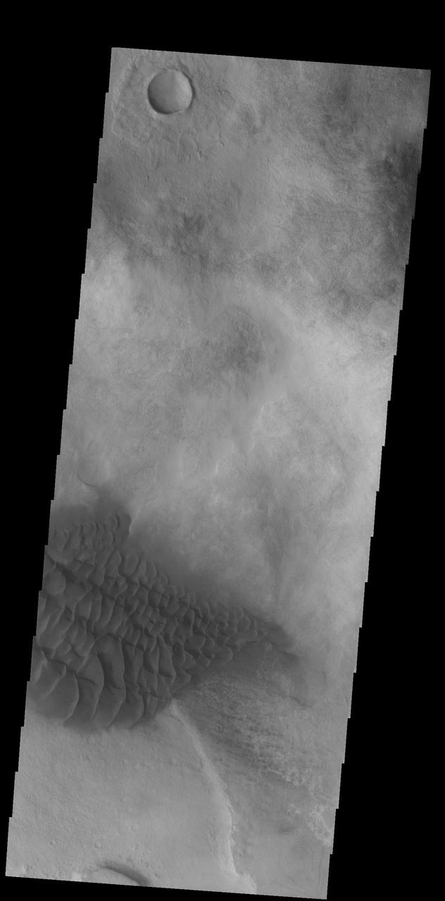
The large hills of sand in this image from NASA 2001 Mars Odyssey spacecraft are located on western margin of Argyre Planitia.
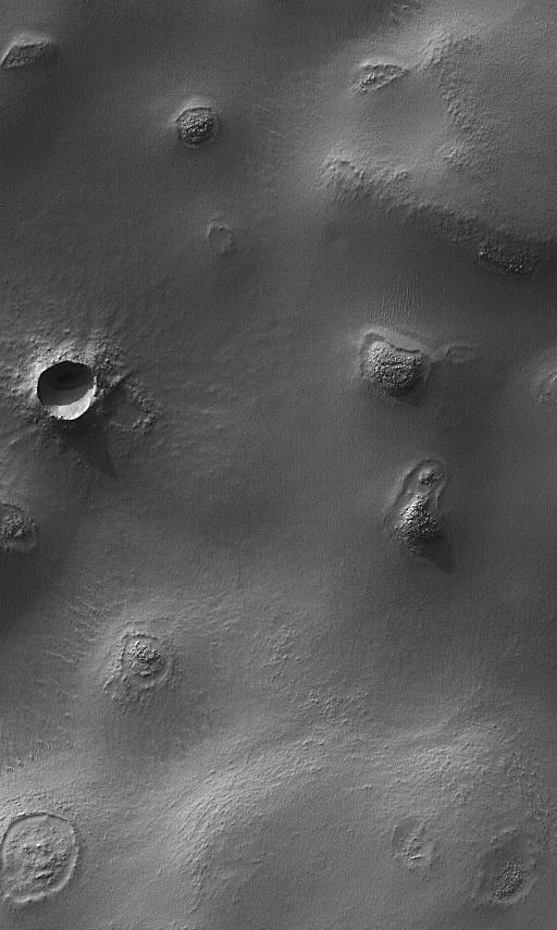
Today's VIS image shows dust devil tracks in Argyre Planitia. The dark streaks are made by dust devil activity scouring the surface and removing the lighter toned dust to reveal the darker rocky surface below. Orbit Number: 66386 Latitude: -46.532 Longitude: 314.96 Instrument: VIS Captured: 2016-12-01 02:09 http://photojournal.jpl.nasa.gov/catalog/PIA21294
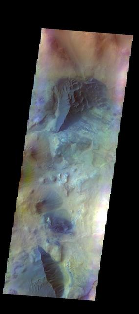
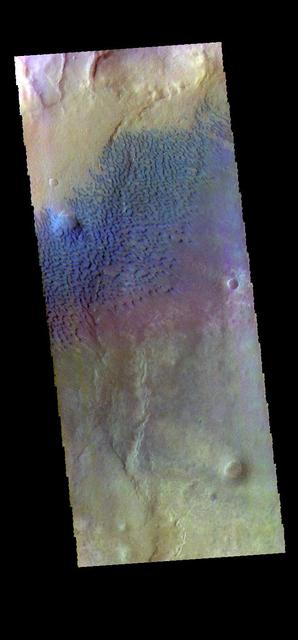
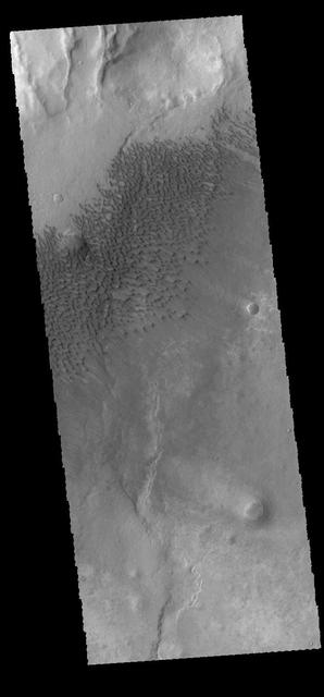
The THEMIS camera contains 5 filters. Data from different filters can be combined in multiple ways to create a false color image. These false color images may reveal subtle variations of the surface not easily identified in a single band image. Today's false color image shows several areas of dunes and sand sheets with dune forms between the numerous hills in this region west of Argyre Planitia. Basaltic sand appears dark blue in this false color image. Orbit Number: 51285 Latitude: -47.6247 Longitude: 303.752 Instrument: VIS Captured: 2013-07-06 18:21 http://photojournal.jpl.nasa.gov/catalog/PIA21306

The dust devil tracks seen in this image from NASA 2001 Mars Odyssey spacecraft are located in Argyre Planitia.
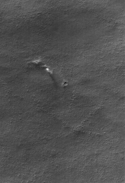
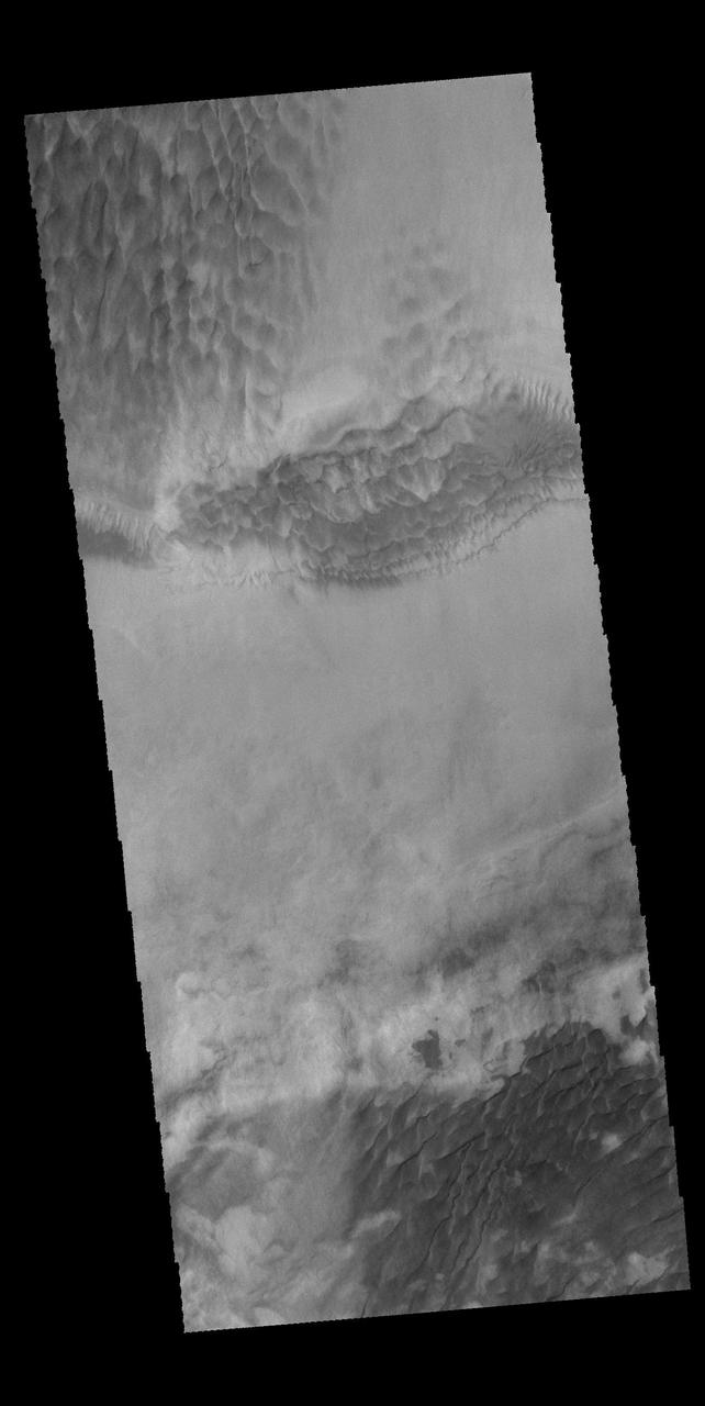
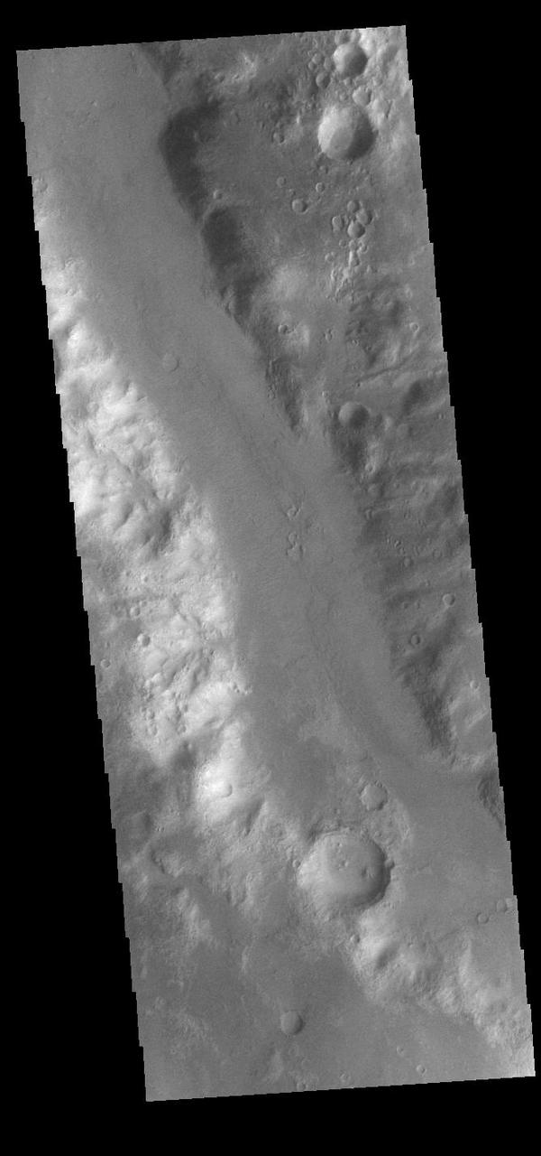
This image from NASA 2001 Mars Odyssey spacecraft shows a fracture north of Argyre Planitia. Note the dunes within the channel.
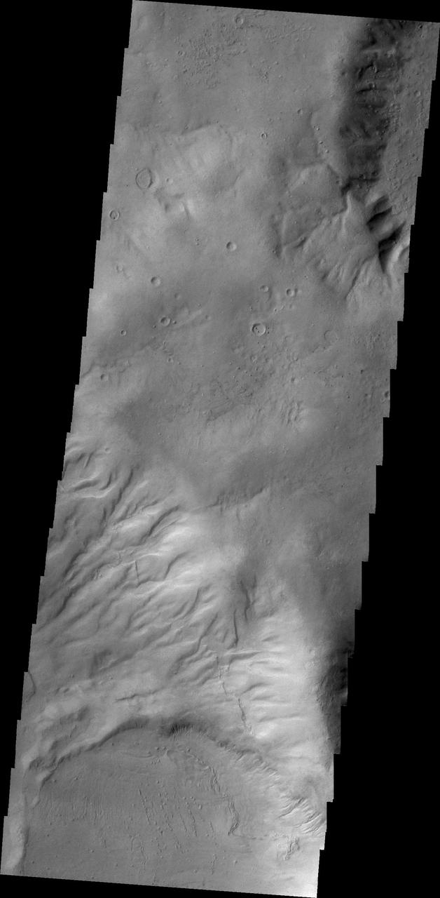
Today's VIS image shows several small channels. These channels are along the break in topography, that leads down into Argyre Planitia. Argyre Planitia and Hellas Planitia are deep basins in the southern hemisphere. Orbit Number: 74586 Latitude: -34.8073 Longitude: 318.916 Instrument: VIS Captured: 2018-10-07 16:02 https://photojournal.jpl.nasa.gov/catalog/PIA22857
This Mars Global Surveyor MGS Mars Orbiter Camera MOC image shows dust plumes created by gusting winds on a plain southwest of Argyre Planitia
Faint dust devil tracks can be seen in the 2001 Mars Odyssey THEMIS VIS image. These tracks are located on the eastern margin of Argyre Planitia.

This image was acquired by NASA Mars Reconnaissance Orbiter to complete a stereo pair over sinuous ridges in Argyre Planitia, but dust clouds kicked up, obscuring most of the surface. http://photojournal.jpl.nasa.gov/catalog/PIA19459
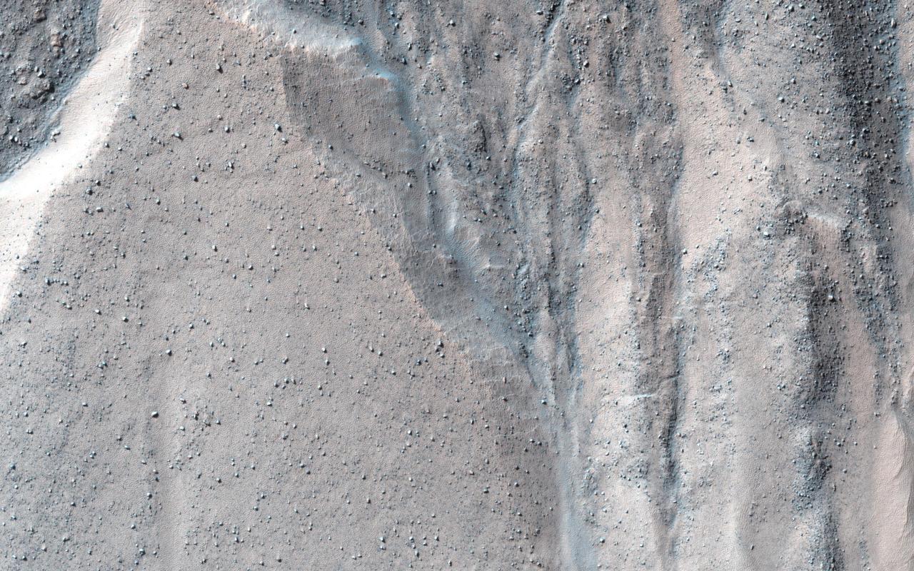
This observation from NASA Mars Reconnaissance Orbiter shows a beautiful example of gullies in a massif in Nereidum Montes, located in Argyre Planitia, one of the largest impact basins on Mars.
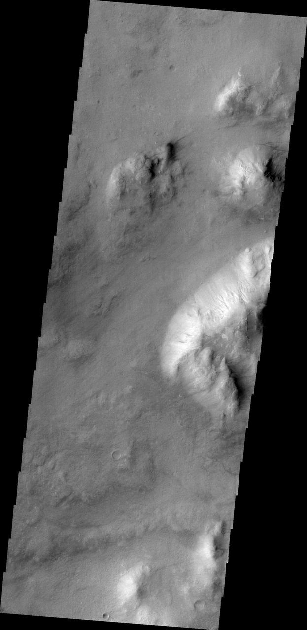
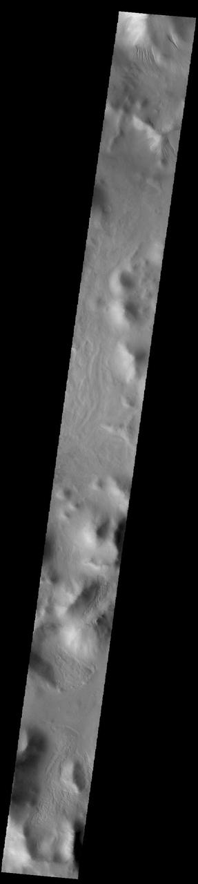
Small gullies captured in this image from NASA 2001 Mars Odyssey are located on the north and south sides of this hill. The hill is part of the mountainous region that borders the northeastern side of Argyre Planitia.
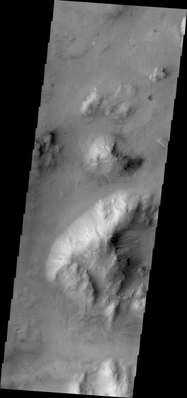
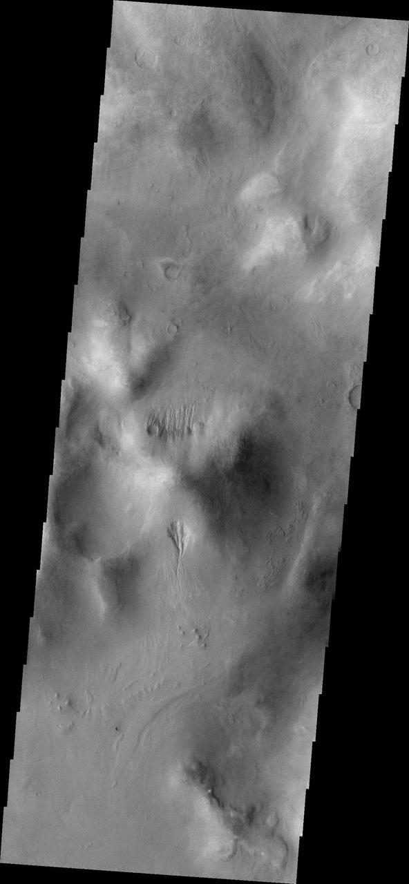
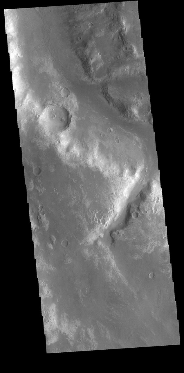
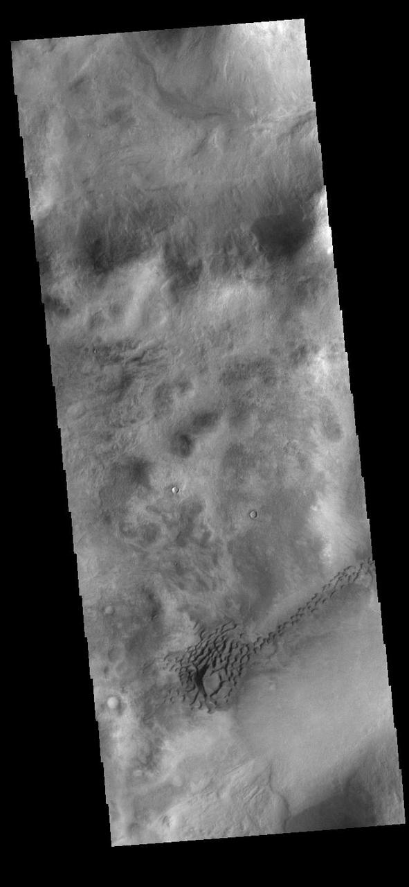
Craters are most often the site of gully formation on Mars. Mega-gullies are also found on the southwestern parts of Vallis Marineris, and in this image from NASA 2001 Mars Odyssey spacecraft, on hills east of Argyre Planitia.
Halley Crater is located on the western side of Argyre Planitia. Sand dunes cover part of the crater floor. Orbit Number: 74805 Latitude: -47.8668 Longitude: 301.231 Instrument: VIS Captured: 2018-10-25 16:25 https://photojournal.jpl.nasa.gov/catalog/PIA22885
This image captured by NASA 2001 Mars Odyssey spacecraft shows multiple dune fields cover the floor of Hooke Crater, located on the northern margin of Argyre Planitia. Orbit Number: 58008 Latitude: -44.8922 Longitude: 315.418 Instrument: VIS Captured: 2015-01-11 02:40 http://photojournal.jpl.nasa.gov/catalog/PIA19205
Today's VIS image shows a small section of Uzboi Vallis. This valley system arises just north of Argyre Planitia and flows northward into Holden Crater. Orbit Number: 81698 Latitude: -31.0656 Longitude: 322.924 Instrument: VIS Captured: 2020-05-15 07:45 https://photojournal.jpl.nasa.gov/catalog/PIA24002
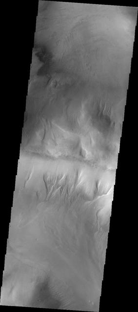
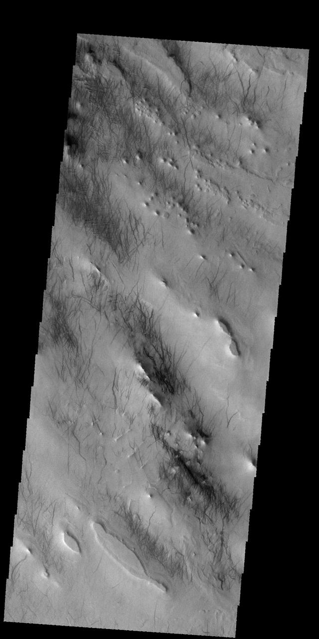
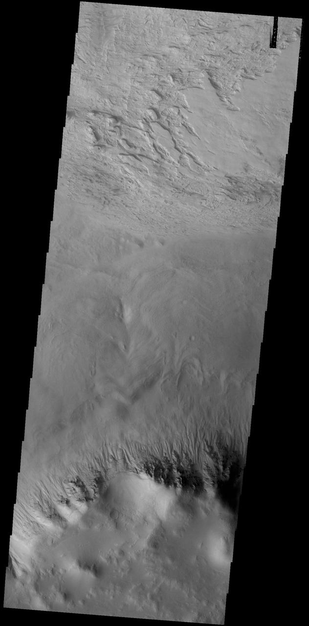
Today's VIS image shows part of Charitum Montes, the rugged highlands surrounding the southern part of Argyre Planitia. At the top of the image are several areas of small channels called gullies. These channels are called gullies due to being on a steep slope rather than a flat river plain. Orbit Number: 91800 Latitude: -56.6004 Longitude: 309.697 Instrument: VIS Captured: 2022-08-25 02:10 https://photojournal.jpl.nasa.gov/catalog/PIA25643
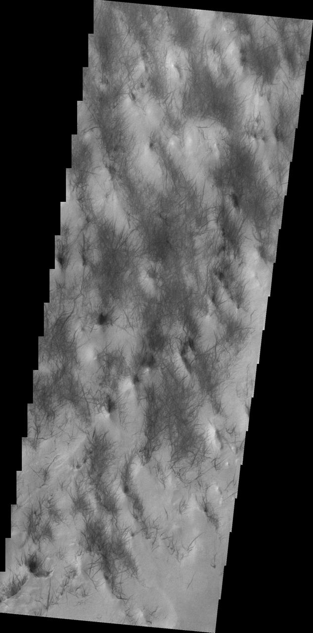
Wind is one of the most active processes on Mars today. This image was taken near Hooke Crater on the margin of Argyre Planitia. Wind is moving along the surface between the hills and valleys of the crater ejecta, picking up the surface dust and leaving the dust free darker rock exposed. Orbit Number: 42358 Latitude: -47.7019 Longitude: 317.797 Instrument: VIS Captured: 2011-07-03 00:45 https://photojournal.jpl.nasa.gov/catalog/PIA23291
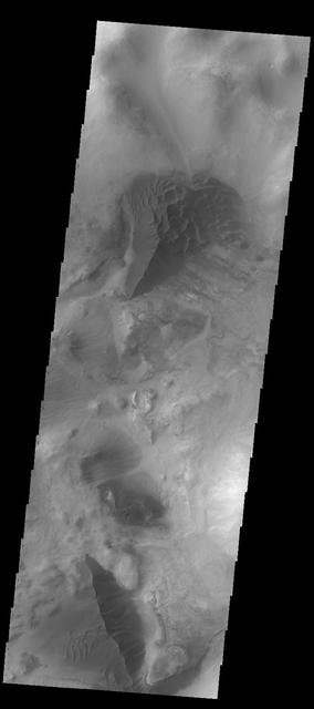
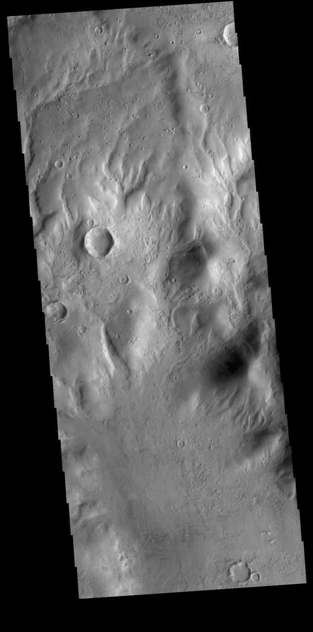
While many regions of sand dunes on Mars are located on the floors of impact craters, dune fields can form in any region where sand can be trapped. In this case, the sand dunes have formed in a depression in the Nereidum Montes region north of Argyre Planitia. Orbit Number: 92006 Latitude: -43.7748 Longitude: 307.763 Instrument: VIS Captured: 2022-09-11 01:41 https://photojournal.jpl.nasa.gov/catalog/PIA25718
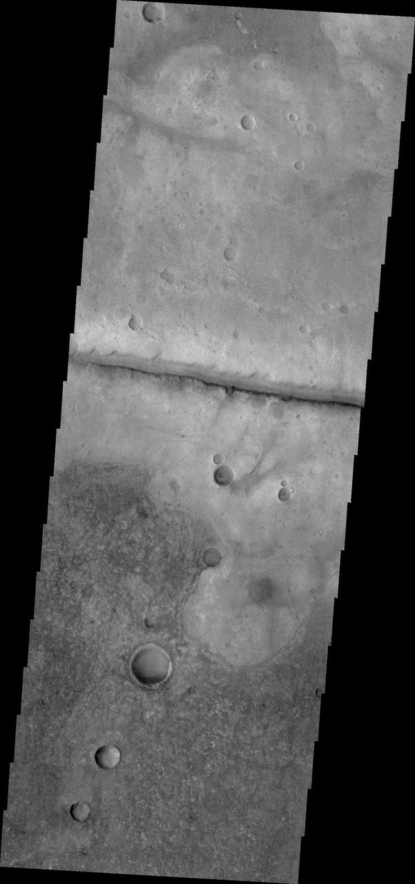
This VIS image shows a small portion of the floor of Galle Crater. This large crater is located on the eastern side of Argyre Planitia. The floor of Galle Crater contains many different features, including fluvial, glacial and aeolian derived products. The steep crater rim is toward the bottom of the image. The incised, flat laying materials at the top of the image are probably eroded layered deposits. Orbit Number: 74804 Latitude: -52.1339 Longitude: 329.267 Instrument: VIS Captured: 2018-10-25 14:28 https://photojournal.jpl.nasa.gov/catalog/PIA22884
This false color image shows sand dunes on the floor of Hale Crater. This 150 km x 125 km (93 miles x 77 miles) crater is located north of Argyre Planitia. Dark blue in this false color combination usually indicates basaltic sand. The THEMIS VIS camera contains 5 filters. The data from different filters can be combined in multiple ways to create a false color image. These false color images may reveal subtle variations of the surface not easily identified in a single band image. Orbit Number: 66554 Latitude: -35.7883 Longitude: 323.039 Instrument: VIS Captured: 2016-12-14 22:52 https://photojournal.jpl.nasa.gov/catalog/PIA23629
Today's VIS image shows a small section of Uzboi Vallis. This valley system arises just north of Argyre Planitia and flows northward into Holden Crater. Uzboi Vallis is 366km long (227 miles). Orbit Number: 91369 Latitude: -30.6694 Longitude: 322.767 Instrument: VIS Captured: 2022-07-20 14:57 https://photojournal.jpl.nasa.gov/catalog/PIA25536
This false color image shows sand dunes on the floor of Sumgin Crater. The crater is located in Noachis Terra north of Argyre Planitia and is 85 km (53 miles) in diameter. Dark blue in this color combination typically means basaltic sands. The THEMIS VIS camera contains 5 filters. The data from different filters can be combined in multiple ways to create a false color image. These false color images may reveal subtle variations of the surface not easily identified in a single band image. Orbit Number: 66517 Latitude: -36.4993 Longitude: 311.197 Instrument: VIS Captured: 2016-12-11 21:42 https://photojournal.jpl.nasa.gov/catalog/PIA23628
This image captured by NASA 2001 Mars Odyssey spacecraft shows sand dunes on the floor of Sumgin Crater. The crater is located in Noachis Terra north of Argyre Planitia. Orbit Number: 66517 Latitude: -36.4993 Longitude: 311.197 Instrument: VIS Captured: 2016-12-11 21:42 http://photojournal.jpl.nasa.gov/catalog/PIA21299

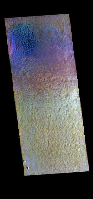
The THEMIS VIS camera contains 5 filters. The data from different filters can be combined in multiple ways to create a false color image. These false color images may reveal subtle variations of the surface not easily identified in a single band image. Today's false color image shows the plains between Hale Crater and Argyre Planitia. Orbit Number: 8815 Latitude: -37.2509 Longitude: 323.023 Instrument: VIS Captured: 2003-12-10 04:12 http://photojournal.jpl.nasa.gov/catalog/PIA19737

This VIS image shows the dune field on the floor of Halley Crater. Rather than small individual sand dunes, the sand here is collected into a sand sheet and dune forms have been created on that surface. Halley Crater is located on the western margin of Argyre Planitia. Orbit Number: 84413 Latitude: -48.8513 Longitude: 300.904 Instrument: VIS Captured: 2020-12-24 20:22 https://photojournal.jpl.nasa.gov/catalog/PIA24413
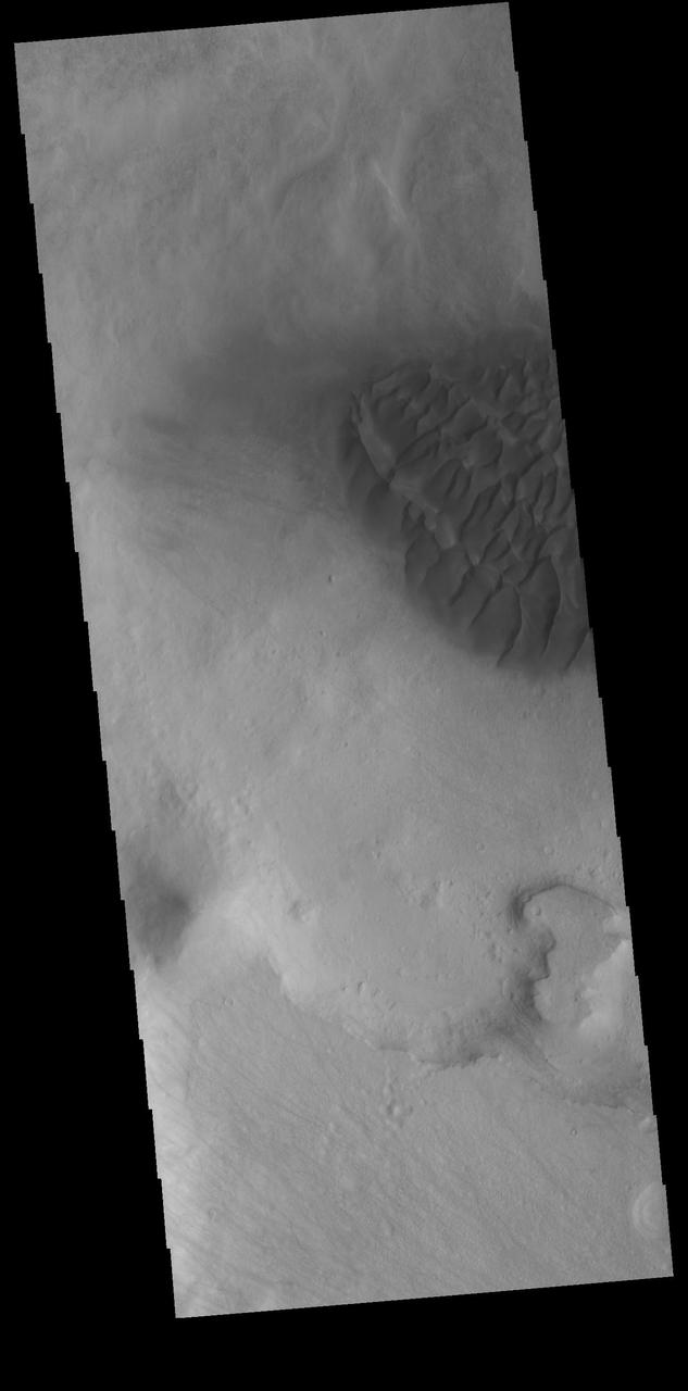
This VIS image shows part of the dune field on the floor of Halley Crater. Rather than small individual sand dunes, the sand here is collected into a sand sheet and dune forms have been created on that surface. Halley Crater is located on the western margin of Argyre Planitia. Orbit Number: 74936 Latitude: -48.1494 Longitude: 300.871 Instrument: VIS Captured: 2018-11-05 11:49 https://photojournal.jpl.nasa.gov/catalog/PIA22971
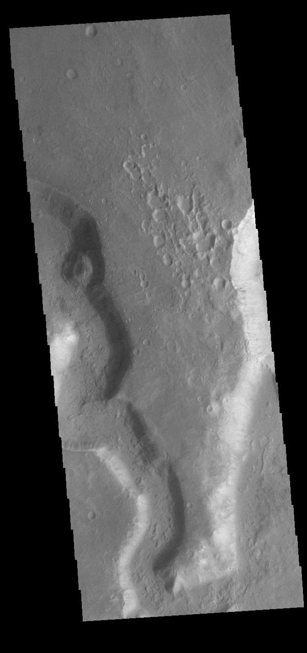
Today's VIS image shows a small section of Nirgal Valles (left side of image) just where it flows into the larger Uzboi Vallis (right side of image). Located in Noachis Terra, Nirgal Valles is 610km long (379 miles), and arises in Noachis Terra. Uzboi Vallis is 353 km long (219 miles) and arises just north of Argyre Planitia and flows northward into Holden Crater. While shorter than Nirgal Valles, Uzboi Vallis is much wider. Orbit Number: 90795 Latitude: -29.5713 Longitude: 322.31 Instrument: VIS Captured: 2022-06-03 08:38 https://photojournal.jpl.nasa.gov/catalog/PIA25507