Arsia Mons
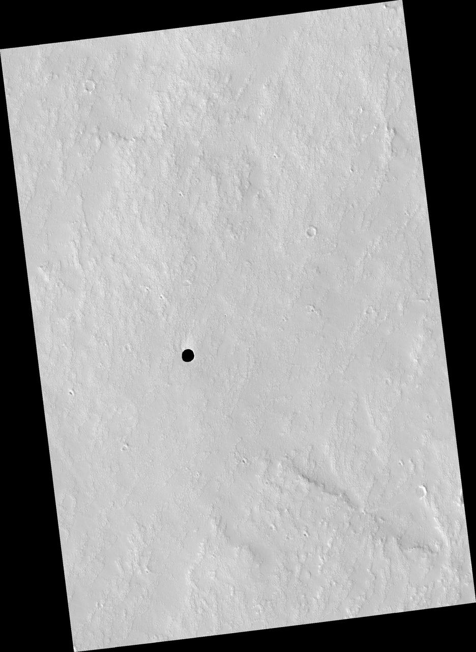
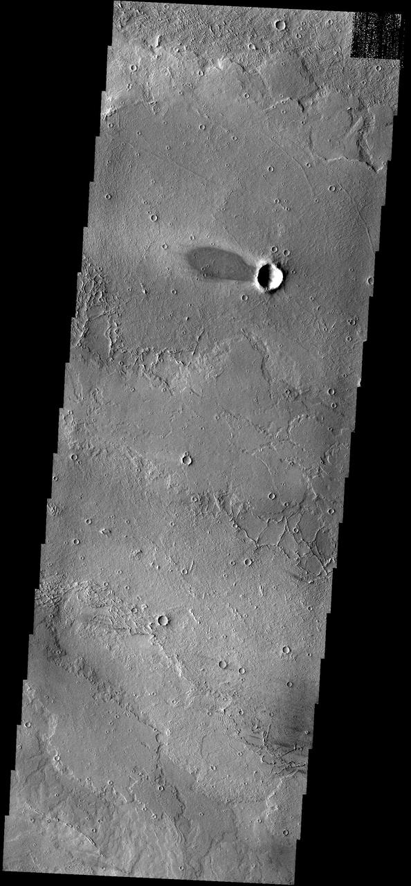
Impact on Arsia Mons
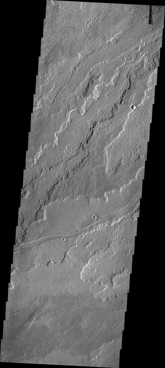
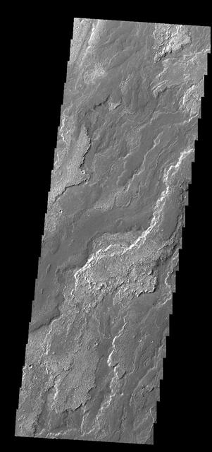
Arsia Mons Flows

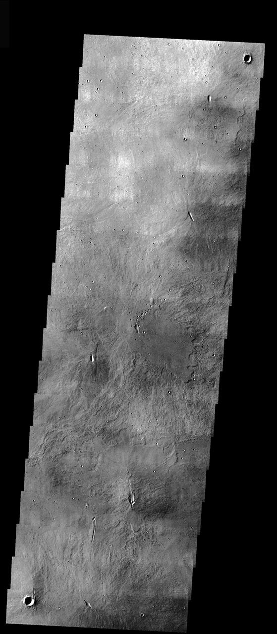
Arsia Mons Mosaic
Arsia Mons by Visible Light
Arsia Mons Southern Flank
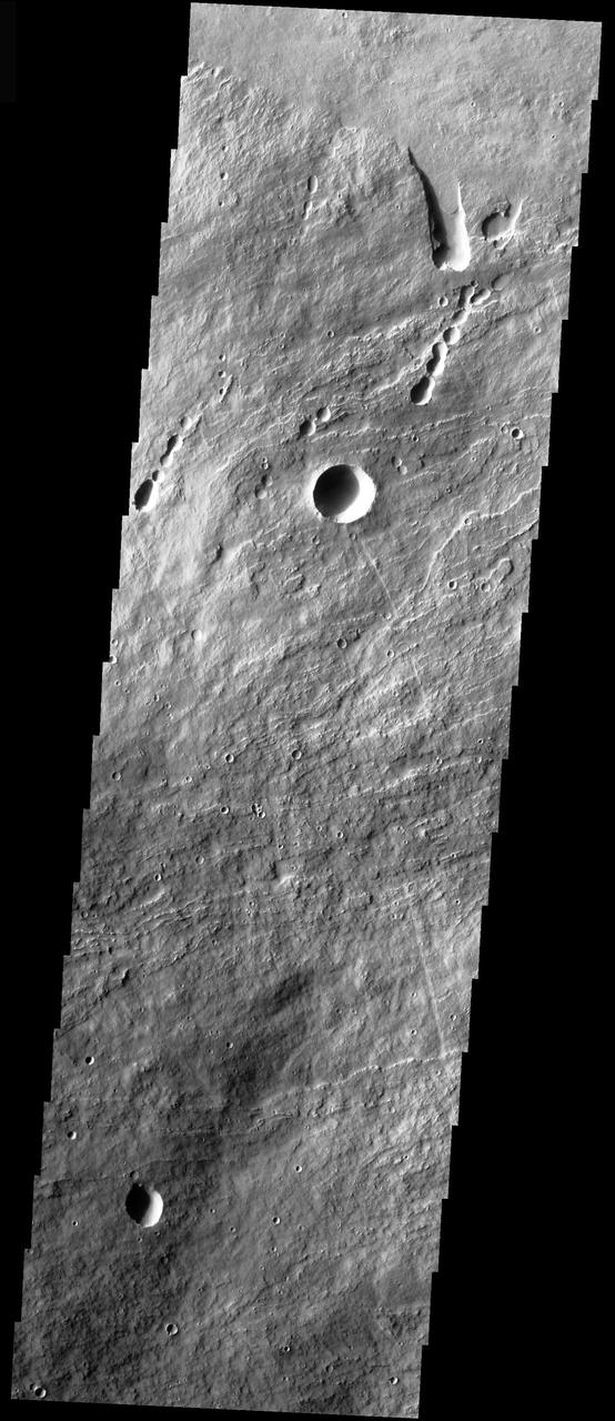
Arsia Mons Flows
Arsia Mons Flows
Arsia Mons Lava Flows
Arsia Mons Overlapping Flows
Arsia Mons Lava Flows

Arsia Mons Caldera Rim
Arsia Mons Flows

Arsia Mons Flows in Infrared
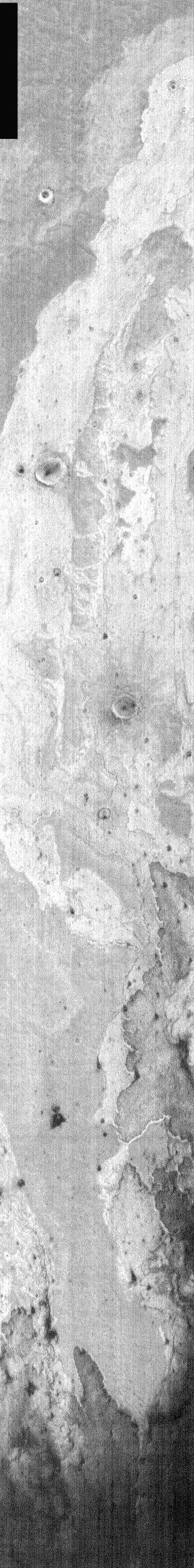
Arsia Mons Western Flows
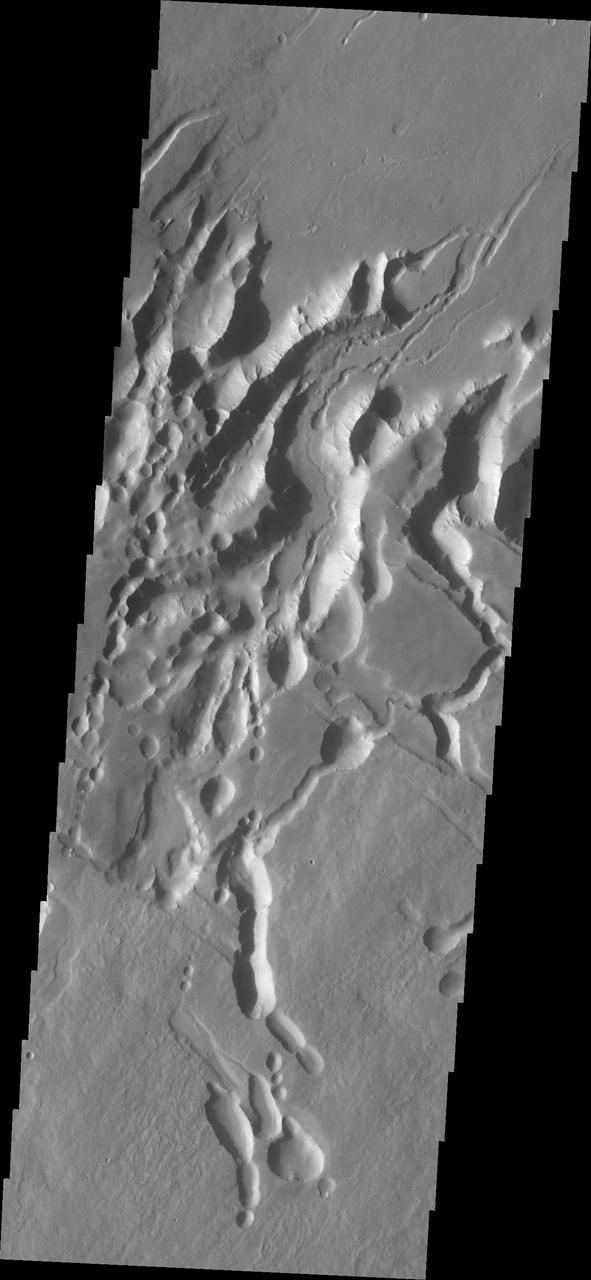
Collapse Features on Arsia Mons
Arsia Mons Caldera
Arsia Mons Caldera
Arsia Mons Surface Flow
Arsia Mons Lava
Arsia Mons Flank
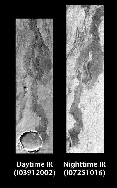
Released 22 June 2004 This pair of images shows part of Arsia Mons. Day/Night Infrared Pairs The image pairs presented focus on a single surface feature as seen in both the daytime and nighttime by the infrared THEMIS camera. The nighttime image (right) has been rotated 180 degrees to place north at the top. Infrared image interpretation Daytime: Infrared images taken during the daytime exhibit both the morphological and thermophysical properties of the surface of Mars. Morphologic details are visible due to the effect of sun-facing slopes receiving more energy than antisun-facing slopes. This creates a warm (bright) slope and cool (dark) slope appearance that mimics the light and shadows of a visible wavelength image. Thermophysical properties are seen in that dust heats up more quickly than rocks. Thus dusty areas are bright and rocky areas are dark. Nighttime: Infrared images taken during the nighttime exhibit only the thermophysical properties of the surface of Mars. The effect of sun-facing versus non-sun-facing energy dissipates quickly at night. Thermophysical effects dominate as different surfaces cool at different rates through the nighttime hours. Rocks cool slowly, and are therefore relatively bright at night (remember that rocks are dark during the day). Dust and other fine grained materials cool very quickly and are dark in nighttime infrared images. Image information: IR instrument. Latitude -19.6, Longitude 241.9 East (118.1 West). 100 meter/pixel resolution. http://photojournal.jpl.nasa.gov/catalog/PIA06399
Arsia Mons Lava Flows at Night
Vent at the Summit of Arsia Mons Volcano
Arsia Mons Collapse Pits in IR
Repeated Clouds over Arsia Mons
These rough surfaced lava flows originated at Arsia Mons
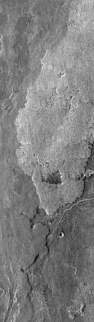
This image captured by NASA 2001 Mars Odyssey spacecraft shows part of the caldera at the summit of Arsia Mons.
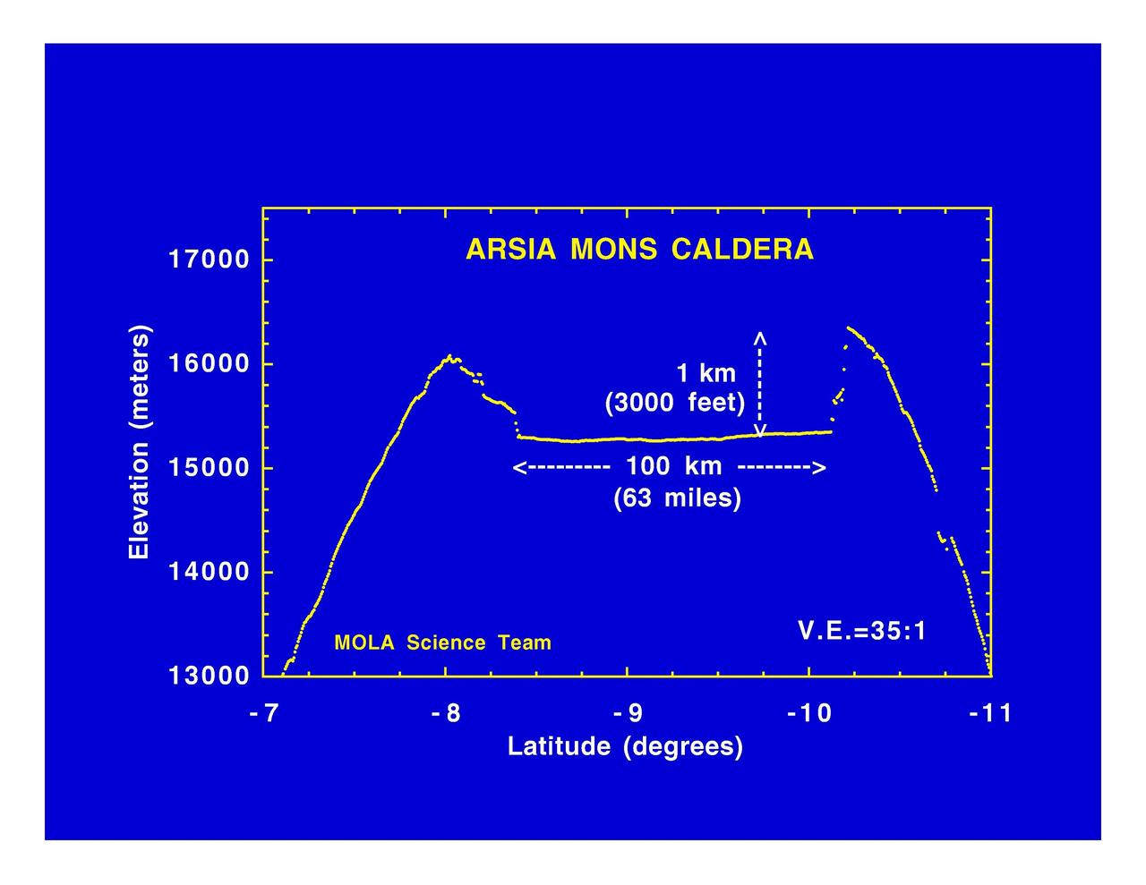
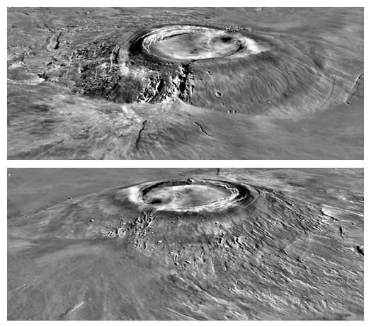
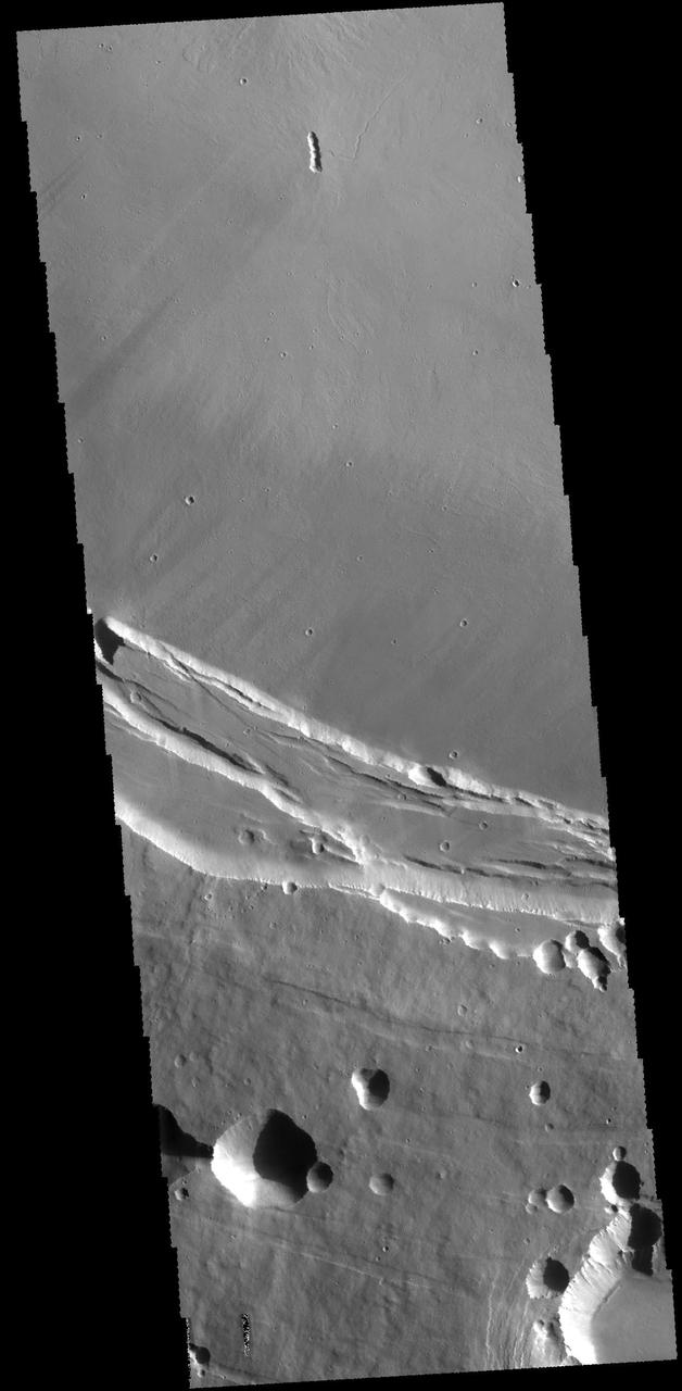
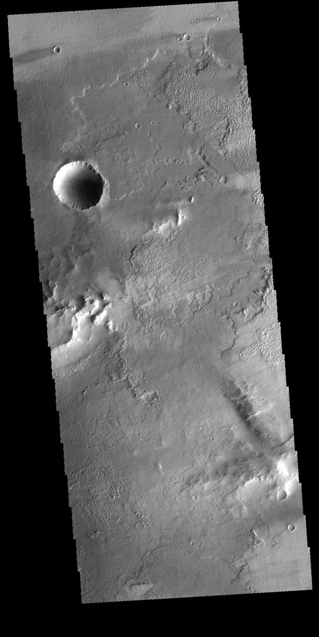
The three large aligned Tharsis volcanoes are Arsia Mons, Pavonis Mons and Ascreaus Mons (from south to north). There are collapse features on all three volcanoes, on the southwestern and northeastern flanks. This alignment may indicate a large fracture/vent system was responsible for the eruptions that formed all three volcanoes. This VIS image shows cross section from the summit caldera to the plains near the southern flank of Arsia Mons. Arsia Mons is 270 miles (450km) in diameter, almost 12 miles (20km) high, and the summit caldera is 72 miles (120km) wide. For comparison, the largest volcano on Earth is Mauna Loa. From its base on the sea floor, Mauna Loa measures only 6.3 (10km) miles high and 75 miles (120km) in diameter. A large volcanic crater known as a caldera is located at the summit of all of the Tharsis volcanoes. These calderas are produced by massive volcanic explosions and collapse. The Arsia Mons summit caldera is larger than many volcanoes on Earth. Orbit Number: 91821 Latitude: -11.0315 Longitude: 240.053 Instrument: VIS Captured: 2022-08-26 20:16 https://photojournal.jpl.nasa.gov/catalog/PIA25649
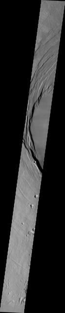
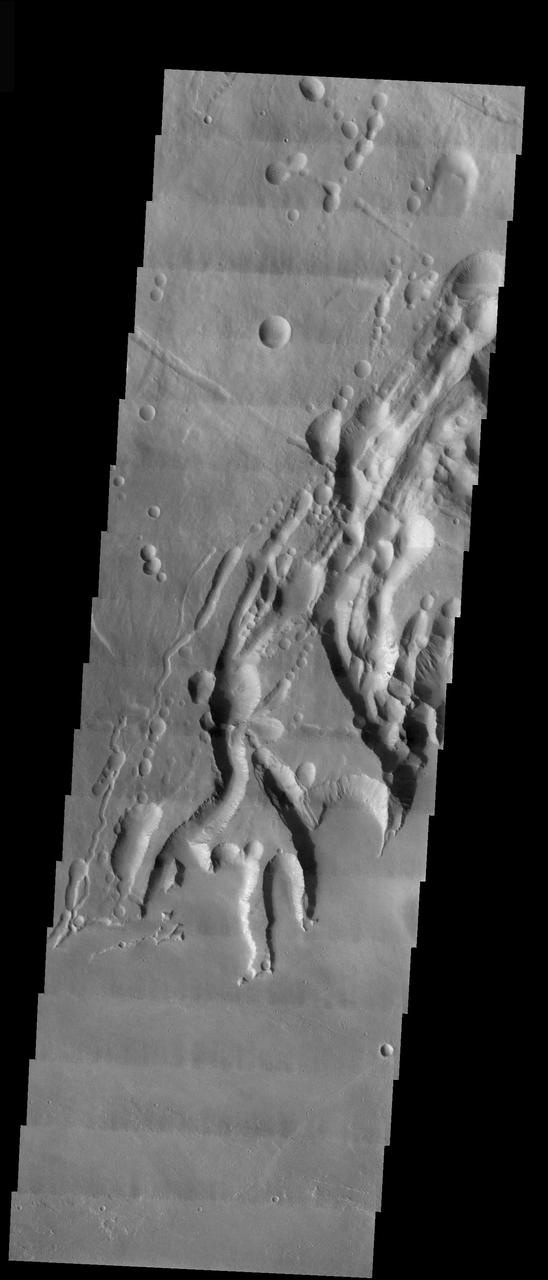
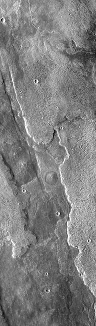
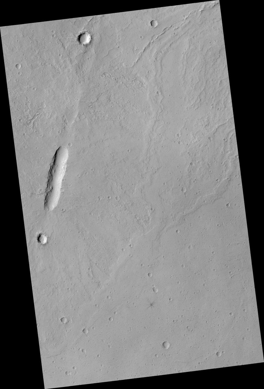
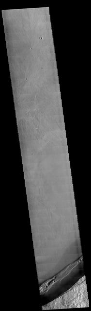
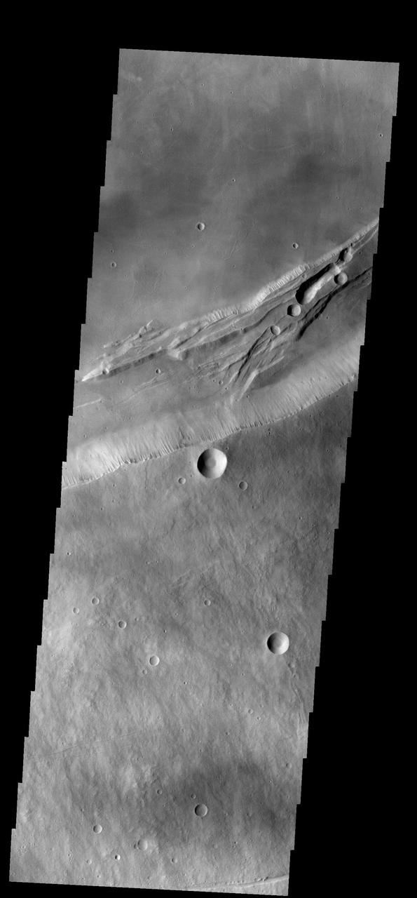
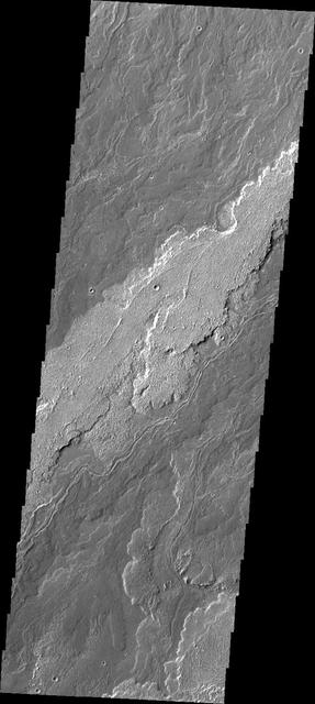
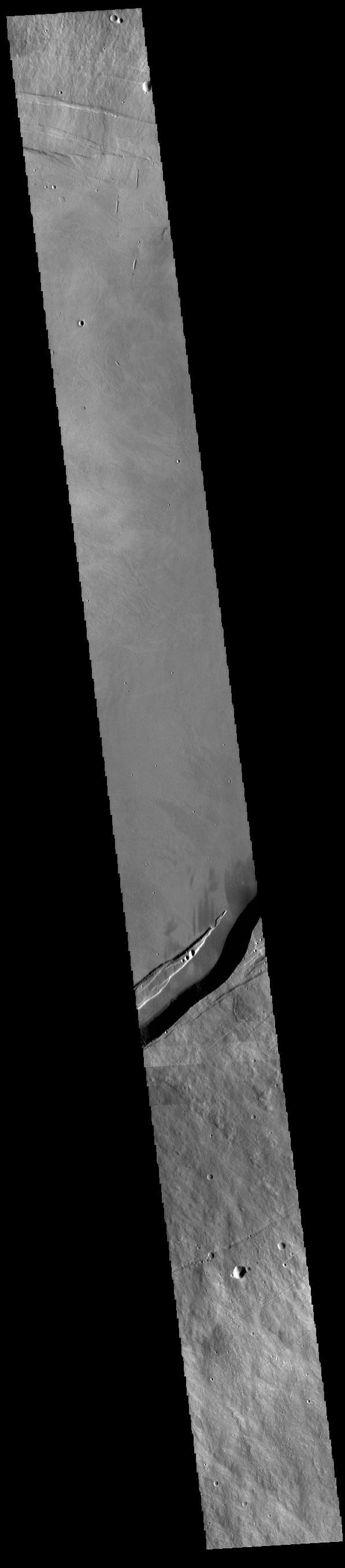
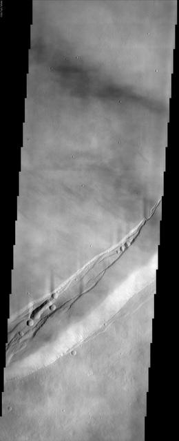
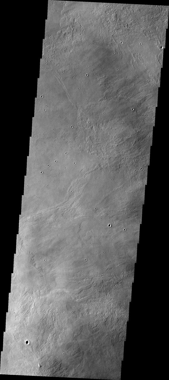
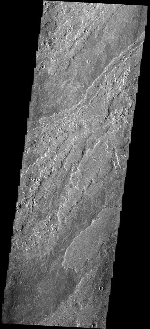
The three large aligned Tharsis volcanoes are Arsia Mons, Pavonis Mons and Ascreaus Mons (from south to north). There are collapse features on all three volcanoes, on the southwestern and northeastern flanks. This alignment may indicate a large fracture/vent system was responsible for the eruptions that formed all three volcanoes. This VIS image shows part of the southern flank of Arsia Mons. The linear features are graben. Arsia Mons is the southernmost of the Tharsis volcanoes. It is 270 miles (450km) in diameter, almost 12 miles (20km) high, and the summit caldera is 72 miles (120km) wide. For comparison, the largest volcano on Earth is Mauna Loa. From its base on the sea floor, Mauna Loa measures only 6.3 miles high and 75 miles in diameter. A large volcanic crater known as a caldera is located at the summit of all of the Tharsis volcanoes. These calderas are produced by massive volcanic explosions and collapse. The Arsia Mons summit caldera is larger than many volcanoes on Earth. Orbit Number: 91484 Latitude: -10.1537 Longitude: 242.255 Instrument: VIS Captured: 2022-07-30 02:19 https://photojournal.jpl.nasa.gov/catalog/PIA25603
Major Martian Volcanoes from MOLA - Arsia Mons
Candidate Cavern Entrance Northeast of Arsia Mons
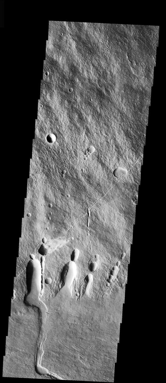
Glacier-Like Flow on Arsia Mons Flank
Broad Western Flows from Arsia Mons
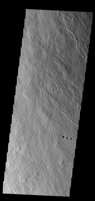
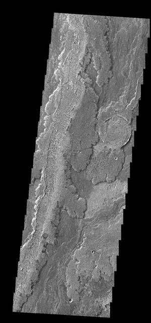
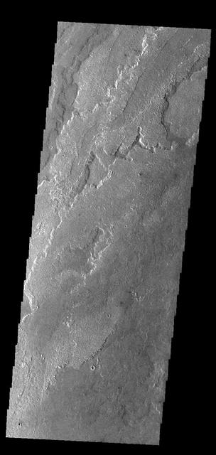
Arsia Mons is the southermost of the large aligned Tharsis volcanoes. Flows originating at Arsia Mons cover a vast region. The flows in this VIS image are part of the SW flow apron of Arsia Mons. The Tharsis trend runs NE/SW thru the centers of the volcanoes creating regions of greater tectonic and volcanic activities along this trend. Orbit Number: 77895 Latitude: -11.9896 Longitude: 236.892 Instrument: VIS Captured: 2019-07-07 04:22 https://photojournal.jpl.nasa.gov/catalog/PIA23395
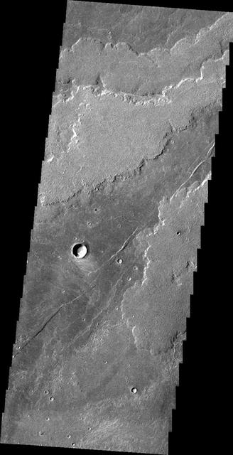
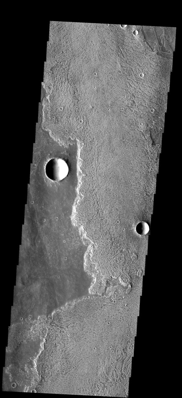
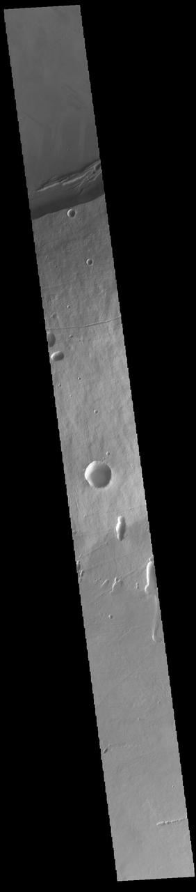
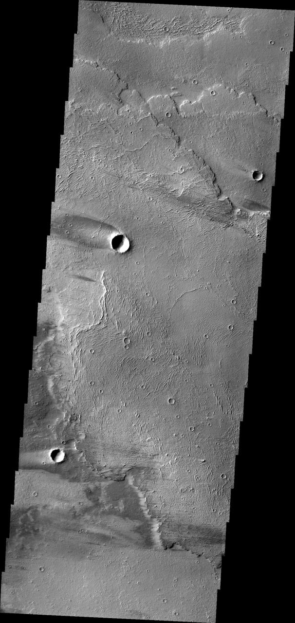
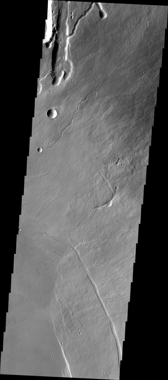
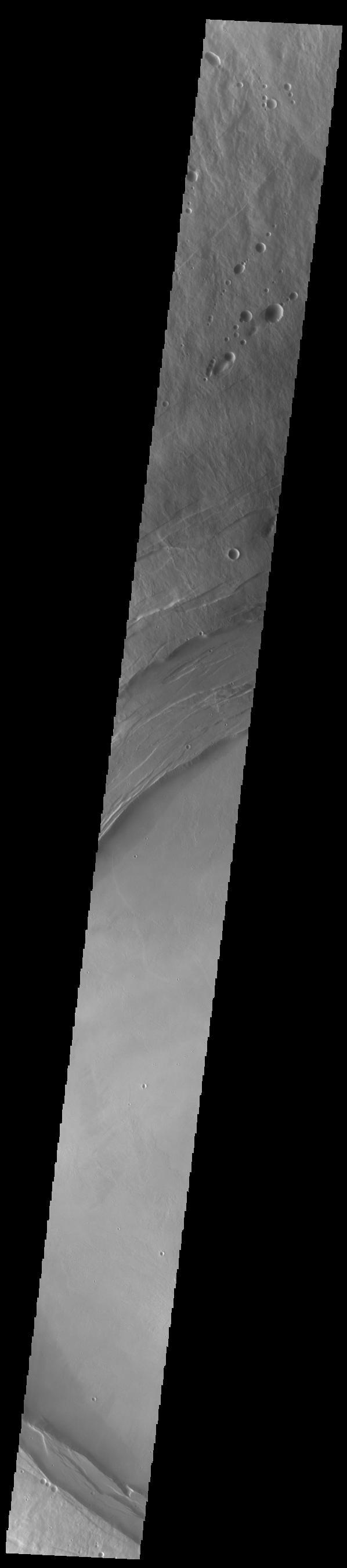
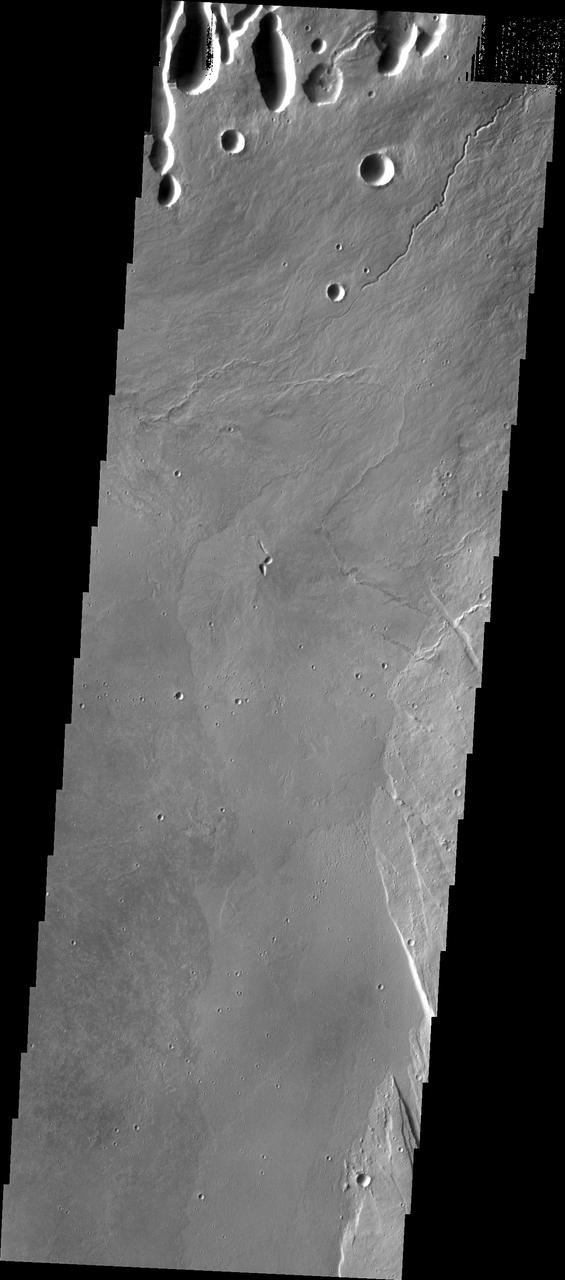
Today's VIS image shows part of the eastern flank of Arsia Mons, including part of Oti Fossae (bottom of image). Arsia Mons is the southernmost and youngest of the three large, aligned Tharsis volcanoes. Oti Fossae - linear graben - follow the major northeast/southwest trend of the volcanoes. Orbit Number: 81526 Latitude: -9.5484 Longitude: 242.037 Instrument: VIS Captured: 2020-05-01 03:58 https://photojournal.jpl.nasa.gov/catalog/PIA23960
Today's VIS image shows part of the summit caldera of Arsia Mons. Arsia Mons is the southernmost of the three large Tharsis volcanoes. Extensive lava plains originated from eruptions of this volcano. On the left side of the image are two hills with linear depressions at the top. These features are vents where localized eruptions created small volcanoes. Orbit Number: 77296 Latitude: -9.56554 Longitude: 239.266 Instrument: VIS Captured: 2019-05-18 20:32 https://photojournal.jpl.nasa.gov/catalog/PIA23281
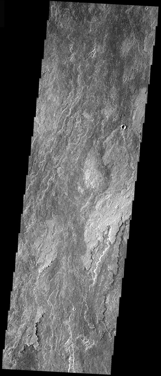
Today's VIS image shows the eastern flank of Arsia Mons, the southernmost aligned volcano in the Tharsis region. The volcano is 435 kilometres (270 mi) in diameter, and almost 20 kilometres (12 mi) high. Arsia Mons is one of the youngest volcanoes on Mars. Orbit Number: 80952 Latitude: -9.8557 Longitude: 241.487 Instrument: VIS Captured: 2020-03-14 21:40 https://photojournal.jpl.nasa.gov/catalog/PIA23931
This image from NASA Mars Odyssey caputured on July 23, 2010 off the northern flank of Arsia Mons shows collapse/vent features.
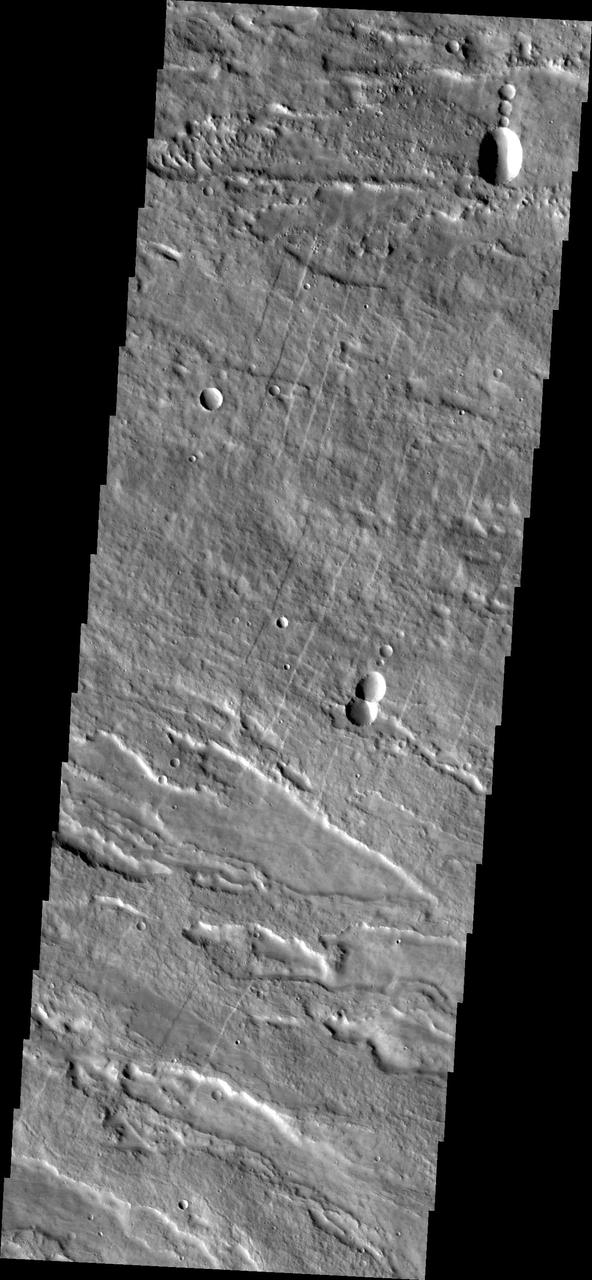
Image captured by NASA 2001 Mars Odyssey spacecraft shows the eastern flank of Arsia Mons midway between the summit of the volcano and the surrounding plains.
Some of the most pristine volcanic flows on Mars are from Arsia Mons as shown in this image captured by NASA Mars Odyssey.
The windstreaks in this image captured by NASA Mars Odyssey are located on lava flows from Arsia Mons.
This image from NASA 2001 Mars Odyssey spacecraft shows lava flows from Arsia Mons.
This image from NASA 2001 Mars Odyssey spacecraft shows part of the summit caldera on Arsia Mons.
Like yesterday image, this image from NASA Mars Odyssey spacecraft shows lava flows from Arsia Mons.
This image, taken by NASA 2001 Mars Odyssey spacecraft, shows a portion of the lava flows associated with Arsia Mons.
This image, taken by NASA 2001 Mars Odyssey spacecraft, shows a small portion of the lava flows associated with Arsia Mons.
The lava flows in this image taken by NASA 2001 Mars Odyssey spacecraft are part of the extensive flow field of Arsia Mons.
This image captured by NASA 2001 Mars Odyssey spacecraft shows volcanic flows from Arsia Mons, the southernmost of the Tharsis volcanoes.
This image from NASA Mars Odyssey spacecraft shows some of the extensive lava flows that originate at Arsia Mons.
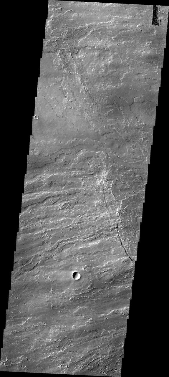
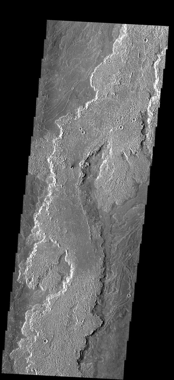
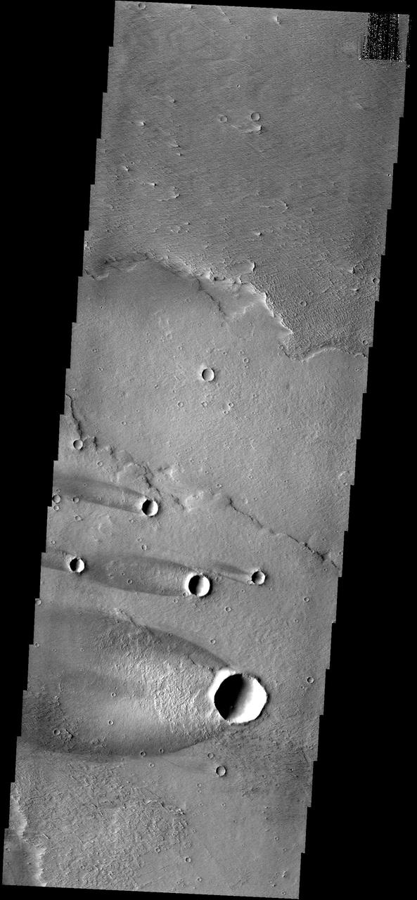
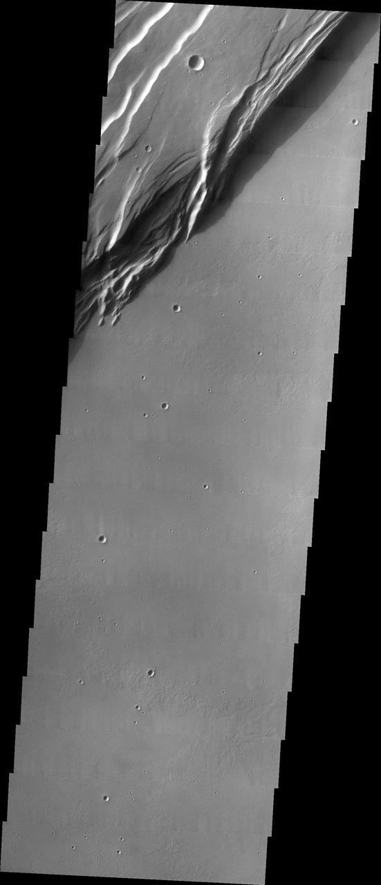
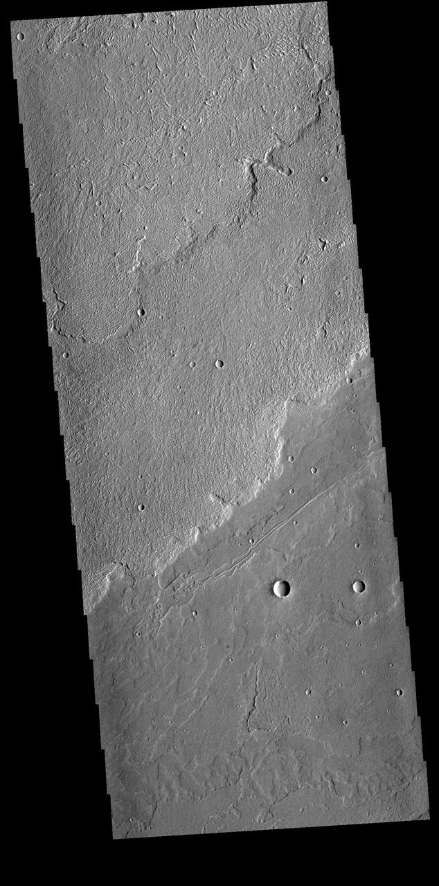
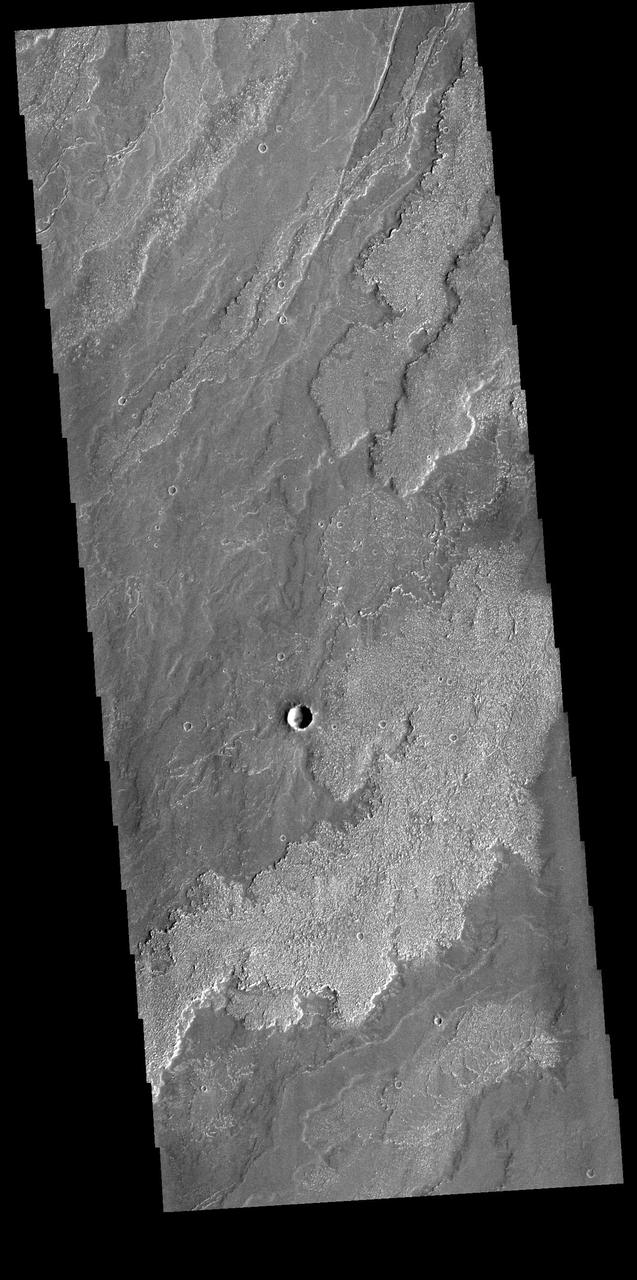
The three large aligned Tharsis volcanoes are Arsia Mons, Pavonis Mons and Ascreaus Mons (from south to north). There are collapse features on all three volcanoes, on the southwestern and northeastern flanks. This alignment may indicate a large fracture/vent system was responsible for the eruptions that formed all three volcanoes. The flows of originating from Arsia Mons are thought to be the youngest of the region. This VIS image shows part of the northeastern flank of Arsia Mons. The scalloped depression are most likely created by collapse of the roof of lava tubes. Lava tubes originate during eruption event, when the margins of a flow harden around a still flowing lava stream. When an eruption ends these can become hollow tubes within the flow. With time, the roof of the tube may collapse into the empty space below. The tubes are linear, so the collapse of the roof creates a linear depression. Arsia Mons is the southernmost of the Tharsis volcanoes. It is 270 miles (450km) in diameter, almost 12 miles (20km) high, and the summit caldera is 72 miles (120km) wide. For comparison, the largest volcano on Earth is Mauna Loa. From its base on the sea floor, Mauna Loa measures only 6.3 miles high and 75 miles in diameter. A large volcanic crater known as a caldera is located at the summit of all of the Tharsis volcanoes. These calderas are produced by massive volcanic explosions and collapse. The Arsia Mons summit caldera is larger than many volcanoes on Earth. The Odyssey spacecraft has spent over 15 years in orbit around Mars, circling the planet more than 69000 times. It holds the record for longest working spacecraft at Mars. THEMIS, the IR/VIS camera system, has collected data for the entire mission and provides images covering all seasons and lighting conditions. Over the years many features of interest have received repeated imaging, building up a suite of images covering the entire feature. From the deepest chasma to the tallest volcano, individual dunes inside craters and dune fields that encircle the north pole, channels carved by water and lava, and a variety of other feature, THEMIS has imaged them all. For the next several months the image of the day will focus on the Tharsis volcanoes, the various chasmata of Valles Marineris, and the major dunes fields. We hope you enjoy these images! Orbit Number: 9417 Latitude: -7.78798 Longitude: 240.585 Instrument: VIS Captured: 2004-01-28 17:39 https://photojournal.jpl.nasa.gov/catalog/PIA22151
This image captured by NASA's 2001 Mars Odyssey spacecraft shows part of the summit caldera of Arsia Mons. Orbit Number: 63900 Latitude: -10.0873 Longitude: 239.197 Instrument: VIS Captured: 2016-05-10 07:58 http://photojournal.jpl.nasa.gov/catalog/PIA20778
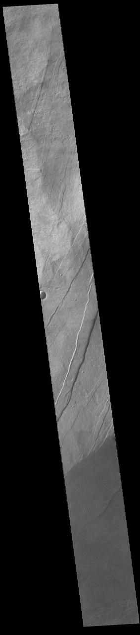
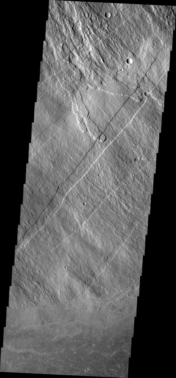
![The linear features in this VIS image are called Oti Fossae. Oti Fossae is located on the eastern flank of Arsia Mons and aligns with the regional northeast/southwest trend of the major Tharsis volcanoes. Graben are formed by extension of the crust and faulting. When large amounts of pressure or tension are applied to rocks on timescales that are fast enough that the rock cannot respond by deforming, the rock breaks along faults. In the case of a graben, two parallel faults are formed by extension of the crust and the rock in between the faults drops downward into the space created by the extension. The crustal deformation in this region was from the inflation of the surface by the rise of magma that created the Tharsis volcanoes. Arsia Mons is the southernmost and youngest of the three large, aligned Tharsis volcanoes [Arsia Mons, Pavonis Mons and Ascreaus Mons, from south to north]. This alignment may indicate a large fracture/vent system was responsible for the eruptions that formed all three volcanoes. Arsia Mons is 270 miles (450km) in diameter, almost 12 miles (20km) high, and the summit caldera is 72 miles (120km) wide. For comparison, the largest volcano on Earth is Mauna Loa. From its base on the sea floor, Mauna Loa measures only 6.3 miles high and 75 miles in diameter. Orbit Number: 89712 Latitude: -8.73951 Longitude: 243.785 Instrument: VIS Captured: 2022-03-06 04:33 https://photojournal.jpl.nasa.gov/catalog/PIA25392](https://images-assets.nasa.gov/image/PIA25392/PIA25392~medium.jpg)
The linear features in this VIS image are called Oti Fossae. Oti Fossae is located on the eastern flank of Arsia Mons and aligns with the regional northeast/southwest trend of the major Tharsis volcanoes. Graben are formed by extension of the crust and faulting. When large amounts of pressure or tension are applied to rocks on timescales that are fast enough that the rock cannot respond by deforming, the rock breaks along faults. In the case of a graben, two parallel faults are formed by extension of the crust and the rock in between the faults drops downward into the space created by the extension. The crustal deformation in this region was from the inflation of the surface by the rise of magma that created the Tharsis volcanoes. Arsia Mons is the southernmost and youngest of the three large, aligned Tharsis volcanoes [Arsia Mons, Pavonis Mons and Ascreaus Mons, from south to north]. This alignment may indicate a large fracture/vent system was responsible for the eruptions that formed all three volcanoes. Arsia Mons is 270 miles (450km) in diameter, almost 12 miles (20km) high, and the summit caldera is 72 miles (120km) wide. For comparison, the largest volcano on Earth is Mauna Loa. From its base on the sea floor, Mauna Loa measures only 6.3 miles high and 75 miles in diameter. Orbit Number: 89712 Latitude: -8.73951 Longitude: 243.785 Instrument: VIS Captured: 2022-03-06 04:33 https://photojournal.jpl.nasa.gov/catalog/PIA25392
This image captured by NASA's 2001 Mars Odyssey spacecraft shows lava flows that originated from Arsia Mons. Orbit Number: 67798 Latitude: -13.539 Longitude: 239.341 Instrument: VIS Captured: 2017-03-27 10:03 https://photojournal.jpl.nasa.gov/catalog/PIA21664
The lava channels and collapse features in this image from NASA 2001 Mars Odyssey spacecraft are located near the summit of Arsia Mons. The fracture in the lower right part of the image marks the boundary of the summit caldera.
This image from NASA 2001 Mars Odyssey spacecraft shows the complex surface on the northeastern flank of Arsia Mons. The channel-like features and collapse pits are likely all due to subsurface lava tubes.
This false color image captured by NASA 2001 Mars Odyssey spacecraft shows part of the summit caldera of Arsia Mons. The mottled bluish tones are from clouds.
The lava flows in image from NASA 2001 Mars Odyssey spacecraft are part of the vast flow field originating from Arsia Mons.
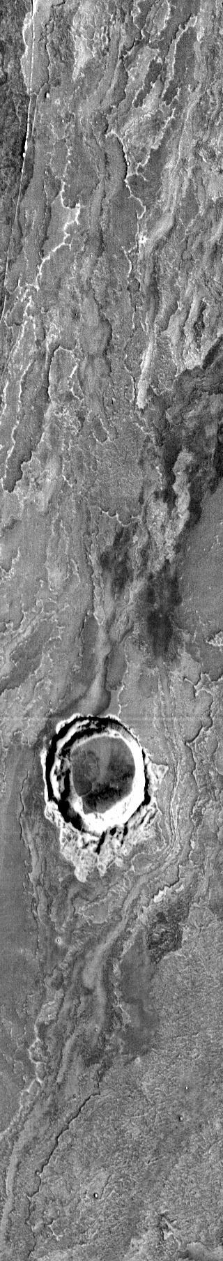
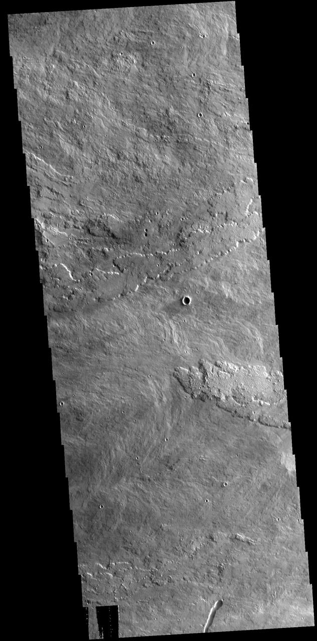
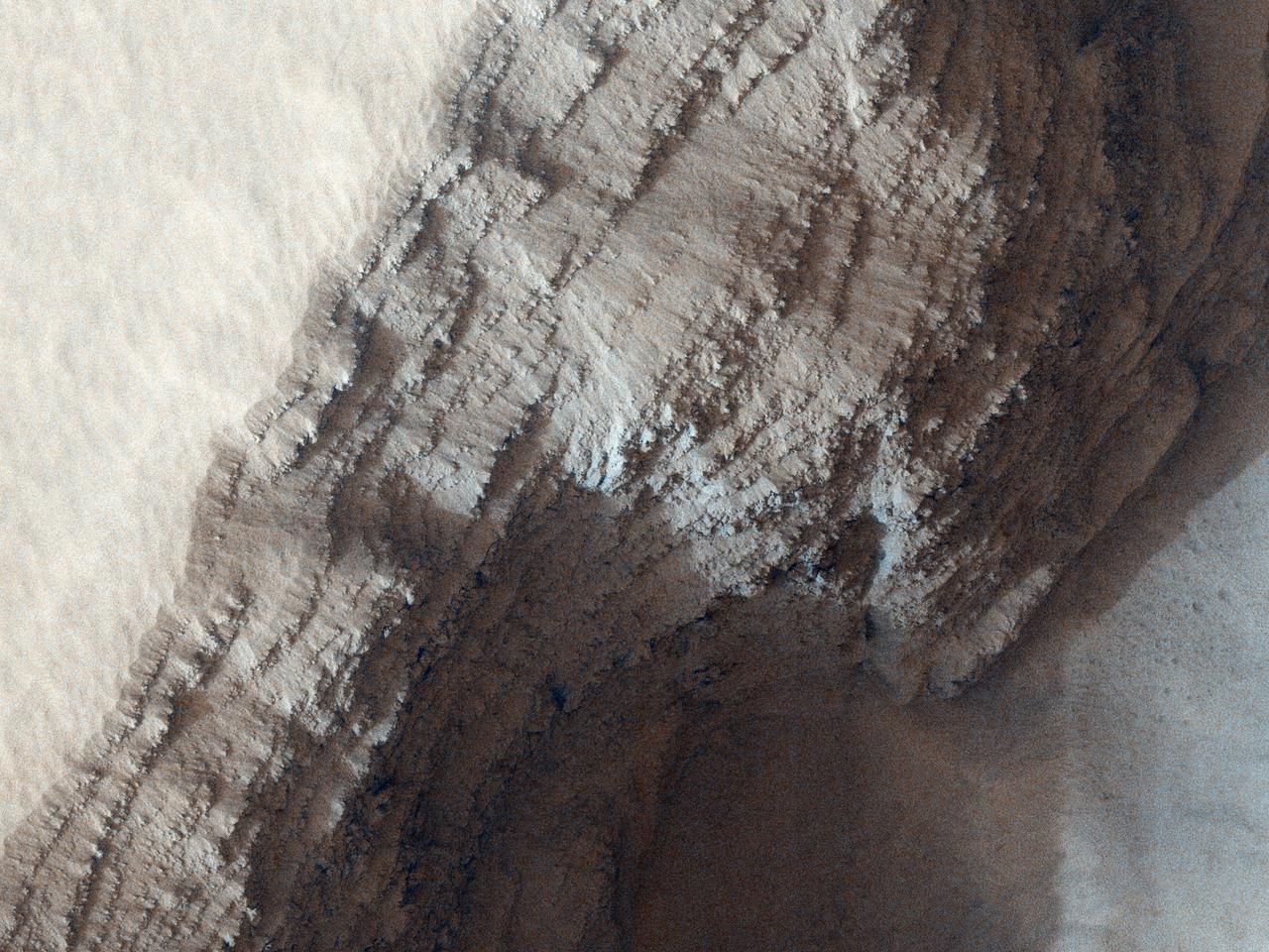
This observation from NASA Mars Reconnaissance Orbiter shows an incredible diversity of ancient lava tubes and impact craters filled with sediment on the flank of Arsia Mons.
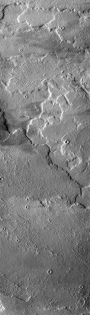
Daedalia Planum was created by extensive lava flows from Arsia Mons. This image from NASA Mars Odyssey shows a small portion of those flows.
This VIS image shows part of the summit caldera on Arsia Mons. Orbit Number: 80977 Latitude: -9.5156 Longitude: 240.199 Instrument: VIS Captured: 2020-03-16 23:04 https://photojournal.jpl.nasa.gov/catalog/PIA23932
This VIS image shows part of Daedalia Planum, which is comprised of lava flows from Arsia Mons. A windstreak is visible at the top of the image, downwind from a small crater. Orbit Number: 66495 Latitude: -15.7413 Longitude: 223.259 Instrument: VIS Captured: 2016-12-10 02:19 http://photojournal.jpl.nasa.gov/catalog/PIA21297
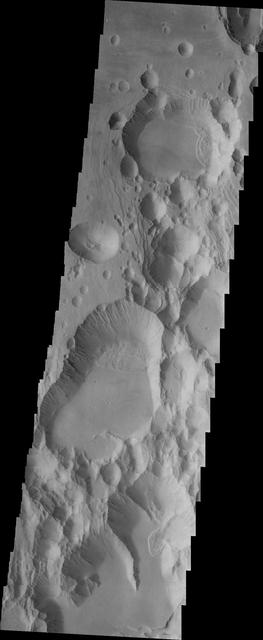
A large volcanic crater known as a caldera is located at the summit of all of the Tharsis volcanoes. These calderas are produced by massive volcanic explosions and collapse.Today's VIS image shows the summit caldera of Arsia Mons. Several small volcanic vents are visible on the caldera floor. It is not uncommon for calderas to have "flat" floors after the final explosive eruption the empties the subsurface magma chamber. There may still be some magma or superheated rock left after the collapse that will fill in part of the depression. Additionally, over time erosion will work to level the topography. Within the Arsia Mons caldera there was renewed activity from several small vents that occurred along the alignment of the NE/SW trend of the three large volcanoes. This ongoing, low volume activity is similar to the lava lake in Kilauea in Hawaii. Arsia Mons is the southernmost of the Tharsis volcanoes. It is 450 km (270 miles) in diameter, almost 20 km (12 miles) high, and the summit caldera is 120 km (72 miles) wide. For comparison, the largest volcano on Earth is Mauna Loa. From its base on the sea floor, Mauna Loa measures only 6.3 miles high and 75 miles in diameter.The Arsia Mons summit caldera is larger than many volcanoes on Earth. Orbit Number: 84328 Latitude: -8.58304 Longitude: 239.166 Instrument: VIS Captured: 2020-12-17 20:11 https://photojournal.jpl.nasa.gov/catalog/PIA24393
The three large aligned Tharsis volcanoes are Arsia Mons, Pavonis Mons and Ascreaus Mons (from south to north). There are collapse features on all three volcanoes, on the southwestern and northeastern flanks. This alignment may indicate a large fracture/vent system was responsible for the eruptions that formed all three volcanoes. The flows originating from Arsia Mons are thought to be the youngest of the region. This VIS image shows part of the northeastern flank of Arsia Mons at the summit caldera. In this region the summit caldera does not have a steep margin most likely due to renewed volcanic flows within this region of the caldera. The scalloped depressions at the top of the image are most likely created by collapse of the roof of lava tubes. Lava tubes originate during eruption event, when the margins of a flow harden around a still flowing lava stream. When an eruption ends these can become hollow tubes within the flow. With time, the roof of the tube may collapse into the empty space below. The tubes are linear, so the collapse of the roof creates a linear depression. Arsia Mons is the southernmost of the Tharsis volcanoes. It is 270 miles (450km) in diameter, almost 12 miles (20km) high, and the summit caldera is 72 miles (120km) wide. For comparison, the largest volcano on Earth is Mauna Loa. From its base on the sea floor, Mauna Loa measures only 6.3 miles high and 75 miles in diameter. A large volcanic crater known as a caldera is located at the summit of all of the Tharsis volcanoes. These calderas are produced by massive volcanic explosions and collapse. The Arsia Mons summit caldera is larger than many volcanoes on Earth. The Odyssey spacecraft has spent over 15 years in orbit around Mars, circling the planet more than 69000 times. It holds the record for longest working spacecraft at Mars. THEMIS, the IR/VIS camera system, has collected data for the entire mission and provides images covering all seasons and lighting conditions. Over the years many features of interest have received repeated imaging, building up a suite of images covering the entire feature. From the deepest chasma to the tallest volcano, individual dunes inside craters and dune fields that encircle the north pole, channels carved by water and lava, and a variety of other feature, THEMIS has imaged them all. For the next several months the image of the day will focus on the Tharsis volcanoes, the various chasmata of Valles Marineris, and the major dunes fields. We hope you enjoy these images! Orbit Number: 17716 Latitude: -8.11179 Longitude: 240.245 Instrument: VIS Captured: 2005-12-12 00:29 https://photojournal.jpl.nasa.gov/catalog/PIA22155
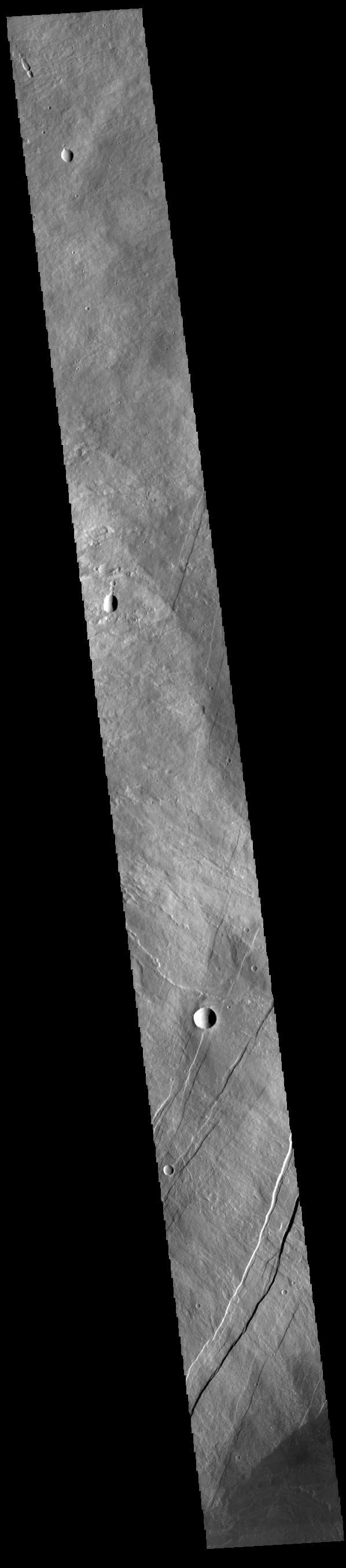
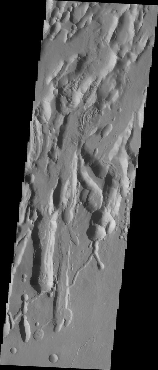
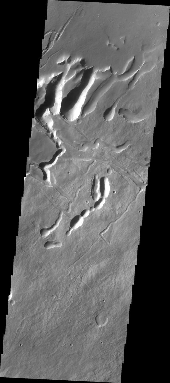
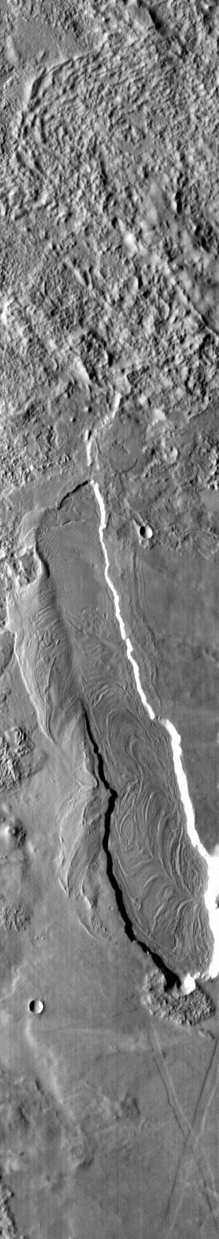
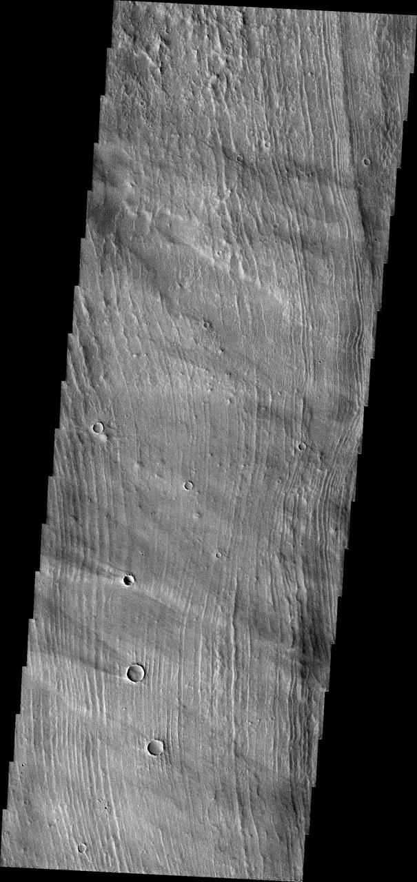
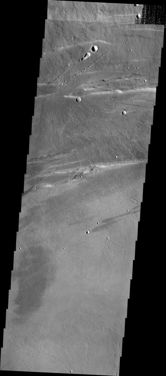
The three large aligned Tharsis volcanoes are Arsia Mons, Pavonis Mons and Ascreaus Mons (from south to north). There are collapse features on all three volcanoes, on the southwestern and northeastern flanks. This alignment may indicate a large fracture/vent system was responsible for the eruptions that formed all three volcanoes. This VIS image shows part of the southern flank of Arsia Mons, along the center of the aligned fracture system. The scalloped depressions are most likely created by collapse of the roof of lava tubes. Lava tubes originate during eruption event, when the margins of a flow harden around a still flowing lava stream. When an eruption ends these can become hollow tubes within the flow. With time, the roof of the tube may collapse into the empty space below. The tubes are linear, so the collapse of the roof creates a linear depression. In this region, the complexity of the collapse and faulting has created a unique surface. This region has collapse depressions with floors at a variety of elevations and depression sizes from small to large. Arsia Mons is the southernmost of the Tharsis volcanoes. It is 270 miles (450km) in diameter, almost 12 miles (20km) high, and the summit caldera is 72 miles (120km) wide. For comparison, the largest volcano on Earth is Mauna Loa. From its base on the sea floor, Mauna Loa measures only 6.3 miles high and 75 miles in diameter. A large volcanic crater known as a caldera is located at the summit of all of the Tharsis volcanoes. These calderas are produced by massive volcanic explosions and collapse. The Arsia Mons summit caldera is larger than many volcanoes on Earth. Orbit Number: 88040 Latitude: -6.88266 Longitude: 240.595 Instrument: VIS Captured: 2021-10-19 12:23 https://photojournal.jpl.nasa.gov/catalog/PIA25116
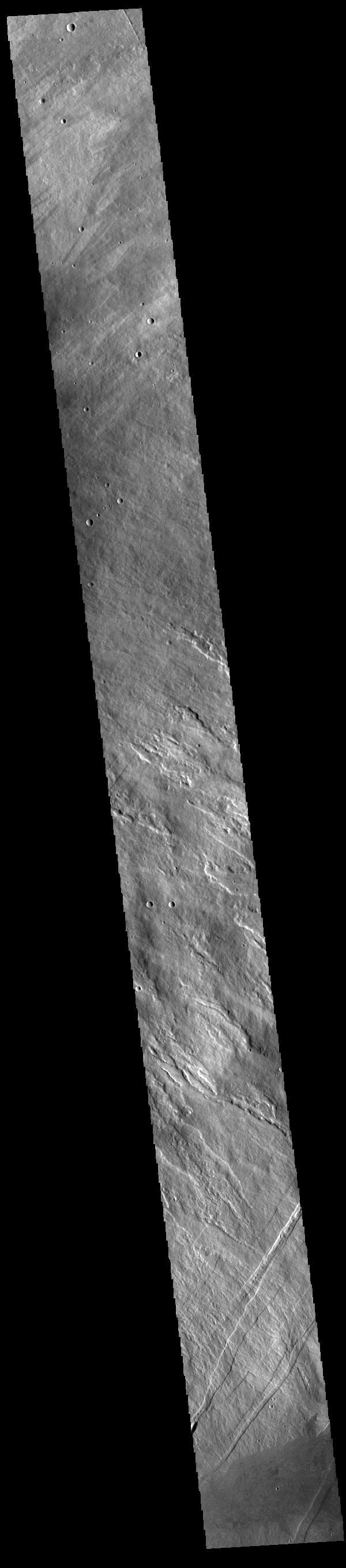
The three large aligned Tharsis volcanoes are Arsia Mons, Pavonis Mons and Ascreaus Mons (from south to north). There are collapse features on all three volcanoes, on the southwestern and northeastern flanks. This alignment may indicate a large fracture/vent system was responsible for the eruptions that formed all three volcanoes. This VIS image shows part of the northwestern flank of Arsia Mons, west of the aligned fracture system. The scalloped depressions and lines of craters are most likely created by collapse of the roof of lava tubes. Lava tubes originate during eruption event, when the margins of a flow harden around a still flowing lava stream. When an eruption ends these can become hollow tubes within the flow. With time, the roof of the tube may collapse into the empty space below. The tubes are linear, so the collapse of the roof creates a linear depression. In this region, the complexity of the collapse and faulting has created a unique surface. This region has collapse depressions with floors at a variety of elevations and depression sizes from small to large. Arsia Mons is the southernmost of the Tharsis volcanoes. It is 270 miles (450km) in diameter, almost 12 miles (20km) high, and the summit caldera is 72 miles (120km) wide. For comparison, the largest volcano on Earth is Mauna Loa. From its base on the sea floor, Mauna Loa measures only 6.3 miles high and 75 miles in diameter. A large volcanic crater known as a caldera is located at the summit of all of the Tharsis volcanoes. These calderas are produced by massive volcanic explosions and collapse. The Arsia Mons summit caldera is larger than many volcanoes on Earth. Orbit Number: 93113 Latitude: -6.63675 Longitude: 238.403 Instrument: VIS Captured: 2022-12-11 04:35 https://photojournal.jpl.nasa.gov/catalog/PIA25817
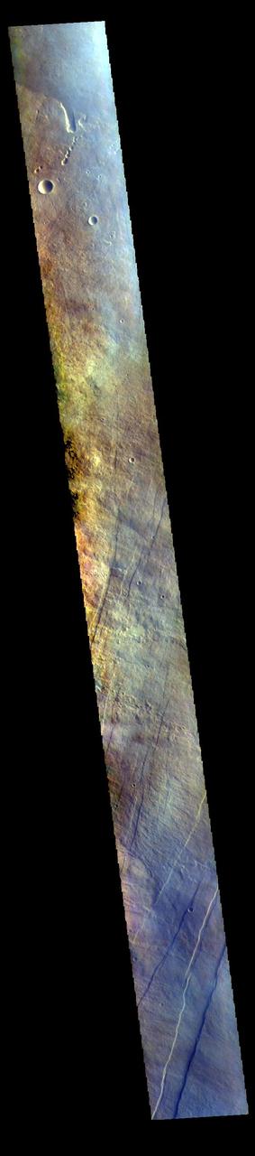
The THEMIS VIS camera contains 5 filters. The data from different filters can be combined in multiple ways to create a false color image. These false color images may reveal subtle variations of the surface not easily identified in a single band image. Today's false color image shows part of the flank of Arsia Mons. The three large aligned Tharsis volcanoes are Arsia Mons, Pavonis Mons and Ascreaus Mons (from south to north). There are collapse features on all three volcanoes, on the southwestern and northeastern flanks. This alignment may indicate a large fracture/vent system was responsible for the eruptions that formed all three volcanoes. This VIS image shows part of the eastern flank of Arsia Mons, west of the aligned fracture system. Arsia Mons is the southernmost of the Tharsis volcanoes. It is 270 miles (450km) in diameter, almost 12 miles (20km) high, and the summit caldera is 72 miles (120km) wide. For comparison, the largest volcano on Earth is Mauna Loa. From its base on the sea floor, Mauna Loa measures only 6.3 miles high and 75 miles in diameter. A large volcanic crater known as a caldera is located at the summit of all of the Tharsis volcanoes. These calderas are produced by massive volcanic explosions and collapse. The Arsia Mons summit caldera is larger than many volcanoes on Earth. The THEMIS VIS camera is capable of capturing color images of the Martian surface using five different color filters. In this mode of operation, the spatial resolution and coverage of the image must be reduced to accommodate the additional data volume produced from using multiple filters. To make a color image, three of the five filter images (each in grayscale) are selected. Each is contrast enhanced and then converted to a red, green, or blue intensity image. These three images are then combined to produce a full color, single image. Because the THEMIS color filters don't span the full range of colors seen by the human eye, a color THEMIS image does not represent true color. Also, because each single-filter image is contrast enhanced before inclusion in the three-color image, the apparent color variation of the scene is exaggerated. Nevertheless, the color variation that does appear is representative of some change in color, however subtle, in the actual scene. Note that the long edges of THEMIS color images typically contain color artifacts that do not represent surface variation. Orbit Number: 94404 Latitude: -8.85515 Longitude: 242.188 Instrument: VIS Captured: 2023-03-27 12:39 https://photojournal.jpl.nasa.gov/catalog/PIA26129
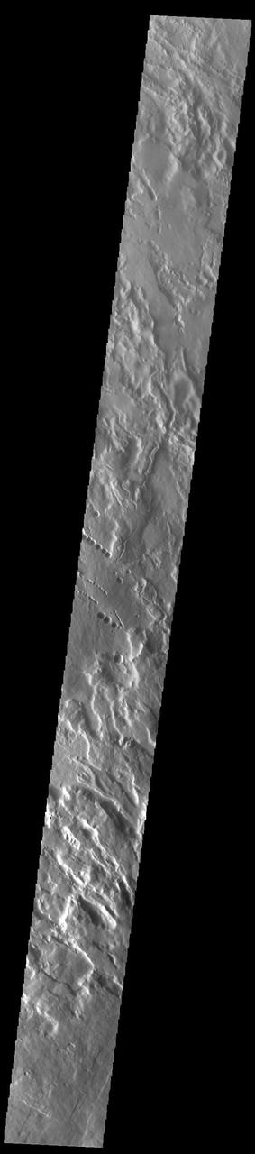
This observance from NASA Mars Reconnaissance Orbiter covers a pit in the lower West flank of Arsia Mons, one of the four giant volcanos of the Tharsis region. Many layers are exposed in the pit, probably marking individual lava flows.
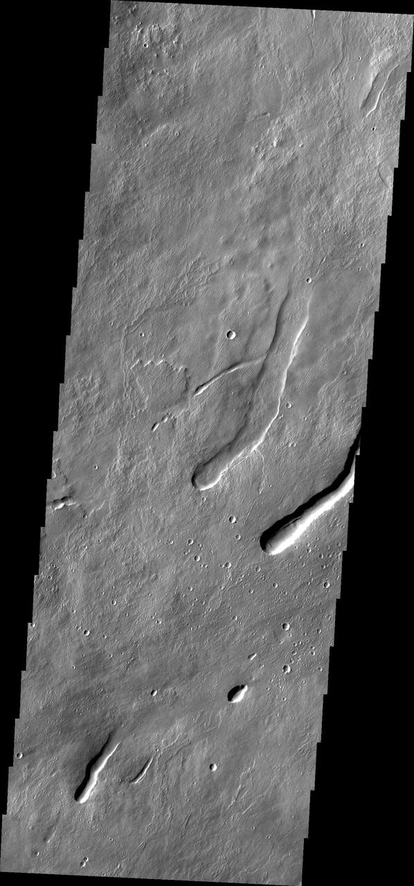
This image captured by NASA 2001 Mars Odyssey spacecraft shows a series of low, concentric ridges is located to the west of Arsia Mons. The origin of these features is unknown, and there are no similar features at the other Tharsis volcanoes.
This NASA Mars Odyssey image shows a portion of the summit region of Arsia Mons, one of the four giant volcanoes in the Tharsis region of Mars. This volcano stands more than 20 km above the surrounding plains, and is about 450 km in diameter at its base.
The three large aligned Tharsis volcanoes are Arsia Mons, Pavonis Mons and Ascreaus Mons (from south to north). There are collapse features on all three volcanoes, on the southwestern and northeastern flanks. This alignment may indicate a large fracture/vent system was responsible for the eruptions that formed all three volcanoes. This VIS image shows part of the southern flank of Arsia Mons, along the center of the aligned fracture system. The scalloped depressions are most likely created by collapse of the roof of lava tubes. Lava tubes originate during eruption event, when the margins of a flow harden around a still flowing lava stream. When an eruption ends these can become hollow tubes within the flow. With time, the roof of the tube may collapse into the empty space below. The tubes are linear, so the collapse of the roof creates a linear depression. In this region, the complexity of the collapse and faulting has created a unique surface. This region has collapse depressions with floors at a variety of elevations, landslide deposits where material has continued to fall into the depression and depression sizes from small to large. Arsia Mons is the southernmost of the Tharsis volcanoes. It is 270 miles (450km) in diameter, almost 12 miles (20km) high, and the summit caldera is 72 miles (120km) wide. For comparison, the largest volcano on Earth is Mauna Loa. From its base on the sea floor, Mauna Loa measures only 6.3 miles high and 75 miles in diameter. A large volcanic crater known as a caldera is located at the summit of all of the Tharsis volcanoes. These calderas are produced by massive volcanic explosions and collapse. The Arsia Mons summit caldera is larger than many volcanoes on Earth. The Odyssey spacecraft has spent over 15 years in orbit around Mars, circling the planet more than 69000 times. It holds the record for longest working spacecraft at Mars. THEMIS, the IR/VIS camera system, has collected data for the entire mission and provides images covering all seasons and lighting conditions. Over the years many features of interest have received repeated imaging, building up a suite of images covering the entire feature. From the deepest chasma to the tallest volcano, individual dunes inside craters and dune fields that encircle the north pole, channels carved by water and lava, and a variety of other feature, THEMIS has imaged them all. For the next several months the image of the day will focus on the Tharsis volcanoes, the various chasmata of Valles Marineris, and the major dunes fields. We hope you enjoy these images! Orbit Number: 33925 Latitude: -10.6619 Longitude: 239.412 Instrument: VIS Captured: 2009-08-07 16:10 https://photojournal.jpl.nasa.gov/catalog/PIA22158
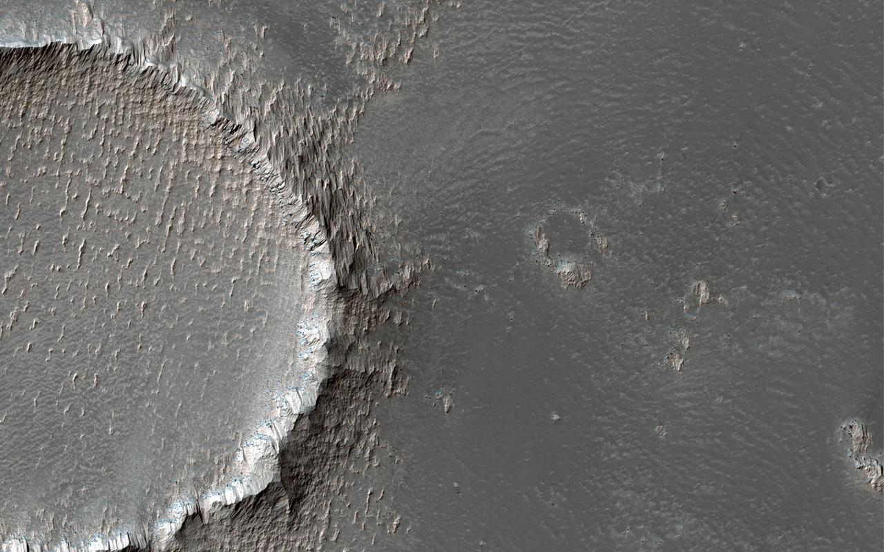
This image is located on the southeastern flank of a volcano on Mars called Arsia Mons. On the eastern side of the image, the lobate margin of an old lava flow is visible among brighter tones. The upstanding rims of several degraded impact craters are also visible. In the detailed cutout, we can see that the bright tones are erosion resistant outcrops, likely from dust that has accumulated and been sculpted by the wind. (The small crater on the left of the cutout is 70 meters across.) Arsia Mons is a shield volcano with a relatively low slope and a massive caldera at its summit. https://photojournal.jpl.nasa.gov/catalog/PIA25184
This THEMIS image shows part of the caldera floor of Arsia Mons. It is not uncommon for calderas to have "flat" floors after the final explosive eruption that empties the subsurface magma chamber. There may still be some magma or superheated rock left after the collapse that will fill in part of the depression. Additionally, over time erosion will work to level the topography. Within Arsia Mons there was renewed activity that occurred within the caldera along the alignment of the NE/SW trend of the three large volcanoes. This ongoing, low volume actitivity is similar to the lava lake in Kilauea in Hawaii. Small flows are visible throughout this image. Arsia Mons is the southernmost of the Tharsis volcanoes. It is 270 miles (450km) in diameter, almost 12 miles (20km) high, and the summit caldera is 72 miles (120km) wide. For comparison, the largest volcano on Earth is Mauna Loa. From its base on the sea floor, Mauna Loa measures only 6.3 miles high and 75 miles in diameter. A large volcanic crater known as a caldera is located at the summit of all of the Tharsis volcanoes. These calderas are produced by massive volcanic explosions and collapse. The Arsia Mons summit caldera is larger than many volcanoes on Earth. The Odyssey spacecraft has spent over 15 years in orbit around Mars, circling the planet more than 69000 times. It holds the record for longest working spacecraft at Mars. THEMIS, the IR/VIS camera system, has collected data for the entire mission and provides images covering all seasons and lighting conditions. Over the years many features of interest have received repeated imaging, building up a suite of images covering the entire feature. From the deepest chasma to the tallest volcano, individual dunes inside craters and dune fields that encircle the north pole, channels carved by water and lava, and a variety of other feature, THEMIS has imaged them all. For the next several months the image of the day will focus on the Tharsis volcanoes, the various chasmata of Valles Marineris, and the major dunes fields. We hope you enjoy these images! Orbit Number: 19588 Latitude: -9.19485 Longitude: 239.276 Instrument: VIS Captured: 2006-05-15 03:33 https://photojournal.jpl.nasa.gov/catalog/PIA22156
This image from NASA 2001 Mars Odyssey spacecraft shows a very small portion of the lava flows that originated from Arsia Mons -- a pre-existing crater has been filled, with only small sections of its rim still visible above the level of the lava.

A large volcanic crater known as a caldera is located at the summit of all of the Tharsis volcanoes. These calderas are produced by massive volcanic explosions and collapse.Today's VIS image shows the summit caldera of Arsia Mons. Several small volcanic vents are visible on the caldera floor. It is not uncommon for calderas to have "flat" floors after the final explosive eruption the empties the subsurface magma chamber. There may still be some magma or superheated rock left after the collapse that will fill in part of the depression. Additionally, over time erosion will work to level the topography. Within the Arsia Mons caldera there was renewed activity from several small vents that occurred along the alignment of the NE/SW trend of the three large volcanoes. This ongoing, low volume activity is similar to the lava lake in Kilauea in Hawaii. Arsia Mons is the southernmost of the Tharsis volcanoes. It is 450 km (270 miles) in diameter, almost 20 km (12 miles) high, and the summit caldera is 120 km (72 miles) wide. For comparison, the largest volcano on Earth is Mauna Loa. From its base on the sea floor, Mauna Loa measures only 6.3 miles high and 75 miles in diameter.The Arsia Mons summit caldera is larger than many volcanoes on Earth. Orbit Number: 79230 Latitude: -9.4441 Longitude: 239.984 Instrument: VIS Captured: 2019-10-25 02:43 https://photojournal.jpl.nasa.gov/catalog/PIA23639
This THEMIS image shows part of the caldera floor of Arsia Mons. It is not uncommon for calderas to have "flat" floors after the final explosive eruption the empties the subsurface magma chamber. There may still be some magma or superheated rock left after the collapse that will fill in part of the depression. Additionally, over time erosion will work to level the topography. Within Arsia Mons there was renewed activity that occurred within the caldera along the alignment of the NE/SW trend of the three large volcanoes. This ongoing, low volume actitivity is similar to the lava lake in Kilauea in Hawaii. Small flows are visible throughout this image. In the center of the image is a small "L" shaped feature. This is the summit vent for the volcanic flows around it. The flows have lapped up against the caldera wall, filling in faults left by the caldera formation and increasing the elevation of the surface in this region of the caldera. Arsia Mons is the southernmost of the Tharsis volcanoes. It is 270 miles (450km) in diameter, almost 12 miles (20km) high, and the summit caldera is 72 miles (120km) wide. For comparison, the largest volcano on Earth is Mauna Loa. From its base on the sea floor, Mauna Loa measures only 6.3 miles high and 75 miles in diameter. A large volcanic crater known as a caldera is located at the summit of all of the Tharsis volcanoes. These calderas are produced by massive volcanic explosions and collapse. The Arsia Mons summit caldera is larger than many volcanoes on Earth. The Odyssey spacecraft has spent over 15 years in orbit around Mars, circling the planet more than 69000 times. It holds the record for longest working spacecraft at Mars. THEMIS, the IR/VIS camera system, has collected data for the entire mission and provides images covering all seasons and lighting conditions. Over the years many features of interest have received repeated imaging, building up a suite of images covering the entire feature. From the deepest chasma to the tallest volcano, individual dunes inside craters and dune fields that encircle the north pole, channels carved by water and lava, and a variety of other feature, THEMIS has imaged them all. For the next several months the image of the day will focus on the Tharsis volcanoes, the various chasmata of Valles Marineris, and the major dunes fields. We hope you enjoy these images! Orbit Number: 19874 Latitude: -8.57834 Longitude: 240.452 Instrument: VIS Captured: 2006-06-07 18:39 https://photojournal.jpl.nasa.gov/catalog/PIA22157

This VIS image shows part of the eastern margin of the summit caldera of Arsia Mons. The arcuate features are the faults created by collapse of summit materials. A massive eruption can empty the large magma chamber which existed within the volcano, creating a void which can not support the weight of the top of the volcano. Arsia Mons is the southernmost of the Tharsis volcanoes. It is 270 miles (450km) in diameter, almost 12 miles (20km) high, and the summit caldera is 72 miles (120km) wide. For comparison, the largest volcano on Earth is Mauna Loa. From its base on the sea floor, Mauna Loa measures only 6.3 miles high and 75 miles in diameter. A large volcanic crater known as a caldera is located at the summit of all of the Tharsis volcanoes. These calderas are produced by massive volcanic explosions and collapse. The Arsia Mons summit caldera is larger than many volcanoes on Earth. The Odyssey spacecraft has spent over 15 years in orbit around Mars, circling the planet more than 69000 times. It holds the record for longest working spacecraft at Mars. THEMIS, the IR/VIS camera system, has collected data for the entire mission and provides images covering all seasons and lighting conditions. Over the years many features of interest have received repeated imaging, building up a suite of images covering the entire feature. From the deepest chasma to the tallest volcano, individual dunes inside craters and dune fields that encircle the north pole, channels carved by water and lava, and a variety of other feature, THEMIS has imaged them all. For the next several months the image of the day will focus on the Tharsis volcanoes, the various chasmata of Valles Marineris, and the major dunes fields. We hope you enjoy these images! Orbit Number: 12487 Latitude: -9.44031 Longitude: 240.527 Instrument: VIS Captured: 2004-10-07 11:58 https://photojournal.jpl.nasa.gov/catalog/PIA22152
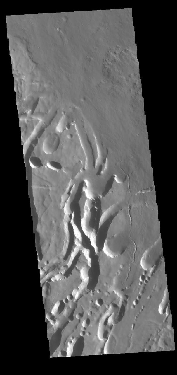
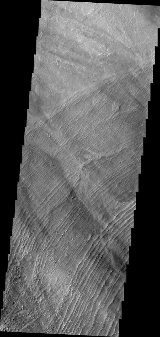
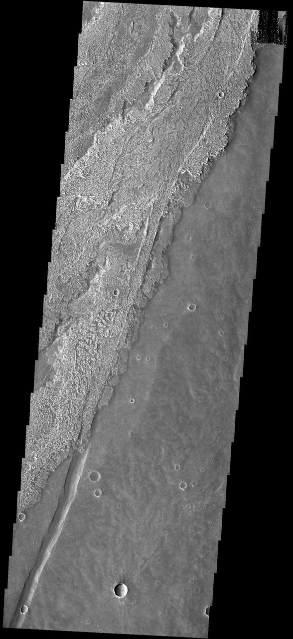
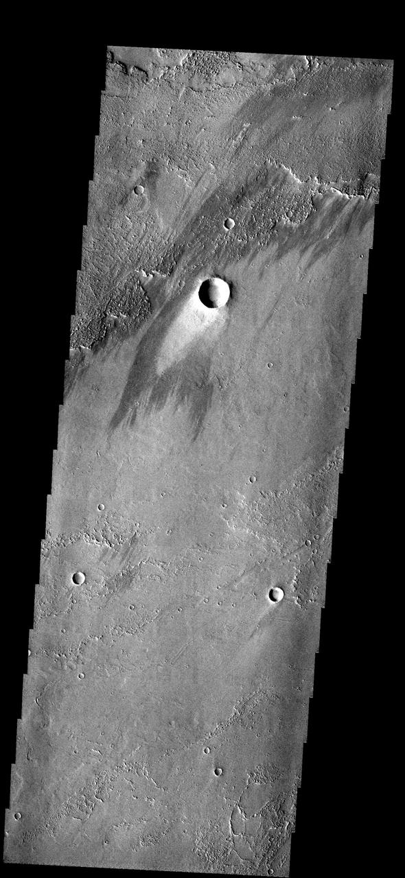
This image shows part of the southeastern flank of Arsia Mons, including the flat lying flows around the base of the volcano. These flows are located at the bottom of the image. Numerous small lava channels are visible aligned sub-parallel to the base of the volcano. Several narrow, lobate flows show the downslope direction from the top left of the image towards the bottom right. Running against this elevation change are large paired faults called graben. Graben form by faults that have allowed the material between them to "slide" down. The resultant topography is a linear depression. None of the lobate flows enter and then run along the fault valley, indicating that the faulting occurred after the lava flows. Arsia Mons is the southernmost of the Tharsis volcanoes. It is 270 miles (450km) in diameter, almost 12 miles (20km) high, and the summit caldera is 72 miles (120km) wide. For comparison, the largest volcano on Earth is Mauna Loa. From its base on the sea floor, Mauna Loa measures only 6.3 miles high and 75 miles in diameter. A large volcanic crater known as a caldera is located at the summit of all of the Tharsis volcanoes. These calderas are produced by massive volcanic explosions and collapse. The Arsia Mons summit caldera is larger than many volcanoes on Earth. The Odyssey spacecraft has spent over 15 years in orbit around Mars, circling the planet more than 69000 times. It holds the record for longest working spacecraft at Mars. THEMIS, the IR/VIS camera system, has collected data for the entire mission and provides images covering all seasons and lighting conditions. Over the years many features of interest have received repeated imaging, building up a suite of images covering the entire feature. From the deepest chasma to the tallest volcano, individual dunes inside craters and dune fields that encircle the north pole, channels carved by water and lava, and a variety of other feature, THEMIS has imaged them all. For the next several months the image of the day will focus on the Tharsis volcanoes, the various chasmata of Valles Marineris, and the major dunes fields. We hope you enjoy these images! Orbit Number: 17691 Latitude: -11.2622 Longitude: 241 Instrument: VIS Captured: 2005-12-09 23:06 https://photojournal.jpl.nasa.gov/catalog/PIA22154
This vent and associated flow are located at the base of Arsia Mons
These lava flows are part of the Arsia Mons volcanic complex
These relatively young lava flows are part of Arsia Mons
This windstreak is located on lava flows west of Arsia Mons
These lava flows are part of the Arsia Mons complex
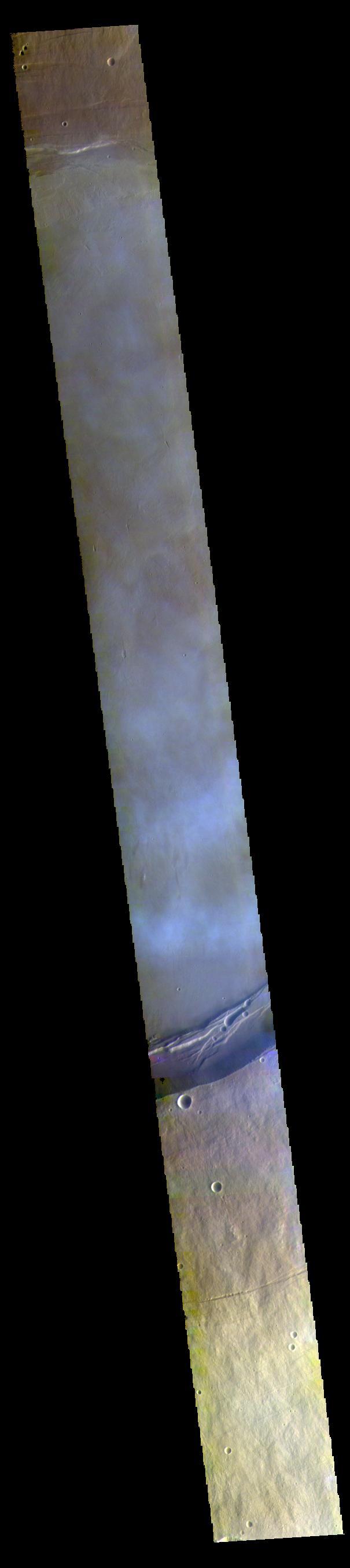
NASA's 2001 Mars Odyssey orbiter used its Thermal Emission Imaging System (THEMIS) to capture this view of Arsia Mons, an ancient volcano, while studying the Red Planet's atmosphere, which appears here as a greenish haze above the scene. THEMIS took the image well before dawn on May 2, 2025. The image has been stretched and brightened to improve contrast and processed to remove instrument noise. The southernmost of the three Tharsis volcanoes, Arsia Mons is 270 miles (450 kilometers) in diameter and almost 12 miles (20 kilometers) high. For comparison, the largest volcano on Earth is Mauna Loa, which measures 75 miles (121 kilometers) in diameter and roughly 6 miles (9 kilometers) high from its base on the seafloor. A large crater known as a caldera, produced by massive volcanic explosions and collapse, is located at the summit of all of the Tharsis volcanoes. At 72 miles (120 kilometers) wide, the Arsia Mons summit caldera is larger than many volcanoes on Earth. This type of image shows Mars' "limb," the edge of the planet's horizon. By flipping on its side while in orbit, Odyssey can point THEMIS head-on at the limb and capture images of the Martian atmosphere. This unique view allows scientists to see the structure and shape of dust and water-ice cloud layers and observe how they change over the course of seasons. Understanding Mars' clouds is particularly important for understanding Martian weather and how phenomena like dust storms occur. This is THEMIS' fourth limb observation since it began pursuing this new kind of science in 2023. When possible, the camera's team has tried to include an interesting surface feature such as Olympus Mons, the tallest volcano in the solar system. https://photojournal.jpl.nasa.gov/catalog/PIA26557
he lava flows in this VIS image originate at Arsia Mons. Arsia Mons in the southermost of the three large Tharsis volcanoes. Orbit Number: 72406 Latitude: -19.4934 Longitude: 234.097 Instrument: VIS Captured: 2018-04-11 02:19 https://photojournal.jpl.nasa.gov/catalog/PIA22597
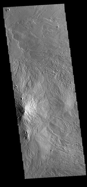
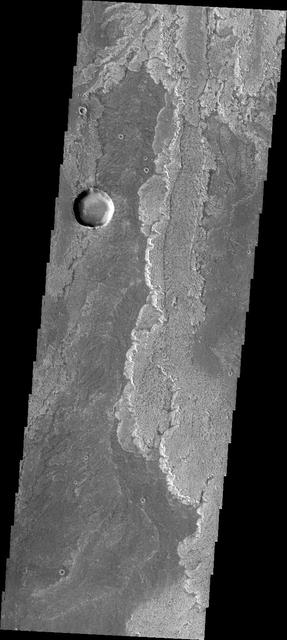
Arsia Chasmata is a complex collapsed region at the northeastern flank of Arsia Mons. The collapsed region aligns with the Pavonis and Ascraeus Mons volcanoes, indicating that all three volcanoes are located on a major fracture in the Tharsis region.
These windstreaks occur on top of lava flows from Arsia Mons
This group of windstreaks is located on lava flows west of Arsia Mons
This beautiful windstreak is located on the lava flows from Arsia Mons
Today's VIS image shows a small portion of the immense lava flows that originated from Arsia Mons. Arsia Mons is the southernmost of the three large aligned volcanoes in the Tharsis region. Arsia Mons last eruption was 10s of million years ago. The youngest volcano in the region is Olympus Mons, the largest volcano in our solar system. Orbit Number: 74945 Latitude: -18.9808 Longitude: 225.731 Instrument: VIS Captured: 2018-11-06 05:00 https://photojournal.jpl.nasa.gov/catalog/PIA22973
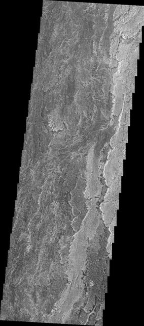
The parallel ridges in this image captured by NASA Mars Odyssey spacecraft are part of Arsia Sulci - a region west of Arsia Mons. How these features were formed is unknown.
Arsia Mons is the southernmost of the Tharsis volcanoes. It is 270 miles (450km) in diameter, almost 12 miles (20km) high, and the summit caldera is 72 miles (120km) wide. For comparison, the largest volcano on Earth is Mauna Loa. From its base on the sea floor, Mauna Loa measures only 6.3 miles high and 75 miles in diameter. A large volcanic crater known as a caldera is located at the summit of all of the Tharsis volcanoes. These calderas are produced by massive volcanic explosions and collapse. The Arsia Mons summit caldera is larger than many volcanoes on Earth. This THEMIS image shows a portion of the western wall of the caldera, revealing the steep walls and linear features associated with the collapse that formed the caldera. The Odyssey spacecraft has spent over 15 years in orbit around Mars, circling the planet more than 69000 times. It holds the record for longest working spacecraft at Mars. THEMIS, the IR/VIS camera system, has collected data for the entire mission and provides images covering all seasons and lighting conditions. Over the years many features of interest have received repeated imaging, building up a suite of images covering the entire feature. From the deepest chasma to the tallest volcano, individual dunes inside craters and dune fields that encircle the north pole, channels carved by water and lava, and a variety of other feature, THEMIS has imaged them all. For the next several months the image of the day will focus on the Tharsis volcanoes, the various chasmata of Valles Marineris, and the major dunes fields. We hope you enjoy these images! Orbit Number: 4424 Latitude: -9.02841 Longitude: 238.916 Instrument: VIS Captured: 2002-12-13 17:18 https://photojournal.jpl.nasa.gov/catalog/PIA22150

This THEMIS image shows part of the southern margin of the summit caldera. This image contains a variety of features representing the major events related to the formation of the volcano. At the top of the image a small linear vent has produced lava flows increasing the elevation of the surface around it. The flat floor of the caldera surrounds the vent and the cliff faces at the center of the image were created during the collapse event that formed the caldera. Depressions at the bottom illustrate collapse into empty voids like lava tubes. Arsia Mons is the southernmost of the Tharsis volcanoes. It is 270 miles (450 km) in diameter, almost 12 miles (20 km) high, and the summit caldera is 72 miles (120 km) wide. For comparison, the largest volcano on Earth is Mauna Loa. From its base on the sea floor, Mauna Loa measures only 6.3 miles high and 75 miles in diameter. A large volcanic crater known as a caldera is located at the summit of all of the Tharsis volcanoes. These calderas are produced by massive volcanic explosions and collapse. The Arsia Mons summit caldera is larger than many volcanoes on Earth. The Odyssey spacecraft has spent over 15 years in orbit around Mars, circling the planet more than 69000 times. It holds the record for longest working spacecraft at Mars. THEMIS, the IR/VIS camera system, has collected data for the entire mission and provides images covering all seasons and lighting conditions. Over the years many features of interest have received repeated imaging, building up a suite of images covering the entire feature. From the deepest chasma to the tallest volcano, individual dunes inside craters and dune fields that encircle the north pole, channels carved by water and lava, and a variety of other feature, THEMIS has imaged them all. For the next several months the image of the day will focus on the Tharsis volcanoes, the various chasmata of Valles Marineris, and the major dunes fields. We hope you enjoy these images! Orbit Number: 63900 Latitude: -10.0873 Longitude: 239.197 Instrument: VIS Captured: 2016-05-10 07:58 https://photojournal.jpl.nasa.gov/catalog/PIA22159
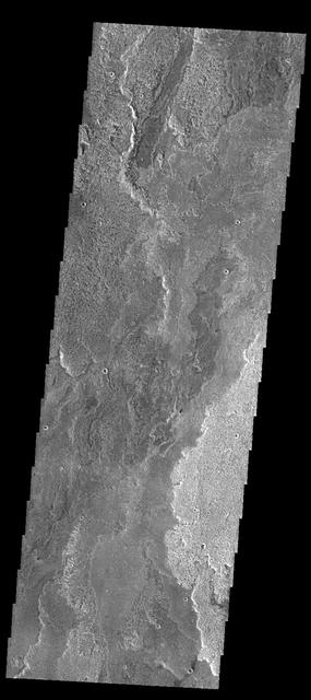
Today's VIS image shows a small portion of Daedalia Planum. Daedalia Planum is an immense lava flow field that originates at Arsia Mons. Arsia Mons is the southernmost of the three large aligned volcanoes in the Tharsis region. Arsia Mons' last eruption was 10s of million years ago. Orbit Number: 80553 Latitude: -23.7847 Longitude: 234.227 Instrument: VIS Captured: 2020-02-11 01:06 https://photojournal.jpl.nasa.gov/catalog/PIA23840
This VIS image shows part of the northwestern margin of the summit caldera. Along with the faults caused by the collapse of the summit materials into the void of the emptied magma chamber, there are many small lobate lava flows and collapse features. The scalloped depressions are most likely created by collapse of the roof of lava tubes. Lava tubes originate during eruption event, when the margins of a flow harden around a still flowing lava stream. When an eruption ends these can become hollow tubes within the flow. With time, the roof of the tube may collapse into the empty space below. The tubes are linear, so the collapse of the roof creates a linear depression. This image illustrates the many processes that occurred in the formation of the volcano. Arsia Mons is the southernmost of the Tharsis volcanoes. It is 270 miles (450km) in diameter, almost 12 miles (20km) high, and the summit caldera is 72 miles (120km) wide. For comparison, the largest volcano on Earth is Mauna Loa. From its base on the sea floor, Mauna Loa measures only 6.3 miles high and 75 miles in diameter. A large volcanic crater known as a caldera is located at the summit of all of the Tharsis volcanoes. These calderas are produced by massive volcanic explosions and collapse. The Arsia Mons summit caldera is larger than many volcanoes on Earth. The Odyssey spacecraft has spent over 15 years in orbit around Mars, circling the planet more than 69000 times. It holds the record for longest working spacecraft at Mars. THEMIS, the IR/VIS camera system, has collected data for the entire mission and provides images covering all seasons and lighting conditions. Over the years many features of interest have received repeated imaging, building up a suite of images covering the entire feature. From the deepest chasma to the tallest volcano, individual dunes inside craters and dune fields that encircle the north pole, channels carved by water and lava, and a variety of other feature, THEMIS has imaged them all. For the next several months the image of the day will focus on the Tharsis volcanoes, the various chasmata of Valles Marineris, and the major dunes fields. We hope you enjoy these images! Orbit Number: 17117 Latitude: -8.43321 Longitude: 239.488 Instrument: VIS Captured: 2005-10-23 16:52 https://photojournal.jpl.nasa.gov/catalog/PIA22153
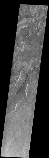
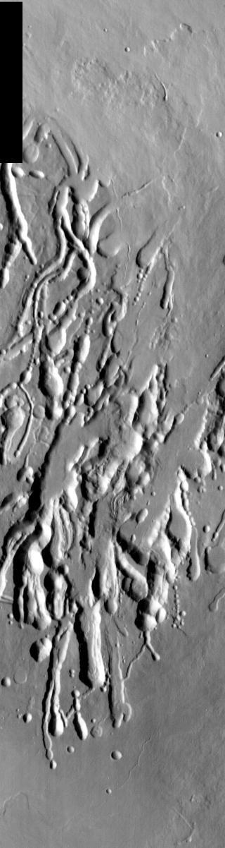
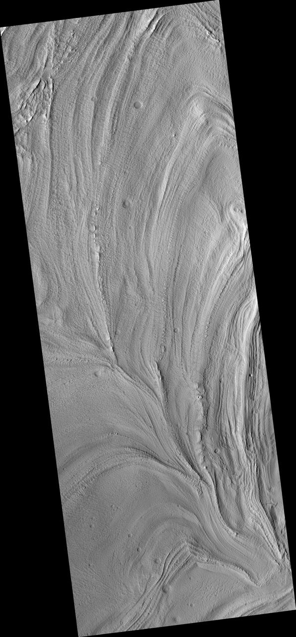
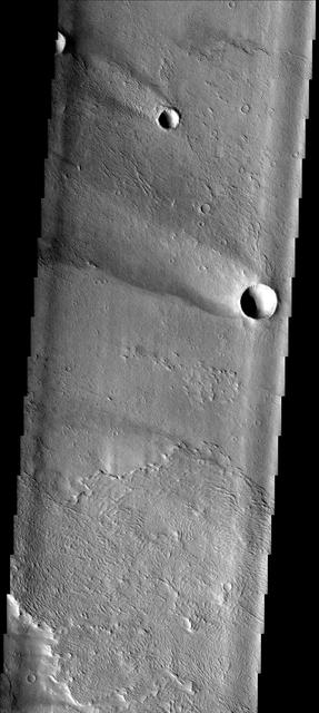
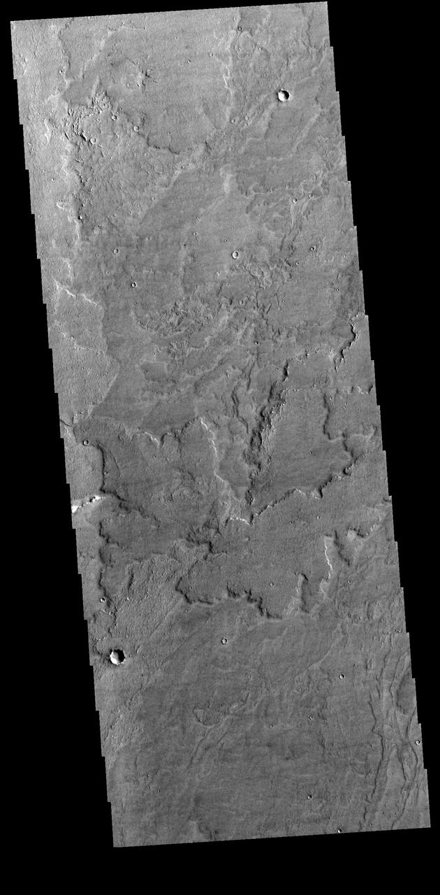
Today's VIS image shows a small portion of the immense lava flows that originated from Arsia Mons. Arsia Mons is the southernmost of the three large aligned volcanoes in the Tharsis region. Arsia Mons' last eruption was 10s of million years ago. The different surface textures are created by differences in the lava viscosity and cooling rates. The lobate margins of each flow can be traced back to the start of each flow — or to the point where they are covered by younger flows. Flows in Daedalia Planum can be as long as 180 km. Orbit Number: 84016 Latitude: -23.1326 Longitude: 237.739 Instrument: VIS Captured: 2020-11-22 03:44 https://photojournal.jpl.nasa.gov/catalog/PIA24363
Today's VIS image shows a small portion of the immense lava flows that originated from Arsia Mons. Arsia Mons is the southernmost of the three large aligned volcanoes in the Tharsis region. Arsia Mons' last eruption was 10s of million years ago. The different surface textures are created by differences in the lava viscosity and cooling rates. The lobate margins of each flow can be traced back to the start of each flow — or to the point where they are covered by younger flows. Flows in Daedalia Planum can be as long as 180 km. Orbit Number: 81539 Latitude: -20.6524 Longitude: 228.51 Instrument: VIS Captured: 2020-05-02 05:36 https://photojournal.jpl.nasa.gov/catalog/PIA23993
Today's VIS image shows a small portion of the immense lava flows that originated from Arsia Mons. Arsia Mons is the southernmost of the three large aligned volcanoes in the Tharsis region. Arsia Mons' last eruption was 10s of million years ago. The different surface textures are created by differences in the lava viscosity and cooling rates. The lobate margins of each flow can be traced back to the start of each flow — or to the point where they are covered by younger flows. Flows in Daedalia Planum can be as long as 180 km. Orbit Number: 84066 Latitude: -22.1783 Longitude: 235.511 Instrument: VIS Captured: 2020-11-26 06:32 https://photojournal.jpl.nasa.gov/catalog/PIA24367
Today's VIS image shows a small portion of the immense lava flows that originated from Arsia Mons. Arsia Mons is the southernmost of the three large aligned volcanoes in the Tharsis region. Arsia Mons' last eruption was 10s of million years ago. The different surface textures are created by differences in the lava viscosity and cooling rates. The lobate margins of each flow can be traced back to the start of each flow -- or to the point where they are covered by younger flows. Flows in Daedalia Planum can be as long as 180 km. Orbit Number: 81913 Latitude: -22.2957 Longitude: 239.093 Instrument: VIS Captured: 2020-06-02 00:40 https://photojournal.jpl.nasa.gov/catalog/PIA24090
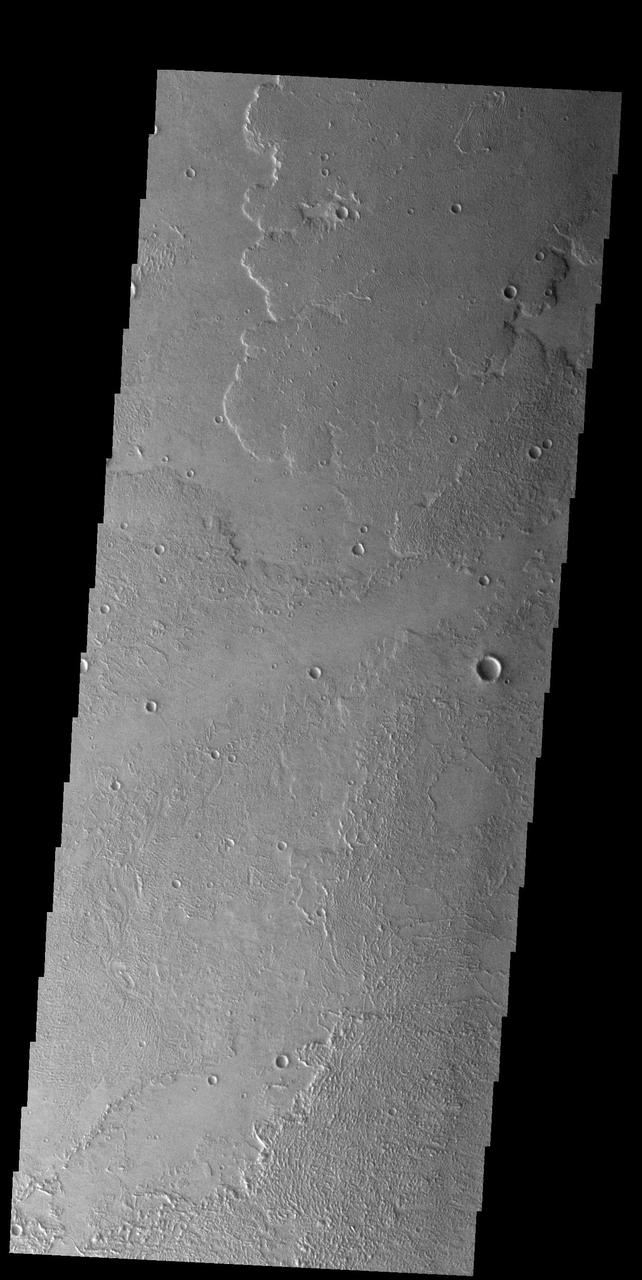
Daedalia Planum is comprised of lava flows from Arsia Mons. This image was captured by NASA 2001 Mars Odyssey spacecraft.