Ascraeus Mons
Ascraeus Mons
Ascraeus Mons
These lava flows are part of Ascraeus Mons
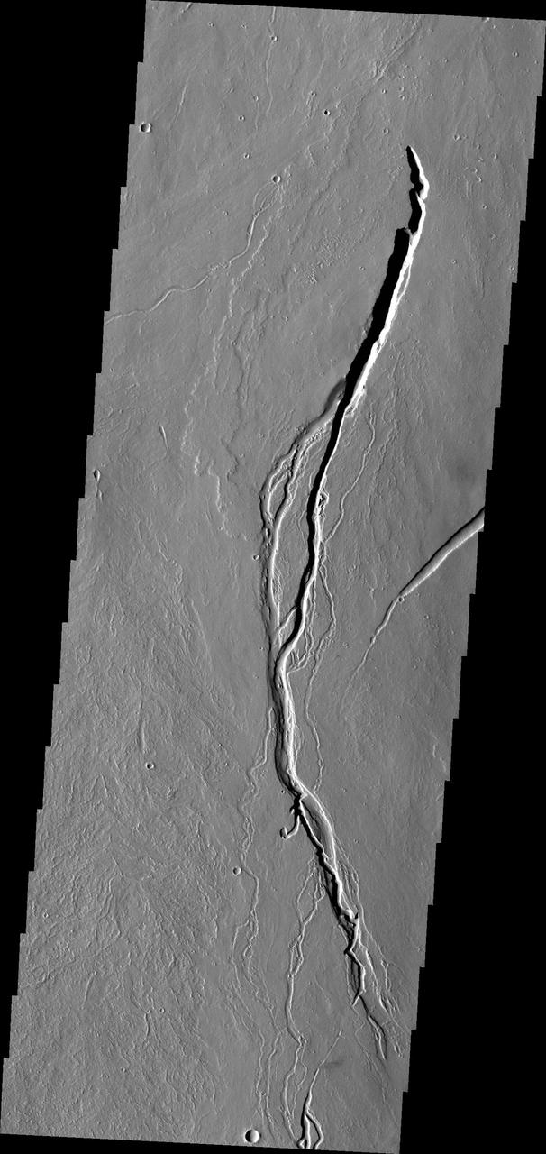
Channel on Ascraeus Mons
Ascraeus Mons Caldera Wall
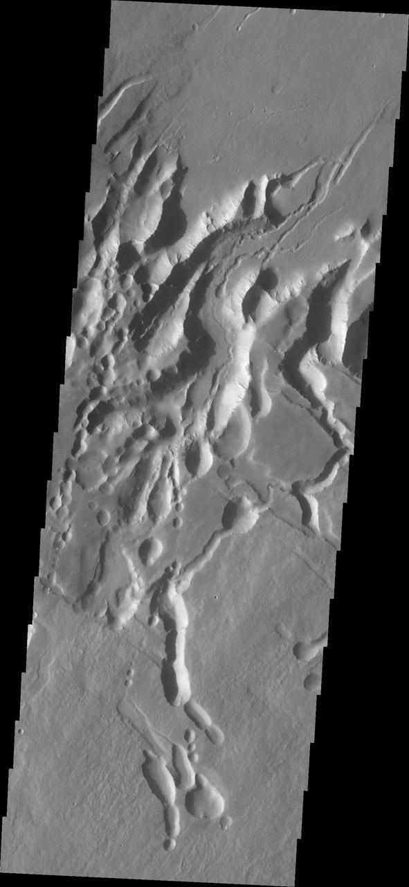
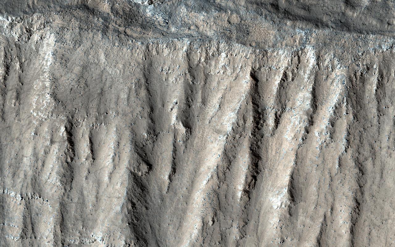
Ascraeus Mons Pits

Ascraeus Mons Collapse Pits
Mantled Surface of Ascraeus Mons
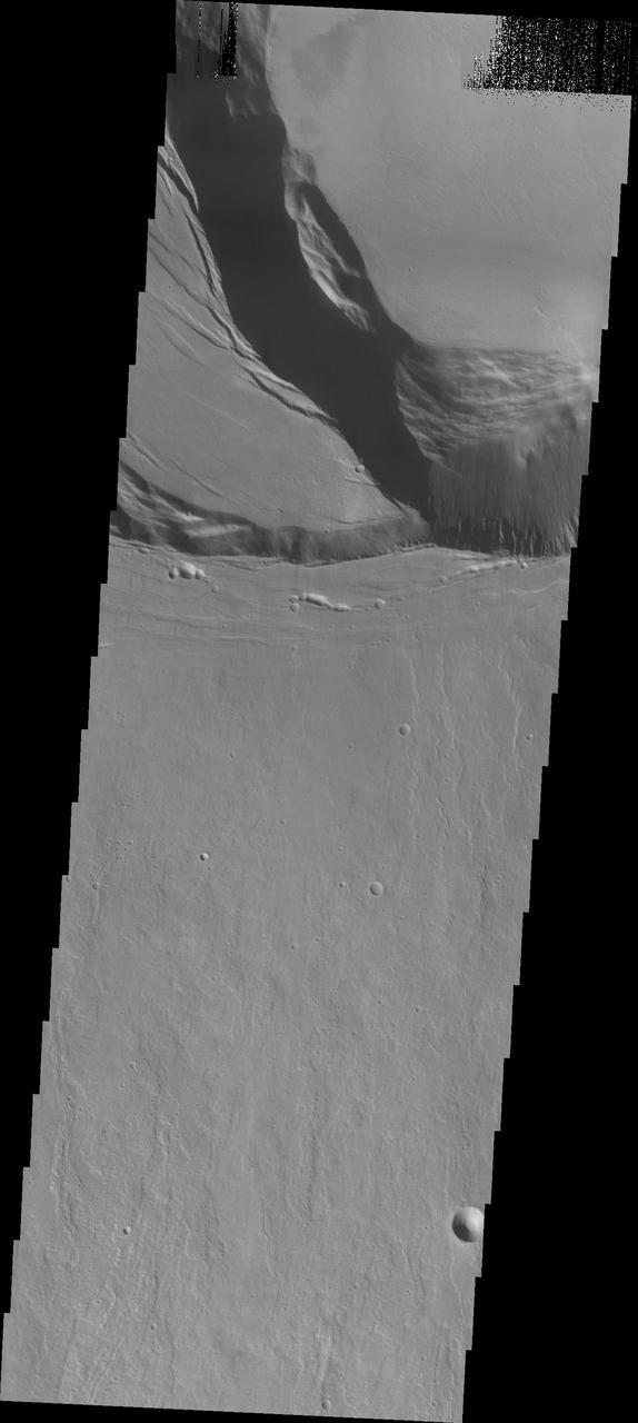
This image shows part of the flank and margin of Ascraeus Mons
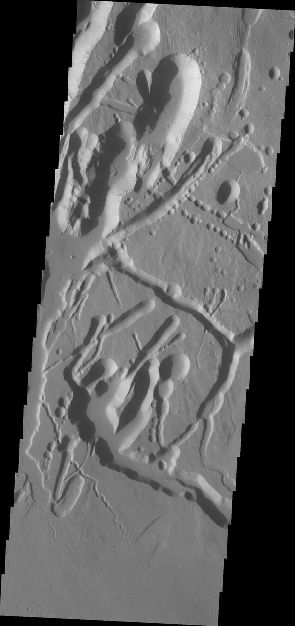
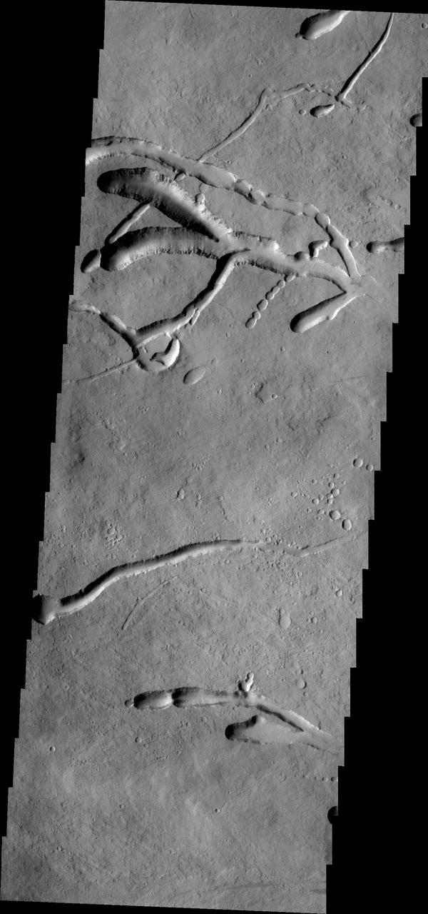
These lava flows and collapse features are part of Ascraeus Mons
This image shows a small portion of the flank of Ascraeus Mons
Today's VIS image shows the summit of Ascraeus Mons. Ascraeus Mons is the northernmost of the three aligned Tharsis volcanoes. Orbit Number: 80602 Latitude: 11.189 Longitude: 255.887 Instrument: VIS Captured: 2020-02-15 02:07 https://photojournal.jpl.nasa.gov/catalog/PIA23841
Lava Flows On Ascraeus Mons Volcano
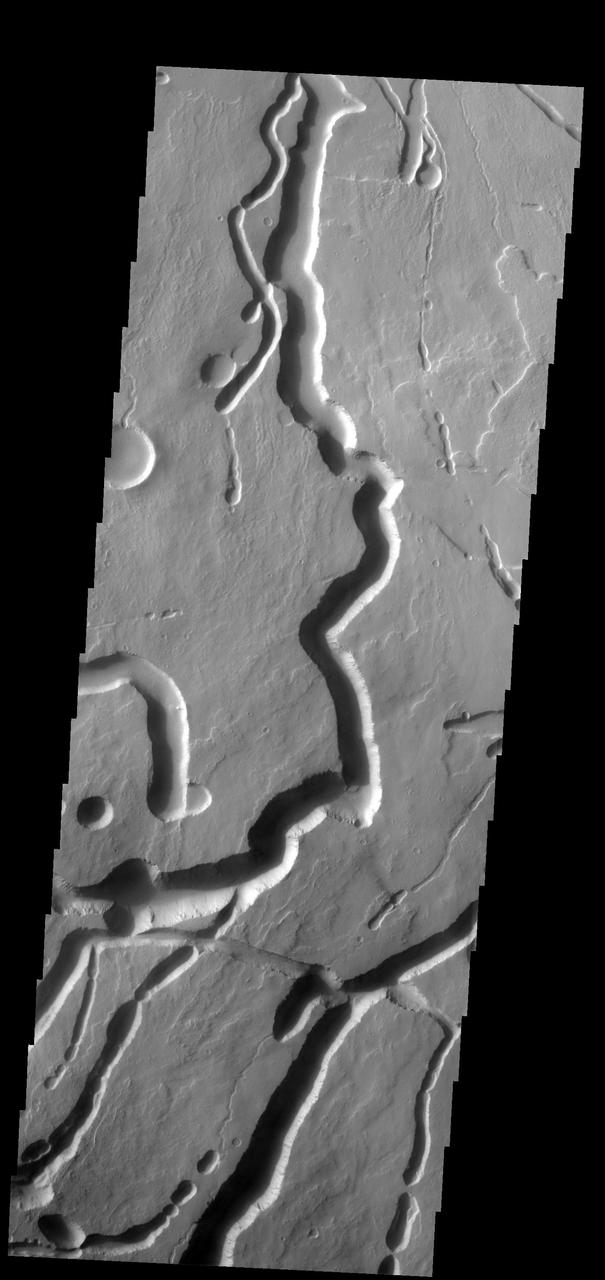
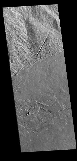
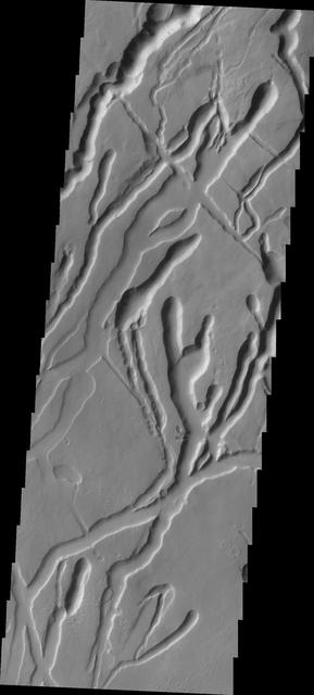
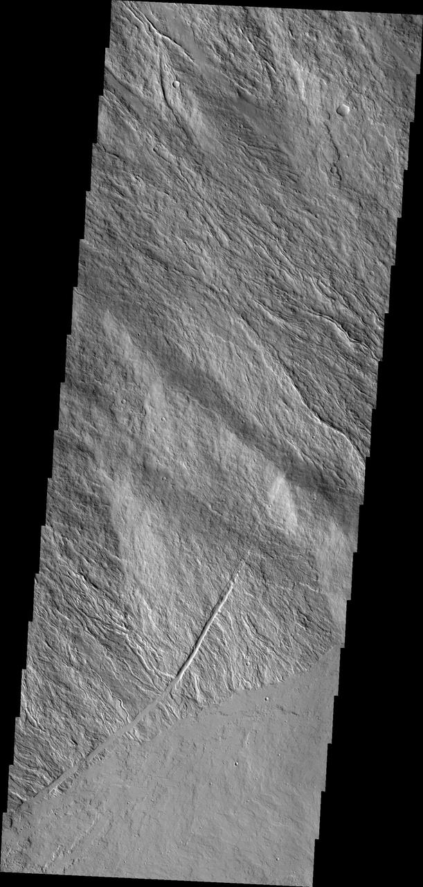
These channels and channel-like collapse features are located on the northeastern flank of Ascraeus Mons
This VIS image shows part of the summit of Ascraeus Mons. Ascraeus Mons is the northernmost and tallest of the three large aligned Tharsis volcanoes. Calderas are found at the tops of volcanoes and are the source region for magma that rises from an underground lava source to erupt at the surface. Volcanoes are formed by repeated flows from the central caldera. The final eruptions can pool within the summit caldera, leaving a flat surface as they cool. Calderas are also a location of collapse, creating rings of tectonic faults that form the caldera rim. Ascraeus Mons has several caldera features at its summit. Ascraeus Mons is 18 km (11 miles) tall, for comparison Mauna Kea – the tallest volcano on Earth – is 10 km tall (6.2 miles, measured from the base below sea level). Orbit Number: 93767 Latitude: 11.2722 Longitude: 11.2722 Instrument: VIS Captured: 2023-02-03 01:58 https://photojournal.jpl.nasa.gov/catalog/PIA25875
This VIS image shows part of the summit of Ascraeus Mons. Ascraeus Mons is the northernmost and tallest of the three large aligned Tharsis volcanoes. Calderas are found at the tops of volcanoes and are the source region for magma that rises from an underground lava source to erupt at the surface. Volcanoes are formed by repeated flows from the central caldera. The final eruptions can pool within the summit caldera, leaving a flat surface as they cool. Calderas are also a location of collapse, creating rings of tectonic faults that form the caldera rim. Ascraeus Mons has several caldera features at its summit. Ascraeus Mons is 18 km (11 miles) tall, for comparison Mauna Kea – the tallest volcano on Earth – is 10 km tall (6.2 miles, measured from the base below sea level). Orbit Number: 94653 Latitude: 10.5186 Longitude: 256.223 Instrument: VIS Captured: 2023-04-17 00:48 https://photojournal.jpl.nasa.gov/catalog/PIA26053
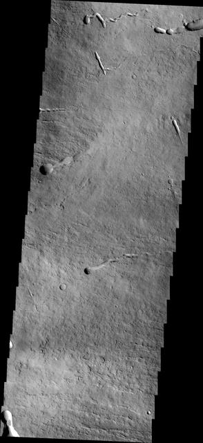
This VIS image is located where the southeastern flank of Ascraeus Mons meets the surrounding volcanic plains. Ascraeus Mons is the northernmost of the three large Tharsis volcanoes. Orbit Number: 77732 Latitude: 8.72838 Longitude: 257.08 Instrument: VIS Captured: 2019-06-23 18:20 https://photojournal.jpl.nasa.gov/catalog/PIA23369
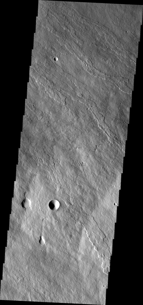
Today's image shows the southwestern flank of Ascraeus Mons. Ascraeus is the northenmost of the three aligned Tharsis volcanoes and is the tallest at 18,225meters (59,793ft). Orbit Number: 82112 Latitude: 9.73717 Longitude: 253.773 Instrument: VIS Captured: 2020-06-18 10:06 https://photojournal.jpl.nasa.gov/catalog/PIA24141
This VIS image shows part of the complex caldera at the summit of Ascraeus Mons. Ascraeus Mons is the northernmost and tallest of the three large aligned Tharsis volcanoes. Calderas are found at the tops of volcanoes and are the source region for magma that rises from an underground lava source to erupt at the surface. Volcanoes are formed by repeated flows from the central caldera. The final eruptions can pool within the summit caldera, leaving a flat surface as they cool. Calderas are also a location of collapse, creating rings of tectonic faults that form the caldera rim. Ascraeus Mons has several caldera features at its summit. Ascraeus Mons is 18 km (11 miles) tall, for comparison Mauna Kea – the tallest volcano on Earth – is 10 km tall (6.2 miles, measured from the base below sea level). Orbit Number: 89125 Latitude: 11.0029 Longitude: 256.08 Instrument: VIS Captured: 2022-01-16 20:38 https://photojournal.jpl.nasa.gov/catalog/PIA25349
This VIS image shows part of the complex caldera at the summit of Ascraeus Mons. Ascraeus Mons is the northernmost and tallest of the three large aligned Tharsis volcanoes. Calderas are found at the tops of volcanoes and are the source region for magma that rises from an underground lava source to erupt at the surface. Volcanoes are formed by repeated flows from the central caldera. The final eruptions can pool within the summit caldera, leaving a flat surface as they cool. Calderas are also a location of collapse, creating rings of tectonic faults that form the caldera rim. Ascraeus Mons has several caldera features at its summit. Ascraeus Mons is 18 km (11 miles) tall, for comparison Mauna Kea — the tallest volcano on Earth — is 10 km tall (6.2 miles, measured from the base below sea level). Orbit Number: 79142 Latitude: 11.5042 Longitude: 256.023 Instrument: VIS Captured: 2019-10-17 20:56 https://photojournal.jpl.nasa.gov/catalog/PIA23575
This VIS image shows part of the summit of Ascraeus Mons. Ascraeus Mons is the northernmost and tallest of the three large aligned Tharsis volcanoes. Calderas are found at the tops of volcanoes and are the source region for magma that rises from an underground lava source to erupt at the surface. Volcanoes are formed by repeated flows from the central caldera. The final eruptions can pool within the summit caldera, leaving a flat surface as they cool. Calderas are also a location of collapse, creating rings of tectonic faults that form the caldera rim. Ascraeus Mons has several caldera features at its summit. Ascraeus Mons is 18 km (11 miles) tall, for comparison Mauna Kea – the tallest volcano on Earth – is 10 km tall (6.2 miles, measured from the base below sea level). Orbit Number: 94366 Latitude: 11.3736 Longitude: 255.73 Instrument: VIS Captured: 2023-03-24 09:40 https://photojournal.jpl.nasa.gov/catalog/PIA26021
This image from NASA 2001 Mars Odyssey spacecraft shows the complex collapse features on the southern flank of Ascraeus Mons.
This image from NASA Mars Odyssey shows lava channels and collapse features on the southwestern flank of Ascraeus Mons.

The lava flows in this image from NASA 2001 Mars Odyssey spacecraft are part of Ascraeus Mons.

This image captured by NASA 2001 Mars Odyssey spacecraft shows part of the complex caldera at the summit of Ascraeus Mons.
The lava flows and collapse features in this image from NASA 2001 Mars Odyssey spacecraft are located near Ascraeus Mons.
This image captured by NASA 2001 Mars Odyssey shows the southern summit caldera of Ascraeus Mons.
This image from NASA Mars Odyssey shows collapse features on the southwest flank of Ascraeus Mons.
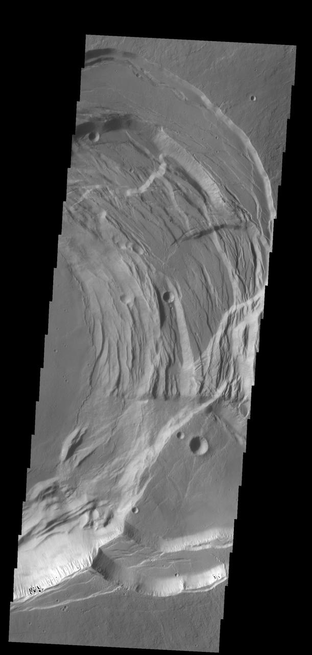
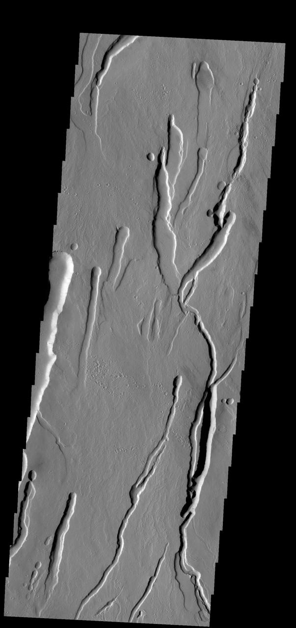
The many channels in this image captured by NASA 2001 Mars Odyssey spacecraft are volcanic collapse features on the southern flank of Ascraeus Mons.
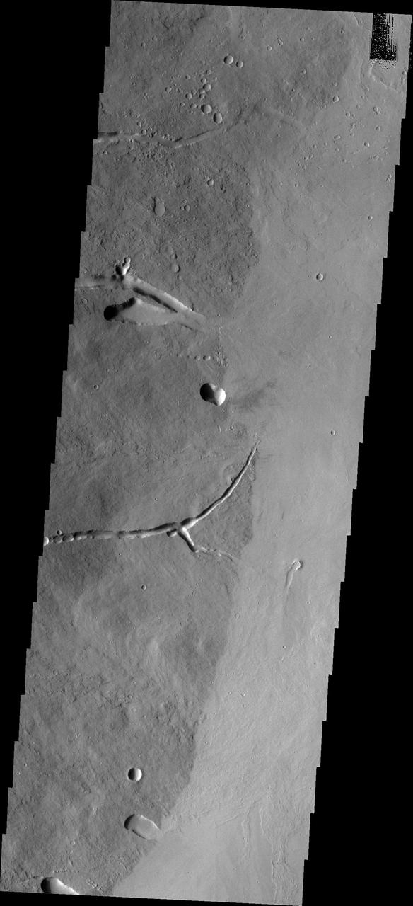
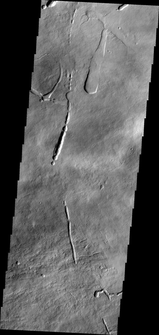
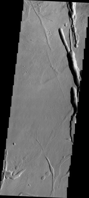
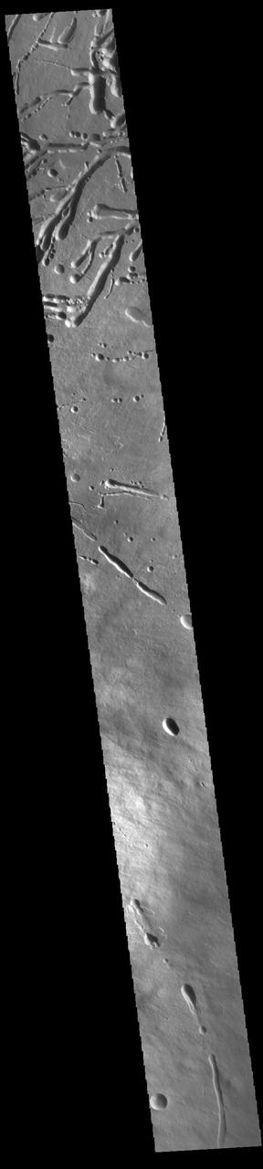
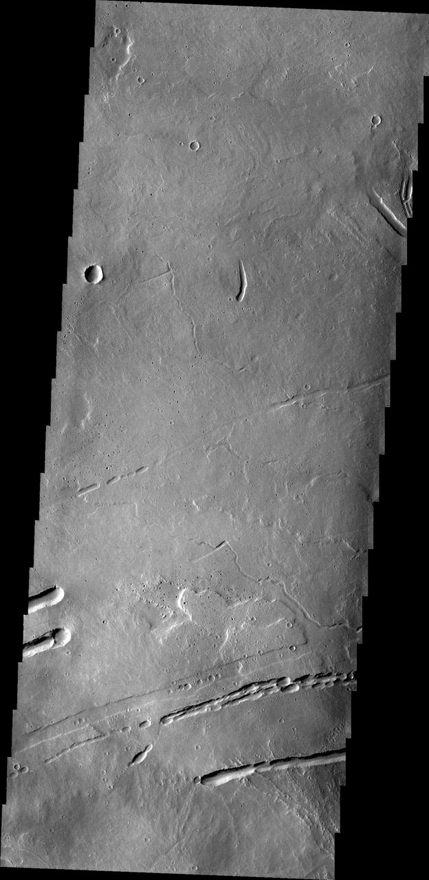
Taken by NASA 2001 Mars Odyssey spacecraft, this image of the northeastern flank of Ascraeus Mons shows several volcanic channels.
This image from NASA 2001 Mars Odyssey spacecraft of the eastern flank of Ascraeus Mons shows multiple collapse features.
This image captured by NASA 2001 Mars Odyssey shows a portion of the northeastern flank of Ascraeus Mons.
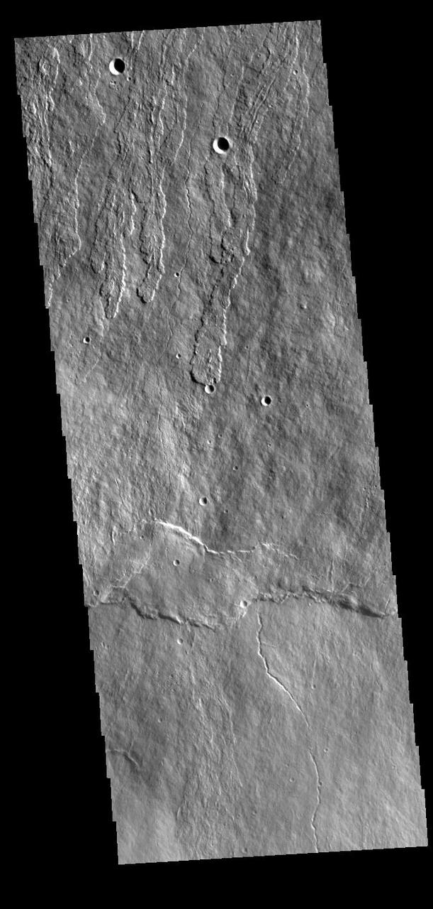
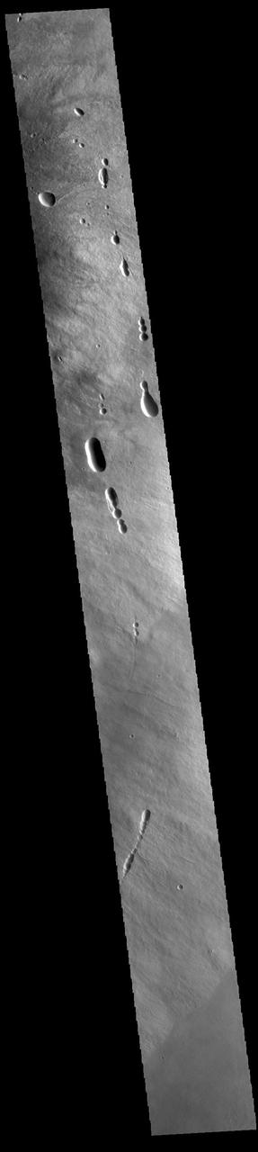
The pits in this image from NASA 2001 Mars Odyssey spacecraft are collapse features on the northern flank of Ascraeus Mons.
This image captured by NASA 2001 Mars Odyssey spacecraft shows part of the summit caldera of Ascraeus Mons.
The lava flows and other volcanic features in this VIS image are part of Ascraeus Mons. Ascraeus Mons is the middle volcano in the aligned Tharsis Montes. Orbit Number: 77832 Latitude: 7.57479 Longitude: 251.986 Instrument: VIS Captured: 2019-07-01 23:58 https://photojournal.jpl.nasa.gov/catalog/PIA23392
This VIS image shows part of the complex caldera at the summit of Ascraeus Mons. Ascraeus Mons is the northernmost and tallest of the three large aligned Tharsis volcanoes. Calderas are found at the tops of volcanoes and are the source region for magma that rises from an underground lava source to erupt at the surface. Volcanoes are formed by repeated flows from the central caldera. The final eruptions can pool within the summit caldera, leaving a flat surface as they cool. Calderas are also a location of collapse, creating rings of tectonic faults that form the caldera rim. Ascraeus Mons has several caldera features at its summit. Ascraeus Mons is 18 km (11 miles) tall, for comparison Mauna Kea – the tallest volcano on Earth – is 10 km tall (6.2 miles, measured from the base below sea level). Orbit Number: 86205 Latitude: 11.3492 Longitude: 255.876 Instrument: VIS Captured: 2021-05-21 10:18 https://photojournal.jpl.nasa.gov/catalog/PIA24227
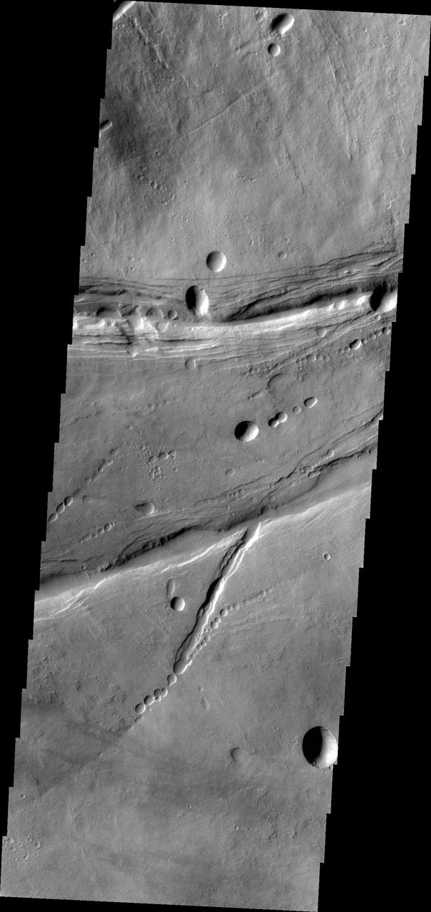
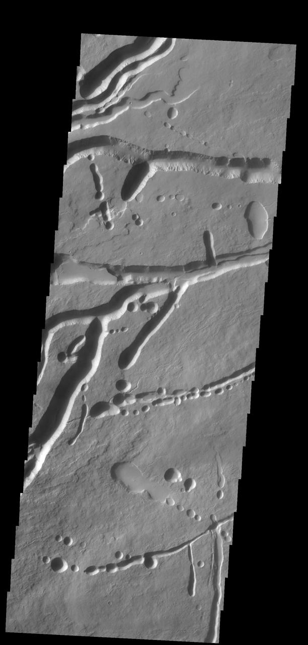
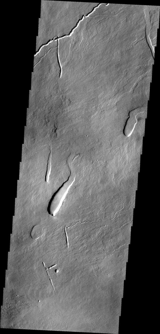
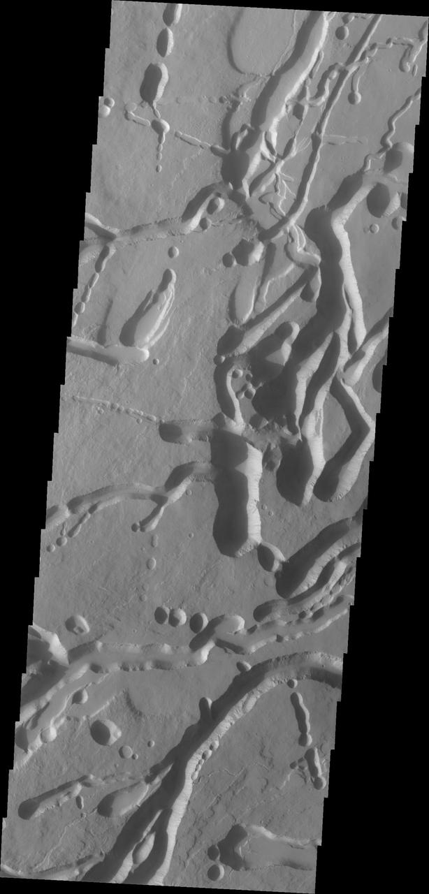
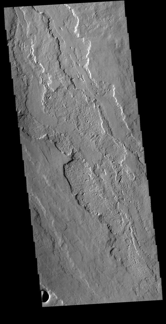
The fractures, collapse features and lava flows in this image captured by NASA 2001 Mars Odyssey spacecraft are all located on the northern flank of Ascraeus Mons.
This image shows a different portion of the collapse features located on the northern flank of Ascraeus Mons as seen by NASA 2001 Mars Odyssey spacecraft.
The linear and circular features in this image from NASA Mars Odyssey spacecraft are all volcanic and are located at the base of the southern flank of Ascraeus Mons.
This image of the southern flank of Ascraeus Mons, taken by NASA 2001 Mars Odyssey spacecraft, shows a small sample of collapse features that are common in the area.
This image captured by NASA 2001 Mars Odyssey spacecraft shows the eastern part of the complex caldera at the summit of Ascraeus Mons.

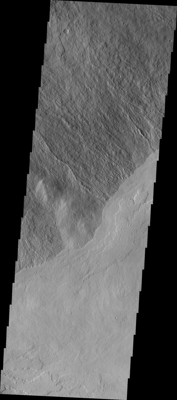
Today's image shows the contact of the southern flank of Ascraeus Mons and the surrounding Tharsis region lava flows. This boundary contains several tectonic factures and collapse features. Ascraeus is the northenmost of the three aligned Tharsis volcaones and is the tallest at 18,225meters (59,793ft). Orbit Number: 82062 Latitude: 8.4003 Longitude: 256.42 Instrument: VIS Captured: 2020-06-14 07:17 https://photojournal.jpl.nasa.gov/catalog/PIA24120
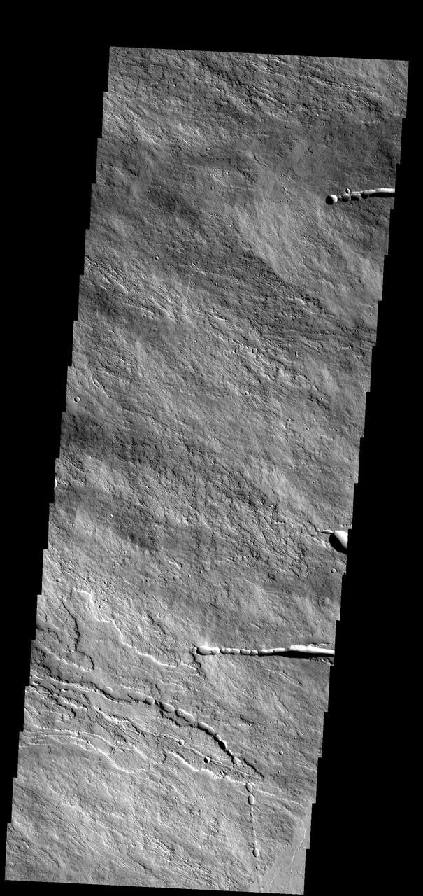
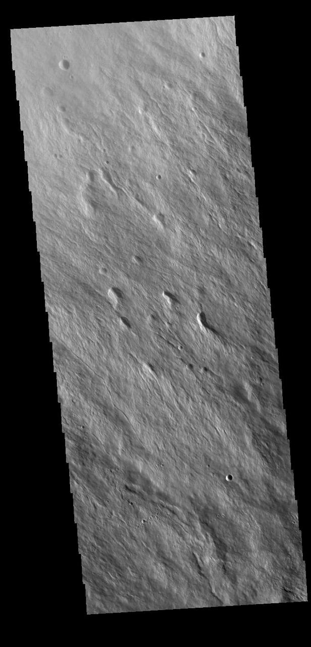
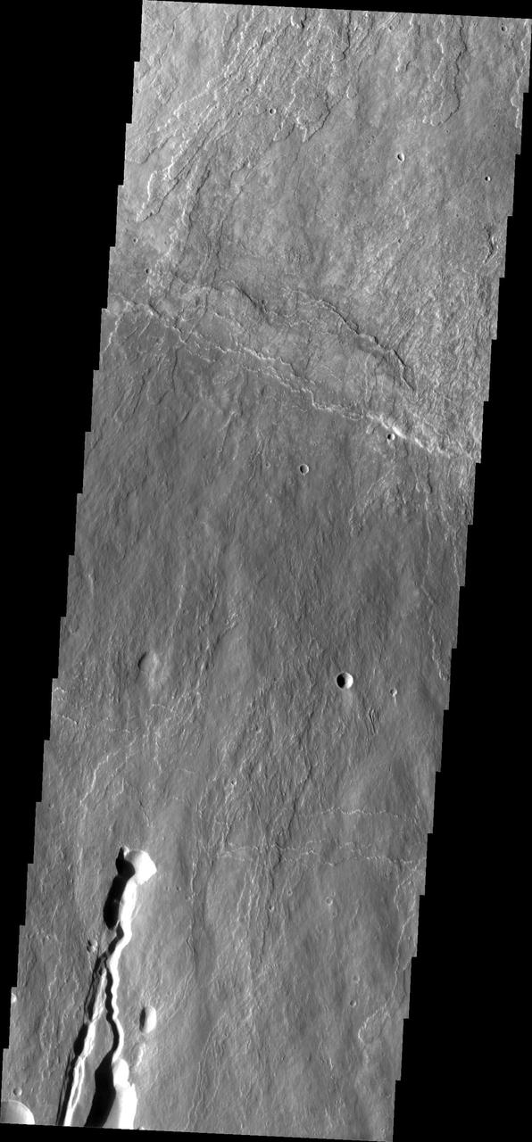
Today's VIS image shows part of the flank of Ascraeus Mons. Thin lava flows are visible. Ascraeus Mons is the northernmost of the three large Tharsis volcanoes and is the tallest at 18km (11 miles) high. Orbit Number: 87403 Latitude: 10.0053 Longitude: 255.249 Instrument: VIS Captured: 2021-08-28 01:41 https://photojournal.jpl.nasa.gov/catalog/PIA25222
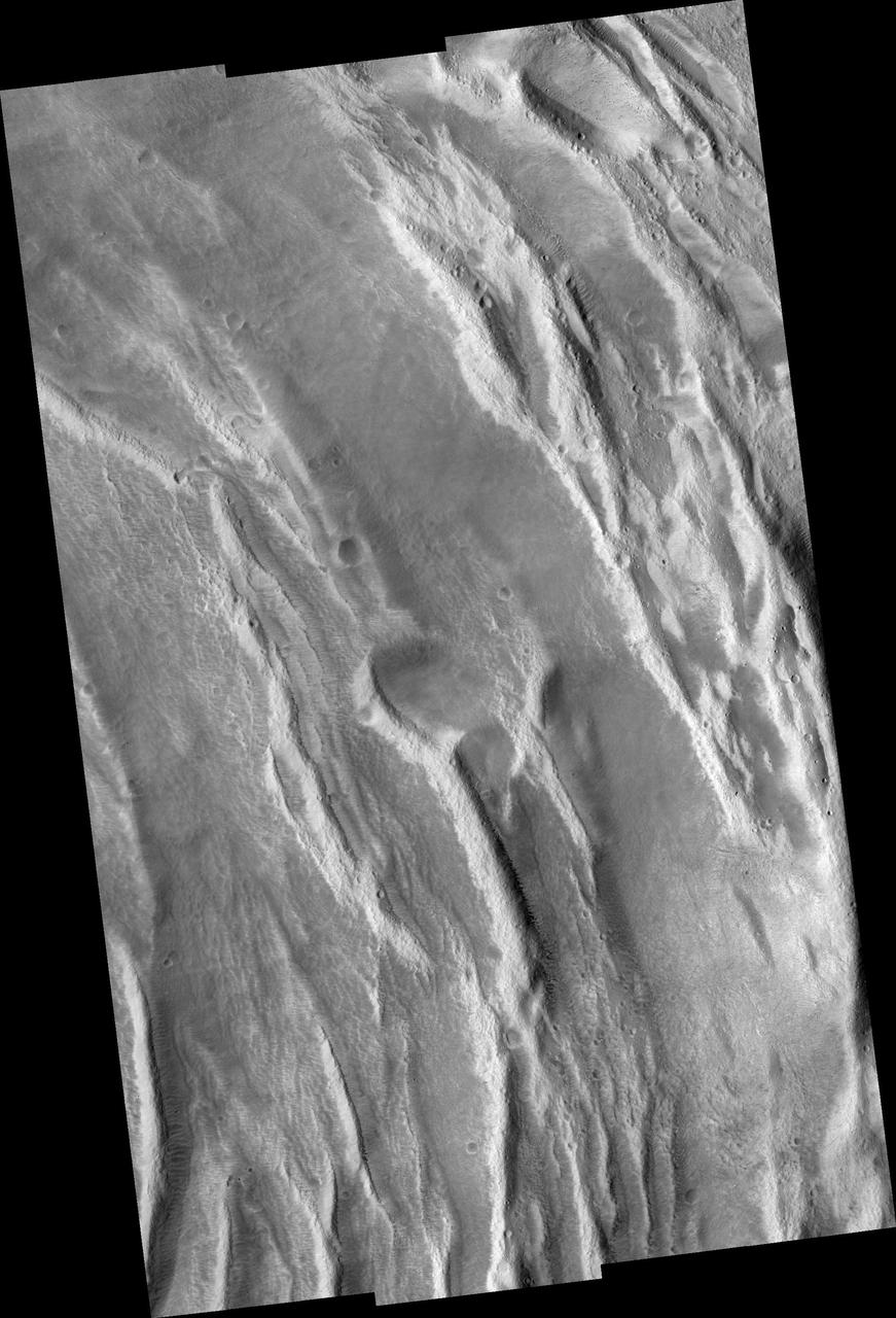
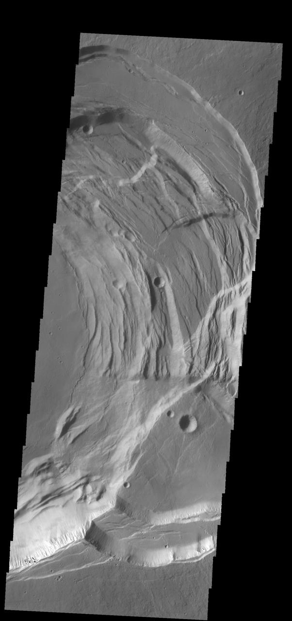
This VIS image shows a cross section of the eastern flank of Ascraeus Mons. Ascreaus Mons is the northernmost volcano of the three large Tharsis volcanoes. In order from north to south the volcanoes are Ascreaus Mons, Pavonis Mons and Arsia Mons. All three volcanoes form a line located along a tectonic bulge caused by extensional forces in the region. Along this trend there are increased tectonic features, collapse features, and additional lava flows that arose from the flanks of the volcanoes rather than just the summit. Like the other large volcanoes in the region, Ascraeus Mons is a shield volcano. Shield volcanoes are formed by lava flows originating near or at the summit, building up layers upon layers of lava. In shield volcanoes summit calderas are typically formed where the surface collapses into the void formed by an emptied magma chamber. Ascraeus Mons is the largest of the three volcanoes with a summit of 18km (11 miles) and a width of 460 km (286 miles). For comparison Mauna Kea – the tallest volcano on Earth – is 10 km tall (6.2 miles). Orbit Number: 94915 Latitude: 12.2183 Longitude: 257.543 Instrument: VIS Captured: 2023-05-08 14:33 https://photojournal.jpl.nasa.gov/catalog/PIA26218
Today's VIS image is located on the summit of Ascraeus Mons, one of the three large Tharsis region volcanoes. Orbit Number: 77470 Latitude: 11.1614 Longitude: 256.126 Instrument: VIS Captured: 2019-06-02 04:32 https://photojournal.jpl.nasa.gov/catalog/PIA23331
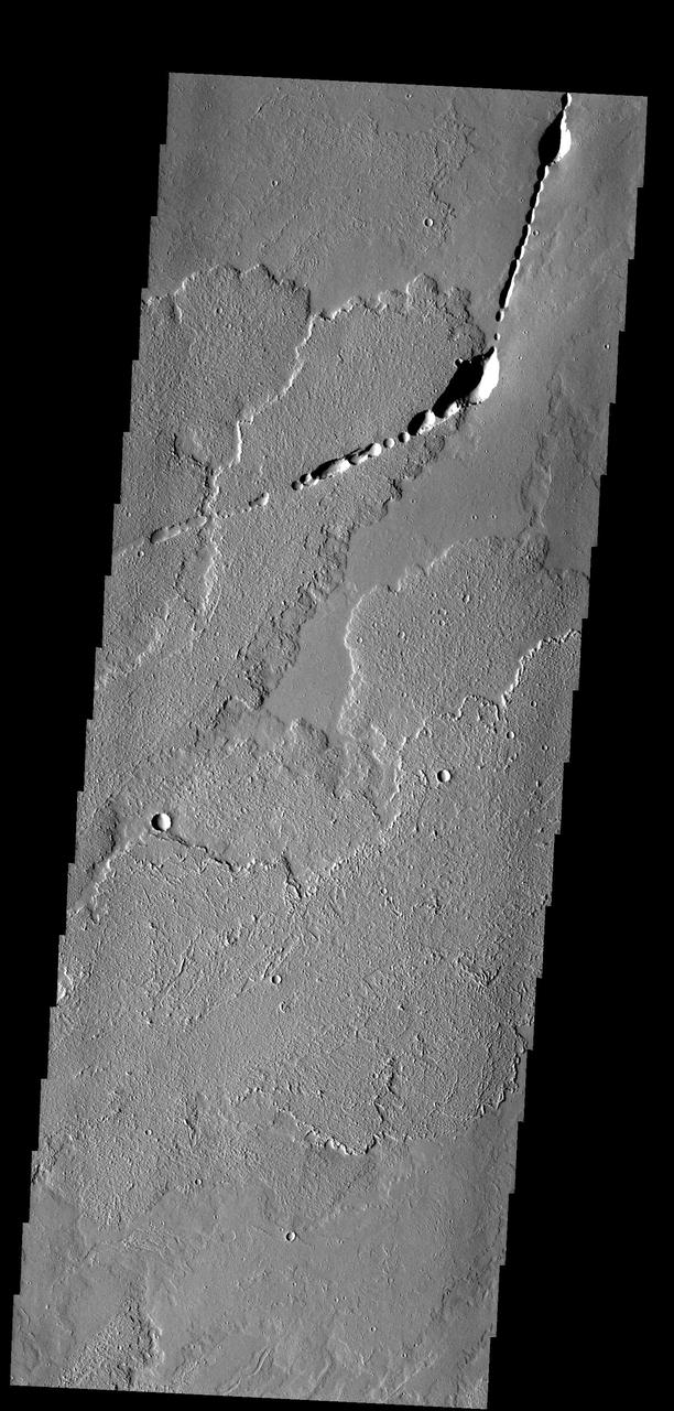
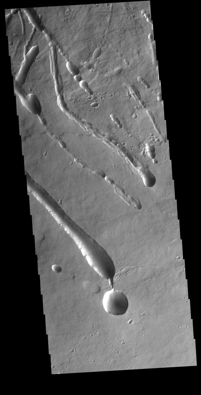
The pits, fractures and channel-like features captured by NASA 2001 Mars Odyssey spacecraft are located on the northern flank of Ascraeus Mons. Most of these features were created by collapse into lava tubes that existed below the surface.
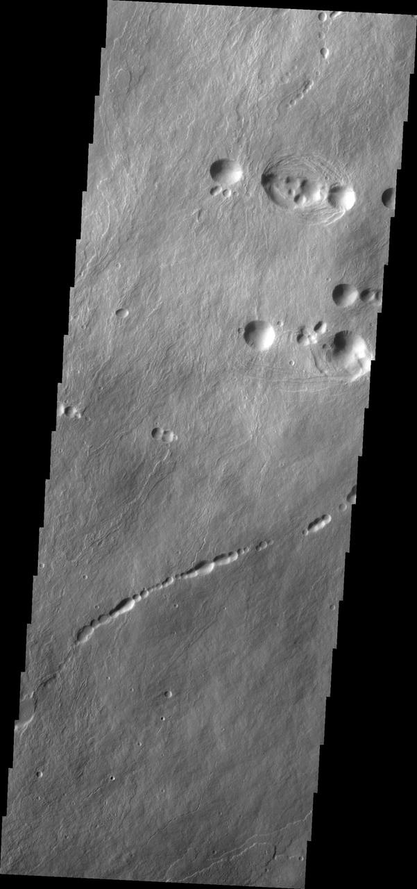
This image captured by NASA 2001 Mars Odyssey spacecraft shows part of the lava field just off the northern flank of Ascraeus Mons. The depressions are collapse features most likely related to lava tubes below the surface.

This image from NASA Mars Odyssey shows part of the eastern flank of Ascraeus Mons, one of the large Tharsis Volcanoes. The circular pits all aligned in a row mark the collapse of the roof of a lava tube.
This image from NASA 2001 Mars Odyssey shows part of the northeastern flank of Ascraeus Mons, one of the large Tharsis volcanoes. The channels were carved by lava, not by water.
The surface textures observed in this NASA Mars Odyssey image of Ascraeus Mons are due to different volcanic flow types. Textural variations can be produced under a variety of different conditions such as varying cooling and flow rates.
This image from NASA 2001 Mars Odyssey spacecraf shows part of the southern flank of Ascraeus Mons. Large collapse features are common in this area.
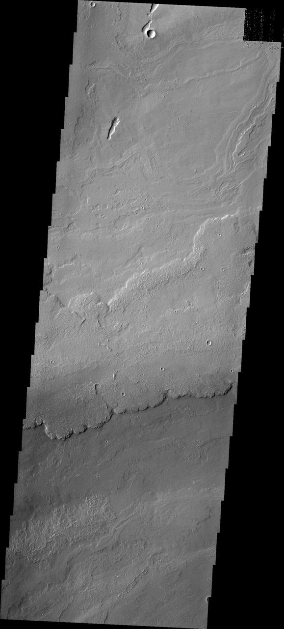
Today's image shows the eastern flank of Ascraeus Mons. Several tectonic fractures and collapse features, as well as lava flows, are visible in the image. Ascraeus Mons is the northernmost of the three aligned Tharsis volcanoes and is the tallest at 18 km (11 miles). Orbit Number: 85868 Latitude: 11.0537 Longitude: 257.947 Instrument: VIS Captured: 2021-04-23 16:21 https://photojournal.jpl.nasa.gov/catalog/PIA24881
Today's VIS image shows part of the northwestern upper flank of Ascraeus Mons. Lava flows and collapse features cover the flank of the volcano. Ascraeus Mons is the northernmost of the three large Tharsis volcanoes and is the tallest at 18km (11 miles) high. For comparison Mauna Kea – the tallest volcano on Earth – is 10 km tall (6.2 miles, measured from the base below sea level). Orbit Number: 88002 Latitude: 12.7202 Longitude: 254.248 Instrument: VIS Captured: 2021-10-16 09:24 https://photojournal.jpl.nasa.gov/catalog/PIA25104
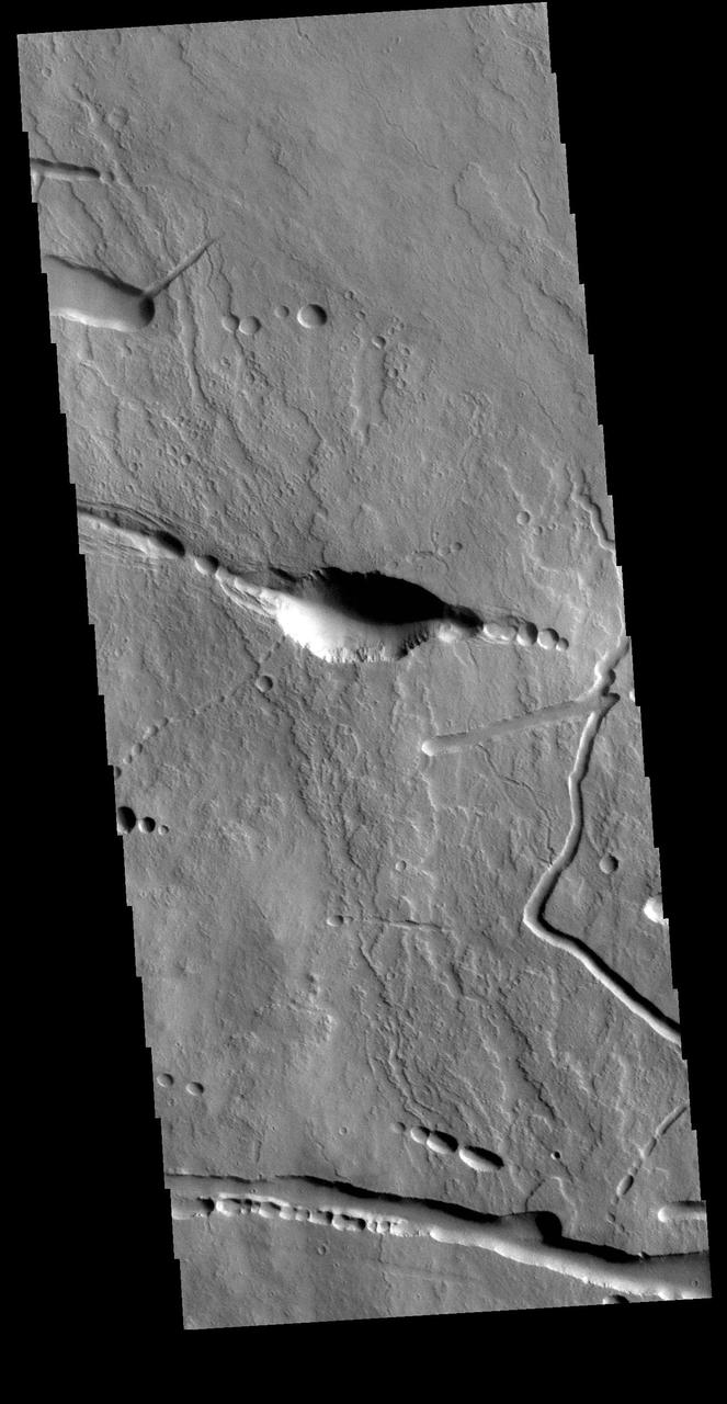
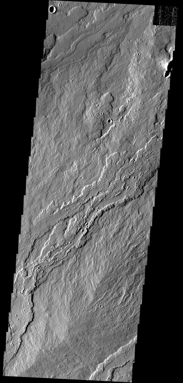
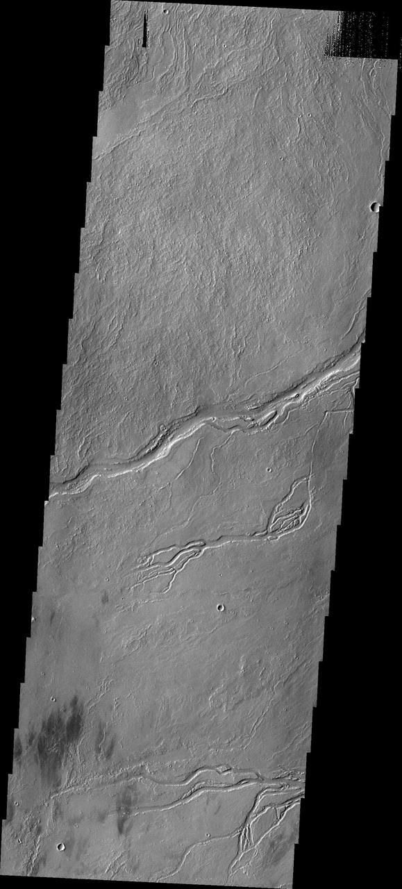
Today's VIS image shows a portion of the northern flank of Ascraeus Mons. Ascraeus Mons is the northernmost of the three large aligned Tharsis volcanoes. All three have extensive flank deposits along the northeast/southwest trend connecting the volcanoes. In today's image volcanic lava flows are visible along with tectonic features and collapse features. Collapse into underlying lava tubes will create a what looks like a series of craters along a tectonic trend. Orbit Number: 79404 Latitude: 15.2404 Longitude: 256.725 Instrument: VIS Captured: 2019-11-08 10:44 https://photojournal.jpl.nasa.gov/catalog/PIA23660
Today's VIS image shows a very small portion of the extensive lava flows of the Tharsis volcanic complex. These flows are located southeast of Ascraeus Mons. Orbit Number: 64473 Latitude: 5.06074 Longitude: 260.881 Instrument: VIS Captured: 2016-06-26 12:47 http://photojournal.jpl.nasa.gov/catalog/PIA20971
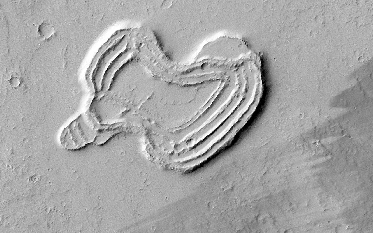
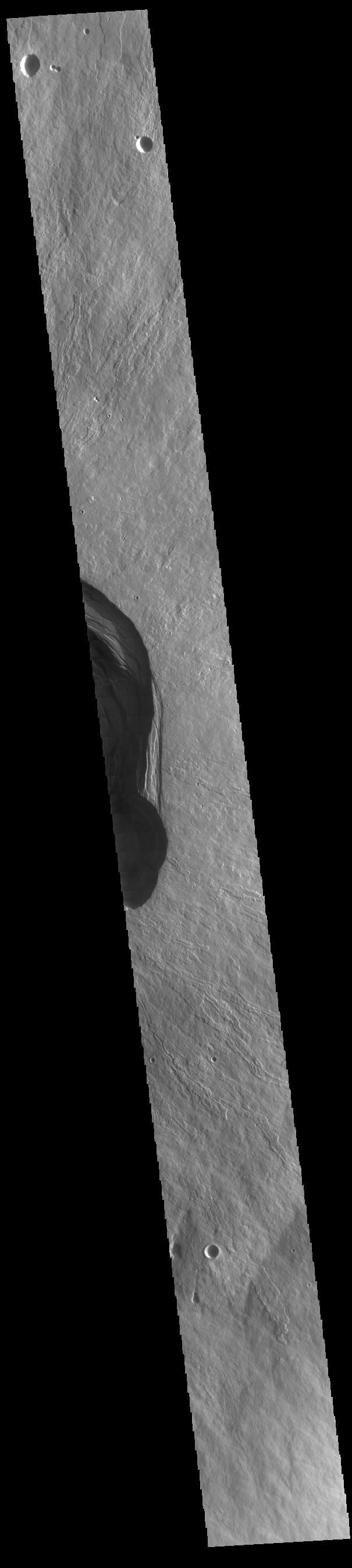
This feature from NASA Mars Reconnaissance Orbiter looks like a heart. It is located south of Ascraeus Mons, which is a large volcano within the Tharsis volcanic plateau, making it extremely likely that this feature was formed by a volcanic process.
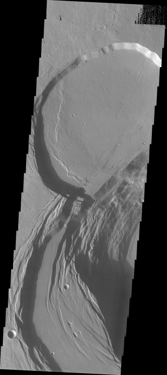
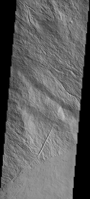
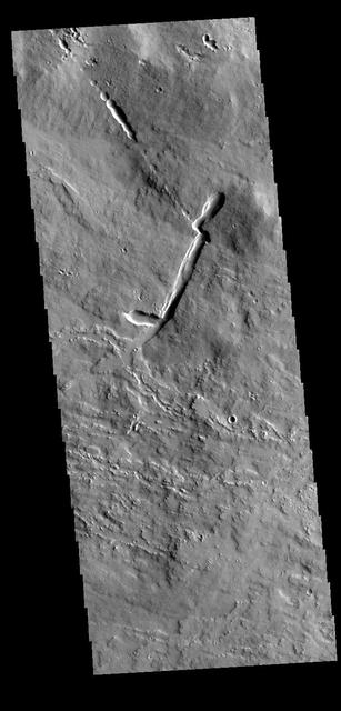
The linear features in this VIS image are located on part of the large flow feature on the southern flank of Ascraeus Mons. The features most likely formed by collapse of the surface into voids created by tube fed lava flows. Orbit Number: 74376 Latitude: 8.57379 Longitude: 253.317 Instrument: VIS Captured: 2018-09-20 09:08 https://photojournal.jpl.nasa.gov/catalog/PIA22843
The THEMIS VIS camera contains 5 filters. The data from different filters can be combined in multiple ways to create a false color image. This false color image from NASA 2001 Mars Odyssey spacecraft shows the southern flank of Ascraeus Mons.
This image shows part of the southeastern flank of Ascraeus Mons. The narrow flows of the volcano dominate the top of the image, while younger volcanic plains cover the bottom of the image. The relative age designation is based on the fact that the brighter plains flows lap up against and cover the flank flows of Ascraeus Mons. The Odyssey spacecraft has spent over 15 years in orbit around Mars, circling the planet more than 69000 times. It holds the record for longest working spacecraft at Mars. THEMIS, the IR/VIS camera system, has collected data for the entire mission and provides images covering all seasons and lighting conditions. Over the years many features of interest have received repeated imaging, building up a suite of images covering the entire feature. From the deepest chasma to the tallest volcano, individual dunes inside craters and dune fields that encircle the north pole, channels carved by water and lava, and a variety of other feature, THEMIS has imaged them all. For the next several months the image of the day will focus on the Tharsis volcanoes, the various chasmata of Valles Marineris, and the major dunes fields. We hope you enjoy these images! Orbit Number: 10339 Latitude: 9.01699 Longitude: 257.294 Instrument: VIS Captured: 2004-04-13 17:23 https://photojournal.jpl.nasa.gov/catalog/PIA21820
This crater is located on the flank of Ascraeus Mons
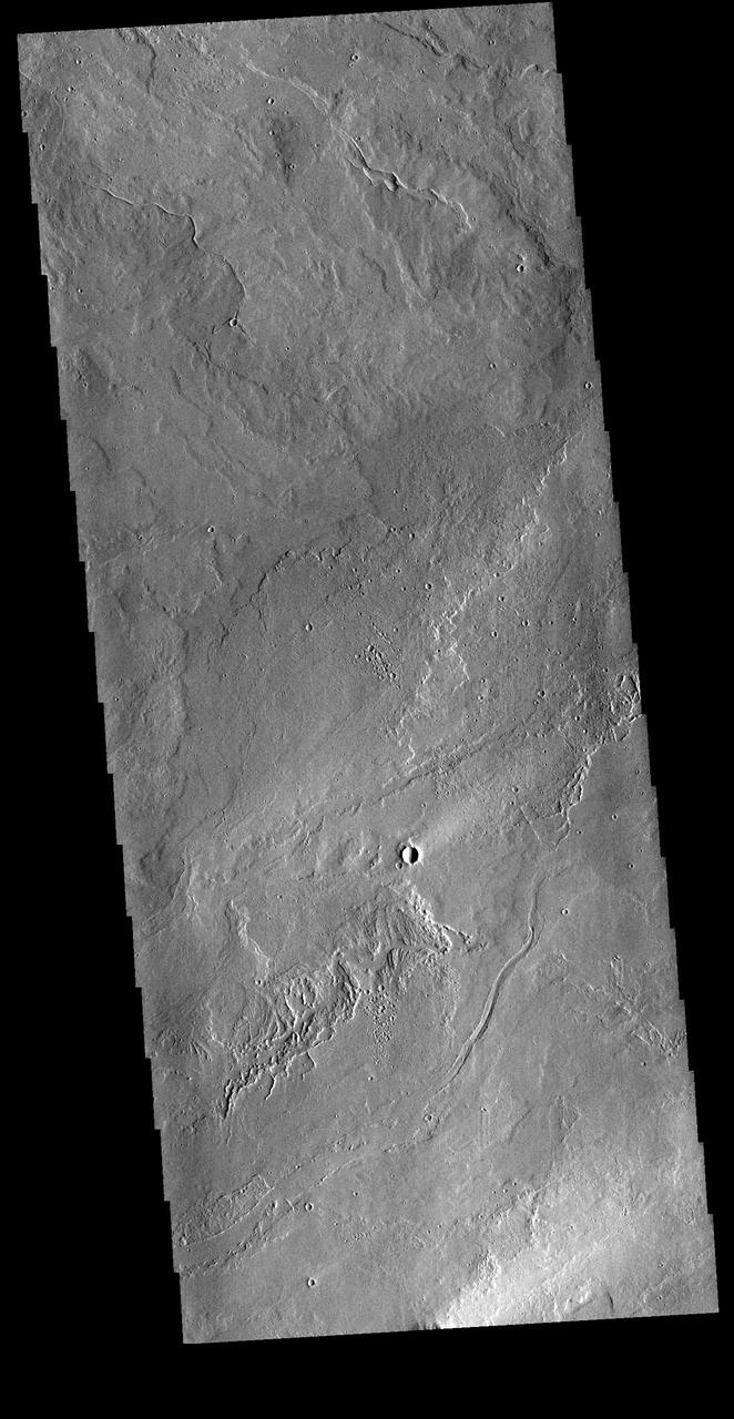
These lava flows are associated with Ascraeus Mons
This image shows part of the southern flank of Ascraeus Mons. The feature at the bottom of the image is a collapse feature. These features can be caused by several processes. The ceiling of lava tubes can collapse into the open space left after the last flow. Tectonic activity can occur, and blocks of material can drop down between faults. The tectonic features are called graben. All three of the Tharsis volcanoes (Ascraeus, Pavonis and Arsia mons) are aligned along a northeast/southwest trend. The largest region of collapse features on each of the three volcanoes are located along this trend. The Odyssey spacecraft has spent over 15 years in orbit around Mars, circling the planet more than 69000 times. It holds the record for longest working spacecraft at Mars. THEMIS, the IR/VIS camera system, has collected data for the entire mission and provides images covering all seasons and lighting conditions. Over the years many features of interest have received repeated imaging, building up a suite of images covering the entire feature. From the deepest chasma to the tallest volcano, individual dunes inside craters and dune fields that encircle the north pole, channels carved by water and lava, and a variety of other feature, THEMIS has imaged them all. For the next several months the image of the day will focus on the Tharsis volcanoes, the various chasmata of Valles Marineris, and the major dunes fields. We hope you enjoy these images! Orbit Number: 18376 Latitude: 9.77446 Longitude: 254.826 Instrument: VIS Captured: 2006-02-04 10:32 https://photojournal.jpl.nasa.gov/catalog/PIA21824
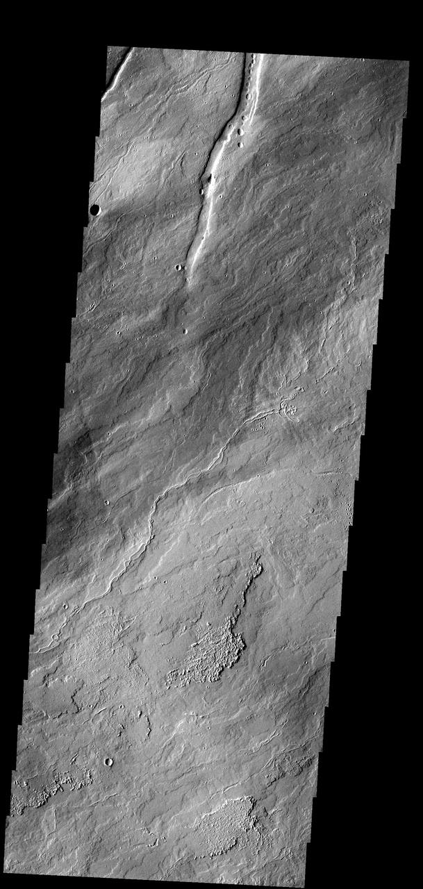
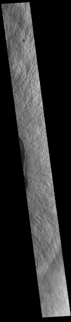
This image of the flank of Ascraeus Mons shows several individual flows where the sides are higher than the center. These are called leveed flows, as the outer margin acts as a levee containing the flow as it continues downslope. Levees grow as the flow margins start to cool. The hotter liquid lava continues as long as the source flows. The Odyssey spacecraft has spent over 15 years in orbit around Mars, circling the planet more than 69000 times. It holds the record for longest working spacecraft at Mars. THEMIS, the IR/VIS camera system, has collected data for the entire mission and provides images covering all seasons and lighting conditions. Over the years many features of interest have received repeated imaging, building up a suite of images covering the entire feature. From the deepest chasma to the tallest volcano, individual dunes inside craters and dune fields that encircle the north pole, channels carved by water and lava, and a variety of other feature, THEMIS has imaged them all. For the next several months the image of the day will focus on the Tharsis volcanoes, the various chasmata of Valles Marineris, and the major dunes fields. We hope you enjoy these images! Orbit Number: 18039 Latitude: 10.3245 Longitude: 256.26 Instrument: VIS Captured: 2006-01-07 16:37 https://photojournal.jpl.nasa.gov/catalog/PIA21823

NASA Mars Odyssey shows Rhabon Valles, a lava channel located between Ascraeus Mons and Uranius Mons.
The volcanic flows in image from NASA 2001 Mars Odyssey spacecraft are located south of Ascraeus Mons and east of Pavonis Mons.

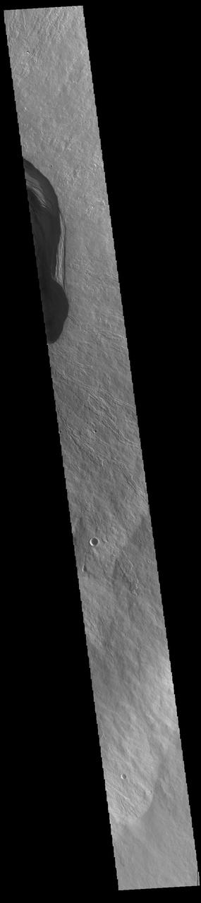
The dark windstreaks in this image are located on volcanic flows northwest of Ascraeus Mons
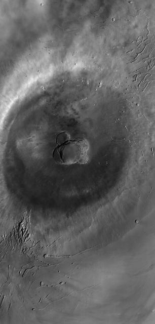
This image shows part of the complex caldera at the summit of the volcano. Calderas are found at the tops of volcanoes and are the source region for magma that rises from an underground lava source to erupt at the surface. Volcanoes are formed by repeated flows from the central caldera. The final eruptions can pool within the summit caldera, leaving a flat surface as they cool. This image shows part of two of the summit calderas, each with a floor at different elevations. Calderas are also a location of collapse, creating rings of tectonic faults that form the caldera rim. Ascraeus Mons has several caldera features at its summit. The Odyssey spacecraft has spent over 15 years in orbit around Mars, circling the planet more than 69000 times. It holds the record for longest working spacecraft at Mars. THEMIS, the IR/VIS camera system, has collected data for the entire mission and provides images covering all seasons and lighting conditions. Over the years many features of interest have received repeated imaging, building up a suite of images covering the entire feature. From the deepest chasma to the tallest volcano, individual dunes inside craters and dune fields that encircle the north pole, channels carved by water and lava, and a variety of other feature, THEMIS has imaged them all. For the next several months the image of the day will focus on the Tharsis volcanoes, the various chasmata of Valles Marineris, and the major dunes fields. We hope you enjoy these images! Orbit Number: 63076 Latitude: 11.3749 Longitude: 255.364 Instrument: VIS Captured: 2016-03-03 11:14 https://photojournal.jpl.nasa.gov/catalog/PIA21830
This image shows part of the complex caldera at the summit of the volcano. Calderas are found at the tops of volcanoes and are the source region for magma that rises from an underground lava source to erupt at the surface. Volcanoes are formed by repeated flows from the central caldera. The final eruptions can pool within the summit caldera, leaving a flat surface as they cool. Calderas are also a location of collapse, creating rings of tectonic faults that form the caldera rim. Ascraeus Mons has several caldera features at its summit. The Odyssey spacecraft has spent over 15 years in orbit around Mars, circling the planet more than 69000 times. It holds the record for longest working spacecraft at Mars. THEMIS, the IR/VIS camera system, has collected data for the entire mission and provides images covering all seasons and lighting conditions. Over the years many features of interest have received repeated imaging, building up a suite of images covering the entire feature. From the deepest chasma to the tallest volcano, individual dunes inside craters and dune fields that encircle the north pole, channels carved by water and lava, and a variety of other feature, THEMIS has imaged them all. For the next several months the image of the day will focus on the Tharsis volcanoes, the various chasmata of Valles Marineris, and the major dunes fields. We hope you enjoy these images! Orbit Number: 17440 Latitude: 11.128 Longitude: 255.731 Instrument: VIS Captured: 2005-11-19 08:59 https://photojournal.jpl.nasa.gov/catalog/PIA21822

This image shows part of the complex caldera at the summit of the volcano. Calderas are found at the tops of volcanoes and are the source region for magma that rises from an underground lava source to erupt at the surface. Volcanoes are formed by repeated flows from the central caldera. The final eruptions can pool within the summit caldera, leaving a flat surface as they cool. Calderas are also a location of collapse, creating rings of tectonic faults that form the caldera rim. Ascraeus Mons has several caldera features at its summit. The Odyssey spacecraft has spent over 15 years in orbit around Mars, circling the planet more than 69000 times. It holds the record for longest working spacecraft at Mars. THEMIS, the IR/VIS camera system, has collected data for the entire mission and provides images covering all seasons and lighting conditions. Over the years many features of interest have received repeated imaging, building up a suite of images covering the entire feature. From the deepest chasma to the tallest volcano, individual dunes inside craters and dune fields that encircle the north pole, channels carved by water and lava, and a variety of other feature, THEMIS has imaged them all. For the next several months the image of the day will focus on the Tharsis volcanoes, the various chasmata of Valles Marineris, and the major dunes fields. We hope you enjoy these images! Orbit Number: 52847 Latitude: 11.2724 Longitude: 255.564 Instrument: VIS Captured: 2013-11-12 08:41 https://photojournal.jpl.nasa.gov/catalog/PIA21828
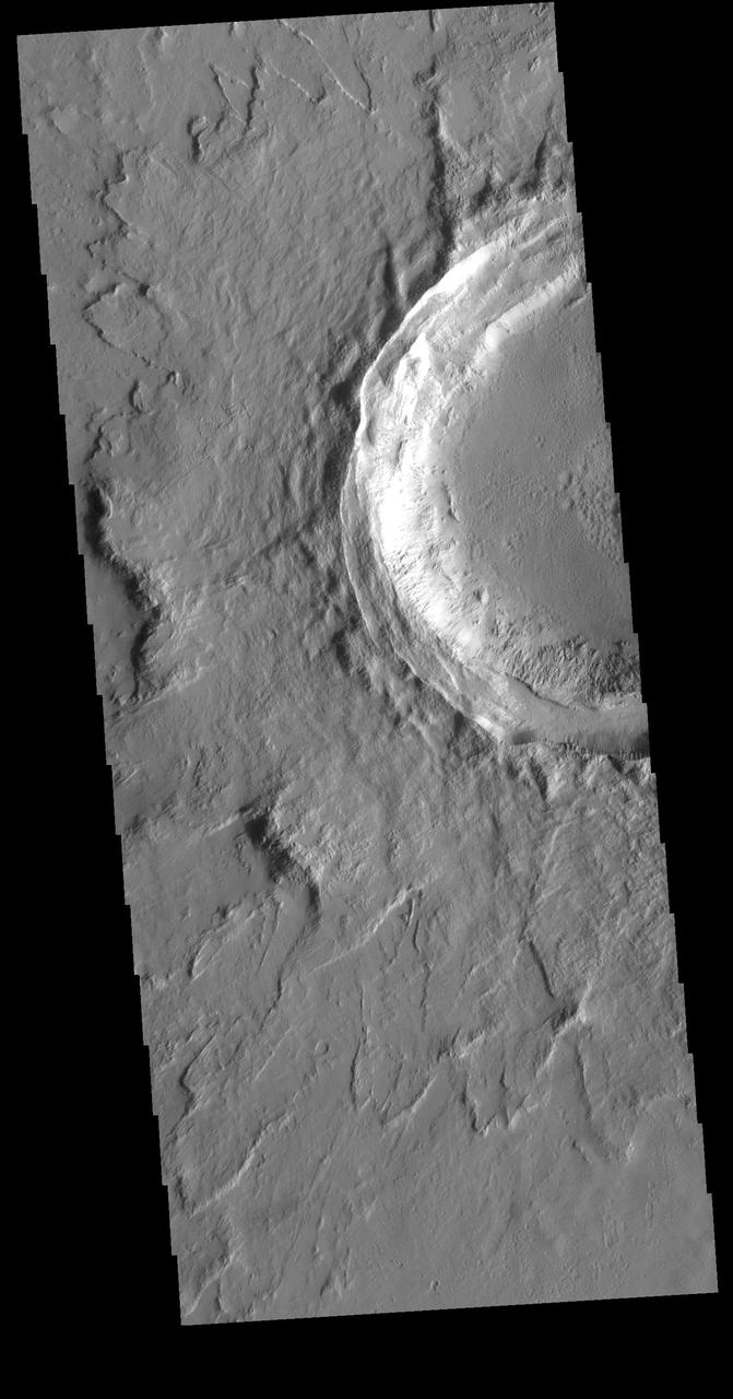
This image shows the eastern part of the complex caldera at the summit of the volcano. Calderas are found at the tops of volcanoes and are the source region for magma that rises from an underground lava source to erupt at the surface. Volcanoes are formed by repeated flows from the central caldera. The final eruptions can pool within the summit caldera, leaving a flat surface as they cool. Calderas are also a location of collapse, creating rings of tectonic faults that form the caldera rim. This image is dominated by the ring of faults that defines the outer margin of the caldera. Ascraeus Mons has several caldera features at its summit. The Odyssey spacecraft has spent over 15 years in orbit around Mars, circling the planet more than 69000 times. It holds the record for longest working spacecraft at Mars. THEMIS, the IR/VIS camera system, has collected data for the entire mission and provides images covering all seasons and lighting conditions. Over the years many features of interest have received repeated imaging, building up a suite of images covering the entire feature. From the deepest chasma to the tallest volcano, individual dunes inside craters and dune fields that encircle the north pole, channels carved by water and lava, and a variety of other feature, THEMIS has imaged them all. For the next several months the image of the day will focus on the Tharsis volcanoes, the various chasmata of Valles Marineris, and the major dunes fields. We hope you enjoy these images! Orbit Number: 53334 Latitude: 11.2134 Longitude: 255.911 Instrument: VIS Captured: 2013-12-22 10:29 https://photojournal.jpl.nasa.gov/catalog/PIA21829
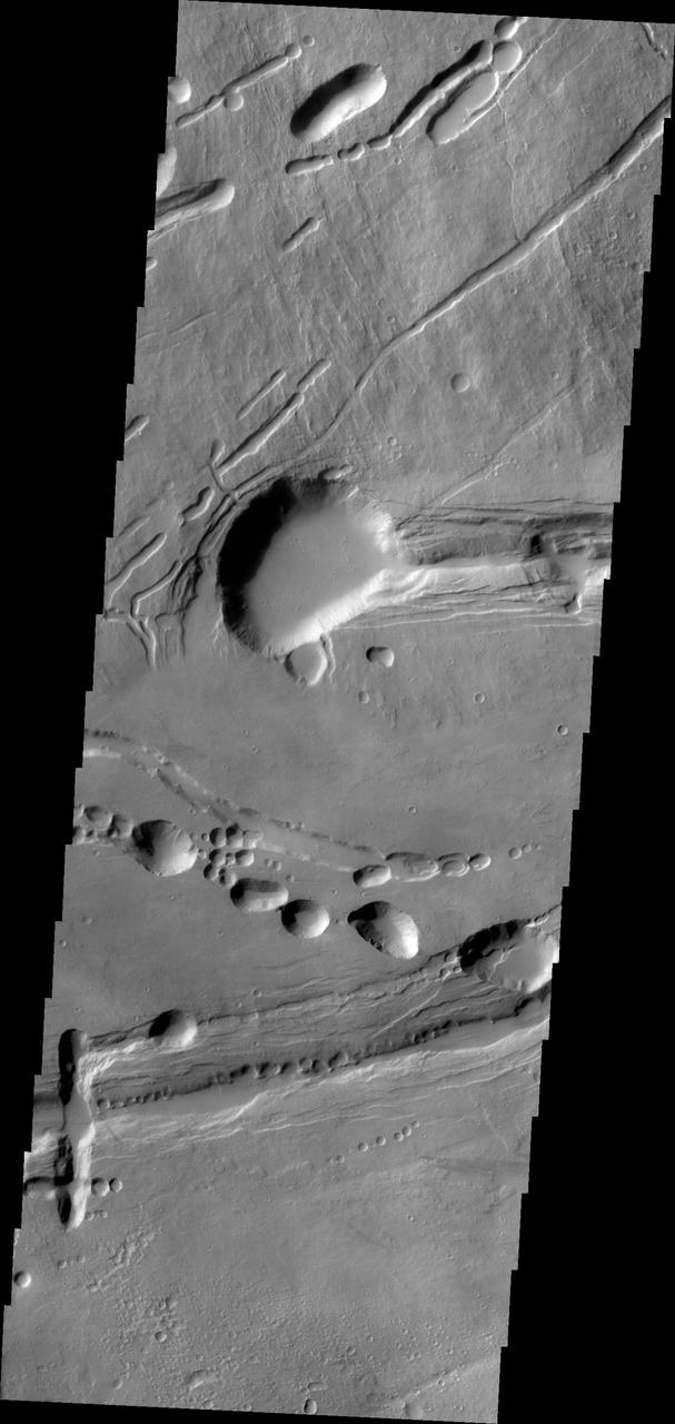
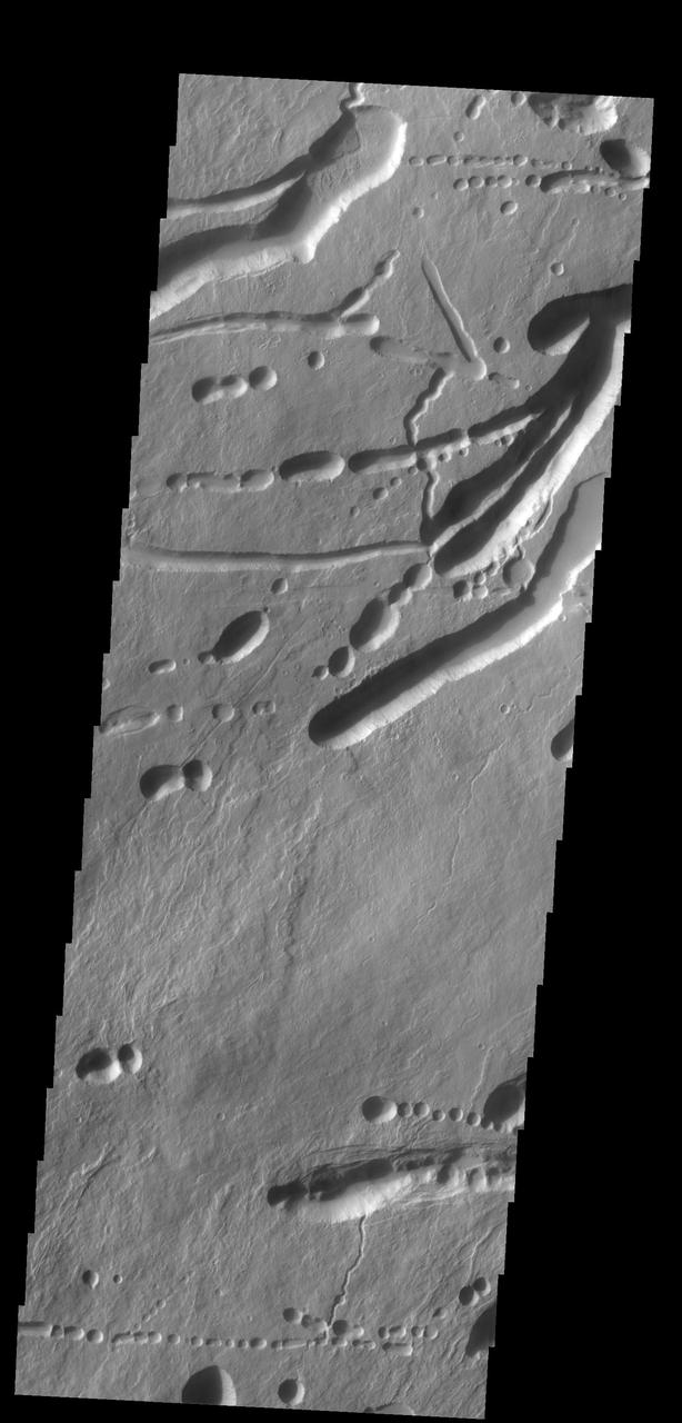
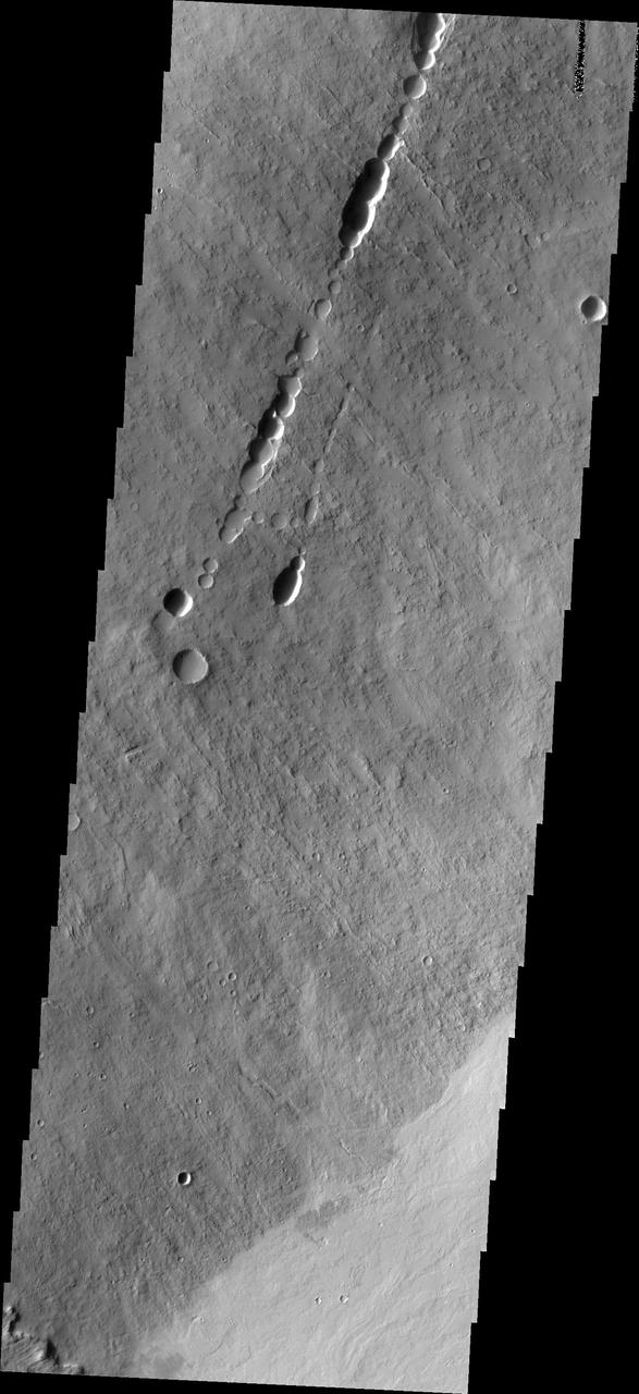
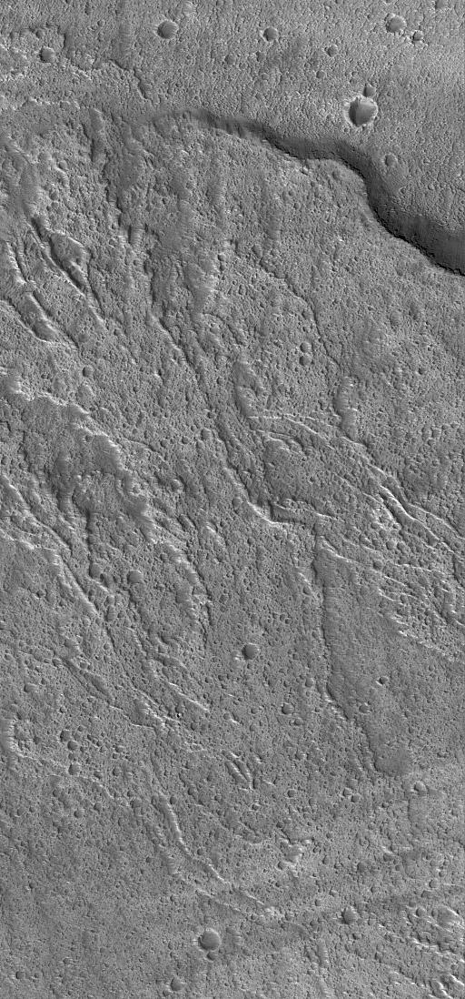
This image shows part of the northeastern flank of Ascraeus Mons, along the trend that joins the three large Tharsis volcanoes. The image has a myriad of collapse features from circular to linear outlines. The majority of the collapse features don't interact with the surface lava flows, indicating that the collapse features were formed after the main emplacement of lava flows from the summit and near summit vents. The Odyssey spacecraft has spent over 15 years in orbit around Mars, circling the planet more than 69000 times. It holds the record for longest working spacecraft at Mars. THEMIS, the IR/VIS camera system, has collected data for the entire mission and provides images covering all seasons and lighting conditions. Over the years many features of interest have received repeated imaging, building up a suite of images covering the entire feature. From the deepest chasma to the tallest volcano, individual dunes inside craters and dune fields that encircle the north pole, channels carved by water and lava, and a variety of other feature, THEMIS has imaged them all. For the next several months the image of the day will focus on the Tharsis volcanoes, the various chasmata of Valles Marineris, and the major dunes fields. We hope you enjoy these images! Orbit Number: 19886 Latitude: 12.7788 Longitude: 257.162 Instrument: VIS Captured: 2006-06-08 18:15 https://photojournal.jpl.nasa.gov/catalog/PIA21827
The lava channels in this image from NASA 2001 Mars Odyssey spacecraft are located on the southern flank of Ascraeus Mons.
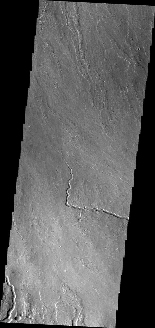
The lava channels in this image from NASA 2001 Mars Odyssey spacecraft are located on the northern flank of Ascraeus Mons.
Arsia Chasmata is a complex collapsed region at the northeastern flank of Arsia Mons. The collapsed region aligns with the Pavonis and Ascraeus Mons volcanoes, indicating that all three volcanoes are located on a major fracture in the Tharsis region.
The lava flows in this image from NASA 2001 Mars Odyssey spacecraft most likely originated from Ascraeus Mons, one of the large Tharsis volcanos.
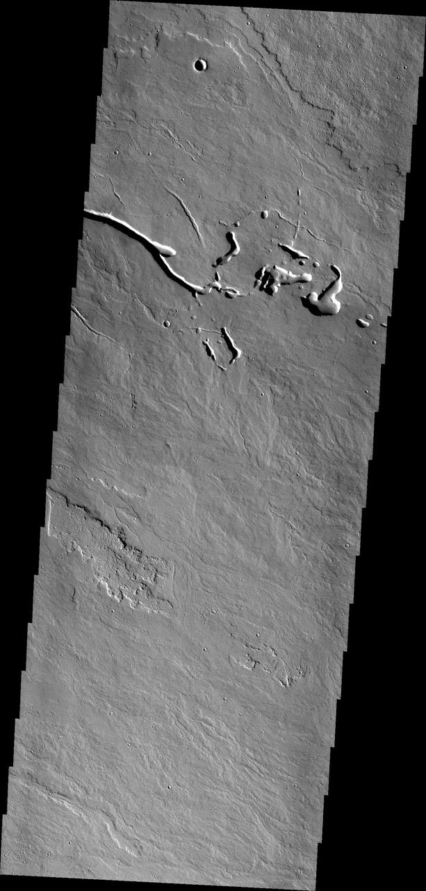
The channels in this image captured by NASA Mars Odyssey spacecraft were created by the flow of lava. This image shows part of the region between Pavonis and Ascraeus Mons.
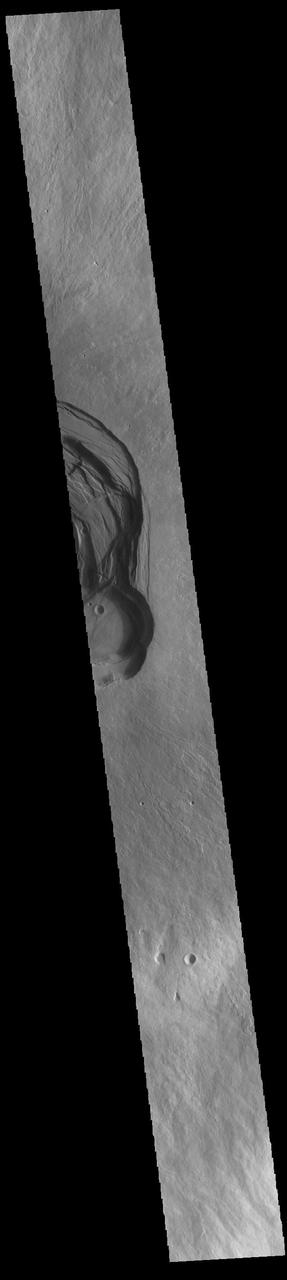
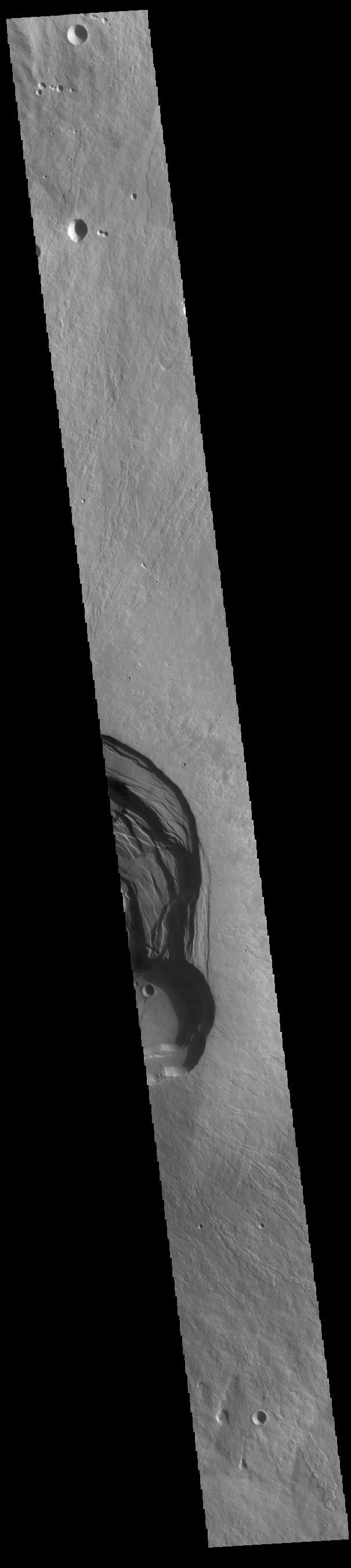
This image shows a collapse feature on the southeastern flank of the volcano. The circular/scalloped margin of the collapse is typical for ceiling collapse into a lava tube. However, the potential lava tube is perpendicular to the surface flows. The linear nature and relationship to the surface flows likely indicate that a preexisting tectonic graben occurred here and hosted lava flows that may have become lava tube flows. So in this case, the collapse feature formed by a combination of tectonic and volcanic processes. The Odyssey spacecraft has spent over 15 years in orbit around Mars, circling the planet more than 69000 times. It holds the record for longest working spacecraft at Mars. THEMIS, the IR/VIS camera system, has collected data for the entire mission and provides images covering all seasons and lighting conditions. Over the years many features of interest have received repeated imaging, building up a suite of images covering the entire feature. From the deepest chasma to the tallest volcano, individual dunes inside craters and dune fields that encircle the north pole, channels carved by water and lava, and a variety of other feature, THEMIS has imaged them all. For the next several months the image of the day will focus on the Tharsis volcanoes, the various chasmata of Valles Marineris, and the major dunes fields. We hope you enjoy these images! Orbit Number: 19861 Latitude: 9.8885 Longitude: 257.922 Instrument: VIS Captured: 2006-06-06 16:52 https://photojournal.jpl.nasa.gov/catalog/PIA21825
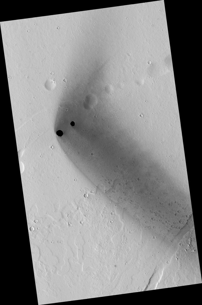
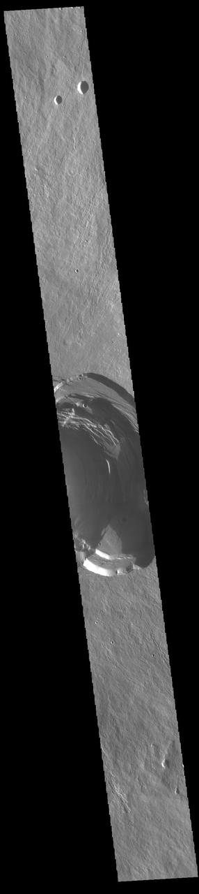
Two dark, rimless pits are located to the northwest of Ascraeus Mons in the Tharsis volcanic region of Mars in this image from NASA Mars Reconnaissance Orbiter. They are situated in the midst of a wispy, dark, boomerang-shaped deposit.
This image shows a small portion of the extensive lava flows created by the large Tharsis volcanoes as seen by NASA 2001 Mars Odyssey spacecraft. These flows are located north east of Ascraeus Mons.

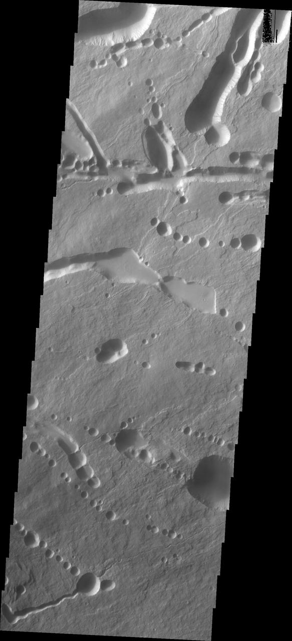
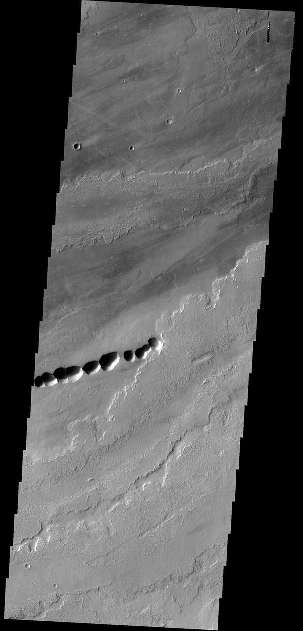
This MOC image shows a chain of collapse pits on a dust-mantled, lava-covered plain northeast of Ascraeus Mons -- one of the giant volcanoes located in the Tharsis region of Mars
Looking again at the southeastern flank of the volcano the narrow nature of the flows are visible. Given the steep sides of the volcano, flows from the summit run as narrow "rivers" down the flank. The flows spread out into wider units when they encounter the flatter plains surrounding the volcano. The Odyssey spacecraft has spent over 15 years in orbit around Mars, circling the planet more than 69000 times. It holds the record for longest working spacecraft at Mars. THEMIS, the IR/VIS camera system, has collected data for the entire mission and provides images covering all seasons and lighting conditions. Over the years many features of interest have received repeated imaging, building up a suite of images covering the entire feature. From the deepest chasma to the tallest volcano, individual dunes inside craters and dune fields that encircle the north pole, channels carved by water and lava, and a variety of other feature, THEMIS has imaged them all. For the next several months the image of the day will focus on the Tharsis volcanoes, the various chasmata of Valles Marineris, and the major dunes fields. We hope you enjoy these images! Orbit Number: 16791 Latitude: 9.07941 Longitude: 257.113 Instrument: VIS Captured: 2005-09-26 22:34 https://photojournal.jpl.nasa.gov/catalog/PIA21821
This image shows part of the steep wall of the caldera (a large volcanic crater) at the top of Ascraeus Mons, one of Mars' giant volcanoes. We can see chutes carved into the soft dust that has built up on the slope, with some similarities to gully landforms elsewhere on the planet. https://photojournal.jpl.nasa.gov/catalog/PIA22804

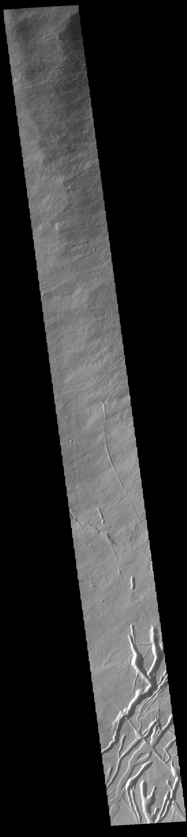
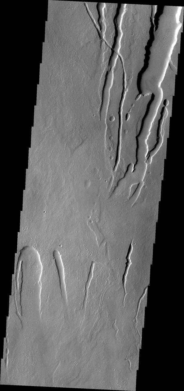
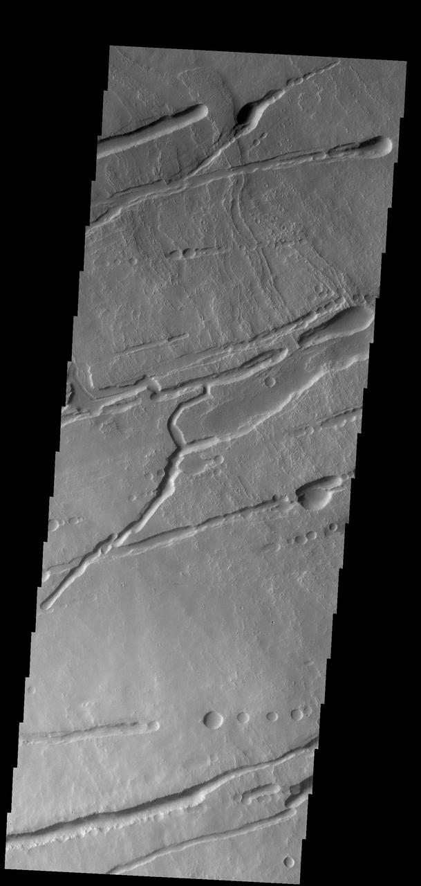
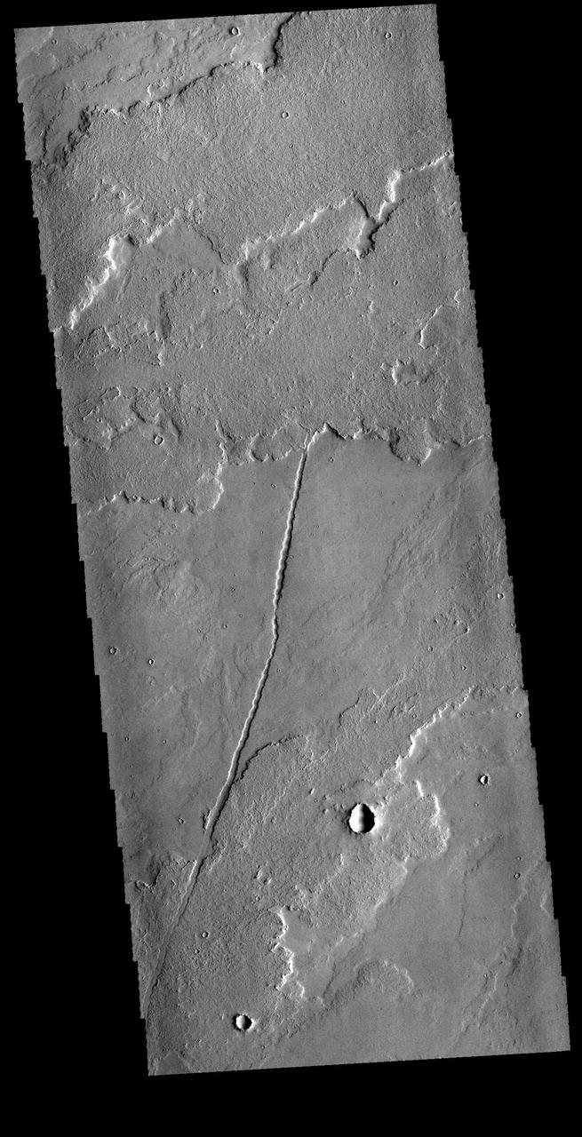
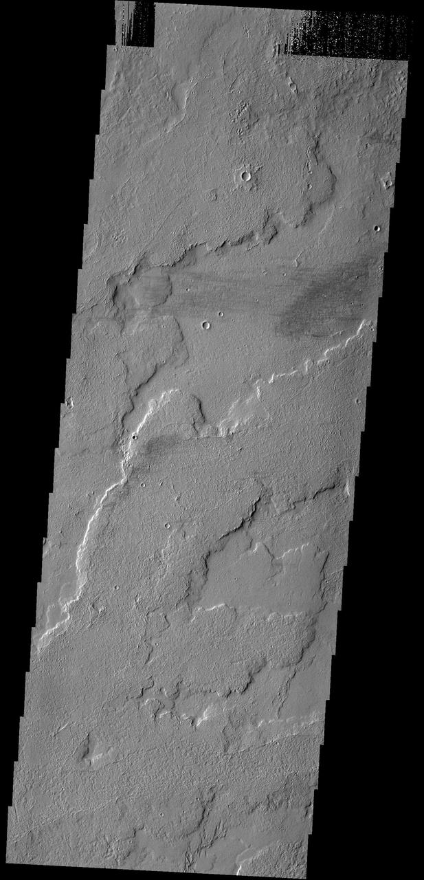
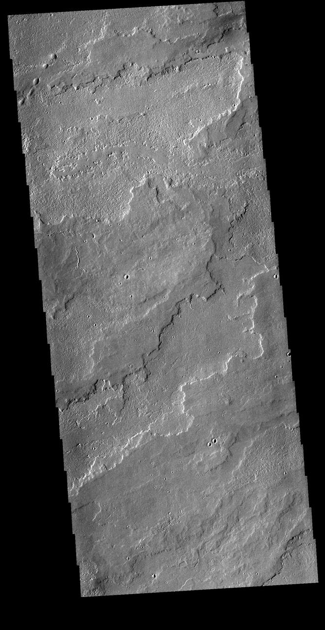
This VIS image shows a portion of the northern flank of Ascreaus Mons. Multiple linear depressions cut across the surface lava flows, having formed after the surface in this region. The chains of oval depressions typically form when a subsurface void is filled by collapse of the 'roof' above it. Orbit Number: 73141 Latitude: 14.9784 Longitude: 255.874 Instrument: VIS Captured: 2018-06-10 15:37 https://photojournal.jpl.nasa.gov/catalog/PIA22669
The collapse features in this image captured by NASA 2001 Mars Odyssey spacecraft are located on the northern flank of Ascreaus Mons.
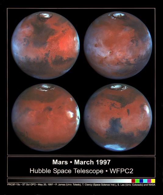
This photograph depicts four Mars views in northern summer provided by the Hubble Space Telescope (HST). The upper left view is centered on Ares Valles where Pathfinder landed in July 1997. Upper right is the Tharsis volcanic region and its associated cloud in the western half of the view. Olympus Mons lies near the western limb, Arsi Mons, Pavonis Mons Ascraeus Mons are to the west of the the center, and Valles Marineris is to the east. The lower Left view shows the Elysium volcanic region in the west, the Tharsis volcanos in East, and Cerberus is left of the center. In the lower right view, the Dark Syrtis Major region, Eysium Mons and Hellas are featured.

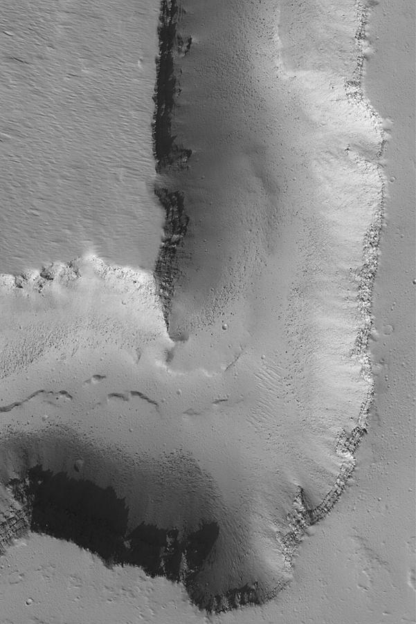
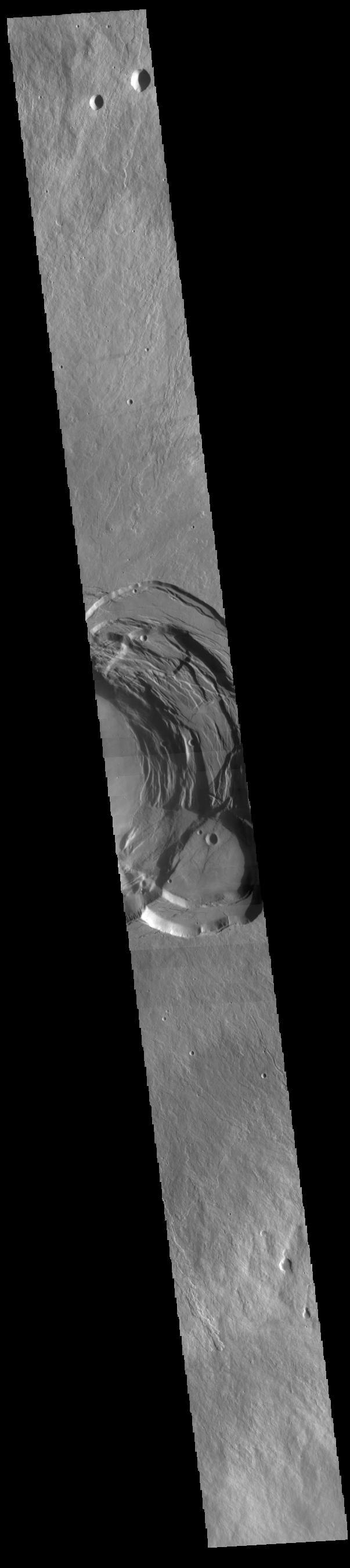
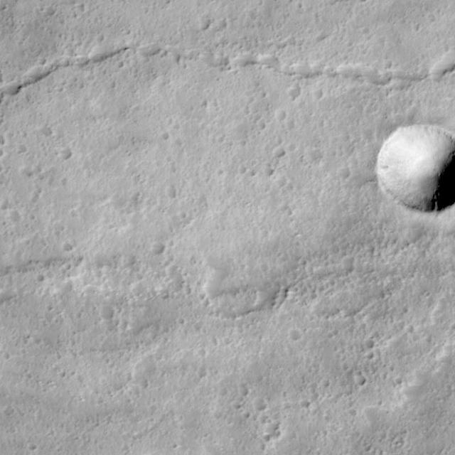
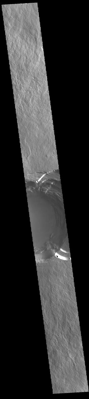
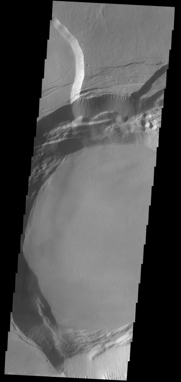
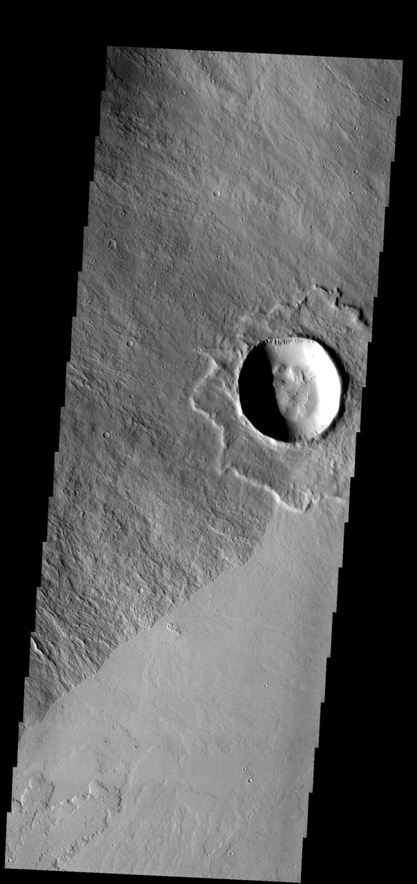
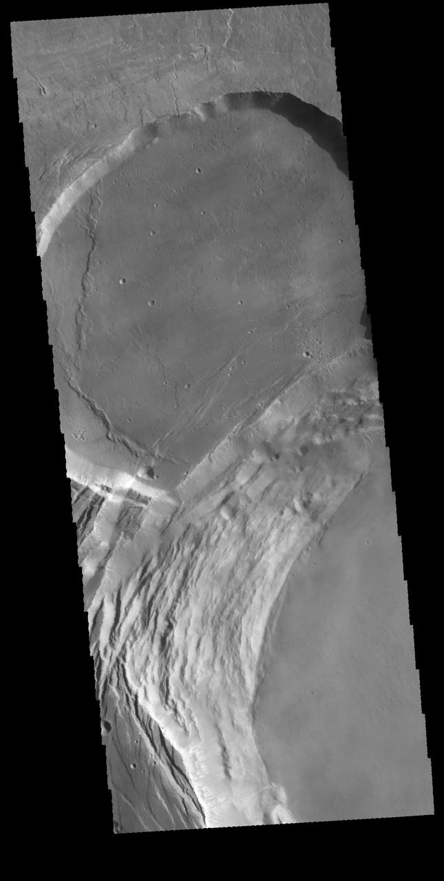
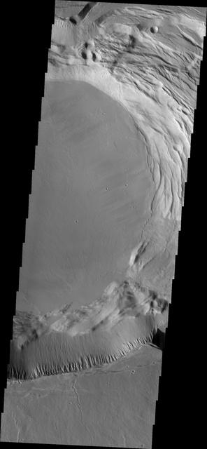
Impact craters are common on all solar system bodies. They offer many clues to scientists regarding the geologic history of a planetary surface, particularly regarding its age, evolution with time, and composition. For instance, this image covers an impact crater on the southeastern flank of Ascraeus Mons, a notable volcano in the Tharsis Plateau. Based on the original science rationale for acquiring this image, by gaining more information about its depth and consequently the stability of the crater wall, we can learn more about the nature of the volcano's flank materials. Also, by carefully studying the materials exposed in the crater walls, we can gain more information about the subsurface. https://photojournal.jpl.nasa.gov/catalog/PIA24919
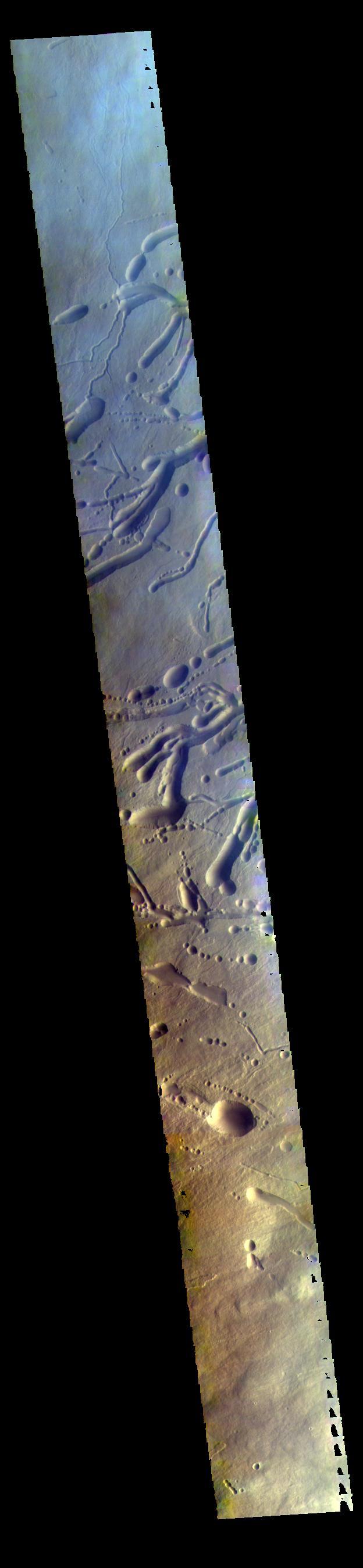
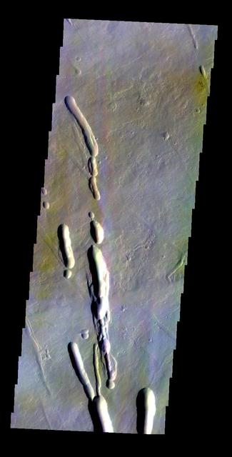
This image from NASA 2001 Mars Odyssey spacecraft is a false color image of part of the northern flank of Ascreaus Mons. The bluish section at the top of the image may indicate an atmospheric haze.
Today's VIS image shows a very small portion of the extensive lava flows of the Tharsis volcanic complex. These flows are located southwest of Ascraeus Mons. Orbit Number: 81900 Latitude: 6.11029 Longitude: 250.287 Instrument: VIS Captured: 2020-05-31 23:08 https://photojournal.jpl.nasa.gov/catalog/PIA24089
This VIS image shows part of the extensive volcanic flows in the Tharsis region. These flows are east of Ascraeus Mons. Orbit Number: 81076 Latitude: 11.2203 Longitude: 261.313 Instrument: VIS Captured: 2020-03-25 02:50 https://photojournal.jpl.nasa.gov/catalog/PIA23935
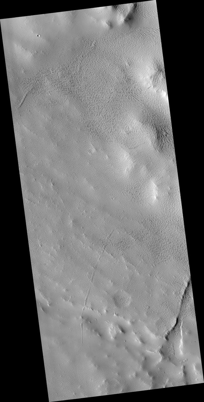
Today's VIS image shows a portion of the immense volcanic flow fields in the Tharsis region. These flows are northeast of Ascraeus Mons. Orbit Number: 81575 Latitude: 16.1457 Longitude: 264.928 Instrument: VIS Captured: 2020-05-05 04:57 https://photojournal.jpl.nasa.gov/catalog/PIA24001
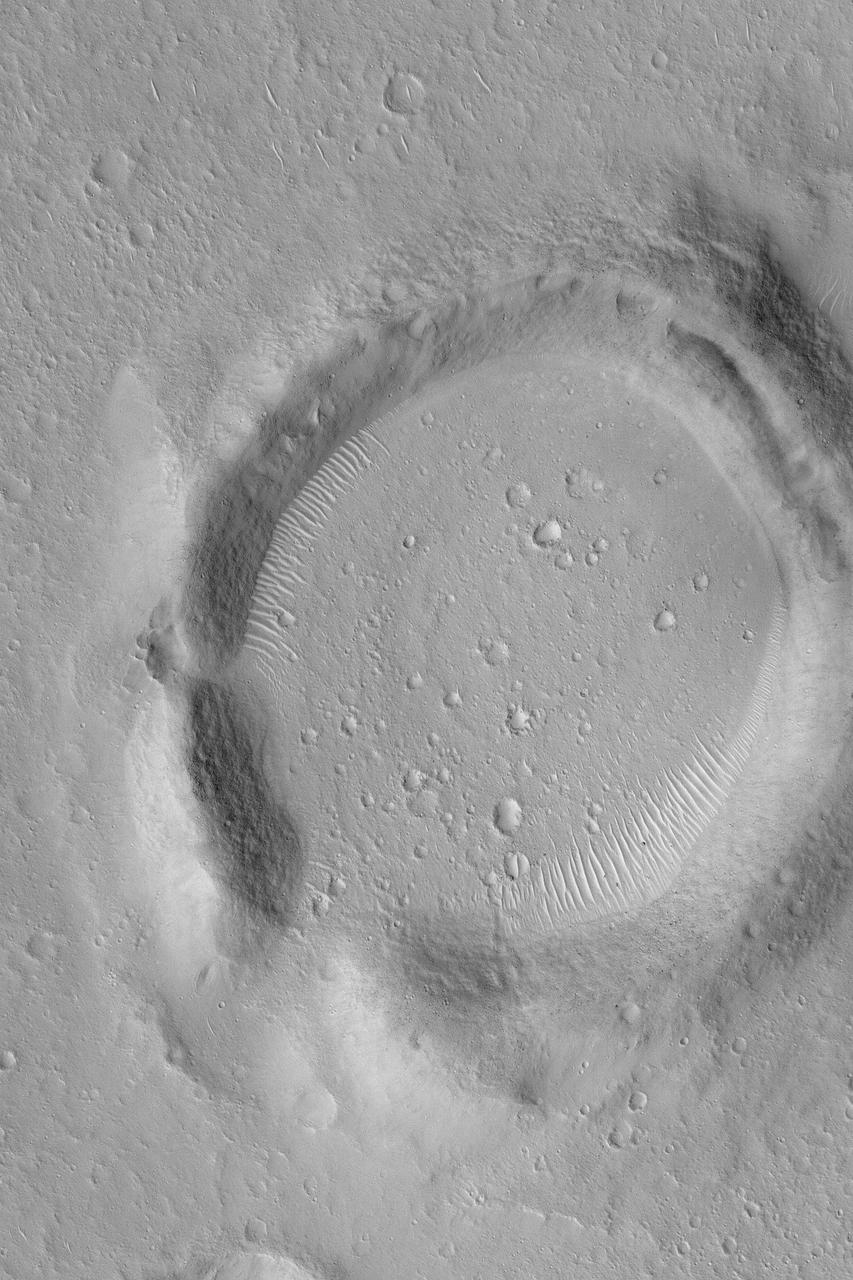
This VIS image shows an unnamed crater located northeast of Ascraeus Mons, on the volcanic plains of the Tharsis region. The rim has several concentric ridges. There are multiple layers of ejecta, with raised edges. The ejecta sits on top of the regional lava flows, indicating it formed after the lava flows covered the area. The lack of significant modification of both rim and ejecta show that this crater is relatively young. Orbit Number: 73066 Latitude: 19.1445 Longitude: 259.912 Instrument: VIS Captured: 2018-06-04 11:22 https://photojournal.jpl.nasa.gov/catalog/PIA22665
This Mars Global Surveyor (MGS) Mars Orbiter Camera (MOC) image shows lava flows on the middle west flank of the large martian volcano, Ascraeus Mons. The flows ran downslope from the lower right (southeast) toward upper left (northwest). These flows are located near 11.9°N, 105.5°W. This December 2003 image covers an area about 3 km (1.9 mi) across; sunlight illuminates the scene from the lower left. http://photojournal.jpl.nasa.gov/catalog/PIA06288
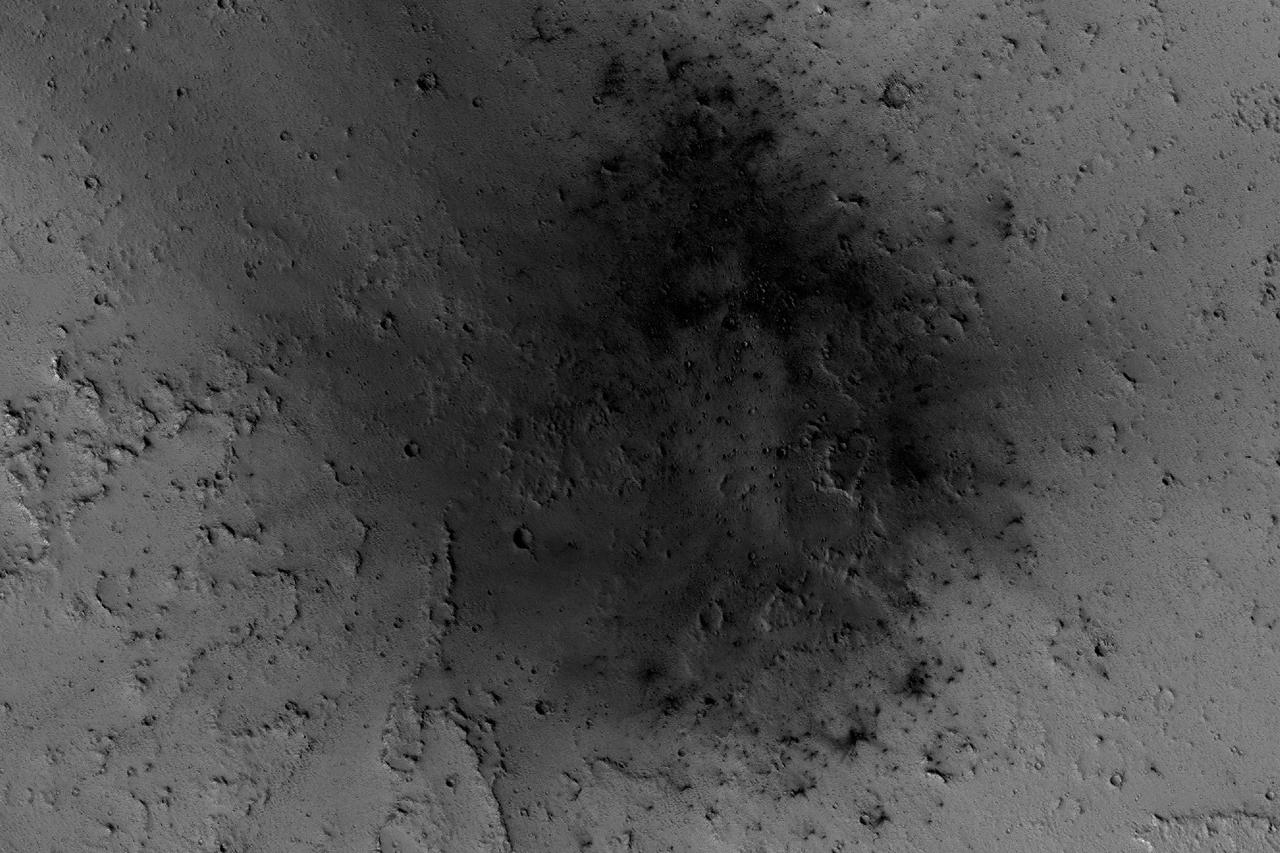
NASA's Mars Reconnaissance Orbiter has been observing Mars in sharp detail for more than a decade, enabling it to document many types of changes, such as the way winds alter the appearance of this recent impact site. The space-rock impact that created this blast zone occurred sometime between September 2005 and February 2006, as bracketed by observations made with the Mars Orbiter Camera on NASA's Mars Global Surveyor spacecraft. The location is between two large volcanos, named Ascraeus Mons and Pavonis Mons, in a dusty area of the Tharsis region of Mars. During the period from 2007 to 2012, winds blowing through the pass between the volcanoes darkened some regions and brightened others, probably by removing and depositing dust. The view covers an area about 1.0 mile (1.6 kilometers) across, at 7 degrees north latitude, 248 degrees east longitude. North is toward the top. An animation is availalble at http://photojournal.jpl.nasa.gov/catalog/PIA21267
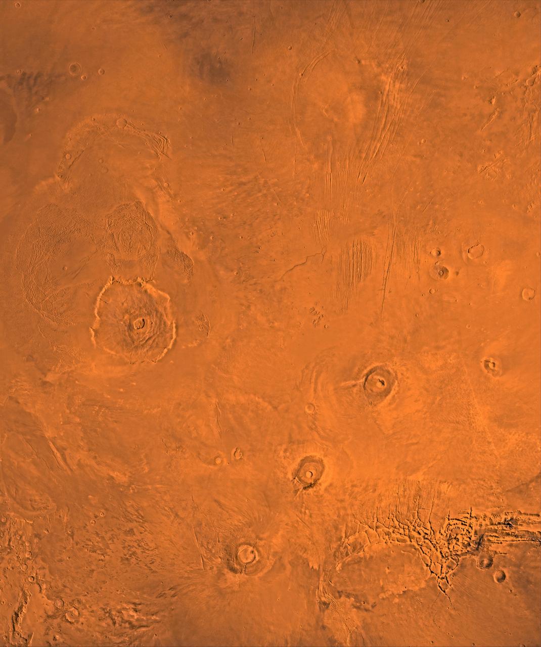
A color image of the Tharsis region of Mars; north toward top. The scene shows the Tharsis bulge, a huge ridge covered by the 3 large aligned Tharsis Montes shield volcanoes (from lower left to right): Arsia, Pavonis, and Ascraeus Mons. To the left of the Tharsis Montes lies the huge Olympus Mons shield volcano, followed clockwise by Alba Patera (north center), several smaller volcanoes, and the linear depressions of Mareotis and Tempe Fossae (upper right). This image is a composite of Viking medium-resolution images in black and white and low-resolution images in color. The image extends from latitude 50 degrees N. to 20 degrees S. and from longitude 85 degrees to 150 degrees. Mercator projection is used between latitudes 20 degrees S. and 30 degrees N.; Lambert projection is used above latitude 30 degrees N. The Tharsis bulge encompasses the most intensely and most recently active volcanic region of the planet. Each Tharsis Montes volcano is 350-400 km in diameter and about 17 km above the surrounding plain. The volcanoes are about 700 km apart and appear to be above a major northeast-trending fracture zone along the bulge, now buried by volcanic deposits. Olympus Mons (left center) is the largest known volcano in the Solar System. It is 27 km high, over 600 km at the base, and is surrounded by a well-defined scarp that is up to 6 km high. The summit calderas (central depressions) of all four volcanoes probably formed from recurrent collapse following drainage of magma resulting from flank eruptions. 1,600-km-diameter Alba Patera (north center) far exceeds any other known volcano in areal extent; it covers eight times the area of Olympus Mons but reaches only about 6 km in height. Fossae (linear depressions) of the Tharsis area are fault-bound graben formed by upwarping of the Tharsis bulge. http://photojournal.jpl.nasa.gov/catalog/PIA00408