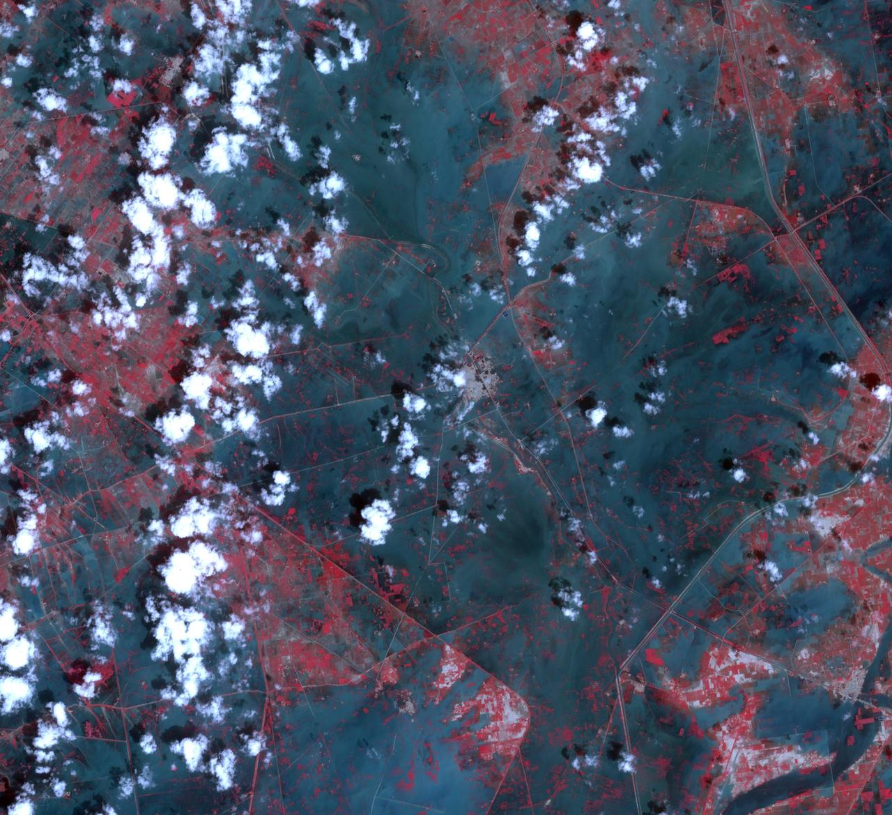
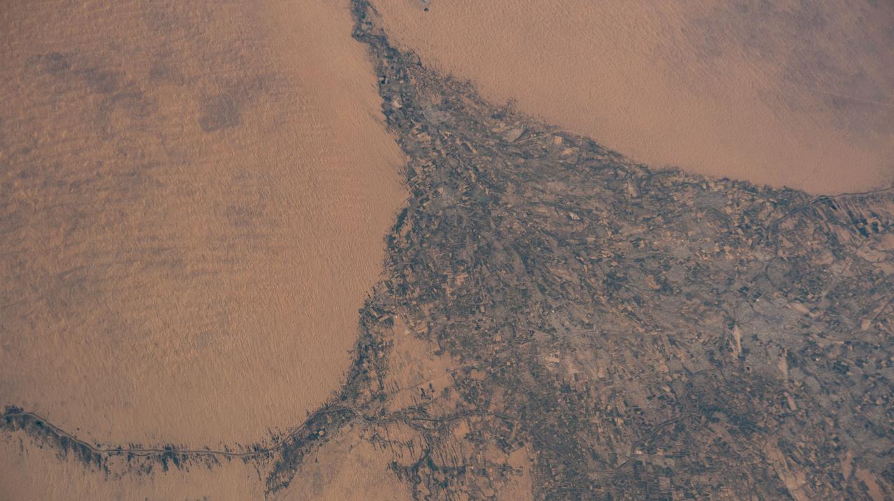
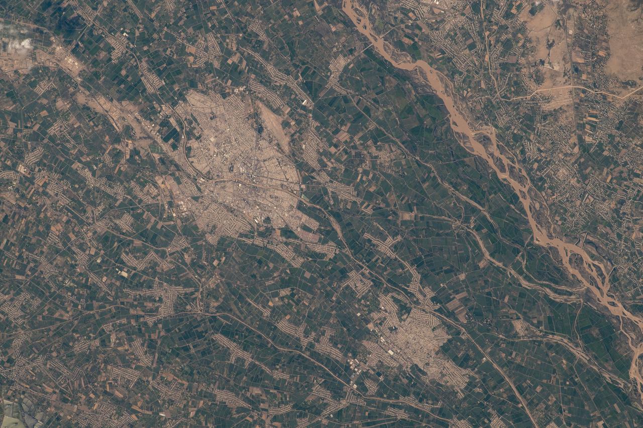
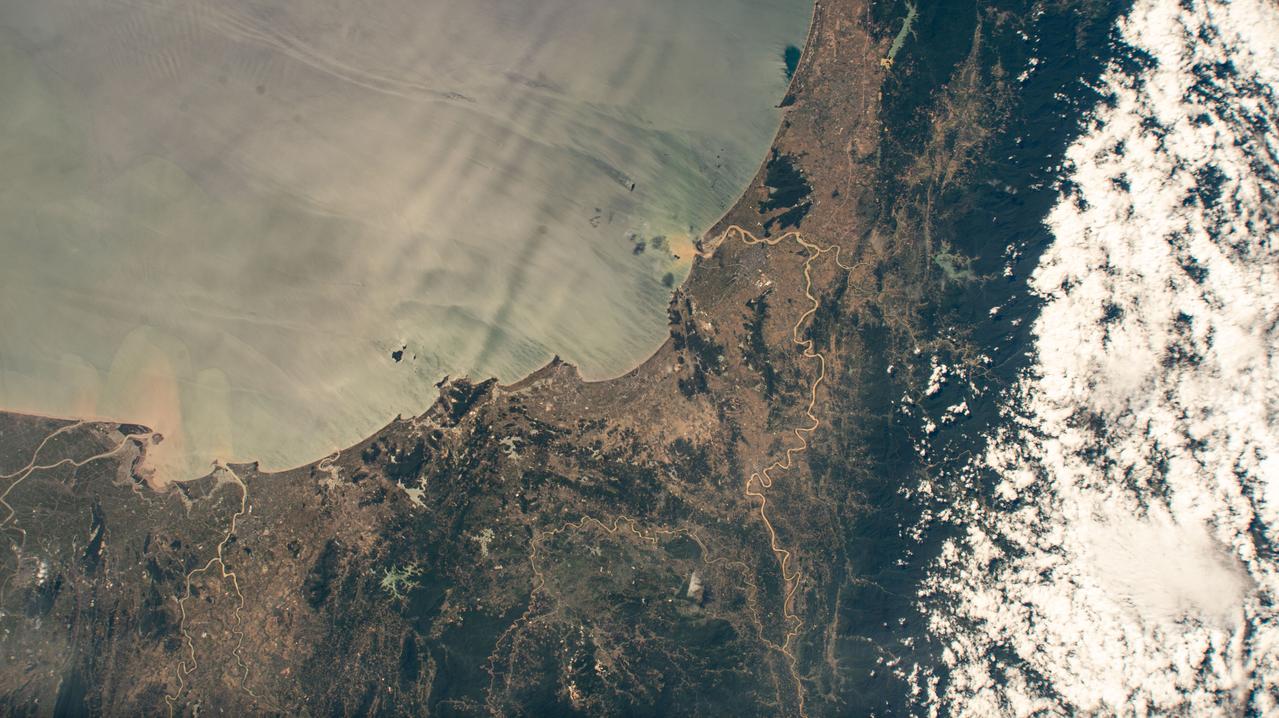
NASA Terra spacecraft captured this image of the city of Jhudo, Pakistan, and surrounding countryside on Sept. 24, 2011. Torrential monsoon rains in south Asia have displaced hundreds of thousands of residents in India, Pakistan and Thailand.

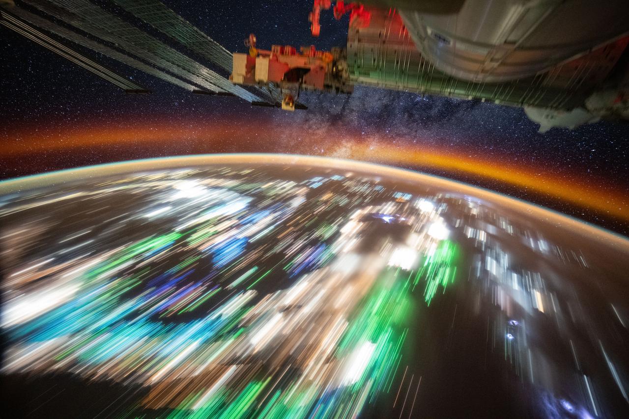
NASA image acquired April 18 - October 23, 2012 This image of Asia and Australia at night is a composite assembled from data acquired by the Suomi NPP satellite in April and October 2012. The new data was mapped over existing Blue Marble imagery of Earth to provide a realistic view of the planet. The nighttime view was made possible by the new satellite’s “day-night band” of the Visible Infrared Imaging Radiometer Suite. VIIRS detects light in a range of wavelengths from green to near-infrared and uses filtering techniques to observe dim signals such as city lights, gas flares, auroras, wildfires, and reflected moonlight. In this case, auroras, fires, and other stray light have been removed to emphasize the city lights. “Night time imagery provides an intuitively graspable view of our planet,” says William Stefanov, a scientist in NASA’s International Space Station program office who has worked with similar images from astronauts. “City lights are an excellent means to track urban and suburban growth, which feeds into planning for energy use and urban hazards, for studying urban heat islands, and for initializing climate models.” Named for satellite meteorology pioneer Verner Suomi, NPP flies over any given point on Earth's surface twice each day at roughly 1:30 a.m. and p.m. The polar-orbiting satellite flies 824 kilometers (512 miles) above the surface, sending its data once per orbit to a ground station in Svalbard, Norway, and continuously to local direct broadcast users distributed around the world. The mission is managed by NASA with operational support from NOAA and its Joint Polar Satellite System, which manages the satellite's ground system. NASA Earth Observatory image by Robert Simmon, using Suomi NPP VIIRS data provided courtesy of Chris Elvidge (NOAA National Geophysical Data Center). Suomi NPP is the result of a partnership between NASA, NOAA, and the Department of Defense. Caption by Mike Carlowicz. Instrument: Suomi NPP - VIIRS Credit: <b><a href="http://www.earthobservatory.nasa.gov/" rel="nofollow"> NASA Earth Observatory</a></b> <b>Click here to view all of the <a href="http://earthobservatory.nasa.gov/Features/NightLights/" rel="nofollow"> Earth at Night 2012 images </a></b> <b>Click here to <a href="http://earthobservatory.nasa.gov/NaturalHazards/view.php?id=79790" rel="nofollow"> read more </a> about this image </b> <b><a href="http://www.nasa.gov/audience/formedia/features/MP_Photo_Guidelines.html" rel="nofollow">NASA image use policy.</a></b> <b><a href="http://www.nasa.gov/centers/goddard/home/index.html" rel="nofollow">NASA Goddard Space Flight Center</a></b> enables NASA’s mission through four scientific endeavors: Earth Science, Heliophysics, Solar System Exploration, and Astrophysics. Goddard plays a leading role in NASA’s accomplishments by contributing compelling scientific knowledge to advance the Agency’s mission. <b>Follow us on <a href="http://twitter.com/NASAGoddardPix" rel="nofollow">Twitter</a></b> <b>Like us on <a href="http://www.facebook.com/pages/Greenbelt-MD/NASA-Goddard/395013845897?ref=tsd" rel="nofollow">Facebook</a></b> <b>Find us on <a href="http://instagram.com/nasagoddard?vm=grid" rel="nofollow">Instagram</a></b>

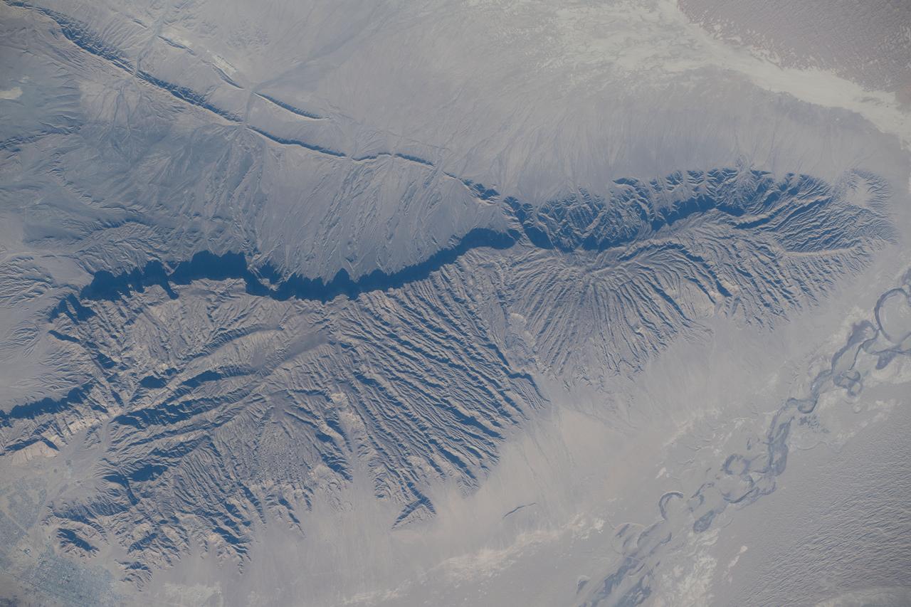
This region of central Asia is situated at the juncture of Mongolia, China and Russia. This image from NASA Terra satellite is MISR Mystery Image Quiz #7.
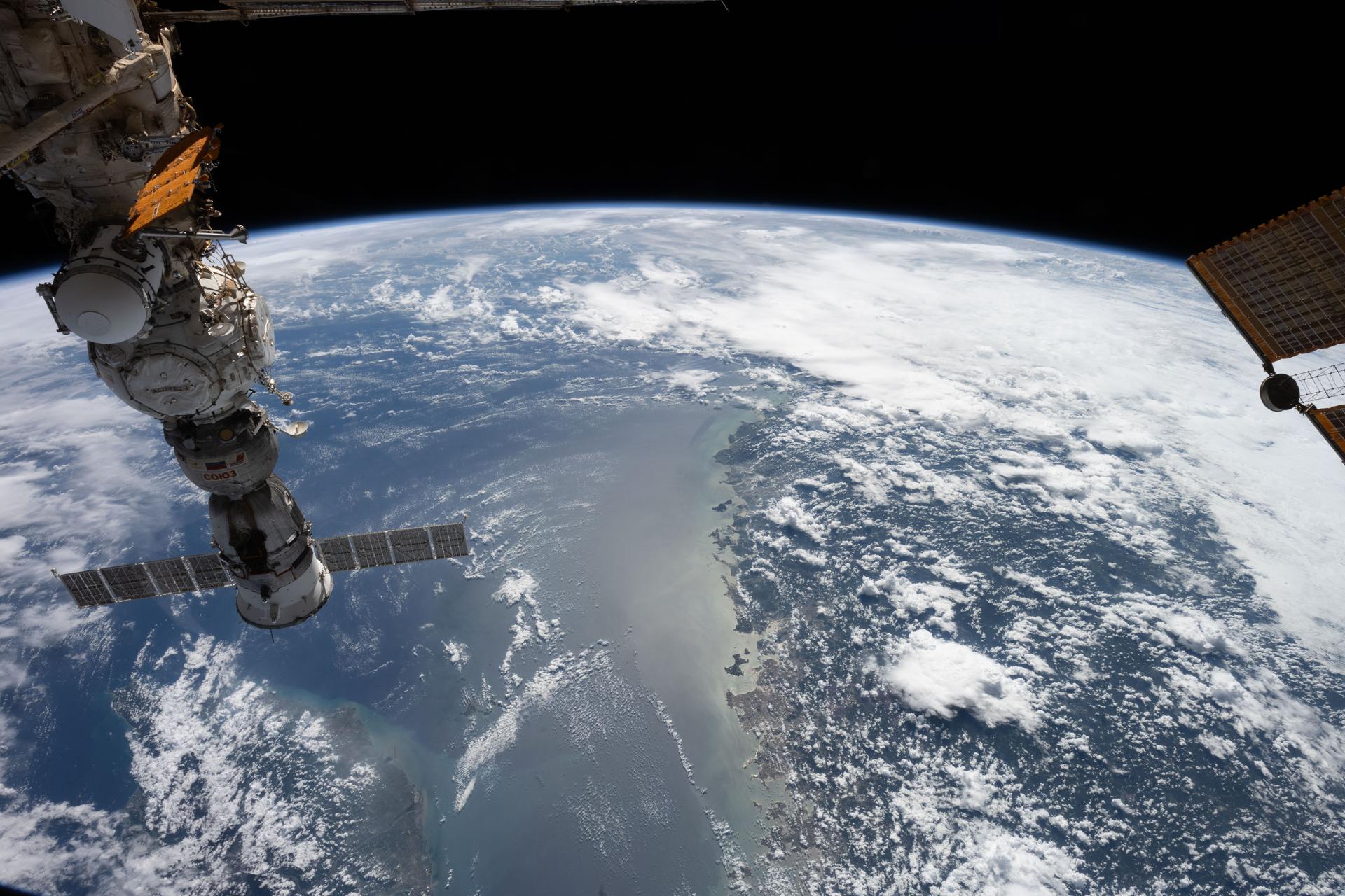
iss071e462180 (Aug. 9, 2024) --- Lake Assad in Syria (upper right) and lakes created by hydroelectric dams in Turkiye, all along the Euphrates River, are pictured from the International Space Station as it orbited 263 miles above the Turkish nation that connects Europe with Asia.
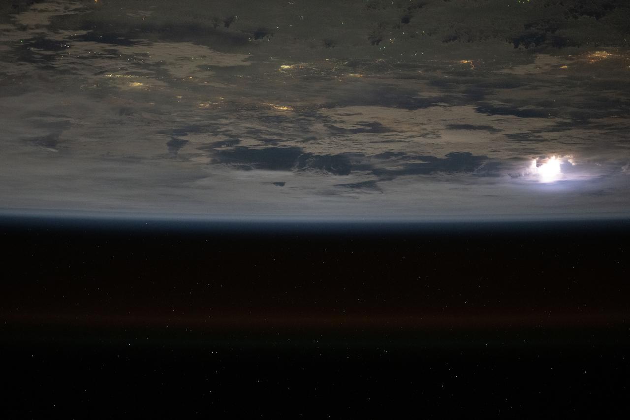
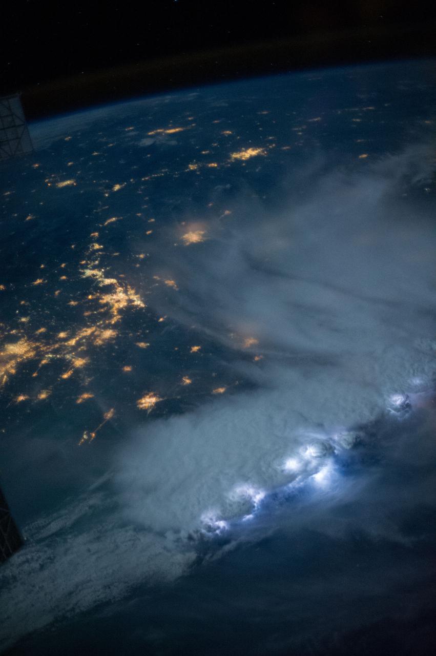
iss073e0204297 (May 25, 2025) --- Lightning illuminates the clouds (left), city lights line the coast of Vietnam, and lights on fishing boats dot the South China Sea in this photograph from the International Space Station as it orbited 259 miles above Southeast Asia.

iss073e0204578 (May 25, 2025) --- Lightning illuminates the clouds (top left) above Southeast Asia in this photograph from the International Space Station as it orbited 259 miles over the South China Sea and off the coast of the Malaysian state of Sarawak on the island of Borneo.
iss074e0002581 (Dec. 14, 2025) --- The International Space Station was orbiting 260 miles above Indravati National Park in central India when this photograph of the Himalayas—more than 700 miles away—was taken, showing the mountain range that separates the Indian subcontinent from Asia.

iss073e0415606 (June 21, 2025) --- The International Space Station soars 259 miles above Cambodia in this long-duration photograph revealing star trails, lightning storms, and the city lights of Southeast Asia streaking below.
Isac Mata, engineering technician at NASA’s Armstrong Flight Research Center, attends to the interior of the DC-8 aircraft at Building 703 in Palmdale, CA. The DC-8 aircraft is prepared for its last mission, ASIA-AQ (Airborne and Satellite Investigation of Asian Air Quality), that will collect detailed air quality data over several locations in Asia to improve the understanding of local air quality in collaboration with local scientists, air quality agencies, and government partners

Scientists Ryan Boyd (left) and Vladislav Sevostianov (right) attend to the Optical Payload for Lasercomm Science (OPALS) instrument on the exterior the DC-8 aircraft at Building 703 in Palmdale, CA. The DC-8 aircraft is prepared for its last mission, ASIA-AQ (Airborne and Satellite Investigation of Asian Air Quality), that will collect detailed air quality data over several locations in Asia to improve the understanding of local air quality in collaboration with local scientists, air quality agencies, and government partners

DC-8 aircraft conducts test flights at Building 703 in Palmdale, CA. The DC-8 aircraft is prepared for its last mission, ASIA-AQ (Airborne and Satellite Investigation of Asian Air Quality), that will collect detailed air quality data over several locations in Asia to improve the understanding of local air quality in collaboration with local scientists, air quality agencies, and government partners

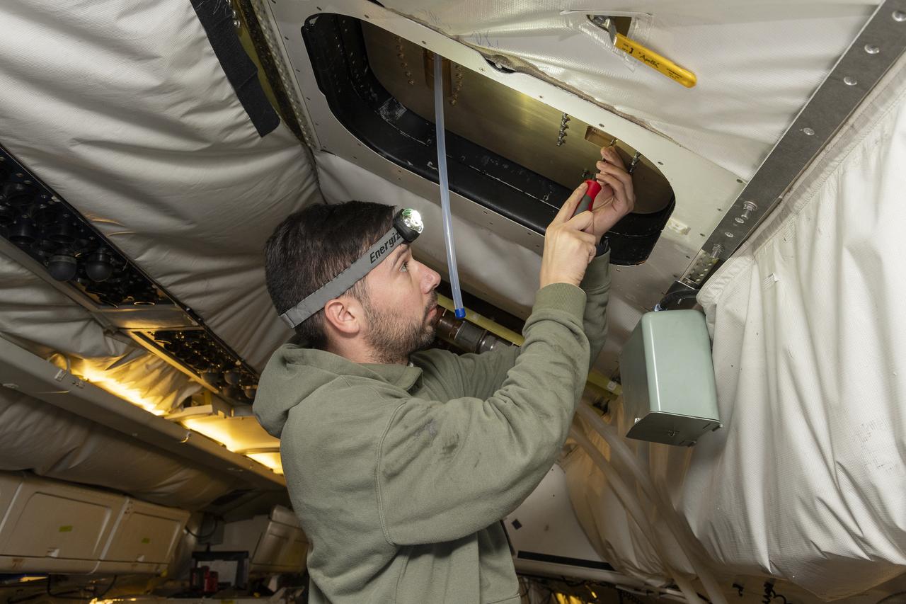
Alan Hills fills liquid nitrogen in the Trace Organic Gas Analyzer (TOGA) instrument onboard the DC-8 aircraft at Building 703 in Palmdale, CA. This instrument measures volatile organic compounds (VOCs) in the atmosphere. The DC-8 aircraft is prepared for its last mission, ASIA-AQ (Airborne and Satellite Investigation of Asian Air Quality), that will collect detailed air quality data over several locations in Asia to improve the understanding of local air quality in collaboration with local scientists, air quality agencies, and government partners

Kat Ball, Chemical Engineering Ph.D candidate at Caltech, attends to the Chemical Ionization Mass Spectrometer (CIMS) rack onboard the DC-8 aircraft at Building 703 in Palmdale, CA. The DC-8 aircraft is prepared for its last mission, ASIA-AQ (Airborne and Satellite Investigation of Asian Air Quality), that will collect detailed air quality data over several locations in Asia to improve the understanding of local air quality in collaboration with local scientists, air quality agencies, and government partners
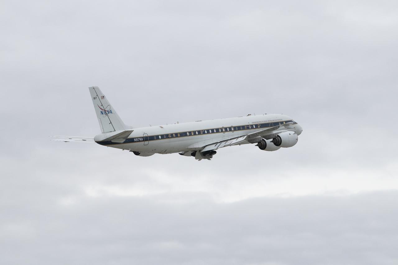
DC-8 aircraft conducts test flights at Building 703 in Palmdale, CA. The DC-8 aircraft is prepared for its last mission, ASIA-AQ (Airborne and Satellite Investigation of Asian Air Quality), that will collect detailed air quality data over several locations in Asia to improve the understanding of local air quality in collaboration with local scientists, air quality agencies, and government partners
The ASTER instrument onboard NASA Terra spacecraft imaged the Khyber Pass, a mountain pass that links Afghanistan and Pakistan. Throughout its history it has been an important trade route between Central Asia and South Asia.
iss073e0134504 (May 22, 2025) --- This long-duration photograph taken from the International Space Station orbiting 259 miles above the South China Sea highlights the city lights of Southeast Asia streaking below, a lightning storm near the top of Earth's horizon, and star trails above an atmopsheric glow.
iss073e1197819 (Nov. 22, 2025) --- Myanmar’s (Burma) Irrawaddy Delta—an important agricultural region in Southeast Asia filled with mangrove forests, rice paddies, and swampy lowlands—empties into the Andaman Sea and is pictured from the International Space Station as it orbited 262 miles above.
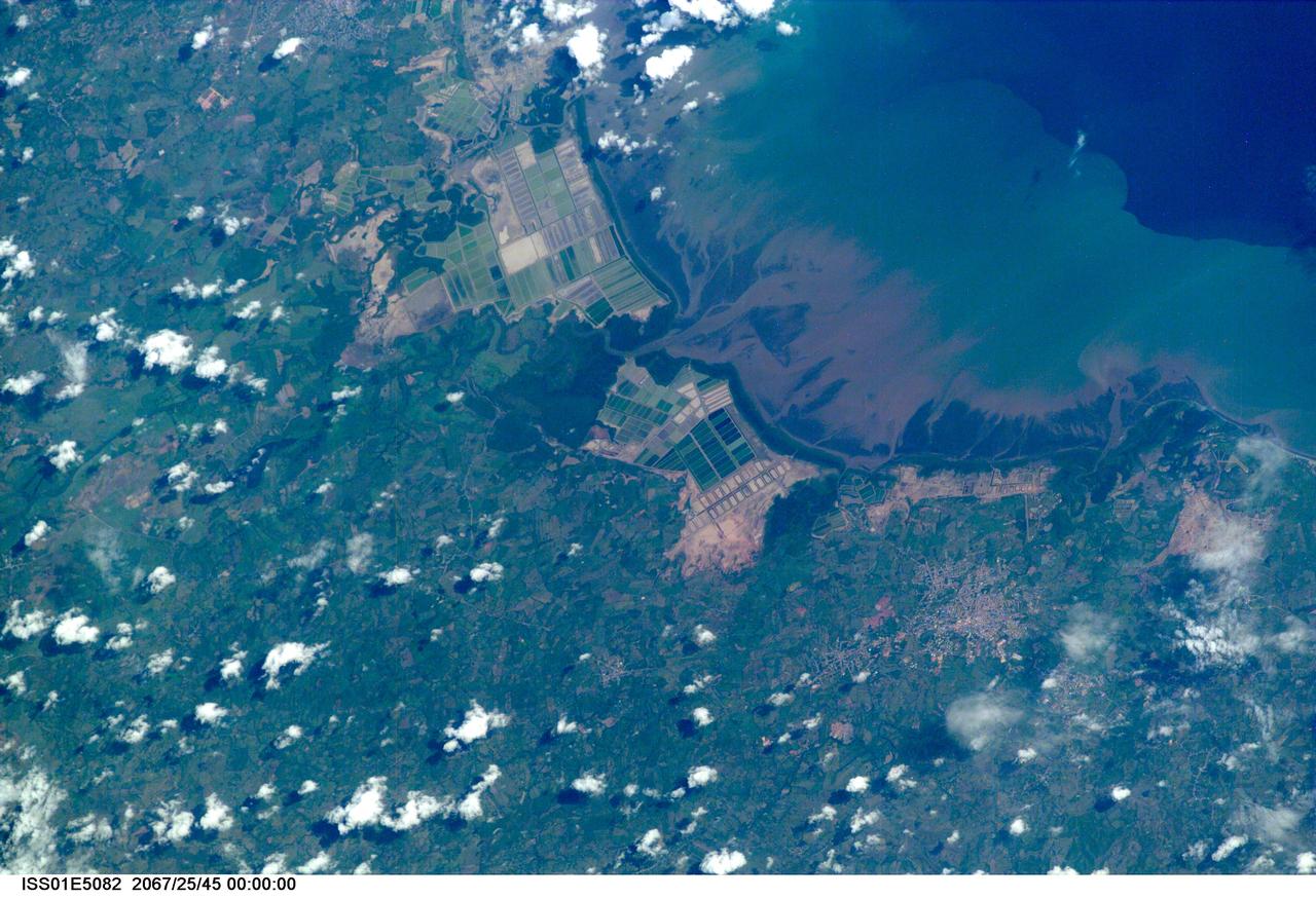
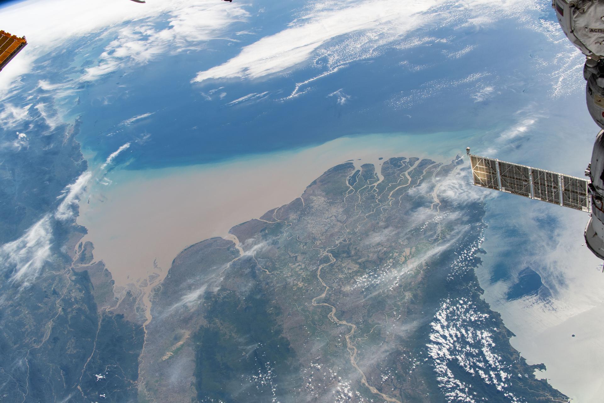
ISS01-E-5082 (December 2000) --- This image of coastal Asia was taken from the International Space Station with a digital still camera and a 400mm lens with a very narrow field of view. Early in the Space Station Program, communications with the crew are less direct, and the exact time that this image was taken could not be determined. Because there are relatively few photograph of Earth taken with this long lens, and because the times are not available to calculate the exact position of the Station over the Earth when the photograph was taken, the exact location of the photograph cannot be determined. Many of these logistical problems will be resolved as camera equipment is replaced and communications with the crew improve. Catalogers believe the coast most resembles Indonesia, and this determination will be maintained until future images allow correction and refinement of the location. The photograph is a striking example of the degree to which humans modify coastal environments. The large green squares in the image probably represent a combination of rice cultivation and aquaculture.

iss073e0257211 (June 17, 2025) --- The city lights of Southeast Asia and lightning storms streak below the International Space Station as it orbited 259 miles above the Gulf of Thailand at approximately 3:17 a.m. local time.

iss074e0351753 (March 6, 2026) --- The snow‑capped Himalayas form a natural boundary between Asia and the well‑lit nighttime cityscape of the Indian subcontinent. At center is Delhi, the capital territory of India, with a metropolitan population of about 33.8 million. The International Space Station was orbiting 264 miles above southwestern China at approximately 11:22 p.m. local time when this photograph was taken. Credit: NASA/Chris Williams

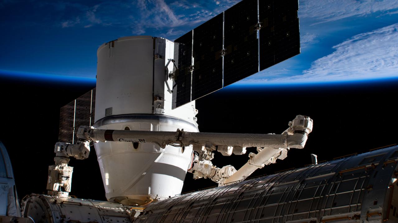
iss073e0507880 (July 26, 2025) --- The warm city lights of Southeast Asia streak below the silvery U.S. segment of the International Space Station in this 30-second exposure from the orbital outpost as it soared 259 miles above China at approximately 10:39 a.m. local time. Near the top center, is the partially obscured SpaceX Dragon spacecraft that docked to the Harmony module's forward port carrying NASA's Crew-11 mission.
iss072e860745 (March 26, 2025) --- This long-duration photograph taken from the International Space Station as it orbited 259 miles above the Andaman Sea reveals the city lights of Southeast Asia and the typical green lights of the fishing boats underneath Earth's atmospheric glow. In the background, a star-filled sky and the Milky Way sparkle above the planet. Credit: NASA/Don Pettit

iss073e0920829 (Oct. 20, 2025) --- This celestial view from a window aboard the SpaceX Dragon crew spacecraft captures the city lights of Central Asia sparkling underneath a bright yellow airglow as an orbital sunrise begins to illuminate Earth's atmosphere underneath a starry night sky. The International Space Station was orbiting 263 miles above Uzbekistan at approximately 4:40 a.m. local time when this long-exposure photograph was taken.
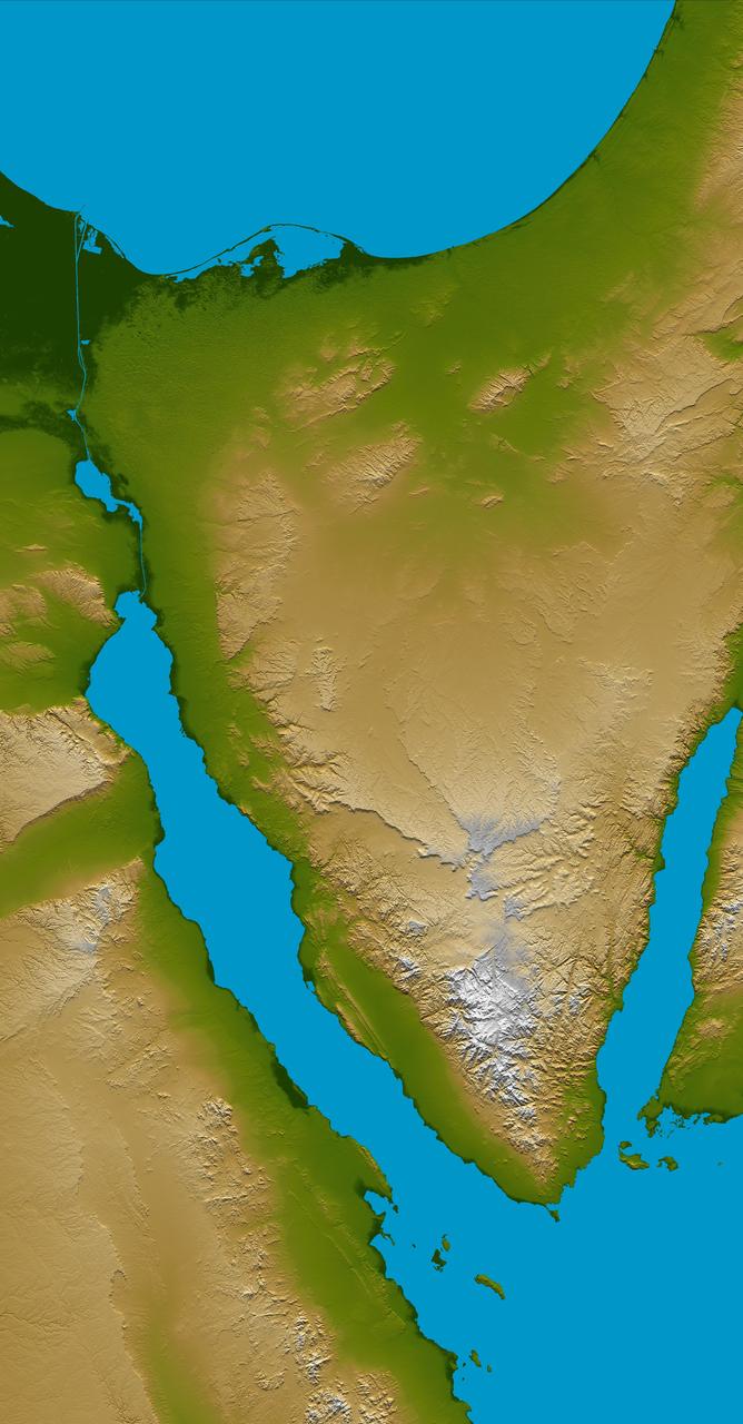
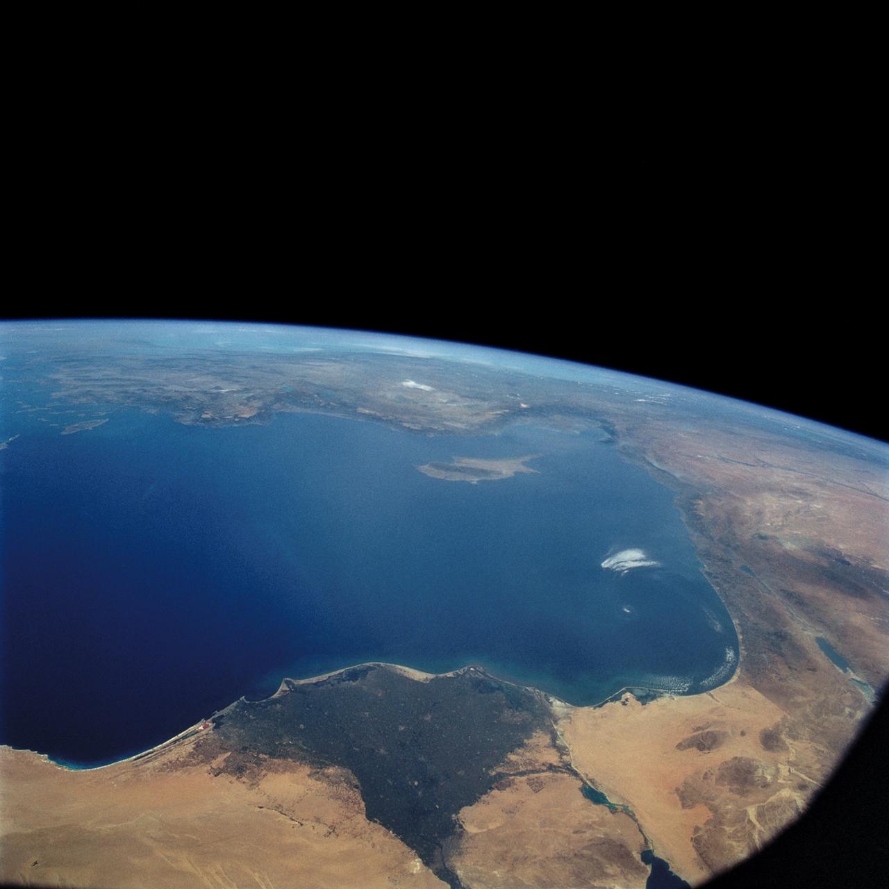
The Sinai Peninsula, located between Africa and Asia, is a result of those two continents pulling apart from each other.
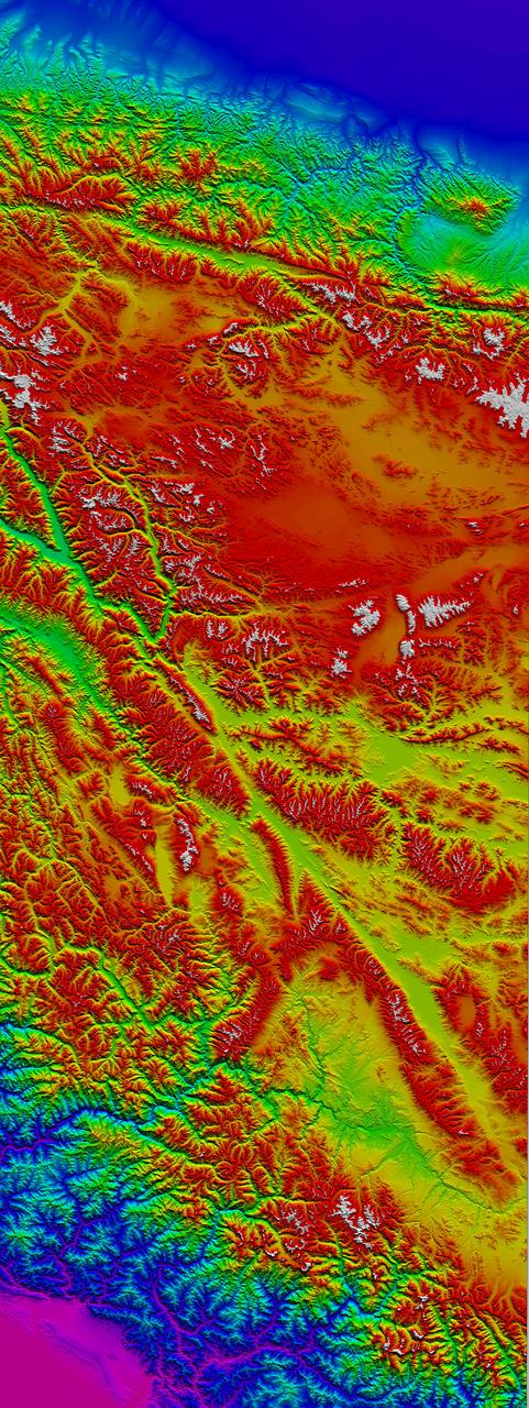
The 5000 meter 16,000 feet high Tibetan Plateau has been formed by the collision of the Indian subcontinent with central Asia.
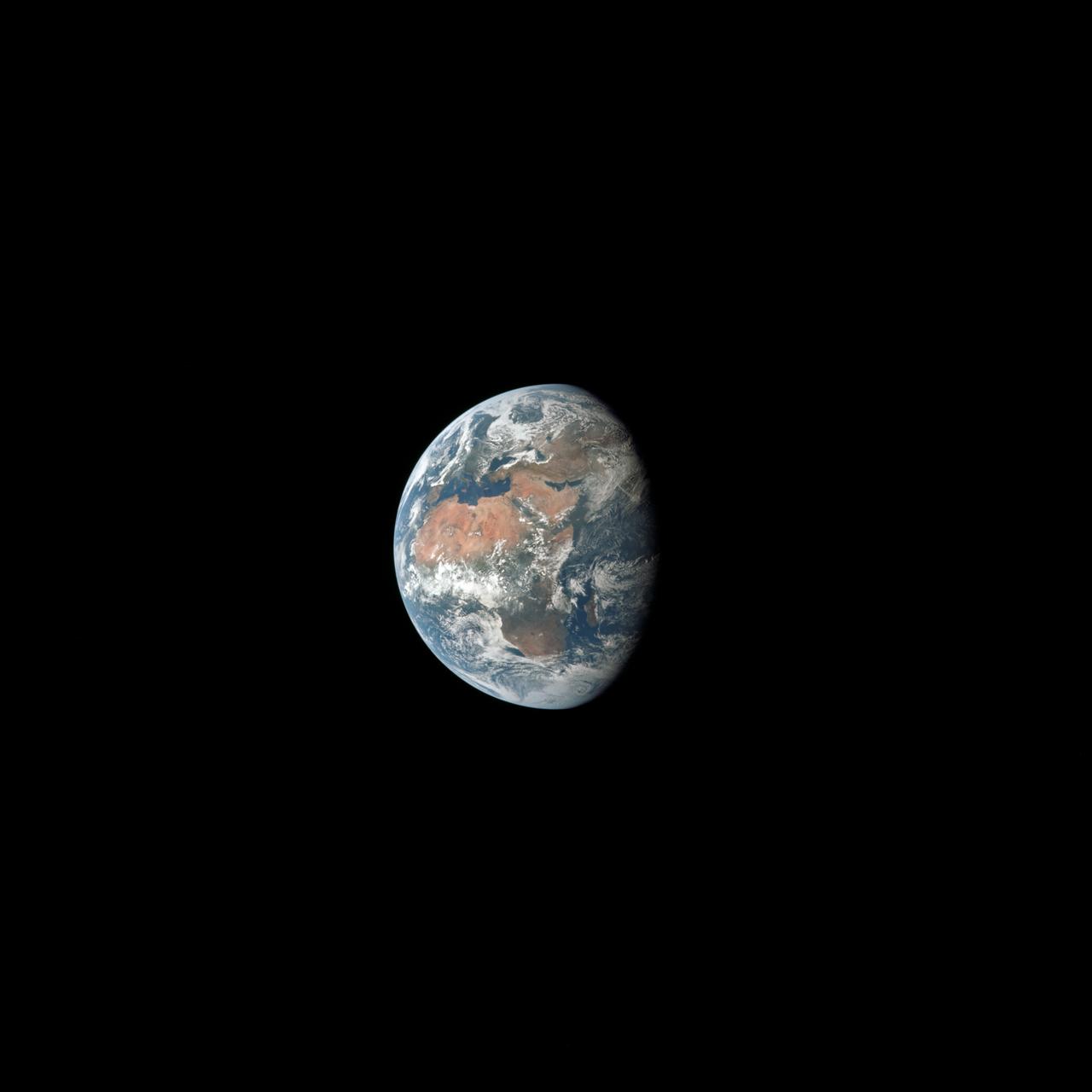
AS11-36-5355 (17 July 1969) --- Most of Africa and portions of Europe and Asia can be seen in this spectacular photograph taken from the Apollo 11 spacecraft during its trans-lunar coast toward the moon. Apollo 11, with astronauts Neil A. Armstrong, commander; Michael Collins, command module pilot; and Edwin E. Aldrin Jr., lunar module pilot, onboard was already 98,000 nautical miles from Earth when this picture was made. While astronauts Armstrong and Aldrin descended in the Lunar Module (LM) "Eagle" to explore the Sea of Tranquility region of the moon, astronaut Collins remained with the Command and Service Modules (CSM) "Columbia" in lunar orbit.

The DC-8 aircraft returns to the hangar at NASA’s Armstrong Flight Research Center Building 703 in Palmdale, California, on April 1, 2024, after completing its final mission supporting Airborne and Satellite Investigation of Asian Air Quality (ASIA-AQ).
STS057-73-075 (21 June-1 July 1993) --- Eastern Mediterranean from an unusually high vantage point over the Nile River, this north-looking view shows not only the eastern Mediterranean but also the entire landmass of Asia Minor, with the Black Sea dimly visible at the horizon. Many of the Greek islands can be seen in the Aegean Sea (top left), off the coast of Asia Minor. Cyprus is visible under atmospheric dust in the northeast corner of the Mediterranean. The dust cloud covers the east end of the Mediterranean, its western edge demarcated by a line that cuts the center of the Nile Delta. This dust cloud originated far to the west, in Algeria, and moved northeast over Sicily, southern Italy, and Greece. Part of the cloud then moved on over the Black Sea, but another part swerved southward back towards Egypt. A gyre of clouds in the southeast corner of the Mediterranean indicates a complementary counterclockwise (cyclonic) circulation of air. The Euphrates River appears as a thin green line (upper right) in the yellow Syrian Desert just south of the blue-green mountains of Turkey. The Dead Sea (lower right) lies in a rift valley which extends north into Turkey and south thousands of miles down the Gulf of Aqaba, the Red Sea, and on through East Africa. The straight international boundary between Israel and Egypt (where the coastline angles) is particularly clear in this view, marked by the thicker vegetation on the Israeli side of the border. The green delta of the Nile River appears in the foreground, with the great conurbation of Cairo seen as a gray area at the apex of the triangle. Most of Egypt's 52 million inhabitants live in the delta. On the east side of the delta, the Suez Canal is visible. On the western corner of the delta lies the ancient city of Alexandria, beside the orange and white salt pans. The World War II battlesite El Alamein lies on the coast.
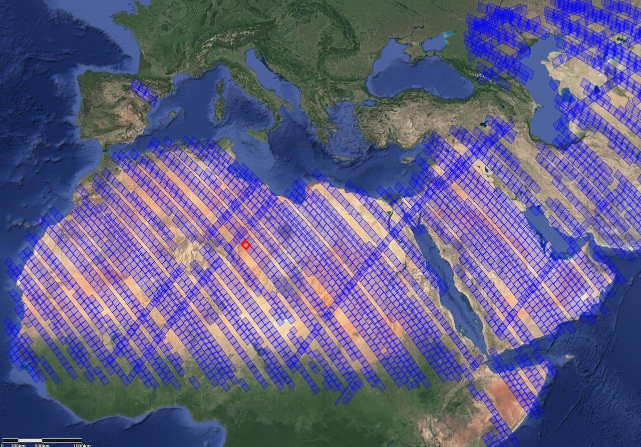
This image shows locations in parts of North Africa, Europe, the Middle East, and Central Asia observed by NASA's Earth Surface Mineral Dust Source Investigation (EMIT). Each blue box is a "scene" the instrument, which is aboard the International Space Station, has captured. The red box indicates where the instrument recently gathered data on three minerals in a location in southwest Libya, in the Sahara Desert. Installed on the space station in July 2022, EMIT orbits Earth about once every 90 minutes to map the world's mineral-dust sources, gathering information about surface composition as the instrument completes about 16 orbits per day. Over the course of its 12-month mission, EMIT will collect measurements of 10 important surface minerals – kaolinite, hematite, goethite, illite, vermiculite, calcite, dolomite, montmorillonite, chlorite, and gypsum – in arid regions between 50-degree south and north latitudes in Africa, Asia, North and South America, and Australia. The data EMIT collects will help scientists better understand the role of airborne dust particles in heating and cooling Earth's atmosphere on global and regional scales. https://photojournal.jpl.nasa.gov/catalog/PIA25429

NASA’s DC-8 operations engineer, Nickelle “Nicki” Reid, left, embraces Katherine Ball, chemical engineering Ph.D. candidate at California Institute of Technology, after the DC-8 aircraft and crew return to NASA Armstrong’s Building 703 in Palmdale, California, on April 1, 2024, following the aircraft’s final mission in support of the Airborne and Satellite Investigation of Asian Air Quality (ASIA-AQ).

From left, Andy Barry, DC-8 pilot; Todd Renfro, flight navigator; and Adam Devalon, flight engineer, share smiles after the DC-8 aircraft and crew return to NASA’s Armstrong Flight Research Center Building 703 in Palmdale, California, on April 1, 2024, following the aircraft’s final mission in support of the Airborne and Satellite Investigation of Asian Air Quality (ASIA-AQ).

NASA’s Armstrong Flight Research Center Director Brad Flick smiles as members of the DC-8 team gather and exchange congratulations after the aircraft and crew return to NASA Armstrong’s Building 703 in Palmdale, California, on April 1, 2024, following the aircraft’s final mission in support of the Airborne and Satellite Investigation of Asian Air Quality (ASIA-AQ).

The DC-8 aircraft returned to NASA’s Armstrong Flight Research Center Building 703 in Palmdale, California, on April 1, 2024, after completing its final mission supporting Airborne and Satellite Investigation of Asian Air Quality (ASIA-AQ). The aircraft and crew were welcomed back with a celebratory water salute by the U.S. Air Force Plant 42 Fire Department.

From left, Wayne Ringelberg, chief pilot at NASA’s Armstrong Flight Research Center in Edwards, California, is welcomed by Michael Thomson, director of NASA Armstrong’s Science Mission Directorate, and Kirsten Boogaard, NASA’s DC-8 project manager, after the DC-8 aircraft and crew return to NASA Armstrong’s Building 703 in Palmdale, California, on April 1, 2024, following the aircraft’s final mission in support of the Airborne and Satellite Investigation of Asian Air Quality (ASIA-AQ).

Walter Klein, DC-8 navigator, exits the aircraft cabin and is welcomed with applause from a supportive team after the DC-8 aircraft and crew return to NASA’s Armstrong Flight Research Center Building 703 in Palmdale, California, on April 1, 2024, following the aircraft’s final mission in support of the Airborne and Satellite Investigation of Asian Air Quality (ASIA-AQ).

Kelly Jellison, avionics lead, and Tim Sandon, flight engineer, exit the DC-8 aircraft cabin and are welcomed with applause from a supportive team after the DC-8 aircraft and crew return to NASA’s Armstrong Flight Research Center Building 703 in Palmdale, California, on April 1, 2024, following the aircraft’s final mission in support of the Airborne and Satellite Investigation of Asian Air Quality (ASIA-AQ).

NASA DC-8 crew members Nickelle “Nicki” Reid, operations engineer, left, and Isac Mata, engineer technician, exchange in a heartfelt hug after the DC-8 aircraft and crew return to NASA Armstrong’s Building 703 in Palmdale, California, on April 1, 2024, following the aircraft’s final mission in support of the Airborne and Satellite Investigation of Asian Air Quality (ASIA-AQ). Smiling in the background is Michael Thomson, director of NASA Armstrong’s Science Mission Directorate.

The DC-8 aircraft returned to NASA’s Armstrong Flight Research Center Building 703 in Palmdale, California, on April 1, 2024, after completing its final mission supporting Airborne and Satellite Investigation of Asian Air Quality (ASIA-AQ). The aircraft and crew were welcomed back with a celebratory water salute by the U.S. Air Force Plant 42 Fire Department.
090 asia philippines 254

The Eastern U.S., Europe, and Japan are brightly lit by their cities, while interiors of Africa, Asia, Australia, and South America are dark and lightly populated in this image created in 2000 by NASA Goddard Space Flight Center.
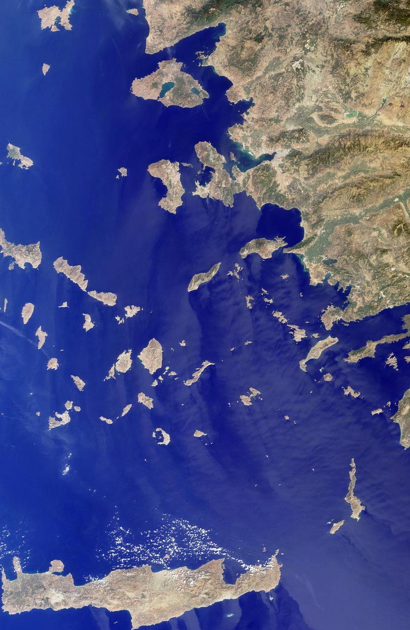
The Greek islands of the Aegean Sea, scattered across 800 kilometers from north to south and between Greece and western Turkey, are uniquely situated at the intersection of Europe, Asia and Africa. This image from NASA Terra satellite was acquired on Se
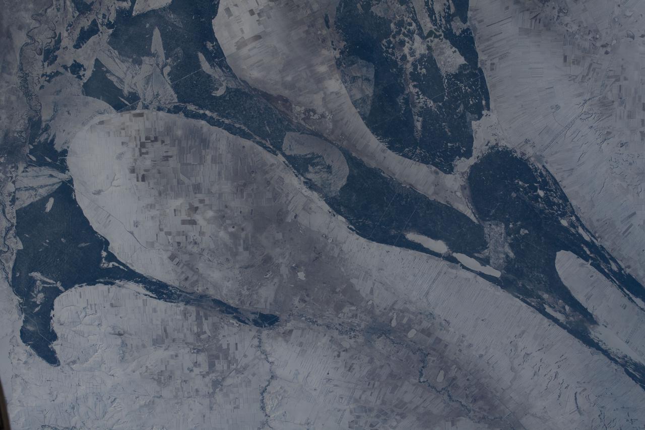
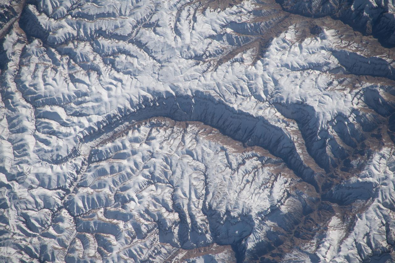
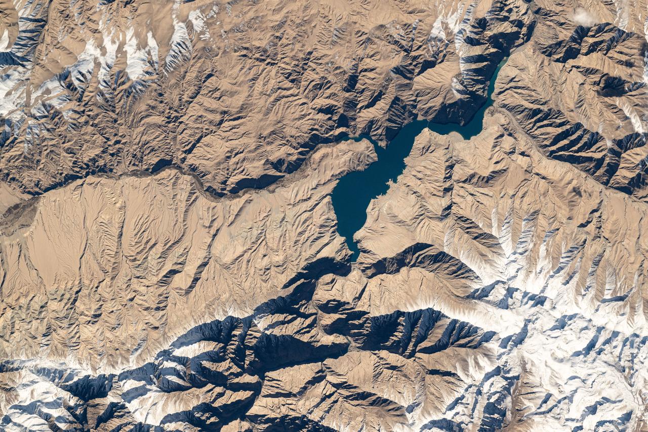
GMT039_13_17_Jasmin Moghbeli_SN1018_Snow-covered Mountains Asia 50-500mm
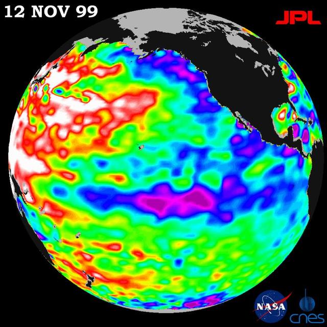
Unusually warm ocean temperatures off Asia and cool waters in the eastern and equatorial Pacific are signaling La Niña mild return, according to the latest sea-surface heights observed by the joint NASA-French space agency TOPEX/Poseidon satellite.
iss066e089960 (Dec. 11, 2021) --- Kazakhstan's snowy, northeast border with Russia is pictured from the International Space Station as it orbited 266 miles above central Asia.
iss068e023350 (Nov. 22, 2022) --- The Yunnan-Guizhou Plateau region of China is pictured from the International Space Station as it orbited 258 miles above southeast Asia.
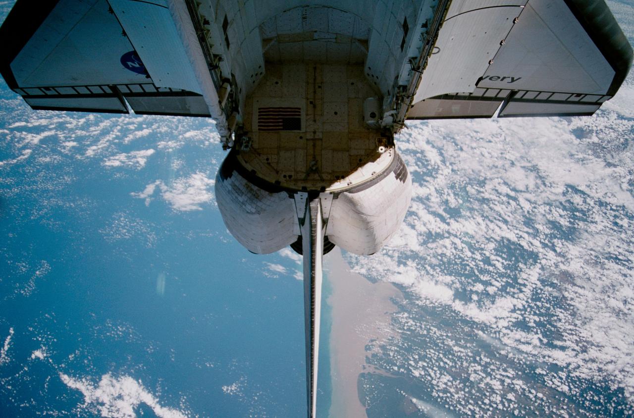
STS102-328-028 (13 March 2001) --- The Space Shuttle Discovery's payload bay and vertical stabilizer are backdropped over Southeast Asia in this 35mm scene.
iss059e067877 (May 19, 2019) --- The International Space Station flies 255 miles above Indonesia as the sun's glint beams off the Celebes Sea in southeast Asia.
iss072e005520 (Sept. 29, 2024) -- One of the largest lakes in Central Asia, Lake Balkhash, was pictured from the International Space Station as it orbited 260 miles above.

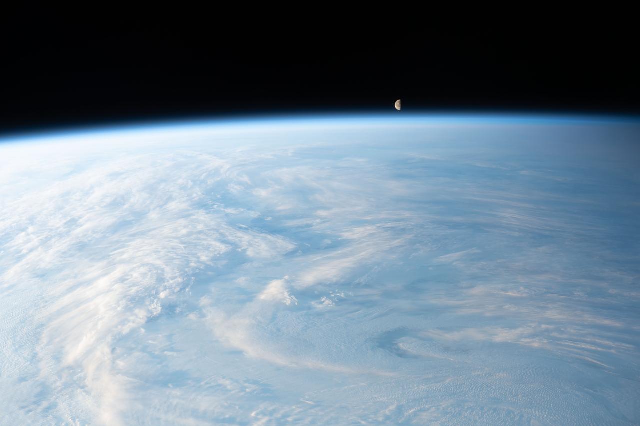
iss067e362262 (Sept. 15, 2022) --- The waning gibbous Moon is pictured from the International Space Station as it orbited 263 miles above Asia.
STS085-503-061 (7 - 19 August 1997) --- Lakes Balkhash and Alakol, southern uplands of Kazakhstan, central Asia. The long, 600 kilometers arc of Lake Balkhash occupies the center of this clear west-looking view. The left of the view shows clearly the westernmost Dzungarian Basin in the autonomous region of Xinjiang Uygur (Sinkiang), China. Kazakhstan's capital city Almaty (Alma-Ata) lies out of sight behind the boom. The Dzungarian Gate is the straight, fault-bounded valley cutting through the Dzhungarskiy Alatau Range. The Gate has acted as a major pass for centuries, allowing access between east Asia and central Asia (the valley floor is about 1,500 feet, whereas peaks reach 15,000 feet on the west and about 10,000 feet on the east side) -- it was one of the routes used by the Mongols when they began their invasion of central Asia and Europe in the 13th century. Lake Ebinur is the bright area beneath the dust plume (left center); strong north winds from the steppes of Kazakhstan and Russia are funneled through the Dzungarian Gate where they pick up sediment from dry lakebeds and blow it into China. The Ili River flows westward, parallel to the Dzhungarskiy Alatau Range, through Kapchagay Lake (partially visible beneath boom), then northwest across a large delta plain and into Lake Balkhash.
Earth observation taken by an Expedition 36 crew member on board the International Space Station (ISS). Per Twitter message: Tien Shan mountain range, Central Asia.
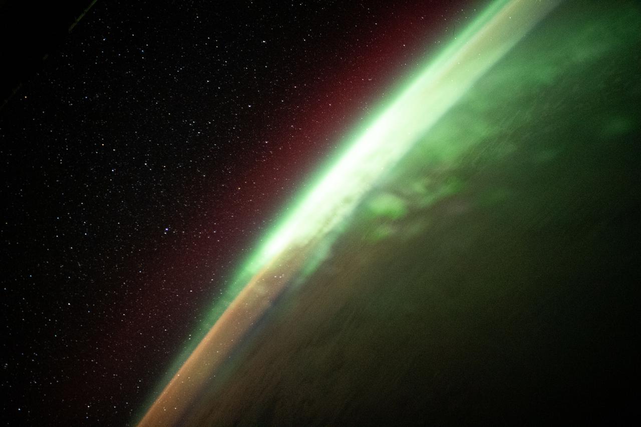
iss065e214231 (Aug. 2, 2021) --- The aurora australis streams across the Earth's atmosphere as the International Space Station orbited 271 miles above the southern Indian Ocean in between Asia and Antarctica.
iss067e302507 (Sept. 1, 2022) --- The Karakum Desert oasis in the Mary region of Turkmenistan is pictured from the International Space Station as it orbited 260 miles above Central Asia.
iss065e214221 (Aug. 2, 2021) --- The aurora australis streams across the Earth's atmosphere as the International Space Station orbited 270 miles above the southern Indian Ocean in between Asia and Antarctica.

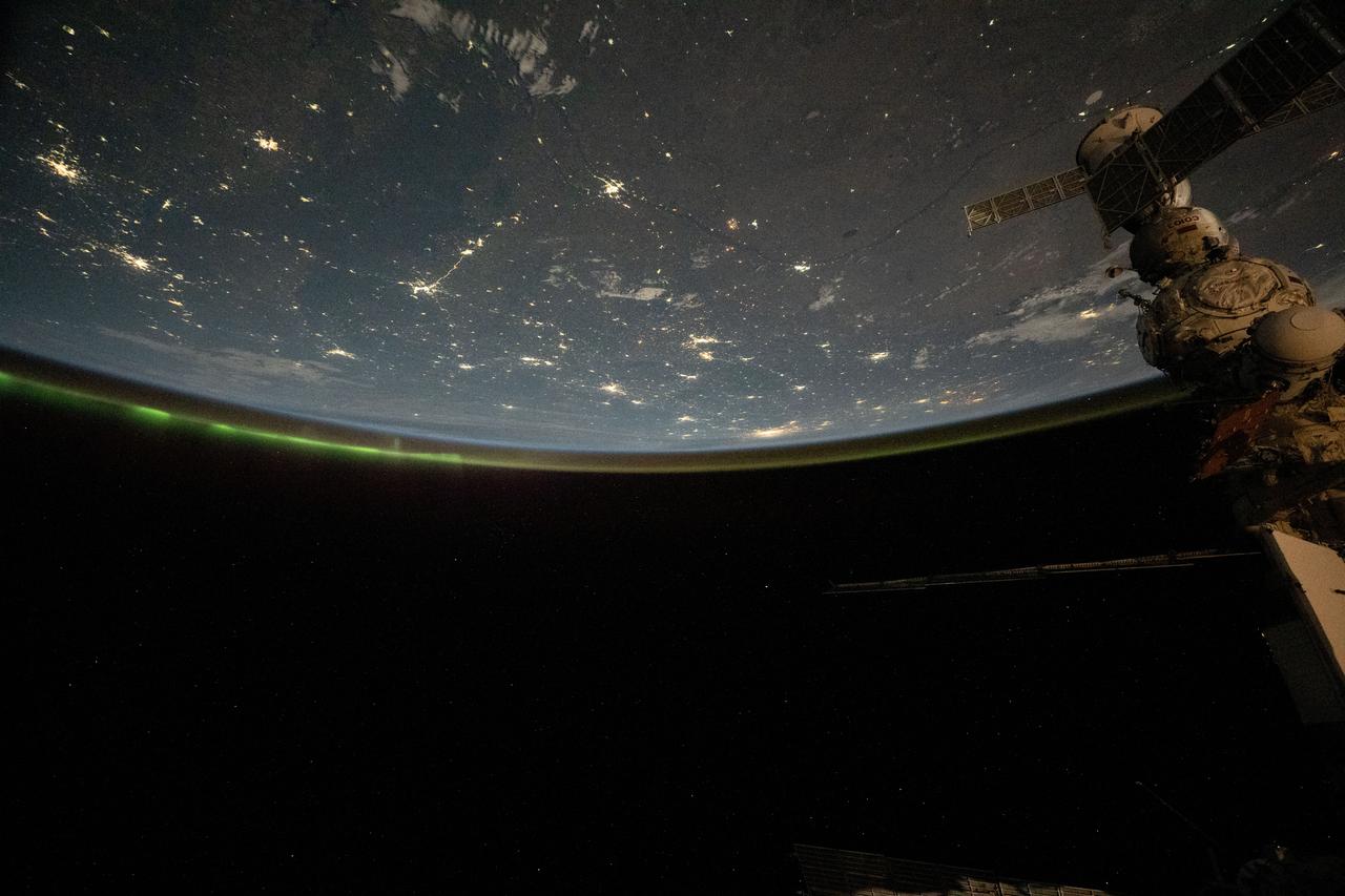
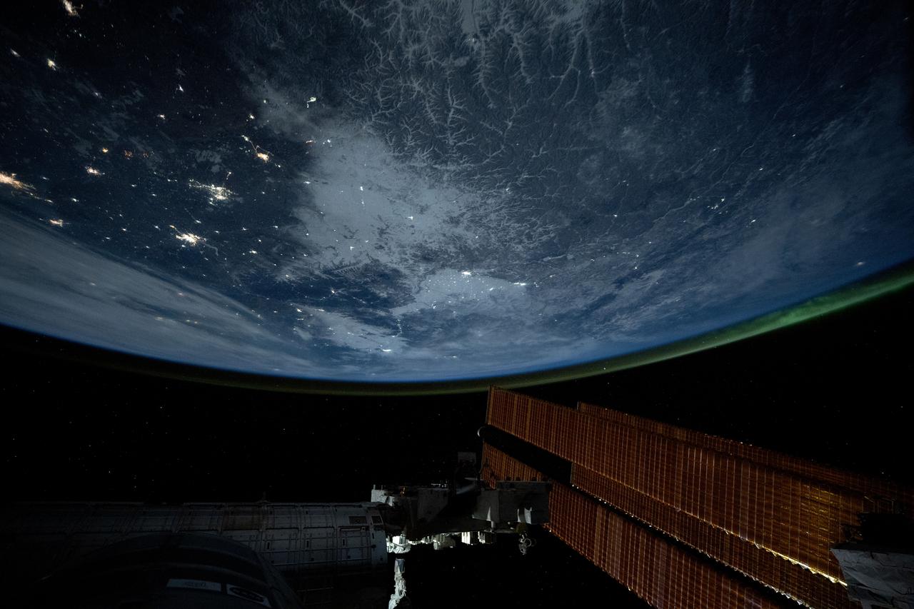
iss062e103874 (March 20, 2020) --- The city lights at the intersection of Europe and Asia sparkle underneath an atmospheric glow and a starry night sky as the International Space Station orbited 262 miles above into an orbital sunset.
iss067e212667 (July 31, 2022) --- The Uzbekistan cities of Urgench and Xonqa near the Amu Darya, a major river in Central Asia, are pictured from the International Space Station as it orbited 259 miles above.
iss065e214235 (Aug. 2, 2021) --- The aurora australis streams across the Earth's atmosphere as the International Space Station orbited 271 miles above the southern Indian Ocean in between Asia and Antarctica.
iss070e042553 (Dec. 17, 2023) --- The Uly Balkan mountian range in Turkmenistan near the coast of the Caspian Sea is pictured from the International Space Station as it orbited 260 miles above the central Asia nation.
iss070e091704 (Feb. 10, 2024) --- A portion of the Pamir Mountains, a mountain range at the northwest junction of the Himalayas and crossing several Central Asia countries, is pictured from the Interntional Space Station as it orbited 261 miles above Uzbekistan.

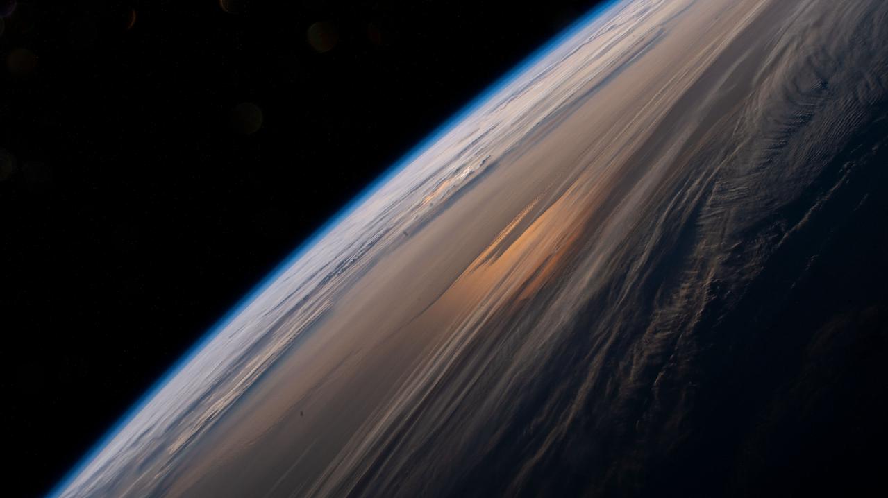
ISS027-E-013302 (15 April 2011) --- This photo captured by one of the Expedition 27 crew members aboard the International Space Station features Earth's atmospheric limb and sunset over southwestern Asia.
iss071e312274 (June 20, 2024) --- The Gökdepe köli fishing pond in the Ahal Region of Turkmenistan is pictured from the International Space Station as it orbited 265 miles above Central Asia.
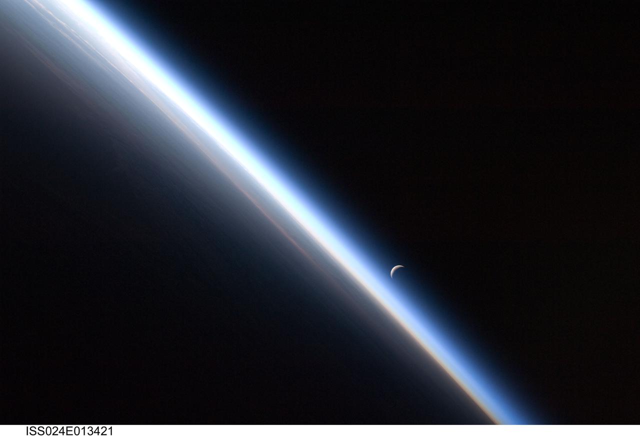
ISS024-E-013421 (4 Sept. 2010) --- A setting last quarter crescent moon and the thin line of Earth’s atmosphere are photographed by an Expedition 24 crew member as the International Space Station passes over central Asia.
iss071e606709 (Aug. 17, 2024) --- Lightning (at right) illuminates the clouds in this photograph from the International Space Station as it orbited 261 miles above the South China Sea with the city lights of Southeast Asia shining through.

iss066e088446 (Dec. 12, 2021) --- The Soyuz MS-19 crew ship is pictured docked to the Rassvet module as the International Space Station orbited 260 miles above southeast Asia.
iss065e009308 (April 28, 2021) --- The early morning hues of an orbital sunrise are pictured from the International Space Station as it soared 264 miles above the China-Russia border in far eastern Asia near the the Sea of Japan.

iss062e081626 (March 4, 2020) --- The atmospheric glow floats above Earth's moonlit horizon beneath a starry sky as the International Space Station orbited 263 miles above central Asia.

iss065e214281 (Aug. 2, 2021) --- The aurora australis streams across the Earth's atmosphere as the International Space Station orbited 271 miles above the southern Indian Ocean in between Asia and Antarctica.
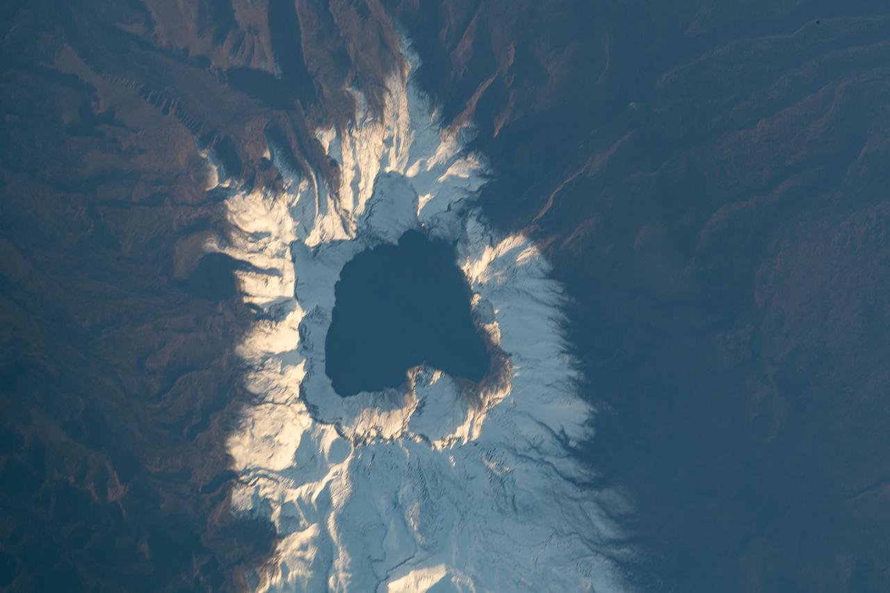
iss065e444007 (Oct. 8, 2021) --- Heaven Lake rests in the crater of the active volcano Paektu Mountain that lies on the China-North Korea border. The International Space Station was orbiting 263 miles above Asia at the time this photograph was taken.
iss070e035253 (Dec. 4, 2023) --- The waning gibbous Moon is pictured just above Earth's horizon in this photograph from the International Space Station as it orbited 262 miles above a cloudy central Asia.
iss072e067740 (Oct. 12, 2024) --- The Tashkurgan River in western China's Hindu Kush mountains near the nations of Tajikistan and Afghanistan is pictured from the International Space Station as it orbited 259 miles above Asia.

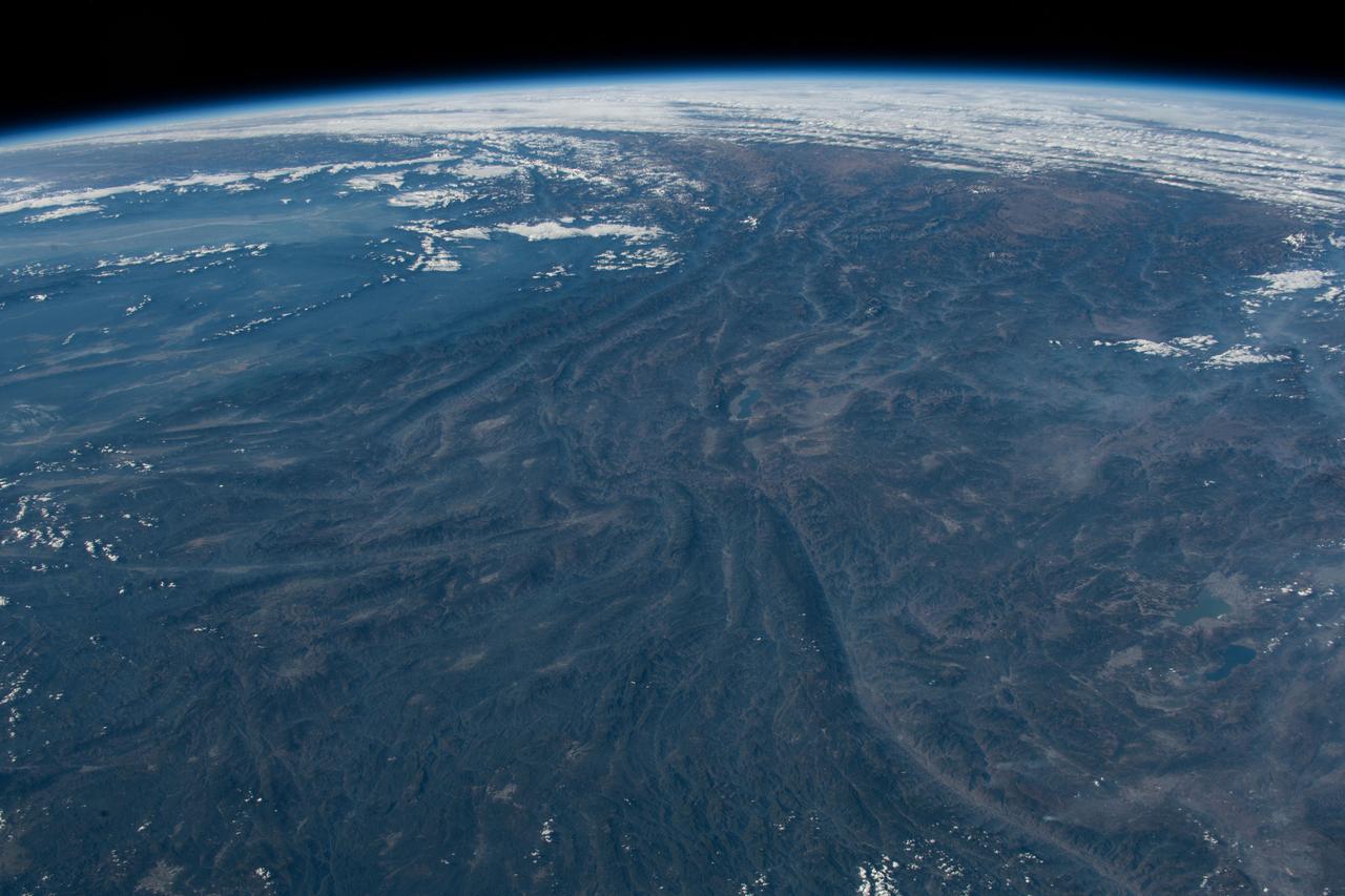
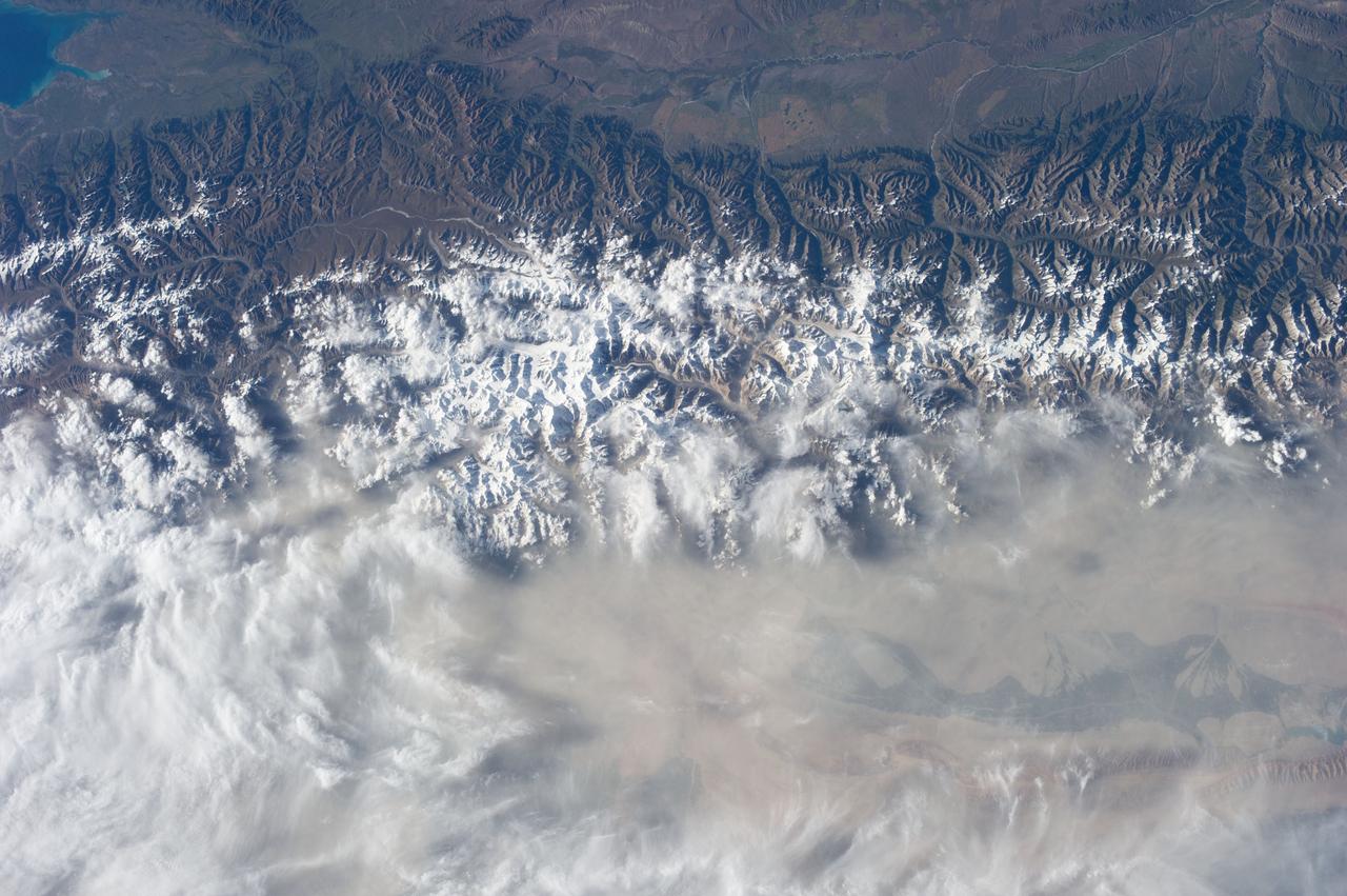
iss072e397138 (Dec. 19, 2024) --- The Himalayas separate the arid steppe of China's Tibetan Plateau from a cloudy Indian subcontinent in this photograph from the International Space Station as it soared 261 miles above Asia.
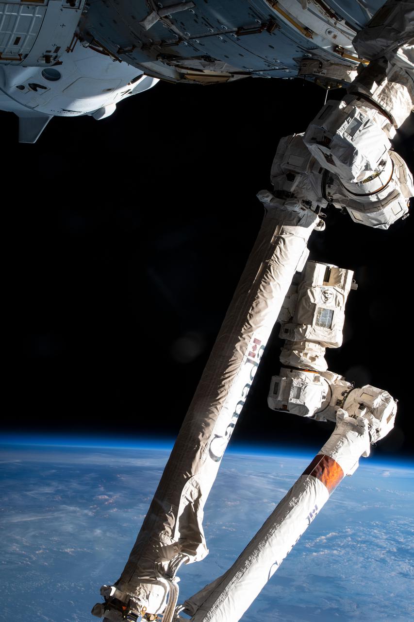
iss066e140062 (Feb. 10, 2022) --- The 57.7-foot-long Canadarm2 robotic arm and the SpaceX Crew Dragon Endeavour (top left) are pictured as the International Space Station orbited 258 miles above southeast Asia.
Earth observation taken during a night pass by an Expedition 36 crew member on board the International Space Station (ISS). Per Twitter message: An impressive line of storms moving through Asia July 24. The lightning was amazing!
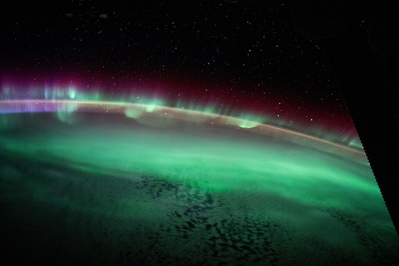
iss065e214198 (Aug. 2, 2021) --- The aurora australis streams across the Earth's atmosphere as the International Space Station orbited 271 miles above the southern Indian Ocean in between Asia and Antarctica.
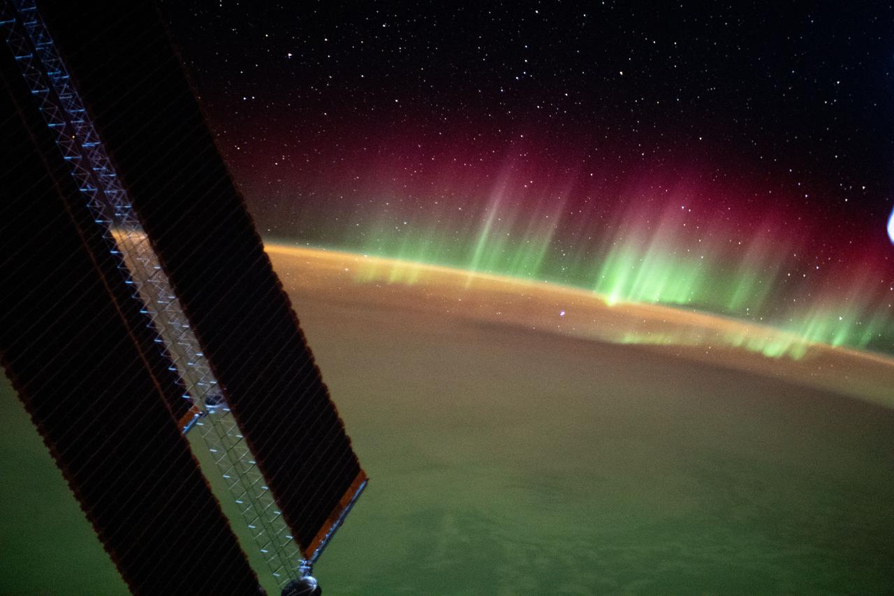
iss071e695419 (Sept. 16, 2024) --- The city lights of central Asia and an aurora crowning Earth's horizon are pictured in this photograph from the International Space Station as it orbited 264 miles above western Kazakhstan.
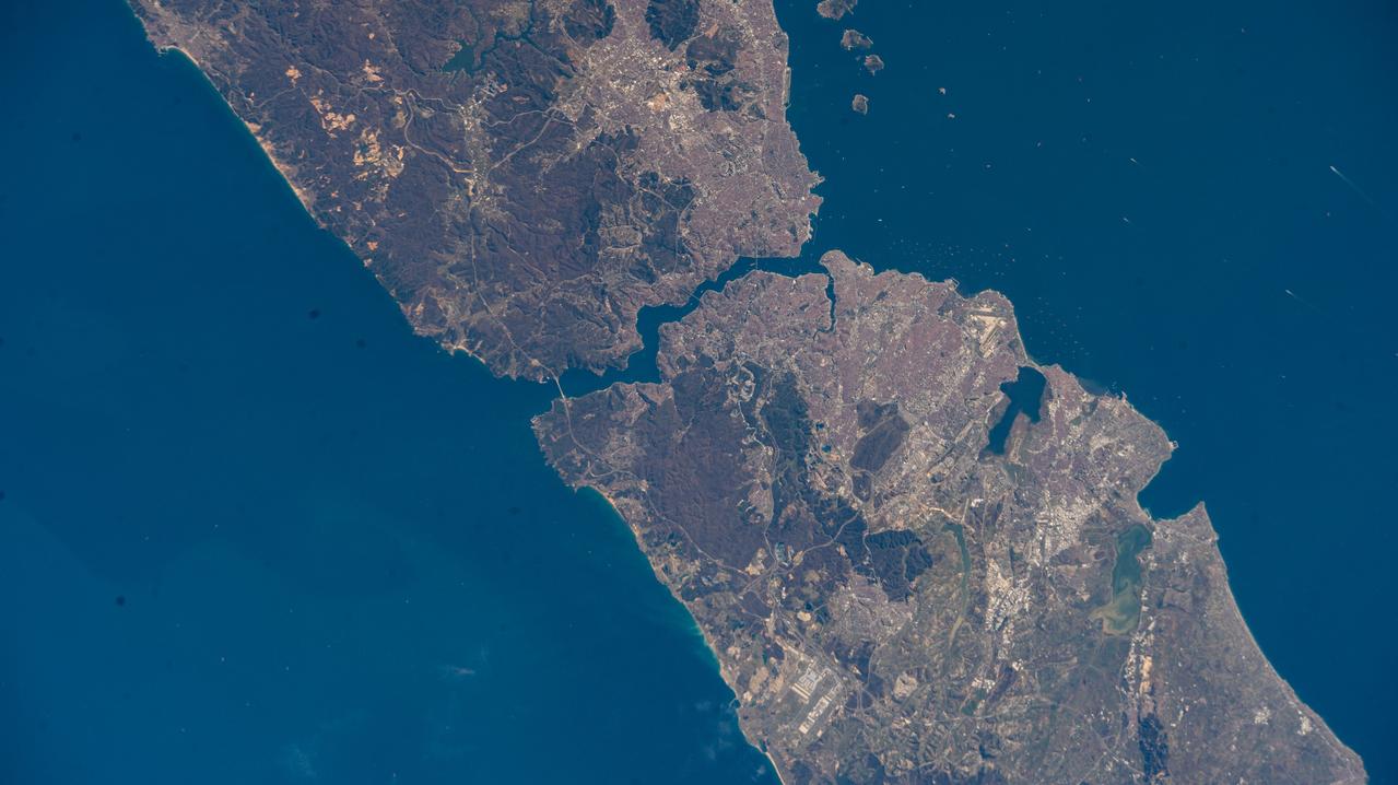
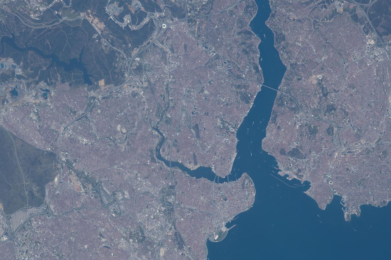
iss072e574770 (Jan. 29, 2025) --- The Bosphorus Strait splits the city of Istanbul, Türkiye, and connects the Black Sea with the Sea of Marmara in this photograph from the International Space Station as it orbited 260 miles above where Europe connects to Asia.
iss065e214251 (Aug. 2, 2021) --- The aurora australis seemingly crowns the Earth's horizon as the International Space Station orbited 272 miles above the southern Indian Ocean in between Asia and Antarctica.
iss067e014096 (April 15, 2022) --- The mountainous border region between Kazakhstan and Kyrgyzstan is pictured from the International Space Station as it orbited 262 miles above Centtral Asia.
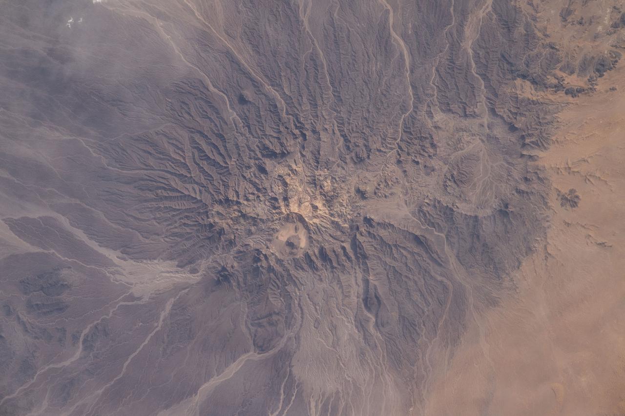
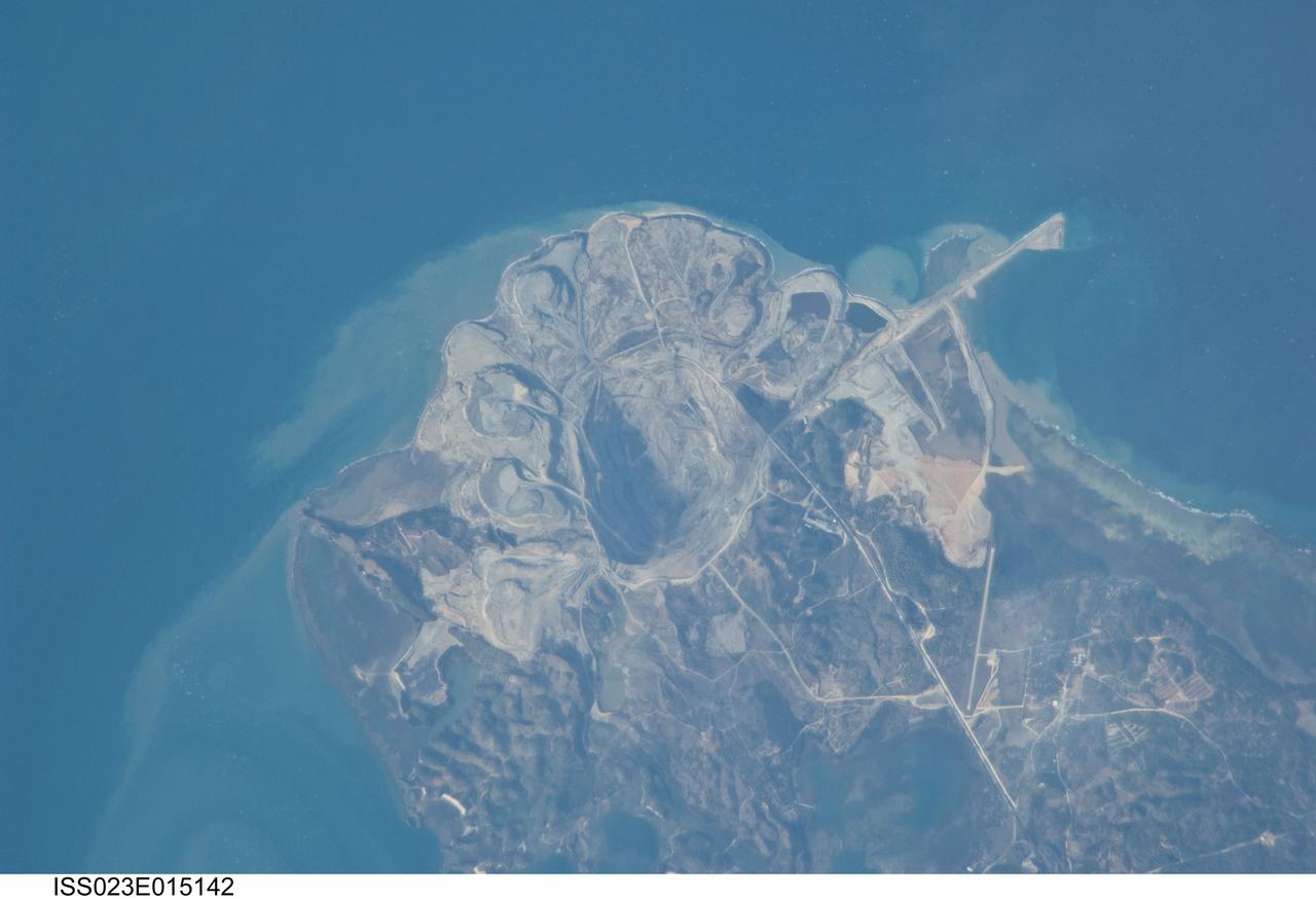
iss071e092895 (May 20, 2024) --- Mud Volcano in Pakistan's western district of Chagai is pictured from the International Space Station as it orbited 258 miles above central Asia.
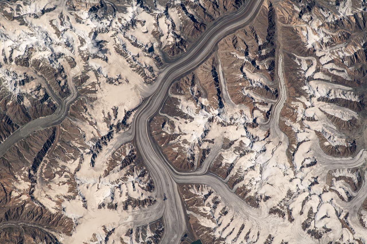
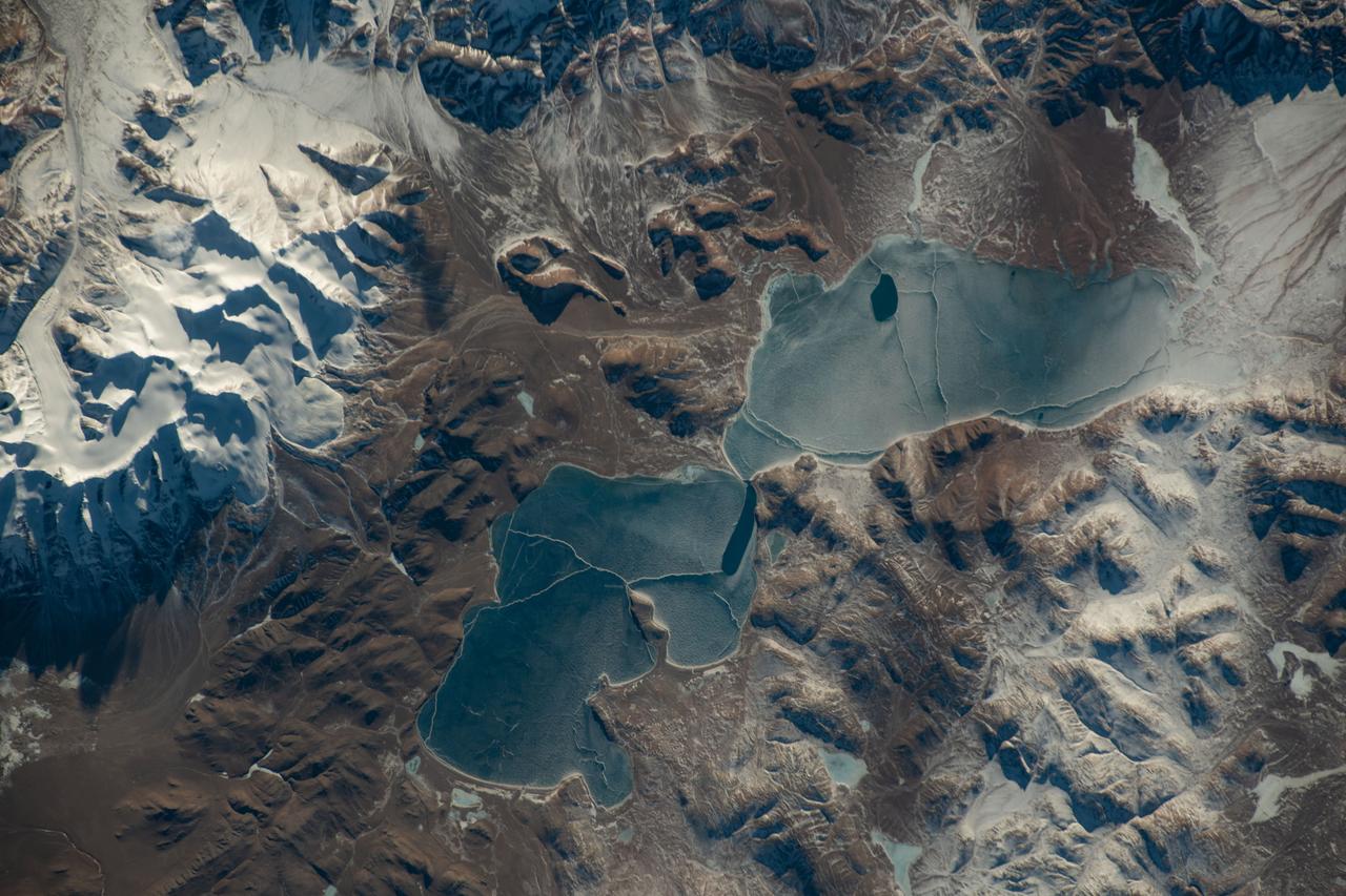
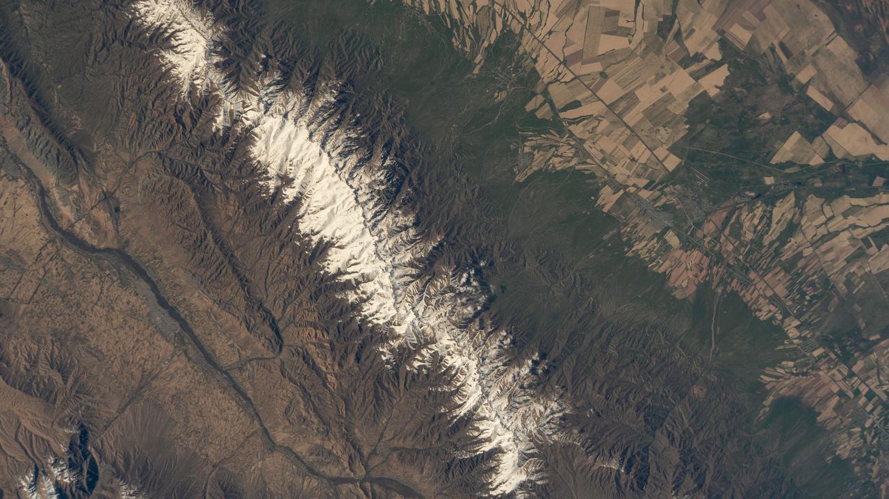
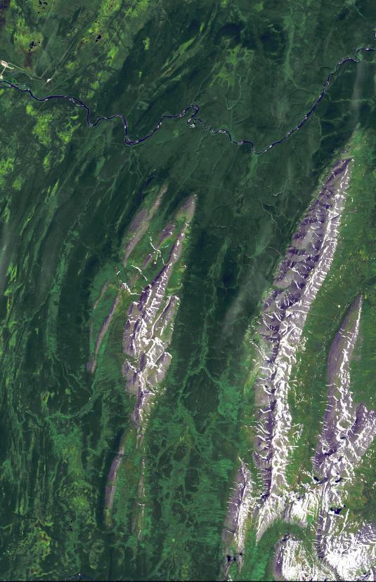
iss069e060329 (Aug. 15, 2023) --- Glaciers in the Pamir mountain range located in The Republic of Tajikistan are pictured from the International Space Station as it orbited 264 miles above Central Asia.
iss065e009307 (April 28, 2021) --- The early morning hues of an orbital sunrise are pictured from the International Space Station as it soared 264 miles above the China-Russia border in far eastern Asia near the the Sea of Japan.
iss068e017473 (Oct. 18, 2022) --- A portion of the Kunlun Mountains, one of the longest mountain ranges in Asia, in southwestern China is pictured from the International Space Station as it orbited 262 miles above.
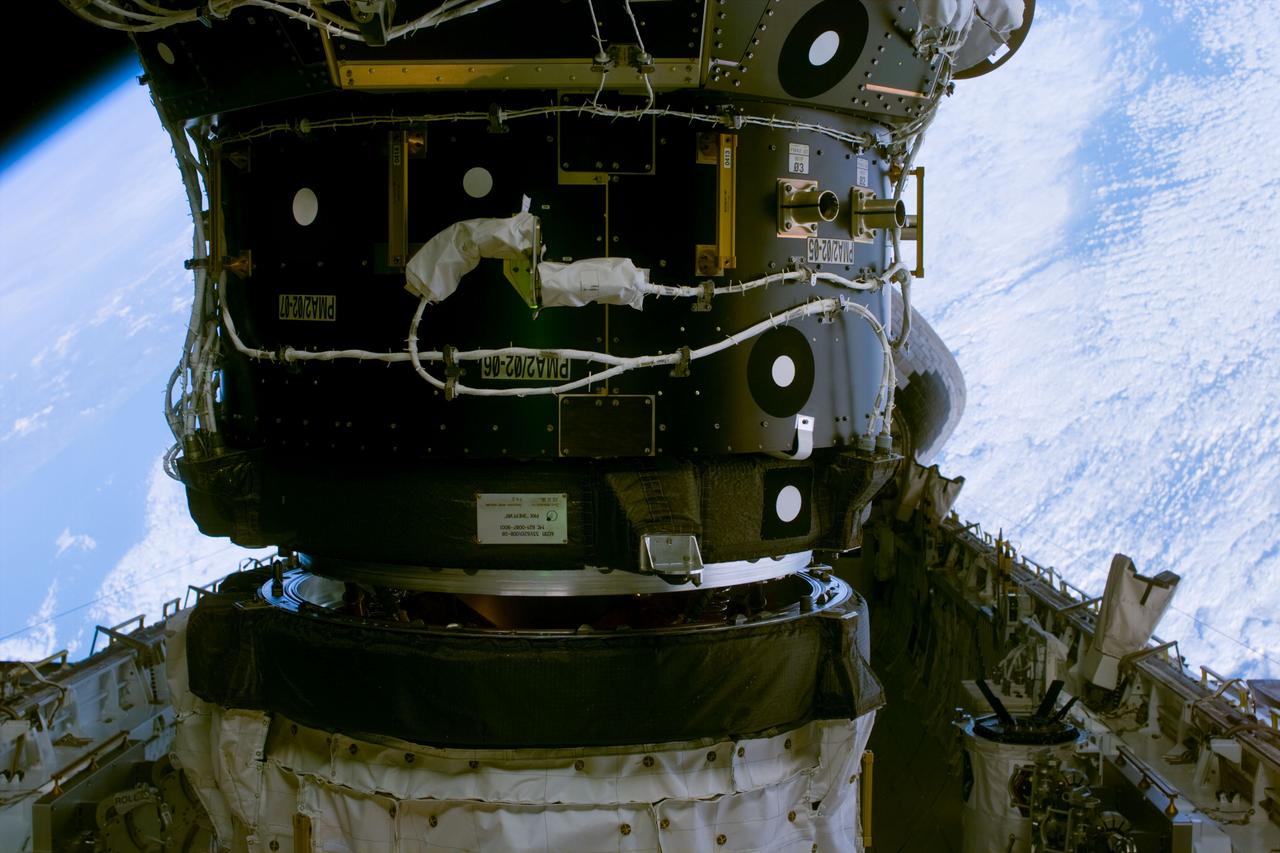
S88-E-5037 (12-05-98)--- Clouds over Asia form the backdrop for this scene of Unity following its successful mating to Endeavour's docking system. The photo was taken at 23:53:02 GMT, Dec. 5.
This image from NASA Terra spacecraft shows the Ural Mountains, which run 2500 km north-south through western Russia, and form the boundary between Europe and Asia. Since the 17th century, the mountains were exploited for their deposits of iron, copper, gold, coal, oil, mica and gemstones. The Urals are among the world's oldest existing mountain ranges, having been formed about 275 million years ago due to the collision of the Laurussia supercontinent with the continent of Kazakhstania. The image was acquired July 13, 2011, covers an area of 39 by 62 km, and is located near 65.5 degrees north, 59.9 degrees east. http://photojournal.jpl.nasa.gov/catalog/PIA19795
iss072e843309 (March 15, 2025) --- City lights dot the northeastern landscape of China with a wispy aurora above Earth's horizon in this photograph from the International Space Station as it orbited 262 miles above Asia. In the bottom foreground, is the Kibo laboratory module's Exposed Facility, an external research platform, and the orbital outpost's main solar arrays.

ISS040-E-098804 (16 Aug. 2014) --- One of the Expedition 40 crew members aboard the International Space Station, flying at an altitude of 221 nautical miles, photographed this oblique image showing parts of the continents of Europe and Asia. Much of Greece is visible on the left side of the frame and a large area of Turkey can be seen at right.
iss073e0983013 (Oct. 21, 2025) --- The Taiwan Strait separates the eastern coast of China’s Fujian Province (right) from the island nation of Taiwan (lower left) in this photograph taken from the International Space Station as it orbited 257 miles above Earth. The strait is a vital waterway in East Asia, supporting the fishing, shipping, and communications industries.
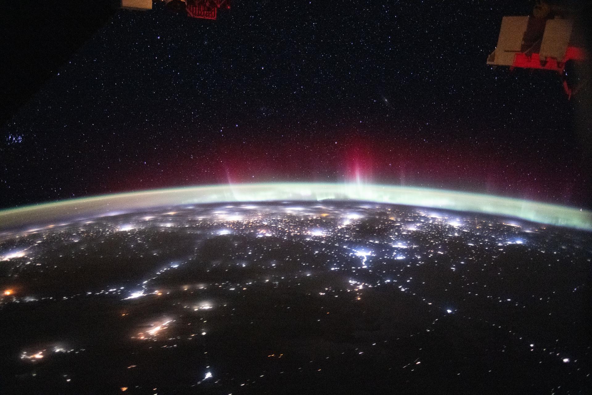
iss074e0324639 (Feb. 22, 2026) --- An aurora streams above Earth’s atmospheric glow, blanketing the city lights of Europe and Russia in this photograph taken at approximately 3:30 a.m. local time from the International Space Station as it orbited 263 miles above Central Asia. Credit: NASA/Chris Williams
iss059e051356 (May 6, 2019) --- The SpaceX Dragon resupply ship is pictured berthed to the Harmony module as the International Space Station orbited 258 miles above east Asia. Dragon was still in the grips of the Canadarm2 robotic arm shortly after it was installed on Harmony.
ISS047e137096 (06/03/2016) --- This stunning Earth image taken from the International Space Station looks from Northwestern China on the bottom into eastern Kazakhstan. The large lake in Kazakhstan with golden sun glint is named Lake Balkhash. It is one of the largest lakes in Asia and is the 15th largest lake in the world. The lake is fed by 7 rivers.
iss065e001923 (April 22, 2021) --- Istanbul, Turkey, connects Europe and Asia and is split by the Golden Horn and the Bosphorus Strait which links the Sea of Marmara to the Black Sea. The International Space Station was orbiting 264 miles above Turkey just southwest of its capital city, Ankara, at the time this photograph was taken.
iss073e0134286 (June 2, 2025) --- The north central Vietnamese coast on the South China Sea, in between the cities of Thanh Hóa on the Nam River (left) and Vinh on the Cá River (right), is pictured from the International Space Station as it orbited 260 miles above Southeast Asia.
iss071e139662 (May 27, 2024) --- The world's largest inland body of water, the Caspian Sea rests in between Europe and Asia and is bordered by the nations of Russia, Kazakhstan, Turkmenistan, Iran, and Azerbaijan. The International Space Station was orbiting 262 miles above Erbil, Iraq, at the time of this photograph.
iss074e0316083 (Feb. 18, 2026) --- The far western edge of the Taklamakan Desert—the world’s second-largest shifting sand desert—meets the Pamir Mountains in China, where scorching desert conditions transition to frigid alpine terrain. The International Space Station was orbiting 259 miles above Central Asia when this photograph was taken.
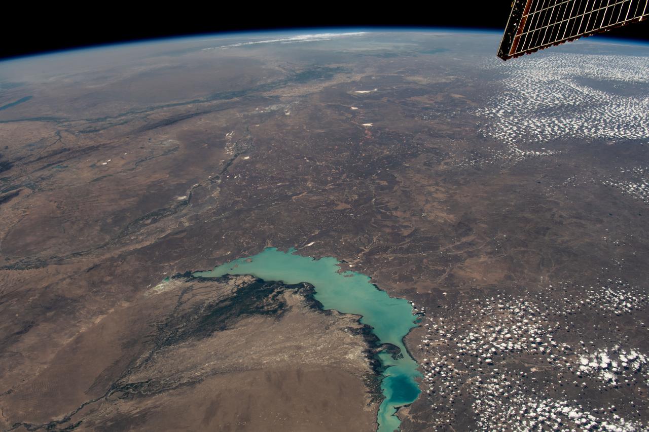
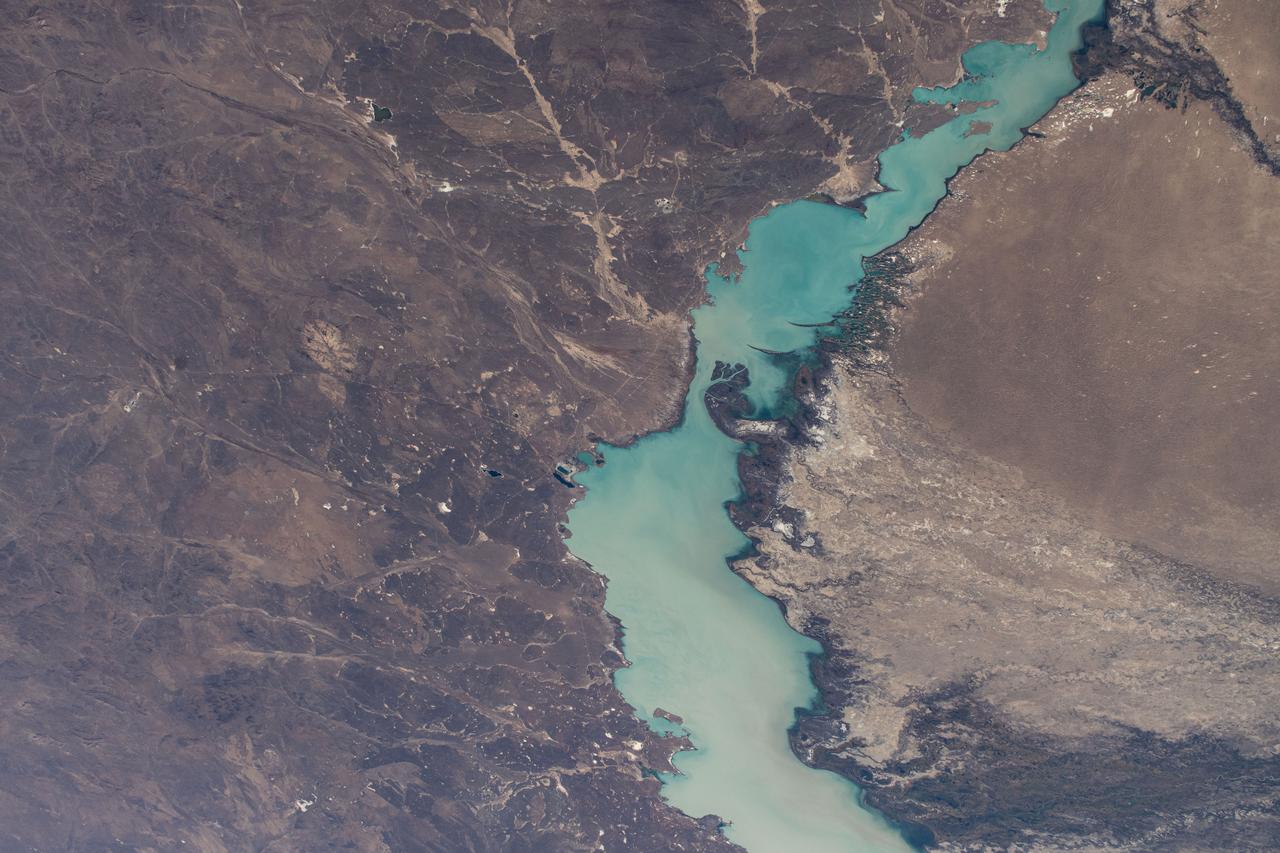
iss069e053802 (August 3, 2023) -- Lake Balkhash, one of the largest in Central Asia, spans roughly 6,500 square miles (17,000 square kilometers) in Kazakhstan. The western part of the lake holds fresh water whereas the eastern side of the basin is salty. The International Space Station soared 261 miles above as this image was taken.
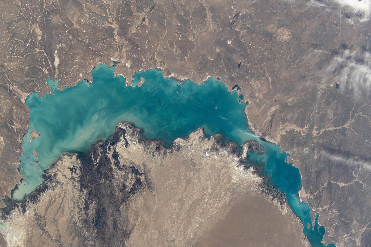
iss071e012112 (April 19, 2024) -- In southeastern Kazakhstan lies Lake Balkhash, one of the largest in Asia. Its turquoise color comes from winter ice melting. As the International Space Station soared nearly 260 miles above, NASA astronaut Mike Barratt captured this photo.
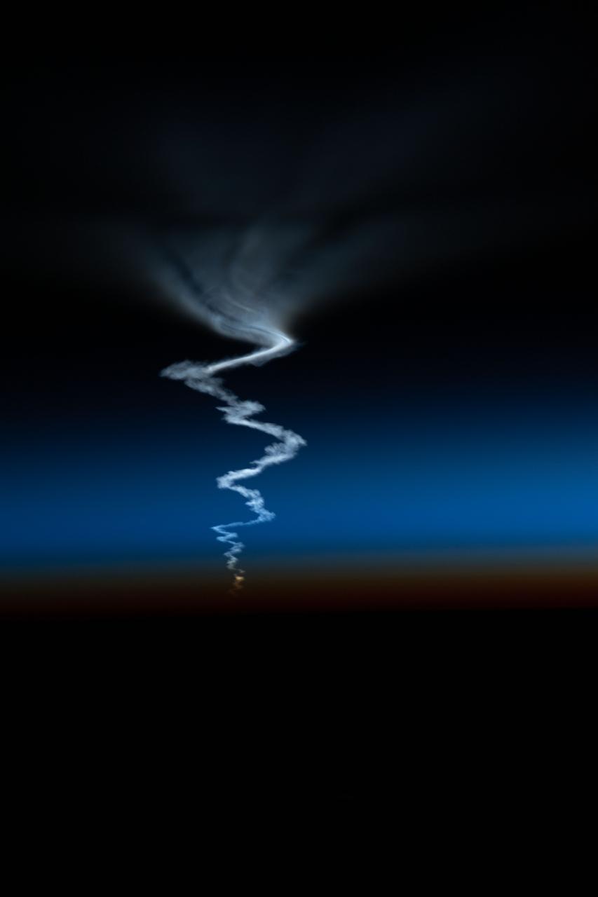
iss067e375971 (Sept. 21, 2022) --- The International Space Station was orbiting into a sunset 263 miles above Asia when this photograph of the Soyuz MS-22 crew ship ascending into space was captured by NASA astronaut and Expedition 67 Flight Engineer Bob Hines.
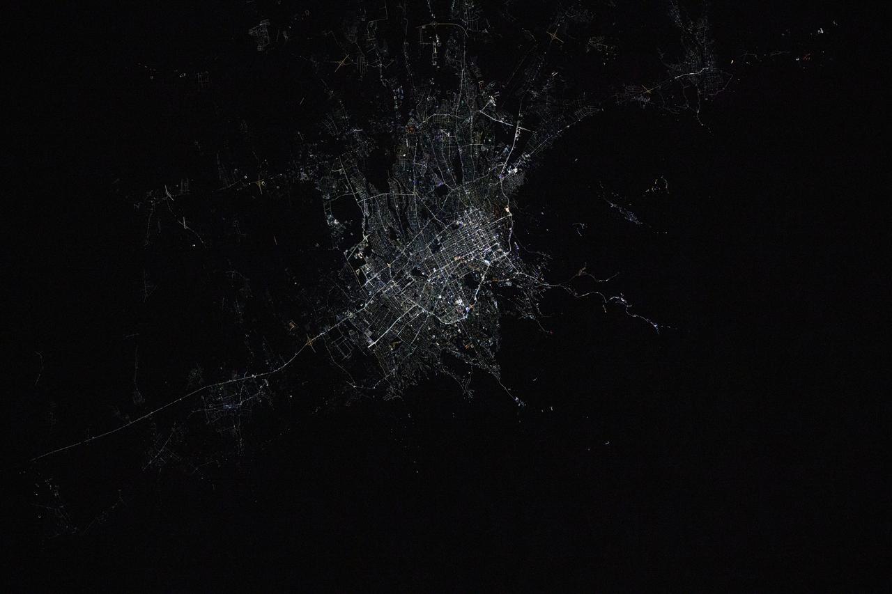
iss072e792891 (March 17, 2025) --- Almaty, Kazakhstan's largest city with a population of about 2.25 million and the second largest city in Central Asia, is pictured at approximately 12:42 a.m. local time from the International Space Station as it orbited 261 miles above.
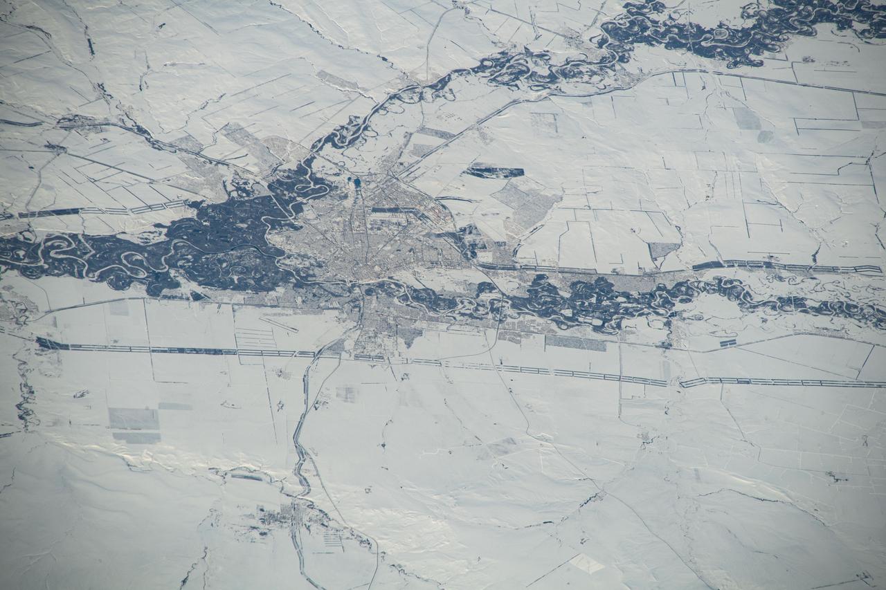
iss070e097619 (Feb. 11, 2024) --- Orenburg, Russia, surrounded by a wintry landscape, the Sakmara and Ural Rivers, and near the border with Kazakhstan, is pictured from the International Station as it orbited 263 miles above the area where Eastern Europe meets central Asia.

ISS017-E-011603 (22 July 2008) --- Layers of Earth's atmosphere, brightly colored as the sun rises over central Asia, and Polar Mesospheric Clouds (also known as noctilucent clouds) are featured in this image photographed by an Expedition 17 crewmember on the International Space Station. The image was acquired in support of International Polar Year research.