Chuquicamata, in Chile's Atacama Desert, is the largest open pit copper mine in the world, by excavated volume. The copper deposits were first exploited in pre-Hispanic times. Open pit mining began in the early 20th century when a method was developed to work low grade oxidized copper ores. The image was acquired September 2, 2007, covers an area of 19.5 by 29.3 km, and is located at 22.1 degrees south, 68.9 degrees west. http://photojournal.jpl.nasa.gov/catalog/PIA20973
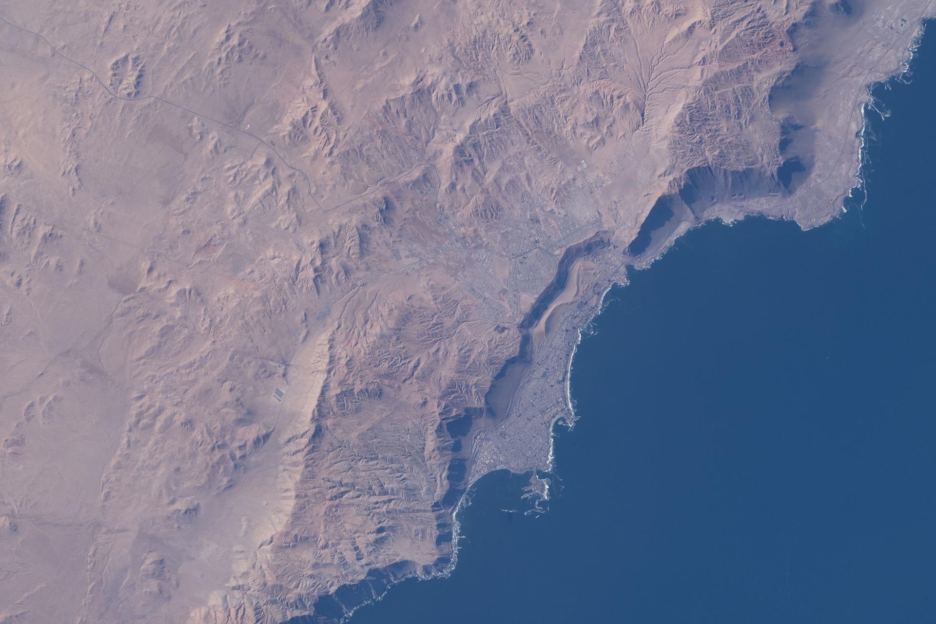
iss074e0362030 (March 5, 2026) --- Iquique, Chile, with a population of over 230,000, lies at the base of a steep coastal slope just west of the Atacama Desert—one of the world’s driest regions—on the South American nation’s Pacific coast. The International Space Station was orbiting 264 miles above at the time of this photograph. Credit: NASA/Jessica Meir
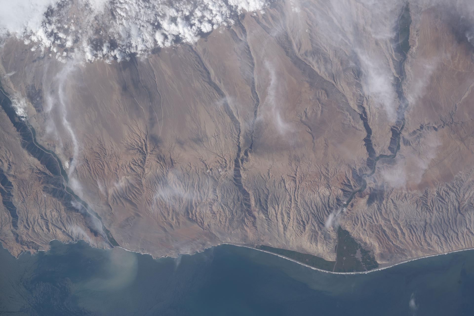
iss074e0315662 (Feb. 13, 2026) --- A portion of the Atacama Desert along Peru’s southern Pacific coast, featuring barren plains, rocky cliffs, vast sand dunes, and fertile river valleys, is pictured from the International Space Station as it orbited 265 miles above the South American nation. Credit: NASA/Chris Williams
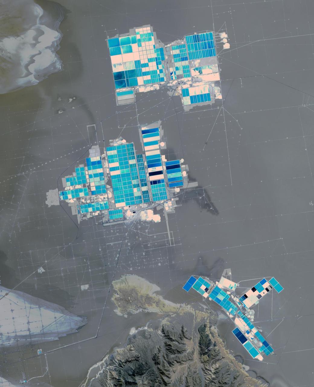
Salar de Atacama (Atacama salt flats) in Chile's Atacama Desert receives 2 mm rain per year. Its attraction are the brines 40 m below ground. They are pumped to the surface into large evaporation pans. After the water has vanished, a yellowish greasy solution is left behind that contains lithium. In fact, Salar de Atacama produces 27% of the world's annual supply. Mining lithium here is less expensive to produce than from neighboring Salar de Uyuni, which is estimated to have half of the lithium reserves in the world. The image was acquired August 21, 2017, covers an area of 22.5 by 27.8 km, and is located at 23.5 degrees south, 68.3 degrees west. https://photojournal.jpl.nasa.gov/catalog/PIA23420
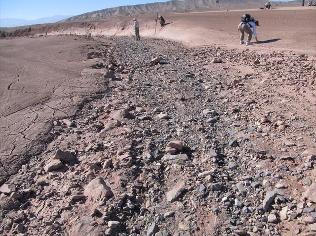
This image shows a dry streambed on an alluvial fan in the Atacama Desert, Chile, revealing the typical patchy, heterogeneous mixture of grain sizes deposited together.
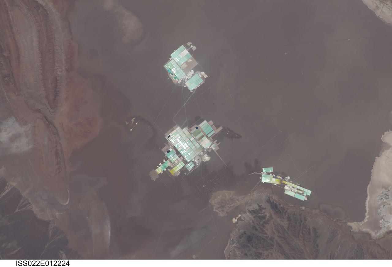
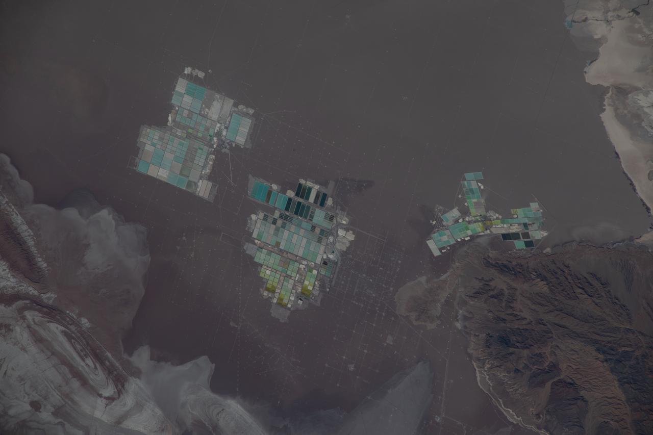
ISS022-E-012224 (15 Dec. 2009) --- Evaporation ponds in the Salar de Atacama, Chile are featured in this image photographed by an Expedition 22 crew member on the International Space Station. The Salar (salt flat) de Atacama in Chile is an enclosed basin with no drainage outlets. While the grey-brown surface of the Salar is flat and desiccated, mineral-rich brines - water with a high percentage of dissolved salts - are located below the surface. The subsurface brines of the Salar de Atacama are particularly rich in lithium salts. Lithium is an essential component of advanced batteries and medicines, among many other uses. The brines are pumped to the surface through a network of wells and into large shallow evaporation ponds ? three such evaporation pond facilities are visible in the center of the image. Color variations in the ponds are due to varying amounts of salts relative to water. The dry and windy climate enhances evaporation of the water, leaving concentrated salts behind for extraction of the lithium. The Salar de Atacama is located in the southern half of the Atacama Desert ? with no historical or current records of rainfall in some parts of this desert, it is considered to be one of the driest places on Earth. This photograph illustrates the central portion of the Salar de Atacama. It is bounded by brown to grey-brown folded and faulted strata of the Cordillera de la Sal to the northwest (upper left) and darker bedrock of the Cordon de Lila to the south (lower right).
iss064e000361 (Oct. 24, 2020) --- Industrial mining activity is pictured in the Atacama Desert of northern Chile, which is one of the most arid places on Earth. The International Space Station had just crossed into South America from the Pacific Ocean when this photograph was taken.
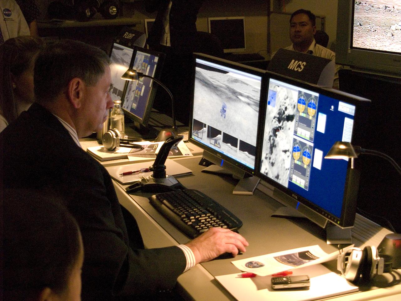
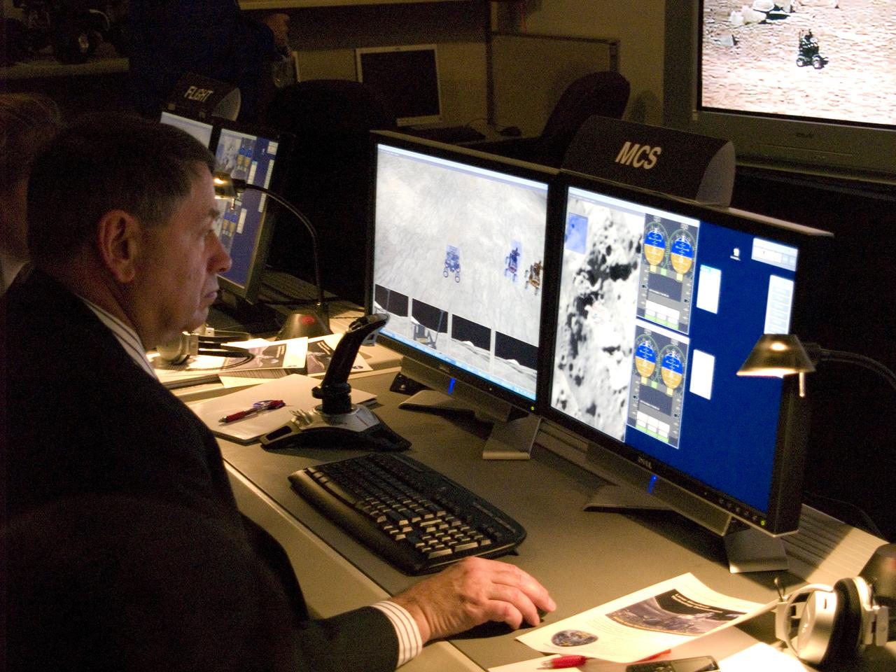
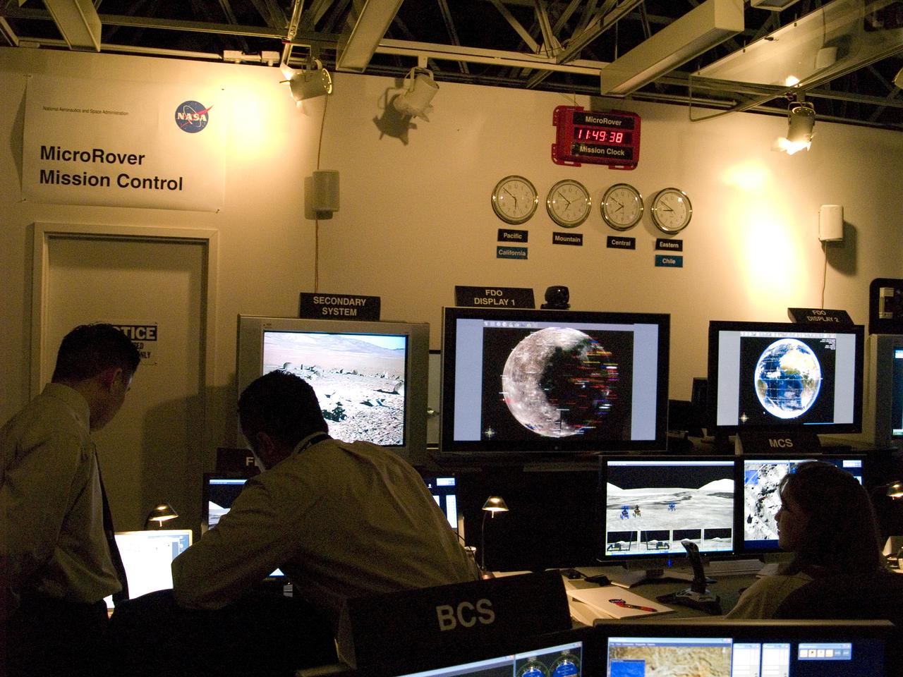
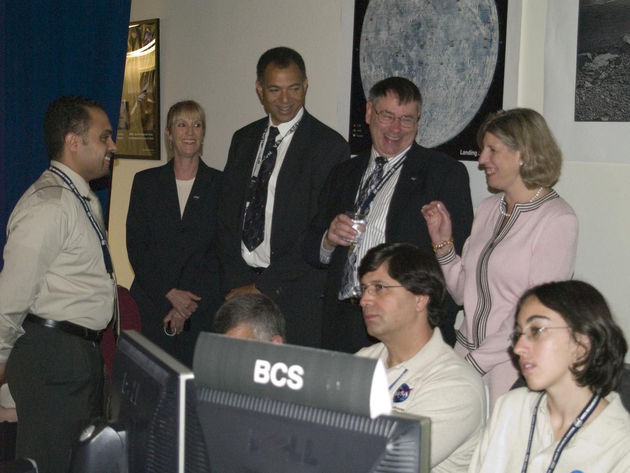
Spaceward Bound Program in Atacama Desert; shown here is a realtime webcast from Yungay, Chile vis satellite involving NASA Scientists and seven NASA Explorer school teachers. Spaceward Bound Program in Atacama Desert; shown here is a realtime webcast from Yungay, Chile vis satellite involving NASA Scientists and seven NASA Explorer school teachers. On the Ames end we find the Girl Scouts Space cookines robotic team. The robot nicknamed Zoe is looking for life in extreme environments in preparation for what might be encounter on Mars. On the Ames end we find the Girl Csouts Space cookines robotic team. The robot nicknamed Zoe is looking for life in extreme environments in preparation for what might be encounter on Mars. see full text on the NASA-Ames News - Research # 04-91AR Center Director works with 'SpaceCookie' sending commands to Zoe.

Spaceward Bound Program in Atacama Desert; shown here is a realtime webcast from Yungay, Chile vis satellite involving NASA Scientists and seven NASA Explorer school teachers. Spaceward Bound Program in Atacama Desert; shown here is a realtime webcast from Yungay, Chile vis satellite involving NASA Scientists and seven NASA Explorer school teachers. On the Ames end we find the Girl Scouts Space cookines robotic team. The robot nicknamed Zoe is looking for life in extreme environments in preparation for what might be encounter on Mars. On the Ames end we find the Girl Csouts Space cookines robotic team. The robot nicknamed Zoe is looking for life in extreme environments in preparation for what might be encounter on Mars. see full text on the NASA-Ames News - Research # 04-91AR Center Director works with 'SpaceCookie' sending commands to Zoe.
Spaceward Bound Program in Atacama Desert; shown here is a realtime webcast from Yungay, Chile vis satellite involving NASA Scientists and seven NASA Explorer school teachers. Spaceward Bound Program in Atacama Desert; shown here is a realtime webcast from Yungay, Chile vis satellite involving NASA Scientists and seven NASA Explorer school teachers. On the Ames end we find the Girl Scouts Space cookines robotic team. The robot nicknamed Zoe is looking for life in extreme environments in preparation for what might be encounter on Mars. On the Ames end we find the Girl Csouts Space cookines robotic team. The robot nicknamed Zoe is looking for life in extreme environments in preparation for what might be encounter on Mars. see full text on the NASA-Ames News - Research # 04-91AR Center Director works with 'SpaceCookie' sending commands to Zoe.
Spaceward Bound Program in Atacama Desert; shown here is a realtime webcast from Yungay, Chile vis satellite involving NASA Scientists and seven NASA Explorer school teachers. Spaceward Bound Program in Atacama Desert; shown here is a realtime webcast from Yungay, Chile vis satellite involving NASA Scientists and seven NASA Explorer school teachers. On the Ames end we find the Girl Scouts Space cookines robotic team. The robot nicknamed Zoe is looking for life in extreme environments in preparation for what might be encounter on Mars. On the Ames end we find the Girl Csouts Space cookines robotic team. The robot nicknamed Zoe is looking for life in extreme environments in preparation for what might be encounter on Mars. see full text on the NASA-Ames News - Research # 04-91AR Center Director works with 'SpaceCookie' sending commands to Zoe.
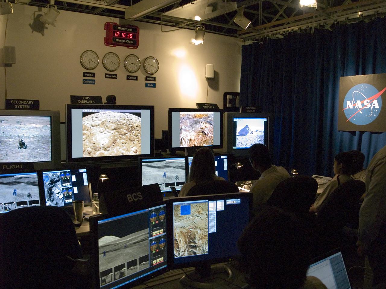
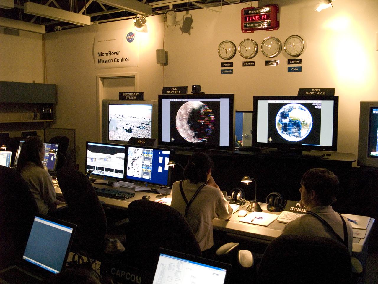
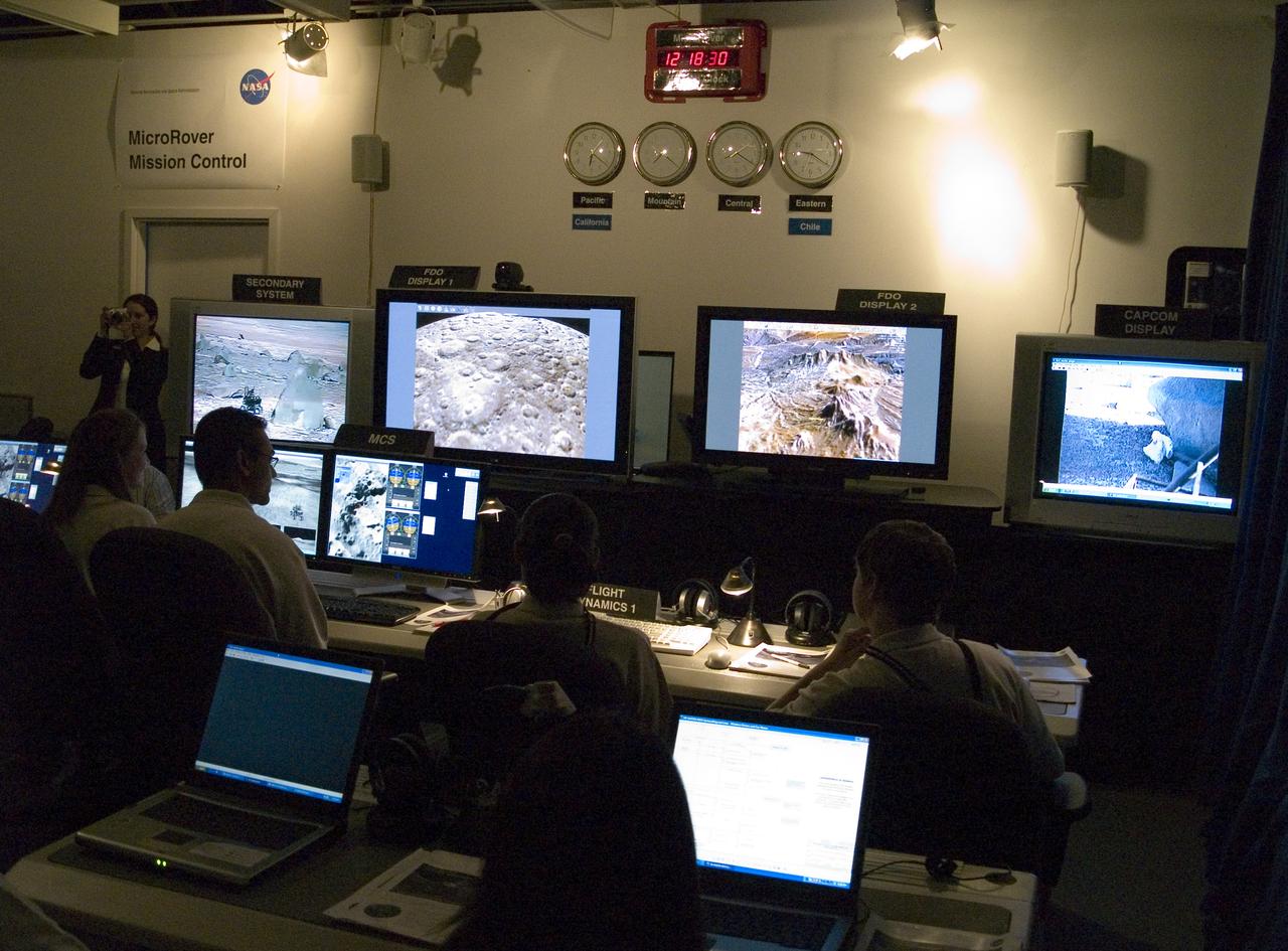
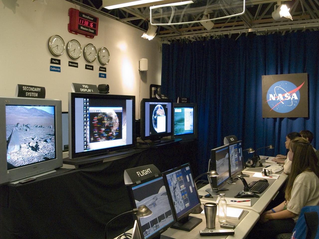
Spaceward Bound Program in Atacama Desert; shown here is a realtime webcast from Yungay, Chile vis satellite involving NASA Scientists and seven NASA Explorer school teachers. On the Ames end we find the Girl Scouts Space cookines robotic team. The robot nicknamed Zoe is looking for life in extreme environments in preparation for what might be encounter on Mars. see full text on the NASA-Ames News - Research # 04-91AR
Spaceward Bound Program in Atacama Desert; shown here is a realtime webcast from Yungay, Chile vis satellite involving NASA Scientists and seven NASA Explorer school teachers. On the Ames end we find the Girl Scouts Space cookines robotic team. The robot nicknamed Zoe is looking for life in extreme environments in preparation for what might be encounter on Mars. see full text on the NASA-Ames News - Research # 04-91AR

Spaceward Bound Program in Atacama Desert; shown here is a realtime webcast from Yungay, Chile vis satellite involving NASA Scientists and seven NASA Explorer school teachers. On the Ames end we find the Girl Scouts Space cookines robotic team. The robot nicknamed Zoe is looking for life in extreme environments in preparation for what might be encounter on Mars. see full text on the NASA-Ames News - Research # 04-91AR
Spaceward Bound Program in Atacama Desert; shown here is a realtime webcast from Yungay, Chile vis satellite involving NASA Scientists and seven NASA Explorer school teachers. On the Ames end we find the Girl Scouts Space cookines robotic team. The robot nicknamed Zoe is looking for life in extreme environments in preparation for what might be encounter on Mars. see full text on the NASA-Ames News - Research # 04-91AR
Spaceward Bound Program in Atacama Desert; shown here is a realtime webcast from Yungay, Chile vis satellite involving NASA Scientists and seven NASA Explorer school teachers. On the Ames end we find the Girl Scouts Space cookines robotic team. The robot nicknamed Zoe is looking for life in extreme environments in preparation for what might be encounter on Mars. see full text on the NASA-Ames News - Research # 04-91AR
Spaceward Bound Program in Atacama Desert; shown here is a realtime webcast from Yungay, Chile vis satellite involving NASA Scientists and seven NASA Explorer school teachers. On the Ames end we find the Girl Scouts Space cookines robotic team. The robot nicknamed Zoe is looking for life in extreme environments in preparation for what might be encounter on Mars. see full text on the NASA-Ames News - Research # 04-91AR
Spaceward Bound Program in Atacama Desert; shown here is a realtime webcast from Yungay, Chile vis satellite involving NASA Scientists and seven NASA Explorer school teachers. On the Ames end we find the Girl Scouts Space cookines robotic team. The robot nicknamed Zoe is looking for life in extreme environments in preparation for what might be encounter on Mars. see full text on the NASA-Ames News - Research # 04-91AR
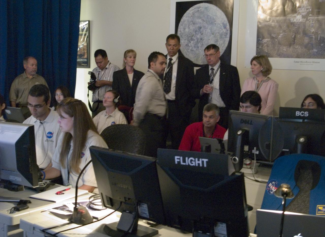
Spaceward Bound Program in Atacama Desert; shown here is a realtime webcast from Yungay, Chile vis satellite involving NASA Scientists and seven NASA Explorer school teachers. On the Ames end we find the Girl Scouts Space cookines robotic team. The robot nicknamed Zoe is looking for life in extreme environments in preparation for what might be encounter on Mars. (back row l-r) Yvonne Clearwater, Ames Education Division, Donald James, Ames Education Division Chief, Pete Worden, Ames Center Director, Angela Diaz, Ames Director of Strategic Communications) see full text on the NASA-Ames News - Research # 04-91AR
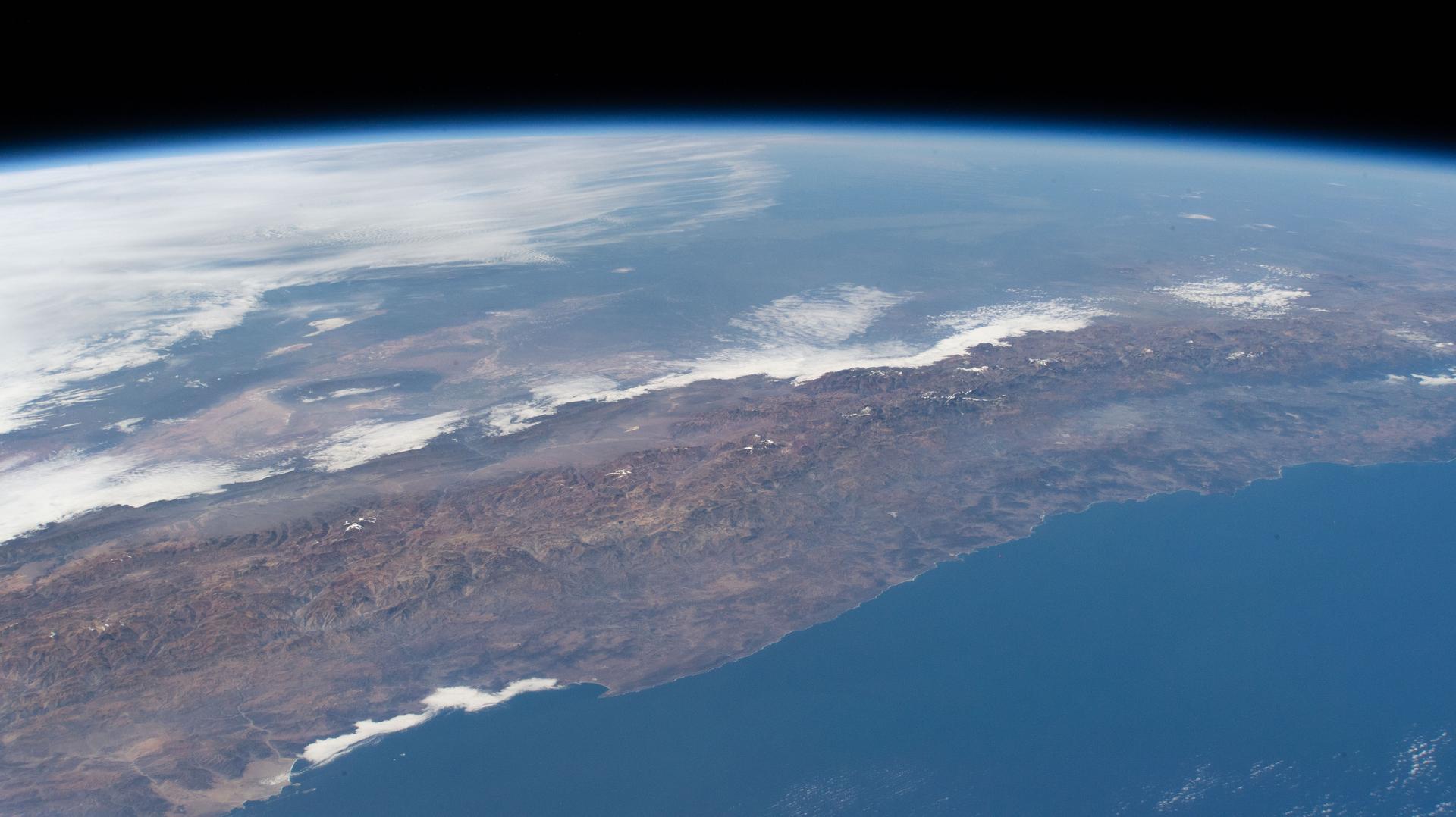
iss074e0349412 (March 3, 2026) --- The Andes mountain range running between Chile and Argentina creates distinct differences in climate and geography between the two South American nations. Chile’s Pacific coastline contributes to its moderate temperatures, with the Atacama Desert in the north being one of the driest places on Earth, while its central and southern regions are cooler and wetter. Argentina’s western side is more arid because the Andes block moisture from the Pacific Ocean, while the country’s Atlantic coastline receives more precipitation than its interior and western regions. Credit: NASA
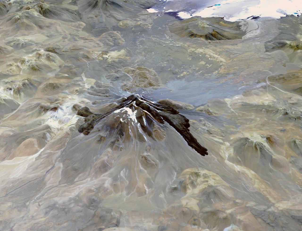
Llullaillaco is a stratovolcano at the border of Argentina and Chile. It lies on a high plateau close to the Atacama Desert. At an elevation of 6723 m ASL, it is the second highest active volcano in the world. About 150,000 years ago the volcano's southeastern flank collapsed, producing a debris avalanche that traveled 25 kilometers. The youngest dated rocks are about 5600 years old; but there are local reports of activity from the 1800s. The perspective image looking east was acquired December 19, 2014 and is located at 24.7 degrees south, 68.5 degrees west. https://photojournal.jpl.nasa.gov/catalog/PIA22721
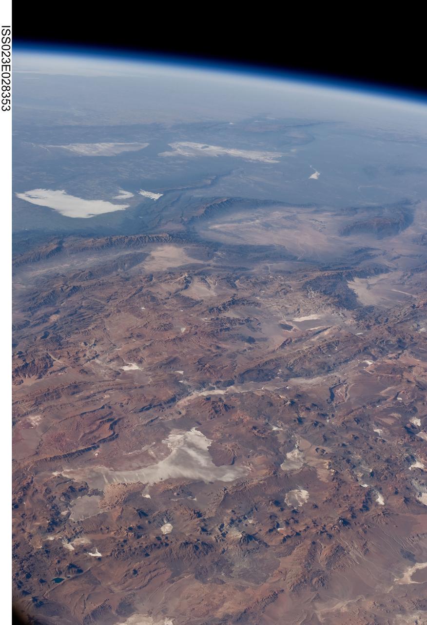
ISS023-E-028353 (26 April 2010) --- Central Andes Mountains, Salar de Arizaro, Argentina are featured in this image photographed by an Expedition 23 crew member on the International Space Station. The high plains (3,000 to greater than 5,000 meters elevation, 13,000 to 19,000 feet) of the Andes Mountains, also known as the Puna, appear in the foreground of this photograph, with a line of young volcanoes facing the much lower Atacama Desert (1,000–2,000 meters elevation). Several large dry lakes, marked by light-toned salt crusts, occupy the basins between major thrust faults in the Puna. Salar de Arizaro (foreground) is the largest of the dry lakes in this view (salar means waterless salt flat in Spanish). This panorama was taken by a station crew member looking southeast across the South American continent when the ISS was almost directly over the Atacama Desert near Chile’s Pacific coast. The Atlantic Ocean coastline (River Plate where Argentina’s capital city of Buenos Aires is located) is dimly visible at top left. A striking geological and landscape contrast is visible at center which separates two distinct geological zones, namely the Puna and the Sierras Pampeanas. The Sierras Pampeanas Mountains are lower in elevation and have few young volcanoes, in contrast to the Puna. Sharp-crested ranges are separated by wide, low valleys in this region. The Salinas Grandes—ephemeral shallow salt lakes at top left (salina means salt lake in Spanish) — occupies one of these valleys. The general color change from reds and browns in the foreground to blues and greens in the upper part of the image reflects the major climatic regions, namely the deserts of the Atacama and Puna, versus the low grassy plains of central Argentina where rainfall is sufficient to promote lush prairie grass growth—known famously as the pampas in Argentina. The Salinas Grandes mark an intermediate semiarid region. What accounts for the changes in landscape? The geology of this part of the Andes is a result of the eastward subduction of the Nazca tectonic plate underneath South America. Investigations using seismic data suggest that the Puna is underlain by a steeply dipping sector of the subducting Nazca plate. The Sierras Pampeanas zone however, is underlain by a sector of the Nazca plate that is almost horizontal, possibly due to the subduction of a submarine mountain range known as the Juan Fernandez Ridge. In the simplest terms, ridges are topographic highs that are difficult to stuff down subduction zones, with profound effects on the volcanism and structures of the upper plate.
STS-65 Earth observation taken aboard Columbia, Orbiter Vehicle (OV) 102, shows Northern Chile and the Andes Mountains. This color photograph is a panoramic (southern view) that features Chile and the Andes Mountains of South America. The Atacama Desert, one of the driest regions on Earth, is clearly visible along the Chilean coast. In the near left foreground is the Salar de Arizaro. Salar Punta Negra in the center foreground appears to be partially filled with water. On the right side of the view, a coastal plateau rises from the Pacific Ocean and meets the Andes Mountains that appear as a backbone running north to south along the border of Chile and Argentina. In the distant left portion of the view can be seen the hazy Chaco Plains and Pampas.
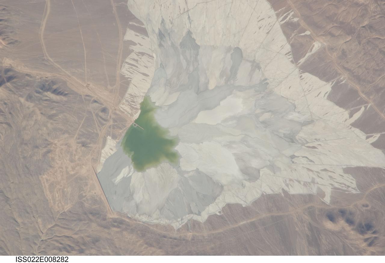
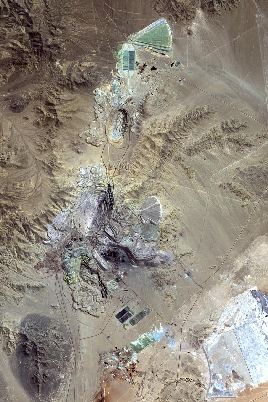
ISS022-E-008282 (9 Dec. 2009) --- One of the world?s leading copper mines, Escondida, in the Atacama Desert of Chile, is featured in this image photographed by an Expedition 22 crew member on the International Space Station. The copper mining industry is a major part of the Chilean economy. The mine is located 170 kilometers southeast of Chile?s port city of Antofagasta, in the hyper arid northern Atacama Desert at an elevation of 3,050 meters (approximately 10,000 feet) above sea level. Escondida produces mainly copper concentrates; assisted by gravity, the concentrates are piped as slurry down to the smaller port of Coloso just south of Antofagasta where they are dewatered for shipping. The photograph features a large light tan and gray waste or ?spoil? materials impoundment area (center) of the mine complex. The copper-bearing waste, which is a large proportion of the material excavated from open pits to the north (not in frame), is poured into the impoundment area as a liquid (green region at photo?s center), and dries to the lighter-toned spoil seen in the image. The spoil is held behind a retaining dam, just a little more than one kilometer in length, visible as a straight line at lower left. ?Escondida? means ?hidden? in Spanish, and refers to the fact that the copper ore body was buried beneath hundreds of meters of barren rock and had to be located by a laborious drilling program following a geologic trend established from other copper occurrences.
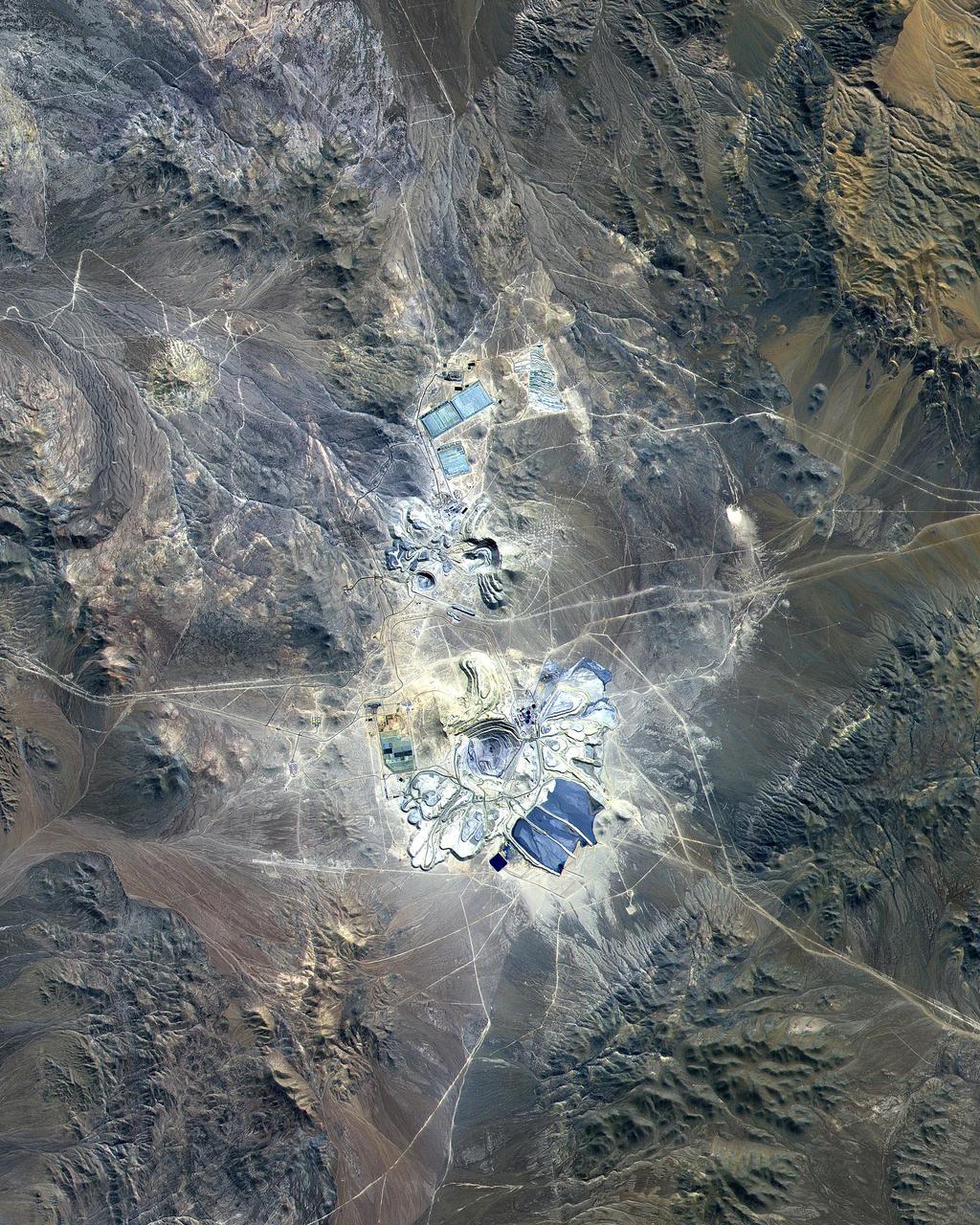
This ASTER image covers 30 by 37 km in the Atacama Desert, Chile and was acquired on April 23, 2000. The Escondida Cu-Au-Ag open-pit mine is at an elevation of 3050 m, and came on stream in 1990. Current capacity is 127,000 tons/day of ore; in 1999 production totaled 827,000 tons of copper, 150,000 ounces of gold and 3.53 million ounces of silver. Primary concentration of the ore is done on-site; the concentrate is then sent to the coast for further processing through a 170 km long, 9 pipe. Escondida is related geologically to three porphyry bodies intruded along the Chilean West Fissure Fault System. A high grade supergene cap overlies primary sulfide ore. This image is a conventional 3-2-1 RGB composite. Figure 1 displays SWIR bands 4-6-8 in RGB, and highlights lithologic and alteration differences of surface units. The image is located at 24.3 degrees south latitude and 69.1 degrees west longitude. http://photojournal.jpl.nasa.gov/catalog/PIA11090
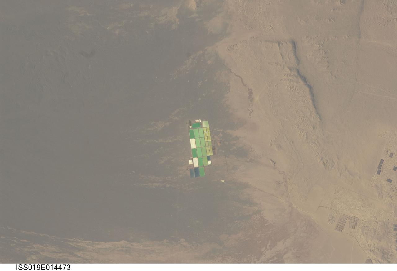
ISS019-E-014473 (5 May 2009) --- Salt ponds in Nueva Victoria, northern Chile are featured in this image photographed by an Expedition 19 crew member on the International Space Station. This view shows a long alluvial fan, sloping from east to west (left to right) in northern Chile with solar evaporation (or salt) ponds, some brightly colored, near the foot of the fan. The alluvial fan sediments are brown and contrast sharply with tan sediments of the Pampa del Tamarugal, the great hyper arid inner valley of Chile?s northern Atacama Desert. Nitrates and many other minerals are mined in this region. A few extraction pits and ore dumps are visible at bottom right, but most of the shallow diggings (0.5?5 meters deep) of a mine extracting caliche deposits ? a hard, cemented layer in the soil formed by downward movement and redeposition of sodium salts ? lie just outside the picture. Iodine is one of the products from mining; it is first extracted by a process known as heap leaching. Waste liquids from the iodine plants are dried in the tan and brightly colored evaporation ponds to crystallize nitrate salts for collection. Fertilizer production for higher-value crops is the main use for the recovered nitrates, but there are many other uses including the manufacture of pharmaceuticals, explosives, glass, ceramics, water treatment and metallurgical processes.
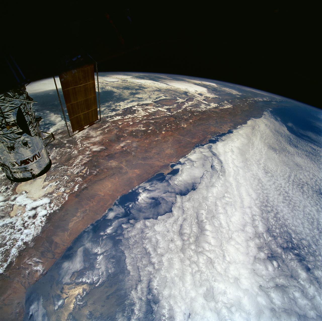
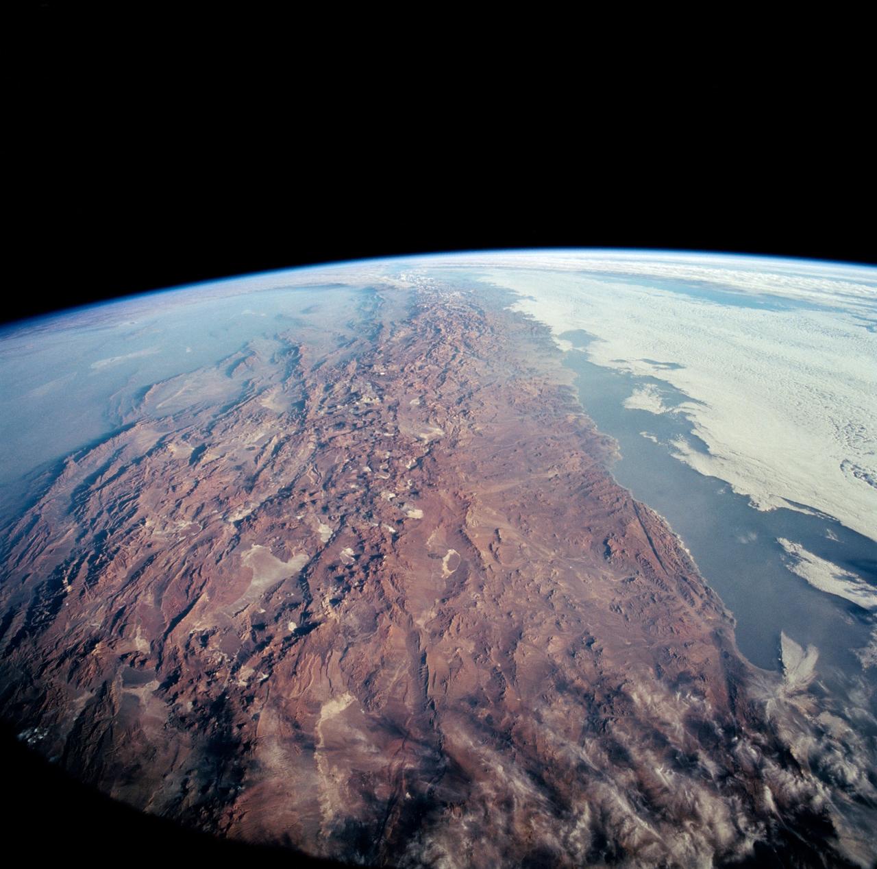
STS061-101-023 (8 Dec 1993) --- This color photograph is a spectacular, panoramic (southeastern view) shot that features the northern half of the country of Chile and the Andes Mountains of South America. The Atacama Desert, one of the driest regions on earth, is clearly visible along the northern Chilean coast. This desert extends from roughly Arica in the north to the city of Caldera in the south, a distance of six hundred miles. Some parts of this very arid region go for more than twenty years without measurable precipitation. It is an area of dramatic and abrupt elevation changes. For example, from the waters edge there is an escarpment of the coastal plateau that rises like an unbroken wall two or three thousand feet above the Pacific Ocean. From the coastal plateau, there is an even more dramatic increase in elevation -- from two thousand feet above sea level to an average elevation of thirteen thousand feet above sea level in the Bolivian Altiplano. This elevation change occurs within a one hundred to two hundred mile distance from the Pacific Ocean. The north-south trending spine of the Andes Mountains can be seen on this photograph. Several of the volcanic peaks in this mountain chain exceed 20,000 feet above sea level. Interspersed with these volcanic peaks, numerous dry lake beds (salars) can be seen as highly reflective surfaces. The largest of these salars (Salar de Uyuni) is visible at the edge of the Hubble Space Telescope (HST). Offshore, the cold Peruvian current produces low stratus clouds that can be found along this coastline at certain times of the year. This is the same type of meteorological phenomena that is found along the southern California coast and the Skeleton coast of southwestern Africa.
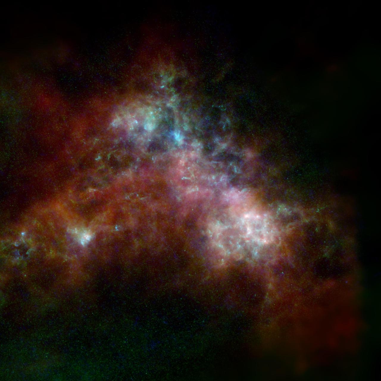
The Small Magellanic Cloud, shown here, is a dwarf galaxy orbiting the Milky Way. The image includes data from the ESA (European Space Agency) Herschel mission, supplemented with data from ESA's retired Planck observatory and two retired NASA missions: the Infrared Astronomical Satellite (IRAS) and Cosmic Background Explorer (COBE). Operated from 2009 to 2013, Herschel detected wavelengths of light in the far-infrared and microwave ranges, and was ideal for studying dust in nearby galaxies because it could capture small-scale structures in the dust clouds in high resolution. However, Herschel often couldn't detect light from diffuse dust clouds – especially in the outer regions of galaxies, where the gas and dust become sparse and thus fainter. As a result, the mission missed up to 30% of all the light given off by dust. Combining the Herschel observations with data from other observatories creates a more complete picture of the dust in the galaxy. In the image, red indicates hydrogen gas; green indicates cold dust; and warmer dust is shown in blue. Launched in 1983, IRAS was the first space telescope to detect infrared light, setting the stage for future observatories like NASA's Spitzer Space Telescope and James Webb Space Telescope. The Planck observatory, launched in 2009, and COBE, launched in 1989, both studied the cosmic microwave background, or light left over from the big bang. The hydrogen gas was detected using the Parkes Radio Telescope and the Australia Compact Telescope Array, located in Australia and managed by the Commonwealth Scientific and Industrial Research Organisation (CSIRO); and the NANTEN2 Observatory in the Atacama Desert in Chile. https://photojournal.jpl.nasa.gov/catalog/PIA25164