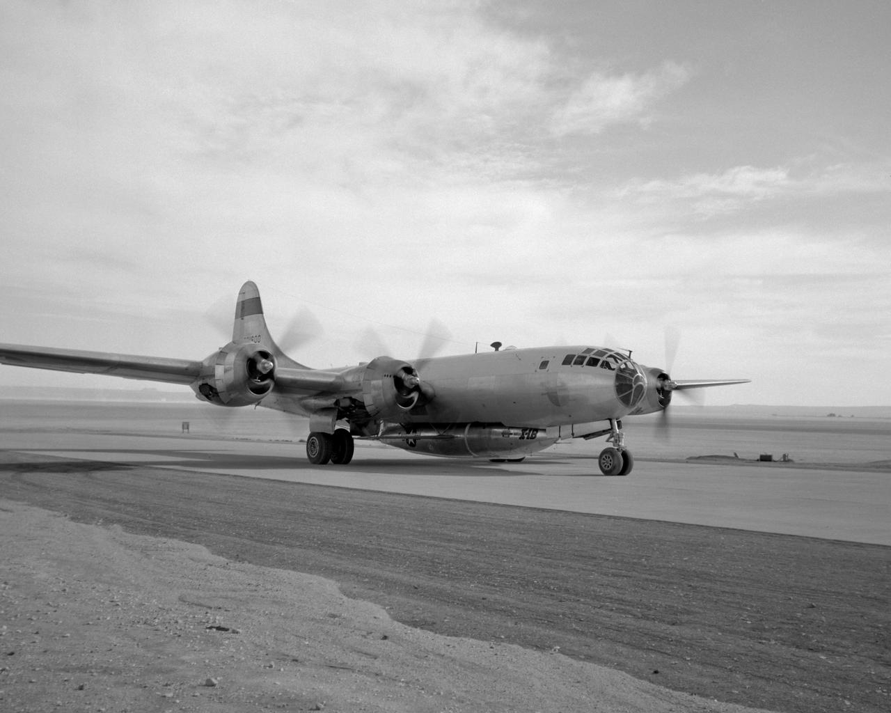
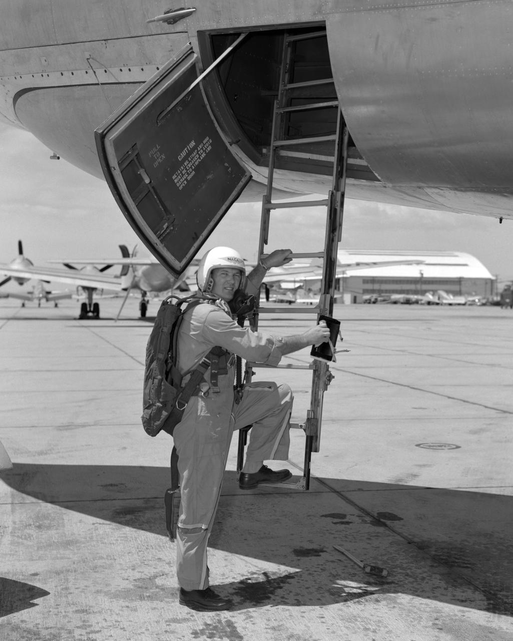
B-29 #800 with X-1B attached taxis in off of the lakebed.
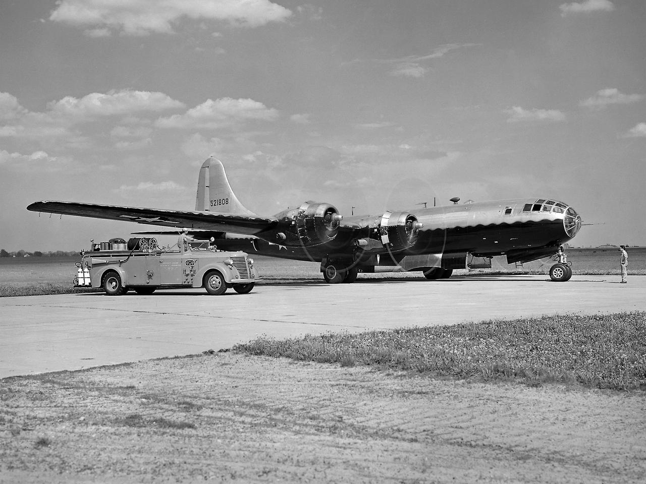
The resolution of the Boeing B-29 Superfortress’ engine cooling problems was one of the Aircraft Engine Research Laboratory’s (AERL) key contributions to the World War II effort. The B-29 leapfrogged previous bombers in size, speed, and altitude capabilities. The B–29 was intended to soar above anti-aircraft fire and make pinpoint bomb drops onto strategic targets. Four Wright Aeronautical R-3350 engines powered the massive aircraft. The engines, however, frequently strained and overheated due to payload overloading. This resulted in a growing number of engine fires that often resulted in crashes. The military asked the NACA to tackle the overheating issue. Full-scale engine tests on a R–3350 engine in the Prop House demonstrated that a NACA-designed impeller increased the fuel injection system’s flow rate. Single-cylinder studies resolved a valve failure problem by a slight extension of the cylinder head, and researchers in the Engine Research Building combated uneven heating with a new fuel injection system. Investigations during the summer of 1944 in the Altitude Wind Tunnel, which could simulate flight conditions at high altitudes, led to reduction of drag and improved air flow by reshaping the cowling inlet and outlet. The NACA modifications were then flight tested on a B-29 bomber that was brought to the AERL.
The NACA’s Lewis Flight Propulsion Laboratory used a Boeing B‒29 Superfortress as a testbed for ramjet investigations in the late 1940s. Lewis researchers conducted a wide variety of studies on ramjets to determine basic the operational data necessary to design missiles. Extensive wind tunnel and test stand studies were augmented by actual flight tests. Lewis engineers modified this B‒29 so that the ramjet could be stored in the bomb bay. Once the aircraft reached the desired altitude and speed, a mechanical arm suspended the ramjet 52 inches below the bomb bay. The ramjet’s angle-of-attack could be independently adjusted, and a periscope permitted a view of the test article from inside the aircraft. Researchers took measurements in free-stream conditions at speeds up to Mach 0.51 and at altitudes ranging from 5,000 to 30,000 feet. They then shut the ramjet down and retracted it into the aircraft. The researchers first determined that 14,000 feet was the maximum altitude at which the engine could be ignited by spark. They used flares to start the engine at altitudes up to 30,000 feet. They were able to determine maximum combustion efficiencies, response time to changes in fuel flow, and minimum fuel-air ratios. Overall the ramjet operated well at all speeds and altitudes.
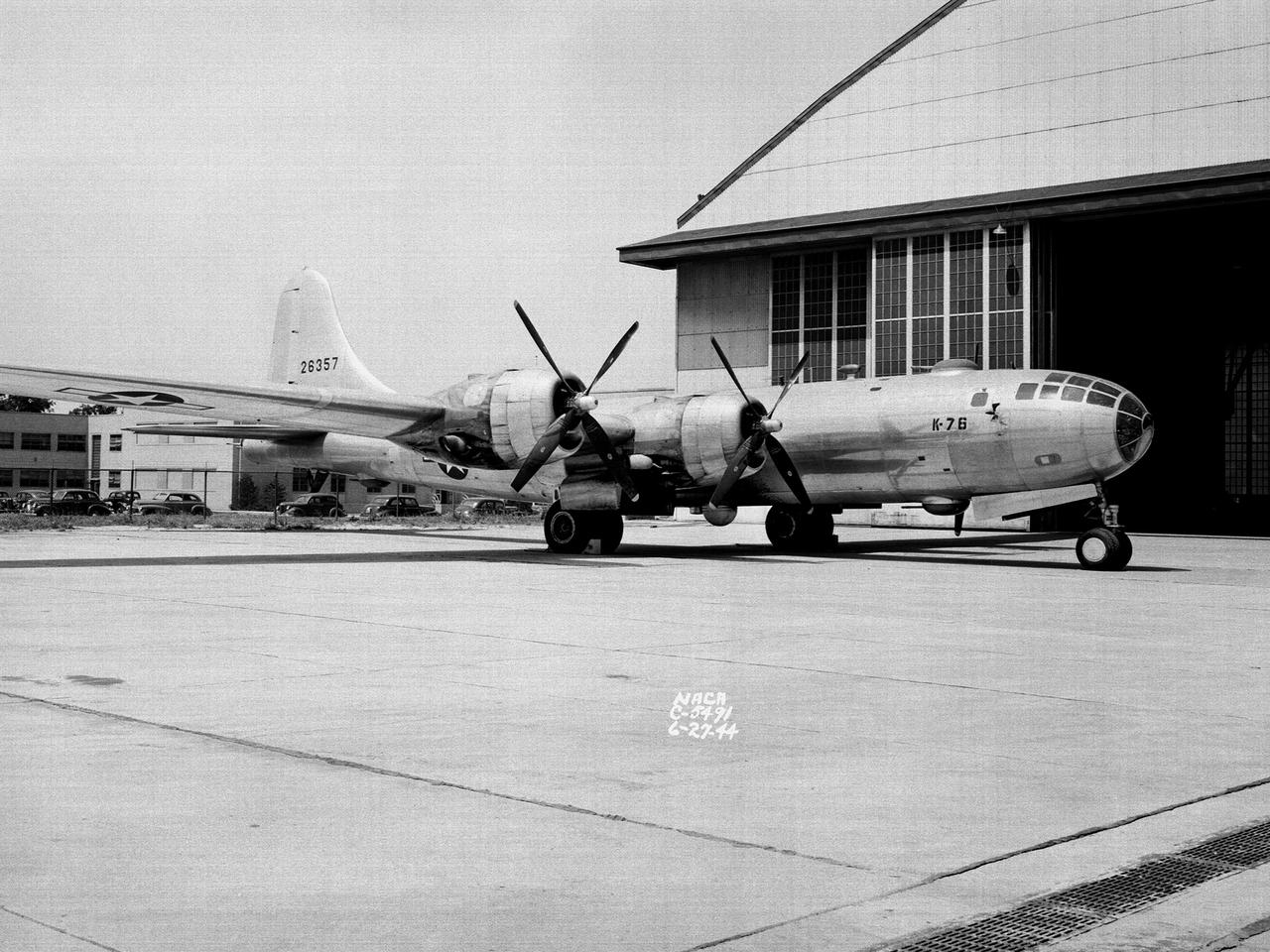
A Boeing B–29 Superfortress at the National Advisory Committee for Aeronautics (NACA) Aircraft Engine Research Laboratory in Cleveland, Ohio. The B–29 was the Army Air Forces’ deadliest weapon during the latter portion of World War II. The aircraft was significantly larger than previous bombers but could fly faster and higher. The B–29 was intended to soar above anti-aircraft fire and make pinpoint drops onto strategic targets. The bomber was forced to carry 20,000 pounds more armament than it was designed for. The extra weight pushed the B–29’s four powerful Wright R–3350 engines to their operating limits. The over-heating of the engines proved to be a dangerous problem. The military asked the NACA to tackle the issue. Full-scale engine tests on a R–3350 engine in the Prop House demonstrated that a NACA-designed impeller increased the flow rate of the fuel injection system. Altitude Wind Tunnel studies of the engine led to the reshaping of cowling inlet and outlet to improve airflow and reduce drag. Single-cylinder studies on valve failures were resolved by a slight extension of the cylinder head, and the Engine Research Building researchers combated uneven heating with a new fuel injection system. The modifications were then tried out on an actual B–29. The bomber arrived in Cleveland on June 22, 1944. The new injection impeller, ducted head baffles and instrumentation were installed on the bomber’s two left wing engines. Eleven test flights were flown over the next month with military pilots at the helm. Overall the flight tests corroborated the wind tunnel and test stand studies.

B-29 #800 with X-1B attached taxi's in off of the lakebed.
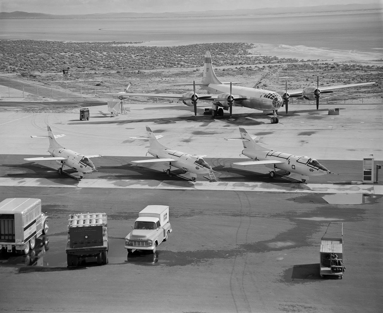
Behind three Douglas D-558-IIs is the B-29 launch aircraft. Under its right wing is the world’s first ground-based reaction control system motion simulator.
The NACA’s Lewis Flight Propulsion Laboratory used a Boeing B-29 Superfortress as a testbed for ramjet investigations in the late 1940s. NACA Lewis conducted a wide variety of studies on ramjets to determine basic operational data necessary to design missiles. This information included the relationship between combustion chamber and inlet pressure and temperature, velocity of the fuel-air ratio to the ignition characteristics, and combustion efficiency. Although wind tunnel and test stand studies were important first steps in determining these factors, actual flight tests were required. Lewis engineers modified the B-29 so that the ramjet could be stored in the bomb bay. Once the aircraft reached the desired altitude and speed the ramjet was suspended 52 inches below the bomb bay. The ramjet’s angle-of-attack could be independently adjusted, and a periscope permitted a view of the test article from inside the aircraft. Measurements were taken in free-stream conditions between 5,000 and 30,000 feet. The test flights, which began in April 1947, were flown at speeds up to Mach 0.51 and altitudes of 5,000 to 30,000 feet. The researchers first determined that 14,000 feet was the maximum altitude at which the engine could be ignited by spark. Flares were used to start the engine at altitudes up to 30,000 feet. Overall the ramjet operated well at all speeds and altitudes. Significant changes in fuel flow were successful at lower altitudes, but produced combustion blowout above 20,000 feet.
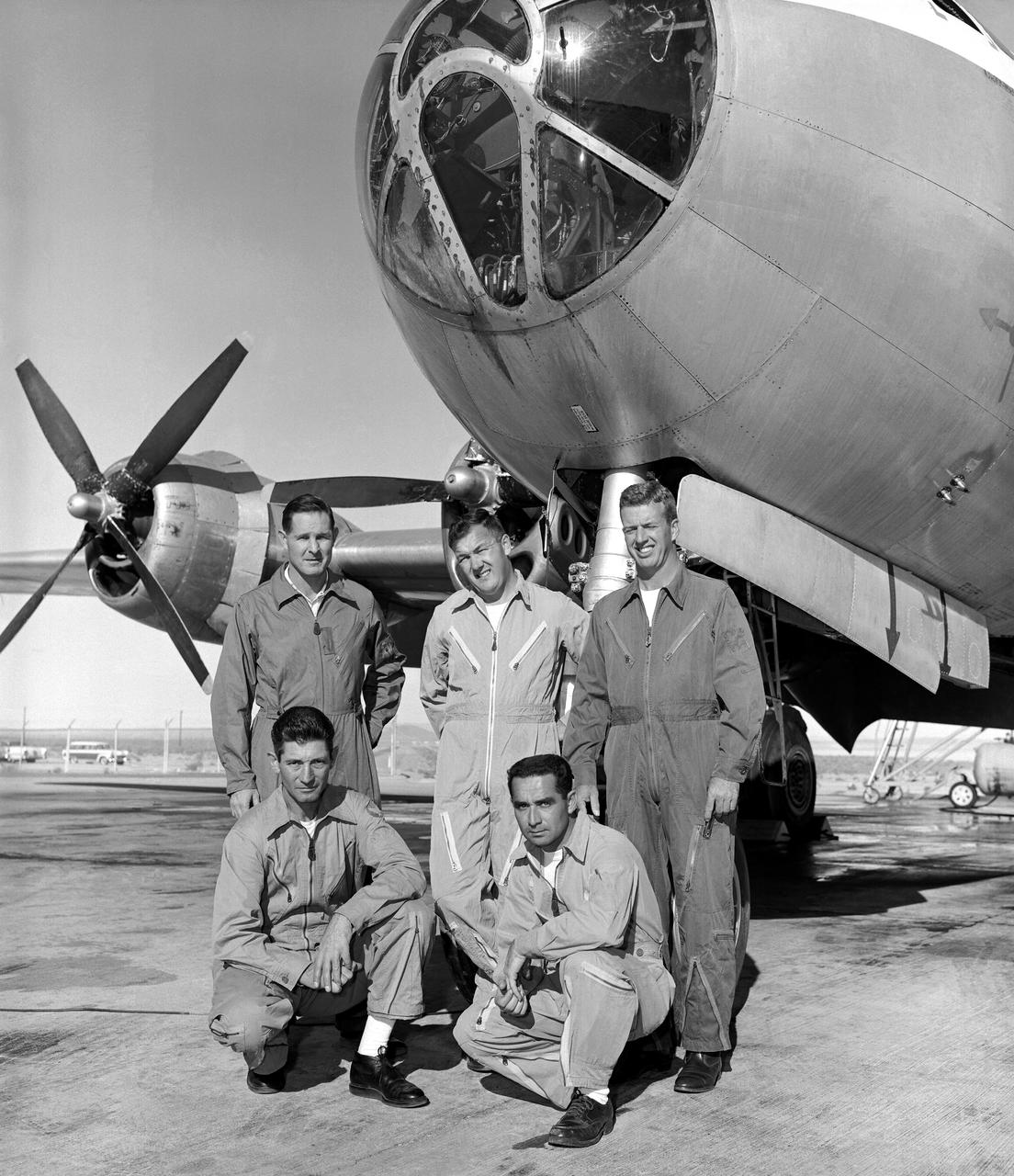
B-29 mothership with pilots - Dick Payne, Stan Butchart, Joe Walker, Charles Littleton, and John Moise
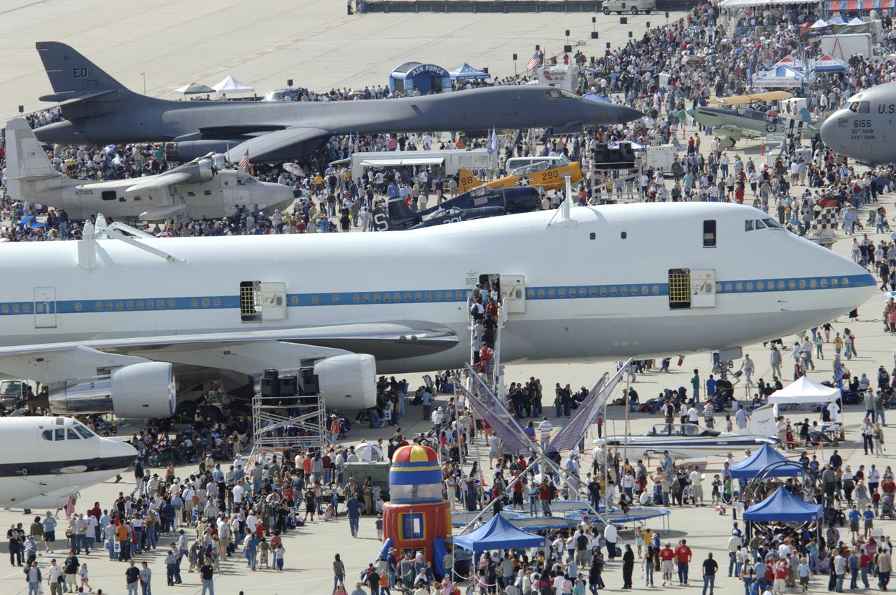
Crowds thronged around NASA's modified 747 Shuttle Carrier Aircraft and an Air Force B-1B Lancer at the Edwards Air Force Base open house Oct. 28-29, 2006.
From December 10, 1966, until his retirement on February 27, 1976, Stanley P. Butchart served as Chief (later, Director) of Flight Operations at NASA's Flight Research Center (renamed on March 26, 1976, the Hugh L. Dryden Flight Research Center). Initially, his responsibilities in this position included the Research Pilots Branch, a Maintenance and Manufacturing Branch, and an Operations Engineering Branch, the last of which not only included propulsion and electrical/electronic sections but project engineers for the X-15 and lifting bodies. During his tenure, however, the responsibilities of his directorate came to include not only Flight Test Engineering Support but Flight Systems and Loads laboratories. Before becoming Chief of Flight Operations, Butchart had served since June of 1966 as head of the Research Pilots Branch (Chief Pilot) and then as acting chief of Flight Operations. He had joined the Center (then known as the National Advisory Committee for Aeronautics' High-Speed Flight Research Station) as a research pilot on May 10, 1951. During his career as a research pilot, he flew a great variety of research and air-launch aircraft including the D-558-I, D-558-II, B-29 (plus its Navy version, the P2B), X-4, X-5, KC-135, CV-880, CV-990, B-47, B-52, B-747, F-100A, F-101, F-102, F-104, PA-30 Twin Comanche, JetStar, F-111, R4D, B-720, and B-47. Although previously a single-engine pilot, he became the Center's principal multi-engine pilot during a period of air-launches in which the pilot of the air-launch aircraft (B-29 or P2B) basically directed the operations. It was he who called for the chase planes before each drop, directed the positioning of fire rescue vehicles, and released the experimental aircraft after ensuring that all was ready for the drop. As pilot of the B-29 and P2B, Butchart launched the X-1A once, the X-1B 13 times, the X-1E 22 times, and the D-558-II 102 times. In addition, he towed the M2-F1 lightweight lifting body 14 times behind an R4
Clean room B 29 SSDIF facility floor was installed in January 2019 by Stonhard
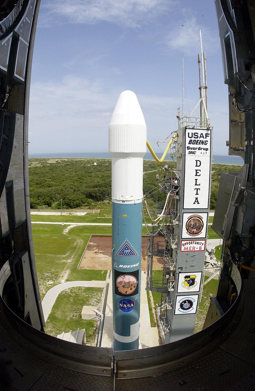
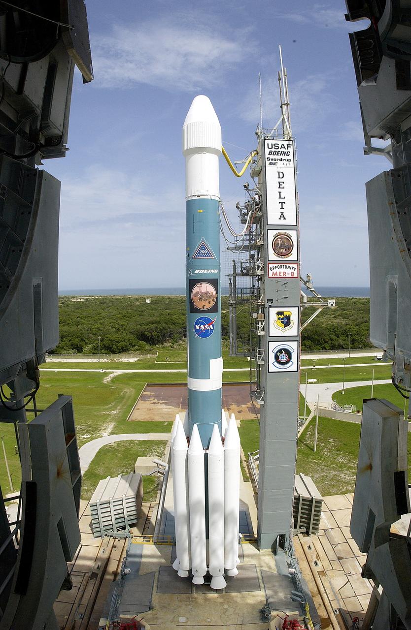
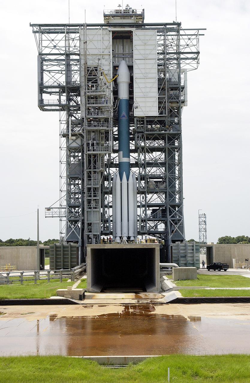
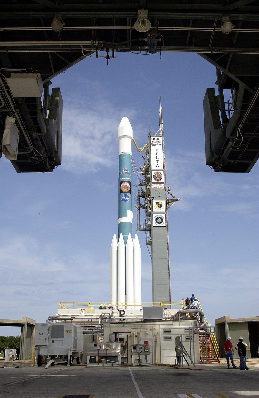
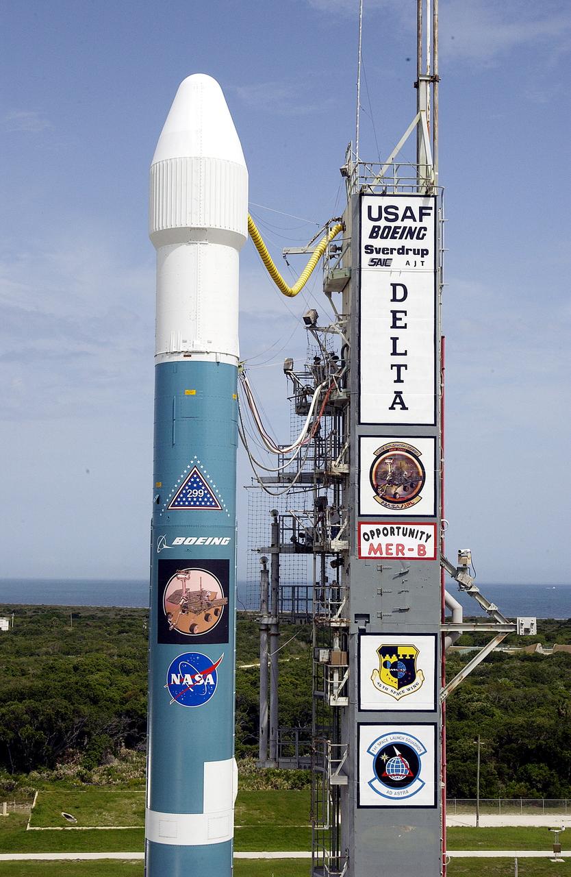
KENNEDY SPACE CENTER, FLA. - The Mobile Service Tower is rolled back at Space Launch Complex 17B, Cape Canaveral Air Force Station, to reveal the Delta II Heavy launch vehicle ready for launch of the Mars Exploration Rover-B (MER-B) mission, with the rover "Opportunity" aboard. The second of twin rovers being sent to Mars, it is equipped with a robotic arm, a drilling tool, three spectrometers, and four pairs of cameras that allow it to have a human-like, 3D view of the terrain. Each rover could travel as far as 100 meters in one day to act as Mars scientists' eyes and hands, exploring an environment where humans are not yet able to go. MER-B is scheduled to launch on June 28 at one of two available times, 11:56:16 p.m. EDT or 12:37:59 a.m. EDT on June 29.
KENNEDY SPACE CENTER, FLA. - The Mobile Service Tower is rolled back at Space Launch Complex 17B, Cape Canaveral Air Force Station, to reveal the Delta II Heavy launch vehicle ready for launch of the Mars Exploration Rover-B (MER-B) mission, with the rover "Opportunity" aboard. The second of twin rovers being sent to Mars, it is equipped with a robotic arm, a drilling tool, three spectrometers, and four pairs of cameras that allow it to have a human-like, 3D view of the terrain. Each rover could travel as far as 100 meters in one day to act as Mars scientists' eyes and hands, exploring an environment where humans are not yet able to go. MER-B is scheduled to launch on June 28 at one of two available times, 11:56:16 p.m. EDT or 12:37:59 a.m. EDT on June 29.
KENNEDY SPACE CENTER, FLA. - The Mobile Service Tower is rolled back at Space Launch Complex 17B, Cape Canaveral Air Force Station, to reveal the Delta II Heavy launch vehicle ready for launch of the Mars Exploration Rover-B (MER-B) mission, with the rover "Opportunity" aboard. The second of twin rovers being sent to Mars, it is equipped with a robotic arm, a drilling tool, three spectrometers, and four pairs of cameras that allow it to have a human-like, 3D view of the terrain. Each rover could travel as far as 100 meters in one day to act as Mars scientists' eyes and hands, exploring an environment where humans are not yet able to go. MER-B is scheduled to launch on June 28 at one of two available times, 11:56:16 p.m. EDT or 12:37:59 a.m. EDT on June 29.
KENNEDY SPACE CENTER, FLA. - The Mobile Service Tower is rolled back at Space Launch Complex 17B, Cape Canaveral Air Force Station, to reveal the Delta II Heavy launch vehicle ready for launch of the Mars Exploration Rover-B (MER-B) mission, with the rover "Opportunity" aboard. The second of twin rovers being sent to Mars, it is equipped with a robotic arm, a drilling tool, three spectrometers, and four pairs of cameras that allow it to have a human-like, 3D view of the terrain. Each rover could travel as far as 100 meters in one day to act as Mars scientists' eyes and hands, exploring an environment where humans are not yet able to go. MER-B is scheduled to launch on June 28 at one of two available times, 11:56:16 p.m. EDT or 12:37:59 a.m. EDT on June 29.
KENNEDY SPACE CENTER, FLA. - The Mobile Service Tower is rolled back at Space Launch Complex 17B, Cape Canaveral Air Force Station, to reveal the Delta II Heavy launch vehicle ready for launch of the Mars Exploration Rover-B (MER-B) mission, with the rover "Opportunity" aboard. The second of twin rovers being sent to Mars, it is equipped with a robotic arm, a drilling tool, three spectrometers, and four pairs of cameras that allow it to have a human-like, 3D view of the terrain. Each rover could travel as far as 100 meters in one day to act as Mars scientists' eyes and hands, exploring an environment where humans are not yet able to go. MER-B is scheduled to launch on June 28 at one of two available times, 11:56:16 p.m. EDT or 12:37:59 a.m. EDT on June 29.

KENNEDY SPACE CENTER, FLA. - The Mobile Service Tower is rolled back at Space Launch Complex 17B, Cape Canaveral Air Force Station, to reveal the Delta II Heavy launch vehicle ready for launch of the Mars Exploration Rover-B (MER-B) mission, with the rover "Opportunity" aboard. The second of twin rovers being sent to Mars, it is equipped with a robotic arm, a drilling tool, three spectrometers, and four pairs of cameras that allow it to have a human-like, 3D view of the terrain. Each rover could travel as far as 100 meters in one day to act as Mars scientists' eyes and hands, exploring an environment where humans are not yet able to go. MER-B is scheduled to launch on June 28 at one of two available times, 11:56:16 p.m. EDT or 12:37:59 a.m. EDT on June 29.
KENNEDY SPACE CENTER, FLA. - The Mobile Service Tower is rolled back at Space Launch Complex 17B, Cape Canaveral Air Force Station, to reveal the Delta II Heavy launch vehicle ready for launch of the Mars Exploration Rover-B (MER-B) mission, with the rover "Opportunity" aboard. The second of twin rovers being sent to Mars, it is equipped with a robotic arm, a drilling tool, three spectrometers, and four pairs of cameras that allow it to have a human-like, 3D view of the terrain. Each rover could travel as far as 100 meters in one day to act as Mars scientists' eyes and hands, exploring an environment where humans are not yet able to go. MER-B is scheduled to launch on June 28 at one of two available times, 11:56:16 p.m. EDT or 12:37:59 a.m. EDT on June 29.
KENNEDY SPACE CENTER, FLA. - The Mobile Service Tower is rolled back at Space Launch Complex 17B, Cape Canaveral Air Force Station, to reveal the Delta II Heavy launch vehicle ready for launch of the Mars Exploration Rover-B (MER-B) mission, with the rover "Opportunity" aboard. The second of twin rovers being sent to Mars, it is equipped with a robotic arm, a drilling tool, three spectrometers, and four pairs of cameras that allow it to have a human-like, 3D view of the terrain. Each rover could travel as far as 100 meters in one day to act as Mars scientists' eyes and hands, exploring an environment where humans are not yet able to go. MER-B is scheduled to launch on June 28 at one of two available times, 11:56:16 p.m. EDT or 12:37:59 a.m. EDT on June 29.
51B-05-028 (29 April-6 May 1985) --- Astronaut Robert Overmyer, 51-B mission commander, aims a Linhof camera through flight deck windows aboard the Space Shuttle Challenger.
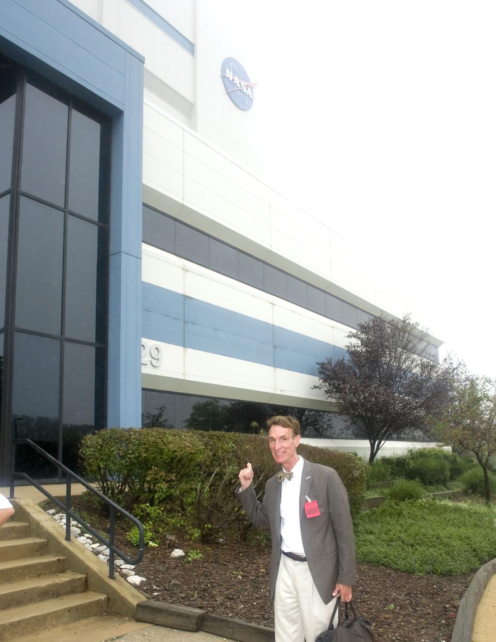
Bill Nye at the building 29 during a tour of Goddard Space Flight Center on September 8, 2011 Credit: NASA/GSFC/Bill Hrybyk <b><a href="http://www.nasa.gov/centers/goddard/home/index.html" rel="nofollow">NASA Goddard Space Flight Center</a></b> enables NASA’s mission through four scientific endeavors: Earth Science, Heliophysics, Solar System Exploration, and Astrophysics. Goddard plays a leading role in NASA’s accomplishments by contributing compelling scientific knowledge to advance the Agency’s mission. <b>Follow us on <a href="http://twitter.com/NASA_GoddardPix" rel="nofollow">Twitter</a></b> <b>Like us on <a href="http://www.facebook.com/pages/Greenbelt-MD/NASA-Goddard/395013845897?ref=tsd" rel="nofollow">Facebook</a></b> <b>Find us on <a href="http://web.stagram.com/n/nasagoddard/?vm=grid" rel="nofollow">Instagram</a></b>

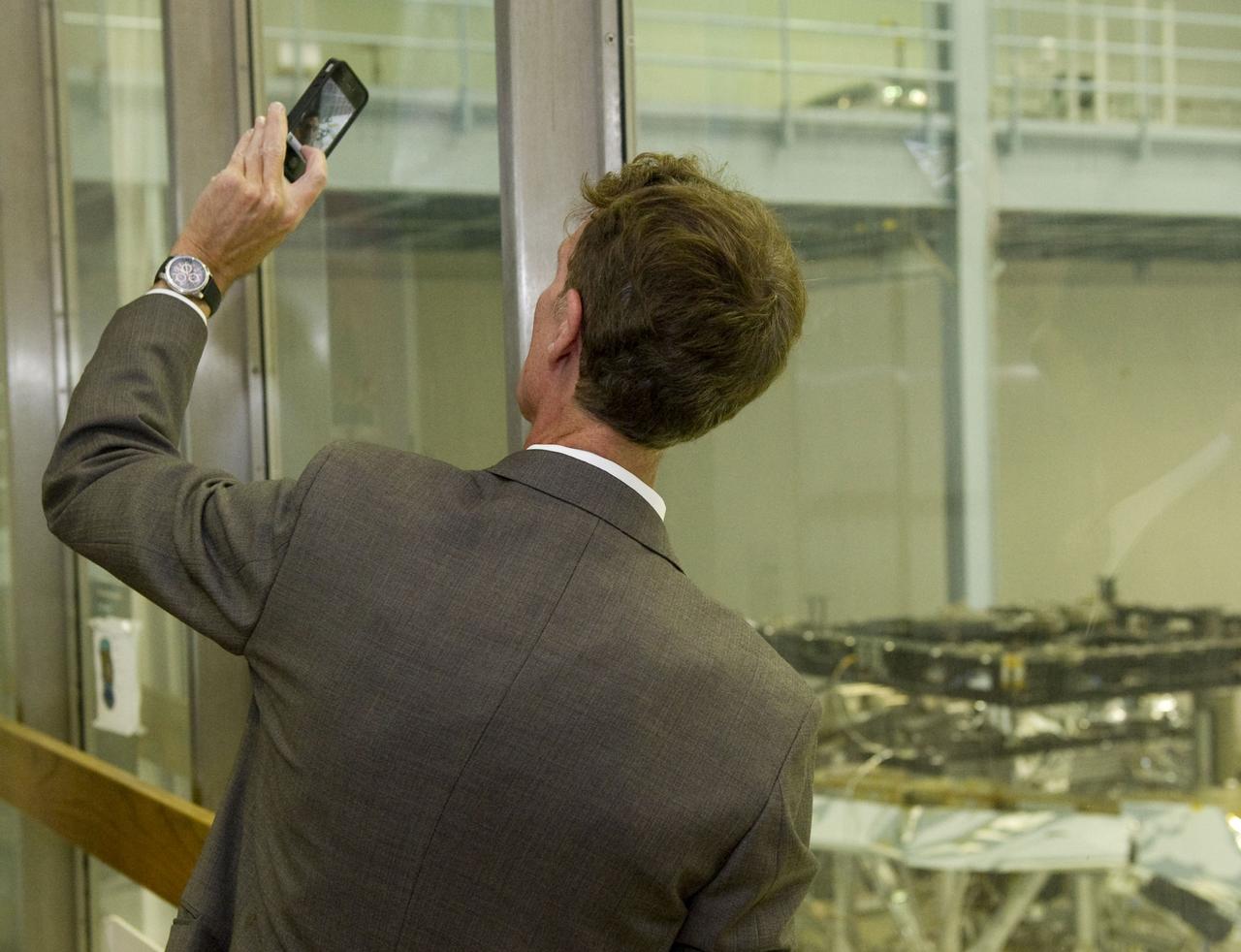
Bill Nye checks out the progress of the James Webb Space Telescope at the building 29 clean room during a tour of Goddard Space Flight Center on September 8, 2011 Credit: NASA/GSFC/Bill Hrybyk <b><a href="http://www.nasa.gov/centers/goddard/home/index.html" rel="nofollow">NASA Goddard Space Flight Center</a></b> enables NASA’s mission through four scientific endeavors: Earth Science, Heliophysics, Solar System Exploration, and Astrophysics. Goddard plays a leading role in NASA’s accomplishments by contributing compelling scientific knowledge to advance the Agency’s mission. <b>Follow us on <a href="http://twitter.com/NASA_GoddardPix" rel="nofollow">Twitter</a></b> <b>Like us on <a href="http://www.facebook.com/pages/Greenbelt-MD/NASA-Goddard/395013845897?ref=tsd" rel="nofollow">Facebook</a></b> <b>Find us on <a href="http://web.stagram.com/n/nasagoddard/?vm=grid" rel="nofollow">Instagram</a></b>
Bill Nye checks out the progress of the James Webb Space Telescope at the building 29 clean room during a tour of Goddard Space Flight Center on September 8, 2011 Credit: NASA/GSFC/Bill Hrybyk <b><a href="http://www.nasa.gov/centers/goddard/home/index.html" rel="nofollow">NASA Goddard Space Flight Center</a></b> enables NASA’s mission through four scientific endeavors: Earth Science, Heliophysics, Solar System Exploration, and Astrophysics. Goddard plays a leading role in NASA’s accomplishments by contributing compelling scientific knowledge to advance the Agency’s mission. <b>Follow us on <a href="http://twitter.com/NASA_GoddardPix" rel="nofollow">Twitter</a></b> <b>Like us on <a href="http://www.facebook.com/pages/Greenbelt-MD/NASA-Goddard/395013845897?ref=tsd" rel="nofollow">Facebook</a></b> <b>Find us on <a href="http://web.stagram.com/n/nasagoddard/?vm=grid" rel="nofollow">Instagram</a></b>
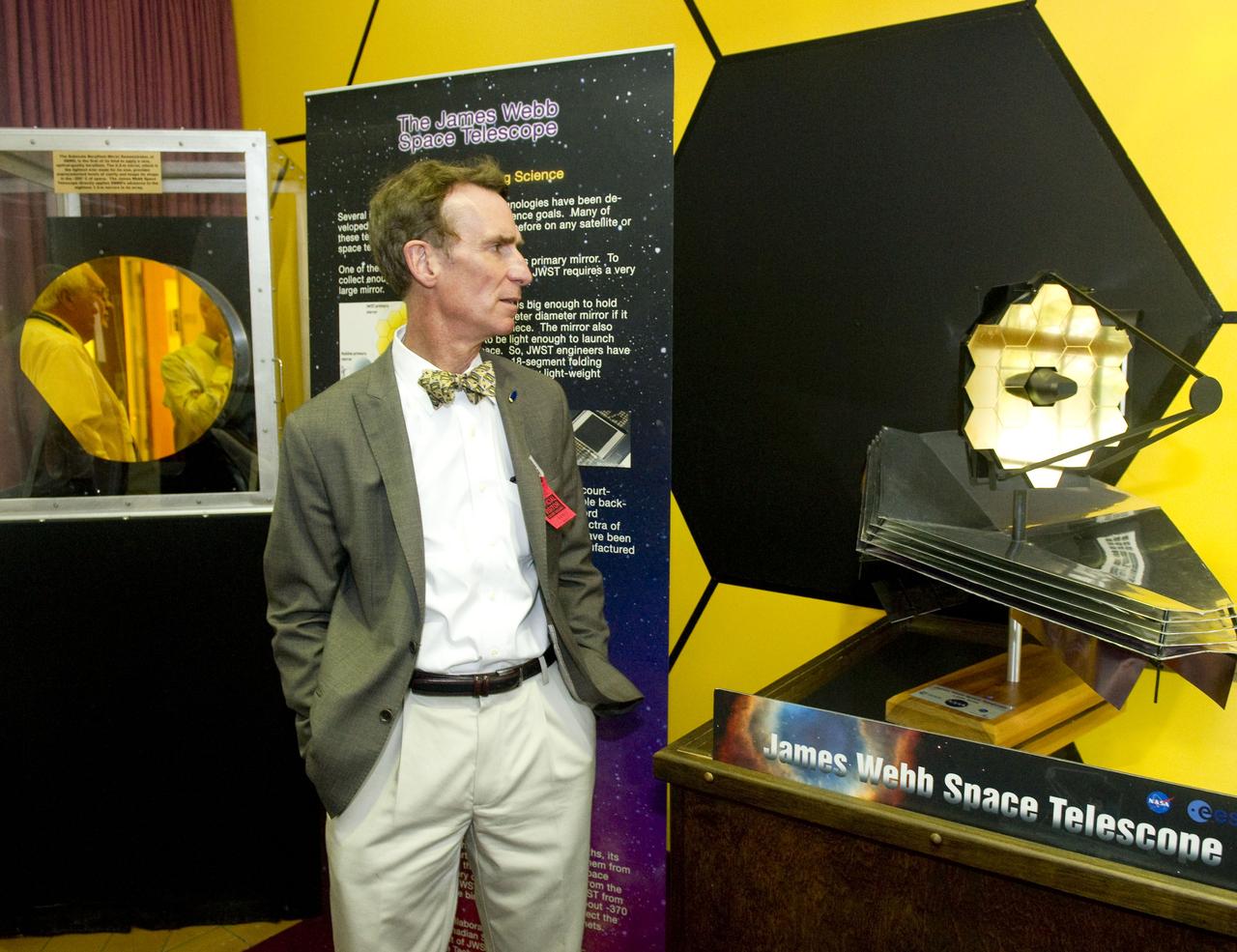
Bill Nye checks out the progress of the James Webb Space Telescope at the building 29 clean room during a tour of Goddard Space Flight Center on September 8, 2011 Credit: NASA/GSFC/Bill Hrybyk <b><a href="http://www.nasa.gov/centers/goddard/home/index.html" rel="nofollow">NASA Goddard Space Flight Center</a></b> enables NASA’s mission through four scientific endeavors: Earth Science, Heliophysics, Solar System Exploration, and Astrophysics. Goddard plays a leading role in NASA’s accomplishments by contributing compelling scientific knowledge to advance the Agency’s mission. <b>Follow us on <a href="http://twitter.com/NASA_GoddardPix" rel="nofollow">Twitter</a></b> <b>Like us on <a href="http://www.facebook.com/pages/Greenbelt-MD/NASA-Goddard/395013845897?ref=tsd" rel="nofollow">Facebook</a></b> <b>Find us on <a href="http://web.stagram.com/n/nasagoddard/?vm=grid" rel="nofollow">Instagram</a></b>
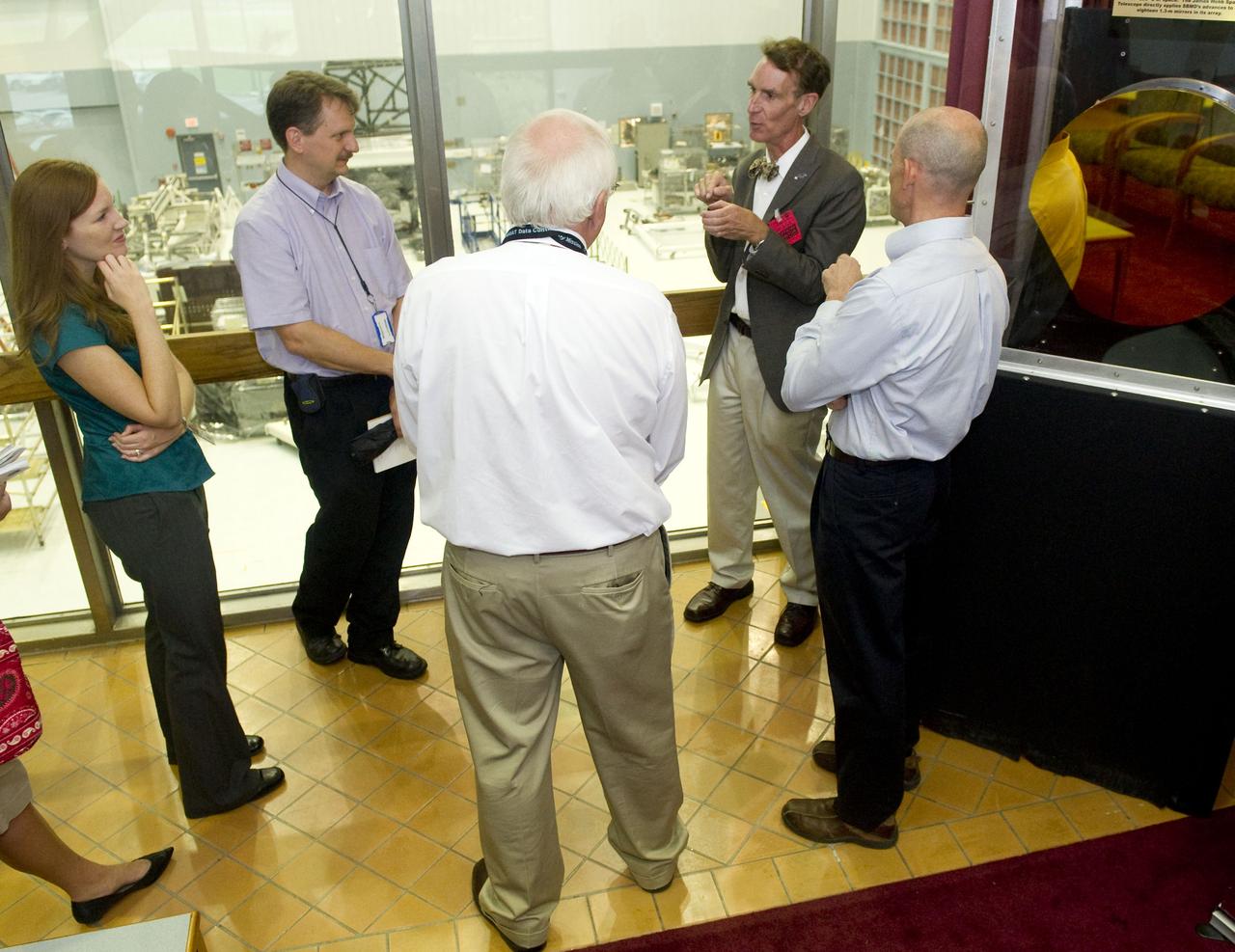
Bill Nye with the James Webb Space Telescope team at the building 29 clean room during a tour of Goddard Space Flight Center on September 8, 2011 Credit: NASA/GSFC/Bill Hrybyk <b><a href="http://www.nasa.gov/centers/goddard/home/index.html" rel="nofollow">NASA Goddard Space Flight Center</a></b> enables NASA’s mission through four scientific endeavors: Earth Science, Heliophysics, Solar System Exploration, and Astrophysics. Goddard plays a leading role in NASA’s accomplishments by contributing compelling scientific knowledge to advance the Agency’s mission. <b>Follow us on <a href="http://twitter.com/NASA_GoddardPix" rel="nofollow">Twitter</a></b> <b>Like us on <a href="http://www.facebook.com/pages/Greenbelt-MD/NASA-Goddard/395013845897?ref=tsd" rel="nofollow">Facebook</a></b> <b>Find us on <a href="http://web.stagram.com/n/nasagoddard/?vm=grid" rel="nofollow">Instagram</a></b>
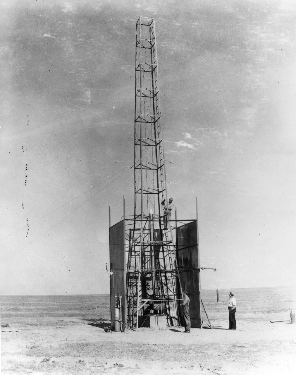
New Mexico -- Dr. Robert Goddard's rocket is being setup for the test that took place on October 29, 1935. It was a good flight. The rocket rose 4,000 feet--time in seconds. <b><a href="http://www.nasa.gov/centers/goddard/home/index.html" rel="nofollow">NASA Goddard Space Flight Center</a></b> enables NASA’s mission through four scientific endeavors: Earth Science, Heliophysics, Solar System Exploration, and Astrophysics. Goddard plays a leading role in NASA’s accomplishments by contributing compelling scientific knowledge to advance the Agency’s mission. <b>Follow us on <a href="http://twitter.com/NASA_GoddardPix" rel="nofollow">Twitter</a></b> <b>Join us on <a href="http://www.facebook.com/pages/Greenbelt-MD/NASA-Goddard/395013845897?ref=tsd" rel="nofollow">Facebook</a></b>

NASA image acquired August 29, 2012 1:57 a.m EDT Hurricane Isaac lit up by moonlight as it spins over the city of New Orleans, La. at 1:57 am central daylight savings time the morning of August 29, 2012. The Suomi National Polar-orbiting Partnership (NPP) satellite captured these images with its Visible Infrared Imaging Radiometer Suite (VIIRS). The "day-night band" of VIIRS detects light in a range of wavelengths from green to near-infrared and uses light intensification to enable the detection of dim signals. Suomi NPP is the result of a partnership between NASA, the National Oceanic and Atmospheric Administration and the Department of Defense. Image Credit: NASA/NOAA, Earth Observatory NASA Earth Observatory image by Jesse Allen and Robert Simmon, using VIIRS Day Night Band data. Credit: <b><a href="http://www.earthobservatory.nasa.gov/" rel="nofollow"> NASA Earth Observatory</a></b> <b><a href="http://www.nasa.gov/audience/formedia/features/MP_Photo_Guidelines.html" rel="nofollow">NASA image use policy.</a></b> <b><a href="http://www.nasa.gov/centers/goddard/home/index.html" rel="nofollow">NASA Goddard Space Flight Center</a></b> enables NASA’s mission through four scientific endeavors: Earth Science, Heliophysics, Solar System Exploration, and Astrophysics. Goddard plays a leading role in NASA’s accomplishments by contributing compelling scientific knowledge to advance the Agency’s mission. <b>Follow us on <a href="http://twitter.com/NASA_GoddardPix" rel="nofollow">Twitter</a></b> <b>Like us on <a href="http://www.facebook.com/pages/Greenbelt-MD/NASA-Goddard/395013845897?ref=tsd" rel="nofollow">Facebook</a></b> <b>Find us on <a href="http://instagrid.me/nasagoddard/?vm=grid" rel="nofollow">Instagram</a></b>
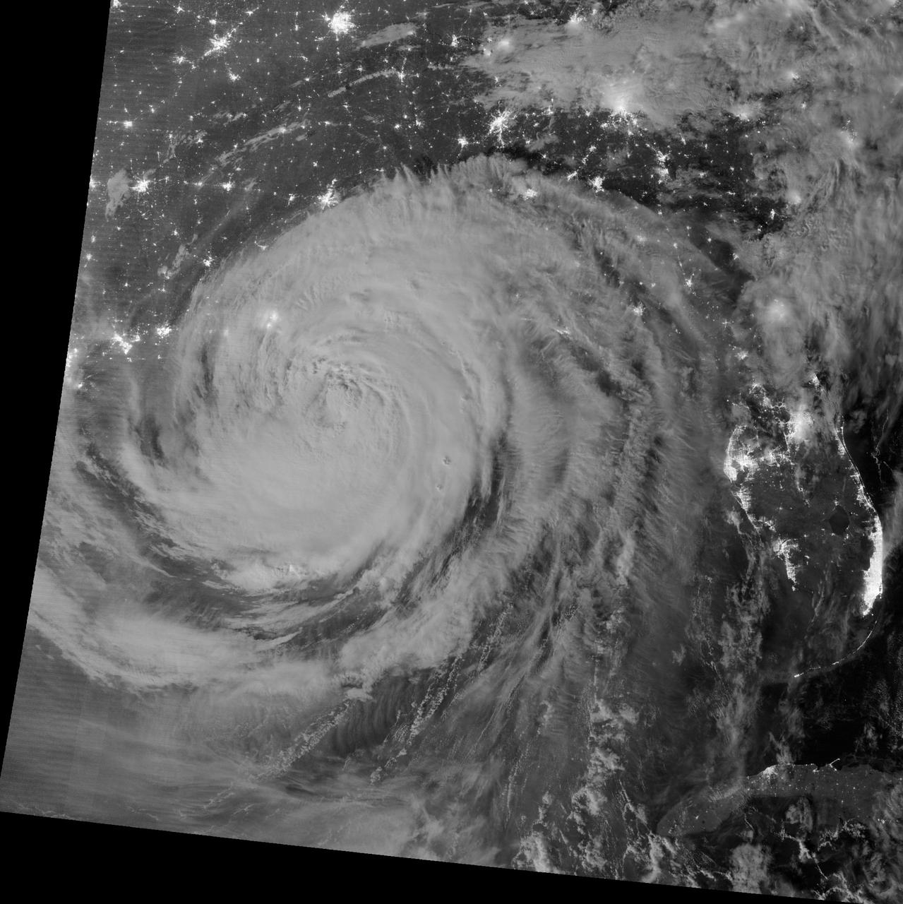
NASA image acquired August 29, 2012 1:57 a.m EDT Annotated view here: <a href="http://bit.ly/RsFT9Y" rel="nofollow">bit.ly/RsFT9Y</a> Hurricane Isaac lit up by moonlight as it spins over the city of New Orleans, La. at 1:57 am central daylight savings time the morning of August 29, 2012. The Suomi National Polar-orbiting Partnership (NPP) satellite captured these images with its Visible Infrared Imaging Radiometer Suite (VIIRS). The "day-night band" of VIIRS detects light in a range of wavelengths from green to near-infrared and uses light intensification to enable the detection of dim signals. Suomi NPP is the result of a partnership between NASA, the National Oceanic and Atmospheric Administration and the Department of Defense. Image Credit: NASA/NOAA, Earth Observatory NASA Earth Observatory image by Jesse Allen and Robert Simmon, using VIIRS Day Night Band data. Credit: <b><a href="http://www.earthobservatory.nasa.gov/" rel="nofollow"> NASA Earth Observatory</a></b> <b><a href="http://www.nasa.gov/audience/formedia/features/MP_Photo_Guidelines.html" rel="nofollow">NASA image use policy.</a></b> <b><a href="http://www.nasa.gov/centers/goddard/home/index.html" rel="nofollow">NASA Goddard Space Flight Center</a></b> enables NASA’s mission through four scientific endeavors: Earth Science, Heliophysics, Solar System Exploration, and Astrophysics. Goddard plays a leading role in NASA’s accomplishments by contributing compelling scientific knowledge to advance the Agency’s mission. <b>Follow us on <a href="http://twitter.com/NASA_GoddardPix" rel="nofollow">Twitter</a></b> <b>Like us on <a href="http://www.facebook.com/pages/Greenbelt-MD/NASA-Goddard/395013845897?ref=tsd" rel="nofollow">Facebook</a></b> <b>Find us on <a href="http://instagrid.me/nasagoddard/?vm=grid" rel="nofollow">Instagram</a></b>

NASA image release September 29, 2011 This image of the distant active galaxy Markarian 509 was taken in April 2007 with the Hubble Space Telescope's Wide Field Camera 2. To read more go to: <a href="http://www.nasa.gov/mission_pages/hubble/science/turbulent-black-hole.html" rel="nofollow">www.nasa.gov/mission_pages/hubble/science/turbulent-black...</a> Credit: NASA, ESA, G. Kriss (STScI), and J. de Plaa (SRON Netherlands Institute for Space Research); Acknowledgment: B. Peterson (Ohio State University) <b><a href="http://www.nasa.gov/audience/formedia/features/MP_Photo_Guidelines.html" rel="nofollow">NASA image use policy.</a></b> <b><a href="http://www.nasa.gov/centers/goddard/home/index.html" rel="nofollow">NASA Goddard Space Flight Center</a></b> enables NASA’s mission through four scientific endeavors: Earth Science, Heliophysics, Solar System Exploration, and Astrophysics. Goddard plays a leading role in NASA’s accomplishments by contributing compelling scientific knowledge to advance the Agency’s mission. <b>Follow us on <a href="http://twitter.com/NASA_GoddardPix" rel="nofollow">Twitter</a></b> <b>Like us on <a href="http://www.facebook.com/pages/Greenbelt-MD/NASA-Goddard/395013845897?ref=tsd" rel="nofollow">Facebook</a></b> <b>Find us on <a href="http://instagrid.me/nasagoddard/?vm=grid" rel="nofollow">Instagram</a></b>
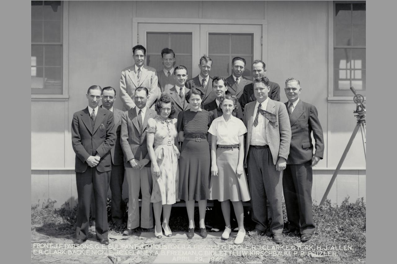
Arriving Engineers were John Parsons and Ferril Nickle (January 29, 1940) They were the first permanent members of the laboratory's staff on site. Other early arrivals from Langley were: Carlton Bioletti, March 1; Arthur B. Freeman, March 2; Edward R. Sharp, March 11; Manie G Poole, March 11; H. Julian Allen, April 13; Geroge E. Bulifant, April 17; Howard W. Krischbaum, April 29; and John P. Houston, April 29. Russ Robinson on-site representative of the construction group and their support staff E York, R Pippen.
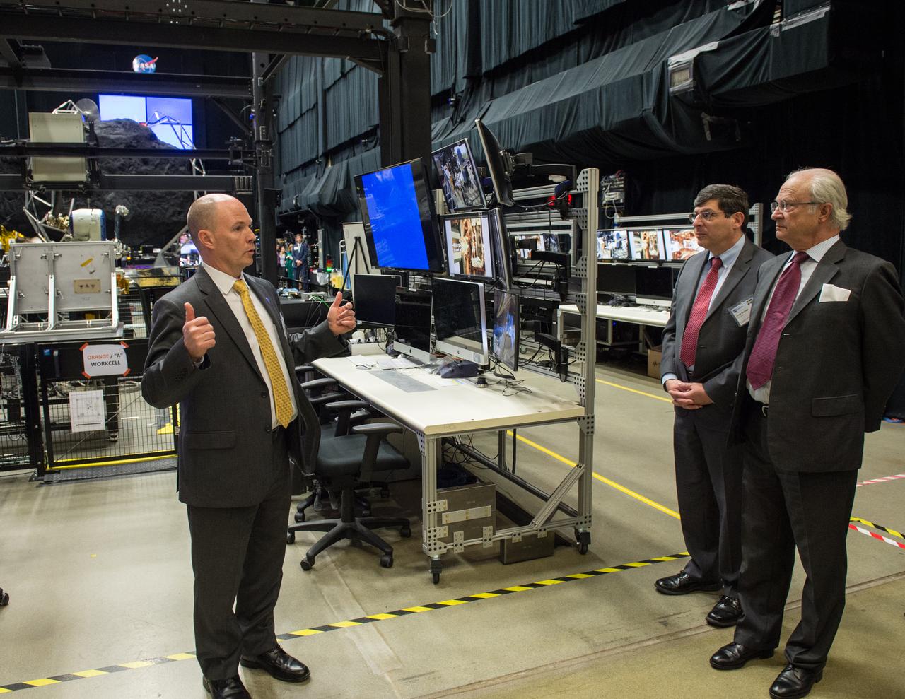
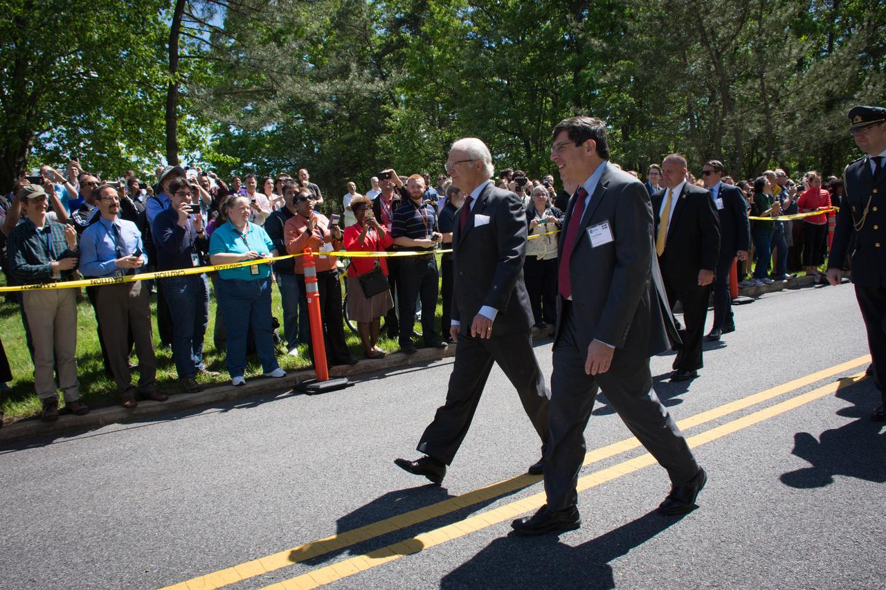
Swedish Delegation Visits GSFC – May 3, 2017 - Members of the Royal Swedish Academy of Engineering Sciences listen to Benjamin Reed, Deputy Division Director of the SatelliteServicing Projects Division about activities happening in Goddard’s Robotic Operations Center in Building 29. Credit: NASA/Goddard/Bill Hrybyk Read more: <a href="https://go.nasa.gov/2p1rP0h" rel="nofollow">go.nasa.gov/2p1rP0h</a> <b><a href="http://www.nasa.gov/audience/formedia/features/MP_Photo_Guidelines.html" rel="nofollow">NASA image use policy.</a></b> <b><a href="http://www.nasa.gov/centers/goddard/home/index.html" rel="nofollow">NASA Goddard Space Flight Center</a></b> enables NASA’s mission through four scientific endeavors: Earth Science, Heliophysics, Solar System Exploration, and Astrophysics. Goddard plays a leading role in NASA’s accomplishments by contributing compelling scientific knowledge to advance the Agency’s mission. <b>Follow us on <a href="http://twitter.com/NASAGoddardPix" rel="nofollow">Twitter</a></b> <b>Like us on <a href="http://www.facebook.com/pages/Greenbelt-MD/NASA-Goddard/395013845897?ref=tsd" rel="nofollow">Facebook</a></b> <b>Find us on <a href="http://instagrid.me/nasagoddard/?vm=grid" rel="nofollow">Instagram</a></b>
Hurricanes Kilo (03C), Ignacio (12E), and Jimena (13E) across the eastern Pacific Ocean. Captured by Terra/MODIS on 08/29/2015 at 22:25 UTC. Credit: NASA/GSFC/Jeff Schmaltz/MODIS Land Rapid Response Team <b><a href="http://www.nasa.gov/audience/formedia/features/MP_Photo_Guidelines.html" rel="nofollow">NASA image use policy.</a></b> <b><a href="http://www.nasa.gov/centers/goddard/home/index.html" rel="nofollow">NASA Goddard Space Flight Center</a></b> enables NASA’s mission through four scientific endeavors: Earth Science, Heliophysics, Solar System Exploration, and Astrophysics. Goddard plays a leading role in NASA’s accomplishments by contributing compelling scientific knowledge to advance the Agency’s mission. <b>Follow us on <a href="http://twitter.com/NASAGoddardPix" rel="nofollow">Twitter</a></b> <b>Like us on <a href="http://www.facebook.com/pages/Greenbelt-MD/NASA-Goddard/395013845897?ref=tsd" rel="nofollow">Facebook</a></b> <b>Find us on <a href="http://instagrid.me/nasagoddard/?vm=grid" rel="nofollow">Instagram</a></b>
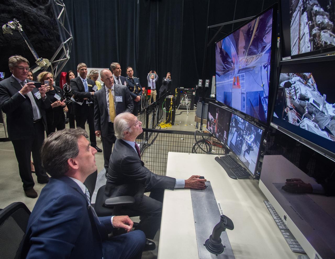
Swedish Delegation Visits GSFC – May 3, 2017 - Members of the Royal Swedish Academy of Engineering Sciences listen to Benjamin Reed, Deputy Division Director of the SatelliteServicing Projects Division about activities happening in Goddard’s Robotic Operations Center in Building 29. Credit: NASA/Goddard/Bill Hrybyk Read more: <a href="https://go.nasa.gov/2p1rP0h" rel="nofollow">go.nasa.gov/2p1rP0h</a> <b><a href="http://www.nasa.gov/audience/formedia/features/MP_Photo_Guidelines.html" rel="nofollow">NASA image use policy.</a></b> <b><a href="http://www.nasa.gov/centers/goddard/home/index.html" rel="nofollow">NASA Goddard Space Flight Center</a></b> enables NASA’s mission through four scientific endeavors: Earth Science, Heliophysics, Solar System Exploration, and Astrophysics. Goddard plays a leading role in NASA’s accomplishments by contributing compelling scientific knowledge to advance the Agency’s mission. <b>Follow us on <a href="http://twitter.com/NASAGoddardPix" rel="nofollow">Twitter</a></b> <b>Like us on <a href="http://www.facebook.com/pages/Greenbelt-MD/NASA-Goddard/395013845897?ref=tsd" rel="nofollow">Facebook</a></b> <b>Find us on <a href="http://instagrid.me/nasagoddard/?vm=grid" rel="nofollow">Instagram</a></b>
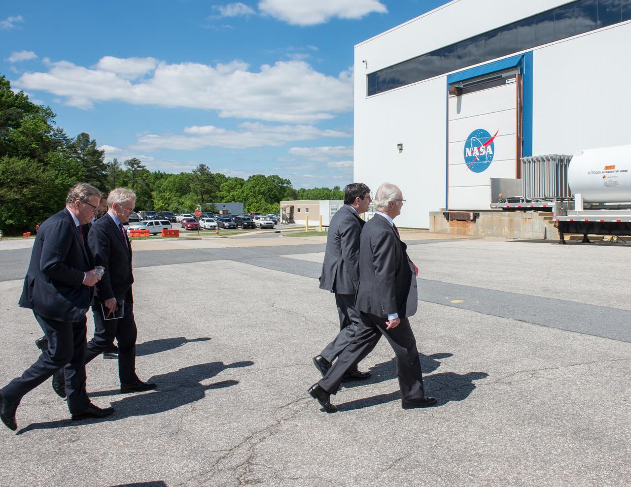
Swedish Delegation Visits GSFC – May 3, 2017 –Goddard Space Flight Center senior management and members of the Royal Swedish Academy walk towards Building 29 as part of the Swedish delegation’s tour of the center. Credit: NASA/Goddard/Bill Hrybyk Read more: <a href="https://go.nasa.gov/2p1rP0h" rel="nofollow">go.nasa.gov/2p1rP0h</a> <b><a href="http://www.nasa.gov/audience/formedia/features/MP_Photo_Guidelines.html" rel="nofollow">NASA image use policy.</a></b> <b><a href="http://www.nasa.gov/centers/goddard/home/index.html" rel="nofollow">NASA Goddard Space Flight Center</a></b> enables NASA’s mission through four scientific endeavors: Earth Science, Heliophysics, Solar System Exploration, and Astrophysics. Goddard plays a leading role in NASA’s accomplishments by contributing compelling scientific knowledge to advance the Agency’s mission. <b>Follow us on <a href="http://twitter.com/NASAGoddardPix" rel="nofollow">Twitter</a></b> <b>Like us on <a href="http://www.facebook.com/pages/Greenbelt-MD/NASA-Goddard/395013845897?ref=tsd" rel="nofollow">Facebook</a></b> <b>Find us on <a href="http://instagrid.me/nasagoddard/?vm=grid" rel="nofollow">Instagram</a></b>
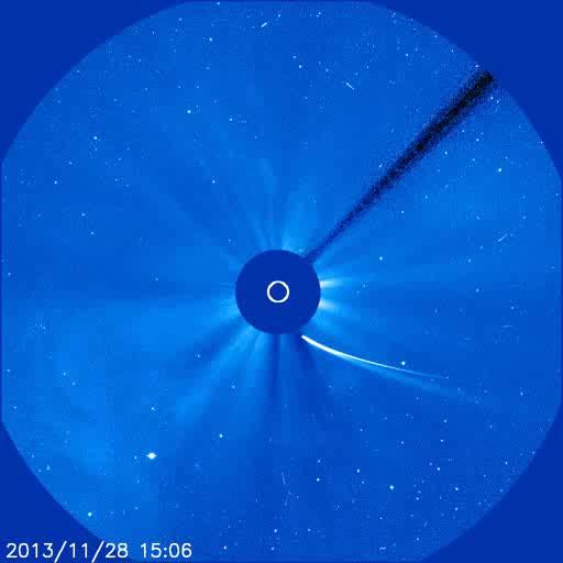
This view captures the transformation of Comet ISON as it rounded the sun. It combines 60 SOHO C2 frames in which ISON appears (Nov. 28, 1248 UT, to Nov. 29, 0316 UT) with stars, noise and particle tracks removed, plus an SDO AIA 171 image of the sun taken just before the spacecraft attempted to image the comet near perihelion. Credit: NASA/ESA/SOHO, NASA/SDO, and Francis Reddy <b><a href="http://www.nasa.gov/audience/formedia/features/MP_Photo_Guidelines.html" rel="nofollow">NASA image use policy.</a></b> <b><a href="http://www.nasa.gov/centers/goddard/home/index.html" rel="nofollow">NASA Goddard Space Flight Center</a></b> enables NASA’s mission through four scientific endeavors: Earth Science, Heliophysics, Solar System Exploration, and Astrophysics. Goddard plays a leading role in NASA’s accomplishments by contributing compelling scientific knowledge to advance the Agency’s mission. <b>Follow us on <a href="http://twitter.com/NASA_GoddardPix" rel="nofollow">Twitter</a></b> <b>Like us on <a href="http://www.facebook.com/pages/Greenbelt-MD/NASA-Goddard/395013845897?ref=tsd" rel="nofollow">Facebook</a></b> <b>Find us on <a href="http://instagram.com/nasagoddard?vm=grid" rel="nofollow">Instagram</a></b>
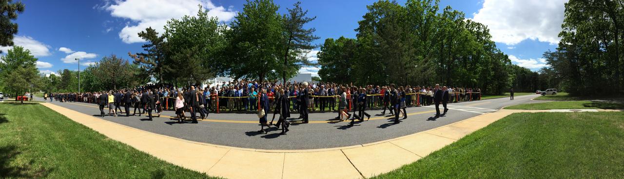
Swedish Delegation Visits GSFC – May 3, 2017 –Goddard Space Flight Center senior management and members of the Royal Swedish Academy walk towards Building 29 as part of the Swedish delegation’s tour of the center. Photo Credit: NASA/Goddard/Rebecca Roth Read more: <a href="https://go.nasa.gov/2p1rP0h" rel="nofollow">go.nasa.gov/2p1rP0h</a> <b><a href="http://www.nasa.gov/audience/formedia/features/MP_Photo_Guidelines.html" rel="nofollow">NASA image use policy.</a></b> <b><a href="http://www.nasa.gov/centers/goddard/home/index.html" rel="nofollow">NASA Goddard Space Flight Center</a></b> enables NASA’s mission through four scientific endeavors: Earth Science, Heliophysics, Solar System Exploration, and Astrophysics. Goddard plays a leading role in NASA’s accomplishments by contributing compelling scientific knowledge to advance the Agency’s mission. <b>Follow us on <a href="http://twitter.com/NASAGoddardPix" rel="nofollow">Twitter</a></b> <b>Like us on <a href="http://www.facebook.com/pages/Greenbelt-MD/NASA-Goddard/395013845897?ref=tsd" rel="nofollow">Facebook</a></b> <b>Find us on <a href="http://instagrid.me/nasagoddard/?vm=grid" rel="nofollow">Instagram</a></b>
Swedish Delegation Visits GSFC – May 3, 2017 –Goddard Space Flight Center senior management and members of the Royal Swedish Academy walk towards Building 29 as part of the Swedish delegation’s tour of the center. Photo Credit: NASA/Goddard/Rebecca Roth Read more: <a href="https://go.nasa.gov/2p1rP0h" rel="nofollow">go.nasa.gov/2p1rP0h</a> <b><a href="http://www.nasa.gov/audience/formedia/features/MP_Photo_Guidelines.html" rel="nofollow">NASA image use policy.</a></b> <b><a href="http://www.nasa.gov/centers/goddard/home/index.html" rel="nofollow">NASA Goddard Space Flight Center</a></b> enables NASA’s mission through four scientific endeavors: Earth Science, Heliophysics, Solar System Exploration, and Astrophysics. Goddard plays a leading role in NASA’s accomplishments by contributing compelling scientific knowledge to advance the Agency’s mission. <b>Follow us on <a href="http://twitter.com/NASAGoddardPix" rel="nofollow">Twitter</a></b> <b>Like us on <a href="http://www.facebook.com/pages/Greenbelt-MD/NASA-Goddard/395013845897?ref=tsd" rel="nofollow">Facebook</a></b> <b>Find us on <a href="http://instagrid.me/nasagoddard/?vm=grid" rel="nofollow">Instagram</a></b>
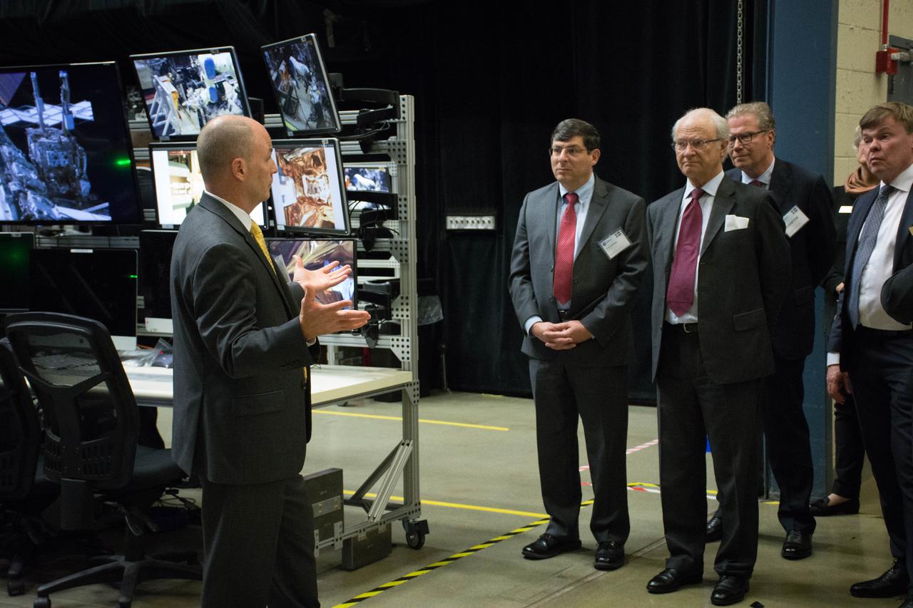
Swedish Delegation Visits GSFC – May 3, 2017 - Members of the Royal Swedish Academy of Engineering Sciences listen to Benjamin Reed, Deputy Division Director of the SatelliteServicing Projects Division about activities happening in Goddard’s Robotic Operations Center in Building 29. Photo Credit: NASA/Goddard/Rebecca Roth Read more: <a href="https://go.nasa.gov/2p1rP0h" rel="nofollow">go.nasa.gov/2p1rP0h</a> <b><a href="http://www.nasa.gov/audience/formedia/features/MP_Photo_Guidelines.html" rel="nofollow">NASA image use policy.</a></b> <b><a href="http://www.nasa.gov/centers/goddard/home/index.html" rel="nofollow">NASA Goddard Space Flight Center</a></b> enables NASA’s mission through four scientific endeavors: Earth Science, Heliophysics, Solar System Exploration, and Astrophysics. Goddard plays a leading role in NASA’s accomplishments by contributing compelling scientific knowledge to advance the Agency’s mission. <b>Follow us on <a href="http://twitter.com/NASAGoddardPix" rel="nofollow">Twitter</a></b> <b>Like us on <a href="http://www.facebook.com/pages/Greenbelt-MD/NASA-Goddard/395013845897?ref=tsd" rel="nofollow">Facebook</a></b> <b>Find us on <a href="http://instagrid.me/nasagoddard/?vm=grid" rel="nofollow">Instagram</a></b>
ISS018-E-006077 (29 Oct. 2008) --- Kennedy Space Center and Cape Canaveral, Florida are featured in this image photographed by an Expedition 18 crewmember on the International Space Station. Launch complex 39, with pads A and B, is visible at center left. The Vehicle Assembly Building (VAB) is visible at lower right.
51B-06-010 (29 April-6 May 1985) --- Lodewijk van den Berg, 51-B payload specialist, observes the growth of mercuric iodide crystal in the vapor crystal growth system (VCGS) on the Spacelab 3 science module aboard the Space Shuttle Challenger.
51B-13-008 (29 April-6 May 1985) --- Astronaut Frederick D. Gregory vacuums air filters in avionics bay. The 51-B pilot is physically located in the overhead area of the middeck on Challenger, but his activity is only a few meters away from the flight deck.
ISS011-E-11317 (29 July 2005) --- Russian Federal Space Agency cosmonaut Sergei K. Krikalev, Expedition 11 commander, and astronaut Wendy B. Lawrence, STS-114 mission specialist, prepare to unload the Raffaello Multi-Purpose Logistics Module (MPLM) docked to the international space station.
This visualization provides a three-dimensional perspective on Hubble's 25th anniversary image of the nebula Gum 29 with the star cluster Westerlund 2 at its core. The flight traverses the foreground stars and approaches the lower left rim of the nebula Gum 29. Passing through the wispy darker clouds on the near side, the journey reveals bright gas illuminated by the intense radiation of the newly formed stars of cluster Westerlund 2. Within the nebula, several pillars of dark, dense gas are being shaped by the energetic light and strong stellar winds from the brilliant cluster of thousands of stars. Note that the visualization is intended to be a scientifically reasonable interpretation and that distances within the model are significantly compressed. Download here: <a href="http://hubblesite.org/newscenter/archive/releases/2015/12/video/" rel="nofollow">hubblesite.org/newscenter/archive/releases/2015/12/video/</a> Credit: NASA, ESA, G. Bacon, L. Frattare, Z. Levay, and F. Summers (Viz3D Team, STScI), and J. Anderson (STScI) Acknowledgment: The Hubble Heritage Team (STScI/AURA), A. Nota (ESA/STScI), the Westerlund 2 Science Team, and ESO <b><a href="http://www.nasa.gov/audience/formedia/features/MP_Photo_Guidelines.html" rel="nofollow">NASA image use policy.</a></b> <b><a href="http://www.nasa.gov/centers/goddard/home/index.html" rel="nofollow">NASA Goddard Space Flight Center</a></b> enables NASA’s mission through four scientific endeavors: Earth Science, Heliophysics, Solar System Exploration, and Astrophysics. Goddard plays a leading role in NASA’s accomplishments by contributing compelling scientific knowledge to advance the Agency’s mission. <b>Follow us on <a href="http://twitter.com/NASAGoddardPix" rel="nofollow">Twitter</a></b> <b>Like us on <a href="http://www.facebook.com/pages/Greenbelt-MD/NASA-Goddard/395013845897?ref=tsd" rel="nofollow">Facebook</a></b> <b>Find us on <a href="http://instagrid.me/nasagoddard/?vm=grid" rel="nofollow">Instagram</a></b>

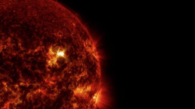
The sun emitted a trio of mid-level solar flares on April 2-3, 2017. The first peaked at 4:02 a.m. EDT on April 2, the second peaked at 4:33 p.m. EDT on April 2, and the third peaked at 10:29 a.m. EDT on April 3. NASA’s Solar Dynamics Observatory, which watches the sun constantly, captured images of the three events. Solar flares are powerful bursts of radiation. Harmful radiation from a flare cannot pass through Earth's atmosphere to physically affect humans on the ground, however — when intense enough — they can disturb the atmosphere in the layer where GPS and communications signals travel. Learn more: <a href="https://go.nasa.gov/2oQVFju" rel="nofollow">go.nasa.gov/2oQVFju</a> Caption: NASA's Solar Dynamics Observatory captured this image of a solar flare peaking at 10:29 a.m. EDT on April 3, 2017, as seen in the bright flash near the sun’s upper right edge. The image shows a subset of extreme ultraviolet light that highlights the extremely hot material in flares and which is typically colorized in teal. Credits: NASA/SDO <b><a href="http://www.nasa.gov/audience/formedia/features/MP_Photo_Guidelines.html" rel="nofollow">NASA image use policy.</a></b> <b><a href="http://www.nasa.gov/centers/goddard/home/index.html" rel="nofollow">NASA Goddard Space Flight Center</a></b> enables NASA’s mission through four scientific endeavors: Earth Science, Heliophysics, Solar System Exploration, and Astrophysics. Goddard plays a leading role in NASA’s accomplishments by contributing compelling scientific knowledge to advance the Agency’s mission. <b>Follow us on <a href="http://twitter.com/NASAGoddardPix" rel="nofollow">Twitter</a></b> <b>Like us on <a href="http://www.facebook.com/pages/Greenbelt-MD/NASA-Goddard/395013845897?ref=tsd" rel="nofollow">Facebook</a></b> <b>Find us on <a href="http://instagrid.me/nasagoddard/?vm=grid" rel="nofollow">Instagram</a></b>
NASA's Aqua satellite captured this image of Joaquin near the Bahamas on Sept. 29 at 18:10 UTC (2:10 p.m. EDT). Credit: NASA Goddard MODIS Rapid Response Team At 11 a.m. EDT (1500 UTC) on Wednesday, September 30, 2015 the center of Hurricane Joaquin was located near latitude 24.7 North, longitude 72.6 West. That puts the center of Joaquin about 215 miles (345 km) east-northeast of the Central Bahamas. Joaquin became a tropical storm Monday evening (EDT), September 29 when it was midway between the Bahamas and Bermuda. By 8 a.m. EDT on September 30, it strengthened into a hurricane and has become the third hurricane of the Atlantic Hurricane season. On September 30, the National Hurricane Center issued a Hurricane Warning for the central Bahamas including Cat Island, the Exumas, Long Island, Rum Cay, and San Salvador. A Hurricane Watch is in effect for the northwestern Bahamas including the Abacos, Berry Islands, Bimini, Eleuthera, Grand Bahama Island, and New Providence, but excluding Andros Island. <b><a href="http://www.nasa.gov/audience/formedia/features/MP_Photo_Guidelines.html" rel="nofollow">NASA image use policy.</a></b> <b><a href="http://www.nasa.gov/centers/goddard/home/index.html" rel="nofollow">NASA Goddard Space Flight Center</a></b> enables NASA’s mission through four scientific endeavors: Earth Science, Heliophysics, Solar System Exploration, and Astrophysics. Goddard plays a leading role in NASA’s accomplishments by contributing compelling scientific knowledge to advance the Agency’s mission. <b>Follow us on <a href="http://twitter.com/NASAGoddardPix" rel="nofollow">Twitter</a></b> <b>Like us on <a href="http://www.facebook.com/pages/Greenbelt-MD/NASA-Goddard/395013845897?ref=tsd" rel="nofollow">Facebook</a></b> <b>Find us on <a href="http://instagrid.me/nasagoddard/?vm=grid" rel="nofollow">Instagram</a></b>
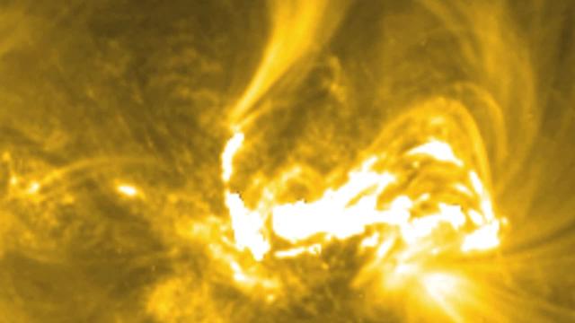
Extreme ultraviolet light streams out of an X-class solar flare as seen in this image captured on March 29, 2014, by NASA's Solar Dynamics Observatory. This image blends two wavelengths of light: 304 and 171 Angstroms, which help scientists observe the lower levels of the sun's atmosphere. More info: The sun emitted a significant solar flare, peaking at 1:48 p.m. EDT March 29, 2014, and NASA's Solar Dynamics Observatory captured images of the event. Solar flares are powerful bursts of radiation. Harmful radiation from a flare cannot pass through Earth's atmosphere to physically affect humans on the ground, however -- when intense enough -- they can disturb the atmosphere in the layer where GPS and communications signals travel. To see how this event impacted Earth, please visit NOAA's Space Weather Prediction Center at <a href="http://spaceweather.gov" rel="nofollow">spaceweather.gov</a>, the U.S. government's official source for space weather forecasts, alerts, watches and warnings. This flare is classified as an X.1-class flare. X-class denotes the most intense flares, while the number provides more information about its strength. An X2 is twice as intense as an X1, an X3 is three times as intense, etc. Credit: NASA/SDO <b><a href="http://www.nasa.gov/audience/formedia/features/MP_Photo_Guidelines.html" rel="nofollow">NASA image use policy.</a></b> <b><a href="http://www.nasa.gov/centers/goddard/home/index.html" rel="nofollow">NASA Goddard Space Flight Center</a></b> enables NASA’s mission through four scientific endeavors: Earth Science, Heliophysics, Solar System Exploration, and Astrophysics. Goddard plays a leading role in NASA’s accomplishments by contributing compelling scientific knowledge to advance the Agency’s mission. <b>Follow us on <a href="http://twitter.com/NASAGoddardPix" rel="nofollow">Twitter</a></b> <b>Like us on <a href="http://www.facebook.com/pages/Greenbelt-MD/NASA-Goddard/395013845897?ref=tsd" rel="nofollow">Facebook</a></b> <b>Find us on <a href="http://instagram.com/nasagoddard?vm=grid" rel="nofollow">Instagram</a></b>

Extreme ultraviolet light streams out of an X-class solar flare as seen in this image captured on March 29, 2014, by NASA's Solar Dynamics Observatory. This image blends two wavelengths of light: 304 and 171 Angstroms, which help scientists observe the lower levels of the sun's atmosphere. More info: The sun emitted a significant solar flare, peaking at 1:48 p.m. EDT March 29, 2014, and NASA's Solar Dynamics Observatory captured images of the event. Solar flares are powerful bursts of radiation. Harmful radiation from a flare cannot pass through Earth's atmosphere to physically affect humans on the ground, however -- when intense enough -- they can disturb the atmosphere in the layer where GPS and communications signals travel. To see how this event impacted Earth, please visit NOAA's Space Weather Prediction Center at <a href="http://spaceweather.gov" rel="nofollow">spaceweather.gov</a>, the U.S. government's official source for space weather forecasts, alerts, watches and warnings. This flare is classified as an X.1-class flare. X-class denotes the most intense flares, while the number provides more information about its strength. An X2 is twice as intense as an X1, an X3 is three times as intense, etc. Credit: NASA/SDO <b><a href="http://www.nasa.gov/audience/formedia/features/MP_Photo_Guidelines.html" rel="nofollow">NASA image use policy.</a></b> <b><a href="http://www.nasa.gov/centers/goddard/home/index.html" rel="nofollow">NASA Goddard Space Flight Center</a></b> enables NASA’s mission through four scientific endeavors: Earth Science, Heliophysics, Solar System Exploration, and Astrophysics. Goddard plays a leading role in NASA’s accomplishments by contributing compelling scientific knowledge to advance the Agency’s mission. <b>Follow us on <a href="http://twitter.com/NASAGoddardPix" rel="nofollow">Twitter</a></b> <b>Like us on <a href="http://www.facebook.com/pages/Greenbelt-MD/NASA-Goddard/395013845897?ref=tsd" rel="nofollow">Facebook</a></b> <b>Find us on <a href="http://instagram.com/nasagoddard?vm=grid" rel="nofollow">Instagram</a></b>
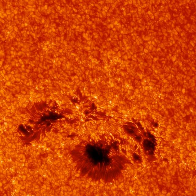
This close-up of the sunspot underneath the March 29, 2014, flare shows incredible detail. The image was captured by the G-band camera at Sacramento Peak in New Mexico. This instrument can focus on only a small area at once, but provide very high resolution. Ground-based telescope data can be hindered by Earth's atmosphere, which blocks much of the sun's ultraviolet and X-ray light, and causes twinkling even in the light it does allow through. As it happens, the March 29 flare occurred at a time of day in New Mexico that often results in the best viewing times from the ground. Credit: Kevin Reardon (National Solar Observatory), Lucia Kleint (BAER Institute) -- On March 29, 2014 the sun released an X-class flare. It was observed by NASA's Interface Region Imaging Spectrograph, or IRIS; NASA's Solar Dynamics Observatory, or SDO; NASA's Reuven Ramaty High Energy Solar Spectroscopic Imager, or RHESSI; the Japanese Aerospace Exploration Agency's Hinode; and the National Solar Observatory's Dunn Solar Telescope located at Sacramento Peak in New Mexico. To have a record of such an intense flare from so many observatories is unprecedented. Such research can help scientists better understand what catalyst sets off these large explosions on the sun. Perhaps we may even some day be able to predict their onset and forewarn of the radio blackouts solar flares can cause near Earth - blackouts that can interfere with airplane, ship and military communications. Read more: <a href="http://1.usa.gov/1kMDQbO" rel="nofollow">1.usa.gov/1kMDQbO</a> Join our Google+ Hangout on May 8 at 2:30pm EST: <a href="http://go.nasa.gov/1mwbBEZ" rel="nofollow">go.nasa.gov/1mwbBEZ</a> Credit: NASA Goddard <b><a href="http://www.nasa.gov/audience/formedia/features/MP_Photo_Guidelines.html" rel="nofollow">NASA image use policy.</a></b> <b><a href="http://www.nasa.gov/centers/goddard/home/index.html" rel="nofollow">NASA Goddard Space Flight Center</a></b> enables NASA’s mission through four scientific endeavors: Earth Science, Heliophysics, Solar System Exploration, and Astrophysics. Goddard plays a leading role in NASA’s accomplishments by contributing compelling scientific knowledge to advance the Agency’s mission. <b>Follow us on <a href="http://twitter.com/NASAGoddardPix" rel="nofollow">Twitter</a></b> <b>Like us on <a href="http://www.facebook.com/pages/Greenbelt-MD/NASA-Goddard/395013845897?ref=tsd" rel="nofollow">Facebook</a></b> <b>Find us on <a href="http://instagram.com/nasagoddard?vm=grid" rel="nofollow">Instagram</a></b>
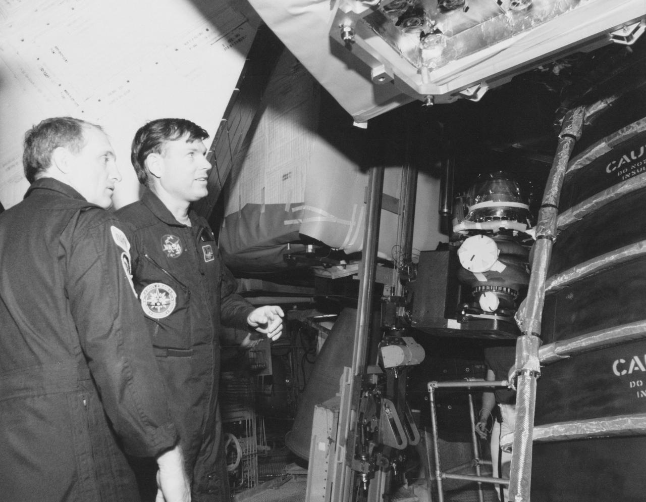
S89-28091 (7 Feb 1989) --- STS-29 astronauts inspect an area near the three main engines of the Space Shuttle Discovery prior to the removal of one of three oxidozer turbo pumps. Left to right are Astronauts James F. Buchli, mission specialist, and Michael L. Coats, mission commander. New pumps are scheduled to be installed soon. Now at Launch Pad 39-B, Discovery is set for launch in mid-March for Mission STS-29. Primary payload will be TDRS-D. Crewmembers not seen here are John E. Blaha, the pilot; and Robert C. Springer and James P. Bagian, both mission specialists.
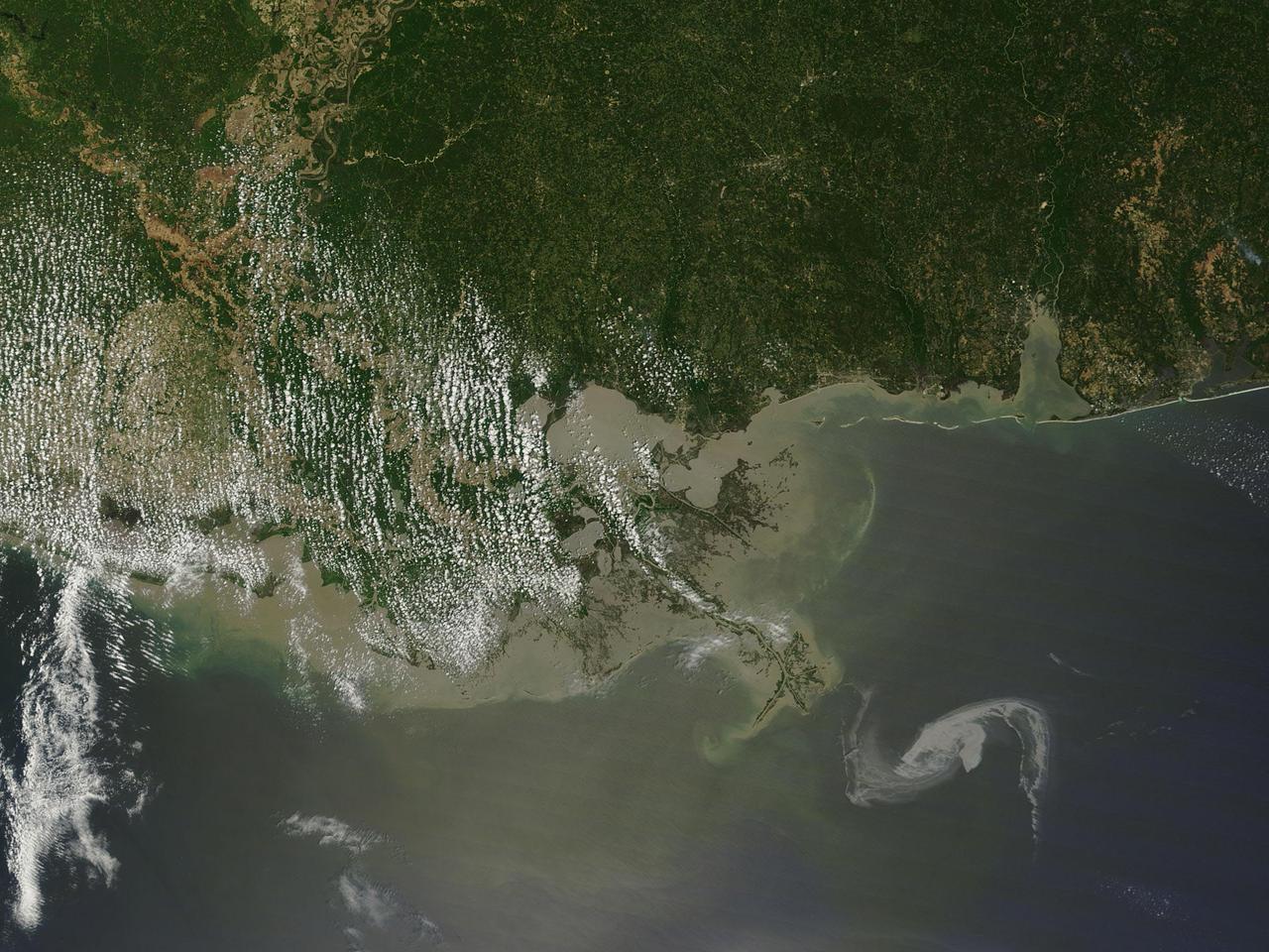
2010/119 - 04/29 at 16 :48 UTC Oil slick in the Gulf of Mexico (Input Direct Broadcast data courtesy Direct Readout Lab, NASA/GSFC) Satellite: Terra NASA/GSFC/Jeff Schmaltz/MODIS Land Rapid Response Team To learn more about MODIS go to: <a href="http://rapidfire.sci.gsfc.nasa.gov/gallery/?latest" rel="nofollow">rapidfire.sci.gsfc.nasa.gov/gallery/?latest</a> <b><a href="http://www.nasa.gov/centers/goddard/home/index.html" rel="nofollow">NASA Goddard Space Flight Center</a></b> is home to the nation's largest organization of combined scientists, engineers and technologists that build spacecraft, instruments and new technology to study the Earth, the sun, our solar system, and the universe.
The March 29, 2014, X-class flare appears as a bright light on the upper right in this image from SDO, showing light in the 304 Angstrom wavelength. This wavelength shows material on the sun in what's called the transition region, where the chromosphere transitions into the upper solar atmosphere, the corona. Some light of the flare is clearly visible, but the flare appears brighter in other images that show hotter temperature material. Credit: NASA/SDO/AIA -- On March 29, 2014 the sun released an X-class flare. It was observed by NASA's Interface Region Imaging Spectrograph, or IRIS; NASA's Solar Dynamics Observatory, or SDO; NASA's Reuven Ramaty High Energy Solar Spectroscopic Imager, or RHESSI; the Japanese Aerospace Exploration Agency's Hinode; and the National Solar Observatory's Dunn Solar Telescope located at Sacramento Peak in New Mexico. To have a record of such an intense flare from so many observatories is unprecedented. Such research can help scientists better understand what catalyst sets off these large explosions on the sun. Perhaps we may even some day be able to predict their onset and forewarn of the radio blackouts solar flares can cause near Earth - blackouts that can interfere with airplane, ship and military communications. Read more: <a href="http://1.usa.gov/1kMDQbO" rel="nofollow">1.usa.gov/1kMDQbO</a> Join our Google+ Hangout on May 8 at 2:30pm EST: <a href="http://go.nasa.gov/1mwbBEZ" rel="nofollow">go.nasa.gov/1mwbBEZ</a> <b><a href="http://www.nasa.gov/audience/formedia/features/MP_Photo_Guidelines.html" rel="nofollow">NASA image use policy.</a></b> <b><a href="http://www.nasa.gov/centers/goddard/home/index.html" rel="nofollow">NASA Goddard Space Flight Center</a></b> enables NASA’s mission through four scientific endeavors: Earth Science, Heliophysics, Solar System Exploration, and Astrophysics. Goddard plays a leading role in NASA’s accomplishments by contributing compelling scientific knowledge to advance the Agency’s mission. <b>Follow us on <a href="http://twitter.com/NASAGoddardPix" rel="nofollow">Twitter</a></b> <b>Like us on <a href="http://www.facebook.com/pages/Greenbelt-MD/NASA-Goddard/395013845897?ref=tsd" rel="nofollow">Facebook</a></b> <b>Find us on <a href="http://instagram.com/nasagoddard?vm=grid" rel="nofollow">Instagram</a></b>
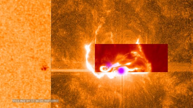
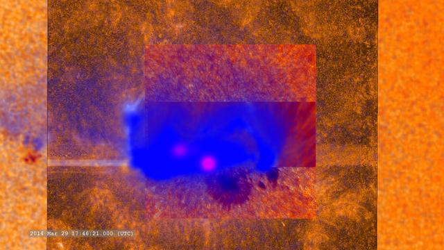
This combined image shows the March 29, 2014, X-class flare as seen through the eyes of different observatories. SDO is on the bottom/left, which helps show the position of the flare on the sun. The darker orange square is IRIS data. The red rectangular inset is from Sacramento Peak. The violet spots show the flare's footpoints from RHESSI. -- On March 29, 2014 the sun released an X-class flare. It was observed by NASA's Interface Region Imaging Spectrograph, or IRIS; NASA's Solar Dynamics Observatory, or SDO; NASA's Reuven Ramaty High Energy Solar Spectroscopic Imager, or RHESSI; the Japanese Aerospace Exploration Agency's Hinode; and the National Solar Observatory's Dunn Solar Telescope located at Sacramento Peak in New Mexico. To have a record of such an intense flare from so many observatories is unprecedented. Such research can help scientists better understand what catalyst sets off these large explosions on the sun. Perhaps we may even some day be able to predict their onset and forewarn of the radio blackouts solar flares can cause near Earth - blackouts that can interfere with airplane, ship and military communications. Read more: <a href="http://1.usa.gov/1kMDQbO" rel="nofollow">1.usa.gov/1kMDQbO</a> Join our Google+ Hangout on May 8 at 2:30pm EST: <a href="http://go.nasa.gov/1mwbBEZ" rel="nofollow">go.nasa.gov/1mwbBEZ</a> Credit: NASA Goddard <b><a href="http://www.nasa.gov/audience/formedia/features/MP_Photo_Guidelines.html" rel="nofollow">NASA image use policy.</a></b> <b><a href="http://www.nasa.gov/centers/goddard/home/index.html" rel="nofollow">NASA Goddard Space Flight Center</a></b> enables NASA’s mission through four scientific endeavors: Earth Science, Heliophysics, Solar System Exploration, and Astrophysics. Goddard plays a leading role in NASA’s accomplishments by contributing compelling scientific knowledge to advance the Agency’s mission. <b>Follow us on <a href="http://twitter.com/NASAGoddardPix" rel="nofollow">Twitter</a></b> <b>Like us on <a href="http://www.facebook.com/pages/Greenbelt-MD/NASA-Goddard/395013845897?ref=tsd" rel="nofollow">Facebook</a></b> <b>Find us on <a href="http://instagram.com/nasagoddard?vm=grid" rel="nofollow">Instagram</a></b>
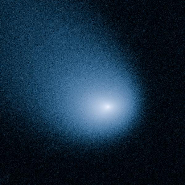
MARCH 27, 2014: Comet Siding Spring is plunging toward the Sun along a roughly 1-million-year orbit. The comet, discovered in 2013, was within the radius of Jupiter's orbit when the Hubble Space Telescope photographed it on March 11, 2014. Hubble resolves two jets of dust coming from the solid icy nucleus. These persistent jets were first seen in Hubble pictures taken on Oct. 29, 2013. The feature should allow astronomers to measure the direction of the nucleus's pole, and hence, rotation axis. The comet will make its closest approach to our Sun on Oct. 25, 2014, at a distance of 130 million miles, well outside Earth's orbit. On its inbound leg, Comet Siding Spring will pass within 84,000 miles of Mars on Oct. 19, 2014, which is less than half the Moon's distance from Earth. The comet is not expected to become bright enough to be seen by the naked eye. Credit: NASA, ESA, and J.-Y. Li (Planetary Science Institute) <b><a href="http://www.nasa.gov/audience/formedia/features/MP_Photo_Guidelines.html" rel="nofollow">NASA image use policy.</a></b> <b><a href="http://www.nasa.gov/centers/goddard/home/index.html" rel="nofollow">NASA Goddard Space Flight Center</a></b> enables NASA’s mission through four scientific endeavors: Earth Science, Heliophysics, Solar System Exploration, and Astrophysics. Goddard plays a leading role in NASA’s accomplishments by contributing compelling scientific knowledge to advance the Agency’s mission. <b>Follow us on <a href="http://twitter.com/NASAGoddardPix" rel="nofollow">Twitter</a></b> <b>Like us on <a href="http://www.facebook.com/pages/Greenbelt-MD/NASA-Goddard/395013845897?ref=tsd" rel="nofollow">Facebook</a></b> <b>Find us on <a href="http://instagram.com/nasagoddard?vm=grid" rel="nofollow">Instagram</a></b>
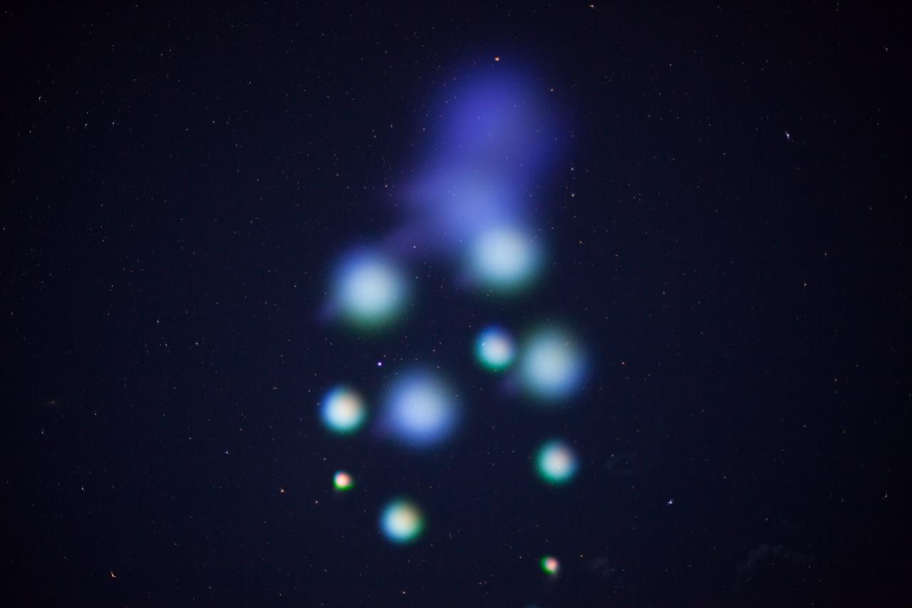
July 4 fireworks came early when a NASA Terrier-Improved Malemute sounding rocket was successfully launched at 4:25 a.m., Thursday, June 29, from the agency’s Wallops Flight Facility in Virginia. During the 8-minute flight, 10 canisters about the size of a soft drink can were ejected in space, 6 to 12 miles away from the 670-pound main payload. The canisters deployed blue-green and red vapor that formed artificial clouds visible from New York to North Carolina. During an ionosphere or aurora science mission, these clouds, or vapor tracers, allow scientists on the ground to visually track particle motions in space. The development of the multi-canister ampoule ejection system will allow scientists to gather information over a much larger area than previously possible when deploying the tracers just from the main payload. Credit: NASA/Wallops <b><a href="http://www.nasa.gov/audience/formedia/features/MP_Photo_Guidelines.html" rel="nofollow">NASA image use policy.</a></b> <b><a href="http://www.nasa.gov/centers/goddard/home/index.html" rel="nofollow">NASA Goddard Space Flight Center</a></b> enables NASA’s mission through four scientific endeavors: Earth Science, Heliophysics, Solar System Exploration, and Astrophysics. Goddard plays a leading role in NASA’s accomplishments by contributing compelling scientific knowledge to advance the Agency’s mission. <b>Follow us on <a href="http://twitter.com/NASAGoddardPix" rel="nofollow">Twitter</a></b> <b>Like us on <a href="http://www.facebook.com/pages/Greenbelt-MD/NASA-Goddard/395013845897?ref=tsd" rel="nofollow">Facebook</a></b> <b>Find us on <a href="http://instagrid.me/nasagoddard/?vm=grid" rel="nofollow">Instagram</a></b>
NASA's Goddard Space Flight Center in Greenbelt, Maryland, played a critical role in the test flight of the #Orion spacecraft on Dec. 5, 2014. Goddard's Networks Integration Center, pictured here, coordinated the communications support for both the Orion vehicle and the Delta IV rocket, ensuring complete communications coverage through NASA's Space Network and Tracking and Data Relay Satellite. The Orion spacecraft lifted off from Cape Canaveral Air Force Station's Space Launch Complex 37 in Florida at 7:05 a.m. EST. The Orion capsule splashed down about four and a half hours later, at 11:29 a.m. EST, about 600 miles off the coast of San Diego, California. While no humans were aboard Orion for this test flight, in the future, Orion will allow humans to travel deeper in to space than ever before, including an asteroid and Mars. Credit: NASA/Goddard/Amber Jacobson Credit: NASA/Goddard/Amber Jacobson <b><a href="http://www.nasa.gov/audience/formedia/features/MP_Photo_Guidelines.html" rel="nofollow">NASA image use policy.</a></b> <b><a href="http://www.nasa.gov/centers/goddard/home/index.html" rel="nofollow">NASA Goddard Space Flight Center</a></b> enables NASA’s mission through four scientific endeavors: Earth Science, Heliophysics, Solar System Exploration, and Astrophysics. Goddard plays a leading role in NASA’s accomplishments by contributing compelling scientific knowledge to advance the Agency’s mission. <b>Follow us on <a href="http://twitter.com/NASAGoddardPix" rel="nofollow">Twitter</a></b> <b>Like us on <a href="http://www.facebook.com/pages/Greenbelt-MD/NASA-Goddard/395013845897?ref=tsd" rel="nofollow">Facebook</a></b> <b>Find us on <a href="http://instagram.com/nasagoddard?vm=grid" rel="nofollow">Instagram</a></b>
On March 29, 2014 the sun released an X-class flare. It was observed by NASA's Interface Region Imaging Spectrograph, or IRIS; NASA's Solar Dynamics Observatory, or SDO; NASA's Reuven Ramaty High Energy Solar Spectroscopic Imager, or RHESSI; the Japanese Aerospace Exploration Agency's Hinode; and the National Solar Observatory's Dunn Solar Telescope located at Sacramento Peak in New Mexico. To have a record of such an intense flare from so many observatories is unprecedented. Such research can help scientists better understand what catalyst sets off these large explosions on the sun. Perhaps we may even some day be able to predict their onset and forewarn of the radio blackouts solar flares can cause near Earth - blackouts that can interfere with airplane, ship and military communications. Read more: <a href="http://1.usa.gov/1kMDQbO" rel="nofollow">1.usa.gov/1kMDQbO</a> Join our Google+ Hangout on May 8 at 2:30pm EST: <a href="http://go.nasa.gov/1mwbBEZ" rel="nofollow">go.nasa.gov/1mwbBEZ</a> Credit: NASA Goddard <b><a href="http://www.nasa.gov/audience/formedia/features/MP_Photo_Guidelines.html" rel="nofollow">NASA image use policy.</a></b> <b><a href="http://www.nasa.gov/centers/goddard/home/index.html" rel="nofollow">NASA Goddard Space Flight Center</a></b> enables NASA’s mission through four scientific endeavors: Earth Science, Heliophysics, Solar System Exploration, and Astrophysics. Goddard plays a leading role in NASA’s accomplishments by contributing compelling scientific knowledge to advance the Agency’s mission. <b>Follow us on <a href="http://twitter.com/NASAGoddardPix" rel="nofollow">Twitter</a></b> <b>Like us on <a href="http://www.facebook.com/pages/Greenbelt-MD/NASA-Goddard/395013845897?ref=tsd" rel="nofollow">Facebook</a></b> <b>Find us on <a href="http://instagram.com/nasagoddard?vm=grid" rel="nofollow">Instagram</a></b>
A combination of many (but not all) of the datasets which observed this flare. -- On March 29, 2014 the sun released an X-class flare. It was observed by NASA's Interface Region Imaging Spectrograph, or IRIS; NASA's Solar Dynamics Observatory, or SDO; NASA's Reuven Ramaty High Energy Solar Spectroscopic Imager, or RHESSI; the Japanese Aerospace Exploration Agency's Hinode; and the National Solar Observatory's Dunn Solar Telescope located at Sacramento Peak in New Mexico. To have a record of such an intense flare from so many observatories is unprecedented. Such research can help scientists better understand what catalyst sets off these large explosions on the sun. Perhaps we may even some day be able to predict their onset and forewarn of the radio blackouts solar flares can cause near Earth - blackouts that can interfere with airplane, ship and military communications. Read more: <a href="http://1.usa.gov/1kMDQbO" rel="nofollow">1.usa.gov/1kMDQbO</a> Join our Google+ Hangout on May 8 at 2:30pm EST: <a href="http://go.nasa.gov/1mwbBEZ" rel="nofollow">go.nasa.gov/1mwbBEZ</a> Credit: NASA Goddard <b><a href="http://www.nasa.gov/audience/formedia/features/MP_Photo_Guidelines.html" rel="nofollow">NASA image use policy.</a></b> <b><a href="http://www.nasa.gov/centers/goddard/home/index.html" rel="nofollow">NASA Goddard Space Flight Center</a></b> enables NASA’s mission through four scientific endeavors: Earth Science, Heliophysics, Solar System Exploration, and Astrophysics. Goddard plays a leading role in NASA’s accomplishments by contributing compelling scientific knowledge to advance the Agency’s mission. <b>Follow us on <a href="http://twitter.com/NASAGoddardPix" rel="nofollow">Twitter</a></b> <b>Like us on <a href="http://www.facebook.com/pages/Greenbelt-MD/NASA-Goddard/395013845897?ref=tsd" rel="nofollow">Facebook</a></b> <b>Find us on <a href="http://instagram.com/nasagoddard?vm=grid" rel="nofollow">Instagram</a></b>
July 4 fireworks came early when a NASA Terrier-Improved Malemute sounding rocket was successfully launched at 4:25 a.m., Thursday, June 29, from the agency’s Wallops Flight Facility in Virginia. During the 8-minute flight, 10 canisters about the size of a soft drink can were ejected in space, 6 to 12 miles away from the 670-pound main payload. The canisters deployed blue-green and red vapor that formed artificial clouds visible from New York to North Carolina. During an ionosphere or aurora science mission, these clouds, or vapor tracers, allow scientists on the ground to visually track particle motions in space. The development of the multi-canister ampoule ejection system will allow scientists to gather information over a much larger area than previously possible when deploying the tracers just from the main payload. Read more here: <a href="https://www.nasa.gov/feature/wallops/2017/nasa-sounding-rocket-will-release-early-morning-artificial-clouds0lighting-up-the-mid-atlantic-coast-may-31" rel="nofollow">www.nasa.gov/feature/wallops/2017/nasa-sounding-rocket-wi...</a> <b><a href="http://www.nasa.gov/audience/formedia/features/MP_Photo_Guidelines.html" rel="nofollow">NASA image use policy.</a></b> <b><a href="http://www.nasa.gov/centers/goddard/home/index.html" rel="nofollow">NASA Goddard Space Flight Center</a></b> enables NASA’s mission through four scientific endeavors: Earth Science, Heliophysics, Solar System Exploration, and Astrophysics. Goddard plays a leading role in NASA’s accomplishments by contributing compelling scientific knowledge to advance the Agency’s mission. <b>Follow us on <a href="http://twitter.com/NASAGoddardPix" rel="nofollow">Twitter</a></b> <b>Like us on <a href="http://www.facebook.com/pages/Greenbelt-MD/NASA-Goddard/395013845897?ref=tsd" rel="nofollow">Facebook</a></b> <b>Find us on <a href="http://instagrid.me/nasagoddard/?vm=grid" rel="nofollow">Instagram</a></b>
On March 29, 2014 the sun released an X-class flare. It was observed by NASA's Interface Region Imaging Spectrograph, or IRIS; NASA's Solar Dynamics Observatory, or SDO; NASA's Reuven Ramaty High Energy Solar Spectroscopic Imager, or RHESSI; the Japanese Aerospace Exploration Agency's Hinode; and the National Solar Observatory's Dunn Solar Telescope located at Sacramento Peak in New Mexico. To have a record of such an intense flare from so many observatories is unprecedented. Such research can help scientists better understand what catalyst sets off these large explosions on the sun. Perhaps we may even some day be able to predict their onset and forewarn of the radio blackouts solar flares can cause near Earth - blackouts that can interfere with airplane, ship and military communications. Read more: <a href="http://1.usa.gov/1kMDQbO" rel="nofollow">1.usa.gov/1kMDQbO</a> Join our Google+ Hangout on May 8 at 2:30pm EST: <a href="http://go.nasa.gov/1mwbBEZ" rel="nofollow">go.nasa.gov/1mwbBEZ</a> Credit: NASA Goddard <b><a href="http://www.nasa.gov/audience/formedia/features/MP_Photo_Guidelines.html" rel="nofollow">NASA image use policy.</a></b> <b><a href="http://www.nasa.gov/centers/goddard/home/index.html" rel="nofollow">NASA Goddard Space Flight Center</a></b> enables NASA’s mission through four scientific endeavors: Earth Science, Heliophysics, Solar System Exploration, and Astrophysics. Goddard plays a leading role in NASA’s accomplishments by contributing compelling scientific knowledge to advance the Agency’s mission. <b>Follow us on <a href="http://twitter.com/NASAGoddardPix" rel="nofollow">Twitter</a></b> <b>Like us on <a href="http://www.facebook.com/pages/Greenbelt-MD/NASA-Goddard/395013845897?ref=tsd" rel="nofollow">Facebook</a></b> <b>Find us on <a href="http://instagram.com/nasagoddard?vm=grid" rel="nofollow">Instagram</a></b>
This movie shows Comet ISON orbiting around the sun – represented by the white circle -- on Nov. 28, 2013. ISON looks smaller as it streams away, but scientists believe its nucleus may still be intact. The video covers Nov. 27, 2013, 3:30 p.m. EST to Nov. 29, 2013, 8:30 a.m. EST. Continuing a history of surprising behavior, material from Comet ISON appeared on the other side of the sun on the evening on Nov. 28, 2013, despite not having been seen in observations during its closest approach to the sun. The question remains whether it is merely debris from the comet, or if some portion of the comet's nucleus survived, but late-night analysis from scientists with NASA's Comet ISON Observing Campaign suggest that there is at least a small nucleus intact. Credit: ESA/NASA/SOHO/Jhelioviewer <b><a href="http://www.nasa.gov/audience/formedia/features/MP_Photo_Guidelines.html" rel="nofollow">NASA image use policy.</a></b> <b><a href="http://www.nasa.gov/centers/goddard/home/index.html" rel="nofollow">NASA Goddard Space Flight Center</a></b> enables NASA’s mission through four scientific endeavors: Earth Science, Heliophysics, Solar System Exploration, and Astrophysics. Goddard plays a leading role in NASA’s accomplishments by contributing compelling scientific knowledge to advance the Agency’s mission. <b>Follow us on <a href="http://twitter.com/NASA_GoddardPix" rel="nofollow">Twitter</a></b> <b>Like us on <a href="http://www.facebook.com/pages/Greenbelt-MD/NASA-Goddard/395013845897?ref=tsd" rel="nofollow">Facebook</a></b> <b>Find us on <a href="http://instagram.com/nasagoddard?vm=grid" rel="nofollow">Instagram</a></b>
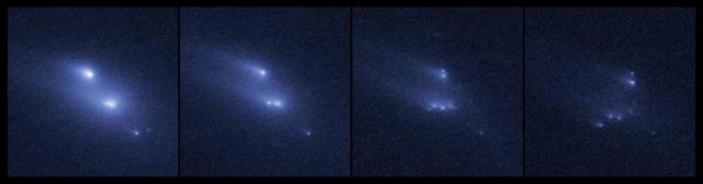
This series of images shows the asteroid P/2013 R3 breaking apart, as viewed by the NASA/ESA Hubble Space Telescope in 2013. This is the first time that such a body has been seen to undergo this kind of break-up. The Hubble observations showed that there are ten distinct objects, each with comet-like dust tails, embedded within the asteroid's dusty envelope. The four largest rocky fragments are up to 200 metres in radius, about twice the length of a football pitch. The date increases from left to right, with frames from 29 October 2013, 15 November 2013, 13 December 2013, and 14 January 2014 respectively, showing how the clumps of debris material move around. The 14 January 2014 frame was not included in the science paper and is additional data. Credit: NASA, ESA, D. Jewitt (UCLA) Read more: <a href="http://1.usa.gov/1ig2E0x" rel="nofollow">1.usa.gov/1ig2E0x</a> <b><a href="http://www.nasa.gov/audience/formedia/features/MP_Photo_Guidelines.html" rel="nofollow">NASA image use policy.</a></b> <b><a href="http://www.nasa.gov/centers/goddard/home/index.html" rel="nofollow">NASA Goddard Space Flight Center</a></b> enables NASA’s mission through four scientific endeavors: Earth Science, Heliophysics, Solar System Exploration, and Astrophysics. Goddard plays a leading role in NASA’s accomplishments by contributing compelling scientific knowledge to advance the Agency’s mission. <b>Follow us on <a href="http://twitter.com/NASAGoddardPix" rel="nofollow">Twitter</a></b> <b>Like us on <a href="http://www.facebook.com/pages/Greenbelt-MD/NASA-Goddard/395013845897?ref=tsd" rel="nofollow">Facebook</a></b> <b>Find us on <a href="http://instagram.com/nasagoddard?vm=grid" rel="nofollow">Instagram</a></b>
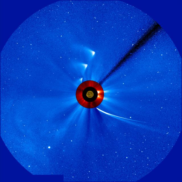
"Timelapse" series of images of comet ISON as viewed by ESA/NASA's Solar and Heliospheric Observatory, or SOHO. This image is a composite, with the sun imaged by NASA's Solar Dynamics Observatory in the center, and SOHO's two coronagraphs showing the solar atmosphere, the corona. The most recent image in this is from 5:30 p.m. EST on Nov. 29, 2013. Continuing a history of surprising behavior, material from Comet ISON appeared on the other side of the sun on the evening on Nov. 28, 2013, despite not having been seen in observations during its closest approach to the sun. The question remains whether it is merely debris from the comet, or if some portion of the comet's nucleus survived, but late-night analysis from scientists with NASA's Comet ISON Observing Campaign suggest that there is at least a small nucleus intact. Image Credit:ESA&NASA/SOHO/SDO <b><a href="http://www.nasa.gov/audience/formedia/features/MP_Photo_Guidelines.html" rel="nofollow">NASA image use policy.</a></b> <b><a href="http://www.nasa.gov/centers/goddard/home/index.html" rel="nofollow">NASA Goddard Space Flight Center</a></b> enables NASA’s mission through four scientific endeavors: Earth Science, Heliophysics, Solar System Exploration, and Astrophysics. Goddard plays a leading role in NASA’s accomplishments by contributing compelling scientific knowledge to advance the Agency’s mission. <b>Follow us on <a href="http://twitter.com/NASA_GoddardPix" rel="nofollow">Twitter</a></b> <b>Like us on <a href="http://www.facebook.com/pages/Greenbelt-MD/NASA-Goddard/395013845897?ref=tsd" rel="nofollow">Facebook</a></b> <b>Find us on <a href="http://instagram.com/nasagoddard?vm=grid" rel="nofollow">Instagram</a></b>
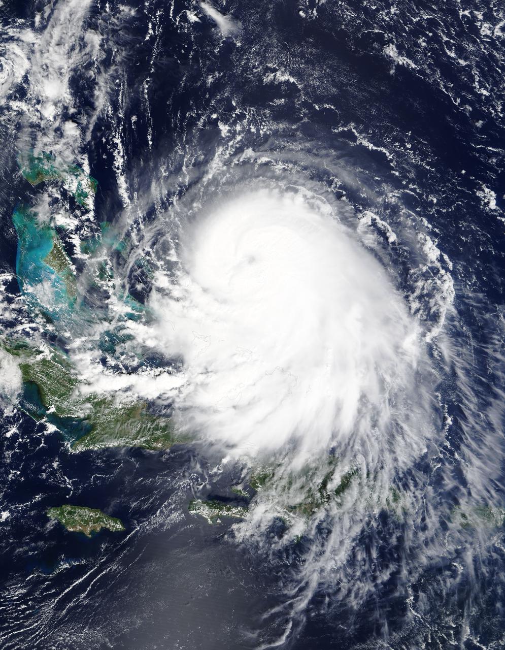
The MODIS instrument on NASA's Terra satellite captured Hurricane Joaquin off the Bahamas at 15:45 UTC (11:45 a.m. EDT) on September 30, 2015. Credit: NASA/GSFC/Jeff Schmaltz/MODIS Land Rapid Response Team At 11 a.m. EDT (1500 UTC) on Wednesday, September 30, 2015 the center of Hurricane Joaquin was located near latitude 24.7 North, longitude 72.6 West. That puts the center of Joaquin about 215 miles (345 km) east-northeast of the Central Bahamas. Joaquin became a tropical storm Monday evening (EDT), September 29 when it was midway between the Bahamas and Bermuda. By 8 a.m. EDT on September 30, it strengthened into a hurricane and has become the third hurricane of the Atlantic Hurricane season. On September 30, the National Hurricane Center issued a Hurricane Warning for the central Bahamas including Cat Island, the Exumas, Long Island, Rum Cay, and San Salvador. A Hurricane Watch is in effect for the northwestern Bahamas including the Abacos, Berry Islands, Bimini, Eleuthera, Grand Bahama Island, and New Providence, but excluding Andros Island. <b><a href="http://www.nasa.gov/audience/formedia/features/MP_Photo_Guidelines.html" rel="nofollow">NASA image use policy.</a></b> <b><a href="http://www.nasa.gov/centers/goddard/home/index.html" rel="nofollow">NASA Goddard Space Flight Center</a></b> enables NASA’s mission through four scientific endeavors: Earth Science, Heliophysics, Solar System Exploration, and Astrophysics. Goddard plays a leading role in NASA’s accomplishments by contributing compelling scientific knowledge to advance the Agency’s mission. <b>Follow us on <a href="http://twitter.com/NASAGoddardPix" rel="nofollow">Twitter</a></b> <b>Like us on <a href="http://www.facebook.com/pages/Greenbelt-MD/NASA-Goddard/395013845897?ref=tsd" rel="nofollow">Facebook</a></b> <b>Find us on <a href="http://instagrid.me/nasagoddard/?vm=grid" rel="nofollow">Instagram</a></b>
NASA launched a Terrier-Improved Malemute suborbital sounding rocket carrying the RockSat-X payload with university and community college student experiments at 6:04 a.m. EDT Wednesday, Aug. 12, from NASA’s Wallops Flight Facilityin Virginia. More than 60 students and instructors from across the continental United States, Hawaii and Puerto Rico were on hand to witness the launch of their experiments. The payload flew to an altitude of about 97 miles and descended via parachute into the Atlantic Ocean off the coast of Wallops. Payload recovery operations began after lift-off. Developed by students from seven higher education programs, the experiments flew through the RockSat-X program in conjunction with the Colorado Space Grant Consortium. Participating institutions in this flight are the University of Colorado, Boulder; Northwest Nazarene University, Nampa, Idaho; the University of Puerto Rico; the University of Nebraska, Lincoln; Virginia Tech University, Blacksburg; Capitol Technology University, Laurel, Maryland; and University of Hawai'i Community Colleges at the Honolulu, Kapi'olani, Kaua'i, and Windward campuses. The next launch scheduled from Wallops is a NASA Black Brant IX suborbital sounding rocket carrying several technology development instruments. The launch is scheduled between 7 and 7:41 p.m. Sept. 29. The backup launch days are Sept. 30 through Oct. 12. <b><a href="http://www.nasa.gov/audience/formedia/features/MP_Photo_Guidelines.html" rel="nofollow">NASA image use policy.</a></b> <b><a href="http://www.nasa.gov/centers/goddard/home/index.html" rel="nofollow">NASA Goddard Space Flight Center</a></b> enables NASA’s mission through four scientific endeavors: Earth Science, Heliophysics, Solar System Exploration, and Astrophysics. Goddard plays a leading role in NASA’s accomplishments by contributing compelling scientific knowledge to advance the Agency’s mission. <b>Follow us on <a href="http://twitter.com/NASAGoddardPix" rel="nofollow">Twitter</a></b> <b>Like us on <a href="http://www.facebook.com/pages/Greenbelt-MD/NASA-Goddard/395013845897?ref=tsd" rel="nofollow">Facebook</a></b> <b>Find us on <a href="http://instagrid.me/nasagoddard/?vm=grid" rel="nofollow">Instagram</a></b>
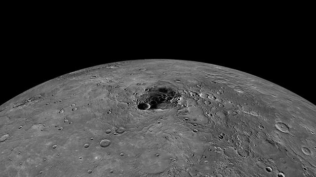
Tune in to NASA's News Conference today, November 29, 2012, at 2 p.m. EST for new findings about Mercury's polar regions. <a href="http://www.nasa.gov/multimedia/nasatv/index.html" rel="nofollow">www.nasa.gov/multimedia/nasatv/index.html</a> Due to its nearly vertical spin axis, Mercury's north pole is never fully sunlit. If it were, it might look something like this image, which is an orthographic projection of a global mosaic. The dark area towards the center of the image contains the north pole. The MESSENGER spacecraft is the first ever to orbit the planet Mercury, and the spacecraft's seven scientific instruments and radio science investigation are unraveling the history and evolution of the Solar System's innermost planet. Visit the Why Mercury? section of this website to learn more about the key science questions that the MESSENGER mission is addressing. During the one-year primary mission, MESSENGER acquired 88,746 images and extensive other data sets. MESSENGER is now in a yearlong extended mission, during which plans call for the acquisition of more than 80,000 additional images to support MESSENGER's science goals. Credit: NASA/Johns Hopkins University Applied Physics Laboratory/Carnegie Institution of Washington <b><a href="http://www.nasa.gov/audience/formedia/features/MP_Photo_Guidelines.html" rel="nofollow">NASA image use policy.</a></b> <b><a href="http://www.nasa.gov/centers/goddard/home/index.html" rel="nofollow">NASA Goddard Space Flight Center</a></b> enables NASA’s mission through four scientific endeavors: Earth Science, Heliophysics, Solar System Exploration, and Astrophysics. Goddard plays a leading role in NASA’s accomplishments by contributing compelling scientific knowledge to advance the Agency’s mission. <b>Follow us on <a href="http://twitter.com/NASA_GoddardPix" rel="nofollow">Twitter</a></b> <b>Like us on <a href="http://www.facebook.com/pages/Greenbelt-MD/NASA-Goddard/395013845897?ref=tsd" rel="nofollow">Facebook</a></b> <b>Find us on <a href="http://instagram.com/nasagoddard?vm=grid" rel="nofollow">Instagram</a></b>
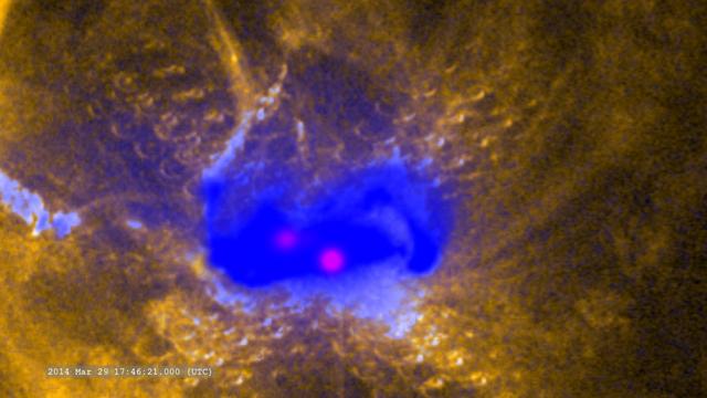
Zoom in on the flare in ultraviolet (SDO/AIA), X-rays (Hinode) and gamma-rays (RHESSI) -- On March 29, 2014 the sun released an X-class flare. It was observed by NASA's Interface Region Imaging Spectrograph, or IRIS; NASA's Solar Dynamics Observatory, or SDO; NASA's Reuven Ramaty High Energy Solar Spectroscopic Imager, or RHESSI; the Japanese Aerospace Exploration Agency's Hinode; and the National Solar Observatory's Dunn Solar Telescope located at Sacramento Peak in New Mexico. To have a record of such an intense flare from so many observatories is unprecedented. Such research can help scientists better understand what catalyst sets off these large explosions on the sun. Perhaps we may even some day be able to predict their onset and forewarn of the radio blackouts solar flares can cause near Earth - blackouts that can interfere with airplane, ship and military communications. Read more: <a href="http://1.usa.gov/1kMDQbO" rel="nofollow">1.usa.gov/1kMDQbO</a> Join our Google+ Hangout on May 8 at 2:30pm EST: <a href="http://go.nasa.gov/1mwbBEZ" rel="nofollow">go.nasa.gov/1mwbBEZ</a> Credit: NASA Goddard <b><a href="http://www.nasa.gov/audience/formedia/features/MP_Photo_Guidelines.html" rel="nofollow">NASA image use policy.</a></b> <b><a href="http://www.nasa.gov/centers/goddard/home/index.html" rel="nofollow">NASA Goddard Space Flight Center</a></b> enables NASA’s mission through four scientific endeavors: Earth Science, Heliophysics, Solar System Exploration, and Astrophysics. Goddard plays a leading role in NASA’s accomplishments by contributing compelling scientific knowledge to advance the Agency’s mission. <b>Follow us on <a href="http://twitter.com/NASAGoddardPix" rel="nofollow">Twitter</a></b> <b>Like us on <a href="http://www.facebook.com/pages/Greenbelt-MD/NASA-Goddard/395013845897?ref=tsd" rel="nofollow">Facebook</a></b> <b>Find us on <a href="http://instagram.com/nasagoddard?vm=grid" rel="nofollow">Instagram</a></b>
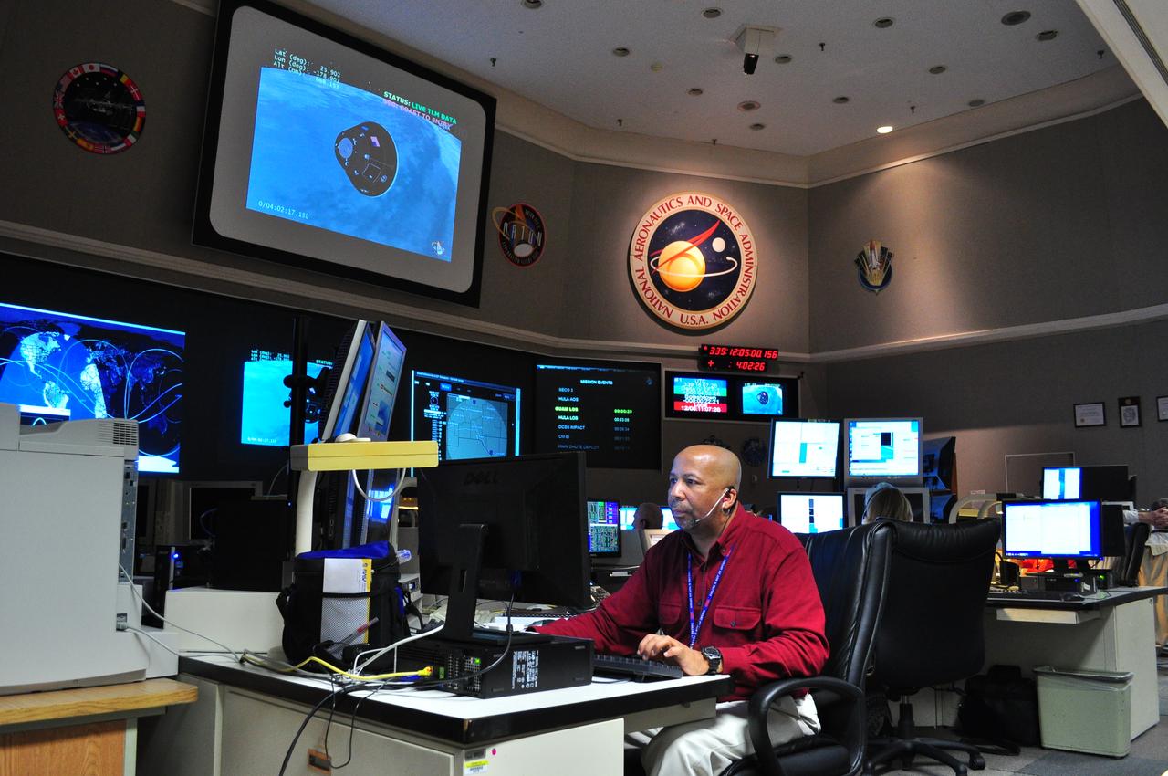
NASA's Goddard Space Flight Center in Greenbelt, Maryland, played a critical role in the test flight of the #Orion spacecraft on Dec. 5, 2014. Goddard's Networks Integration Center, pictured here, coordinated the communications support for both the Orion vehicle and the Delta IV rocket, ensuring complete communications coverage through NASA's Space Network and Tracking and Data Relay Satellite. The Orion spacecraft lifted off from Cape Canaveral Air Force Station's Space Launch Complex 37 in Florida at 7:05 a.m. EST. The Orion capsule splashed down about four and a half hours later, at 11:29 a.m. EST, about 600 miles off the coast of San Diego, California. While no humans were aboard Orion for this test flight, in the future, Orion will allow humans to travel deeper in to space than ever before, including an asteroid and Mars. Credit: NASA/Goddard/Amber Jacobson Credit: NASA/Goddard/Amber Jacobson <b><a href="http://www.nasa.gov/audience/formedia/features/MP_Photo_Guidelines.html" rel="nofollow">NASA image use policy.</a></b> <b><a href="http://www.nasa.gov/centers/goddard/home/index.html" rel="nofollow">NASA Goddard Space Flight Center</a></b> enables NASA’s mission through four scientific endeavors: Earth Science, Heliophysics, Solar System Exploration, and Astrophysics. Goddard plays a leading role in NASA’s accomplishments by contributing compelling scientific knowledge to advance the Agency’s mission. <b>Follow us on <a href="http://twitter.com/NASAGoddardPix" rel="nofollow">Twitter</a></b> <b>Like us on <a href="http://www.facebook.com/pages/Greenbelt-MD/NASA-Goddard/395013845897?ref=tsd" rel="nofollow">Facebook</a></b> <b>Find us on <a href="http://instagram.com/nasagoddard?vm=grid" rel="nofollow">Instagram</a></b>
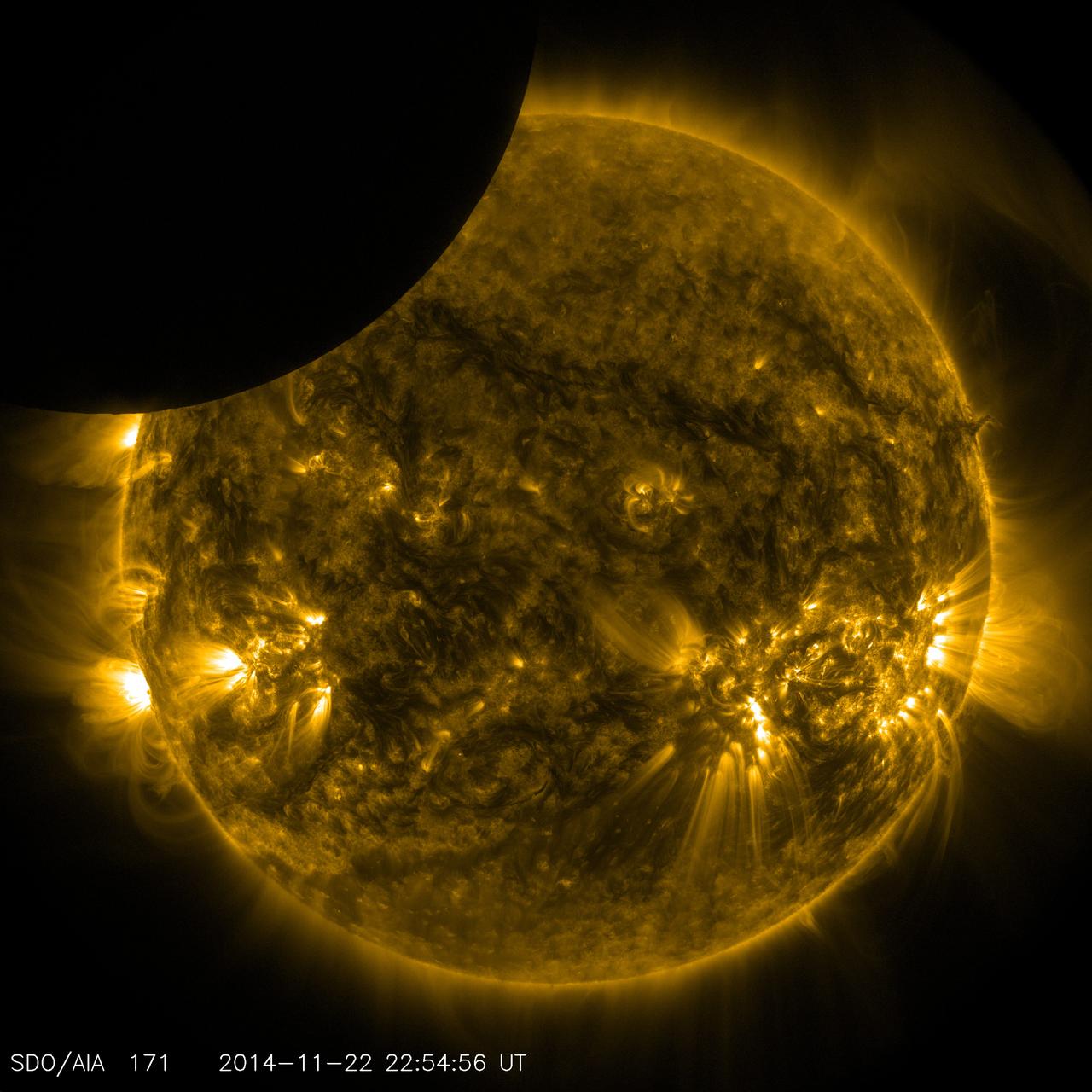
On Nov. 22, 2014 from 5:29 to 6:04 p.m. EST., the moon partially obscured the view of the sun from NASA's Solar Dynamics Observatory. This phenomenon, which is called a lunar transit, could only be seen from SDO's point of view. In 2014, SDO captured four such transits -- including its longest ever recorded, which occurred on Jan. 30, and lasted two and a half hours. SDO imagery during a lunar transit always shows a crisp horizon on the moon -- a reflection of the fact that the moon has no atmosphere around it to distort the light from the sun. The horizon is so clear in these images that mountains and valleys in the terrain can be seen. Credit: NASA/SDO <b><a href="http://www.nasa.gov/audience/formedia/features/MP_Photo_Guidelines.html" rel="nofollow">NASA image use policy.</a></b> <b><a href="http://www.nasa.gov/centers/goddard/home/index.html" rel="nofollow">NASA Goddard Space Flight Center</a></b> enables NASA’s mission through four scientific endeavors: Earth Science, Heliophysics, Solar System Exploration, and Astrophysics. Goddard plays a leading role in NASA’s accomplishments by contributing compelling scientific knowledge to advance the Agency’s mission. <b>Follow us on <a href="http://twitter.com/NASAGoddardPix" rel="nofollow">Twitter</a></b> <b>Like us on <a href="http://www.facebook.com/pages/Greenbelt-MD/NASA-Goddard/395013845897?ref=tsd" rel="nofollow">Facebook</a></b> <b>Find us on <a href="http://instagrid.me/nasagoddard/?vm=grid" rel="nofollow">Instagram</a></b>
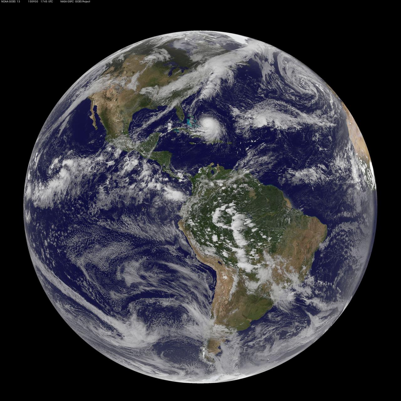
NOAA's GOES-East satellite captured this visible image of Hurricane Joaquin east of the Bahamas on Sept. 30 at 1745 UTC (1:45 p.m. EDT). Credit: NASA/NOAA GOES Project At 11 a.m. EDT (1500 UTC) on Wednesday, September 30, 2015 the center of Hurricane Joaquin was located near latitude 24.7 North, longitude 72.6 West. That puts the center of Joaquin about 215 miles (345 km) east-northeast of the Central Bahamas. Joaquin became a tropical storm Monday evening (EDT), September 29 when it was midway between the Bahamas and Bermuda. By 8 a.m. EDT on September 30, it strengthened into a hurricane and has become the third hurricane of the Atlantic Hurricane season. On September 30, the National Hurricane Center issued a Hurricane Warning for the central Bahamas including Cat Island, the Exumas, Long Island, Rum Cay, and San Salvador. A Hurricane Watch is in effect for the northwestern Bahamas including the Abacos, Berry Islands, Bimini, Eleuthera, Grand Bahama Island, and New Providence, but excluding Andros Island. <b><a href="http://www.nasa.gov/audience/formedia/features/MP_Photo_Guidelines.html" rel="nofollow">NASA image use policy.</a></b> <b><a href="http://www.nasa.gov/centers/goddard/home/index.html" rel="nofollow">NASA Goddard Space Flight Center</a></b> enables NASA’s mission through four scientific endeavors: Earth Science, Heliophysics, Solar System Exploration, and Astrophysics. Goddard plays a leading role in NASA’s accomplishments by contributing compelling scientific knowledge to advance the Agency’s mission. <b>Follow us on <a href="http://twitter.com/NASAGoddardPix" rel="nofollow">Twitter</a></b> <b>Like us on <a href="http://www.facebook.com/pages/Greenbelt-MD/NASA-Goddard/395013845897?ref=tsd" rel="nofollow">Facebook</a></b> <b>Find us on <a href="http://instagrid.me/nasagoddard/?vm=grid" rel="nofollow">Instagram</a></b>
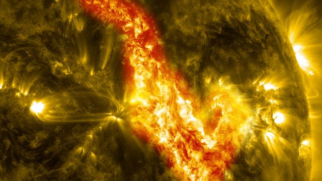
A magnetic filament of solar material erupted on the sun in late September, breaking the quiet conditions in a spectacular fashion. The 200,000 mile long filament ripped through the sun's atmosphere, the corona, leaving behind what looks like a canyon of fire. The glowing canyon traces the channel where magnetic fields held the filament aloft before the explosion. Visualizers at NASA's Goddard Space Flight Center in Greenbelt, Md. combined two days of satellite data to create a short movie of this gigantic event on the sun: <a href="http://bit.ly/166CncU" rel="nofollow">bit.ly/166CncU</a> In reality, the sun is not made of fire, but of something called plasma: particles so hot that their electrons have boiled off, creating a charged gas that is interwoven with magnetic fields. These images were captured on Sept. 29-30, 2013, by NASA's Solar Dynamics Observatory, or SDO, which constantly observes the sun in a variety of wavelengths. Read more/download video: <a href="http://1.usa.gov/1dnrsjF" rel="nofollow">1.usa.gov/1dnrsjF</a> Credit: NASA/SDO <b><a href="http://www.nasa.gov/audience/formedia/features/MP_Photo_Guidelines.html" rel="nofollow">NASA image use policy.</a></b> <b><a href="http://www.nasa.gov/centers/goddard/home/index.html" rel="nofollow">NASA Goddard Space Flight Center</a></b> enables NASA’s mission through four scientific endeavors: Earth Science, Heliophysics, Solar System Exploration, and Astrophysics. Goddard plays a leading role in NASA’s accomplishments by contributing compelling scientific knowledge to advance the Agency’s mission. <b>Follow us on <a href="http://twitter.com/NASA_GoddardPix" rel="nofollow">Twitter</a></b> <b>Like us on <a href="http://www.facebook.com/pages/Greenbelt-MD/NASA-Goddard/395013845897?ref=tsd" rel="nofollow">Facebook</a></b> <b>Find us on <a href="http://instagram.com/nasagoddard?vm=grid" rel="nofollow">Instagram</a></b>
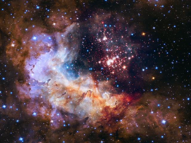
The brilliant tapestry of young stars flaring to life resemble a glittering fireworks display in the 25th anniversary NASA Hubble Space Telescope image, released to commemorate a quarter century of exploring the solar system and beyond since its launch on April 24, 1990. “Hubble has completely transformed our view of the universe, revealing the true beauty and richness of the cosmos” said John Grunsfeld, astronaut and associate administrator of NASA’s Science Mission Directorate. “This vista of starry fireworks and glowing gas is a fitting image for our celebration of 25 years of amazing Hubble science.” The sparkling centerpiece of Hubble’s anniversary fireworks is a giant cluster of about 3,000 stars called Westerlund 2, named for Swedish astronomer Bengt Westerlund who discovered the grouping in the 1960s. The cluster resides in a raucous stellar breeding ground known as Gum 29, located 20,000 light-years away from Earth in the constellation Carina. Read more: <a href="http://www.nasa.gov/press-release/nasa-unveils-celestial-fireworks-as-official-image-for-hubble-25th-anniversary" rel="nofollow">www.nasa.gov/press-release/nasa-unveils-celestial-firewor...</a> <b><a href="http://www.nasa.gov/audience/formedia/features/MP_Photo_Guidelines.html" rel="nofollow">NASA image use policy.</a></b> <b><a href="http://www.nasa.gov/centers/goddard/home/index.html" rel="nofollow">NASA Goddard Space Flight Center</a></b> enables NASA’s mission through four scientific endeavors: Earth Science, Heliophysics, Solar System Exploration, and Astrophysics. Goddard plays a leading role in NASA’s accomplishments by contributing compelling scientific knowledge to advance the Agency’s mission. <b>Follow us on <a href="http://twitter.com/NASAGoddardPix" rel="nofollow">Twitter</a></b> <b>Like us on <a href="http://www.facebook.com/pages/Greenbelt-MD/NASA-Goddard/395013845897?ref=tsd" rel="nofollow">Facebook</a></b> <b>Find us on <a href="http://instagrid.me/nasagoddard/?vm=grid" rel="nofollow">Instagram</a></b>
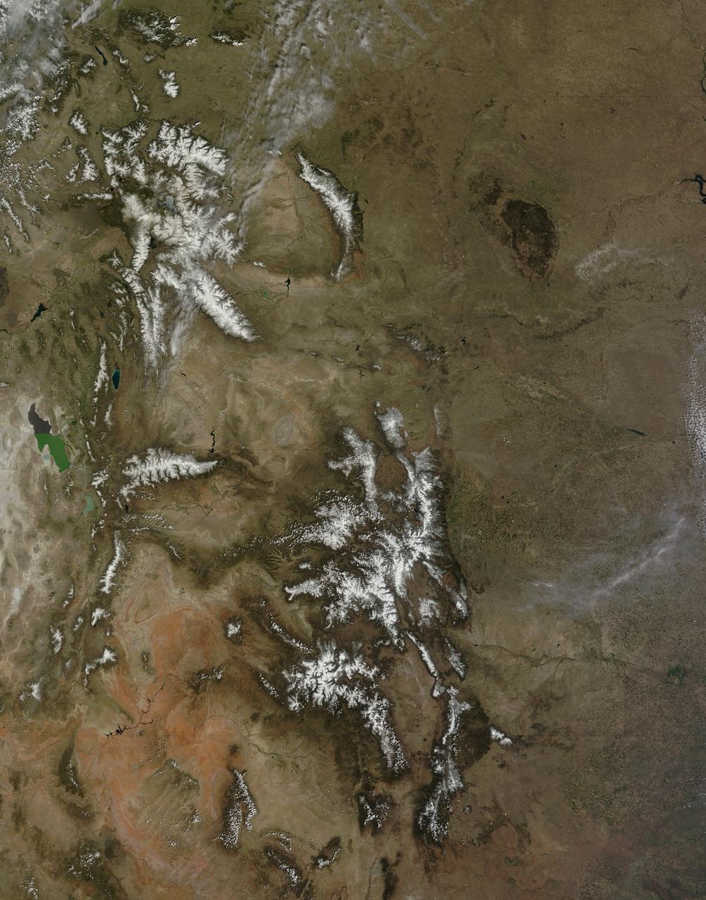
On April 29, 2015 the Moderate Resolution Imaging Spectroradiometer (MODIS) aboard NASA’s Terra satellite captured a true-color image of a typical spring scene in the western United State: snow-crowned Rocky Mountains rising above the faintly greening plains. The Rocky Mountains stretch from British Columbia, Canada to the Rio Grande in New Mexico, a span of roughly 3,000 miles, and contains many of the highest peaks in the continental United States. The tallest, Mount Elbert, rises 14,400 ft. (4,401 m) above sea level, and is located in the San Isabel National Forest, near Leadville, Colorado. This image covers seven Rocky Mountain states. From north to south they are: Montana and Idaho, Wyoming; Utah (with the Great Salt Lake visible) and Colorado; Arizona and New Mexico. To the east, the Great Plain states captured are, from north to south: North Dakota, South Dakota, Nebraska, Kansas, Oklahoma and northwestern Texas. Credit: NASA/GSFC/Jeff Schmaltz/MODIS Land Rapid Response Team <b><a href="http://www.nasa.gov/audience/formedia/features/MP_Photo_Guidelines.html" rel="nofollow">NASA image use policy.</a></b> <b><a href="http://www.nasa.gov/centers/goddard/home/index.html" rel="nofollow">NASA Goddard Space Flight Center</a></b> enables NASA’s mission through four scientific endeavors: Earth Science, Heliophysics, Solar System Exploration, and Astrophysics. Goddard plays a leading role in NASA’s accomplishments by contributing compelling scientific knowledge to advance the Agency’s mission. <b>Follow us on <a href="http://twitter.com/NASAGoddardPix" rel="nofollow">Twitter</a></b> <b>Like us on <a href="http://www.facebook.com/pages/Greenbelt-MD/NASA-Goddard/395013845897?ref=tsd" rel="nofollow">Facebook</a></b> <b>Find us on <a href="http://instagrid.me/nasagoddard/?vm=grid" rel="nofollow">Instagram</a></b>
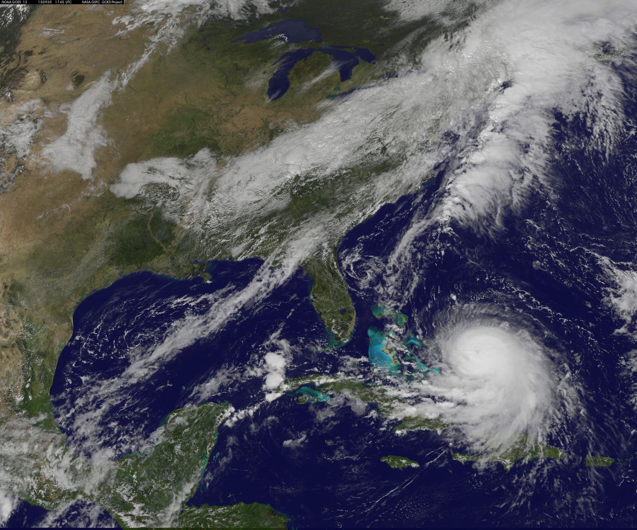
NOAA's GOES-East satellite captured this visible image of Hurricane Joaquin east of the Bahamas on Sept. 30 at 1745 UTC (1:45 p.m. EDT). Credit: NASA/NOAA GOES Project At 11 a.m. EDT (1500 UTC) on Wednesday, September 30, 2015 the center of Hurricane Joaquin was located near latitude 24.7 North, longitude 72.6 West. That puts the center of Joaquin about 215 miles (345 km) east-northeast of the Central Bahamas. Joaquin became a tropical storm Monday evening (EDT), September 29 when it was midway between the Bahamas and Bermuda. By 8 a.m. EDT on September 30, it strengthened into a hurricane and has become the third hurricane of the Atlantic Hurricane season. On September 30, the National Hurricane Center issued a Hurricane Warning for the central Bahamas including Cat Island, the Exumas, Long Island, Rum Cay, and San Salvador. A Hurricane Watch is in effect for the northwestern Bahamas including the Abacos, Berry Islands, Bimini, Eleuthera, Grand Bahama Island, and New Providence, but excluding Andros Island. <b><a href="http://www.nasa.gov/audience/formedia/features/MP_Photo_Guidelines.html" rel="nofollow">NASA image use policy.</a></b> <b><a href="http://www.nasa.gov/centers/goddard/home/index.html" rel="nofollow">NASA Goddard Space Flight Center</a></b> enables NASA’s mission through four scientific endeavors: Earth Science, Heliophysics, Solar System Exploration, and Astrophysics. Goddard plays a leading role in NASA’s accomplishments by contributing compelling scientific knowledge to advance the Agency’s mission. <b>Follow us on <a href="http://twitter.com/NASAGoddardPix" rel="nofollow">Twitter</a></b> <b>Like us on <a href="http://www.facebook.com/pages/Greenbelt-MD/NASA-Goddard/395013845897?ref=tsd" rel="nofollow">Facebook</a></b> <b>Find us on <a href="http://instagrid.me/nasagoddard/?vm=grid" rel="nofollow">Instagram</a></b>
Hugh Dryden (far left) presents the NACA Exceptional Service Medal award at the NACA High Speed Flight Station. He awarded (L-R) Joe Walker (X-1A research pilot), Stan Butchart (pilot of the B-29 mothership),and Richard Payne (X-1A crew chief) in recognition of their research extending knowledge of swept wing flight.
S88-31374 (29 April 1961) --- A close-up of astronaut Alan B. Shepard Jr. in his space suit with his helmet on inside the Mercury capsule. He is undergoing a flight simulation test with the capsule mated to the Redstone booster. This will be the first attempt to put a man into space by the U.S. aboard a Mercury spacecraft, launched atop a Redstone rocket. The suborbital trajectory will be down the Atlantic Missile Range. Photo credit: NASA or National Aeronautics and Space Administration
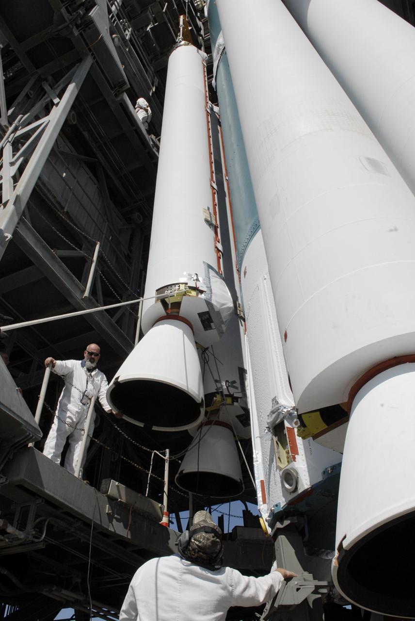
CAPE CANAVERAL, Fla. – On Launch Pad 17-B at Cape Canaveral Air Force Station, workers monitor the placement of a solid rocket booster on a Delta II rocket for launch of the STSS Demonstrator spacecraft. The spacecraft is a midcourse tracking technology demonstrator, part of an evolving ballistic missile defense system. STSS is capable of tracking objects after boost phase and provides trajectory information to other sensors. It will be launched by NASA for the Missile Defense Agency on July 29. Photo credit: NASA/Kim Shiflett
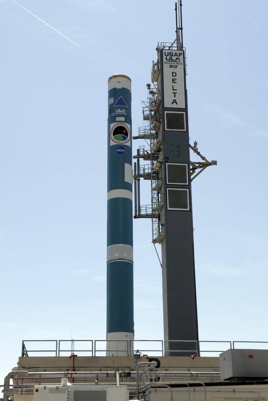
CAPE CANAVERAL, Fla. – On Launch Complex 17-B at Cape Canaveral Air Force Station, the first stage of the Delta II rocket waits on the gantry for the solid rocket boosters. The STSS Demonstrators is a midcourse tracking technology demonstrator and is part of an evolving ballistic missile defense system. STSS is capable of tracking objects after boost phase and provides trajectory information to other sensors. It will be launched by NASA for the Missile Defense Agency on July 29. Photo credit: NASA/Kim Shiflett
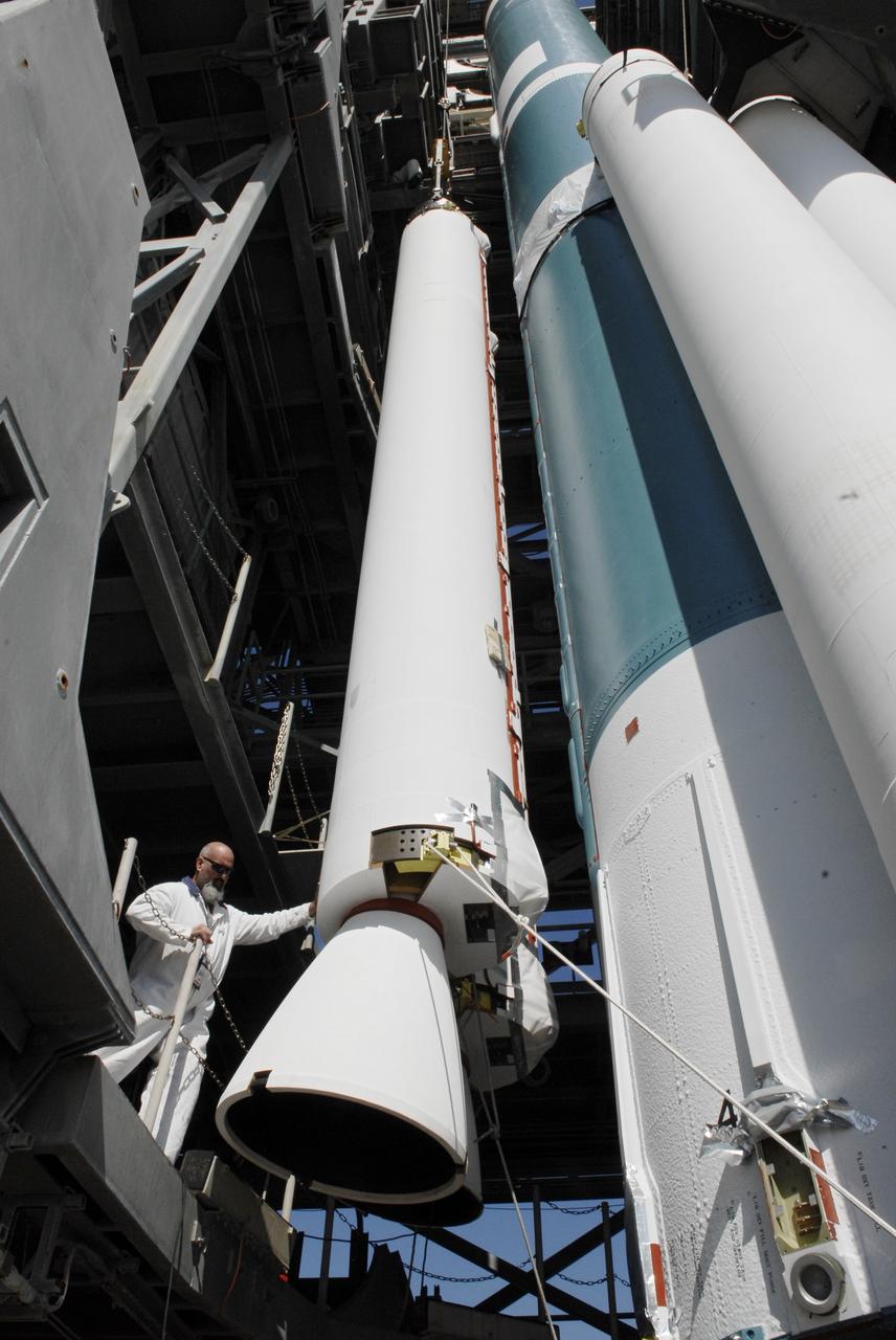
CAPE CANAVERAL, Fla. – On Launch Pad 17-B at Cape Canaveral Air Force Station, a worker monitors the placement of a solid rocket booster on a Delta II rocket for launch of the STSS Demonstrator spacecraft. The spacecraft is a midcourse tracking technology demonstrator, part of an evolving ballistic missile defense system. STSS is capable of tracking objects after boost phase and provides trajectory information to other sensors. It will be launched by NASA for the Missile Defense Agency on July 29. Photo credit: NASA/Kim Shiflett

JSC2003-E-61571 (29 October 2003) --- Astronaut Wendy B. Lawrence, STS-114 mission specialist, arrives at the Kennedy Space Center (KSC) Shuttle Landing Facility in a T-38 jet aircraft. Lawrence, who is a new addition to the mission crew, is taking part in hands-on equipment and orbiter familiarization along with other crewmembers.
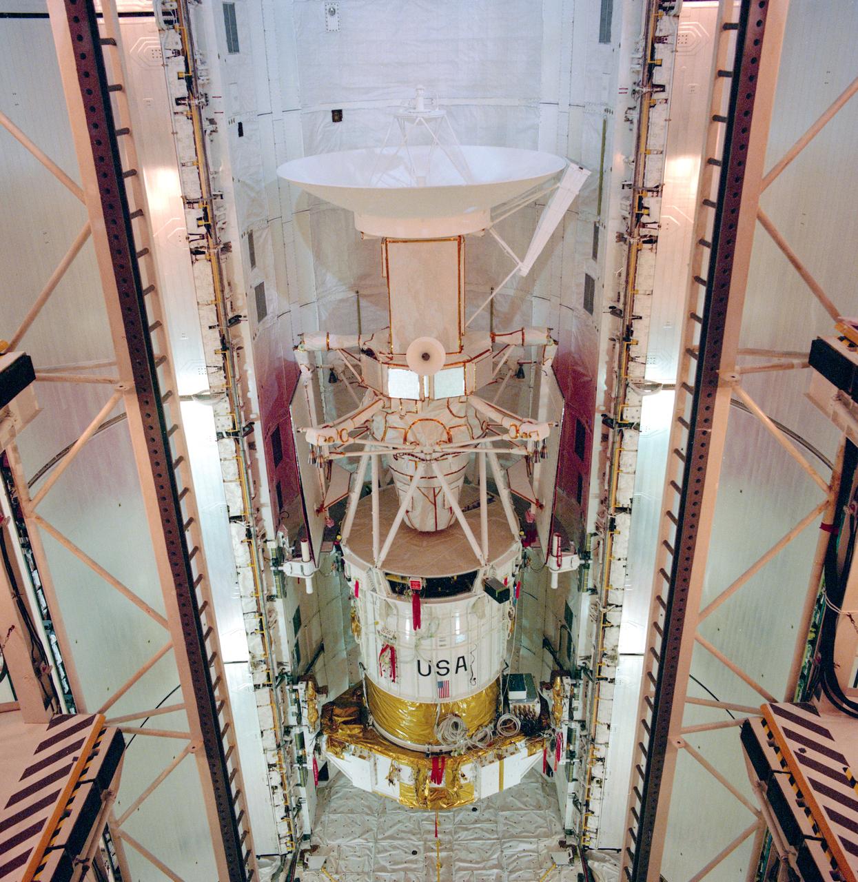
S89-30720 (29 March 1989) --- The spacecraft Magellan is in the payload bay of the orbiter Atlantis at launch pad 39-B. Magellan is scheduled to be released from Atlantis April 28, 1989, on NASA's STS-30 mission. Its mission will be the first U.S. planetary probe in over 10 years and it is the first deployed by the shuttle. The mission calls for the spacecraft to make the approximately 15-month journey to the planet Venus and perform radar mapping operations, transmitting the information back to NASA's Jet Propulsion Laboratory (JPL) in California.

iss073e0509720 (Aug. 18, 2025) --- Great Bend, Kansas, primarily an agricultural town and located at the point where the Arkansas River course shifts, is pictured from the International Space Station as it orbited 261 miles above the Sunflower State. The triangular Great Bend Municipal Airport, once used as a base for the B-29 Superfortress during WWII and now used for general aviation, can also be seen.
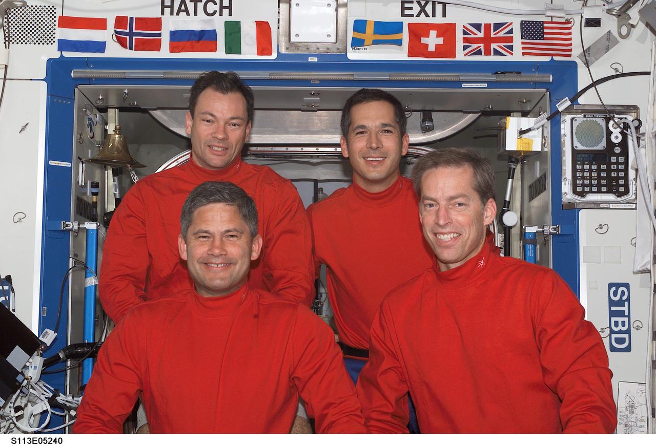
STS113-E-05240 (29 November 2002) --- The STS-113 crewmembers pose for a crew photo in the Destiny laboratory on the International Space Station (ISS). From the left, front row, are astronauts Paul S. Lockhart and James D. Wetherbee, pilot and mission commander, respectively. From the left, back row, are astronauts Michael E. Lopez-Alegria and John B. Herrington, mission specialists.
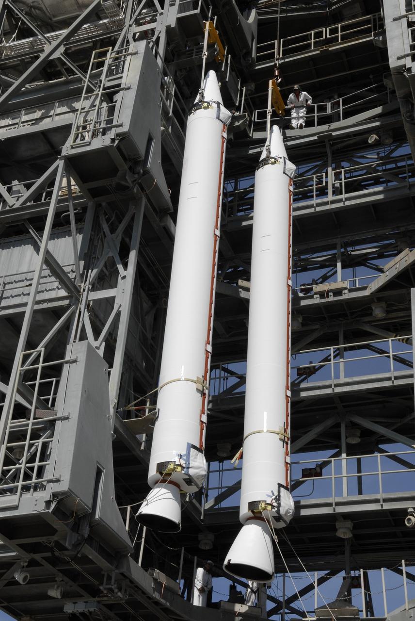
CAPE CANAVERAL, Fla. – On Launch Complex 17-B at Cape Canaveral Air Force Station, solid rocket boosters are lifted into the mobile service tower. The boosters will be attached to the Delta II rocket that will launch the STSS Demonstrator spacecraft. The STSS Demonstrators is a midcourse tracking technology demonstrator and is part of an evolving ballistic missile defense system. STSS is capable of tracking objects after boost phase and provides trajectory information to other sensors. It will be launched by NASA for the Missile Defense Agency on July 29. Photo credit: NASA/Kim Shiflett
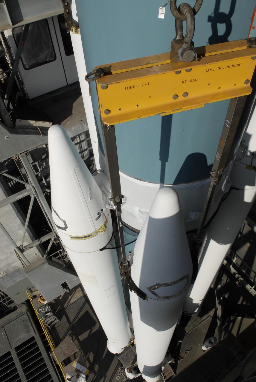
CAPE CANAVERAL, Fla. – On Launch Pad 17-B at Cape Canaveral Air Force Station, solid rocket boosters are attached to a Delta II rocket for launch of the STSS Demonstrator spacecraft. The spacecraft is a midcourse tracking technology demonstrator, part of an evolving ballistic missile defense system. STSS is capable of tracking objects after boost phase and provides trajectory information to other sensors. It will be launched by NASA for the Missile Defense Agency on July 29. Photo credit: NASA/Kim Shiflett
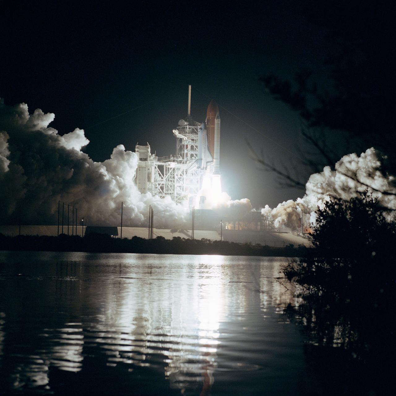
61B-S-067 (26 Nov 1985) --- Space Shuttle Atlantis ascends into the night sky at 7:29 p.m. (EST), November 26, with a seven member crew and three communications satellites aboard. The STS 61-B crewmembers are Brewster Shaw Jr., Bryan D. O?Connor, Mary L. Cleave, Sherwood C. Spring, Jerry L. Ross and Payload Specialists Rodolfo Neri of Mexico (Morelos) and Charles D. Walker of McDonnell Douglas.
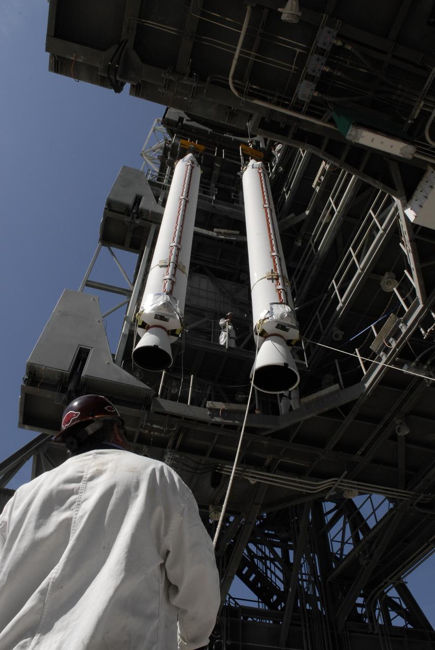
CAPE CANAVERAL, Fla. – On Launch Complex 17-B at Cape Canaveral Air Force Station, solid rocket boosters are lifted into the mobile service tower. The boosters will be attached to the Delta II rocket that will launch the STSS Demonstrator spacecraft. The STSS Demonstrators is a midcourse tracking technology demonstrator and is part of an evolving ballistic missile defense system. STSS is capable of tracking objects after boost phase and provides trajectory information to other sensors. It will be launched by NASA for the Missile Defense Agency on July 29. Photo credit: NASA/Kim Shiflett
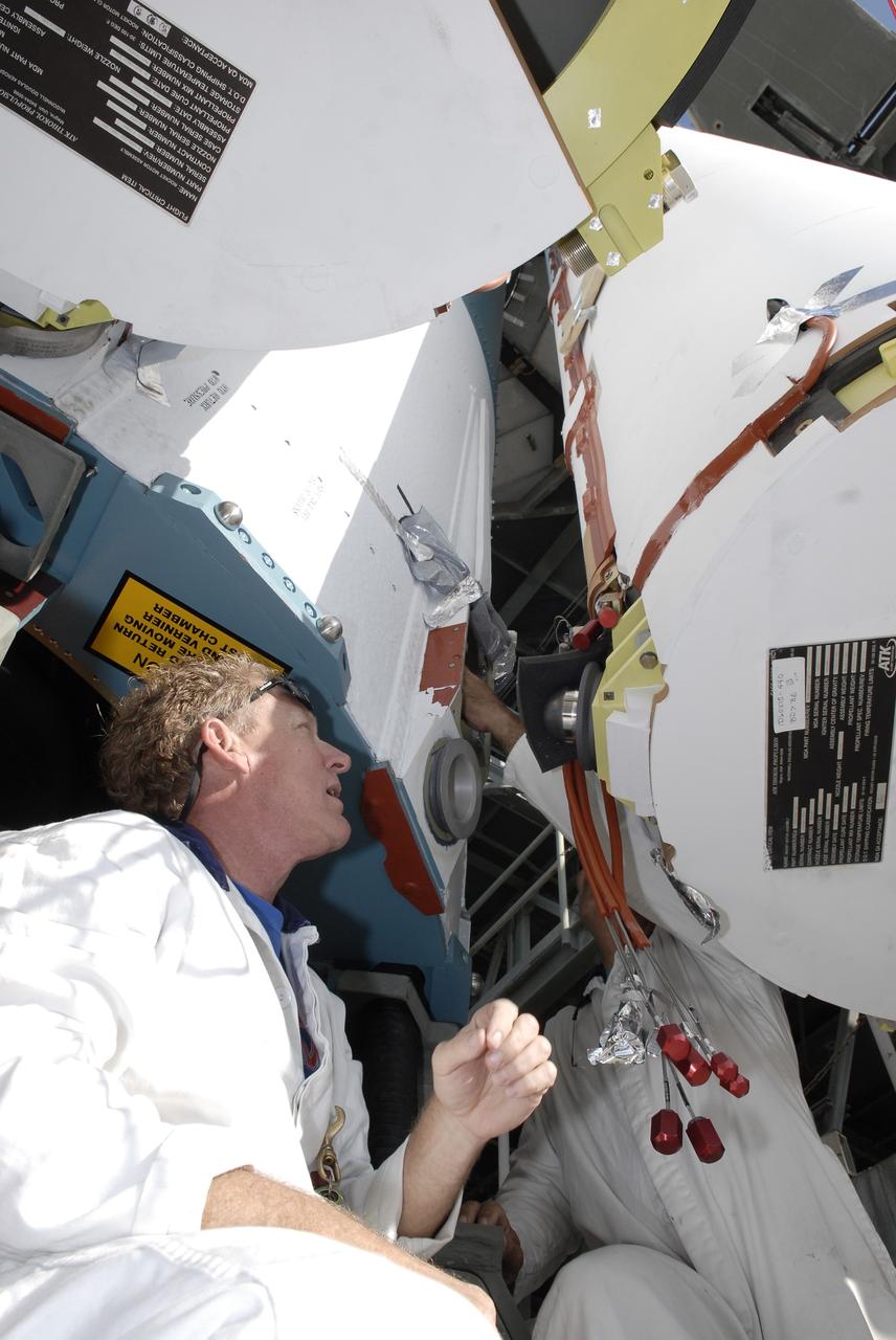
CAPE CANAVERAL, Fla. – On Launch Pad 17-B at Cape Canaveral Air Force Station, a worker attaches solid rocket boosters to a Delta II rocket for launch of the STSS Demonstrator spacecraft. The spacecraft is a midcourse tracking technology demonstrator, part of an evolving ballistic missile defense system. STSS is capable of tracking objects after boost phase and provides trajectory information to other sensors. It will be launched by NASA for the Missile Defense Agency on July 29. Photo credit: NASA/Kim Shiflett
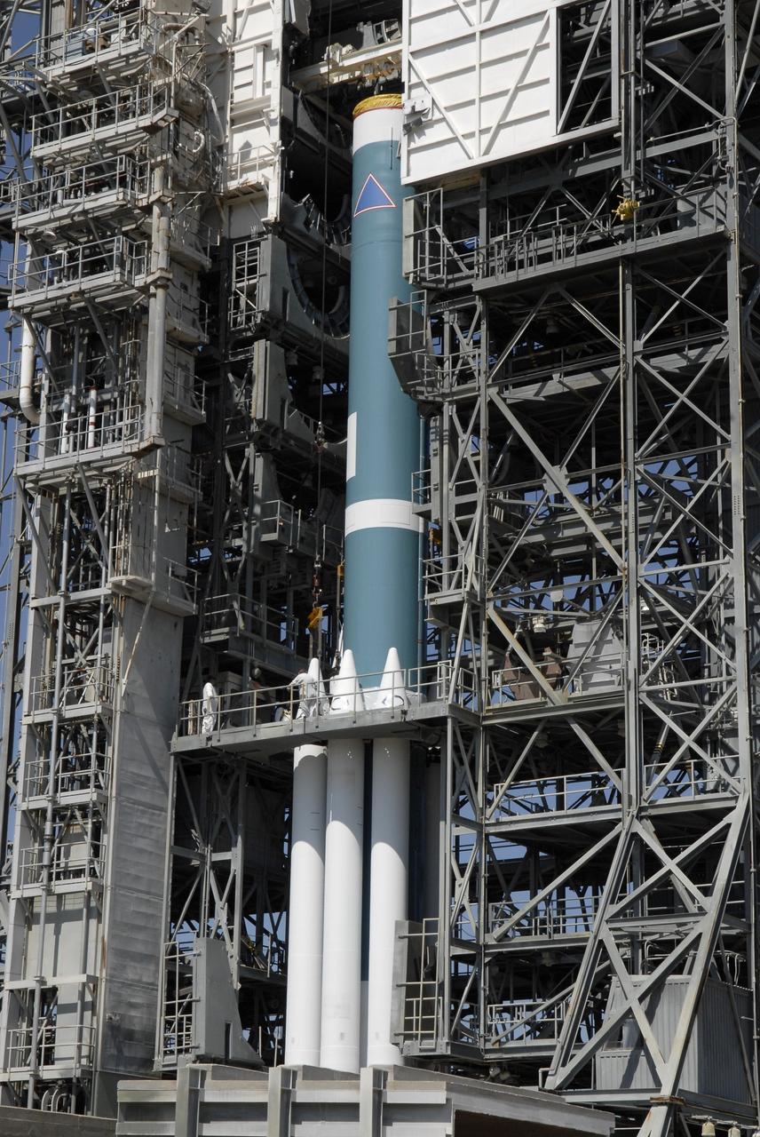
CAPE CANAVERAL, Fla. – On Launch Pad 17-B at Cape Canaveral Air Force Station, solid rocket boosters are installed on a Delta II rocket for launch of the STSS Demonstrator spacecraft. The spacecraft is a midcourse tracking technology demonstrator, part of an evolving ballistic missile defense system. STSS is capable of tracking objects after boost phase and provides trajectory information to other sensors. It will be launched by NASA for the Missile Defense Agency on July 29. Photo credit: NASA/Kim Shiflett
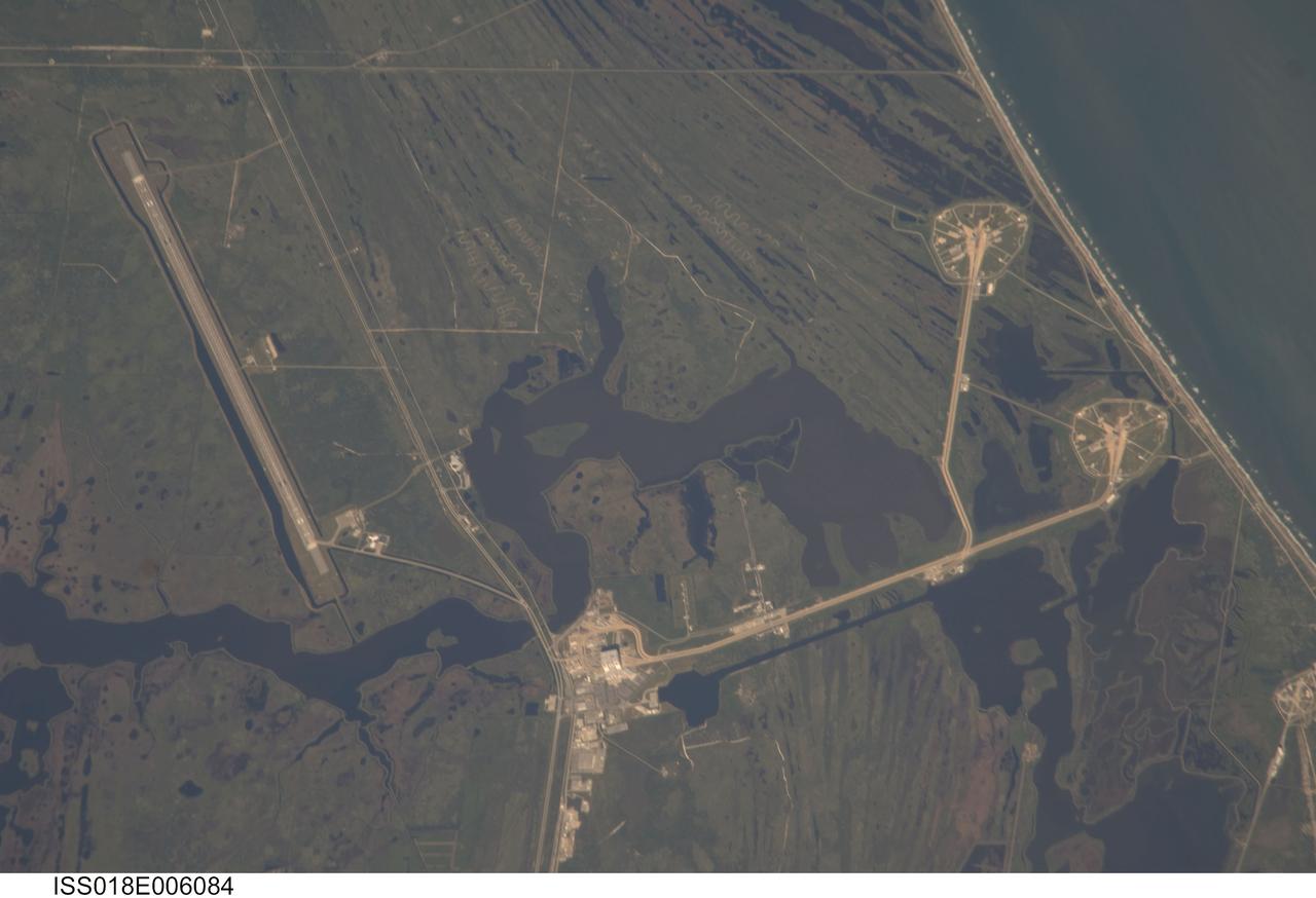
ISS018-E-006084 (29 Oct. 2008) --- Kennedy Space Center and Cape Canaveral, Florida are featured in this image photographed by an Expedition 18 crewmember on the International Space Station. Launch complex 39, with pads A and B, is visible at right. The Vehicle Assembly Building (VAB) is visible at bottom center. The Shuttle Landing Facility appears as a long thin strip at left.
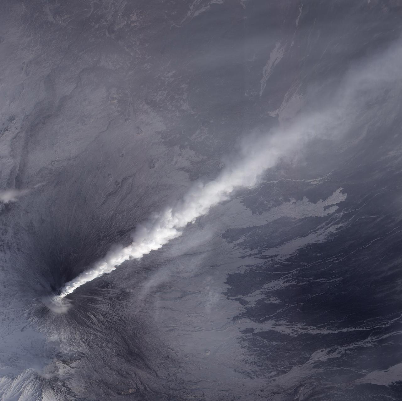
NASA image acquired December 4, 2010 After a respite of less than a month, Klyuchevskaya Volcano resumed erupting in late November 2010. The Global Volcanism Program reported several ash plumes that rose up to 7.9 kilometers (26,000 feet) above sea level from November 25–29. According to the Kamchatka Volcanic Eruption Response Team (KVERT) seismicity was “slightly above background levels” on November 26th and 27th, and they reported observations of strombolian activity on December 1st and 2nd. A plume of ash, steam, and other volcanic gases streamed from Klyuchevskaya on December 4, 2010, visible in this natural-color image acquired by the Advanced Land Imager (ALI) aboard the Earth Observing-1 (EO-1) satellite. In the large image, a much smaller plume is visible above neighboring Bezymianny Volcano. NASA Earth Observatory image by Jesse Allen & Robert Simmon, using ALI data from the NASA EO-1 team. Caption by Robert Simmon. Instrument: EO-1 - ALI Credit: <b><a href="http://www.earthobservatory.nasa.gov/" rel="nofollow"> NASA Earth Observatory</a></b> <b><a href="http://www.nasa.gov/centers/goddard/home/index.html" rel="nofollow">NASA Goddard Space Flight Center</a></b> enables NASA’s mission through four scientific endeavors: Earth Science, Heliophysics, Solar System Exploration, and Astrophysics. Goddard plays a leading role in NASA’s accomplishments by contributing compelling scientific knowledge to advance the Agency’s mission. <b>Follow us on <a href="http://twitter.com/NASA_GoddardPix" rel="nofollow">Twitter</a></b> <b>Join us on <a href="http://www.facebook.com/pages/Greenbelt-MD/NASA-Goddard/395013845897?ref=tsd" rel="nofollow">Facebook</a></b>
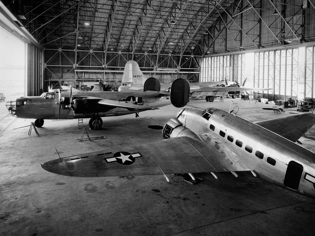
A Consolidated B–24D Liberator (left), Boeing B–29 Superfortress (background), and Lockheed RA–29 Hudson (foreground) parked inside the Flight Research Building at the National Advisory Committee for Aeronautics (NACA) Aircraft Engine Research Laboratory in Cleveland, Ohio. A P–47G Thunderbolt and P–63A King Cobra are visible in the background. The laboratory utilized 15 different aircraft during the final 2.5 years of World War II. This starkly contrasts with the limited-quantity, but long-duration aircraft of the NASA’s modern fleet. The Flight Research Building is a 272- by 150-foot hangar with an internal height ranging from 40 feet at the sides to 90 feet at its apex. The steel support trusses were pin-connected at the top with tension members extending along the corrugated transite walls down to the floor. The 37.5-foot-tall and 250-foot-long doors on either side can be opened in sections. The hangar included a shop area and stock room along the far wall, and a single-story office wing with nine offices, behind the camera. The offices were later expanded. The hangar has been in continual use since its completion in December 1942. Nearly 70 different aircraft have been sheltered here over the years. Temporary offices were twice constructed over half of the floor area when office space was at a premium.
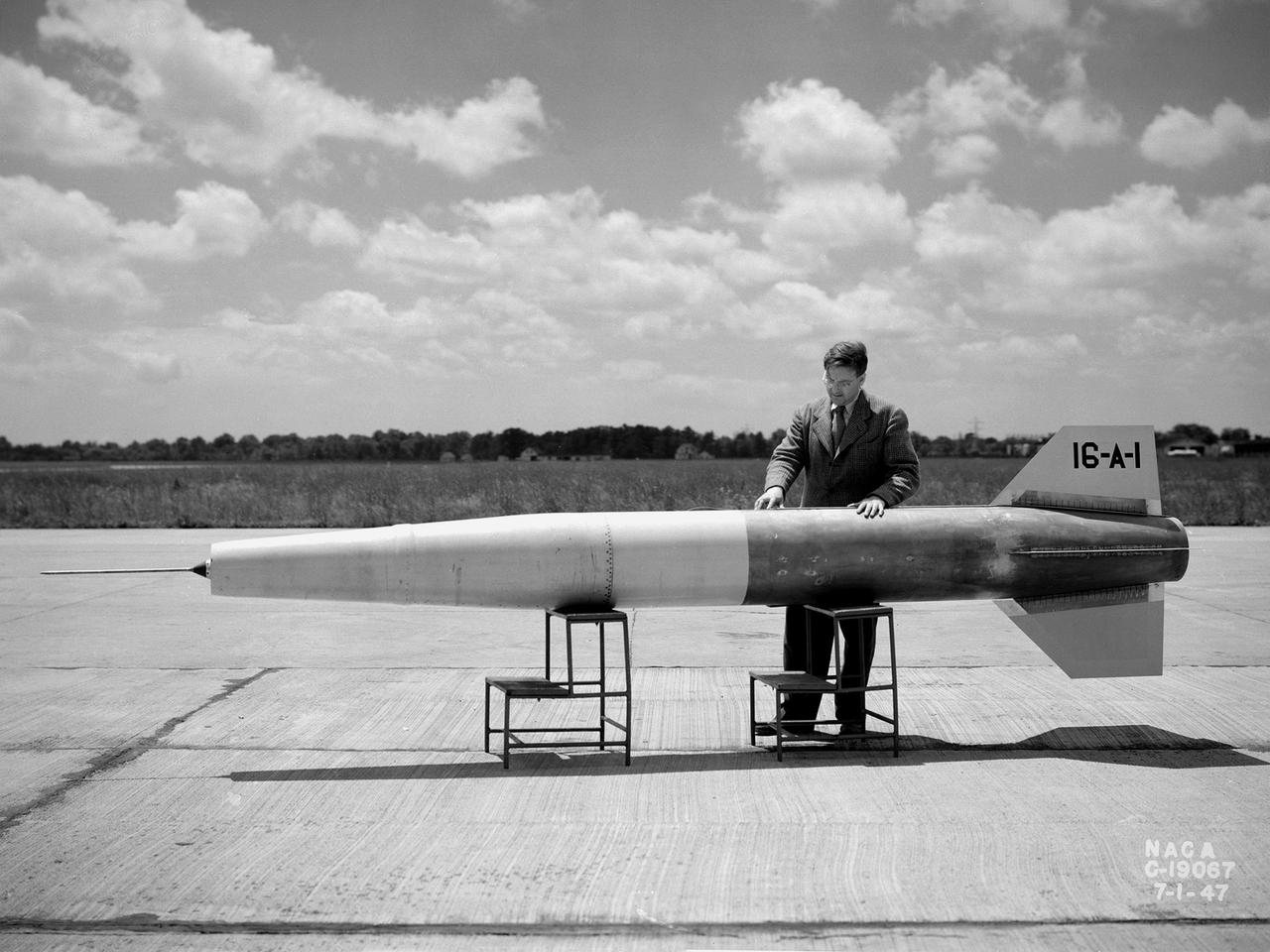
A NACA researcher prepares a 16-inch diameter and 16-foot long ramjet for a launch over Wallops Island in July 1947. The Lewis Flight Propulsion Laboratory conducted a wide variety of studies on ramjets in the 1940s and 1960s to determine the basic operational data necessary to design missiles. Although wind tunnel and test stand investigations were important first steps in determining these factors, actual flight tests were required. Lewis possessed several aircraft for the ramjet studies, including North American F-82 Mustangs, a Northrup P-61 Black Widow, and a Boeing B-29 Superfortress, which was used for this particular ramjet. This was Lewis’ first flight at over the experimental testing ground at Wallops Island. The NACA’s Langley laboratory established the station on the Virginia coast in 1945 to conduct early missile tests. This ramjet-powered missile was affixed underneath the B-29’s left wing and flown up to 29,000 feet. The ramjet was ignited as the aircraft reached Mach 0.5 and released. The flight went well, but a problem with the data recording prevented a successful mission. Nonetheless additional flights in November 1947 provided researchers with data on the engine’s combustion efficiency at different levels of fuel-air ratios, thrust coefficients, temperatures, and drag. Transonic flight data such as the rapid acceleration through varying flight conditions could not be easily captured in wind tunnels.
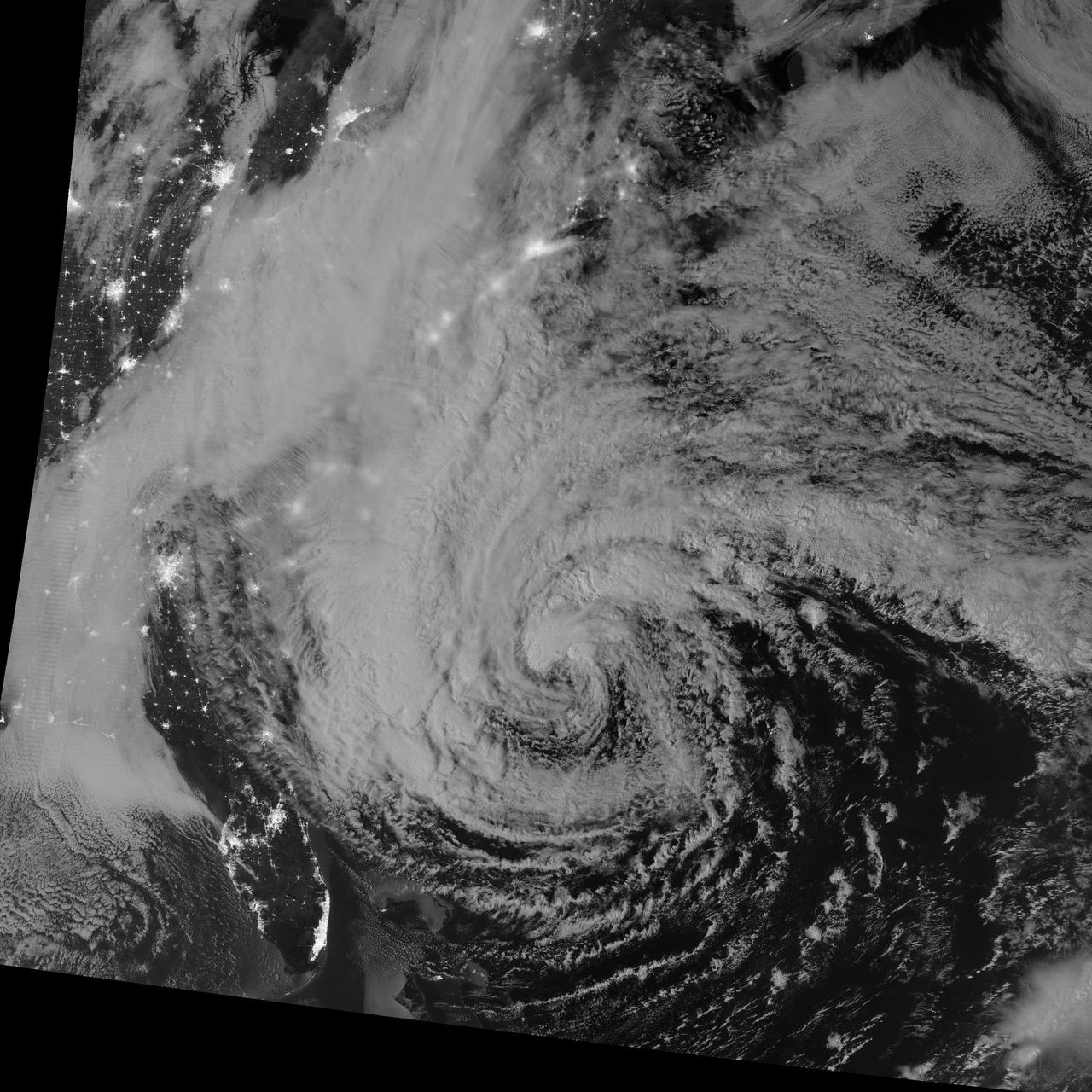
NASA image acquired October 28, 2012 <b>For the latest info from NASA on Hurricane Sandy go to: <a href="http://1.usa.gov/Ti5SgS" rel="nofollow">1.usa.gov/Ti5SgS</a></b> This image of Hurricane Sandy was acquired by the Visible Infrared Imaging Radiometer Suite (VIIRS) on the Suomi NPP satellite around 2:42 a.m. Eastern Daylight Time (06:42 Universal Time) on October 28, 2012. The storm was captured by a special “day-night band,” which detects light in a range of wavelengths from green to near-infrared and uses filtering techniques to observe dim signals such as auroras, airglow, gas flares, city lights, and reflected moonlight. In this case, the cloud tops were lit by the nearly full Moon (full occurs on October 29). Some city lights in Florida and Georgia are also visible amidst the clouds. The Suomi NPP satellite was launched one year ago today (on October 28, 2011) to extend and enhance long-term records of key environmental data monitored by NASA, the National Oceanic and Atmospheric Administration (NOAA), and the U.S. Department of Defense. NASA Earth Observatory image by Jesse Allen and Robert Simmon, using VIIRS Day-Night Band data from the Suomi National Polar-orbiting Partnership (Suomi NPP). Suomi NPP is the result of a partnership between NASA, the National Oceanic and Atmospheric Administration, and the Department of Defense. Caption by Michael Carlowicz. Instrument: Suomi NPP - VIIRS <b><a href="http://www.nasa.gov/audience/formedia/features/MP_Photo_Guidelines.html" rel="nofollow">NASA image use policy.</a></b> <b><a href="http://www.nasa.gov/centers/goddard/home/index.html" rel="nofollow">NASA Goddard Space Flight Center</a></b> enables NASA’s mission through four scientific endeavors: Earth Science, Heliophysics, Solar System Exploration, and Astrophysics. Goddard plays a leading role in NASA’s accomplishments by contributing compelling scientific knowledge to advance the Agency’s mission. <b>Follow us on <a href="http://twitter.com/NASA_GoddardPix" rel="nofollow">Twitter</a></b> <b>Like us on <a href="http://www.facebook.com/pages/Greenbelt-MD/NASA-Goddard/395013845897?ref=tsd" rel="nofollow">Facebook</a></b> <b>Find us on <a href="http://instagrid.me/nasagoddard/?vm=grid" rel="nofollow">Instagram</a></b>
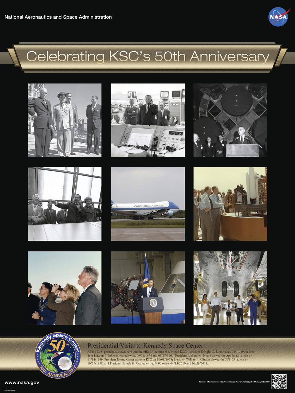
Presidential Visits to Kennedy Space Center: All the U. S. presidents shown here were in office at the time they visited KSC. President Dwight D. Eisenhower, 02/10/1960 President Lyndon B. Johnson visited twice, 09/14/1964 and 09/27/1966 President Richard M. Nixon viewed the Apollo 12 launch on 11/14/1969 President Jimmy Carter came to KSC on 10/01/1978 President William J. Clinton viewed the STS-95 launch on 10/29/1998 and President Barack H. Obama visited KSC twice, 04/15/2010 and 04/29/2011. Poster designed by Kennedy Space Center Graphics Department/Greg Lee. Credit: NASA
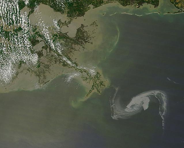
2010/119 - 04/29 at 16 :48 UTC Oil slick in the Gulf of Mexico To see a full view of this image go to: <a href="http://www.flickr.com/photos/gsfc/4563296541/">www.flickr.com/photos/gsfc/4563296541/</a> (Input Direct Broadcast data courtesy Direct Readout Lab, NASA/GSFC) Satellite: Terra NASA/GSFC/Jeff Schmaltz/MODIS Land Rapid Response Team To learn more about MODIS go to: <a href="http://rapidfire.sci.gsfc.nasa.gov/gallery/?latest" rel="nofollow">rapidfire.sci.gsfc.nasa.gov/gallery/?latest</a> <b><a href="http://www.nasa.gov/centers/goddard/home/index.html" rel="nofollow">NASA Goddard Space Flight Center</a></b> is home to the nation's largest organization of combined scientists, engineers and technologists that build spacecraft, instruments and new technology to study the Earth, the sun, our solar system, and the universe.
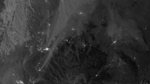
On August 29, 2012, the Visible Infrared Imaging Radiometer Suite (VIIRS) on the Suomi NPP satellite captured this nighttime view of wildfires burning in Idaho and Montana. The image was captured by the VIIRS “day-night band,” which detects light in a range of wavelengths from green to near-infrared and uses filtering techniques to observe signals such as gas flares, auroras, wildfires, city lights, and reflected moonlight. When the image was acquired, the moon was in its waxing gibbous phase, meaning it was more than half-lit, but less than full. Numerous hot spots from the Mustang Complex Fire are visible in northern Idaho. A plume of thick, billowing smoke streams west from the brightest fires near the Idaho-Montana border. The Halstead and Trinity Ridge fires are visible to the south. In addition to the fires, city lights from Boise and other smaller cities appear throughout the image. A bank of clouds is located west of the Mustang Complex, over southeastern Washington and northeastern Oregon. The Operational Line System (OLS)—an earlier generation of night-viewing sensors on the U.S. Defense Meteorological Satellite Program (DMSP) satellites—was also capable of detecting fires at night. But the VIIRS “day-night band” is far better than OLS at resolving them. Each pixel of an VIIRS image shows roughly 740 meters (0.46 miles), compared to the 3-kilometer footprint (1.86 miles) on the OLS system. NASA Earth Observatory image by Jesse Allen and Robert Simmon, using VIIRS Day-Night Band data from the Suomi National Polar-orbiting Partnership. Suomi NPP is the result of a partnership between NASA, the National Oceanic and Atmospheric Administration, and the Department of Defense. Caption by Adam Voiland. Instrument: Suomi NPP - VIIRS Credit: <b><a href="http://www.earthobservatory.nasa.gov/" rel="nofollow"> NASA Earth Observatory</a></b> <b>Click here to view all of the <a href="http://earthobservatory.nasa.gov/Features/NightLights/" rel="nofollow"> Earth at Night 2012 images </a></b> <b>Click here to <a href="http://earthobservatory.nasa.gov/NaturalHazards/view.php?id=79754" rel="nofollow"> read more </a> about this image </b> <b><a href="http://www.nasa.gov/audience/formedia/features/MP_Photo_Guidelines.html" rel="nofollow">NASA image use policy.</a></b> <b><a href="http://www.nasa.gov/centers/goddard/home/index.html" rel="nofollow">NASA Goddard Space Flight Center</a></b> enables NASA’s mission through four scientific endeavors: Earth Science, Heliophysics, Solar System Exploration, and Astrophysics. Goddard plays a leading role in NASA’s accomplishments by contributing compelling scientific knowledge to advance the Agency’s mission. <b>Follow us on <a href="http://twitter.com/NASA_GoddardPix" rel="nofollow">Twitter</a></b> <b>Like us on <a href="http://www.facebook.com/pages/Greenbelt-MD/NASA-Goddard/395013845897?ref=tsd" rel="nofollow">Facebook</a></b> <b>Find us on <a href="http://instagram.com/nasagoddard?vm=grid" rel="nofollow">Instagram</a></b>
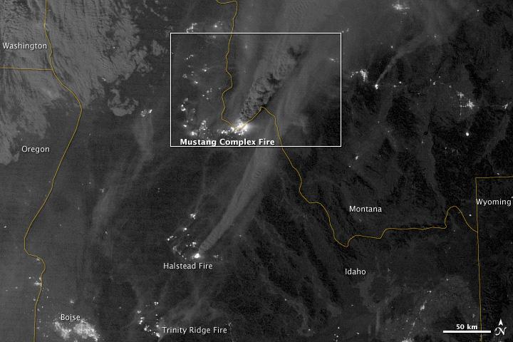
On August 29, 2012, the Visible Infrared Imaging Radiometer Suite (VIIRS) on the Suomi NPP satellite captured this nighttime view of wildfires burning in Idaho and Montana. The image was captured by the VIIRS “day-night band,” which detects light in a range of wavelengths from green to near-infrared and uses filtering techniques to observe signals such as gas flares, auroras, wildfires, city lights, and reflected moonlight. When the image was acquired, the moon was in its waxing gibbous phase, meaning it was more than half-lit, but less than full. Numerous hot spots from the Mustang Complex Fire are visible in northern Idaho. A plume of thick, billowing smoke streams west from the brightest fires near the Idaho-Montana border. The Halstead and Trinity Ridge fires are visible to the south. In addition to the fires, city lights from Boise and other smaller cities appear throughout the image. A bank of clouds is located west of the Mustang Complex, over southeastern Washington and northeastern Oregon. The Operational Line System (OLS)—an earlier generation of night-viewing sensors on the U.S. Defense Meteorological Satellite Program (DMSP) satellites—was also capable of detecting fires at night. But the VIIRS “day-night band” is far better than OLS at resolving them. Each pixel of an VIIRS image shows roughly 740 meters (0.46 miles), compared to the 3-kilometer footprint (1.86 miles) on the OLS system. NASA Earth Observatory image by Jesse Allen and Robert Simmon, using VIIRS Day-Night Band data from the Suomi National Polar-orbiting Partnership. Suomi NPP is the result of a partnership between NASA, the National Oceanic and Atmospheric Administration, and the Department of Defense. Caption by Adam Voiland. Instrument: Suomi NPP - VIIRS Credit: <b><a href="http://www.earthobservatory.nasa.gov/" rel="nofollow"> NASA Earth Observatory</a></b> <b>Click here to view all of the <a href="http://earthobservatory.nasa.gov/Features/NightLights/" rel="nofollow"> Earth at Night 2012 images </a></b> <b>Click here to <a href="http://earthobservatory.nasa.gov/NaturalHazards/view.php?id=79754" rel="nofollow"> read more </a> about this image </b> <b><a href="http://www.nasa.gov/audience/formedia/features/MP_Photo_Guidelines.html" rel="nofollow">NASA image use policy.</a></b> <b><a href="http://www.nasa.gov/centers/goddard/home/index.html" rel="nofollow">NASA Goddard Space Flight Center</a></b> enables NASA’s mission through four scientific endeavors: Earth Science, Heliophysics, Solar System Exploration, and Astrophysics. Goddard plays a leading role in NASA’s accomplishments by contributing compelling scientific knowledge to advance the Agency’s mission. <b>Follow us on <a href="http://twitter.com/NASA_GoddardPix" rel="nofollow">Twitter</a></b> <b>Like us on <a href="http://www.facebook.com/pages/Greenbelt-MD/NASA-Goddard/395013845897?ref=tsd" rel="nofollow">Facebook</a></b> <b>Find us on <a href="http://instagram.com/nasagoddard?vm=grid" rel="nofollow">Instagram</a></b>
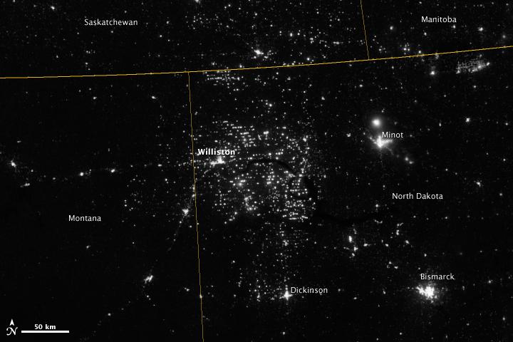
Northwestern North Dakota is one of the least-densely populated parts of the United States. Cities and people are scarce, but satellite imagery shows the area has been aglow at night in recent years. The reason: the area is home to the Bakken shale formation, a site where oil production is booming. Companies hoping to extract oil from the Bakken formation have drilled hundreds of new wells in the last few years; natural gas often bubbles up to the surface as part of the process. Lacking the infrastructure to pipe the gas away, many drillers simply burn it in a practice known as flaring. On November 12, 2012, the Visible Infrared Imaging Radiometer Suite (VIIRS) on the Suomi NPP satellite captured this nighttime view of widespread gas flaring throughout the area. Many of the specks of light are evidence of gas flaring, though others may be the lights around drilling equipment. Some of the brighter areas correspond to towns and cities including Williston, Minot, and Dickinson. The image was captured by the VIIRS “day-night band,” which detects light in a range of wavelengths from green to near-infrared and uses filtering techniques to observe signals such as gas flares, auroras, wildfires, city lights, and reflected moonlight. When VIIRS acquired the image, the moon was in its waning crescent phase, meaning it was reflecting only a small amount of light. According to the U.S. Energy Information Administration, natural gas production from the Bakken shale has increased more than 20-fold between 2007 and 2010. Gas production averaged over 485 million cubic feet per day in September 2011, compared to the 2005 average of about 160 million cubic feet per day. Due to the lack of gas pipeline and processing facilities in the region, about 29 percent of that gas is flared. NASA Earth Observatory image by Jesse Allen and Robert Simmon, using VIIRS Day-Night Band data from the Suomi National Polar-orbiting Partnership. Suomi NPP is the result of a partnership between NASA, the National Oceanic and Atmospheric Administration, and the Department of Defense. Caption by Adam Voiland. Instrument: Suomi NPP - VIIRS Credit: <b><a href="http://www.earthobservatory.nasa.gov/" rel="nofollow"> NASA Earth Observatory</a></b> <b>Click here to view all of the <a href="http://earthobservatory.nasa.gov/Features/NightLights/" rel="nofollow"> Earth at Night 2012 images </a></b> <b>Click here to <a href="http://earthobservatory.nasa.gov/NaturalHazards/view.php?id=79810" rel="nofollow"> read more </a> about this image </b> <b><a href="http://www.nasa.gov/audience/formedia/features/MP_Photo_Guidelines.html" rel="nofollow">NASA image use policy.</a></b> <b><a href="http://www.nasa.gov/centers/goddard/home/index.html" rel="nofollow">NASA Goddard Space Flight Center</a></b> enables NASA’s mission through four scientific endeavors: Earth Science, Heliophysics, Solar System Exploration, and Astrophysics. Goddard plays a leading role in NASA’s accomplishments by contributing compelling scientific knowledge to advance the Agency’s mission. <b>Follow us on <a href="http://twitter.com/NASA_GoddardPix" rel="nofollow">Twitter</a></b> <b>Like us on <a href="http://www.facebook.com/pages/Greenbelt-MD/NASA-Goddard/395013845897?ref=tsd" rel="nofollow">Facebook</a></b> <b>Find us on <a href="http://instagram.com/nasagoddard?vm=grid" rel="nofollow">Instagram</a></b>
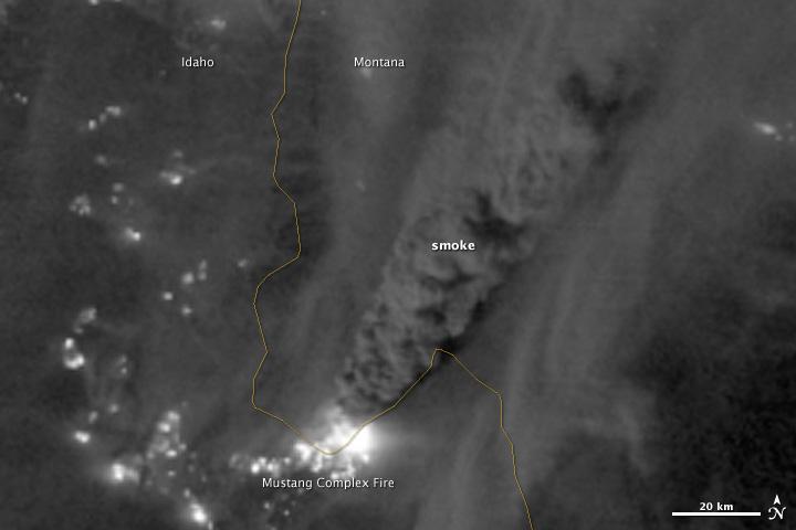
On August 29, 2012, the Visible Infrared Imaging Radiometer Suite (VIIRS) on the Suomi NPP satellite captured this nighttime view of wildfires burning in Idaho and Montana. The image was captured by the VIIRS “day-night band,” which detects light in a range of wavelengths from green to near-infrared and uses filtering techniques to observe signals such as gas flares, auroras, wildfires, city lights, and reflected moonlight. When the image was acquired, the moon was in its waxing gibbous phase, meaning it was more than half-lit, but less than full. Numerous hot spots from the Mustang Complex Fire are visible in northern Idaho. A plume of thick, billowing smoke streams west from the brightest fires near the Idaho-Montana border. The Halstead and Trinity Ridge fires are visible to the south. In addition to the fires, city lights from Boise and other smaller cities appear throughout the image. A bank of clouds is located west of the Mustang Complex, over southeastern Washington and northeastern Oregon. The Operational Line System (OLS)—an earlier generation of night-viewing sensors on the U.S. Defense Meteorological Satellite Program (DMSP) satellites—was also capable of detecting fires at night. But the VIIRS “day-night band” is far better than OLS at resolving them. Each pixel of an VIIRS image shows roughly 740 meters (0.46 miles), compared to the 3-kilometer footprint (1.86 miles) on the OLS system. NASA Earth Observatory image by Jesse Allen and Robert Simmon, using VIIRS Day-Night Band data from the Suomi National Polar-orbiting Partnership. Suomi NPP is the result of a partnership between NASA, the National Oceanic and Atmospheric Administration, and the Department of Defense. Caption by Adam Voiland. Instrument: Suomi NPP - VIIRS Credit: <b><a href="http://www.earthobservatory.nasa.gov/" rel="nofollow"> NASA Earth Observatory</a></b> <b>Click here to view all of the <a href="http://earthobservatory.nasa.gov/Features/NightLights/" rel="nofollow"> Earth at Night 2012 images </a></b> <b>Click here to <a href="http://earthobservatory.nasa.gov/NaturalHazards/view.php?id=79754" rel="nofollow"> read more </a> about this image </b> <b><a href="http://www.nasa.gov/audience/formedia/features/MP_Photo_Guidelines.html" rel="nofollow">NASA image use policy.</a></b> <b><a href="http://www.nasa.gov/centers/goddard/home/index.html" rel="nofollow">NASA Goddard Space Flight Center</a></b> enables NASA’s mission through four scientific endeavors: Earth Science, Heliophysics, Solar System Exploration, and Astrophysics. Goddard plays a leading role in NASA’s accomplishments by contributing compelling scientific knowledge to advance the Agency’s mission. <b>Follow us on <a href="http://twitter.com/NASA_GoddardPix" rel="nofollow">Twitter</a></b> <b>Like us on <a href="http://www.facebook.com/pages/Greenbelt-MD/NASA-Goddard/395013845897?ref=tsd" rel="nofollow">Facebook</a></b> <b>Find us on <a href="http://instagram.com/nasagoddard?vm=grid" rel="nofollow">Instagram</a></b>
Northwestern North Dakota is one of the least-densely populated parts of the United States. Cities and people are scarce, but satellite imagery shows the area has been aglow at night in recent years. The reason: the area is home to the Bakken shale formation, a site where gas and oil production are booming. On November 12, 2012, the Visible Infrared Imaging Radiometer Suite (VIIRS) on the Suomi NPP satellite captured this nighttime view of widespread drilling throughout the area. Most of the bright specks are lights associated with drilling equipment and temporary housing near drilling sites, though a few are evidence of gas flaring. Some of the brighter areas correspond to towns and cities including Williston, Minot, and Dickinson. The image was captured by the VIIRS “day-night band,” which detects light in a range of wavelengths from green to near-infrared and uses “smart” light sensors to observe dim signals such as gas flares, auroras, wildfires, city lights, and reflected moonlight. When VIIRS acquired the image, the Moon was in its waning crescent phase, so the landscape was reflecting only a small amount of light. According to the U.S. Energy Information Administration, natural gas production from the Bakken shale has increased more than 20-fold between 2007 and 2010. Gas production averaged over 485 million cubic feet per day in September 2011, compared to the 2005 average of about 160 million cubic feet per day. Due to the lack of a gas pipeline and processing facilities in the region, about 29 percent of that gas is flared. NASA Earth Observatory image by Jesse Allen and Robert Simmon, using VIIRS Day-Night Band data from the Suomi National Polar-orbiting Partnership. Suomi NPP is the result of a partnership between NASA, the National Oceanic and Atmospheric Administration, and the Department of Defense. Caption by Adam Voiland. Instrument: Suomi NPP - VIIRS Credit: <b><a href="http://www.earthobservatory.nasa.gov/" rel="nofollow"> NASA Earth Observatory</a></b> <b>Click here to view all of the <a href="http://earthobservatory.nasa.gov/Features/NightLights/" rel="nofollow"> Earth at Night 2012 images </a></b> <b>Click here to <a href="http://earthobservatory.nasa.gov/NaturalHazards/view.php?id=79810" rel="nofollow"> read more </a> about this image </b> <b><a href="http://www.nasa.gov/audience/formedia/features/MP_Photo_Guidelines.html" rel="nofollow">NASA image use policy.</a></b> <b><a href="http://www.nasa.gov/centers/goddard/home/index.html" rel="nofollow">NASA Goddard Space Flight Center</a></b> enables NASA’s mission through four scientific endeavors: Earth Science, Heliophysics, Solar System Exploration, and Astrophysics. Goddard plays a leading role in NASA’s accomplishments by contributing compelling scientific knowledge to advance the Agency’s mission. <b>Follow us on <a href="http://twitter.com/NASA_GoddardPix" rel="nofollow">Twitter</a></b> <b>Like us on <a href="http://www.facebook.com/pages/Greenbelt-MD/NASA-Goddard/395013845897?ref=tsd" rel="nofollow">Facebook</a></b> <b>Find us on <a href="http://instagram.com/nasagoddard?vm=grid" rel="nofollow">Instagram</a></b>