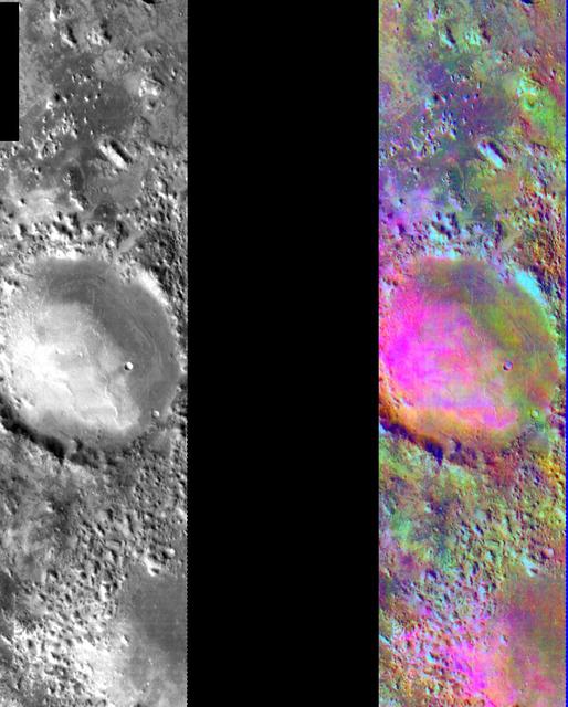
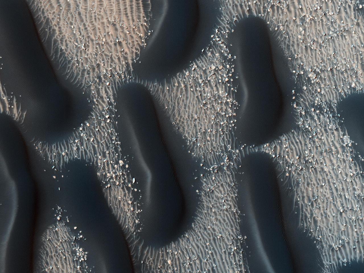
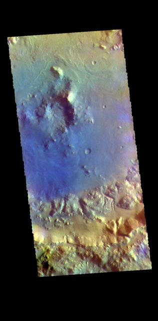
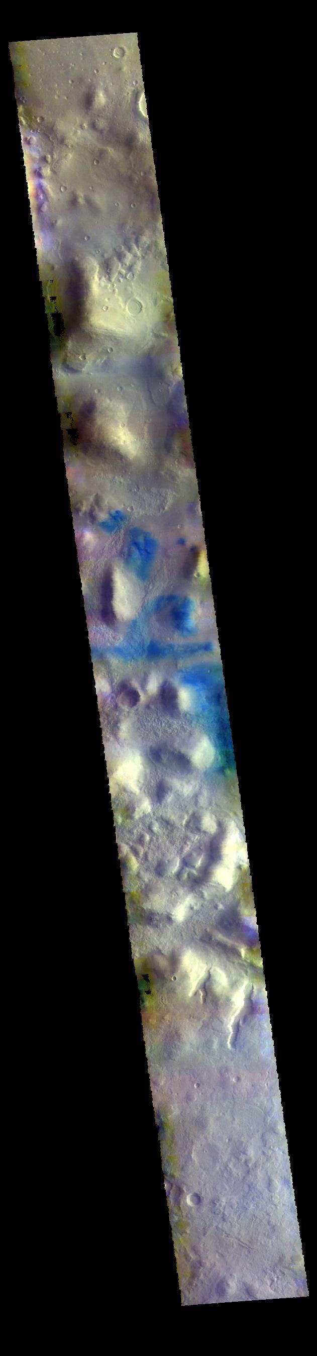
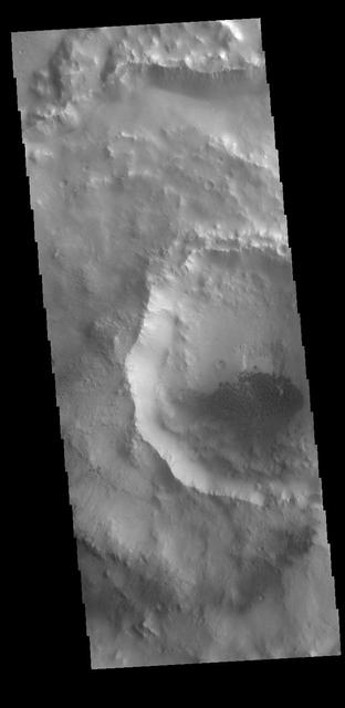
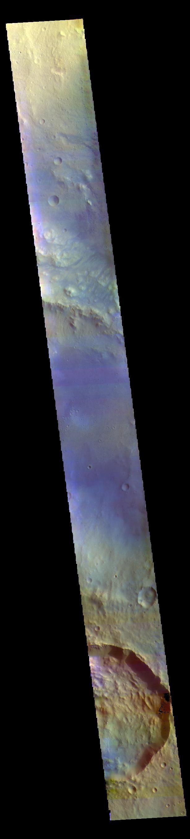
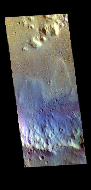
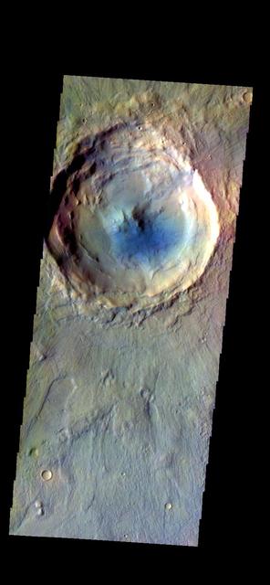
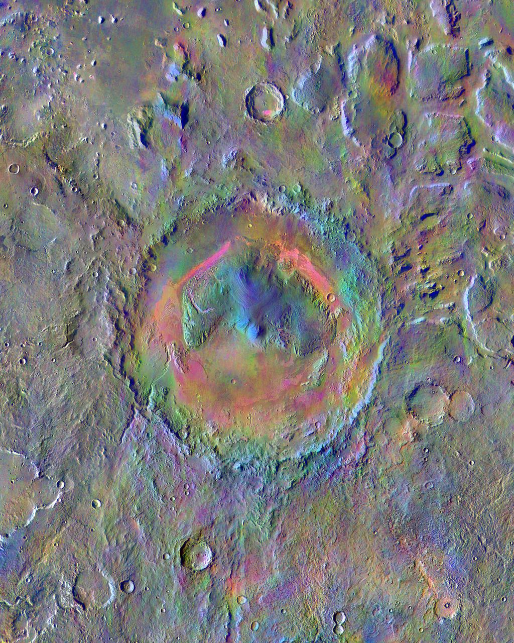
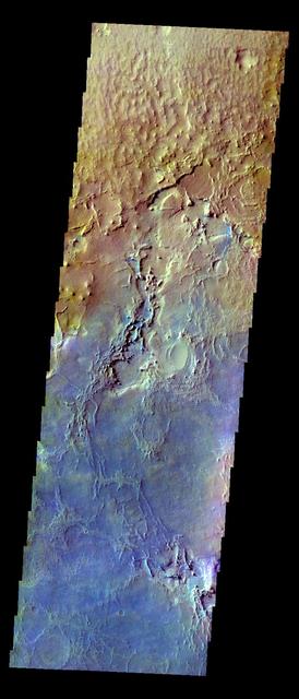
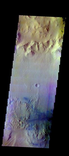
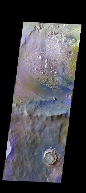
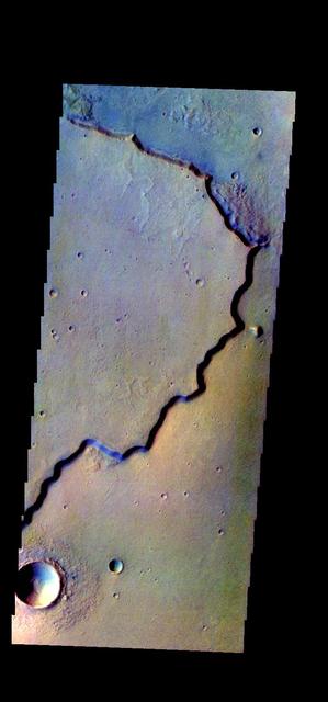
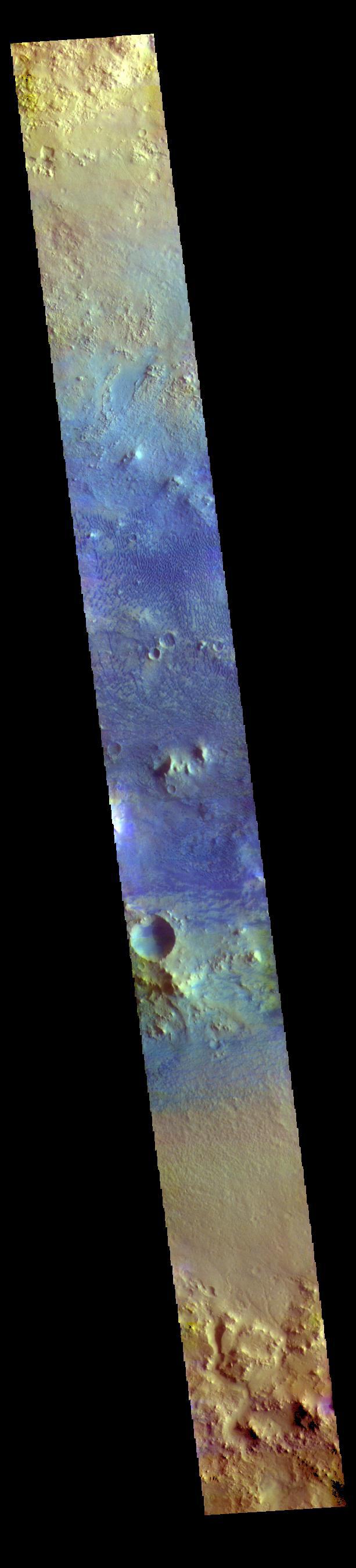
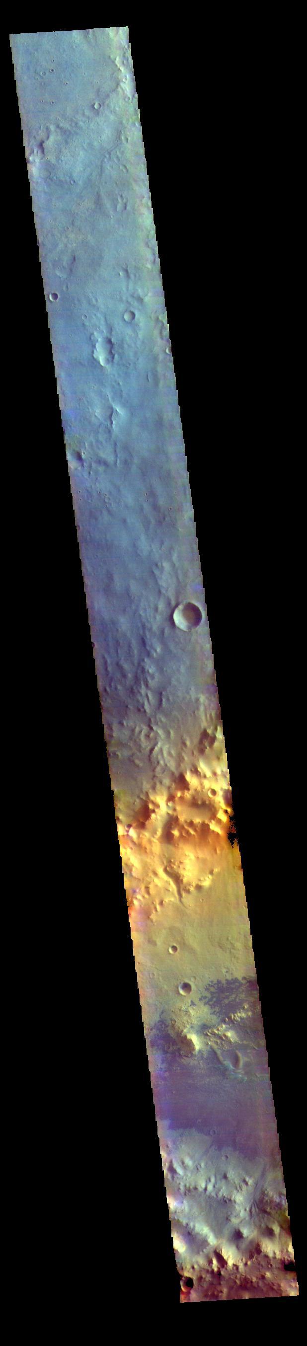
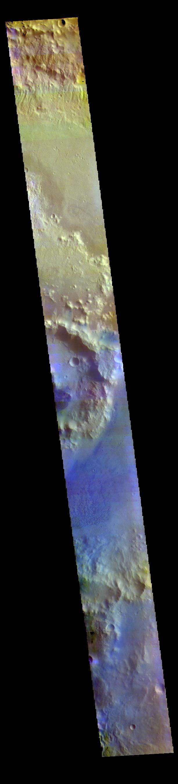
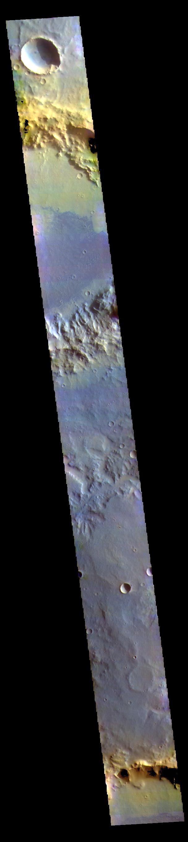
Basaltic Crater in Color IR
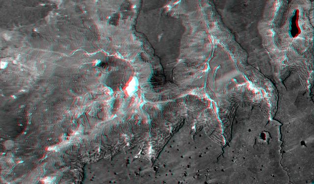
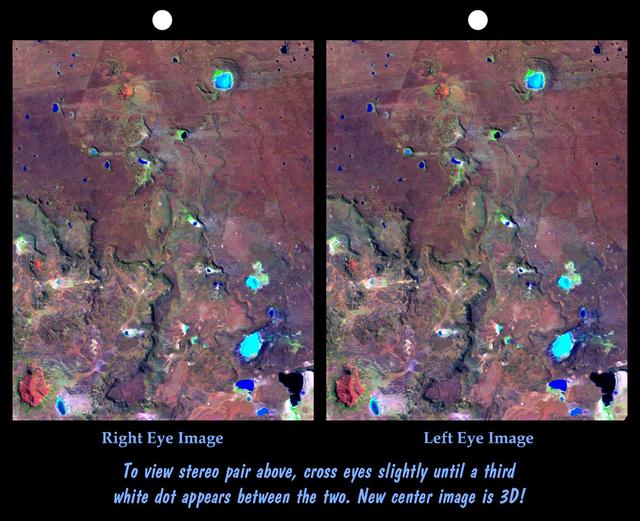
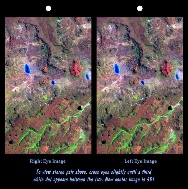
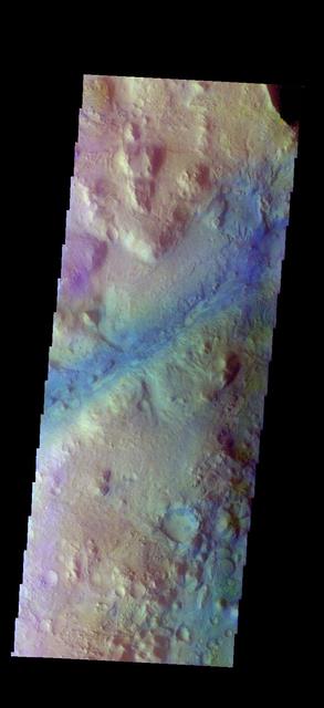
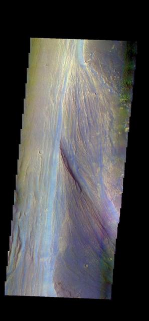
This anaglyph, from NASA Shuttle Radar Topography Mission, shows basalt cliffs along the northwest edge of the Meseta de Somuncura plateau near Sierra Colorada, Argentina. 3D glasses are necessary to view this image.
Basalt cliffs along the northwest edge of the Meseta de Somuncura plateau near Sierra Colorada, Argentina show an unusual and striking pattern of erosion.
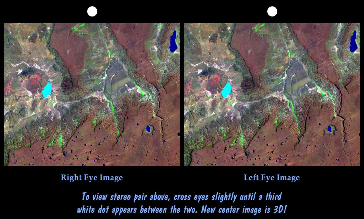
The Meseta de Somuncura is a semi-arid basalt plateau in northern Patagonia. This view of the northwestern part of the plateau, near Los Menucos, Argentina, shows numerous depressions where the upper basalt layers are missing or collapsed.
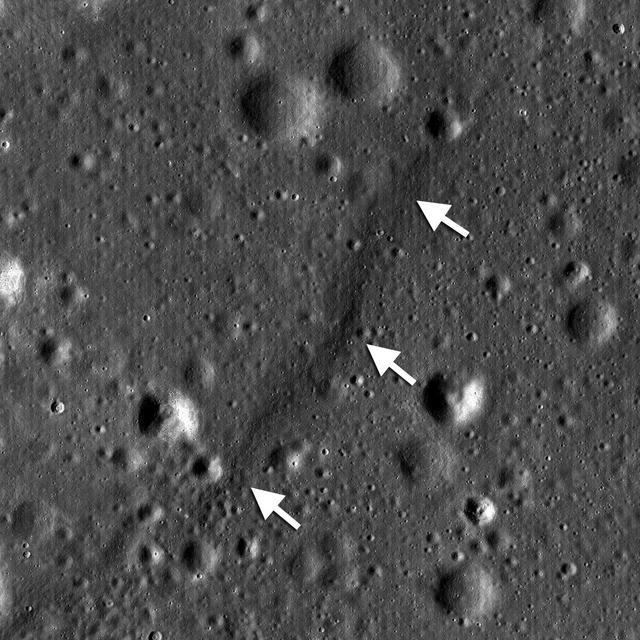
NASA Lunar Reconnaissance Orbiter shows a lobate scarp in the mare basalts of Aitken crater on the lunar farside arrows.
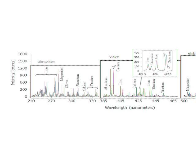
This graph shows a spectrum recorded by the Chemistry and Camera instrument ChemCam in NASA Curiosity Mars rover; it is is typical of Martian volcanic basalt material.
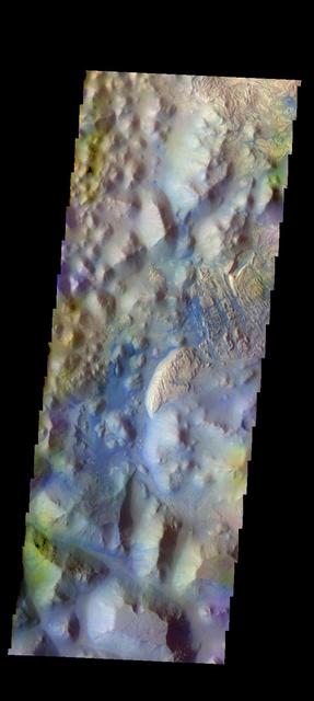
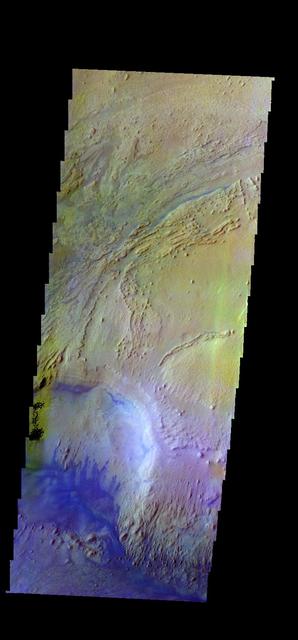
The Meseta de Somuncura is a broad plateau capped by basalt. Near its western edge is evidence of multiple volcanic events and a complex erosion history.

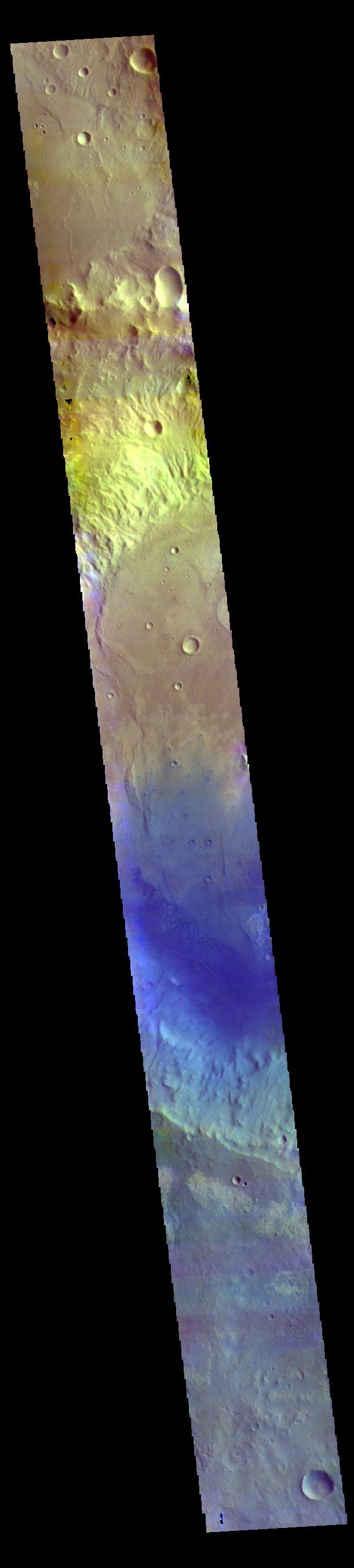
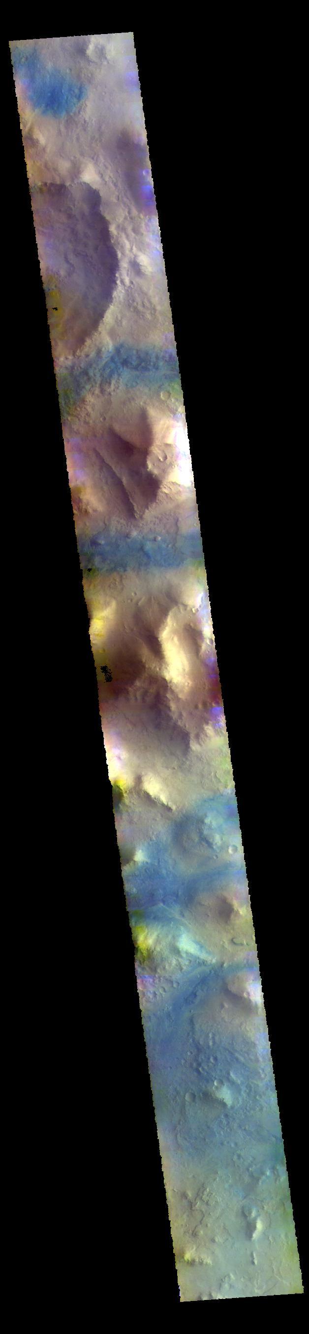
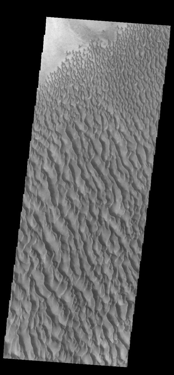
Today's VIS image is located in an unnamed crater in Arabia Terra. Dark blue in this combination is typically basaltic sands. The presence of sand dunes with this tone indicated that these dunes are of basaltic composition. The THEMIS VIS camera contains 5 filters. The data from different filters can be combined in multiple ways to create a false color image. These false color images may reveal subtle variations of the surface not easily identified in a single band image. Orbit Number: 62523 Latitude: 11.3145 Longitude: 13.2155 Instrument: VIS Captured: 2016-01-17 22:08 https://photojournal.jpl.nasa.gov/catalog/PIA23112
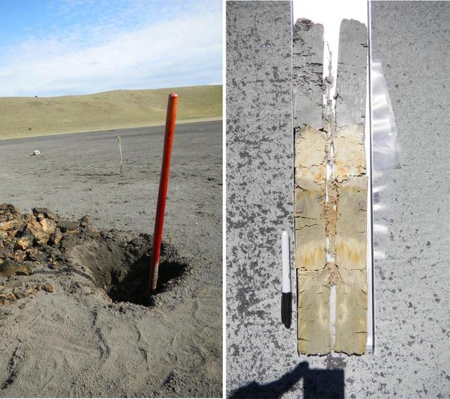
A sampling pit exposing clay-bearing lake sediments, deposited in a basaltic basin in southern Australia -- a modern terrestrial analog to the Yellowknife Bay area that NASA Curiosity rover is exploring.
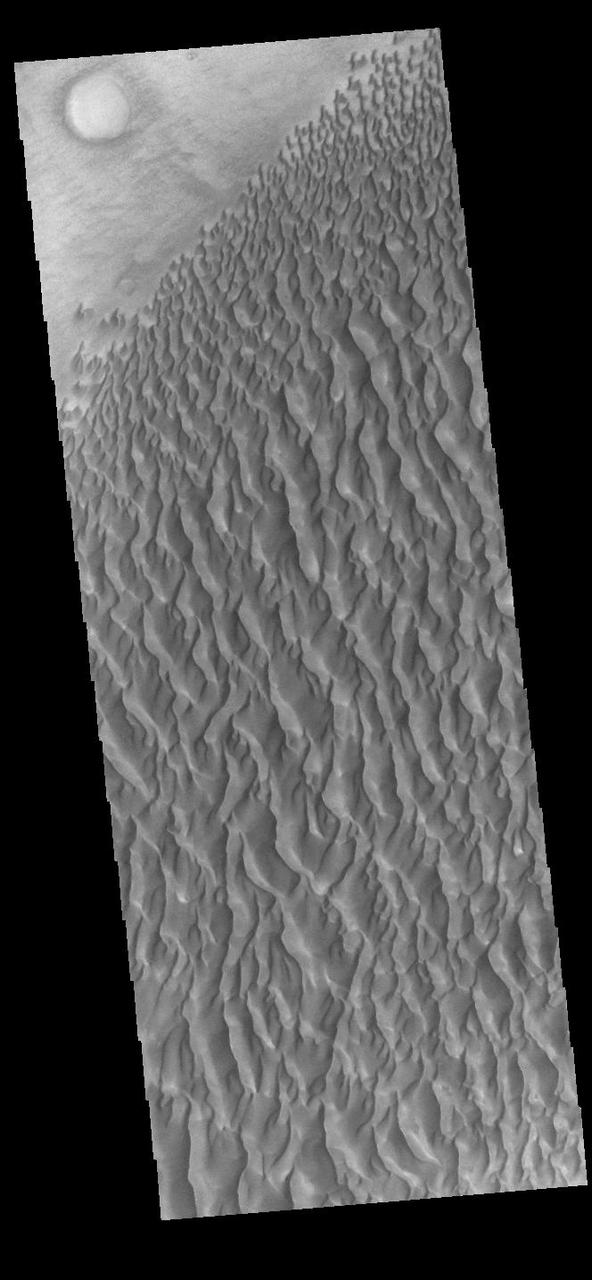
This observation from NASA Mars Reconnaissance Orbiter shows the edge of a dark dune field on the floor of Proctor Crater in the Southern highlands of Mars. The dark dunes are composed of basaltic sand that has collected on the bottom of the crater.
This image is a single frame from a computer animation, which begins with a global view of the planet Mars created from images by NASA Mars Odyssey. Color is used to emphasize the Martian topographic, andesite, and basalt compositional differences.

This image taken by the MAHLI camera shows a sample of basaltic rock from a lava flow in New Mexico serves as a calibration target carried on the front of NASA Mars rover Curiosity for the rover Canadian-made APXS instrument.

This anaglyph, from NASA Shuttle Radar Topography Mission, shows Meseta de Somuncura, a semi-arid basalt plateau in northern Patagonia. 3D glasses are necessary to view this image.
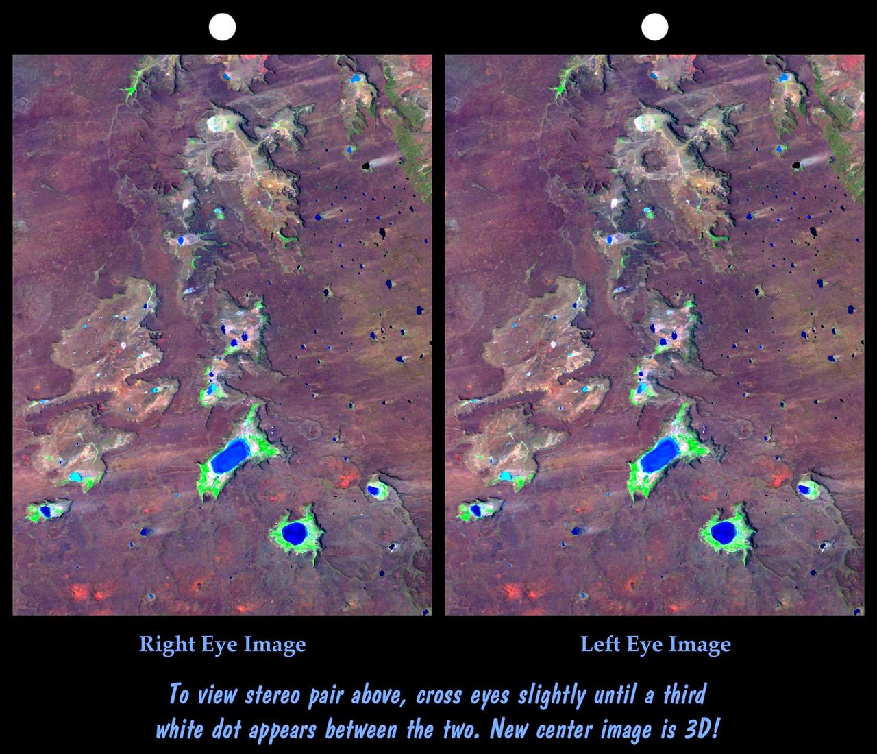
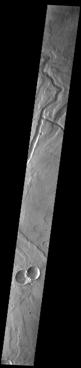
This view of northern Patagonia, near El Cain, Argentina shows complexly eroded volcanic terrain, with basalt mesas, sinkholes, landslide debris, playas, and relatively few integrated drainage channels.

This anaglyph, from NASA Shuttle Radar Topography Mission, shows Meseta de Somuncura, a broad plateau capped by basalt. Near its western edge is evidence of multiple volcanic events. 3D glasses are necessary to view this image.
Luna 16 was the first robotic mission to land on the Moon on basaltic plains of Mare Fecunditatis and return a sample to the Earth. It was launched by the Soviet Union on 12 September 1970. This image was taken by NASA Lunar Reconnaissance Orbiter.

This spectacular view, taken by NASA 2001 Mars Odyssey, shows the sunlit cliffs and basaltic sand dunes in southern Melas Chasma shows Mars in a way rarely seen: in full, realistic color.
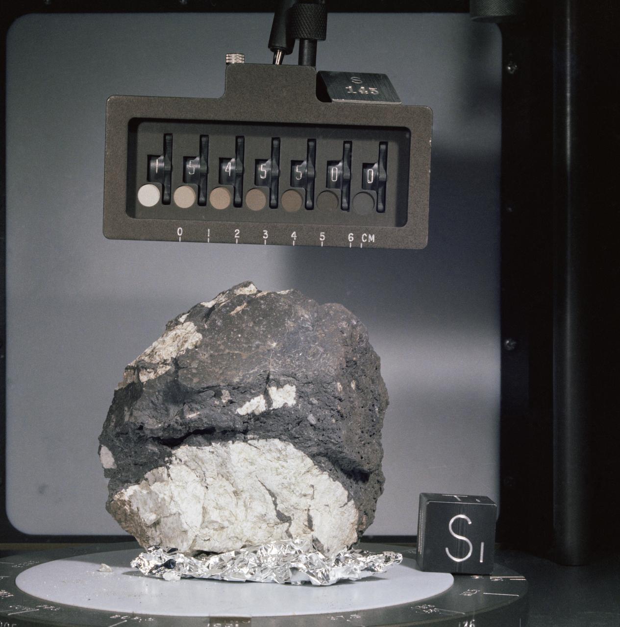
Generic: 15556. Mission: Apollo 15. Station: 9A. Landmark: HADLEY RILLE. BagNumber: SCB 2. OriginalWeight: 1542. SuperClass: Basalt. SubClass: Olivine. Category: ROCK. Classifications: F.G. ol-norm . Description: F.G. ol-norm. Classification 1: BASALT.
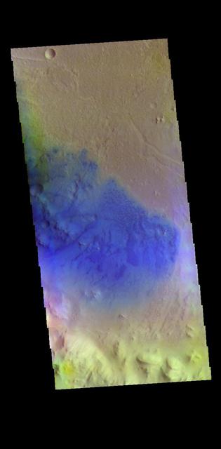
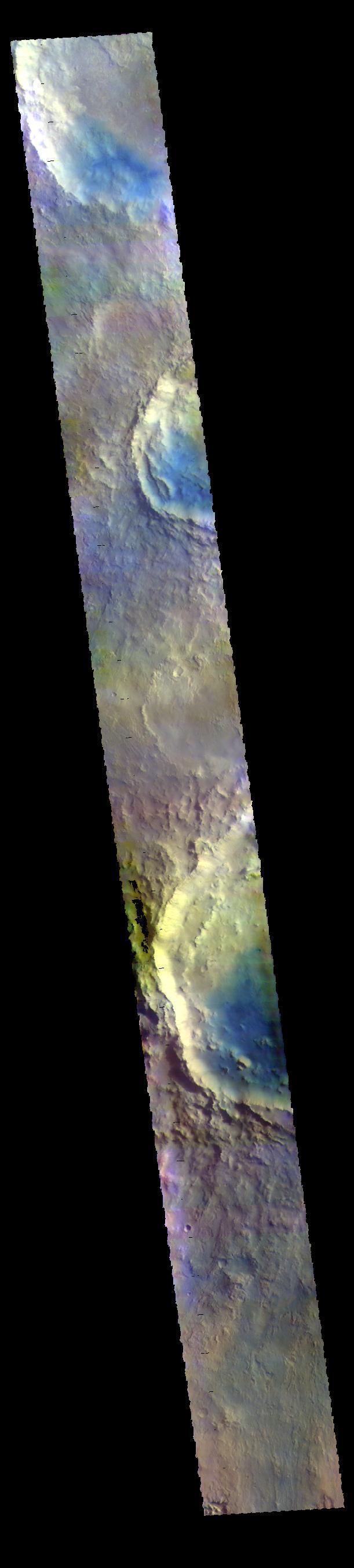
A group of dunes is visible on the floor of this unnamed crater in Arabia Terra. The dunes contain basaltic sand, which is darker than the dust covered materials of the rest of the crater. Orbit Number: 71366 Latitude: 9.85278 Longitude: 7.9986 Instrument: VIS Captured: 2018-01-15 10:16 https://photojournal.jpl.nasa.gov/catalog/PIA22383
Tombaugh Crater is in the center of this VIS image. Dark blue tones are basaltic sands of the floor of the crater. The THEMIS VIS camera contains 5 filters. The data from different filters can be combined in multiple ways to create a false color image. These false color images may reveal subtle variations of the surface not easily identified in a single band image. Orbit Number: 60796 Latitude: 3.67604 Longitude: 161.758 Instrument: VIS Captured: 2015-08-28 16:43 https://photojournal.jpl.nasa.gov/catalog/PIA22718
This image shows a small section of Nili Fossae. The darker blue tones are usually indications of basaltic sands. The THEMIS VIS camera contains 5 filters. The data from different filters can be combined in multiple ways to create a false color image. These false color images may reveal subtle variations of the surface not easily identified in a single band image. Orbit Number: 60318 Latitude: 24.7981 Longitude: 80.7408 Instrument: VIS Captured: 2015-07-20 08:53 https://photojournal.jpl.nasa.gov/catalog/PIA22706
The THEMIS VIS camera contains 5 filters. The data from different filters can be combined in multiple ways to create a false color image. These false color images may reveal subtle variations of the surface not easily identified in a single band image. Today's false color image shows a crater in Arabia Terra. Dark blue in this filter combination indicates basaltic sand. Orbit Number: 69458 Latitude: 35.4862 Longitude: 0.619413 Instrument: VIS Captured: 2017-08-11 05:43 https://photojournal.jpl.nasa.gov/catalog/PIA24451
In southern Syria, the Azraq-Wadi as Sirhan Depression is the site of young volcanic activity, producing an extensive basaltic volcanic field. The north-northwest to south-southeast structural and fault control of the crust is evident in the straight alignment of numerous chains of cinder cones. At the top of the image, the northeast trending streaks are windblown sand deposits. The image was acquired May 20, 2009, covers an area of 46.5 x 67 km, and is located at 33.3 degrees north, 37.1 degrees east. http://photojournal.jpl.nasa.gov/catalog/PIA19479
This false color image shows part of the floor of Marth Crater. Dark blue tones typically indicate basaltic sands. Wind action is blowing the sand and dust to the southern side of the crater floor. Marth Crater is located in Arabia Terra. The THEMIS VIS camera contains 5 filters. The data from different filters can be combined in multiple ways to create a false color image. These false color images may reveal subtle variations of the surface not easily identified in a single band image. Orbit Number: 60914 Latitude: 13.5027 Longitude: 356.362 Instrument: VIS Captured: 2015-09-07 09:58 https://photojournal.jpl.nasa.gov/catalog/PIA23040
The THEMIS VIS camera contains 5 filters. The data from different filters can be combined in multiple ways to create a false color image. These false color images may reveal subtle variations of the surface not easily identified in a single band image. Today's false color image shows sand dunes on the floor of an unnamed crater in Terra Cimmeria. Dark blue in this filter combination indicates basaltic sand. Orbit Number: 69566 Latitude: -9.20212 Longitude: 129.12 Instrument: VIS Captured: 2017-08-20 03:02 https://photojournal.jpl.nasa.gov/catalog/PIA24453

This VIS image shows part of northern Terra Sabaea. Blue tones in false color images usually indicate basaltic sand. The THEMIS VIS camera contains 5 filters. The data from different filters can be combined in multiple ways to create a false color image. These false color images may reveal subtle variations of the surface not easily identified in a single band image. Orbit Number: 61910 Latitude: 37.5082 Longitude: 57.7093 Instrument: VIS Captured: 2015-11-28 10:37 https://photojournal.jpl.nasa.gov/catalog/PIA23086
Today's VIS image shows part of the floor of Rutherford Crater. Blue tones in false color images are indicative of basaltic sand. Rutherford Crater is approximately 107 km (66 miles) in diameter. This crater is located in Arabia Terra. The THEMIS VIS camera contains 5 filters. The data from different filters can be combined in multiple ways to create a false color image. These false color images may reveal subtle variations of the surface not easily identified in a single band image. Orbit Number: 61900 Latitude: 18.9562 Longitude: 349.107 Instrument: VIS Captured: 2015-11-27 14:45 https://photojournal.jpl.nasa.gov/catalog/PIA23091
The THEMIS VIS camera contains 5 filters. The data from different filters can be combined in multiple ways to create a false color image. These false color images may reveal subtle variations of the surface not easily identified in a single band image. Today's false color image shows the floor of Peridier Crater. Small dunes are visible in the image. Dark blue tones indicate basaltic sands. Peridier Crater is 94 km (58 miles) in diameter. Orbit Number: 71276 Latitude: 25.1422 Longitude: 83.61 Instrument: VIS Captured: 2018-01-08 00:25 https://photojournal.jpl.nasa.gov/catalog/PIA24512
This VIS image is located in an unnamed crater in Arabia Terra. Dark blue tones in false color indicate basaltic sands. These sands have created the dunes seen in this image. The THEMIS VIS camera contains 5 filters. The data from different filters can be combined in multiple ways to create a false color image. These false color images may reveal subtle variations of the surface not easily identified in a single band image. Orbit Number: 62274 Latitude: 10.6037 Longitude: 358.441 Instrument: VIS Captured: 2015-12-28 09:57 https://photojournal.jpl.nasa.gov/catalog/PIA23109
Part of a large crater fills the center of this VIS image. In this false color image the dark blue material is basaltic sand. The sands are located between the crater rim and a large mound of material on the floor of the crater. The THEMIS VIS camera contains 5 filters. The data from different filters can be combined in multiple ways to create a false color image. These false color images may reveal subtle variations of the surface not easily identified in a single band image. Orbit Number: 60626 Latitude: 1.14687 Longitude: 26.4337 Instrument: VIS Captured: 2015-08-14 16:43 https://photojournal.jpl.nasa.gov/catalog/PIA22712
Today's VIS image shows part of northern Terra Sabaea, where hills are common. The blue tones are usually locations of basaltic sand. The THEMIS VIS camera contains 5 filters. The data from different filters can be combined in multiple ways to create a false color image. These false color images may reveal subtle variations of the surface not easily identified in a single band image. Orbit Number: 60587 Latitude: 34.6347 Longitude: 66.5714 Instrument: VIS Captured: 2015-08-11 11:50 https://photojournal.jpl.nasa.gov/catalog/PIA22710

The THEMIS VIS camera contains 5 filters. The data from different filters can be combined in multiple ways to create a false color image. These false color images may reveal subtle variations of the surface not easily identified in a single band image. Today's false color image shows part of an unnamed crater located in Terra Sabaea. Dark blue tones in this filter combination indicate basaltic sand. Orbit Number: 80423 Latitude: -8.92009 Longitude: 22.5362 Instrument: VIS Captured: 2020-01-31 08:18 https://photojournal.jpl.nasa.gov/catalog/PIA24675
The THEMIS VIS camera contains 5 filters. The data from different filters can be combined in multiple ways to create a false color image. These false color images may reveal subtle variations of the surface not easily identified in a single band image. Today's false color image shows part of Terra Sabaea. Dark blue tones in this filter combination indicate basaltic sands. Orbit Number: 78125 Latitude: 17.9126 Longitude: 76.888 Instrument: VIS Captured: 2019-07-26 03:05 https://photojournal.jpl.nasa.gov/catalog/PIA24651
The THEMIS VIS camera contains 5 filters. The data from different filters can be combined in multiple ways to create a false color image. These false color images may reveal subtle variations of the surface not easily identified in a single band image. Today's false color image shows an unnamed crater in Noachis Terra. Small dunes can be seen in the bottom half of the image. Dark blue tones in this filter combination indicate basaltic sands. Orbit Number: 71104 Latitude: -3.40884 Longitude: 12.2767 Instrument: VIS Captured: 2017-12-24 20:10 https://photojournal.jpl.nasa.gov/catalog/PIA24505

NASA's Mars Reconnaissance Orbiter (MRO) observed sand dunes in the north polar regions of Mars showing light coatings of pale orange dust blown partially across the dark basaltic sand. Around the edges of the dunes, patches of seasonal dry ice remain. These patches will be gone soon as they sublimate (turn from ice to gas) in the summer sun. Some blocks of ice are visible at the foot of an alcove formed by a sand avalanche down the slipface of the dune. https://photojournal.jpl.nasa.gov/catalog/PIA22511

NASA's Mars Reconnaissance Orbiter shows bright ripples line the topography in this region, formed within a past climate. Dark dunes and sand streaks (composed of basaltic sand) have moved and filled lower areas, pushed by more recent winds from the top towards the bottom of this image. Lobo Vallis is named for a river on the Ivory Coast. https://photojournal.jpl.nasa.gov/catalog/PIA22346
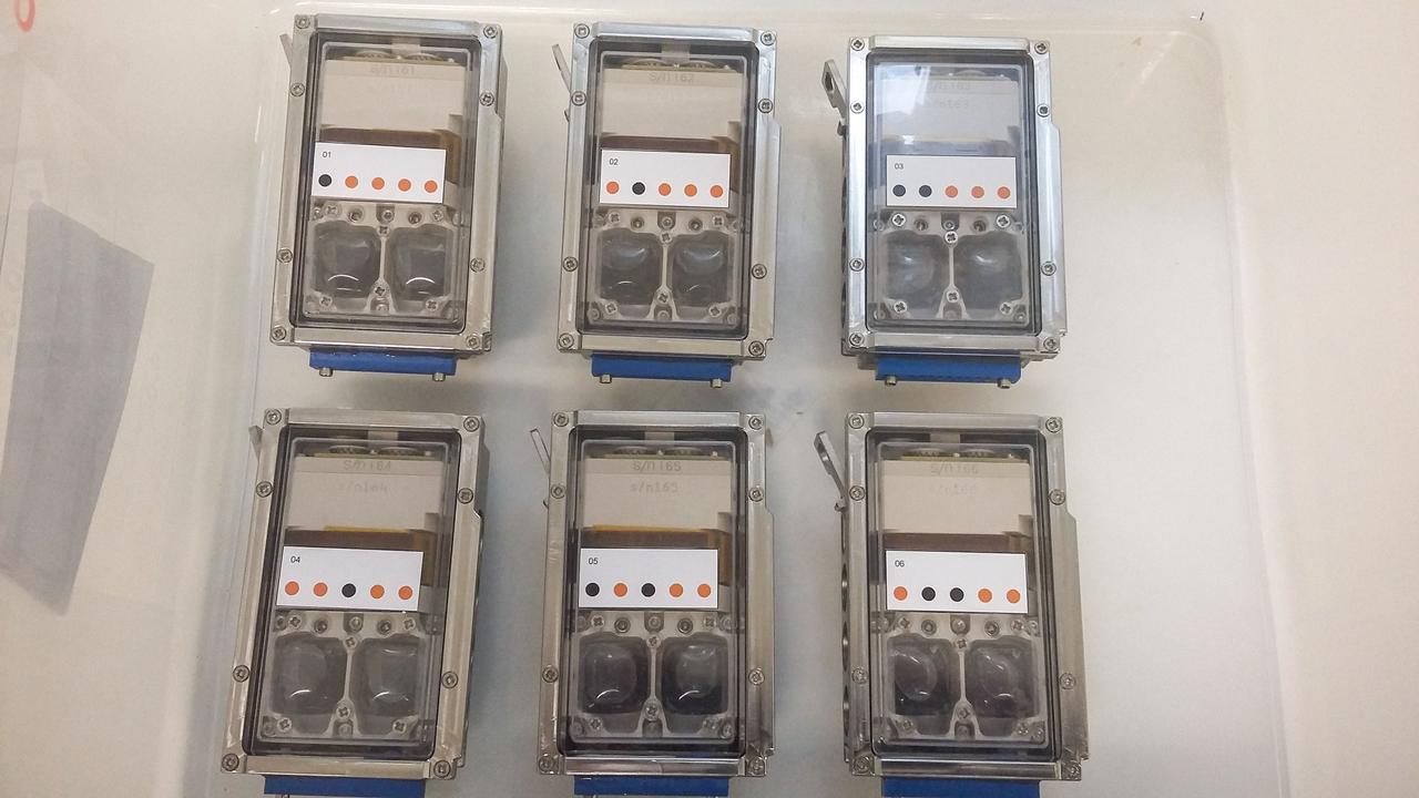
jsc2019e039818 (11/18/2018) --- Preflight imagery of six filled bioreactors from the BioRock project showing culture chambers containing growing microbes in media with basalt rocks. The purpose of the Biorock investigation is to examine the effects of altered gravity on the rock/microbe/liquid system as a whole. (Image Courtesy of: ESA)
Today's VIS image shows a field of sand dunes in an unnamed crater located in Margaritifer Terra. Most sand dunes on Mars are made of dark basaltic sands. Orbit Number: 78228 Latitude: 6.60598 Longitude: 346.706 Instrument: VIS Captured: 2019-08-03 14:35 https://photojournal.jpl.nasa.gov/catalog/PIA23455
The THEMIS VIS camera contains 5 filters. The data from different filters can be combined in multiple ways to create a false color image. These false color images may reveal subtle variations of the surface not easily identified in a single band image. Today's false color image shows Trouvelot Crater and other nearby craters. Dark blue tones in this version of color combination is often dark basaltic sands. Orbit Number: 71242 Latitude: 14.6817 Longitude: 346.517 Instrument: VIS Captured: 2018-01-05 05:07 https://photojournal.jpl.nasa.gov/catalog/PIA24511
This VIS image shows part of Terra Sabaea, including plains, craters, and mesas. The dark blue tones often indicate locations of basaltic sands. The THEMIS VIS camera contains 5 filters. The data from different filters can be combined in multiple ways to create a false color image. These false color images may reveal subtle variations of the surface not easily identified in a single band image. Orbit Number: 60437 Latitude: 29.7491 Longitude: 74.5651 Instrument: VIS Captured: 2015-07-30 03:21 https://photojournal.jpl.nasa.gov/catalog/PIA22707
This VIS image shows parts of several craters located in Arabia Terra. Blue tones in false color images indicated the presence of basaltic sands. The THEMIS VIS camera contains 5 filters. The data from different filters can be combined in multiple ways to create a false color image. These false color images may reveal subtle variations of the surface not easily identified in a single band image. Orbit Number: 61900 Latitude: 9.88836 Longitude: 350.337 Instrument: VIS Captured: 2015-11-27 14:42 https://photojournal.jpl.nasa.gov/catalog/PIA23090
The THEMIS VIS camera contains 5 filters. The data from different filters can be combined in multiple ways to create a false color image. These false color images may reveal subtle variations of the surface not easily identified in a single band image. Today's false color image shows the floor of an unnamed crater in Tyrrhena Terra. Sand dunes are visible on the crater floor. Dark blue tones indicate basaltic sands. Orbit Number: 71862 Latitude: -5.32227 Longitude: 93.5361 Instrument: VIS Captured: 2018-02-25 06:52 https://photojournal.jpl.nasa.gov/catalog/PIA24514
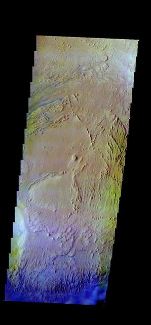
Today's VIS image crosses part of the flank of Tyrrhenus Mons. Tyrrhenus Mons is one of the oldest martian volcanoes. Unlike most of the other Martian volcanoes, it is made of layers that include softer volcanic ash rather than just basaltic flows. This difference is evident in how the volcano is being eroded, creating broad intersecting sinuous channels. On Earth basaltic flows form broad shield volcanoes like Hawaii. Shield volcanoes can erupt from the central crater, as well as along the flanks. Volcanoes with ash layers, called composite volcanoes, form steeper sides like Mt Rainier and Mt Fuji, with material erupting only from the central caldera. Tyrrhenus Mons more closely resembles composite volcanoes. Orbit Number: 88182 Latitude: -20.6084 Longitude: 105.788 Instrument: VIS Captured: 2021-10-31 04:55 https://photojournal.jpl.nasa.gov/catalog/PIA25159
Tyrrhenus Mons is one of the oldest Martian volcanoes. Tyrrhena Fossae is the largest of the channels dissecting the volcano. As well as being one of the oldest volcanoes, it is made of layers that include volcanic ash rather than just basaltic flows. This difference is evident in how the volcano is being eroded, creating broad intersecting sinuous channels. On Earth basaltic flows form broad shield volcanoes like Hawaii. Shield volcanoes can erupt from the central crater, as well as along the flanks. Volcanoes with ash layers, called composite volcanoes, form steeper sides like Mt Rainier and Mt Fuji. The major amount of material erupts only from the central caldera. Orbit Number: 73059 Latitude: -20.5291 Longitude: 107.331 Instrument: VIS Captured: 2018-06-03 21:19 https://photojournal.jpl.nasa.gov/catalog/PIA22664
STS054-151-009 (13-19 Jan 1993) --- This large format camera's view shows the circular volcanic structure of the Brandberg mountain, which at 2630 meters (8,550 feet) is the highest point in the new nation of Namibia. The Brandberg is a major feature in the very arid Namib Desert on Africa's southwest coast. Coastal fog brings some moisture to the driest parts of the desert.

This image is located between Terra Sabaea and Isidis Planitia basin. Blue tones in this band configuration indicate basaltic sands. The sands are more prevalent in the plains at the upper frame part of the image, and only occur in limited number of depressions in the bottom half of the image. The underlying reason for the difference may related to sand abundance or sand mobility by the wind. The THEMIS VIS camera contains 5 filters. The data from different filters can be combined in multiple ways to create a false color image. These false color images may reveal subtle variations of the surface not easily identified in a single band image. Orbit Number: 61560 Latitude: 18.3868 Longitude: 79.0246 Instrument: VIS Captured: 2015-10-30 14:44 https://photojournal.jpl.nasa.gov/catalog/PIA23068
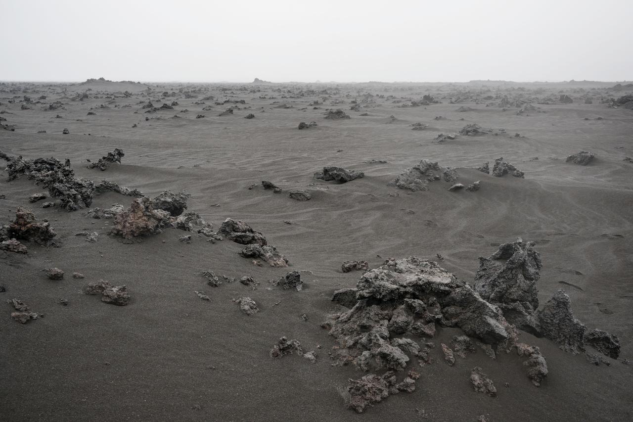
A view of the Holuhraun lava field from the Bárðarbunga volcano, located in Vatnajökull National Park in Iceland. The image shows the rubbly textured basaltic lava flow that has been partially buried by wind-blown sediment. Iceland has been used as a planetary analog for geology training for astronauts since the Apollo missions because of the geologic similarities to the Moon.
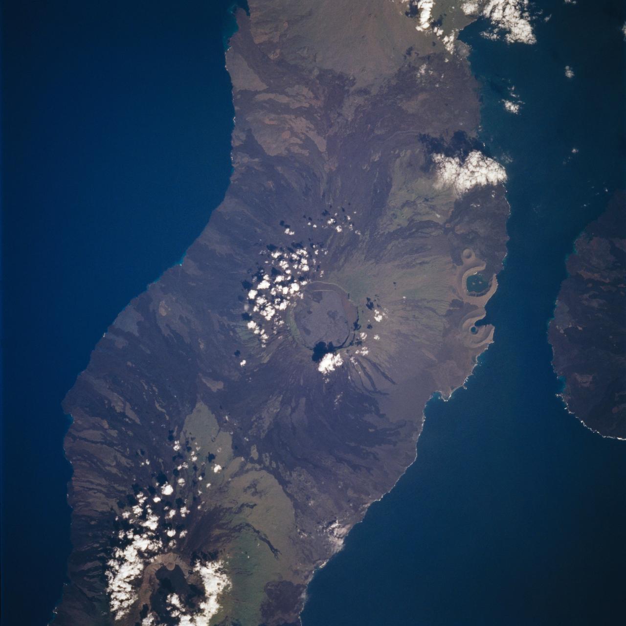
STS059-213-019 (9-20 April 1994) --- SRL scientists will use these photographs with the radar imagery to discriminate among different ages of basalt flows, and different ecosystems of shrub communities, on these equatorial volcanic islands. Aims are twofold: to understand the history of physical and biological systems on the islands themselves, and to extend what is learned to other, less-well-known areas globally. Hasselblad photograph.

This image captured by NASA's 2001 Mars Odyssey spacecraft shows an infrared image of Kaiser Crater and the dune field on the crater floor. Brighter tones in the image are warmer surfaces. The basaltic dunes are dark in the visible, but bright in infrared. Orbit Number: 66814 Latitude: -47.0992 Longitude: 19.782 Instrument: IR Captured: 2017-01-05 08:54 http://photojournal.jpl.nasa.gov/catalog/PIA21504
The THEMIS camera contains 5 filters. The data from different filters can be combined in multiple ways to create a false color image. These false color images may reveal subtle variations of the surface not easily identified in a single band image. Today's false color images shows an unnamed crater in Acidalia Planitia. The "dark blue" material is likely basaltic sand. Orbit Number: 19321 Latitude: 42.1856 Longitude: 359.705 Instrument: VIS Captured: 2006-04-23 05:40 http://photojournal.jpl.nasa.gov/catalog/PIA20231

AST-02-130 (20 July 1975) --- An oblique view of a portion of Libya and the Arab Republic of Egypt, as photographed from the Apollo spacecraft in Earth orbit during the joint U.S.-USSR Apollo-Soyuz Test Project mission. The geological features are the Jebel Uweinat and Jebel Arkenu basaltic mountains in the Libyan sand sea. This picture was taken with a 70mm Hasselblad camera using medium-speed Ektachrome QX-807 type film. The spacecraft was at an altitude of 219 kilometers (136 statute miles).
The THEMIS camera contains 5 filters. The data from different filters can be combined in multiple ways to create a false color image. These false color images may reveal subtle variations of the surface not easily identified in a single band image. Today's false color images shows an unnamed crater in Noachis Terra. The "dark blue" material is probably basaltic sands. Orbit Number: 17811 Latitude: -77.9919 Longitude: 0.491743 Instrument: VIS Captured: 2005-12-19 20:35. http://photojournal.jpl.nasa.gov/catalog/PIA20225

The Channeled Scablands in Washington were formed about 19,000 years ago when glacial Lake Missoula in Montana burst through its ice dam, and a 320 m deep lake emptied in a catastrophic flood that reached the Pacific Ocean. The basaltic terrain of Washington was deeply carved into channels, mesas, and giant dunes as the water scoured the landscape. The image was acquired August 4, 2021, covers an area of 40.2 by 48.8 km, and is located at 47.5 degrees north, 119.2 degrees west. https://photojournal.jpl.nasa.gov/catalog/PIA26008
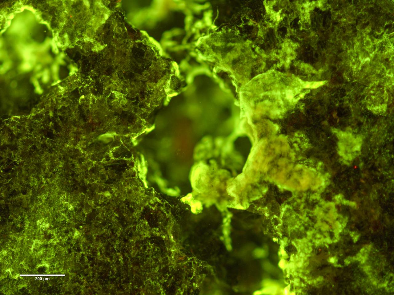
jsc2019e039825 (7/16/2019) --- Preflight Ffuorescence microscopy image of biofilm of Spingomonas desiccabilis growing over and into the surface of a basalt slide as part of BioRock experiment. Organisms are stained with DNA binding sye Sybr Gold. Growth can be seen into the rock cavities. The purpose of the Biorock investigation is to examine the effects of altered gravity on the rock/microbe/liquid system as a whole. (Image Courtesy of: ESA)
The THEMIS camera contains 5 filters. The data from different filters can be combined in multiple ways to create a false color image. These false color images may reveal subtle variations of the surface not easily identified in a single band image. Today's false color image shows part of Nili Fossae. Dark "blue" is interpreted to be basaltic rock/sand. Orbit Number: 17546 Latitude: 24.4543 Longitude: 79.8833 Instrument: VIS Captured: 2005-11-28 02:22. http://photojournal.jpl.nasa.gov/catalog/PIA20223
Io's volcanic plains are shown in this Voyager 1 image mosaic. Also visible are numerous volcanic calderas and lava flows. Ra Patera with its multihued lava flows is below and right of the mosaic's center. This scene is about 1300 miles (2100 km) long. The composition of Io's volcanic plains and lava flows has not been determined, but they could consist dominantly of sulfur or of silicates (such as basalt) coated with sulfur condensates. The bright whitish patches probably consist of freshly deposited SO2 frost. http://photojournal.jpl.nasa.gov/catalog/PIA00321
The THEMIS camera contains 5 filters. The data from different filters can be combined in multiple ways to create a false color image. These false color images may reveal subtle variations of the surface not easily identified in a single band image. Today's false color image shows part of Iani Chaos. The "dark blue" material is likely basaltic sand. Orbit Number: 18037 Latitude: -1.05225 Longitude: 341.26 Instrument: VIS Captured: 2006-01-07 10:45. http://photojournal.jpl.nasa.gov/catalog/PIA20228
Today's VIS image crosses part of the flank of Tyrrhenus Mons. Tyrrhenus Mons is one of the oldest martian volcanoes. Unlike most of the other Martian volcanoes, it is made of layers that include softer volcanic ash rather than just basaltic flows. This difference is evident in how the volcano is being eroded, creating broad intersecting sinuous channels. Tyrrhena Fossae, the largest of the channels dissecting the volcano, is visible in this image. On Earth basaltic flows form broad shield volcanoes like Hawaii. Shield volcanoes can erupt from the central crater, as well as along the flanks. Volcanoes with ash layers, called composite volcanoes, form steeper sides like Mt Rainier and Mt Fuji, with material erupting only from the central caldera. Tyrrhenus Mons more closely resembles composite volcanoes. Orbit Number: 93105 Latitude: -21.2039 Longitude: 107.185 Instrument: VIS Captured: 2022-12-10 12:51 https://photojournal.jpl.nasa.gov/catalog/PIA25813
Gale Crater, home to NASA's Curiosity Mars rover, shows a new face in this mosaic image made using data from the Thermal Emission Imaging System (THEMIS) on NASA's Mars Odyssey orbiter. The colors come from an image processing technique that identifies mineral differences in surface materials and displays them in false colors. For example, windblown dust appears pale pink and olivine-rich basalt looks purple. The bright pink on Gale's floor appears due to a mix of basaltic sand and windblown dust. The blue at the summit of Gale's central mound, Mount Sharp, probably comes from local materials exposed there. The typical average Martian surface soil looks grayish-green. Scientists use false-color images such as these to identify places of potential geologic interest. The diameter of the crater is 96 miles (154 kilometers). North is up. THEMIS and other instruments on Mars Odyssey have been studying Mars from orbit since 2001. Curiosity landed in the northeastern portion of Gale Crater in 2012 and climbed onto the flank of Mount Sharp in 2014. http://photojournal.jpl.nasa.gov/catalog/PIA19674
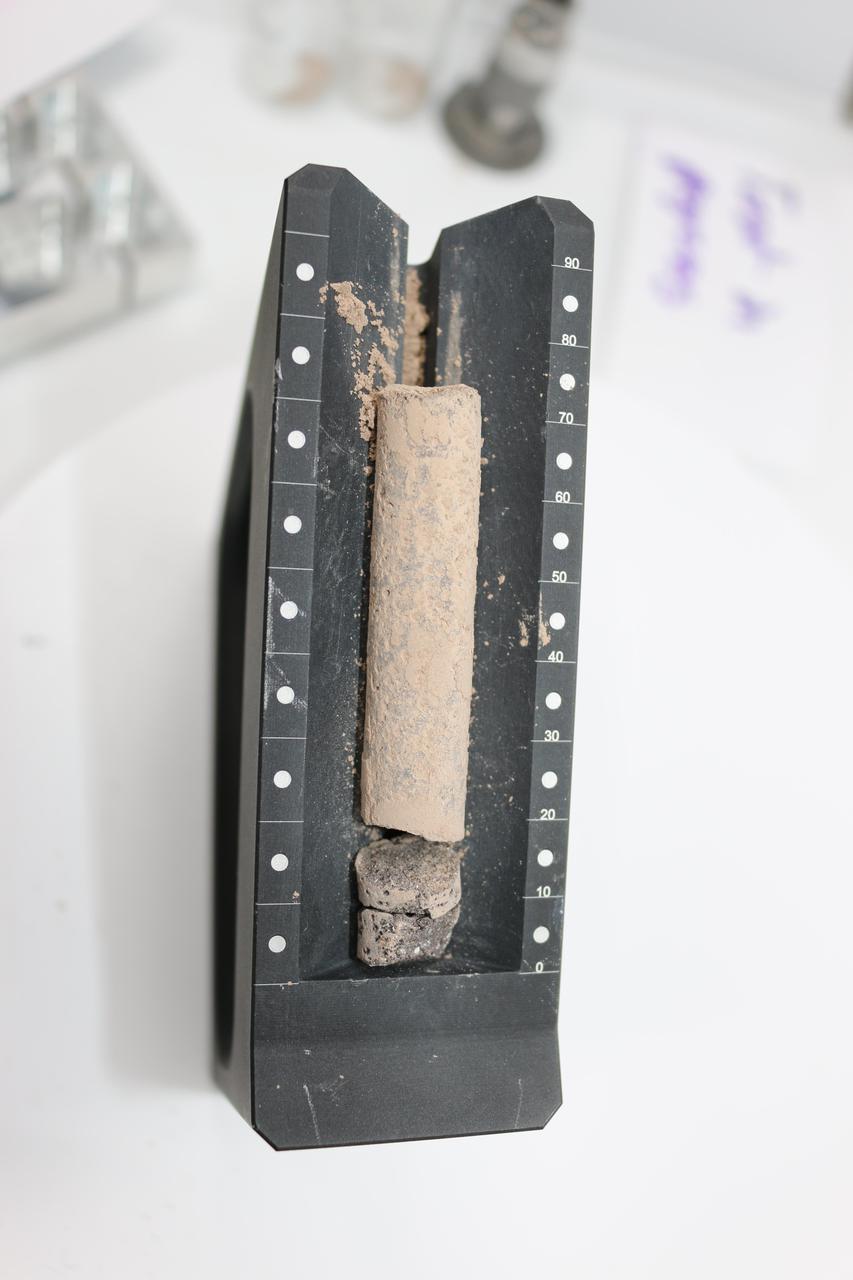
This image shows a core, about 2.8 inches (71.1 millimeters) in length, collected from a basaltic rock during a test of the Perseverance rover's Sampling and Caching System at NASA's Jet Propulsion Laboratory in Southern California. After a sampling test is completed, engineers carefully remove the core from its sample tube and place it in a sample tray, as they've done here, to document the result. A key objective for Perseverance's mission on Mars is astrobiology, including the search for signs of ancient microbial life. The rover will characterize the planet's geology and past climate, pave the way for human exploration of the Red Planet, and be the first mission to collect and cache Martian rock and regolith (broken rock and dust). Subsequent NASA missions, in cooperation with ESA (European Space Agency), would send spacecraft to Mars to collect these sealed samples from the surface and return them to Earth for in-depth analysis. The Mars 2020 Perseverance mission is part of NASA's Moon to Mars exploration approach, which includes Artemis missions to the Moon that will help prepare for human exploration of the Red Planet. https://photojournal.jpl.nasa.gov/catalog/PIA24809
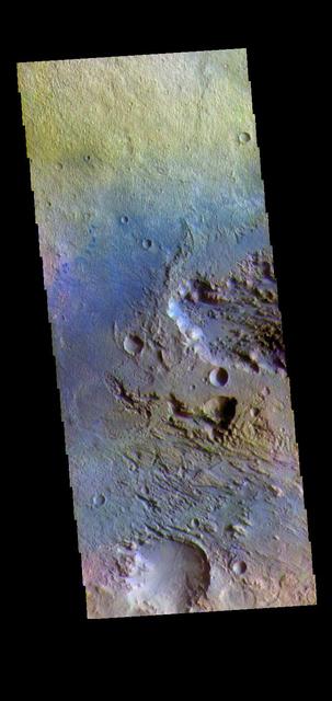
This image displays sand dunes within Proctor Crater. These dunes are composed of basaltic sand that has collected in the bottom of the crater. The topographic depression of the crater forms a sand trap that prevents the sand from escaping. Dune fields are common in the bottoms of craters on Mars and appear as dark splotches that lean up against the downwind walls of the craters. Dunes are useful for studying both the geology and meteorology of Mars. The sand forms by erosion of larger rocks, but it is unclear when and where this erosion took place on Mars or how such large volumes of sand could be formed. The dunes also indicate the local wind directions by their morphology. In this case, there are few clear slipfaces that would indicate the downwind direction. The crests of the dunes also typically run north-south in the image. This dune form indicates that there are probably two prevailing wind directions that run east and west (left to right and right to left). Orbit Number: 83605 Latitude: -47.5325 Longitude: 30.3915 Instrument: VIS Captured: 2020-10-19 08:09 https://photojournal.jpl.nasa.gov/catalog/PIA24276
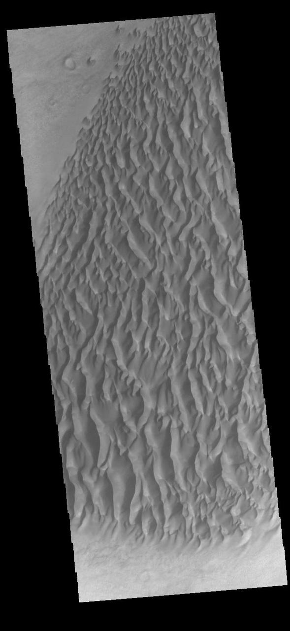
This VIS image displays sand dunes within Proctor Crater. These dunes are composed of basaltic sand that has collected in the bottom of the crater. The topographic depression of the crater forms a sand trap that prevents the sand from escaping. Dune fields are common in the bottoms of craters on Mars and appear as dark splotches that often lean up against the downwind walls of the craters. Dunes are useful for studying both the geology and meteorology of Mars. The sand forms by erosion of larger rocks, but it is unclear when and where this erosion took place on Mars or how such large volumes of sand could be formed. The dunes also indicate the local wind directions by their morphology. In this case, there are few clear slipfaces that would indicate the downwind direction. The crests of the dunes also typically run north-south in the image. This dune form indicates that there are probably two prevailing wind directions that run east and west (left to right and right to left). Proctor Crater is located in Noachis Terra and is 168 km (104 miles) in diameter. Orbit Number: 92103 Latitude: -47.6832 Longitude: 30.1021 Instrument: VIS Captured: 2022-09-19 01:21 https://photojournal.jpl.nasa.gov/catalog/PIA25746
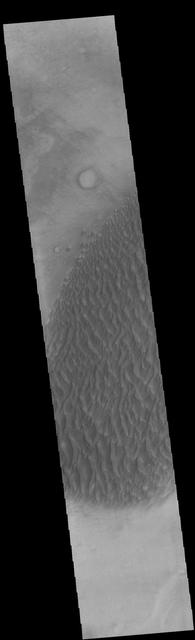
This image displays sand dunes within Proctor Crater. These dunes are composed of basaltic sand that has collected in the bottom of the crater. The topographic depression of the crater forms a sand trap that prevents the sand from escaping. Dune fields are common in the bottoms of craters on Mars and appear as dark splotches that lean up against the downwind walls of the craters. Dunes are useful for studying both the geology and meteorology of Mars. The sand forms by erosion of larger rocks, but it is unclear when and where this erosion took place on Mars or how such large volumes of sand could be formed. The dunes also indicate the local wind directions by their morphology. In this case, there are few clear slipfaces that would indicate the downwind direction. The crests of the dunes also typically run north-south in the image. This dune form indicates that there are probably two prevailing wind directions that run east and west (left to right and right to left). Orbit Number: 82145 Latitude: -47.5218 Longitude: 30.1064 Instrument: VIS Captured: 2020-06-21 03:00 https://photojournal.jpl.nasa.gov/catalog/PIA24142
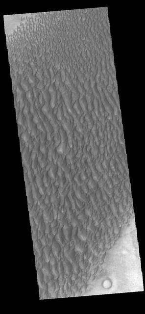
This image displays sand dunes within Proctor Crater. These dunes are composed of basaltic sand that has collected in the bottom of the crater. The topographic depression of the crater forms a sand trap that prevents the sand from escaping. Dune fields are common in the bottoms of craters on Mars and appear as dark splotches that lean up against the downwind walls of the craters. Dunes are useful for studying both the geology and meteorology of Mars. The sand forms by erosion of larger rocks, but it is unclear when and where this erosion took place on Mars or how such large volumes of sand could be formed. The dunes also indicate the local wind directions by their morphology. In this case, there are few clear slipfaces that would indicate the downwind direction. The crests of the dunes also typically run north-south in the image. This dune form indicates that there are probably two prevailing wind directions that run east and west (left to right and right to left). Proctor Crater is located in Noachis Terra and is 168 km (104 miles) in diameter. Orbit Number: 82719 Latitude: -47.5005 Longitude: 30.5331 Instrument: VIS Captured: 2020-08-07 09:19 https://photojournal.jpl.nasa.gov/catalog/PIA24152
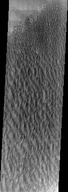
This image from NASA Mars Odyssey spacecraft, located near 30E and 47.5S, displays sand dunes within Proctor Crater. These dunes are composed of basaltic sand that has collected in the bottom of the crater. The topographic depression of the crater forms a sand trap that prevents the sand from escaping. Dune fields are common in the bottoms of craters on Mars and appear as dark splotches that lean up against the downwind walls of the craters. Dunes are useful for studying both the geology and meteorology of Mars. The sand forms by erosion of larger rocks, but it is unclear when and where this erosion took place on Mars or how such large volumes of sand could be formed. The dunes also indicate the local wind directions by their morphology. In this case, there are few clear slipfaces that would indicate the downwind direction. The crests of the dunes also typically run north-south in the image. This dune form indicates that there are probably two prevailing wind directions that run east and west (left to right and right to left). http://photojournal.jpl.nasa.gov/catalog/PIA04011
This VIS image displays sand dunes within Proctor Crater. These dunes are composed of basaltic sand that has collected in the bottom of the crater. The topographic depression of the crater forms a sand trap that prevents the sand from escaping. Dune fields are common in the bottoms of craters on Mars and appear as dark splotches that often lean up against the downwind walls of the craters. Dunes are useful for studying both the geology and meteorology of Mars. The sand forms by erosion of larger rocks, but it is unclear when and where this erosion took place on Mars or how such large volumes of sand could be formed. The dunes also indicate the local wind directions by their morphology. In this case, there are few clear slipfaces that would indicate the downwind direction. The crests of the dunes also typically run north-south in the image. This dune form indicates that there are probably two prevailing wind directions that run east and west (left to right and right to left). Proctor Crater is located in Noachis Terra and is 168 km (104 miles) in diameter. Orbit Number: 90069 Latitude: -47.5035 Longitude: 30.2656 Instrument: VIS Captured: 2022-04-04 13:50 https://photojournal.jpl.nasa.gov/catalog/PIA25469
This VIS image displays sand dunes within Proctor Crater. These dunes are composed of basaltic sand that has collected in the bottom of the crater. The topographic depression of the crater forms a sand trap that prevents the sand from escaping. Dune fields are common in the bottoms of craters on Mars and appear as dark splotches that often lean up against the downwind walls of the craters. Dunes are useful for studying both the geology and meteorology of Mars. The sand forms by erosion of larger rocks, but it is unclear when and where this erosion took place on Mars or how such large volumes of sand could be formed. The dunes also indicate the local wind directions by their morphology. In this case, there are few clear slipfaces that would indicate the downwind direction. The crests of the dunes also typically run north-south in the image. This dune form indicates that there are probably two prevailing wind directions that run east and west (left to right and right to left). Proctor Crater is located in Noachis Terra and is 168 km (104 miles) in diameter. Orbit Number: 91816 Latitude: -47.7614 Longitude: 29.9278 Instrument: VIS Captured: 2022-08-26 10:12 https://photojournal.jpl.nasa.gov/catalog/PIA25646
This VIS image displays sand dunes within Proctor Crater. These dunes are composed of basaltic sand that has collected in the bottom of the crater. The topographic depression of the crater forms a sand trap that prevents the sand from escaping. Dune fields are common in the bottoms of craters on Mars and appear as dark splotches that often lean up against the downwind walls of the craters. Dunes are useful for studying both the geology and meteorology of Mars. The sand forms by erosion of larger rocks, but it is unclear when and where this erosion took place on Mars or how such large volumes of sand could be formed. The dunes also indicate the local wind directions by their morphology. In this case, there are few clear slipfaces that would indicate the downwind direction. The crests of the dunes also typically run north-south in the image. This dune form indicates that there are probably two prevailing wind directions that run east and west (left to right and right to left). Proctor Crater is located in Noachis Terra and is 168 km (104 miles) in diameter. Orbit Number: 91660 Latitude: -47.4832 Longitude: 30.5852 Instrument: VIS Captured: 2022-08-13 13:28 https://photojournal.jpl.nasa.gov/catalog/PIA25616
This VIS image displays sand dunes within Proctor Crater. These dunes are composed of basaltic sand that has collected in the bottom of the crater. The topographic depression of the crater forms a sand trap that prevents the sand from escaping. Dune fields are common in the bottoms of craters on Mars and appear as dark splotches that lean up against the downwind walls of the craters. Dunes are useful for studying both the geology and meteorology of Mars. The sand forms by erosion of larger rocks, but it is unclear when and where this erosion took place on Mars or how such large volumes of sand could be formed. The dunes also indicate the local wind directions by their morphology. In this case, there are few clear slipfaces that would indicate the downwind direction. The crests of the dunes also typically run north-south in the image. This dune form indicates that there are probably two prevailing wind directions that run east and west (left to right and right to left). Proctor Crater is located in Noachis Terra and is 168 km (104 miles) in diameter. Orbit Number: 90356 Latitude: -47.4835 Longitude: 30.3891 Instrument: VIS Captured: 2022-04-28 05:00 https://photojournal.jpl.nasa.gov/catalog/PIA25475
This VIS image shows sand dunes within Proctor Crater. These dunes are composed of basaltic sand that has collected in the bottom of the crater. The topographic depression of the crater forms a sand trap that prevents the sand from escaping. Dune fields are common in the bottoms of craters on Mars and appear as dark splotches that often lean up against the downwind walls of the craters. Dunes are useful for studying both the geology and meteorology of Mars. The sand forms by erosion of larger rocks, but it is unclear when and where this erosion took place on Mars or how such large volumes of sand could be formed. The dunes also indicate the local wind directions by their morphology. In this case, there are few clear slipfaces that would indicate the downwind direction. The crests of the dunes also typically run north-south in the image. This dune form indicates that there are probably two prevailing wind directions that run east and west (left to right and right to left). Proctor Crater is located in Noachis Terra and is 168 km (104 miles) in diameter. Orbit Number: 91373 Latitude: -47.4558 Longitude: 30.4026 Instrument: VIS Captured: 2022-07-20 22:18 https://photojournal.jpl.nasa.gov/catalog/PIA25537
This VIS image of Olympia Undae was collected during north polar summer. The dunes are now completely frost free and are dark in color due to being made of basaltic sand. The surface between the dunes, where visible, is a bright tone. In some regions of dense dunes, the bright material may be a deposit on the dunes rather than the underlying surface. The presence of gypsum has been suggested for Olympia Undae, gypsum is a lighter tone than basalt in this filter of the THEMIS VIS camera. Olympia Undae is a vast dune field in the north polar region of Mars. It consists of a broad sand sea or erg that partly rings the north polar cap from about 120° to 240°E longitude and 78° to 83°N latitude. The dune field covers an area of approximately 470,000 km2 (bigger than California, smaller than Texas). Olympia Undae is the largest continuous dune field on Mars. Olympia Undae is not the only dune field near the north polar cap, several other smaller fields exist in the same latitude, but in other ranges of longitude, e.g. Abolos and Siton Undae. Barchan and transverse dune forms are the most common. In regions with limited available sand individual barchan dunes will form, the surface beneath and between the dunes is visible. In regions with large sand supplies, the sand sheet covers the underlying surface, and dune forms are found modifying the surface of the sand sheet. In this case transverse dunes are more common. Barchan dunes "point" down wind, transverse dunes are more linear and form parallel to the wind direction. The "square" shaped transverse dunes in Olympia Undae are due to two prevailing wind directions. The density of dunes and the alignments of the dune crests varies with location, controlled by the amount of available sand and the predominant winds over time. The Odyssey spacecraft has spent over 15 years in orbit around Mars, circling the planet more than 71,000 times. It holds the record for longest working spacecraft at Mars. THEMIS, the IR/VIS camera system, has collected data for the entire mission and provides images covering all seasons and lighting conditions. Over the years many features of interest have received repeated imaging, building up a suite of images covering the entire feature. From the deepest chasma to the tallest volcano, individual dunes inside craters and dune fields that encircle the north pole, channels carved by water and lava, and a variety of other feature, THEMIS has imaged them all. For the next several months the image of the day will focus on the Tharsis volcanoes, the various chasmata of Valles Marineris, and the major dunes fields. We hope you enjoy these images! Orbit Number: 21125 Latitude: 81.5387 Longitude: 181.591 Instrument: VIS Captured: 2006-09-18 18:07 https://photojournal.jpl.nasa.gov/catalog/PIA22294

This VIS image of Olympia Undae was collected during north polar summer. The dunes are now completely frost free and are dark in color due to being made of basaltic sand. The surface between the dunes, where visible, is a bright tone. In some regions of dense dunes, the bright material may be a deposit on the dunes rather than the underlying surface. The presence of gypsum has been suggested for Olympia Undae, gypsum is a lighter tone than basalt in this filter of the THEMIS VIS camera. Olympia Undae is a vast dune field in the north polar region of Mars. It consists of a broad sand sea or erg that partly rings the north polar cap from about 120° to 240°E longitude and 78° to 83°N latitude. The dune field covers an area of approximately 470,000 km2 (bigger than California, smaller than Texas). Olympia Undae is the largest continuous dune field on Mars. Olympia Undae is not the only dune field near the north polar cap, several other smaller fields exist in the same latitude, but in other ranges of longitude, e.g. Abolos and Siton Undae. Barchan and transverse dune forms are the most common. In regions with limited available sand individual barchan dunes will form, the surface beneath and between the dunes is visible. In regions with large sand supplies, the sand sheet covers the underlying surface, and dune forms are found modifying the surface of the sand sheet. In this case transverse dunes are more common. Barchan dunes "point" down wind, transverse dunes are more linear and form parallel to the wind direction. The "square" shaped transverse dunes in Olympia Undae are due to two prevailing wind directions. The density of dunes and the alignments of the dune crests varies with location, controlled by the amount of available sand and the predominant winds over time. The Odyssey spacecraft has spent over 15 years in orbit around Mars, circling the planet more than 71,000 times. It holds the record for longest working spacecraft at Mars. THEMIS, the IR/VIS camera system, has collected data for the entire mission and provides images covering all seasons and lighting conditions. Over the years many features of interest have received repeated imaging, building up a suite of images covering the entire feature. From the deepest chasma to the tallest volcano, individual dunes inside craters and dune fields that encircle the north pole, channels carved by water and lava, and a variety of other feature, THEMIS has imaged them all. For the next several months the image of the day will focus on the Tharsis volcanoes, the various chasmata of Valles Marineris, and the major dunes fields. We hope you enjoy these images! Orbit Number: 12614 Latitude: 80.8745 Longitude: 174.688 Instrument: VIS Captured: 2004-10-18 00:23 https://photojournal.jpl.nasa.gov/catalog/PIA22293
Today's false color image shows part of Firsoff Crater, located north of Meridiani Planum. Dark blue tones in the false color filter combination are basaltic sands. The THEMIS VIS camera contains 5 filters. The data from different filters can be combined in multiple ways to create a false color image. These false color images may reveal subtle variations of the surface not easily identified in a single band image. Orbit Number: 63185 Latitude: 2.88676 Longitude: 351.048 Instrument: VIS Captured: 2016-03-12 10:38 https://photojournal.jpl.nasa.gov/catalog/PIA23222
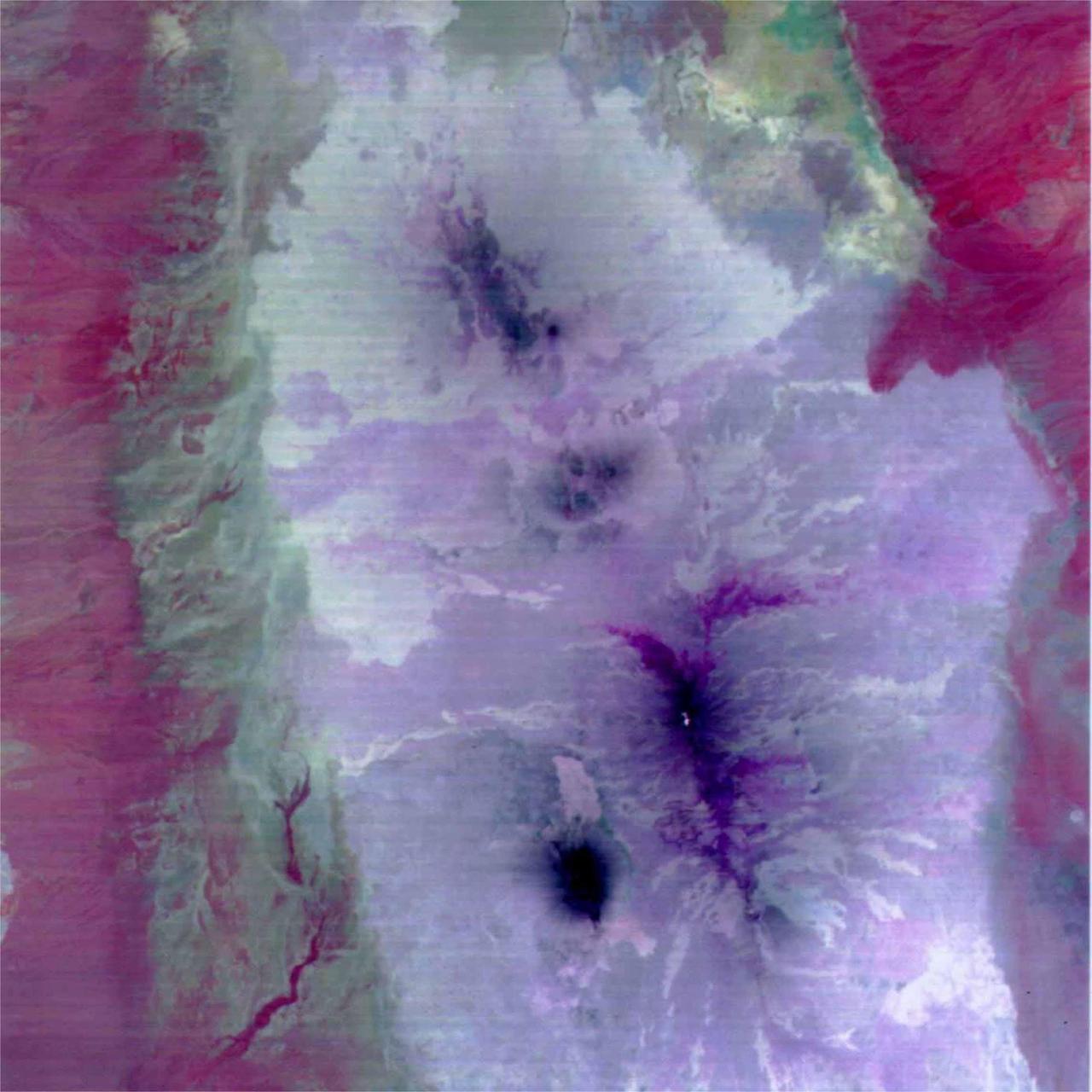
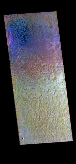
Mawrth Vallis is a place on Mars that has fascinated scientists because of the clays and other hydrated minerals detected from orbit. In this image, the enhanced black colors are most likely basaltic sands and rocks, while the green, yellow, and blue colors correspond to the different hydrated minerals. This particular image was taken of a location in Mawrth Vallis that has a mineral called jarosite. Jarosite on Earth forms under wet, oxidizing, and acidic conditions. Another place on Mars where the Opportunity rover landed and explored also has jarosite. https://photojournal.jpl.nasa.gov/catalog/PIA23080
The THEMIS VIS camera contains 5 filters. The data from different filters can be combined in multiple ways to create a false color image. These false color images may reveal subtle variations of the surface not easily identified in a single band image. Today's false color image shows part of Arabia Terra. A dark blue tone in this false color image is often associated with basaltic sand. Orbit Number: 12307 Latitude: 3.44332 Longitude: 5.97644 Instrument: VIS Captured: 2004-09-22 18:11 http://photojournal.jpl.nasa.gov/catalog/PIA19794
This false color image shows sand dunes on the floor of Sumgin Crater. The crater is located in Noachis Terra north of Argyre Planitia and is 85 km (53 miles) in diameter. Dark blue in this color combination typically means basaltic sands. The THEMIS VIS camera contains 5 filters. The data from different filters can be combined in multiple ways to create a false color image. These false color images may reveal subtle variations of the surface not easily identified in a single band image. Orbit Number: 66517 Latitude: -36.4993 Longitude: 311.197 Instrument: VIS Captured: 2016-12-11 21:42 https://photojournal.jpl.nasa.gov/catalog/PIA23628
This image is a color composite covering the Rift Valley inland area of Ethiopia (south of the region shown in PIA02452). The color difference of this image reflects the distribution of different rocks with different amounts of silicon dioxide. It is inferred that the area with whitish color is covered with basalt and the pinkish area in the center contain sandesite. This is the first spaceborne, multi-band TIR image in history that enables geologists to distinguish between rocks with similar compositions. The size of image: 60 km x 60 km approx., ground resolution 90 m x 90 m approximately. http://photojournal.jpl.nasa.gov/catalog/PIA02453

The THEMIS VIS camera contains 5 filters. The data from different filters can be combined in multiple ways to create a false color image. These false color images may reveal subtle variations of the surface not easily identified in a single band image. Today's false color image shows most of the floor of an unnamed crater in Terra Sabaea. Sand dunes are visible on the crater floor. Dark blue tones in this filter combination indicate basaltic sand. Orbit Number: 79163 Latitude: -3.81361 Longitude: 12.2472 Instrument: VIS Captured: 2019-10-19 14:21 https://photojournal.jpl.nasa.gov/catalog/PIA24657
The THEMIS VIS camera contains 5 filters. The data from different filters can be combined in multiple ways to create a false color image. These false color images may reveal subtle variations of the surface not easily identified in a single band image. Today's false color image shows part of Gale Crater. Basaltic sands are dark blue in this type of false color combination. The Curiosity Rover is located in another portion of Gale Crater, far southwest of this image. Orbit Number: 51803 Latitude: -4.39948 Longitude: 138.116 Instrument: VIS Captured: 2013-08-18 09:04 http://photojournal.jpl.nasa.gov/catalog/PIA21312
The THEMIS VIS camera contains 5 filters. The data from different filters can be combined in multiple ways to create a false color image. These false color images may reveal subtle variations of the surface not easily identified in a single band image. Today's false color image shows an unnamed crater located on the floor of the much larger Schiaparelli Crater. The dark blue material located in the topographic lows is basaltic sand. Orbit Number: 19495 Latitude: -0.402445 Longitude: 14.3131 Instrument: VIS Captured: 2006-05-07 13:43 http://photojournal.jpl.nasa.gov/catalog/PIA20244
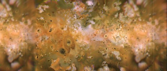
Io's volcanic plains are shown in this Voyager 1 image mosaic which covers the area roughly from latitude 60 degrees N. to latitude 60 degrees S. and longitude 100-345. North is up. Numerous volcanic calderas, lava flows, and volcanic eruption plumes are visible here. The composition of Io's volcanic plains and lava flows has not been determined, but they could consist dominantly of sulfur with surface frosts of sulfur dioxide or of silicates (such as basalt) encrusted with sulfur and sulfur dioxide condensates. The bright whitish patches probably consist of freshly deposited sulfur dioxide frost. http://photojournal.jpl.nasa.gov/catalog/PIA00319
The THEMIS VIS camera contains 5 filters. The data from different filters can be combined in multiple ways to create a false color image. These false color images may reveal subtle variations of the surface not easily identified in a single band image. Today's false color image shows part of the interior deposit of Firsoff Crater. The dark blue material is most likely basaltic sand. Orbit Number: 43854 Latitude: 2.72924 Longitude: 350.449 Instrument: VIS Captured: 2011-11-03 05:57 http://photojournal.jpl.nasa.gov/catalog/PIA21018
The THEMIS VIS camera contains 5 filters. The data from different filters can be combined in multiple ways to create a false color image. These false color images may reveal subtle variations of the surface not easily identified in a single band image. Today's false color image shows part of Lobo Vallis, which is part of the larger Kasei Valles. The dark blue material is most likely basaltic sand. Orbit Number: 43756 Latitude: 27.9304 Longitude: 299.541 Instrument: VIS Captured: 2011-10-26 04:14 http://photojournal.jpl.nasa.gov/catalog/PIA21015

The THEMIS VIS camera contains 5 filters. The data from different filters can be combined in multiple ways to create a false color image. These false color images may reveal subtle variations of the surface not easily identified in a single band image. Today's false color image shows part of the floor of Kaiser Crater, including some of the sand dunes found there. In this false color combination dark blue often indicates basaltic sands. Orbit Number: 66814 Latitude: -46.2976 Longitude: 19.611 Instrument: VIS Captured: 2017-01-05 08:55 https://photojournal.jpl.nasa.gov/catalog/PIA24051
The THEMIS VIS camera contains 5 filters. The data from different filters can be combined in multiple ways to create a false color image. These false color images may reveal subtle variations of the surface not easily identified in a single band image. Today's false color image shows part of the margin of Chryse Planitia. Dark blue in this false color combination is mostly likely basaltic material/dunes. Orbit Number: 44280 Latitude: 33.0423 Longitude: 309.853 Instrument: VIS Captured: 2011-12-08 07:16 http://photojournal.jpl.nasa.gov/catalog/PIA21162
Craters of the Moon National Monument is located in southern Idaho in the Snake River Plain. The Snake River Plain was formed by a series of giant eruptions which started 16 million years ago. The COM flows were erupted between 15,000 and 2,100 years ago. The hotspot that created the eruptions is now under Yellowstone. The COM has some of the best examples of open rift cracks in the world. There are excellent examples of almost every variety of basaltic, as well as tree molds, lava tubes, and many other volcanic features. The image was acquired July 14, 2006, covers an area of 65.2 by 75.4 km, and is located at 43.5 degrees north, 113.5 degrees west. https://photojournal.jpl.nasa.gov/catalog/PIA26501
The THEMIS VIS camera contains 5 filters. The data from different filters can be combined in multiple ways to create a false color image. These false color images may reveal subtle variations of the surface not easily identified in a single band image. Today's false color image shows a small section of Nili Fossae. The linear depression at the top of the image is one of the Nili Fossae graben. Dark blue in this filter combination indicates basaltic sand. Orbit Number: 69580 Latitude: 25.2782 Longitude: 80.2868 Instrument: VIS Captured: 2017-08-21 06:55 https://photojournal.jpl.nasa.gov/catalog/PIA24452
The THEMIS camera contains 5 filters. Data from different filters can be combined in multiple ways to create a false color image. These false color images may reveal subtle variations of the surface not easily identified in a single band image. Today's false color image shows several areas of dunes and sand sheets with dune forms between the numerous hills in this region west of Argyre Planitia. Basaltic sand appears dark blue in this false color image. Orbit Number: 51285 Latitude: -47.6247 Longitude: 303.752 Instrument: VIS Captured: 2013-07-06 18:21 http://photojournal.jpl.nasa.gov/catalog/PIA21306
The THEMIS VIS camera contains 5 filters. The data from different filters can be combined in multiple ways to create a false color image. These false color images may reveal subtle variations of the surface not easily identified in a single band image. Today's false color image shows a cross section of Baldet Crater. Dark blue tones in this filter combination indicate basaltic sands. A large field of dunes is visible on the floor of the crater. Baldet Crater is located in Terra Sabaea and is 181km (112 miles) in diameter. Orbit Number: 77776 Latitude: 22.6741 Longitude: 65.6646 Instrument: VIS Captured: 2019-06-27 09:22 https://photojournal.jpl.nasa.gov/catalog/PIA24635
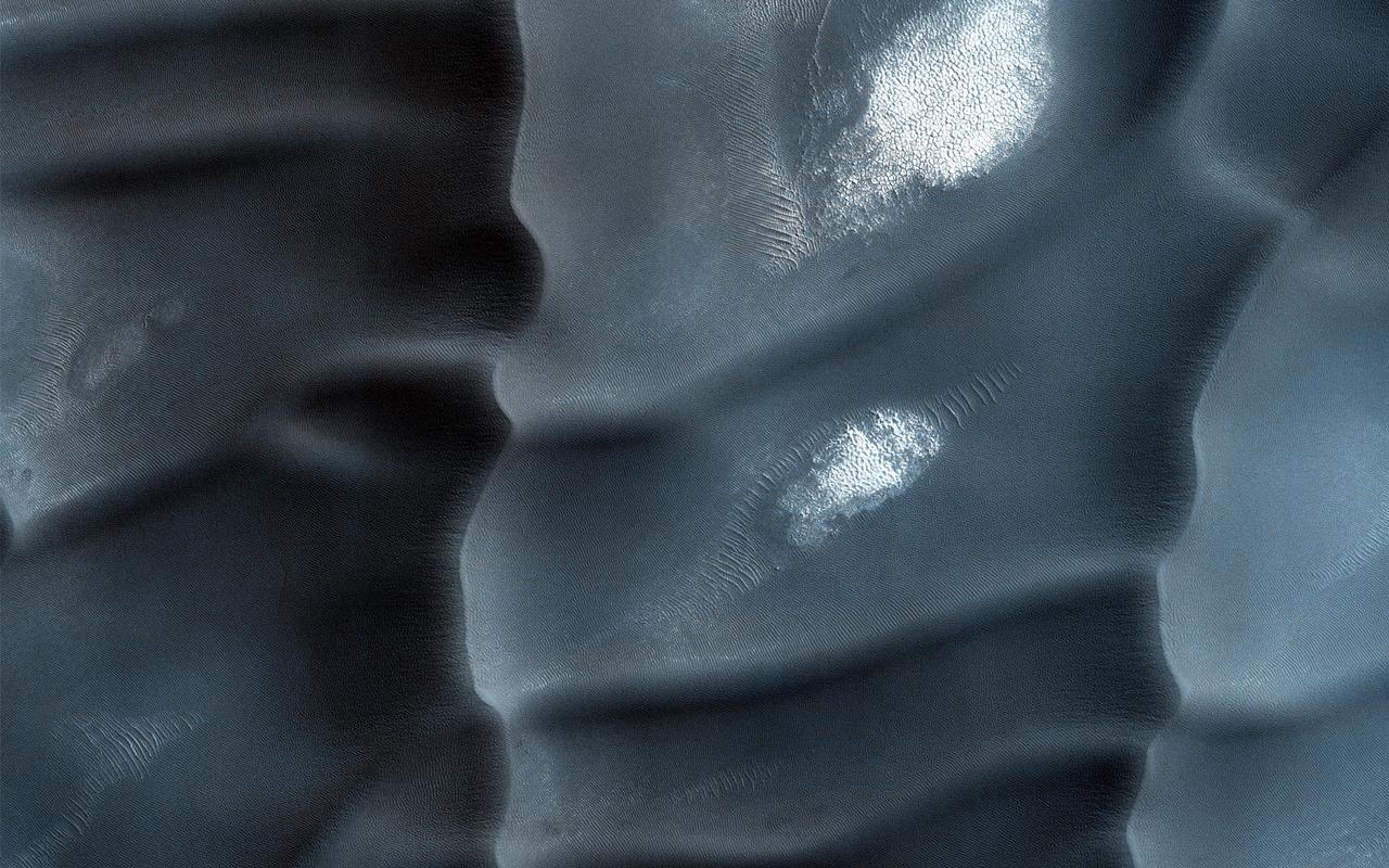
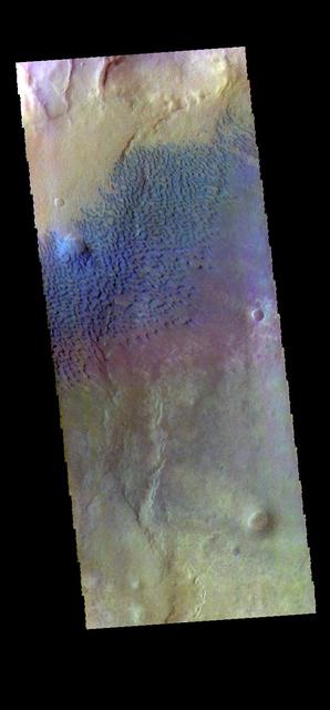
These sand dunes are a type of aeolian bedform and partly encircle the Martian North Pole in a region called Olympia Undae. Unlike most of the sand dunes on Mars that are made of the volcanic rock basalt, these are made of a type of sulfate mineral called gypsum. Whence the sand? Well, gypsum is a mineral that can often form from the evaporation of water that has sulfur and calcium dissolved in it. This sand was probably sourced from a northern region on Mars that used to be quite wet. The boxy gridding of the dunes indicates that the wind blows in multiple directions. Note: "Aeolian" means wind-blown and "bedform" means piles of sediment shaped by a flowing fluid (liquid or gas). http://photojournal.jpl.nasa.gov/catalog/PIA20743
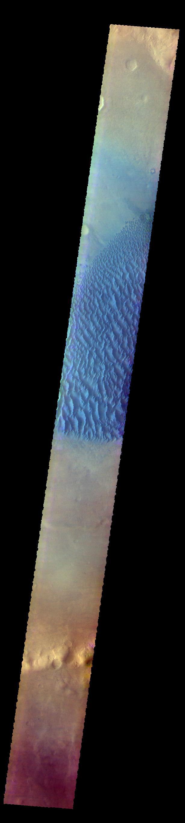
The THEMIS VIS camera contains 5 filters. The data from different filters can be combined in multiple ways to create a false color image. These false color images may reveal subtle variations of the surface not easily identified in a single band image. Today's false color image shows the floor of Proctor Crater, including the large dune field. Basaltic sands are typically blue in false color images. Proctor Crater is located in Noachis Terra. Orbit Number: 59946 Latitude: -47.9086 Longitude: 30.1317 Instrument: VIS Captured: 2015-06-19 16:07 https://photojournal.jpl.nasa.gov/catalog/PIA22670
This false color image shows sand dunes on the floor of Hale Crater. This 150 km x 125 km (93 miles x 77 miles) crater is located north of Argyre Planitia. Dark blue in this false color combination usually indicates basaltic sand. The THEMIS VIS camera contains 5 filters. The data from different filters can be combined in multiple ways to create a false color image. These false color images may reveal subtle variations of the surface not easily identified in a single band image. Orbit Number: 66554 Latitude: -35.7883 Longitude: 323.039 Instrument: VIS Captured: 2016-12-14 22:52 https://photojournal.jpl.nasa.gov/catalog/PIA23629
Today's VIS image is located in Arabia Terra. The crater at the bottom of the image contains a large region of sand dunes. Dark blue in this band configuration indicates basaltic sand. The THEMIS VIS camera contains 5 filters. The data from different filters can be combined in multiple ways to create a false color image. These false color images may reveal subtle variations of the surface not easily identified in a single band image. Orbit Number: 61563 Latitude: -6.83478 Longitude: 355.996 Instrument: VIS Captured: 2015-10-30 20:32 https://photojournal.jpl.nasa.gov/catalog/PIA23069
The THEMIS VIS camera contains 5 filters. The data from different filters can be combined in multiple ways to create a false color image. These false color images may reveal subtle variations of the surface not easily identified in a single band image. Today's false color image shows a cross section of Trouvelot Crater and the smaller unnamed crater on its floor. Dark blue in this color combination indicates basaltic sand, visible in sand dunes on the floors of both craters. Orbit Number: 70344 Latitude: 15.837 Longitude: 347.427 Instrument: VIS Captured: 2017-10-23 05:33 https://photojournal.jpl.nasa.gov/catalog/PIA24503
This VIS image shows part of Acidalia Colles. The term colles means hill. Dark blue tones in this band configuration typically identify basaltic sands. This "blue" material is found on the plains, but also on some of the hill faces. Acidalia Colles in located in central Acidalia Planitia. The THEMIS VIS camera contains 5 filters. The data from different filters can be combined in multiple ways to create a false color image. These false color images may reveal subtle variations of the surface not easily identified in a single band image. Orbit Number: 61526 Latitude: 49.3311 Longitude: 334.82 Instrument: VIS Captured: 2015-10-27 19:43 https://photojournal.jpl.nasa.gov/catalog/PIA23067

The THEMIS camera contains 5 filters. The data from different filters can be combined in multiple ways to create a false color image. These false color images may reveal subtle variations of the surface not easily identified in a single band image. Today's false color image shows the northern tip of Baetis Mensa. In false color images dark blue is often basaltic sands. In this image it is possible to trace the sands from the erosion of Beatis Mensa moving down the canyon gullies to the floor of Ophir Chasma. Orbit Number: 42247 Latitude: -4.17728 Longitude: 287.975 Instrument: VIS Captured: 2011-06-23 21:11 http://photojournal.jpl.nasa.gov/catalog/PIA20792
Today's false color image shows an unnamed crater north of Meridiani Planum. The dark blue features are small basaltic sand dunes. The THEMIS VIS camera contains 5 filters. The data from different filters can be combined in multiple ways to create a false color image. These false color images may reveal subtle variations of the surface not easily identified in a single band image. Orbit Number: 63172 Latitude: 5.06165 Longitude: 5.91331 Instrument: VIS Captured: 2016-03-11 08:58 https://photojournal.jpl.nasa.gov/catalog/PIA23220
The THEMIS VIS camera contains 5 filters. The data from different filters can be combined in multiple ways to create a false color image. These false color images may reveal subtle variations of the surface not easily identified in a single band image. Today's false color image shows part of Noachis Terra. The large craters are unnamed, as is the channel in the center of the image. Dark blue tones in this false color image indicate basaltic sands. Orbit Number: 63010 Latitude: -5.56102 Longitude: 2.22751 Instrument: VIS Captured: 2016-02-27 00:40 https://photojournal.jpl.nasa.gov/catalog/PIA23199
The THEMIS VIS camera contains 5 filters. The data from different filters can be combined in multiple ways to create a false color image. These false color images may reveal subtle variations of the surface not easily identified in a single band image. Today's false color image shows part of the interior deposit in Firsoff Crater. The dark blue material is most likely basaltic sand. Orbit Number: 43467 Latitude: 2.73971 Longitude: 350.606 Instrument: VIS Captured: 2011-10-02 09:29 http://photojournal.jpl.nasa.gov/catalog/PIA21011
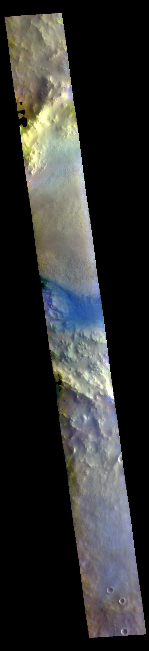
This false color image shows part of the floor of an unnamed crater in Terra Sabaea. The material in part of the crater floor has been eroded by the wind. The small blue dots are sand dunes. In this false color combination basaltic sand is typically a dark blue. The THEMIS VIS camera contains 5 filters. The data from different filters can be combined in multiple ways to create a false color image. These false color images may reveal subtle variations of the surface not easily identified in a single band image. Orbit Number: 64281 Latitude: -24.9701 Longitude: 46.0487 Instrument: VIS Captured: 2016-06-10 17:03 https://photojournal.jpl.nasa.gov/catalog/PIA23599