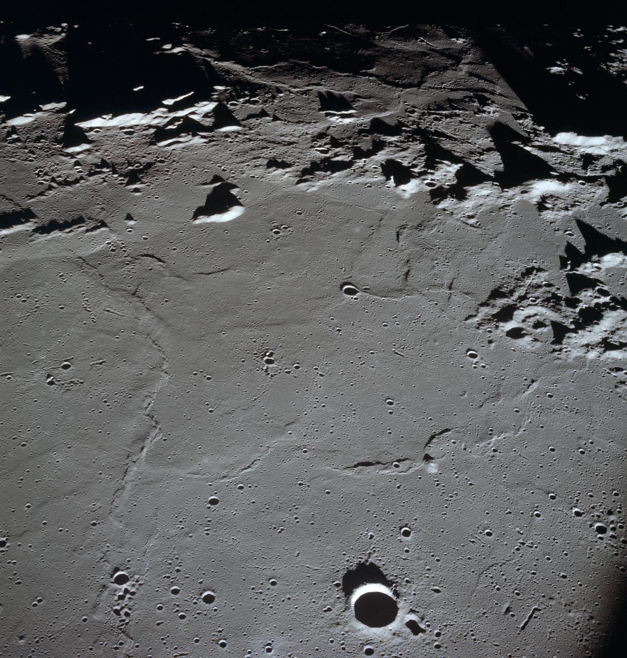
AS10-27-3908 (18-26 May 1969) --- An Apollo 10 photograph of the lunar nearside looking westward across Apollo Landing Site 3 in Central Bay. Bruce, the prominent crater in the lower right corner, is about 3.7 statute miles in diameter. Topographic features on the surface of Central Bay are accentuated by the low sun angle.
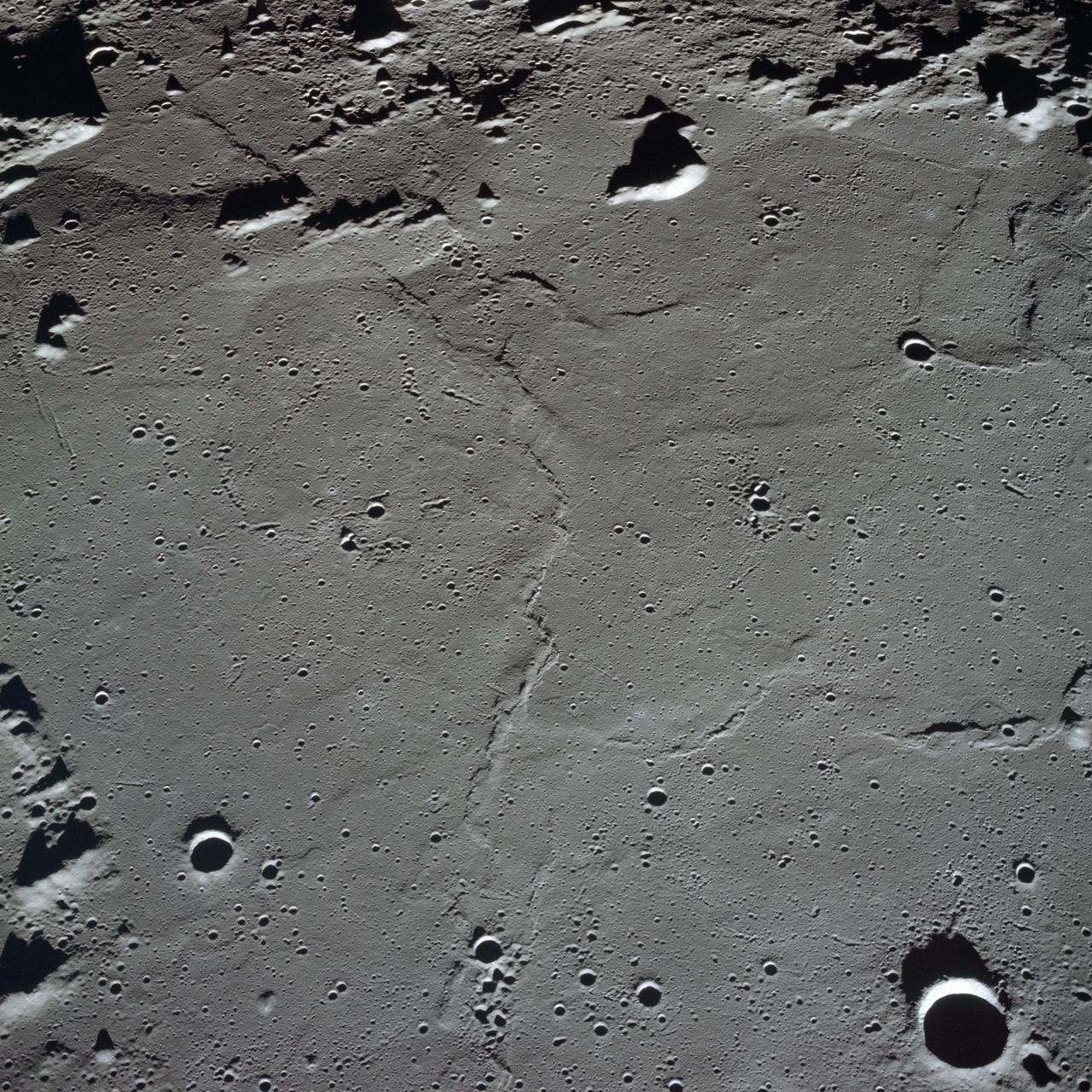
AS10-27-3907 (18-26 May 1969) --- Apollo 10 westward view across Apollo Landing Site 3 in the Central Bay. Apollo Landing Site 3 is in the middle distance at the left margin of the pronounced ridge in the left half of the photograph. Bruce, the prominent crater, near the bottom of the scene, is about 6 kilometers (3.7 statute miles) in diameter. Topographic features on the surface of the Central Bay are accentuated by the low sun angle. Sun angles range from near 6 degrees at the bottom of the photograph to less than one degree at the top.
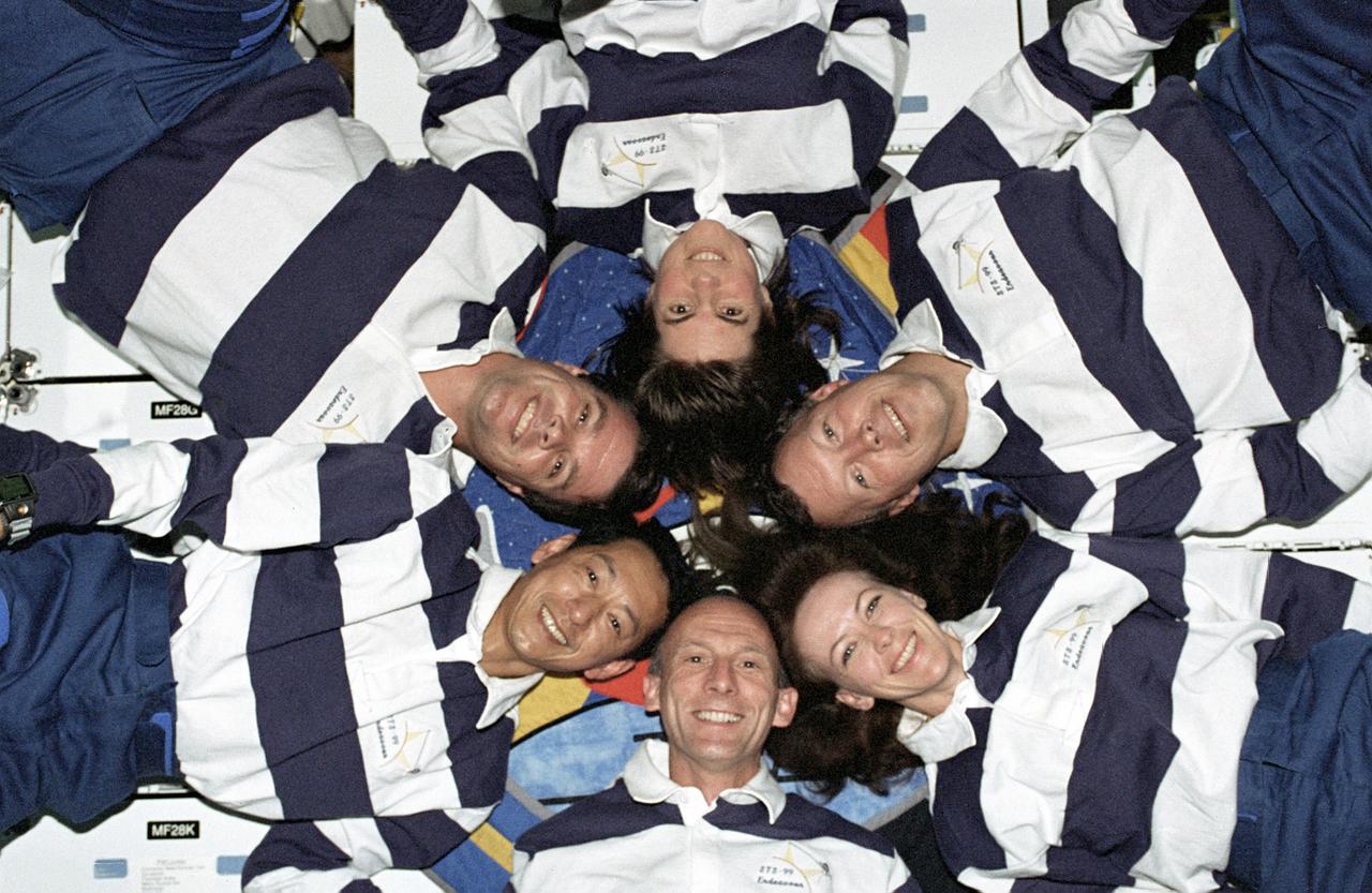
The STS-99 crew pose for a "star-burst" pose in celebration of a successful Shuttle Radar Topographic Mission (SRTM) aboard NASA's Space Shuttle Endeavor. Clockwise, around the circle, from top center are astronauts Janice Voss, Dominic L. Gorie, Janet L. Kavandi, Gerhard Thiele of the European Space Agency, Mamoru Mohri of the Japanese Space Agency, and Kevin Kregel. The STS-99 SRTM mission was the most ambitious Earth mapping mission to date. Orbiting at 233 kilometers (145 miles) above Earth, two radar anternas, one located in the Shuttle bay and the other located on the end of a 60-meter deployable mast, was used during the mission to map Earth's features. The goal was to provide a 3-dimensional topographic map of the world's surface up to the Arctic and Antarctic Circles. The mission completed 222 hours of around the clock radar mapping gathering enough information to fill more than 20,000 CDs.

STS054-72-056 (13-19 Jan 1993) --- A ship wake in the Bay of Bengal is noticeable in this 70mm frame. The sun glint pattern on the ocean reveals many patterns of sea surface roughness related to currents, waves, wind roughening, and biology that and are not apparent when the ocean is viewed away from the Sun's reflection. In this view of the Bay of Bengal, southeast of Madras, India, sun glint highlights convergence zones between ocean currents (bright, linear features), a eddy, and the wake of a ship. In several locations where the ship has passed areas of current shear, the ship wake is distorted, indicating the relative current direction.
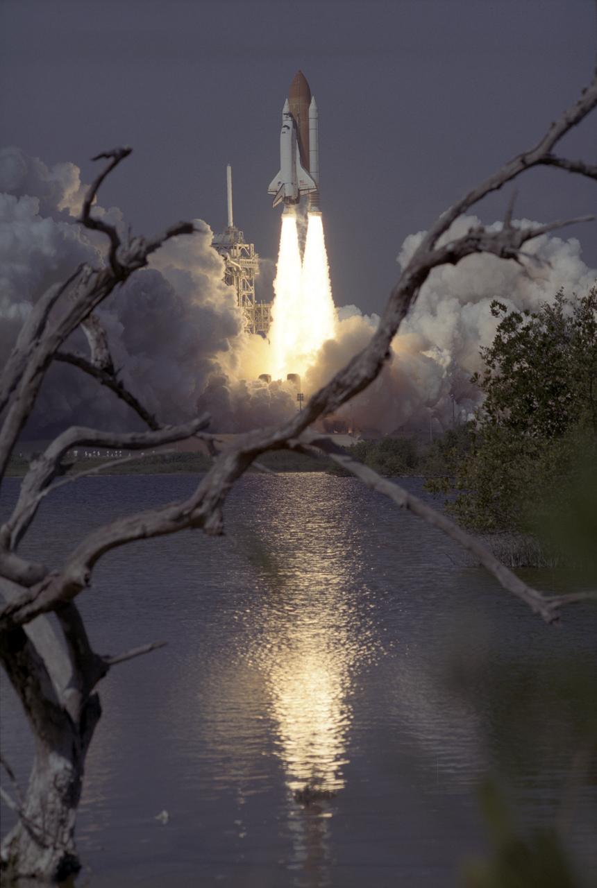
The Space Shuttle Orbiter Endeavour blasts form the launch pad on February 11, 2000 carrying its crew of six for the STS-99 mission, a Shuttle Radar Topography Mission (SRTM), the most ambitious Earth mapping mission to date. Orbiting at 233 kilometers (145 miles) above Earth, two radar anternas, one located in the Shuttle bay and the other located on the end of a 60-meter deployable mast, was used during the mission to map Earth's features. The goal was to provide a 3-dimensional topographic map of the world's surface up to the Arctic and Antarctic Circles. The mission completed 222 hours of around the clock radar mapping gathering enough information to fill more than 20,000 CDs.
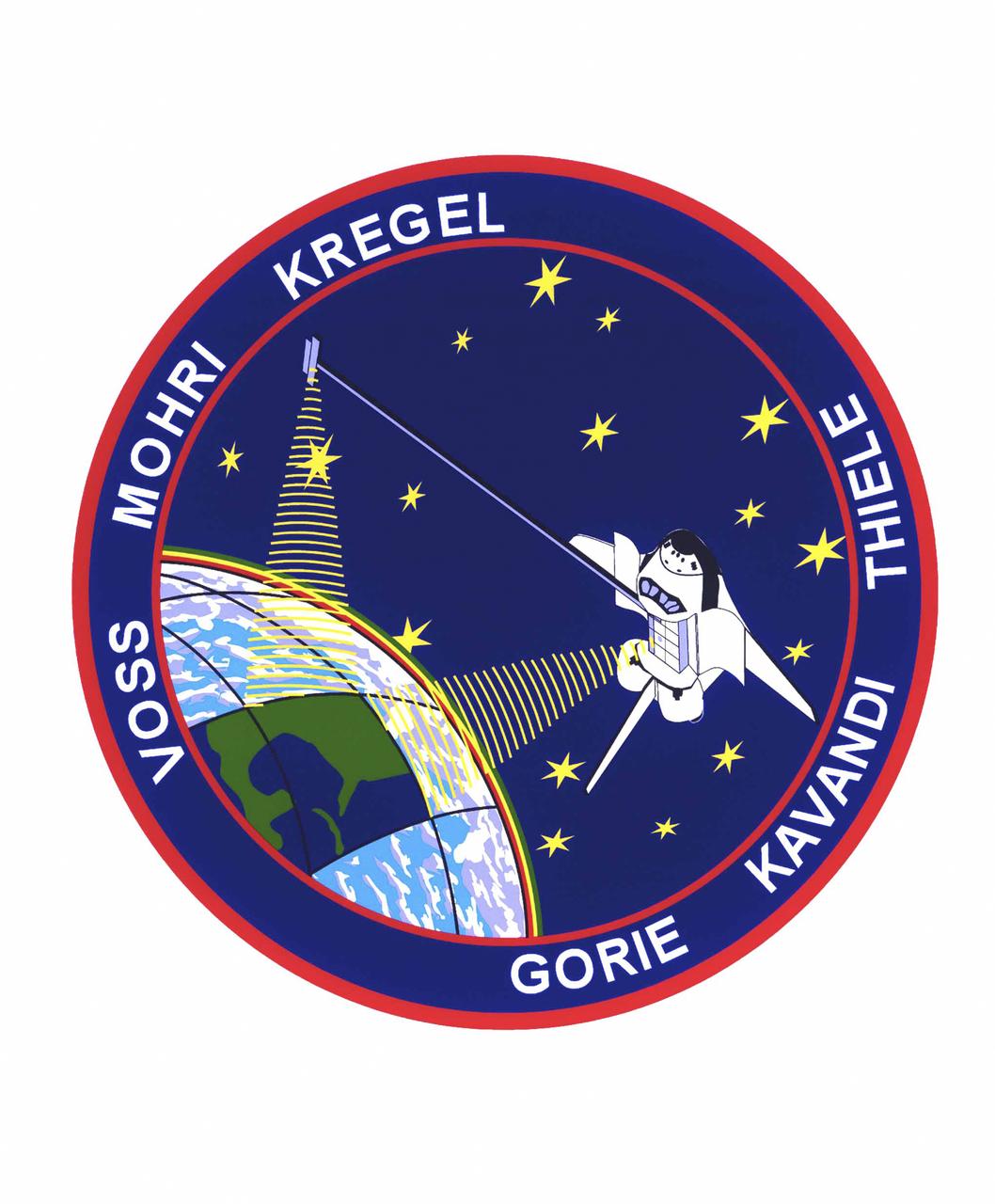
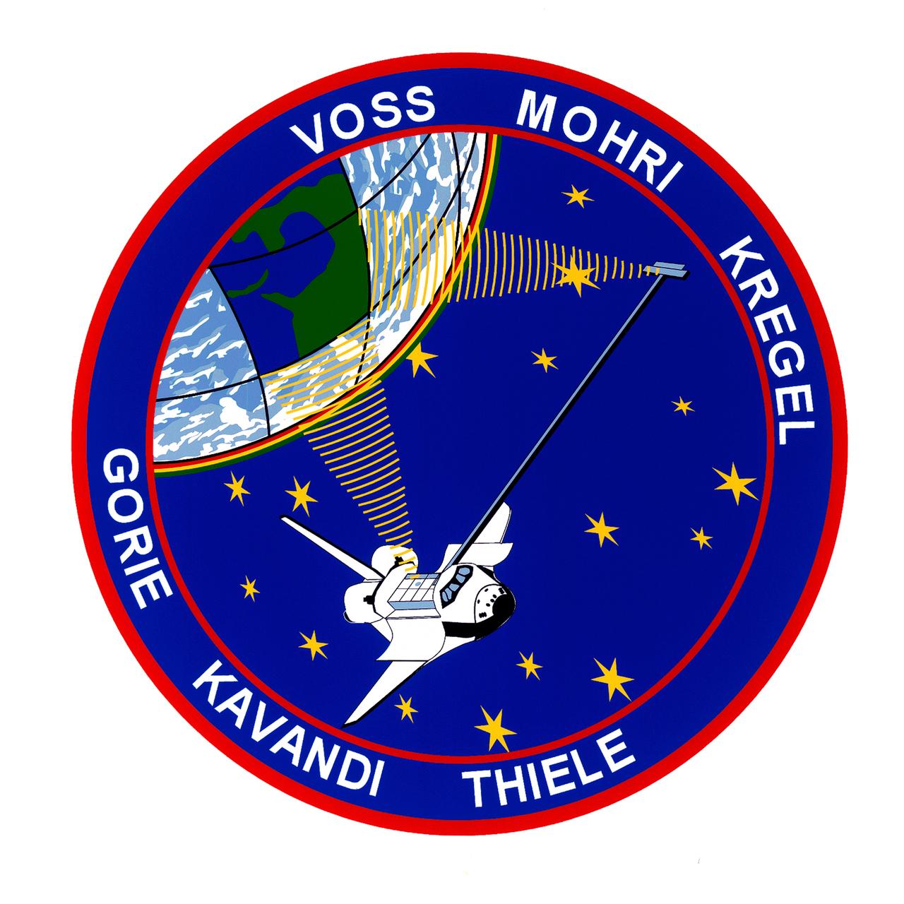
The STS-99 crew members designed the flight insignia for the Shuttle Radar Topography Mission (SRTM), the most ambitious Earth mapping mission to date. Two radar anternas, one located in the Shuttle bay and the other located on the end of a 60-meter deployable mast, was used during the mission to map Earth's features. The goal was to provide a 3-dimensional topographic map of the world's surface up to the Arctic and Antarctic Circles. In the patch, the clear portion of Earth illustrates the radar beams penetrating its cloudy atmosphere and the unique understanding of the home planet that is provided by space travel. The grid on Earth reflects the mapping character of the SRTM mission. The patch depicts the Space Shuttle Endeavour orbiting Earth in a star spangled universe. The rainbow along Earth's horizon resembles an orbital sunrise. The crew deems the bright colors of the rainbow as symbolic of the bright future ahead because of human beings' venturing into space. The crew of six launched aboard the Space Shuttle Endeavor on February 11, 2000 and completed 222 hours of around the clock radar mapping gathering enough information to fill more than 20,000 CDs.
STS099-S-001 (June 1999) --- The STS-99 crew members designed the flight insignia for the Shuttle Radar Topography Mission (SRTM), the most ambitious Earth mapping mission to date. Two radar antennas, one located in the shuttle bay and the other located on the end of a 60-meter deployable mast, will be used during the mission to map Earth?s features. The goal is to provide a three-dimensional topographic map of the world?s surface up to the Arctic and Antarctic Circles. The clear portion of Earth illustrates the radar beams penetrating its cloudy atmosphere and the unique understanding of the home planet that is provided by space travel. The grid on Earth reflects the mapping character of the SRTM mission. The patch depicts the space shuttle Endeavour orbiting Earth in a star spangled universe. The rainbow along Earth?s horizon resembles an orbital sunrise. The crew deems the bright colors of the rainbow as symbolic of the bright future ahead because of human beings? venturing into space. The NASA insignia design for space shuttle flights is reserved for use by the astronauts and for other official use as the NASA Administrator may authorize. Public availability has been approved only in the forms of illustrations by the various news media. When and if there is any change in this policy, which is not anticipated, the change will be publicly announced. Photo credit: NASA
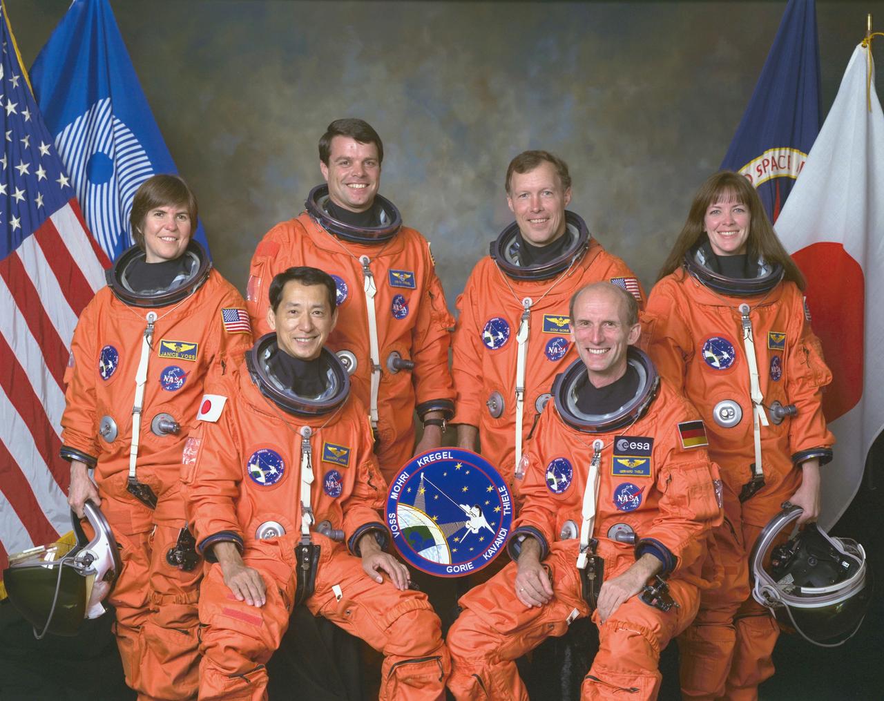
An international crew assigned to STS-99 takes a break from training to pose for the traditional crew portrait at NASA's Johnson Space Center (JSC). In front are international astronauts and mission specialists Mamoru Mohri, representing Japan's Space Agency (NASDA), and Gerhard P. J. Thiele of Germany, representing the European Space Agency (ESA). In back are astronauts Janice Voss, mission specialist; Kevin R. Kregel, mission commander; Dominic L. Gorie, pilot; and Janet L. Kavandi, mission specialist. STS-99 was a Shuttle Radar Topography Mission (SRTM), the most ambitious Earth mapping mission to date. Two radar anternas, one located in the Shuttle bay and the other located on the end of a 60-meter deployable mast, was used during the mission to map Earth's features. The goal was to provide a 3-dimensional topographic map of the world's surface up to the Arctic and Antarctic Circles. Launched aboard the Space Shuttle Endeavor on February 11, 2000, the 11-day mission provided enough information to fill more than 20,000 CDs.