The worst forest fires in nearly two decades are burning out of control on Borneo, creating the thick blanket of smoke in this Oct. 14, 2015 image from NASA Terra spacecraft.
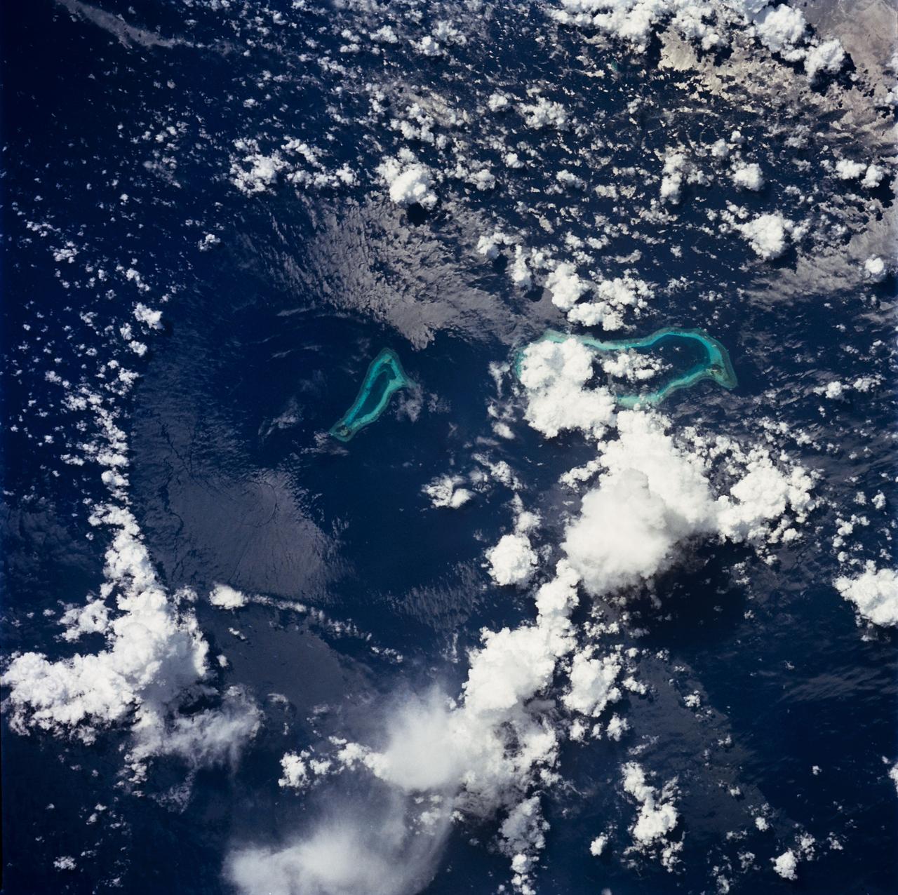
STS049-71-042 (8 May 1992) --- This photograph, taken from the Earth-orbiting Space Shuttle Endeavour, shows a collapsed thunderstorm in the southwestern Pacific Ocean. The clouds were pushed from this circular area of the ocean's surface by relatively cool air that spread downward and outward from a dying thunderstorm. Around the edges of the downdrafted air, new, though smaller, storms are developing. The photo was taken on May 8, 1992, between Borneo and the Philippine island of Mindoro. Two coral atolls can be seen near the center of the photograph. The crew members used a handheld Hasselblad camera, 250-mm lens, color film to expose the image.
A ferry carrying more than 600 passengers sank in the Java Sea between the island of Java and Borneo just before midnight on December 29, 2006, during high winds and rough seas.
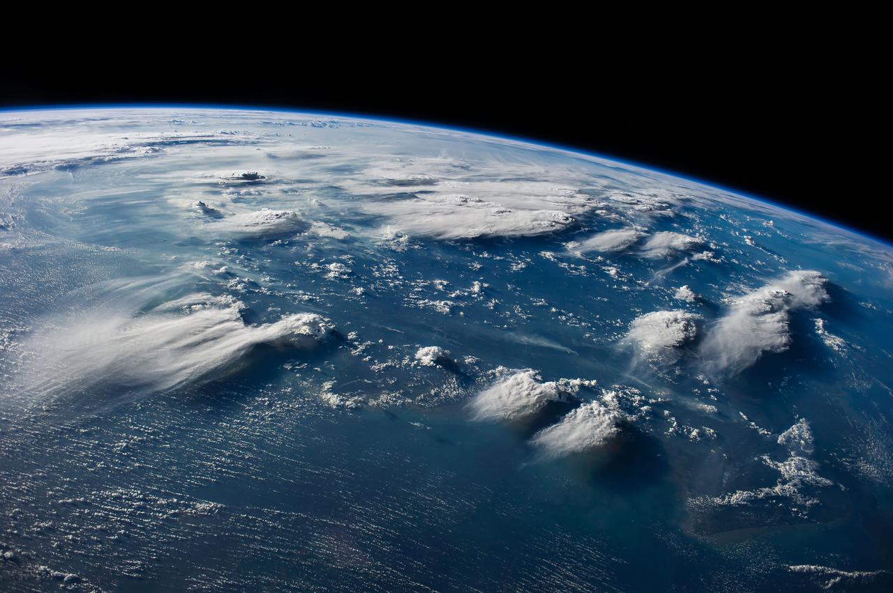
ISS040-E-088891 (5 Aug. 2014) --- Thunderheads near Borneo, Indonesia are featured in this image photographed by an Expedition 40 crew member on the International Space Station. Late afternoon sun casts long shadows from high thunderhead anvils over southern Borneo. Crews aboard the space station have recently concentrated on panoramic views of clouds?taken with lenses similar to the focal length of the human eye. These images reveal the kinds of views crews see -- huge areas of the planet, with a strong three-dimensional sense of what it is like to fly 350 kilometers above Earth. Winds usually blow in different directions at different altitudes. High-altitude winds are clearly sweeping the tops off the many tallest thunderclouds, generating long anvils of diffuse cirrus plumes that trail south. At low levels, ?streets? of white dots -- fair-weather cumulus clouds -- are aligned with west-moving winds (lower left). Small smoke plumes from forest fires onshore are also aligned west. Storm formation near the horizon -- more than 1,000 kilometers away (center) -- is assisted by air currents rising over the central mountains of Borneo.

iss073e0204578 (May 25, 2025) --- Lightning illuminates the clouds (top left) above Southeast Asia in this photograph from the International Space Station as it orbited 259 miles over the South China Sea and off the coast of the Malaysian state of Sarawak on the island of Borneo.
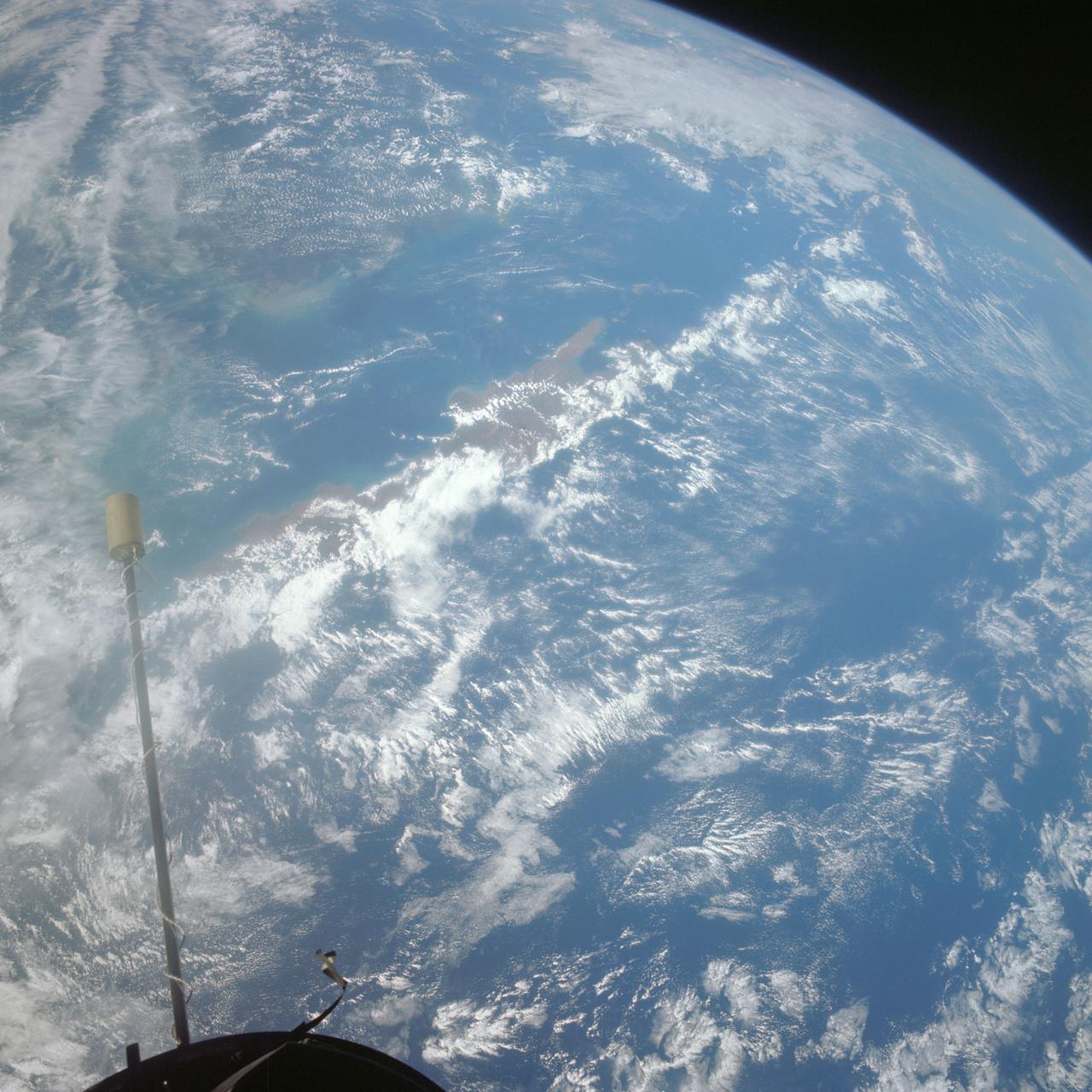
S66-54692 (14 Sept. 1966) --- Indonesian Islands (partial cloud cover): Sumatra, Java, Bali, Borneo, and Sumbawa, as photographed from the Gemini-11 spacecraft during its 26th revolution of Earth, at an altitude of 570 nautical miles. Photo credit: NASA
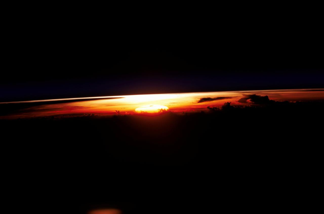
STS109-345-032 (1-12 March 2002) --- One of the astronauts aboard the Space Shuttle Columbia photographed this west-looking view featuring the profile of the atmosphere and the setting sun. The shuttle was located over the Java Sea to the south of Kalimantan (Borneo) in Indonesia when this image was acquired. Visible to the right of the setting sun are cloud tops from some thunderstorms. The sun's reflection (bright spot over the setting sun) can be seen off the upper layers of the earth's atmosphere.
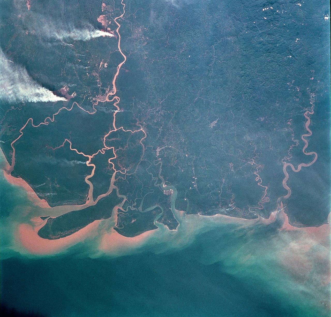
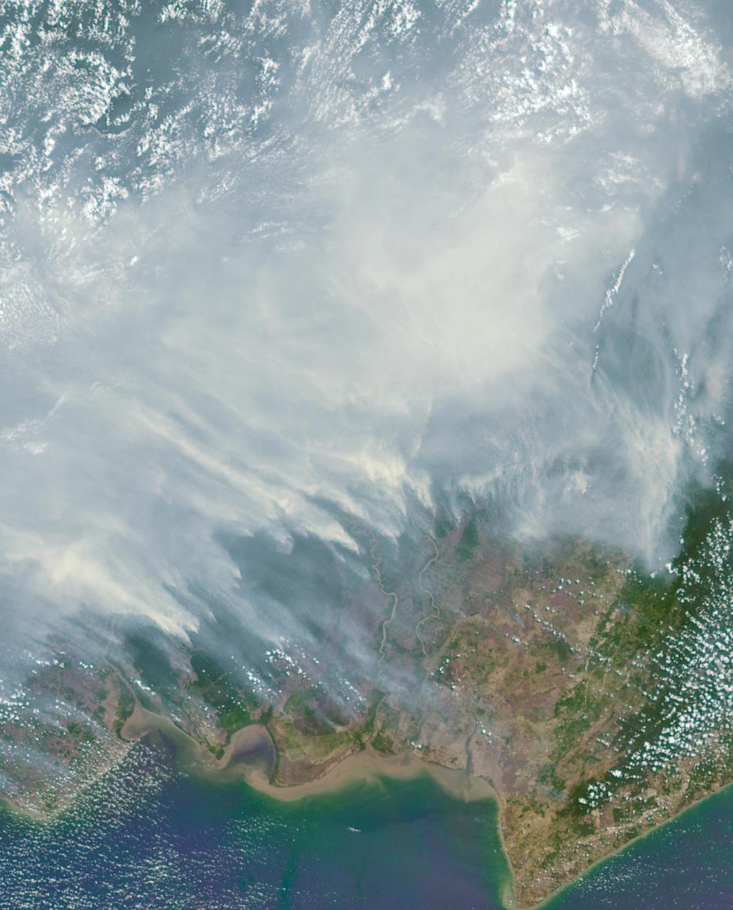
STS093-708-062 (23-27 July 1999) --- The STS-93 astronauts took this picture of the Island of Borneo, which is divided among Indonesia, Malaysia and Brunei. The Rajang River meets the South China Sea in the northwestern portion of the Malaysian state of Sarawak. Smoke from both large and small fires is blowing north by the prevailing summer winds. Notice the contrast of dark colored rainforest with the lighter clearings where the largest fires are burning. According to NASA scientists studying the STS-93 photo collection, the sediment plumes along the coast are mostly shoreline erosional materials caught up in longshore currents. The Saribas River can be seen at the bottom.