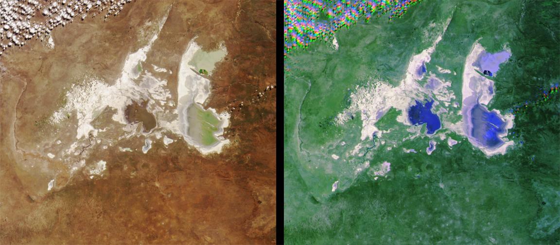
These images from NASA Terra satellite images of the Ntwetwe and Sua Pans in northeastern Botswana were acquired on August 18, 2000 Terra orbit 3553.
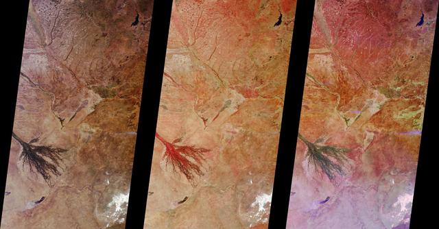
These images from NASA Terra satellite images of Zambia and Botswana, Africa were acquired on August 25, 2000 during Terra orbit 3655.
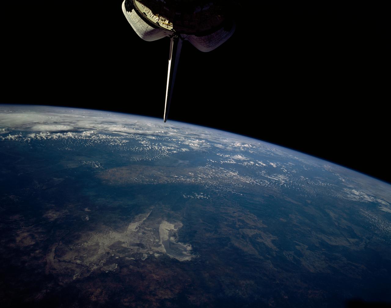
STS054-151-015 (13-19 Jan 1993) --- The Makgadikgadi Salt Pan is one of the largest features in Botswana visible from space. Any water that spills out of the Okavango Swamplands flows down to the Makgadikgadi where it evaporates. An ancient beach line can be seen as a smooth line around the west (left) side of the Pan. Orapa diamond mine can be detected due south of the pan as a small rectangle. The large geological feature known as the Great Dike of Zimbabwe can be seen far right. This large panorama shows clouds in southern Angola, Zambia and Zimbabwe in the distance.
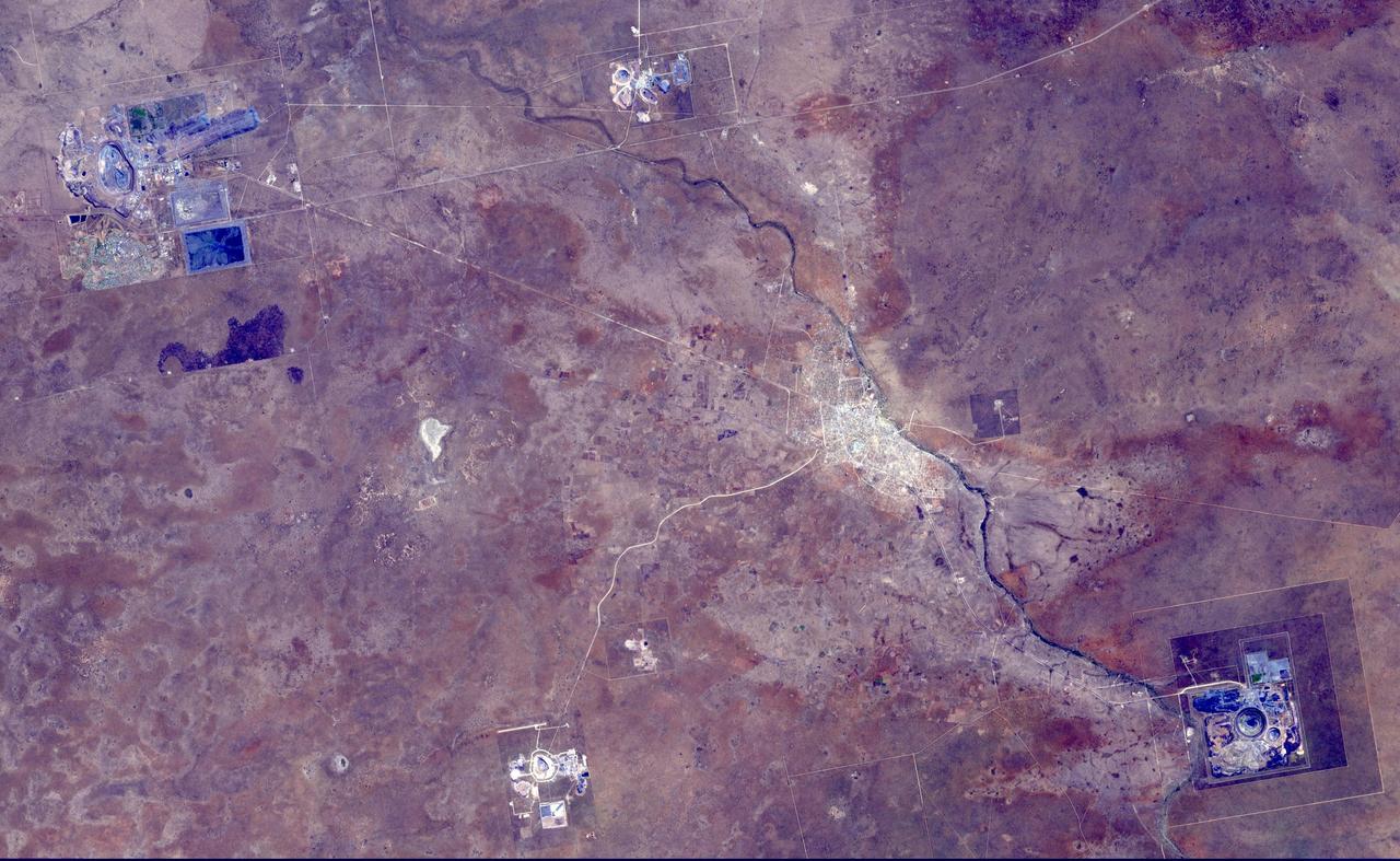
This image from NASA Terra spacecraft shows the Orapa diamond mine, the world largest diamond mine by area. The mine is located in Botswana. It is the oldest of four mines operated by the same company, having begun operations in 1971. Orapa is an open pit style of mine, located on two kimberlite pipes. Currently, the Orapa mine annually produces approximately 11 million carats (2200 kg) of diamonds. The Letlhakane diamond mine is also an open pit construction. In 2003, the Letlhakane mine produced 1.06 million carats of diamonds. The Damtshaa diamond mine is the newest of four mines, located on top of four distinct kimberlite pipes of varying ore grade. The mine is forecast to produce about 5 million carats of diamond over the projected 31 year life of the mine. The image was acquired October 5, 2014, covers an area of 28 by 45 km, and is located at 21.3 degrees south, 25.4 degrees east. http://photojournal.jpl.nasa.gov/catalog/PIA20104
In this panoramic view of the Okavango Swamp, Botswana, (19.0S, 22.0E), the Okavango River, seen in sunglint, flows into a topographic trough to form an inland delta. Water, trapped in the meandering delta distributaries is evaporated or transpired by vegetation. In Angola to the north, the many fires of the seasonal burning of savannah vegetation for land clearing, in preparation for agriculture, has filled the atmosphere with haze and smoke.
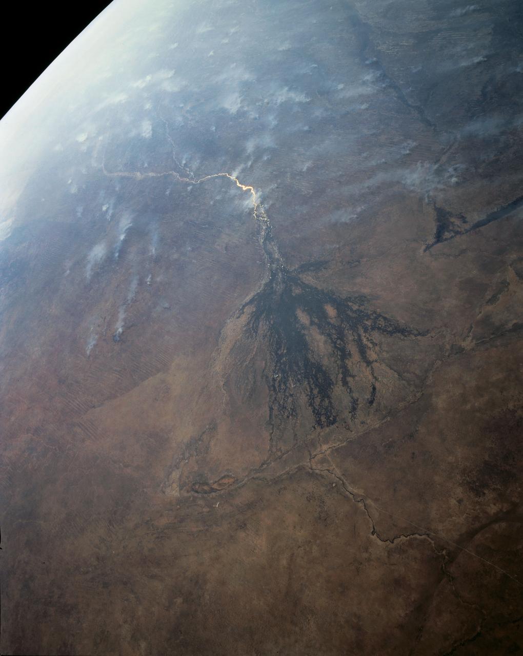
STS066-122-091 (3-14 Nov. 1994) --- This November 1994 view looking south-southeast shows clouds over the Okavango Delta area of northern Botswana. The Okavango is one of the wilder, less spoiled regions of Africa. The area still supports great herds of wild animals such as elephant, zebra and the cape buffalo. Despite conservation efforts from the stable government of Botswana, delta habitats are pressured. The Okavango River (lower left of view) brings water from the high, wet plateaus of Angola into the Kalahari Desert, and enormous inland basin. As a result of a series of small faults (upper center of the view) related to the African Rift System, the river is dammed up in the form of swampy inland delta. Here, water is consumed by evaporation, infiltration, and the swamp forests. Late summer floods take six months to slowly penetrate the 160 kilometer (95 miles) to the other end of the Delta. The visual patterns of the area are strongly linear: straight sand dunes occur in many places and can be seen across the bottom portion of the photograph. Numerous brush-fire scars produce a complex, straight-edged pattern over much of the lower portion of this view. Lake Ngami (upper right of view) was once permanently full as late as the middle 1800's. Changes in the climate of the area over the last 100 years has changed the size and shape of the inland delta.
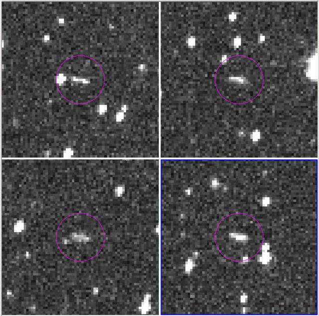
These are the discovery observations of asteroid 2018 LA from the Catalina Sky Survey, taken June 2, 2018. About eight hours after these images were taken, the asteroid entered Earth's atmosphere (about 9:44 a.m. PDT, 12:44 p.m. EDT, 16:44 UTC, 6:44 p.m. local Botswana time), and disintegrated in the upper atmosphere near Botswana, Africa. https://photojournal.jpl.nasa.gov/catalog/PIA22468
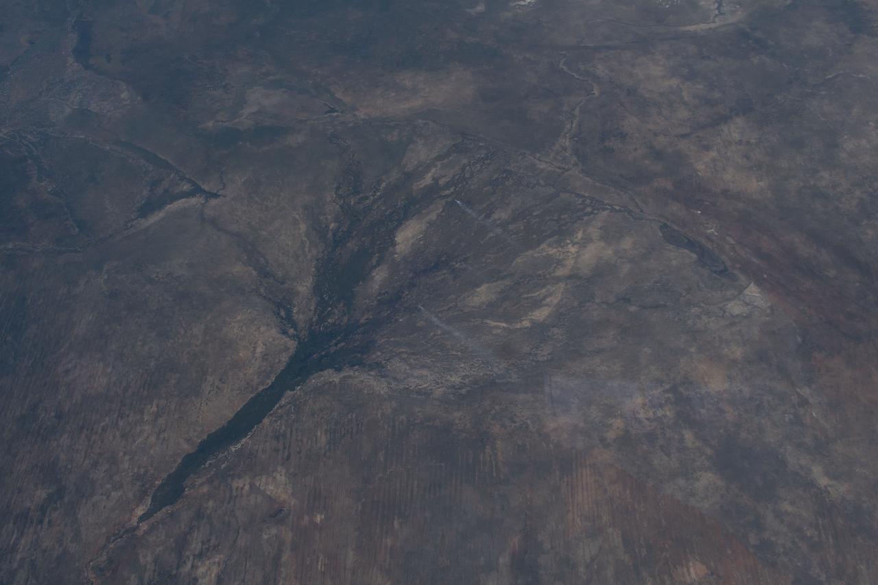
iss069e014332 (May 23, 2023) --- The Okavango Delta in the nation of Botswana is pictured from the International Space Station as it orbited 260 miles above the African continent.
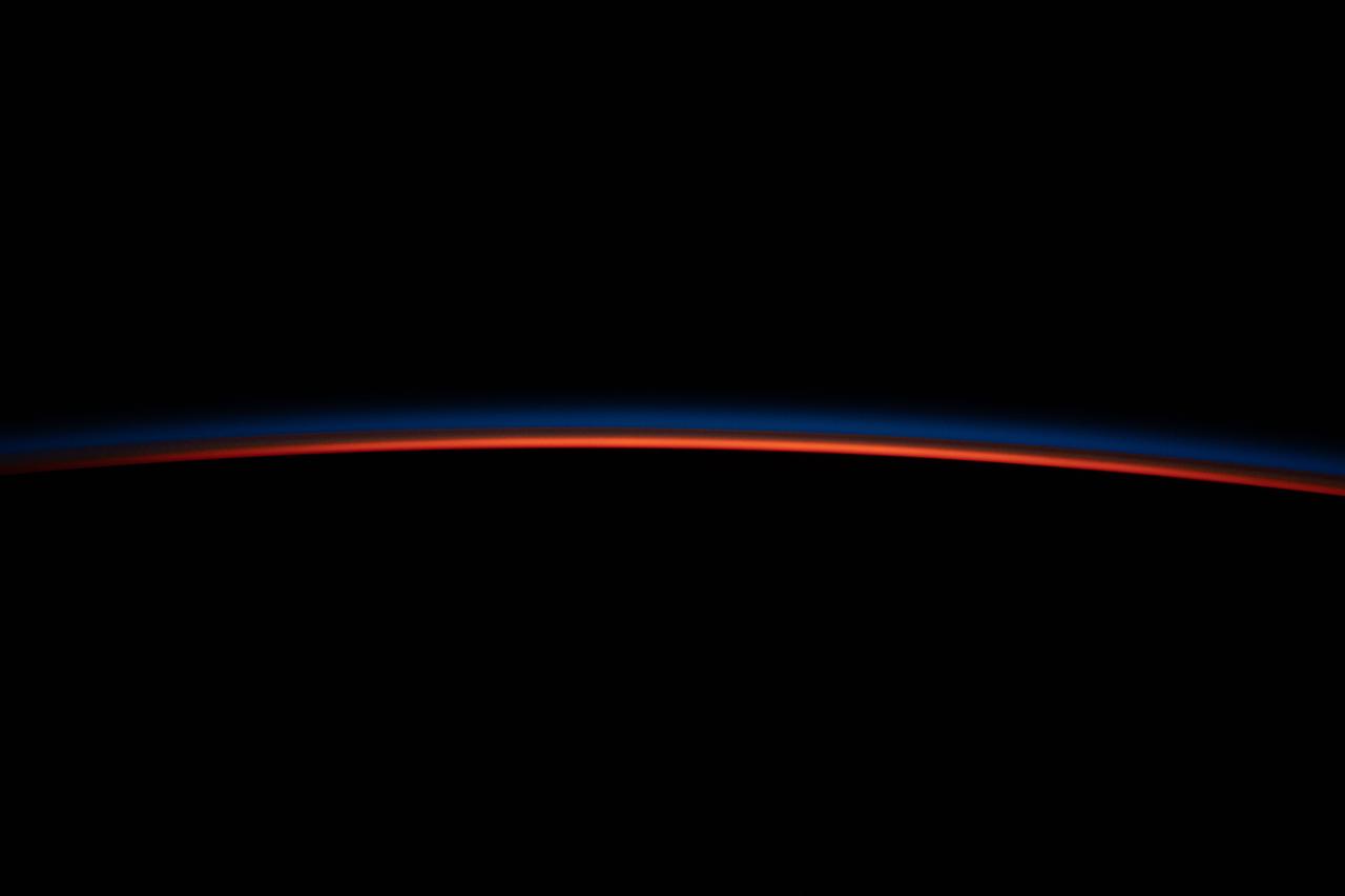
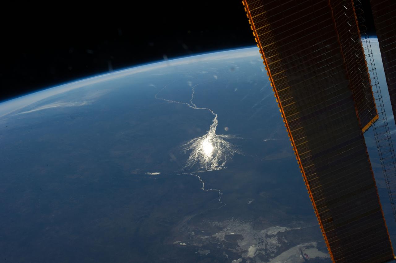
iss067e036283 (May 7, 2022) --- The last rays of an orbital sunset illuminate Earth's horizon in this photograph from the International Space Station as it orbited 263 miles above the African nation Botswana.
iss059e061058 (May 11, 2019) --- The Okavango Delta, a lush animal habitat during the seasonal floods, in Botswana is pictured from the International Space Station as the orbital complex flew 258 miles above the southern portion of the African continent.
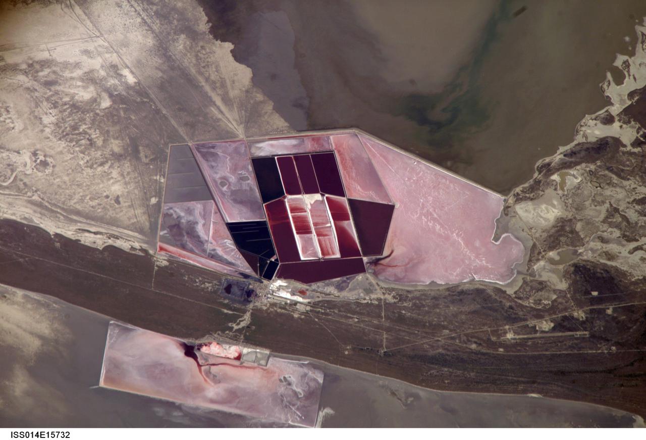
ISS014-E-15732 (1 March 2007) --- Salt ponds of Botswana are featured in this image photographed by an Expedition 14 crewmember on the International Space Station. This recent, detailed view shows the salt ponds of one of Africa's major producers of soda ash (sodium carbonate) and salt. Soda ash is used for glass making, in metallurgy, in the detergent industry, and in chemical manufacture. The image shows a small part of the great salt flats of central Botswana known as the Makgadikgadi Salt Pans. The soda ash and salt are both mainly exported (since 1989) to most countries in southern and central Africa. Brines from just beneath the pan floor are evaporated to produce the soda ash and salt -- a process for which the semiarid climate of Botswana is ideal. Red salt-loving algae in the ponds indicate that the salinity of the evaporating brines is medium to high. The salt pans of Botswana--a prominent visual photo target of interest for astronauts aboard the station--lie at the low point of a vast shallow continental basin. Rivers draining from as far away as central Angola - more than 1,000 kilometers away - supply water to the pans. According to scientists, during several wet climatic phases in the recent geological past the pans were permanently filled with water, for thousands of years, only to dry out when climates fluctuated to drier conditions. During dry phases water only reaches the pans underground. These are the brines that support the ash and salt industry. During wet phases when open water exists, beach ridges are constructed by wave action. One of these crosses the lower part of the view.
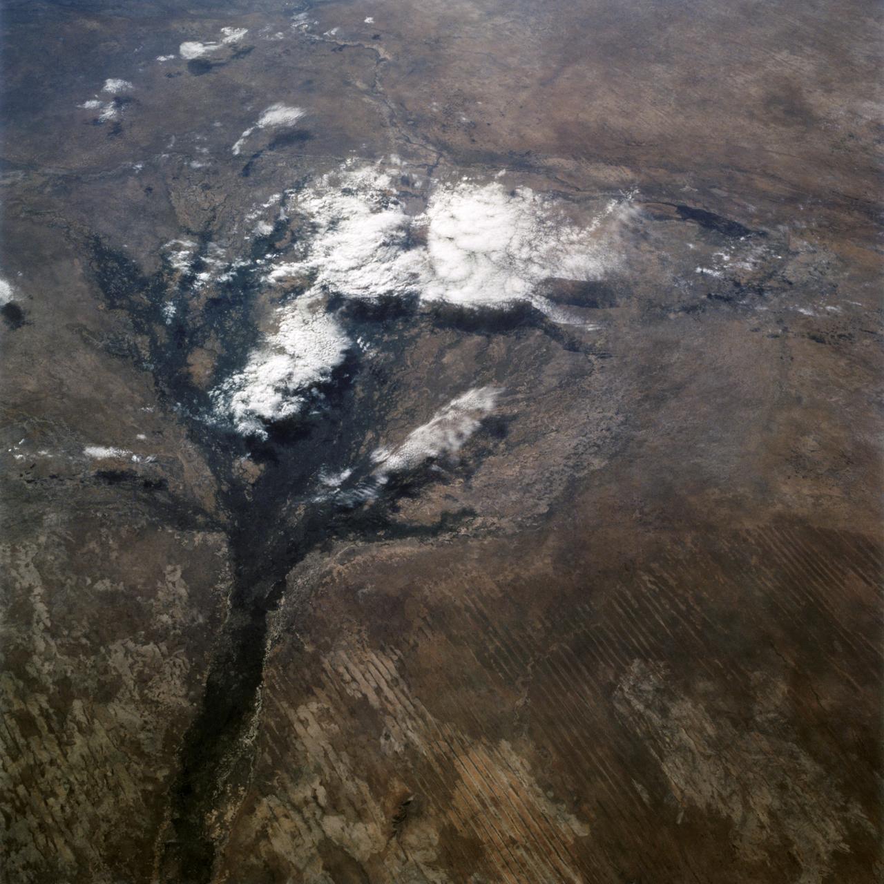
61A-43-029 (2 Nov 1985) --- This view, photographed from the Earth orbiting Challenger, features a vertical view of the Okavango Swamp in Botswana. Center coordinates are 19.0 degrees south latitude and 22.5 degrees east longitude. The Challenger was flying at an altitude of 177 nautical miles when the photo was taken with a 70mm handheld Hasselblad camera.
iss073e0604445 (Aug. 30, 2025) --- The Okavango Delta, part of the Moremi Game Reserve in Botswana, is formed by the Okavango River flowing in from Angola. Instead of reaching the sea, the river empties into the Kalahari Desert, creating a lush, seasonally flooded wetland that supports one of the most biodiverse ecosystems in Africa. This photograph was taken from the International Space Station as it orbited 261 miles above the African continent.
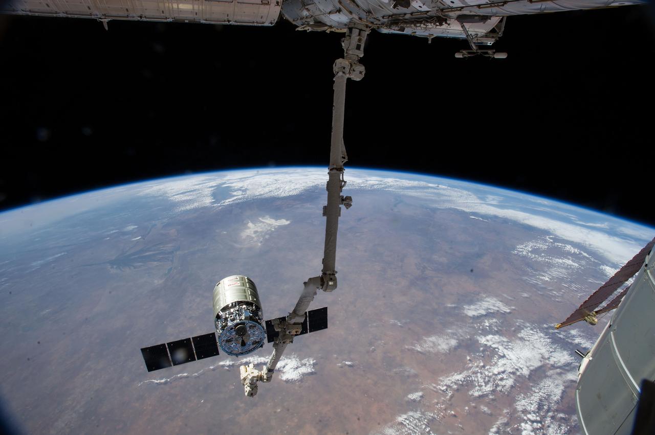
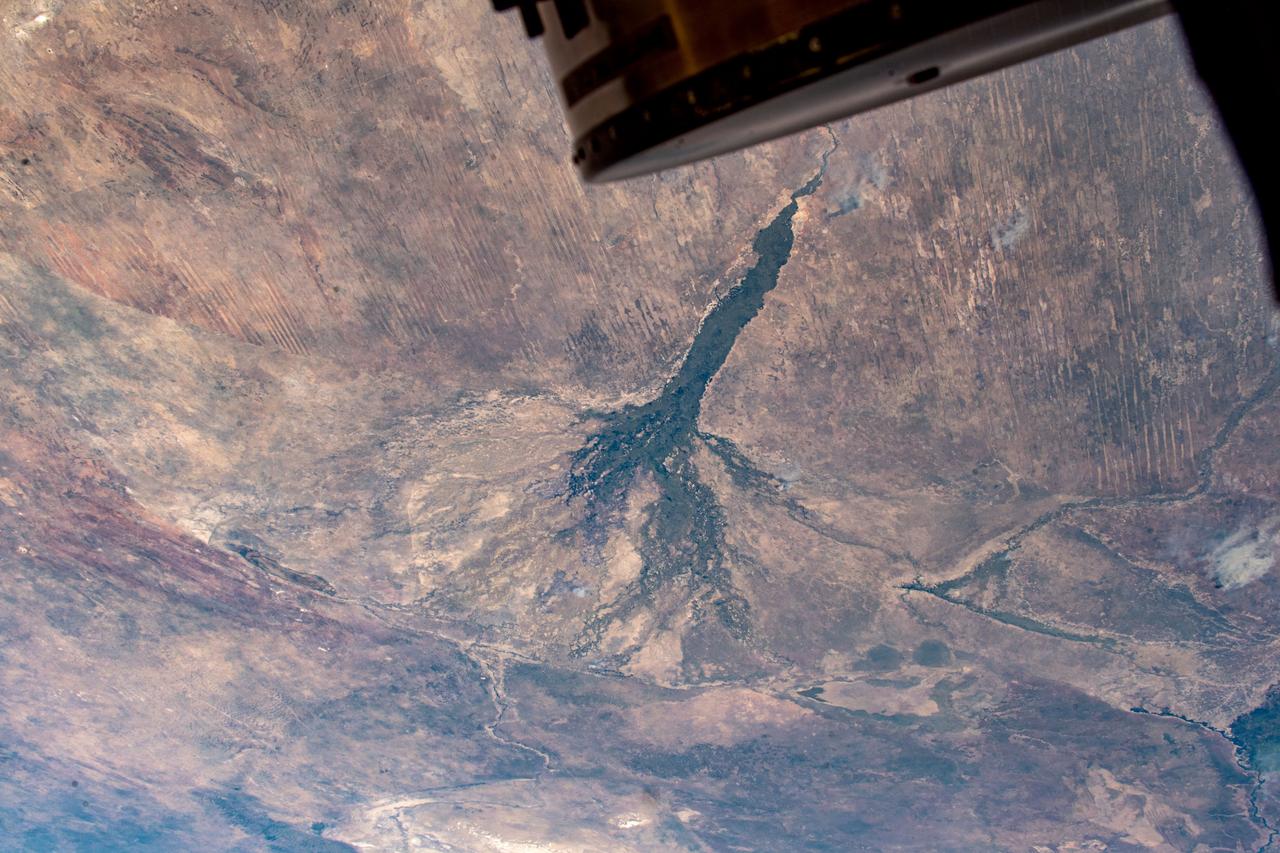
ISS040-E-095229 (15 Aug. 2014) --- The International Space Station's Canadarm2 prepares to release the Orbital Sciences Corporation's commercial cargo craft after a month visiting the orbital outpost. European Space Agency astronaut Alexander Gerst and NASA astronaut Reid Wiseman, both Expedition 40 flight engineers, were at the controls of the robotics workstation in the Cupola removing Cygnus from the Harmony node then safely releasing it at 6:40 a.m. (EDT) Aug. 15, 2014. Much of lower the continent of Africa provides the panoramic background for the scene with Botswana's Okavango Delta being the most conspicuous feature at left center.
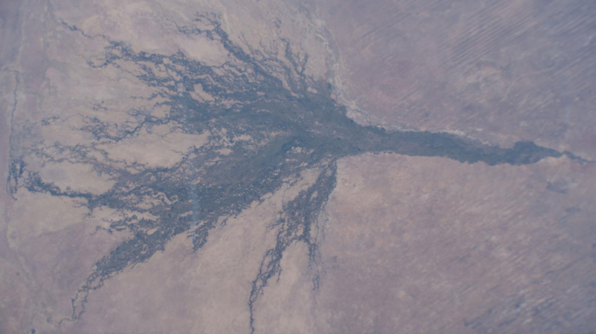
ISS028-E-006830 (2 June 2011) --- Okavango Swamp in Botswana is featured in this image photographed by an Expedition 28 crew member on the International Space Station. This short focal-length photograph shows the entire Okavango ?delta,? a swampland known in Southern Africa as the ?Jewel of the Kalahari Desert?. This enormous pristine wetland of forest, wildlife, and freshwater almost miraculously appears in a desert where surface water is typically non-existent. The water comes from the Okavango River which rises in the high-rainfall zone of southern Angola, hundreds of kilometers to the northwest. The dark green forested floodplain is approximately 10 kilometers wide where it enters the view (left). The Okavango then enters a rift basin which allows the river to spread out, forming the wetland. The width of the rift determines the dimensions of the delta?150 kilometers from apex to the linear downstream margin (right). The apex fault is more difficult to discern, but two fault lines actually define the downstream margin; the fault traces are indicated by linear stream channels and vegetation patterns oriented at nearly right angles to the southeast-trending distributary channels at center. The distributary channels carry sediment from the Okavango River that is deposited within the rift basin. Over time, a fan-shaped morphology of the deposits has developed, leading to characterization of the wetland as the Okavango ?delta?. The drying trend from higher rainfall in the north (left) to less rainfall in central Botswana (right) is shown by the change from the greens of denser savanna vegetation to browns of an open ?thornscrub? savanna. More subtle distinctions appear: the distributary arms of the delta include tall, permanent riverine and seasonal forest (dark green), with grasses and other savanna vegetation (light green) on floodplains?which appear well watered in this image. Linear dunes, emplaced by constant winds from the east during drier climates, appear as straight lines at left. The dunes are 10 meters high and their sands hold enough moisture for some trees to grow on them. Counter-intuitively, the low ?streets? between the dunes are treeless because they are dominated by dense dry white soils known as calcretes.
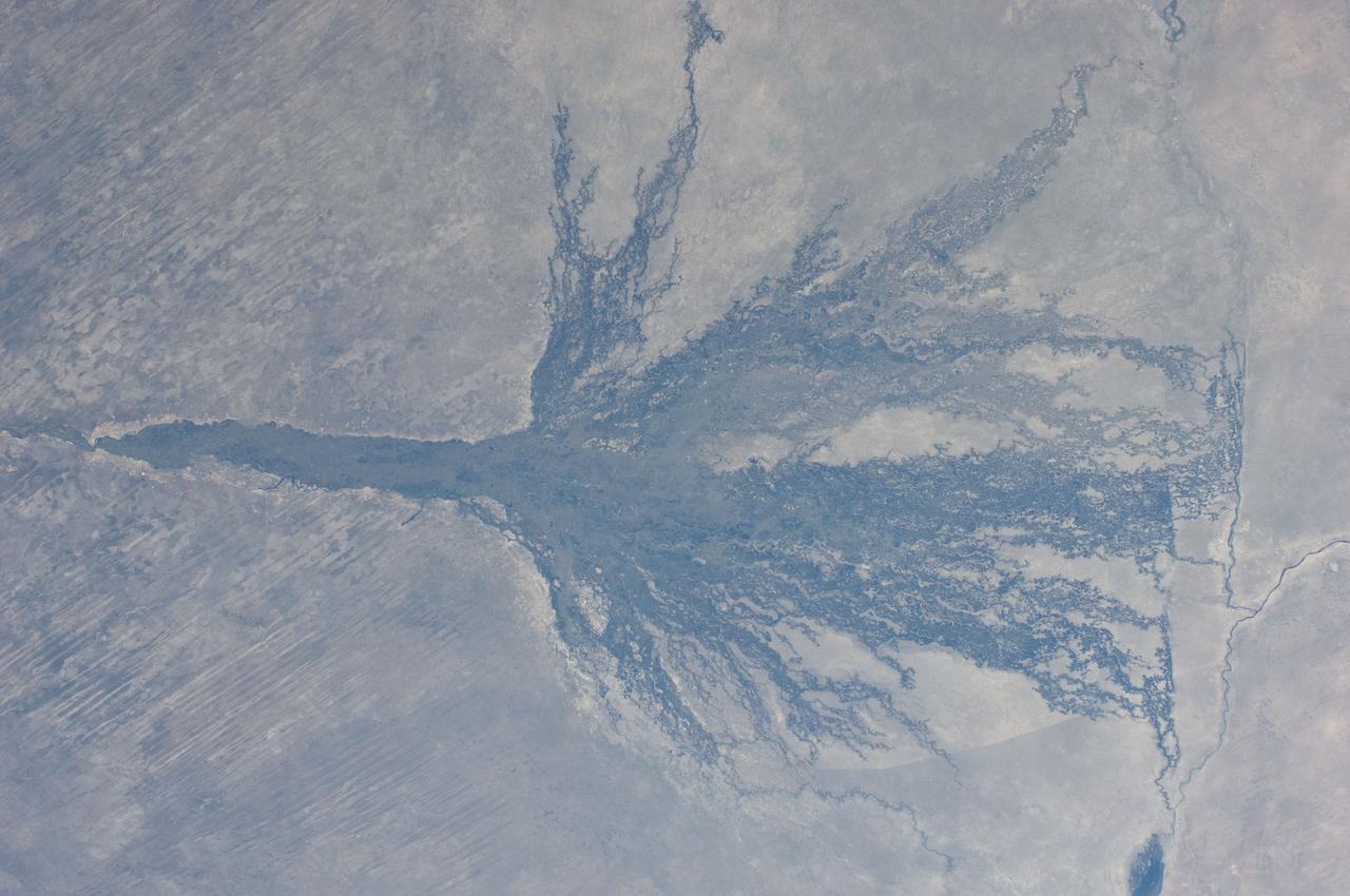
ISS040-E-008209 (6 June 2014) --- Okavango inland delta in northern Botswana is featured in this image photographed by an Expedition 40 crew member on the International Space Station. The great Okavango delta in the Kalahari Desert is illuminated in the sun?s reflection point in this panorama. Using this sun glint technique, crew members can image fine detail of water bodies. Here the bright line of the Okavango River shows the annual summer flood advancing from the well-watered Angolan Highlands (upper margin) to the delta. Then the flood water slowly seeps across the 150 kilometer-long delta, supplying forests and wetlands, finally reaching the fault-bounded lower margin of the delta in the middle of winter. Most of the water of this large river is used up by the forests, or evaporates in the dry air. Only two percent of the river?s water actually exits the delta. The wetland supports high biodiversity in the middle of the otherwise semiarid Kalahari Desert, and is now one of the most famous tourist sites in Africa. This view also shows the small quantity of water in the Boteti River. Okavango water only reaches the dry lake floors (lower right) in the wettest years. Part of one of the station?s solar arrays is visible at right.