
This turboprop-powered Beech T-34C is flown by NASA's Dryden Flight Research Center for mission support and pilot proficiency.

A Beech T-34C mission support aircraft flown by NASA Dryden Flight Research Center shows off its classic lines as it soars over the desert near Edwards Air Force Base.

A Beech T-34C flown by NASA Dryden Flight Research Center for mission support descends over the Southern California desert near Edwards Air Force Base.
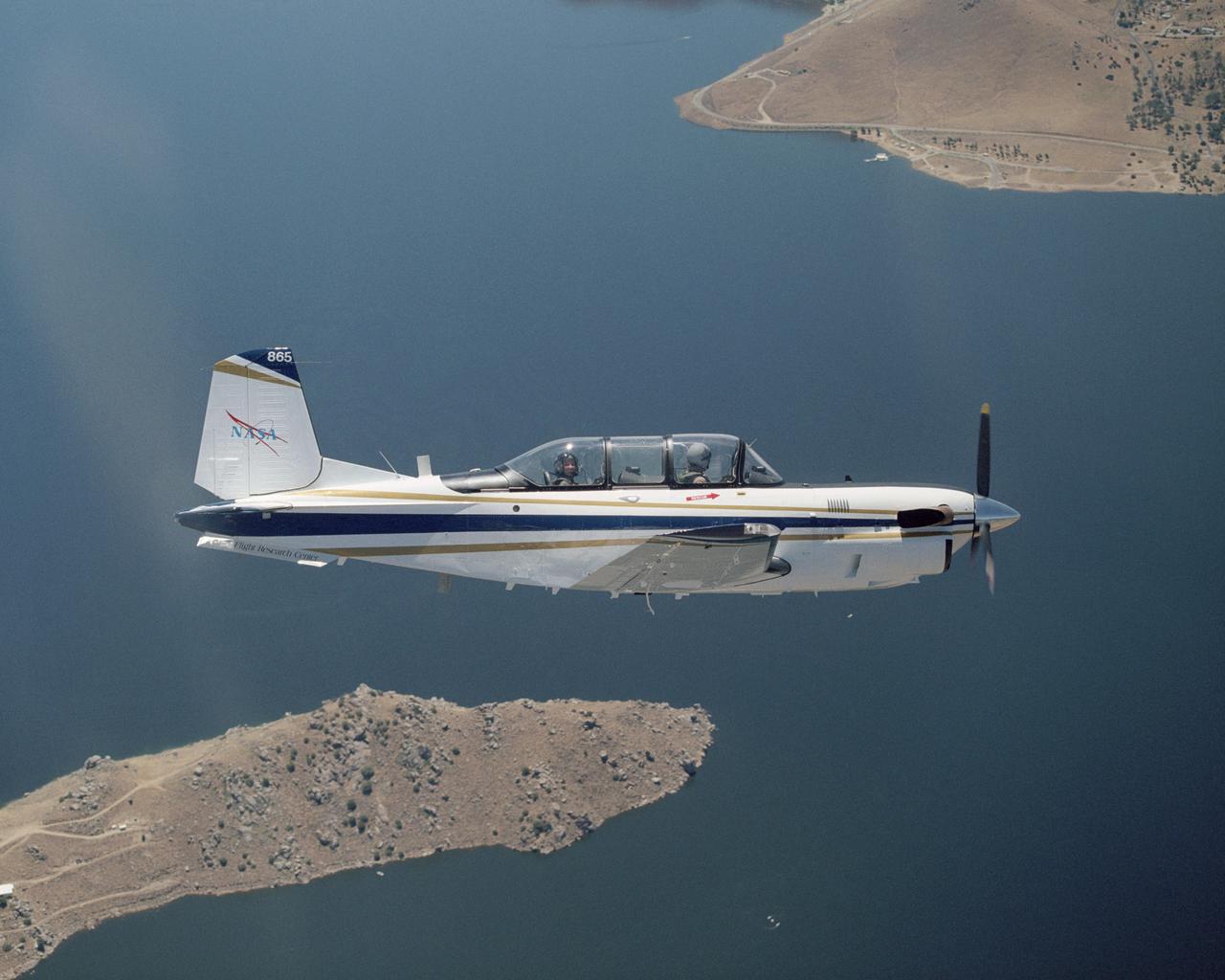
A Beech T-34C aircraft used by NASA Dryden Flight Research Center for mission support banks over Lake Isabella in Kern County during a recent flight.

A Beech T-34C aircraft used by NASA Dryden Flight Research Center for mission support banks over Lake Isabella in Kern County during a recent flight.

A NASA T-34C aircraft, used for safety chase, is shown flying above the Dryden Flight Research Center, Edwards, California in March 1997. The aircraft was previously used at the Lewis Research Center in propulsion experiments involving turboprop engines, and was used as a chase aircraft at Dryden for smaller and slower research projects. Chase aircraft accompany research flights for photography and video purposes, and also as support for safety and research. At Dryden, the T-34 is used mainly for smaller remotely piloted vehicles which fly slower than NASA's F-18's, used for larger scale projects. This aircraft was returned to the U.S. Navy in May of 2002. The T-34C, built by Beech, carries a crew of 2 and is nicknamed the Mentor.

A NASA T-34C aircraft, used for safety chase, is shown flying above the Dryden Flight Research Center, Edwards, California in March 1997. The aircraft was previously used at the Lewis Research Center in propulsion experiments involving turboprop engines, and was used as a chase aircraft at Dryden for smaller and slower research projects. Chase aircraft accompany research flights for photography and video purposes, and also as support for safety and research. At Dryden, the T-34 is used mainly for smaller remotely piloted vehicles which fly slower than NASA's F-18's, used for larger scale projects. This aircraft was returned to the U.S. Navy in May of 2002. The T-34C, built by Beech, carries a crew of 2 and is nicknamed the Mentor.

The back seat instrument panel on the NASA T-34C chase plane. In its role as a military trainer, the instructor pilot would ride in the back seat, while the student would be in the front seat. As a chase plane, the back seat would be occupied by a photographer. The aircraft was previously used at the Lewis Research Center in propulsion experiments involving turboprop engines, and was used as a chase aircraft at Dryden for smaller and slower research projects. Chase aircraft accompany research flights for photography and video purposes, and also as support for safety and research. At Dryden, the T-34 is used mainly for smaller remotely piloted vehicles which fly slower than NASA's F-18's, used for larger scale projects. This aircraft was returned to the U.S. Navy in May of 2002. The T-34C, built by Beech, carries a crew of 2 and is nicknamed the Mentor.
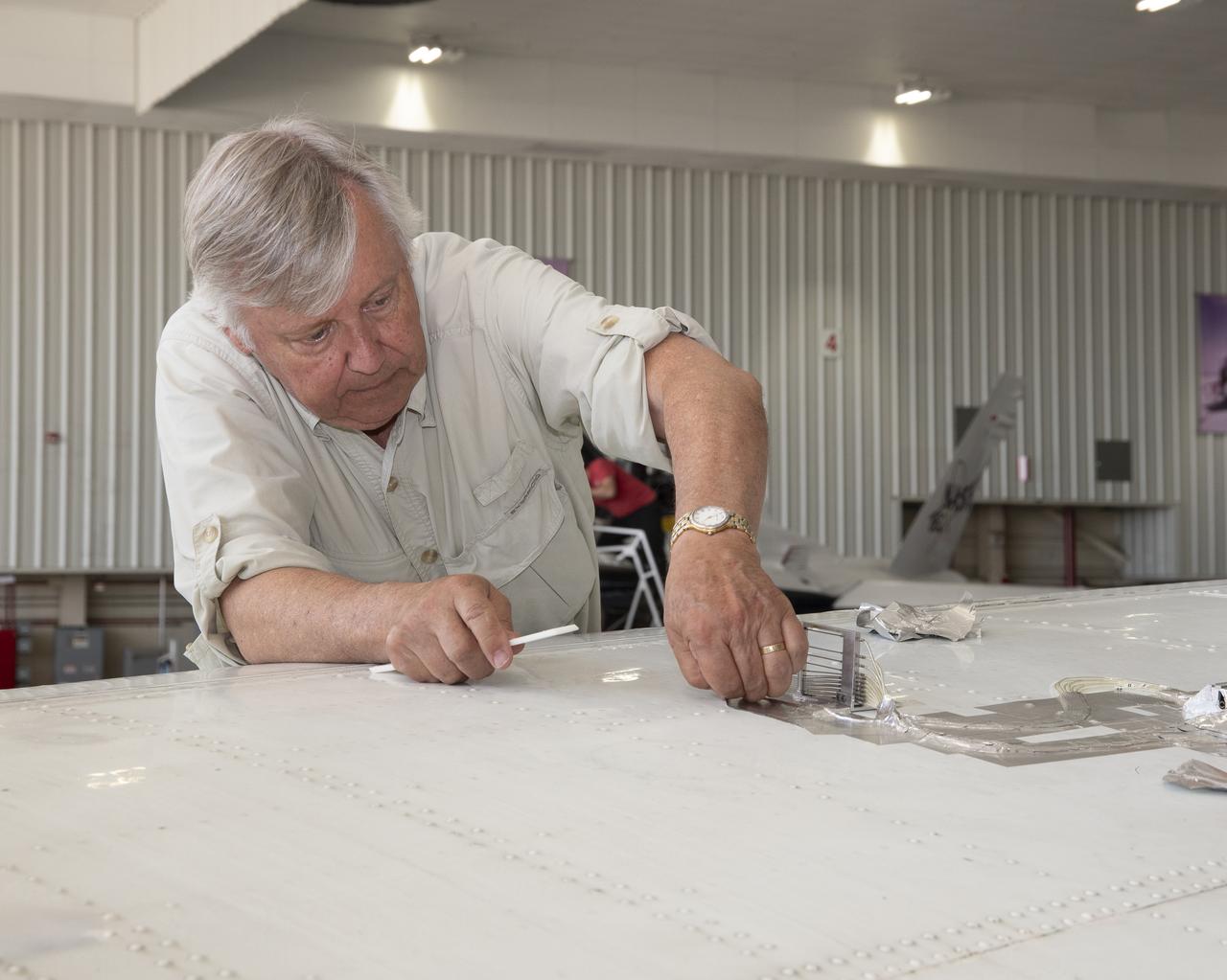
Cal Poly San Luis Obispo Professor Russ Westphal works on the Boundary Layer Data System (BLDS) attached to the wing of a Beechcraft Beech 200 Super King Air aircraft. The BLDS was attached to the aircraft with removable adhesives for a flight test at NASA’s Armstrong Flight Research Center.
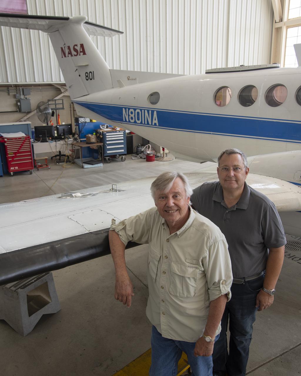
Cal Poly San Luis Obispo professors Russ Westphal, left, and Aaron Drake posed next to NASA Armstrong Flight Research Center’s Beechcraft Beech 200 Super King Air aircraft. On the King Air’s wing is the Boundary Layer Data System (BLDS), a sensor developed by Cal Poly and Northrop Grumman. BLDS was flown at NASA Armstrong as a step towards creating a process allowing universities, small businesses and other interested parties to quickly test flight technologies.
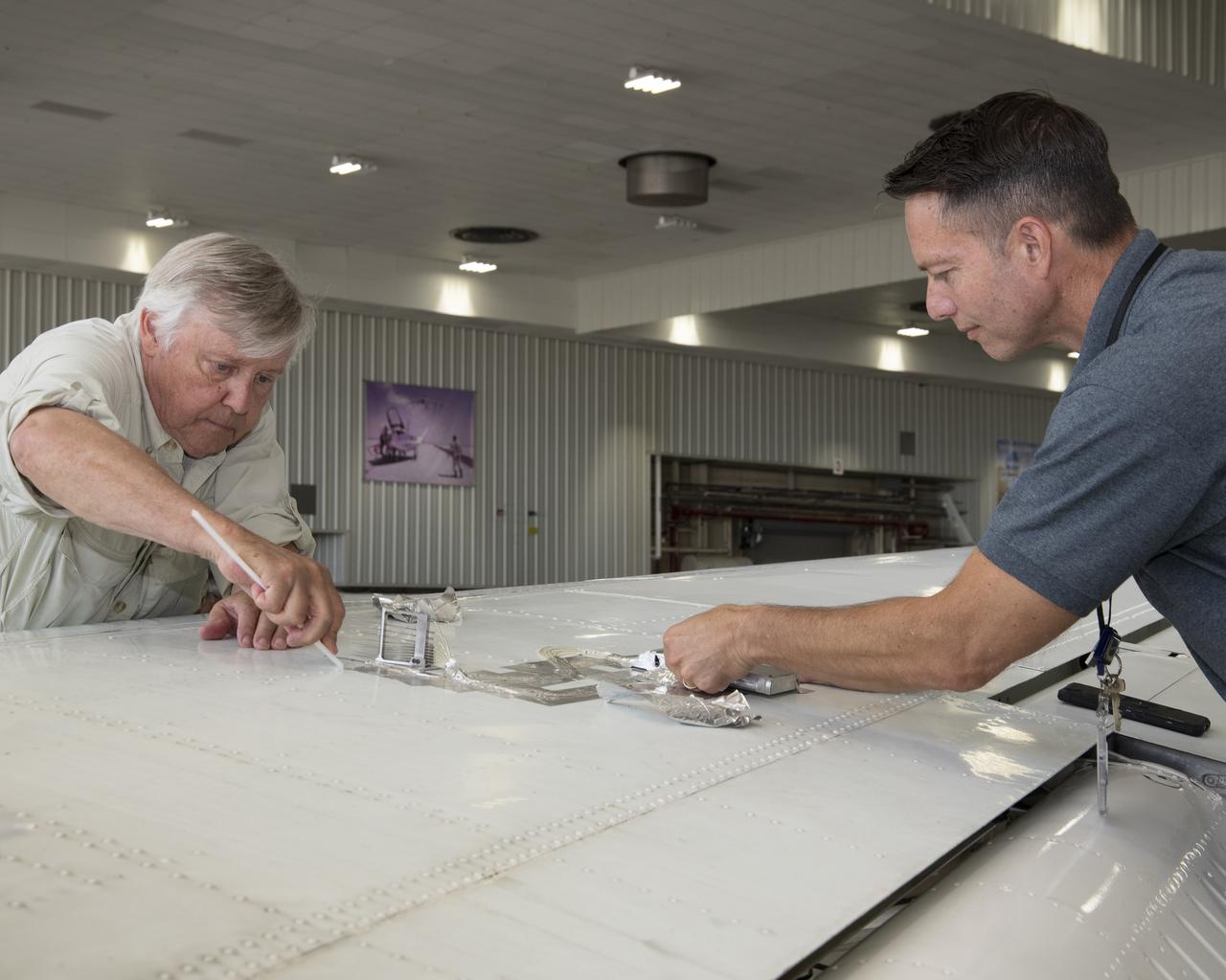
Cal Poly San Luis Obispo Professor Russ Westphal, left, and NASA Armstrong’s Technology Transfer Officer Benjamin Tomlinson remove the Boundary Layer Data System (BLDS) sensor attached to the wing of a Beechcraft Beech 200 Super King Air. The BLDS was flight tested at NASA’s Armstrong Flight Research Center to showcase rapid and flexible flight-testing capabilities.

Mark Pestana is a research pilot and project manager at the NASA Dryden Flight Research Center, Edwards, Calif. He is a pilot for the Beech B200 King Air, the T-34C and the Predator B. He flies the F-18 Hornet as a co-pilot and flight test engineer. Pestana has accumulated more than 4,000 hours of military and civilian flight experience. He was also a flight engineer on the NASA DC-8 flying laboratory. Pestana was the project manager and pilot for the Hi–rate Wireless Airborne Network Demonstration flown on the NASA B200 research aircraft. He flew B200 research missions for the X-38 Space Integrated Inertial Navigation Global Positioning System experiment. Pestana also participated in several deployments of the DC-8, including Earth science expeditions ranging from hurricane research over the Caribbean Sea to ozone studies over the North Pole, atmospheric chemistry over the South Pacific, rain forest health in Central America, Rocky Mountain ice pack assessment, and volcanic and tectonic activity around the Pacific Rim. He came to Dryden as a DC-8 mission manager in June 1998 from NASA Johnson Space Center, Houston, where he served as the Earth and Space Science discipline manager for the International Space Station Program at Johnson. Pestana also served as a flight crew operations engineer in the Astronaut Office, developing the controls, displays, tools, crew accommodations and procedures for on-orbit assembly, test, and checkout of the International Space Station. He led the analysis and technical negotiations for modification of the Russian Soyuz spacecraft as an emergency crew return vehicle for space station crews. He joined the U.S. Air Force Reserve in 1991 and held various positions as a research and development engineer, intelligence analyst, and Delta II launch vehicle systems engineer. He retired from the U.S. Air Force Reserve with the rank of colonel in 2005. Prior to 1990, Pestana was on active duty with the U.S. Air Force as the director of mi

NASA pilot Ed Lewis with the T-34C aircraft on the Dryden Flight Research Center Ramp. The aircraft was previously used at the Lewis Research Center in propulsion experiments involving turboprop engines, and was used as a chase aircraft at Dryden for smaller and slower research projects. Chase aircraft accompany research flights for photography and video purposes, and also as support for safety and research. At Dryden, the T-34 is used mainly for smaller remotely piloted vehicles which fly slower than NASA's F-18's, used for larger scale projects. This aircraft was returned to the U.S. Navy in May of 2002.
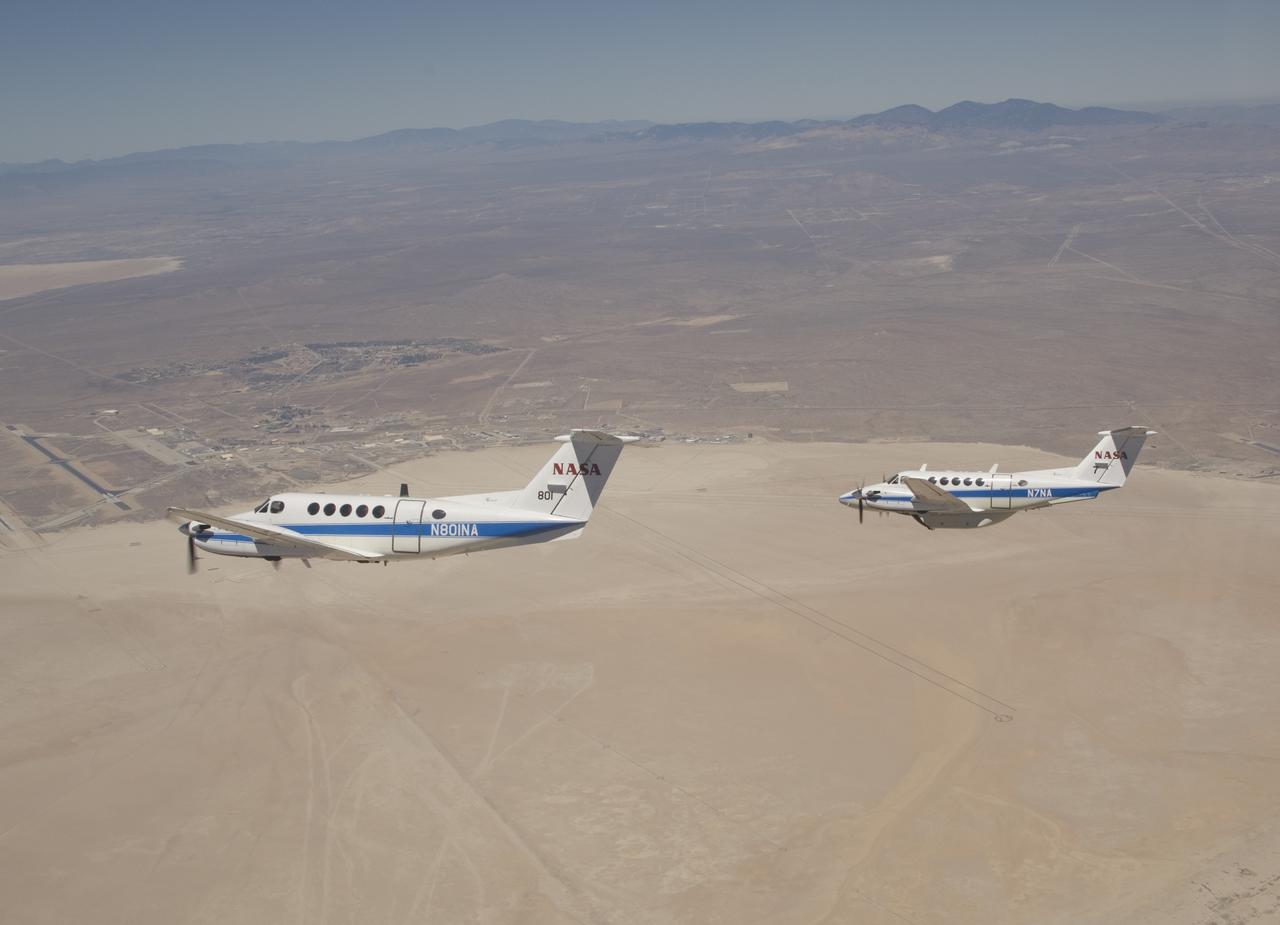
Two Beechcraft King Air mission support aircraft operated by NASA's Dryden Flight Research Center fly in formation over Rogers Dry Lake at Edwards Air Force Base.
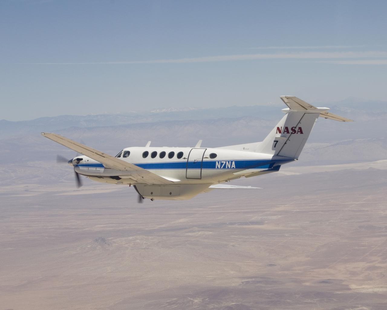
NASA's Dryden Flight Research Center operates this Beechcraft B-200 King Air N7NA for both pilot proficiency and mission management.
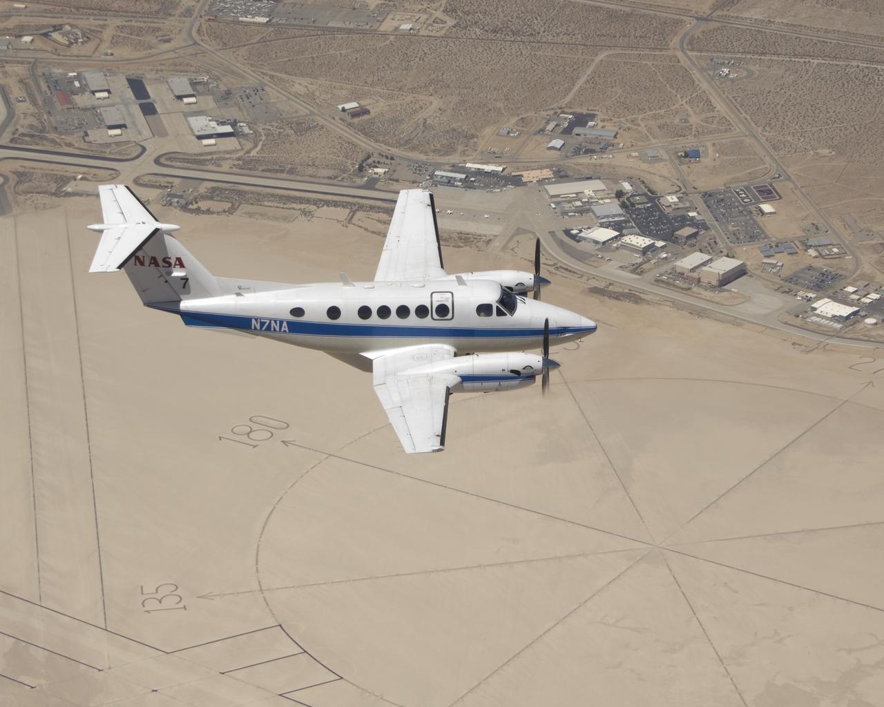
NASA's Beechcraft King Air N7NA mission support aircraft soars over the compass rose on Rogers Dry Lake adjacent to NASA's Dryden Flight Research Center.
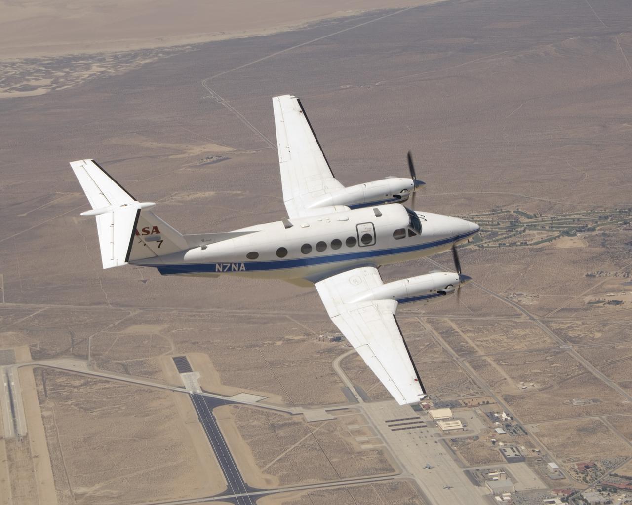
One of NASA Dryden Flight Research Center's two Beechcraft King Air mission support aircraft shows off its lines over Edwards Air Force Base, Calif.
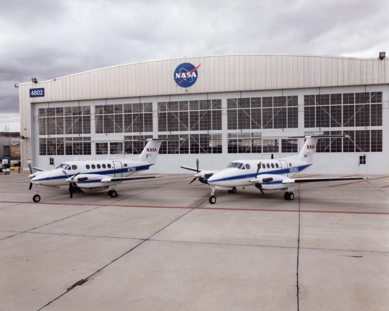
NASA N801NA and NASA 7 together on the NASA Dryden ramp.

Technicians set up test hardware inside the test section of the Icing Research Tunnel at the National Aeronautics and Space Administration (NASA) Lewis Research Center. The Icing Research Tunnel was built in the early 1940s to study the formation of ice on aircraft surfaces and develop methods of preventing or eradicating that ice. Ice buildup is dangerous because it adds extra weight, effects aerodynamics, and sometimes blocks air flow through engines. The Icing Research Tunnel is a closed-loop atmospheric wind tunnel with a 6- by 9-foot test section. The tunnel can produce speeds up to 300 miles per hour and temperatures from 30 to -45 °F. NACA engineers struggled initially to perfect a spray bar system to introduce moisture into the airstream. The tunnel was shut down in the late 1950s as the center focused its energy exclusively on space. Industrial customers began using the tunnel sporadically, then steadily, in the 1960s. Boeing, Aerojet, Lockheed, Sikorsky, Beech and others ran tests during the 1960s. Boeing analyzed engine inlets for the CH-47 Chinook, CH-46 (Sea Knight) and CH-113. This photograph was taken during a series of 100 ice-phobic coatings for the Federal Aviation Administration. They found that many of the coatings reduced ice adhesion to the test sample, but they could not be used for aircraft applications.
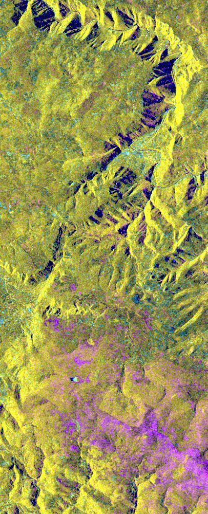
This is an X-band seasonal image of the central part of Lozere Departement situated south of the Massif Central in France. The image is 10 kilometers by 25 kilometers (6 miles by 15.5 miles) and is centered at approximately 44.3 degrees north latitude and 3 degrees east longitude. This image was acquired by the Spaceborne Imaging Radar-C/X-band Synthetic Aperture Radar aboard the space shuttle Endeavour on April 15, 1994 and on October 6, 1994. The image channels have the following color assignments: red was acquired in April; green was acquired in October; and blue is the ratio of the two data sets combined. Seasonal differences in the vegetation are visible in pink, which are heaths growing in the spring. This research area features two large limestone plateaus cut by the famous Gorges du Tarn, standing in parallel with the granite mountain range known as the Cevennes Mountains nearby. Land-use consists mainly of grasslands, heaths and forests. Forest types seen in the images are Austrian pines,Scots pines, spruce, fir and beech trees. Most forests were planted at the end of the 19th century through a national reforestation program aimed at reducing the strong erosion risks in these areas. This program was so successful that today the forests are exploited for forest pulpwood and sawlogs, but also remain protected as conservation regions. The study being performed in this area will assess the potential of spaceborne radar remote sensing for temperate forest type mapping and forest resource monitoring. The combination of X-band SAR data with lower frequency data (such as the SIR-C L-band data) allows scientists to distinguish forest tree species and biomass, or areas of ground vegetation. The lessons learned from the radar images of these controlled forest regions can be applied to larger areas and naturally grown forests to help ecologists protect and maintain them. The SIR-C/X-SAR images will be investigated by scientists from the remote sensing laboratory Cemagref in Montpellier and the National Forestry Board in Mende, France. http://photojournal.jpl.nasa.gov/catalog/PIA01755