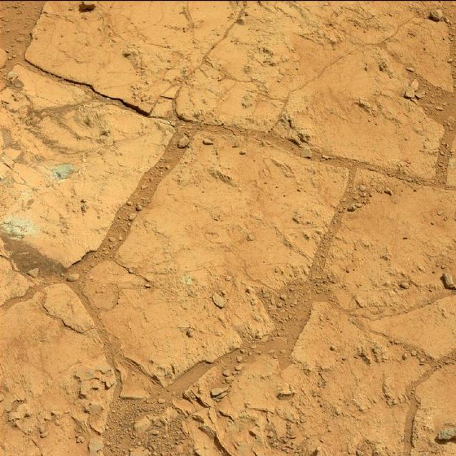
A blink pair of images taken before and after NASA Curiosity performed a mini drill test on a Martian rock shows changes resulting from that activity.
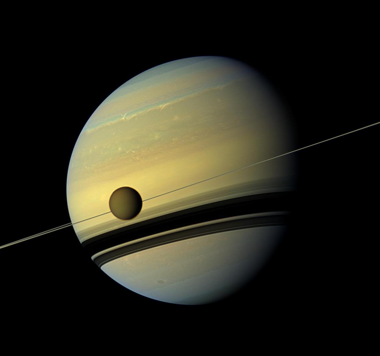
A giant of a moon appears before a giant of a planet undergoing seasonal changes in this natural color view of Titan and Saturn from NASA Cassini spacecraft.

This before-and-after image pair acquired by NASA Terra spacecraft of the Japan coastal cities of Ofunato and Kesennuma reveals changes to the landscape that are likely due to the effects of the tsunami on March 11, 2011. The new image is on the left.

Two pairs of side-by-side, before and after images from NASA Mars Reconnaissance Orbiter illustrate changes in the shape of edges of dark sand dunes in the Nili Patera region of Mars.
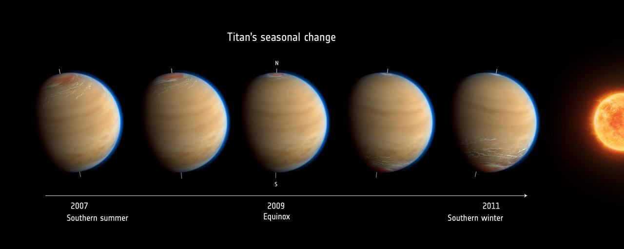
Inspired by data from NASA Cassini mission, this artist impression of Saturn moon Titan shows the change in observed atmospheric effects before, during and after equinox in 2009.
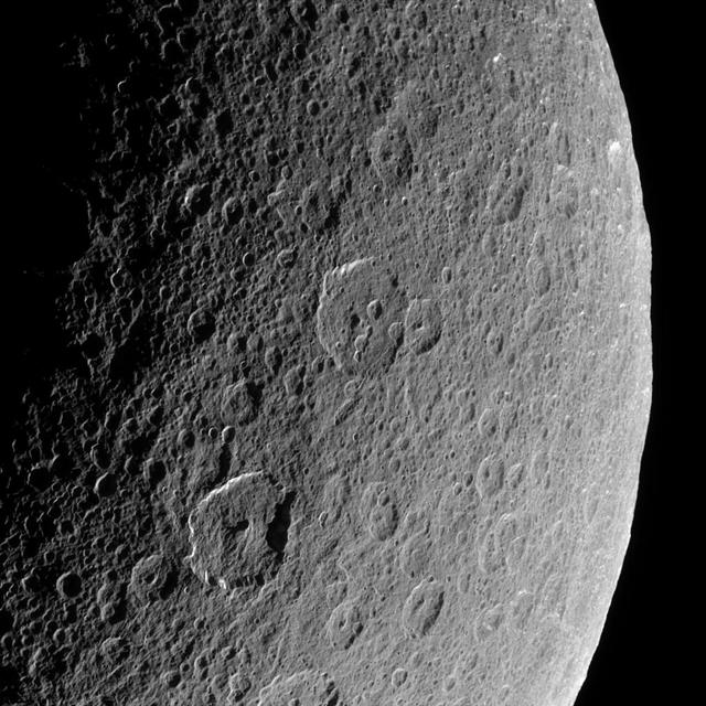
Cassini looks down upon Rhea, whose cratered surface was already ancient before any complex life developed on Earth. The terrain seen here has probably changed little in the past billion years
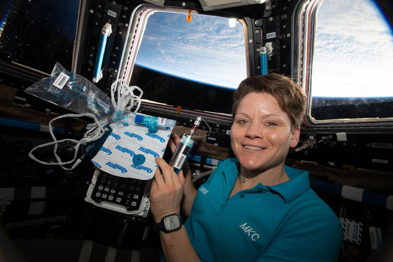
iss058e010750 (Feb. 6, 2019) --- Expedition 58 Flight Engineer Anne McClain of NASA is pictured in the cupola holding biomedical gear for the Marrow experiment. The study measures fat changes in the bone marrow before, and after exposure to microgravity. In addition, this investigation measures specific changes of red and white blood cell functions. Bone marrow fat is measured using magnetic resonance. Red blood cell function is measured with a breath sample analyzed with a gas chromatograph, and white blood cell function is studied through their genetic expression.
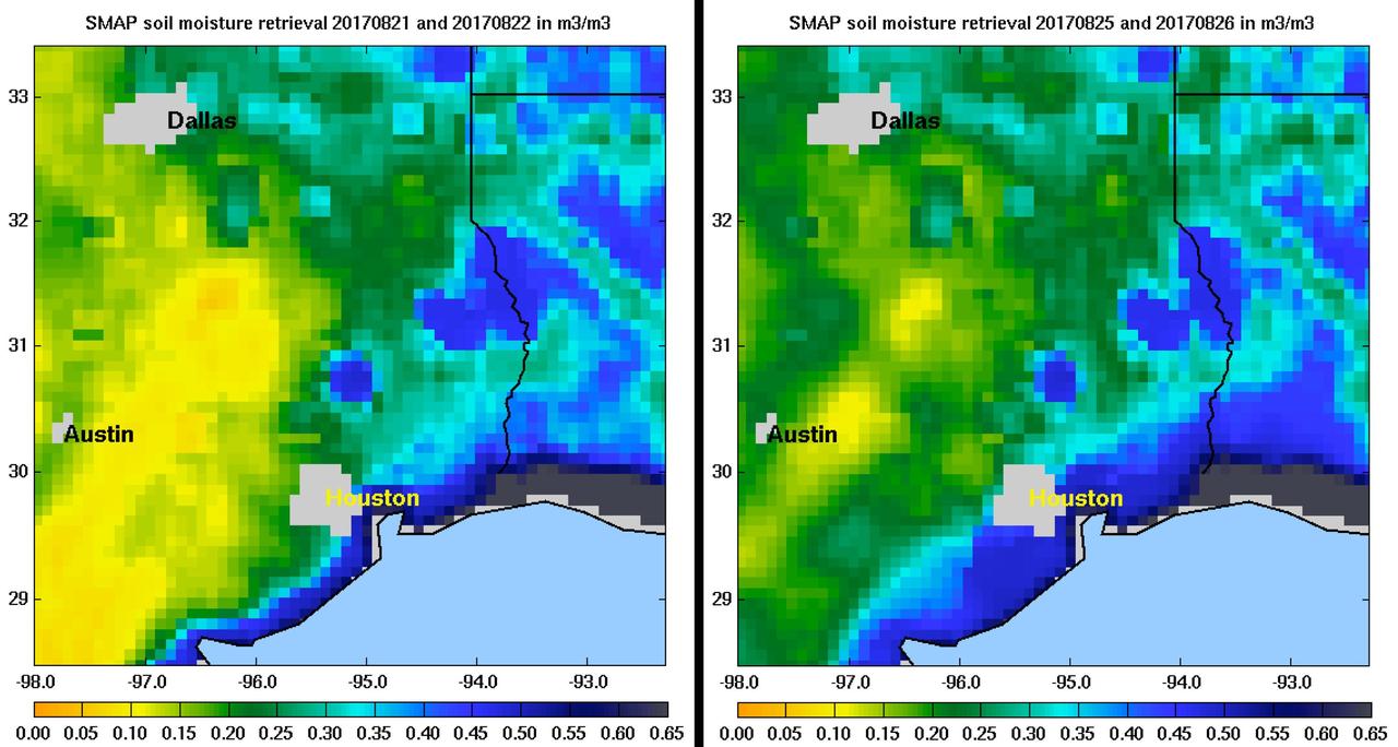
Images of soil moisture conditions in Texas near Houston, generated by NASA's Soil Moisture Active Passive (SMAP) satellite before and after the landfall of Hurricane Harvey can be used to monitor changing ground conditions due to Harvey's rainfall. As seen in the left panel, SMAP observations show that soil surface conditions were already very wet a few days before the hurricane made landfall (August 21/22), with moisture levels in the 20 to 40 percent range. Such saturated soil surfaces contributed to the inability of water to infiltrate more deeply into soils, thereby increasing the likelihood of flooding. After Harvey made landfall, the southwest portion of Houston became exceptionally wet, as seen in the right panel image from August 25/26, signaling the arrival of heavy rains and widespread flooding. https://photojournal.jpl.nasa.gov/catalog/PIA21926
HiRISE has been operating since 2006, and lately many of our observations of gullies are repeat images designed to study changes. However, we are also collecting data over gullies never before seen at this resolution, to study their morphology and allow us to look for changes in the future. This is the first HiRISE look at a cluster of gullies that appear modified or degraded—the gully fans have ripples and ridges that have formed since the last major gully activity, suggesting that they don't change very often, but we won't know for sure unless we look! https://photojournal.jpl.nasa.gov/catalog/PIA23666
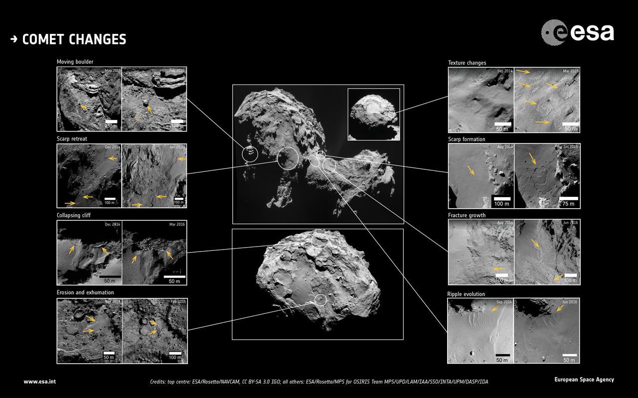
This image showcases changes identified in high-resolution images of Comet 67P/Churyumov-Gerasimenko during more than two years of monitoring by ESA's Rosetta spacecraft. The approximate locations of each feature are marked on the central context images. Dates of when the before and after images were taken are also indicated. Note that the orientation and resolution between image pairs may vary, therefore set arrows in each image point to the location of the changes, for guidance. http://photojournal.jpl.nasa.gov/catalog/PIA21566

A. Thomas Young, right, retired Executive Vice President, Lockheed Martin, speaks before the U.S. House of Representatives' Committee on Science and Technology, Subcommittee on Space and Aeronautics to discuss proposed changes to NASA's exploration program on Wednesday, March 24, 2010, on Capitol Hill in Washington. Photo Credit: (NASA/Carla Cioffi)

Douglas R. Cooke, NASA's Associate Administrator for Exploration Systems Mission Directorate (ESMD), appears before the U.S. House of Representatives' Committee on Science and Technology, Subcommittee on Space and Aeronautics to discuss proposed changes to NASA's exploration program on Wednesday, March 24, 2010, on Capitol Hill in Washington. Photo Credit: (NASA/Carla Cioffi)

Douglas R. Cooke, NASA's Associate Administrator for Exploration Systems Mission Directorate (ESMD), appears before the U.S. House of Representatives' Committee on Science and Technology, Subcommittee on Space and Aeronautics to discuss proposed changes to NASA's exploration program on Wednesday, March 24, 2010, on Capitol Hill in Washington. Photo Credit: (NASA/Carla Cioffi)

Douglas R. Cooke, NASA's Associate Administrator for Exploration Systems Mission Directorate (ESMD), appears before the U.S. House of Representatives' Committee on Science and Technology, Subcommittee on Space and Aeronautics to discuss proposed changes to NASA's exploration program on Wednesday, March 24, 2010, on Capitol Hill in Washington. Photo Credit: (NASA/Carla Cioffi)

A. Thomas Young, retired Executive Vice President, Lockheed Martin, appears before the U.S. House of Representatives' Committee on Science and Technology, Subcommittee on Space and Aeronautics to discuss proposed changes to NASA's exploration program on Wednesday, March 24, 2010, on Capitol Hill in Washington. Photo Credit: (NASA/Carla Cioffi)
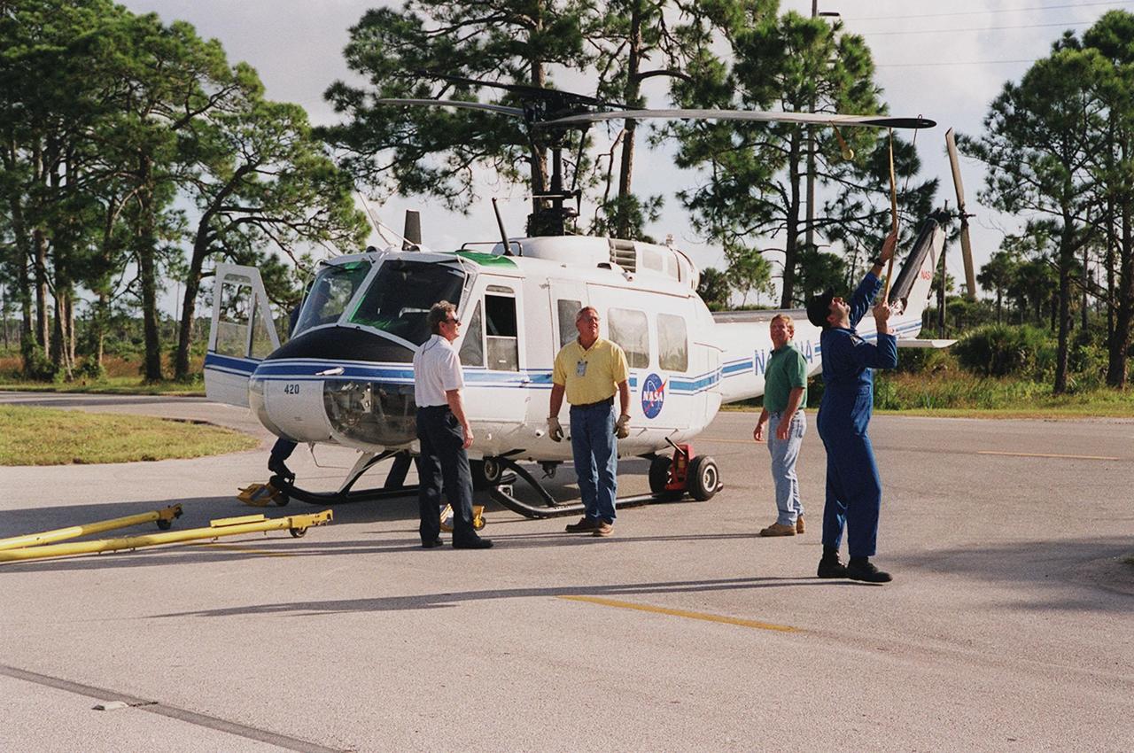
KENNEDY SPACE CENTER, FLA. -- The pilot of the NASA helicopter secures the rotary blade before the helicopter’s transfer to Ransom Road at KSC. It is one of four UH-1H helicopters that will have its blades painted, changing the black to a pattern of white and yellow stripes. The pattern provides better visibility in smoke and fire conditions. When the rotors are turning, the stripes create a yellow and white circle that is more easily seen by a second helicopter from above. The helicopters, primarily used for security and medical evacuation for NASA, will be used to deliver water via buckets during brush fires. The change was made to comply with U.S. Fish and Wildlife and Department of Forestry regulations for helicopter-assisted fire control

KENNEDY SPACE CENTER, FLA. -- The pilot of the NASA helicopter secures the rotary blade before the helicopter’s transfer to Ransom Road at KSC. It is one of four UH-1H helicopters that will have its blades painted, changing the black to a pattern of white and yellow stripes. The pattern provides better visibility in smoke and fire conditions. When the rotors are turning, the stripes create a yellow and white circle that is more easily seen by a second helicopter from above. The helicopters, primarily used for security and medical evacuation for NASA, will be used to deliver water via buckets during brush fires. The change was made to comply with U.S. Fish and Wildlife and Department of Forestry regulations for helicopter-assisted fire control
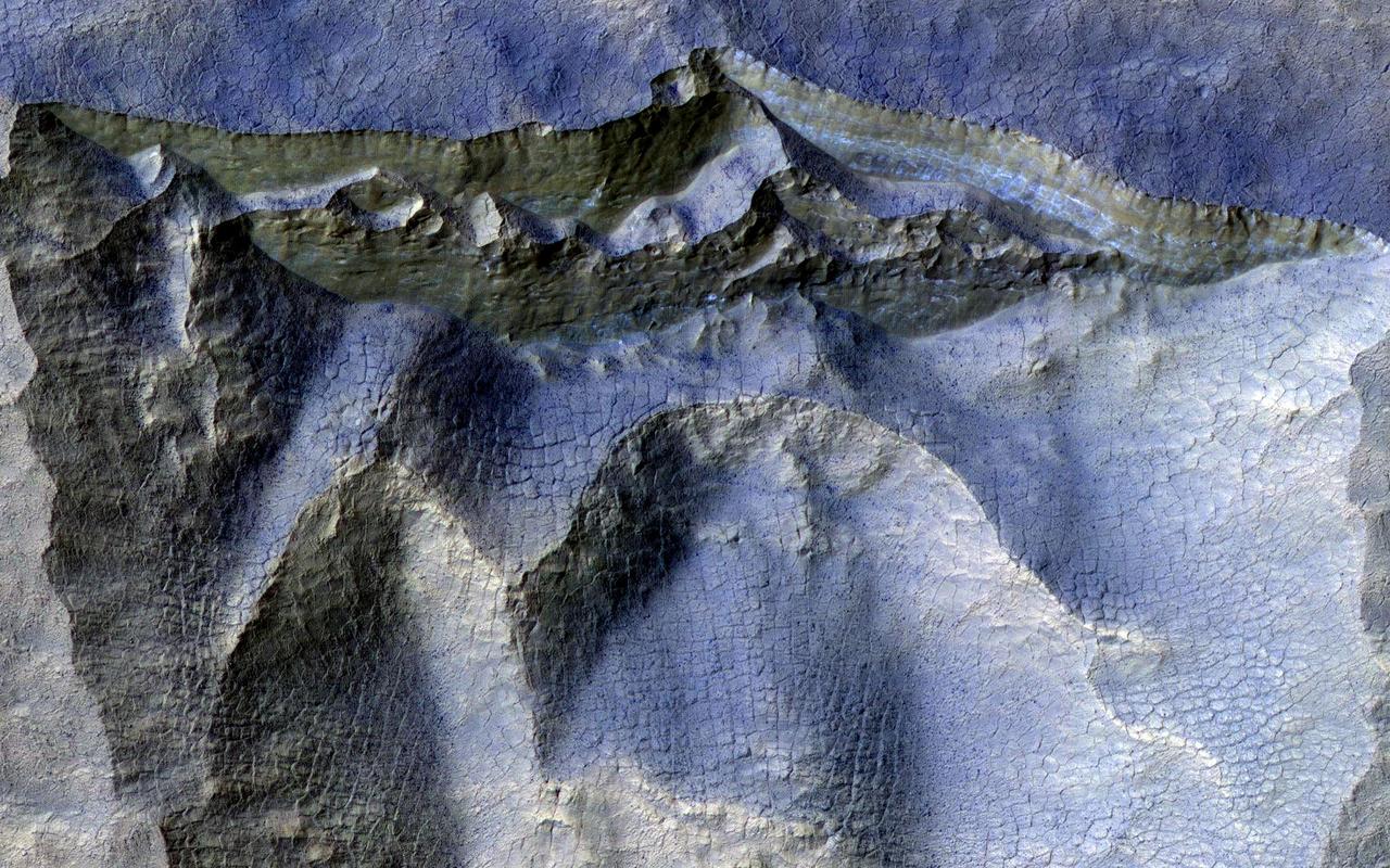
Scientists have come to realize that, just below the surface, about one third of Mars is covered in ice. We study this ice to learn about Mars' ancient climate and astronauts' future water supplies. Sometimes we see the buried ice because cliffs form like the one in this image. On the brownish, dusty cliff wall, the faint light-blue-colored ice shows through. Some of these cliffs change before our eyes and boulders of ice can tumble downhill. We take repeat images of these scenes to check for changes like this. https://photojournal.jpl.nasa.gov/catalog/PIA24147
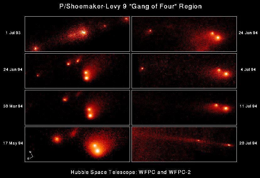
This series of eight NASA Hubble Space Telescope "snapshots" shows the evolution of the P-Q complex, also called the "gang of four" region, of comet P/Shoemaker-Levy 9. The eight individual frames chronicle changes in the comet during the 12 months before colliding with Jupiter. The sequence shows that the relative separations of the various cometary fragments, thought to range in size from about 500 meters to almost 4 km (2.5 miles) across, changed dramatically over this period. The apparent separation of Q1 and Q2 was only about 1100 kilometers (680 miles) on 1 July 1993 and increased to 28,000 kilometers (17,400 miles) by 20 July 1994. http://photojournal.jpl.nasa.gov/catalog/PIA01264
iss068e041971 (1/26/2023) --- Three-week-old Thale cress plants from the Plant Habitat-03 (PH-03) investigation are seen just before a harvest aboard the International Space Station. One leaf was harvested from each of the 48 plants and then preserved before being sent back to Earth for further analysis. The samples are critical to PH-03 as the preserved leaves allow for the transcriptome (gene expression) and methylome (epigenetic modifications) analyses. PH-03 aims to discover whether genetic changes persist through multiple plant generations, a first step in developing plants better suited for future space exploration.
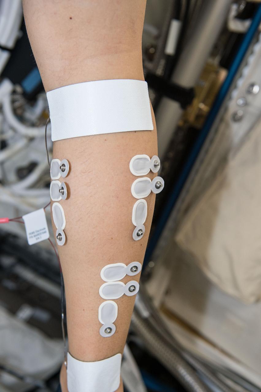
iss050e012909 (11/29/2016) --- A view of an Expedition 50 Crewmember (wearing electrodes) during the setup phase of the Sarcolab-3 Experiment in the Columbus Module. Myotendinous and Neuromuscular Adaptation to Long-term Spaceflight (Sarcolab) investigates the adaptation and deterioration of the soleus, or calf muscle, where it joins the Achilles tendon, which links it to the heel and carries loads from the entire body. Muscle fiber samples are taken from crew members before and after flight, and analyzed for changes in structural and chemical properties.
The Little Joe launch vehicle being readied for a test launch from Wallops in January 1960... Page 77. Photograph published in Winds of Change, 75th Anniversary NASA publication, by James Schultz. **note - see L59-5137 page 77 also. Photograph published in Engineer in Charge: A History of the Langley Aeronautical Laboratory, 1917-1958 by James R. Hansen. Page 389. ...was conceived by Langley engineers Max Faget and Paul Purser even before STG (Space Task Group) was organized.

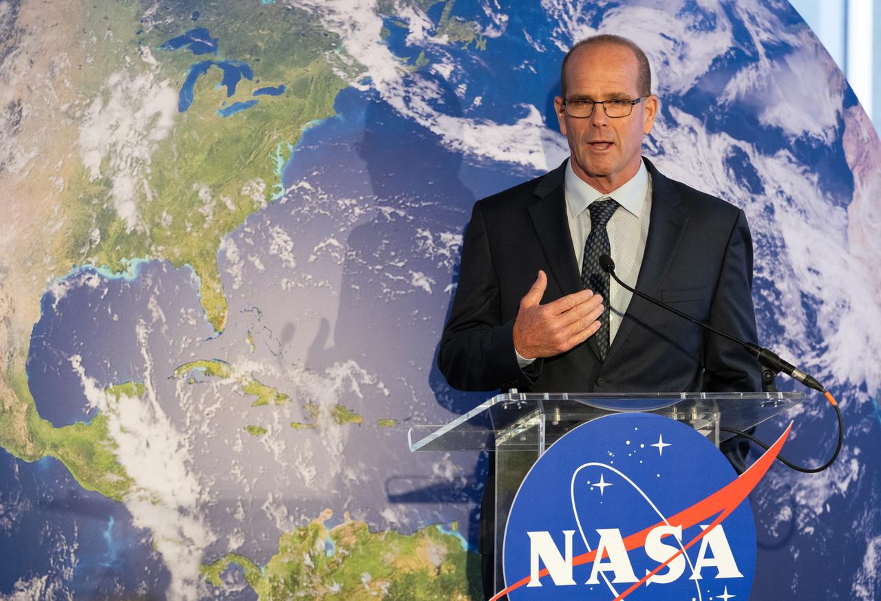
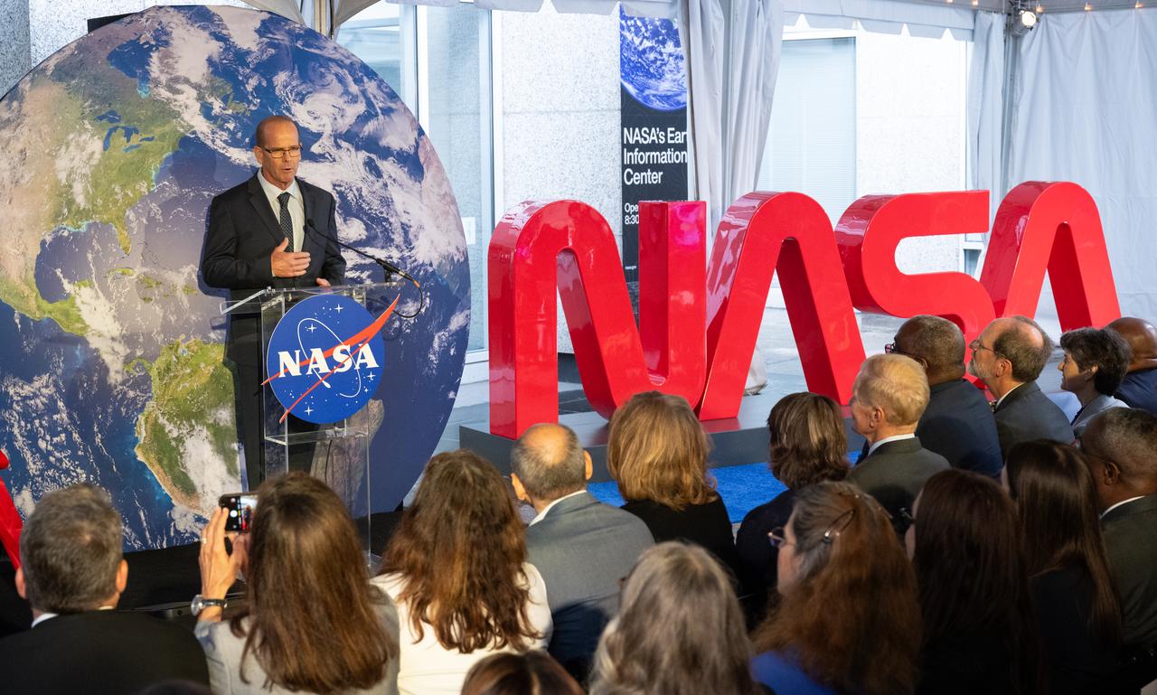
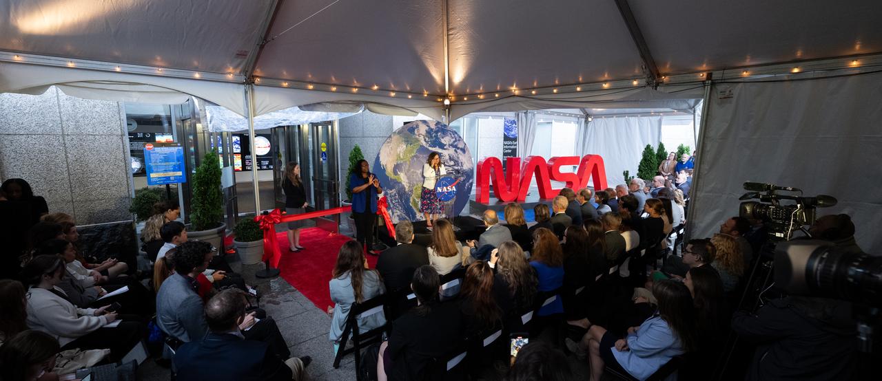
Kate Calvin, NASA’s Chief Scientist, speaks before the ribbon cutting ceremony to open NASA’s Earth Information Center, Wednesday, June 21, 2023, at the Mary W. Jackson NASA Headquarters building in Washington. The Earth Information Center is new immersive experience that combines live data sets with cutting-edge data visualization and storytelling to allow visitors to see how our planet is changing. Photo Credit: (NASA/Joel Kowsky)

NASA Administrator Bill Nelson delivers remarks before the ribbon cutting ceremony to open NASA’s Earth Information Center, Wednesday, June 21, 2023, at the Mary W. Jackson NASA Headquarters building in Washington. The Earth Information Center is new immersive experience that combines live data sets with cutting-edge data visualization and storytelling to allow visitors to see how our planet is changing. Photo Credit: (NASA/Joel Kowsky)
jsc2023e046371 (12/02/2022) --- The Multi-Needle Langmuir Probe (m-NLP) is seen at European Test Services (ETS) before thermal vacuum testing. The Langmuir Probe measures contents of the ionosphere from station's unique vantage point. Measurements of small-scale changes could allow for discovery that prevents degradation in global navigation systems. Image courtesy of ESA/Estec, Kensa Benamar.
iss050e012389 (11/29/2016) --- European Space Agency (ESA) Thomas Pesquet and Cosmonaut Sergei Ryzhikov during the setup phase of the Sarcolab-3 Experiment in the Columbus Module. Myotendinous and Neuromuscular Adaptation to Long-term Spaceflight (Sarcolab) investigates the adaptation and deterioration of the soleus, or calf muscle, where it joins the Achilles tendon, which links it to the heel and carries loads from the entire body. Muscle fiber samples are taken from crew members before and after flight, and analyzed for changes in structural and chemical properties.
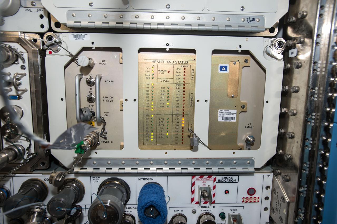
iss050e053932 (3/3/2017) --- A view of Long Duration Sorbent Testbed during Inlet Filter change. The Long Duration Sorbent Testbed (LDST) investigation exposes desiccants and CO2 sorbents to the ISS atmosphere for an extended period (such as one year) before returning them to earth for analysis of contamination level and capacity loss. The results will determine which types of sorbents would be most effective on long-term missions to Mars or other destinations.

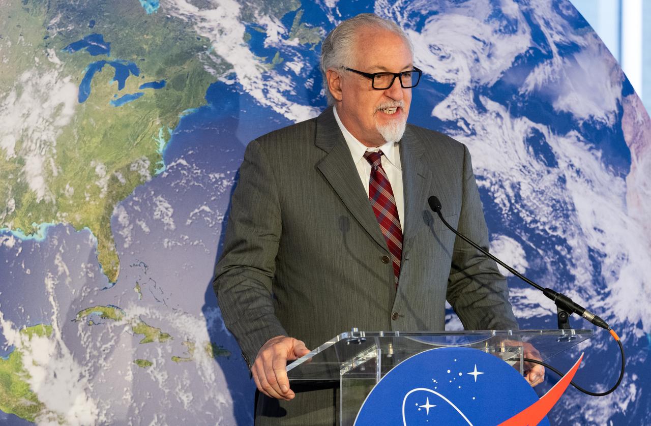
Dave Applegate, Director of the U.S. Geologic Survey (USGS), speaks before the ribbon cutting ceremony to open NASA’s Earth Information Center, Wednesday, June 21, 2023, at the Mary W. Jackson NASA Headquarters building in Washington. The Earth Information Center is new immersive experience that combines live data sets with cutting-edge data visualization and storytelling to allow visitors to see how our planet is changing. Photo Credit: (NASA/Joel Kowsky)
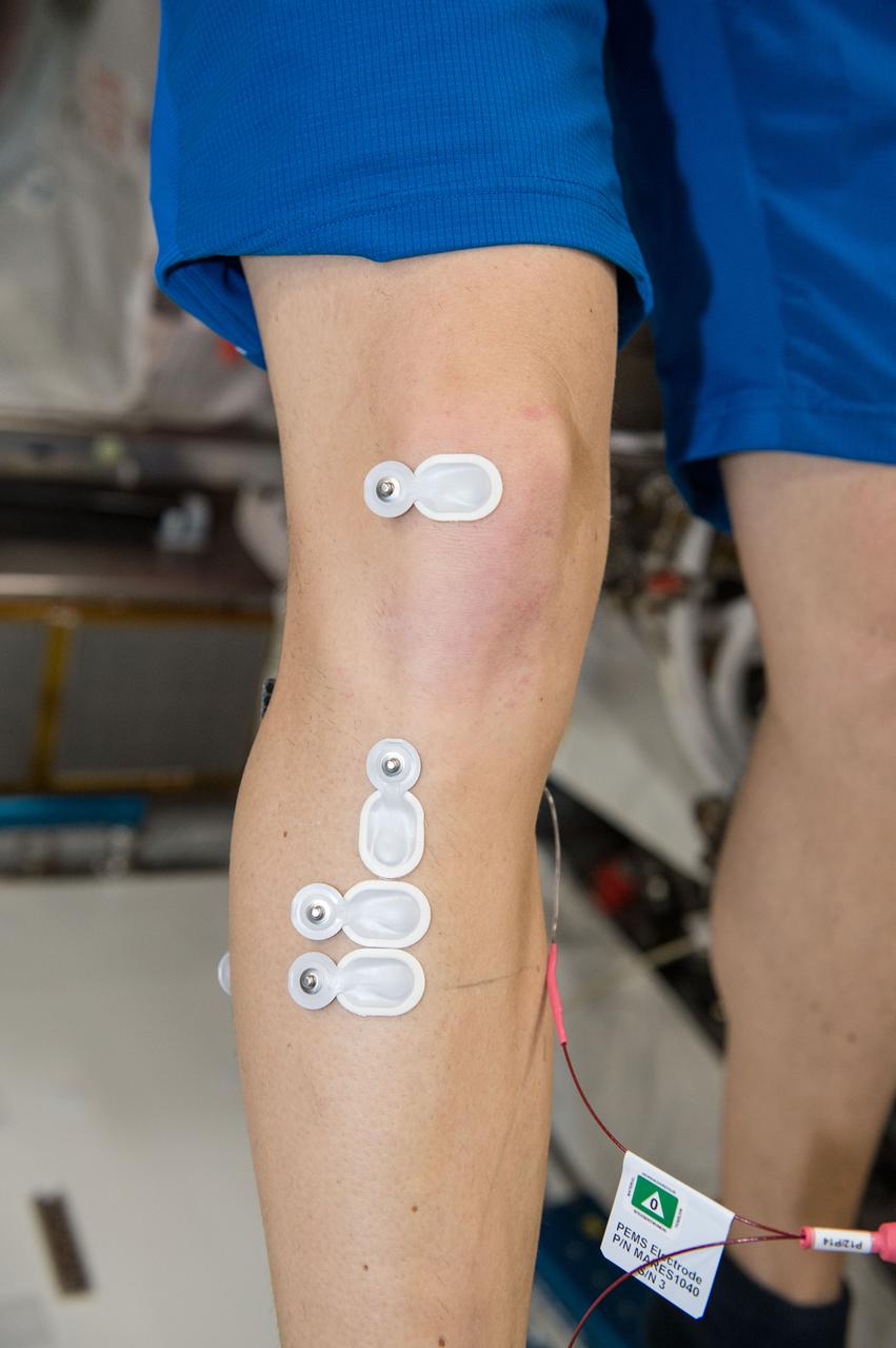
iss050e012907 (11/29/2016) --- European Space Agency (ESA) Thomas Pesquet (only leg - wearing electrodes) during the setup phase of the Sarcolab-3 Experiment in the Columbus Module. Myotendinous and Neuromuscular Adaptation to Long-term Spaceflight (Sarcolab) investigates the adaptation and deterioration of the soleus, or calf muscle, where it joins the Achilles tendon, which links it to the heel and carries loads from the entire body. Muscle fiber samples are taken from crew members before and after flight, and analyzed for changes in structural and chemical properties.
iss050e012915 (11/29/2016) --- European Space Agency (ESA) Thomas Pesquet and Cosmonaut Sergei Ryzhikov during the setup phase of the Sarcolab-3 Experiment in the Columbus Module. Myotendinous and Neuromuscular Adaptation to Long-term Spaceflight (Sarcolab) investigates the adaptation and deterioration of the soleus, or calf muscle, where it joins the Achilles tendon, which links it to the heel and carries loads from the entire body. Muscle fiber samples are taken from crew members before and after flight, and analyzed for changes in structural and chemical properties.
Michael Morgan, Assistant Secretary of Commerce for Environmental Observation and Prediction at the National Oceanic and Atmospheric Administration (NOAA), speaks before the ribbon cutting ceremony to open NASA’s Earth Information Center, Wednesday, June 21, 2023, at the Mary W. Jackson NASA Headquarters building in Washington. The Earth Information Center is new immersive experience that combines live data sets with cutting-edge data visualization and storytelling to allow visitors to see how our planet is changing. Photo Credit: (NASA/Joel Kowsky)
Dwane Roth of Big D Farms in Kansas, speaks before the ribbon cutting ceremony to open NASA’s Earth Information Center, Wednesday, June 21, 2023, at the Mary W. Jackson NASA Headquarters building in Washington. The Earth Information Center is new immersive experience that combines live data sets with cutting-edge data visualization and storytelling to allow visitors to see how our planet is changing. Photo Credit: (NASA/Joel Kowsky)
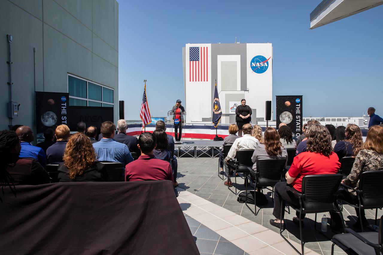
Kennedy Space Center Director Janet Petro addresses attendees before NASA Administrator Bill Nelson delivers the 2022 State of NASA address on March 28, 2022, at the Florida spaceport. Nelson highlighted NASA’s plans to explore the Moon and Mars, address climate change, promote racial and economic equity, and drive economic growth while sustaining U.S. leadership in aviation and aerospace innovation.
Dwane Roth of Big D Farms in Kansas, speaks before the ribbon cutting ceremony to open NASA’s Earth Information Center, Wednesday, June 21, 2023, at the Mary W. Jackson NASA Headquarters building in Washington. The Earth Information Center is new immersive experience that combines live data sets with cutting-edge data visualization and storytelling to allow visitors to see how our planet is changing. Photo Credit: (NASA/Joel Kowsky)
Karen St. Germain, Director of the Earth Science Division of NASA’s Science Mission Directorate, before the ribbon cutting ceremony to open NASA’s Earth Information Center, Wednesday, June 21, 2023, at the Mary W. Jackson NASA Headquarters building in Washington. The Earth Information Center is new immersive experience that combines live data sets with cutting-edge data visualization and storytelling to allow visitors to see how our planet is changing. Photo Credit: (NASA/Joel Kowsky)

VANDENBERG AIR FORCE BASE, Calif. – A United Launch Alliance Delta II rocket is seen eight minutes before launching from Space Launch Complex 2 at Vandenberg Air Force Base in California on Wednesday, July 2, 2014. OCO-2 will measure the global distribution of carbon dioxide, the leading human-produced greenhouse gas driving changes in Earth’s climate. Photo Credit: NASA/Bill Ingalls

NASA personnel watch the Changing of the Guard ritual before a wreath is laid at the Tomb of the Unknowns by NASA Administrator Jim Bridenstine as part of NASA's Day of Remembrance, Thursday, Feb. 7, 2019, at Arlington National Cemetery in Arlington, Va. The wreaths were laid in memory of those men and women who lost their lives in the quest for space exploration. Photo Credit: (NASA/Aubrey Gemignani)

Douglas R. Cooke, left, NASA's Associate Administrator for Exploration Systems Mission Directorate (ESMD) and A. Thomas Young, retired Executive Vice President, Lockheed Martin appear before the U.S. House of Representatives' Committee on Science and Technology, Subcommittee on Space and Aeronautics to discuss proposed changes to NASA's exploration program on Wednesday, March 24, 2010, on Capitol Hill in Washington. Photo Credit: (NASA/Carla Cioffi)
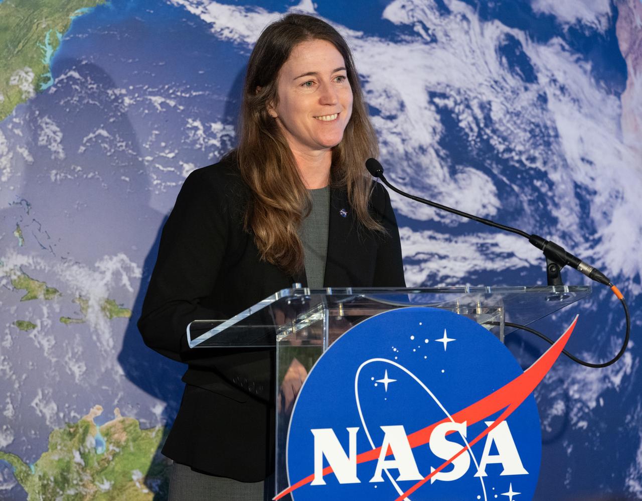
Kate Calvin, NASA’s Chief Scientist, speaks before the ribbon cutting ceremony to open NASA’s Earth Information Center, Wednesday, June 21, 2023, at the Mary W. Jackson NASA Headquarters building in Washington. The Earth Information Center is new immersive experience that combines live data sets with cutting-edge data visualization and storytelling to allow visitors to see how our planet is changing. Photo Credit: (NASA/Joel Kowsky)

NASA Administrator Bill Nelson delivers remarks before the ribbon cutting ceremony to open NASA’s Earth Information Center, Wednesday, June 21, 2023, at the Mary W. Jackson NASA Headquarters building in Washington. The Earth Information Center is new immersive experience that combines live data sets with cutting-edge data visualization and storytelling to allow visitors to see how our planet is changing. Photo Credit: (NASA/Joel Kowsky)

NASA Administrator Bill Nelson delivers remarks before the ribbon cutting ceremony to open NASA’s Earth Information Center, Wednesday, June 21, 2023, at the Mary W. Jackson NASA Headquarters building in Washington. The Earth Information Center is new immersive experience that combines live data sets with cutting-edge data visualization and storytelling to allow visitors to see how our planet is changing. Photo Credit: (NASA/Joel Kowsky)

The NASA Worm Logo sign is unveiled before the ribbon cutting ceremony to open NASA’s Earth Information Center, Wednesday, June 21, 2023, at the Mary W. Jackson NASA Headquarters building in Washington. The Earth Information Center is new immersive experience that combines live data sets with cutting-edge data visualization and storytelling to allow visitors to see how our planet is changing. Photo Credit: (NASA/Joel Kowsky)
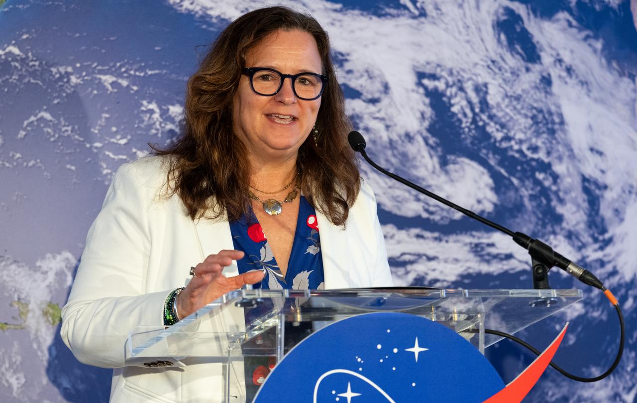
Karen St. Germain, Director of the Earth Science Division of NASA’s Science Mission Directorate, before the ribbon cutting ceremony to open NASA’s Earth Information Center, Wednesday, June 21, 2023, at the Mary W. Jackson NASA Headquarters building in Washington. The Earth Information Center is new immersive experience that combines live data sets with cutting-edge data visualization and storytelling to allow visitors to see how our planet is changing. Photo Credit: (NASA/Joel Kowsky)
Mike Michener, Deputy Assistant Administrator for the Bureau for Resilience and Food Security at the United States Agency for International Development (USAID), speaks before the ribbon cutting ceremony to open NASA’s Earth Information Center, Wednesday, June 21, 2023, at the Mary W. Jackson NASA Headquarters building in Washington. The Earth Information Center is new immersive experience that combines live data sets with cutting-edge data visualization and storytelling to allow visitors to see how our planet is changing. Photo Credit: (NASA/Joel Kowsky)
Marlen Eve, Deputy Administrator for the Agricultural Research Service at the U.S. Department of Agriculture (USDA), speaks before the ribbon cutting ceremony to open NASA’s Earth Information Center, Wednesday, June 21, 2023, at the Mary W. Jackson NASA Headquarters building in Washington. The Earth Information Center is new immersive experience that combines live data sets with cutting-edge data visualization and storytelling to allow visitors to see how our planet is changing. Photo Credit: (NASA/Joel Kowsky)

The NASA Worm Logo sign is unveiled before the ribbon cutting ceremony to open NASA’s Earth Information Center, Wednesday, June 21, 2023, at the Mary W. Jackson NASA Headquarters building in Washington. The Earth Information Center is new immersive experience that combines live data sets with cutting-edge data visualization and storytelling to allow visitors to see how our planet is changing. Photo Credit: (NASA/Joel Kowsky)
Janet McCabe, Deputy Administrator of the Environmental Protection Agency (EPA), speaks before the ribbon cutting ceremony to open NASA’s Earth Information Center, Wednesday, June 21, 2023, at the Mary W. Jackson NASA Headquarters building in Washington. The Earth Information Center is new immersive experience that combines live data sets with cutting-edge data visualization and storytelling to allow visitors to see how our planet is changing. Photo Credit: (NASA/Joel Kowsky)

Eric Hooks, Deputy Administrator of the Federal Emergency Management Agency (FEMA), speaks before the ribbon cutting ceremony to open NASA’s Earth Information Center, Wednesday, June 21, 2023, at the Mary W. Jackson NASA Headquarters building in Washington. The Earth Information Center is new immersive experience that combines live data sets with cutting-edge data visualization and storytelling to allow visitors to see how our planet is changing. Photo Credit: (NASA/Joel Kowsky)
Kennedy Space Center Director Janet Petro addresses attendees before NASA Administrator Bill Nelson delivers the 2022 State of NASA address on March 28, 2022, at the Florida spaceport. Nelson highlighted NASA’s plans to explore the Moon and Mars, address climate change, promote racial and economic equity, and drive economic growth while sustaining U.S. leadership in aviation and aerospace innovation.

S128-E-007282 (4 Sept. 2009) --- Onboard the International Space Station since July, astronaut Tim Kopra is pictured on the orbital outpost a little less than a week before his scheduled return to Earth. Earlier this week, Kopra changed roles from Expedition 20 flight engineer to STS-128 mission specialist. Kopra came up to the station with the STS-127 crew and participated in a spacewalk on July 18. He will return to Earth aboard the Discovery on a scheduled Sept. 10 landing.
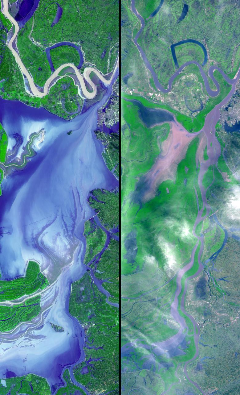
These images show dramatic change in the water at Dongting Lake in Hunan province, China. A flood crest surged down the Yangtze River in late August of this year, but the embankments made by residents there held. The left image was acquired on September 2, 2002 and shows the extent of the lake. The right image was obtained March 19, 2002 before the flooding began. These images were acquired on September 2, 2002 and March 19, 2002 by the Advanced Spaceborne Thermal Emission and Reflection Radiometer (ASTER) on NASA's Terra satellite. With its 14 spectral bands from the visible to the thermal infrared wavelength region, and its high spatial resolution of 15 to 90 meters (about 50 to 300 feet), ASTER will image Earth for the next 6 years to map and monitor the changing surface of our planet. http://photojournal.jpl.nasa.gov/catalog/PIA03858

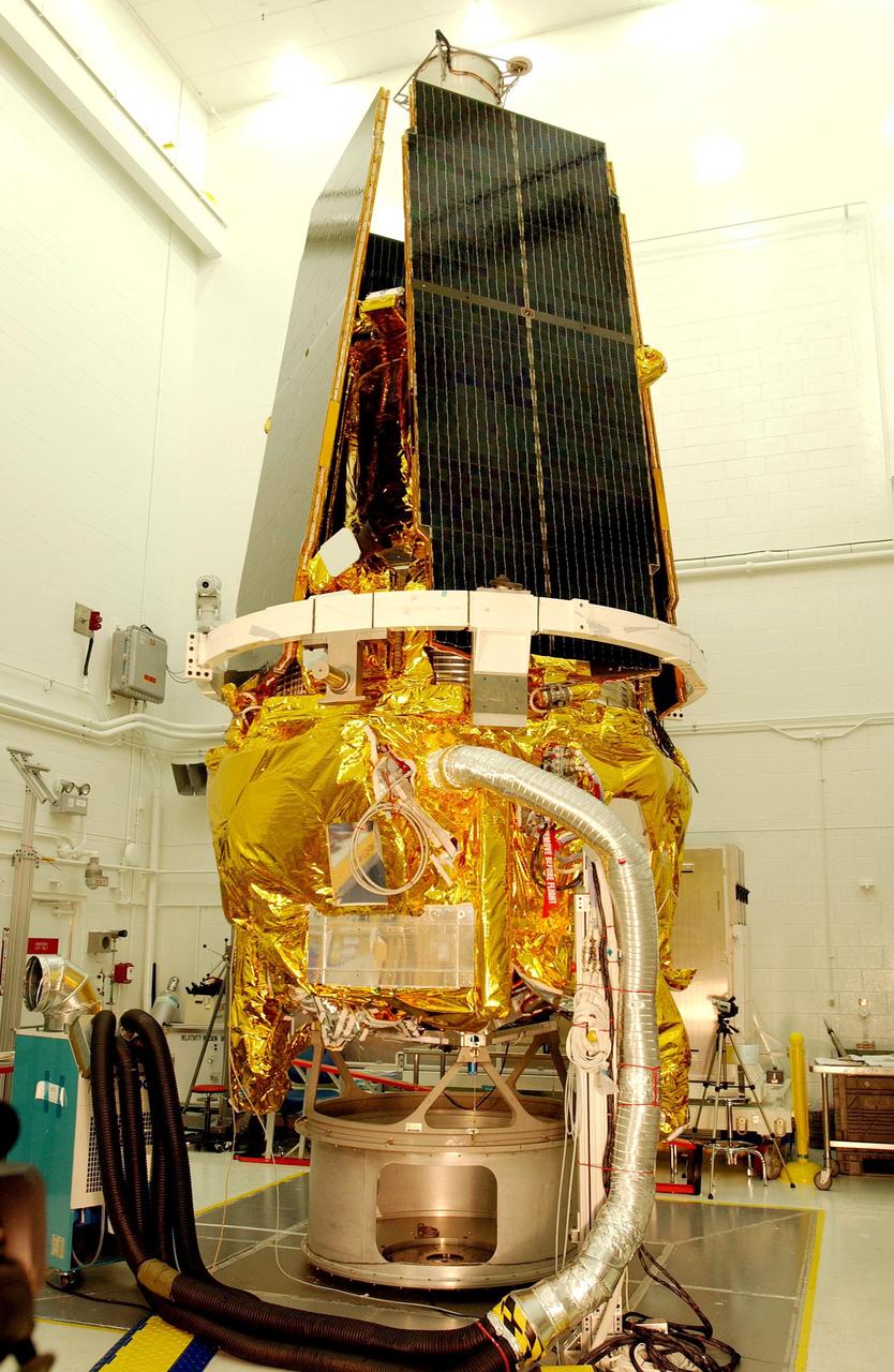
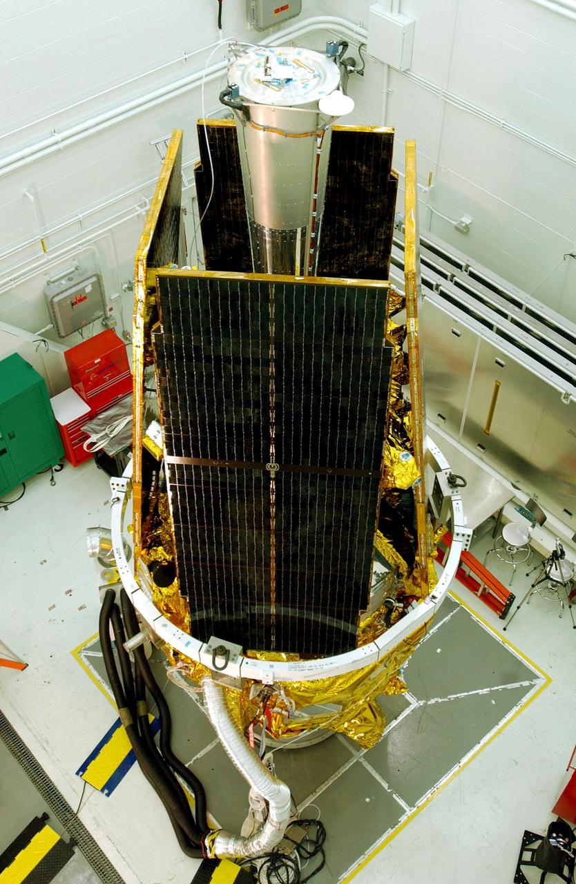
KENNEDY SPACE CENTER, FLA. - The Ice, Cloud, and Land Elevation Satellite, or ICESat, undergoes final processing before launch. ICESat is a 661-pound satellite known as Geoscience Laser Altimeter System (GLAS) that will revolutionize our understanding of ice and its role in global climate change and how we protect and understand our home planet. It will help scientists determine if the global sea level is rising or falling. It will look at the ice sheets that blanket the Earth's poles to see if they are growing or shrinking. It will assist in developing an understanding of how changes in the Earth's atmosphere and climate effect polar ice masses and global sea level. ICESat is scheduled for launch, with the Cosmic Hot Interstellar Plasma Spectrometer or CHIPSat, on a Delta II expendable launch vehicle from Vandenberg Air Force Base, Calif., on Jan. 11, 2003, between 4:45 p.m. - 5:30 p.m. PST.
KENNEDY SPACE CENTER, FLA. -- In the upper level of the mobile service tower on Launch Pad 17-B at Cape Canaveral Air Force Station, workers help maneuver the THEMIS spacecraft into place. They will next remove the protective cover before encapsulating and mating the spacecraft with the third stage of the Delta II rocket. THEMIS consists of five identical probes, the largest number of scientific satellites ever launched into orbit aboard a single rocket. The THEMIS mission is to investigate what causes auroras in the Earth's atmosphere to dramatically change from slowly shimmering waves of light to wildly shifting streaks of color. Discovering what causes auroras to change will provide scientists with important details on how the planet's magnetosphere works and the important Sun-Earth connection. THEMIS is scheduled to launch aboard a Delta II rocket on Feb. 15 during a window extending from 6:08 to 6:27 p.m. Photo credit: NASA/Amanda Diller
This is an X-band image of seasonal changes at the ecological test site of Raco, Michigan, located south of Whitefish Bay on Lake Superior. The image is centered at about 46 degrees north latitude and 85 degrees west longitude. This image was acquired by the X-band Synthetic Aperture Radar onboard the space shuttle Endeavour on April 10th, 1994, and on October 1, 1994. The areas shown in red correspond to the April 10th data; the areas in blue correspond to data acquired on October 1, 1994; green indicates the ratio of data acquired on April 10 and October 1, 1994. The area shown is 22.7 kilometers by 53 kilometers (14 miles by 33 miles). Lake Superior in the upper right was frozen in April and had small waves (ripples) on its surface in October. The land area contains mostly forests and, to a lesser extent, agricultural regions. In April the area was covered in wet snow. By October, there agricultural areas were covered with grass. Vegetation and soils were moist due to rainfalls three days before the data was acquired on October 1, 1994. The bright light green/yellow tones in the lower half of the image show the stronger reflections of the snow-covered agricultural fields. The pinkish color corresponds to the coniferous and deciduous forests. The green area represents red pines. These trees are smaller than the surrounding forest cover and allow more radar penetration. The area is green because the radar is sensing the surface, which undergoes great change from snow to grass and fern undergrowth between April and October. The bright green triangle in the upper half of the image is an old airstrip, while the modern airport can be seen on the bottom right side of the image. The Raco site is an important location for monitoring seasonal changes and future global change because it is situated at the ecological transition zone between the boreal forests and the northern temperate forests. This transitional zone is expected to be ecologically sensitive to anticipated global changes resulting from climatic warming. Baseline studies of vegetation are essential in monitoring these expected changes. http://photojournal.jpl.nasa.gov/catalog/PIA01734
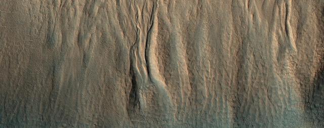
Although actively-forming gullies are common in the middle latitudes of Mars, there are also pristine-looking gullies in equatorial regions. In this scene, the gullies have very sharp channels and different colors where the gullies have eroded and deposited material. Over time, the topography becomes smoothed over and the color variations disappear, unless there is recent activity. Changes have not been visible here from before-and-after images, and maybe such differences are apparent compared to older images, but nobody has done a careful comparison. What may be needed to see subtle changes is a new image that matches the lighting conditions of an older one. Equatorial gully activity is probably much less common — perhaps there is major downslope avalanching every few centuries — so we need to be lucky to see changes. MRO has now been imaging Mars for over 16 years, and the chance of seeing rare activity increases as the time interval widens between repeat images. https://photojournal.jpl.nasa.gov/catalog/PIA25309
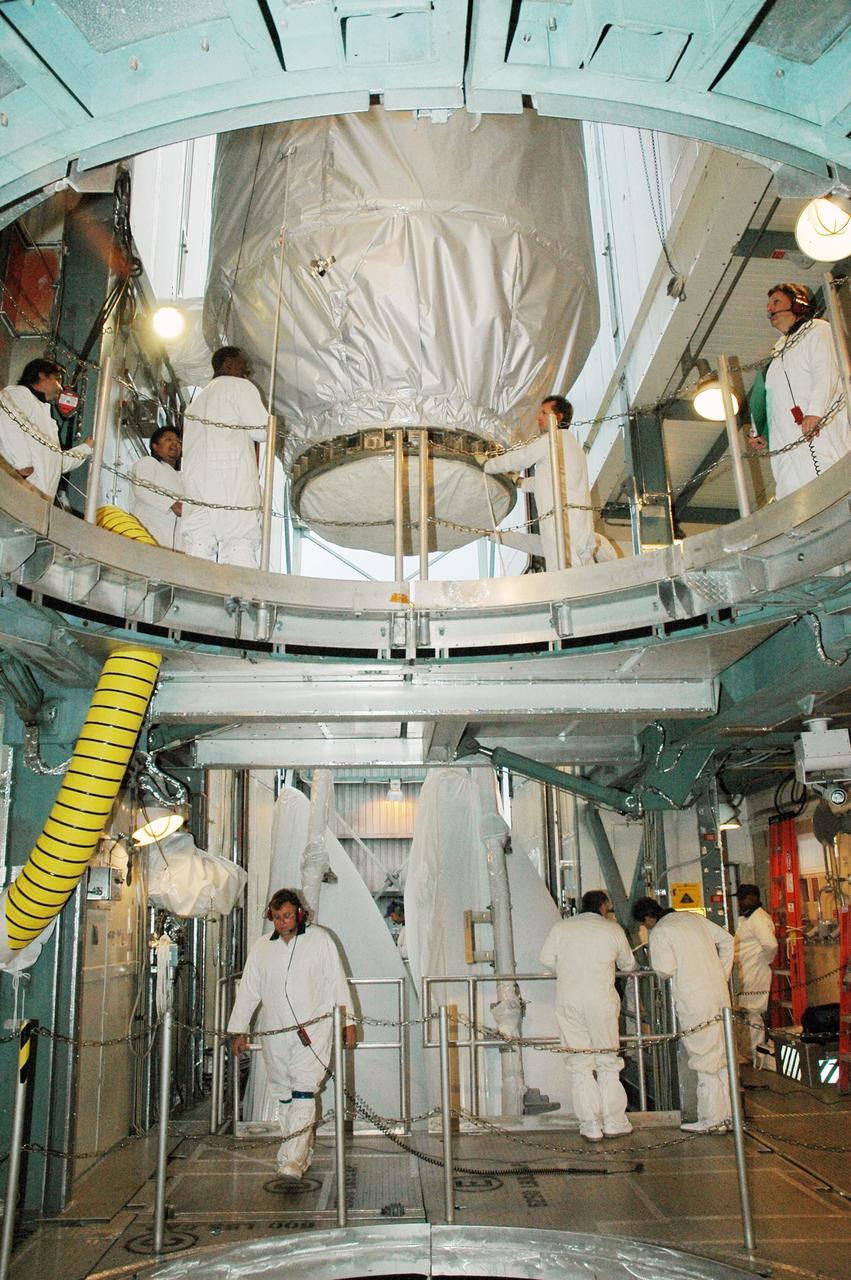
KENNEDY SPACE CENTER, FLA. -- The Mars Polar Lander is suspended from a crane in the Spacecraft Assembly and Encapsulation Facility-2 (SAEF-2) before being lowered to a workstand. There it will be mated to the third stage of the Boeing Delta II rocket before it is transported to Launch Pad 17B, Cape Canaveral Air Station. The lander, which will be launched on Jan. 3, 1999, is a solar-powered spacecraft designed to touch down on the Martian surface near the northern-most boundary of the south pole in order to study the water cycle there. The lander also will help scientists learn more about climate change and current resources on Mars, studying such things as frost, dust, water vapor and condensates in the Martian atmosphere. It is the second spacecraft to be launched in a pair of Mars '98 missions. The first is the Mars Climate Orbiter, which was launched aboard a Delta II rocket from Launch Complex 17A on Dec. 11, 1998
KENNEDY SPACE CENTER, FLA. -- The Gravity Probe B spacecraft is in NASA’s Payload Processing Facility 1610 on North Vandenberg Air Force Base in California after completion of prelaunch processing before going to the pad. The spacecraft will be transported to Space Launch Complex 2 on April 1 and mated to the Boeing Delta II rocket. Gravity Probe B consists of four sophisticated gyroscopes that will provide an almost perfect space-time reference system. The mission will look in a precise manner for tiny changes in the direction of spin. Gravity Probe B will be launched into a 400-nautical-mile-high polar orbit for a 16-month mission. Launch is scheduled for April 17.
iss050e012767 (11/29/2016) --- European Space Agency (ESA) Thomas Pesquet and Cosmonaut Sergei Ryzhikov during the setup phase of the Sarcolab-3 Experiment, by deploying and configuring the Muscle Atrophy Resistive Exercise System (MARES), in the Columbus Module. Myotendinous and Neuromuscular Adaptation to Long-term Spaceflight (Sarcolab) investigates the adaptation and deterioration of the soleus, or calf muscle, where it joins the Achilles tendon, which links it to the heel and carries loads from the entire body. Muscle fiber samples are taken from crew members before and after flight, and analyzed for changes in structural and chemical properties.
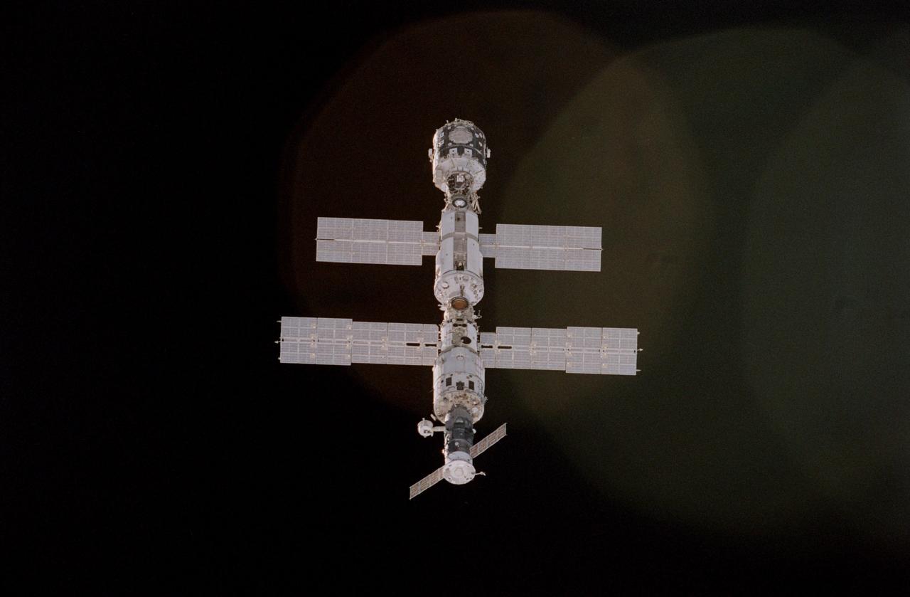
STS092-405-013 (11-24 October 2000) --- Not long before the link-up of the Space Shuttle Discovery and the International Space Station (ISS), a crew member onboard the shuttle used a 35mm camera to grab this vertical image of the station. This was one of the last looks at the station in the represented configuration, as the seven-member team went about changing its appearance with the addition of important new pieces. Backdropped against the blackness of space, the various elements visible, from top to bottom, are Node 1 or Unity, the functional cargo block (FGB) or Zarya, the service module or Zvezda, and a Progress cargo supply vehicle.

Scientists and Coast Guard swimmers test the integrity a melt pond on sea ice in the Chukchi Sea on July 9, 2010, before drilling holes through which instruments can be deployed to collect data. The research is part of NASA's ICESCAPE mission onboard the U.S. Coast Guard icebreaker Healy to sample the physical, chemical and biological characteristics of the ocean and sea ice. Impacts of Climate change on the Eco-Systems and Chemistry of the Arctic Pacific Environment (ICESCAPE) is a multi-year NASA shipborne project. The bulk of the research will take place in the Beaufort and Chukchi Sea’s in summer of 2010 and fall of 2011. Photo Credit: (NASA/Kathryn Hansen)
KENNEDY SPACE CENTER, FLA. -- The Gravity Probe B spacecraft is in NASA’s Payload Processing Facility 1610 on North Vandenberg Air Force Base in California after completion of prelaunch processing before going to the pad. The spacecraft will be transported to Space Launch Complex 2 on April 1 and mated to the Boeing Delta II rocket. Gravity Probe B consists of four sophisticated gyroscopes that will provide an almost perfect space-time reference system. The mission will look in a precise manner for tiny changes in the direction of spin. Gravity Probe B will be launched into a 400-nautical-mile-high polar orbit for a 16-month mission. Launch is scheduled for April 17.
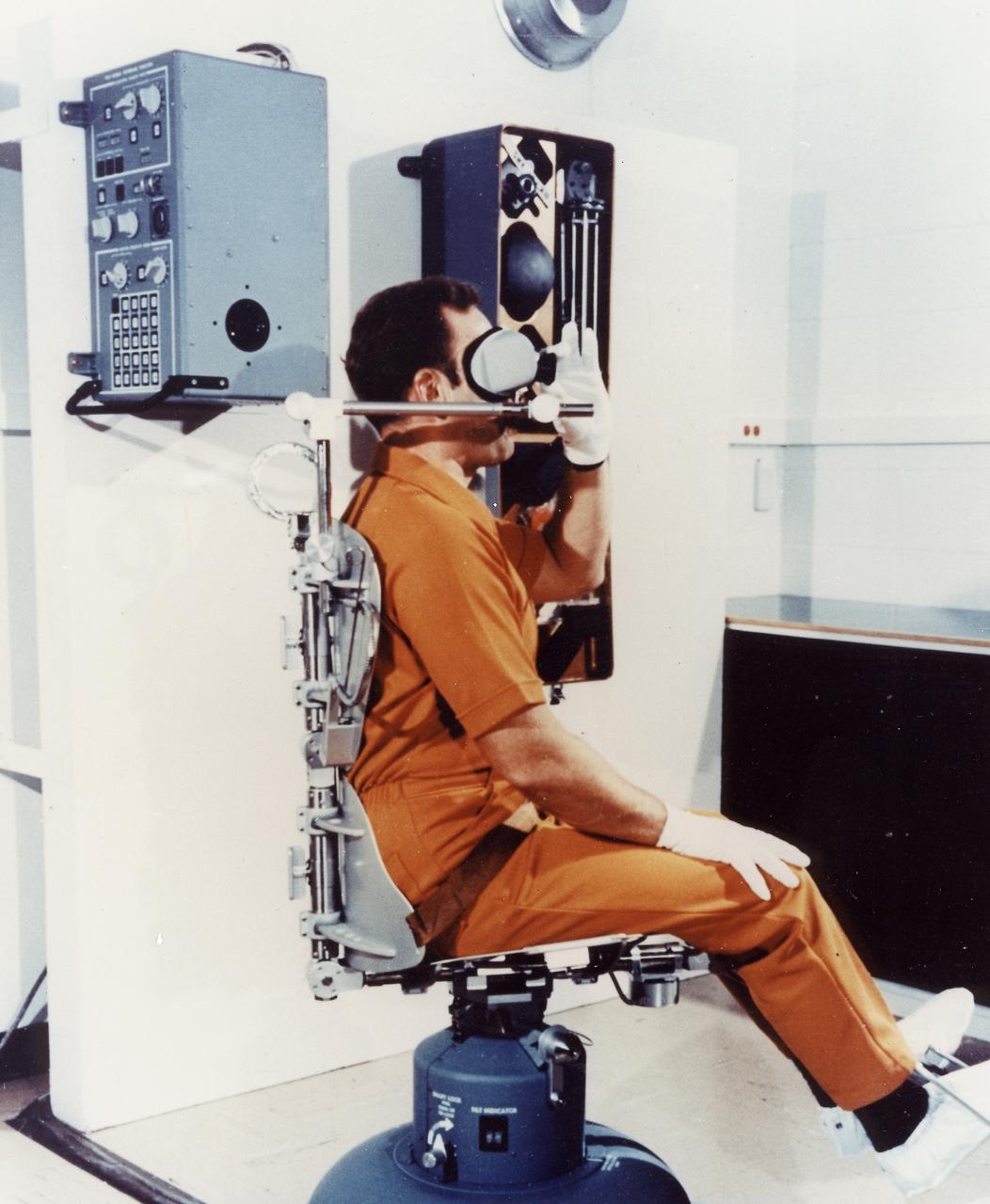
This 1970 photograph shows the Rotating Litter Chair, a major component of Skylab's Human Vestibular Function experiment (M131). The experiment was a set of medical studies designed to determine the effect of long-duration space missions on astronauts' coordination abilities. The M131 experiment tested the astronauts susceptibility to motion sickness in the Skylab environment, acquired data fundamental to an understanding of the functions of human gravity reception under prolonged absence of gravity, and tested for changes in the sensitivity of the semicircular canals. Data from this experiment was collected before, during, and after flight. The Marshall Space Flight Center had program management responsibility for the development of Skylab hardware and experiments.

Models for the seasonal variation in atmospheric density on Mars between summer (low density) and winter (higher density) predict that air density will be high enough in late March for NASA's Mars Ingenuity Helicopter to return to its original RPM. Since September, the helicopter's rotors have been operating an increased RPM of 2,700 – up from 2,537 RPM during Ingenuity's first 13 flights. The Ingenuity team will use observations from Perseverance's weather station, MEDA, to confirm the true air density on Mars before making the change. https://photojournal.jpl.nasa.gov/catalog/PIA25211
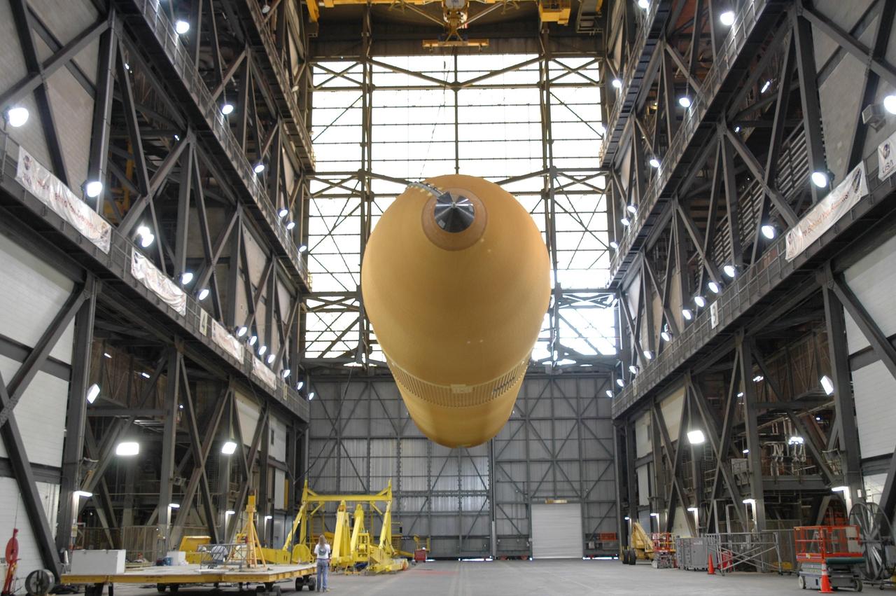
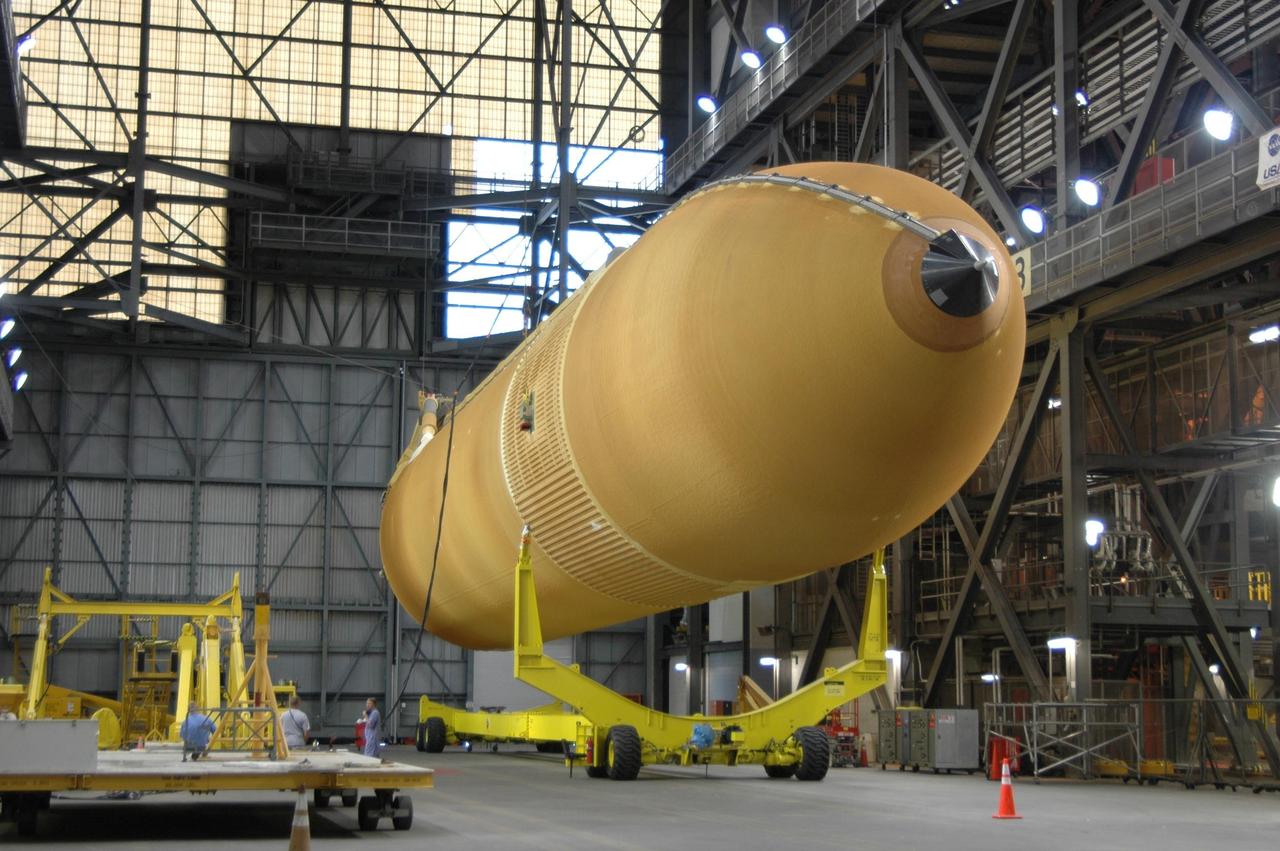
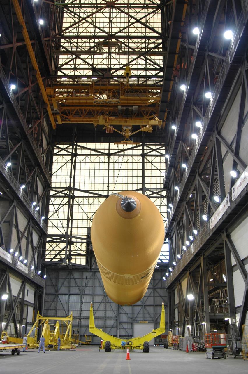
KENNEDY SPACE CENTER, FLA. - A technician watches as the External Tank (ET) designated to fly on Return to Flight mission STS-114 is prepared to be lifted from the checkout cell in the Vehicle Assembly Building. It will be mated with the Solid Rocket Boosters. The ET is recently redesigned to meet recommendations of the Columbia Accident Investigation Board before return to flight. Among dozens of changes is a redesigned forward bipod fitting to reduce the risk to the Space Shuttle from falling debris during ascent. Considered a test flight, STS-114 is scheduled to launch during a window extending May 15 to June 3. The Shuttle will carry supplies and equipment to the International Space Station.

KENNEDY SPACE CENTER, FLA. -- A closeup of the top of the Gravity Probe B spacecraft in NASA’s Payload Processing Facility 1610 on North Vandenberg Air Force Base in California after completion of prelaunch processing before going to the pad. The spacecraft will be transported to Space Launch Complex 2 on April 1 and mated to the Boeing Delta II rocket. Gravity Probe B consists of four sophisticated gyroscopes that will provide an almost perfect space-time reference system. The mission will look in a precise manner for tiny changes in the direction of spin. Gravity Probe B will be launched into a 400-nautical-mile-high polar orbit for a 16-month mission. Launch is scheduled for April 17.

The A-1 Test Stand at NASA Stennis Space Center near Bay St. Louis, Miss., was the focus of a ceremony held Thursday to transition the storied facility to a new program of work: testing the J-2X engines that will power the agency's next generation spacecraft, Ares I & V. Standing before the historic structure, with a plaque commemorating the change, are (from left) SSC Center Director Richard Gilbrech; NASA Associate Administrator for Exploration Systems Scott Horowitz; and NASA Space Operations Deputy Associate Administrator for Program Integration Michael Hawes. Ares vehicles are the crew and cargo launch vehicles being developed under NASA's Constellation Program.
jsc2024e043737 (4/17/2024) --- A scanning electron-microscopy image of human platelets taken preflight at the NASA Space Radiation Laboratory. Megakaryocytes Orbiting in Outer Space and Near Earth: The MOON Study (Megakaryocyte Flying-One (MeF1)) investigates how environmental conditions affect development and function of platelets and megakaryocytes, cells found in bone marrow. Results could clarify the risks of changes in inflammation, immune responses, and clot formation in spaceflight and on the ground. Platelets are isolated from NASA crew members before they launch to the International Space Station, and after return to Earth. Image courtesy of the NASA Space Radiation Laboratory.
KENNEDY SPACE CENTER, FLA. - The External Tank (ET) designated to fly on Return to Flight mission STS-114 is lifted above the checkout cell to be mated with the Solid Rocket Boosters. The ET is recently redesigned to meet recommendations of the Columbia Accident Investigation Board before return to flight. Among dozens of changes is a redesigned forward bipod fitting to reduce the risk to the Space Shuttle from falling debris during ascent. Considered a test flight, STS-114 is scheduled to launch during a window extending May 15 to June 3. The Shuttle will carry supplies and equipment to the International Space Station.
KENNEDY SPACE CENTER, FLA. - External tank No. 118 is suspended over the transfer aisle of the Vehicle Assembly Building before being raised to vertical and into high bay 3 for mating with solid rocket boosters stacked there. The tank is designated to fly on mission STS-115 with Atlantis. It will fly with many major safety changes, including the removal of the protuberance air load ramps. The mission will deliver the second port truss segment, the P3/P4 Truss, to attach to the first port truss segment, the P1 Truss, as well as deploy solar array set 2A and 4A. Launch of Space Shuttle Atlantis is scheduled for late August. Photo credit: NASA/Jim Grossmann
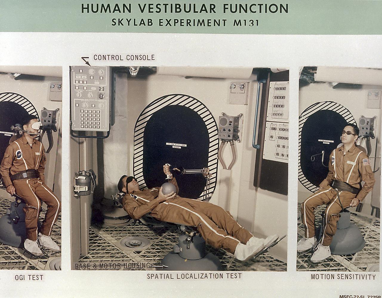
This set of photographs details Skylab's Human Vestibular Function experiment (M131). This experiment was a set of medical studies designed to determine the effect of long-duration space missions on astronauts' coordination abilities. This experiment tested the astronauts susceptibility to motion sickness in the Skylab environment, acquired data fundamental to an understanding of the functions of human gravity reception under prolonged absence of gravity, and tested for changes in the sensitivity of the semicircular canals. Data from this experiment was collected before, during, and after flight. The Marshall Space Flight Center had program management responsibility for the development of Skylab hardware and experiments.
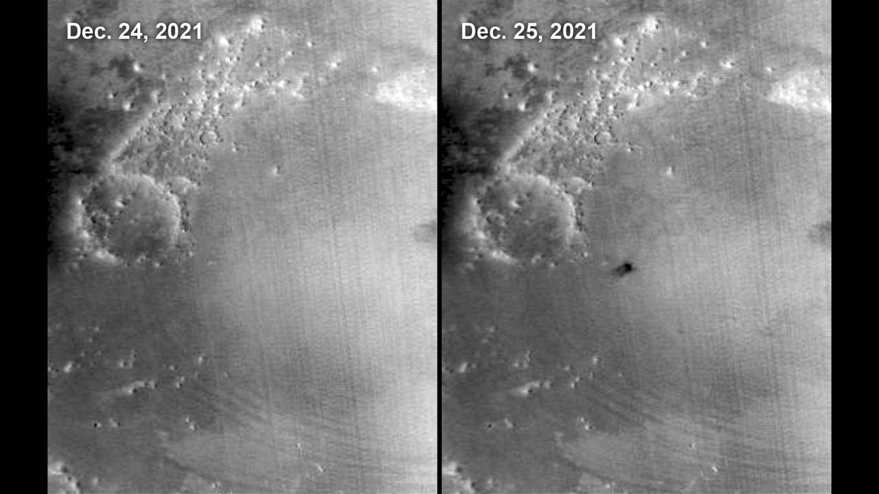
The Mars Color Imager (MARCI) camera aboard NASA's Mars Reconnaissance Orbiter (MRO) captured this before-and-after comparison of a region of Mars called Amazonis Planitia, which was struck by a meteoroid on Dec. 24, 2021. The impact was so large that MARCI can view it from space. As MRO passes over the planet, MARCI takes linear images – essentially strips – of the planet's circumference each day. The images are then stitched together to create a daily global map of the planet, data that's typically used to monitor atmospheric changes and Martian weather. https://photojournal.jpl.nasa.gov/catalog/PIA25585
KENNEDY SPACE CENTER, FLA. - Workers on the mobile service tower, or gantry, at Space Launch Complex 2 on North Vandenberg Air Force Base, Calif., check connections as the protective cover is lifted off the Aura spacecraft. Aura will be mated to the second stage of the Boeing Delta II rocket before the fairing is installed. The latest in the Earth Observing System (EOS) series, Aura is scheduled to launch July 10. Aura’s four state-of-the-art instruments will study the dynamics of chemistry occurring in the atmosphere. The spacecraft will provide data to help scientists better understand the Earth’s ozone, air quality and climate change.
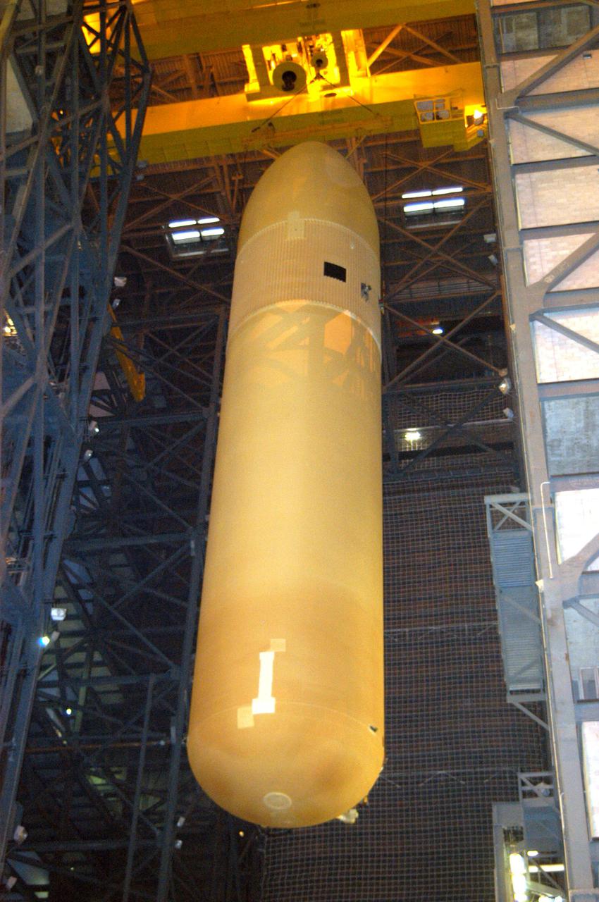
KENNEDY SPACE CENTER, FLA. - In the Vehicle Assembly Building, the External Tank (ET) designated to fly on Return to Flight mission STS-114 is moved to the Solid Rocket Boosters for mating. The ET is recently redesigned to meet recommendations of the Columbia Accident Investigation Board before return to flight. Among dozens of changes is a redesigned forward bipod fitting to reduce the risk to the Space Shuttle from falling debris during ascent. Considered a test flight, STS-114 is scheduled to launch during a window extending May 15 to June 3. The Shuttle will carry supplies and equipment to the International Space Station.
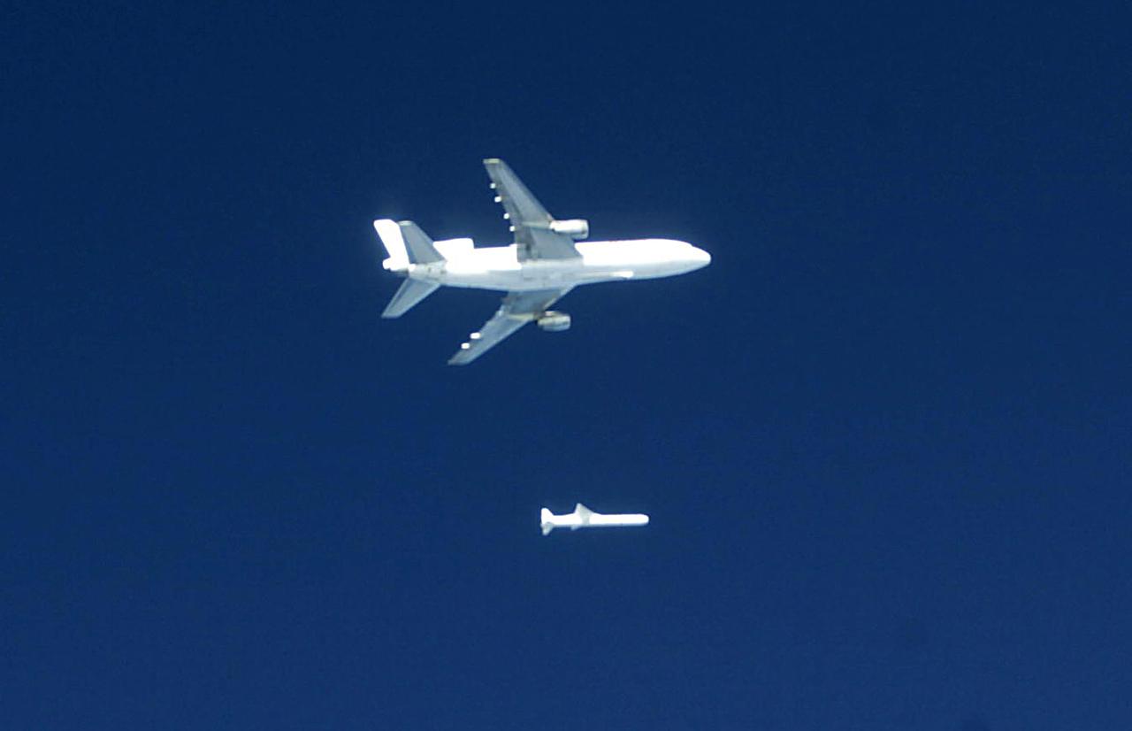
Orbital Sciences Corportation's L1011 releases a Pegasus rocket before ignition, January 25, 2003, off the coast of Cape Canaveral, FL, which will deliver the SORCE satellite, Solar Radiation and Climate Experiment, into the low-Earth orbit. The joint project with Orbital, NASA and the University of Colorado satellite is an atmospheric instrument that will measure incoming radiant energy from the sun. Scientists will use this to address long term atmospheric and climate changes. Other uses will be for ozone research and ultraviolet radiation. (Photo by Eric Roback and Rob Rivers, NASA Langley Research Center)
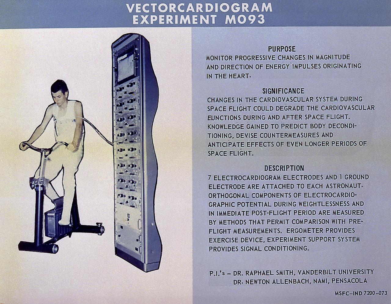
This chart details Skylab's Vectorcardiogram experiment and facility, a medical study to measure the activity of the heart by recording electric signals (vectorcardiographic potentials) of each astronaut during preflight, inflight, and post-flight periods and obtain information on changes in heart functions induced by flight conditions. Vectorcardiograms were taken with a bicycle ergometer (part of Experiment M171) at regular intervals throughout the mission while the crewmen were at rest, and before, during, and after specific exercise periods. This instrument enabled an astronaut to exercise at selected levels of energy consumption. The Marshall Space Flight Center had program management responsibility for the development of Skylab hardware and experiments.
KENNEDY SPACE CENTER, FLA. - In the Vehicle Assembly Building, external tank No. 118 is lifted off its transporter before being raised to vertical and into high bay 3 for mating with solid rocket boosters stacked there. The tank is designated to fly on mission STS-115 with Atlantis. It will fly with many major safety changes, including the removal of the protuberance air load ramps. The mission will deliver the second port truss segment, the P3/P4 Truss, to attach to the first port truss segment, the P1 Truss, as well as deploy solar array set 2A and 4A. Launch of Space Shuttle Atlantis is scheduled for late August. Photo credit: NASA/Jim Grossmann
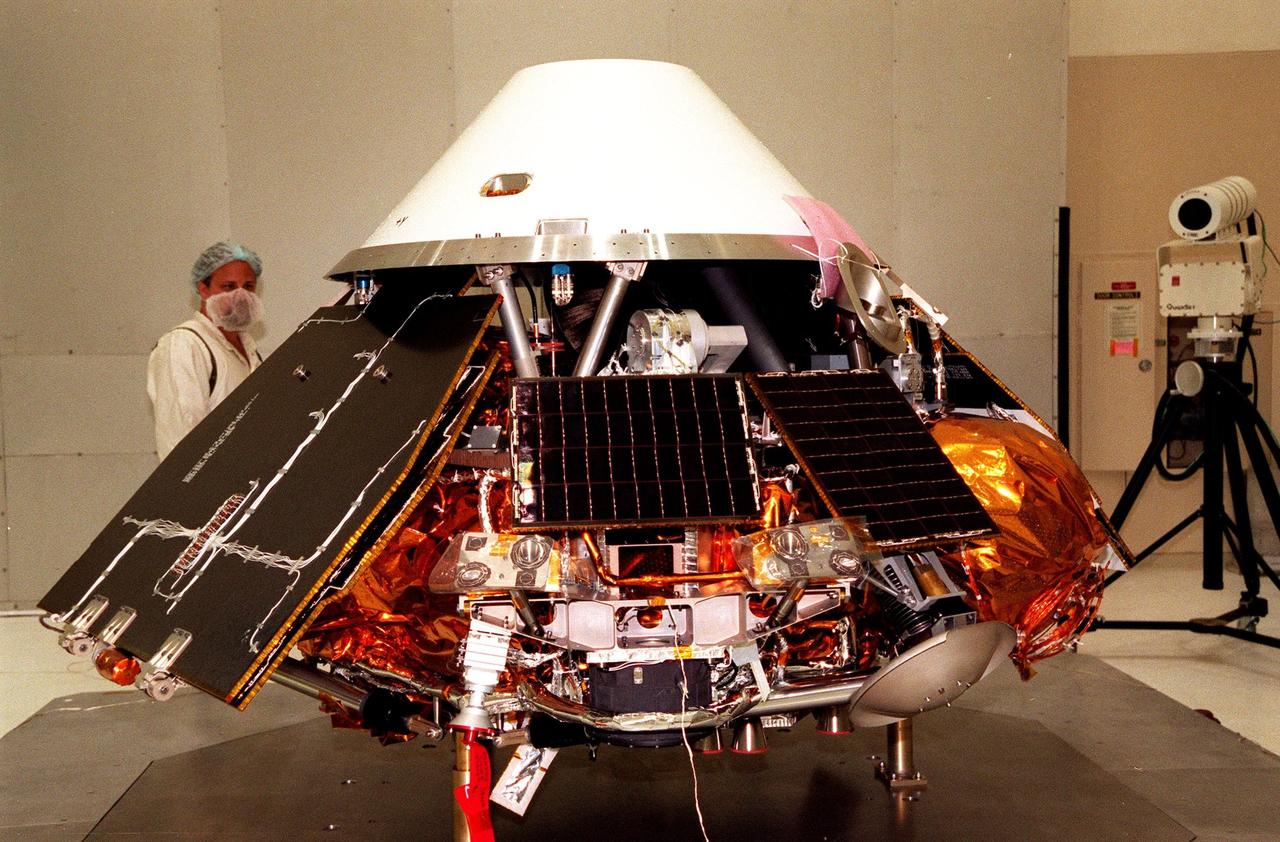
KENNEDY SPACE CENTER, FLA. -- In the Spacecraft Assembly and Encapsulation Facility-2 (SAEF-2), a KSC technician looks over the Mars Polar Lander before its encapsulation inside the backshell, a protective cover. The solar-powered spacecraft, targeted for launch from Cape Canaveral Air Station aboard a Delta II rocket on Jan. 3, 1999, is designed to touch down on the Martian surface near the northern-most boundary of the south pole in order to study the water cycle there. The lander also will help scientists learn more about climate change and current resources on Mars, studying such things as frost, dust, water vapor and condensates in the Martian atmosphere
The Satellite Operations Facility of the National Oceanic and Atmospheric Administration (NOAA) is seen here minutes before the launch of the National Polar-orbiting Operational Environmental Satellite System Preparatory Project (NPP) on Friday, Oct. 28, 2011 in Suitland, Md. NPP is a joint venture between NASA and NOAA, and is the nation's newest Earth-observing satellite, which will provide data on climate change science, allow for accurate weather forecasts and advance warning for severe weather. NPP was launched from Vandenberg Air Force Base in California. Photo Credit: (NASA/Carla Cioffi)
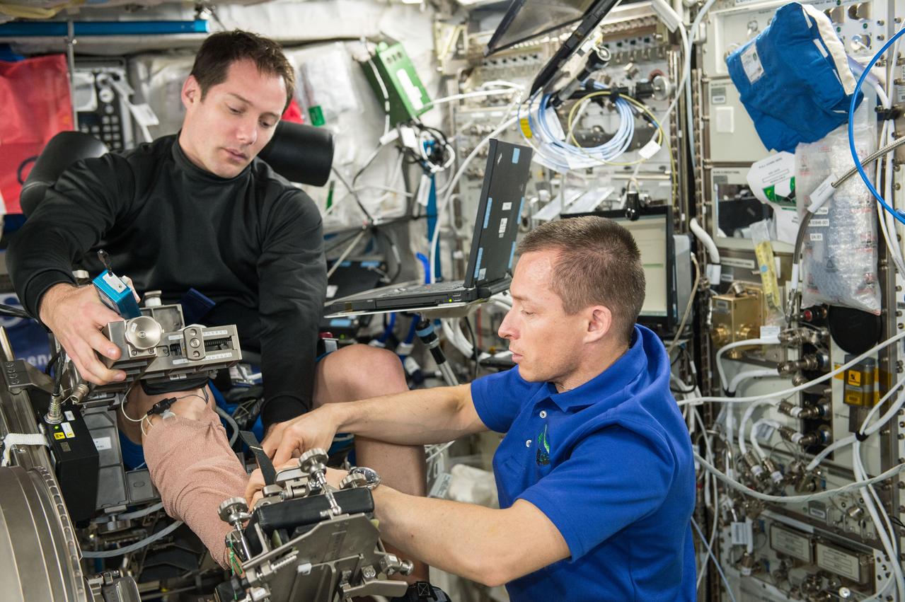
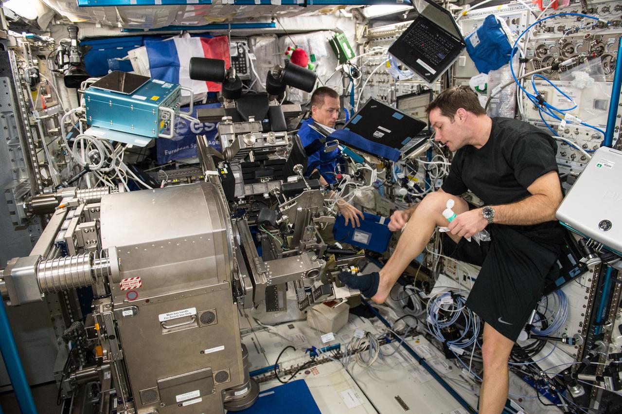
STS078-430-009 (20 June-7 July 1996) --- Astronaut Richard M. Linnehan, mission specialist, performs a test on his leg using the Torque Velocity Dynamometer (TVD). Dr. Thirsk was measuring changes in muscle forces of the leg in this particular view. The TVD hardware is also used to measure arm muscle forces and velocity at the bicep and tricep areas. Crewmembers for the mission performed all experiment protocols prior to flight to develop a baseline and will also perform post-flight tests to complete the analysis. Additionally, muscle biopsies were taken before the flight and will be conducted after the flight.
KENNEDY SPACE CENTER, FLA. -- A closeup of the Gravity Probe B spacecraft in NASA’s Payload Processing Facility 1610 on North Vandenberg Air Force Base in California after completion of prelaunch processing before going to the pad. The spacecraft will be transported to Space Launch Complex 2 on April 1 and mated to the Boeing Delta II rocket. Gravity Probe B consists of four sophisticated gyroscopes that will provide an almost perfect space-time reference system. The mission will look in a precise manner for tiny changes in the direction of spin. Gravity Probe B will be launched into a 400-nautical-mile-high polar orbit for a 16-month mission. Launch is scheduled for April 17.
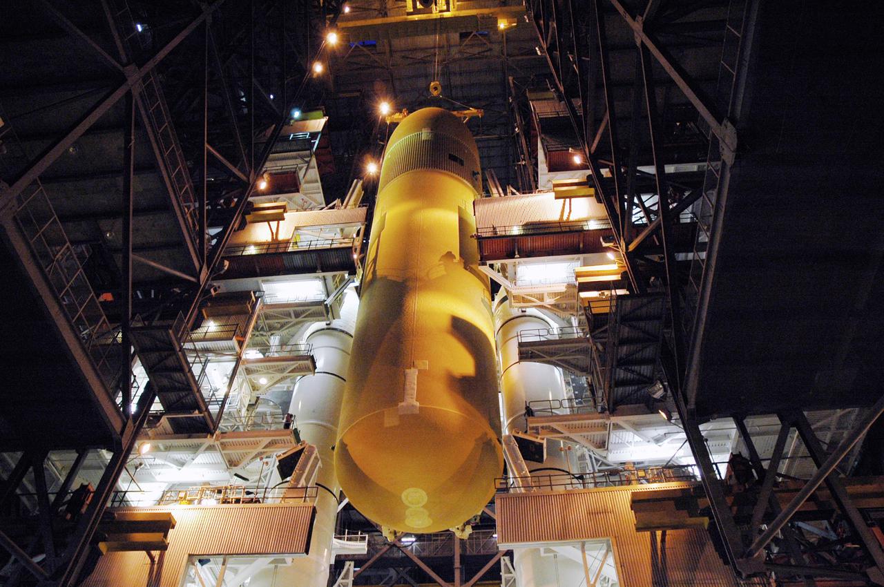
KENNEDY SPACE CENTER, FLA. - The immense size of the External Tank is captured here as a crane lowers it between the Solid Rocket Boosters (SRBs) on the Mobile Launcher Platform. The ET, designated for the Return to Flight mission STS-114, will be mated to the SRBs for launch. The 154-foot long ET is recently redesigned to meet recommendations of the Columbia Accident Investigation Board before returning to flight. Among dozens of changes is a redesigned forward bipod fitting to reduce the risk to the Space Shuttle from falling debris during ascent. Considered a test flight, STS-114 is scheduled to launch during a window extending May 15 to June 3. The Shuttle will carry supplies and equipment to the International Space Station.
KENNEDY SPACE CENTER, FLA. -- In the Spacecraft Assembly and Encapsulation Facility-2 (SAEF-2), the top of the Mars Polar Lander is secured on a portable stand. The Lander will undergo testing, including a functional test of the science instruments and the basic spacecraft subsystems, before its launch from Cape Canaveral Air Station aboard a Delta II rocket on Jan. 3, 1999. The solar-powered spacecraft is designed to touch down on the Martian surface near the northern-most boundary of the south pole in order to study the water cycle there. The lander also will help scientists learn more about climate change and current resources on Mars, studying such things as frost, dust, water vapor and condensates in the Martian atmosphere
KENNEDY SPACE CENTER, FLA. - In the Vehicle Assembly Building, external tank No. 118 is lifted off its transporter before being raised to vertical and into high bay 3 for mating with solid rocket boosters stacked there. The tank is designated to fly on mission STS-115 with Atlantis. It will fly with many major safety changes, including the removal of the protuberance air load ramps. The mission will deliver the second port truss segment, the P3/P4 Truss, to attach to the first port truss segment, the P1 Truss, as well as deploy solar array set 2A and 4A. Launch of Space Shuttle Atlantis is scheduled for late August. Photo credit: NASA/Jim Grossmann
KENNEDY SPACE CENTER, FLA. -- The Gravity Probe B spacecraft is in NASA’s Payload Processing Facility 1610 on North Vandenberg Air Force Base in California after completion of prelaunch processing before going to the pad. The spacecraft will be transported to Space Launch Complex 2 on April 1 and mated to the Boeing Delta II rocket. Gravity Probe B consists of four sophisticated gyroscopes that will provide an almost perfect space-time reference system. The mission will look in a precise manner for tiny changes in the direction of spin. Gravity Probe B will be launched into a 400-nautical-mile-high polar orbit for a 16-month mission. Launch is scheduled for April 17.
KENNEDY SPACE CENTER, FLA. - The External Tank (ET) designated to fly on Return to Flight mission STS-114 is lifted from a checkout cell to be mated with the Solid Rocket Boosters. The ET is recently redesigned to meet recommendations of the Columbia Accident Investigation Board before return to flight. Among dozens of changes is a redesigned forward bipod fitting to reduce the risk to the Space Shuttle from falling debris during ascent. Considered a test flight, STS-114 is scheduled to launch during a window extending May 15 to June 3. The Shuttle will carry supplies and equipment to the International Space Station.
STS078-304-018 (20 June - 7 July 1996) --- Payload specialist Robert B. Thirsk, representing the Canadian Space Agency (CSA), performs a test on his arm using the Torque Velocity Dynamometer (TVD). Dr. Thirsk was measuring changes in muscle forces of the bicep and tricep in this particular view. The TVD hardware is also used to measure leg muscle forces and velocity at the ankle and elbow joints. Crew members for the mission performed all experiment protocols prior to flight to develop a baseline and will also perform post-flight tests to complete the analysis. Additionally, muscle biopsies were taken before the flight and will be conducted after the flight.
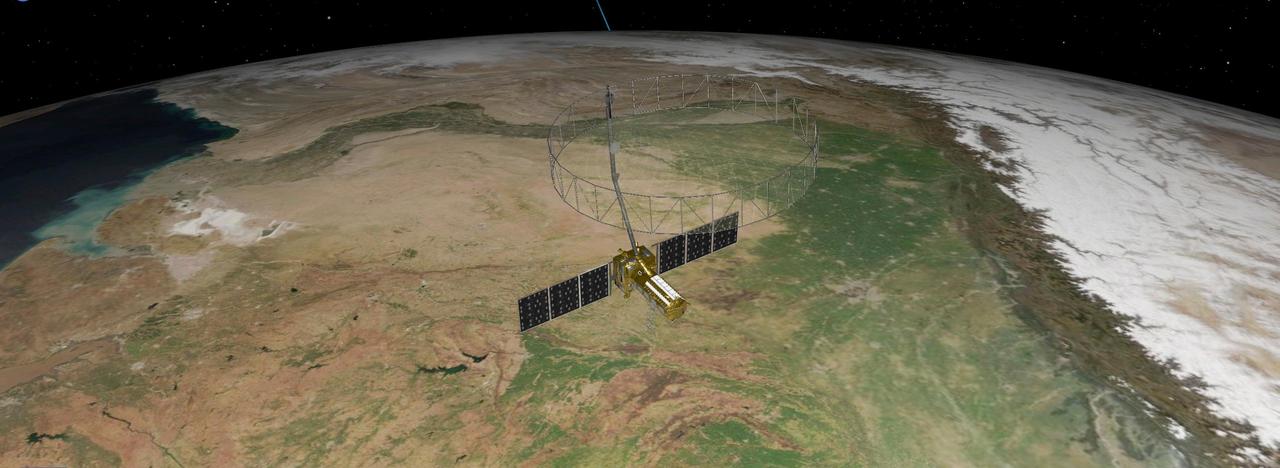
This artist's concept depicts the NISAR satellite orbiting Earth over northeastern India. Short for NASA-ISRO Synthetic Aperture Radar, the mission is an equal collaboration between the NASA and the Indian Space Research Organisation and marks the first time the two agencies have cooperated on hardware development for an Earth-observing mission. Observations from NISAR will benefit humanity by helping researchers around the world better understand changes in our planet's surface, including its ice sheets, glaciers, and sea ice. It also will capture changes in forest and wetland ecosystems and track movement and deformation of our planet's crust by phenomena such as earthquakes, landslides, and volcanic activity. The global and rapid coverage from NISAR will provide unprecedented opportunities for disaster response, producing data to assist in mitigating and assessing damage, with observations before and after catastrophic events available in short time frames. NISAR will launch from ISRO's Satish Dhawan Space Centre on India's southeastern coast in 2025. https://photojournal.jpl.nasa.gov/catalog/PIA26496
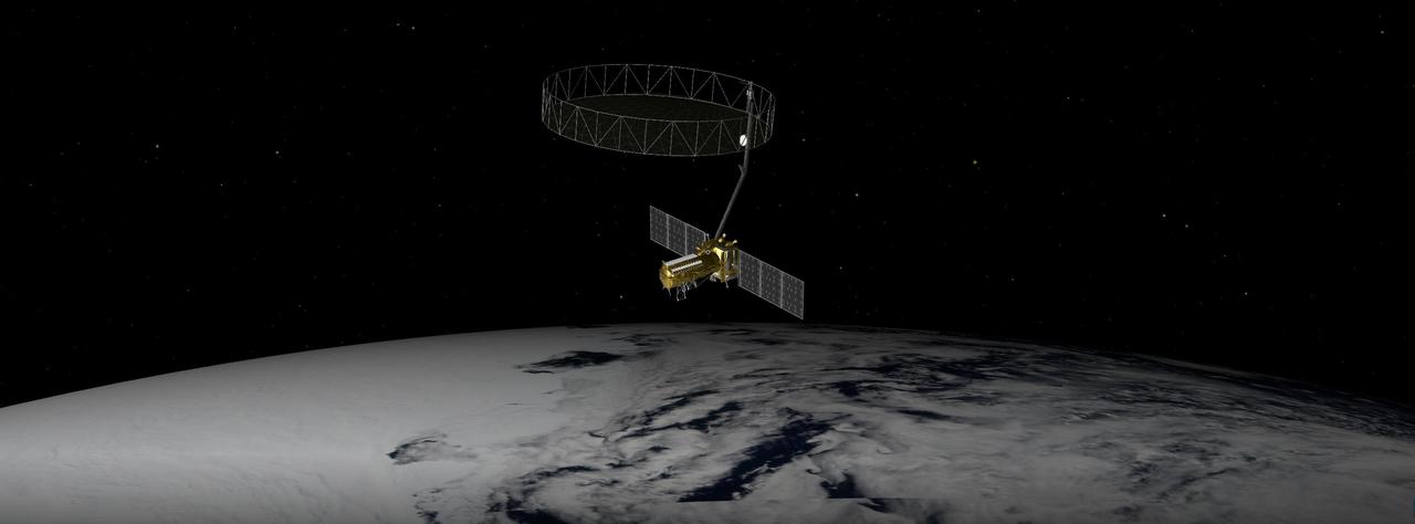
This artist's concept depicts the NISAR satellite orbiting Earth over Antarctica. Short for NASA-ISRO Synthetic Aperture Radar, the mission is an equal collaboration between the NASA and the Indian Space Research Organisation and marks the first time the two agencies have cooperated on hardware development for an Earth-observing mission. Observations from NISAR will benefit humanity by helping researchers around the world better understand changes in our planet's surface, including its ice sheets, glaciers, and sea ice. It also will capture changes in forest and wetland ecosystems and track movement and deformation of our planet's crust by phenomena such as earthquakes, landslides, and volcanic activity. The global and rapid coverage from NISAR will provide unprecedented opportunities for disaster response, producing data to assist in mitigating and assessing damage, with observations before and after catastrophic events available in short time frames. NISAR will launch from ISRO's Satish Dhawan Space Centre on India's southeastern coast in March 2025. https://photojournal.jpl.nasa.gov/catalog/PIA26492
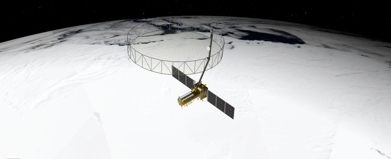
This artist's concept depicts the NISAR satellite orbiting Earth over Antarctica. Short for NASA-ISRO Synthetic Aperture Radar, the mission is an equal collaboration between the NASA and the Indian Space Research Organisation and marks the first time the two agencies have cooperated on hardware development for an Earth-observing mission. Observations from NISAR will benefit humanity by helping researchers around the world better understand changes in our planet's surface, including its ice sheets, glaciers, and sea ice, which are collectively known as the cryosphere. It also will capture changes in forest and wetland ecosystems and track movement and deformation of our planet's crust by phenomena such as earthquakes, landslides, and volcanic activity. The global and rapid coverage from NISAR will provide unprecedented opportunities for disaster response, producing data to assist in mitigating and assessing damage, with observations before and after catastrophic events available in short time frames. NISAR will launch from ISRO's Satish Dhawan Space Centre on India's southeastern coast in 2025. https://photojournal.jpl.nasa.gov/catalog/PIA26493
KENNEDY SPACE CENTER, FLA. - Workers check the lower end of the first stage of the Delta II rocket before it is lifted up the tower on NASA's Space Launch Complex 2 (SLC-2), Vandenberg Air Force Base, Calif. The rocket will carry the ICESat and CHIPSat satellites into Earth orbits. ICESat is a 661-pound satellite known as Geoscience Laser Altimeter System (GLAS) that will revolutionize our understanding of ice and its role in global climate change and how we protect and understand our home planet. It will help scientists determine if the global sea level is rising or falling. It will look at the ice sheets that blanket the Earth's poles to see if they are growing or shrinking. It will assist in developing an understanding of how changes in the Earth's atmosphere and climate effect polar ice masses and global sea level. CHIPSat, a suitcase-size 131-pound satellite, will provide invaluable information into the origin, physical processes and properties of the hot gas contained in the interstellar medium. This can provide important clues about the formation and evolution of galaxies since the interstellar medium literally contains the seeds of future stars. The Delta II launch is scheduled for Jan. 11 between 4:45 p.m. - 5:30 p.m. PST.
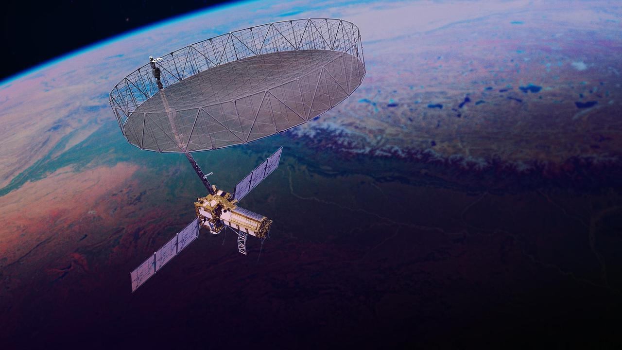
This artist's concept depicts the NISAR satellite orbiting Earth. Short for NASA-ISRO Synthetic Aperture Radar, the mission is an equal collaboration between NASA and the Indian Space Research Organisation and marks the first time the two agencies have cooperated on hardware development for an Earth-observing mission. Observations from NISAR will benefit humanity by helping researchers around the world better understand changes in our planet's surface, including its ice sheets, glaciers, and sea ice. It also will capture changes in forest and wetland ecosystems and track movement and deformation of our planet's crust by phenomena such as earthquakes, landslides, and volcanic activity. The global and rapid coverage from NISAR will provide unprecedented support for disaster response, producing data to assist in mitigating and assessing damage, with observations before and after catastrophic events available in short time frames. NISAR launched from ISRO's Satish Dhawan Space Centre on India's southeastern coast on July 30, 2025. https://photojournal.jpl.nasa.gov/catalog/PIA26613
VANDENBERG AIR FORCE BASE, Calif. – NASA's Orbiting Carbon Observatory-2, or OCO-2, is viewed for the last time in the mobile service tower at Space Launch Complex 2 on Vandenberg Air Force Base in California before the Delta II payload fairing encloses it completely for launch. The fairing will protect OCO-2 during launch aboard a United Launch Alliance Delta II rocket, scheduled for 5:56 a.m. EDT on July 1. OCO-2 is NASA’s first mission dedicated to studying atmospheric carbon dioxide, the leading human-produced greenhouse gas driving changes in Earth’s climate. OCO-2 will provide a new tool for understanding the human and natural sources of carbon dioxide emissions and the natural "sinks" that absorb carbon dioxide and help control its buildup. The observatory will measure the global geographic distribution of these sources and sinks and study their changes over time. To learn more about OCO-2, visit http://oco.jpl.nasa.gov. Photo credit: NASA/30th Space Wing, U.S. Air Force
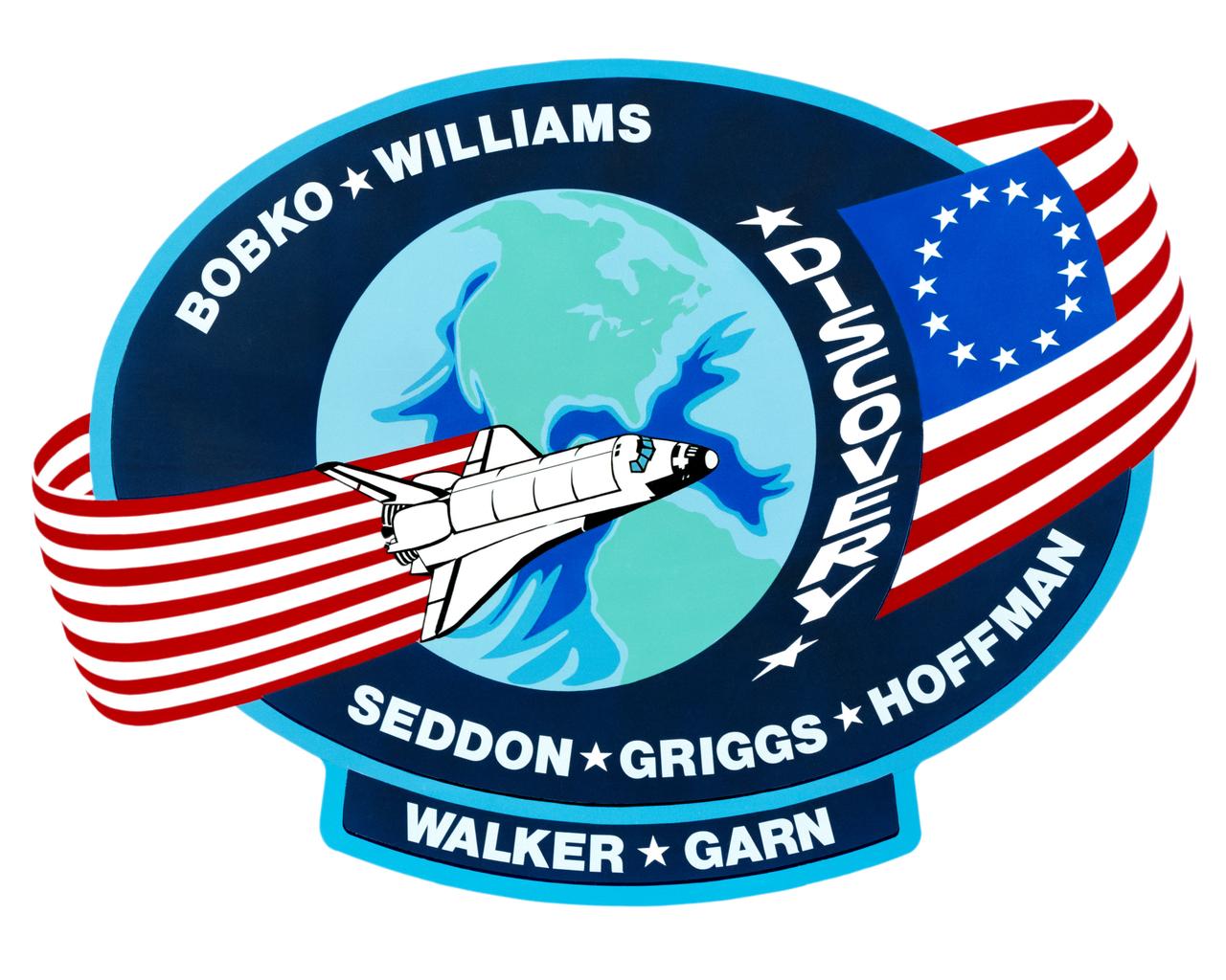
S85-28989 (March 1985) --- The dominant features of the STS-51D emblem are an orbit formed by a Colonial American flag and a space shuttle. The flag in orbit signifies the U.S. flag to indicate that it comes from this country and the American people. The original 13-star flag is used to symbolize a continuity of technical achievement and progress since colonial times. The name Discovery preceding the flag represents the spirit of Discovery and exploration of new frontiers which have been a hallmark of American people even before they were formed together as a nation. The crew members are Karol J. Bobko, Donald E. Williams, Rhea Seddon, S. David Griggs and Jeffrey A. Hoffman of NASA; and Charles D. Walker, representing McDonnell Douglas Corporation; and U. S. Senator Jake Garn. The NASA insignia design for space shuttle flights is reserved for use by the astronauts and for other official use as the NASA Administrator may authorize. Public availability has been approved only in the forms of illustrations by the various news media. When and if there is any change in this policy, which is not anticipated, the change will be publicly announced. Photo credit: NASA
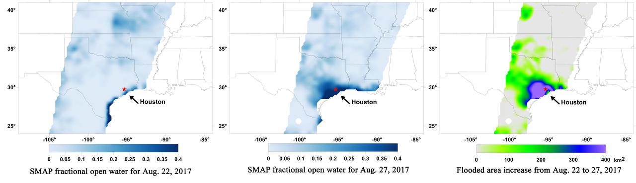
A new series of images generated with data from NASA's Soil Moisture Active Passive (SMAP) satellite illustrate the surface flooding caused by Hurricane Harvey from before its initial landfall through August 27, 2017. The SMAP observations detect the proportion of the ground covered by surface water within the satellite's field of view. The sequence of images depicts successive satellite orbital swath observations showing the surface water conditions on August 22, before Harvey's landfall (left), and then on Aug. 27, two days after landfall (middle). The resulting increase in surface flooding from record rainfall over the three-day period, shown at right, depicts regionally heavy flooding around the Houston metropolitan area. The hardest hit areas (blue and purple shades) cover more than 23,000 square miles (about 59,600 square kilometers) and indicate a more than 1,000-fold increase in surface water cover from rainfall-driven flooding. SMAP's low-frequency (L-band) microwave radiometer features enhanced capabilities for detecting surface water changes in nearly all weather conditions and under low-to-moderate vegetation cover. The satellite provides global coverage with one to three-day repeat sampling, which is well suited for monitoring dynamic inland waters around the world. https://photojournal.jpl.nasa.gov/catalog/PIA21930
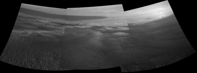
Late-afternoon shadows include one cast by the rover itself in this look toward the floor of Endeavour Crater by NASA's Mars Exploration Rover Opportunity. The rover recorded this scene on Nov. 11, 2017, during the 4,911th Martian day, or sol, of the rover's work on Mars. That was about a week before Opportunity's eighth Martian winter solstice. Opportunity's location is partway down a narrow valley that descends from the crest of the western rim of Endeavour Crater to the crater's floor. This fluid-carved set of troughs, called "Perseverance Valley," is the length of about two football fields, at a slope of about 15 to 17 degrees. The Navigation Camera (Navcam) on Opportunity's mast took the three component images stitched together into this scene. The images were taken about three minutes apart, long enough to see how the shadow was changing on the slope, at the seams between the images. Wheel tracks in the lower right of the scene were made before the rover climbed back uphill for a closer look at some rocks it had passed. The portions of the rover in the shadow at upper right include the mast with the Navcam and Panoramic Camera (Pancam) on top and the UHF radio antenna, which Opportunity uses to transmit images and other data to overflying orbiters for relay to Earth. https://photojournal.jpl.nasa.gov/catalog/PIA22071
VANDENBERG AIR FORCE BASE, Calif. – The Ocean Surface Topography Mission, or OSTM/Jason 2, spacecraft is being wrapped, or bagged, before fueling, encapsulation and transfer to the launch pad. The launch of the OSTM/Jason 2 aboard a Delta II rocket is scheduled for Friday, June 20, from Vandenberg Air Force Base in California. The launch window extends from 12:46 a.m. to 12:55 a.m. PDT. The satellite will be placed in an 830-mile-high orbit at an inclination of 66 degrees after separating from the Delta II 55 minutes after liftoff. The five primary science instruments of the Ocean Surface Topography Mission aboard the Jason 2 spacecraft are dedicated to measuring ocean surface height. These measurements will be used to evaluate and forecast climate changes and improve weather forecasting. The results also are expected to help forecasters better predict hurricane intensity. Photo credit: NASA
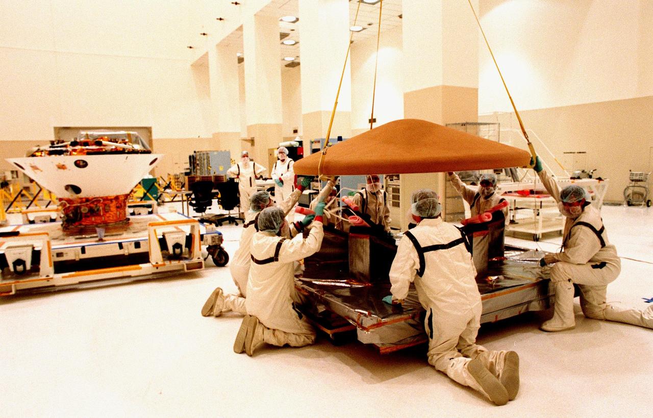
KENNEDY SPACE CENTER, FLA. -- In the Spacecraft Assembly and Encapsulation Facility-2 (SAEF-2), the top of the Mars Polar Lander is lowered onto a portable stand. The Lander will undergo testing, including a functional test of the science instruments and the basic spacecraft subsystems, before its launch from Cape Canaveral Air Station aboard a Delta II rocket on Jan. 3, 1999. The solar-powered spacecraft is designed to touch down on the Martian surface near the northern-most boundary of the south pole in order to study the water cycle there. The lander also will help scientists learn more about climate change and current resources on Mars, studying such things as frost, dust, water vapor and condensates in the Martian atmosphere
The SpaceX Falcon 9 rocket, carrying the Surface Water and Ocean Topography (SWOT) satellite, soars upward after lifting off from Space Launch Complex-4 East at Vandenberg Space Force Base in California on Dec. 16, 2022, at 3:46 a.m. PST. A collaboration between NASA and the French space agency Centre National d’Études Spatiales (CNES), with contributions from the Canadian Space Agency and the UK Space Agency, SWOT will be the first satellite to survey nearly all water on Earth’s surface. The satellite will help researchers understand how much water flows in and out of Earth’s freshwater bodies and will provide insight into the ocean’s role in climate change. The instruments onboard will measure the height of water in lakes, rivers, reservoirs, and the ocean, and will observe ocean features in higher definition than ever before. NASA’s Launch Services Program, based at the agency’s Kennedy Space Center in Florida, is managing the launch service.