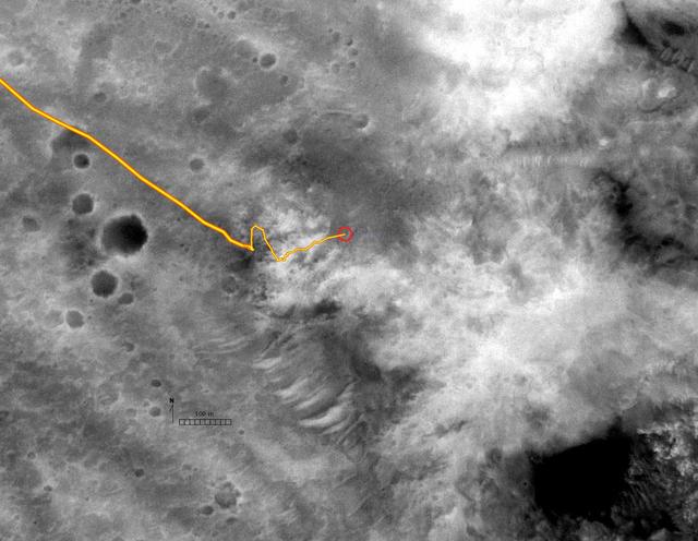
Spirit Route in Black and White
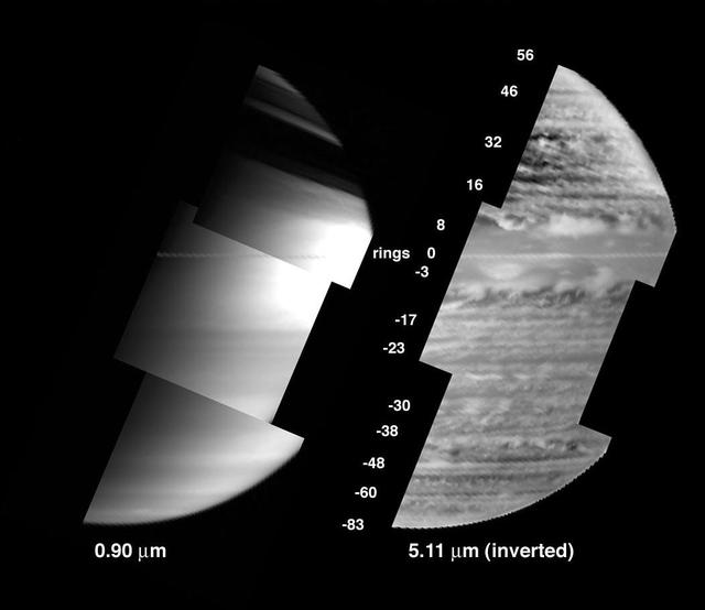
A New View of Saturn - Black and White
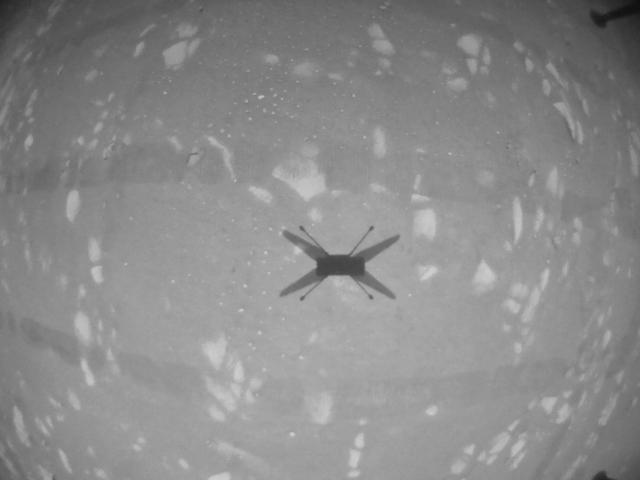
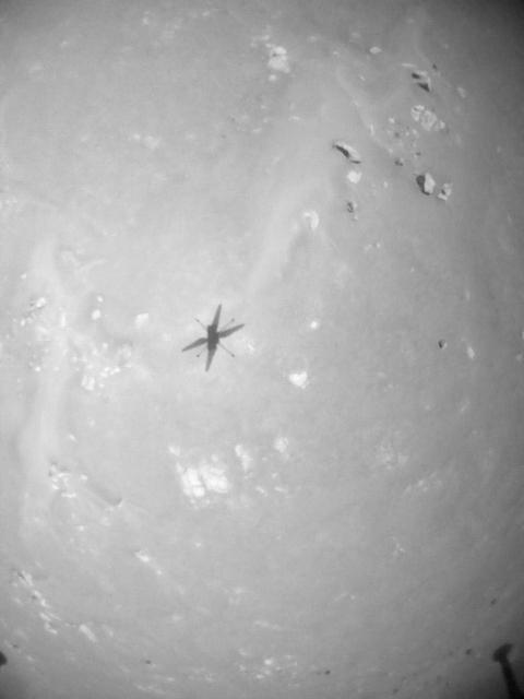
This black-and-white image was taken by the navigation camera aboard NASA's Ingenuity helicopter during its third flight, on April 25, 2021. https://photojournal.jpl.nasa.gov/catalog/PIA24623
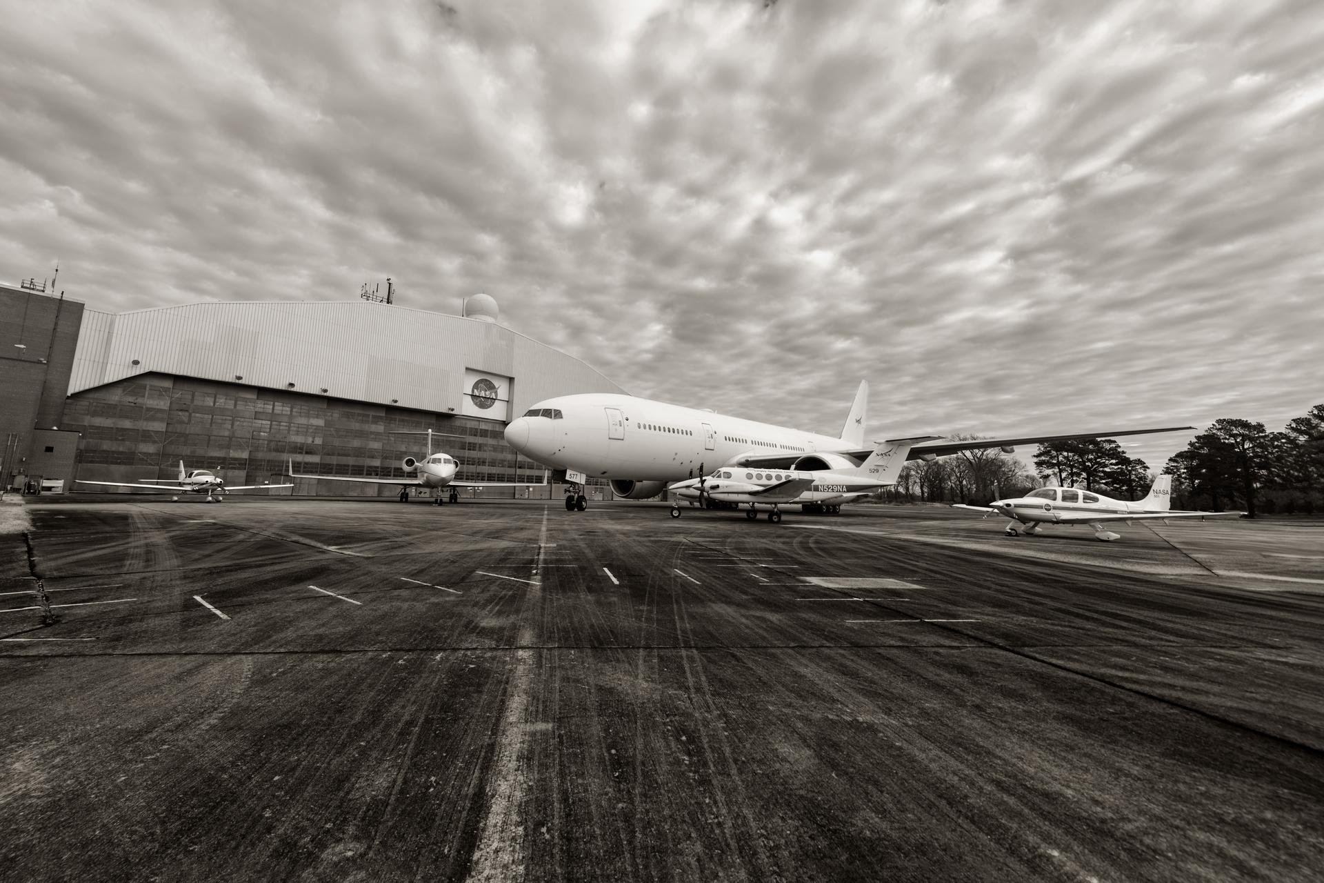
NASA Langley Research Science Directorate (RSD) Aircraft outside the hangar in Hampton Va in black white.
This video clip was obtained by the Ingenuity Mars Helicopter's black-and-white navigation camera during its 14th flight, on Oct. 24, 2021. During the flight, the rotorcraft reached a peak altitude of 16 feet (5 meters) with a small sideways translation of 7 feet (2 meters) to avoid a nearby sand ripple, before setting down again. Flight 14 was only 23 seconds in length. As a result, enough onboard memory was available to obtain black-and-white navigation camera imagery at the high-rate of 7.4 frames a second. Movie available at https://photojournal.jpl.nasa.gov/catalog/PIA24976
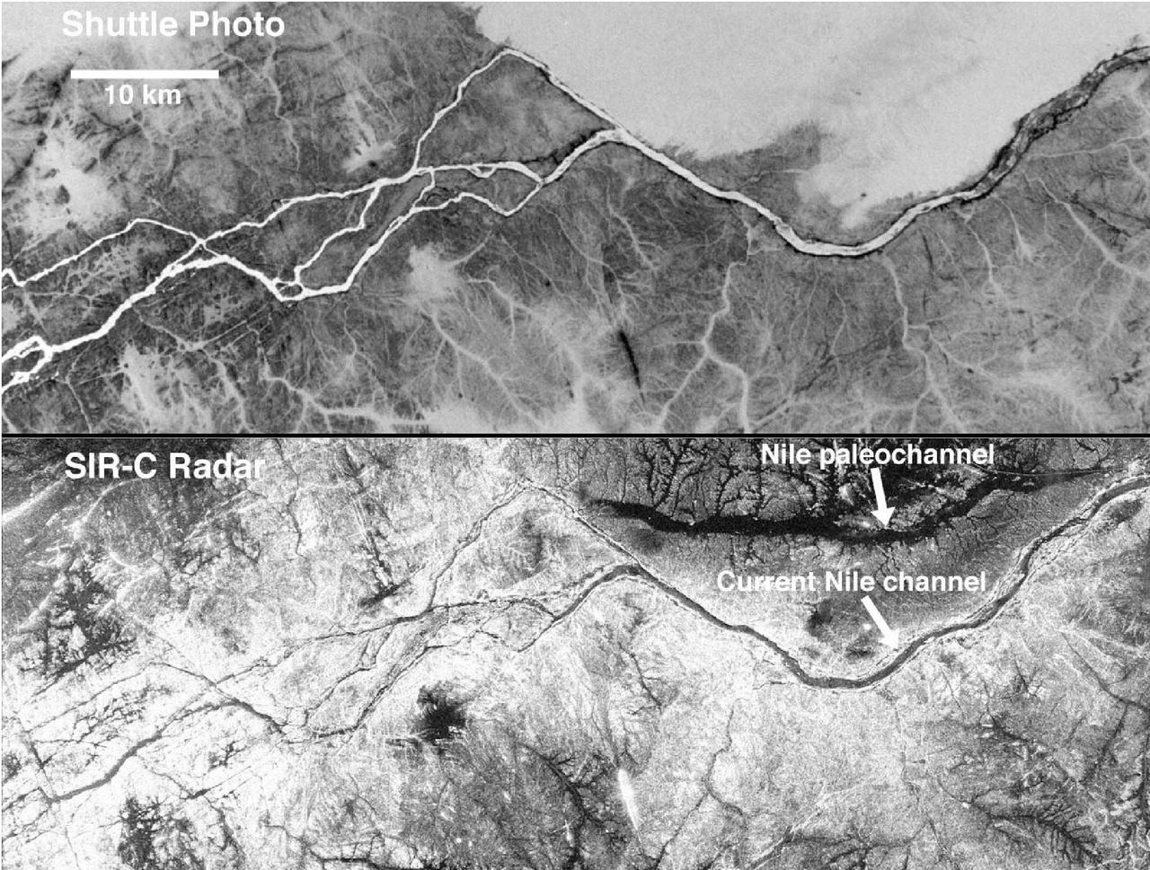
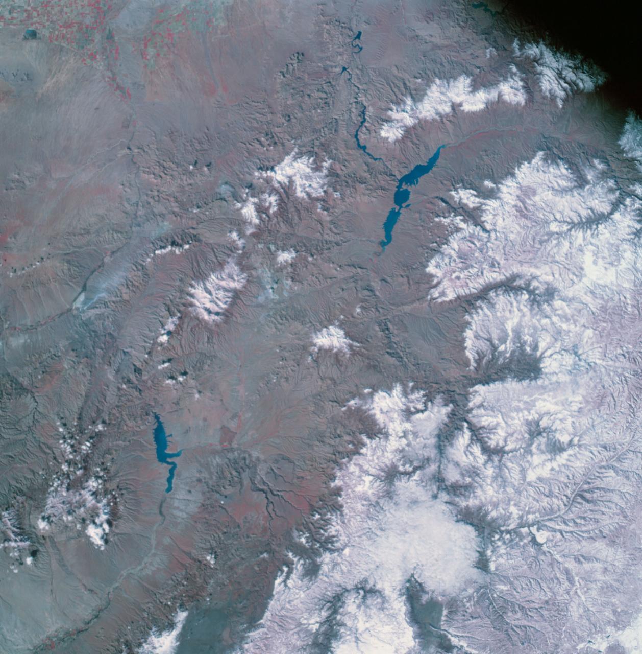
These two gray-scale images from NASA Space Shuttle show part of the Nile River, near the Fourth Cataract in Sudan.

Dr. Quincy Brown, director of space STEM and workforce policy for the White House National Space Council, speaks at an event to commemorate Black Space Week (BSW) 2024 titled, "Beyond the Color Lines From Science Fiction to Science Fact," in the Oprah Winfrey Theater at the Smithsonian National Museum of African American History and Culture, Monday, June 17, 2024 in Washington. Photo Credit: (NASA/Aubrey Gemignani)

This graphic shows the computer simulation of a black hole from start to finish. Plasma is falling slowly toward the black hole in a (at the upper left). The plasma has a magnetic field, shown by the white lines. It picks up speed as it falls toward the hole in b (at the upper right), c (lower left) and d (lower right). However, the rotating black hole twists up space itself (and the magnetic field lines) and ejects electromagnetic power along the north and south poles above the black hole. The red and white color shows the immense electromagnetic power output, which eventually will pick up particles and form squirting jets. This simulation was conducted using supercomputers at Japan's National Institute for Fusion Science. http://photojournal.jpl.nasa.gov/catalog/PIA04206
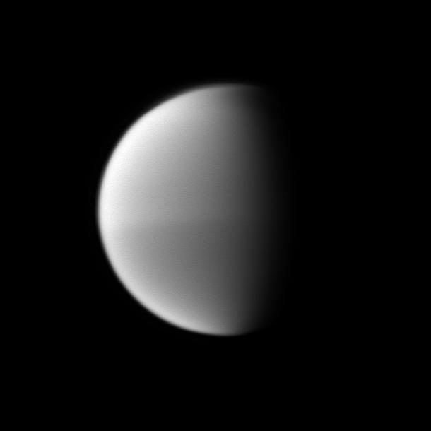
Titan seasonal hemispheric dichotomy is chronicled in black and white, with the moon northern half appearing slightly lighter than the dark southern half in this image taken by NASA Cassini spacecraft.
This image shows the calibration target for the Chemistry and Camera ChemCam instrument on NASA Curiosity rover. The calibration target is one square and a group of nine circles that look dark in the black-and-white image.
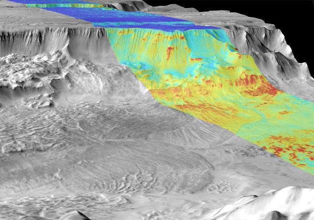
This image is a mosaic of day and night infrared images of Melas Chasma taken by NASA Mars Odyssey spacecraft. The daytime temperature images are shown in black and white, superimposed on the Martian topography.
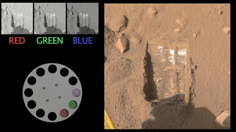
The Surface Stereo Imager onboard NASA Phoenix Mars Lander captures a scene with three different filters. The images are sent to Earth in black and white and the color is added by mission scientists.
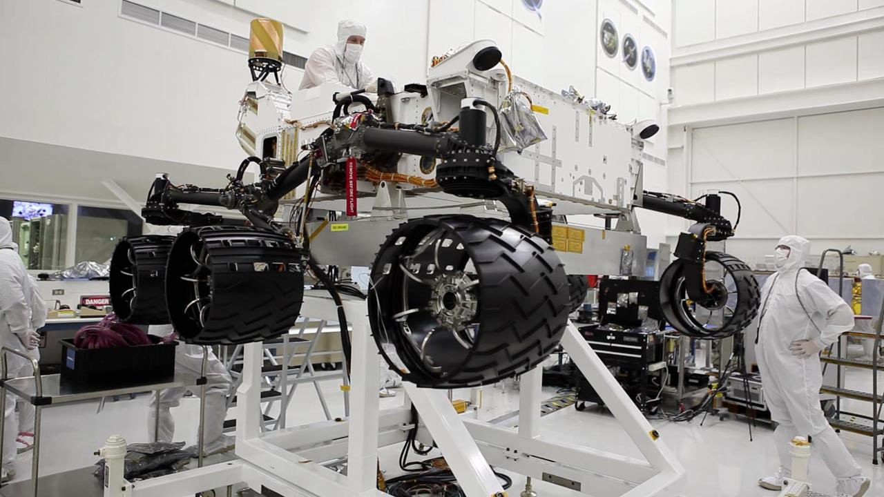
This image was taken in the cleanroom where NASA Curiosity rover is being assembled. It shows the rover, which is about the size of an SUV, hoisted on a white lift, with its black wheels suspended in the air.
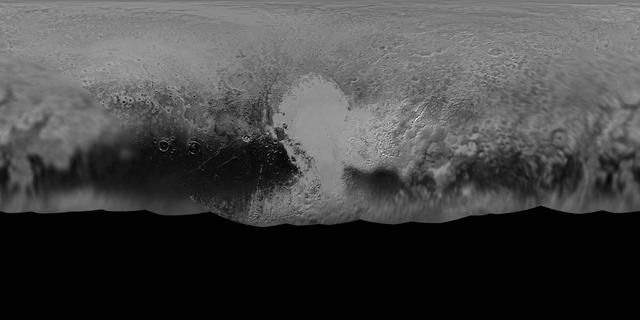
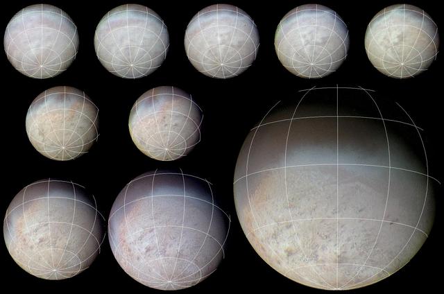
NASA New Horizons mission science team has produced this updated panchromatic black-and-white global map of Pluto. The map includes all resolved images of Pluto surface acquired between July 7-14, 2015.
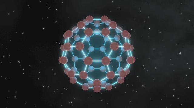
This image illustrates that buckyballs -- discovered in space by NASA Spitzer Space Telescope -- closely resemble old fashioned, black-and-white soccer balls, only on much smaller scales.
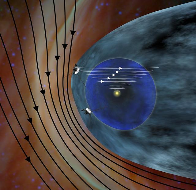
This artist concept shows the different expected directions of the magnetic fields in interstellar space black lines and the magnetic field emanating from our sun white lines as NASA Voyager 1 spacecraft travels northward out of the heliosphere.
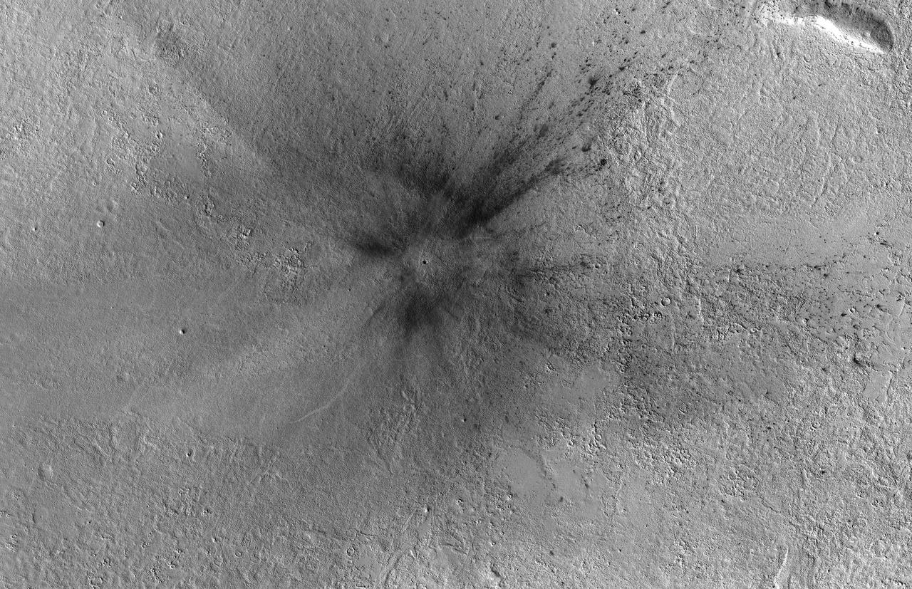
This meteoroid impact crater on Mars was captured using the black-and-white Context Camera aboard NASA's Mars Reconnaissance Orbiter (MRO). The Context Camera took this image showing the impact, which occurred Sept. 18, 2021, in a region called Tempe Terra. The meteoroid struck the side of a graben – a depression created by faults. The impact crater left behind is roughly 427 feet (130 meters) across. https://photojournal.jpl.nasa.gov/catalog/PIA25587

This view of Jupiter was taken by Voyager 1. This image was taken through color filters and recombined to produce the color image. This photo was assembled from three black and white negatives by the Image Processing Lab at Jet Propulsion Laboratory. http://photojournal.jpl.nasa.gov/catalog/PIA01384
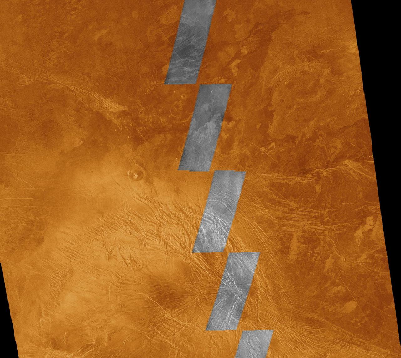
This image compares NASA Magellan data acquired in August 1990 during the initial test of the radar system black and white insets with data acquired by the spacecraft in April 1991 color background. The area is in the southern hemisphere of Venus. http://photojournal.jpl.nasa.gov/catalog/PIA00220
This color image from NASA Voyager 2 was reconstructed by making a computer composite of three black and white images taken through red, green, and blue filters. Details on Triton surface unfold dramatically in this sequence of approach images. http://photojournal.jpl.nasa.gov/catalog/PIA00329
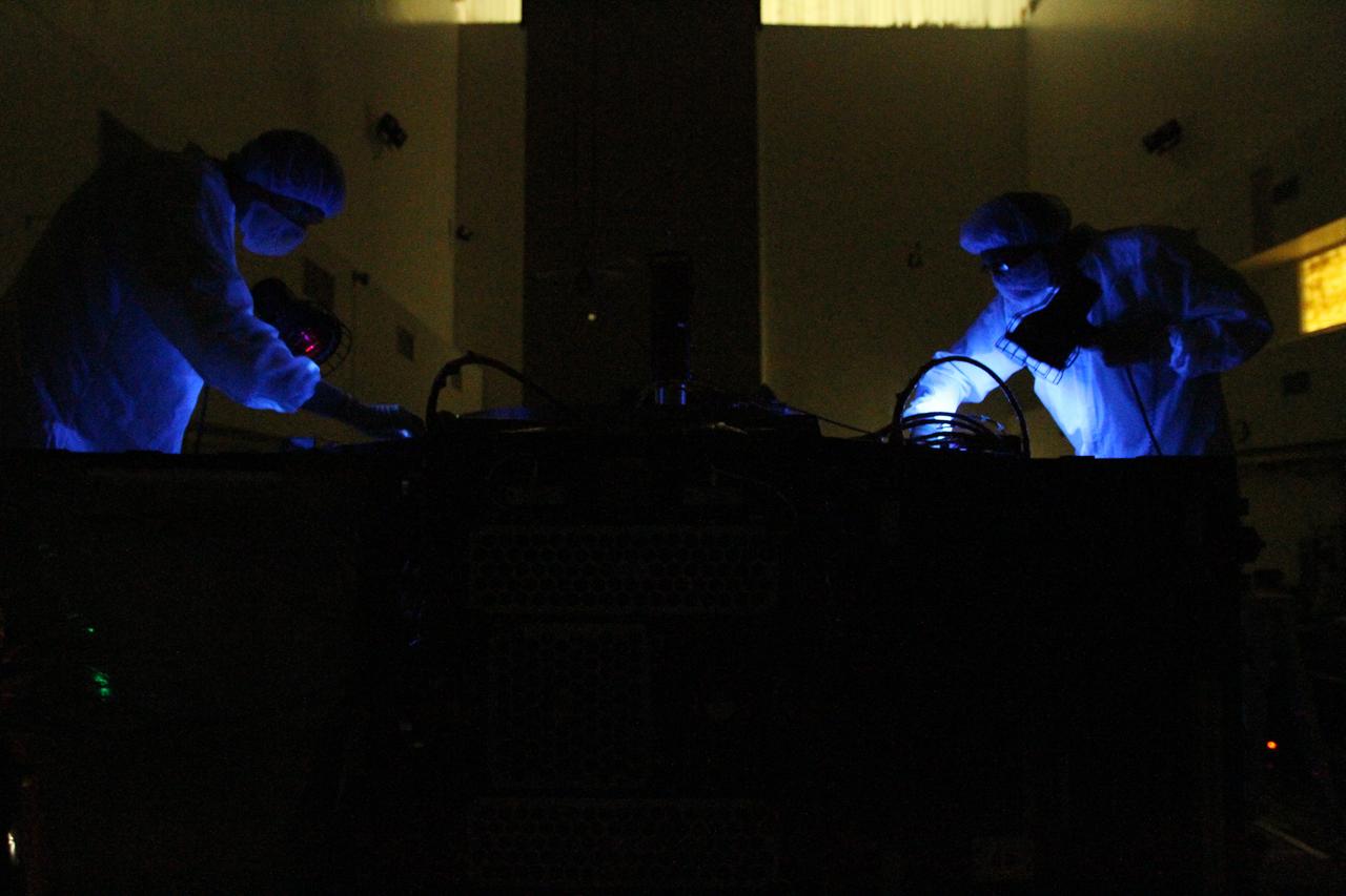
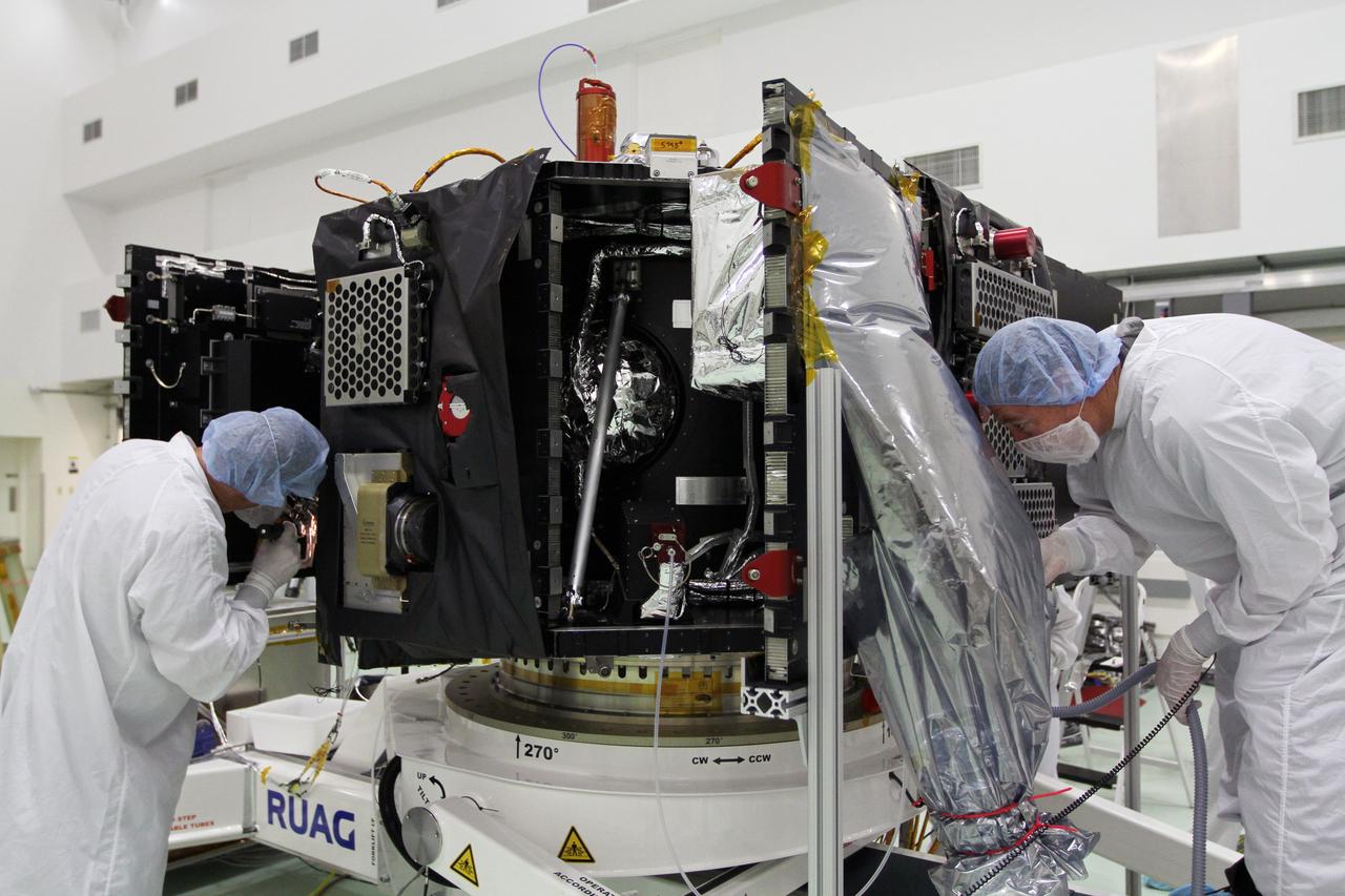
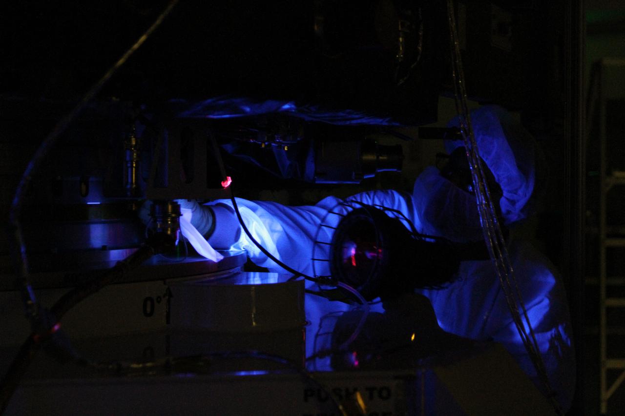
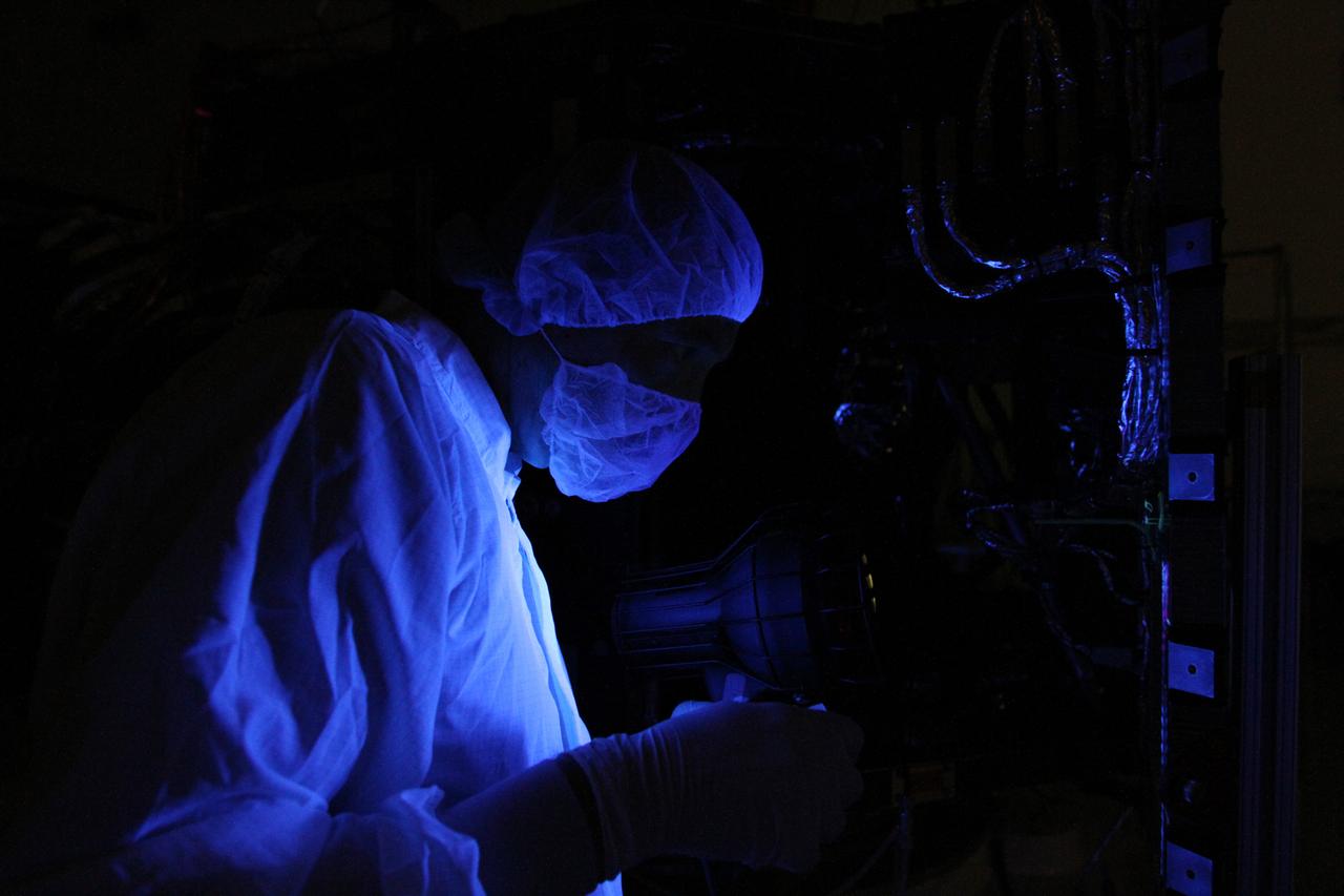
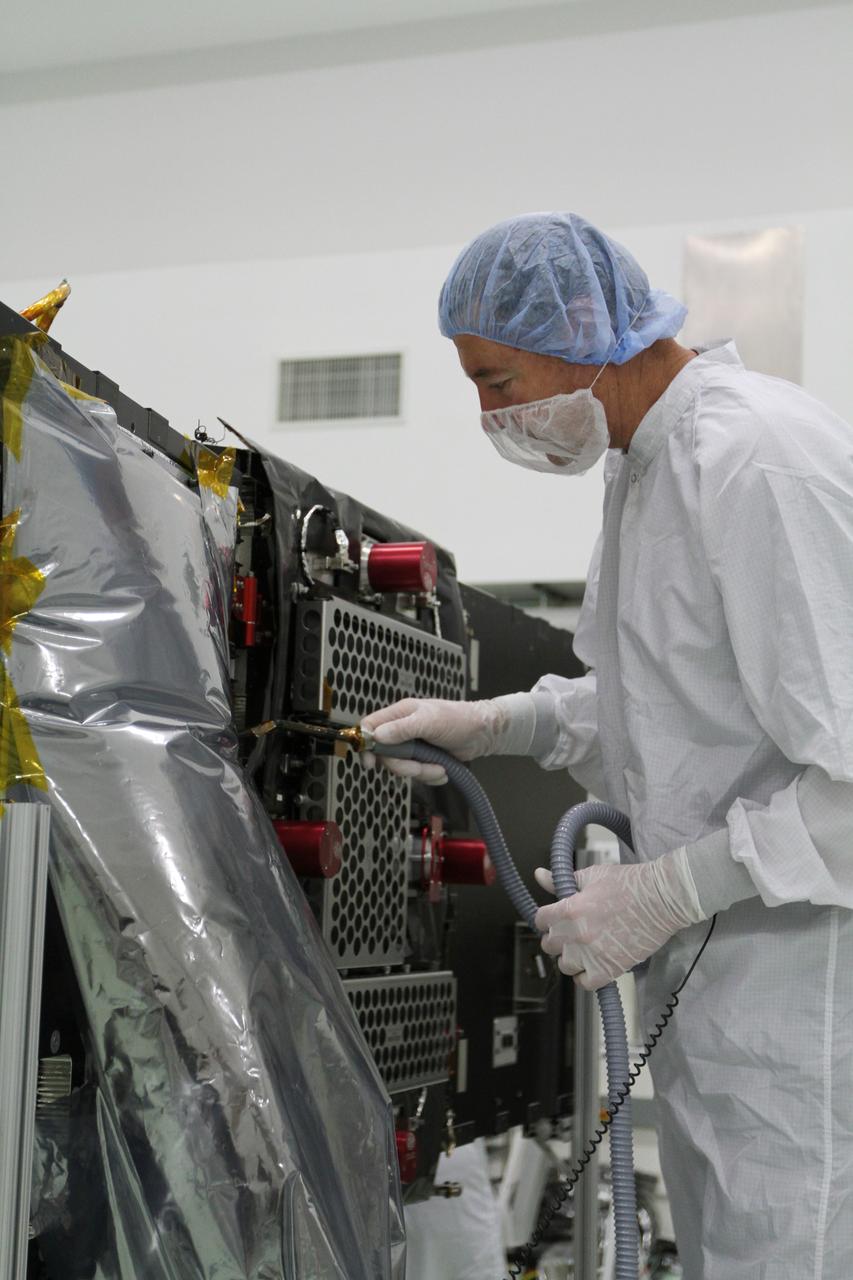
RBSP - White Light & Black Light Cleaning of Satellites B & A
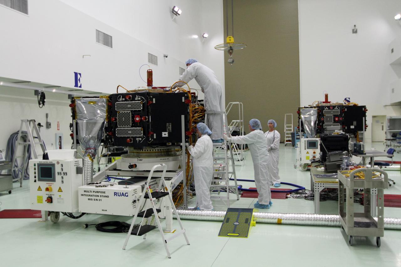
RBSP - White Light & Black Light Cleaning of Satellites B & A
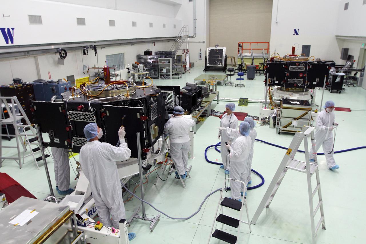
RBSP - White Light & Black Light Cleaning of Satellites B & A
RBSP - White Light & Black Light Cleaning of Satellites B & A

RBSP - White Light & Black Light Cleaning of Satellites B & A
RBSP - White Light & Black Light Cleaning of Satellites B & A
RBSP - White Light & Black Light Cleaning of Satellites B & A
RBSP - White Light & Black Light Cleaning of Satellites B & A
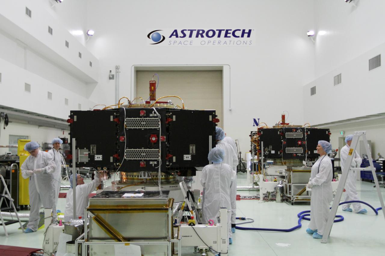
RBSP - White Light & Black Light Cleaning of Satellites B & A
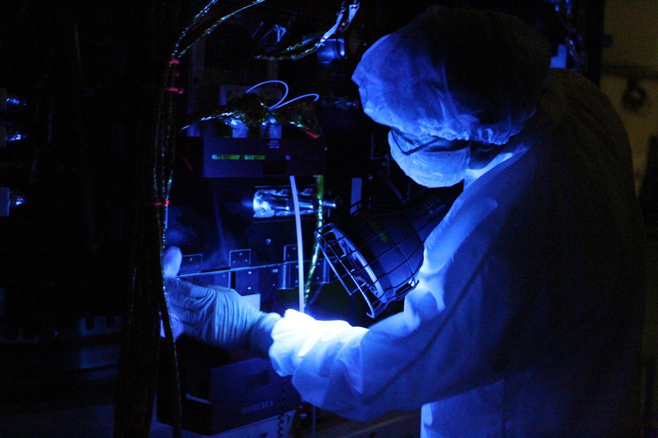
RBSP - White Light & Black Light Cleaning of Satellites B & A
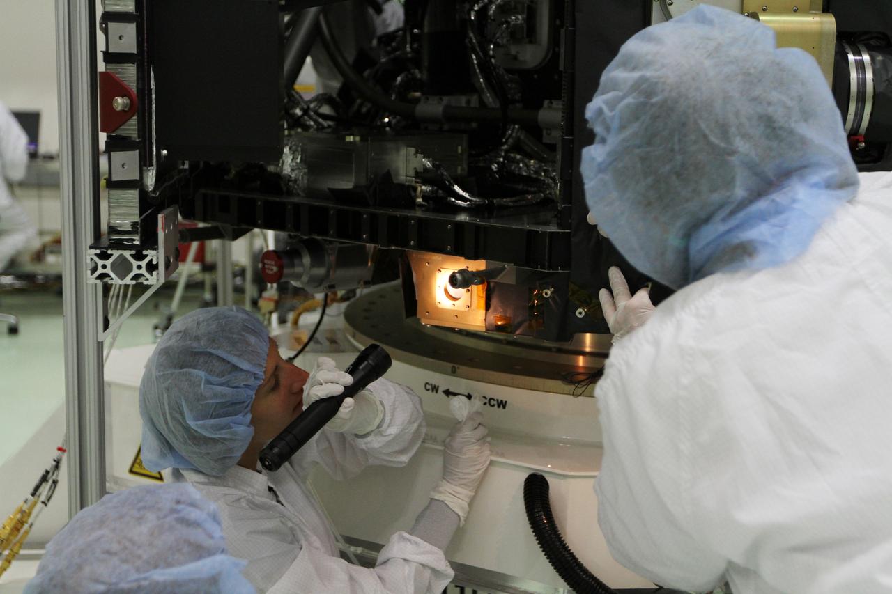
RBSP - White Light & Black Light Cleaning of Satellites B & A
On the second day of the 25.5-day Artemis I mission, Orion used its optical navigation camera to snap black and white photos of planet Earth. Orion uses the optical navigation camera to capture imagery of the Earth and the Moon at different phases and distances, providing an enhanced body of data to certify its effectiveness as a method for determining its position in space for future missions under differing lighting conditions.
On the second day of the 25.5-day Artemis I mission, Orion used its optical navigation camera to snap black and white photos of planet Earth. Orion uses the optical navigation camera to capture imagery of the Earth and the Moon at different phases and distances, providing an enhanced body of data to certify its effectiveness as a method for determining its position in space for future missions under differing lighting conditions.
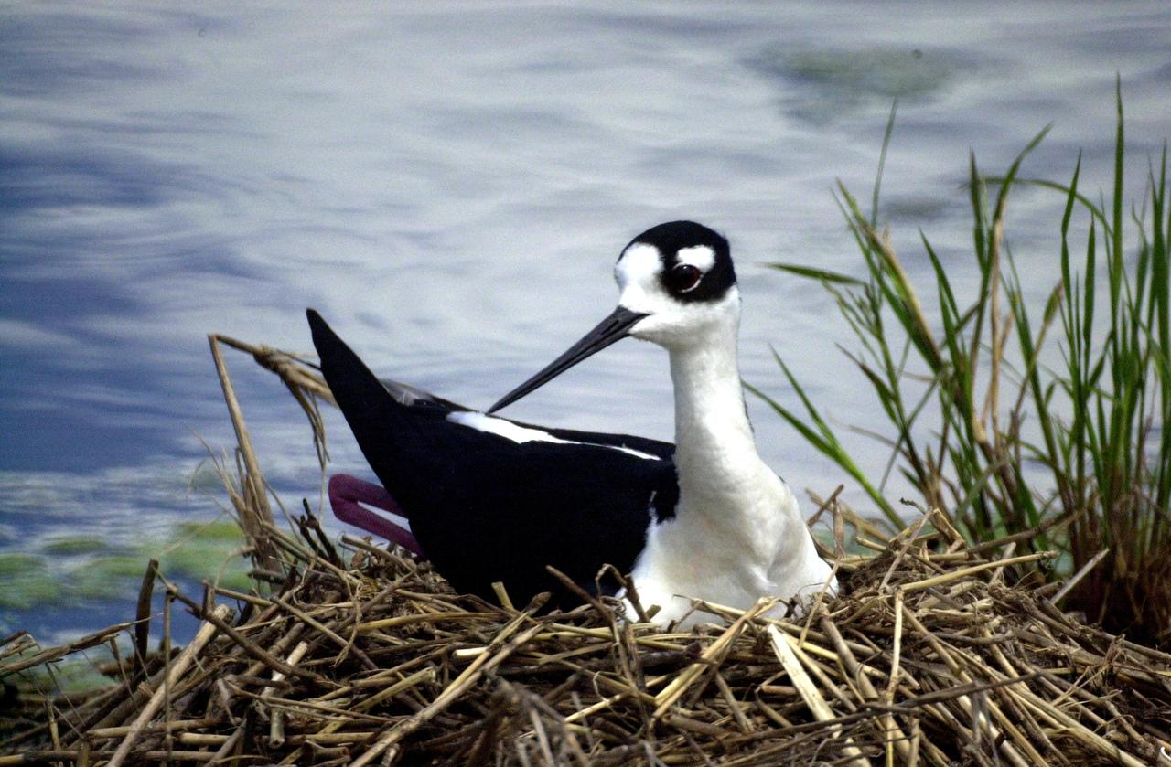
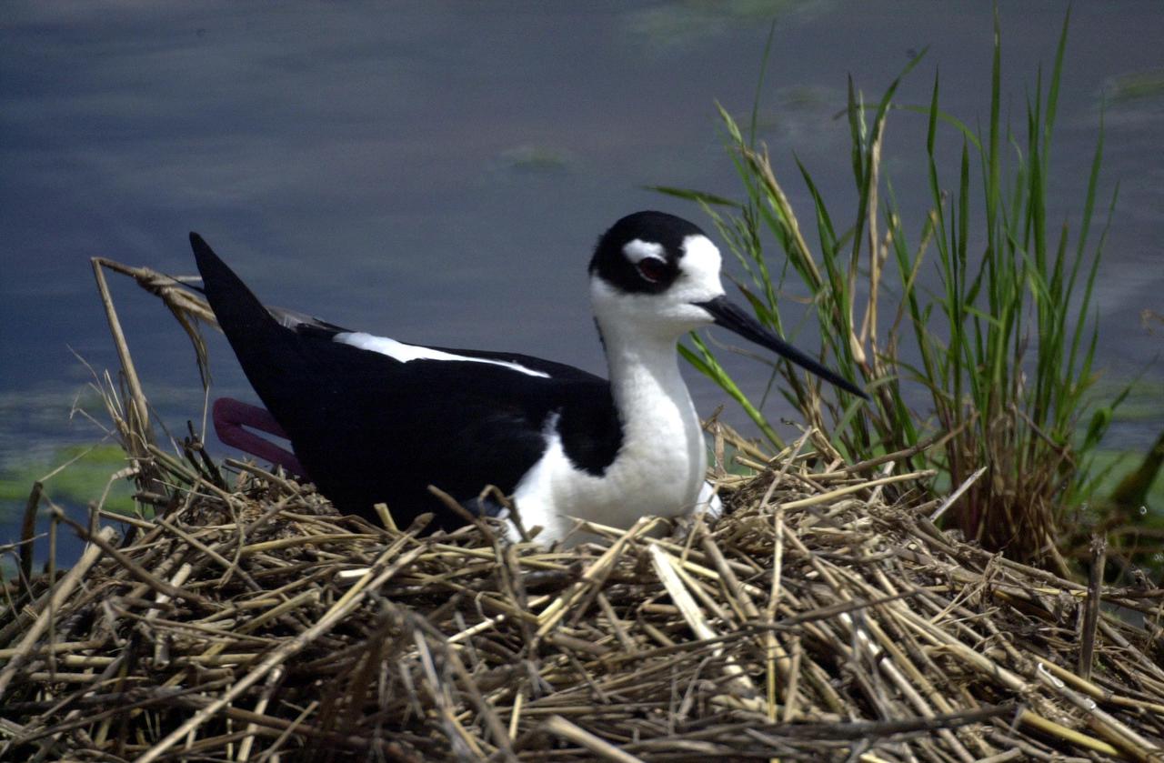
KENNEDY SPACE CENTER, FLA. -- A Black-necked Stilt lies on her nest in wetlands near KSC. Distinctive with its black and white coloring, the species also can be identified by its very long red legs and very thin, long black bill. These stilts inhabit salt marshes and shallow coastal bays in the East
KENNEDY SPACE CENTER, FLA. -- A Black-necked Stilt lies on her nest in wetlands near KSC. Distinctive with its black and white coloring, the species also can be identified by its very long red legs and very thin, long black bill. These stilts inhabit salt marshes and shallow coastal bays in the East
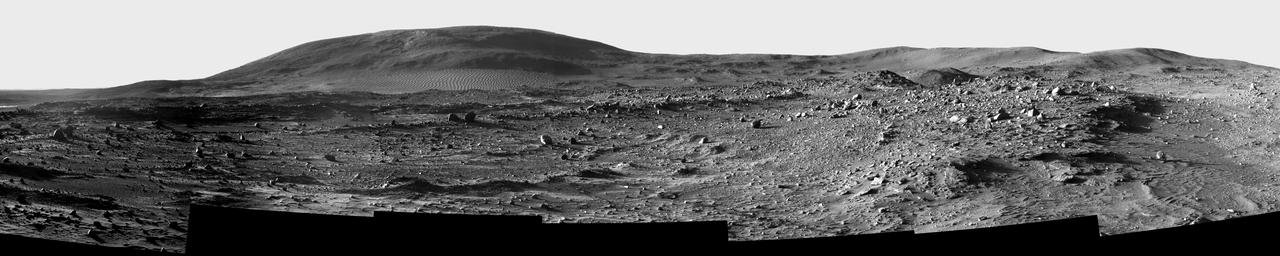
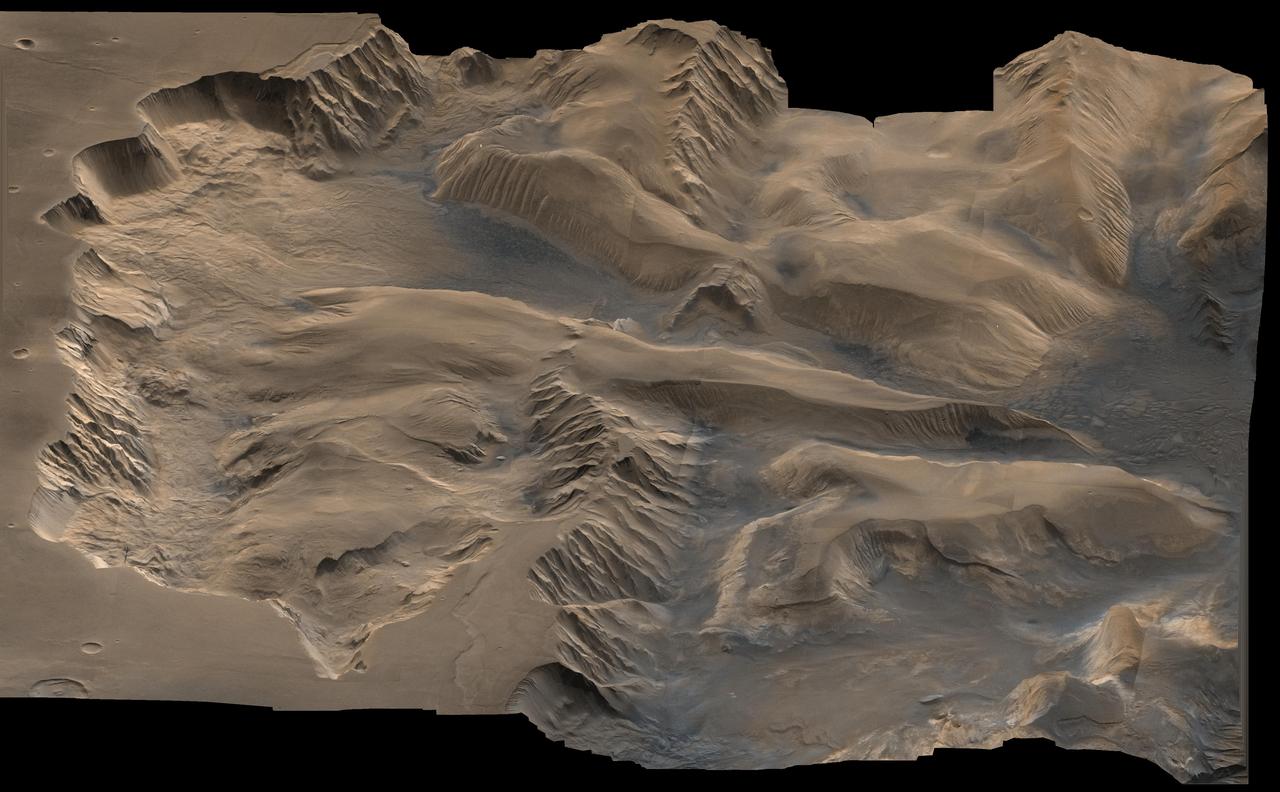
This image shows a sweeping black-and-white panorama of the rounded, knob-like peak of Husband

This chart illustrates relative masses of super-dense cosmic objects, ranging from white dwarfs to supermassive black holes encased in the cores of most galaxies. The first three dead stars left all form when stars more massive than our sun explode.
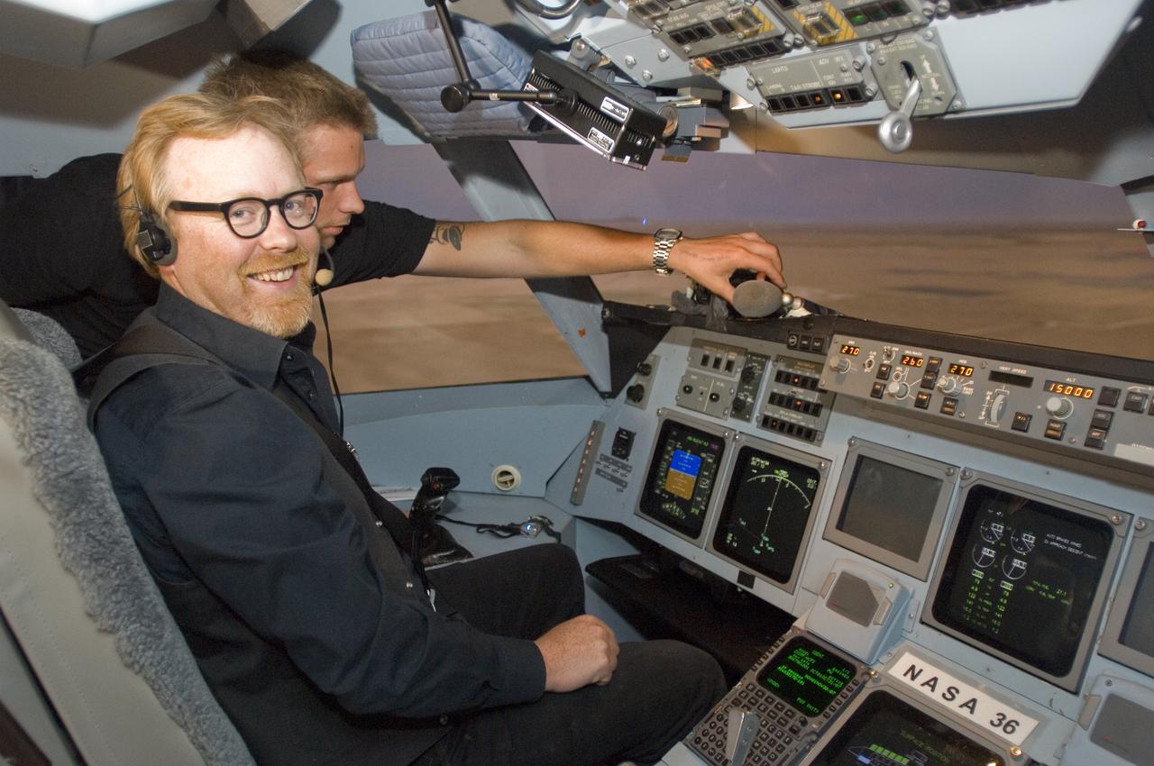
Mythbusters TV in Ames CVSRF Simulator with Discovery Channel show hosts Adam Savage (black shirt) and Jamie Hyneman (white shirt) inside simulator cab.
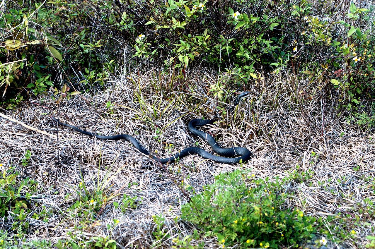
KENNEDY SPACE CENTER, FLA. - A black racer snake slithers away through a patch of dry grass on the grounds of Kennedy Space Center. The Black Racer Snake is one of the fastest, non-venomous snakes in North America. It has a slender body with a slender oval-shaped head and white patch on its chin. It lives in brushy areas, rocky hillsides and meadows, and underneath boards or tin around old buildings. Black Racers feed on insects, eggs, mice, frogs and lizards. Kennedy shares a boundary with the Merritt Island National Wildlife Refuge, home to some of the nation’s rarest and most unusual species of wildlife. In addition, the Refuge supports 19 endangered or threatened wildlife species on Federal or State lists, more than any other single refuge in the U.S.
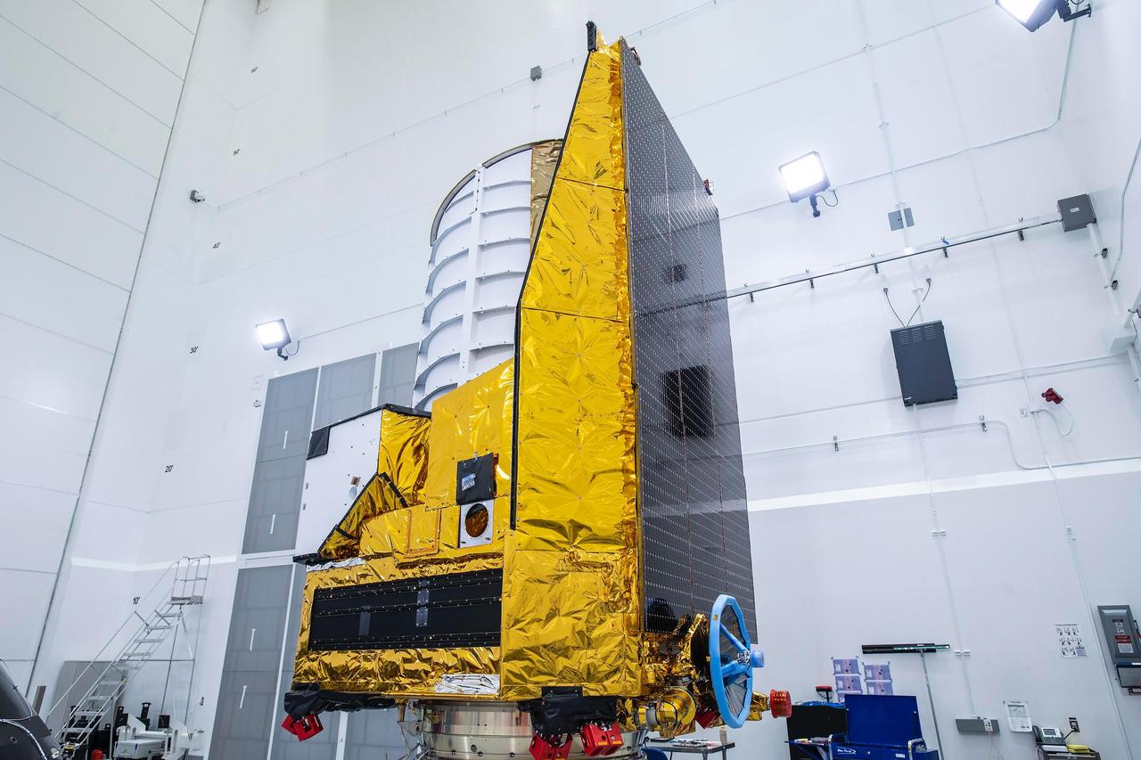
The ESA (European Space Agency) Euclid telescope, with contributions from NASA, is shown here on Friday 23 June, being secured to the adaptor of a SpaceX Falcon 9 rocket before launch. Black solar panels line the right side of the spacecraft. The telescope will view the cosmos through the top of the white cylinder that sits above the spacecraft's instruments. https://photojournal.jpl.nasa.gov/catalog/PIA25783
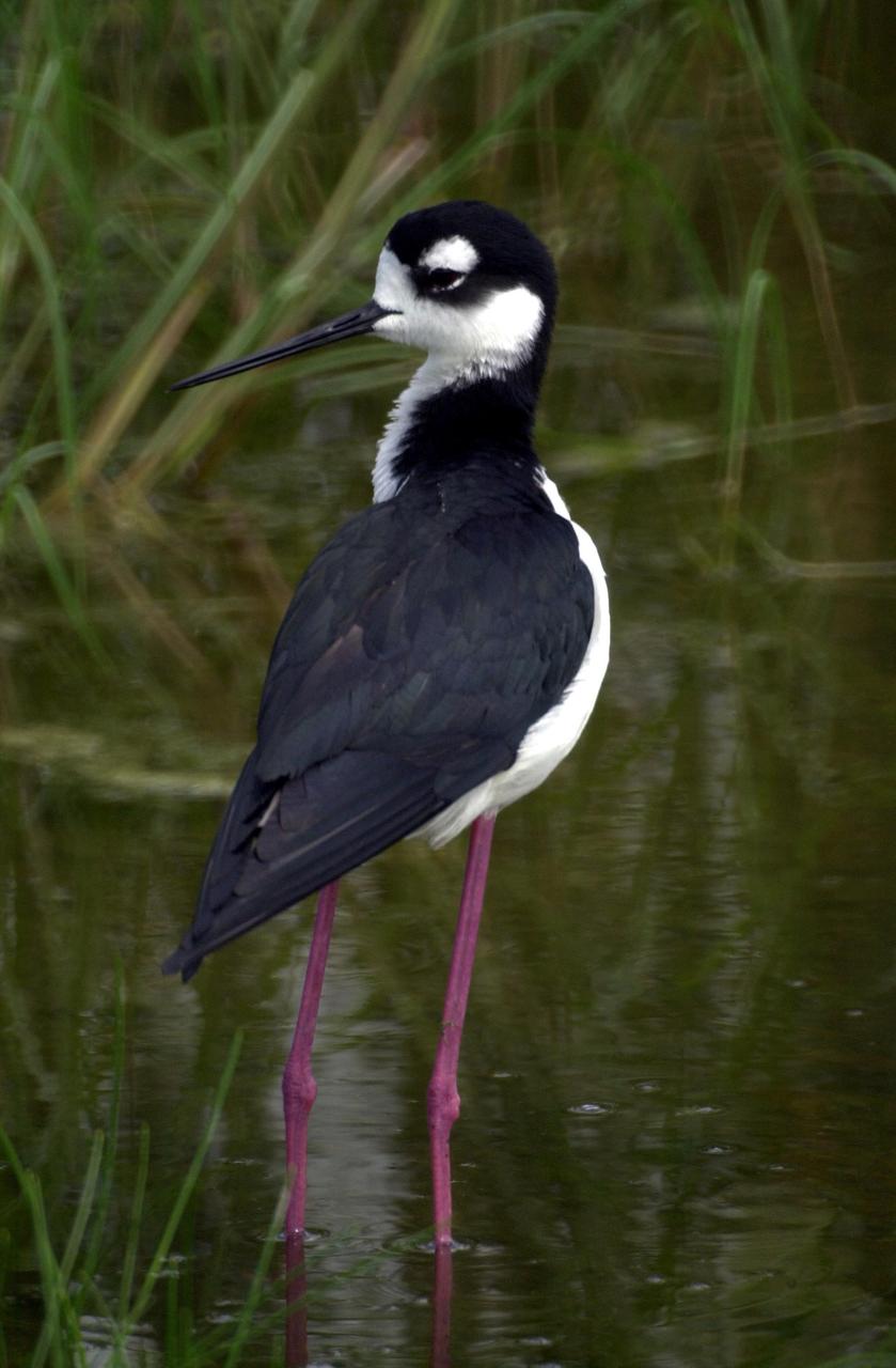
KENNEDY SPACE CENTER, FLA. -- A Black-necked Stilt, distinctive with its black and white coloring and long red legs, wades close to its nest in wetlands near KSC. These stilts inhabit salt marshes and shallow coastal bays in the East
NASA's Ingenuity Mars Helicopter took these images on its fourth flight, on April 30, 2021, using its navigation camera. The camera, which tracks surface features below the helicopter, takes images at a rate at which the helicopter's blades appear frozen in place, despite making 21 full rotations in-between each image. In flight, the blades spin at 2,537 rpm. The images are aligned entirely using Ingenuity's on-board position tracking system highlighting the stability and accuracy of the navigation algorithm. Movie available at https://photojournal.jpl.nasa.gov/catalog/PIA24630
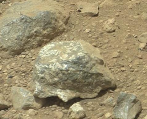
The Mast Camera Mastcam on NASA Mars rover Curiosity showed researchers interesting color and patterns in this unnamed rock.

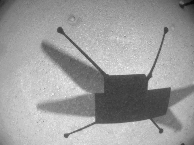
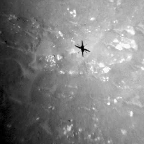
NASA's Ingenuity Mars Helicopter took this shot, capturing its own shadow, while hovering over the Martian surface on April 19, 2021, during the first instance of powered, controlled flight on another planet. It used its navigation camera, which autonomously tracks the ground during flight. The Ingenuity Mars Helicopter was built by JPL, which also manages this technology demonstration project for NASA Headquarters. It is supported by NASA's Science Mission Directorate, Aeronautics Research Mission Directorate, and Space Technology Mission Directorate. NASA's Ames Research Center and Langley Research Center provided significant flight performance analysis and technical assistance during Ingenuity's development. A key objective for Perseverance's mission on Mars is astrobiology, including the search for signs of ancient microbial life. The rover will characterize the planet's geology and past climate, pave the way for human exploration of the Red Planet, and be the first mission to collect and cache Martian rock and regolith (broken rock and dust). Subsequent NASA missions, in cooperation with ESA (European Space Agency), would send spacecraft to Mars to collect these sealed samples from the surface and return them to Earth for in-depth analysis. The Mars 2020 Perseverance mission is part of NASA's Moon to Mars exploration approach, which includes Artemis missions to the Moon that will help prepare for human exploration of the Red Planet. https://photojournal.jpl.nasa.gov/catalog/PIA24584
AS09-26A-3801A (12 March 1969) --- Colored infrared photograph of the Phoenix, Arizona area, taken on March 12, 1969, by one of the four synchronized cameras of the Apollo 9 Earth Resources Survey (SO65) Experiment. At 11:28 a.m. (EST) when this picture was made the Apollo 9 spacecraft was at an altitude of 127 nautical miles, and the sun elevation was 32 degrees above the horizon. The location of the point on Earth's surface at which the four-camera combination was aimed was 33 degrees 25 minutes north latitude, and 112 degrees 18 minutes west longitude. The other three cameras used: (B) black and white film with a red filter; (C) black and white infrared film; and (D) black and white film with a green filter.
AS09-26A-3792A (11 March 1969) --- Color infrared photograph of the Atlanta, Georgia area taken on March 11, 1969, by one of the four synchronized cameras of the Apollo 9 Earth Resources Survey (SO-65) experiment. At 11:21 a.m. (EST) when this picture was taken, the Apollo 9 spacecraft was at an altitude of 106 nautical miles, and the sun elevation was 47 degrees above the horizon. The location of the point on Earth's surface at which the four-camera combination was aimed was 33 degrees 10 minutes north latitude, and 84 degrees and 40 minutes west longitude. The other three cameras used: (B) black and white film with a red filter; (C) black and white infrared film; and (D) black and white film with a green filter.
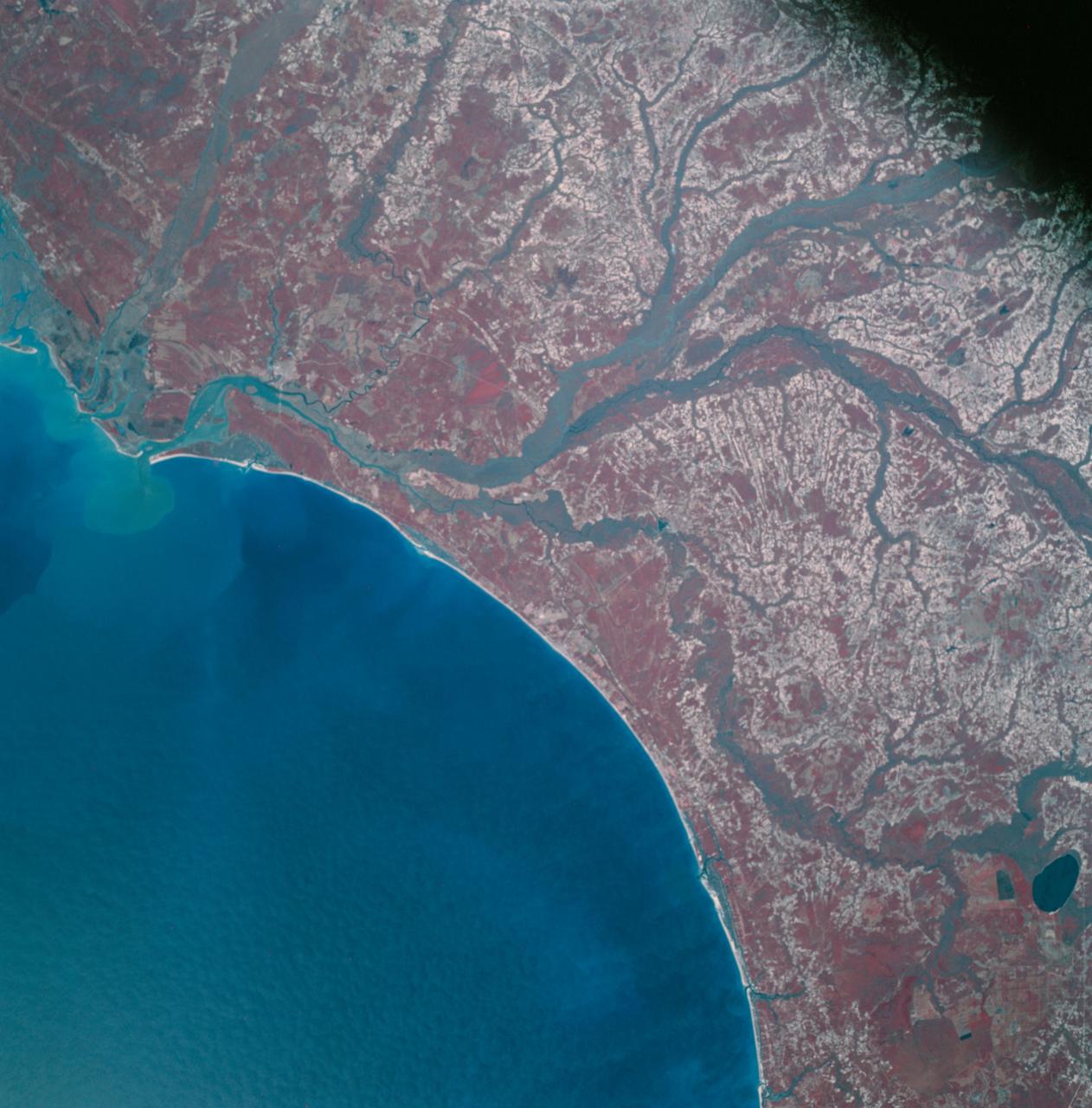
AS09-26A-3793A (12 March 1969) --- Color infrared photograph of the Atlantic Coast of South Carolina, Georgetown-Myrtle Beach-Conway area, taken on March 12, 1969, by one of the four synchronized cameras of the Apollo 9 Earth Resources Survey SO65 Experiment. At 10:00 a.m. (EST) when this picture was made the Apollo 9 spacecraft was at an altitude of 116 nautical miles, and the sun elevation was 39 degrees above the horizon. The location of the point on Earth's surface at which the four-camera combination was aimed was 33 degrees 35 minutes north latitude, and 79 degrees 3 minutes west longitude. The other three cameras used: (B) black and white film with a red filter; (C) black and white infrared film; and (D) black and white film with a green filter.

AS09-26A-3816A (12 March 1969) --- Color infrared photograph of the Atlantic coast of Georgia, Brunswick area, taken on March 12, 1969, by one of the four synchronized cameras of the Apollo 9 Earth Resources Survey SO65 Experiment. At 11:35 a.m. (EST) when this picture was made the Apollo 9 spacecraft was at an altitude of 102 nautical miles, and the sun elevation was 51 degrees above the horizon. The location of the point on Earth's surface at which the four-camera combination was aimed 31 degrees 16 minutes north latitude, and 81 degrees 17 minutes west longitude. The other three cameras used: (B) black and white film with a red filter; (C) black and white infrared film; and (D) black and white film with a green filter.
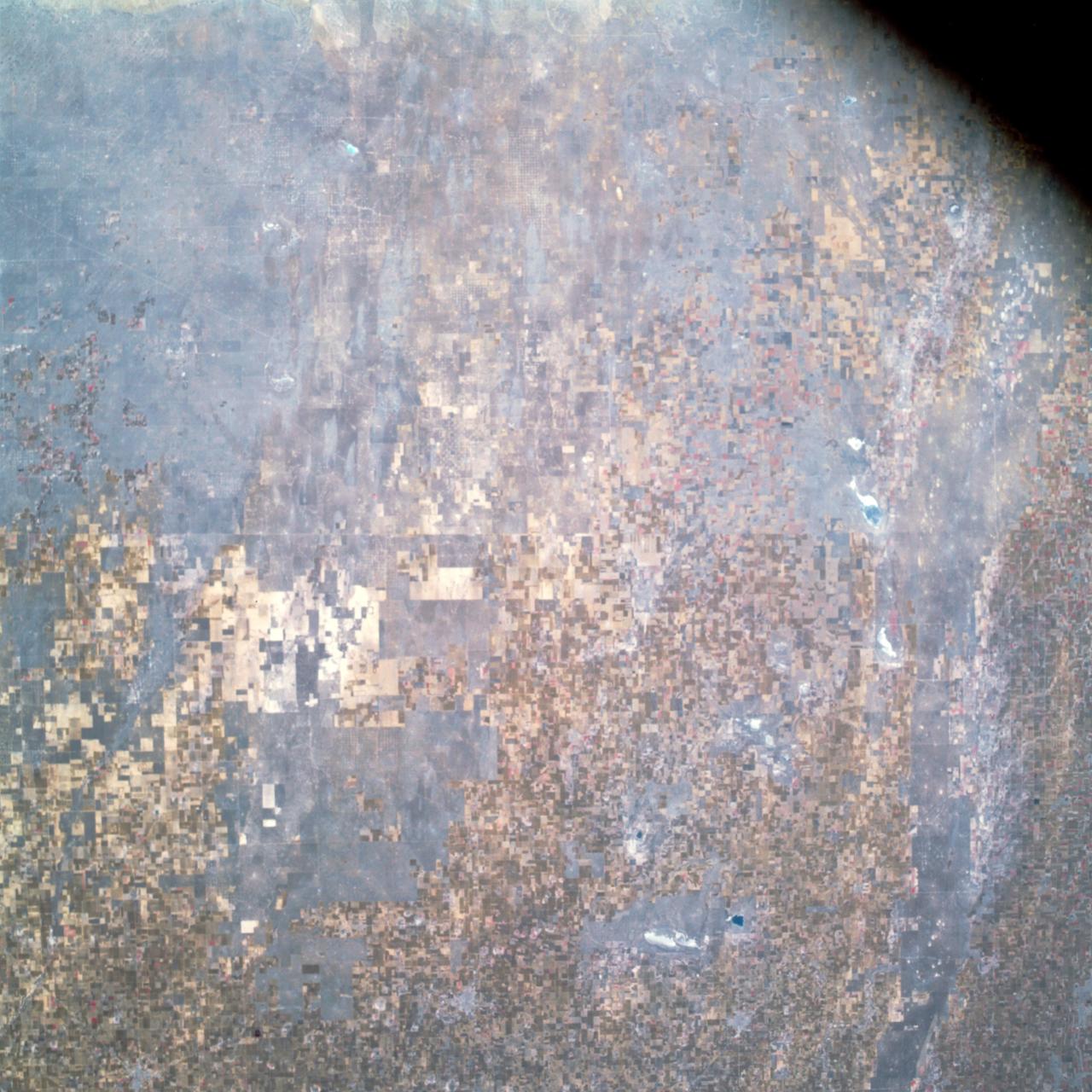
AS09-26A-3808A (12 March 1969) --- Color infrared photograph of the Lubbock, Texas area, taken on March 12, 1969, by one of the four synchronized cameras of the Apollo 9 Earth Resources Survey SO65 Experiment. At 11:31 a.m. (EST) when this picture was made the Apollo 9 spacecraft was at an altitude of 117 nautical miles, and the sun elevation was 38 degrees above the horizon. The location of the point on the surface of Earth at which the four-camera combination was aimed was 33 degrees 41 minutes north latitude, and 101 degrees 29 minutes west longitude. The other three cameras used: (B) black and white film with a red filter; (C) black and white infrared film; and (D) black and white film with a green filter.

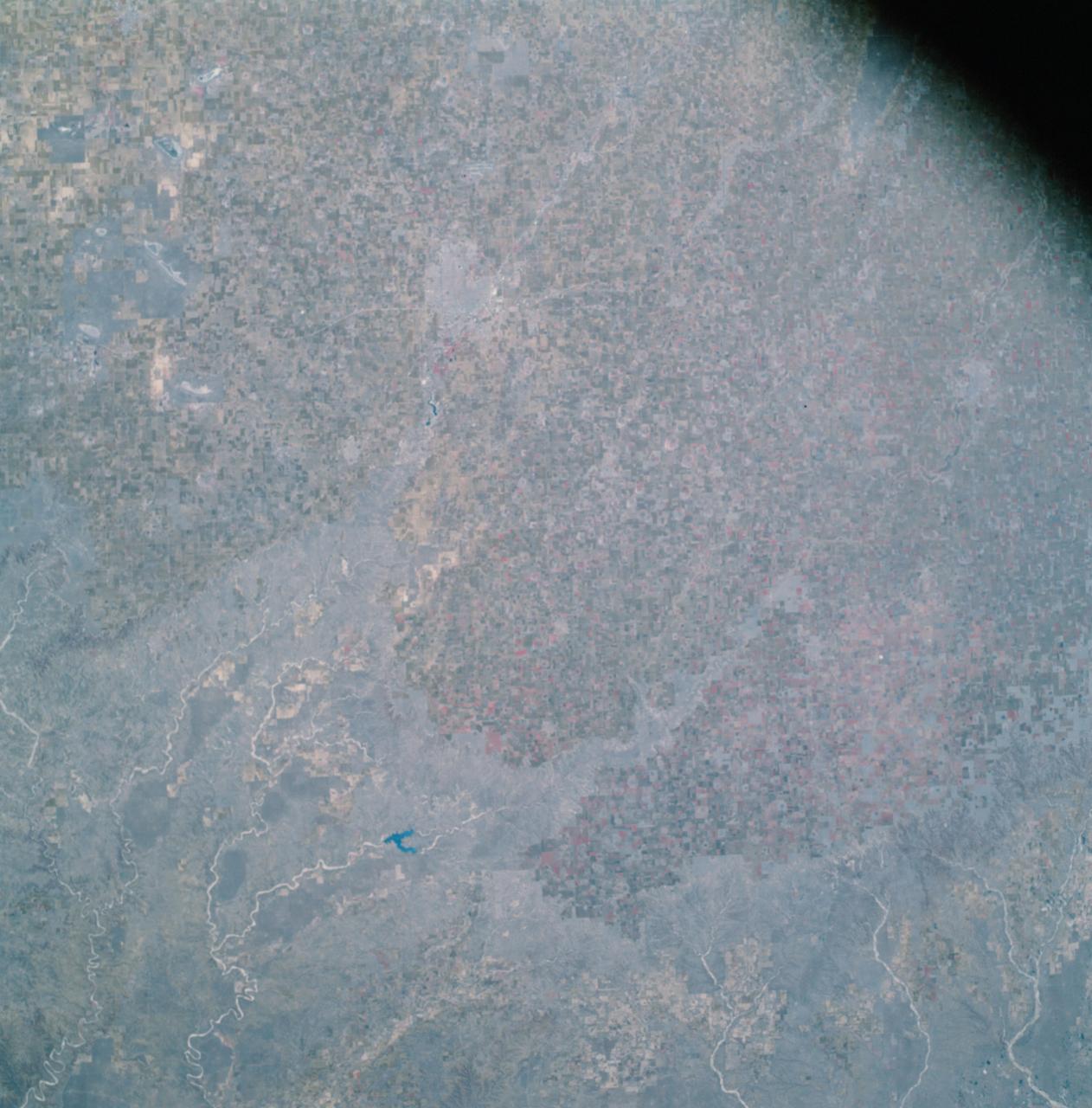
AS09-26A-3743A (9 March 1969) --- Color infrared photograph of the Yazoo River Valley, Pearl River, Pearl River Reservoir, and Jackson, Mississippi, area, taken on March 9, 1969, by one of the four synchronized cameras of the Apollo 9 Earth Resources Survey SO65 Experiment. At 1:08 p.m. (EST) when this photograph was made the Apollo 9 spacecraft was at an altitude of 105 nautical miles, and the sun elevation was at 55 degrees above the horizon. The location of the point on Earth's surface at which the four-camera combination was aimed was 32 degrees 34 minutes north latitude, and 89 degrees 57 minutes west longitude. The other three cameras used: (B) black and white film with a red filter; (C) black and white infrared film; and (D) black and white film with a green filter.
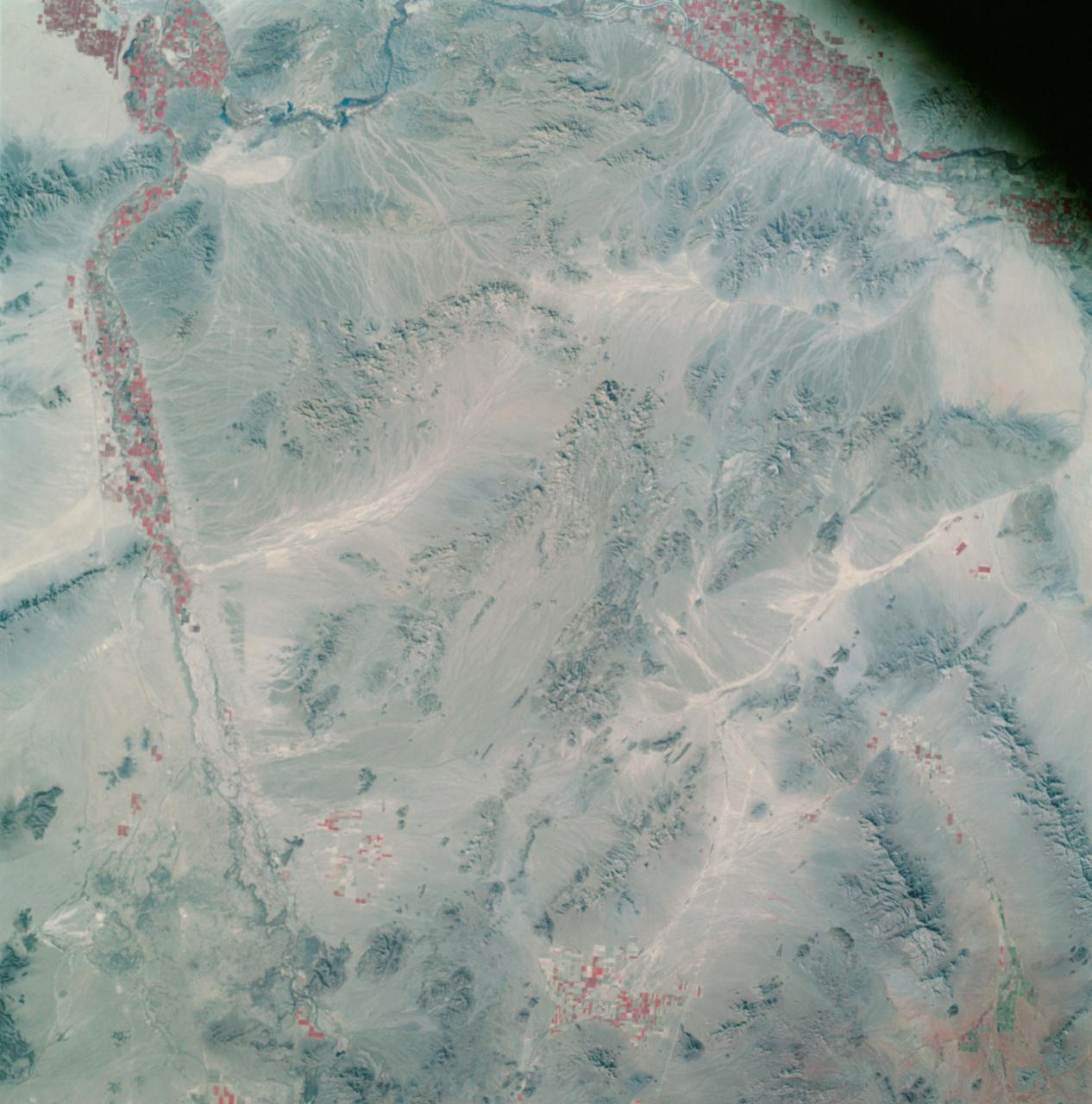
AS09-26A-3800A (12 March 1969) --- Color infrared photograph of southwestern Arizona, Yuma-Gila Desert-Gila River-Colorado River area, taken on March 12, 1969, by one of the four synchronized cameras of the Apollo 9 Earth Resources Survey SO65 Experiment. At 11:28 a.m. (EST) when this picture was made the Apollo 9 spacecraft was at an altitude of 128 nautical miles, and the sun elevation was 30 degrees above the horizon. The location of the point on Earth's surface at which the four-camera combination was aimed 33 degrees 19 minutes north latitude, and 113 degrees 45 minutes west longitude. The other three cameras used: (B) black and white film with a red filter; (C) black and white infrared film; and (D) black and white film with a green filter.
AS09-26A-3807A (12 March 1969) --- Color infrared photograph of the Texas-New Mexico border area, between Lubbock and Roswell, taken on March 12, 1969, by one of the four synchronized cameras of the Apollo 9 Earth Resources Survey (SO65). At 11:30 a.m. (EST) when this picture was made the Apollo 9 spacecraft was at an altitude of 119 nautical miles, and the sun elevation was 38 degrees above the horizon. The location of the point on Earth's surface at which the four-camera combination was aimed was 33 degrees 42 minutes north latitude, and 103 degrees 1 minute west longitude. The other three cameras used: (B) black and white film with a red filter; (C) black and white infrared film; and (D) black and white film with a green filter.

AS09-26A-3748A (9 March 1969) --- A color infrared photograph of the Salton Sea and Imperial Valley area of Southern California and the Mexicali, Mexico area, taken on March 9, 1969, by one of the four synchronized cameras of the Apollo 9 Earth Resources Survey S065 Experiment. At 2:36 p.m. (EST) when this picture was made the Apollo 9 spacecraft was at an altitude of 103 nautical miles, and the sun elevation was 45 degrees above at which the four-camera combination was aimed was 33 degrees 3 minutes north latitude, and 115 degrees 45 minutes west longitude. The other three cameras used: (B) black and white film with a red filter; (C) black and white infrared film; and (D) black and white film with a green filter.
AS09-26A-3802A (12 March 1969) --- Color infrared photograph of the Globe, Arizona area, including Roosevelt Lake and San Carlos Reservoir, taken on March 12, 1969, by one of the four synchronized cameras of the Apollo 9 Earth Resources Survey SO65 Experiment. At 11:29 a.m. (EST) when this picture was made the Apollo 9 spacecraft was at an altitude of 119 nautical miles, and the sun elevation was 38 degrees above the horizon. The location of the point on Earth's surface at which the four-camera combination was aimed was 33 degrees 42 minutes north latitude, and 103 degrees 1 minute west longitude. The other three cameras used: (B) black and white film with a red filter; (C) black and white infrared film; and (D) black and white film with a green filter.

AS09-26A-3728A (8 March 1969) --- Color infrared photograph of the Houston-Galveston-Freeport, Texas Gulf Coast area taken on March 8, 1969, by one of the four synchronized cameras of the Apollo 9 Earth Resources Survey S065 Experiment. At 3:05 p.m. (EST) when this picture was made the Apollo 9 spacecraft was at an altitude of 105 nautical miles, and the sun elevation was 54 degrees above the horizon. The location of the point on Earth's surface at which the four-camera combination was aimed was 29 degrees 4 minutes north latitude, and 95 degrees 24 minutes west longitude. The three other cameras used: (B) black and white film with a red filter; (C) black and white infrared film; and (D) black and white film with a green filter.

This two-panel illustration shows a black hole surrounded by a disk of gas, before and after the disk is partially dispersed. In the left panel, the ball of white light above the black hole is the black hole corona, a collection of ultra-hot gas particles that forms as gas from the disk falls into the black hole. The streak of debris falling toward the disk is what remains of a star that was torn apart by the black hole's gravity. The right panel shows the black hole after the debris from the star has dispersed some of the gas in the disk, causing the corona to disappear. https://photojournal.jpl.nasa.gov/catalog/PIA23864
S82-31408 (May 1983) --- The Spacelab 2 emblem is a symbolic representation of the scientific objectives of the mission. The emblem is in the shape of a triangular shield with convexly curved edges. Across the top of a black out border are the words ?SPACELAB 2?. Within the black border is a sky blue border carryhing the words: ?ASTRONOMY?, ON TOP? ?PHYSICS?, on the left; and ?BIOLOGY?, on the right. Within the blue border is a schematic view of the sun, the earth, and the orbiter with Spacelab 2. The sun appears in the upper right background as a white disc surrounded by six concentric rings ranging grom bright yellow near the disc through yellow-red to a dark red out ring. A sector of the earth with blue ocean and a black portion of North America is in the upper left corner. The black and white Orbiter is seen from directly overhead in the foreground, the right side illuminated by the sun, the left side in shadow. Although the payload bay doors are not open, the Spacelab 2 payload is seen as if the doors were open. In black on white are seen the three pallets, and the separately mounted cosmic ray experiment at the aft end of the bay.
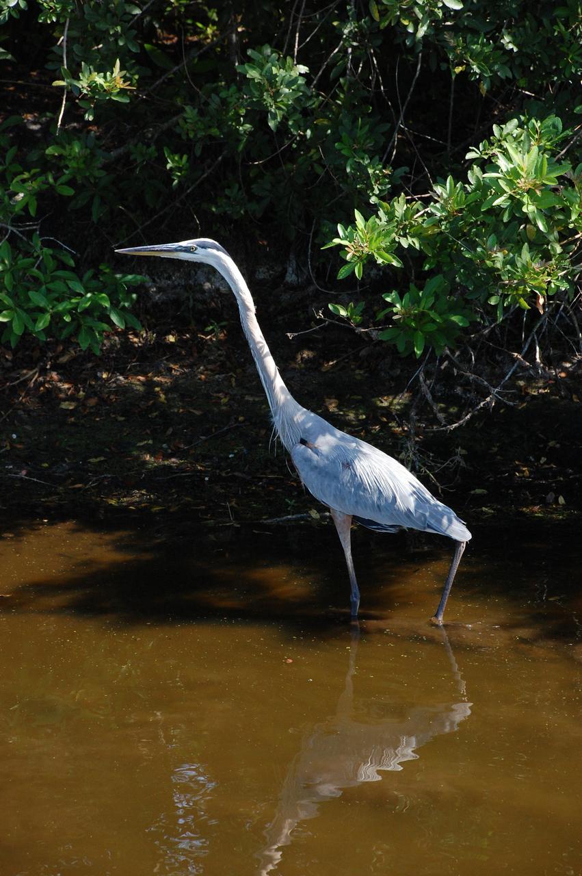
CAPE CANAVERAL, Fla. – A great blue heron stands tall in the water, perhaps looking for food, on grounds of NASA's Kennedy Space Center in Florida. More gray than blue, with a yellowish bill and black legs, it has a brownish-buff colored neck with a black border and white in front of its neck with a vertical black streak. The bird's head is white with a black stripe above its eye. They range throughout the U.S., inhabiting lakes, ponds, rivers and marshes. Their principal food is fish or frogs but may feed on small mammals, reptiles and occasionally birds. Kennedy shares a boundary with the Merritt Island National Wildlife Refuge, which is a habitat for more than 310 species of birds, 25 mammals, 117 fishes and 65 amphibians and reptiles. Photo credit: NASA/Ben Smegelsky
CAPE CANAVERAL, Fla. – A great blue heron stands tall in the water, perhaps looking for food, on grounds of NASA's Kennedy Space Center in Florida. More gray than blue, with a yellowish bill and black legs, it has a brownish-buff colored neck with a black border and white in front of its neck with a vertical black streak. The bird's head is white with a black stripe above its eye. They range throughout the U.S., inhabiting lakes, ponds, rivers and marshes. Their principal food is fish or frogs but may feed on small mammals, reptiles and occasionally birds. Kennedy shares a boundary with the Merritt Island National Wildlife Refuge, which is a habitat for more than 310 species of birds, 25 mammals, 117 fishes and 65 amphibians and reptiles. Photo credit: NASA/Ben Smegelsky
This meteoroid impact crater on Mars was discovered using the black-and-white Context Camera aboard NASA's Mars Reconnaissance Orbiter (MRO). The Context Camera took this image showing the impact, which occurred Dec. 24, 2021, in a region called Amazonis Planitia. Relying on data from the Mars Color Imager camera, also aboard MRO, along with seismic data from NASA's InSight lander, scientists were able to determine when this particular crater formed. Looking closely at the crater's rim, white specks could be detected that suggested the presence of water ice (which was later confirmed by MRO's High-Resolution Imaging Science Experiment, or HiRISE, camera). Debris thrown during the impact can be seen reaching as far as 23 miles (37 kilometers) away. The disturbance seen in the surface suggests the meteoroid was traveling towards the northeast when it hit the ground, throwing the longest streaks of debris in that direction. https://photojournal.jpl.nasa.gov/catalog/PIA25584
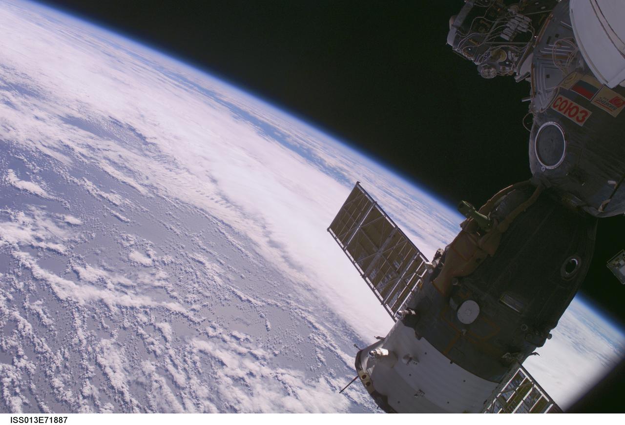
ISS013-E-71887 (28 Aug. 2006) --- Backdropped by the blackness of space and a blue and white Earth, the docked Soyuz TMA-8 spacecraft is featured in this image photographed by an Expedition 13 crewmember from a window on the International Space Station.
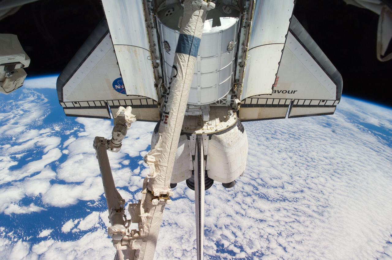
STS113-348-001 (23 November – 7 December 2002) --- The horizon of a blue and white Earth and the blackness of space form the backdrop for this view of Space Shuttle Endeavour’s vertical stabilizer.

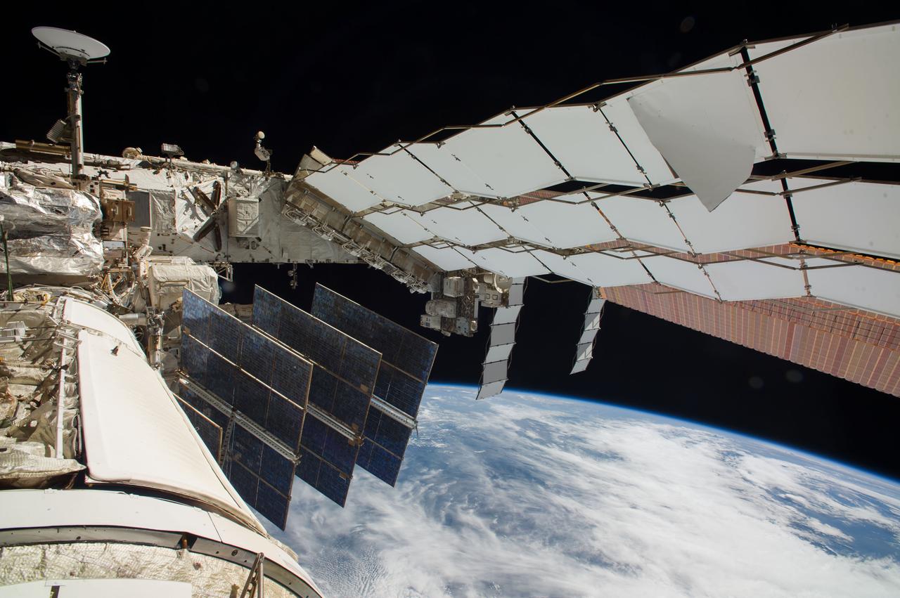
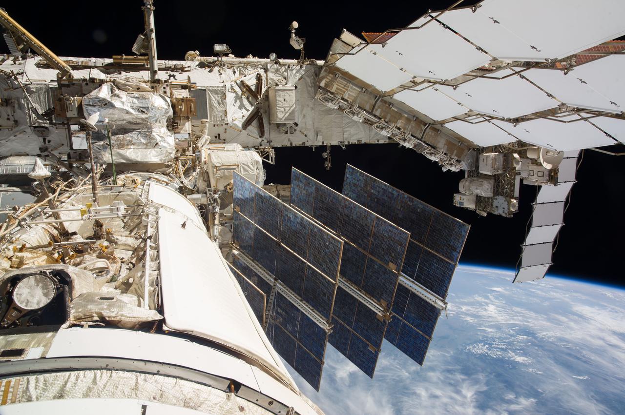
ISS036-E-047951 (7 Sept. 2013) --- Backdropped by a blue and white part of Earth and the blackness of space, International Space Station solar array panels are featured in this image photographed by an Expedition 36 crew member aboard the station.
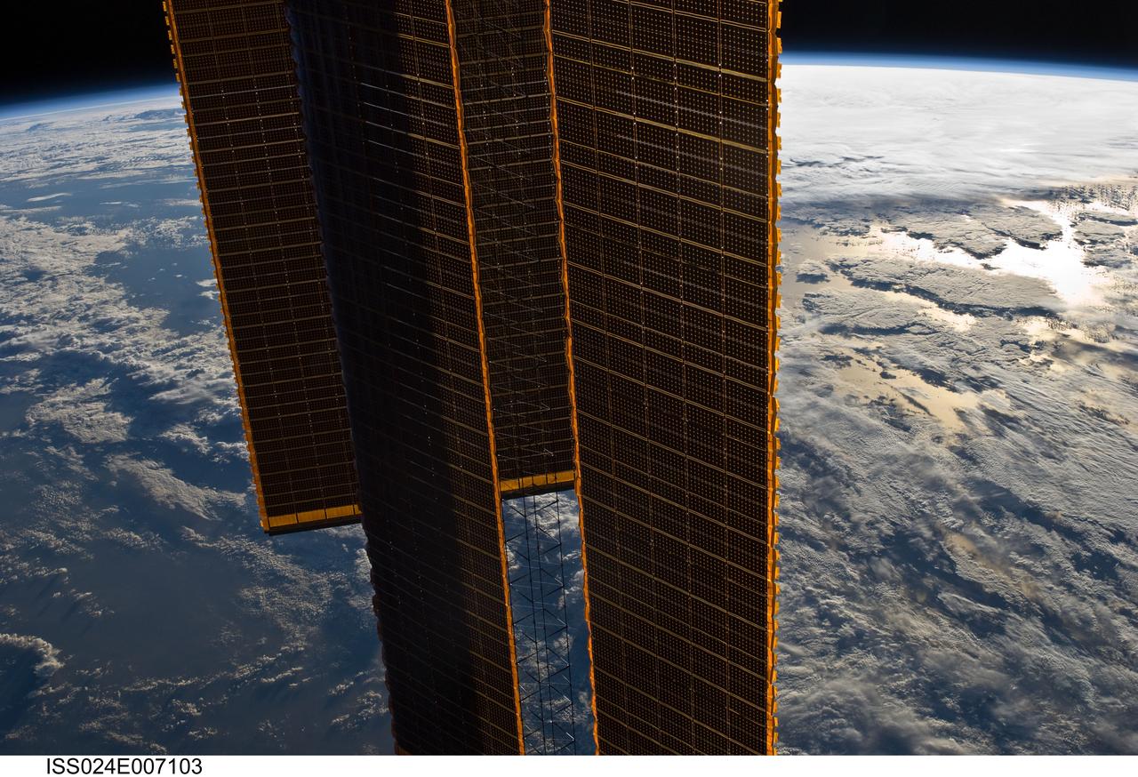
ISS024-E-007103 (29 June 2010) --- Backdropped by a blue and white part of Earth and the blackness of space, International Space Station solar array panels are featured in this image photographed by an Expedition 24 crew member aboard the station.
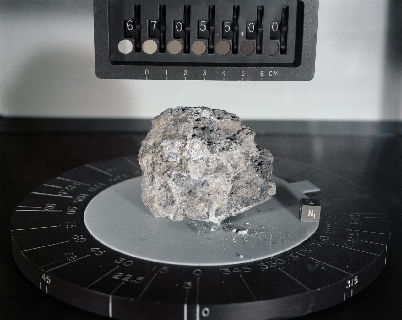
S72-36949 (April 1972) --- A black and white breccia from the rim of North Ray Crater. Its white, feldspar-rich, fine grained matrix is very friable. A variety of different rock types are observed as inclusions. They range in size from several centimeters to less than 1mm. Note also the presence white, feldspar-rich inclusions.
This is an X-band black-and-white image of the forests east of the Baikal Forest in the Jablonowy Mountains of Russia. The image is centered at 52.5 degrees north latitude and 116 degrees east longitude near the mining town of Bukatschatscha. This image was acquired by the Spaceborne Imaging Radar-C/X-band Synthetic Aperture Radar aboard the space shuttle Endeavour on October 4, 1994, during the second flight of the spaceborne radar. This area is part of an international research project known as the Taiga Aerospace Investigation using Geographic Information System Applications. http://photojournal.jpl.nasa.gov/catalog/PIA01754
The shadow of NASA's Ingenuity Mars Helicopter can be seen in this animated GIF composed of images taken by its black-and-white navigation camera during the rotocraft's third flight, on April 25, 2021. The camera, which tracks surface features below the helicopter, takes images at a rate at which the helicopter's blades appear frozen in place, despite making 21 full rotations in-between each image. At full speed, the blades spin at 2,537 rpm. The images are aligned entirely using Ingenuity's on-board position tracking system highlighting the stability and accuracy of the navigation algorithm. Movie available at https://photojournal.jpl.nasa.gov/catalog/PIA24644
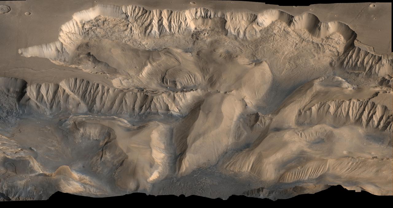
An oblique, color image of central Valles Marineris, Mars showing relief of Ophir and Candor Chasmata; view toward north. The photograph is a composite of Viking high-resolution images in black and white and low-resolution images in color. Ophir Chasma on the north is approximately 300 km across and as deep as 10 km. The connected chasma or valleys of Valles Marineris may have formed from a combination of erosional collapse and structural activity. Tongues of interior layered deposits on the floor of the chasmata can be observed as well as young landslide material along the base of Ophir Chasma's north wall. http://photojournal.jpl.nasa.gov/catalog/PIA00005
An oblique, color image of central Valles Marineris, Mars showing relief of Ophir and Candor Chasmata; view toward east. The photograph is a composite of Viking high-resolution images in black and white and low-resolution images in color. Ophir Chasma on the north (left side) is approximately 300 km across and as deep as 10 km. The connected chasma or valleys of Valles Marineris may have formed from a combination of erosional collapse and structural activity. Tongues of interior layered deposits on the floor of the chasmata can be observed as well as young landslide material along the base of Ophir Chasma's north wall. http://photojournal.jpl.nasa.gov/catalog/PIA00006
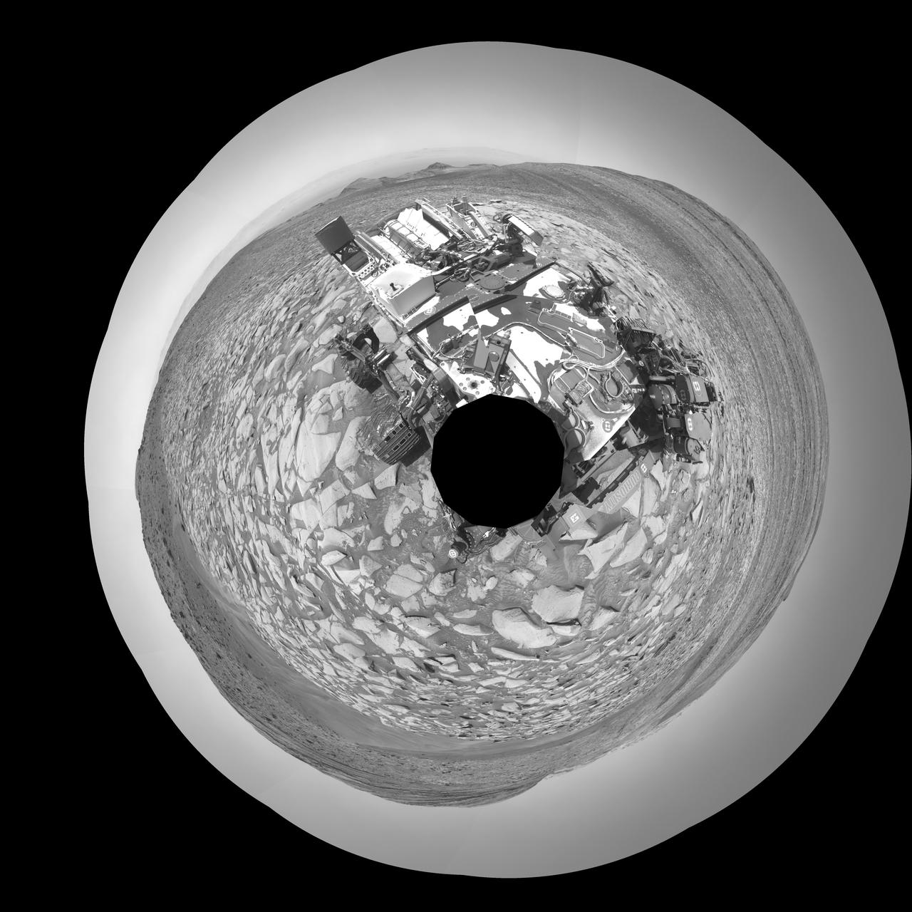
NASA's Curiosity Mars rover captured this selfie using its left black-and-white navigation camera, which is mounted on its mast, or "head," on Feb. 3, 2024, the 4,086th Martian day, or sol, of the mission. The selfie is made up of 36 individual images that were stitched together after being sent back to Earth. This warped view is different than the color selfies Curiosity has taken in the past using the camera on the end of its robotic arm, called the Mars Hand Lens Imager, or MAHLI. With its arm acting as a kind of selfie stick, Curiosity can show more of its body and surroundings. Instead, the images from the navigation camera on the mast are displayed as a polar projection; the black hole in the center is where the mast is located on the rover, an area which it can't image. https://photojournal.jpl.nasa.gov/catalog/PIA26310
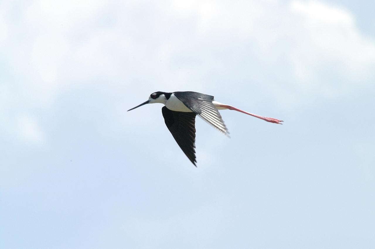
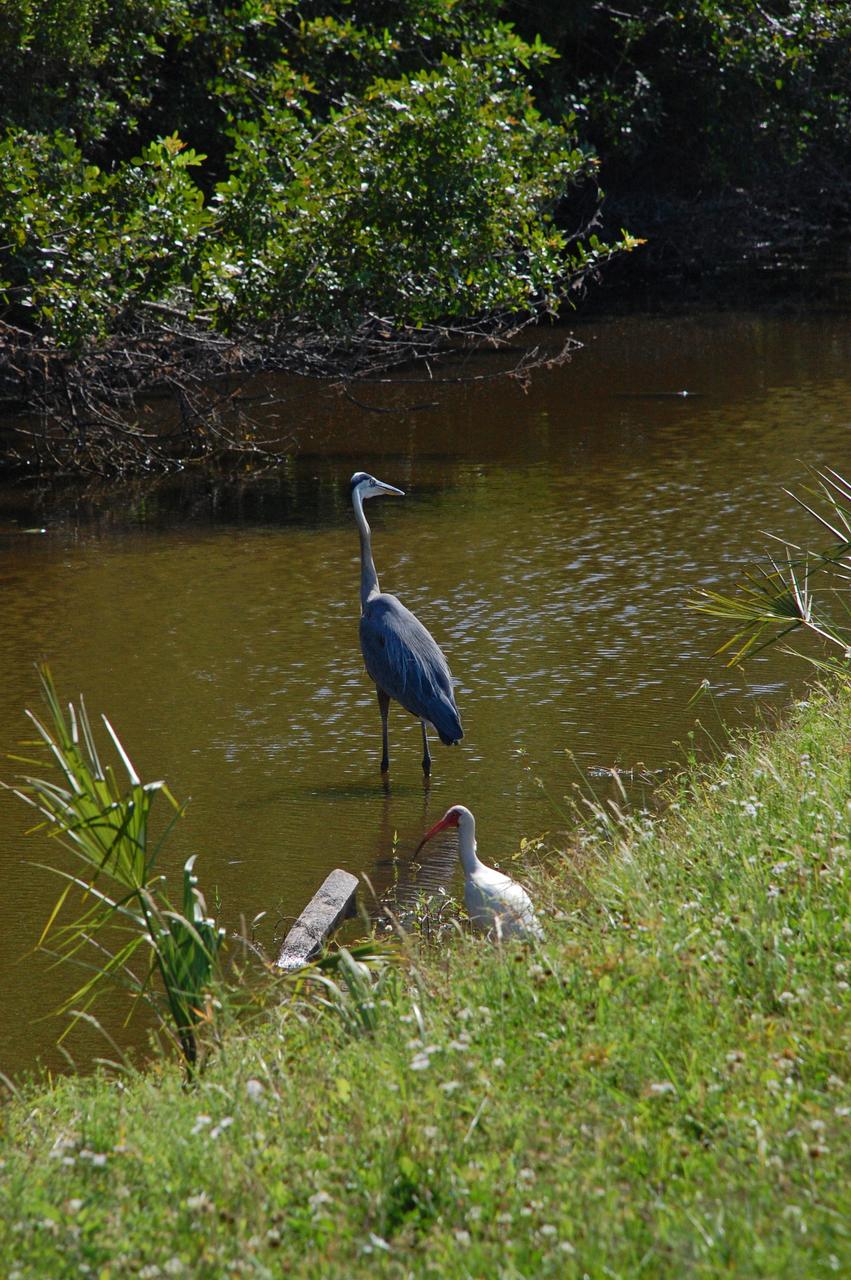
KENNEDY SPACE CENTER, FLA. - Distinctive with its black and white coloring and very long red legs trailing behind is a black-winged stilt. The bird is a common sight around KSC, which shares a boundary with the Merritt Island National Wildlife Refuge. The marshes and open water of the refuge provide wintering areas for 23 species of migratory waterfowl, as well as a year-round home for great blue herons, great egrets, wood storks, cormorants, brown pelicans and other species of marsh and shore birds.
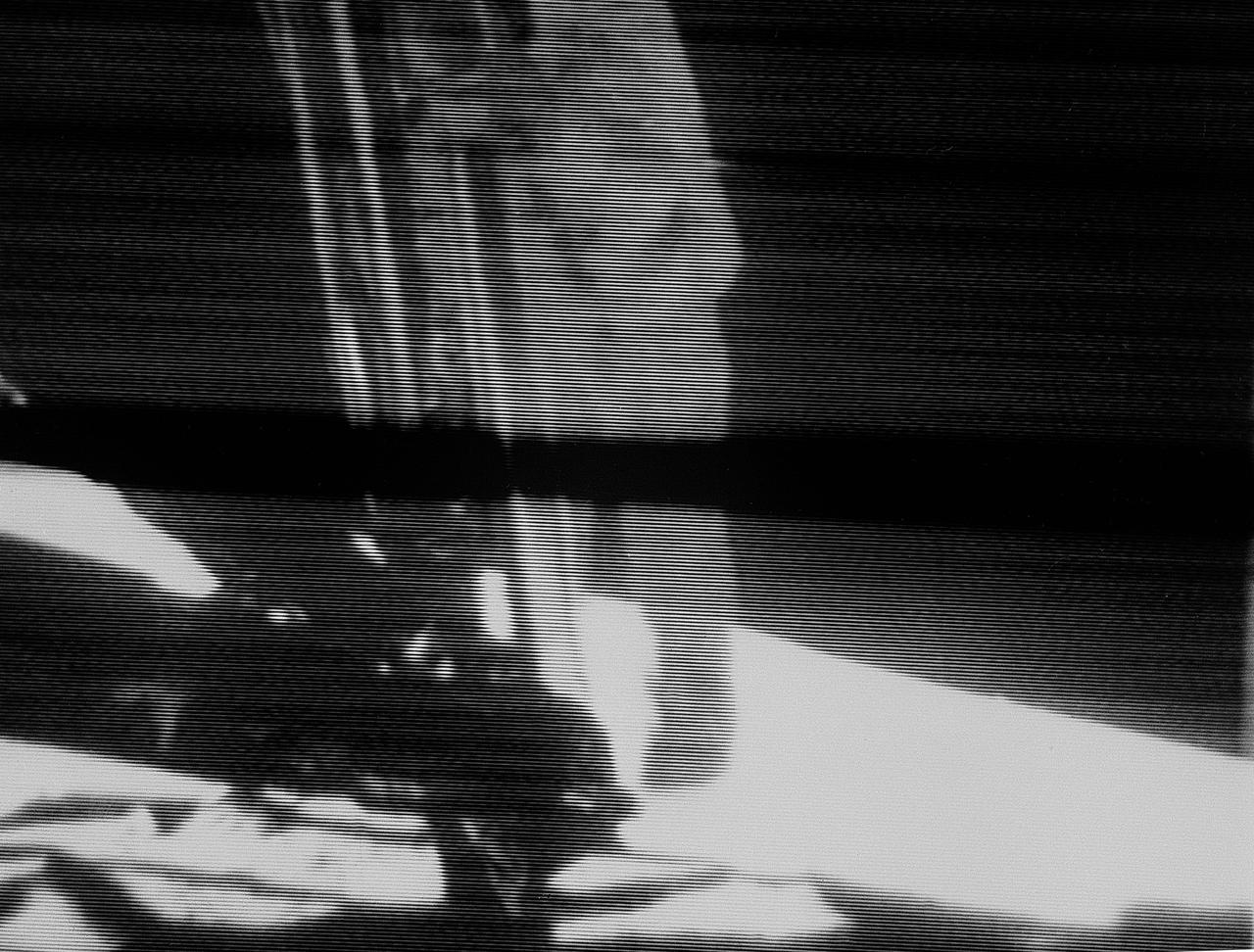
S69-42583 (20 July 1969) --- Astronaut Neil A. Armstrong, Apollo 11 commander, descends the ladder of the Apollo 11 Lunar Module (LM) prior to making the first step by man on another celestial body. This view is a black and white reproduction taken from a telecast by the Apollo 11 lunar surface camera during extravehicular activity (EVA). The black bar running through the center of the picture is an anomaly in the television ground data system at the Goldstone Tracking Station.

RONALD BLAKELY, ASSOCIATE DIRECTOR FOR THE WHITE HOUSE INITIATIVE ON HISTORICALLY BLACK COLLEGES AND UNIVERSITIES, SPEAKS DURING NASA’S FIRST PARTNERSHIPS MEETING FOR HISTORICALLY BLACK COLLEGES AND UNIVERSITIES AND MINORITY SERVING INSTITUTIONS. NASA’S OFFICE OF SMALL BUSINESS PROGRAMS HOSTED THE EVENT, WHICH ALLOWED REPRESENTATIVES FROM 30 NATIONWIDE UNIVERSITIES AND NASA PRIME CONTRACTORS TO DISCUSS POTENTIAL SUBCONTRACTING OPPORTUNITIES
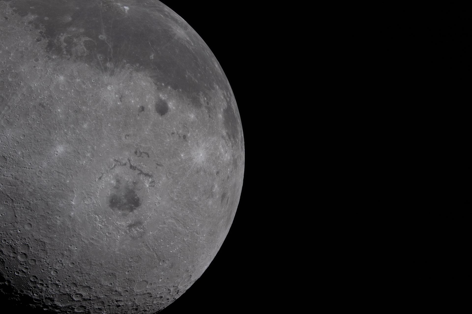
art002e009278 (April 6, 2026) - Just over half of the Moon fills the left half of the image. The near side, characterized by the dark patches of ancient lava, is visible on the top third of the lunar disk. Orientale basin, a round crater in the center with a black patch of ancient lava in the center, is wrapped in rings of mountains. The round black spot northeast of Orientale is Grimaldi crater, and Aristarchus crater is the bright white dot in the midst of a dark grey lava flow at the top of the image.

Chandra X-Ray Observatory provided this composite X-ray (blue and green) and optical (red) image of the active galaxy NGC 1068 showing gas blowing away in a high-speed wind from the vicinity of a central supermassive black hole. Regions of intense star formation in the irner spiral arms of the galaxy are highlighted by both optical and x-ray emissions. A doughnut shaped cloud of cool gas and dust surrounding the black hole, known as the torus, appears as the elongated white spot . It has has a mass of about 5 million suns and is estimated to extend from within a few light years of the black hole out to about 300 light years.
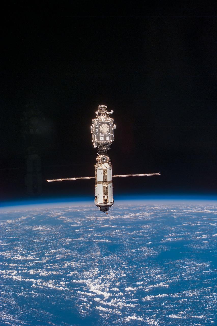
ISS040-E-123158 (2 Sept. 2014) --- A portion of the Russian segment of the International Space Station is featured in this image photographed by an Expedition 40 crew member onboard the station. A blue and white part of Earth and the blackness of space provide the backdrop for the scene.
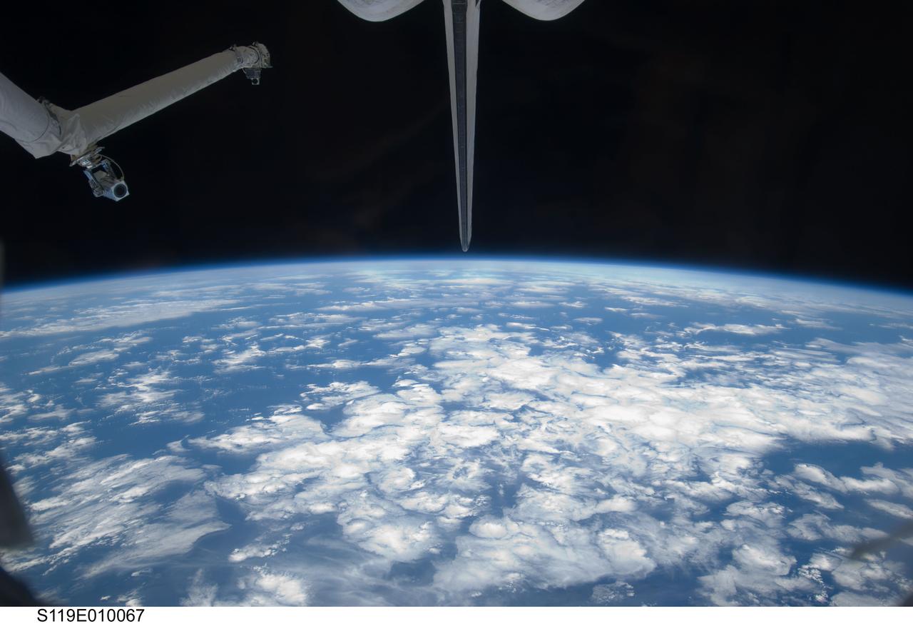
S119-E-010067 (26 March 2009) --- Backdropped by a blue and white Earth and the blackness of space, a portion of Space Shuttle Discovery's Remote Manipulator System (RMS), vertical stabilizer and orbital maneuvering system (OMS) pods are featured in this image photographed by a STS-119 crewmember during flight day 12 activities.

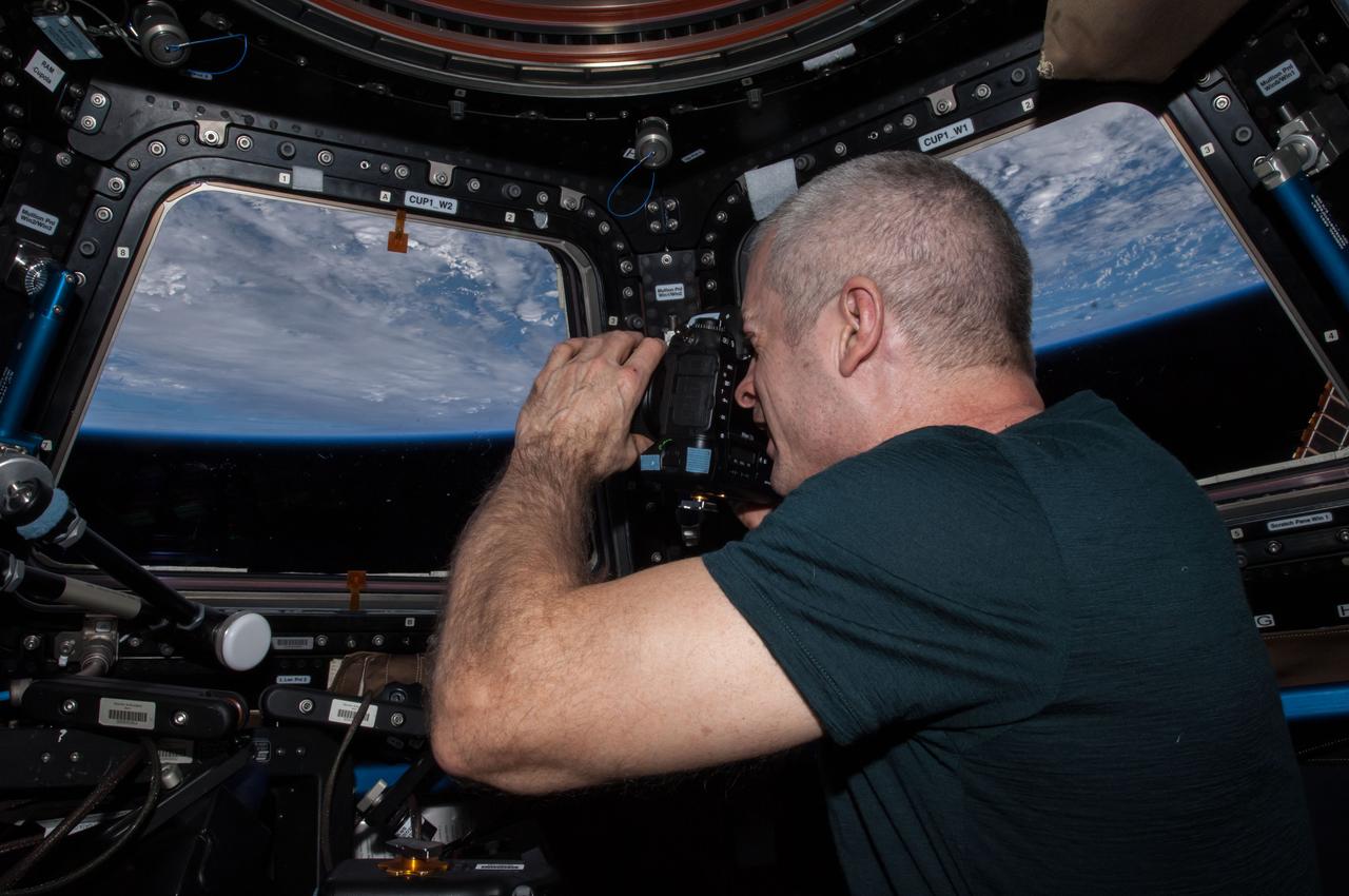
ISS024-E-014263 (11 Sept. 2010) --- NASA astronaut Tracy Caldwell Dyson, Expedition 24 flight engineer, looks through a window in the Cupola of the International Space Station. A blue and white part of Earth and the blackness of space are visible through the windows.
S96-E-5219 (03 June 1999) --- The International Space Station (ISS) is backdropped against the blue and white horizon scene of Earth and the blackness of space following separation from Discovery. The photograph was taken with an electronic still camera (ESC) on Discovery's aft flight deck at 23:11:05 GMT, June 3, 1999.
ISS018-E-008788 (16 Nov. 2008) --- Space Shuttle Endeavour (STS-126) and the International Space Station's robotic Canadarm2 (foreground) are featured in this view while Endeavour is docked with the station. A blue and white Earth and the blackness of space provide the backdrop for the scene.
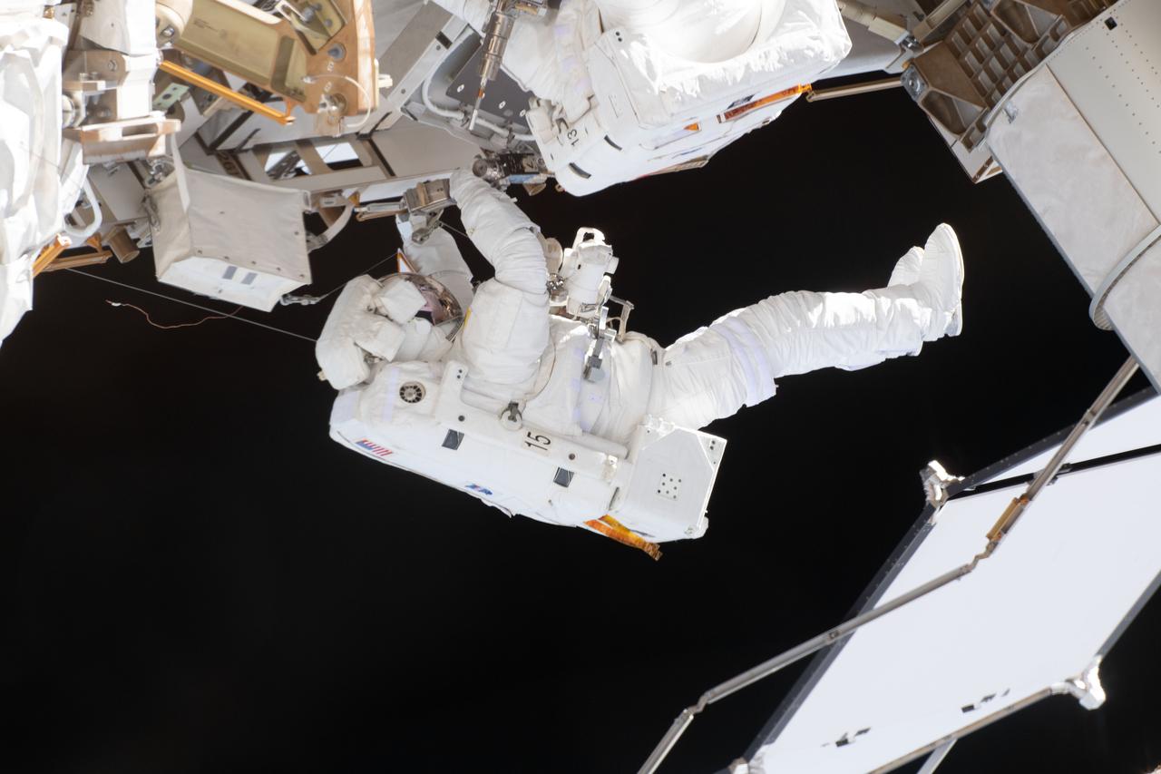
iss059e002192 (March 22, 2019) --- NASA astronaut Nick Hague, in his white U.S. spacesuit with no stripes, is contrasted by the blackness of space during a six-hour, 39-minute spacewalk to upgrade the International Space Station's power storage capacity. This was Hague's and NASA astronaut Anne McClain's (out of frame) first spacewalk.
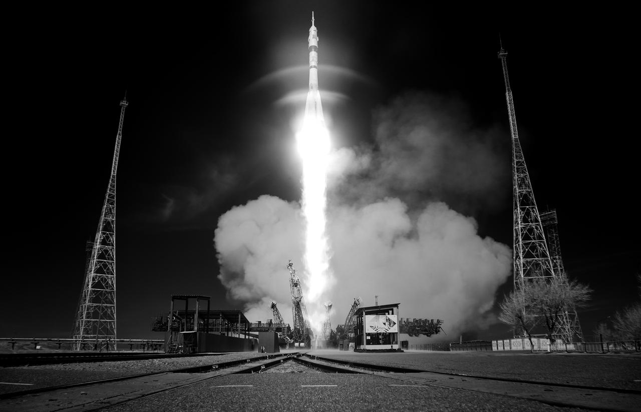
In this black and white infrared image, a Soyuz rocket launches to the International Space Station with Expedition 73 crew members: NASA astronaut Jonny Kim, and Roscosmos cosmonauts Sergey Ryzhikov and Alexey Zubritskiy onboard, Tuesday, April 8, 2025, at the Baikonur Cosmodrome in Kazakhstan. Photo Credit: (NASA/Joel Kowsky)
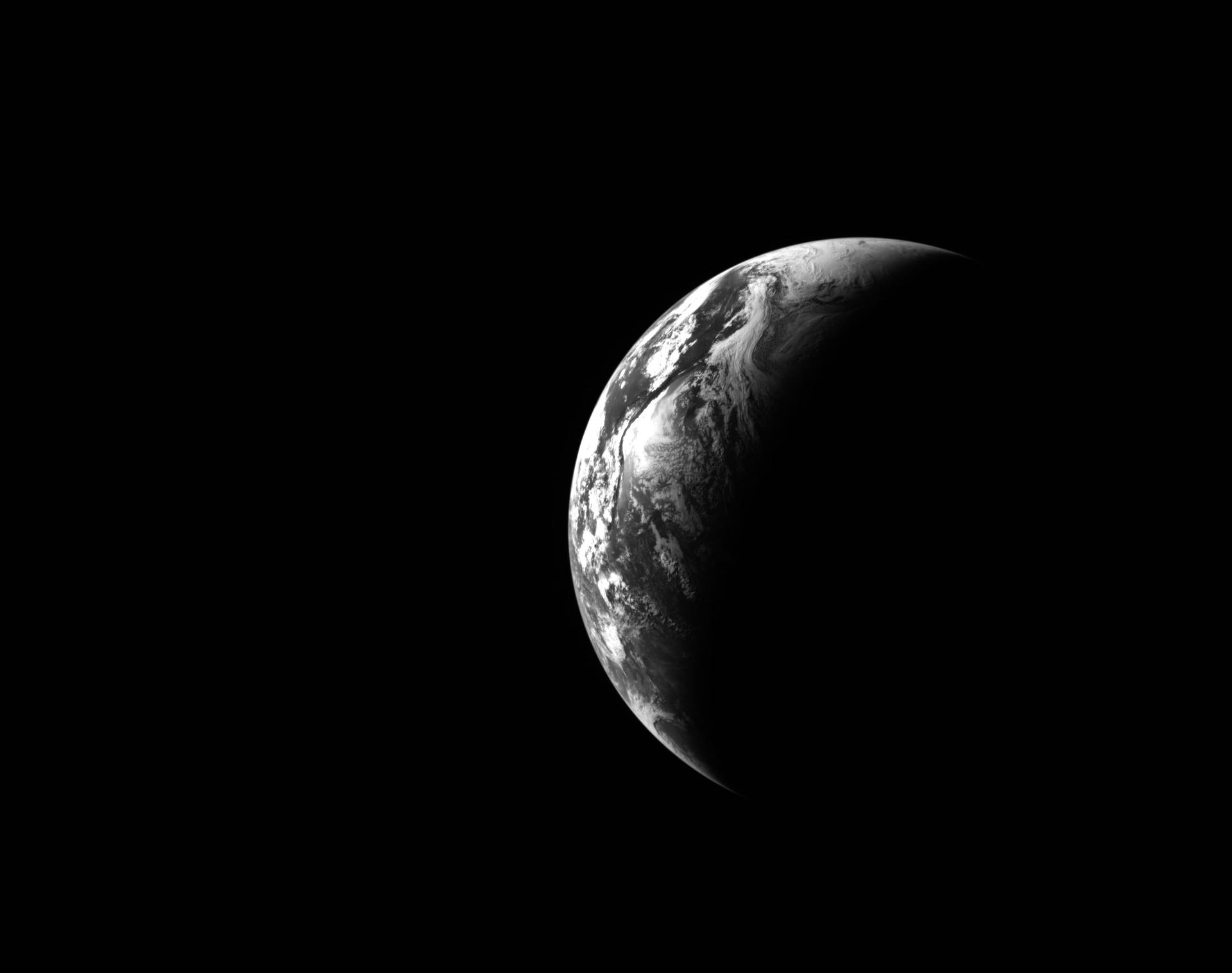
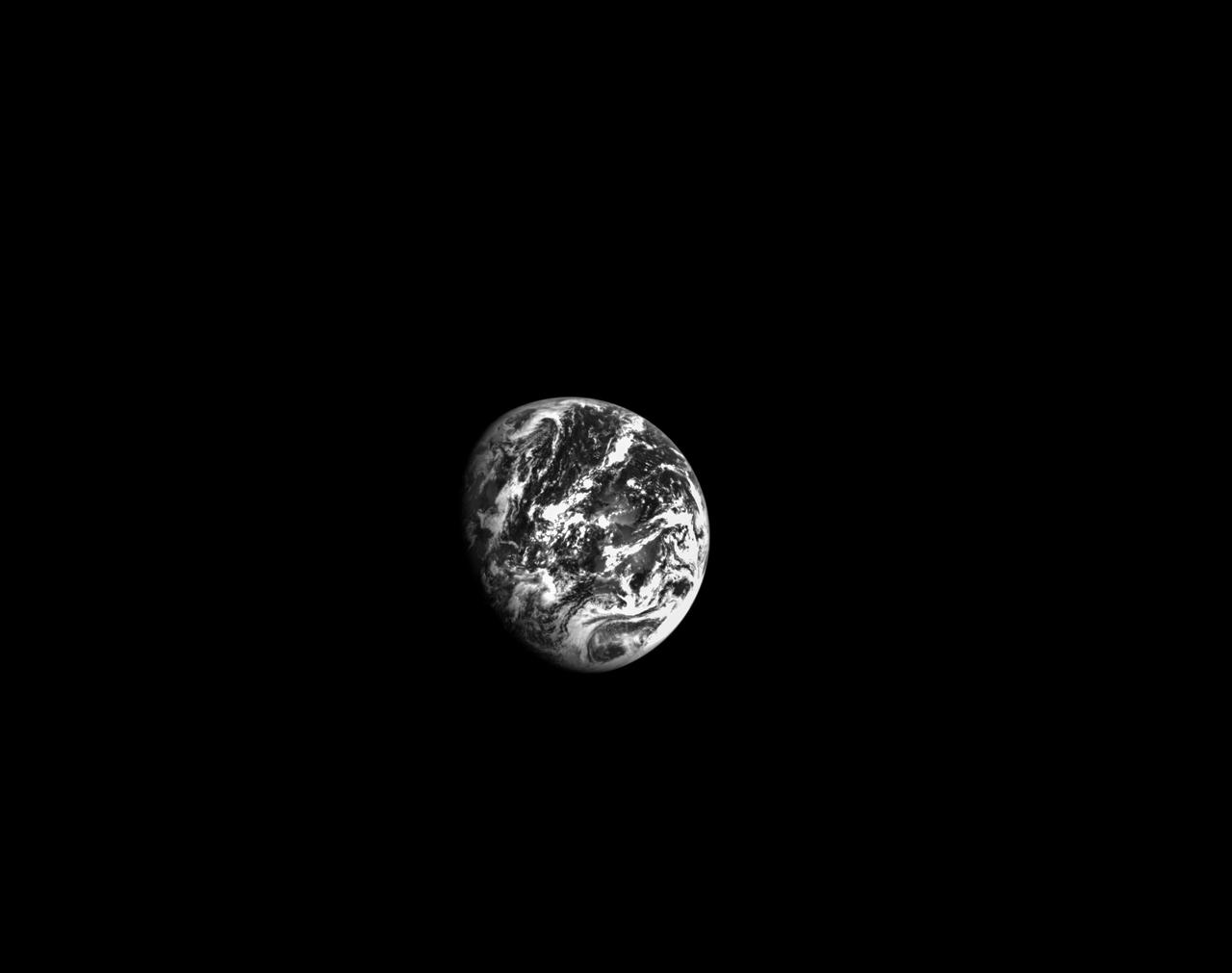
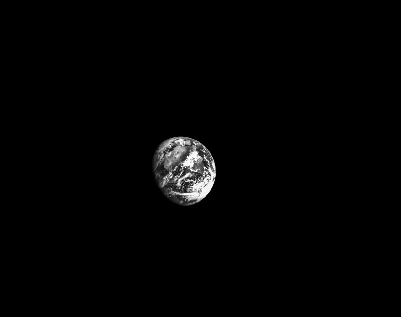
art002e000180 (April 1, 2026) - This black and white image of Earth was captured by the optical navigation sensor on the exterior of the Orion spacecraft on the first day of the Artemis II mission, as the four astronauts inside were traveling farther than any humans have ventured in more than 50 years.
ISS040-E-123646 (7 Sept. 2014) --- NASA astronaut Steve Swanson, Expedition 40 commander, uses a still camera at the windows in the Cupola of the International Space Station. A blue and white part of Earth and the blackness of space are visible through the windows.
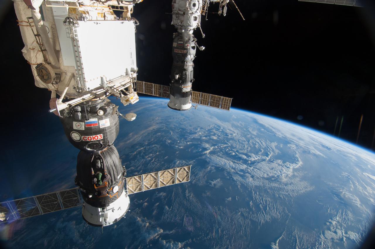
ISS040-E-006049 (30 May 2014) --- The Russian Soyuz 39 spacecraft (foreground) and Progress 55 spacecraft, docked to the International Space Station, are featured in this image photographed by an Expedition 40 crew member on the space station. A blue and white part of Earth and the blackness of space provide the backdrop for the scene.
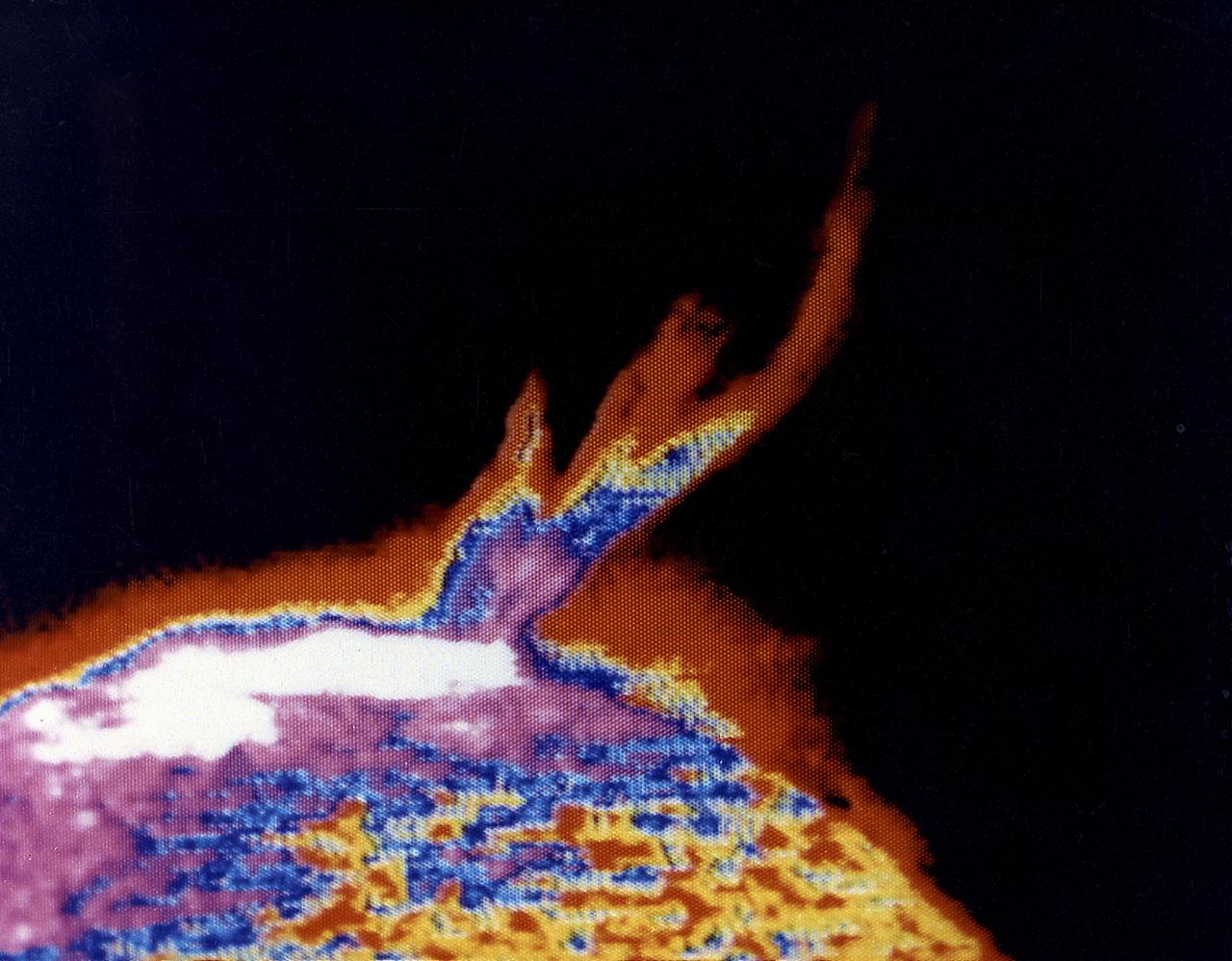
This photograph shows a solar prominence in action, one of Skylab's many splendorous views. It was taken on August 21, 1973. Interpretation of the rich store of Skylab ultraviolet solar data was facilitated by computerized color enhancement of the original black-and-white images, highlighting subtle but important brightness differences.
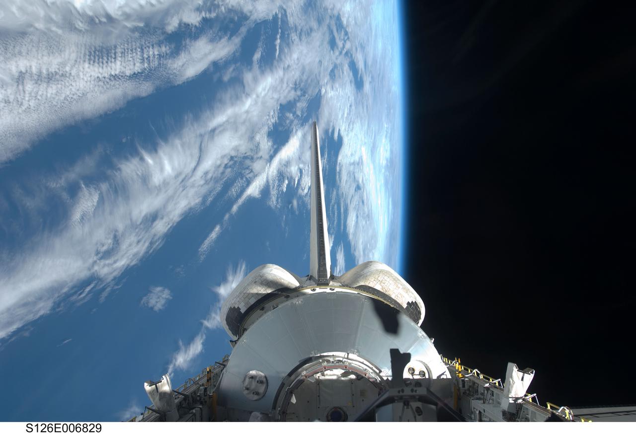
S126-E-006829 (15 Nov. 2008) --- Backdropped by a blue and white Earth and the blackness of space, the Leonardo Multi-Purpose Logistics Module visible in Space Shuttle Endeavour's payload bay, vertical stabilizer and orbital maneuvering system (OMS) pods are featured in this image photographed by a STS-126 crewmember.
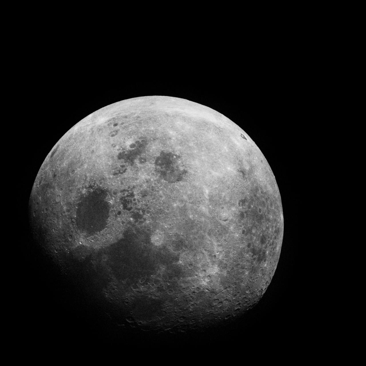
Apollo 8, Entire Moon. Possible Filter. Taken during the Transearth Coast (TEC). Original Film Magazine was labeled G. Camera Data: 70mm Hasselblad. Film Type: Kodak SO-2458 Black and White,ASA 2000. December 21-27,1968.
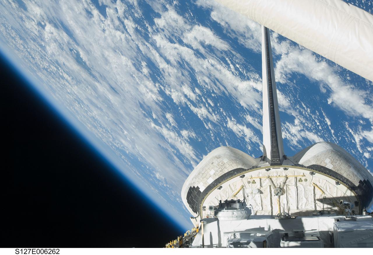
S127-E-006262 (16 July 2009) --- Backdropped by a blue and white Earth and the blackness of space, a partial view of Space Shuttle Endeavour?s payload bay, vertical stabilizer and orbital maneuvering system (OMS) pods are featured in this image photographed by a STS-127 crew member from an aft flight deck window.
ISS040-E-123162 (2 Sept. 2014) --- A portion of the Russian segment of the International Space Station is featured in this image photographed by an Expedition 40 crew member onboard the station. A blue and white part of Earth and the blackness of space provide the backdrop for the scene.
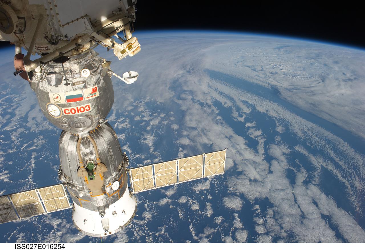
ISS027-E-016254 (22 April 2011) --- A docked Russian Soyuz spacecraft is featured in this image photographed by an Expedition 27 crew member on the International Space Station. A blue and white part of Earth and the blackness of space provide the backdrop for the scene.
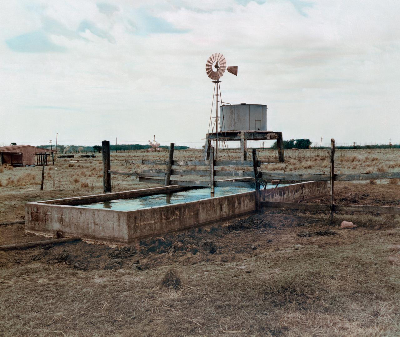
S76-32986 (March 1962) --- A color enhancement of a black and white photograph of a water trough, windmill, grazing area and feed lot on the future site of the Manned Spacecraft Center, Houston, Texas. NOTE: The Manned Spacecraft Center was named Lyndon B. Johnson Space Center in memory of the late President following his death.
ISS040-E-123647 (7 Sept. 2014) --- NASA astronaut Steve Swanson, Expedition 40 commander, uses a still camera at the windows in the Cupola of the International Space Station. A blue and white part of Earth and the blackness of space are visible through the windows.
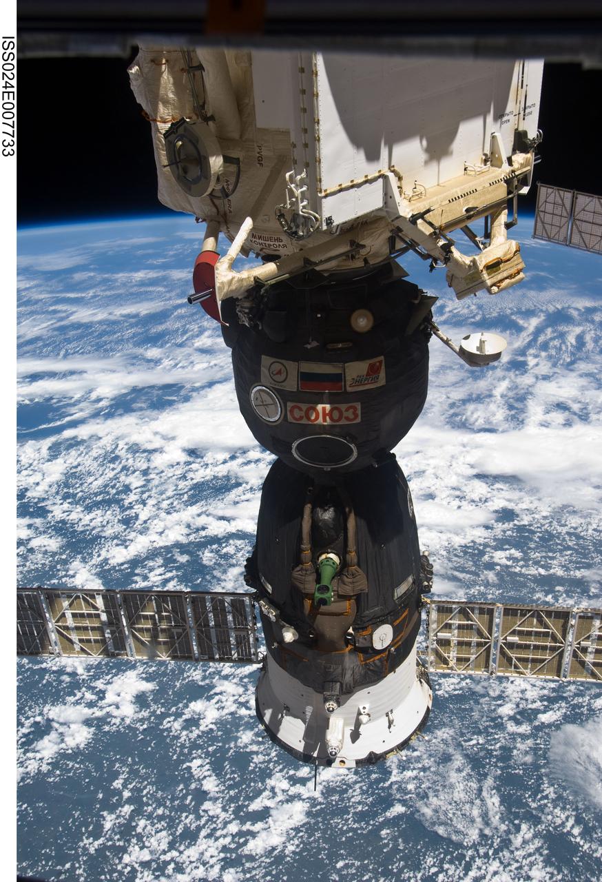
ISS024-E-007733 (9 July 2010) --- The Soyuz TMA-19 spacecraft, docked to the Rassvet Mini-Research Module 1 (MRM1), is featured in this image photographed by an Expedition 24 crew member on the International Space Station. A blue and white part of Earth and the blackness of space provide the backdrop for the scene.

ISS040-E-069582 (16 July 2014) --- The Orbital Sciences’ Cygnus cargo craft attached to the end of the Canadarm2 robotic arm is berthed to the nadir port of the Harmony node of the International Space Station, photographed by an Expedition 40 crew member. A blue and white part of the Earth and the blackness of space provide the backdrop for the scene.
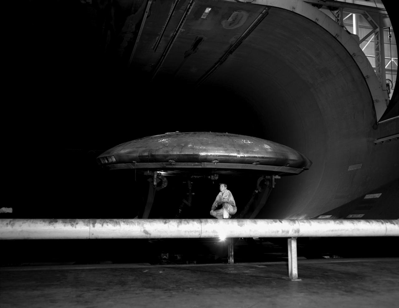
3/4 front view of Avrocar without tail, showing ground board and variable height struts. The ground board minimizes the boundary layer on the floor under the model. black and white negative: KODAK T-MAX 100 Professional. SBA settings neutral SBA on, color SBA on
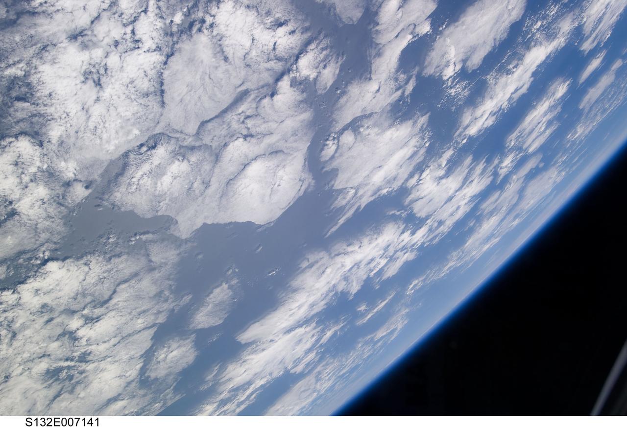
S132-E-007141 (15 May 2010) --- A blue and white part of Earth and the blackness of space are featured in this image photographed by an STS-132 crew member on the Earth-orbiting space shuttle Atlantis during flight day two activities.
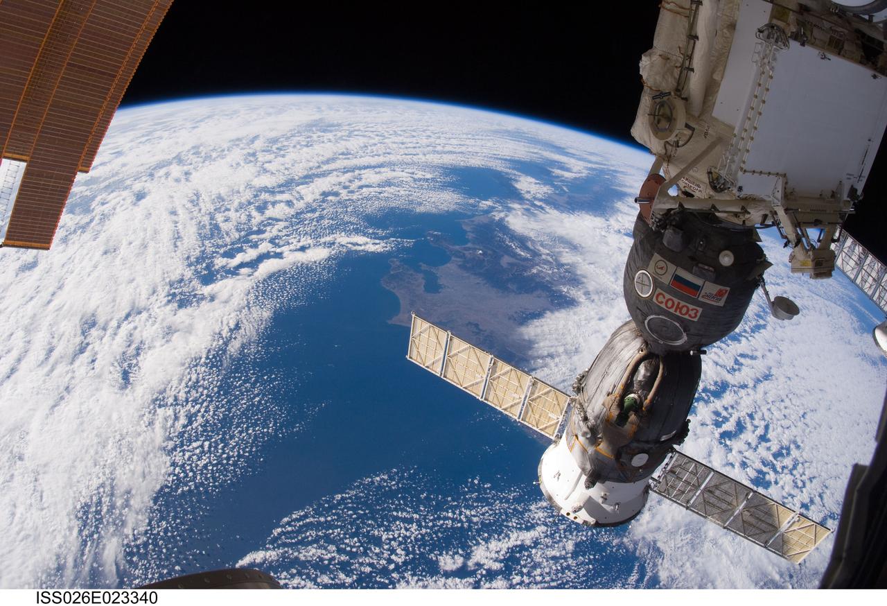
ISS026-E-023340 (31 Jan. 2011) --- A Russian Soyuz spacecraft, docked to the International Space Station, is featured in this image photographed by an Expedition 26 crew member aboard the station. A blue and white part of Earth and the blackness of space provide the backdrop for the scene.
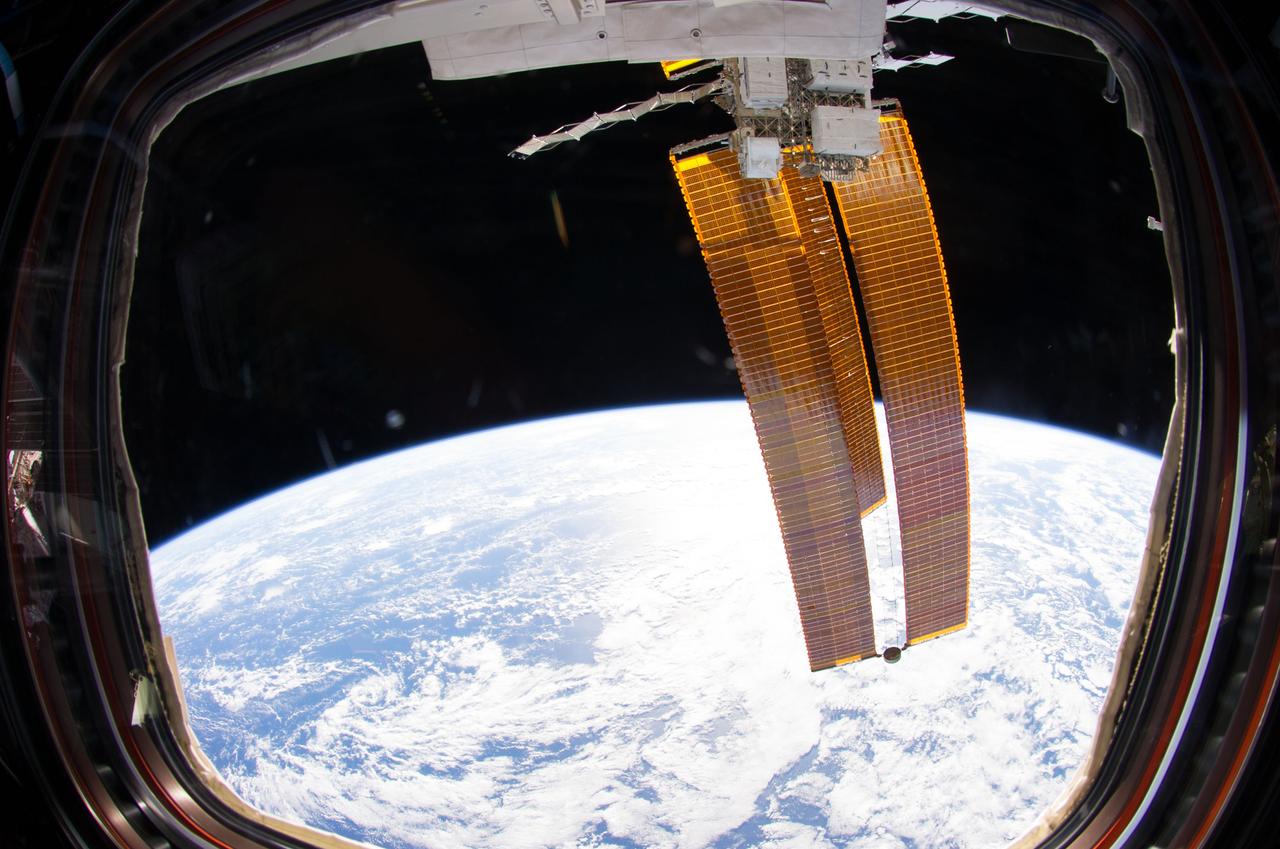
ISS040-E-006193 (1 June 2014) --- Backdropped by a blue and white part of Earth and the blackness of space, solar array wings are featured in this image photographed by an Expedition 40 crew member from a window in the Cupola of the International Space Station.
S74-21921 (For release 1974) --- Sun photographed by Apollo Telescope Mount through spectroheliometer at a wavelength of 625.3 angstroms. The black areas are the surface of the sun; the reds, yellows and whites are the corona some 70,000 kilometers above the surface. Photo credit: NASA