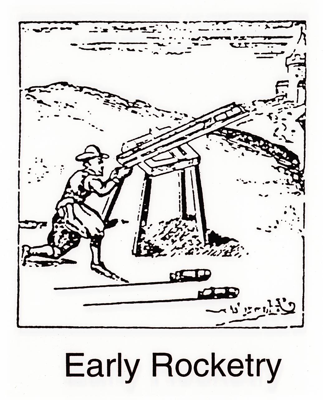
During the early introduction of rockets to Europe, they were used only as weapons. Enemy troops in India repulsed the British with rockets. Later, in Britain, Sir William Congreve developed a rocket that could fire to about 9,000 feet. The British fired Congreve rockets against the United States in the War of 1812.
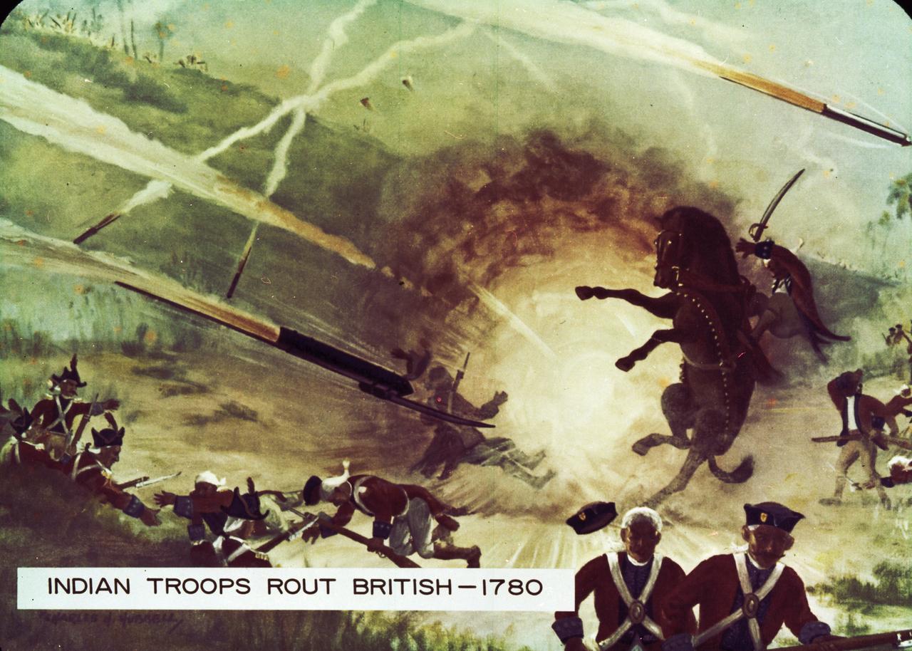
The English confrontation with Indian rockets came in 1780 at the Battle of Guntar. The closely massed, normally unflinching British troops broke and ran when the Indian army laid down a rocket barrage in their midst.
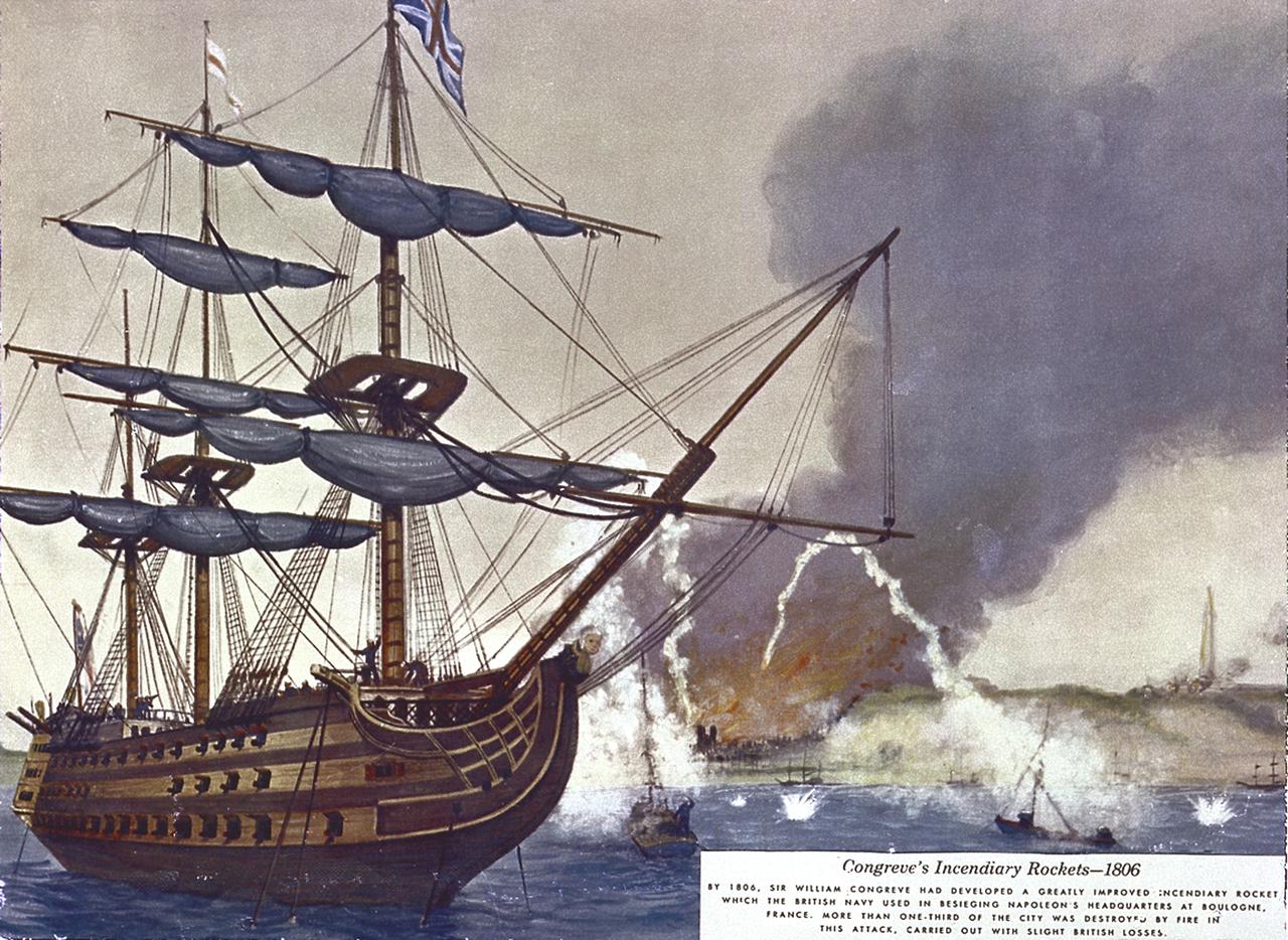
Sir William Congreve developed a rocket with a range of about 9,000 feet. The incendiary rocket used black powder, an iron case, and a 16-foot guide stick. In 1806, British used Congreve rockets to attack Napoleon's headquarters in France. In 1807, Congreve directed a rocket attack against Copenhagen.
STS068-155-011 (30 September-11 October 1994) --- (Okanagan Lake, British Columbia) View southward down the lake; Vernon is in the foreground, Kelowna just before the bend in the lake, and Penticton at the far end of the lake. Green crops are still vigorous despite the season (early October); clear-cuts dot the forested hillsides.
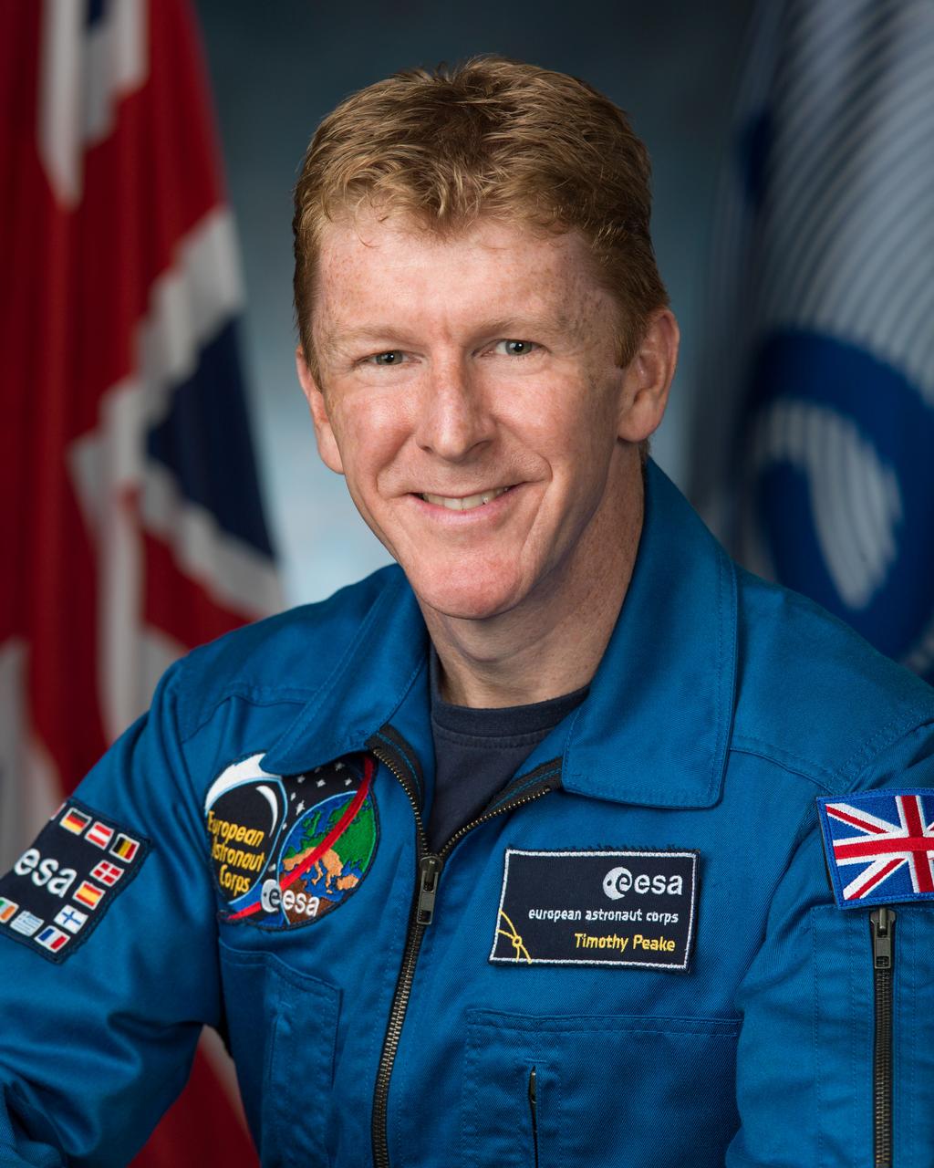
Official NASA portrait of British astronaut Timothy Peake. Photo Date: August 28, 2013. Location: Building 8, Room 183 - Photo Studio. Photographer: Robert Markowitz
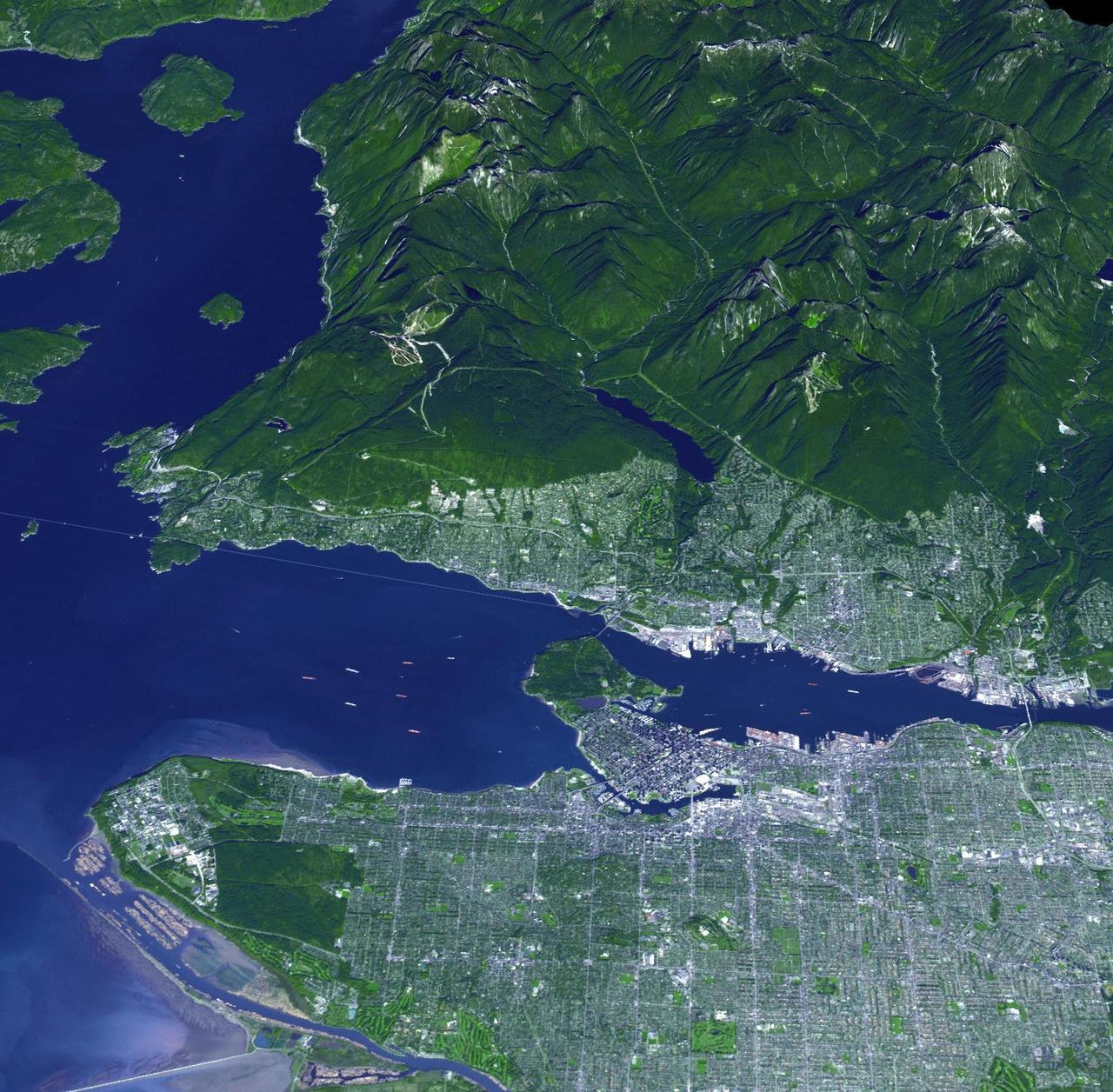
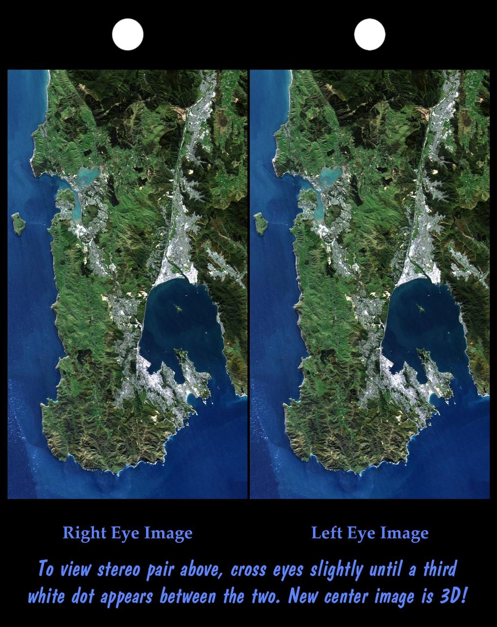
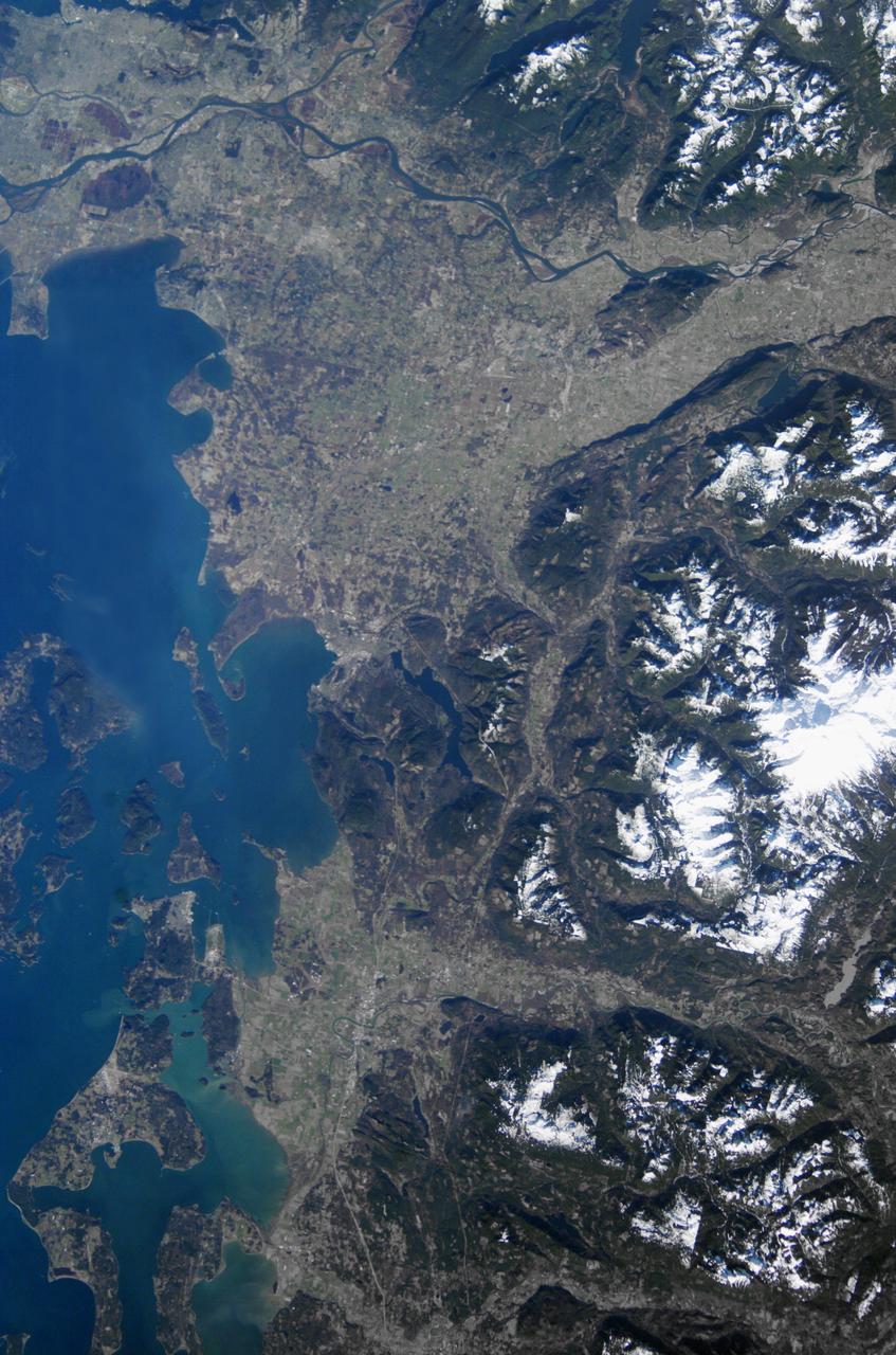
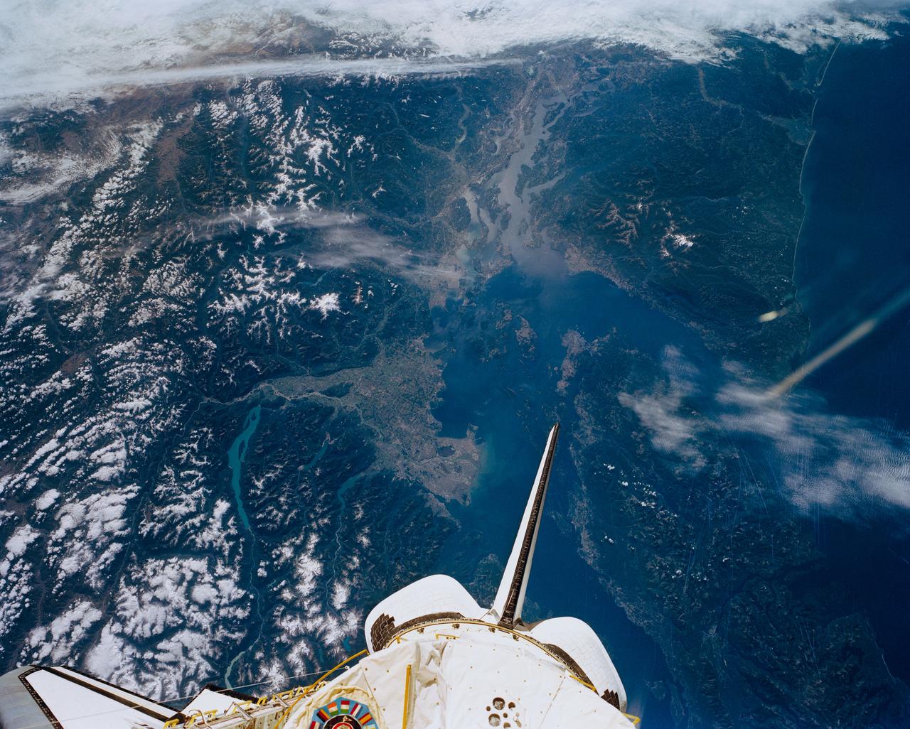
SL3-121-2410 (July-September 1973) --- Skylab 3 Earth view of Washington, British Columbia, Vancouver Island and Puget Sound. Photo credit: NASA
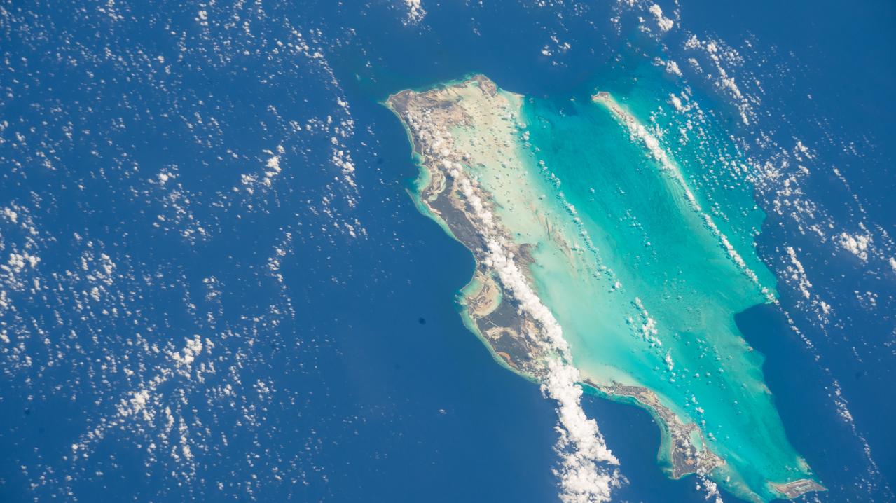
iss073e0098600 (May 26, 2025) --- The Turks and Caicos Islands, a British Overseas Territory in the Atlantic Ocean with a population of approximately 49,300, are pictured from the International Space Station as it orbited 260 miles above.

iss074e0623393 (May 31, 2026) --- Surrey in British Columbia, Canada, is southeast of Vancouver across the Fraser River and part of the city's metropolitan area. Surrey's surging population growth puts the city on pace to surpass Vancouver to become the province’s most populous city in a few years. The International Space Station was orbiting 261 miles above North America at the time of this photograph. Credit: NASA/Chris Williams
On Feb. 12, 2010, the 21st Winter Olympic Games opened in the city of Vancouver, British Columbia, Canada. NASA Terra spacecraft acquired this image of the city of Vancouver, British Columbia, Canada, on Sept. 29, 2008.
AST-19-1570 (24 July 1975) --- An oblique view of the Rocky Mountains area of British Columbia and Alberta in Canada, as photographed from the Apollo spacecraft in Earth orbit during the joint U.S.-USSR Apollo-Soyuz Test Project mission. This picture was taken at an altitude of 222 kilometers (138 statute miles) with a 70mm Hasselblad camera using medium-speed Ektachrome QX-807 type film.
This spaceborne radar image shows part of the British territory of Hong Kong, adjacent to mainland China. The South China Sea is shown in dark blue and red on the image.
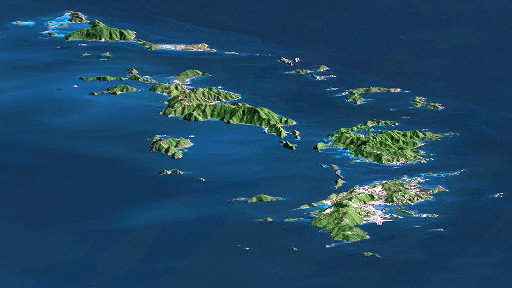
St. Thomas, St. John, Tortola, and Virgin Gorda are the four main islands front to back of this east-looking view of the U.S. Virgin Islands and British Virgin Islands, along the northeast perimeter of the Caribbean Sea.
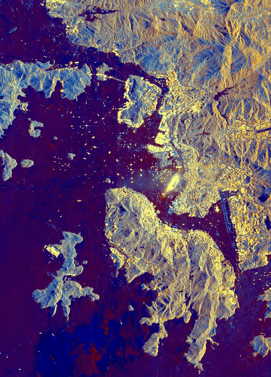
This three-frequency spaceborne radar image shows the southern end of Vancouver Island on the west coast of Canada. The white area in the lower right is the city of Victoria, the capital of the province of British Columbia.

This image from NASA Terra spacecraft is of the Isle of Man also known as Mann, a self-governing British Crown Dependency in the Irish Sea between Great Britain and Ireland.
Wellington, the capital city of New Zealand, is located on the shores of Port Nicholson, a natural harbor at the south end of North Island. The city was founded in 1840 by British emigrants and now has a regional population of more than 400,000 residents.
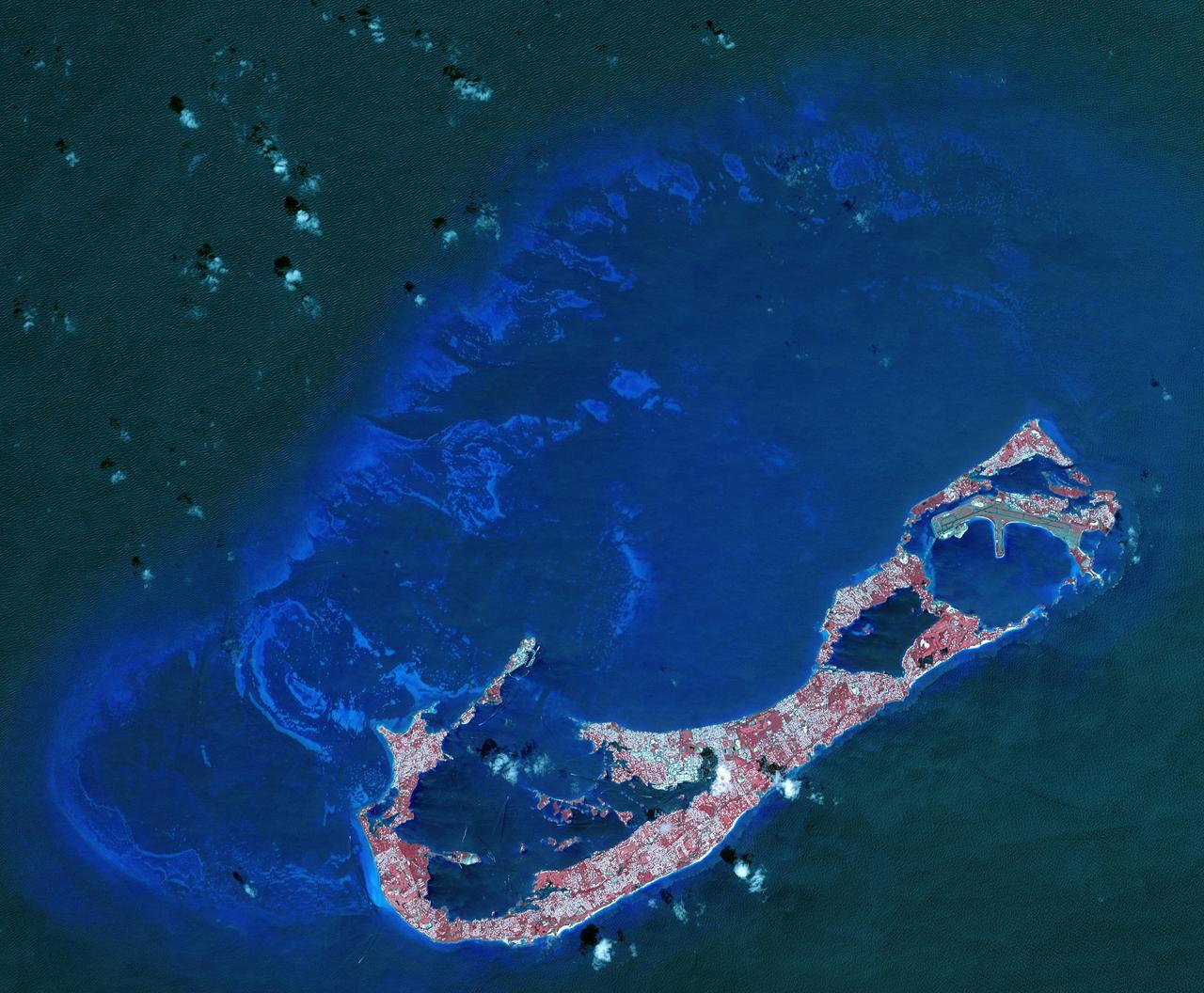
Bermuda is a British Overseas Territory in the western Atlantic off the east coast of North America. The uninhabited islands were first discovered in 1503 by the Spanish explorer Juan de Bermudez. In 1609 the English Virginia Colony settled Bermuda, and it has remained a British colony for over 400 years. Bermuda's economy is dominated by offshore insurance, and tourism, resulting in a very high GDP per capita. The image was acquired April 19, 2009, covers an area of 29.4 by 40.7 kilometers, and is located at 32.3 degrees north, 64.8 degrees west. http://photojournal.jpl.nasa.gov/catalog/PIA21315
S66-46054 (18 July 1966) --- Venezuela, British Guyana, Surinam and Trinidad, as seen from the Gemini-10 spacecraft. On the left is the mouth of the Orinoco River in Venezuela. Mouth of Essequibo River in British Guyana is in right center. Photo credit: NASA
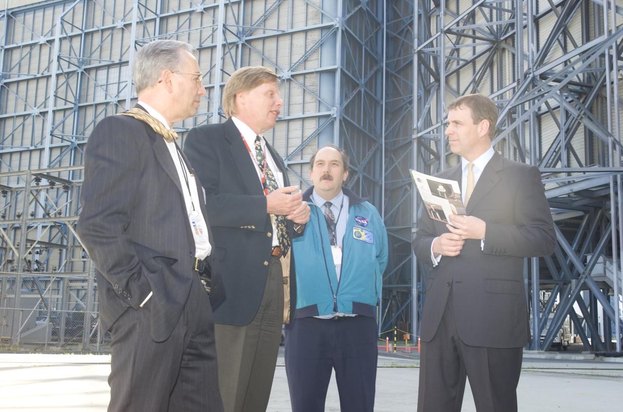
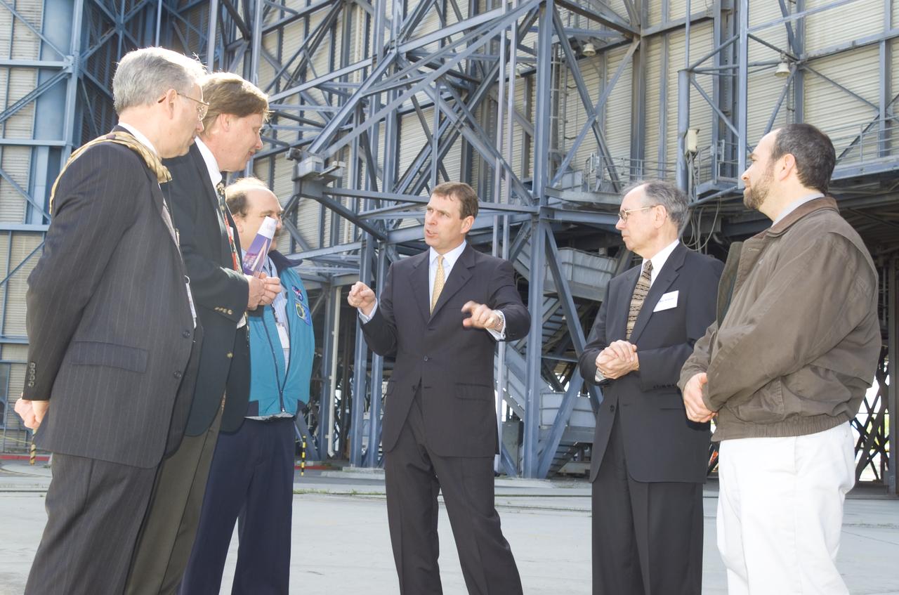
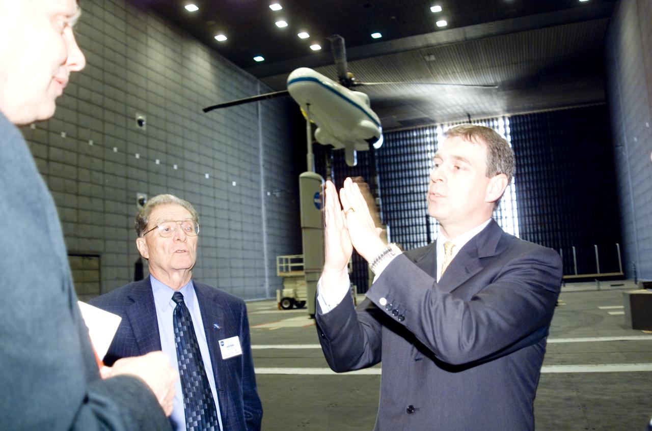
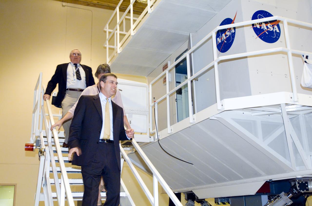
British royalty visits Ames; Prince Andrew, Duke of York on tour
British royalty visits Ames; Prince Andrew, Duke of York on tour

British royalty visits Ames; Prince Andrew, Duke of York on tour

British royalty visits Ames; Prince Andrew, Duke of York on tour
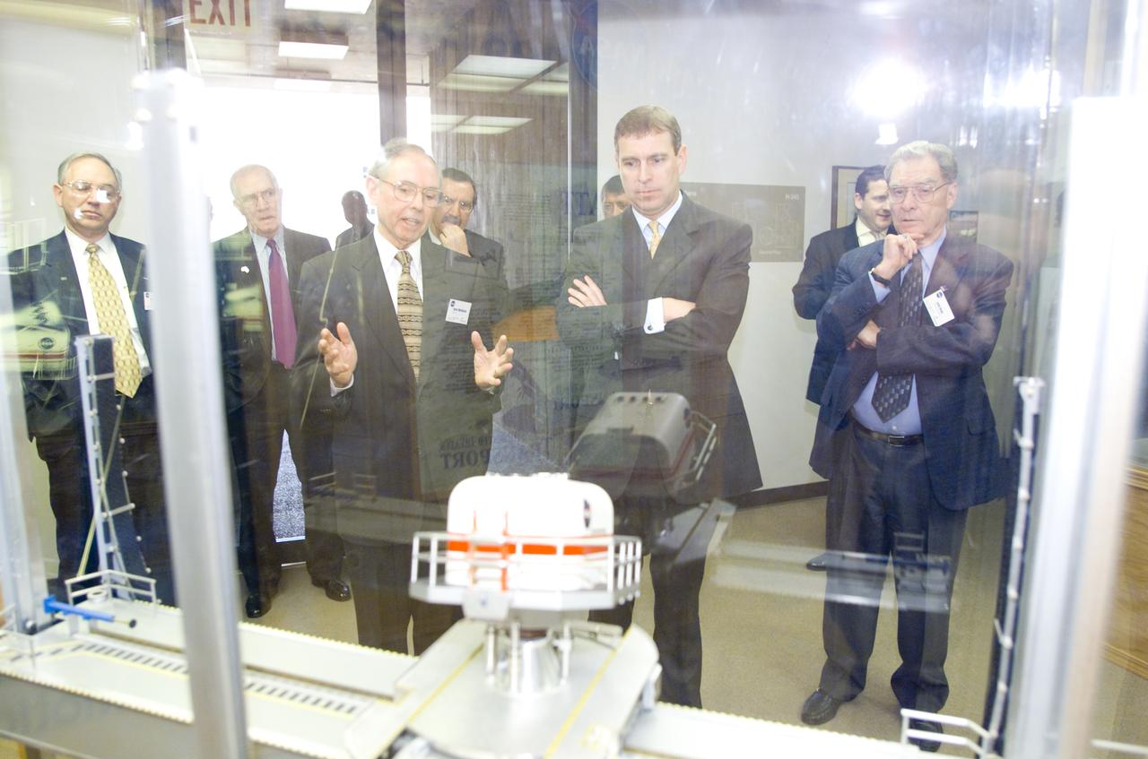
British royalty visits Ames; Prince Andrew, Duke of York on tour of CVSRF

British royalty visits Ames; Prince Andrew, Duke of York on tour of VMS
British royalty visits Ames; Prince Andrew, Duke of York on tour in CVSRF

British royalty visits Ames; Prince Andrew, Duke of York on tour

British royalty visits Ames; Prince Andrew, Duke of York on tour
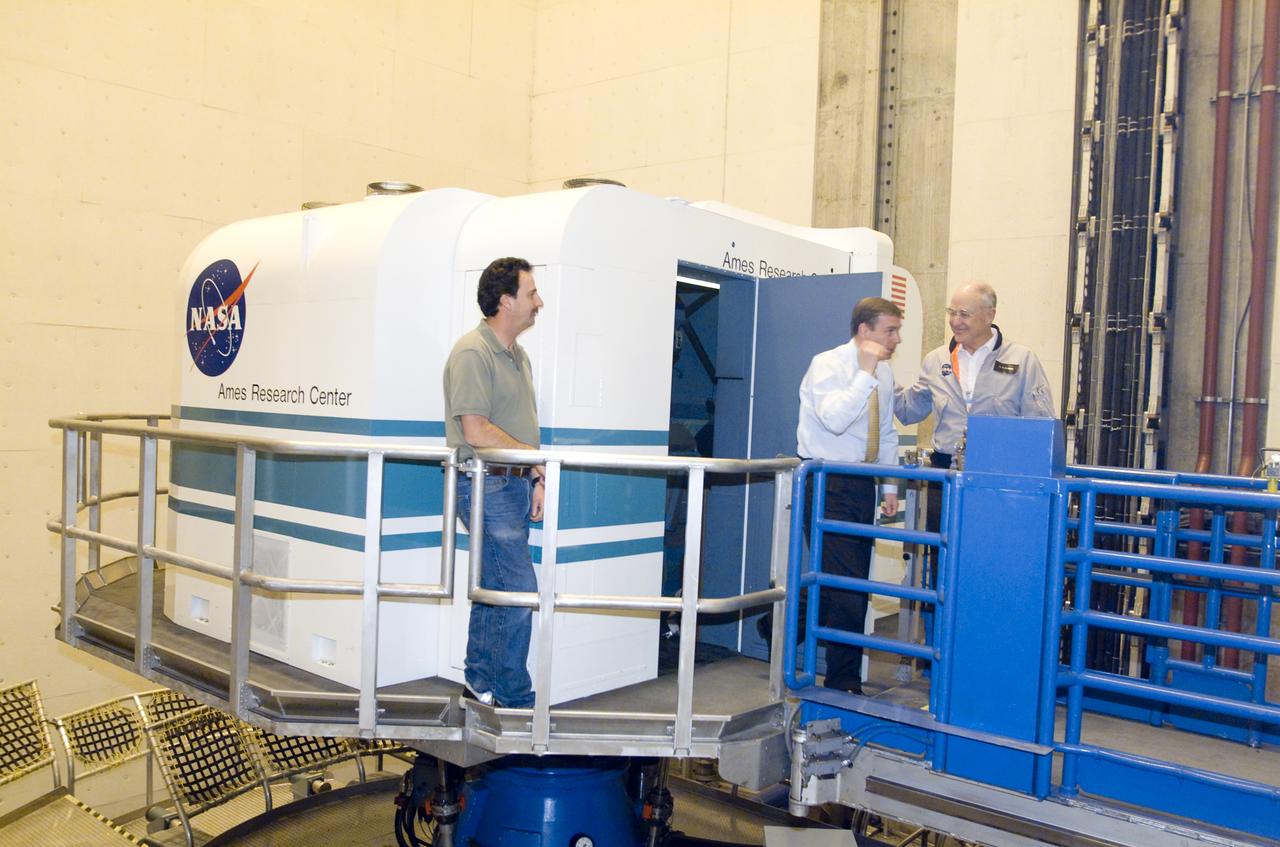
British royalty visits Ames; Prince Andrew, Duke of York on tour of VMS

British royalty visits Ames; Prince Andrew, Duke of York on tour

British royalty visits Ames; Prince Andrew, Duke of York on tour

British royalty visits Ames; Prince Andrew, Duke of York on tour
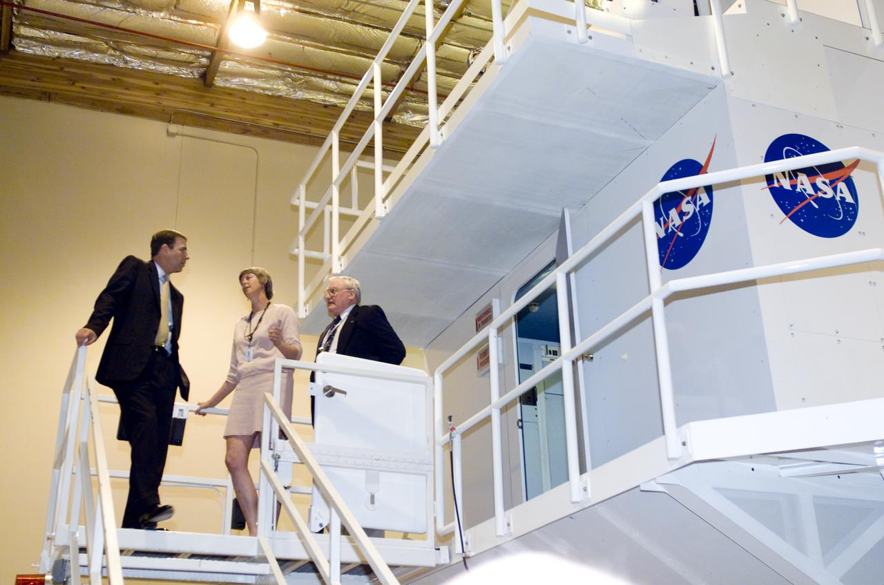
British royalty visits Ames; Prince Andrew, Duke of York on tour of CVSRF

British royalty visits Ames; Prince Andrew, Duke of York on tour

British royalty visits Ames; Prince Andrew, Duke of York on tour

The city of Calcutta appears in this 24 by 34 km (15 by 21 mile) sub-scene, acquired March 29, 2000. In 1690 the British East India Company founded Calcutta as a trading post on the marshy east bank of the Hugli River. Chosen for its easily defensible location and its access to the Bay of Bengal, the site developed into an important trading port. In 1773 Calcutta was made the capital of British India. As merchants and workers from all over the Indian subcontinent flocked to the city, British interests prospered, and British colonizers built mansions and palaces on land reclaimed from the marshes and swampland. In 1912, however, Calcutta lost its position as the colonial capital to Delhi. The end of British rule in India in 1947 cut off many of Calcutta's sources of trade and brought a deluge of immigrants to the city. The Bangladesh war in 1971 exacerbated the influx of refugees. Today this vibrant city has a population of over 5 million, and continues to sprawl to the north and south from the central grid of its old European section. This image was acquired on June 23, 2002, covers an area of 33 x 27 km, and is located at 22.6 degrees north latitude and 88.3 degrees east longitude. http://photojournal.jpl.nasa.gov/catalog/PIA11157
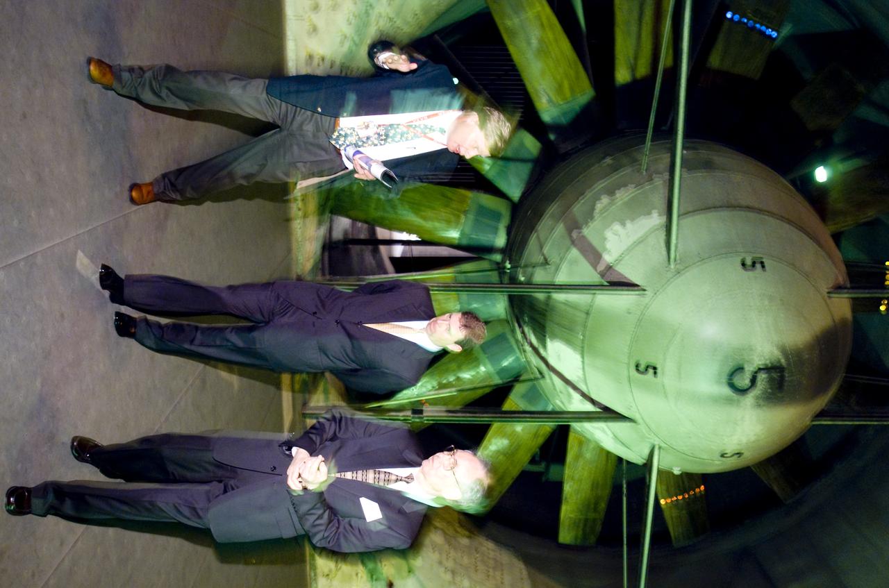
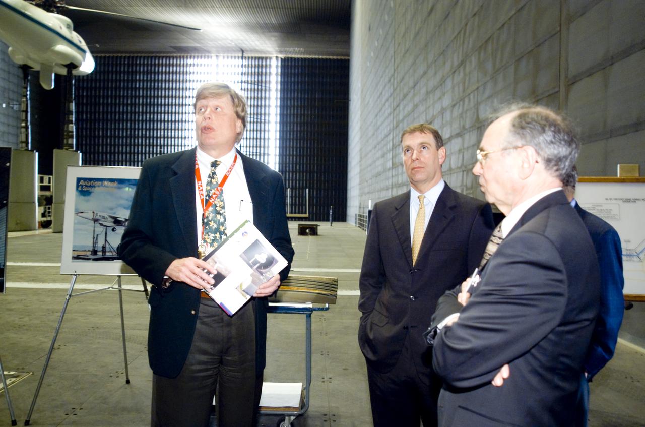
British royalty visits Ames; Prince Andrew, Duke of York on tour of NFAC (40x80x120ft w.t.)
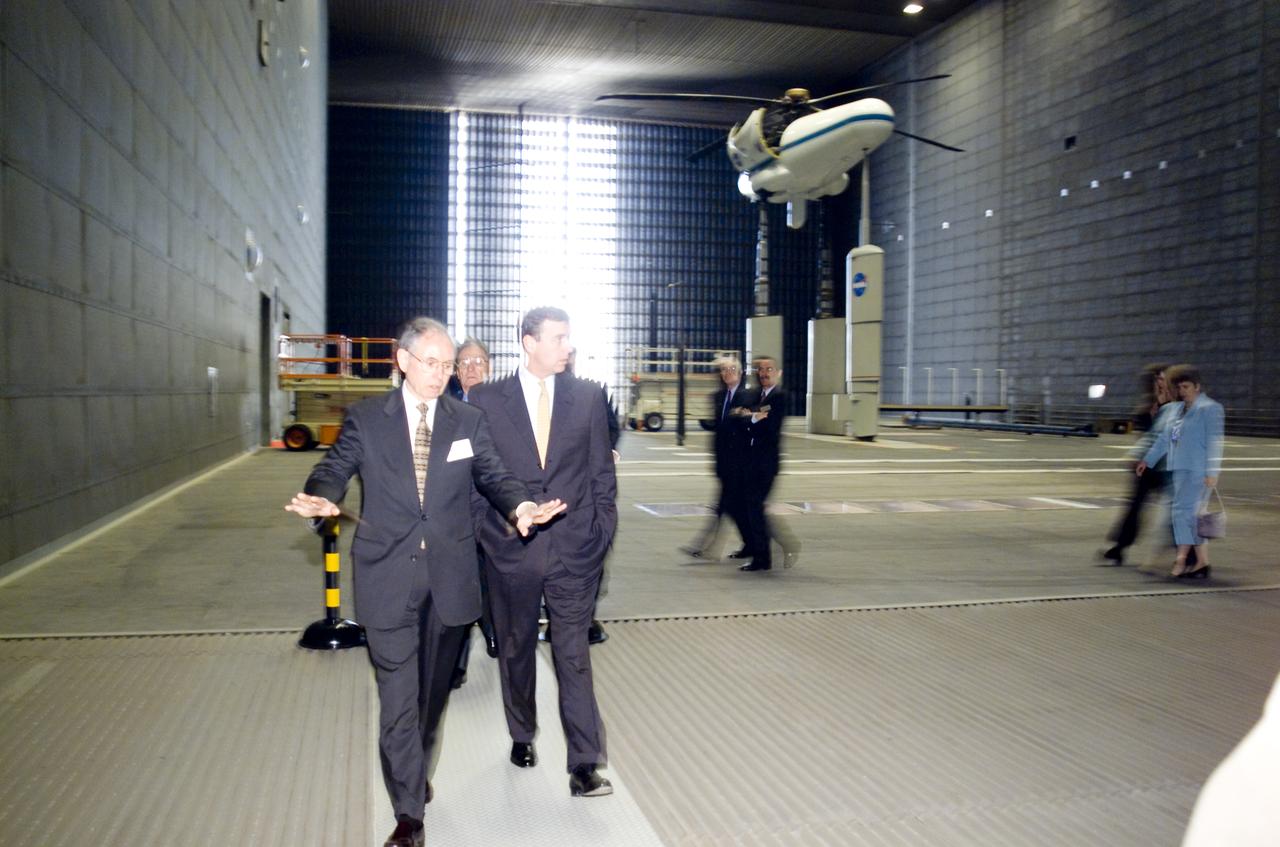
British royalty visits Ames; Prince Andrew, Duke of York on tour of 80x120ft Wind Tunnel
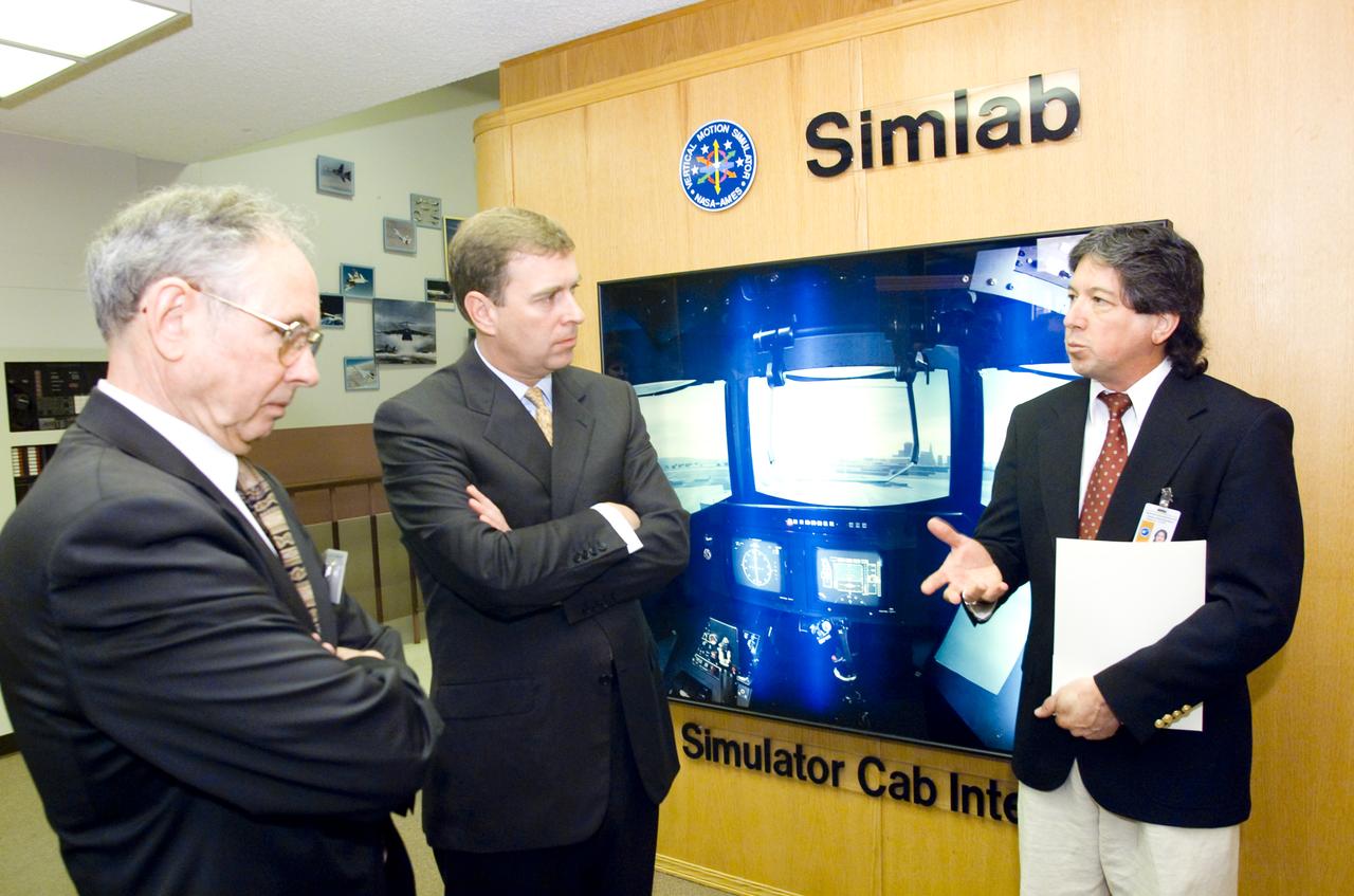
British royalty visits Ames; Prince Andrew, Duke of York on tour of Vertical Motion Simulator Facilities (VMS)
British royalty visits Ames; Prince Andrew, Duke of York on tour in 80x120ft w.t.
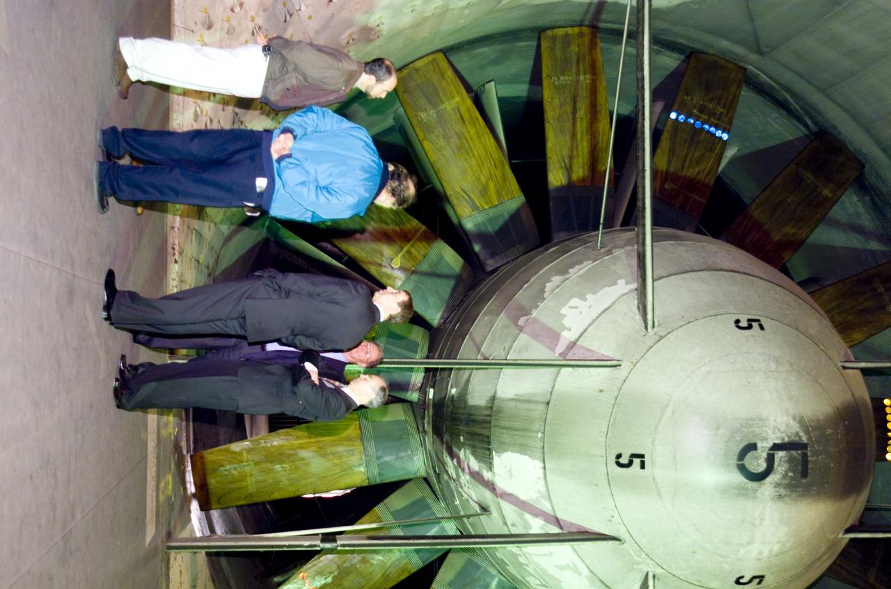
British royalty visits Ames; Prince Andrew, Duke of York on tour of the NFAC facility. (40x80x120ft Wind Tunnel)
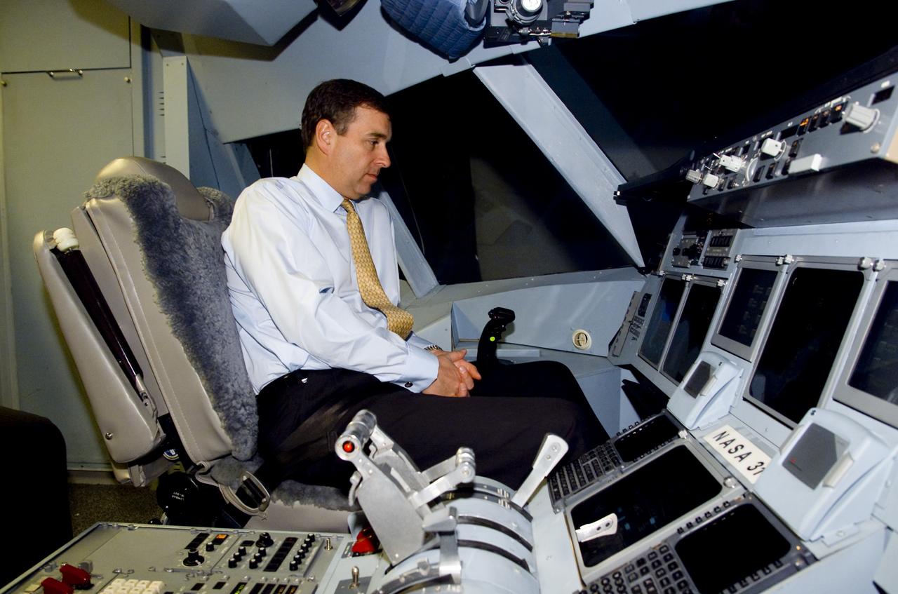
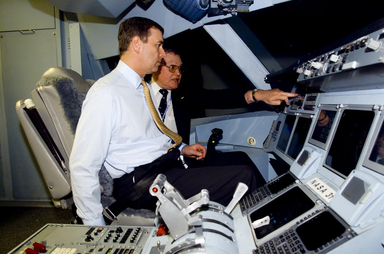
British royalty visits Ames; Prince Andrew, Duke of York on tour at the VMS (Vertical Motion Simulator)
British royalty visits Ames; Prince Andrew, Duke of York on tour in 80x120ft w.t.

British royalty visits Ames; Prince Andrew, Duke of York on tour in 80x120ft w.t.
British royalty visits Ames; Prince Andrew, Duke of York on tour of CVSRF (Crew Vehicle Systems Research Facililty) simulators

British royalty visits Ames; Prince Andrew, Duke of York greeted by Jack Boyd, Executive Assistant of Center Director
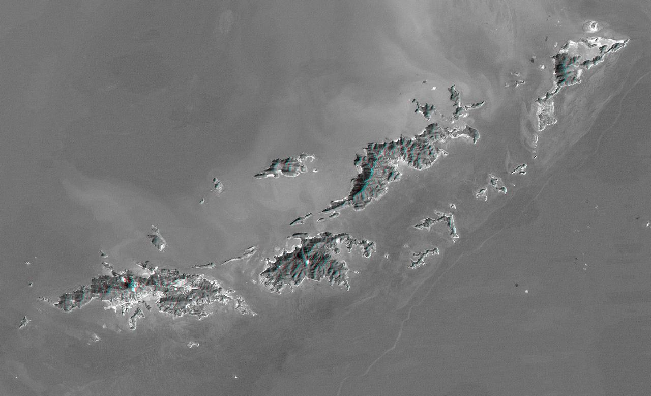
St. Thomas, St. John, Tortola, and Virgin Gorda are the four main islands lower left to upper right of this map-view anaglyph of the U.S. Virgin Islands and British Virgin Islands from NASA Shuttle Radar Topography Mission. 3D glasses are necessary.

British royalty visits Ames; Prince Andrew, Duke of York on tour, here with Dr Henry McDonald, Director of Ames Research Center presenting a memento to the Prince.
ISS008-E-15493 (12 February 2004) --- A regional picture of Mount Baker, Washington, showing its proximity to Seattle and Vancouver, is featured in this image photographed by an Expedition 8 crewmember on the International Space Station (ISS). The Cascade Range is an arc of volcanoes that extends from southwestern British Columbia to northern California. One of the six major composite volcanoes is Mount Baker in northern Washington close to the Canadian border, about 85 miles north-northeast of Seattle and 65 miles southeast of Vancouver, British Columbia.
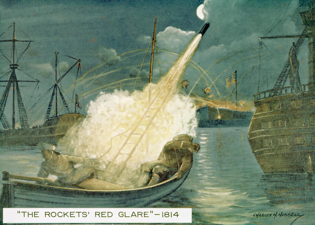
The British fired Congreve rockets against the United States in the War of 1812. As a result Francis Scott Key coined the phrase the "rocket's red glare." Congreve had used a 16-foot guide stick to help stabilize his rocket. William Hale, another British inventor, invented the stickless rocket in 1846. The U.S. Army used the Hale rocket more than 100 years ago in the war with Mexico. Rockets were also used to a limited extent by both sides in the American Civil War.
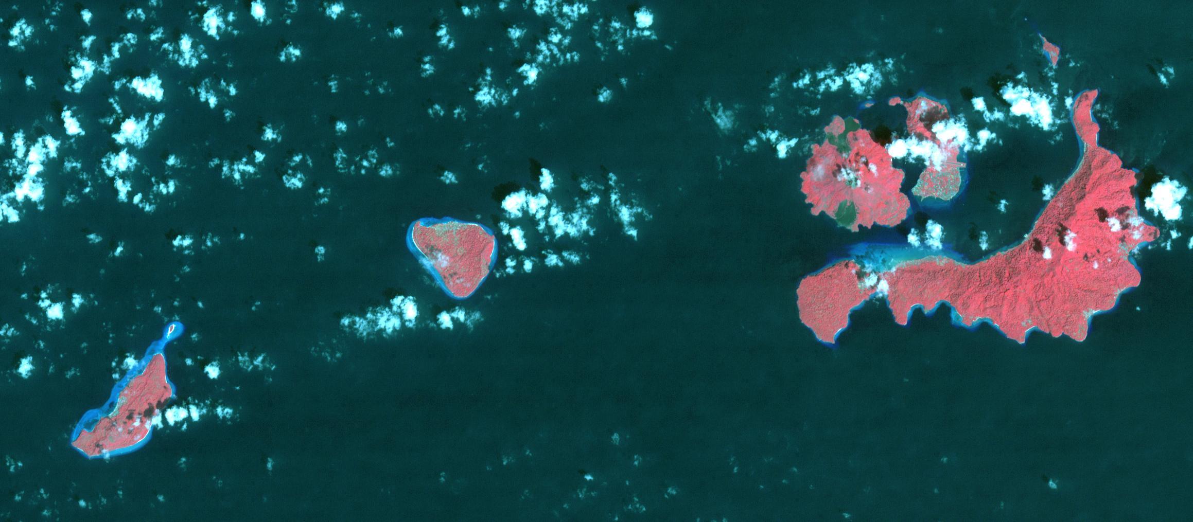
In 1667, the Dutch exchanged Run Island (left-most in the image) with the British for Manhattan (renamed from New Amsterdam to New York). Run Island is one of the smallest, and western-most, of the Banda Islands, part of the Malukus, Indonesia. At the time it was the only source of the incredibly valuable spices nutmeg and mace. The image was acquired January 5, 2016, covers an area of 15.7 by 34.8 kilometers, and is located at 4.5 degrees south, 129.7 degrees east. https://photojournal.jpl.nasa.gov/catalog/PIA22133
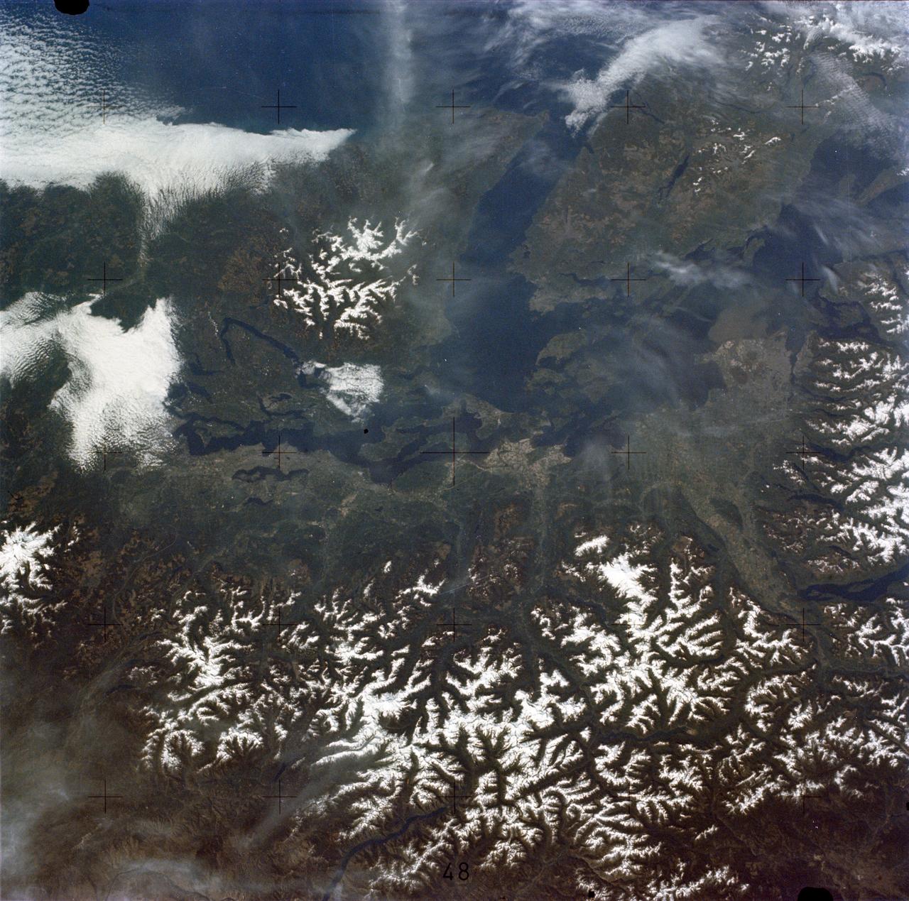
ISS024-E-009781 (28 July 2010) --- The Coastal Mountains in British Columbia, Canada are featured in this image photographed by an Expedition 24 crew member on the International Space Station.
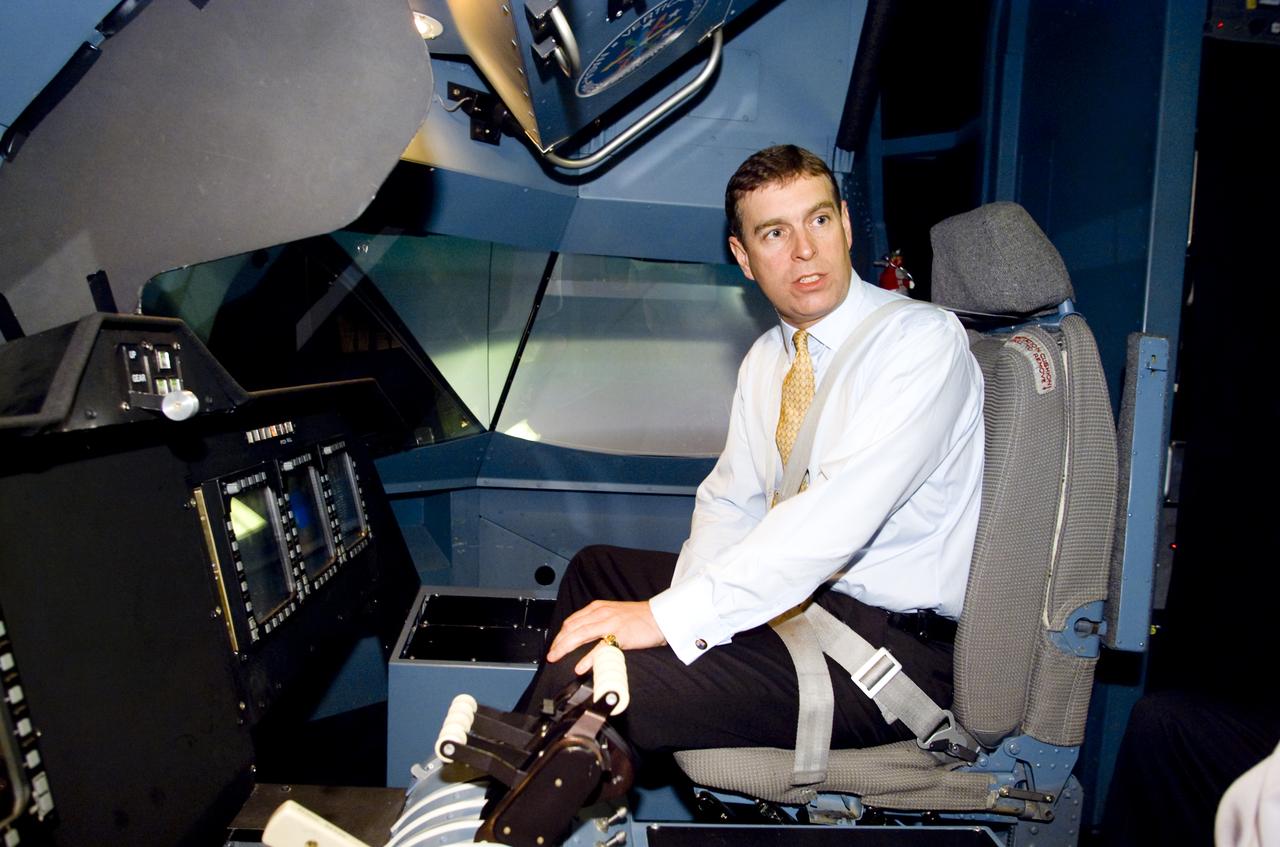
British Royalty visits Ames; Prince Andrew, Duke of York on tour. Seen here in the Vertical Motion Simulator in N-243 flying a tilt-wing simulation. (VMS)

ISS007-E-12749 (14 August 2003) --- This view of forest fires in lower British Columbia, Canada was taken by one of the Expedition 7 crewmembers onboard the International Space Station (ISS).

Silicon Valley FIRST Regional Robotics competition: Arctic Ice Bears - Team 1544 - NASA/USKH British Petroteum/CIRI Foundation & Bartlett HS. Anchorage, Alaska (AK)

iss068e011272 (Oct. 1, 2022) --- The Canadian Rockies in the Canadian provinces of British Columbia and Alberta are pictured from the International Space Station as it orbited 262 miles above North America. Credit: NASA/Bob Hines
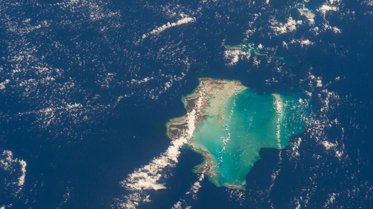
iss073e0118628 (May 26, 2025) --- The Turks and Caicos Islands, an archipelago and British Overseas Territory in the Atlantic Ocean southeast of The Bahamas, are pictured from the International Space Station as it orbited 261 miles above.
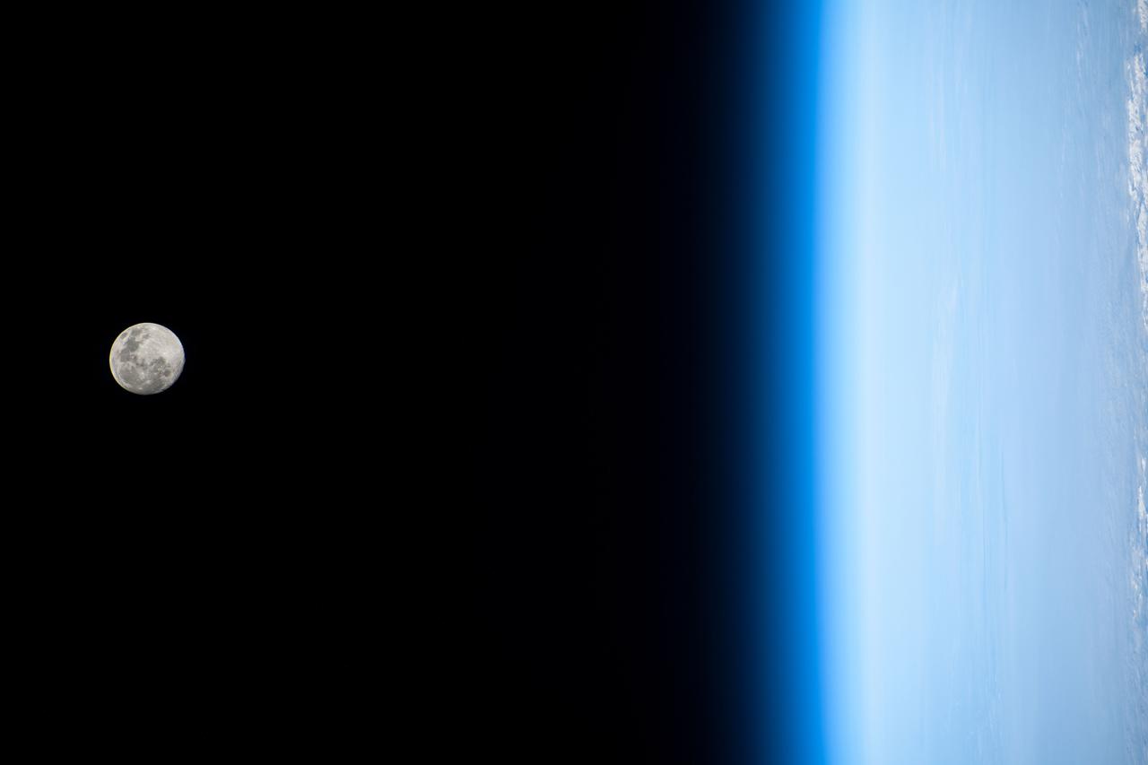
iss066e144042 (Feb. 14, 2022) --- The waxing gibbous Moon is pictured on Valentine's Day from the International Space Station as it orbited 261 miles above the Pacific Ocean off the coast of British Columbia, Canada.
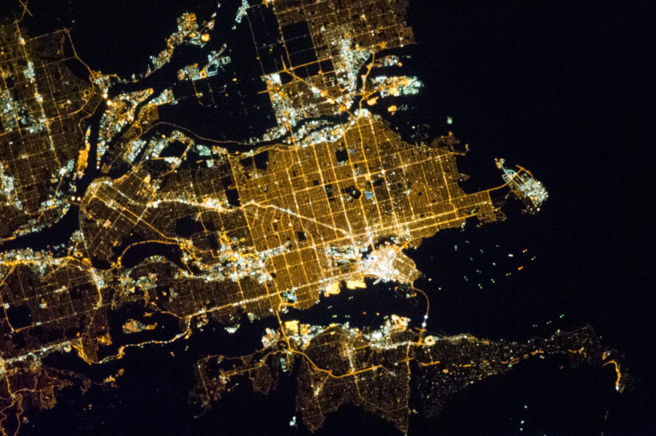
ISS035-E-013076 (31 March 2013) --- One of the crew members aboard the International Space Station photographed this night image of Vancouver, British Columbia, Canada on March 31, 2013.

iss064e059520 (April 14, 2021) --- Northrop Grumman's Cygnus space freighter, with one of its prominent cymbal-shaped solar arrays, is pictured as the International Space Station orbited 266 miles above British Columbia, Canada.

iss068e011266 (Oct. 1, 2022) --- Vancouver in British Columbia, Canada (at top), and Seattle, Washington (lower right) are pictured from the International Space Station as it orbited 262 miles above North America. Credit: NASA/Bob Hines

Silicon Valley FIRST Regional Robotics competition: Arctic Ice Bears - Team 1544 - NASA/USKH British Petroteum/CIRI Foundation & Bartlett HS. Anchorage, Alaska (AK)
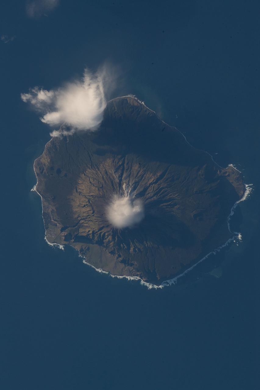
iss056e097317 (July 18, 2018) --- Queen Mary's Peak on the British territorial island of Tristan Da Cunha is pictured as the International Space Station was orbiting nearly 260 miles above the South Atlantic Ocean.

iss068e009287 (Oct. 5, 2022) --- The British Overseas Territory of Turks and Caicos Islands is pictured from the International Space Station as it orbited 260 miles above. Credit: NASA/Bob Hines
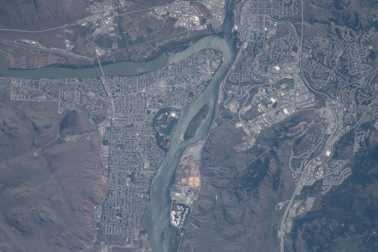
iss056e077345 (June 24, 2018) --- The Canadian city of Kamloops, British Columbia and the Thompson River are pictured as the International Space Station was orbiting about 257 miles above the North American continent.

iss065e376897 (Sept. 13, 2021) --- The International Space Station orbits 266 miles above the north Pacific Ocean off the coast of British Columbia, Canada, looking across the city lights of northwest America into a sunrise highlighted by an aurora.
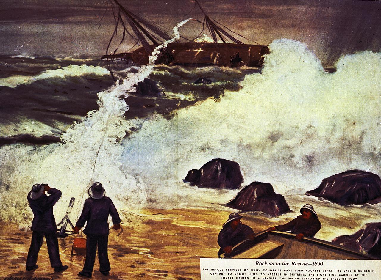
By 1870, American and British inventors had found other ways to use rockets. For example, the Congreve rocket was capable of carrying a line over 1,000 feet to a stranded ship. In 1914, an estimated 1,000 lives were saved by this technique.
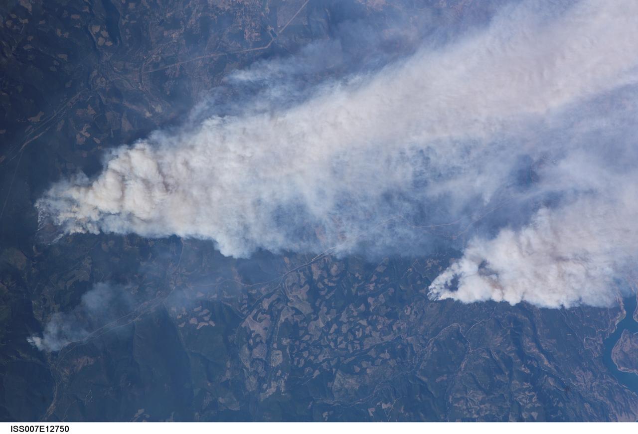
ISS007-E-12750 (14 August 2003) --- This view of forest fires in lower British Columbia, Canada was taken by one of the Expedition 7 crewmembers onboard the International Space Station (ISS).
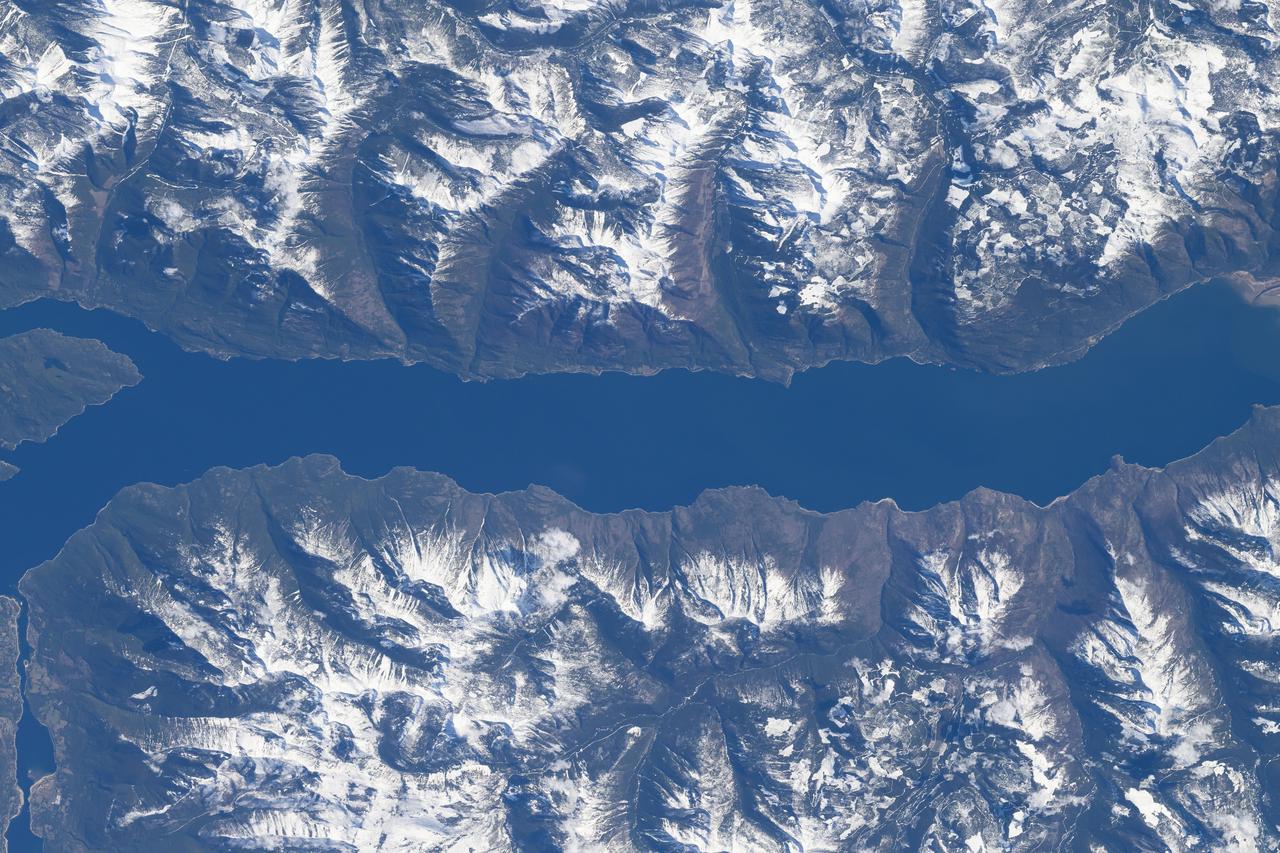
iss071e007896 (April 13, 2024) --- The southern portion of Kootenay Lake, sourrounded by the Canadian Rockies, in the Canadian province of British Columbia is pictured from the International Space Station as it orbited 260 miles above North America.
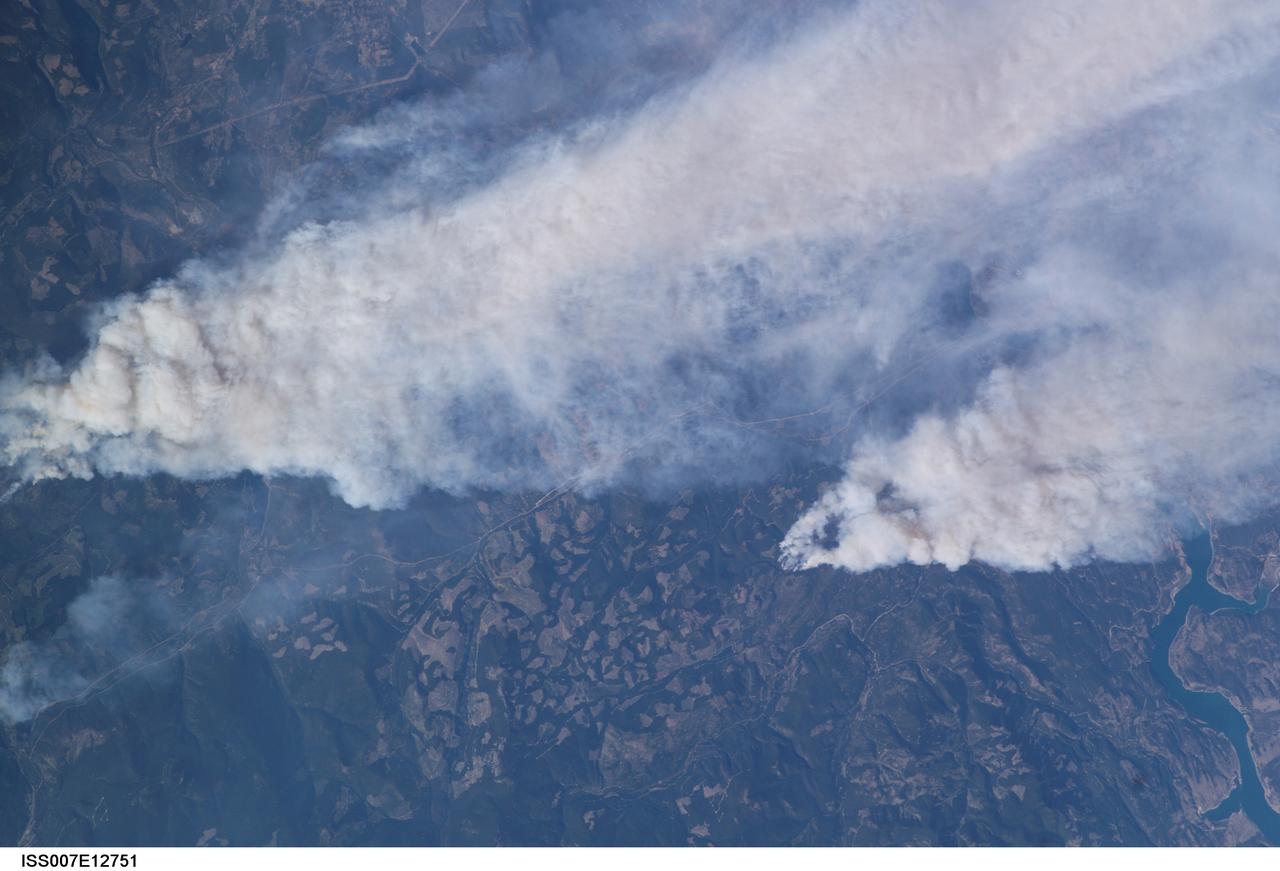
ISS007-E-12751 (14 August 2003) --- This view of forest fires in lower British Columbia, Canada was taken by one of the Expedition 7 crewmembers onboard the International Space Station (ISS).
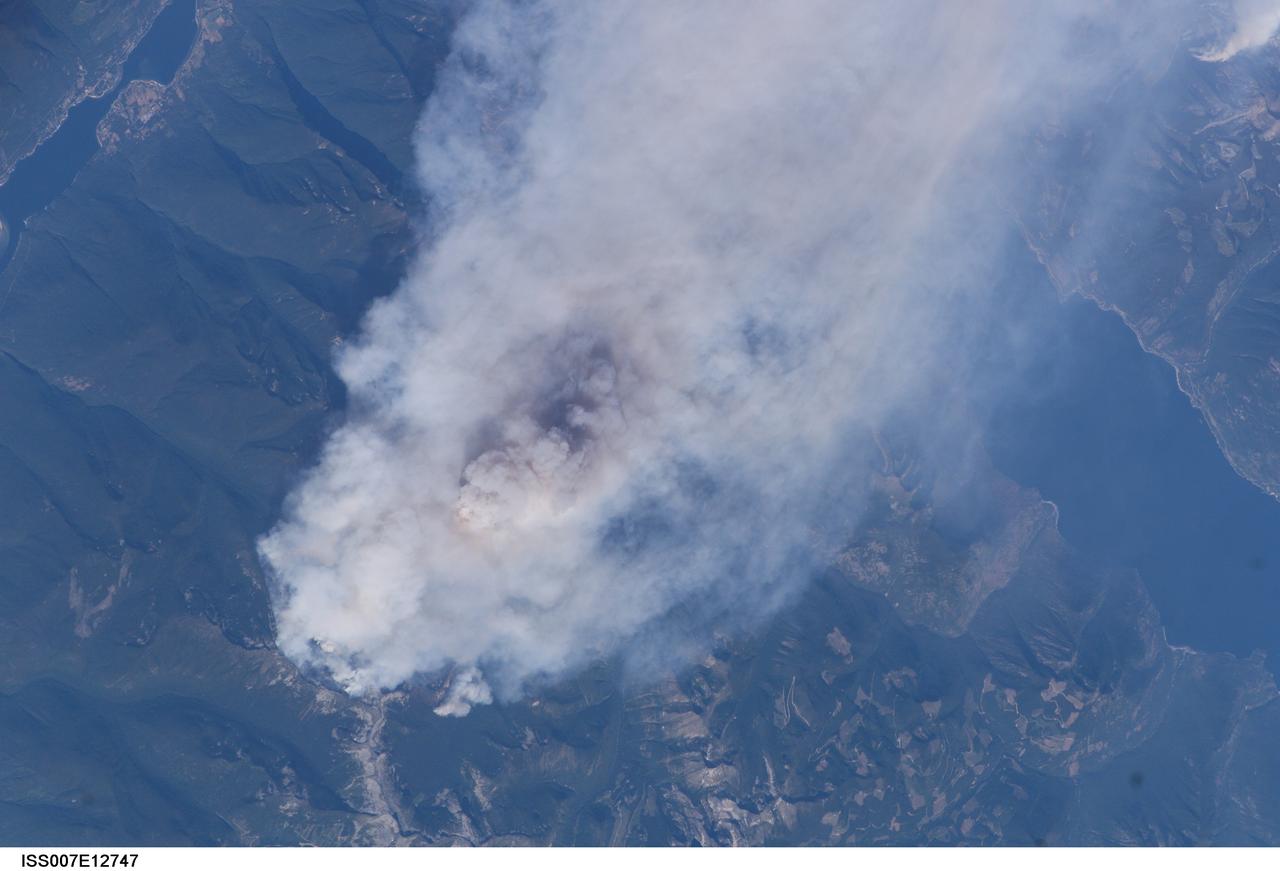
ISS007-E-12747 (14 August 2003) --- This view of forest fires in lower British Columbia, Canada was taken by one of the Expedition 7 crewmembers onboard the International Space Station (ISS).
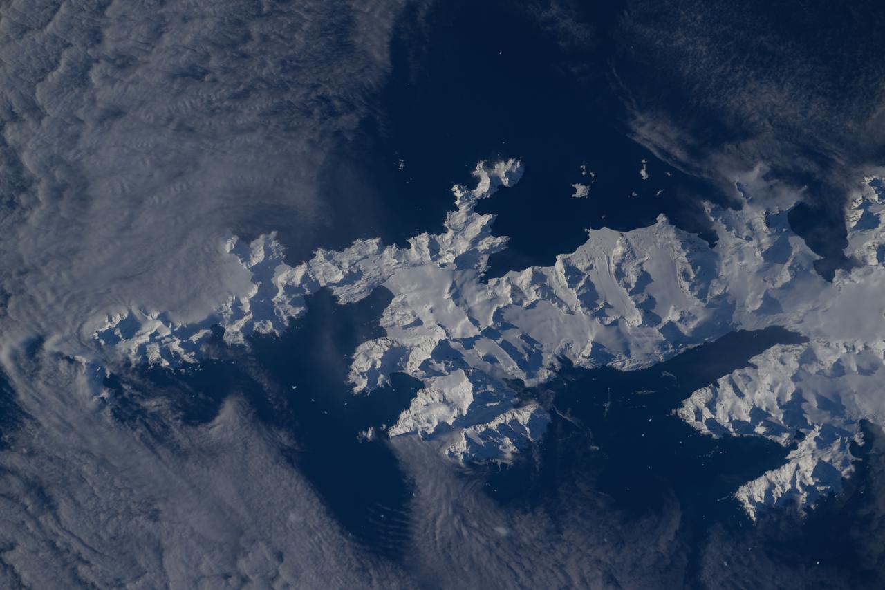
iss071e581850 (Sept. 1, 2024) -- In the southern Atlantic ocean is a snow-covered South Georgia Island. The British Overseas Territory was photographed by NASA astronaut Michael Barratt as the International Space Station orbited 267 miles above.
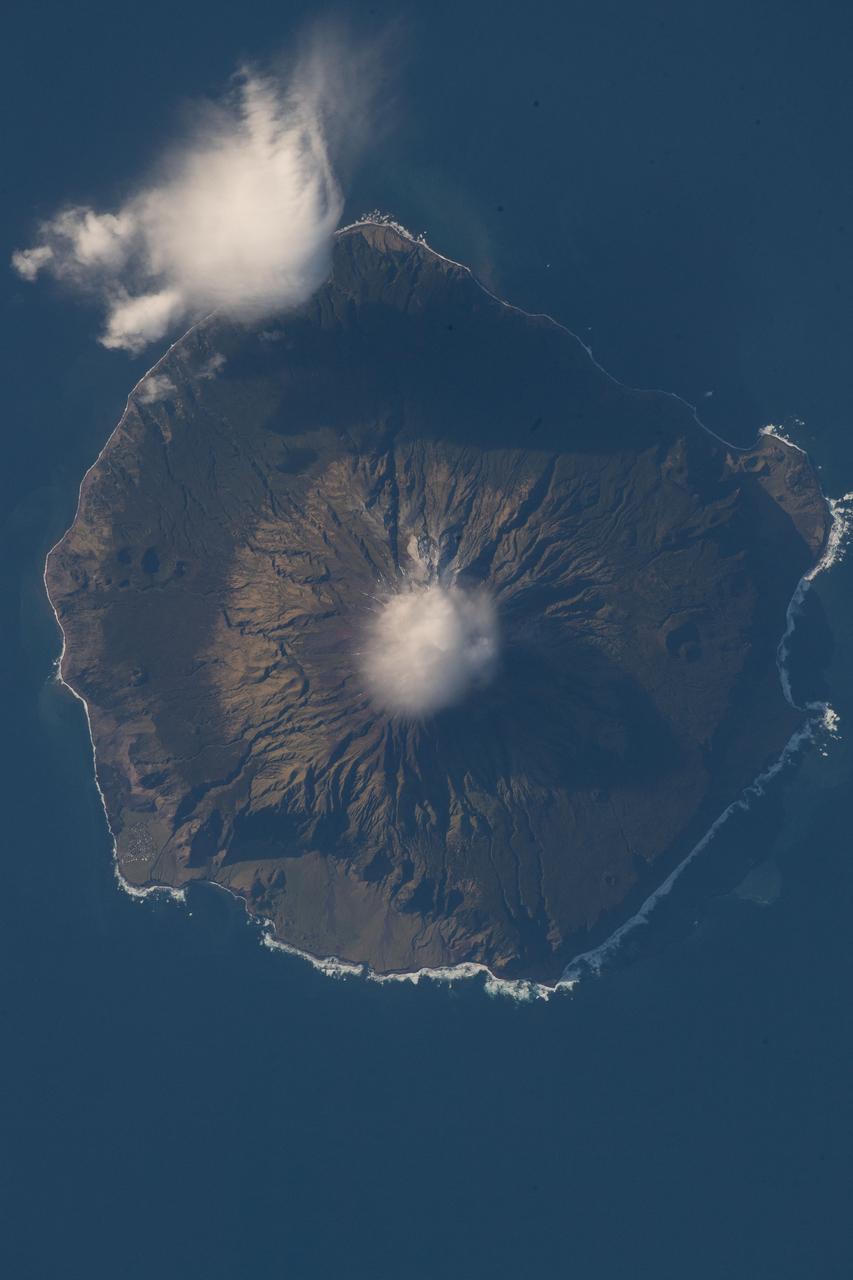
iss056e097317 (July 18, 2018) --- Queen Mary's Peak on the British territorial island of Tristan Da Cunha is pictured as the International Space Station was orbiting nearly 260 miles above the South Atlantic Ocean.

Earth observation taken during a day pass by an Expedition 37 crew member on board the International Space Station (ISS). Identified via Twitter message as Wyoming to British Columbia.
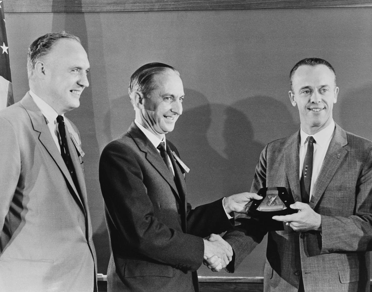
S61-03850 (1 Oct. 1961) --- Astronaut Alan B. Shepard Jr. (right) receives a plaque and award from members of the British Rocket Society. Photo credit: NASA or National Aeronautics and Space Administration
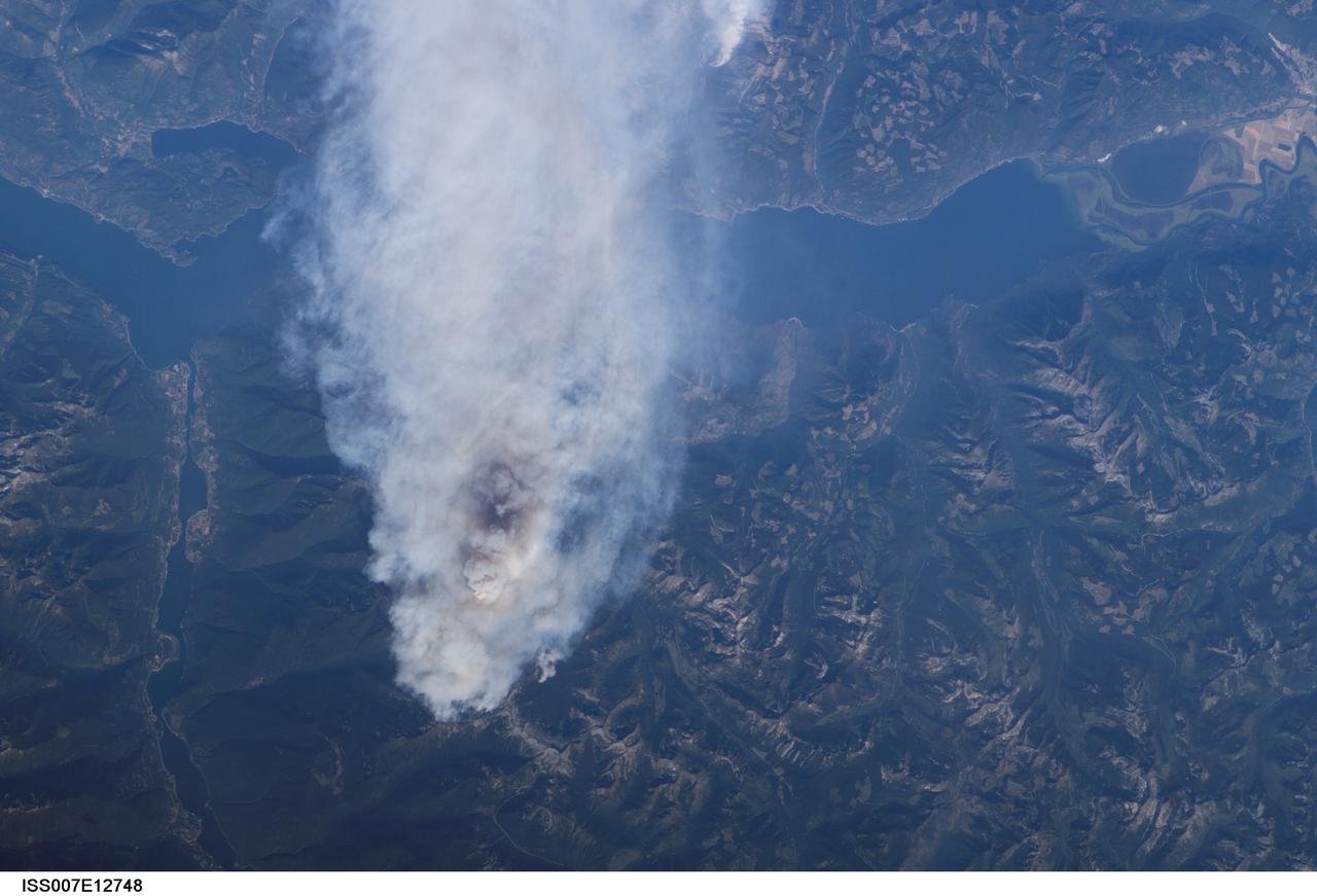
ISS007-E-12748 (14 August 2003) --- This view of forest fires in lower British Columbia, Canada was taken by one of the Expedition 7 crewmembers onboard the International Space Station (ISS).
ISS008-E-15491 (12 February 2004) --- This scene featuring Mount Baker, Washington, was photographed by an Expedition 8 crewmember on the International Space Station (ISS). The high-resolution image provides details of the rough terrain near the summit and on the upper flanks. The Cascade Range is an arc of volcanoes that extends from southwestern British Columbia to northern California. One of the six major composite volcanoes is Mount Baker in northern Washington close to the Canadian border, about 85 miles north-northeast of Seattle and 65 miles southeast of Vancouver, British Columbia.
This 34 by 59 km sub-scene, acquired on July 5, 2000, covers the eastern part of the Strait of Gibraltar, separating Spain from Morocco. The promontory on the eastern side of the conspicuous Spanish port is the Rock of Gibraltar. The Rock of Gibraltar was once one of the two classical Pillars of Hercules, crowned with silver columns by Phoenician mariners to mark the limits of safe navigation for the ancient Mediterranean peoples. The rocky promontory still commands the western entrance to the Mediterranean Sea, separated from North Africa only by the narrow Strait of Gibraltar. A British colony, Gibraltar occupies a narrow strip of land at the southernmost tip of the Iberian Peninsula. It is separated from the Spanish mainland by a neutral zone contained on a narrow, sandy isthmus. The rocky limestone and shale ridge known as the Rock rises abruptly from the sea, to a maximum elevation of 426 meters (1,398 feet). Because of its strategic location and formidable topography, Gibraltar serves mainly as a British fortress. The Rock has traditionally been a symbol of British naval strength. Most of its sparse land is taken up by air and naval installations, and the civilian population is small. The image is centered at 36 degrees north latitude, 5.5 degrees west longitude. http://photojournal.jpl.nasa.gov/catalog/PIA11167
iss056e077394 (June 25, 2018) --- The coastal city of Bellingham, Wash. is just across the U.S.-Canadian border from Vancouver, British Columbia. The International Space Station was orbiting almost 256 miles above Vancouver Island at the time an Expedition 56 crew member took this photograph.
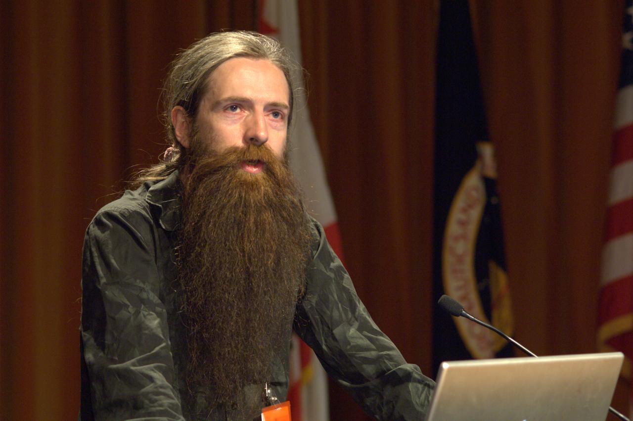
Dr Aubrey de Grey presents a Director's Colloquium to the NASA Ames Research Center staff entitled 'Prospects for defeating aging altogether' Dr. de Grey is a British bomedical gerontologist educated at Cambridge University in the UK. A video of the presentation is currently available at the NASA Ames Library.
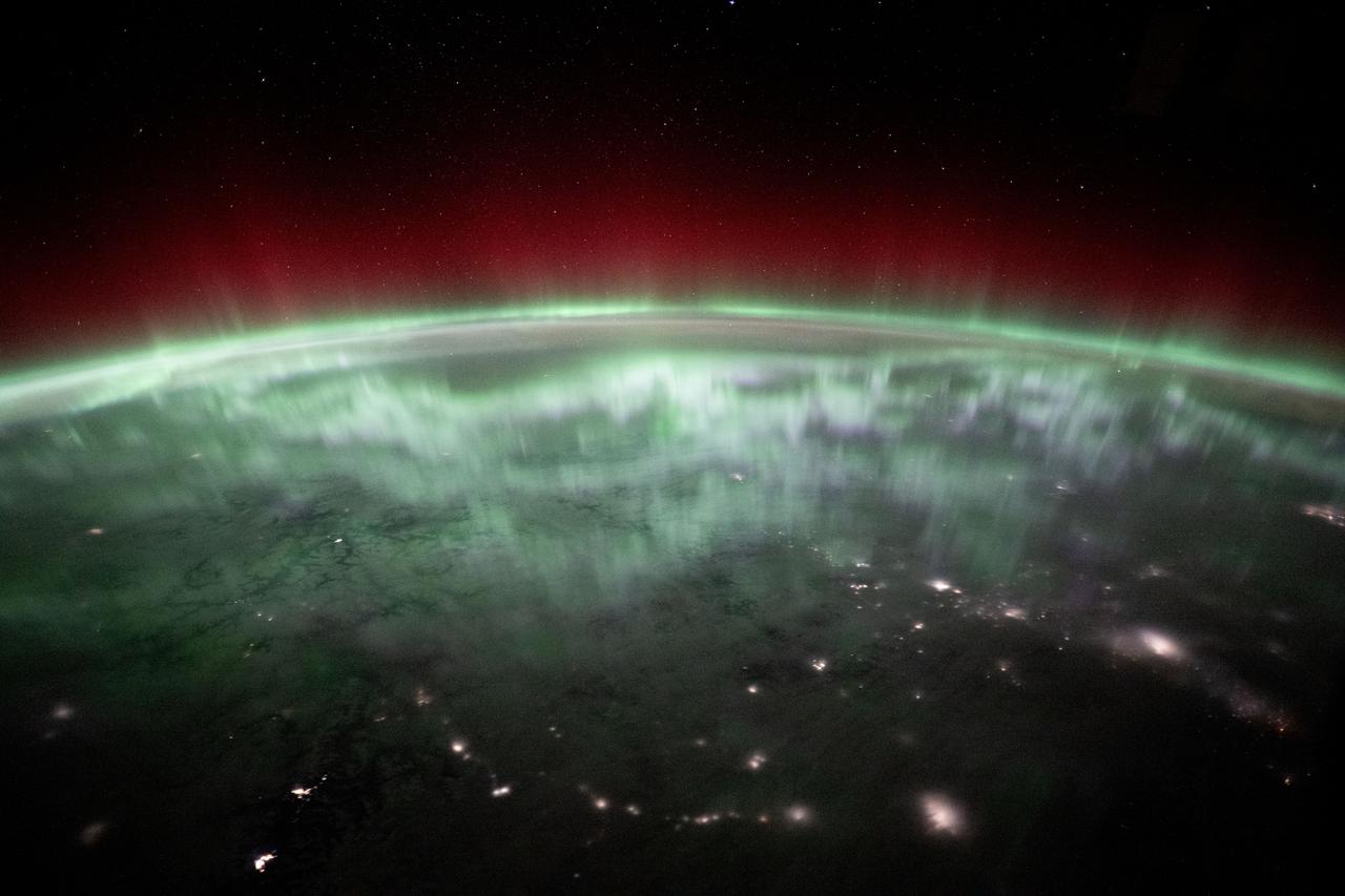
iss072e501410 (Jan. 4, 2025) --- An aurora shimmers and dances above the city lights of Canada in this photograph from the International Space Station as it orbited 259 miles above Vancouver, British Columbia, about 1:55 a.m. local time. Credit: NASA/Don Pettit
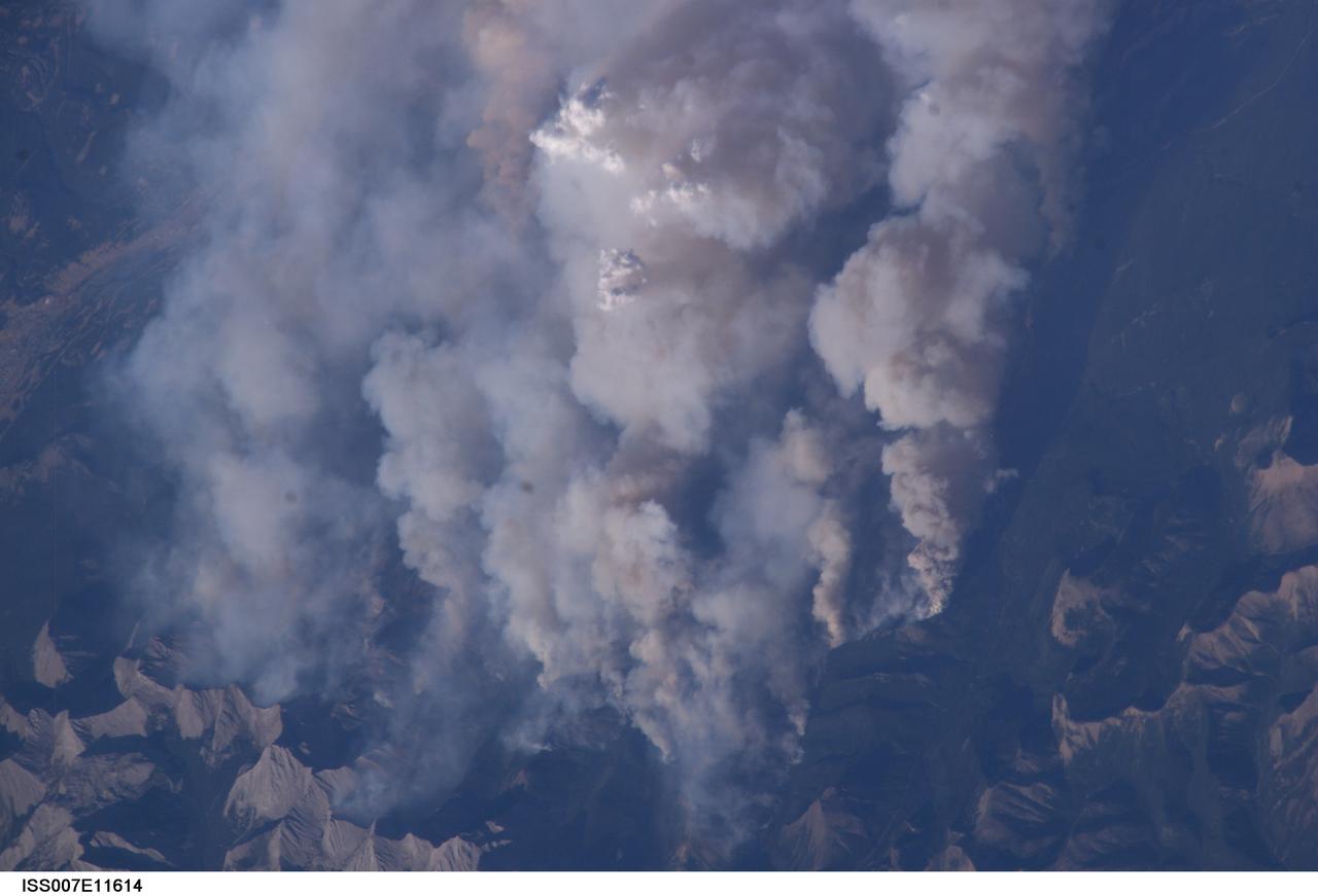
ISS007-E-11614 (2 August 2003) --- This digital still camera's view from the International Space Station features early August forest fires in the Lost Creek area on the border of Alberta and British Columbia, just to the southwest of Calgary. Across the international border, fires were raging in the Glacier National Park in Montana
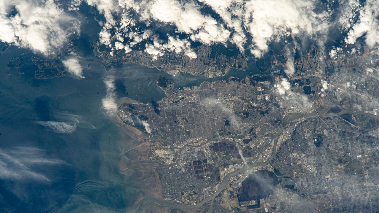
iss071e006133 (April 9, 2024) --- Vancouver, British Columbia, and its surroundng suburbs on the Strait of Georgia are pictured from the International Space Station as it orbited 261 miles above Canada. Toward lower center, is the Fairmont Vancouver Airport on Sea Island.
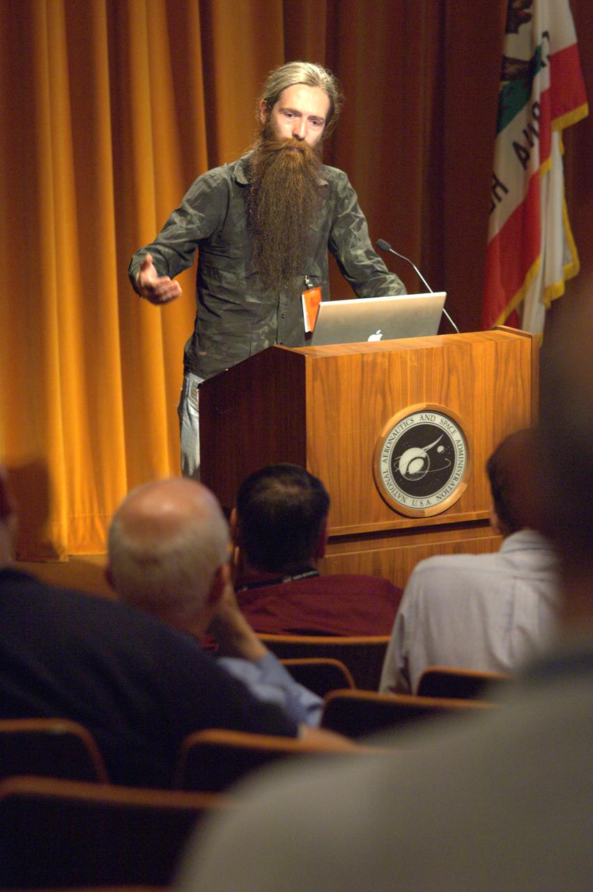
Dr Aubrey de Grey presents a Director's Colloquium to the NASA Ames Research Center staff entitled 'Prospects for defeating aging altogether' Dr. de Grey is a British bomedical gerontologist educated at Cambridge University in the UK. A video of the presentation is currently available at the NASA Ames Library.
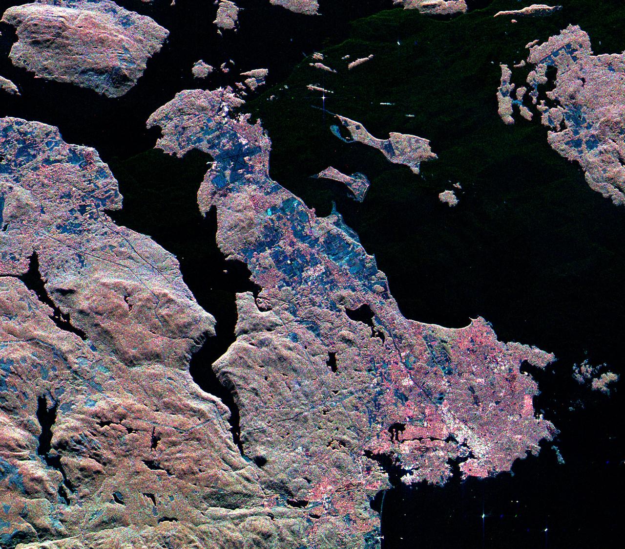
STS009-33-1276 (28 Nov- 8 Dec 1983) --- The entire British Crown Colony of Hong Kong and a portion of Kwangtung Province of China are seen. The city of Victoria is on Hong Kong Island. The Colony?s airport (Kai Tak) is seen at the mainland city of Kowloon.
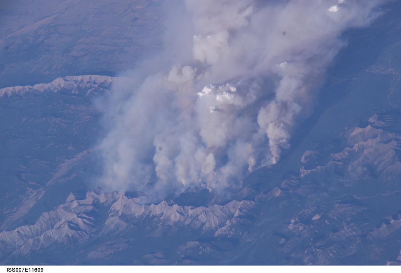
ISS007-E-11609 (2 August 2003) --- This digital still camera's view from the International Space Station features early August forest fires in the Lost Creek area on the border of Alberta and British Columbia, just to the southwest of Calgary. Across the international border, the fires were raging in the Glacier National Park in Montana
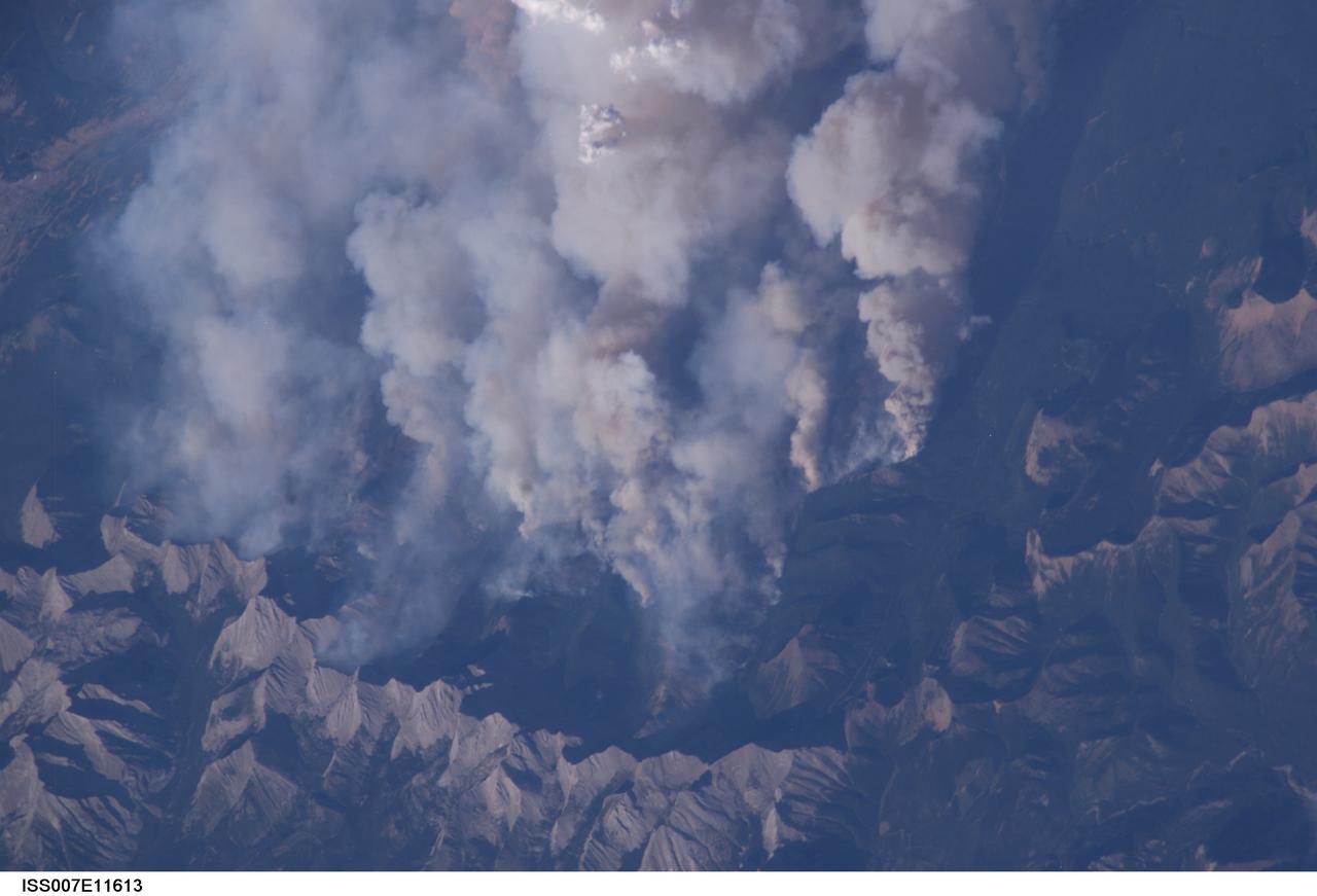
ISS007-E-11613 (2 August 2003) --- This digital still camera's view from the International Space Station features early August forest fires in the Lost Creek area on the border of Alberta and British Columbia, just to the southwest of Calgary. Across the international border, fires were raging in the Glacier National Park in Montana

Dr Aubrey de Grey presents a Director's Colloquium to the NASA Ames Research Center staff entitled 'Prospects for defeating aging altogether' Dr. de Grey is a British bomedical gerontologist educated at Cambridge University in the UK. A video of the presentation is currently available at the NASA Ames Library.

Dr Aubrey de Grey presents a Director's Colloquium to the NASA Ames Research Center staff entitled 'Prospects for defeating aging altogether' Dr. de Grey is a British bomedical gerontologist educated at Cambridge University in the UK. A video of the presentation is currently available at the NASA Ames Library.

iss069e003960 (April 17, 2023) --- Three Roscosmos components on the International Space Station were photographed by UAE (United Arab Emirates) astronaut and Expedition 69 Flight Engineer Sultan Alneyadi while orbiting 263 miles above a partly Pacific Ocean off the coast of British Columbia, Canada. At left, from top to bottom, are the Nauka multipurpose laboratory module's forward port, the Prichal docking module, and the Soyuz MS-23 crew ship.
STS047-151-488 (12 - 20 Sept 1992) --- In this large format camera image, the forested Cascade Range appears along the left side; the Pacific Ocean, on the right. The frame was photographed as the Space Shuttle Endeavour flew north to south over Vancouver and Seattle. Many peaks in the Cascades reach altitudes greater than 9,000 feet and remain snowcapped even in mid-summer. The Strait of Juan de Fuca separates the Olympic Peninsula (top right) from Vancouver Island (bottom right). Snowcapped Mt. Olympus (7,965 feet) is one of the wettest places in the continental United States, with rainfall in excess of 120 inches per year. The port cities of Seattle and Tacoma occupy the heavily indented coastline of Puget Sound (top center). They appear as light-colored areas on the left side of the Sound. The angular street pattern of Tacoma is visible at the top of the picture. The international boundary between Canada and the United States of America runs across the middle of the view. The city of Victoria (center) is the light patch on the tip of Vancouver Island. Canada's Fraser River Delta provides flat topography on which the cities of Vancouver, Burnaby, and New Westminster were built. These cities appear as the light-colored area just left of center. The Fraser River can be seen snaking its way out of the mountains at the apex of the delta. Numerous ski resorts dot the slopes of the mountains (bottom left) that rise immediately to the north of Vancouver. In the same area the blue water of Harrison and other, smaller lakes fills some of the valleys that were excavated by glaciers in the "recent" geological past, according to NASA scientists studying the photography. A Linhof camera was used to expose the frame.
SL2-05-458 (22 June 1973) --- Portions of northwest Washington State (48.0N, 122.5) can be seen in this view as well as portions of British Columbia, Canada. The snow covered Cascade Mountains are on the eastern side of the scene. Vancouver Island is visible in the northeast corner of the photo. The strait of Juan de Fuca separates Vancouver Island from the northwest corner of Washington. Seattle is near the center and the snow covered Olympic Mountains are to the east. Photo credit: NASA
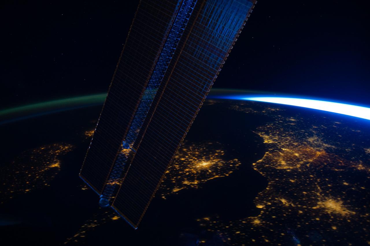
ISS030-E-064161 (2 Feb. 2012) --- Parts of a number of European nations appear in this nighttime image photographed from the International Space Station. The scene, captured by one of the Expedition 30 crew members, shows the British Isles (left, partially obstructed by one of the space station's solar array panels) with London just right of bottom center; the English Channel, which is dark; Paris (lower right corner); and the Netherlands (right side). The greenish airglow is fairly uniform and minor until it transitions to daybreak on the right.
On the small Hebridean island of Eriskay, Scotland, the causeway linking it to the outside world was only completed 20 years ago. The isolation protected the Eriskay Pony, one of the UK's oldest and rarest breeds. It was here that in 1745, Bonny Prince Charlie first set foot in Scotland to launch his uprising to retake the British throne. The image was acquired June 17, 2013, covers an area of 9.2 by 10.2 km, and is located at 57.1 degrees north, 7.3 degrees west. https://photojournal.jpl.nasa.gov/catalog/PIA25639
A short drive from Windsor, England, west of London, near the Thames, lies Runnymede meadow. Following John Kennedy's 1963 assassination, the British government commemorated his life by gifting 1.6 ha to the US federal government, making it the only piece of American soil in Britain. The image was acquired June 6, 2016, covers an area of 7.5 by 8 km, and is located at 51.4 degrees north, 0.6 degrees west. https://photojournal.jpl.nasa.gov/catalog/PIA26508
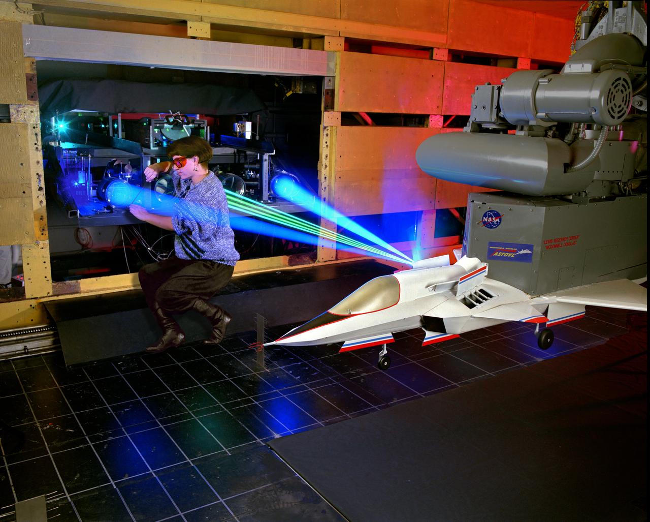
The 9x15 low speed tunnel tests take off and landing of aircraft. The laser velocimetry system for flow measurement show here, with the color blue and green lasers, measures engine exhaust that comes back up from the ground. The STOVL model n the 9x15 low speed wind tunnel, building 39, is similar to the British Harrier aircraft.
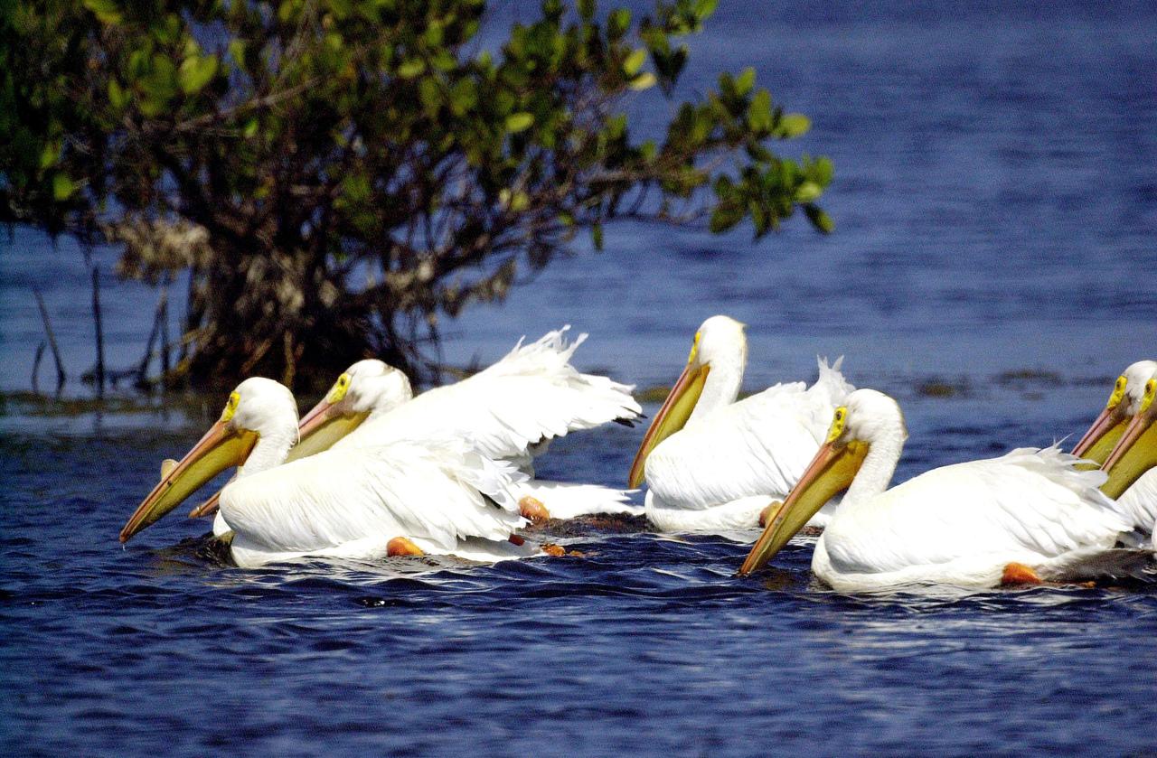
KENNEDY SPACE CENTER, FLA. -- White pelicans swim gracefully on the blue water of this lake near Kennedy Space Center. Found from British Columbia south to western Ontario, California and the Texas coast, White Pelicans winter from Florida south to Panama. They prefer marshy lakes and coastal regions, and winter chiefly in coastal lagoons
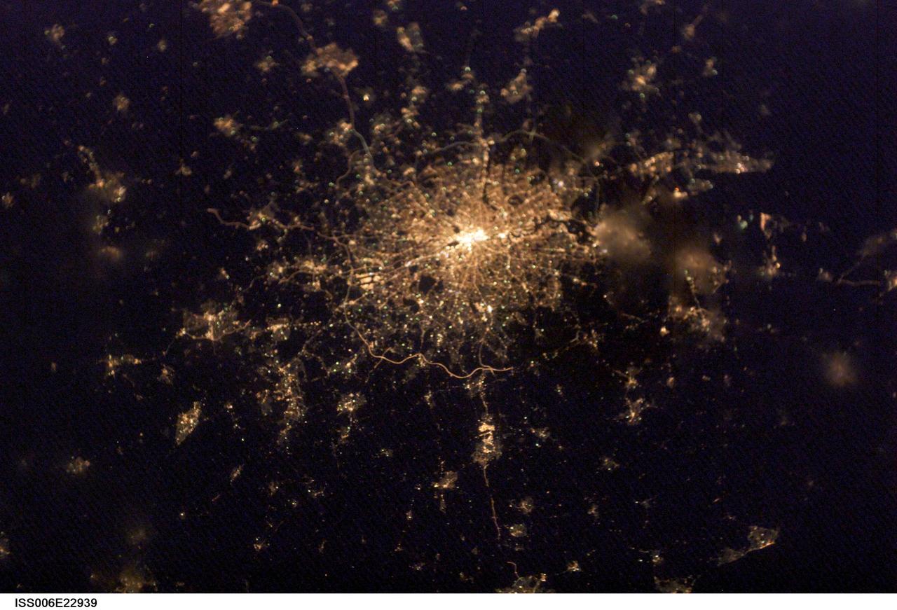
ISS006-E-22939 (4 February 2003) --- City lights of London, England were captured with a digital still camera by one of the Expedition Six crewmembers on the International Space Station (ISS). This nighttime view of the British capital shows the city;s urban density and infrastructure as highlighted by electrical lighting. Beyond lie isolated bright areas marking the numerous smaller cities and towns of the region and as far southeast as Hastings on the coast. London;s two major airports, Heathrow and Gatwick, are visible to the south of the city.
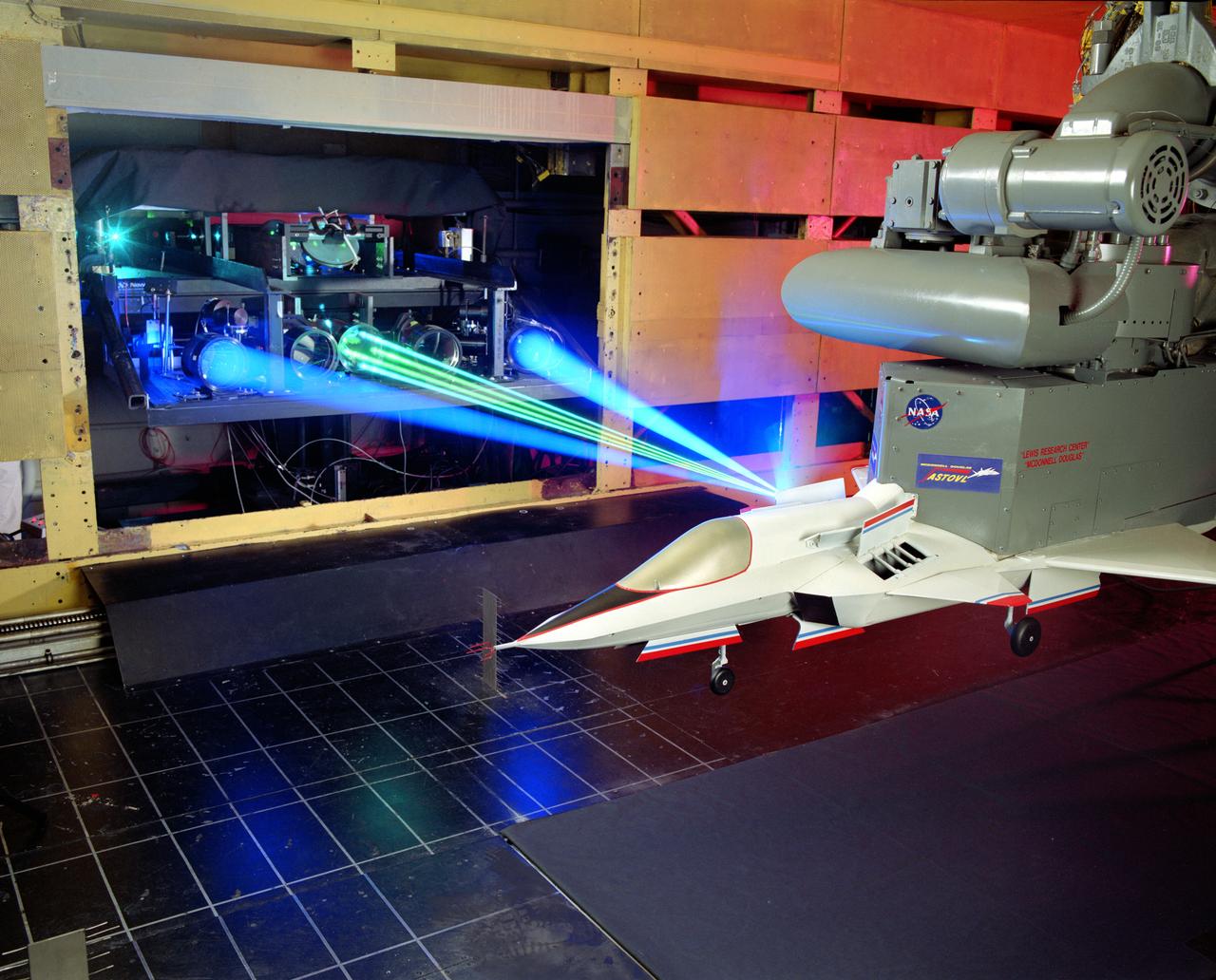
The 9x15 low speed tunnel tests take off and landing of aircraft. The laser velocimetry system for flow measurement show here, with the color blue and green lasers, measures engine exhaust that comes back up from the ground. The STOVL model n the 9x15 low speed wind tunnel, building 39, is similar to the British Harrier aircraft.
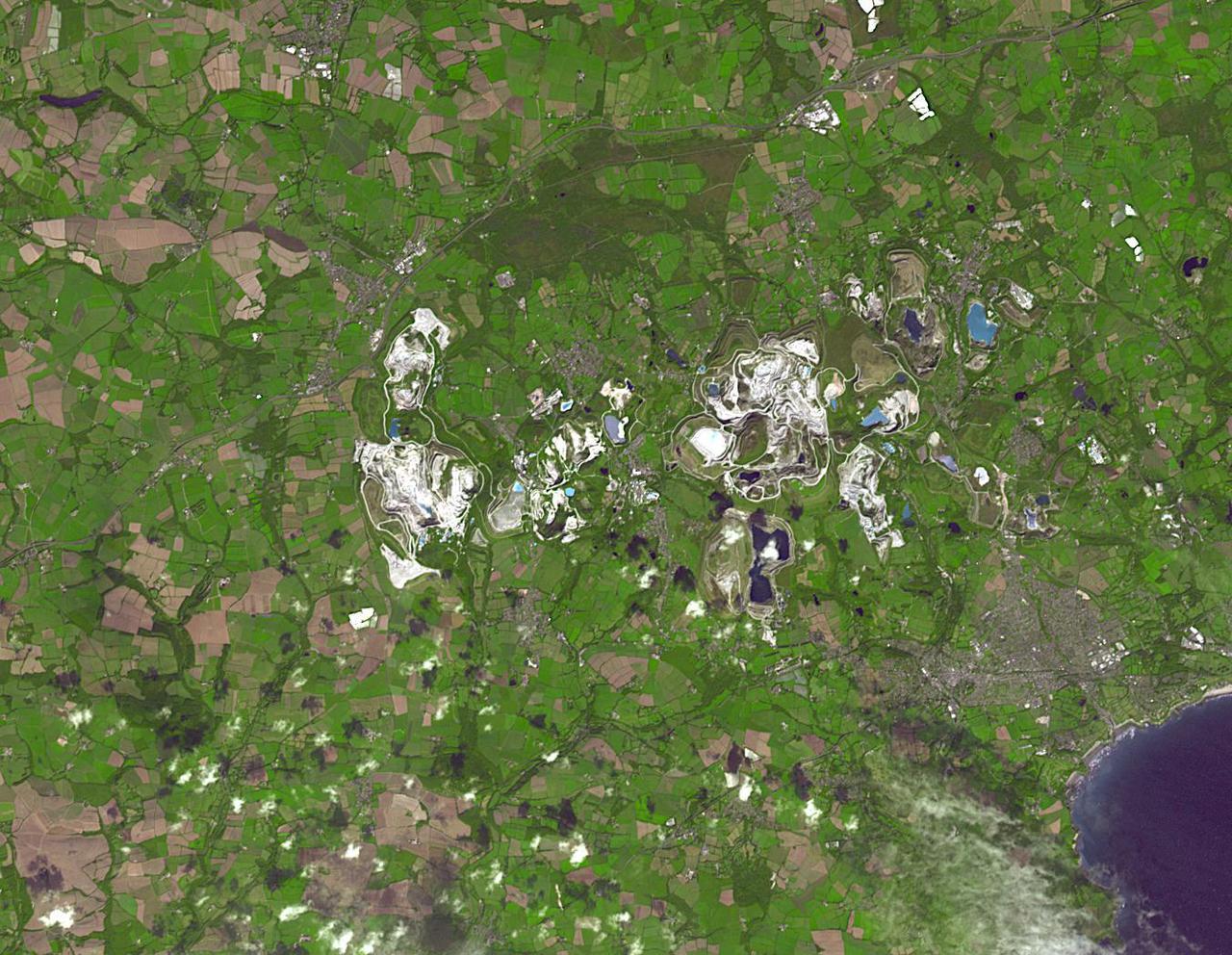
The British porcelain industry began with the discovery of china clay (kaolinite) at Tregonning Hill, Cornwall, in 1745. By the early 19th century, the St Austell deposits were the largest in the world. By 1910, Cornwall was producing fifty percent of the world's china clay. Today, the St Austell deposits have largely been abandoned in favor of other deposits, mainly in Brazil. The image was acquired September 10, 2014, covers an area of 15.7 by 20.3 km, and is located at 50.4 degrees north, 4.9 degrees west. https://photojournal.jpl.nasa.gov/catalog/PIA24865
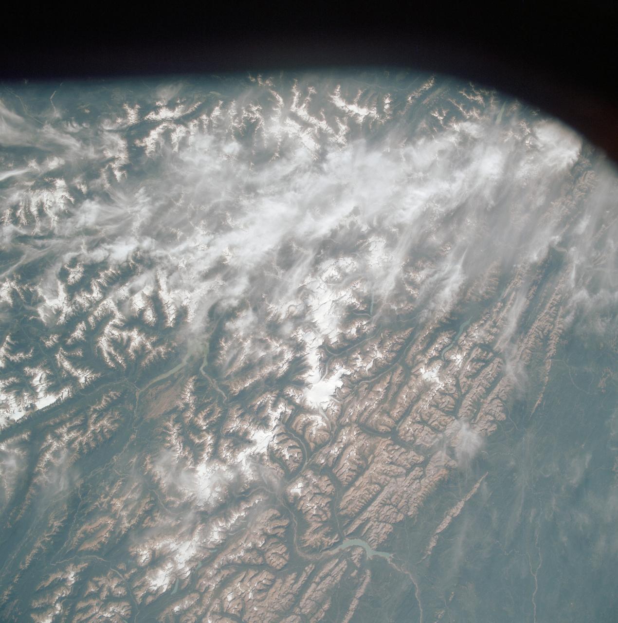
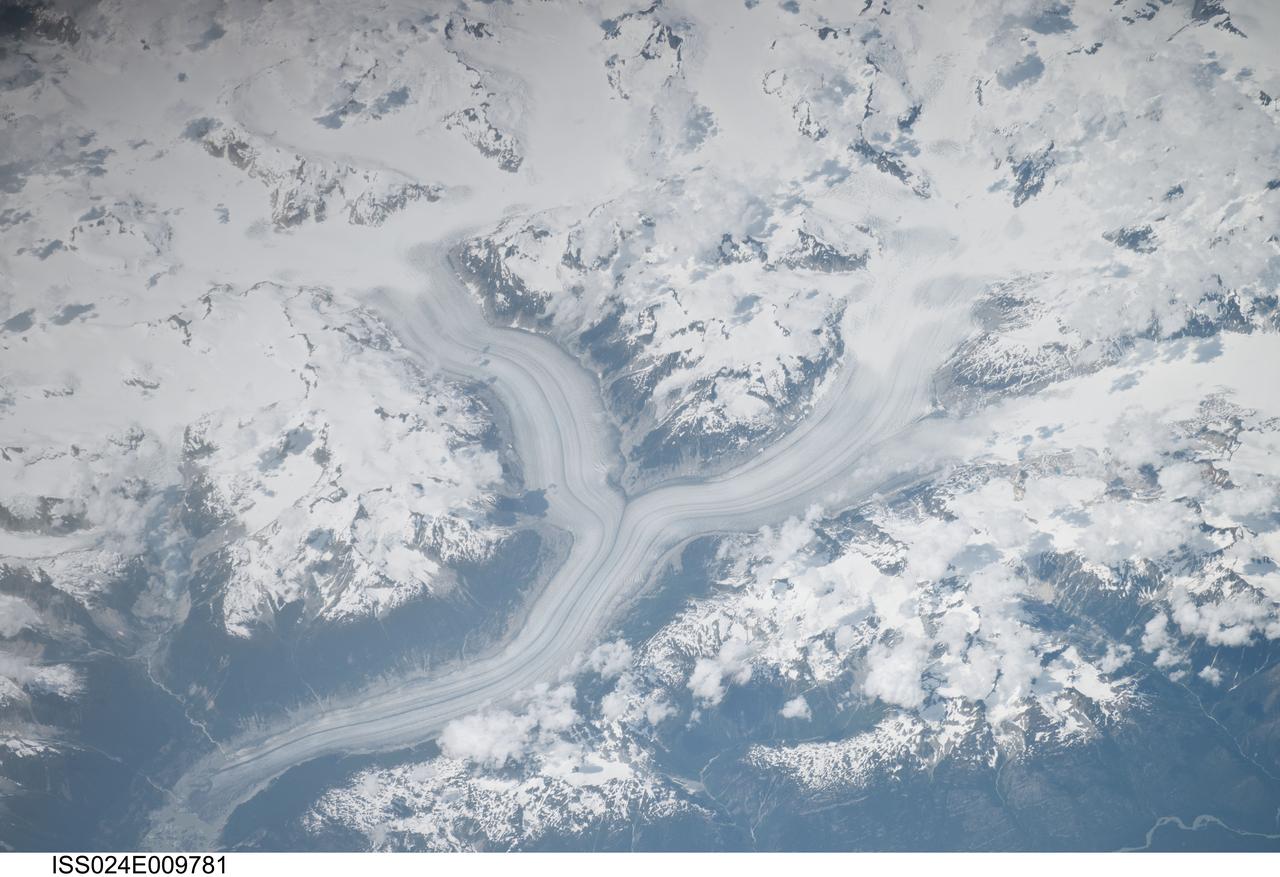
41G-43-016 (5-13 Oct 1984) --- The Gulf of Alaska, with the great peaks of the Saint Elias Range of Alaska, Yukon, and British Columbia. Mount Logan, Canada's highest mountain peak at 19,850 feet, is to the left of the center of the photograph. Between Saint Elias Peak and Mount Vancouver, right of center, flows the great Malaspina Glacier in a great lobe of ice shaped like a human ear.
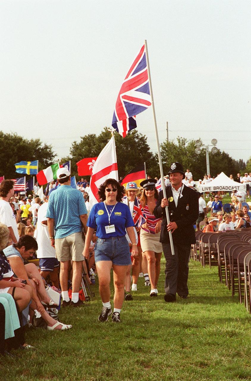
British police officers carry their country’s flag while marching in a parade at the KSC Visitor Complex during opening ceremonies of the 2000 International Law Enforcement Games. More than 1,850 participants and their families took part in the opening, held in the Rocket Garden. The ceremony included parades, torch lighting and a tug of war. The games feature officers from 15 countries and 37 United States in competitions around Brevard County, Fla