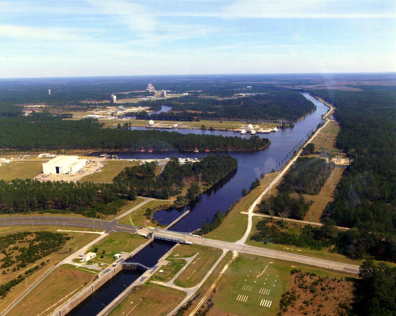
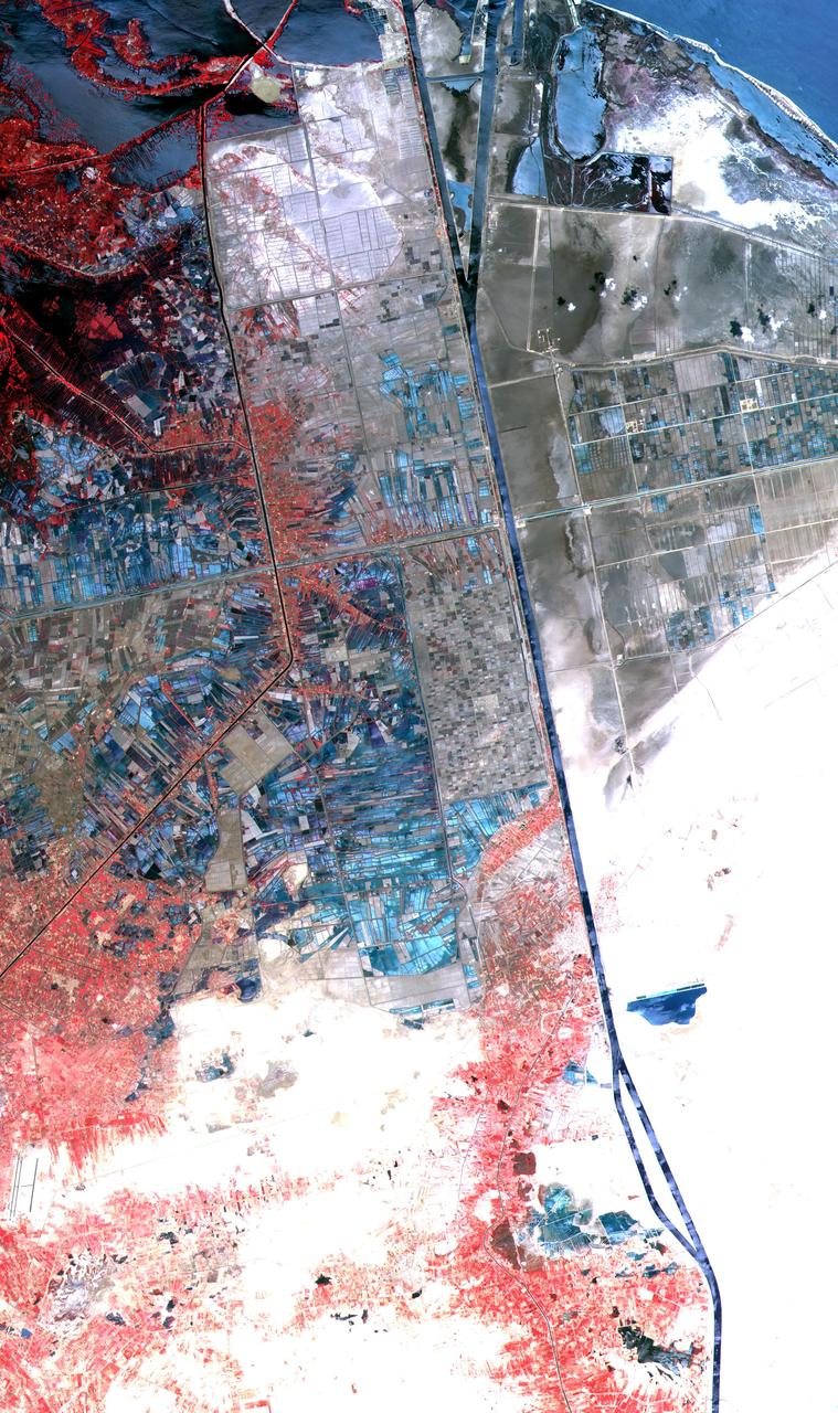
This aerial view of Stennis Space Center's unique lock and canal system
American Flamingos cool off in the Indian River at Haulover Canal on Merritt Island on Thursday, Jan. 11, 2024. The American Flamingos are more common in Mexico and Cuba but the winds from Hurricane Idalia relocated them to Florida in September 2023. Kennedy Space Center in Florida shares a border with the Merritt Island National Wildlife Refuge where more than 310 species of birds inhabit the refuge.
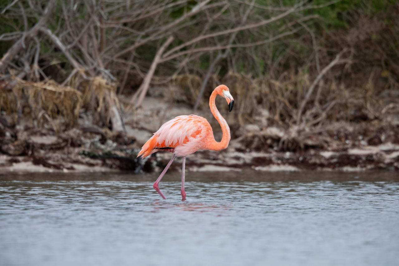
An American Flamingo cools off in the Indian River at Haulover Canal on Merritt Island on Thursday, Jan. 11, 2024. The American Flamingos are more common in Mexico and Cuba but the winds from Hurricane Idalia relocated them to Florida in September 2023. Kennedy Space Center in Florida shares a border with the Merritt Island National Wildlife Refuge where more than 310 species of birds inhabit the refuge.
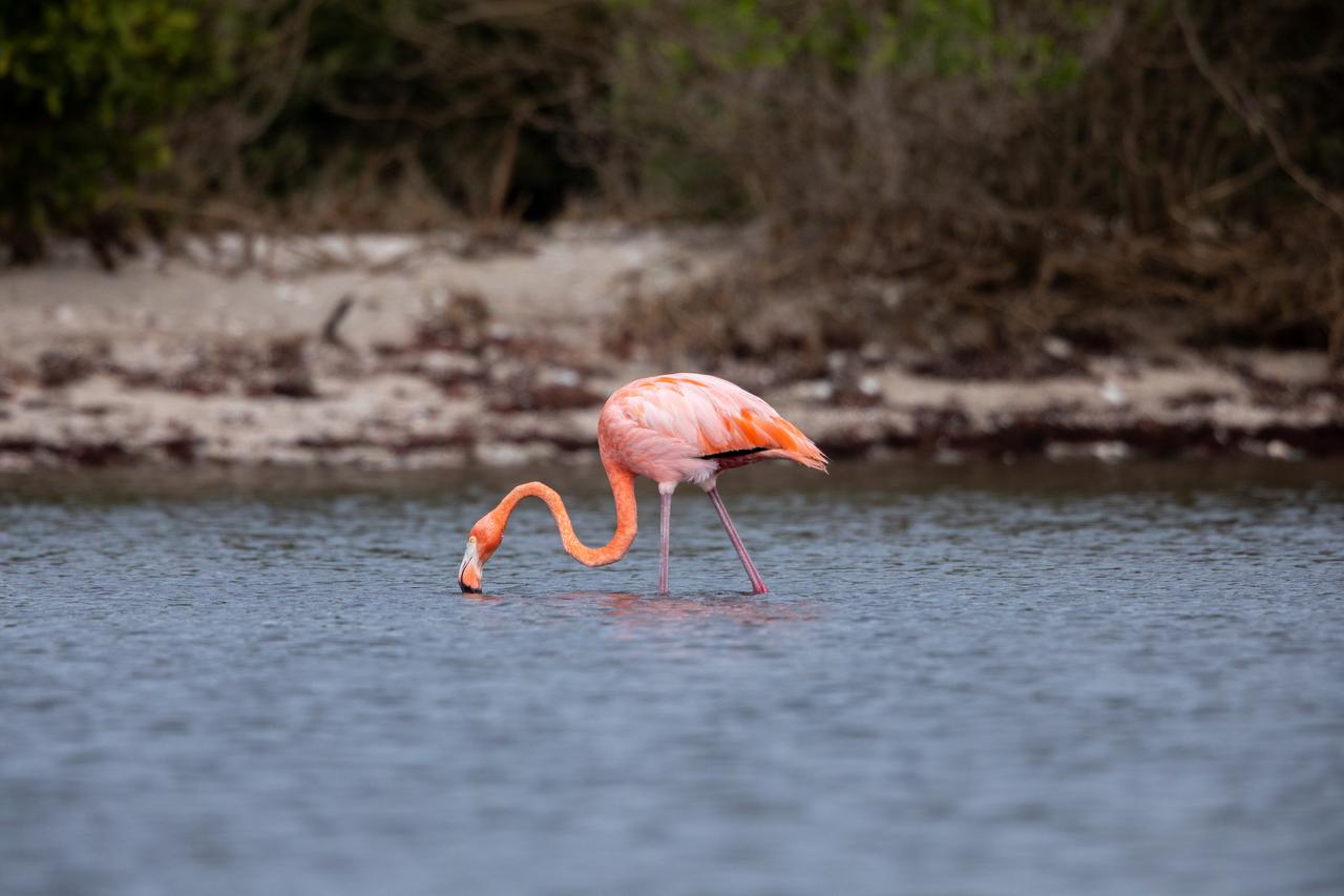
An American Flamingo takes a sip of water in the Indian River at Haulover Canal on Merritt Island on Thursday, Jan. 11, 2024. The American Flamingos are more common in Mexico and Cuba but the winds from Hurricane Idalia relocated them to Florida in September 2023. Kennedy Space Center in Florida shares a border with the Merritt Island National Wildlife Refuge where more than 310 species of birds inhabit the refuge.
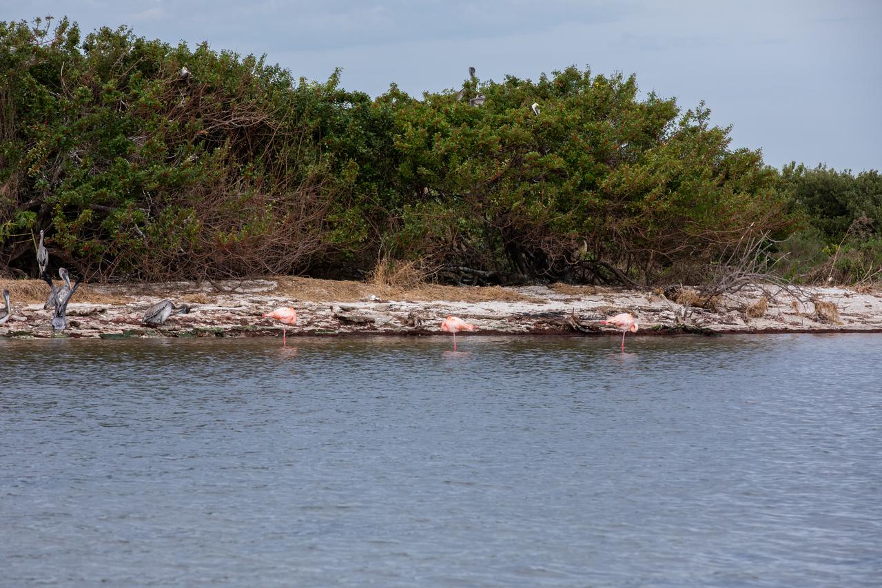
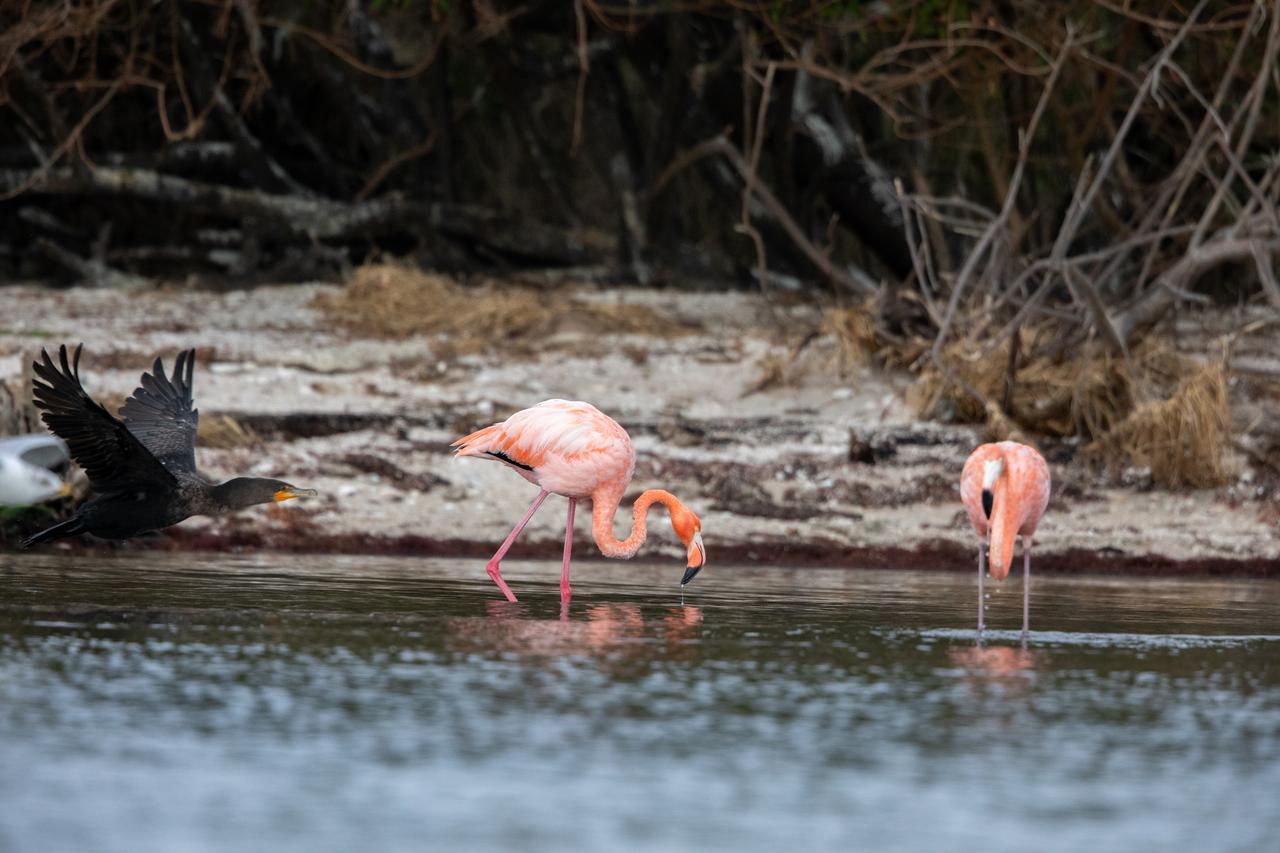
Three American Flamingos cool off in the Indian River at Haulover Canal on Merritt Island on Thursday, Jan. 11, 2024. The American Flamingos are more common in Mexico and Cuba but the winds from Hurricane Idalia relocated them to Florida in September 2023. Kennedy Space Center in Florida shares a border with the Merritt Island National Wildlife Refuge where more than 310 species of birds inhabit the refuge.
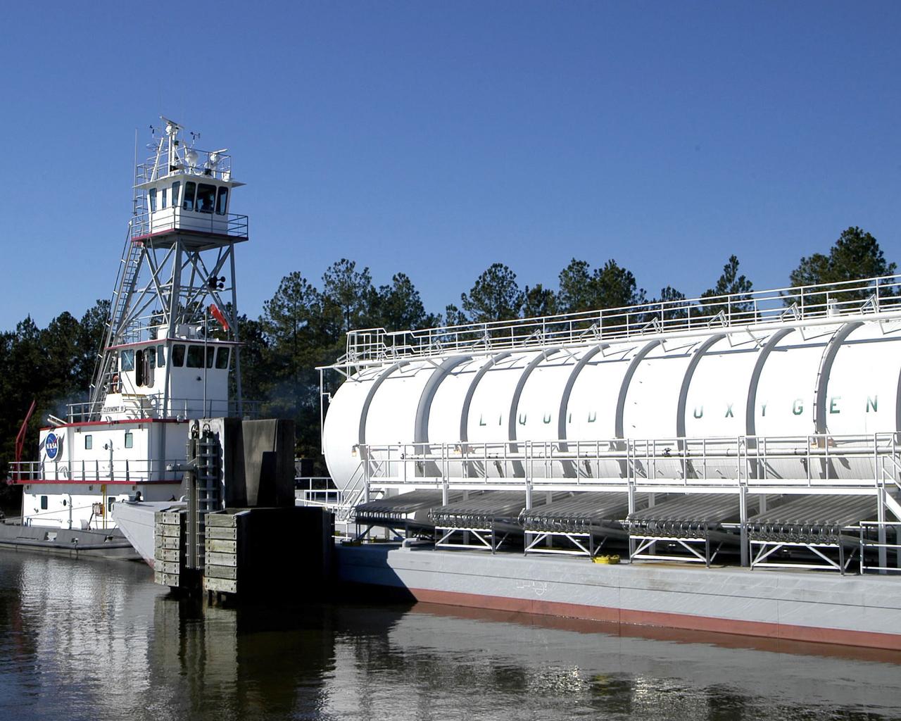
The crew of the NASA tugboat Clermont II navigates a barge of super-cool liquid oxygen through the 7 -mile canal system at SSC prior to a Space Shuttle Main Engine test.
Even after the mega-freighter Ever Given was freed from its grounding in the Suez Canal on March 29, 5 days later shipping traffic still had not recovered from the crisis. At the southern entrance to the Canal, in the Gulf of Suez, over 100 freighters waited their turn to enter the Canal and proceed to the Mediterranean Sea. The image was acquired April 4, covers an area of 21.3 by 34.5 km, and is located 29.7 degrees north, 32.6 degrees east. https://photojournal.jpl.nasa.gov/catalog/PIA24553
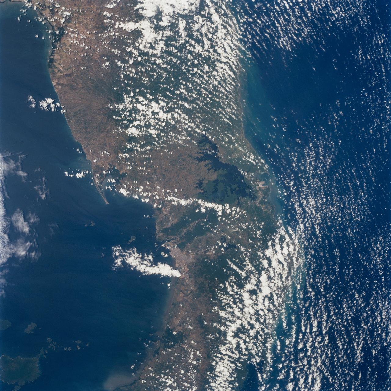
STS062-85-095 (4-18 March 1994) --- Gatun Lake and the forested Panama Canal Zone can be seen in this north northwest-looking low oblique photograph obtained in March 1994. The shipping chanel of the canal is 82.4 kilometers (51.2 miles) long, though the canal zone is only 65 kilometers (40 miles) long. The width of the canal zones extends generally 8 kilometers (5 miles) on either side of the shipping channel, except near Madden Lake. The canal connects the Atlantic Ocean (coastal city of Colon) with the Pacific Ocean near Panama City in a line that takes a northwest to southeast course because of the configuration of the isthmus. The canal zigzags across the isthmus to take advantage of the geographic features of the area such as the Chagres River. The controlled water supply for the canal is provided by the three artificial lakes: Gatun near the Atlantic terminus, Miraflores near the Pacific terminus and Madden about halfway across the isthmus. Gatun is the largest of the three lakes covering an area of 429 square kilometers (165 square miles). In the midst of this lake is Barro Colorado Island, a world-famous wild game perserve. Madden Lake was built as a large supplemental reservoir to keep water levels up in the canal during the dry season. All three lakes are vital sources of water for maintaining the ship channel over the continental divide (Gaillard Cut) and for regulating the flow of water that enables hugh vessels to be lifted and lowered in massive locks.
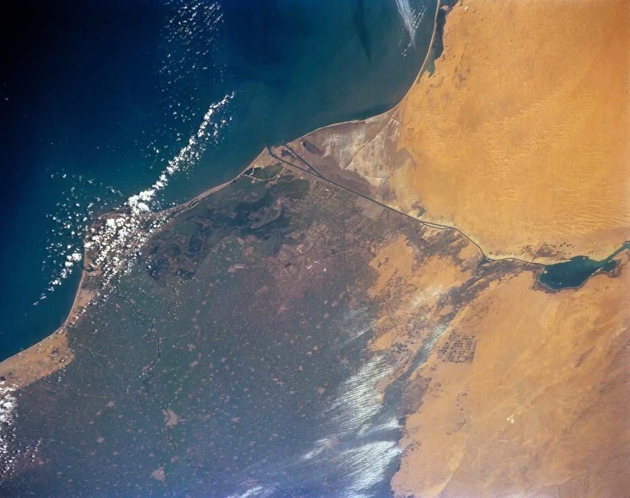
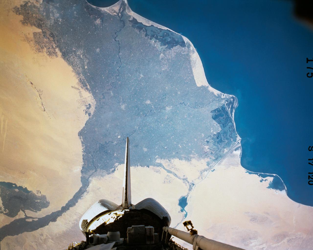
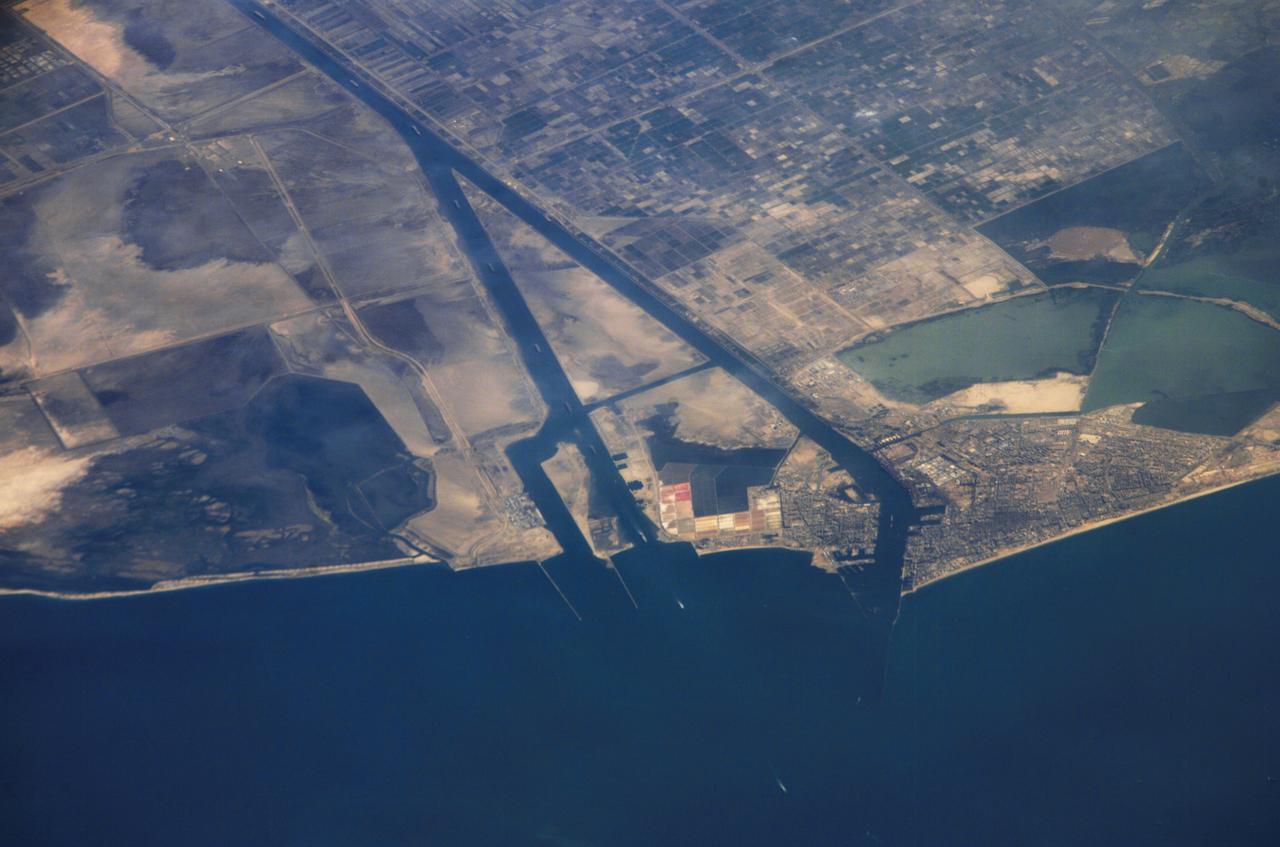
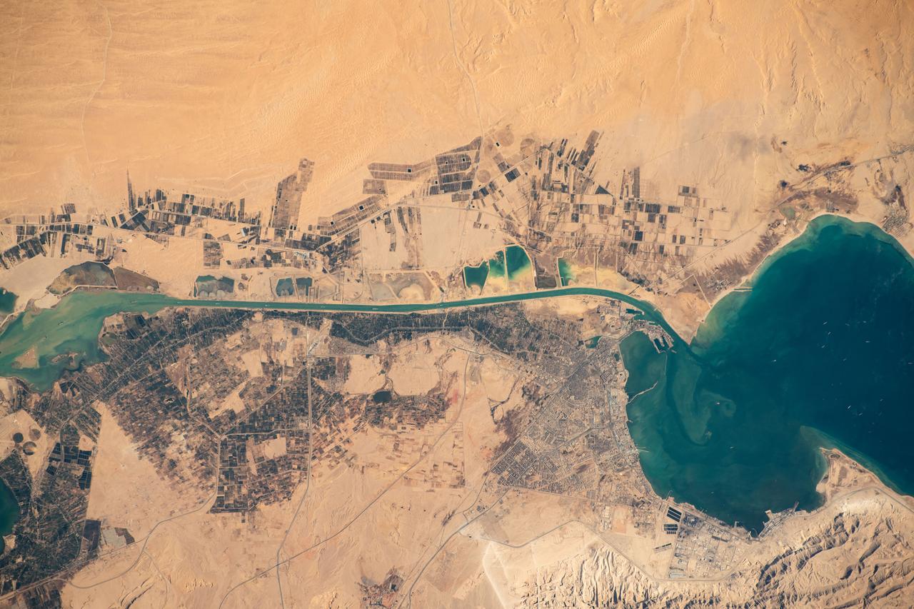
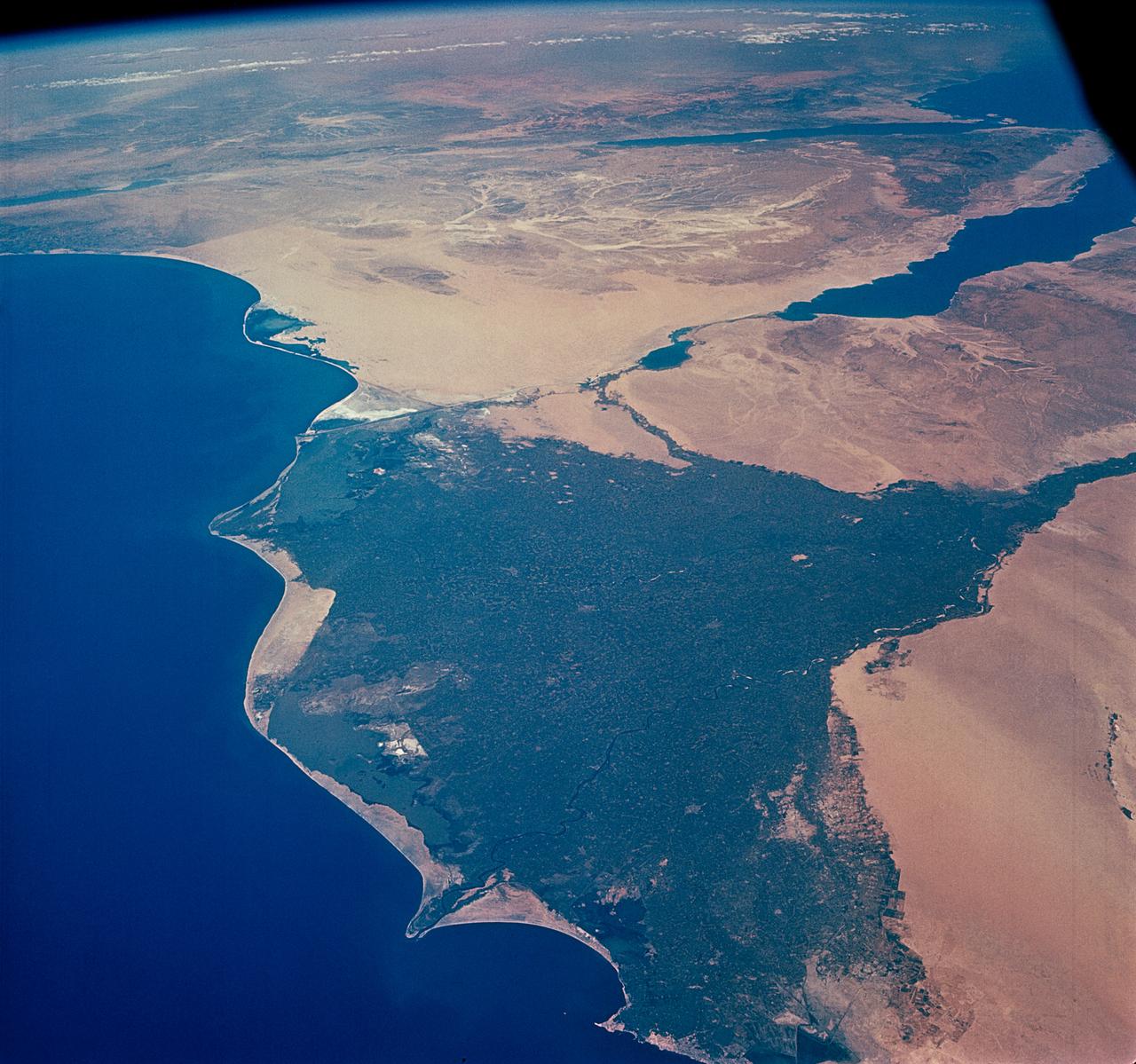
One of the most important waterways in the world, the Suez Canal runs north to south across the Isthmus of Suez in northeastern Egypt. This image of the canal covers an area 36 kilometers (22 miles) wide and 60 kilometers (47 miles) long in three bands of the reflected visible and infrared wavelength region. It shows the northern part of the canal, with the Mediterranean Sea just visible in the upper right corner. The Suez Canal connects the Mediterranean Sea with the Gulf of Suez, an arm of the Red Sea. The artificial canal provides an important shortcut for ships operating between both European and American ports and ports located in southern Asia, eastern Africa, and Oceania. With a length of about 195 kilometers (121 miles) and a minimum channel width of 60 meters (197 feet), the Suez Canal is able to accommodate ships as large as 150,000 tons fully loaded. Because no locks interrupt traffic on this sea level waterway, the transit time only averages about 15 hours. ASTER acquired this scene on May 19, 2000. http://photojournal.jpl.nasa.gov/catalog/PIA02661
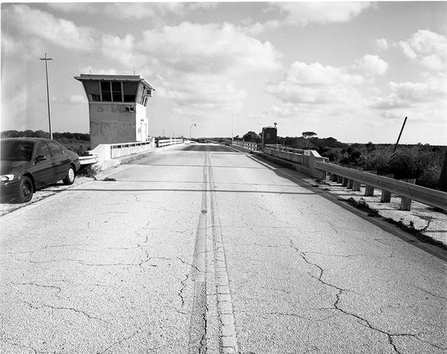
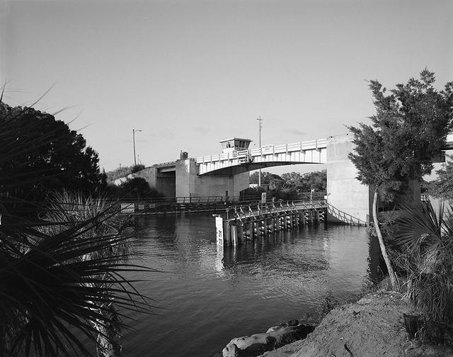
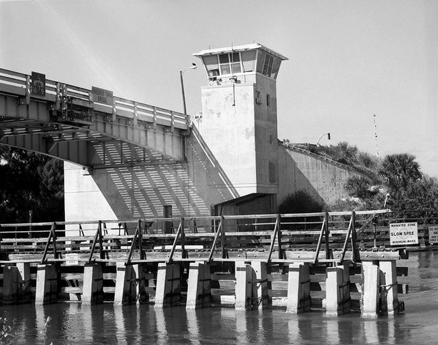
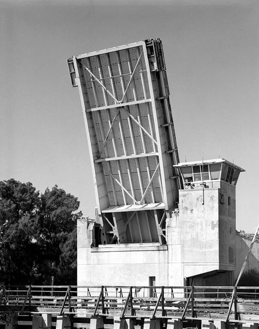
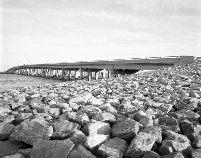
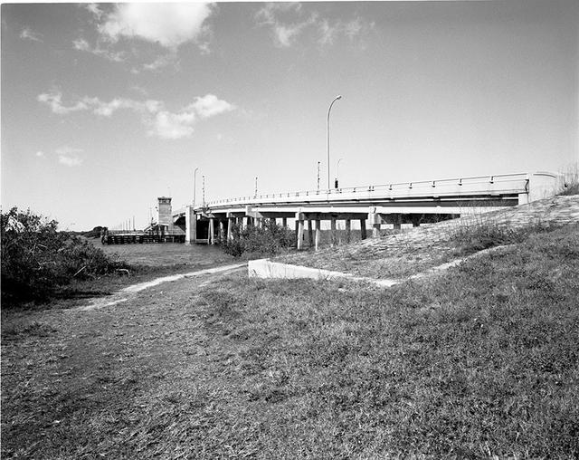
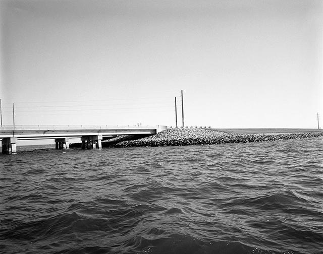
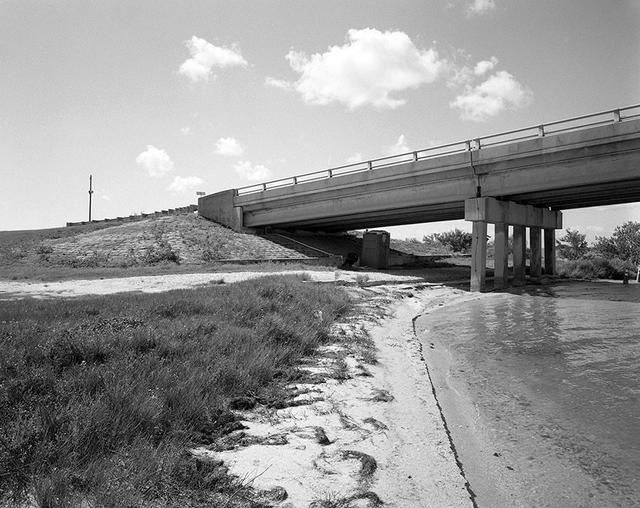
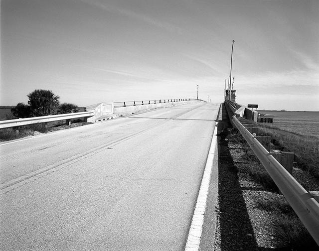
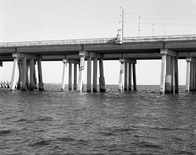
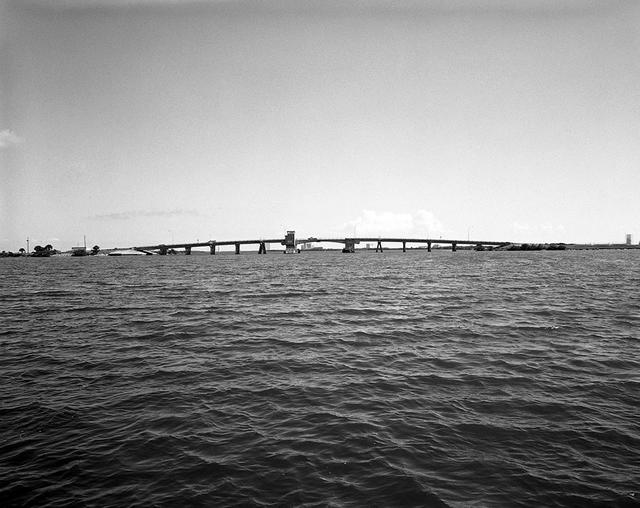
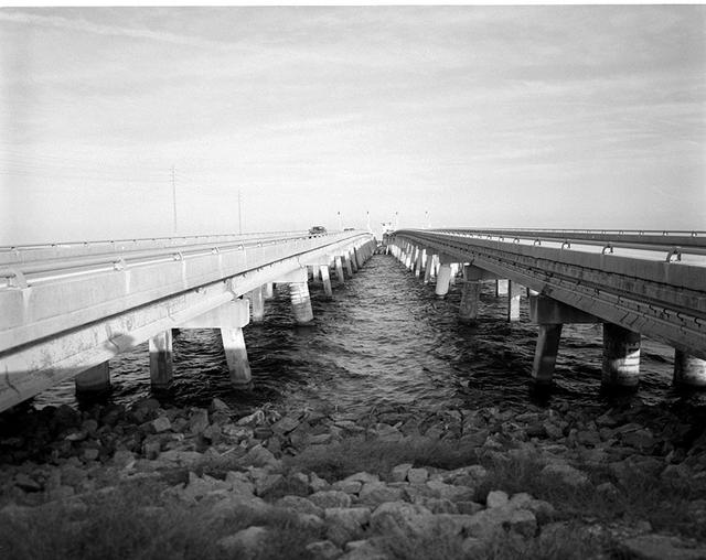
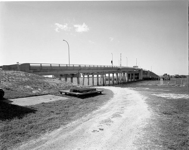
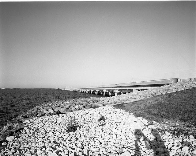
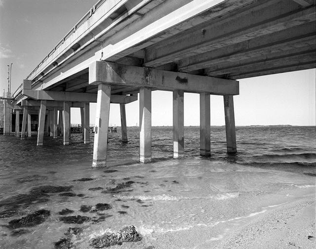
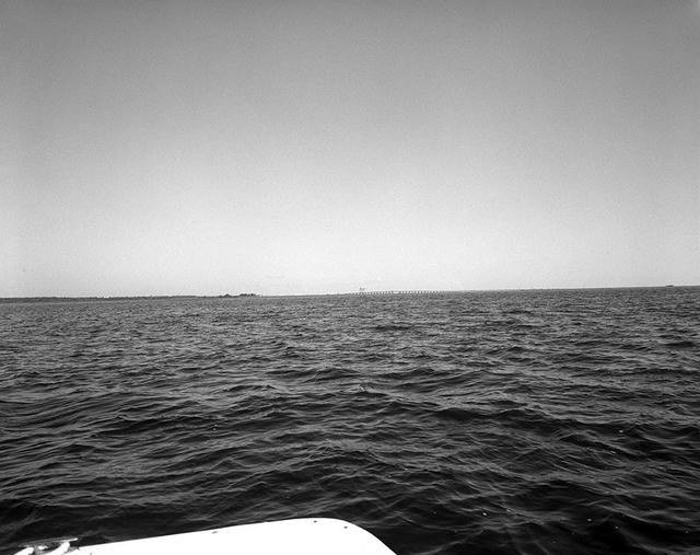
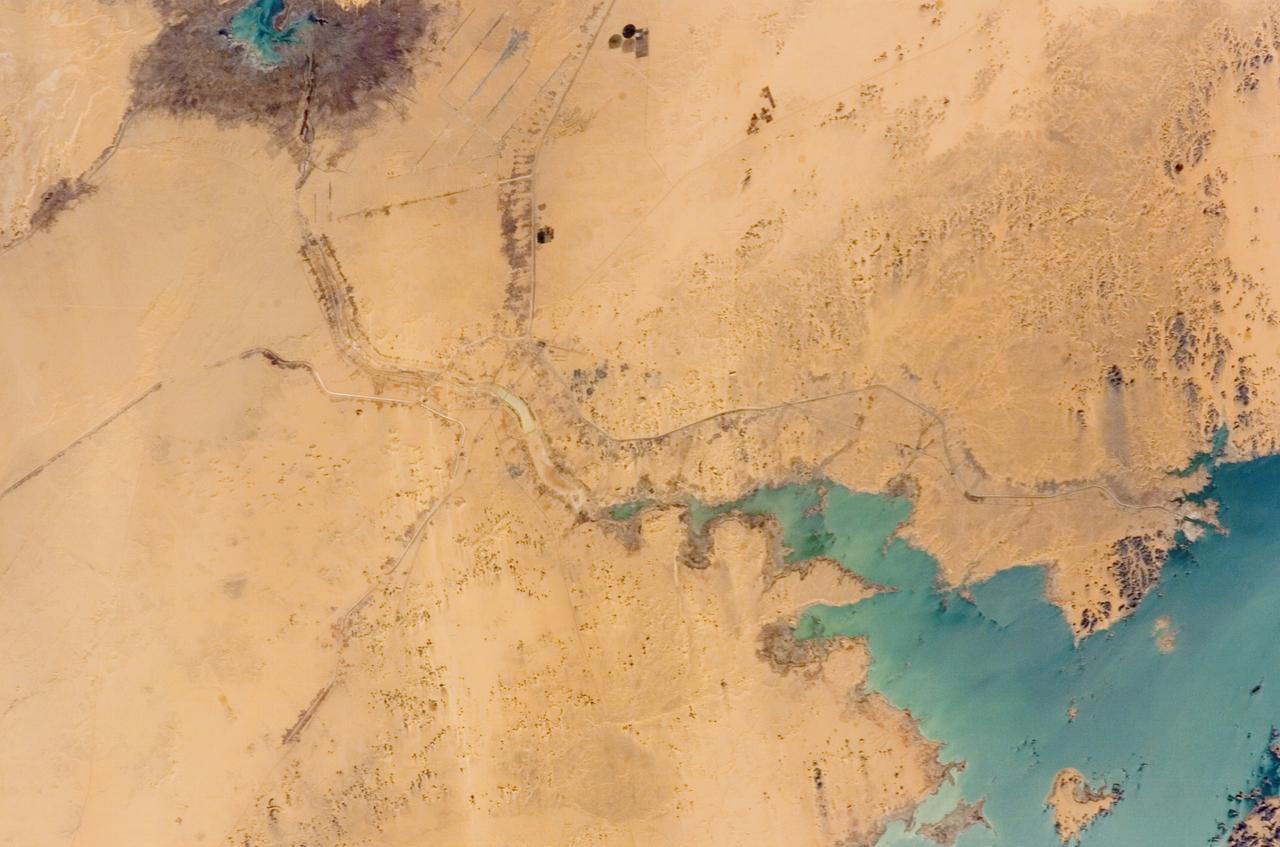
View of the Haulover Canal Bridge
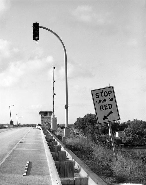
View of the Haulover Canal Bridge
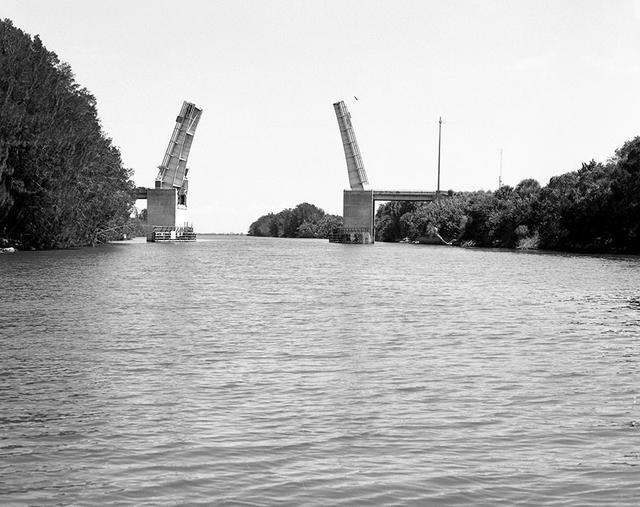
View of the Haulover Canal Bridge
View of the Haulover Canal Bridge
View of the Haulover Canal Bridge
View of the Haulover Canal Bridge
View of the Haulover Canal Bridge
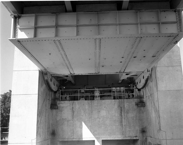
View of the Haulover Canal Bridge
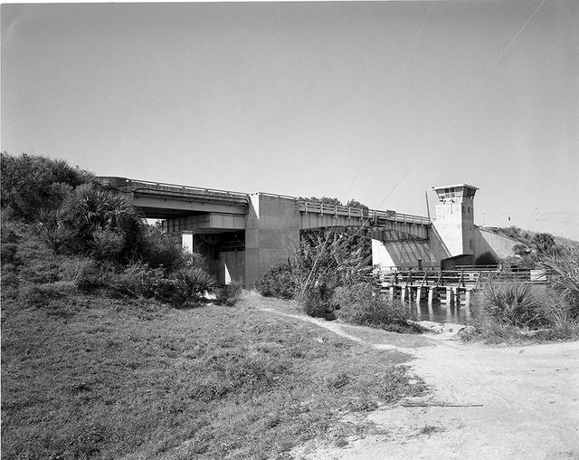
View of the Haulover Canal Bridge
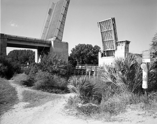
View of the Haulover Canal Bridge

View of the Haulover Canal Bridge
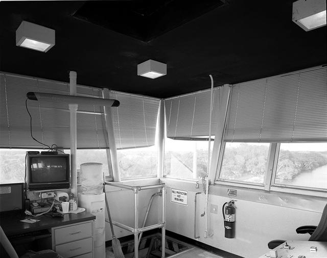
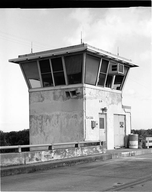
Interior view of the Haulover Canal Bridge Control Tower
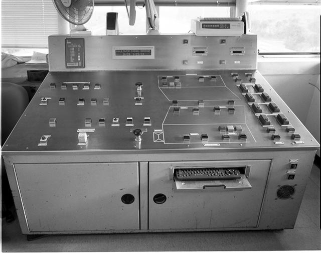
Interior view of the Haulover Canal Bridge Control Tower
STS068-237-099 (30 September-11 October 1994) --- This 70mm frame shows the Panama Canal (center, between the two dark green belts) the main ship way to travel from the Atlantic to the Pacific Ocean. Also seen is a great deal of detail in Panama City (left center, on the Pacific Ocean coastline). Geologists studying the photography returned by Shuttle astronauts feel this picture is the best ever of the city. Agricultural fields can be seen on the east side of Panama City and on both sides of the Pan American Highway (the straight thin line extending to the left). Sedimentation in the Chepo River (upper left) is thought to be due to eroded soil from the agricultural lands near the sea. This river is surrounded by swamps lying along the Pacific coastline.
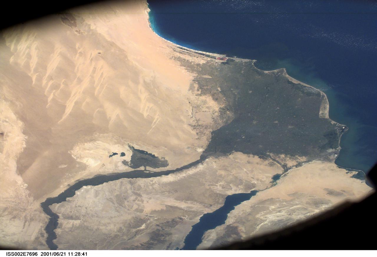
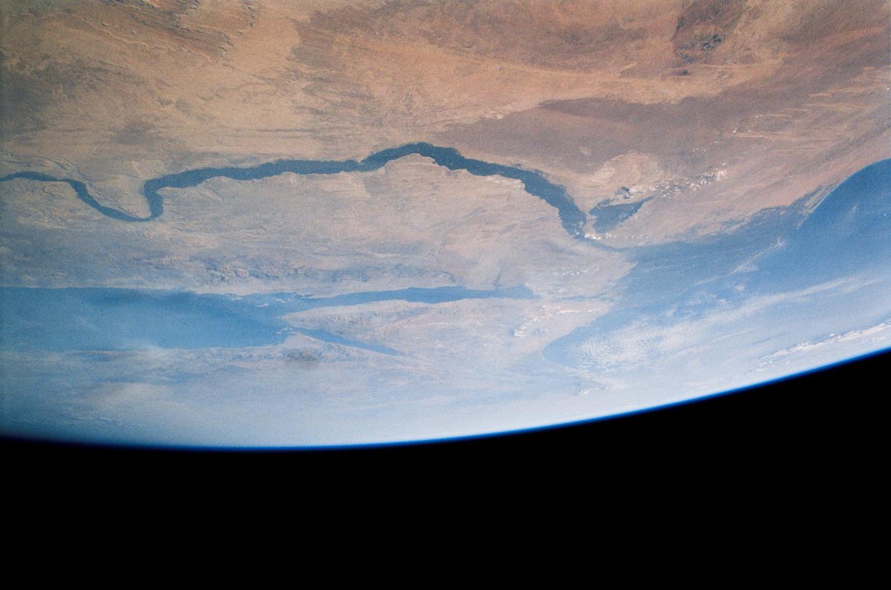
SS002-E-7696 (21 June 2001) --- Wide view of the Nile River and Suez Canal, Egypt, as photographed with a digital still camera aboard the International Space Station (ISS).
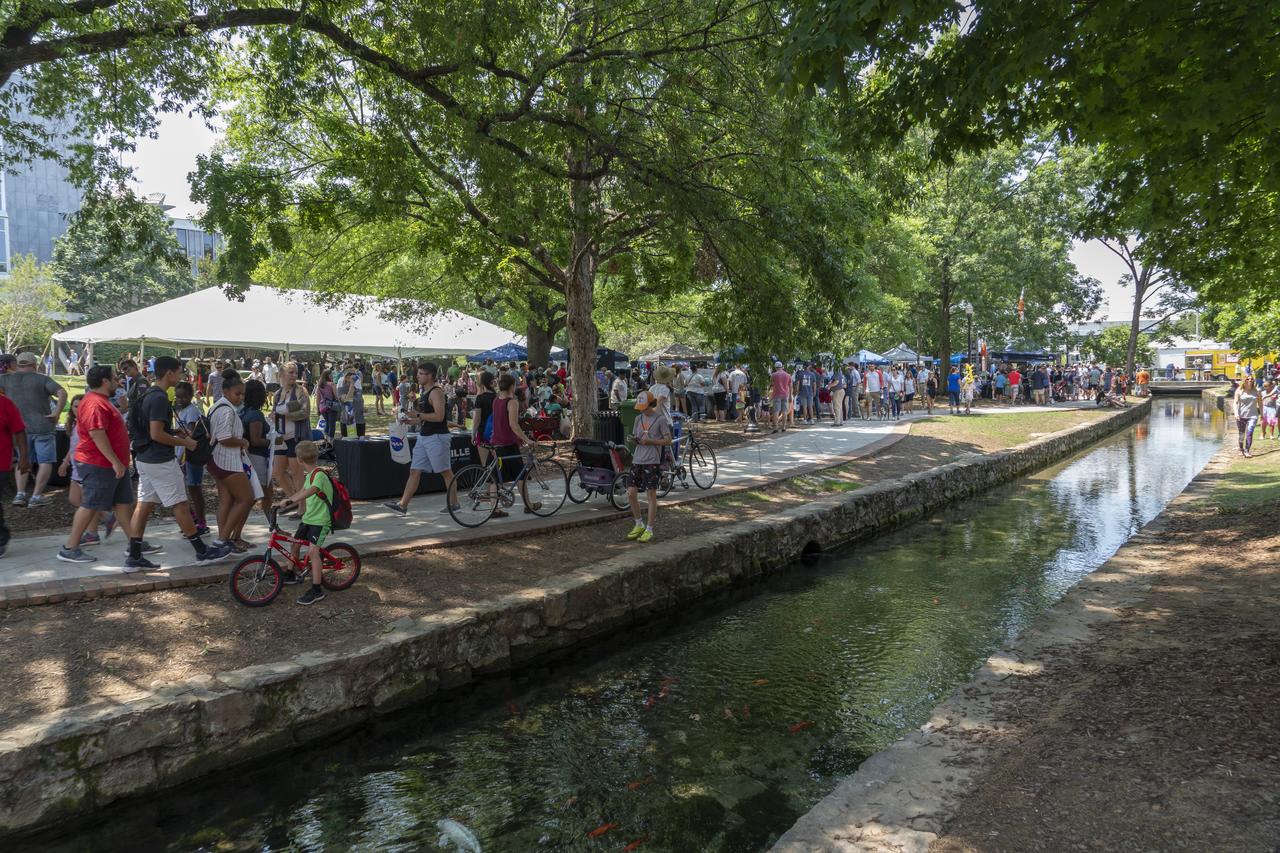
NASA's Marshall Space Flight Center showcased it's various projects for the public in Huntsville, Alabama's Big Spring Park. Exhibits were displayed by all of the various directorates of the Center with employee volunteers explaining all aspects of their projects. Adding to the festivities was the attendance of retired NASA astronaut Robert "Hoot" Gibson. A view of the canal running through the park showing a small portion of the crowd attending NASA Day in the Park.
STS-56 Earth observation of the northeastern Nile Delta was photographed from the Earth-orbiting Discovery, Orbiter Vehicle (OV) 103. The branch of the Nile featured in the frame is Daimietta. The Suez Canal marks the boundary of the Nile Delta agriculture and the Sinai Desert to the right. Lake Masada, the dark waterlogged area to the west (left) of Port Said is becoming more saline as the Aswan Dam has reduced sediment downstream. This sediment reduction, according to NASA scientists studying the STS-56 photography, has resulted in increased coastal erosion and the intrusion of a salt-water lens to the ground water, particularly in the northeastern portions of the delta. Center pivot irrigation fields are located along either side of the Ramses Canal, which connects the Daimietta Nile with Great Bitter Lake. This canal has been re-dug three or four times in the past 3,000 years. Historians note that the canal's most famous use was as the departure point of the fleet of Pharaoh Necho. The fleet circumnavigated Africa clockwise from the head of the Red Sea to the Mediterranean coast of the Nile (probably the Rosetta Nile) in a three-year voyage circa 660 BC.
NASA in the Park on June 16 in Huntsville featured more than 60 exhibits and demonstrations by NASA experts, as well as performances by Marshall musicians, educational opportunities, games and hands-on activities for all ages. Big Spring canal is a good place to cool off in the 90 degree heat
Suez Canal, Gulf of Suez, Sinai Peninsula, United Arab Republic (Egypt), Mediterranean Sea, as seen from the Apollo 7 spacecraft during its 13th revolution of the earth. Photographed from an altitude of 126 nautical miles, at ground elapsed time of 19 hours and 42 minutes.
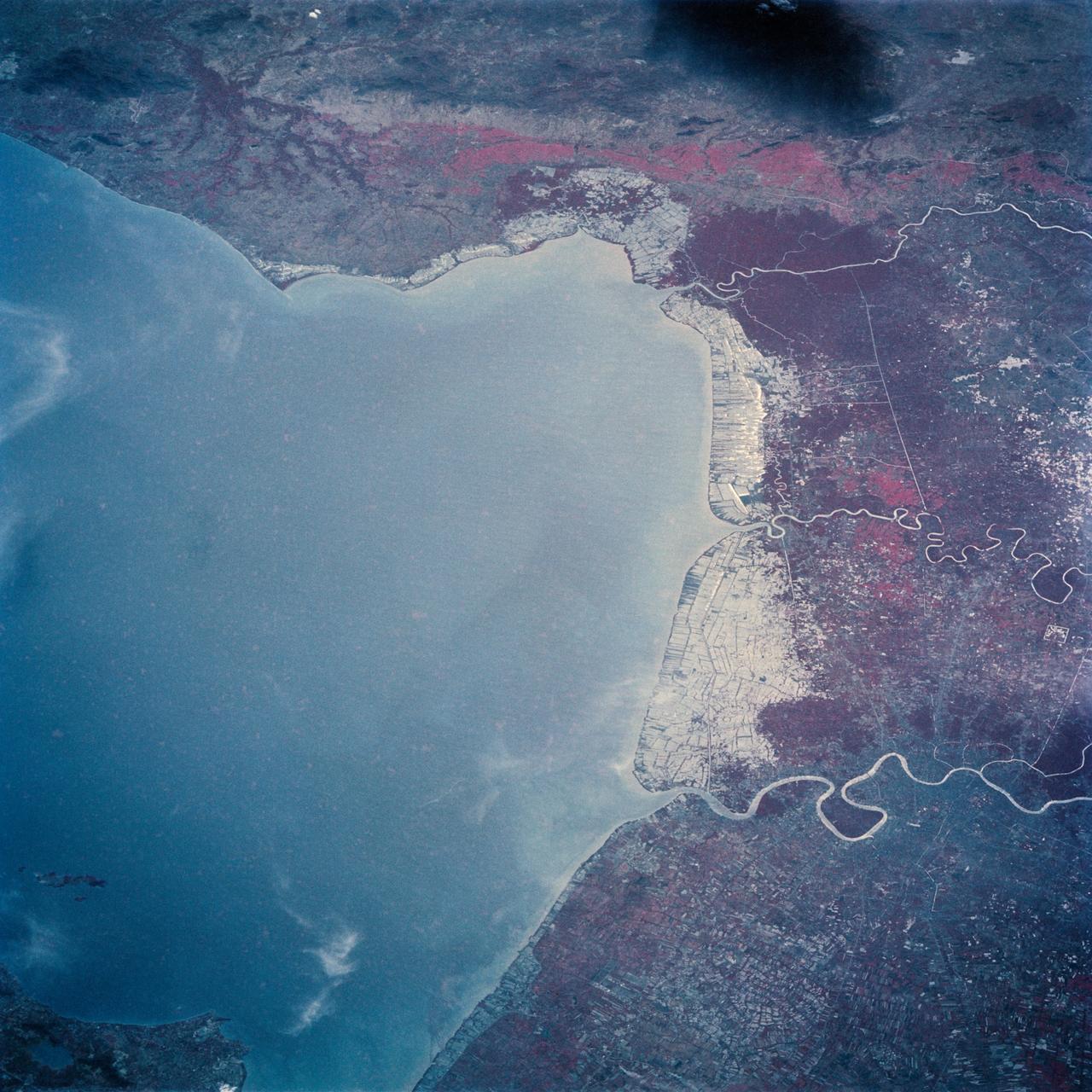
The Bight of Bangkok and the city of Bangkok, Thailand are visible in this west looking view. The city of Bangkok, with an estimated population in excess of 3.7 million people, can be seen in the lower right-hand corner of the view. The city, famous as a jewelry trading center, dealing in precious stones and silver and bronze ware, is situated in a vast lowland. This lowland is a major rice growing area interspersed with canals used for irrigation and drainage. Rice is a major export commodity of Thailand. The deforested hills of the Bilauktaung Range can be seen at the top of the view.
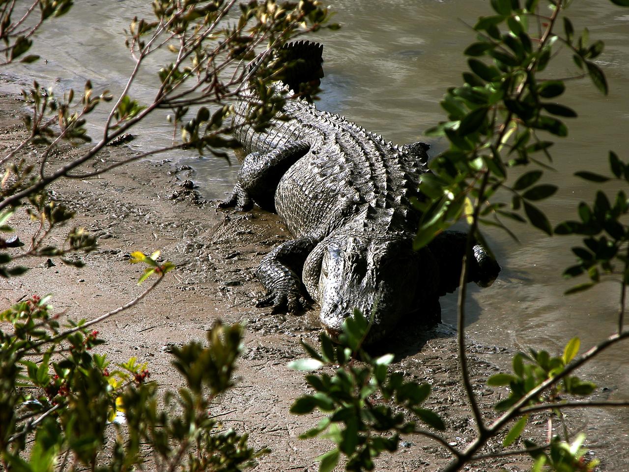
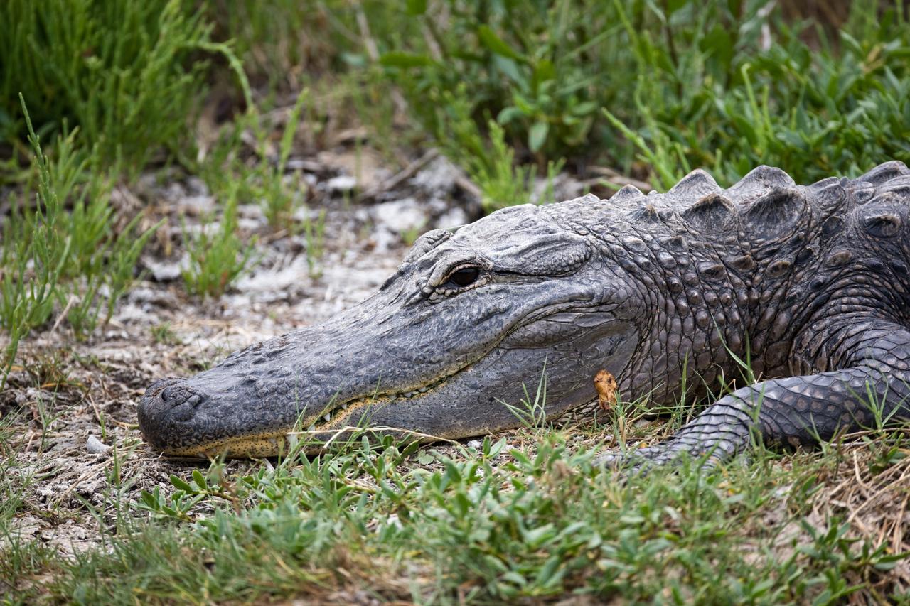
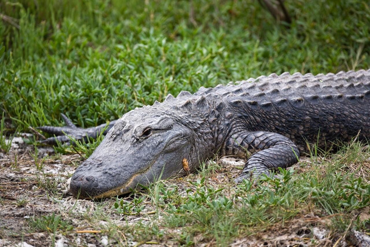
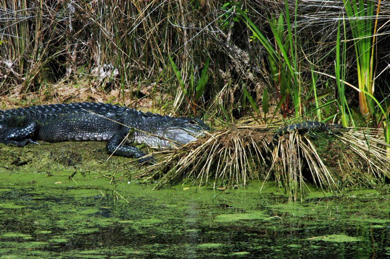
KENNEDY SPACE CENTER, FLA. -- An alligator is spotted sunning on the muddy bank of a canal in KSC. Nearly 5,000 alligators can be found in canals, ponds, and waterways throughout the Center and the surrounding Merritt Island National Wildlife Refuge. American alligators feed and rest in the water, and lay their eggs in dens they dig into the banks. The young alligators spend their first several weeks in these dens. The Wildlife Refuge encompasses 92,000 acres that are a habitat for more than 331 species of birds, 31 mammals, 117 fishes, and 65 amphibians and reptiles.
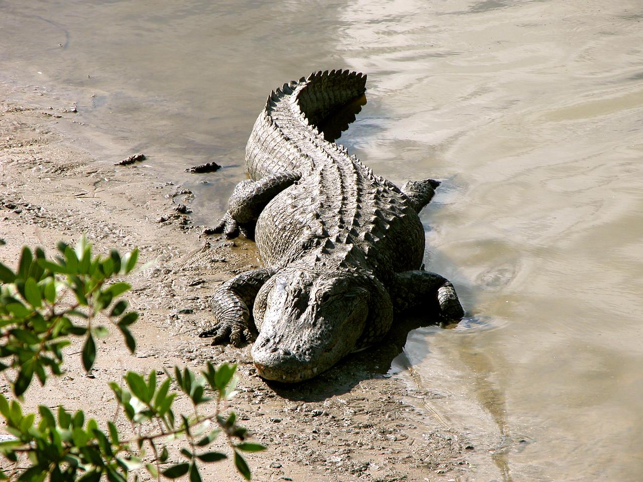
KENNEDY SPACE CENTER, FLA. -- An alligator is spotted sunning on the muddy bank of a canal in KSC. Nearly 5,000 alligators can be found in canals, ponds, and waterways throughout the Center and the surrounding Merritt Island National Wildlife Refuge. American alligators feed and rest in the water, and lay their eggs in dens they dig into the banks. The young alligators spend their first several weeks in these dens. The Wildlife Refuge encompasses 92,000 acres that are a habitat for more than 331 species of birds, 31 mammals, 117 fishes, and 65 amphibians and reptiles.
The Nile River Delta of Egypt (30.0N, 31.0E) irrigated by the Nile River and its many distributaries, is some of the richest farm land in the world and home to some 45 million people, over half of Egypt's population. The capital city of Cairo is at the apex of the delta. Just across the river from Cairo can be seen the ancient three big pyramids and sphinx at Giza and the Suez Canal is just to the right of the delta.
ISS018-E-024949 (31 Jan. 2009) --- The All-American Canal, the largest irrigation canal in the world and a key landmark along the California-Mexico border, is featured in this image photographed by an Expedition 18 crewmember on the International Space Station. This image captures about 15 kilometers of the important infrastructure corridor just west of Yuma, AZ. The prominent dark line crossing the image is the Canal which is crossed, in this view, by Interstate Highway 8. The canal carries 740.6 cubic meters (26,155 cubic feet) of water per second from the Colorado River westward to support the intensive agriculture of California?s Imperial Valley to the northwest, and to nine cities including San Diego, CA. The canal system is the Imperial Valley?s only source of water, and allows irrigation of more than 2,000 square kilometers (500,000 acres) of agricultural fields. The Coachella Canal, one of four main branch canals, leads water north to Imperial Valley. This section of the canal requires constant maintenance. Approximately 68,000 acre-feet of water per year are lost by seepage from the All-American Canal - especially where the canal crosses the great Algodones Dune Field, a portion of which is visible extending from top to bottom in the center of the image. Additionally, dune sand is constantly blown to the southeast, and into the canal. As part of California?s Colorado River Water Use Plan, 37 kilometers (23 miles) of the canal is being lined to prevent water loss by seepage. A recently opened sector parallels the old canal (right) and new lined sectors are under construction (bright lines, center). Engineers have sited new sections of the canal to avoid the worst areas of dune-sand invasion, so that the new configuration will be significantly cheaper to maintain and operate. A new road crosses the dunes and marks the US?Mexico border as part of border fence construction efforts. The margin of the Colorado River floodplain in Mexico is just visible two kilometers south of the border (lower left corner). This floodplain is Mexico?s equivalent of the Imperial Valley in terms of its enormous irrigated agricultural production.
STS098-712-091 (7-20 February 2001) --- The forested area of the Panama Canal Zone can be seen near the center of this north-looking image, photographed with a 70mm handheld camera from the Earth-orbiting Space Shuttle Atlantis. (NOTE: The image should be oriented with Panama running horizontally and the majority of the clouds at the top). The Panama Canal Zone extends 5 miles (8 kilometers) on either side of the Panama Canal. The forested zone acts as a buffer for the canal to help prevent erosion and sediment from clogging the canal. Most of the countryside on both sides of the Canal Zone has been deforested to make way for large ranches and the raising of cattle. Though some sedimentation is occurring, dredging of the canal keeps the passage clear. The Panama Canal is 40 miles (64 kilometers) long including dredged approach channels at each end. With the Caribbean Sea covering the upper portion of the image and the Pacific Ocean covering the lower portion of the image, the canal traverses the Isthmus of Panama in a northwest to southeast direction. Gatun Lake, one of the largest artificial lakes in the world, is visible at the north end of the Canal Zone. Panama City (light-colored grayish area) is discernible to the right of the canal at its southern entrance from the Pacific Ocean. In 1996, 15,000 ships traveled through the canal, an average of 42 ships per day. Passage through the canal requires 7 to 8 hours.

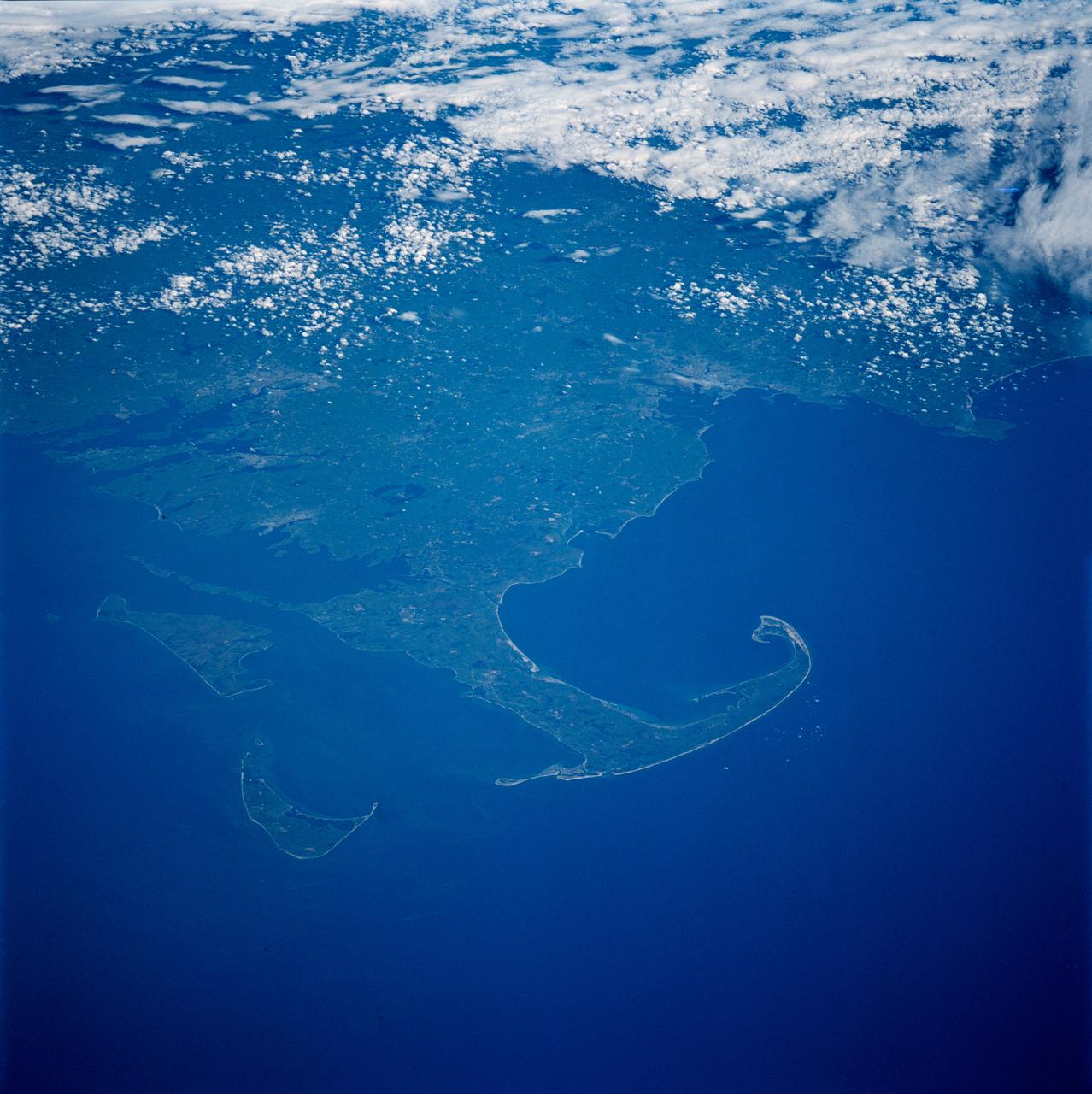
Site of the original Plymouth Colony in Massachusetts (42.0N, 70.5), This detailed photo is rich in early American history. Plymouth Rock, the Pilgrims first stepping stone on North America and site of Plymouth Colony is located just behind the natural breakwater on the south shore of Plymouth Bay seen in the middle of the photo. The through canal to the south is part of the Intercoastal Canal system. Cape Cod is just south of the canal.
The Isthmus of Corinth has played a very important role in the history of Greece. It is the only land bridge between the country north Attica and south Peloponnese. This image was acquired by NASA Terra spacecraft.
View of the Indian River Bridge
View of the Banana River Bridge
View of the Indian River Bridge
View of the Banana River Bridge
View of the Banana River Bridge
View of the Indian River Bridge
View of the Banana River Bridge
View of the Indian River Bridge
View of the Banana River Bridge
View of the Indian River Bridge
View of the Banana River Bridge
View of the Indian River Bridge
ISS013-E-44847 (30 June 2006) --- Ship traffic on the Suez Canal, Egypt is featured in this image photographed by an Expedition 13 crewmember on the International Space Station. This oblique photograph captures a northbound convoy of cargo ships entering the Mediterranean Sea from the Suez Canal in Egypt (leftmost canal branch at image center). Oblique images are taken at an angle other than vertical, or nadir -- looking down a line connecting the station to the point on the Earth's surface directly below it -- and this provides a sense of perspective. In this case, the station was located above the eastern coast of Cyprus and the crewmember was looking at Egypt to the southwest. Regions of reduced clarity in the image are caused by thin variable cloud cover. The Suez Canal connects Port Said on the Mediterranean Sea with the port of Suez on the Red Sea, and provides an essentially direct route for transport of goods between Europe and Asia. The Canal is 163 kilometers long and 300 meters wide at its narrowest point -- sufficiently wide for ships as large as aircraft carriers to traverse it. Transit time from end to end is 14 hours on average.
SL3-122-2620 (July-September 1973) --- Skylab 3 Earth view of the Nile Delta, Egypt and Suez Canal. Photo credit: NASA
CAPE CANAVERAL, Fla. –– On NASA's Kennedy Space Center in Florida, an alligator rests on the bank of a canal. Alligators can be spotted in the drainage canals and other waters surrounding Kennedy. In Spring, they frequently roam, searching for mates. The center shares a boundary with the Merritt Island Wildlife Nature Refuge, which is a habitat for more than 310 species of birds, 25 mammals, 117 fishes and 65 amphibians and reptiles. Photo credit: NASA/Dimitri Gerondidakis
ISS047e115879 (05/13/2016) --- NASA astronaut Jeff Williams captured this image of the ancient Potidea canal in Greece from the International Space Station. For 2,000 years this canal has connected the Thermaikos and Toronaios Gulfs. Williams posted the photograph to his Twitter account May 13, 2016 saying, "Coastal currents and erosion over 2,000 years appear to have displaced the two sides of this isthmus," which may explain the coastline's misalignment".
iss073e0423962 (Aug. 7, 2025) --- The Zeid Reservoir in Turkmenistan is pictured from the International Space Station as it orbited 260 miles above Central Asia. The reservoir was designed to capture some of the sand and sediment flowing in from the nearby Amu Darya River and the Karakum Canal. This helps keep the water cleaner and protects the canal system from getting clogged.

CAPE CANAVERAL, Fla. - An alligator looks warily at the photographer who's spotted the familiar head in a drainage canal on NASA's Kennedy Space Center in Florida. A protected species, alligators can be spotted in the drainage canals and other waters surrounding KSC. The center shares a boundary with the Merritt Island Wildlife Nature Refuge, which is a habitat for more than 310 species of birds, 25 mammals, 117 fishes and 65 amphibians and reptiles. Photo credit: NASA/Dimitri Gerondidakis

CAPE CANAVERAL, Fla. - On NASA's Kennedy Space Center in Florida, an alligator from a nearby drainage canal stares at the photographer. A protected species, alligators can be spotted in the drainage canals and other waters surrounding KSC. The center shares a boundary with the Merritt Island Wildlife Nature Refuge, which is a habitat for more than 310 species of birds, 25 mammals, 117 fishes and 65 amphibians and reptiles. Photo credit: NASA/Dimitri Gerondidakis
CAPE CANAVERAL, Fla. –– On NASA's Kennedy Space Center in Florida, an alligator rests on the bank of a canal. Alligators can be spotted in the drainage canals and other waters surrounding Kennedy. The center shares a boundary with the Merritt Island Wildlife Nature Refuge, which is a habitat for more than 310 species of birds, 25 mammals, 117 fishes and 65 amphibians and reptiles. Photo credit: NASA/Dimitri Gerondidakis
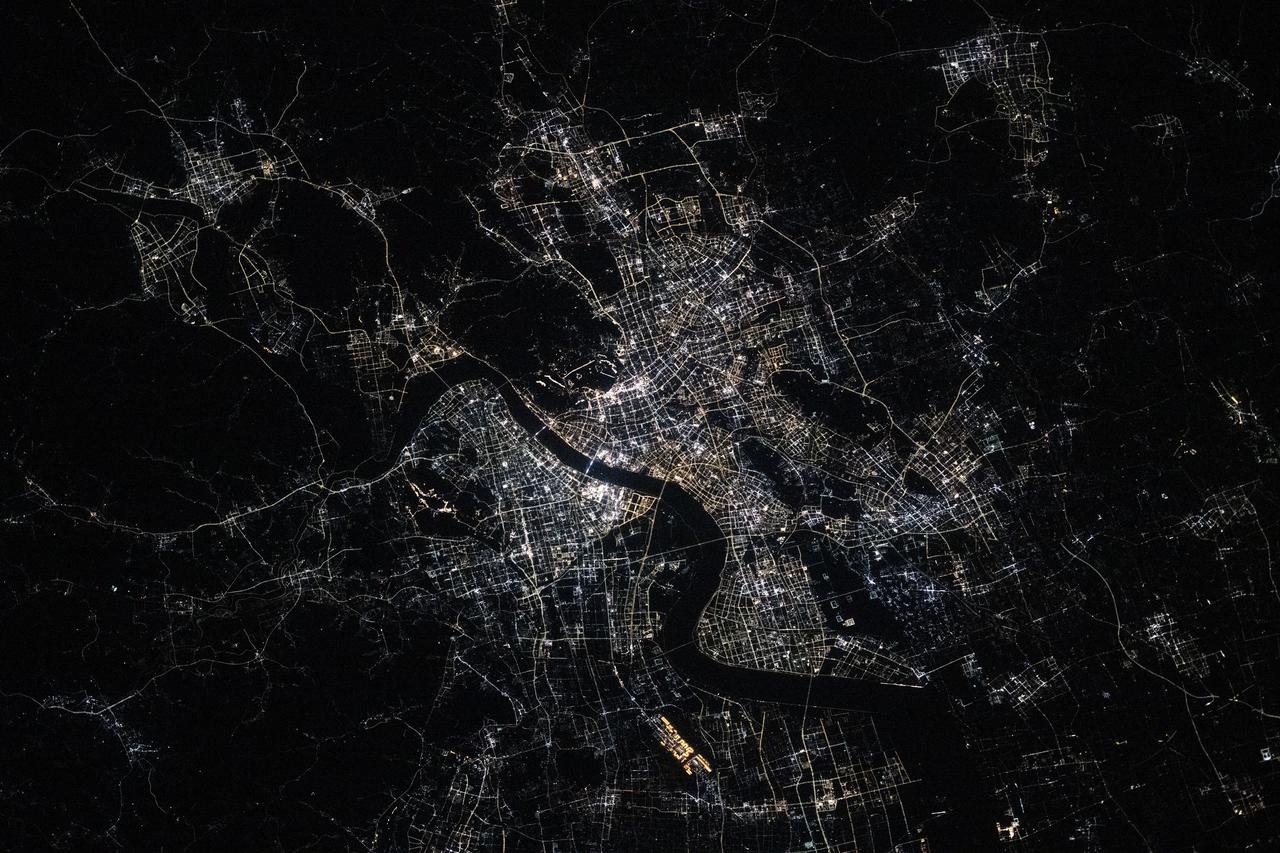
iss073e0420079 (July 3, 2025) --- Hangzhou, China—home to approximately 13 million people and the southern end of the Grand Canal, the longest artificial river in the world—glows in this nighttime view from the International Space Station. The canal stretches over 1,200 miles from its starting point in Beijing. This photograph was taken at approximately 9:55 p.m. local time while the station was orbiting 259 miles above Earth.
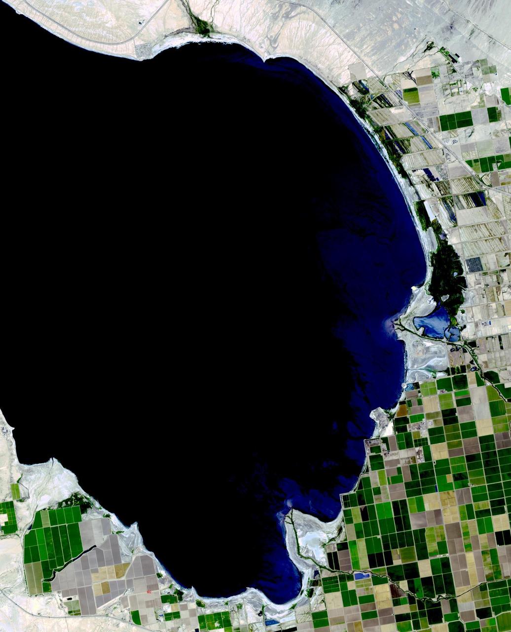
The Salton Sea in south California was created in 1905 when spring flooding on the Colorado River breached a canal. For 18 months the entire volume of the river rushed into the Salton Trough, creating a lake 32 km wide and 72 km long. In the 1950s, resorts sprang up along the shores. However, shrinking of the lake and increased salinity led to the abandonment of the resorts. The two images show the shrinking lake on May 31, 1984 (Landsat) and June 14, 2015 (ASTER). The images cover an area of 37.5 x 27 km, and are located at 33.2 degrees north, 115.7 degrees west. http://photojournal.jpl.nasa.gov/catalog/PIA19786

Four hundred bridges cross the labyrinth of canals that form the 120 islands of Venice, situated in a saltwater lagoon between the mouths of the Po and Piave rivers in northeast Italy. All traffic in the city moves by boat. Venice is connected to the mainland, 4 kilometers (2.5 miles) away, by ferries as well as a causeway for road and rail traffic. The Grand Canal winds through the city for about 3 kilometers (about 2 miles), dividing it into two nearly equal sections. According to tradition, Venice was founded in 452, when the inhabitants of Aquileia, Padua, and several other northern Italian cities took refuge on the islands of the lagoon from the Teutonic tribes invading Italy at that time. This image was acquired on December 9, 2001 by the Advanced Spaceborne Thermal Emission and Reflection Radiometer (ASTER) on NASA's Terra satellite. With its 14 spectral bands from the visible to the thermal infrared wavelength region, and its high spatial resolution of 15 to 90 meters (about 50 to 300 feet), ASTER will image Earth for the next 6 years to map and monitor the changing surface of our planet. http://photojournal.jpl.nasa.gov/catalog/PIA03860
SL3-115-1917 (July-September 1973) --- Skylab 3 Earth view of the United Arab Republic (UAR), Nile Delta, Cairo, Suez Canal, Sinai and Dead Sea. Photo credit: NASA
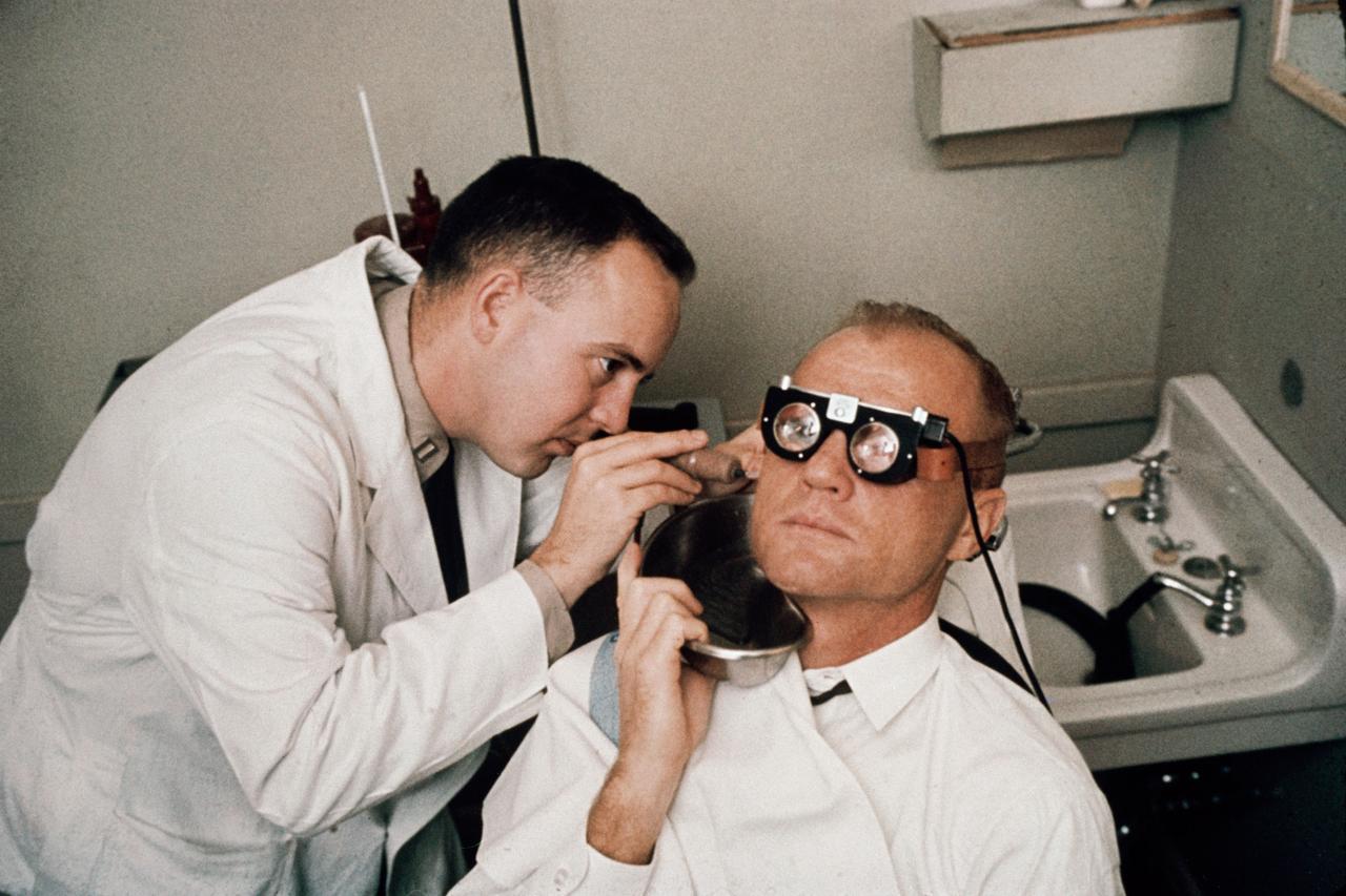
S64-14849 (1962) --- Astronaut John H. Glenn Jr.'s balance mechanism (semi-circular-canals) is tested by running cool water into his ear and measuring effect on eye motions (nystagmus). Photo credit: NASA
iss070e034694 (Nov. 30, 2023) --- The Suez Gulf (right) and the southern portion of the Suez Canal are pictured from the International Space Station as it orbited 260 miles above Egypt near the Mediterranean coast.
KENNEDY SPACE CENTER, FLA. - In a canal on Kennedy Space Center, an alligator stays close to its young, at right. Nearly 5,000 alligators can be found in canals, ponds and waterways throughout the Center and the surrounding Merritt Island National Wildlife Refuge. American alligators feed and rest in the water, and lay their eggs in dens they dig into the banks. The young alligators spend their first several weeks in these dens. The Wildlife Refuge encompasses 92,000 acres that are a habitat for more than 331 species of birds, 31 mammals, 117 fishes, and 65 amphibians and reptiles. Photo credit: NASA/Jim Grossmann

KENNEDY SPACE CENTER, FLA. - In a canal on Kennedy Space Center, young alligators stay close to their nest. Nearly 5,000 alligators can be found in canals, ponds and waterways throughout the Center and the surrounding Merritt Island National Wildlife Refuge. American alligators feed and rest in the water, and lay their eggs in dens they dig into the banks. The young alligators spend their first several weeks in these dens. The Wildlife Refuge encompasses 92,000 acres that are a habitat for more than 331 species of birds, 31 mammals, 117 fishes, and 65 amphibians and reptiles. Photo credit: NASA/Jim Grossmann
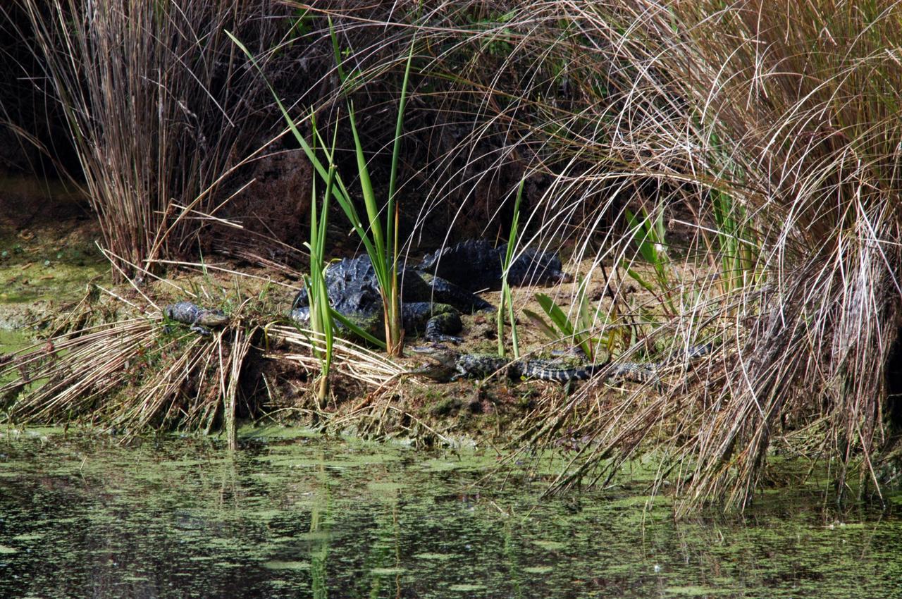
KENNEDY SPACE CENTER, FLA. - In a canal on Kennedy Space Center, the adult alligator moves into the midst of the young alligators near their nest. Nearly 5,000 alligators can be found in canals, ponds and waterways throughout the Center and the surrounding Merritt Island National Wildlife Refuge. American alligators feed and rest in the water, and lay their eggs in dens they dig into the banks. The young alligators spend their first several weeks in these dens. The Wildlife Refuge encompasses 92,000 acres that are a habitat for more than 331 species of birds, 31 mammals, 117 fishes, and 65 amphibians and reptiles. Photo credit: NASA/Jim Grossmann
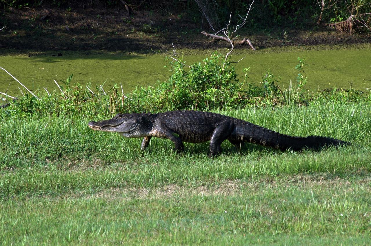
KENNEDY SPACE CENTER, FLA. - This alligator is on the move next to a canal at the Press Site at NASA's Kennedy Space Center. It may be on the hunt for food or for love (May and June are mating season on the Space Coast). Alligators are plentiful in the canals, ponds and marshes around the Center, which shares a boundary with the Merritt Island National Wildlife Refuge. The Refuge is a habitat for more than 310 species of birds, 25 mammals, 117 fishes and 65 amphibians and reptiles. In addition, the Refuge supports 19 endangered or threatened wildlife species on Federal or State lists, more than any other single refuge in the U.S. Photo credit: NASA/Ken Thornsley
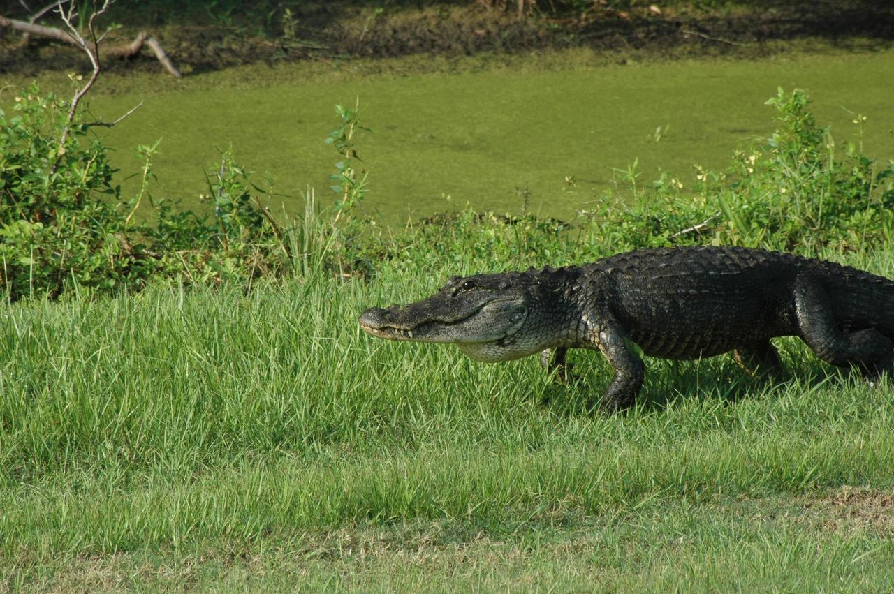
KENNEDY SPACE CENTER, FLA. - This alligator is on the move next to a canal at the Press Site at NASA's Kennedy Space Center. It may be on the hunt for food or for love (May and June are mating season on the Space Coast). Alligators are plentiful in the canals, ponds and marshes around the Center, which shares a boundary with the Merritt Island National Wildlife Refuge. The Refuge is a habitat for more than 310 species of birds, 25 mammals, 117 fishes and 65 amphibians and reptiles. In addition, the Refuge supports 19 endangered or threatened wildlife species on Federal or State lists, more than any other single refuge in the U.S. Photo credit: NASA/Ken Thornsley
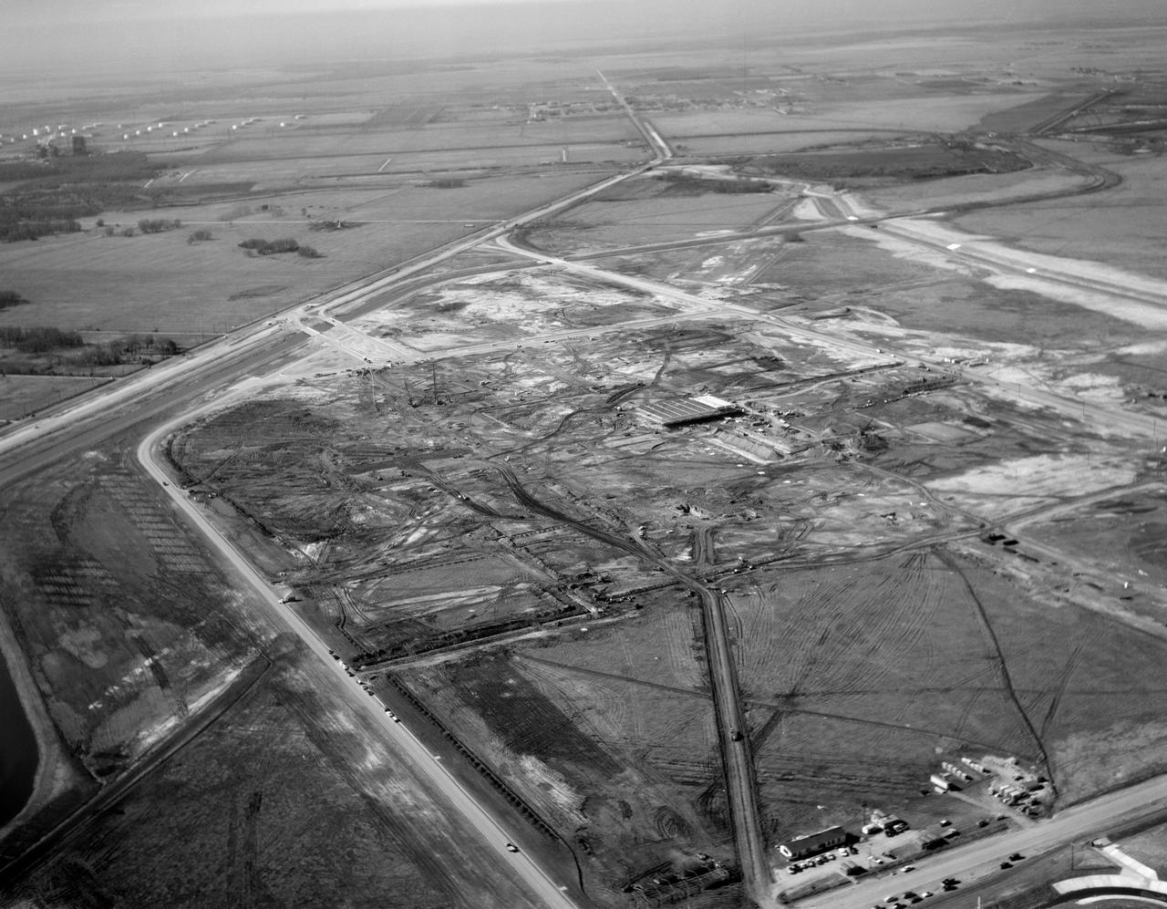
S63-01074 (1963) --- A black and white aerial view of Site 1, the Manned Spacecraft Center, in 1963 during early construction. The view faces the southwest. Highway 528 is at the top of the picture. Second Street runs basically north and south on the right side of the image, to the right or west and running parallel to that avenue is a drainage ditch. Winding through the site a Houston Lighting and Power Co. canal crosses over the drainage ditch near the top of the frame. Twin bridges over the canal are pictured at upper left which were constructed to allow traffic to enter and leave through MSC's secondary gateway. In frame center, construction appears very far along on the Central Data Office.
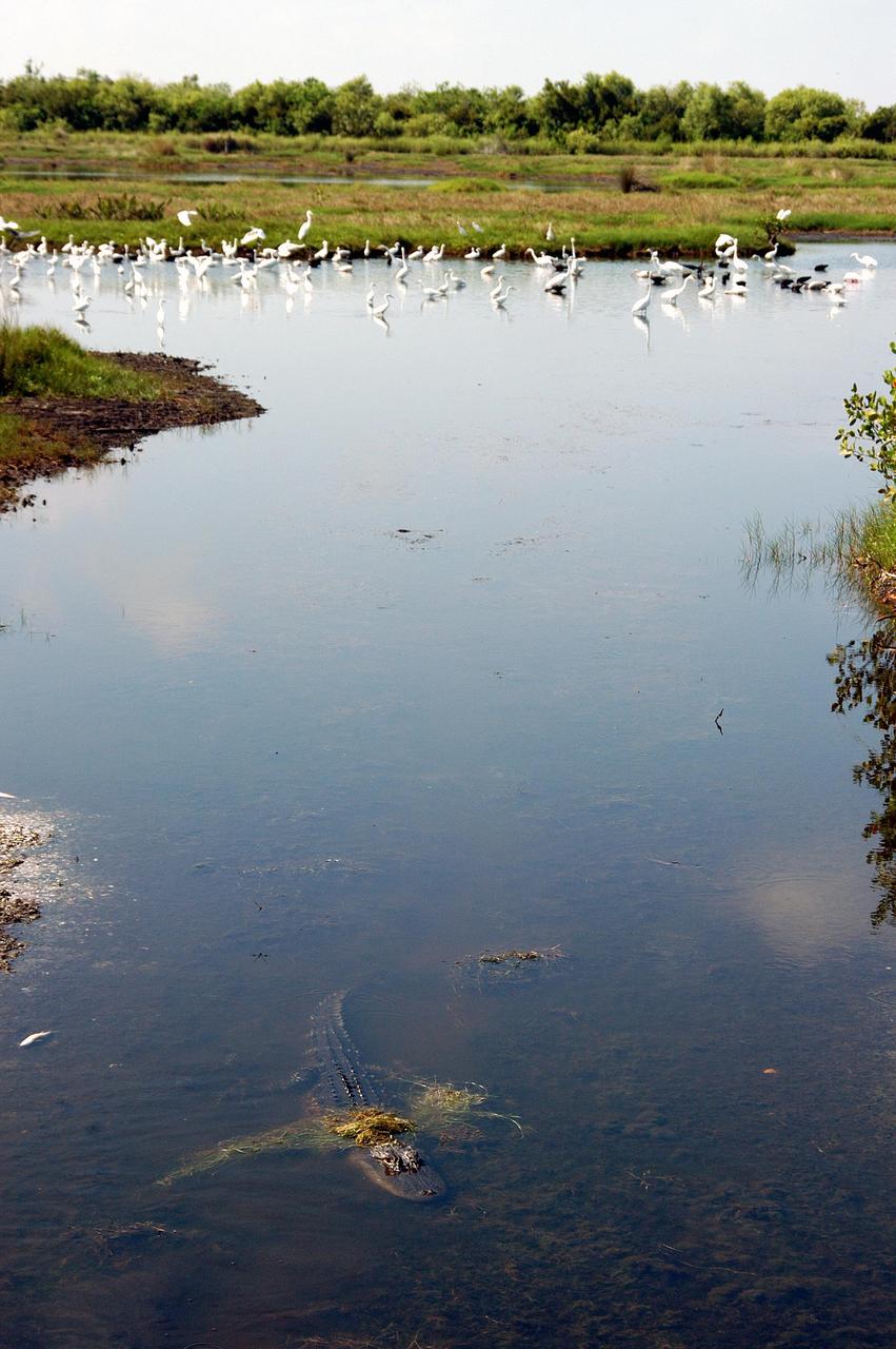
KENNEDY SPACE CENTER, FLA. - Above, herons, a roseate spoonbill and other species of water birds gather in a canal near KSC, which shares a boundary with the Merritt Island National Wildlife Refuge. Below is an alligator. Nearly 5,000 alligators can be found in canals, ponds, and waterways throughout the Center. The marshes and open water of the refuge also provide wintering areas for 23 species of migratory waterfowl, as well as a year-round home for great blue herons, great egrets, wood storks, cormorants, brown pelicans and other species of marsh and shore birds.
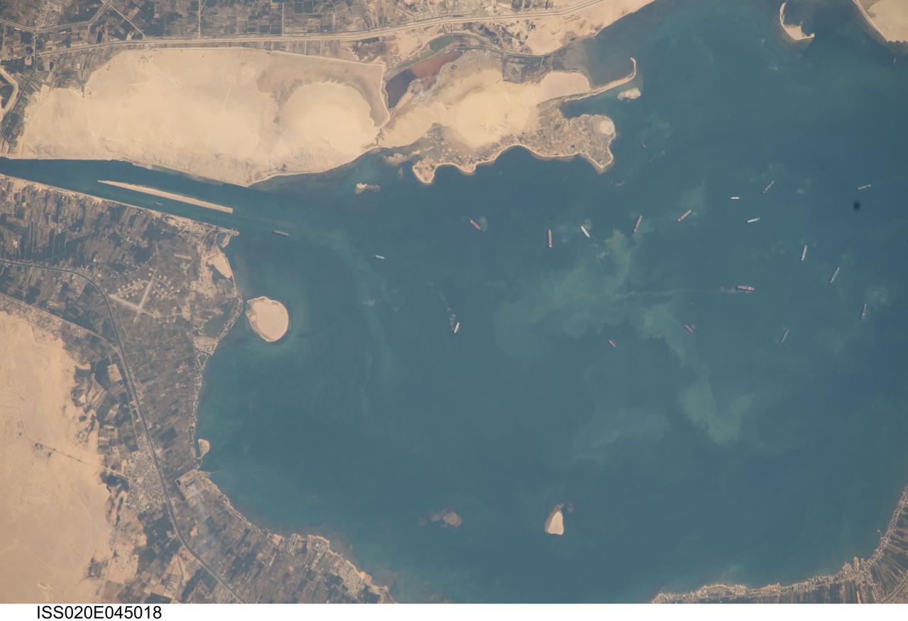
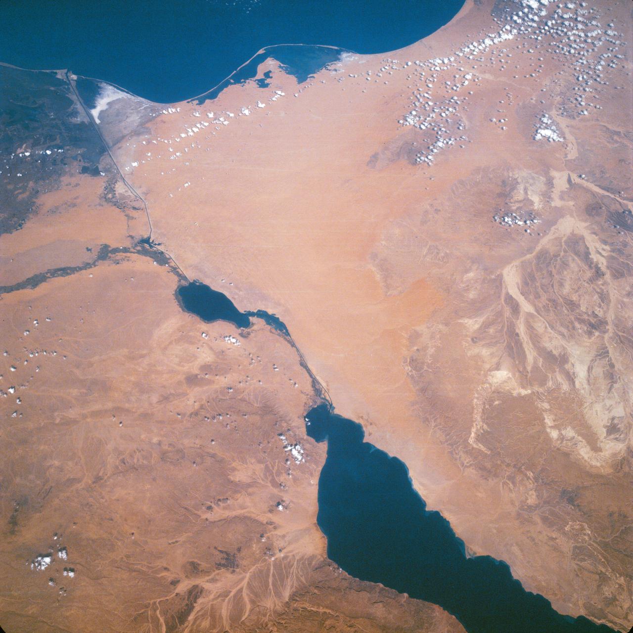
ISS020-E-045018 (2 Oct. 2009) --- Great Bitter Lake, Egypt is featured in this image photographed by an Expedition 20 crew member on the International Space Station. The Great Bitter Lake is one of several lakes located along the Suez Canal that connects the eastern Mediterranean and Red Seas. As the Canal is built only to allow ships to travel in a single lane, the Great Bitter Lake is a location where ships can change their position in line - much like a motor highway passing lane - before proceeding to either Port Said to the north, or the port of Suez to the south. The lake also provides an intermediate harborage for ships traversing the Canal ? a journey that typically takes 14 hours end-to-end. Several ships - some under power and some anchored ? are visible at right. Prior to the opening of the Suez Canal in 1869, Great Bitter Lake was a large salt flat, the typical geomorphic expression of basins in the arid Egyptian climate. Large expanses of white to tan sandy sediments at left and top attest to the desert conditions surrounding the Lake. Located at the approximate midpoint of the Suez Canal, Great Bitter Lake is now filled with water derived from both the Red and Mediterranean Seas and this steady influx of water balances the water lost to evaporation. The town of Fayid (also spelled as Fayed), visible along the western shore of the Lake (bottom) is a tourist destination frequented, particularly in the summer months, by residents of Cairo.
STS121-334-026 (4-17 July 2006) --- This photo, featuring an easterly view of the Nile River, the Nile River Delta, Sinai Peninsula, the Suez Canal, Red Sea and part of the Mediterranean Sea, was taken by one of the STS-121 crewmembers aboard the Space Shuttle Discovery. Cairo, Egypt, can be seen at far right.
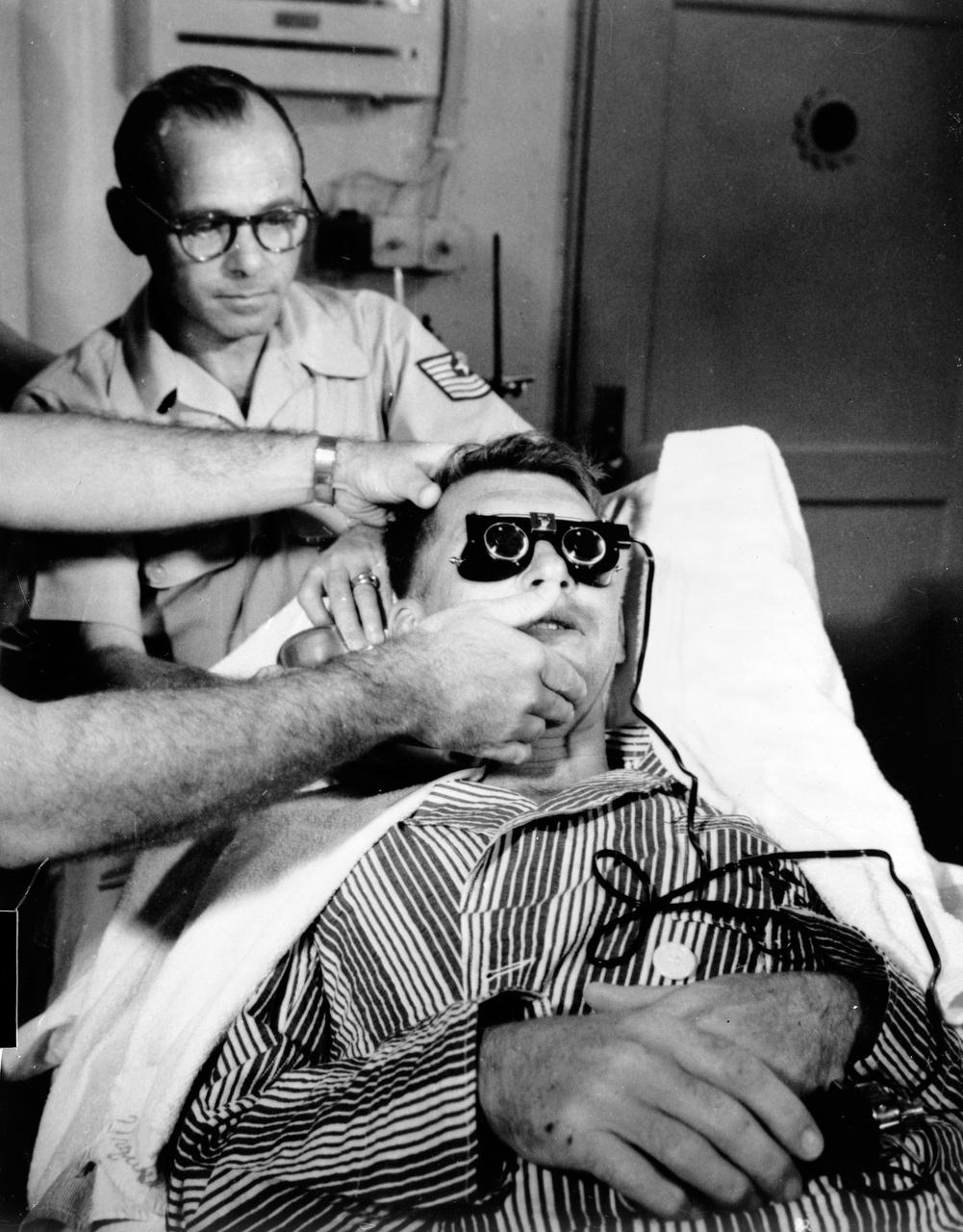
S62-06157 (1962) --- Astronaut Walter Schirra Jr. gets modified calonic test. His balance mechanism (semicircular canals) are tested by running cool water into ear and measuring effect on eye motions (nystagmus) after his six-orbit flight in the Sigma 7 spacecraft. Photo credit: NASA
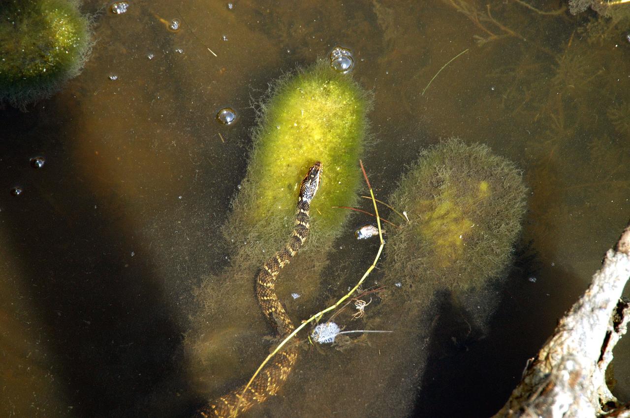
KENNEDY SPACE CENTER, FLA. - An unidentified snake seems suspended in the marshy water of a canal near KSC, which shares a boundary with the Merritt Island National Wildlife Refuge. The refuge encompasses 92,000 acres that are a habitat for more than 331 species of birds, 31 mammals, 117 fishes, and 65 amphibians and reptiles.
S65-34776 (3-7 June 1965) --- This photograph shows the Nile Delta, Egypt, the Suez Canal, Israel, Jordan, Syria, Saudi Arabia, and Iraq as seen from the Gemini-Titan 4 (GT-4) spacecraft during its 12th revolution of Earth.
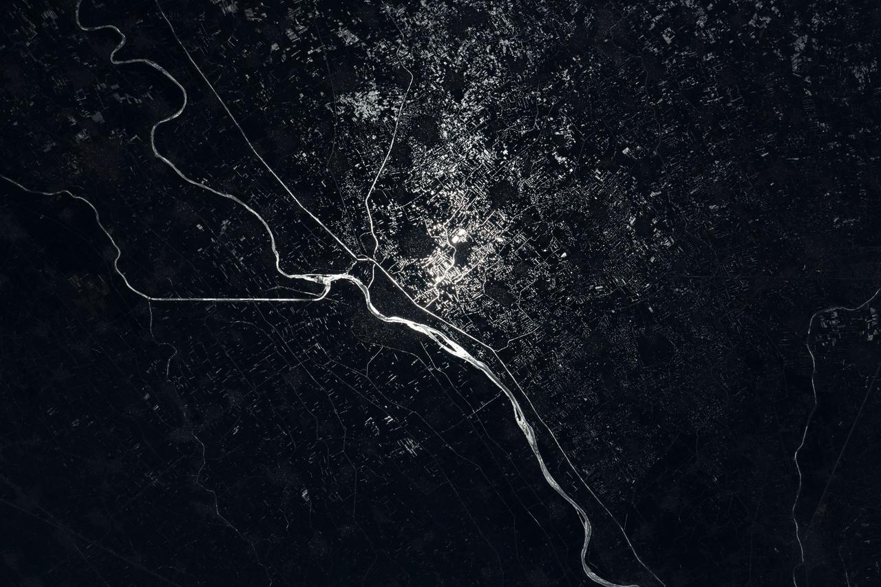
iss067e089285 (May 29, 2022) --- The Damietta Branch of the Nile River splits into canals in the central portion of the Nile Delta in Egypt. Lights from several cities surrounding the Egyptian waterways are pictured in this nighttime photograph from the International Space Station as it orbited 262 miles above the Mediterranean Sea off the coast of the Sinai Peninsula.
STS084-703-003 (15-24 May 1997) --- Cape Cod extends 105 kilometers (65 miles) into the Atlantic Ocean. To the south of Cape Cod are the islands of Martha's Vineyard (west) and Nantucket (east). The city of Boston can be seen surrounding the bay above the "hook" on Cape Cod. To the south are the cities of New Bedford on Buzzards Bay, and Providence, Rhode Island. The Cape Cod Canal is an artificial waterway that connects Buzzards Bay and Cape Cod Bay. The waterway is 28 kilometers (17.5 miles) and does not contains locks. The canal was built to shorten the distance over water between New York City and Boston. In 1620 the Pilgrims landed at Provincetown, on the upper tip of Cape Cod, before they proceeded to Plymouth.
STS087-717-088 (19 November – 5 December 1997) --- Featured in this view are Sudan’s agricultural projects dependent on irrigation. Just southeast of the confluence of the Blue and White Nile rivers (and the city of Khartoum) is one of the largest irrigation projects in the world, known as the Gezira Scheme. The economy of Sudan is largely based on agriculture. The Gezira Scheme was begun by the British in 1925 and distributes water from the Blue Nile through canals and ditches to tenant farms lying between the Blue and White Nile rivers. Farmers cooperate with the Sudanese government and the Gezira Board. This network of canals and ditches is 2,700 miles (4,300 kilometers) long, and the irrigated area covers 2.5 million acres (1 million hectares). The main crop grown in this region is cotton. This picture is one of the 70mm Earth observations visuals used by the crew at its post flight presentation events.
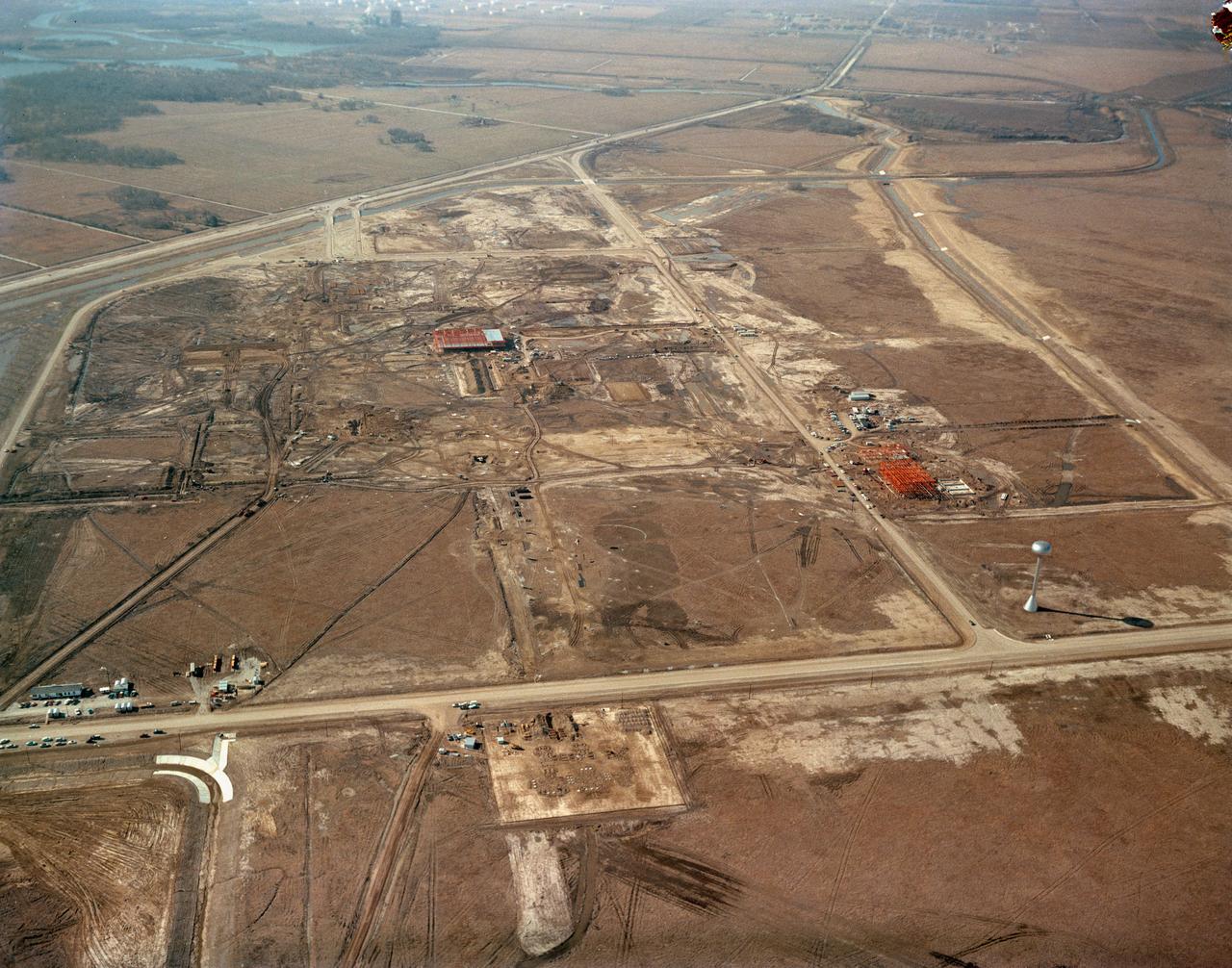
S63-00950 (1963) --- An aerial view of Site 1, the Manned Spacecraft Center, in 1963 during early construction. The view faces the southwest. Highway 528 is at the top of the picture. Second Street runs basically north and south on the right side of the image, to the right or west and running parallel to that avenue is a drainage ditch. Winding through the site a Houston Lighting and Power Co. canal crosses over the drainage ditch near the top of the frame. Twin bridges over the canal are pictured at upper left which were constructed to allow traffic to enter and leave through MSC's secondary gateway. The unfinished red structure to the right of center and roughly 100 yards south of the elevated water storage tank is the Central Heating and Cooling Plant. In the upper left quadrant of the frame, construction appears very far along on the Central Data Office.
ISS012-E-11654 (11 Dec. 2005) --- Lake Nasser and New Valley, Egypt are featured in this image photographed by an Expedition 12 crew member on the International Space Station. Cycles of flood and drought in the African Sahel are legendary, and they have provided the impetus for major waterworks on Africa’s great rivers. The construction of the Aswan High Dam on the Nile River, creating Lake Nasser in the 1960s, is the biggest and most visible project. Heavy rains in the source regions of the Nile in the 1990s resulted in record water levels in Lake Nasser. The abundance of water facilitated the Egyptian government’s promotion of another massive water distribution system called New Valley. In 1997, Lake Nasser flooded westward down a spillway into the Toshka depression in southern Egypt, creating four new lakes over the next few years. Following the initial flooding, a pumping station and canal were constructed in 2000 to maintain water flow into the region, allowing for industrial and agricultural development in the desert. This view shows the completed Mubarek Pumping Station on Lake Nasser; the spillway that originally flooded the Toshka depression and the southern end of the first of the Toshka Lakes; part of the 50-kilometer-long main canal (the Sheikh Zayed Canal); side canals; and several new fields in the Egyptian desert northwest of Lake Nasser. Astronauts, cosmonauts and space-based sensors have been monitoring these developments in Egypt since their inception in the late 1990s. New Valley’s Toshka Lakes, and the new developments surrounding them, represent one of the most visible and rapid man-made changes on Earth’s surface.
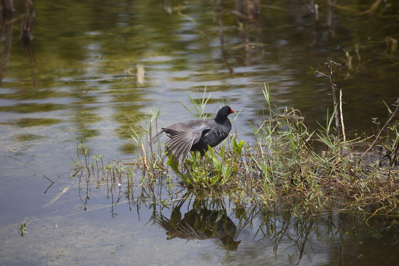
CAPE CANAVERAL, Fla. -- A Common Gallinule perches in the grass on the edge of a canal on NASA's Kennedy Space Center in Florida. The undeveloped property on Kennedy Space Center is managed by the U.S. Fish and Wildlife Service through the Merritt Island National Wildlife Refuge. The refuge provides a habitat for a plethora of wildlife, including 330 species of birds. For information on the refuge, visit http://www.fws.gov/merrittisland/Index.html. Photo credit: NASA/Daniel Casper
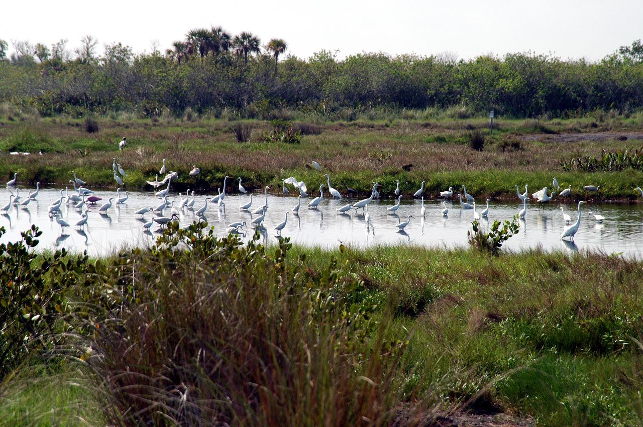
KENNEDY SPACE CENTER, FLA. - Herons, a roseate spoonbill and other species of water birds gather in a canal near KSC, which shares a boundary with the Merritt Island National Wildlife Refuge. The marshes and open water of the refuge provide wintering areas for 23 species of migratory waterfowl, as well as a year-round home for great blue herons, great egrets, wood storks, cormorants, brown pelicans and other species of marsh and shore birds.
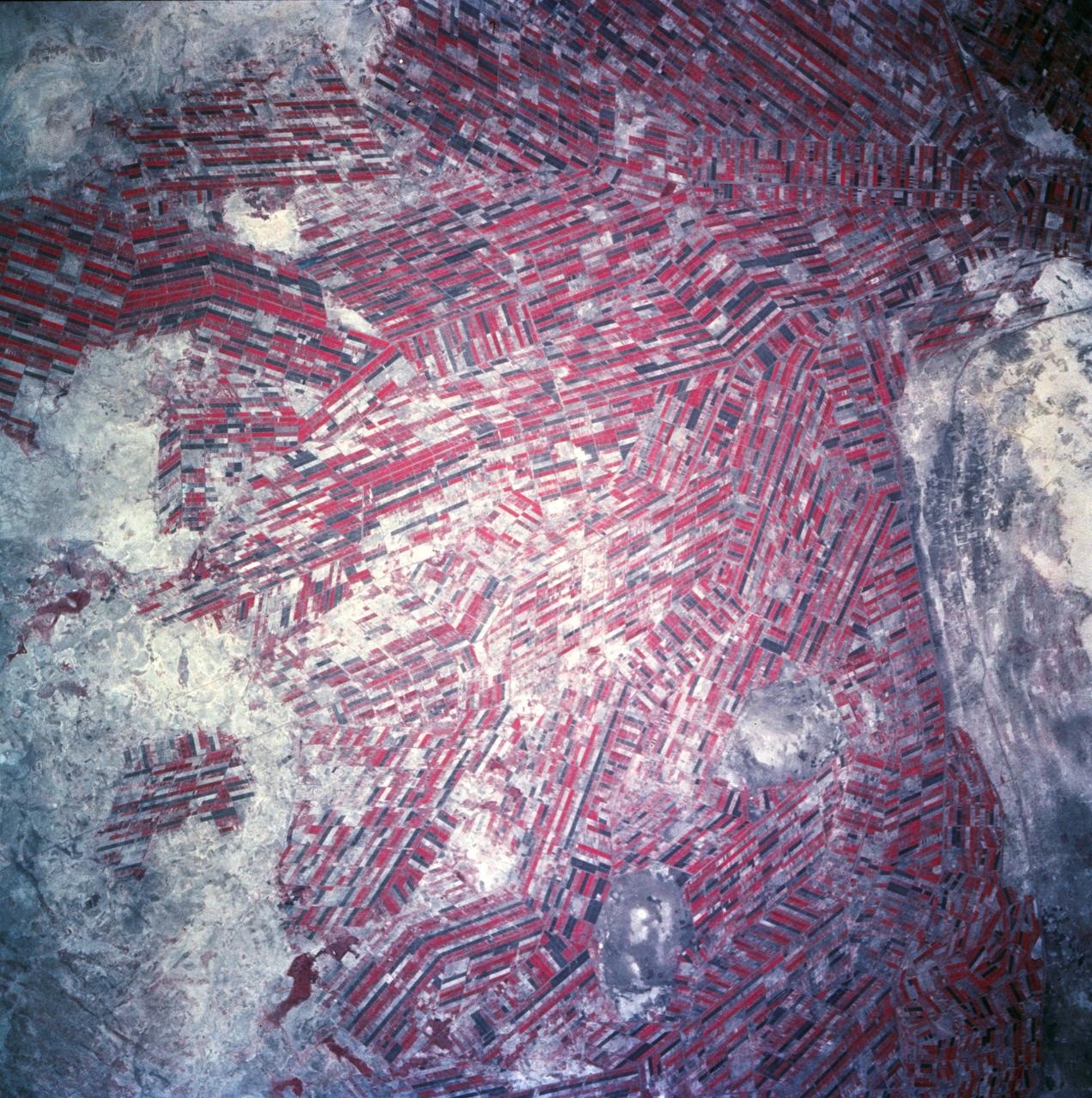
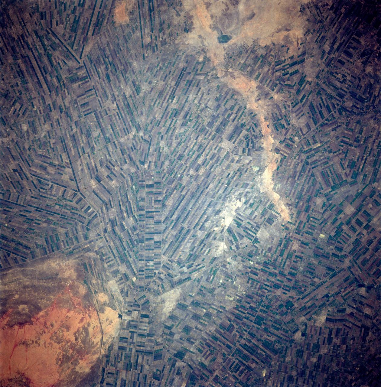
Agricultural patterns are distinctly visible in this near-vertical false color infrared photography taken in November 1994. The area depicted on the photograph is south of Khartoum between the White and Blue Nile Rivers. By far the most important irrigation project in sub-Saharan Africa, both large and small scale agricultural enterprises have been developed using water transported from the perennial Nile Rivers. Hundreds of small rectangular fields and water-filled canals can be seen in this photograph.
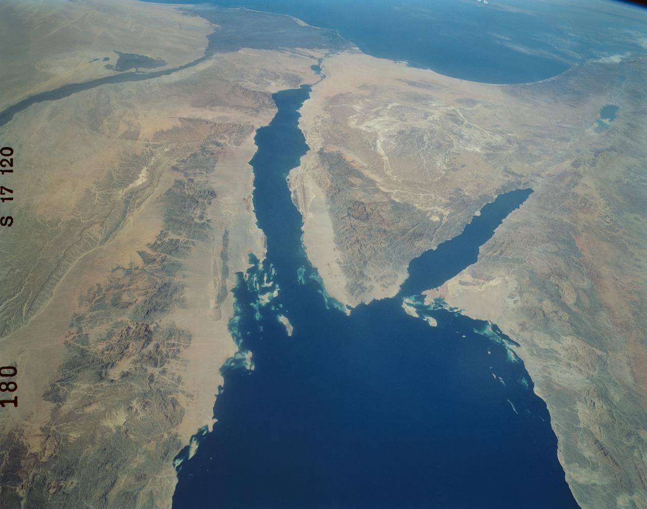
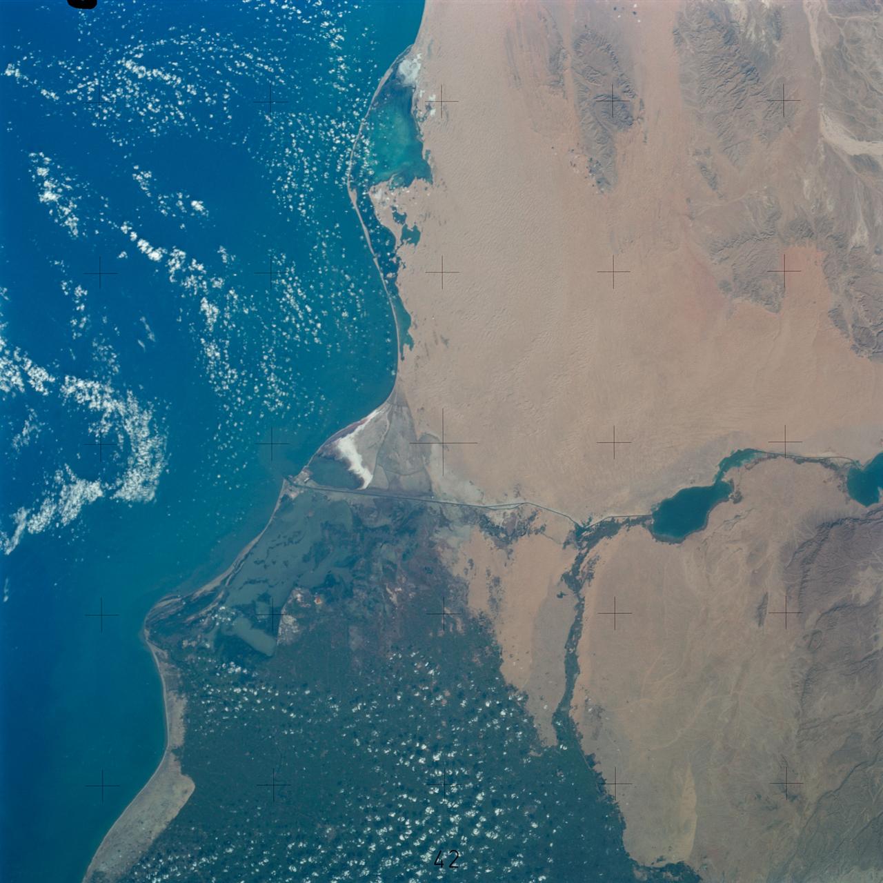
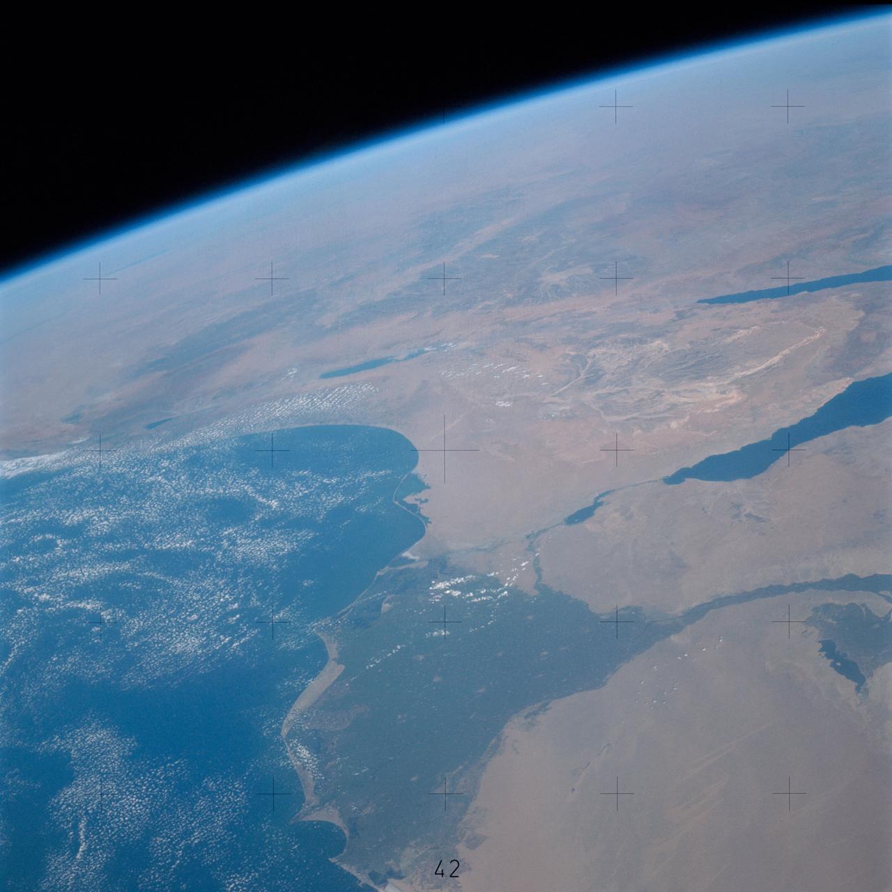
An excellent panoramic view of the entire Sinai Peninsula (29.0N, 34.0E) and the nearby Nile River Delta and eastern Mediterranean coastal region. The Suez Canal, at the top of the scene just to the right of the Delta, connects the Mediterranean Sea with the Gulf of Suez on the west side of the Sinai Peninsula and the Gulf of Aqaba is on the west where they both flow into the Red Sea. At upper right, is the Dead Sea, Jordan River and Lake Tiberius.
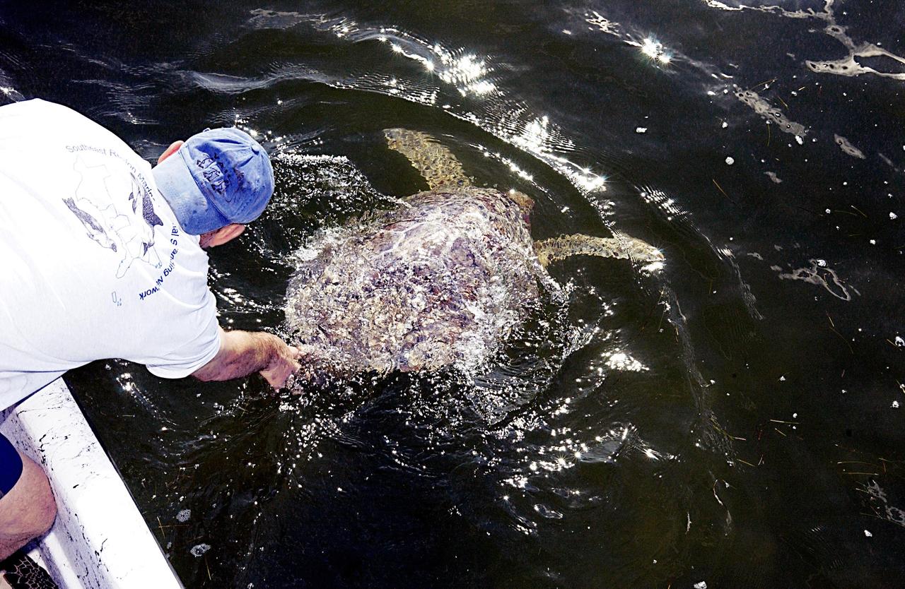
KENNEDY SPACE CENTER, FLA. - A sea turtle is released into the Mosquito Lagoon. It is one of several turtles found stunned, impacted by the unseasonal cold temperatures experienced in Central Florida. The cooperative effort of KSC contractor Dynamac Corporation's Aquatics Program and the Merritt Island National Wildlife Refuge warmed the turtles and evaluated them for release. Most were tagged and the largest one received a transmitter, provided by the University of Central Florida, for satellite tracking. The turtles were then transported through the Haulover Canal to a location away from the main channel for release..
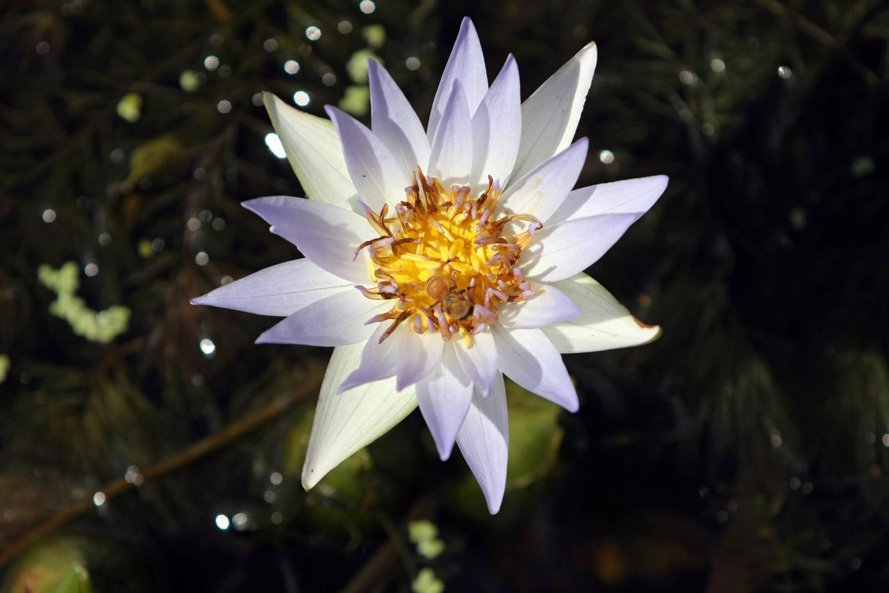
CAPE CANAVERAL, Fla. - A water lily stretches above the water in a canal on NASA's Kennedy Space Center in Florida. The center shares a boundary with the Merritt Island Wildlife Nature Refuge, consisting of 140,000 acres. The Refuge provides a wide variety of habitats: coastal dunes, saltwater estuaries and marshes, freshwater impoundments, scrub, pine flatwoods, and hardwood hammocks that provide habitat for more than 1,500 species of plants and animals. Photo credit: NASA/Dimitri Gerondidakis

CAPE CANAVERAL, Fla. -- A roseate spoonbill is joined by several other species as it searches for food in a canal at NASA's Kennedy Space Center in Florida. The undeveloped property on Kennedy Space Center is managed by the U.S. Fish and Wildlife Service through the Merritt Island National Wildlife Refuge. The refuge provides a habitat for a plethora of wildlife, including 330 species of birds. For information on the refuge, visit http://www.fws.gov/merrittisland/Index.html. Photo credit: NASA/Daniel Casper
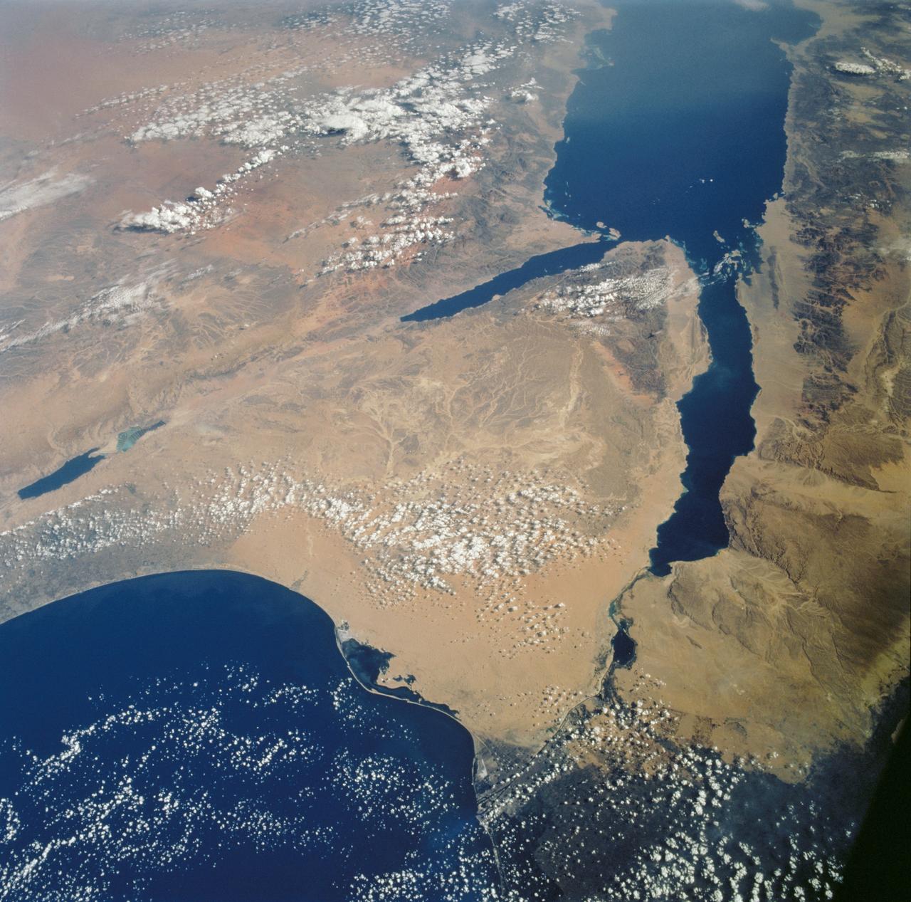
STS112-702-002 (7-18 October 2002) --- Egypt's triangular Sinai Peninsula lies in the center of this view, photographed from the Space Shuttle Atlantis, with the dark greens of the Nile delta lower right. In this southwesterly view, the Red Sea, with its characteristic parallel coastlines, stretches toward the top. At the bottom of the image, the Suez Canal appears as an irregular line joining the Red Sea to the Mediterranean Sea (lower left). The Dead Sea in central Israel, with its light blue salt ponds at the south end, appears on the left margin.
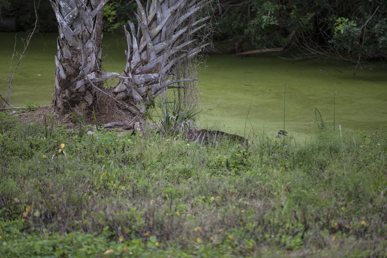
CAPE CANAVERAL, Fla. – A bobcat walks along a canal near the NASA News Center at Kennedy Space Center in Florida. The center shares a boundary with the Merritt Island National Wildlife Refuge. The refuge encompasses 140,000 acres that are a habitat for more than 330 species of birds, 31 mammals, 117 fishes, and 65 amphibians and reptiles. Photo credit: NASA/Daniel Casper
CAPE CANAVERAL, Fla. –– In the water on NASA's Kennedy Space Center in Florida, an alligator waits for a prospective meal. Alligators can be spotted in the drainage canals and other waters surrounding Kennedy. The center shares a boundary with the Merritt Island Wildlife Nature Refuge, which is a habitat for more than 310 species of birds, 25 mammals, 117 fishes and 65 amphibians and reptiles. Photo credit: NASA/Dimitri Gerondidakis
JSC2005-E-37989 (8 September 2005)--- Extensive flooding of neighborhoods to the east of the 17th Street Canal (left center, oriented north-south) is evident in this image acquired on September 8, 2005 from the International Space Station. Standing water in the street grid imparts a dark greenish brown coloration to the inundated regions. Flooded portions of I-610 (extending east-west) are clearly visible in the center of the image. Image is cropped from original ISS011-E-12527 and is oriented with north to the top.
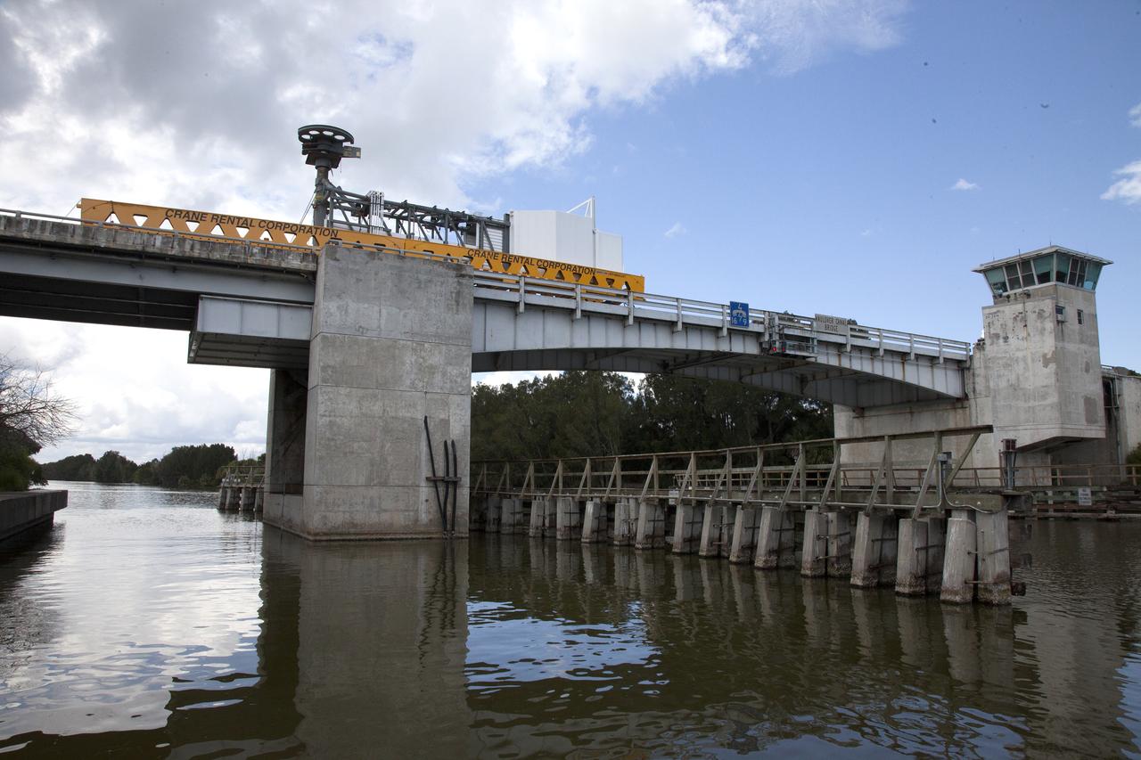
A heavy-lift transport truck, carrying the Crew Access Arm for Space Launch Complex 41, crosses the Haulover Canal Bridge on its way to the entrance of NASA’s Kennedy Space Center in Florida. The arm will be installed on the Complex 41 Crew Access Tower at Cape Canaveral Air Force Station. It will be used as a bridge by astronauts to board Boeing's CST-100 Starliner spacecraft as it stands on the launch pad atop a United Launch Alliance Atlas V rocket.
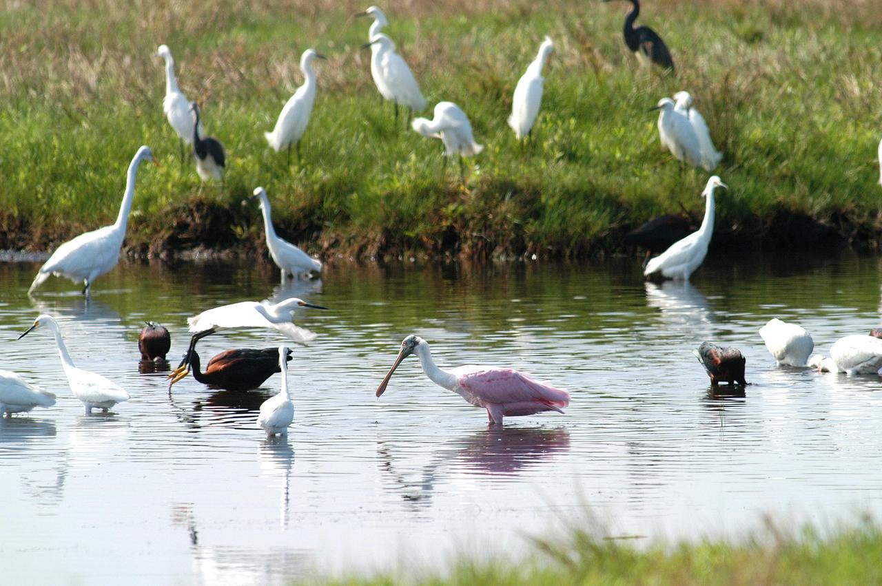
KENNEDY SPACE CENTER, FLA. - Herons, black ibis and a roseate spoonbill gather in a canal near KSC, which shares a boundary with the Merritt Island National Wildlife Refuge. The marshes and open water of the refuge provide wintering areas for 23 species of migratory waterfowl, as well as a year-round home for great blue herons, great egrets, wood storks, cormorants, brown pelicans and other species of marsh and shore birds.
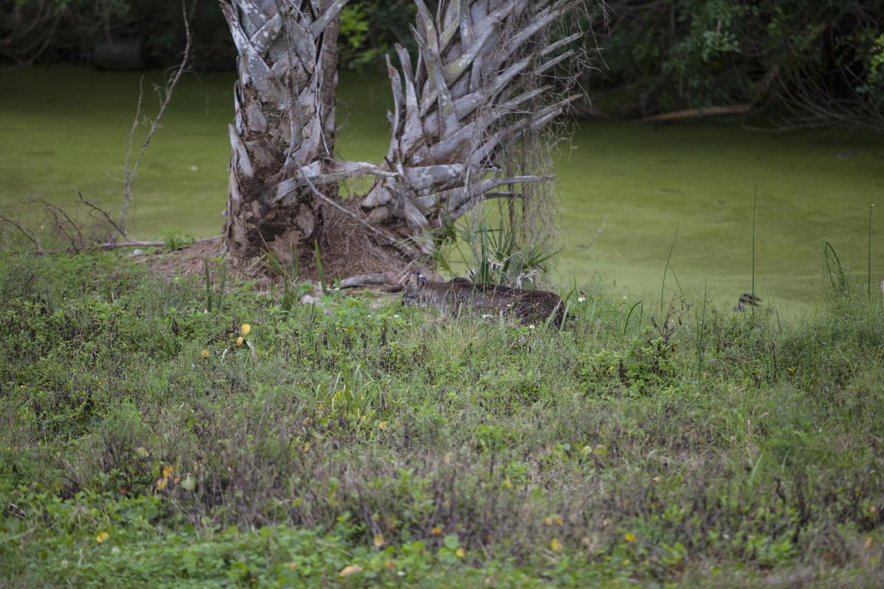
CAPE CANAVERAL, Fla. – A bobcat walks along a canal near the NASA News Center at Kennedy Space Center in Florida. The center shares a boundary with the Merritt Island National Wildlife Refuge. The refuge encompasses 140,000 acres that are a habitat for more than 330 species of birds, 31 mammals, 117 fishes, and 65 amphibians and reptiles. Photo credit: NASA/Daniel Casper
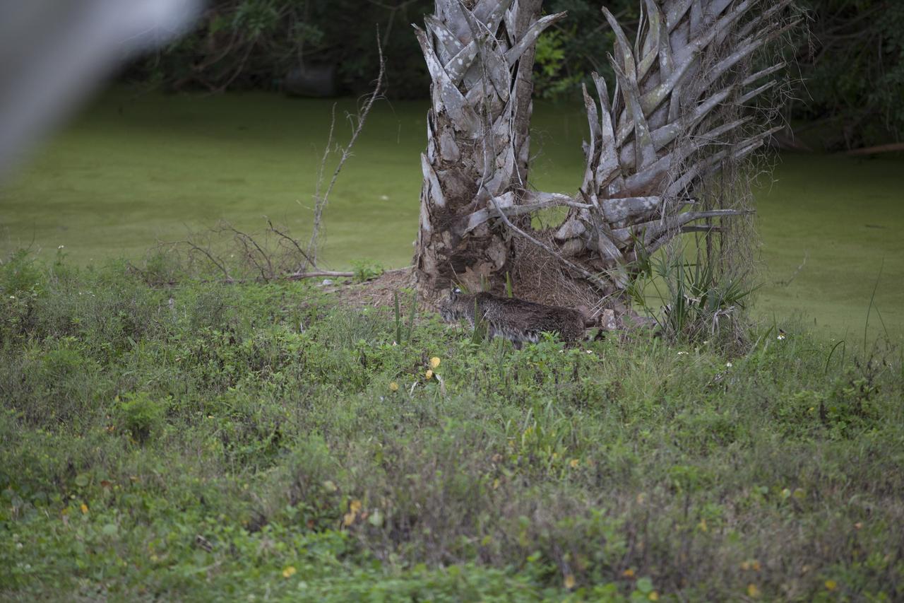
CAPE CANAVERAL, Fla. – A bobcat walks along a canal near the NASA News Center at Kennedy Space Center in Florida. The center shares a boundary with the Merritt Island National Wildlife Refuge. The refuge encompasses 140,000 acres that are a habitat for more than 330 species of birds, 31 mammals, 117 fishes, and 65 amphibians and reptiles. Photo credit: NASA/Daniel Casper. Note: Selected image is cropped
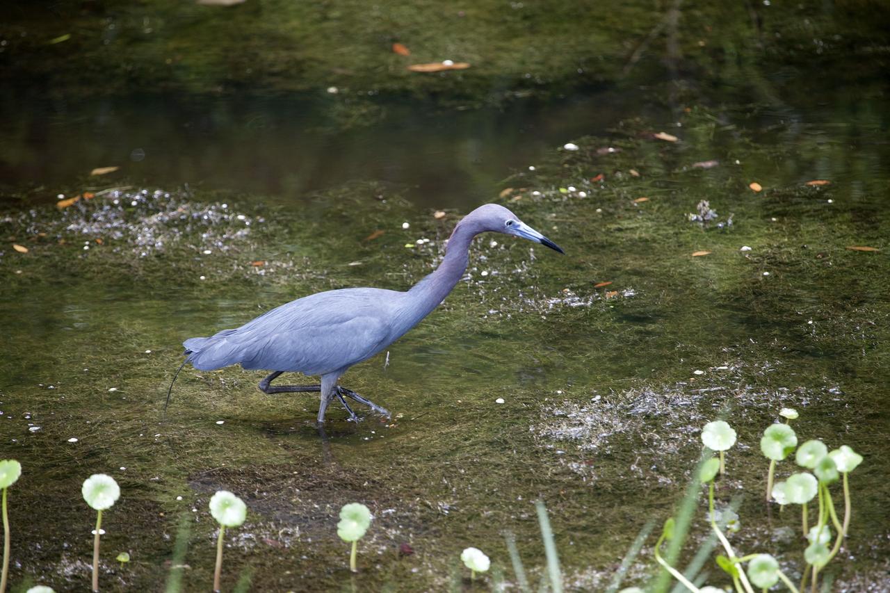
CAPE CANAVERAL, Fla. -- A blue heron wades through a canal, searching for food on NASA's Kennedy Space Center in Florida. The undeveloped property on Kennedy Space Center is managed by the U.S. Fish and Wildlife Service through the Merritt Island National Wildlife Refuge. The refuge provides a habitat for a plethora of wildlife, including 330 species of birds. For information on the refuge, visit http://www.fws.gov/merrittisland/Index.html. Photo credit: NASA/Daniel Casper

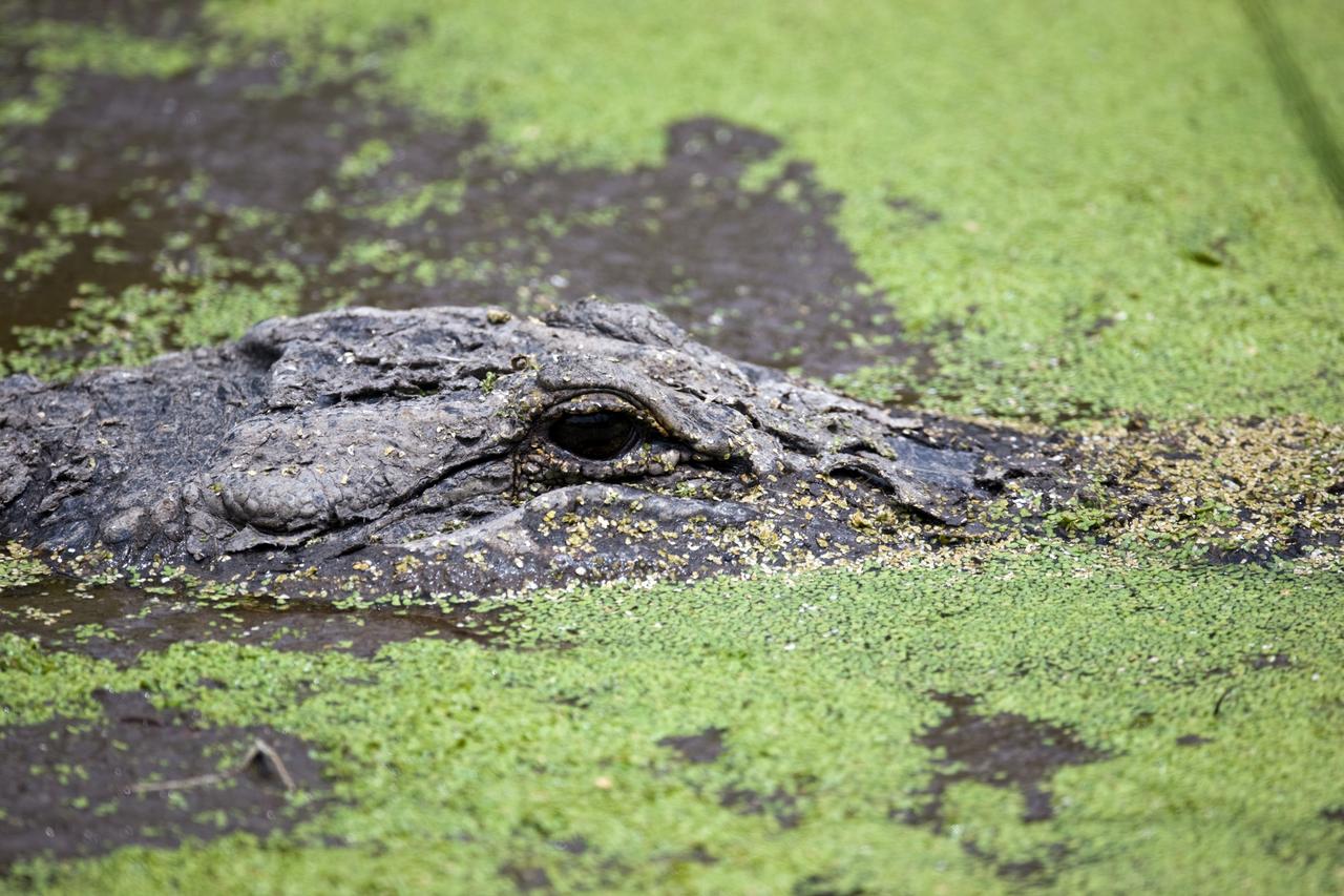
CAPE CANAVERAL, Fla. –– Who is watching whom, as this alligator appears to stare into the camera (at a safe distance away) from its watery site. Alligators can be spotted in the drainage canals and other waters surrounding Kennedy. The center shares a boundary with the Merritt Island Wildlife Nature Refuge, which is a habitat for more than 310 species of birds, 25 mammals, 117 fishes and 65 amphibians and reptiles. Photo credit: NASA/Dimitri Gerondidakis

CAPE CANAVERAL, Fla. -- A roseate spoonbill makes its way through a canal at NASA's Kennedy Space Center in Florida. The undeveloped property on Kennedy Space Center is managed by the U.S. Fish and Wildlife Service through the Merritt Island National Wildlife Refuge. The refuge provides a habitat for a plethora of wildlife, including 330 species of birds. For information on the refuge, visit http://www.fws.gov/merrittisland/Index.html. Photo credit: NASA/Daniel Casper
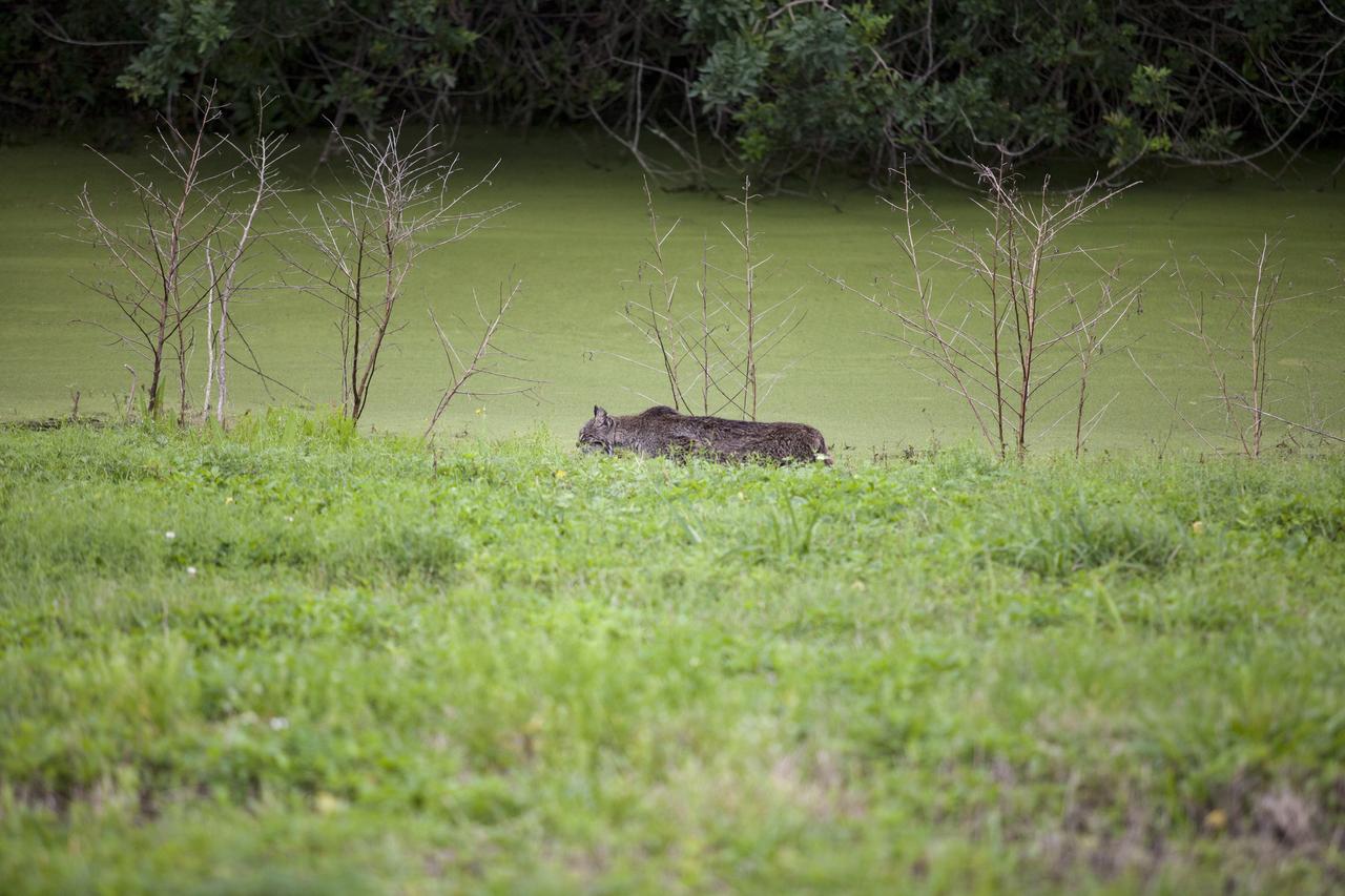
CAPE CANAVERAL, Fla. – A bobcat walks on the shore of a canal near the NASA News Center at Kennedy Space Center in Florida. The center shares a boundary with the Merritt Island National Wildlife Refuge. The refuge encompasses 140,000 acres that are a habitat for more than 330 species of birds, 31 mammals, 117 fishes, and 65 amphibians and reptiles. Photo credit: NASA/Daniel Casper
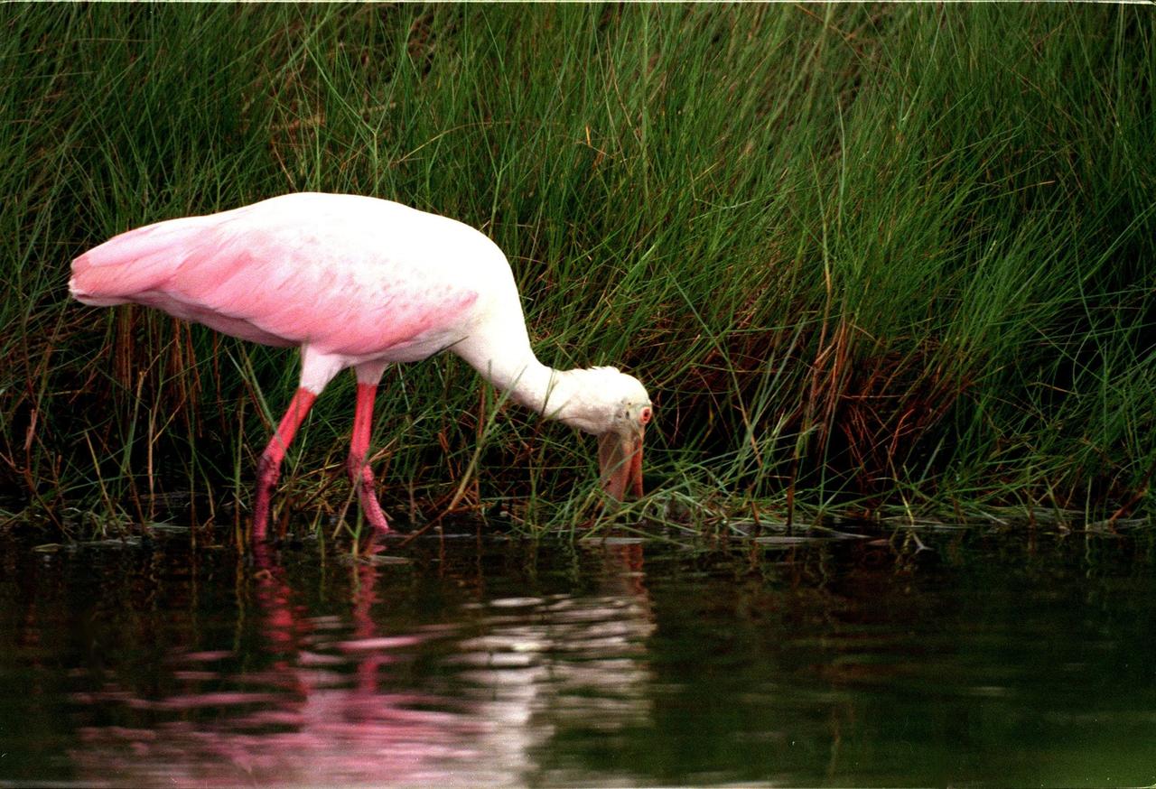
KENNEDY SPACE CENTER, FLA. -- A roseate spoonbill feeds alongside a canal in the Merritt Island National Wildlife Refuge. The birds are named for their brilliant pink color and paddle-shaped bill and feed in shallow water by swinging their bill back and forth, scooping up small fish and crustaceans. They typically inhabit mangroves on the coasts of southern Florida, Louisiana and Texas
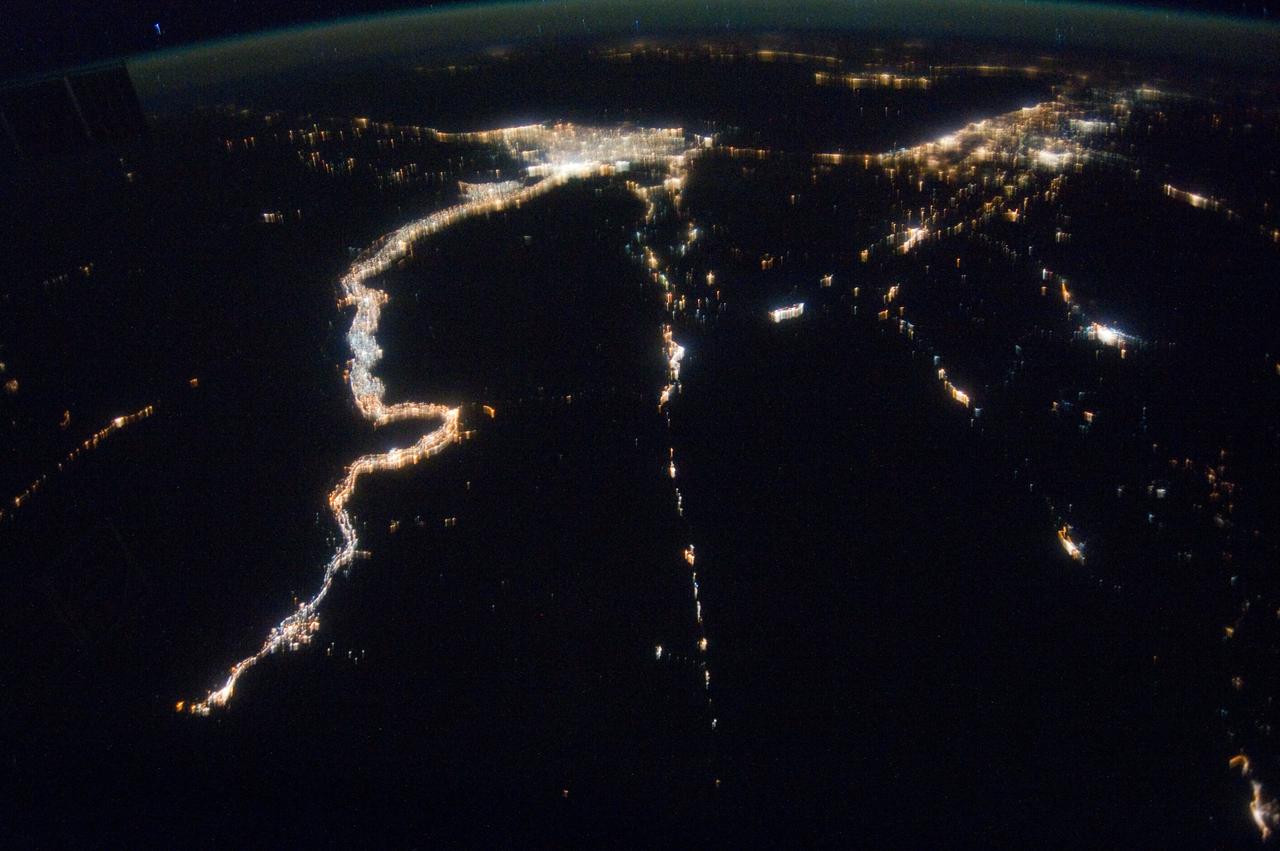
ISS030-E-112823 (25 Feb. 2012) --- This nighttime image photographed by one of the Expedition 30 crew members aboard the International Space Station provides a look toward the Mediterranean Sea. Along the left side, the night lights clearly depict the high population associated with the Nile River and its delta and the Alexandria, Egypt area (top left center). The Gulf of Suez and the Suez Canal are seen to the right.