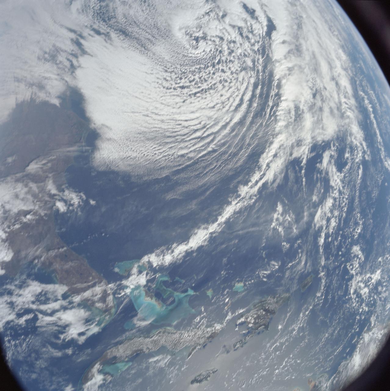
AS08-16-2581 (21-27 Dec. 1968) --- This photograph of Earth was taken from the Apollo 8 spacecraft while it was in Earth orbit. Most of the southeastern United States and the Caribbean Sea area, the U.S. coastline from Chesapeake Bay to the Florida Peninsula can be seen. The Bahamas and the islands of Cuba, Jamaica, Hispaniola and Puerto Rico extend across the Caribbean, the light blue of the shallow Bahama banks contrasting sharply with the darker hue of the deeper water, especially in the Tongue of the Ocean area.
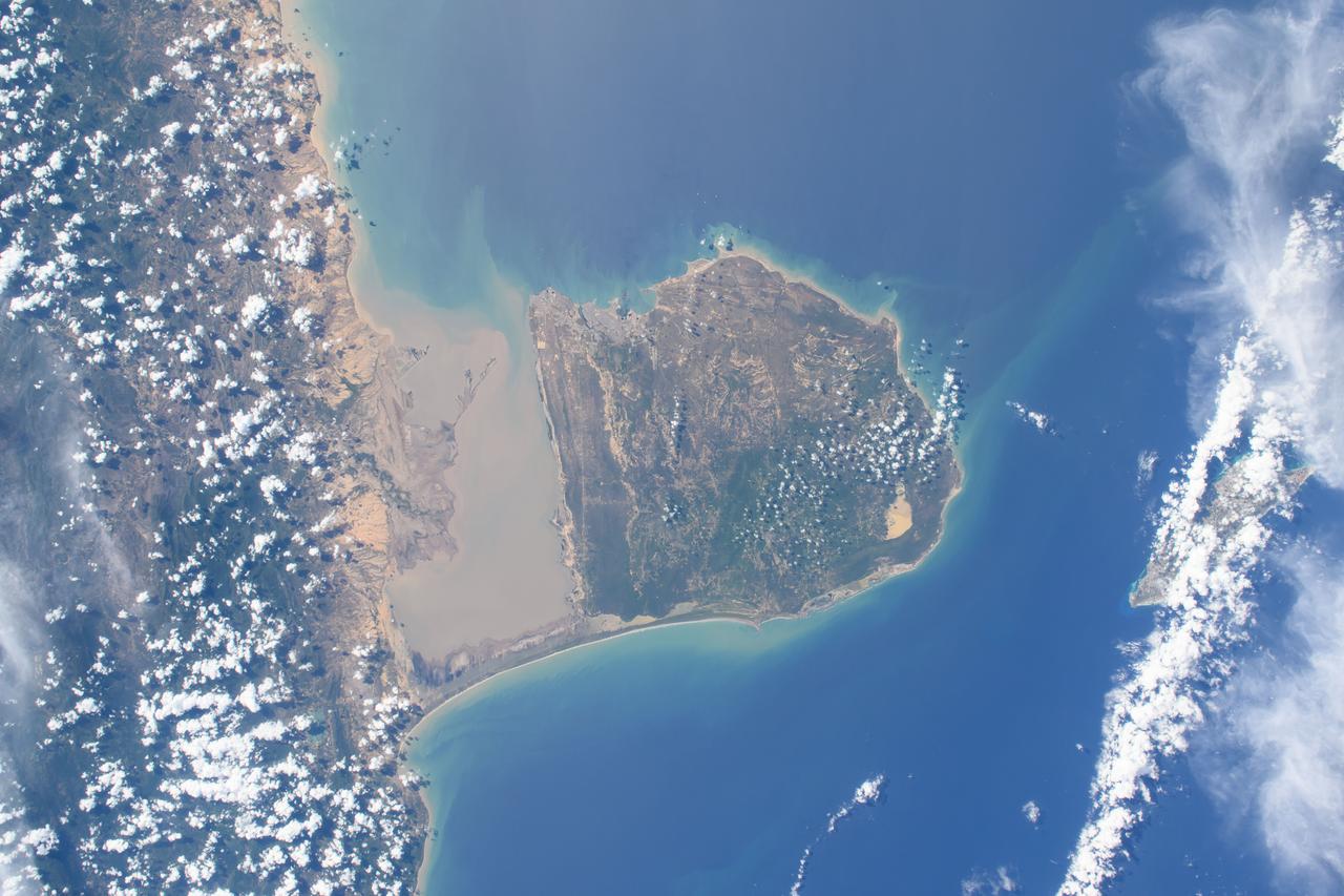
iss072e394498 (Dec. 18, 2024) --- Venezuala's Falcón Municipality on the coast of the Caribbean Sea is pictured from the International Space Station as it orbited 261 miles above.
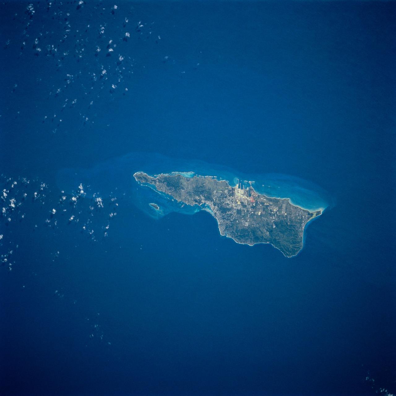
STS054-74-049 (13-19 Jan. 1993) --- St. Croix is the largest, and most industrial of the U.S. Virgin Islands. This photograph captures St. Croix's features in great detail. The large industrial complex in the middle of the southern shore is the world's largest petroleum refinery. The main city, Christiansted, can be seen across the island on the north shore. The reefs around the eastern end of St. Croix are preserved as a submarine national park -- Buck Island Reef National Park -- around the small island off the north shore of the eastern end of St. Croix.
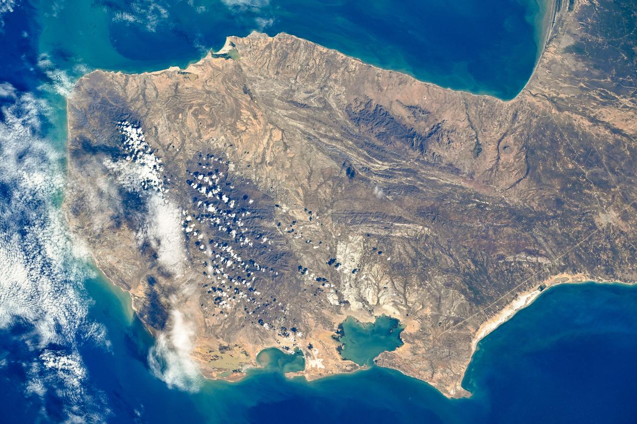
iss073e0379768 (July 20, 2025) --- Colombia's La Guajira Peninsula on the Caribbean Sea, with its desert region and beautiful coastline, is pictured from the International Space Station as it orbited 258 miles above.
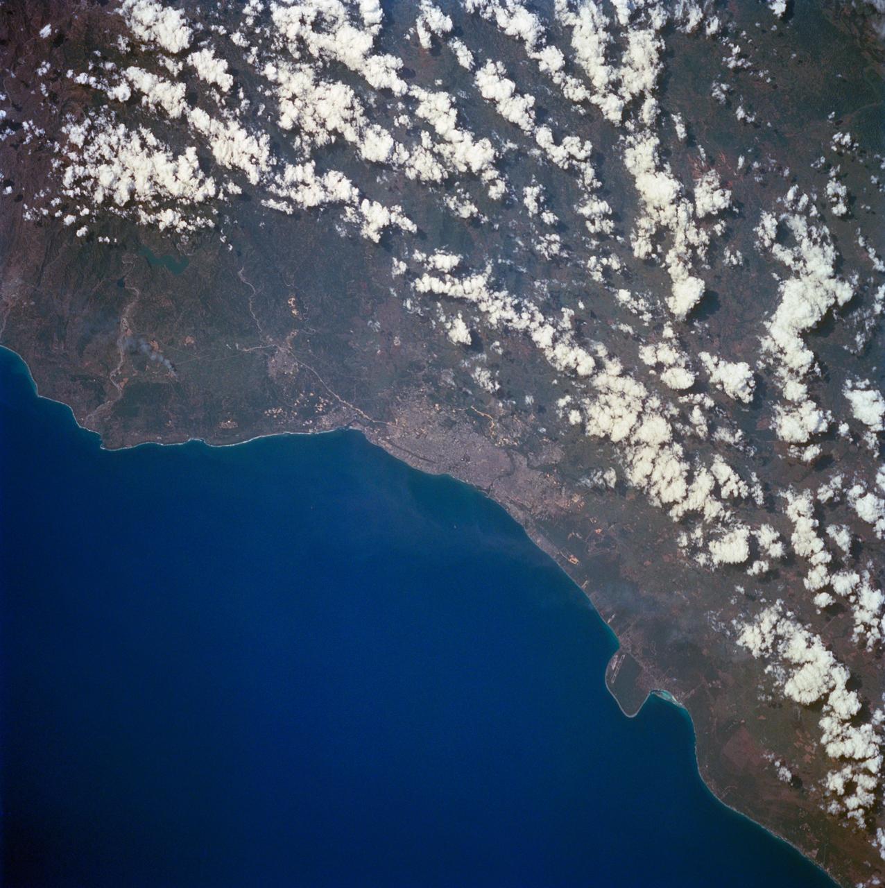
STS060-84-063 (3-11 Feb 1994) --- This is an excellent photograph of the coastal city of Santo Domingo on the Caribbean Sea. The airports including De las Americas International Airport are clearly seen. This photo illustrates the resolving power of the films. For example, two isolated smoke plumes are clearly seen each side of the city.
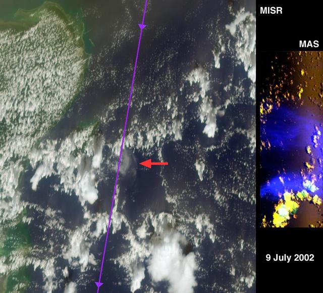
This montage is a natural-color view of the Caribbean Sea east of the Yucatan Peninsula as seen by NASA Terra satellite.
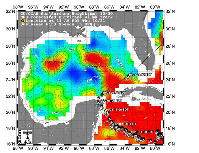
This sea surface height map of the Gulf of Mexico and the northwestern Caribbean Sea, with the Florida peninsula on the upper right, is based on altimeter data from three satellites including NASA Jason-1.
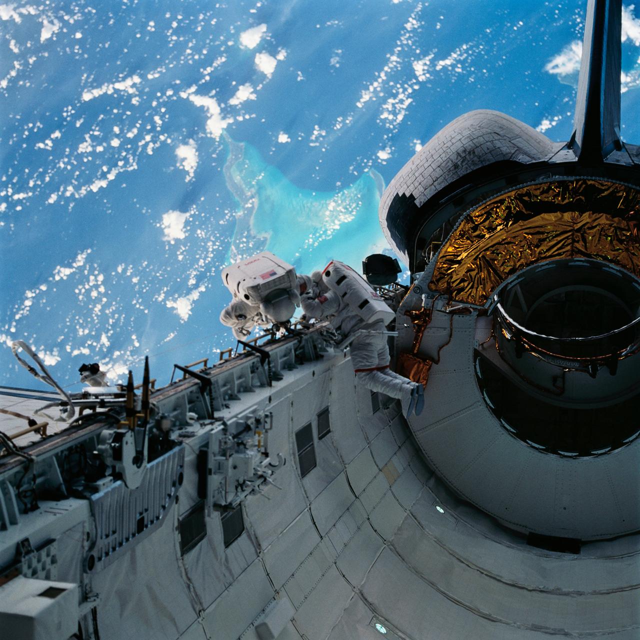
With the Caribbean Sea and part of the Bahama Islands chain as a backdrop, two STS-51 crewmembers evaluate procedures and gear to be used on the upcoming Hubble Space Telescope (HST)-servicing mission. Sharing the lengthy extravehicular activity in and around Discovery's cargo bay were astronauts James H. Newman (left), and Carl E. Walz, mission specialists.
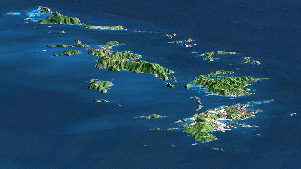
St. Thomas, St. John, Tortola, and Virgin Gorda are the four main islands front to back of this east-looking view of the U.S. Virgin Islands and British Virgin Islands, along the northeast perimeter of the Caribbean Sea.
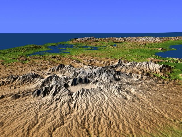
This perspective view from NASA Shuttle Radar Topography Mission SRTM, acquired on February 2000, shows central Panama, with the remnants of the extinct volcano El Valle in the foreground and the Caribbean Sea in the distance.
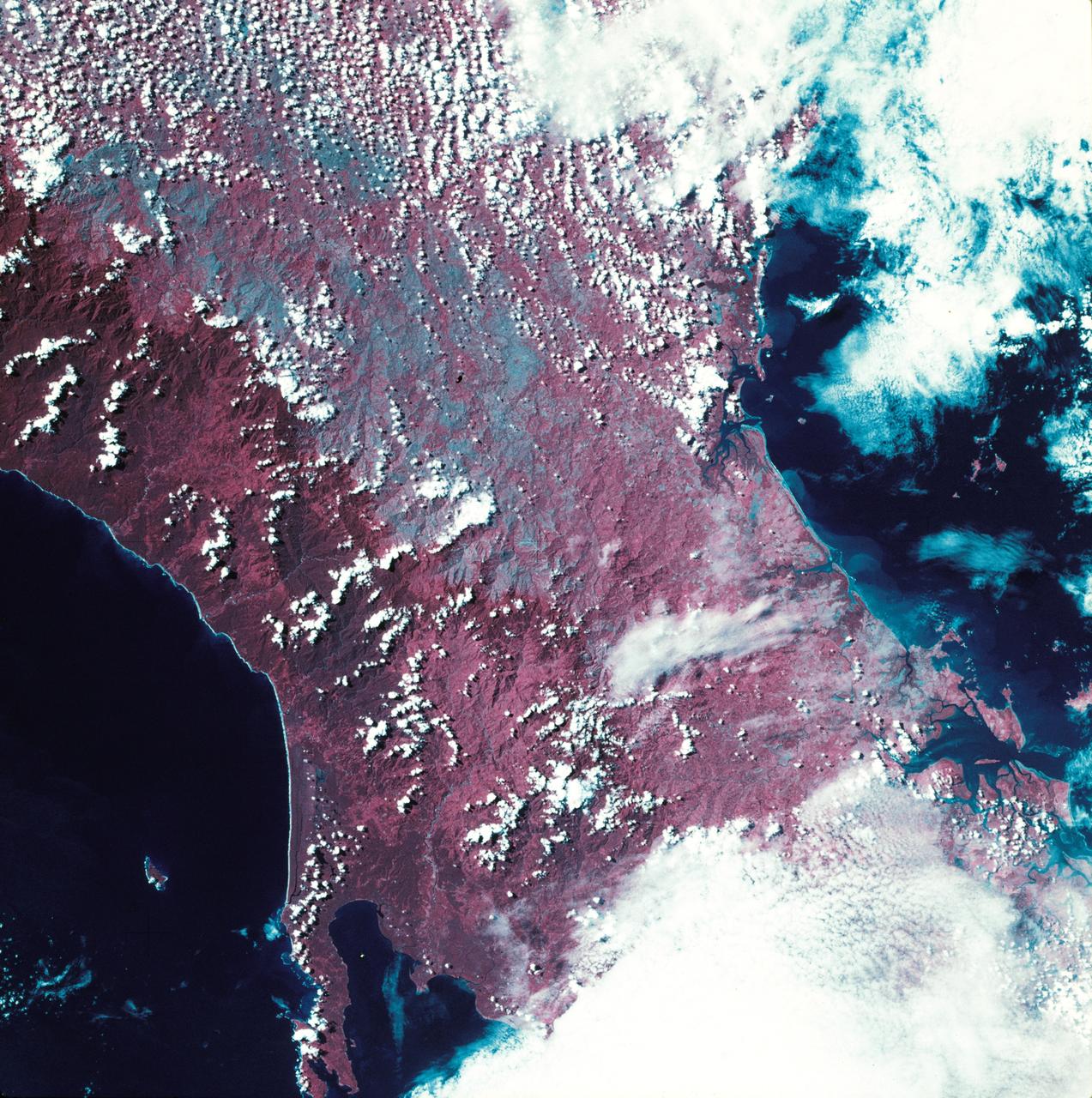
SL3-27-224 (July-September 1973) --- A vertical view of the western portion of the Republic of Panama on the Isthmus of Panama as photographed from Earth orbit by one of the six lenses of the Itek-furnished S190-A Multispectral Photographic Facility Experiment aboard the Skylab space station. This picture was taken with 2443 infrared color film. The large, clear body of water on the north side of the isthmus is Golfo de los Mosquitos, an extension of the Caribbean Sea. The large, partly cloud-covered body of water on the south side of the isthmus is Golfo de Chiriqui, an extension of the Pacific Ocean. Federal agencies participating with NASA on the EREP project are the Department of Agriculture, Commerce, Interior, the Environmental Protection Agency and the Corps of Engineers. All EREP photography is available to the public through the Department of Interior?s Earth Resources Observation Systems Data Center, Sioux Falls, South Dakota, 57198. Photo credit: NASA
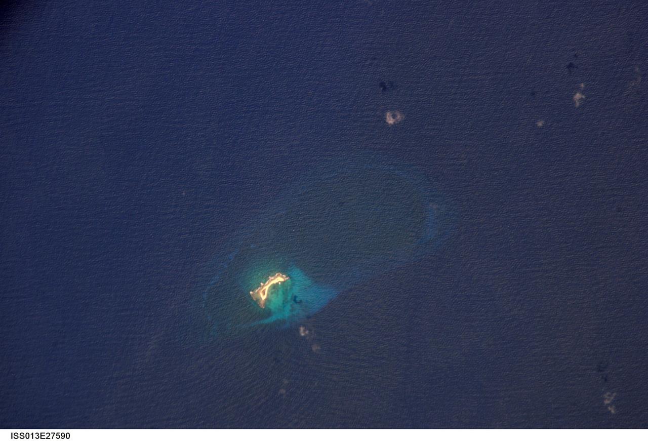
ISS013-E-27590 (27 May 2006) --- Aves Island, Caribbean Sea is featured in this image photographed by an Expedition 13 crewmember on the International Space Station. This image is a rare almost cloud free view of the island and the submerged fringing coral reef that surrounds it. Scientists believe the crosshatch-like pattern of roughness on the surrounding sea surface was caused by variable winds at the time of image acquisition. The island itself currently stands a mere 4 meters above the surrounding sea surface, and in high seas it can be completely submerged. While the low elevation of the island makes it a hazard to shipping, it also provides a major nesting site for green sea turtles (Chelonia mydas) in the Caribbean.
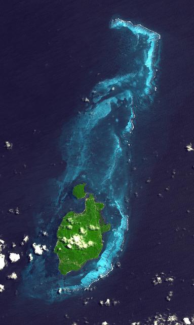
Providencia Island, located in the Caribbean Sea, is part of Colombia even though located 800 km northwest of mainland Colombia. The small island has an area of 17 square kilometers. First settled in 1629 by Puritans on the Seaflower ship, the island was taken by Spain in 1641. Providencia is the center point of the UNESCO Marine Protected Area the Seaflower Biosphere Reserve. The image was acquired July 28, 2010, covers an area of 17.4 by 29 km, and is located at 13.3 degrees north, 81.3 degrees west. https://photojournal.jpl.nasa.gov/catalog/PIA24281

iss065e023015 (May 6, 2021) --- Guantanamo Bay in Cuba is pictured from the International Space Station as it orbited 261 miles above the Caribbean Sea.
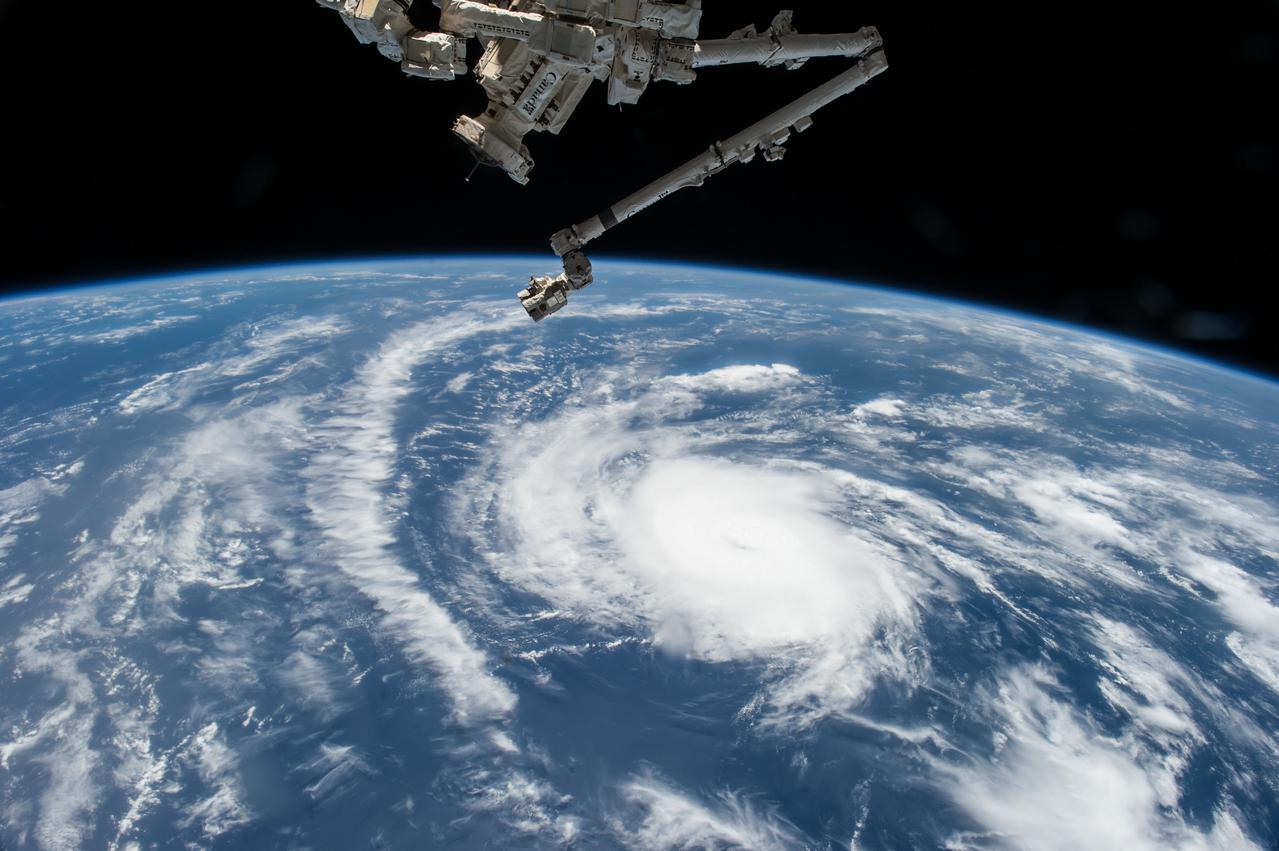
ISS044E059041 (08/21/2015) --- Hurricane Danny as seen from the International Space Station as it traversed the Caribbean Sea headed for Puerto Rico, the Dominican Republic and Cuba.
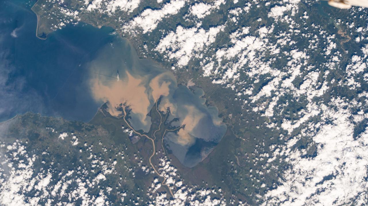
iss064e002042 (Oct. 27, 2020) --- The Atrato River in northwestern Colombia, which leads to the Caribbean Sea, is pictured from the International Space Station.
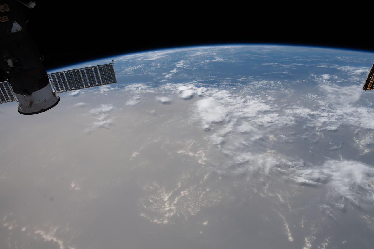
iss063e032020 (June 21, 2020) --- What looks like land is actually a Saharan dust cloud that has blown over the Atlantic Ocean and is nearing the Caribbean Sea.
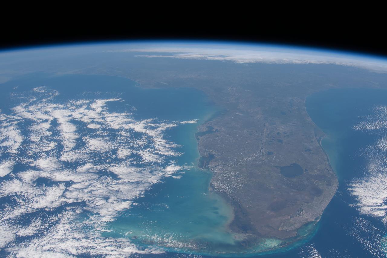
iss062e069492 (Feb. 28, 2020) --- The Florida peninsula is pictured looking northward as the International Space Station orbited 263 miles above the Caribbean Sea.
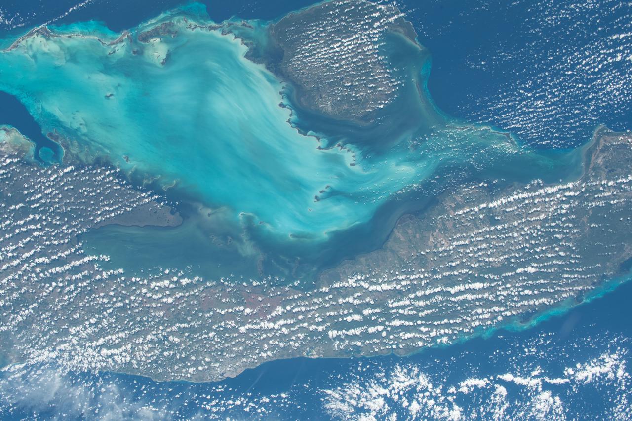
iss057e114400 (Dec. 7, 2018) --- The International Space Station flies 252 miles above the island nation of Cuba and the Gulf of Batabano in the Caribbean Sea.
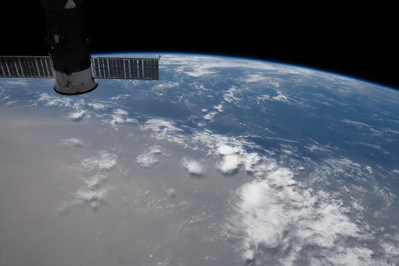
iss063e032007 (June 21, 2020) --- What looks like land is actually a Saharan dust cloud that has blown over the Atlantic Ocean and is nearing the Caribbean Sea.
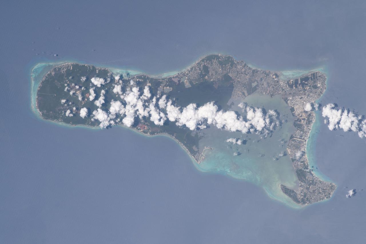
iss069e025190 (June 25, 2023) -- Clouds lightly cover the Cayman Islands as the International Space Station orbited 258 miles above the Caribbean Sea.
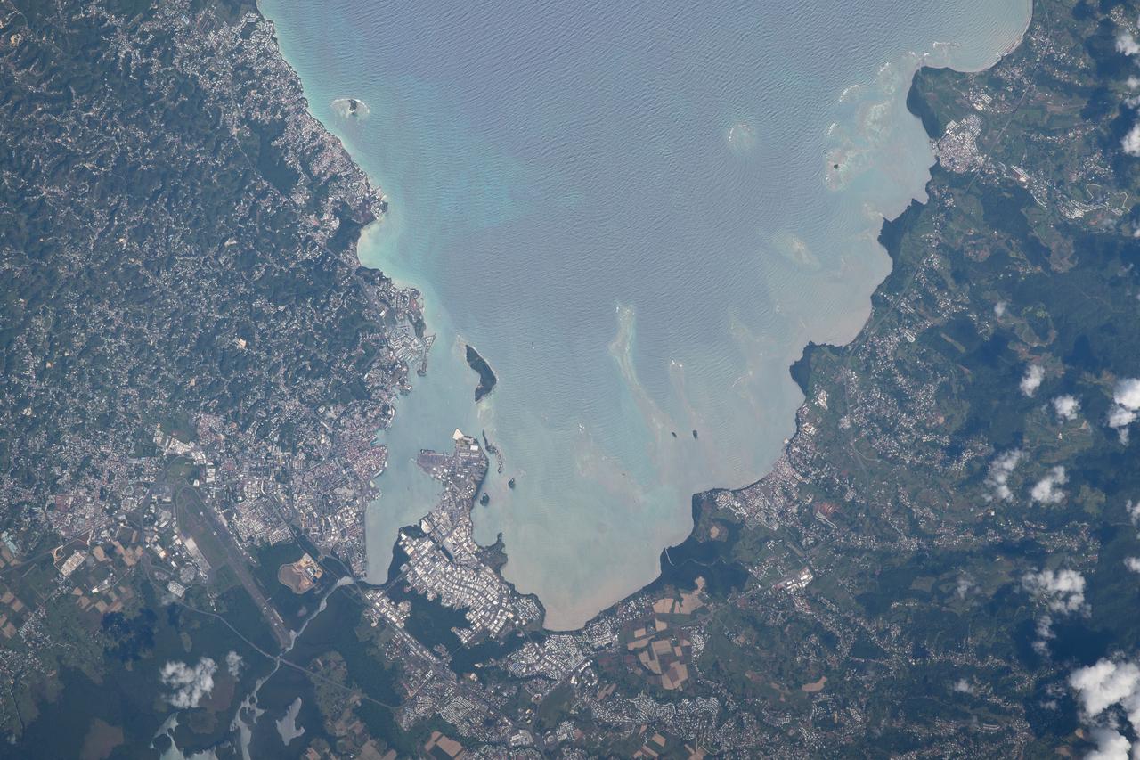
iss063e002083 (April 22, 2020) --- Baie-Mahault (bottom center) is a city in the French overseas region of Guadeloupe, an island group in the southern Caribbean Sea.
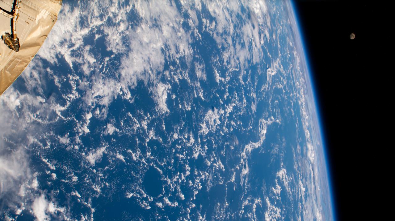
iss065e280824 (Aug. 19, 2021) --- The waxing gibbous Moon (upper right) is pictured from the International Space Station as it orbited 262 miles above the Atlantic Ocean just east of the Lesser Antilles, a group of islands in the Caribbean Sea.
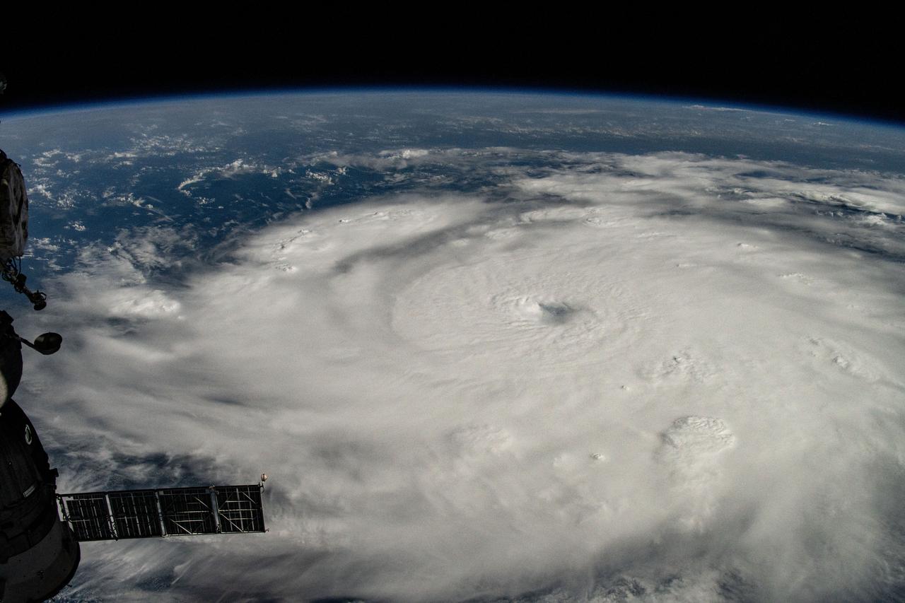
iss071e245405 (July 1, 2024) --- Hurricane Beryl is pictured as a Category 4 storm off the coast of Grenada in the Caribbean Sea as the International Space Station orbited 263 miles above.
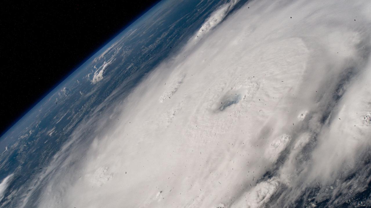
iss071e245678 (July 1, 2024) --- Hurricane Beryl is pictured as a Category 4 storm south of Barbados from the International Space Station as it orbited 262 miles above the Caribbean Sea.
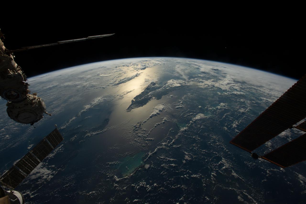
iss068e023212 (Nov. 20, 2022) --- The sun's glint beams across the Caribbean Sea and the Atlantic Ocean highlighting Cuba and Haiti in this photograph from the International Space Station as it orbited 258 miles above.
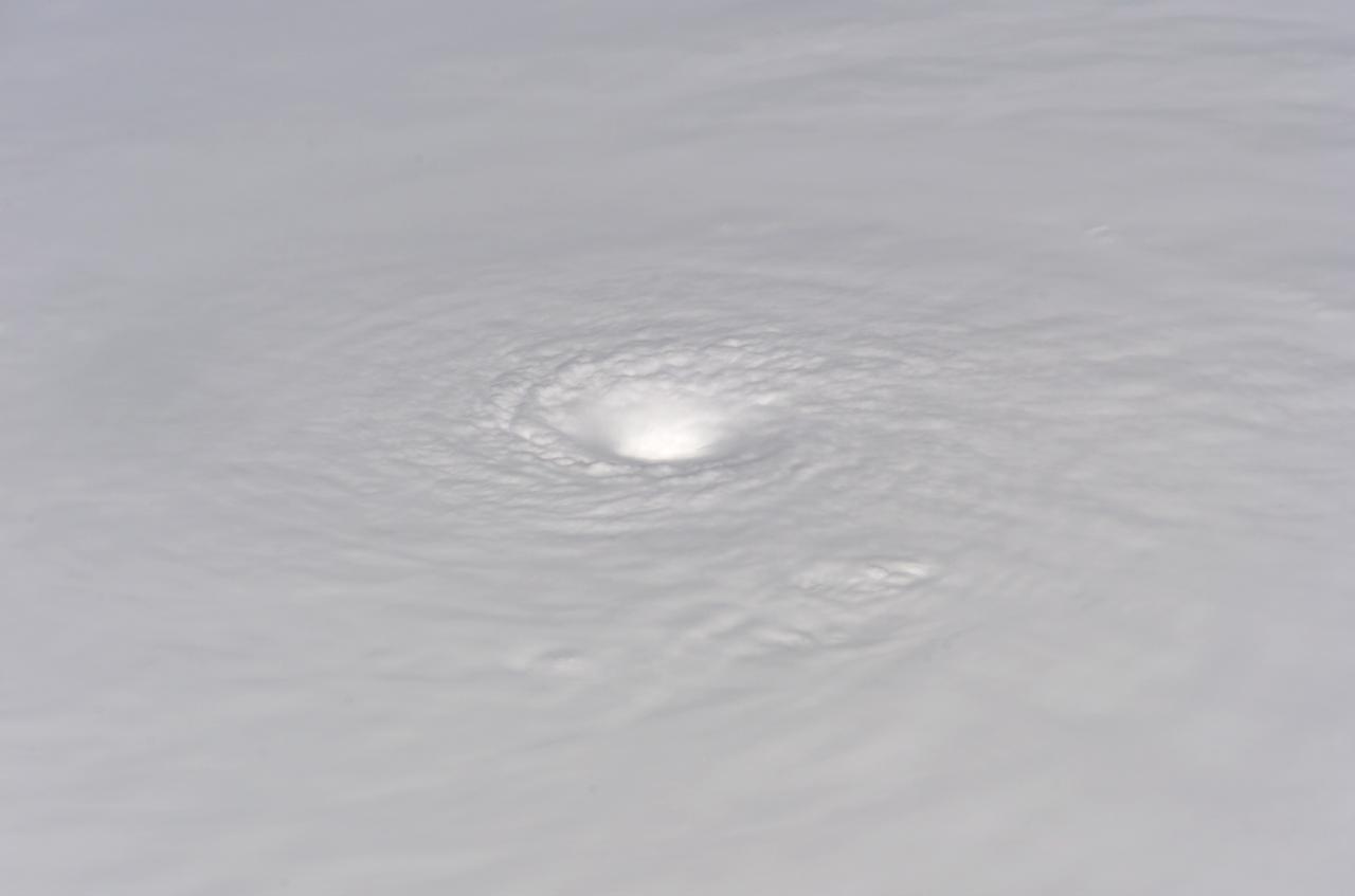
ISS012-E-05259 (19 Oct. 2005) --- Hurricane Wilma is featured in this image photographed by an Expedition 12 crewmember on the International Space Station as it passes over the Caribbean Sea, 340 miles southeast of Cozumel, Mexico.
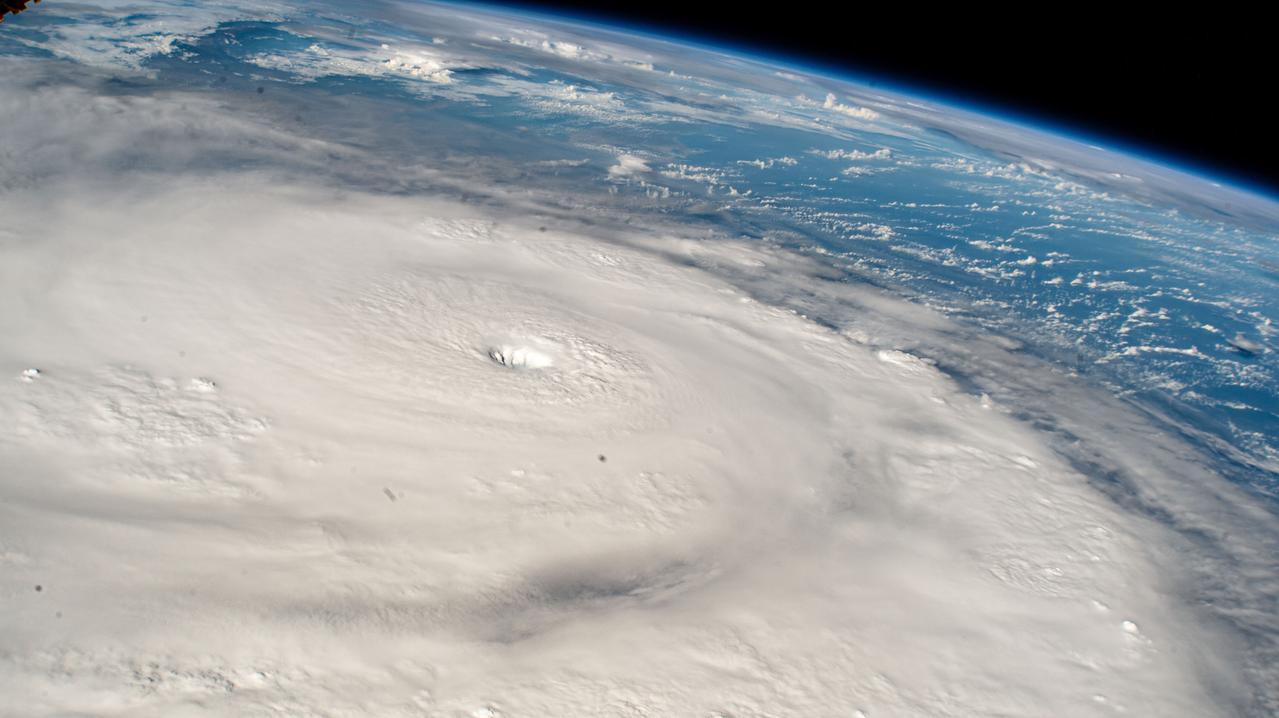
iss071e256908 (July 2, 2024) --- Hurricane Beryl is pictured as a Category 5 storm southwest of Barbados in the Caribbean Sea as the International Space Station orbited 263 miles above.
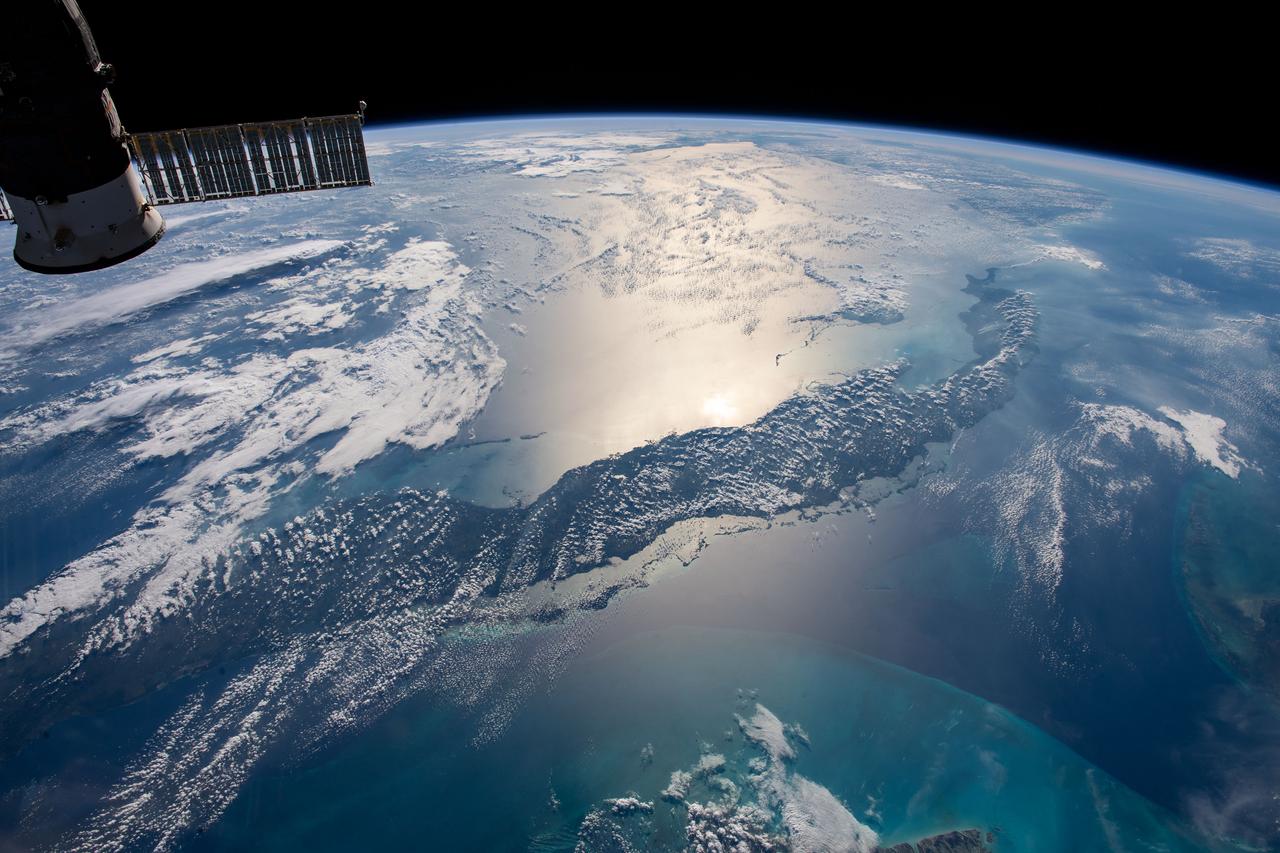
iss061e061245 (Nov. 26, 2019) --- The International Space Station orbits 255 miles above the Atlantic Ocean looking southwest over Cuba as the Sun's glint beams off the Caribbean Sea.
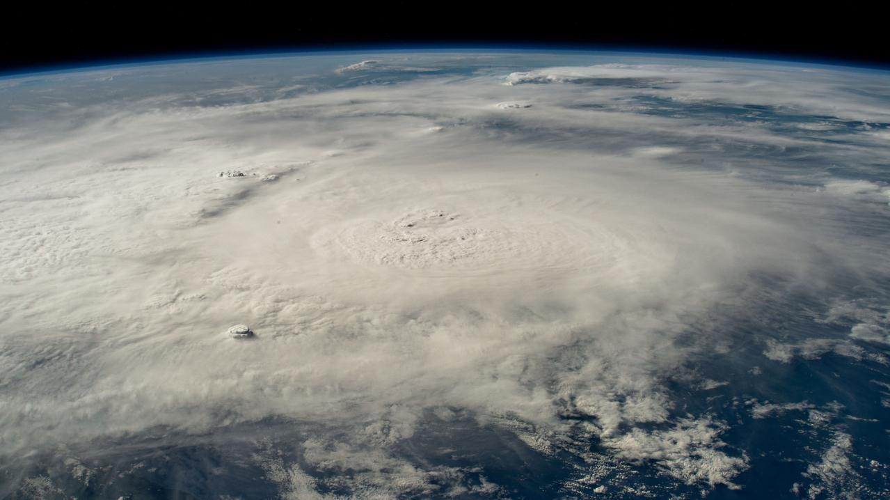
iss071e266892 (July 3, 2024) --- Hurricane Beryl is pictured as a Category 4 storm above the Caribbean Sea from the International Space Station as it orbited 263 miles above western Cuba.
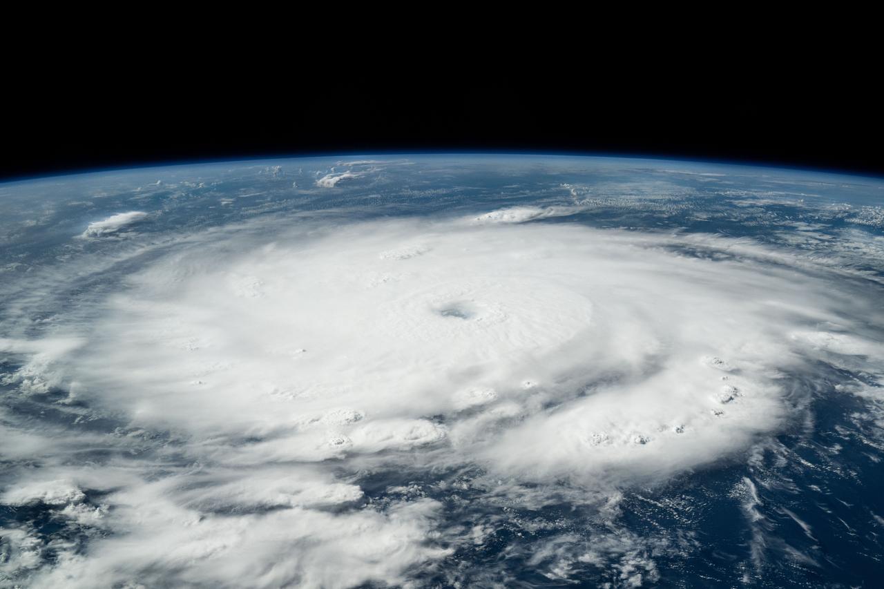
iss071e245501 (July 1, 2024) --- Hurricane Beryl is pictured as a Category 4 storm off the coast of Grenada in the Caribbean Sea as the International Space Station orbited 262 miles above.
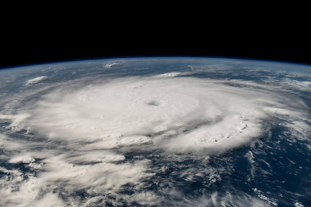
iss071e245371 (July 1, 2024) --- Hurricane Beryl is pictured as a Category 4 storm off the coast of Grenada in the Caribbean Sea as the International Space Station orbited 262 miles above.
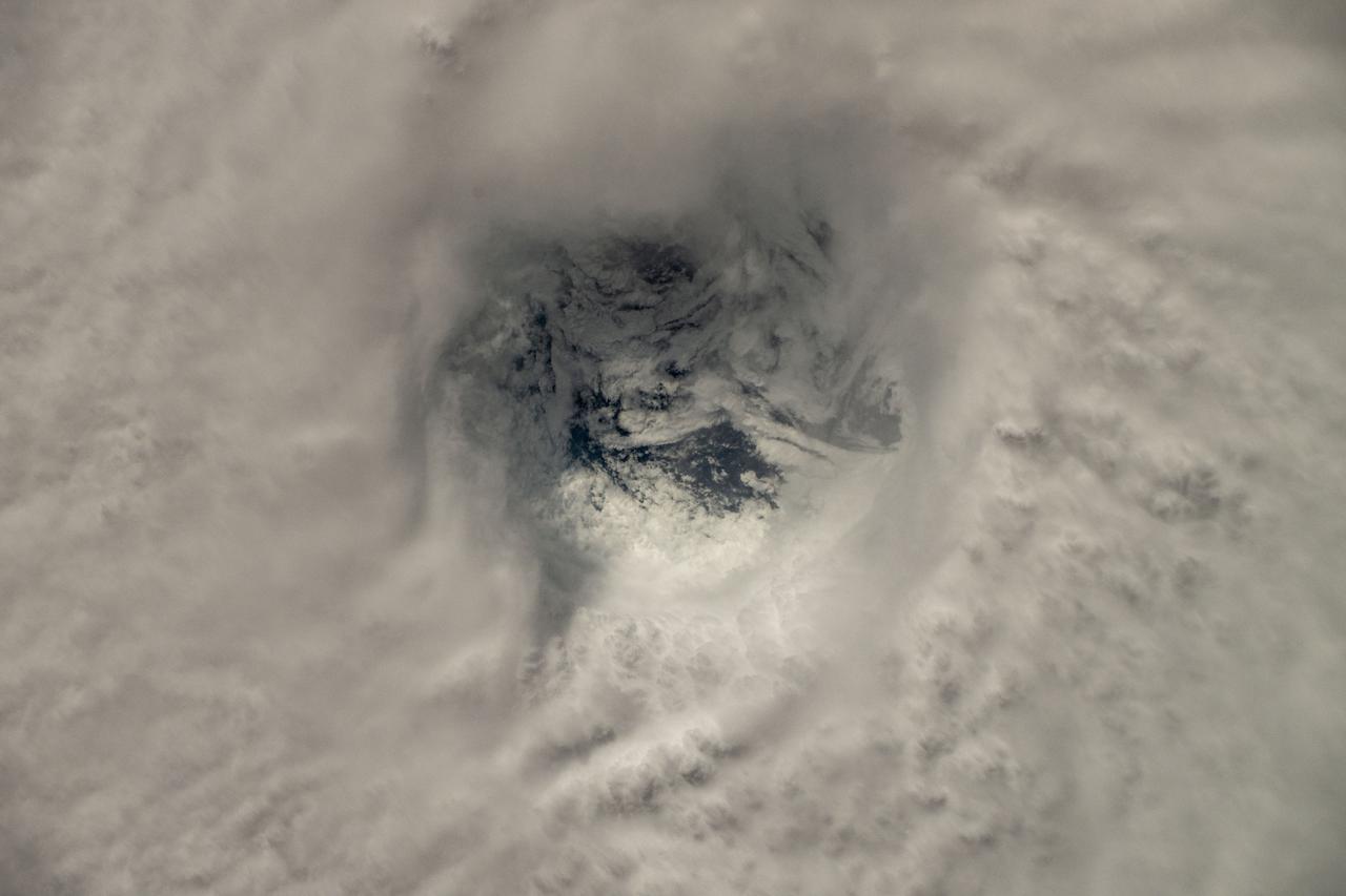
iss071e245377 (July 1, 2024) --- The eye of Hurricane Beryl, a Category 4 storm off the coast of Grenada in the Caribbean Sea, is pictured as the International Space Station orbited 263 miles above.
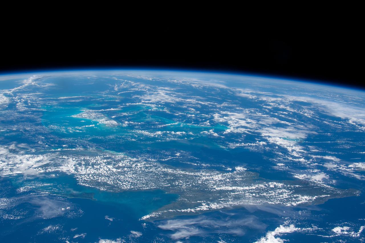
iss061e026166 (Oct. 31, 2019) --- The island nation of Cuba is pictured in the rich blue waters between the Caribbean Sea and the Atlantic Ocean as the International Space Station orbited 255 miles above.
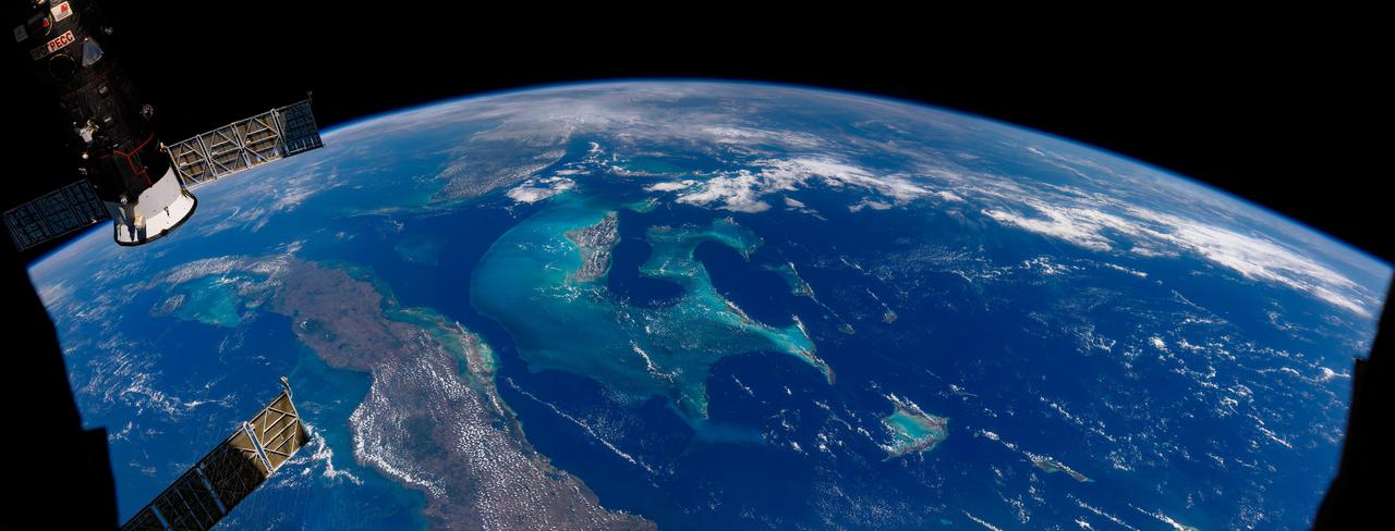
jsc2021e019119 (May 2, 2021) --- This composite photograph, a combination of several distinct photographs, of Cuba, the Bahamas and southern Florida was captured as the International Space Station orbited 263 miles above the Caribbean Sea.
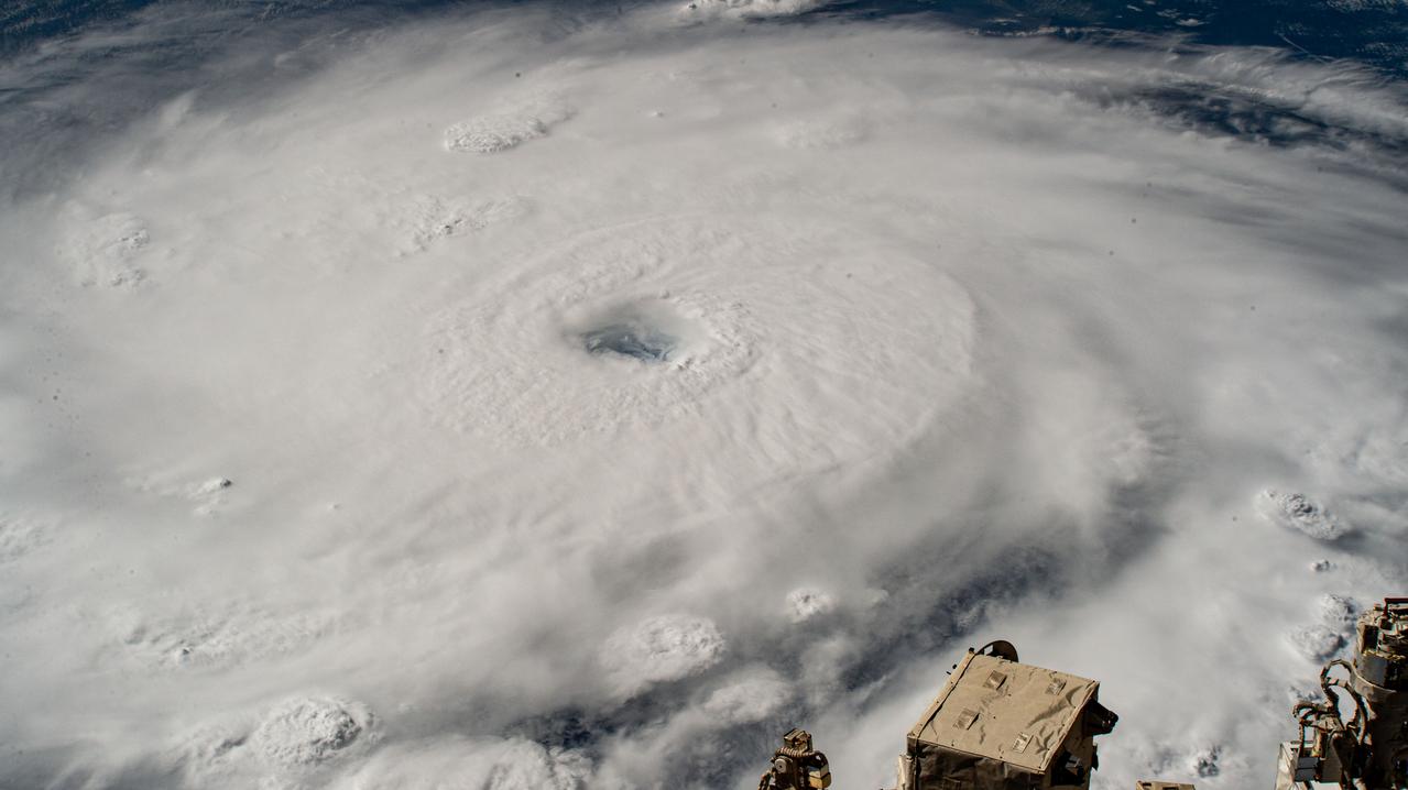
iss071e245675 (July 1, 2024) --- Hurricane Beryl is pictured as a Category 4 storm south of Barbados from the International Space Station as it orbited 262 miles above the Caribbean Sea.
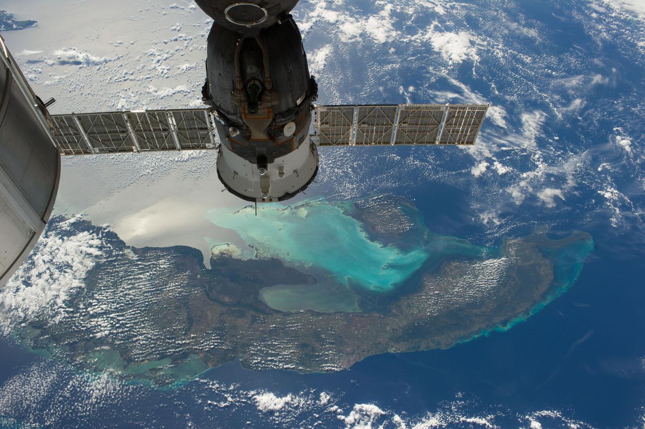
ISS038-E-021401 (24 Dec. 2013) --- The Caribbean country of Cuba is pictured in this high oblique image, photographed by one of the Expedition 38 crew members aboard the International Space Station. Andros ISland, part of the Bahamas, is Cuba is an archipelago of islands in the northern Caribbean Sea at the confluence with the Gulf of Mexico and the Atlantic Ocean. A Russian Soyuz spacecraft is docked to the station.
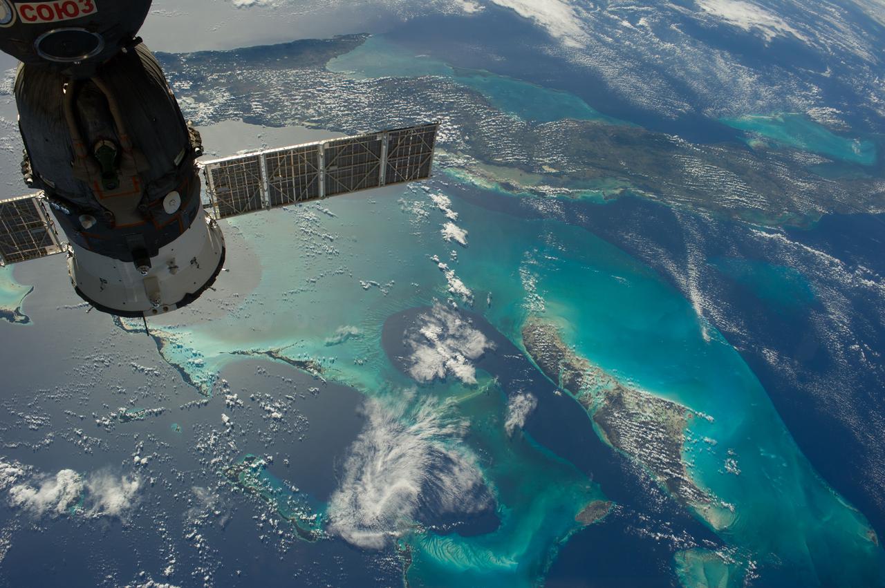
ISS038-E-019899 (23 Dec. 2013) --- The Caribbean country of Cuba appears at the top of this high oblique image, photographed by one of the Expedition 38 crew members aboard the International Space Station. Andros Island, part of the Bahamas, is in the bottom of the frame. Cuba is an archipelago of islands in the northern Caribbean Sea at the confluence with the Gulf of Mexico and the Atlantic Ocean. A Russian Soyuz spacecraft is docked to the station.
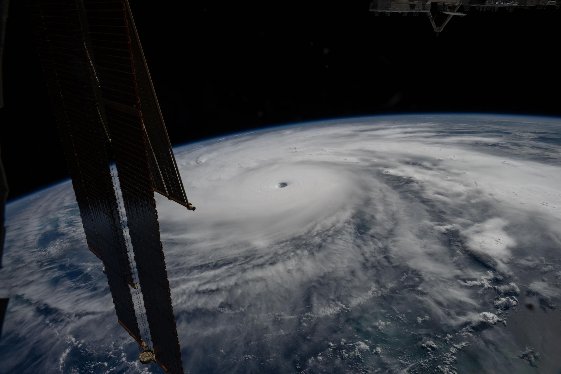
iss073e1044319 (Oct. 28, 2025) --- Category 5 Hurricane Melissa, one of the most powerful storms to strike the Caribbean in recent history, is pictured about 50 miles south of Jamaica in this photograph from the International Space Station as it orbited 262 miles above the Yucatan Peninsula.
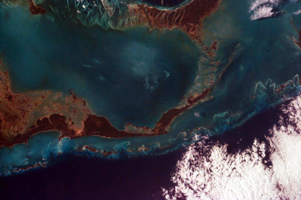
This image from NASA EarthKAM captures the tropical beauty of the major islands of the Little Bahama Bank, the most northerly of the island groups that comprise the Bahamas.
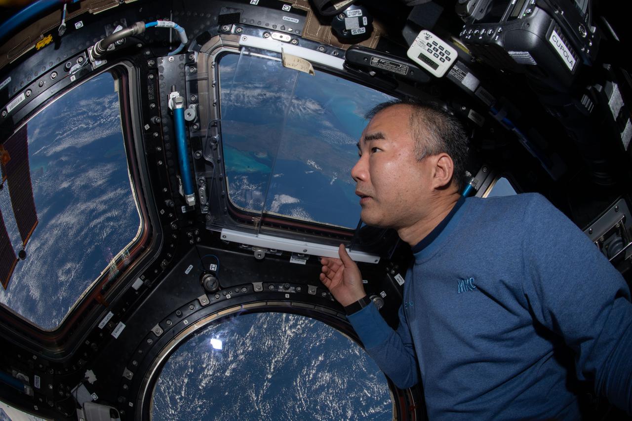
iss064e025495 (Jan. 21, 2021) --- JAXA (Japan Aerospace Exploration Agency) astronaut and Expedition 64 Flight Engineer Soichi Noguchi enjoys the view of Earth below from the seven-windowed cupola as the International Space Station orbited 260 miles above the Caribbean Sea.
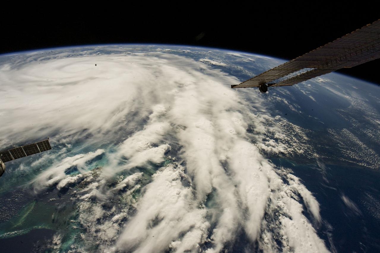
iss067e381585 (Sept. 26, 2022) --- Hurricane Ian is pictured from the International Space Station as it orbited 258 miles above the Caribbean Sea east of Belize. At the time of this photograph, Ian was just south of Cuba gaining strength and heading toward Florida.
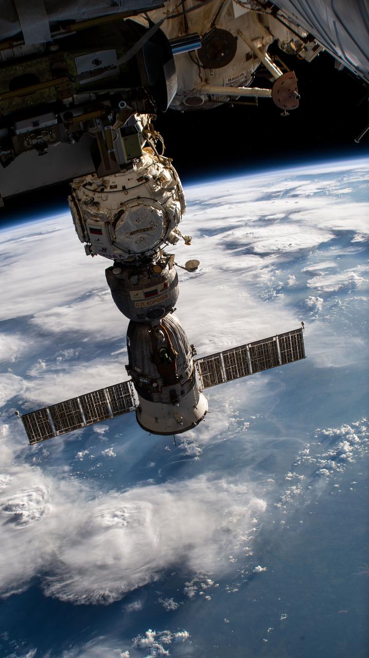
iss067e362302 (Sept. 15, 2022) --- The Soyuz MS-21 crew ship is pictured attached to the Prichal docking module as the International Space Station orbited 259 miles above the Caribbean Sea in between the island nations of Grenada and Trinidad and Tobago..
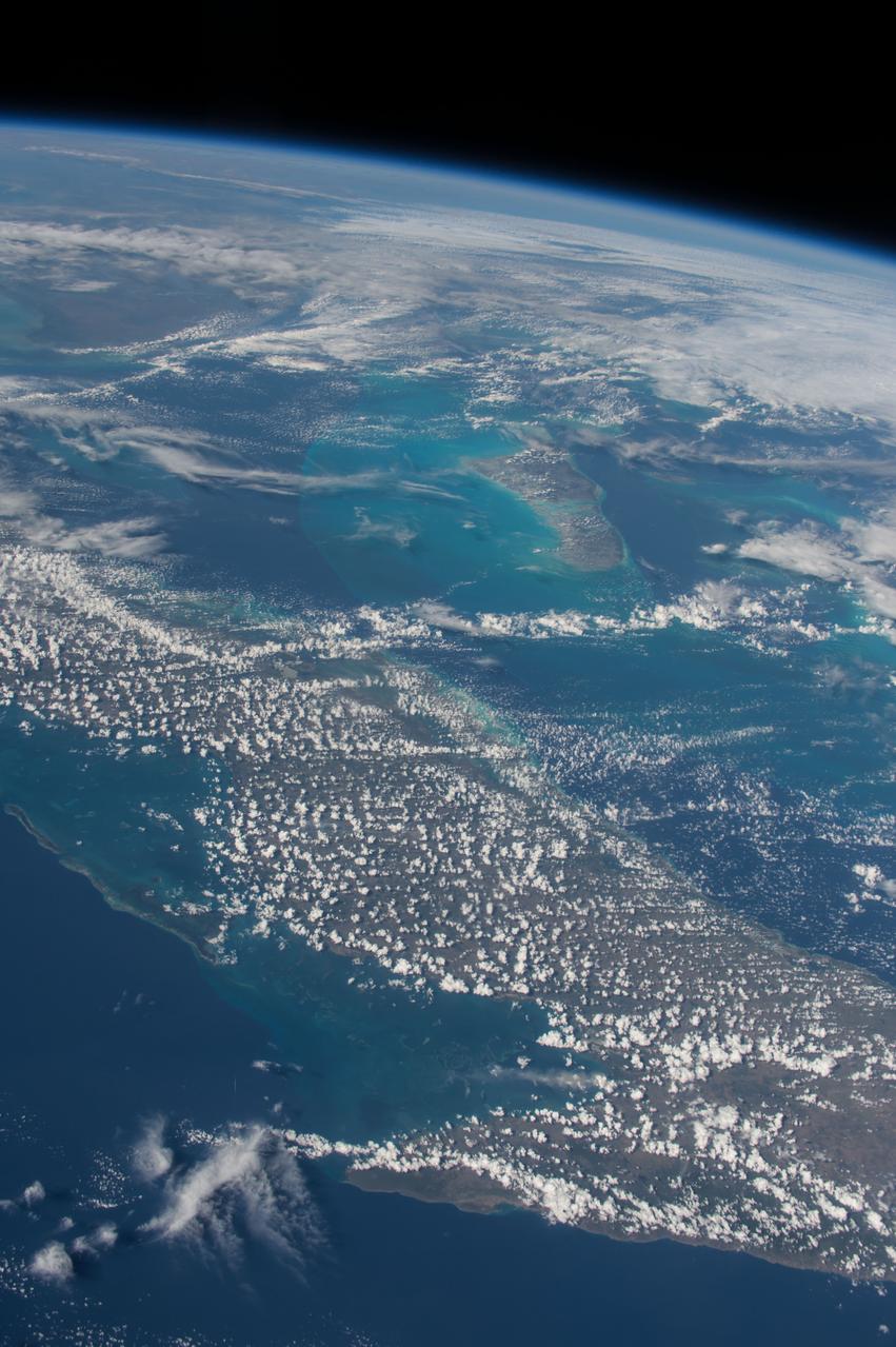
ISS042E135486 (01/10/2015) --- Just another sunny day in the Caribbean sea as viewed by astronauts aboard the International Space Station. This image was tweeted out by NASA astronaut Terry Virts as he captured the Earth observation of #Cuba and #Bahamas on Jan. 10, 2015.
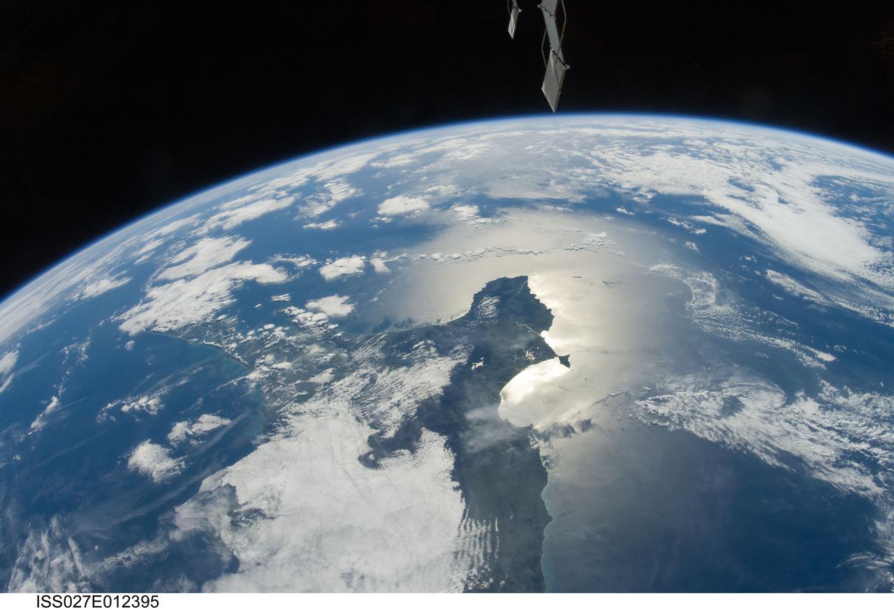
ISS027-E-012395 (13 April 2011)--– One of the Expedition 27 crew members aboard the International Space Station photographed this southeastward looking panoramic view centered on the Azuero Peninsula of Panama. The southwestern Caribbean Sea and the cloud-covered Isthmus of Panama are to the left and the Gulf of Panama and the eastern Pacific Ocean with sun glint are on the right.
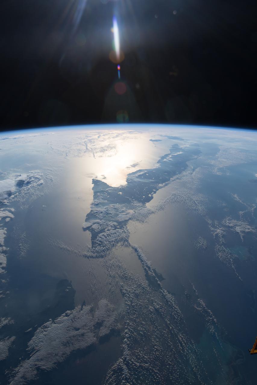
iss055e005471 (March 25, 2018) --- This view of Cuba looks from east to west and reaches the cities of Santiago de Cuba on its west coast and Havana on its east coast. The sun's glint is reflected off the Caribbean Sea on Cuba's southern coast.

iss055e023899 (April 15, 2018) --- The United States island territory of Puerto Rico and the surrounding blue waters of the Caribbean Sea on its southern coast and the Atlantic Ocean on its northern coast were pictured by an Expedition 55 crew member aboard the International Space Station.
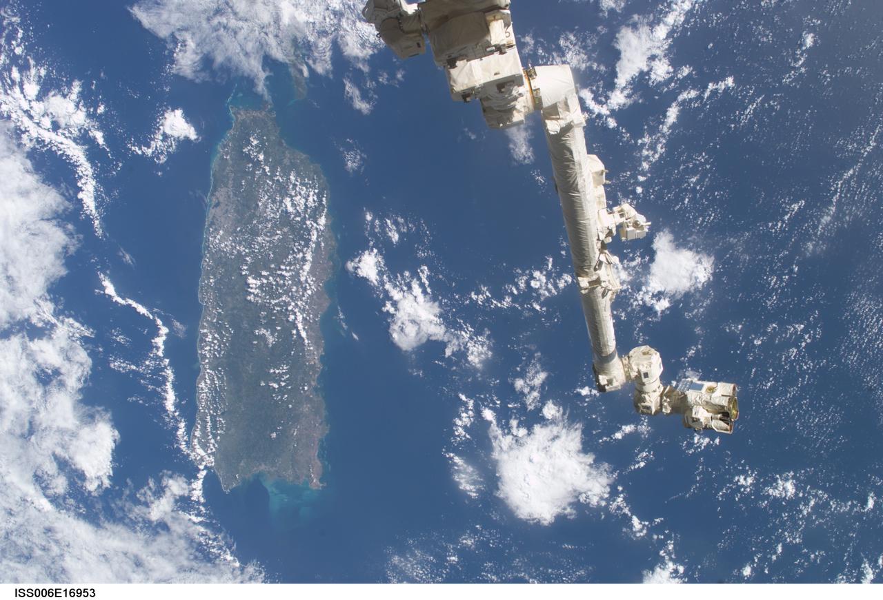
ISS006-E-16953 (9 January 2003) --- The Space Station Remote Manipulator System (SSRMS) or Canadarm2 is backdropped against the Caribbean Sea in this digital still camera's view taken from the International Space Station (ISS). Puerto Rico is in the left side of the frame.

iss071e009021 (April 15, 2024) -- The Zapata Peninsula on the southern coast of Cuba is pictured from the International Space Station as it orbited nearly 260 miles above. Both a Biosphere Reserve and National Park, it's home to diverse ecosystems, including coral reefs in the cove of the Caribbean Sea.
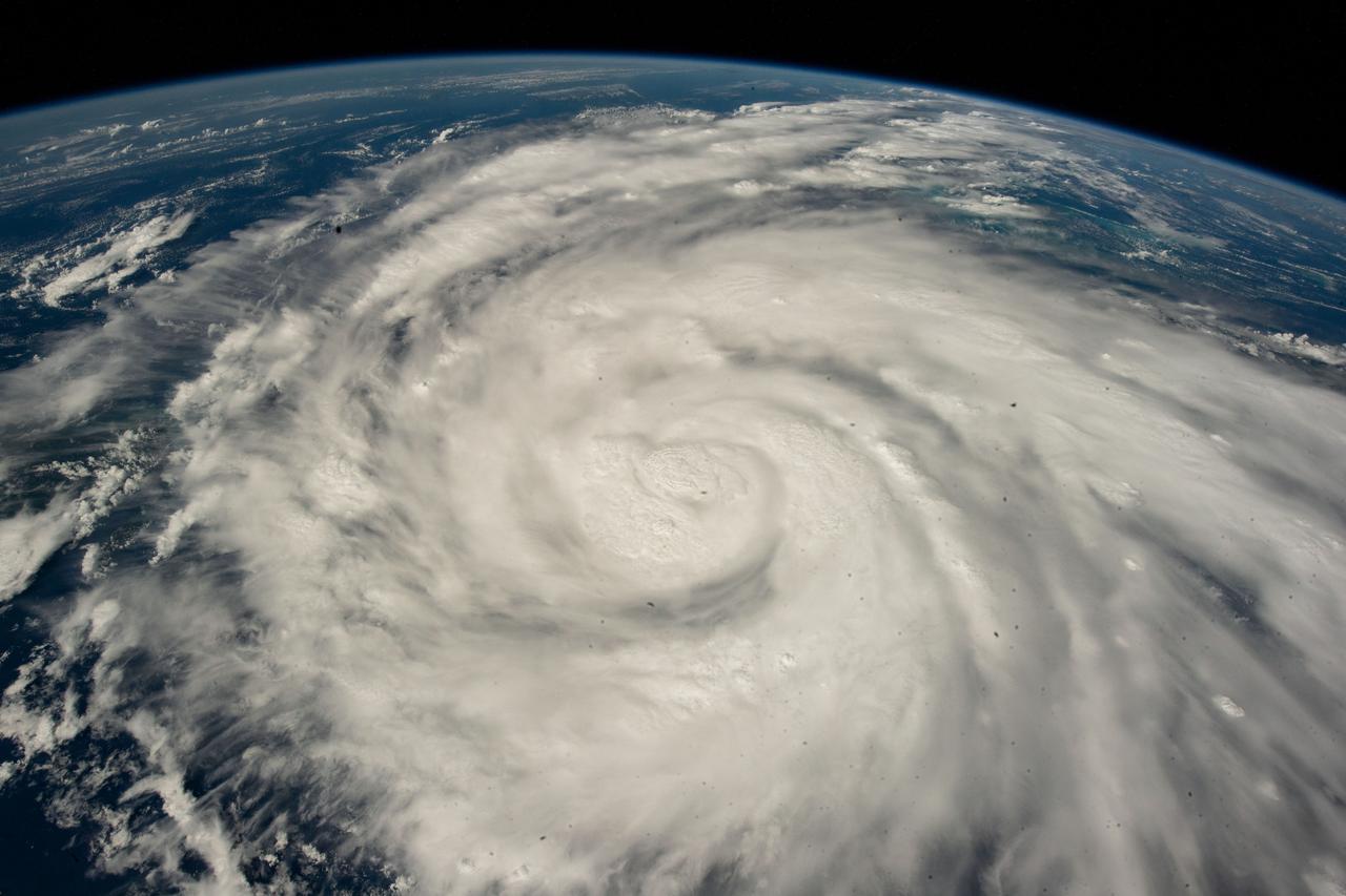
iss067e381585 (Sept. 26, 2022) --- Hurricane Ian is pictured from the International Space Station as it orbited 258 miles above the Caribbean Sea east of Belize. At the time of this photograph, Ian was just south of Cuba gaining strength and heading toward Florida.
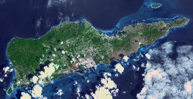
Saint Croix is a district of the U.S. Virgin Islands, in the Caribbean Sea. First inhabited by indigenous groups, the island was visited by Columbus in 1493. By the end of the 16th century, the island was uninhabited, the native population dispersed or killed. Starting in the 17th century, the island was successively claimed by the Spanish, the French, the French West India Company, and, for the next 200 years, the Danish West India Company. In 1801 the British invaded and took control; followed by Denmark-Norway a year later. Then again the British, and again Denmark in 1815. One hundred years later, in 1915, Denmark sold the Virgin Islands to the United States, and the inhabitants were granted US citizenship. Saint Croix was home to HOVENSA, one of the world's largest oil refineries. In 2012, the refinery closed, and tourism is now the main source of revenue (Wikipedia). The image covers an area of 18.7 by 36.2 km, was acquired March 10, 2011, and is located at 17.7 degrees north, 64.7 degrees west. https://photojournal.jpl.nasa.gov/catalog/PIA22894
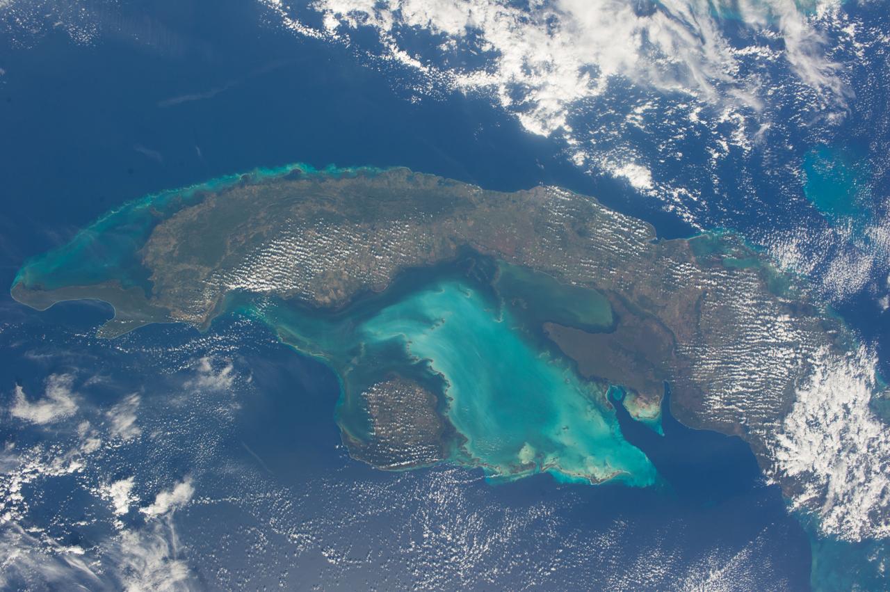
ISS038-E-021397 (24 Dec. 2013) --- The Caribbean country of Cuba is pictured in this nadir image, photographed by one of the Expedition 38 crew members aboard the International Space Station. (Note: North is at the top of the picture.) Cuba is an archipelago of islands in the northern Caribbean Sea at the confluence with the Gulf of Mexico and the Atlantic Ocean. In the southeast, the dark coastal area is home to the Sierra Maestra mountains. It is the highest mountain range on the island, with Pico Turquino reaching nearly 2000 meters. On the central southern coast of the island is the Sierra Del Escambray mountain range, including the 1160 meter-high Pico San Juan, Cuba's second highest peak.
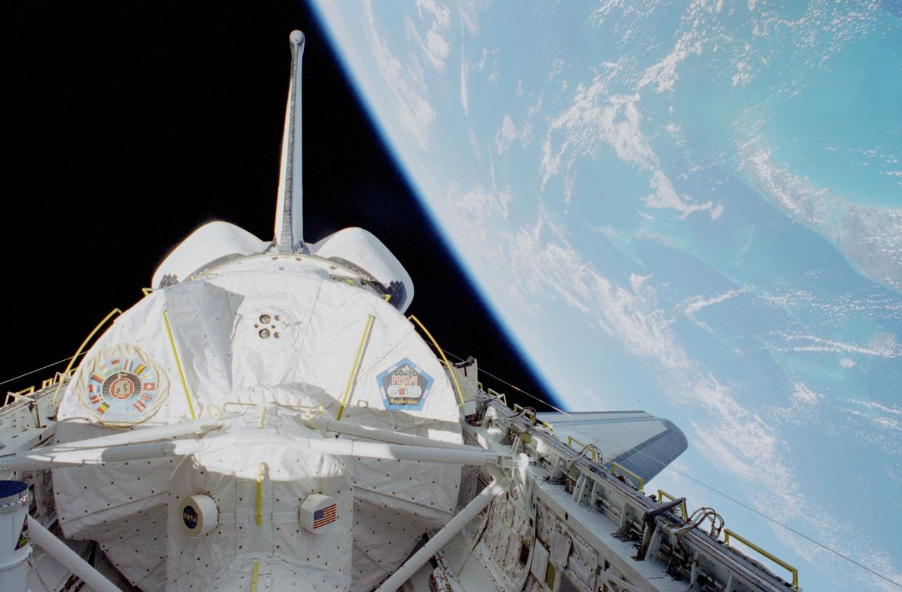
STS083-464-005 (4-8 April 1997) --- This view, photographed not long after orbital insertion, shows Spacelab Module in the cargo bay of the Space Shuttle Columbia, backdropped against the darkness of space and the Bahama Islands area of the Caribbean Sea. The logo on the left pays tribute to the various nations participating in the mission. The decal on the right is the pentagonal logo for the Microgravity Science Laboratory 1 (MSL-1) mission.
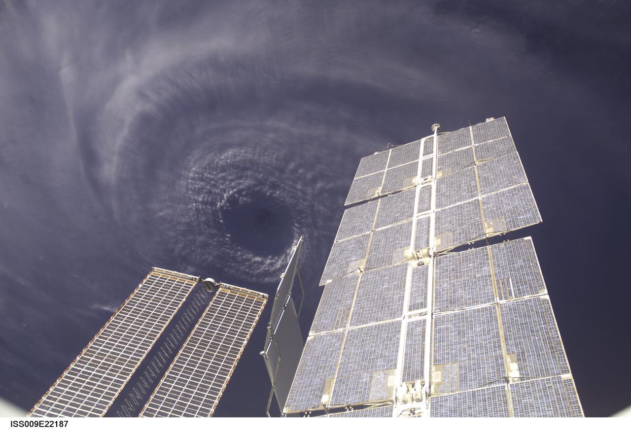
ISS009-E-22187 (11 September 2004) --- This image features the eye of Hurricane Ivan at center, partially framed by solar array panels on the International Space Station. One of the strongest hurricanes on record, Ivan was photographed Saturday from an altitude of about 230 miles by Astronaut Edward M. (Mike) Fincke, NASA ISS science officer and flight engineer, aboard the orbital outpost. At the time, Ivan was in the western Caribbean Sea and reported to have winds of 160 mph.
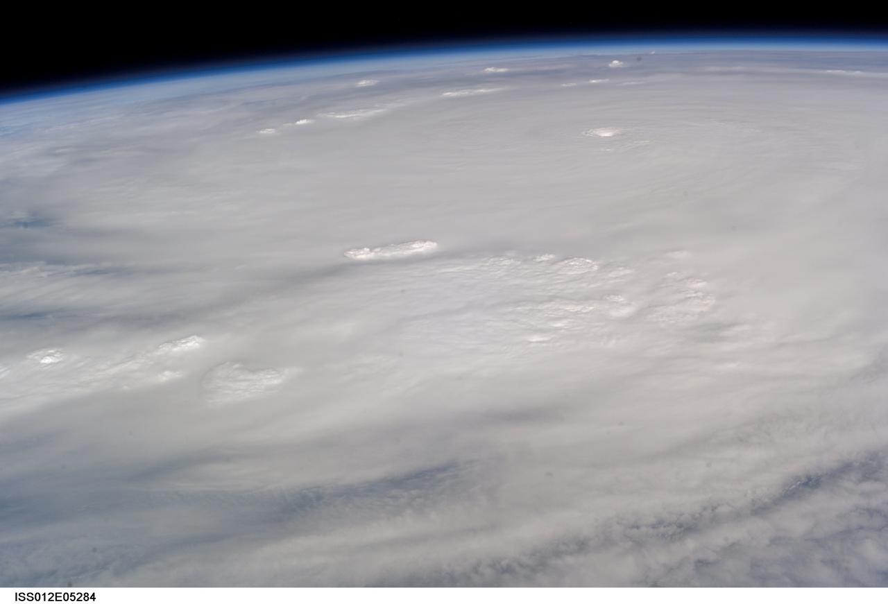
ISS012-E-5284 (19 Oct. 2005) --- This image of Hurricane Wilma was taken at 8:24 a.m. CDT Wednesday, Oct. 19, by the crew aboard NASA's international space station as the complex flew 222 miles above the storm. At the time, Wilma was the strongest Atlantic hurricane in history, with winds near 175 miles per hour. The storm was located in the Caribbean Sea, 340 miles southeast of Cozumel, Mexico.
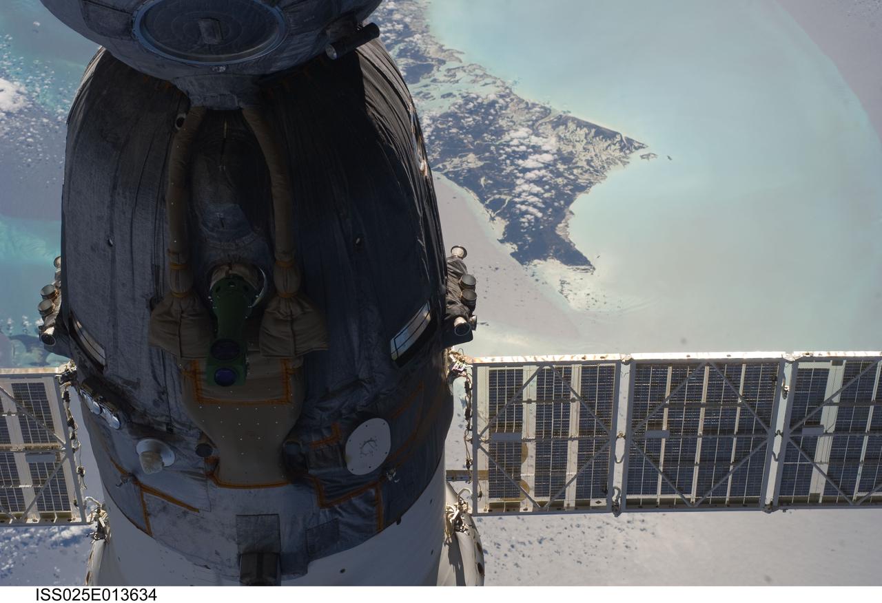
ISS025-E-013634 (9 Nov. 2010) --- The Soyuz TMA-19 spacecraft dominates the foreground of this image exposed by one of the Expedition 25 crew members as the International Space Station and the docked Russian spacecraft were 220 miles above the Caribbean Sea. The island of Andros, in the Bahamas chain, can be seen in the background. Three members of the current six-person staffing aboard the orbital complex are expected to return to Earth in the Soyuz in about two and half weeks.
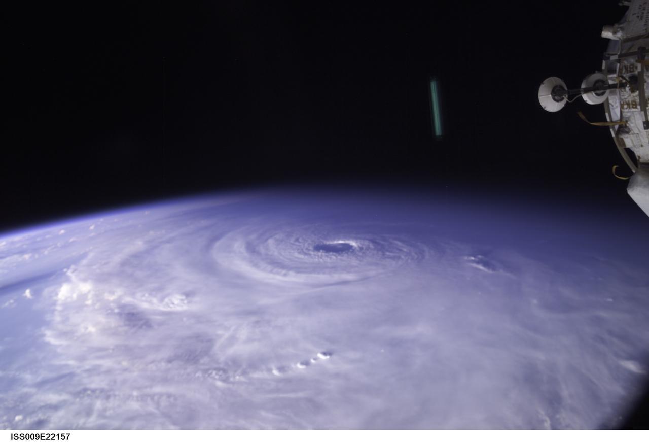
ISS009-E-22157 (11 September 2004) ---- This image of Hurricane Ivan, one of the strongest hurricanes on record, was taken Saturday from an altitude of about 230 miles by Astronaut Edward M. (Mike) Fincke, NASA ISS science officer and flight engineer, looking out the window of the International Space Station. At the time, Ivan was in the western Caribbean Sea and reported to have winds of 160 mph
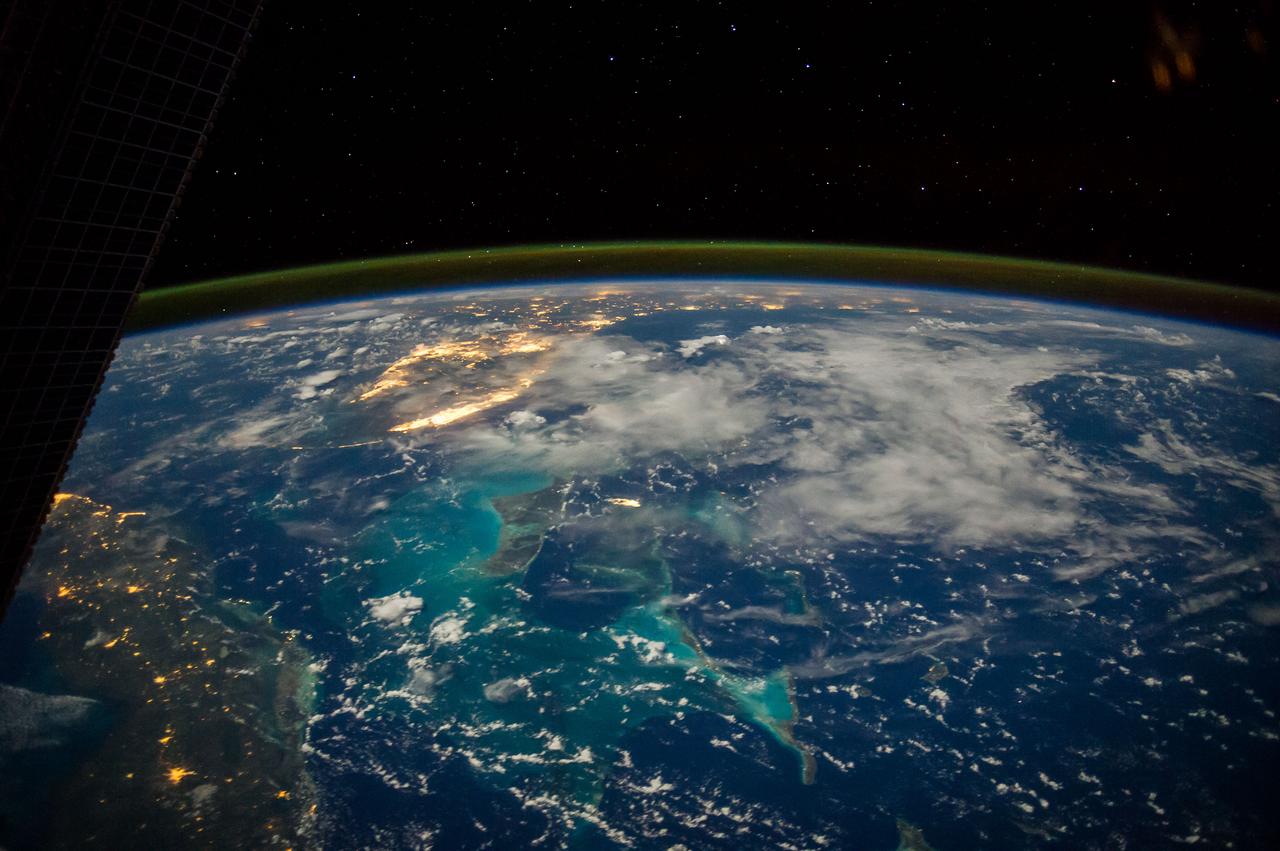
ISS040-E-063578 (15 July 2014) --- One of the Expedition 40 crew members aboard the Earth-orbiting International Space Station, flying some 225 nautical miles above the Caribbean Sea in the early morning hours of July 15, photographed this north-looking panorama that includes parts of Cuba, the Bahamas and Florida, and even runs into several other areas in the southeastern U.S. The long stretch of lights to the left of center frame gives the shape of Miami.
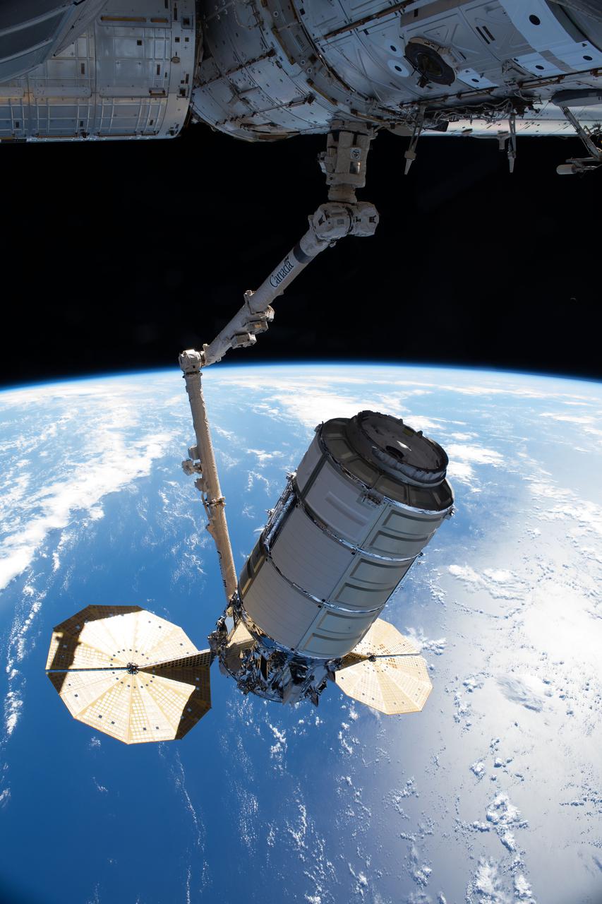
iss065e241472 (Aug. 12, 2021) --- Northrop Grumman's Cygnus space freighter, in the grips of the Canadarm2 robotic arm, is remotely maneuvered by ground controllers toward the International Space Station's Unity module where it was installed for three months of cargo operations. The International Space Station was orbiting 261 miles above the Atlantic Ocean near the Caribbean Sea at the time of this photograph.
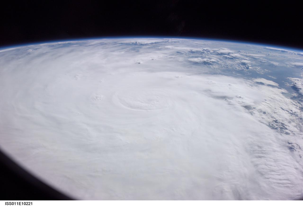
ISS011-E-10221 (7 July 2005) --- At the time of this Expedition 11 digital still camera's image, Hurricane Dennis was churning northwestward through the Caribbean Sea between Jamaica and eastern Cuba packing winds of up to 115 miles per hour. Even though the hurricane had just attained Category 3 intensity, the eye had not yet cleared. This high-oblique, panoramic view, taken through a 28mm lens at 21:14:00 gmt, is looking southwest.
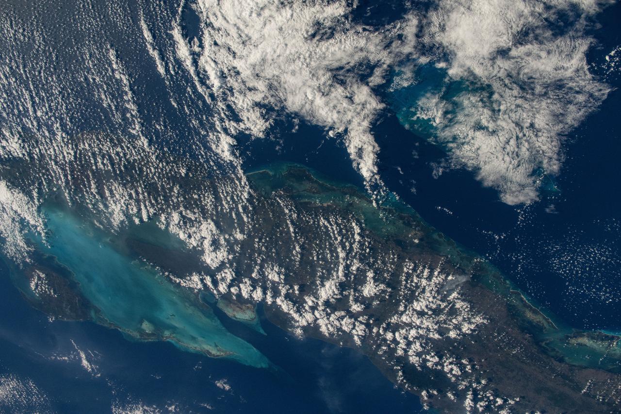
iss072e1000000 (April 11, 2025) --- This is the one-millionth image taken during the Expedition 72 mission aboard the International Space Station. The clouds covering the island nation of Cuba hide its capital and largest city Havana (far left) on the Florida Strait. To the south are the marshlands and forests of Cuba's Zapata Swamp that leads to the Caribbean Sea. NASA astronaut and Expedition 72 Flight Engineer Nichole Ayers took this photograph from the International Space Station as it orbited 261 miles above the Bahamas.
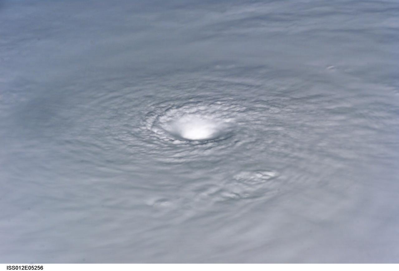
ISS012-E-5256 (19 Oct. 2005) --- This image of Hurricane Wilma was taken at 8:23 a.m. CDT Wednesday, Oct. 19, by the crew aboard NASA's international space station as the complex flew 222 miles above the storm. At the time, Wilma was the strongest Atlantic hurricane in history, with winds near 175 miles per hour. The storm was located in the Caribbean Sea, 340 miles southeast of Cozumel, Mexico.
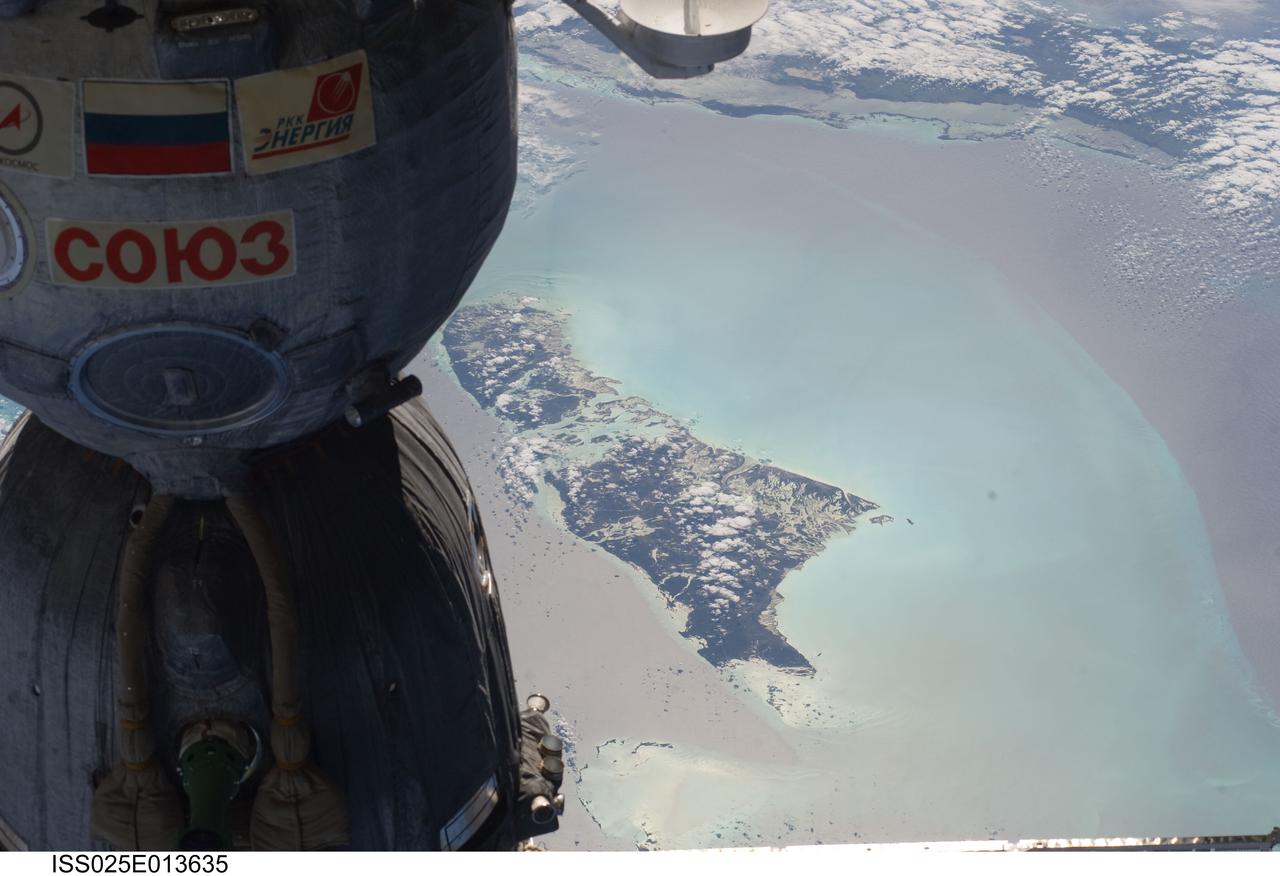
ISS025-E-013635 (9 Nov. 2010) --- The Soyuz TMA-19 spacecraft dominates the foreground of this image exposed by one of the Expedition 25 crew members as the International Space Station and the docked Russian spacecraft were 220 miles above the Caribbean Sea. The island of Andros, in the Bahamas chain, can be seen in the background. Three members of the current six-person staffing aboard the orbital complex are expected to return to Earth in the Soyuz in about two and half weeks.
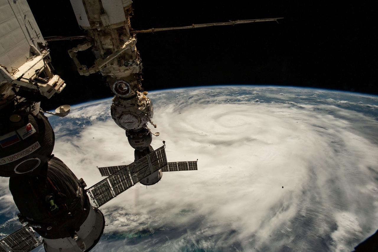
iss067e381585 (Sept. 26, 2022) --- Hurricane Ian is pictured from the International Space Station as it orbited 258 miles above the Caribbean Sea east of Belize. At the time of this photograph, Ian was just south of Cuba gaining strength and heading toward Florida. In the foreground (from left), are the Soyuz MS-22 crew ship, docked to the Rassvet module, and the Soyuz MS-21 crew ship, docked to the Prichal module.
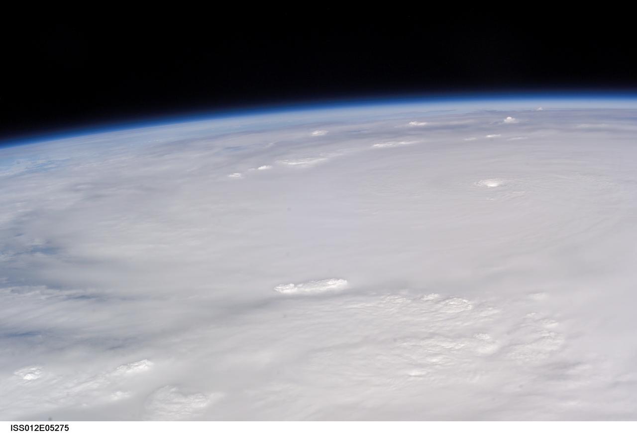
ISS012-E-5275 (19 Oct. 2005) --- This image of Hurricane Wilma was taken at 8:24 a.m. CDT Wednesday, Oct. 19, by the crew aboard NASA's international space station as the complex flew 222 miles above the storm. At the time, Wilma was the strongest Atlantic hurricane in history, with winds near 175 miles per hour. The storm was located in the Caribbean Sea, 340 miles southeast of Cozumel, Mexico.
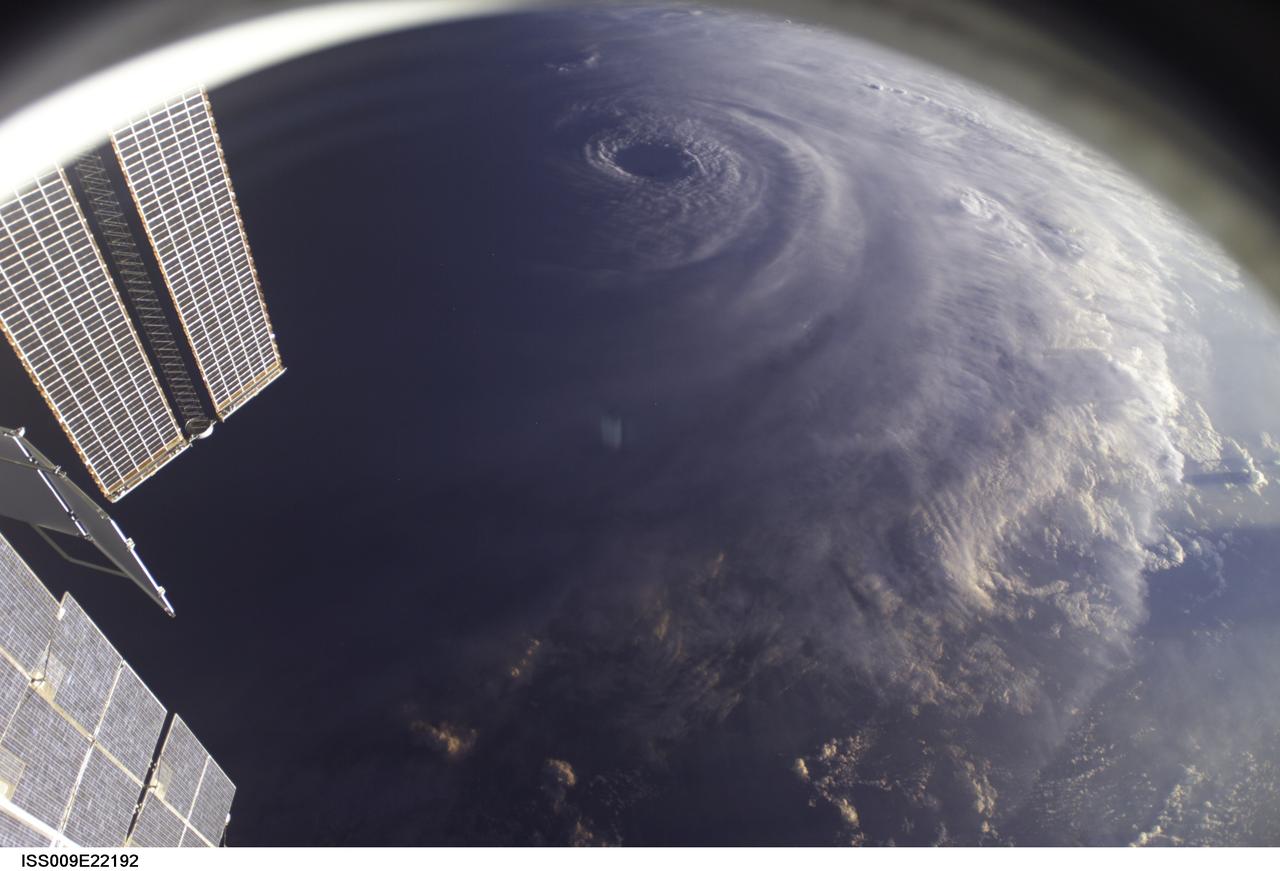
ISS009-E-22192 (11 September 2004) ---- This image of Hurricane Ivan, one of the strongest hurricanes on record, was taken Saturday from an altitude of about 230 miles by Astronaut Edward M. (Mike) Fincke, NASA ISS science officer and flight engineer, looking out the window of the International Space Station. At the time, Ivan was in the western Caribbean Sea and reported to have winds of 160 mph
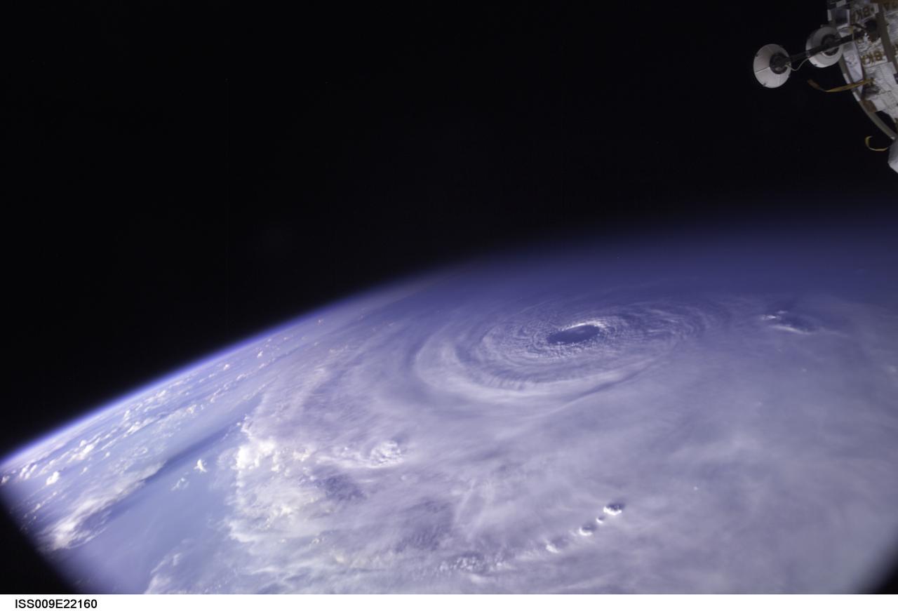
ISS009-E-22160 (11 September 2004) ---- This image of Hurricane Ivan, one of the strongest hurricanes on record, was taken Saturday from an altitude of about 230 miles by Astronaut Edward M. (Mike) Fincke, NASA ISS science officer and flight engineer, looking out the window of the International Space Station. At the time, Ivan was in the western Caribbean Sea and reported to have winds of 160 mph
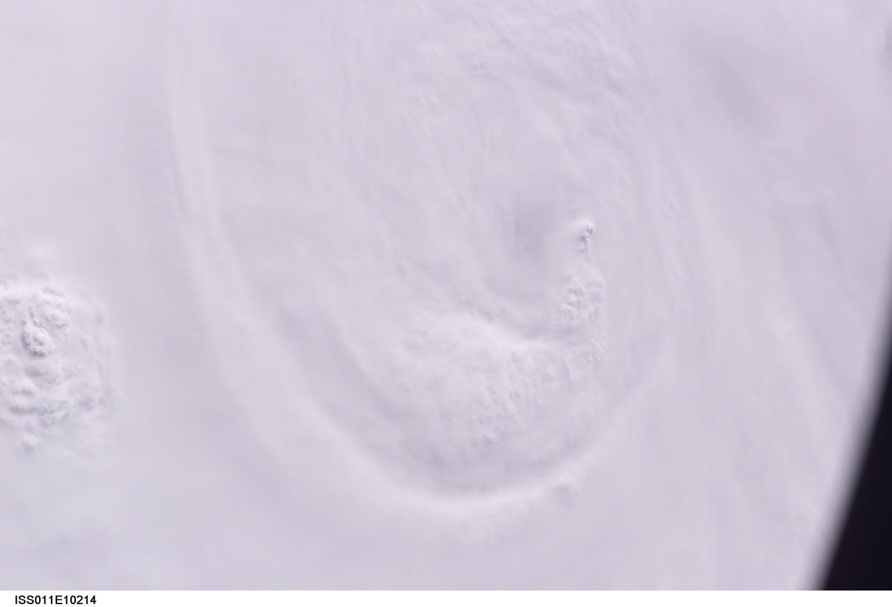
ISS011-E-10214 (7 July 2005) --- At the time of this Expedition 11 digital still camera's image, Hurricane Dennis was churning northwestward through the Caribbean Sea between Jamaica and eastern Cuba packing winds of up to 115 miles per hour. Even though the hurricane had just attained Category 3 intensity, the eye had not yet cleared. This oblique view, captured with a 70mm lens at 21:12:01 gmt, is looking west.
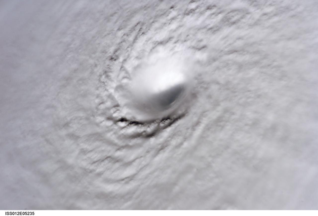
ISS012-E-5235 (19 Oct. 2005) --- This image of Hurricane Wilma was taken at 8:22 a.m. CDT Wednesday, Oct. 19, by the crew aboard NASA's international space station as the complex flew 222 miles above the storm. At the time, Wilma was the strongest Atlantic hurricane in history, with winds near 175 miles per hour. The storm was located in the Caribbean Sea, 340 miles southeast of Cozumel, Mexico.
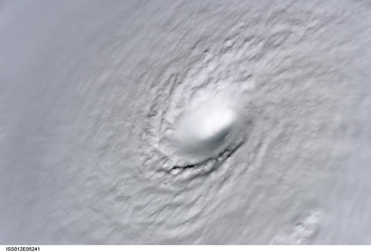
ISS012-E-5241 (19 Oct. 2005) --- This image of Hurricane Wilma was taken at 8:22 a.m. CDT Wednesday, Oct. 19, by the crew aboard NASA's international space station as the complex flew 222 miles above the storm. At the time, Wilma was the strongest Atlantic hurricane in history, with winds near 175 miles per hour. The storm was located in the Caribbean Sea, 340 miles southeast of Cozumel, Mexico.
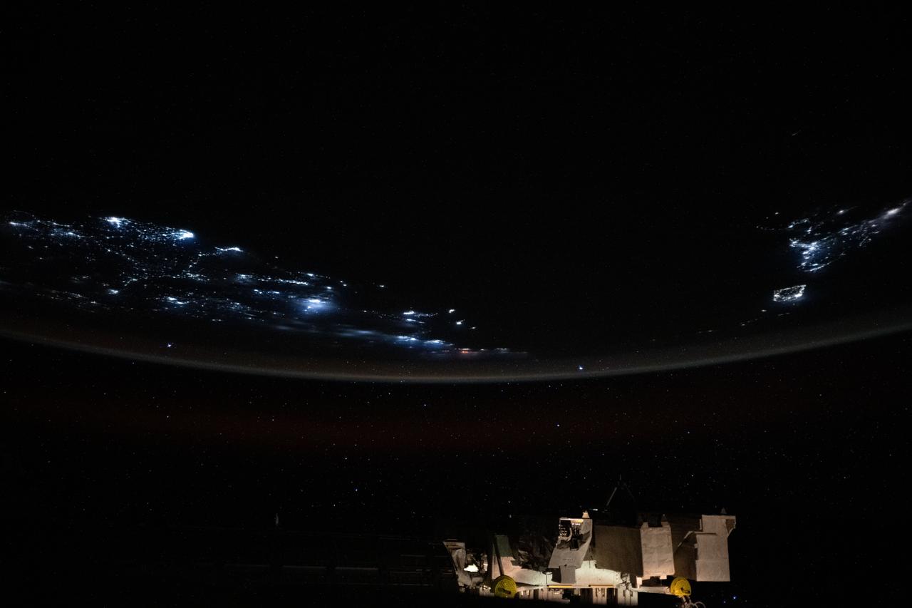
iss073e0854494 (Sept. 21, 2025) --- The coastlines of Colombia and Venezuela (left), illuminated by city lights, are separated from the island nations of the Dominican Republic and Puerto Rico (far right) by the dark expanse of the Caribbean Sea. The International Space Station was orbiting approximately 260 miles above Earth when this photograph was taken at around 1:06 a.m. local time.
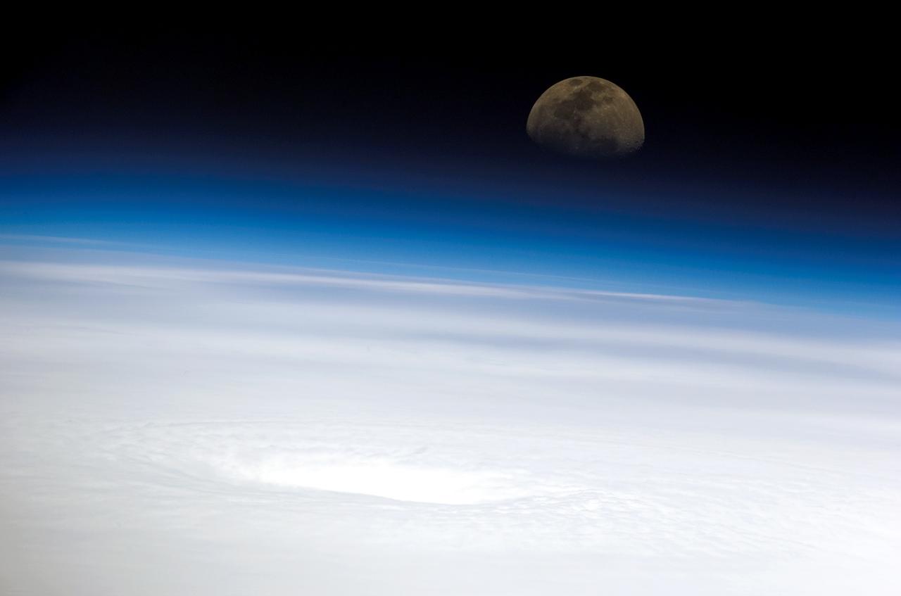
ISS011-E-10509 (16 July 2005) --- This high-oblique panoramic view, recorded by a digital still camera using a 400mm lens, shows the eye of Hurricane Emily. The image was captured by the crew of the international space station while the complex was over the southern Gulf of Mexico looking eastwardly toward the rising moon. At the time, Emily was a strengthening Category 4 hurricane with winds of nearly 155 miles per hour and moving west-northwestwardly over the northwest Caribbean Sea about 135 miles southwest of Kingston, Jamaica.
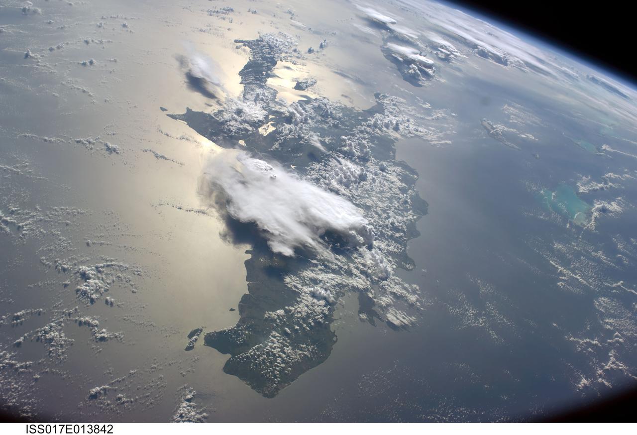
ISS017-E-013842 (19 Aug. 2008) --- A serene view of a portion of the Greater Antilles islands in the Caribbean Sea. The island of Hispaniola is in the foreground, comprised of the Dominican Republic and Haiti (in the sunglint). Looking toward the horizon, the eastern tip of Cuba is seen through the clouds and thunderstorms that are scattered over the islands. The light blue shallower areas, to the right or north of Hispaniola and extending toward the Earths limb, are the Turks and Caicos islands and the Acklins Islands. The Great Inagua island is off the coast of Haiti. These islands are located along the geological border of the North American Plate (to the right) and the Caribbean Plate (to the left). The photo was taken by the Expedition 17 crew onboard the International Space Station on Aug 19, 2008 with a 28 mm lens.
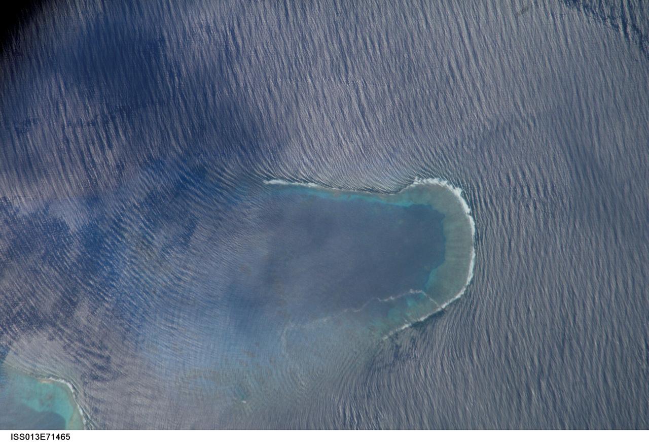
ISS013-E-71465 (27 Aug. 2006) --- Bajo Nuevo Reef in the western Caribbean Sea is featured in this image photographed by an Expedition 13 crewmember on the International Space Station. The Bajo Nuevo reef is approximately 26 kilometers long, comprising two separate U-shaped cays, with only tiny sandy islands associated with them. The eastern cay, shown in this image, encloses a lagoon. Protected from open-sea swells, the water surface is calmer and some back reef detail is visible within the lagoon. Cloud shadows darken the top left corner. The clearest feature is the broad pattern of swells which show two slightly different orientations, producing a tightly crossed pattern. These swells are oriented transverse to the wind direction and were probably set in motion by two different storms hundreds of kilometers east of the reef. A single irregular line of light color--also suggestive of surface oil--traces a path along the south side of the lagoon.
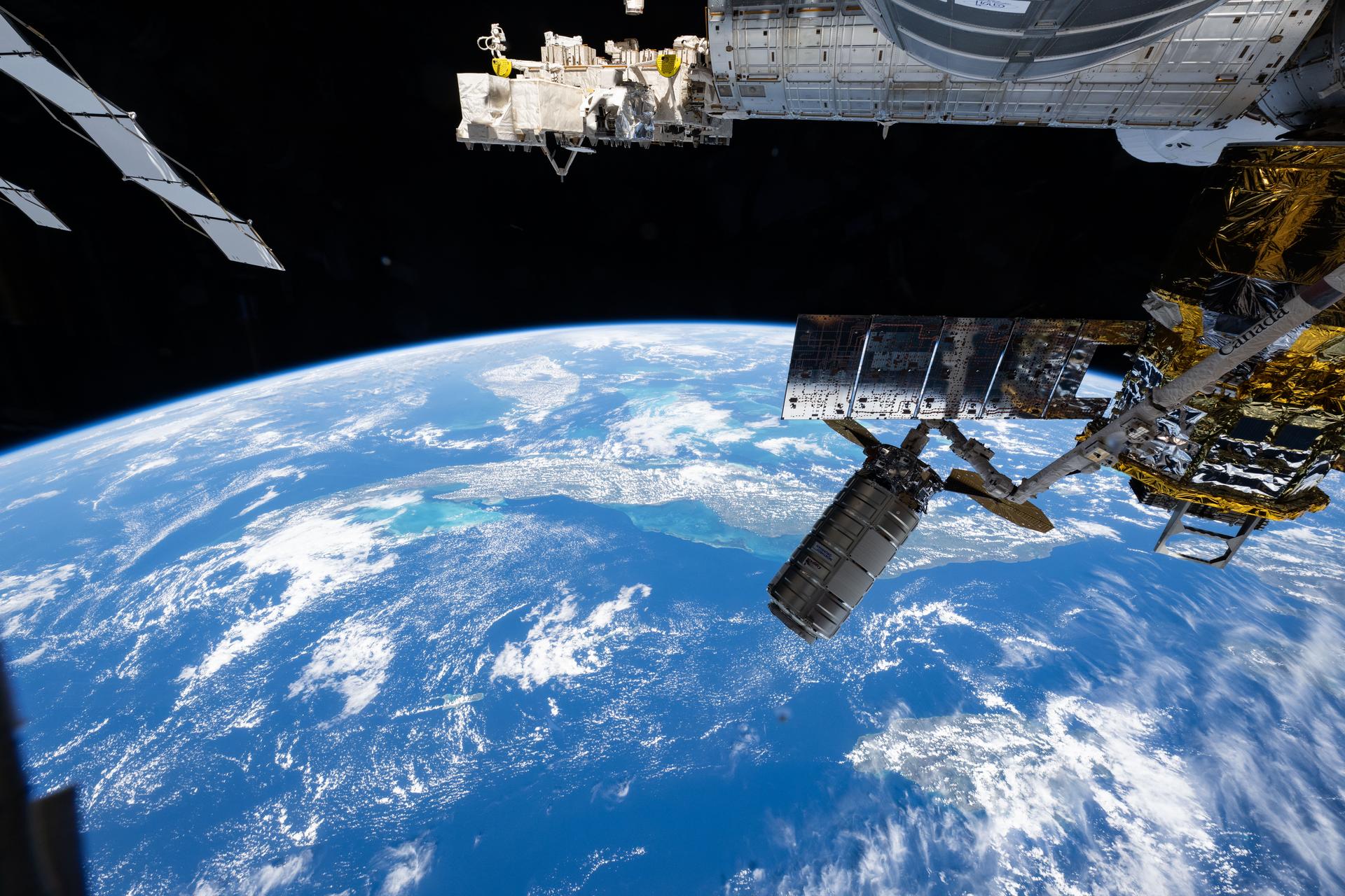
iss073e1196921 (Nov. 25, 2025) --- Northrop Grumman's Cygnus XL cargo craft is pictured in the grips of the International Space Station Canadarm2 robotic arm. Cygnus XL had been temporarily released from its Earth-facing port on the Unity module to make room for the Soyuz MS-28 crew spacecraft, which was scheduled to arrive the next day and dock to the Rassvet module. JAXA's (Japan Aerospace Exploration Agency) HTV-X1 cargo craft, with its solar arrays deployed, is seen berthed to the Earth-facing port of the Harmony module. The orbital outpost was soaring 262 miles above the Caribbean Sea south of Cuba at the time of this photograph.
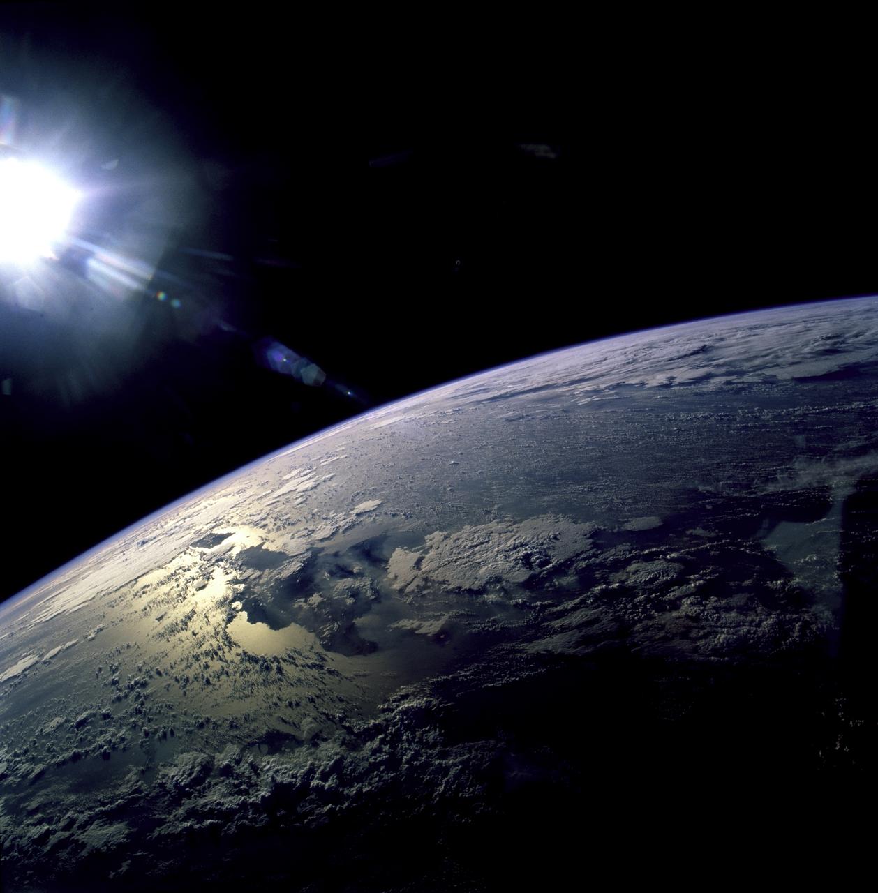
STS082-723-071 (11-21 Feb. 1997) --- The island of Hispaniola appears left center in this wide-angle view, photographed with a 70mm handheld camera from the Earth-orbiting Space Shuttle Discovery. The prominent cape is Cap-a-Foux, the northwest point of Haiti. The cloud is broken by the mountainous spine of the island. Smoke from bush fires appears in the valleys between the ridges. The coppery tinge of light reflected off the sea surface indicates pollution in the air -- probably industrial pollutants from North America which are typically fed around from the Atlantic seaboard into the Caribbean from the east.
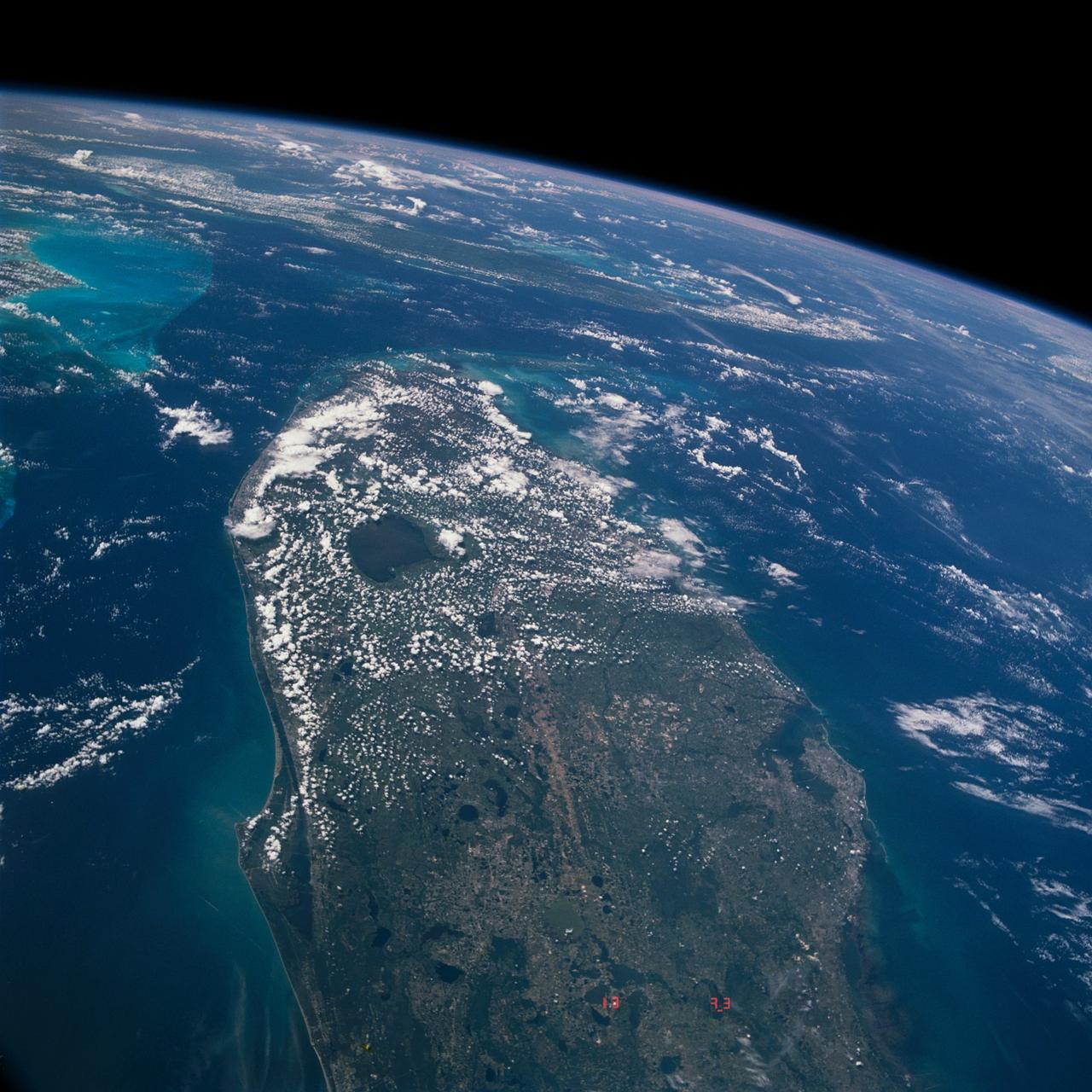
STS040-613-049 (5-14 June 1991) --- This oblique scene from the Earth-orbiting Space Shuttle Columbia shows southern Florida, several of the Bahama Islands and parts of the Atlantic Ocean, the Gulf of Mexico and the Caribbean Sea. The nine-day STS-40/Spacelab Life Sciences (SLS-1) mission started with launch from Kennedy Space Center (KSC), visible in lower left. Cuba can be seen at top center. The picture was photographed with a handheld Rolleiflex camera, aimed through Columbia's aft flight deck windows.
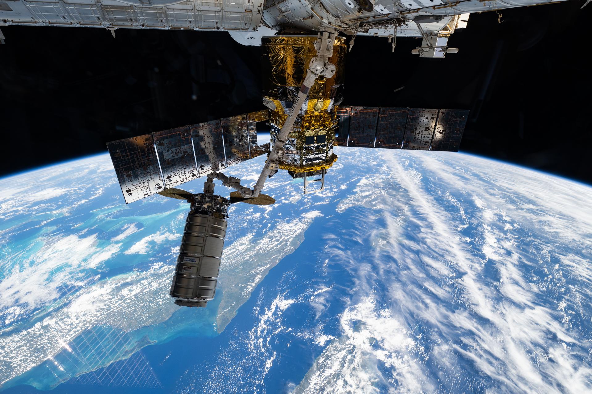
iss073e1196940 (Nov. 25, 2025) --- Northrop Grumman's Cygnus XL cargo craft is pictured in the grips of the International Space Station Canadarm2 robotic arm. Cygnus XL had been temporarily released from its Earth-facing port on the Unity module to make room for the Soyuz MS-28 crew spacecraft, which was scheduled to arrive the next day and dock to the Rassvet module. JAXA's (Japan Aerospace Exploration Agency) HTV-X1 cargo craft, with its solar arrays deployed, is seen berthed to the Earth-facing port of the Harmony module. The orbital outpost was soaring 261 miles above the Caribbean Sea south of Cuba at the time of this photograph.
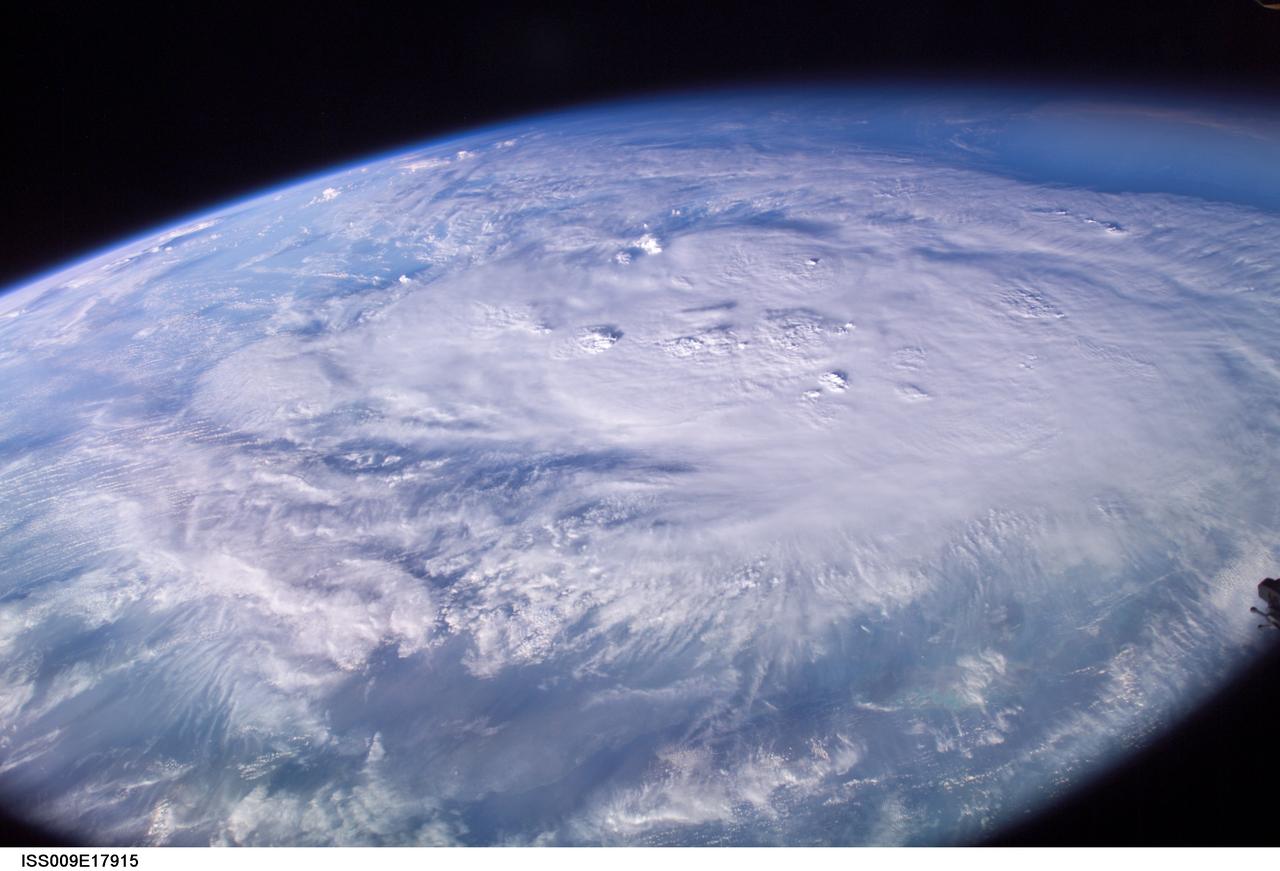
ISS009-E-17915 (12 August 2004) --- This is an early morning view (6:29 a.m., CDT) from the International Space Station, which shows Hurricane Charley centered south of western Cuba over the Cayman Islands in the northwest Caribbean Sea. At the time of this image the storm was reported to be near 19.2N 80.5W with winds of 85 miles per hour as it moved northwest at 16 miles per hour. The north coast of Cuba is barely visible near the bottom of the image, which was taken by astronaut Mike Fincke looking to the south as the spacecraft flew on a track north of Cuba and the storm.
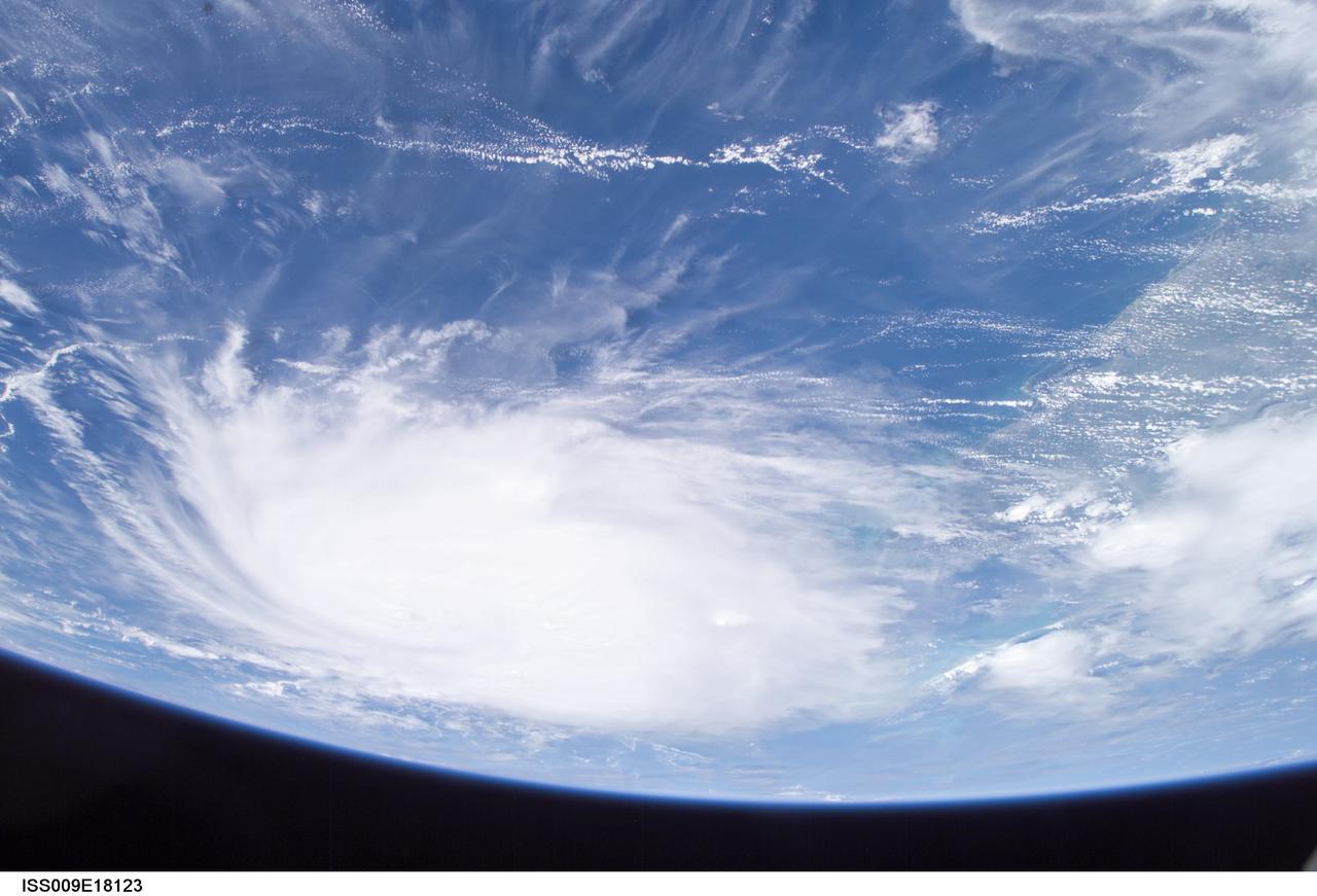
ISS009-E-18123 (21:08:33 GMT, 12 August 2004) --- This panoramic view of Hurricane Charley was taken by the Expedition 9 crew of the International Space Station just after 5PM (EDT), August 12, 2004. The Category Two Hurricane was in the northwest Caribbean Sea, 140 miles south-southeast of Havana, Cuba moving north-northwest at 18mph packing winds of 105mph. In this view looking southeast, the newly formed eye of the storm is just visible and the west coast of Florida from Naples to Tampa Bay may be seen on the right.
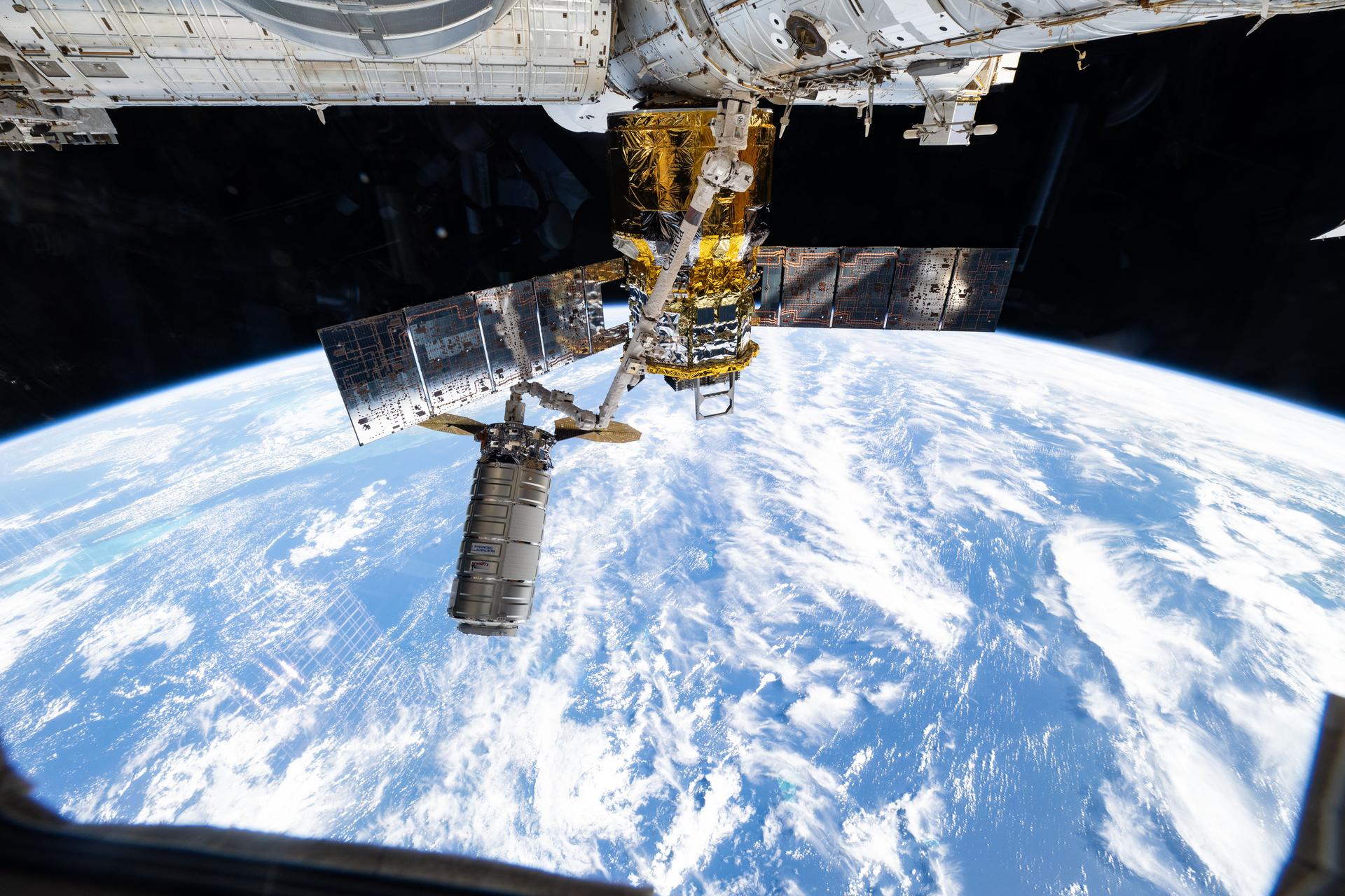
iss073e1196882 (Nov. 25, 2025) --- Northrop Grumman's Cygnus XL cargo craft is pictured in the grips of the International Space Station Canadarm2 robotic arm. Cygnus XL had been temporarily released from its Earth-facing port on the Unity module to make room for the Soyuz MS-28 crew spacecraft, which was scheduled to arrive the next day and dock to the Rassvet module. JAXA's (Japan Aerospace Exploration Agency) HTV-X1 cargo craft, with its solar arrays deployed, is seen berthed to the Earth-facing port of the Harmony module. The orbital outpost was soaring 262 miles above the Caribbean Sea east of the Yucatan Peninsula.
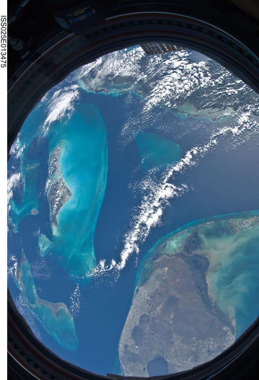
ISS025-E-013475 (9 Nov. 2010) --- Parts of the Atlantic, Gulf of Mexico and Caribbean Sea are easily noted in this unusual circular shaped image exposed by one of the Expedition 25 crew members aboard the International Space Station 220 miles above Earth. A 16mm f/2.8D lens gives this image a fish-eye effect, and the frame of the Cupola window adds to the circular shape. The southern portion of the Florida peninsula, including the elongated metropolitan Miami area, Lake Okeechobee and the Florida Keys, lies just a few kilometers away from islands in the Bahamas chain and the "Tongue of the Ocean." Andros is the largest visible island to the left of center.

This image hosts a look at the eye of Hurricane Ivan, one of the strongest hurricanes on record, as the storm topped the western Caribbean Sea on Saturday, September 11, 2004. The hurricane was photographed by astronaut Edward M. (Mike) Fincke from aboard the International Space Station (ISS) at an altitude of approximately 230 miles. At the time, the category 5 storm sustained winds in the eye of the wall that were reported at about 160 mph. Crew Earth Observations record Earth surface changes over time, as well as more fleeting events such as storms, floods, fires, and volcanic eruptions.
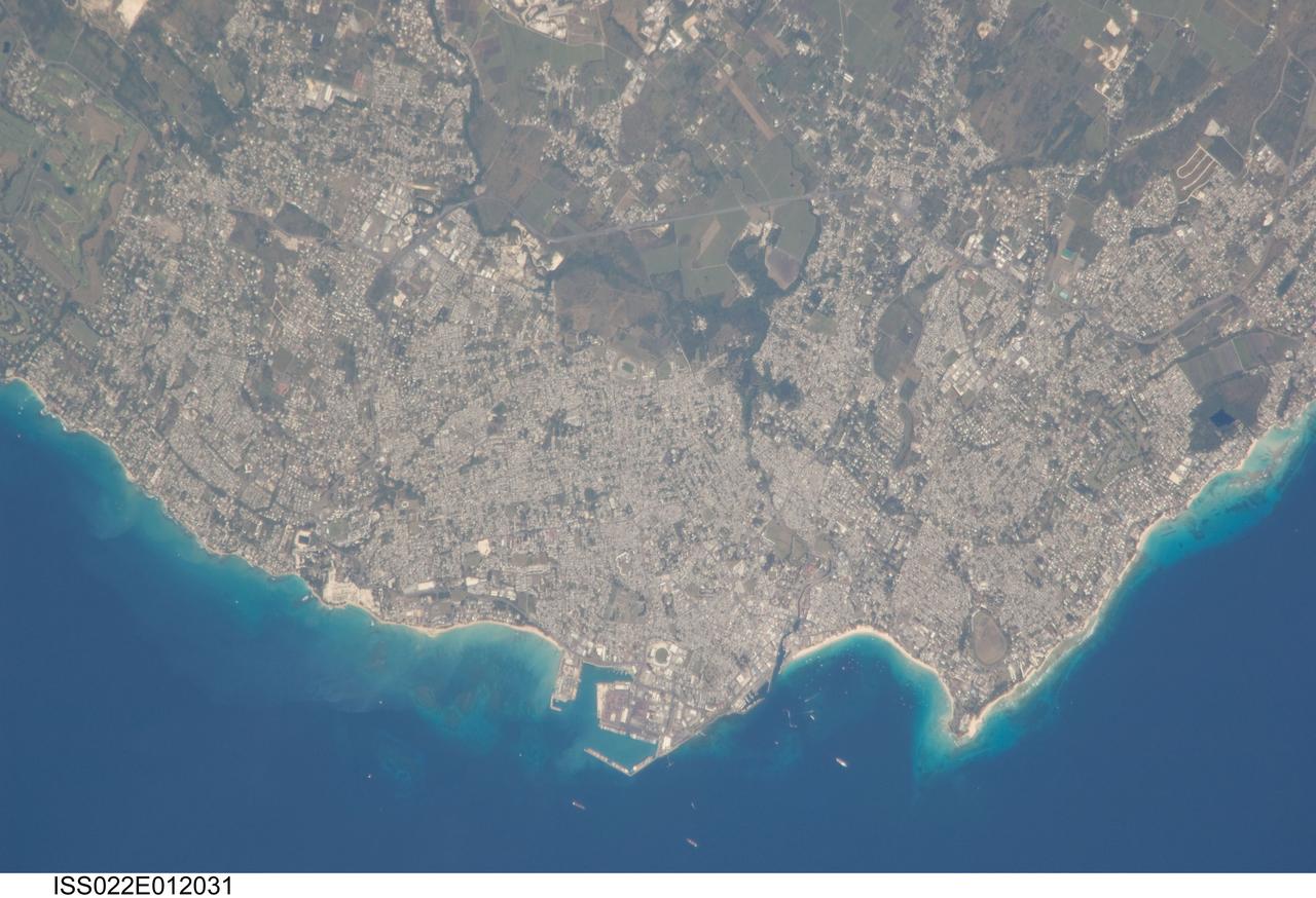
ISS022-E-012031 (16 Dec. 2009) --- Greater Bridgetown area, Barbados is featured in this image photographed by an Expedition 22 crew member on the International Space Station. Bridgetown is the capital city of the island nation of Barbados, located to the east of the Lesser Antilles Island chain. While Barbados is considered to be part of the Lesser Antilles, it is located within the western Atlantic Ocean rather than the Caribbean Sea region. Bridgetown is the largest city in Barbados in addition to being the seat of government. Barbados is a member of the British Commonwealth, and considers Queen Elizabeth II to be its constitutional monarch. Bridgetown, and the surrounding towns that make up the Greater Bridgetown area, is located along the southwestern coastline of the island. The metropolitan area is readily recognized in this image due to the gray and white rooftops and street grids (center) that contrast with green vegetated fields and riparian areas of the island?s interior to the northeast (top center). Bridgetown is a major port destination for both commercial and cruise ships serving the eastern Caribbean ? several ships are visible within Carlisle Bay. Water color in the image changes from light blue along the coastline ? indicating shallow water ? to the dark blue of deeper water away from the island.
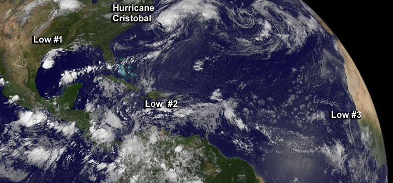
Although there's only one formed tropical cyclone in the Atlantic: Hurricane Cristobal, there are three other developing areas of low pressure and all were captured in this panoramic image from NOAA's GOES-East satellite today at 8 a.m. EDT. Cristobal is a hurricane located east of the U.S. East coast and is forecast to move up toward eastern Canada tonight (and stay off-shore). The image was made at NASA's GOES Project at NASA's Goddard Space Flight Center in Greenbelt, Maryland. Low #1. A weak area of low pressure near the coast of South Texas is producing disorganized showers and thunderstorms. Significant development of this system is unlikely before it moves inland over South Texas and northern Mexico today. It has a ten percent chance of development into a tropical depression in the next 2 days. Low #2. A tropical wave located over the eastern Caribbean Sea continues to produce disorganized cloudiness and showers. Upper-level winds are expected to remain unfavorable for development during the next couple of days while the system moves across the eastern and central Caribbean Sea. However, environmental conditions could become conducive for some development when the system moves over the northwestern Caribbean Sea on Sunday and into the southwestern Gulf of Mexico early next week. It has a near zero chance to develop in the next 2 days. Low #3. A tropical wave is forecast to move off the west coast of Africa on Friday. Environmental conditions could be conducive for some gradual development of this system while it moves westward at 10 to 15 mph across the eastern Atlantic early next week. This has a near zero chance of development in the next two days. <b><a href="http://www.nasa.gov/audience/formedia/features/MP_Photo_Guidelines.html" rel="nofollow">NASA image use policy.</a></b> <b><a href="http://www.nasa.gov/centers/goddard/home/index.html" rel="nofollow">NASA Goddard Space Flight Center</a></b> enables NASA’s mission through four scientific endeavors: Earth Science, Heliophysics, Solar System Exploration, and Astrophysics. Goddard plays a leading role in NASA’s accomplishments by contributing compelling scientific knowledge to advance the Agency’s mission. <b>Follow us on <a href="http://twitter.com/NASAGoddardPix" rel="nofollow">Twitter</a></b> <b>Like us on <a href="http://www.facebook.com/pages/Greenbelt-MD/NASA-Goddard/395013845897?ref=tsd" rel="nofollow">Facebook</a></b> <b>Find us on <a href="http://instagram.com/nasagoddard?vm=grid" rel="nofollow">Instagram</a></b>
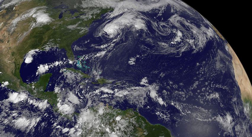
Although there's only one formed tropical cyclone in the Atlantic: Hurricane Cristobal, there are three other developing areas of low pressure and all were captured in this panoramic image from NOAA's GOES-East satellite today at 8 a.m. EDT. Cristobal is a hurricane located east of the U.S. East coast and is forecast to move up toward eastern Canada tonight (and stay off-shore). The image was made at NASA's GOES Project at NASA's Goddard Space Flight Center in Greenbelt, Maryland. Low #1. A weak area of low pressure near the coast of South Texas is producing disorganized showers and thunderstorms. Significant development of this system is unlikely before it moves inland over South Texas and northern Mexico today. It has a ten percent chance of development into a tropical depression in the next 2 days. Low #2. A tropical wave located over the eastern Caribbean Sea continues to produce disorganized cloudiness and showers. Upper-level winds are expected to remain unfavorable for development during the next couple of days while the system moves across the eastern and central Caribbean Sea. However, environmental conditions could become conducive for some development when the system moves over the northwestern Caribbean Sea on Sunday and into the southwestern Gulf of Mexico early next week. It has a near zero chance to develop in the next 2 days. Low #3. A tropical wave is forecast to move off the west coast of Africa on Friday. Environmental conditions could be conducive for some gradual development of this system while it moves westward at 10 to 15 mph across the eastern Atlantic early next week. This has a near zero chance of development in the next two days. <b><a href="http://www.nasa.gov/audience/formedia/features/MP_Photo_Guidelines.html" rel="nofollow">NASA image use policy.</a></b> <b><a href="http://www.nasa.gov/centers/goddard/home/index.html" rel="nofollow">NASA Goddard Space Flight Center</a></b> enables NASA’s mission through four scientific endeavors: Earth Science, Heliophysics, Solar System Exploration, and Astrophysics. Goddard plays a leading role in NASA’s accomplishments by contributing compelling scientific knowledge to advance the Agency’s mission. <b>Follow us on <a href="http://twitter.com/NASAGoddardPix" rel="nofollow">Twitter</a></b> <b>Like us on <a href="http://www.facebook.com/pages/Greenbelt-MD/NASA-Goddard/395013845897?ref=tsd" rel="nofollow">Facebook</a></b> <b>Find us on <a href="http://instagram.com/nasagoddard?vm=grid" rel="nofollow">Instagram</a></b>
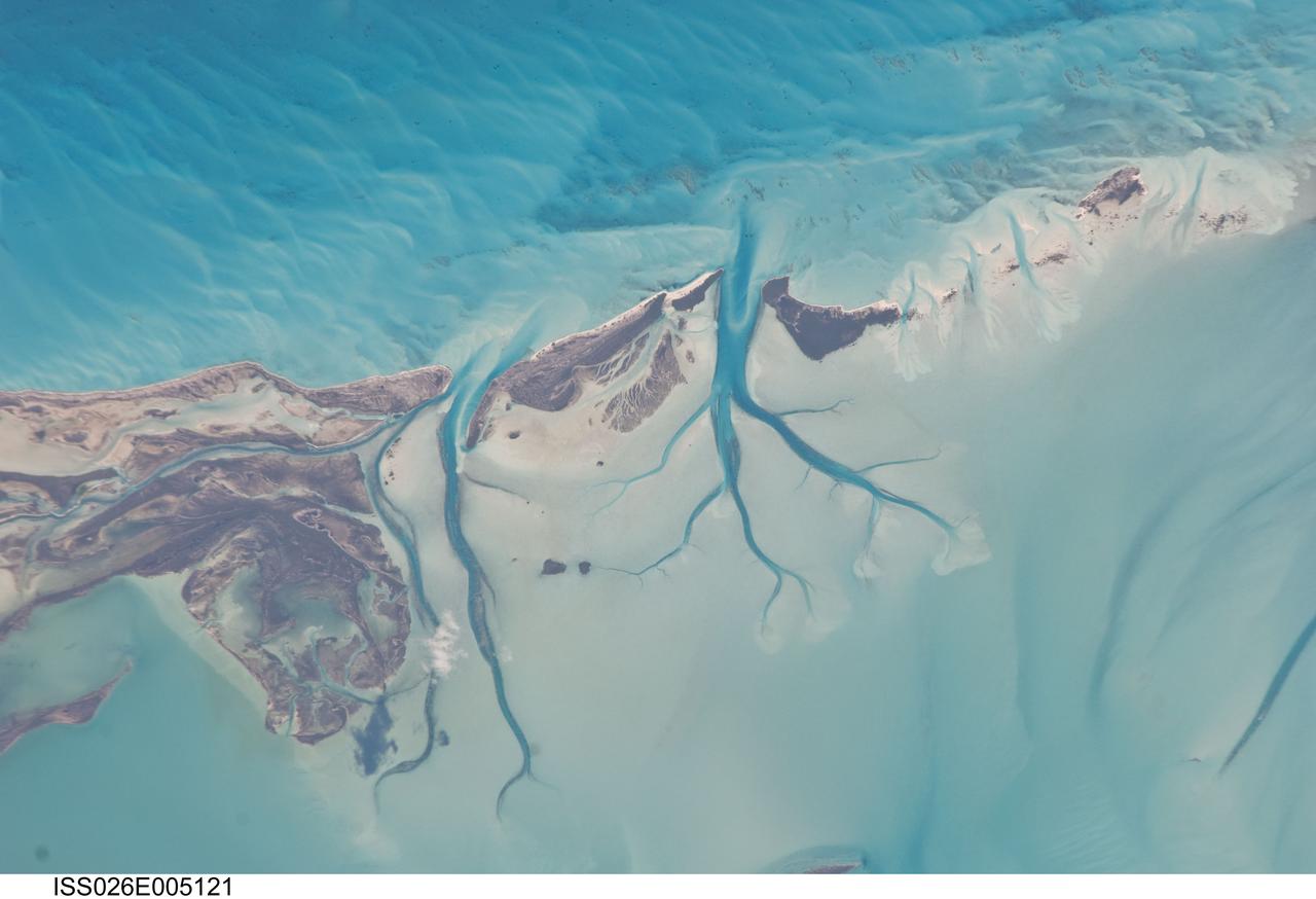
ISS026-E-005121 (27 Nov. 2010) --- Tidal flats and channels on Long Island, Bahamas are featured in this image photographed by an Expedition 26 crew member on the International Space Station. The islands of the Bahamas in the Caribbean Sea are situated on large depositional platforms (the Great and Little Bahama Banks) composed mainly of carbonate sediments ringed by fringing reefs – the islands themselves are only the parts of the platform currently exposed above sea level. The sediments are formed mostly from the skeletal remains of organisms settling to the sea floor; over geologic time, these sediments will consolidate to form carbonate sedimentary rocks such as limestone. This detailed photograph provides a view of tidal flats and tidal channels near Sandy Cay on the western side of Long Island, located along the eastern margin of the Great Bahama Bank. The continually exposed parts of the island have a brown coloration in the image, a result of soil formation and vegetation growth (left). To the north of Sandy Cay an off-white tidal flat composed of carbonate sediments is visible; light blue-green regions indicate shallow water on the tidal flat. Tidal flow of seawater is concentrated through gaps in the anchored land surface, leading to formation of relatively deep tidal channels that cut into the sediments of the tidal flat. The channels, and areas to the south of the island, have a vivid blue coloration that provides a clear indication of deeper water (center).
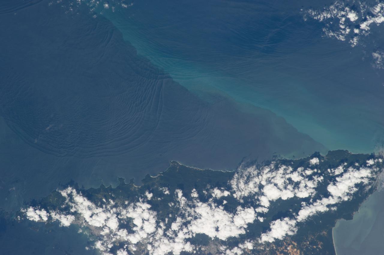
ISS034-E-032377 (18 Jan. 2013) --- Internal waves off Northern Trinidad are featured in this image photographed by an Expedition 34 crew member on the International Space Station. This photograph shows the north coast of the island of Trinidad in the southeastern Caribbean Sea, where heating of the land is setting off the growth of cumulus clouds. The light blue northwest-southeast trending plume at center is sediment from one of the rivers that flows into the sea here. Adjacent to, and appearing to cross the sediment plume, a series of subtle interacting arcs can be seen in the sea. These are known as internal waves which are the surface manifestation of slow waves moving tens of meters beneath the sea surface. These produce enough of an effect on the sea surface to be seen from space, but only where they are enhanced due to reflection of sunlight, or sunglint, back towards the space station. The image shows at least three sets of internal waves interacting. The most prominent set (top left) shows a “packet” of several waves moving from the northwest due to the tidal flow towards the north coast of Trinidad. Two less prominent, younger sets can be seen further out to sea. A very broad set enters the view from the north and northeast, and interacts at top center with the first set. All the internal waves are probably caused by the shelf break near Tobago (outside the image to top right). The shelf break is the step between shallow seas (around continents and islands) and the deep ocean. It is the line at which tides usually start to generate internal waves. The sediment plume at center is embedded in the Equatorial Current (also known as the Guyana Current) and is transporting material to the northwest—in almost the opposite direction to the movement of the internal waves. The current flows strongly from east to west around Trinidad, all the way from equatorial Africa, driven by year-round easterly winds. Seafarers in the vicinity of Trinidad are warned that the current, and its local reverse eddies, make navigation of smaller craft in these waters complicated and sometimes dangerous.
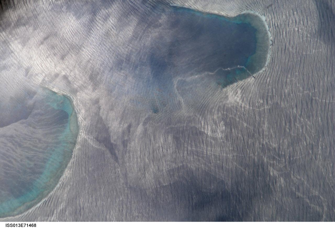
ISS013-E-71468 (27 Aug. 2006) --- Bajo Nuevo Reef in the western Caribbean Sea is featured in this image photographed by an Expedition 13 crewmember on the International Space Station. The Bajo Nuevo reef is approximately 26 kilometers long, comprising two separate U-shaped cays, with only tiny sandy islands associated with them. This detailed view reveals small, low islands that fringe the upwind side (image right) of the lagoon. These islands seem dwarfed by wave swells, which almost appear to wash over them. The clearest feature is the broad pattern of swells which show two slightly different orientations, producing a tightly crossed pattern. These swells are oriented transverse to the wind direction and were probably set in motion by two different storms hundreds of kilometers east of the reef. A single irregular line of light color--also suggestive of surface oil--traces a path along the south side of the lagoon.
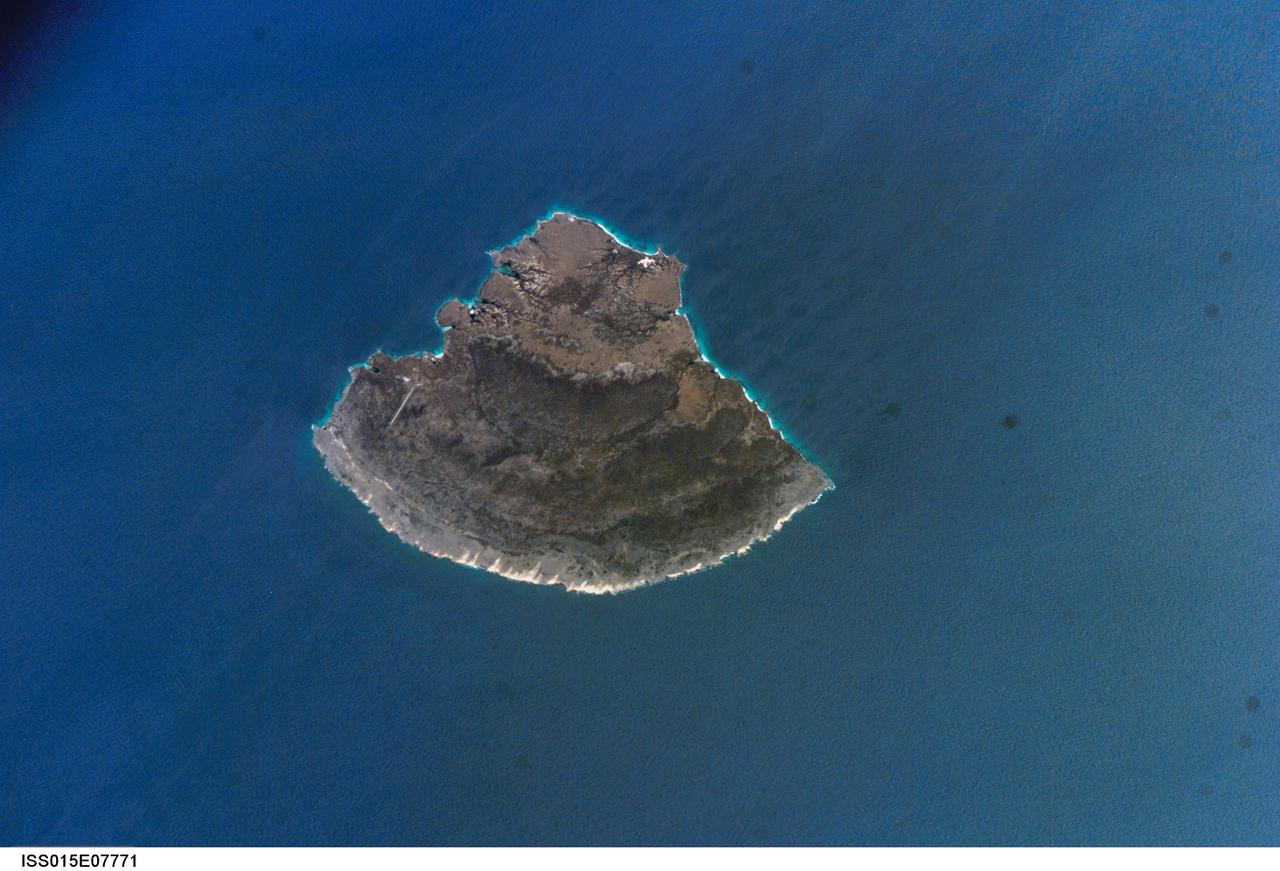
ISS015-E-07771 (12 May 2007) --- Isla Blanquilla, Venezuela is featured in this image photographed by an Expedition 15 crewmember on the International Space Station. The small island of Blanquilla is so named for its white sand beaches, visible in this image as a bright border along the northeastern -- eastern shoreline. Located approximately 292 kilometers (182 miles) northeast of Caracas, this Caribbean island is a popular destination for divers and tourists arriving by boat or airplane (the airstrip is visible at left center). Surface currents extending from the western coastline of the island (right center) are caused by easterly trade winds. According to scientists, this dominant wind has also caused movement of beach sand to form white "fingers" extending inland along the east coast (bottom center). The flora and fauna of Isla Blanquilla are an interesting mixture of arid (cacti, iguanas) and introduced species (wild donkeys and goats), but it is particularly notable for the presence of black coral. Black coral (order Antipatharia) is something of a misnomer, as it refers to the skeleton of the coral rather than the living organism (which is typically brightly colored). Black corals around the world are harvested for use in jewelry and other craftwork, so much so that the species has been listed for protection under the Convention on International Trade in Endangered Species of Wild Fauna and Flora. The island is the southernmost subaerial (above water) exposure of the Aves Ridge, a seafloor topography feature of the southernmost Caribbean ocean. The western third of the island is comprised of Cretaceous to Paleocene granitic rock (brown to tan), while the remainder consists of three limestone terraces of Pleistocene age deposited on the older granitic basement rock. The terraces decrease in age outwards from the western third of the island. The terraces record fluctuating sea levels, thought to be related to glacial advances and retreats during the Pleistocene together with tectonic uplift of the island.
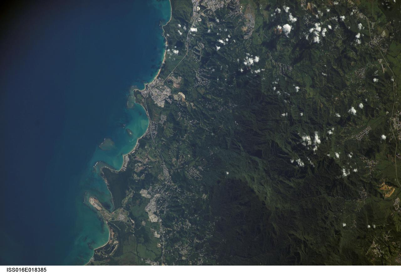
ISS016-E-018385 (23 Dec. 2008) --- Luquillo Mountains, Puerto Rico are featured in this image photographed by an Expedition 16 crewmember on the International Space Station. The Luquillo Mountains are located in the northeastern portion of Puerto Rico and rise to elevations of 1,075 meters. According to scientists, the mountains are comprised mainly of volcanic rock material that was uplifted by tectonism - Puerto Rico is located between the junction of the North American and Caribbean plates - approximately 37--28 million years ago. Prevailing easterly winds bring moisture from the Caribbean Sea that falls as precipitation as they cross the mountains. Higher elevations receive more rainfall than lower elevations, leading to subtropical forest types in the lowlands and montane forest types near the summits. This image, taken during the rainy season, illustrates the rich vegetation cover of the mountains. The rapid change in ecosystems with elevation, land use history, and exposure to frequent natural disturbances (such as hurricanes) makes the Luquillo Mountains as ideal location for ecological study. The Luquillo Experimental Forest Long Term Ecological Research (LTER) site is contained within the Luquillo National Forest, covering much of the mountains to the southwest of the city of Luquillo (center). Historical human land uses in the Forest -- such as logging, agriculture, charcoal production, and coffee plantations - have determined much of the current ecosystem structure. Results of LTER site research indicates that the forest ecosystems recover more rapidly from natural disturbances (like hurricanes) than they do from human disturbance.
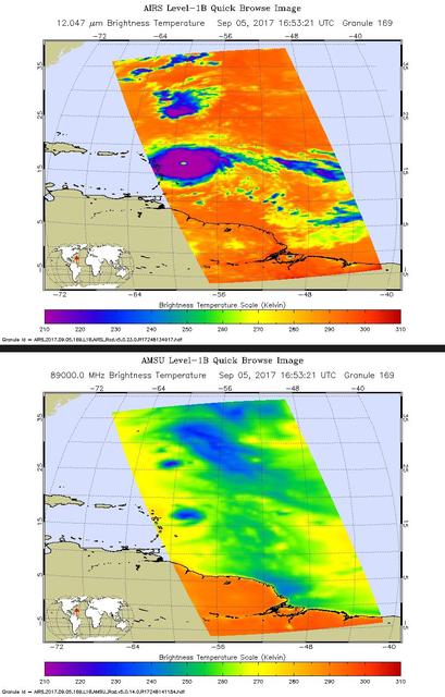
Hurricane Irma is the strongest hurricane ever recorded outside the Caribbean Sea and Gulf of Mexico. These two images from the Atmospheric Infrared Sounder (AIRS) instrument aboard NASA's Aqua satellite show what Hurricane Irma looked like when Aqua passed overhead just before 1 p.m. local time (10 a.m. PDT) on Sept. 5, 2017. Forecasts at the National Hurricane Center have Irma passing near the major islands to its west before turning northward near Florida this weekend. The first image (top) is an infrared snapshot from AIRS (see Figure 1 for larger image). In orange and red areas, the ocean surface shines through, while blue and purple areas represent cold, high clouds that obscure what lies below. Typical of well-developed hurricanes, Irma is nearly circular with a well-defined eye at its center. The eye is about 25 miles (40 kilometers) in diameter. Careful scrutiny shows a red pixel in the center of the eye, which means that AIRS achieved a bulls-eye with one of its "looks" and was able to see to the ocean between the dense clouds in the eye wall. The second image (bottom) shows the view through AIRS' microwave-colored "lenses" (see Figure 2 for larger image). Here the ocean surface looks yellow, while green represents various degrees of cloudiness. Blue shows areas where it is raining heavily. The eye is not apparent in this image because the "pixel size" of the microwave sounder, about 30 miles (50 kilometers), is larger than the eye and therefore cannot "thread the needle." The infrared sounder, on the other hand, has a pixel size of only 10 miles (16.5 kilometers) and can distinguish the small eye. https://photojournal.jpl.nasa.gov/catalog/PIA21941

Mark Pestana is a research pilot and project manager at the NASA Dryden Flight Research Center, Edwards, Calif. He is a pilot for the Beech B200 King Air, the T-34C and the Predator B. He flies the F-18 Hornet as a co-pilot and flight test engineer. Pestana has accumulated more than 4,000 hours of military and civilian flight experience. He was also a flight engineer on the NASA DC-8 flying laboratory. Pestana was the project manager and pilot for the Hi–rate Wireless Airborne Network Demonstration flown on the NASA B200 research aircraft. He flew B200 research missions for the X-38 Space Integrated Inertial Navigation Global Positioning System experiment. Pestana also participated in several deployments of the DC-8, including Earth science expeditions ranging from hurricane research over the Caribbean Sea to ozone studies over the North Pole, atmospheric chemistry over the South Pacific, rain forest health in Central America, Rocky Mountain ice pack assessment, and volcanic and tectonic activity around the Pacific Rim. He came to Dryden as a DC-8 mission manager in June 1998 from NASA Johnson Space Center, Houston, where he served as the Earth and Space Science discipline manager for the International Space Station Program at Johnson. Pestana also served as a flight crew operations engineer in the Astronaut Office, developing the controls, displays, tools, crew accommodations and procedures for on-orbit assembly, test, and checkout of the International Space Station. He led the analysis and technical negotiations for modification of the Russian Soyuz spacecraft as an emergency crew return vehicle for space station crews. He joined the U.S. Air Force Reserve in 1991 and held various positions as a research and development engineer, intelligence analyst, and Delta II launch vehicle systems engineer. He retired from the U.S. Air Force Reserve with the rank of colonel in 2005. Prior to 1990, Pestana was on active duty with the U.S. Air Force as the director of mi
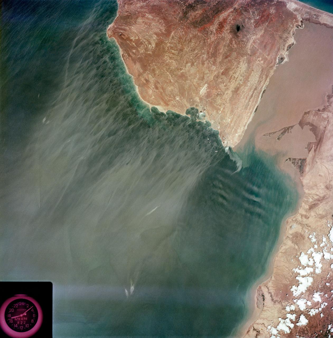
S73-35079 (July-September 1973) --- A near vertical view of the Caribbean coast of Venezuela is seen in this Skylab 3 Earth Resources Experiment Package S190-B (five-inch Earth terrain camera) photograph taken from the Skylab space station in Earth orbit. The large body of water is the Golfo de Venezuela; and the major land mass is the Peninsula de Paraguana. The view is looking northward from the mouth of the Golfete de Coro and Punta Cardon to Punta Macolla. The peninsula is connected to the Venezuelan mainland by the narrow strip of land in the most easterly corner of the picture. The dry, arid climate on the peninsula is indicated by sparse vegetation and the abundance of sand dunes. The highest point is about 2,700 feet above the sea and is the conspicuous black spot. Old raised shoreline features appear as streaks parallel to the Golfete de Coro. Sand dunes and stream erosion have modified these features. Water of the Golfete de Coro is red from the high sediment content. The streaks in the water off the peninsula is apparently an effect of wind which is blowing sand and water offshore. The EREP investigator Dr. Jose Antonio Galavis, of the Ministerio de Mines e Hidrocarburos, will use this information to map geology and coastal sedimentation in the Peninsula de Paraguana. Federal agencies participating with NASA on the EREP projects are the Departments of Agriculture, Commerce, Interior, the Environmental Protection Agency and the Corps of Engineers. All EREP photography is available to the public through the Department of Interior?s Earth Resources Observations Systems Data Center, Sioux Falls, South Dakota, 57198. (Alternate number SL3-83-237) Photo credit: NASA
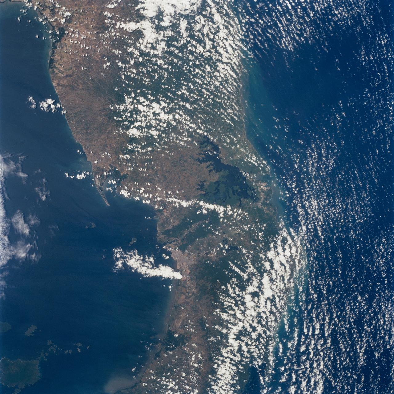
STS098-712-091 (7-20 February 2001) --- The forested area of the Panama Canal Zone can be seen near the center of this north-looking image, photographed with a 70mm handheld camera from the Earth-orbiting Space Shuttle Atlantis. (NOTE: The image should be oriented with Panama running horizontally and the majority of the clouds at the top). The Panama Canal Zone extends 5 miles (8 kilometers) on either side of the Panama Canal. The forested zone acts as a buffer for the canal to help prevent erosion and sediment from clogging the canal. Most of the countryside on both sides of the Canal Zone has been deforested to make way for large ranches and the raising of cattle. Though some sedimentation is occurring, dredging of the canal keeps the passage clear. The Panama Canal is 40 miles (64 kilometers) long including dredged approach channels at each end. With the Caribbean Sea covering the upper portion of the image and the Pacific Ocean covering the lower portion of the image, the canal traverses the Isthmus of Panama in a northwest to southeast direction. Gatun Lake, one of the largest artificial lakes in the world, is visible at the north end of the Canal Zone. Panama City (light-colored grayish area) is discernible to the right of the canal at its southern entrance from the Pacific Ocean. In 1996, 15,000 ships traveled through the canal, an average of 42 ships per day. Passage through the canal requires 7 to 8 hours.
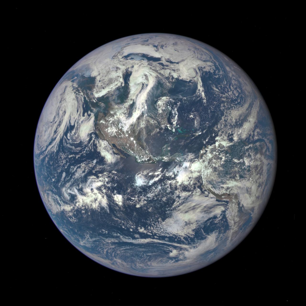
A NASA camera on the Deep Space Climate Observatory satellite has returned its first view of the entire sunlit side of Earth from one million miles away. This color image of Earth was taken by NASA’s Earth Polychromatic Imaging Camera (EPIC), a four megapixel CCD camera and telescope. The image was generated by combining three separate images to create a photographic-quality image. The camera takes a series of 10 images using different narrowband filters -- from ultraviolet to near infrared -- to produce a variety of science products. The red, green and blue channel images are used in these color images. The image was taken July 6, 2015, showing North and Central America. The central turquoise areas are shallow seas around the Caribbean islands. This Earth image shows the effects of sunlight scattered by air molecules, giving the image a characteristic bluish tint. The EPIC team is working to remove this atmospheric effect from subsequent images. Once the instrument begins regular data acquisition, EPIC will provide a daily series of Earth images allowing for the first time study of daily variations over the entire globe. These images, available 12 to 36 hours after they are acquired, will be posted to a dedicated web page by September 2015. The primary objective of DSCOVR, a partnership between NASA, the National Oceanic and Atmospheric Administration (NOAA) and the U.S. Air Force, is to maintain the nation’s real-time solar wind monitoring capabilities, which are critical to the accuracy and lead time of space weather alerts and forecasts from NOAA. For more information about DSCOVR, visit: <a href="http://www.nesdis.noaa.gov/DSCOVR/" rel="nofollow">www.nesdis.noaa.gov/DSCOVR/</a>
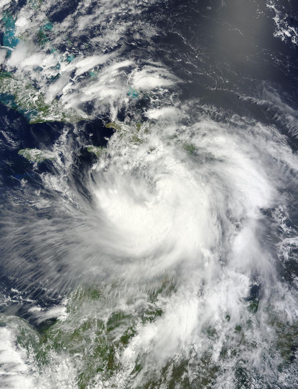
NASA's Terra satellite passed over Tropical Storm Isaac on Aug. 24 at 15:20 UTC (11:20 a.m. EDT) as it continued moving through the eastern Caribbean Sea. The MODIS instrument onboard Aqua captured this visible image. At 2 p.m. EDT on Aug. 24, Isaac's maximum sustained winds were near 60 mph (95 kmh). The National Hurricane Center noted that Isaac could strengthen later before reaching the coast of Hispaniola tonight, Aug. 24. Hispaniola is an island that contains the Dominican Republic and Haiti. Isaac is located about 135 miles (215 km) south-southeast of Port au Prince, Haiti, near latitude 16.8 north and longitude 71.4 west. Isaac is now moving toward the northwest near 14 mph (22 kmh). Isaac is expected to reach hurricane status over the weekend of Aug. 25-26 and NASA satellites will continue providing valuable temperature, rainfall, visible and infrared data. Text Credit: Rob Gutro NASA's Goddard Space Flight Center, Greenbelt, Md. <b>To read more go to: <a href="http://www.nasa.gov/mission_pages/hurricanes/archives/2012/h2012_Isaac.html" rel="nofollow">www.nasa.gov/mission_pages/hurricanes/archives/2012/h2012...</a></b> Credit: NASA Goddard MODIS Rapid Response Team <b><a href="http://www.nasa.gov/audience/formedia/features/MP_Photo_Guidelines.html" rel="nofollow">NASA image use policy.</a></b> <b><a href="http://www.nasa.gov/centers/goddard/home/index.html" rel="nofollow">NASA Goddard Space Flight Center</a></b> enables NASA’s mission through four scientific endeavors: Earth Science, Heliophysics, Solar System Exploration, and Astrophysics. Goddard plays a leading role in NASA’s accomplishments by contributing compelling scientific knowledge to advance the Agency’s mission. <b>Follow us on <a href="http://twitter.com/NASA_GoddardPix" rel="nofollow">Twitter</a></b> <b>Like us on <a href="http://www.facebook.com/pages/Greenbelt-MD/NASA-Goddard/395013845897?ref=tsd" rel="nofollow">Facebook</a></b> <b>Find us on <a href="http://instagrid.me/nasagoddard/?vm=grid" rel="nofollow">Instagram</a></b>
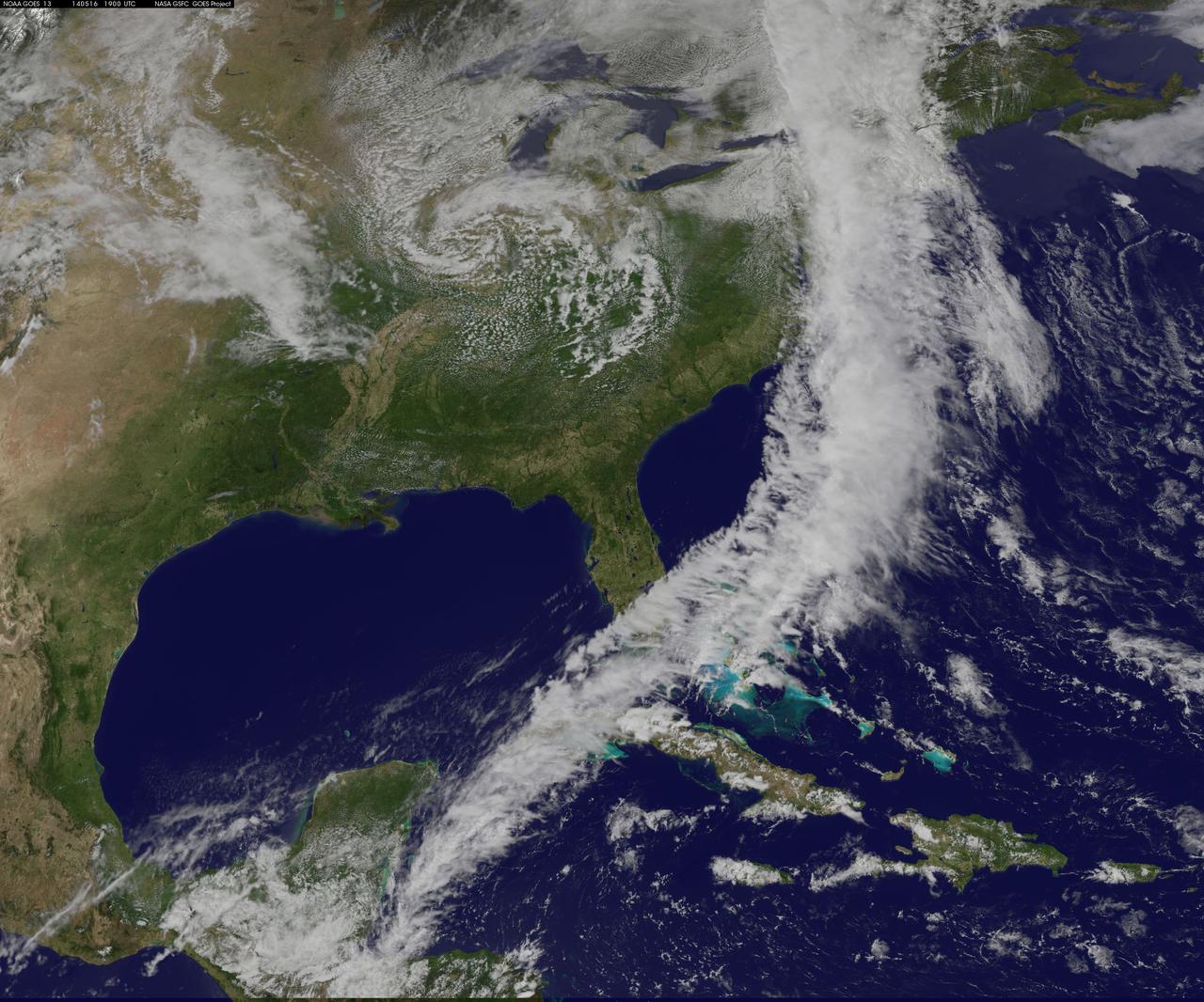
NOAA's GOES-East satellite captured an image of a powerful cold front that triggered flash flood watches and warnings along the U.S. East Coast on May 16. NOAA's National Weather Service noted flash flooding was possible from New England into eastern North Carolina today, May 16. The clouds associated with the long cold front was captured using visible data from NOAA's GOES-East or GOES-13 satellite on at 1900 UTC (3:00 p.m. EDT) and was made into an image by NASA/NOAA's GOES Project at NASA's Goddard Space Flight Center in Greenbelt, Md. The clouds stretched from Maine south through the Mid-Atlantic down to southern Florida with a tail of clouds extending into the western Caribbean Sea. South of Lake Michigan the rounded swirl of clouds indicates another low pressure system. GOES satellites provide the kind of continuous monitoring necessary for intensive data analysis. Geostationary describes an orbit in which a satellite is always in the same position with respect to the rotating Earth. This allows GOES to hover continuously over one position on Earth's surface, appearing stationary. As a result, GOES provide a constant vigil for the atmospheric "triggers" for severe weather conditions such as tornadoes, flash floods, hail storms and hurricanes. For updated information about the storm system, visit NOAA's National Weather Service website: <a href="http://www.weather.gov" rel="nofollow">www.weather.gov</a> For more information about GOES satellites, visit: <a href="http://www.goes.noaa.gov/" rel="nofollow">www.goes.noaa.gov/</a> or <a href="http://goes.gsfc.nasa.gov/" rel="nofollow">goes.gsfc.nasa.gov/</a> Rob Gutro NASA's Goddard Space Flight Center <b><a href="http://www.nasa.gov/audience/formedia/features/MP_Photo_Guidelines.html" rel="nofollow">NASA image use policy.</a></b> <b><a href="http://www.nasa.gov/centers/goddard/home/index.html" rel="nofollow">NASA Goddard Space Flight Center</a></b> enables NASA’s mission through four scientific endeavors: Earth Science, Heliophysics, Solar System Exploration, and Astrophysics. Goddard plays a leading role in NASA’s accomplishments by contributing compelling scientific knowledge to advance the Agency’s mission. <b>Follow us on <a href="http://twitter.com/NASAGoddardPix" rel="nofollow">Twitter</a></b> <b>Like us on <a href="http://www.facebook.com/pages/Greenbelt-MD/NASA-Goddard/395013845897?ref=tsd" rel="nofollow">Facebook</a></b> <b>Find us on <a href="http://instagram.com/nasagoddard?vm=grid" rel="nofollow">Instagram</a></b>
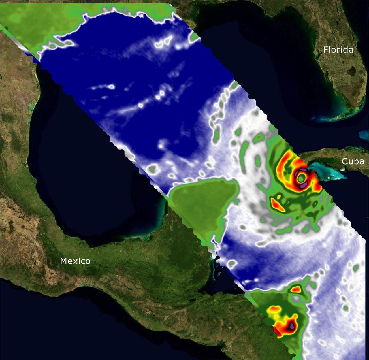
Two recently launched instruments that were designed and built at NASA's Jet Propulsion Laboratory in Southern California to provide forecasters data on weather over the open ocean captured images of Hurricane Ian on Sept. 27, 2022, as the storm approached Cuba on its way north toward the U.S. mainland. The instruments, Compact Ocean Wind Vector Radiometer (COWVR) and Temporal Experiment for Storms and Tropical Systems (TEMPEST), observe the planet's atmosphere and surface from aboard the International Space Station, which passed in low-Earth orbit over the Caribbean Sea at about 12:30 a.m. EDT. Ian made landfall in Cuba's Pinar del Rio province at 4:30 a.m. EDT, according to the National Hurricane Center. At that time, it was a Category 3 hurricane, with estimated wind speeds of 125 mph (205 kph). The image above combines microwave emissions measurements from both COWVR and TEMPEST. White sections indicate the presence of clouds. Green portions indicate rain. Yellow, red, and black indicate where air and water vapor were moving most swiftly. Ian's center is seen just off of Cuba's southern coast, and the storm is shown covering the island with rain and wind. COWVR and TEMPEST sent the data for this image back to Earth in a direct stream via NASA's tracking and data relay satellite (TDRS) constellation. The data were processed at JPL and made available to forecasters less than two hours after collection. About the size of a minifridge, COWVR measures natural microwave emissions over the ocean. The magnitude of the emissions increases with the amount of rain in the atmosphere, and the strongest rain produces the strongest microwave emissions. TEMPEST – comparable in size to a cereal box – tracks microwaves at a much shorter wavelength, allowing it to see ice particles within the hurricane's cloudy regions that are thrust into the upper atmosphere by the storm. Both microwave radiometers were conceived to demonstrate that smaller, more energy-efficient, more simply designed sensors can perform most of the same measurements as current space-based weather instruments that are heavier, consume more power, and cost much more to construct. COWVR's development was funded by the U.S. Space Force, and TEMPEST was developed with NASA funding. The U.S. Space Test Program-Houston 8 (STP-H8) is responsible for hosting the instruments on the space station under Space Force funding in partnership with NASA. Data from the instruments are being used by government and university weather forecasters and scientists. The mission will inform development of future space-based weather sensors, and scientists are working on mission concepts that would take advantage of the low-cost microwave sensor technologies to study long-standing questions, such as how heat from the ocean fuels global weather patterns. https://photojournal.jpl.nasa.gov/catalog/PIA25425