This is the McDornell Douglas CD-XA Reusable Launch Vehicle (RLV) concept. The Delta Clipper-Experimental (DC-X) was originally developed by McDonnell Douglas for the DOD. The DC-XA is a single-stage-to-orbit, vertical takeoff/vertical landing, launch vehicle concept, whose development is geared to significantly reduce launch cost and provided a test bed for NASA Reusable Launch Vehicle (RLV) technology as the Delta Clipper-Experimental Advanced (DC-XA). The program was discontinued in 2003.

(jsc2022e089094_alt) (Nov. 21, 2022) During day 6 of the 25.5 day mission, Vanessa Wyche, Johnson Space Center, Center Director and Flight Director Rick LaBrode, inside the Artemis Mission Control Room or the White Flight Control Room at the Johnson Space Center during the Outbound Powered Flyby (OPF) burn. The Outbound Powered Flyby burn, targeted the DRI burn and was performed as Orion flew by the Moon around 62 mi (100 km)
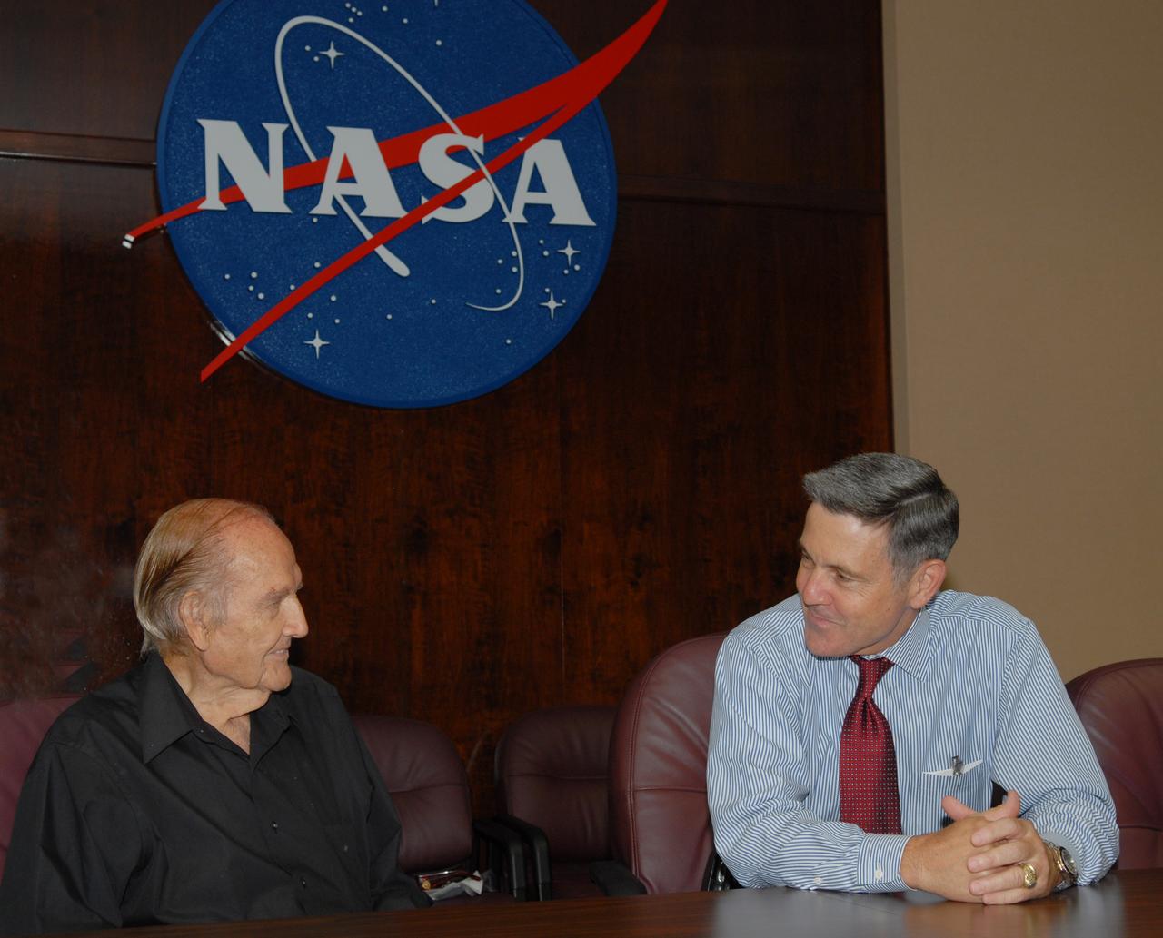
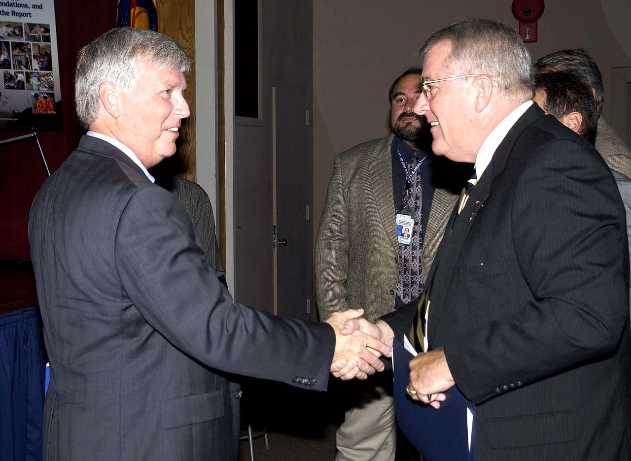
Senator George McGovern Meets CD Bob Cabana
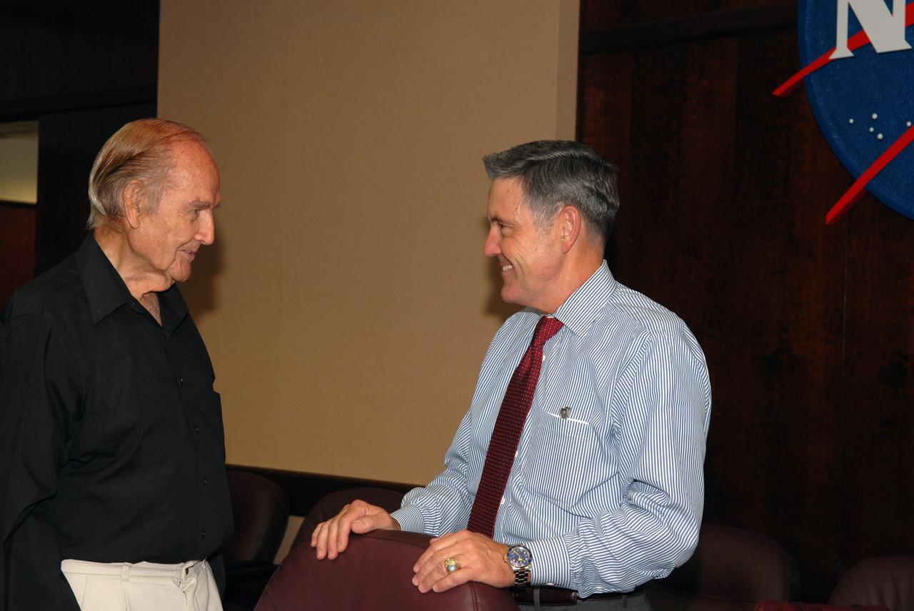
Senator George McGovern Meets CD Bob Cabana
KENNEDY SPACE CENTER, FLA. -- Center Director Bill Parsons welcomes STS-122 Pilot Alan Poindexter after the mission crew's arrival at NASA's Kennedy Space Center. At right is Commander Steve Frick. Seen behind Poindexter is Mission Specialist Leland Melvin. The crew's arrival signals the imminent launch of space shuttle Atlantis on mission STS-122. The launch countdown begins at 7 p.m. Dec. 3. Launch is scheduled for 4:31 p.m. EST on Dec. 6. Atlantis will carry the Columbus Lab, Europe's largest contribution to the construction of the International Space Station. It will support scientific and technological research in a microgravity environment. Columbus, a program of ESA, is a multifunctional, pressurized laboratory that will be permanently attached to Node 2 of the space station to carry out experiments in materials science, fluid physics and biosciences, as well as to perform a number of technological applications. Photo credit: NASA/Kim Shiflett
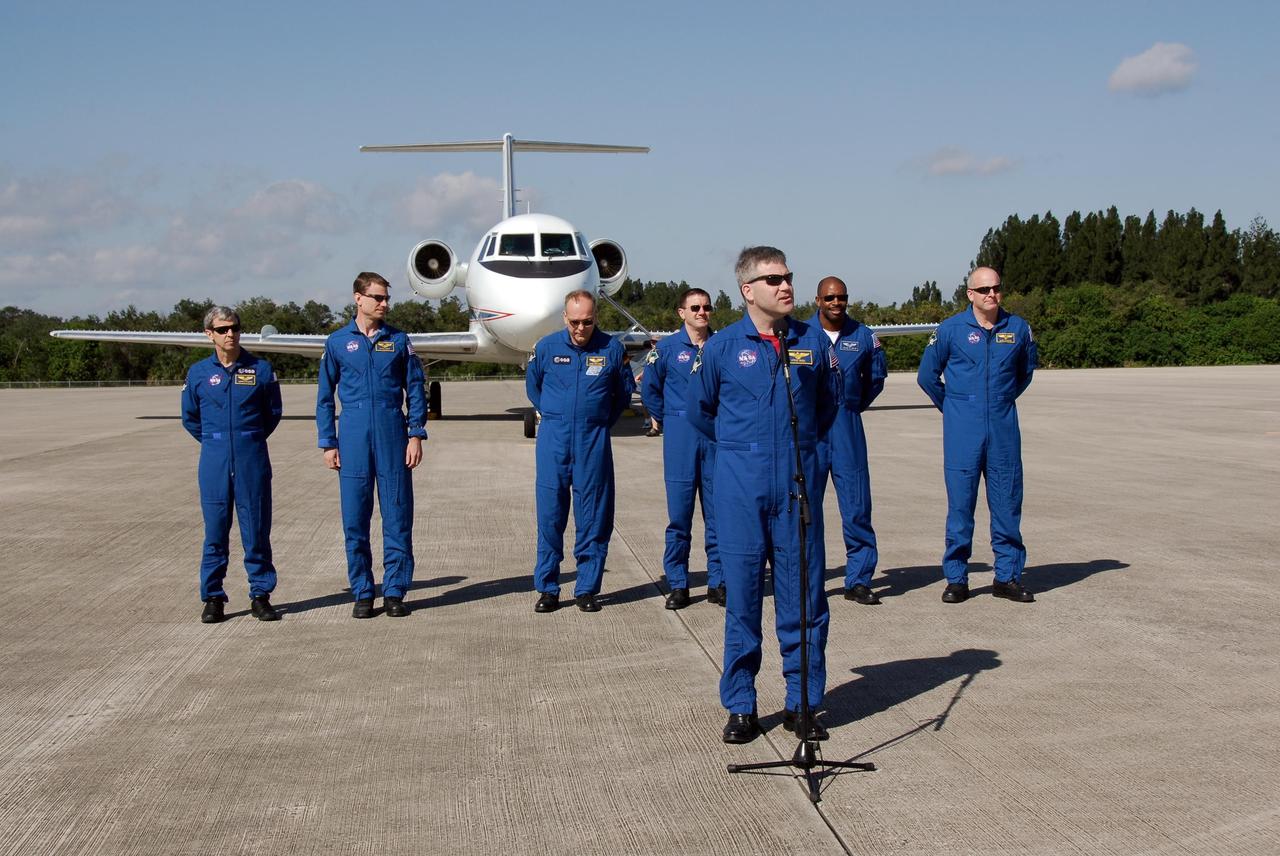
KENNEDY SPACE CENTER, FLA. -- After arrival at NASA's Kennedy Space Center, the STS-122 mission crew greet the media on the Shuttle Landing Facility. At the microphone is Commander Steve Frick. Behind him, left to right, are Mission Specialists Leopold Eyharts, Stanley Love, Hans Schlegel, Rex Walheim and Leland Melvin, and Pilot Alan Poindexter. Eyhars and Schlegel represent the European Space Agency. The crew's arrival signals the imminent launch of space shuttle Atlantis on mission STS-122. The launch countdown begins at 7 p.m. Dec. 3. Launch is scheduled for 4:31 p.m. EST on Dec. 6. Atlantis will carry the Columbus Lab, Europe’s largest contribution to the construction of the International Space Station. It will support scientific and technological research in a microgravity environment. Columbus, a program of ESA, is a multifunctional, pressurized laboratory that will be permanently attached to Node 2 of the space station to carry out experiments in materials science, fluid physics and biosciences, as well as to perform a number of technological applications. Photo credit: NASA/Kim Shiflett
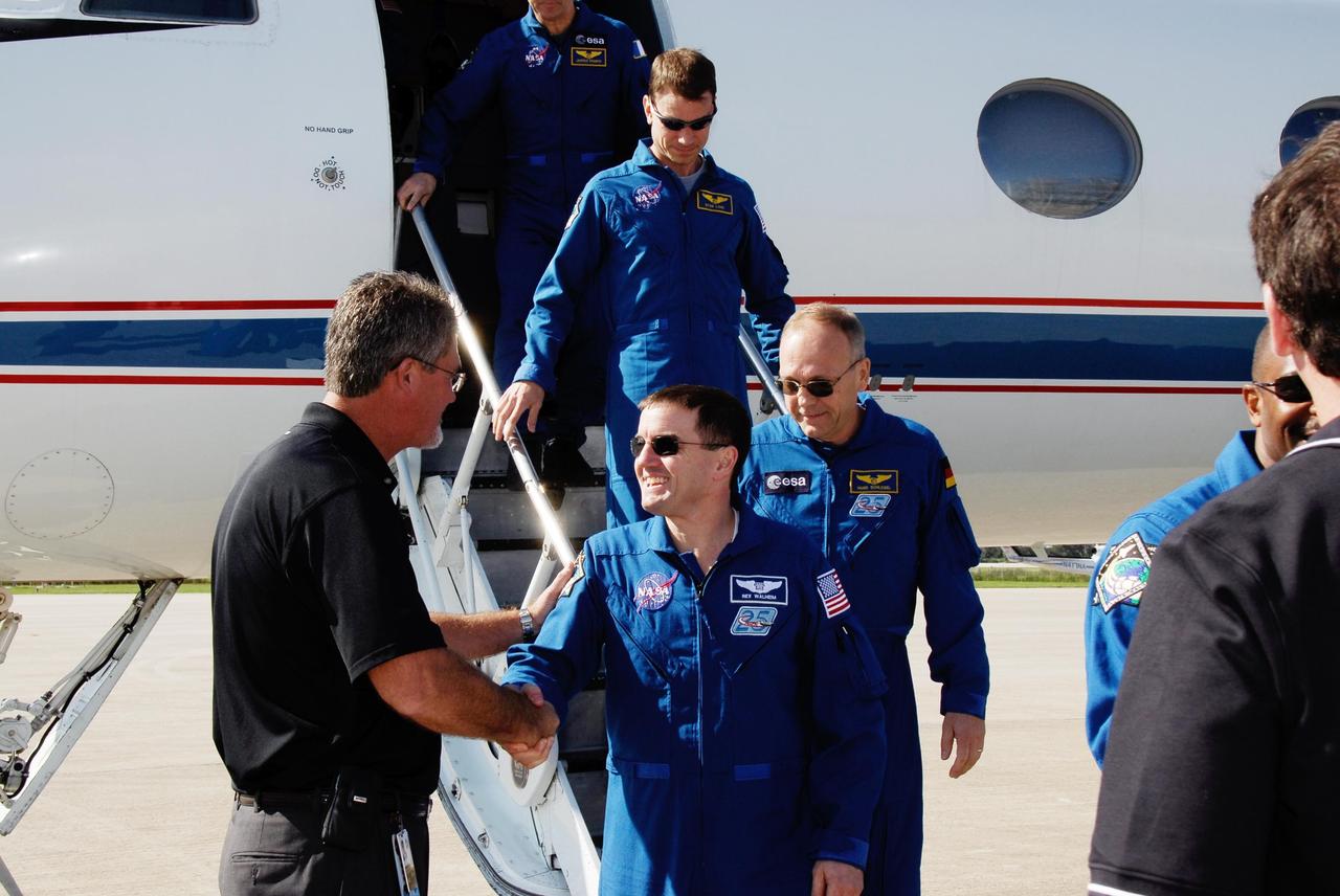
KENNEDY SPACE CENTER, FLA. -- Center Director Bill Parsons welcomes STS-122 Mission Specialist Rex Walheim after the mission crew's arrival at NASA's Kennedy Space Center. Behind Walheim are Mission Specialists Hans Schlegel and Stanley Love. Schlegel represents the European Space Agency. The crew's arrival signals the imminent launch of space shuttle Atlantis on mission STS-122. The launch countdown begins at 7 p.m. Dec. 3. Launch is scheduled for 4:31 p.m. EST on Dec. 6. Atlantis will carry the Columbus Lab, Europe's largest contribution to the construction of the International Space Station. It will support scientific and technological research in a microgravity environment. Columbus, a program of ESA, is a multifunctional, pressurized laboratory that will be permanently attached to Node 2 of the space station to carry out experiments in materials science, fluid physics and biosciences, as well as to perform a number of technological applications. Photo credit: NASA/Kim Shiflett
New Educational CD-Rom 'Exploring Aeronautics' Previewed by Ames Staff & Kids.
New Educational CD-Rom 'Exploring Aeronautics' Previewed by Ames Staff & Kids.
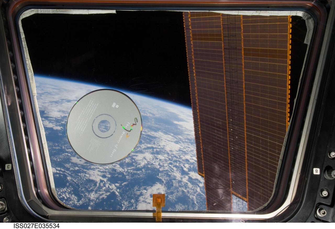
View of a music CD, The Memory Of Trees by Enya, floating in front of a window in the Cupola Module during Expedition 27 / STS-134 joint operations.
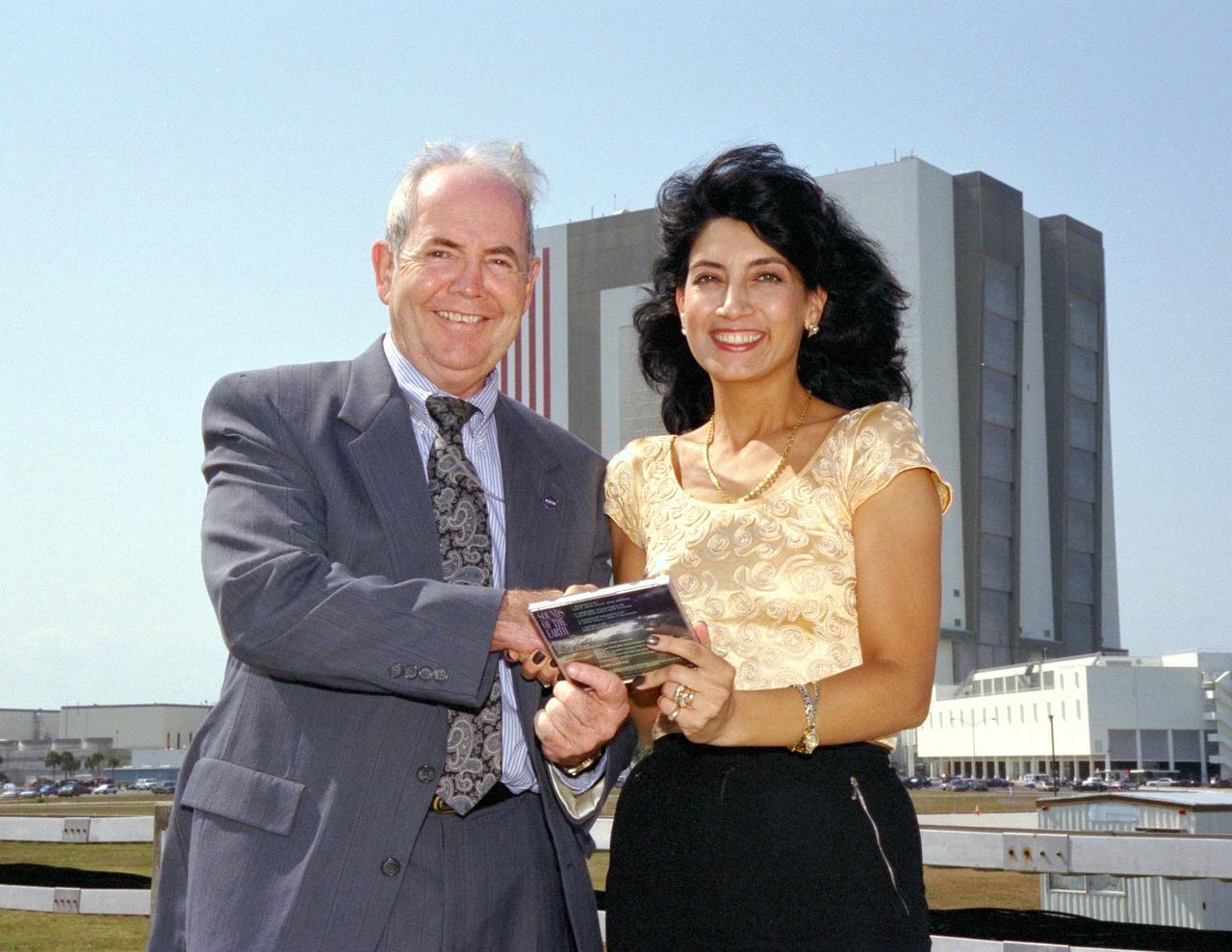
KENNEDY SPACE CENTER, FLA. -- David Dickinson, the acting director of the National Aeronautics and Space Administration (NASA) Public Affairs Office at Kennedy Space Center, accepts a copy of Bulgarian singer Dyana Dafova's latest compact disc (CD) from her on behalf of NASA. The 525-foot tall Vehicle Assembly Building, where Space Shuttle orbiters are mated to their external tank/solid rocket booster stacks, looms in the background. Dyana is touring the United States to promote her CD, entitled "Sounds of the Earth," and was an invited guest of NASA for the launch of Columbia on STS-90, the Neurolab mission, earlier in the day. Columbia lifted off from Launch Pad 39B at 2:19 p.m. EDT. Dyana characterized the music on her CD as a new sound, incorporating jazz and new age classics, sung in a newly created language comprised of Bulgarian, English, Sanskrit, Aramski and Hebrew
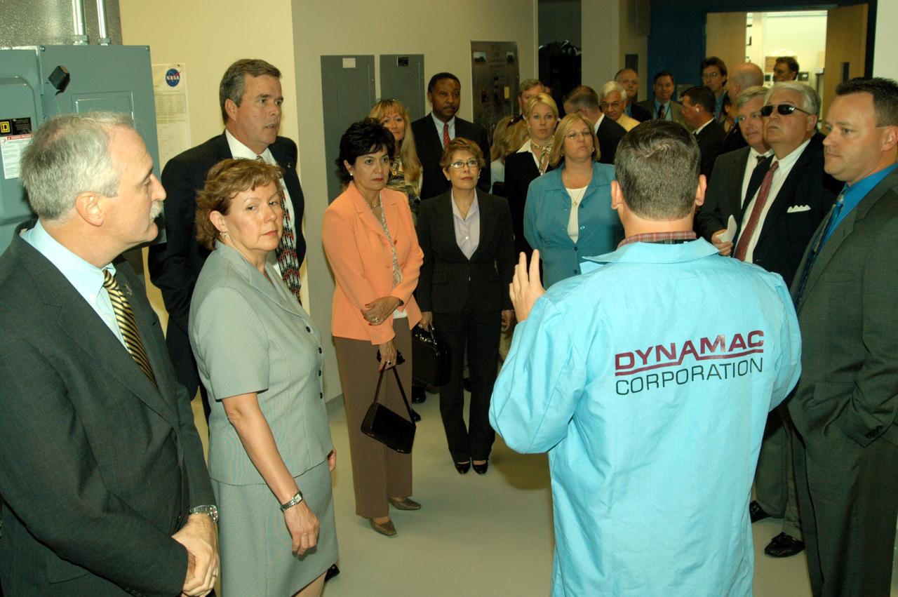
KENNEDY SPACE CENTER, FLA. -- Neil Yorio, a Dynamac scientist (right), explains the function of the KSC Space Life Sciences (SLS) Lab to a prestigious tour group. From left are NASA Administrator Sean O’Keefe and his wife, Laura; Florida Gov. Jeb Bush; Bernadette Kennedy, wife of the Center Director (CD); Columba Bush, wife of the governor; behind Mrs. Bush, former astronaut Winston Scott; and third from right, CD Jim Kennedy. The new lab is a state-of-the-art facility built for ISS biotechnology research. It was developed as a partnership between NASA-KSC and the State of Florida. The tour followed the launching ceremony at the KSC Visitor Complex for the new Florida quarter issued by the U.S. Mint. The ceremony was emceed by Kennedy and included remarks by O’Keefe, Bush, U.S. Mint Director Henrietta Holsman Fore and Deputy Secretary of the Treasury Samuel W. Bodman.
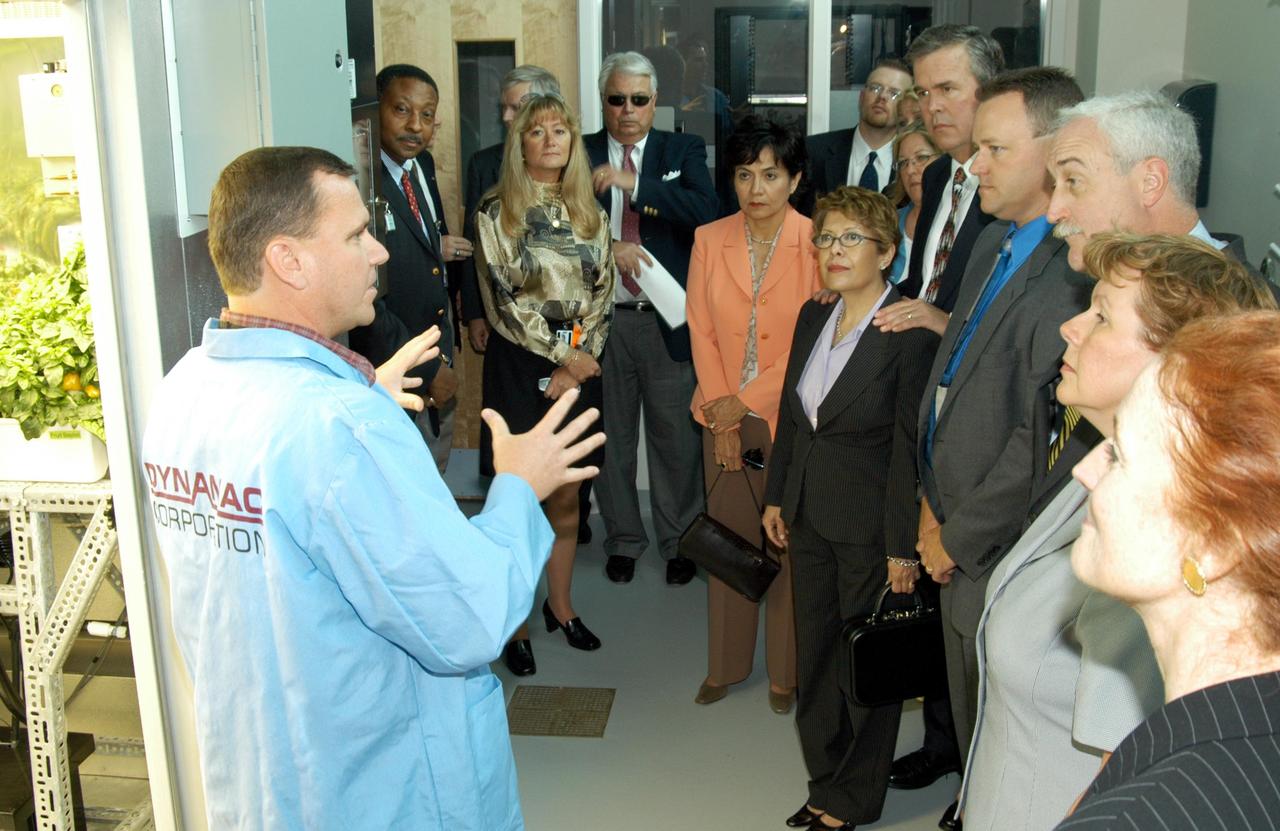
KENNEDY SPACE CENTER, FLA. -- Neil Yorio, a Dynamac scientist(left), explains the function of the KSC Space Life Sciences (SLS) Lab to a prestigious tour group. In the background at left is former astronaut Winston Scott; at center is Bernadette Kennedy, wife of the Center Director (CD); next to her are Columba and Florida Gov. Jeb Bush; third from right is NASA Administrator Sean O’Keefe, next to his wife, Laura; and on the far right is U.S. Mint Director Henrietta Holsman Fore. The new lab is a state-of-the-art facility built for ISS biotechnology research. It was developed as a partnership between NASA-KSC and the State of Florida. The tour followed the launching ceremony at the KSC Visitor Complex for the new Florida quarter issued by the U.S. Mint. The ceremony was emceed by CD Jim Kennedy and included remarks by O’Keefe, Bush, Fore and Deputy Secretary of the Treasury Samuel W. Bodman.
KENNEDY SPACE CENTER, FLA. - Center Director Jim Kennedy (left) welcomes Bill Pickavance to the podium during the CD’s first all-hands meeting with employees. Pickavance is vice president and deputy program manager, Florida operations, United Space Alliance. Also, making presentations were Dr. Woodrow Whitlow Jr., KSC deputy director, and Tim Wilson, assistant chief engineer for Shuttle. Representatives from the Shuttle program and contractor team were on hand to discuss the Columbia Accident Investigation Board report and where KSC stands in its progress toward return to flight.
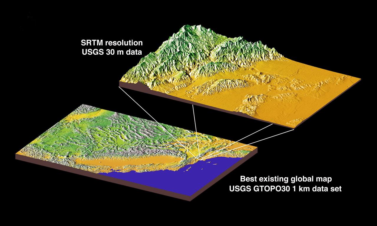
JSC2000E01552 (January 2000) --- This chart compares currently available global map data with the data which will be provided by SRTM during STS-99. The area depicted is the California coast. The SRTM mission will have approximately 1,000 scheduled data takes (every time Endeavour is over land). Data acquisition will be conducted in excess of 80 hours. The recording rate for data will be 180 Mbits/sec for C-band, 90 Mbits/sec for X-band. Total raw radar data will be approximately 9.8 terabytes (15,000 CDs). The mission will utilize some 300 high-density tapes (each tape records 30 min. of C-band, or 60 min. of X-band data).
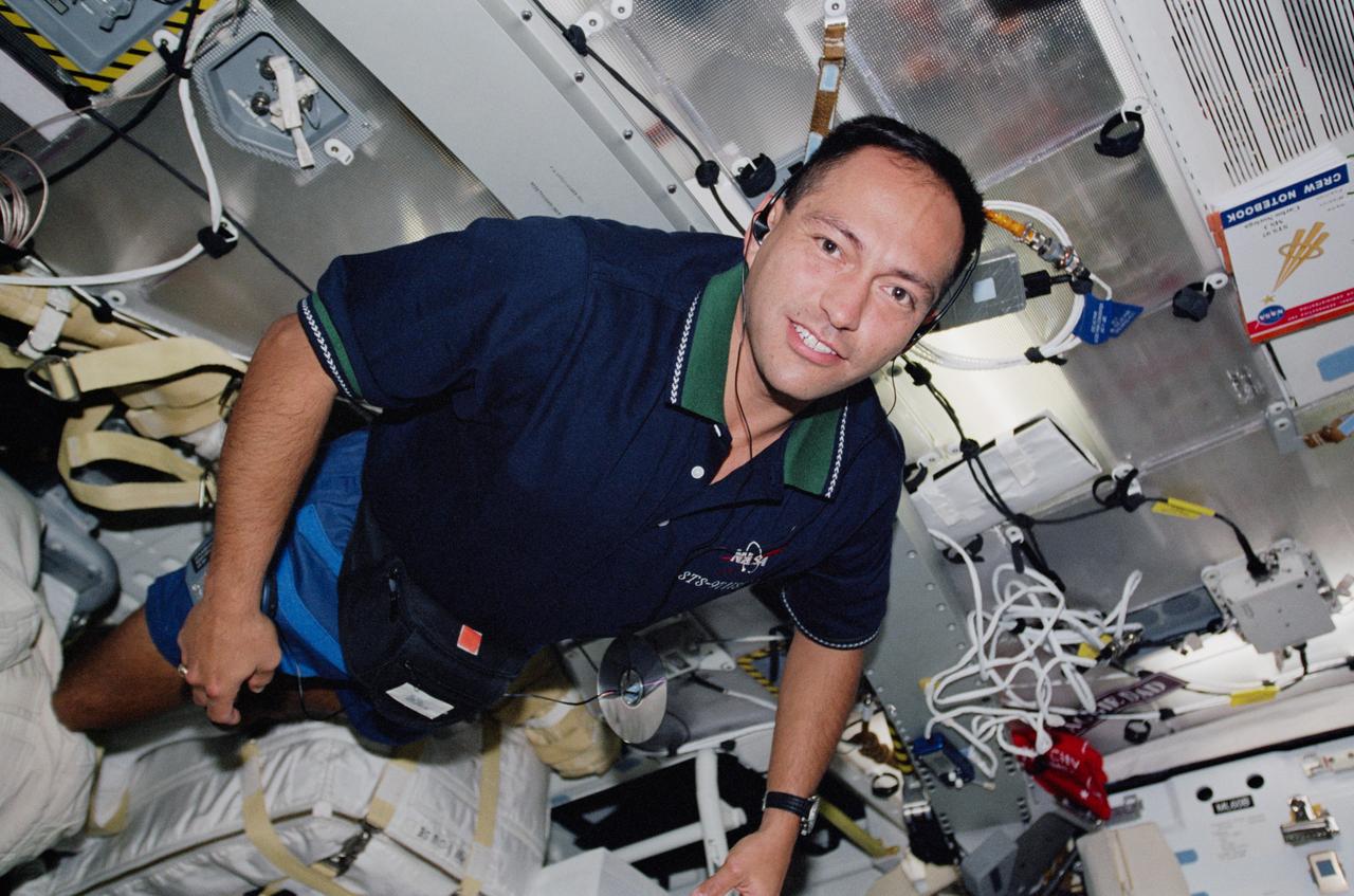
STS097-327-021 (30 Nov. - 11 Dec. 2000) --- Astronaut Carlos I. Noriega moves some gear around on the middeck of the Earth-orbiting Space Shuttle Endeavour.
jsc2024e060607 (Sept. 4, 2024) --- The SpaceX Crew-10 patch was thoughtfully designed by the four-person crew. They used AI for initial inspiration, while the ever-irreplaceable human perfected the design and brought the patch to fruition. It is a 10-sided patch with the roman numeral X boldly in the center, representing the 10th operational flight of the Crew Dragon spacecraft. The Dragon, also the capsule’s namesake, is wings out in full flight, representing the four professional pilots that make up the crew complement. The Dragon, illuminated by one of Earth’s stunning and beautiful sunrises, is focused on the ISS and its mission, while keeping a watchful position above Earth. The stars are red, white, and blue for the flag colors of each crew members’ home country, and the brightest stars represent the crew’s closest family members and support system.
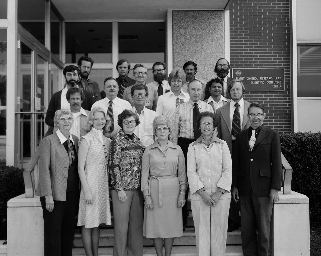
FDCD Stability and Control Branch Photo. Names, rows front to back, people left to right: Ground level: 1. Margery Hanna 2. Debra L. Livingston 3. Carolyn Grantham 4. Nell Moore 5. Katherine G. Johnson 6. Hewitt Phillips Step 1: 1. John Shaughnessy 2. John Young 3. Bill Martz 4. Charles T. Woolley Step 2: 1. Al Hamer 2. Marion Wise (?) 3. Suresh Joshi Step 3: 1. Willard W. Anderson 2. Albert A. Schy 3. Daniel P. Giesy Step 4: 1. Hugh Bergeron 2. Claude Keckler 3. Nelson Groom 4. Ralph Will Names Given by Danial Pl. Giesy.
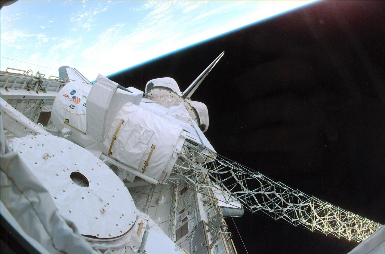
Launched February 11, 2000, the STS-99 Shuttle Radar Topographic Mission (SRTM) was the most ambitious Earth mapping mission to date. A 200-ft long (60 meter) mast supporting the SRTM where it jutted into space from the Space Shuttle Endeavour. In this photograph, part of the SRTM hardware is shown in the payload bay of the shuttle. Orbiting some 145 miles (233 kilometers) above Earth, the giant structure was deployed on February 12, 2000 and the C-band and X-band anternae mounted on it quickly went to work mapping parts of the Earth. The SRTM radar was able to penetrate clouds as well as provide its own illumination, independent of daylight, obtaining3-dimentional topographic images of the world's surface up to the Arctic and Antarctic Circles. The mission completed 222 hours of around the clock radar mapping gathering enough information to fill more than 20,000 CDs.
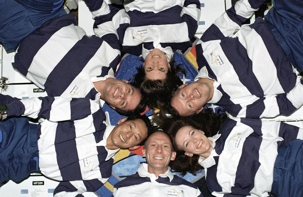
The STS-99 crew pose for a "star-burst" pose in celebration of a successful Shuttle Radar Topographic Mission (SRTM) aboard NASA's Space Shuttle Endeavor. Clockwise, around the circle, from top center are astronauts Janice Voss, Dominic L. Gorie, Janet L. Kavandi, Gerhard Thiele of the European Space Agency, Mamoru Mohri of the Japanese Space Agency, and Kevin Kregel. The STS-99 SRTM mission was the most ambitious Earth mapping mission to date. Orbiting at 233 kilometers (145 miles) above Earth, two radar anternas, one located in the Shuttle bay and the other located on the end of a 60-meter deployable mast, was used during the mission to map Earth's features. The goal was to provide a 3-dimensional topographic map of the world's surface up to the Arctic and Antarctic Circles. The mission completed 222 hours of around the clock radar mapping gathering enough information to fill more than 20,000 CDs.
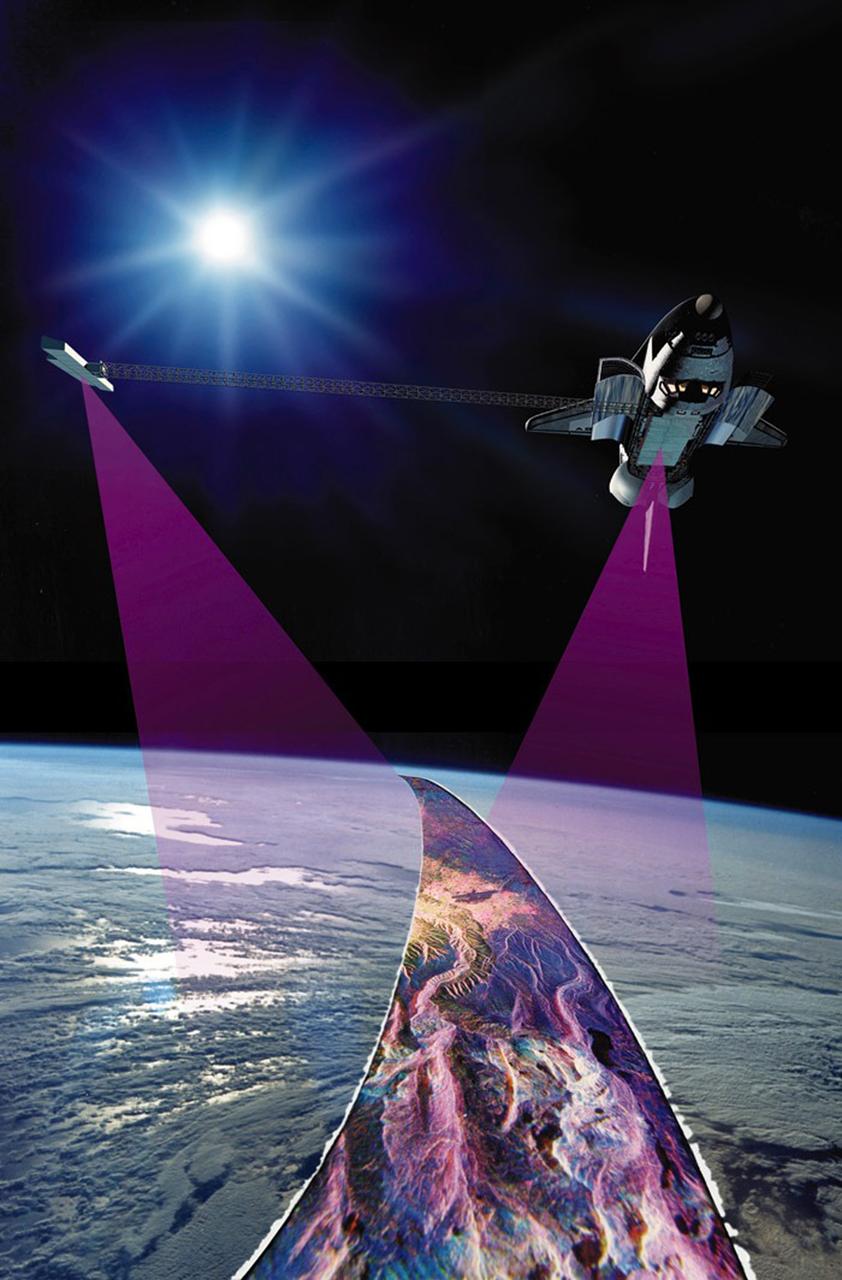
Launched February 11, 2000, the STS-99 Shuttle Radar Topographic Mission (SRTM) was the most ambitious Earth mapping mission to date. This illustration shows the Space Shuttle Endeavour orbiting some 145 miles (233 kilometers) above Earth. With C-band and X-band outboard anternae at work, one located in the Shuttle bay and the other located on the end of a 60-meter deployable mast, the SRTM radar was able to penetrate clouds as well as provide its own illumination, independent of daylight, obtaining 3-dimentional topographic images of the world's surface up to the Arctic and Antarctic Circles. The mission completed 222 hours of around the clock radar mapping, gathering enough information to fill more than 20,000 CDs.
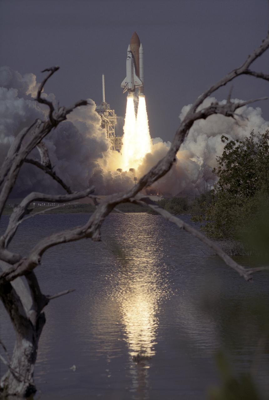
The Space Shuttle Orbiter Endeavour blasts form the launch pad on February 11, 2000 carrying its crew of six for the STS-99 mission, a Shuttle Radar Topography Mission (SRTM), the most ambitious Earth mapping mission to date. Orbiting at 233 kilometers (145 miles) above Earth, two radar anternas, one located in the Shuttle bay and the other located on the end of a 60-meter deployable mast, was used during the mission to map Earth's features. The goal was to provide a 3-dimensional topographic map of the world's surface up to the Arctic and Antarctic Circles. The mission completed 222 hours of around the clock radar mapping gathering enough information to fill more than 20,000 CDs.
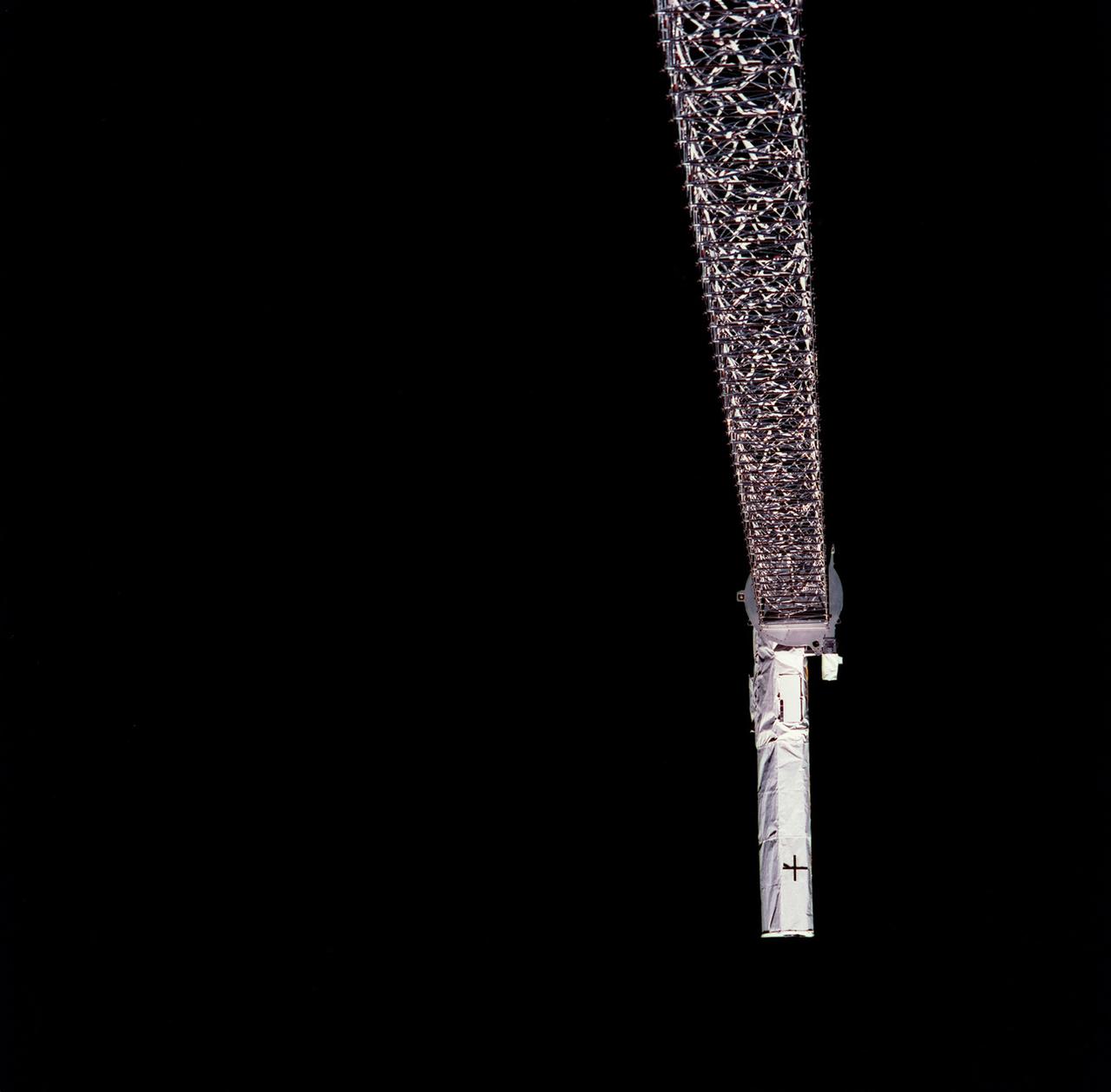
Launched February 11, 2000, the STS-99 Shuttle Radar Topographic Mission (SRTM) was the most ambitious Earth mapping mission to date. This photograph shows a 200-ft long (60 meter) mast supporting the SRTM jutted into space from the Space Shuttle Endeavour (out of frame). Orbiting some 145 miles (233 kilometers) above Earth, the giant structure was deployed on February 12, 2000 and its C-band and X-band anternae quickly went to work mapping parts of the Earth. The outboard antennae can be seen near bottom right. The SRTM radar was able to penetrate clouds as well as provide its own illumination, independent of daylight, and obtained 3-dimentional topographic images of the world's surface up to the Arctic and Antarctic Circles. The mission completed 222 hours of around the clock radar mapping, gathering enough information to fill more than 20,000 CDs.
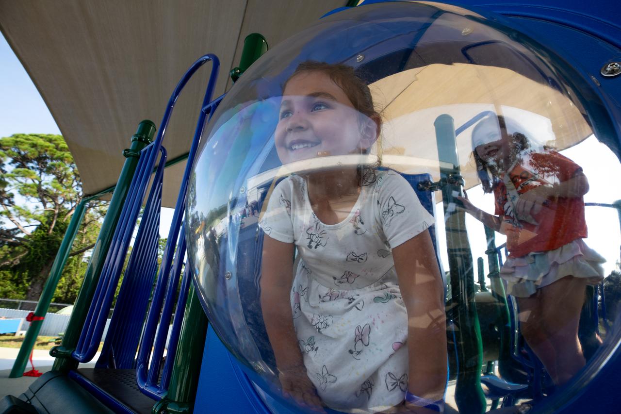
Children enjoy a brand new playground at Kennedy Space Center’s Child Development Center on Aug. 10, 2023. The playground officially opened following a ribbon cutting ceremony earlier in the day.
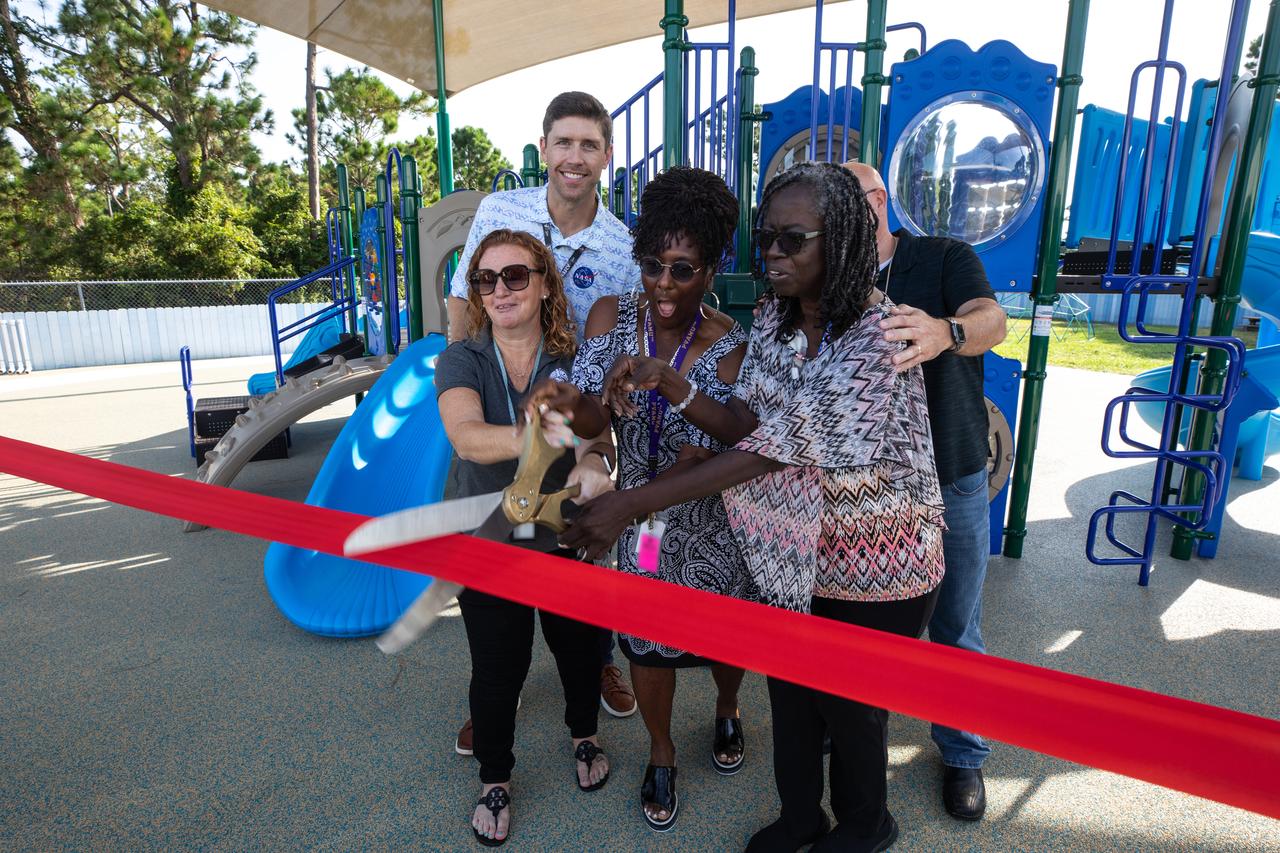
Staff members at Kennedy Space Center’s Child Development Center, along with members of the NASA Exchange, cut the ribbon to officially open a new playground at the facility on Aug. 10, 2023.

Children anxiously anticipate the opening of a new playground at Kennedy Space Center’s Child Development Center on Aug. 10, 2023. The kids were able to enjoy the playground immediately following a ribbon cutting ceremony.

Children enjoy a brand new playground at Kennedy Space Center’s Child Development Center on Aug. 10, 2023. The playground officially opened following a ribbon cutting ceremony earlier in the day.

Children anxiously anticipate the opening of a new playground at Kennedy Space Center’s Child Development Center on Aug. 10, 2023. The kids were able to enjoy the playground immediately following a ribbon cutting ceremony.
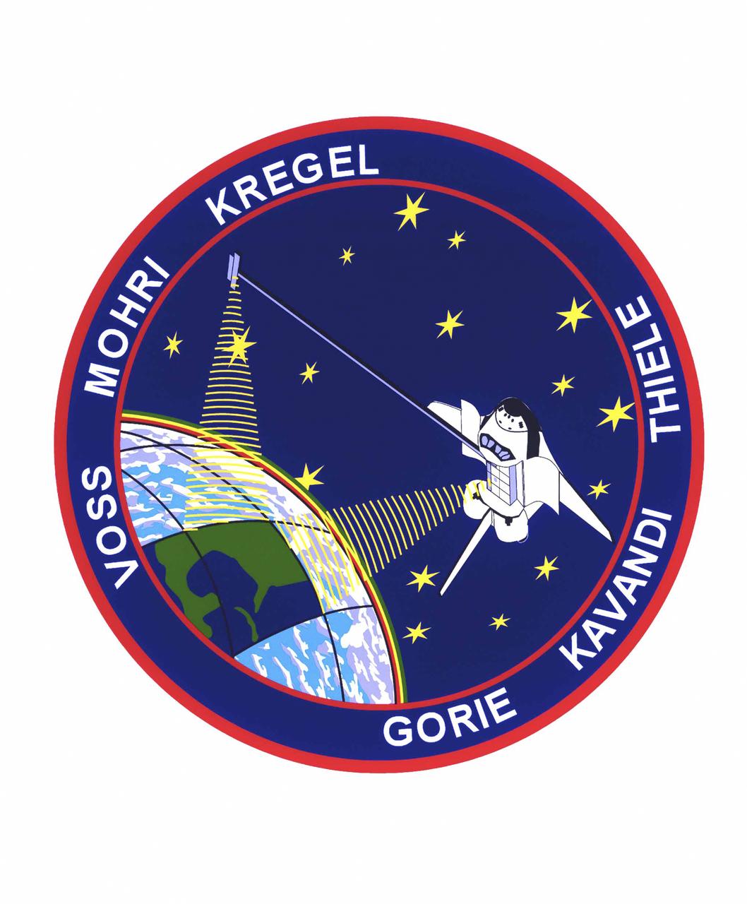
The STS-99 crew members designed the flight insignia for the Shuttle Radar Topography Mission (SRTM), the most ambitious Earth mapping mission to date. Two radar anternas, one located in the Shuttle bay and the other located on the end of a 60-meter deployable mast, was used during the mission to map Earth's features. The goal was to provide a 3-dimensional topographic map of the world's surface up to the Arctic and Antarctic Circles. In the patch, the clear portion of Earth illustrates the radar beams penetrating its cloudy atmosphere and the unique understanding of the home planet that is provided by space travel. The grid on Earth reflects the mapping character of the SRTM mission. The patch depicts the Space Shuttle Endeavour orbiting Earth in a star spangled universe. The rainbow along Earth's horizon resembles an orbital sunrise. The crew deems the bright colors of the rainbow as symbolic of the bright future ahead because of human beings' venturing into space. The crew of six launched aboard the Space Shuttle Endeavor on February 11, 2000 and completed 222 hours of around the clock radar mapping gathering enough information to fill more than 20,000 CDs.
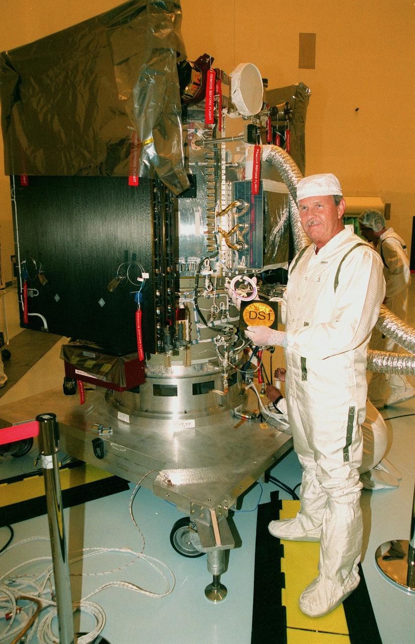
KENNEDY SPACE CENTER, FLA. -- In the Payload Hazardous Servicing Facility, Tom Shain, project manager on Deep Space 1, displays a CD containing 350,000 names of KSC workers that he will place in a pouch and insert inside the spacecraft. The first flight in NASA's New Millennium Program, Deep Space 1 is designed to validate 12 new technologies for scientific space missions of the next century. Onboard experiments include an ion propulsion engine and software that tracks celestial bodies so the spacecraft can make its own navigation decisions without the intervention of ground controllers. Deep Space 1 will complete most of its mission objectives within the first two months, but may also do a flyby of a near-Earth asteroid, 1992 KD, in July 1999. Deep Space 1 will be launched aboard a Boeing Delta 7326 rocket from Launch Pad 17A, Cape Canaveral Air Station, in October. Delta II rockets are medium capacity expendable launch vehicles derived from the Delta family of rockets built and launched since 1960. Since then there have been more than 245 Delta launches

Goddard's Ritsko Wins 2011 SAVE Award The winner of the 2011 SAVE Award is Matthew Ritsko, a Goddard financial manager. His tool lending library would track and enable sharing of expensive space-flight tools and hardware after projects no longer need them. This set of images represents the types of tools used at NASA. To read more go to: <a href="http://www.nasa.gov/topics/people/features/ritsko-save.html" rel="nofollow">www.nasa.gov/topics/people/features/ritsko-save.html</a> Dr. Doug Rabin (Code 671) and PI La Vida Cooper (Code 564) inspect engineering samples of the HAS-2 imager which will be tested and readout using a custom ASIC with a 16-bit ADC (analog to digital converter) and CDS (correlated double sampling) circuit designed by the Code 564 ASIC group as a part of an FY10 IRAD. The purpose of the IRAD was to develop and high resolution digitizer for Heliophysics applications such as imaging. Future goals for the collaboration include characterization testing and eventually a sounding rocket flight of the integrated system. *ASIC= Application Specific Integrated Circuit NASA/GSFC/Chris Gunn
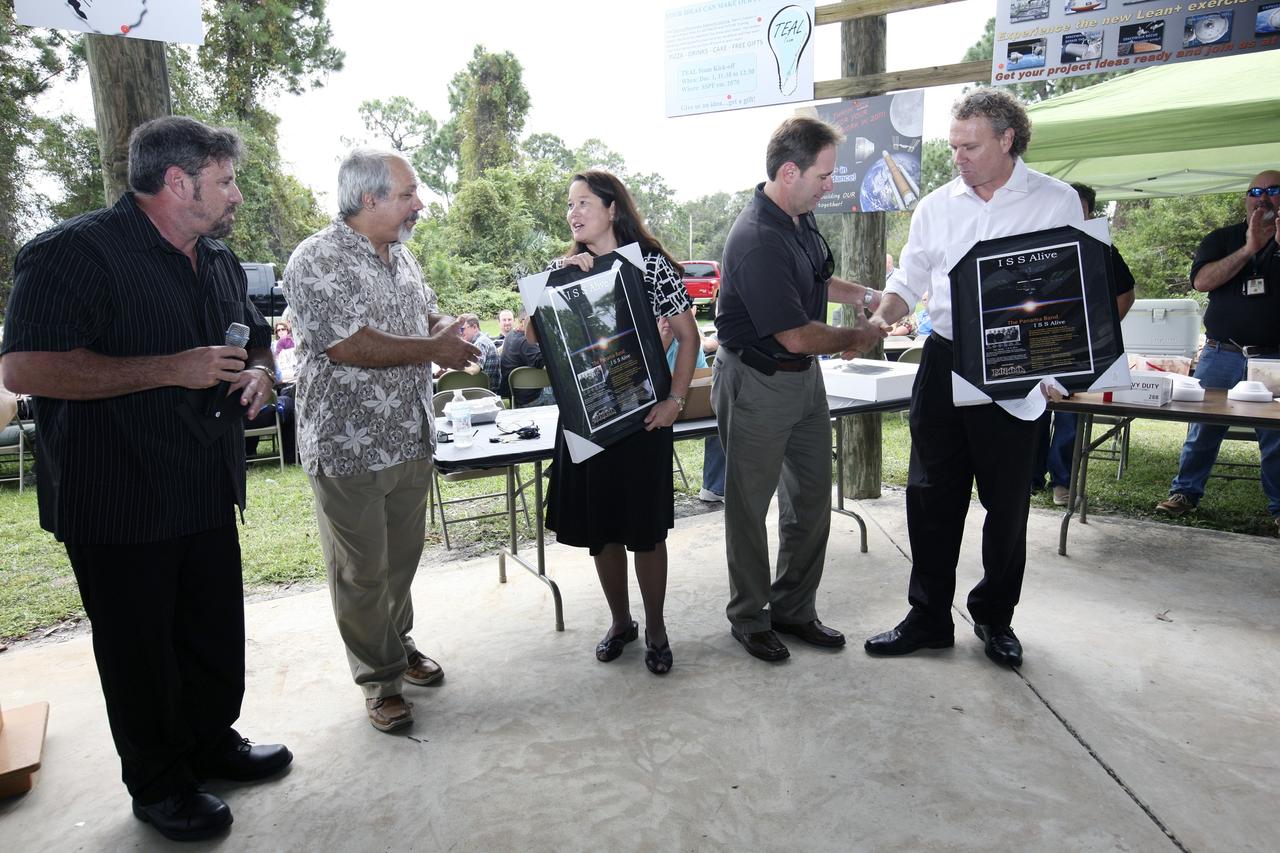
CAPE CANAVERAL, Fla. – International Space Station Ground Processing and Research Project Office Director Josie Burnett, third from left, and Associate Director for Engineering and Technical Operations Russell Romanella, right, are presented plaques and CDs of the song “ISS Alive,” written and recorded by the Panama Band, during the "ISS Is Alive" employee recognition barbecue celebration at Kars Park II at NASA's Kennedy Space Center in Florida. From left are also band members Lew Ingelido, who composed the song, Tom Hadoulias and Norm Tokarz. NASA and The Boeing Co. hosted the celebration to thank the employees based at the Kennedy Space Center who were involved in building the largest, most complex international scientific project in history and the largest venture in space to date. The station has hosted human life, work and research in space for more than 10 years. Boeing is the prime contractor to NASA for the space station. In addition to designing and building all the major U.S. elements, Boeing also is responsible for ensuring the successful integration of new hardware and software -- including components from international partners -- as well as for providing sustaining engineering work. For more information on the International Space Station, visit http://www.nasa.gov/station. Photo credit: NASA/Amanda Diller
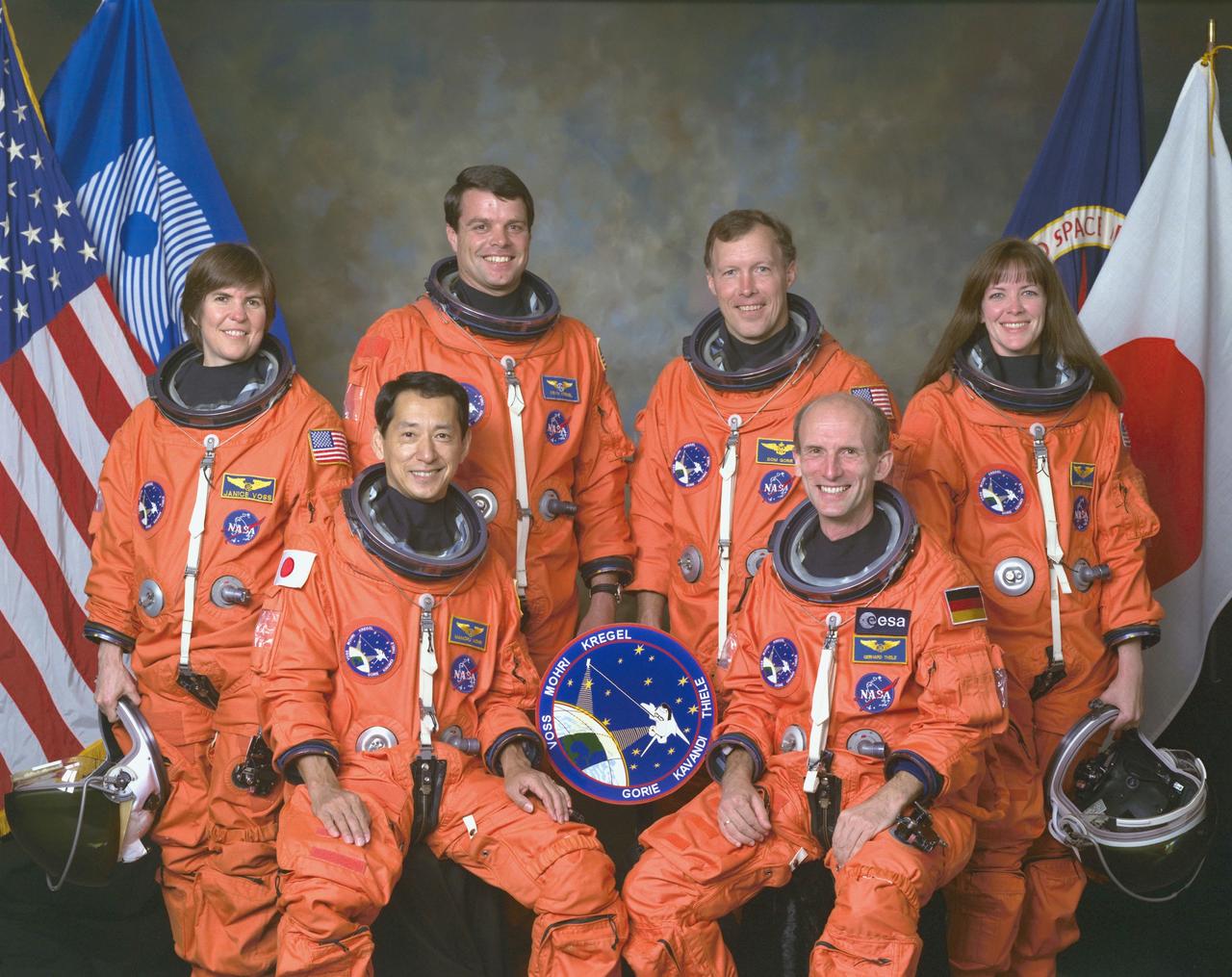
An international crew assigned to STS-99 takes a break from training to pose for the traditional crew portrait at NASA's Johnson Space Center (JSC). In front are international astronauts and mission specialists Mamoru Mohri, representing Japan's Space Agency (NASDA), and Gerhard P. J. Thiele of Germany, representing the European Space Agency (ESA). In back are astronauts Janice Voss, mission specialist; Kevin R. Kregel, mission commander; Dominic L. Gorie, pilot; and Janet L. Kavandi, mission specialist. STS-99 was a Shuttle Radar Topography Mission (SRTM), the most ambitious Earth mapping mission to date. Two radar anternas, one located in the Shuttle bay and the other located on the end of a 60-meter deployable mast, was used during the mission to map Earth's features. The goal was to provide a 3-dimensional topographic map of the world's surface up to the Arctic and Antarctic Circles. Launched aboard the Space Shuttle Endeavor on February 11, 2000, the 11-day mission provided enough information to fill more than 20,000 CDs.
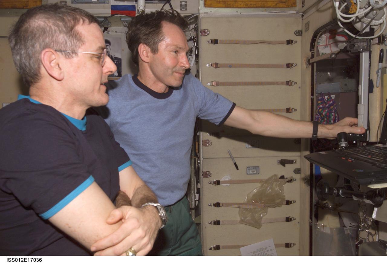
ISS012-E-17036 (23 Jan. 2006) --- Astronaut William S. (Bill) McArthur (foreground), Expedition 12 commander and NASA space station science officer, and cosmonaut Valery I. Tokarev, flight engineer representing Russia's Federal Space Agency, watch the contents of a compact disk at a work station in the Zvezda Service Module of the International Space Station. The compact disk was in the Radioskaf (SuitSat) package delivered to the station by a Progress spacecraft.
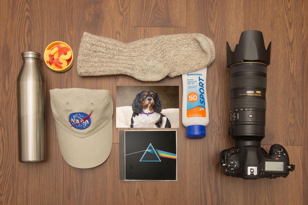
The first thing that went into my Moonkit was my camera. Some of the most iconic photographs ever taken were captured on the surface of the Moon by NASA astronauts. The camera has to go. The hat and sunscreen will be a must to protect me from the unfiltered sunlight. Warm socks? Of course, my feet are always cold. A little “Moon Music” and a photo of Holly, the best dog in the world, will pass the time during breaks. Lastly, I need to eat. Water and gummy peach rings will pack in a small corner of my pack. Marv Smith Lead Photographer, NASA Glenn Research Center
As we head into the 21st Century, it seems hard to believe that human beings have been sending spacecraft toward Mars for more than 3 decades already. The first spacecraft to reach Mars was Mariner 4 in 1965. This success was followed by two spacecraft in 1969, Mariners 6 and 7. Now the wonders and alien beauty of Mars continue to unfold with each day that the Mars Global Surveyor -- which arrived in September 1997 -- continues to radio its data to Earth. Mars exploration was always difficult and each bit of data returned from the planet is a marvel. On August 5, 1969, the Mariner 7 spacecraft flew past Mars at a minimum altitude of about 4200 km. It acquired 14 wide/narrow angle image pairs during the few minutes of the "near encounter" flyby. One of these image pairs, 7N19/7N20, shows the south polar region and contains a feature that at the time was nicknamed "the Giant's Footprint." Shown in the first two pictures, above, the feature consists of two adjoining craters, one about 80 km (50 mi) in diameter and the other about 50 km (31 mi) across near latitude 76°S, longitude 276°W. The oblique geometry of the Mariner 7 image enhances the impression of a footprint. The "Giant's Footprint" was almost missed when Mariner 7 suffered a near-catastrophic battery failure just a few days before the encounter -- on July 30 -- that put the spacecraft sporadically out of contact with Earth for two days. Ground controllers at the Jet Propulsion Laboratory (JPL)recovered the spacecraft, re-planned its imaging sequence based on results from the Mariner 6 flyby on July 31, and salvaged all of the mission's science goals in under a week! In the 1970's, the larger crater in "giant's footprint" was named "Vishniac" in honor of Wolf Vishniac, an American microbiologist of the University of Rochester who was instrumental in the development of methods to search for life on Mars. Vishniac was tragically killed in a fall in Antarctica in 1973 while retrieving a life detection experiment, and the crater was named in honor of this "giant" in the search for life on Mars. More than three decades after the Mariner 7 flyby, Mars Global Surveyor's Mars Orbiter Camera (MOC) acquired a commemorative view of the interior of Vishniac Crater on October 25, 1999. The context image and the 3-meters (9.8 feet)-per-pixel narrow angle view are shown above (in the lower image pair). Mariner 7's 7N20 has a nominal resolution of about 180 meters (591 feet) per pixel, while the MOC high resolution view is about 60 times higher (in actuality, the lower quality of the Mariner 7 images makes the resolution gain even more dramatic). The MOC high resolution view (lower right, above) shows a 1.5 kilometer-(0.9 mile)-wide portion of the floor of Vishniac in the process of defrosting during southern spring. The bright areas are still frost-covered, while the darker areas are either defrosted or composed of darkened or "dirty" frost. The dark patches in the image seem to serve as sources for dark streaks of material that has either been blown across the landscape by wind, or has somehow caused the erosion of frost to create the streaks. Dark streaks follow the local topography, as might the wind that blew across this landscape. This pattern of spots and streaks was quite common on the defrosting south polar cap during the spring that lasted from early August 1999 to late December 1999. All images shown here are illuminated by sunlight from the lower right. Image orientation with north toward the bottom was selected in order to show the "footprint" visible in Mariner 7 image 7N20. The Mariner 7 images were recovered at Malin Space Science Systems from the original 7-track magnetic tapes, archived on CD-ROM by the JPL Data Preservation activity. More images relating to the release can be viewed at http://photojournal.jpl.nasa.gov/catalog/PIA02365