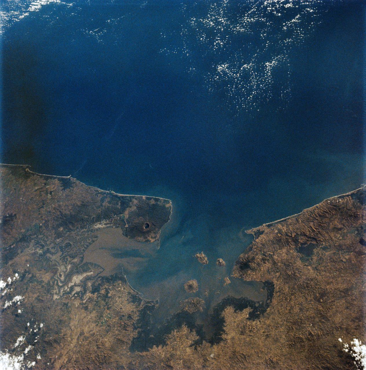
AS09-19-3019 (3-13 March 1969) --- Gulf of Fonseca, on the Pacific coast of Central America, as photographed from the Apollo 9 spacecraft during its Earth-orbital mission. The gulf is shared by the nations of El Salvador, Honduras, and Nicaragua. The prominent volcano on the peninsula in Nicaragua is Volcan Cosiguina.

AS08-16-2593 (21-27 Dec. 1968) --- A striking view from the Apollo 8 spacecraft showing nearly the entire Western Hemisphere, from the mouth of the St. Lawrence River, including nearby Newfoundland, extending to Tierra del Fuego at the southern tip of South America. Central America is clearly outlined. Nearly all of South America is covered by clouds, except the high Andes Mountain chain along the west coast. A small portion of the bulge of West Africa shows along the sunset terminator.

NASA Administrator Sean O'Keefe speaking at the AirSAR 2004 Mesoamerica hangar naming ceremony. AirSAR 2004 Mesoamerica is a three-week expedition by an international team of scientists that will use an all-weather imaging tool, called the Airborne Synthetic Aperture Radar (AirSAR), in a mission ranging from the tropical rain forests of Central America to frigid Antarctica.
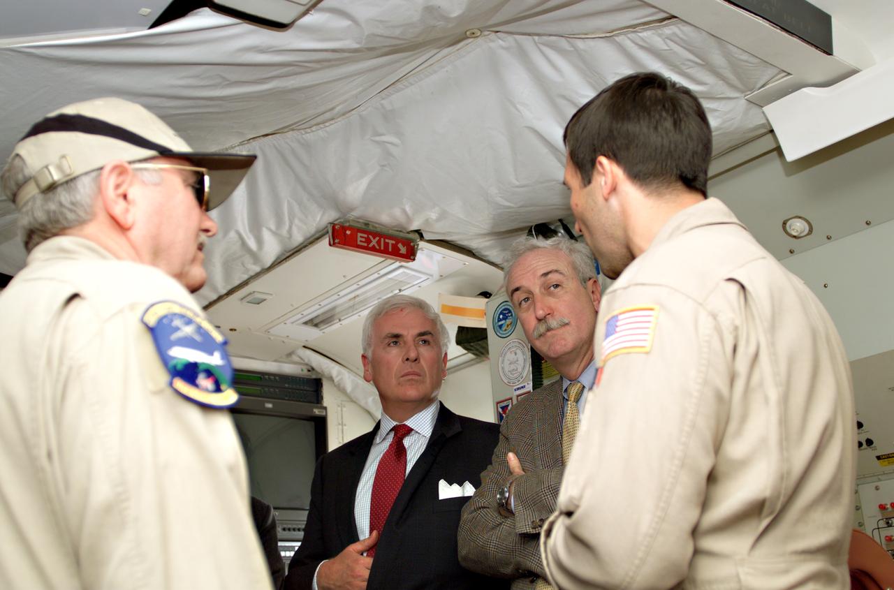
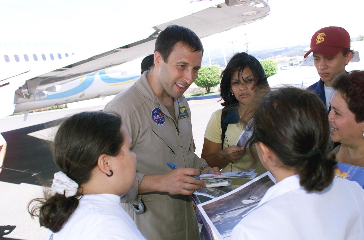
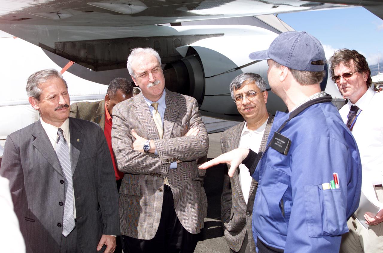
Dr. Tom Mace, NASA DFRC Director of Airborne Sciences, and Walter Klein(far right), NASA DFRC Airborne Science Mission Manager, brief John Danilovich, US Ambassador to Costa Rica, and NASA Administrator Sean O'Keefe onboard NASA's DC-8 during a stop-off on the AirSAR 2004 Mesoamerica campaign. AirSAR 2004 Mesoamerica is a three-week expedition by an international team of scientists that will use an all-weather imaging tool, called the Airborne Synthetic Aperture Radar (AirSAR), in a mission ranging from the tropical rain forests of Central America to frigid Antarctica.
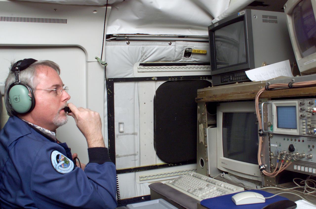
JPL Researcher Tim Miller at the primary AirSAR station aboard NASA's DC-8 flying laboratory during the AirSAR 2004 campaign. AirSAR 2004 is a three-week expedition by an international team of scientists that will use an all-weather imaging tool, called the Airborne Synthetic Aperture Radar (AirSAR), in a mission ranging from the tropical rain forests of Central America to frigid Antarctica.
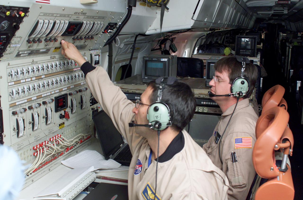
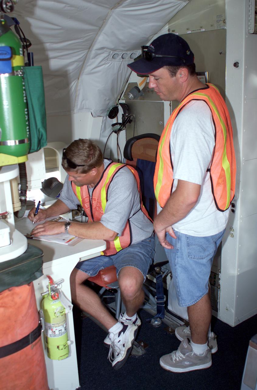
Airborne Science personnel Walter Klein and David Bushman at the Mission Manager's console onboard NASA's DC-8 during the AirSAR 2004 campaign. AirSAR 2004 is a three-week expedition by an international team of scientists that will use an all-weather imaging tool, called the Airborne Synthetic Aperture Radar (AirSAR), in a mission ranging from the tropical rain forests of Central America to frigid Antarctica.

NASA Dryden's DC-8 on the ramp at Jaun Santamaria International Airport, San Jose, Costa Rica during the AirSAR 2004 campaign. AirSAR 2004 is a three-week expedition by an international team of scientists that will use an all-weather imaging tool, called the Airborne Synthetic Aperture Radar (AirSAR), in a mission ranging from the tropical rain forests of Central America to frigid Antarctica.

NASA Dryden's DC-8 on the ramp at Jaun Santamaria International Airport, San Jose, Costa Rica during the AirSAR 2004 campaign. AirSAR 2004 is a three-week expedition by an international team of scientists that will use an all-weather imaging tool, called the Airborne Synthetic Aperture Radar (AirSAR), in a mission ranging from the tropical rain forests of Central America to frigid Antarctica.

NASA's DC-8 flying laboratory takes off from Juan Santamaria International Airport in San Jose, Costa Rica, on NASA's AirSAR 2004 campaign. AirSAR 2004 is a three-week expedition by an international team of scientists that will use an all-weather imaging tool, called the Airborne Synthetic Aperture Radar (AirSAR), in a mission ranging from the tropical rain forests of Central America to frigid Antarctica.
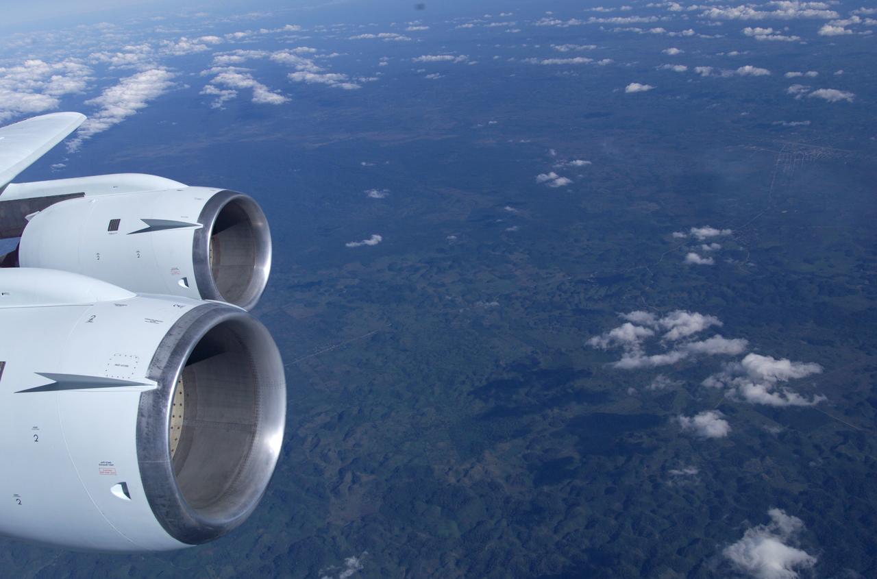
This is a photograph from the left side of the aircraft as NASA's DC-8 does an AirSAR 2004 research "line" over Honduras. AirSAR 2004 is a three-week expedition by an international team of scientists that will use an all-weather imaging tool, called the Airborne Synthetic Aperture Radar (AirSAR), in a mission ranging from the tropical rain forests of Central America to frigid Antarctica.

NASA's DC-8 flying laboratory takes off from Juan Santamaria International Airport in San Jose, Costa Rica, on NASA's AirSAR 2004 campaign. AirSAR 2004 is a three-week expedition by an international team of scientists that will use an all-weather imaging tool, called the Airborne Synthetic Aperture Radar (AirSAR), in a mission ranging from the tropical rain forests of Central America to frigid Antarctica.

NASA Dryden's DC-8 on the ramp at Jaun Santamaria International Airport, San Jose, Costa Rica during the AirSAR 2004 campaign. AirSAR 2004 is a three-week expedition by an international team of scientists that will use an all-weather imaging tool, called the Airborne Synthetic Aperture Radar (AirSAR), in a mission ranging from the tropical rain forests of Central America to frigid Antarctica.

JPL Researcher Bruce Chapman at an AirSAR station aboard NASA's DC-8 flying laboratory during the AirSAR 2004 campaign. AirSAR 2004 is a three-week expedition by an international team of scientists that will use an all-weather imaging tool, called the Airborne Synthetic Aperture Radar (AirSAR), in a mission ranging from the tropical rain forests of Central America to frigid Antarctica.

David Bushman at the Mission Manager's console onboard NASA's DC-8 during the AirSAR 2004 campaign. AirSAR 2004 is a three-week expedition by an international team of scientists that will use an all-weather imaging tool, called the Airborne Synthetic Aperture Radar (AirSAR), in a mission ranging from the tropical rain forests of Central America to frigid Antarctica.
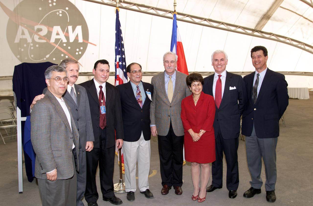
VIP group in hangar during AirSAR 2004 Mesoamerica campaign, L-R: Dr. Gahssem Asrar, NASA Associate Administrator for Earth Science Enterprises; Fernando Gutierrez, Costa Rican Minister of Science and Technology(MICIT); Jorge Andres Diaz, Director of the Costa Rican National Hangar for Airborne Research division of the National Center for High Technology(CENAT); Dr. Pedro Leon, General Director for the Costa Rican National Center for High Technology(CENAT); NASA Administrator Sean O'Keefe; Dr. Sonia Marta Mora, President of the Costa Rican National Rector’s Council(CONARE); Mr. John Danilovich, US Ambassador to Costa Rica; and unknown. AirSAR 2004 Mesoamerica is a three-week expedition by an international team of scientists that will use an all-weather imaging tool, called the Airborne Synthetic Aperture Radar (AirSAR), in a mission ranging from the tropical rain forests of Central America to frigid Antarctica.
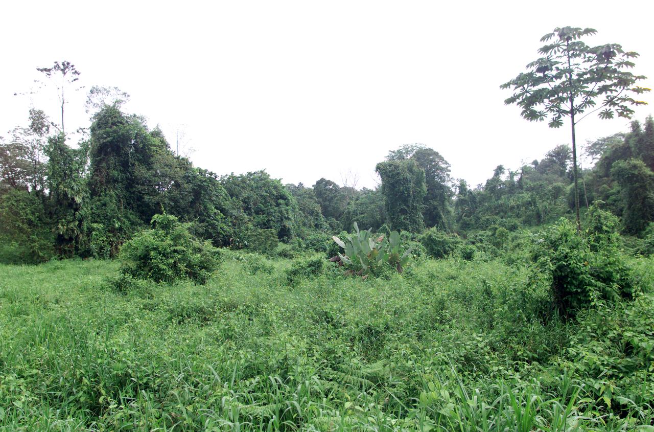
Dense rain forest in the La Selva region of Costa Rica. AirSAR 2004 Mesoamerica is a three-week expedition by an international team of scientists that uses an all-weather imaging tool, called the Airborne Synthetic Aperture Radar (AirSAR) which is located onboard NASA's DC-8 airborne laboratory. Scientists from many parts of the world including NASA's Jet Propulsion Laboratory are combining ground research done in several areas in Central America with NASA's AirSAR technology to improve and expand on the quality of research they are able to conduct. The radar, developed by NASA's Jet Propulsion Laboratory, can penetrate clouds and also collect data at night. Its high-resolution sensors operate at multiple wavelengths and modes, allowing AirSAR to see beneath treetops, through thin sand, and dry snow pack. AirSAR's 2004 campaign is a collaboration of many U.S. and Central American institutions and scientists, including NASA; the National Science Foundation; the Smithsonian Institution; National Geographic; Conservation International; the Organization of Tropical Studies; the Central American Commission for Environment and Development; and the Inter-American Development Bank.

A spider photographed during NASA's AirSAR 2004 Mesoamerica campaign in the La Selva region of the Costa Rican rain forest. AirSAR 2004 Mesoamerica is a three-week expedition by an international team of scientists that uses an all-weather imaging tool, called the Airborne Synthetic Aperture Radar (AirSAR) which is located onboard NASA's DC-8 airborne laboratory. Scientists from many parts of the world including NASA's Jet Propulsion Laboratory are combining ground research done in several areas in Central America with NASA's AirSAR technology to improve and expand on the quality of research they are able to conduct. The radar, developed by NASA's Jet Propulsion Laboratory, can penetrate clouds and also collect data at night. Its high-resolution sensors operate at multiple wavelengths and modes, allowing AirSAR to see beneath treetops, through thin sand, and dry snow pack. AirSAR's 2004 campaign is a collaboration of many U.S. and Central American institutions and scientists, including NASA; the National Science Foundation; the Smithsonian Institution; National Geographic; Conservation International; the Organization of Tropical Studies; the Central American Commission for Environment and Development; and the Inter-American Development Bank.

NASA's DC-8 flying laboratory seen at sunset after a flight supporting the AirSAR 2004 Mesoamerica campaign. AirSAR 2004 Mesoamerica is a three-week expedition by an international team of scientists that uses an all-weather imaging tool, called the Airborne Synthetic Aperture Radar (AirSAR) which is located onboard NASA's DC-8 airborne laboratory. Scientists from many parts of the world including NASA's Jet Propulsion Laboratory are combining ground research done in several areas in Central America with NASA's AirSAR technology to improve and expand on the quality of research they are able to conduct. The radar, developed by NASA's Jet Propulsion Laboratory, can penetrate clouds and also collect data at night. Its high-resolution sensors operate at multiple wavelengths and modes, allowing AirSAR to see beneath treetops, through thin sand, and dry snow pack. AirSAR's 2004 campaign is a collaboration of many U.S. and Central American institutions and scientists, including NASA; the National Science Foundation; the Smithsonian Institution; National Geographic; Conservation International; the Organization of Tropical Studies; the Central American Commission for Environment and Development; and the Inter-American Development Bank.

NASA's DC-8 flying laboratory seen at sunset after a flight supporting the AirSAR 2004 Mesoamerica campaign. AirSAR 2004 Mesoamerica is a three-week expedition by an international team of scientists that uses an all-weather imaging tool, called the Airborne Synthetic Aperture Radar (AirSAR) which is located onboard NASA's DC-8 airborne laboratory. Scientists from many parts of the world including NASA's Jet Propulsion Laboratory are combining ground research done in several areas in Central America with NASA's AirSAR technology to improve and expand on the quality of research they are able to conduct. The radar, developed by NASA's Jet Propulsion Laboratory, can penetrate clouds and also collect data at night. Its high-resolution sensors operate at multiple wavelengths and modes, allowing AirSAR to see beneath treetops, through thin sand, and dry snow pack. AirSAR's 2004 campaign is a collaboration of many U.S. and Central American institutions and scientists, including NASA; the National Science Foundation; the Smithsonian Institution; National Geographic; Conservation International; the Organization of Tropical Studies; the Central American Commission for Environment and Development; and the Inter-American Development Bank.
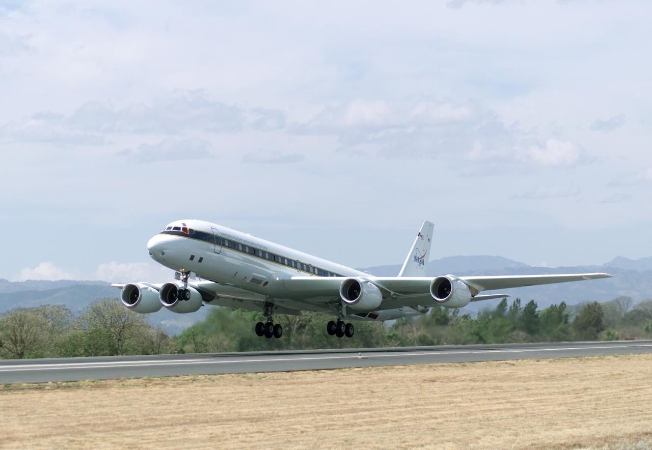
NASA's DC-8 flying laboratory takes off from Juan Santamaria International Airport in San Jose, Costa Rica, on NASA's AirSAR 2004 campaign. AirSAR 2004 Mesoamerica is a three-week expedition by an international team of scientists that uses an all-weather imaging tool, called the Airborne Synthetic Aperture Radar (AirSAR) which is located onboard NASA's DC-8 airborne laboratory. Scientists from many parts of the world including NASA's Jet Propulsion Laboratory are combining ground research done in several areas in Central America with NASA's AirSAR technology to improve and expand on the quality of research they are able to conduct. The radar, developed by NASA's Jet Propulsion Laboratory, can penetrate clouds and also collect data at night. Its high-resolution sensors operate at multiple wavelengths and modes, allowing AirSAR to see beneath treetops, through thin sand, and dry snow pack. AirSAR's 2004 campaign is a collaboration of many U.S. and Central American institutions and scientists, including NASA; the National Science Foundation; the Smithsonian Institution; National Geographic; Conservation International; the Organization of Tropical Studies; the Central American Commission for Environment and Development; and the Inter-American Development Bank.
Reflectors setup in the La Selva region of the Costa Rican rain forest by scientist Paul Siqueira from NASA’s Jet Propulsion Lab. These reflectors are used by JPL scientists onboard Dryden's DC-8 aircraft to calibrate the Airborne Synthetic Aperture Radar (AirSAR) system. Scientists place these reflectors at known points on the ground, allowing researchers onboard the aircraft to verify their data. AirSAR 2004 Mesoamerica is a three-week expedition by an international team of scientists that uses an all-weather imaging tool, called the Airborne Synthetic Aperture Radar (AirSAR) which is located onboard NASA's DC-8 airborne laboratory. Scientists from many parts of the world including NASA's Jet Propulsion Laboratory are combining ground research done in several areas in Central America with NASA's AirSAR technology to improve and expand on the quality of research they are able to conduct. The radar, developed by NASA's Jet Propulsion Laboratory, can penetrate clouds and also collect data at night. Its high-resolution sensors operate at multiple wavelengths and modes, allowing AirSAR to see beneath treetops, through thin sand, and dry snow pack. AirSAR's 2004 campaign is a collaboration of many U.S. and Central American institutions and scientists, including NASA; the National Science Foundation; the Smithsonian Institution; National Geographic; Conservation International; the Organization of Tropical Studies; the Central American Commission for Environment and Development; and the Inter-American Development Bank.
Reflectors setup in the La Selva region of the Costa Rican rain forest by scientist Paul Siqueira from NASA’s Jet Propulsion Lab. These reflectors are used by JPL scientists onboard Dryden's DC-8 aircraft to calibrate the Airborne Synthetic Aperture Radar (AirSAR) system. Scientists place these reflectors at known points on the ground, allowing researchers onboard the aircraft to verify their data. AirSAR 2004 Mesoamerica is a three-week expedition by an international team of scientists that uses an all-weather imaging tool, called the Airborne Synthetic Aperture Radar (AirSAR) which is located onboard NASA's DC-8 airborne laboratory. Scientists from many parts of the world including NASA's Jet Propulsion Laboratory are combining ground research done in several areas in Central America with NASA's AirSAR technology to improve and expand on the quality of research they are able to conduct. The radar, developed by NASA's Jet Propulsion Laboratory, can penetrate clouds and also collect data at night. Its high-resolution sensors operate at multiple wavelengths and modes, allowing AirSAR to see beneath treetops, through thin sand, and dry snow pack. AirSAR's 2004 campaign is a collaboration of many U.S. and Central American institutions and scientists, including NASA; the National Science Foundation; the Smithsonian Institution; National Geographic; Conservation International; the Organization of Tropical Studies; the Central American Commission for Environment and Development; and the Inter-American Development Bank.
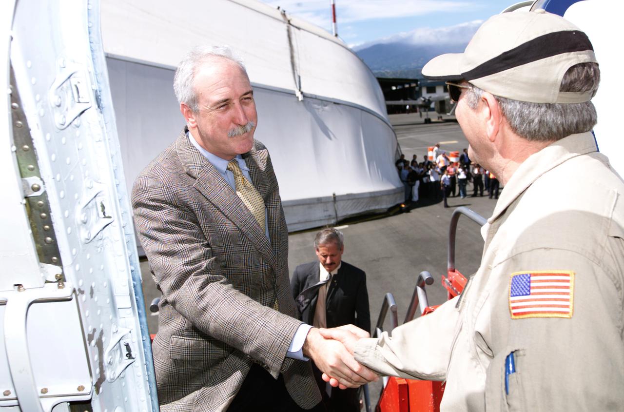
Dr. Tom Mace, NASA DFRC Director of Airborne Sciences, greets NASA Administrator Sean O'Keefe as he enters the DC-8 aircraft during a stop-off on the AirSAR 2004 Mesoamerica campaign. AirSAR 2004 Mesoamerica is a three-week expedition by an international team of scientists that will use an all-weather imaging tool, called the Airborne Synthetic Aperture Radar (AirSAR), in a mission ranging from the tropical rain forests of Central America to frigid Antarctica.
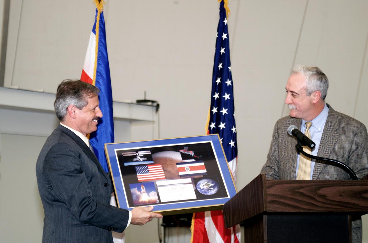
NASA Administrator Sean O'Keefe making a presentation to Fernando Gutierrez, Costa Rican Minister of Science and Technology(MICIT), during the AirSAR 2004 Mesoamerica hangar naming ceremony. AirSAR 2004 Mesoamerica is a three-week expedition by an international team of scientists that will use an all-weather imaging tool, called the Airborne Synthetic Aperture Radar (AirSAR), in a mission ranging from the tropical rain forests of Central America to frigid Antarctica.

Mr. John Danilovich, US Ambassador to Costa Rica, and NASA Administrator Sean O'Keefe at the AirSAR 2004 Mesoamerica hangar naming ceremony. AirSAR 2004 Mesoamerica is a three-week expedition by an international team of scientists that will use an all-weather imaging tool, called the Airborne Synthetic Aperture Radar (AirSAR), in a mission ranging from the tropical rain forests of Central America to frigid Antarctica.
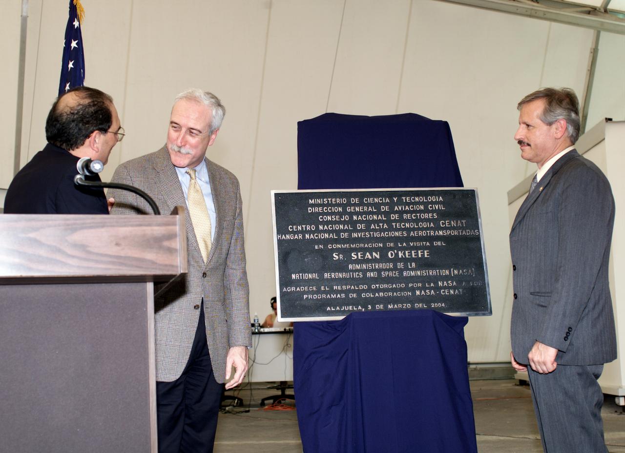
AirSAR 2004 Mesoamerica plaque unveiling by NASA Administrator Sean O'Keefe and Fernando Gutierrez, Costa Rican Minister of Science and Technology(MICIT). AirSAR 2004 Mesoamerica is a three-week expedition by an international team of scientists that will use an all-weather imaging tool, called the Airborne Synthetic Aperture Radar (AirSAR), in a mission ranging from the tropical rain forests of Central America to frigid Antarctica.
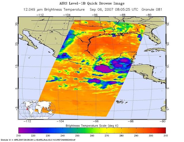
These infrared and microwave images were created with data retrieved by the Atmospheric Infrared Sounder AIRS on NASA Aqua satellite, and show the remnants of the former Hurricane Felix over Central America, September, 2007.
DC-8 Quality Inspector Scott Silver signs documents while Acting Crew Chief Mike Bereda looks on prior to a DC-8 AirSAR flight in Costa Rica. AirSAR 2004 Mesoamerica is a three-week expedition by an international team of scientists that uses an all-weather imaging tool, called the Airborne Synthetic Aperture Radar (AirSAR) which is located onboard NASA's DC-8 airborne laboratory. Scientists from many parts of the world including NASA's Jet Propulsion Laboratory are combining ground research done in several areas in Central America with NASA's AirSAR technology to improve and expand on the quality of research they are able to conduct. The radar, developed by NASA's Jet Propulsion Laboratory, can penetrate clouds and also collect data at night. Its high-resolution sensors operate at multiple wavelengths and modes, allowing AirSAR to see beneath treetops, through thin sand, and dry snow pack. AirSAR's 2004 campaign is a collaboration of many U.S. and Central American institutions and scientists, including NASA; the National Science Foundation; the Smithsonian Institution; National Geographic; Conservation International; the Organization of Tropical Studies; the Central American Commission for Environment and Development; and the Inter-American Development Bank.

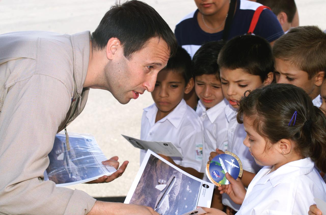
NASA Dryden Mission Manager Walter Klein poses with school children that visited the airport during AirSAR 2004. In spanish, he explained to them the mission of the DC-8 AirSAR 2004 Mesoamerican campaign in Costa Rica. AirSAR 2004 Mesoamerica is a three-week expedition by an international team of scientists that uses an all-weather imaging tool, called the Airborne Synthetic Aperture Radar (AirSAR) which is located onboard NASA's DC-8 airborne laboratory. Scientists from many parts of the world including NASA's Jet Propulsion Laboratory are combining ground research done in several areas in Central America with NASA's AirSAR technology to improve and expand on the quality of research they are able to conduct. The radar, developed by NASA's Jet Propulsion Laboratory, can penetrate clouds and also collect data at night. Its high-resolution sensors operate at multiple wavelengths and modes, allowing AirSAR to see beneath treetops, through thin sand, and dry snow pack. AirSAR's 2004 campaign is a collaboration of many U.S. and Central American institutions and scientists, including NASA; the National Science Foundation; the Smithsonian Institution; National Geographic; Conservation International; the Organization of Tropical Studies; the Central American Commission for Environment and Development; and the Inter-American Development Bank.

NASA Dryden Mission Manager Walter Klein passes out Airborne Science stickers and lithographs to underprivileged school children that visited the airport on Monday March 8, 2004. In spanish, he explained to them the mission of the DC-8 AirSAR 2004 Mesoamerican campaign in Costa Rica. AirSAR 2004 Mesoamerica is a three-week expedition by an international team of scientists that uses an all-weather imaging tool, called the Airborne Synthetic Aperture Radar (AirSAR) which is located onboard NASA's DC-8 airborne laboratory. Scientists from many parts of the world including NASA's Jet Propulsion Laboratory are combining ground research done in several areas in Central America with NASA's AirSAR technology to improve and expand on the quality of research they are able to conduct. The radar, developed by NASA's Jet Propulsion Laboratory, can penetrate clouds and also collect data at night. Its high-resolution sensors operate at multiple wavelengths and modes, allowing AirSAR to see beneath treetops, through thin sand, and dry snow pack. AirSAR's 2004 campaign is a collaboration of many U.S. and Central American institutions and scientists, including NASA; the National Science Foundation; the Smithsonian Institution; National Geographic; Conservation International; the Organization of Tropical Studies; the Central American Commission for Environment and Development; and the Inter-American Development Bank.
NASA Dryden Mission Manager Walter Klein passes out Airborne Science stickers and lithographs to underprivileged school children that visited the airport on Monday March 8, 2004. In spanish, he explained to them the mission of the DC-8 AirSAR 2004 Mesoamerican campaign in Costa Rica. AirSAR 2004 Mesoamerica is a three-week expedition by an international team of scientists that uses an all-weather imaging tool, called the Airborne Synthetic Aperture Radar (AirSAR) which is located onboard NASA's DC-8 airborne laboratory. Scientists from many parts of the world including NASA's Jet Propulsion Laboratory are combining ground research done in several areas in Central America with NASA's AirSAR technology to improve and expand on the quality of research they are able to conduct. The radar, developed by NASA's Jet Propulsion Laboratory, can penetrate clouds and also collect data at night. Its high-resolution sensors operate at multiple wavelengths and modes, allowing AirSAR to see beneath treetops, through thin sand, and dry snow pack. AirSAR's 2004 campaign is a collaboration of many U.S. and Central American institutions and scientists, including NASA; the National Science Foundation; the Smithsonian Institution; National Geographic; Conservation International; the Organization of Tropical Studies; the Central American Commission for Environment and Development; and the Inter-American Development Bank.
NASA Dryden Mission Manager Walter Klein passes out Airborne Science stickers and lithographs to underprivileged school children that visited the airport on Monday March 8, 2004. In spanish, he explained to them the mission of the DC-8 AirSAR 2004 Mesoamerican campaign in Costa Rica. AirSAR 2004 Mesoamerica is a three-week expedition by an international team of scientists that uses an all-weather imaging tool, called the Airborne Synthetic Aperture Radar (AirSAR) which is located onboard NASA's DC-8 airborne laboratory. Scientists from many parts of the world including NASA's Jet Propulsion Laboratory are combining ground research done in several areas in Central America with NASA's AirSAR technology to improve and expand on the quality of research they are able to conduct. The radar, developed by NASA's Jet Propulsion Laboratory, can penetrate clouds and also collect data at night. Its high-resolution sensors operate at multiple wavelengths and modes, allowing AirSAR to see beneath treetops, through thin sand, and dry snow pack. AirSAR's 2004 campaign is a collaboration of many U.S. and Central American institutions and scientists, including NASA; the National Science Foundation; the Smithsonian Institution; National Geographic; Conservation International; the Organization of Tropical Studies; the Central American Commission for Environment and Development; and the Inter-American Development Bank.
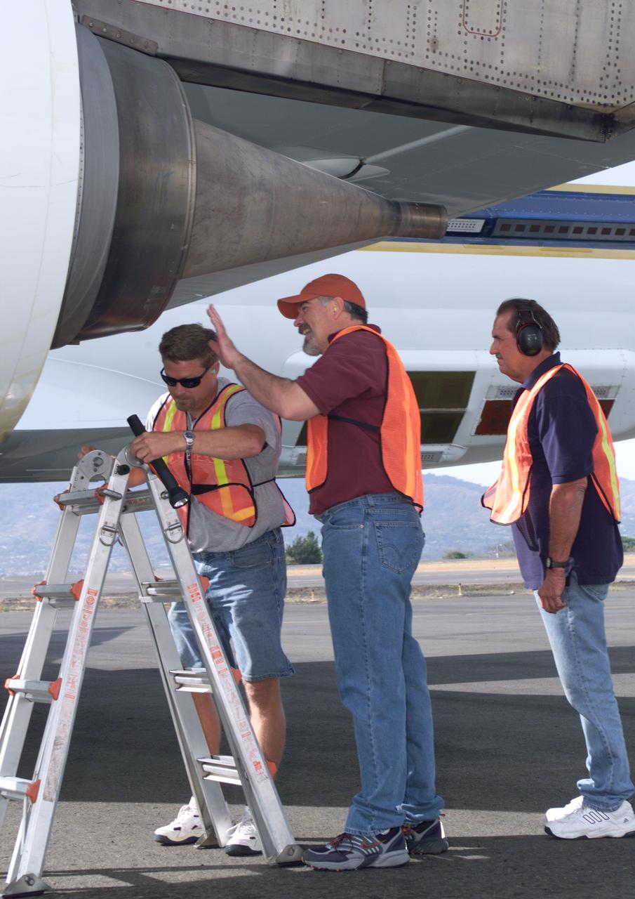
NASA Dryden DC-8 maintenance crew members inspect the aircraft prior to take-off. L-R; Scott Silver, Paul Ristrim and Mike Lakowski. AirSAR 2004 Mesoamerica is a three-week expedition by an international team of scientists that uses an all-weather imaging tool, called the Airborne Synthetic Aperture Radar (AirSAR) which is located onboard NASA's DC-8 airborne laboratory. Scientists from many parts of the world including NASA's Jet Propulsion Laboratory are combining ground research done in several areas in Central America with NASA's AirSAR technology to improve and expand on the quality of research they are able to conduct. The radar, developed by NASA's Jet Propulsion Laboratory, can penetrate clouds and also collect data at night. Its high-resolution sensors operate at multiple wavelengths and modes, allowing AirSAR to see beneath treetops, through thin sand, and dry snow pack. AirSAR's 2004 campaign is a collaboration of many U.S. and Central American institutions and scientists, including NASA; the National Science Foundation; the Smithsonian Institution; National Geographic; Conservation International; the Organization of Tropical Studies; the Central American Commission for Environment and Development; and the Inter-American Development Bank.
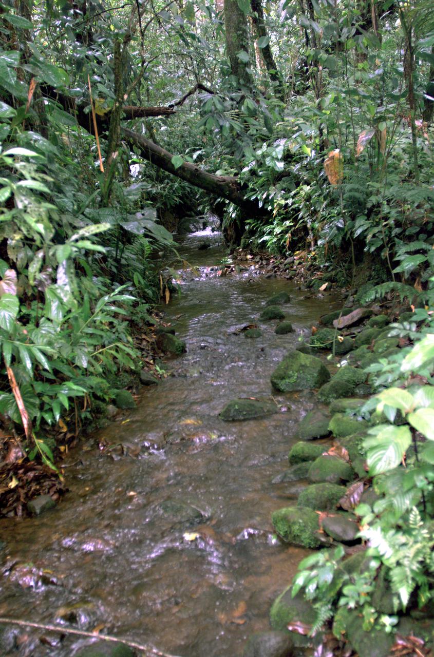
This photograph shows a stream in the La Selva region of the Costa Rican rain forest, taken during NASA's AirSAR 2004 campaign. AirSAR 2004 Mesoamerica is a three-week expedition by an international team of scientists that uses an all-weather imaging tool, called the Airborne Synthetic Aperture Radar (AirSAR) which is located onboard NASA's DC-8 airborne laboratory. Scientists from many parts of the world including NASA's Jet Propulsion Laboratory are combining ground research done in several areas in Central America with NASA's AirSAR technology to improve and expand on the quality of research they are able to conduct. The radar, developed by NASA's Jet Propulsion Laboratory, can penetrate clouds and also collect data at night. Its high-resolution sensors operate at multiple wavelengths and modes, allowing AirSAR to see beneath treetops, through thin sand, and dry snow pack. AirSAR's 2004 campaign is a collaboration of many U.S. and Central American institutions and scientists, including NASA; the National Science Foundation; the Smithsonian Institution; National Geographic; Conservation International; the Organization of Tropical Studies; the Central American Commission for Environment and Development; and the Inter-American Development Bank.
GMT362_00_58_Terry Virts_chile andes central south america amazon start in mountains_123

GMT362_00_58_Terry Virts_chile andes central south america amazon start in mountains_123
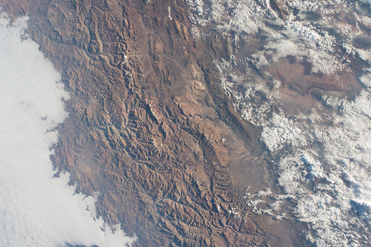
GMT362_00_58_Terry Virts_chile andes central south america amazon start in mountains_123
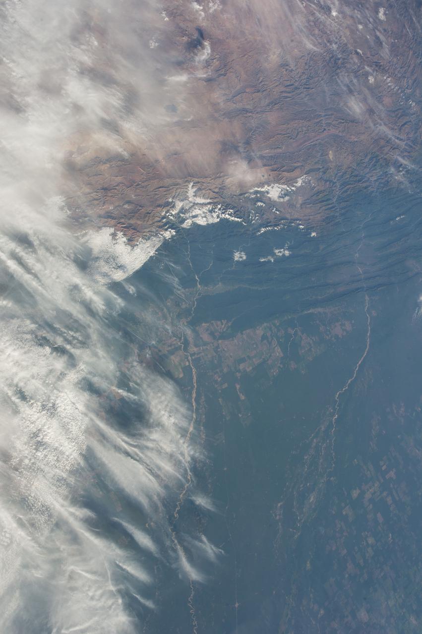
GMT362_00_58_Terry Virts_chile andes central south america amazon start in mountains_123
GMT362_00_58_Terry Virts_chile andes central south america amazon start in mountains_123
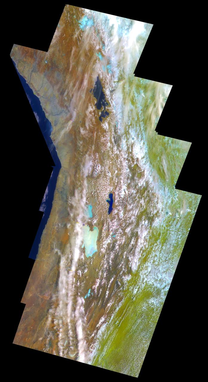
This false-color mosaic of the central part of the Andes mountains of South America 70 degrees w. longitude, 19 degrees s. latitude is made up of 42 images acquired by NASA’s Galileo spacecraft from an altitude of about 25,000 kilometers 15,000 miles. http://photojournal.jpl.nasa.gov/catalog/PIA00133
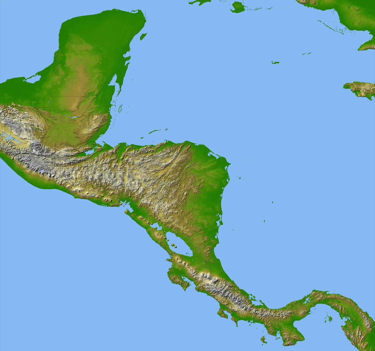
Panama, Costa Rica, Nicaragua, El Salvador, Honduras, Guatemala, Belize, southern Mexico and parts of Cuba and Jamaica are all seen in this image from NASA Shuttle Radar Topography Mission.
Personnel viewing AirSAR hardware while touring the outside of NASA's DC-8 during a stop-off on the AirSAR 2004 Mesoamerica campaign, L-R: Fernando Gutierrez, Costa Rican Minister of Science and Technology(MICIT); NASA Administrator Sean O'Keefe; Dr. Gahssem Asrar, NASA Associate Administrator for Earth Science Enterprises; JPL scientist Bruce Chapman; and Craig Dobson, NASA Program Manager for AirSAR. AirSAR 2004 Mesoamerica is a three-week expedition by an international team of scientists that will use an all-weather imaging tool, called the Airborne Synthetic Aperture Radar (AirSAR), in a mission ranging from the tropical rain forests of Central America to frigid Antarctica.
iss067e355983 (Sept. 11, 2022) --- The Andes Mountain range is pictured from the International Space Station as it orbited 264 miles above the coast of central Chile in South America.

iss062e138226 (April 8, 2020) --- The U.S. Northrop Grumman Cygnus resupply ship is featured in this image as the International Space Station orbited above the Pacific Ocean off the coast of Central America.
ISS043E227213 (05/20/2015) --- Earth observation of South America from the International Space Station on May 20, 2015. NASA astronaut Terry Virts tweeted this image with the remark of: "Farm fields in central #Brazil #SouthAmerica".
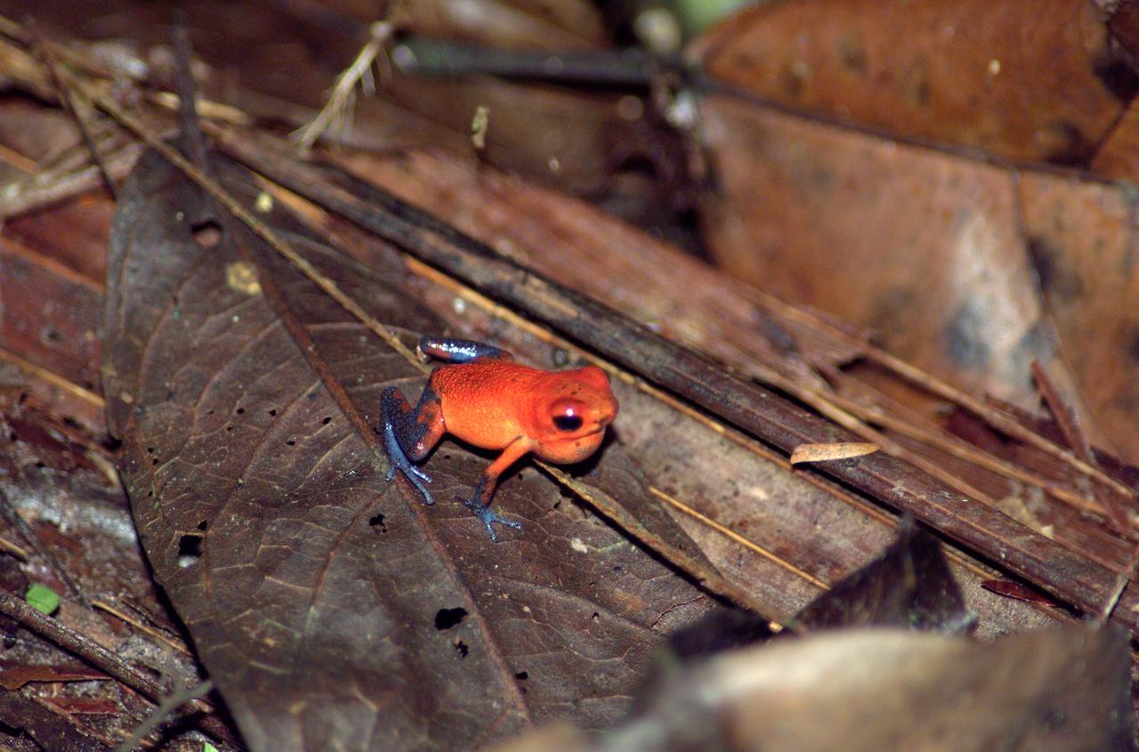
A tree frog photographed in the La Selva region of the Costa Rican rain forest as part of NASA's AirSAR 2004 Mesoamerica campaign. AirSAR 2004 Mesoamerica is a three-week expedition by an international team of scientists that will use an all-weather imaging tool, called the Airborne Synthetic Aperture Radar (AirSAR) which is located onboard NASA's DC-8 airborne laboratory. Scientists from many parts of the world including NASA's Jet Propulsion Laboratory are combining ground research done in several areas in Central America with NASA's AirSAR technology to improve and expand on the quality of research they are able to do. NASA's AIRSAR technolgy provides two essential elements to the ground-based scientists. First, it tests and provides accurate measurements of the forest structure. Secondly, AirSAR can study a larger area of the forest versus the smaller area that can be tested and plotted by the ground scientists. It also provides a unique one-of-a-kind system of measurement that obtains important information for the scientists, such as where forests are located and what exactly is in them.
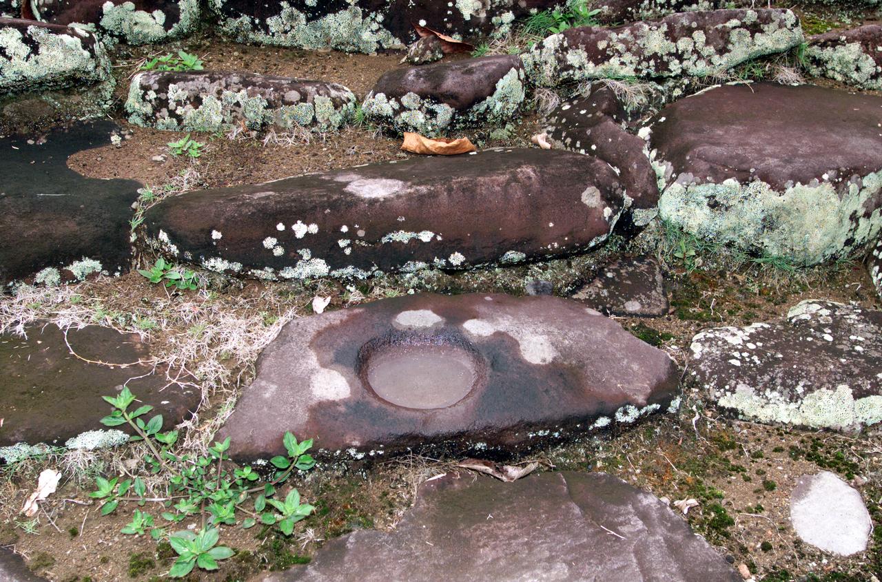
Pre-Columbian archaeological ruins are revealed through Costa Rican rain forest in this photo taken during NASA's AirSAR 2004 Mesoamerica campaign. AirSAR 2004 Mesoamerica is a three-week expedition by an international team of scientists that uses an all-weather imaging tool, called the Airborne Synthetic Aperture Radar (AirSAR) which is located onboard NASA's DC-8 airborne laboratory. The radar, developed by NASA's Jet Propulsion Laboratory, can penetrate clouds and also collect data at night. Its high-resolution sensors operate at multiple wavelengths and modes, allowing AirSAR to see beneath treetops, through thin sand, and dry snow pack. Much of the archaeological evidence needed to understand Pre-Columbian societies in Central America comes from features on the landscape. Difficult terrain and logistics have limited ground data collection. AirSAR helped to detect signs of ancient civilizations hidden beneath the forest. Its images will shed insights into the way modern humans interact with their landscape, and how ancient peoples lived and what became of their civilizations.
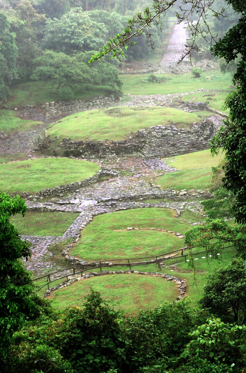
Pre-Columbian archaeological ruins are revealed through Costa Rican rain forest in this photo taken during NASA's AirSAR 2004 Mesoamerica campaign. AirSAR 2004 Mesoamerica is a three-week expedition by an international team of scientists that uses an all-weather imaging tool, called the Airborne Synthetic Aperture Radar (AirSAR) which is located onboard NASA's DC-8 airborne laboratory. The radar, developed by NASA's Jet Propulsion Laboratory, can penetrate clouds and also collect data at night. Its high-resolution sensors operate at multiple wavelengths and modes, allowing AirSAR to see beneath treetops, through thin sand, and dry snow pack. Much of the archaeological evidence needed to understand Pre-Columbian societies in Central America comes from features on the landscape. Difficult terrain and logistics have limited ground data collection. AirSAR helped to detect signs of ancient civilizations hidden beneath the forest. Its images will shed insights into the way modern humans interact with their landscape, and how ancient peoples lived and what became of their civilizations.
A tree trunk structure photographed in the La Selva region of the Costa Rican rain forest as part of NASA's AirSAR 2004 Mesoamerica campaign. AirSAR 2004 Mesoamerica is a three-week expedition by an international team of scientists that will use an all-weather imaging tool, called the Airborne Synthetic Aperture Radar (AirSAR) which is located onboard NASA's DC-8 airborne laboratory. Scientists from many parts of the world including NASA's Jet Propulsion Laboratory are combining ground research done in several areas in Central America with NASA's AirSAR technology to improve and expand on the quality of research they are able to do. NASA's AIRSAR technolgy provides two essential elements to the ground-based scientists. First, it tests and provides accurate measurements of the forest structure. Secondly, AirSAR can study a larger area of the forest versus the smaller area that can be tested and plotted by the ground scientists. It also provides a unique one-of-a-kind system of measurement that obtains important information for the scientists, such as where forests are located and what exactly is in them.
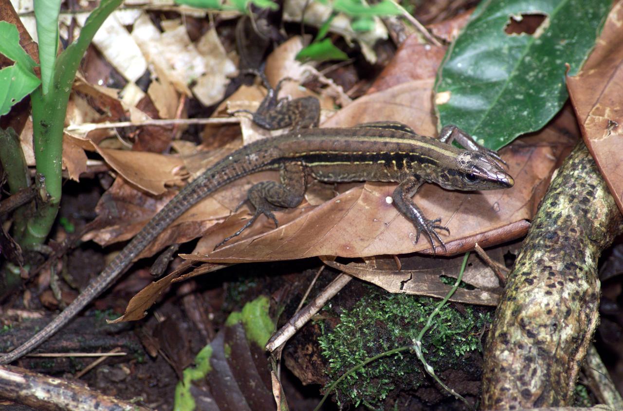
A lizard photographed in the La Selva region of the Costa Rican rain forest as part of NASA's AirSAR 2004 Mesoamerica campaign. AirSAR 2004 Mesoamerica is a three-week expedition by an international team of scientists that will use an all-weather imaging tool, called the Airborne Synthetic Aperture Radar (AirSAR) which is located onboard NASA's DC-8 airborne laboratory. Scientists from many parts of the world including NASA's Jet Propulsion Laboratory are combining ground research done in several areas in Central America with NASA's AirSAR technology to improve and expand on the quality of research they are able to do. NASA's AIRSAR technolgy provides two essential elements to the ground-based scientists. First, it tests and provides accurate measurements of the forest structure. Secondly, AirSAR can study a larger area of the forest versus the smaller area that can be tested and plotted by the ground scientists. It also provides a unique one-of-a-kind system of measurement that obtains important information for the scientists, such as where forests are located and what exactly is in them.
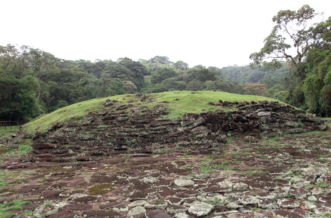
Pre-Columbian archaeological ruins are revealed through Costa Rican rain forest in this photo taken during NASA's AirSAR 2004 Mesoamerica campaign. AirSAR 2004 Mesoamerica is a three-week expedition by an international team of scientists that uses an all-weather imaging tool, called the Airborne Synthetic Aperture Radar (AirSAR) which is located onboard NASA's DC-8 airborne laboratory. The radar, developed by NASA's Jet Propulsion Laboratory, can penetrate clouds and also collect data at night. Its high-resolution sensors operate at multiple wavelengths and modes, allowing AirSAR to see beneath treetops, through thin sand, and dry snow pack. Much of the archaeological evidence needed to understand Pre-Columbian societies in Central America comes from features on the landscape. Difficult terrain and logistics have limited ground data collection. AirSAR helped to detect signs of ancient civilizations hidden beneath the forest. Its images will shed insights into the way modern humans interact with their landscape, and how ancient peoples lived and what became of their civilizations.
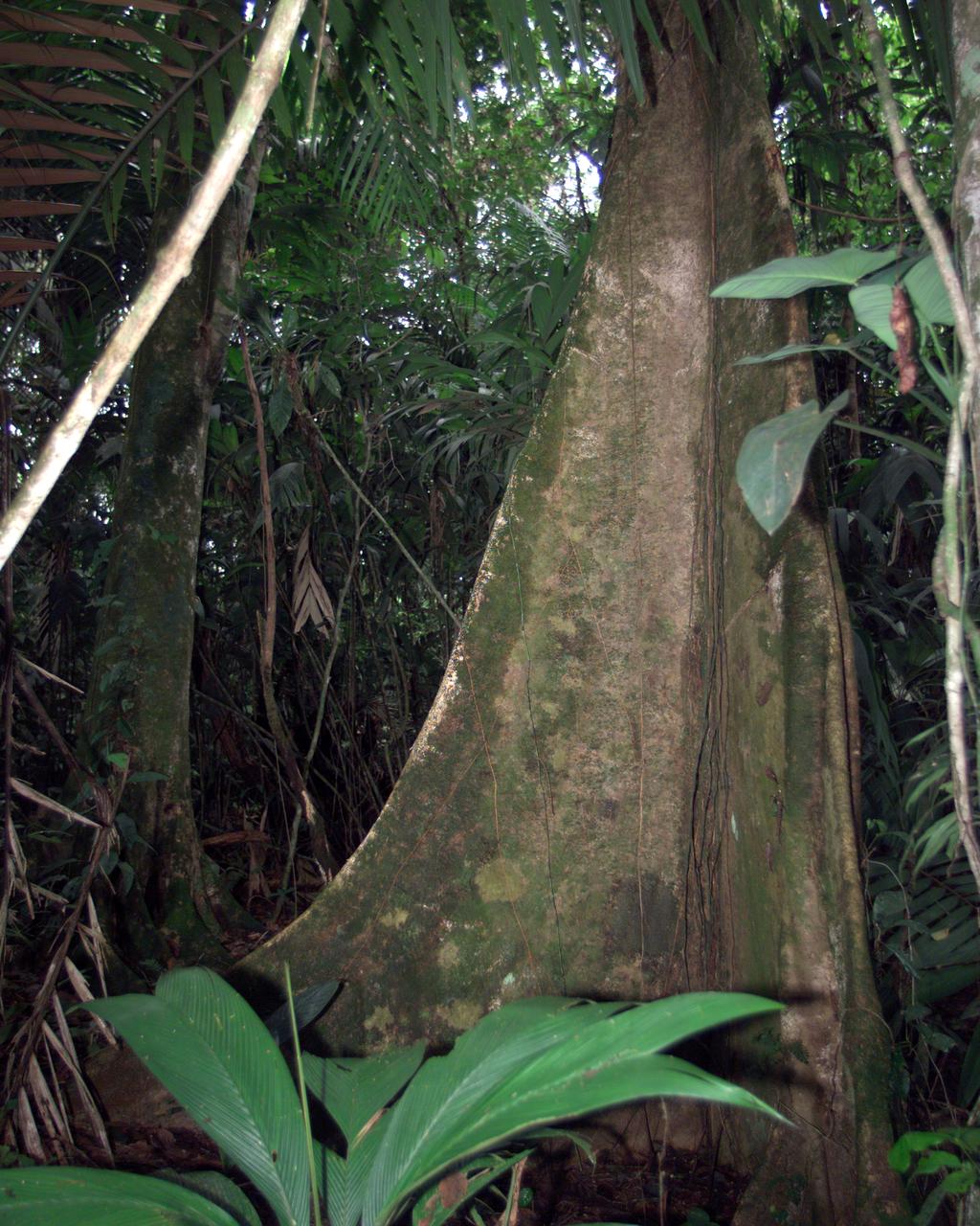
A unique tree trunk photographed in La Selva region of the Costa Rican rain forest as part of NASA's AirSAR 2004 Mesoamerica campaign. AirSAR 2004 Mesoamerica is a three-week expedition by an international team of scientists that will use an all-weather imaging tool, called the Airborne Synthetic Aperture Radar (AirSAR) which is located onboard NASA's DC-8 airborne laboratory. Scientists from many parts of the world including NASA's Jet Propulsion Laboratory are combining ground research done in several areas in Central America with NASA's AirSAR technology to improve and expand on the quality of research they are able to do. NASA's AIRSAR technolgy provides two essential elements to the ground-based scientists. First, it tests and provides accurate measurements of the forest structure. Secondly, AirSAR can study a larger area of the forest versus the smaller area that can be tested and plotted by the ground scientists. It also provides a unique one-of-a-kind system of measurement that obtains important information for the scientists, such as where forests are located and what exactly is in them.

A butterfly photographed in the La Selva region of the Costa Rican rain forest as part of NASA's AirSAR 2004 Mesoamerica campaign. AirSAR 2004 Mesoamerica is a three-week expedition by an international team of scientists that will use an all-weather imaging tool, called the Airborne Synthetic Aperture Radar (AirSAR) which is located onboard NASA's DC-8 airborne laboratory. Scientists from many parts of the world including NASA's Jet Propulsion Laboratory are combining ground research done in several areas in Central America with NASA's AirSAR technology to improve and expand on the quality of research they are able to do. NASA's AIRSAR technolgy provides two essential elements to the ground-based scientists. First, it tests and provides accurate measurements of the forest structure. Secondly, AirSAR can study a larger area of the forest versus the smaller area that can be tested and plotted by the ground scientists. It also provides a unique one-of-a-kind system of measurement that obtains important information for the scientists, such as where forests are located and what exactly is in them.
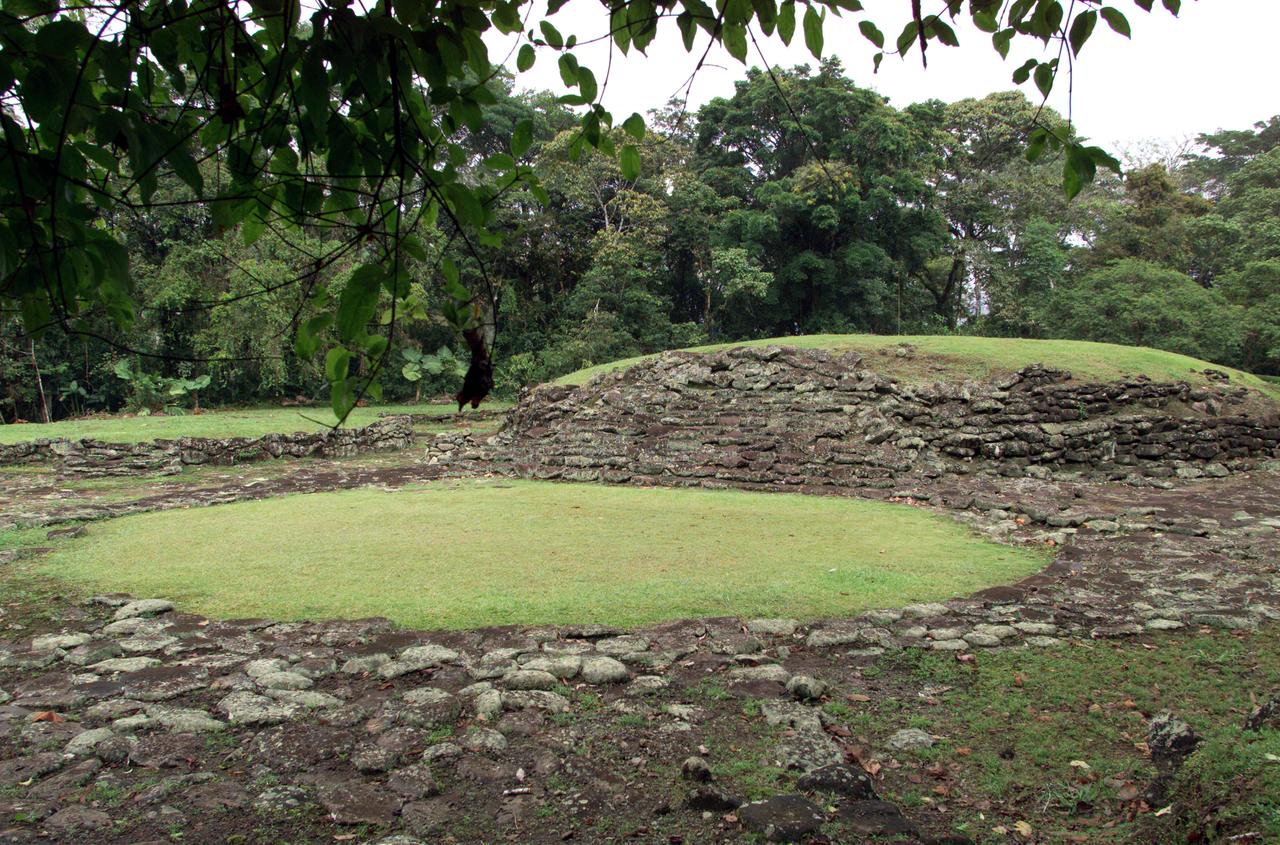
Pre-Columbian archaeological ruins are revealed through Costa Rican rain forest in this photo taken during NASA's AirSAR 2004 Mesoamerica campaign. AirSAR 2004 Mesoamerica is a three-week expedition by an international team of scientists that uses an all-weather imaging tool, called the Airborne Synthetic Aperture Radar (AirSAR) which is located onboard NASA's DC-8 airborne laboratory. The radar, developed by NASA's Jet Propulsion Laboratory, can penetrate clouds and also collect data at night. Its high-resolution sensors operate at multiple wavelengths and modes, allowing AirSAR to see beneath treetops, through thin sand, and dry snow pack. Much of the archaeological evidence needed to understand Pre-Columbian societies in Central America comes from features on the landscape. Difficult terrain and logistics have limited ground data collection. AirSAR helped to detect signs of ancient civilizations hidden beneath the forest. Its images will shed insights into the way modern humans interact with their landscape, and how ancient peoples lived and what became of their civilizations.
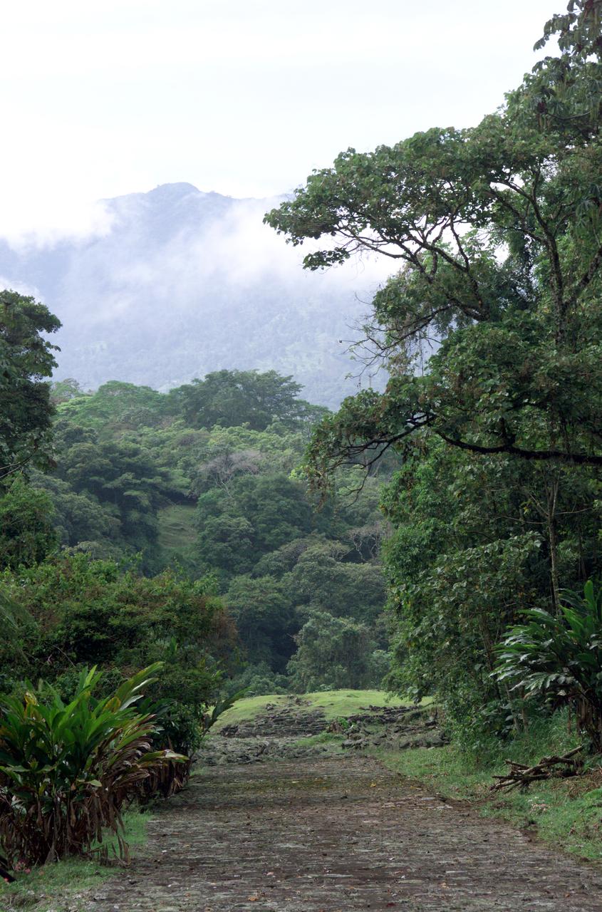
Pre-Columbian archaeological ruins are revealed through Costa Rican rain forest in this photo taken during NASA's AirSAR 2004 Mesoamerica campaign. AirSAR 2004 Mesoamerica is a three-week expedition by an international team of scientists that uses an all-weather imaging tool, called the Airborne Synthetic Aperture Radar (AirSAR) which is located onboard NASA's DC-8 airborne laboratory. The radar, developed by NASA's Jet Propulsion Laboratory, can penetrate clouds and also collect data at night. Its high-resolution sensors operate at multiple wavelengths and modes, allowing AirSAR to see beneath treetops, through thin sand, and dry snow pack. Much of the archaeological evidence needed to understand Pre-Columbian societies in Central America comes from features on the landscape. Difficult terrain and logistics have limited ground data collection. AirSAR helped to detect signs of ancient civilizations hidden beneath the forest. Its images will shed insights into the way modern humans interact with their landscape, and how ancient peoples lived and what became of their civilizations.
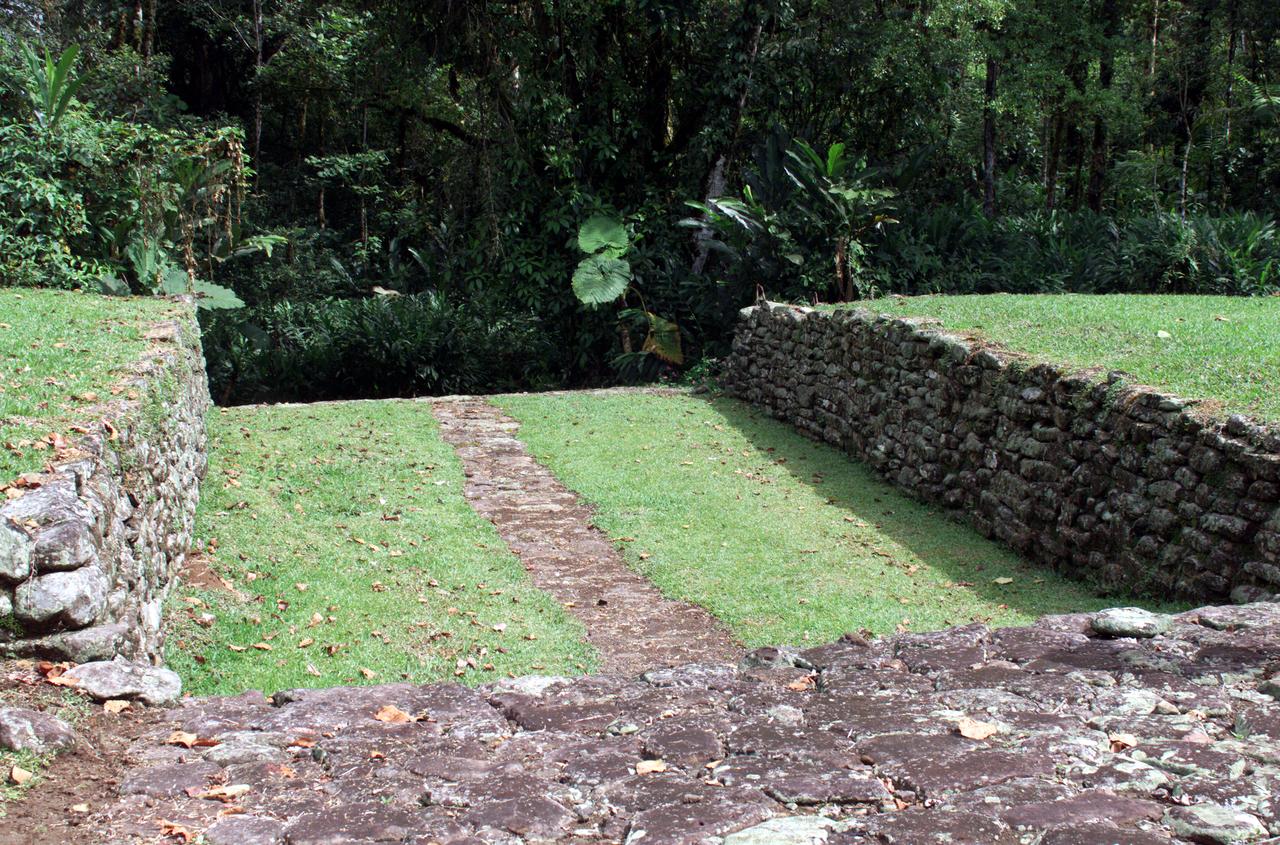
Pre-Columbian archaeological ruins are revealed through Costa Rican rain forest in this photo taken during NASA's AirSAR 2004 Mesoamerica campaign. AirSAR 2004 Mesoamerica is a three-week expedition by an international team of scientists that uses an all-weather imaging tool, called the Airborne Synthetic Aperture Radar (AirSAR) which is located onboard NASA's DC-8 airborne laboratory. The radar, developed by NASA's Jet Propulsion Laboratory, can penetrate clouds and also collect data at night. Its high-resolution sensors operate at multiple wavelengths and modes, allowing AirSAR to see beneath treetops, through thin sand, and dry snow pack. Much of the archaeological evidence needed to understand Pre-Columbian societies in Central America comes from features on the landscape. Difficult terrain and logistics have limited ground data collection. AirSAR helped to detect signs of ancient civilizations hidden beneath the forest. Its images will shed insights into the way modern humans interact with their landscape, and how ancient peoples lived and what became of their civilizations.
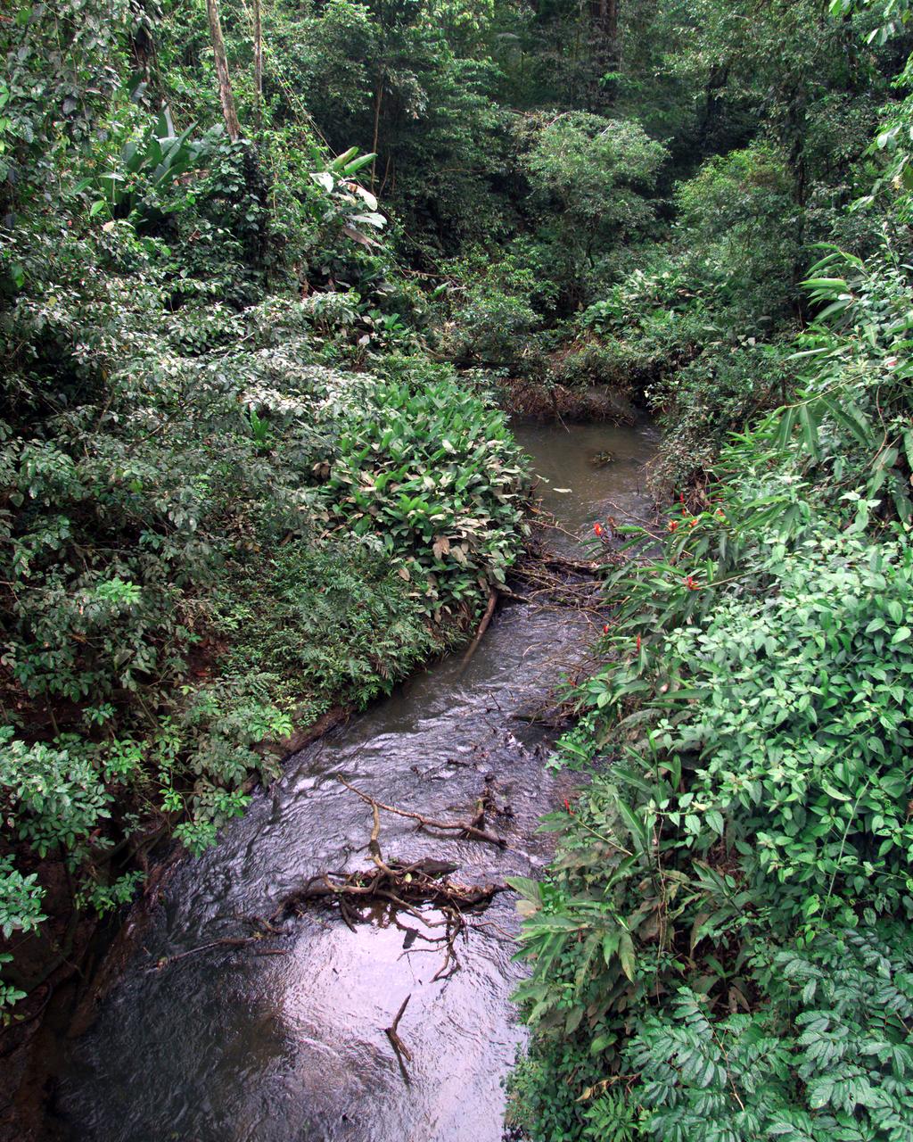
This photograph shows a stream in the La Selva region of the Costa Rican rain forest, taken during NASA's AirSAR 2004 Mesoamerica campaign. AirSAR 2004 Mesoamerica is a three-week expedition by an international team of scientists that will use an all-weather imaging tool, called the Airborne Synthetic Aperture Radar (AirSAR) which is located onboard NASA's DC-8 airborne laboratory. Scientists from many parts of the world including NASA's Jet Propulsion Laboratory are combining ground research done in several areas in Central America with NASA's AirSAR technology to improve and expand on the quality of research they are able to do. NASA's AIRSAR technolgy provides two essential elements to the ground-based scientists. First, it tests and provides accurate measurements of the forest structure. Secondly, AirSAR can study a larger area of the forest versus the smaller area that can be tested and plotted by the ground scientists. It also provides a unique one-of-a-kind system of measurement that obtains important information for the scientists, such as where forests are located and what exactly is in them.
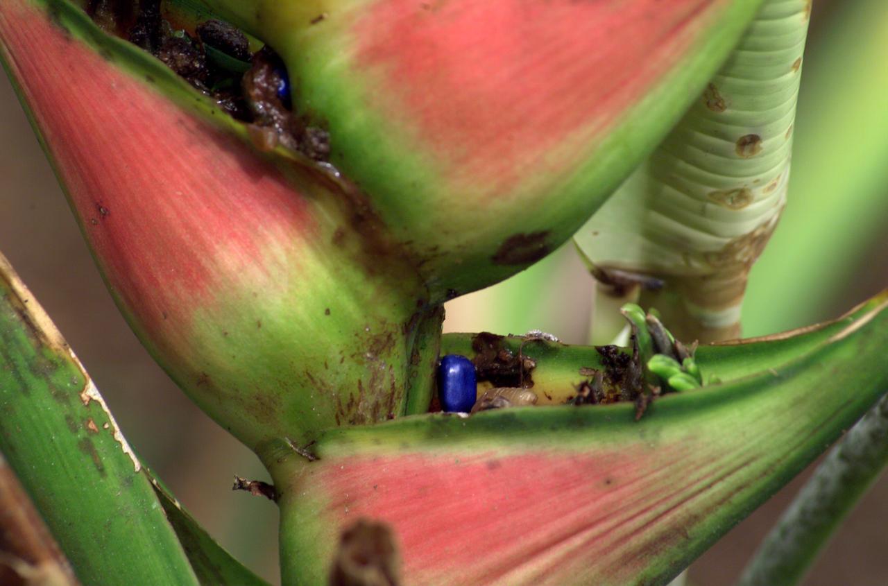
A plant photographed in the La Selva region of the Costa Rican rain forest as part of NASA's AirSAR 2004 Mesoamerica campaign. AirSAR 2004 Mesoamerica is a three-week expedition by an international team of scientists that will use an all-weather imaging tool, called the Airborne Synthetic Aperture Radar (AirSAR) which is located onboard NASA's DC-8 airborne laboratory. Scientists from many parts of the world including NASA's Jet Propulsion Laboratory are combining ground research done in several areas in Central America with NASA's AirSAR technology to improve and expand on the quality of research they are able to do. NASA's AIRSAR technolgy provides two essential elements to the ground-based scientists. First, it tests and provides accurate measurements of the forest structure. Secondly, AirSAR can study a larger area of the forest versus the smaller area that can be tested and plotted by the ground scientists. It also provides a unique one-of-a-kind system of measurement that obtains important information for the scientists, such as where forests are located and what exactly is in them.
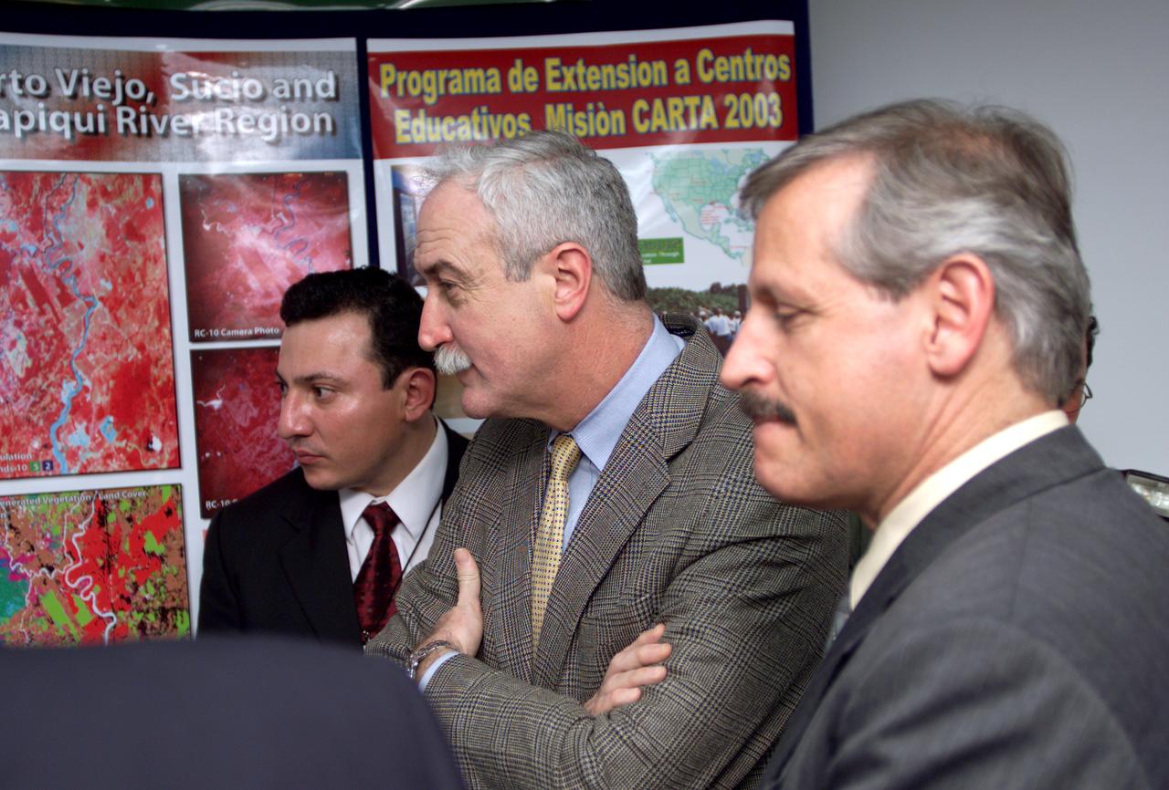
L-R; Jorge Andres Diaz, Director of the Costa Rican National Hangar for Airborne Research division of the National Center for High Technology(CENAT); NASA Administrator Sean O'Keefe; and Fernando Gutierrez, Costa Rican Minister of Science and Technology(MICIT), viewing posters showing how NASA activities have made an impact on Costa Rican people. Mr. O'Keefe was in Costa Rica to participate in the AirSAR 2004 Mesoamerica campaign, which used NASA DFRC's DC-8 airborne laboratory aircraft. AirSAR 2004 is a three-week expedition by an international team of scientists that will use an all-weather imaging tool, called the Airborne Synthetic Aperture Radar (AirSAR), in a mission ranging from the tropical rain forests of Central America to frigid Antarctica.

VIP tour of NASA DFRC's DC-8 airborne laboratory during the AirSAR 2004 Mesoamerica campaign given by Craig Dobson, NASA Program Manager for AirSAR, L-R: Dr. Sonia Marta Mora, President of the Costa Rican National Rector’s Council; NASA Administrator Sean O'Keefe; Fernando Gutierrez, Costa Rican Minister of Science and Technology(MICIT); Mr. John Danilovich, US Ambassador to Costa Rica; and Dobson. AirSAR 2004 Mesoamerica is a three-week expedition by an international team of scientists that will use an all-weather imaging tool, called the Airborne Synthetic Aperture Radar (AirSAR), in a mission ranging from the tropical rain forests of Central America to frigid Antarctica.

VIP’s onboard NASA's DC-8 aircraft during the AirSAR 2004 Mesoamerica campaign, L-R: Mr. John Danilovich, US Ambassador to Costa Rica; Dr. Gahssem Asrar, NASA Associate Administrator for Earth Science Enterprises; Dr. Sonia Marta Mora, President of the Costa Rican National Rector’s Council; and Fernando Gutierrez, Costa Rican Minister of Science and Technology(MICIT). AirSAR 2004 Mesoamerica is a three-week expedition by an international team of scientists that will use an all-weather imaging tool, called the Airborne Synthetic Aperture Radar (AirSAR), in a mission ranging from the tropical rain forests of Central America to frigid Antarctica.

KENNEDY SPACE CENTER, FLA. -- The Merritt Island National Wildlife Refuge, which shares a boundary with the Kennedy Space Center, is winter home to hundreds of waterfowl such as these coots and pintail ducks. The smaller coot inhabits open ponds and marshes, wintering in saltwater bays and inlets. They range from southern Canada to northern South America. The pintail can be found in marshes, prairie ponds and tundra, and salt marshes in winter. They range from Alaska and Greenland south to Central America and the West Indies

AS11-36-5337 (16 July 1969) --- This view of Earth showing clouds over its surface was photographed from the Apollo 11 spacecraft during its translunar journey toward the moon. The spacecraft was already about 10,000 nautical miles from Earth when this picture was taken. Portions of the land mass of North America and Central America can be seen. Aboard Apollo 11 were astronauts Neil A. Armstrong, Michael Collins and Edwin E. Aldrin Jr.
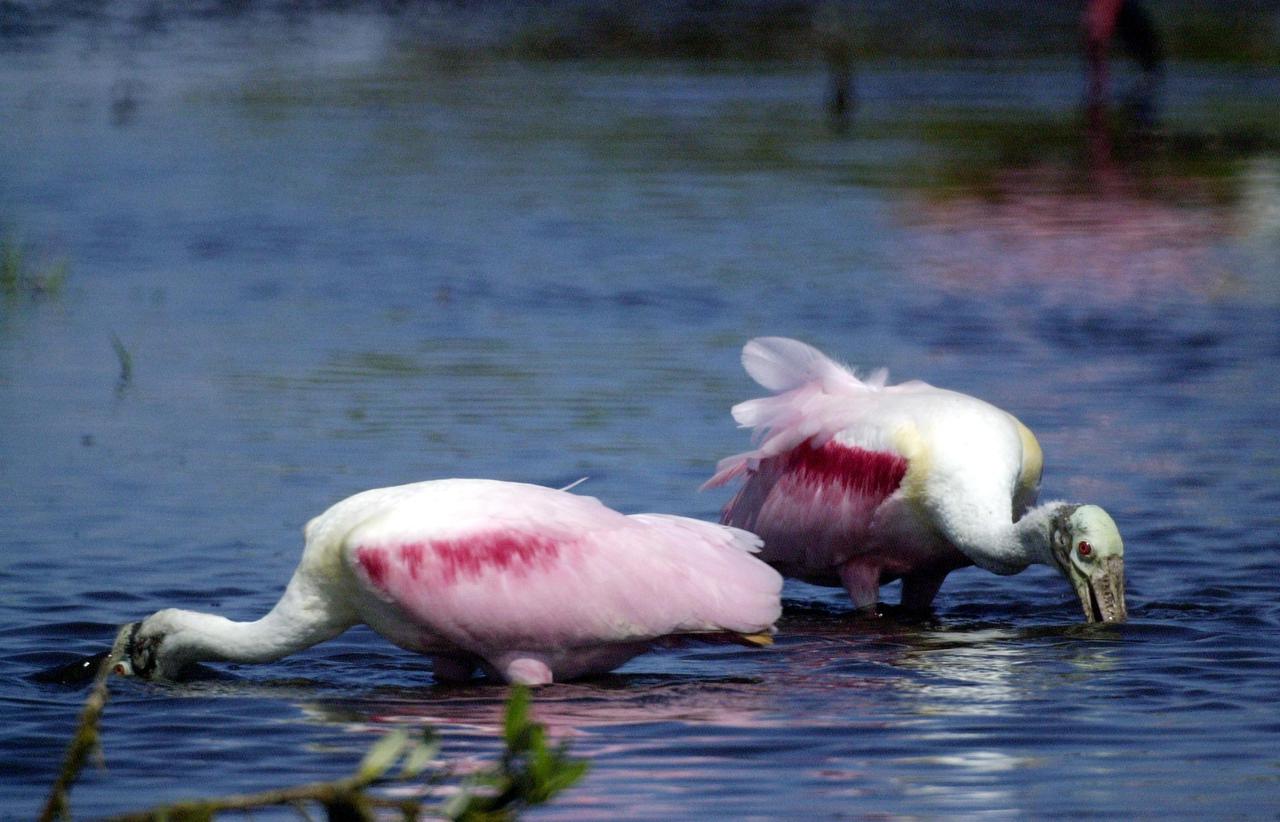
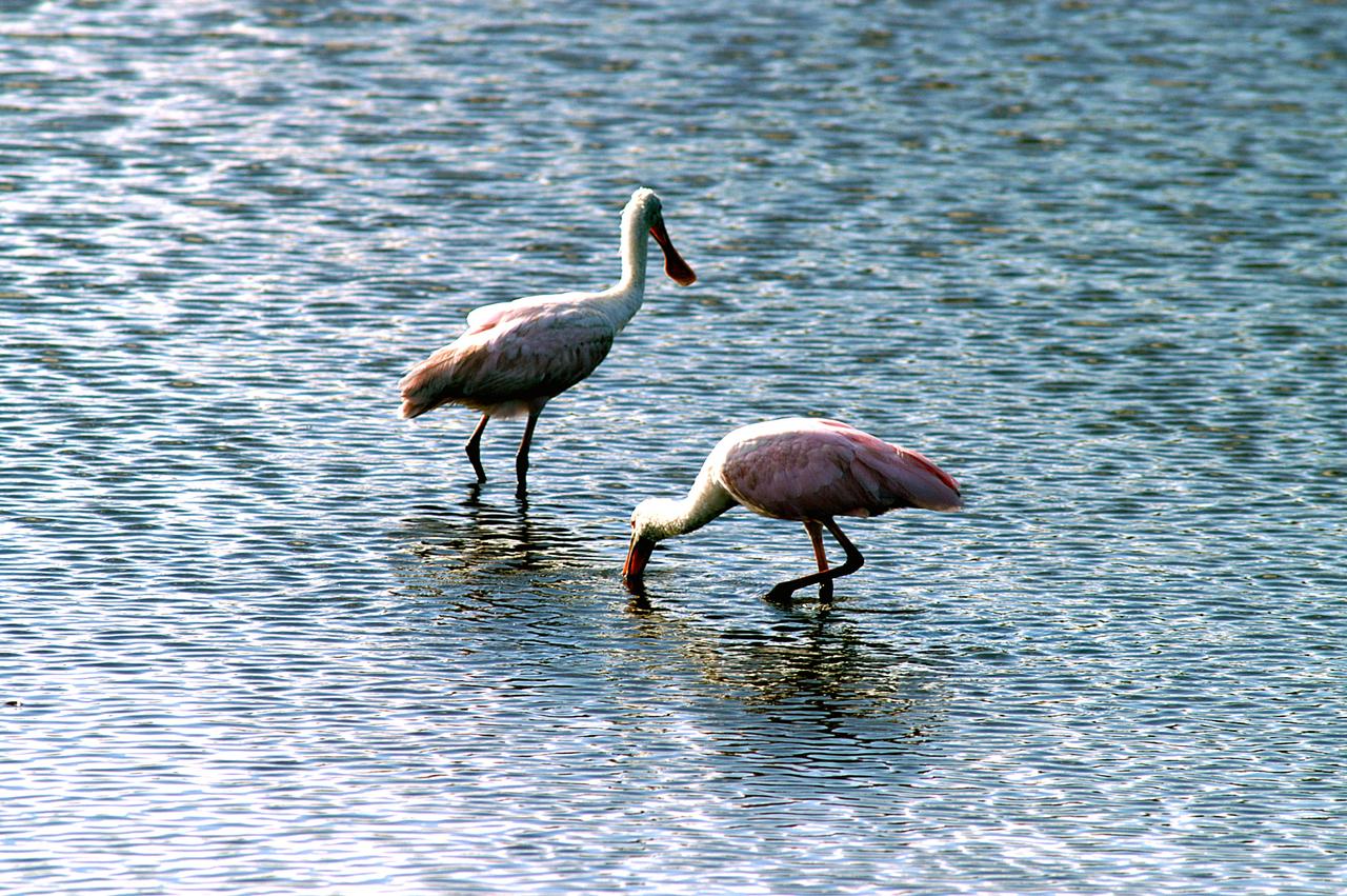
KENNEDY SPACE CENTER, FLA. -- In a lake near Kennedy Space Center, a pair of Roseate Spoonbills search the water for food. They obtain food by sweeping their broad bills from side to side. This species inhabits mangroves, ranging from the coasts of southern Florida and Texas (sometimes Louisiana), the West Indies, Mexico and Central and South America.

A total solar eclipse swept across a narrow portion of the North American continent from Mexico’s Pacific coast to the Atlantic coast of Newfoundland, Canada. A partial solar eclipse was visible across the entire North American continent along with parts of Central America and Europe.

Under mostly overcast skies, the Moon passes in front of the Sun as a partial solar eclipse approaches 85% in New Orleans, home of NASA’s Michoud Assembly Facility, on Monday, April 8, 2024. A total solar eclipse tracked along a narrow strip of the North American continent from Mexico’s Pacific coast to the Atlantic coast of Newfoundland, Canada. A partial solar eclipse was visible across the entire North American continent as well as parts of Europe and Central America. Image credit: NASA/Michael DeMocker

Under mostly overcast skies, the Moon passes in front of the Sun as a partial solar eclipse approaches 85% in New Orleans, home of NASA’s Michoud Assembly Facility, on Monday, April 8, 2024. A total solar eclipse tracked along a narrow strip of the North American continent from Mexico’s Pacific coast to the Atlantic coast of Newfoundland, Canada. A partial solar eclipse was visible across the entire North American continent as well as parts of Europe and Central America. Image credit: NASA/Michael DeMocker

STS060-85-000AD (3-11 Feb 1994) --- This photograph shows the Central American nations of Nicaragua, Costa Rica and parts of Panama. Lake Nicaragua defines the southern limits of the country of Nicaragua. The cloud-free portion of the photo shows Costa Rica, it's gulf and Peninsula of Nicoya. Agricultural land use is clearly seen around Nicoya and a few islands of tropical forests are seen at the edges. The capital city of San Jose, Costa Rica, is partly cloud-covered in this image.
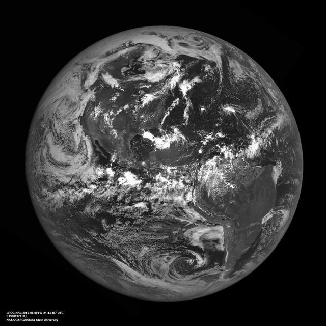
The western hemisphere of our home planet Earth. North (upper left), Central, and South America (lower right) were nicely free of clouds when LRO pointed home on 9 August 2010 to acquire this beautiful view. LROC NAC E136013771. As LRO orbits the Moon every two hours sending down a stream of science data, it is easy to forget how close the Moon is to the Earth. The average distance between the two heavenly bodies is just 384,399 km (238,854 miles). Check your airline frequent flyer totals, perhaps you have already flown the distance to the Moon and back on a single airline. http://photojournal.jpl.nasa.gov/catalog/PIA13519

Guests learn about the total solar eclipse from NASA staff at the Dallas Arboretum, Monday, April 8, 2024, in Dallas, Texas. A total solar eclipse swept across a narrow portion of the North American continent from Mexico’s Pacific coast to the Atlantic coast of Newfoundland, Canada. A partial solar eclipse was visible across the entire North American continent along with parts of Central America and Europe. Photo Credit: (NASA/Keegan Barber) in Dallas, Texas on Monday, April 8, 2024. A total solar eclipse swept across a narrow portion of the North American continent from Mexico’s Pacific coast to the Atlantic coast of Newfoundland, Canada. A partial solar eclipse was visible across the entire North American continent along with parts of Central America and Europe. Photo Credit: (NASA/Keegan Barber)

Guests learn about the total solar eclipse from NASA staff at the Dallas Arboretum, Monday, April 8, 2024, in Dallas, Texas. A total solar eclipse swept across a narrow portion of the North American continent from Mexico’s Pacific coast to the Atlantic coast of Newfoundland, Canada. A partial solar eclipse was visible across the entire North American continent along with parts of Central America and Europe. Photo Credit: (NASA/Keegan Barber) in Dallas, Texas on Monday, April 8, 2024. A total solar eclipse swept across a narrow portion of the North American continent from Mexico’s Pacific coast to the Atlantic coast of Newfoundland, Canada. A partial solar eclipse was visible across the entire North American continent along with parts of Central America and Europe. Photo Credit: (NASA/Keegan Barber)
Guests learn about the total solar eclipse from NASA staff at the Dallas Arboretum, Monday, April 8, 2024, in Dallas, Texas. A total solar eclipse swept across a narrow portion of the North American continent from Mexico’s Pacific coast to the Atlantic coast of Newfoundland, Canada. A partial solar eclipse was visible across the entire North American continent along with parts of Central America and Europe. Photo Credit: (NASA/Keegan Barber) in Dallas, Texas on Monday, April 8, 2024. A total solar eclipse swept across a narrow portion of the North American continent from Mexico’s Pacific coast to the Atlantic coast of Newfoundland, Canada. A partial solar eclipse was visible across the entire North American continent along with parts of Central America and Europe. Photo Credit: (NASA/Keegan Barber)

Guests learn about the total solar eclipse from NASA staff at the Dallas Arboretum, Monday, April 8, 2024, in Dallas, Texas. A total solar eclipse swept across a narrow portion of the North American continent from Mexico’s Pacific coast to the Atlantic coast of Newfoundland, Canada. A partial solar eclipse was visible across the entire North American continent along with parts of Central America and Europe. Photo Credit: (NASA/Keegan Barber) in Dallas, Texas on Monday, April 8, 2024. A total solar eclipse swept across a narrow portion of the North American continent from Mexico’s Pacific coast to the Atlantic coast of Newfoundland, Canada. A partial solar eclipse was visible across the entire North American continent along with parts of Central America and Europe. Photo Credit: (NASA/Keegan Barber)

Guests learn about the total solar eclipse from NASA staff at the Dallas Arboretum, Monday, April 8, 2024, in Dallas, Texas. A total solar eclipse swept across a narrow portion of the North American continent from Mexico’s Pacific coast to the Atlantic coast of Newfoundland, Canada. A partial solar eclipse was visible across the entire North American continent along with parts of Central America and Europe. Photo Credit: (NASA/Keegan Barber) in Dallas, Texas on Monday, April 8, 2024. A total solar eclipse swept across a narrow portion of the North American continent from Mexico’s Pacific coast to the Atlantic coast of Newfoundland, Canada. A partial solar eclipse was visible across the entire North American continent along with parts of Central America and Europe. Photo Credit: (NASA/Keegan Barber)

Guests learn about the total solar eclipse from NASA staff at the Dallas Arboretum, Monday, April 8, 2024, in Dallas, Texas. A total solar eclipse swept across a narrow portion of the North American continent from Mexico’s Pacific coast to the Atlantic coast of Newfoundland, Canada. A partial solar eclipse was visible across the entire North American continent along with parts of Central America and Europe. Photo Credit: (NASA/Keegan Barber) in Dallas, Texas on Monday, April 8, 2024. A total solar eclipse swept across a narrow portion of the North American continent from Mexico’s Pacific coast to the Atlantic coast of Newfoundland, Canada. A partial solar eclipse was visible across the entire North American continent along with parts of Central America and Europe. Photo Credit: (NASA/Keegan Barber)
Guests learn about the total solar eclipse from NASA staff at the Dallas Arboretum, Monday, April 8, 2024, in Dallas, Texas. A total solar eclipse swept across a narrow portion of the North American continent from Mexico’s Pacific coast to the Atlantic coast of Newfoundland, Canada. A partial solar eclipse was visible across the entire North American continent along with parts of Central America and Europe. Photo Credit: (NASA/Keegan Barber) in Dallas, Texas on Monday, April 8, 2024. A total solar eclipse swept across a narrow portion of the North American continent from Mexico’s Pacific coast to the Atlantic coast of Newfoundland, Canada. A partial solar eclipse was visible across the entire North American continent along with parts of Central America and Europe. Photo Credit: (NASA/Keegan Barber)

Guests learn about the total solar eclipse from NASA staff at the Dallas Arboretum, Monday, April 8, 2024, in Dallas, Texas. A total solar eclipse swept across a narrow portion of the North American continent from Mexico’s Pacific coast to the Atlantic coast of Newfoundland, Canada. A partial solar eclipse was visible across the entire North American continent along with parts of Central America and Europe. Photo Credit: (NASA/Keegan Barber) in Dallas, Texas on Monday, April 8, 2024. A total solar eclipse swept across a narrow portion of the North American continent from Mexico’s Pacific coast to the Atlantic coast of Newfoundland, Canada. A partial solar eclipse was visible across the entire North American continent along with parts of Central America and Europe. Photo Credit: (NASA/Keegan Barber)

Guests learn about the total solar eclipse from NASA staff at the Dallas Arboretum, Monday, April 8, 2024, in Dallas, Texas. A total solar eclipse swept across a narrow portion of the North American continent from Mexico’s Pacific coast to the Atlantic coast of Newfoundland, Canada. A partial solar eclipse was visible across the entire North American continent along with parts of Central America and Europe. Photo Credit: (NASA/Keegan Barber) in Dallas, Texas on Monday, April 8, 2024. A total solar eclipse swept across a narrow portion of the North American continent from Mexico’s Pacific coast to the Atlantic coast of Newfoundland, Canada. A partial solar eclipse was visible across the entire North American continent along with parts of Central America and Europe. Photo Credit: (NASA/Keegan Barber)

Guests decorate their protective glasses at the Dallas Arboretum prior to the total solar eclipse, Monday, April 8, 2024, in Dallas, Texas. A total solar eclipse swept across a narrow portion of the North American continent from Mexico’s Pacific coast to the Atlantic coast of Newfoundland, Canada. A partial solar eclipse was visible across the entire North American continent along with parts of Central America and Europe. Photo Credit: (NASA/Keegan Barber) in Dallas, Texas on Monday, April 8, 2024. A total solar eclipse swept across a narrow portion of the North American continent from Mexico’s Pacific coast to the Atlantic coast of Newfoundland, Canada. A partial solar eclipse was visible across the entire North American continent along with parts of Central America and Europe. Photo Credit: (NASA/Keegan Barber)

Guests learn about the total solar eclipse from NASA staff at the Dallas Arboretum, Monday, April 8, 2024, in Dallas, Texas. A total solar eclipse swept across a narrow portion of the North American continent from Mexico’s Pacific coast to the Atlantic coast of Newfoundland, Canada. A partial solar eclipse was visible across the entire North American continent along with parts of Central America and Europe. Photo Credit: (NASA/Keegan Barber) in Dallas, Texas on Monday, April 8, 2024. A total solar eclipse swept across a narrow portion of the North American continent from Mexico’s Pacific coast to the Atlantic coast of Newfoundland, Canada. A partial solar eclipse was visible across the entire North American continent along with parts of Central America and Europe. Photo Credit: (NASA/Keegan Barber)
Guests learn about the total solar eclipse from NASA staff at the Dallas Arboretum, Monday, April 8, 2024, in Dallas, Texas. A total solar eclipse swept across a narrow portion of the North American continent from Mexico’s Pacific coast to the Atlantic coast of Newfoundland, Canada. A partial solar eclipse was visible across the entire North American continent along with parts of Central America and Europe. Photo Credit: (NASA/Keegan Barber) in Dallas, Texas on Monday, April 8, 2024. A total solar eclipse swept across a narrow portion of the North American continent from Mexico’s Pacific coast to the Atlantic coast of Newfoundland, Canada. A partial solar eclipse was visible across the entire North American continent along with parts of Central America and Europe. Photo Credit: (NASA/Keegan Barber)
Guests learn about the total solar eclipse from NASA staff at the Dallas Arboretum, Monday, April 8, 2024, in Dallas, Texas. A total solar eclipse swept across a narrow portion of the North American continent from Mexico’s Pacific coast to the Atlantic coast of Newfoundland, Canada. A partial solar eclipse was visible across the entire North American continent along with parts of Central America and Europe. Photo Credit: (NASA/Keegan Barber) in Dallas, Texas on Monday, April 8, 2024. A total solar eclipse swept across a narrow portion of the North American continent from Mexico’s Pacific coast to the Atlantic coast of Newfoundland, Canada. A partial solar eclipse was visible across the entire North American continent along with parts of Central America and Europe. Photo Credit: (NASA/Keegan Barber)
Guests learn about the total solar eclipse from NASA staff at the Dallas Arboretum, Monday, April 8, 2024, in Dallas, Texas. A total solar eclipse swept across a narrow portion of the North American continent from Mexico’s Pacific coast to the Atlantic coast of Newfoundland, Canada. A partial solar eclipse was visible across the entire North American continent along with parts of Central America and Europe. Photo Credit: (NASA/Keegan Barber) in Dallas, Texas on Monday, April 8, 2024. A total solar eclipse swept across a narrow portion of the North American continent from Mexico’s Pacific coast to the Atlantic coast of Newfoundland, Canada. A partial solar eclipse was visible across the entire North American continent along with parts of Central America and Europe. Photo Credit: (NASA/Keegan Barber)
Guests pose for a photo at the Dallas Arboretum, Monday, April 8, 2024, in Dallas, Texas. A total solar eclipse swept across a narrow portion of the North American continent from Mexico’s Pacific coast to the Atlantic coast of Newfoundland, Canada. A partial solar eclipse was visible across the entire North American continent along with parts of Central America and Europe. Photo Credit: (NASA/Keegan Barber) in Dallas, Texas on Monday, April 8, 2024. A total solar eclipse swept across a narrow portion of the North American continent from Mexico’s Pacific coast to the Atlantic coast of Newfoundland, Canada. A partial solar eclipse was visible across the entire North American continent along with parts of Central America and Europe. Photo Credit: (NASA/Keegan Barber)
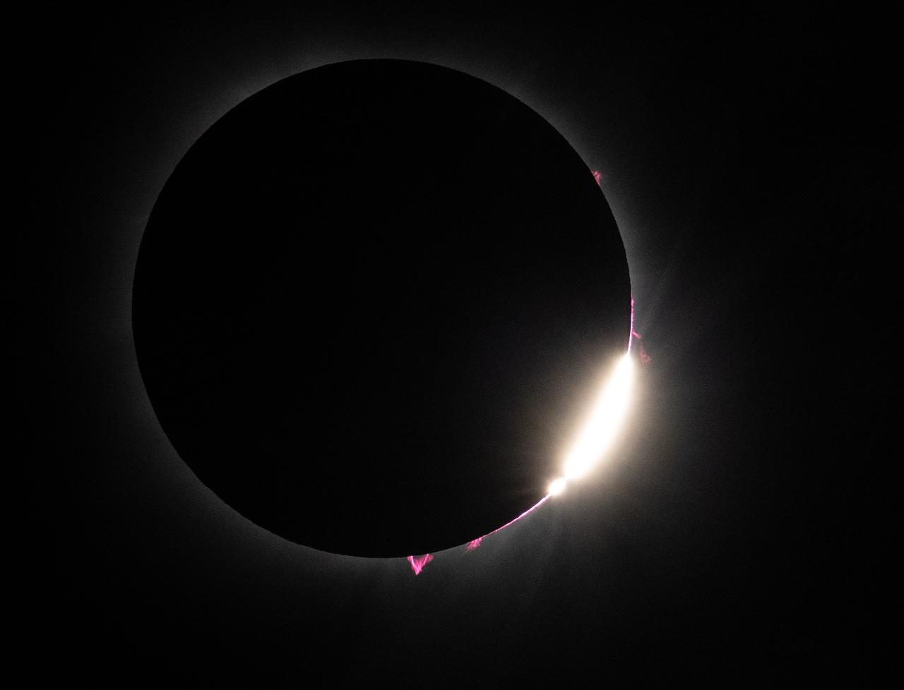
Bailey's Beads and solar prominences are seen just after totality in Dallas, Texas on Monday, April 8, 2024. A total solar eclipse swept across a narrow portion of the North American continent from Mexico’s Pacific coast to the Atlantic coast of Newfoundland, Canada. A partial solar eclipse was visible across the entire North American continent along with parts of Central America and Europe. Photo Credit: (NASA/Keegan Barber) in Dallas, Texas on Monday, April 8, 2024. A total solar eclipse swept across a narrow portion of the North American continent from Mexico’s Pacific coast to the Atlantic coast of Newfoundland, Canada. A partial solar eclipse was visible across the entire North American continent along with parts of Central America and Europe. Photo Credit: (NASA/Keegan Barber)
KENNEDY SPACE CENTER, FLA. -- Two roseate spoonbills hunt for their supper in the water near KSC. Spoonbills prefer to inhabit mangroves, ranging from the coasts of southern Florida, Louisiana and Texas, to the West Indies, Mexico, Central and South America. They feed on shrimps and fish in shallow waters. Spoonbills are one of 310 species of birds that inhabit the National Merritt Island Wildlife Refuge, which shares a boundary with KSC. The marshes and open water of the refuge also provide wintering areas for 23 species of migratory waterfowl, as well as a year-round home for great blue herons, great egrets, wood storks, cormorants, brown pelicans and other species of marsh and shore birds.
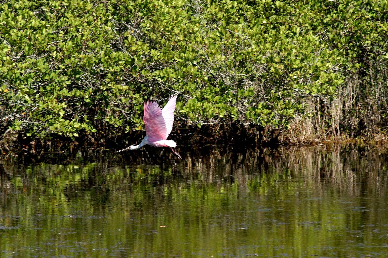
KENNEDY SPACE CENTER, FLA. - A roseate spoonbill flies across the water near KSC. Spoonbills prefer to inhabit mangroves, ranging from the coasts of southern Florida, Louisiana and Texas, to the West Indies, Mexico, Central and South America. They feed on shrimps and fish in shallow waters. Spoonbills are one of 310 species of birds that inhabit the National Merritt Island Wildlife Refuge, which shares a boundary with KSC. The marshes and open water of the refuge also provide wintering areas for 23 species of migratory waterfowl, as well as a year-round home for great blue herons, great egrets, wood storks, cormorants, brown pelicans and other species of marsh and shore birds.
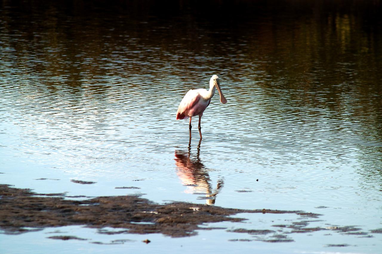
KENNEDY SPACE CENTER, FLA. -- A roseate spoonbill contemplates its reflection in the water near KSC. Spoonbills prefer to inhabit mangroves, ranging from the coasts of southern Florida, Louisiana and Texas, to the West Indies, Mexico, Central and South America. They feed on shrimps and fish in shallow waters. Spoonbills are one of 310 species of birds that inhabit the Merritt Island National Wildlife Refuge, which shares a boundary with KSC. The marshes and open water of the refuge also provide wintering areas for 23 species of migratory waterfowl, as well as a year-round home for great blue herons, great egrets, wood storks, cormorants, brown pelicans and other species of marsh and shore birds.
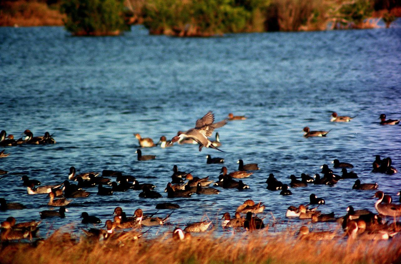
KENNEDY SPACE CENTER, FLA. -- A pintail duck is poised for landing, joining other ducks and coots on the waters of the Merritt Island National Wildlife Refuge at Kennedy Space Center. The refuge is winter home to hundreds of waterfowl such as these coots and pintail ducks. The smaller coot inhabits open ponds and marshes, wintering in saltwater bays and inlets. They range from southern Canada to northern South America. The pintail can be found in marshes, prairie ponds and tundra, and salt marshes in winter. They range from Alaska and Greenland south to Central America and the West Indies

AS15-91-12343 (26 July 1971) --- This view of Earth was photographed by the Apollo 15 crewmen as they sped toward the fourth lunar landing. The spacecraft was between 25,000 and 30,000 nautical miles from Earth when this photo was made. The United States (note Florida), Central America and part of Canada can be seen at the left side of the picture, with South America at lower center. Spain and the northwest part of Africa can be seen at right. The Bahamas Banks, unique geological feature, can be seen (different shade of blue) east of Florida. Also note large North Atlantic storm front moving over Greenland in upper center.
STS091-701-075 (2-12 June 1998) --- Fires across Mexico and Central America which created heavy smoke plumes for a few weeks in May and June, 1998, were recorded on 70mm film by the crewmembers of STS-91. The smoke circulated around a high pressure system over the Gulf of Mexico and brought thick smoke and soot to the south central United States. Scientists are looking at burning regions like this around the world to study the smokes affect on the albedo or the reflectance of the sun's rays and how it may influence the world's climate. This view captures the area from the Gulf of Tehuantepec, on the south side, to the Bay of Campeche to the north in early June 1998.

Visitors to The Children’s Museum of Indianapolis learn about the upcoming total solar eclipse from NASA staff, Saturday, April 6, 2024, in Indianapolis, Ind. On Monday, April 8, a total solar eclipse will sweep across a narrow portion of the North American continent from Mexico’s Pacific coast to the Atlantic coast of Newfoundland, Canada, while a partial solar eclipse will be visible across the entire North American continent along with parts of Central America and Europe. Photo Credit: (NASA/Joel Kowsky)

Maurice Henderson speaks to guests about the upcoming total solar eclipse at the Dallas Arboretum, Sunday, April 7, 2024, in Dallas, Texas. On Monday, April 8, a total solar eclipse will sweep across a narrow portion of the North American continent from Mexico’s Pacific coast to the Atlantic coast of Newfoundland, Canada, while a partial solar eclipse will be visible across the entire North American continent along with parts of Central America and Europe. Photo Credit: (NASA/Keegan Barber)

People gather on the roof of NASA Headquarters in Washington to watch a partial solar eclipse through protective glasses in Washington, on Monday, April 8, 2024. A total solar eclipse swept across a narrow portion of the North American continent from Mexico’s Pacific coast to the Atlantic coast of Newfoundland, Canada. A partial solar eclipse was visible across the entire North American continent along with parts of Central America and Europe. Photo Credit: (NASA/Connie Moore)
Jane Rigby, senior project scientist for NASA's James Webb Space Telescope, speaks to visitors at The Children’s Museum of Indianapolis, Saturday, April 6, 2024, in Indianapolis, Ind. On Monday, April 8, a total solar eclipse will sweep across a narrow portion of the North American continent from Mexico’s Pacific coast to the Atlantic coast of Newfoundland, Canada, while a partial solar eclipse will be visible across the entire North American continent along with parts of Central America and Europe. Photo Credit: (NASA/Joel Kowsky)
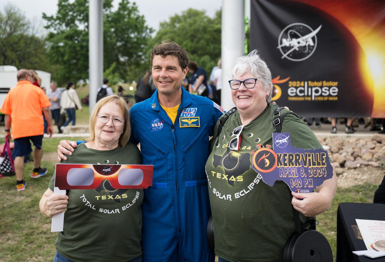
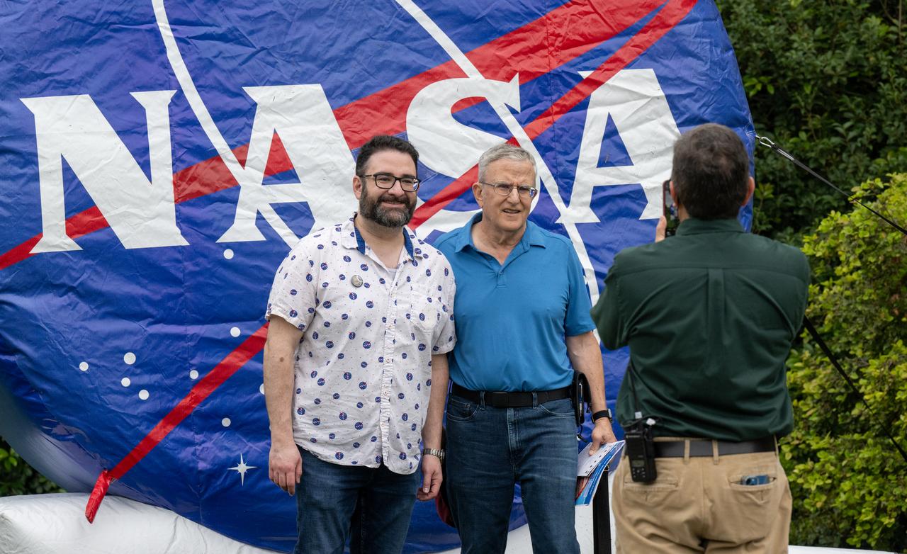
Astronaut Reid Wiseman poses for a photo with guests at the total solar eclipse festival in Kerrville, TX on Monday, April 8, 2024. A total solar eclipse swept across a narrow portion of the North American continent from Mexico’s Pacific coast to the Atlantic coast of Newfoundland, Canada. A partial solar eclipse was visible across the entire North American continent along with parts of Central America and Europe. Photo Credit: (NASA/Aubrey Gemignani)

The statue on top of the Borg-Warner trophy is seen wearing solar glasses at the Indianapolis Motor Speedway ahead of the total solar eclipse, Monday, April 8, 2024, in Indianapolis, Ind. A total solar eclipse swept across a narrow portion of the North American continent from Mexico’s Pacific coast to the Atlantic coast of Newfoundland, Canada. A partial solar eclipse was visible across the entire North American continent along with parts of Central America and Europe. Photo Credit: (NASA/Joel Kowsky)

NASA Broadcast Host Tahira Allen, Space Physicist Gina DiBraccio, and NASA astronaut Reid Wiseman are seen during the broadcast of the total solar eclipse in Kerrville, TX on Monday, April 8, 2024. A total solar eclipse swept across a narrow portion of the North American continent from Mexico’s Pacific coast to the Atlantic coast of Newfoundland, Canada. A partial solar eclipse was visible across the entire North American continent along with parts of Central America and Europe. Photo Credit: (NASA/Aubrey Gemignani)

Shown is remnants of the former headquarters building at NASA’s Kennedy Space Center on Jan. 11, 2022. Built in 1965, the 439,000-square-foot structure was demolished and replaced at the Florida spaceport by the 200,000-square-foot, seven-story Central Campus Headquarters (CCHQ) Building. The CCHQ is a modernized, energy efficient facility representative of Kennedy’s transformation to America’s premier multi-user spaceport. The area previously occupied by the old headquarters building will be utilized as greenspace.
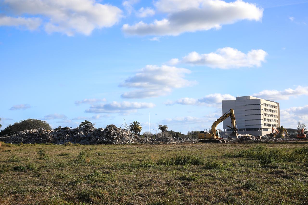
In the foreground is remnants of the former headquarters building at NASA’s Kennedy Space Center on Jan. 11, 2022. Built in 1965, the 439,000-square-foot structure was demolished and replaced at the Florida spaceport by the 200,000-square-foot, seven-story Central Campus Headquarters (CCHQ) Building, shown in the background. The CCHQ is a modernized, energy efficient facility representative of Kennedy’s transformation to America’s premier multi-user spaceport. It opened in May 2019. The area previously occupied by the old headquarters building will be utilized as greenspace.