SL2-05-364 (22 June 1973) --- Lying in the eastern Mediterranean Sea, the entire Island of Crete (35.0N, 25.0E) can be seen in great detail in this cloud free view. The volcanic origins of this island can also be observed in the many sharp and angular ridgelines and rugged coastal features. Photo credit: NASA

iss071e700011 (Sept. 19, 2024) -- The largest of the Greek islands, Crete, was photographed from the International Space Station as it orbited 258 miles above. The northwestern portion of the island is pictured here, including Chania, one of four regional units.

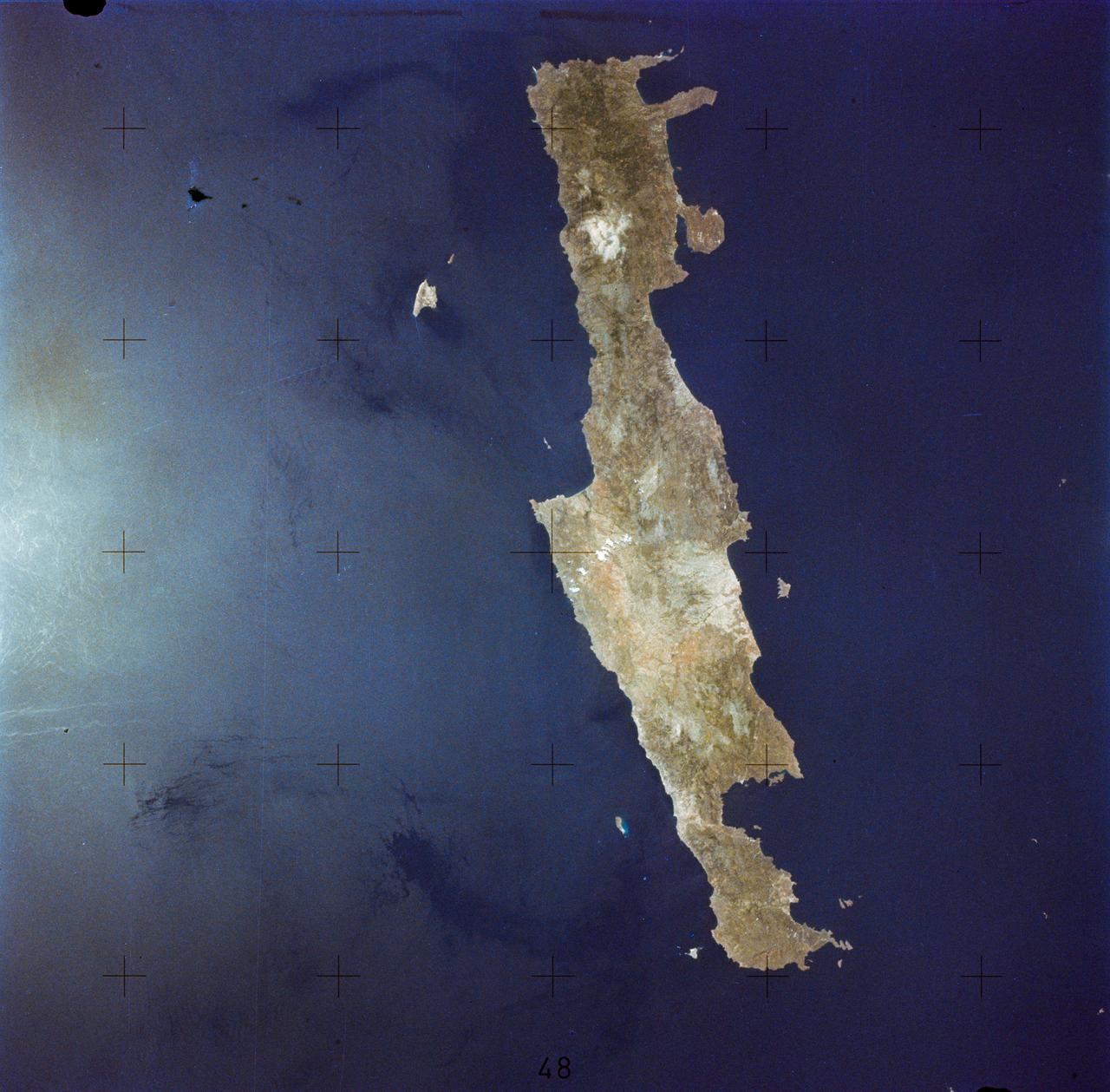
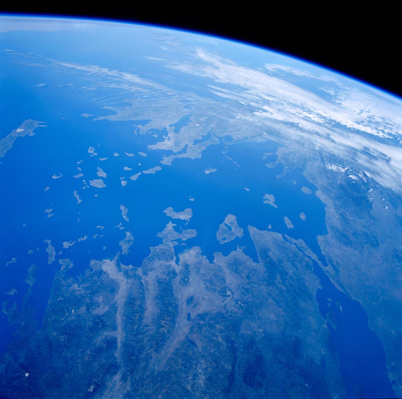
ISS028-E-018562 (22 July 2011) --- Island of Crete, Greece is featured in this image photographed by an Expedition 28 crew member on the International Space Station. In classical Greek mythology the island of Crete was home to King Minos and the terrible Minotaur, a beast that was half man and half bull. The known historical record of Crete is no less impressive. The island was the center of the Bronze Age Minoan civilization that flourished from approximately 2700 – 1420 BC. There is archeological, geological, and cultural evidence to suggest that a cataclysmic volcanic eruption in approximately 1620 BC of Santorini volcano was a major cause of the decline – if not complete destruction – of the Minoan civilization. Today, Crete is the largest and most heavily populated island of Greece (or the Hellenic Republic). The island extends for approximately 260 kilometers and is approximately 60 kilometers across at its widest point. The terrain of Crete is rugged and includes mountains, plateaus, and several deep gorges. The largest city on the island, Heraklion, is located along the northern coastline (center). Several smaller islands ring Crete; two of the largest of these, Dia and Gavdos are sparsely populated year-round, although Gavdos hosts numerous summer visitors. The western and central parts of Crete appear surrounded by quicksilver in this photograph. This phenomenon is known as sunglint, caused by light reflecting off of the sea surface directly toward the observer. The point of maximum reflectance is visible as a bright white region to the northwest of the island (lower right). Surface currents causing variations in the degree of reflectance are visible near the southwestern shoreline of Crete and the smaller island of Gavdos (upper right).
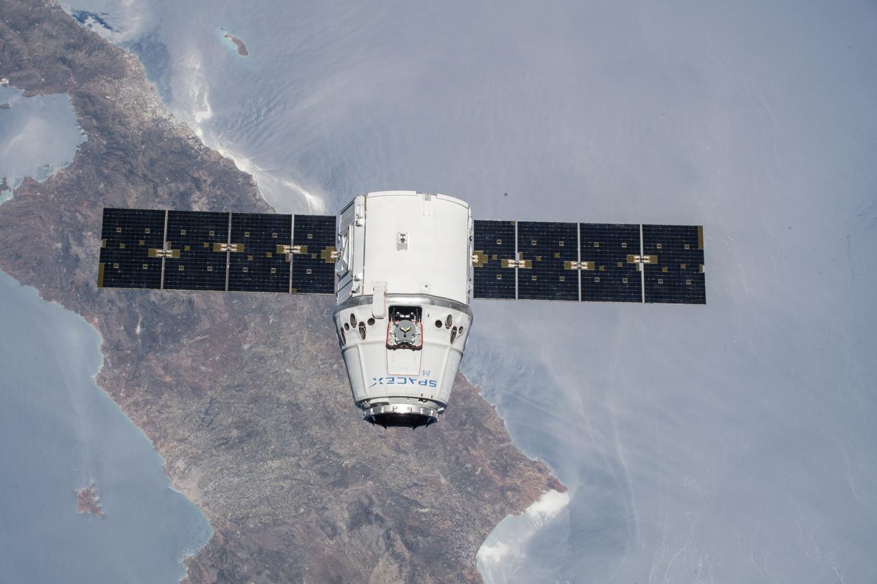
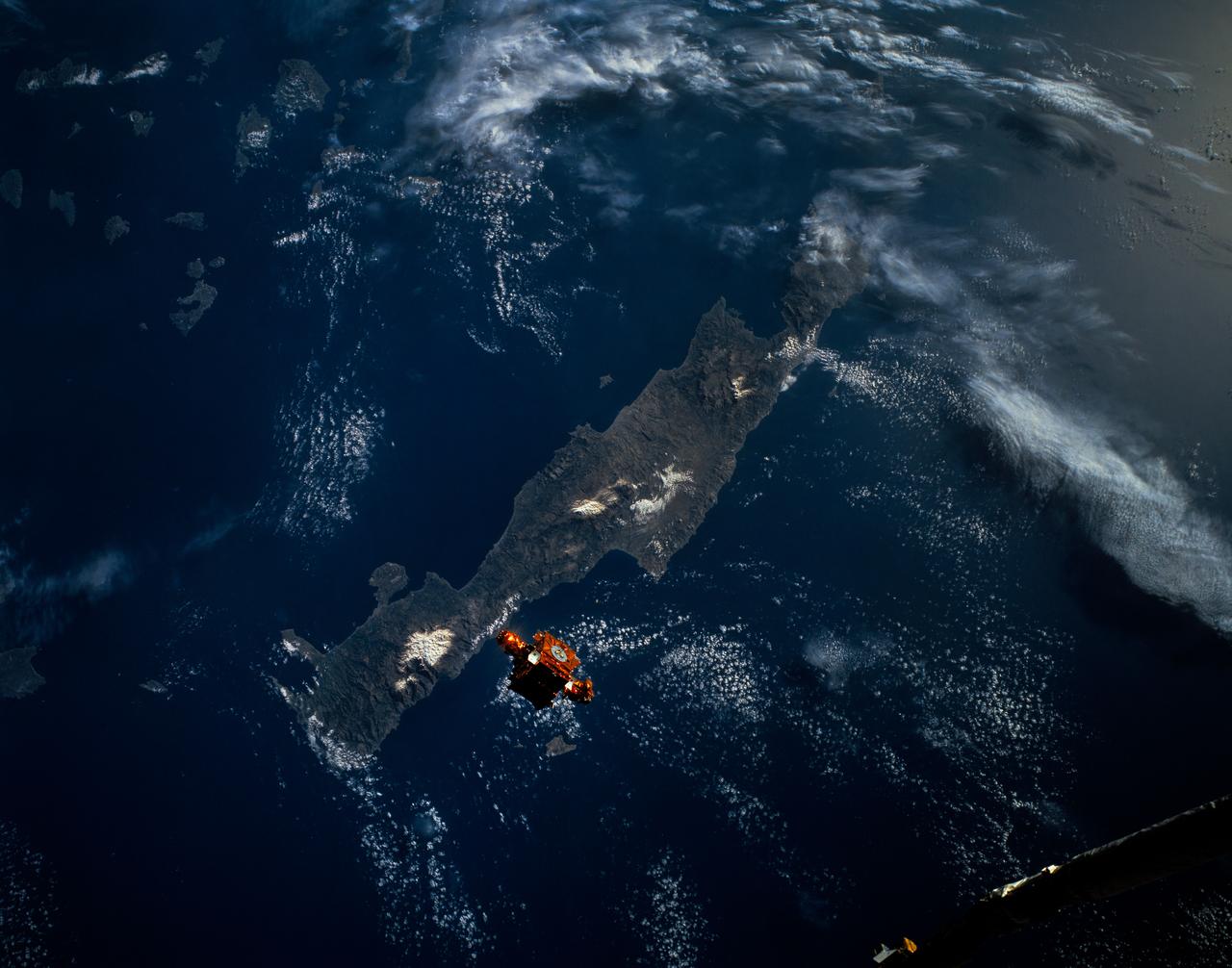
iss056e073506 (July 2, 2018) --- The SpaceX Dragon cargo craft is pictured approaching the International Space Station as both spacecraft were orbiting over the Greek island of Crete.
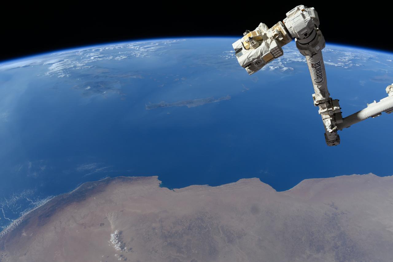
iss071e384199 (July 17, 2024) --- The Canadarm2 robotic arm's latching end effector, or LEE, is used to grapple fixtures on the International Space Station, as well as capture the approaching Cygnus cargo craft from Northrop Grumman and attach it to the Unity module for cargo transfer operations. 256 miles below the outpost is the Mediterranean coast of Libya and Egypt and the Greek island of Crete.
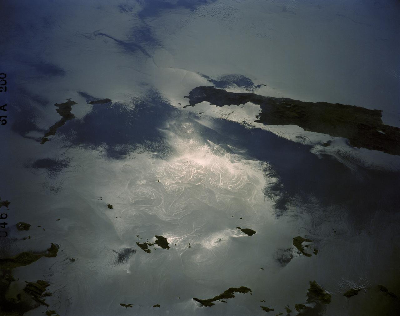
61A-200-046 (30 Oct--6 Nov 1985) --- A low-sun angle view of the eastern Mediterranean Sea showing the east tip of the island of Crete and the Sporades Islands of the Agean Sea. Numberous sprial eddies and island wakes are also highlighted in the sunglint--a delight to oceanographers. pg.26-2
STS084-707-013 (15-24 May 1997) --- As photographed from the Earth-orbiting Space Shuttle Atlantis, this 70mm scene provides a modern view from space of a region rich in ancient history. The Minoan civilization thrived on Crete (western end of the island is visible on the left side of the image) from 3000 BC to about 1100 BC. It is believed by some historians that the eruption of the volcanic island of Thera (the "C" shaped island facing Crete) and possible tsunami helped to bring about the end of the Minoan civilization. The next great civilization to emerge was that of the Greeks. One of the most prominent city-states was Athens which can be seen as a light colored area on an elongated piece of land at center of view (near the clouds). The Aegean Sea separates Greece from Asia Minor (Turkey) in the foreground.
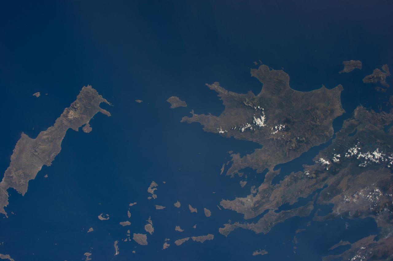
ISS040-E-033303 (3 July 2014) --- One of the Expedition 40 crew members aboard the International Space Station photographed this image from an altitude of 225 nautical miles, featuring the Ionian Sea (top), Crete (southernmost island at left), the Cyclades (bottom center) and much of Greece's land mass (right, or northernmost part of the frame).
During STS-56, the Shuttle Pointed Autonomous Research Tool for Astronomy 201 (SPARTAN-201), a freeflying payload, was photographed by Discovery's, Orbiter Vehicle (OV) 103's, crewmembers as it drifted above the Mediterranean Sea near the island of Crete. On the mission's third day, the remote manipulator system (RMS) arm was used to lift SPARTAN-201 from its support structure in OV-103's payload bay and release it in space. SPARTAN-201 was later recaptured by OV-103's RMS and returned to Earth with the astronaut crew.
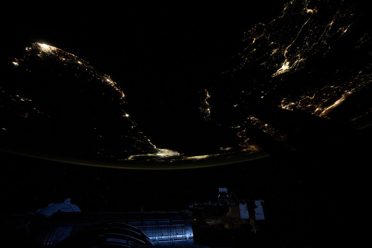
iss073e0312086 (May 22, 2025) --- At top left, the city lights of Benghazi, Libya, arc downward toward the glow of civilization on Egypt's Nile Delta outlining Africa's Mediterranean Sea coast. Israel's metropolitan lights then round north and east into Istanbul, Turkey (far right), and Athens, Greece, and their surrounding suburbs in southern Europe. Resting in the center of the Mediterranean's darkness is the Greek island of Crete.
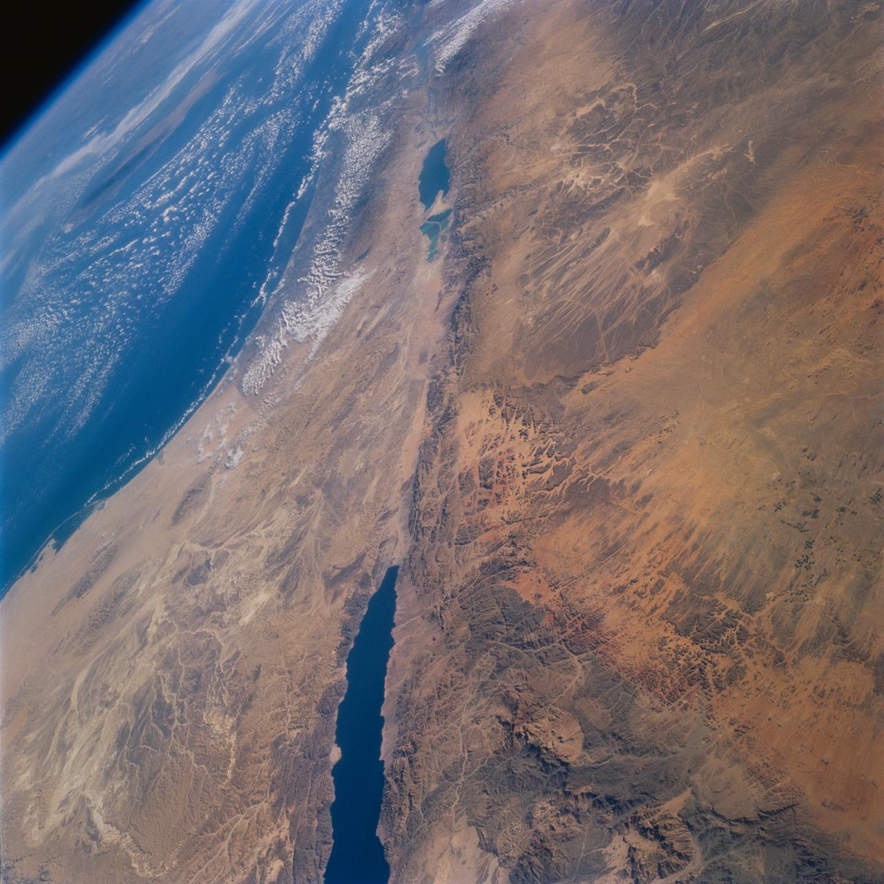
STS077-732-093 (19-29 May 1996) --- This high oblique perspective from the Space Shuttle Endeavour shows the Dead Sea Rift Valley and the surrounding deserts. North is to the right side of the frame. The vegetation line on the coast between Egypt and Israel is clearly visible. Crete is visible in the Mediterranean Sea. The Dead Sea was formed approximately 3 million years ago. A passage opened up to the sea and the water poured in. It is about 1,300 feet below sea level. It is fed by the Jordan River and numerous mineral springs from the surrounding hills. It is estimated to contain 43 million metric tons of salt. The salinity is 32 percent.
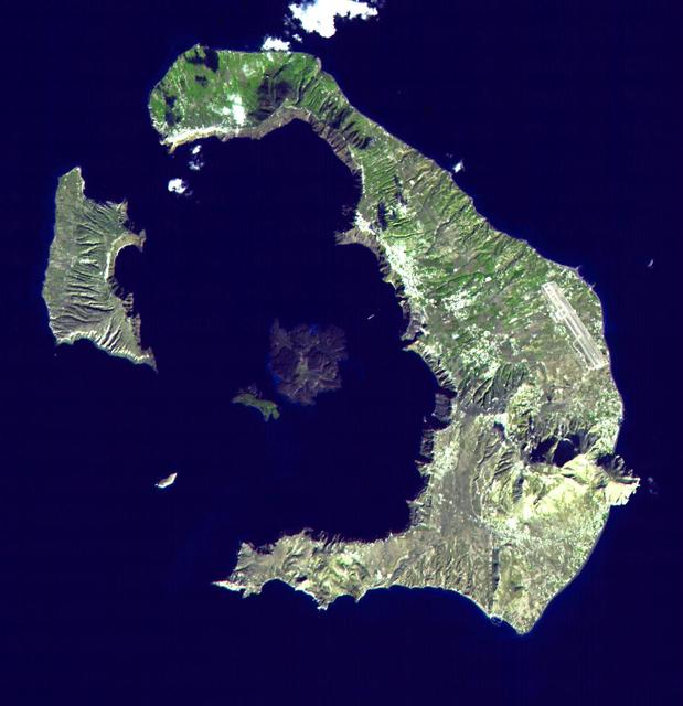
This ASTER image of Santorini was acquired on November 21, 2000 and covers an area of 18 by 18 km. The eruption of Santorini in 1650 B.C. was one of the largest in the last 10,000 years. About 30 cubic kilometers of magma was erupted, forming a plinian column 36 km high. The removal of such a large volume of magma caused the volcano to collapse, producing a caldera. Ash fell over a large area of the eastern Mediterranean. The eruption probably caused the end of the Minoan civilization on the island of Crete. The largest island is Thera, and the smaller is Therasia. The Kameni Islands (dark in the image center) formed after the caldera., with the most recent eruptions occurring in 1950. The image is centered at 36.4 degrees north latitude, 25.4 degrees east longitude. http://photojournal.jpl.nasa.gov/catalog/PIA02673
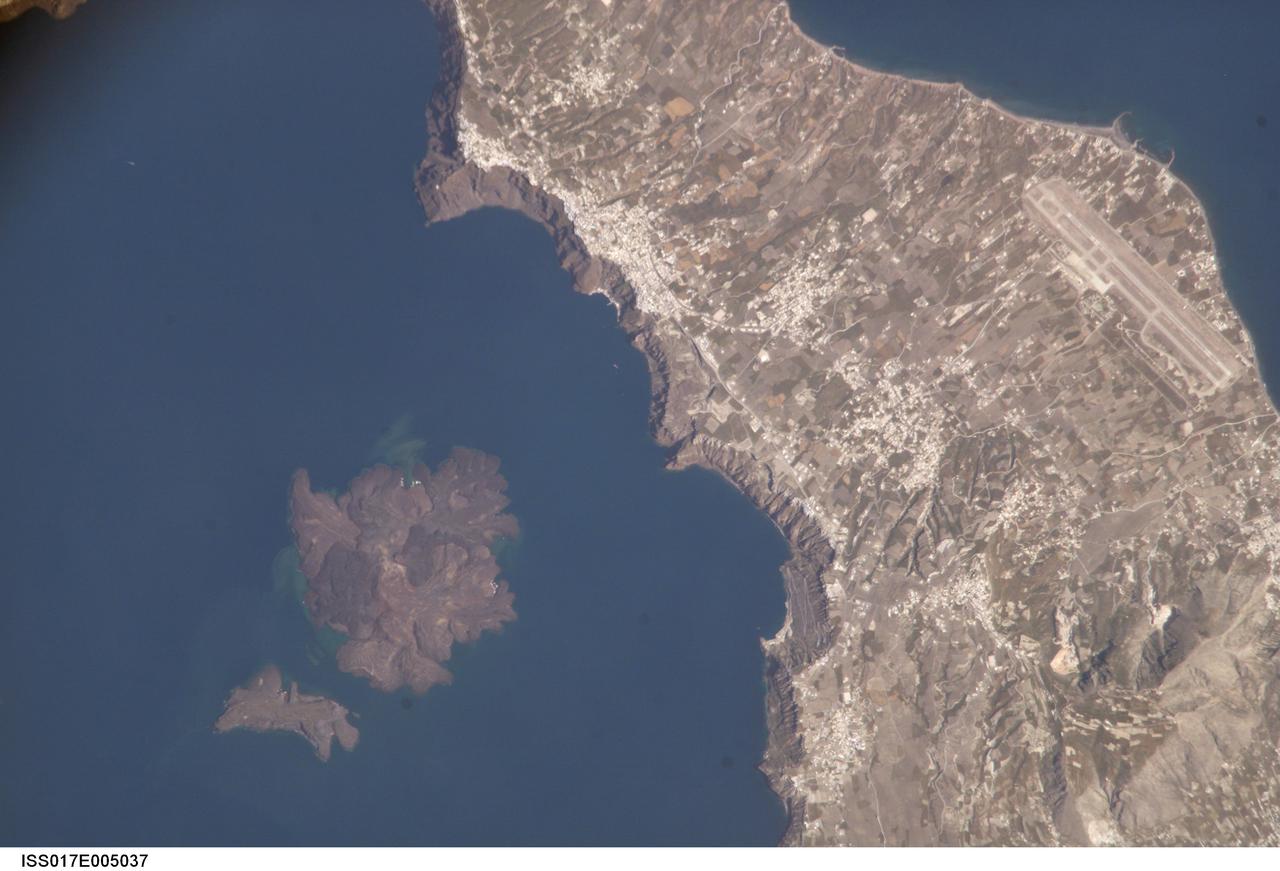
ISS017-E-005037 (19 April 2008) --- Santorini Volcano, Greece is featured in this image photographed by an Expedition 17 crewmember on the International Space Station. According to scientists, one of the largest volcanic eruptions in the past 10,000 years occurred approximately 1620 BC on the volcanic island of Santorini in the Aegean Sea. This view illustrates the center of Santorini Volcano, located approximately 118 kilometers to the north of Crete (not shown). Prior to 1620 BC, the island of Santorini -- now known as Thera -- had been built up by layers of lava created by overlapping shield volcanoes, and had experienced three significant eruptions that formed overlapping calderas, or collapsed magma chambers. Around 1620 BC, the fourth (and latest) major eruption created the present-day islands and caldera bay of Santorini Volcano. The caldera rim is clearly visible in this image as a steep cliff forming the western shoreline of the island of Thera. Following the 1620 BC eruption, much of the previous island of Santorini was destroyed or submerged. The white rooftops of cities and towns trace the caldera rim on the island of Thera, and overlook the young central islands of Nea Kameni and Palaea Kameni -- both, according to scientists, formed from lava domes and flows that started erupting approximately 1400 years after the last major caldera-forming event. Several of these flows are visible in the image as brown to dark-brown irregular masses forming Nea Kameni (left). The most recent volcanic activity in the Kameni islands occurred in 1950, and included some small explosions and production of lava. The extent of development and location of an airport (upper right) on Thera illustrate the popularity of Santorini Volcano as a tourist destination. Today, volcanic activity is closely monitored by the Institute for the Study and Monitoring of the Santorini Volcano, or ISMOSAV.