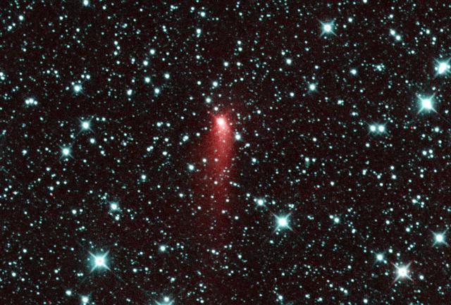
NASA NEOWISE spotted Comet C/2013 UQ4 Catalina, appearing to be a highly active comet one day past perihelion on July 7, 2014.
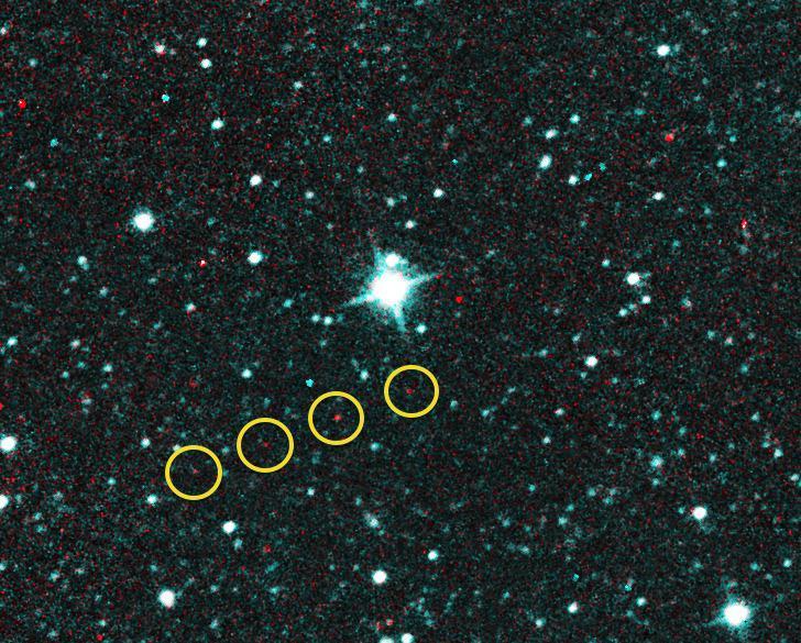
Comet C/2013 UQ4 Catalina first looked like an asteroid when NASA NEOWISE team first observed it on December 31, 2013. These exposures were taken that day, when the comet was at a distance of about 2.9 AU from the sun.
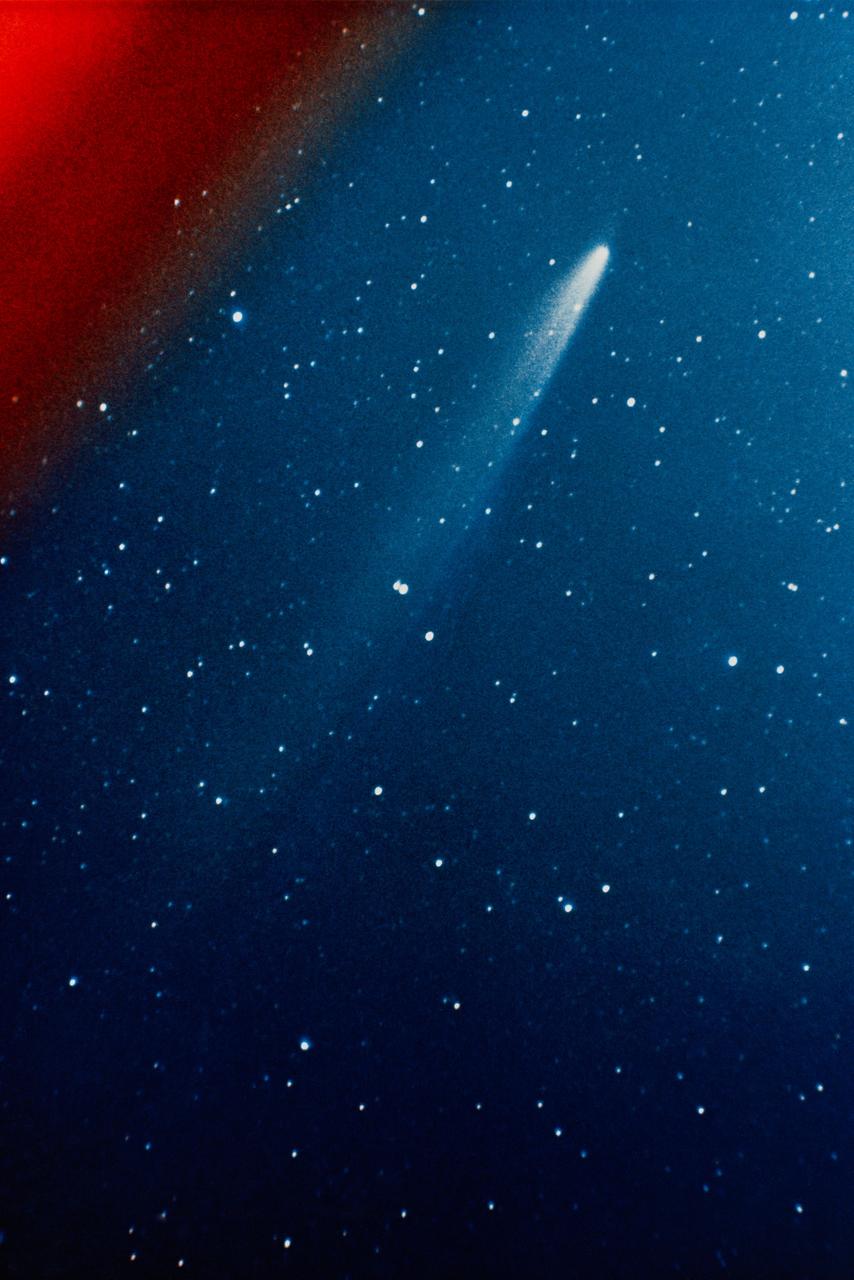
S74-17688 (11 Jan. 1974) --- This color photograph of the comet Kohoutek was taken by members of the lunar and planetary laboratory photographic team from the University of Arizona, at the Catalina Observatory with a 35mm camera on Jan. 11, 1974. Photo credit: NASA
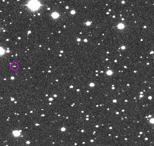
These are the discovery observations of asteroid 2018 LA from the Catalina Sky Survey, taken June 2, 2018. About eight hours after these images were taken, the asteroid entered Earth's atmosphere (about 9:44 a.m. PDT, 12:44 p.m. EDT, 16:44 UTC, 6:44 p.m. local Botswana time), and disintegrated in the upper atmosphere near Botswana, Africa. https://photojournal.jpl.nasa.gov/catalog/PIA22468
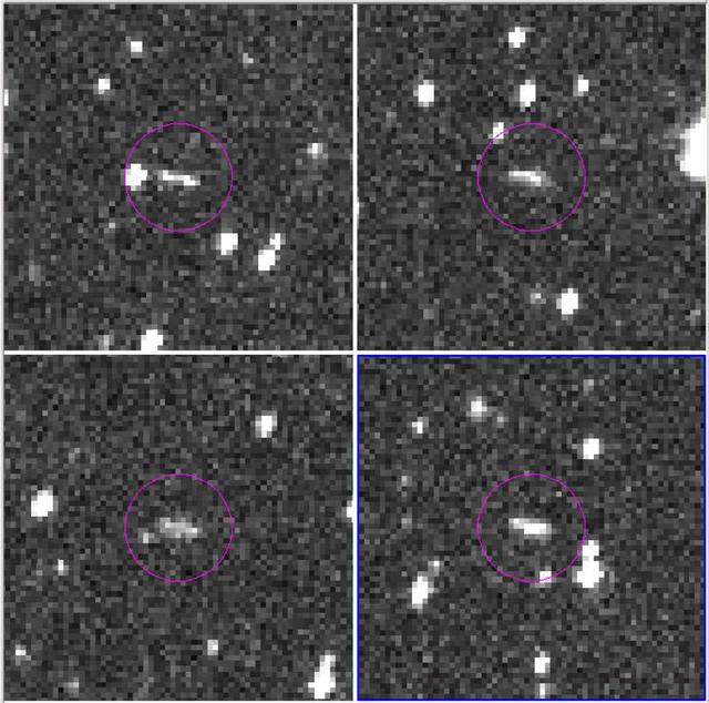
This frame from a sequence of four images taken during one night of observation by NASA's Catalina Sky Survey near Tucson, Arizona, shows the speck of light that moves relative to the background stars is a small asteroid that was, at the time, about as far away as the moon. This asteroid, named 2014 AA, was the second one ever detected on course to impact Earth. It was estimated to be about 6 to 10 feet (2 to 3 meters) in diameter, and it harmlessly hit Earth's atmosphere over the Atlantic Ocean about 20 hours after its discovery in these images. The images were taken Jan. 1, 2014. They provide an example of how asteroids are typically discovered by detection of their motion relative to background stars. An animation is available at https://photojournal.jpl.nasa.gov/catalog/PIA21712

iss070e103326 (Feb. 28, 2024) --- The nightime lights of the Los Angeles, California, urban area were photographed by Expedition 70 Flight Engineer Jasmin Moghbeli of NASA as the International Space Station orbited 262 miles above the Pacific Ocean near Catalina Island.

AS09-22-3436 (March 1969) --- Los Angeles-Long Beach area of southern California, as photographed from the Apollo 9 spacecraft during its 92nd revolution of Earth. Santa Catalina Island is located off the coast. The California coastline is visible from San Clemente northward to Point Dume. Clouds cover most of the San Gabriel Mountains around Los Angeles.
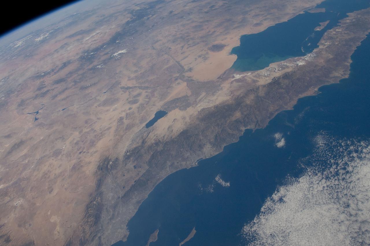
ISS029-E-042846 (16 Nov. 2011) --- Parts of the U.S. and Mexico are seen in this image photographed by one of the Expedition 29 crew members from the International Space Station as it flew above the Pacific Ocean on Nov. 16, 2011. The Salton Sea is in the center of the frame, with the Gulf of Cortez, Mexico's Baja California and the Colorado River in the upper right quadrant. The Los Angeles Basin and Santa Catalina and San Clemente islands are at the bottom center edge of the image. Lake Mead and the Las Vegas area of Nevada even made it into the frame in the upper left quadrant.
This view of southern California as seen from the Apollo 7 spacecraft during its 18th revolution of the earth. Photographed from an altitude of 124 nautical miles. The coast of California can be seen from Point Mugu southward to Oceanside. Santa Catalina can be seen below the off shore clouds. Details of the Los Angeles area are obscured by pollution which extends from Banning westard for 100 miles to beyond Malibu. In the upper portion of the photograph can be seen (left to right) the San Joaquin Valley beyond Bakersfield, the Techachapi Mountains, the Sierra Nevada, Owens Valley, Death Valley and the Mojave Desert.
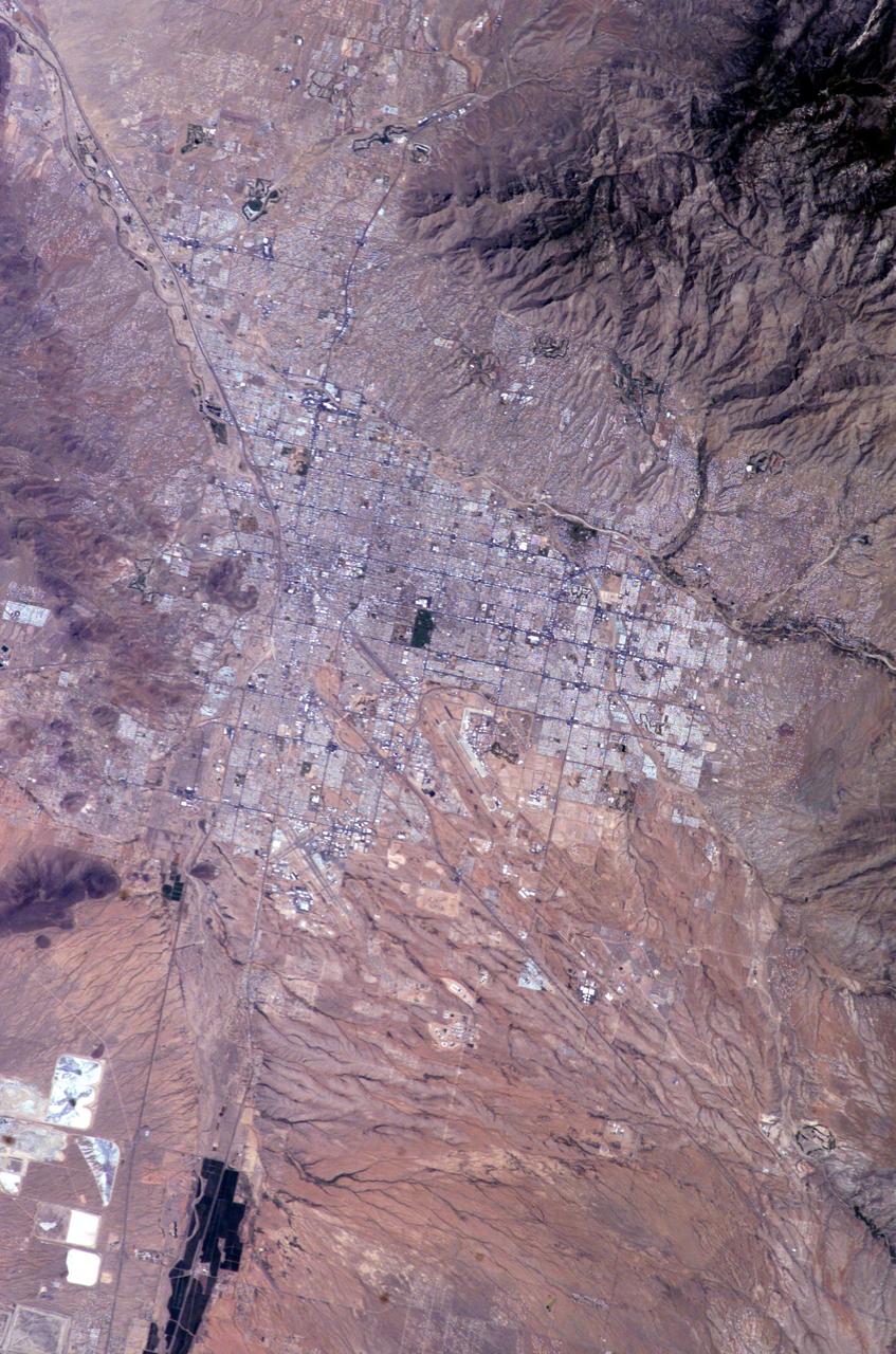
ISS009-E-10382 (7 June 2004) --- Tucson, Arizona is featured in this image photographed by an Expedition 9 crewmember on the International Space Station (ISS). Tucson lies between the forested Catalina Mountains and the Tucson Mountains (dark reddish brown at left). The typical western North American cityscape is a pattern of regular north-south aligned rectangles outlined by major streets set one mile apart. Tucson’s Randolph golf course is the large rectangular dark zone in the image center. The striking contrast between the golf course and its surroundings is due to dense grass cover maintained by frequent watering. The rectangular grid pattern disappears in the small streets of the original city center, situated along the Santa Cruz River (enters the view lower left and exits in the top left corner). Newer and less densely built-up neighborhoods in the foothills of the Catalina Mountains are designed to incorporate natural landscape features, and retain major washes with natural vegetation. This portion of the cityscape seen from space is consequently quite different from the main city grid. The foothills afford views of the city to the south and the mountains to the north and are major areas of development. Large white dots within the urban grid are the reflective rooftops of shopping malls. Tucson enjoys an important position along several major crossroads. Interstate highway I-10, which connects southern California to Florida, appears as a straight line running parallel with the Santa Cruz River northwest from Tucson in the direction of Phoenix. The I-10 traverses a well-marked alluvial fan that extends from the Santa Rita Mountains to the southeast (fine drainage pattern lower center) and exits the view lower right. Highway I-19 is the straight line (lower left) leading south from the city center, between the Santa Cruz River and rectangular spoil heaps of nearby copper mines. The I-19 connects Tucson with Nogales on the Mexican border.
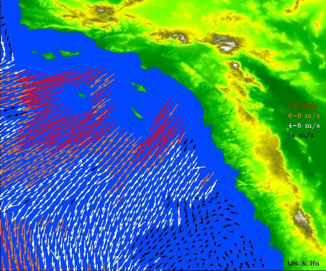
High-resolution ocean surface wind data from NASA's Quick Scatterometer (QuikScat) illustrate the strength of Santa Ana winds that pounded Southern California this week, causing damage and spreading brush fires. The colored arrows represent various ranges of wind speed, which were still well in excess of 30 knots (34 miles per hour), even after reaching the ocean and weakening. Santa Ana winds are offshore and down-slope winds unique to Southern California that are usually channeled through mountain gaps. These Santa Ana winds extend more than 500 kilometers (310 miles) offshore before changing direction to flow along the shore. The wind speeds and directions are retrieved from range-compressed backscatter data measured by QuikScat that has much higher spatial resolution than QuikScat's standard data products. Useful applications of high-resolution science-quality wind products derived from range-compressed backscatter have been demonstrated in two scientific papers: one on Hurricane Floyd and the other on Catalina Eddies. This is the first demonstration on near-real-time retrieval applications. http://photojournal.jpl.nasa.gov/catalog/PIA03892
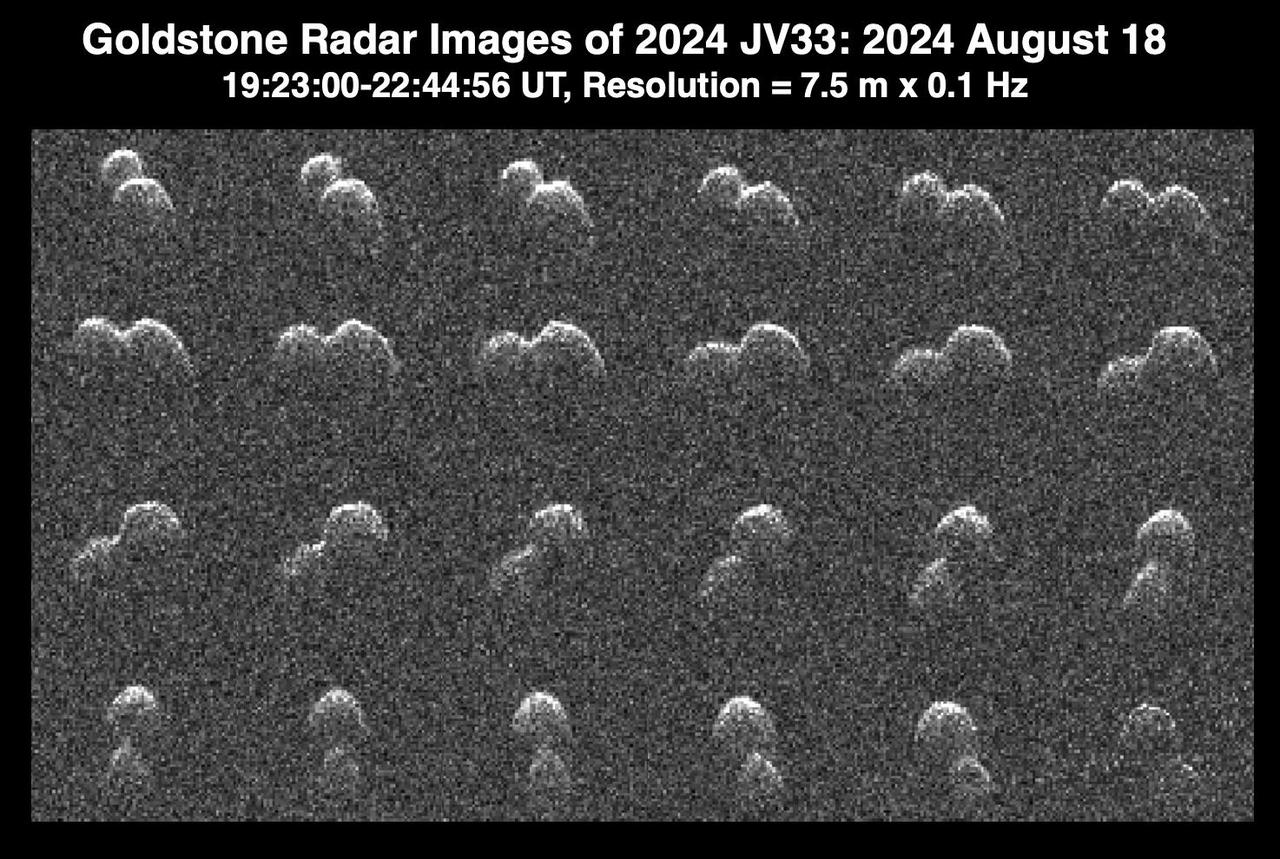
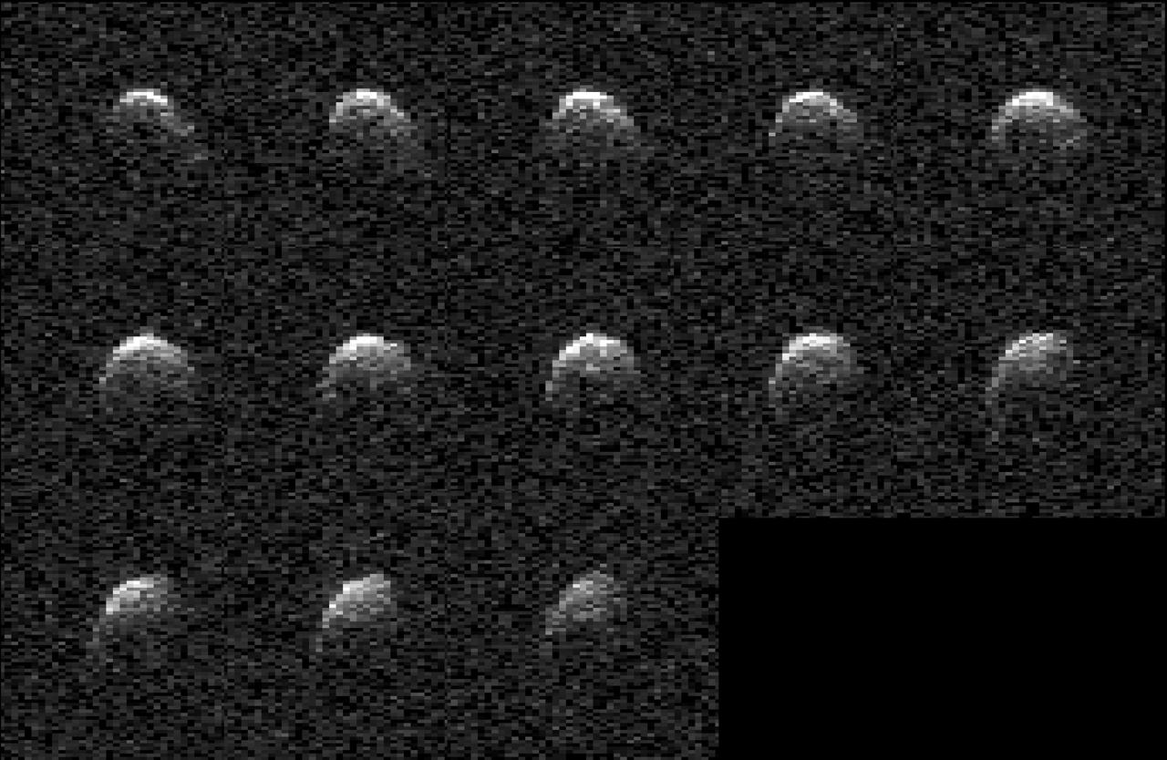
This series of seven radar observations by the Deep Space Network's Goldstone Solar System Radar shows the asteroid 2011 UL21 during its close approach with Earth from 4.1 million miles (6.6 million kilometers) away – about 17 times the distance between the Moon and Earth. White circles highlight the main asteroid and its small moon (a bright dot at the bottom of the image). Passing Earth on June 27, 2024, the asteroid was discovered in 2011 by the NASA-funded Catalina Sky Survey, in Tucson, Arizona. This marked the first time it came close enough to Earth to be imaged by radar. While the nearly mile-wide (1.5-kilometer-wide) object is classified as being potentially hazardous, calculations of its future orbits show that it won't pose a threat to our planet for the foreseeable future. In addition to determining the asteroid is roughly spherical, scientists at NASA's Jet Propulsion Laboratory discovered that it's a binary system: A smaller asteroid, or moonlet, orbits it from a distance of about 1.9 miles (3 kilometers). https://photojournal.jpl.nasa.gov/catalog/PIA26384
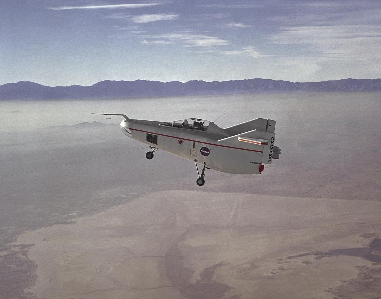
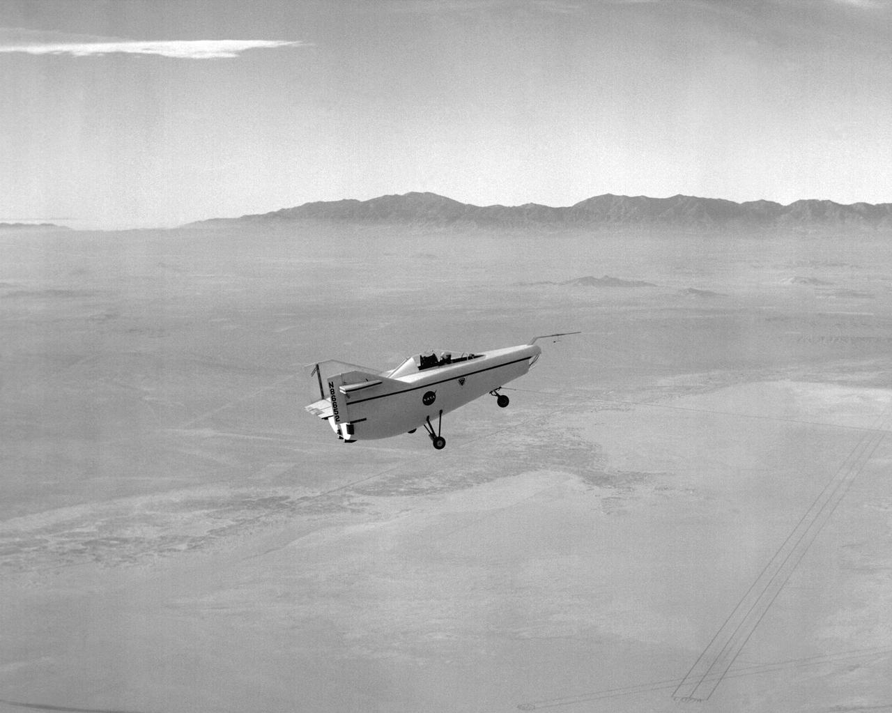
The M2-F1 Lifting Body is seen here under tow, high above Rogers Dry Lake near the Flight Research Center (later redesignated the Dryden Flight Research Center), Edwards, California. R. Dale Reed effectively advocated the project with the support of NASA research pilot Milt Thompson. Together, they gained the support of Flight Research Center Director Paul Bikle. After a six-month feasibility study, Bikle gave approval in the fall of 1962 for the M2-F1 to be built.
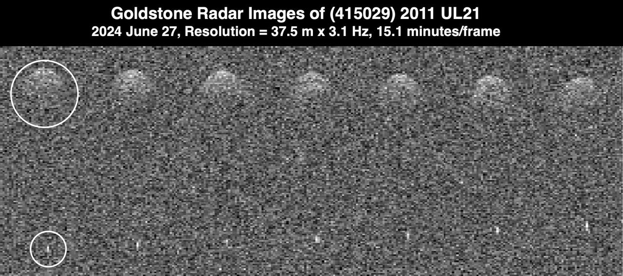
This series of radar images obtained by the Goldstone Solar System Radar near Barstow, California, on Aug. 18, 2024, shows the asteroid 2024 JV33 shortly before its close approach with Earth. The images were captured when the asteroid was at a distance of 2.8 million miles (4.6 million kilometers), about 12 times the distance between the Moon and Earth. Discovered by the NASA-funded Catalina Sky Survey in Tucson, Arizona, on May 4, the near-Earth asteroid's shape resembles that of a peanut – with two rounded lobes, one lobe larger than the other. Scientists used the radar images to determine that it is about 980 feet (300 meters) long and that its length is about double its width. Asteroid 2024 JV33 rotates once every seven hours. Radar is the principal technique for discovering such asteroids, which are called contact binaries. Dozens of them have been imaged by Goldstone, which is part of NASA's Deep Space Network. At least 14% of near-Earth asteroids larger than about 660 feet (200 meters) have a contact binary shape. Asteroid 2024 JV33 has an elongated orbit similar to that of many comets that are strongly influenced by the gravity of Jupiter. While no comet-like activity has been observed, the possibility remains that the asteroid may be an inactive cometary nucleus. The asteroid is classified as potentially hazardous, but it does not pose a hazard to Earth for the foreseeable future. These Goldstone measurements have greatly reduced the uncertainties in the asteroid's distance from Earth and in its future motion for many decades. https://photojournal.jpl.nasa.gov/catalog/PIA26389
This collage represents a selection of planetary radar observations of asteroid 2008 OS7 that were made the day before its close approach with our planet on Feb. 2, 2024. The stadium-size near-Earth object passed at a distance of about 1.8 million miles (2.9 million kilometers, or 7 ½ times the distance between Earth and the Moon). Scientists at NASA's Jet Propulsion Laboratory used the powerful 230-foot (70-meter) Goldstone Solar System Radar antenna at the Deep Space Network's facility near Barstow, California, to capture these images. The observations will help scientists better understand the asteroid's size, rotation, shape, and surface details. Until this close approach, very little was known about 2008 OS7 as it has been too distant for planetary radar to image it. The asteroid was discovered on July 30, 2008, during routine search operations for NEOs by the NASA-funded Catalina Sky Survey, which is headquartered at the University of Arizona in Tucson. Observations revealed that the asteroid is comparatively slow rotating, completing one rotation every 29 ½ hours. The rotational period of 2008 OS7 was determined Petr Pravec, at the Astronomical Institute of the Czech Academy of Sciences in Ondřejov, Czech Republic, who observed the asteroid's light curve – or how the brightness of the object changes over time. As the asteroid spins, variations on its shape can change the brightness of reflected light astronomers can see, and those changes can be recorded to understand the period of the asteroid's rotation. The Goldstone observations confirm the asteroid's uncommonly slow rotation. https://photojournal.jpl.nasa.gov/catalog/PIA26149
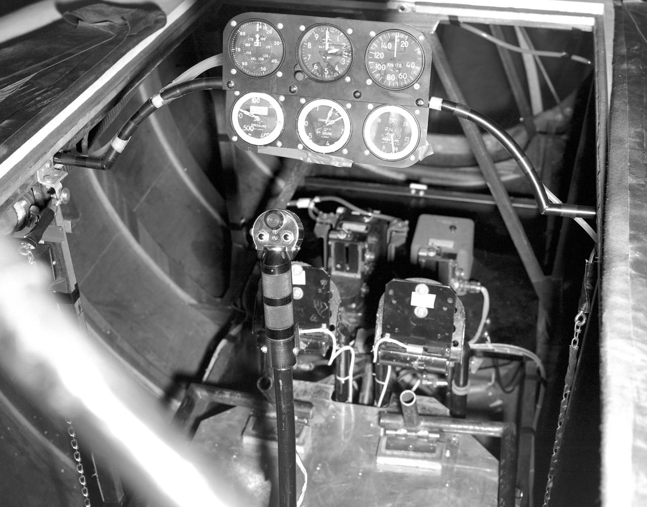
This photo shows the cockpit configuration of the M2-F1 wingless lifting body. With a top speed of about 120 knots, the M2-F1 had a simple instrument panel. Besides the panel itself, the ribs of the wooden shell (left) and the control stick (center) are also visible.
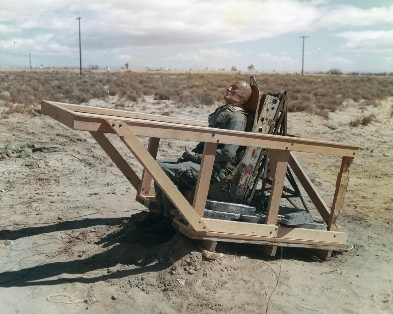
The M2-F1 was fitted with an ejection seat before the airtow flights began. The project selected the seat used in the T-37 as modified by the Weber Company to use a rocket rather than a ballistic charge for ejection. To test the ejection seat, the Flight Research Center's Dick Klein constructed a plywood mockup of the M2-F1's top deck and canopy. On the first firings, the test was unsuccessful, but on the final test the dummy in the seat landed safely. The M2-F1 ejection seat was later used in the two Lunar Landing Research Vehicles and the three Lunar Landing Training Vehicles. Three of them crashed, but in each case the pilot ejected from the vehicle successfully.
After the grounding of the M2-F1 in 1966, it was kept in outside storage on the Dryden complex. After several years, its fabric and plywood structure was damaged by the sun and weather. Restoration of the vehicle began in February 1994 under the leadership of NASA retiree Dick Fischer, with other retirees who had originally worked on the M2-F1's construction and flight research three decades before also participating. The photo shows the now-restored M2-F1 returning to the site of its flight research, now called the Dryden Flight Research Center, on 22 August 1997.
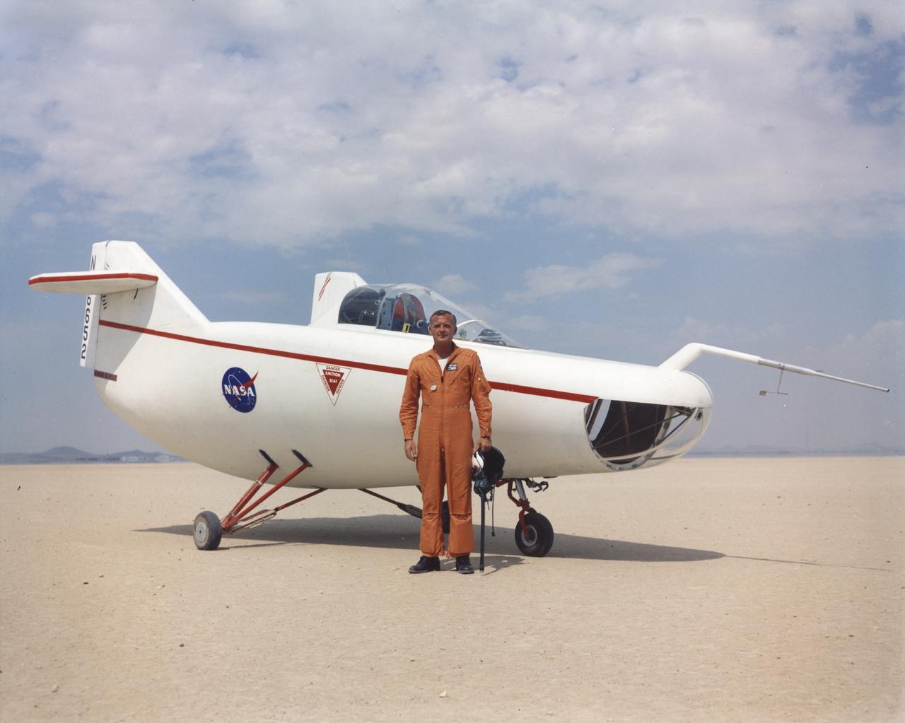
NASA Flight Research Pilot Milt Thompson, shown here on the lakebed with the M2-F1 lifting body, was an early backer of R. Dale Reed's lifting-body proposal. He urged Flight Research Center director Paul Bikle to approve the M2-F1's construction. Thompson also made the first glide flights in both the M2-F1 and its successor, the heavyweight M2-F2.
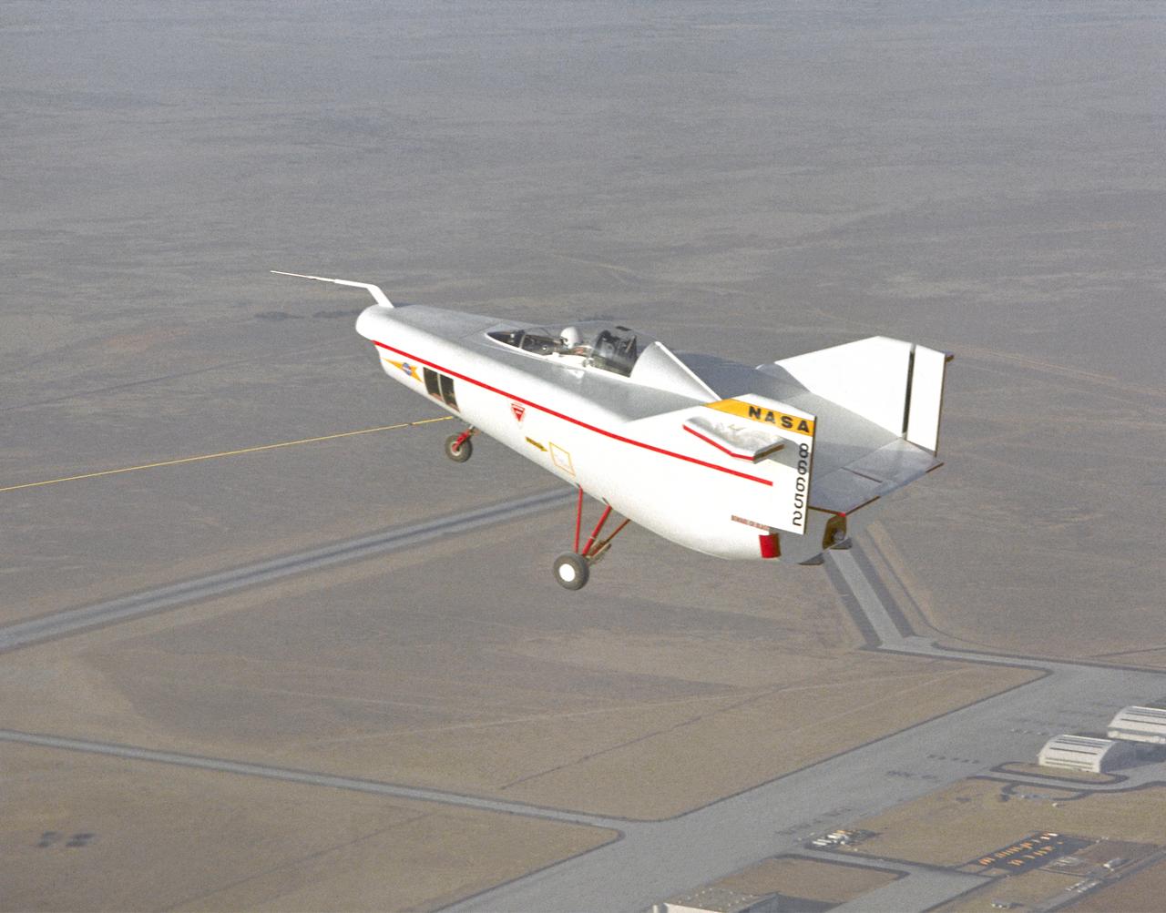
Following the first M2-F1 airtow flight on 16 August 1963, the Flight Research Center used the vehicle for both research flights and to check out new lifting-body pilots. These included Bruce Peterson, Don Mallick, Fred Haise, and Bill Dana from NASA. Air Force pilots who flew the M2-F1 included Chuck Yeager, Jerry Gentry, Joe Engle, Jim Wood, and Don Sorlie, although Wood, Haise, and Engle only flew on car tows. In the three years between the first and last flights of the M2-F1, it made about 400 car tows and 77 air tows.
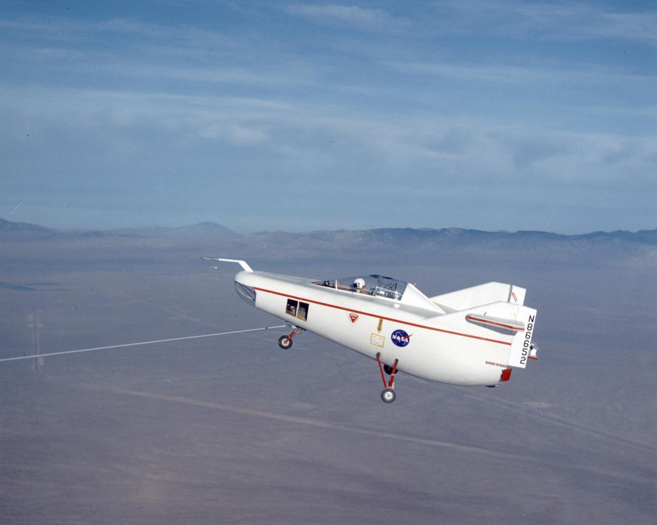
After initial ground-tow flights of the M2-F1 using the Pontiac as a tow vehicle, the way was clear to make air tows behind a C-47. The first air tow took place on 16 August 1963. Pilot Milt Thompson found that the M2-F1 flew well, with good control. This first flight lasted less than two minutes from tow-line release to touchdown. The descent rate was 4,000 feet per minute.
The M2-F1 Lifting Body is seen here under tow by an unseen C-47 at the NASA Flight Research Center (later redesignated the Dryden Flight Research Center), Edwards, California. The low-cost vehicle was the first piloted lifting body to be test flown. The lifting-body concept originated in the mid-1950s at the National Advisory Committee for Aeronautics' Ames Aeronautical Laboratory, Mountain View California. By February 1962, a series of possible shapes had been developed, and R. Dale Reed was working to gain support for a research vehicle.
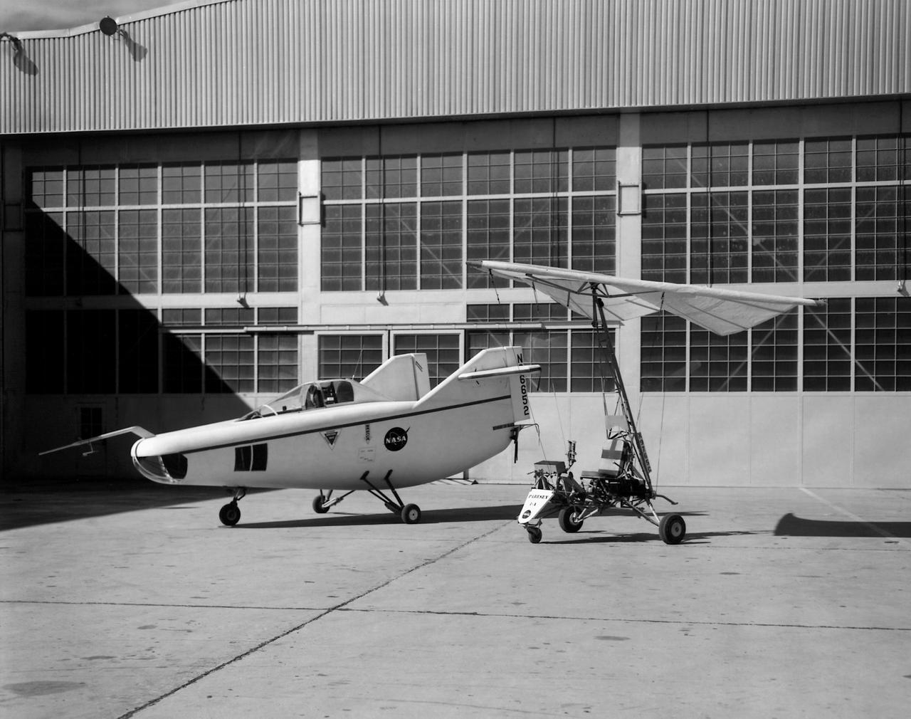
In this photo of the M2-F1 lifting body and the Paresev 1B on the ramp, the viewer sees two vehicles representing different approaches to building a research craft to simulate a spacecraft able to land on the ground instead of splashing down in the ocean as the Mercury capsules did. The M2-F1 was a lifting body, a shape able to re-enter from orbit and land. The Paresev (Paraglider Research Vehicle) used a Rogallo wing that could be (but never was) used to replace a conventional parachute for landing a capsule-type spacecraft, allowing it to make a controlled landing on the ground.