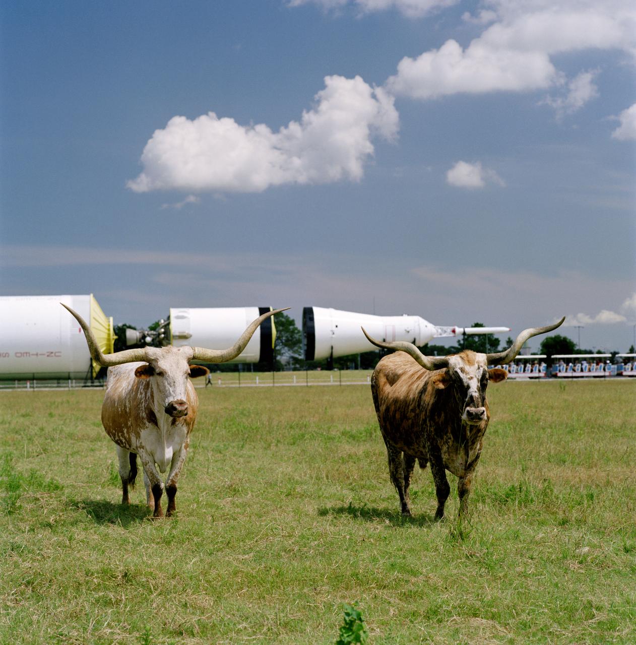
Photographic documentation showing longhorn cattle which belong to the Longhorn Project in front of the Saturn V in JSC's Rocket Park.
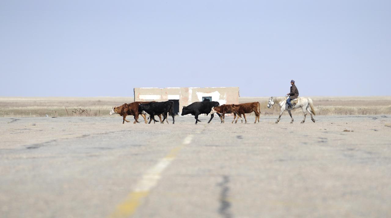
A Kazakh man herds cattle across the tarmac at the Arkalyk airport in Kazakhstan, Friday, April, 19, 2008. Arkalyk was used as one of the helicopter staging areas for the landing of the Soyuz TMA-11 spacecraft carrying Expedition 16 Commander Peggy Whitson, Flight Engineer and Soyuz Commander Yuri Malenchenko and South Korean spaceflight participant So-yeon Yi. The Soyuz made a ballistic landing, touching down more then 400 kilometers short of the intended target in central Kazakhstan. Photo Credit: (NASA/Bill Ingalls)
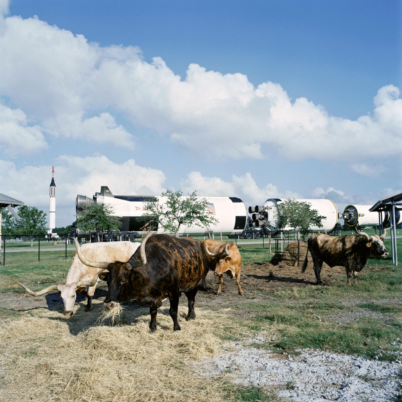
Photographic documentation taken during the opening ceremonies for the Longhorn Project pavilion at JSC. Longhorn cattle graze, with Rocket Park in the background.
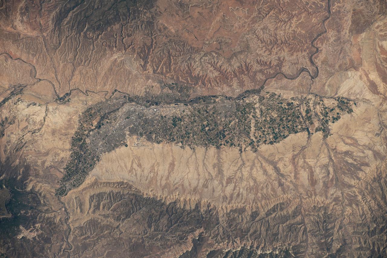
iss073e0429954 (June 21, 2025) --- Colorado's Western Slope region, highlighted by the city of Grand Junction and its surrounding suburbs (at center), is pictured from the International Space Station as it orbited 261 miles above the Centennial State. The municipality's economy is primarily supported by the agribusiness industry, including cattle ranching and fruit cultivation.
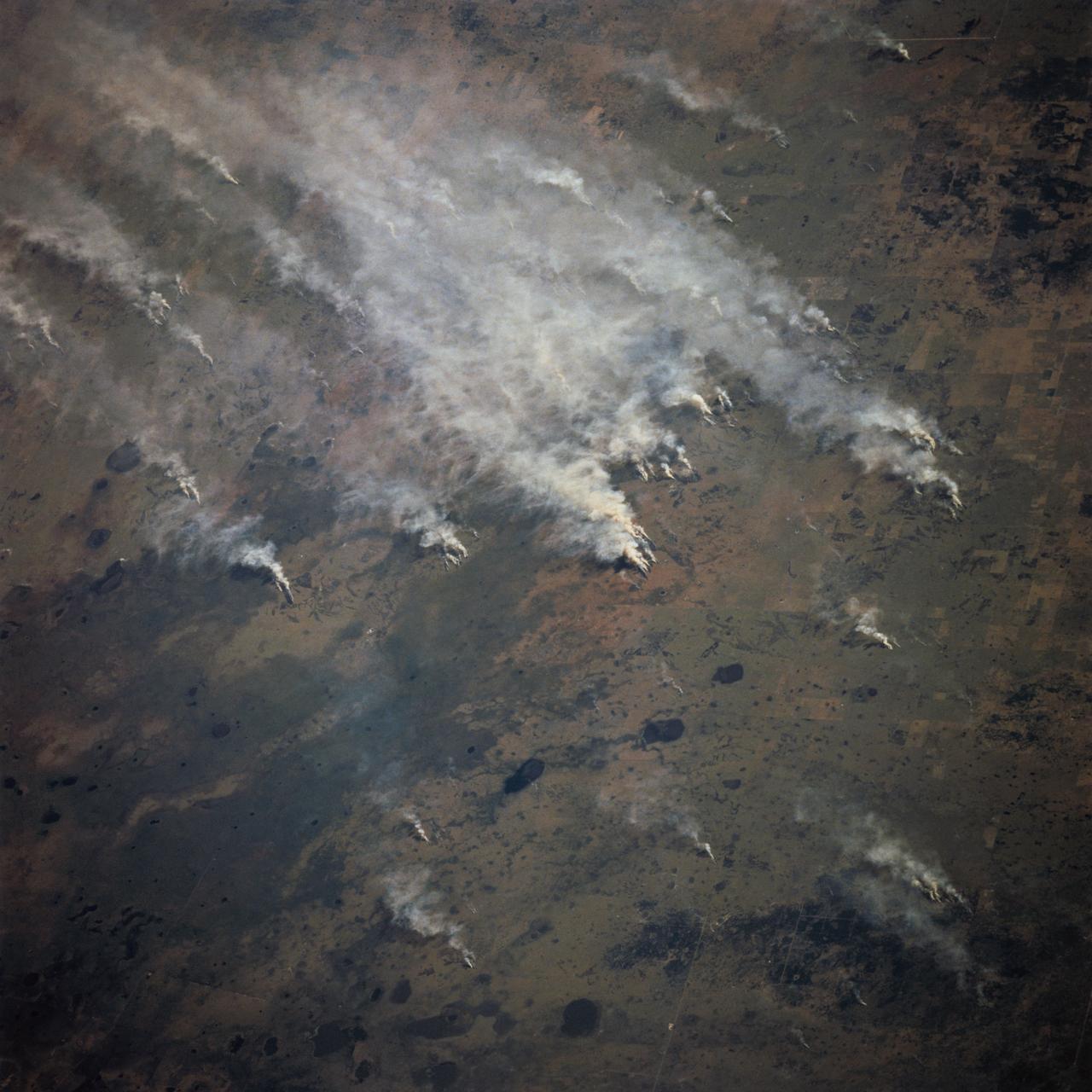
STS070-717-027 (13-22 JULY 1995) --- Easterly winds from the Mozambique Channel blow the smoke from many large fires in southern Mozambique inland. Neighboring views showed the smoke moving over and around the Chimanimani Mountains, into Zimbabwe on the African plateau. Winter is the dry season in southern Africa and fires are set to hasten the greening of the grass shoots for cattle grazing.
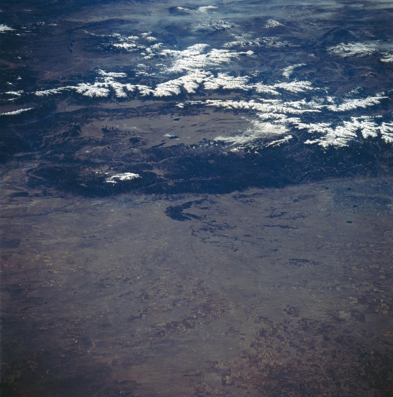
STS058-89-013 (18 Oct-1 Nov 1993) --- An oblique westward view, across the wheat fields and cattle pastures, of eastern Colorado to the Front Range of the Rocky Mountains. Denver is bisected at the center of the right edge of the frame. Pikes Peak and Colorado Springs are left of center, and the Arkansas River Valley with Canyon City and the Royal Gorge are along the left edge of the frame. This view shows the startling contrast between the nearly-flat High Plains and the ancient geological uplift of the Rockies.
iss074e0494100 (April 19, 2026) --- The sub-freezing landscape at the southern tip of Canada’s Lake Winnipeg (top right), where ice fishing is popular, reveals crop fields that will be ready for the seeding of wheat, barley, oats, and canola in late spring and early summer. Cattle and sheep are also raised in the region. The International Space Station was orbiting 267 miles above Ontario when this photograph was taken. Credit: ESA/Sophie Adenot
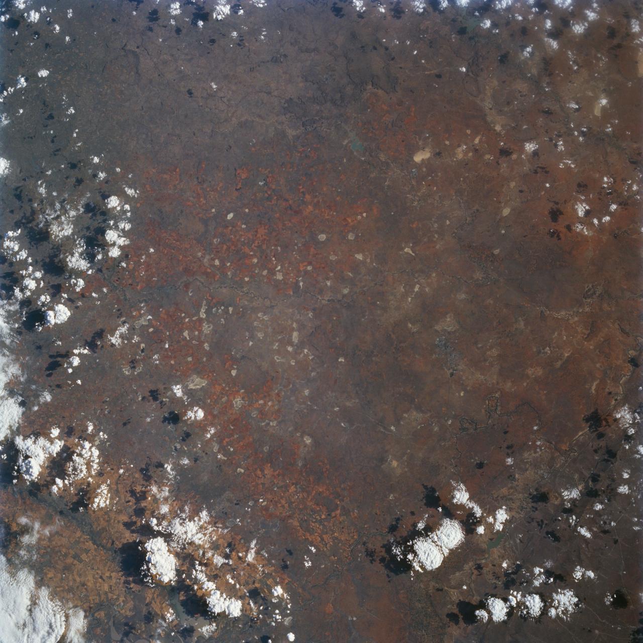
STS072-727-059 (11-20 Jan. 1996) --- Plains of the Orange Free State, South Africa are featured in this 70mm frame exposed from the Space Shuttle Endeavour. If the photograph is oriented with the largest clouds at the top edge, so that the cloud shadows fall to the upper right of each cloud, then north is to the top. The Vaal River flows along the top and through the upper left of the photograph; the reservoir of the Bloemhofdam on the Sand River can be seen between clouds at the upper right of the photograph. Kimberley can be seen as a gray smudge southeast of a contorted set of bends in the Vaal river (upper left center). With high magnification four dark dots, large open-pit mine shafts, can be seen within the gray smudge of the city. Kimberley, the capital of Northern Cape Province, was founded in 1878 after the discovery of diamonds in 1969 - 71, and reached by railway in 1885. Diamond mining and gem cutting remain prominent in the economy. The reddish soil and scattered salt pans (playa lakes) across the plateau suggest the semi-arid climate, suitable for cattle ranching. Reservoirs on most streams now provide water for the towns as well as irrigation for agriculture.
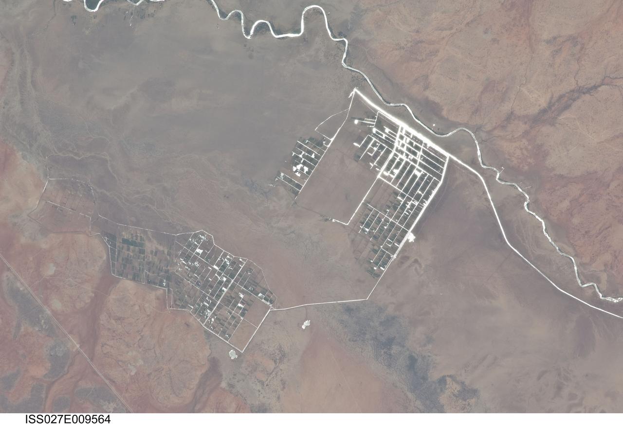
ISS027-E-009564 (31 March 2011) --- Agricultural fields along the Shebelle River in Ethiopia are featured in this image photographed by an Expedition 27 crew member on the International Space Station. The Shebelle River supports limited agricultural development within the arid to semi-arid Ogaden Plateau region of southeastern Ethiopia. This detailed photograph illustrates a network of irrigation canals and fields located approximately 42 kilometers to the west-northwest of the city of Gode, Ethiopia. Floodplain sediments and soils are dark brown to gray (center), and contrast with reddish rocks and soils of the adjacent plateau. Water in the Shebelle River, and the irrigation canals, has a bright, mirror-like appearance due to sunglint, or light reflecting off the water surface back towards the observer on the space station. Vegetation in the floodplain (bottom center) and agricultural fields is dark green. The river water supports a variety of crops?the most common being sorghum and maize?as well as grazing for livestock (cattle, sheep, goats, and camels). The Shebelle River has its headwaters in the Ethiopian Highlands, and transports water and sediment 1,000 kilometers to the southeast across Ethiopia, continuing an additional 130 kilometers into neighboring Somalia. The Shebelle River does not reach the Indian Ocean during most years, but disappears into the sands near the coast in Somalia. During periods of heavy rainfall and flooding however, the Shebelle can reach the Indian Ocean.
STS098-712-091 (7-20 February 2001) --- The forested area of the Panama Canal Zone can be seen near the center of this north-looking image, photographed with a 70mm handheld camera from the Earth-orbiting Space Shuttle Atlantis. (NOTE: The image should be oriented with Panama running horizontally and the majority of the clouds at the top). The Panama Canal Zone extends 5 miles (8 kilometers) on either side of the Panama Canal. The forested zone acts as a buffer for the canal to help prevent erosion and sediment from clogging the canal. Most of the countryside on both sides of the Canal Zone has been deforested to make way for large ranches and the raising of cattle. Though some sedimentation is occurring, dredging of the canal keeps the passage clear. The Panama Canal is 40 miles (64 kilometers) long including dredged approach channels at each end. With the Caribbean Sea covering the upper portion of the image and the Pacific Ocean covering the lower portion of the image, the canal traverses the Isthmus of Panama in a northwest to southeast direction. Gatun Lake, one of the largest artificial lakes in the world, is visible at the north end of the Canal Zone. Panama City (light-colored grayish area) is discernible to the right of the canal at its southern entrance from the Pacific Ocean. In 1996, 15,000 ships traveled through the canal, an average of 42 ships per day. Passage through the canal requires 7 to 8 hours.

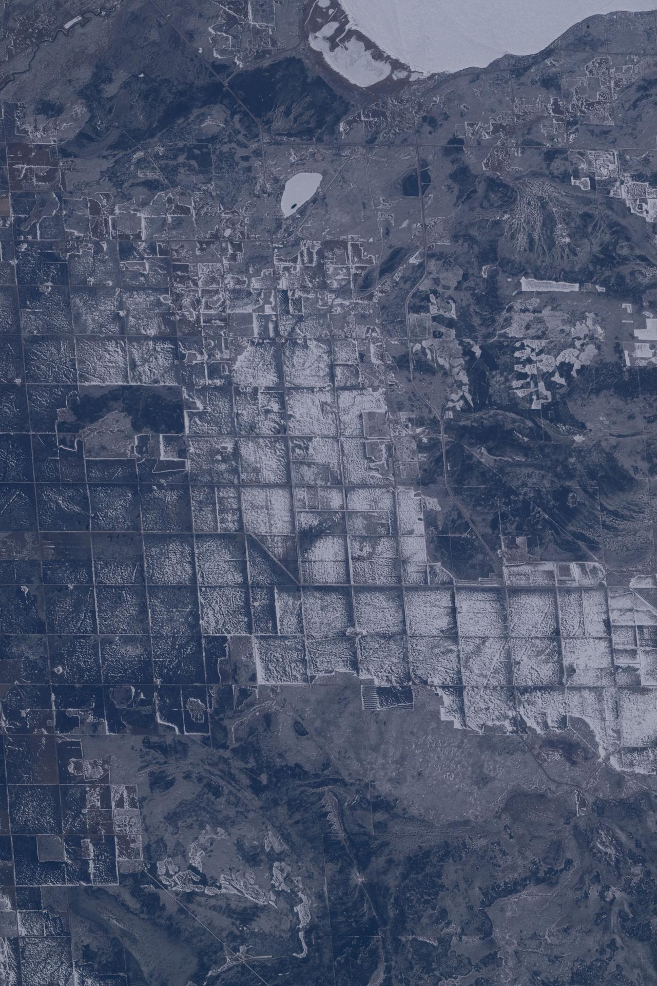
ISS034-E-057550 (28 Feb. 2013) --- One of the Expedition 34 crew members aboard the Earth-orbiting International Space Station photographed this image featuring the Southern High Plains of northwestern Texas, directly south of the city of Amarillo (off the image to the north). At first glance the picture appears more like a map than an actual photo. The winter of 2012-2013 has been marked by powerful snowstorms with record-setting snowfall throughout much of the Midwestern United States The snowstorm that passed through this area left a record snowfall of approximately 43 centimeters (17 inches). Snow blankets the city of Canyon, Texas. Urban street grids and stream channels appear etched into the landscape by the snow, a result of both melting and street clearing in the urban regions and of the incised nature of stream channels in the surrounding plains. Agricultural fields are easily identified due to the even snow cover broken only by roadways between the fields. Palo Duro Canyon is largely free of snow along the Prairie Dog Town Fork of the Red River channel and at lower elevations, allowing the red sedimentary rocks of the canyon walls to be visible. Lake Tanglewood, a reservoir to the northeast of Canyon, appears dark due to a lack of ice cover. Another dark region to the northwest of Canyon is a feed yard for cattle; any snowfall in this area has been removed by the actions of the livestock. The image was recorded with a digital camera using a 400 millimeter lens,
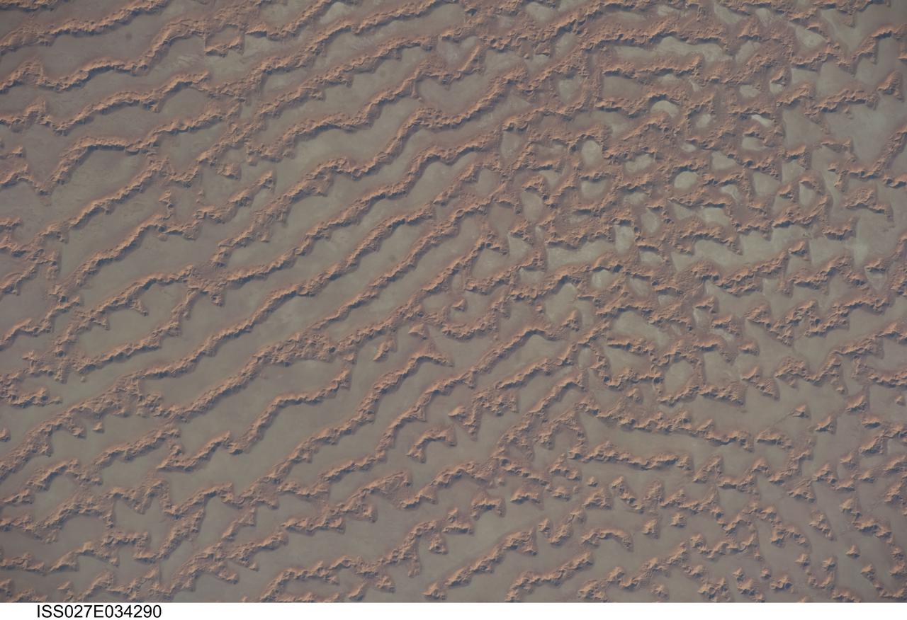
ISS027-E-034290 (16 May 2011) --- Ar Rub al Khali Sand Sea, Arabian Peninsula is featured in this image photographed by an Expedition 27 crew member on the International Space Station. The Ar Rub al Khali, also known as the “Empty Quarter”, is a large region of sand dunes and interdune flats known as a sand sea (or erg). This photograph highlights a part of the Ar Rub al Khali located close to its southeastern margin in the Sultanate of Oman. Reddish-brown, large linear sand dunes alternate with blue-gray interdune salt flats known as sabkhas at left. The major trend of the linear dunes is transverse to northwesterly trade winds that originate in Iraq (known as the Shamal winds). Formation of secondary barchan (crescent-shaped) and star dunes (dune crests in several directions originating from a single point, looking somewhat like a starfish from above) on the linear dunes is supported by southwesterly winds that occur during the monsoon season (Kharif winds). The long linear dunes begin to break up into isolated large star dunes to the northeast and east (right). This is likely a result of both wind pattern interactions and changes in the sand supply to the dunes. The Empty Quarter covers much of the south-central portion of the Arabian Peninsula, and with an area of approximately 660,000 square kilometers it is the largest continuous sand desert on Earth. The Empty Quarter is so called as the dominantly hyperarid climate and difficulty of travel through the dunes has not encouraged permanent settlement within the region. There is geological and archeological evidence to support cooler and wetter past climates in the region together with human settlement. This evidence includes exposed lakebed sediments, scattered stone tools, and the fossils of hippopotamus, water buffalo, and long-horned cattle.