Cerberus Fossae
East Cerberus
Cerberus Fossae
Cerberus Troughs
Cerberus Fossae
Cerberus Fossae
Eastern Cerberus
Cerberus Fossae
Cerberus Fossae
Cerberus Fossae Pits
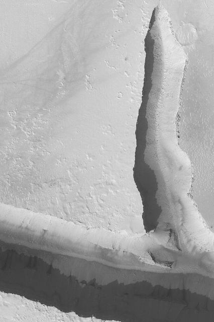
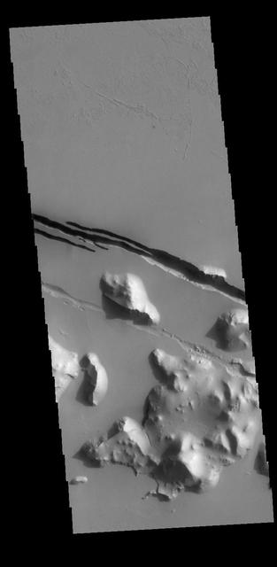
Peering into a Cerberus Fossae Trough
Valley South of Cerberus
Cerberus Fossae Troughs
Cerberus Flood Features
Cerberus Fossae Trough
Cerberus Fossae Trough
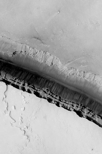
Cerberus Fossae Trough
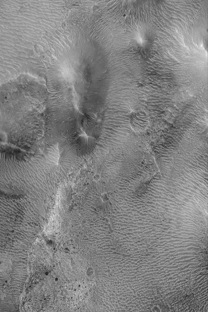
Large Ripples in Cerberus
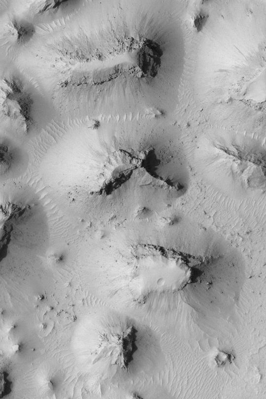
Buttes South of Cerberus
Cerberus Fossae Fractures
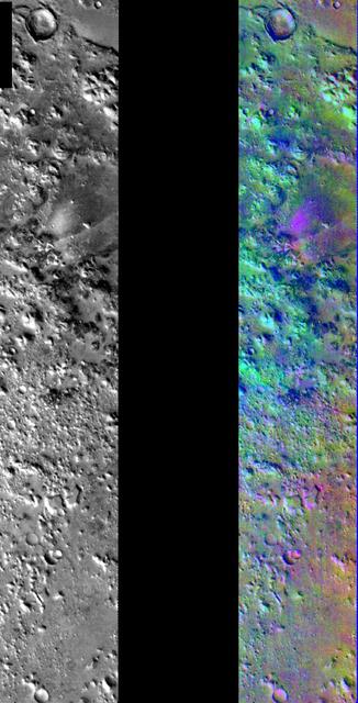
Decorrelation Stretch Near Cerberus Fossae
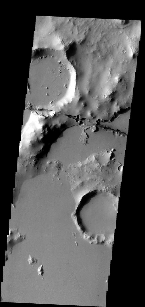
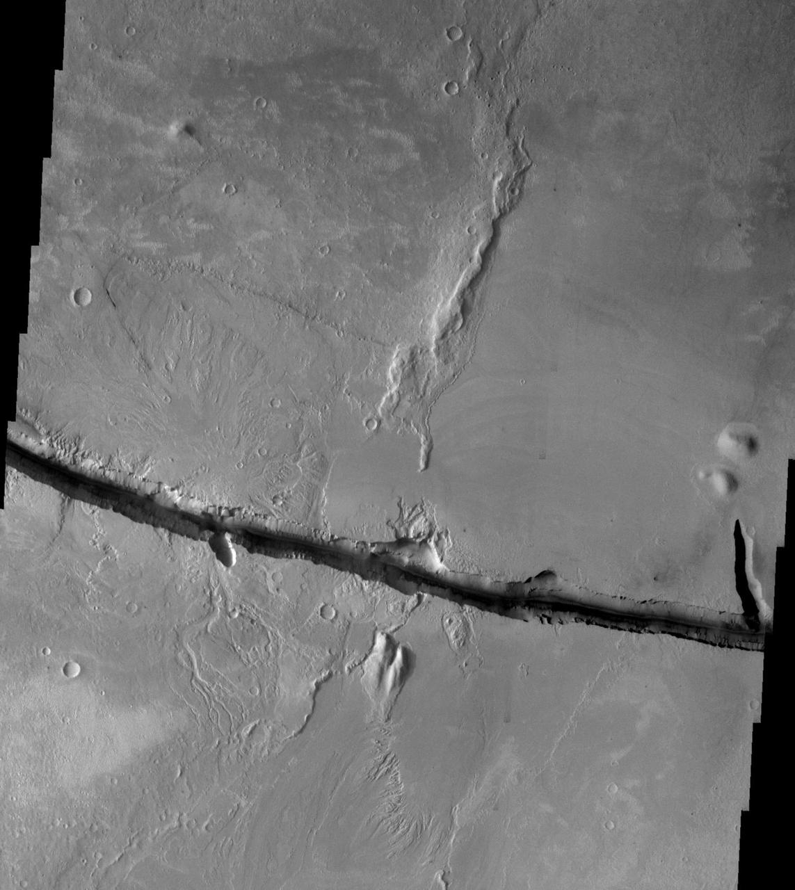
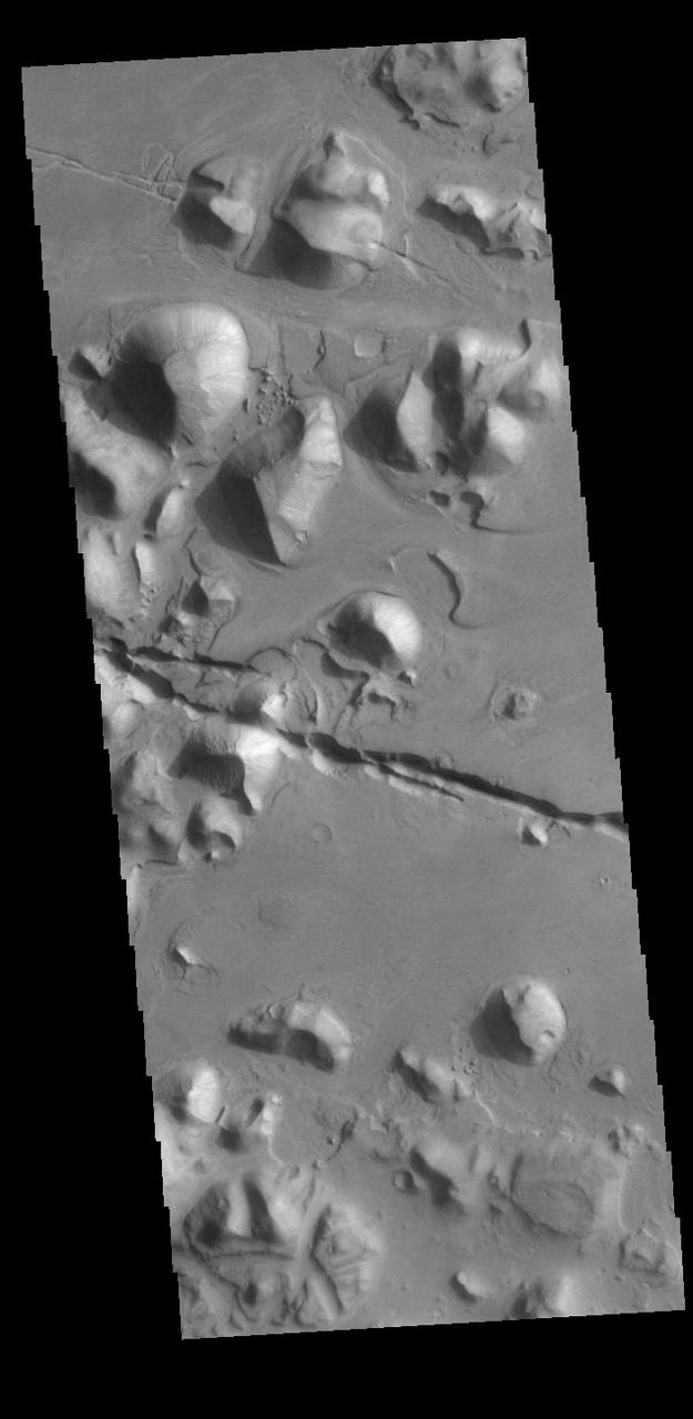
One of the Cerberus Fossae fractures cuts through the plains and highlands in this image
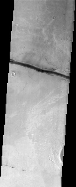
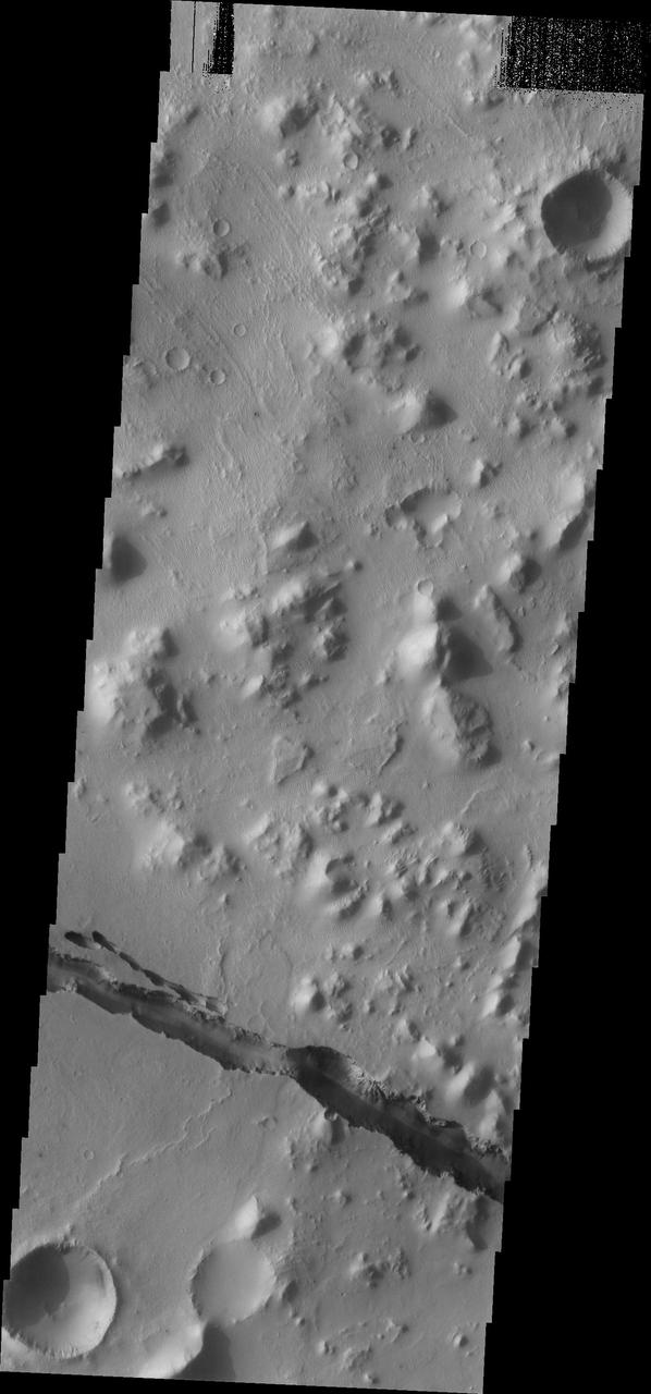
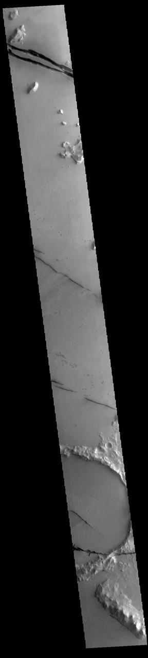
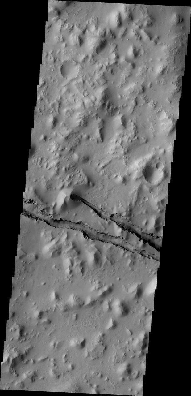
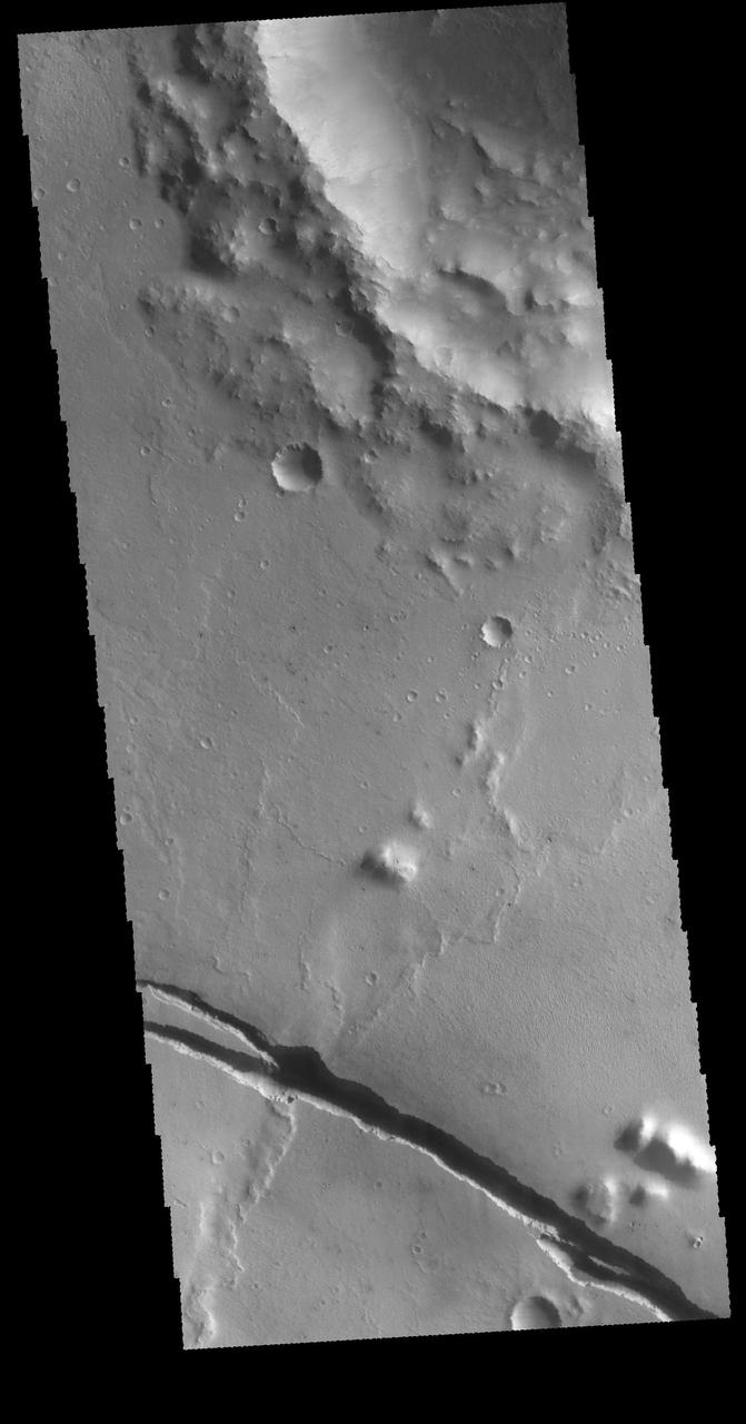
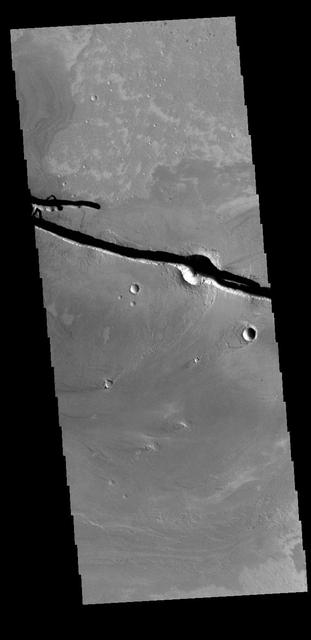
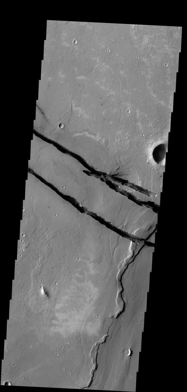
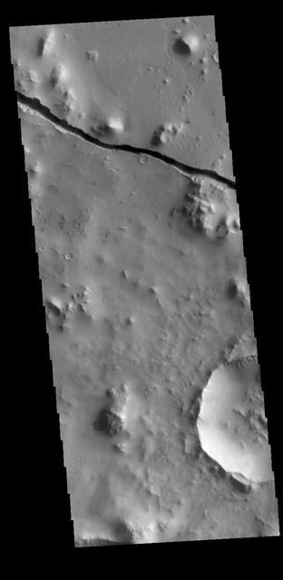
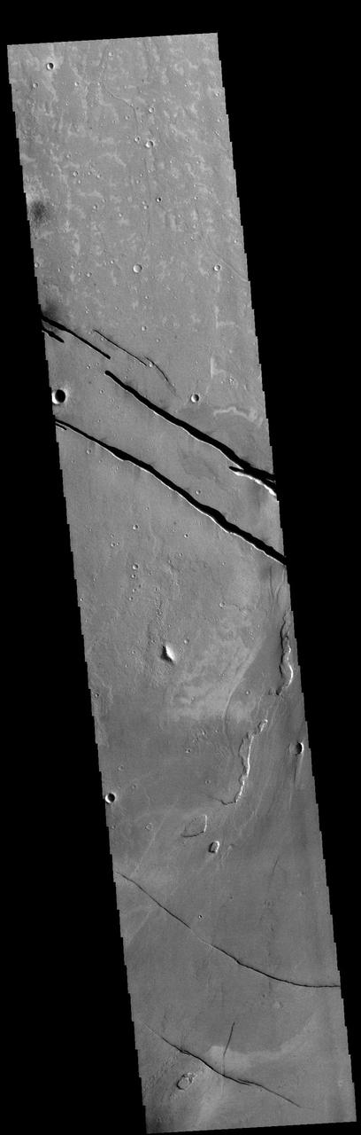
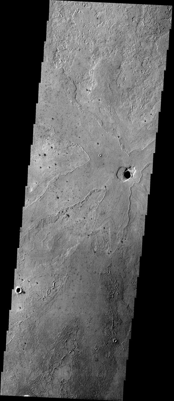
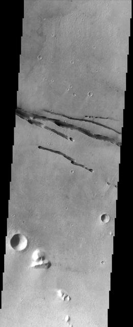
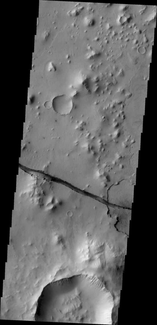
Today's VIS image shows a section of Cerberus Fossae. Cerberus Fossae are located in Elysium Planitia, southeast of the Elysium Mons volcanic complex. The linear features in the image are tectonic graben. Graben are formed by extension of the crust and faulting. When large amounts of pressure or tension are applied to rocks on timescales that are fast enough that the rock cannot respond by deforming, the rock breaks along faults. In the case of a graben, two parallel faults are formed by extension of the crust and the rock in between the faults drops downward into the space created by the extension. Numerous sets of graben are visible in this THEMIS image, trending from north-northwest to south-southeast. Because the faults defining the graben are formed perpendicular to the direction of the applied stress, we know that extensional forces were pulling the crust apart in the east-northeast/west-southwest direction. The Cerberus Fossae graben are sources of both channels and significant volcanic flows. Cerberus Fossae cuts across features such as hills, indicating the relative youth of the tectonic activity. The Cerberus Fossae system is 1235km (767 miles) long. Orbit Number: 94282 Latitude: 9.86336 Longitude: 159.223 Instrument: VIS Captured: 2023-03-17 11:40 https://photojournal.jpl.nasa.gov/catalog/PIA26000
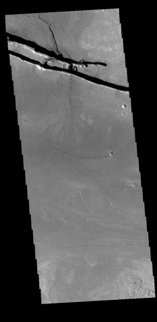
Today's VIS image shows a section of Cerberus Fossae. Cerberus Fossae are located in Elysium Planitia, southeast of the Elysium Mons volcanic complex. The linear features in the image are tectonic graben. Graben are formed by extension of the crust and faulting. When large amounts of pressure or tension are applied to rocks on timescales that are fast enough that the rock cannot respond by deforming, the rock breaks along faults. In the case of a graben, two parallel faults are formed by extension of the crust and the rock in between the faults drops downward into the space created by the extension. Several sets of graben are visible in this THEMIS image, trending from west-northwest to east-southeast. Because the faults defining the graben are formed perpendicular to the direction of the applied stress, we know that extensional forces were pulling the crust apart in the north-northeast/south-southwest direction. The Cerberus Fossae graben are sources of both channels and significant volcanic flows. Cerberus Fossae cuts across features such as hills, indicating the relative youth of the tectonic activity. The Cerberus Fossae system is 1235km (767 miles) long. Orbit Number: 94232 Latitude: 10.1207 Longitude: 161.626 Instrument: VIS Captured: 2023-03-13 08:52 https://photojournal.jpl.nasa.gov/catalog/PIA25999
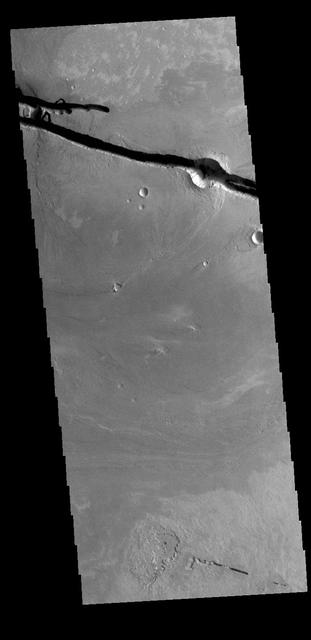
Today's VIS image shows a section of Cerberus Fossae. Cerberus Fossae are located in Elysium Planitia, southeast of the Elysium Mons volcanic complex. The linear features in the image are tectonic graben. Graben are formed by extension of the crust and faulting. When large amounts of pressure or tension are applied to rocks on timescales that are fast enough that the rock cannot respond by deforming, the rock breaks along faults. In the case of a graben, two parallel faults are formed by extension of the crust and the rock in between the faults drops downward into the space created by the extension. Numerous sets of graben are visible in this THEMIS image, trending from north-northwest to south-southeast. Because the faults defining the graben are formed perpendicular to the direction of the applied stress, we know that extensional forces were pulling the crust apart in the east-northeast/west-southwest direction. The Cerberus Fossae graben are sources of both channels and significant volcanic flows. Cerberus Fossae cuts across features such as hills, indicating the relative youth of the tectonic activity. Orbit Number: 93945 Latitude: 8.24256 Longitude: 161.492 Instrument: VIS Captured: 2023-02-17 17:42 https://photojournal.jpl.nasa.gov/catalog/PIA25933
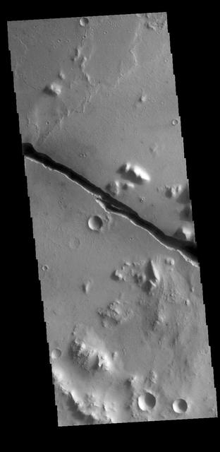
Today's VIS image shows a section of Cerberus Fossae. Cerberus Fossae are located in Elysium Planitia, southeast of the Elysium Mons volcanic complex. The linear features in the image are tectonic graben. Graben are formed by extension of the crust and faulting. When large amounts of pressure or tension are applied to rocks on timescales that are fast enough that the rock cannot respond by deforming, the rock breaks along faults. In the case of a graben, two parallel faults are formed by extension of the crust and the rock in between the faults drops downward into the space created by the extension. Numerous sets of graben are visible in this THEMIS image, trending from north-northwest to south-southeast. Because the faults defining the graben are formed perpendicular to the direction of the applied stress, we know that extensional forces were pulling the crust apart in the east-northeast/west-southwest direction. The Cerberus Fossae graben are sources of both channels and significant volcanic flows. Cerberus Fossae cuts across features such as hills, indicating the relative youth of the tectonic activity. Orbit Number: 94781 Latitude: 8.95114 Longitude: 163.746 Instrument: VIS Captured: 2023-04-27 13:44 https://photojournal.jpl.nasa.gov/catalog/PIA26156
Today's VIS image shows a section of Cerberus Fossae. Cerberus Fossae are located in Elysium Planitia, southeast of the Elysium Mons volcanic complex. The linear features in the image are tectonic graben. Graben are formed by extension of the crust and faulting. When large amounts of pressure or tension are applied to rocks on timescales that are fast enough that the rock cannot respond by deforming, the rock breaks along faults. In the case of a graben, two parallel faults are formed by extension of the crust and the rock in between the faults drops downward into the space created by the extension. Two graben are visible in this THEMIS image, trending from west-northwest to east-southeast. Because the faults defining the graben are formed perpendicular to the direction of the applied stress, we know that extensional forces were pulling the crust apart in the north-northeast/south-southwest direction. The Cerberus Fossae graben are sources of both channels and significant volcanic flows. The rough surface around the graben is thought to be volcanic flows. Cerberus Fossae cuts across features such as hills, indicating the relative youth of the tectonic activity. Orbit Number: 94494 Latitude: 8.856 Longitude: 163.378 Instrument: VIS Captured: 2023-04-03 22:36 https://photojournal.jpl.nasa.gov/catalog/PIA26031
Cloudy Image of Cerberus Rupes Dark Lineation
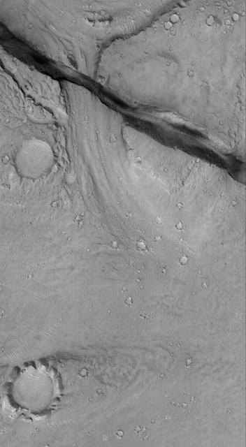
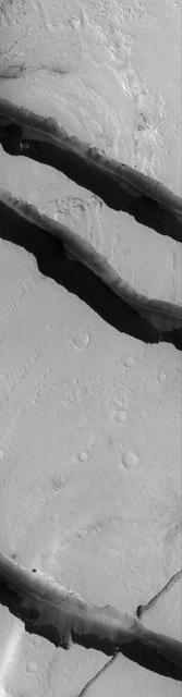
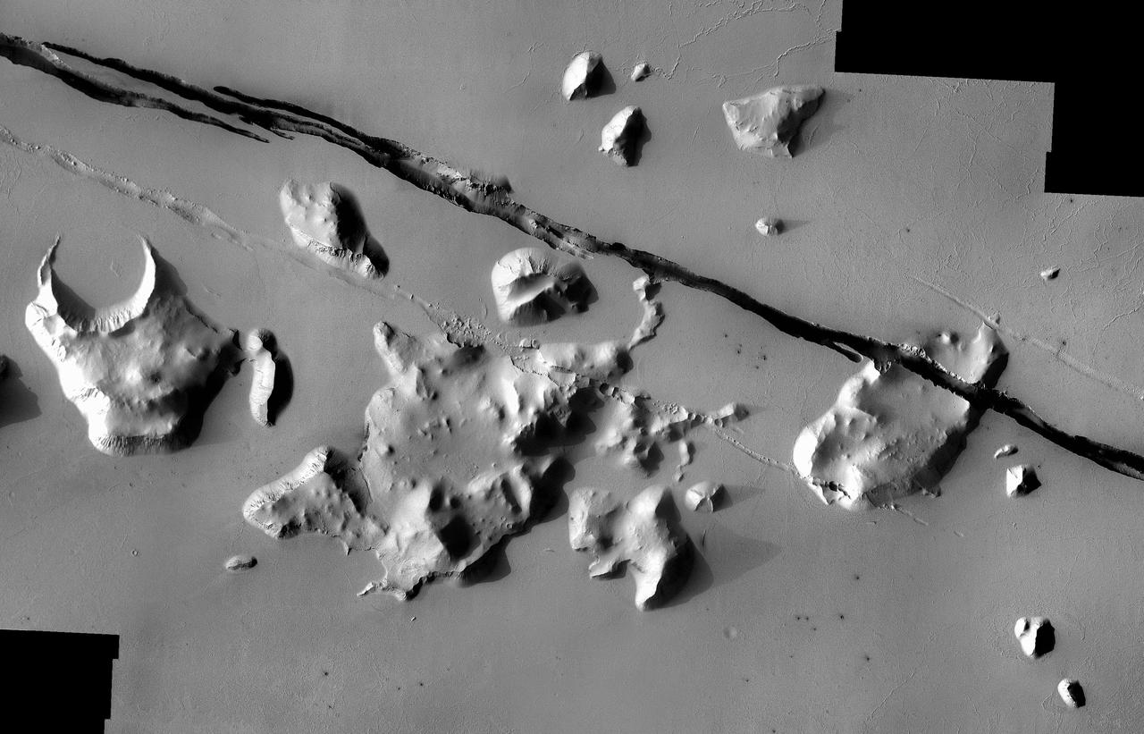
The fractures in this image taken by NASA 2001 Mars Odyssey spacecraft are part of Cerberus Fossae.
This image captured by NASA 2001 Mars Odyssey spacecraft shows part of Cerberus Fossae. The linear depressions are called fossae.
This image captured by NASA 2001 Mars Odyssey shows a small portion of the large fracture called Cerberus Fossae.
This image captured by NASA 2001 Mars Odyssey spacecraft shows a portion of Cerberus Fossae.
This image captured by NASA 2001 Mars Odyssey spacecraft shows a graben that is part of Cerberus Fossae.
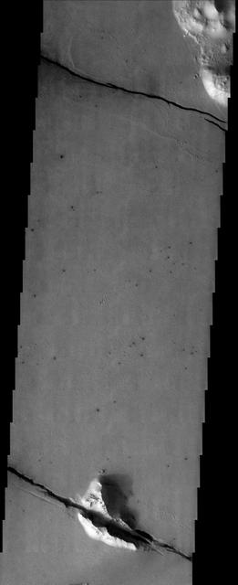
One of the tectonic fractures of Cerberus Fossae is visible at the bottom of this image taken by NASA Mars Odyssey on June 25, 2010.
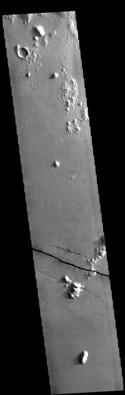
Today's VIS image shows a section of Cerberus Fossae. Located southeast of the Elysium Planitia volcanic complex, the linear graben near the top of the image was created by tectonic forces related to the volcanic activity. The graben are sources of both channels and significant volcanic flows. Cerberus Fossae cuts across features such as hills, indicating the relative youth of the tectonic activity. Graben form where extensional tectonic forces allows blocks of material to subside between paired faults. Orbit Number: 89952 Latitude: 10.0355 Longitude: 157.294 Instrument: VIS Captured: 2022-03-25 22:57 https://photojournal.jpl.nasa.gov/catalog/PIA25465
The Cerberus feature, imaged here by NASA Mars Odyssey, is a dark region at the southeastern edge of the huge Elysium Mons volcanic complex that was visible to early astronomers because it was a distinctive dark spot on a large bright region of Mars.
The linear depressions in the middle of this VIS image are graben called Cerberus Fossae. Graben form where extensional tectonic forces allows blocks of material to subside between paired faults. Cerberus Fossae are located in Elysium Planitia, southeast of the Elysium Mons volcanic complex. Orbit Number: 87793 Latitude: 15.3137 Longitude: 163.349 Instrument: VIS Captured: 2021-09-29 04:24 https://photojournal.jpl.nasa.gov/catalog/PIA25292
This image captured by NASA 2001 Mars Odyssey spacecraft shows Cerberus Fossae, a group of graben located near the southern part of Tartarus Montes.
This image captured by NASA 2001 Mars Odyssey spacecraft shows a portion of Cerberus Fossae, a set of linear graben located south of Tartarus Montes.
The dark fractures in this image from NASA 2001 Mars Odyssey spacecraft are part of Cerberus Fossae.
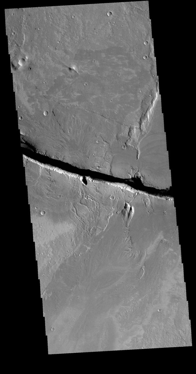
The linear depressions at the top half of this VIS image are graben that are called Cerberus Fossae. Graben form where extensional tectonic forces allows blocks of material to subside between paired faults. Cerberus Fossae are located in Elysium Planitia, southeast of the Elysium Mons volcanic complex. This graben is also the source of significant liquid flows, which created Athabasca Valles. The actual formation liquid proposed include flood water, low viscosity lava, and even glaciers. It is possible that water and lava both played a role in creating the channel system. Orbit Number: 78821 Latitude: 10.1133 Longitude: 157.297 Instrument: VIS Captured: 2019-09-21 10:33 https://photojournal.jpl.nasa.gov/catalog/PIA23503
The linear depressions at the top of the VIS image are some of the graben that comprise Cerberus Fossae. Graben form where extensional tectonic forces allows blocks of material to subside between paired faults. Cerberus Fossae is located in Elysium Planitia, southeast of the Elysium Mons volcanic complex. These graben were also the source of significant volcanic flows, creating the flow features to the top and the bottom of the graben. These flows are called Athabasca Valles. Water may have also been released from the graben, creating a complex history for channel forms in this region. Orbit Number: 79108 Latitude: 10.0044 Longitude: 157.144 Instrument: VIS Captured: 2019-10-15 01:44 https://photojournal.jpl.nasa.gov/catalog/PIA23568
The linear depressions at the top of the VIS image are some of the graben that comprise Cerberus Fossae. Graben form where extensional tectonic forces allows blocks of material to subside between paired faults. Cerberus Fossae are located in Elysium Planitia, southeast of the Elysium Mons volcanic complex. The graben were also the source of significant volcanic flows, creating the deposits seen at the lower part of the image. Orbit Number: 77985 Latitude: 9.97726 Longitude: 157.285 Instrument: VIS Captured: 2019-07-14 14:21 https://photojournal.jpl.nasa.gov/catalog/PIA23400
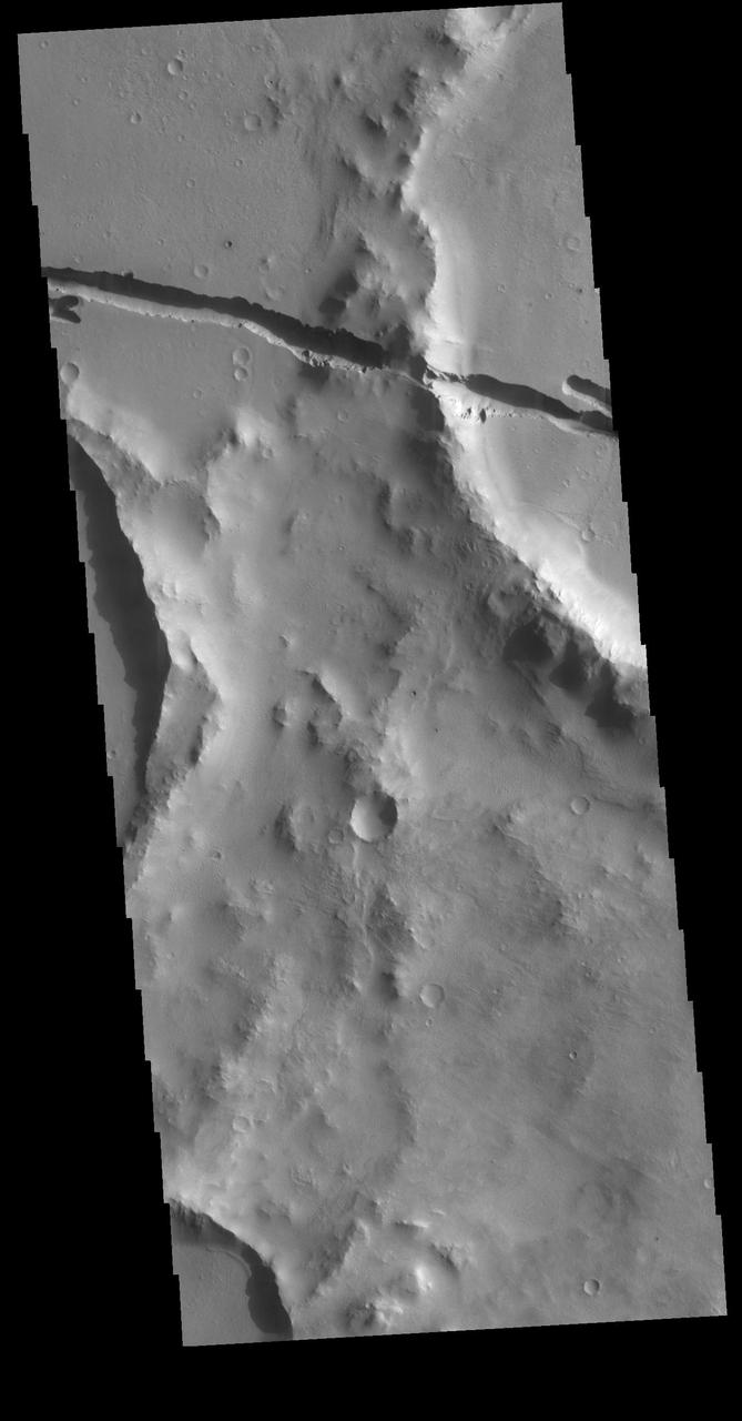
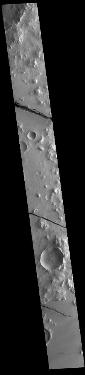
Today's VIS image shows part of Cerberus Fossae. These large graben cut across the Tartarus Montes in Elysium Planitia. A graben forms when large blocks of material slide downward between paired faults in regions of extensional stresses. The straight sides and uniform depths are indications that these are tectonic features rather than channels caused by fluid erosion. Cerberus Fossae graben are 1235 km long, approximately the distance between Los Angeles, California and Albuquerque, New Mexico. Orbit Number: 78222 Latitude: 10.4327 Longitude: 159.273 Instrument: VIS Captured: 2019-08-03 02:45 https://photojournal.jpl.nasa.gov/catalog/PIA23449
The fractures in this image are part of a large system of fractures called Cerberus Fossae. Athabasca Valles is visible in the lower right corner of the image as seen by NASA 2001 Mars Odyssey spacecraft.
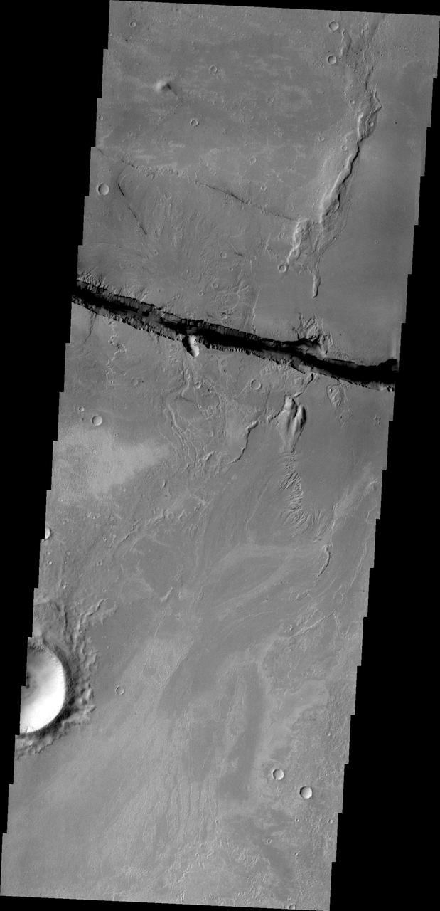
Today's VIS image shows a section of Cerberus Fossae. Located southeast of the Elysium Planitia volcanic complex, the linear graben near the top of the image was created by tectonic forces related to the volcanic activity. The graben are sources of both channels and significant volcanic flows. As seen in this image, the graben cuts across features such as hills, indicating the relative youth of the tectonic activity. Graben form where extensional tectonic forces allows blocks of material to subside between paired faults. Orbit Number: 79944 Latitude: 9.53204 Longitude: 158.706 Instrument: VIS Captured: 2019-12-22 21:50 https://photojournal.jpl.nasa.gov/catalog/PIA23743
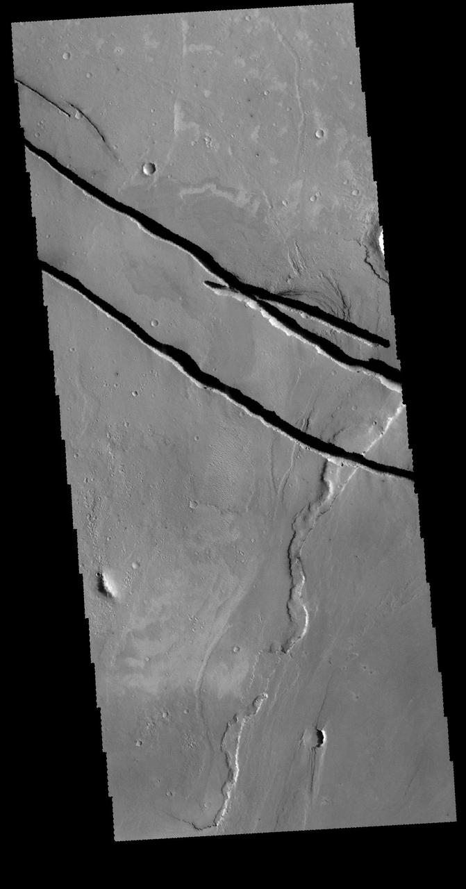
The linear depressions in this VIS image are part of the Cerberus Fossae fracture system. The system is made up of parallel graben created by tectonic forces pulling the crust apart. The entire system is 1235km long (767 miles). Orbit Number: 79270 Latitude: 8.68461 Longitude: 163.521 Instrument: VIS Captured: 2019-10-28 09:53 https://photojournal.jpl.nasa.gov/catalog/PIA23653
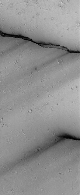
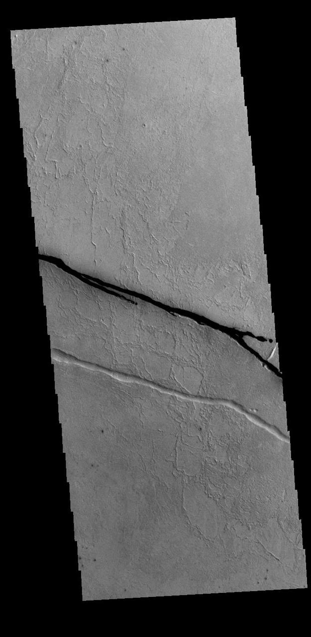
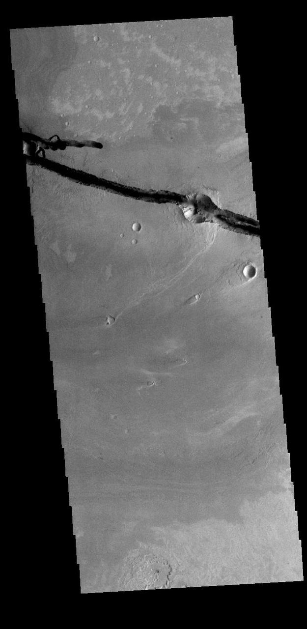
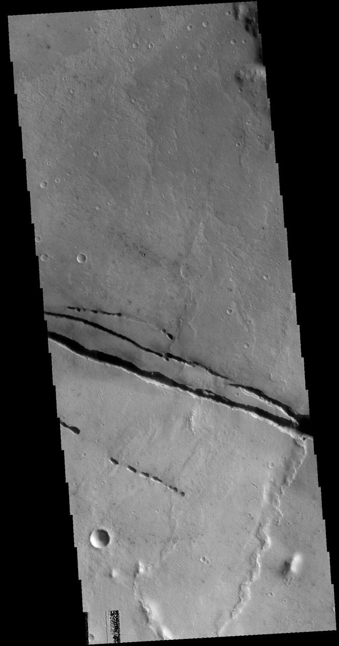
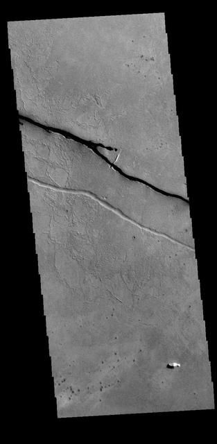
The two linear depressions at the bottom of today's VIS image are part of Cerberus Fossae. The features are termed graben and are formed by crustal extension that allows material to subside between paired tectonic faults. The straight sides and uniform depths are indications that these are tectonic features rather than channels caused by fluid erosion. Orbit Number: 77361 Latitude: 9.90217 Longitude: 161.214 Instrument: VIS Captured: 2019-05-24 05:06 https://photojournal.jpl.nasa.gov/catalog/PIA23327
The linear depression in today's VIS image is part of Cerberus Fossae. The feature is termed a graben and was formed by crustal extension that allowed material to subside between paired tectonic faults. The straight sides and uniform depths are indications that this is tectonic feature rather than a channel caused by fluid erosion. Orbit Number: 79345 Latitude: 9.14199 Longitude: 159.698 Instrument: VIS Captured: 2019-11-03 14:06 https://photojournal.jpl.nasa.gov/catalog/PIA23657
The linear depressions in today's VIS image are part of Cerberus Fossae. The features are termed grabens, and are formed by extensional tectonic forces. As the regional fractures move apart, blocks of material subside between paired faults. The straight sides and uniform depths are indications that this is tectonic feature rather than a channel caused by fluid erosion. The fossae stretch for 1235km (767 miles). Orbit Number: 85522 Latitude: 9.58809 Longitude: 159.803 Instrument: VIS Captured: 2021-03-26 04:37 https://photojournal.jpl.nasa.gov/catalog/PIA24828
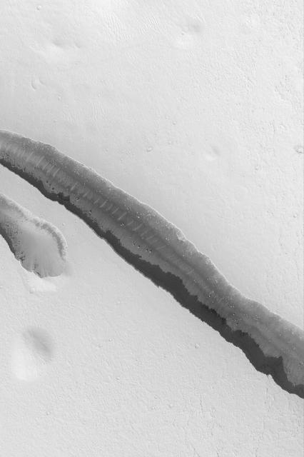
This VIS image shows one of the linear depressions of Cerberus Fossae. This feature is called a graben and is formed by extensional tectonic forces. As the regional fractures move apart, blocks of material slide down between paired faults. Orbit Number: 80106 Latitude: 13.7626 Longitude: 164.573 Instrument: VIS Captured: 2020-01-05 05:59 https://photojournal.jpl.nasa.gov/catalog/PIA23754

Visible in this observation from NASA Mars Reconnaissance Orbiter is a section of Cerberus Fossae, which are comprised of a series of rifts present located in Elysium Planitia just north the Martian equator.
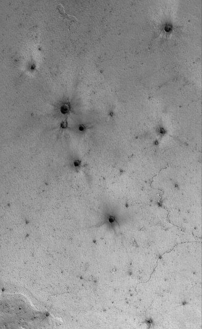
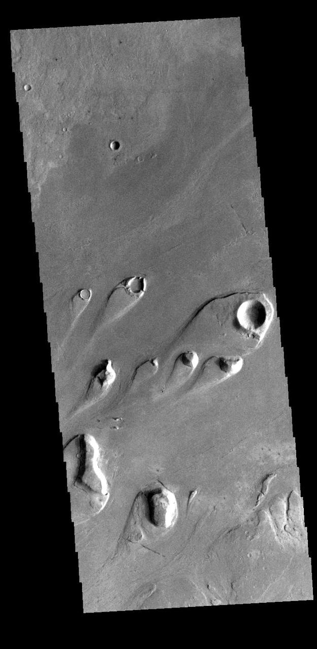
This Mars Global Surveyor MGS Mars Orbiter Camera MOC image shows a field of small craters formed by secondary debris thrown from a larger meteoritic impact on the plains south of the Cerberus region
Today's VIS image shows a section of Cerberus Fossae. Located southeast of the Elysium Planitia volcanic complex, the linear graben in the image were created by tectonic forces related to the volcanic activity. The graben are sources of both channels and significant volcanic flows. The Cerberus Fossae graben cut across features such as hills, indicating the relative youth of the tectonic activity. Graben form where extensional tectonic forces allows blocks of material to subside between paired faults. Cerberus Fossae are 270km (168 miles) long. Just off the image to the right is the start of Athabasca Valles, which is seen flowing below the graben to the bottom left of the image. Arising from Cerberus Fossae, the formation mode of this channel is still being debated. While the channel features are similar to water flow, other features are similar to lava flows, and yet other features have an appearance of slabs of material that floated on an underlying fluid. It is thought that Athabasca Valles is the youngest outflow channel system on Mars. Athabasca Valles is just one of the complex channel formations in the Elysium Planitia region. The THEMIS VIS camera is capable of capturing color images of the Martian surface using five different color filters. In this mode of operation, the spatial resolution and coverage of the image must be reduced to accommodate the additional data volume produced from using multiple filters. To make a color image, three of the five filter images (each in grayscale) are selected. Each is contrast enhanced and then converted to a red, green, or blue intensity image. These three images are then combined to produce a full color, single image. Because the THEMIS color filters don't span the full range of colors seen by the human eye, a color THEMIS image does not represent true color. Also, because each single-filter image is contrast enhanced before inclusion in the three-color image, the apparent color variation of the scene is exaggerated. Nevertheless, the color variation that does appear is representative of some change in color, however subtle, in the actual scene. Note that the long edges of THEMIS color images typically contain color artifacts that do not represent surface variation. Orbit Number: 86770 Latitude: 10.3516 Longitude: 156.539 Instrument: VIS Captured: 2021-07-06 22:48 https://photojournal.jpl.nasa.gov/catalog/PIA24994
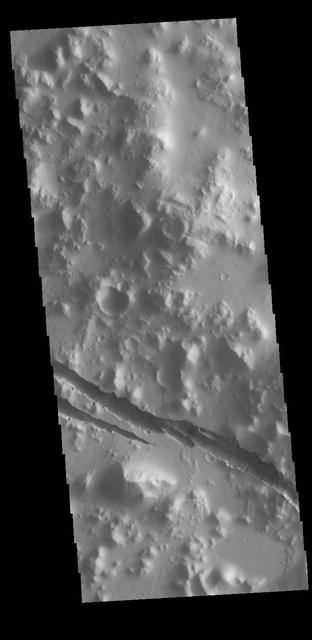
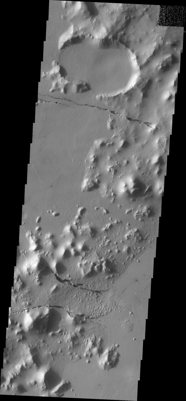
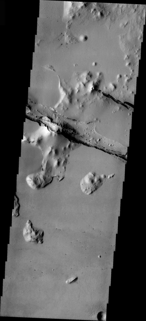
Today's VIS image shows part of Cerberus Fossae. These large graben cut across the Tartarus Montes in Elysium Planitia. A graben is formed when large blocks of material slid downward between paired faults in regions of extensional stresses. Orbit Number: 77648 Latitude: 10.0918 Longitude: 160.48 Instrument: VIS Captured: 2019-06-16 20:19 https://photojournal.jpl.nasa.gov/catalog/PIA23364
This VIS image shows a section of Cerberus Fossae. Located southeast of the Elysium Planitia volcanic complex, the linear graben was created by tectonic forces related to the volcanic activity. The fossae cuts across features such as hills, indicating the relative youth of the tectonic activity. The fossae is also the source of several channels, some of which are visible on the bottom of the fossae. Orbit Number: 71498 Latitude: 9.94964 Longitude: 157.873 Instrument: VIS Captured: 2018-01-26 07:16 https://photojournal.jpl.nasa.gov/catalog/PIA22397
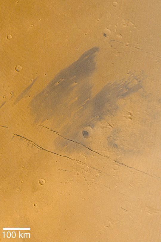
Cerberus, seen in this image from NASA Mars Odyssey spacecraft, is a dark region on Mars that has shrunk down from a continuous length of about 1000 km to roughly three discontinuous spots a few 100 kms in length in less than 20 years.
Geological faulting has opened cracks in the Cerberus region that slice through flat plains and mesas alike. This image is part of an All Star set marking the occasion of NASA Mars Odyssey as the longest-working Mars spacecraft in history.
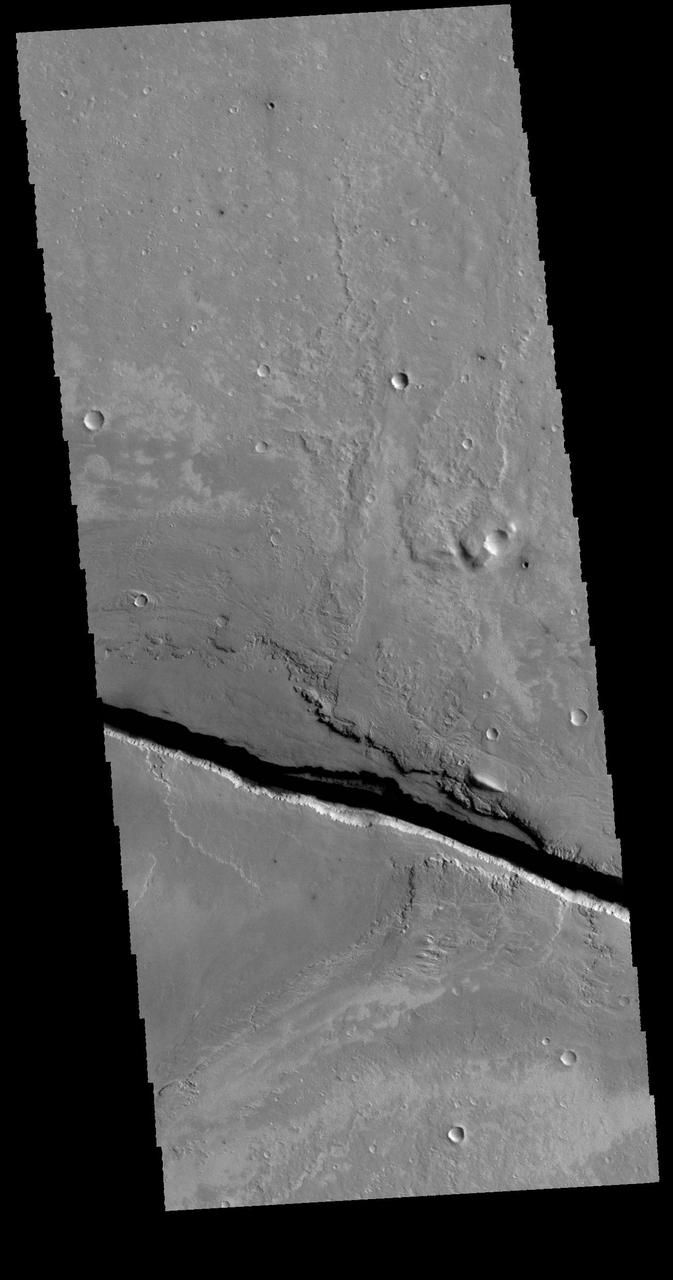
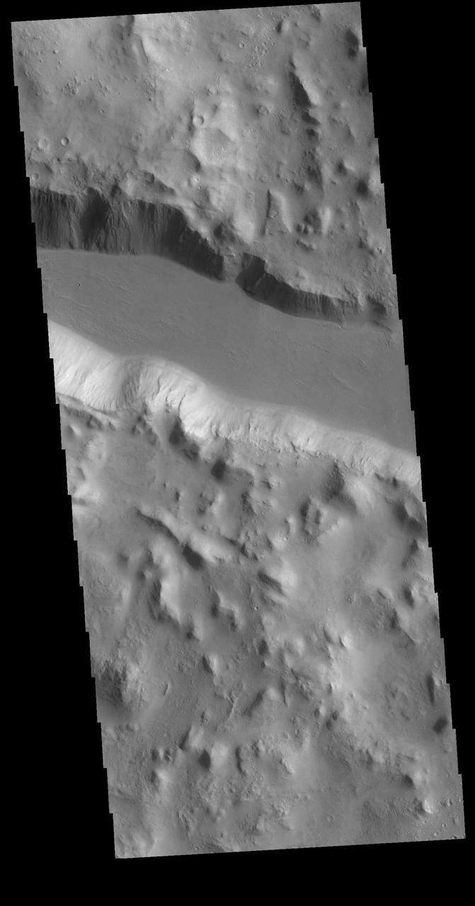
This image taken by NASA Mars Reconnaissance Orbiter shows part of Cerberus Fossae, a long system of extensional normal faults arranged in trough-bounding graben-bounding pairs.
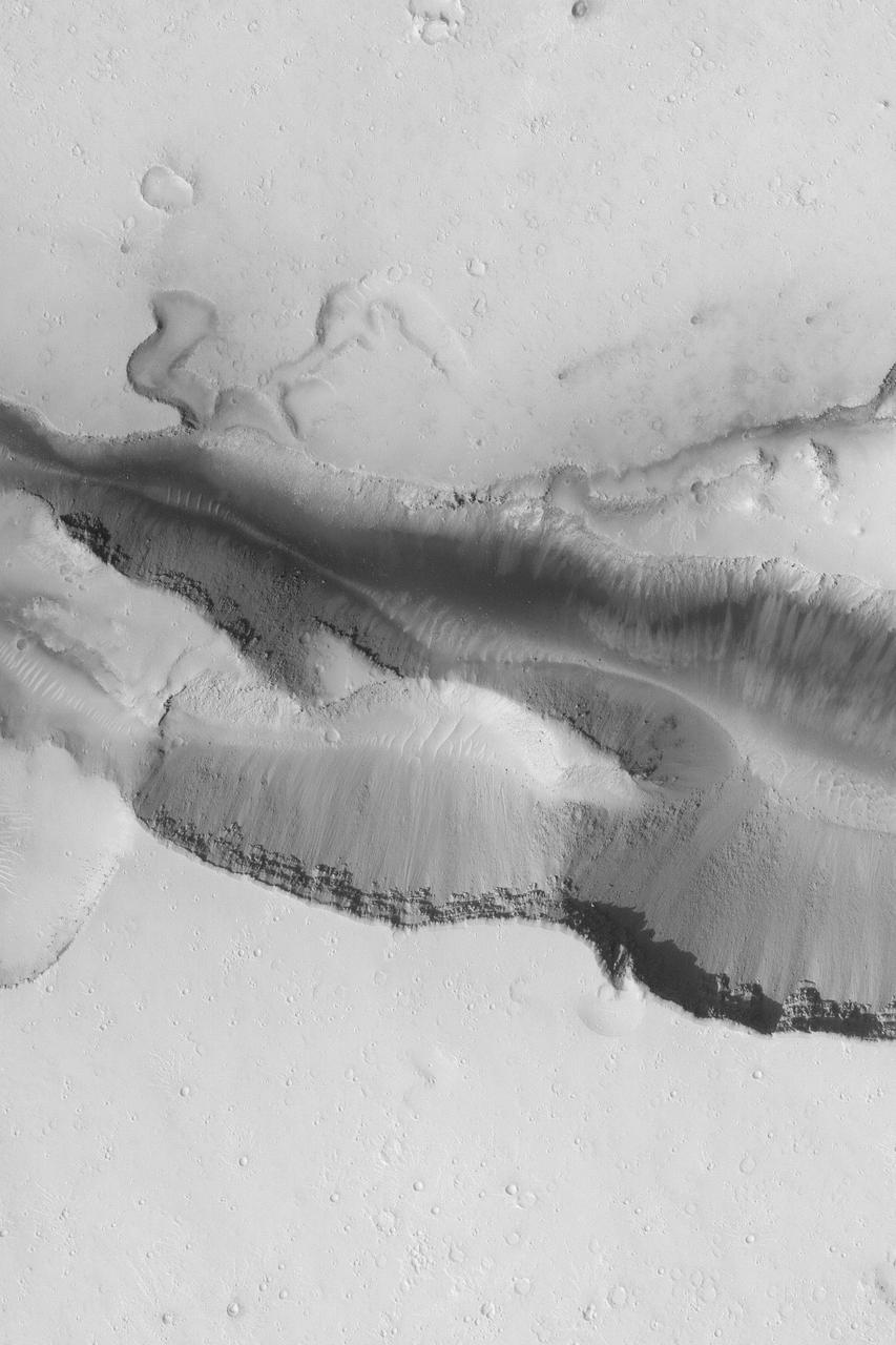
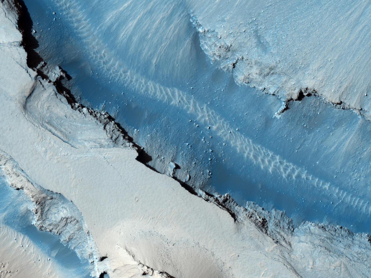
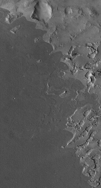
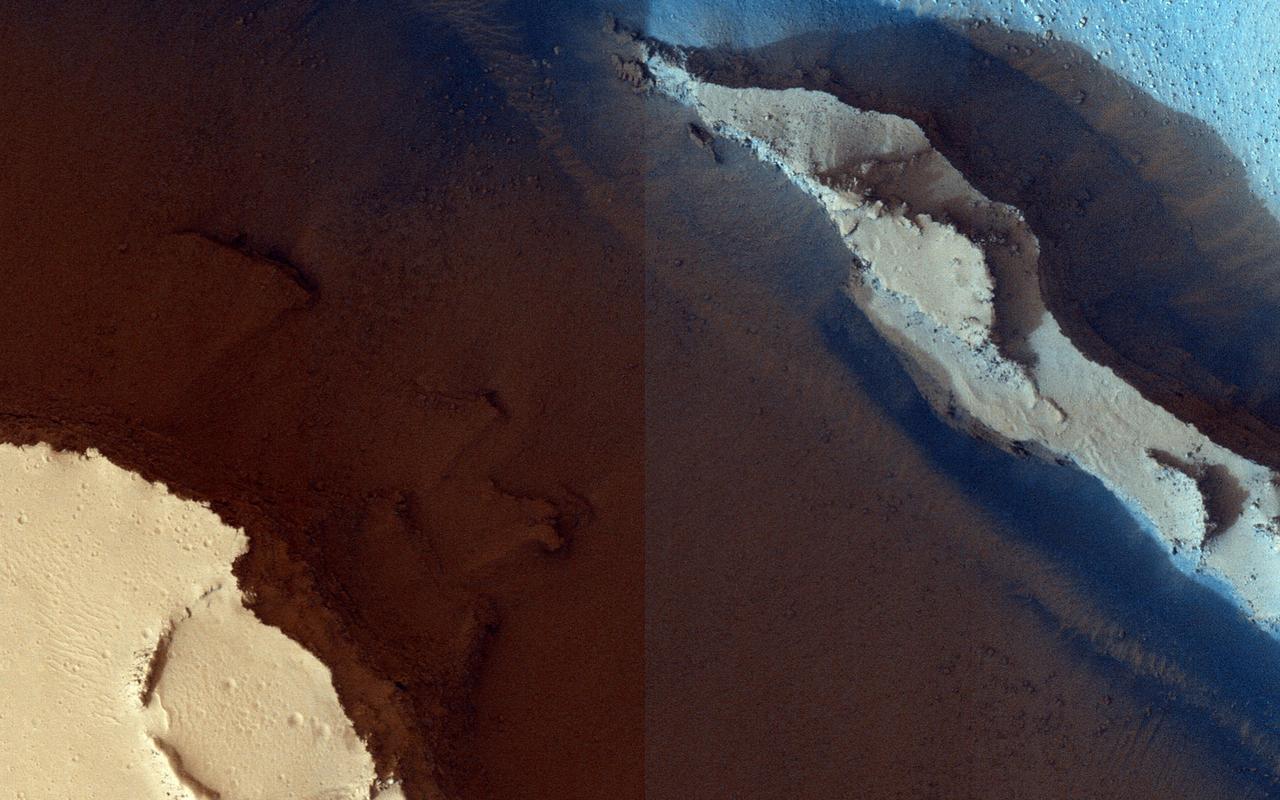
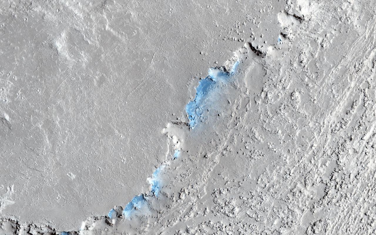
Cerberus Fossae is a steep-sided set of troughs cutting volcanic plains to the east of Elysium Mons. Steep slopes on Mars have active landslides (also called "mass wasting"), and here we see evidence for two types of activity. First, the light bluish boulders on the slope appear to originate at a layer of bedrock (also light blue) near the top of the section. Second, the dark thin lines are recurring slope lineae, probably also due to mass wasting, but composed of finer-grained materials. https://photojournal.jpl.nasa.gov/catalog/PIA23182
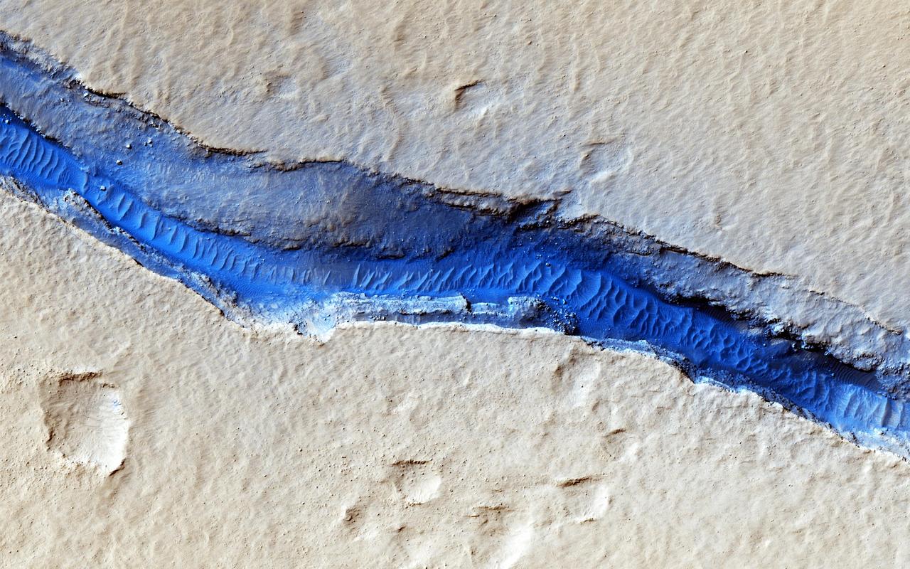
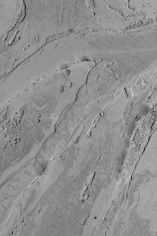
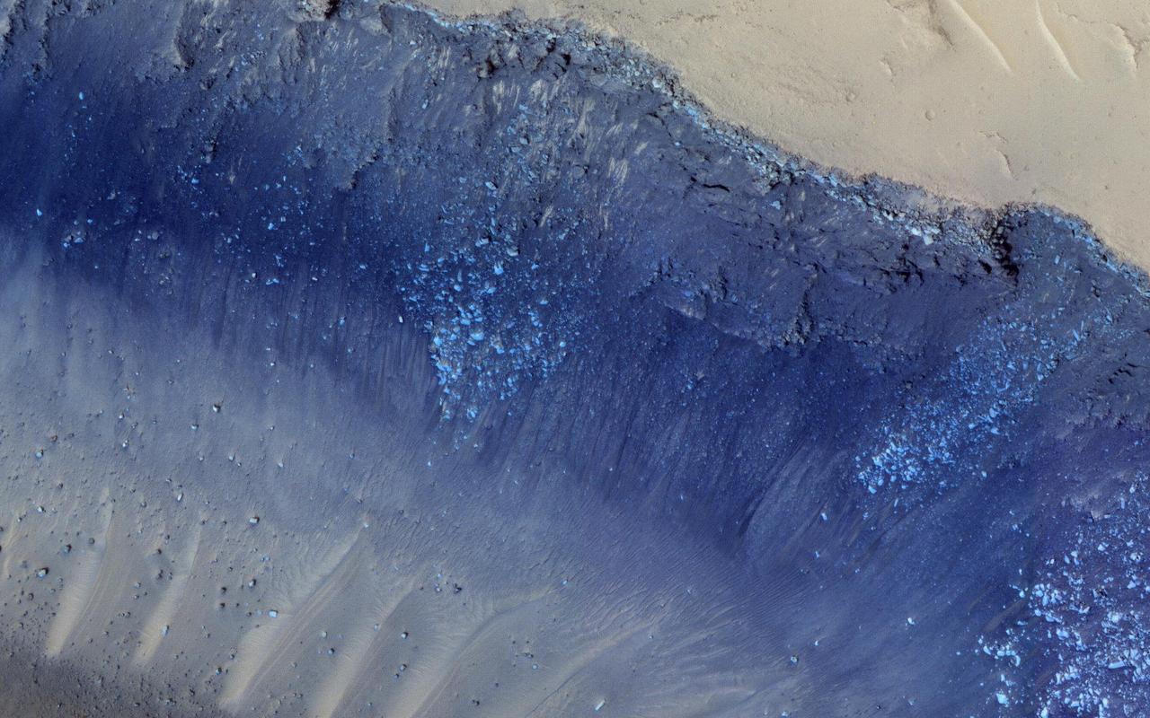
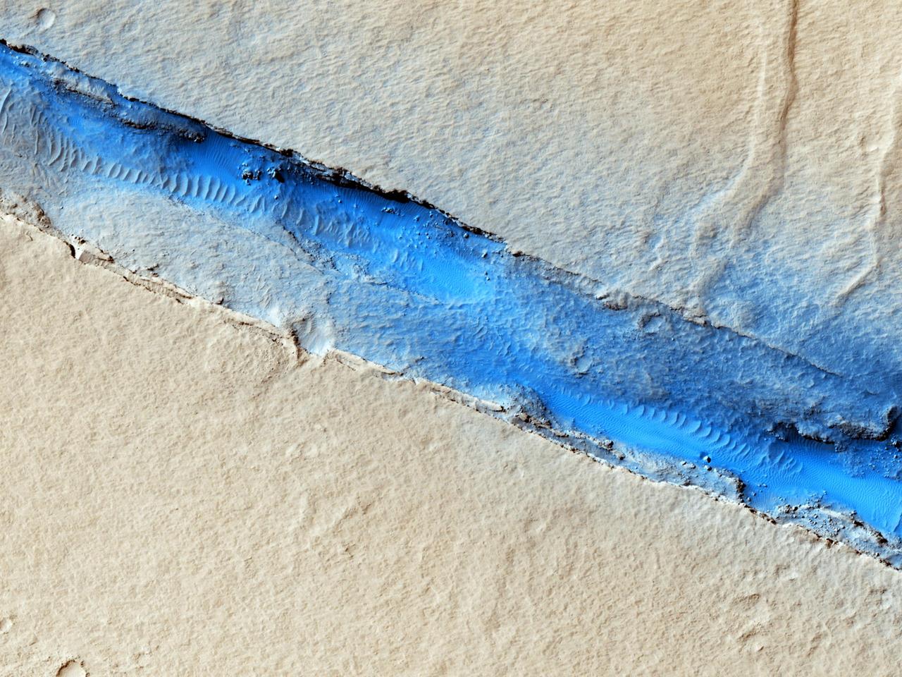
A dominant driver of surface processes on Mars today is aeolian (wind) activity. In many cases, sediment from this activity is trapped in low-lying areas, such as craters. Aeolian features in the form of dunes and ripples can occur in many places on Mars depending upon regional wind regimes. The Cerberus Fossae are a series of discontinuous fissures along dusty plains in the southeastern region of Elysium Planitia. This rift zone is thought to be the result of combined volcano-tectonic processes. Dark sediment has accumulated in areas along the floor of these fissures as well as inactive ripple-like aeolian bedforms known as "transverse aeolian ridges" (TAR). Viewed through HiRISE infrared color, the basaltic sand lining the fissures' floor stands out as deep blue against the light-toned dust covering the region. This, along with the linearity of the fissures and the wave-like appearance of the TAR, give the viewer an impression of a river cutting through the Martian plains. However, this river of sand does not appear to be flowing. Analyses of annual monitoring images of this region have not detected aeolian activity in the form of ripple migration thus far. http://photojournal.jpl.nasa.gov/catalog/PIA21063
These lava flows surrounding a depression in the plains are located in the Cerberus region of Elysium Planitia

Wunderkammer Laboratory Team leader Jim Rothrock, left, answers questions from 8th grade Sullivan Middle School (Mass.) students about his robot named "Cerberus" on Friday, June 15, 2012, at the Worcester Polytechnic Institute (WPI) in Worcester, Mass. Rothrock's robot team will compete for a $1.5 million NASA prize in the NASA-WPI Sample Return Robot Centennial Challenge at WPI. Teams have been challenged to build autonomous robots that can identify, collect and return samples. NASA needs autonomous robotic capability for future planetary exploration. Photo Credit: (NASA/Bill Ingalls)

Ancient lava flow in Cerberus Planitia is observed here by NASA Mars Reconnaissance Orbiter.
This MOC image shows dark lava flows that have embayed -- flowed up against and into -- higher, more rugged terrain in the Cyclopia/Aethiopis region of Mars southwest of Cerberus
This MOC image shows dark lava flows that have embayed -- flowed up against and into -- higher, more rugged terrain in the Cyclopia/Aethiopis region of Mars southwest of Cerberus
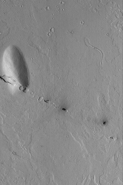
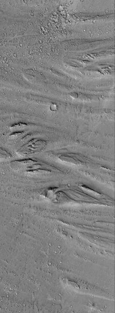
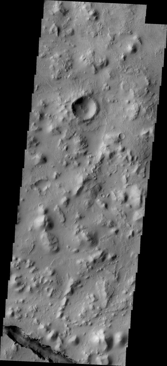
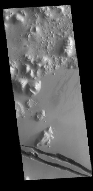
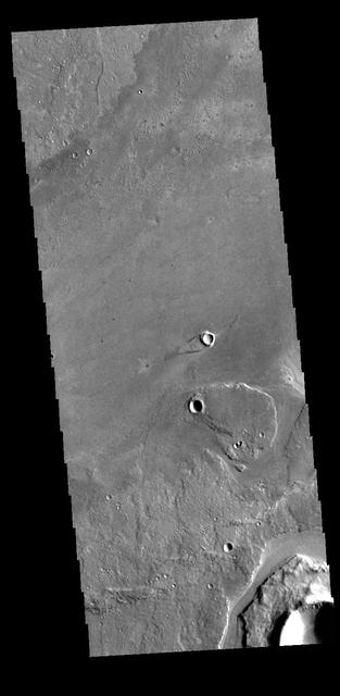
Today's VIS image shows a single linear depression, most likely a graben. This region is located just south of Cerberus Fossae, so it may have formed at the same time. Several Cerberus Fossae graben have also been source regions for flow features. Orbit Number: 94756 Latitude: 7.92391 Longitude: 165.118 Instrument: VIS Captured: 2023-04-25 12:20 https://photojournal.jpl.nasa.gov/catalog/PIA26155
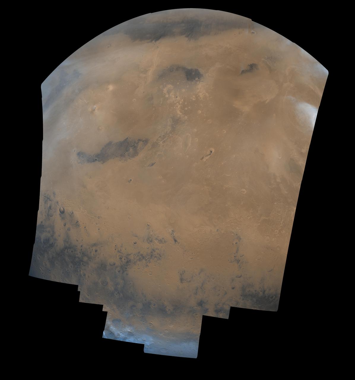
This mosaic is composed of 104 images from NASA's Viking Orbiter acquired on February 11, 1980. At that time, it was early northern summer on Mars. http://photojournal.jpl.nasa.gov/catalog/PIA00091
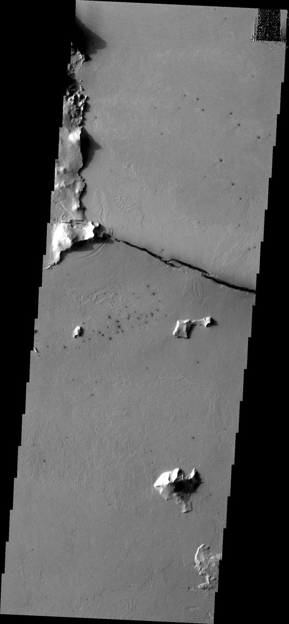
This image from NASA Mars Odyssey spacecraft shows fractures within the volcanic plains south of Elysium Mons.

This image from NASA Mars Odyssey spacecraft shows fractures within the volcanic plains south of Elysium Mons.
The trenches or fossae are found in Athabasca Valles as seen by NASA Mars Reconnaissance Orbiter. These trenches or "fossae" are about a kilometer (0.62 miles) across. This area shows where two segments have joined up and are close to a third section. The fossae are probably areas where the surface has collapsed down into voids made from faults (huge cracks with movement on either side) that don't extend up to the surface. In structural geology, when multiple faults are closely spaced, we call that a relay zone. These zones have much higher stress built up in the crust and consequently tend to be more fractured. These fractures can serve as "pipes" for fluids (water, lava, gases) to flow through. This area corresponds with the youngest of Mars' giant outflow channels, Athabasca Valles, that is only 2 to 20 million years old and shows geologic evidence of having been formed and modified jointly by water and lava. http://photojournal.jpl.nasa.gov/catalog/PIA19300
This observation from NASA Mars Reconnaissance Orbiter shows the end of a small channel near Athabasca Valles on Mars. Athabasca is an example of a Martian outflow channel, likely carved by a massive flood of groundwater.
The fracture is this image captured by NASA 2001 Mars Odyssey spacecraft cuts right through a hill, indicating tremendous tectonic stresses were at work to create this feature.
This VIS image shows part of Athabasca Valles. Arising from Cerberus Fossae, the formation mode of this channel is still being debated. While the channel features are similar to water flow, other features are similar to lava flows, and then other features have an appearance of slabs of material that floated on a underlying fluid. This is just one of the complex channel formations in the Elysium Planitia region. Orbit Number: 78297 Latitude: 8.93976 Longitude: 155.611 Instrument: VIS Captured: 2019-08-09 06:58 https://photojournal.jpl.nasa.gov/catalog/PIA23472
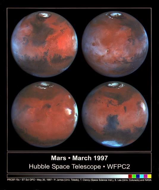
This photograph depicts four Mars views in northern summer provided by the Hubble Space Telescope (HST). The upper left view is centered on Ares Valles where Pathfinder landed in July 1997. Upper right is the Tharsis volcanic region and its associated cloud in the western half of the view. Olympus Mons lies near the western limb, Arsi Mons, Pavonis Mons Ascraeus Mons are to the west of the the center, and Valles Marineris is to the east. The lower Left view shows the Elysium volcanic region in the west, the Tharsis volcanos in East, and Cerberus is left of the center. In the lower right view, the Dark Syrtis Major region, Eysium Mons and Hellas are featured.

This VIS image shows part of Athabasca Valles. Several streamlined islands are visible, with 'tails' pointing downstream. Arising from Cerberus Fossae, the formation mode of this channel is still being debated. While the channel features are similar to water flow, other features are similar to lava flows, and yet other features have an appearance of slabs of material that floated on an underlying fluid. This is just one of the complex channel formations in the Elysium Planitia region. Orbit Number: 81766 Latitude: 8.8671 Longitude: 155.76 Instrument: VIS Captured: 2020-05-20 22:21 https://photojournal.jpl.nasa.gov/catalog/PIA24013
This VIS image shows part of Athabasca Valles. Several streamlined islands are visible, with 'tails' pointing downstream. Arising from Cerberus Fossae, the formation mode of this channel is still being debated. While the channel features are similar to water flow, other features are similar to lava flows, and yet other features have an appearance of slabs of material that floated on an underlying fluid. This is just one of the complex channel formations in the Elysium Planitia region. Orbit Number: 86820 Latitude: 7.69451 Longitude: 154.454 Instrument: VIS Captured: 2021-07-11 01:35 https://photojournal.jpl.nasa.gov/catalog/PIA25103
The linearity of the volcanic vent shown in this image observed by NASA Mars Reconnaissance Orbiter, in conjunction with evidence of lava flow from the vent, suggests control by combined volcano-tectonic processes.
Today's VIS image shows part of Athabasca Valles. Multiple streamlined islands are seen in this image. The teardrop shaped features were formed by liquid flow deflected around features such as craters and hills. The 'tail' of the island points downstream. The source of the fluid was likely an outburst of groundwater, perhaps related to the Elysium volcanic complex located to the northwest of this image. Arising from Cerberus Fossae, the formation mode of this channel is still being debated. While the channel features are similar to water flow, other features are similar to lava flows, and yet other features have an appearance of slabs of material that floated on an underlying fluid. It is thought that Athabasca Valles is the youngest outflow channel system on Mars. Athabasca Valles is just one of the complex channel formations in the Elysium Planitia region. Orbit Number: 89977 Latitude: 9.44823 Longitude: 156.138 Instrument: VIS Captured: 2022-03-28 00:21 https://photojournal.jpl.nasa.gov/catalog/PIA25466
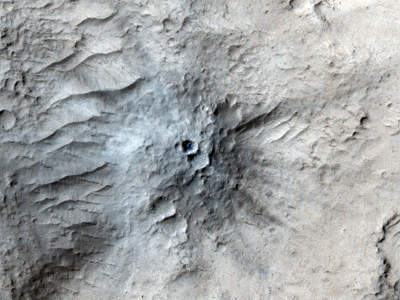
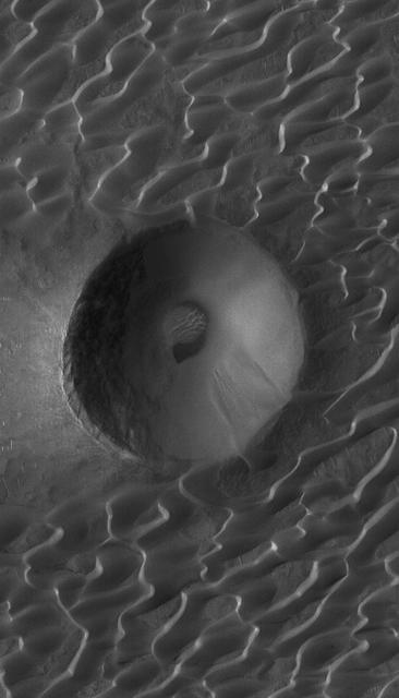
NASA's Mars Reconnaissance Orbiter used its High-Resolution Imaging Science Experiment (HiRISE) camera to capture this impact crater in Cerberus Fossae, a seismically active region of the Red Planet, on March 4, 2021. Scientists matched the crater's appearance on the surface with a quake detected by NASA's InSight lander, which was about 1,000 miles (1,640 kilometers) away. The crater is estimated to be about 71 feet (21.5 meters) in diameter. Most of the impacts detected by InSight, which was retired in 2022 after operating for more than four years, were thought to send their seismic signals through the Martian crust. But scientists concluded the energy from this impact traveled through the planet's mantle, much deeper than expected, after studying the location of the impact crater and seismic signals linked to it. Because of this finding, models of the composition and structure of the inner planet will have to be reassessed. This impact crater, along with others covered in a pair of papers published in Geophysical Research Letters in February 2025, was found with help from a machine learning algorithm developed at NASA's Jet Propulsion Laboratory in Southern California. The algorithm searched through tens of thousands of images captured by MRO's Context Camera in a matter of days, detecting 123 potential craters that may have occurred at the same time InSight was recording data. Traditional methods, in which human scientists carefully peer over images pixel by pixel, would have taken years of work to find these matches. Human scientists still had to narrow down the pool of candidate craters to 49 that matched InSight's quake data. After discovering this impact, scientists commanding MRO to take more detailed imagery with HiRISE. https://photojournal.jpl.nasa.gov/catalog/PIA26518
This image captured by NASA Mars Reconnaissance Orbiter shows a small channel cutting into young volcanic lavas in a region where massive catastrophic flooding took place in the relatively recent past. The Athabasca Valles region includes a vast lava flow, thought to be the youngest on Mars, with even younger outflow channels that were carved by running water. The source of the water is believed to be the Cerberus Fossae valleys to the north, which may have penetrated to an over-pressurized aquifer in the subsurface. Nowadays, erosion by gravity, wind, and frost gradually wears down the rims of the outflow channels. In this scene, we see dark materials along the channel rim that were probably exposed by this erosion. The dark materials are less red than the surrounding surface and so they appear blue in this enhanced color picture. Viewed close up, the dark materials show ripples that suggest they are made up of mobile sand. It is possible that this sand originated elsewhere and simply collected where we see it today, but the fact that sand is not found elsewhere in the scene suggest to us that it is eroding out of the volcanic layers at the retreating rim of the channel. Sand sources are important because mobile sand grains have only a limited lifetime, wearing down and chipping apart each time they impact the surface. Erosion of the volcanic materials in this region may provide sands to replace those that are destroyed. Few such sand sources have so far been identified on Mars. http://photojournal.jpl.nasa.gov/catalog/PIA18889