
Early Chinese rockets were used in warfare and celebrations. In fact, the origin of the rocket is shown simply in these Chinese characters. They stand for both "rocket" and "fire arrow."
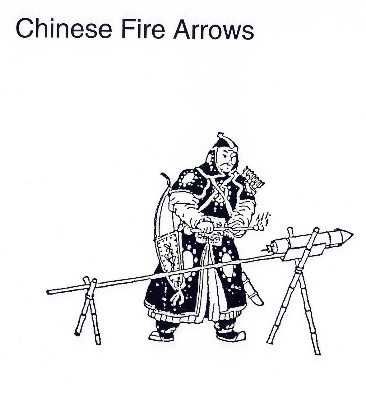
They sounded more like fireworks than rockets but the Chinese used rockets in battle.
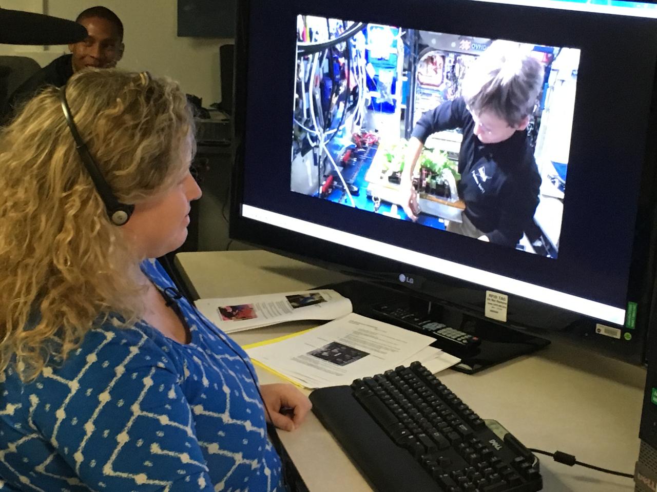
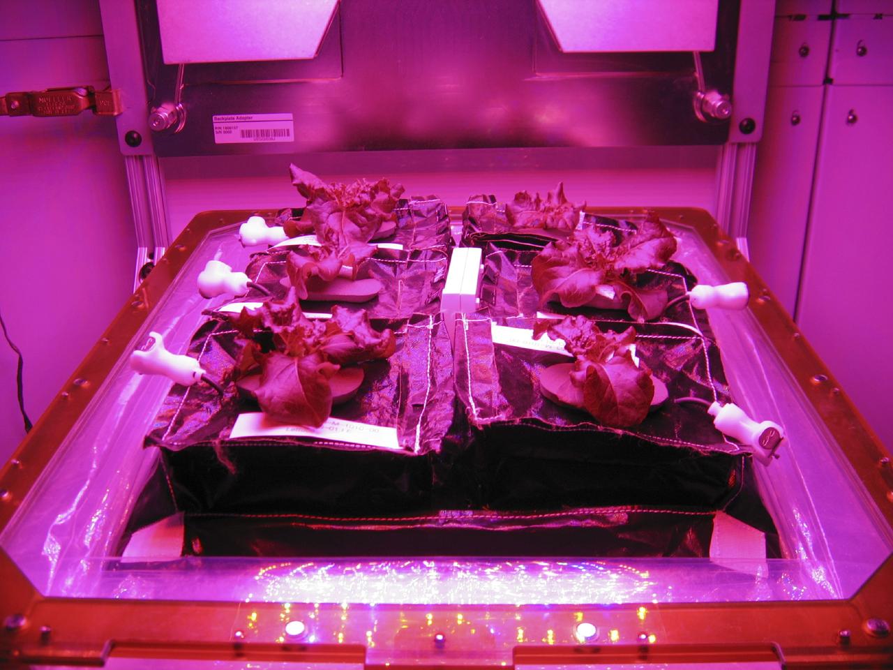
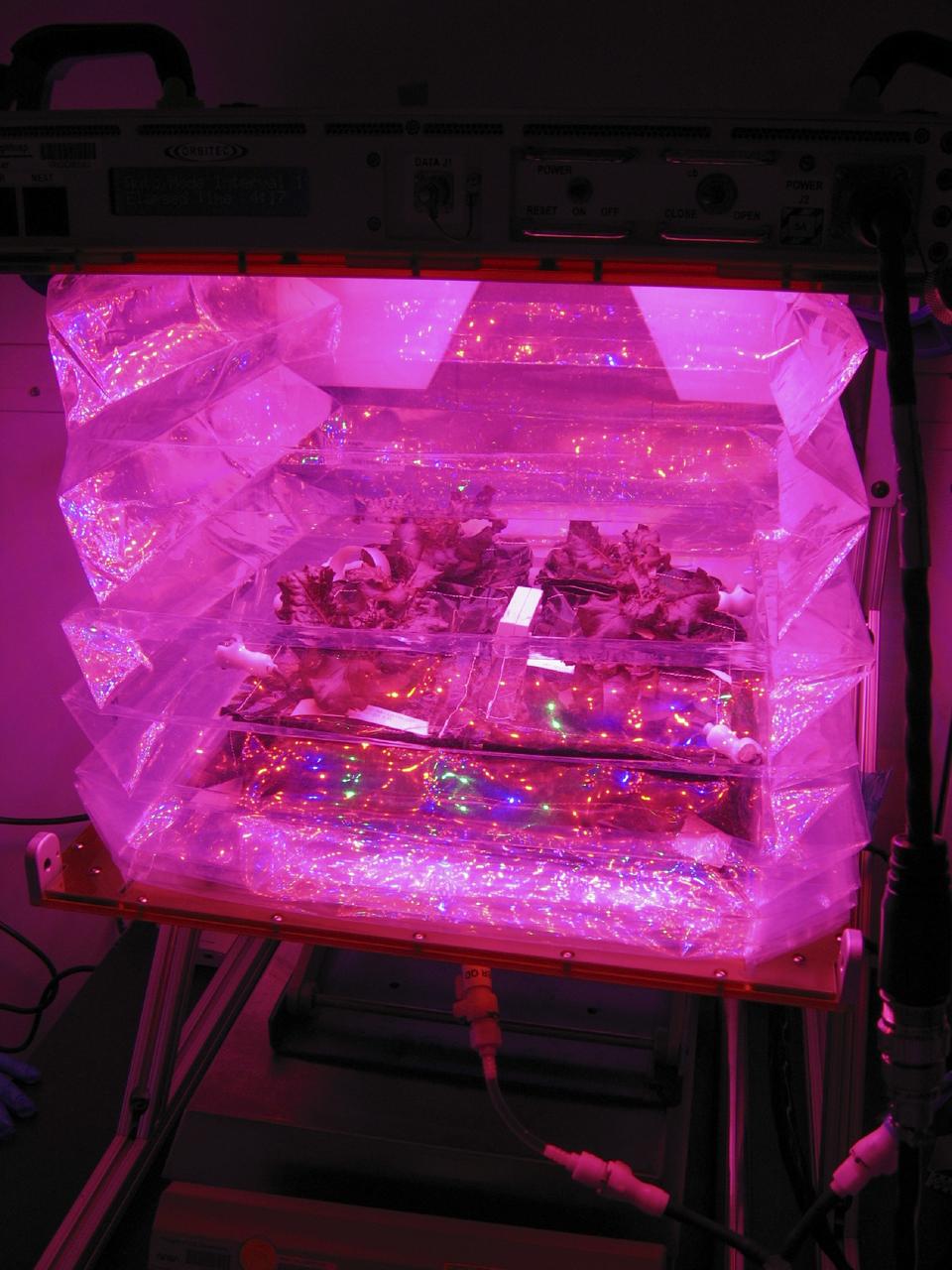
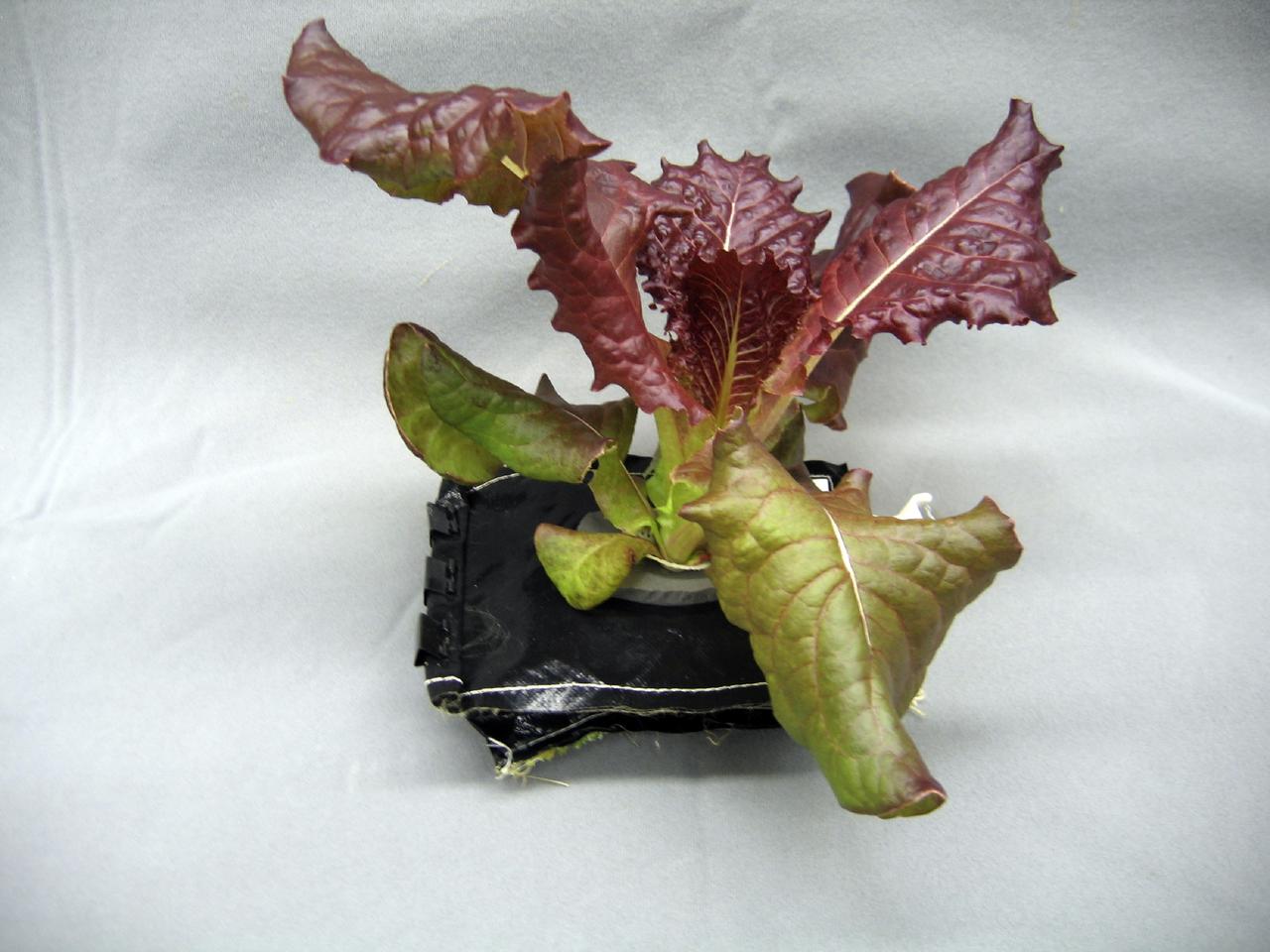
At Kennedy Space Center in Florida, Veggie Project Manager Nicole Dufour instructs astronaut Peggy Whitson during the harvest of Chinese cabbage aboard the International Space Station. While the space station crew will get to eat some of the Chinese cabbage, the rest is being saved for scientific study back at Kennedy Space Center. This is the fifth crop grown aboard the station, and the first Chinese cabbage.
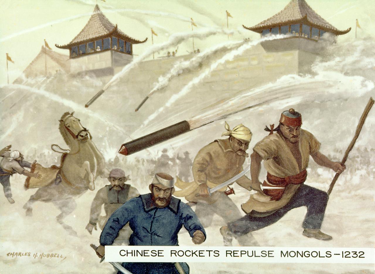
One of the earliest recorded instances of the use of rockets was as military weapons against the Mongols by the Chinese at the siege of Kai Fung Foo in 1232 A.D. An arrow with a tube of gunpowder produced an arrow of flying fire. The Mongol attackers fled in terror, even though the rockets were inaccurate and relatively harmless.
This NAC image shows Qi Baishi and Hovnatanian, two craters that were newly named in November 2008. Qi Baishi is named for the famous Chinese painter who died in 1957. Hovnatanian is named for the nineteenth century Armenian painter Hakop Hovnatanian.
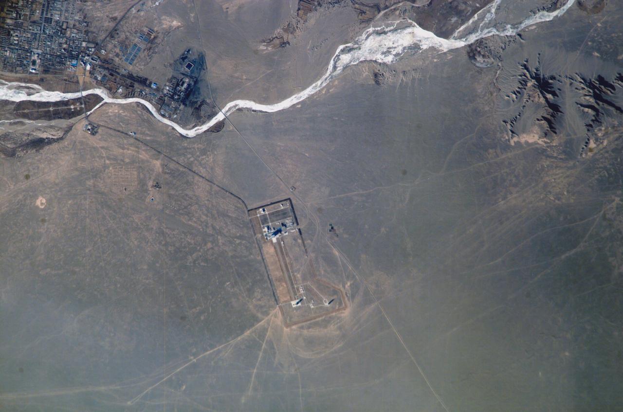
ISS010-E-14586 (23 January 2005) --- Chinese Launch Complex at Jiuquan is featured in this image photographed by an Expedition 10 crewmember on the International Space Station.

The Chinese Zhurong rover, named after the god of fire in Chinese mythology, landed in Utopia Planitia in May 2021. Utopia Planitia is a volcanic region located in the low-lying Northern Hemisphere of Mars. The expansive, flat, smooth plains of Utopia are dimpled by impact craters, volcanic domes, light-toned ridges made of wind-blown materials, and troughs. If the rover continues to drive south from its landing site, this HiRISE view shows the kind of terrain and features Zhurong may explore. https://photojournal.jpl.nasa.gov/catalog/PIA24914
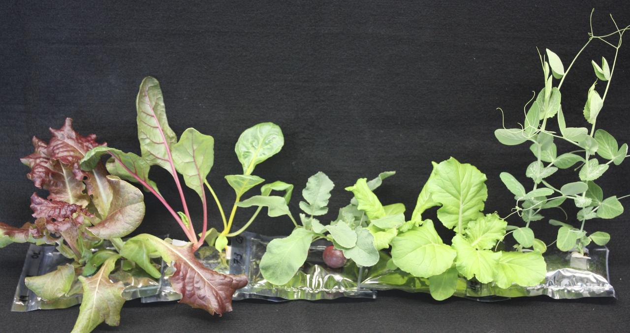
CAPE CANAVERAL, Fla. – Several different types of 21-day-old plants grow in analog VEGGIE pillows include, from right, Outredgeous red romaine lettuce, Bright Lights Swiss chard, Cherry Bomb II radish, Tokyo Bekana Chinese cabbage and Sugar Pod II snow pea. U.S. astronauts living and working aboard the International Space Station are going to receive a newly developed Vegetable Production System VEGGIE. VEGGIE is set to launch aboard SpaceX's Dragon capsule on NASA's third Commercial Resupply Services mission targeted to launch Dec. 9 from Space Launch Complex 40 at Cape Canaveral Air Force Station in Florida. Photo credit: NASA/Gioia Massa
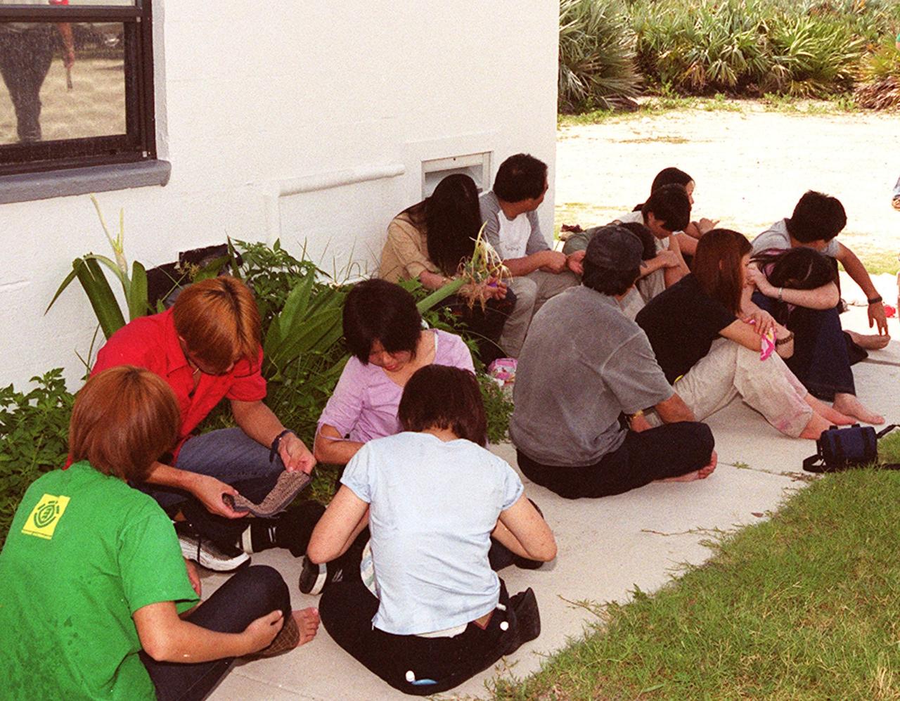
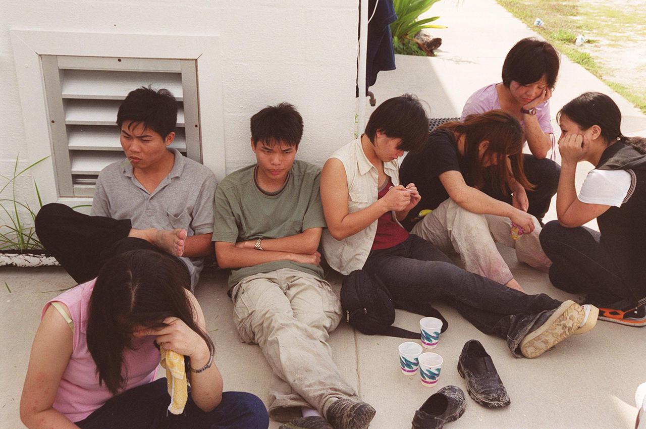
KENNEDY SPACE CENTER, Fla. -- Chinese foreign nationals (center and right), who arrived unannounced on Kennedy Space Center grounds, wait for representatives of Immigration and Naturalization Services to transport them to an office in Orlando for processing
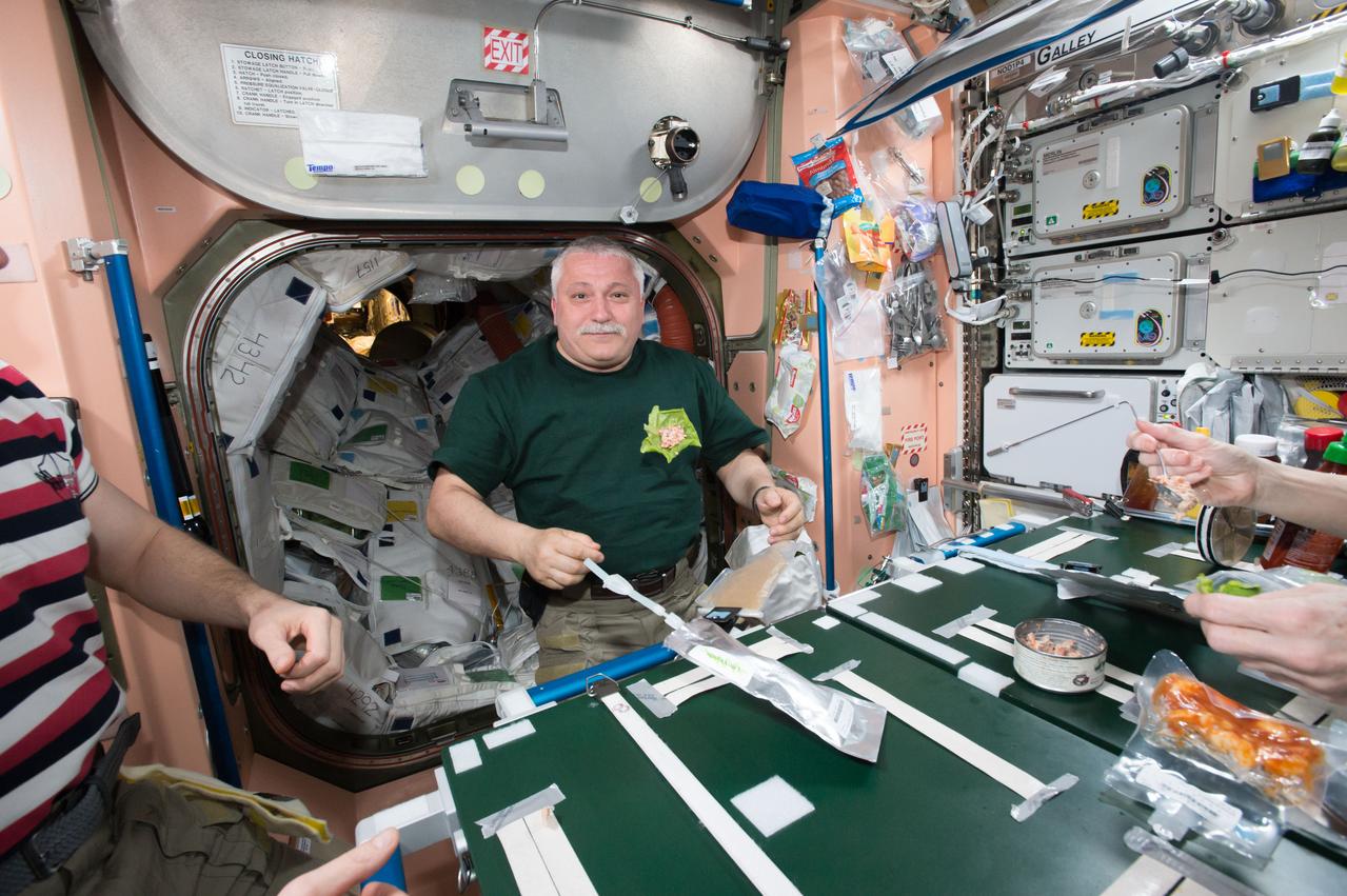
iss051e029147 (4/29/2017) --- Russian Cosmonaut Fyodor Yurchikhin prepares to eat some of the Chinese cabbage that was grown in the Veggie Plant Growth facility as part of the Veg-03 investigation. Credits: NASA
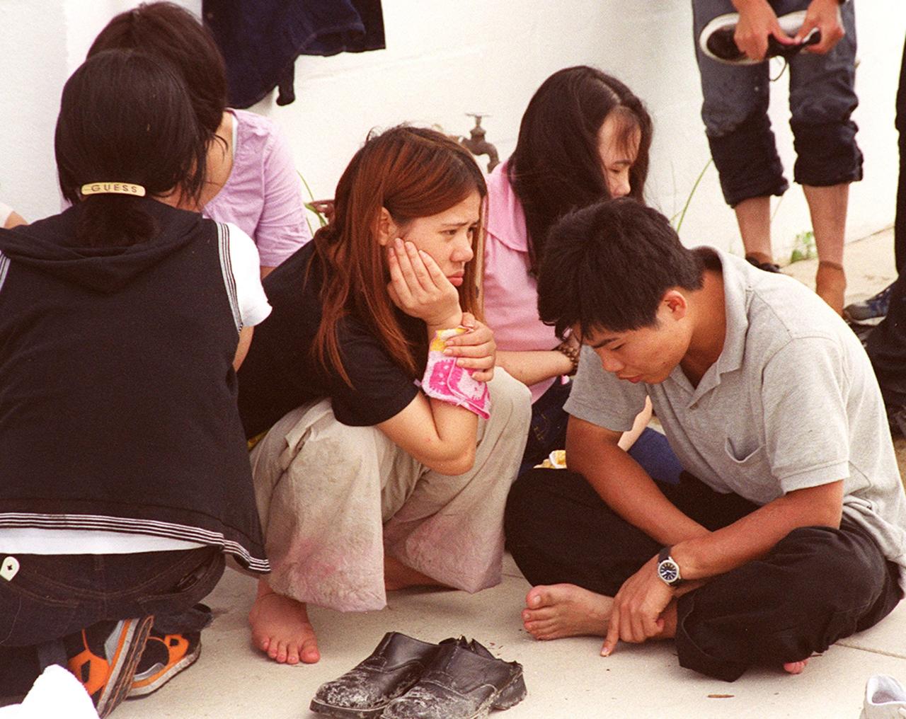
KENNEDY SPACE CENTER, Fla. -- These Chinese foreign nationals, part of a larger group who arrived unannounced on Kennedy Space Center grounds, wait for representatives of Immigration and Naturalization Services to transport them to an office in Orlando for processing
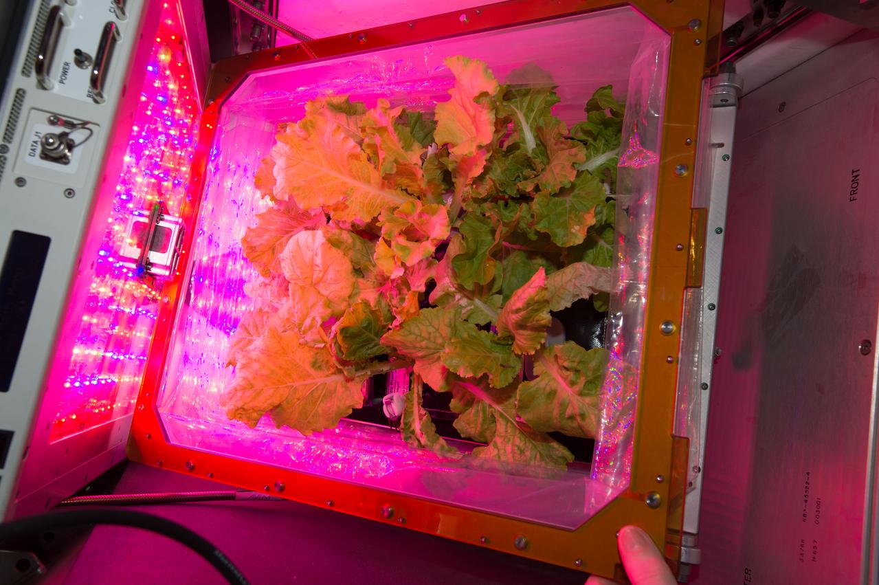
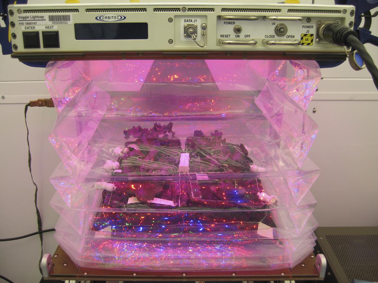
iss051e038158 (5/8/2017) --- Chinese cabbage is grown in the Veggie facility on the International Space Station. The sprouts form in a low-maintenance foam pillow and are grown using a special light to help the plants thrive.
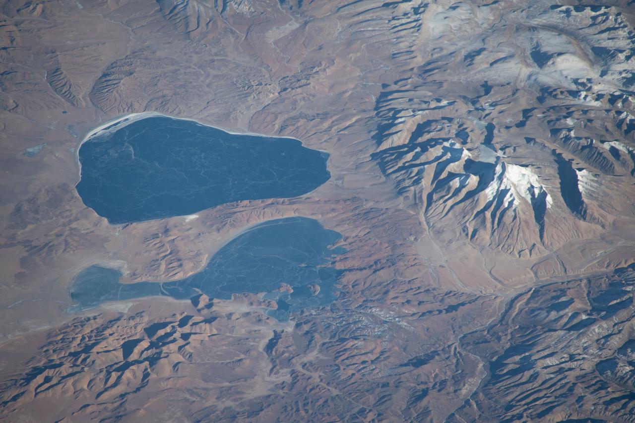
iss070e091722 (Feb. 10, 2024) --- Lakes Mansarovar (top) and Rakshastal, on the Chinese side of the Himalayan border with India, are pictured from the International Space Station as it orbited 260 miles above the Indian subcontinent.
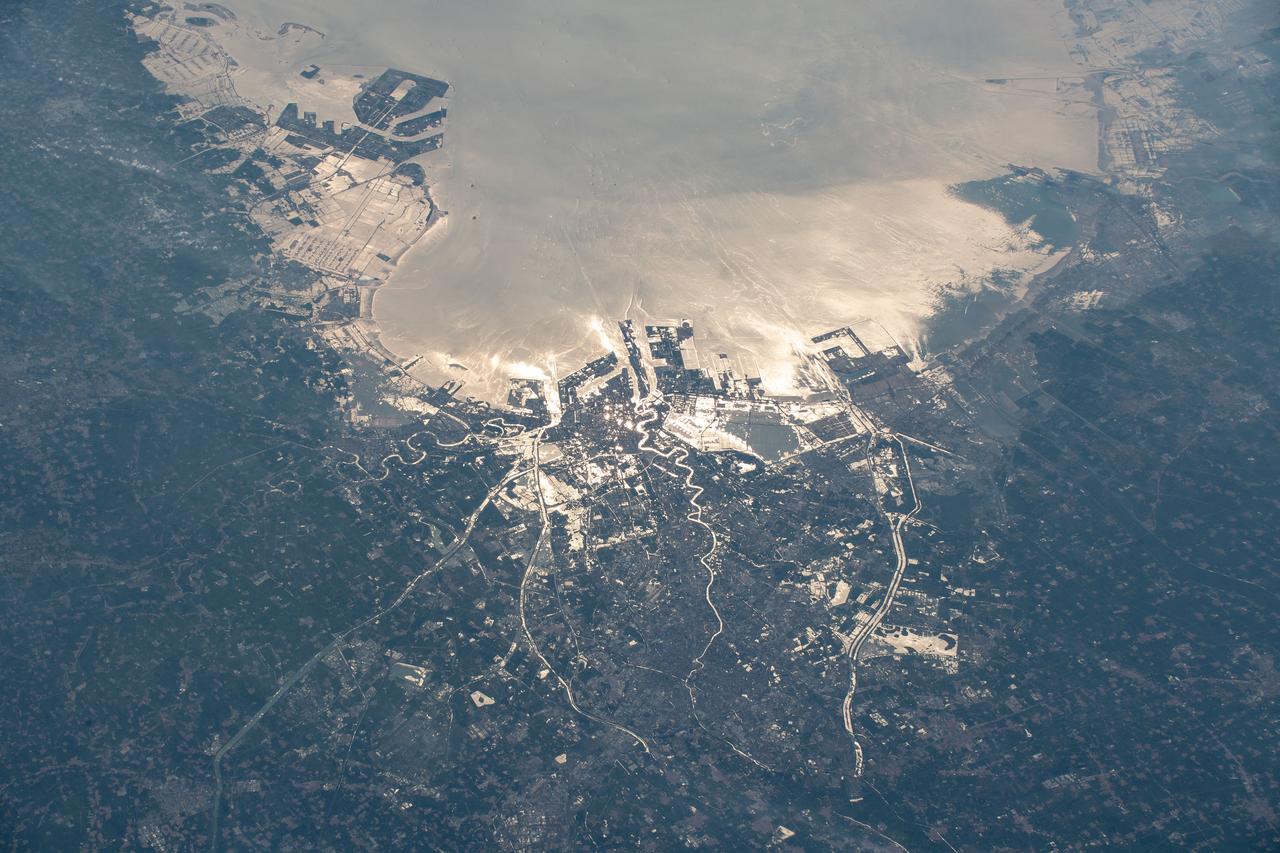
iss060e052554 (Sept. 2, 2019) --- The northeastern Chinese port city of Tianjin is pictured with the Sun's glint beaming off the Bohai Sea as the International Space Station orbited 263 miles above the Asian continent.
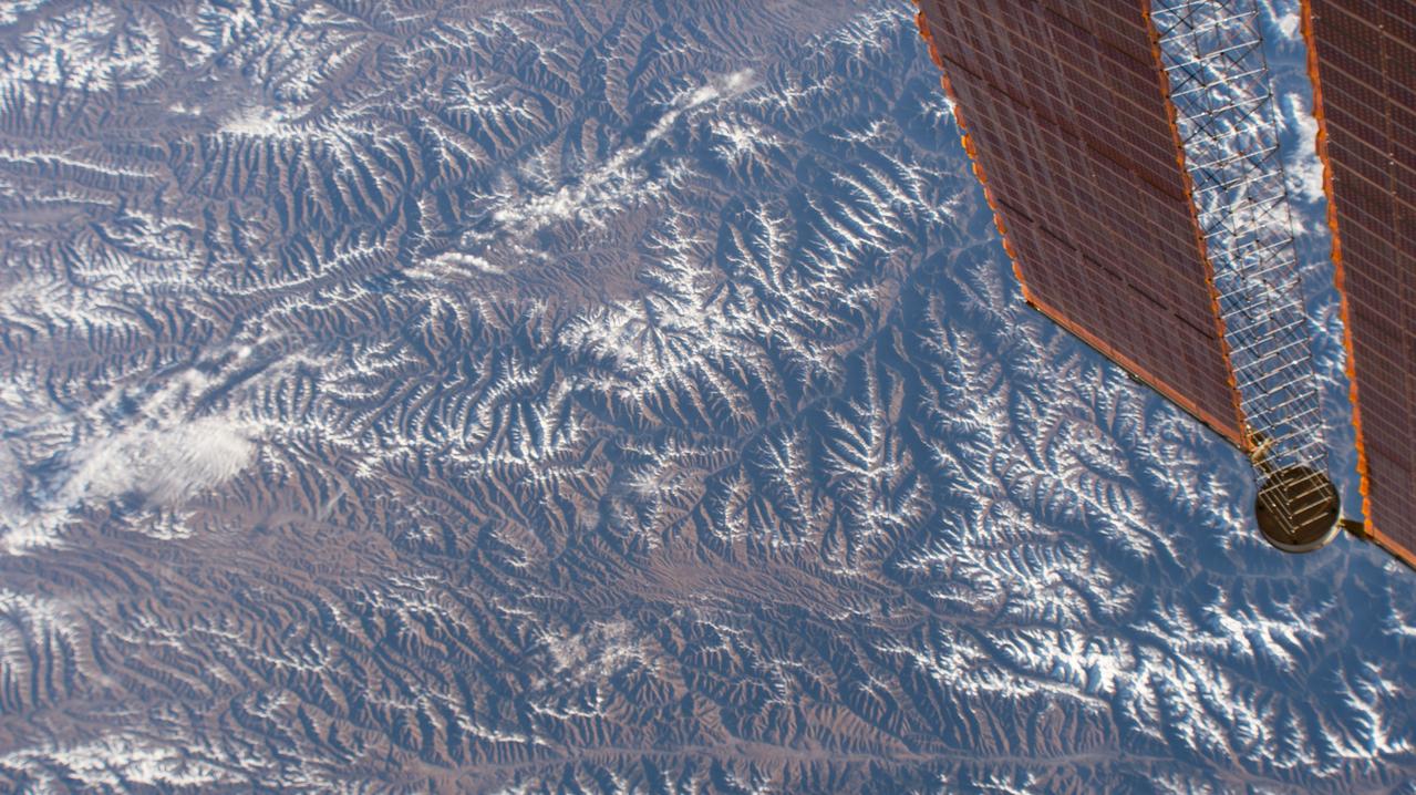
iss053e180185 (Nov. 13, 2017) --- A portion of the southwestern Chinese province of Sichuan and its snow-capped mountains are pictured with the tip of one of the International Space Station's main solar arrays in the foreground.
KENNEDY SPACE CENTER, Fla. -- Chinese foreign nationals, who arrived unannounced on Kennedy Space Center grounds, wait for representatives of Immigration and Naturalization Services to transport them to an office in Orlando for processing
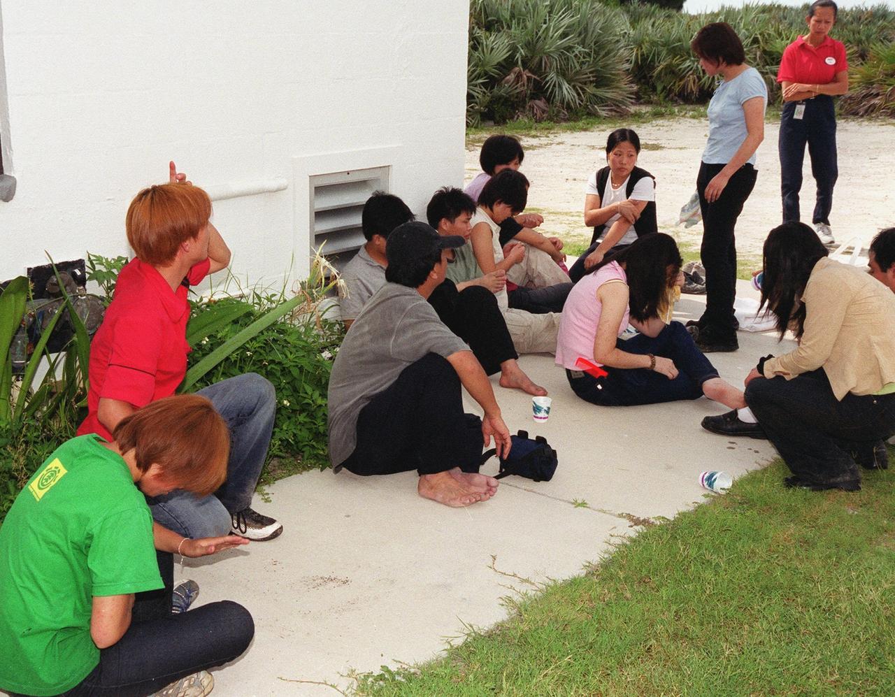
KENNEDY SPACE CENTER, Fla. -- Chinese foreign nationals (on right), who arrived unannounced on Kennedy Space Center grounds, wait for representatives of Immigration and Naturalization Services to transport them to an office in Orlando for processing
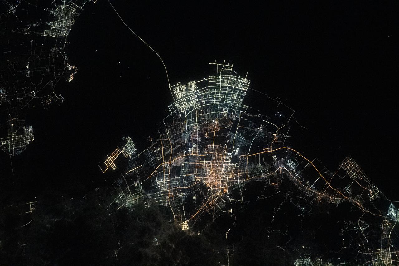
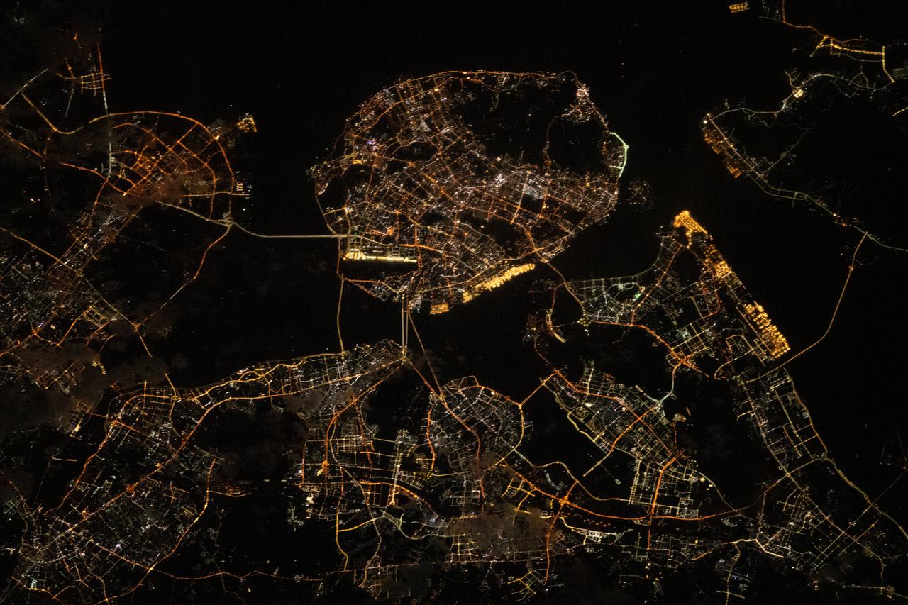
iss070e096353 (Feb. 17, 2024) --- The night lights of Chinese villlages on Hangzhou Bay are pictured from the International Space Station as it orbited 260 miles above the East China Sea.
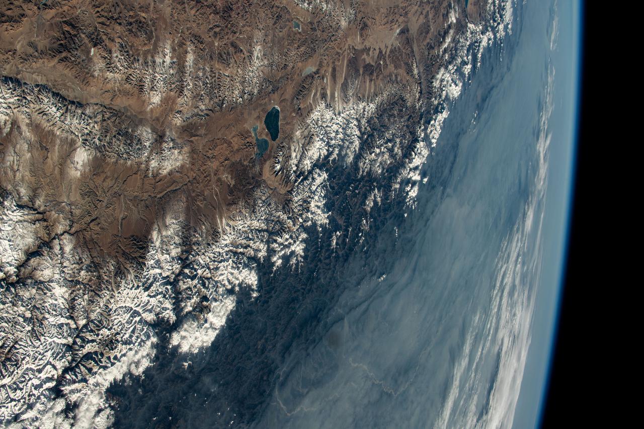
iss070e097638 (Feb. 11, 2024) --- The Himalayas, separating the Indian subcontinent from China, home to the South Asian nations of Nepal and Bhutan, and with Lakes Mansarovar and Rakshastal on the Chinese side, are pictured from the International Space Station as it orbited 261 miles above.
iss069e027389 (July 2, 2023) --- The southeast Chinese port city of Xiamen, on the coast of the South China Sea with a population of over 5.1 million people, is pictured from the International Space Station as it orbited 258 miles above during an orbital night pass.
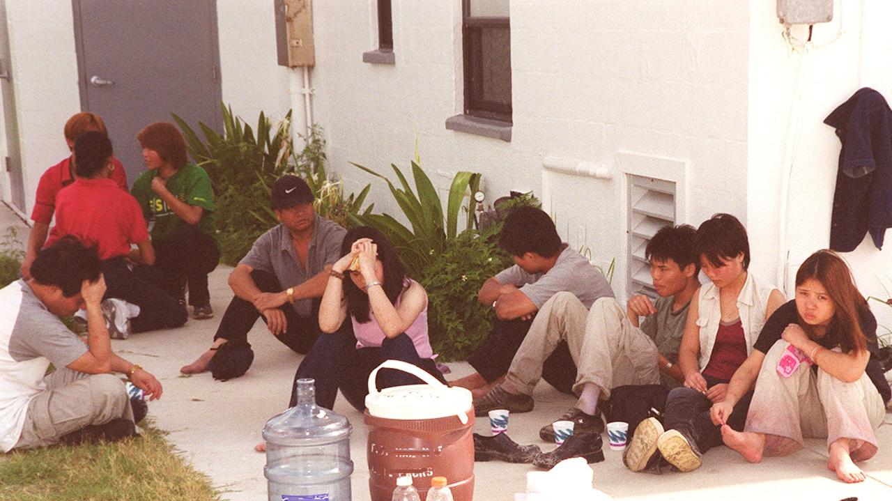
KENNEDY SPACE CENTER, Fla. -- This group of Chinese foreign nationals (foreground) are part of a larger group who arrived unannounced on Kennedy Space Center grounds. They are waiting for representatives of Immigration and Naturalization Services to transport them to an office in Orlando for processing
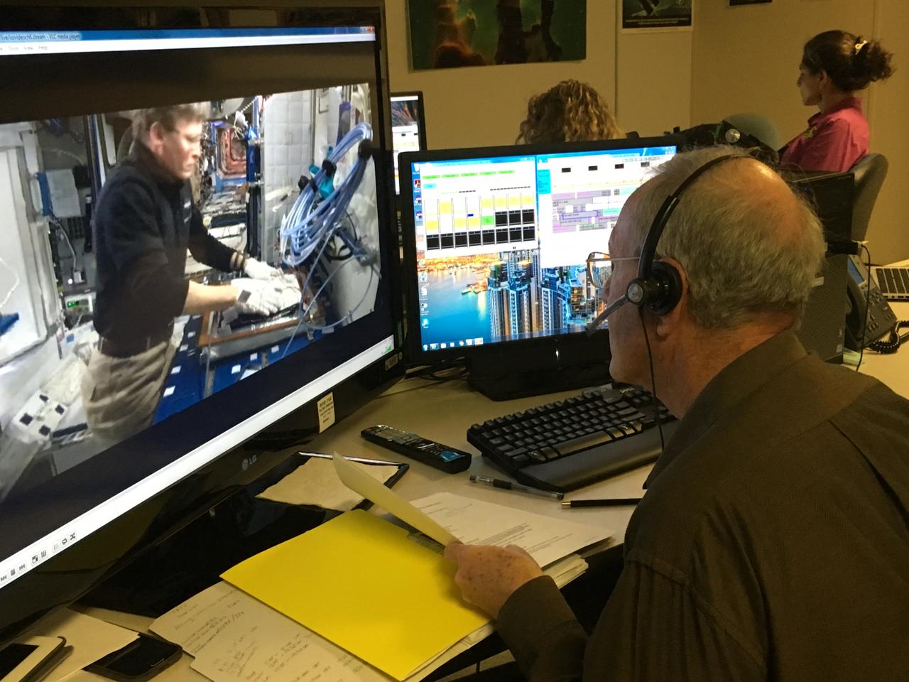
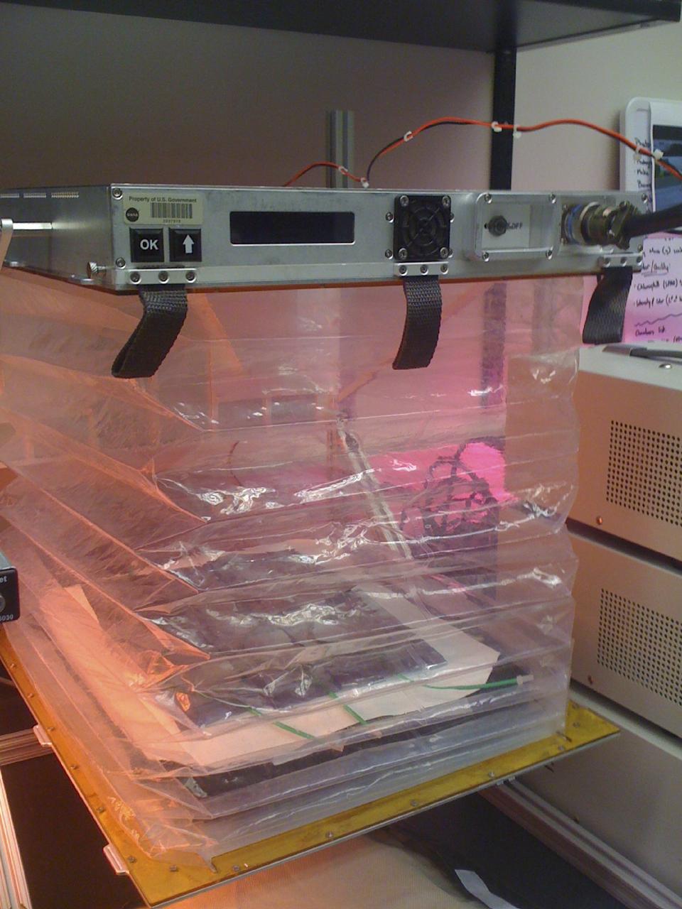
Charles Spern, project manager on the Engineering Services Contract, communicates instructions for the Veggie system to astronaut Peggy Whitson aboard the International Space Station during the initiation of the second Chinese cabbage to be grown aboard the orbiting laboratory on April 3, 2017.
iss073e0510447 (Aug. 19, 2025) --- Agricultural activities in the diverse landscape of Kazakhstan's Jetisu region, near the Chinese border and once a key corridor of the ancient Silk Road, are pictured from the International Space Station as it orbited 263 miles above the Central Asian nation. Credit: Roscosmos
iss071e439833 (Aug. 8, 2024) --- Xiang River runs through the city of Changsha (center) in China's province of Hunan. At far left, the city of Yueyang lies on the bank of Dongdongting Lake in Hunan's humid, subtropical region. The International Space Station was orbiting 262 miles above the Asian nation at the time of this photograph.
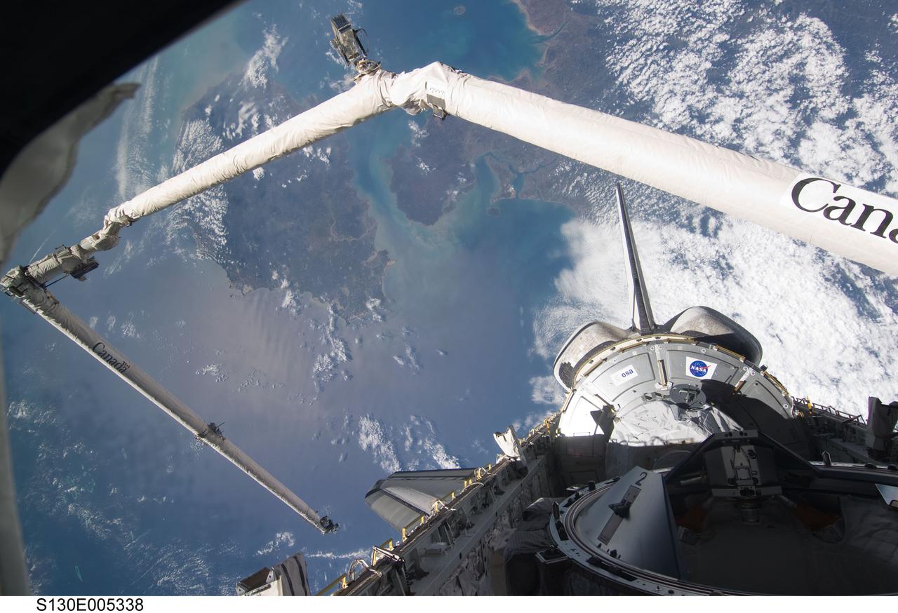
S130-E-005338 (8 Feb. 2010) --- Backdropped by the South China Sea and the Gulf of Tonkin, the Tranquility node in space shuttle Endeavour’s payload bay, vertical stabilizer, orbital maneuvering system (OMS) pods and a shadow-covered docking mechanism are featured in this image photographed by the STS-130 crew from an aft flight deck window. Hainan Island can be seen between the South China Sea (bottom) and Gulf of Tonkin (top). The Leizhou Peninsula of the Chinese mainland is on the upper right.

According to one ancient legend, a Chinese official named Wan Hoo attempted a flight to the moon using a large wicker chair to which were fastened 47 large rockets. Forty seven assistants, each armed with a torch, rushed forward to light the fuses. In a moment, there was a tremendous roar accompanied by billowing clouds of smoke. When the smoke cleared, the flying chair and Wan Hoo were gone.
iss072e435710 (Dec. 28, 2024) --- The Taiwan Strait separates China's southeast coast from Taiwan in this photograph from the International Space Station as it orbited 257 miles above Asia. From bottom center toward the upper left, the city lights from Quanzhuo to Shanghai light up the Chinese coast. Toward right center, the city lights from Taipei to Tainan (bottom right) illuminate Taiwan's western coast. This frame was captured approximately 12:51 a.m. local time.
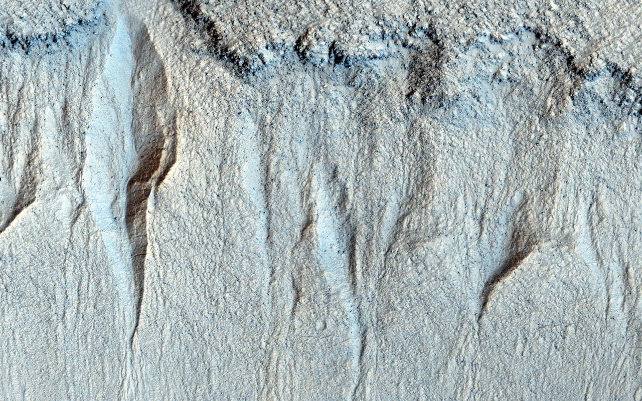
NASA Mars Reconnaissance Orbiter observes a group of small gullies along a rock layer on the south wall of Liu Hsin Crater. At the foot of the gullies fans of granular sediment have been deposited downhill from the gully formation. Nearby, there are much larger gullies. By comparing the gullies that are just 20 kilometers away, we may be able to determine the factors that affect their size. Liu Hsin (also spelled Xin) was a Chinese astronomer, historian, and editor during the Western Han Dynasty (206 BCE to 9 CE) and then the Xin Dynasty (9 to 23 CE). This caption is based in part on a public target suggestion from HiWish. (Note: the header image is non map-projected, so approximate north is down). http://photojournal.jpl.nasa.gov/catalog/PIA19175

With maximum sustained wind speeds of 140 mph, Super Typhoon Utor made landfall in the Philippines on August 11, 2013 around 18:00z. The storm crossed over the island of Luzon and into the South China Sea. The Joint Typhoon Warning Center predicts Utor will head for the Chinese mainland and make landfall again around 12:00z on the 14th about 200 miles southwest of Hong Kong. This colorized infrared image from the Suomi NPP satellite shows the storm on August 11th at 4:30z. NASA/NOAA <b><a href="http://www.nasa.gov/audience/formedia/features/MP_Photo_Guidelines.html" rel="nofollow">NASA image use policy.</a></b> <b><a href="http://www.nasa.gov/centers/goddard/home/index.html" rel="nofollow">NASA Goddard Space Flight Center</a></b> enables NASA’s mission through four scientific endeavors: Earth Science, Heliophysics, Solar System Exploration, and Astrophysics. Goddard plays a leading role in NASA’s accomplishments by contributing compelling scientific knowledge to advance the Agency’s mission. <b>Follow us on <a href="http://twitter.com/NASA_GoddardPix" rel="nofollow">Twitter</a></b> <b>Like us on <a href="http://www.facebook.com/pages/Greenbelt-MD/NASA-Goddard/395013845897?ref=tsd" rel="nofollow">Facebook</a></b> <b>Find us on <a href="http://instagram.com/nasagoddard?vm=grid" rel="nofollow">Instagram</a></b>
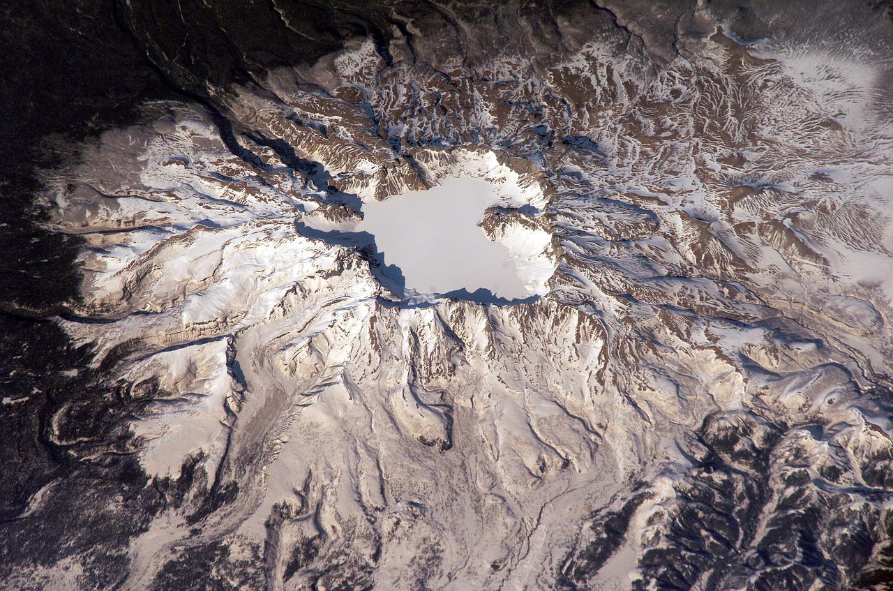
ISS006-E-43366 (4 April 2003) --- This view featuring Baitoushan Volcano, China and North Korea, was photographed by an Expedition 6 crewmember on the International Space Station (ISS). One of the largest known Holocene eruptions occurred at Baitoushan Volcano (also known as Changbaishan in China and P’aektu-san in Korea) about 1000 A.D., with erupted material deposited as far away as northern Japan – a distance of approximately 1200 kilometers. The eruption also created the 4.5 kilometer diameter, 850 meters deep summit caldera of the volcano that is now filled with the waters of Lake Tianchi (or Sky Lake). This oblique photograph was taken during the winter season, and snow highlights frozen Lake Tianchi along with lava flow lobes along the southern face of the volcano. Baitoushan last erupted in 1702 and is considered a dormant volcano. Gas emissions were reported from the summit and nearby hot springs in 1994, but no evidence of renewed activity of the volcano was observed. The Chinese-Korean border runs directly through the center of the summit caldera, and the mountain is considered sacred by the dominantly Korean population living near the volcano. Lake Tianchi is a popular resort destination, both for its natural beauty and alleged sightings of unidentified creatures living in its depths (similar to legendary Loch Ness Monster in Scotland).

In the summer of the year 1054 AD, Chinese astronomers saw a new "guest star," that appeared six times brighter than Venus. So bright in fact, it could be seen during the daytime for several months. This "guest star" was forgotten about until 700 years later with the advent of telescopes. Astronomers saw a tentacle-like nebula in the place of the vanished star and called it the Crab Nebula. Today we know it as the expanding gaseous remnant from a star that self-detonated as a supernova, briefly shining as brightly as 400 million suns. The explosion took place 6,500 light-years away. If the blast had instead happened 50 light-years away it would have irradiated Earth, wiping out most life forms. In the late 1960s astronomers discovered the crushed heart of the doomed star, an ultra-dense neutron star that is a dynamo of intense magnetic field and radiation energizing the nebula. Astronomers therefore need to study the Crab Nebula across a broad range of electromagnetic radiation, from X-rays to radio waves. This image combines data from five different telescopes: the VLA (radio) in red; Spitzer Space Telescope (infrared) in yellow; Hubble Space Telescope (visible) in green; XMM-Newton (ultraviolet) in blue; and Chandra X-ray Observatory (X-ray) in purple. More images and an animation are available at https://photojournal.jpl.nasa.gov/catalog/PIA21474
CAPE CANAVERAL, Fla. –Outredgeous red romaine lettuce plants grow inside in a prototype VEGGIE flight pillow. The bellows of the hardware have been lowered to better observe the plants. A small temperature and relative humidity data logger is placed between the pillows small white box, central. U.S. astronauts living and working aboard the International Space Station are going to receive a newly developed Vegetable Production System VEGGIE. VEGGIE is set to launch aboard SpaceX's Dragon capsule on NASA's third Commercial Resupply Services mission targeted to launch Dec. 9 from Space Launch Complex 40 at Cape Canaveral Air Force Station in Florida. Photo credit: NASA/Gioia Massa
CAPE CANAVERAL, Fla. –Outredgeous red romaine lettuce plants grow inside the bellows of a prototype VEGGIE flight pillow. U.S. astronauts living and working aboard the International Space Station are going to receive a newly developed Vegetable Production System VEGGIE. VEGGIE is set to launch aboard SpaceX's Dragon capsule on NASA's third Commercial Resupply Services mission targeted to launch Dec. 9 from Space Launch Complex 40 at Cape Canaveral Air Force Station in Florida. Photo credit: NASA/Gioia Massa
CAPE CANAVERAL, Fla. – Outredgeous red romaine lettuce plants grow inside the bellows of a prototype VEGGIE flight pillow. U.S. astronauts living and working aboard the International Space Station are going to receive a newly developed Vegetable Production System VEGGIE. VEGGIE is set to launch aboard SpaceX's Dragon capsule on NASA's third Commercial Resupply Services mission targeted to launch Dec. 9 from Space Launch Complex 40 at Cape Canaveral Air Force Station in Florida. Photo credit: NASA/Bryan Onate
CAPE CANAVERAL, Fla. – A 28-day-old Outredgeous red romaine lettuce plant grows in a prototype VEGGIE flight pillow. U.S. astronauts living and working aboard the International Space Station are going to receive a newly developed Vegetable Production System VEGGIE. VEGGIE is set to launch aboard SpaceX's Dragon capsule on NASA's third Commercial Resupply Services mission targeted to launch Dec. 9 from Space Launch Complex 40 at Cape Canaveral Air Force Station in Florida. Photo credit: NASA/Gioia Massa
CAPE CANAVERAL, Fla. – This prototype VEGGIE hardware was designed and built by Orbital Technologies Corp. of Madison, Wisc. U.S. astronauts living and working aboard the International Space Station are going to receive a newly developed Vegetable Production System VEGGIE. VEGGIE is set to launch aboard SpaceX's Dragon capsule on NASA's third Commercial Resupply Services mission targeted to launch Dec. 9 from Space Launch Complex 40 at Cape Canaveral Air Force Station in Florida. Photo credit: NASA/Gioia Massa
Chinese authorities shut down much of Harbin – a city of more than 10 million people – as unusually high levels of pollution shrouded the city and the surrounding region in mid-October, 2013. Measurements taken on October 20, 2013 scored the air quality index in the city at 500, the highest possible reading. Levels above 300 are considered hazardous to human health. The Moderate Resolution Imaging Spectroradiometer (MODIS) on NASA’s Aqua satellite acquired this true-color image of northeastern China on October 21. The brightest areas are fog, which is tinged with gray or yellow due to the air pollution. Other cloud-free areas have a pall of gray and brown smog that blots out the city and surrounding towns. Harbin lies under the Y-shaped patch of fog and smog in the south-central section of the image, completely obscured from view. Some neighborhoods experienced concentrations of fine particulate matter (PM 2.5) as high as 1,000 micrograms per cubic meter. For comparison the U.S. Environmental Protection Agency’s air quality standards state that PM 2.5 should remain below 35 micrograms per cubic meter. It is extremely rare for particulate levels to reach such high levels in the absence of a dust storm or forest fire. Chinese authorities grounded airplanes, shuttered thousands of schools and closed major roads in response to the surge in pollution. A few days after pollution levels started to rise, Harbin hospitals reported a 30 percent increase in admissions related to respiratory problems, and several Harbin pharmacies were sold out of pollution facemasks, according to media reports. Cold weather and lack of wind helped fuel the pollution outbreak, but human factors also played an important role. Wheat and corn farmers in the region light fires in the fall to burn off debris following the harvest. Also, city officials turned on Harbin’s city-wide, coal-powered heating system just prior to the pollution outbreak, according to China’s state-run Xinhua News Agency. Credit: NASA/GSFC/Jeff Schmaltz/MODIS Land Rapid Response Team <b><a href="http://www.nasa.gov/audience/formedia/features/MP_Photo_Guidelines.html" rel="nofollow">NASA image use policy.</a></b> <b><a href="http://www.nasa.gov/centers/goddard/home/index.html" rel="nofollow">NASA Goddard Space Flight Center</a></b> enables NASA’s mission through four scientific endeavors: Earth Science, Heliophysics, Solar System Exploration, and Astrophysics. Goddard plays a leading role in NASA’s accomplishments by contributing compelling scientific knowledge to advance the Agency’s mission. <b>Follow us on <a href="http://twitter.com/NASA_GoddardPix" rel="nofollow">Twitter</a></b> <b>Like us on <a href="http://www.facebook.com/pages/Greenbelt-MD/NASA-Goddard/395013845897?ref=tsd" rel="nofollow">Facebook</a></b> <b>Find us on <a href="http://instagram.com/nasagoddard?vm=grid" rel="nofollow">Instagram</a></b>
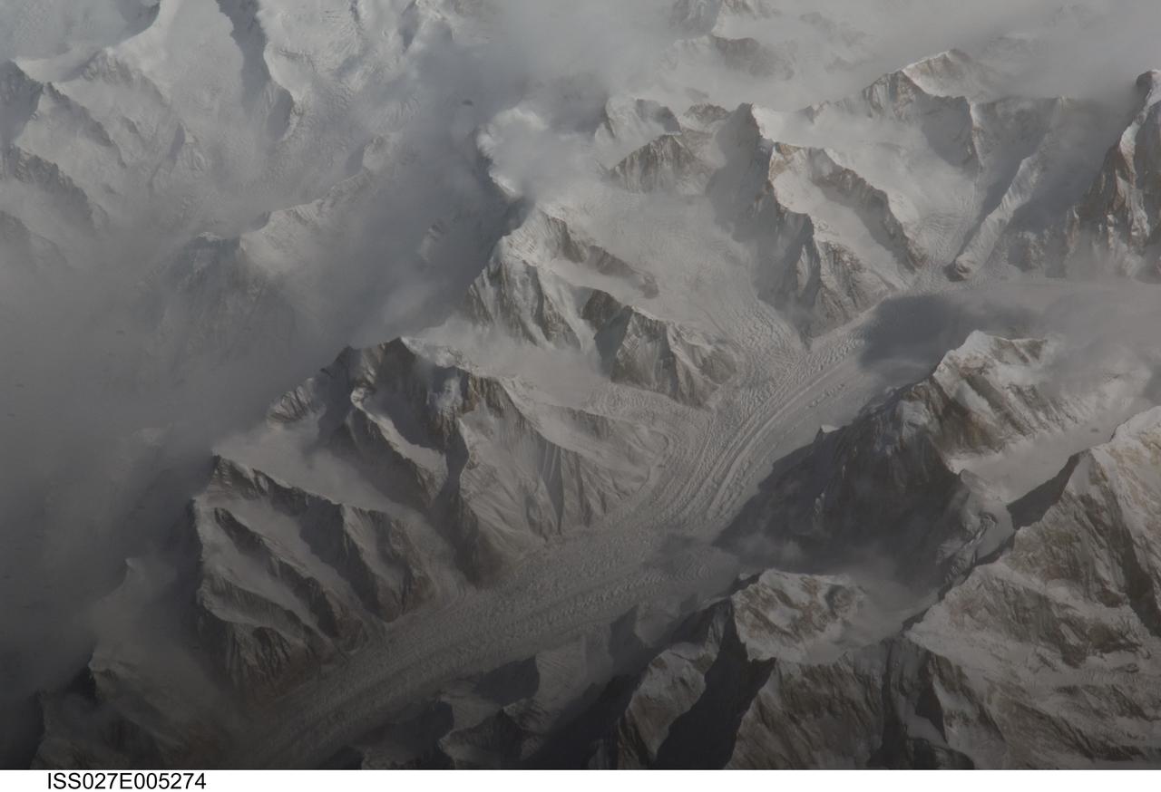
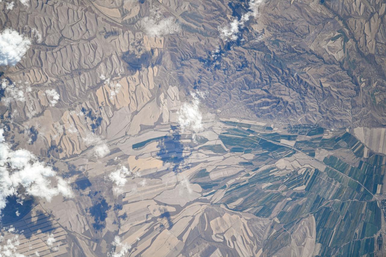
ISS027-E-005274 (16 March 2011) --- Central Tien Shan in the People?s Republic of China is featured in this image photographed by an Expedition 27 crew member on the International Space Station (ISS). The Tien Shan (or ?celestial mountains? in Chinese) is one of the largest continuous mountain ranges in the world, extending approximately 2,500 kilometers roughly east-west across Central Asia. This photograph provides a detailed view of part of the central Tien Shan, located approximately 64 kilometers east of a point where the borders of China, Kyrgyzstan, and Kazakhstan meet. While the image looks like it might have been taken from an airplane, it was taken from the space station at an altitude of 341 kilometers. The distance between the ISS ground track position (approximately 304 kilometers to the southwest) and the imaged area produces an oblique ? looking outwards an angle, rather than straight down ? view that, together with shadowing of valleys, accentuates the mountainous topography. Like the Himalayas to the south, the uplift of the Tien Shan results from the ongoing collision between the Eurasian and Indian continental tectonic plates. The rugged topography of the range is the result of subsequent erosion by water, wind, and in the highest parts of the range, active glaciers. Two types of glaciers are visible in the image; cirque glaciers occupy amphitheater-like depressions on the upper slopes of the mountains, and feed ice downslope to aggregate into large valley glaciers such as the one visible at center. Low clouds obscure an adjacent valley and glaciers to the north (upper left). Two high peaks of the central Tien Shan are identifiable in the image. Xuelian Feng has a high summit of 6,527 meters above sea level. To the east, the aptly-named Peak 6231 has summit of 6,231 meters above sea level.
September 22, the autumnal equinox, marks the beginning of fall in the Northern Hemisphere, but the fall harvest begins early in the harsh continental climate of eastern Kazakhstan. By September 9, 2013, when the Operational Land Imager (OLI) on the Landsat 8 satellite acquired this image, several fields were already harvested and bare. Others were dark green with pasture grasses or ripening crops. The fields fill the contours of the land, running long and narrow down mountain valleys and spreading in large squares over the plains. Agriculture is an important segment of the economy in Kazakhstan: the country’s dry climate is ideal for producing high quality wheat for export. However, 61 percent of the country’s agricultural land is pasture for livestock. The area shown in this image, far eastern Kazakhstan near the Chinese border, is a minor wheat-growing region and may also produce sunflowers, barley, and other food crops. An artifact of Soviet-era collective farms, most of the farms in Kazakhstan are large, covering more than 5,000 hectares (12,500 acres). Some of the larger fields in the image reflect the big business side of agriculture. However, family farms and small agriculture businesses account for 35 percent of the country’s agricultural production, and some of these are visible as well, particularly in the uneven hills and mountains. Nearly all agriculture in Kazakhstan is rain fed. Farmers in this region have designed their fields to take advantage of rain flowing down hills, allowing the natural shape of the land to channel water to crops. The effect is a mosaic of green and tan with tones matching the natural vegetation in the mountains to the north. NASA Earth Observatory image by Jesse Allen using Landsat data from the U.S. Geological Survey. Caption by Holli Riebeek. Instrument: Landsat 8 - OLI More info: <a href="http://1.usa.gov/16IZ047" rel="nofollow">1.usa.gov/16IZ047</a> <b><a href="http://www.nasa.gov/audience/formedia/features/MP_Photo_Guidelines.html" rel="nofollow">NASA image use policy.</a></b> <b><a href="http://www.nasa.gov/centers/goddard/home/index.html" rel="nofollow">NASA Goddard Space Flight Center</a></b> enables NASA’s mission through four scientific endeavors: Earth Science, Heliophysics, Solar System Exploration, and Astrophysics. Goddard plays a leading role in NASA’s accomplishments by contributing compelling scientific knowledge to advance the Agency’s mission. <b>Follow us on <a href="http://twitter.com/NASA_GoddardPix" rel="nofollow">Twitter</a></b> <b>Like us on <a href="http://www.facebook.com/pages/Greenbelt-MD/NASA-Goddard/395013845897?ref=tsd" rel="nofollow">Facebook</a></b> <b>Find us on <a href="http://instagram.com/nasagoddard?vm=grid" rel="nofollow">Instagram</a></b>
The dark squares that make up the checkerboard pattern in this image are fields of a sort—fields of seaweed. Along the south coast of South Korea, seaweed is often grown on ropes, which are held near the surface with buoys. This technique ensures that the seaweed stays close enough to the surface to get enough light during high tide but doesn’t scrape against the bottom during low tide. The Operational Land Imager (OLI) on Landsat 8 acquired this image of seaweed cultivation in the shallow waters around Sisan Island on January 31, 2014. Home to a thriving aquaculture industry, the south coast of South Korea produces about 90 percent of the country’s seaweed crop. The waters around Sisan are not the only place where aquaculture is common. View the large image to see how ubiquitous seaweed aquaculture is along the coast in Jeollanam-do, the southernmost province on the Korean peninsula. Two main types of seaweed are cultivated in South Korea: Undaria (known as miyeok in Korean, wakame in Japanese) and Pyropia (gim in Korean, nori in Japanese). Both types are used generously in traditional Korean, Japanese, and Chinese food. Since 1970, farmed seaweed production has increased by approximately 8 percent per year. Today, about 90 percent of all the seaweed that humans consume globally is farmed. That may be good for the environment. In comparison to other types of food production, seaweed farming has a light environmental footprint because it does not require fresh water or fertilizer. NASA Earth Observatory image by Jesse Allen, using Landsat data from the U.S. Geological Survey. Caption by Adam Voiland. Credit: <b><a href="http://www.earthobservatory.nasa.gov/" rel="nofollow"> NASA Earth Observatory</a></b> <b><a href="http://www.nasa.gov/audience/formedia/features/MP_Photo_Guidelines.html" rel="nofollow">NASA image use policy.</a></b> <b><a href="http://www.nasa.gov/centers/goddard/home/index.html" rel="nofollow">NASA Goddard Space Flight Center</a></b> enables NASA’s mission through four scientific endeavors: Earth Science, Heliophysics, Solar System Exploration, and Astrophysics. Goddard plays a leading role in NASA’s accomplishments by contributing compelling scientific knowledge to advance the Agency’s mission. <b>Follow us on <a href="http://twitter.com/NASAGoddardPix" rel="nofollow">Twitter</a></b> <b>Like us on <a href="http://www.facebook.com/pages/Greenbelt-MD/NASA-Goddard/395013845897?ref=tsd" rel="nofollow">Facebook</a></b> <b>Find us on <a href="http://instagrid.me/nasagoddard/?vm=grid" rel="nofollow">Instagram</a></b>
The dark squares that make up the checkerboard pattern in this image are fields of a sort—fields of seaweed. Along the south coast of South Korea, seaweed is often grown on ropes, which are held near the surface with buoys. This technique ensures that the seaweed stays close enough to the surface to get enough light during high tide but doesn’t scrape against the bottom during low tide. The Operational Land Imager (OLI) on Landsat 8 acquired this image of seaweed cultivation in the shallow waters around Sisan Island on January 31, 2014. Home to a thriving aquaculture industry, the south coast of South Korea produces about 90 percent of the country’s seaweed crop. The waters around Sisan are not the only place where aquaculture is common. View the large image to see how ubiquitous seaweed aquaculture is along the coast in Jeollanam-do, the southernmost province on the Korean peninsula. Two main types of seaweed are cultivated in South Korea: Undaria (known as miyeok in Korean, wakame in Japanese) and Pyropia (gim in Korean, nori in Japanese). Both types are used generously in traditional Korean, Japanese, and Chinese food. Since 1970, farmed seaweed production has increased by approximately 8 percent per year. Today, about 90 percent of all the seaweed that humans consume globally is farmed. That may be good for the environment. In comparison to other types of food production, seaweed farming has a light environmental footprint because it does not require fresh water or fertilizer. NASA Earth Observatory image by Jesse Allen, using Landsat data from the U.S. Geological Survey. Caption by Adam Voiland. Credit: <b><a href="http://www.earthobservatory.nasa.gov/" rel="nofollow"> NASA Earth Observatory</a></b> <b><a href="http://www.nasa.gov/audience/formedia/features/MP_Photo_Guidelines.html" rel="nofollow">NASA image use policy.</a></b> <b><a href="http://www.nasa.gov/centers/goddard/home/index.html" rel="nofollow">NASA Goddard Space Flight Center</a></b> enables NASA’s mission through four scientific endeavors: Earth Science, Heliophysics, Solar System Exploration, and Astrophysics. Goddard plays a leading role in NASA’s accomplishments by contributing compelling scientific knowledge to advance the Agency’s mission. <b>Follow us on <a href="http://twitter.com/NASAGoddardPix" rel="nofollow">Twitter</a></b> <b>Like us on <a href="http://www.facebook.com/pages/Greenbelt-MD/NASA-Goddard/395013845897?ref=tsd" rel="nofollow">Facebook</a></b> <b>Find us on <a href="http://instagrid.me/nasagoddard/?vm=grid" rel="nofollow">Instagram</a></b>

Peering deep into the core of the Crab Nebula, this close-up image reveals the beating heart of one of the most historic and intensively studied remnants of a supernova, an exploding star. The inner region sends out clock-like pulses of radiation and tsunamis of charged particles embedded in magnetic fields. The neutron star at the very center of the Crab Nebula has about the same mass as the sun but compressed into an incredibly dense sphere that is only a few miles across. Spinning 30 times a second, the neutron star shoots out detectable beams of energy that make it look like it's pulsating. The NASA Hubble Space Telescope snapshot is centered on the region around the neutron star (the rightmost of the two bright stars near the center of this image) and the expanding, tattered, filamentary debris surrounding it. Hubble's sharp view captures the intricate details of glowing gas, shown in red, that forms a swirling medley of cavities and filaments. Inside this shell is a ghostly blue glow that is radiation given off by electrons spiraling at nearly the speed of light in the powerful magnetic field around the crushed stellar core. The neutron star is a showcase for extreme physical processes and unimaginable cosmic violence. Bright wisps are moving outward from the neutron star at half the speed of light to form an expanding ring. It is thought that these wisps originate from a shock wave that turns the high-speed wind from the neutron star into extremely energetic particles. When this "heartbeat" radiation signature was first discovered in 1968, astronomers realized they had discovered a new type of astronomical object. Now astronomers know it's the archetype of a class of supernova remnants called pulsars - or rapidly spinning neutron stars. These interstellar "lighthouse beacons" are invaluable for doing observational experiments on a variety of astronomical phenomena, including measuring gravity waves. Observations of the Crab supernova were recorded by Chinese astronomers in 1054 A.D. The nebula, bright enough to be visible in amateur telescopes, is located 6,500 light-years away in the constellation Taurus. Credits: NASA and ESA, Acknowledgment: J. Hester (ASU) and M. Weisskopf (NASA/MSFC) <b><a href="http://www.nasa.gov/audience/formedia/features/MP_Photo_Guidelines.html" rel="nofollow">NASA image use policy.</a></b> <b><a href="http://www.nasa.gov/centers/goddard/home/index.html" rel="nofollow">NASA Goddard Space Flight Center</a></b> enables NASA’s mission through four scientific endeavors: Earth Science, Heliophysics, Solar System Exploration, and Astrophysics. Goddard plays a leading role in NASA’s accomplishments by contributing compelling scientific knowledge to advance the Agency’s mission. <b>Follow us on <a href="http://twitter.com/NASAGoddardPix" rel="nofollow">Twitter</a></b> <b>Like us on <a href="http://www.facebook.com/pages/Greenbelt-MD/NASA-Goddard/395013845897?ref=tsd" rel="nofollow">Facebook</a></b> <b>Find us on <a href="http://instagrid.me/nasagoddard/?vm=grid" rel="nofollow">Instagram</a></b>