This image captured by NASA 2001 Mars Odyssey spacecraft shows graben called Claritas Fossae. Orbit Number: 66332 Latitude: -35.5437 Longitude: 251.308 Instrument: VIS Captured: 2016-11-26 15:54 http://photojournal.jpl.nasa.gov/catalog/PIA21288
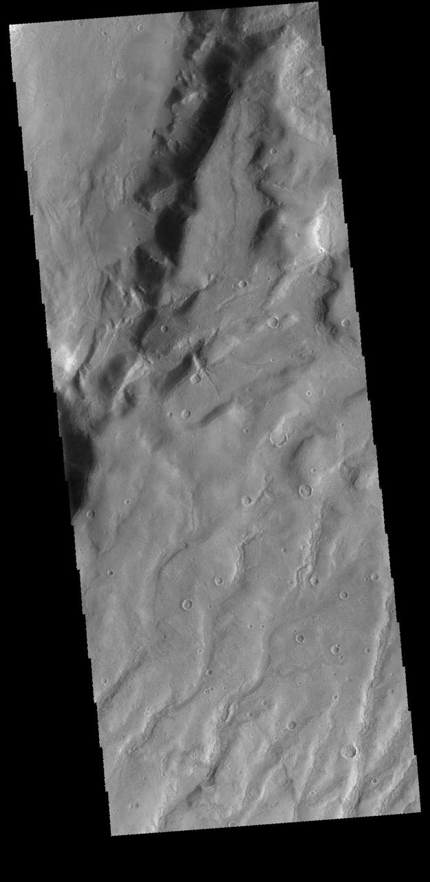
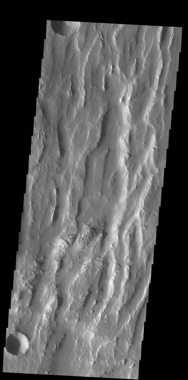
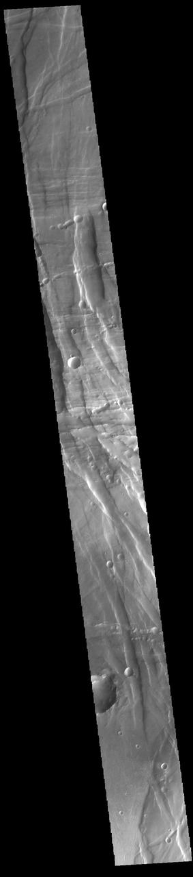
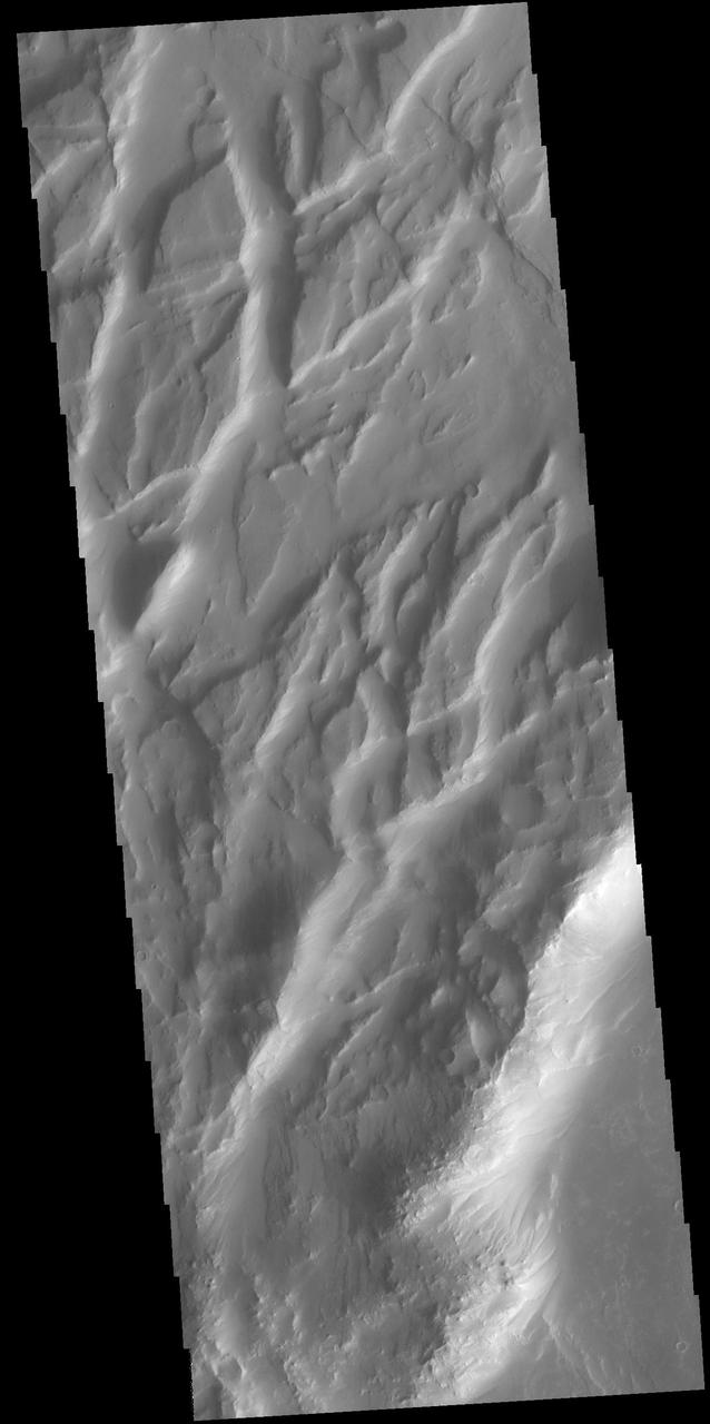
This VIS image shows several channels dissecting the higher elevations of Claritas Fossae. Orbit Number: 65209 Latitude: -40.6523 Longitude: 266 Instrument: VIS Captured: 2016-08-26 03:33 http://photojournal.jpl.nasa.gov/catalog/PIA21005
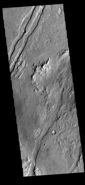
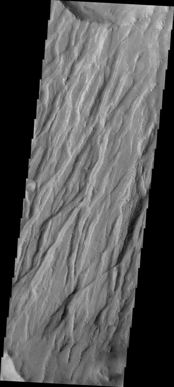
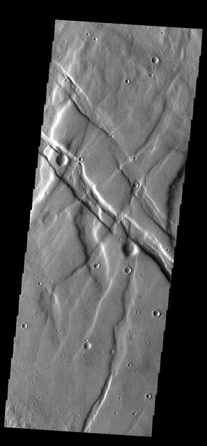
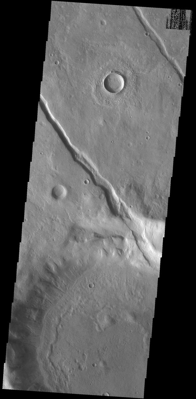
The linear depressions in this VIS image are some of the numerous graben that make up Claritas Fossae. Graben form when two faults cause a block of material to be dropped to a lower elevation. Orbit Number: 65197 Latitude: -35.7709 Longitude: 251.553 Instrument: VIS Captured: 2016-08-25 03:51 http://photojournal.jpl.nasa.gov/catalog/PIA21004
Claritas Fossae, Approximately Natural Color http://photojournal.jpl.nasa.gov/catalog/PIA00338
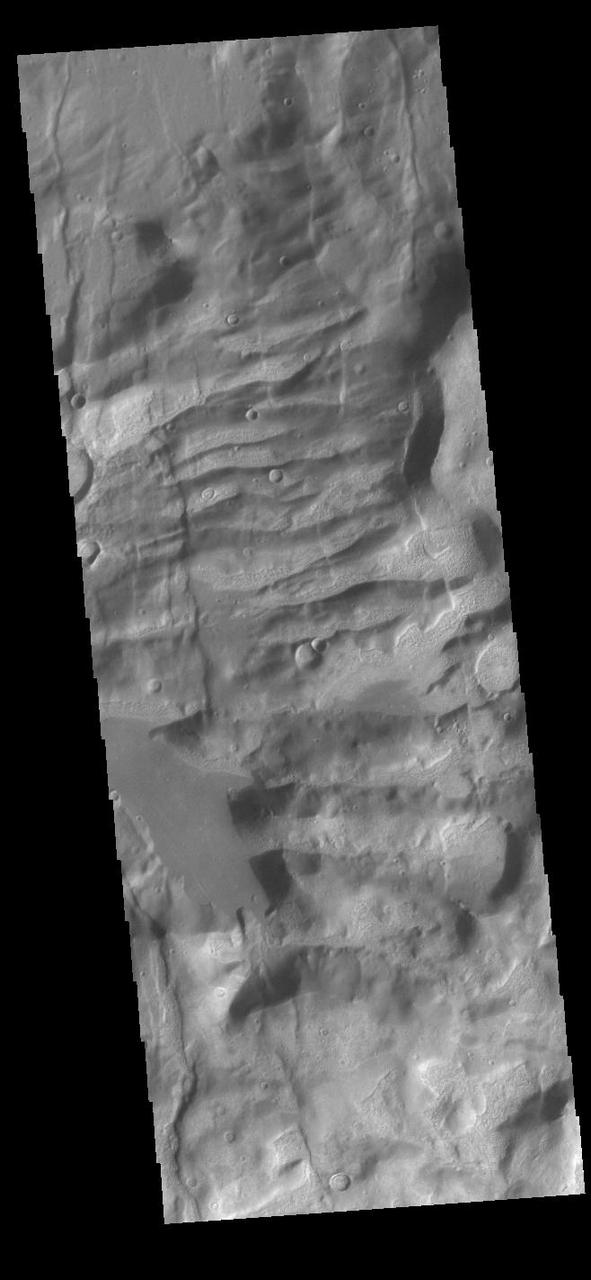
The linear graben in this image from NASA 2001 Mars Odyssey spacecraft are all part of Claritas Fossae.
Today's VIS image shows part of Claritas Fossae. The linear features (fossae) are graben, a tectonic feature created when blocks of material subside between paired faults. These graben filled highlands are bounded by Solis Planum to the northeast and Icaria Planum to the southwest. Extensional tectonic forces are responsible for graben formation. While close to the Tharsis region, it is thought that Claritas Fossae formed prior to the large lava flows located north of this image. The large, deepest depression is younger than the other graben of Claritas Fossae. It is not known if it formed just after the other graben, or at a much later time. Orbit Number: 90760 Latitude: -12.0301 Longitude: 249.617 Instrument: VIS Captured: 2022-05-31 11:34 https://photojournal.jpl.nasa.gov/catalog/PIA25506
The fractures in this image captured by NASA 2001 Mars Odyssey spacecraft are part of Claritas Fossae. Note the small, bright dunes in the deep furrow on the bottom left of the image.
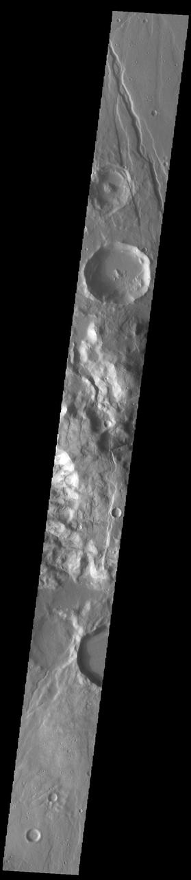
Claritas Fossae is the dissected and fractured highland between the volcanic plains of Daedalia and Solis Planums. This image is from NASA 2001 Mars Odyssey spacecraft.
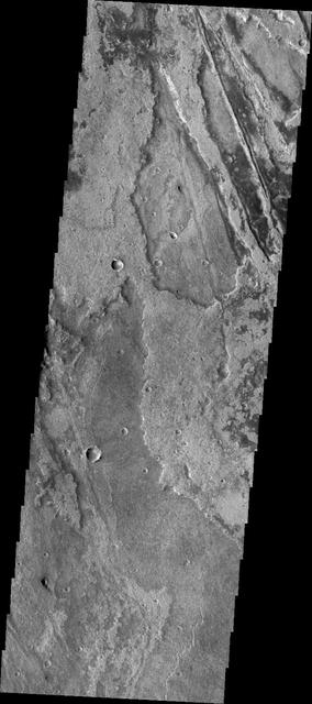
Located between the lava plains of Daedalia Planum and Solis Planum, Claritas Fossae is a graben filled highland. Graben are formed by tectonic activity, where extensional forces stretch the surface allowing blocks of material to slide down between paired faults. These linear grabens are termed fossae. This region of Mars had very active tectonism and volcanism, resulting in the huge volcanos like Arsia Mons and deep chasmata of Valles Marineris. Claritas Fossae was formed prior to the large lava flows of the Tharsis region. Orbit Number: 84439 Latitude: -41.4956 Longitude: 272.168 Instrument: VIS Captured: 2020-12-26 23:43 https://photojournal.jpl.nasa.gov/catalog/PIA24402
Located between the lava plains of Daedalia Planum and Solis Planum, Claritas Fossae is a graben filled highland. Graben are formed by tectonic activity, where extensional forces stretch the surface allowing blocks of material to slide down between paired faults. These linear grabens are termed fossae. This region of Mars had very active tectonism and volcanism, resulting in the huge volcanos like Arsia Mons and deep chasmata of Valles Marineris. Claritas Fossae was formed prior to the large lava flows of the Tharsis region. Orbit Number: 92164 Latitude: -26.3031 Longitude: 253.828 Instrument: VIS Captured: 2022-09-24 01:20 https://photojournal.jpl.nasa.gov/catalog/PIA25757

Located between the lava plains of Daedalia Planum and Solis Planum, Claritas Fossae is a graben filled highland. Graben are formed by tectonic activity, where extensional forces stretch the surface allowing blocks of material to slide down between paired faults. These linear grabens are termed fossae. This region of Mars had very active tectonism and volcanism, resulting in the huge volcanos like Arsia Mons and deep chasmata of Valles Marineris. Claritas Fossae was formed prior to the large lava flows of the Tharsis region. Orbit Number: 91852 Latitude: -35.0327 Longitude: 253.577 Instrument: VIS Captured: 2022-08-29 08:49 https://photojournal.jpl.nasa.gov/catalog/PIA25713
Located between the lava plains of Daedalia Planum and Solis Planum, Claritas Fossae is a graben filled highland. Graben are formed by tectonic activity, where extensional forces stretch the surface allowing blocks of material to slide down between paired faults. These linear grabens are termed fossae. This region of Mars had very active tectonism and volcanism, resulting in the huge volcanos like Arsia Mons and deep chasmata of Valles Marineris. Claritas Fossae was formed prior to the large lava flows of the Tharsis region. Orbit Number: 91733 Latitude: -42.0473 Longitude: 263.442 Instrument: VIS Captured: 2022-08-19 14:12 https://photojournal.jpl.nasa.gov/catalog/PIA25620
Located between the lava plains of Daedalia Planum and Solis Planum, Claritas Fossae is a graben filled highland. Graben are formed by tectonic activity, where extensional forces stretch the surface allowing blocks of material to slide down between paired faults. These linear grabens are termed fossae. This region of Mars had very active tectonism and volcanism, resulting in the huge volcanos like Arsia Mons and deep chasmata of Valles Marineris. Claritas Fossae was formed prior to the large lava flows of the Tharsis region. Orbit Number: 81376 Latitude: -35.6385 Longitude: 253.121 Instrument: VIS Captured: 2020-04-18 15:46 https://photojournal.jpl.nasa.gov/catalog/PIA23957
Located between the lava plains of Daedalia Planum and Solis Planum, Claritas Fossae is a graben filled highland. Graben are formed by tectonic activity, where extensional forces stretch the surface allowing blocks of material to slide down between paired faults. These linear grabens are termed fossae. This region of Mars had very active tectonism and volcanism, resulting in the huge volcanos like Arsia Mons and deep chasmata of Valles Marineris. Claritas Fossae was formed prior to the large lava flows of the Tharsis region. Orbit Number: 92825 Latitude: -36.7944 Longitude: 262.701 Instrument: VIS Captured: 2022-11-17 11:37 https://photojournal.jpl.nasa.gov/catalog/PIA25801
Located between the lava plains of Daedalia Planum and Solis Planum, Claritas Fossae is a graben filled highland. Graben are formed by tectonic activity, where extensional forces stretch the surface allowing blocks of material to slide down between paired faults. These linear grabens are termed fossae. This region of Mars had very active tectonism and volcanism, resulting in the huge volcanos like Arsia Mons and deep chasmata of Valles Marineris. Claritas Fossae was formed prior to the large lava flows of the Tharsis region. Orbit Number: 91646 Latitude: -14.0577 Longitude: 249.123 Instrument: VIS Captured: 2022-08-12 10:26 https://photojournal.jpl.nasa.gov/catalog/PIA25612
Located between the lava plains of Daedalia Planum and Solis Planum, Claritas Fossae is a graben filled highland. Graben are formed by tectonic activity, where extensional forces stretch the surface allowing blocks of material to slide down between paired faults. These linear grabens are termed fossae. This region of Mars had very active tectonism and volcanism, resulting in the huge volcanos like Arsia Mons and deep chasmata of Valles Marineris. Claritas Fossae was formed prior to the large lava flows of the Tharsis region. Orbit Number: 91446 Latitude: -36.8955 Longitude: 262.397 Instrument: VIS Captured: 2022-07-26 23:05 https://photojournal.jpl.nasa.gov/catalog/PIA25572

Located between the lava plains of Daedalia Planum and Solis Planum, Claritas Fossae is a graben filled highland. Graben are formed by tectonic activity, where extensional forces stretch the surface allowing blocks of material to slide down between paired faults. These linear grabens are termed fossae. This region of Mars had very active tectonism and volcanism, resulting in the huge volcanos like Arsia Mons and deep chasmata of Valles Marineris. Claritas Fossae was formed prior to the large lava flows of the Tharsis region. Orbit Number: 91427 Latitude: -41.2195 Longitude: 273.629 Instrument: VIS Captured: 2022-07-25 08:59 https://photojournal.jpl.nasa.gov/catalog/PIA25580
Today's VIS image shows part of Claritas Fossae. These graben filled highlands are bounded by Solis Planum to the northeast and Icaria Planum to the southwest. The linear features (fossae) are graben, a tectonic feature created when blocks of material subside between paired faults. Extensional tectonic forces are responsible for graben formation. While close to the Tharsis region, it is thought that Claritas Fossae formed prior to the large lava flows located north of this image. Orbit Number: 83503 Latitude: -40.434 Longitude: 274.364 Instrument: VIS Captured: 2020-10-10 22:06 https://photojournal.jpl.nasa.gov/catalog/PIA24259
Located between the lava plains of Daedalia Planum and Solis Planum, Claritas Fossae is a graben filled highland. Graben are formed by tectonic activity, where extensional forces stretch the surface allowing blocks of material to slide down between paired faults. These linear grabens are termed fossae. This region of Mars had very active tectonism and volcanism, resulting in the huge volcanos like Arsia Mons and deep chasmata of Valles Marineris. Claritas Fossae was formed prior to the large lava flows of the Tharsis region. Orbit Number: 84464 Latitude: -40.7803 Longitude: 271.084 Instrument: VIS Captured: 2020-12-29 01:07 https://photojournal.jpl.nasa.gov/catalog/PIA24403
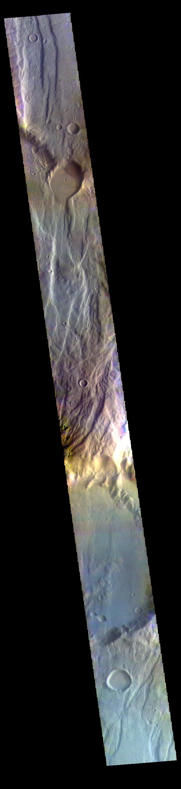
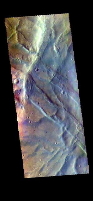
This false color image captured by NASA 2001 Mars Odyssey spacecraft shows part of Claritas Fossae.
Located between the lava plains of Daedalia Planum and Solis Planum, Claritas Fossae is a graben filled highland. Graben are formed by tectonic activity. In this region of Mars extensive and long lived volcanic and tectonic activity created the largest volcanoes and the longest canyon system on Mars. Volcanic and tectonic forces coexist and tectonic faults are often utilized by subsurface magma to reach the surface. Claritas Fossae was formed prior to the large lava flows of the Tharsis region. Orbit Number: 74950 Latitude: -17.7366 Longitude: 252.095 Instrument: VIS Captured: 2018-11-06 15:40 https://photojournal.jpl.nasa.gov/catalog/PIA22974
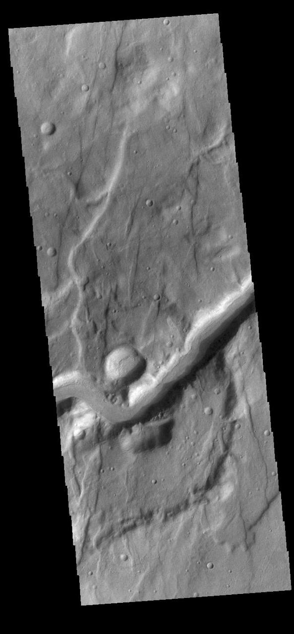
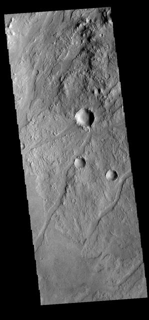
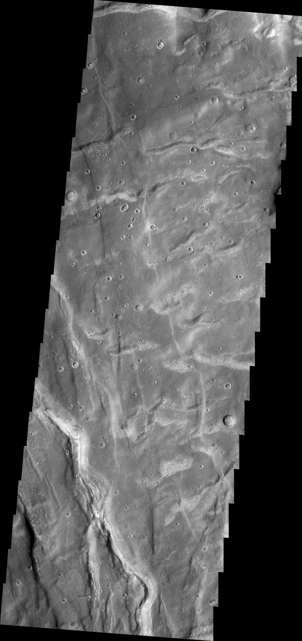
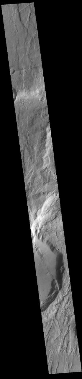
This VIS image shows an unnamed channel located in Claritas Fossae. The channel flows from the highland of the fossae down into Icaria Planum. Orbit Number: 91833 Latitude: -39.1847 Longitude: 257.974 Instrument: VIS Captured: 2022-08-27 19:50 https://photojournal.jpl.nasa.gov/catalog/PIA25711
The eastern rim of this unnamed crater in Claritas Fossae is very degraded, as seen in this image from NASA Mars Odyssey, indicating that it very ancient and has been subjected to erosion and bombardment from impactors such as asteroids and comets.
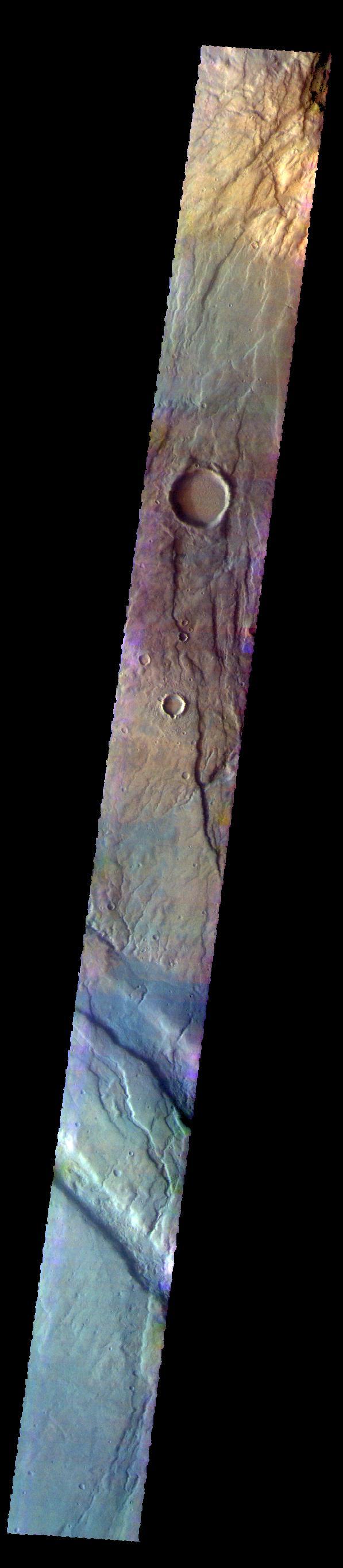
The THEMIS VIS camera contains 5 filters. The data from different filters can be combined in multiple ways to create a false color image. These false color images may reveal subtle variations of the surface not easily identified in a single band image. Today's false color image shows part of Claritas Fossae. The graben filled highlands are bounded by Solis Planum to the northeast and Icaria Planum to the southwest. The linear features (fossae) are graben, a tectonic feature created when blocks of material subside between paired faults. Extensional tectonic forces are responsible for graben formation. While close to the Tharsis region, it is thought that Claritas Fossae formed prior to the large lava flows located north of this image. Orbit Number: 67635 Latitude: -41.3176 Longitude: 260.749 Instrument: VIS Captured: 2017-03-13 23:52 https://photojournal.jpl.nasa.gov/catalog/PIA24074

This VIS image shows a section of an unnamed channel. This channel starts within Claritas Fossae and empties down hill into Icaria Planum. Orbit Number: 75343 Latitude: -39.1537 Longitude: 257.791 Instrument: VIS Captured: 2018-12-08 23:49 https://photojournal.jpl.nasa.gov/catalog/PIA23030
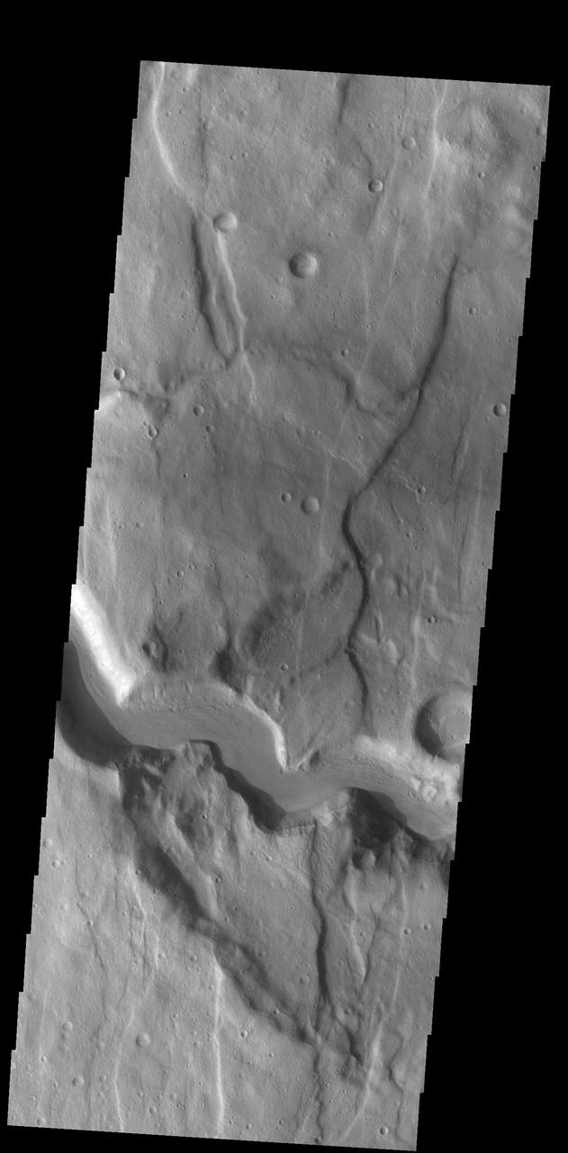
Today's VIS image shows a section of an unnamed channel. This channel starts in Claritas Fossae and empties down into Icaria Planum. The linear features that parallel the sides of the image are fractures that can create linear depressions (fossae). Orbit Number: 75343 Latitude: -39.1537 Longitude: 257.791 Instrument: VIS Captured: 2018-12-08 23:49 https://photojournal.jpl.nasa.gov/catalog/PIA23075
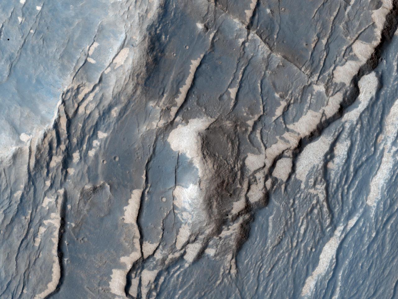
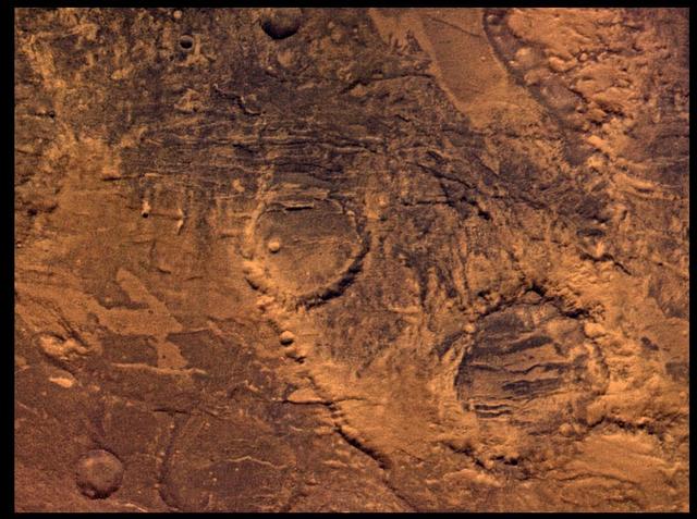
NASA Mars Reconnaissance Orbiter captured this image of the Claritas Fossae region, characterized by systems of graben. A graben forms when a block of the planet crust drops down between two faults, due to extension, or pulling, of the crust.
The THEMIS VIS camera contains 5 filters. The data from different filters can be combined in multiple ways to create a false color image. These false color images may reveal subtle variations of the surface not easily identified in a single band image. Today's false color image shows part of Claritas Fossae. The linear features in the image are graben, formed when a block of material subsides between paired faults in a region of extensional tectonic stress. Orbit Number: 67778 Latitude: -39.8482 Longitude: 269.945 Instrument: VIS Captured: 2017-03-25 19:11 https://photojournal.jpl.nasa.gov/catalog/PIA24076
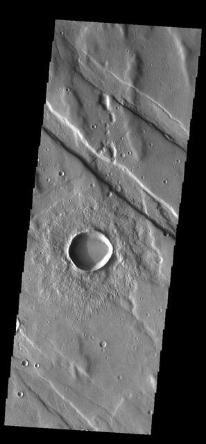
Just as on Earth, volcanism and tectonism are found together on Mars. In this image from NASA 2001 Mars Odyssey spacecraft the ridges and fractures of Claritas Fossae are affecting or perhaps hosting the volcanic flows of Solis Planum.
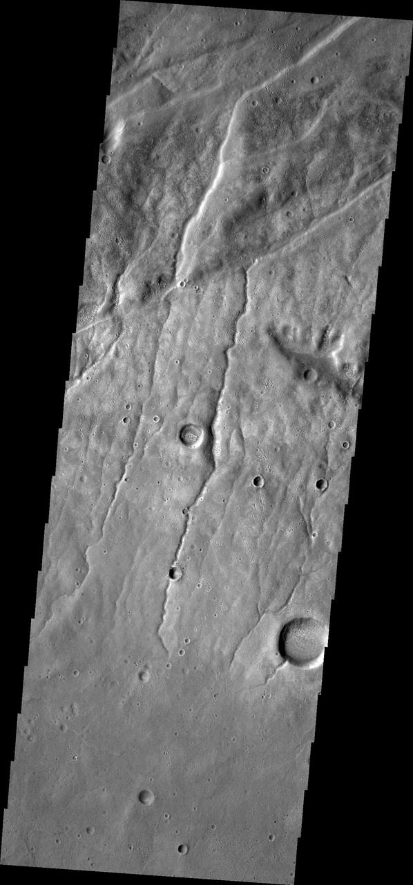
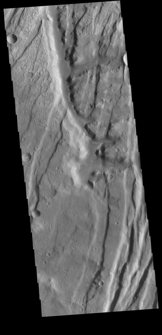
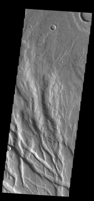
This image from NASA 2001 Mars Odyssey spacecraft of the Claritas Fossae region illustrates how fractures affect other features. In this instance, the fractures control the path of several channels from upper right towards lower left.
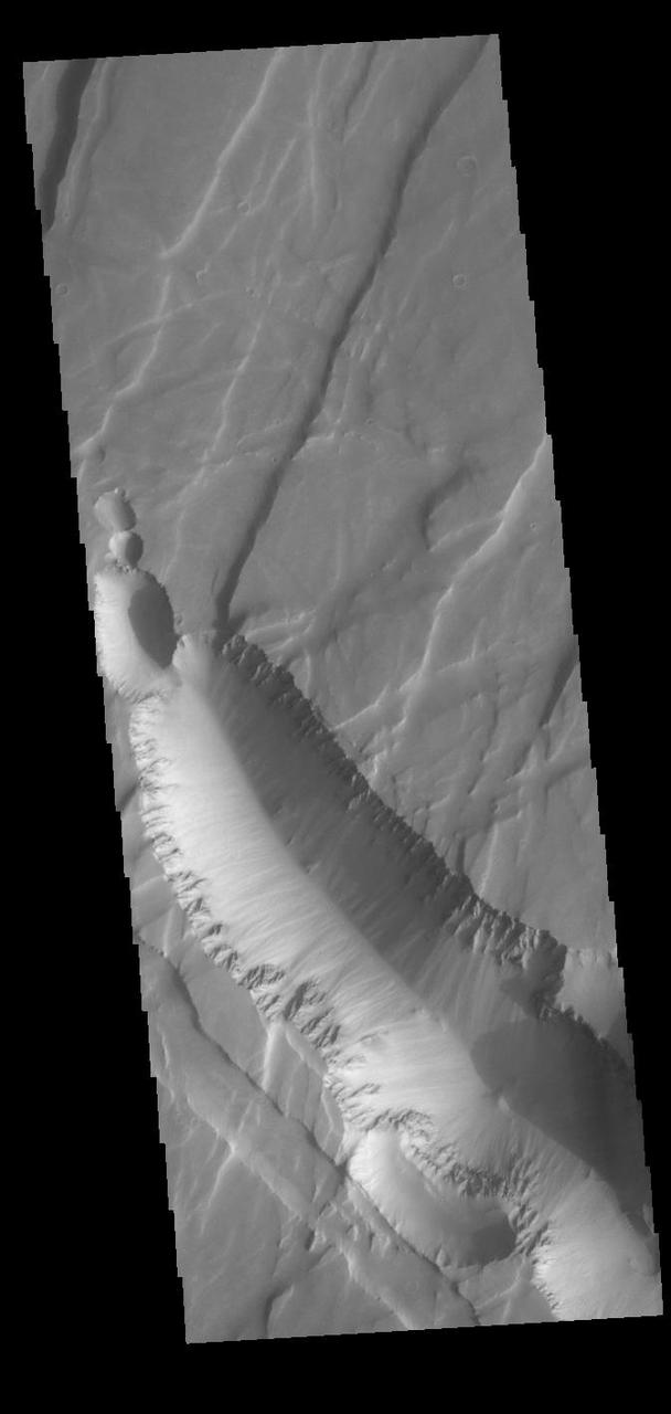
Located on the northern margin of Aonia Terra, this unnamed crater interacts with one of the fossa, also called a graben. In this image, it is apparent that the tectonic depression crosses the crater, which means the crater was created before the depression. The ability to relatively date the different features allows for interpretations of the series of events that created the features in this image. Orbit Number: 74806 Latitude: -42.6506 Longitude: 273.295 Instrument: VIS Captured: 2018-10-25 18:22 https://photojournal.jpl.nasa.gov/catalog/PIA22886

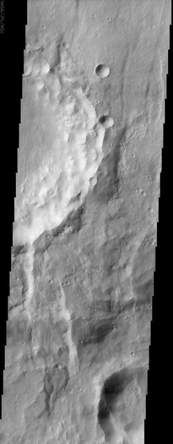
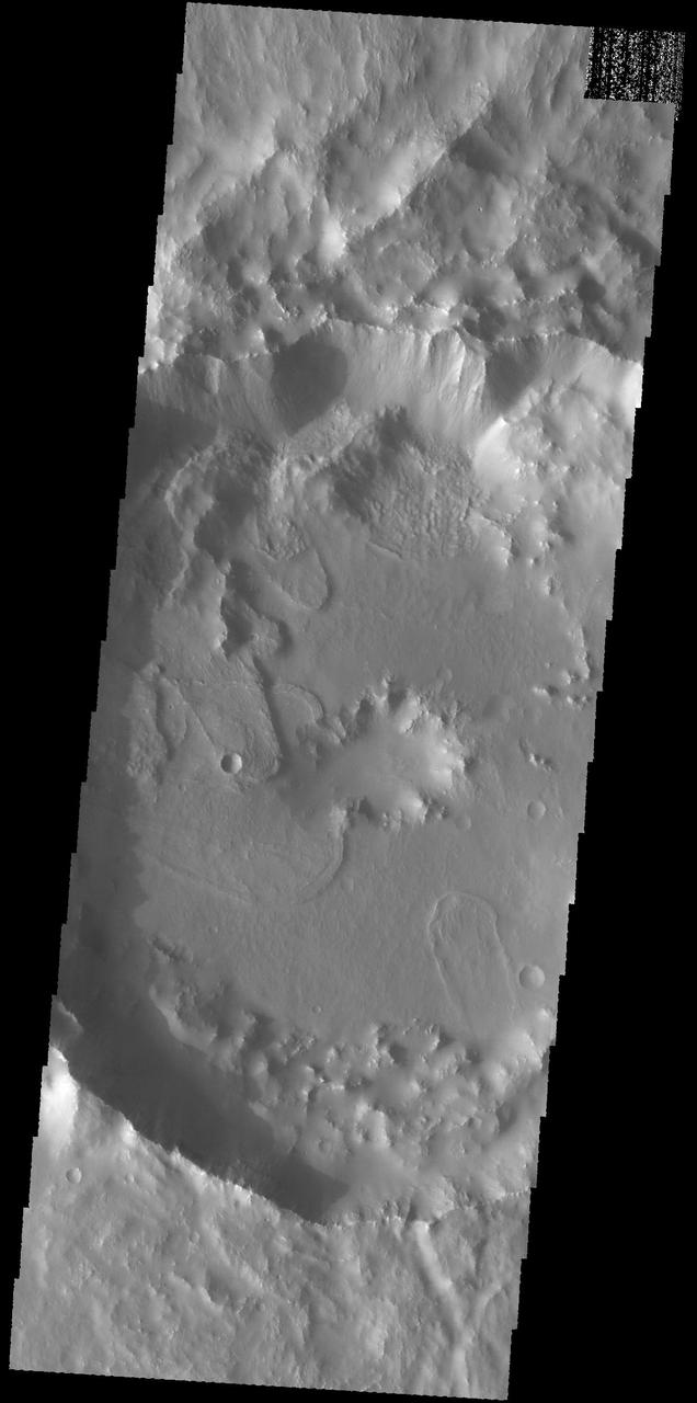
Today's VIS image shows two unnamed channels on the western edge of Claritas Fossae. The small channel joins the larger one close the the crater rim. The main channel has formed a delta in the crater. Deltas are formed when sediment laden rivers slow down – either due to a flattening of topography, or entering a standing body of water. The reduction in velocity causes the sediments to be deposited. The main channel often diverges into numerous smaller channel that spread apart to form the typical fan shape of a delta. Orbit Number: 92145 Latitude: -39.0947 Longitude: 256.903 Instrument: VIS Captured: 2022-09-22 12:24 https://photojournal.jpl.nasa.gov/catalog/PIA25747
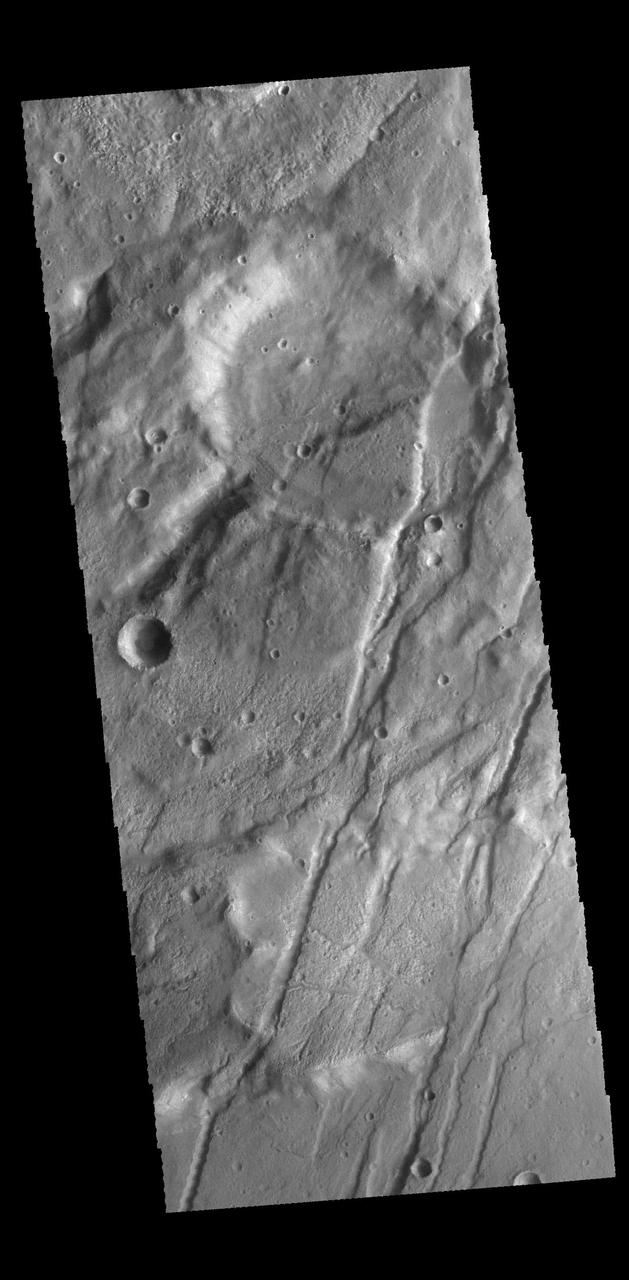
Today's VIS image shows part of Tugaske Crater. The northern margin of this crater has been modified from a circular form, most likely related to the tectonic activity of Claritas Fossae, where this crater is located. Additionally there are several landslide deposits in the crater, perhaps also formed by tectonic instability in the local region. Orbit Number: 59439 Latitude: -31.581 Longitude: 258.918 Instrument: VIS Captured: 2015-05-08 22:03 http://photojournal.jpl.nasa.gov/catalog/PIA19505
Mars Syria Planum-centered volcanism and tectonism produced fractures, narrow to broad grabens, large scarps, and broad fold and thrust ridges that deformed a basement complex captured by NASA's Viking Orbiter 2. http://photojournal.jpl.nasa.gov/catalog/PIA00154

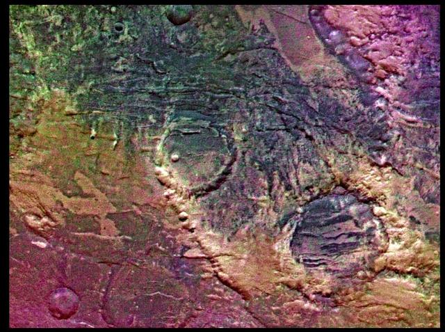
The THEMIS VIS camera contains 5 filters. The data from different filters can be combined in multiple ways to create a false color image. These false color images may reveal subtle variations of the surface not easily identified in a single band image. Today's false color image shows the southeastern floor and rim of Virrat Crater (top of image), and the northern rim of Wukari Crater (bottom of image). These craters are located in Claritas Fossae. Orbit Number: 67710 Latitude: -31.2255 Longitude: 257.255 Instrument: VIS Captured: 2017-03-20 04:07 https://photojournal.jpl.nasa.gov/catalog/PIA24075