
A perigee full moon or supermoon is seen over the Old Post Office and Clock Tower, Sunday, August 10, 2014, in Washington. A supermoon occurs when the moon’s orbit is closest (perigee) to Earth at the same time it is full. Photo Credit: (NASA/Bill Ingalls)
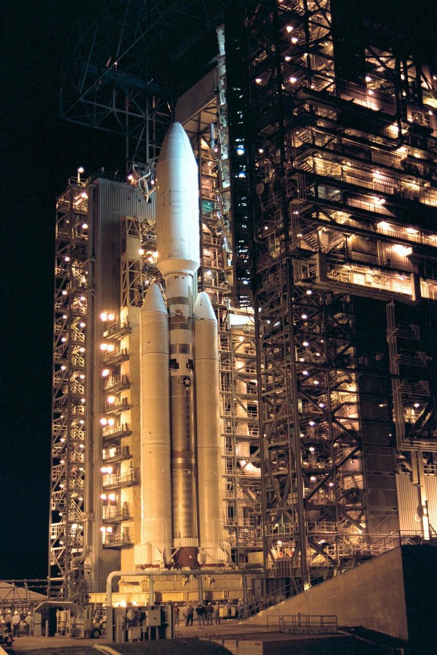
At Launch Complex 40 on Cape Canaveral Air Station, the Mobile Service Tower is rolled away from the Titan IVB/Centaur carrying the Cassini spacecraft, marking a major milestone in the launch countdown sequence. Retraction of the structure began about an hour later than scheduled due to minor problems with ground support equipment. The countdown clock for the Cassini mission began ticking earlier today at the T-26-hour mark. Other upcoming prelaunch milestones include activation of the final launch sequence for the Cassini spacecraft at the T-180-minute mark in the countdown, to be followed about an hour later by initiation of loading of the Titan IVB's Centaur stage with its complement of liquid hydrogen and liquid oxygen. Liftoff of Cassini on the journey to Saturn and its moon Titan is slated to occur during a window opening at 4:55 a.m. EDT, Oct. 13, and extending through 7:15 a.m
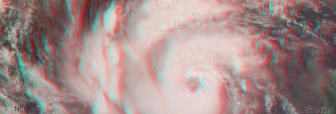
MISR's stereo anaglyph shows a three-dimensional view of Michael and combines two of MISR's nine camera angles. Using 3D red-blue glasses, you can see the 3D effect. Apparent in the 3D stereo anaglyph as well as the height field are a number of bright "clumps." These are groups of strong thunderstorms embedded within the larger circulation of the hurricane. Known as "vortical hot towers" the presence of these features indicates rapid transport of heat energy from the ocean surface into the storm, typically indicative of rapid intensification of the hurricane. In fact, between 11 a.m. and 2 p.m. EDT, while MISR imaged the hurricane, the estimated central pressure dropped 8 hPa and the maximum sustained winds increased about 12 mph (19 kph) and over the next 24 hours Hurricane Michael intensified from a Category 2 to a Category 4 storm. The National Hurricane Center clocked Michael's sustained wind speed at 150 mph (240 kph) just before noon local time on Wednesday. It is expected to bring strong winds, storm surge and heavy rain to much of the southeast. https://photojournal.jpl.nasa.gov/catalog/PIA22748