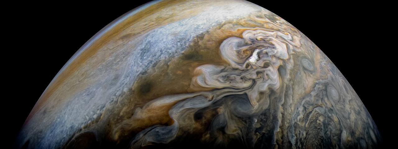
See swirling cloud formations in the northern area of Jupiter's north temperate belt in this new view taken by NASA's Juno spacecraft. The color-enhanced image was taken on Feb. 7 at 5:42 a.m. PST (8:42 a.m. EST), as Juno performed its eleventh close flyby of Jupiter. At the time the image was taken, the spacecraft was about 5,086 miles (8,186 kilometers) from the tops of the clouds of the planet at a latitude of 39.9 degrees. Citizen scientist Kevin M. Gill processed this image using data from the JunoCam imager. https://photojournal.jpl.nasa.gov/catalog/PIA21978 . - Enhanced image by Kevin M. Gill (CC-BY) based on images provided courtesy of NASA/JPL-Caltech/SwRI/MSSS
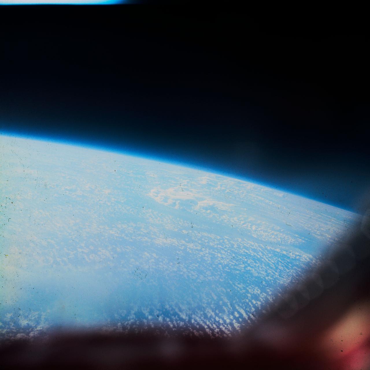
S62-06612 (3 Oct. 1962) --- Cloud formation over South America taken during the fifth orbit pass of the Mercury-Atlas 8 (MA-8) mission by astronaut Walter M. Schirra Jr. with a hand-held camera. Photo credit: NASA
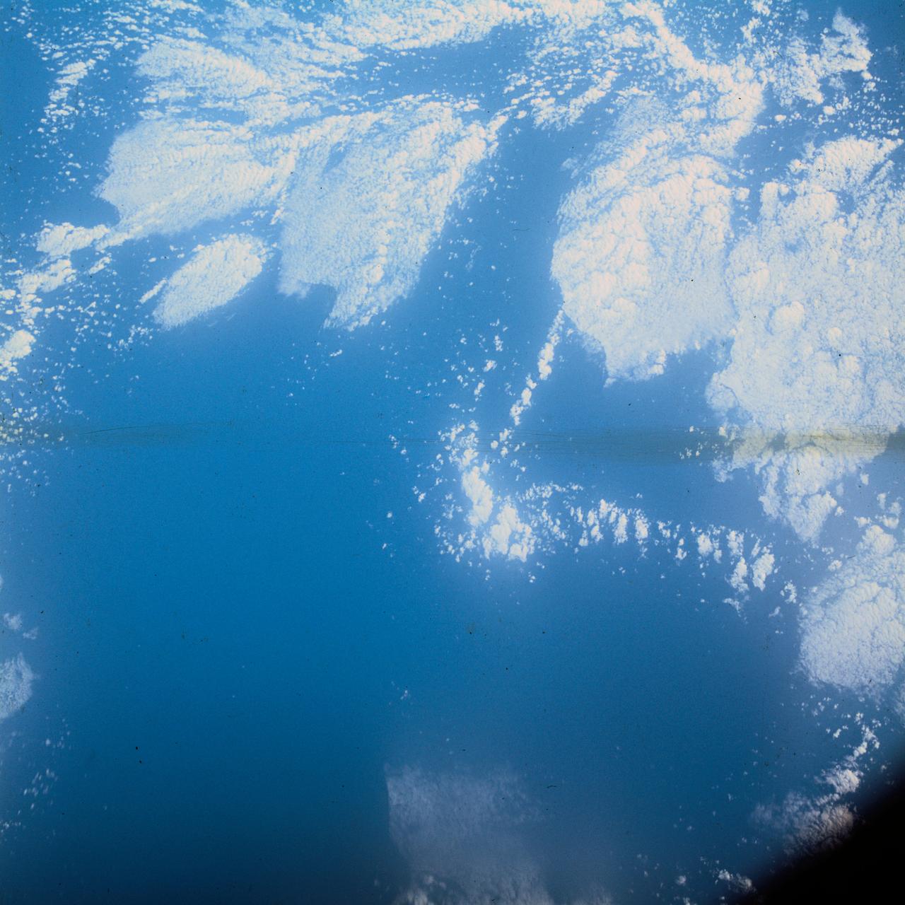
S62-06606 (3 Oct. 1962) --- Cloud formation over Western Atlantic Ocean north of South America taken during the fourth orbit pass of the Mercury-Atlas 8 (MA-8) mission by astronaut Walter M. Schirra Jr. with a hand-held camera. Photo credit: NASA
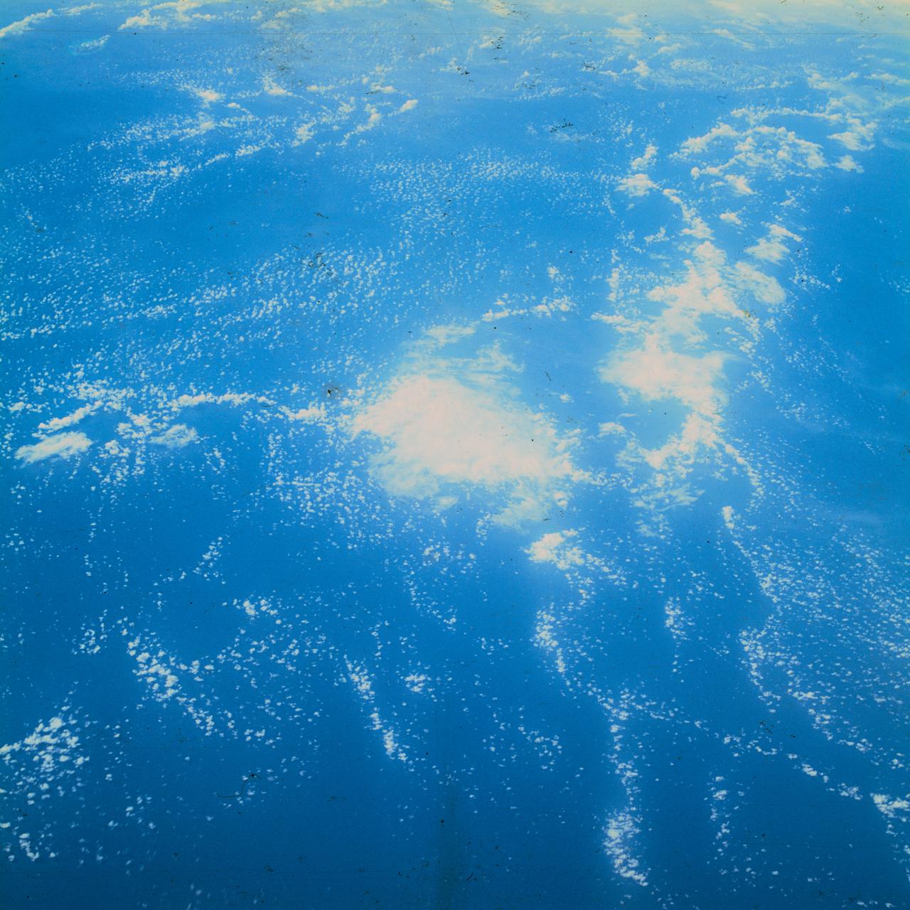
S62-06613 (3 Oct. 1962) --- Cumulus cloud formation over West Atlantic Ocean north of South American during the fourth orbit pass of the Mercury-Atlas 8 (MA-8) mission by astronaut Walter M. Schirra Jr. with a hand-held camera. Photo credit: NASA
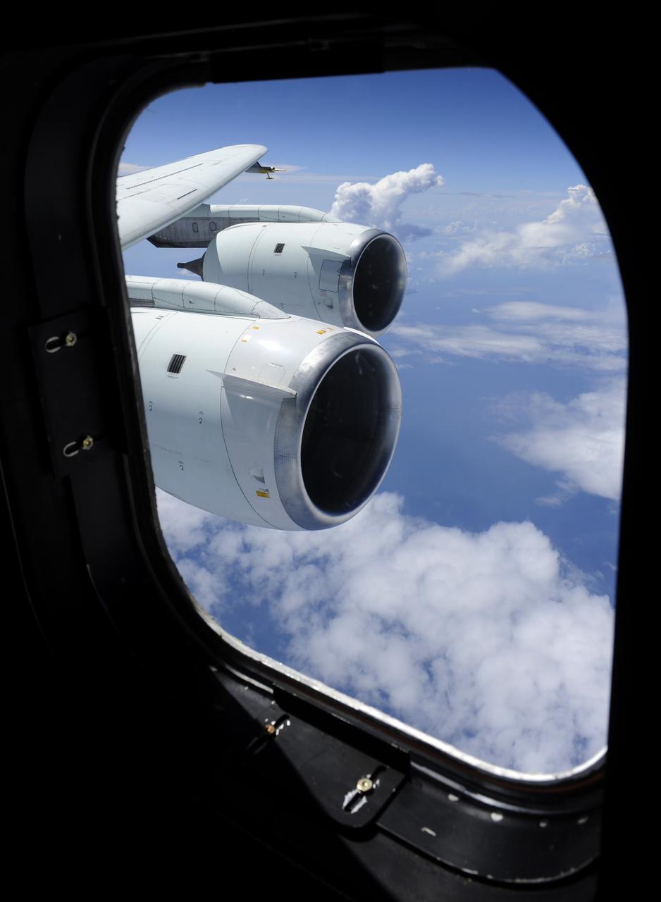
Cloud formations are seen through the window of NASA DC-8 aircraft during a flight, Tuesday, Aug. 17, 2010, over the Gulf of Mexico where researchers were studying weather patterns as part of trhe Genesis and Rapid Intensification Processes (GRIP) experiment, a NASA Earth science field experiment in 2010 that is being conducted to better understand how tropical storms form and develop into major hurricanes. Photo Credit: (NASA/Paul E. Alers)
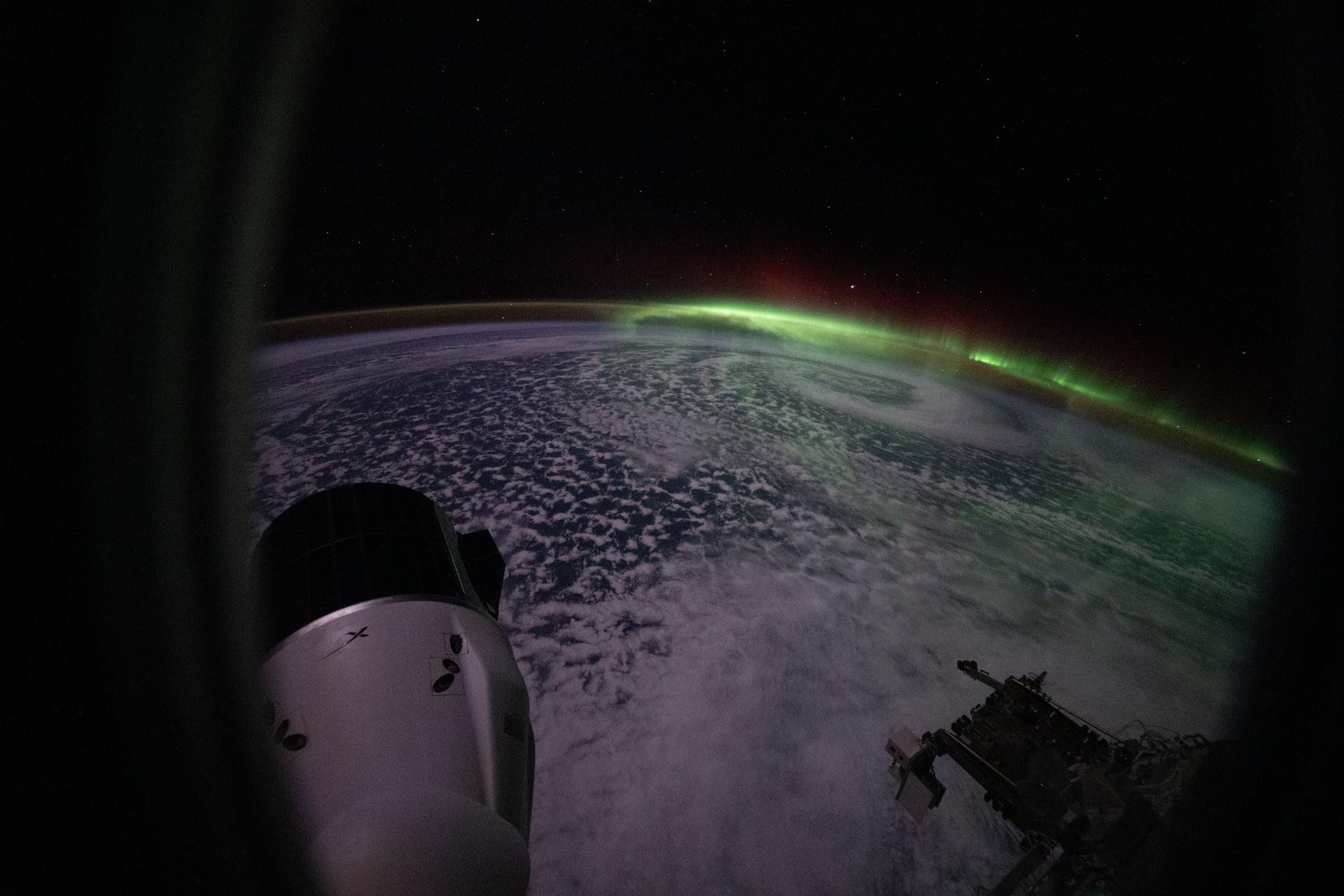
iss074e0702651 (June 5, 2026) --- The aurora australis arcs above a swirling cloud formation in this photograph taken from a window on a SpaceX Dragon crew spacecraft docked to the Harmony module's space-facing port on the International Space Station. At lower left is a SpaceX Dragon cargo spacecraft docked to Harmony's forward port. The orbital outpost was soaring 272 miles above the southern Indian Ocean southwest of Perth, Australia, at the time of this photograph. Credit: NASA/Chris Williams

iss058e000188 (Dec. 24, 2018) --- The cloud-covered Pacific coast of the South American nation of Chile contrasts with the Andes Mountain range and the cloud formations extending over Argentina.
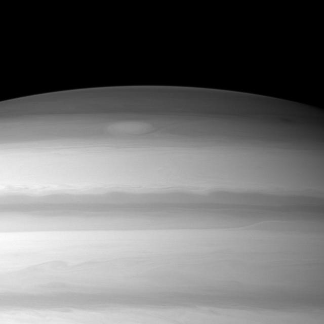
A large cloud formation swirls through the high northern latitudes of Saturn near the top of this image taken by NASA Cassini spacecraft.

In combined data from ESA Herschel and NASA Spitzer telescopes, irregular distribution of dust in the Small Magellanic Cloud becomes clear. A stream of dust extends to left, known as the galaxy wing, and a bar of star formation appears to right.
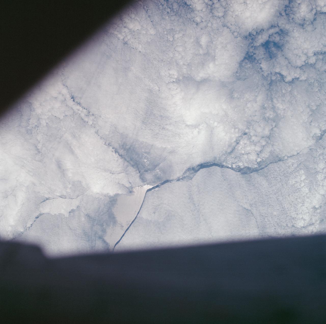
AS07-05-1644 (13 Oct. 1968) --- Remarkable cloud patterns as seen from the Apollo 7 spacecraft during its 34th revolution of Earth. Note break in two adjacent decks of strato-cumulus cloud formations. Sea can be seen through holes in clouds.
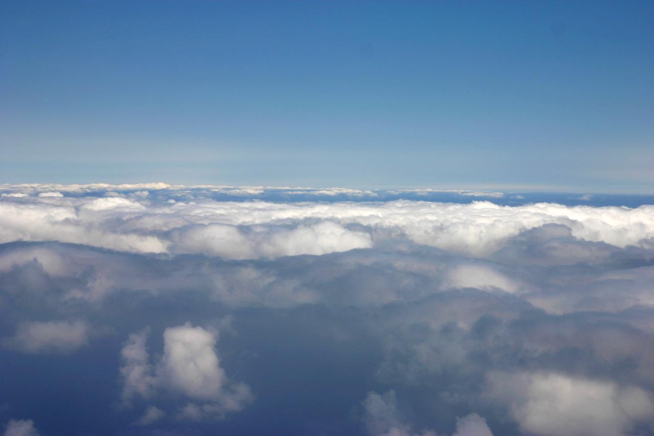
DC-8 NAMMA (NASA African Monson Multidisciplinary Analyses) MISSION TO CAPE VERDE, AFRICA - Cloud formation during Aug 25 flight
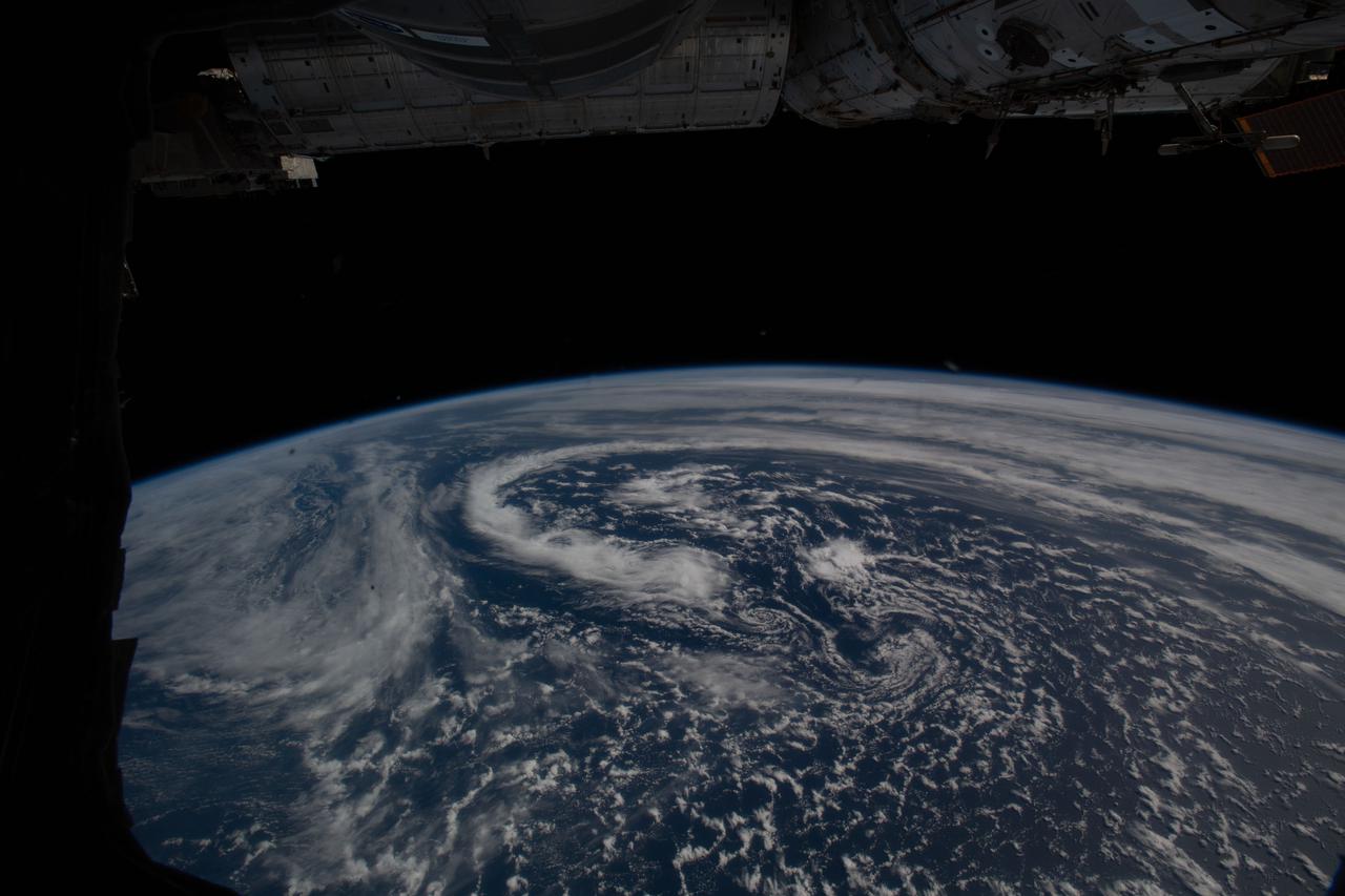
iss064e059496 (April 14, 2021) --- A cloud formation swirls in the Atlantic Ocean south of Alaska's Aleutian Islands as the International Space Station soared 265 miles above.
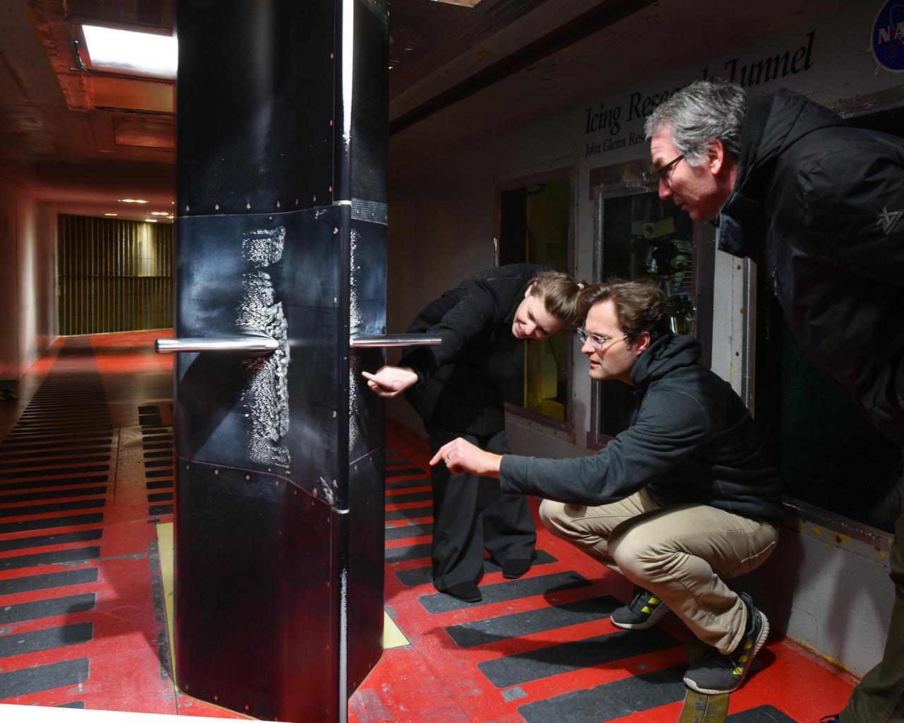
Pictured is a model to study the ice collection on struts in jet engines during flight. Researchers inspect the ice after the model encounters a simulated icing cloud during testing. Super cooled water created from the icing cloud that flows though the wind tunnel. The super cooled water forms ice on contact with the test model. Researchers then inspect the ice formation before laser scanning of the ice formation for further research and analysis.
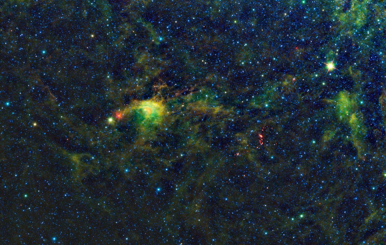
NASA Wide-Field Infrared Survey Explorer has uncovered a striking population of young stellar objects in a complex of dense, dark clouds in the southern constellation of Circinus.
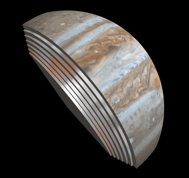
This composite image depicts Jupiter's cloud formations as seen through the eyes of Juno's Microwave Radiometer (MWR) instrument as compared to the top layer, a Cassini Imaging Science Subsystem image of the planet. The MWR can see a couple of hundred miles (kilometers) into Jupiter's atmosphere with its largest antenna. The belts and bands visible on the surface are also visible in modified form in each layer below. http://photojournal.jpl.nasa.gov/catalog/PIA21107
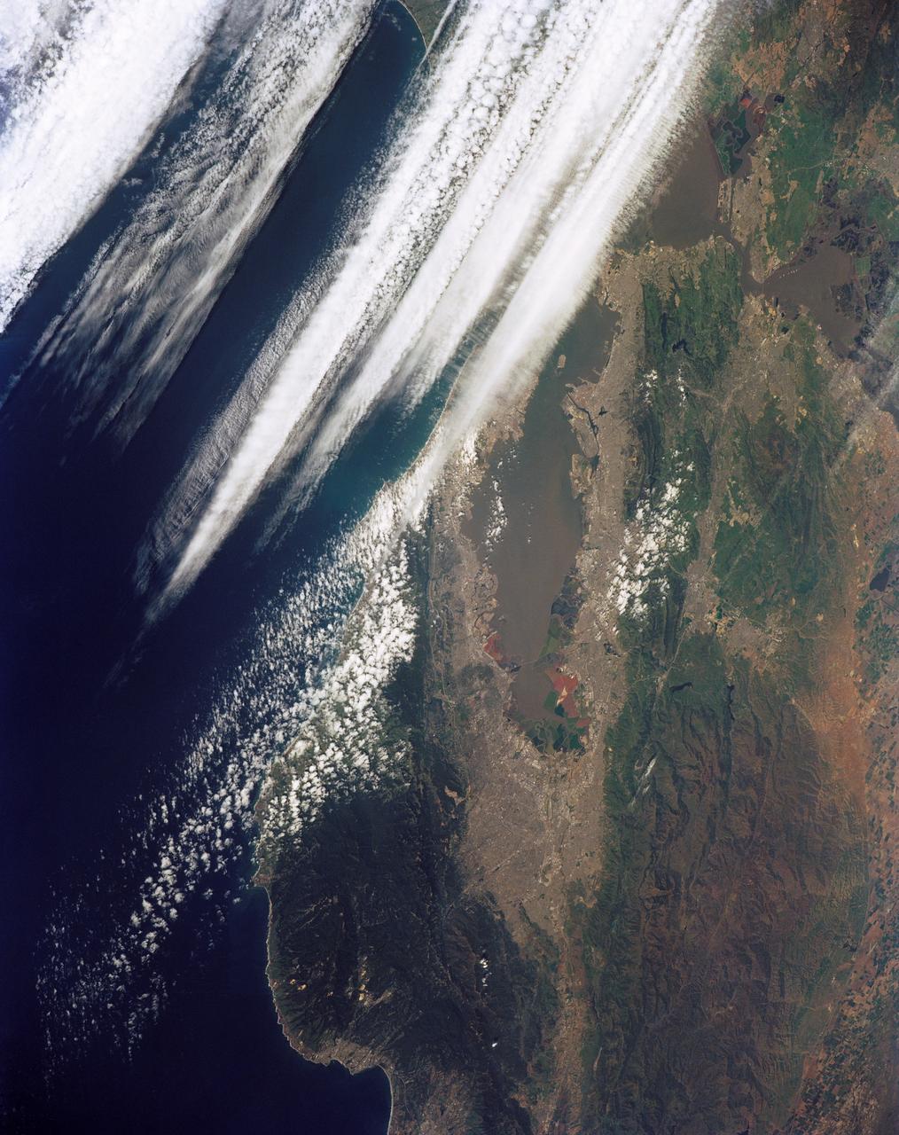
STS039-151-181A (28 April-6 May 1991) --- Large format (five-inch) frame of the San Francisco/Oakland Bay Area of northern California. Stratus clouds at 35,000 feet and cumulus clouds at about 15,000 feet are seen over the Pacific Coast, obscuring the Golden Gate Bridge.
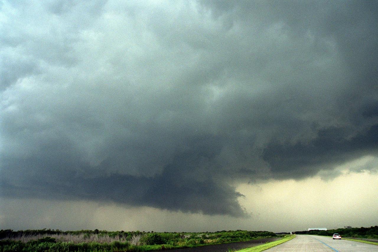
KENNEDY SPACE CENTER, Fla. -- Dark clouds and strong winds seem almost to touch the ground near the tow-way leading from the Shuttle Landing Facility (SLF). In the background (right) can be seen the new hangar at the SLF and the mate/demate device. The cloud formation is proceeding across the SLF towards the Vehicle Assembly Building

This image captures swirling cloud belts and tumultuous vortices within Jupiter's northern hemisphere. NASA's Juno spacecraft took this color-enhanced image at 10:23 p.m. PDT on May 23, 2018 (1:23 a.m. EDT on May 24), as the spacecraft performed its 13th close flyby of Jupiter. At the time, Juno was about 9,600 miles (15,500 kilometers) from the planet's cloud tops, above a northern latitude of 56 degrees. The region seen here is somewhat chaotic and turbulent, given the various swirling cloud formations. In general, the darker cloud material is deeper in Jupiter's atmosphere, while bright cloud material is high. The bright clouds are most likely ammonia or ammonia and water, mixed with a sprinkling of unknown chemical ingredients. A bright oval at bottom center stands out in the scene. This feature appears uniformly white in ground-based telescope observations. However, with JunoCam we can observe the fine-scale structure within this weather system, including additional structures within it. There is not significant motion apparent in the interior of this feature; like the Great Red Spot, its winds probably slows down greatly toward the center. Citizen scientists Gerald Eichstädt and Seán Doran created this image using data from the spacecraft's JunoCam imager. The view is a composite of several separate JunoCam images that were re-projected, blended, and healed. https://photojournal.jpl.nasa.gov/catalog/PIA22424
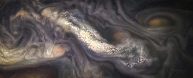
This image captures a high-altitude cloud formation surrounded by swirling patterns in the atmosphere of Jupiter's North North Temperate Belt region. The North North Temperate Belt is one of Jupiter's many colorful, swirling cloud bands. Scientists have wondered for decades how deep these bands extend. Gravity measurements collected by Juno during its close flybys of the planet have now provided an answer. Juno discovered that these bands of flowing atmosphere actually penetrate deep into the planet, to a depth of about 1,900 miles (3,000 kilometers). NASA's Juno spacecraft took this color-enhanced image at 10:11 p.m. PDT on July 15, 2018 (1:11 a.m. EDT on July 16), as the spacecraft performed its 14th close flyby of Jupiter. At the time, Juno was about 3,900 miles (6,200 kilometers) from the planet's cloud tops, above a latitude of 36 degrees. Citizen scientist Jason Major created this image using data from the spacecraft's JunoCam imager. https://photojournal.jpl.nasa.gov/catalog/PIA22426 . - Enhanced image by Jason Major based on images provided courtesy of NASA/JPL-Caltech/SwRI/MSSS
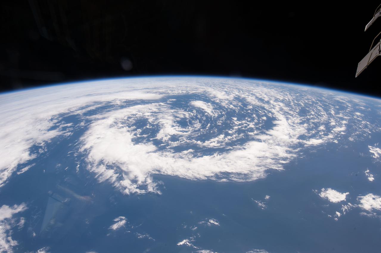
iss042e033298 (12/09/2014) --- US Astronaut Barry (Butch) Wilmore captured this ominous but interesting cloud formation aboard the International Space Station on 9 December 2014.
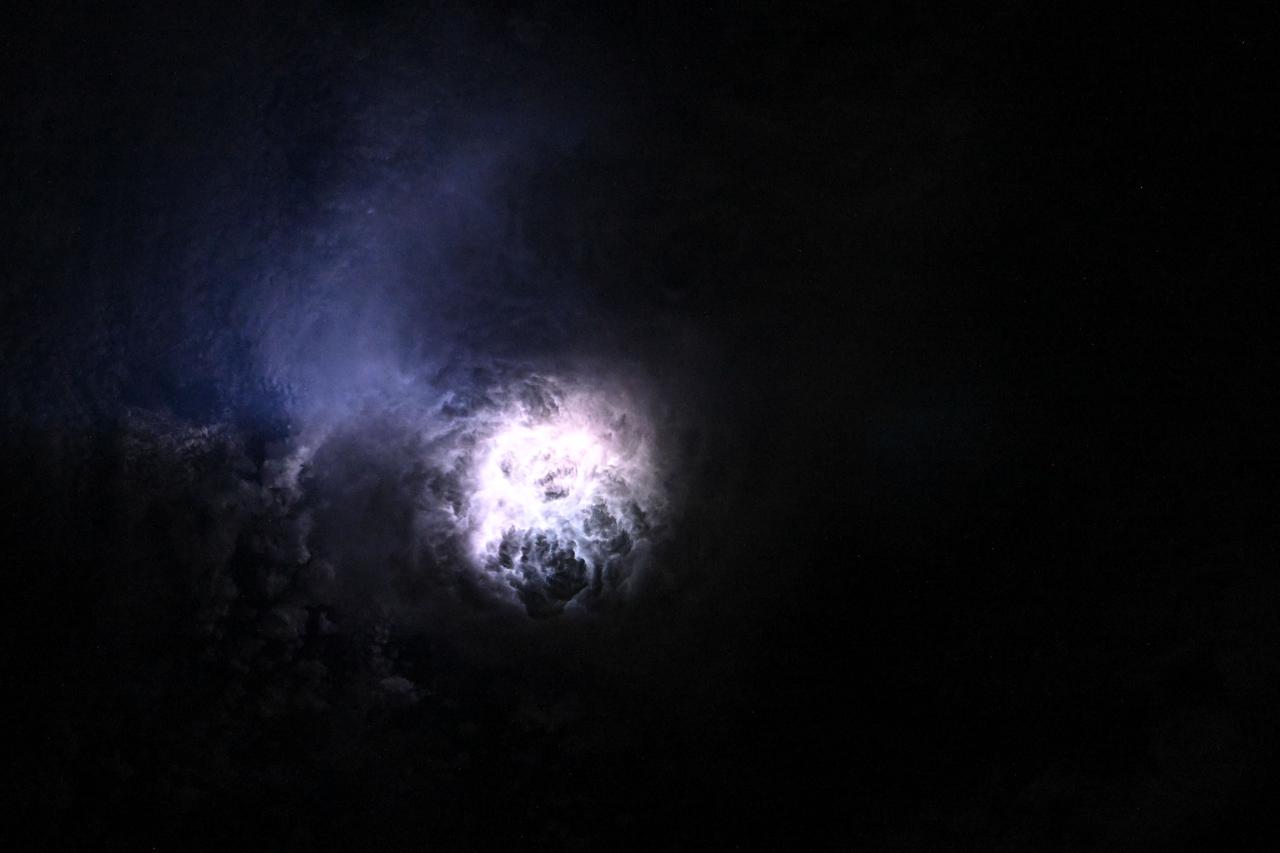
iss073e0080625 (May 15, 2025) --- This nebula-like formation is actually lightning illuminating the clouds during a storm off the coast of North Carolina in this photograph from the International Space Station as it orbited 260 miles above the Atlantic Ocean.

iss059e019940 (April 11, 2019) --- 256 miles above Earth an Expedition 59 crew member photographed a variety of cloud formations surrounding the sun's glint beaming off the South Pacific Ocean.
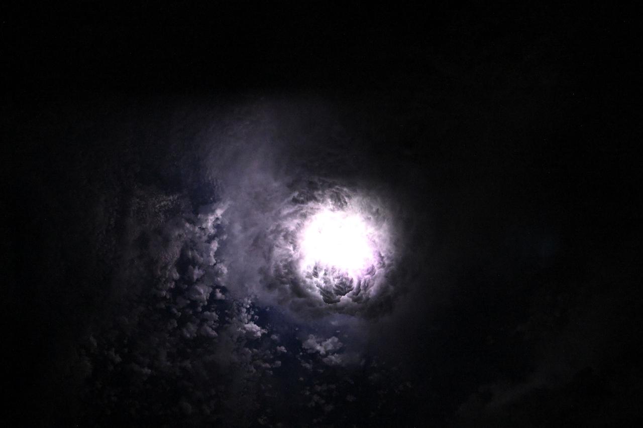
iss073e0080280 (May 15, 2025) --- This nebula-like formation is actually lightning illuminating the clouds during a storm off the coast of North Carolina in this photograph from the International Space Station as it orbited 260 miles above the Atlantic Ocean.
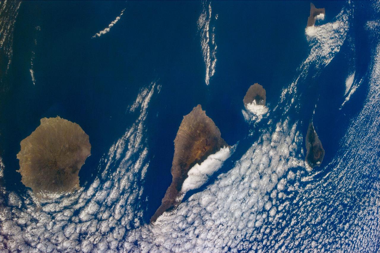
S94-E-5059 (July 1997) --- Several islands in the Canary chain and the cloud formations that are generally associated with this chain were captured with the STS-94 electronic still camera (ESC) in this nadir view from the Space Shuttle Columbia.
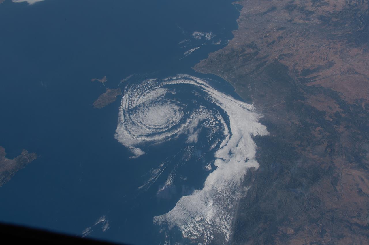
iss063e031610 (June 21, 2020) --- A cloud formation spirals in the Balearic Sea between Valencia, Spain, and the island of Ibiza as the International Space Station orbited above southern Europe.
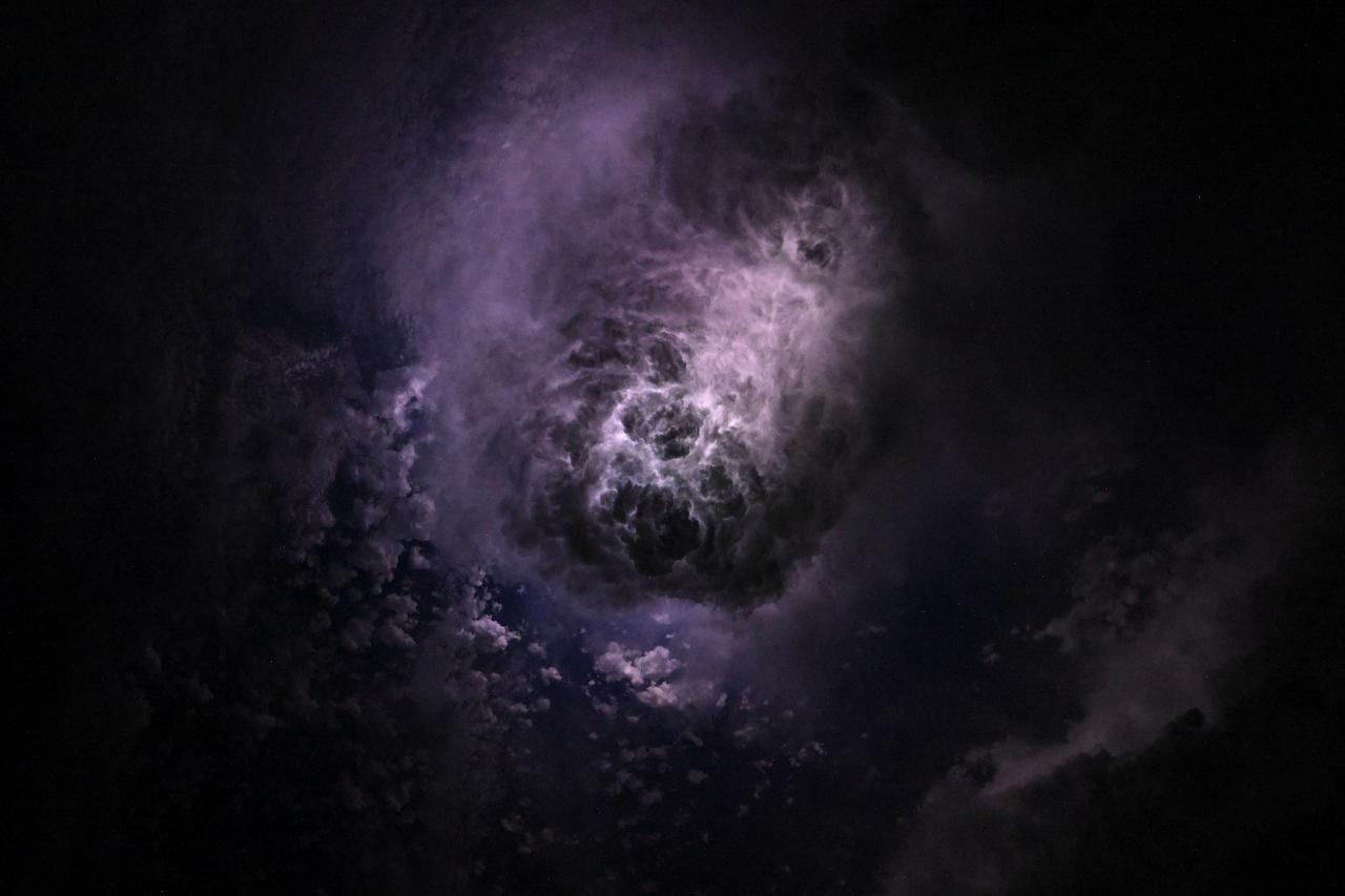
iss073e0080327 (May 15, 2025) --- This nebula-like formation is actually lightning illuminating the clouds during a storm off the coast of North Carolina in this photograph from the International Space Station as it orbited 260 miles above the Atlantic Ocean.
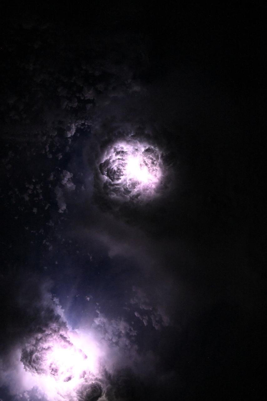
iss073e0081060 (May 15, 2025) --- This nebula-like formation is actually lightning illuminating the clouds during a storm off the coast of North Carolina in this photograph from the International Space Station as it orbited 260 miles above the Atlantic Ocean.

iss055e013731 (April 7, 2018) --- An Expedition 55 crew member aboard the International Space Station photographed a cloud formation over the Caspian Sea surrounded by the countries of Azerbaijan, Iran and Turkmenistan.

This image captures the swirling cloud formations around the south pole of Jupiter, looking up toward the equatorial region. NASA's Juno spacecraft took the color-enhanced image during its eleventh close flyby of the gas giant planet on Feb. 7 at 7:11 a.m. PST (10:11 a.m. EST). At the time, the spacecraft was 74,896 miles (120,533 kilometers) from the tops of Jupiter's clouds at 84.9 degrees south latitude. Citizen scientist Gerald Gerald Eichstädt processed this image using data from the JunoCam imager. This image was created by reprocessing raw JunoCam data using trajectory and pointing data from the spacecraft. This image is one in a series of images taken in an experiment to capture the best results for illuminated parts of Jupiter's polar region. To make features more visible in Jupiter's terminator -- the region where day meets night -- the Juno team adjusted JunoCam so that it would perform like a portrait photographer taking multiple photos at different exposures, hoping to capture one image with the intended light balance. For JunoCam to collect enough light to reveal features in Jupiter's dark twilight zone, the much brighter illuminated day-side of Jupiter becomes overexposed with the higher exposure. https://photojournal.jpl.nasa.gov/catalog/PIA21980. - Enhanced image by Gerald Eichstädt based on images provided courtesy of NASA/JPL-Caltech/SwRI/MSSS
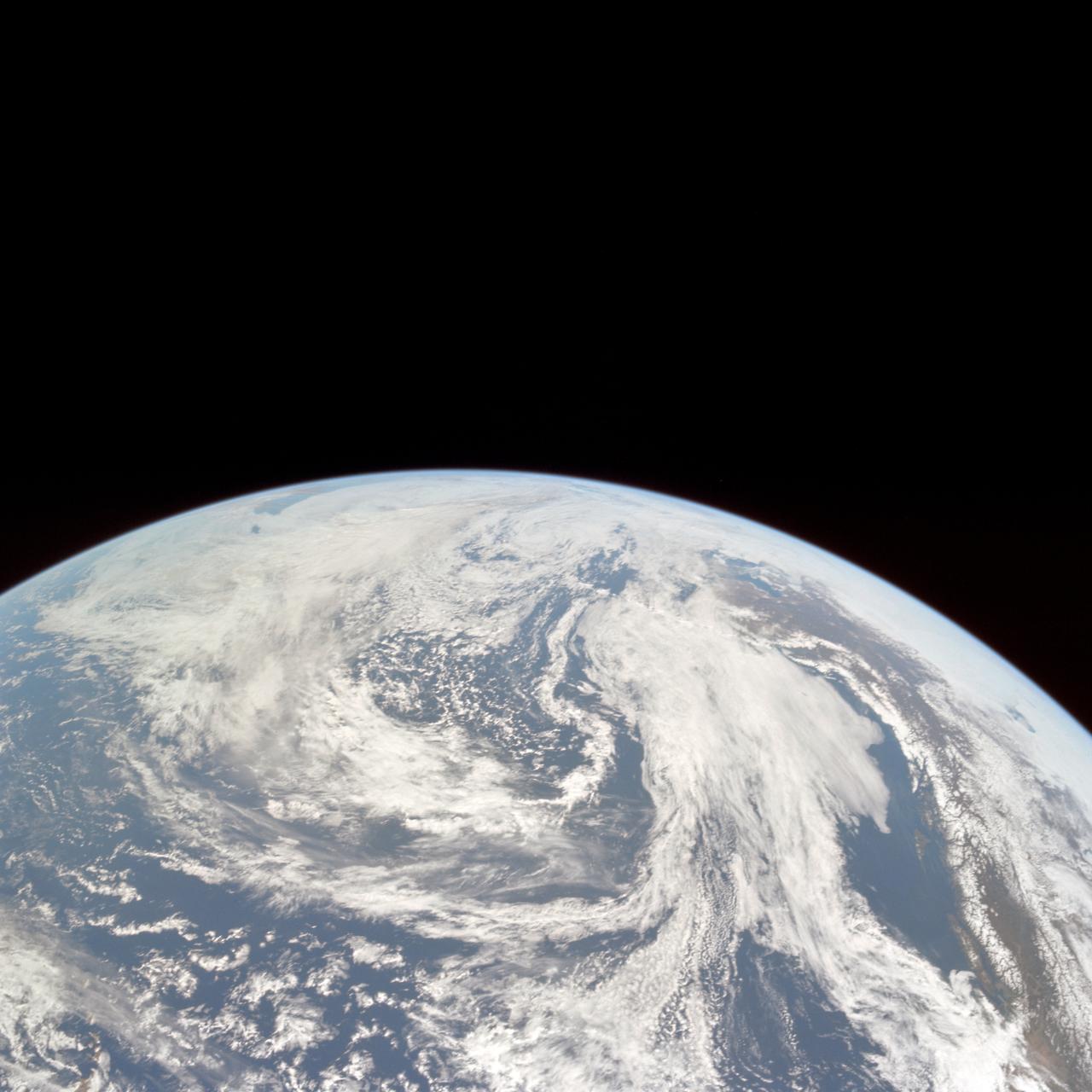
AS10-34-5010 (18 May 1969) --- This photograph of Earth was taken from the Apollo 10 spacecraft shortly after trans-lunar insertion. The counter-clockwise arrangement of the cloud formations indicates a northern hemisphere view, although insufficient amounts of land are visible for exact location.

61A-200-003 (30 Oct 1985) --- A large format Linhof camera onboard the Space Shuttle Columbia provided this coastal view of Somalia. The perspective is looking north from Muqdisho (foreground) to Raas Xaafuun at the horizon. Cumulus clouds cover the Somali Desert. The elongated, thinner steak of clouds follows a topographically depressed area, a wash know as Webi Shibeli.
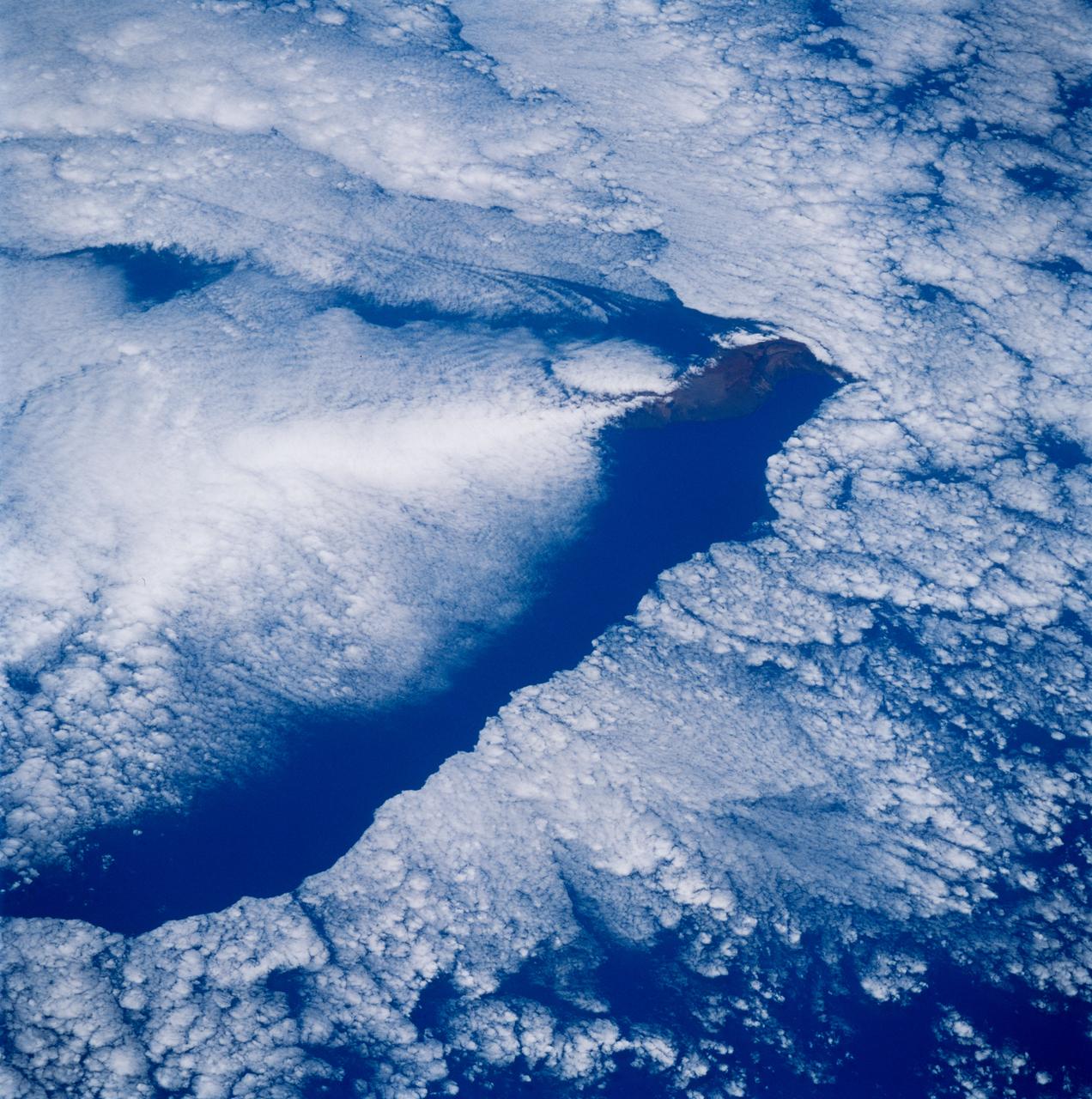
STS083-749-079 (4-8 April 1997) --- Cloud wake covers the Leeward Islands. Like a ship making a wake in the water, Guadeloupe Island is making a wake in the clouds. Seeing certain weather features tells us information as to what the conditions were at the time the photo was taken. For instance, a solid cloud area is formed behind the island in this photo so the winds are under or at 5 meters per second (mps). If the winds were greater Von Karman Vortices would develop. Formation of Von Karman Vortices requires wind speeds of 5 and 13 mps and a strong low level temperature inversion below the highest peak of the island.

This image from NASA Galileo spacecraft is of Jupiter moon Io and its surrounding sky is shown in false color.
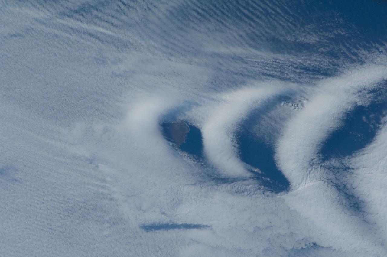
ISS030-E-193144 (25 March 2012) --- Wave clouds near Ile aux Cochons are featured in this image photographed by an Expedition 30 crew member on the International Space Station. This photograph illustrates the formation of wave clouds in the wake—or downwind side—of Ile aux Cochons (“Isle of Pigs”) located in the Southern Indian Ocean. The island is approximately located 3,000 kilometers southeast of the southern tip of the African continent and 2,300 kilometers northwest of Antarctica. The island itself, of which only a part of the eastern coastline is visible at center, is volcanic in origin with a summit elevation of 775 meters above sea level. According to scientists, the Ile aux Cochons stratovolcano is thought to have erupted within the last 12,000 years; however no historical activity has been recorded. The summit elevation is high enough for the land surface to interact with cloud layers and winds flowing past the island. Two major cloud layers are visible; a lower, more uniform layer consists of roughly parallel cloud “streets” that suggest a westerly flow pattern of air. When the air mass encounters the Ile aux Cochons, moisture-laden air rises and cools, causing more water vapor to condense into clouds. As the air mass passes over the summit of Ile aux Cochons and descends, it may encounter alternating moist and dry air layers, enabling the formation of the discontinuous chevron-shaped wave clouds in the wake of the island. While their appearance suggests that the clouds are forming in the wake of the island and moving eastwards, in fact it is the air mass that is moving, with clouds forming in regions of moist air and dissipating in dry regions. Ile aux Cochons is the westernmost of the islands that form the subantarctic Crozet Archipelago (part of the French Southern and Antarctic Lands). Accept for occasional research visits, the island is uninhabited. The island is an important breeding site for seabirds, including the world’s largest King Penguin colony.

A disk of hot gas swirls around a black hole in this illustration. Some of the gas came from a star that was pulled apart by the black hole, forming the long stream of hot gas on the right, feeding into the disk. These events are formally known as tidal disruption events, or TDEs. It can take just a matter or weeks or months from the destruction of the star to the formation of the disk. The gas gets hotter the closer it gets to the black hole, but the hottest material can be found above the black hole. This hottest material is cloud of plasma (gas atoms with their electrons stripped away) known as a corona. Most TDEs that result in the formation of a corona also produce jets of material that spew into space away from the black hole at its poles. A TDE called AT2021ehb is the first confirmed example of a corona forming without jets in a tidal disruption event. The observation of AT2021ehb makes it possible for scientists to study the formation of jets and coronae separately. https://photojournal.jpl.nasa.gov/catalog/PIA25440
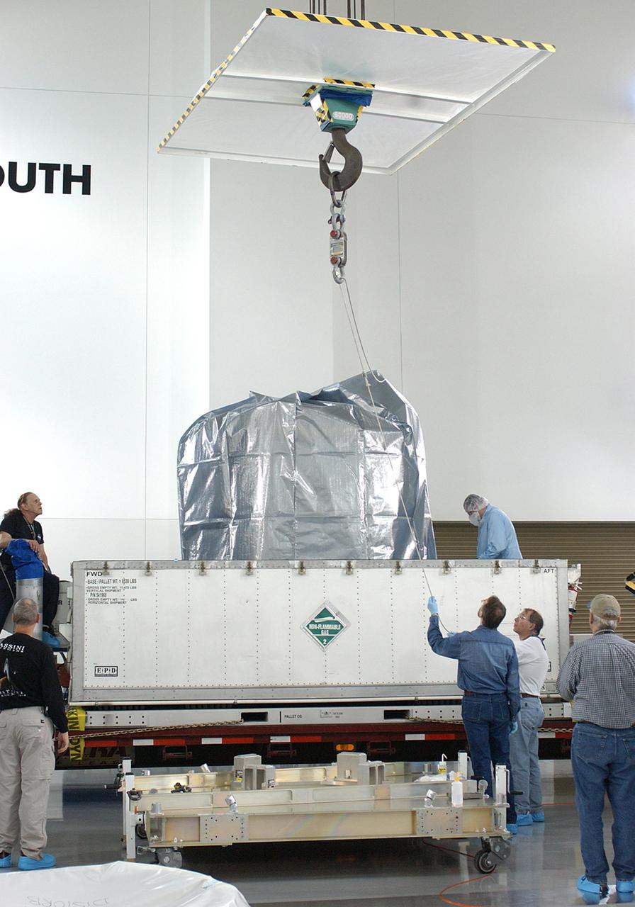
KENNEDY SPACE CENTER, FLA. - At the Astrotech Payload Processing Facility on Vandenberg Air Force Base in California, an overhead crane is attached to the CloudSat spacecraft to lift it out of its shipping container. CloudSat was shipped from Ball Aerospace and Technologies Corp. in Boulder, Colo. The spacecraft will undergo electrical and spacecraft transmitter testing. In combination with the Cloud-Aerosol Lidar and Infrared Pathfinder Satellite Observation (CALIPSO), the spacecraft will provide never-before-seen 3-D perspectives of how clouds and aerosols form, evolve, and affect weather and climate. CALIPSO and CloudSat will fly in formation with three other satellites to enhance understanding of climate systems. The launch date for CloudSat_CALIPSO is no earlier than Aug. 22.

KENNEDY SPACE CENTER, FLA. - The CloudSat spacecraft arrives via truck at the Astrotech Payload Processing Facility on Vandenberg Air Force Base in California from Ball Aerospace and Technologies Corp. in Boulder, Colo. CloudSat will undergo electrical and spacecraft transmitter testing. In combination with the Cloud-Aerosol Lidar and Infrared Pathfinder Satellite Observation (CALIPSO), the spacecraft will provide never-before-seen 3-D perspectives of how clouds and aerosols form, evolve, and affect weather and climate. CALIPSO and CloudSat will fly in formation with three other satellites to enhance understanding of climate systems. The launch date for CloudSat_CALIPSO is no earlier than Aug. 22.
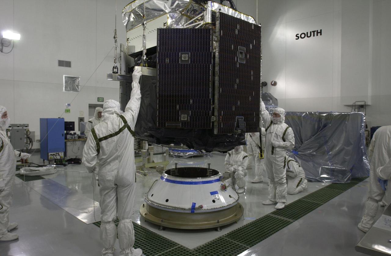
KENNEDY SPACE CENTER, FLA. -- Technicians position NASA's CloudSat spacecraft onto a Delta payload attach fitting in a clean room at Vandenberg Air Force Base, Calif. CALIPSO stands for Cloud-Aerosol Lidar and Infrared Pathfinder Satellite Observation. CALIPSO and CloudSat are highly complementary satellites and will be launched together. They will provide never-before-seen 3-D perspectives of how clouds and aerosols form, evolve, and affect weather and climate. CALIPSO and CloudSat will fly in formation with three other satellites in the A-train constellation to enhance understanding of our climate system. Launch of CALIPSO_CloudSat aboard a Boeing Delta II rocket is scheduled for 3:01 a.m. PDT Sept. 29.
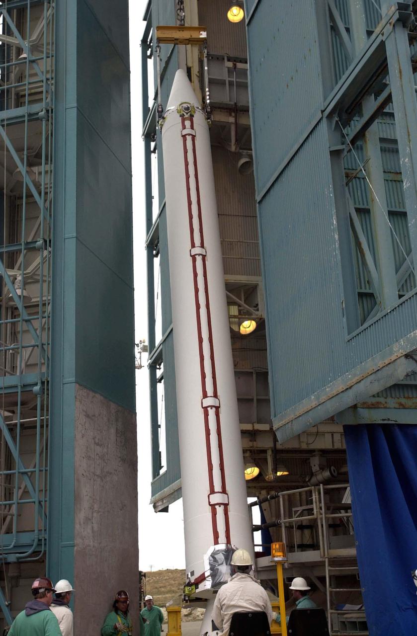
VANDENBERG AIR FORCE BASE, CALIF. - One of four Solid Rocket Boosters for the CALIPSO_CloudSat launch is ready for lifting into the mobile service tower, or gantry, where it will be attached to the Boeing Delta II rocket. CALIPSO stands for Cloud-Aerosol Lidar and Infrared Pathfinder Satellite Observation. CALIPSO and CloudSat are highly complementary satellites and together will provide never-before-seen 3-D perspectives of how clouds and aerosols form, evolve, and affect weather and climate. CALIPSO and CloudSat will fly in formation with three other satellites in the A-train constellation to enhance understanding of our climate system. Launch of CALIPSO_CloudSat aboard a Boeing Delta II rocket is scheduled for 3:01 a.m. Sept. 29.

KENNEDY SPACE CENTER, FLA. -- Technicians prepare to move NASA's CloudSat spacecraft for mating to a Delta payload attach fitting in a clean room at Vandenberg Air Force Base, Calif. CALIPSO stands for Cloud-Aerosol Lidar and Infrared Pathfinder Satellite Observation. CALIPSO and CloudSat are highly complementary satellites and will be launched together. They will provide never-before-seen 3-D perspectives of how clouds and aerosols form, evolve, and affect weather and climate. CALIPSO and CloudSat will fly in formation with three other satellites in the A-train constellation to enhance understanding of our climate system. Launch of CALIPSO_CloudSat aboard a Boeing Delta II rocket is scheduled for 3:01 a.m. PDT Sept. 29.
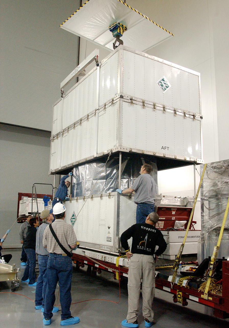
KENNEDY SPACE CENTER, FLA. - The shipping container is lifted away from the CloudSat spacecraft at the Astrotech Payload Processing Facility on Vandenberg Air Force Base in California. It was shipped from Ball Aerospace and Technologies Corp. in Boulder, Colo. CloudSat will undergo electrical and spacecraft transmitter testing. In combination with the Cloud-Aerosol Lidar and Infrared Pathfinder Satellite Observation (CALIPSO), the spacecraft will provide never-before-seen 3-D perspectives of how clouds and aerosols form, evolve, and affect weather and climate. CALIPSO and CloudSat will fly in formation with three other satellites to enhance understanding of climate systems. The launch date for CloudSat_CALIPSO is no earlier than Aug. 22.

KENNEDY SPACE CENTER, FLA. - At the Astrotech Payload Processing Facility on Vandenberg Air Force Base in California, the CloudSat spacecraft is again being lowered, but on a different mounting stand. CloudSat will undergo electrical and spacecraft transmitter testing. In combination with the Cloud-Aerosol Lidar and Infrared Pathfinder Satellite Observation (CALIPSO), the spacecraft will provide never-before-seen 3-D perspectives of how clouds and aerosols form, evolve, and affect weather and climate. CALIPSO and CloudSat will fly in formation with three other satellites to enhance understanding of climate systems. The launch date for CloudSat_CALIPSO is no earlier than Aug. 22.
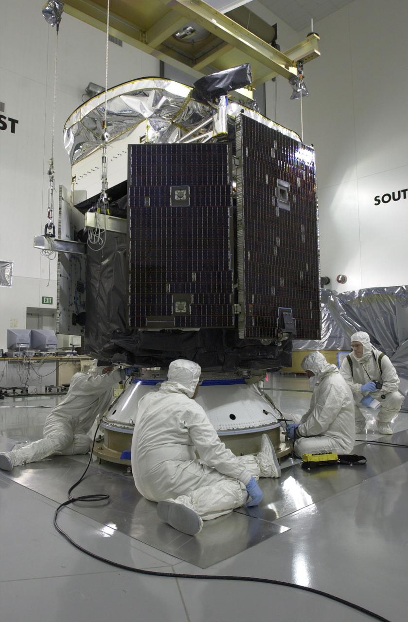
KENNEDY SPACE CENTER, FLA. -- Technicians secure NASA's CloudSat spacecraft to a Delta payload attach fitting in a clean room at Vandenberg Air Force Base, Calif. CALIPSO stands for Cloud-Aerosol Lidar and Infrared Pathfinder Satellite Observation. CALIPSO and CloudSat are highly complementary satellites and will be launched together. They will provide never-before-seen 3-D perspectives of how clouds and aerosols form, evolve, and affect weather and climate. CALIPSO and CloudSat will fly in formation with three other satellites in the A-train constellation to enhance understanding of our climate system. Launch of CALIPSO_CloudSat aboard a Boeing Delta II rocket is scheduled for 3:01 a.m. PDT Sept. 29.

KENNEDY SPACE CENTER, FLA. - At the Astrotech Payload Processing Facility on Vandenberg Air Force Base in California, workers watch as the CloudSat spacecraft is lifted away from the attachment ring now situated on the workstand. In combination with the Cloud-Aerosol Lidar and Infrared Pathfinder Satellite Observation (CALIPSO), the spacecraft will provide never-before-seen 3-D perspectives of how clouds and aerosols form, evolve, and affect weather and climate. CALIPSO and CloudSat will fly in formation with three other satellites to enhance understanding of climate systems. The launch date for CloudSat_CALIPSO is no earlier than Aug. 22.

KENNEDY SPACE CENTER, FLA. - At the Astrotech Payload Processing Facility on Vandenberg Air Force Base in California, workers help guide the CloudSat spacecraft with an attachment ring as it is lowered toward the workstand on the floor. CloudSat will undergo electrical and spacecraft transmitter testing. In combination with the Cloud-Aerosol Lidar and Infrared Pathfinder Satellite Observation (CALIPSO), the spacecraft will provide never-before-seen 3-D perspectives of how clouds and aerosols form, evolve, and affect weather and climate. CALIPSO and CloudSat will fly in formation with three other satellites to enhance understanding of climate systems. The launch date for CloudSat_CALIPSO is no earlier than Aug. 22.

KENNEDY SPACE CENTER, FLA. - At the Astrotech Payload Processing Facility on Vandenberg Air Force Base in California, the CloudSat spacecraft is in place on a stand. CloudSat will undergo electrical and spacecraft transmitter testing. In combination with the Cloud-Aerosol Lidar and Infrared Pathfinder Satellite Observation (CALIPSO), the spacecraft will provide never-before-seen 3-D perspectives of how clouds and aerosols form, evolve, and affect weather and climate. CALIPSO and CloudSat will fly in formation with three other satellites to enhance understanding of climate systems. The launch date for CloudSat_CALIPSO is no earlier than Aug. 22.
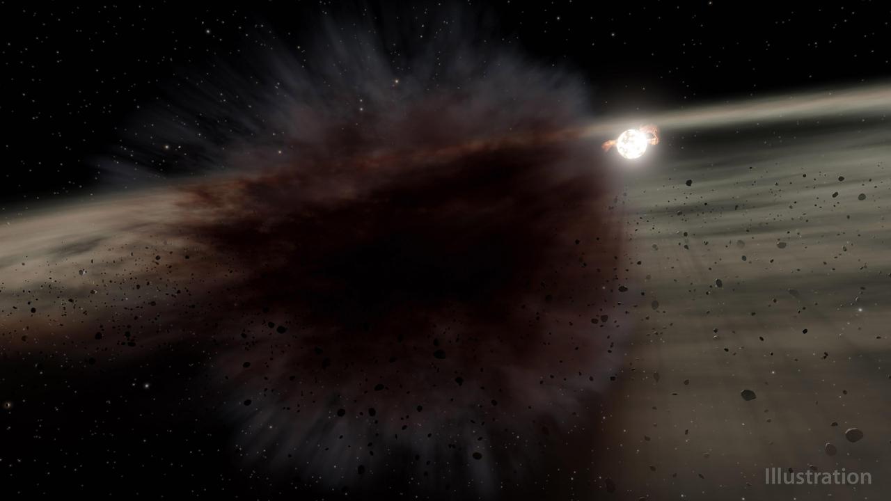
This illustration shows what a debris cloud around the young star called HD 166191 might look like up close. Astronomers using NASA's now-retired Spitzer Space Telescope saw a debris cloud briefly block the light from that star. The cloud was likely created by a smashup between two large asteroid-sized objects that might be the seeds of future planets around the star. HD 166191 is about 10 million years old. Around this time in a star's life, dust left over from its formation has clumped together to form rocky bodies called planetesimals. Asteroids are leftover planetesimals from the formation of our own solar system. Around other stars, these objects can be the seeds of future planets. Catastrophic collisions between them become common once the gas that previously filled the space between the objects disperses. Spitzer has previously found evidence of these collisions around young stars where rocky planets are forming. Kate Su of the University of Arizona led the team that saw the debris cloud transit around HD 166191 – the first transit of its kind ever found. Anticipating they might see evidence of one of these collisions around the star, the team ultimately used Spitzer to conduct more than 100 observations of the system between 2015 and 2019. While the objects are too small and distant to resolve by telescope, their smashups produce large amounts of dust that is detectable. Infrared light, which Spitzer detected, is an ideal range for detecting dust, including the debris created by protoplanet collisions. In mid-2018, the space telescope saw the HD 166191 system become significantly brighter, suggesting an increase in debris production. During that time, Spitzer also detected a debris cloud blocking the star. Combining Spitzer's observation of the transit with observations by telescopes on the ground, the team could deduce the size and shape of the debris cloud. Their work suggests the cloud was highly elongated, with a minimum estimated area three times that of the star. However, the amount of infrared brightening Spitzer saw suggests only a small portion of the cloud passed in front of the star, and that the debris from this event covered an area hundreds of times that of the star. To produce a cloud that big, the objects in the main collision must have been the size of dwarf planets, like Vesta in our solar system – an asteroid 330 miles (530 kilometers) wide in the main asteroid belt between Mars and Jupiter. By 2019, the cloud that passed in front of HD 166191 was no longer visible, but the system contained twice as much dust as it had before Spitzer spotted the cloud. https://photojournal.jpl.nasa.gov/catalog/PIA25161
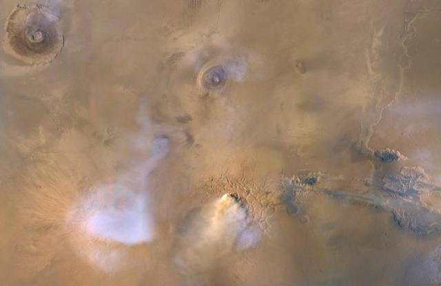
The yellow-white cloud in the bottom-center of this image is a Mars "dust tower" — a concentrated cloud of dust that can be lofted dozens of miles above the surface. The blue-white plumes are water vapor clouds. Olympus Mons, the tallest volcano in the solar system, is visible in the upper left corner, while Valles Marineris can be seen in the lower right. Heat-sensitive instruments like the Mars Climate Sounder, carried aboard NASA's Mars Reconnaissance Orbiter (MRO), can map the formation of these dust towers, which form almost continuously during global dust storms. Taken on Nov. 30, 2010, the image was produced by MRO's Mars Color Imager (MARCI), which was built and is operated by Malin Space Science Systems in San Diego. https://photojournal.jpl.nasa.gov/catalog/PIA23513

This image depicts the formation of multiple whirlpools in a sodium gas cloud. Scientists who cooled the cloud and made it spin created the whirlpools in a Massachusetts Institute of Technology laboratory, as part of NASA-funded research. This process is similar to a phenomenon called starquakes that appear as glitches in the rotation of pulsars in space. MIT's Wolgang Ketterle and his colleagues, who conducted the research under a grant from the Biological and Physical Research Program through NASA's Jet Propulsion Laboratory, Pasadena, Calif., cooled the sodium gas to less than one millionth of a degree above absolute zero (-273 Celsius or -460 Fahrenheit). At such extreme cold, the gas cloud converts to a peculiar form of matter called Bose-Einstein condensate, as predicted by Albert Einstein and Satyendra Bose of India in 1927. No physical container can hold such ultra-cold matter, so Ketterle's team used magnets to keep the cloud in place. They then used a laser beam to make the gas cloud spin, a process Ketterle compares to stroking a ping-pong ball with a feather until it starts spirning. The spinning sodium gas cloud, whose volume was one- millionth of a cubic centimeter, much smaller than a raindrop, developed a regular pattern of more than 100 whirlpools.

A researcher sets up equipment in the Space Power Chamber at National Aeronautics and Space Administration’s (NASA) Plum Brook Station to study the effects of contaminants on clouds. Drs. Rosa and Jorge Pena of Pennsylvania State University's Department of Meteorology initiated the program in an effort to develop methods of creating stable, long-lasting clouds in a test chamber in order to study their composition and formation. The researchers then wanted to use the artificially-created clouds to determine how they were affected by pollution. The 100-foot diameter and 122-foot high Space Power Chamber is the largest vacuum chamber in the world. The researchers covered the circular walls with muslin. A recirculating water system saturated the cloth. The facility engineers then reduced the chamber’s pressure which released the water from the muslin and generated a cloud. The researchers produced five different clouds in this first portion of this study. They discovered that they could not create stable clouds because of the heat generated by the water-pumping equipment. Nonetheless, they felt confident enough to commence planning the second phase of the program using a heat exchanger to cool the equipment.

Image release June 22, 2010 A spectacular new NASA/ESA Hubble Space Telescope image — one of the largest ever released of a star-forming region — highlights N11, part of a complex network of gas clouds and star clusters within our neighbouring galaxy, the Large Magellanic Cloud. This region of energetic star formation is one of the most active in the nearby Universe. The Large Magellanic Cloud contains many bright bubbles of glowing gas. One of the largest and most spectacular has the name LHA 120-N 11, from its listing in a catalogue compiled by the American astronomer and astronaut Karl Henize in 1956, and is informally known as N11. Close up, the billowing pink clouds of glowing gas make N11 resemble a puffy swirl of fairground candy floss. From further away, its distinctive overall shape led some observers to nickname it the Bean Nebula. The dramatic and colourful features visible in the nebula are the telltale signs of star formation. N11 is a well-studied region that extends over 1000 light-years. It is the second largest star-forming region within the Large Magellanic Cloud and has produced some of the most massive stars known. It is the process of star formation that gives N11 its distinctive look. Three successive generations of stars, each of which formed further away from the centre of the nebula than the last, have created shells of gas and dust. These shells were blown away from the newborn stars in the turmoil of their energetic birth and early life, creating the ring shapes so prominent in this image. Beans are not the only terrestrial shapes to be found in this spectacular high resolution image from the NASA/ESA Hubble Space Telescope. In the upper left is the red bloom of nebula LHA 120-N 11A. Its rose-like petals of gas and dust are illuminated from within, thanks to the radiation from the massive hot stars at its centre. N11A is relatively compact and dense and is the site of the most recent burst of star development in the region. Other star clusters abound in N11, including NGC 1761 at the bottom of the image, which is a group of massive hot young stars busily pouring intense ultraviolet radiation out into space. Although it is much smaller than our own galaxy, the Large Magellanic Cloud is a very vigorous region of star formation. Studying these stellar nurseries helps astronomers understand a lot more about how stars are born and their ultimate development and lifespan. Both the Large Magellanic Cloud and its small companion, the Small Magellanic Cloud, are easily seen with the unaided eye and have always been familiar to people living in the southern hemisphere. The credit for bringing these galaxies to the attention of Europeans is usually given to Portuguese explorer Fernando de Magellan and his crew, who viewed it on their 1519 sea voyage. However, the Persian astronomer Abd Al-Rahman Al Sufi and the Italian explorer Amerigo Vespucci recorded the Large Magellanic Cloud in 964 and 1503 respectively. Credit: NASA, ESA and Jesús Maíz Apellániz (Instituto de Astrofísica de Andalucía, Spain) To learn more about Hubble go to: <a href="http://www.nasa.gov/mission_pages/hubble/main/index.html" rel="nofollow">www.nasa.gov/mission_pages/hubble/main/index.html</a> <b><a href="http://www.nasa.gov/centers/goddard/home/index.html" rel="nofollow">NASA Goddard Space Flight Center</a></b> is home to the nation's largest organization of combined scientists, engineers and technologists that build spacecraft, instruments and new technology to study the Earth, the sun, our solar system, and the universe.
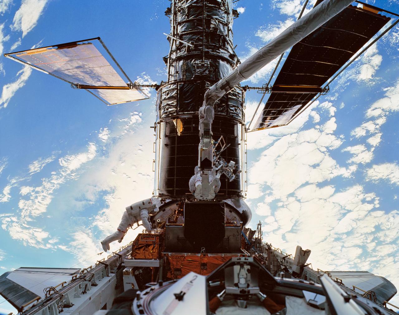
STS103-501-026 (19 - 27 December 1999) --- Astronauts C. Michael Foale, left, and Claude Nicollier (on Discovery's robotic arm) install a Fine Guidance Sensor (FGS) into a protective enclosure in the Shuttle’s payload bay. Foale and Nicollier performed the second of three space walks to service the Hubble Space Telescope (HST) on the STS-103 mission. A large format camera inside Discovery's cabin was used to record this high-resolution image, while the Shuttle was orbiting above ocean and clouds.
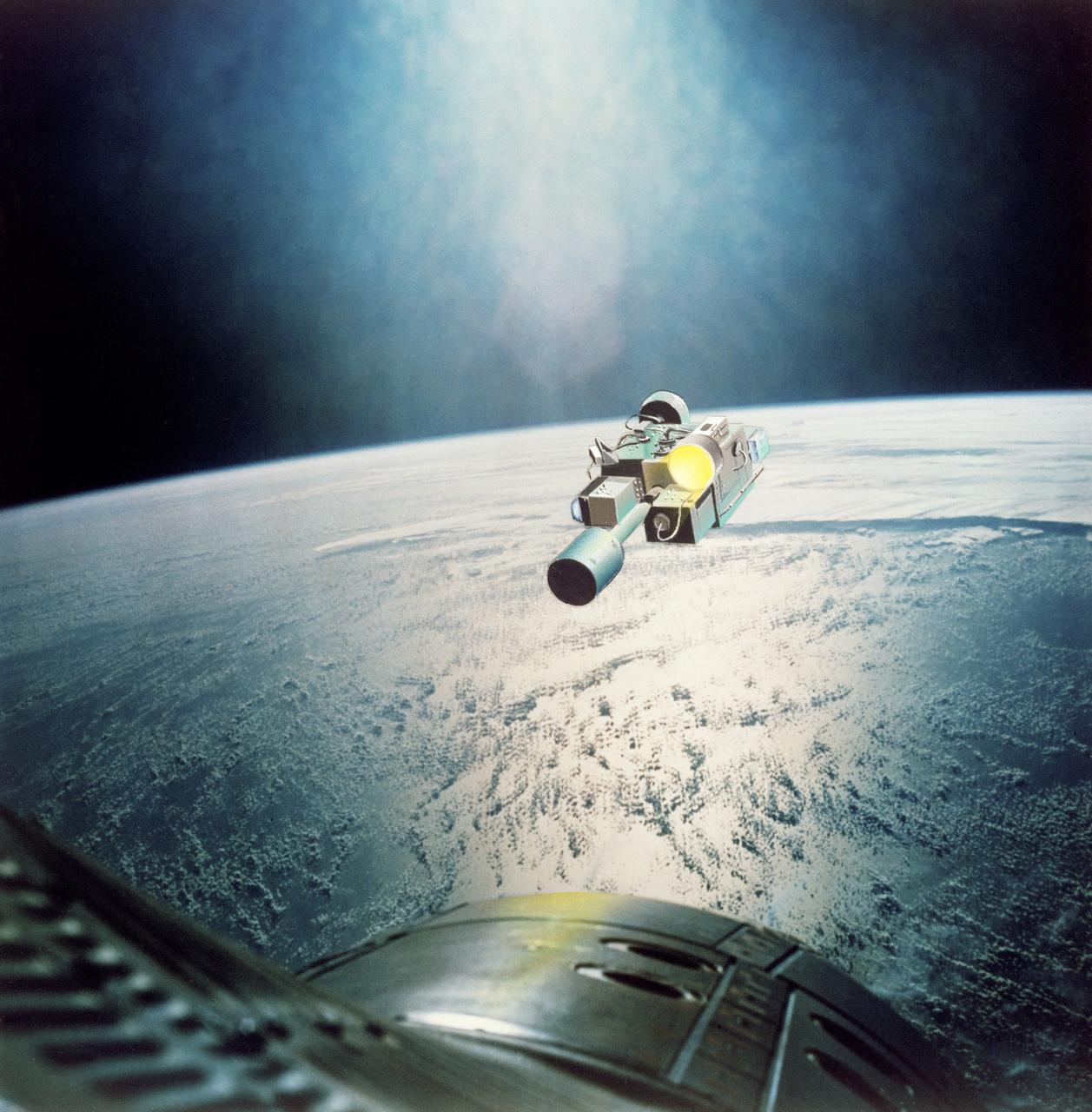
S65-28653 (August 1965) --- Rendezvous Evaluation Pod (REP) in orbit is approached by Gemini spacecraft as seen in this artist's concept using an actual photograph taken on the Gemini-4 mission. The REP is superimposed over a Gemini-4 Earth-sky picture of cloud formations over an ocean. The REP will be used by the crew of the Gemini-5 spacecraft to practice rendezvous techniques.
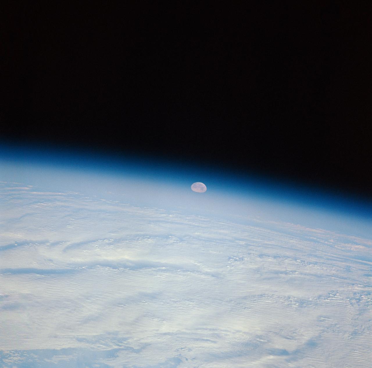
STS-32 crew took this view of the moon setting over the Earth's limb. Near the center is a semi-vortex in the clouds - a storm system in the early stages of formation. The moon's image is distorted due to refraction through the Earth's atmosphere. The near side of the moon is visible showing the vast area of the moon's western seas (Mare Occidental), Apollo landing sites: Apollo 14 at Fra Mauro and Apollo 16 at Central Highlands near Descartes.
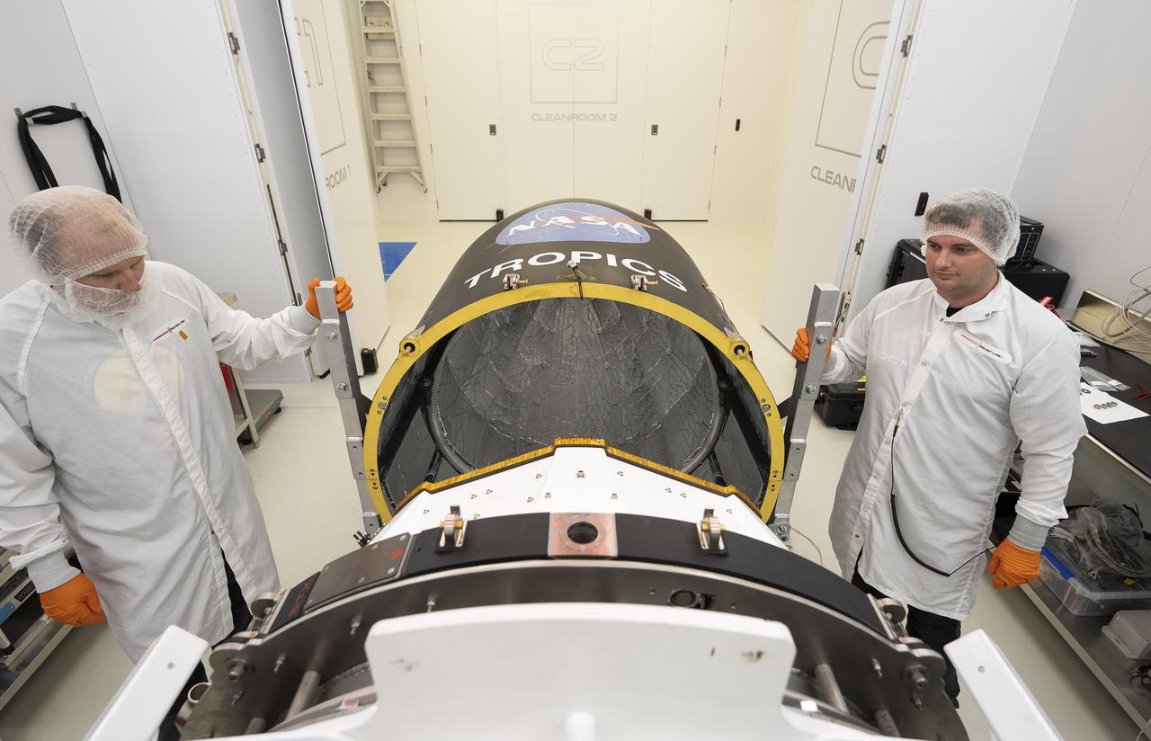
Technicians place NASA’s Time-Resolved Observations of Precipitation structure and storm Intensity with a Constellation of Smallsats (TROPICS) CubeSats in Rocket Lab’s Electron payload fairing in a processing facility near Launch Complex 1 in Mahia, New Zealand. TROPICS is scheduled to launch on Monday, May 1, at 1 a.m. New Zealand time from Launch Complex 1, Pad B. TROPICS will provide data on temperature, precipitation, water vapor, and clouds by measuring microwave frequencies, providing insight into storm formation and intensification.
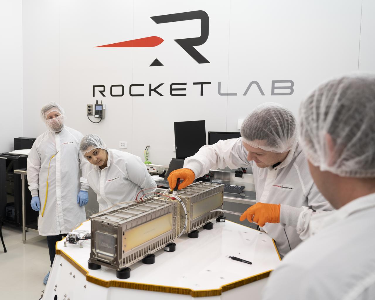
Technicians prepare NASA’s Time-Resolved Observations of Precipitation structure and storm Intensity with a Constellation of Smallsats (TROPICS) CubeSats for encapsulation in Rocket Lab’s Electron payload fairing in a processing facility near Launch Complex 1 in Mahia, New Zealand. TROPICS is scheduled to launch on Monday, May 1, at 1 a.m. New Zealand time from Launch Complex 1, Pad B. TROPICS will provide data on temperature, precipitation, water vapor, and clouds by measuring microwave frequencies, providing insight into storm formation and intensification.
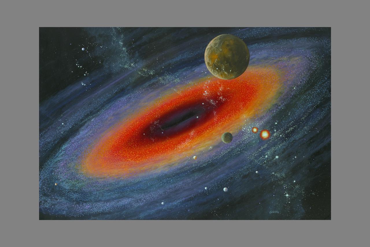
Artist: Gebing Artist's conception of a newborne star, still hidden in visible light by the dust clouds within which it formed, shows matter in orbit around the rotating star. Such leftover debris may eventually form comets, planets, satellites, and asteroids. Material squeezed out by the formation process is thought to be ejected along the star's rotation axis in relatively narrow, high-velocity streams of matter. (ref: SIRTF borchure 'A Window on Cosmic Birth 1987) -- Milky Way with Black hole
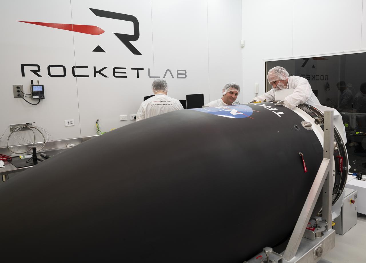
NASA’s Time-Resolved Observations of Precipitation structure and storm Intensity with a Constellation of Smallsats (TROPICS) CubeSats are encapsulated inside Rocket Lab’s Electron payload fairing in a processing facility near Launch Complex 1 in Mahia, New Zealand. TROPICS is scheduled to launch on Monday, May 1, at 1 a.m. New Zealand time from Launch Complex 1, Pad B. TROPICS will provide data on temperature, precipitation, water vapor, and clouds by measuring microwave frequencies, providing insight into storm formation and intensification.
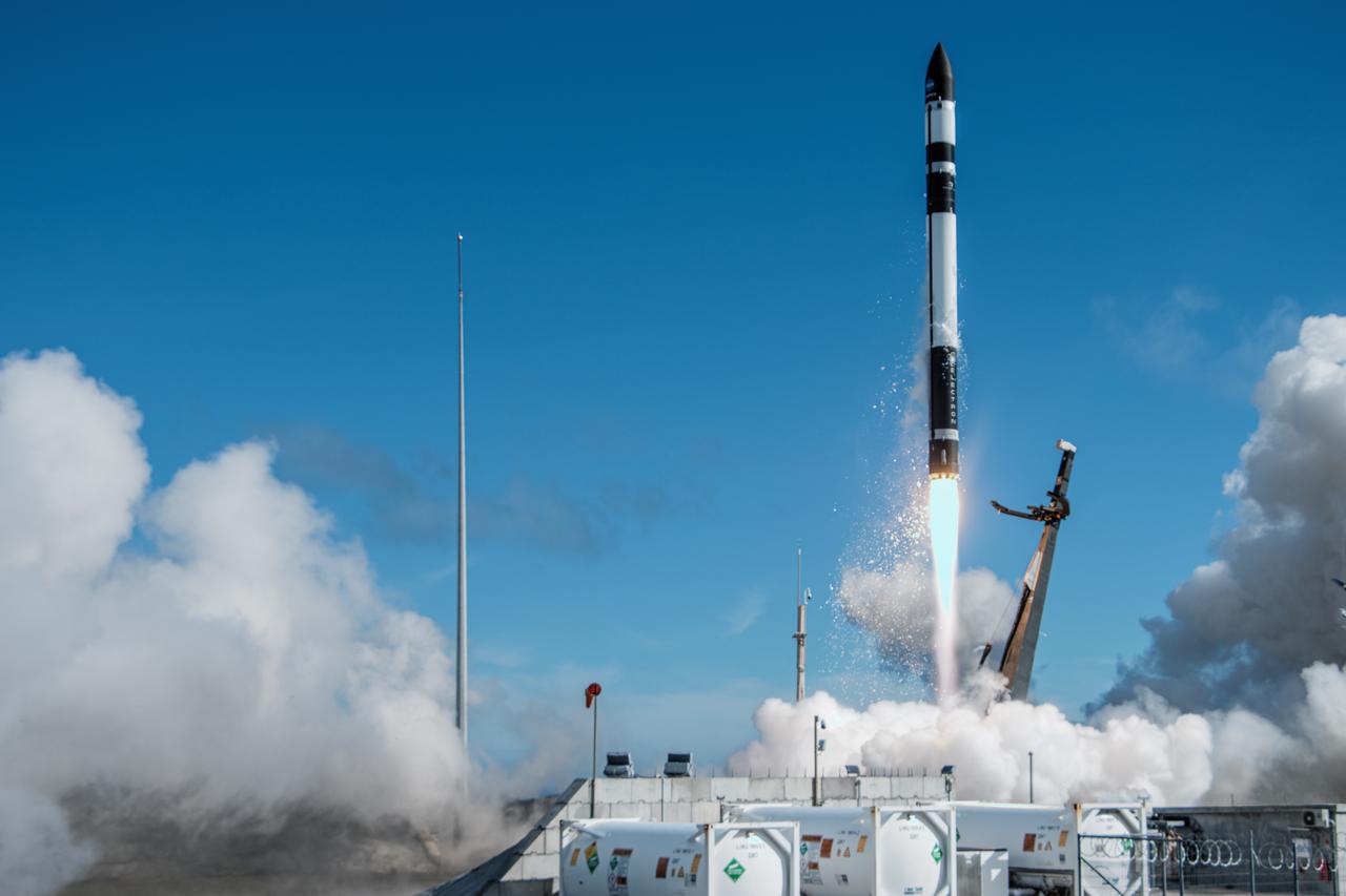
A Rocket Lab Electron rocket lifts off Launch Complex 1, Pad B, in Māhia, New Zealand on May 8 at 1 p.m. New Zealand time (May 7 at 9 p.m. EDT), carrying two NASA CubeSats designed to study tropical cyclones, including hurricanes and typhoons. NASA’s Time-Resolved Observations of Precipitation structure and storm Intensity with a Constellation of Smallsats (TROPICS) CubeSats will provide data on temperature, precipitation, water vapor, and clouds by measuring microwave frequencies, providing insight into storm formation and intensification.
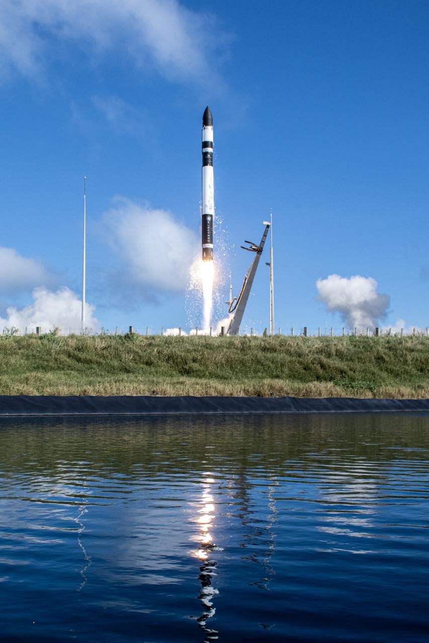
A Rocket Lab Electron rocket lifts off Launch Complex 1, Pad B, in Māhia, New Zealand on May 8 at 1 p.m. New Zealand time (May 7 at 9 p.m. EDT), carrying two NASA CubeSats designed to study tropical cyclones, including hurricanes and typhoons. NASA’s Time-Resolved Observations of Precipitation structure and storm Intensity with a Constellation of Smallsats (TROPICS) CubeSats will provide data on temperature, precipitation, water vapor, and clouds by measuring microwave frequencies, providing insight into storm formation and intensification.
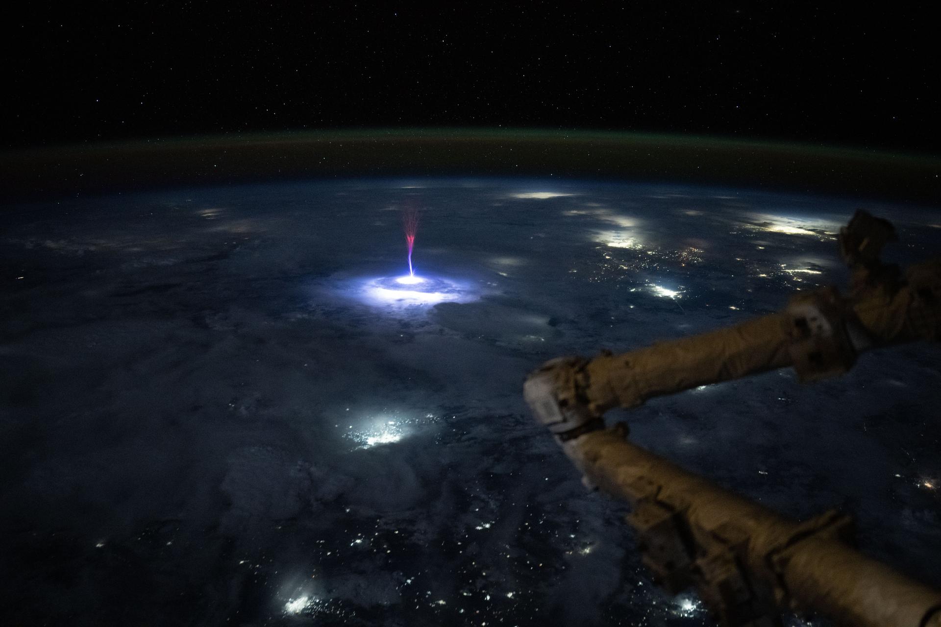
iss073e0281502 (July 03, 2025) --- A Gigantic Jet event was photographed by NASA astronaut Nichole Ayers from aboard the International Space Station. Jets are a powerful type of electrical discharge that extends from the top of a thunderstorm into the upper atmosphere. The space station offers a unique view of these events above the clouds, and scientists can use these types of photos to better understand the formation and characteristics of these phenomena. Image Credit: NASA
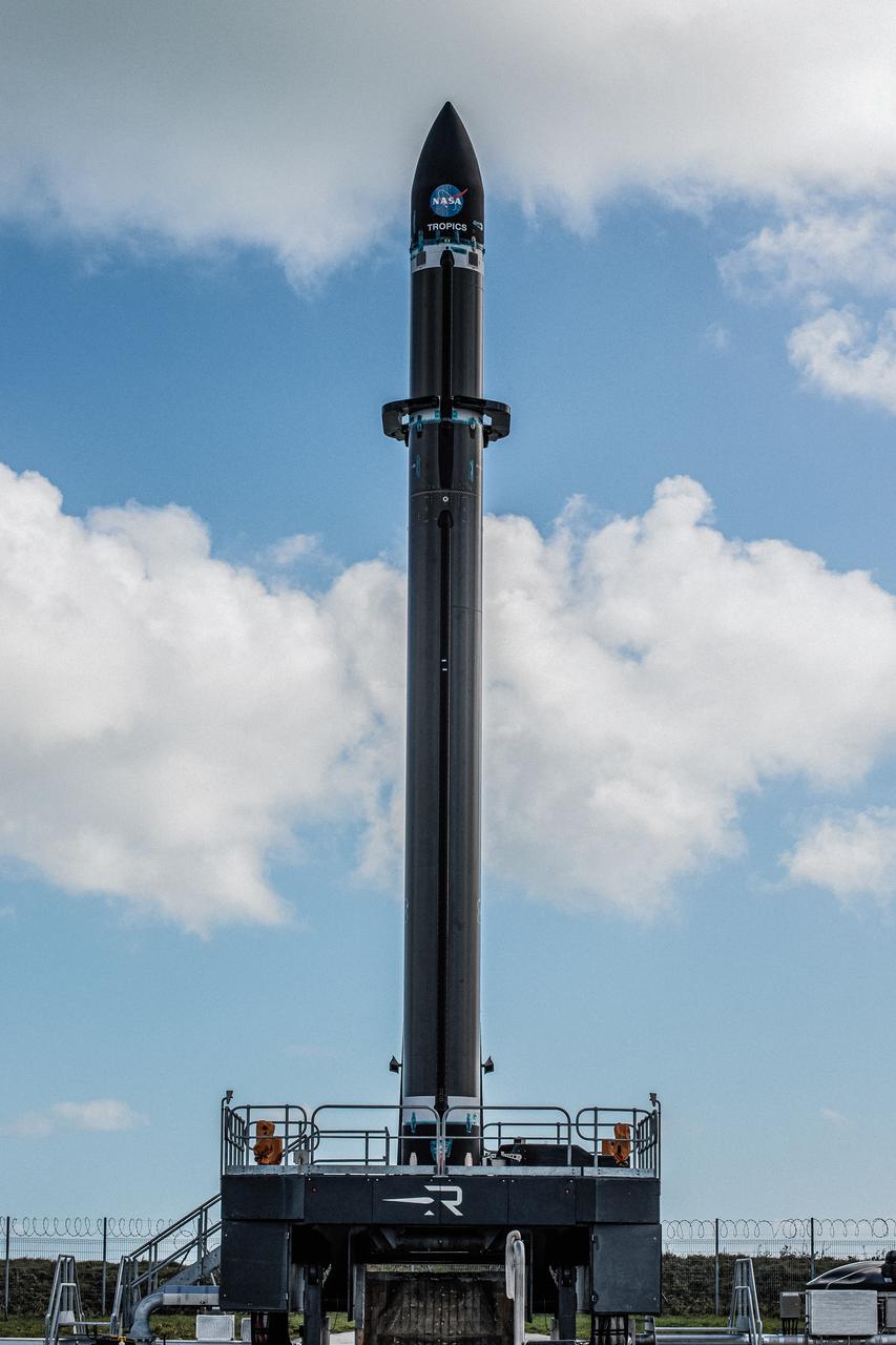
Rocket Lab’s Electron rocket is vertical on the pad at Launch Complex 1 in Mahia, New Zealand. NASA’s Time-Resolved Observations of Precipitation structure and storm Intensity with a Constellation of Smallsats (TROPICS) CubeSats are secured in the payload fairing atop the rocket. TROPICS is scheduled to launch on Monday, May 1, at 1 a.m. New Zealand time from Launch Complex 1, Pad B. TROPICS will provide data on temperature, precipitation, water vapor, and clouds by measuring microwave frequencies, providing insight into storm formation and intensification.
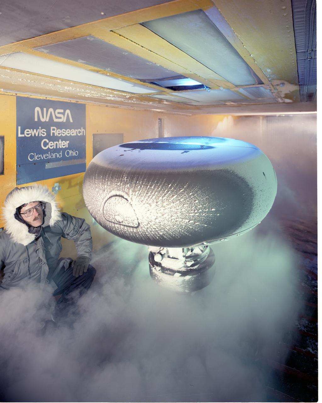
An AH-64 (Apache) Longbow fire control full size radar photographed during icing tests in the Icing Research wind tunnel. Built at the end of World War II, the Icing Research Tunnel is the oldest and largest refrigerated icing wind tunnel in the world. It can produce winds that travel up to 395 miles per hour and reach temperatures as low as -30 degrees Fahrenheit. The facility simulates ice formation during flight by spraying a cloud of super-cooled water droplets onto an aircraft component or model.
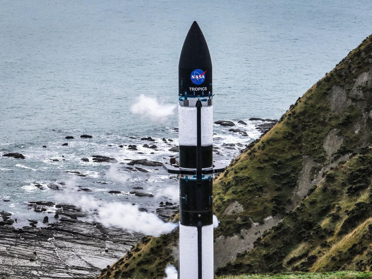
A wet dress rehearsal is underway for Rocket Lab’s Electron rocket at Launch Complex 1 in Mahia, New Zealand on April 28, 2023. NASA’s Time-Resolved Observations of Precipitation structure and storm Intensity with a Constellation of Smallsats (TROPICS) CubeSats are secured in the payload fairing atop the rocket. TROPICS is scheduled to launch from Launch Complex 1, Pad B. TROPICS will provide data on temperature, precipitation, water vapor, and clouds by measuring microwave frequencies, providing insight into storm formation and intensification.
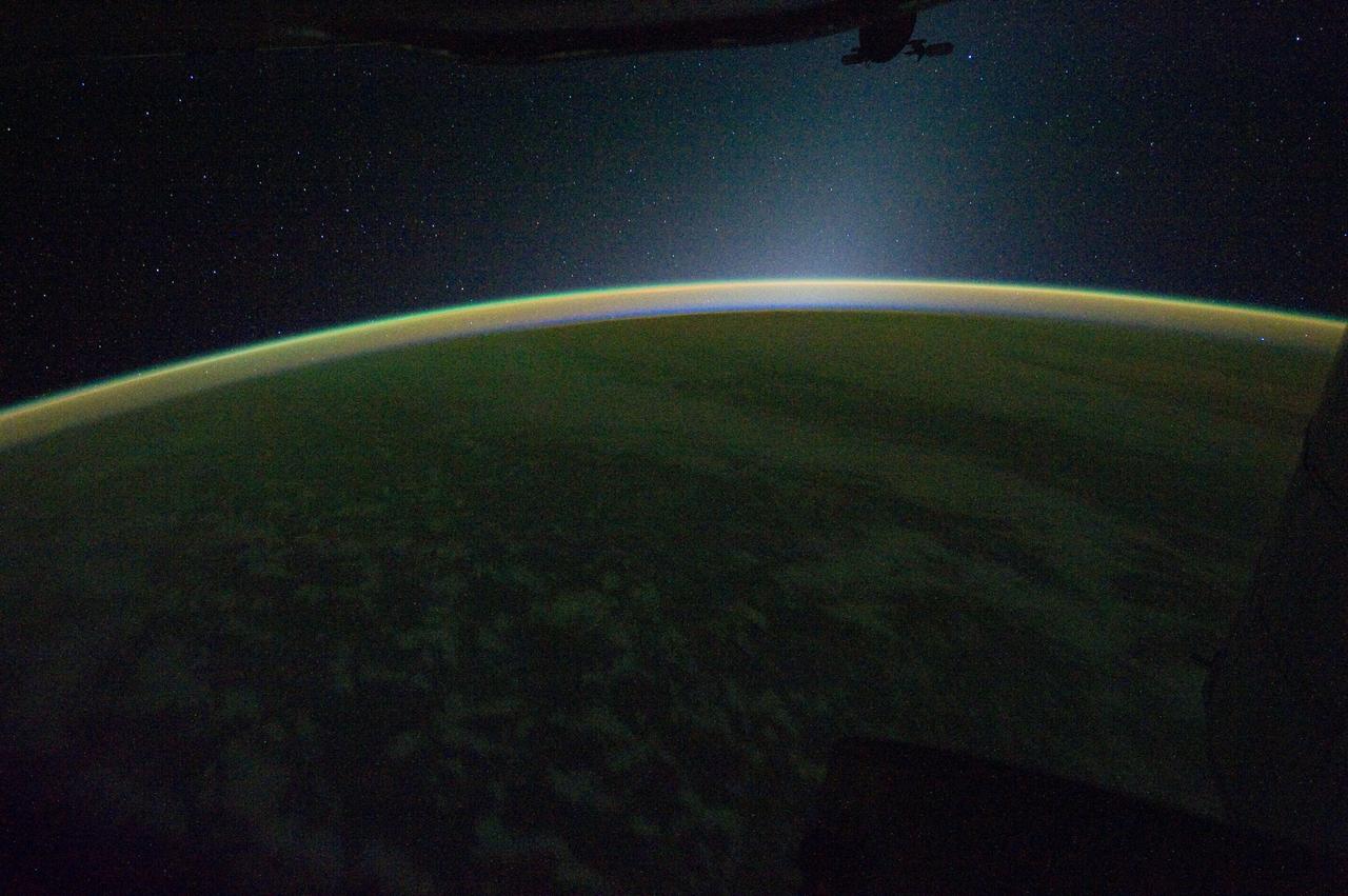
ISS030-E-007397 (24 Nov. 2011) --- This is a panoramic view of Earth's atmospheric limb photographed by an Expedition 30 crew member aboard the International Space Station when it was over a point centered approximately at 41.5 degrees north latitude and 179.9 degrees west longitude (central North Pacific – right at the International Dateline). The view is looking westward, well after sunset. The panorama includes airglow, some cloud formations, a portion of the space station silhouetted at the top of the frame and a star field.
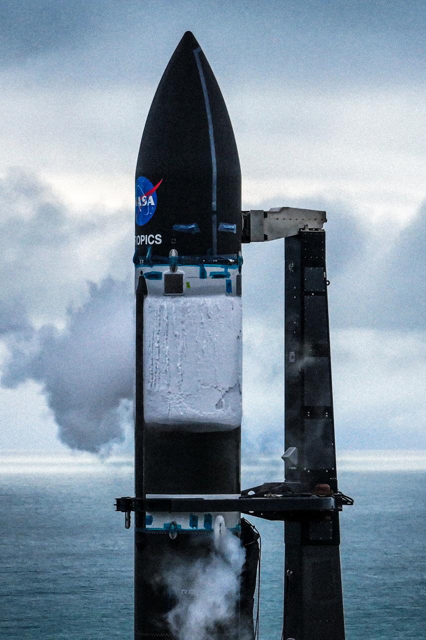
A wet dress rehearsal is underway for Rocket Lab’s Electron rocket at Launch Complex 1 in Mahia, New Zealand on April 28, 2023. NASA’s Time-Resolved Observations of Precipitation structure and storm Intensity with a Constellation of Smallsats (TROPICS) CubeSats are secured in the payload fairing atop the rocket. TROPICS is scheduled to launch from Launch Complex 1, Pad B. TROPICS will provide data on temperature, precipitation, water vapor, and clouds by measuring microwave frequencies, providing insight into storm formation and intensification.
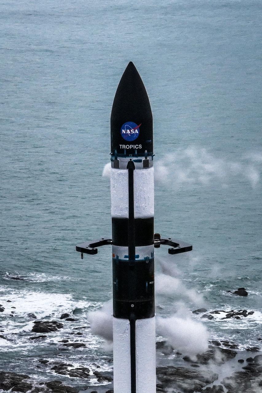
A wet dress rehearsal is underway for Rocket Lab’s Electron rocket at Launch Complex 1 in Mahia, New Zealand on April 28, 2023. NASA’s Time-Resolved Observations of Precipitation structure and storm Intensity with a Constellation of Smallsats (TROPICS) CubeSats are secured in the payload fairing atop the rocket. TROPICS is scheduled to launch from Launch Complex 1, Pad B. TROPICS will provide data on temperature, precipitation, water vapor, and clouds by measuring microwave frequencies, providing insight into storm formation and intensification.

Rocket Lab’s Electron rocket is vertical on the pad at Launch Complex 1 in Mahia, New Zealand. NASA’s Time-Resolved Observations of Precipitation structure and storm Intensity with a Constellation of Smallsats (TROPICS) CubeSats are secured in the payload fairing atop the rocket. TROPICS is scheduled to launch on Monday, May 1, at 1 a.m. New Zealand time from Launch Complex 1, Pad B. TROPICS will provide data on temperature, precipitation, water vapor, and clouds by measuring microwave frequencies, providing insight into storm formation and intensification.
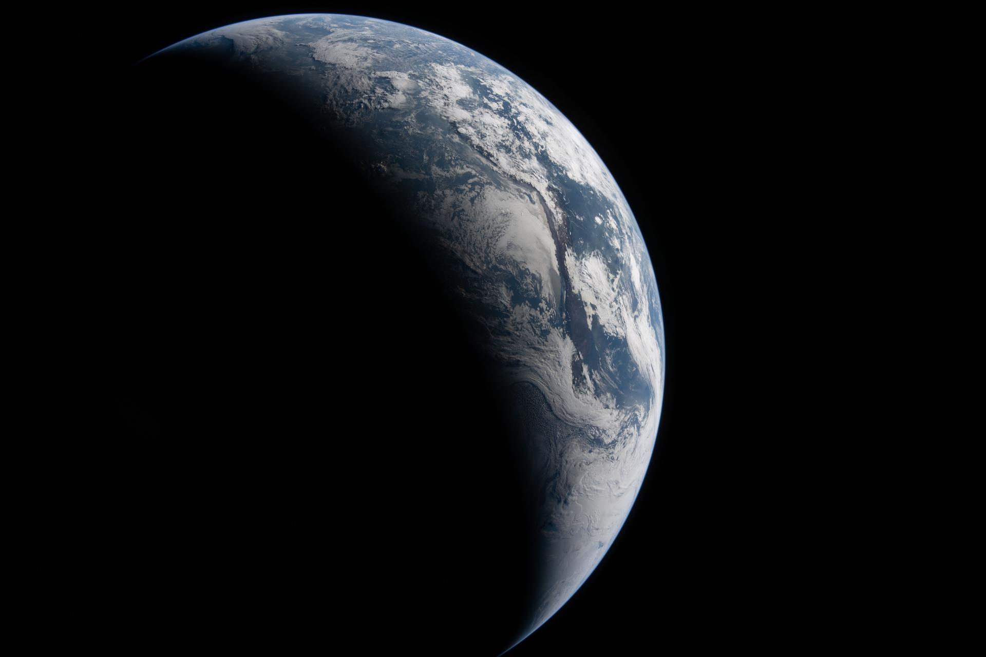
art002e023314 (April 2, 2026) – The Artemis II crew captured this view of Earth from approximately 43,500 miles (70,000 kilometers) away. Sunlight illuminates a portion of the planet while much of Earth remains in shadow, creating a curved boundary between day and night. South America is prominent in the sunlit portion, where the Atacama Desert, Andes Mountains, cloud formations, and other surface features are visible against the darkness of space. Credit: NASA

This Chandra X-ray observatory image of M83 shows numerous point-like neutron stars and black hole x-ray sources scattered throughout the disk of this spiral galaxy. The bright nuclear region of the galaxy glows prominently due to a burst of star formation that is estimated to have begun about 20 million years ago in the galaxy's time frame. The nuclear region, enveloped by a 7 million degree Celsius gas cloud of carbon, neon, magnesium, silicon, and sulfur atoms, contains a much higher concentration of neutron stars and black holes than the rest of the galaxy. Hot gas with a slightly lower temperature of 4 million degrees observed along the spiral arms of the galaxy suggests that star formation in this region may be occurring at a more sedate rate.
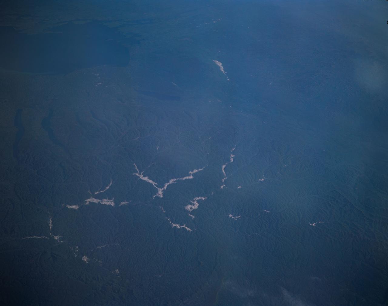
STS077-162-036 (19-29 May 1996) --- An oblique view of eastern New York State, Lake Ontario and the Saint Lawrence River. This view of New York State looking northeast was provided by the crew members of the mission. The Linhof camera, a 4x5 format instrument, provides a wide panorama of the region. If the picture is oriented with the NASA logo to the left bottom corner, North will be to the upper side of the frame. Lake Ontario is in the upper left corner and the Catskills are in the lower portion of the scene. The Finger Lakes from Cayuga to Oneida are in the left-center. One of the remarkable aspects of this photograph is this part of New York only averages 68 cloud free days per year. According to scientists studying the photo collection, the entire area of this photograph was covered by glaciers during the ice ages. The glaciers left their marks in the creation of the Finger Lakes and the formation of Lake Ontario.
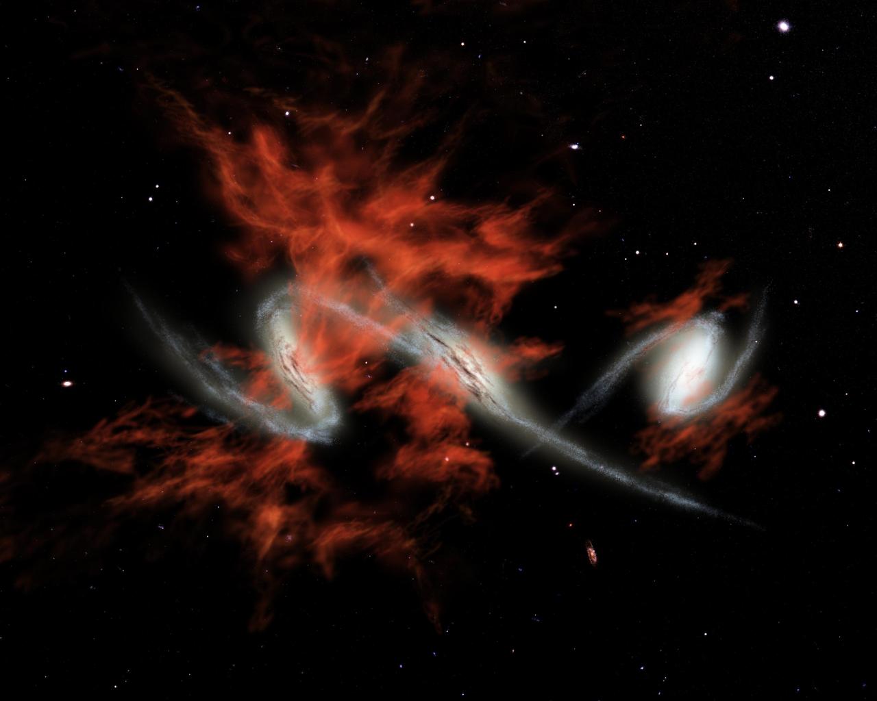
This artist's concept illustrates one possible answer to the puzzle of the "giant galactic blobs." These blobs (red), first identified about five years ago, are mammoth clouds of intensely glowing material that surround distant galaxies (white). Astronomers using visible-light telescopes can see the glow of the blobs, but they didn't know what provides the energy to light them up. NASA's Spitzer Space Telescope set its infrared eyes on one well-known blob located 11 billion light-years away, and discovered three tremendously bright galaxies, each shining with the light of more than one trillion Suns, headed toward each other. Spitzer also observed three other blobs in the same galactic neighborhood and found equally bright galaxies within them. One of these blobs is also known to contain galaxies merging together. The findings suggest that galactic mergers might be the mysterious source of blobs. If so, then one explanation for how mergers produce such large clouds of material is that they trigger intense bursts of star formation. This star formation would lead to exploding massive stars, or supernovae, which would then shoot gases outward in a phenomenon known as superwinds. Blobs produced in this fashion are illustrated in this artist's concept. http://photojournal.jpl.nasa.gov/catalog/PIA07221
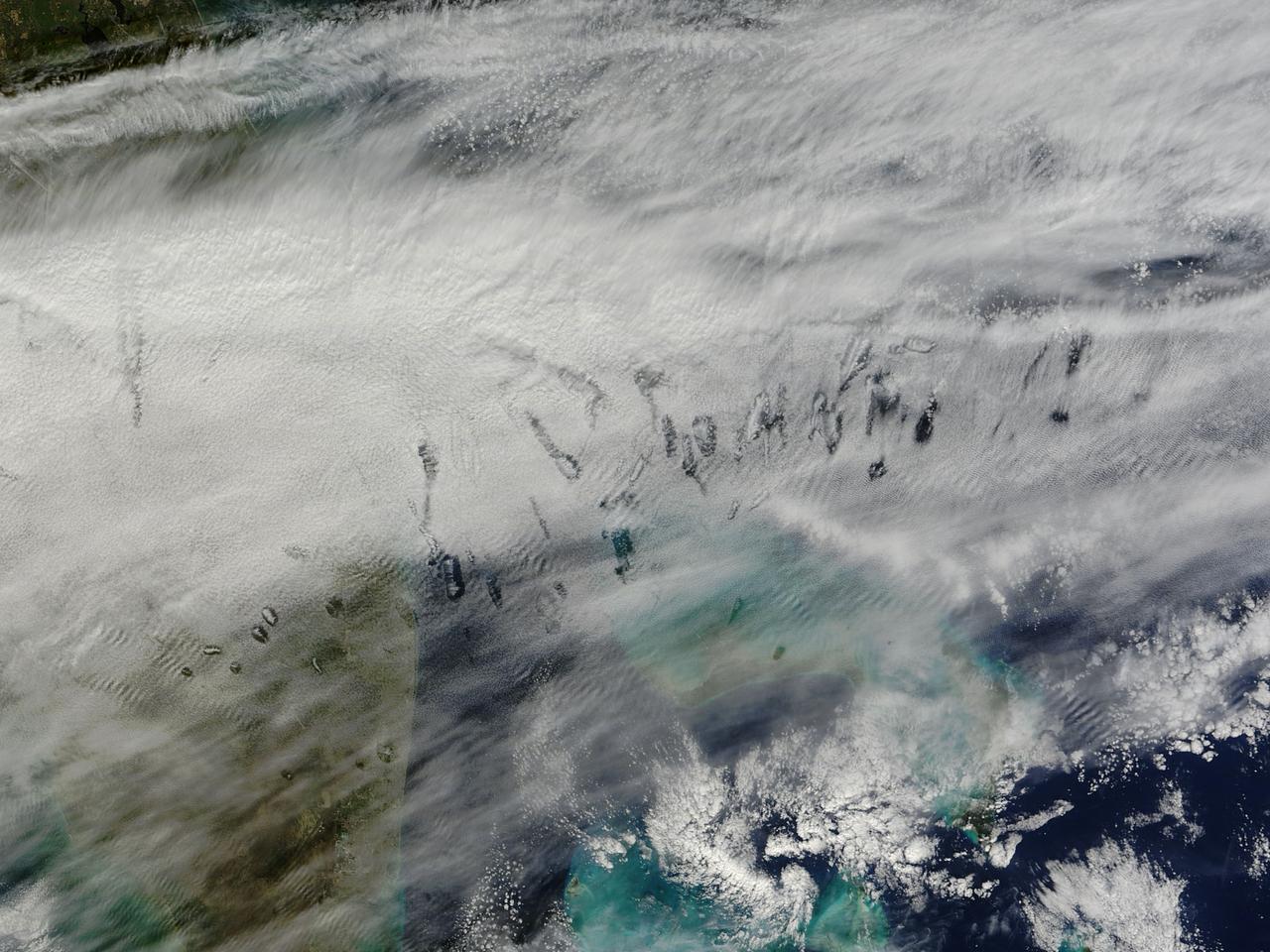
In elementary school, students learn that water freezes at 0 degrees Celsius (32 degrees Fahrenheit). That is true most of the time, but there are exceptions to the rule. For instance, water with very few impurities (such as dust or pollution particles, fungal spores, bacteria) can be chilled to much cooler temperatures and still remain liquid—a process known as supercooling. Supercooling may sound exotic, but it occurs pretty routinely in Earth’s atmosphere. Altocumulus clouds, a common type of mid-altitude cloud, are mostly composed of water droplets supercooled to a temperature of about -15 degrees C. Altocumulus clouds with supercooled tops cover about 8 percent of Earth’s surface at any given time. Supercooled water droplets play a key role in the formation of hole-punch and canal clouds, the distinctive clouds shown in these satellite images. Hole-punch clouds usually appear as circular gaps in decks of altocumulus clouds; canal clouds look similar but the gaps are longer and thinner. This true-color image shows hole-punch and canal clouds off the coast of Florida, as observed on December 12, 2014, by the Moderate Resolution Imaging Spectroradiometer (MODIS) on NASA’s Terra satellite. Both types of cloud form when aircraft fly through cloud decks rich with supercooled water droplets and produce aerodynamic contrails. Air expands and cools as it moves around the wings and past the propeller, a process known as adiabatic cooling. Air temperatures over jet wings often cool by as much as 20 degrees Celsius, pushing supercooled water droplets to the point of freezing. As ice crystals form, they absorb nearby water droplets. Since ice crystals are relatively heavy, they tend to sink. This triggers tiny bursts of snow or rain that leave gaps in the cloud cover. Whether a cloud formation becomes a hole-punch or canal depends on the thickness of the cloud layer, the air temperature, and the degree of horizontal wind shear. Both descending and ascending aircraft—including jets and propeller planes—can trigger hole-punch and canal clouds. The nearest major airports in the images above include Miami International, Fort Lauderdale International, Grand Bahama International, and Palm Beach International. Credit: NASA/GSFC/Jeff Schmaltz/MODIS Land Rapid Response Team <b><a href="http://www.nasa.gov/audience/formedia/features/MP_Photo_Guidelines.html" rel="nofollow">NASA image use policy.</a></b> <b><a href="http://www.nasa.gov/centers/goddard/home/index.html" rel="nofollow">NASA Goddard Space Flight Center</a></b> enables NASA’s mission through four scientific endeavors: Earth Science, Heliophysics, Solar System Exploration, and Astrophysics. Goddard plays a leading role in NASA’s accomplishments by contributing compelling scientific knowledge to advance the Agency’s mission. <b>Follow us on <a href="http://twitter.com/NASAGoddardPix" rel="nofollow">Twitter</a></b> <b>Like us on <a href="http://www.facebook.com/pages/Greenbelt-MD/NASA-Goddard/395013845897?ref=tsd" rel="nofollow">Facebook</a></b> <b>Find us on <a href="http://instagram.com/nasagoddard?vm=grid" rel="nofollow">Instagram</a></b>
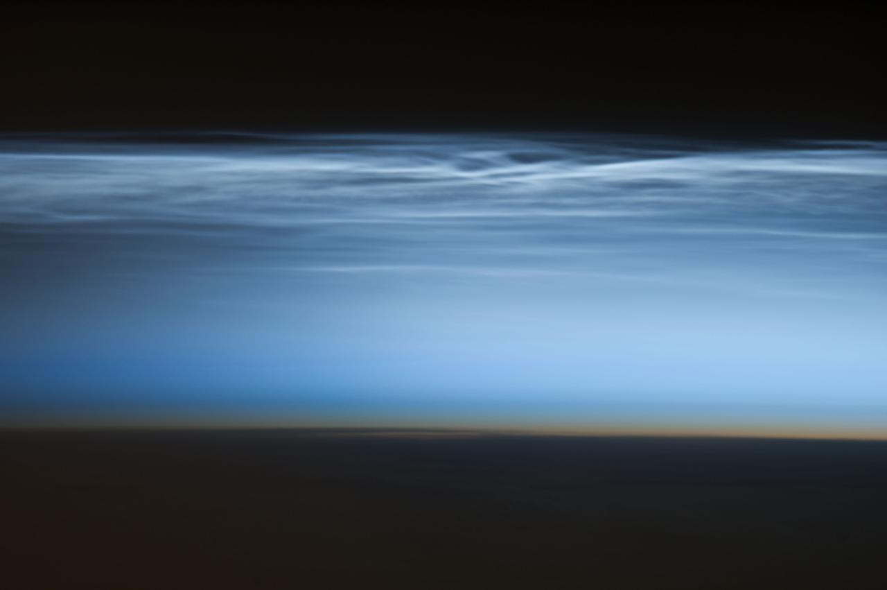
ISS034-E-024622 (5 Jan. 2013) --- Polar mesospheric clouds over the South Pacific Ocean are featured in this image photographed by an Expedition 34 crew member on the International Space Station. Polar mesospheric clouds—also known as noctilucent, or “night shining” clouds—are formed 76 to 85 kilometers above Earth’s surface near the mesosphere-thermosphere boundary of the atmosphere, a region known as the mesopause. At these altitudes, water vapor can freeze into clouds of ice crystals. When the sun is below the horizon such that the ground is in darkness, these high clouds may still be illuminated—lending them their ethereal, “night shining” qualities. Noctilucent clouds have been observed from all human vantage points in both the Northern and Southern Hemispheres – from the surface, in aircraft, and in orbit from the space station—and tend to be most visible during the late spring and early summer seasons. Polar mesospheric clouds also are of interest to scientists studying the atmosphere. While some scientists seek to understand their mechanisms of formation, others have identified them as potential indicators of atmospheric changes resulting from increases in greenhouse gas concentrations. This photograph was taken when the station was over the Pacific Ocean south of French Polynesia. While most polar mesospheric cloud images are taken from the orbital complex with relatively short focal length lens to maximize the field of view, this image was taken with a long lens (400 mm) allowing for additional detail of the cloud forms to be seen. Below the brightly-lit noctilucent clouds in the center of the image, the pale orange band indicates the stratosphere.

ISS031-E-116058 (13 June 2012) --- Polar mesospheric clouds in the Northern Hemisphere are featured in this image photographed by an Expedition 31 crew member on the International Space Station. In both the Northern and Southern Hemisphere, during their respective late spring and early summer seasons, polar mesospheric clouds are at the peak of their visibility. Visible from the ground during twilight, aircraft in flight, and the International Space Station, they typically appear as delicate shining threads against the darkness of space?hence their other name of noctilucent or ?night-shining? clouds. On the same day this image was taken from the space station while it was passing over the night-darkened Tibetan Plateau, polar mesospheric clouds were also visible to aircraft flying above Canada. In addition to this still image, the space station crew took a time-lapse image sequence of polar mesospheric clouds several days earlier (June 5, 2012) while passing over western Asia; this is first such sequence of images of the phenomena taken from orbit. Polar mesospheric clouds form between 76-85 kilometers above the Earth?s surface, when there is sufficient water vapor at these high altitudes to freeze into ice crystals. The clouds are illuminated by the setting sun while the ground surface below is in darkness, lending them their night-shining properties. In addition to the illuminated tracery of polar mesospheric clouds trending across the center of the image, lower layers of the atmosphere are also illuminated; the lowest layer of the atmosphere, the stratosphere, is indicated by dim orange and red tones. While the exact cause of formation of polar mesospheric clouds is still debated?dust from meteors, global warming, and rocket exhaust have all been suggested as contributing factors?recent research suggests that changes in atmospheric gas composition or temperature has caused the clouds to become brighter over time.

ISS016-E-027426 (5 Feb. 2008) --- Cumulonimbus Cloud over Africa is featured in this image photographed by an Expedition 16 crewmember on the International Space Station. Deemed by many meteorologists as one of the most impressive of cloud formations, cumulonimbus (from the Latin for "puffy" and "dark") clouds form due to vigorous convection of warm and moist unstable air. Surface air warmed by the Sun-heated ground surface rises, and if sufficient atmospheric moisture is present, water droplets will condense as the air mass encounters cooler air at higher altitudes. The air mass itself also expands and cools as it rises due to decreasing atmospheric pressure, a process known as adiabatic cooling. This type of convection is common in tropical latitudes year-round and during the summer season at higher latitudes. As water in the rising air mass condenses and changes from a gaseous to a liquid state, it releases energy to its surroundings, further heating the surrounding air and leading to more convection and rising of the cloud mass to higher altitudes. This leads to the characteristic vertical "towers" associated with cumulonimbus clouds, an excellent example of which is visible in this image (right). If enough moisture is present to condense and continue heating the cloud mass through several convective cycles, a tower can rise to altitudes of approximately 10 kilometers at high latitudes to 20 kilometers in the tropics -- before encountering a region of the atmosphere known as the tropopause. The tropopause is characterized by a strong temperature inversion where the atmosphere is dryer and no longer cools with altitude. This halts further vertical motion of the cloud mass, and causes flattening and spreading of the cloud tops into an anvil-shaped cloud as illustrated by this oblique photograph. The view direction is at an angle from the vertical, rather than straight "down" towards the Earth's surface. The image, photographed while the International Space Station was passing over western Africa near the Senegal-Mali border, shows a fully-formed anvil cloud with numerous smaller cumulonimbus towers rising near it. The high energetics of these storm systems typically make them hazardous due to associated heavy precipitation, lightning, high wind speeds and possible tornadoes.
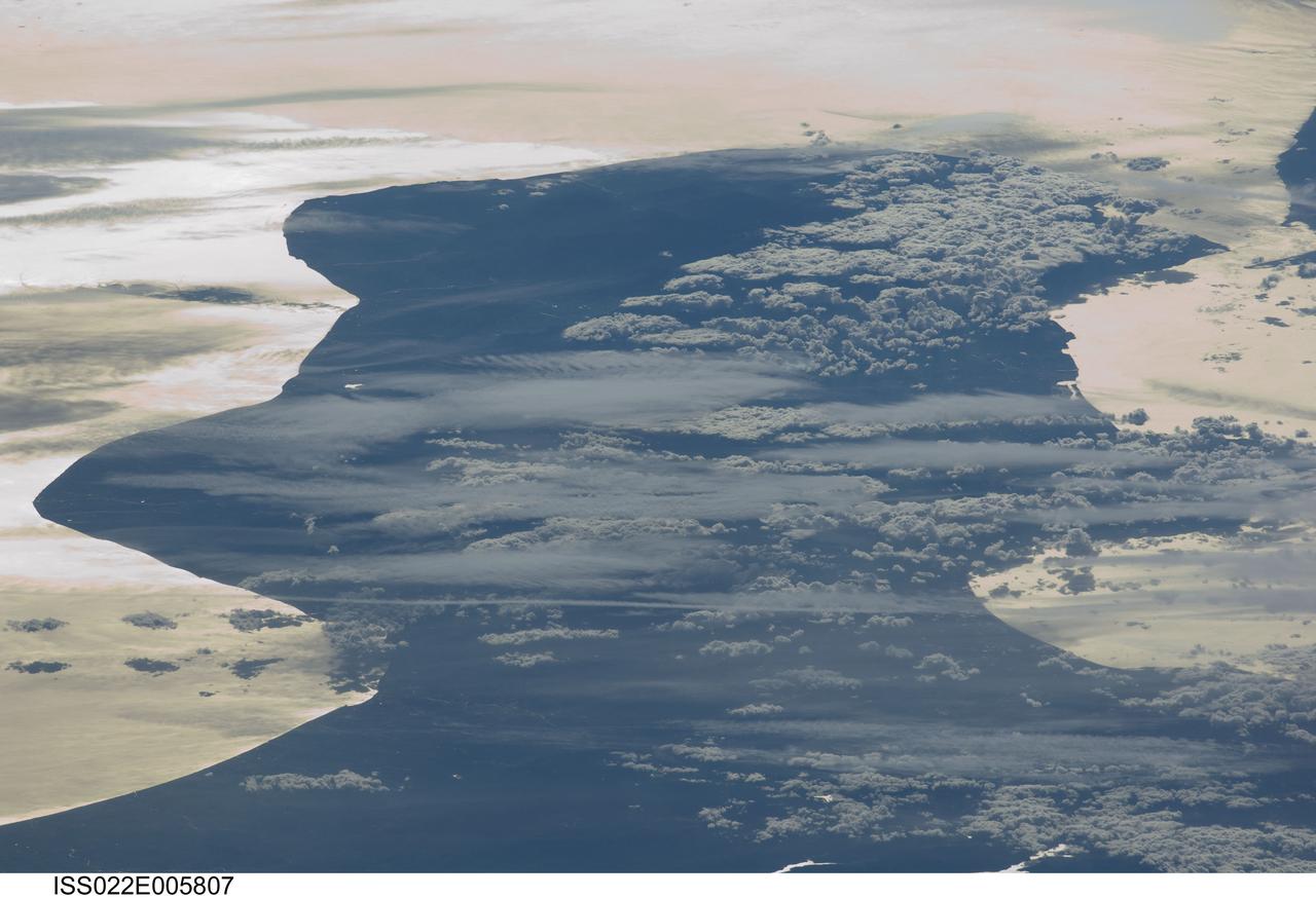
ISS022-E-005807 (3 Dec. 2009) --- Cloud formations and sunglint near Italy are featured in this image photographed by an Expedition 22 crew member on the International Space Station. This view depicts the Calabria region of southern Italy ? the toe of Italy?s ?boot? ? outlined by the Ionian and Tyrrhenian Seas to the southeast and northwest respectively. The water surfaces present a mirror-like appearance due to sunglint. This phenomenon is caused by sunlight reflecting off the water surface directly back towards the crew member aboard the space station. The ISS was located over northwestern Romania, approximately 1,040 kilometers to the northeast of Calabria, when this image was taken. The Calabrian peninsula appears shortened and distorted due to the high viewing angle from the station. Such imagery is termed oblique, indicating that the view is not looking directly downwards towards Earth?s surface from the ISS (known as a nadir view). This highly oblique view also highlights two distinct cloud patterns over the Calabrian interior. Patchy, highly textured cumulus clouds are present at lower altitudes, while grey altostratus clouds are elongated by prevailing winds at higher altitudes. The Strait of Messina, just visible at upper right, marks the boundary between the coastlines of Italy and the island of Sicily.
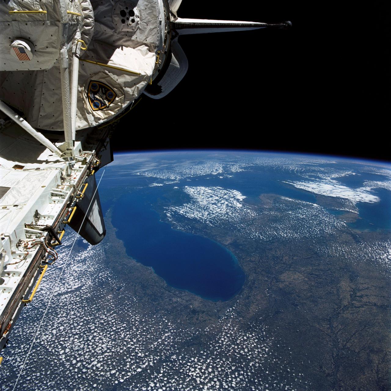
STS040-77-045 (6 June 1991) --- This image, photographed on June 6, 1991, is an oblique view looking north-northeast and shows most of the Great Lakes region. Part of Columbia's cargo bay and the Spacelab Life Sciences (SLS-1) module are in the foreground. In the center of the image is Lake Michigan with Chicago clearly visible along the southwest shore. According to NASA photo experts studying the STS-40 imagery, this image shows several interesting meteorological phenomena. The difference in temperature between the warming land and the cold lake waters is illustrated by the low level clouds. The warming land surface results in rising air and the formation of clouds, while the lake waters are cold and result in the lakes remaining cloud free. Also visible is evidence of lake breezes developing around several of the lakes. This phenomena is also driven by the difference in temperature between the land and the water. Winds blowing off the lakes must travel 25 - 30 miles inland before it warms sufficiently to create clouds.
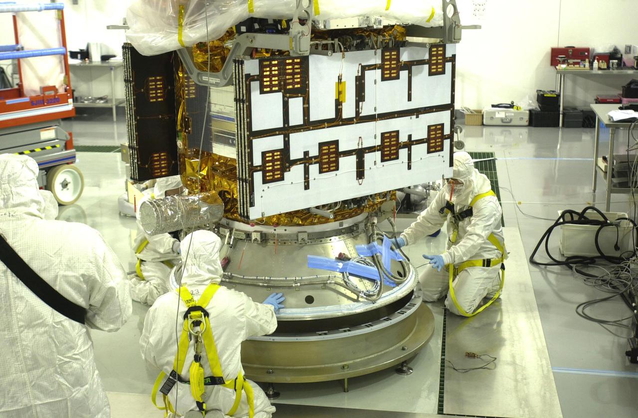
VANDENBERG AIR FORCE BASE, CALIF. - Inside the Astrotech Payload Processing Facility on Vandenberg Air Force Base in California, workers help guide the CALIPSO spacecraft as it is lowered onto a payload attach fitting. CALIPSO will be mated to the Lower Delta Payload Attach Fitting (LDPAF) that contains the CloudSat satellite. The PAF is the interface between the spacecraft and the second stage of the rocket. CALIPSO stands for Cloud-Aerosol Lidar and Infrared Pathfinder Satellite Observation. CALIPSO and CloudSat are highly complementary satellites that will provide never-before-seen 3-D perspectives of how clouds and aerosols form, evolve, and affect weather and climate. CALIPSO and CloudSat will fly in formation with three other satellites in the A-train constellation to enhance understanding of our climate system. Launch of CALIPSO_CloudSat aboard a Boeing Delta II rocket is scheduled for 3:01 a.m. PDT Sept. 29.
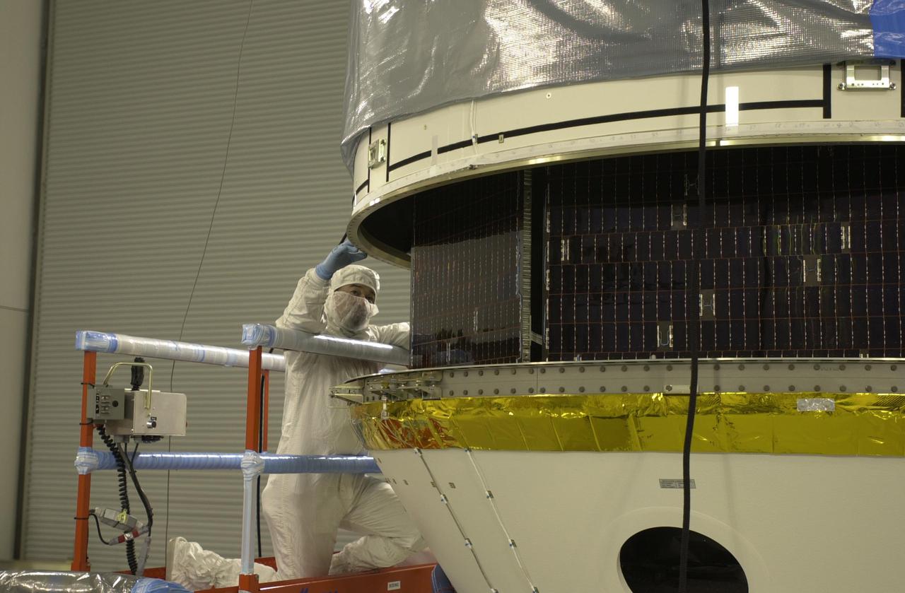
VANDENBERG AIR FORCE BASE, CALIF. - Inside the Astrotech Payload Processing Facility on Vandenberg Air Force Base in California, the upper Delta Payload Attach Fitting (UDPAF) is lowered toward the lower Delta Payload Attach Fitting (LDPAF). The LDPAF holds the CloudSat satellite and the UDPAF will hold the CALIPSO satellite. The two sections will be mated. CALIPSO stands for Cloud-Aerosol Lidar and Infrared Pathfinder Satellite Observation. CALIPSO and CloudSat are highly complementary satellites that will provide never-before-seen 3-D perspectives of how clouds and aerosols form, evolve, and affect weather and climate. CALIPSO and CloudSat will fly in formation with three other satellites in the A-train constellation to enhance understanding of our climate system. Launch of CALIPSO_CloudSat aboard a Boeing Delta II rocket is scheduled for 3:01 a.m. PDT Sept. 29.
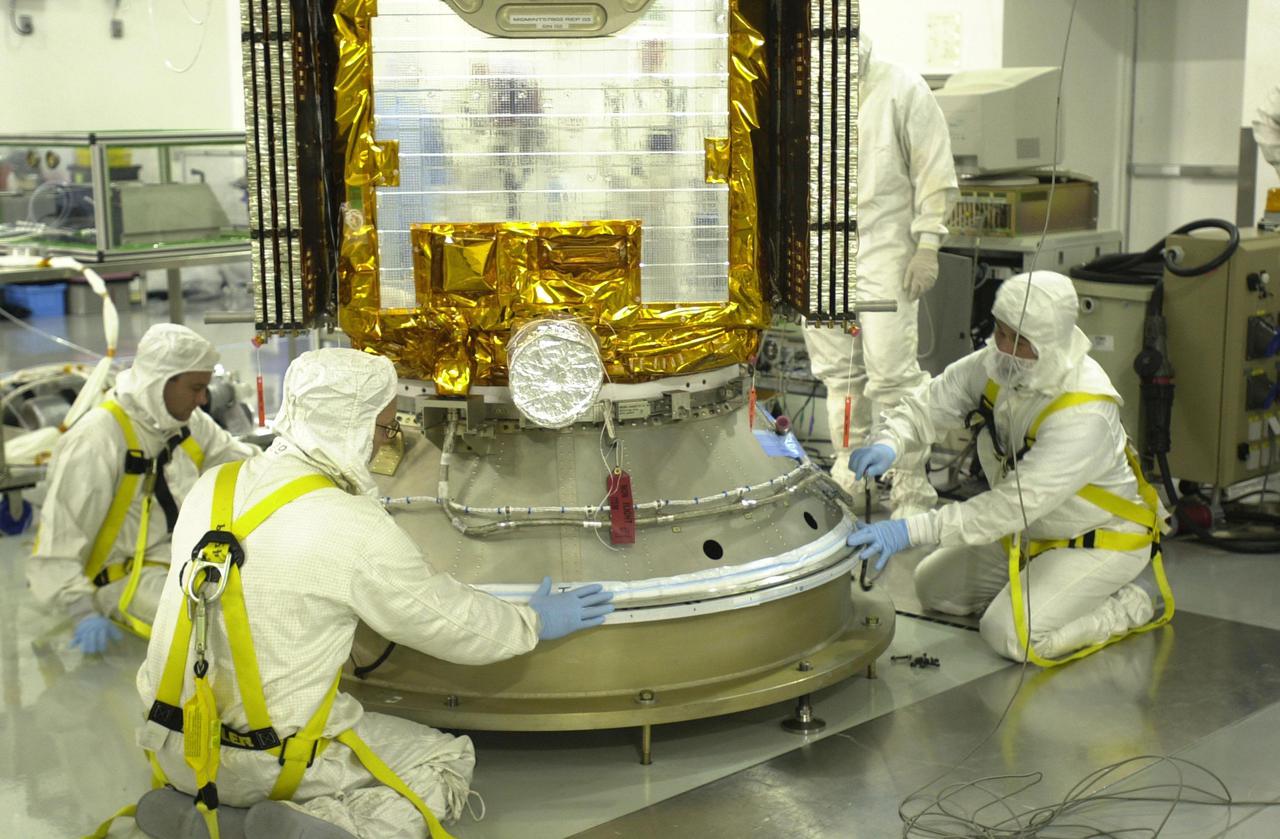
VANDENBERG AIR FORCE BASE, CALIF. - Inside the Astrotech Payload Processing Facility on Vandenberg Air Force Base in California, workers secure the CALIPSO spacecraft onto a payload attach fitting. CALIPSO will be mated to the Lower Delta Payload Attach Fitting (LDPAF) that contains the CloudSat satellite. The PAF is the interface between the spacecraft and the second stage of the rocket. CALIPSO stands for Cloud-Aerosol Lidar and Infrared Pathfinder Satellite Observation. CALIPSO and CloudSat are highly complementary satellites that will provide never-before-seen 3-D perspectives of how clouds and aerosols form, evolve, and affect weather and climate. CALIPSO and CloudSat will fly in formation with three other satellites in the A-train constellation to enhance understanding of our climate system. Launch of CALIPSO_CloudSat aboard a Boeing Delta II rocket is scheduled for 3:01 a.m. PDT Sept. 29.
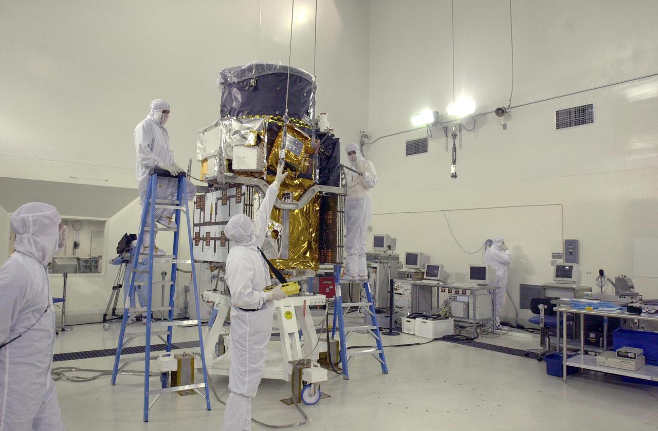
VANDENBERG AIR FORCE BASE, CALIF. - At Vandenberg Air Force Base in California, the CALIPSO spacecraft is being prepared for a move to a specially modified container where LIDAR (LIght Detection And Ranging) laser testing will take place. CALIPSO stands for Cloud-Aerosol LIDAR and Infrared Pathfinder Satellite Observation. LIDAR measures distance, speed, rotation, chemical composition and concentration. CALIPSO and CloudSat will fly in formation with three other satellites in the A-train constellation to enhance understanding of our climate system. They are highly complementary satellites and together they will provide never-before-seen 3-D perspectives of how clouds and aerosols form, evolve, and affect weather and climate. Launch of CALIPSO_CloudSat aboard a Boeing Delta II rocket is scheduled for 3:01 a.m. PDT Sept. 29.
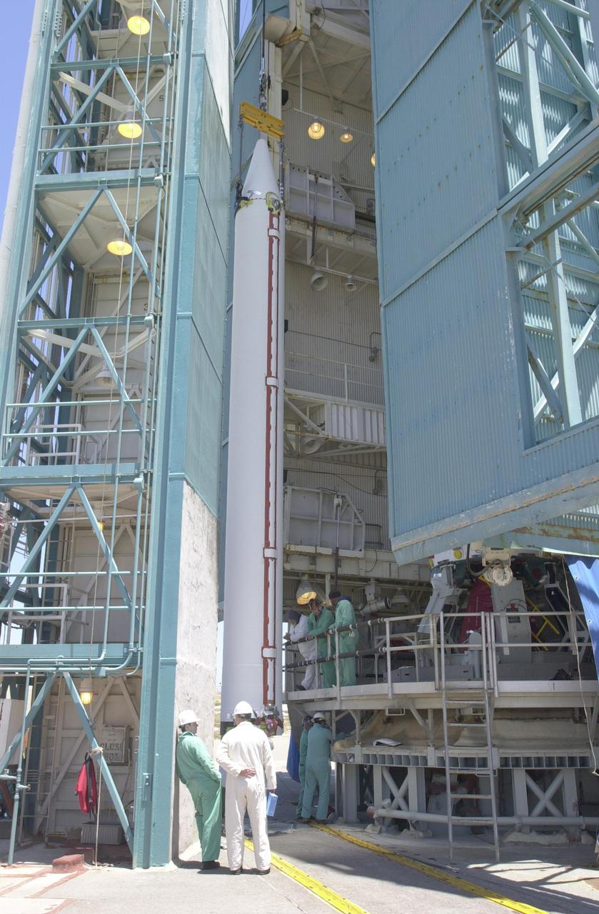
VANDENBERG AIR FORCE BASE, CALIF. - At NASA Space Launch Complex 2 on Vandenberg Air Force Base in California, another Solid Rocket Booster is attached to the Boeing Delta II rocket seen behind it. The Delta is the launch vehicle for the CALIPSO_CloudSat spacecraft. CALIPSO stands for Cloud-Aerosol Lidar and Infrared Pathfinder Satellite Observation. CALIPSO and CloudSat are highly complementary satellites and together will provide never-before-seen 3-D perspectives of how clouds and aerosols form, evolve, and affect weather and climate. CALIPSO and CloudSat will fly in formation with three other satellites in the A-train constellation to enhance understanding of our climate system. Launch of CALIPSO_CloudSat aboard a Boeing Delta II rocket is scheduled for 3:01 a.m. Sept. 29.
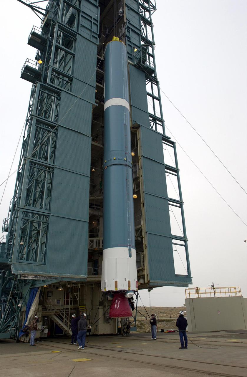
VANDENBERG AIR FORCE BASE, CALIF. - At NASA Space Launch Complex 2 on Vandenberg Air Force Base in California, the Boeing Delta II rocket, launch vehicle for the CALIPSO_CloudSat spacecraft, is ready to lifted into the mobile service tower, or gantry. CALIPSO stands for Cloud-Aerosol Lidar and Infrared Pathfinder Satellite Observation. CALIPSO and CloudSat are highly complementary satellites and together will provide never-before-seen 3-D perspectives of how clouds and aerosols form, evolve, and affect weather and climate. CALIPSO and CloudSat will fly in formation with three other satellites in the A-train constellation to enhance understanding of our climate system. Launch of CALIPSO_CloudSat aboard a Boeing Delta II rocket is scheduled for 3:01 a.m. Sept. 29.
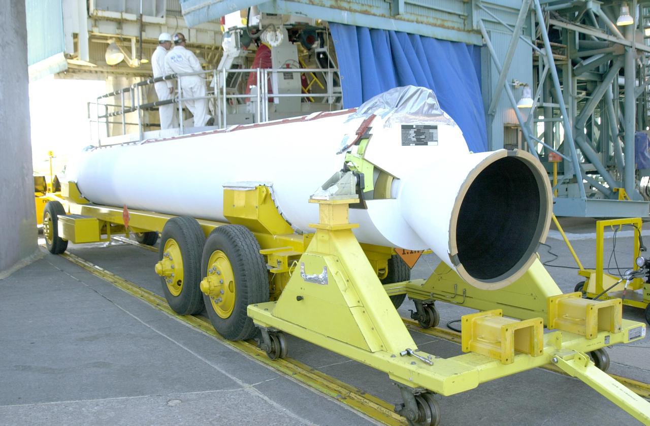
VANDENBERG AIR FORCE BASE, CALIF. - Another Solid Rocket Booster for the CALIPSO_CloudSat launch is ready to be raised to a vertical position at NASA Space Launch Complex 2 on Vandenberg Air Force Base in California. It will then be lifted into the mobile service tower, or gantry, and attached to the Boeing Delta II rocket. The Delta is the launch vehicle for the CALIPSO_CloudSat spacecraft. CALIPSO stands for Cloud-Aerosol Lidar and Infrared Pathfinder Satellite Observation. CALIPSO and CloudSat are highly complementary satellites and together will provide never-before-seen 3-D perspectives of how clouds and aerosols form, evolve, and affect weather and climate. CALIPSO and CloudSat will fly in formation with three other satellites in the A-train constellation to enhance understanding of our climate system. Launch of CALIPSO_CloudSat aboard a Boeing Delta II rocket is scheduled for 3:01 a.m. Sept. 29.
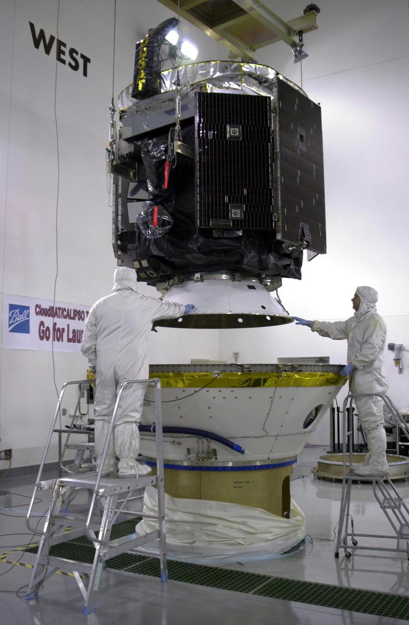
KENNEDY SPACE CENTER, FLA. - In a clean room at Vandenberg Air Force Base in California, workers ensure NASA's CloudSat spacecraft is lowered safely into the lower portion of the Delta Payload Attach Fitting. CloudSat joins the CALIPSO spacecraft for launch. CALIPSO stands for Cloud-Aerosol Lidar and Infrared Pathfinder Satellite Observation. CALIPSO and CloudSat are highly complementary satellites that will provide never-before-seen 3-D perspectives of how clouds and aerosols form, evolve, and affect weather and climate. CALIPSO and CloudSat will fly in formation with three other satellites in the A-train constellation to enhance understanding of our climate system. Launch of CALIPSO_CloudSat aboard a Boeing Delta II rocket is scheduled for 3:01 a.m. PDT Sept. 29.
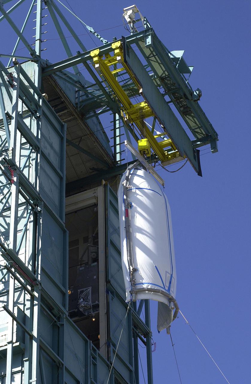
VANDENBERG AIR FORCE BASE, CALIF. - At NASA Space Launch Complex 2 on Vandenberg Air Force Base in California, the first half of the fairing for CALIPSO_CloudSat reaches the top of the mobile service tower, or gantry. The fairing encloses and protects the spacecraft during launch and flight through the atmosphere. Once in space, it is jettisoned. CALIPSO stands for Cloud-Aerosol Lidar and Infrared Pathfinder Satellite Observation. CALIPSO and CloudSat are highly complementary satellites and together will provide never-before-seen 3-D perspectives of how clouds and aerosols form, evolve, and affect weather and climate. CALIPSO and CloudSat will fly in formation with three other satellites in the A-train constellation to enhance understanding of our climate system. Launch of CALIPSO_CloudSat aboard a Boeing Delta II rocket is scheduled for 3:01 a.m. Sept. 29.
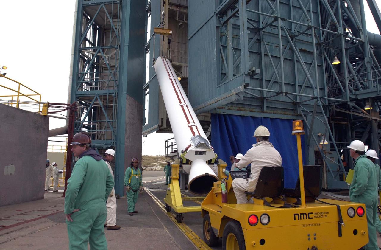
VANDENBERG AIR FORCE BASE, CALIF. - One of four Solid Rocket Boosters for the CALIPSO_CloudSat launch is raised off the transporter to a vertical position. It will be lifted into the mobile service tower, or gantry, and attached to the Boeing Delta II rocket. CALIPSO stands for Cloud-Aerosol Lidar and Infrared Pathfinder Satellite Observation. CALIPSO and CloudSat are highly complementary satellites and together will provide never-before-seen 3-D perspectives of how clouds and aerosols form, evolve, and affect weather and climate. CALIPSO and CloudSat will fly in formation with three other satellites in the A-train constellation to enhance understanding of our climate system. Launch of CALIPSO_CloudSat aboard a Boeing Delta II rocket is scheduled for 3:01 a.m. Sept. 29.
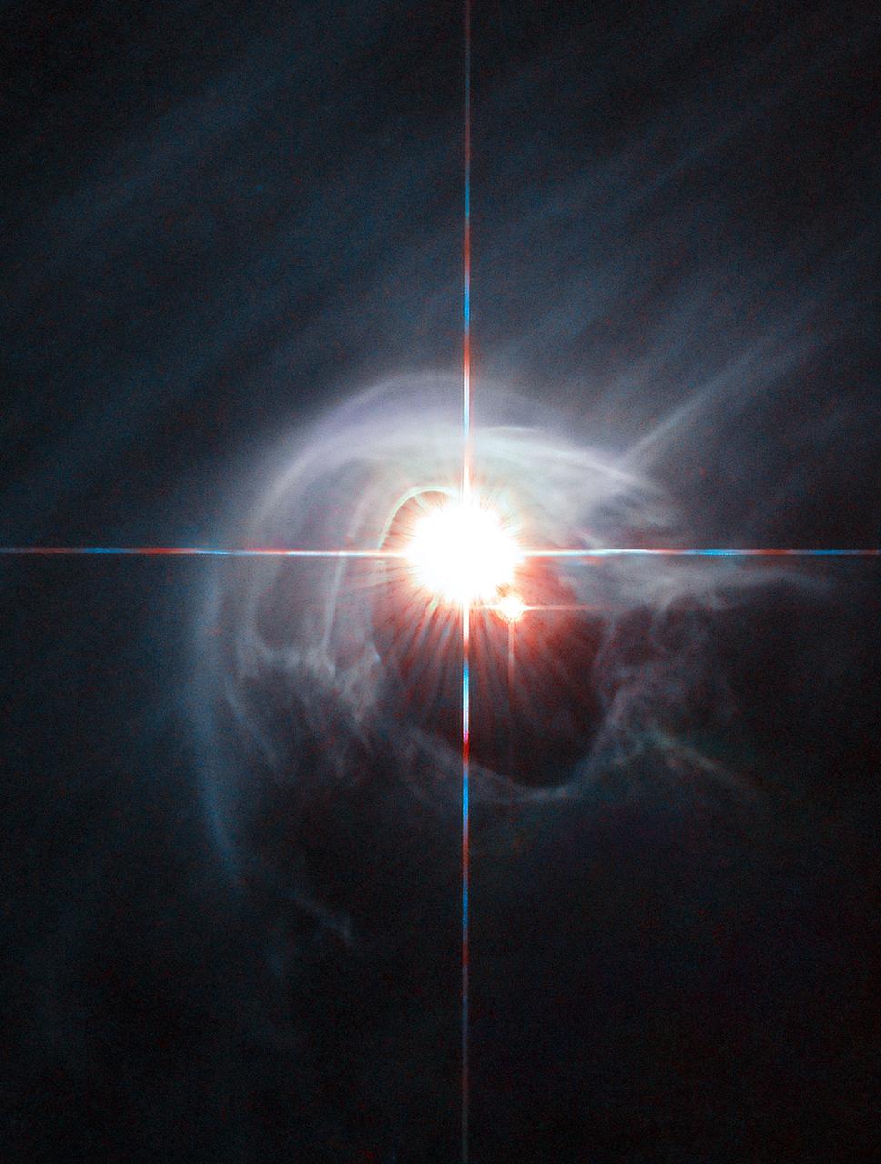
Two stars shine through the centre of a ring of cascading dust in this image taken by the NASA/ESA Hubble Space Telescope. The star system is named DI Cha, and while only two stars are apparent, it is actually a quadruple system containing two sets of binary stars. As this is a relatively young star system it is surrounded by dust. The young stars are moulding the dust into a wispy wrap. The host of this alluring interaction between dust and star is the Chamaeleon I dark cloud — one of three such clouds that comprise a large star-forming region known as the Chamaeleon Complex. DI Cha's juvenility is not remarkable within this region. In fact, the entire system is among not only the youngest but also the closest collections of newly formed stars to be found and so provides an ideal target for studies of star formation.
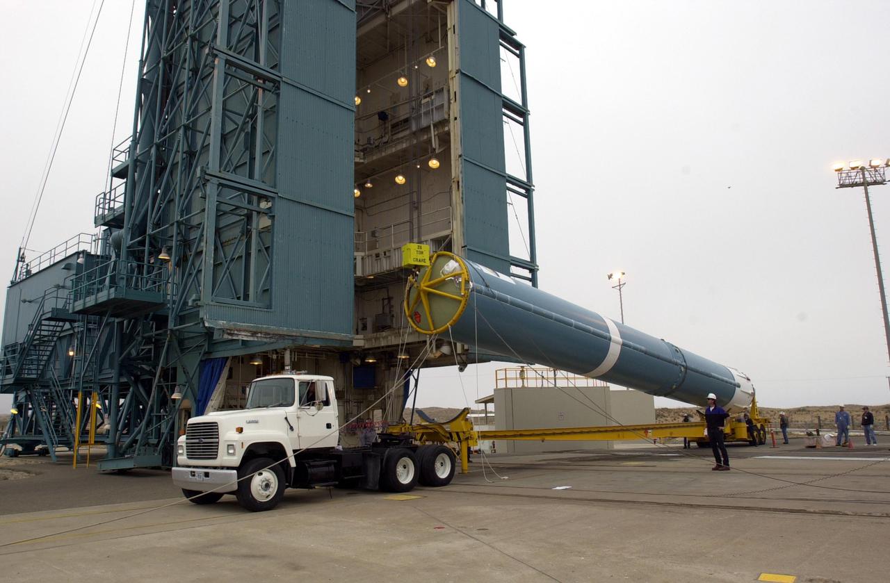
VANDENBERG AIR FORCE BASE, CALIF. - At NASA Space Launch Complex 2 on Vandenberg Air Force Base in California, the first stage of the Boeing Delta II rocket, launch vehicle for the CALIPSO_CloudSat spacecraft, is raised off the transporter. Once it is vertical, it will be lifted up into the mobile service tower, or gantry. CALIPSO stands for Cloud-Aerosol Lidar and Infrared Pathfinder Satellite Observation. CALIPSO and CloudSat are highly complementary satellites and together will provide never-before-seen 3-D perspectives of how clouds and aerosols form, evolve, and affect weather and climate. CALIPSO and CloudSat will fly in formation with three other satellites in the A-train constellation to enhance understanding of our climate system. Launch of CALIPSO_CloudSat aboard a Boeing Delta II rocket is scheduled for 3:01 a.m. Sept. 29.
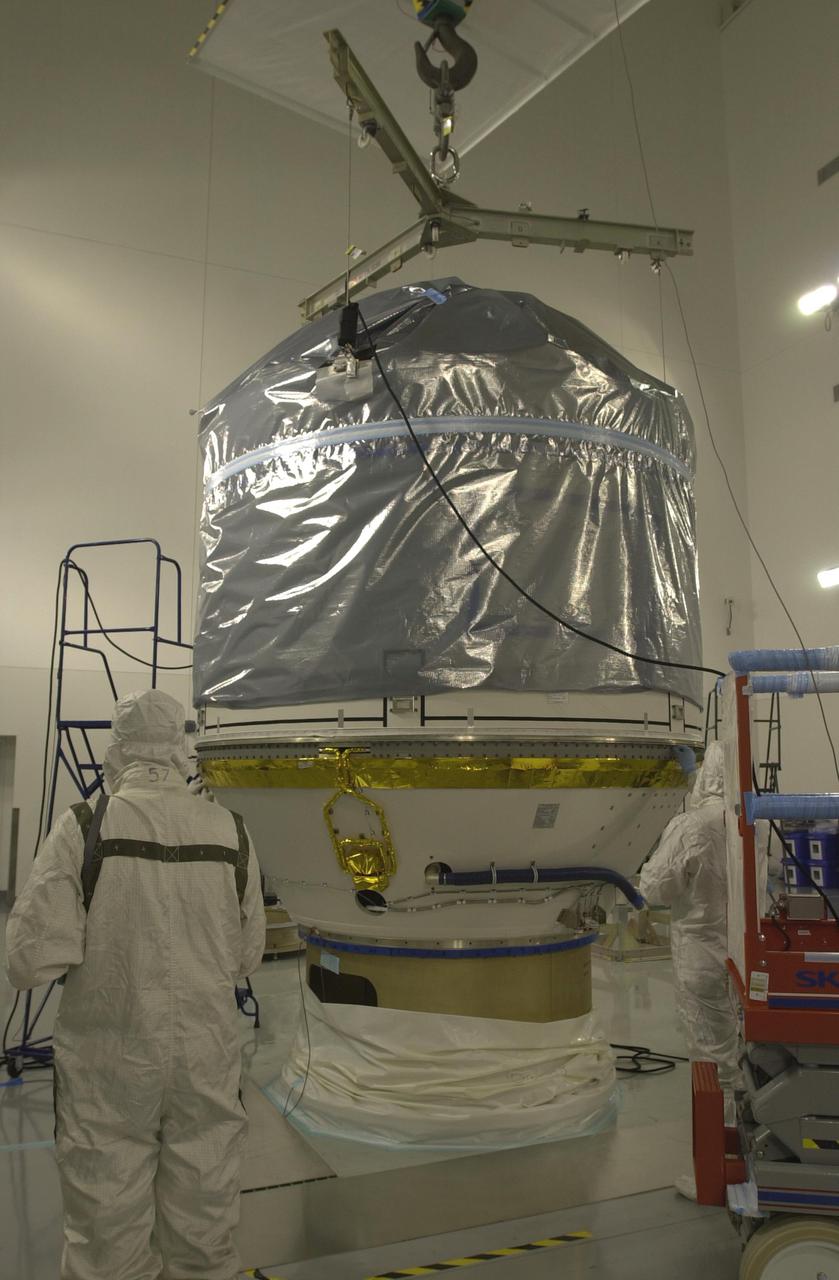
VANDENBERG AIR FORCE BASE, CALIF. - Inside the Astrotech Payload Processing Facility on Vandenberg Air Force Base in California, the upper Delta Payload Attach Fitting (UDPAF) has been mated with the lower Delta Payload Attach Fitting (LDPAF). The LDPAF holds the CloudSat satellite and the UDPAF will hold the CALIPSO satellite. CALIPSO stands for Cloud-Aerosol Lidar and Infrared Pathfinder Satellite Observation. CALIPSO and CloudSat are highly complementary satellites that will provide never-before-seen 3-D perspectives of how clouds and aerosols form, evolve, and affect weather and climate. CALIPSO and CloudSat will fly in formation with three other satellites in the A-train constellation to enhance understanding of our climate system. Launch of CALIPSO_CloudSat aboard a Boeing Delta II rocket is scheduled for 3:01 a.m. PDT Sept. 29.
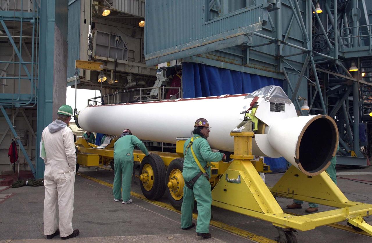
VANDENBERG AIR FORCE BASE, CALIF. - One of four Solid Rocket Boosters for the CALIPSO_CloudSat launch arrives at NASA Space Launch Complex 2 on Vandenberg Air Force Base in California. It will be lifted into the mobile service tower, or gantry, and attached to the Boeing Delta II rocket. CALIPSO stands for Cloud-Aerosol Lidar and Infrared Pathfinder Satellite Observation. CALIPSO and CloudSat are highly complementary satellites and together will provide never-before-seen 3-D perspectives of how clouds and aerosols form, evolve, and affect weather and climate. CALIPSO and CloudSat will fly in formation with three other satellites in the A-train constellation to enhance understanding of our climate system. Launch of CALIPSO_CloudSat aboard a Boeing Delta II rocket is scheduled for 3:01 a.m. Sept. 29.
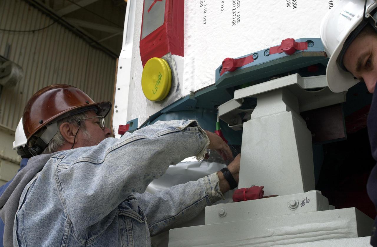
VANDENBERG AIR FORCE BASE, CALIF. - At NASA Space Launch Complex 2 on Vandenberg Air Force Base in California, the Boeing Delta II rocket, launch vehicle for the CALIPSO_CloudSat spacecraft, is prepared for lifting into the mobile service tower, or gantry. CALIPSO stands for Cloud-Aerosol Lidar and Infrared Pathfinder Satellite Observation. CALIPSO and CloudSat are highly complementary satellites and together will provide never-before-seen 3-D perspectives of how clouds and aerosols form, evolve, and affect weather and climate. CALIPSO and CloudSat will fly in formation with three other satellites in the A-train constellation to enhance understanding of our climate system. Launch of CALIPSO_CloudSat aboard a Boeing Delta II rocket is scheduled for 3:01 a.m. Sept. 29.
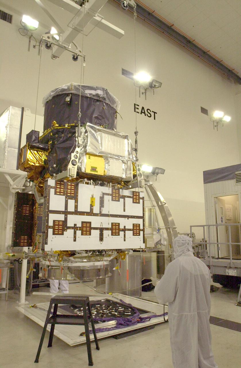
VANDENBERG AIR FORCE BASE, CALIF. - At Vandenberg Air Force Base in California, the CALIPSO spacecraft is lifted off a work stand for a move to a specially modified container where LIDAR (LIght Detection And Ranging) laser testing will take place. CALIPSO stands for Cloud-Aerosol LIDAR and Infrared Pathfinder Satellite Observation. LIDAR measures distance, speed, rotation, chemical composition and concentration. CALIPSO and CloudSat will fly in formation with three other satellites in the A-train constellation to enhance understanding of our climate system. They are highly complementary satellites and together they will provide never-before-seen 3-D perspectives of how clouds and aerosols form, evolve, and affect weather and climate. Launch of CALIPSO_CloudSat aboard a Boeing Delta II rocket is scheduled for 3:01 a.m. PDT Sept. 29.
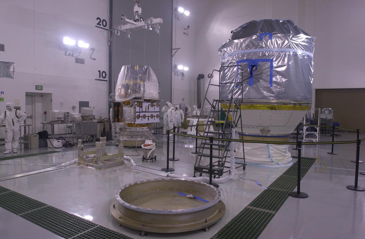
VANDENBERG AIR FORCE BASE, CALIF. — Inside the Astrotech Payload Processing Facility on Vandenberg Air Force Base in California, the CALIPSO spacecraft (background, left) is ready for mating with the upper Delta Payload Attach Fitting (UDPAF). Later the UDPAF will be mated with the lower Delta Payload Attach Fitting, which contains the CloudSat satellite. The PAF is the interface between the spacecraft and the second stage of the rocket. CALIPSO stands for Cloud-Aerosol Lidar and Infrared Pathfinder Satellite Observation. CALIPSO and CloudSat are highly complementary satellites that will provide never-before-seen 3-D perspectives of how clouds and aerosols form, evolve, and affect weather and climate. CALIPSO and CloudSat will fly in formation with three other satellites in the A-train constellation to enhance understanding of our climate system. Launch of CALIPSO_CloudSat aboard a Boeing Delta II rocket is scheduled for 3:01 a.m. PDT Sept. 29.

VANDENBERG AIR FORCE BASE, CALIF. - At NASA Space Launch Complex 2 on Vandenberg Air Force Base in California, the first stage of the Boeing Delta II rocket for the CALIPSO_CloudSat launch arrives on the pad. It will be raised to vertical and lifted up into the mobile service tower, or gantry. CALIPSO stands for Cloud-Aerosol Lidar and Infrared Pathfinder Satellite Observation. CALIPSO and CloudSat are highly complementary satellites and together will provide never-before-seen 3-D perspectives of how clouds and aerosols form, evolve, and affect weather and climate. CALIPSO and CloudSat will fly in formation with three other satellites in the A-train constellation to enhance understanding of our climate system. Launch of CALIPSO_CloudSat aboard a Boeing Delta II rocket is scheduled for 3:01 a.m. Sept. 29.
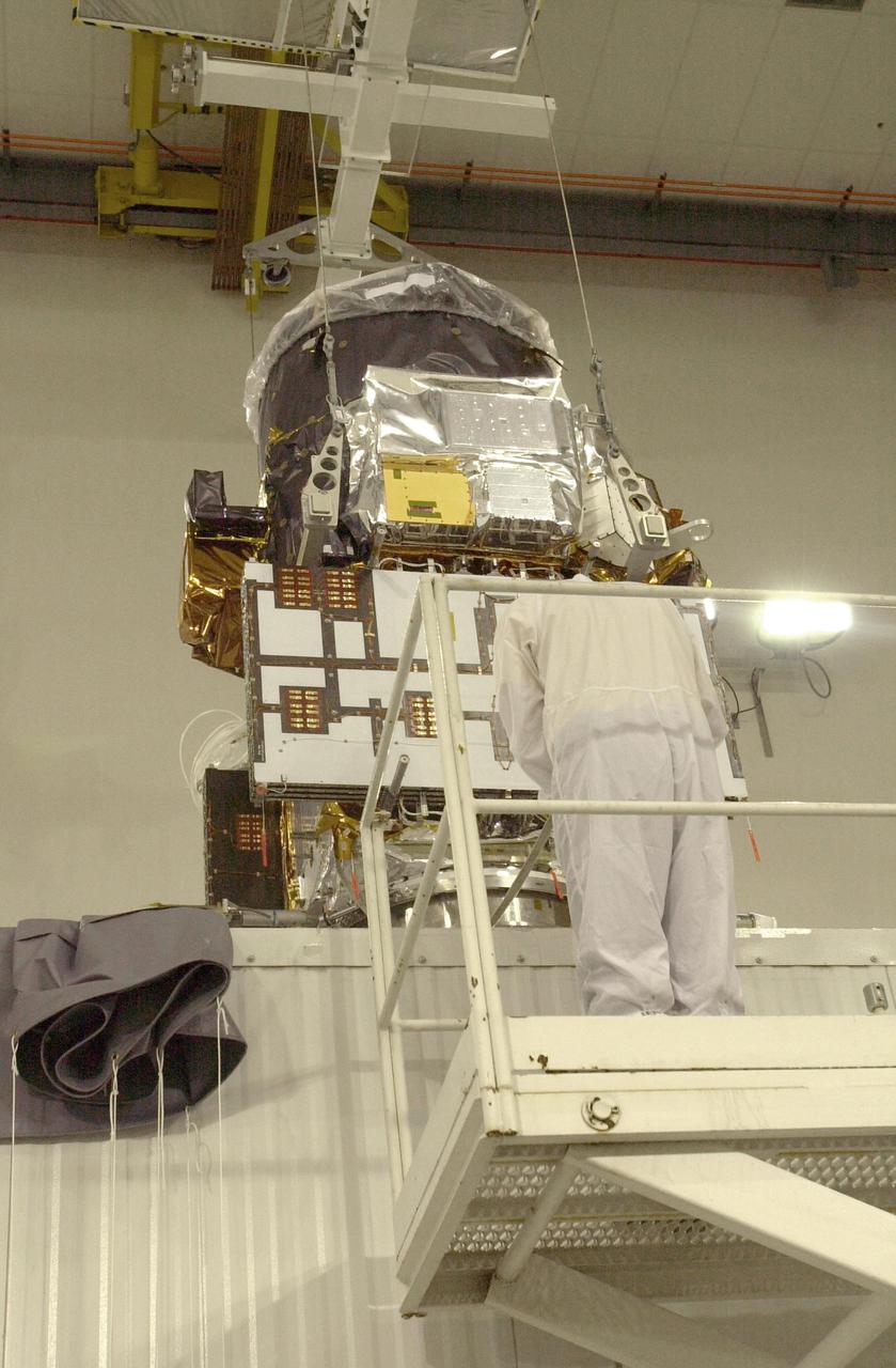
VANDENBERG AIR FORCE BASE, CALIF. - At Vandenberg Air Force Base in California, an overhead crane lowers the suspended CALIPSO spacecraft into a specially modified container (lower right) where LIDAR (LIght Detection And Ranging) laser testing will take place. CALIPSO stands for Cloud-Aerosol LIDAR and Infrared Pathfinder Satellite Observation. LIDAR measures distance, speed, rotation, chemical composition and concentration. CALIPSO and CloudSat will fly in formation with three other satellites in the A-train constellation to enhance understanding of our climate system. They are highly complementary satellites and together they will provide never-before-seen 3-D perspectives of how clouds and aerosols form, evolve, and affect weather and climate. Launch of CALIPSO_CloudSat aboard a Boeing Delta II rocket is scheduled for 3:01 a.m. PDT Sept. 29.
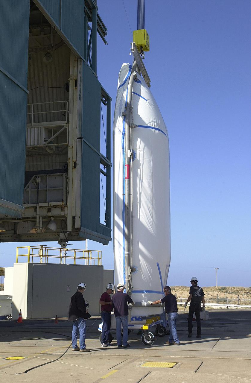
VANDENBERG AIR FORCE BASE, CALIF. - At NASA Space Launch Complex 2 on Vandenberg Air Force Base in California, one half of the fairing for CALIPSO_CloudSat is ready to be lifted into the mobile service tower, or gantry. The fairing encloses and protects the spacecraft during launch and flight through the atmosphere. Once in space, it is jettisoned. CALIPSO stands for Cloud-Aerosol Lidar and Infrared Pathfinder Satellite Observation. CALIPSO and CloudSat are highly complementary satellites and together will provide never-before-seen 3-D perspectives of how clouds and aerosols form, evolve, and affect weather and climate. CALIPSO and CloudSat will fly in formation with three other satellites in the A-train constellation to enhance understanding of our climate system. Launch of CALIPSO_CloudSat aboard a Boeing Delta II rocket is scheduled for 3:01 a.m. Sept. 29.
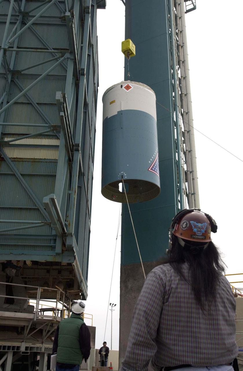
VANDENBERG AIR FORCE BASE, CALIF. - At NASA Space Launch Complex 2 on Vandenberg Air Force Base in California, the interstage for the Boeing Delta II rocket is lifted up the mobile service tower, or gantry. There it will be mated with the first stage already there. The Delta is the launch vehicle for the CALIPSO_CloudSat spacecraft. CALIPSO stands for Cloud-Aerosol Lidar and Infrared Pathfinder Satellite Observation. CALIPSO and CloudSat are highly complementary satellites and together will provide never-before-seen 3-D perspectives of how clouds and aerosols form, evolve, and affect weather and climate. CALIPSO and CloudSat will fly in formation with three other satellites in the A-train constellation to enhance understanding of our climate system. Launch of CALIPSO_CloudSat aboard a Boeing Delta II rocket is scheduled for 3:01 a.m. Sept. 29.
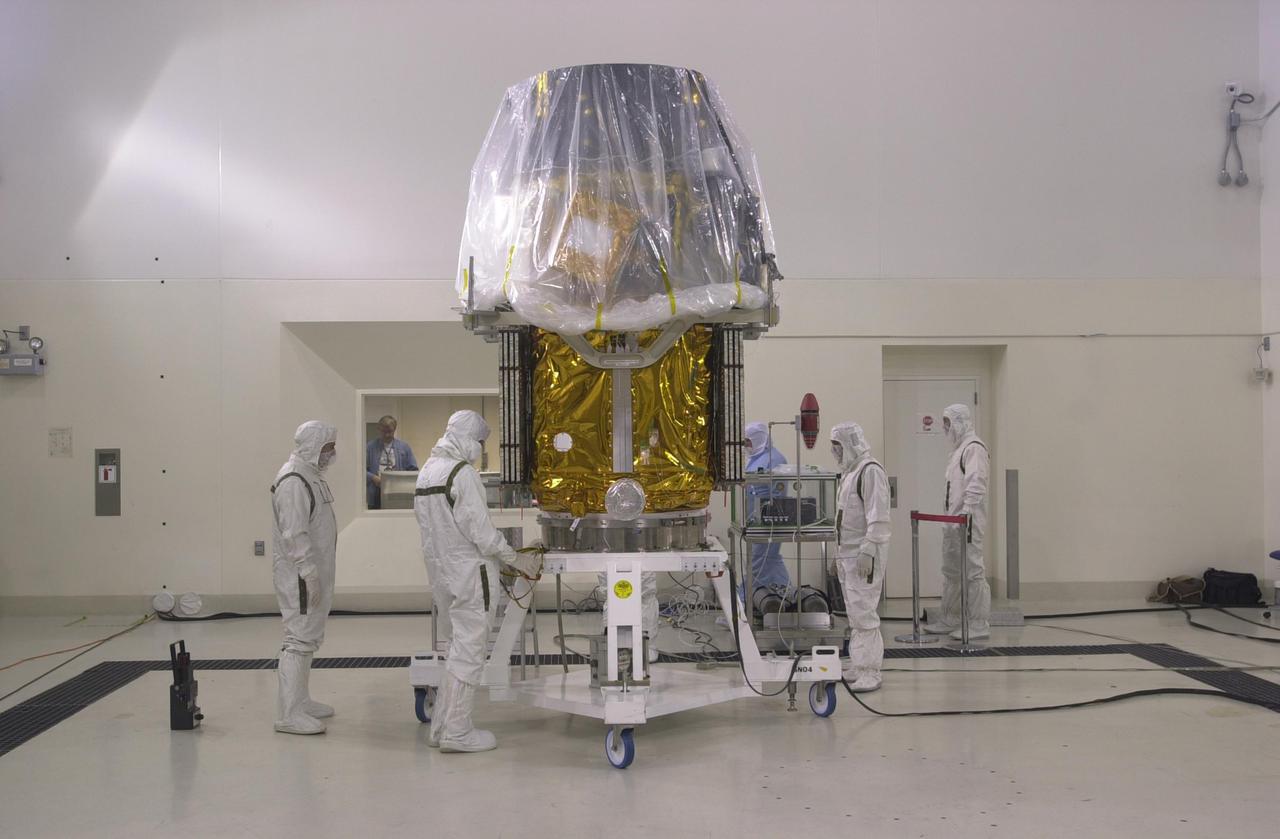
VANDENBERG AIR FORCE BASE, CALIF. — Inside the Astrotech Payload Processing Facility on Vandenberg Air Force Base in California, the CALIPSO spacecraft is being prepared for mating with the upper Delta Payload Attach Fitting (UDPAF). Later the UDPAF will be mated with the lower Delta Payload Attach Fitting, which contains the CloudSat satellite. The PAF is the interface between the spacecraft and the second stage of the rocket. CALIPSO stands for Cloud-Aerosol Lidar and Infrared Pathfinder Satellite Observation. CALIPSO and CloudSat are highly complementary satellites that will provide never-before-seen 3-D perspectives of how clouds and aerosols form, evolve, and affect weather and climate. CALIPSO and CloudSat will fly in formation with three other satellites in the A-train constellation to enhance understanding of our climate system. Launch of CALIPSO_CloudSat aboard a Boeing Delta II rocket is scheduled for 3:01 a.m. PDT Sept. 29.