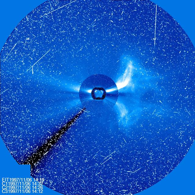
Four different instruments on SOHO show a large CME on Nov. 6, 1997. The sun is at the center, with three coronagraph images of different sizes around it. The streaks of white light are from protons hitting the SOHO cameras producing a snowy effect typical of a significant flare. ..Credit: NASA/SOHO..---..CME WEEK: What To See in CME Images Two main types of explosions occur on the sun: solar flares and coronal mass ejections. Unlike the energy and x-rays produced in a solar flare – which can reach Earth at the speed of light in eight minutes – coronal mass ejections are giant, expanding clouds of solar material that take one to three days to reach Earth. Once at Earth, these ejections, also called CMEs, can impact satellites in space or interfere with radio communications. During CME WEEK from Sept. 22 to 26, 2014, we explore different aspects of these giant eruptions that surge out from the star we live with. When a coronal mass ejection blasts off the sun, scientists rely on instruments called coronagraphs to track their progress. Coronagraphs block out the bright light of the sun, so that the much fainter material in the solar atmosphere -- including CMEs -- can be seen in the surrounding space. CMEs appear in these images as expanding shells of material from the sun's atmosphere -- sometimes a core of colder, solar material (called a filament) from near the sun's surface moves in the center. But mapping out such three-dimensional components from a two-dimensional image isn't easy. Watch the slideshow to find out how scientists interpret what they see in CME pictures. The images in the slideshow are from the three sets of coronagraphs NASA currently has in space. One is on the joint European Space Agency and NASA Solar and Heliospheric Observatory, or SOHO. SOHO launched in 1995, and sits between Earth and the sun about a million miles away from Earth. The other two coronagraphs are on the two spacecraft of the NASA Solar Terrestrial Relations Observatory, or STEREO, mission, which launched in 2006. The two STEREO spacecraft are both currently viewing the far side of the sun. Together these instruments help scientists create a three-dimensional model of any CME as its journey unfolds through interplanetary space. Such information can show why a given characteristic of a CME close to the sun might lead to a given effect near Earth, or any other planet in the solar system...<b><a href="http://www.nasa.gov/audience/formedia/features/MP_Photo_Guidelines.html" rel="nofollow">NASA image use policy.</a></b> <b><a href="http://www.nasa.gov/centers/goddard/home/index.html" rel="nofollow">NASA Goddard Space Flight Center</a></b> enables NASA’s mission through four scientific endeavors: Earth Science, Heliophysics, Solar System Exploration, and Astrophysics. Goddard plays a leading role in NASA’s accomplishments by contributing compelling scientific knowledge to advance the Agency’s mission. <b>Follow us on <a href="http://twitter.com/NASAGoddardPix" rel="nofollow">Twitter</a></b> <b>Like us on <a href="http://www.facebook.com/pages/Greenbelt-MD/NASA-Goddard/395013845897?ref=tsd" rel="nofollow">Facebook</a></b> <b>Find us on <a href="http://instagram.com/nasagoddard?vm=grid" rel="nofollow">Instagram</a></b>
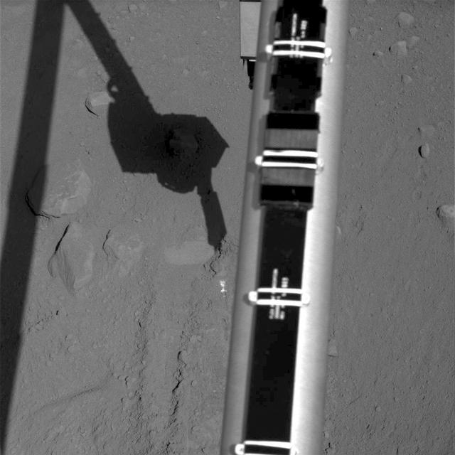
Images taken by NASA Phoenix Mars Lander Surface Stereo Imager, combined into a panoramic view looking north from the lander.
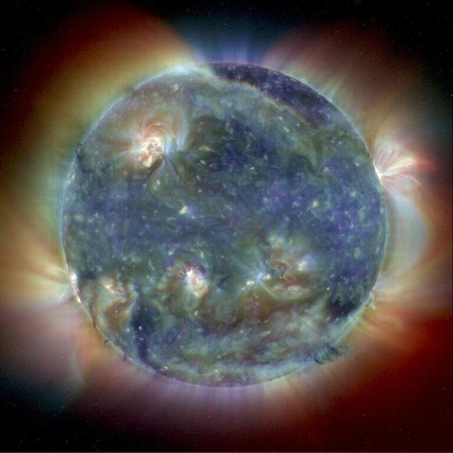
This composite image combines NASA Extreme Ultravoilet Imaging Telescope images from three wavelengths into one that reveals solar features unique to each wavelength.
This images from a sequence of images that combines 32 images of clouds moving eastward across a Martian horizon. The Surface Stereo Imager on NASA Phoenix Mars Lander took this set of images on Sept. 18, 2008,
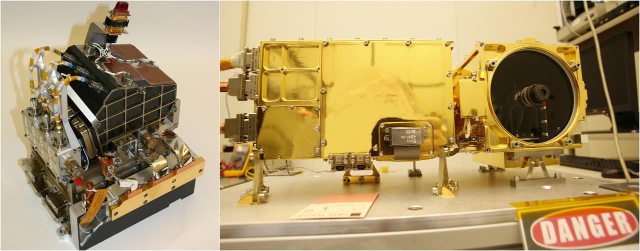
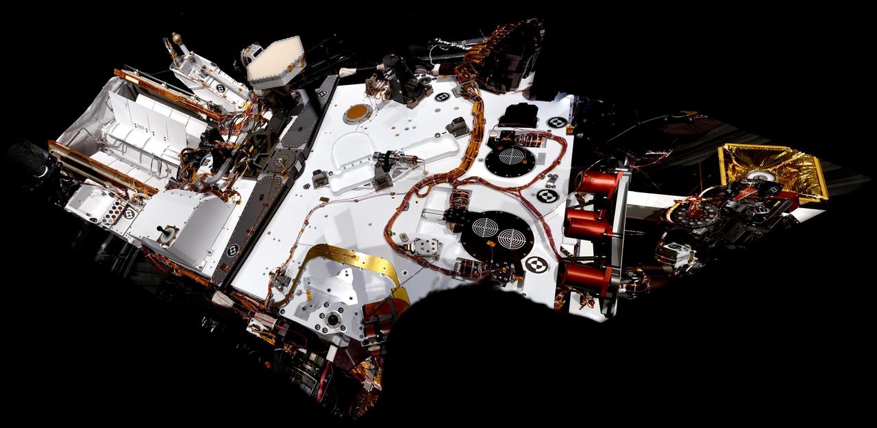
The two main parts of the ChemCam laser instrument for NASA Mars Science Laboratory mission are shown in this combined image.
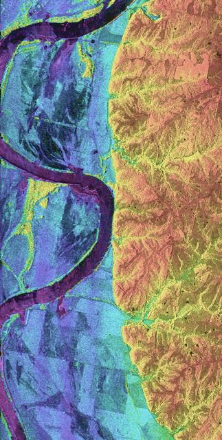
This is a combined radar and topography image of an area along the Missouri River that experienced severe flooding and levee failure in the summer of 1993.
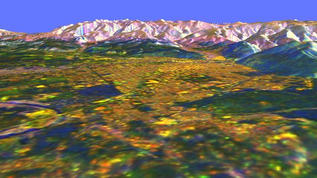
This is a three-dimensional perspective view of Missoula, Montana, created by combining two spaceborne radar images using a technique known as interferometry.
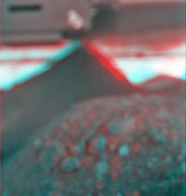
This stereo view combines a pair of images taken two months apart by the microscopic imager on NASA Mars Exploration Rover Spirit. 3D glasses are necessary to view this image.
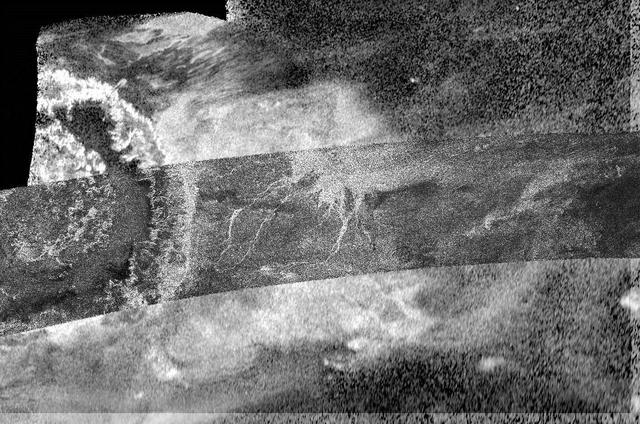
This image, created by combining two different types of radar images from NASA Cassini spacecraft, reveals more details of Titan crater Menrva at left and its surroundings than a single image could provide.
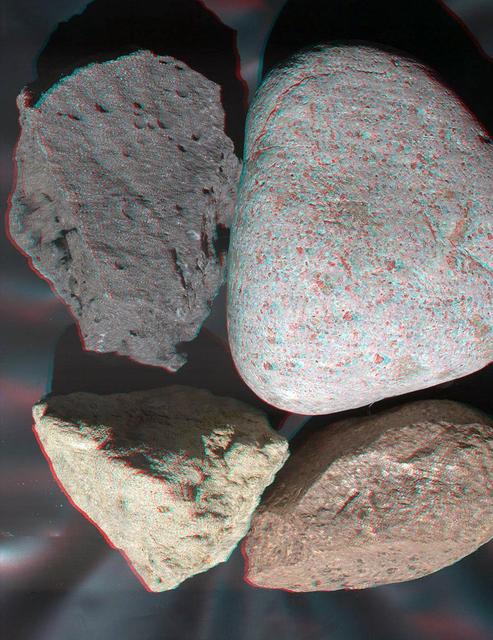
This stereo view of terrestrial rocks combines two images taken by a testing twin of the Mars Hand Lens Imager MAHLI camera on NASA Mars Science Laboratory. 3D glasses are necessary to view this image.
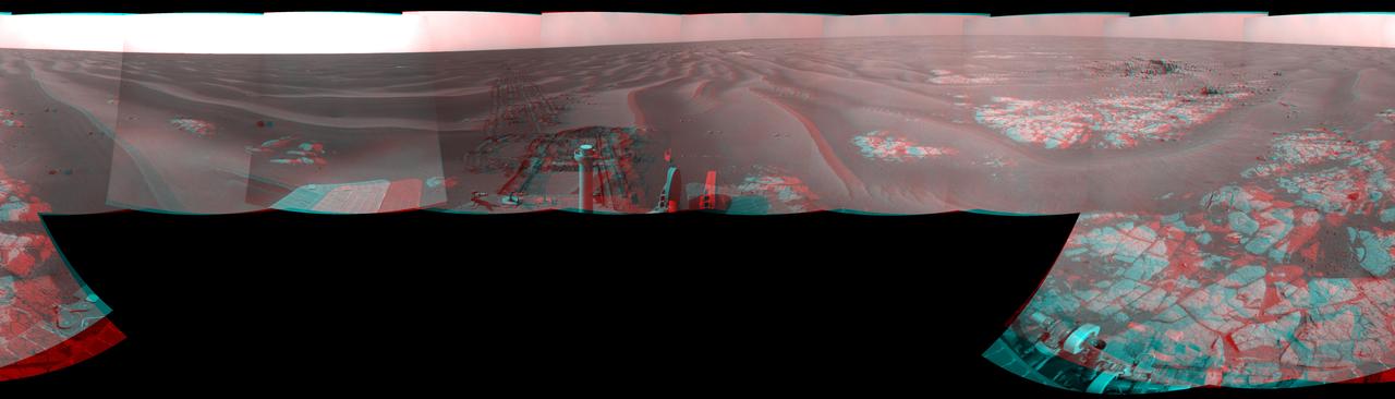
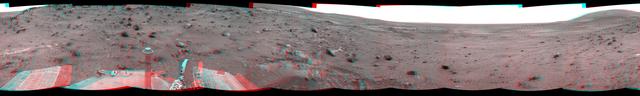
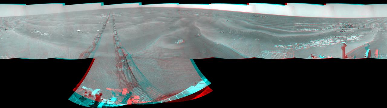
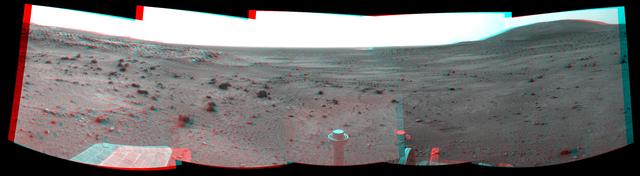
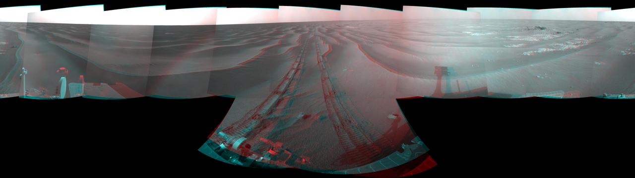
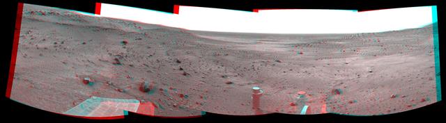
NASA Mars Exploration Rover Opportunity combined images into this stereo, 360-degree view of the rover surroundings on March 12, 2009. Cook Islands is visible just below center of this image. 3D glasses are necessary to view this image.

During its flight, NASA’s Galileo spacecraft returned images of the Earth and Moon. Separate images of the Earth and Moon were combined to generate this view. http://photojournal.jpl.nasa.gov/catalog/PIA00342
The THEMIS VIS camera contains 5 filters. The data from different filters can be combined in multiple ways to create a false color image. These false color images may reveal subtle variations of the surface not easily identified in a single band image. Today's false color image shows a crater in Arabia Terra. Dark blue in this filter combination indicates basaltic sand. Orbit Number: 69458 Latitude: 35.4862 Longitude: 0.619413 Instrument: VIS Captured: 2017-08-11 05:43 https://photojournal.jpl.nasa.gov/catalog/PIA24451

Today's VIS image is located in an unnamed crater in Arabia Terra. Dark blue in this combination is typically basaltic sands. The presence of sand dunes with this tone indicated that these dunes are of basaltic composition. The THEMIS VIS camera contains 5 filters. The data from different filters can be combined in multiple ways to create a false color image. These false color images may reveal subtle variations of the surface not easily identified in a single band image. Orbit Number: 62523 Latitude: 11.3145 Longitude: 13.2155 Instrument: VIS Captured: 2016-01-17 22:08 https://photojournal.jpl.nasa.gov/catalog/PIA23112
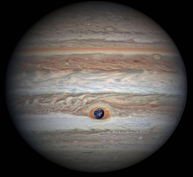
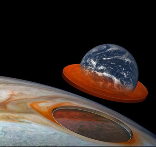
Measuring in at 10,159 miles (16,350 kilometers) in width (as of April 3, 2017) Jupiter's Great Red Spot is 1.3 times as wide as Earth. This composite image was generated by combining NASA imagery of Earth with an image of Jupiter taken by astronomer Christopher Go. This composite image was generated by combining NASA imagery of Earth with an image of Jupiter taken by astronomer Christopher Go. https://photojournal.jpl.nasa.gov/catalog/PIA21774
The THEMIS VIS camera contains 5 filters. The data from different filters can be combined in multiple ways to create a false color image. These false color images may reveal subtle variations of the surface not easily identified in a single band image. Today's false color image shows an unnamed crater in Noachis Terra. Small dunes can be seen in the bottom half of the image. Dark blue tones in this filter combination indicate basaltic sands. Orbit Number: 71104 Latitude: -3.40884 Longitude: 12.2767 Instrument: VIS Captured: 2017-12-24 20:10 https://photojournal.jpl.nasa.gov/catalog/PIA24505
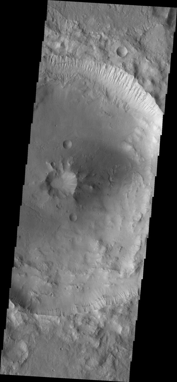
The THEMIS VIS camera contains 5 filters. The data from different filters can be combined in multiple ways to create a false color image. These false color images may reveal subtle variations of the surface not easily identified in a single band image. Today's false color image shows part of Gale Crater. Basaltic sands are dark blue in this type of false color combination. The Curiosity Rover is located in another portion of Gale Crater, far southwest of this image. Orbit Number: 51803 Latitude: -4.39948 Longitude: 138.116 Instrument: VIS Captured: 2013-08-18 09:04 http://photojournal.jpl.nasa.gov/catalog/PIA21312
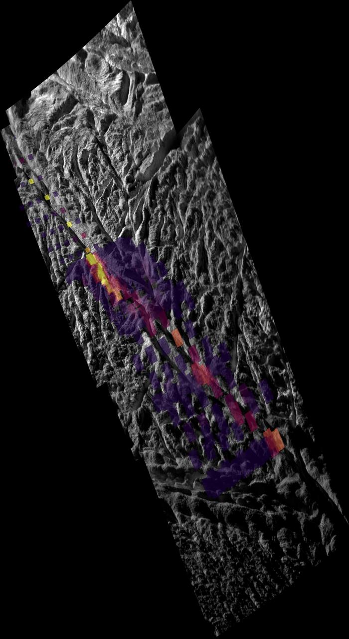
This image, combining data from the imaging science subsystem and composite infrared spectrometer aboard NASA Cassini spacecraft, shows pockets of heat appearing along one of the mysterious fractures in the south polar region of Saturn moon Enceladus
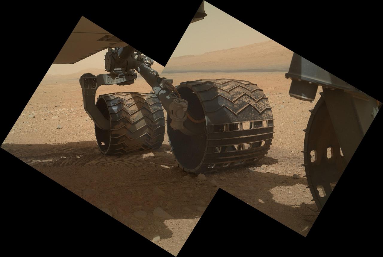
This view of the three left wheels of NASA Mars rover Curiosity combines two images that were taken by the rover Mars Hand Lens Imager MAHLI during the 34th Martian day, or sol, on Mars Sept. 9, 2012.

NASA Mars Exploration Rover Spirit used its navigation camera to take the images that have been combined into this stereo, 180-degree view of the rover surroundings on Feb. 17, 2009. 3D glasses are necessary to view this image.
The THEMIS camera contains 5 filters. The data from different filters can be combined in multiple ways to create a false color image. This image from NASA 2001 Mars Odyssey spacecraft shows part of Terra Sirenum.
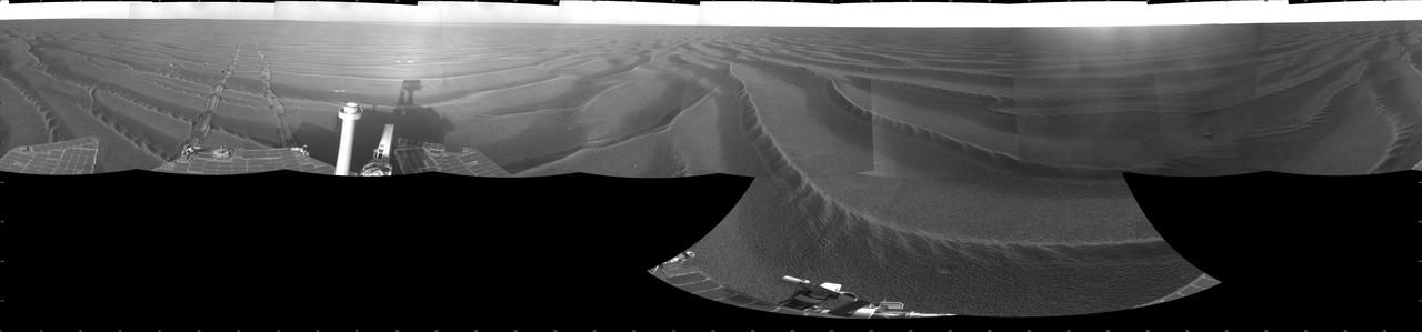
NASA Mars Exploration Rover Spirit used its navigation camera to take the images that have been combined into this stereo, full-circle view of the rover surroundings on March 10, 2009. 3D glasses are necessary to view this image.
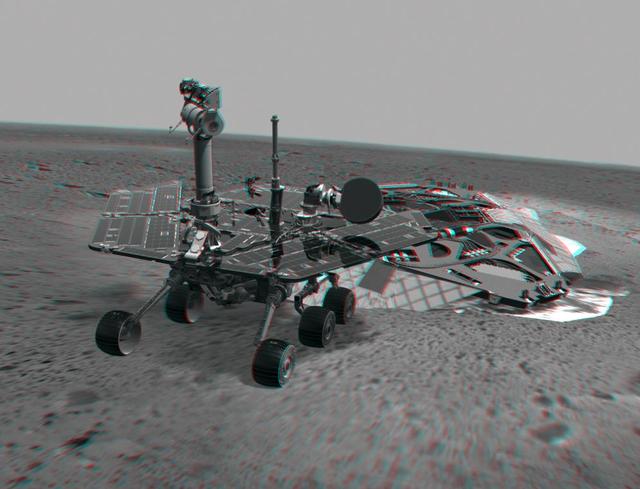
This 3-D image combines computer-generated models of NASA Mars Exploration Rover Spirit and its lander with real surface data from the rover panoramic camera. 3D glasses are necessary to view this image.
This view of Cilix impact crater on Europa was created in 2013 using 3-D stereo images taken by NASA Galileo spacecraft, combined with advanced image processing techniques.
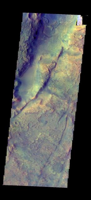
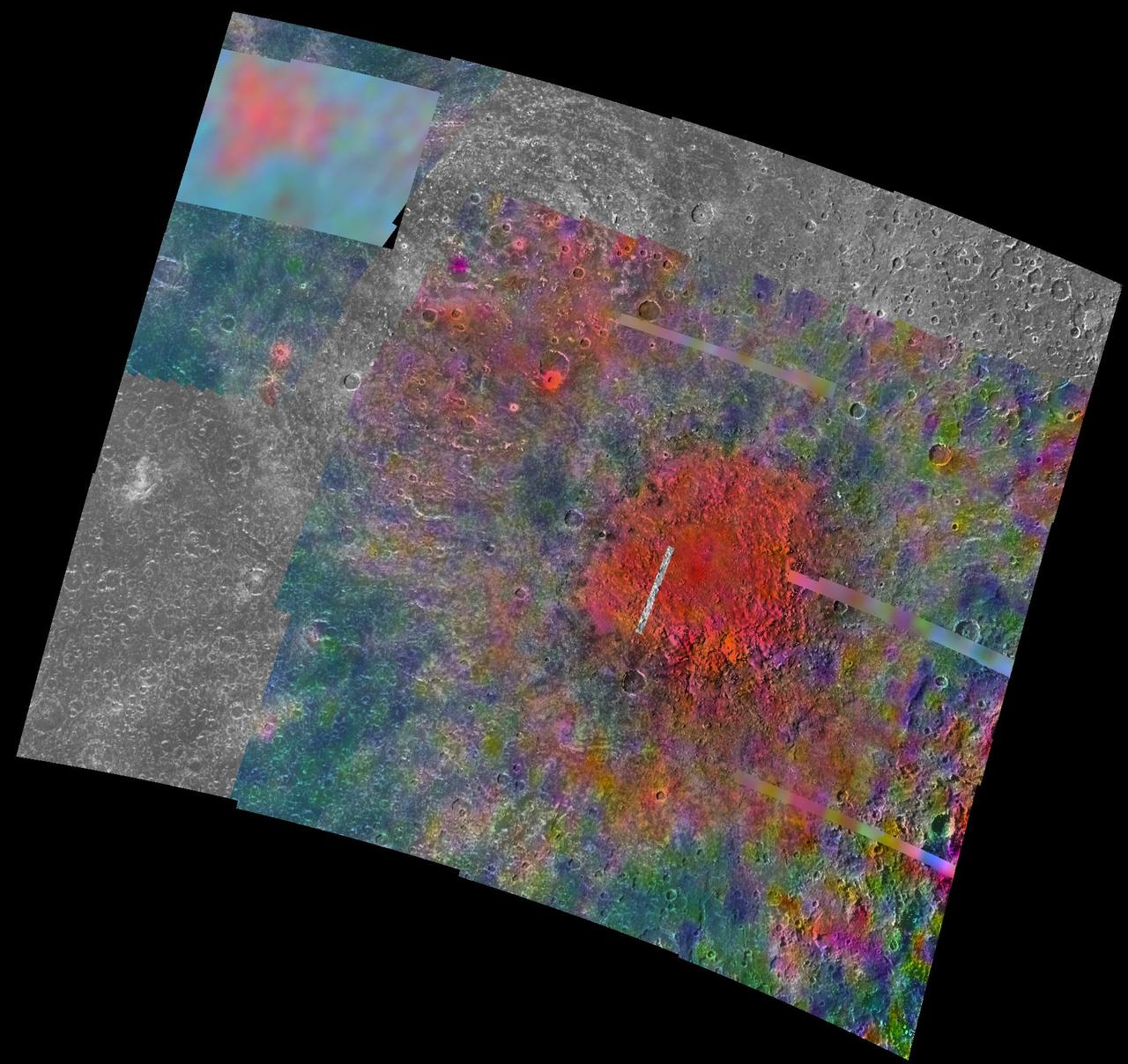
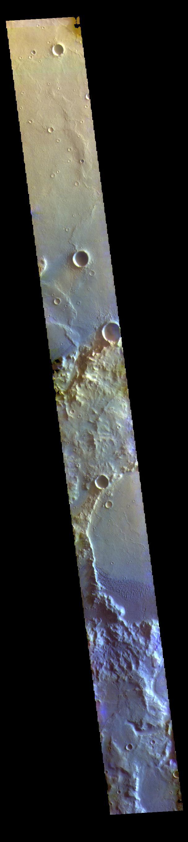
The THEMIS camera contains 5 filters. The data from different filters can be combined in multiple ways to create a false color image. This image from NASA 2001 Mars Odyssey spacecraft shows part of Nili Fossae.
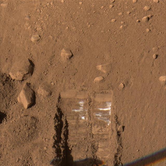
The Surface Stereo Imager on NASA Phoenix Mars Lander recorded this true-color image of the lander Robotic Arm enlarging and combining the two trenches informally named Dodo left and Goldilocks.
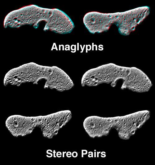
This image from NASA NEAR Shoemaker is of processed data showing Eros from slightly different perspectives is combined as anaglyphs or stereo pairs. 3D glasses are necessary to view this image.

This is a composite image of N49, the brightest supernova remnant in optical light in the Large Magellanic Cloud; the image combines data from the Chandra X-ray Telescope blue and NASA Spitzer Space Telescope red.
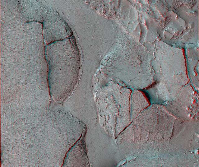
This stereo view shows fractured mounds on the southern edge of Elysium Planitia on Mars. It combines two images from NASA Mars Reconnaissance Orbiter. 3D glasses are necessary to view this image.
NASA Mars Exploration Rover Opportunity used its navigation camera to take the images combined into this 360-degree stereo view of the rover surroundings on July 19, 2009. 3D glasses are necessary to view this image.
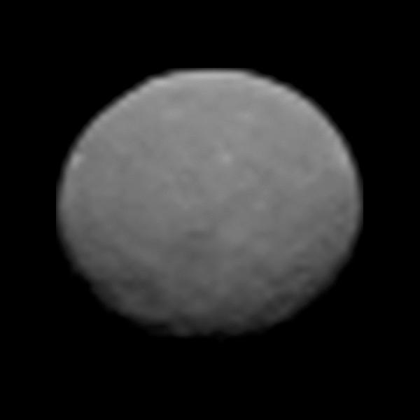
This frame from an animation of the dwarf planet Ceres was made by combining images taken by the Dawn spacecraft on January 25, 2015. These images of Ceres, and they represent the highest-resolution views to date of the dwarf planet. http://photojournal.jpl.nasa.gov/catalog/PIA19171
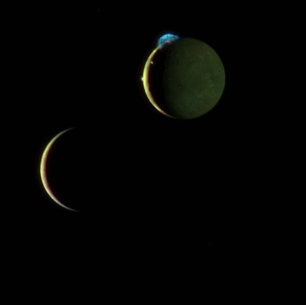
This beautiful image of the crescents of volcanic Io and more sedate Europa is a combination of two New Horizons images taken March 2, 2007, about two days after New Horizons made its closest approach to Jupiter.

Infrared images from NASA Spitzer Space Telescope and Wide-field Infrared Survey Explorer are combined in this image of RCW 86, the dusty remains of the oldest documented example of an exploding star, or supernova.
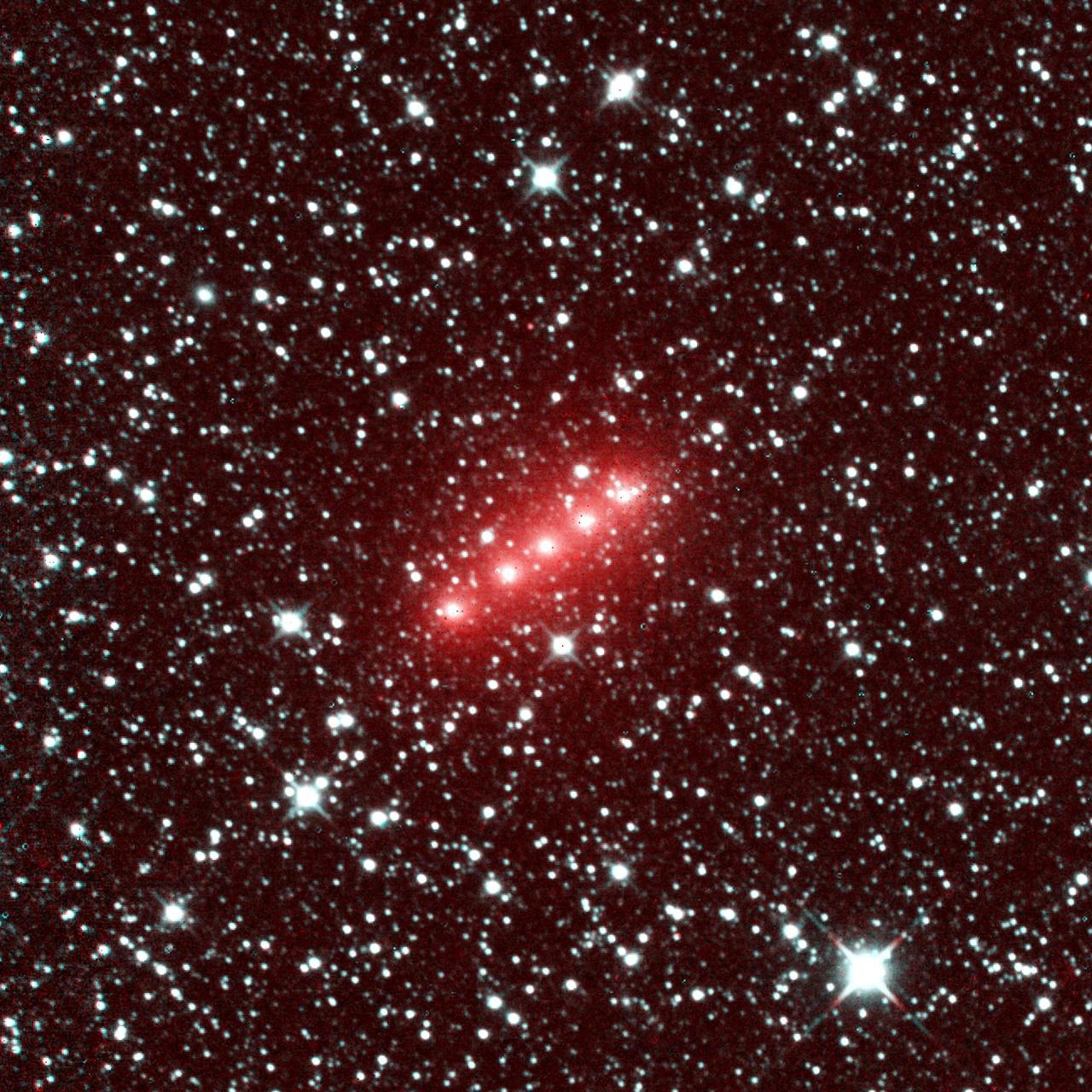
Comet C/2014 Q2 Lovejoy is one of more than 32 comets imaged by NASA NEOWISE mission from December 2013 to December 2014. This image of comet Lovejoy combines a series of observations made in November 2013.
The THEMIS camera contains 5 filters. The data from different filters can be combined in multiple ways to create a false color image. This image from NASA 2001 Mars Odyssey spacecraft shows part of Capri Mensa.
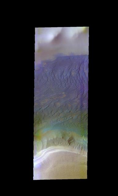
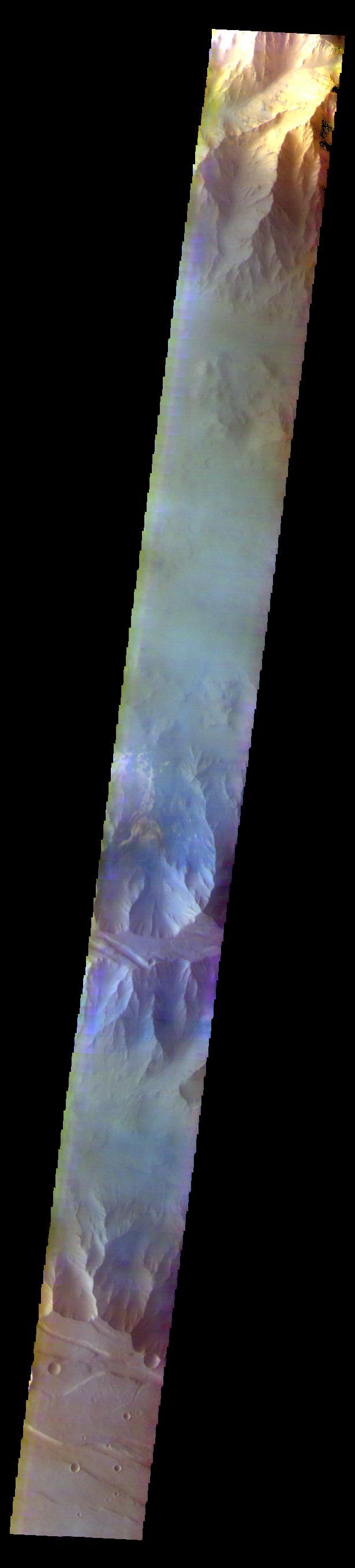
The THEMIS camera contains 5 filters. The data from different filters can be combined in multiple ways to create a false color image. This image from NASA 2001 Mars Odyssey spacecraft shows part of Ophir Chasma.
NASA Mars Exploration Rover Spirit took the images combined to make this stereo view on March 21, 2009. West is at the center, where a dust devil is visible in the distance. 3D glasses are necessary to view this image.
The THEMIS camera contains 5 filters. The data from different filters can be combined in multiple ways to create a false color image. This image from NASA 2001 Mars Odyssey spacecraft shows part of Martin Crater.
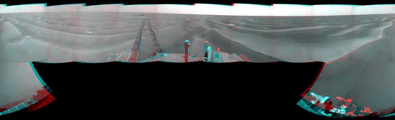
NASA Mars Exploration Rover Opportunity used its navigation camera to take the images combined into this stereo 180-degree view on March 7-9, 2009. 3D glasses are necessary to view this image.
The THEMIS camera contains 5 filters. The data from different filters can be combined in multiple ways to create a false color image. This image from NASA 2001 Mars Odyssey spacecraft shows a hill in Tyrrhena Terra.
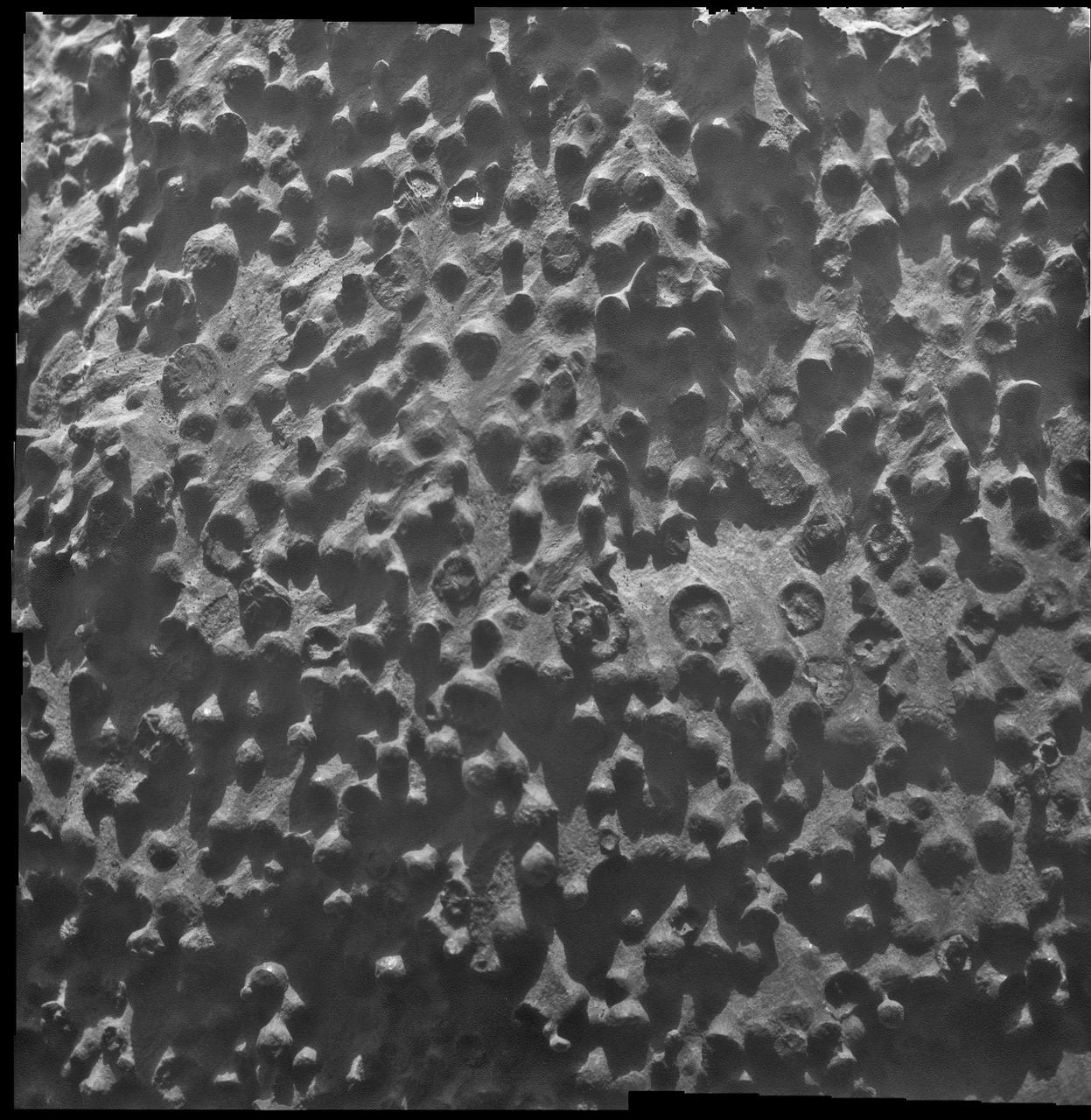
Small spherical objects fill the field in this mosaic combining four images from the Microscopic Imager on NASA Mars Exploration Rover Opportunity at an outcrop called Kirkwood in the Cape York segment of the western rim of Endeavour Crater.
NASA Mars Exploration Rover Opportunity took the images combined to make this stereo view on Aug. 28, 2007. The rover was perched at the lip of Victoria Crater. 3D glasses are necessary to view this image.
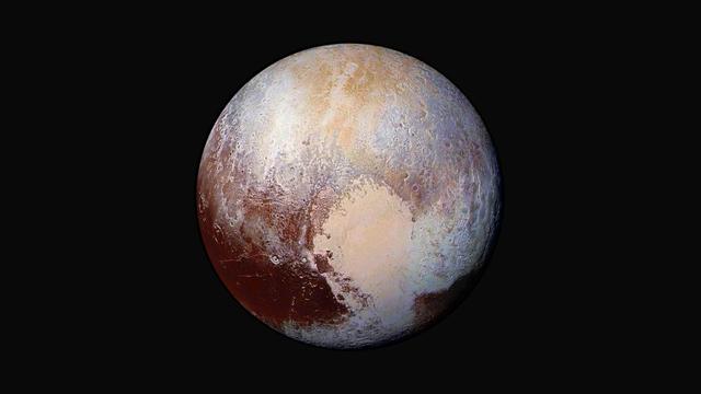
Four images from New Horizons Long Range Reconnaissance Imager LORRI were combined with color data from the spacecraft Ralph instrument to create this enhanced color global view of Pluto.
NASA Mars Exploration Rover Opportunity used its navigation camera to take the images combined into this stereo 180-degree view on Feb. 13, 2009. 3D glasses are necessary to view this image.
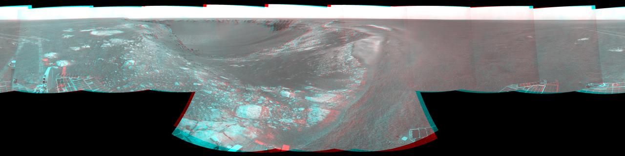
NASA Mars Exploration Rover Opportunity combined images into this stereo, 360-degree view of the rover surroundings on Oct. 22, 2008. Opportunity position was about 300 meters southwest of Victoria. 3D glasses are necessary to view this image.

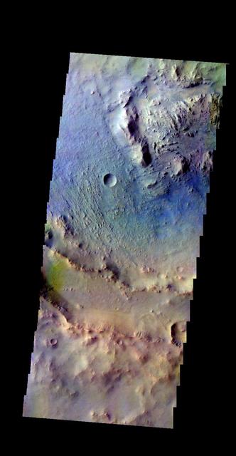
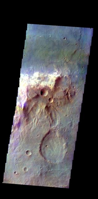
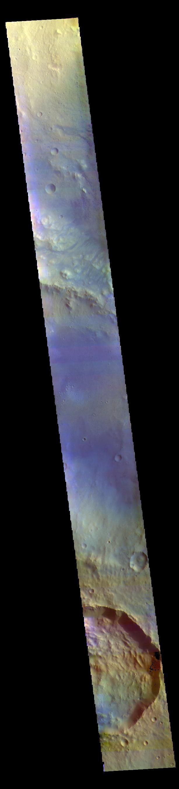
The THEMIS camera contains 5 filters. The data from different filters can be combined in multiple ways to create a false color image. This image from NASA 2001 Mars Odyssey spacecraft shows part of Gale Crater.
NASA Mars rover Curiosity took the images combined into this mosaic of the rover upper deck. The images were taken in March 2011. At the time, Curiosity was inside a space simulation chamber at NASA Jet Propulsion Laboratory, Pasadena, Calif.
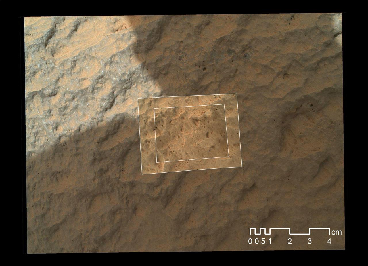
This image combines photographs taken by the Mars Hand Lens Imager MAHLI at three different distances from the first Martian rock that NASA Curiosity rover touched with its arm.
The Surface Stereo Imager on NASA Phoenix Mars Lander recorded this image of the lander Robotic Arm enlarging and combining the two trenches informally named Dodo left and Goldilocks.
Callisto southern hemisphere was imaged by both the Near Infrared Mapping Spectrometer NIMS and the Solid State Imaging SSI instrument during NASA Galileo eighth orbit of Jupiter. This is a mosaic combining both views.
This illustration combines an image of Jupiter from the JunoCam instrument aboard NASA's Juno spacecraft with a composite image of Earth to depict the size and depth of Jupiter's Great Red Spot. https://photojournal.jpl.nasa.gov/catalog/PIA24817
NASA Mars Exploration Rover Opportunity used its navigation camera to take the images combined into this stereo 180-degree view on March 5, 2009. 3D glasses are necessary to view this image.
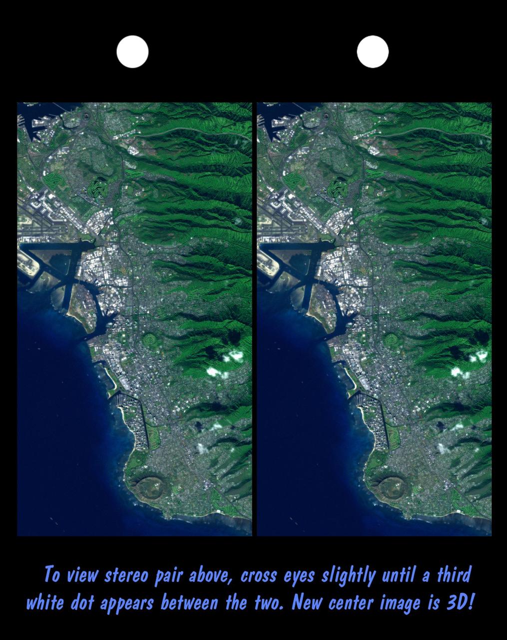
Honolulu, on the island of Oahu, is a large and growing urban area. This stereoscopic image pair, combining a Landsat image with topography measured by NASA Shuttle Radar Topography Mission SRTM, shows how topography controls the urban pattern.
The THEMIS camera contains 5 filters. The data from different filters can be combined in multiple ways to create a false color image. This image from NASA 2001 Mars Odyssey spacecraft shows part of Eridania Planitia.
NASA Mars Exploration Rover Spirit took these images that have been combined into this stereo, 180-degree view of the rover surroundings on March 23, 2009. 3D glasses are necessary to view this image.
The THEMIS camera contains 5 filters. The data from different filters can be combined in multiple ways to create a false color image. This image from NASA 2001 Mars Odyssey spacecraft shows part of Peraea Cavus.
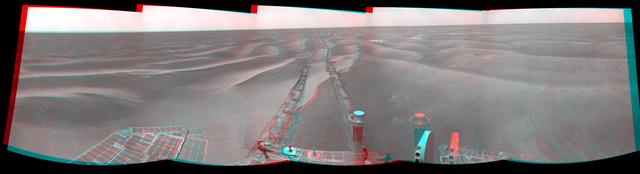
NASA Mars Exploration Rover Opportunity used its navigation camera to take the images combined into this 360-degree view of the rover surroundings.

This composite image of the Tycho supernova remnant combines infrared and X-ray observations obtained with NASA Spitzer and Chandra space observatories, respectively,
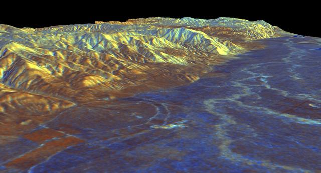
This is a three-dimensional perspective view of Owens Valley, near the town of Bishop, California that was created by combining two spaceborne radar images using a technique known as interferometry.
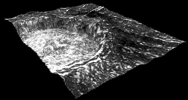
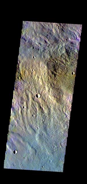
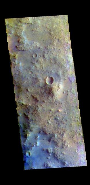
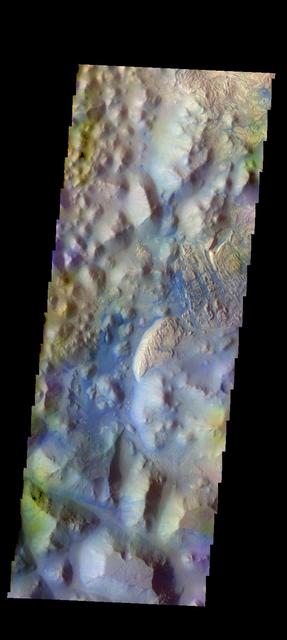
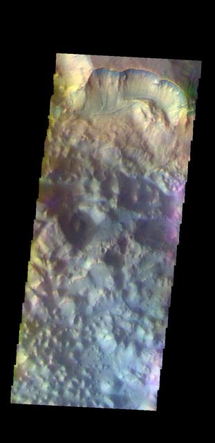
Impact craters can have a variety of floor features. This image from NASA Mars Odyssey is a central peak/pit combination crater in Terra Cimmeria.
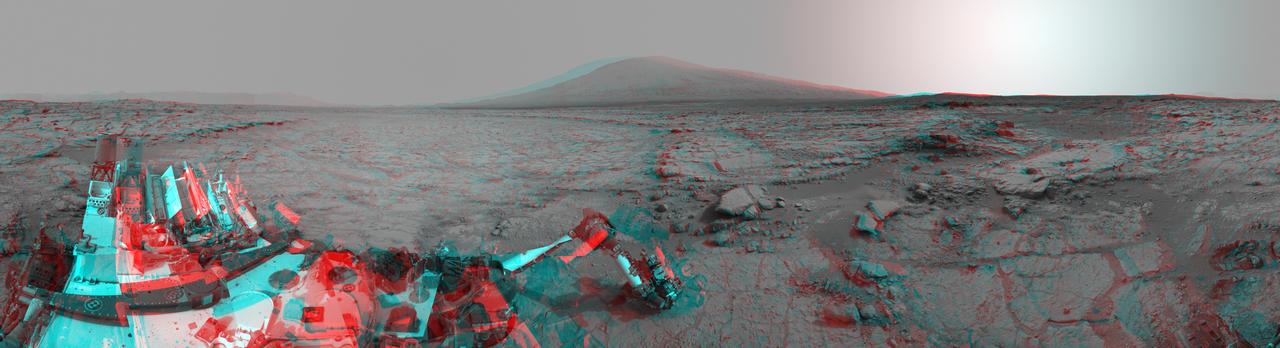
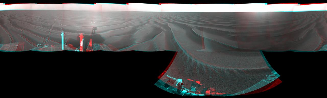
The left and right eyes of the Navigation Camera Navcam in NASA Curiosity Mars rover took the dozens of images combined into this 3-D scene of the rover and its surroundings.

The THEMIS VIS camera contains 5 filters. The data from different filters can be combined in multiple ways to create a false color image. These false color images may reveal subtle variations of the surface not easily identified in a single band image. Today's false color image shows part of an unnamed crater located in Terra Sabaea. Dark blue tones in this filter combination indicate basaltic sand. Orbit Number: 80423 Latitude: -8.92009 Longitude: 22.5362 Instrument: VIS Captured: 2020-01-31 08:18 https://photojournal.jpl.nasa.gov/catalog/PIA24675
The THEMIS VIS camera contains 5 filters. The data from different filters can be combined in multiple ways to create a false color image. These false color images may reveal subtle variations of the surface not easily identified in a single band image. Today's false color image shows sand dunes on the floor of an unnamed crater in Terra Cimmeria. Dark blue in this filter combination indicates basaltic sand. Orbit Number: 69566 Latitude: -9.20212 Longitude: 129.12 Instrument: VIS Captured: 2017-08-20 03:02 https://photojournal.jpl.nasa.gov/catalog/PIA24453
The THEMIS VIS camera contains 5 filters. The data from different filters can be combined in multiple ways to create a false color image. These false color images may reveal subtle variations of the surface not easily identified in a single band image. Today's false color image shows part of Terra Sabaea. Dark blue tones in this filter combination indicate basaltic sands. Orbit Number: 78125 Latitude: 17.9126 Longitude: 76.888 Instrument: VIS Captured: 2019-07-26 03:05 https://photojournal.jpl.nasa.gov/catalog/PIA24651
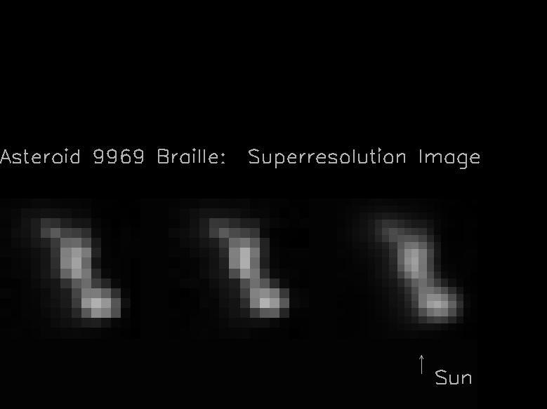
The two images on the left hand side of this composite image frame were taken 914 seconds and 932 seconds after the NASA Deep Space 1 encounter with the asteroid 9969 Braille. The image on the right was created by combining the two images on the left.

This composite image of Earth and its moon, as seen from Mars, combines the best Earth image with the best moon image from four sets of images acquired on Nov. 20, 2016, by the High Resolution Imaging Science Experiment (HiRISE) camera on NASA's Mars Reconnaissance Orbiter. Each was separately processed prior to combining them so that the moon is bright enough to see. The moon is much darker than Earth and would barely be visible at the same brightness scale as Earth. The combined view retains the correct sizes and positions of the two bodies relative to each other. HiRISE takes images in three wavelength bands: infrared, red, and blue-green. These are displayed here as red, green, and blue, respectively. This is similar to Landsat images in which vegetation appears red. The reddish feature in the middle of the Earth image is Australia. Southeast Asia appears as the reddish area (due to vegetation) near the top; Antarctica is the bright blob at bottom-left. Other bright areas are clouds. These images were acquired for calibration of HiRISE data, since the spectral reflectance of the Moon's near side is very well known. When the component images were taken, Mars was about 127 million miles (205 million kilometers) from Earth. http://photojournal.jpl.nasa.gov/catalog/PIA21260

Two images of the night sky were combined to show Earth and Venus as seen by the Mast Camera aboard NASA's Curiosity Mars rover on June 5, 2020, the 2,784th Martian day, or sol, of the mission. Both planets appear as mere pinpoints of light owing to a combination of distance and dust in the air; they would normally look like bright stars. A feature called Tower Butte is just visible at the bottom of the image, part of the clay-bearing region that Curiosity has been exploring since early 2019. https://photojournal.jpl.nasa.gov/catalog/PIA23899
This stereo view combines a pair of images taken by the microscopic imager on NASA Mars Exploration Rover Spirit during the 1,925th Martian day sol of Spirit mission on Mars June 2, 2009. 3D glasses are necessary to view this image.
The THEMIS VIS camera contains 5 filters. Data from the filters can be combined in many ways to create a false color image. This image from NASA 2001 Mars Odyssey spacecraft shows the region just west of the dune/polar cap image from earlier this week.
The THEMIS VIS camera contains 5 filters. The data from different filters can be combined in multiple ways to create a false color image. These false color images may reveal subtle variations of the surface not easily identified in a single band image. Today's false color image shows Trouvelot Crater and other nearby craters. Dark blue tones in this version of color combination is often dark basaltic sands. Orbit Number: 71242 Latitude: 14.6817 Longitude: 346.517 Instrument: VIS Captured: 2018-01-05 05:07 https://photojournal.jpl.nasa.gov/catalog/PIA24511
The THEMIS VIS camera contains 5 filters. The data from different filters can be combined in multiple ways to create a false color image. These false color images may reveal subtle variations of the surface not easily identified in a single band image. Today's false color image shows part of the margin of Chryse Planitia. Dark blue in this false color combination is mostly likely basaltic material/dunes. Orbit Number: 44280 Latitude: 33.0423 Longitude: 309.853 Instrument: VIS Captured: 2011-12-08 07:16 http://photojournal.jpl.nasa.gov/catalog/PIA21162
Context image The THEMIS camera contains 5 filters. The data from different filters can be combined in multiple ways to create a false color image. These false color images may reveal subtle variations of the surface not easily identified in a single band image. Today's false color image shows part of Eos Chasma. Orbit Number: 18300 Latitude: -14.9443 Longitude: 312.7 Instrument: VIS Captured: 2006-01-29 02:31. http://photojournal.jpl.nasa.gov/catalog/PIA20227
The THEMIS camera contains 5 filters. The data from different filters can be combined in multiple ways to create a false color image. This image from NASA 2001 Mars Odyssey spacecraft shows the northern tip of Baetis Mensa. The THEMIS camera contains 5 filters. The data from different filters can be combined in multiple ways to create a false color image. These false color images may reveal subtle variations of the surface not easily identified in a single band image. Today's false color image shows the northern tip of Baetis Mensa. In false color images dark blue is often basaltic sands. In this image it is possible to trace the sands from the erosion of Beatis Mensa moving down the canyon gullies to the floor of Ophir Chasma. Orbit Number: 42247 Latitude: -4.17728 Longitude: 287.975 Instrument: VIS Captured: 2011-06-23 21:11 http://photojournal.jpl.nasa.gov/catalog/PIA20792
The THEMIS camera contains 5 filters.l The data from different filters can be combined in multiple ways to create a false color image. These false color images may reveal subtle variations of the surface not easily identified in a single band image. Today's false color images show part of Ausonia Montes. Orbit Number: 42503 Latitude: -28.1322 Longitude: 98.9668 Instrument: VIS Captured: 2011-07-14 23:09 http://photojournal.jpl.nasa.gov/catalog/PIA20794
The THEMIS VIS camera contains 5 filters. The data from different filters can be combined in multiple ways to create a false color image. These false color images may reveal subtle variations of the surface not easily identified in a single band image. Today's false color image shows part of Ophir Chasma. Orbit Number: 45867 Latitude: -4.55075 Longitude: 289.252 Instrument: VIS Captured: 2012-04-16 20:31 http://photojournal.jpl.nasa.gov/catalog/PIA21173
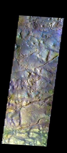
The THEMIS VIS camera contains 5 filters. The data from different filters can be combined in multiple ways to create a false color image. These false color images may reveal subtle variations of the surface not easily identified in a single band image. Today's false color image shows part of Iani Chaos. Orbit Number: 44854 Latitude: -0.717905 Longitude: 342.194 Instrument: VIS Captured: 2012-01-24 11:21 http://photojournal.jpl.nasa.gov/catalog/PIA21165

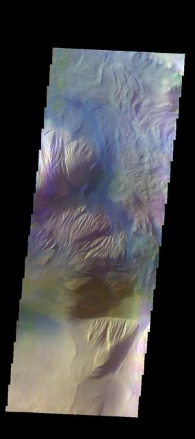
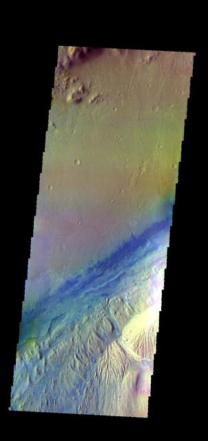
The THEMIS VIS camera contains 5 filters. The data from different filters can be combined in multiple ways to create a false color image. These false color images may reveal subtle variations of the surface not easily identified in a single band image. Today's false color image shows part Ganges Chasma. Orbit Number: 64384 Latitude: -6.67274 Longitude: 310.956 Instrument: VIS Captured: 2016-06-19 04:46 http://photojournal.jpl.nasa.gov/catalog/PIA20787
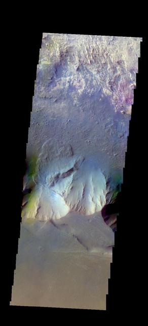
The THEMIS camera contains 5 filters. The data from different filters can be combined in multiple ways to create a false color image. These false color images may reveal subtle variations of the surface not easily identified in a single band image. Today's false color image shows part of Juventae Chasma. Orbit Number: 43345 Latitude: -4.63793 Longitude: 296.778 Instrument: VIS Captured: 2011-09-22 06:32 http://photojournal.jpl.nasa.gov/catalog/PIA20987
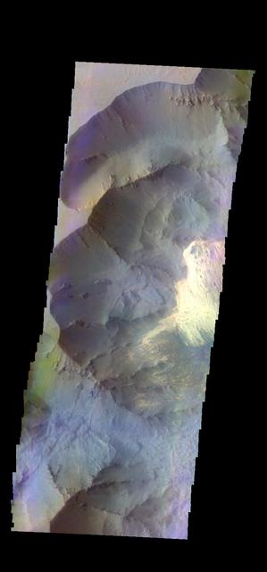
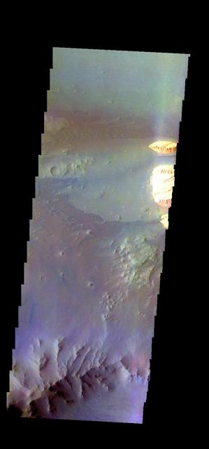
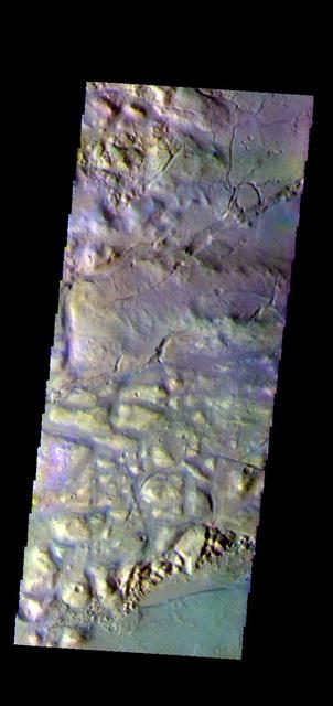
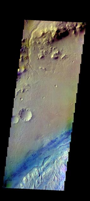
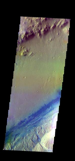
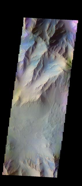
The THEMIS VIS camera contains 5 filters. The data from different filters can be combined in multiple ways to create a false color image. These false color images may reveal subtle variations of the surface not easily identified in a single band image. Today's false color image shows part of Coprates Chasma. Orbit Number: 59937 Latitude: -12.9223 Longitude: 295.366 Instrument: VIS Captured: 2015-06-18 22:08 https://photojournal.jpl.nasa.gov/catalog/PIA21797
The THEMIS camera contains 5 filters. The data from different filters can be combined in multiple ways to create a false color image. These false color images may reveal subtle variations of the surface not easily identified in a single band image. Today's false color image shows part of Ganges Chasma. Orbit Number: 43282 Latitude: -8.53126 Longitude: 313.149 Instrument: VIS Captured: 2011-09-17 02:06 http://photojournal.jpl.nasa.gov/catalog/PIA20983
The THEMIS VIS camera contains 5 filters. The data from different filters can be combined in multiple ways to create a false color image. These false color images may reveal subtle variations of the surface not easily identified in a single band image. Today's false color image shows part of Juventae Chasma. Dunes are visible on the floor of the chasma. Orbit Number: 64372 Latitude: -5.09926 Longitude: 297.062 Instrument: VIS Captured: 2016-06-18 05:03 http://photojournal.jpl.nasa.gov/catalog/PIA20786
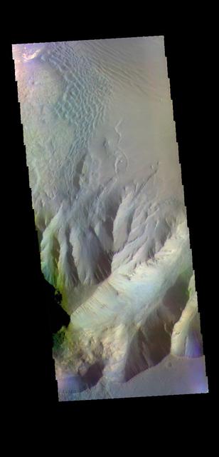
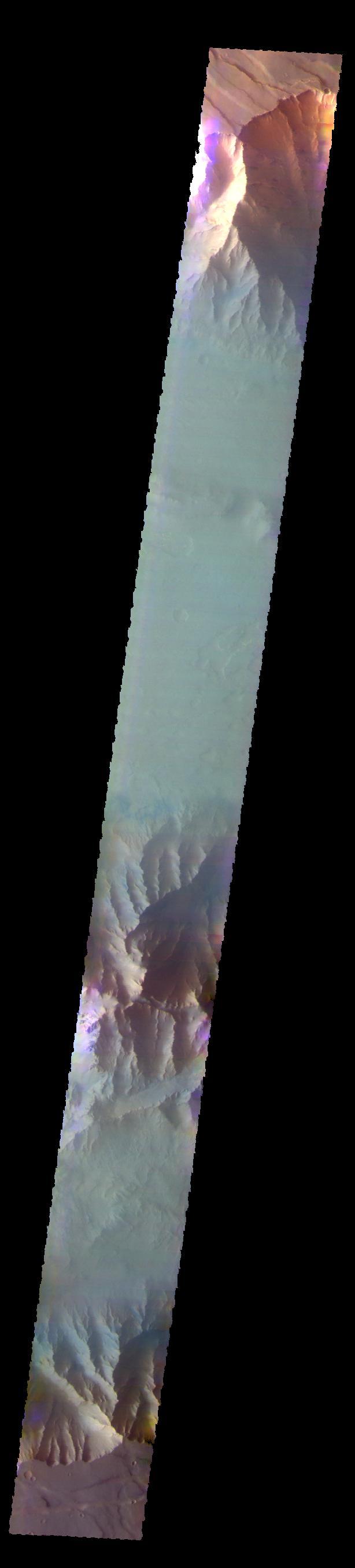
The THEMIS VIS camera contains 5 filters. The data from different filters can be combined in multiple ways to create a false color image. These false color images may reveal subtle variations of the surface not easily identified in a single band image. Today's false color image shows part of Candor Chasma. There is a landslide deposit from the rim of the chasma. Orbit Number: 44856 Latitude: -6.68095 Longitude: 283.729 Instrument: VIS Captured: 2012-01-24 15:20 http://photojournal.jpl.nasa.gov/catalog/PIA21167
The THEMIS VIS camera contains 5 filters. The data from different filters can be combined in multiple ways to create a false color image. These false color images may reveal subtle variations of the surface not easily identified in a single band image. Today's false color image shows part Nili Fossae. Orbit Number: 45861 Latitude: 21.8183 Longitude: 77.0538 Instrument: VIS Captured: 2012-04-16 10:30 http://photojournal.jpl.nasa.gov/catalog/PIA21172
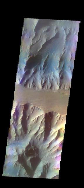
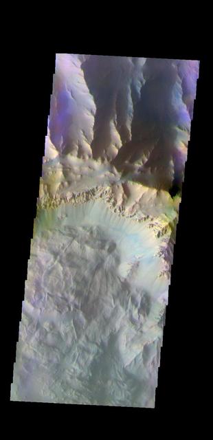
The THEMIS VIS camera contains 5 filters. The data from different filters can be combined in multiple ways to create a false color image. These false color images may reveal subtle variations of the surface not easily identified in a single band image. Today's false color image shows part of Coprates Chasma. Orbit Number: 52272 Latitude: -13.5675 Longitude: 297.001 Instrument: VIS Captured: 2013-09-25 23:18 http://photojournal.jpl.nasa.gov/catalog/PIA21515
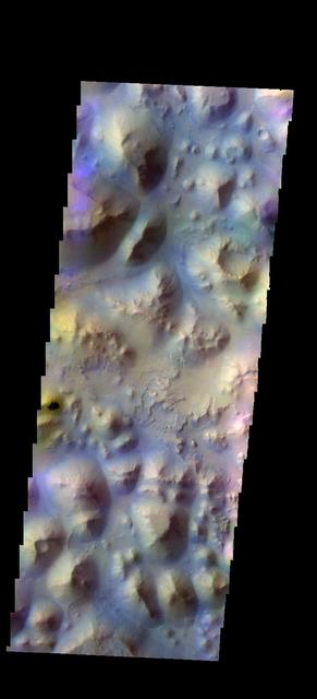
The THEMIS VIS camera contains 5 filters. The data from different filters can be combined in multiple ways to create a false color image. These false color images may reveal subtle variations of the surface not easily identified in a single band image. Today's false color image shows part of Gorgonum Chaos. Orbit Number: 50315 Latitude: -37.785 Longitude: 189.412 Instrument: VIS Captured: 2013-04-17 22:37 http://photojournal.jpl.nasa.gov/catalog/PIA21277
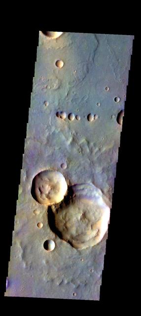
The THEMIS camera contains 5 filters. The data from different filters can be combined in multiple ways to create a false color image. These false color images may reveal subtle variations of the surface not easily identified in a single band image. Today's false color image shows part of Galle Crater. Orbit Number: 59661 Latitude: -50.8727 Longitude: 331.232 Instrument: VIS Captured: 2015-05-27 04:53 https://photojournal.jpl.nasa.gov/catalog/PIA21699
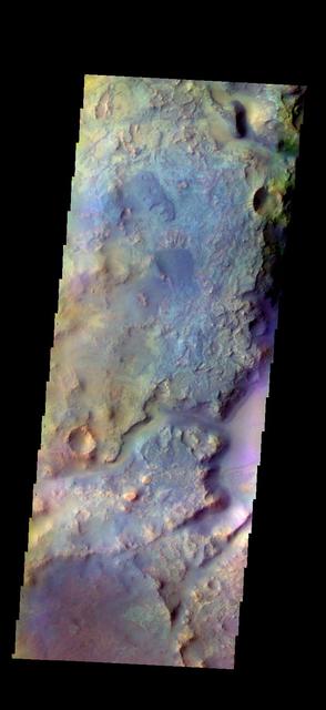
The THEMIS VIS camera contains 5 filters. The data from different filters can be combined in multiple ways to create a false color image. These false color images may reveal subtle variations of the surface not easily identified in a single band image. Today's false color image shows part of Gale Crater, the home of Curiosity Rover. Orbit Number: 52340 Latitude: -4.59603 Longitude: 137.402 Instrument: VIS Captured: 2013-10-01 13:32 http://photojournal.jpl.nasa.gov/catalog/PIA21516
The THEMIS camera contains 5 filters. The data from different filters can be combined in multiple ways to create a false color image. These false color images may reveal subtle variations of the surface not easily identified in a single band image. This image from NASA 2001 Mars Odyssey spacecraft shows part of Gorgonum Chaos. Orbit Number: 58131 Latitude: -38.0727 Longitude: 189.465 Instrument: VIS Captured: 2015-01-21 05:12 https://photojournal.jpl.nasa.gov/catalog/PIA21542
The THEMIS camera contains 5 filters. The data from different filters can be combined in multiple ways to create a false color image. These false color images may reveal subtle variations of the surface not easily identified in a single band image. Today's false color images shows part of Ophir Planum. Orbit Number: 17901 Latitude: -9.97494 Longitude: 303.278 Instrument: VIS Captured: 2005-12-27 06:04. http://photojournal.jpl.nasa.gov/catalog/PIA20226
The THEMIS camera contains 5 filters. The data from different filters can be combined in multiple ways to create a false color image. These false color images may reveal subtle variations of the surface not easily identified in a single band image. This image from NASA 2001 Mars Odyssey spacecraft shows more of Asimov Crater. Orbit Number: 58206 Latitude: -47.4085 Longitude: 4.59969 Instrument: VIS Captured: 2015-01-27 09:56 https://photojournal.jpl.nasa.gov/catalog/PIA21544
The THEMIS camera contains 5 filters. The data from different filters can be combined in multiple ways to create a false color image. These false color images may reveal subtle variations of the surface not easily identified in a single band image. Today's false color image shows part of Iani Chaos. The "dark blue" material is likely basaltic sand. Orbit Number: 18037 Latitude: -1.05225 Longitude: 341.26 Instrument: VIS Captured: 2006-01-07 10:45. http://photojournal.jpl.nasa.gov/catalog/PIA20228
The THEMIS VIS camera contains 5 filters. The data from different filters can be combined in multiple ways to create a false color image. These false color images may reveal subtle variations of the surface not easily identified in a single band image. Today's false color image shows part of Gale Crater. Gale Crater is the home of the Curiosity Rover. Orbit Number: 46072 Latitude: -4.53679 Longitude: 137.296 Instrument: VIS Captured: 2012-05-03 17:29 http://photojournal.jpl.nasa.gov/catalog/PIA21196
The THEMIS camera contains 5 filters. The data from different filters can be combined in multiple ways to create a false color image. These false color images may reveal subtle variations of the surface not easily identified in a single band image. Today's false color image shows Pyrrhae Chaos. Orbit Number: 58875 Latitude: -10.0832 Longitude: 332.017 Instrument: VIS Captured: 2015-03-23 11:20 http://photojournal.jpl.nasa.gov/catalog/PIA20766
The THEMIS VIS camera contains 5 filters. The data from different filters can be combined in multiple ways to create a false color image. These false color images may reveal subtle variations of the surface not easily identified in a single band image. Today's false color image shows part of Gale Crater. The Curiosity Rover is located in Gale Crater. Orbit Number: 52390 Latitude: -4.49318 Longitude: 137.423 Instrument: VIS Captured: 2013-10-05 16:16 https://photojournal.jpl.nasa.gov/catalog/PIA21530
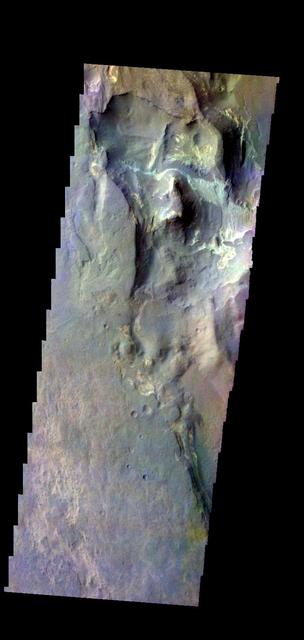
The THEMIS VIS camera contains 5 filters. The data from different filters can be combined in multiple ways to create a false color image. These false color images may reveal subtle variations of the surface not easily identified in a single band image. Today's false color image shows part of Coprates Chasma. Orbit Number: 59675 Latitude: -12.3624 Longitude: 293.637 Instrument: VIS Captured: 2015-05-28 08:21 https://photojournal.jpl.nasa.gov/catalog/PIA21702
The THEMIS VIS camera contains 5 filters. The data from different filters can be combined in multiple ways to create a false color image. These false color images may reveal subtle variations of the surface not easily identified in a single band image. Today's false color image shows part of Coprates Chasma. Orbit Number: 51835 Latitude: -13.3714 Longitude: 294.464 Instrument: VIS Captured: 2013-08-21 00:18 http://photojournal.jpl.nasa.gov/catalog/PIA21313
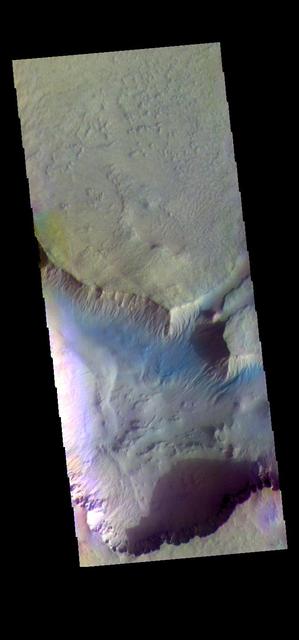
The THEMIS camera contains 5 filters. The data from different filters can be combined in multiple ways to create a false color image. These false color images may reveal subtle variations of the surface not easily identified in a single band image. Today's false color image shows part of Terby Crater. Orbit Number: 43440 Latitude: -27.3622 Longitude: 73.7577 Instrument: VIS Captured: 2011-09-30 02:20 http://photojournal.jpl.nasa.gov/catalog/PIA20990
The THEMIS VIS camera contains 5 filters. The data from different filters can be combined in multiple ways to create a false color image. These false color images may reveal subtle variations of the surface not easily identified in a single band image. Today's false color image shows part of Juventae Chasma, including sand dunes on the floor of the chasma. Orbit Number: 48863 Latitude: -4.23406 Longitude: 297.286 Instrument: VIS Captured: 2012-12-19 10:35 http://photojournal.jpl.nasa.gov/catalog/PIA21199
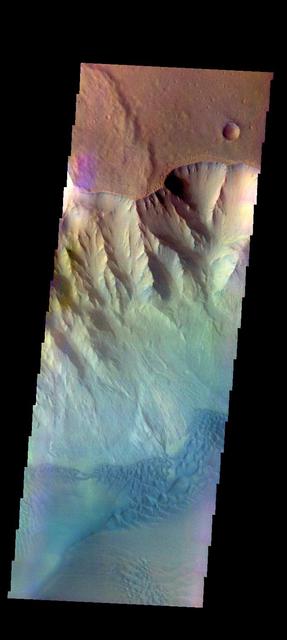
The THEMIS VIS camera contains 5 filters. The data from different filters can be combined in multiple ways to create a false color image. These false color images may reveal subtle variations of the surface not easily identified in a single band image. Today's false color image shows part of Coprates Chasma. Orbit Number: 59076 Latitude: -12.8501 Longitude: 293.344 Instrument: VIS Captured: 2015-04-09 00:34 https://photojournal.jpl.nasa.gov/catalog/PIA21667

The THEMIS camera contains 5 filters. The data from different filters can be combined in multiple ways to create a false color image. These flase color images may reveal subtle variations of the surface not easily identified in a single band image. Today's false color image shows part of Nili Fossae. Orbit Number: 43177 Latitude: 22.1864 Longitude: 77.2742 Instrument: VIS Captured: 2011-09-08 12:28 http://photojournal.jpl.nasa.gov/catalog/PIA20982