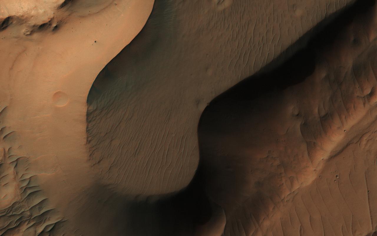
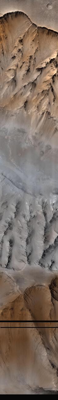
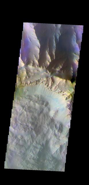
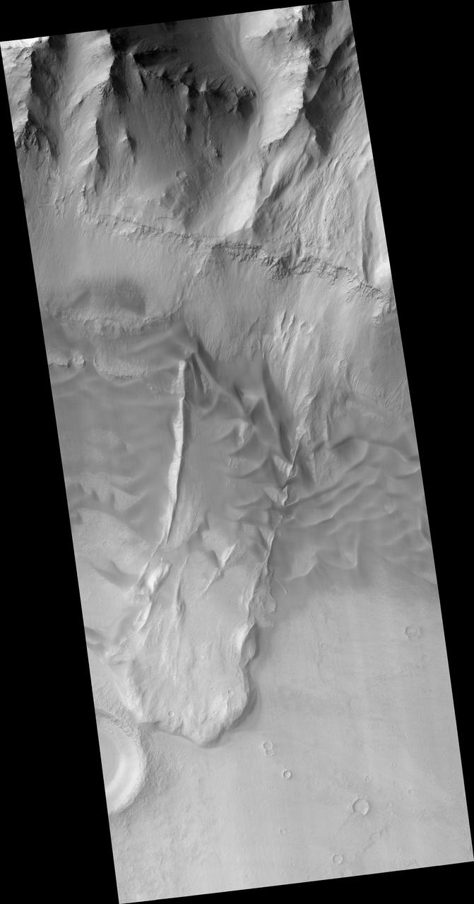
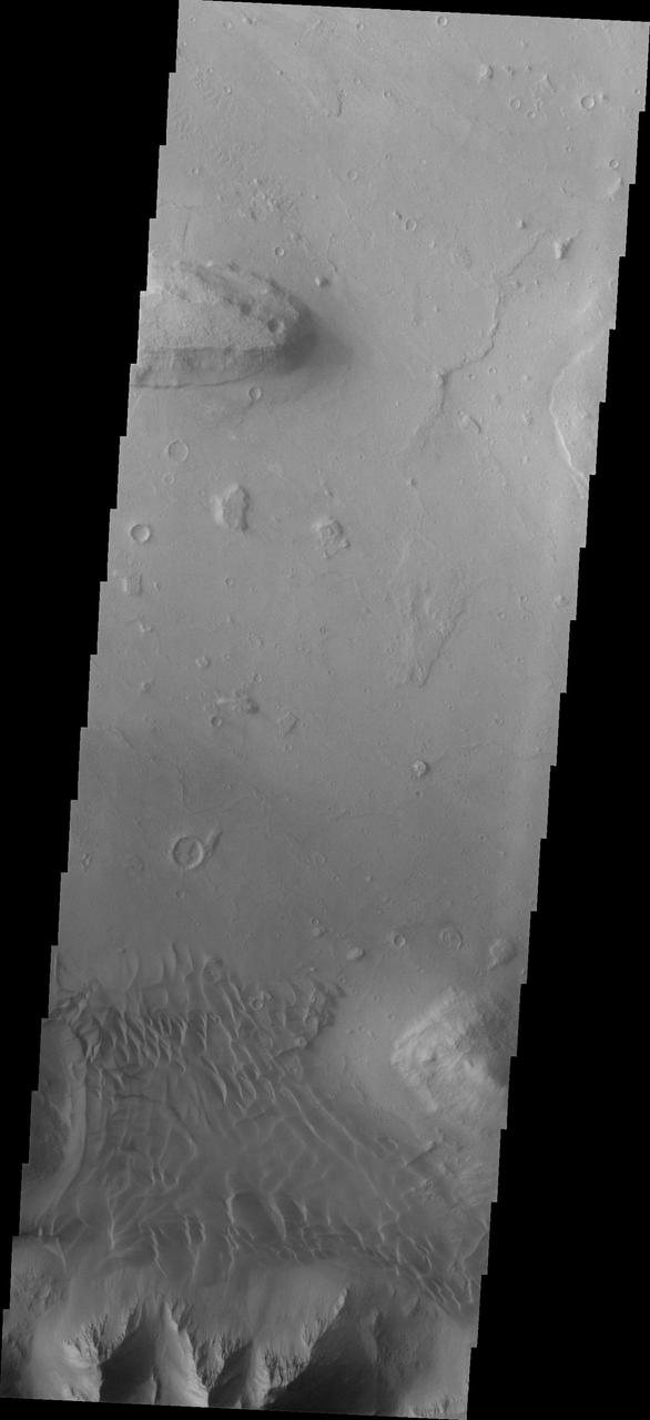
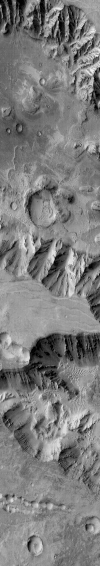
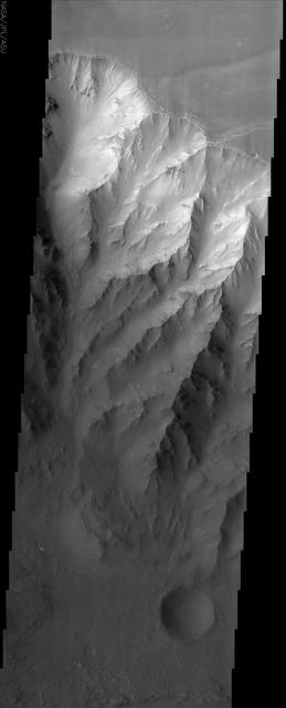
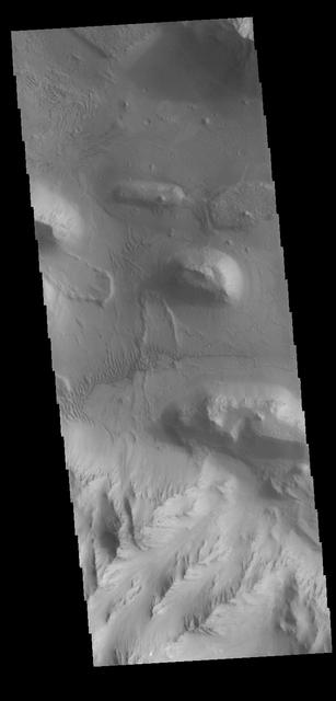
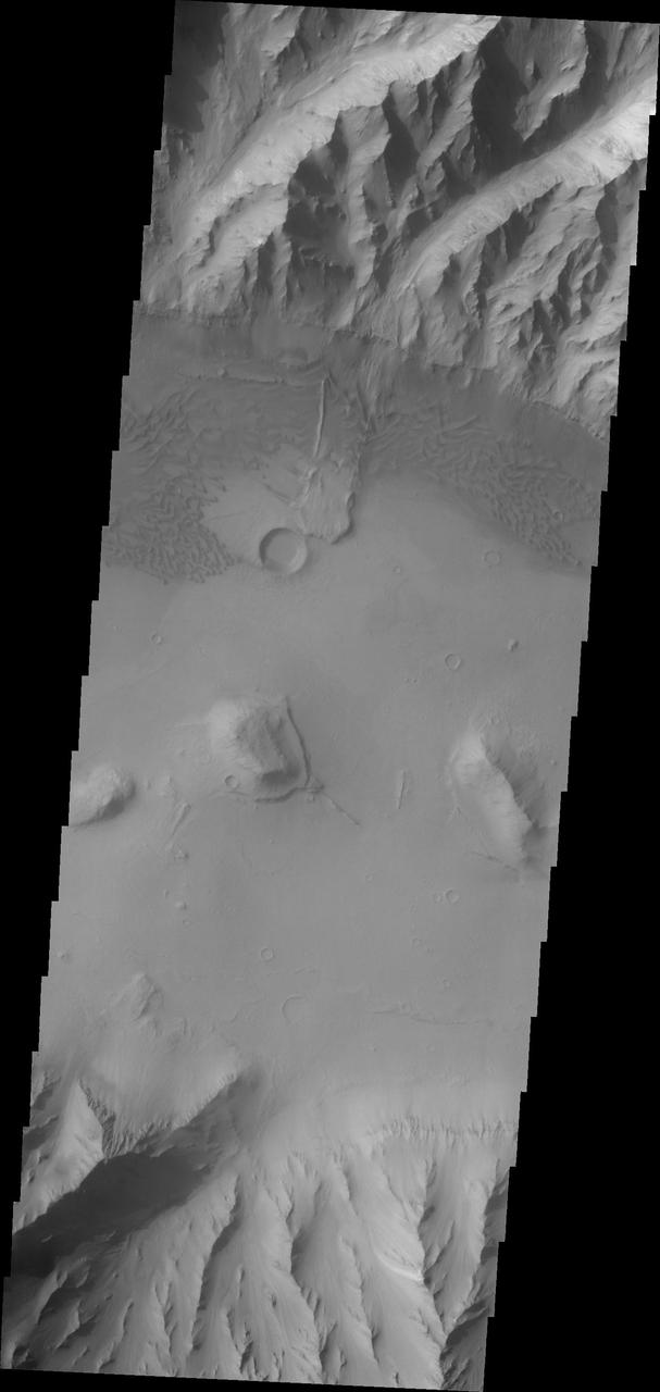
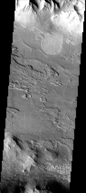
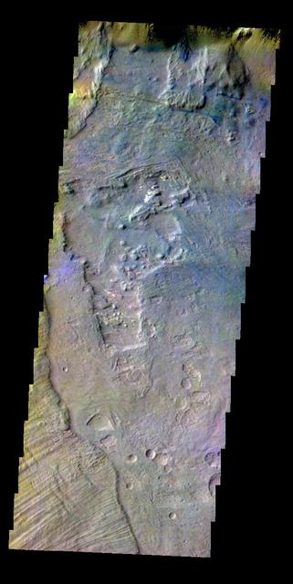
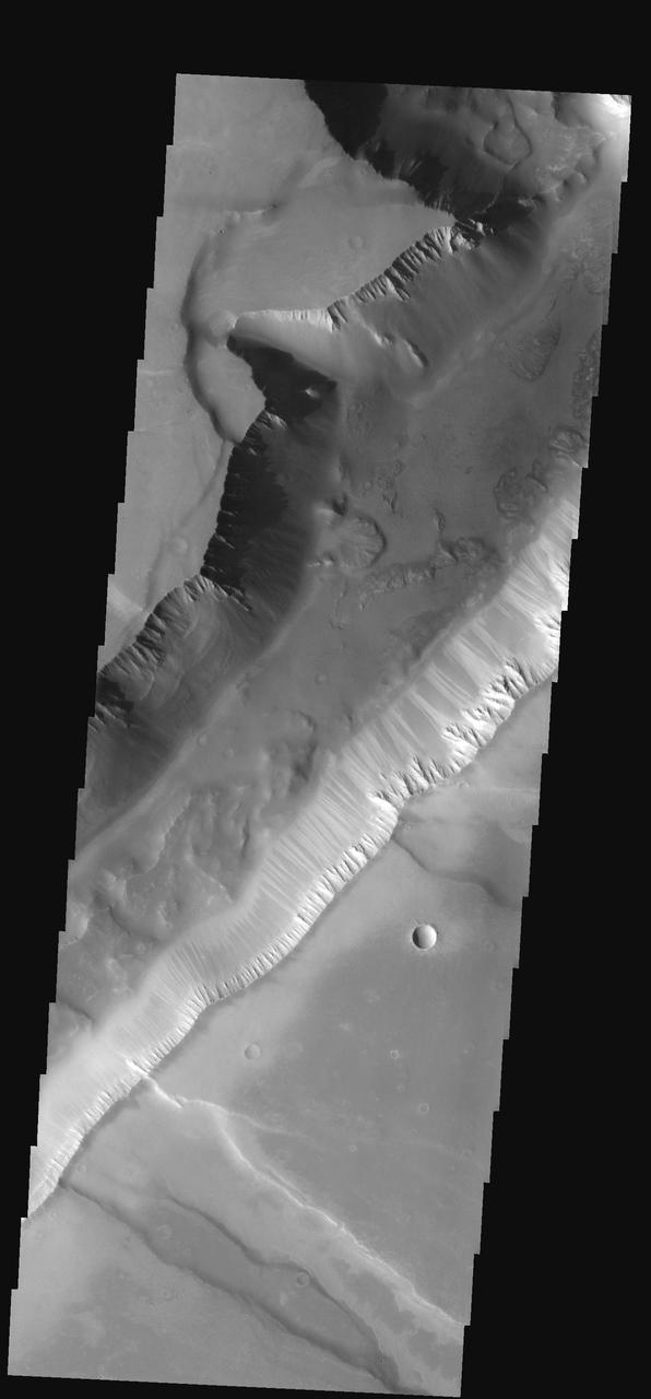
This image from NASA's Mars Reconnaissance Orbiter shows a small portion of the floor of Coprates Chasma, a large trough within the Valles Marineris system of canyons. Although the exact sequence of events that formed Coprates Chasma is unknown, the ripples, mesas, and craters visible throughout the terrain point to a complex history involving multiple mechanisms of erosion and deposition. The main trough of Coprates Chasma ranges from 60 to 100 kilometers in width. https://photojournal.jpl.nasa.gov/catalog/PIA21872
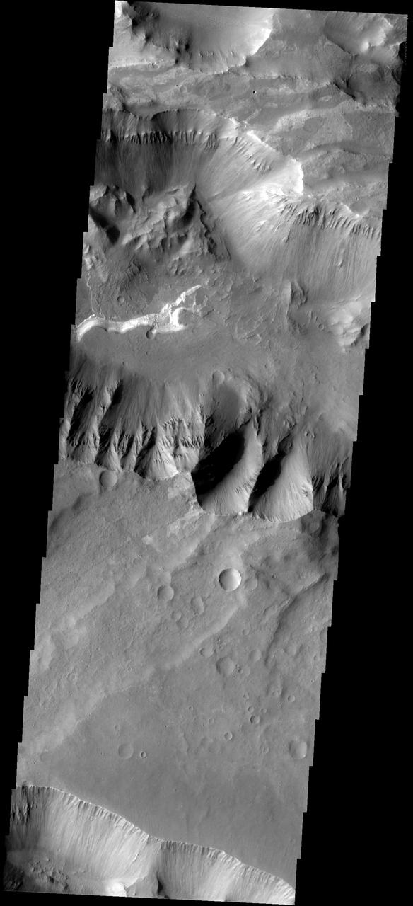
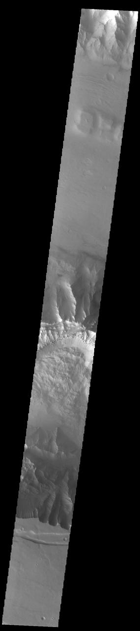
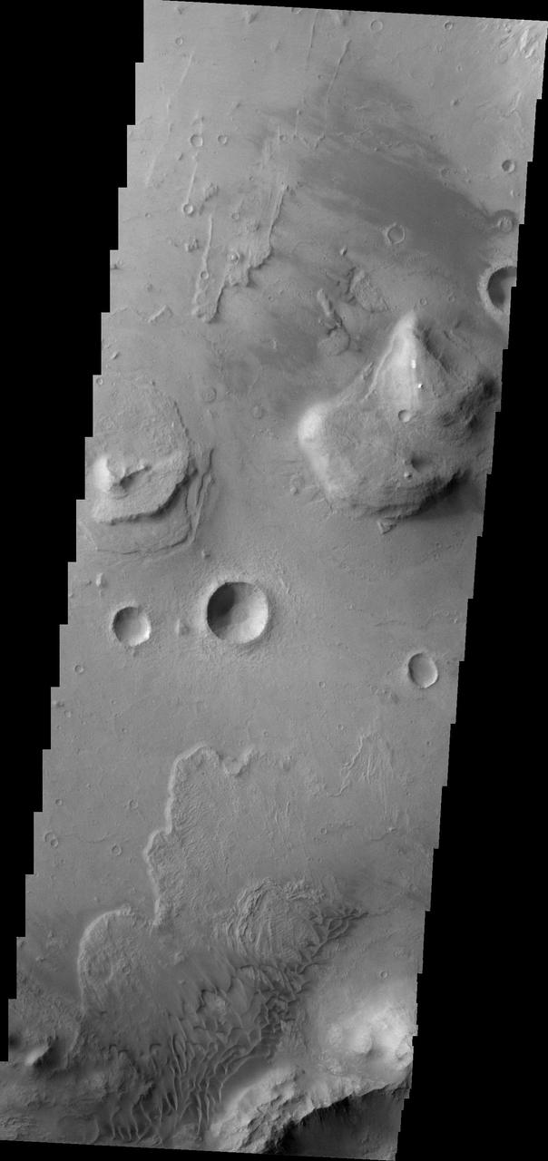
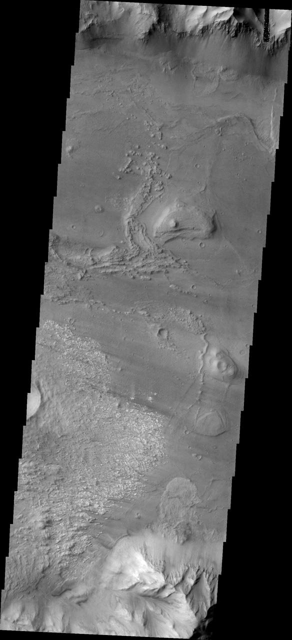
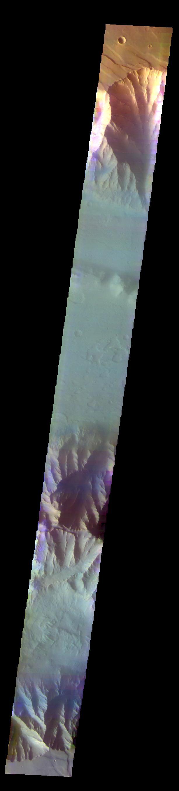
Coprates Chasma is one of the numerous canyons that make up Valles Marineris. The chasma stretches for 960 km (600 miles) from Melas Chasma to the west and Capri Chasma to the east. Landslide deposits, layered materials and sand dunes cover a large portion of the chasma floor. This image is located in central Coprates Chasma. The floor of the chasma is covered by a complex deposit of material. This chaotic surface differs from most of the floor of the canyon and indicate a local process, perhaps a very large landslide or failure of the cliff face. The Odyssey spacecraft has spent over 15 years in orbit around Mars, circling the planet more than 69000 times. It holds the record for longest working spacecraft at Mars. THEMIS, the IR/VIS camera system, has collected data for the entire mission and provides images covering all seasons and lighting conditions. Over the years many features of interest have received repeated imaging, building up a suite of images covering the entire feature. From the deepest chasma to the tallest volcano, individual dunes inside craters and dune fields that encircle the north pole, channels carved by water and lava, and a variety of other feature, THEMIS has imaged them all. For the next several months the image of the day will focus on the Tharsis volcanoes, the various chasmata of Valles Marineris, and the major dunes fields. We hope you enjoy these images! Orbit Number: 27086 Latitude: -13.564 Longitude: 300.618 Instrument: VIS Captured: 2008-01-22 12:04 https://photojournal.jpl.nasa.gov/catalog/PIA21994
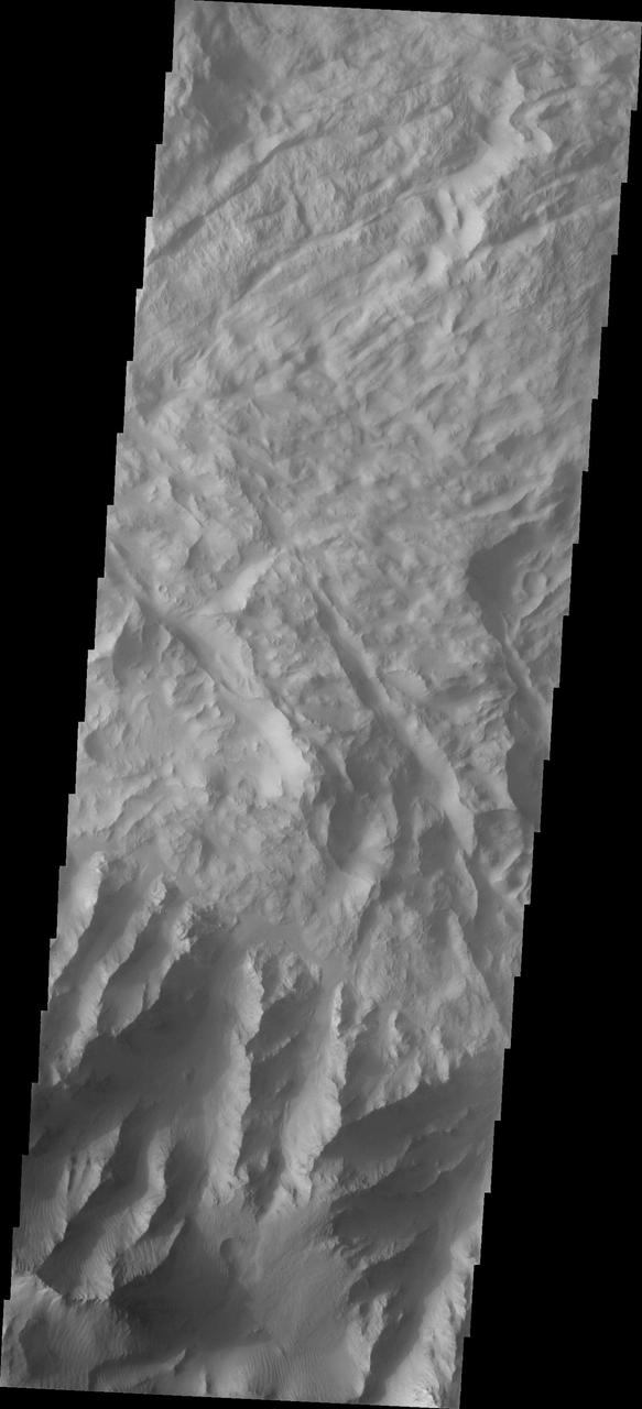
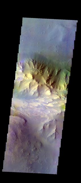
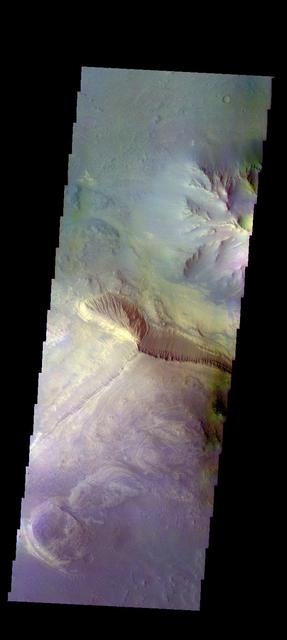
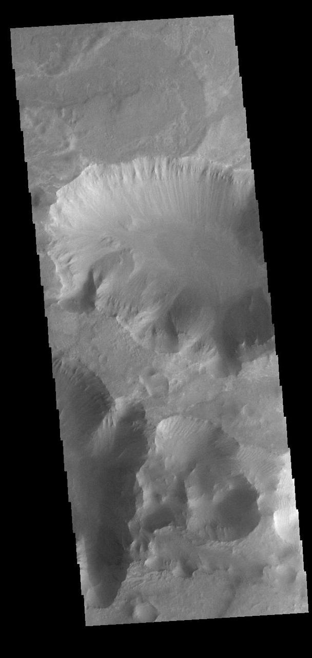
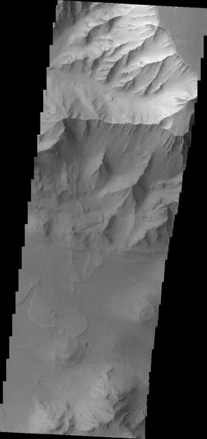
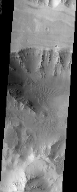
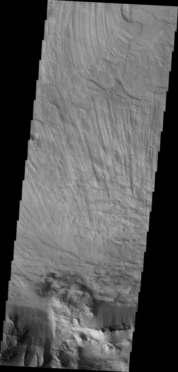
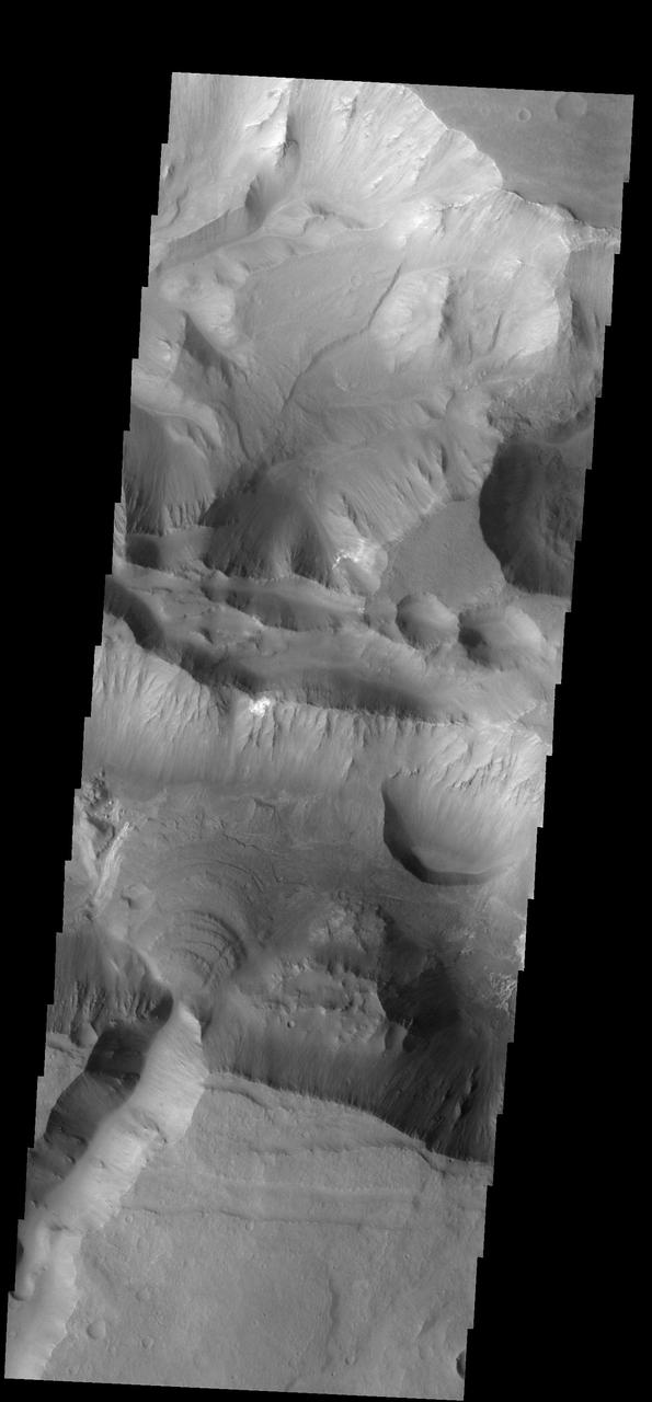
Coprates Chasma

Coprates Chasma

Coprates Chasma
Coprates Chasma
Coprates Chasma
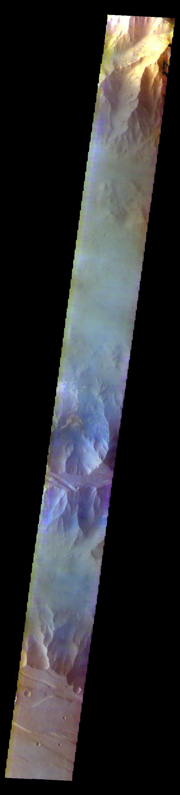
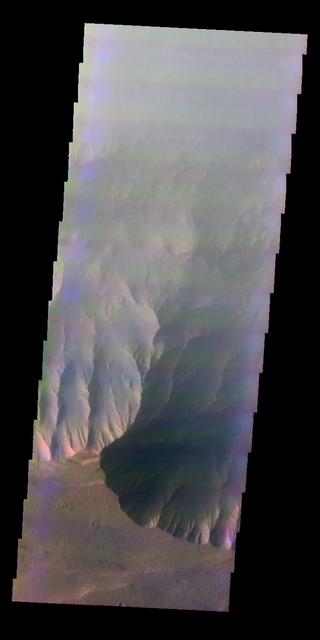
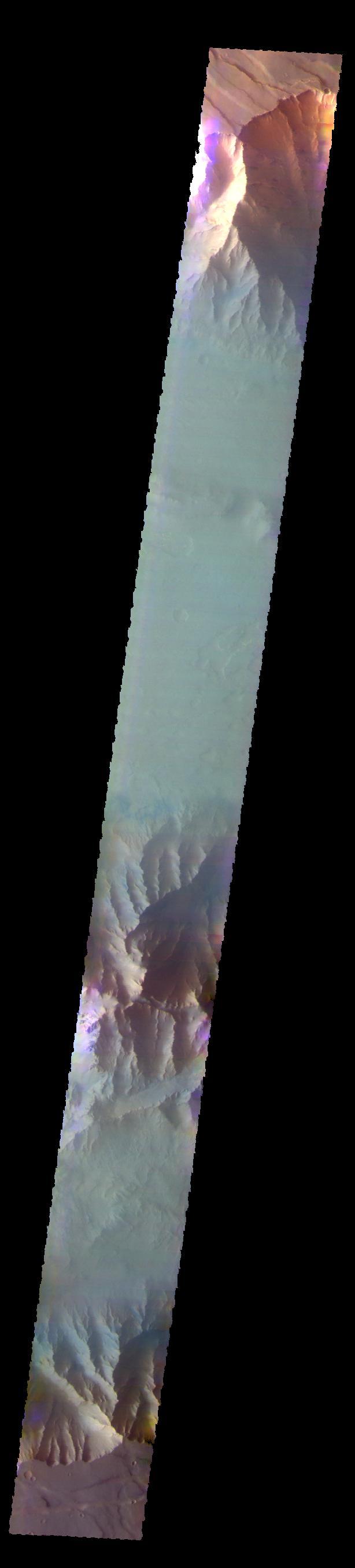
The THEMIS VIS camera contains 5 filters. The data from different filters can be combined in multiple ways to create a false color image. These false color images may reveal subtle variations of the surface not easily identified in a single band image. Today's false color image shows part of Coprates Chasma. Orbit Number: 59937 Latitude: -12.9223 Longitude: 295.366 Instrument: VIS Captured: 2015-06-18 22:08 https://photojournal.jpl.nasa.gov/catalog/PIA21797
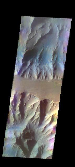
The THEMIS VIS camera contains 5 filters. The data from different filters can be combined in multiple ways to create a false color image. These false color images may reveal subtle variations of the surface not easily identified in a single band image. Today's false color image shows part of Coprates Chasma. Orbit Number: 52272 Latitude: -13.5675 Longitude: 297.001 Instrument: VIS Captured: 2013-09-25 23:18 http://photojournal.jpl.nasa.gov/catalog/PIA21515
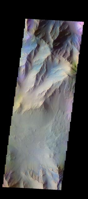
The THEMIS VIS camera contains 5 filters. The data from different filters can be combined in multiple ways to create a false color image. These false color images may reveal subtle variations of the surface not easily identified in a single band image. Today's false color image shows part of Coprates Chasma. Orbit Number: 51835 Latitude: -13.3714 Longitude: 294.464 Instrument: VIS Captured: 2013-08-21 00:18 http://photojournal.jpl.nasa.gov/catalog/PIA21313
The THEMIS VIS camera contains 5 filters. The data from different filters can be combined in multiple ways to create a false color image. These false color images may reveal subtle variations of the surface not easily identified in a single band image. Today's false color image shows part of Coprates Chasma. Orbit Number: 59076 Latitude: -12.8501 Longitude: 293.344 Instrument: VIS Captured: 2015-04-09 00:34 https://photojournal.jpl.nasa.gov/catalog/PIA21667
The THEMIS VIS camera contains 5 filters. The data from different filters can be combined in multiple ways to create a false color image. These false color images may reveal subtle variations of the surface not easily identified in a single band image. Today's false color image shows part of Coprates Chasma. Orbit Number: 51423 Latitude: -12.1253 Longitude: 291.311 Instrument: VIS Captured: 2013-07-18 02:40 http://photojournal.jpl.nasa.gov/catalog/PIA21308
The THEMIS camera contains 5 filters. The data from different filters can be combined in multiple ways to create a false color image. This image from NASA 2001 Mars Odyssey spacecraft shows part of the interior of Coprates Chasma. Orbit Number: 50911 Latitude: -12.184 Longitude: 291.09 Instrument: VIS Captured: 2013-06-05 23:33 http://photojournal.jpl.nasa.gov/catalog/PIA21290
This image shows part of Coprates Chasma
Slipping and Sliding in Coprates Chasma
Outcrops in Coprates Chasma
Layered Mesa in Coprates Chasma
Coprates Chasma Landslides in IR
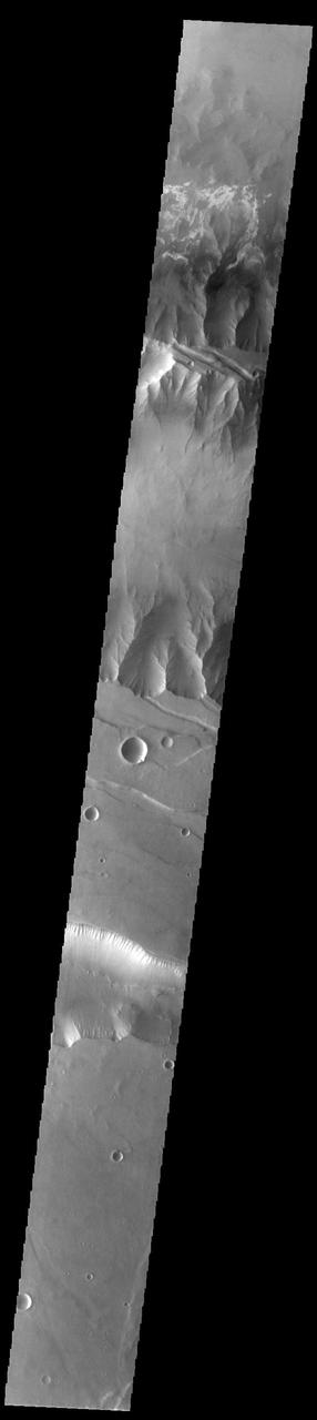
Coprates Chasma is one of the numerous canyons that make up Valles Marineris. The chasma stretches for 960 km (600 miles) from Melas Chasma to the west and Capri Chasma to the east. Landslide deposits, layered materials and sand dunes cover a large portion of the chasma floor. This image is located in eastern Coprates Chasma. The image shows a relatively smooth floor, with a group of sand dune forms located against the wall of the chasma (bottom of image). The Odyssey spacecraft has spent over 15 years in orbit around Mars, circling the planet more than 69000 times. It holds the record for longest working spacecraft at Mars. THEMIS, the IR/VIS camera system, has collected data for the entire mission and provides images covering all seasons and lighting conditions. Over the years many features of interest have received repeated imaging, building up a suite of images covering the entire feature. From the deepest chasma to the tallest volcano, individual dunes inside craters and dune fields that encircle the north pole, channels carved by water and lava, and a variety of other feature, THEMIS has imaged them all. For the next several months the image of the day will focus on the Tharsis volcanoes, the various chasmata of Valles Marineris, and the major dunes fields. We hope you enjoy these images! Orbit Number: 27061 Latitude: -13.9602 Longitude: 301.82 Instrument: VIS Captured: 2008-01-20 10:39 https://photojournal.jpl.nasa.gov/catalog/PIA21993
Today's VIS image is located between the main part of Coprates Chasma (north) and Coprates Catena (south). The canyon in this area is much shallower than the main canyon. Coprates Chasma is one of the numerous canyons that make up Valles Marineris. The chasma stretches for 960 km (600 miles) from Melas Chasma to the west and Capri Chasma to the east. Orbit Number: 90883 Latitude: -15.0445 Longitude: 301.518 Instrument: VIS Captured: 2022-06-10 14:37 https://photojournal.jpl.nasa.gov/catalog/PIA25516
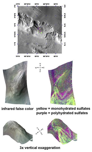
Complex Sulfate Deposits in Coprates Chasma
This image captured by NASA Mars Odyssey shows a portion of Coprates Chasma.
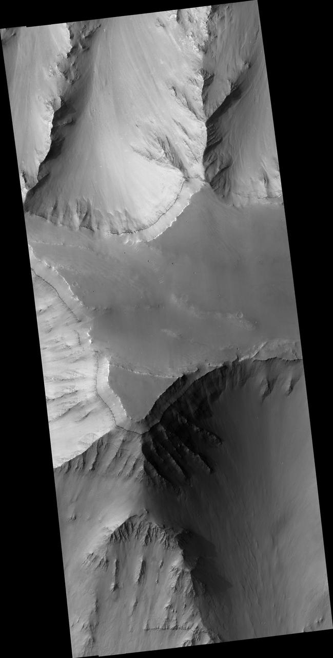
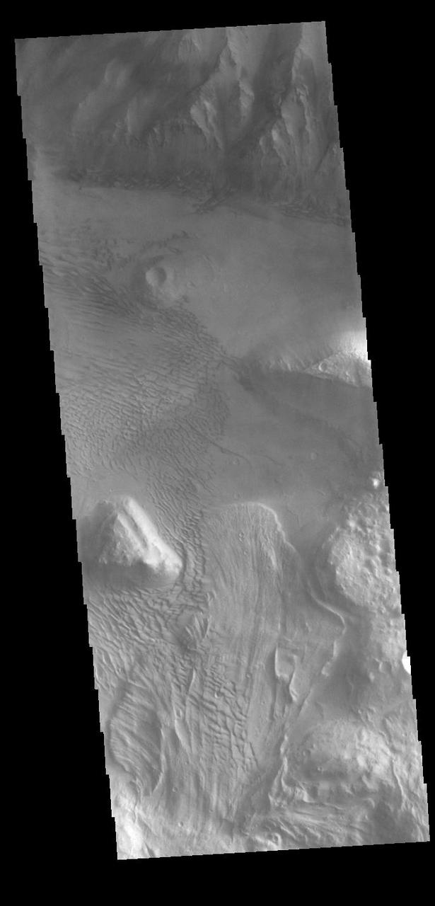
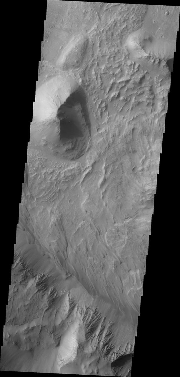
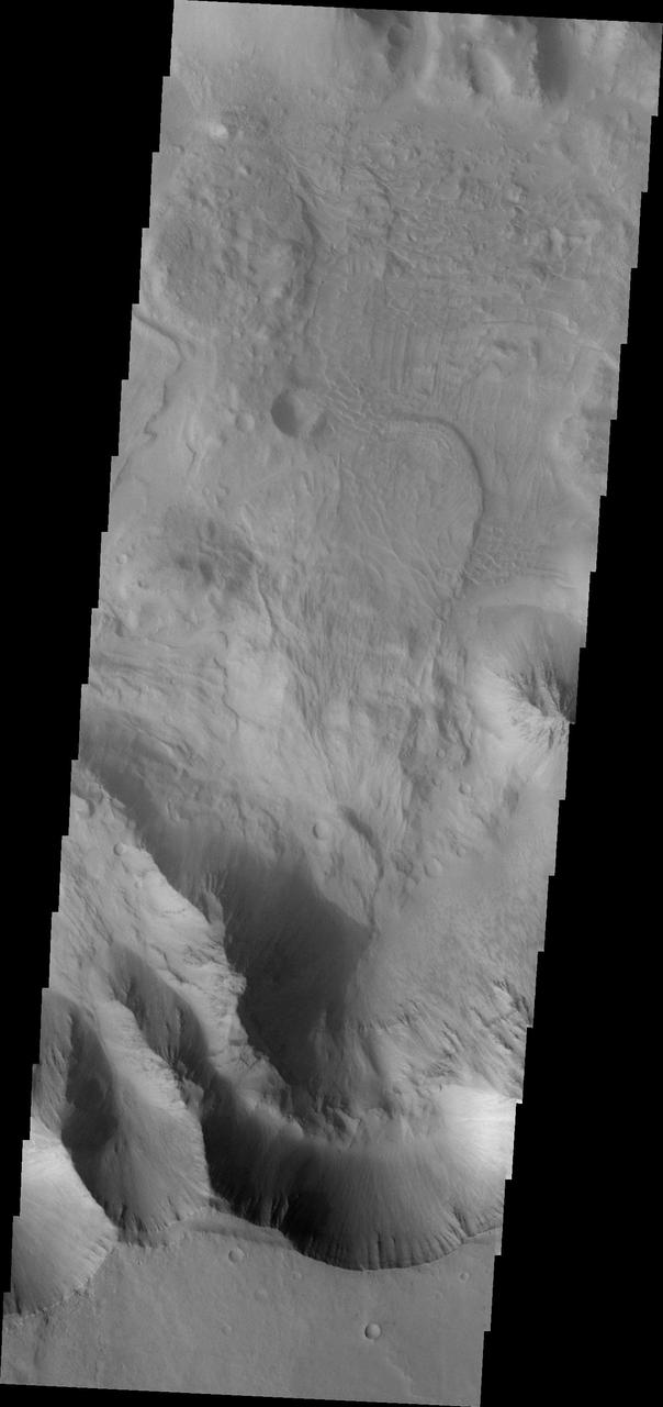
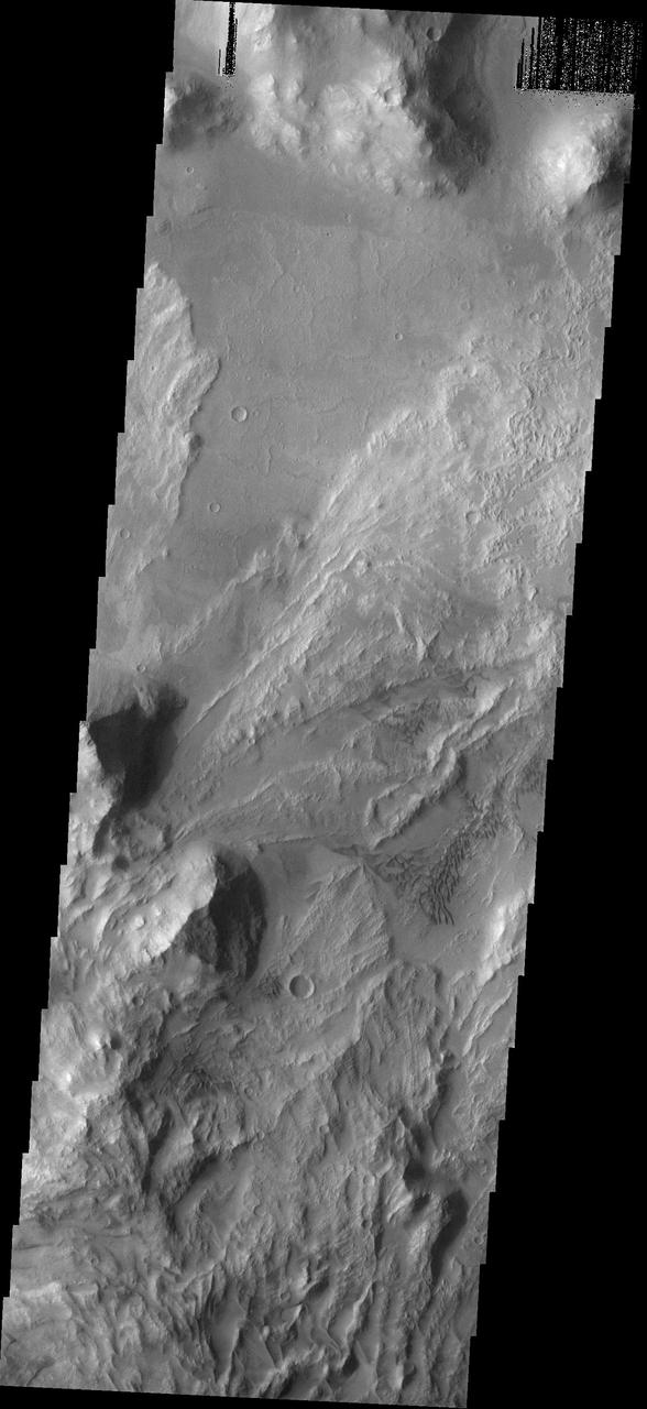
Today's VIS image shows a cross section of Coprates Chasma. In this region the chasma has two sections – a deep, flat floored canyon at the top of the image, and a shallower section in the lower part of the image. The sections are divided by a large ridge. The floor of the bottom canyon is covered by large landslide deposits. Coprates Chasma is one of the numerous canyons that make up Valles Marineris. The chasma stretches for 960 km (600 miles) from Melas Chasma to the west and Capri Chasma to the east. Orbit Number: 91988 Latitude: -12.6995 Longitude: 293.287 Instrument: VIS Captured: 2022-09-09 13:27 https://photojournal.jpl.nasa.gov/catalog/PIA25717
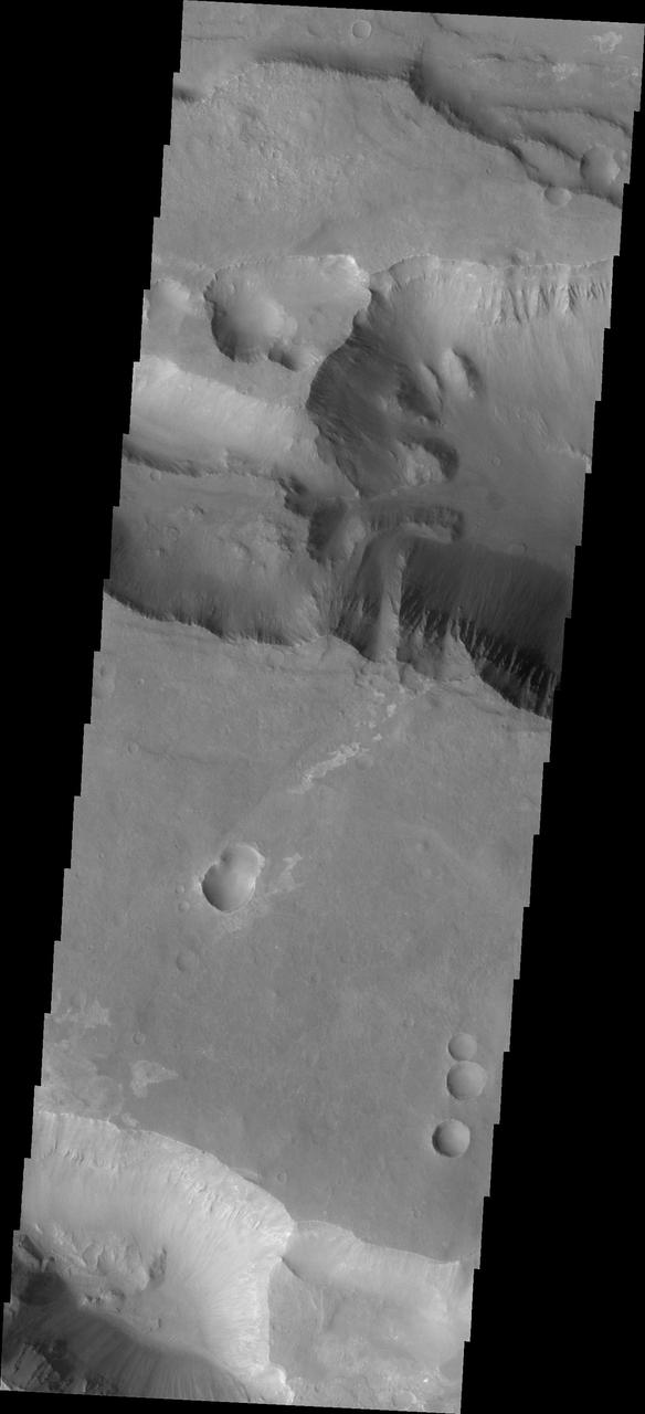
Today's VIS image shows a cross section of Coprates Chasma. In this region the chasma has two sections – a deep, flat floored canyon at the top of the image (the northern cliff face is not visible in this image), and the second section below that separated by a large ridge. Paralleling it to the south runs a narrower and shallower chain of linked pits and depressions called Coprates Catena. Landslide deposits, layered materials and sand dunes cover a large portion of the chasma floor. The brighter materials at the top of the image are layered deposits. It is unknown how deep these canyon deposits were when they formed. The layering is only visible due to erosion, making it difficult to estimate the original thickness. While layered deposits can be found on the floor of Coprates Chasma, they are most commonly found along the lower elevations and at the bottom of the cliff faces in the canyon. Coprates Chasma is one of the numerous canyons that make up Valles Marineris. The chasma stretches for 960 km (600 miles) from Melas Chasma to the west and Capri Chasma to the east. Orbit Number: 93111 Latitude: -14.0758 Longitude: 295.079 Instrument: VIS Captured: 2022-12-11 00:40 https://photojournal.jpl.nasa.gov/catalog/PIA25816
This VIS image is located on the eastern side of Coprates Chasma, near Capri Chasma. The image shows a large lobe shaped landslide deposit at the bottom of the canyon cliff face. Sand dunes are visible both on the landslide deposit and other parts of the canyon floor. Coprates Chasma is one of the numerous canyons that make up Valles Marineris. The chasma stretches for 960 km (600 miles) from Melas Chasma to the west and Capri Chasma to the east. Landslide deposits, layered materials and sand dunes cover a large portion of the chasma floor. Orbit Number: 88225 Latitude: -15.0285 Longitude: 304.496 Instrument: VIS Captured: 2021-11-03 17:56 https://photojournal.jpl.nasa.gov/catalog/PIA25196

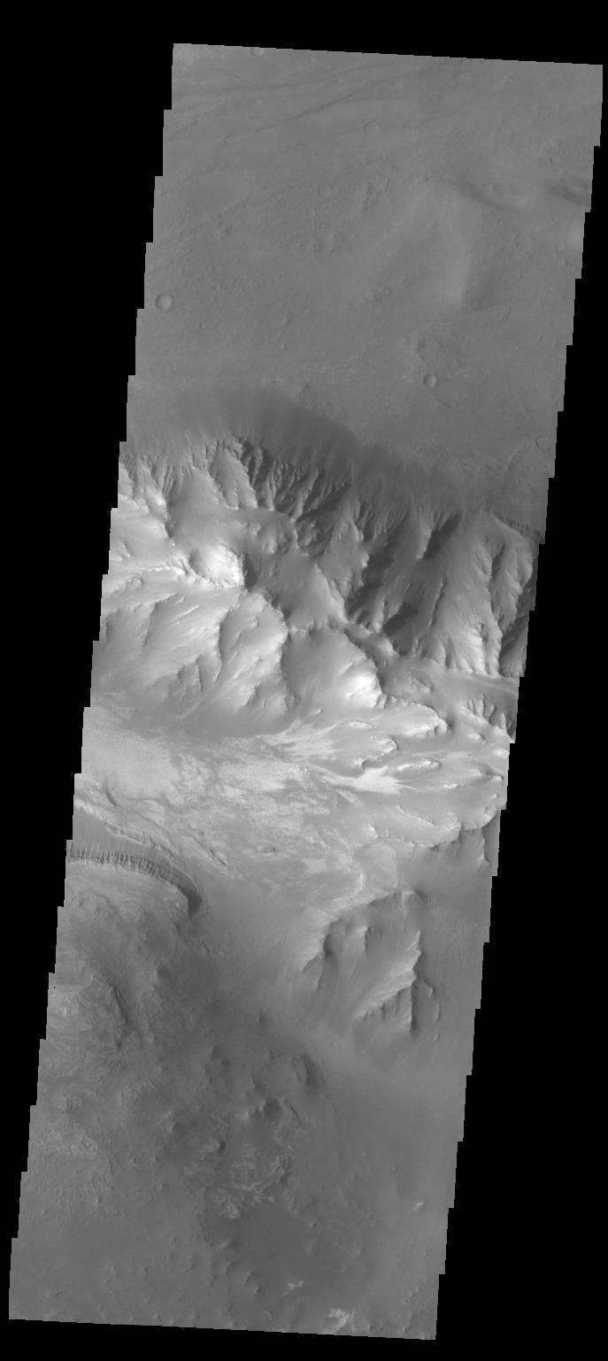
Today's VIS image shows a cross section of Coprates Chasma. The floor of the canyon is covered by large landslide deposits. Coprates Chasma is one of the numerous canyons that make up Valles Marineris. The chasma stretches for 960 km (600 miles) from Melas Chasma to the west and Capri Chasma to the east. Paralleling the chasma to the south runs a narrower and shallower chain of linked pits and depressions called Coprates Catena. Orbit Number: 93011 Latitude: -14.3186 Longitude: 299.989 Instrument: VIS Captured: 2022-12-02 19:04 https://photojournal.jpl.nasa.gov/catalog/PIA25811
This image captured by NASA 2001 Mars Odyssey spacecraft is further west from yesterday image, near the margin between Coprates Chasma and Melas Chasma.
Coprates Chasma comprises the central portion of the Valles Marineris canyon system complex. This image from NASA Mars Odyssey spacecraft of the southern wall of Coprates Chasma contains a landslide deposit with dunes over portions of slide.
This NASA 2001 Mars Odyssey image shows part of the floor of Coprates Chasma.
This image shows part of Coprates Chasma as seen by NASA 2001 Mars Odyssey spacecraft.
This image captured by NASA 2001 Mars Odyssey spacecraft shows the eastern part of Coprates Chasma.
NASA 2001 Mars Odyssey shows part of the floor of Coprates Chasma which contains various deposits, including dune fields.
This 2001 Mars Odyssey THEMIS VIS image crosses Coprates Chasma, showing both floor and wall features of the canyon.
A large landslide deposit fills the bottom part of this image of Coprates Chasma captured by NASA 2001 Mars Odyssey spacecraft.
This image from NASA 2001 Mars Odyssey spacecraft shows part of Coprates Chasma, which is just one part of the extensive Valles Marineris canyon system.
This image from NASA Mars Odyssey spacecraft shows the northern interior wall of Coprates Chasma, one of the major canyons that form Valles Marineris.
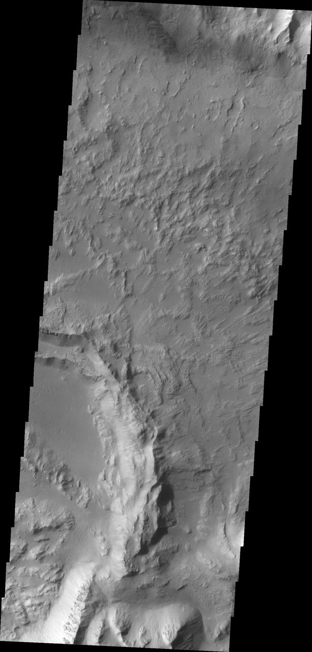
The floor of Coprates Chasma contains many different geologic landforms. This image, taken by NASA 2001 Mars Odyssey spacecraft, shows the effects of wind and landslides.
This image taken by NASA 2001 Mars Odyssey shows a portion of the floor of Coprates Chasma. Note the sand dune forms near the southern cliff face.
This image captured by NASA 2001 Mars Odyssey spacecraft shows part of the floor of Coprates Chasma, including a large sand sheet and smaller dunes.
Several landslide deposits are visible in this image of Coprates Chasma taken by NASA 2001 Mars Odyssey spacecraft.
This image from NASA Mars Reconnaissance Orbiter shows exposures of deposits along the plateau just to the south of Coprates Chasma.
This image from NASA Mars Odyssey spacecraft, which displays clearly the contrast between bedrock, sand, and dust surfaces, covers a portion of Coprates Chasma, part of the Valles Marineris system of canyons that stretch for thousands of kilometers.
A sandsheet with dune forms covers most of the floor of this unnamed crater within Coprates Chasma in this image captured by NASA Mars Odyssey on June 23, 2010.

Coprates Chasma is one of the numerous canyons that make up Valles Marineris. The chasma stretches for 960 km (600 miles) from Melas Chasma to the west and Capri Chasma to the east. Landslide deposits, layered materials and sand dunes cover a large portion of the chasma floor. This image is located in central Coprates Chasma. The image shows multiple landslide features, which form the bright lobed shaped deposits at the bottom of the canyon cliff face (top of image). The linear grooves on the top of the large landslide deposit were formed as the material came to rest on the canyon floor. The other features on the chasma floor are layered materials that have been weathered. The Odyssey spacecraft has spent over 15 years in orbit around Mars, circling the planet more than 69000 times. It holds the record for longest working spacecraft at Mars. THEMIS, the IR/VIS camera system, has collected data for the entire mission and provides images covering all seasons and lighting conditions. Over the years many features of interest have received repeated imaging, building up a suite of images covering the entire feature. From the deepest chasma to the tallest volcano, individual dunes inside craters and dune fields that encircle the north pole, channels carved by water and lava, and a variety of other feature, THEMIS has imaged them all. For the next several months the image of the day will focus on the Tharsis volcanoes, the various chasmata of Valles Marineris, and the major dunes fields. We hope you enjoy these images! Orbit Number: 16803 Latitude: -12.5614 Longitude: 296.887 Instrument: VIS Captured: 2005-09-27 20:25 https://photojournal.jpl.nasa.gov/catalog/PIA21992
This VIS image shows part of the wall and floor of Coprates Chasma. Several landslide deposits are visible as well as small regions of sand dunes. Orbit Number: 71992 Latitude: -14.4199 Longitude: 302.56 Instrument: VIS Captured: 2018-03-07 23:50 https://photojournal.jpl.nasa.gov/catalog/PIA22410
NASA Mars Reconnaissance Orbiter shows light-toned deposits along Coprates Chasma slopes.
Coprates Chasma is one of the numerous canyons that make up Valles Marineris. The chasma stretches for 960 km (600 miles) from Melas Chasma to the west and Capri Chasma to the east. Landslide deposits, layered materials and sand dunes cover a large portion of the chasma floor. This image is located in eastern Coprates Chasma, just east of the previous image. In this image, the lobate margins of several landslide deposits are easy to identify. This indicates the chaotic surface in yesterday's image are materials emplaced by landslides. The brighter features at the bottom of the image are layered materials. There are also dunes in the region with the layered deposits. The Odyssey spacecraft has spent over 15 years in orbit around Mars, circling the planet more than 69000 times. It holds the record for longest working spacecraft at Mars. THEMIS, the IR/VIS camera system, has collected data for the entire mission and provides images covering all seasons and lighting conditions. Over the years many features of interest have received repeated imaging, building up a suite of images covering the entire feature. From the deepest chasma to the tallest volcano, individual dunes inside craters and dune fields that encircle the north pole, channels carved by water and lava, and a variety of other feature, THEMIS has imaged them all. For the next several months the image of the day will focus on the Tharsis volcanoes, the various chasmata of Valles Marineris, and the major dunes fields. We hope you enjoy these images! Orbit Number: 33037 Latitude: -13.8409 Longitude: 301.104 Instrument: VIS Captured: 2009-05-26 13:16 https://photojournal.jpl.nasa.gov/catalog/PIA21995
Coprates Chasma is one of the numerous canyons that make up Valles Marineris. The chasma stretches for 960 km (600 miles) from Melas Chasma to the west and Capri Chasma to the east. Landslide deposits, layered materials and sand dunes cover a large portion of the chasma floor. This image is located on the eastern side of Coprates Chasma, near Capri Chasma. The image shows multiple landslide features, which form lobed shaped deposits at the bottom of the canyon cliff face. Sand dunes are visible both on the landslide deposit and other parts of the canyon floor. The Odyssey spacecraft has spent over 15 years in orbit around Mars, circling the planet more than 69000 times. It holds the record for longest working spacecraft at Mars. THEMIS, the IR/VIS camera system, has collected data for the entire mission and provides images covering all seasons and lighting conditions. Over the years many features of interest have received repeated imaging, building up a suite of images covering the entire feature. From the deepest chasma to the tallest volcano, individual dunes inside craters and dune fields that encircle the north pole, channels carved by water and lava, and a variety of other feature, THEMIS has imaged them all. For the next several months the image of the day will focus on the Tharsis volcanoes, the various chasmata of Valles Marineris, and the major dunes fields. We hope you enjoy these images! Orbit Number: 16653 Latitude: -14.2759 Longitude: 303.707 Instrument: VIS Captured: 2005-09-15 12:01 https://photojournal.jpl.nasa.gov/catalog/PIA21991
This image taken by NASA 2001 Mars Odyssey of the eastern end of Coprates Chasma contains a landslide deposit and sand dunes. Both features are typical for the chasmata that make up Valles Marineris.
Coprates Chasma is one of the numerous canyons that make up Valles Marineris. The chasma stretches for 960 km (600 miles) from Melas Chasma to the west and Capri Chasma to the east. Landslide deposits, layered materials and sand dunes cover a large portion of the chasma floor. This image is located in central Coprates Chasma. In this image, there is a landslide deposit at the bottom of the image. The brighter material to the left of the landslide appears to be a rough surface likely etched by wind action. The chasma contains numerous regions of sand dunes, indicating that the wind plays a part in the erosion and deposition of fine materials in the canyon. The Odyssey spacecraft has spent over 15 years in orbit around Mars, circling the planet more than 69000 times. It holds the record for longest working spacecraft at Mars. THEMIS, the IR/VIS camera system, has collected data for the entire mission and provides images covering all seasons and lighting conditions. Over the years many features of interest have received repeated imaging, building up a suite of images covering the entire feature. From the deepest chasma to the tallest volcano, individual dunes inside craters and dune fields that encircle the north pole, channels carved by water and lava, and a variety of other feature, THEMIS has imaged them all. For the next several months the image of the day will focus on the Tharsis volcanoes, the various chasmata of Valles Marineris, and the major dunes fields. We hope you enjoy these images! Orbit Number: 35820 Latitude: -12.793 Longitude: 297.407 Instrument: VIS Captured: 2010-01-10 16:39 https://photojournal.jpl.nasa.gov/catalog/PIA21996
Recurring slope lineae RSL may be due to active seeps of water. These dark flows are abundant along the steep slopes of ancient bedrock in Coprates Chasma as seen in this image from NASA Mars Reconnaissance Orbiter.
Coprates Chasma is one of the numerous canyons that make up Valles Marineris. The chasma stretches for 960 km (600 miles) from Melas Chasma to the west and Capri Chasma to the east. Landslide deposits, layered materials and sand dunes cover a large portion of the chasma floor. This image is located in central Coprates Chasma. The brighter materials at the bottom of the image are layered deposits. It is unknown how deep these canyon deposits were when they formed. The layering is only visible due to erosion, making it difficult to estimate the original thickness. While layered deposits can be found on the floor of Coprates Chasma, they are most commonly found along the lower elevations and at the bottom of the cliff faces in the canyon. The Odyssey spacecraft has spent over 15 years in orbit around Mars, circling the planet more than 69000 times. It holds the record for longest working spacecraft at Mars. THEMIS, the IR/VIS camera system, has collected data for the entire mission and provides images covering all seasons and lighting conditions. Over the years many features of interest have received repeated imaging, building up a suite of images covering the entire feature. From the deepest chasma to the tallest volcano, individual dunes inside craters and dune fields that encircle the north pole, channels carved by water and lava, and a variety of other feature, THEMIS has imaged them all. For the next several months the image of the day will focus on the Tharsis volcanoes, the various chasmata of Valles Marineris, and the major dunes fields. We hope you enjoy these images! Orbit Number: 51810 Latitude: -12.6848 Longitude: 295.197 Instrument: VIS Captured: 2013-08-18 22:56 https://photojournal.jpl.nasa.gov/catalog/PIA22000
This landslide occurred in Coprates Chasma
The THEMIS camera contains 5 filters. The data from different filters can be combined in multiple ways to create a false color image. This image from NASA 2001 Mars Odyssey spacecraft shows part of the floor of Coprates Chasma.
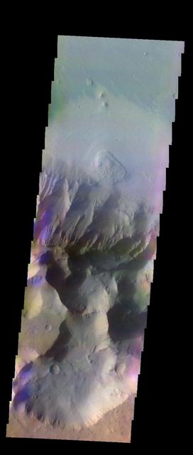
The THEMIS VIS camera contains 5 filters. The data from different filters can be combined in multiple ways to create a false color image. This false color image captured by NASA 2001 Mars Odyssey spacecraft shows part of Coprates Chasma.
The THEMIS VIS camera contains 5 filters. The data from different filters can be combined in multiple ways to create a false color image. This false color image captured by NASA 2001 Mars Odyssey spacecraft shows part of Coprates Chasma.
The THEMIS VIS camera contains 5 filters. The data from different filters can be combined in multiple ways to create a false color image. This false color image from NASA 2001 Mars Odyssey spacecraft shows part of Coprates Chasma.
The THEMIS VIS camera contains 5 filters. The data from different filters can be combined in multiple ways to create a false color image. This false color image from NASA 2001 Mars Odyssey spacecraft shows part of Coprates Chasma.

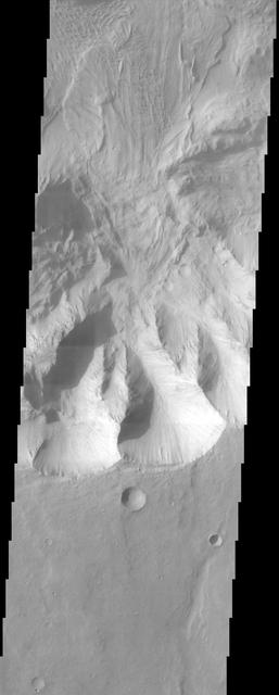
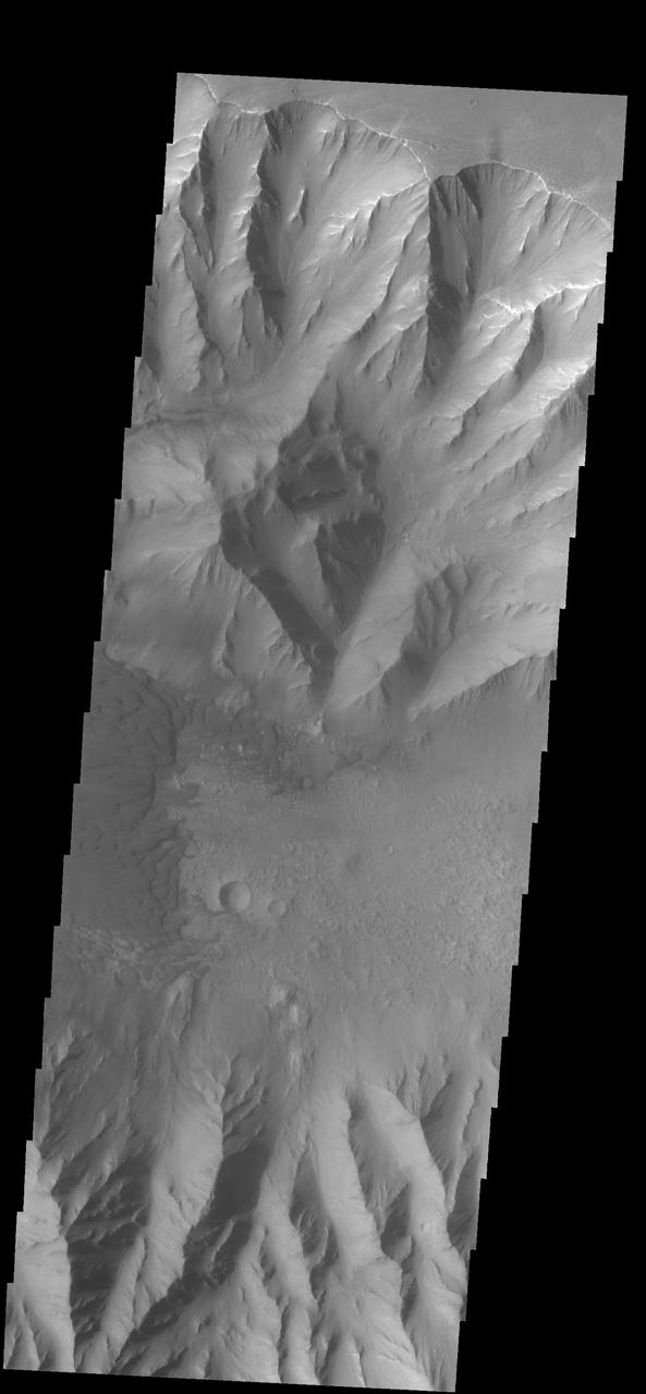
Coprates Chasma is one of the numerous canyons that make up Valles Marineris. The chasma stretches for 960 km (600 miles) from Melas Chasma to the west and Capri Chasma to the east. Landslide deposits, layered materials and sand dunes cover a large portion of the chasma floor. This image is located in eastern Coprates Chasma. The branching features near the bottom of the image are spurs of rock in the cliff face. The rock is more resistant to erosion that fine materials like sand and dust. Those materials are visible below the spurs, and then onto the canyon floor. Unlike the large landslide deposits, these small fans of material build up over time as the material above erodes. There are sand dunes along the edge of the fans in this image. The Odyssey spacecraft has spent over 15 years in orbit around Mars, circling the planet more than 69000 times. It holds the record for longest working spacecraft at Mars. THEMIS, the IR/VIS camera system, has collected data for the entire mission and provides images covering all seasons and lighting conditions. Over the years many features of interest have received repeated imaging, building up a suite of images covering the entire feature. From the deepest chasma to the tallest volcano, individual dunes inside craters and dune fields that encircle the north pole, channels carved by water and lava, and a variety of other feature, THEMIS has imaged them all. For the next several months the image of the day will focus on the Tharsis volcanoes, the various chasmata of Valles Marineris, and the major dunes fields. We hope you enjoy these images! Orbit Number: 36294 Latitude: -14.7055 Longitude: 303.066 Instrument: VIS Captured: 2010-02-18 17:20 https://photojournal.jpl.nasa.gov/catalog/PIA21998
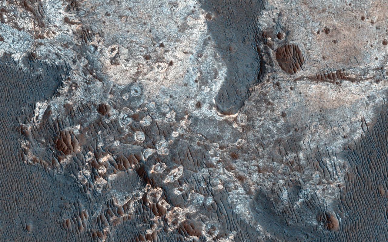
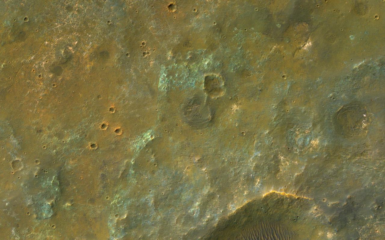
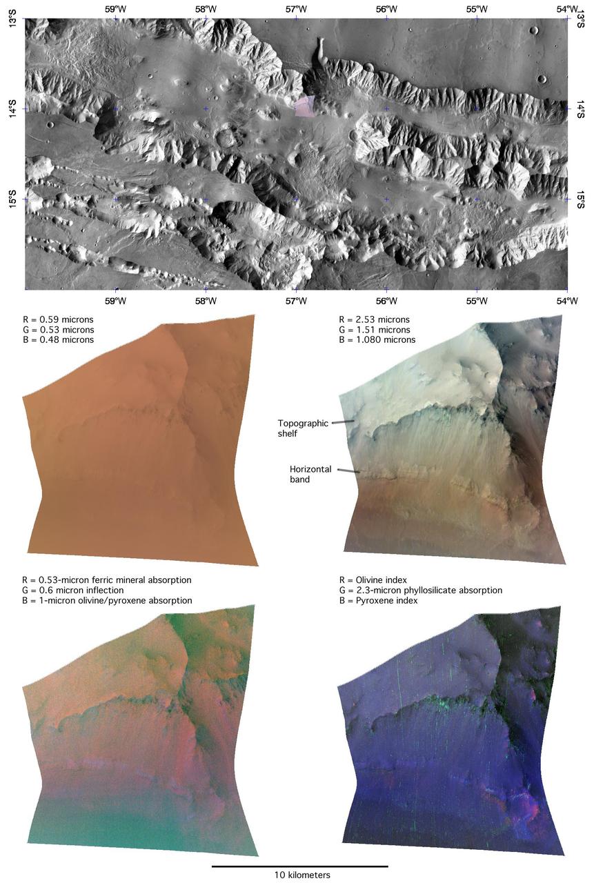
This image captured by NASA Mars Reconnaissance Orbiter MRO covers diverse surface units on the floor of eastern Coprates Chasma in eastern Valles Marineris. The bedrock has diverse minerals producing wonderful color contrasts. In over 10 years of orbiting Mars, HiRISE has acquired nearly 50,000 large images, but they cover less than 3 percent of the Martian surface. https://photojournal.jpl.nasa.gov/catalog/PIA21606

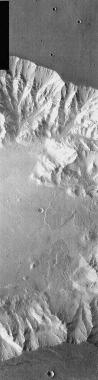
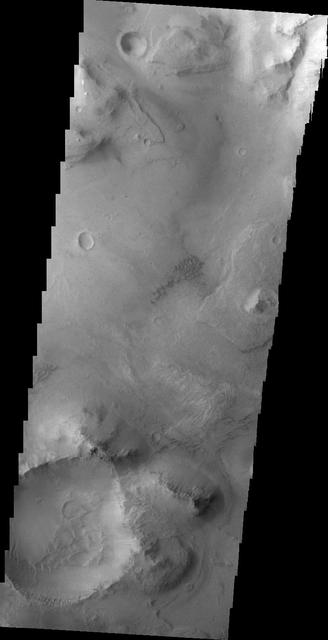
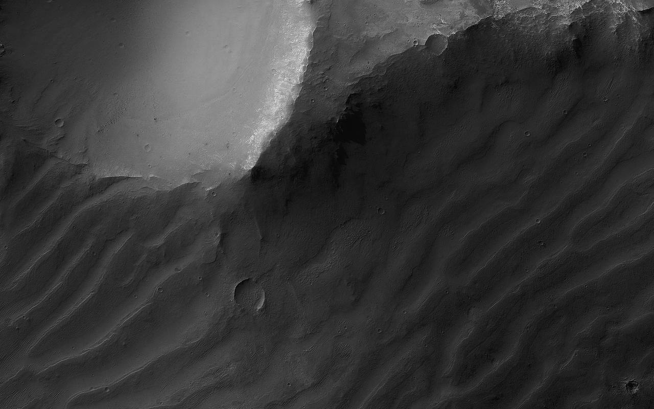
Coprates Chasma is one of the numerous canyons that make up Valles Marineris. The chasma stretches for 960 km (600 miles) from Melas Chasma to the west and Capri Chasma to the east. Landslide deposits, layered materials and sand dunes cover a large portion of the chasma floor. This image is located in eastern Coprates Chasma. The plateau above the chasma is visible in this image. The cliff face is very steep, with the elevation dropping over 3 miles from the plateau to the canyon floor. Craters are relatively rare on the chasma floor, the one in this image is fairly large. The crater rim has affected winds in this region, causing the interior dunes within the crater as well as the dunes outside the crater rim. The Odyssey spacecraft has spent over 15 years in orbit around Mars, circling the planet more than 69000 times. It holds the record for longest working spacecraft at Mars. THEMIS, the IR/VIS camera system, has collected data for the entire mission and provides images covering all seasons and lighting conditions. Over the years many features of interest have received repeated imaging, building up a suite of images covering the entire feature. From the deepest chasma to the tallest volcano, individual dunes inside craters and dune fields that encircle the north pole, channels carved by water and lava, and a variety of other feature, THEMIS has imaged them all. For the next several months the image of the day will focus on the Tharsis volcanoes, the various chasmata of Valles Marineris, and the major dunes fields. We hope you enjoy these images! Orbit Number: 37804 Latitude: -14.4843 Longitude: 302.193 Instrument: VIS Captured: 2010-06-23 01:14 https://photojournal.jpl.nasa.gov/catalog/PIA21999
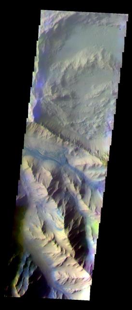
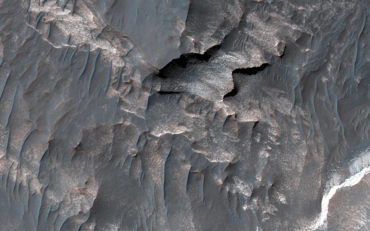
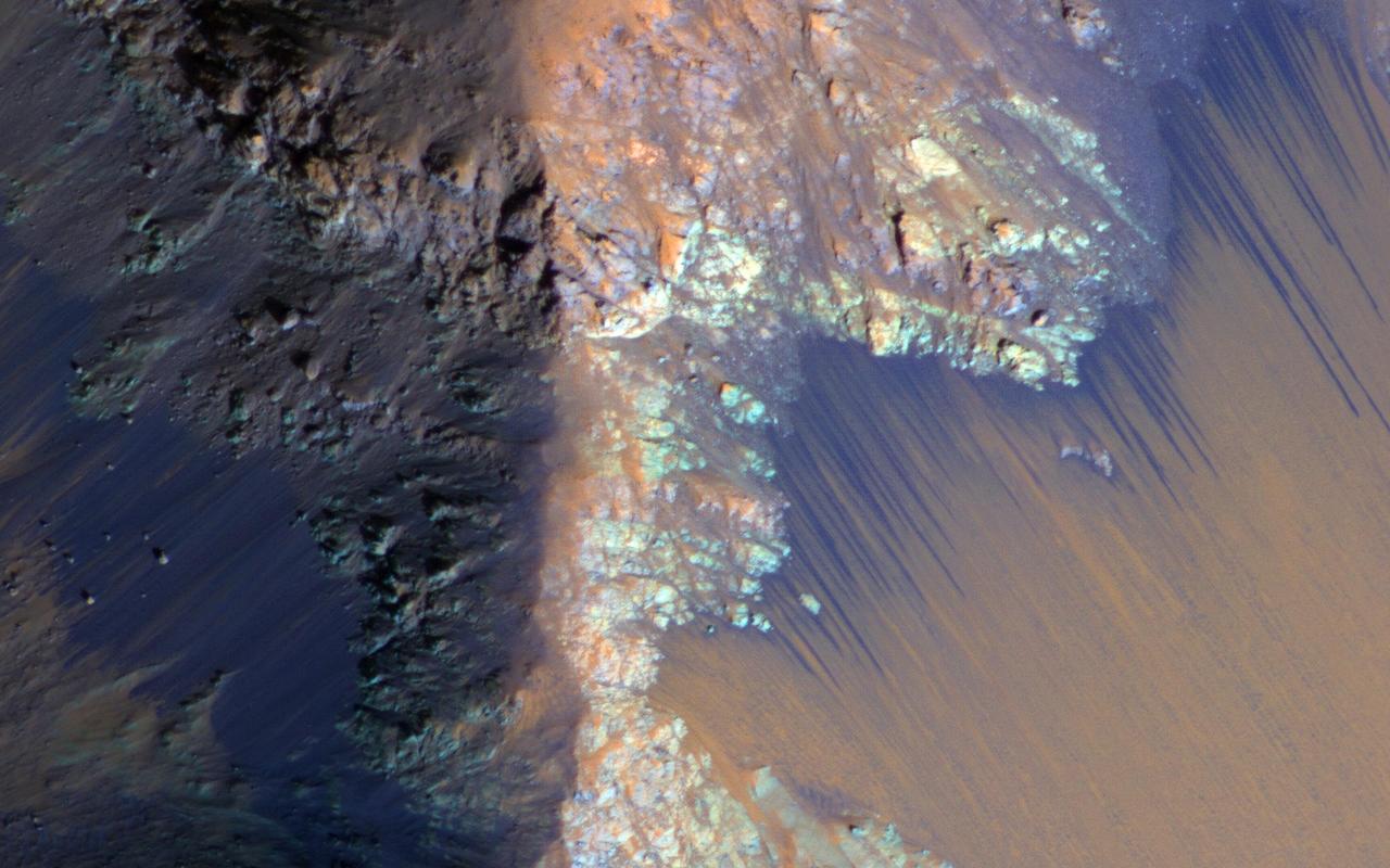
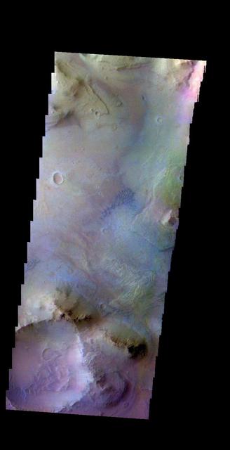
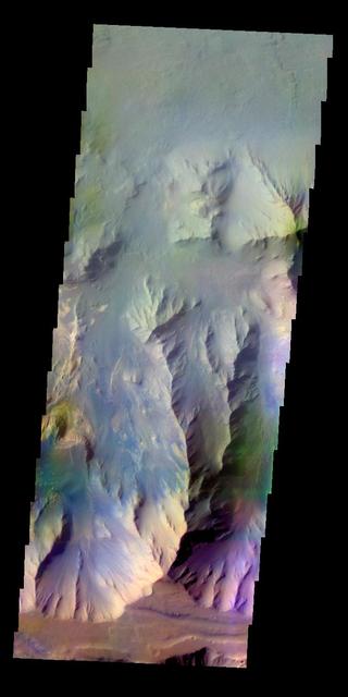
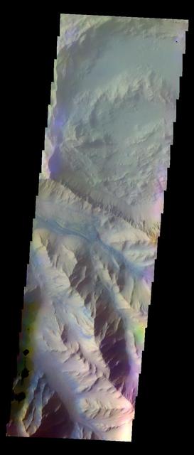
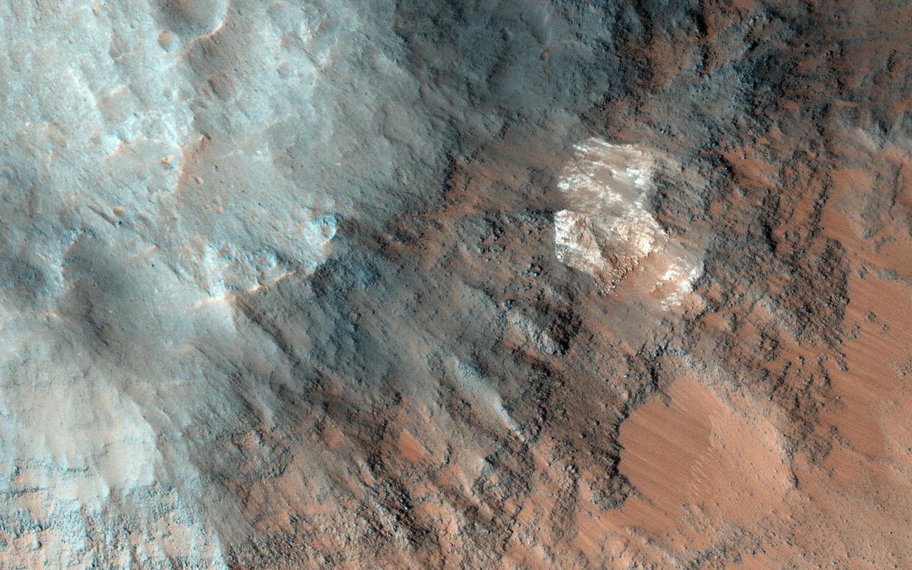
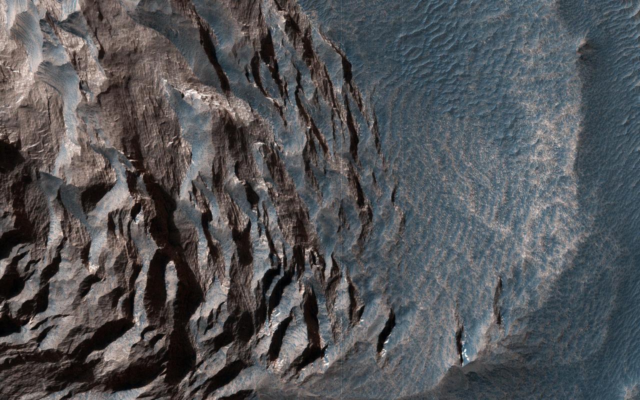
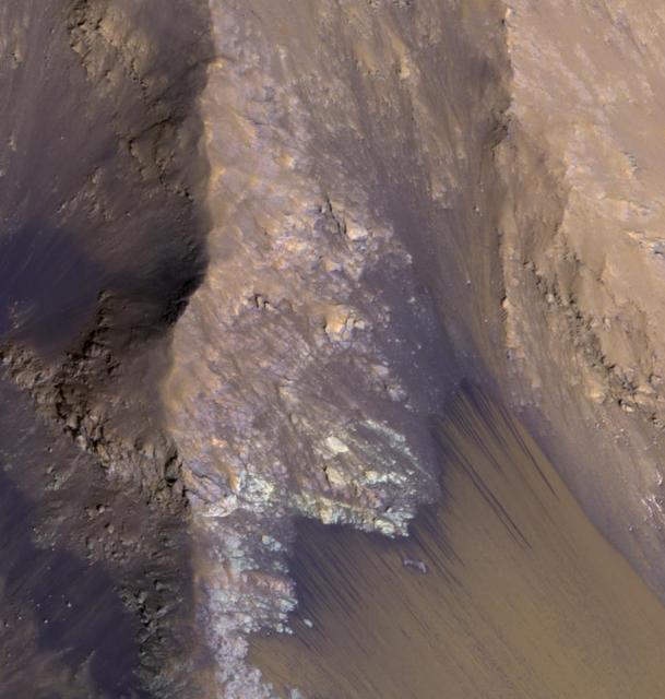
This image shows the southern wall of Coprates Chasma, in the equatorial canyon system of Valles Marineris. While much of the lower slopes are covered by sand, exposed bedrock is clearly visible in the upper canyon walls. In an enhanced color image, the varying colors – shades of white, cyan, and purple – are suggestive of multiple minerals being present within the bedrock, indicating a complicated geologic history, possibly involving alteration by water. (In this cutout, north is down.) https://photojournal.jpl.nasa.gov/catalog/PIA25985
The THEMIS VIS camera contains 5 filters. The data from different filters can be combined in multiple ways to create a false color image. These false color images may reveal subtle variations of the surface not easily identified in a single band image. Today's false color image shows part of Coprates Chasma. The pale blueish regions over the low elevations of the chasma may be an atmospheric haze. Orbit Number: 58764 Latitude: -12.2698 Longitude: 293.692 Instrument: VIS Captured: 2015-03-14 07:58 http://photojournal.jpl.nasa.gov/catalog/PIA20242
The THEMIS VIS camera contains 5 filters. The data from different filters can be combined in multiple ways to create a false color image. These false color images may reveal subtle variations of the surface not easily identified in a single band image. Today's false color image shows part of Coprates Chasma. Orbit Number: 59675 Latitude: -12.3624 Longitude: 293.637 Instrument: VIS Captured: 2015-05-28 08:21 https://photojournal.jpl.nasa.gov/catalog/PIA21702
Coprates Chasma is one of the numerous canyons that make up Valles Marineris. The chasma stretches for 960 km (600 miles) from Melas Chasma to the west and Capri Chasma to the east. Landslide deposits, layered materials and sand dunes cover a large portion of the chasma floor. This image is located on the eastern side of Coprates Chasma, near Capri Chasma. The image shows multiple landslide features, which form lobed shaped deposits at the bottom of the canyon cliff face. Sand dunes are visible both on the landslide deposit and other parts of the canyon floor. The Odyssey spacecraft has spent over 15 years in orbit around Mars, circling the planet more than 69000 times. It holds the record for longest working spacecraft at Mars. THEMIS, the IR/VIS camera system, has collected data for the entire mission and provides images covering all seasons and lighting conditions. Over the years many features of interest have received repeated imaging, building up a suite of images covering the entire feature. From the deepest chasma to the tallest volcano, individual dunes inside craters and dune fields that encircle the north pole, channels carved by water and lava, and a variety of other feature, THEMIS has imaged them all. For the next several months the image of the day will focus on the Tharsis volcanoes, the various chasmata of Valles Marineris, and the major dunes fields. We hope you enjoy these images! Orbit Number: 16628 Latitude: -15.4094 Longitude: 304.726 Instrument: VIS Captured: 2005-09-13 10:38 https://photojournal.jpl.nasa.gov/catalog/PIA21990
The THEMIS VIS camera contains 5 filters. The data from different filters can be combined in multiple ways to create a false color image. These false color images may reveal subtle variations of the surface not easily identified in a single band image. Today's false color image shows part of Coprates Chasma. Orbit Number: 10201 Latitude: -15.2593 Longitude: 303.778 Instrument: VIS Captured: 2004-04-02 06:51 http://photojournal.jpl.nasa.gov/catalog/PIA19755
The THEMIS VIS camera contains 5 filters. The data from different filters can be combined in multiple ways to create a false color image. These false color images may reveal subtle variations of the surface not easily identified in a single band image. Today's false color image shows part of Coprates Chasma. Orbit Number: 10713 Latitude: -12.6203 Longitude: 294.663 Instrument: VIS Captured: 2004-05-14 10:33 http://photojournal.jpl.nasa.gov/catalog/PIA19771
The dunes and landslides in this image occur within Coprates Chasma
This image captured by NASA 2001 Mars Odyssey spacecraft shows a portion of Coprates Catena, a shallow system of connecting depressions south of Coprates Chasma.
A landslide deposit is visible in this VIS image of Coprates Catena. Coprates Catena parallels the much larger Coprates Chasma; both are part of Valles Marineris. Orbit Number: 71880 Latitude: -14.7075 Longitude: 295.237 Instrument: VIS Captured: 2018-02-26 18:24 https://photojournal.jpl.nasa.gov/catalog/PIA22407
This image covers the high plains about 25 kilometers (15 miles) south of Coprates Chasma, near the eastern end of the Valles Marineris canyon system. Here, the CRISM instrument on MRO has detected clay minerals, which imply substantial water-rock interactions in the past. These minerals often have a reddish- to yellow appearance in HiRISE images. In this observation, the minerals appear concentrated along the boundaries of polygons up to 10 meters across. Perhaps the water-rock interactions at this site were most extensive within a network of pre-existing fractures dissecting the bedrock. Rough, blue-to-purplish material appears to overlie the polygonal fractures in portions of the image. We also see lighter blue-to-green materials. While CRISM can provide a time constraint to the compositions of these varied materials, HiRISE shows us how they relate to each other and how such a colorful scene could have been assembled over geologic time. https://photojournal.jpl.nasa.gov/catalog/PIA24700
The finely ridged material in this image captured by NASA 2001 Mars Odyssey spacecraft are huge landslide deposits called Coprates Labes. These landslide deposits are located on the floor of Coprates Chasma.
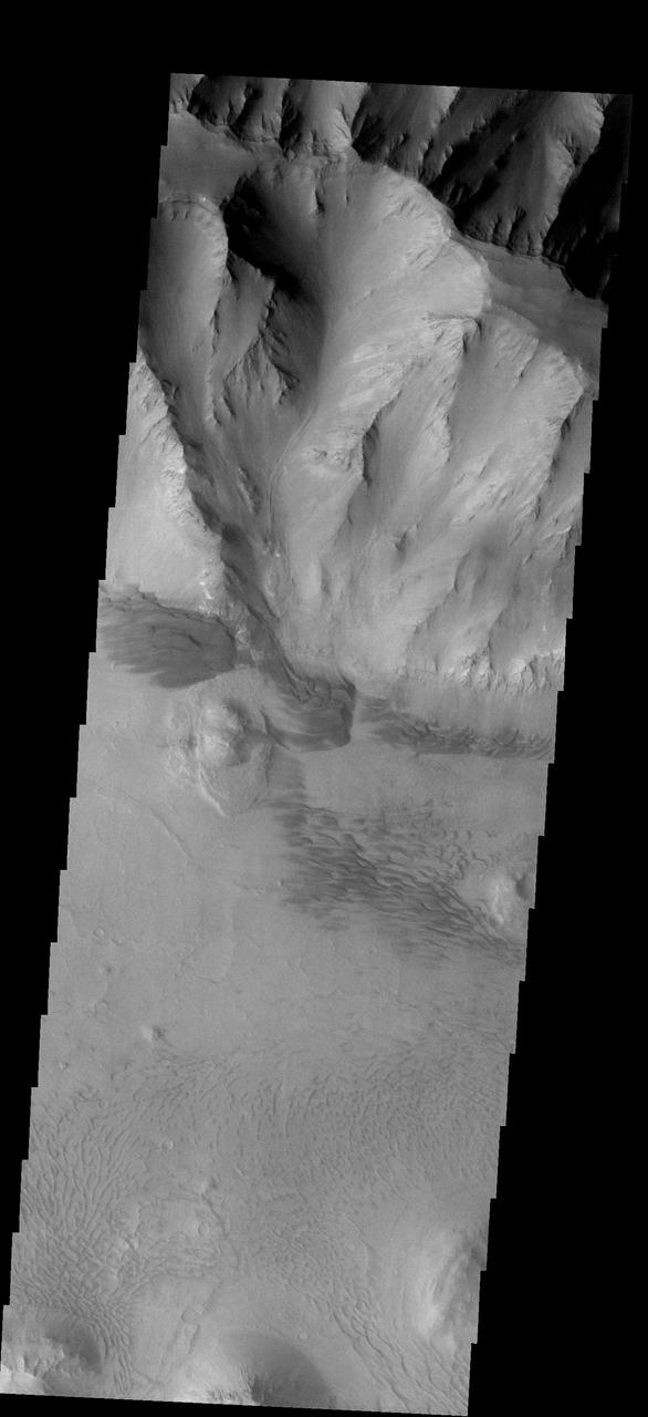
This beautiful fan deposit is located at the end of a mega-gully that empties into the southern trough of Coprates Chasma
This MOC image shows the contact between an area of light-toned rock and an expanse of darker-toned materials on the floor of Coprates Chasma

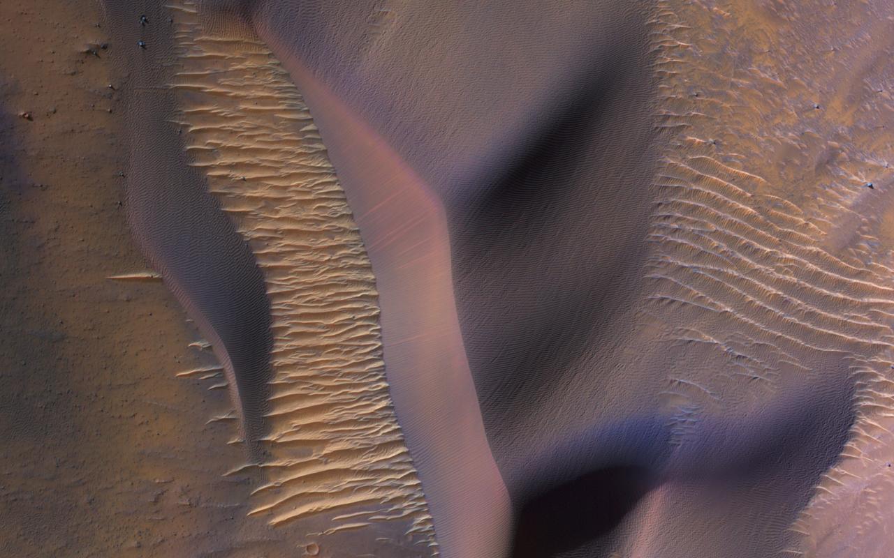
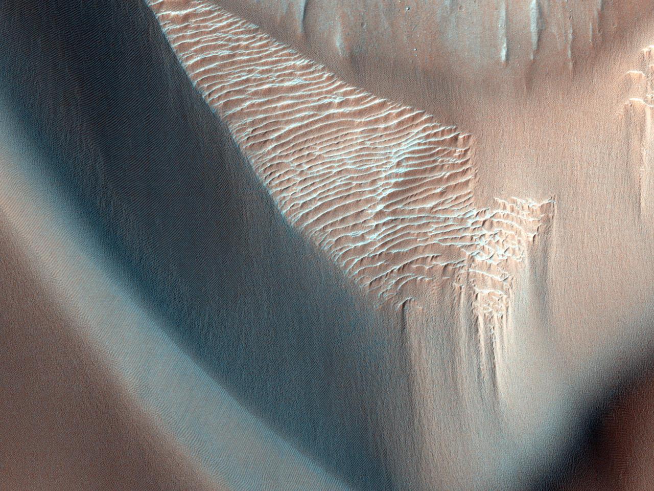
This image was acquired on January 2, 2014 by NASA's Mars Reconnaissance Orbiter. Dune fields located among canyon wall slopes are also known as "wall dune fields" and are further identified as either climbing or falling. Falling dunes are defined as large bedforms with lee faces on the downhill side-indicating that this is the direction of their migration-and on moderate slopes greater than 10 to 12 degrees. (A lee face is the the down-wind side of a dune.) On Earth and Mars, these types of dunes are largely controlled by what is called "microtopography." Physical obstacles can accelerate and decelerate airflow, create turbulence, potentially enhancing erosion, deposition, and/or transport of dune sediment. This class of dune morphology is relatively rare across Mars. However, falling dunes (like these) and climbing fields are frequently located among the spur-and-gully walls in the Melas and Coprates chasmata (see the paper here). Here is one example, of active falling dunes on this large massif in east Coprates Chasma. More information is available at https://photojournal.jpl.nasa.gov/catalog/PIA22684
This image of the northern wall of Coprates Chasma, in Valles Marineris, was taken by the Compact Reconnaissance Imaging Spectrometer for Mars CRISM on June 16, 2007.
This image of the east end of Coprates Chasma contains several dune fields. The dunes in the center of the image are larger and darker than the dunes at the bottom

This MOC image shows layered, light-toned, sedimentary rocks that have been exposed by erosion in Coprates Chasma, one of the many chasms which comprise the Valles Marineris trough system on Mars

Elorza Crater is a complex crater located north of Coprates Chasma. This image from NASA Mars Reconnaissance Orbiter centers on the southwestern portion of the central uplift, characterized by numerous bedrock exposures and coherent impact melt flows.
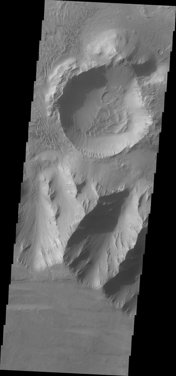
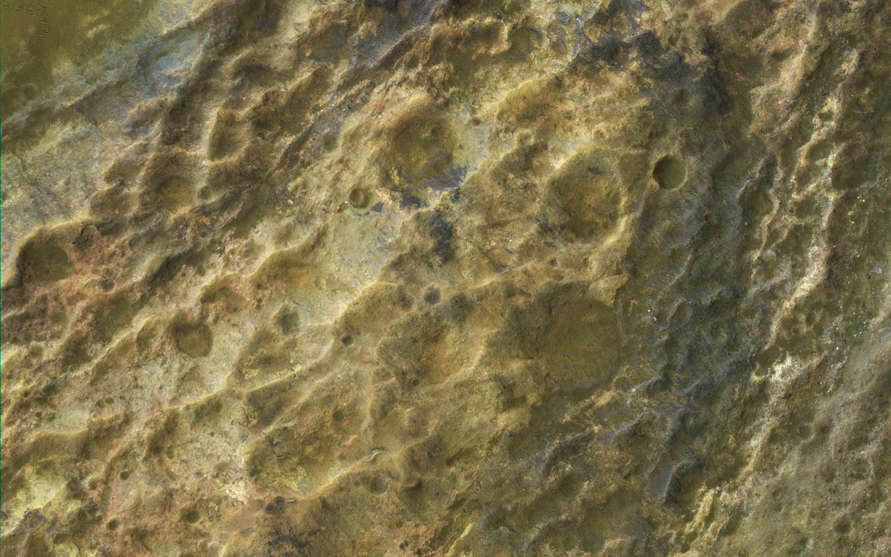
Impact craters can be created anywhere on the surface of Mars at any time. This image taken by NASA 2001 Mars Odyssey shows a crater located on the floor of Coprates Chasma.
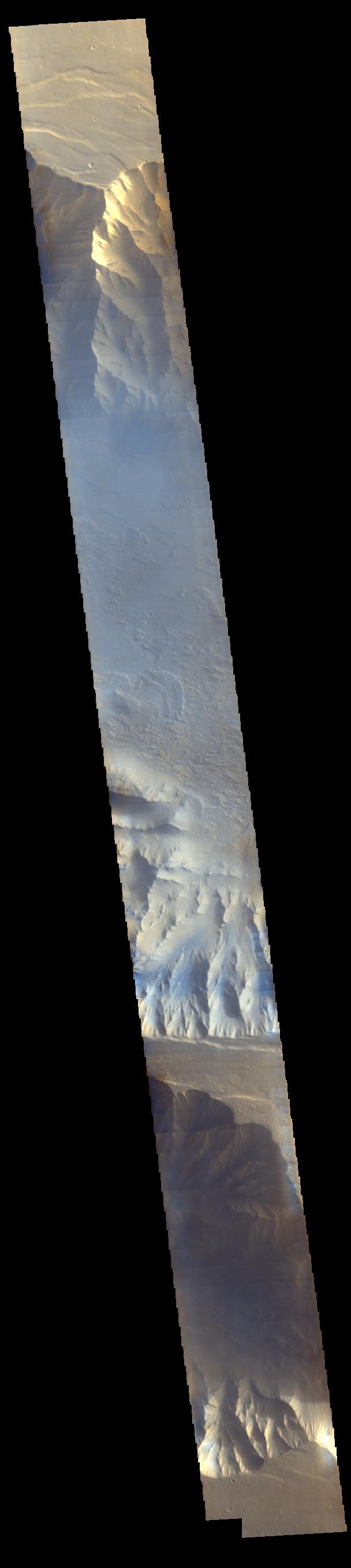
Light blue clouds fill Coprates Chasma on Mars, part of Valles Marineris, the vast Grand Canyon of Mars. The clouds are mostly ice crystals and they appear blue in color in this image from NASA Mars Odyssey.
This narrow canyon is part of Coprates Chasma. On the east side of the canyon a landslide is visible. The southern wall of the canyon is marked by bright and dark streaks where dust has slid down the cliff face
Coprates Chasma is located in the huge canyon system, Vallis Marineris. NASA Mars Reconnaissance Orbiter finds indications of high thermal inertia. What do we mean when we describe a surface as having "high thermal inertia"? The term refers to the ability of a material to conduct and store heat, and in planetary science, its measure of the subsurface's ability to store heat during the day and reradiate it during the night. What causes thermal inertia? It depends on the composition of the terrain that we're studying. Here in Coprates Chasma, the site of this observation, we find indications of such high thermal inertia, so an image at high resolution may help us determine the composition and structure to give us an answer. http://photojournal.jpl.nasa.gov/catalog/PIA19357

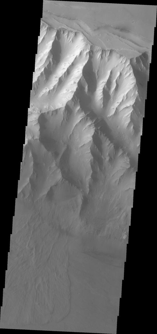
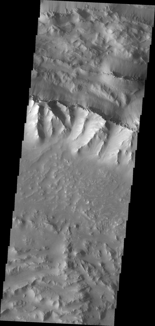
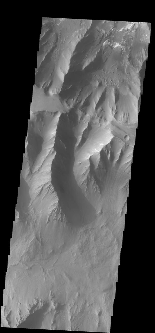
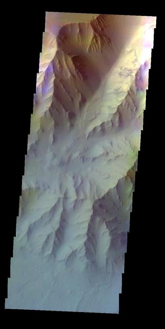
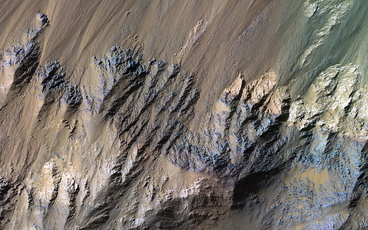
This image from NASA Mars Reconnaissance Orbiter shows a transect of Coprates Chasma wall stratigraphy, which includes moving down sequence: the southern plateau, wall spurs, fans of eroded material, gullies, sand dunes, and canyon floor.
This image from NASA's Mars Reconnaissance Orbiter (MRO) shows some of these on the slopes of Nectaris Montes within Coprates Chasma. Sand dunes in Valles Marineris can be impressive in size, with steep slopes that seem to climb and descend. The brighter bedforms are inactive while the bigger dunes move over the landscape, burying and exhuming the surface. https://photojournal.jpl.nasa.gov/catalog/PIA22455
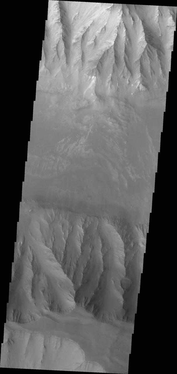
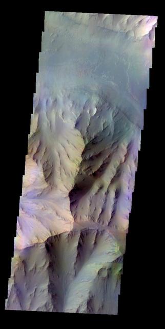
This image shows a cross-section of ancient canyon systems in east Coprates Chasma, and displays several orders and generations of wind-driven dunes and ripples, also called bedforms. Some areas display more modern bedforms, often termed mega-ripples, which have likely been active over long timescales and have migrated in the recent past. Other areas along the canyon wall have larger bedforms that show a very different appearance. Although they have a spacing that would make them similar to typical Martian sand dunes, many display superposed craters, indicating they have not migrated for a very long time, possibly hundreds of thousands of years. https://photojournal.jpl.nasa.gov/catalog/PIA23530
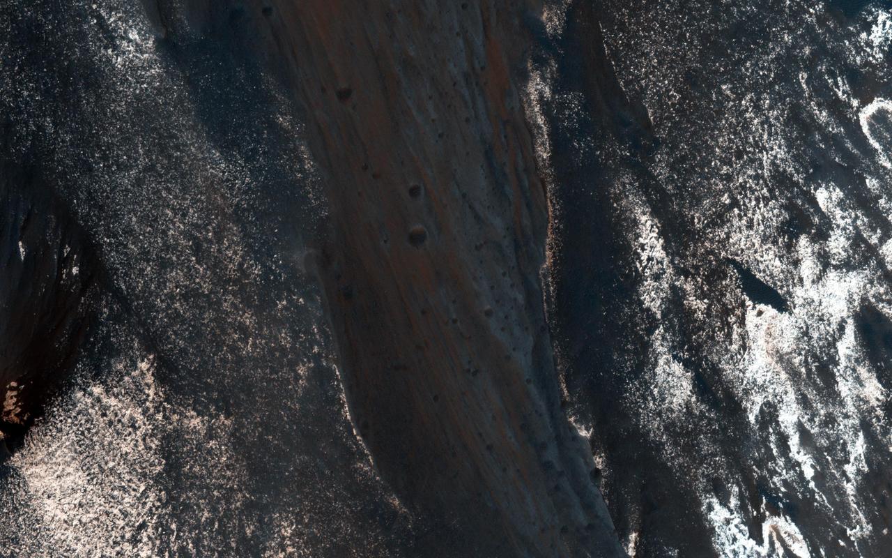
The formation of recurring slope lineae is a fascinating process on Mars. These RSLs show up in the spring and fade in the winter as seen by NASA Mars Reconnaissance Orbiter.
Layered sedimentary rocks are key to understanding the geologic history of a planet, recording the sequence of deposition and the changes over time in the materials that were deposited. These layered sediments are on the floor of eastern Coprates Chasma in Valles Marineris, the grandest canyon on Mars. They are erosional remnants of a formerly much more extensive sedimentary deposit that once filled the floor of the canyon but is nowadays reduced to isolated mesas. The origin of the deposits is not yet known. Various theories attribute the sediments to wind blown dust and sand, or to volcanic materials, or accumulations of debris from avalanches originating from the canyon walls, or even to lakebed sediments laid down when the canyons were filled with liquid water. Some sediments are devoid of boulders or blocks larger than the limit of resolution (about 0.5 meters), so avalanche debris is unlikely. We see fine laminations with a horizontal spacing of about 2 meters and a vertical separation less than 2 meters. No previous orbital observations were capable of resolving such fine scale layering. https://photojournal.jpl.nasa.gov/catalog/PIA23583
In this image from NASA Mars Reconnaissance Orbiter, lower wall rock spurs are found that spread dark materials onto a dune field, suggesting local wall materials are a nearby sediment source for dunes.
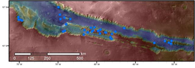
Blue dots on this map indicate sites of recurring slope lineae (RSL) in part of the Valles Marineris canyon network on Mars. RSL are seasonal dark streaks regarded as the strongest evidence for the possibility of liquid water on the surface of modern Mars. The area mapped here has the highest density of known RSL on the Red Planet. The RSL were identified by repeated observations of the sites using the High Resolution Imaging Science Experiment (HiRISE) camera on NASA's Mars Reconnaissance Orbiter. Map colors represent elevation, where red is high and blue is low. Valles Marineris is the largest canyon system in the solar system. The region shown here includes Melas Chasma and Coprates Chasma, in the central and eastern portions of Valles Marineris. The mapped area extends about 1,500 miles (2,400 kilometers) east to west and about 280 miles (450 kilometers) north to south, at latitudes from 9 to 17 degrees south of Mars' equator. The base map uses data from the Mars Orbiter Camera and Mars Orbiter Laser Altimeter of NASA's Mars Global Surveyor mission. RSL extend downslope during a warm season, fade in the colder part of the year, and repeat the process in a subsequent Martian year. A study of 41 RSL sites in this canyon area, published July 7, 2016, provides support for the notion that significant amounts of near-surface water can be found on modern Mars, though the work also indicates that puzzles remain unsolved in understanding how these seasonal features form. Each site includes anywhere from a few to more than 1,000 individual "lineae." http://photojournal.jpl.nasa.gov/catalog/PIA20756
Among the many discoveries by NASA's Mars Reconnaissance Orbiter since the mission was launched on Aug. 12, 2005, are seasonal flows on some steep slopes. These flows have a set of characteristics consistent with shallow seeps of salty water. This July 21, 2015, image from the orbiter's High Resolution Imaging Science Experiment (HiRISE) camera shows examples of these flows on a slope within Coprates Chasma, which is part of the grandest canyon system on Mars, Valles Marineris. The image covers an area of ground one-third of a mile (536 meters) wide. These flows are called recurring slope lineae because they fade and disappear during cold seasons and reappear in warm seasons, repeating this pattern every Martian year. The flows seen in this image are on a north-facing slope, so they are active in northern-hemisphere spring. The flows emanate from the relatively bright bedrock and flow onto sandy fans, where they are remarkably straight, following linear channels. Valles Marineris contains more of these flows than everywhere else on Mars combined. At any season, some are active, though on different slope aspects at different seasons. Future human explorers (and settlers?) will need water to drink, grow food, produce oxygen to breath, and make rocket fuel. Bringing all of that water from Earth would be extremely expensive, so using water on Mars is essential. Although there is plenty of water ice at high latitudes, surviving the cold winters would be difficult. An equatorial source of water would be preferable, so Valles Marineris may be the best destination. However, the chemistry of this water must be understood before betting any lives on it. http://photojournal.jpl.nasa.gov/catalog/PIA19805