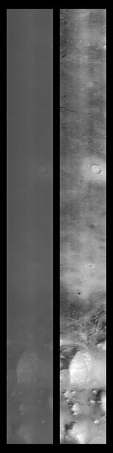
Cydonia Region
Cydonia Region - Pass #2
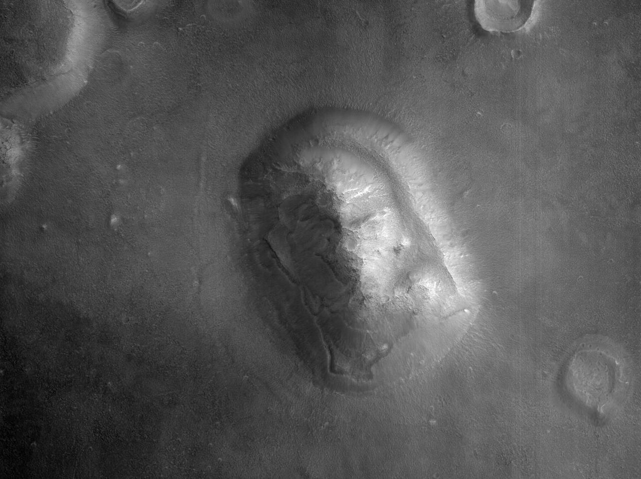
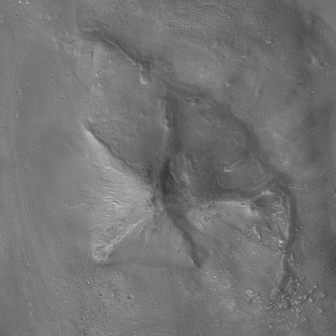
Popular Landform in Cydonia Region
Cydonia Region - Detail
Cydonia Region - Pass #3
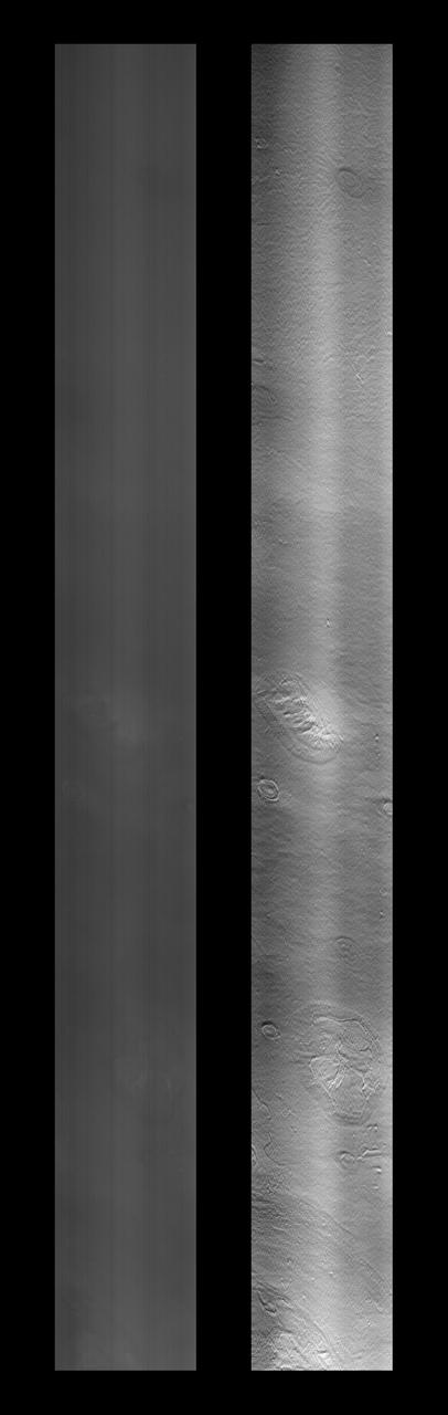
Images of the Cydonia region of Mars continue to be popular among visitors to the Mars Global Surveyor (MGS) Mars Orbiter Camera (MOC)web site. The two pictures (one annotated, the other not) are mosaics of two images from MGS MOC and one from the Mars Odyssey Thermal Emission Imaging System visible camera (THEMIS VIS). The mosaics highlight a Cydonia landform popularly known as the "D&M Pyramid." It is located near 40.7°N, 9.6°W. Although it is not really shaped like a pyramid, the Cydonia landform is one of thousands of massifs, buttes, mesas, knobs, and blocks that mark the transition from the far northwestern Arabia Terra cratered highlands down to the northeastern Acidalia Planitia lowlands. Each block, whether shaped like a face, a pyramid, or simply a mesa, massif, or knob, is a remnant of the bedrock of northeastern Arabia that was left behind as erosion slowly degraded the terrain along this zone between the highlands and the lowlands. A few outcroppings of layers in this ancient bedrock can be seen in the mosaic of the pyramid-like landform shown here; much of the landform is covered with eroded mantling material that was deposited long after this highlands remnant became an isolated feature in Cydonia. The mosaic was created from two MOC images obtained in June (R06-00469) and July (R07-00422) of 2003 and one THEMIS VIS image acquired in 2002 (V01024003). The mosaic is 8 km by 8 km (5 mi by 5 mi) across and each of the three images is illuminated from the lower left. North is up. The picture on the right shows the location of the two MOC images as black outlines; the THEMIS image not only covers the gap between the two MOC images, it also fills out the lower left and upper right corners. http://photojournal.jpl.nasa.gov/catalog/PIA04745
The southern section of Cydonia Region is dominated by both a series of craters and the remnants of channels that may be from a past fluvial system as seen by NASA Mars Reconnaissance Orbiter spacecraft. The paleochannel system has wind-blown bedforms in its interior, with crests oriented approximately perpendicular to the channel walls. The large rocky patch near the center of the image shows some evidence of bedding as would be expected for a river delta or other water-lain sediments, but the rough dissected nature of outcrops and superimposed aeolian bedforms and other sediments makes identification of this feature difficult. http://photojournal.jpl.nasa.gov/catalog/PIA20046
This image was taken by NASA Mars Global Surveyor Cydonia region on Mars. 3D glasses are necessary to view this image.
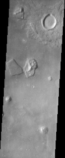
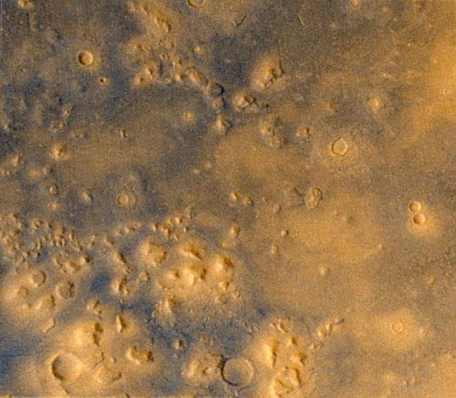
The Cydonia region on Mars, seen in this image from NASA Mars Odyssey spacecraft, straddles the boundary between the bright, dusty, cratered highlands to the southeast and the dark, relatively dust-free, lowland plains to the west.
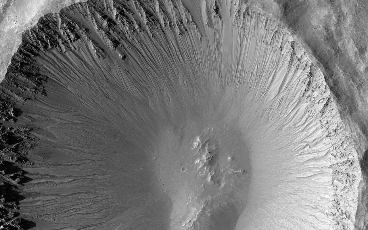
The central portion of this image from NASA's Mars Reconnaissance Orbiter is dominated by a sharp-rimmed crater that is roughly 5 kilometers in diameter. On its slopes, gullies show young (i.e., geologically recent) headward erosion, which is the lengthening of the gully in the upslope direction. This crater is also remarkable for another reason. This image is part of a stereo pair, and the anaglyph of these images shows that the bottom of the crater contains a small mound. This mound hints at a possible complex crater, with the mound being a central uplift. Complex craters as small as this one are uncommon and such examples may provide clues to the lithology of the rocks underground and possibly to the impact process itself. http://photojournal.jpl.nasa.gov/catalog/PIA20158
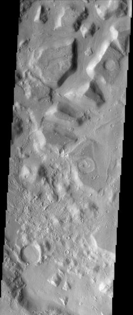
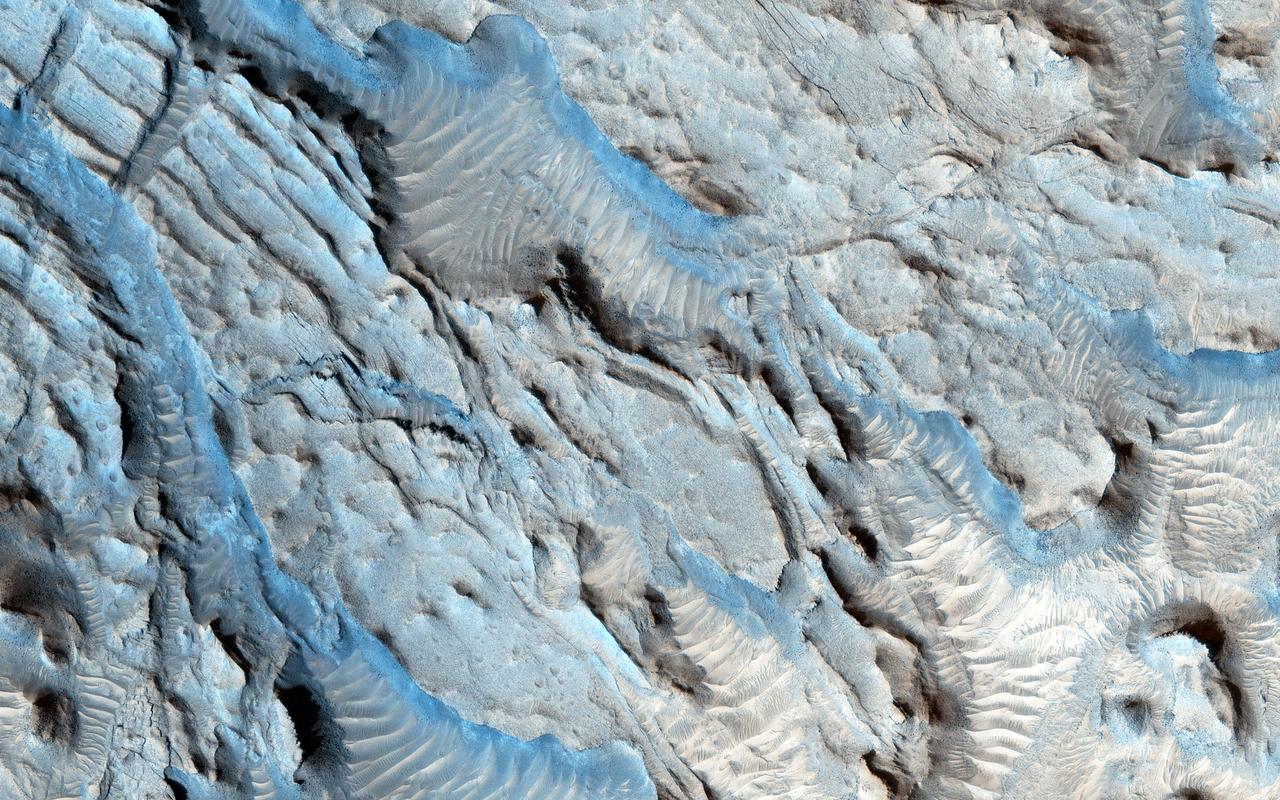
This image shows the dissected interior of a crater in the Cydonia region of Mars. The flat-topped buttes and mesas in the northern portion of the image were once a continuous layer of material that filled the crater. Since deposition, the material has been disturbed and dissected. The process that causes such landforms is not well known, but likely involves frozen subsurface water that may have found its way to the surface. The surfaces on the mesas are not rough, suggesting that the whole scene is mantled with fine dust, masking the details that may give clues to whether surface water was involved at some point in the past. Small recent channels can be seen in the lower left. This is an indication of relatively recent small-scale surface activity, which has been could have been volcanic, fluvial, or some process involving subsurface volatiles (ice). http://photojournal.jpl.nasa.gov/catalog/PIA04030
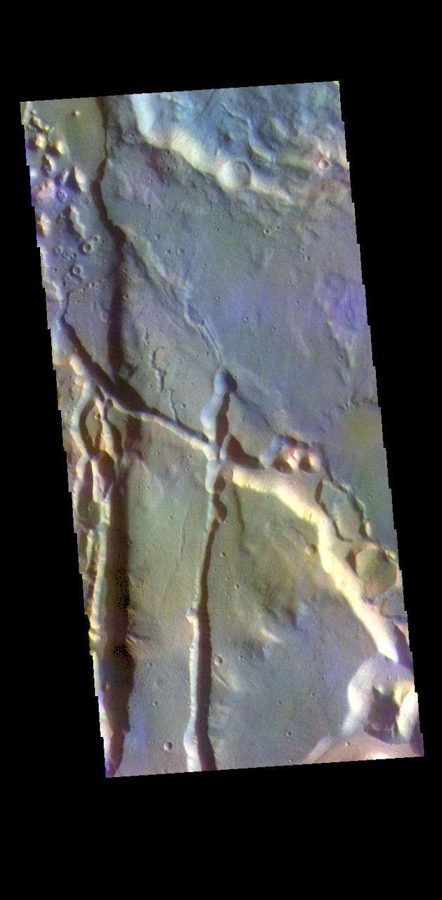
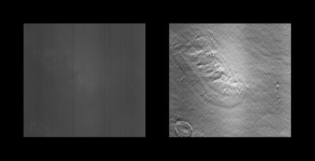
The THEMIS VIS camera contains 5 filters. The data from different filters can be combined in multiple ways to create a false color image. These false color images may reveal subtle variations of the surface not easily identified in a single band image. Today's false color image shows part of Cydonia Mensae. Cydonia Mensae is located in the region between the cratered highlands of northwestern Arabia Terra and the southern lowlands of Acidalia Planitia. This area contains many different landforms, including tectonic features, chaos terrain and impact craters. This VIS image shows a portion of chaos in the top left of the frame, and several tectonic depressions. The THEMIS VIS camera is capable of capturing color images of the Martian surface using five different color filters. In this mode of operation, the spatial resolution and coverage of the image must be reduced to accommodate the additional data volume produced from using multiple filters. To make a color image, three of the five filter images (each in grayscale) are selected. Each is contrast enhanced and then converted to a red, green, or blue intensity image. These three images are then combined to produce a full color, single image. Because the THEMIS color filters don't span the full range of colors seen by the human eye, a color THEMIS image does not represent true color. Also, because each single-filter image is contrast enhanced before inclusion in the three-color image, the apparent color variation of the scene is exaggerated. Nevertheless, the color variation that does appear is representative of some change in color, however subtle, in the actual scene. Note that the long edges of THEMIS color images typically contain color artifacts that do not represent surface variation. Orbit Number: 95074 Latitude: 35.0203 Longitude: 347.284 Instrument: VIS Captured: 2023-05-21 16:54 https://photojournal.jpl.nasa.gov/catalog/PIA26152