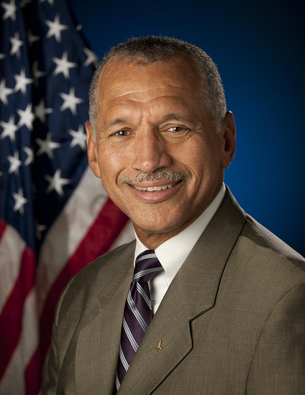
Portrait, Charles F. Bolden, Jr., Administrator, National Aeronautics and Space Administration (NASA). Washington, DC, July 29, 2009. Photo Credit: (NASA/Bill Ingalls)
NASA African Monsoon Multidisciplinary Analyses (NAMMA) DC-8 deployment to Cape Verde, Sal island, Africa
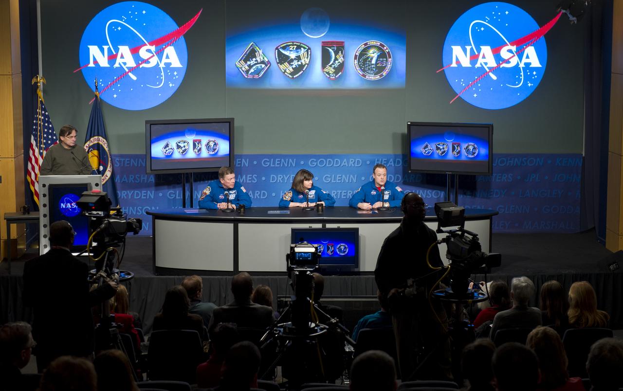
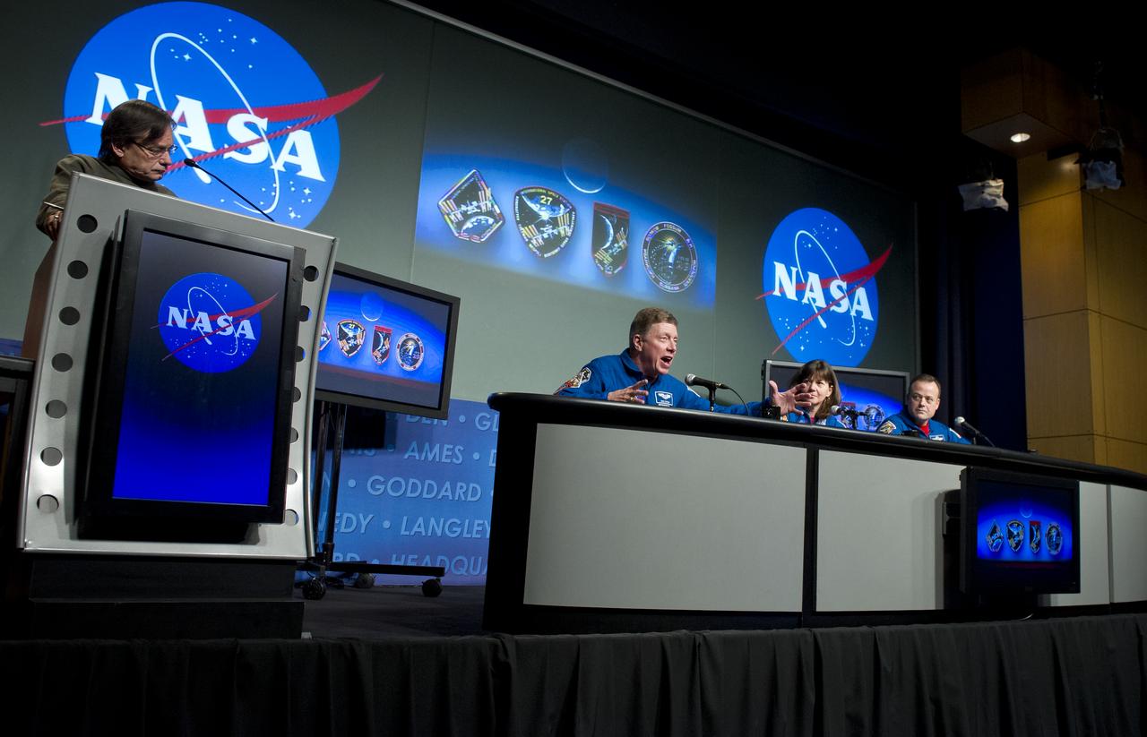
Brad Doorn, SMAP applications lead, Science Mission Directorate’s Applied Sciences Program at NASA Headquarters speaks during a briefing about the upcoming launch of the Soil Moisture Active Passive (SMAP) mission, Thursday, Jan. 08, 2015, at NASA Headquarters in Washington DC. The mission is scheduled for a Jan. 29 launch from Vandenberg Air Force Base in California, and will provide the most accurate, highest-resolution global measurements of soil moisture ever obtained from space. The data will be used to enhance scientists' understanding of the processes that link Earth's water, energy and carbon cycles. Photo Credit: (NASA/Aubrey Gemignani)
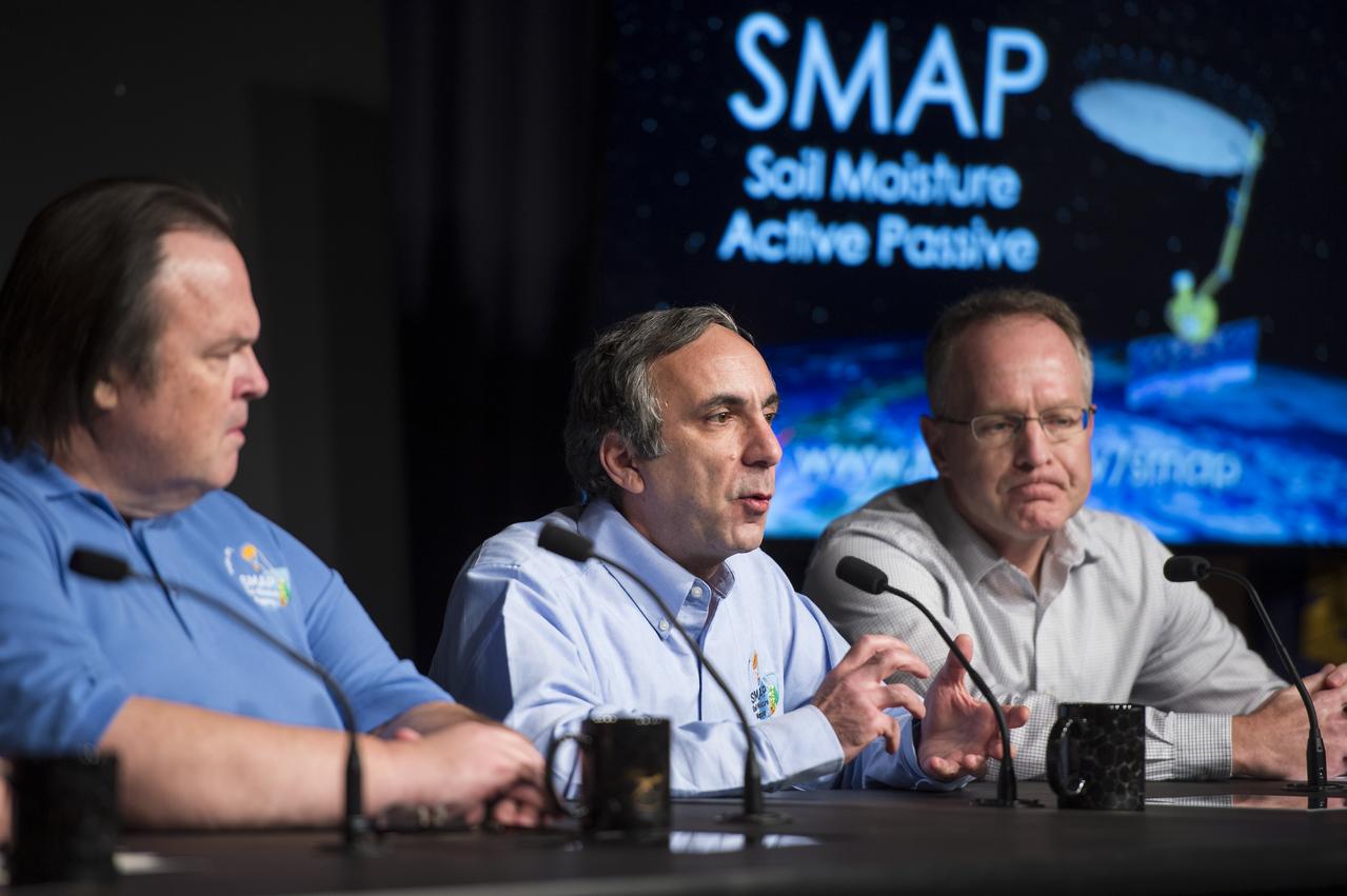
Dara Entekhabi, SMAP science team lead, Massachusetts Institute of Technology, center, speaks during a briefing about the upcoming launch of the Soil Moisture Active Passive (SMAP) mission, Thursday, Jan. 08, 2015, at NASA Headquarters in Washington DC. The mission is scheduled for a Jan. 29 launch from Vandenberg Air Force Base in California, and will provide the most accurate, highest-resolution global measurements of soil moisture ever obtained from space. The data will be used to enhance scientists' understanding of the processes that link Earth's water, energy and carbon cycles. Photo Credit: (NASA/Aubrey Gemignani)

Kent Kellogg, SMAP project manager at NASA’s Jet Propulsion Laboratory (JPL) in Pasadena, CA, speaks during a briefing about the upcoming launch of the Soil Moisture Active Passive (SMAP) mission, Thursday, Jan. 08, 2015, at NASA Headquarters in Washington DC. The mission is scheduled for a Jan. 29 launch from Vandenberg Air Force Base in California, and will provide the most accurate, highest-resolution global measurements of soil moisture ever obtained from space. The data will be used to enhance scientists' understanding of the processes that link Earth's water, energy and carbon cycles. Photo Credit: (NASA/Aubrey Gemignani)
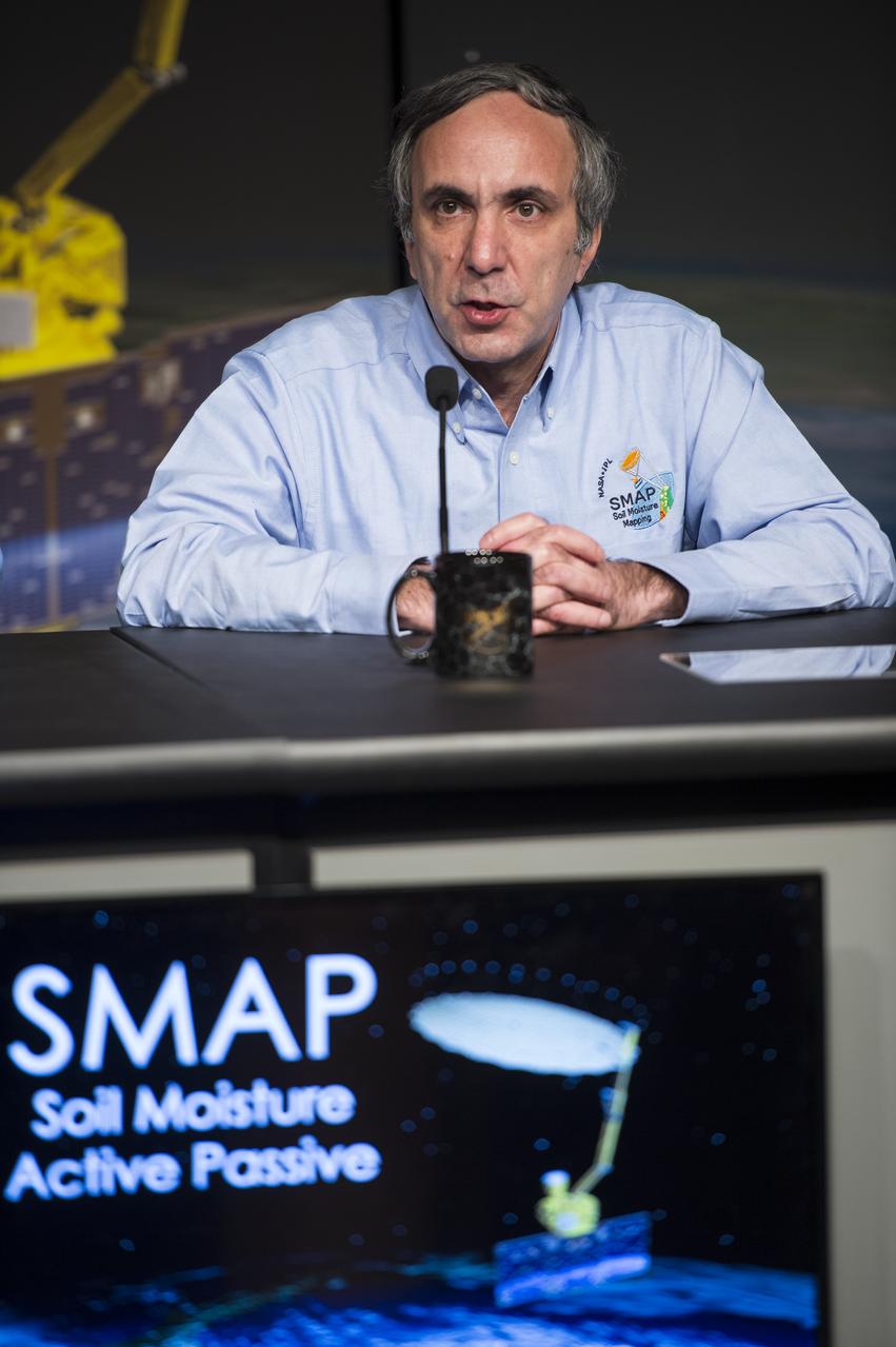
Dara Entekhabi, SMAP science team lead, Massachusetts Institute of Technology, speaks during a briefing about the upcoming launch of the Soil Moisture Active Passive (SMAP) mission, Thursday, Jan. 08, 2015, at NASA Headquarters in Washington DC. The mission is scheduled for a Jan. 29 launch from Vandenberg Air Force Base in California, and will provide the most accurate, highest-resolution global measurements of soil moisture ever obtained from space. The data will be used to enhance scientists' understanding of the processes that link Earth's water, energy and carbon cycles. Photo Credit: (NASA/Aubrey Gemignani)

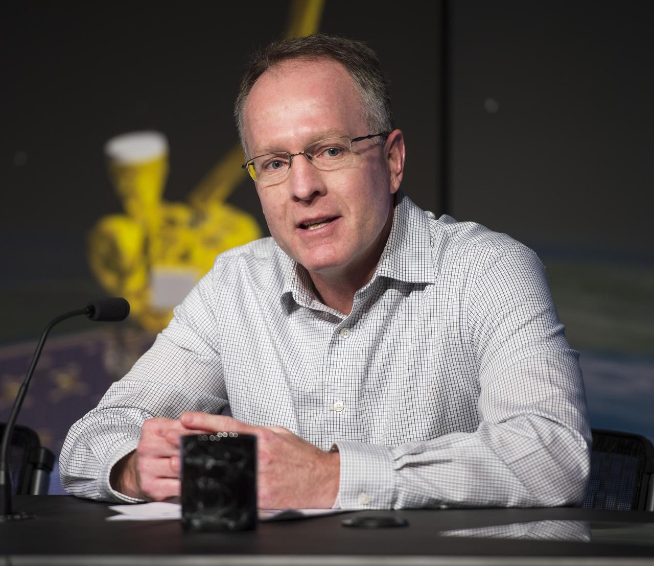
Christine Bonniksen, SMAP program executive with the Science Mission Directorate’s Earth Science Division at NASA Headquarters speaks during a briefing about the upcoming launch of the Soil Moisture Active Passive (SMAP) mission, Thursday, Jan. 08, 2015, at NASA Headquarters in Washington DC. The mission is scheduled for a Jan. 29 launch from Vandenberg Air Force Base in California, and will provide the most accurate, highest-resolution global measurements of soil moisture ever obtained from space. The data will be used to enhance scientists' understanding of the processes that link Earth's water, energy and carbon cycles. Photo Credit: (NASA/Aubrey Gemignani)
Astronaut Mike Fossum, Expedition 28 flight engineer and Expedition 29 Commander, discusses his mission to the International Space Station during a visit to NASA Headquarters in Washington, Tuesday, Feb. 14, 2012. Photo Credit: (NASA/Carla Cioffi)
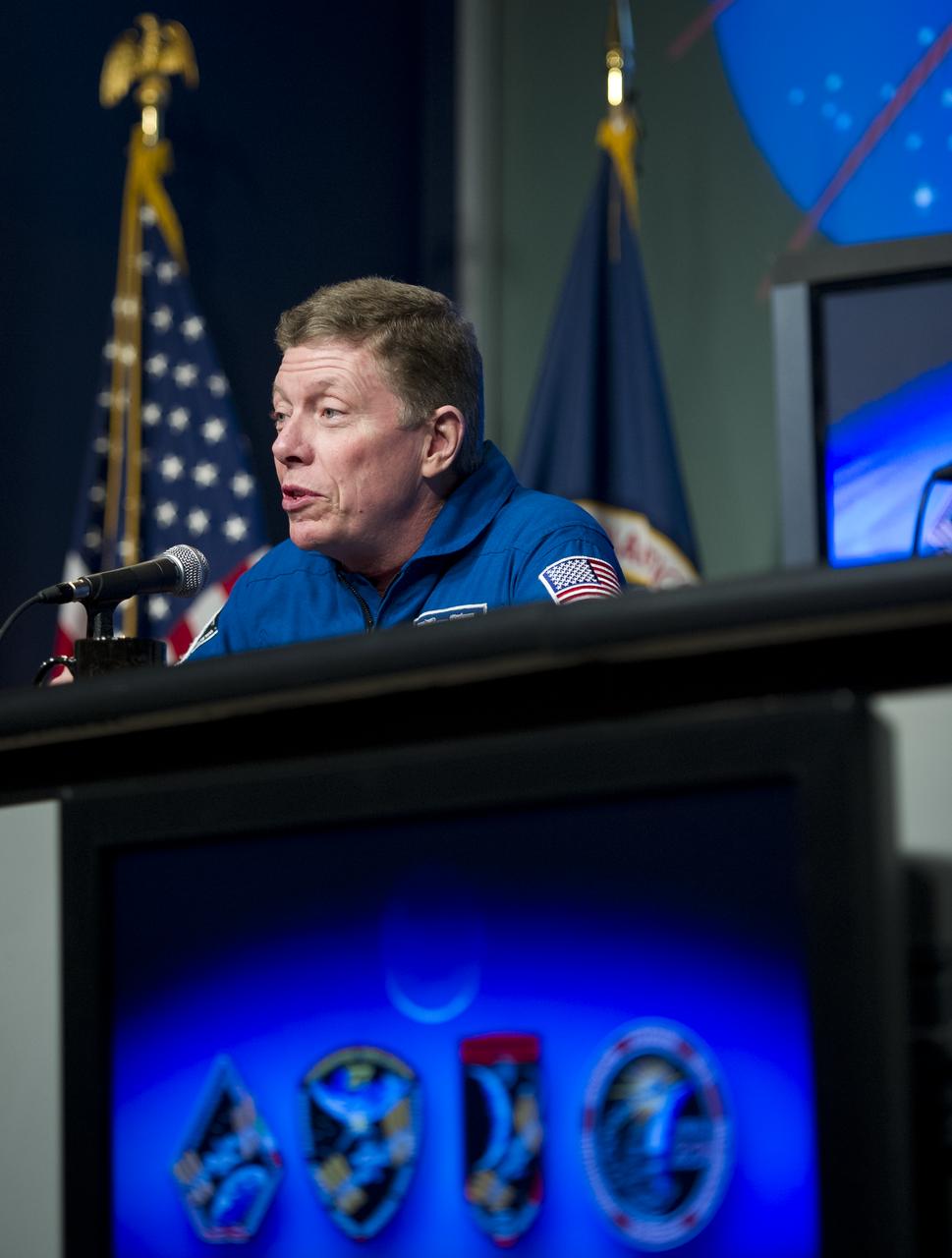
Astronaut Mike Fossum, Expedition 28 flight engineer and Expedition 29 Commander, discusses his mission to the International Space Station during a visit to NASA Headquarters in Washington, Tuesday, Feb. 14, 2012. Photo Credit: (NASA/Carla Cioffi)
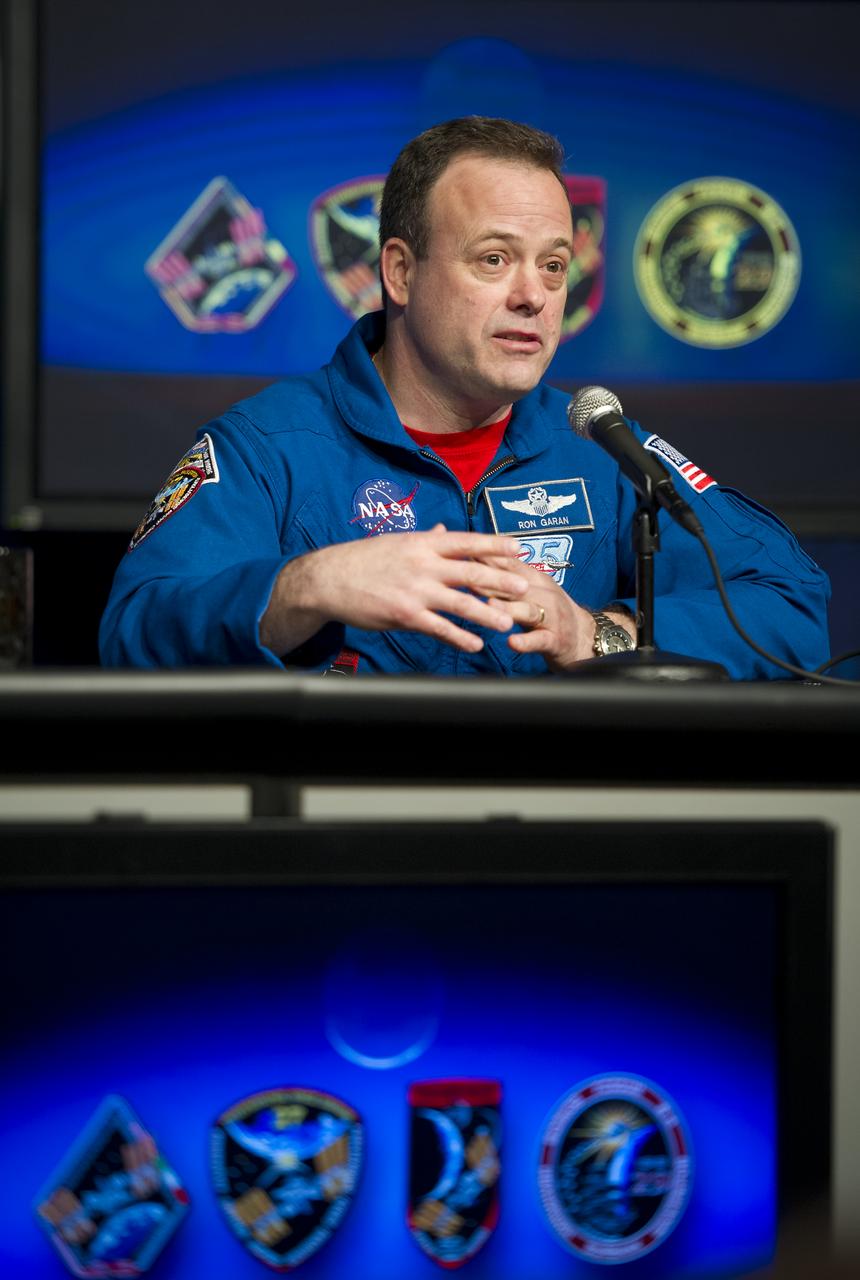
Astronaut Ron Garan, Expedition 27 & 28 flight engineer, discusses his mission to the International Space Station during a visit to NASA Headquarters in Washington, Tuesday, Feb. 14, 2012. Photo Credit: (NASA/Carla Cioffi)
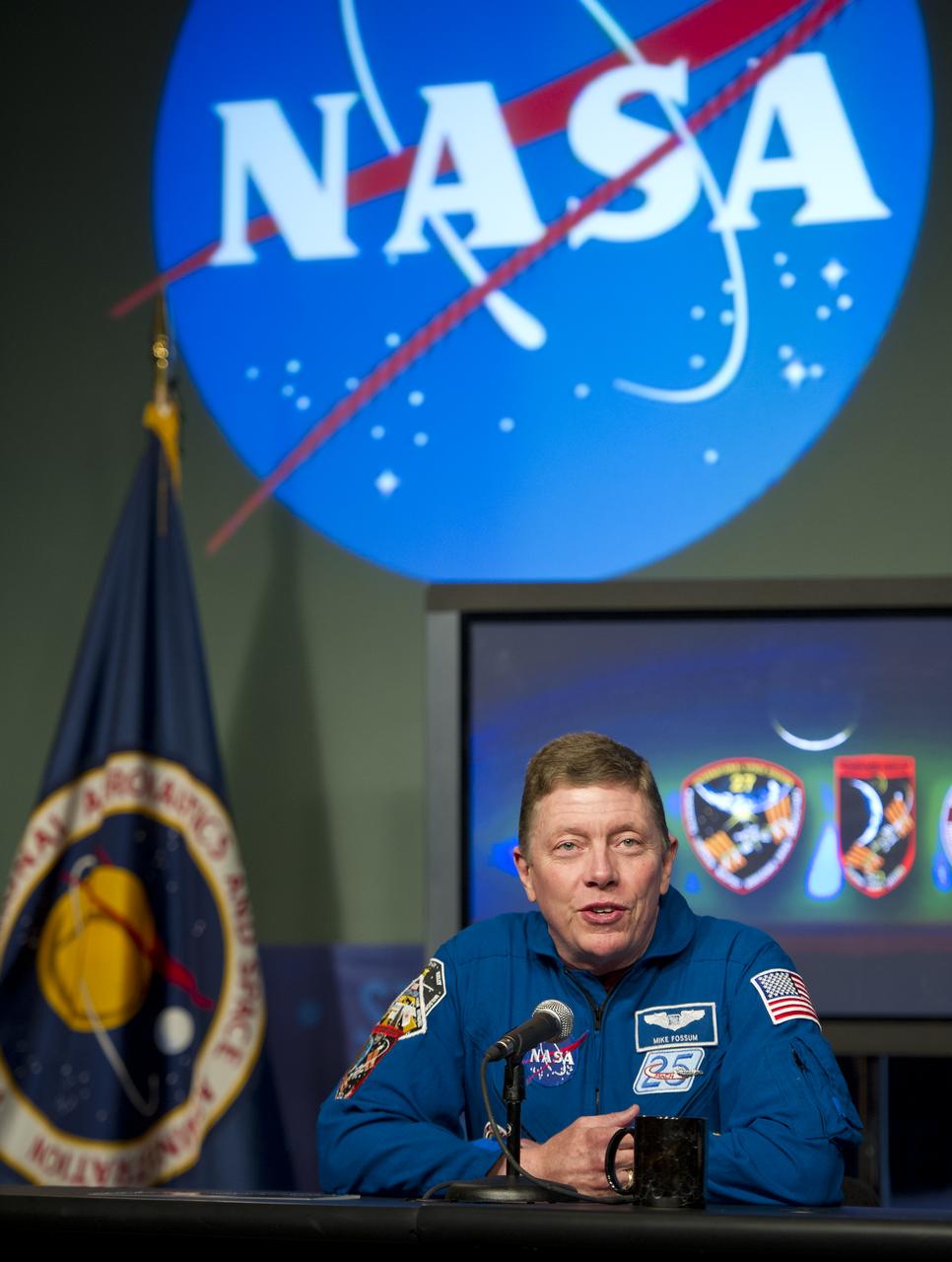
Astronaut Mike Fossum, Expedition 28 flight engineer and Expedition 29 Commander, discusses his mission to the International Space Station during a visit to NASA Headquarters in Washington, Tuesday, Feb. 14, 2012. Photo Credit: (NASA/Carla Cioffi)
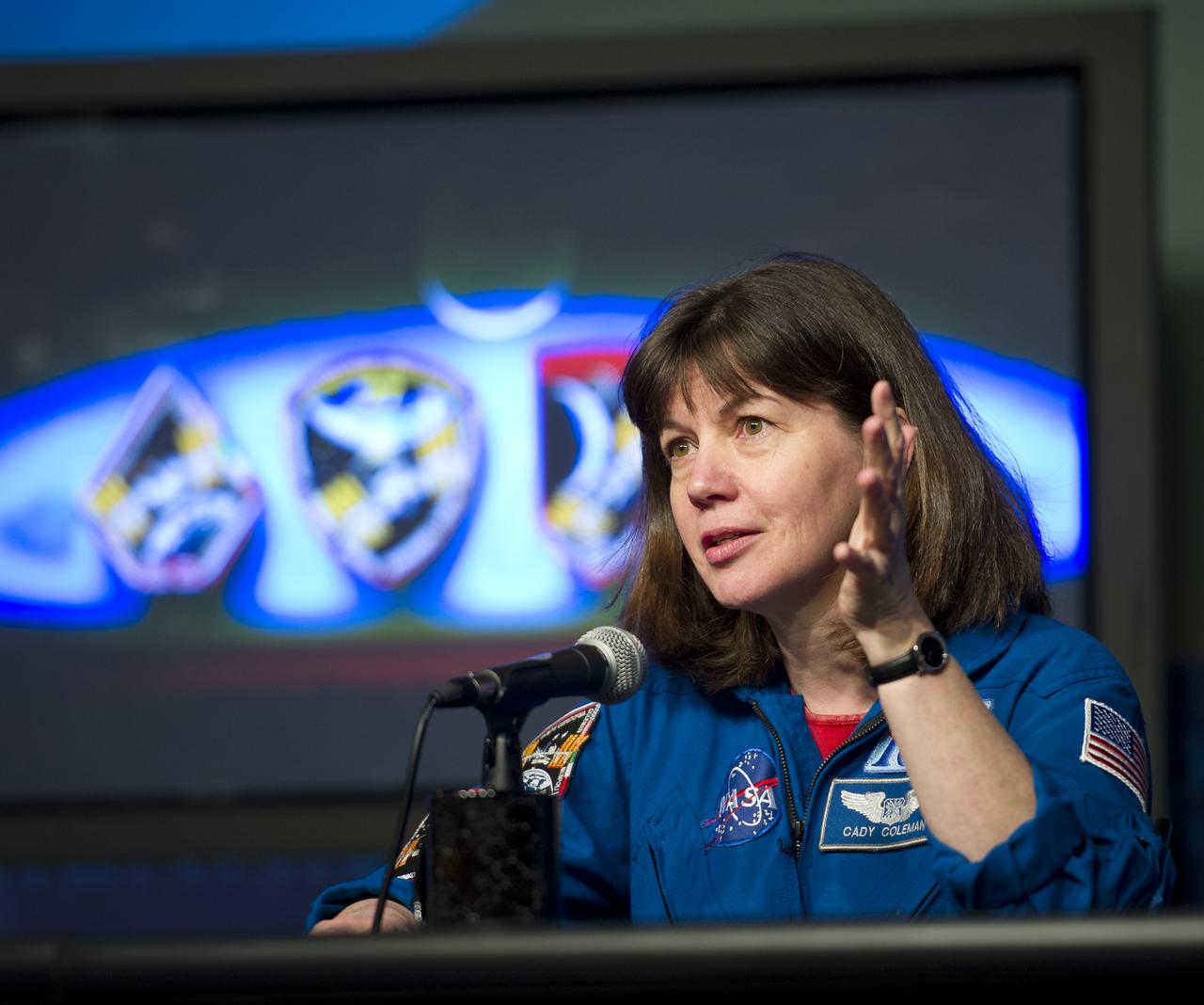
Astronaut Catherine Coleman, Expedition 26 and 27 flight engineer, discusses her mission to the International Space Station during a visit to NASA Headquarters in Washington, Tuesday, Feb. 14, 2012. Photo Credit: (NASA/Carla Cioffi)
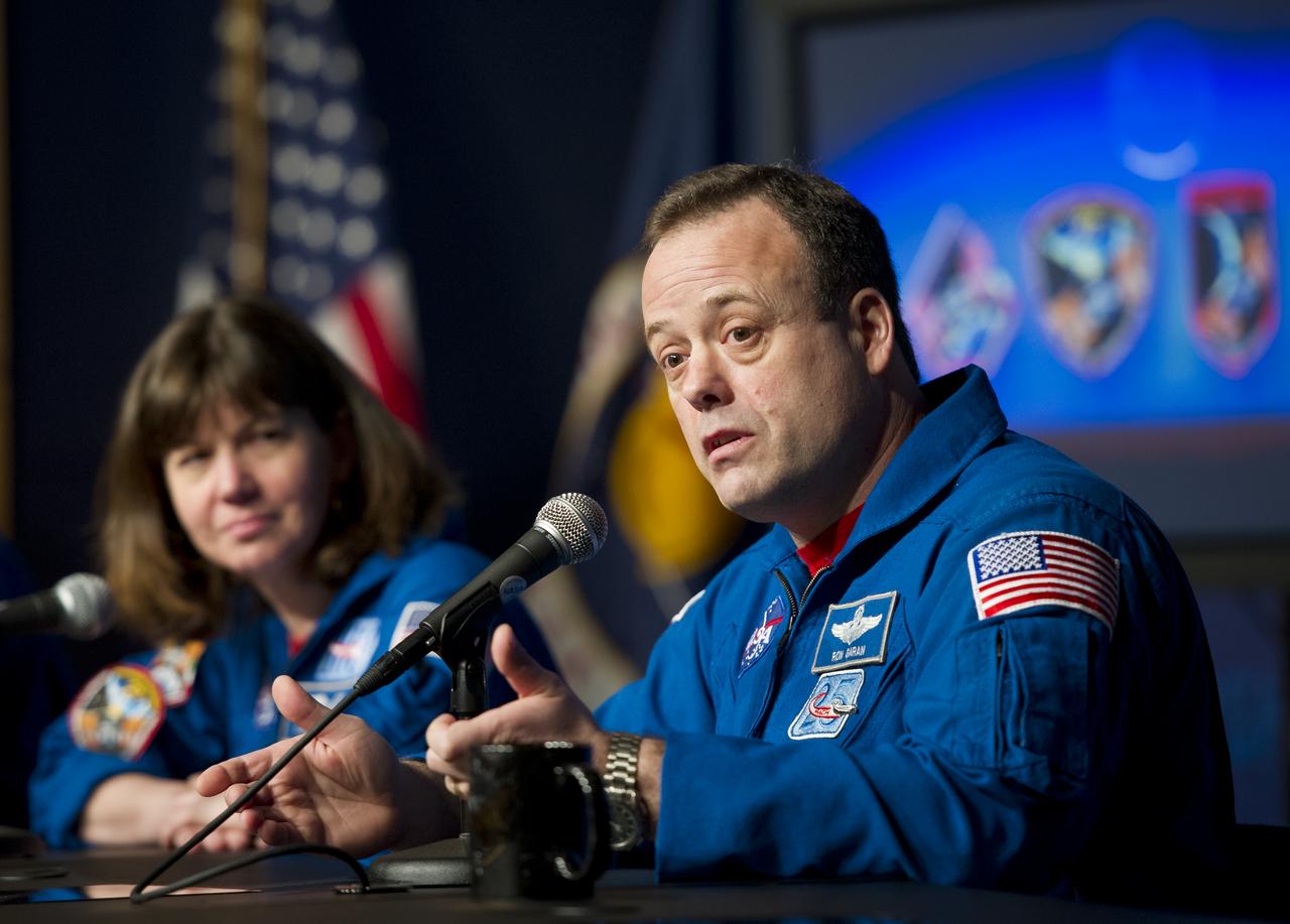
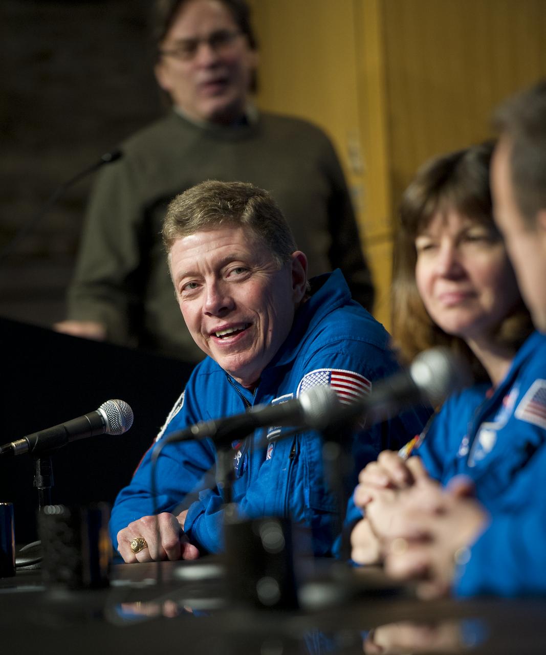
Astronaut Ron Garan, right, Expedition 27 & 28 flight engineer, discusses his mission to the International Space Station during a visit to NASA Headquarters in Washington, Tuesday, Feb. 14, 2012. Garan is joined by astronaut Catherine Coleman who was a flight engineer on Expeditions 26 & 27. Photo Credit: (NASA/Carla Cioffi)
Astronaut Catherine Coleman, center, Expedition 26 and 27 flight engineer, discusses her mission to the International Space Station during a visit to NASA Headquarters in Washington, Tuesday, Feb. 14, 2012. Coleman is seen with fellow astronauts Mike Fossum, left, and Ron Garan. Fossum was a flight engineer on Expedition 28 and Commander of Expedition 29. Garan was a flight engineer on Expeditions 27 & 28. Photo Credit: (NASA/Carla Cioffi)
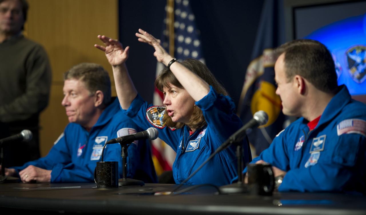
Astronaut Catherine Coleman, center, Expedition 26 and 27 flight engineer, discusses her mission to the International Space Station during a visit to NASA Headquarters in Washington, Tuesday, Feb. 14, 2012. Coleman is seen with fellow astronauts Mike Fossum, left, and Ron Garan. Fossum was a flight engineer on Expedition 28 and Commander of Expedition 29. Garan was a flight engineer on Expeditions 27 & 28. Photo Credit: (NASA/Carla Cioffi)
Astronaut Ron Garan, far right, Expedition 27 & 28 flight engineer, discusses his mission to the International Space Station during a visit to NASA Headquarters in Washington, Tuesday, Feb. 14, 2012. Garan is joined by astronauts Catherine Coleman, center, and Mike Fossum. Coleman was a flight engineer on Expeditions 26 & 27, and Fossum was a flight engineer on Expedition 28 and Expedition 29 Commander. Photo Credit: (NASA/Carla Cioffi)
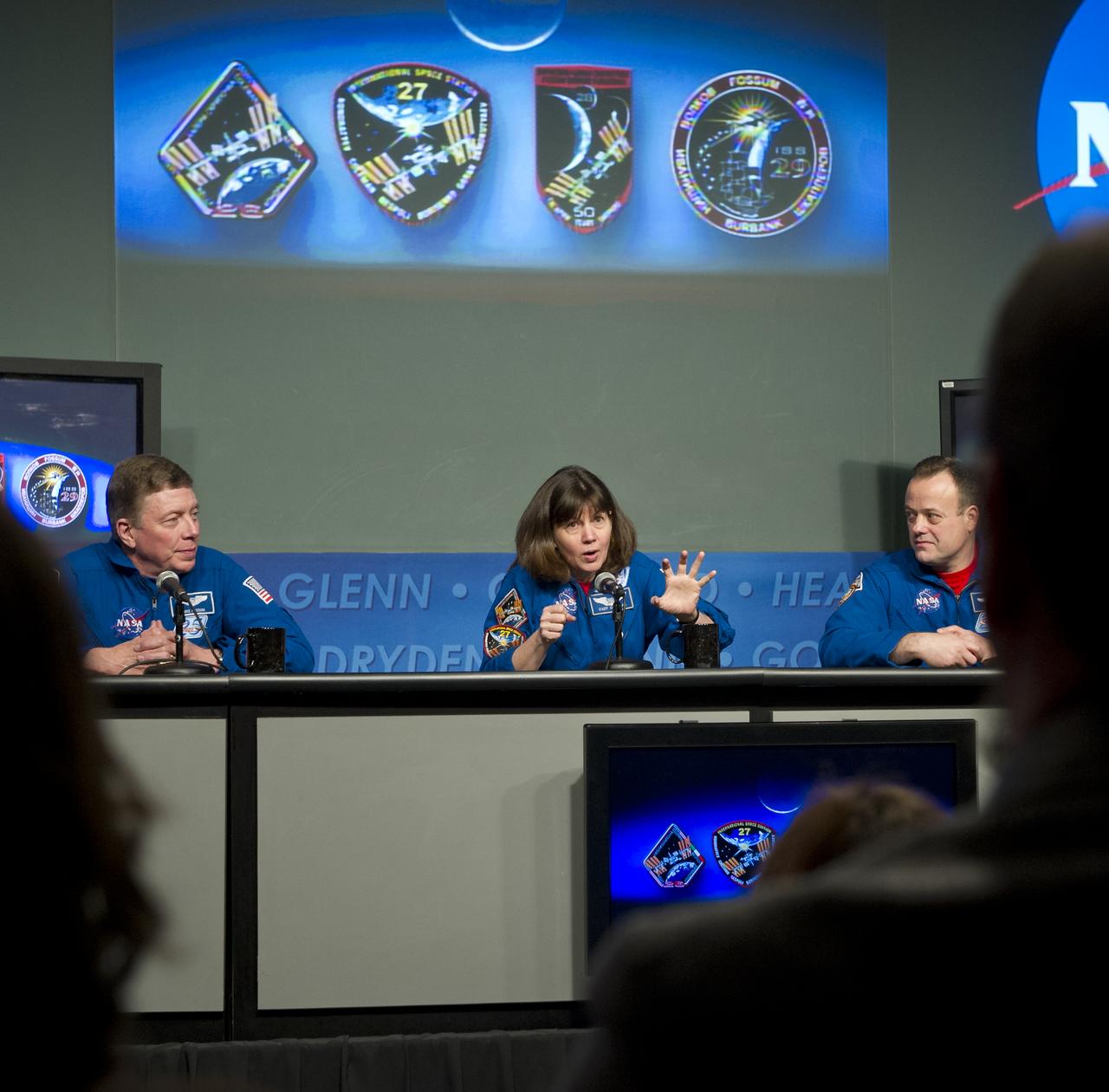
Mike Fossum, second from left, Expedition 28 flight engineer and Expedition 29 Commander, discusses his mission to the International Space Station during a visit to NASA Headquarters in Washington, Tuesday, Feb. 14, 2012. Seen with Fossum are astronauts Catherine Coleman, second from right, Expedition 26 & 27 flight engineer, and Ron Garan, Expedition 27 & 28 flight engineer. Photo Credit: (NASA/Carla Cioffi)
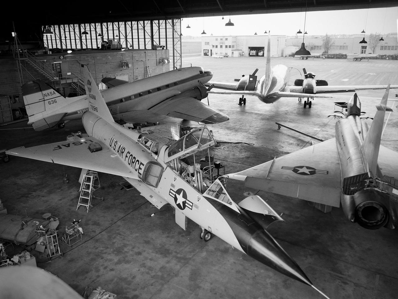
Several aircraft parked inside the Flight Research Building, or hangar, at the National Aeronautics and Space Administration (NASA) Lewis Research Center in Cleveland, Ohio. A Convair F-106B Delta Dart is in the foreground, a Convair F-102A Delta Dagger is to the right, a Douglas DC-3 is in the back to left, and a Convair T-29 is in background. Lewis’ Martin B-57B Canberra is not seen in this photograph. The F-102A had just been acquired by Lewis to serve as a chase plane for the F-106B. The Lewis team removed the weapons system and 700 pounds of wire from the F-106B when it was acquired on October 20, 1966. The staff cut holes in the wings and modified the elevons to mount the test nacelles. A 228-gallon fuel tank was installed in the missile bay, and the existing wing tanks were used for instrumentation. This photograph contains a rare view of the Block House, seen to the left of the aircraft. Lewis acquired three large developmental programs in 1962—the Centaur and Agena rockets and the M-1 engine. The center was short on office space at the time, and its flight research program was temporarily on the wane. Lewis management decided to construct a large cinderblock structure inside one half of the hangar to house the new personnel. This structure was used until 1965 when the new Developmental Engineering Building was built. The Block House was eventually torn down in 1973.
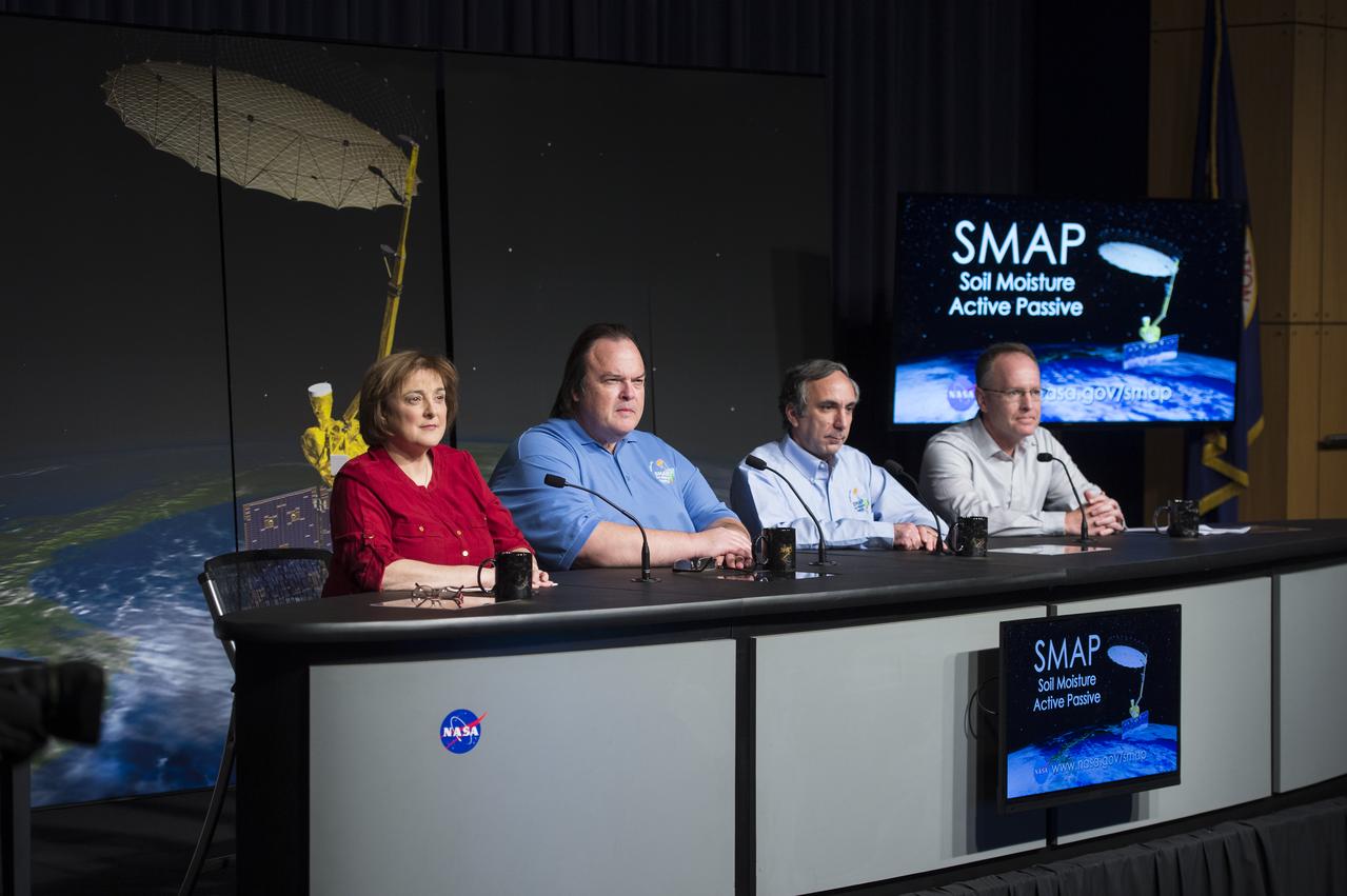
Christine Bonniksen, SMAP program executive with the Science Mission Directorate’s Earth Science Division, NASA Headquarters, left, Kent Kellogg, SMAP project manager, NASA Jet Propulsion Laboratory (JPL), second from left, Dara Entekhabi, SMAP science team lead, Massachusetts Institute of Technology, second from right, and Brad Doorn, SMAP applications lead, Science Mission Directorate’s Applied Sciences Program, NASA Headquarters, right, are seen during a briefing about the upcoming launch of the Soil Moisture Active Passive (SMAP) mission, Thursday, Jan. 08, 2015, at NASA Headquarters in Washington DC. The mission is scheduled for a Jan. 29 launch from Vandenberg Air Force Base in California, and will provide the most accurate, highest-resolution global measurements of soil moisture ever obtained from space. The data will be used to enhance scientists' understanding of the processes that link Earth's water, energy and carbon cycles. Photo Credit: (NASA/Aubrey Gemignani)

Christine Bonniksen, SMAP program executive with the Science Mission Directorate’s Earth Science Division, NASA Headquarters, left, Kent Kellogg, SMAP project manager, NASA Jet Propulsion Laboratory (JPL), second from left, Dara Entekhabi, SMAP science team lead, Massachusetts Institute of Technology, second from right, and Brad Doorn, SMAP applications lead, Science Mission Directorate’s Applied Sciences Program, NASA Headquarters, right, are seen during a briefing about the upcoming launch of the Soil Moisture Active Passive (SMAP) mission, Thursday, Jan. 08, 2015, at NASA Headquarters in Washington DC. The mission is scheduled for a Jan. 29 launch from Vandenberg Air Force Base in California, and will provide the most accurate, highest-resolution global measurements of soil moisture ever obtained from space. The data will be used to enhance scientists' understanding of the processes that link Earth's water, energy and carbon cycles. Photo Credit: (NASA/Aubrey Gemignani)
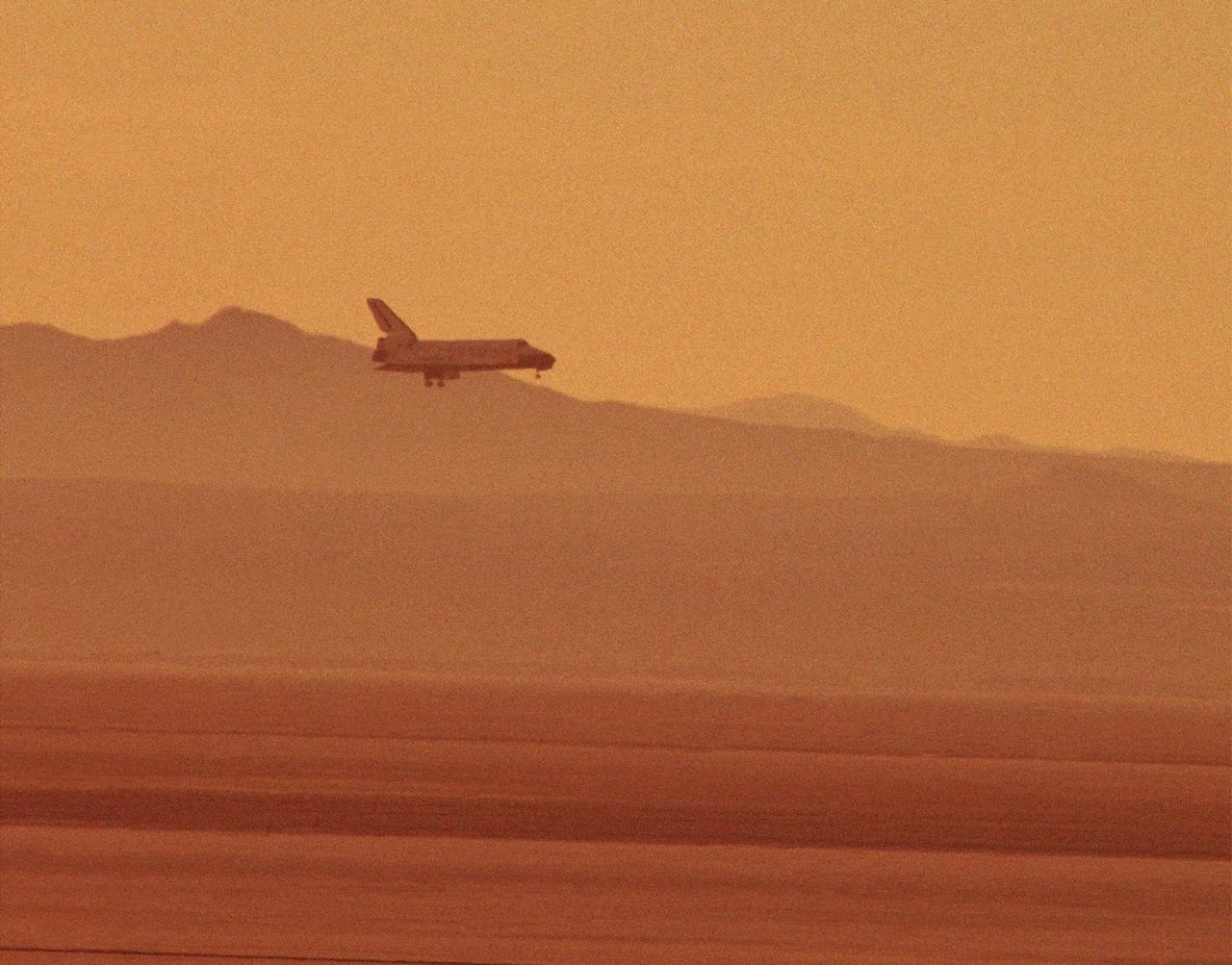
The STS-29 Space Shuttle Discovery mission approaches for a landing at NASA's then Ames-Dryden Flight Research Facility, Edwards AFB, California, early Saturday morning, 18 March 1989. Touchdown was at 6:35:49 a.m. PST and wheel stop was at 6:36:40 a.m. on runway 22. Controllers chose the concrete runway for the landing in order to make tests of braking and nosewheel steering. The STS-29 mission was very successful, completing the launch a Tracking and Data Relay communications satellite, as well as a range of scientific experiments. Discovery's five man crew was led by Commander Michael L. Coats, and included pilot John E. Blaha and mission specialists James P. Bagian, Robert C. Springer, and James F. Buchli.
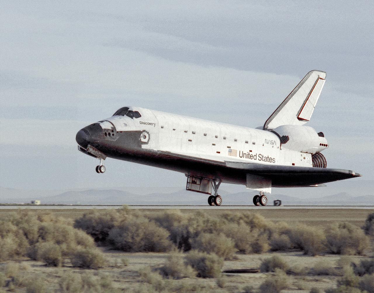
The STS-29 Space Shuttle Discovery mission lands at NASA's then Ames-Dryden Flight Research Facility, Edwards AFB, California, early Saturday morning, 18 March 1989. Touchdown was at 6:35:49 a.m. PST and wheel stop was at 6:36:40 a.m. on runway 22. Controllers chose the concrete runway for the landing in order to make tests of braking and nosewheel steering. The STS-29 mission was very successful, completing the launch of a Tracking and Data Relay communications satellite, as well as a range of scientific experiments. Discovery's five-man crew was led by Commander Michael L. Coats, and included pilot John E. Blaha and mission specialists James P. Bagian, Robert C. Springer, and James F. Buchli.

In May 2014, two new studies concluded that a section of the land-based West Antarctic ice sheet had reached a point of inevitable collapse. Meanwhile, fresh observations from September 2014 showed sea ice around Antarctica had reached its greatest extent since the late 1970s. To better understand such dynamic and dramatic differences in the region's land and sea ice, researchers are travelling south to Antarctica this month for the sixth campaign of NASA’s Operation IceBridge. The airborne campaign, which also flies each year over Greenland, makes annual surveys of the ice with instrumented research aircraft. Instruments range from lasers that map the elevation of the ice surface, radars that "see" below it, and downward looking cameras to provide a natural-color perspective. The Digital Mapping System (DMS) camera acquired the above photo during the mission’s first science flight on October 16, 2009. At the time of the image, the DC-8 aircraft was flying at an altitude of 515 meters (1,700 feet) over heavily compacted first-year sea ice along the edge of the Amundsen Sea. Since that first flight, much has been gleaned from IceBridge data. For example, images from an IceBridge flight in October 2011 revealed a massive crack running about 29 kilometers (18 miles) across the floating tongue of Antarctica's Pine Island Glacier. The crack ultimately led to a 725-square-kilometer (280-square-mile) iceberg. In 2012, IceBridge data was a key part of a new map of Antarctica called Bedmap2. By combining surface elevation, ice thickness, and bedrock topography, Bedmap2 gives a clearer picture of Antarctica from the ice surface down to the land surface. Discoveries have been made in Greenland, too, including the identification of a 740-kilometer-long (460-mile-long) mega canyon below the ice sheet. Repeated measurements of land and sea ice from aircraft extend the record of observations once made by NASA’s Ice, Cloud, and Land Elevation Satellite, or ICESat, which stopped functioning in 2009. In addition to extending the ICESat record, IceBridge also sets the stage for ICESat-2, which is scheduled for launch in 2017. Credit: IceBridge DMS L0 Raw Imagery courtesy of the Digital Mapping System (DMS) team/NASA DAAC at the National Snow and Ice Data Center More info: <a href="http://earthobservatory.nasa.gov/IOTD/view.php?id=84549" rel="nofollow">earthobservatory.nasa.gov/IOTD/view.php?id=84549</a> <a href="http://earthobservatory.nasa.gov/IOTD/view.php?id=84549" rel="nofollow">earthobservatory.nasa.gov/IOTD/view.php?id=84549</a>