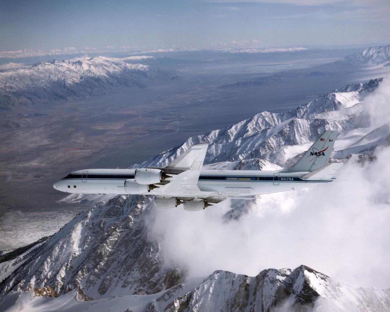
DC-8 Airborne Laboratory in banked flight over snow-capped Sierra Nevada mountain range
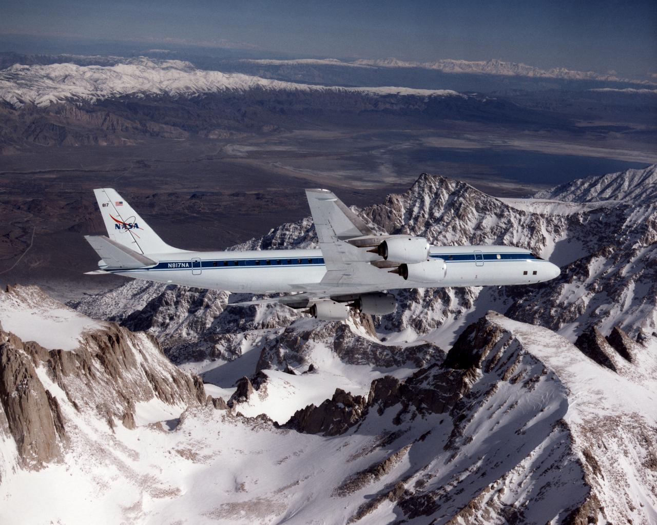
The DC-8 banking over the jagged peak of Mount Whitney on a February 25, 1998 flight. The DC-8 and a pair of ER-2 aircraft are operated by the Airborne Science program at the NASA Dryden Flight Research Center. NASA, other governmental agencies, academia, and scientific and technical organizations employ the DC-8 for a variety of experiments.
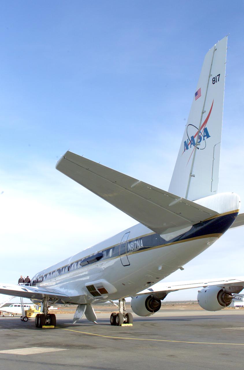
NASA’s DC-8 aircraft at Carlos Ibanez International Airport in Punta Arenas, Chile. A portion of AirSAR hardware is visible on the left rear fuselage. AirSAR 2004 is a three-week expedition in Central and South America by an international team of scientists that is using an all-weather imaging tool, called the Airborne Synthetic Aperture Radar (AirSAR), located onboard NASA's DC-8 airborne laboratory. Scientists from many parts of the world are combining ground research with NASA's AirSAR technology to improve and expand on the quality of research they are able to conduct.
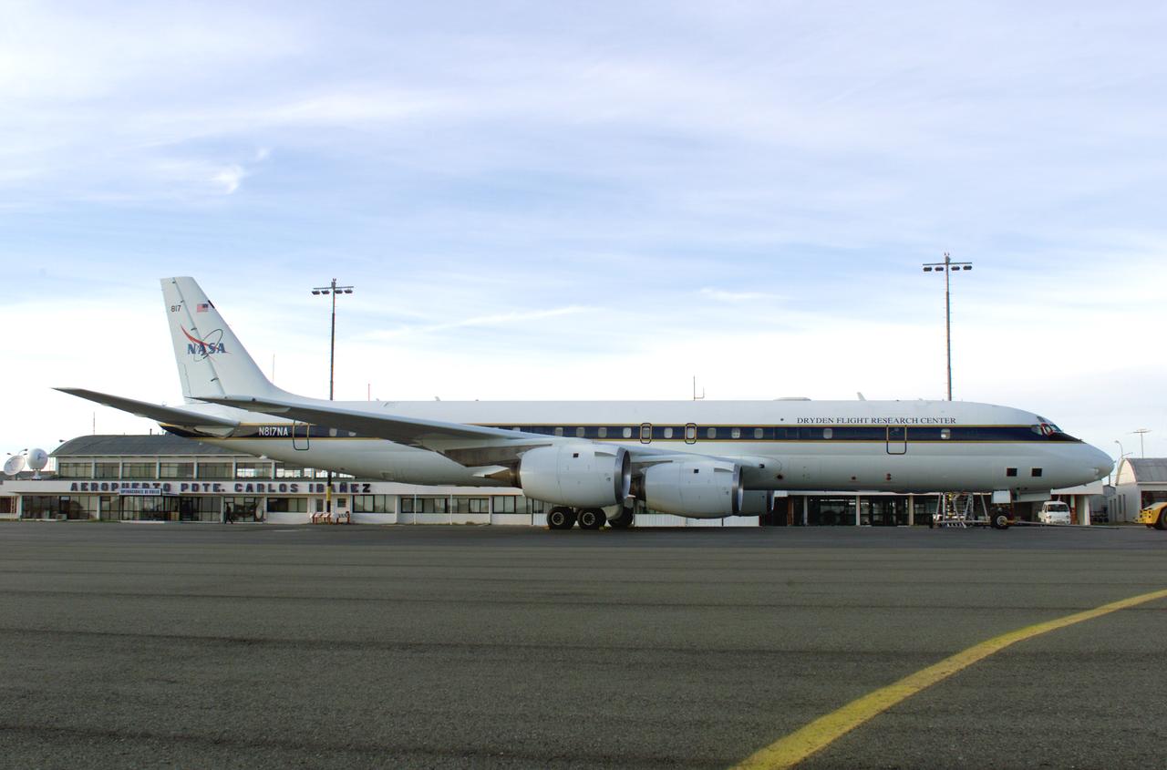
NASA’s DC-8 aircraft prior to launch from Carlos Ibanez International Airport in Punta Arenas, Chile, during AirSAR 2004. AirSAR 2004 is a three-week expedition in Central and South America by an international team of scientists that is using an all-weather imaging tool, called the Airborne Synthetic Aperture Radar (AirSAR), located onboard NASA's DC-8 airborne laboratory. Scientists from many parts of the world are combining ground research with NASA's AirSAR technology to improve and expand on the quality of research they are able to conduct.
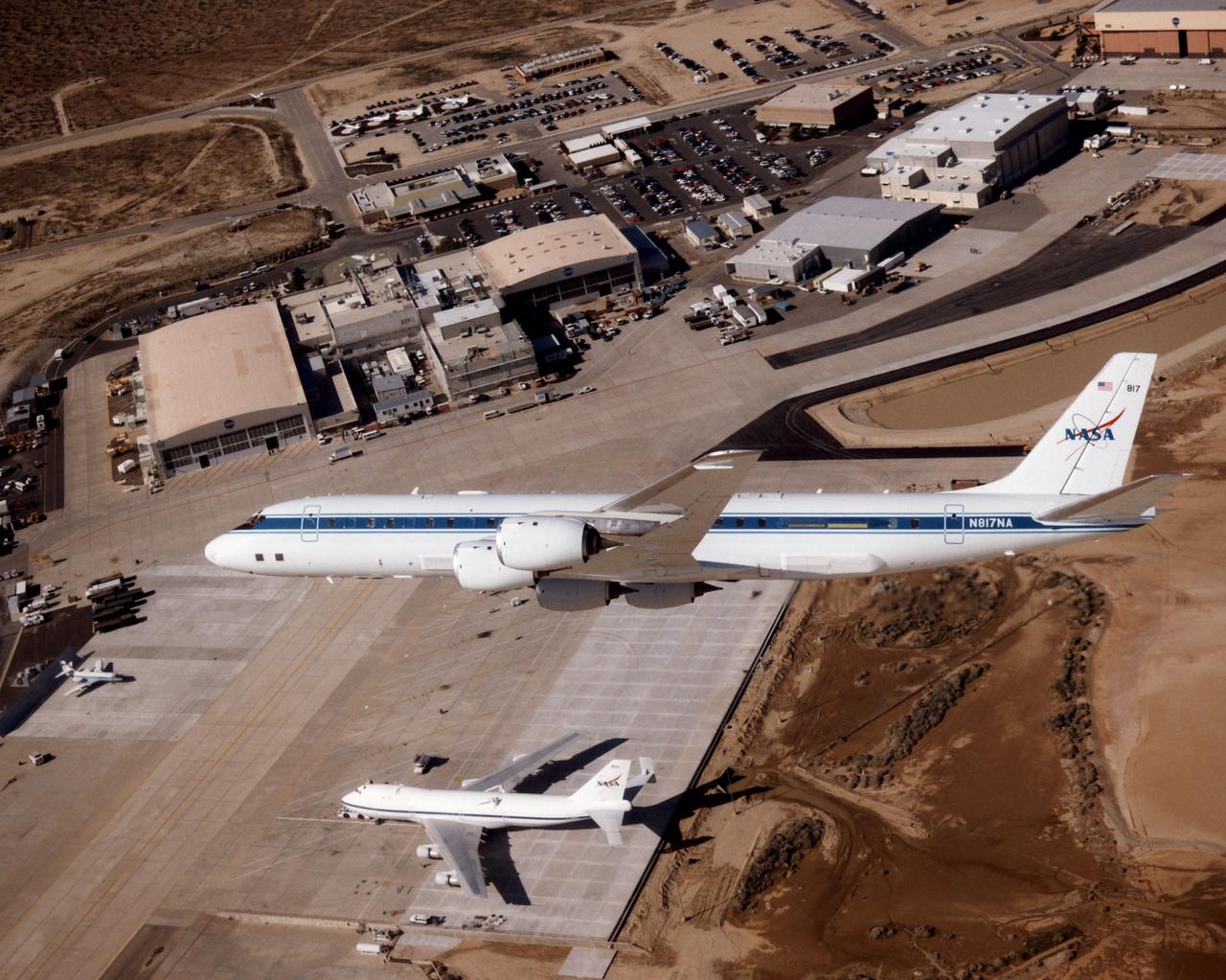
The DC-8 aircraft is seen making a banking turn high above the NASA Dryden ramp. This view of the DC-8's left side reveals some of the modifications necessary for particular on-board experiments. To the right of the DC-8 is the edge of Rogers Dry Lake. Above the aircraft's forward fuselage is the Dryden Flight Research Center headquarters building, while other NASA facilities extend down the flightline to the right. Below the DC-8 is the Shuttle Carrier Aircraft (SCA), on which are visible attachment points for the Shuttle Orbiter.
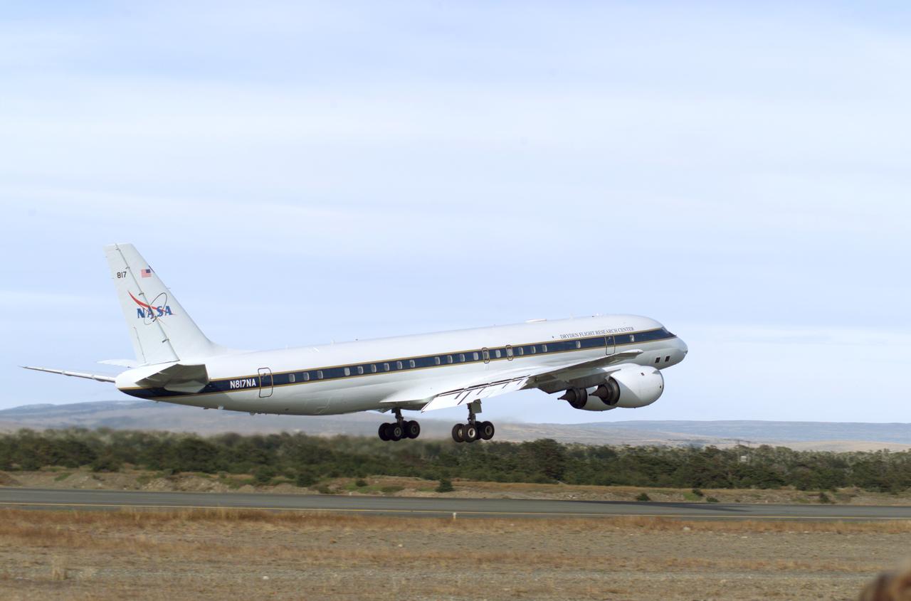
NASA's DC-8 flying laboratory takes off from Carlos Ibanez International Airport in Punta Arenas, Chile, during NASA's AirSAR 2004 campaign. AirSAR 2004 is a three-week expedition in Central and South America by an international team of scientists that is using an all-weather imaging tool, called the Airborne Synthetic Aperture Radar (AirSAR), located onboard NASA's DC-8 airborne laboratory. Scientists from many parts of the world are combining ground research with NASA's AirSAR technology to improve and expand on the quality of research they are able to conduct.

NASA DC-8 Pilots Craig Bomben and Bill Brockett explain the DC-8 cockpit to Chilean students onboard the DC-8 aircraft at Carlos Ibanez del Campo International Airport in Punta Arenas, Chile. AirSAR 2004 is a three-week expedition by an international team of scientists that is using an all-weather imaging tool, called the Airborne Synthetic Aperture Radar (AirSAR) which is located onboard NASA's DC-8 airborne laboratory. Scientists from many parts of the world including NASA's Jet Propulsion Laboratory are combining ground research done in several areas in Central and South America with NASA's AirSAR technology to improve and expand on the quality of research they are able to conduct. In South America and Antarctica, AirSAR will collect imagery and data to help determine the contribution of Southern Hemisphere glaciers to sea level rise due to climate change. In Patagonia, researchers found this contribution had more than doubled from 1995 to 2000, compared to the previous 25 years. AirSAR data will make it possible to determine whether that trend is decreasing, continuing or accelerating. AirSAR will also provide reliable information on ice shelf thickness to measure the contribution of the glaciers to sea level.

NASA DC-8 Ground Support Technician Joe Niquette performs routine maintenance on the DC-8 aircraft at Carlos Ibanez del Campo International Airport in Punta Arenas, Chile. AirSAR 2004 is a three-week expedition by an international team of scientists that is using an all-weather imaging tool, called the Airborne Synthetic Aperture Radar (AirSAR) which is located onboard NASA's DC-8 airborne laboratory. Scientists from many parts of the world including NASA's Jet Propulsion Laboratory are combining ground research done in several areas in Central and South America with NASA's AirSAR technology to improve and expand on the quality of research they are able to conduct. In South America and Antarctica, AirSAR will collect imagery and data to help determine the contribution of Southern Hemisphere glaciers to sea level rise due to climate change. In Patagonia, researchers found this contribution had more than doubled from 1995 to 2000, compared to the previous 25 years. AirSAR data will make it possible to determine whether that trend is decreasing, continuing or accelerating. AirSAR will also provide reliable information on ice shelf thickness to measure the contribution of the glaciers to sea level.
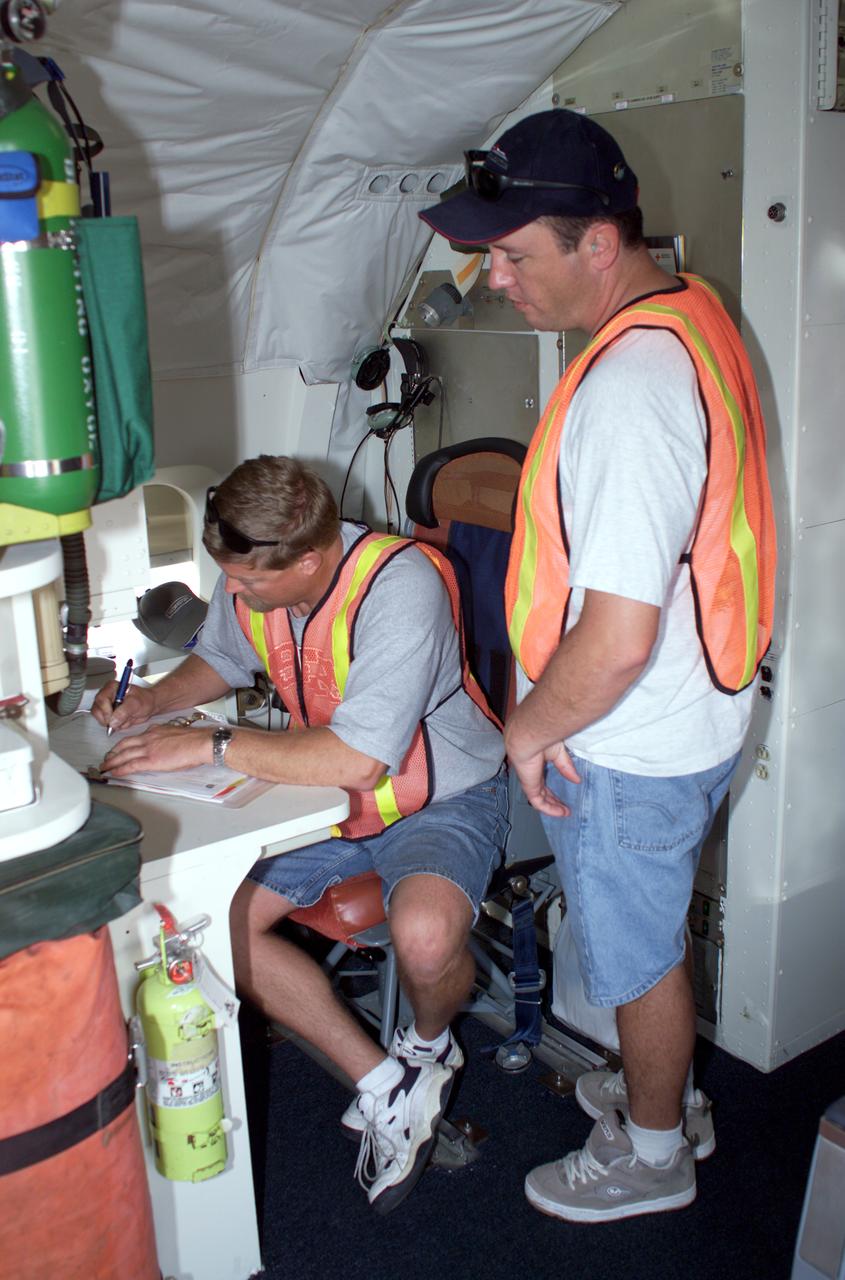
DC-8 Quality Inspector Scott Silver signs documents while Acting Crew Chief Mike Bereda looks on prior to a DC-8 AirSAR flight in Costa Rica. AirSAR 2004 Mesoamerica is a three-week expedition by an international team of scientists that uses an all-weather imaging tool, called the Airborne Synthetic Aperture Radar (AirSAR) which is located onboard NASA's DC-8 airborne laboratory. Scientists from many parts of the world including NASA's Jet Propulsion Laboratory are combining ground research done in several areas in Central America with NASA's AirSAR technology to improve and expand on the quality of research they are able to conduct. The radar, developed by NASA's Jet Propulsion Laboratory, can penetrate clouds and also collect data at night. Its high-resolution sensors operate at multiple wavelengths and modes, allowing AirSAR to see beneath treetops, through thin sand, and dry snow pack. AirSAR's 2004 campaign is a collaboration of many U.S. and Central American institutions and scientists, including NASA; the National Science Foundation; the Smithsonian Institution; National Geographic; Conservation International; the Organization of Tropical Studies; the Central American Commission for Environment and Development; and the Inter-American Development Bank.
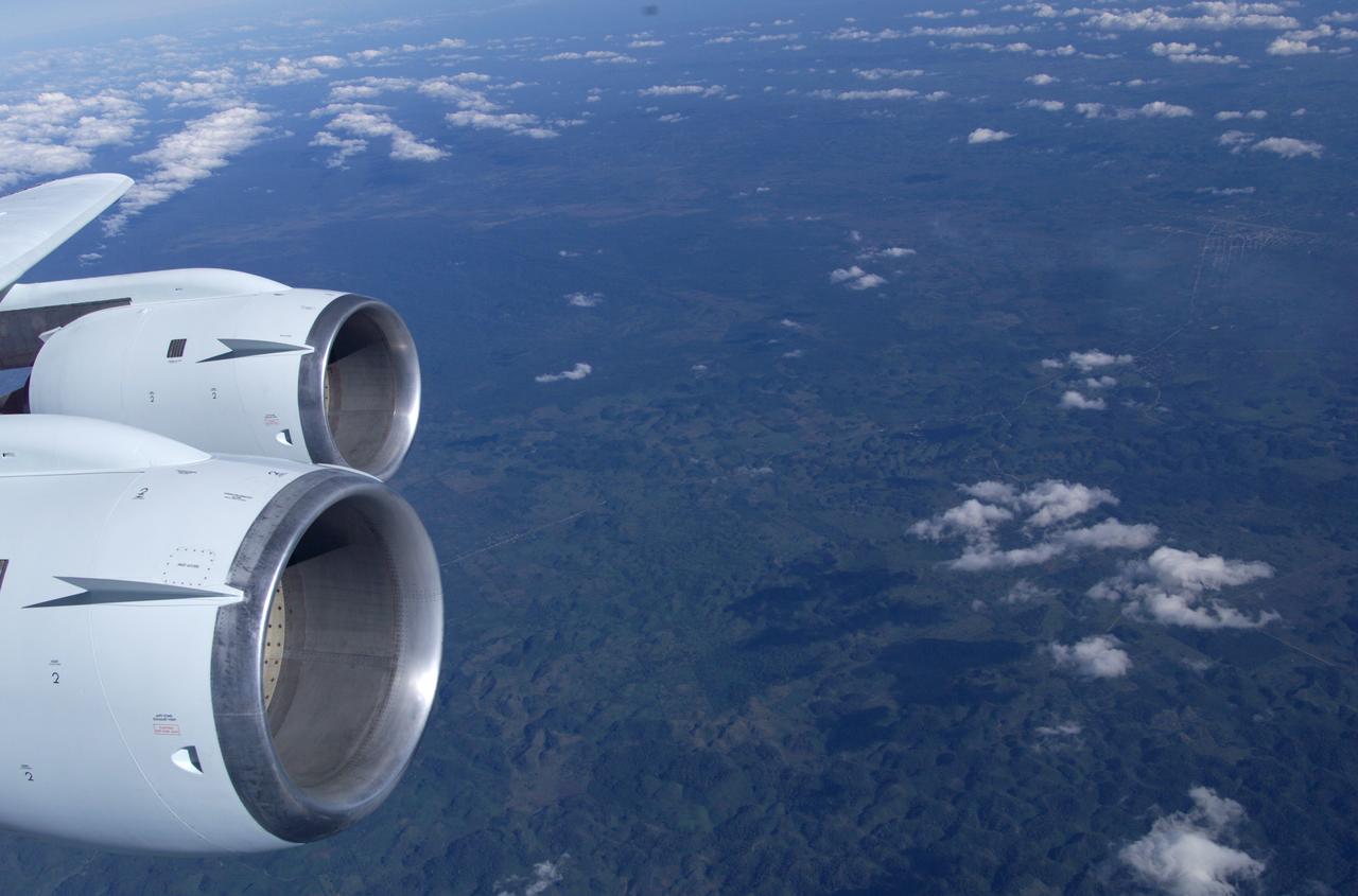
This is a photograph from the left side of the aircraft as NASA's DC-8 does an AirSAR 2004 research "line" over Honduras. AirSAR 2004 is a three-week expedition by an international team of scientists that will use an all-weather imaging tool, called the Airborne Synthetic Aperture Radar (AirSAR), in a mission ranging from the tropical rain forests of Central America to frigid Antarctica.
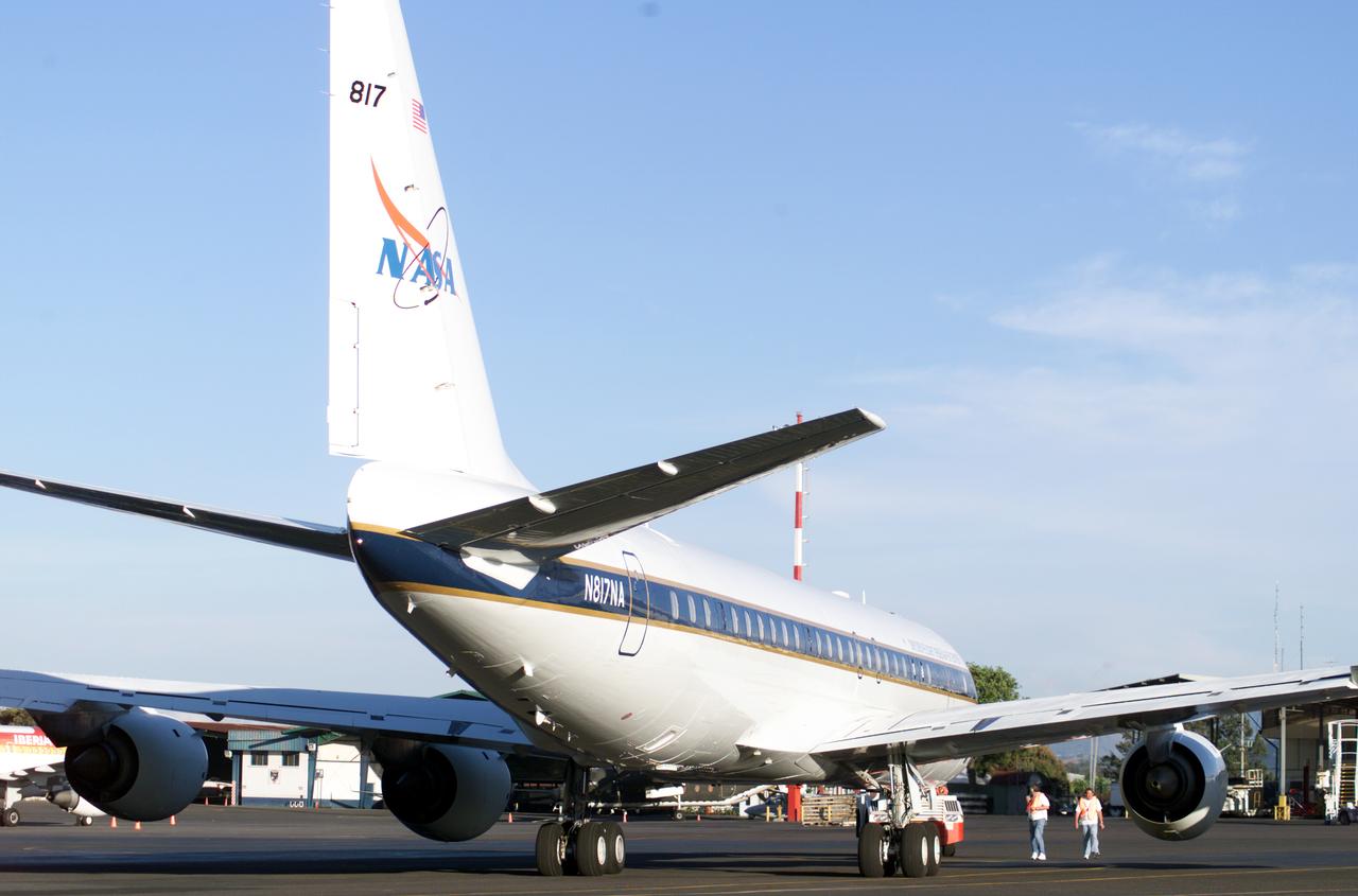
NASA Dryden's DC-8 on the ramp at Jaun Santamaria International Airport, San Jose, Costa Rica during the AirSAR 2004 campaign. AirSAR 2004 is a three-week expedition by an international team of scientists that will use an all-weather imaging tool, called the Airborne Synthetic Aperture Radar (AirSAR), in a mission ranging from the tropical rain forests of Central America to frigid Antarctica.
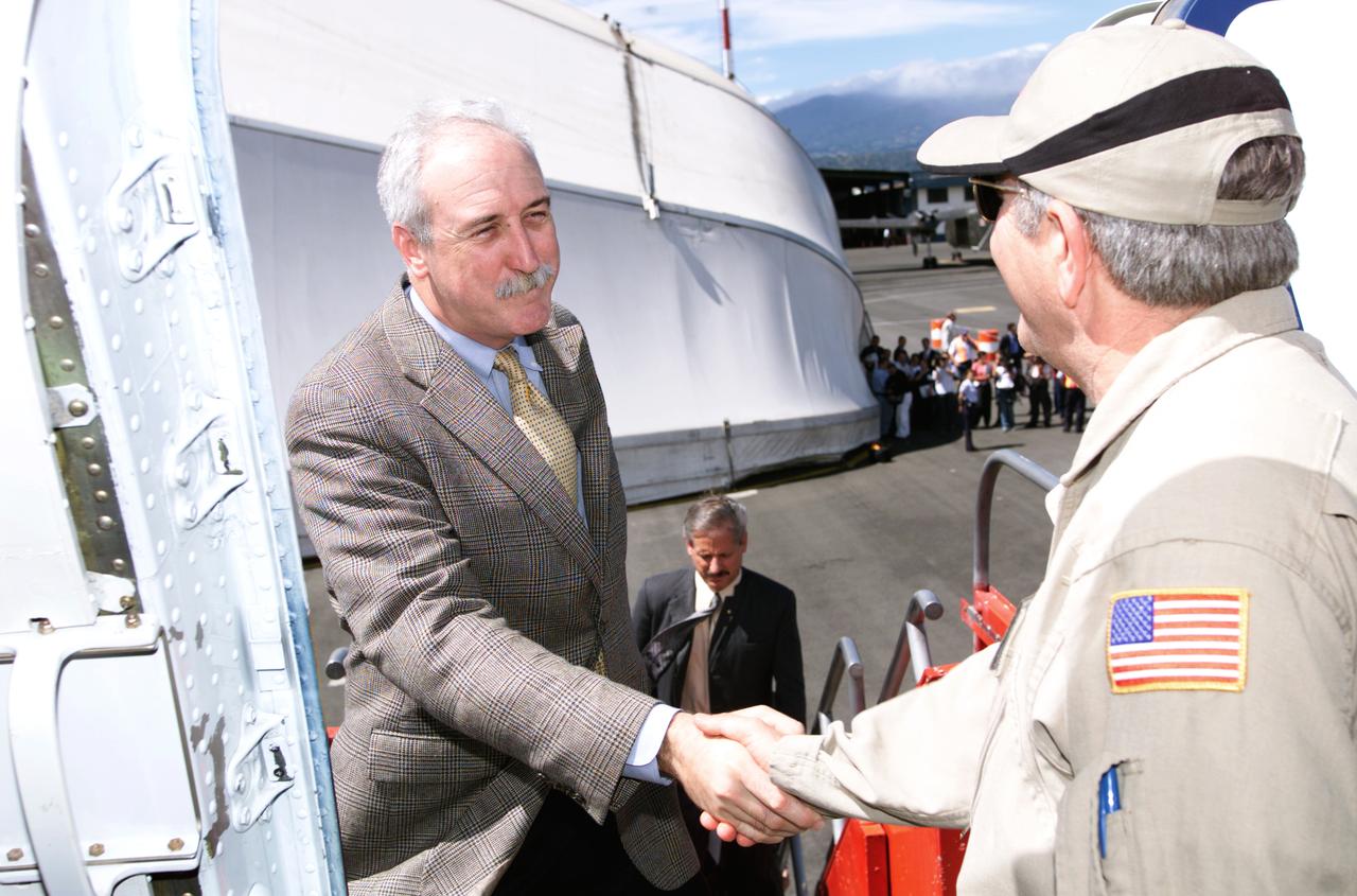
Dr. Tom Mace, NASA DFRC Director of Airborne Sciences, greets NASA Administrator Sean O'Keefe as he enters the DC-8 aircraft during a stop-off on the AirSAR 2004 Mesoamerica campaign. AirSAR 2004 Mesoamerica is a three-week expedition by an international team of scientists that will use an all-weather imaging tool, called the Airborne Synthetic Aperture Radar (AirSAR), in a mission ranging from the tropical rain forests of Central America to frigid Antarctica.
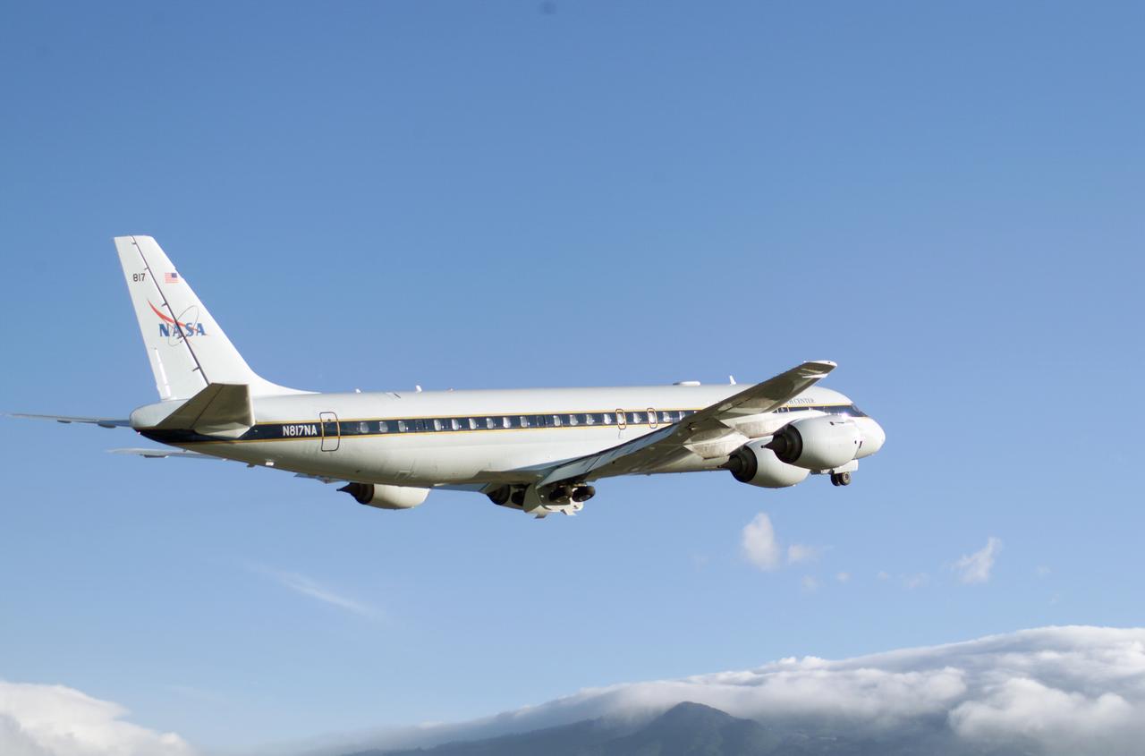
NASA's DC-8 flying laboratory takes off from Juan Santamaria International Airport in San Jose, Costa Rica, on NASA's AirSAR 2004 campaign. AirSAR 2004 is a three-week expedition by an international team of scientists that will use an all-weather imaging tool, called the Airborne Synthetic Aperture Radar (AirSAR), in a mission ranging from the tropical rain forests of Central America to frigid Antarctica.
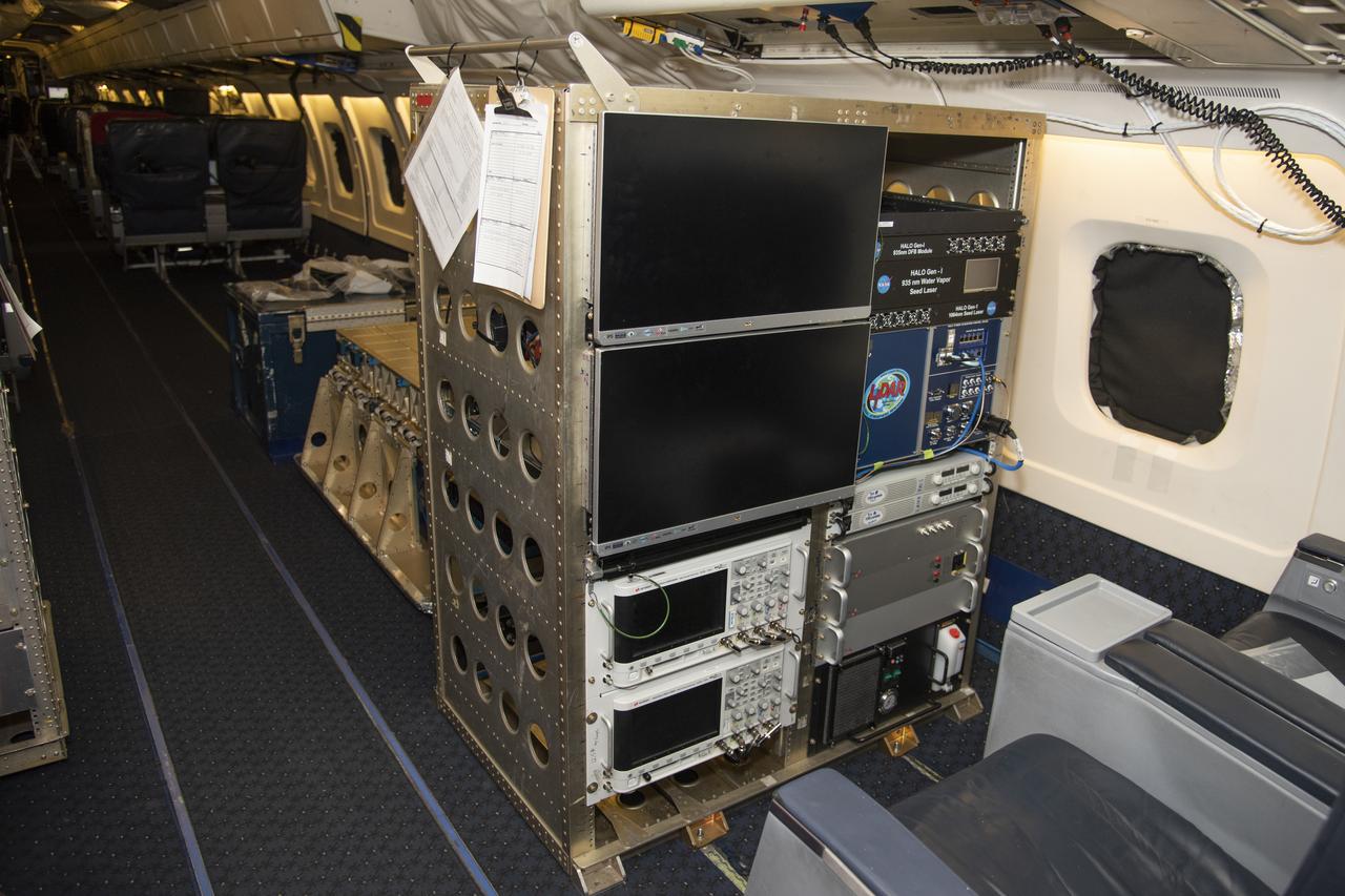
The High Altitude Lidar Observatory (HALO) system electronics and diagnostic tools are integrated onto the DC-8 airborne science laboratory at NASA Armstrong Flight Research Center in Edwards, California. The lidar system control electronics are on the right hand side of the rack. The large monitors on the left are used to display real-time images of water vapor and aerosol profiles, which are used by the science team to guide in-flight decisions and navigation. The compact HALO instrument head can be seen directly behind the electronics rack.
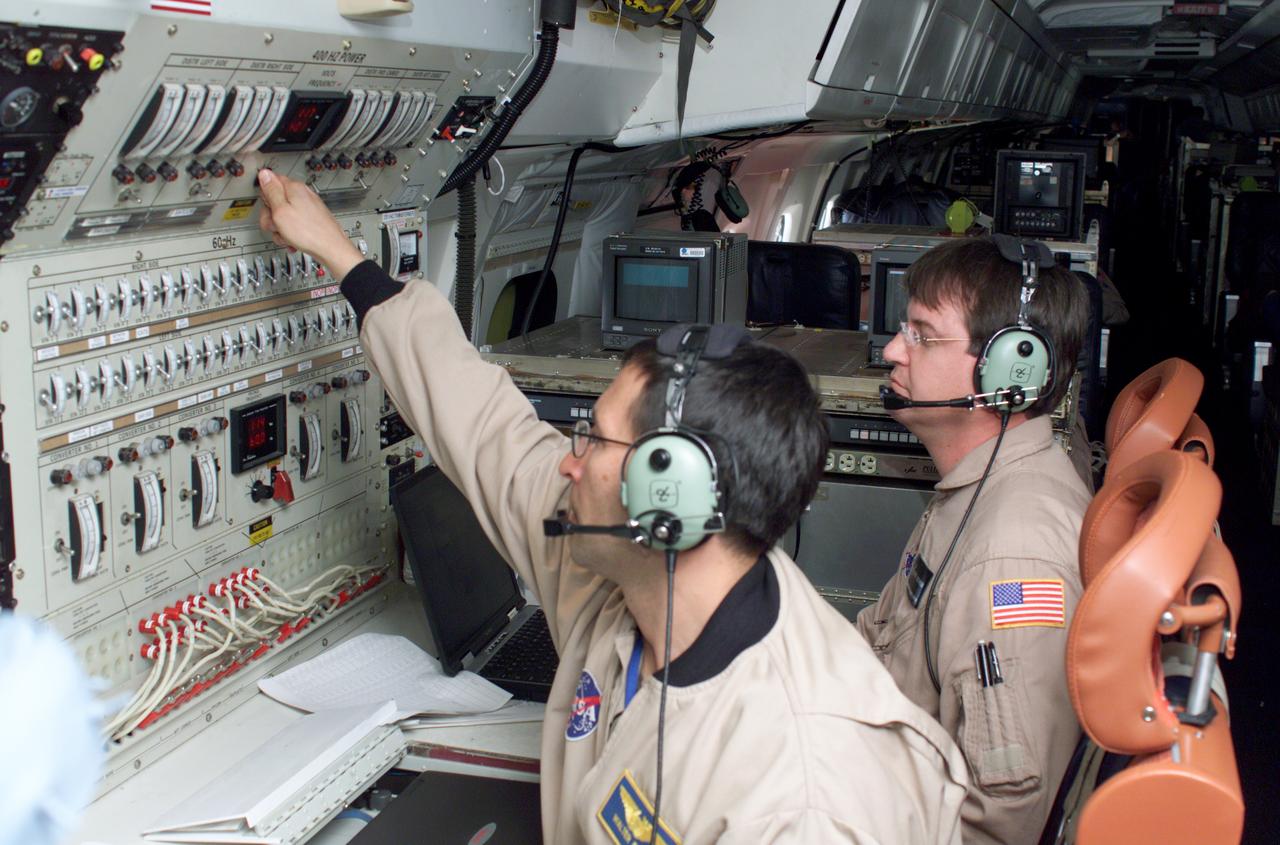
Airborne Science personnel Walter Klein and David Bushman at the Mission Manager's console onboard NASA's DC-8 during the AirSAR 2004 campaign. AirSAR 2004 is a three-week expedition by an international team of scientists that will use an all-weather imaging tool, called the Airborne Synthetic Aperture Radar (AirSAR), in a mission ranging from the tropical rain forests of Central America to frigid Antarctica.

NASA Dryden's DC-8 on the ramp at Jaun Santamaria International Airport, San Jose, Costa Rica during the AirSAR 2004 campaign. AirSAR 2004 is a three-week expedition by an international team of scientists that will use an all-weather imaging tool, called the Airborne Synthetic Aperture Radar (AirSAR), in a mission ranging from the tropical rain forests of Central America to frigid Antarctica.
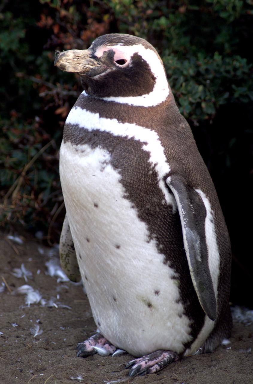
A penguin near Punta Arena, Chile, photographed in its natural summer habitat during NASA's AirSAR 2004 campaign. AirSAR 2004 is a three-week expedition in Central and South America by an international team of scientists that is using an all-weather imaging tool, called the Airborne Synthetic Aperture Radar (AirSAR), located onboard NASA's DC-8 airborne laboratory. Scientists from many parts of the world are combining ground research with NASA's AirSAR technology to improve and expand on the quality of research they are able to conduct.
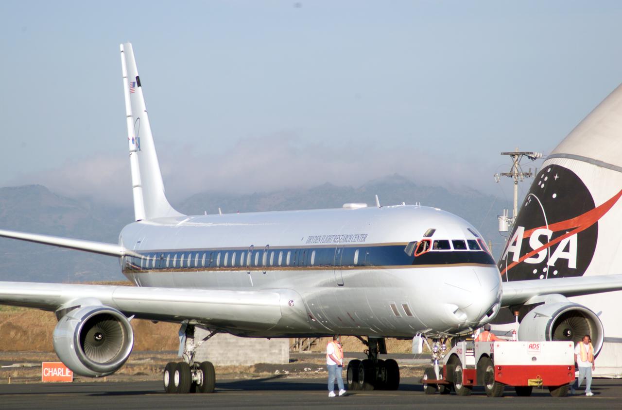
NASA Dryden's DC-8 on the ramp at Jaun Santamaria International Airport, San Jose, Costa Rica during the AirSAR 2004 campaign. AirSAR 2004 is a three-week expedition by an international team of scientists that will use an all-weather imaging tool, called the Airborne Synthetic Aperture Radar (AirSAR), in a mission ranging from the tropical rain forests of Central America to frigid Antarctica.

NASA's DC-8 flying laboratory takes off from Juan Santamaria International Airport in San Jose, Costa Rica, on NASA's AirSAR 2004 campaign. AirSAR 2004 is a three-week expedition by an international team of scientists that will use an all-weather imaging tool, called the Airborne Synthetic Aperture Radar (AirSAR), in a mission ranging from the tropical rain forests of Central America to frigid Antarctica.

David Bushman at the Mission Manager's console onboard NASA's DC-8 during the AirSAR 2004 campaign. AirSAR 2004 is a three-week expedition by an international team of scientists that will use an all-weather imaging tool, called the Airborne Synthetic Aperture Radar (AirSAR), in a mission ranging from the tropical rain forests of Central America to frigid Antarctica.
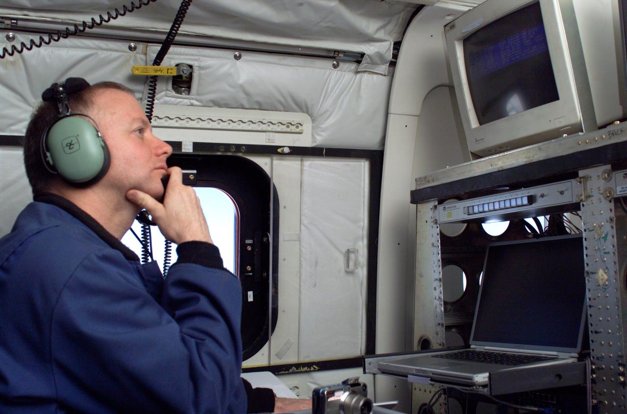
JPL Researcher Bruce Chapman at an AirSAR station aboard NASA's DC-8 flying laboratory during the AirSAR 2004 campaign. AirSAR 2004 is a three-week expedition by an international team of scientists that will use an all-weather imaging tool, called the Airborne Synthetic Aperture Radar (AirSAR), in a mission ranging from the tropical rain forests of Central America to frigid Antarctica.
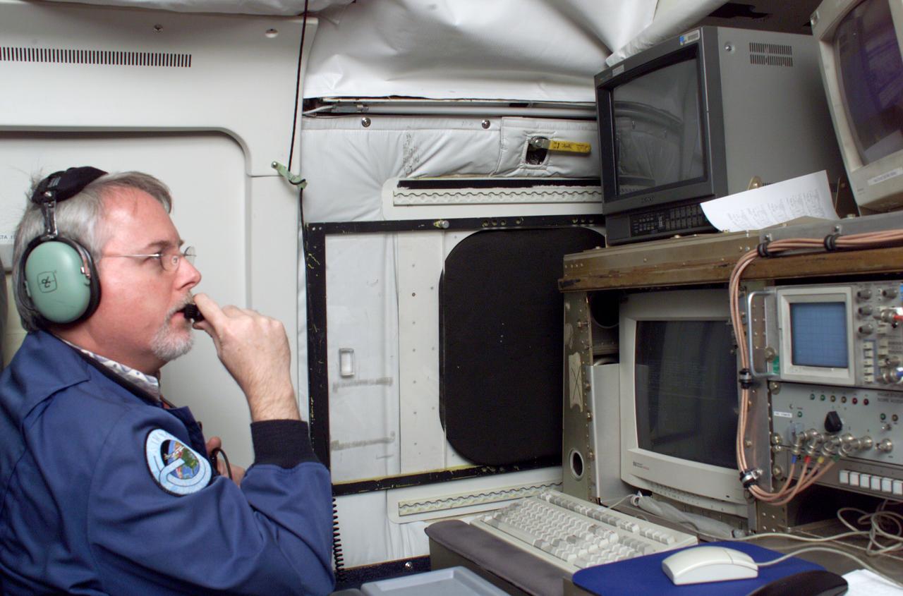
JPL Researcher Tim Miller at the primary AirSAR station aboard NASA's DC-8 flying laboratory during the AirSAR 2004 campaign. AirSAR 2004 is a three-week expedition by an international team of scientists that will use an all-weather imaging tool, called the Airborne Synthetic Aperture Radar (AirSAR), in a mission ranging from the tropical rain forests of Central America to frigid Antarctica.
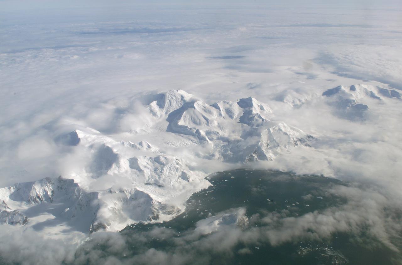
An AirSAR 2004 view from the DC-8 as it approaches the Larsen Ice Shelf, which is part of the Antarctic Peninsula. AirSAR 2004 is a three-week expedition in Central and South America by an international team of scientists that is using an all-weather imaging tool, called the Airborne Synthetic Aperture Radar (AirSAR), located onboard NASA's DC-8 airborne laboratory. Scientists from many parts of the world are combining ground research with NASA's AirSAR technology to improve and expand on the quality of research they are able to conduct. These photos are from the DC-8 aircraft while flying an AirSAR mission over Antarctica. The Antarctic Peninsula is more similar to Alaska and Patagonia than to the rest of the Antarctic continent. It is drained by fast glaciers, receives abundant precipitation, and melts significantly in the summer months. In recent decades, the Peninsula has experienced significant atmospheric warming (about 2 degrees C since 1950), which has triggered a vast and spectacular retreat of its floating ice shelves, glacier reduction, a decrease in permanent snow cover and a lengthening of the melt season. As a result, the contribution to sea level from this region could be rapid and substantial. With an area of 120,000 km, or ten times the Patagonia ice fields, the Peninsula could contribute as much as 0.4mm/yr sea level rise, which would be the largest single contribution to sea level from anywhere in the world. This region is being studied by NASA using a DC-8 equipped with the Airborne Synthetic Aperture Radar developed by scientists from NASA’s Jet Propulsion Laboratory. AirSAR will provide a baseline model and unprecedented mapping of the region. This data will make it possible to determine whether the warming trend is slowing, continuing or accelerating. AirSAR will also provide reliable information on ice shelf thickness to measure the contribution of the glaciers to sea level.
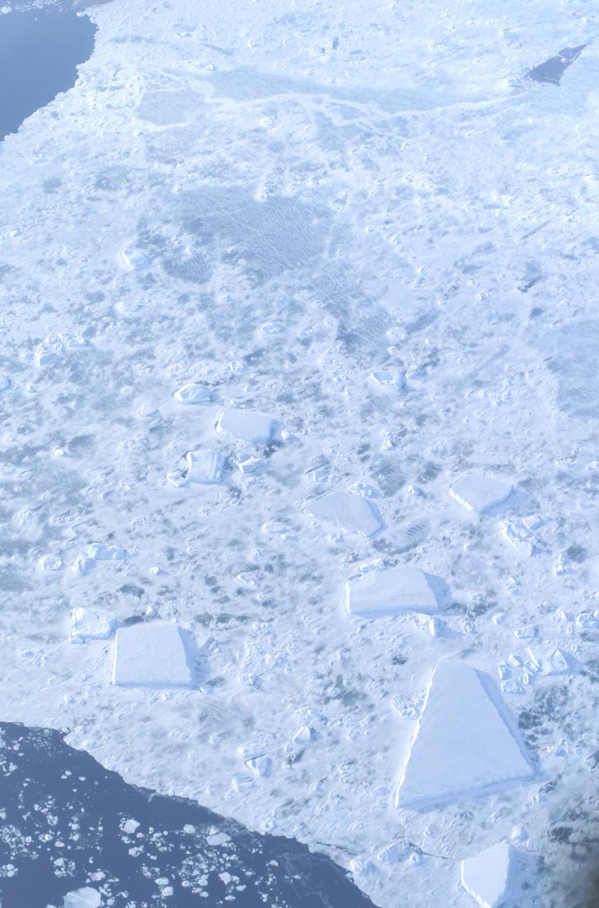
The Larsen Ice Shelf in Antarctica viewed from NASA's DC-8 aircraft during the AirSAR 2004 campaign. AirSAR 2004 is a three-week expedition in Central and South America by an international team of scientists that is using an all-weather imaging tool, called the Airborne Synthetic Aperture Radar (AirSAR), located onboard NASA's DC-8 airborne laboratory. Scientists from many parts of the world are combining ground research with NASA's AirSAR technology to improve and expand on the quality of research they are able to conduct. These photos are from the DC-8 aircraft while flying an AirSAR mission over Antarctica. The Antarctic Peninsula is more similar to Alaska and Patagonia than to the rest of the Antarctic continent. It is drained by fast glaciers, receives abundant precipitation, and melts significantly in the summer months. In recent decades, the Peninsula has experienced significant atmospheric warming (about 2 degrees C since 1950), which has triggered a vast and spectacular retreat of its floating ice shelves, glacier reduction, a decrease in permanent snow cover and a lengthening of the melt season. As a result, the contribution to sea level from this region could be rapid and substantial. With an area of 120,000 km, or ten times the Patagonia ice fields, the Peninsula could contribute as much as 0.4mm/yr sea level rise, which would be the largest single contribution to sea level from anywhere in the world. This region is being studied by NASA using a DC-8 equipped with the Airborne Synthetic Aperture Radar developed by scientists from NASA’s Jet Propulsion Laboratory. AirSAR will provide a baseline model and unprecedented mapping of the region. This data will make it possible to determine whether the warming trend is slowing, continuing or accelerating. AirSAR will also provide reliable information on ice shelf thickness to measure the contribution of the glaciers to sea level.

The Larsen Ice Shelf in Antarctica viewed from NASA's DC-8 aircraft during the AirSAR 2004 campaign. AirSAR 2004 is a three-week expedition in Central and South America by an international team of scientists that is using an all-weather imaging tool, called the Airborne Synthetic Aperture Radar (AirSAR), located onboard NASA's DC-8 airborne laboratory. Scientists from many parts of the world are combining ground research with NASA's AirSAR technology to improve and expand on the quality of research they are able to conduct. These photos are from the DC-8 aircraft while flying an AirSAR mission over Antarctica. The Antarctic Peninsula is more similar to Alaska and Patagonia than to the rest of the Antarctic continent. It is drained by fast glaciers, receives abundant precipitation, and melts significantly in the summer months. In recent decades, the Peninsula has experienced significant atmospheric warming (about 2 degrees C since 1950), which has triggered a vast and spectacular retreat of its floating ice shelves, glacier reduction, a decrease in permanent snow cover and a lengthening of the melt season. As a result, the contribution to sea level from this region could be rapid and substantial. With an area of 120,000 km, or ten times the Patagonia ice fields, the Peninsula could contribute as much as 0.4mm/yr sea level rise, which would be the largest single contribution to sea level from anywhere in the world. This region is being studied by NASA using a DC-8 equipped with an Airborne Synthetic Aperture Radar (AirSAR) developed by scientists from NASA’s Jet Propulsion Laboratory. AirSAR will provide a baseline model and unprecedented mapping of the region. This data will make it possible to determine whether the warming trend is slowing, continuing or accelerating. AirSAR will also provide reliable information on ice shelf thickness to measure the contribution of the glaciers to sea level.
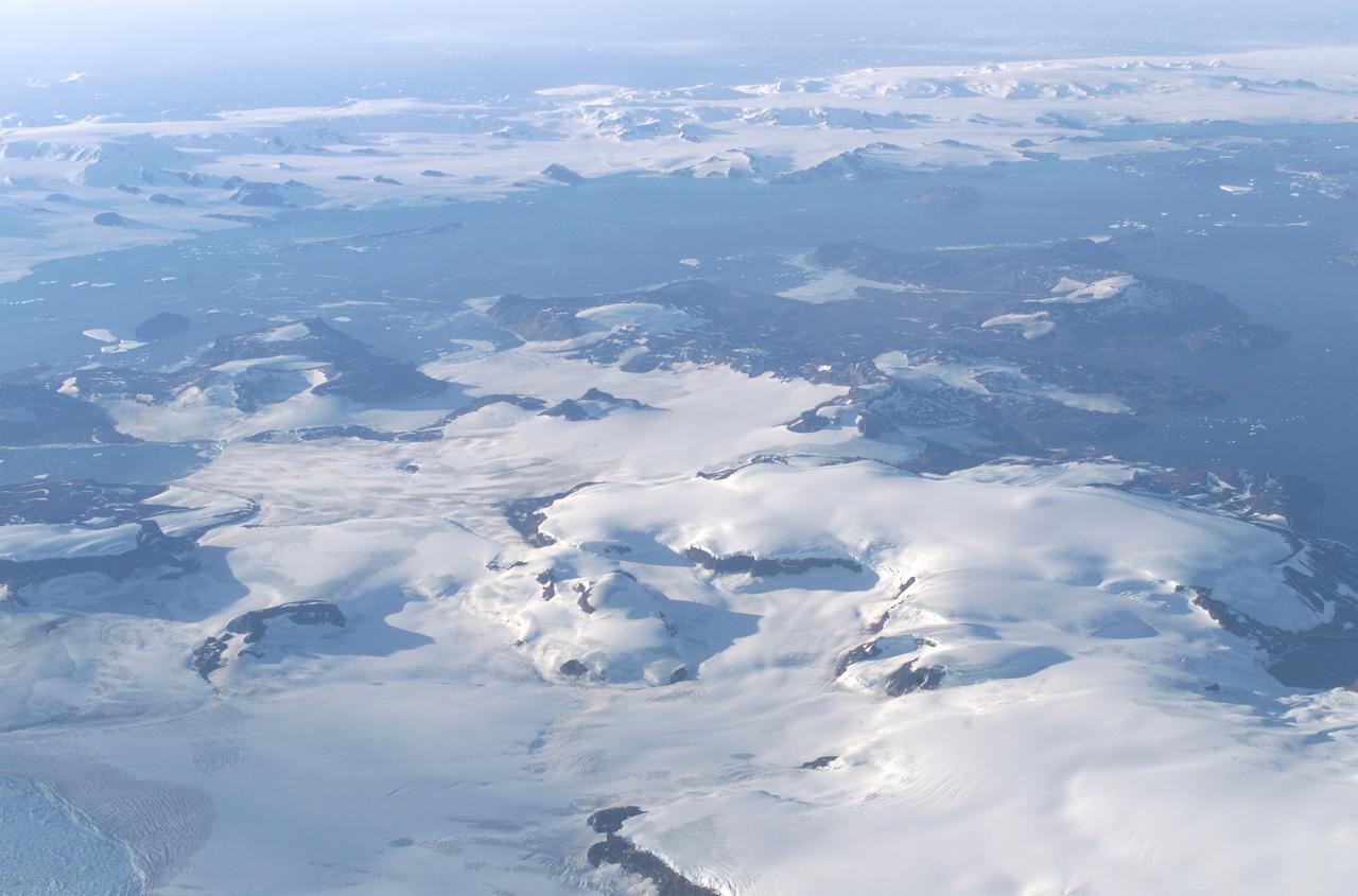
James Ross Island captured by NASA photographer James Ross(no relation), from NASA's DC-8 aircraft during an AirSAR 2004 mission over the Antarctic Peninsula. James Ross Island, named for 19th century British polar explorer Sir James Clark Ross, is located at the northern tip of the Antarctic Peninsula. The island is about 1500 m high and 40-60 km wide. In recent decades, the area has experienced significant atmospheric warming (about 2 degrees C since 1950), which has triggered a vast and spectacular retreat of its floating ice shelves, glacier reduction, a decrease in permanent snow cover and a lengthening of the melt season. AirSAR 2004 is a three-week expedition in Central and South America by an international team of scientists that is using an all-weather imaging tool, called the Airborne Synthetic Aperture Radar (AirSAR), located onboard NASA's DC-8 airborne laboratory. Scientists from many parts of the world are combining ground research with NASA's AirSAR technology to improve and expand on the quality of research they are able to conduct. These photos are from the DC-8 aircraft while flying an AirSAR mission over Antarctica. The Antarctic Peninsula is more similar to Alaska and Patagonia than to the rest of the Antarctic continent. It is drained by fast glaciers, receives abundant precipitation, and melts significantly in the summer months. This region is being studied by NASA using a DC-8 equipped with the Airborne Synthetic Aperture Radar developed by scientists from NASA’s Jet Propulsion Laboratory. AirSAR will provide a baseline model and unprecedented mapping of the region. This data will make it possible to determine whether the warming trend is slowing, continuing or accelerating. AirSAR will also provide reliable information on ice shelf thickness to measure the contribution of the glaciers to sea level.

The Larsen Ice Shelf in Antarctica viewed from NASA's DC-8 aircraft during the AirSAR 2004 campaign. AirSAR 2004 is a three-week expedition in Central and South America by an international team of scientists that is using an all-weather imaging tool, called the Airborne Synthetic Aperture Radar (AirSAR), located onboard NASA's DC-8 airborne laboratory. Scientists from many parts of the world are combining ground research with NASA's AirSAR technology to improve and expand on the quality of research they are able to conduct. These photos are from the DC-8 aircraft while flying an AirSAR mission over Antarctica. The Antarctic Peninsula is more similar to Alaska and Patagonia than to the rest of the Antarctic continent. It is drained by fast glaciers, receives abundant precipitation, and melts significantly in the summer months. In recent decades, the Peninsula has experienced significant atmospheric warming (about 2 degrees C since 1950), which has triggered a vast and spectacular retreat of its floating ice shelves, glacier reduction, a decrease in permanent snow cover and a lengthening of the melt season. As a result, the contribution to sea level from this region could be rapid and substantial. With an area of 120,000 km, or ten times the Patagonia ice fields, the Peninsula could contribute as much as 0.4mm/yr sea level rise, which would be the largest single contribution to sea level from anywhere in the world. This region is being studied by NASA using a DC-8 equipped with the Airborne Synthetic Aperture Radar developed by scientists from NASA’s Jet Propulsion Laboratory. AirSAR will provide a baseline model and unprecedented mapping of the region. This data will make it possible to determine whether the warming trend is slowing, continuing or accelerating. AirSAR will also provide reliable information on ice shelf thickness to measure the contribution of the glaciers to sea level.
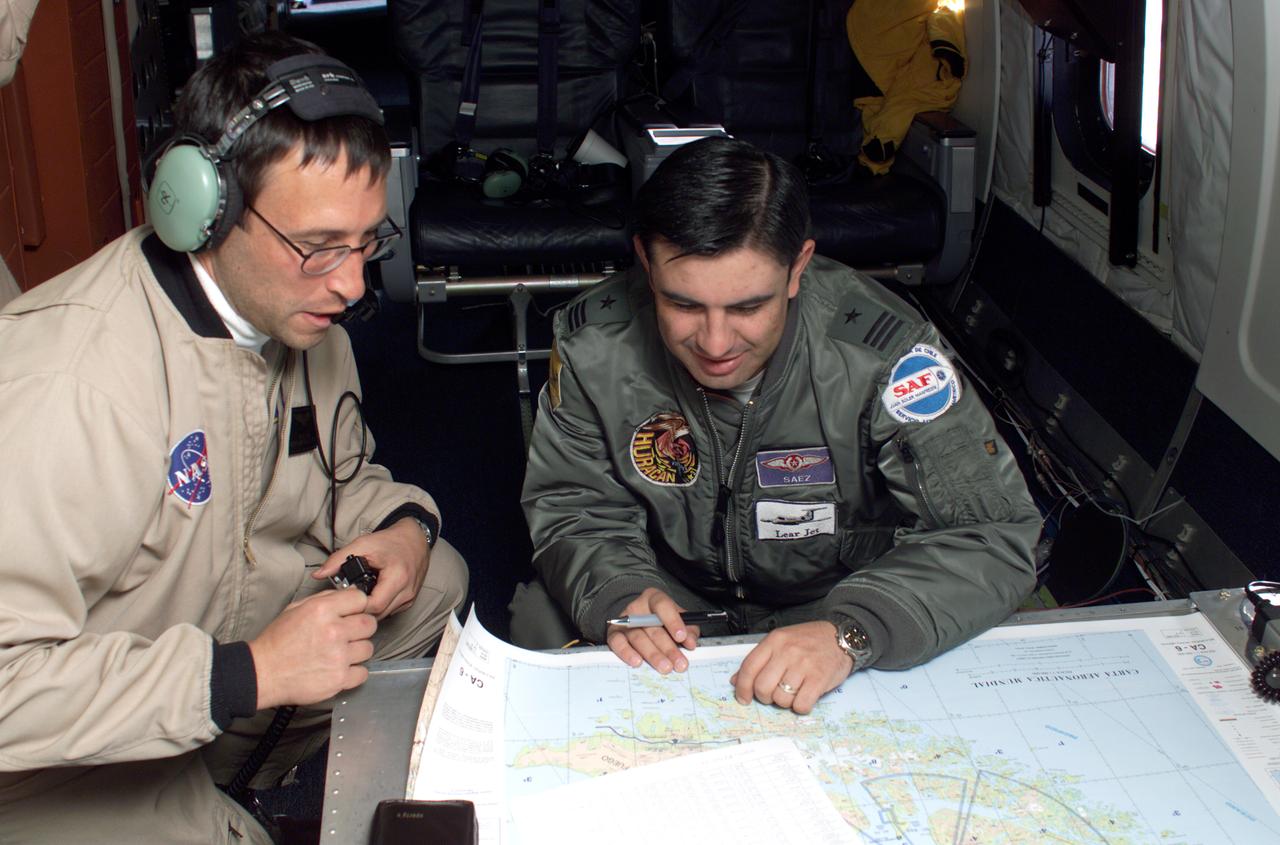
NASA DC-8 Mission Manager Walter Klein and Chilean Air Force Advisor Captain Saez review maps of the Antarctic Peninsula during an AirSAR 2004 mission. AirSAR 2004 is a three-week expedition in Central and South America by an international team of scientists that is using an all-weather imaging tool, called the Airborne Synthetic Aperture Radar (AirSAR), located onboard NASA's DC-8 airborne laboratory. Scientists from many parts of the world are combining ground research with NASA's AirSAR technology to improve and expand on the quality of research they are able to conduct. These photos are from the DC-8 aircraft while flying an AirSAR mission over Antarctica. The Antarctic Peninsula is more similar to Alaska and Patagonia than to the rest of the Antarctic continent. It is drained by fast glaciers, receives abundant precipitation, and melts significantly in the summer months. In recent decades, the Peninsula has experienced significant atmospheric warming (about 2 degrees C since 1950), which has triggered a vast and spectacular retreat of its floating ice shelves, glacier reduction, a decrease in permanent snow cover and a lengthening of the melt season. As a result, the contribution to sea level from this region could be rapid and substantial. With an area of 120,000 km, or ten times the Patagonia ice fields, the Peninsula could contribute as much as 0.4mm/yr sea level rise, which would be the largest single contribution to sea level from anywhere in the world. This region is being studied by NASA using a DC-8 equipped with the Airborne Synthetic Aperture Radar developed by scientists from NASA’s Jet Propulsion Laboratory. AirSAR will provide a baseline model and unprecedented mapping of the region. This data will make it possible to determine whether the warming trend is slowing, continuing or accelerating. AirSAR will also provide reliable information on ice shelf thickness to measure the contribution of the glaciers to sea level.
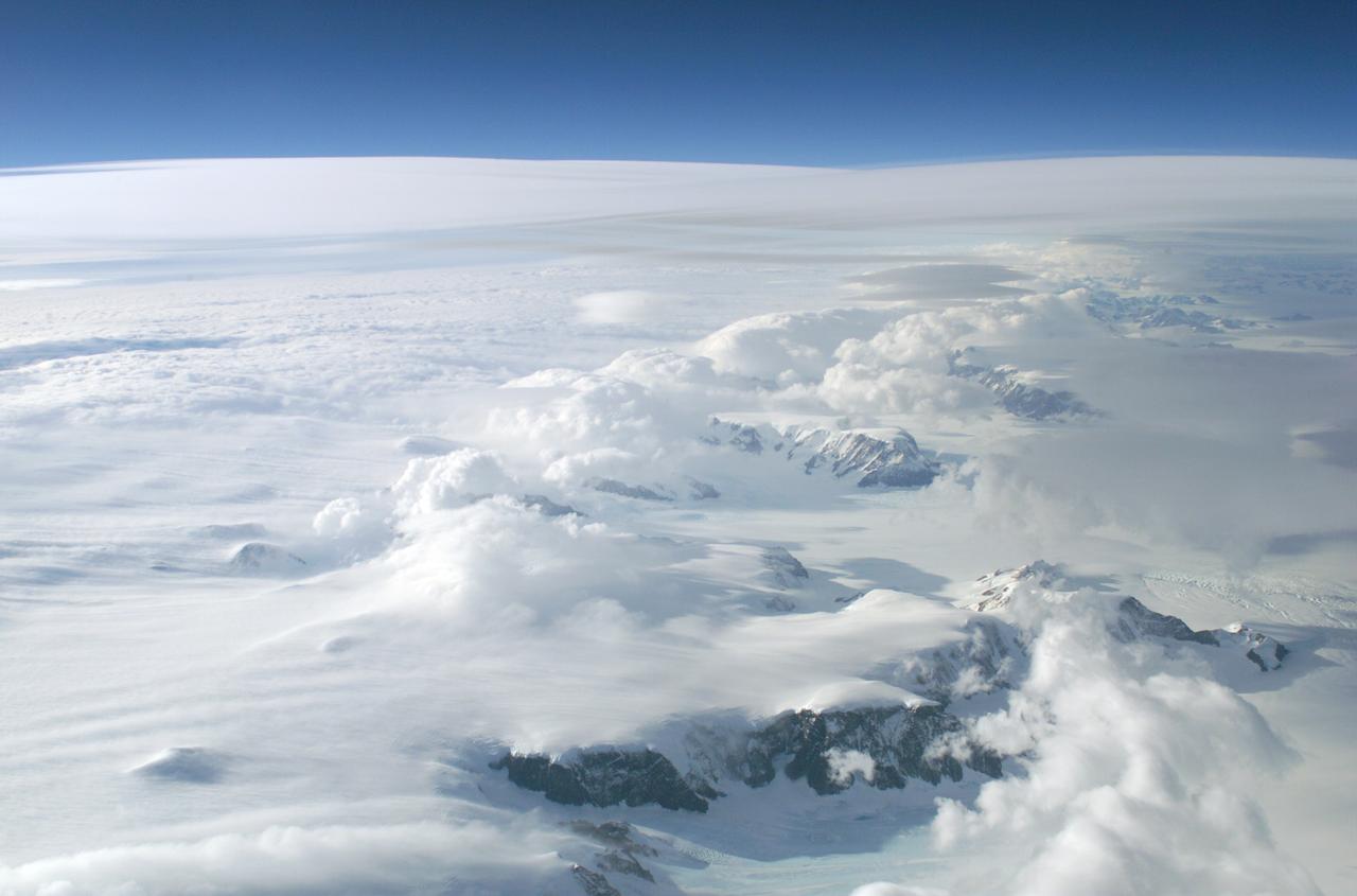
The Larsen Ice Shelf in Antarctica viewed from NASA's DC-8 aircraft during the AirSAR 2004 campaign. AirSAR 2004 is a three-week expedition in Central and South America by an international team of scientists that is using an all-weather imaging tool, called the Airborne Synthetic Aperture Radar (AirSAR), located onboard NASA's DC-8 airborne laboratory. Scientists from many parts of the world are combining ground research with NASA's AirSAR technology to improve and expand on the quality of research they are able to conduct. These photos are from the DC-8 aircraft while flying an AirSAR mission over Antarctica. The Antarctic Peninsula is more similar to Alaska and Patagonia than to the rest of the Antarctic continent. It is drained by fast glaciers, receives abundant precipitation, and melts significantly in the summer months. In recent decades, the Peninsula has experienced significant atmospheric warming (about 2 degrees C since 1950), which has triggered a vast and spectacular retreat of its floating ice shelves, glacier reduction, a decrease in permanent snow cover and a lengthening of the melt season. As a result, the contribution to sea level from this region could be rapid and substantial. With an area of 120,000 km, or ten times the Patagonia ice fields, the Peninsula could contribute as much as 0.4mm/yr sea level rise, which would be the largest single contribution to sea level from anywhere in the world. This region is being studied by NASA using a DC-8 equipped with the Airborne Synthetic Aperture Radar developed by scientists from NASA’s Jet Propulsion Laboratory. AirSAR will provide a baseline model and unprecedented mapping of the region. This data will make it possible to determine whether the warming trend is slowing, continuing or accelerating. AirSAR will also provide reliable information on ice shelf thickness to measure the contribution of the glaciers to sea level.
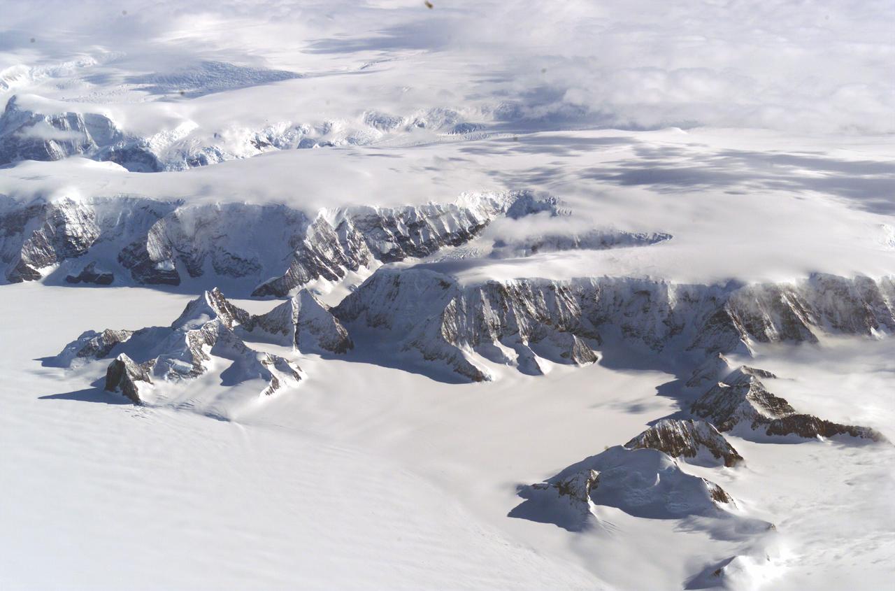
The Larsen Ice Shelf in Antarctica viewed from NASA's DC-8 aircraft during the AirSAR 2004 campaign. AirSAR 2004 is a three-week expedition in Central and South America by an international team of scientists that is using an all-weather imaging tool, called the Airborne Synthetic Aperture Radar (AirSAR), located onboard NASA's DC-8 airborne laboratory. Scientists from many parts of the world are combining ground research with NASA's AirSAR technology to improve and expand on the quality of research they are able to conduct. These photos are from the DC-8 aircraft while flying an AirSAR mission over Antarctica. The Antarctic Peninsula is more similar to Alaska and Patagonia than to the rest of the Antarctic continent. It is drained by fast glaciers, receives abundant precipitation, and melts significantly in the summer months. In recent decades, the Peninsula has experienced significant atmospheric warming (about 2 degrees C since 1950), which has triggered a vast and spectacular retreat of its floating ice shelves, glacier reduction, a decrease in permanent snow cover and a lengthening of the melt season. As a result, the contribution to sea level from this region could be rapid and substantial. With an area of 120,000 km, or ten times the Patagonia ice fields, the Peninsula could contribute as much as 0.4mm/yr sea level rise, which would be the largest single contribution to sea level from anywhere in the world. This region is being studied by NASA using a DC-8 equipped with the Airborne Synthetic Aperture Radar developed by scientists from NASA’s Jet Propulsion Laboratory. AirSAR will provide a baseline model and unprecedented mapping of the region. This data will make it possible to determine whether the warming trend is slowing, continuing or accelerating. AirSAR will also provide reliable information on ice shelf thickness to measure the contribution of the glaciers to sea level.
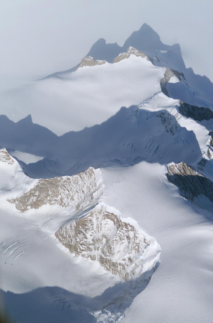
The Larsen Ice Shelf in Antarctica viewed from NASA's DC-8 aircraft during the AirSAR 2004 campaign. AirSAR 2004 is a three-week expedition in Central and South America by an international team of scientists that is using an all-weather imaging tool, called the Airborne Synthetic Aperture Radar (AirSAR), located onboard NASA's DC-8 airborne laboratory. Scientists from many parts of the world are combining ground research with NASA's AirSAR technology to improve and expand on the quality of research they are able to conduct. These photos are from the DC-8 aircraft while flying an AirSAR mission over Antarctica. The Antarctic Peninsula is more similar to Alaska and Patagonia than to the rest of the Antarctic continent. It is drained by fast glaciers, receives abundant precipitation, and melts significantly in the summer months. In recent decades, the Peninsula has experienced significant atmospheric warming (about 2 degrees C since 1950), which has triggered a vast and spectacular retreat of its floating ice shelves, glacier reduction, a decrease in permanent snow cover and a lengthening of the melt season. As a result, the contribution to sea level from this region could be rapid and substantial. With an area of 120,000 km, or ten times the Patagonia ice fields, the Peninsula could contribute as much as 0.4mm/yr sea level rise, which would be the largest single contribution to sea level from anywhere in the world. This region is being studied by NASA using a DC-8 equipped with the Airborne Synthetic Aperture Radar developed by scientists from NASA’s Jet Propulsion Laboratory. AirSAR will provide a baseline model and unprecedented mapping of the region. This data will make it possible to determine whether the warming trend is slowing, continuing or accelerating. AirSAR will also provide reliable information on ice shelf thickness to measure the contribution of the glaciers to sea level.
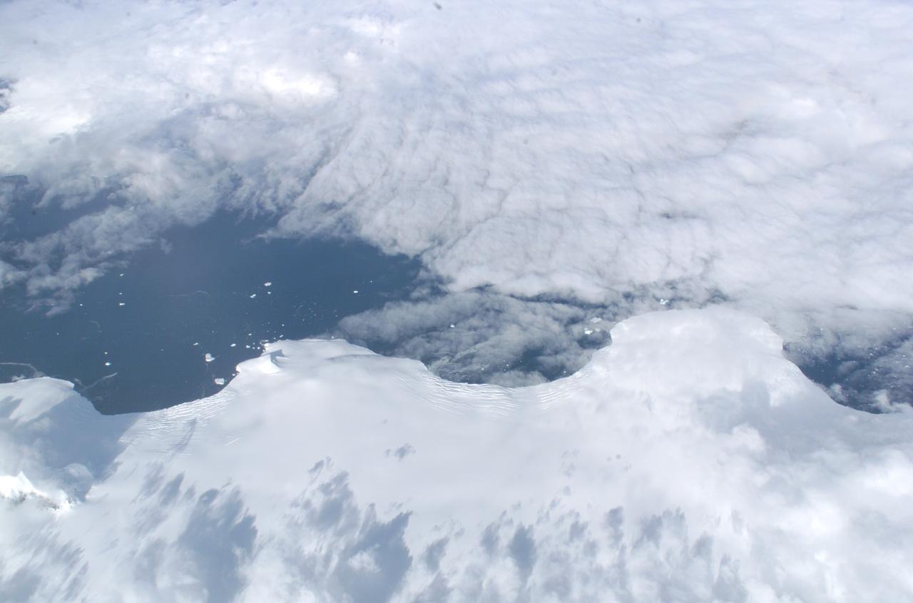
The Larsen Ice Shelf in Antarctica viewed from NASA's DC-8 aircraft during the AirSAR 2004 campaign. AirSAR 2004 is a three-week expedition in Central and South America by an international team of scientists that is using an all-weather imaging tool, called the Airborne Synthetic Aperture Radar (AirSAR), located onboard NASA's DC-8 airborne laboratory. Scientists from many parts of the world are combining ground research with NASA's AirSAR technology to improve and expand on the quality of research they are able to conduct. These photos are from the DC-8 aircraft while flying an AirSAR mission over Antarctica. The Antarctic Peninsula is more similar to Alaska and Patagonia than to the rest of the Antarctic continent. It is drained by fast glaciers, receives abundant precipitation, and melts significantly in the summer months. In recent decades, the Peninsula has experienced significant atmospheric warming (about 2 degrees C since 1950), which has triggered a vast and spectacular retreat of its floating ice shelves, glacier reduction, a decrease in permanent snow cover and a lengthening of the melt season. As a result, the contribution to sea level from this region could be rapid and substantial. With an area of 120,000 km, or ten times the Patagonia ice fields, the Peninsula could contribute as much as 0.4mm/yr sea level rise, which would be the largest single contribution to sea level from anywhere in the world. This region is being studied by NASA using a DC-8 equipped with the Airborne Synthetic Aperture Radar developed by scientists from NASA’s Jet Propulsion Laboratory. AirSAR will provide a baseline model and unprecedented mapping of the region. This data will make it possible to determine whether the warming trend is slowing, continuing or accelerating. AirSAR will also provide reliable information on ice shelf thickness to measure the contribution of the glaciers to sea level.
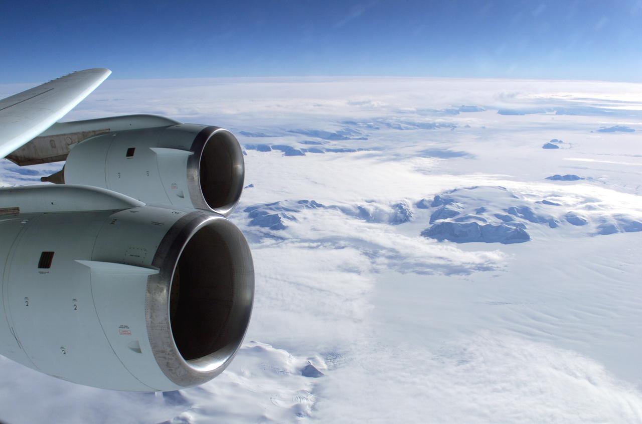
The Larsen Ice Shelf in Antarctica viewed from NASA's DC-8 aircraft during the AirSAR 2004 campaign. AirSAR 2004 is a three-week expedition in Central and South America by an international team of scientists that is using an all-weather imaging tool, called the Airborne Synthetic Aperture Radar (AirSAR), located onboard NASA's DC-8 airborne laboratory. Scientists from many parts of the world are combining ground research with NASA's AirSAR technology to improve and expand on the quality of research they are able to conduct. These photos are from the DC-8 aircraft while flying an AirSAR mission over Antarctica. The Antarctic Peninsula is more similar to Alaska and Patagonia than to the rest of the Antarctic continent. It is drained by fast glaciers, receives abundant precipitation, and melts significantly in the summer months. In recent decades, the Peninsula has experienced significant atmospheric warming (about 2 degrees C since 1950), which has triggered a vast and spectacular retreat of its floating ice shelves, glacier reduction, a decrease in permanent snow cover and a lengthening of the melt season. As a result, the contribution to sea level from this region could be rapid and substantial. With an area of 120,000 km, or ten times the Patagonia ice fields, the Peninsula could contribute as much as 0.4mm/yr sea level rise, which would be the largest single contribution to sea level from anywhere in the world. This region is being studied by NASA using a DC-8 equipped with the Airborne Synthetic Aperture Radar developed by scientists from NASA’s Jet Propulsion Laboratory. AirSAR will provide a baseline model and unprecedented mapping of the region. This data will make it possible to determine whether the warming trend is slowing, continuing or accelerating. AirSAR will also provide reliable information on ice shelf thickness to measure the contribution of the glaciers to sea level.

The Thurston Island calving front off of western Antarctica as seen from the window of NASA's DC-8 on Nov. 5, 2014. Image Credit: NASA/Jim Yungel NASA’s Operation IceBridge collected some rare images on a flight out of Punta Arenas, Chile on Nov. 5, 2014, on a science flight over western Antarctica dubbed Ferrigno-Alison-Abbott 01. The crew snapped a few shots of a calving front of the Antarctic ice sheet. This particular flight plan was designed to collect data on changes in ice elevation along the coast near the Ferrigno and Alison ice streams, on the Abbot Ice Shelf, and grounded ice along the Eights Coast.
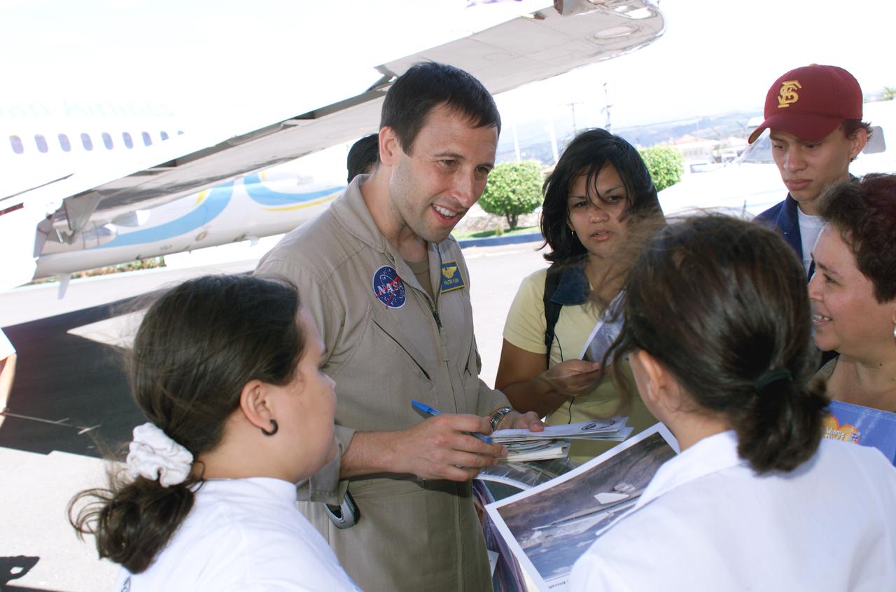
NASA Dryden Mission Manager Walter Klein passes out Airborne Science stickers and lithographs to underprivileged school children that visited the airport on Monday March 8, 2004. In spanish, he explained to them the mission of the DC-8 AirSAR 2004 Mesoamerican campaign in Costa Rica. AirSAR 2004 Mesoamerica is a three-week expedition by an international team of scientists that uses an all-weather imaging tool, called the Airborne Synthetic Aperture Radar (AirSAR) which is located onboard NASA's DC-8 airborne laboratory. Scientists from many parts of the world including NASA's Jet Propulsion Laboratory are combining ground research done in several areas in Central America with NASA's AirSAR technology to improve and expand on the quality of research they are able to conduct. The radar, developed by NASA's Jet Propulsion Laboratory, can penetrate clouds and also collect data at night. Its high-resolution sensors operate at multiple wavelengths and modes, allowing AirSAR to see beneath treetops, through thin sand, and dry snow pack. AirSAR's 2004 campaign is a collaboration of many U.S. and Central American institutions and scientists, including NASA; the National Science Foundation; the Smithsonian Institution; National Geographic; Conservation International; the Organization of Tropical Studies; the Central American Commission for Environment and Development; and the Inter-American Development Bank.
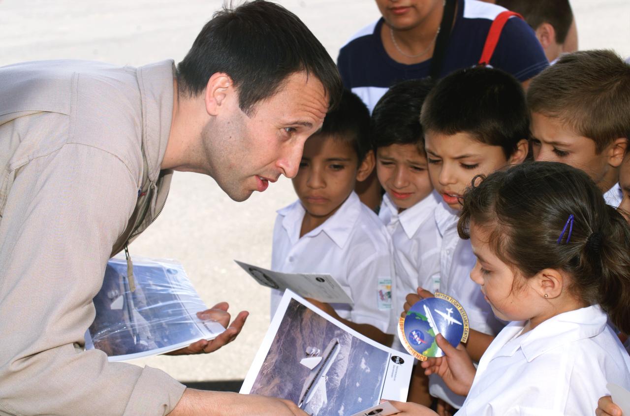
NASA Dryden Mission Manager Walter Klein passes out Airborne Science stickers and lithographs to underprivileged school children that visited the airport on Monday March 8, 2004. In spanish, he explained to them the mission of the DC-8 AirSAR 2004 Mesoamerican campaign in Costa Rica. AirSAR 2004 Mesoamerica is a three-week expedition by an international team of scientists that uses an all-weather imaging tool, called the Airborne Synthetic Aperture Radar (AirSAR) which is located onboard NASA's DC-8 airborne laboratory. Scientists from many parts of the world including NASA's Jet Propulsion Laboratory are combining ground research done in several areas in Central America with NASA's AirSAR technology to improve and expand on the quality of research they are able to conduct. The radar, developed by NASA's Jet Propulsion Laboratory, can penetrate clouds and also collect data at night. Its high-resolution sensors operate at multiple wavelengths and modes, allowing AirSAR to see beneath treetops, through thin sand, and dry snow pack. AirSAR's 2004 campaign is a collaboration of many U.S. and Central American institutions and scientists, including NASA; the National Science Foundation; the Smithsonian Institution; National Geographic; Conservation International; the Organization of Tropical Studies; the Central American Commission for Environment and Development; and the Inter-American Development Bank.

NASA Dryden Mission Manager Walter Klein passes out Airborne Science stickers and lithographs to underprivileged school children that visited the airport on Monday March 8, 2004. In spanish, he explained to them the mission of the DC-8 AirSAR 2004 Mesoamerican campaign in Costa Rica. AirSAR 2004 Mesoamerica is a three-week expedition by an international team of scientists that uses an all-weather imaging tool, called the Airborne Synthetic Aperture Radar (AirSAR) which is located onboard NASA's DC-8 airborne laboratory. Scientists from many parts of the world including NASA's Jet Propulsion Laboratory are combining ground research done in several areas in Central America with NASA's AirSAR technology to improve and expand on the quality of research they are able to conduct. The radar, developed by NASA's Jet Propulsion Laboratory, can penetrate clouds and also collect data at night. Its high-resolution sensors operate at multiple wavelengths and modes, allowing AirSAR to see beneath treetops, through thin sand, and dry snow pack. AirSAR's 2004 campaign is a collaboration of many U.S. and Central American institutions and scientists, including NASA; the National Science Foundation; the Smithsonian Institution; National Geographic; Conservation International; the Organization of Tropical Studies; the Central American Commission for Environment and Development; and the Inter-American Development Bank.

VIP’s onboard NASA's DC-8 aircraft during the AirSAR 2004 Mesoamerica campaign, L-R: Mr. John Danilovich, US Ambassador to Costa Rica; Dr. Gahssem Asrar, NASA Associate Administrator for Earth Science Enterprises; Dr. Sonia Marta Mora, President of the Costa Rican National Rector’s Council; and Fernando Gutierrez, Costa Rican Minister of Science and Technology(MICIT). AirSAR 2004 Mesoamerica is a three-week expedition by an international team of scientists that will use an all-weather imaging tool, called the Airborne Synthetic Aperture Radar (AirSAR), in a mission ranging from the tropical rain forests of Central America to frigid Antarctica.
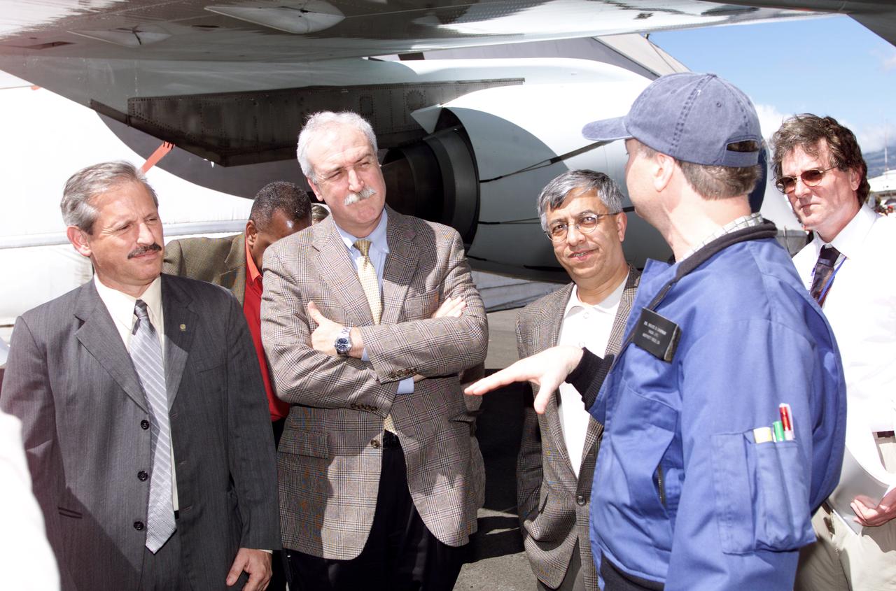
Personnel viewing AirSAR hardware while touring the outside of NASA's DC-8 during a stop-off on the AirSAR 2004 Mesoamerica campaign, L-R: Fernando Gutierrez, Costa Rican Minister of Science and Technology(MICIT); NASA Administrator Sean O'Keefe; Dr. Gahssem Asrar, NASA Associate Administrator for Earth Science Enterprises; JPL scientist Bruce Chapman; and Craig Dobson, NASA Program Manager for AirSAR. AirSAR 2004 Mesoamerica is a three-week expedition by an international team of scientists that will use an all-weather imaging tool, called the Airborne Synthetic Aperture Radar (AirSAR), in a mission ranging from the tropical rain forests of Central America to frigid Antarctica.

NASA’s Operation IceBridge collected some rare images on a flight out of Punta Arenas, Chile on Nov. 5, 2014, on a science flight over western Antarctica dubbed Ferrigno-Alison-Abbott 01. Following a routine calibration pass over Punta Arenas airport, the NASA DC-8 overflew the USS Constellation which is being towed for demolition after 53 yeas of service. The crew then snapped a few shots of a calving front of the Antarctic ice sheet. This particular flight plan was designed to collect data on changes in ice elevation along the coast near the Ferrigno and Alison ice streams, on the Abbot Ice Shelf, and grounded ice along the Eights Coast.
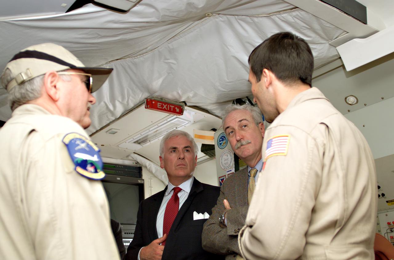
Dr. Tom Mace, NASA DFRC Director of Airborne Sciences, and Walter Klein(far right), NASA DFRC Airborne Science Mission Manager, brief John Danilovich, US Ambassador to Costa Rica, and NASA Administrator Sean O'Keefe onboard NASA's DC-8 during a stop-off on the AirSAR 2004 Mesoamerica campaign. AirSAR 2004 Mesoamerica is a three-week expedition by an international team of scientists that will use an all-weather imaging tool, called the Airborne Synthetic Aperture Radar (AirSAR), in a mission ranging from the tropical rain forests of Central America to frigid Antarctica.

VIP tour of NASA DFRC's DC-8 airborne laboratory during the AirSAR 2004 Mesoamerica campaign given by Craig Dobson, NASA Program Manager for AirSAR, L-R: Dr. Sonia Marta Mora, President of the Costa Rican National Rector’s Council; NASA Administrator Sean O'Keefe; Fernando Gutierrez, Costa Rican Minister of Science and Technology(MICIT); Mr. John Danilovich, US Ambassador to Costa Rica; and Dobson. AirSAR 2004 Mesoamerica is a three-week expedition by an international team of scientists that will use an all-weather imaging tool, called the Airborne Synthetic Aperture Radar (AirSAR), in a mission ranging from the tropical rain forests of Central America to frigid Antarctica.
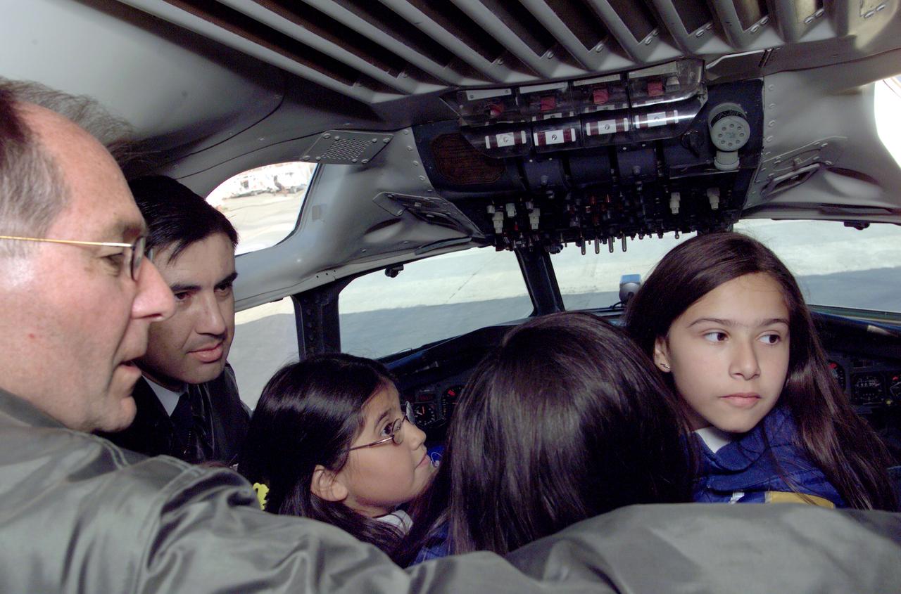
Pilot Bill Brockett (left) and Chilean Air Force Captain Saez with school children in the cockpit of NASA Dryden's DC-8 flying laboratory. Brockett explained NASA's AirSAR 2004 mission in Chile. AirSAR 2004 is a three-week expedition by an international team of scientists that uses an all-weather imaging tool, called the Airborne Synthetic Aperture Radar (AirSAR) which is located onboard NASA's DC-8 airborne laboratory. Scientists from many parts of the world including NASA's Jet Propulsion Laboratory are combining ground research done in several areas in Central and South America with NASA's AirSAR technology to improve and expand on the quality of research they are able to conduct. In South America and Antarctica, AirSAR collected imagery and data to help determine the contribution of Southern Hemisphere glaciers to sea level rise due to climate change. In Patagonia, researchers found this contribution had more than doubled from 1995 to 2000, compared to the previous 25 years. AirSAR data will make it possible to determine whether that trend is continuing or accelerating. AirSAR will also provide reliable information on ice shelf thickness to measure the contribution of the glaciers to sea level.
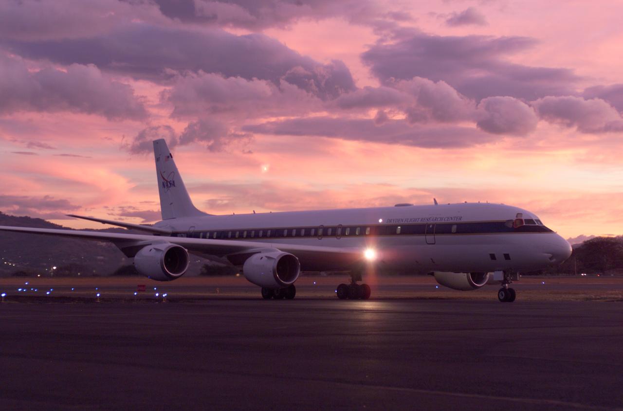
NASA's DC-8 flying laboratory seen at sunset after a flight supporting the AirSAR 2004 Mesoamerica campaign. AirSAR 2004 Mesoamerica is a three-week expedition by an international team of scientists that uses an all-weather imaging tool, called the Airborne Synthetic Aperture Radar (AirSAR) which is located onboard NASA's DC-8 airborne laboratory. Scientists from many parts of the world including NASA's Jet Propulsion Laboratory are combining ground research done in several areas in Central America with NASA's AirSAR technology to improve and expand on the quality of research they are able to conduct. The radar, developed by NASA's Jet Propulsion Laboratory, can penetrate clouds and also collect data at night. Its high-resolution sensors operate at multiple wavelengths and modes, allowing AirSAR to see beneath treetops, through thin sand, and dry snow pack. AirSAR's 2004 campaign is a collaboration of many U.S. and Central American institutions and scientists, including NASA; the National Science Foundation; the Smithsonian Institution; National Geographic; Conservation International; the Organization of Tropical Studies; the Central American Commission for Environment and Development; and the Inter-American Development Bank.
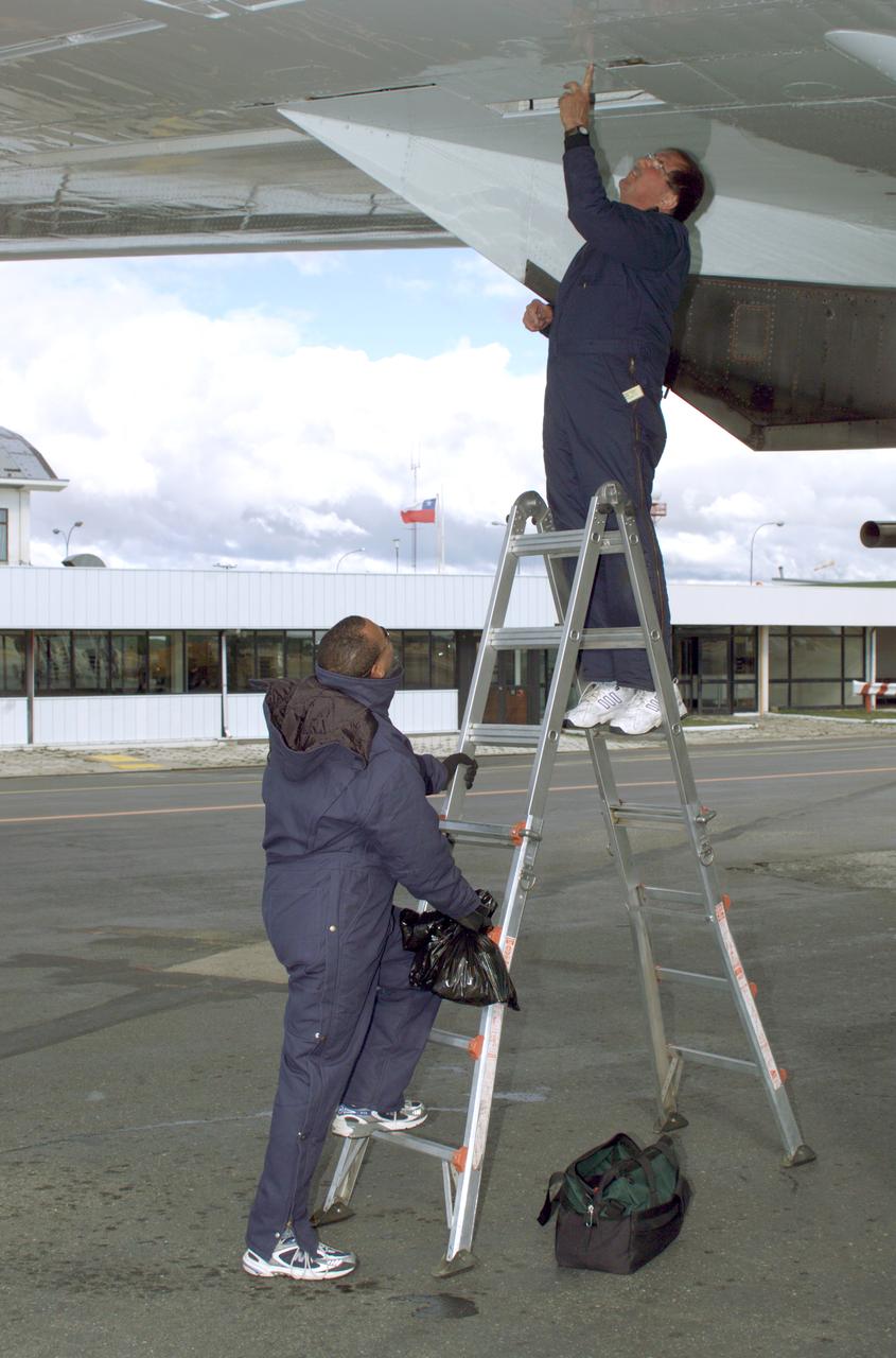
NASA DC-8 Ground Support Technicians Mark Corlew and Mike Lakowski perform routine maintenance on the aircraft at Carlos Ibanez del Campo International Airport in Punta Arenas, Chile. AirSAR 2004 is a three-week expedition by an international team of scientists that is using an all-weather imaging tool, called the Airborne Synthetic Aperture Radar (AirSAR) which is located onboard NASA's DC-8 airborne laboratory. Scientists from many parts of the world including NASA's Jet Propulsion Laboratory are combining ground research done in several areas in Central and South America with NASA's AirSAR technology to improve and expand on the quality of research they are able to conduct. In South America and Antarctica, AirSAR will collect imagery and data to help determine the contribution of Southern Hemisphere glaciers to sea level rise due to climate change. In Patagonia, researchers found this contribution had more than doubled from 1995 to 2000, compared to the previous 25 years. AirSAR data will make it possible to determine whether that trend is decreasing, continuing or accelerating. AirSAR will also provide reliable information on ice shelf thickness to measure the contribution of the glaciers to sea level.
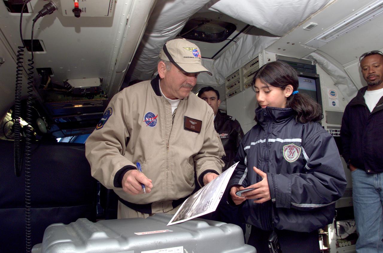
Dr. Tom Mace, NASA DFRC Director of Airborne Sciences, talks with a student from Punta Arenas, Chile, during a tour of the DC-8 aircraft while it was in the country supporting the AirSAR 2004 campaign. AirSAR 2004 is a three-week expedition by an international team of scientists that uses an all-weather imaging tool, called the Airborne Synthetic Aperture Radar (AirSAR) which is located onboard NASA's DC-8 airborne laboratory. Scientists from many parts of the world including NASA's Jet Propulsion Laboratory are combining ground research done in several areas in Central and South America with NASA's AirSAR technology to improve and expand on the quality of research they are able to conduct. In South America and Antarctica, AirSAR collected imagery and data to help determine the contribution of Southern Hemisphere glaciers to sea level rise due to climate change. In Patagonia, researchers found this contribution had more than doubled from 1995 to 2000, compared to the previous 25 years. AirSAR data will make it possible to determine whether that trend is continuing or accelerating. AirSAR will also provide reliable information on ice shelf thickness to measure the contribution of the glaciers to sea level.

NASA's DC-8 flying laboratory seen at sunset after a flight supporting the AirSAR 2004 Mesoamerica campaign. AirSAR 2004 Mesoamerica is a three-week expedition by an international team of scientists that uses an all-weather imaging tool, called the Airborne Synthetic Aperture Radar (AirSAR) which is located onboard NASA's DC-8 airborne laboratory. Scientists from many parts of the world including NASA's Jet Propulsion Laboratory are combining ground research done in several areas in Central America with NASA's AirSAR technology to improve and expand on the quality of research they are able to conduct. The radar, developed by NASA's Jet Propulsion Laboratory, can penetrate clouds and also collect data at night. Its high-resolution sensors operate at multiple wavelengths and modes, allowing AirSAR to see beneath treetops, through thin sand, and dry snow pack. AirSAR's 2004 campaign is a collaboration of many U.S. and Central American institutions and scientists, including NASA; the National Science Foundation; the Smithsonian Institution; National Geographic; Conservation International; the Organization of Tropical Studies; the Central American Commission for Environment and Development; and the Inter-American Development Bank.
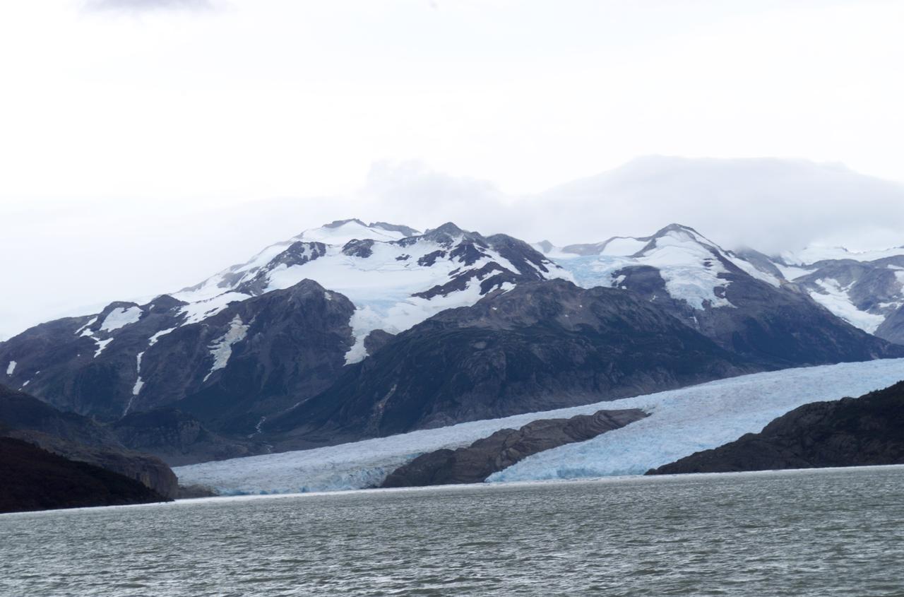
Glacier Grey view from Lago Grey (Grey Lake), photographed during NASA's AirSAR 2004 campaign in Chile. Land visible in this photo was covered by glacier just 6 years earlier. AirSAR 2004 is a three-week expedition in Central and South America by an international team of scientists that is using an all-weather imaging tool, called the Airborne Synthetic Aperture Radar (AirSAR), located onboard NASA's DC-8 airborne laboratory. Scientists from many parts of the world are combining ground research with NASA's AirSAR technology to improve and expand on the quality of research they are able to conduct. Founded in 1959, Torres del Paine National Park encompasses 450,000 acres in the Patagonia region of Chile. This region is being studied by NASA using a DC-8 equipped with an Airborne Synthetic Aperture Radar (AirSAR) developed by scientists from NASA’s Jet Propulsion Laboratory. This is a very sensitive region that is important to scientists because the temperature has been consistently rising causing a subsequent melting of the region’s glaciers. AirSAR will provide a baseline model and unprecedented mapping of the region. This data will make it possible to determine whether the warming trend is slowing, continuing or accelerating. AirSAR will also provide reliable information on ice shelf thickness to measure the contribution of the glaciers to sea level.
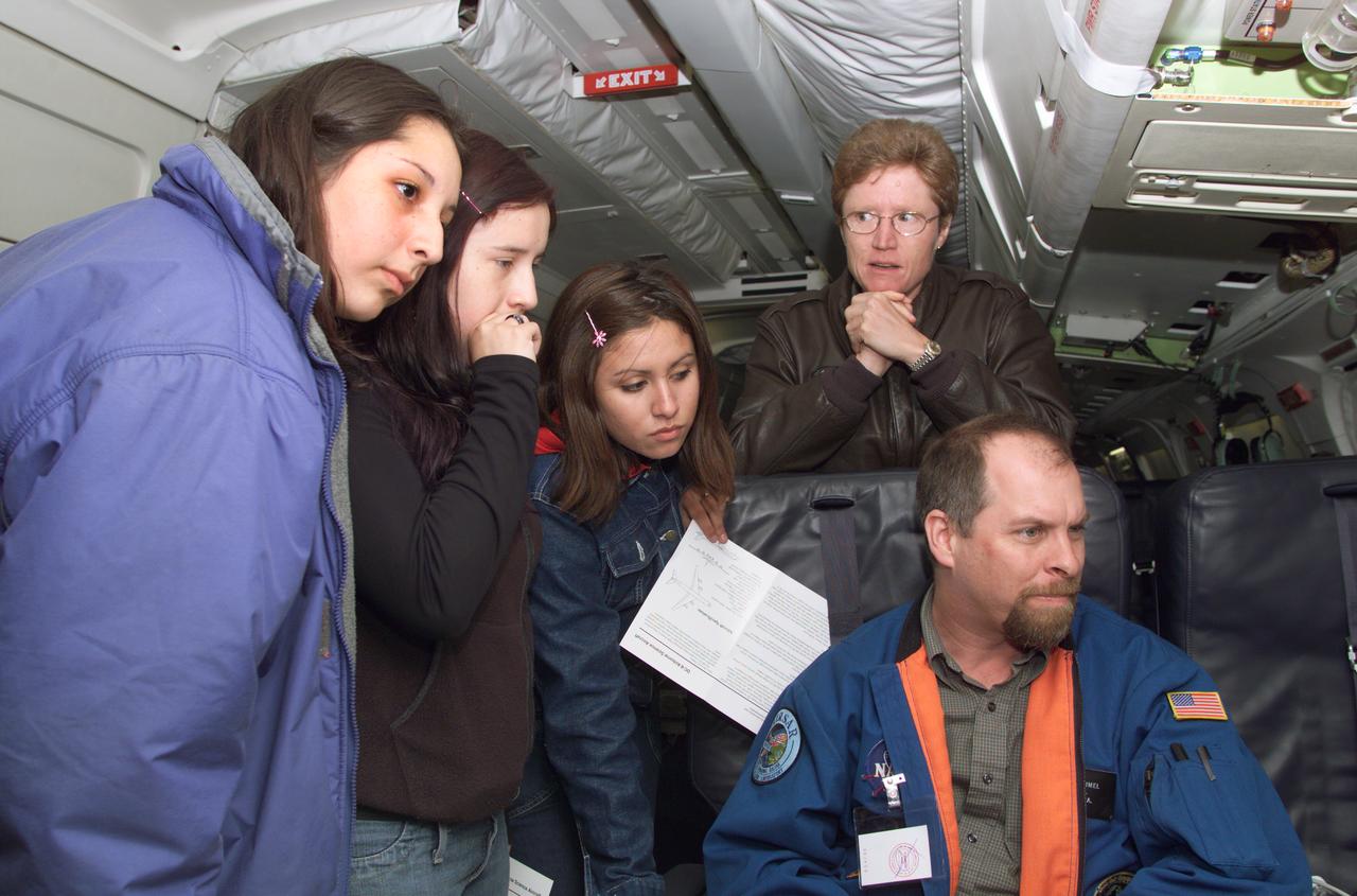
JPL scientist Dr. David Imel and U.S. Air Force Colonel Gwen Linde, the Defense Department Attache Officer assigned to the Chilean Embassy, lead Chilean students on a tour of the DC-8 aircraft at Carlos Ibanez del Campo International Airport in Punta Arenas, Chile. AirSAR 2004 is a three-week expedition by an international team of scientists that is using an all-weather imaging tool, called the Airborne Synthetic Aperture Radar (AirSAR) which is located onboard NASA's DC-8 airborne laboratory. Scientists from many parts of the world including NASA's Jet Propulsion Laboratory are combining ground research done in several areas in Central and South America with NASA's AirSAR technology to improve and expand on the quality of research they are able to conduct. In South America and Antarctica, AirSAR will collect imagery and data to help determine the contribution of Southern Hemisphere glaciers to sea level rise due to climate change. In Patagonia, researchers found this contribution had more than doubled from 1995 to 2000, compared to the previous 25 years. AirSAR data will make it possible to determine whether that trend is decreasing, continuing or accelerating. AirSAR will also provide reliable information on ice shelf thickness to measure the contribution of the glaciers to sea level.
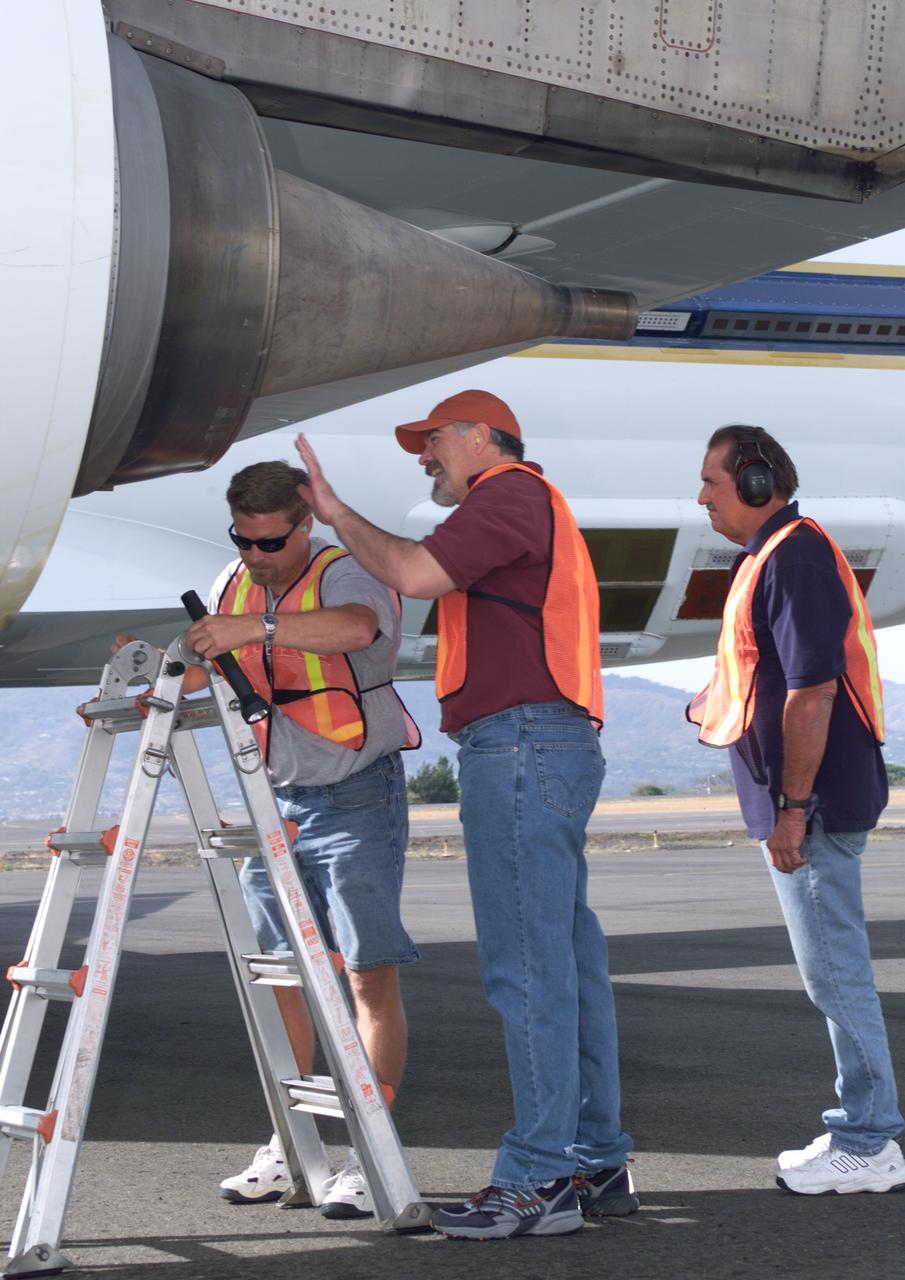
NASA Dryden DC-8 maintenance crew members inspect the aircraft prior to take-off. L-R; Scott Silver, Paul Ristrim and Mike Lakowski. AirSAR 2004 Mesoamerica is a three-week expedition by an international team of scientists that uses an all-weather imaging tool, called the Airborne Synthetic Aperture Radar (AirSAR) which is located onboard NASA's DC-8 airborne laboratory. Scientists from many parts of the world including NASA's Jet Propulsion Laboratory are combining ground research done in several areas in Central America with NASA's AirSAR technology to improve and expand on the quality of research they are able to conduct. The radar, developed by NASA's Jet Propulsion Laboratory, can penetrate clouds and also collect data at night. Its high-resolution sensors operate at multiple wavelengths and modes, allowing AirSAR to see beneath treetops, through thin sand, and dry snow pack. AirSAR's 2004 campaign is a collaboration of many U.S. and Central American institutions and scientists, including NASA; the National Science Foundation; the Smithsonian Institution; National Geographic; Conservation International; the Organization of Tropical Studies; the Central American Commission for Environment and Development; and the Inter-American Development Bank.

Chilean Air Force Captain Saez and Dr. Tom Mace, DFRC Director of Airborne Sciences, discuss airborne science during a DC-8 ferry flight from Santiago to Punta Arenas, Chile. AirSAR 2004 is a three-week expedition by an international team of scientists that uses an all-weather imaging tool, called the Airborne Synthetic Aperture Radar (AirSAR) which is located onboard NASA's DC-8 airborne laboratory. Scientists from many parts of the world including NASA's Jet Propulsion Laboratory are combining ground research done in several areas in Central and South America with NASA's AirSAR technology to improve and expand on the quality of research they are able to conduct. In South America and Antarctica, AirSAR collected imagery and data to help determine the contribution of Southern Hemisphere glaciers to sea level rise due to climate change. In Patagonia, researchers found this contribution had more than doubled from 1995 to 2000, compared to the previous 25 years. AirSAR data will make it possible to determine whether that trend is continuing or accelerating. AirSAR will also provide reliable information on ice shelf thickness to measure the contribution of the glaciers to sea level.

NASA Dryden Mission Manager Walter Klein poses with school children that visited the airport during AirSAR 2004. In spanish, he explained to them the mission of the DC-8 AirSAR 2004 Mesoamerican campaign in Costa Rica. AirSAR 2004 Mesoamerica is a three-week expedition by an international team of scientists that uses an all-weather imaging tool, called the Airborne Synthetic Aperture Radar (AirSAR) which is located onboard NASA's DC-8 airborne laboratory. Scientists from many parts of the world including NASA's Jet Propulsion Laboratory are combining ground research done in several areas in Central America with NASA's AirSAR technology to improve and expand on the quality of research they are able to conduct. The radar, developed by NASA's Jet Propulsion Laboratory, can penetrate clouds and also collect data at night. Its high-resolution sensors operate at multiple wavelengths and modes, allowing AirSAR to see beneath treetops, through thin sand, and dry snow pack. AirSAR's 2004 campaign is a collaboration of many U.S. and Central American institutions and scientists, including NASA; the National Science Foundation; the Smithsonian Institution; National Geographic; Conservation International; the Organization of Tropical Studies; the Central American Commission for Environment and Development; and the Inter-American Development Bank.
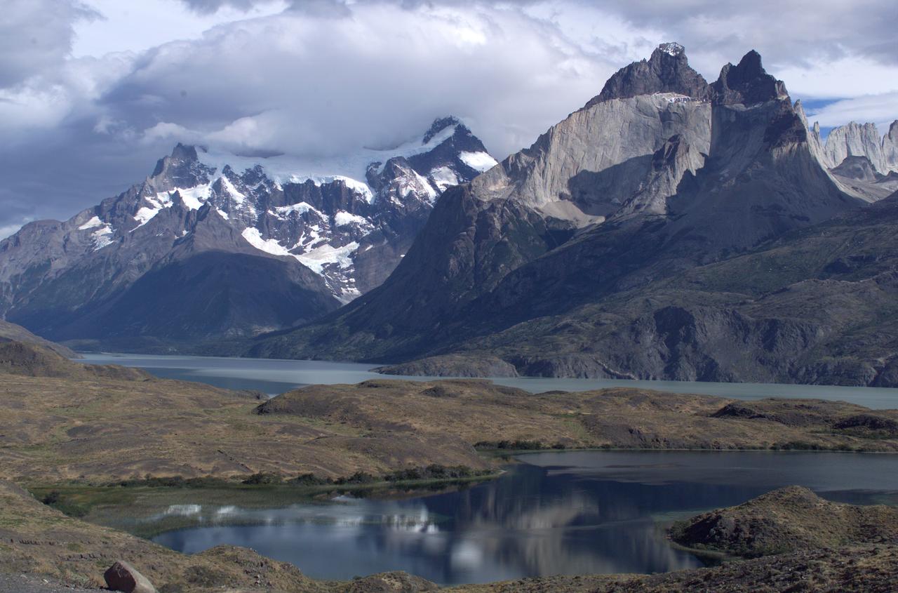
The Cuernos del Paine mountains in Torres del Paine National Park, Chile, during NASA's AirSAR 2004 campaign. AirSAR 2004 is a three-week expedition in Central and South America by an international team of scientists that is using an all-weather imaging tool, called the Airborne Synthetic Aperture Radar (AirSAR), located onboard NASA's DC-8 airborne laboratory. Scientists from many parts of the world are combining ground research with NASA's AirSAR technology to improve and expand on the quality of research they are able to conduct. Founded in 1959, Torres del Paine National Park encompasses 450,000 acres in the Patagonia region of Chile. This region is being studied by NASA using a DC-8 equipped with an Airborne Synthetic Aperture Radar (AirSAR) developed by scientists from NASA’s Jet Propulsion Laboratory. This is a very sensitive region that is important to scientists because the temperature has been consistently rising causing a subsequent melting of the region’s glaciers. AirSAR will provide a baseline model and unprecedented mapping of the region. This data will make it possible to determine whether the warming trend is slowing, continuing or accelerating. AirSAR will also provide reliable information on ice shelf thickness to measure the contribution of the glaciers to sea level.
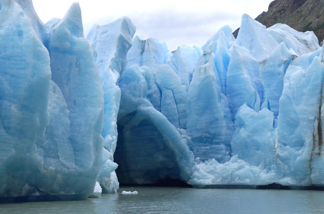
A cave in Glacier Grey in Torres del Paine National Park, seen during NASA's AirSAR 2004 campaign in Chile. AirSAR 2004 is a three-week expedition in Central and South America by an international team of scientists that is using an all-weather imaging tool, called the Airborne Synthetic Aperture Radar (AirSAR), located onboard NASA's DC-8 airborne laboratory. Scientists from many parts of the world are combining ground research with NASA's AirSAR technology to improve and expand on the quality of research they are able to conduct. Founded in 1959, Torres del Paine National Park encompasses 450,000 acres in the Patagonia region of Chile. This region is being studied by NASA using a DC-8 equipped with an Airborne Synthetic Aperture Radar (AirSAR) developed by scientists from NASA’s Jet Propulsion Laboratory. This is a very sensitive region that is important to scientists because the temperature has been consistently rising causing a subsequent melting of the region’s glaciers. AirSAR will provide a baseline model and unprecedented mapping of the region. This data will make it possible to determine whether the warming trend is slowing, continuing or accelerating. AirSAR will also provide reliable information on ice shelf thickness to measure the contribution of the glaciers to sea level.
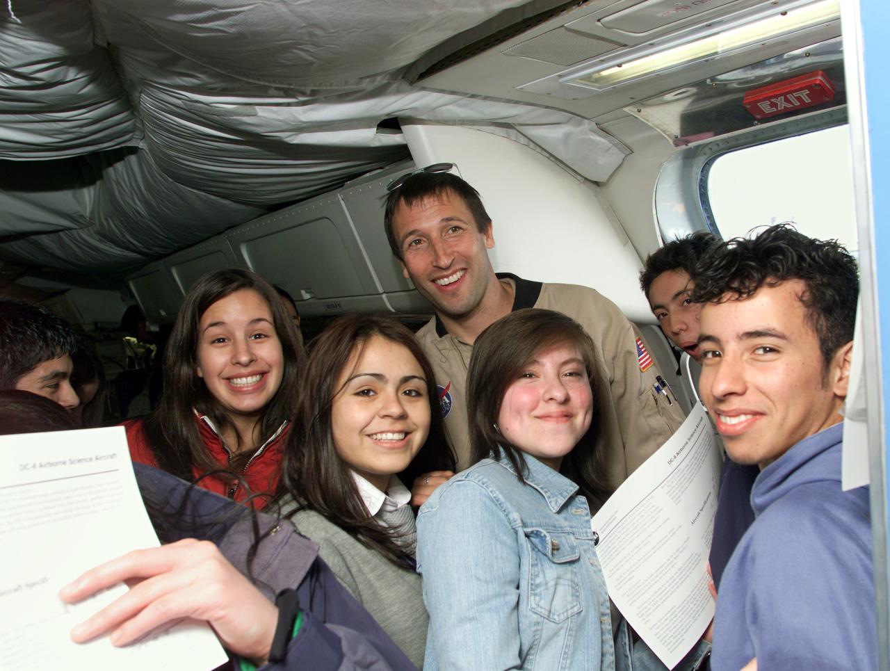
NASA DC-8 Mission Manager Walter Klein poses with a group of Chilean Students onboard the aircraft at Carlos Ibanez del Campo International Airport in Punta Arenas, Chile. AirSAR 2004 is a three-week expedition by an international team of scientists that is using an all-weather imaging tool, called the Airborne Synthetic Aperture Radar (AirSAR) which is located onboard NASA's DC-8 airborne laboratory. Scientists from many parts of the world including NASA's Jet Propulsion Laboratory are combining ground research done in several areas in Central and South America with NASA's AirSAR technology to improve and expand on the quality of research they are able to conduct. In South America and Antarctica, AirSAR will collect imagery and data to help determine the contribution of Southern Hemisphere glaciers to sea level rise due to climate change. In Patagonia, researchers found this contribution had more than doubled from 1995 to 2000, compared to the previous 25 years. AirSAR data will make it possible to determine whether that trend is decreasing, continuing or accelerating. AirSAR will also provide reliable information on ice shelf thickness to measure the contribution of the glaciers to sea level.
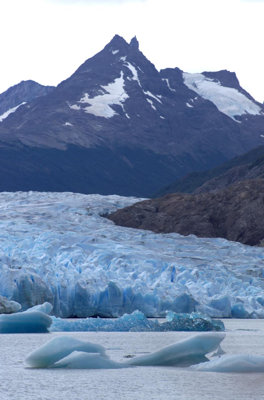
Glacier Grey in front of the Cuernos del Paine mountains, photographed from Lago Grey (Grey Lake) during NASA's AirSAR 2004 campaign in Chile. AirSAR 2004 is a three-week expedition in Central and South America by an international team of scientists that is using an all-weather imaging tool, called the Airborne Synthetic Aperture Radar (AirSAR), located onboard NASA's DC-8 airborne laboratory. Scientists from many parts of the world are combining ground research with NASA's AirSAR technology to improve and expand on the quality of research they are able to conduct. Founded in 1959, Torres del Paine National Park encompasses 450,000 acres in the Patagonia region of Chile. This region is being studied by NASA using a DC-8 equipped with an Airborne Synthetic Aperture Radar (AirSAR) developed by scientists from NASA’s Jet Propulsion Laboratory. This is a very sensitive region that is important to scientists because the temperature has been consistently rising causing a subsequent melting of the region’s glaciers. AirSAR will provide a baseline model and unprecedented mapping of the region. This data will make it possible to determine whether the warming trend is slowing, continuing or accelerating. AirSAR will also provide reliable information on ice shelf thickness to measure the contribution of the glaciers to sea level.
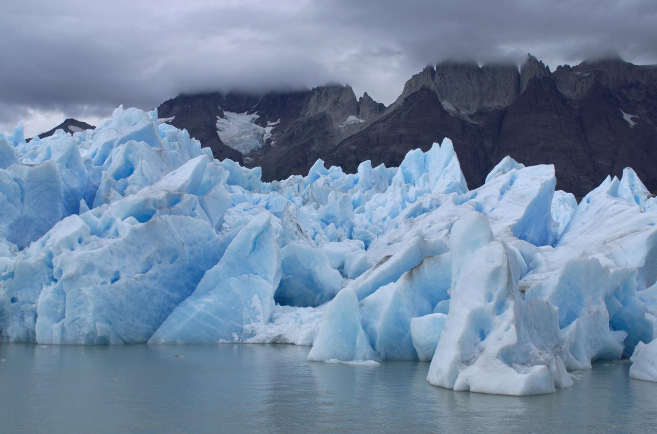
View of Glacier Grey from Lago Grey (Grey Lake), with the Cuernos del Paine mountains in the background, seen during NASA's AirSAR 2004 campaign in Chile. AirSAR 2004 is a three-week expedition in Central and South America by an international team of scientists that is using an all-weather imaging tool, called the Airborne Synthetic Aperture Radar (AirSAR), located onboard NASA's DC-8 airborne laboratory. Scientists from many parts of the world are combining ground research with NASA's AirSAR technology to improve and expand on the quality of research they are able to conduct. Founded in 1959, Torres del Paine National Park encompasses 450,000 acres in the Patagonia region of Chile. This region is being studied by NASA using a DC-8 equipped with an Airborne Synthetic Aperture Radar (AirSAR) developed by scientists from NASA’s Jet Propulsion Laboratory. This is a very sensitive region that is important to scientists because the temperature has been consistently rising causing a subsequent melting of the region’s glaciers. AirSAR will provide a baseline model and unprecedented mapping of the region. This data will make it possible to determine whether the warming trend is slowing, continuing or accelerating. AirSAR will also provide reliable information on ice shelf thickness to measure the contribution of the glaciers to sea level.
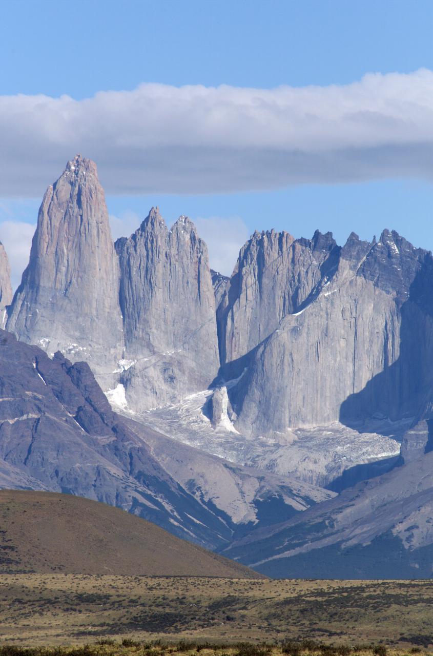
The Cuernos del Paine mountains in Torres del Paine National Park in Chile, photographed during NASA's AirSAR 2004 campaign. AirSAR 2004 is a three-week expedition in Central and South America by an international team of scientists that is using an all-weather imaging tool, called the Airborne Synthetic Aperture Radar (AirSAR), located onboard NASA's DC-8 airborne laboratory. Scientists from many parts of the world are combining ground research with NASA's AirSAR technology to improve and expand on the quality of research they are able to conduct. Founded in 1959, Torres del Paine National Park encompasses 450,000 acres in the Patagonia region of Chile. This region is being studied by NASA using a DC-8 equipped with an Airborne Synthetic Aperture Radar (AirSAR) developed by scientists from NASA’s Jet Propulsion Laboratory. This is a very sensitive region that is important to scientists because the temperature has been consistently rising causing a subsequent melting of the region’s glaciers. AirSAR will provide a baseline model and unprecedented mapping of the region. This data will make it possible to determine whether the warming trend is slowing, continuing or accelerating. AirSAR will also provide reliable information on ice shelf thickness to measure the contribution of the glaciers to sea level.
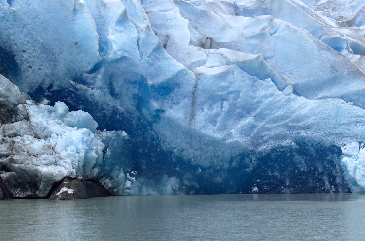
Close-up view of Grey Glacier from Lago Grey (Grey Lake), taken during NASA's AirSAR 2004 campaign in Chile. AirSAR 2004 is a three-week expedition in Central and South America by an international team of scientists that is using an all-weather imaging tool, called the Airborne Synthetic Aperture Radar (AirSAR), located onboard NASA's DC-8 airborne laboratory. Scientists from many parts of the world are combining ground research with NASA's AirSAR technology to improve and expand on the quality of research they are able to conduct. Founded in 1959, Torres del Paine National Park encompasses 450,000 acres in the Patagonia region of Chile. This region is being studied by NASA using a DC-8 equipped with an Airborne Synthetic Aperture Radar (AirSAR) developed by scientists from NASA’s Jet Propulsion Laboratory. This is a very sensitive region that is important to scientists because the temperature has been consistently rising causing a subsequent melting of the region’s glaciers. AirSAR will provide a baseline model and unprecedented mapping of the region. This data will make it possible to determine whether the warming trend is slowing, continuing or accelerating. AirSAR will also provide reliable information on ice shelf thickness to measure the contribution of the glaciers to sea level.

NASA Dryden Mission Manager Walter Klein poses with school children that visited the DC-8 during AirSAR 2004 in Punta Arenas, Chile. AirSAR 2004 is a three-week expedition by an international team of scientists that uses an all-weather imaging tool, called the Airborne Synthetic Aperture Radar (AirSAR) which is located onboard NASA's DC-8 airborne laboratory. Scientists from many parts of the world including NASA's Jet Propulsion Laboratory are combining ground research done in several areas in Central and South America with NASA's AirSAR technology to improve and expand on the quality of research they are able to conduct. In South America and Antarctica, AirSAR collected imagery and data to help determine the contribution of Southern Hemisphere glaciers to sea level rise due to climate change. In Patagonia, researchers found this contribution had more than doubled from 1995 to 2000, compared to the previous 25 years. AirSAR data will make it possible to determine whether that trend is continuing or accelerating. AirSAR will also provide reliable information on ice shelf thickness to measure the contribution of the glaciers to sea level.
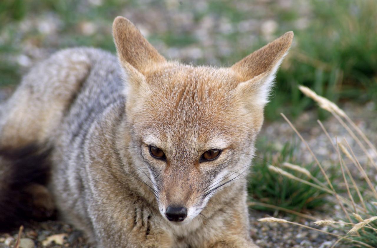
A fox at Torres del Paine National Park in Chile during NASA's AirSAR 2004 campaign. AirSAR 2004 is a three-week expedition in Central and South America by an international team of scientists that is using an all-weather imaging tool, called the Airborne Synthetic Aperture Radar (AirSAR), located onboard NASA's DC-8 airborne laboratory. Scientists from many parts of the world are combining ground research with NASA's AirSAR technology to improve and expand on the quality of research they are able to conduct. Founded in 1959, Torres del Paine National Park encompasses 450,000 acres in the Patagonia region of Chile. This region is being studied by NASA using a DC-8 equipped with an Airborne Synthetic Aperture Radar (AirSAR) developed by scientists from NASA’s Jet Propulsion Laboratory. This is a very sensitive region that is important to scientists because the temperature has been consistently rising causing a subsequent melting of the region’s glaciers. AirSAR will provide a baseline model and unprecedented mapping of the region. This data will make it possible to determine whether the warming trend is slowing, continuing or accelerating. AirSAR will also provide reliable information on ice shelf thickness to measure the contribution of the glaciers to sea level.
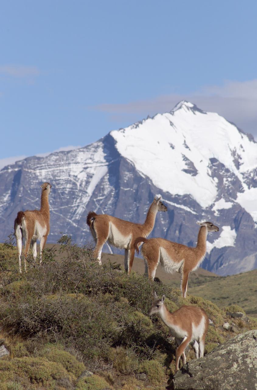
The Cuernos del Paine mountains in Torres del Paine National Park in Chile provide a backdrop to a herd of guanacos during NASA's AirSAR 2004 campaign. AirSAR 2004 is a three-week expedition in Central and South America by an international team of scientists that is using an all-weather imaging tool, called the Airborne Synthetic Aperture Radar (AirSAR), located onboard NASA's DC-8 airborne laboratory. Scientists from many parts of the world are combining ground research with NASA's AirSAR technology to improve and expand on the quality of research they are able to conduct. Founded in 1959, Torres del Paine National Park encompasses 450,000 acres in the Patagonia region of Chile. This region is being studied by NASA using a DC-8 equipped with an Airborne Synthetic Aperture Radar (AirSAR) developed by scientists from NASA’s Jet Propulsion Laboratory. This is a very sensitive region that is important to scientists because the temperature has been consistently rising causing a subsequent melting of the region’s glaciers. AirSAR will provide a baseline model and unprecedented mapping of the region. This data will make it possible to determine whether the warming trend is slowing, continuing or accelerating. AirSAR will also provide reliable information on ice shelf thickness to measure the contribution of the glaciers to sea level.
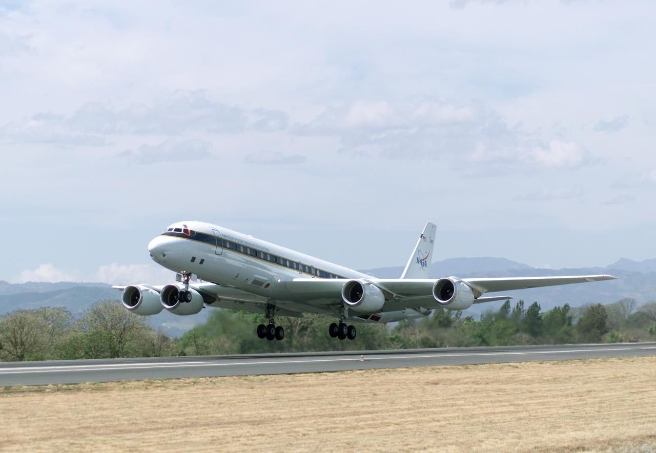
NASA's DC-8 flying laboratory takes off from Juan Santamaria International Airport in San Jose, Costa Rica, on NASA's AirSAR 2004 campaign. AirSAR 2004 Mesoamerica is a three-week expedition by an international team of scientists that uses an all-weather imaging tool, called the Airborne Synthetic Aperture Radar (AirSAR) which is located onboard NASA's DC-8 airborne laboratory. Scientists from many parts of the world including NASA's Jet Propulsion Laboratory are combining ground research done in several areas in Central America with NASA's AirSAR technology to improve and expand on the quality of research they are able to conduct. The radar, developed by NASA's Jet Propulsion Laboratory, can penetrate clouds and also collect data at night. Its high-resolution sensors operate at multiple wavelengths and modes, allowing AirSAR to see beneath treetops, through thin sand, and dry snow pack. AirSAR's 2004 campaign is a collaboration of many U.S. and Central American institutions and scientists, including NASA; the National Science Foundation; the Smithsonian Institution; National Geographic; Conservation International; the Organization of Tropical Studies; the Central American Commission for Environment and Development; and the Inter-American Development Bank.

NASA Dryden Mission Manager Walter Klein talks with school children from Punta Arenas, Chile, during a tour of the DC-8 aircraft while it was in the country supporting the AirSAR 2004 campaign. AirSAR 2004 is a three-week expedition by an international team of scientists that uses an all-weather imaging tool, called the Airborne Synthetic Aperture Radar (AirSAR) which is located onboard NASA's DC-8 airborne laboratory. Scientists from many parts of the world including NASA's Jet Propulsion Laboratory are combining ground research done in several areas in Central and South America with NASA's AirSAR technology to improve and expand on the quality of research they are able to conduct. In South America and Antarctica, AirSAR collected imagery and data to help determine the contribution of Southern Hemisphere glaciers to sea level rise due to climate change. In Patagonia, researchers found this contribution had more than doubled from 1995 to 2000, compared to the previous 25 years. AirSAR data will make it possible to determine whether that trend is continuing or accelerating. AirSAR will also provide reliable information on ice shelf thickness to measure the contribution of the glaciers to sea level.
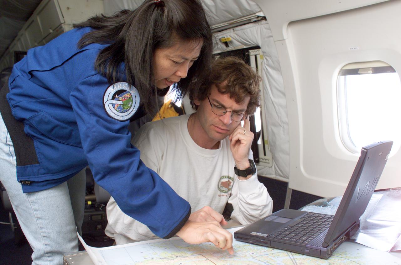
NASA JPL scientists Yunling Lou and Dr. Eric Rignot work on line selection while flying AirSAR missions over the Antarctic Peninsula. AirSAR 2004 is a three-week expedition in Central and South America by an international team of scientists that is using an all-weather imaging tool, called the Airborne Synthetic Aperture Radar (AirSAR), located onboard NASA's DC-8 airborne laboratory. Scientists from many parts of the world are combining ground research with NASA's AirSAR technology to improve and expand on the quality of research they are able to conduct. These photos are from the DC-8 aircraft while flying an AirSAR mission over Antarctica. The Antarctic Peninsula is more similar to Alaska and Patagonia than to the rest of the Antarctic continent. It is drained by fast glaciers, receives abundant precipitation, and melts significantly in the summer months. In recent decades, the Peninsula has experienced significant atmospheric warming (about 2 degrees C since 1950), which has triggered a vast and spectacular retreat of its floating ice shelves, glacier reduction, a decrease in permanent snow cover and a lengthening of the melt season. As a result, the contribution to sea level from this region could be rapid and substantial. With an area of 120,000 km, or ten times the Patagonia ice fields, the Peninsula could contribute as much as 0.4mm/yr sea level rise, which would be the largest single contribution to sea level from anywhere in the world. This region is being studied by NASA using a DC-8 equipped with the Airborne Synthetic Aperture Radar developed by scientists from NASA’s Jet Propulsion Laboratory. AirSAR will provide a baseline model and unprecedented mapping of the region. This data will make it possible to determine whether the warming trend is slowing, continuing or accelerating. AirSAR will also provide reliable information on ice shelf thickness to measure the contribution of the glaciers to sea level.
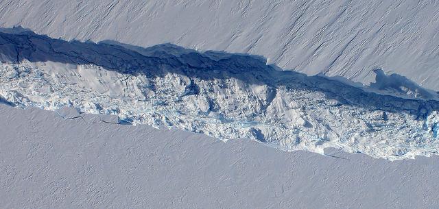
A close-up image of the crack spreading across the ice shelf of Pine Island Glacier shows the details of the boulder-like blocks of ice that fell into the rift when it split. For most of the 18-mile stretch of the crack that NASA’s DC-8 flew over on Oct. 26, 2011, it stretched about 240 feet wide, as roughly seen here. The deepest points ranged from about 165 to 190 feet, roughly equal to the top of the ice shelf down to sea level. Scientists expect the crack to propagate and the ice shelf to calve an iceberg of more than 300 square miles in the coming months. This image was captured by the Digital Mapping System (DMS) aboard the DC-8. Credit: NASA/DMS NASA's Operation IceBridge returns to a base camp of Punta Arenas, Chile for the third year of flights over Antarctica's changing sea ice, glaciers and ice sheets. NASA's DC-8, outfitted with seven remote-sensing instruments, and a Gulfstream 5 operated by the National Science Foundation and National Center for Atmospheric Research and outfitted with a high-altitude laser-ranging mapper, will fly from Chile over Antarctica in October and November. The mission is designed to record changes to Antarctica's ice sheets and give scientists insight into what is driving those changes. Follow the progress of the mission: Campaign News site: <a href="http://www.nasa.gov/mission_pages/icebridge/index.html" rel="nofollow">www.nasa.gov/mission_pages/icebridge/index.html</a> IceBridge blog: <a href="http://blogs.nasa.gov/cm/newui/blog/viewpostlist.jsp?blogname=icebridge" rel="nofollow">blogs.nasa.gov/cm/newui/blog/viewpostlist.jsp?blogname=ic...</a> Twitter: @nasa_ice <b><a href="http://www.nasa.gov/audience/formedia/features/MP_Photo_Guidelines.html" rel="nofollow">NASA image use policy.</a></b> <b><a href="http://www.nasa.gov/centers/goddard/home/index.html" rel="nofollow">NASA Goddard Space Flight Center</a></b> enables NASA’s mission through four scientific endeavors: Earth Science, Heliophysics, Solar System Exploration, and Astrophysics. Goddard plays a leading role in NASA’s accomplishments by contributing compelling scientific knowledge to advance the Agency’s mission. <b>Follow us on <a href="http://twitter.com/NASA_GoddardPix" rel="nofollow">Twitter</a></b> <b>Like us on <a href="http://www.facebook.com/pages/Greenbelt-MD/NASA-Goddard/395013845897?ref=tsd" rel="nofollow">Facebook</a></b> <b>Find us on <a href="http://instagrid.me/nasagoddard/?vm=grid" rel="nofollow">Instagram</a></b>

There’s more than one way to study the impact of biofuels. For NASA scientists, it means trailing an aircraft from as little as 300 feet behind while flying 34,000 feet in the air. Earlier this year, a NASA-led team conducted a series of carefully choreographed flights over California in order to sniff out how aircraft emissions differ when using petroleum fuels or biofuels. Early results from the Alternative Fuel Effects on Contrails and Cruise Emissions (ACCESS II) experiment confirm that blended biofuel is the cleaner-burning fuel. "Our findings show we definitely see a 50 percent reduction in soot emissions from the DC-8 when it burns the blended fuel as opposed to jet fuel alone," said Bruce Anderson, ACCESS principal investigator from NASA's Langley Research Center. The DC-8 is a NASA science workhorse: a flying laboratory equipped to collect—or, in this case, produce—data for basic Earth science research. During the ACESS experiment, scientists took advantage of the aircraft's segregated fuel tank. On the fly, the pilot switched the fuel type sent to each of the four engines. The engines burned either jet fuel, or a 50-50 blend of jet fuel and a renewable alternative produced from camelina plant oil. With each change of fuel, three other instrumented aircraft took turns lining up in the DC-8's wake and flying anywhere from 90 meters (300 feet) to more than 30 kilometers (20 miles) behind to catch a sniff. Richard Moore, a post-doctoral fellow at NASA Langley, took this photograph with a DSLR camera on May 7, 2014, during an ACCESS II test flight over Edwards Air Force Base in California. The photo was taken from Langley's HU-25C Guardian jet as it descended toward NASA's Armstrong Flight Research Center after a successful three-hour sampling flight behind the DC-8. The aircraft trailing the DC-8 in the photo was a Falcon 20-E5 jet owned by the German Aerospace Center. The flight on May 7 was just the first in a series of flights that lasted throughout the month. After the campaign, researchers continued to examine the data to determine whether a reduction in soot emissions translates to a reduction in contrail formation, and how that might affect climate. Read more: <a href="http://1.usa.gov/1wBfaKq" rel="nofollow">1.usa.gov/1wBfaKq</a> <b><a href="http://www.nasa.gov/audience/formedia/features/MP_Photo_Guidelines.html" rel="nofollow">NASA image use policy.</a></b> <b><a href="http://www.nasa.gov/centers/goddard/home/index.html" rel="nofollow">NASA Goddard Space Flight Center</a></b> enables NASA’s mission through four scientific endeavors: Earth Science, Heliophysics, Solar System Exploration, and Astrophysics. Goddard plays a leading role in NASA’s accomplishments by contributing compelling scientific knowledge to advance the Agency’s mission. <b>Follow us on <a href="http://twitter.com/NASAGoddardPix" rel="nofollow">Twitter</a></b> <b>Like us on <a href="http://www.facebook.com/pages/Greenbelt-MD/NASA-Goddard/395013845897?ref=tsd" rel="nofollow">Facebook</a></b> <b>Find us on <a href="http://instagram.com/nasagoddard?vm=grid" rel="nofollow">Instagram</a></b>
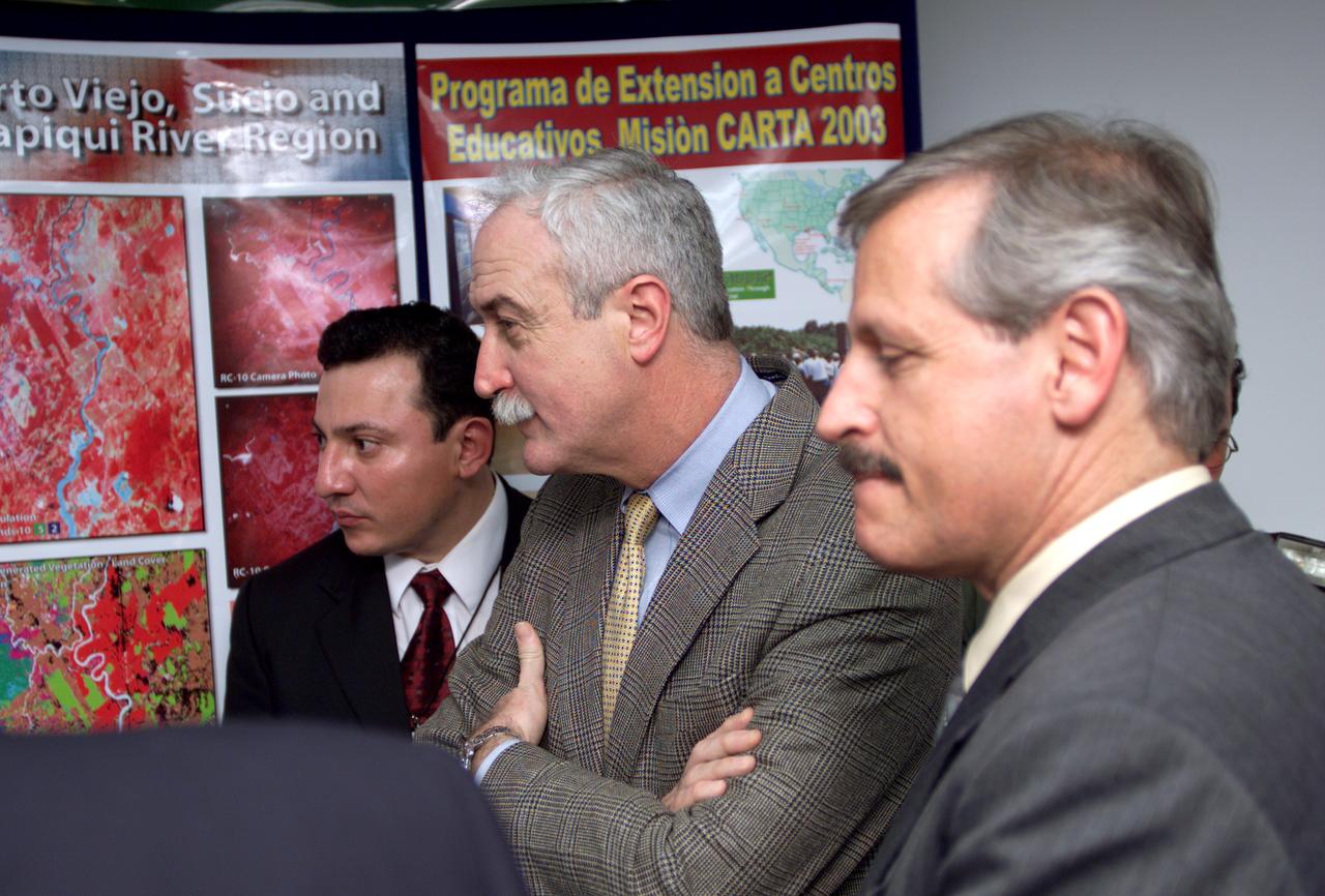
L-R; Jorge Andres Diaz, Director of the Costa Rican National Hangar for Airborne Research division of the National Center for High Technology(CENAT); NASA Administrator Sean O'Keefe; and Fernando Gutierrez, Costa Rican Minister of Science and Technology(MICIT), viewing posters showing how NASA activities have made an impact on Costa Rican people. Mr. O'Keefe was in Costa Rica to participate in the AirSAR 2004 Mesoamerica campaign, which used NASA DFRC's DC-8 airborne laboratory aircraft. AirSAR 2004 is a three-week expedition by an international team of scientists that will use an all-weather imaging tool, called the Airborne Synthetic Aperture Radar (AirSAR), in a mission ranging from the tropical rain forests of Central America to frigid Antarctica.

During a flight over the Pine Island Glacier ice shelf, the DC-8 banks over the Amundsen Sea and the clean edge of the ice shelf front. The shelf drops about 200 feet from its surface to sea level. This image was taken on Oct. 26, 2011. Credit: NASA/GSFC/Jefferson Beck NASA's Operation IceBridge returns to a base camp of Punta Arenas, Chile for the third year of flights over Antarctica's changing sea ice, glaciers and ice sheets. NASA's DC-8, outfitted with seven remote-sensing instruments, and a Gulfstream 5 operated by the National Science Foundation and National Center for Atmospheric Research and outfitted with a high-altitude laser-ranging mapper, will fly from Chile over Antarctica in October and November. The mission is designed to record changes to Antarctica's ice sheets and give scientists insight into what is driving those changes. Follow the progress of the mission: Campaign News site: <a href="http://www.nasa.gov/mission_pages/icebridge/index.html" rel="nofollow">www.nasa.gov/mission_pages/icebridge/index.html</a> IceBridge blog: <a href="http://blogs.nasa.gov/cm/newui/blog/viewpostlist.jsp?blogname=icebridge" rel="nofollow">blogs.nasa.gov/cm/newui/blog/viewpostlist.jsp?blogname=ic...</a> Twitter: @nasa_ice <b><a href="http://www.nasa.gov/audience/formedia/features/MP_Photo_Guidelines.html" rel="nofollow">NASA image use policy.</a></b> <b><a href="http://www.nasa.gov/centers/goddard/home/index.html" rel="nofollow">NASA Goddard Space Flight Center</a></b> enables NASA’s mission through four scientific endeavors: Earth Science, Heliophysics, Solar System Exploration, and Astrophysics. Goddard plays a leading role in NASA’s accomplishments by contributing compelling scientific knowledge to advance the Agency’s mission. <b>Follow us on <a href="http://twitter.com/NASA_GoddardPix" rel="nofollow">Twitter</a></b> <b>Like us on <a href="http://www.facebook.com/pages/Greenbelt-MD/NASA-Goddard/395013845897?ref=tsd" rel="nofollow">Facebook</a></b> <b>Find us on <a href="http://instagrid.me/nasagoddard/?vm=grid" rel="nofollow">Instagram</a></b>
Pre-Columbian archaeological ruins are revealed through Costa Rican rain forest in this photo taken during NASA's AirSAR 2004 Mesoamerica campaign. AirSAR 2004 Mesoamerica is a three-week expedition by an international team of scientists that uses an all-weather imaging tool, called the Airborne Synthetic Aperture Radar (AirSAR) which is located onboard NASA's DC-8 airborne laboratory. The radar, developed by NASA's Jet Propulsion Laboratory, can penetrate clouds and also collect data at night. Its high-resolution sensors operate at multiple wavelengths and modes, allowing AirSAR to see beneath treetops, through thin sand, and dry snow pack. Much of the archaeological evidence needed to understand Pre-Columbian societies in Central America comes from features on the landscape. Difficult terrain and logistics have limited ground data collection. AirSAR helped to detect signs of ancient civilizations hidden beneath the forest. Its images will shed insights into the way modern humans interact with their landscape, and how ancient peoples lived and what became of their civilizations.
Pre-Columbian archaeological ruins are revealed through Costa Rican rain forest in this photo taken during NASA's AirSAR 2004 Mesoamerica campaign. AirSAR 2004 Mesoamerica is a three-week expedition by an international team of scientists that uses an all-weather imaging tool, called the Airborne Synthetic Aperture Radar (AirSAR) which is located onboard NASA's DC-8 airborne laboratory. The radar, developed by NASA's Jet Propulsion Laboratory, can penetrate clouds and also collect data at night. Its high-resolution sensors operate at multiple wavelengths and modes, allowing AirSAR to see beneath treetops, through thin sand, and dry snow pack. Much of the archaeological evidence needed to understand Pre-Columbian societies in Central America comes from features on the landscape. Difficult terrain and logistics have limited ground data collection. AirSAR helped to detect signs of ancient civilizations hidden beneath the forest. Its images will shed insights into the way modern humans interact with their landscape, and how ancient peoples lived and what became of their civilizations.
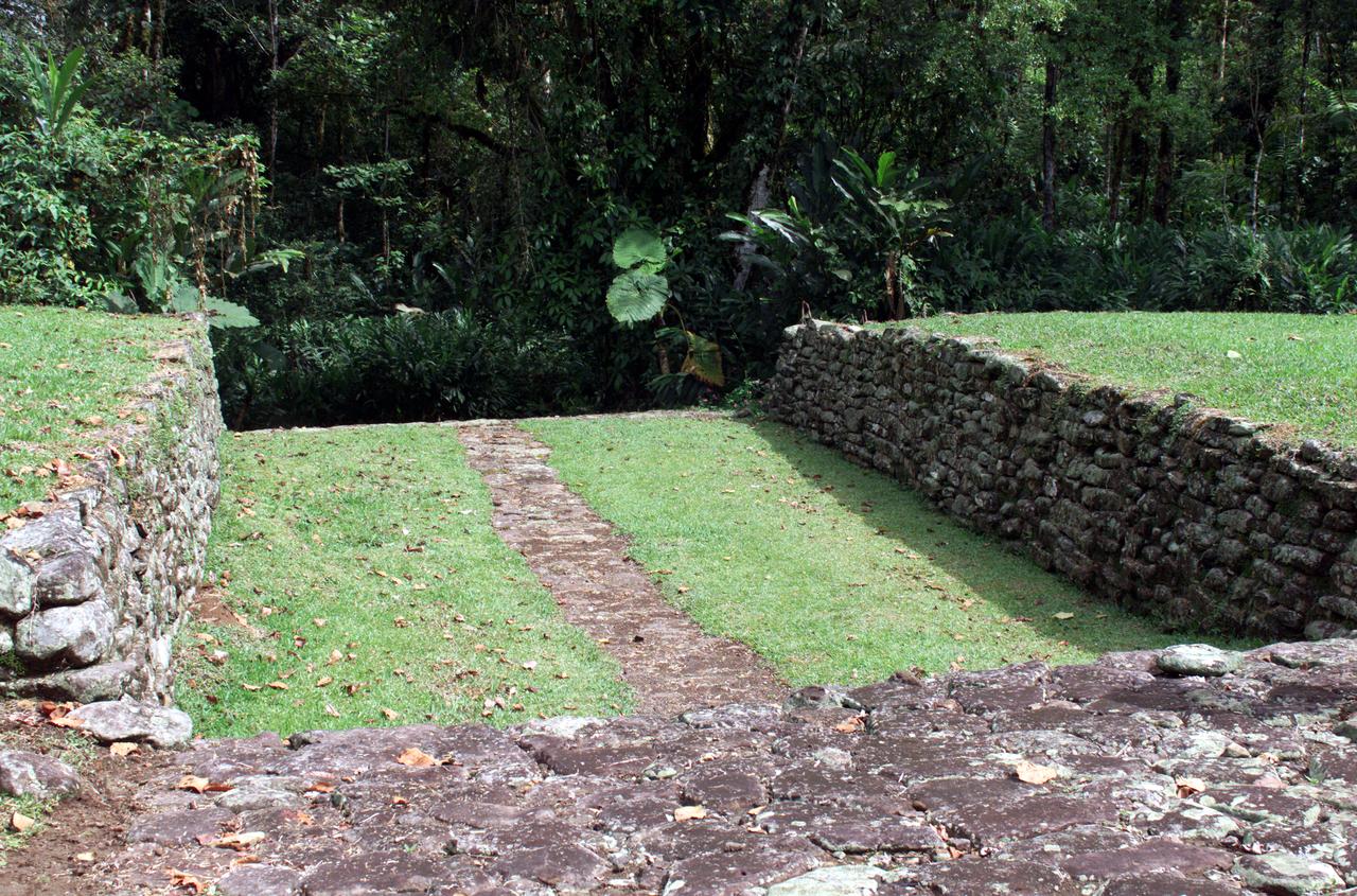
Pre-Columbian archaeological ruins are revealed through Costa Rican rain forest in this photo taken during NASA's AirSAR 2004 Mesoamerica campaign. AirSAR 2004 Mesoamerica is a three-week expedition by an international team of scientists that uses an all-weather imaging tool, called the Airborne Synthetic Aperture Radar (AirSAR) which is located onboard NASA's DC-8 airborne laboratory. The radar, developed by NASA's Jet Propulsion Laboratory, can penetrate clouds and also collect data at night. Its high-resolution sensors operate at multiple wavelengths and modes, allowing AirSAR to see beneath treetops, through thin sand, and dry snow pack. Much of the archaeological evidence needed to understand Pre-Columbian societies in Central America comes from features on the landscape. Difficult terrain and logistics have limited ground data collection. AirSAR helped to detect signs of ancient civilizations hidden beneath the forest. Its images will shed insights into the way modern humans interact with their landscape, and how ancient peoples lived and what became of their civilizations.
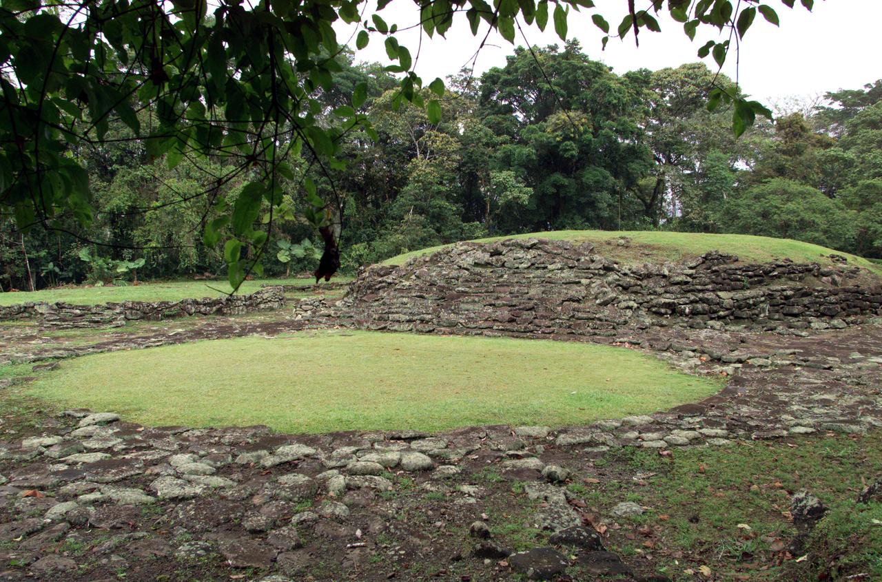
Pre-Columbian archaeological ruins are revealed through Costa Rican rain forest in this photo taken during NASA's AirSAR 2004 Mesoamerica campaign. AirSAR 2004 Mesoamerica is a three-week expedition by an international team of scientists that uses an all-weather imaging tool, called the Airborne Synthetic Aperture Radar (AirSAR) which is located onboard NASA's DC-8 airborne laboratory. The radar, developed by NASA's Jet Propulsion Laboratory, can penetrate clouds and also collect data at night. Its high-resolution sensors operate at multiple wavelengths and modes, allowing AirSAR to see beneath treetops, through thin sand, and dry snow pack. Much of the archaeological evidence needed to understand Pre-Columbian societies in Central America comes from features on the landscape. Difficult terrain and logistics have limited ground data collection. AirSAR helped to detect signs of ancient civilizations hidden beneath the forest. Its images will shed insights into the way modern humans interact with their landscape, and how ancient peoples lived and what became of their civilizations.
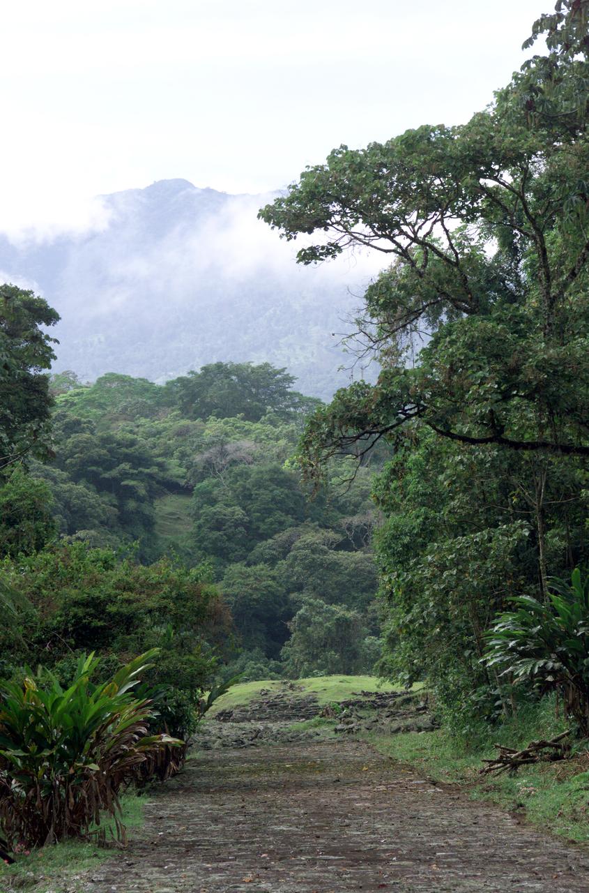
Pre-Columbian archaeological ruins are revealed through Costa Rican rain forest in this photo taken during NASA's AirSAR 2004 Mesoamerica campaign. AirSAR 2004 Mesoamerica is a three-week expedition by an international team of scientists that uses an all-weather imaging tool, called the Airborne Synthetic Aperture Radar (AirSAR) which is located onboard NASA's DC-8 airborne laboratory. The radar, developed by NASA's Jet Propulsion Laboratory, can penetrate clouds and also collect data at night. Its high-resolution sensors operate at multiple wavelengths and modes, allowing AirSAR to see beneath treetops, through thin sand, and dry snow pack. Much of the archaeological evidence needed to understand Pre-Columbian societies in Central America comes from features on the landscape. Difficult terrain and logistics have limited ground data collection. AirSAR helped to detect signs of ancient civilizations hidden beneath the forest. Its images will shed insights into the way modern humans interact with their landscape, and how ancient peoples lived and what became of their civilizations.
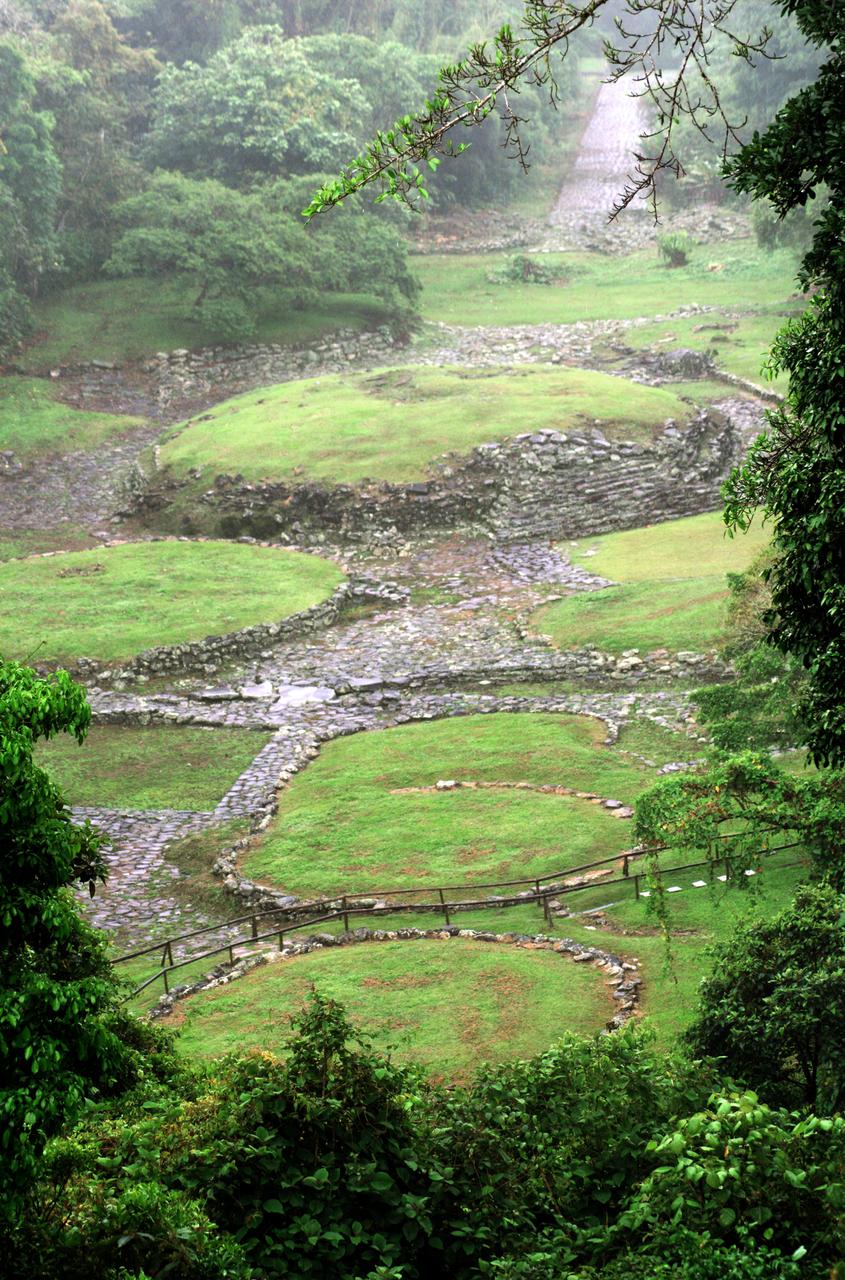
Pre-Columbian archaeological ruins are revealed through Costa Rican rain forest in this photo taken during NASA's AirSAR 2004 Mesoamerica campaign. AirSAR 2004 Mesoamerica is a three-week expedition by an international team of scientists that uses an all-weather imaging tool, called the Airborne Synthetic Aperture Radar (AirSAR) which is located onboard NASA's DC-8 airborne laboratory. The radar, developed by NASA's Jet Propulsion Laboratory, can penetrate clouds and also collect data at night. Its high-resolution sensors operate at multiple wavelengths and modes, allowing AirSAR to see beneath treetops, through thin sand, and dry snow pack. Much of the archaeological evidence needed to understand Pre-Columbian societies in Central America comes from features on the landscape. Difficult terrain and logistics have limited ground data collection. AirSAR helped to detect signs of ancient civilizations hidden beneath the forest. Its images will shed insights into the way modern humans interact with their landscape, and how ancient peoples lived and what became of their civilizations.
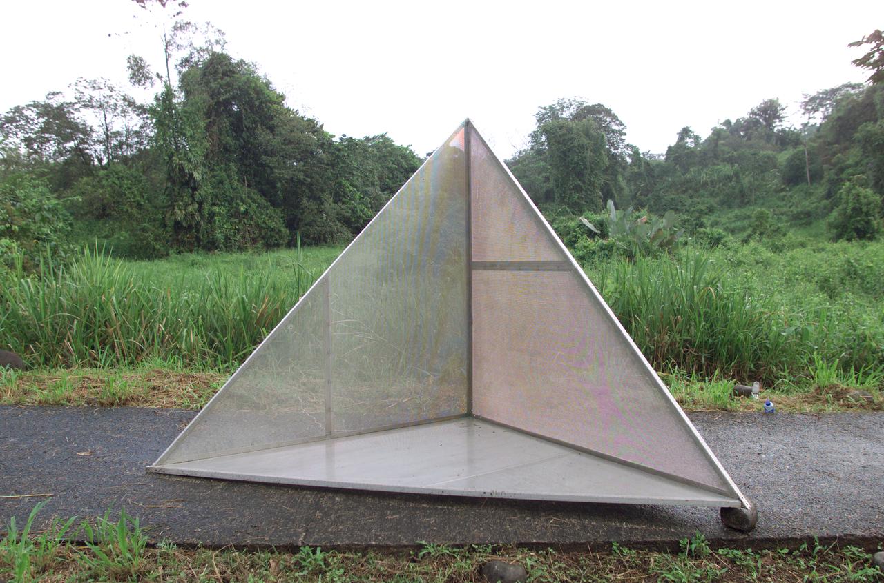
Reflectors setup in the La Selva region of the Costa Rican rain forest by scientist Paul Siqueira from NASA’s Jet Propulsion Lab. These reflectors are used by JPL scientists onboard Dryden's DC-8 aircraft to calibrate the Airborne Synthetic Aperture Radar (AirSAR) system. Scientists place these reflectors at known points on the ground, allowing researchers onboard the aircraft to verify their data. AirSAR 2004 Mesoamerica is a three-week expedition by an international team of scientists that uses an all-weather imaging tool, called the Airborne Synthetic Aperture Radar (AirSAR) which is located onboard NASA's DC-8 airborne laboratory. Scientists from many parts of the world including NASA's Jet Propulsion Laboratory are combining ground research done in several areas in Central America with NASA's AirSAR technology to improve and expand on the quality of research they are able to conduct. The radar, developed by NASA's Jet Propulsion Laboratory, can penetrate clouds and also collect data at night. Its high-resolution sensors operate at multiple wavelengths and modes, allowing AirSAR to see beneath treetops, through thin sand, and dry snow pack. AirSAR's 2004 campaign is a collaboration of many U.S. and Central American institutions and scientists, including NASA; the National Science Foundation; the Smithsonian Institution; National Geographic; Conservation International; the Organization of Tropical Studies; the Central American Commission for Environment and Development; and the Inter-American Development Bank.
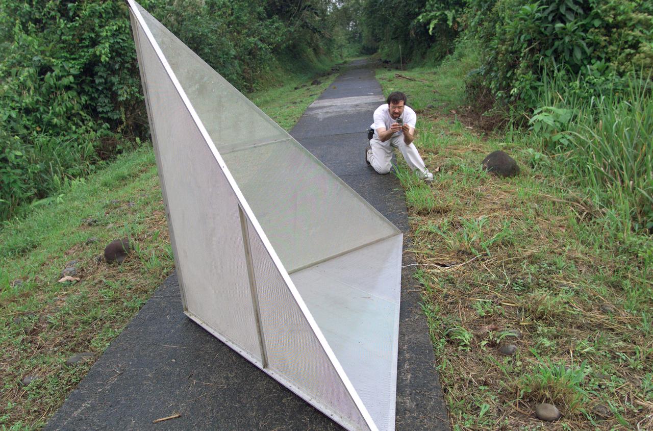
Reflectors setup in the La Selva region of the Costa Rican rain forest by scientist Paul Siqueira from NASA’s Jet Propulsion Lab. These reflectors are used by JPL scientists onboard Dryden's DC-8 aircraft to calibrate the Airborne Synthetic Aperture Radar (AirSAR) system. Scientists place these reflectors at known points on the ground, allowing researchers onboard the aircraft to verify their data. AirSAR 2004 Mesoamerica is a three-week expedition by an international team of scientists that uses an all-weather imaging tool, called the Airborne Synthetic Aperture Radar (AirSAR) which is located onboard NASA's DC-8 airborne laboratory. Scientists from many parts of the world including NASA's Jet Propulsion Laboratory are combining ground research done in several areas in Central America with NASA's AirSAR technology to improve and expand on the quality of research they are able to conduct. The radar, developed by NASA's Jet Propulsion Laboratory, can penetrate clouds and also collect data at night. Its high-resolution sensors operate at multiple wavelengths and modes, allowing AirSAR to see beneath treetops, through thin sand, and dry snow pack. AirSAR's 2004 campaign is a collaboration of many U.S. and Central American institutions and scientists, including NASA; the National Science Foundation; the Smithsonian Institution; National Geographic; Conservation International; the Organization of Tropical Studies; the Central American Commission for Environment and Development; and the Inter-American Development Bank.
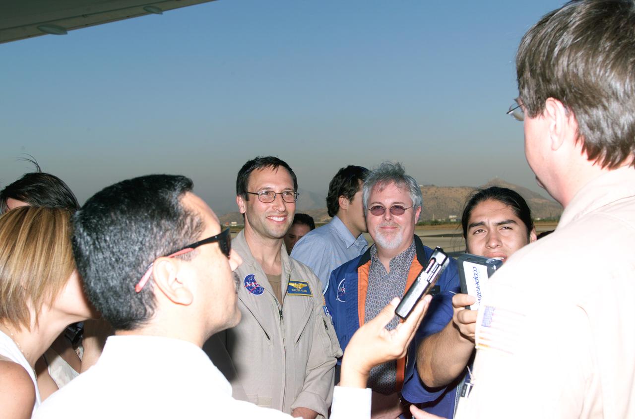
L to R; NASA Dryden Mission Manager Walter Klein (in tan flight suit), JPL AirSAR Scientist Tim Miller, and Mission Manager David Bushman briefing press in Santiago, Chile, for NASA's AirSAR 2004 mission. AirSAR 2004 is a three-week expedition by an international team of scientists that uses an all-weather imaging tool, called the Airborne Synthetic Aperture Radar (AirSAR) which is located onboard NASA's DC-8 airborne laboratory. Scientists from many parts of the world including NASA's Jet Propulsion Laboratory are combining ground research done in several areas in Central and South America with NASA's AirSAR technology to improve and expand on the quality of research they are able to conduct. In South America and Antarctica, AirSAR collected imagery and data to help determine the contribution of Southern Hemisphere glaciers to sea level rise due to climate change. In Patagonia, researchers found this contribution had more than doubled from 1995 to 2000, compared to the previous 25 years. AirSAR data will make it possible to determine whether that trend is continuing or accelerating. AirSAR will also provide reliable information on ice shelf thickness to measure the contribution of the glaciers to sea level.
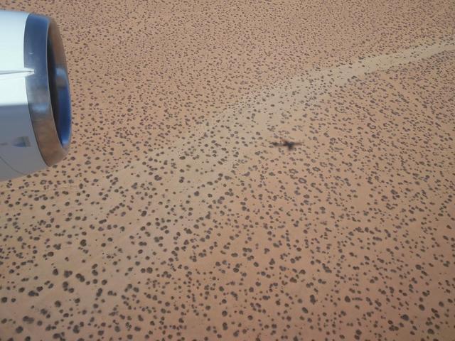
The DC-8 research aircraft casting its shadow on the ground in California's Mojave Desert during an IceBridge instrument check flight. Prior to field campaigns, IceBridge instrument and aircraft teams run the aircraft through a series of tests to ensure that everything is operating at peak condition. Credit: NASA / Jim Yungel NASA's Operation IceBridge is an airborne science mission to study Earth's polar ice. For more information about IceBridge, visit: <a href="http://www.nasa.gov/icebridge" rel="nofollow">www.nasa.gov/icebridge</a> <b><a href="http://www.nasa.gov/audience/formedia/features/MP_Photo_Guidelines.html" rel="nofollow">NASA image use policy.</a></b> <b><a href="http://www.nasa.gov/centers/goddard/home/index.html" rel="nofollow">NASA Goddard Space Flight Center</a></b> enables NASA’s mission through four scientific endeavors: Earth Science, Heliophysics, Solar System Exploration, and Astrophysics. Goddard plays a leading role in NASA’s accomplishments by contributing compelling scientific knowledge to advance the Agency’s mission. <b>Follow us on <a href="http://twitter.com/NASAGoddardPix" rel="nofollow">Twitter</a></b> <b>Like us on <a href="http://www.facebook.com/pages/Greenbelt-MD/NASA-Goddard/395013845897?ref=tsd" rel="nofollow">Facebook</a></b> <b>Find us on <a href="http://instagram.com/nasagoddard?vm=grid" rel="nofollow">Instagram</a></b>
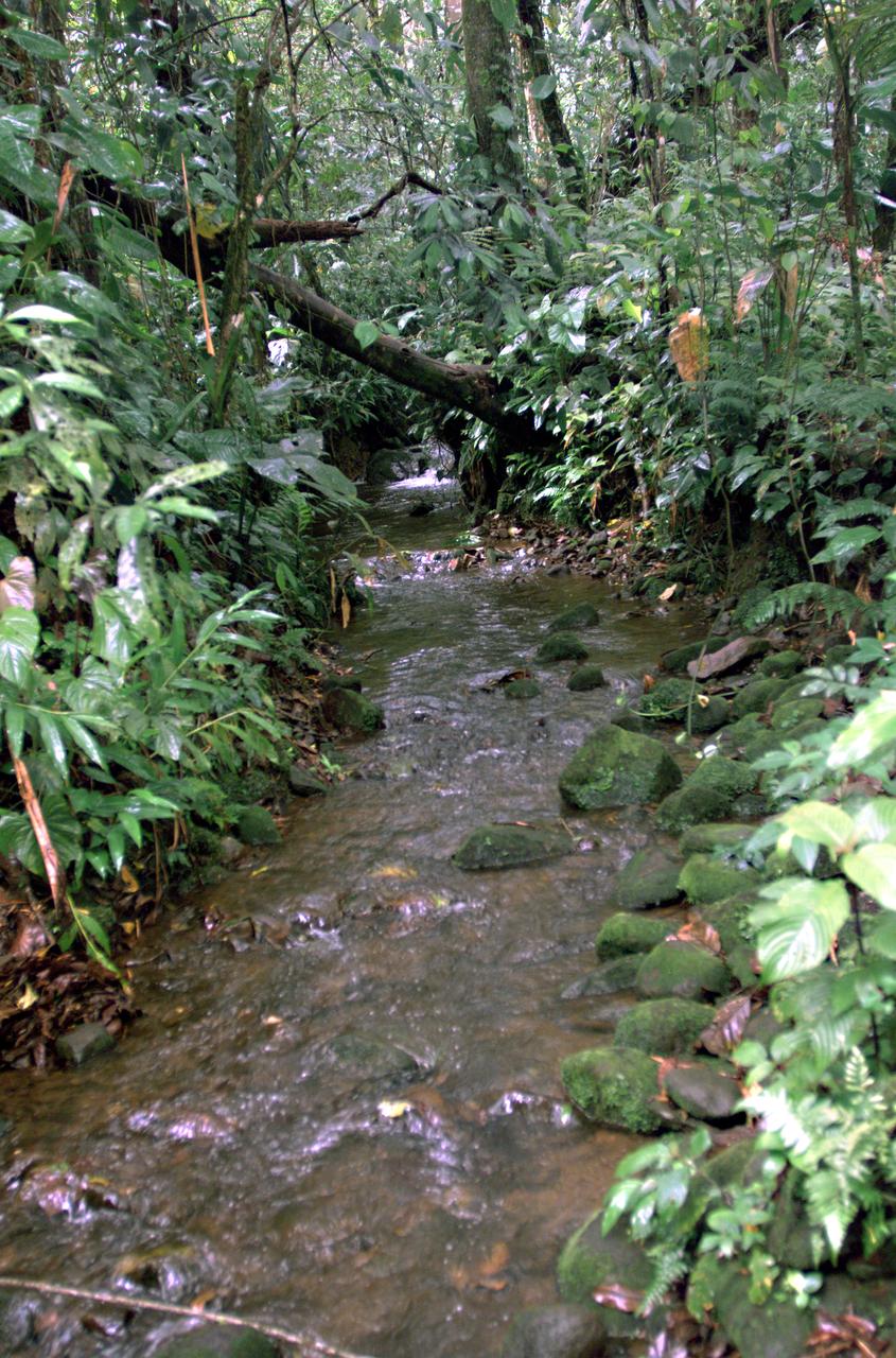
This photograph shows a stream in the La Selva region of the Costa Rican rain forest, taken during NASA's AirSAR 2004 campaign. AirSAR 2004 Mesoamerica is a three-week expedition by an international team of scientists that uses an all-weather imaging tool, called the Airborne Synthetic Aperture Radar (AirSAR) which is located onboard NASA's DC-8 airborne laboratory. Scientists from many parts of the world including NASA's Jet Propulsion Laboratory are combining ground research done in several areas in Central America with NASA's AirSAR technology to improve and expand on the quality of research they are able to conduct. The radar, developed by NASA's Jet Propulsion Laboratory, can penetrate clouds and also collect data at night. Its high-resolution sensors operate at multiple wavelengths and modes, allowing AirSAR to see beneath treetops, through thin sand, and dry snow pack. AirSAR's 2004 campaign is a collaboration of many U.S. and Central American institutions and scientists, including NASA; the National Science Foundation; the Smithsonian Institution; National Geographic; Conservation International; the Organization of Tropical Studies; the Central American Commission for Environment and Development; and the Inter-American Development Bank.
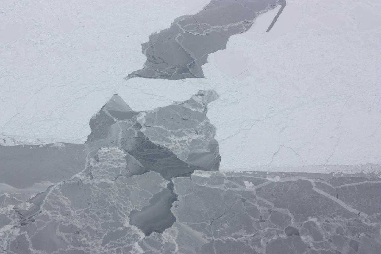
Closer look at a re-frozen lead in sea ice in the Bellingshausen Sea, seen from the DC-8 on Oct. 19, 2012. Credit: NASA / George Hale NASA's Operation IceBridge is an airborne science mission to study Earth's polar ice. For more information about IceBridge, visit: <a href="http://www.nasa.gov/icebridge" rel="nofollow">www.nasa.gov/icebridge</a> <b><a href="http://www.nasa.gov/audience/formedia/features/MP_Photo_Guidelines.html" rel="nofollow">NASA image use policy.</a></b> <b><a href="http://www.nasa.gov/centers/goddard/home/index.html" rel="nofollow">NASA Goddard Space Flight Center</a></b> enables NASA’s mission through four scientific endeavors: Earth Science, Heliophysics, Solar System Exploration, and Astrophysics. Goddard plays a leading role in NASA’s accomplishments by contributing compelling scientific knowledge to advance the Agency’s mission. <b>Follow us on <a href="http://twitter.com/NASA_GoddardPix" rel="nofollow">Twitter</a></b> <b>Like us on <a href="http://www.facebook.com/pages/Greenbelt-MD/NASA-Goddard/395013845897?ref=tsd" rel="nofollow">Facebook</a></b> <b>Find us on <a href="http://instagrid.me/nasagoddard/?vm=grid" rel="nofollow">Instagram</a></b>
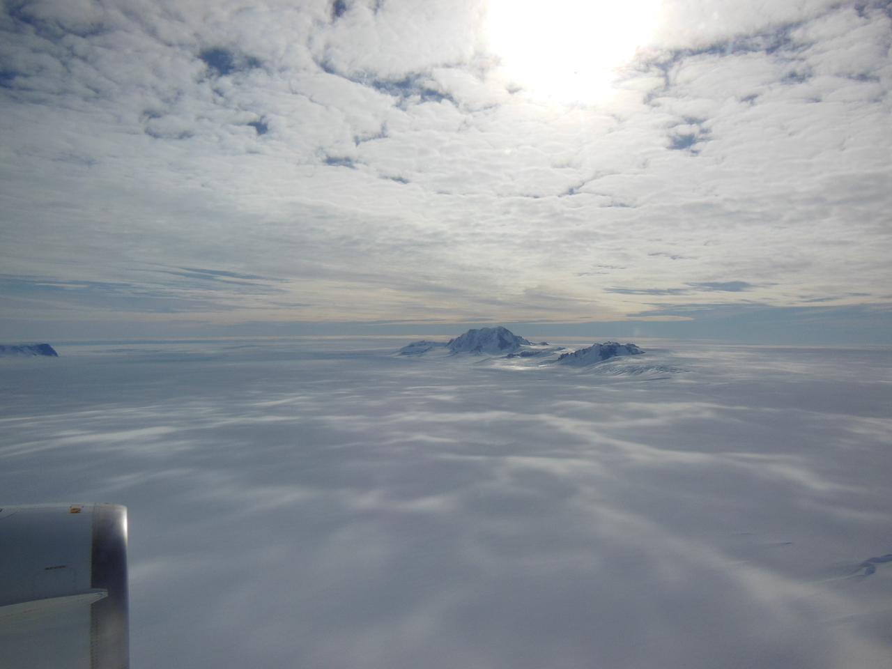
Mountains seen from the IceBridge DC-8 during a survey of the Getz Ice Shelf on Oct. 27, 2012. Credit: NASA / Christy Hansen NASA's Operation IceBridge is an airborne science mission to study Earth's polar ice. For more information about IceBridge, visit: <a href="http://www.nasa.gov/icebridge" rel="nofollow">www.nasa.gov/icebridge</a> <b><a href="http://www.nasa.gov/audience/formedia/features/MP_Photo_Guidelines.html" rel="nofollow">NASA image use policy.</a></b> <b><a href="http://www.nasa.gov/centers/goddard/home/index.html" rel="nofollow">NASA Goddard Space Flight Center</a></b> enables NASA’s mission through four scientific endeavors: Earth Science, Heliophysics, Solar System Exploration, and Astrophysics. Goddard plays a leading role in NASA’s accomplishments by contributing compelling scientific knowledge to advance the Agency’s mission. <b>Follow us on <a href="http://twitter.com/NASA_GoddardPix" rel="nofollow">Twitter</a></b> <b>Like us on <a href="http://www.facebook.com/pages/Greenbelt-MD/NASA-Goddard/395013845897?ref=tsd" rel="nofollow">Facebook</a></b> <b>Find us on <a href="http://instagrid.me/nasagoddard/?vm=grid" rel="nofollow">Instagram</a></b>
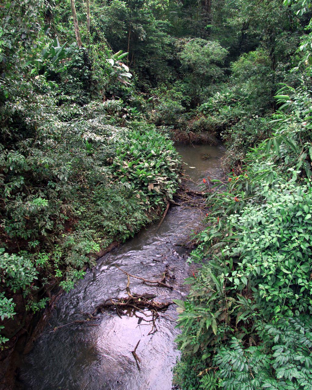
This photograph shows a stream in the La Selva region of the Costa Rican rain forest, taken during NASA's AirSAR 2004 Mesoamerica campaign. AirSAR 2004 Mesoamerica is a three-week expedition by an international team of scientists that will use an all-weather imaging tool, called the Airborne Synthetic Aperture Radar (AirSAR) which is located onboard NASA's DC-8 airborne laboratory. Scientists from many parts of the world including NASA's Jet Propulsion Laboratory are combining ground research done in several areas in Central America with NASA's AirSAR technology to improve and expand on the quality of research they are able to do. NASA's AIRSAR technolgy provides two essential elements to the ground-based scientists. First, it tests and provides accurate measurements of the forest structure. Secondly, AirSAR can study a larger area of the forest versus the smaller area that can be tested and plotted by the ground scientists. It also provides a unique one-of-a-kind system of measurement that obtains important information for the scientists, such as where forests are located and what exactly is in them.
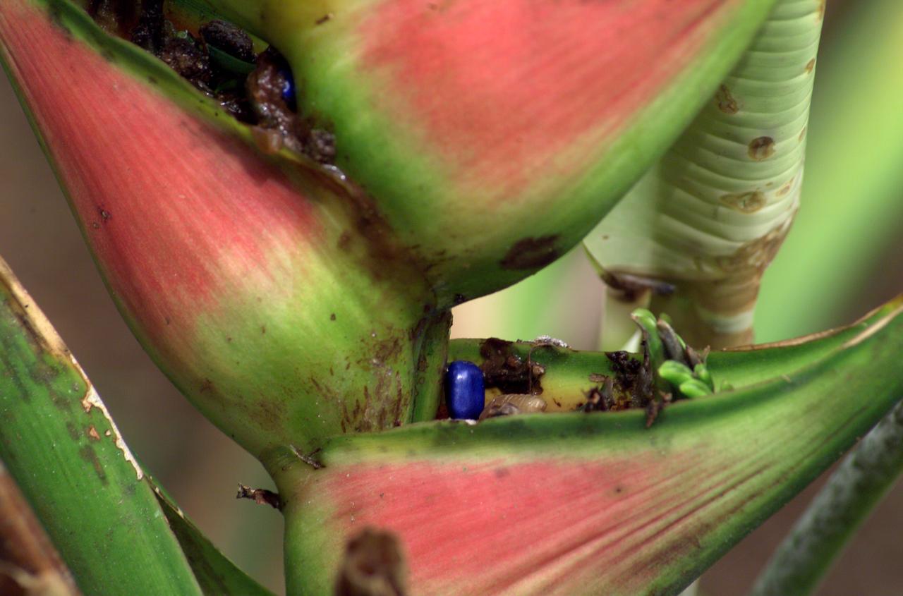
A plant photographed in the La Selva region of the Costa Rican rain forest as part of NASA's AirSAR 2004 Mesoamerica campaign. AirSAR 2004 Mesoamerica is a three-week expedition by an international team of scientists that will use an all-weather imaging tool, called the Airborne Synthetic Aperture Radar (AirSAR) which is located onboard NASA's DC-8 airborne laboratory. Scientists from many parts of the world including NASA's Jet Propulsion Laboratory are combining ground research done in several areas in Central America with NASA's AirSAR technology to improve and expand on the quality of research they are able to do. NASA's AIRSAR technolgy provides two essential elements to the ground-based scientists. First, it tests and provides accurate measurements of the forest structure. Secondly, AirSAR can study a larger area of the forest versus the smaller area that can be tested and plotted by the ground scientists. It also provides a unique one-of-a-kind system of measurement that obtains important information for the scientists, such as where forests are located and what exactly is in them.

Nighttime interior shot of the DC-8 during the transit flight to Santiago. Credit: NASA/Michael Studinger NASA's Operation IceBridge is an airborne science mission to study Earth's polar ice. For more information about IceBridge, visit: <a href="http://www.nasa.gov/icebridge" rel="nofollow">www.nasa.gov/icebridge</a> <b><a href="http://www.nasa.gov/audience/formedia/features/MP_Photo_Guidelines.html" rel="nofollow">NASA image use policy.</a></b> <b><a href="http://www.nasa.gov/centers/goddard/home/index.html" rel="nofollow">NASA Goddard Space Flight Center</a></b> enables NASA’s mission through four scientific endeavors: Earth Science, Heliophysics, Solar System Exploration, and Astrophysics. Goddard plays a leading role in NASA’s accomplishments by contributing compelling scientific knowledge to advance the Agency’s mission. <b>Follow us on <a href="http://twitter.com/NASA_GoddardPix" rel="nofollow">Twitter</a></b> <b>Like us on <a href="http://www.facebook.com/pages/Greenbelt-MD/NASA-Goddard/395013845897?ref=tsd" rel="nofollow">Facebook</a></b> <b>Find us on <a href="http://instagrid.me/nasagoddard/?vm=grid" rel="nofollow">Instagram</a></b>
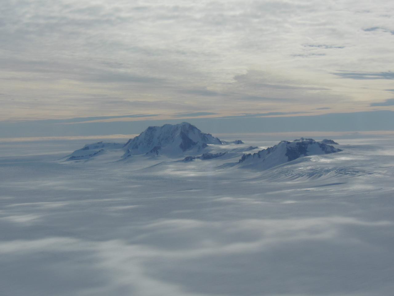
Mountains seen from the IceBridge DC-8 during a survey of the Getz Ice Shelf on Oct. 27, 2012. Credit: NASA / Christy Hansen NASA's Operation IceBridge is an airborne science mission to study Earth's polar ice. For more information about IceBridge, visit: <a href="http://www.nasa.gov/icebridge" rel="nofollow">www.nasa.gov/icebridge</a> <b><a href="http://www.nasa.gov/audience/formedia/features/MP_Photo_Guidelines.html" rel="nofollow">NASA image use policy.</a></b> <b><a href="http://www.nasa.gov/centers/goddard/home/index.html" rel="nofollow">NASA Goddard Space Flight Center</a></b> enables NASA’s mission through four scientific endeavors: Earth Science, Heliophysics, Solar System Exploration, and Astrophysics. Goddard plays a leading role in NASA’s accomplishments by contributing compelling scientific knowledge to advance the Agency’s mission. <b>Follow us on <a href="http://twitter.com/NASA_GoddardPix" rel="nofollow">Twitter</a></b> <b>Like us on <a href="http://www.facebook.com/pages/Greenbelt-MD/NASA-Goddard/395013845897?ref=tsd" rel="nofollow">Facebook</a></b> <b>Find us on <a href="http://instagrid.me/nasagoddard/?vm=grid" rel="nofollow">Instagram</a></b>
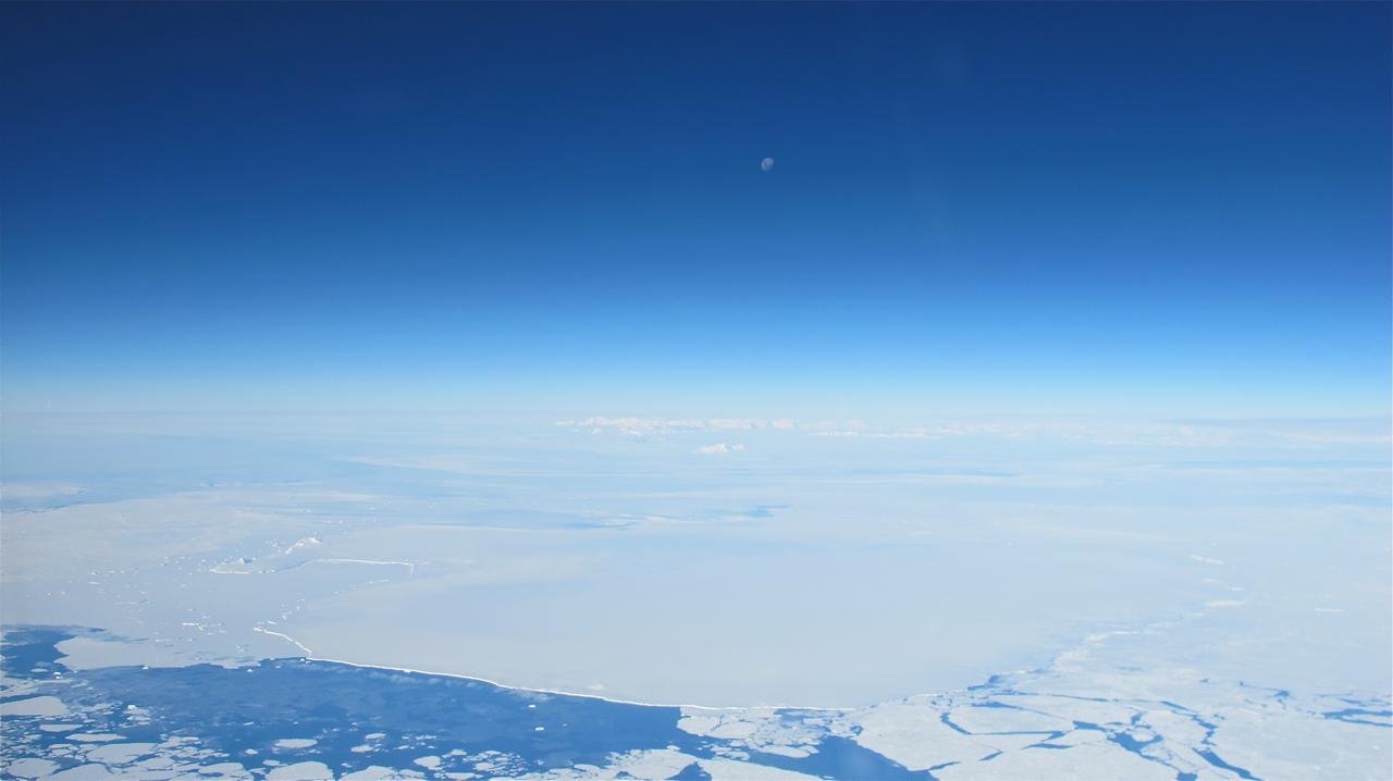
The moon over the Antarctic Peninsula seen from the IceBridge DC-8 on Oct. 25, 2012. Credit: NASA / James Yungel NASA's Operation IceBridge is an airborne science mission to study Earth's polar ice. For more information about IceBridge, visit: <a href="http://www.nasa.gov/icebridge" rel="nofollow">www.nasa.gov/icebridge</a> <b><a href="http://www.nasa.gov/audience/formedia/features/MP_Photo_Guidelines.html" rel="nofollow">NASA image use policy.</a></b> <b><a href="http://www.nasa.gov/centers/goddard/home/index.html" rel="nofollow">NASA Goddard Space Flight Center</a></b> enables NASA’s mission through four scientific endeavors: Earth Science, Heliophysics, Solar System Exploration, and Astrophysics. Goddard plays a leading role in NASA’s accomplishments by contributing compelling scientific knowledge to advance the Agency’s mission. <b>Follow us on <a href="http://twitter.com/NASA_GoddardPix" rel="nofollow">Twitter</a></b> <b>Like us on <a href="http://www.facebook.com/pages/Greenbelt-MD/NASA-Goddard/395013845897?ref=tsd" rel="nofollow">Facebook</a></b> <b>Find us on <a href="http://instagrid.me/nasagoddard/?vm=grid" rel="nofollow">Instagram</a></b>
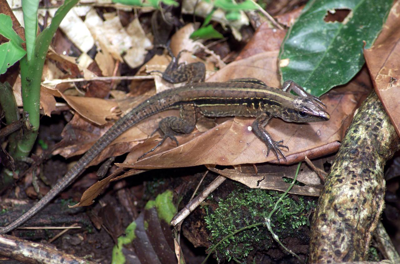
A lizard photographed in the La Selva region of the Costa Rican rain forest as part of NASA's AirSAR 2004 Mesoamerica campaign. AirSAR 2004 Mesoamerica is a three-week expedition by an international team of scientists that will use an all-weather imaging tool, called the Airborne Synthetic Aperture Radar (AirSAR) which is located onboard NASA's DC-8 airborne laboratory. Scientists from many parts of the world including NASA's Jet Propulsion Laboratory are combining ground research done in several areas in Central America with NASA's AirSAR technology to improve and expand on the quality of research they are able to do. NASA's AIRSAR technolgy provides two essential elements to the ground-based scientists. First, it tests and provides accurate measurements of the forest structure. Secondly, AirSAR can study a larger area of the forest versus the smaller area that can be tested and plotted by the ground scientists. It also provides a unique one-of-a-kind system of measurement that obtains important information for the scientists, such as where forests are located and what exactly is in them.

School children from Punta Arenas, Chile, talk with Dr. David Imel, an AirSAR scientist from NASA JPL, during AirSAR 2004. AirSAR 2004 is a three-week expedition by an international team of scientists that uses an all-weather imaging tool, called the Airborne Synthetic Aperture Radar (AirSAR) which is located onboard NASA's DC-8 airborne laboratory. Scientists from many parts of the world including NASA's Jet Propulsion Laboratory are combining ground research done in several areas in Central and South America with NASA's AirSAR technology to improve and expand on the quality of research they are able to conduct. In South America and Antarctica, AirSAR collected imagery and data to help determine the contribution of Southern Hemisphere glaciers to sea level rise due to climate change. In Patagonia, researchers found this contribution had more than doubled from 1995 to 2000, compared to the previous 25 years. AirSAR data will make it possible to determine whether that trend is continuing or accelerating. AirSAR will also provide reliable information on ice shelf thickness to measure the contribution of the glaciers to sea level.
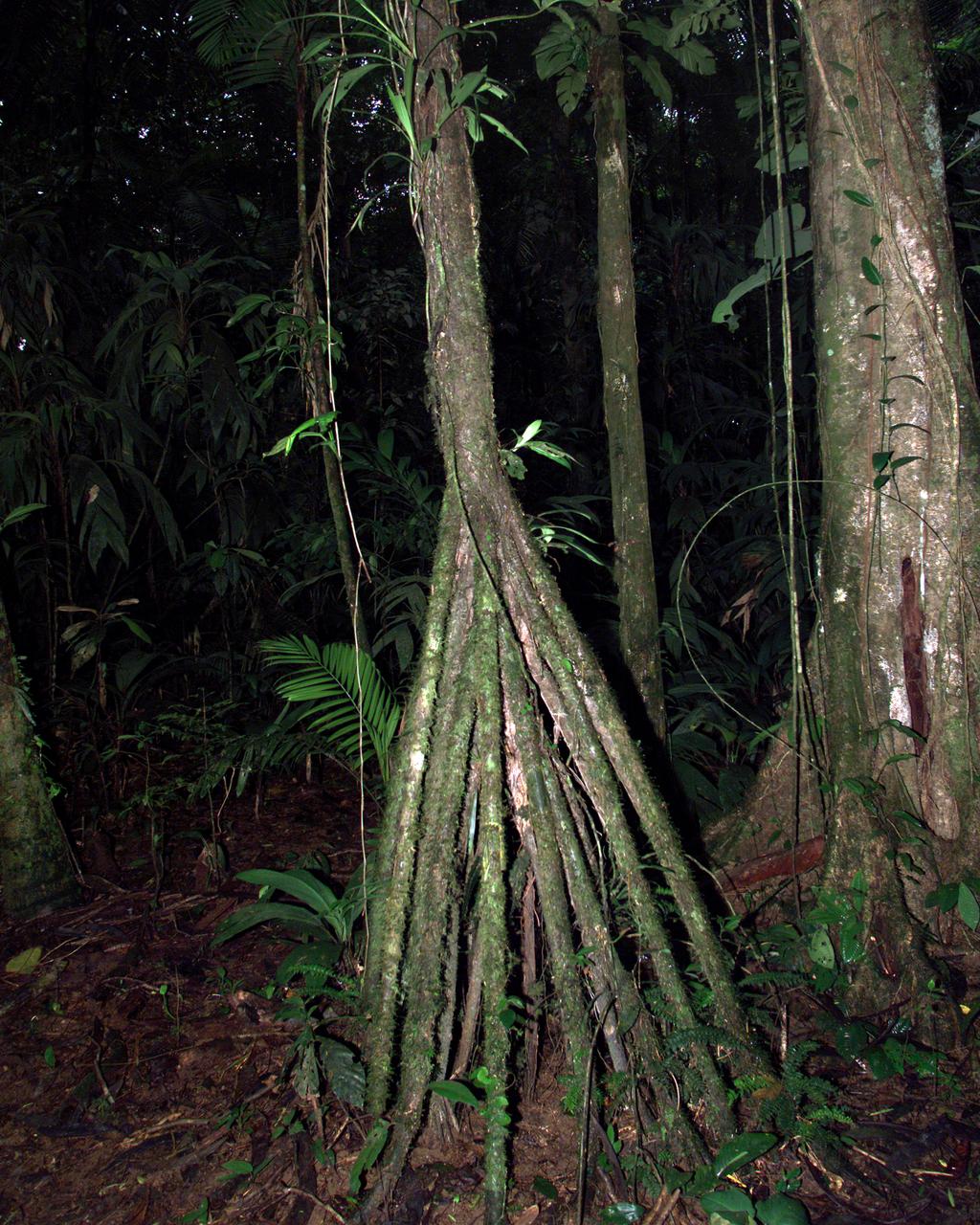
A tree trunk structure photographed in the La Selva region of the Costa Rican rain forest as part of NASA's AirSAR 2004 Mesoamerica campaign. AirSAR 2004 Mesoamerica is a three-week expedition by an international team of scientists that will use an all-weather imaging tool, called the Airborne Synthetic Aperture Radar (AirSAR) which is located onboard NASA's DC-8 airborne laboratory. Scientists from many parts of the world including NASA's Jet Propulsion Laboratory are combining ground research done in several areas in Central America with NASA's AirSAR technology to improve and expand on the quality of research they are able to do. NASA's AIRSAR technolgy provides two essential elements to the ground-based scientists. First, it tests and provides accurate measurements of the forest structure. Secondly, AirSAR can study a larger area of the forest versus the smaller area that can be tested and plotted by the ground scientists. It also provides a unique one-of-a-kind system of measurement that obtains important information for the scientists, such as where forests are located and what exactly is in them.

A spider photographed during NASA's AirSAR 2004 Mesoamerica campaign in the La Selva region of the Costa Rican rain forest. AirSAR 2004 Mesoamerica is a three-week expedition by an international team of scientists that uses an all-weather imaging tool, called the Airborne Synthetic Aperture Radar (AirSAR) which is located onboard NASA's DC-8 airborne laboratory. Scientists from many parts of the world including NASA's Jet Propulsion Laboratory are combining ground research done in several areas in Central America with NASA's AirSAR technology to improve and expand on the quality of research they are able to conduct. The radar, developed by NASA's Jet Propulsion Laboratory, can penetrate clouds and also collect data at night. Its high-resolution sensors operate at multiple wavelengths and modes, allowing AirSAR to see beneath treetops, through thin sand, and dry snow pack. AirSAR's 2004 campaign is a collaboration of many U.S. and Central American institutions and scientists, including NASA; the National Science Foundation; the Smithsonian Institution; National Geographic; Conservation International; the Organization of Tropical Studies; the Central American Commission for Environment and Development; and the Inter-American Development Bank.
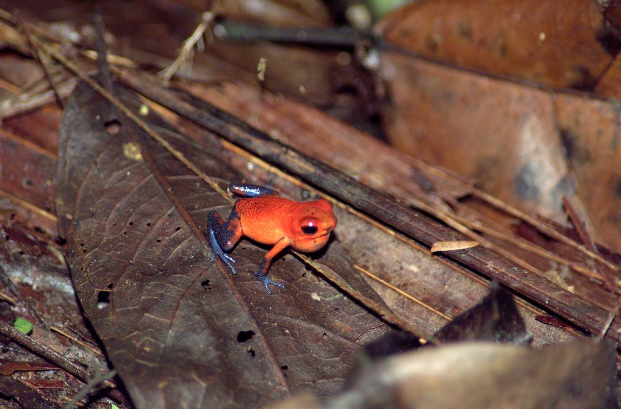
A tree frog photographed in the La Selva region of the Costa Rican rain forest as part of NASA's AirSAR 2004 Mesoamerica campaign. AirSAR 2004 Mesoamerica is a three-week expedition by an international team of scientists that will use an all-weather imaging tool, called the Airborne Synthetic Aperture Radar (AirSAR) which is located onboard NASA's DC-8 airborne laboratory. Scientists from many parts of the world including NASA's Jet Propulsion Laboratory are combining ground research done in several areas in Central America with NASA's AirSAR technology to improve and expand on the quality of research they are able to do. NASA's AIRSAR technolgy provides two essential elements to the ground-based scientists. First, it tests and provides accurate measurements of the forest structure. Secondly, AirSAR can study a larger area of the forest versus the smaller area that can be tested and plotted by the ground scientists. It also provides a unique one-of-a-kind system of measurement that obtains important information for the scientists, such as where forests are located and what exactly is in them.
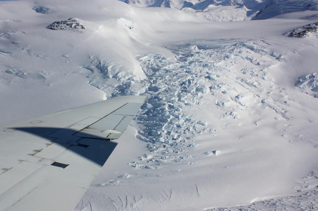
An area of broken glacier ice seen from the IceBridge DC-8 on Oct. 22, 2012. Credit: NASA / George Hale NASA's Operation IceBridge is an airborne science mission to study Earth's polar ice. For more information about IceBridge, visit: <a href="http://www.nasa.gov/icebridge" rel="nofollow">www.nasa.gov/icebridge</a> <b><a href="http://www.nasa.gov/audience/formedia/features/MP_Photo_Guidelines.html" rel="nofollow">NASA image use policy.</a></b> <b><a href="http://www.nasa.gov/centers/goddard/home/index.html" rel="nofollow">NASA Goddard Space Flight Center</a></b> enables NASA’s mission through four scientific endeavors: Earth Science, Heliophysics, Solar System Exploration, and Astrophysics. Goddard plays a leading role in NASA’s accomplishments by contributing compelling scientific knowledge to advance the Agency’s mission. <b>Follow us on <a href="http://twitter.com/NASA_GoddardPix" rel="nofollow">Twitter</a></b> <b>Like us on <a href="http://www.facebook.com/pages/Greenbelt-MD/NASA-Goddard/395013845897?ref=tsd" rel="nofollow">Facebook</a></b> <b>Find us on <a href="http://instagrid.me/nasagoddard/?vm=grid" rel="nofollow">Instagram</a></b>
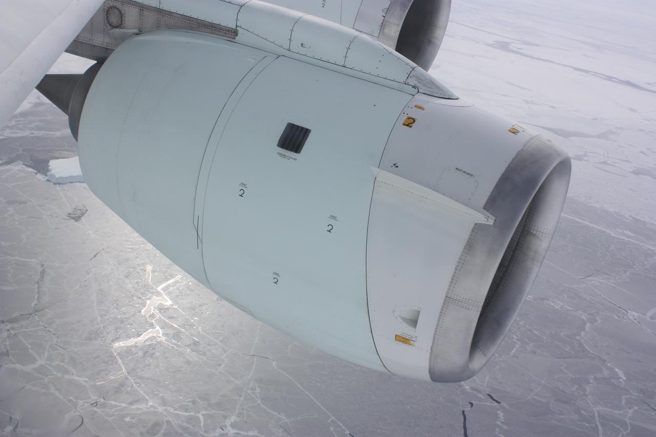
One of the engines of NASA's DC-8 airborne laboratory above sea ice in the Bellingshausen Sea on Oct. 19, 2012. Credit: NASA / George Hale NASA's Operation IceBridge is an airborne science mission to study Earth's polar ice. For more information about IceBridge, visit: <a href="http://www.nasa.gov/icebridge" rel="nofollow">www.nasa.gov/icebridge</a> <b><a href="http://www.nasa.gov/audience/formedia/features/MP_Photo_Guidelines.html" rel="nofollow">NASA image use policy.</a></b> <b><a href="http://www.nasa.gov/centers/goddard/home/index.html" rel="nofollow">NASA Goddard Space Flight Center</a></b> enables NASA’s mission through four scientific endeavors: Earth Science, Heliophysics, Solar System Exploration, and Astrophysics. Goddard plays a leading role in NASA’s accomplishments by contributing compelling scientific knowledge to advance the Agency’s mission. <b>Follow us on <a href="http://twitter.com/NASA_GoddardPix" rel="nofollow">Twitter</a></b> <b>Like us on <a href="http://www.facebook.com/pages/Greenbelt-MD/NASA-Goddard/395013845897?ref=tsd" rel="nofollow">Facebook</a></b> <b>Find us on <a href="http://instagrid.me/nasagoddard/?vm=grid" rel="nofollow">Instagram</a></b>

A butterfly photographed in the La Selva region of the Costa Rican rain forest as part of NASA's AirSAR 2004 Mesoamerica campaign. AirSAR 2004 Mesoamerica is a three-week expedition by an international team of scientists that will use an all-weather imaging tool, called the Airborne Synthetic Aperture Radar (AirSAR) which is located onboard NASA's DC-8 airborne laboratory. Scientists from many parts of the world including NASA's Jet Propulsion Laboratory are combining ground research done in several areas in Central America with NASA's AirSAR technology to improve and expand on the quality of research they are able to do. NASA's AIRSAR technolgy provides two essential elements to the ground-based scientists. First, it tests and provides accurate measurements of the forest structure. Secondly, AirSAR can study a larger area of the forest versus the smaller area that can be tested and plotted by the ground scientists. It also provides a unique one-of-a-kind system of measurement that obtains important information for the scientists, such as where forests are located and what exactly is in them.
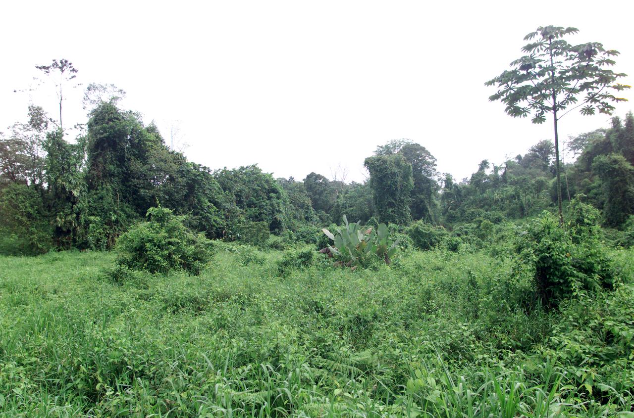
Dense rain forest in the La Selva region of Costa Rica. AirSAR 2004 Mesoamerica is a three-week expedition by an international team of scientists that uses an all-weather imaging tool, called the Airborne Synthetic Aperture Radar (AirSAR) which is located onboard NASA's DC-8 airborne laboratory. Scientists from many parts of the world including NASA's Jet Propulsion Laboratory are combining ground research done in several areas in Central America with NASA's AirSAR technology to improve and expand on the quality of research they are able to conduct. The radar, developed by NASA's Jet Propulsion Laboratory, can penetrate clouds and also collect data at night. Its high-resolution sensors operate at multiple wavelengths and modes, allowing AirSAR to see beneath treetops, through thin sand, and dry snow pack. AirSAR's 2004 campaign is a collaboration of many U.S. and Central American institutions and scientists, including NASA; the National Science Foundation; the Smithsonian Institution; National Geographic; Conservation International; the Organization of Tropical Studies; the Central American Commission for Environment and Development; and the Inter-American Development Bank.
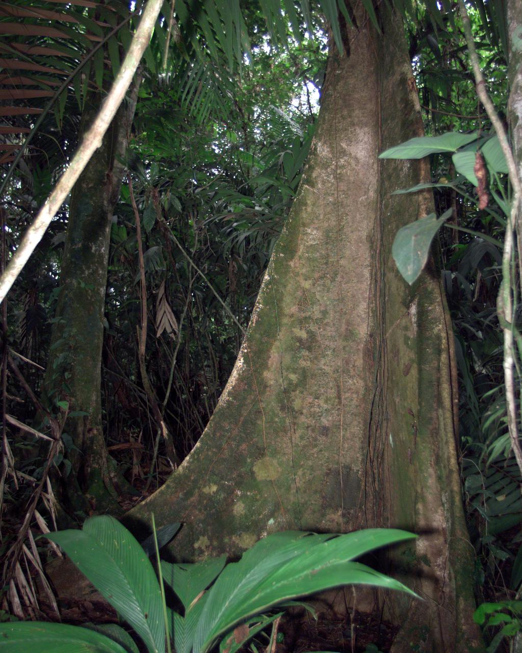
A unique tree trunk photographed in La Selva region of the Costa Rican rain forest as part of NASA's AirSAR 2004 Mesoamerica campaign. AirSAR 2004 Mesoamerica is a three-week expedition by an international team of scientists that will use an all-weather imaging tool, called the Airborne Synthetic Aperture Radar (AirSAR) which is located onboard NASA's DC-8 airborne laboratory. Scientists from many parts of the world including NASA's Jet Propulsion Laboratory are combining ground research done in several areas in Central America with NASA's AirSAR technology to improve and expand on the quality of research they are able to do. NASA's AIRSAR technolgy provides two essential elements to the ground-based scientists. First, it tests and provides accurate measurements of the forest structure. Secondly, AirSAR can study a larger area of the forest versus the smaller area that can be tested and plotted by the ground scientists. It also provides a unique one-of-a-kind system of measurement that obtains important information for the scientists, such as where forests are located and what exactly is in them.
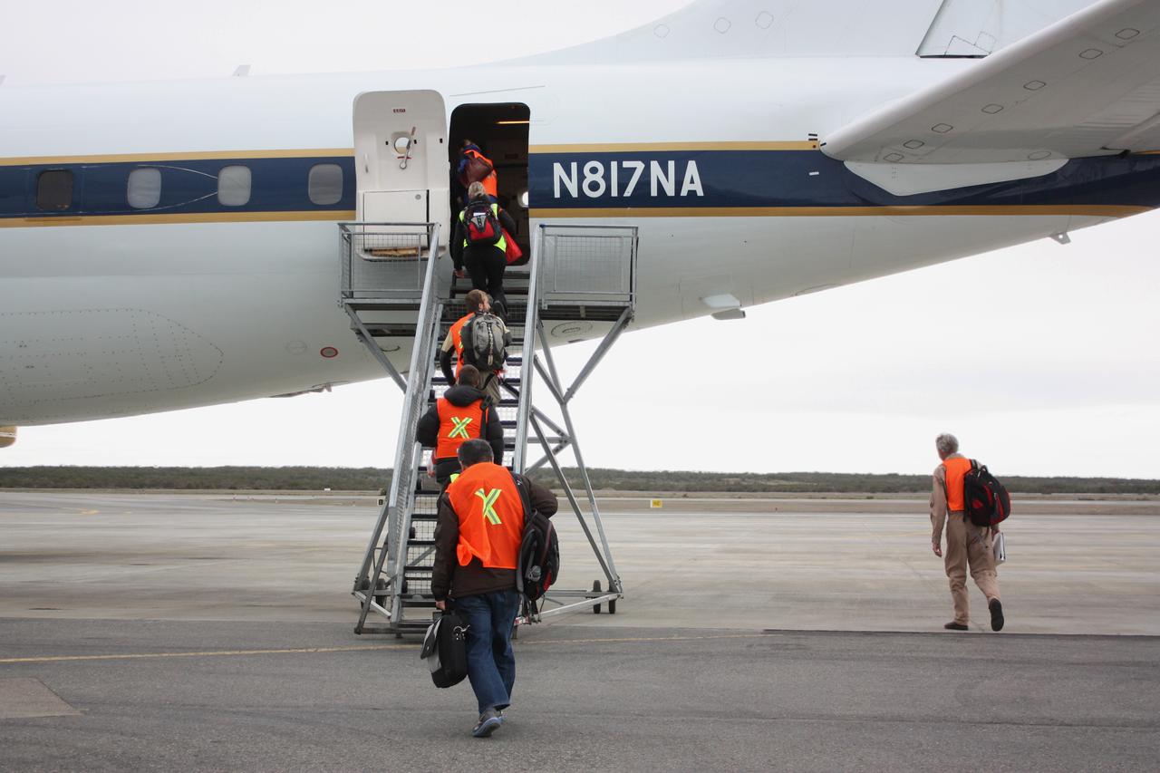
IceBridge personnel boarding NASA's DC-8 airborne laboratory on the morning of Oct. 22, 2012, before a mission to survey the Ronne Ice Shelf. Credit: NASA / George Hale NASA's Operation IceBridge is an airborne science mission to study Earth's polar ice. For more information about IceBridge, visit: <a href="http://www.nasa.gov/icebridge" rel="nofollow">www.nasa.gov/icebridge</a> <b><a href="http://www.nasa.gov/audience/formedia/features/MP_Photo_Guidelines.html" rel="nofollow">NASA image use policy.</a></b> <b><a href="http://www.nasa.gov/centers/goddard/home/index.html" rel="nofollow">NASA Goddard Space Flight Center</a></b> enables NASA’s mission through four scientific endeavors: Earth Science, Heliophysics, Solar System Exploration, and Astrophysics. Goddard plays a leading role in NASA’s accomplishments by contributing compelling scientific knowledge to advance the Agency’s mission. <b>Follow us on <a href="http://twitter.com/NASA_GoddardPix" rel="nofollow">Twitter</a></b> <b>Like us on <a href="http://www.facebook.com/pages/Greenbelt-MD/NASA-Goddard/395013845897?ref=tsd" rel="nofollow">Facebook</a></b> <b>Find us on <a href="http://instagrid.me/nasagoddard/?vm=grid" rel="nofollow">Instagram</a></b>

An iceberg trapped in sea ice in the Amundsen Sea, seen from the IceBridge DC-8 during the Getz 07 mission on Oct. 27. Credit: NASA / Maria-Jose Vinas NASA's Operation IceBridge is an airborne science mission to study Earth's polar ice. For more information about IceBridge, visit: <a href="http://www.nasa.gov/icebridge" rel="nofollow">www.nasa.gov/icebridge</a> <b><a href="http://www.nasa.gov/audience/formedia/features/MP_Photo_Guidelines.html" rel="nofollow">NASA image use policy.</a></b> <b><a href="http://www.nasa.gov/centers/goddard/home/index.html" rel="nofollow">NASA Goddard Space Flight Center</a></b> enables NASA’s mission through four scientific endeavors: Earth Science, Heliophysics, Solar System Exploration, and Astrophysics. Goddard plays a leading role in NASA’s accomplishments by contributing compelling scientific knowledge to advance the Agency’s mission. <b>Follow us on <a href="http://twitter.com/NASA_GoddardPix" rel="nofollow">Twitter</a></b> <b>Like us on <a href="http://www.facebook.com/pages/Greenbelt-MD/NASA-Goddard/395013845897?ref=tsd" rel="nofollow">Facebook</a></b> <b>Find us on <a href="http://instagrid.me/nasagoddard/?vm=grid" rel="nofollow">Instagram</a></b>
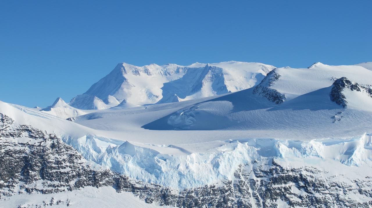
Ice on the Ellsworth Range in Antarctica as seen from the IceBridge DC-8 on Oct. 22, 2012. NASA's Operation IceBridge is an airborne science mission to study Earth's polar ice. For more information about IceBridge, visit: <a href="http://www.nasa.gov/icebridge" rel="nofollow">www.nasa.gov/icebridge</a> <b><a href="http://www.nasa.gov/audience/formedia/features/MP_Photo_Guidelines.html" rel="nofollow">NASA image use policy.</a></b> <b><a href="http://www.nasa.gov/centers/goddard/home/index.html" rel="nofollow">NASA Goddard Space Flight Center</a></b> enables NASA’s mission through four scientific endeavors: Earth Science, Heliophysics, Solar System Exploration, and Astrophysics. Goddard plays a leading role in NASA’s accomplishments by contributing compelling scientific knowledge to advance the Agency’s mission. <b>Follow us on <a href="http://twitter.com/NASA_GoddardPix" rel="nofollow">Twitter</a></b> <b>Like us on <a href="http://www.facebook.com/pages/Greenbelt-MD/NASA-Goddard/395013845897?ref=tsd" rel="nofollow">Facebook</a></b> <b>Find us on <a href="http://instagrid.me/nasagoddard/?vm=grid" rel="nofollow">Instagram</a></b>