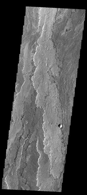
Today's VIS image shows a small portion of Daedalia Planum. Daedalia Planum was created by lava flows from Arsia Mons. Orbit Number: 64898 Latitude: -23.0356 Longitude: 239.131 Instrument: VIS Captured: 2016-07-31 12:48 http://photojournal.jpl.nasa.gov/catalog/PIA20997
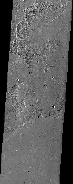
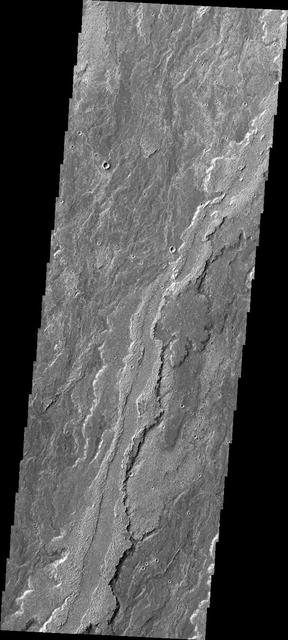
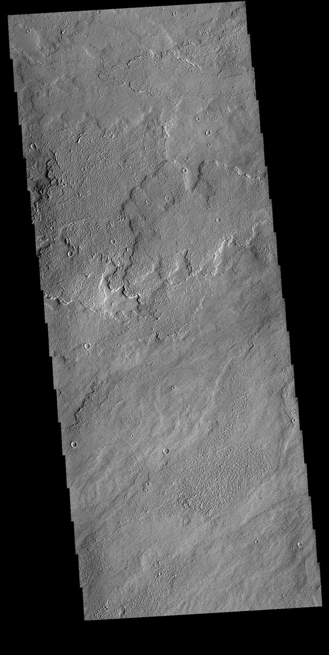
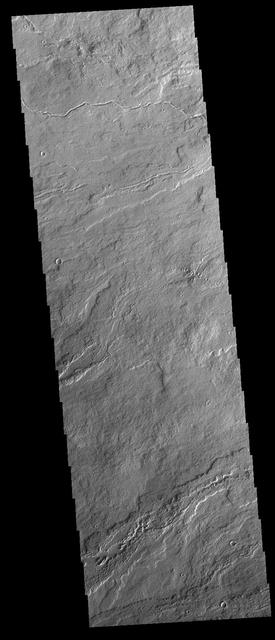
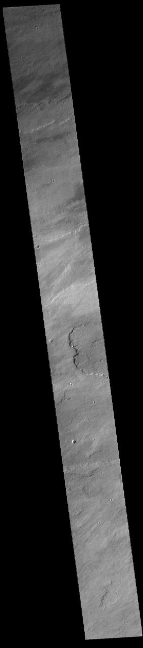
This VIS image shows a small portion of Daedalia Planum. The lava flows in this region originated at Arsia Mons, one of the large Tharsis volcanoes. Several different elevations of lava flow are visible in this image, some much smoother in appearance than others. Orbit Number: 66838 Latitude: -18.1894 Longitude: 231.819 Instrument: VIS Captured: 2017-01-07 07:45 http://photojournal.jpl.nasa.gov/catalog/PIA21321
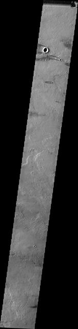
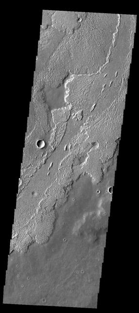
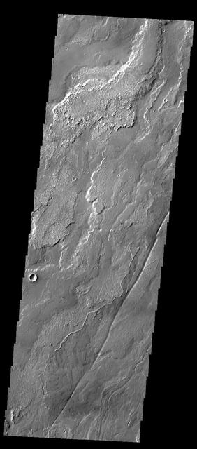
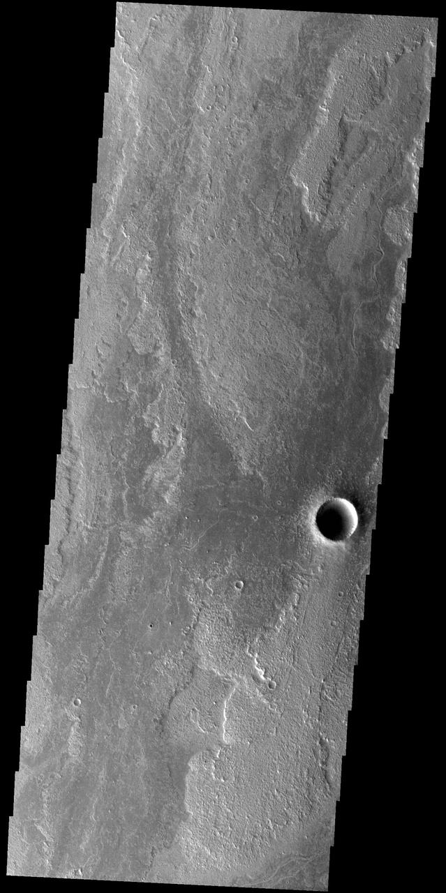
This VIS image shows part of Daedalia Planum, which is comprised of lava flows from Arsia Mons. A windstreak is visible at the top of the image, downwind from a small crater. Orbit Number: 66495 Latitude: -15.7413 Longitude: 223.259 Instrument: VIS Captured: 2016-12-10 02:19 http://photojournal.jpl.nasa.gov/catalog/PIA21297
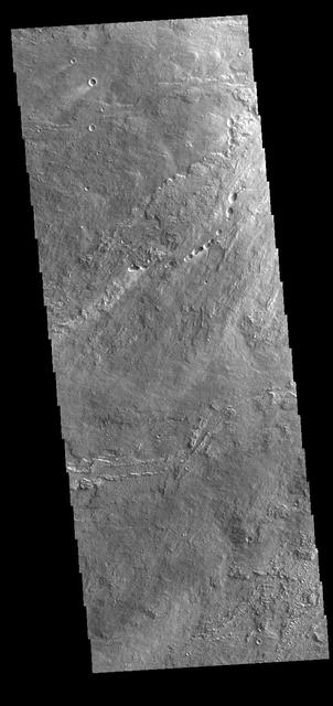
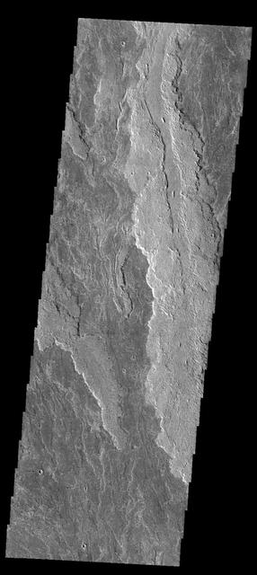
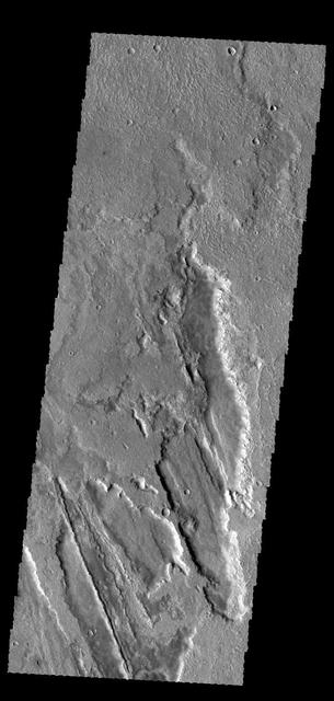
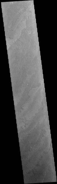
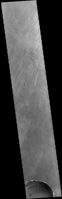
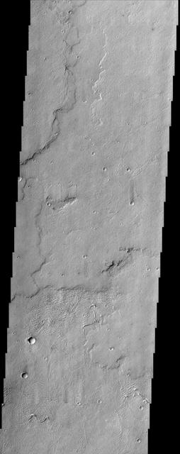
Daedalia Planum
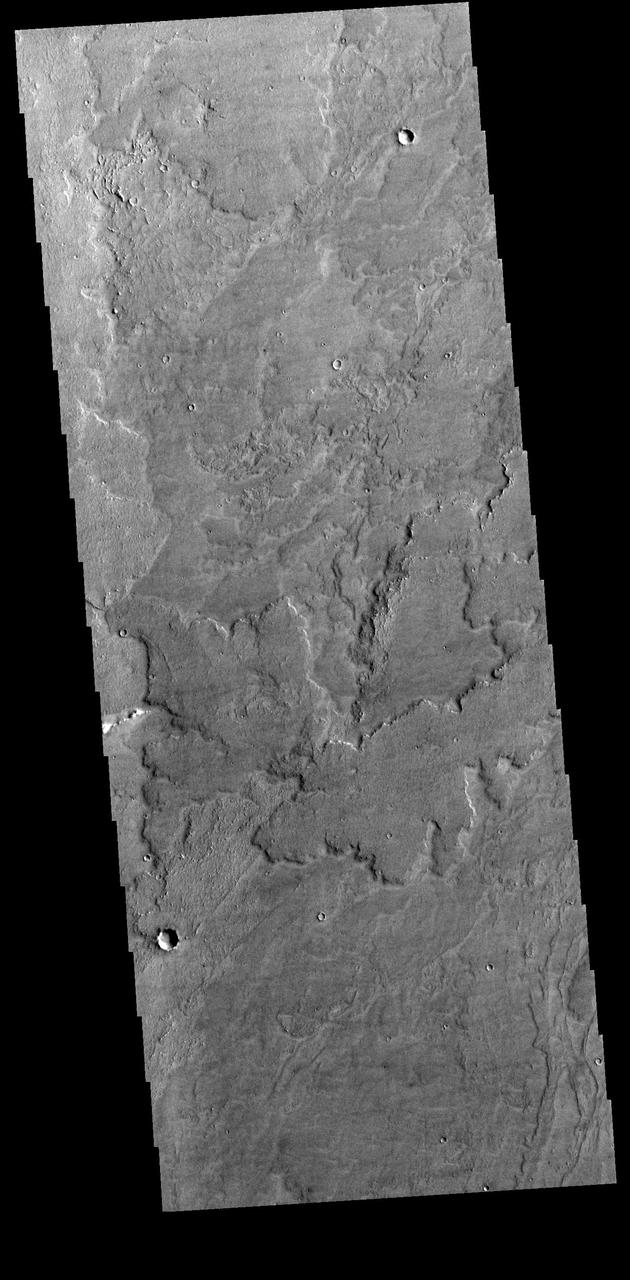
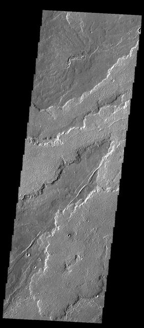
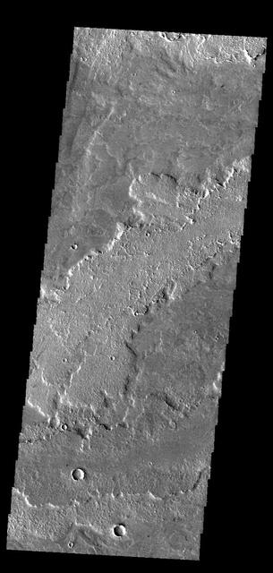
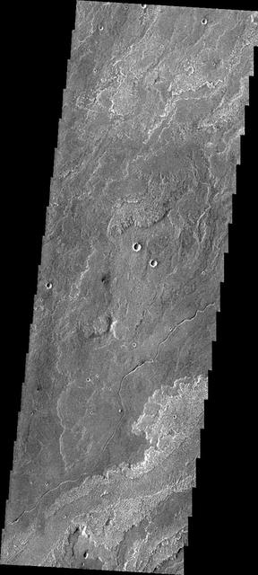
Daedalia Planum
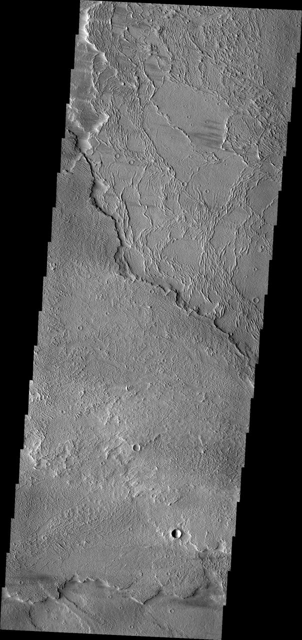
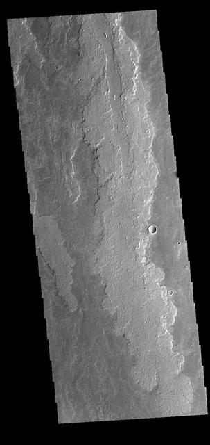
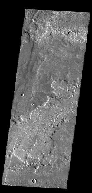
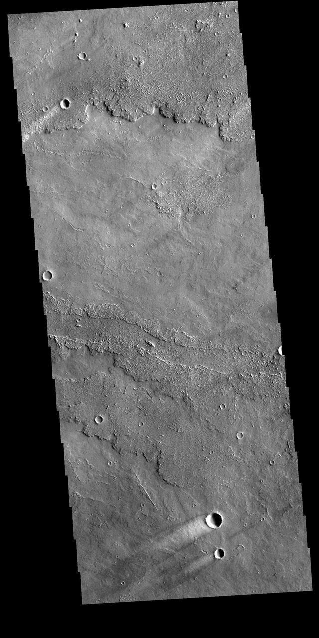
Daedalia Planum
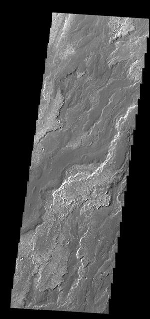
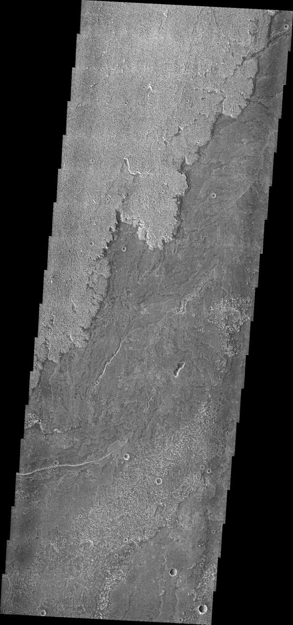
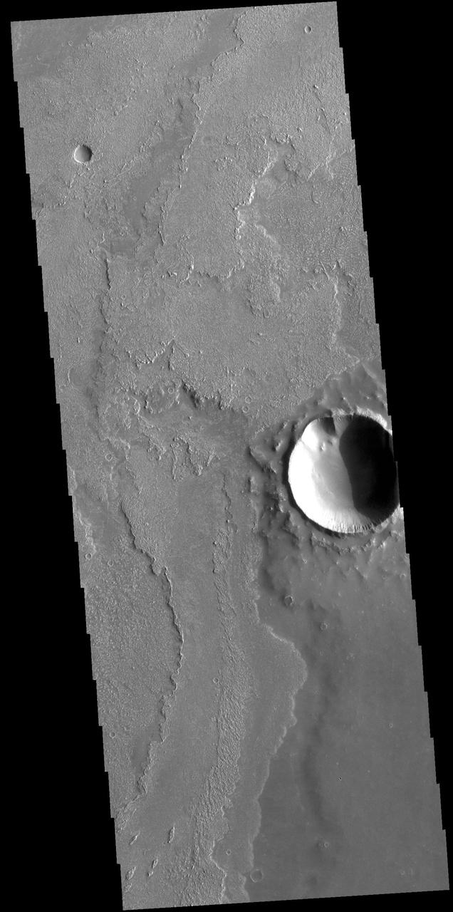
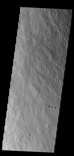
Daedalia Planum
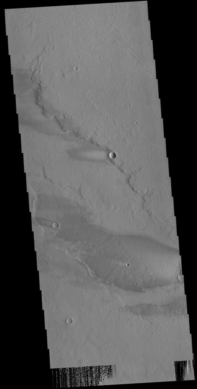
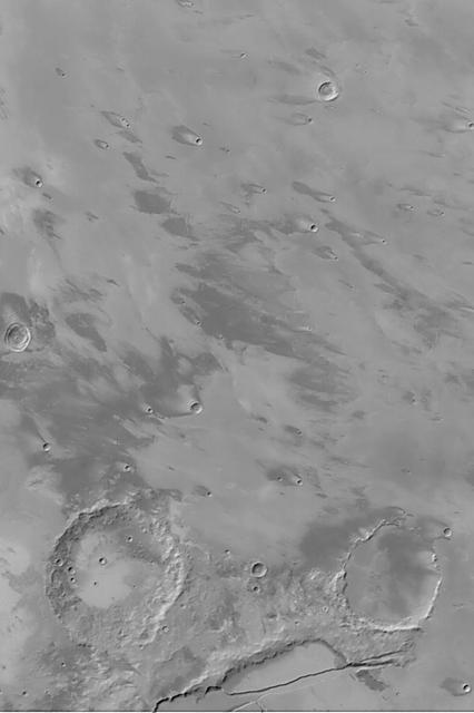
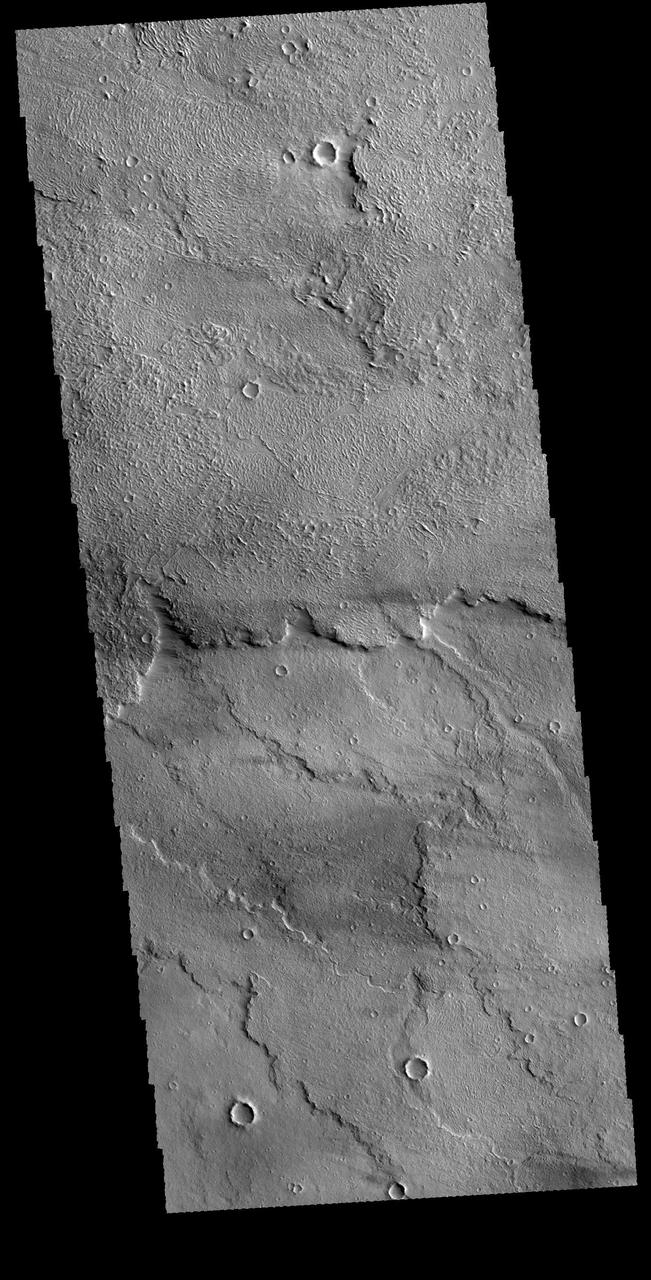
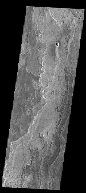
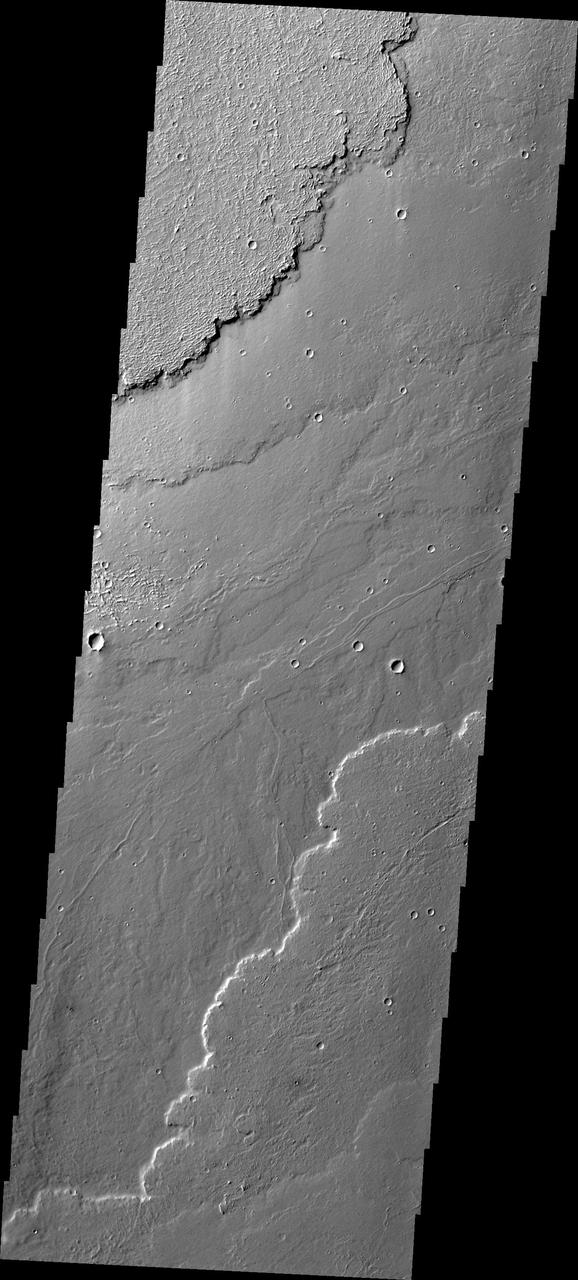
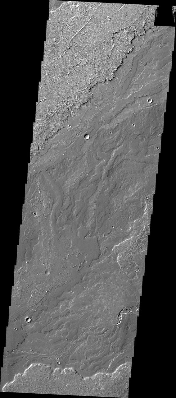
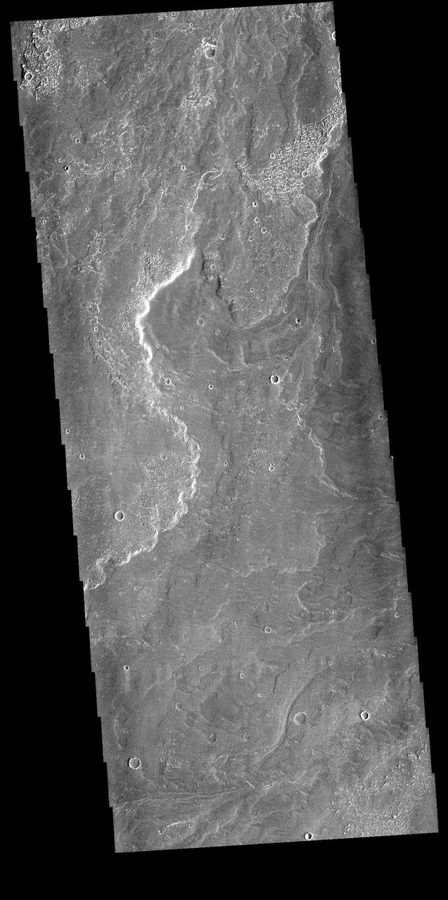
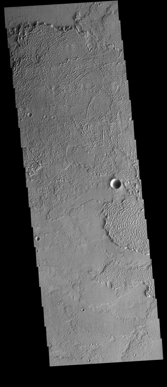
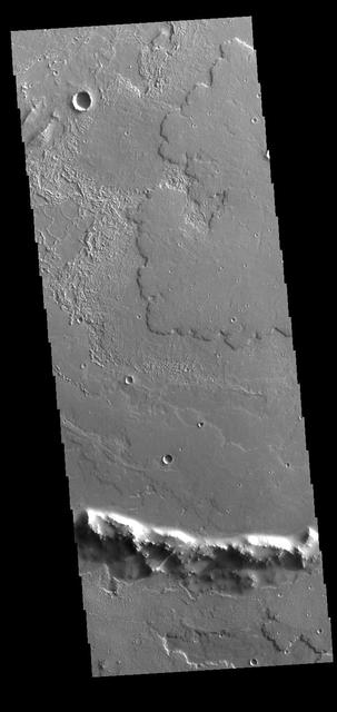
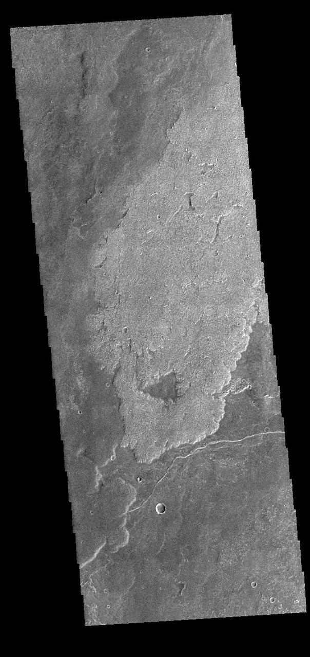
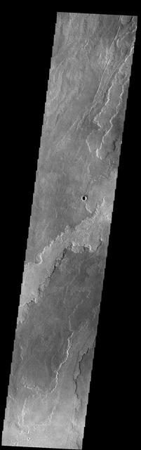
This VIS image shows part of Daedalia Planum as well as several windstreaks. There is a large streak in the bottom half of the frame from a large crater off the image to the right. The "tail" of the windstreak is on the downwind side of the crater. Orbit Number: 64886 Latitude: -8.63998 Longitude: 223.484 Instrument: VIS Captured: 2016-07-30 13:10 http://photojournal.jpl.nasa.gov/catalog/PIA20995
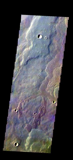
The THEMIS VIS camera contains 5 filters. The data from different filters can be combined in multiple ways to create a false color image. These false color images may reveal subtle variations of the surface not easily identified in a single band image. Today's false color image shows a small portion of Daedalia Planum. Orbit Number: 52611 Latitude: -22.2406 Longitude: 243.285 Instrument: VIS Captured: 2013-10-23 20:49 https://photojournal.jpl.nasa.gov/catalog/PIA21531
Daedalia Planum Wind Streaks
Daedalia Planum Wind Streak
Wind Streaks on Daedalia Planum
The volcanic flows in Daedalia Planum originated from Arsia Mons. This image from NASA Mars Odyssey shows a tiny portion of Daedalia Planum.
Margin of Lava Flow in Daedalia Planum
Crenulated Lava Flows of Daedalia Planum
The volcanic flows that comprise Daedalia Planum arose from Arsia Mons. This image from NASA 2001 Mars Odyssey spacecraft shows a small portion of Daedalia Planum, including a channel-fed lava flow.
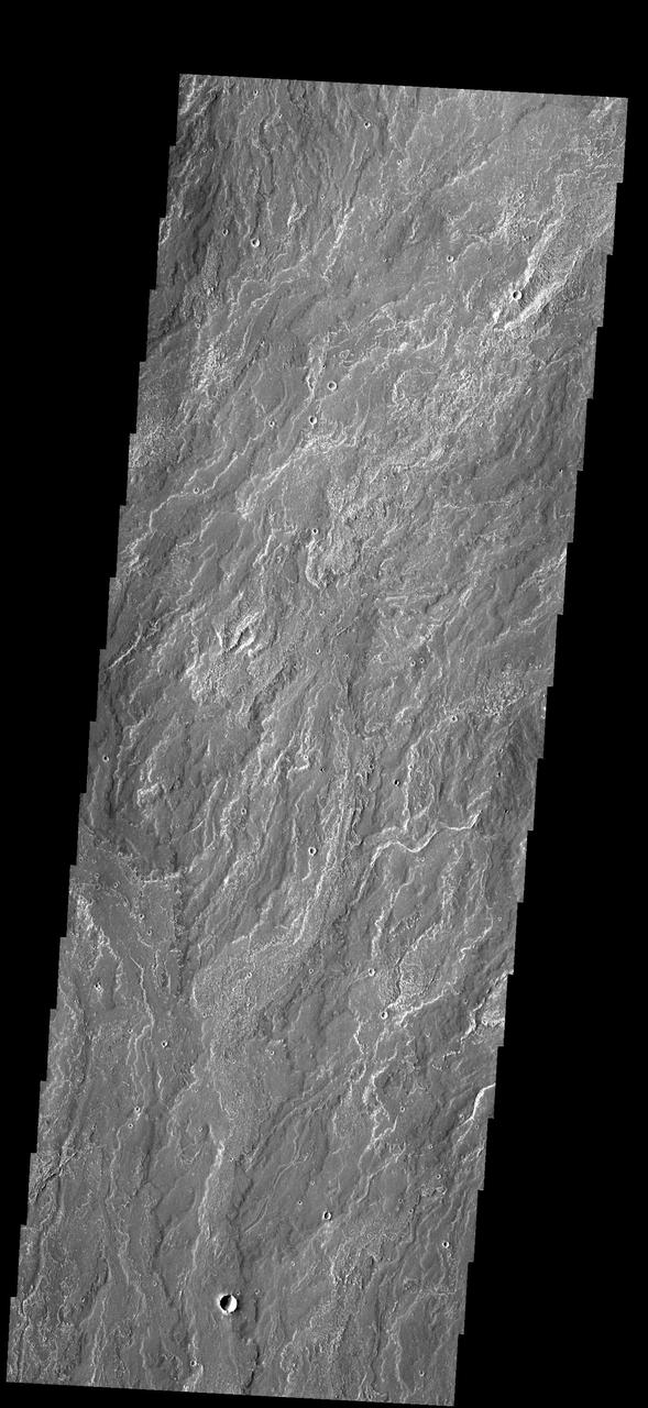
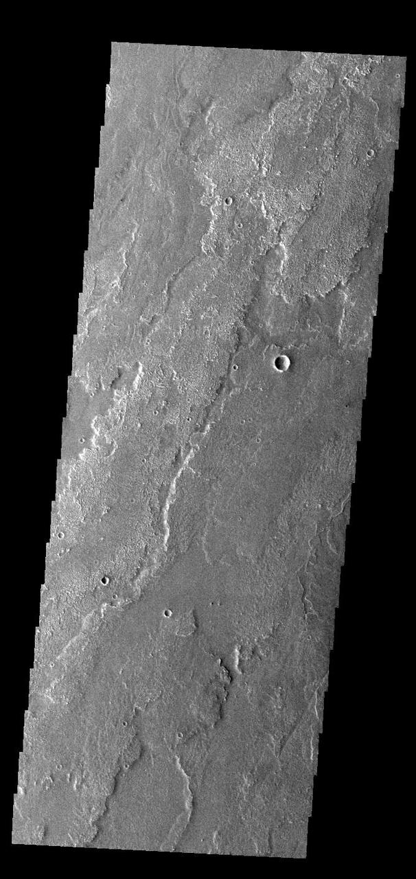
Today's VIS image shows a portion of Daedalia Planum. Daedalia Planum is a huge lava flow field that originates at Arsia Mons, the southermost of the three large aligned Tharsis region volcanoes. Individual lava flows can have lengths up to almost 180 km (111 miles). The longest Hawaiian lava flow is only 51 km (31 miles). The total area of Daedalia Planum is 2.9 million square km — more than four times the size of Texas. Orbit Number: 78207 Latitude: -14.2806 Longitude: 235.365 Instrument: VIS Captured: 2019-08-01 20:58 https://photojournal.jpl.nasa.gov/catalog/PIA23447
Today's VIS image shows a small portion of Daedalia Planum. Daedalia Planum is an immense lava flow field that originates at Arsia Mons. Arsia Mons is the southernmost of the three large aligned volcanoes in the Tharsis region. Arsia Mons' last eruption was 10s of million years ago. Orbit Number: 80553 Latitude: -23.7847 Longitude: 234.227 Instrument: VIS Captured: 2020-02-11 01:06 https://photojournal.jpl.nasa.gov/catalog/PIA23840
This image from NASA Mars Odyssey shows different flow surfaces in Daedalia Planum.
Daedalia Planum is comprised of lava flows from Arsia Mons. This image was captured by NASA 2001 Mars Odyssey spacecraft.

This image from NASA 2001 Mars Odyssey spacecraft shows a small portion of the lava flows that make up Daedalia Planum.
This image captured by NASA 2001 Mars Odyssey spacecraft shows a small portion of Daedalia Planum.
This image captured by NASA 2001 Mars Odyssey spacecraft shows part of the extensive lava flows that comprise Daedalia Planum.
This image from NASA 2001 Mars Odyssey spacecraft shows a small portion of the lava flows that comprise Daedalia Planum.
The lava flows in this image from NASA 2001 Mars Odyssey spacecraft are part of the extensive lava plains of Daedalia Planum.
This image captured by NASA 2001 Mars Odyssey spacecraft shows a small portion of the lava flows that make up Daedalia Planum.
This image from NASA 2001 Mars Odyssey spacecraft shows lava flows in Daedalia Planum.
This image captured by NASA 2001 Mars Odyssey spacecraft shows a small portion of the lava flows that comprise Daedalia Planum.
The lava flows in this image are part of Daedalia Planum as seen by NASA 2001 Mars Odyssey spacecraft.
This image captured by NASA 2001 Mars Odyssey spacecraft shows more of the extensive lava flows in Daedalia Planum.
Lava flows near the margin of Daedalia Planum are seen in this image from NASA 2001 Mars Odyssey spacecraft.
The extensive volcanic flows in this image captured by NASA 2001 Mars Odyssey spacecraft are part of Daedalia Planum.
This image from NASA 2001 Mars Odyssey spacecraft shows part of the extensive lava flows that make up Daedalia Planum.

The volcanic flows in this image from NASA Mars Odyssey spacecraft are part of Daedalia Planum. The flows originated at Arsia Mons.
This image from NASA 2001 Mars Odyssey spacecraft shows different surface textures in some of the lava flows of Daedalia Planum.
Concentric Crater Floor Deposits in Daedalia Planum

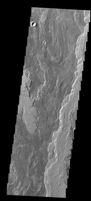
This VIS image shows a small portion of Daedalia Planum. The lava flows in this image originated at Arsia Mons. Individual flows have lengths up to almost 180km (~111 miles). The longest Hawaiian lava flow is only 51km (~31 miles). The area of Daedalia Planum is 2.9 million square km - more than 4 times the size of Texas. Orbit Number: 75431 Latitude: -18.9209 Longitude: 241.546 Instrument: VIS Captured: 2018-12-16 05:39 https://photojournal.jpl.nasa.gov/catalog/PIA23085
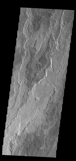
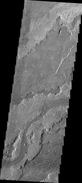
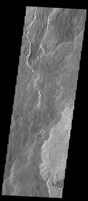
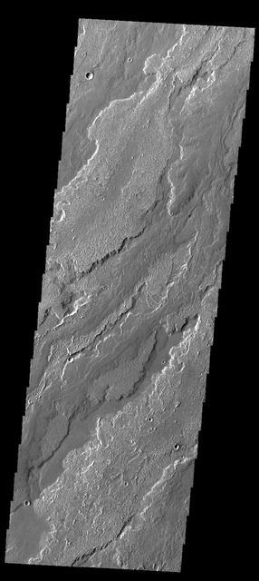
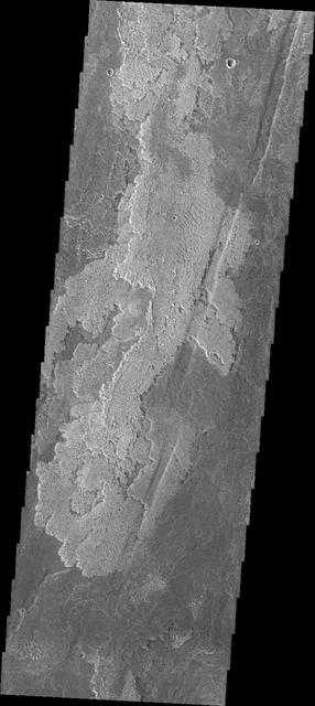
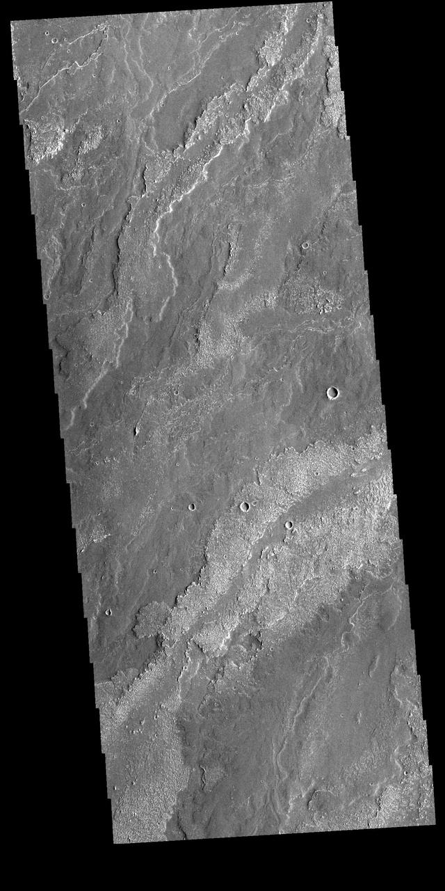
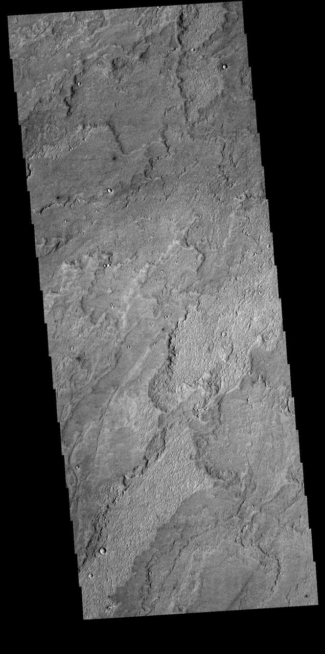
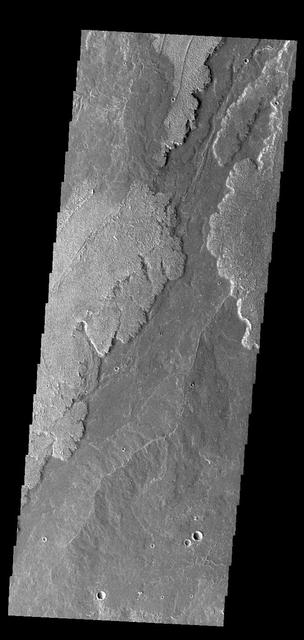
Today's VIS image shows part of the extensive volcanic flows that make up Daedalia Planum. The different layers and surface textures are due to flows at different times, or the affect of cooling as the flow narrows and extends far from the lava source. Daedalia Planum volcanic flows originate at or near Arsia Mons. Orbit Number: 75431 Latitude: -18.9209 Longitude: 241.546 Instrument: VIS Captured: 2018-12-16 05:39 https://photojournal.jpl.nasa.gov/catalog/PIA23032
The lava flows seen in this image from NASA 2001 Mars Odyssey spacecraft are part of Daedalia Planum. The flows are associated with Arsia Mons.
The volcanic flows in this image captured by NASA Mars Odyssey spacecraft are part of Daedalia Planum, an extensive flow field originating from Arsia Mons.
This image captured by NASA 2001 Mars Odyssey spacecraft shows part of the extensive field of lava flows that make up Daedalia Planum.
This image captured by NASA 2001 Mars Odyssey spacecraft shows a portion of Daedalia Planum, an extensive volcanic plain comprised of flows from Arsia Mons.
Innumerable lava flows from Arsia Mons make up the volcanic plains called Daedalia Planum as seen by NASA 2001 Mars Odyssey.
Interesting textures on lava flows in Daedalia Planum, southwest of the Tharsis volcanoes, can by observed in this image from NASA Mars Odyssey spacecraft.
This image captured by NASA 2001 Mars Odyssey spacecraft shows a small portion of Daedalia Planum, which is mainly comprised of lava flows related to Arsia Mons.
Extensive lava flows originating from Arsia Mons created Daedalia Planum. This image is from NASA 2001 Mars Odyssey spacecraft.
This image captured by NASA 2001 Mars Odyssey spacecraft shows a small portion of Daedalia Planum, a huge region of volcanic flows south of Arsia Mons.
Some of the youngest volcanic flows on Mars are from Arsia Mons. This image captured by NASA 2001 Mars Odyssey of Daedalia Planum shows some of these flows.
The lava flows in this image captured by NASA 2001 Mars Odyssey spacecraft are part of Daedalia Planum, the immense plain of flows from Arsia Mons.
This image, captured by NASA Mars Odyssey on May 23, 2010 of Daedalia Planum, shows various lava flows from Arsia Mons.
Layer upon layer of volcanic flows make up Daedalia Planum as shown in this image from NASA 2001 Mars Odyssey spacecraft.

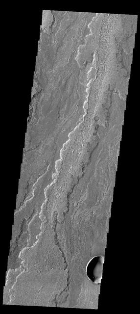
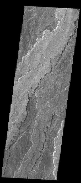
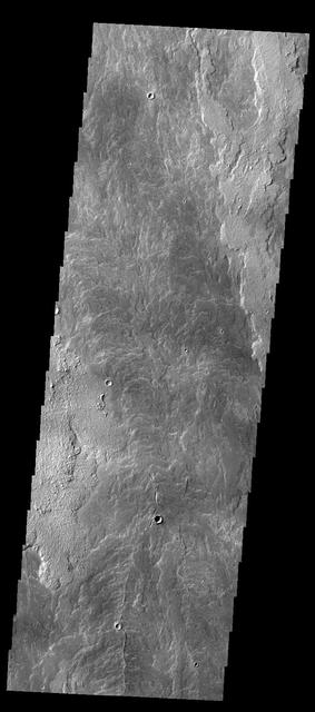
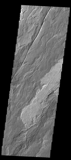
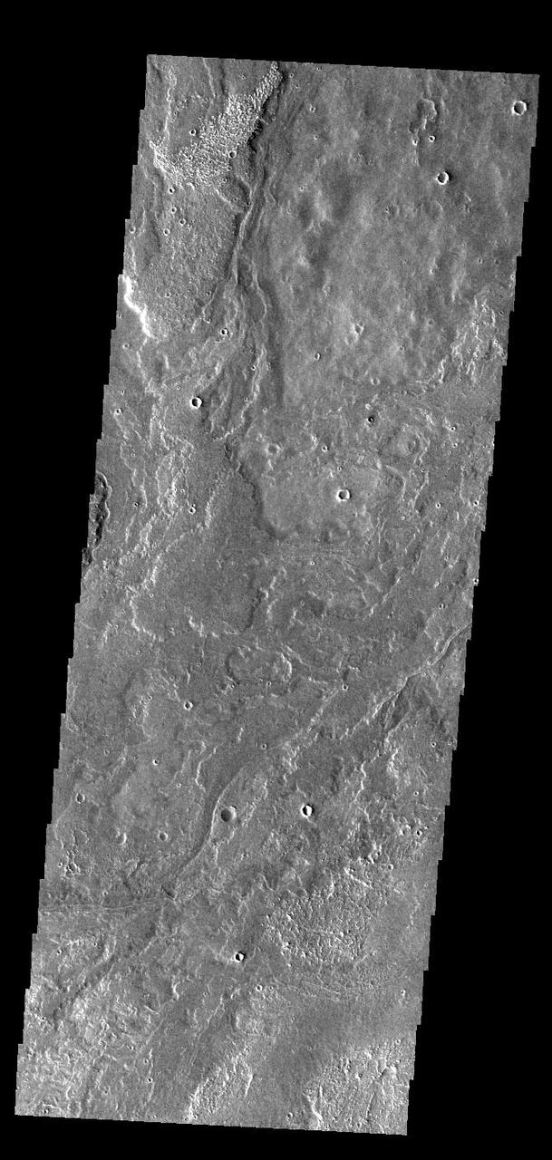
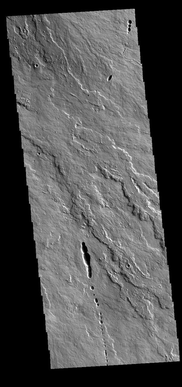
This VIS image shows a small portion of the lava flows that comprise Daedalia Planum. The flows originated at Arsia Mons, the youngest of the three Tharsis volcanoes. The Tharsis volcanoes are aligned in a northeast trending system. The majority of the Daedalia Planum flows can be traced back to the southern flank of Arsia Mons along the extension of the controlling alignment. Orbit Number: 71932 Latitude: -24.5979 Longitude: 235.782 Instrument: VIS Captured: 2018-03-03 01:09 https://photojournal.jpl.nasa.gov/catalog/PIA22408
This image captured by NASA 2001 Mars Odyssey shows just one of the many lava flows that make up Daedalia Planum. Theses volcanic flows are from Arsia Mons, the southernmost of the three Tharsis Montes.
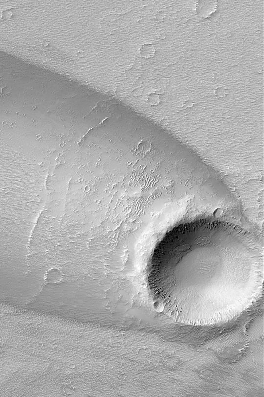
This image from NASA 2001 Mars Odyssey spacecraft of Daedalia Planum shows the termination or end of a single flow. In this case it is the end of the brighter/rougher flow on the right side of the image.
Daedalia Planum is comprised of enormous amounts of lava flows, the majority of which appear to be related to Arsia Mons. In this image from NASA 2001 Mars Odyssey spacecraft, multiple overlapping flows are evident.
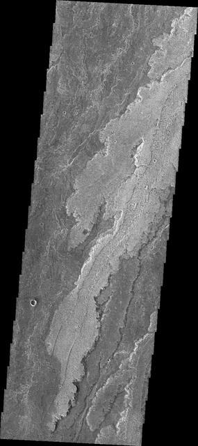
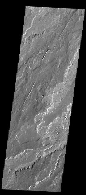
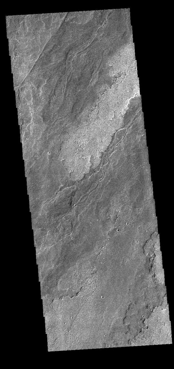
Today's VIS image shows a small part of Daedalia Planum. The lava flows originate from Arsia Mons, one of the large volcanoes in the Tharsis region. The different surface textures are created by differences in the lava viscosity and cooling rates. The lobate margins of each flow can be traced back to the start of each flow -- or to the point where they are covered by younger flows. Flows in Daedalia Planum can be as long as 180 km. Orbit Number: 75325 Latitude: -18.8135 Longitude: 231.098 Instrument: VIS Captured: 2018-12-07 12:54 https://photojournal.jpl.nasa.gov/catalog/PIA23073
Today's VIS image shows a small part of Daedalia Planum. The lava flows originate from Arsia Mons, one of the large volcanoes in the Tharsis region. The different surface textures are created by differences in the lava viscosity and cooling rates. The lobate margins of each flow can be traced back to the start of each flow — or to the point where they are covered by younger flows. Flows in Daedalia Planum can be as long as 180 km. Orbit Number: 82038 Latitude: -14.622 Longitude: 231.902 Instrument: VIS Captured: 2020-06-12 07:44 https://photojournal.jpl.nasa.gov/catalog/PIA24115
Today's VIS image shows a small part of Daedalia Planum. The lava flows originate from Arsia Mons, one of the large volcanoes in the Tharsis region. The different surface textures are created by differences in the lava viscosity and cooling rates. The lobate margins of each flow can be traced back to the start of each flow — or to the point where they are covered by younger flows. Flows in Daedalia Planum can be as long as 180 km. Orbit Number: 81888 Latitude: -22.8438 Longitude: 240.412 Instrument: VIS Captured: 2020-05-30 23:16 https://photojournal.jpl.nasa.gov/catalog/PIA24086
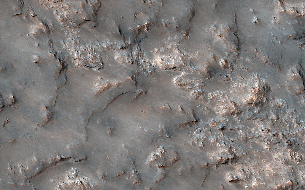
This image shows partially exposed bedrock within the Koval'sky impact basin, which is on the outskirts of the extensive lava field of Daedalia Planum. Daedalia Planum is located southwest of Arsia Mons, which may be the source responsible for filling the crater with lava flows and ash deposits. On one side, bright bedrock with scattered dark blue spots are seen. The dark blue spots are boulders shedding from the outcrops. The color range of the bedrock provides some information on its composition. The blue color is indicative of the presence of iron-rich minerals that are generally not oxidized (i.e., rusted), unlike most of the ruddy Martian surface. Volcanic rocks are common on Mars. Possible candidate minerals for the bluish materials are often consistent with iron-rich minerals, such as pyroxene and olivine. The ridges may represent remnants of the original surface of the lava flows that filled the Koval'sky impact basin. NB: The region is named for M. A. Koval'sky, a Russian astronomer. https://photojournal.jpl.nasa.gov/catalog/PIA21765
This image captured by NASA 2001 Mars Odyssey spacecraft shows part of the extensive flow field called Daedalia Planum. The lava flows originated at Arsia Mons. Orbit Number: 58928 Latitude: -16.8846 Longitude: 242.147 Instrument: VIS Captured: 2015-03-27 20:06 http://photojournal.jpl.nasa.gov/catalog/PIA19465
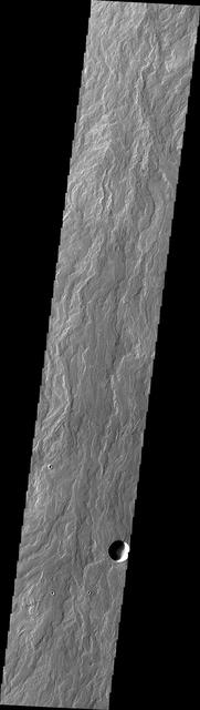
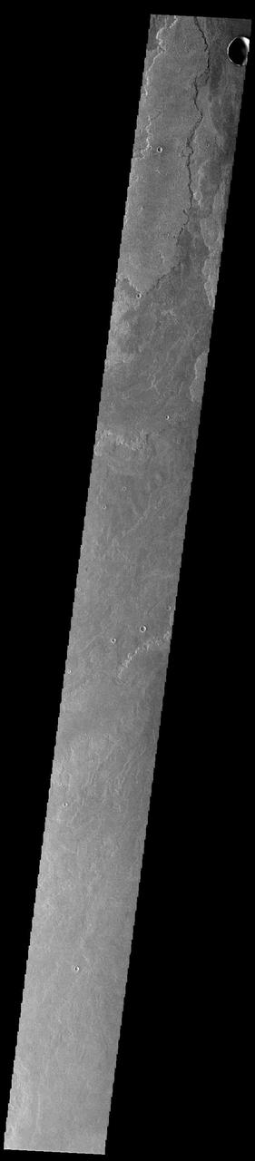
The lava flows in this VIS image are part of Daedalia Planum, a huge lava field that originates from Arsia Mons. Orbit Number: 59489 Latitude: -19.5001 Longitude: 258.333 Instrument: VIS Captured: 2015-05-13 00:48 http://photojournal.jpl.nasa.gov/catalog/PIA19722
This image from NASA 2001 Mars Odyssey spacecraft shows a small portion of the lava flows that make up Daedalia Planum. These flows originate at Arsia Mons. Orbit Number: 58379 Latitude: -24.4283 Longitude: 237.799 Instrument: VIS Captured: 2015-02-10 15:13 http://photojournal.jpl.nasa.gov/catalog/PIA19277
This image captured by NASA 2001 Mars Odyssey spacecraft shows a small portion of the lava flows that comprise Daedalia Planum. These flows originated at Arsia Mons. Orbit Number: 58691 Latitude: -24.3187 Longitude: 237.76 Instrument: VIS Captured: 2015-03-08 07:47 http://photojournal.jpl.nasa.gov/catalog/PIA19451
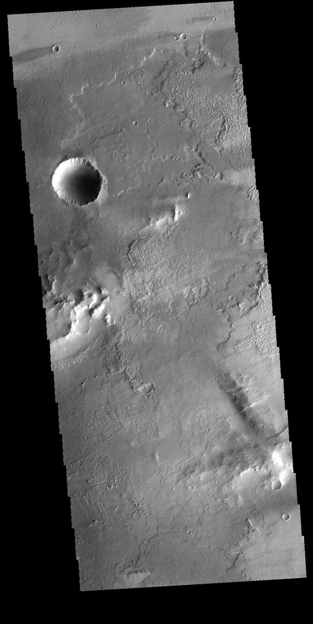
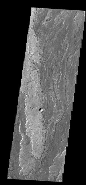
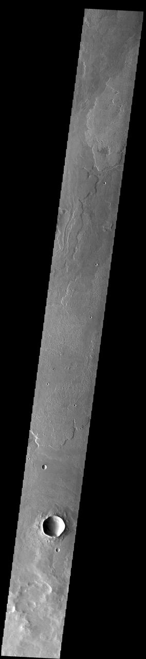
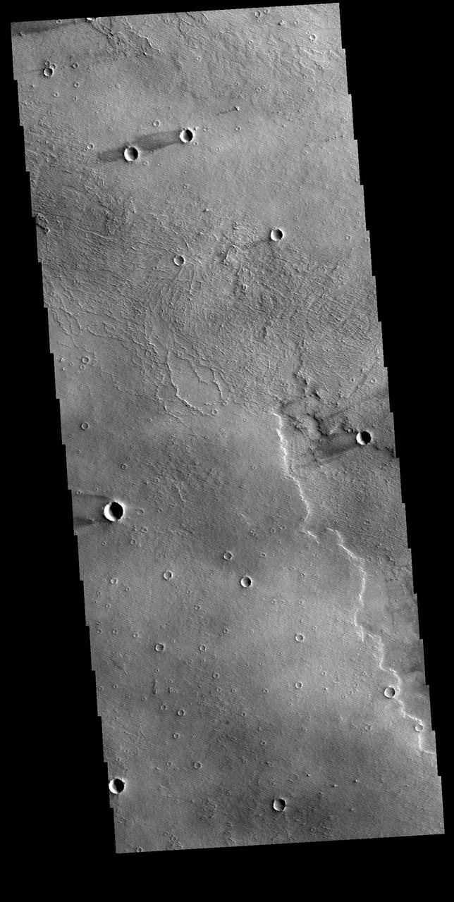
This VIS image shows a small portion of the vast lava flow field of Daedalia Planum. The flows originate at Arsia Mons, the youngest of the three Tharsis volcanoes. Orbit Number: 72493 Latitude: -20.9092 Longitude: 243.284 Instrument: VIS Captured: 2018-04-18 06:19 https://photojournal.jpl.nasa.gov/catalog/PIA22611
Today's VIS image shows a small portion of the immense lava plains of Daedalia Planum. These flows originated from Arsia Mons, one of the three large Tharsis volcanoes. Orbit Number: 75238 Latitude: -19.446 Longitude: 221.612 Instrument: VIS Captured: 2018-11-30 08:56 https://photojournal.jpl.nasa.gov/catalog/PIA23016
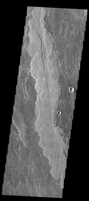
Today's VIS image shows a small portion of Daedalia Planum. The lava flows the comprise this large lava plain originated at Arsia Mons, one of the large Tharsis volcanoes. Orbit Number: 74957 Latitude: -18.6281 Longitude: 239.478 Instrument: VIS Captured: 2018-11-07 04:43 https://photojournal.jpl.nasa.gov/catalog/PIA22986
Today's VIS image shows a small portion of the extensive volcanic plains of Daedalia Planum. These lava flows originated from Arsia Mons, the southernmost of the three large Tharsis volcanoes. Orbit Number: 75250 Latitude: -13.305 Longitude: 234.502 Instrument: VIS Captured: 2018-12-01 08:41 https://photojournal.jpl.nasa.gov/catalog/PIA23026
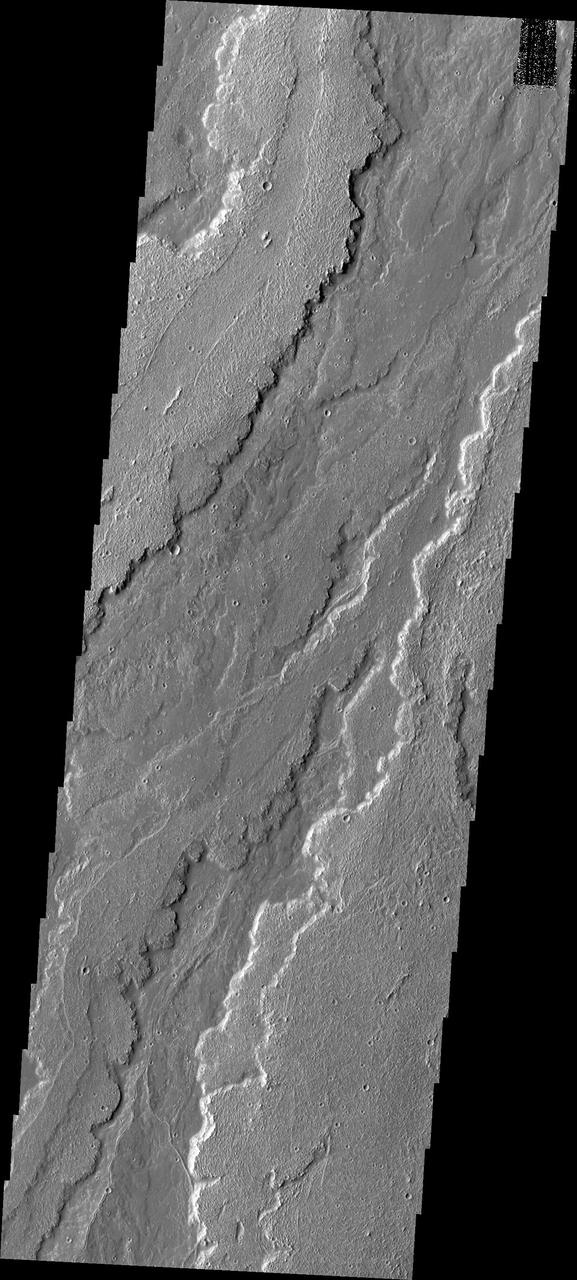
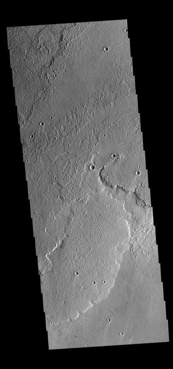
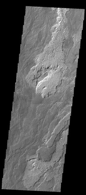
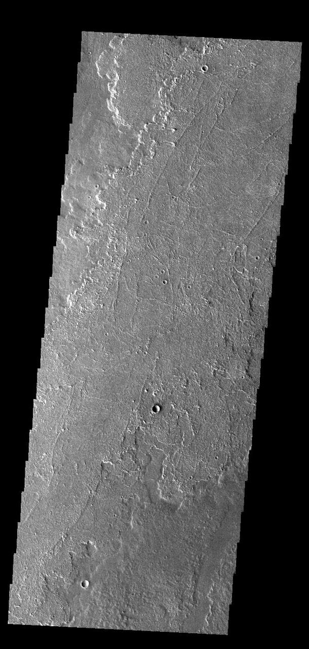
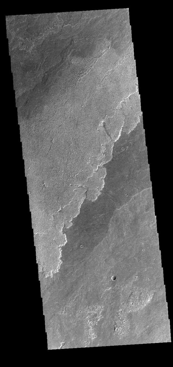
Today's VIS image shows part of the extensive lava flows that comprise Daedalia Planum. These flows originate at Arsia Mons, the southernmost of the three large aligned volcanoes in the Tharsis region of Mars. The different surface textures relate to properties like viscosity and temperature of the molten lava as it flowed and then cooled into solid rock. Orbit Number: 81052 Latitude: -21.9464 Longitude: 238.195 Instrument: VIS Captured: 2020-03-23 03:13 https://photojournal.jpl.nasa.gov/catalog/PIA23927
This VIS image shows a small portion of the vast lava fields called Daedalia Planum. These flows originated from Arsia Mons, the southernmost and youngest of the three aligned Tharis volcanoes. Different surface textures arise from different factors in the flows, such as temperature, flow volume, composition and cooling rates. Orbit Number: 79018 Latitude: -22.1992 Longitude: 238.021 Instrument: VIS Captured: 2019-10-07 15:42 https://photojournal.jpl.nasa.gov/catalog/PIA23542
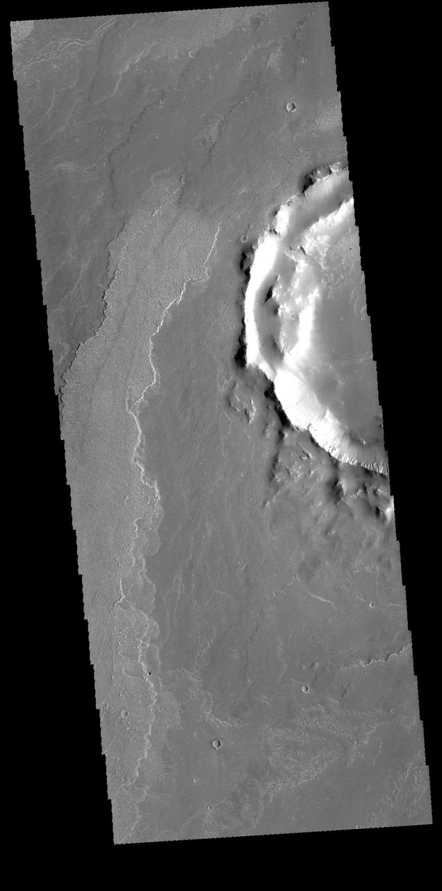
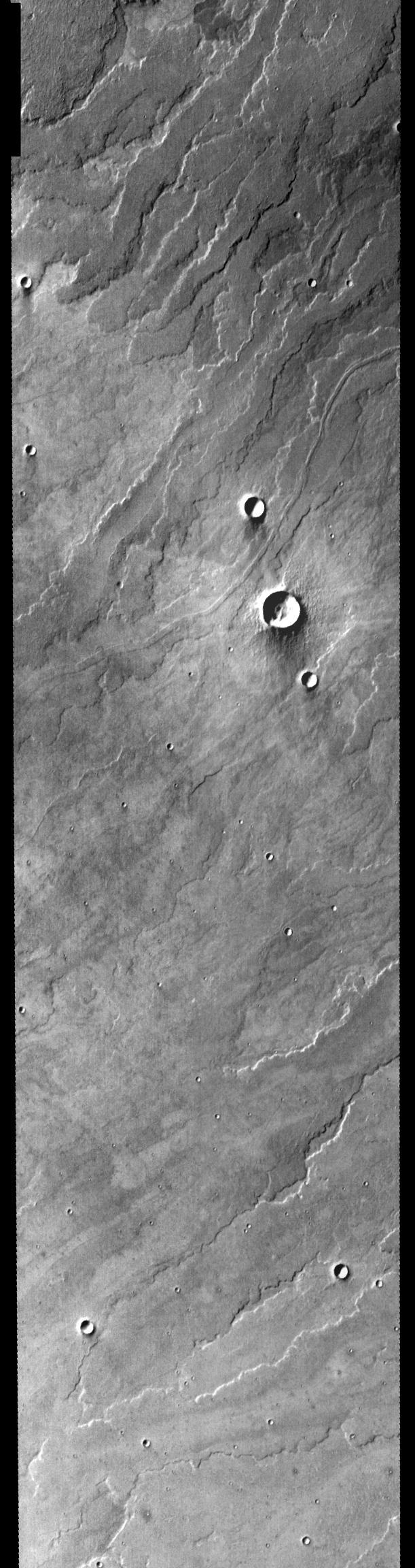
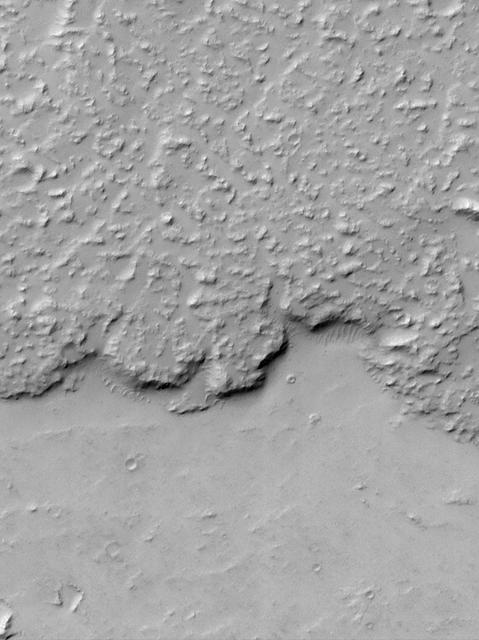
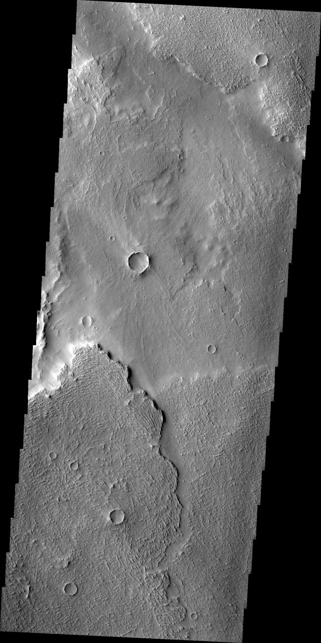
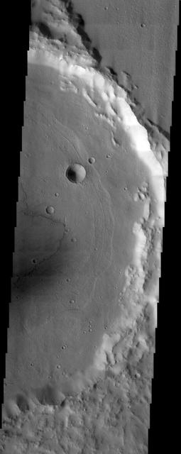
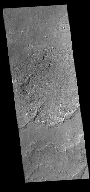
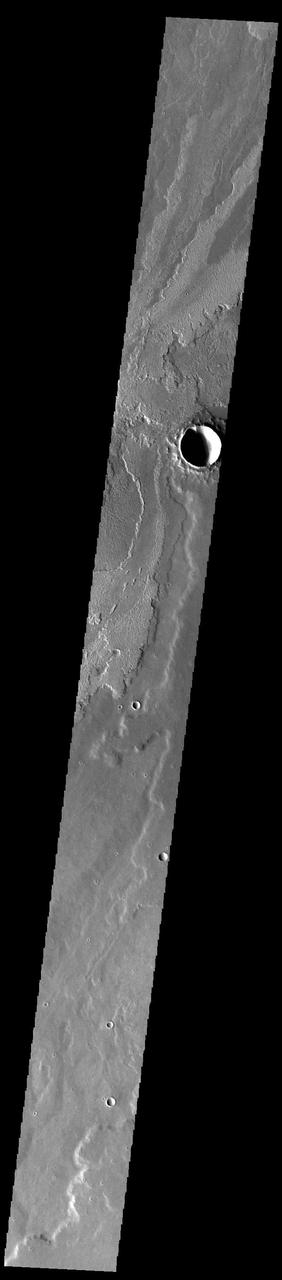
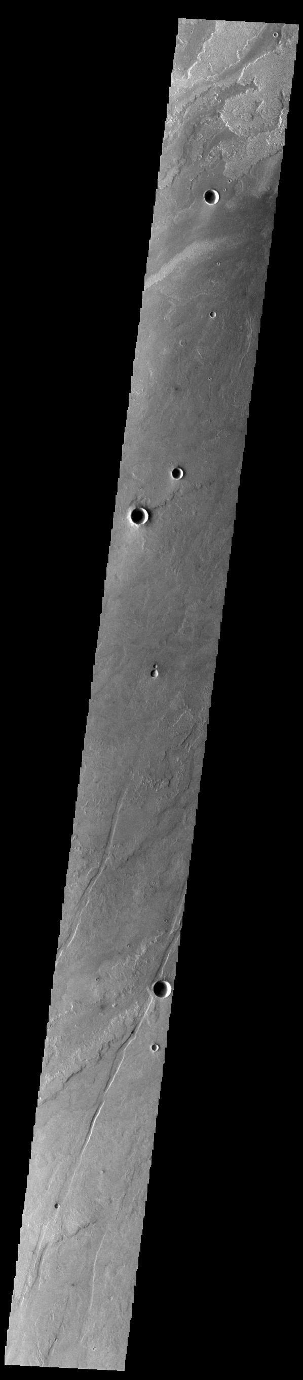
At the bottom of this VIS image of Daedalia Planum is the uppermost rim of an impact crater. The unnamed crater has been almost completely filled by lava flows originating from Arsia Mons. Orbit Number: 71346 Latitude: -21.6885 Longitude: 229.536 Instrument: VIS Captured: 2018-01-13 18:33 https://photojournal.jpl.nasa.gov/catalog/PIA22382
This VIS image shows a small portion of the vast lava flow field of Daedalia Planum. The flows originate at Arsia Mons, the southernmost and youngest of the three large aligned volcanoes in the Tharsis region. Arsia Mons' last eruption was tens of million years ago. The youngest volcano in the region is Olympus Mons, the largest volcano in our solar system. Orbit Number: 78993 Latitude: -22.11 Longitude: 239.279 Instrument: VIS Captured: 2019-10-05 14:17 https://photojournal.jpl.nasa.gov/catalog/PIA23540
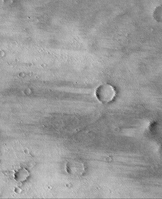
This windstreak is located on the volcanic plains of Daedalia Planum as seen by NASA Mars Odyssey. The dark outer margin is the region of dust being removed from the surface. The inner bright part is where dust is being deposited.
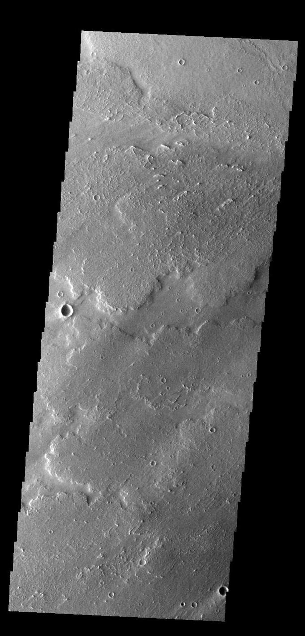
This NASA Mars Odyssey image captures a portion of several lava flows in Daedalia Planum southwest of the Arsia Mons shield volcano. Textures characteristic of the variable surface roughness associated with different lava flows in this region are easily s
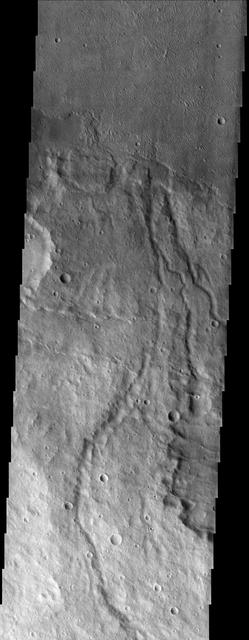
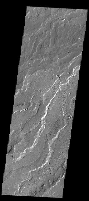
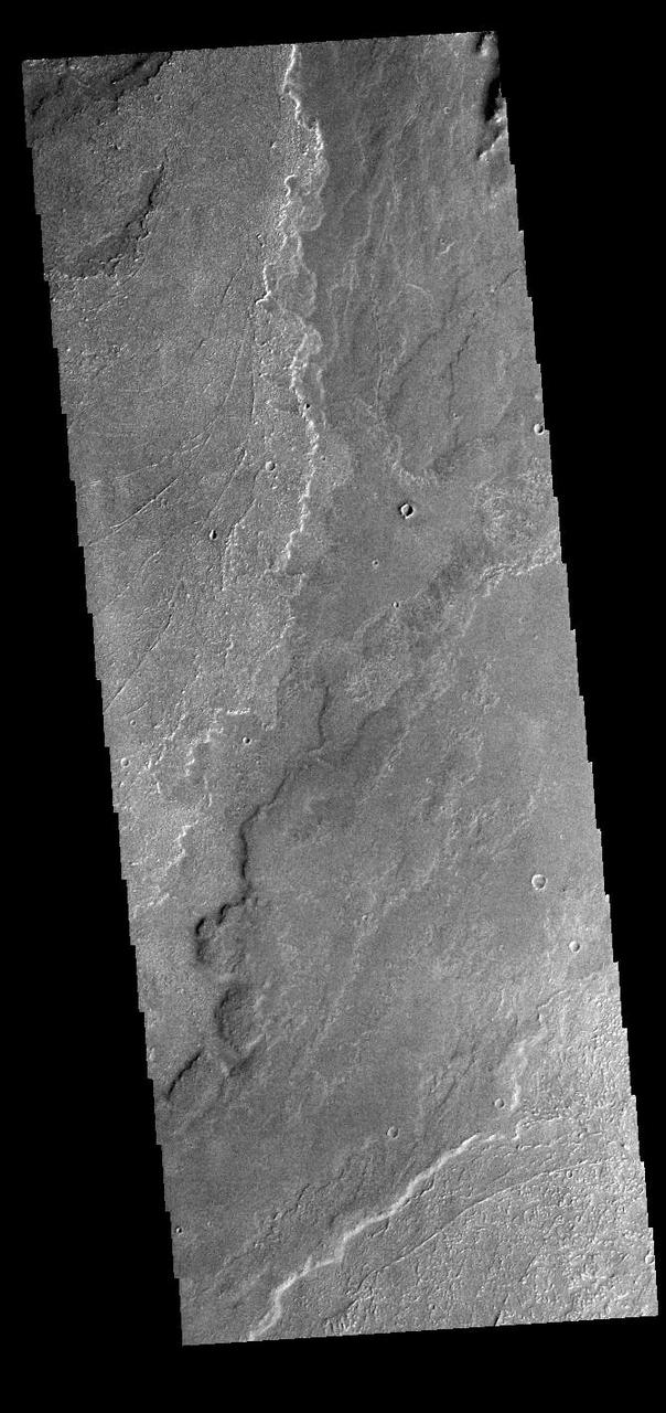
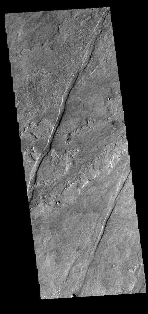
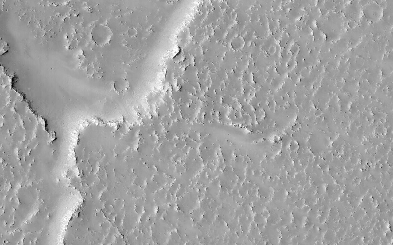
This image from NASA 2001 Mars Odyssey spacecraft shows a small portion of Daedalia Planum, which is comprised of lava flows from Arsia Mons. Note the small channel in the image. This channel was likely created by lava rather than water flow.
Today's VIS image shows several windstreaks on lava plains southwest of Arsia Mons. The extensive lava flow field is called Daedalia Planum. Orbit Number: 80603 Latitude: -14.064 Longitude: 230.438 Instrument: VIS Captured: 2020-02-15 03:58 https://photojournal.jpl.nasa.gov/catalog/PIA23842
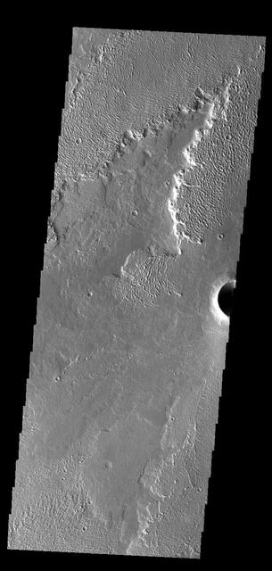
This image captured by NASA's 2001 Mars Odyssey spacecraft shows lava flows that originated from Arsia Mons. Orbit Number: 67798 Latitude: -13.539 Longitude: 239.341 Instrument: VIS Captured: 2017-03-27 10:03 https://photojournal.jpl.nasa.gov/catalog/PIA21664
Today's VIS image shows a small portion of the immense lava flows that originated from Arsia Mons. Arsia Mons is the southernmost of the three large aligned volcanoes in the Tharsis region. Arsia Mons' last eruption was 10s of million years ago. The different surface textures are created by differences in the lava viscosity and cooling rates. The lobate margins of each flow can be traced back to the start of each flow — or to the point where they are covered by younger flows. Flows in Daedalia Planum can be as long as 180 km (111 miles). For comparison the longest Hawaiian lava flow is only 51 km (˜31 miles) long. The total area of Daedalia Planum is 2.9 million square km – more than four times the size of Texas. Orbit Number: 92489 Latitude: -22.5933 Longitude: 238.293 Instrument: VIS Captured: 2022-10-20 19:34 https://photojournal.jpl.nasa.gov/catalog/PIA25763
Today's VIS image shows a small portion of the immense lava flows that originated from Arsia Mons. Arsia Mons is the southernmost of the three large aligned volcanoes in the Tharsis region. Arsia Mons' last eruption was 10s of million years ago. The different surface textures are created by differences in the lava viscosity and cooling rates. The lobate margins of each flow can be traced back to the start of each flow — or to the point where they are covered by younger flows. Flows in Daedalia Planum can be as long as 180 km (111 miles). For comparison the longest Hawaiian lava flow is only 51 km (˜31 miles) long. The total area of Daedalia Planum is 2.9 million square km – more than four times the size of Texas. Orbit Number: 92439 Latitude: -22.8332 Longitude: 240.737 Instrument: VIS Captured: 2022-10-16 16:45 https://photojournal.jpl.nasa.gov/catalog/PIA25762
Today's VIS image shows a small portion of the immense lava flows that originated from Arsia Mons. Arsia Mons is the southernmost of the three large aligned volcanoes in the Tharsis region. Arsia Mons' last eruption was 10s of million years ago. The different surface textures are created by differences in the lava viscosity and cooling rates. The lobate margins of each flow can be traced back to the start of each flow — or to the point where they are covered by younger flows. Flows in Daedalia Planum can be as long as 180 km (111 miles). For comparison the longest Hawaiian lava flow is only 51 km (˜31 miles) long. The total area of Daedalia Planum is 2.9 million square km – more than four times the size of Texas. Orbit Number: 89650 Latitude: -23.8918 Longitude: 234.54 Instrument: VIS Captured: 2022-03-01 01:57 https://photojournal.jpl.nasa.gov/catalog/PIA25456
Today's VIS image shows a small portion of the immense lava flows that originated from Arsia Mons. Arsia Mons is the southernmost of the three large aligned volcanoes in the Tharsis region. Arsia Mons' last eruption was 10s of million years ago. The different surface textures are created by differences in the lava viscosity and cooling rates. The lobate margins of each flow can be traced back to the start of each flow — or to the point where they are covered by younger flows. Flows in Daedalia Planum can be as long as 180 km (111 miles). For comparison the longest Hawaiian lava flow is only 51 km (˜31 miles) long. The total area of Daedalia Planum is 2.9 million square km – more than four times the size of Texas. Orbit Number: 92751 Latitude: -23.4788 Longitude: 239.589 Instrument: VIS Captured: 2022-11-11 09:19 https://photojournal.jpl.nasa.gov/catalog/PIA25770
Today's VIS image shows a small portion of the immense lava flows that originated from Arsia Mons. Arsia Mons is the southernmost of the three large aligned volcanoes in the Tharsis region. Arsia Mons' last eruption was 10s of million years ago. The different surface textures are created by differences in the lava viscosity and cooling rates. The lobate margins of each flow can be traced back to the start of each flow — or to the point where they are covered by younger flows. Flows in Daedalia Planum can be as long as 180 km (111 miles). For comparison the longest Hawaiian lava flow is only 51 km (˜31 miles) long. The total area of Daedalia Planum is 2.9 million square km – more than four times the size of Texas. Orbit Number: 90698 Latitude: -22.5145 Longitude: 239.748 Instrument: VIS Captured: 2022-05-26 08:59 https://photojournal.jpl.nasa.gov/catalog/PIA25510
Today's VIS image shows a small portion of the immense lava flows that originated from Arsia Mons. Arsia Mons is the southernmost of the three large aligned volcanoes in the Tharsis region. Arsia Mons' last eruption was 10s of million years ago. The different surface textures are created by differences in the lava viscosity and cooling rates. The lobate margins of each flow can be traced back to the start of each flow — or to the point where they are covered by younger flows. Flows in Daedalia Planum can be as long as 180 km (111 miles). For comparison the longest Hawaiian lava flow is only 51 km (˜31 miles) long. The total area of Daedalia Planum is 2.9 million square km – more than four times the size of Texas. Orbit Number: 92102 Latitude: -21.4397 Longitude: 243.244 Instrument: VIS Captured: 2022-09-18 22:46 https://photojournal.jpl.nasa.gov/catalog/PIA25745
Today's VIS image shows a small portion of the immense lava flows that originated from Arsia Mons. Arsia Mons is the southernmost of the three large aligned volcanoes in the Tharsis region. Arsia Mons' last eruption was 10s of million years ago. The different surface textures are created by differences in the lava viscosity and cooling rates. The lobate margins of each flow can be traced back to the start of each flow — or to the point where they are covered by younger flows. Flows in Daedalia Planum can be as long as 180 km (111 miles). For comparison the longest Hawaiian lava flow is only 51 km (˜31 miles) long. The total area of Daedalia Planum is 2.9 million square km – more than four times the size of Texas. Orbit Number: 91584 Latitude: -23.3958 Longitude: 239.081 Instrument: VIS Captured: 2022-08-07 07:52 https://photojournal.jpl.nasa.gov/catalog/PIA25608
Today's VIS image shows a small portion of the immense lava flows that originated from Arsia Mons. Arsia Mons is the southernmost of the three large aligned volcanoes in the Tharsis region. Arsia Mons' last eruption was 10s of million years ago. The different surface textures are created by differences in the lava viscosity and cooling rates. The lobate margins of each flow can be traced back to the start of each flow — or to the point where they are covered by younger flows. Flows in Daedalia Planum can be as long as 180 km (111 miles). For comparison the longest Hawaiian lava flow is only 51 km (˜31 miles) long. The total area of Daedalia Planum is 2.9 million square km – more than four times the size of Texas. Orbit Number: 92988 Latitude: -14.2638 Longitude: 243.558 Instrument: VIS Captured: 2022-11-30 21:37 https://photojournal.jpl.nasa.gov/catalog/PIA25809
Today's VIS image shows a small portion of the immense lava flows that originated from Arsia Mons. Arsia Mons is the southernmost of the three large aligned volcanoes in the Tharsis region. Arsia Mons' last eruption was 10s of million years ago. The different surface textures are created by differences in the lava viscosity and cooling rates. The lobate margins of each flow can be traced back to the start of each flow — or to the point where they are covered by younger flows. Flows in Daedalia Planum can be as long as 180 km (111 miles). For comparison the longest Hawaiian lava flow is only 51 km (˜31 miles) long. The total area of Daedalia Planum is 2.9 million square km – more than four times the size of Texas. Orbit Number: 90723 Latitude: -23.0254 Longitude: 238.572 Instrument: VIS Captured: 2022-05-28 10:23 https://photojournal.jpl.nasa.gov/catalog/PIA25479

Today's VIS image shows a small portion of the immense lava flows that originated from Arsia Mons. Arsia Mons is the southernmost of the three large aligned volcanoes in the Tharsis region. Arsia Mons' last eruption was 10s of million years ago. The different surface textures are created by differences in the lava viscosity and cooling rates. The lobate margins of each flow can be traced back to the start of each flow — or to the point where they are covered by younger flows. Flows in Daedalia Planum can be as long as 180 km (111 miles). For comparison the longest Hawaiian lava flow is only 51 km (˜31 miles) long. The total area of Daedalia Planum is 2.9 million square km – more than four times the size of Texas. Orbit Number: 92614 Latitude: -19.2044 Longitude: 232.636 Instrument: VIS Captured: 2022-10-31 02:33 https://photojournal.jpl.nasa.gov/catalog/PIA25765
Today's VIS image shows a small portion of the immense lava flows that originated from Arsia Mons. Arsia Mons is the southernmost of the three large aligned volcanoes in the Tharsis region. Arsia Mons' last eruption was 10s of million years ago. The different surface textures are created by differences in the lava viscosity and cooling rates. The lobate margins of each flow can be traced back to the start of each flow — or to the point where they are covered by younger flows. Flows in Daedalia Planum can be as long as 180 km (111 miles). For comparison the longest Hawaiian lava flow is only 51 km (˜31 miles) long. The total area of Daedalia Planum is 2.9 million square km – more than four times the size of Texas. Orbit Number: 91603 Latitude: -23.5547 Longitude: 238.804 Instrument: VIS Captured: 2022-08-08 20:42 https://photojournal.jpl.nasa.gov/catalog/PIA25610
Today's VIS image shows a small portion of the immense lava flows that originated from Arsia Mons. Arsia Mons is the southernmost of the three large aligned volcanoes in the Tharsis region. Arsia Mons' last eruption was 10s of million years ago. The different surface textures are created by differences in the lava viscosity and cooling rates. The lobate margins of each flow can be traced back to the start of each flow — or to the point where they are covered by younger flows. Flows in Daedalia Planum can be as long as 180 km (111 miles). For comparison the longest Hawaiian lava flow is only 51 km (˜31 miles) long. The total area of Daedalia Planum is 2.9 million square km – more than four times the size of Texas. Orbit Number: 92152 Latitude: -22.9243 Longitude: 240.536 Instrument: VIS Captured: 2022-09-23 01:36 https://photojournal.jpl.nasa.gov/catalog/PIA25748
Today's VIS image shows a small portion of the immense lava flows that originated from Arsia Mons. Arsia Mons is the southernmost of the three large aligned volcanoes in the Tharsis region. Arsia Mons' last eruption was 10s of million years ago. The different surface textures are created by differences in the lava viscosity and cooling rates. The lobate margins of each flow can be traced back to the start of each flow — or to the point where they are covered by younger flows. Flows in Daedalia Planum can be as long as 180 km (111 miles). For comparison the longest Hawaiian lava flow is only 51 km (˜31 miles) long. The total area of Daedalia Planum is 2.9 million square km – more than four times the size of Texas. Orbit Number: 89625 Latitude: -23.7327 Longitude: 235.755 Instrument: VIS Captured: 2022-02-27 00:33 https://photojournal.jpl.nasa.gov/catalog/PIA25452
Today's VIS image shows a small portion of the immense lava flows that originated from Arsia Mons. Arsia Mons is the southernmost of the three large aligned volcanoes in the Tharsis region. Arsia Mons' last eruption was 10s of million years ago. The different surface textures are created by differences in the lava viscosity and cooling rates. The lobate margins of each flow can be traced back to the start of each flow — or to the point where they are covered by younger flows. Flows in Daedalia Planum can be as long as 180 km (111 miles). For comparison the longest Hawaiian lava flow is only 51 km (˜31 miles) long. The total area of Daedalia Planum is 2.9 million square km – more than four times the size of Texas. Orbit Number: 91422 Latitude: -13.8077 Longitude: 231.424 Instrument: VIS Captured: 2022-07-24 23:46 https://photojournal.jpl.nasa.gov/catalog/PIA25579
Today's VIS image shows a small portion of the immense lava flows that originated from Arsia Mons. Arsia Mons is the southernmost of the three large aligned volcanoes in the Tharsis region. Arsia Mons' last eruption was 10s of million years ago. The different surface textures are created by differences in the lava viscosity and cooling rates. The lobate margins of each flow can be traced back to the start of each flow — or to the point where they are covered by younger flows. Flows in Daedalia Planum can be as long as 180 km (111 miles). For comparison the longest Hawaiian lava flow is only 51 km (˜31 miles) long. The total area of Daedalia Planum is 2.9 million square km – more than four times the size of Texas. Orbit Number: 87778 Latitude: -14.0489 Longitude: 240.029 Instrument: VIS Captured: 2021-09-27 22:36 https://photojournal.jpl.nasa.gov/catalog/PIA25291
Today's VIS image shows a small portion of the immense lava flows that originated from Arsia Mons. Arsia Mons is the southernmost of the three large aligned volcanoes in the Tharsis region. Arsia Mons' last eruption was 10s of million years ago. The different surface textures are created by differences in the lava viscosity and cooling rates. The lobate margins of each flow can be traced back to the start of each flow — or to the point where they are covered by younger flows. Flows in Daedalia Planum can be as long as 180 km (111 miles). For comparison the longest Hawaiian lava flow is only 51 km (˜31 miles) long. The total area of Daedalia Planum is 2.9 million square km – more than four times the size of Texas. Orbit Number: 91559 Latitude: -22.1397 Longitude: 240.149 Instrument: VIS Captured: 2022-08-05 06:28 https://photojournal.jpl.nasa.gov/catalog/PIA25605
Today's VIS image shows a small portion of the immense lava flows that originated from Arsia Mons. Arsia Mons is the southernmost of the three large aligned volcanoes in the Tharsis region. Arsia Mons' last eruption was 10s of million years ago. The different surface textures are created by differences in the lava viscosity and cooling rates. The lobate margins of each flow can be traced back to the start of each flow — or to the point where they are covered by younger flows. Flows in Daedalia Planum can be as long as 180 km (111 miles). For comparison the longest Hawaiian lava flow is only 51 km (~31 miles) long. The total area of Daedalia Planum is 2.9 million square km — more than four times the size of Texas. Orbit Number: 84353 Latitude: -22.909 Longitude: 236.007 Instrument: VIS Captured: 2020-12-19 21:40 https://photojournal.jpl.nasa.gov/catalog/PIA24396
Today's VIS image shows a small portion of the immense lava flows that originated from Arsia Mons. Arsia Mons is the southernmost of the three large aligned volcanoes in the Tharsis region. Arsia Mons' last eruption was 10s of million years ago. The different surface textures are created by differences in the lava viscosity and cooling rates. The lobate margins of each flow can be traced back to the start of each flow — or to the point where they are covered by younger flows. Flows in Daedalia Planum can be as long as 180 km (111 miles). For comparison the longest Hawaiian lava flow is only 51 km (about 31 miles) long. The total area of Daedalia Planum is 2.9 million square km — more than four times the size of Texas. Orbit Number: 83991 Latitude: -22.4242 Longitude: 239.034 Instrument: VIS Captured: 2020-11-20 02:20 https://photojournal.jpl.nasa.gov/catalog/PIA24357
Today's VIS image shows a small portion of the immense lava flows that originated from Arsia Mons. Arsia Mons is the southernmost of the three large aligned volcanoes in the Tharsis region. Arsia Mons' last eruption was 10s of million years ago. The different surface textures are created by differences in the lava viscosity and cooling rates. The lobate margins of each flow can be traced back to the start of each flow — or to the point where they are covered by younger flows. Flows in Daedalia Planum can be as long as 180 km (111 miles). For comparison the longest Hawaiian lava flow is only 51 km (about 31 miles) long. The total area of Daedalia Planum is 2.9 million square km — more than four times the size of Texas. Orbit Number: 83966 Latitude: -22.0287 Longitude: 240.3 Instrument: VIS Captured: 2020-11-18 00:56 https://photojournal.jpl.nasa.gov/catalog/PIA24354
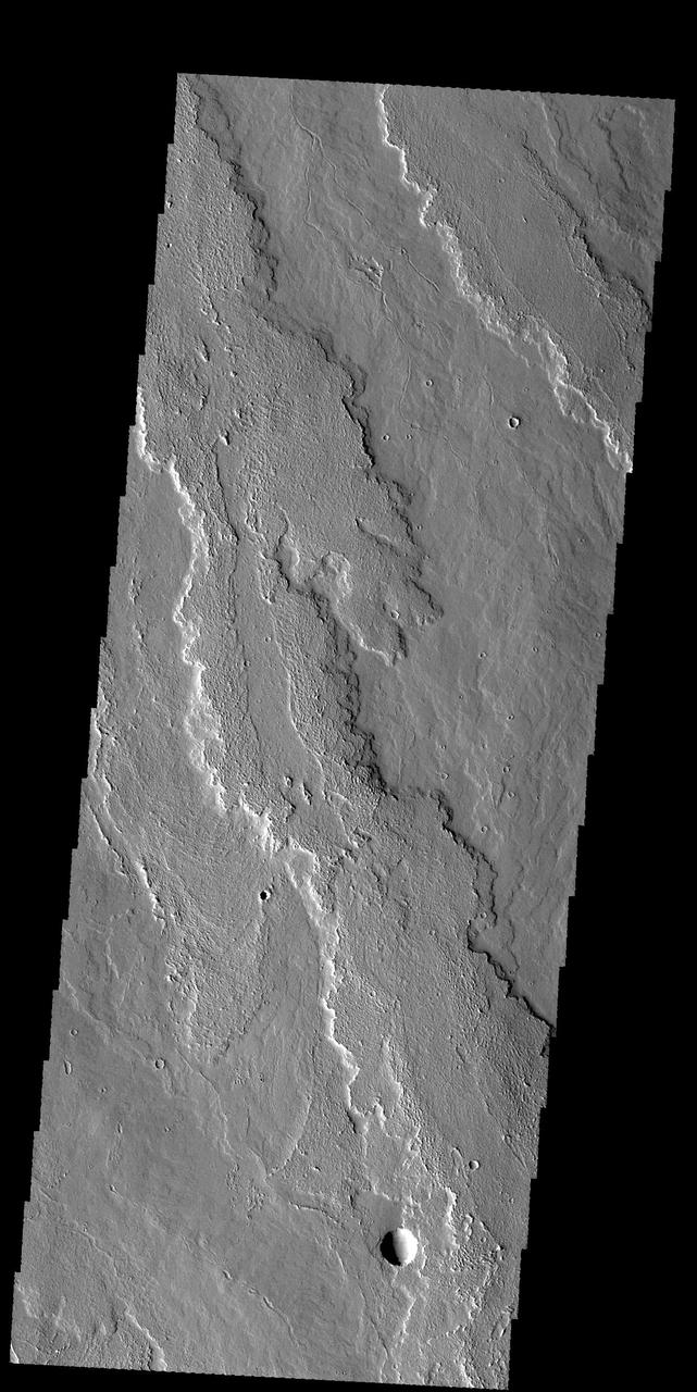
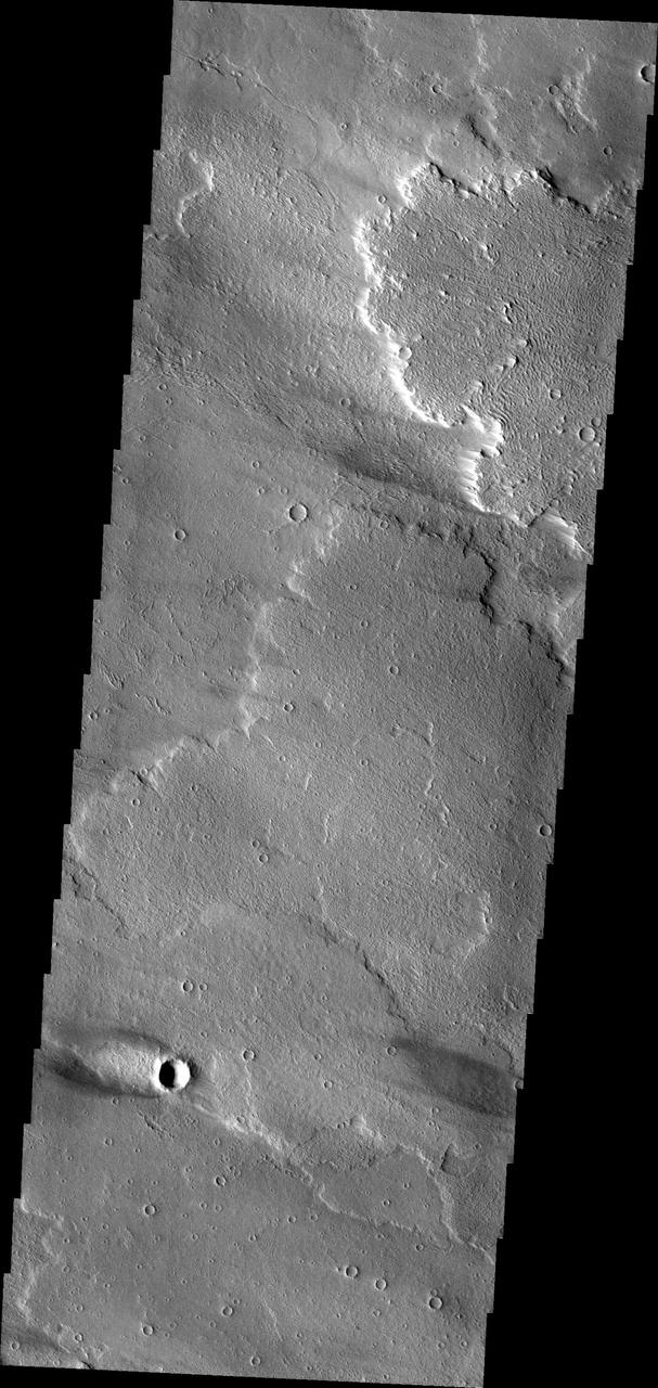
Lava flows south of Arsia Mons in Daedalia Planum transition from younger flows with elongated, sinuous morphologies to the northeast, to older, broader lobes and sheet flows to the southwest. This image is from NASA Mars Reconnaissance Orbiter.
This VIS images shows several windstreaks located on the volcanic plains of Daedalia Planum. The dark and bright material forming "tails" behind the craters were created by surface winds funneled over and around the crater. The raised rims and bowls of impact craters causes a complex interaction such that the wind vortex in the lee of the crater can both scour away the surface dust and deposit it back in the center of the lee. The "tail" shows the direction of the wind, in this case blowing from the right to the left. Orbit Number: 80441 Latitude: -13.1034 Longitude: 223.8 Instrument: VIS Captured: 2020-02-01 19:50 https://photojournal.jpl.nasa.gov/catalog/PIA23838
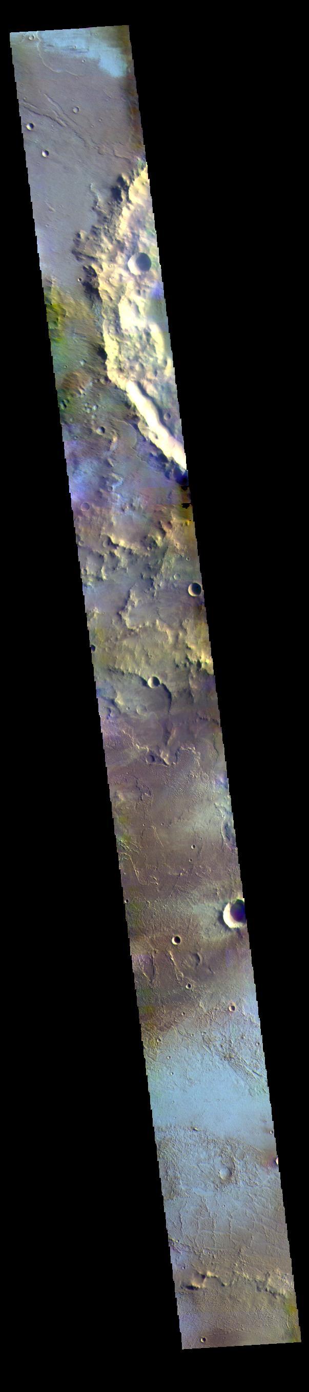
The THEMIS VIS camera contains 5 filters. The data from different filters can be combined in multiple ways to create a false color image. These false color images may reveal subtle variations of the surface not easily identified in a single band image. Today's false color image shows part of Daedalia Planum. The pale blue surfaces are thought to be early morning ground frost. This image was collected during the winter season. Orbit Number: 71758 Latitude: -15.7206 Longitude: 216.767 Instrument: VIS Captured: 2018-02-16 17:10 https://photojournal.jpl.nasa.gov/catalog/PIA24513
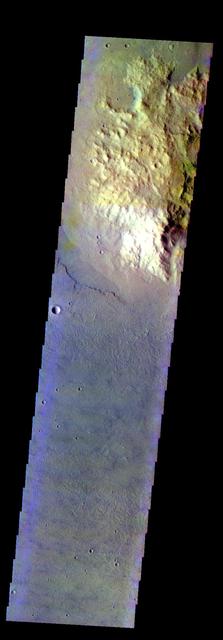
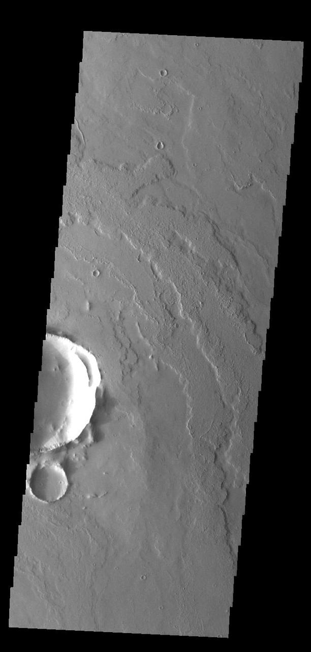
The THEMIS VIS camera contains 5 filters. The data from different filters can be combined in multiple ways to create a false color image. This image from NASA 2001 Mars Odyssey spacecraft shows a highland surrounded by the lava flows of Daedalia Planum. Orbit Number: 7283 Latitude: -27.9862 Longitude: 226.532 Instrument: VIS Captured: 2003-08-06 01:36 http://photojournal.jpl.nasa.gov/catalog/PIA19460
Today's VIS image shows a small portion of the immense lava flows that originated from Arsia Mons. Arsia Mons is the southernmost of the three large aligned volcanoes in the Tharsis region. Arsia Mons' last eruption was 10s of million years ago. The different surface textures are created by differences in the lava viscosity and cooling rates. The lobate margins of each flow can be traced back to the start of each flow — or to the point where they are covered by younger flows. Flows in Daedalia Planum can be as long as 180 km (111 miles). For comparison the longest Hawaiian lava flow is only 51 km (˜31 miles) long. The total area of Daedalia Planum is 2.9 million square km – more than four times the size of Texas. Windstreaks in this image show unidirectional winds from the upper right corner towards the lower left corner. Orbit Number: 93001 Latitude: -12.3262 Longitude: 228.783 Instrument: VIS Captured: 2022-12-01 23:18 https://photojournal.jpl.nasa.gov/catalog/PIA25810