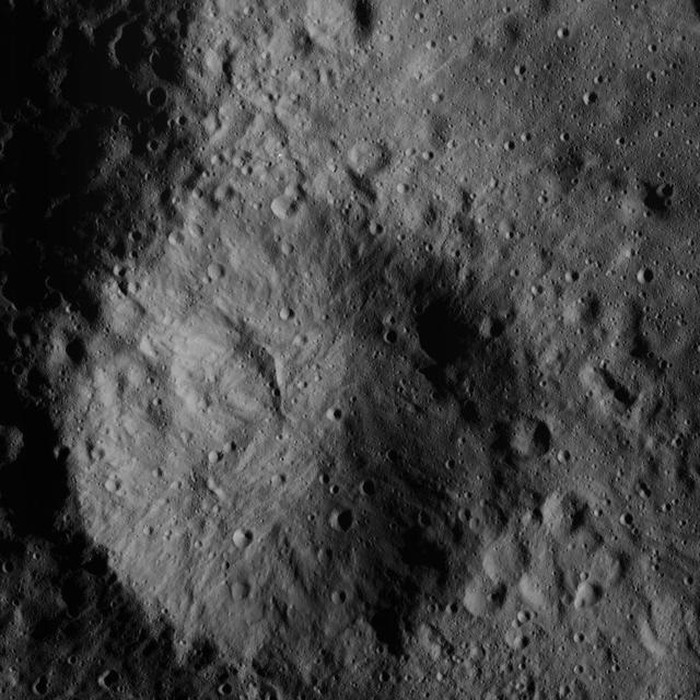
This image of a small crater north of Ceres' Datan Crater was obtained by NASA's Dawn spacecraft on June 9, 2018 from an altitude of about 48 miles (77 kilometers). https://photojournal.jpl.nasa.gov/catalog/PIA22528

NASA's Dawn spacecraft captured this view on May 28, 2016, showing a relatively young crater with smooth walls and a sharp rim. The crater has a prominent central ridge, imprinted upon the rim of the larger Datan Crater, lying toward the lower right. The image is centered at approximately 64 degrees north latitude, 249 degrees east longitude. Dawn took this image on May 28, 2016, from its low-altitude mapping orbit, at a distance of about 240 miles (385 kilometers) above the surface. The image resolution is 120 feet (35 meters) per pixel. http://photojournal.jpl.nasa.gov/catalog/PIA20876
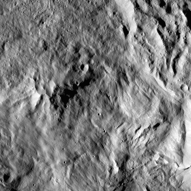
This image from NASA Dawn spacecraft shows the center of Datan Crater on Ceres. Datan measures about 40 miles 60 kilometers in diameter.

This image from NASA Dawn spacecraft shows the interior of the crater Datan, which is superimposed on the northwestern rim of the larger crater Geshtin. The area at right, above the rim of Datan, is within Geshtin.
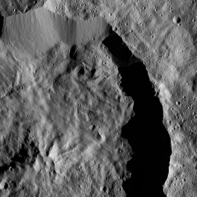
Datan Crater is featured in this scene from Ceres captured by NASA Dawn spacecraft. Datan is imprinted on the older Geshtin Crater, whose terrain fills the rest of the view. The image is centered at approximately 59 degrees north latitude, 256 degrees east longitude. NASA's Dawn spacecraft took this image on March 30, 2016, from its low-altitude mapping orbit, at a distance of about 240 miles (385 kilometers) above the surface. The image resolution is 120 feet (35 meters) per pixel. http://photojournal.jpl.nasa.gov/catalog/PIA20693

This image of Ceres, taken by NASA's Dawn spacecraft, demonstrates how the relative ages of impact craters can be revealed by their positions relative to each other. In many cases, as with the craters at the center of this view, younger craters are seen to be "superposed" on -- meaning located on top of -- older craters below. The largest feature in the image scene is the 48-mile-wide (77-kilometer-wide) Geshtin crater, which is superposed by the younger Datan crater, which is 37 miles (60 kilometers) in diameter. On its upper-left rim, Datan is superposed by a smaller, even younger unnamed crater. The image was taken on Oct. 2, 2015, from an altitude of 915 miles (1,470 kilometers), and has a resolution of 450 feet (140 meters) per pixel. The image is centered at approximately 59 degrees north latitude, 258 degrees east longitude. http://photojournal.jpl.nasa.gov/catalog/PIA20000

This view from Ceres' northern hemisphere shows parts of Datan Crater (at left) and Geshtin Crater (at right). NASA's Dawn spacecraft took this image on June 17, 2016, from its low-altitude mapping orbit, at a distance of about 240 miles (385 kilometers) above the surface. The image resolution is 120 feet (35 meters) per pixel. http://photojournal.jpl.nasa.gov/catalog/PIA20860
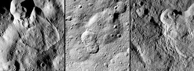
NASA's Dawn spacecraft has revealed many landslides on Ceres, which researchers interpret to have been shaped by a significant amount of water ice. A 2017 study in the journal Nature Geoscience classifies three types of these debris flows. Image 1 (left in the montage) shows an example of "Type I" flow features, which are relatively round and large, have thick "toes" at their ends. They look similar to rock glaciers and icy landslides on Earth. Type I landslides are mostly found at high latitudes, which is also where the most ice is thought to reside near Ceres' surface. Image 2 (center) shows an example of a "Type II" flow feature. Type II features are often thinner and longer than Type I, and are the most common type of landslide on Ceres. They appear more like the avalanches seen on Earth. Image 3 (right) shows an example of a "Type III" flow feature at Datan Crater. The study authors interpret Ceres' Type III landslides to involve melted ice, although scientists do not know if they actually contain liquid water. The authors think Type III landslides are related to impact craters, and may have formed during impact events into the ice on Ceres. The features resemble fluid material ejected from craters in the icy regions of Mars and Jupiter's moon Ganymede. https://photojournal.jpl.nasa.gov/catalog/PIA21471