
The Aristarchus region is one of the most diverse and interesting areas on the Moon. About 500 images from NASA's Clementine spacecraft were processed and combined into a multispectral mosaic of this region. http://photojournal.jpl.nasa.gov/catalog/PIA00090
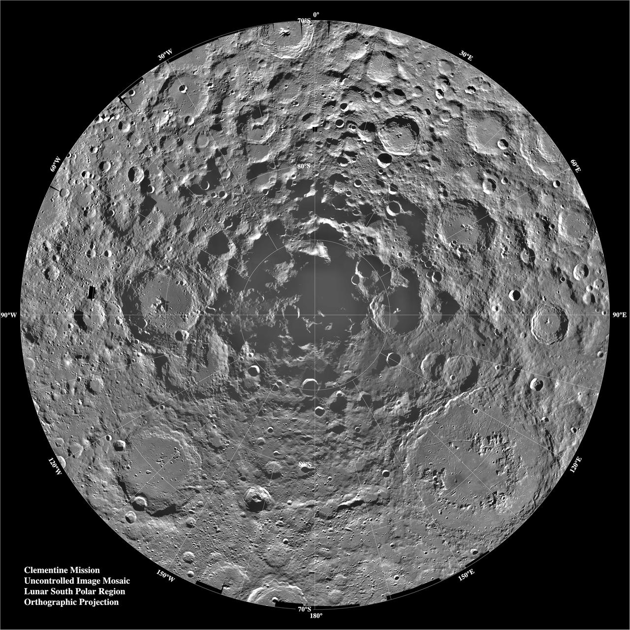
Lunar mosaic of ~1500 Clementine images of the south polar region of the moon. The projection is orthographic, centered on the south pole. The Schrodinger Basin (320 km in diameter) is located in the lower right of the mosaic. Amundsen-Ganswindt is the more subdued circular basin between Schrodinger and the pole. The polar regions of the moon are of special interest because of the postulated occurrence of ice in permanently shadowed areas. The south pole is of greater interest because the area that remains in shadow is much larger than that at the north pole. http://photojournal.jpl.nasa.gov/catalog/PIA00001
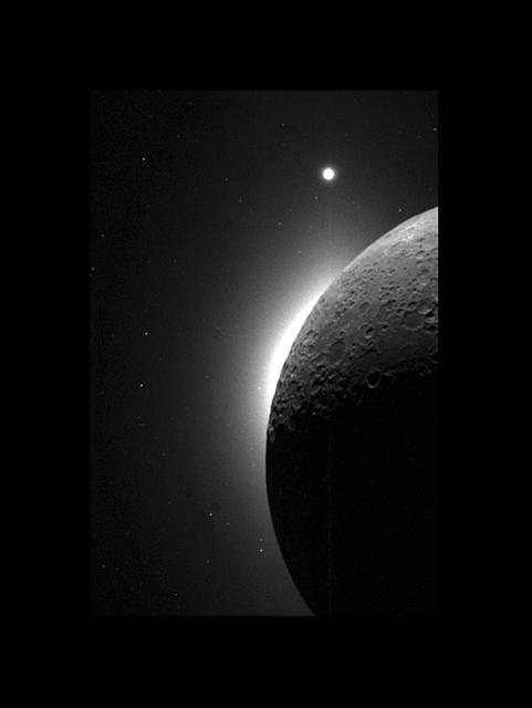
In 1994, during its flight, NASA's Clementine spacecraft returned images of the Moon. In addition to the geologic mapping cameras, the Clementine spacecraft also carried two Star Tracker cameras for navigation. These lightweight (0.3 kg) cameras kept the spacecraft on track by constantly observing the positions of stars, reminiscent of the age-old seafaring tradition of sextant/star navigation. These navigation cameras were also to take some spectacular wide angle images of the Moon. In this picture the Moon is seen illuminated solely by light reflected from the Earth--Earthshine! The bright glow on the lunar horizon is caused by light from the solar corona; the sun is just behind the lunar limb. Caught in this image is the planet Venus at the top of the frame. http://photojournal.jpl.nasa.gov/catalog/PIA00434
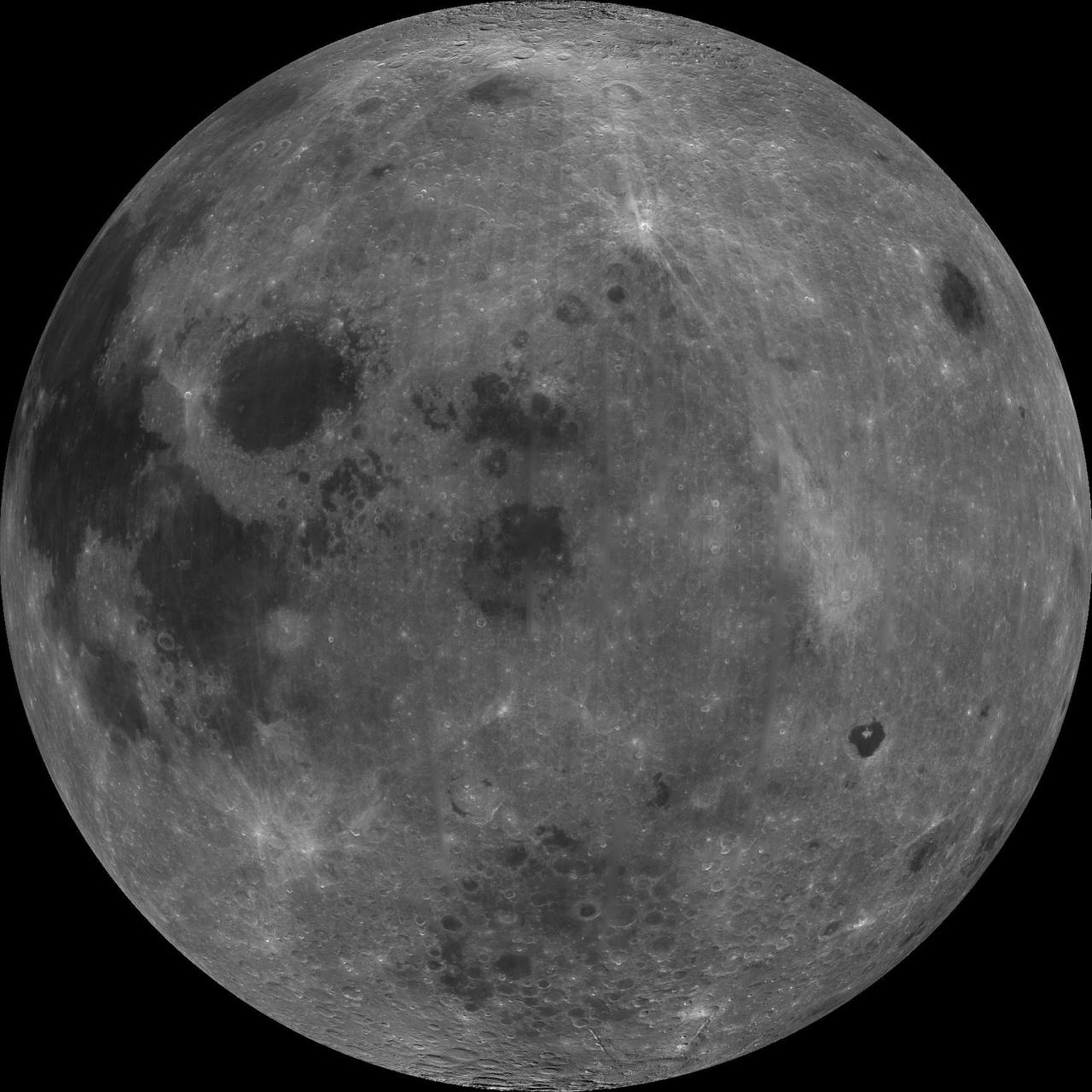
About 50,000 Clementine images were processed to produce the four orthographic views of the Moon. The images show albedo variations (normalized brightness or reflectivity) of the surface at a wavelength of 750 nm (just longward of visible red). The image projection is centered at 0 degree latitude and 180 degrees longitude. Mare Moscoviense (dark albedo feature upper left of image center) and South Pole-Aitken Basin (dark feature at bottom) represent maria regions largely absent on the lunar farside. The Clementine altimeter showed Aitken Basin to consist of a topographic rim about 2500 km in diameter, an inner shelf ranging from 400 to 600 km in width, and an irregular depressed floor about 12 km in depth. http://photojournal.jpl.nasa.gov/catalog/PIA00303
About 50,000 Clementine images were processed to produce the four orthographic views of the Moon. The images show albedo variations (normalized brightness or reflectivity) of the surface at a wavelength of 750 nm (just longward of visible red). The image projection is centered at 0 degree latitude and 180 degrees longitude. Mare Moscoviense (dark albedo feature upper left of image center) and South Pole-Aitken Basin (dark feature at bottom) represent maria regions largely absent on the lunar farside. The Clementine altimeter showed Aitken Basin to consist of a topographic rim about 2500 km in diameter, an inner shelf ranging from 400 to 600 km in width, and an irregular depressed floor about 12 km in depth. http://photojournal.jpl.nasa.gov/catalog/PIA00304

During its flight and lunar orbit, NASA’s Clementine spacecraft returned images of the planet Earth and the Moon. This collection of UVVIS camera Clementine images shows the Earth from the Moon and 3 images of the Earth. The image on the left shows the Earth as seen across the lunar north pole; the large crater in the foreground is Plaskett. The Earth actually appeared about twice as far above the lunar horizon as shown. The top right image shows the Earth as viewed by the UVVIS camera while Clementine was in transit to the Moon; swirling white cloud patterns indicate storms. The two views of southeastern Africa were acquired by the UVVIS camera while Clementine was in low Earth orbit early in the mission. http://photojournal.jpl.nasa.gov/catalog/PIA00432
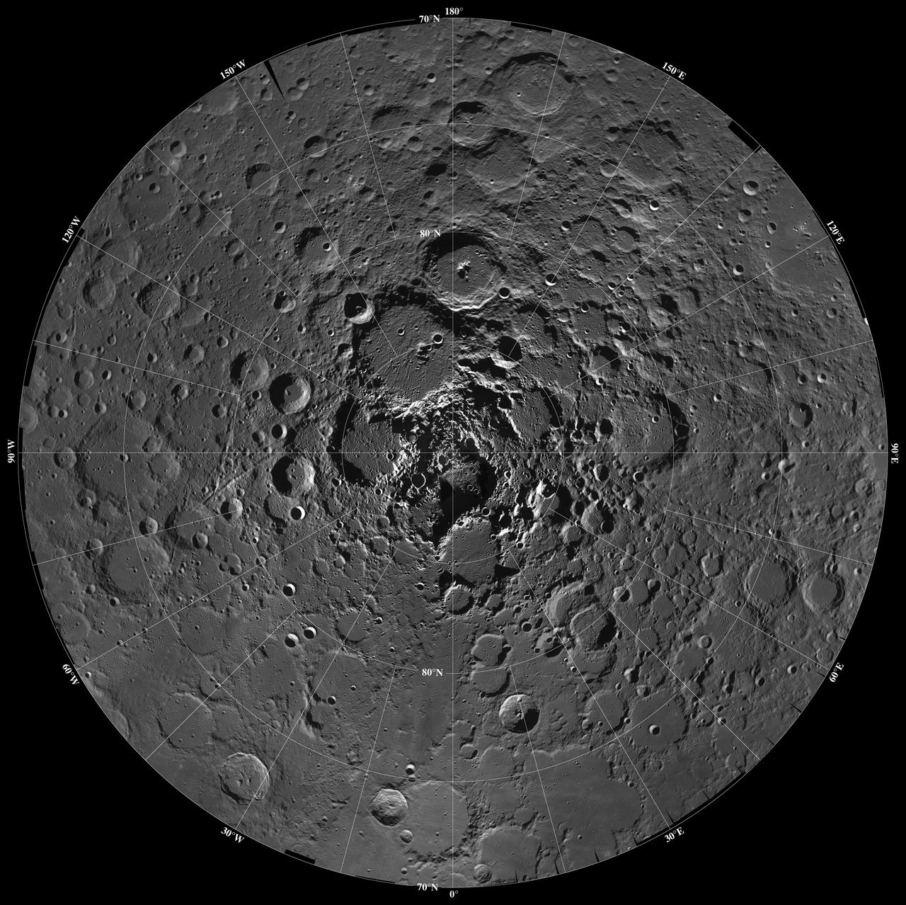
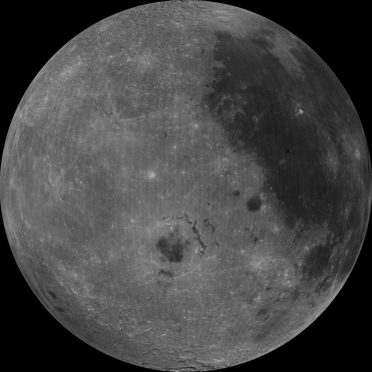
Lunar mosaic of ~1500 Clementine images of the north polar region of the moon. The projection is orthographic centered on the north pole. The polar regions of the moon are of special interest because of the postulated occurrence of ice in permanently shadowed areas. The north pole of the moon is absent of the very rugged terrain seen at the south pole. http://photojournal.jpl.nasa.gov/catalog/PIA00002
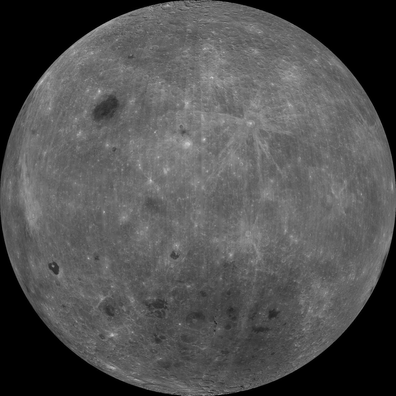
About 50,000 Clementine images were processed to produce the four orthographic views of the Moon. The images show albedo variations (normalized brightness or reflectivity) of the surface at a wavelength of 750 nm (just longward of visible red). The image projection is centered at 0 degree latitude and 180 degrees longitude. Mare Moscoviense (dark albedo feature upper left of image center) and South Pole-Aitken Basin (dark feature at bottom) represent maria regions largely absent on the lunar farside. The Clementine altimeter showed Aitken Basin to consist of a topographic rim about 2500 km in diameter, an inner shelf ranging from 400 to 600 km in width, and an irregular depressed floor about 12 km in depth. http://photojournal.jpl.nasa.gov/catalog/PIA00304