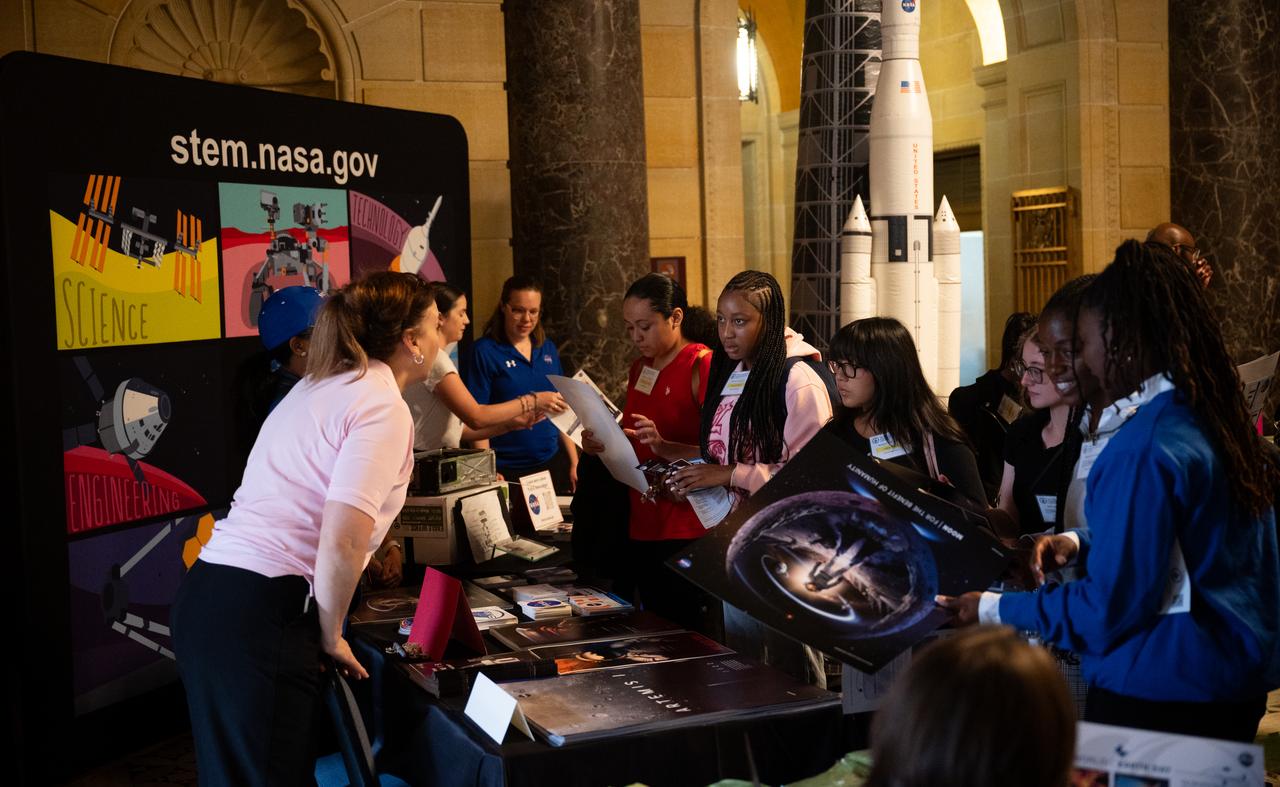
Students and other attendees speak with NASA representatives during the 2023 National Youth Summit hosted by the U.S. Department of Commerce’s Office of Faith-Based and Neighborhood Partnerships, Thursday, Sept. 21, 2023, at the U.S. Department of Commerce in Washington. Photo Credit: (NASA/Joel Kowsky)

Attendees view NASA exhibits during the 2023 National Youth Summit hosted by the U.S. Department of Commerce’s Office of Faith-Based and Neighborhood Partnerships, Thursday, Sept. 21, 2023, at the U.S. Department of Commerce in Washington. Photo Credit: (NASA/Joel Kowsky)

Members of a U.S. Air Force Honor Guard present the colors during the 2023 National Youth Summit hosted by the U.S. Department of Commerce’s Office of Faith-Based and Neighborhood Partnerships, Thursday, Sept. 21, 2023, at the U.S. Department of Commerce in Washington. Photo Credit: (NASA/Joel Kowsky)
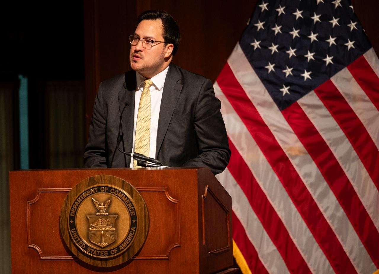
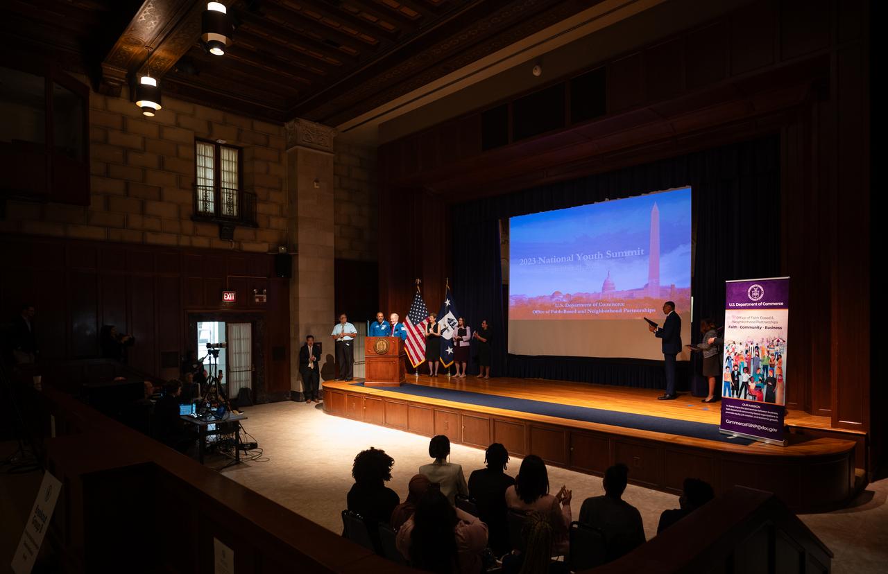
Andrés Chong-Qui Torres, director of the Office of Faith-Based and Neighborhood Partnerships at the Department of Commerce, delivers remarks at the 2023 National Youth Summit hosted by the U.S. Department of Commerce’s Office of Faith-Based and Neighborhood Partnerships, Thursday, Sept. 21, 2023, at the U.S. Department of Commerce in Washington. Photo Credit: (NASA/Joel Kowsky)

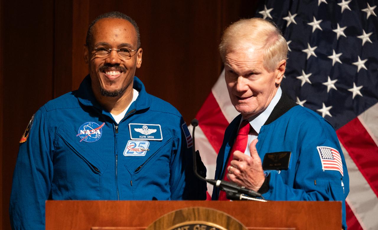
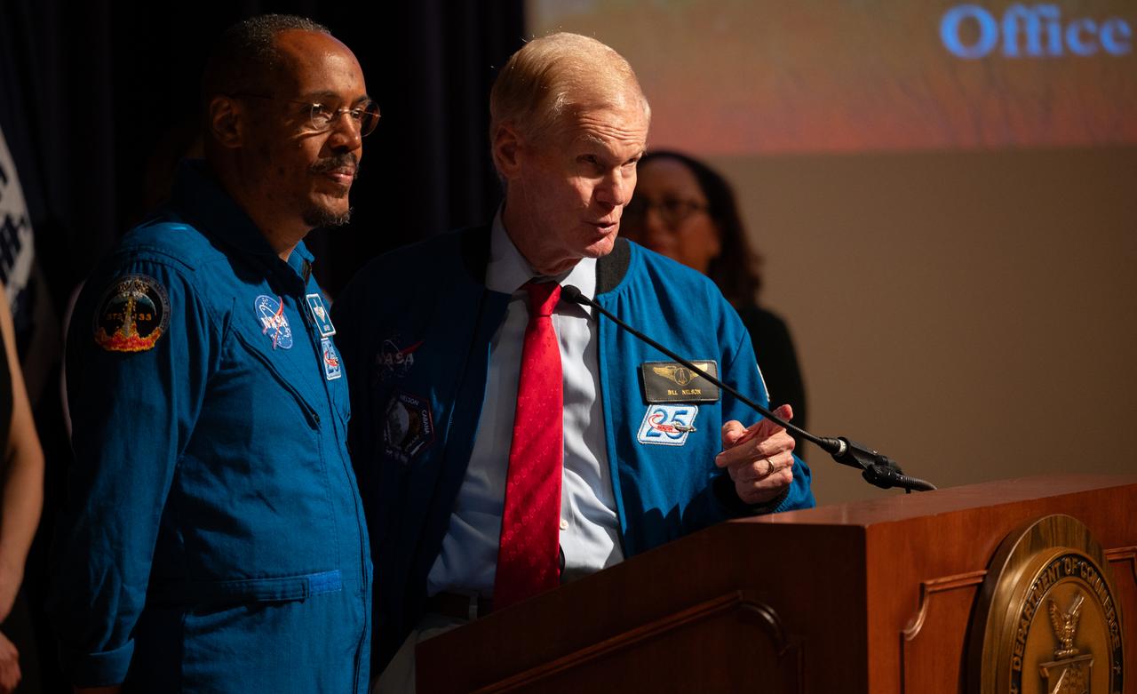
NASA Administrator Bill Nelson, right, delivers remarks alongside NASA astronaut Alvin Drew at the 2023 National Youth Summit hosted by the U.S. Department of Commerce’s Office of Faith-Based and Neighborhood Partnerships, Thursday, Sept. 21, 2023, at the U.S. Department of Commerce in Washington. Photo Credit: (NASA/Joel Kowsky)
NASA Administrator Bill Nelson, right, delivers remarks alongside NASA astronaut Alvin Drew at the 2023 National Youth Summit hosted by the U.S. Department of Commerce’s Office of Faith-Based and Neighborhood Partnerships, Thursday, Sept. 21, 2023, at the U.S. Department of Commerce in Washington. Photo Credit: (NASA/Joel Kowsky)
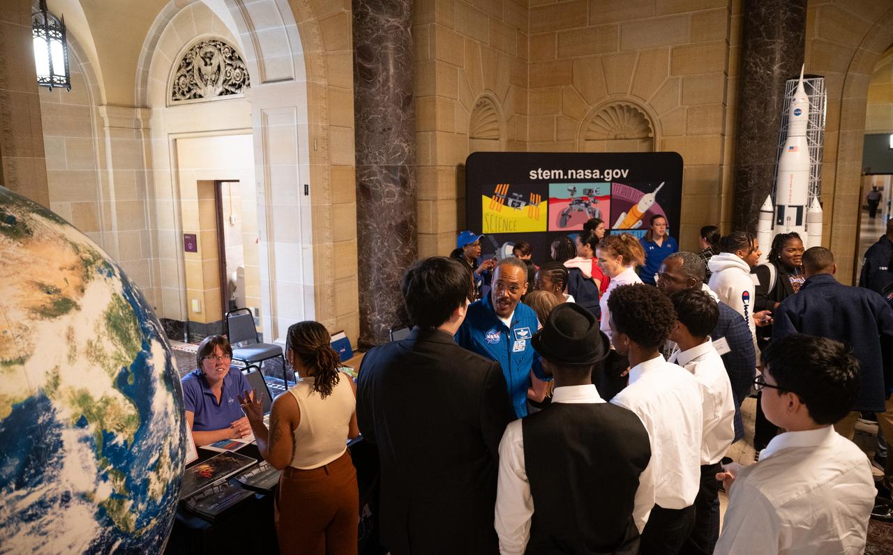
NASA astronaut Alvin Drew speaks to students during the 2023 National Youth Summit hosted by the U.S. Department of Commerce’s Office of Faith-Based and Neighborhood Partnerships, Thursday, Sept. 21, 2023, at the U.S. Department of Commerce in Washington. Photo Credit: (NASA/Joel Kowsky)
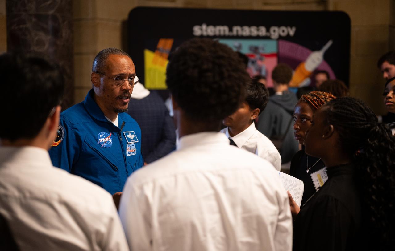
NASA astronaut Alvin Drew speaks to students during the 2023 National Youth Summit hosted by the U.S. Department of Commerce’s Office of Faith-Based and Neighborhood Partnerships, Thursday, Sept. 21, 2023, at the U.S. Department of Commerce in Washington. Photo Credit: (NASA/Joel Kowsky)
NASA Administrator Bill Nelson delivers remarks alongside NASA astronaut Alvin Drew at the 2023 National Youth Summit hosted by the U.S. Department of Commerce’s Office of Faith-Based and Neighborhood Partnerships, Thursday, Sept. 21, 2023, at the U.S. Department of Commerce in Washington. Photo Credit: (NASA/Joel Kowsky)
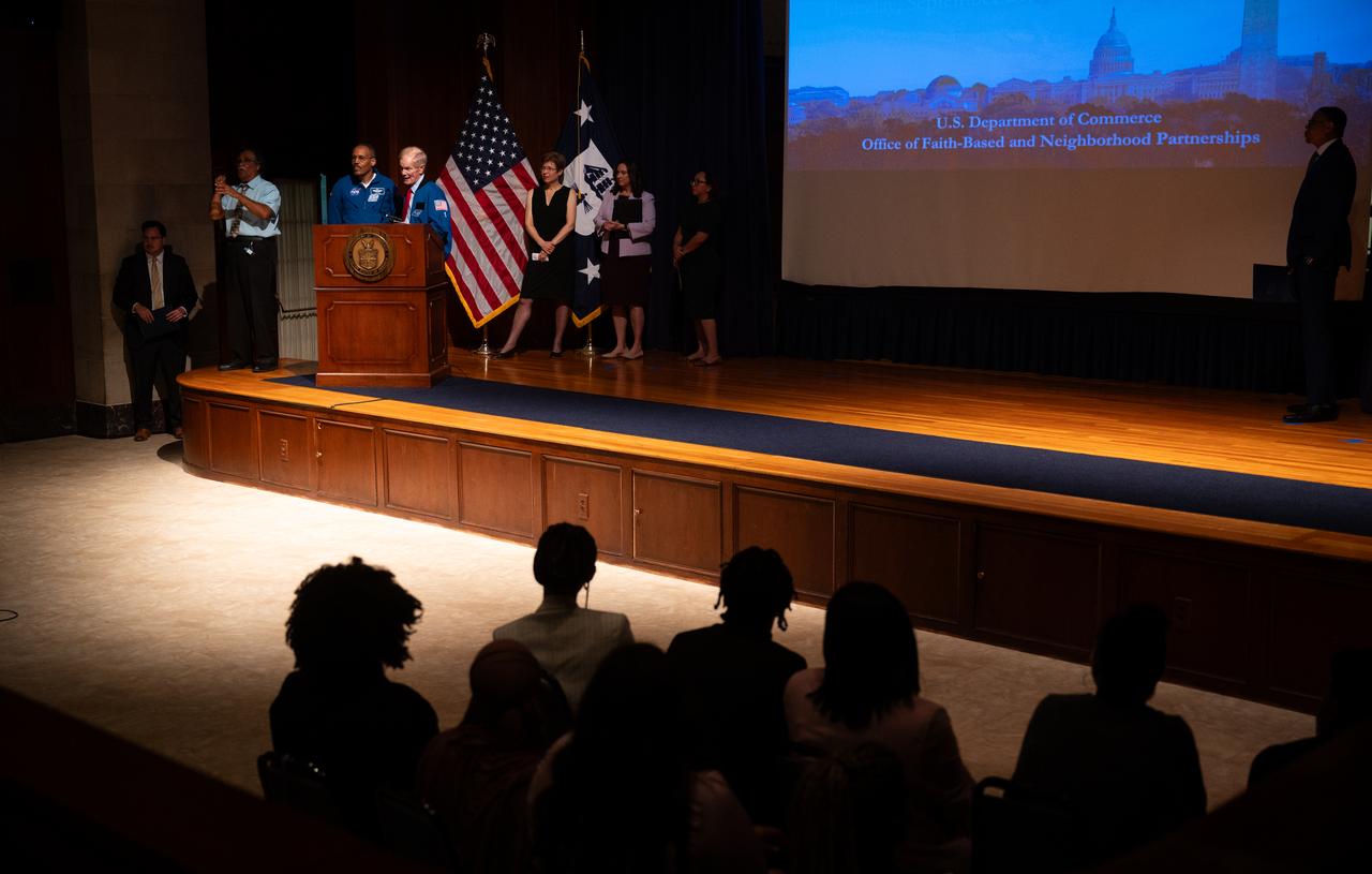
NASA Administrator Bill Nelson delivers remarks alongside NASA astronaut Alvin Drew at the 2023 National Youth Summit hosted by the U.S. Department of Commerce’s Office of Faith-Based and Neighborhood Partnerships, Thursday, Sept. 21, 2023, at the U.S. Department of Commerce in Washington. Photo Credit: (NASA/Joel Kowsky)
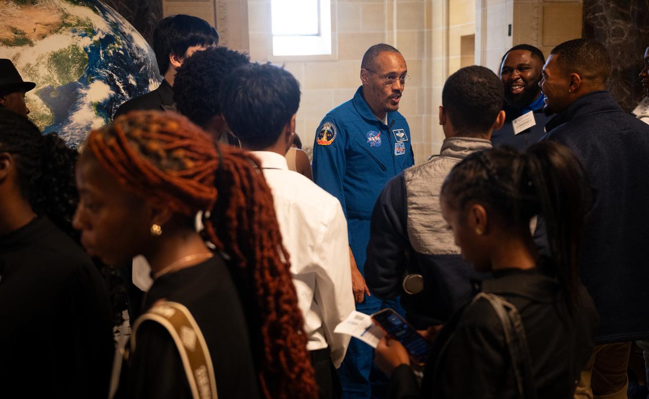
NASA astronaut Alvin Drew speaks to students during the 2023 National Youth Summit hosted by the U.S. Department of Commerce’s Office of Faith-Based and Neighborhood Partnerships, Thursday, Sept. 21, 2023, at the U.S. Department of Commerce in Washington. Photo Credit: (NASA/Joel Kowsky)
NASA Administrator Bill Nelson, right, delivers remarks alongside NASA astronaut Alvin Drew at the 2023 National Youth Summit hosted by the U.S. Department of Commerce’s Office of Faith-Based and Neighborhood Partnerships, Thursday, Sept. 21, 2023, at the U.S. Department of Commerce in Washington. Photo Credit: (NASA/Joel Kowsky)
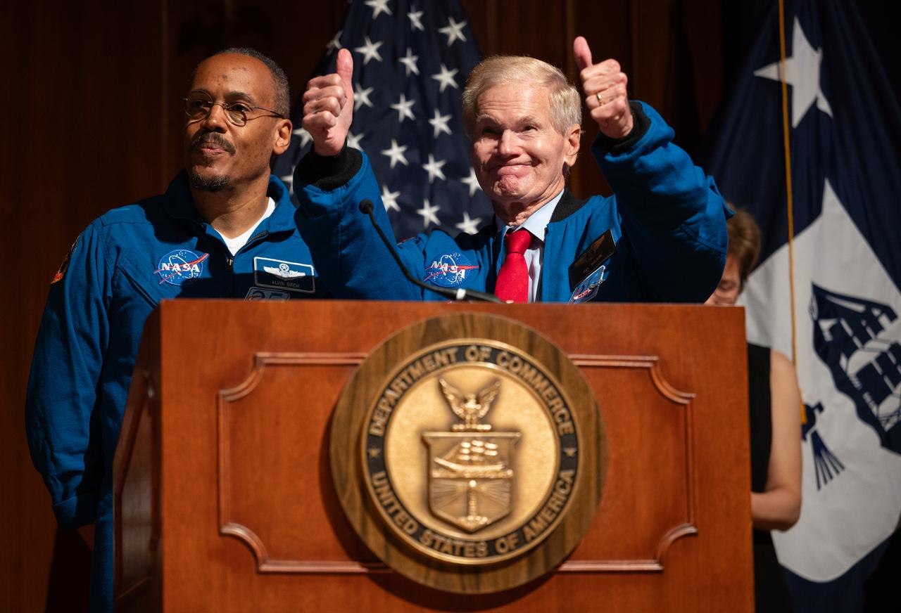
NASA Administrator Bill Nelson, right, gives thumbs up to students and attendees after delivering remarks alongside NASA astronaut Alvin Drew at the 2023 National Youth Summit hosted by the U.S. Department of Commerce’s Office of Faith-Based and Neighborhood Partnerships, Thursday, Sept. 21, 2023, at the U.S. Department of Commerce in Washington. Photo Credit: (NASA/Joel Kowsky)
Don Graves, deputy secretary, U.S. Department of Commerce, speaks at an event to commemorate Black Space Week (BSW) 2024 titled, "Beyond the Color Lines From Science Fiction to Science Fact," in the Oprah Winfrey Theater at the Smithsonian National Museum of African American History and Culture, Monday, June 17, 2024 in Washington. Photo Credit: (NASA/Aubrey Gemignani)
Don Graves, deputy secretary, U.S. Department of Commerce, speaks at an event to commemorate Black Space Week (BSW) 2024 titled, "Beyond the Color Lines From Science Fiction to Science Fact," in the Oprah Winfrey Theater at the Smithsonian National Museum of African American History and Culture, Monday, June 17, 2024 in Washington. Photo Credit: (NASA/Aubrey Gemignani)

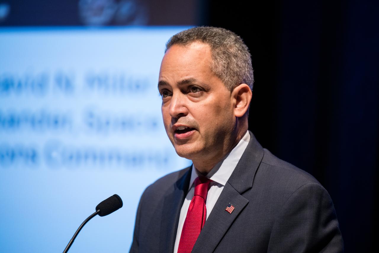
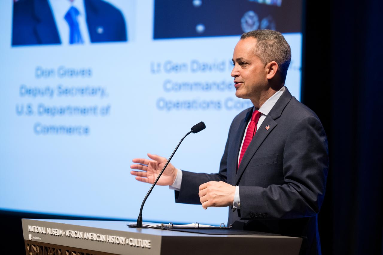
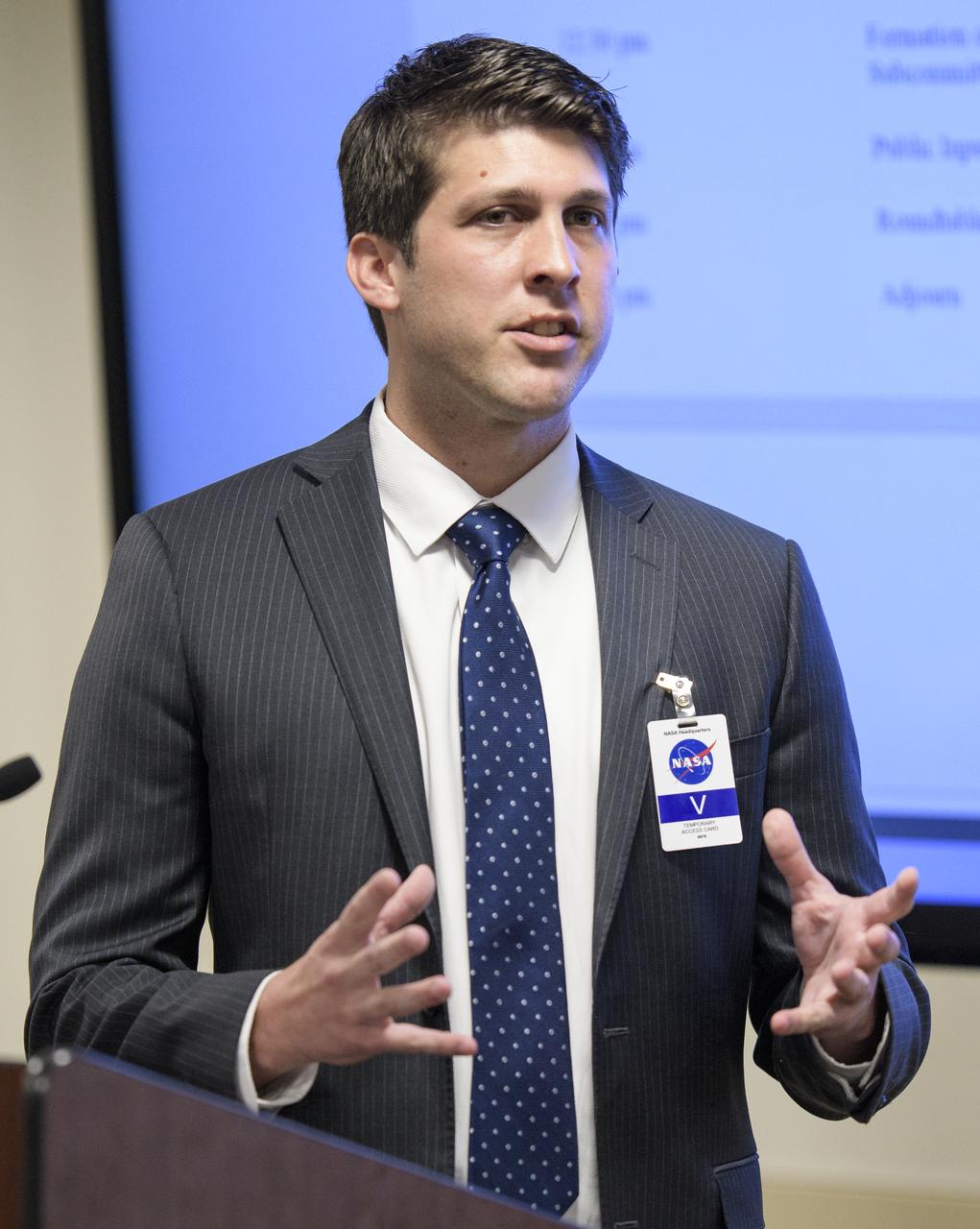
Kevin O'Connell, Director of the Office of Space Commerce at the Department of Commerce, testifies during a hearing of the Senate Committee on Commerce, Science, and Transportation titled "The New Space Race: Ensuring U.S. Global Leadership on the Final Frontier," Wednesday, March 13, 2019 at the Dirksen Senate Office Building in Washington. Photo Credit: (NASA/Joel Kowsky)

Kevin O'Connell, Director of the Office of Space Commerce at the Department of Commerce, testifies during a hearing of the Senate Committee on Commerce, Science, and Transportation titled "The New Space Race: Ensuring U.S. Global Leadership on the Final Frontier," Wednesday, March 13, 2019 at the Dirksen Senate Office Building in Washington. Photo Credit: (NASA/Joel Kowsky)

Kevin O'Connell, Director of the Office of Space Commerce at the Department of Commerce, testifies during a hearing of the Senate Committee on Commerce, Science, and Transportation titled "The New Space Race: Ensuring U.S. Global Leadership on the Final Frontier," Wednesday, March 13, 2019 at the Dirksen Senate Office Building in Washington. Photo Credit: (NASA/Joel Kowsky)

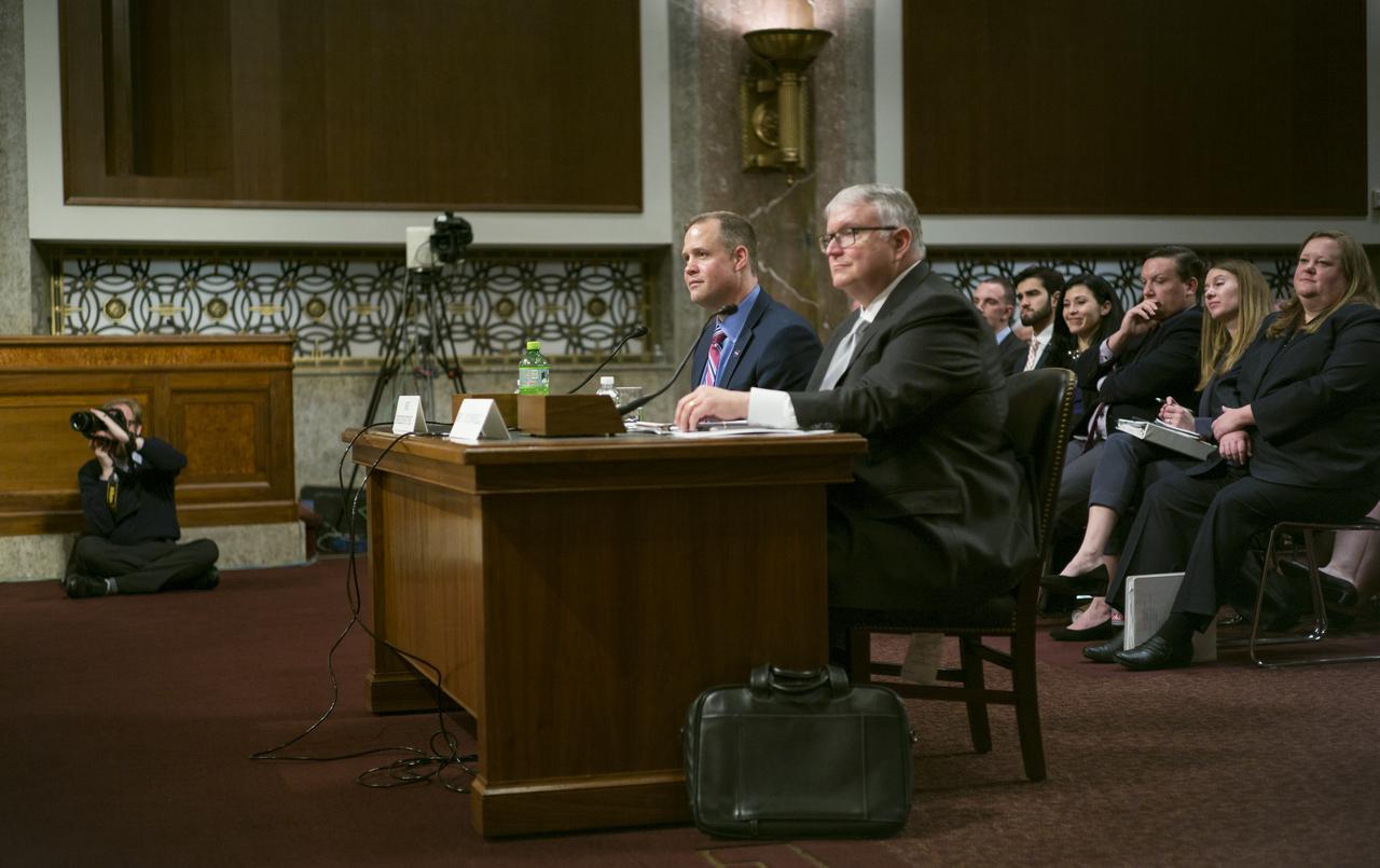
NASA Administrator Jim Bridenstine, right, and Kevin O'Connell, Director of the Office of Space Commerce at the Department of Commerce, left, are seen during a hearing of the Senate Committee on Commerce, Science, and Transportation titled "The New Space Race: Ensuring U.S. Global Leadership on the Final Frontier," Wednesday, March 13, 2019 at the Dirksen Senate Office Building in Washington. Photo Credit: (NASA/Joel Kowsky)

NASA Administrator Jim Bridenstine, left, and Kevin O’Connell, Director, Office of Space Commerce, Department of Commerce testify before the Aviation and Space Subcommittee of the Senate Commerce, Science, and Transportation Committee during a hearing titled “The Emerging Space Environment: Operational, Technical, and Policy Challenges.”, Tuesday, May 14, 2019, at the Dirksen Senate Office Building in Washington. Photo Credit: (NASA/Bill Ingalls)

NASA Administrator Jim Bridenstine, left, and Kevin O'Connell, Director of the Office of Space Commerce at the Department of Commerce are seen during a hearing of the Senate Committee on Commerce, Science, and Transportation titled "The New Space Race: Ensuring U.S. Global Leadership on the Final Frontier," Wednesday, March 13, 2019 at the Dirksen Senate Office Building in Washington. Photo Credit: (NASA/Joel Kowsky)
NASA Administrator Jim Bridenstine, left, and Kevin O'Connell, Director of the Office of Space Commerce at the Department of Commerce are seen during a hearing of the Senate Committee on Commerce, Science, and Transportation titled "The New Space Race: Ensuring U.S. Global Leadership on the Final Frontier," Wednesday, March 13, 2019 at the Dirksen Senate Office Building in Washington. Photo Credit: (NASA/Joel Kowsky)

NASA Administrator Jim Bridenstine, left, and Kevin O'Connell, Director of the Office of Space Commerce at the Department of Commerce are seen during a hearing of the Senate Committee on Commerce, Science, and Transportation titled "The New Space Race: Ensuring U.S. Global Leadership on the Final Frontier," Wednesday, March 13, 2019 at the Dirksen Senate Office Building in Washington. Photo Credit: (NASA/Joel Kowsky)

NASA Administrator Jim Bridenstine, left, and Kevin O'Connell, Director of the Office of Space Commerce at the Department of Commerce are seen during a hearing of the Senate Committee on Commerce, Science, and Transportation titled "The New Space Race: Ensuring U.S. Global Leadership on the Final Frontier," Wednesday, March 13, 2019 at the Dirksen Senate Office Building in Washington. Photo Credit: (NASA/Joel Kowsky)
NASA Administrator Jim Bridenstine testifies along with Kevin O'Connell, Director of the Office of Space Commerce at the Department of Commerce during a hearing of the Senate Committee on Commerce, Science, and Transportation titled "The New Space Race: Ensuring U.S. Global Leadership on the Final Frontier," Wednesday, March 13, 2019 at the Dirksen Senate Office Building in Washington. Photo Credit: (NASA/Joel Kowsky)

Kevin O’Connell, Director, Office of Space Commerce, Department of Commerce testifies before the Aviation and Space Subcommittee of the Senate Commerce, Science, and Transportation Committee during a hearing titled “The Emerging Space Environment: Operational, Technical, and Policy Challenges.”, Tuesday, May 14, 2019, at the Dirksen Senate Office Building in Washington. Photo Credit: (NASA/Bill Ingalls)

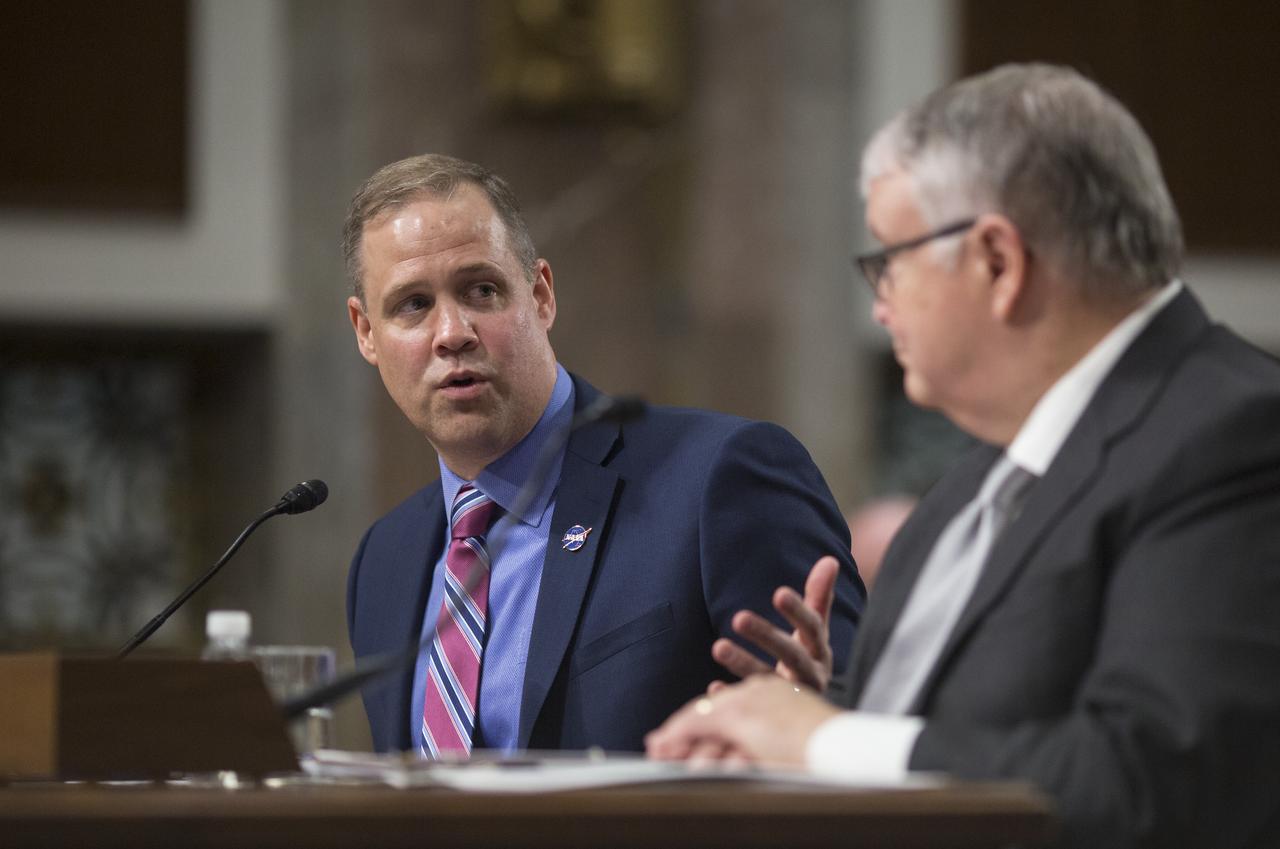
NASA Administrator Jim Bridenstine, right, and Kevin O'Connell, Director of the Office of Space Commerce at the Department of Commerce, left, are seen during a hearing of the Senate Committee on Commerce, Science, and Transportation titled "The New Space Race: Ensuring U.S. Global Leadership on the Final Frontier," Wednesday, March 13, 2019 at the Dirksen Senate Office Building in Washington. Photo Credit: (NASA/Joel Kowsky)
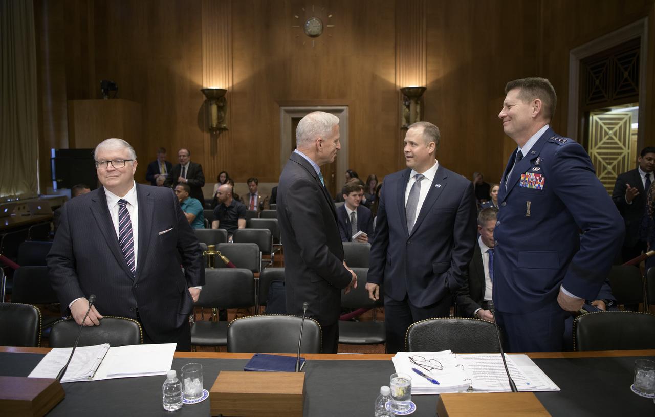
Kevin O’Connell, Director, Office of Space Commerce, Department of Commerce, left, Robert Cardillo, Former Director, National Geospatial-Intelligence Agency, NASA Administrator Jim Bridenstine, and Lt. Gen. David D. Thompson, Vice Commander, Space Command, United States Air Force, right, gather ahead of testifying along with Col. Pamela A. Melroy, United States Air Force (ret.) (former astronaut), before the Aviation and Space Subcommittee of the Senate Commerce, Science, and Transportation Committee, Tuesday, May 14, 2019, at the Dirksen Senate Office Building in Washington. Photo Credit: (NASA/Bill Ingalls)
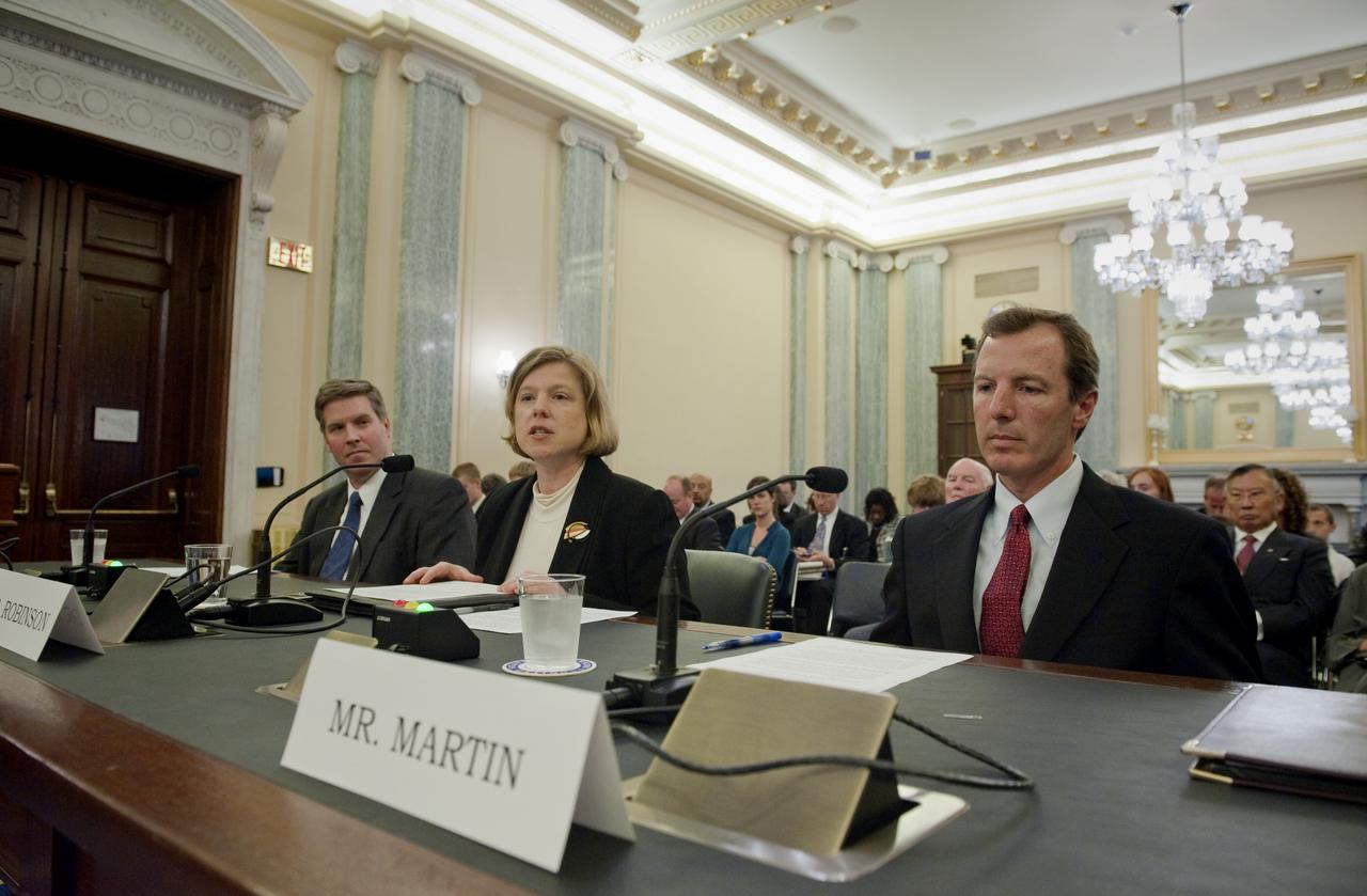
Dr. Elizabeth M. Robinson, nominee for Chief Financial Officer for NASA, center, answers questions during her confirmation hearing in front of the Senate Committee on Commerce, Science and Transportation, Thursday, Oct. 15, 2009, on Capitol Hill in Washington. Robinson is flanked by Dr. Patrick Gallagher, nominee to be Assistant Secretary of the Transportation Security Administration at the U.S. Department of Commerce, far left, and Paul K. Martin, nominee to be Inspector General at NASA. Photo Credit: (NASA/Paul E. Alers)

Paul K. Martin, nominee for Inspector General at NASA, far right, answers questions during his confirmation hearing in front of the Senate Committee on Commerce, Science and Transportation, Thursday, Oct. 15, 2009, on Capitol Hill in Washington. Looking on are Dr. Elizabeth M. Robinson, nominee for Chief Financial Officer for NASA, center, and Dr. Patrick Gallagher, nominee to be Assistant Secretary of the Transportation Security Administration at the U.S. Department of Commerce. Photo Credit: (NASA/Paul E. Alers)
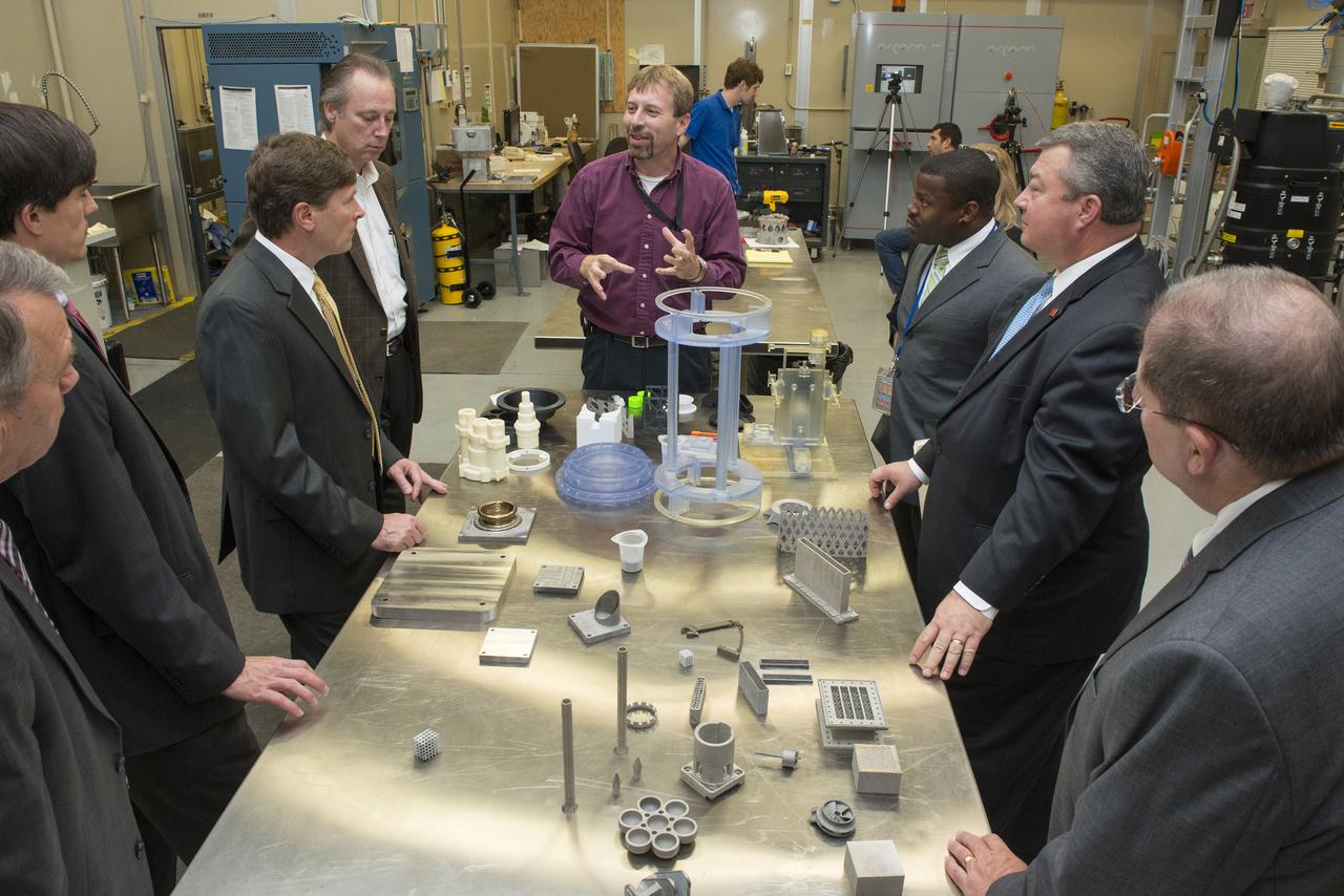
KEN COOPER GIVES AN OVERVIEW OF ADDITIVE MANUFACTURING TO STATE SENATOR BILL HOLTZCLAW, REPRESENTATIVE MAC MCCUTCHEON, GREG CANFIELD OF THE ALABAMA DEPARTMENT OF COMMERCE, GOVERNOR BENTLEY’S CHIEF OF STAFF, DAVID PERRY, AND LT. GOVERNOR STRANGES CHIEF OF STAFF, STEVE PELHAM.

Mr. Joel Szabat of Maryland appears before the Senate Committee on Commerce, Science, and Transportation as the nominee to be Assistant Secretary for Aviation and International Affairs at the Department of Transportation on Thursday, Aug. 23, 2018 in the Russell Senate Office Building in Washington. Photo Credit: (NASA/Bill Ingalls)
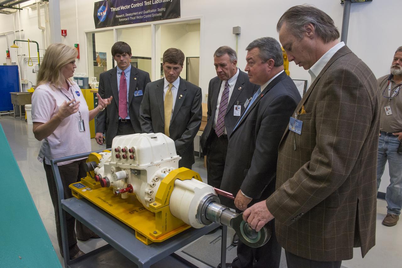
LISA BATES PROVIDES AN OVERVIEW OF THRUST VECTOR CONTROL TO STATE SENATOR BILL HOLTZCLAW, REPRESENTATIVE MAC MCCUTCHEON, GREG CANFIELD OF THE ALABAMA DEPARTMENT OF COMMERCE, GOVERNOR BENTLEY’S CHIEF OF STAFF, DAVID PERRY, AND LT. GOVERNOR STRANGES CHIEF OF STAFF, STEVE PELHAM.

Mr. Joel Szabat of Maryland appears before the Senate Committee on Commerce, Science, and Transportation as the nominee to be Assistant Secretary for Aviation and International Affairs at the Department of Transportation on Thursday, Aug. 23, 2018 in the Russell Senate Office Building in Washington. Photo Credit: (NASA/Bill Ingalls)
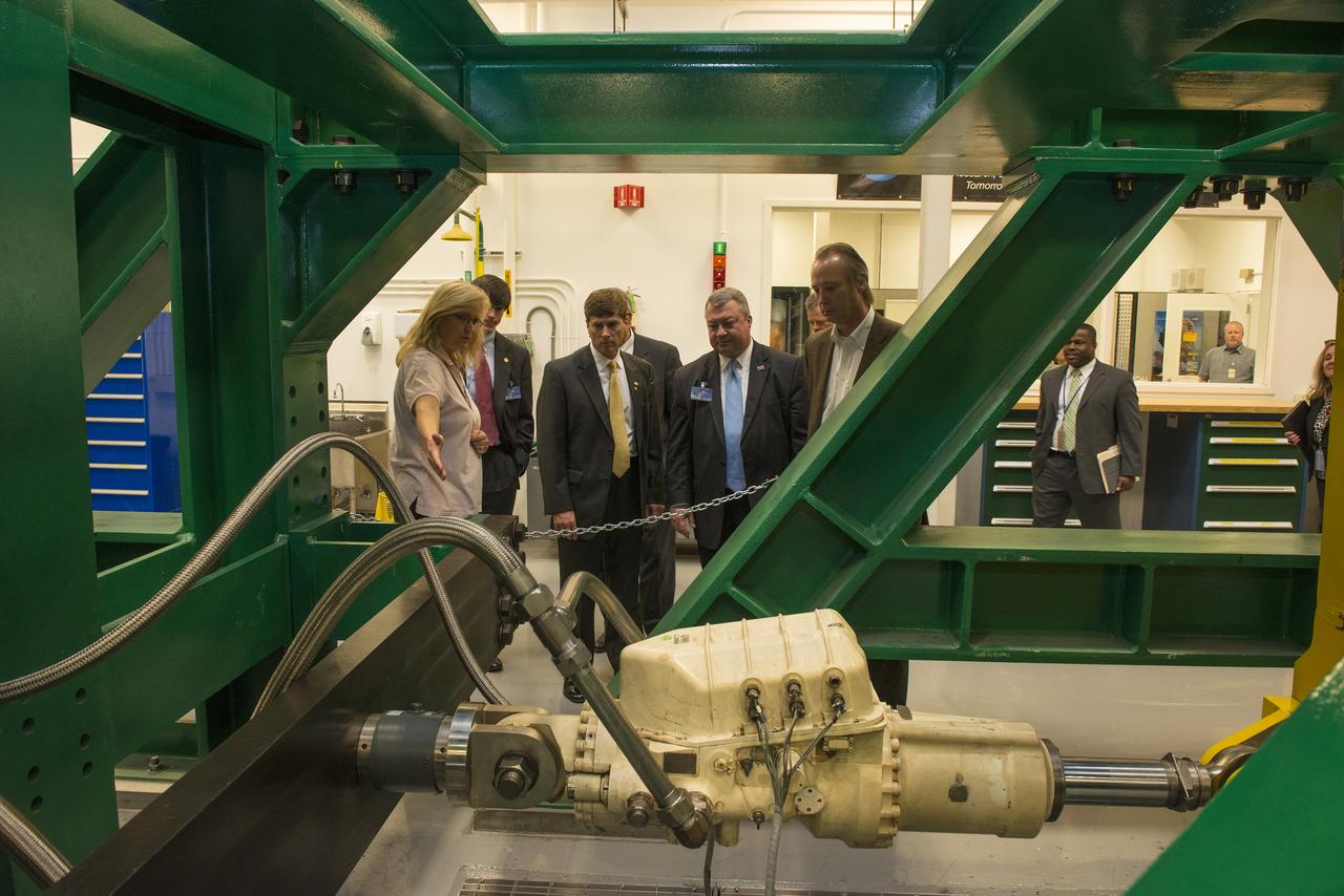
LISA BATES PROVIDES AN OVERVIEW OF THRUST VECTOR CONTROL TO STATE SENATOR BILL HOLTZCLAW, REPRESENTATIVE MAC MCCUTCHEON, GREG CANFIELD OF THE ALABAMA DEPARTMENT OF COMMERCE, GOVERNOR BENTLEY’S CHIEF OF STAFF, DAVID PERRY, AND LT. GOVERNOR STRANGES CHIEF OF STAFF, STEVE PELHAM

NASA Administrator Jim Bridenstine, left, Kevin O’Connell, Director, Office of Space Commerce, Department of Commerce, Robert Cardillo, Former Director, National Geospatial-Intelligence Agency, Lt. Gen. David D. Thompson, Vice Commander, Space Command, United States Air Force, and Col. Pamela A. Melroy, United States Air Force (ret.) (former astronaut), right, testify before the Senate Aviation and Space Subcommittee during a hearing titled “The Emerging Space Environment: Operational, Technical, and Policy Challenges.”, Tuesday, May 14, 2019, at the Dirksen Senate Office Building in Washington. Photo Credit: (NASA/Bill Ingalls)

Dr. Michael Griffin testifies, Tuesday, April 12, 2005, during his confirmation hearing before the U.S. Senate Commerce Committee at the Russell Senate Office Building in Washington. If confirmed, Griffin, who currently heads the space department at the Johns Hopkins University Applied Physics Laboratory will become NASA's 11th administrator. Photo Credit (NASA/Renee Bouchard)

James Uthmeier, of the Department of Commerce, speaks about deregulation and space traffic management initiatives at the first meeting of the National Space Council Users' Advisory Group, Tuesday, June 19, 2018 at NASA Headquarters in Washington. The Users' Advisory Group will advise and inform the National Space Council on a broad range of aerospace topics, including the impacts of U.S. and international laws and regulations, national security space priorities, scientific and human space exploration priorities, and ways to bolster support. Photo Credit: (NASA/Joel Kowsky)

James Uthmeier, of the Department of Commerce, speaks about deregulation and space traffic management initiatives at the first meeting of the National Space Council Users' Advisory Group, Tuesday, June 19, 2018 at NASA Headquarters in Washington. The Users' Advisory Group will advise and inform the National Space Council on a broad range of aerospace topics, including the impacts of U.S. and international laws and regulations, national security space priorities, scientific and human space exploration priorities, and ways to bolster support. Photo Credit: (NASA/Joel Kowsky)
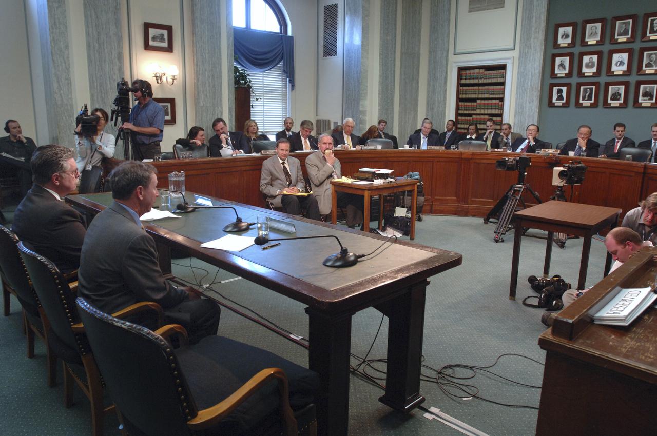
Dr. Michael Griffin testifies, Tuesday, April 12, 2005, during his confirmation hearing before the U.S. Senate Commerce Committee at the Russell Senate Office Building in Washington. If confirmed, Griffin, who currently heads the space department at the Johns Hopkins University Applied Physics Laboratory will become NASA's 11th administrator. Photo Credit (NASA/Renee Bouchard)

Dr. Michael Griffin testifies, Tuesday, April 12, 2005, during his confirmation hearing before the U.S. Senate Commerce Committee at the Russell Senate Office Building in Washington. If confirmed, Griffin, who currently heads the space department at the Johns Hopkins University Applied Physics Laboratory will become NASA's 11th administrator. Photo Credit (NASA/Renee Bouchard)

Audience members are seen as Don Graves, deputy secretary, U.S. Department of Commerce, speaks at an event to commemorate Black Space Week (BSW) 2024 titled, "Beyond the Color Lines From Science Fiction to Science Fact," in the Oprah Winfrey Theater at the Smithsonian National Museum of African American History and Culture, Monday, June 17, 2024 in Washington. Photo Credit: (NASA/Aubrey Gemignani)

U.S. Senator Barbara Mikulski, D-Md., testifies before the U.S. Senate Commerce Committee during the confirmation hearing of Dr. Michael Griffin, rear center, Tuesday, April 12, 2005, at the Russell Senate Office Building in Washington. Griffin currently heads the space department at Johns Hopkins University's Applied Physics Laboratory. If confirmed by the full U.S. Senate, Dr. Griffin would be NASA's 11th administrator. Photo Credit: (NASA/Renee Bouchard)

Dr. Michael Griffin testifies, Tuesday, April 12, 2005, during his confirmation hearing before the U.S. Senate Commerce Committee at the Russell Senate Office Building in Washington. If confirmed, Griffin, who currently heads the space department at the Johns Hopkins University Applied Physics Laboratory will become NASA's 11th administrator. Photo Credit (NASA/Renee Bouchard)

Dr. Michael Griffin testifies, Tuesday, April 12, 2005, during his confirmation hearing before the U.S. Senate Commerce Committee at the Russell Senate Office Building in Washington. If confirmed, Griffin, who currently heads the space department at the Johns Hopkins University Applied Physics Laboratory will become NASA's 11th administrator. Photo Credit (NASA/Renee Bouchard)
James Uthmeier, of the Department of Commerce, speaks about deregulation and space traffic management initiatives at the first meeting of the National Space Council Users' Advisory Group, Tuesday, June 19, 2018 at NASA Headquarters in Washington. The Users' Advisory Group will advise and inform the National Space Council on a broad range of aerospace topics, including the impacts of U.S. and international laws and regulations, national security space priorities, scientific and human space exploration priorities, and ways to bolster support. Photo Credit: (NASA/Joel Kowsky)

Dr. Michael Griffin testifies, Tuesday, April 12, 2005, during his confirmation hearing before the U.S. Senate Commerce Committee at the Russell Senate Office Building in Washington. If confirmed, Griffin, who currently heads the space department at the Johns Hopkins University Applied Physics Laboratory will become NASA's 11th administrator. Photo Credit (NASA/Renee Bouchard)
Dr. Michael Griffin, right, talks with his wife Rebecca Griffin prior to testifying at his confirmation hearing before the U.S. Senate Commerce Committee, Tuesday, April 12, 2005, at the Russell Senate Office Building in Washington. If confirmed, Griffin, who currently heads the space department at the Johns Hopkins University Applied Physics Laboratory will become NASA's 11th administrator. Photo Credit (NASA/Renee Bouchard)

U.S. Senator Barbara Mikulski, D-Md., testifies before the U.S. Senate Commerce Committee during the confirmation hearing of Dr. Michael Griffin, right background, Tuesday, April 12, 2005, at the Russell Senate Office Building in Washington. Griffin currently heads the space department at Johns Hopkins University's Applied Physics Laboratory. If confirmed by the full U.S. Senate, Dr. Griffin would be NASA's 11th administrator. Photo Credit: (NASA/Renee Bouchard)

U.S. Senator Barbara Mikulski, D-Md., testifies before the U.S. Senate Commerce Committee during the confirmation hearing of Dr. Michael Griffin, rear center, Tuesday, April 12, 2005, at the Russell Senate Office Building in Washington. Griffin currently heads the space department at Johns Hopkins University's Applied Physics Laboratory. If confirmed by the full U.S. Senate, Dr. Griffin would be NASA's 11th administrator. Photo Credit: (NASA/Renee Bouchard)

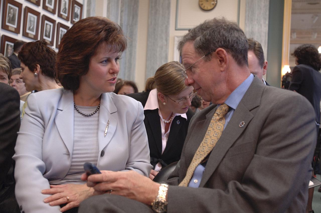
U.S. Senator Daniel K. Inouye, D-Hawaii, left, speaks as U.S. Senator Ted Stevens, R-Alaska, looks on during the confirmation hearing for Dr. Michael Griffin, in front of the U.S. Senate Commerce Committee, Tuesday, April 12, 2005, in Washington. If confirmed, Griffin, who currently heads the space department at the Johns Hopkins University Applied Physics Laboratory will become NASA's 11th administrator. Photo Credit (NASA/Renee Bouchard)

Dr. Michael Griffin testifies, Tuesday, April 12, 2005, during his confirmation hearing before the U.S. Senate Commerce Committee at the Russell Senate Office Building in Washington. If confirmed, Griffin, who currently heads the space department at the Johns Hopkins University Applied Physics Laboratory will become NASA's 11th administrator. Photo Credit (NASA/Renee Bouchard)

Dr. Michael Griffin testifies, Tuesday, April 12, 2005, during his confirmation hearing before the U.S. Senate Commerce Committee at the Russell Senate Office Building in Washington. If confirmed, Griffin, who currently heads the space department at the Johns Hopkins University Applied Physics Laboratory will become NASA's 11th administrator. Photo Credit (NASA/Renee Bouchard)
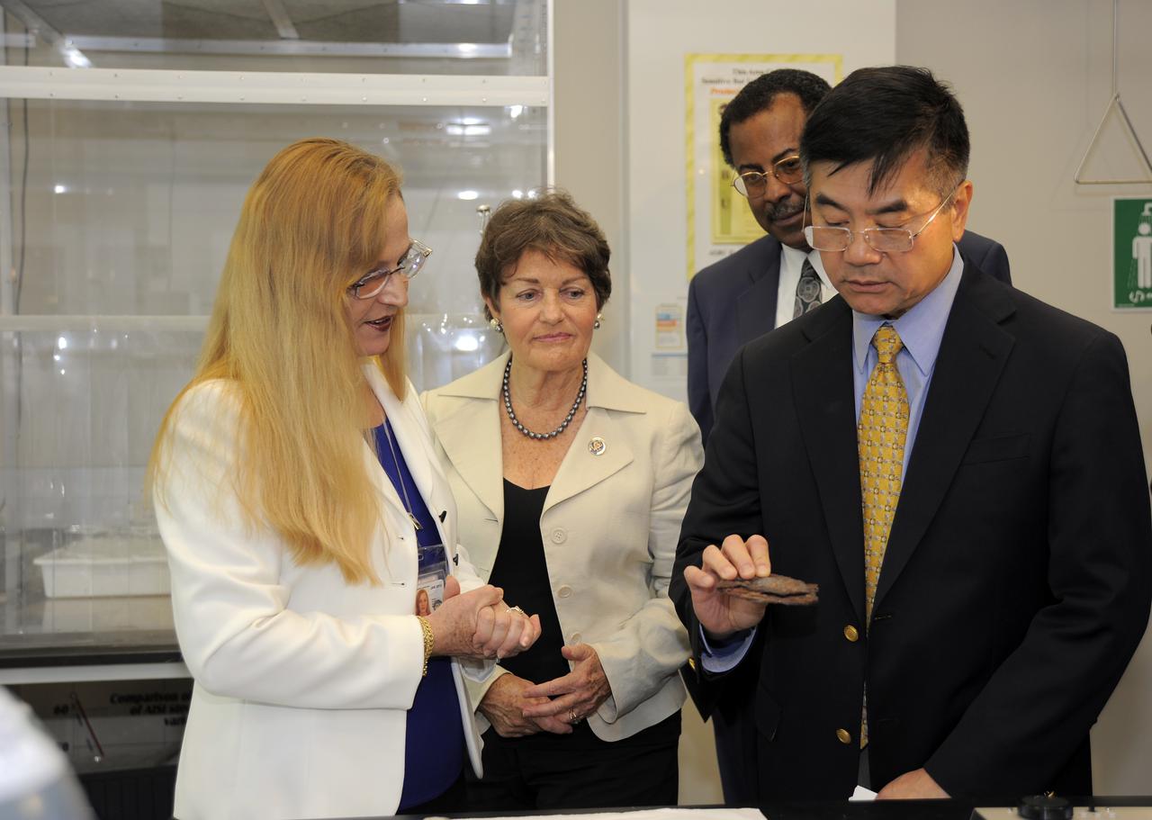
CAPE CANAVERAL, Fla. -- At NASA's Kennedy Space Center in Florida, Luz Marina Calle, left, shows Rep. Suzanne Kosmas, NASA Associate Deputy Administrator Charles Scales and Commerce Secretary Gary Locke the types of experiments taking place in the Space Life Sciences Lab. Calle's research focuses on corrosion prevention. As part of Locke's visit to Kennedy a meeting also was held with about a dozen workers expected to lose their jobs with the retirement of the Space Shuttle Program to discuss what the Commerce Department, NASA and the White House are doing to improve the local economy as the program winds down. NASA Administrator Charlie Bolden and Locke co-chair the White House’s Task Force on Space Industry Workforce and Economic Development, which was formed in May and is expected to provide a report to President Obama this month. Photo credit: NASA_Kim Shiflett

SL3-40-077 (July-September 1973) --- A vertical view of the Mediterranean coastal area of southeastern France as photographed from Earth orbit by one of the six lenses of the Itek-furnished S190-A Multispectral Photographic Facility Experiment aboard the Skylab space station. This view of the coast extends from the eastern outskirts of Marseilles easterly to Cannes, and includes the city of Toulon. The S190-A experiment is part of the Skylab Earth Resources Experiments Package. Federal agencies participating with NASA on the EREP project are the Departments of Agriculture, Commerce, Interior, the Environmental Protection Agency and the Corps of Engineers. All EREP photography is available to the public through the Department of Interior?s Earth Resources Observations Systems Data Center, Sioux Falls, South Dakota, 57198. Photo credit: NASA
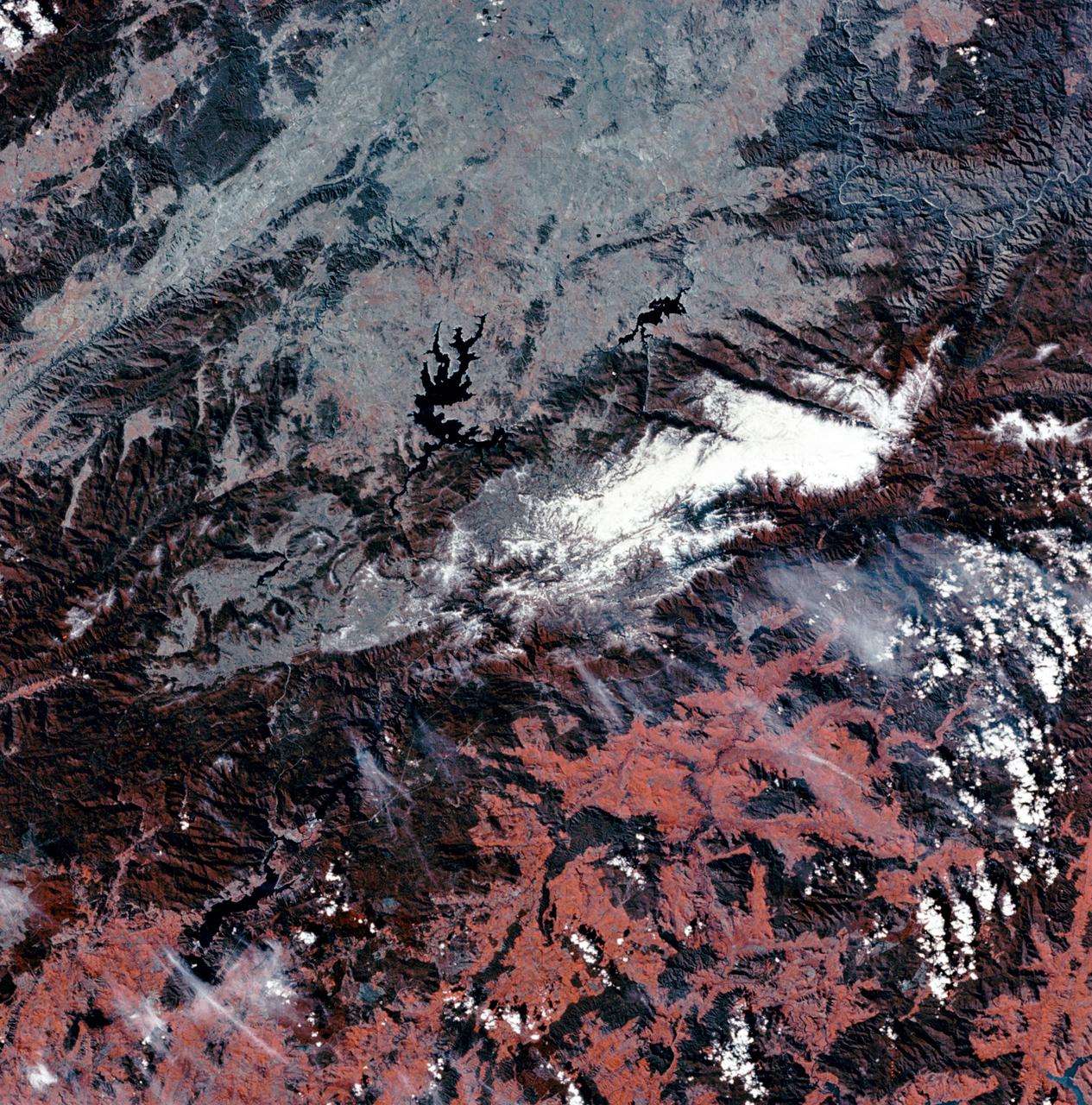
SL3-27-180 (July-September 1973) --- A vertical view of the Snowy Mountains area of Australian Alps in the States of Victoria and New South Wales, Australia, as photographed from Earth orbit by one of the six lenses of the Itek-furnished S190-A Multispectral Photographic Facility Experiment aboard the Skylab space station. This picture was taken with type 2443 infrared color film. The lake near the center of the picture is the Eucumbene Reservoir. This area is located immediately south-southwest of the capital city of Canberra. Federal agencies participating with NASA on the EREP project are the Departments of Agriculture, Commerce, Interior, the Environmental Protection Agency and the Corps of Engineers. All EREP photography is available to the public through the Department of Interior?s Earth Resources Observations Systems Data Center, Sioux Falls, South Dakota, 57198. Photo credit: NASA

SL3-22-0214 (July-September 1973) --- A vertical view of southeastern Washington State as photographed from Earth orbit by one of the six lenses of the Itek-furnished S190-A Multispectral Photographic Facility Experiment aboard the Skylab space station. The Snake River flows into the Columbia River in the most southerly corner of the picture. The Wallula Lake is below the junction of the two rivers. The Yakima Valley is at the southwestern edge of the photograph. The Columbia Basin is in the center of the picture. The Cascade Range extends across the northwest corner of the photograph. This picture was taken with type SO-356 regular color film. The S190-A experiment is part of the Earth Resources Experiments Package. Federal agencies participating with NASA on the EREP project are the Departments of Agriculture, Commerce, Interior, the Environmental Protection Agency and the Corps of Engineers. All EREP photography is available to the public through the Department of Interior?s Earth Resources Observations Systems Data Center, Sioux Falls, South Dakota, 57198. Photo credit: NASA
SL2-10-250 (May-June 1973) --- A vertical view of eastern Iowa and northwestern Illinois, as photographed from Skylab space station in Earth orbit. Davenport, Burlington and Muscatine, Iowa; and Rock Island and Moline, Illinois can be delineated on opposite sides of the Mississippi River. The Iowa River and tributaries of it can also be delineated. This photograph was taken with one of six lenses of the Itek-furnished Multispectral Photographic Facility Experiment S190-A mounted in the Multiple Docking Adapter (MDA) of the space station. A six-inch lens, using 70mm medium speed Ektachrome (SO-356) film, was used. Agencies participating with NASA on the EREP project are the Departments of Agriculture, Commerce and Interior; the Environmental Protection Agency and the Corps of Engineers. All EREP photography is available to the public through the Department of Interior's Earth Resources Observations Systems Data Center, Sioux Falls, South Dakota, 57198. Photo credit: NASA
SL3-27-224 (July-September 1973) --- A vertical view of the western portion of the Republic of Panama on the Isthmus of Panama as photographed from Earth orbit by one of the six lenses of the Itek-furnished S190-A Multispectral Photographic Facility Experiment aboard the Skylab space station. This picture was taken with 2443 infrared color film. The large, clear body of water on the north side of the isthmus is Golfo de los Mosquitos, an extension of the Caribbean Sea. The large, partly cloud-covered body of water on the south side of the isthmus is Golfo de Chiriqui, an extension of the Pacific Ocean. Federal agencies participating with NASA on the EREP project are the Department of Agriculture, Commerce, Interior, the Environmental Protection Agency and the Corps of Engineers. All EREP photography is available to the public through the Department of Interior?s Earth Resources Observation Systems Data Center, Sioux Falls, South Dakota, 57198. Photo credit: NASA
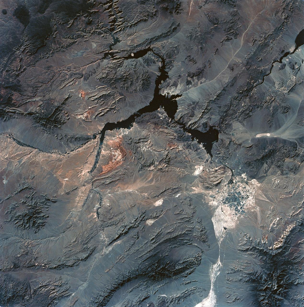
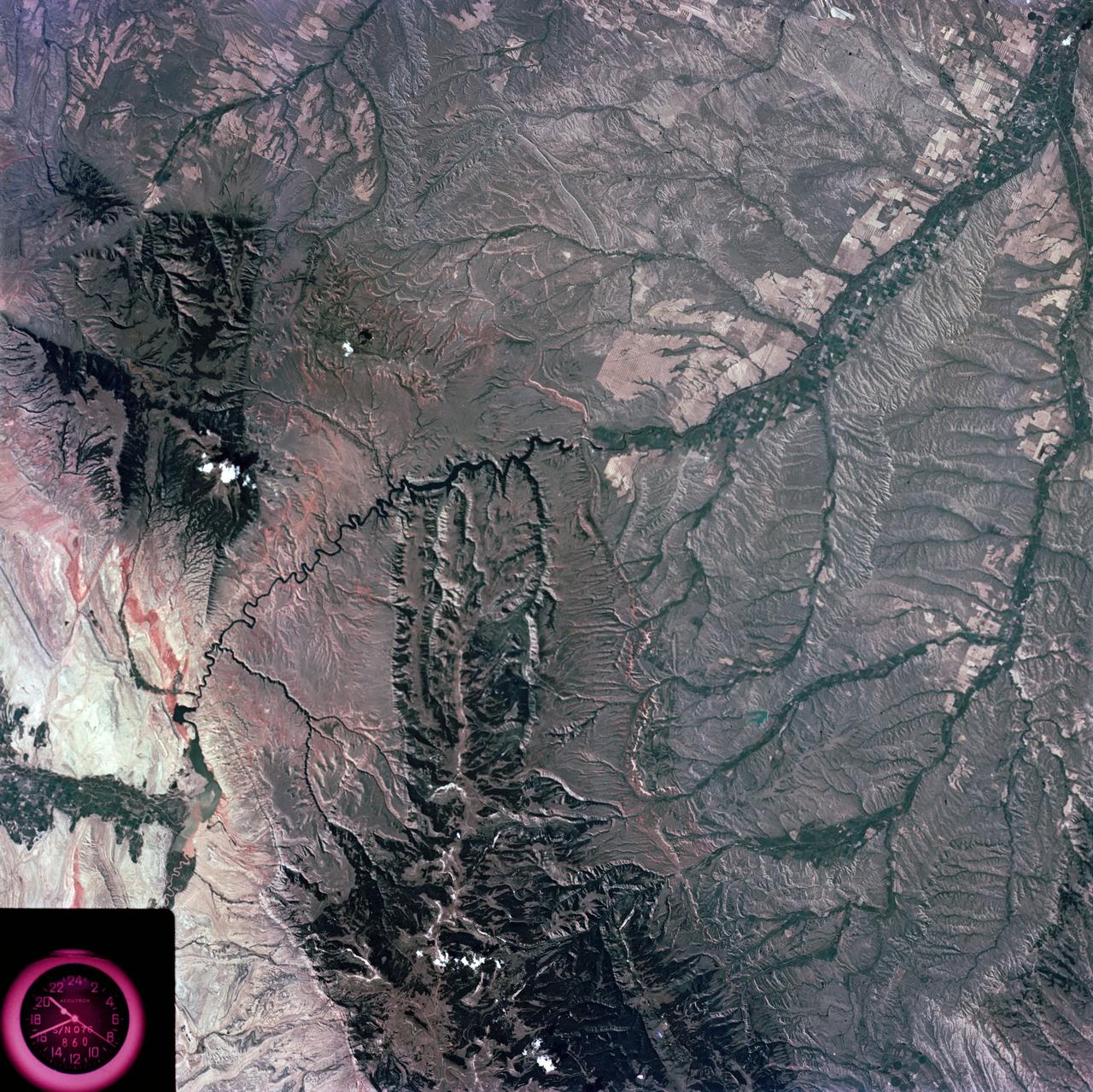
SL3-28-059 (July-September 1973) --- A vertical view of the Lake Mead and Las Vegas, Nevada area as photographed from Earth orbit by one of the six lenses of the Itek-furnished S190-A Multispectral Photographic Facility Experiment aboard the Skylab space station. Lake Mead is water of the Colorado River impounded by Hoover Dam. Most of the land in the picture is Nevada. However, a part of the northwest corner of Arizona can be seen. Federal agencies participating with NASA on the EREP project are the Departments of Agriculture, Commerce, Interior, the Environmental Protection Agency and the Corps of Engineers. All EREP photography is available to the public through the Department of Interior?s Earth Resources Observations Systems Data Center, Sioux Falls, South Dakota, 57198. Photo credit: NASA
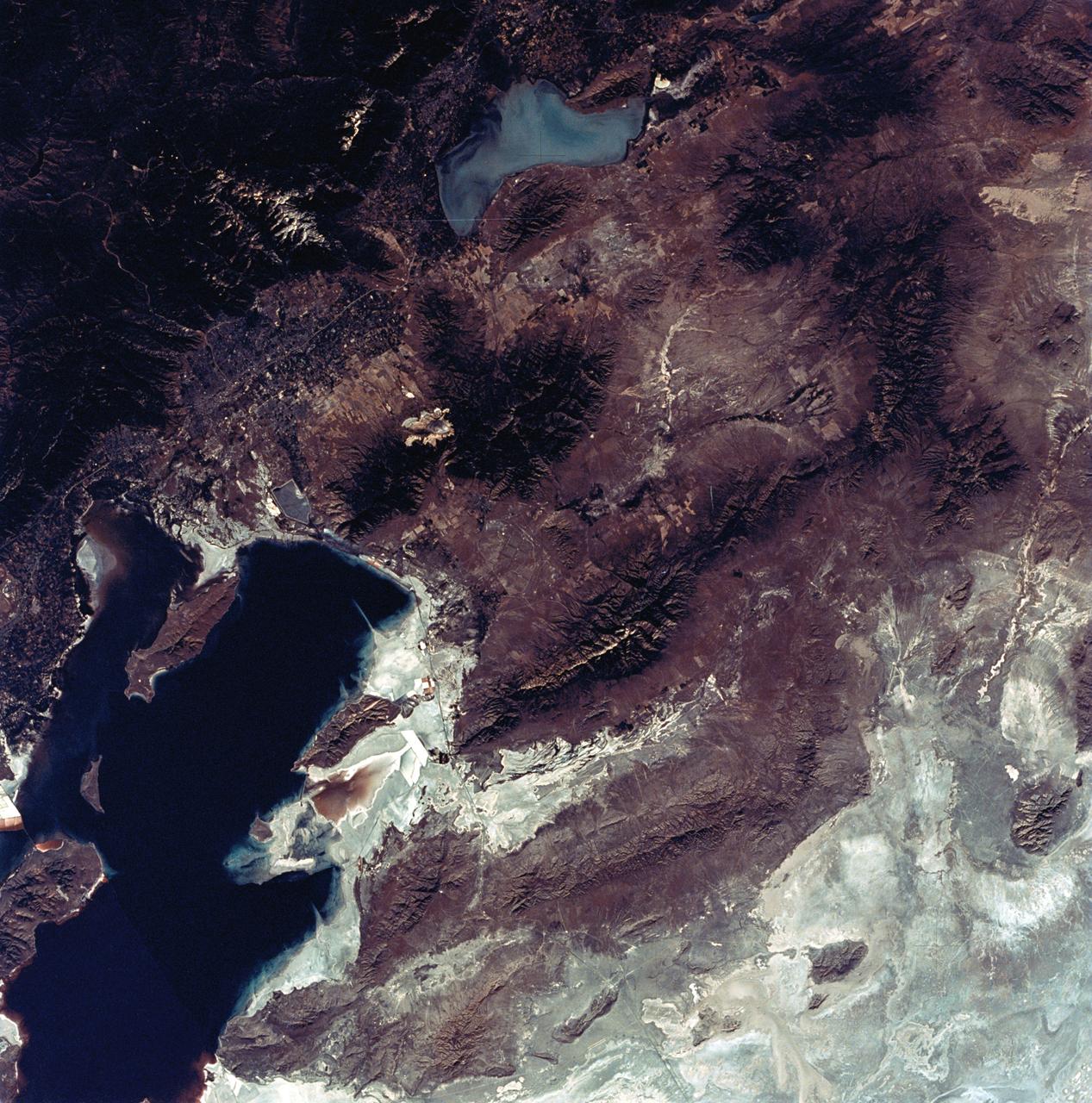
SL3-22-0322 (July-September 1973) --- An oblique view of the Salt Lake City, Utah area as photographed from Earth orbit by one of the six lenses of the Itek-furnished S190-A Multispectral Photographic Facility Experiment aboard the Skylab space station. Approximately two-thirds of the Great Salt Lake is in view. The smaller body of water south of Salt Lake City is Utah Lake. The Wasatch Range is on the east side of the Great Salt Lake. Federal agencies participating with NASA on the EREP project are the Departments of Agriculture, Commerce, Interior, the Environmental Protection Agency and the Corps of Engineers. All EREP photography is available to the public through the Department of Interior?s Earth Resources Observations Systems Data Center, Sioux Falls, South Dakota, 57198. Photo credit: NASA

Stu Witt, founder of the Mojave Air and Spaceport and former Chairman of the Commercial Spaceflight Federation, asks a questions of the Department of Commerce's James Uthmeier during the first meeting of the National Space Council Users' Advisory Group, Tuesday, June 19, 2018 at NASA Headquarters in Washington. The Users' Advisory Group will advise and inform the National Space Council on a broad range of aerospace topics, including the impacts of U.S. and international laws and regulations, national security space priorities, scientific and human space exploration priorities, and ways to bolster support. Photo Credit: (NASA/Joel Kowsky)
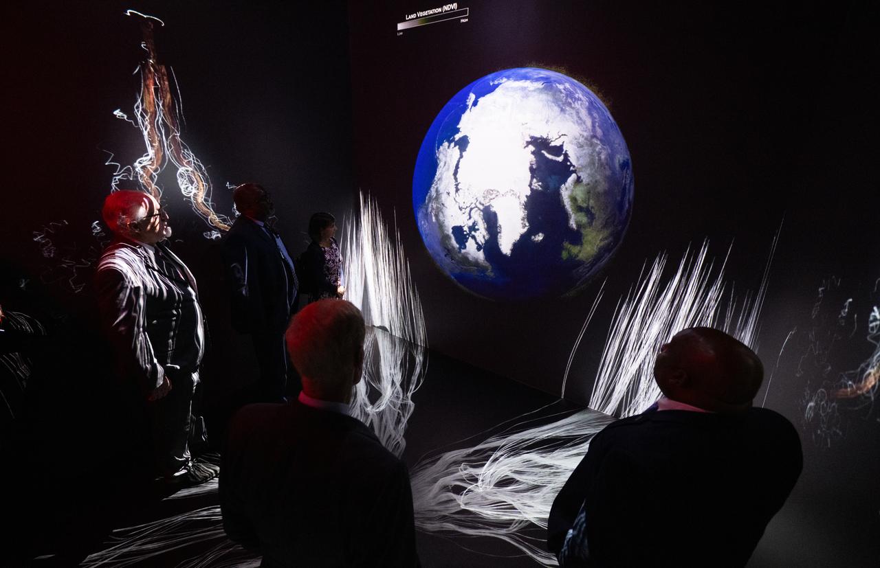
NASA Administrator Bill Nelson, Michael Morgan, Assistant Secretary of Commerce for Environmental Observation and Prediction at the National Oceanic and Atmospheric Administration (NOAA), Marlen Eve, Deputy Administrator for the Agricultural Research Service at the U.S. Department of Agriculture (USDA), and Eric Hooks, Deputy Administrator of the Federal Emergency Management Agency (FEMA), are seen as they watch “Space for Earth,” the immersive audio-visual installation in NASA’s Earth Information Center, following the ribbon cutting ceremony, Wednesday, June 21, 2023, at the Mary W. Jackson NASA Headquarters building in Washington. The Earth Information Center is new immersive experience that combines live data sets with cutting-edge data visualization and storytelling to allow visitors to see how our planet is changing. Photo Credit: (NASA/Joel Kowsky)
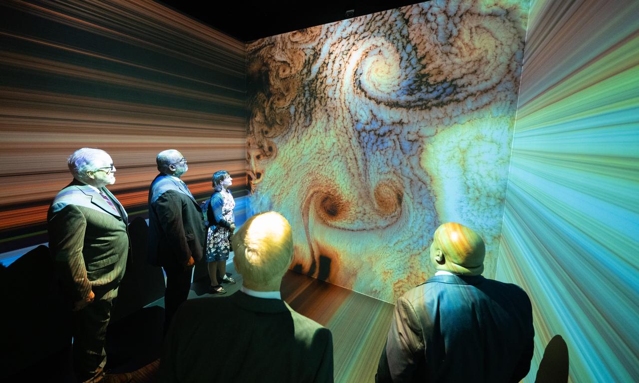
NASA Administrator Bill Nelson, Michael Morgan, Assistant Secretary of Commerce for Environmental Observation and Prediction at the National Oceanic and Atmospheric Administration (NOAA), Marlen Eve, Deputy Administrator for the Agricultural Research Service at the U.S. Department of Agriculture (USDA), and Eric Hooks, Deputy Administrator of the Federal Emergency Management Agency (FEMA), are seen as they watch “Space for Earth,” the immersive audio-visual installation in NASA’s Earth Information Center, following the ribbon cutting ceremony, Wednesday, June 21, 2023, at the Mary W. Jackson NASA Headquarters building in Washington. The Earth Information Center is new immersive experience that combines live data sets with cutting-edge data visualization and storytelling to allow visitors to see how our planet is changing. Photo Credit: (NASA/Joel Kowsky)

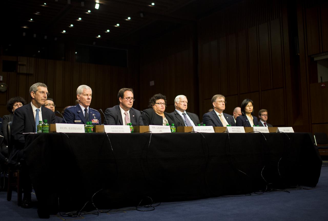
From left; Hon. Alan Estevez, Principle Deputy Under Secretary of Defense for Acquisition, Technology, and Logistics; General William Shelton, Commander of the United States Air Force Space Command; Robert Lightfoot, NASA Associate Administrator; Cristina Chaplain, Director of Acquisition and Sourcing Management at the Government Accountability Office; major General Howard Mitchell (USAF Ret.), Vice President for Program Assessments at The Aerospace Corporation; Daniel Dunbacher, Professor of Practice in the Department of Aeronautics and Aerospace Engineering at Purdue University; and Dr. Yool Kim, Senior Engineer at The Rand Corporation; are seen during a hearing in front of the Senate Subcommittee on Strategic Forces and Senate Committee on Commerce, Science, and Transportation on Wednesday, July 16, 2014, at the Hart Senate Office Building in Washington, DC. The Senate hearing focused on assured access to space.

From left; Hon. Alan Estevez, Principle Deputy Under Secretary of Defense for Acquisition, Technology, and Logistics; General William Shelton, Commander of the United States Air Force Space Command; Robert Lightfoot, NASA Associate Administrator; Cristina Chaplain, Director of Acquisition and Sourcing Management at the Government Accountability Office; major General Howard Mitchell (USAF Ret.), Vice President for Program Assessments at The Aerospace Corporation; Daniel Dunbacher, Professor of Practice in the Department of Aeronautics and Aerospace Engineering at Purdue University; and Dr. Yool Kim, Senior Engineer at The Rand Corporation; are seen during a hearing in front of the Senate Subcommittee on Strategic Forces and Senate Committee on Commerce, Science, and Transportation on Wednesday, July 16, 2014, at the Hart Senate Office Building in Washington, DC. The Senate hearing focused on assured access to space.
From left; Hon. Alan Estevez, Principle Deputy Under Secretary of Defense for Acquisition, Technology, and Logistics; General William Shelton, Commander of the United States Air Force Space Command; Robert Lightfoot, NASA Associate Administrator; Cristina Chaplain, Director of Acquisition and Sourcing Management at the Government Accountability Office; major General Howard Mitchell (USAF Ret.), Vice President for Program Assessments at The Aerospace Corporation; Daniel Dunbacher, Professor of Practice in the Department of Aeronautics and Aerospace Engineering at Purdue University; and Dr. Yool Kim, Senior Engineer at The Rand Corporation; are seen during a hearing in front of the Senate Subcommittee on Strategic Forces and Senate Committee on Commerce, Science, and Transportation on Wednesday, July 16, 2014, at the Hart Senate Office Building in Washington, DC. The Senate hearing focused on assured access to space.
SL3-87-299 (July-September 1973) --- A vertical view of southeastern New York State is seen in this Skylab 3 Earth Resources Experiments Package S190-B (five-inch Earth terrain camera) infrared photograph taken from the Skylab space station in Earth orbit. An 18-inch, 450mm lens and type 2443 infrared Ektachrome film was used. This picture covers the northern part of New Jersey, a part of northwestern Pennsylvania, and the western tip of Connecticut. The body of water is Long Island Sound. The wide Hudson River flows southward across a corner of the photograph. The New York City metropolitan area occupies part of the picture. Federal agencies participating with NASA on the EREP project are the Departments of Agriculture, Commerce, Interior, the Environmental Protection Agency and the Corps of Engineers. All EREP photography is available to the public through the Department of Interior?s Earth Resources Observations Systems Data Center, Sioux Falls, South Dakota, 57198. Photo credit: NASA
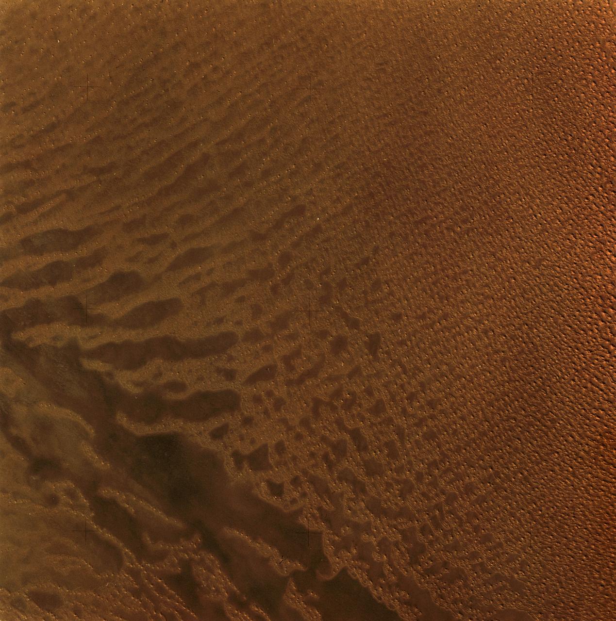
SL3-34-056 (July-September 1973) --- A near vertical view of an 8,000 square-mile area of the Grand Erg Oriental in east central Algeria as photographed from Earth orbit by one of the six lenses of the Itek-furnished S190-A Multispectral Photographic Facility Experiment in the Multiple Docking Adapter of the Skylab space station. The Grand Erg contains vast areas of sand dunes and sand plains. This photograph illustrates the variety of surface features that are characteristic of the Sahara Desert. The dark areas are relatively sand free, and may contain rock outcrops along which travel is considerably easier. Sand dunes are abundant in this picture, and their size, shape, location and pattern are due to the underlying topography and direction of the prevailing winds. Scientists interested in study of dune fields will be able to use this photograph for detailed analysis of the dune features, especially their characteristics adjacent to the sand-free areas. Federal agencies participating with NASA on the EREP project are the Departments of Agriculture, Commerce, Interior, the Environmental Protection Agency and the Corps of Engineers. All EREP photography is available to the public through the Department of Interior?s Earth Resources Observations Systems Data Center, Sioux Falls, South Dakota, 57198. Photo credit: NASA
SL3-45-020 (July-September 1973) --- A vertical view of the Virginia-Tennessee-Kentucky border area as photographed from Earth orbit by one of the six lenses of the Itek-furnished S190-A Multispectral Photographic Facility Experiment aboard the Skylab space station. This picture was taken with type 2443 infrared color film. The S190-A experiment is part of the Skylab Earth Resources Experiments Package. The long, narrow ridge is Pine Mountain; and it is crossed by U.S. 25E at Pineville near its southernmost end. Some 25 miles south of Pineville U.S. 25E passes through the famed Cumberland Gap which at 1,600 feet elevation crosses Cumberland Mountain. Kingsport, Tennessee is located east of Cumberland Gap near the center of the picture. Bristol, Tennessee-Virginia is further east. Greenville and Elizabethton, Tennessee can also be seen in this photograph. The clouds across the southeast edge of the picture are over the Blue Ridge Mountains. Federal agencies participating with NASA on the EREP project are the Departments of Agriculture, Commerce, Interior, the Environmental Protection Agency and the Corps of Engineers. All EREP photography is available to the public through the Department of Interior?s Earth Resources Observations Systems Data Center, Sioux Falls, 57198. Photo credit: NASA
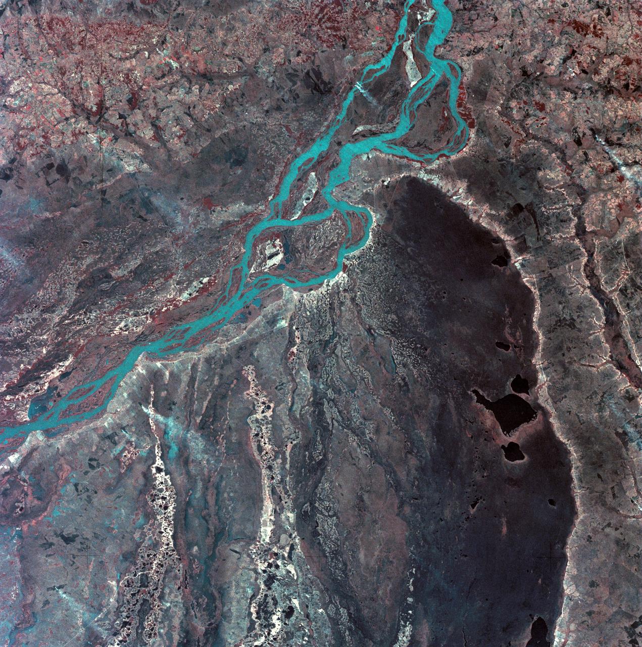
SL3-33-167 (July-September 1973) --- A vertical view of the Argentina-Paraguay border area of South America as photographed from Earth orbit by one of the six lenses of the Itek-furnished S190-A Multispectral Photographic Facility Experiment aboard the Skylab space station. This picture was taken with type 2443 infrared color film. The Parana River flows from east to west across the picture. This part of the Rio Parana is located between the towns of Posadas, Argentina, and Resistencia, Argentina. The major body of water in the large swamp area is Laguna Ibera. Note the several fires burning in this area. The largest land mass (Argentina) is south of the river. Paraguay is north of the river. Isla Apipe Grande is near the center of the photograph. The S190-A experiment is part of the Skylab Earth Resources Experiments Package. Federal agencies participating with NASA on the EREP project are the Departments of Agriculture, Commerce, Interior, the Environmental Protection Agency and the Corps of Engineers. All EREP photography is available to the public through the Department of Interior?s Earth Resources Observations Systems Data Center, Sioux Falls, South Dakota, 57198. Photo credit: NASA
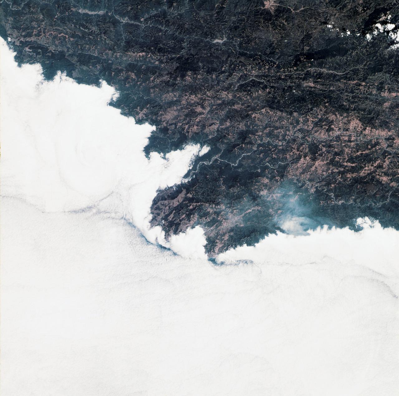
SL3-34-336 (July-September 1973) --- A vertical view of a portion of northern California near the Pacific coast as photographed from Earth orbit by one of the six lenses of the Itek-furnished S190-A Multispectral Photographic Facility Experiment in the Multiple Docking Adapter of the Skylab space station. A cloud deck covers the Pacific Ocean. Most of Cape Mendocino is clear of clouds and extends into the Pacific as the westernmost part of California. The sinuous pattern of the Bel River (in center) flows northward into the ocean and is characteristic of the rivers that drain the coastal ranges. This area is immediately southeast of Eureka. During Skylab 3 extensive forest fires occurred near Briceland and the smoke rising from the fires is clearly visible next to the cloud bank. Redwood and fir forests are sources of lumber in this region; and a variety of clear cut (timbering) patterns appear as light against the dark forest. The patterns appear to be related to the topography. Analysis of this photograph will aid Dr. P.G. Langley, Earth Satellite Corporation, in developing methods for forest inventory using space photography. Federal agencies participating with NASA on the EREP project are the Departments of Agriculture, Commerce, Interior, the Environmental Protection Agency and the Corps of Engineers. All EREP photography is available to the public through the Department of Interior?s Earth Resources Observations Systems Data Center, Sioux Falls, South Dakota, 57198. Photo credit: NASA

SL3-33-156 (July-September 1973) --- A near vertical view of the Florence, Italy area as photographed from Earth orbit by one of the Itek-furnished S190-A Multispectral Photographic Facility Experiment aboard the Skylab space station. The view extends from the Ligurian Sea, an extension of the Mediterranean Sea, across the Apennine Mountains to the Po River Valley. Florence (Firenze) is near the center of the land mass. The mouth of the Arno River is at the center of the coastline. The city of Leghorn (Livorno) is on the coast just south of the Arno River. This picture was taken with type 2443 infrared color film. The S190-A experiment is part of the Skylab Earth Resources Experiments Package. Federal agencies participating with NASA on the EREP project are the Department of Agriculture, Commerce, Interior, the Environmental Protection Agency and the Corps of Engineers. All EREP photography is available to the public through the Department of Interior?s Earth Resources Observations Systems Data Center, Sioux Falls, South Dakota, 57198. Photo credit: NASA
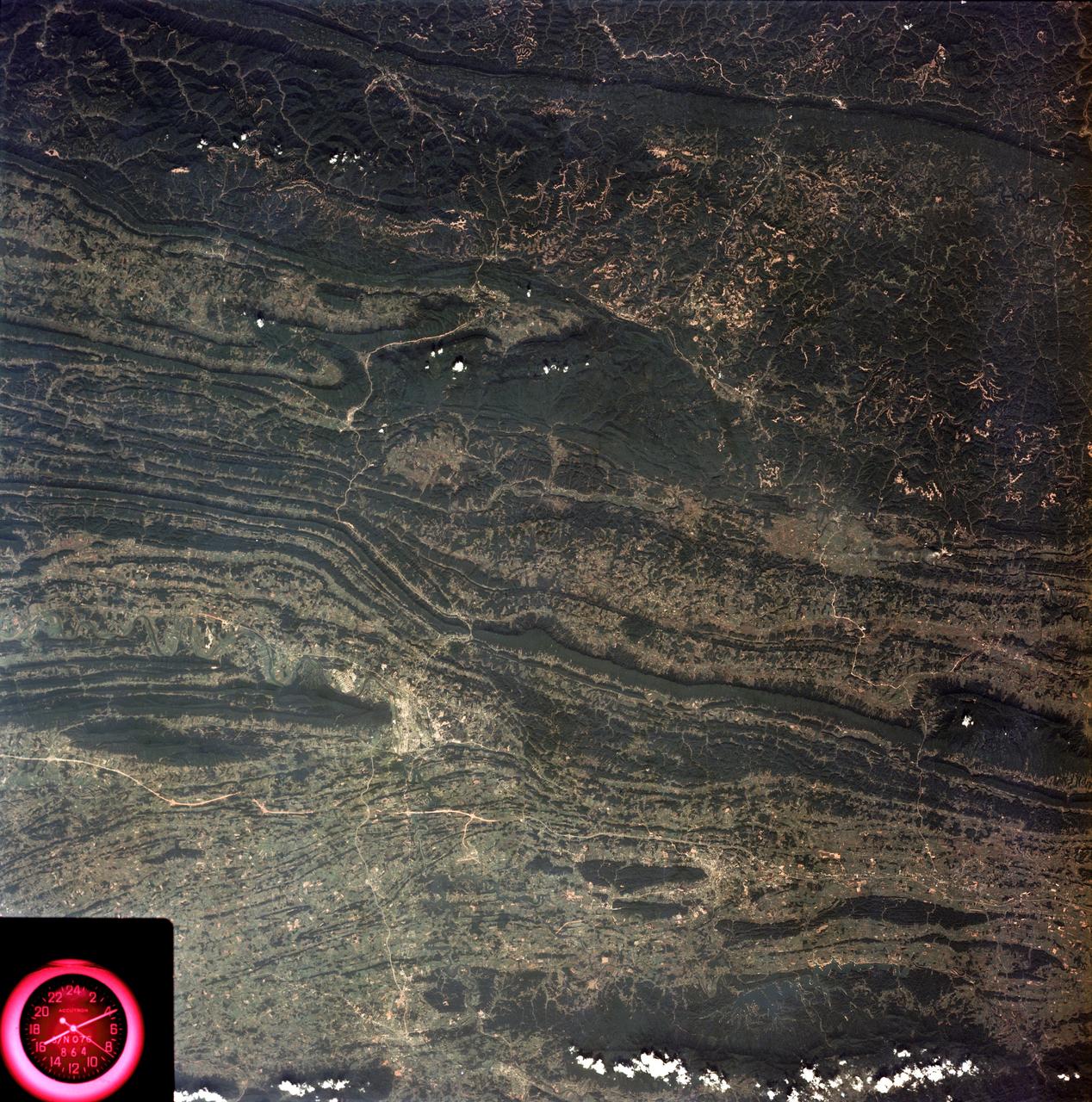
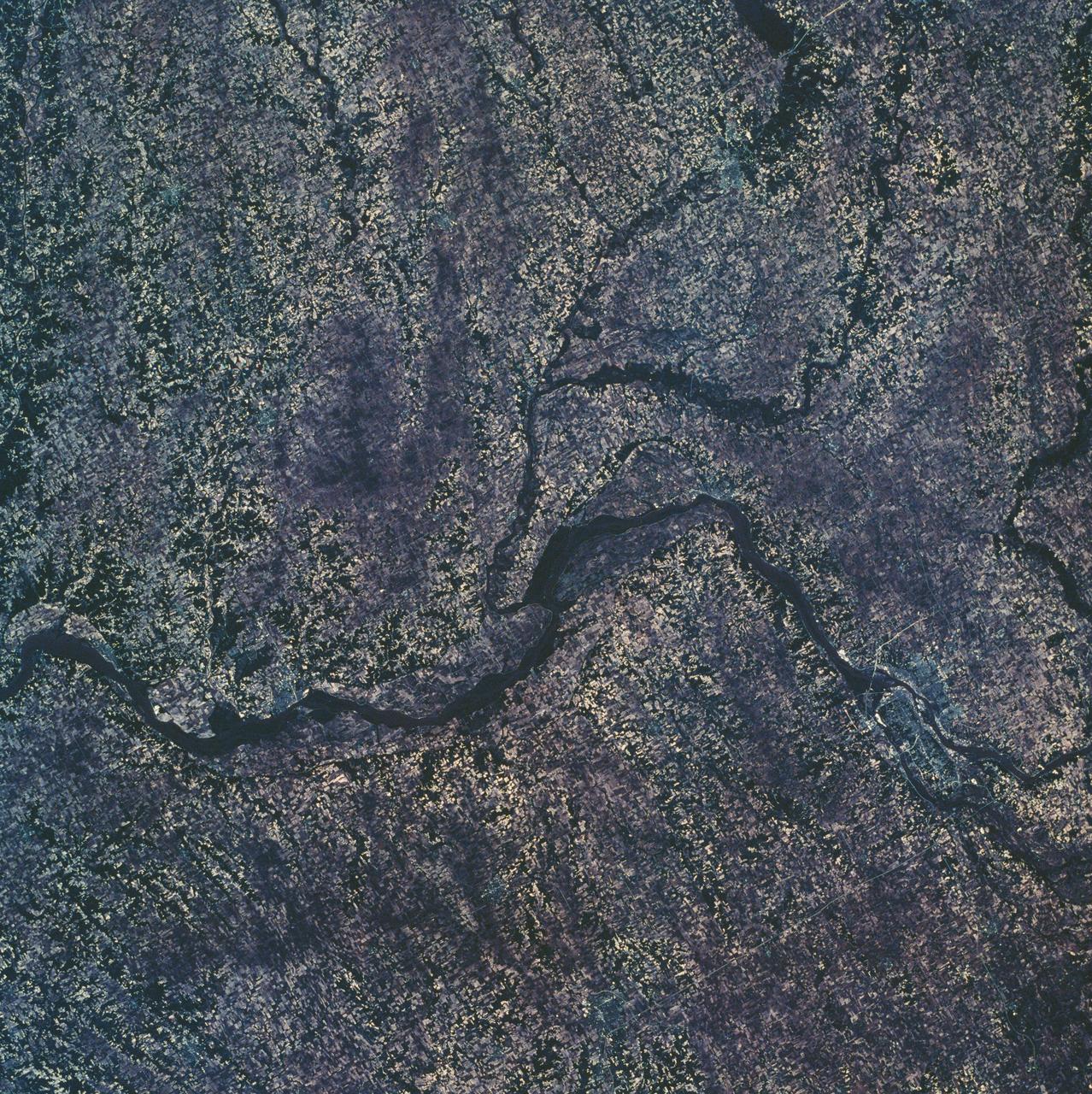
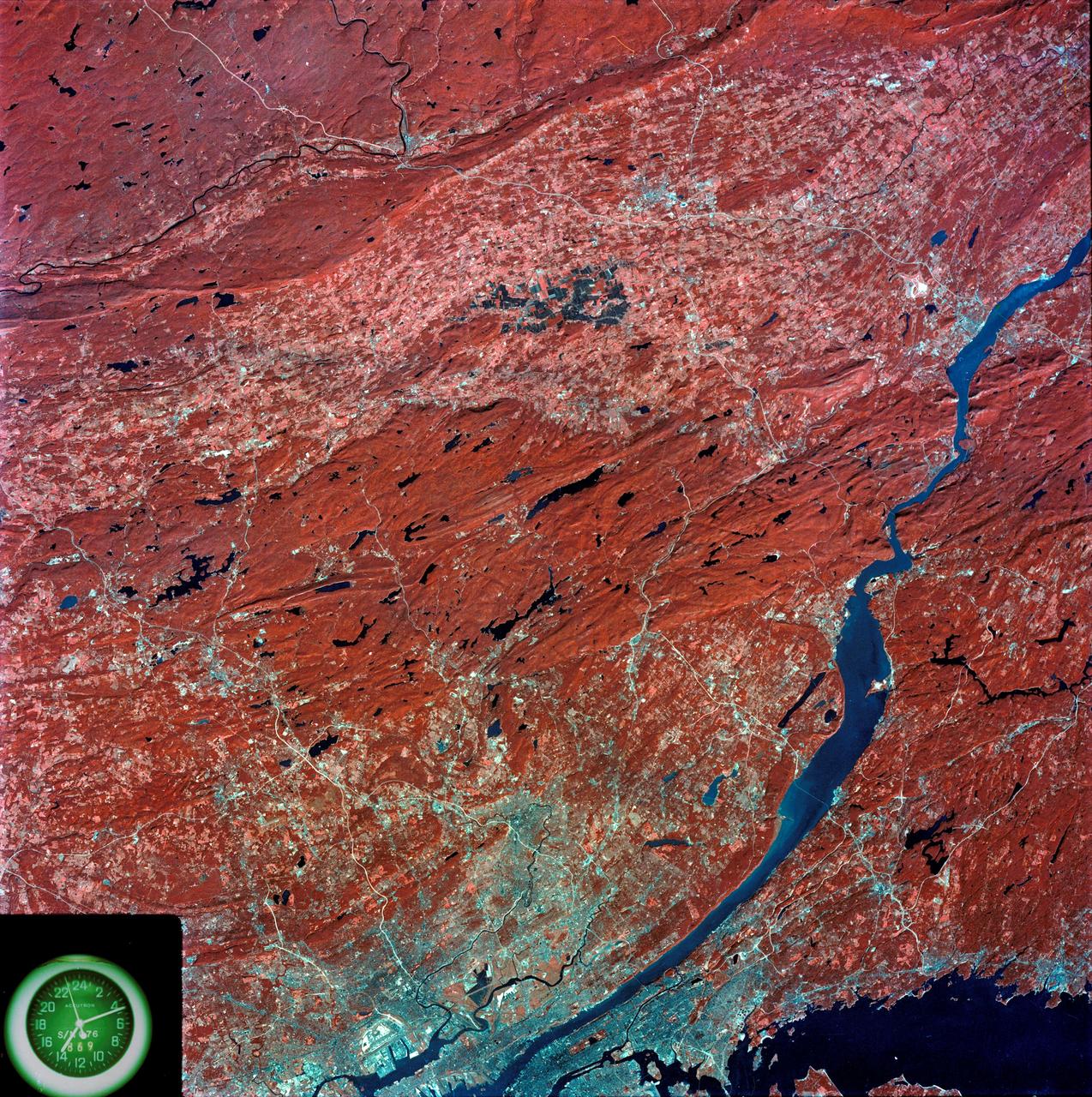
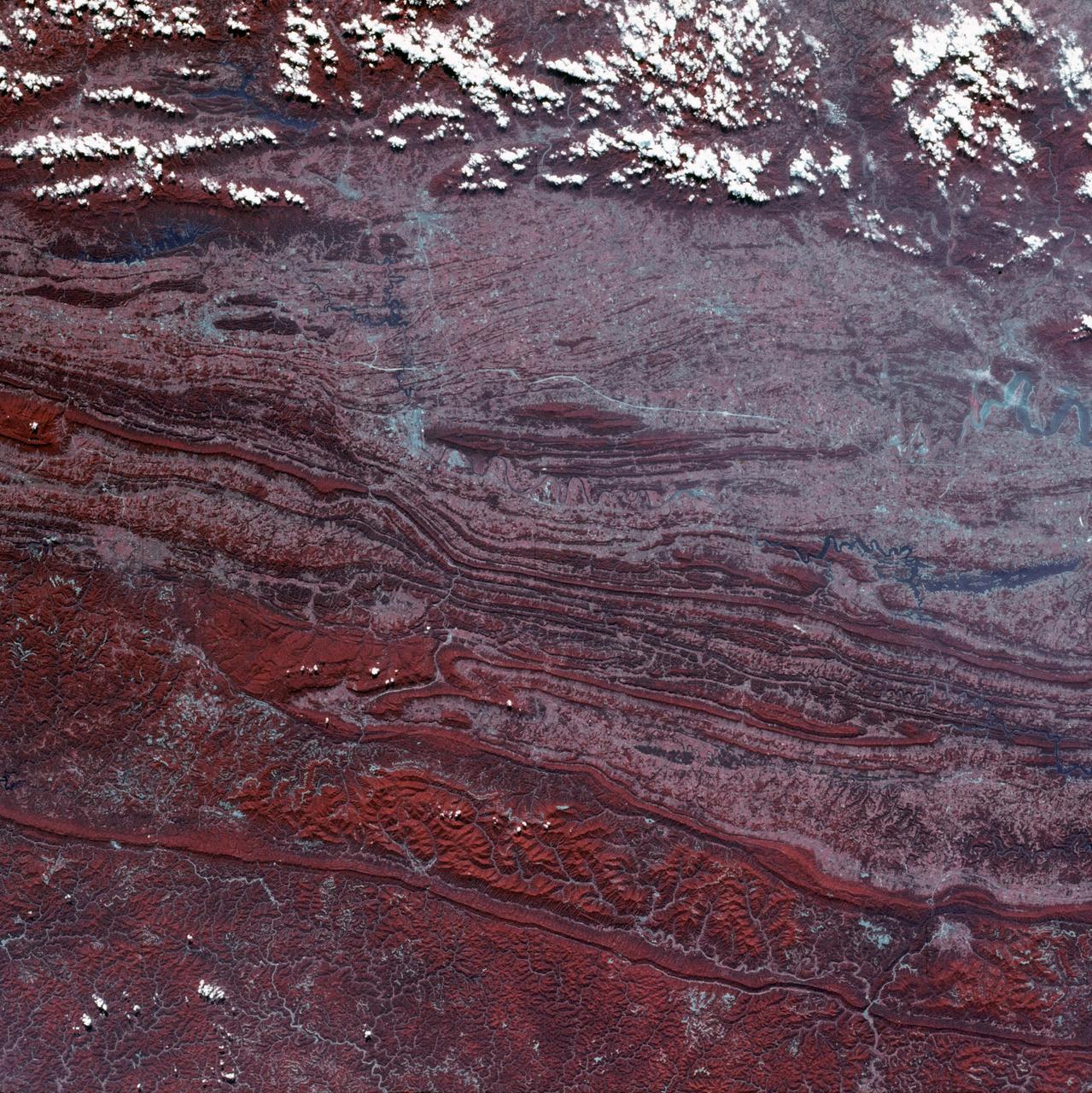
SL3-88-053 (July-September 1973) --- A near vertical view of the Tennessee-Virginia-Kentucky border area is seen in this Skylab 3 Earth Resources Experiments Package S190-B (five-inch Earth terrain camera) photograph taken from the Skylab space station in Earth orbit. The clock is in the most southerly corner of the picture. Interstate 81 under construction extends northeast-southwest across the bottom portion of the photograph. The larger urban area nearest the center of the picture is Kingsport, Tennessee. On the southern side of I-80 and east of Kingsport is the city of Bristol, Tennessee-Virginia. Johnson City, Tennessee is the urban area near the edge of the picture southeast of Kingsport. The Holston River, a tributary of the Tennessee River, meanders through the Kingsport area. The characteristic ridge and valley features in the Cumberland Plateau of Kentucky, Tennessee and Virginia are clearly visible. Forests (dark green) occur on the ridges and clearly outline the folded and faulted rock formations. The valleys (light) were formed in the softer rocks as a result of erosion. Agricultural areas are indicated by the characteristic rectangular patterns. Coal production is an important industry of this area; and it is mined by surface open pit operations. The irregular light areas in the Kentucky-Virginia border area are the strip mines which follow the contour of the land. Reclamation of the strip mine areas is aided through accurate knowledge of the mine and drainage systems. Dr. Ronald Brooks of the Wolf Research and Development Corporation can use this photograph in study of strip mine areas in the east central U.S. Federal agencies participating with NASA on the EREP project are the Departments of Agriculture, Commerce, Interior, the Environmental Protection Agency and the Corps of Engineers. All EREP photography is available to the public through the Department of Interior’s Earth Resources Observations Systems Data Center, Sioux Falls, South Dakota, 57198. Photo credit: NASA
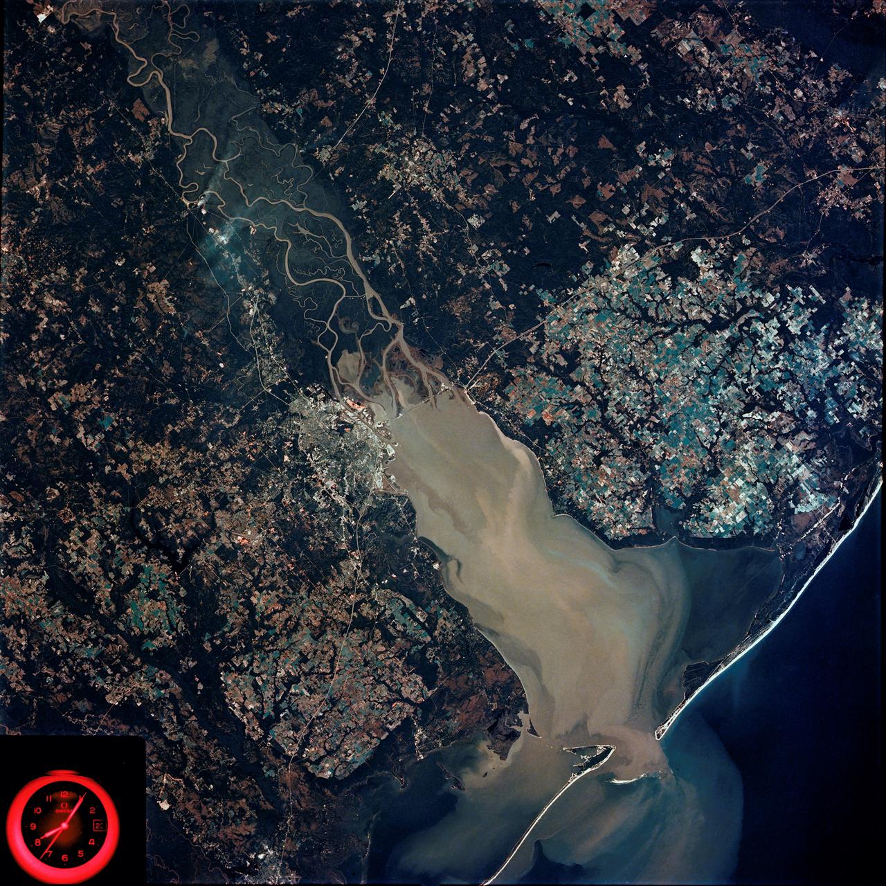
SL4-92-300 (February 1974) --- A near vertical view of the Mobile Bay, Alabama area is seen in this Skylab 4 Earth Resources Experiments Package S190-B (five-inch earth terrain camera) photograph taken from the Skylab space station in Earth orbit. North of Mobile the Tombigbee and Alabama Rivers join to form the Mobile River. Detailed configuration of the individual stream channels and boundaries can be defined as the Mobile River flows into Mobile Bay, and thence into the Gulf of Mexico. The Mobile River Valley with its numerous stream channels is a distinct light shade in contrast to the dark green shade of the adjacent areas. The red coloration of Mobile Bay reflects the sediment load carried into the Bay by the rivers. Variations in red color indicate sediment load and the current paths within Mobile Bay. The waterly movement of the along shore currents at the mouth of Mobile Bay is shown by the contrasting light blue of the sediment-laden current and the blue of the Gulf predominately. Agricultural areas east and west of Mobile Bay are characterized by a rectangular pattern in green to white shades. Color variations may reflect the type and growth cycle of crops. Agricultural areas (light gray-greens) are also clearly visible in other parts of the photograph. Interstate 10 extends from near Pascagoula, Mississippi eastward through Mobile to the outskirts of Pensacola, Florida. Analysis of the EREP photographic data will be undertaken by the U.S. Corps of Engineers to determine bay dynamic processes. Federal agencies participating with NASA on the EREP project are the Departments of Agriculture, Commerce, Interior, the Environmental Protection Agency and the Corps of Engineers. All EREP photography is available to the public through the Department of Interior's Earth Resources Observations Systems Data Center, Sioux Falls, South Dakota. 57198 Photo credit: NASA
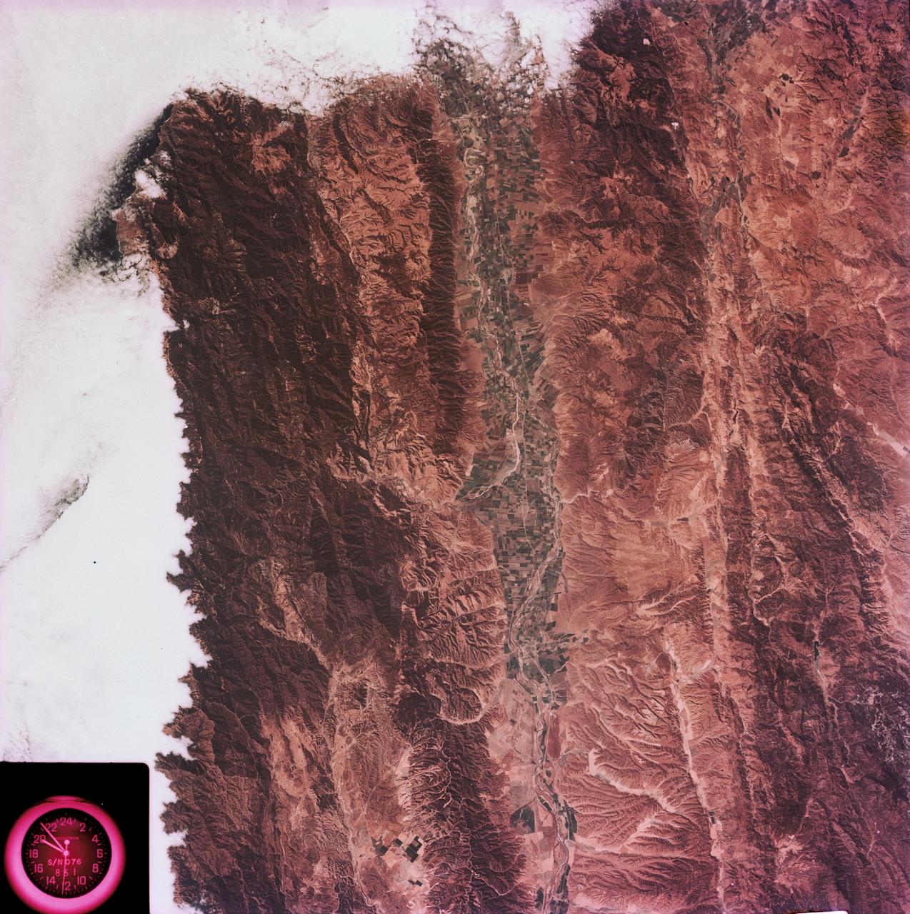
SL3-88-004 (July-September 1973) --- A vertical view of the Salinas River Valley area south of Monterey Bay, California area is seen in this Skylab 3 Earth Resources Experiments Package S190-B (five-inch Earth terrain camera) photograph taken from the Skylab space station in Earth orbit. The valley is an irrigated agricultural area, and is indicated by the dark-green and light-gray rectangular patterns in the centre of the picture. The city of Salinas is barely visible under the cloud cover at the top (north) end of the valley. The dark mass on the left (west) side of the valley is the Santa Lucia mountain range. The Big Sur area is on the left and partly covered by clouds. The Diablo Range forms the dark mass in the lower right (southeast) corner of the photograph. The town of Hollister is the gray area in the dark-green rectangular farm tracts which occupy the floor of the San Benito Valley in the upper right (northeast) corner of the photograph. The Salinas River flows northwestward toward Monterey Bay. The towns of Soledad, Greenfield and King City appear as gray areas along U.S. 101 in the Salinas Valley. The geology of the area is complex, and has been racked by several earthquakes resulting from movement along the San Andreas and subsidiary faults. Here, the surface expression of the San Andreas Fault can be traced from a point just west of Hollister at the contrast of dark brown and tan to a point about one inch left of the lower right (southeast) corner of the picture. Subsidiary faults are indicated by the curving trend of the rocks along the right side. The photograph will provide detailed information on land use patterns (Dr. R. Colwell, University of California, Berkeley) and fault tectonics (Dr. P. Merifield, Earth Science Res., Inc. and Dr. M. Abdel-Gawad, Rockwell International). Federal agencies participating with NASA on the EREP project are the Departments of Agriculture, Commerce, Interior, the Environmental Protection Agency and the Corps of Engineers. All EREP photography is available to the public through the Department of Interior’s Earth Resources Observations Systems Data Center, Sioux Falls, South Dakota, 57198. Photo credit: NASA

SL3-87-355 (July-September 1973) --- A vertical view of the eastern coast of Sicily area is seen in this Skylab 3 Earth Resources Experiments Package S190-B (five-inch earth terrain camera) infrared photograph taken from the Skylab space station in Earth orbit. Mount Etna, the highest volcano in Europe (10,958 feet), is still active as evidenced by the thin plume of smoke emanating from its crest. (The altitude is approximate because the height of the volcano changes with each eruption). On the flanks of Etna recent lava flows appear black in contrast to the older flows and volcanic debris that are red. Numerous small, circular cinder cones on the flanks represent sites of previous eruptions. Catania, on the Mediterranean coast south of Etna, is the largest of several cities and villages which appear as light-gray patches on the lower slopes of the volcano. Plano de Catania, south of the city of Catania, is outlined by polygonal light and dark agricultural tracts. Several lakes, the largest of which is Lake Pozzillo, show up as dark blue in the photograph. The unusual colors in the picture are due to the use of color infrared film in which vegetation appears red. This is very evident on the slopes of Etna, in the Monti Nebrodi area at upper let, and in the local areas in the lower part of the picture. Studies of Mount Etna and related volcanic features will be undertaken by Professor Roberto Cassinis of Servizio Geologio d?Italia, Rome. Federal agencies participating with NASA on the EREP project are the Departments of Agriculture, Commerce, Interior, the Environmental Protection Agency and the Corps of Engineers. All EREP photography is available to the public through the Department of Interior?s Earth Resources Observation Systems Data Center, Sioux Falls, South Dakota, 57198. Photo credit: NASA
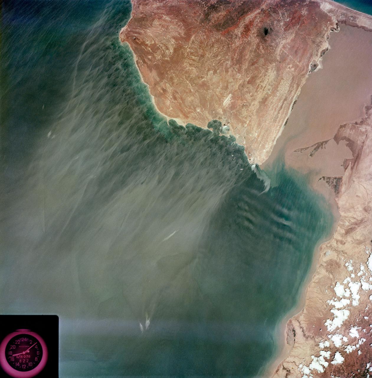
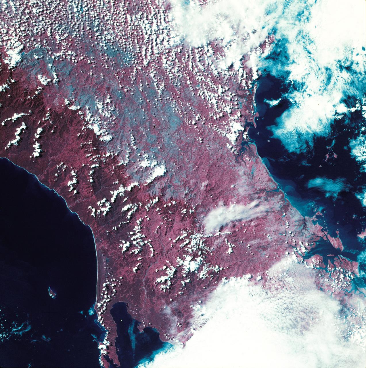
S73-35079 (July-September 1973) --- A near vertical view of the Caribbean coast of Venezuela is seen in this Skylab 3 Earth Resources Experiment Package S190-B (five-inch Earth terrain camera) photograph taken from the Skylab space station in Earth orbit. The large body of water is the Golfo de Venezuela; and the major land mass is the Peninsula de Paraguana. The view is looking northward from the mouth of the Golfete de Coro and Punta Cardon to Punta Macolla. The peninsula is connected to the Venezuelan mainland by the narrow strip of land in the most easterly corner of the picture. The dry, arid climate on the peninsula is indicated by sparse vegetation and the abundance of sand dunes. The highest point is about 2,700 feet above the sea and is the conspicuous black spot. Old raised shoreline features appear as streaks parallel to the Golfete de Coro. Sand dunes and stream erosion have modified these features. Water of the Golfete de Coro is red from the high sediment content. The streaks in the water off the peninsula is apparently an effect of wind which is blowing sand and water offshore. The EREP investigator Dr. Jose Antonio Galavis, of the Ministerio de Mines e Hidrocarburos, will use this information to map geology and coastal sedimentation in the Peninsula de Paraguana. Federal agencies participating with NASA on the EREP projects are the Departments of Agriculture, Commerce, Interior, the Environmental Protection Agency and the Corps of Engineers. All EREP photography is available to the public through the Department of Interior?s Earth Resources Observations Systems Data Center, Sioux Falls, South Dakota, 57198. (Alternate number SL3-83-237) Photo credit: NASA

S73-35082 (July-Sept. 1973) --- A near vertical view of a portion of west Africa ravaged by drought for the past five years is seen in this Skylab 3 Earth Resources Experiments Package S190-B (five-inch Earth terrain camera) photograph taken from the Skylab space station in Earth orbit. The semi-desert scene is in southeastern Niger about 200 nautical miles east-northeast of the capital city of Niamey. A polygonal-shaped area (dark) in the lower right corner of the picture represents a range-management ranch. The dry stream beds trending diagonally across the photograph locally contain some water or vegetation (green). The beds are sources of water through shallow drilling and contain soils suitable for production of crops. The variety of tans, browns and grays are typical desert colors that represent barren rocks and soil or sand-filled ancient stream valleys. Absence of vegetation is the singular feature of the area. Dr. G. Stuckmann of the Geographic Institute, University of Technology, Mannover, Federal Republic of Germany, will use this photograph in the study of the hydrologic regime of the region through analysis of fossil drainage patterns, geological structures and accumulations of surface water. Federal agencies participating with NASA on the EREP project are the Departments of Agriculture, Commerce, Interior, the Environmental Protection Agency and the Corps of Engineers. All EREP photography is available to the public through the Department of Interior?s Earth Resources Observations Systems Data Center, Sioux Falls, South Dakota, 57198. (Alternate number SL3-86-166) Photo credit: NASA

SL4-93-167 (February 1974) --- A vertical view of the Kennedy Space Center and the Florida Atlantic coast area is seen in this Skylab 4 Earth Resources Experiments Package S190-B (five-inch earth terrain camera) infrared photography taken from the Skylab space station in Earth orbit. This photograph shows the major land-ocean features of the Florida coast near Vero Beach northward to Cape Canaveral and the KSC complex. The launch pads for the Skylab missions are clearly visible. Identification of living vegetation is possible through the use of the color infrared film. Various shades of red portray differences in the vegetation such as shown in the patterns in the agricultural area near Vero Beach. In the Kennedy Space Center, the nearly continuous and uniform red color shows that most of the land areas are heavily vegetated. The white coastal beach areas are strongly contrasted to the red land and the blue Atlantic Ocean. Old dunal areas in KSC are visible on Merritt Island which is separated from the Launch areas by the Banana River and the mainland by the Indian River. Federal and state highways and numerous causeways over the rivers are easily identified. The Florida mainland is partly shadowed by small white clouds which cast a pronounced shadow to the east of each cloud indicated the Sun is west of solar noon. Federal agencies participating with NASA on the EREP project are the Departments of Agriculture, Commerce, Interior, the Environmental Protection Agency and the Core of Engineers. All EREP photography is available to the public through the Department of Interior's Earth Resources Observations Systems Data Center, Sioux Falls, South Dakota, 57198. Photo credit: NASA
S73-35081 (July-September 1973) --- A view of approximately 3,600 square miles of north central Wyoming and southern Montana is seen in this Skylab 3 Earth Resources Experiments Package S190-B (five-inch Earth terrain camera) photograph taken from the Skylab space station in Earth orbit. The Big Horn River following northward crosses between the northwest trending Big Horn Mountains and the Pryor Mountains. Yellowtail Reservoir, named after a former chief of the Crow Indian tribe in the center of the picture is impounded by a dam across the small rectangular crop area along the Big Horn River (upper right) and the strip farming (yellow) practiced on the rolling hill along the Big Horn River and its tributaries (upper left corner and right edge). The low sun angle enhances the structural features of the mountains as well as the drainage patterns in the adjacent basins. Rock formation appears in this color photograph as they would to the eye from this altitude. The distinctive redbeds can be traced along the front of the Pryor Mountains and indicate the folding that occurred during mountain building. EREP investigators, Dr. Houston of the University of Wyoming and Dr. Hoppin of the University of Iowa, will analyze the photograph and use the results in geological mapping and mineral resource studies. Lowell, Wyoming (lower left corner) and Hardin, Montana (upper right corner) can be recognized. Federal agencies participating with NASA on the EREP project are the Departments of Agriculture, Commerce, Interior, the Environmental Protection Agency and the Corps of Engineers. All EREP photography is available to the public through the Department of Interior?s Earth Resources Observations Systems Data Center, Sioux Falls, South Dakota, 57198. (Alternate number SL3-86-337) Photo credit: NASA
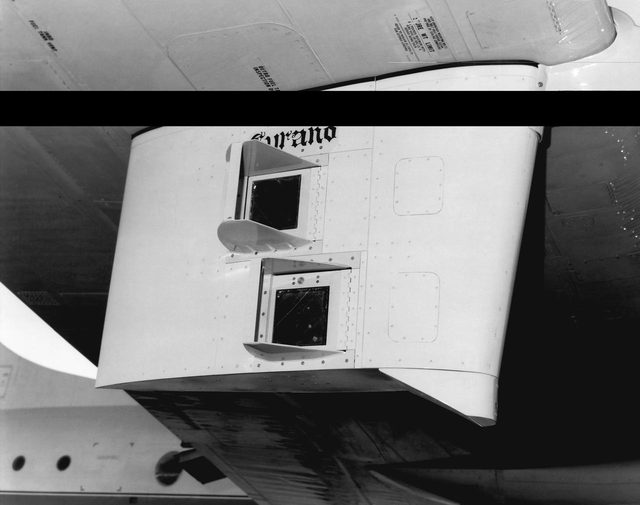
This photo shows the Shuttle tile flight test fixture under the wing of a National Oceanographic and Atmospheric Administration WP-3D aircraft.
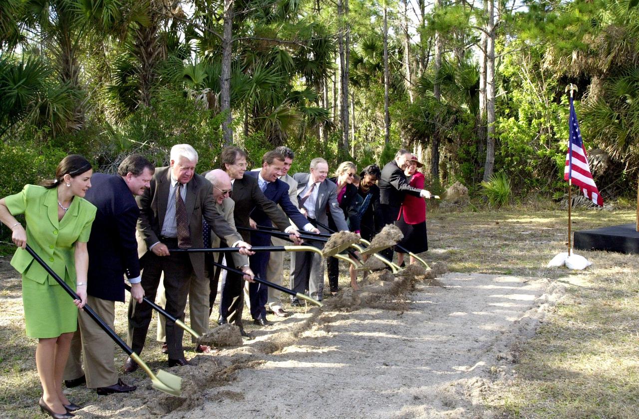
At a groundbreaking ceremony, participants and guests toss their shovelfuls of dirt, signifying the start of construction on a new roadway through KSC. From left are Dr. Pamella J. Dana, from the executive office of Florida’s governor, Jeb Bush; Deputy Associate Administrator Michael Hawes, NASA; Sen. George Kirkpatrick; Spaceport Florida Authority Executive Director Ed Gormel; Executive Director Dr. Samuel T. Durrance, Florida Space Research Institute; Florida’s Lt. Gov. Frank Brogan; Congressman Dave Weldon; Center Director Roy Bridges Jr.; SFA SERPL Program Manager Debra Holliday; KSC SERPL Program Manager Jan Heuser; District Manager Cheryl Harrison-Lee, Florida Department of Transportation; State Senator Jim Sebesta; and KSC Director JoAnn H. Morgan, External Relations and Business Development The roadway, to be known as Space Commerce Way, will serve the public by providing a 24-hour access route through KSC from S.R. 3 to the NASA Causeway and KSC Visitor Complex. It is the start of a construction project that includes the Space Experiment Research and Processing Laboratory (SERPL). Considered a magnet facility, the laboratory will support the development and processing of life sciences experiments destined for the International Space Station and accommodate NASA, industry and academic researchers performing associated biological research.. The project is enabled by a partnership and collaboration between NASA and the State of Florida to create a vital resource for international and commercial space customers