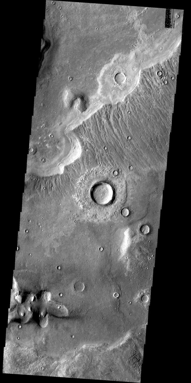
Deuteronilus Mensae
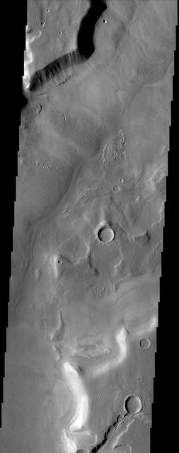
Lobate Apron in Deuteronilus Mensae
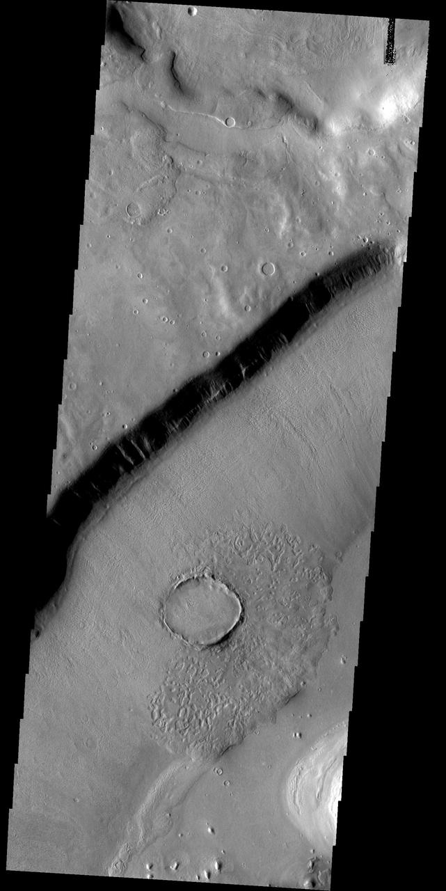
Lyot Crater and Northern Deuteronilus Mensae
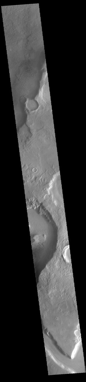
This NASA Mars Odyssey image shows several fretted channels within Deuteronilus Mensae in the northern plains of Mars. These linear troughs appear to have been extensively modified by surficial processes.
The terrain in this image from NASA Mars Reconnaissance Orbiter lies in the Deuteronilus Mensae region along the highland-lowland dichotomy boundary in the northern hemisphere of Mars.
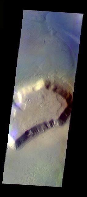
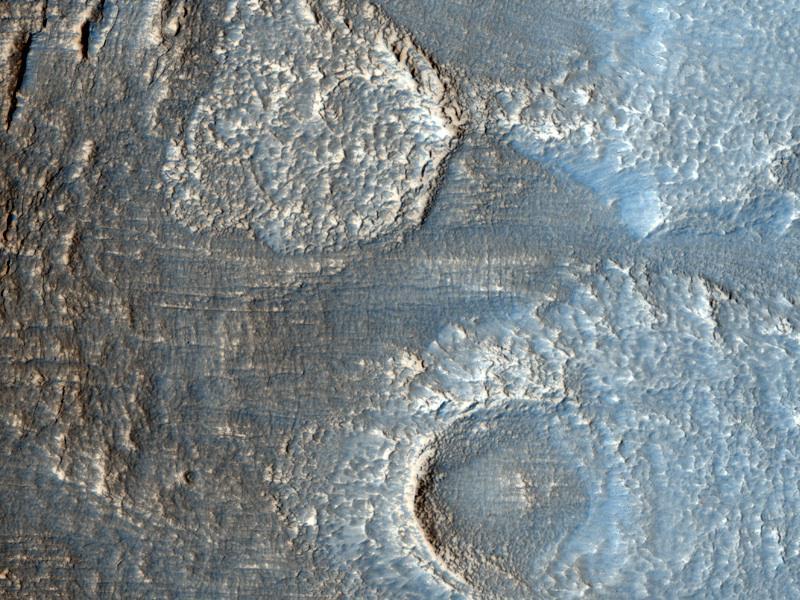
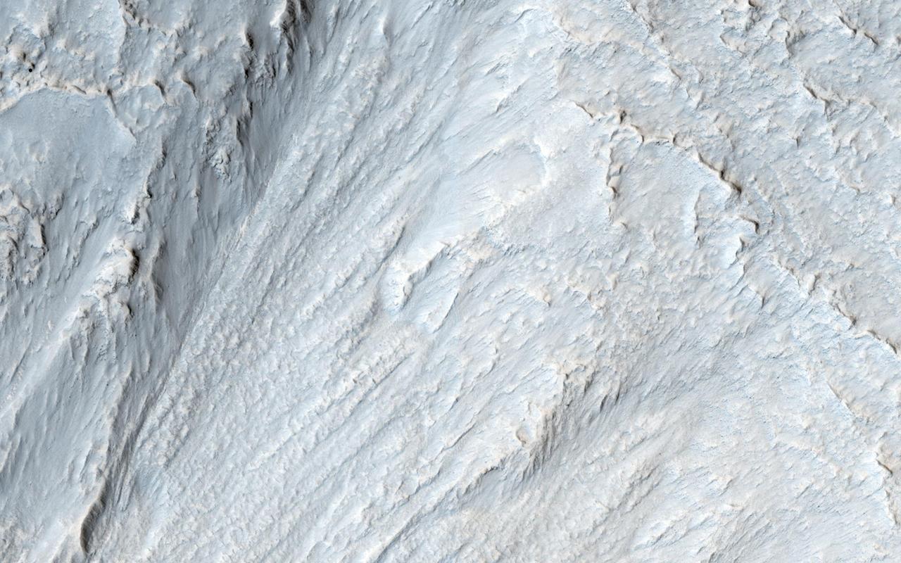
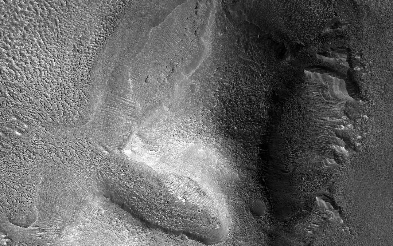
This enhanced color image from NASA's Mars Reconnaissance Orbiter shows the surface of a lobate debris apron in the Deuteronilus Mensae region of Mars, on the boundary between the Northern plains and Southern lowlands. These lobe-shaped formations commonly emanate from mesas in this region and have pitted, lineated textures that suggest the flow of water ice. Results from the SHARAD (SHAllow RADar) instrument on MRO indicate that lobate debris aprons in Deuteronilus Mensae, similar to those visible here, are composed of material dominated by ice and are interpreted to be potential debris-covered glaciers or rock glaciers. These debris apron surfaces are also covered by an ice-rich deposit that we’ve observed draping over entire regions in the mid-latitudes of Mars. It is this mantling deposit that filled in the crater, with its subsequent removal around the outer margins, probably due to differential sublimation of the ice. The same textures in the center of the crater are like those of the surrounding terrain. https://photojournal.jpl.nasa.gov/catalog/PIA21955
The THEMIS VIS camera contains 5 filters. The data from different filters can be combined in multiple ways to create a false color image. These false color images may reveal subtle variations of the surface not easily identified in a single band image. Today's false color image shows one of the many mesas that make up Deuteronilus Mensae. Orbit Number: 10809 Latitude: 42.6291 Longitude: 24.4723 Instrument: VIS Captured: 2004-05-22 09:54 http://photojournal.jpl.nasa.gov/catalog/PIA19772

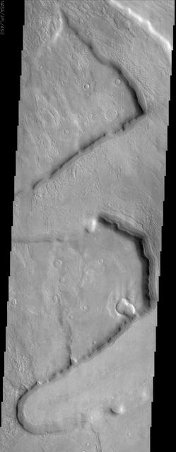
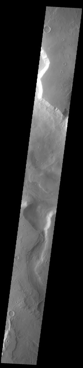
Mamers Valles is a long sinuous canyon beginning in Arabia Terra and ending in the Northern lowlands of Deuteronilus Mensae. This image from NASA Mars Reconnaissance Orbiter features the southern facing slope of the canyon wall. The northern half (top) has a rough, pitted texture with numerous impact craters, while the middle section shows the steep canyon wall. Streaks of slightly different colors show slope material eroding onto the canyon floor. Though the canyon itself was formed long ago, the material deposited on the canyon floor has been laid down over time, creating a much younger surface. The difference in age of the surfaces can also be indicated by the presence or absence of impact craters. The longer a surface has been exposed, the more impact craters it will accumulate. Counting craters to determine age estimates of planetary surfaces has been used throughout the solar system. This method is based on the assumption that the youngest, freshly formed surfaces will have no impact craters, and as time progresses crater impacts will accumulate at a predictable rate. This concept has been calibrated using crater counts on the Moon and the measured age of the rocks brought back by the Apollo missions. https://photojournal.jpl.nasa.gov/catalog/PIA21603
This image shows part of one of the many mesas that comprise Deuteronilus Mensae as well as the surrounding debris slope and plains surface
This crater appears to be in the process of being covered over by downslope movement of material. These large slopes of material are common in Deuteronilus Mensae
This image from the Deuteronilus Mensae region shows an interesting portion of the martian dichotomy. It appears that the crater in the upper part of the image is being re-exposed after burial
This image captured by NASA Mars Reconnaissance Orbiter appears to show some type of mass movement of material down the wall of a mesa in Deuteronilus Mensae.
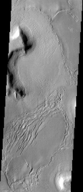
A broad channel in the Deuteronilus Mensae region, shown in this NASA Mars Odyssey image, displays the strange landforms common to the northern mid-latitudes where ground ice likely plays a role in their formation.
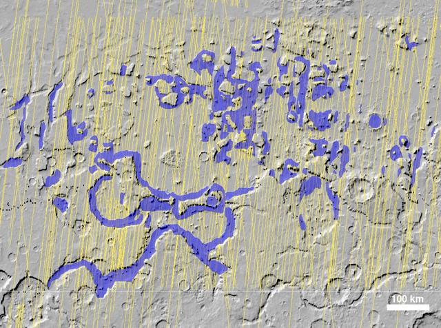
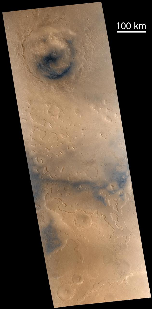
NASA Mars Reconnaissance Orbiter has detected widespread deposits of glacial ice in the mid-latitudes of Mars. This map of a region known as Deuteronilus Mensae, in the northern hemisphere, shows locations of the detected ice deposits in blue.
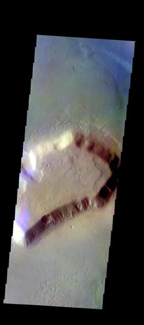
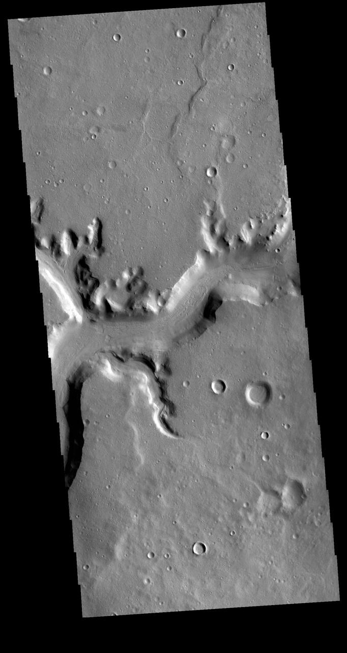
The sinuous channel in this NASA Mars Odyssey image begins at the edge of Cerulli Crater in northern Arabia and snakes its way across 1,000 km 621 miles of cratered highlands before reaching Deuteronilus Mensae at the boundary of the northern lowlands.
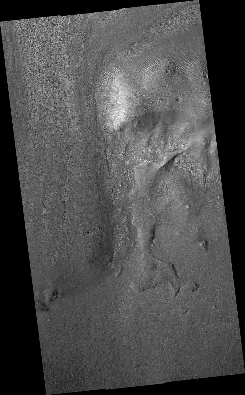
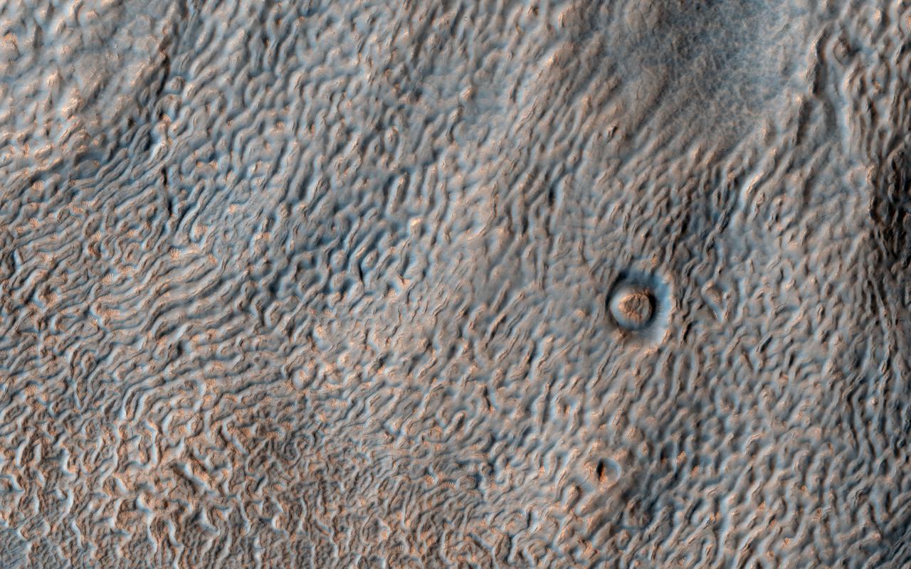
Lobate debris aprons (LDA) are commonly found surrounding dissected plateaus in the Deuteronilus Mensae region of Mars. They have been interpreted as debris-covered glaciers and radar data have shown their interiors to be composed of pure ice. The mound in this image is slightly removed from most of the other plateaus, and the LDA surrounding it is highly degraded. The sharp scarps on the western and eastern sides of the mound indicate that a great deal of the ice once found in these landforms has since sublimated away, leaving behind these collapsed debris cliffs. https://photojournal.jpl.nasa.gov/catalog/PIA24464
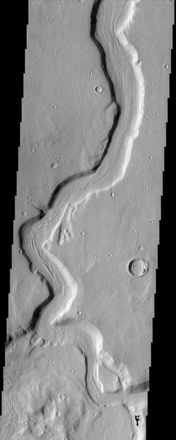
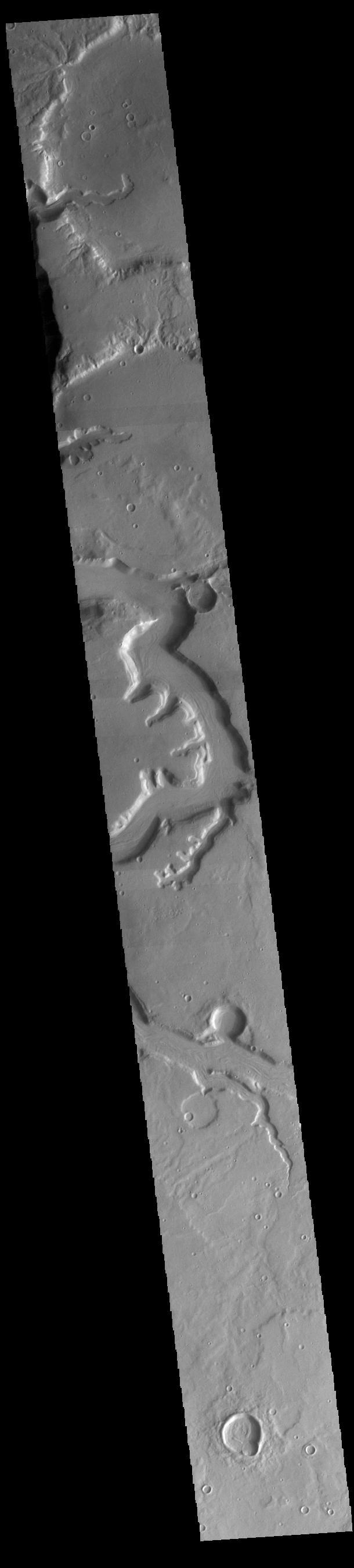
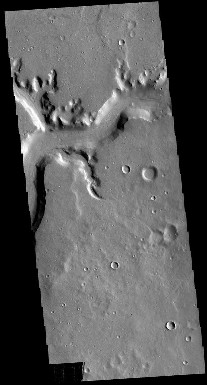
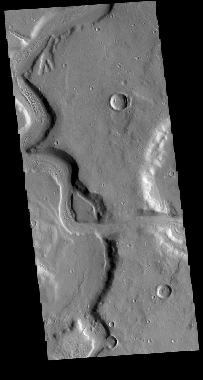
Today's VIS image shows a section of Mamers Valles. The channel enters a crater in the center of the image and exits at the top of the image. The channel is nearly 1000 km long (600 miles). Mamers Valles originates near Cerulli Crater in northern Arabia Terra, and after a short section near the crater where flow is to the south, flows northward to empty in Deuteronilus Mensae. The steep walls of Mamers Valles can reach heights of 1200 m (4000 feet). Orbit Number: 89520 Latitude: 33.5229 Longitude: 17.1272 Instrument: VIS Captured: 2022-02-18 09:21 https://photojournal.jpl.nasa.gov/catalog/PIA25376
Today's VIS image shows a section of Mamers Valles. The channel is nearly 1000 km long (600 miles). Mamers Valles originates near Cerulli Crater in northern Arabia Terra, and after a short section near the crater where flow is to the south, flows northward to empty in Deuteronilus Mensae. The steep walls of Mamers Valles can reach heights of 1200 m (4000 feet). Orbit Number: 79487 Latitude: 31.1242 Longitude: 19.9702 Instrument: VIS Captured: 2019-11-15 06:50 https://photojournal.jpl.nasa.gov/catalog/PIA23663
Today's VIS image shows a section of Mamers Valles. The channel is nearly 1000 km long (600 miles). Mamers Valles originates near Cerulli Crater in northern Arabia Terra, and after a short section near the crater where flow is to the south, flows northward to empty in Deuteronilus Mensae. The steep walls of Mamers Valles can reach heights of 1200 m (4000 feet). Orbit Number: 87773 Latitude: 32.4612 Longitude: 17.9185 Instrument: VIS Captured: 2021-09-27 12:58 https://photojournal.jpl.nasa.gov/catalog/PIA25270

Today's VIS image shows a section of Mamers Valles. The channel is nearly 1000 km long (600 miles). Mamers Valles originates near Cerulli Crater in northern Arabia Terra, and after a short section near the crater where flow is to the south, flows northward to empty in Deuteronilus Mensae. The steep walls of Mamers Valles can reach heights of 1200 m (4000 feet). Orbit Number: 88896 Latitude: 31.184 Longitude: 19.9349 Instrument: VIS Captured: 2021-12-29 00:12 https://photojournal.jpl.nasa.gov/catalog/PIA25342
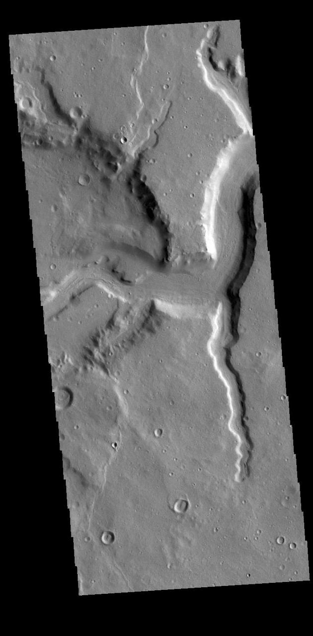
Today's VIS image shows a section of Mamers Valles. The channel is nearly 1000 km long (600 miles). Mamers Valles originates near Cerulli Crater in northern Arabia Terra, and after a short section near the crater where flow is to the south, flows northward to empty in Deuteronilus Mensae. The steep walls of Mamers Valles can reach heights of 1200 m (4000 feet). This portion of Mamers Valles is part of the southward flowing channel. Orbit Number: 89757 Latitude: 31.2642 Longitude: 20.0676 Instrument: VIS Captured: 2022-03-09 21:42 https://photojournal.jpl.nasa.gov/catalog/PIA25461
Today's VIS image shows a section of Mamers Valles. The channel is nearly 1000 km long (600 miles). Mamers Valles originates near Cerulli Crater in northern Arabia Terra, and after a short section near the crater where flow is to the south, flows northward to empty in Deuteronilus Mensae. The steep walls of Mamers Valles can reach heights of 1200 m (4000 feet). Orbit Number: 81571 Latitude: 32.8216 Longitude: 17.9954 Instrument: VIS Captured: 2020-05-04 21:07 https://photojournal.jpl.nasa.gov/catalog/PIA24000
Today's VIS image shows a section of Mamers Valles. The channel enters a crater in the center of the image and exits at the top of the image. The channel is nearly 1000 km long (600 miles). Mamers Valles originates near Cerulli Crater in northern Arabia Terra, and after a short section near the crater where flow is to the south, flows northward to empty in Deuteronilus Mensae. The steep walls of Mamers Valles can reach heights of 1200 m (4000 feet). Orbit Number: 89807 Latitude: 40.6271 Longitude: 16.0543 Instrument: VIS Captured: 2022-03-14 00:34 https://photojournal.jpl.nasa.gov/catalog/PIA25463

Today's VIS image shows a section of Mamers Valles. Mamer Valles is nearly 1000 km long (600 miles). It originates near Cerulli Crater in northern Arabia Terra, and after a short section near the crater where flow is to the south, flows northward to empty in Deuteronilus Mensae. The section of the channel in this image is part of the southward flowing part of the system. The steep walls of Mamers Valles can reach heights of 1200 m (4000 feet). Orbit Number: 89757 Latitude: 31.2642 Longitude: 20.0676 Instrument: VIS Captured: 2022-03-09 21:42 https://photojournal.jpl.nasa.gov/catalog/PIA25395
Today's VIS image shows a section of Mamers Valles. The channel is nearly 1000 km long (600 miles). Mamers Valles originates near Cerulli Crater in northern Arabia Terra, and after a short section near the crater where flow is to the south, flows northward to empty in Deuteronilus Mensae. The steep walls of Mamers Valles can reach heights of 1200 m (4000 feet). Orbit Number: 79200 Latitude: 31.0046 Longitude: 19.9804 Instrument: VIS Captured: 2019-10-22 15:40 https://photojournal.jpl.nasa.gov/catalog/PIA23633
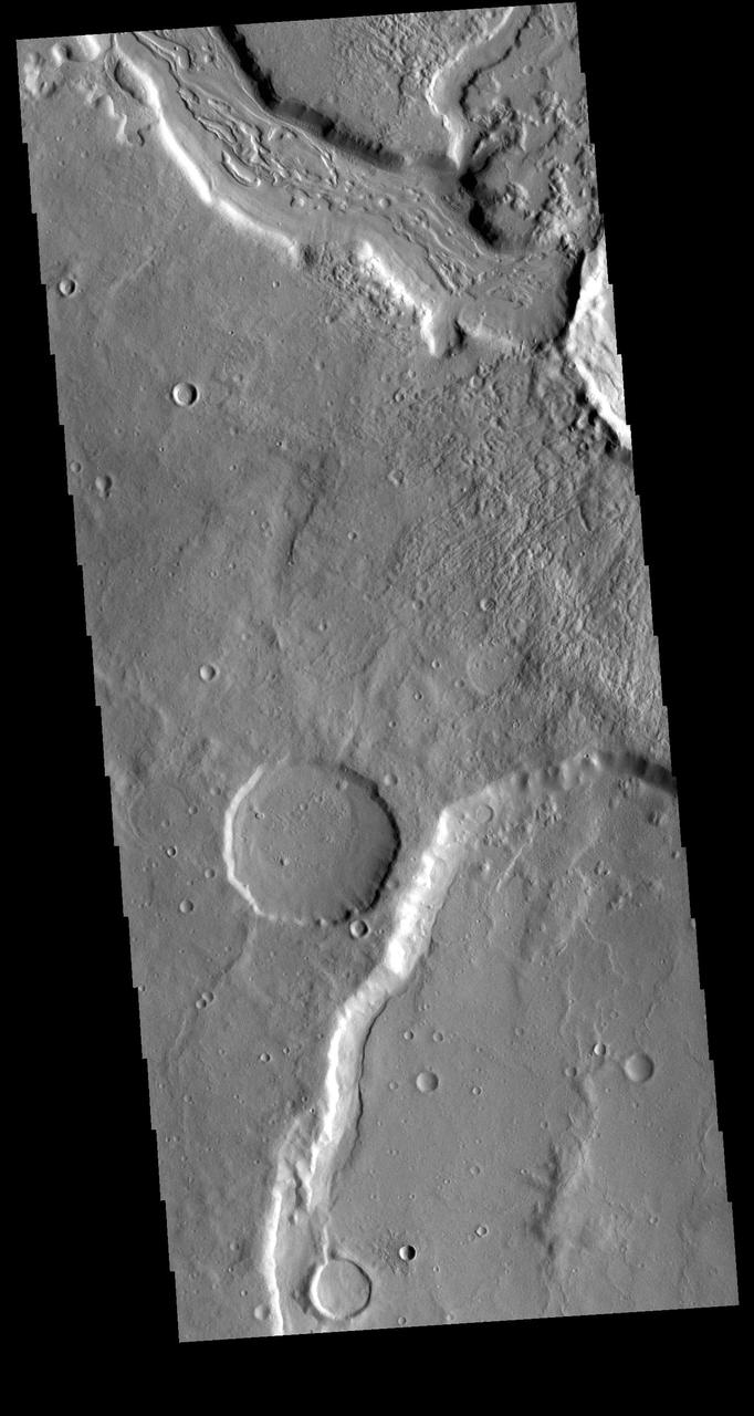
Today's VIS image shows a section of Mamers Valles where it enters into Ismenius Cavus. The channel is nearly 1000 km long (600 miles). Mamers Valles originates near Cerulli Crater in northern Arabia Terra, and after a short section near the crater where flow is to the south, flows northward to empty in Deuteronilus Mensae. The steep walls of Mamers Valles can reach heights of 1200 m (4000 feet). Orbit Number: 93619 Latitude: 33.35 Longitude: 17.3572 Instrument: VIS Captured: 2023-01-21 22:16 https://photojournal.jpl.nasa.gov/catalog/PIA25872
Today's VIS image shows a section of Mamers Valles. The channel is nearly 1000 km long (600 miles). Mamers Valles originates near Cerulli Crater in northern Arabia Terra, and after a short section near the crater where flow is to the south, flows northward to empty in Deuteronilus Mensae. The steep walls of Mamers Valles can reach heights of 1200 m (4000 feet). Orbit Number: 80685 Latitude: 31.7182 Longitude: 18.531 Instrument: VIS Captured: 2020-02-21 22:16 https://photojournal.jpl.nasa.gov/catalog/PIA23859
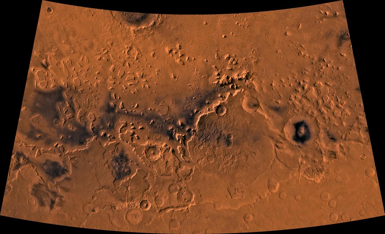
Color image of part of the Ismenius Lacus region of Mars (MC-5 quadrangle) containing the impact crater Moreux (right center); north toward top. The scene shows heavily cratered highlands in the south on relatively smooth lowland plains in the north separated by a belt of dissected terrain, containing flat-floored valleys, mesas, and buttes. This image is a composite of Viking medium-resolution images in black and white and low-resolution images in color. The image extends from latitude 36 degrees N. to 50 degrees N. and from longitude 310 degrees to 340 degrees; Lambert conformal conic projection. The dissected terrain along the highlands/lowlands boundary consists of the flat-floored valleys of Deuteronilus Mensae (on left) and Prontonilus Mensae (on right) and farther north the small, rounded hills of knobby terrain. Flows on the mensae floors contain striae that run parallel to valley walls; where valleys meet, the striae merge, similar to medial moraines on glaciers. Terraces within the valley hills have been interpreted as either layered rocks or wave terraces. The knobby terrain has been interpreted as remnants of the old, densely cratered highland terrain perhaps eroded by mass wasting. http://photojournal.jpl.nasa.gov/catalog/PIA00420
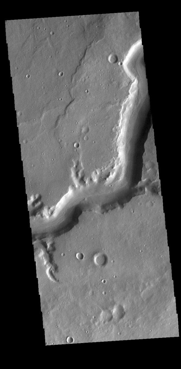
Today's VIS image shows a section of Mamers Valles. The channel is nearly 1000 km long (600 miles). Mamers Valles originates near Cerulli Crater in northern Arabia Terra, and after a short section near the crater where flow is to the south, flows northward to empty in Deuteronilus Mensae. This image is located where the channel changes from southward flow to northward. On the right side of the image the channel cuts from one crater into a lower one. The channel hugs the wall of the second crater and then exits to the top of the image. The steep walls of Mamers Valles can reach heights of 1200 m (4000 feet). Orbit Number: 80086 Latitude: 30.9514 Longitude: 19.1598 Instrument: VIS Captured: 2020-01-03 14:34 https://photojournal.jpl.nasa.gov/catalog/PIA23750
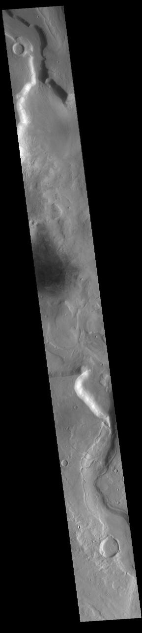
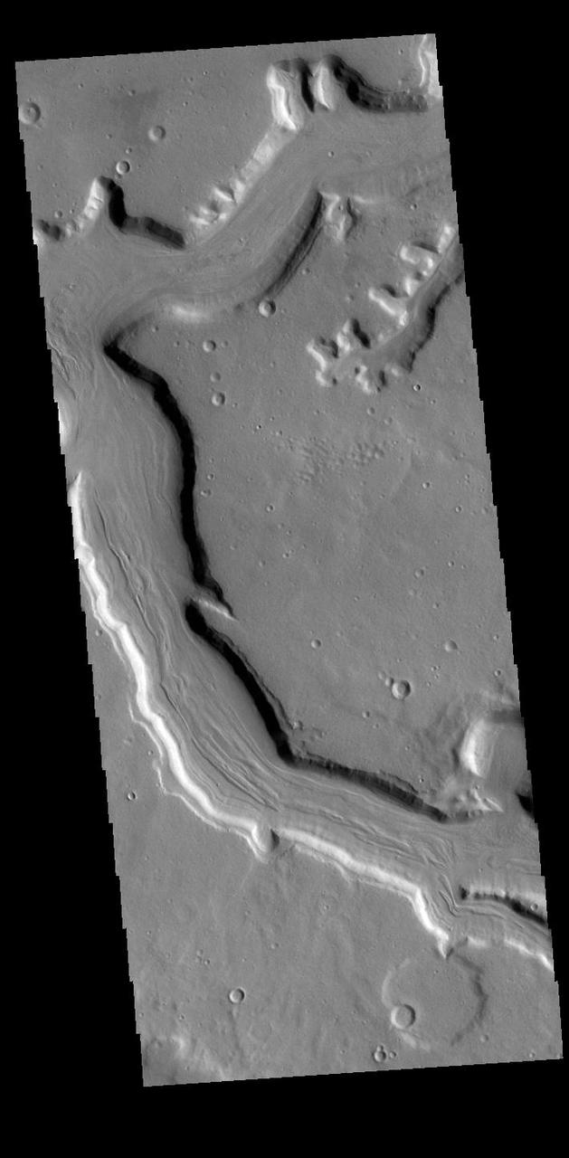
Today's VIS image shows a section of Mamers Valles, a complex channel nearly 1000 km long (600 miles). Mamers Valles originates near Cerulli Crater in northern Arabia Terra, and after a short section near the crater where flow is to the south, flows northward to empty in Deuteronilus Mensae. This image is located where the channel is still flowing southward. On the left side of the image the channel cuts into a crater, one of several the valles will encounter. The steep walls of Mamers Valles can reach heights of 1200 m (4000 feet). Orbit Number: 88035 Latitude: 30.9168 Longitude: 19.6827 Instrument: VIS Captured: 2021-10-19 02:43 https://photojournal.jpl.nasa.gov/catalog/PIA25115