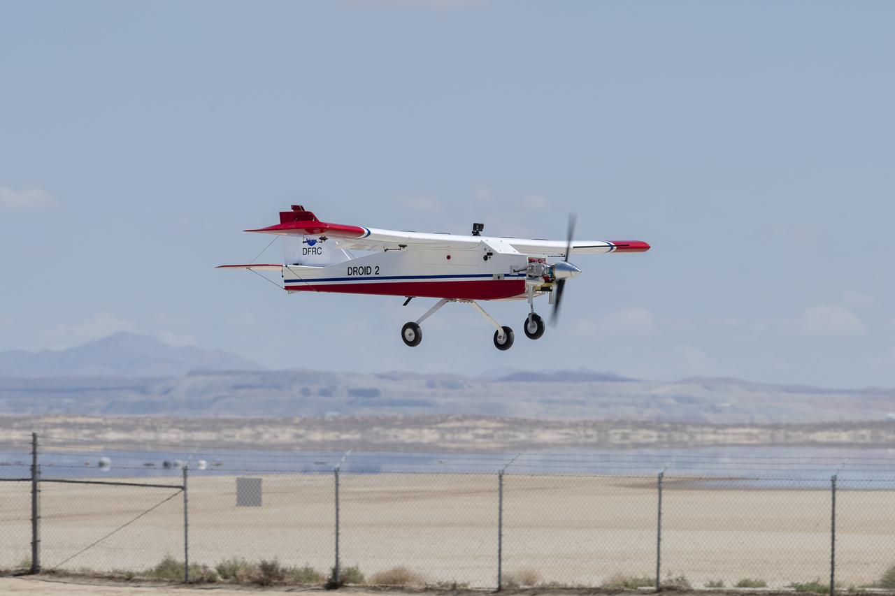
The DROID 2 (Dryden Remotely Operated Integrated Drone 2) prepares to land at NASA's Armstrong Flight Research Center in Edwards, California, as part of the Advanced Exploration of Reliable Operation at Low Altitudes: Meteorology, Simulation, and Technology campaign. The focus was to study wind to provide data for safe takeoff and landing of future air taxis.
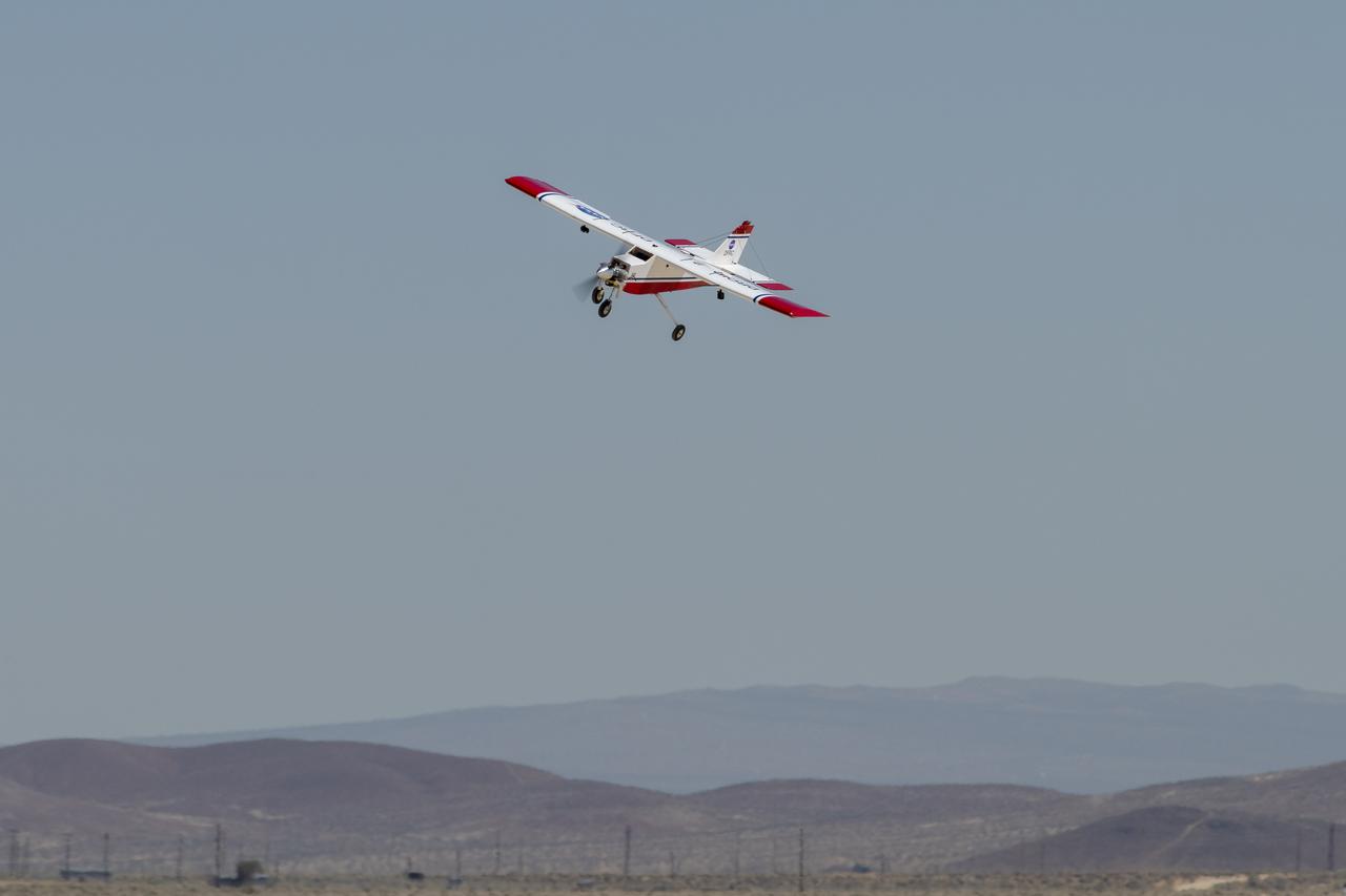
The DROID 2 (Dryden Remotely Operated Integrated Drone 2) flies at NASA's Armstrong Flight Research Center in Edwards, California, as part of the Advanced Exploration of Reliable Operation at Low Altitudes: Meteorology, Simulation, and Technology campaign. The focus was to study wind to provide data for safe takeoff and landing of future air taxis.
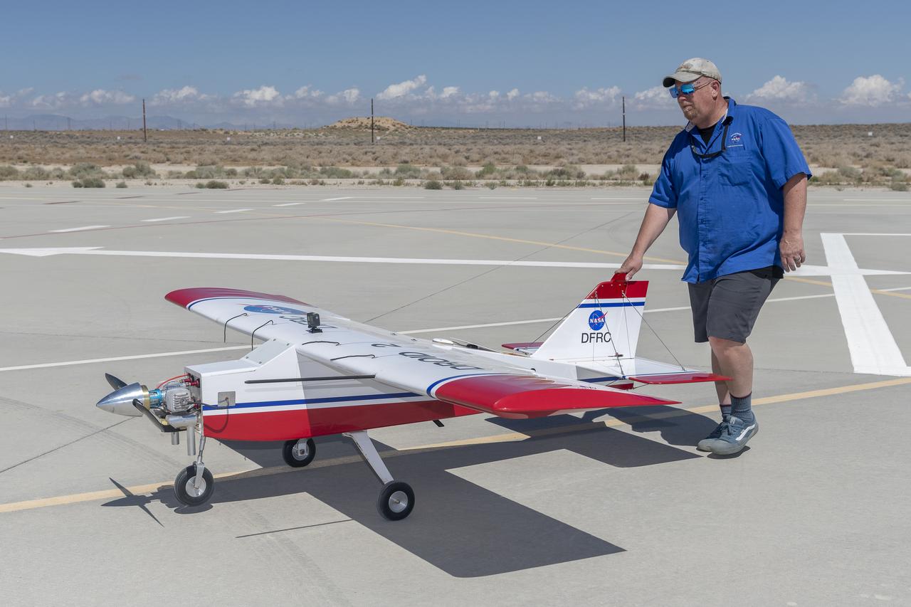
Robert "Red" Jensen positions the DROID 2 (Dryden Remotely Operated Integrated Drone) aircraft before a flight for the Advanced Exploration of Reliable Operation at Low Altitudes: Meteorology, Simulation, and Technology campaign. The weather study was at NASA's Armstrong Flight Research Center in Edwards, California. The focus was to study wind to provide data for safe takeoff and landing of future air taxis.
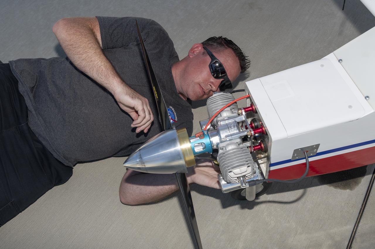
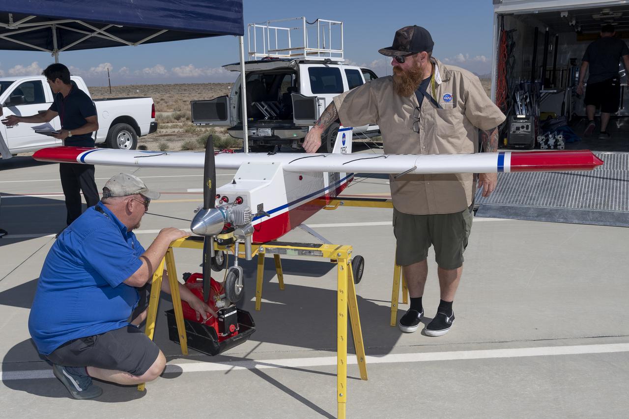
Justin Link prepares the DROID 2 (Dryden Remotely Operated Integrated Drone 2) aircraft before a flight for the Advanced Exploration of Reliable Operation at Low Altitudes: Meteorology, Simulation, and Technology campaign. The weather study was at NASA's Armstrong Flight Research Center in Edwards, California. The focus was to study wind to provide data for safe takeoff and landing of future air taxis.
The DROID 2 (Dryden Remotely Operated Integrated Drone 2) aircraft flies by the former space shuttle hangar at NASA's Armstrong Flight Research Center in Edwards, California, as part of the Advanced Exploration of Reliable Operation at Low Altitudes: Meteorology, Simulation, and Technology campaign. The focus was to study wind to provide data for safe takeoff and landing of future air taxis.
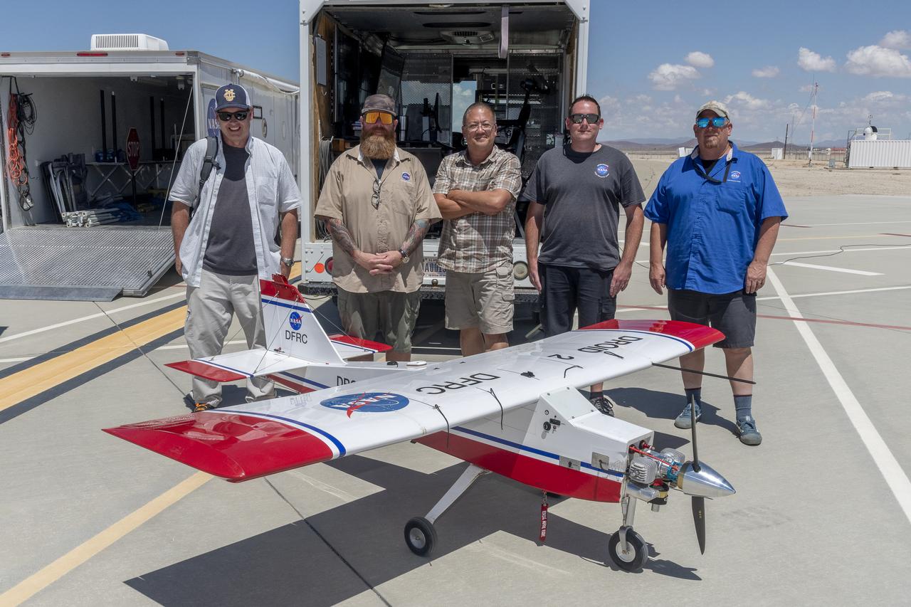
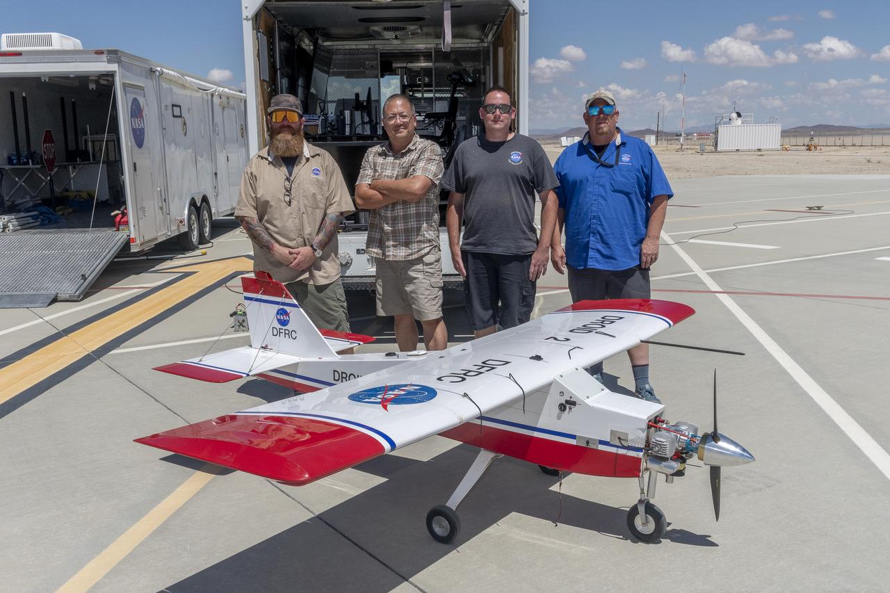
John Melton, Justin Hall, Derek Abramson, Justin Link, and Robert "Red" Jensen were key on mission day for the Advanced Exploration of Reliable Operation at Low Altitudes: Meteorology, Simulation, and Technology campaign. The DROID 2 (Dryden Remotely Operated Integrated Drone 2) aircraft supported the campaign at NASA's Armstrong Flight Research Center in Edwards, California. The focus was to study wind to provide data for safe takeoff and landing of future air taxis.
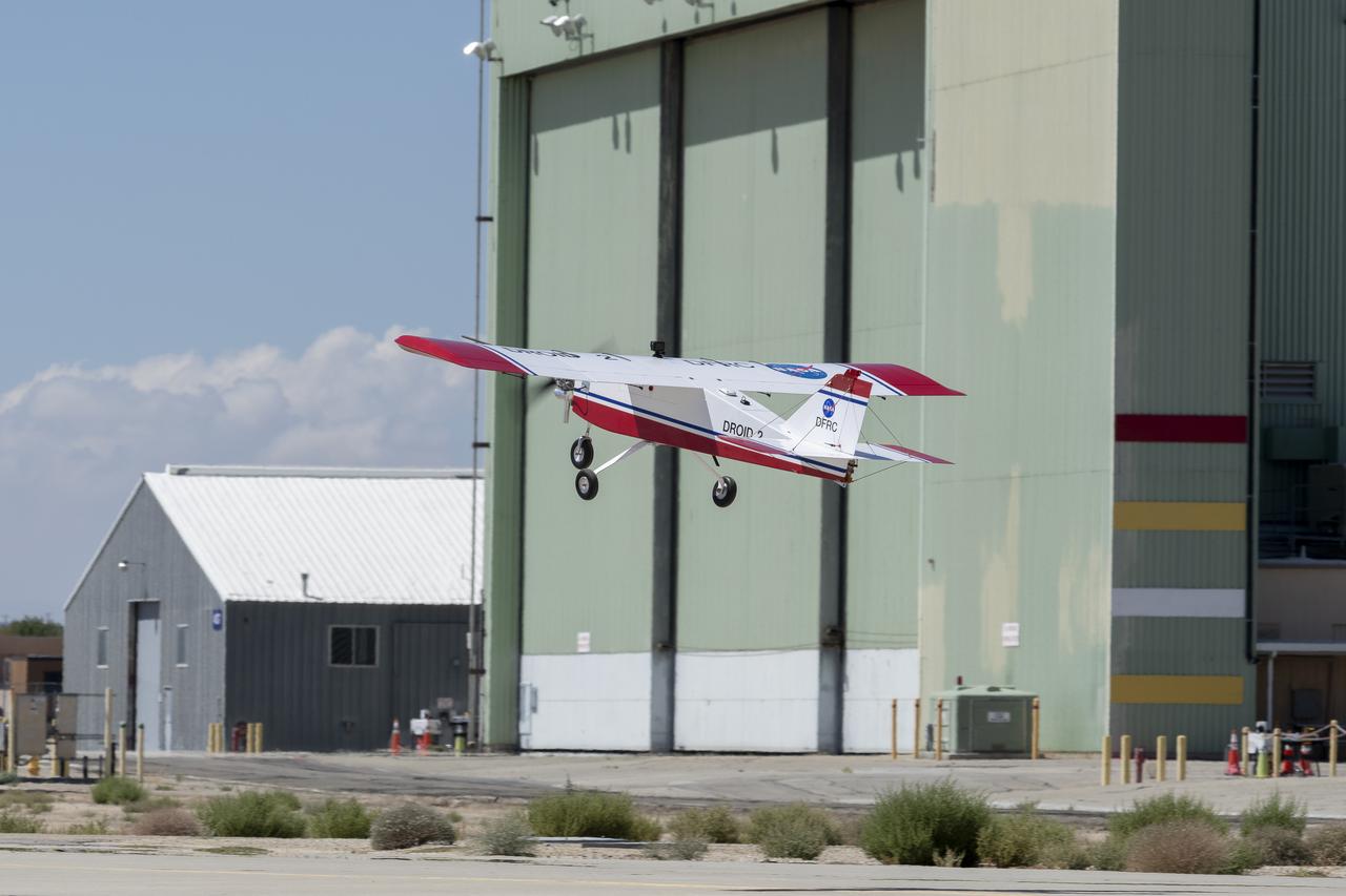
The DROID 2 (Dryden Remotely Operated Integrated Drone 2) aircraft flies by the former space shuttle hangar at NASA's Armstrong Flight Research Center in Edwards, California, as part of the Advanced Exploration of Reliable Operation at Low Altitudes: Meteorology, Simulation, and Technology campaign. The focus was to study wind to provide data for safe takeoff and landing of future air taxis.

The DROID 2 (Dryden Remotely Operated Integrated Drone 2) flies by a 140-foot instrumented tower at NASA's Armstrong Flight Research Center in Edwards, California, as part of the Advanced Exploration of Reliable Operation at Low Altitudes: Meteorology, Simulation, and Technology campaign. The focus was to study wind to provide data for safe takeoff and landing of future air taxis.
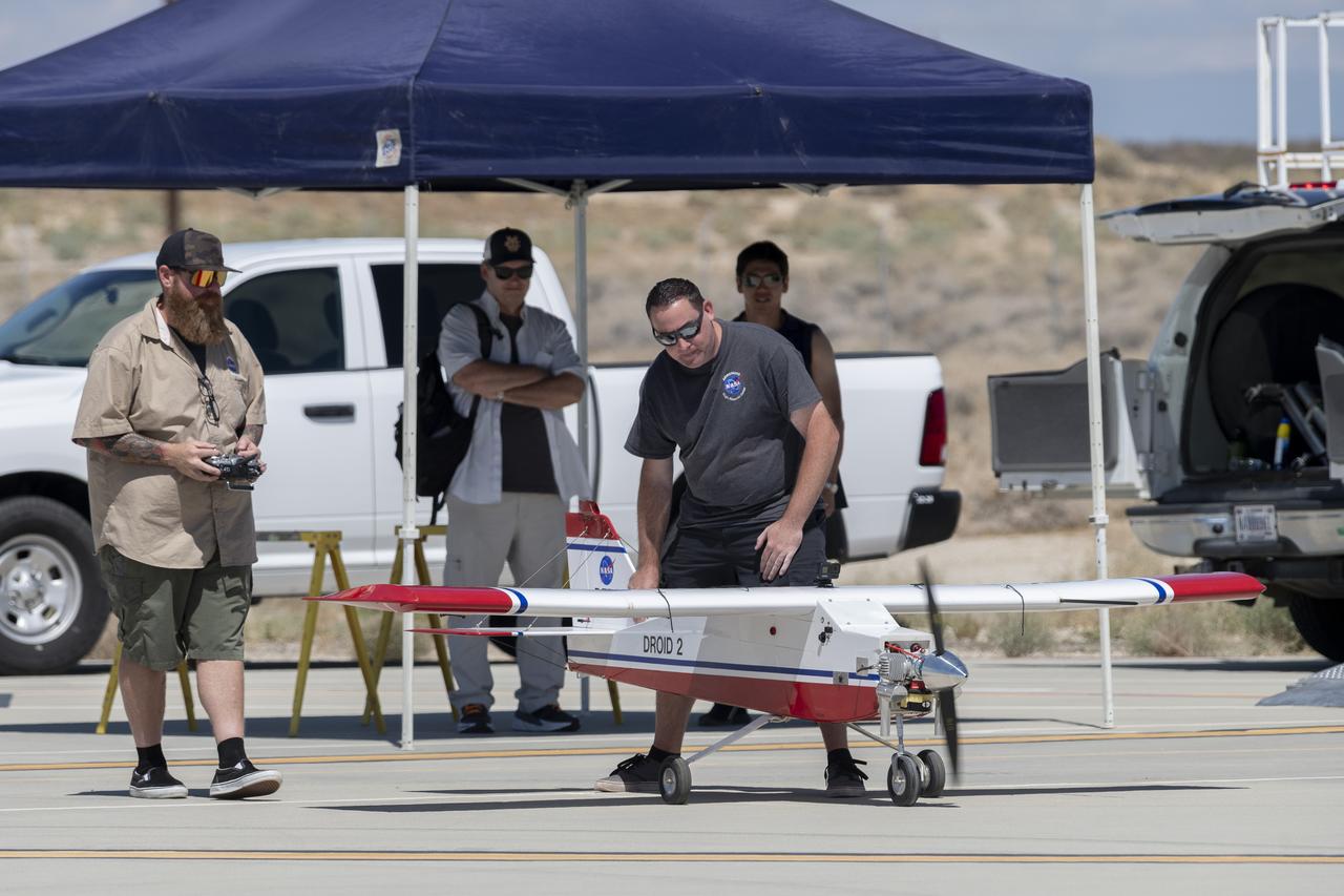
Justin Hall, left, prepares to pilot the DROID 2 (Dryden Remotely Operated Integrated Drone 2) aircraft, as John Melton watches and Justin Link makes a final adjustment. The flight was part of the Advanced Exploration of Reliable Operation at Low Altitudes: Meteorology, Simulation, and Technology campaign. The weather study was at NASA's Armstrong Flight Research Center in Edwards, California. The focus was to study wind to provide data for safe takeoff and landing of future air taxis.
Justin Hall, Derek Abramson, Justin Link, and Robert "Red" Jensen were key to a successful mission for the DROID 2 (Dryden Remotely Operated Integrated Drone 2) aircraft at NASA's Armstrong Flight Research Center in Edwards, California. The aircraft flew as part of the Advanced Exploration of Reliable Operation at Low Altitudes: Meteorology, Simulation, and Technology campaign. The focus was to study wind to provide data for safe takeoff and landing of future air taxis.
Robert "Red" Jensen and Justin Hall prepare the DROID 2 (Dryden Remotely Operated Integrated Drone 2) aircraft for the Advanced Exploration of Reliable Operation at Low Altitudes: Meteorology, Simulation, and Technology campaign flights. The weather study was at NASA's Armstrong Flight Research Center in Edwards, California. The focus was to study wind to provide data for safe takeoff and landing of future air taxis.
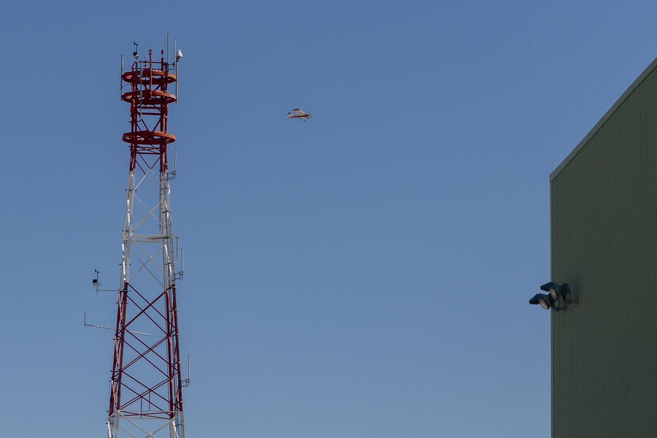
The DROID 2 (Dryden Remotely Operated Integrated Drone 2) flies by a 140-foot instrumented tower and the former space shuttle hangar at NASA's Armstrong Flight Research Center in Edwards, California, as part of the Advanced Exploration of Reliable Operation at Low Altitudes: Meteorology, Simulation, and Technology campaign. The focus was to study wind to provide data for safe takeoff and landing of future air taxis.
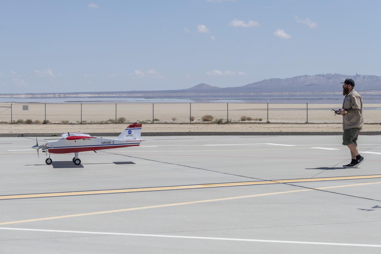
Justin Hall lands the DROID 2 (Dryden Remotely Operated Integrated Drone 2) aircraft at NASA's Armstrong Flight Research Center in Edwards, California, as part of the Advanced Exploration of Reliable Operation at Low Altitudes: Meteorology, Simulation, and Technology campaign. The focus was to study wind to provide data for safe takeoff and landing of future air taxis.

Robert "Red" Jensen lands the DROID 2 (Dryden Remotely Operated Integrated Drone 2) aircraft at NASA's Armstrong Flight Research Center in Edwards, California, as part of the Advanced Exploration of Reliable Operation at Low Altitudes: Meteorology, Simulation, and Technology campaign. The focus was to study wind to provide data for safe takeoff and landing of future air taxis.
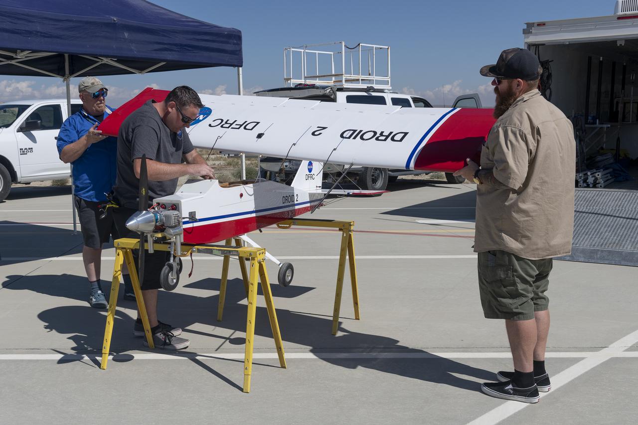
Robert "Red" Jensen, Justin Link, and Justin Hall prepare the DROID 2 (Dryden Remotely Operated Integrated Drone 2) for the Advanced Exploration of Reliable Operation at Low Altitudes: Meteorology, Simulation, and Technology campaign flights. The weather study was at NASA's Armstrong Flight Research Center in Edwards, California. The focus was to study wind to provide data for safe takeoff and landing of future air taxis.

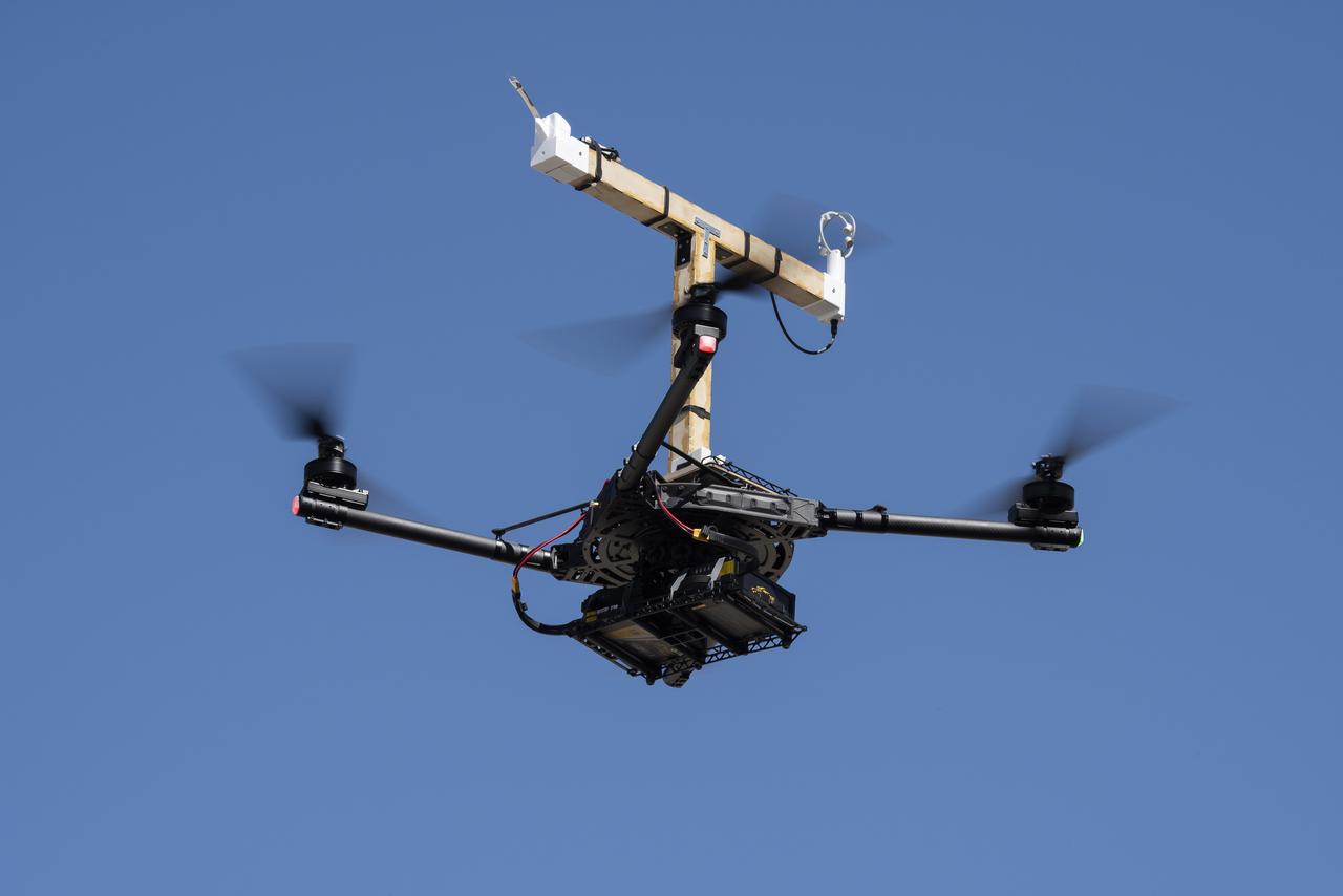
The Alta-X aircraft flies by the former space shuttle hangar at NASA’s Armstrong Flight Research Center in Edwards, California, as part of the Advanced Exploration of Reliable Operation at Low Altitudes: Meteorology, Simulation and Technology campaign. The campaign was at NASA Armstrong to study wind from the ground to 2,000 feet to provide data to assist future drones to safely land on rooftop hubs called vertiports and to potentially improve weather prediction.
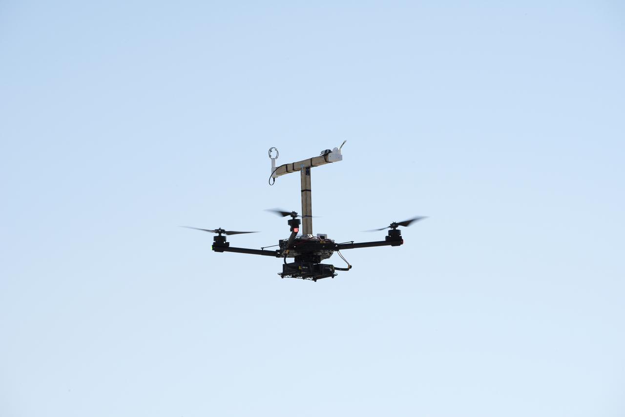
The Alta-X aircraft flies at NASA’s Armstrong Flight Research Center in Edwards, California, as part of the Advanced Exploration of Reliable Operation at Low Altitudes: Meteorology, Simulation and Technology campaign. The campaign was at NASA Armstrong to study wind from the ground to 2,000 feet to provide data to assist future drones to safely land on rooftop hubs called vertiports and to potentially improve weather prediction.
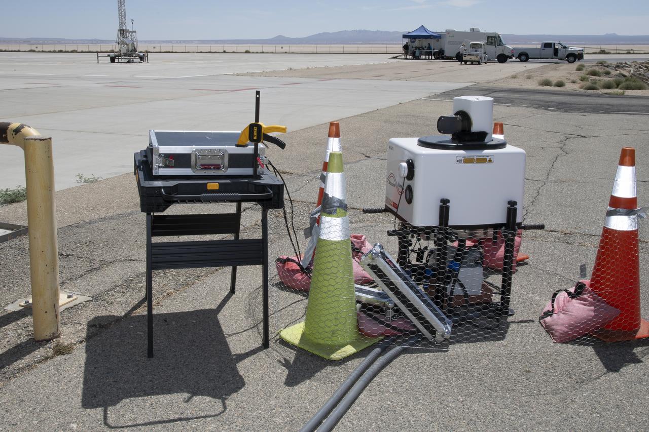
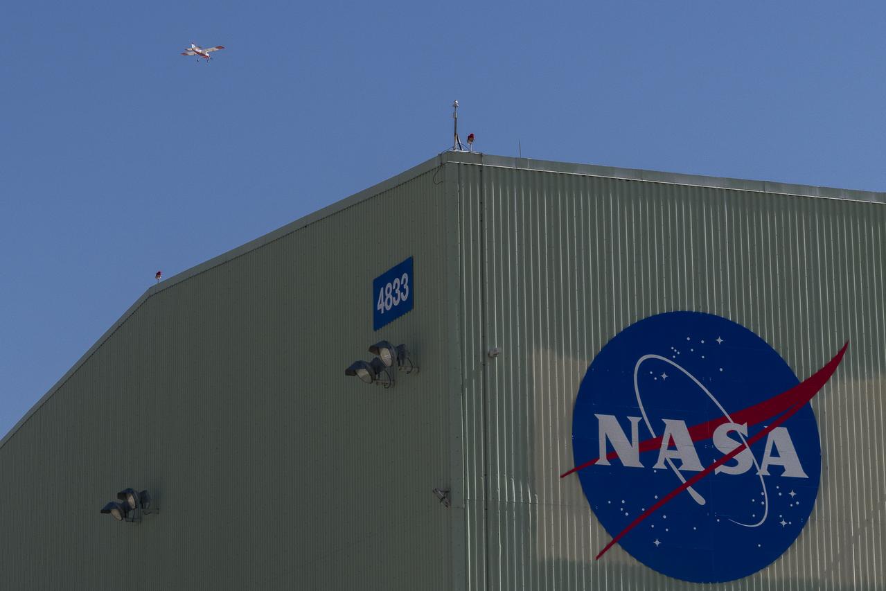
This is one of two lidar units positioned on either end of Building 4833 at NASA’s Armstrong Flight Research Center in Edwards, California, that formed the cutting-edge ‘virtual tower concept.’ The units use lasers to measure airflow from the ground level to 2,000 feet to provide data to assist future drones to safely land on rooftop hubs called vertiports, and to potentially improve weather prediction. It was part of the multi-faceted Advanced Exploration of Reliable Operation at Low Altitudes: Meteorology, Simulation and Technology campaign.
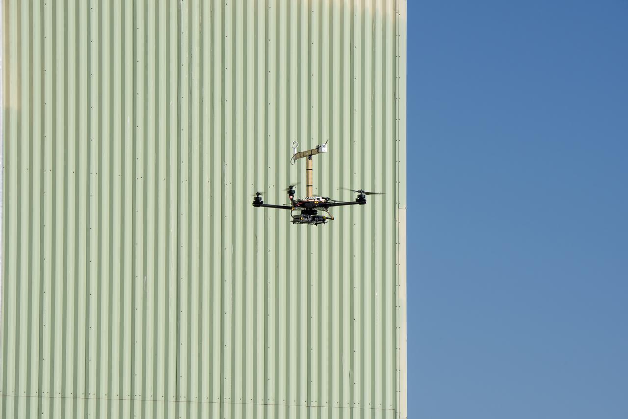
The Alta-X aircraft flies by the former space shuttle hangar at NASA’s Armstrong Flight Research Center in Edwards, California, as part of the Advanced Exploration of Reliable Operation at Low Altitudes: Meteorology, Simulation and Technology campaign. The campaign was at NASA Armstrong Flight to study wind from the ground to 2,000 feet to provide data to assist future drones to safely land on rooftop hubs called vertiports and to potentially improve weather prediction.
Tegan French and Rocky Garcia are at a weather balloon system’s ground station monitoring temperature, humidity, pressure, and winds transmitted from an instrument package on the balloon as it ascends. The balloon is part of the different methods to collect wind and weather data for the Advanced Exploration of Reliable Operation at Low Altitudes: Meteorology, Simulation and Technology campaign. The weather study was at NASA’s Armstrong Flight Research Center in Edwards, California. The focus was to study wind from the ground to 2,000 feet to provide data to assist future drones to safely land on rooftop hubs called vertiports and to potentially improve weather prediction.
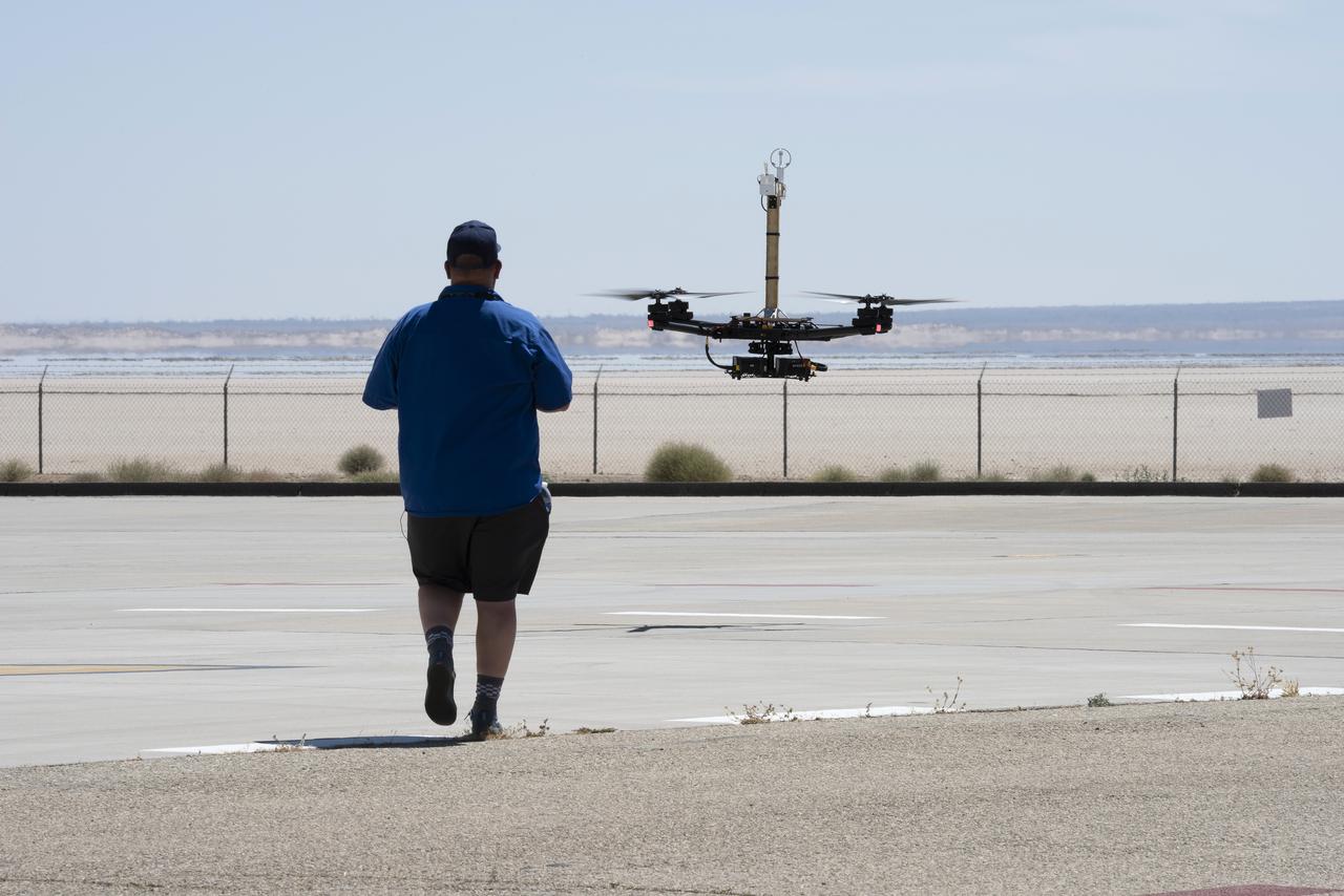
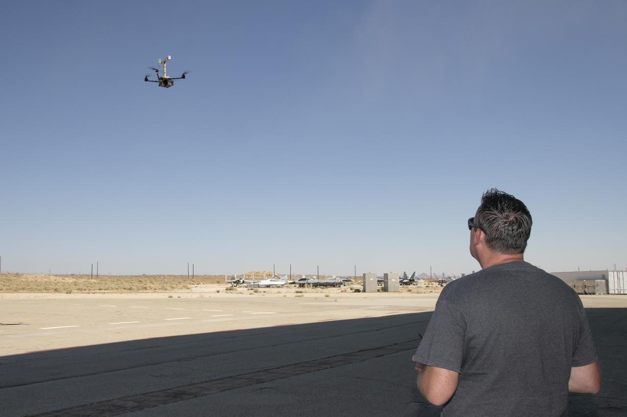
Red Jensen lands the Alta-X aircraft at NASA’s Armstrong Flight Research Center in Edwards, California, as part of the Advanced Exploration of Reliable Operation at Low Altitudes: Meteorology, Simulation and Technology campaign. The campaign was at NASA Armstrong to study wind from the ground to 2,000 feet to provide data to assist future drones to safely land on rooftop hubs called vertiports and to potentially improve weather prediction.
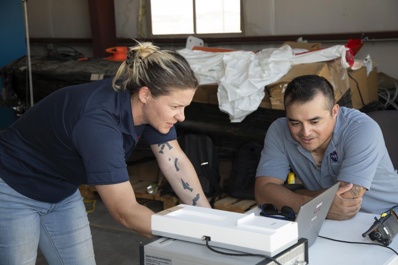
Jennifer Fowler works on securing sensors onto the test fixture on the Alta-X aircraft. Justin Link, Grady Koch, and Tyler Willhite are in the background. The Advanced Exploration of Reliable Operation at Low Altitudes: Meteorology, Simulation and Technology campaign was at NASA’s Armstrong Flight Research Center in Edwards, California. The focus was to study wind from the ground to 2,000 feet to provide data to assist future drones to safely land on rooftop hubs called vertiports and to potentially improve weather prediction.
Jennifer Fowler talks to Red Jensen prior to a flight for the Advanced Exploration of Reliable Operation at Low Altitudes: Meteorology, Simulation and Technology campaign. Tyler Willhite completes some equipment checks for the research in the background. The weather study was at NASA’s Armstrong Flight Research Center in Edwards, California. The focus was to study wind from the ground to 2,000 feet to provide data to assist future drones to safely land on rooftop hubs called vertiports and to potentially improve weather prediction.
Red Jensen looks over the Alta-X aircraft before a flight for the Advanced Exploration of Reliable Operation at Low Altitudes: Meteorology, Simulation and Technology campaign. The weather study was at NASA’s Armstrong Flight Research Center in Edwards, California. The focus was to study wind from the ground to 2,000 feet to provide data to assist future drones to safely land on rooftop hubs called vertiports and to potentially improve weather prediction.
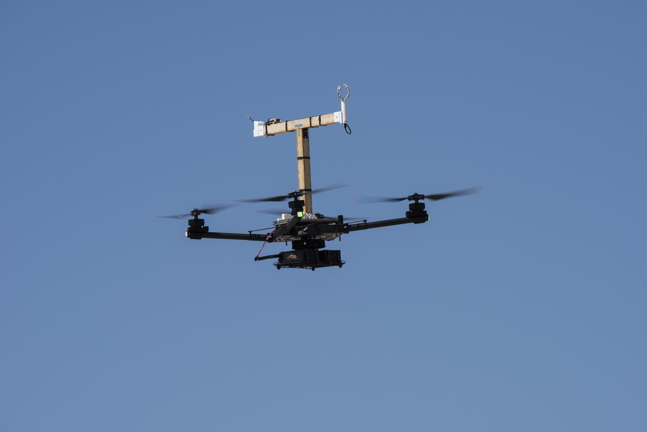
The Alta-X aircraft flies at NASA’s Armstrong Flight Research Center in Edwards, California, as part of the Advanced Exploration of Reliable Operation at Low Altitudes: Meteorology, Simulation and Technology campaign. The campaign was at NASA Armstrong to study wind from the ground to 2,000 feet to provide data to assist future drones to safely land on rooftop hubs called vertiports and to potentially improve weather prediction.
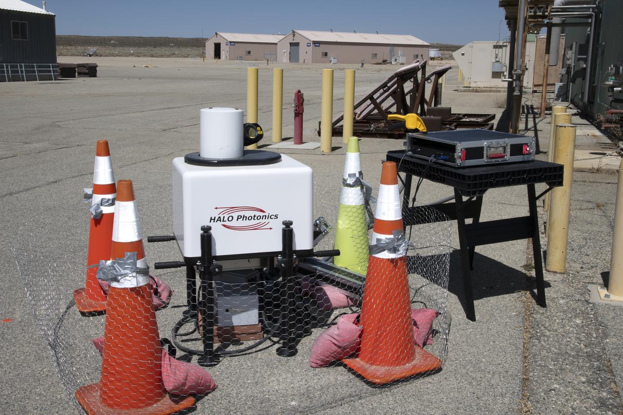
This is one of two lidar units positioned on either end of Building 4833 at NASA’s Armstrong Flight Research Center in Edwards, California, that formed the cutting-edge ‘virtual tower concept.’ The units use lasers to measure airflow from the ground level to 2,000 feet to provide data to assist future drones to safely land on rooftop hubs called vertiports, and to potentially improve weather prediction. It was part of the multi-faceted Advanced Exploration of Reliable Operation at Low Altitudes: Meteorology, Simulation and Technology campaign.
The Alta-X aircraft flies at NASA’s Armstrong Flight Research Center in Edwards, California, as part of the Advanced Exploration of Reliable Operation at Low Altitudes: Meteorology, Simulation and Technology campaign. The campaign was at NASA Armstrong to study wind from the ground to 2,000 feet to provide data to assist future drones to safely land on rooftop hubs called vertiports and to potentially improve weather prediction.
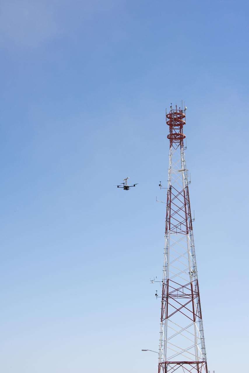
The Alta-X aircraft flies by a 140-foot instrumented tower at NASA’s Armstrong Flight Research Center in Edwards, California, as part of the Advanced Exploration of Reliable Operation at Low Altitudes: Meteorology, Simulation and Technology campaign. The campaign was at NASA Armstrong to study wind from the ground to 2,000 feet to provide data to assist future drones to safely land on rooftop hubs called vertiports and to potentially improve weather prediction.

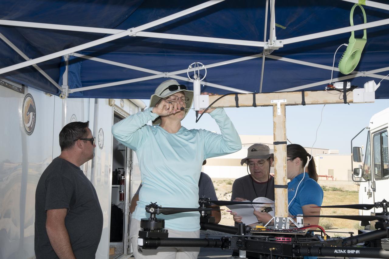
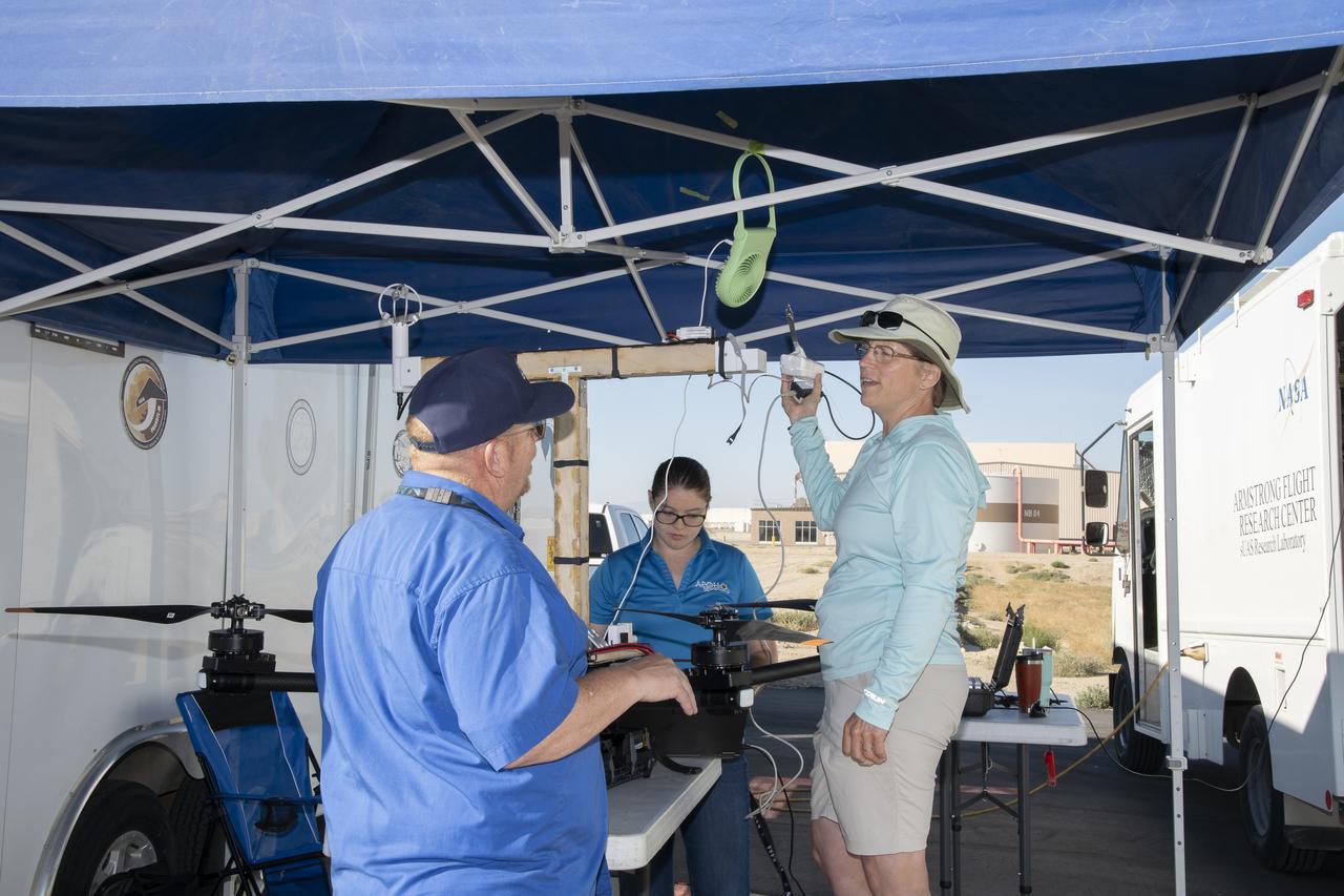
Justin Link, left, Red Jensen and Derek Abramson prepare for an Alta-X aircraft flight as part of the Advanced Exploration of Reliable Operation at Low Altitudes: Meteorology, Simulation and Technology campaign. In the background are Grady Koch and Jennifer Fowler. The campaign was at NASA Armstrong to study wind from the ground to 2,000 feet to provide data to assist future drones to safely land on rooftop hubs called vertiports and to potentially improve weather prediction.
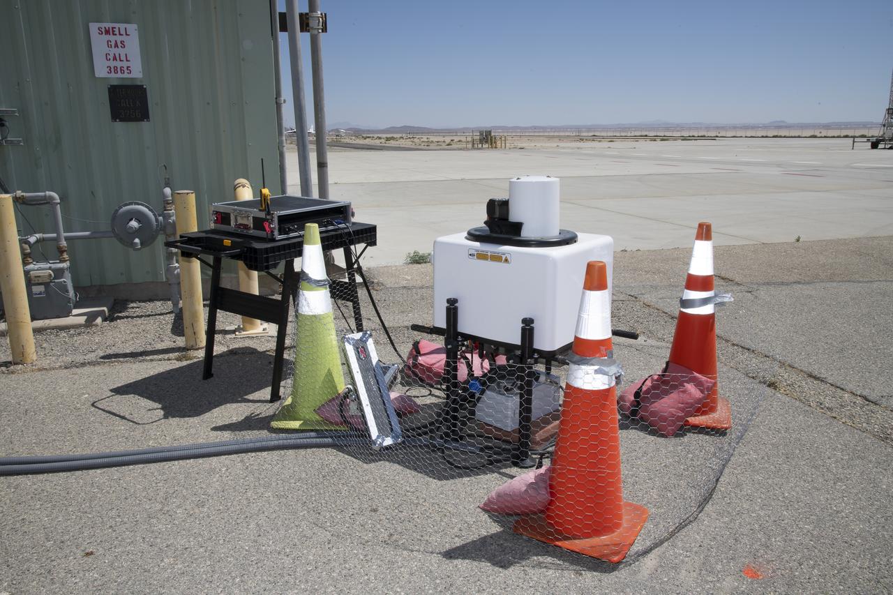
This is one of two lidar units positioned on either end of Building 4833 at NASA’s Armstrong Flight Research Center in Edwards, California, that formed the cutting-edge ‘virtual tower concept.’ The units use lasers to measure airflow from the ground level to 2,000 feet to provide data to assist future drones to safely land on rooftop hubs called vertiports, and to potentially improve weather prediction. It was part of the multi-faceted Advanced Exploration of Reliable Operation at Low Altitudes: Meteorology, Simulation and Technology campaign.
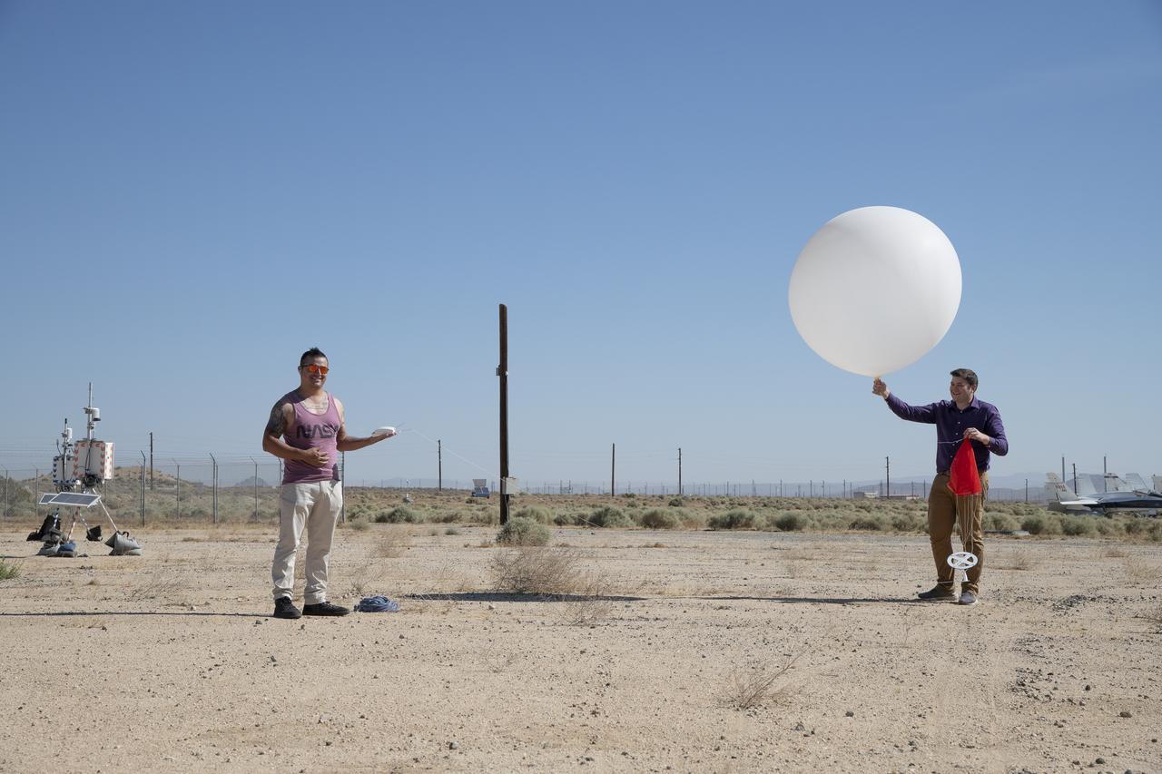
Rocky Garcia and Wesley James prepare a weather balloon to collect wind data for the Advanced Exploration of Reliable Operation at Low Altitudes: Meteorology, Simulation and Technology campaign. The weather study was at NASA’s Armstrong Flight Research Center in Edwards, California. The focus was to study wind from the ground to 2,000 feet to provide data to assist future drones to safely land on rooftop hubs called vertiports and to potentially improve weather prediction.
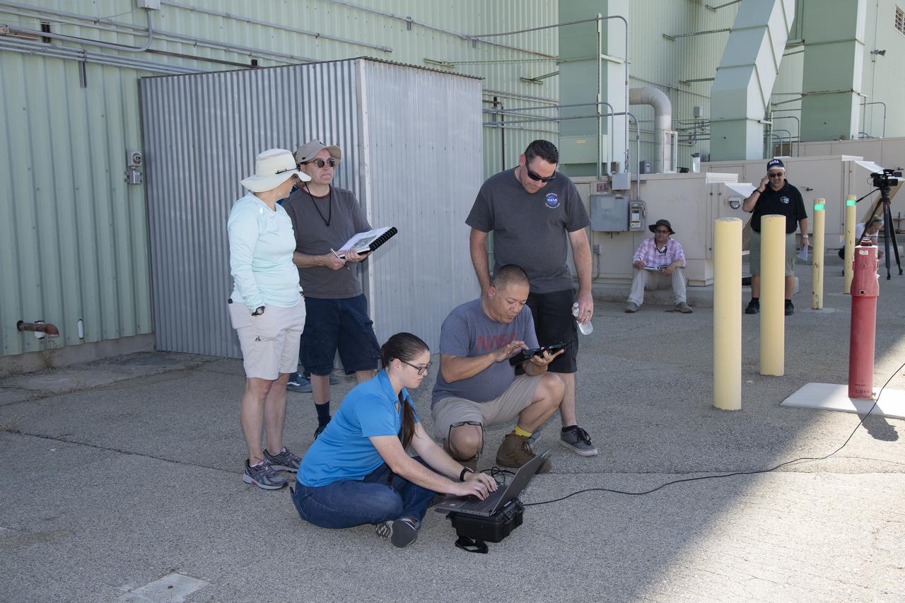
Tyler Willhite, sitting, and Derek Abramson and Justin Link, prepare for an Alta-X aircraft flight. Behind them are Jennifer Fowler, from left and Grady Kock. The Alta-X flight was part of the Advanced Exploration of Reliable Operation at Low Altitudes: Meteorology, Simulation and Technology campaign. The campaign was at NASA Armstrong to study wind from the ground to 2,000 feet to provide data to assist future drones to safely land on rooftop hubs called vertiports and to potentially improve weather prediction.
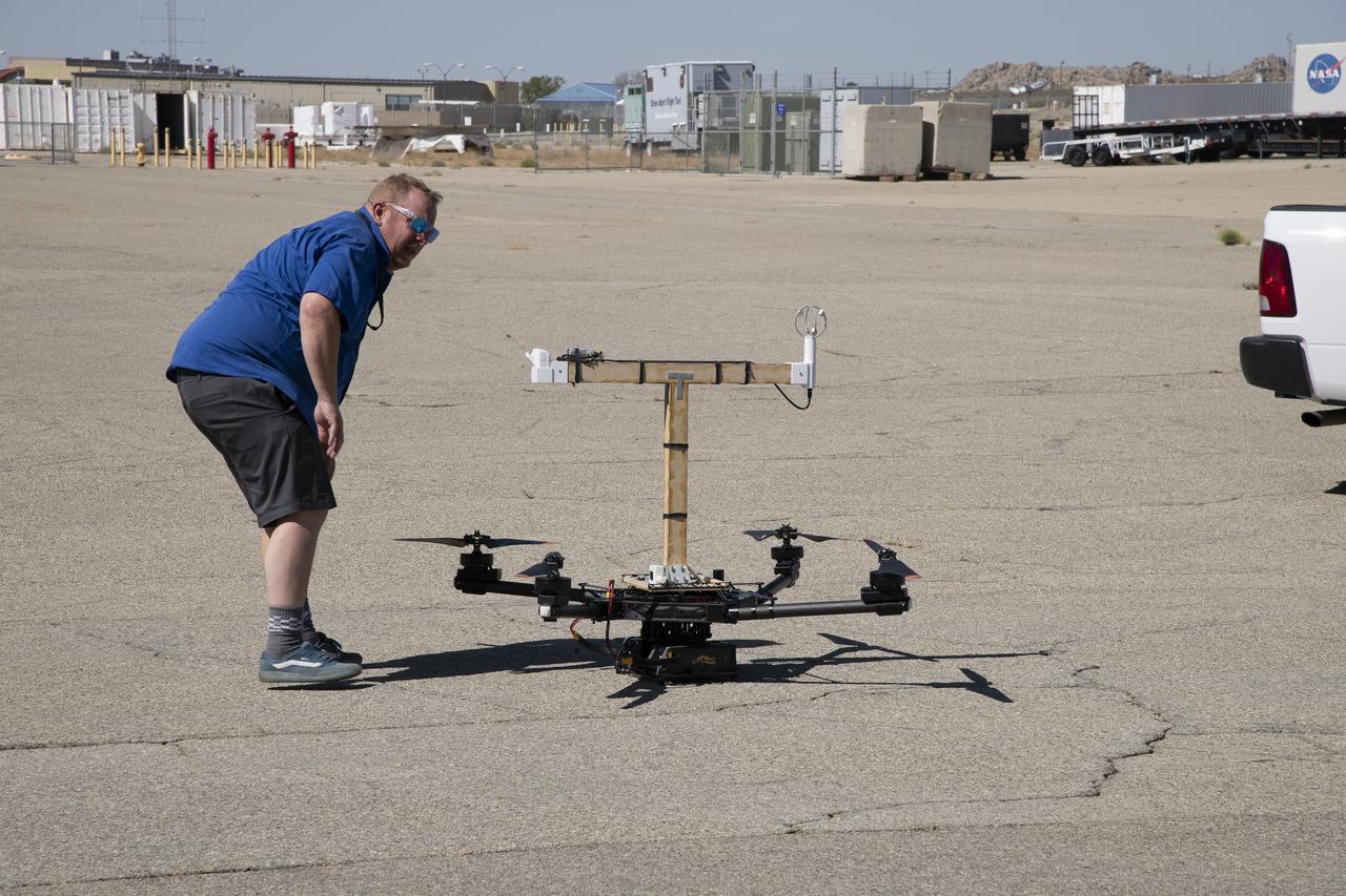
Justin Link positions the Alta-X aircraft for a hover to capture data as part of the Advanced Exploration of Reliable Operation at Low Altitudes: Meteorology, Simulation and Technology campaign. The campaign was at NASA Armstrong to study wind from the ground to 2,000 feet to provide data to assist future drones to safely land on rooftop hubs called vertiports and to potentially improve weather prediction.

This is one of two lidar units positioned on either end of Building 4833 at NASA’s Armstrong Flight Research Center in Edwards, California, that formed the cutting-edge ‘virtual tower concept.’ The units use lasers to measure airflow from the ground level to 2,000 feet to provide data to assist future drones to safely land on rooftop hubs called vertiports, and to potentially improve weather prediction. It was part of the multi-faceted Advanced Exploration of Reliable Operation at Low Altitudes: Meteorology, Simulation and Technology campaign.
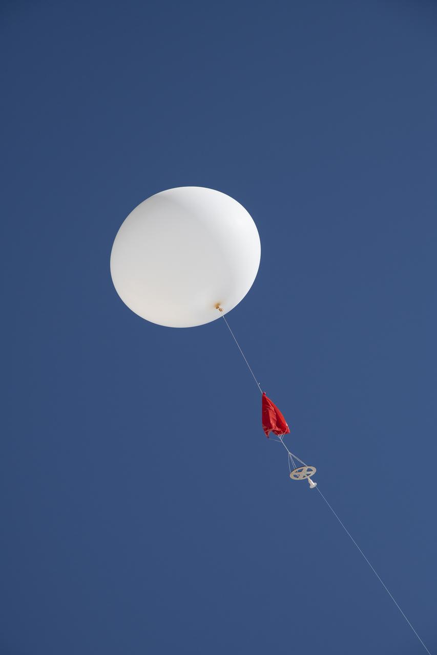
A weather balloon is launched to collect wind data for the Advanced Exploration of Reliable Operation at Low Altitudes: Meteorology, Simulation and Technology campaign. The weather study was at NASA’s Armstrong Flight Research Center in Edwards, California. The focus was to study wind from the ground to 2,000 feet to provide data to assist future drones to safely land on rooftop hubs called vertiports and to potentially improve weather prediction.