
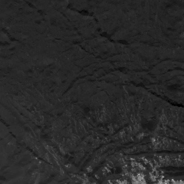
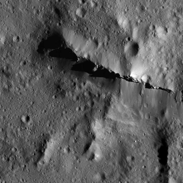
This image made with data from NASA's Dawn spacecraft shows pit chains on dwarf planet Ceres called Samhain Catenae. Scientists created this image by draping the grayscale mosaic of Ceres' surface onto the shape model of the dwarf planet. The arrows in the image point to a few of the pit chains investigated in a 2017 study in the journal Geophysical Research Letters. https://photojournal.jpl.nasa.gov/catalog/PIA22086

This artist concept shows NASA Dawn spacecraft arriving at the dwarf planet Ceres, the most massive body in the asteroid belt. Dawn is the first mission to visit a dwarf planet.

Dwarf planet Ceres is located in the main asteroid belt, between the orbits of Mars and Jupiter, as illustrated in this artist conception.

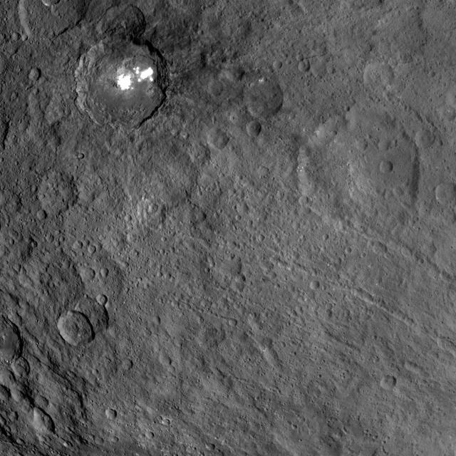
This map from NASA's Dawn mission shows locations of bright material on dwarf planet Ceres. There are more than 300 bright areas, called "faculae," on Ceres. Scientists have divided them into four categories: bright areas on the floors of crater (red), on the rims or walls of craters (green), in the ejecta blankets of craters (blue), and on the flanks of the mountain Ahuna Mons (yellow). https://photojournal.jpl.nasa.gov/catalog/PIA21914

This orthographic projection shows dwarf planet Ceres as seen by NASA's Dawn spacecraft. The projection is centered on Occator Crater, home to the brightest area on Ceres. Occator is centered at 20 degrees north latitude, 239 degrees east longitude. This image was made from views Dawn took during its low-altitude mapping orbit, at about 240 miles (385 kilometers) above the surface. The image resolution is about 460 feet (140 meters) per pixel. https://photojournal.jpl.nasa.gov/catalog/PIA21906
This image obtained by NASA's Dawn spacecraft shows a field of small craters next to Kokopelli Crater, seen at bottom right in this image, on dwarf planet Ceres. The small craters overlay a smooth, wavy material that represents ejecta from nearby Dantu Crater. The small craters were formed by blocks ejected in the Dantu impact event, and likely from the Kokopelli impact as well. Kokopelli is named after the fertility deity who presides over agriculture in the tradition of the Pueblo people from the southwestern United States. The crater measures 21 miles (34 kilometers) in diameter. Dawn took this image during its first extended mission on August 11, 2016, from its low-altitude mapping orbit, at about 240 miles (385 kilometers) above the surface. The center coordinates of this image are 20 degrees north latitude, 123 degrees east longitude. https://photojournal.jpl.nasa.gov/catalog/PIA21915
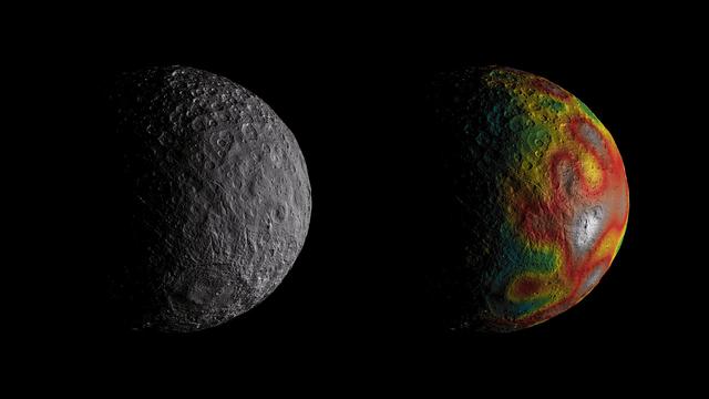
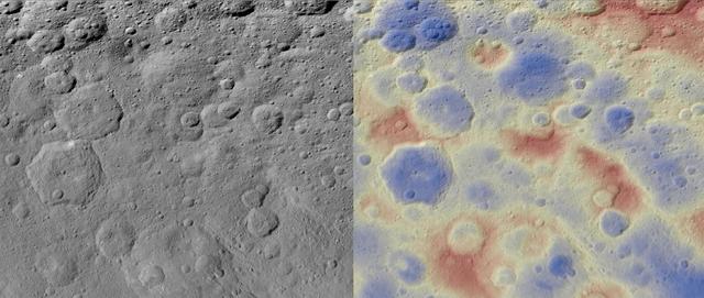
This frame from an animation shows Ceres as seen by NASA's Dawn spacecraft from its high-altitude mapping orbit at 913 miles (1,470 kilometers) above the surface. The colorful map overlaid at right shows variations in Ceres' gravity field measured by Dawn, and gives scientists hints about the dwarf planet's internal structure. Red colors indicate more positive values, corresponding to a stronger gravitational pull than expected, compared to scientists' pre-Dawn model of Ceres' internal structure; blue colors indicate more negative values, corresponding to a weaker gravitational pull. The animation was created by projecting a map of Ceres onto a rotating sphere. The image scale is about 450 feet (140 meters) per pixel. The animations are available at https://photojournal.jpl.nasa.gov/catalog/PIA22083
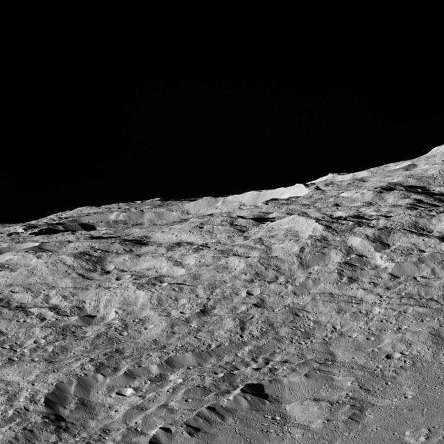
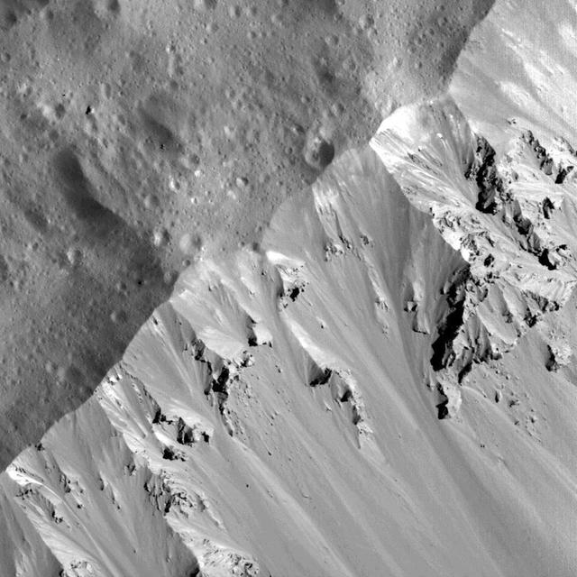
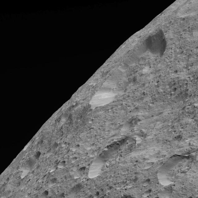
On the way to its lowest-ever and final orbit, NASA's Dawn spacecraft is observing Ceres and returning new compositional data (infrared spectra) and images of the dwarf planet's surface, such as this dramatic image of Ceres' limb. This picture is one of the first images returned by Dawn in more than a year. Dawn captured this view on May 16, 2018 from an altitude of about 270 miles (440 kilometers). The large crater near the horizon is about 22 miles (35 kilometers) in diameter. It is located at about 23 degrees north latitude, 350 degrees east longitude, not far from a series of tholi (small mountains) that include Kwanzaa Tholus. The midsize crater in the foreground is located about 75 miles (120 kilometers) from the large crater. This rough landscape suggests these features are on top of ancient terrains. The Dawn spacecraft has returned many limb images of Ceres in the course of its mission. These images offer complementary perspective to the images generally obtained by imaging the surface directly beneath the spacecraft. This example shows that Ceres' limb is relatively smooth despite the rough surface, because this large body is rounded by its own gravity. https://photojournal.jpl.nasa.gov/catalog/PIA22476
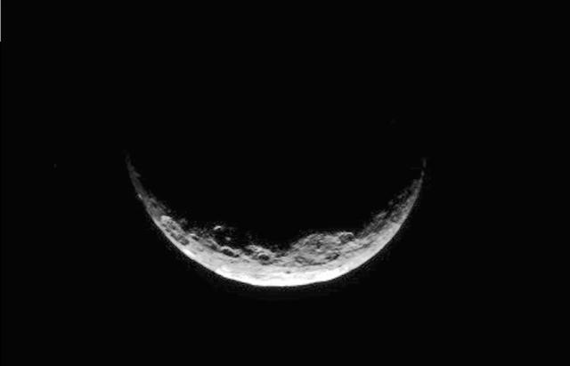
NASA's Dawn spacecraft took this image of Ceres' south polar region on May 17, 2017, from an altitude of about 26,400 miles (42,500 kilometers). The image scale is about 2.5 miles (4 kilometers) per pixel. Dawn took this image to help navigators refine their measurements of the spacecraft's position in orbit. Ceres appears as a crescent as Dawn is on the night side of the dwarf planet. Zadeni Crater, which is 80 miles (128 kilometers) wide, is recognizable on the bottom left side of the crescent. The large crater seen on the right side is Urvara Crater, which is 101 miles (163 kilometers) wide. Large fractures scarring Ceres' surface can also be distinguished here. Dawn captured a similar scene (Figure 1) at higher resolution, although with a slightly different geometry, on April 26, 2015, from its RC3 orbit at an altitude of about 8,450 miles (13,600 kilometers) and an image scale of about 0.81 miles (1.3 kilometers) per pixel. The geology of Ceres' polar regions is very rough in comparison to that generally found at lower latitudes. This is because colder temperatures near the poles allow craters to hold their original shapes over longer periods of time. Features found on Ceres are named after gods and goddesses of agriculture, as well as harvest festivals, from around the world. Zadeni is named for the ancient Georgian god of bountiful harvest, while Urvara is an Indian and Iranian deity of plants and fields. https://photojournal.jpl.nasa.gov/catalog/PIA21407
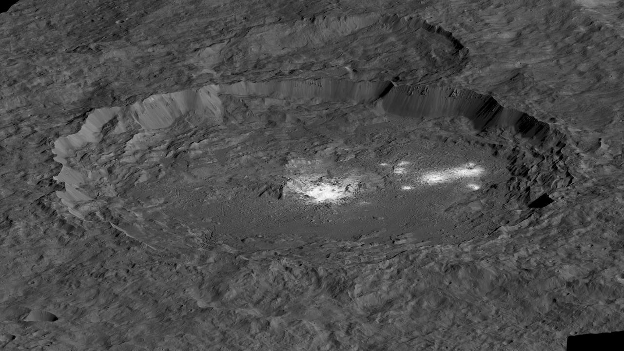
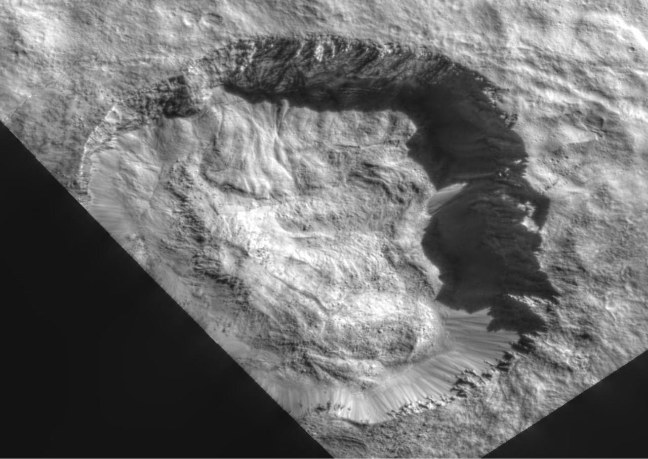
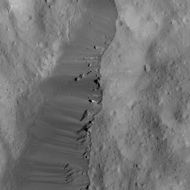
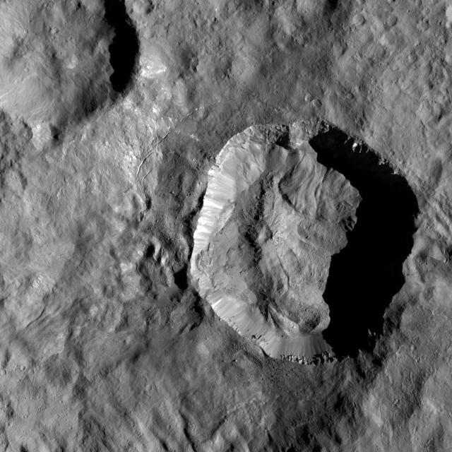
This simulated perspective view shows Occator Crater, measuring 57 miles (92 kilometers) across and 2.5 miles (4 kilometers) deep, which contains the brightest area on Ceres. This region has been the subject of intense interest since Dawn's approach to the dwarf planet in early 2015. This view, which faces north, was made using images from Dawn's low-altitude mapping orbit, 240 miles (385 kilometers) above Ceres. Dawn's close-up view reveals a dome in a smooth-walled pit in the bright center of the crater. Numerous linear features and fractures crisscross the top and flanks of this dome. Prominent fractures also surround the dome and run through smaller, bright regions found within the crater. The central dome area is called Cerealia Facula and the dimmer bright areas are called Vinalia Faculae. https://photojournal.jpl.nasa.gov/catalog/PIA21913

This collage shows some of the most interesting geological sites that NASA's Dawn spacecraft has revealed at dwarf planet Ceres. Images were acquired with the spacecraft's framing camera during various phases of the mission: Survey orbit at a distance of about 2,700 miles (4,400 kilometers); high-altitude mapping orbit (HAMO) at a distance of 915 miles (1,470 kilometers) from Ceres; and low-altitude mapping orbit (LAMO) at an altitude of 240 miles (385 kilometers). In the first row, from left to right: Ceres in shown in false color, roughly centered on Occator Crater, home of the brightest area on Ceres. This picture combines color images obtained by Dawn in its survey orbit. Red corresponds to a wavelength range around 980 nanometers (near infrared), green to a wavelength range around 750 nanometers (red, visible light) and blue to a wavelength range of around 430 nanometers (blue, visible light). This picture illustrates the diversity of terrains on Ceres where the bluish material points to recently emplaced material and the brownish background material is associated with older terrains. Juling Crater (12 miles, 20 kilometers in diameter) as seen in LAMO. Central coordinates are 36 degrees south latitude, 168 degrees east longitude. It is named after the Sakai/Orang Asli (Malaysia) spirit of the crops. This crater displays evidence for the presence of ice -- for example, in the form of a large flow feature seen at the top of the image. Oxo Crater (6 miles, 10 kilometers in diameter) as seen in LAMO. Center coordinates are 42 degrees north latitude, 0 degrees east longitude. It is named after the god of agriculture in Afro-Brazilian beliefs of Yoruba derivation. Oxo hosts the first site at which Dawn detected ice on Ceres, exposed by a landslide. Ahuna Mons is not only a volcano, but also the tallest mountain on Ceres. It is about 2.5 miles (4 kilometers) high and 11 miles (17 kilometers) wide. Center coordinates are 10 degrees south latitude, 316 degrees east longitude. This view combines images obtained in LAMO in blue (430 nanometers), green (750 nanometers) and infrared (980 nanometers) color filters. Ahuna is named after the Sumi tribe (Nagaland, northeastern India) traditional post-harvest thanksgiving festival. Second Row Occator Crater (57 miles, 92 kilometers across) is seen in LAMO images. Center coordinates are 20 degrees north latitude, 239 degrees east longitude. Named after the Roman agricultural deity of the harrowing. This image shows a "Type I" flow feature with a thick "toe" typical of rock glaciers and icy landslides on Earth as viewed in LAMO. The flow feature, found in Ghanan Crater (77 degrees north latitude, 31 degrees east longitude), is one of the most voluminous on Ceres. Enhanced color view of Haulani Crater (21 miles, 34 kilometers in diameter) in color observed in HAMO. Central coordinates: 6 degrees north latitude, 11 degrees east longitude. Named after the Hawaiian plant goddess. Kokopelli Crater (21 miles, 34 kilometers in diameter) seen in LAMO. Central coordinates: 18 degrees north latitude, 125 degrees east longitude. Named after the Pueblo (SW USA) fertility deity, who presides over agriculture. This crater displays a nice arrangement of scarps that likely formed when the crater partly collapsed during its formation. Third Row Central region of Occator Crater, called Cerealia Facula, seen in color. The facula -- or "bright spot" -- is about 9 miles (14 kilometers) in diameter. Center coordinates: 20 N, 240 E. Cerealia refers to the major festival in Ancient Rome that celebrates the grain goddess Ceres (8 days in mid- to late April). The view was produced by combining the highest resolution images of Occator obtained in LAMO (at image scales of 35 meters, or 115 feet, per pixel) with color images obtained in HAMO (at image scales of 135 meters, or about 440 feet, per pixel). The three images used to produce the color were taken using filters centered at 430, 750 and 980 nanometers (the last being slightly beyond the range of human vision, in the near-infrared). North part of Nar Sulcus seen in LAMO. The full feature is about 39 miles (63 km) in length and is located around 42 degrees south latitude, 280 degrees east longitude. Nar is a Azerbaijani festival of pomegranate harvest held in October-November in Goychay city, center of pomegranate cultivation in Azerbaijan. A sulcus is a set of parallel furrows or ridges. Ikapati Crater (31 miles, 50 kilometers in diameter) seen in LAMO. Central coordinates: 34 degrees north latitude, 46 degrees east longitude. Ikapati is named after the Philippine goddess of the cultivated lands. The crater has a smooth floor, probably because heat from the impact that formed Ikapati caused ice in the ground to melt, and then refreeze. This view of Ceres, taken in LAMO, shows an area located at approximately 86 degrees south longitude, 177 degrees east longitude. This part of Ceres, near the south pole, has such long shadows because, from the perspective of this location, the sun is near the horizon. At the time this image was taken, the sun was 4 degrees north of the equator. If you were standing this close to Ceres' south pole, the sun would never get high in the sky during the course of a nine-hour Cerean day. https://photojournal.jpl.nasa.gov/catalog/PIA22090
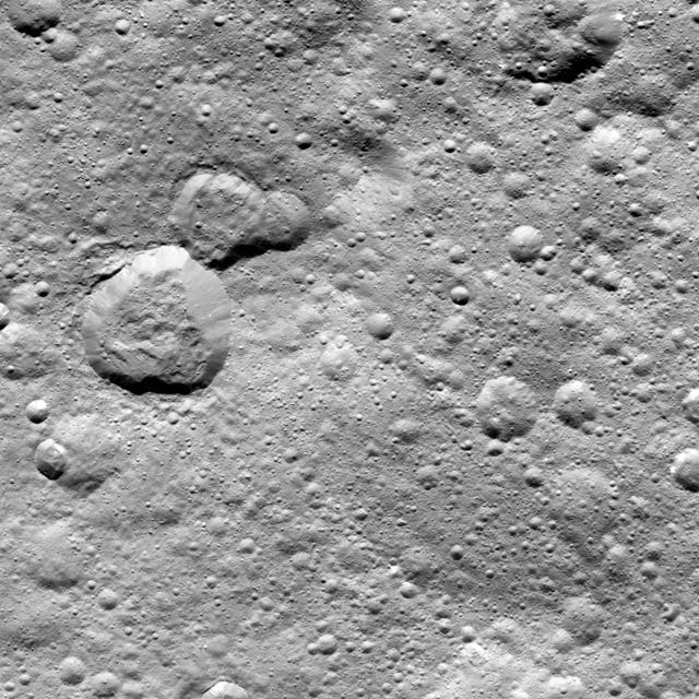
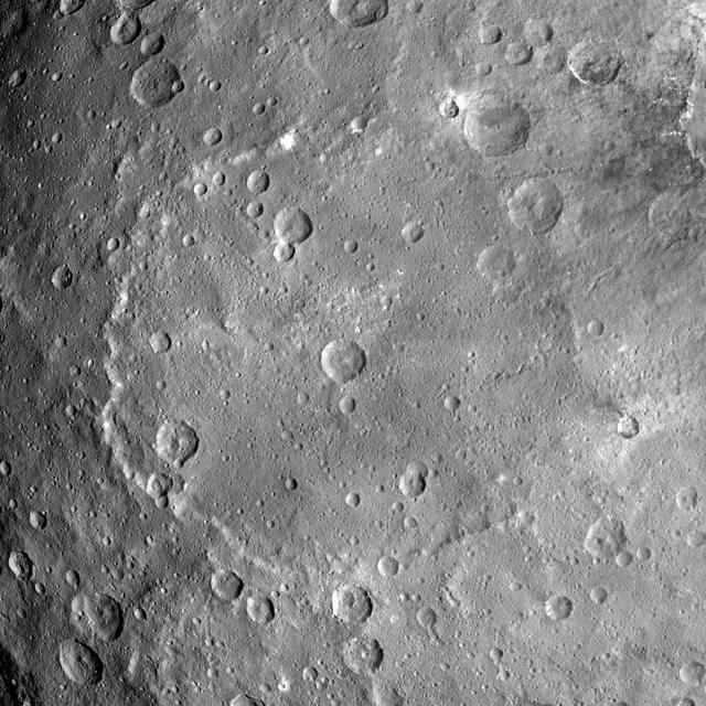
This image from NASA's Dawn spacecraft shows the large craters Urvara (top) and Yalode (bottom) on dwarf planet Ceres. These features are so big that they must be observed from high altitudes in order to fit in the frame of a single image. Urvara is (101 miles (163 kilometers) in diameter, while Yalode is 162 miles (260 kilometers) in diameter. The two giant craters were formed at different times. Yalode is almost 1 billion years older than Urvara, which is about 120 million to 140 million years old. Yalode's relatively smooth floor indicates Ceres' crust material became close to -- or even reached -- the melting temperature of ice as a consequence of the heat generated by the impact. On the other hand, the smaller Urvara has rougher terrain. This suggests Urvara had either a lower temperature increase from the impact, or a colder crust temperature at the time of the crater's formation, or a combination of the two. Indeed, Ceres' interior was warmer in the past, and has been slowly cooling as its supply of radioactive isotopes, whose decay represents Ceres' main heat source, has been decreasing over time. This picture also reveals geological details such, as the feature Nar Sulcus inside Yalode and a central peak in Urvara. Urvara is named after the Indian and Iranian deity of plants and fields. Yalode is named for the Dahomey goddess, worshipped by women at the harvest rites. This image was obtained by NASA's Dawn spacecraft on June 9, 2015. The spacecraft was then in its survey orbit (2,700 miles, 4,400 kilometers above the surface), when the footprint of Dawn's framing camera on Ceres' surface was about 260 miles (420 kilometers) across on Ceres' surface. The resolution is 1,400 feet (410 meters) per pixel. The central coordinates of the picture are 43 degrees south latitude, 278 degrees east in longitude. https://photojournal.jpl.nasa.gov/catalog/PIA21917
This frame from an animation of the dwarf planet Ceres was made by combining images taken by the Dawn spacecraft on January 25, 2015. These images of Ceres, and they represent the highest-resolution views to date of the dwarf planet. http://photojournal.jpl.nasa.gov/catalog/PIA19171

This artist concept illustrates a young, red dwarf star surrounded by three planets. NASA Galaxy Evolution Explorer is helping to identify young, red dwarf stars that are close to us by detecting their ultraviolet light.
This artist animation shows a brown dwarf surrounded by a swirling disc of planet-building dust. NASA Spitzer Space Telescope spotted such a disc around a surprisingly low-mass brown dwarf, or failed star.
This image depicts the dwarf planet Ceres, as seen from the Dawn spacecraft. It was taken 147,000 miles 237,000 kilometers from Ceres on January 25, 2015, is part of a series of views representing the best look so far at the dwarf planet. http://photojournal.jpl.nasa.gov/catalog/PIA19173
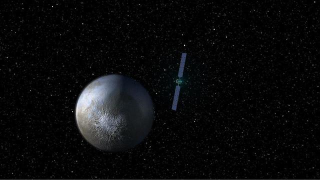
This image shows NASA Dawn spacecraft leaving the giant asteroid Vesta and arriving at the dwarf planet Ceres.

An artist concept of the dwarf planet Eris and its moon Dysnomia. The sun is the small star in the distance.
These views of Ceres, taken by NASA Dawn spacecraft on December 10, show an area in the southern part of the southern hemisphere of the dwarf planet.
This view of Ceres, taken by NASA Dawn spacecraft on December 10, 2015, shows an area in the southern mid-latitudes of the dwarf planet.
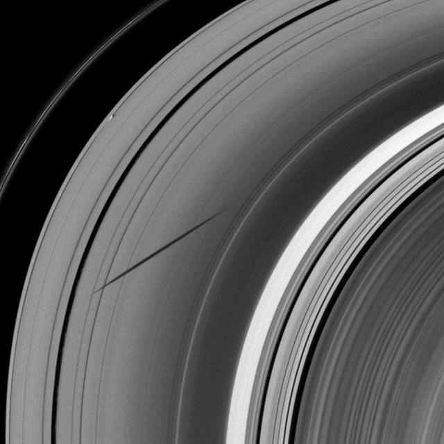
The shadow of the moon Janus dwarfs the shadow of Daphnis on Saturn A ring in this image taken as the planet approached its August 2009 equinox.
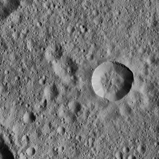
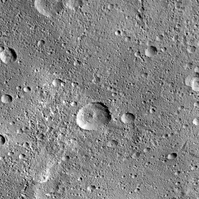
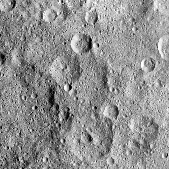
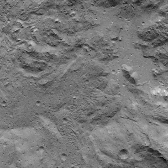
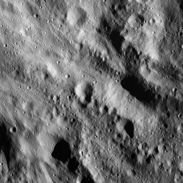
This view from NASA Dawn spacecraft shows a fresh crater among older terrain on Ceres, typical of the terrain of the dwarf planet.
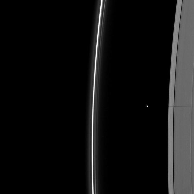
The shadow of the moon Janus dwarfs the shadow of Daphnis on Saturn A ring in this image taken as the planet approached its August 2009 equinox.

Brown dwarfs are more massive than planets but not quite as massive as stars. Generally speaking, they have between 13 and 80 times the mass of Jupiter. A brown dwarf becomes a star if its core pressure gets high enough to start nuclear fusion. https://photojournal.jpl.nasa.gov/catalog/PIA23685
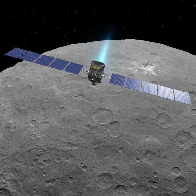
This artist concept shows NASA Dawn spacecraft above dwarf planet Ceres, as seen in images from the mission. http://photojournal.jpl.nasa.gov/catalog/PIA19598
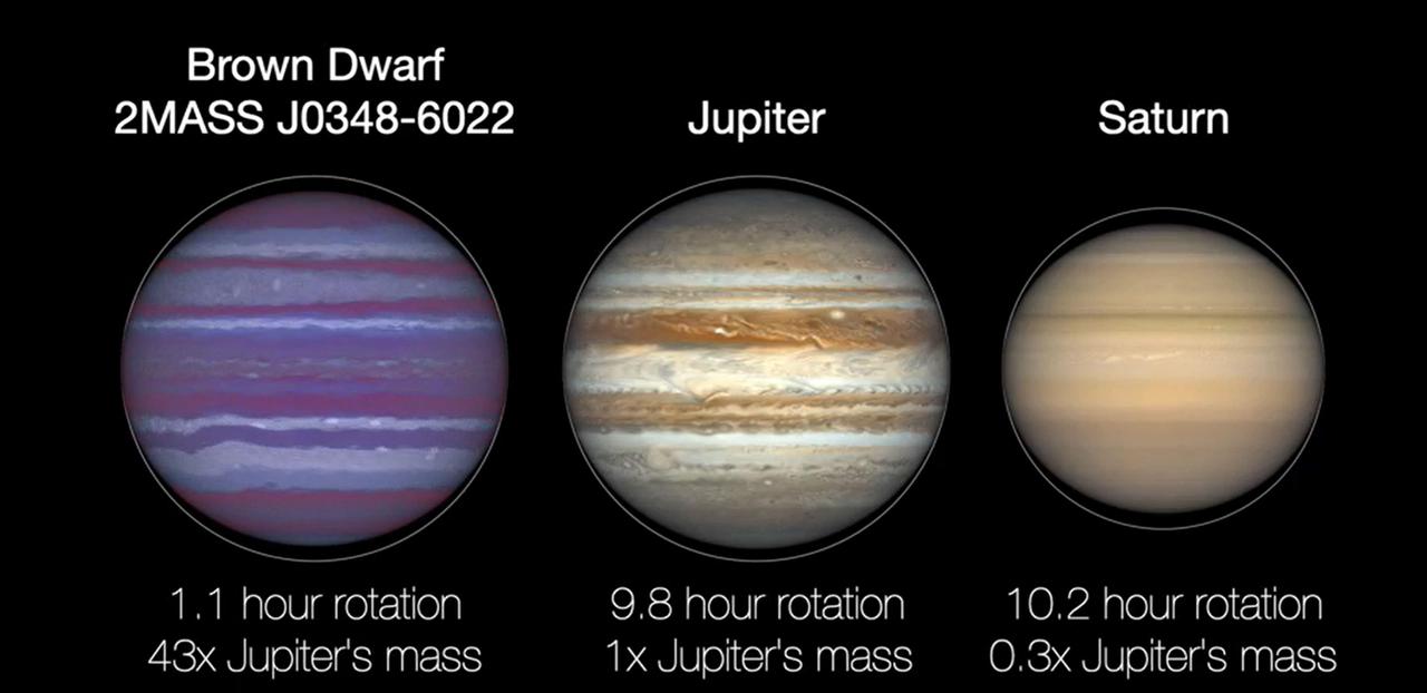
All spinning objects, from carousels to planets, generate centripetal force. If a planet rotates too fast, that force can pull it apart. Before that happens, the planet will experience "flattening," or bulging around its midsection, as seen in this animated illustration of a brown dwarf, Jupiter, and Saturn. Animation available at https://photojournal.jpl.nasa.gov/catalog/PIA24376

This illustration shows the unusual orbit of planet Kepler-413b around a close pair of orange and red dwarf stars. The planet 66-day orbit is tilted 2.5 degrees with respect to the plane of the binary stars orbit.
This illustration shows the unusual orbit of planet Kepler-413b around a close pair of orange and red dwarf stars. The planet 66-day orbit is tilted 2.5 degrees with respect to the plane of the binary stars orbit.
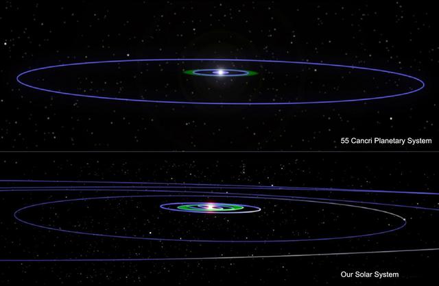
This artist concept illustrates two planetary systems -- 55 Cancri top and our own. Blue lines show the orbits of planets, including the dwarf planet Pluto in our solar system.

All seven planets discovered in orbit around the red dwarf star TRAPPIST-1 could easily fit inside the orbit of Mercury, the innermost planet of our solar system. In fact, they would have room to spare. TRAPPIST-1 also is only a fraction of the size of our Sun; it isn't much larger than Jupiter. So, the TRAPPIST-1 system's proportions look more like Jupiter and its moons than those of our solar system. The seven planets of TRAPPIST-1 are all Earth-sized and terrestrial. TRAPPIST-1 is an ultra-cool dwarf star in the constellation Aquarius, and its planets orbit very close to it. https://photojournal.jpl.nasa.gov/catalog/PIA22096

This image from NASA's Dawn spacecraft shows Dantu Crater, which is 78 miles (126 kilometers) across. Its shape is reminiscent of Occator Crater -- in particular, they both have shallow floors and central pits. This suggests melting and possibly some hydrothermal activity occurred following impact that formed Dantu. Part of the energy generated by the impact would have been turned into heat. The relatively warm temperatures found at the low latitudes of Dantu and Occator make it easier for Ceres' ice-rich material to melt as a consequence of impact-generated heat. The unnamed crater seen below Dantu in this image is smaller and has a much rougher floor. This is because the smaller impact event would not have generated as much heat. The numerous bright spots found across the crater suggest bright material may be just below the surface, exposed through small impacts and landslides. Ejected material from Dantu extends up to Kerwan crater, with a dark color reminiscent of material that came from Occator. Dantu was named for the Ghanaian god associated with the planting of the corn. This picture was taken by the Dawn framing camera on September 25, 2015, from 915 miles (1,470 kilometers) altitude. The center coordinates of this picture are 22 degrees north latitude, 133 degrees east longitude. https://photojournal.jpl.nasa.gov/catalog/PIA21412
Haulani Crater (21 miles, 34 kilometers in diameter) is one of the youngest craters on Ceres, as evidenced by its sharp rims and bright, bluish material in enhanced color composite images from the framing camera on NASA's Dawn spacecraft. Haulani is also a good example of a polygonal crater. This high-resolution topography map of the crater's floor and northern rim displays a prime example of pitted terrains. Those features were likely formed through the rapid vaporization of subsurface water upon impact, and suggest that there is abundant water in Ceres' crust. Pitted terrains have also been found on Mars and Vesta. This topographic map was produced from the combination of images acquired under multiple illumination angles while the Dawn spacecraft was in its low-altitude mapping orbit, at a distance of about 240 miles (385 kilometers) above the surface. The colors represent elevations ranging from 1.3 miles (2.1 kilometers) below the surface to 0.75 miles (1.2 kilometers) above the surface. The center coordinates of the crater are 5.8 degree north latitude and 10.77 east longitude. An unannotated version of this image is also available. Haulani is named after the Hawaiian plant goddess. https://photojournal.jpl.nasa.gov/catalog/PIA21748
This image of a boulder field near Ceres' Occator Crater's eastern rim was obtained by NASA's Dawn spacecraft on June 9, 2018 from an altitude of about 30 miles (48 kilometers). https://photojournal.jpl.nasa.gov/catalog/PIA22525
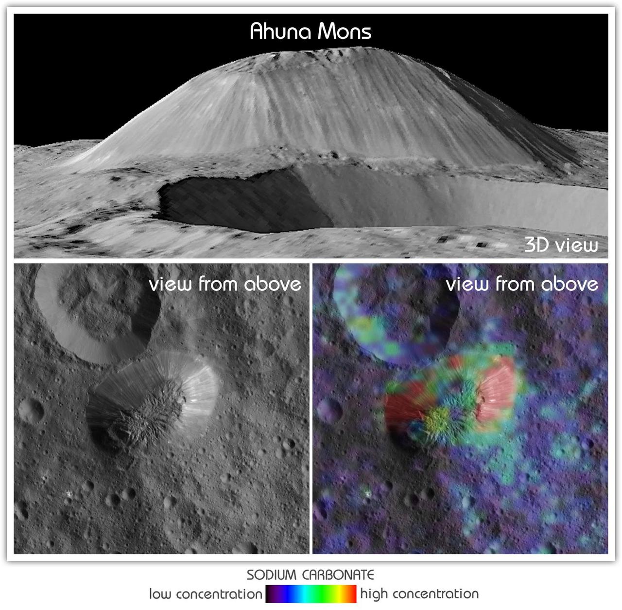
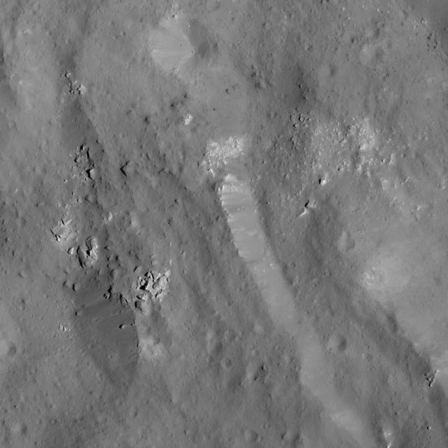
This view from NASA's Dawn mission shows Ceres' tallest mountain, Ahuna Mons, 2.5 miles (4 kilometers) high and 11 miles (17 kilometers) wide. This is one of the few sites on Ceres at which a significant amount of sodium carbonate has been found, shown in green and red colors in the lower right image. The top and lower left images were collected by Dawn's framing camera. The top image is a 3D view reconstructed with the help of topography data. A non-annotated version is available at https://photojournal.jpl.nasa.gov/catalog/PIA21919
This image of Urvara Crater was obtained by NASA's Dawn spacecraft on May 20, 2018 from an altitude of about 920 miles (1480 kilometers). The center of Urvara Crater is located at about 46 degrees south in latitude and 249 degrees east in longitude. https://photojournal.jpl.nasa.gov/catalog/PIA22472
This color mosaic of Dantu Crater was obtained by NASA's Dawn spacecraft on May 23, 2018 from an altitude of about 305 miles (490 kilometers). The center of Dantu Crater is located at about 24 degrees north in latitude and 138 degrees east in longitude. https://photojournal.jpl.nasa.gov/catalog/PIA22471
This image was obtained by NASA's Dawn spacecraft on July 6, 2018 from an altitude of about 36 miles (58 kilometers). The subspacecraft position from which this image was taken is about 20.7 degrees north latitude and 242.0 degrees east longitude. https://photojournal.jpl.nasa.gov/catalog/PIA22626
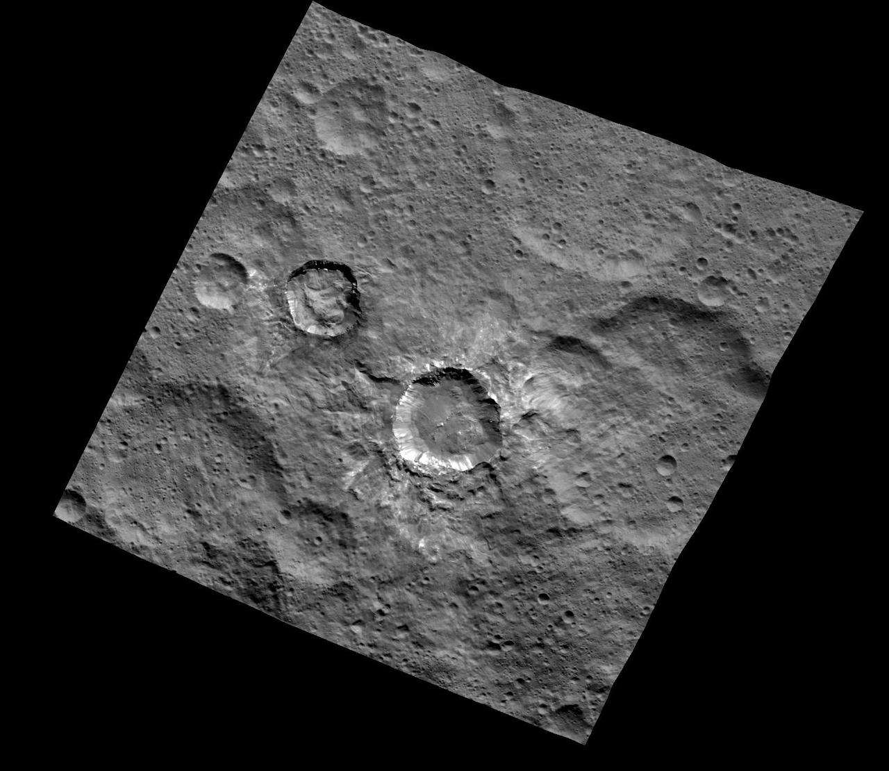
This image from NASA's Dawn spacecraft shows a group of craters, left of center, that resembles a rubber duck. Halki Crater, the "head," is 12 miles (20 kilometers) in diameter, while Telepinu Crater, the "body," is 19 miles (31 kilometers) across. They can be found in the global map of Ceres' names. The "beak" crater is unnamed. Halki and Telepinu have both been recently added to the list of official names for Ceres' geological features. They are both named after Hittite (Asia Minor) deities: the goddess of grain and the god of fertility and vegetation, respectively. Dawn acquired this picture on August 20, 2015, from its high-altitude mapping orbit at about 915 miles (1,470 kilometers) above the surface. The center coordinates of this image are 26 degrees north latitude, 339 degrees east longitude. https://photojournal.jpl.nasa.gov/catalog/PIA21909
This image was obtained by NASA's Dawn spacecraft on July 5, 2018 from an altitude of about 33 miles (54 kilometers). The center of this picture is located at about 20.3 degrees north latitude and 240.6 degrees east longitude. https://photojournal.jpl.nasa.gov/catalog/PIA22630
This image of the eastern rim of Occator Crater was obtained by NASA's Dawn spacecraft on June 10, 2018 from an altitude of about 22 miles (36 kilometers). https://photojournal.jpl.nasa.gov/catalog/PIA22529
This view from NASA's Dawn mission shows the floor of Ceres' Juling Crater. The crater floor shows evidence of the flow of ice and rock, similar to rock glaciers in Earth's polar regions. Dawn acquired the picture with its framing camera on Aug. 30, 2016. https://photojournal.jpl.nasa.gov/catalog/PIA21920
This image taken by NASA's Dawn spacecraft shows a region located next to the northwestern rim of Urvara Crater on Ceres. This terrain displays a rugged texture also found within Urvara. Multiple Dawn observations, in particular neutron spectroscopy (which measures the hydrogen content in the regolith) and flow features, have shown that water ice is present near the surface above 40 degrees north latitude, where these features are found. Therefore, the rugged texture may result from the high strength exhibited by ice at the temperatures found at mid- and high latitudes on Ceres. The prominent crater (5.0 miles, 8.8 kilometers in diameter) at right in this picture is called Tawals. Its sharp rim suggests it was created by a relatively recent impact into a relatively strong material. A different view of this crater can be found in PIA20941. Tawals Crater is named after the Polish god of the fields and the tilling. Dawn took this image during its extended mission on August 25, 2016, from its low-altitude mapping orbit, or LAMO, at a distance of about 240 miles (385 kilometers) above the surface. The center coordinates of this image are 40 degrees south latitude, 237 degrees east longitude. https://photojournal.jpl.nasa.gov/catalog/PIA21750
This image of the region between Urvara Crater's eastern rim and Yalode Crater's western rim was obtained by NASA's Dawn spacecraft on May 20, 2018 from an altitude of about 1070 miles (1720 kilometers). The center of this picture is located at about 54 degrees south in latitude and 272 degrees east in longitude. https://photojournal.jpl.nasa.gov/catalog/PIA22516
This image of a small boulder on Ceres was obtained by NASA's Dawn spacecraft on June 10, 2018 from an altitude of about 24 miles (38 kilometers). https://photojournal.jpl.nasa.gov/catalog/PIA22530
This image was obtained by NASA's Dawn spacecraft on July 5, 2018 from an altitude of about 32 miles (51 kilometers). The center of this picture is located at about 18.8 degrees north latitude and 240.7 degrees east longitude. https://photojournal.jpl.nasa.gov/catalog/PIA22632
This image of was obtained by NASA's Dawn spacecraft on May 30, 2018 from an altitude of about 420 miles (675 kilometers). Ejecta from Haulani Crater can be seen on the right side of the image. The center of this picture is located at about 2 degrees south in latitude and 6 degrees east in longitude. https://photojournal.jpl.nasa.gov/catalog/PIA22518
This image of landslides along Ceres' Occator Crater's eastern rim was obtained by NASA's Dawn spacecraft on June 9, 2018 from an altitude of about 27 miles (44 kilometers). https://photojournal.jpl.nasa.gov/catalog/PIA22526
This image of Xevioso Crater was obtained by NASA's Dawn spacecraft on May 16, 2018 from an altitude of about 470 miles (760 kilometers). The center of Xevioso Crater is located at about 0.7 degrees south in latitude and 310.6 degrees east in longitude. https://photojournal.jpl.nasa.gov/catalog/PIA22515
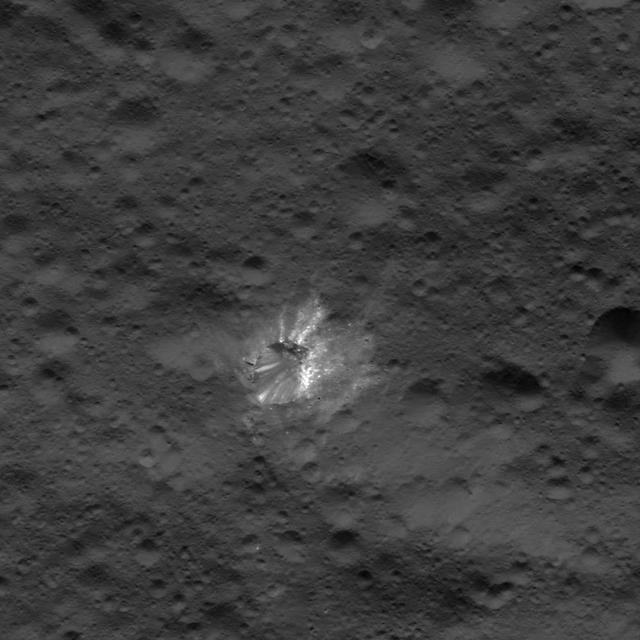
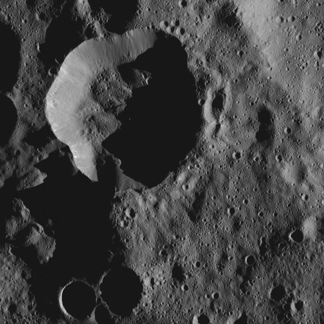
Xevioso Crater is the small (5.3 miles, 8.5 kilometers in diameter) crater associated with bright ejecta toward the top of this image, taken by NASA's Dawn spacecraft. It is one of the newly named craters on Ceres. Xevioso is located in the vicinity of Ahuna Mons, the tall, lonely mountain seen toward the bottom of the picture. Given that the small impact that formed Xevioso was able to excavate bright material, scientists suspect the material may be found at shallow depth. Its nature and relationship to other bright regions on Ceres is under analysis. The asymmetrical distribution of this bright ejecta indicates Xevioso formed via an oblique impact. Another view of Xevioso can be found here. Xevioso is named for the Fon god of thunder and fertility from the Kingdom of Dahomey, which was located in a region that is now the west African country of Benin. Dawn acquired this picture on October 15, 2015, from its high altitude mapping orbit at about 915 miles (1,470 kilometers) above the surface. The center coordinates of this image are 3.8 degrees south latitude, 314 degrees east longitude, and its resolution is 450 feet (140 meters) per pixel. https://photojournal.jpl.nasa.gov/catalog/PIA21907
This image of Ceres' Occator Crater's eastern rim was obtained by NASA's Dawn spacecraft on June 9, 2018 from an altitude of about 30 miles (48 kilometers). https://photojournal.jpl.nasa.gov/catalog/PIA22524
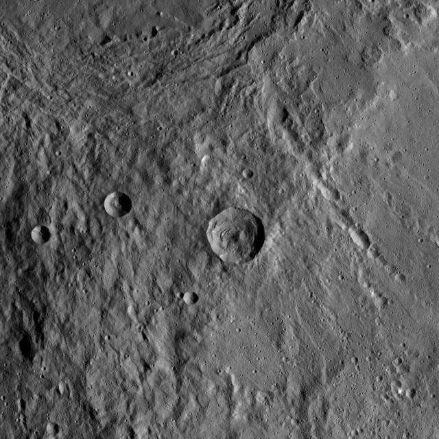
The 16-mile-wide (26-kilometer-wide) crater Insitor is located almost exactly in the center of Kerwan crater on Ceres. Scientists can compute the chances that a cosmic dart would hit exactly at the bullseye of the largest crater on Ceres by using models of impact frequency as a function of time, combined with the period of time since Kerwan's formation. By counting the number of craters within Kerwan and comparing that number to the distribution of craters on Earth's moon and other bodies, it is possible to derive an approximate time for Kerwan's formation of between 550 and 750 million years ago. The chance that a crater the size of Insitor would be formed at the center of Kerwan over that period is only one in one hundred. This image of Ceres was obtained by NASA's Dawn spacecraft on September 23, 2015, from an altitude of about 915 miles (1,470 kilometers). Insitor crater is located at 10.7 degrees south latitude, 124.9 degrees east longitude. The crater gets its name from the Roman agricultural deity in charge of the sowing of crops. https://photojournal.jpl.nasa.gov/catalog/PIA21614
This image was obtained by NASA's Dawn spacecraft on July 17, 2018 from an altitude of about 25 miles (41 kilometers). The center of this picture is located at about 31.0 degrees south latitude and 248.9 degrees east longitude. https://photojournal.jpl.nasa.gov/catalog/PIA22641
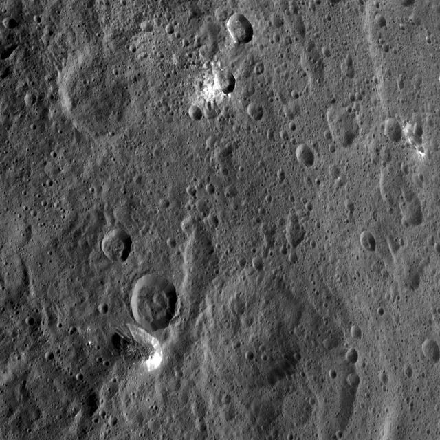
NASA's Dawn spacecraft took this image of Hakumyi Crater on Ceres, visible left of center. The crater is named after a Paraguayan, Brazilian and Bolivian spirit said to be helpful in gardening. Hakumyi, 18 miles (29 kilometers) in diameter, is located about 43 miles (70 kilometers) west of Ernutet Crater. Ernutet is where scientists found evidence of organic material, thanks to Dawn's visible and infrared mapping spectrometer. Evidence for organics was also found at the 4-mile (6.5 kilometer) wide fresh crater on the southern rim of Hakumyi and on the lobe-shaped flow of material that runs into Hakumyi. These two features look relatively young in comparison to the rest of Hakumyi Crater, whose rims and overall shape are subdued. The lobate flow is reminiscent of the Type I flows identified in multiple places at high latitudes on Ceres, and suggests a significant amount of ice near the surface. Dawn took this image on August 20, 2015, from 915 miles (1,470 kilometers) altitude. The center coordinates of this image are 48.9 degrees north latitude and 27.0 degrees east longitude. https://photojournal.jpl.nasa.gov/catalog/PIA21413
This image was obtained by NASA's Dawn spacecraft on July 5, 2018 from an altitude of about 34 miles (55 kilometers). The center of this picture is located at about 20.9 degrees north latitude and 240.5 degrees east longitude. https://photojournal.jpl.nasa.gov/catalog/PIA22629
This image of a small crater north of Ceres' Datan Crater was obtained by NASA's Dawn spacecraft on June 9, 2018 from an altitude of about 48 miles (77 kilometers). https://photojournal.jpl.nasa.gov/catalog/PIA22528
This image was obtained by NASA's Dawn spacecraft on May 30, 2018 from an altitude of about 465 miles (750 kilometers). The center of this picture is located at about 3 degrees south in latitude and 11 degrees east in longitude. https://photojournal.jpl.nasa.gov/catalog/PIA22517
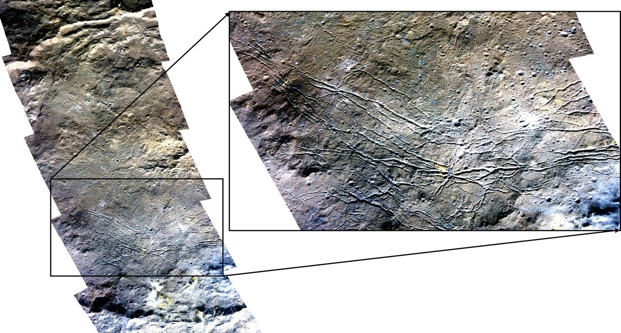
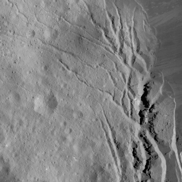
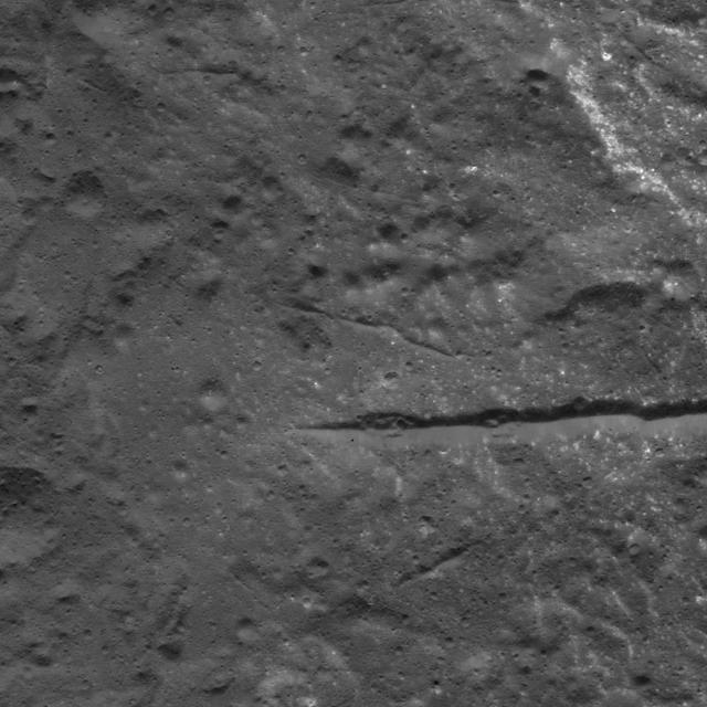
This image from NASA's Dawn spacecraft shows the northeastern rim of Urvara Crater on Ceres at lower left. To the right of the crater, the long, narrow feature that appears to jut out toward the north is called Pongal Catena, which is about 60 miles (96 km) long. Catenae are large grooves or troughs that can have various origins. They refer to chains of closely connected craters formed by a series of impacts, as found on Jupiter's moon Ganymede. They can also represent large faults created by internal forces, for example in this example found on Mars. The mechanism that formed Pongal Catena is not understood yet, but it likely formed as a consequence of the stresses generated by the large impacts that resulted in the formation of the Urvara and Yalode craters. Pongal catena is one of several types of fractures found in this region that reflect a complex history. A feature called Nar Sulcus is another example. Studying the geometry of these features and their relationships can help shed light on the nature of Ceres' subsurface. This image was obtained on September 28, 2015, from an altitude of about 915 miles (1,470 kilometers). Pongal Catena is centered at 37.4 degrees south latitude, 267.7 degrees east longitude. This feature gets its name from the Tamil (Sri Lanka and southern India) harvest festival observed in mid-January. It is a time for giving thanks to nature, and we thank Ceres for all the wonders it has offered us so far. https://photojournal.jpl.nasa.gov/catalog/PIA21408
This image was obtained by NASA's Dawn spacecraft on July 16, 2018 from an altitude of about 67 miles (107 kilometers). The center of this picture is located at about 22.3 degrees north latitude and 240.3 degrees east longitude. https://photojournal.jpl.nasa.gov/catalog/PIA22642
This image was obtained by NASA's Dawn spacecraft on July 5, 2018 from an altitude of about 75 miles (121 kilometers). The center of this picture is located at about 43.8 degrees south latitude and 247.6 degrees east longitude. https://photojournal.jpl.nasa.gov/catalog/PIA22636
This image was obtained by NASA's Dawn spacecraft on July 5, 2018 from an altitude of about 26 miles (43 kilometers). The center of this picture is located at about 15.1 degrees north latitude and 241.2 degrees east longitude. https://photojournal.jpl.nasa.gov/catalog/PIA22633
This image of Nar Sulcus in Yalode Crater was obtained by NASA's Dawn spacecraft on May 19, 2018 from an altitude of about 875 miles (1410 kilometers). Nar Sulcus is located at about 42 degrees south in latitude and 280 degrees east in longitude. https://photojournal.jpl.nasa.gov/catalog/PIA22469
This image of a battered crater rim on Ceres was obtained by NASA's Dawn spacecraft on June 10, 2018 from an altitude of about 25 miles (40 kilometers). https://photojournal.jpl.nasa.gov/catalog/PIA22531

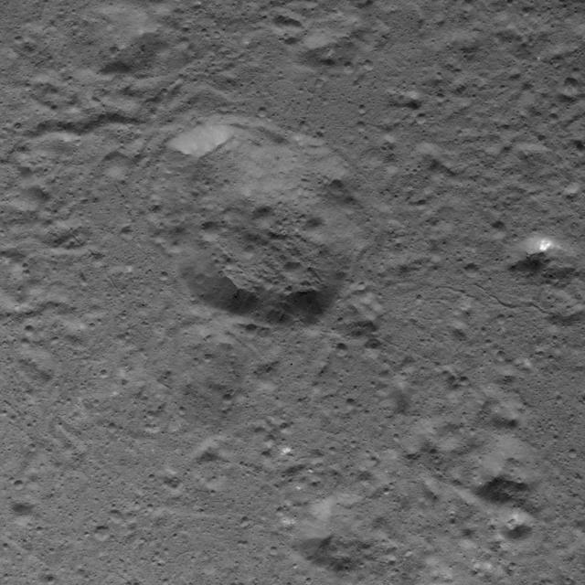
This image taken by NASA's Dawn spacecraft shows Emesh, a crater on Ceres. Emesh, named after the Sumerian god of vegetation and agriculture, is 12 miles (20 kilometers) wide. Located at the edge of the Vendimia Planitia, the floor of this crater is asymmetrical with terraces distributed along the eastern rim. Additionally, this image shows many subtle linear features that are likely the surface expressions of faults. These faults play a big role in shaping Ceres' craters, leading to non-circular craters such as Emesh. To the left of Emesh in this view, a much older crater of similar size has mostly been erased by impacts and their ejecta. Dawn took this image on May 11, 2016, from its low-altitude mapping orbit, at a distance of about 240 miles (385 kilometers) above the surface. The center coordinates of this image are 11 degrees north latitude, 158 degrees east longitude. https://photojournal.jpl.nasa.gov/catalog/PIA21911

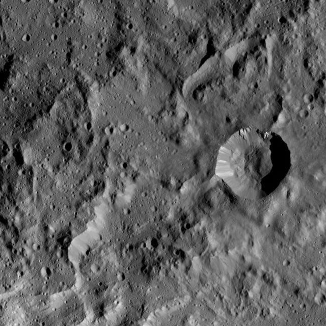
This image from NASA's Dawn spacecraft highlights Axomama Crater, the small crater shown to the right of center. It is 3 miles (5 kilometers) in diameter and located just inside the western rim of Dantu Crater. Axomama is one of the newly named craters on Ceres. Its sharp edges indicate recent emplacement by a small impact. This picture also shows details on the floor of Dantu, which comprises most of the image. The many fractures and the central pit (see also PIA20303) are reminiscent of Occator Crater and could point to a similar formation history, involving activity driven by the presence of liquid water in the subsurface. Axomama is named after the Incan goddess of potato, or "Potato-mother." NASA's Dawn spacecraft acquired this picture during its extended mission on July 24, 2016, from its low altitude mapping orbit at about 240 miles (385 kilometers) above the surface. The center coordinates of this image are 24 degrees north latitude, 131 degrees east longitude. https://photojournal.jpl.nasa.gov/catalog/PIA21908
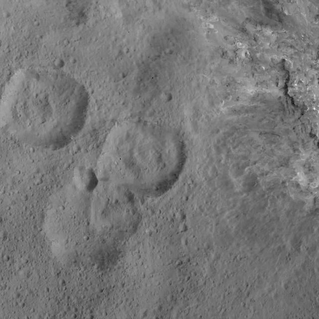
This region on Ceres, located in the vicinity of Toharu Crater, presents two small craters: Juling at top (12 miles, 20 kilometers in diameter) and Kupalo at bottom (16 miles, 26 kilometers in diameter). Both craters are relatively young, as indicated by their sharp rims. These features are located at about the same latitude (about 38 degrees south) as Tawals Crater and show similar crater shapes and rugged terrain. These features may reflect the presence of ice below the surface. Subtle bright features can be distinguished in places. These likely were excavated by small impacts and landslides along the slopes of the crater rims. This suggests that a different type of material, likely rich in salts, is present in the shallow subsurface. Juling is named after the Sakai/Orang Asli spirit of the crops from Malaysia, and Kupalo gets its name from the Russian god of vegetation and of the harvest. NASA's Dawn spacecraft acquired this picture on August 24, 2016. The image was taken during Dawn's extended mission, from its low altitude mapping orbit at about 240 miles (385 kilometers) above the surface. The center coordinates of this image are 38 degrees south latitude, 165 degrees east longitude. https://photojournal.jpl.nasa.gov/catalog/PIA21753
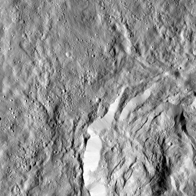
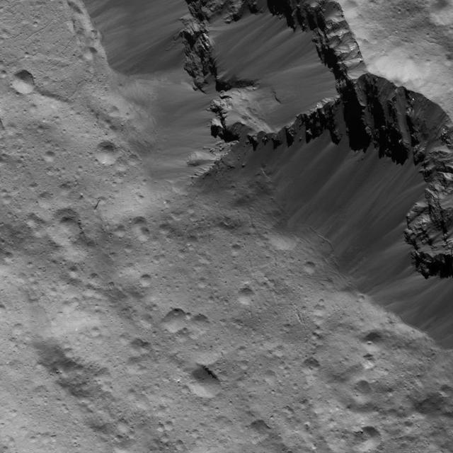
This image from NASA's Dawn spacecraft showing the northern part of Hanami Planum on Ceres honors the Japanese cherry blossom festival, or "Hanami," which is a long-standing Japanese tradition of welcoming spring. Hanami Planum is the third largest geological feature on Ceres, after Vendimia Planitia and the Samhain Catenae. It extends over 345 miles (555 kilometers). This image shows familiar features, such as Occator Crater, characterized both by bright material inside the crater and dark ejecta material outside. Several parallel linear features, called Junina Catenae, can be seen departing from Occator and extending toward the top of the image. These catenae are chains of small craters formed by the impact and scouring of material ejected when large craters are formed. Scientists were able to relate these crater chains to Urvara and Yalode. Even though these are located in the southern hemisphere, some of their ejecta could reach the northern hemisphere, thanks to Ceres' fast rotation and small size. This image was obtained by Dawn on June 15, 2015. The spacecraft was then in its survey orbit (2,700 miles, or 4,400 kilometers high), when the footprint of Dawns framing camera on Ceres surface was about 260 miles (420 kilometers). The resolution is 1,400 feet (410 meters) per pixel. The central coordinates of the picture are 14 degrees north latitude, 213 degrees east in longitude. https://photojournal.jpl.nasa.gov/catalog/PIA21921
This image from NASA's Dawn spacecraft shows the largest crater on Ceres, called Kerwan. The crater has an appearance scientists refer to as "relaxed," meaning its sharp features have softened since Kerwan formed. Its overall shape looks something like a pancake, especially when viewed near Ceres' limb. The origin of its polygonal shape is not yet well understood; it might be due to large faults in the subsurface generated by other large impacts, as has been suggested for other craters. The smaller crater named Insitor sits in the center of Kerwan. The dark material seen at top right is ejecta from Dantu crater. At 174 miles (280 kilometers) wide, Kerwan is so large that it would have taken about 50 images at Dawn's low-altitude mapping orbit (called LAMO, at 240 miles or 385 kilometers altitude) to cover the crater from one side to the other. Kerwan was also too wide to fit within the camera's field of view at Dawn's high-altitude mapping orbit (called HAMO, at 915 miles, 1,470 kilometers). It fit nicely into this frame from Dawn's Survey phase (an altitude of 2,700 miles or 4,400 kilometers), taken shortly after the spacecraft entered orbit in 2015. Kerwan takes its name from the Hopi spirit of sprouting maize. This picture was obtained on June 12, 2015. Its center coordinates are 10.8 degrees south latitude, 123.9 degrees east longitude. https://photojournal.jpl.nasa.gov/catalog/PIA21411
This close-up image of the Vinalia Faculae in Occator Crater was obtained by NASA's Dawn spacecraft on June 14, 2018 from an altitude of about 24 miles (39 kilometers). This image reveals the intricate pattern between bright and dark material across this flow feature. The complex structure of the dark background is reminiscent of lava flows observed on Earth. However, in the case of Ceres, the flow material likely involved a lot of ice. The bright material is mostly composed of sodium carbonate, a salt whose exposure onto the crater floor involved a liquid source. The center of this picture is located at about 21.0 degrees north latitude and 241.3 degrees east longitude. https://photojournal.jpl.nasa.gov/catalog/PIA22478
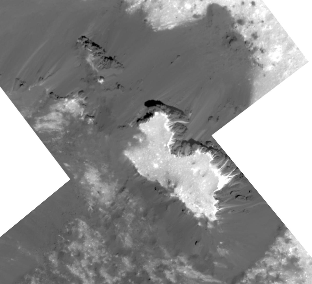
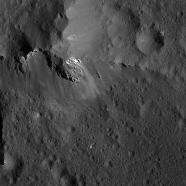
This mosaic of a prominent mound located on the western side of Cerealia Facula was obtained by NASA's Dawn spacecraft on June 22, 2018 from an altitude of about 21 miles (34 kilometers). The geometry of this feature is similar to a mesa or large butte with a flat top. It has been puzzling scientists since its discovery in the early images of the Dawn mission at Ceres. These new images reveal many details. In particular, the relationships between the bright material, mostly composed of sodium carbonate, and the dark background might hold clues about the origin of the facula. This feature is located at about 19.5 degrees north latitude and 239.2 degrees east longitude. https://photojournal.jpl.nasa.gov/catalog/PIA22477
This image was obtained by NASA's Dawn spacecraft on July 3, 2018 from an altitude of about 26 miles (42 kilometers). The center of this picture is located at about 16.5 degrees north latitude and 241.2 degrees east longitude. https://photojournal.jpl.nasa.gov/catalog/PIA22640
his image was obtained by NASA's Dawn spacecraft on July 1, 2018 from an altitude of about 29 miles (46 kilometers). The center of this picture is located at about 20.8 degrees north latitude and 241.2 degrees east longitude. https://photojournal.jpl.nasa.gov/catalog/PIA22644
This image of Occator Crater's southeastern wall and floor was obtained by NASA's Dawn spacecraft on June 17, 2018 from an altitude of about 22 miles (36 kilometers). The center of this picture is located at about 17.4 degrees north latitude and 243.8 degrees east longitude. https://photojournal.jpl.nasa.gov/catalog/PIA22551
This image was obtained by NASA's Dawn spacecraft on July 1, 2018 from an altitude of about 179 miles (288 kilometers). The center of this picture is located at about 67.3 degrees south latitude and 249.1 degrees east longitude. https://photojournal.jpl.nasa.gov/catalog/PIA22635
Yalode crater is so large -- at 162 miles, 260 kilometers in diameter -- that a variety of vantage points is necessary to understand its geological context. This view of the northern portion of Yalode is one of many images NASA's Dawn spacecraft has taken of this crater. The large impact that formed the crater likely involved a lot of heat, which explains the relatively smooth crater floor punctuated by smaller craters. A couple of larger craters in Yalode have polygonal shapes. This type of crater shape is frequently found on Ceres and may be indicative of extensive underground fractures. The larger crater to the right of center in this image is called Lono (12 miles, 20 kilometers in diameter) and the one below it is called Besua (11 miles, 17 kilometers). Some of the small craters are accompanied by ejecta blankets that are more reflective than their surroundings. The strange Nar Sulcus fractures can be seen in the bottom left corner of the picture. Linear features seen throughout the image may have formed when material collapsed above empty spaces underground. These linear features include linear chains of craters called catenae. Dawn took this image on September 27, 2015, from 915 miles (1,470 kilometers) altitude. The center coordinates of this image are 32 degrees south latitude and 300 degrees east longitude. Yalode gets its name from a goddess worshipped by women at the harvest rites in the Dahomey culture of western Africa. Besua takes its name from the Egyptian grain god, and Lono from the Hawaiian god of agriculture. https://photojournal.jpl.nasa.gov/catalog/PIA21410
This high-resolution image of Juling Crater on Ceres reveals, in exquisite detail, features on the rims and crater floor. The crater is about 1.6 miles (2.5 kilometers) deep and the small mountain, seen left of the center of the crater, is about 0.6 miles (1 kilometers) high. The many features indicative of the flow of material suggest the subsurface is rich in ice. The geological structure of this region also generally suggests that ice is involved. The origin of the small depression seen at the top of the mountain is not fully understood but might have formed as a consequence of a landslide, visible on the northeastern flank. Dawn took this image during its extended mission on August 25, 2016, from its low-altitude mapping orbit at a distance of about 240 miles (385 kilometers) above the surface. The center coordinates of this image are 36 degrees south latitude, 167 degrees east longitude. Juling is named after the Sakai/Orang Asli spirit of the crops from Malaysia. NASA's Dawn spacecraft acquired this picture on August 24, 2016. The image was taken during Dawn's extended mission, from its low altitude mapping orbit at about 240 miles (385 kilometers) above the surface. The center coordinates of this image are 38 degrees south latitude, 165 degrees east longitude. https://photojournal.jpl.nasa.gov/catalog/PIA21754
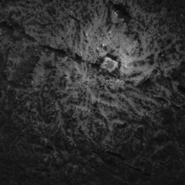
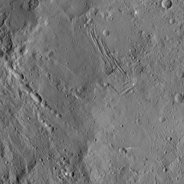
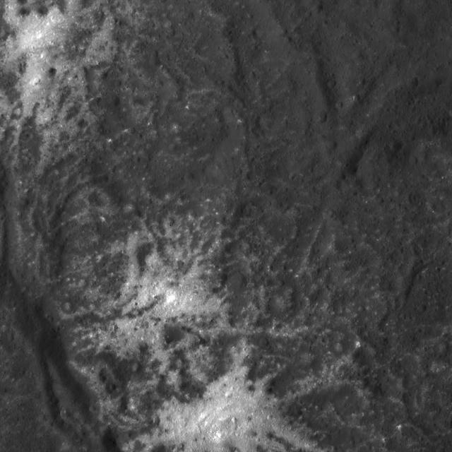
This view obtained by NASA's Dawn spacecraft during its Survey orbit illustrates the diversity and complexity of Ceres' geology. It shows familiar features: Occator Crater with its bright deposits (called faculae) of carbonates and other salts, a series of linear features (at right) called Samhain Catenae, and another large crater on the right side of the image called Kirnis. A relatively fresh crater called Lociyo, superimposed on an older crater, can be seen toward the bottom left of the picture. Studying the morphologies and relationships between various types of geological features can help scientists reconstruct Ceres' history. Occator appears to be one of the youngest features in this picture, except for a couple of smaller craters. The 71-mile-wide (115-kilometer-wide) Kirnis Crater on the other hand is an old, eroded crater. It owes its peculiar polygonal shape in part to its overlap with one of the Samhain Catenae. This illustrates the role of fractures in driving the geometry of some of Ceres' craters. The origin of these particular catenae is not understood yet, and is not necessarily related to the Pongal Catena. Kirnis Crater is named after a Lithuanian spirit-guardian of cherry trees, whereas the Samhain Catenae refer to a Gaelic festival organized at the end of the harvest season. It was observed in Ireland and Scotland during seven days in October and November, nearly halfway between the autumn equinox and the winter solstice. This picture was obtained on June 25, 2015, from an altitude of 2,700 miles (4,400 kilometers). It is centered at 1.7 degrees north latitude, and 249 degrees east longitude. https://photojournal.jpl.nasa.gov/catalog/PIA21409
This image was obtained by NASA's Dawn spacecraft on July 5, 2018 from an altitude of about 32 miles (52 kilometers). The center of this picture is located at about 19.3 degrees north latitude and 240.7 degrees east longitude. https://photojournal.jpl.nasa.gov/catalog/PIA22631
This image was obtained by NASA's Dawn spacecraft on July 3, 2018 from an altitude of about 22 miles (35 kilometers). The center of this picture is located at about 14.4 degrees north latitude and 241.4 degrees east longitude. https://photojournal.jpl.nasa.gov/catalog/PIA22634
This image of Juling and Kupalo Craters was obtained by NASA's Dawn spacecraft on May 25, 2018 from an altitude of about 855 miles (1380 kilometers). The center coordinates of this image are about 38 degrees south in latitude and 173 degrees east in longitude. https://photojournal.jpl.nasa.gov/catalog/PIA22470
This enhanced color image of Ceres' surface was made from data obtained on April 29, 2017, when NASA's Dawn spacecraft was exactly between the sun and Ceres. Dawn's framing cameras took images of Ceres with a clear filter as well as five different color filters. Images combining these different color filter perspectives reveal fine details of Ceres' surface. For example, they emphasize the distinct compositions and textures of the material ejected from craters. The brightest region on Ceres, called Cerealia Facula, is highlighted in Occator Crater in the center of this image. Vinalia Faculae, the set of secondary bright spots in the same crater, are located to the right of Cerealia Facula. One of the darkest regions on Ceres is next to Occator, and represents ejected material from the impact that formed the crater. The ejected material forms a large arc that extends over several hundred kilometers, below the center of Ceres in this image. That material's distribution is partly determined by Ceres' rotation. Other craters also show a mixture of bright and dark regions. While the bright areas are generally identified as salt-rich material excavated from Ceres' crust, the origin of the dark material remains to be explained. It may have been excavated from a different layer within Ceres' subsurface than the rest of the ejecta blanket. Scientists will continue analyzing the color data to look for clues about the nature of the different materials on Ceres. The blueish color is generally found in association with young craters. Scientists believe the color relates to processes that occur when an impact ejects and redistributes material on the surface. The continuous bombardment of Ceres' surface by micrometeorites alters the texture of the exposed material, leading to its reddening. This image was taken altitude of about 12,000 miles (20,000 kilometers). https://photojournal.jpl.nasa.gov/catalog/PIA21406
This image, obtained by NASA's Dawn spacecraft on June 9, 2018, shows subtle features on Ceres from an altitude of about 33 miles (53 kilometers). https://photojournal.jpl.nasa.gov/catalog/PIA22523
This image was obtained by NASA's Dawn spacecraft on July 4, 2018 from an altitude of about 30 miles (48 kilometers). The center of this picture is located at about 18.5 degrees north latitude and 240.5 degrees east longitude. https://photojournal.jpl.nasa.gov/catalog/PIA22637
This image was obtained by NASA's Dawn spacecraft on July 16, 2018 from an altitude of about 47 miles (76 kilometers). The center of this picture is located at about 14.7 degrees north latitude and 241.5 degrees east longitude. https://photojournal.jpl.nasa.gov/catalog/PIA22643
This image was obtained by NASA's Dawn spacecraft on July 6, 2018 from an altitude of about 72 miles (116 kilometers). The center of this picture is located at about 44.1 degrees south latitude and 249.1 degrees east longitude. https://photojournal.jpl.nasa.gov/catalog/PIA22628
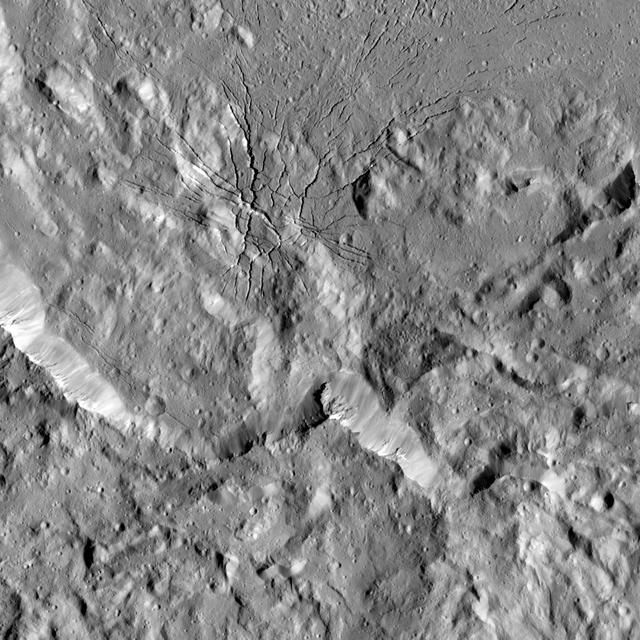
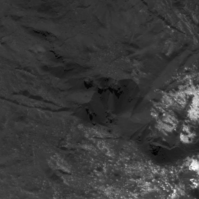
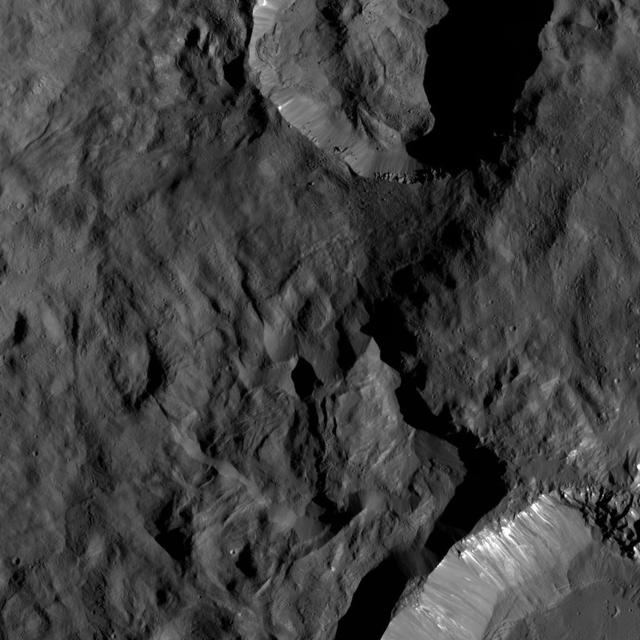
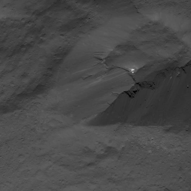
This image shows a complex set of fractures found in the southwestern region of the floor of Occator Crater on Ceres. In this picture, north is at the top. The two intersecting fracture systems (roughly northwest-southeast and southwest-northeast) are part of a larger fault network that extends across Occator's floor. These fractures have been interpreted as evidence that material came up from below and formed a dome shape, as if a piston was pushing Occator's floor from beneath the surface. This may be due to the upwelling of material coming from Ceres' deep interior. An alternative hypothesis is that the deformation is due to volume changes inside a reservoir of icy magma in the shallow subsurface that is in the process of freezing, similar to the change in volume that a bottle of water experiences when put in a freezer. Another set of fractures can be seen parallel to the southwestern wall and is not connected to the Occator fracture network. Dawn took this image during its extended mission on August 17, 2016, from its low-altitude mapping orbit, at a distance of about 240 miles (385 kilometers) above the surface. The image resolution is 120 feet (35 meters) per pixel. The center coordinates are 16 degrees north in latitude and 237 east in longitude. https://photojournal.jpl.nasa.gov/catalog/PIA22091
This image of Occator Crater's northern wall was obtained by NASA's Dawn spacecraft on June 16, 2018 from an altitude of about 21 miles (33 kilometers). The sub-spacecraft position from which this image was taken is about 25.8 degrees north latitude and 242.1 degrees east longitude. https://photojournal.jpl.nasa.gov/catalog/PIA22550
This image of Ceres' limb was obtained by NASA's Dawn spacecraft on May 30, 2018 from an altitude of about 280 miles (450 kilometers). https://photojournal.jpl.nasa.gov/catalog/PIA22522
This image was obtained by NASA's Dawn spacecraft on July 3, 2018 from an altitude of about 30 miles (48 kilometers). The center of this picture is located at about 20.2 degrees north latitude and 240.8 degrees east longitude. https://photojournal.jpl.nasa.gov/catalog/PIA22638
This image was obtained by NASA's Dawn spacecraft on July 3, 2018 from an altitude of about 28 miles (44 kilometers). The center of this picture is located at about 18.0 degrees north latitude and 238.0 degrees east longitude. https://photojournal.jpl.nasa.gov/catalog/PIA22639

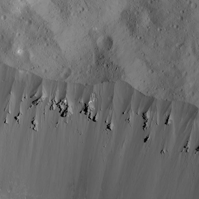
This view from NASA's Dawn mission shows where ice has been detected in the northern wall of Ceres' Juling Crater, which is in almost permanent shadow. Dawn acquired the picture with its framing camera on Aug. 30, 2016, and it was processed with the help of NASA Ames Stereo Pipeline (ASP), to estimate the slope of the cliff. https://photojournal.jpl.nasa.gov/catalog/PIA21918
These images show a subtle feature on Ceres called Kwanzaa Tholus. Kwanzaa, meaning "first fruits" in Swahili, is an African-American festival based on ancient African harvest celebrations, and takes place from December 26 to January 1. A tholus is a type of small mountain. Kwanzaa Tholus measures about 22 by 12 miles (35 by 19 kilometers) and is elevated about 2 miles (3 km) above its surroundings. Because the mountain does not rise sharply above the ground, it is difficult to see in the mosaic on the left, although a small crescent-shaped shadow stands out. The image on the right, which is an elevation map of the area, shows where Kwanzaa Tholus is more prominently. The rounded shape of Kwanzaa Tholus is typical of tholi (plural of tholus) in general, but is different than other examples found on Ceres (like Dalien Tholus) and Mars. This region is particularly rich in this type of feature: The current Ceres map shows six named tholi and montes (slightly bigger mountains) in the region (centered around 32 degrees north, 327 degrees east) and several others including Ahuna Mons farther south. Scientists say Kwanzaa Tholus may have once been as prominent as Ahuna Mons, the tallest and most noticeable mountain on Ceres. Ahuna Mons is likely a cryovolcano, a volcano formed by the gradual accumulation of thick, slowly flowing icy materials. Because ice https://www.nasa.gov/feature/goddard/2016/ceres-cryo-volcano/is not strong enough to preserve an elevated structure for extended periods, cryovolcanoes on Ceres are expected to gradually collapse over tens of millions of years. This means Kwanzaa Tholus and other tholi in that area could be degraded mountains, which also formed from cryovolcanic activity. The mosaic on the left combines images taken by NASA's Dawn spacecraft in its high-altitude mapping orbit (HAMO) at about 915 miles (1,470 kilometers) above the surface. The spatial resolution is 450 feet (140 meters) per pixel. https://photojournal.jpl.nasa.gov/catalog/PIA21916
This image of smooth material on Ceres was obtained by NASA's Dawn spacecraft on June 9, 2018 from an altitude of about 41 miles (66 kilometers). https://photojournal.jpl.nasa.gov/catalog/PIA22527
This image was obtained by NASA's Dawn spacecraft on July 6, 2018 from an altitude of about 72 miles (116 kilometers). The center of this picture is located at about 44.1 degrees south latitude and 249.1 degrees east longitude. https://photojournal.jpl.nasa.gov/catalog/PIA22627
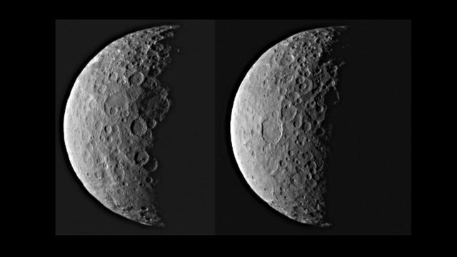
NASA's Dawn spacecraft took these images of dwarf planet Ceres from about 25,000 miles (40,000 kilometers) away on Feb. 25, 2015. Ceres appears half in shadow because of the current position of the spacecraft relative to the dwarf planet and the sun. The resolution is about 2.3 miles (3.7 kilometers) per pixel. http://photojournal.jpl.nasa.gov/catalog/PIA19310
This image from NASA Spitzer Space Telescope shows two young brown dwarfs, objects that fall somewhere between planets and stars in terms of their temperature and mass.

This is an illustration of a planet that is four times the mass of Jupiter and orbits 5 billion miles from a brown-dwarf companion the bright red object seen in the background.
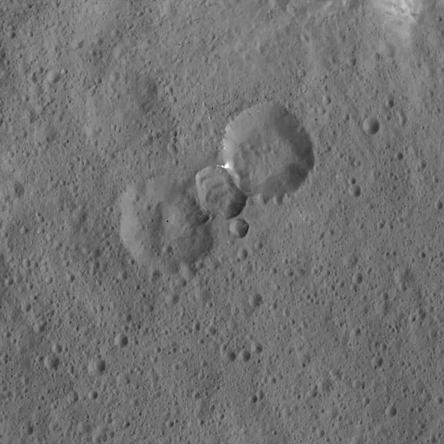
This view from NASA Dawn spacecraft shows a scene from the northern hemisphere of Ceres, north of Occator Crater, which is home of the brightest area on the dwarf planet.
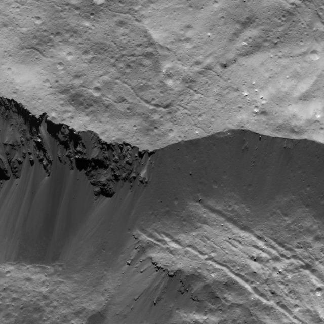
Shadows cast a dark mood on this scene from Ceres, near the dwarf planet north pole in this image acquired by NASA Dawn spacecraft.
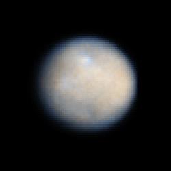
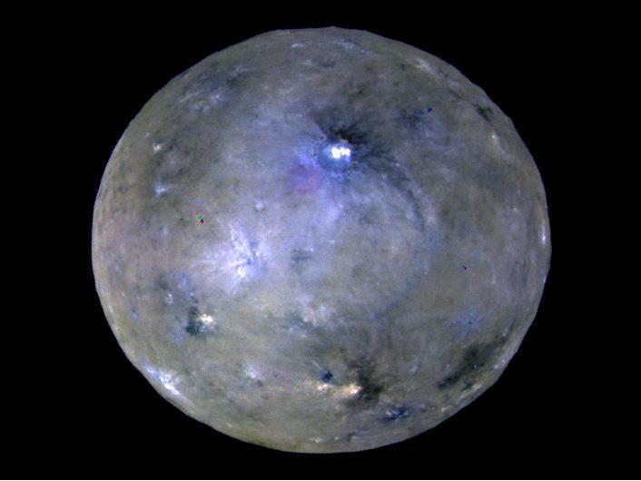
This is a NASA Hubble Space Telescope color image of dwarf planet Ceres, the largest object in the asteroid belt. The contrast has been enhanced to reveal surface details.

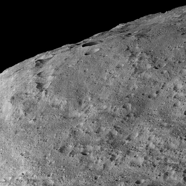
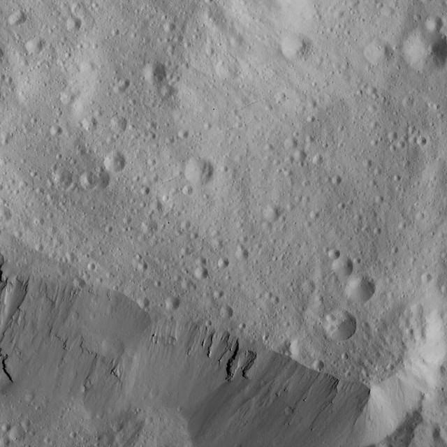
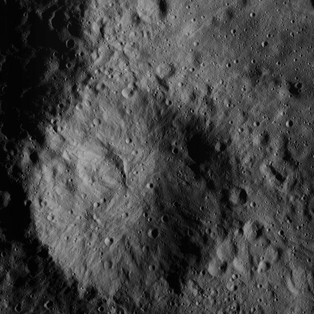
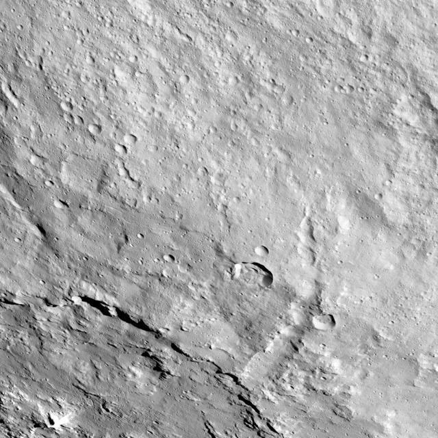
Part of the southern hemisphere on dwarf planet Ceres is seen in this image taken by NASA Dawn spacecraft. This left side of the image shows the eastern rim of Urvara crater.