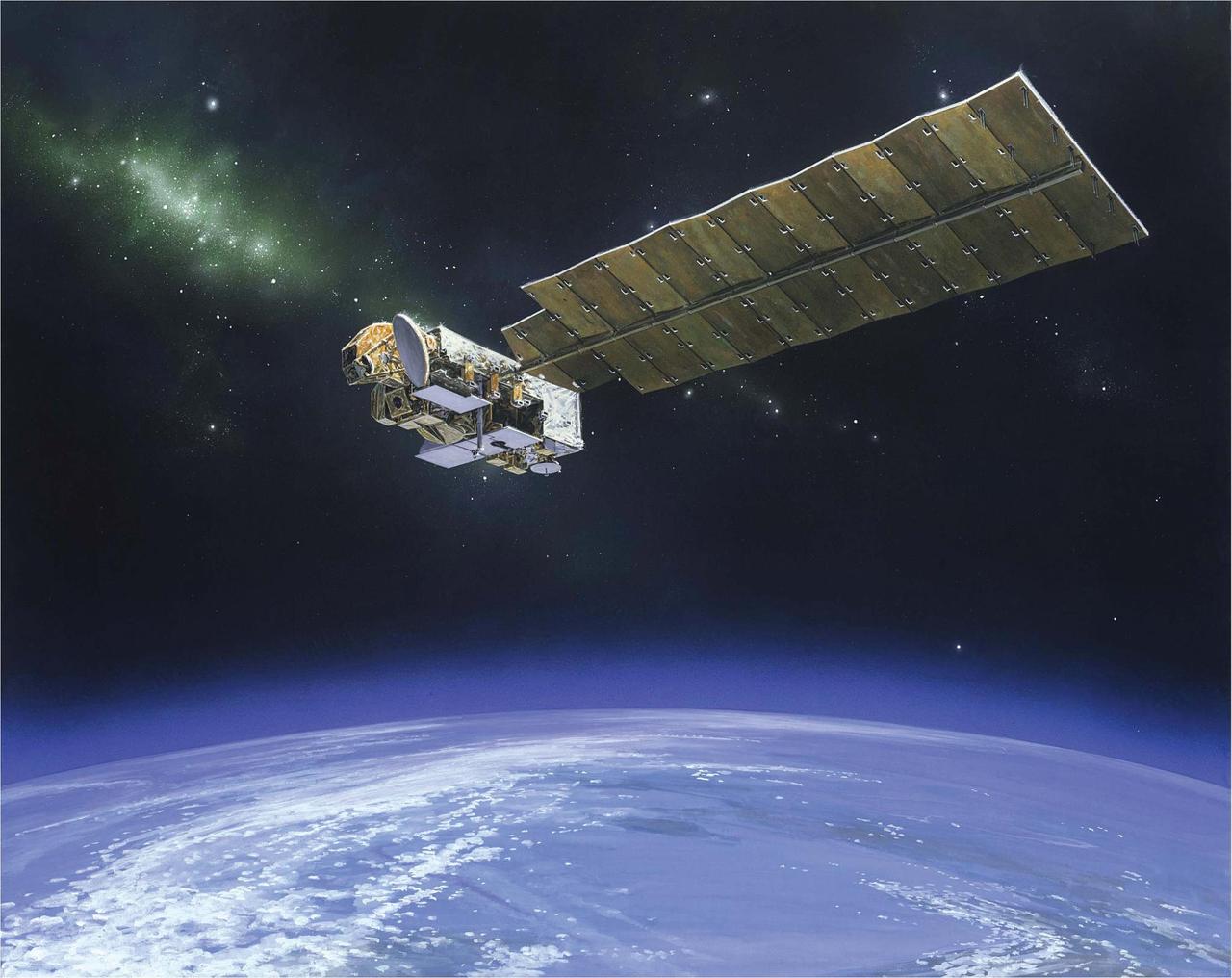
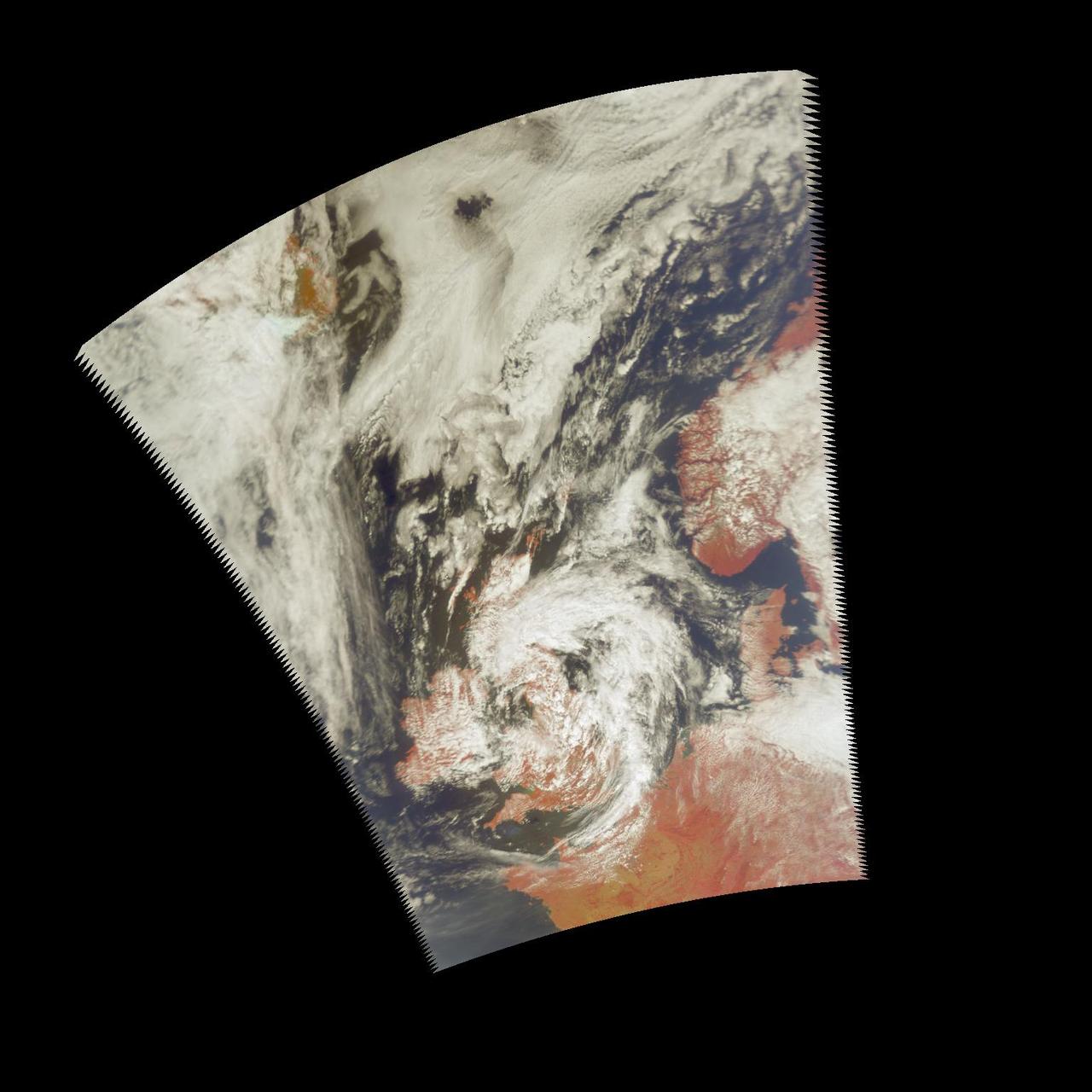
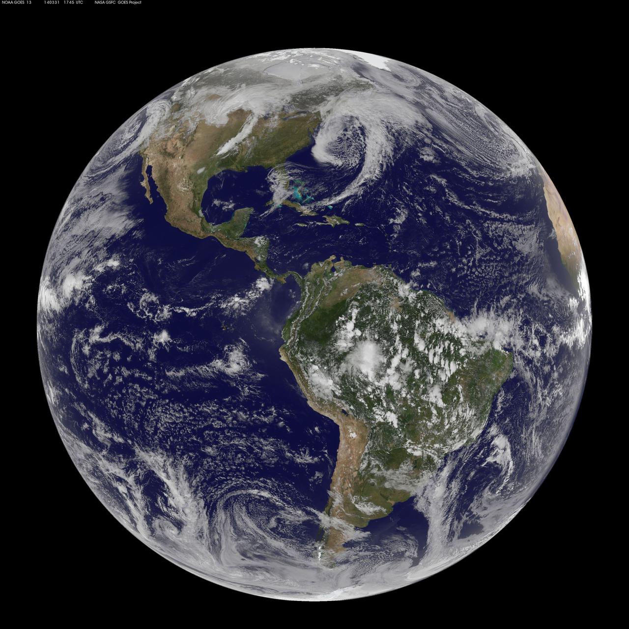
Earth atmosphere observation taken by the Expedition 35 crew aboard the ISS. The colors roughly denote the layers of the atmosphere (the orange troposphere, the white stratosphere, and the blue mesosphere).

This graphic compares the atmospheric circulations of Earth and Jupiter. Earth contains one Ferrel cell (a mid-latitudinal cell where air flows poleward and eastward at the surface, and equatorward and westward at higher altitudes). On Jupiter, the circulation cells are depicted in aqua, and underlying jets streams in the pink region. The jet streams are characteristic for all depths associated with the cells. Jupiter has eight Ferrel-like cells in the north and eight in the south, due to its large size and fast rotation. Each of these cells on Jupiter is at least 30 times larger than the equivalent cell on Earth. The main difference between the Jovian and terrestrial cells is that on Earth, the cell ends at the surface, while on gaseous Jupiter, it penetrates into the deeper layers of the atmosphere. Due to measuring limitations, it has yet to be determined how deep these cells extend. https://photojournal.jpl.nasa.gov/catalog/PIA24965

NASA Sees Tohoku-Oki Earthquake and Tsunami in Earth Upper Atmosphere

iss074e0089803 (Jan. 16, 2026) --- Earth's thin blue atmosphere traces the planet's horizon as the sun's glint beams off a partly cloudy Pacific Ocean west of Chile on the South American continent. The International Space Station was orbiting 271 miles above Earth at the time of this photograph.

S70-17646 (18 April 1970) --- An unidentified airline passenger snapped these bright objects, believed to be the Apollo 13 Service Module (SM) and Lunar Module (LM) as they entered Earth's atmosphere over the Pacific Ocean on April 18, 1970. The aircraft, an Air New Zealand DC-8 was midway between the Fiji Islands (Nandi Island to be specific) and Auckland, New Zealand, when the photograph was taken. The crew men of the problem plagued Apollo 13 mission jettisoned the LM and SM prior to entering Earth's atmosphere in the Apollo 13 Command Module (CM).

This Expedition Seven image, taken while aboard the International Space Station (ISS), shows the limb of the Earth at the bottom transitioning into the orange-colored stratosphere, the lowest and most dense portion of the Earth's atmosphere. The troposphere ends abruptly at the tropopause, which appears in the image as the sharp boundary between the orange- and blue-colored atmosphere. The silvery blue noctilucent clouds extend far above the Earth's troposphere. The silver of the setting moon is visible at upper right.

This morphing animation compares the eddies in Earth's oceans to the turbulent clouds in Jupiter's atmosphere. In the movie, a zoom occurs around a vortex dipole: a typical structure consisting of a cyclone and an anticyclone that is present both in Earth's ocean and Jupiter's atmosphere. The ocean image showing the spring phytoplankton bloom in the southern Gulf of Bothnia was generated from data collected by the MODIS instrument about NASA's Aqua satellite. The Jupiter image is from JunoCam. Scientist Lia Siegelman observed the similarities between the richness of turbulence around Joviancyclones and the filaments around smaller eddies seen in Earth's oceans. These similarities were especially evident in high-resolution satellite images of plankton blooms. Movie available at https://photojournal.jpl.nasa.gov/catalog/PIA25069

This animation shows asteroid 2022 EB5's predicted orbit around the Sun before impacting into the Earth's atmosphere on March 11, 2022. The asteroid – estimated to be about 6 ½ feet (2 meters) wide – was discovered two hours before impact. Using NASA's Scout impact hazard assessment system, members of the Center for Near Earth Object Studies (CNEOS) – which is managed by NASA's Jet Propulsion Laboratory in Southern California – accurately predicted where and when the asteroid would harmlessly break up in Earth's atmosphere. Infrasound sensors, which can detect low frequency sound waves as they travel through the atmosphere, confirmed the impact occurred over the Norwegian Sea, southwest of Norway's Jan Mayen island. Animation available at https://photojournal.jpl.nasa.gov/catalog/PIA24568

iss072e978997 (April 13, 2025) --- The Moon's light is refracted by the Earth's atmosphere giving it a spheroid shape in this photograph from the International Space Station as it orbited into a sunset 264 miles above the border between Bolivia and Brazil in South America.

iss072e023504 (Sept. 28, 2024) -- As the International Space Station soared 271 miles above the Indian Ocean during orbital nighttime, a vibrant green aurora begins to fold through Earth's atmosphere.

iss072e724819 (March 5, 2025) --- An atmospheric glow blankets Earth's horizon above the Pacific Ocean in this nighttime photograph from the International Space Station as it orbited 260 miles above the southern California coastline.

iss071e439624 (Aug. 6, 2024) --- An orbital sunrise colorfully illuminates the Earth's atmosphere and highlights the boundary between night and day, also known as the terminator, in this photograph from the International Space Station as it orbited 267 miles above the Pacific Ocean north of Auckland, New Zealand.

The Aura spacecraft is NASA atmospheric chemistry mission that is monitoring the Earth protective atmosphere.

iss072e032577 (Oct. 7, 2024) -- The SpaceX Dragon Freedom spacecraft is pictured attached to the forward-facing port of the International Space Station's Harmony module as a vibrant aurora moves through Earth's atmosphere while the station orbited 273 miles above the Indian Ocean.

iss071e564695 (Aug. 11, 2024) -- In this long-exposure shot taken from the International Space Station as it orbited 268 miles above the Indian Ocean, stars glitter above green and red auroras swirling through Earth's atmosphere.

iss071e207178 (June 23, 2024) -- A long exposure shot taken aboard the International Space Station shows a golden atmospheric glow crowning Earth's horizon as the orbiting laboratory soared 267 miles over the South Pacific Ocean.

iss072e010734 (Oct. 1, 2024) -- As the International Space Station soared 266 miles over Western Australia, NASA astronaut Jeanette Epps captured this long-exposure shot of Earth at night and star trails glittering above the atmosphere.

iss072e011489 (Sept. 27, 2024) --- The aurora australis blends with Earth's atmospheric glow blanketing the nighttime horizon in this photograph from the International Space Station as it orbited 271 miles above the Pacific Ocean off the coast of New Zealand.

iss073e0988954 (Oct. 30, 2025) --- An orbital sunrise illuminates Earth's atmosphere and cloud tops in this photograph captured from the International Space Station as it orbited 264 miles above the Czech Republic in Eastern Europe.

iss072e030161 (Oct. 10, 2024) --- The aurora australis blends into Earth's atmospheric glow in this photograph from the International Space Station as it soared into an orbital sunset 274 miles above the South Pacific Ocean.

iss073e0077872 (May 20, 2025) --- The Last Quarter Moon is pictured above Earth's atmosphere from the International Space Station as it soared 260 miles over the Pacific Ocean southwest of Panama on the Latin American continent.

STS066-129-005 (3-14 Nov 1994) --- Clouds over the Atlantic Ocean serve as the backdrop for this 70mm scene of the Atmospheric Laboratory for Applications and Science (ATLAS-3) payload in the cargo bay of the Earth-orbiting Space Shuttle Atlantis. Crew members onboard Atlantis were astronauts Donald R. McMonagle, Curtis L. Brown, Jr., Ellen Ochoa, Scott E. Parazynski and Joseph R. Tanner, along with Jean-François Clervoy of the European Space Agency (ESA). The six astronauts spent 11-days in Earth-orbit in support of the Atmospheric Laboratory for Applications and Science (ATLAS-3) mission.

STS039-610-037 (28 April-6 May 1991) --- Numerous atmospheric scattering layers over Earth are apparent in this frame. The layers consist of fine particles suspended in very stable layers of the atmosphere. This photo was taken with a 70mm Rolliflex camera during the Space Shuttle Discovery's eight day mission. Crew members onboard were astronauts Michael L. Coats, L. Blaine Hammond, Guion S. Bluford, Richard J. Hieb, Gregory J. Harbaugh, Donald R. McMonagle and Charles L. (Lacy) Veach.

iss073e0036151 (April 20, 2025) --- A wispy aurora intersects with Earth's atmospheric glow as a slight moon glint beams off a cloudy Southern Ocean. The International Space Station was orbiting 269 miles above the Bass Strait off the coast of Tasmania at the time of this photograph.

iss072e278609 (Nov. 26, 2024) --- The Large Magellanic Cloud among a starry backdrop above Earth's atmospheric glow highlights this long duration photograph from the International Space Station as it orbited 260 miles above the Pacific Ocean off the coast of Mexico. Credit: NASA/Don Pettit

iss072e011331 (Sept. 27, 2024) --- The aurora australis blends with Earth's atmospheric glow blanketing the nighttime horizon with New Zealand's city lights below in this photograph from the International Space Station as it orbited 270 miles above the Tasman Sea.

iss072e030246 (Oct. 7, 2024) --- The first rays of an orbital sunrise illuminate Earth's atmosphere in this photograph from the International Space Station as it orbited 269 miles above the Pacific Ocean near Chile's Patagonia coast on the South American continent.

iss073e0035898 (April 20, 2025) --- An atmospheric glow crowns Earth's horizon as an aurora streams across the Southern Ocean in this photograph from the International Space Station as it orbited 271 miles above. Silhouetted in the right foreground, is a set of the orbital outpost's main solar arrays.

S114-E-7558 (6 August 2005) --- This view featuring a distant Moon and a line of airglow of Earth’s atmosphere was photographed by an STS-114 crewmember onboard the Space Shuttle Discovery after departure from the international space station.

iss073e0175716 (May 27, 2025) --- The New Moon is pictured above Earth's atmosphere during an orbital sunset in this photograph from the International Space Station as it soared 259 miles over the Atlantic Ocean northwest of Cabo Verde, an African island nation, at approximately 10:33 p.m. local time.

iss073e0175732 (May 27, 2025) --- The New Moon is pictured seemingly beneath Earth's atmosphere during an orbital sunset in this photograph from the International Space Station as it soared 259 miles above Mauritania on the African continent at approximately 9:59 p.m. local time.

iss074e0089802 (Jan. 16, 2026) --- The first rays of an orbital sunrise illuminate Earth’s atmosphere in this photograph taken from the International Space Station as it orbited 268 miles above French Polynesia in the Pacific Ocean at approximately 2:52 a.m. local time.

iss074e0324639 (Feb. 22, 2026) --- An aurora streams above Earth’s atmospheric glow, blanketing the city lights of Europe and Russia in this photograph taken at approximately 3:30 a.m. local time from the International Space Station as it orbited 263 miles above Central Asia. Credit: NASA/Chris Williams

STS047-54-018 (12-20 Sept. 1992) --- The colors in this photograph provide insight into the relative density of the atmosphere. The crew members had many opportunities to witness sunrises and sunsets, considering they orbit the Earth every 90 minutes, but few, they said, compared to this scene. It captures the silhouette of several mature thunderstorms with their cirrus anvil tops spreading out against the tropopause (the top of the lowest layer of Earth's atmosphere) at sunset. The lowest layer (troposphere) is the densest and refracts light at the red end of the visible spectrum (7,400 Angstroms), while the blues (4,000 Angstroms) are separated in the least dense portion of the atmosphere (middle and upper atmosphere, or stratosphere and mesosphere). Several layers of blue can be seen. NASA scientists studying the photos believe this stratification to be caused by the scattering of light by particulate trapped in the stratosphere and mesosphere particulate that generally originate from volcanic eruptions, such as those of Mt. Pinatubo in the Philippines and, most recently, Mt. Spurr in Alaska.

iss074e0222272 (Jan. 6, 2026) --- The sun begins setting above Earth's atmospheric glow blanketing a cloudy Atlantic Ocean. The International Space Station was orbiting 260 miles above the Earth off the coast of Florida when this photograph was taken. In the foreground, are a SpaceX Dragon spacecraft (lower left) and a set of the orbital outpost's solar arrays (right). Credit: JAXA/Kimiya Yui

This cross section of the Earth's atmosphere at sunset and earth limb (24.5S, 43.5E) displays an unusual layering believed to be caused by temperature inversions which effectively concentrate smoke, dust and aerosols into narrow layers. the top of the stratosphere can be seen as the top of the white layer thought to contain volcanic debris. The purple layer is the troposphere containing smoke from landclearing biomass burning.

iss073e0343806 (July 15, 2025) --- The SpaceX Dragon spacecraft carrying the Axiom Mission 4 crew is pictured from the International Space Station separating from its trunk and reentering Earth's atmosphere above the Pacific Ocean near the coast of California at approximately 12:20 a.m. local time. The streak is the plasma trail caused by the intense friction between Dragon's heat shield and the atmospheric gases as the spacecraft penetrates the atmosphere.

iss072e921627 (March 30, 2025) --- This long-duration photograph from the International Space Station highlights star trails and an atmospheric glow blanketing Earth's horizon. In the foreground, is a set of the space station's main solar arrays (left), the Kibo laboratory module (right), and Kibo's External Platform that houses experiments exposed to the vacuum of space. The orbital outpost was soaring 259 miles above the Pacific Ocean southeast of Japan going into a sunset.

iss073e0608751 (June 13, 2025) --- The aurora australis streams above the Earth and into the atmospheric glow in this photograph taken from the International Space Station as it orbited 269 miles above the Indian Ocean midway between Australia and Antarctica at approximately 2:51 a.m. local time. Portions of the orbital outpost's Roscosmos segment are visible in the foreground, including (from left) the Rassvet module and the Soyuz MS-27 crew spacecraft docked to the Prichal module which is itself attached to the Nauka science module.

iss072e921629 (March 30, 2025) --- This long-duration photograph from the International Space Station highlights star trails and an atmospheric glow blanketing Earth's horizon. In the foreground, is a set of the space station's main solar arrays (left), the Kibo laboratory module (right), and Kibo's External Platform that houses experiments exposed to the vacuum of space. The orbital outpost was soaring 259 miles above the Pacific Ocean southeast of Japan after sunset.

iss072e921628 (March 30, 2025) --- This long-duration photograph from the International Space Station highlights star trails and an atmospheric glow blanketing Earth's horizon. In the foreground, is a set of the space station's main solar arrays (left), the Kibo laboratory module (right), and Kibo's External Platform that houses experiments exposed to the vacuum of space. The orbital outpost was soaring 259 miles above the Pacific Ocean southeast of Japan just after sunset.

iss072e921626 (March 30, 2025) --- This long-duration photograph from the International Space Station highlights star trails and an atmospheric glow blanketing Earth's horizon. In the foreground, is a set of the space station's main solar arrays (left), the Kibo laboratory module (right), and Kibo's External Platform that houses experiments exposed to the vacuum of space. The orbital outpost was soaring 259 miles above the Pacific Ocean southeast of Japan moments before sunset.

iss072e147691 (Nov. 9, 2024) --- Star trails, an aurora, and Earth's atmospheric glow highlight this long-duration photograph taken from the International Space Station as it orbited 259 miles above the North Pacific Ocean.

ISS034-E-005039 (18 Nov. 2012) --- Soyuz TMA-05M (descent module) beginning to re-enter the Earth's atmosphere on Nov. 19 (real time, Nov. 18, U.S. time) leaving a plasma trail as the Expedition 33 crew streaked toward a pre-dawn landing on the steppe of Kazakhstan northeast of Arkalyk.

iss072e031823 (Oct. 7, 2024) -- Peering through the window of the SpaceX Dragon Endeavour spacecraft, NASA astronaut Matthew Dominick captured this image of the SpaceX Dragon Freedom spacecraft as vivid green and pink aurora swirled through Earth's atmosphere while the International Space Station soared 273 miles above the Indian Ocean.

ISS034-E-005049 (18 Nov. 2012) --- Soyuz TMA-05M (descent module) beginning to re-enter the Earth's atmosphere on Nov. 19 (real time, Nov. 18, U.S. time) leaving a plasma trail as the Expedition 33 crew streaked toward a pre-dawn landing on the steppe of Kazakhstan northeast of Arkalyk.

ISS034-E-005037 (18 Nov. 2012) --- Soyuz TMA-05M (descent module) beginning to re-enter the Earth's atmosphere on Nov. 19 (real time, Nov. 18, U.S. time) leaving a plasma trail as the Expedition 33 crew streaked toward a pre-dawn landing on the steppe of Kazakhstan northeast of Arkalyk.

iss072e454972 (Jan. 9, 2025) --- This long-duration photograph highlights the Roscosmos segment of the International Space Station with the Soyuz MS-26 crew ship (bottom center) docked to the Rassvet module. Star trails and Earth's atmospheric glow are also prominently pictured from the orbital outpost as it soared 258 miles above the Pacific Ocean.

iss073e0516005 (Aug. 23, 2025) --- The Milky Way appears above Earth's bright atmospheric glow in this photograph from the International Space Station as it soared 261 miles above southern Iran at approximately 12:54 a.m. local time. The camera was configured for low light and long duration settings.

ISS034-E-005034 (18 Nov. 2012) --- Soyuz TMA-05M (descent module) beginning to re-enter the Earth's atmosphere on Nov. 19 (real time, Nov. 18, U.S. time) leaving a plasma trail as the Expedition 33 crew streaked toward a pre-dawn landing on the steppe of Kazakhstan northeast of Arkalyk.

iss072e147765 (Nov. 9, 2024) --- The streaks of city lights, star trails, an aurora, and Earth's atmospheric glow highlight this long-duration photograph taken from the International Space Station as it orbited 259 miles above the North Pacific Ocean off the coast of Japan.

iss073e0819960 (Oct. 3, 2025) --- The waxing gibbous Moon rises above Earth’s blue atmosphere in this photograph taken from the International Space Station as it orbited 263 miles above a cloudy Atlantic Ocean off the coast of Quebec, Canada.

iss073e0761799 (Sept. 6, 2025) --- A wispy aurora caps Earth's horizon as an orbital sunrise begins illuminating the atmosphere in this photograph taken at approximately 2:19 a.m. local time from the International Space Station as it orbited 264 miles above the Mongolia-China border region.

iss072e030147 (Oct. 7, 2024) --- The atmospheric glow, caused by atoms and moelcules excited by sunlight, blankets Earth's nighttime horizon with a sparkling field of stars above in this photograph from the International Space Station as it orbited 270 miles above the Pacific Ocean north of Auckland, New Zealand.

The super-Earth exoplanet 55 Cancri e, depicted with its star in this artist's concept, likely has an atmosphere thicker than Earth's, with ingredients that could be similar to those of Earth's atmosphere, according to a 2017 study using data from NASA's Spitzer Space Telescope. Scientists say the planet may be entirely covered in lava. The planet is so close to its star that one face of the planet consistently faces the star, resulting in a dayside and a nightside. https://photojournal.jpl.nasa.gov/catalog/PIA22069

STS052-23-022 (22 Oct.-1 Nov. 1992) --- As the Space Shuttle Columbia orbited Earth in an easterly direction over the Indian Ocean, moonrise was followed quickly by sunrise. The photograph was taken from an altitude of 285 kilometers (154 nautical miles), over Lake Tanganyika in central Africa. The Sun was still 28 degrees below the horizon and not yet illuminating the dark band of low-level clouds on the limb 1,850 kilometers (l,000 nautical miles) away. Ranging from 13--18 kilometers above these low-level clouds is a brown layer at the tropical tropopause. A tropopause is a major atmospheric temperature inversion which isolates the troposphere from the stratosphere and effectively concentrates particulate from both above and below this level.

iss072e010164 (Oct. 1, 2024) --- The first rays of an orbital sunrise breakthrough illuminating Earth's atmosphere in this photograph from the International Space Station as it orbited 272 miles above the South Pacifc Ocean off the southern coast of New Zealand. In the foreground, at right, is the Canadarm2 robotic arm and partially obscured at top, is the SpaceX Dragon Freedom spacecract docked to the Harmony module's forward port.

iss072e516844 (Jan. 18, 2025) --- The non-periodic Comet C/2024 G3 (ATLAS), or the "Great Comet of 2025," is pictured seemingly above Earth's atmosphere though it was actually about 87 million miles away and five days past its closest approach, or perihelion, to the Sun. The International Space Station was orbiting 261 miles above Kazakhstan at the time of this photograph. Credit: NASA/Don Pettit

iss072e860745 (March 26, 2025) --- This long-duration photograph taken from the International Space Station as it orbited 259 miles above the Andaman Sea reveals the city lights of Southeast Asia and the typical green lights of the fishing boats underneath Earth's atmospheric glow. In the background, a star-filled sky and the Milky Way sparkle above the planet. Credit: NASA/Don Pettit

iss072e941128 (April 2, 2025) --- This long duration photograph, taken from the International Space Station as it orbited 271 miles above the South Georgia and the South Sandwich Islands in the southern Atlantic Ocean, highlights star trails and Earth's atmospheric glow moments before the orbital outpost soared into a sunrise. In the foreground (from left), are the Soyuz MS-26 spacecraft docked to the Rassvet module, a set of the station's main solar arrays, and the Canadarm2 robotic arm.

iss072e007238 (Oct. 1, 2024) --- The non-periodic Comet C/2024 G3 (ATLAS) is pictured seemingly above Earth's atmosphere though it was actually about 235 million miles away and heading for a trip around the Sun. The International Space Station was orbiting 272 miles above the southern Atlantic Ocean in between the Falkland Islands (Islas Malvinas) and South Georgia and the South Sandwich Islands at the time of this photograph. Credit: NASA/Don Pettit

iss073e0982783 (Oct. 26, 2025) --- A red-yellow airglow blankets Earth as the last rays of an orbital sunset illuminate the atmosphere in this photograph from the International Space Station as it orbited 262 miles above the South Atlantic Ocean.
This animation illustrates the path the Stardust return capsule will follow once it enters Earth atmosphere.

This image shows atmospheric water vapor in Earth upper troposphere, about 10 kilometers 6 miles above the surface, as measured by NASA Microwave Limb Sounder MLS instrument flying aboard the Upper Atmosphere Research Satellite.

Created with data acquired by JPL Atmospheric Infrared Sounder instrument during July 2009 this image shows large-scale patterns of carbon dioxide concentrations that are transported around Earth by the general circulation of the atmosphere.

This image was created with data acquired by JPLa Atmospheric Infrared Sounder during July 2008. The image shows large scale patterns of carbon dioxide concentrations that are transported around the Earth by the general circulation of the atmosphere.

Michael Morgan, Assistant Secretary of Commerce for Environmental Observation and Prediction at the National Oceanic and Atmospheric Administration (NOAA), speaks before the ribbon cutting ceremony to open NASA’s Earth Information Center, Wednesday, June 21, 2023, at the Mary W. Jackson NASA Headquarters building in Washington. The Earth Information Center is new immersive experience that combines live data sets with cutting-edge data visualization and storytelling to allow visitors to see how our planet is changing. Photo Credit: (NASA/Joel Kowsky)

These images, taken over northern Europe on July 20, 2002, depict a few of the different views of Earth and its atmosphere that are produced by the Atmospheric Infrared Sounder experiment system operating on NASA Aqua spacecraft. http://photojournal.jpl.nasa.gov/catalog/PIA00345

The Solar Dynamics Observatory SDO spacecraft, shown above the Earth as it faces toward the Sun. SDO is designed to study the influence of the Sun on the Earth and the inner solar system by studying the solar atmosphere. http://photojournal.jpl.nasa.gov/catalog/PIA18169

This illustration shows what a sprite could look like in Jupiter's atmosphere. Named after a mischievous, quick-witted character in English folklore, sprites last for only a few milliseconds. They feature a central blob of light with long tendrils of light extending down toward the ground and upward. In Earth's upper atmosphere, their interaction with nitrogen give sprites a reddish hue. At Jupiter, where the predominance of hydrogen in the upper atmosphere would likely give them a blue hue. https://photojournal.jpl.nasa.gov/catalog/PIA23990

This image shows differences in atmospheric water vapor relative to a normal average year in the Earth upper troposphere about 10 kilometers 6 miles above the surface.

This image shows differences in atmospheric water vapor relative to a normal average year in the Earth upper troposphere about 10 kilometers 6 miles above the surface.

Seven minutes before NASA Phoenix Mars Lander enters the Martian atmosphere, it will jettison the cruise stage hardware that it relied on during the long flight from Earth.

This image shows the distribution and amount of carbon dioxide in Earth mid-troposphere in July 2008 as measured by NASA Atmospheric Infrared Sounder AIRS instrument.

ISS028-E-018188 (21 July 2011) --- This unprecedented view of the space shuttle Atlantis, appearing like a bean sprout against clouds and city lights, on its way home, was photographed by the Expedition 28 crew of the International Space Station. Airglow over Earth can be seen in the background.

ISS028-E-018200 (21 July 2011) --- This unprecedented view of the space shuttle Atlantis, appearing like a bean sprout against clouds and city lights, on its way home, was photographed by the Expedition 28 crew of the International Space Station. Airglow over Earth can be seen in the background.

ISS028-E-018177 (21 July 2011) --- This unprecedented view of the space shuttle Atlantis, appearing like a bean sprout against clouds and city lights, on its way home, was photographed by the Expedition 28 crew of the International Space Station. Airglow over Earth can be seen in the background.

ISS028-E-018217 (21 July 2011) --- This unprecedented view of the space shuttle Atlantis, appearing like a bean sprout against clouds and city lights, on its way home, was photographed by the Expedition 28 crew on the International Space Station. Airglow over Earth can be seen in the background.

ISS028-E-018216 (21 July 2011) --- This unprecedented view of the space shuttle Atlantis, appearing like a bean sprout against the darkness of space, a faint line of airglow over a dark cloud-covered Earth, on its way home, was photographed by the crew of the International Space Station. Airglow over Earth can be seen in the background.

ISS028-E-018199 (21 July 2011) --- This unprecedented view of the space shuttle Atlantis, appearing like a bean sprout against clouds and city lights, on its way home, was photographed by the Expedition 28 crew of the International Space Station. Airglow over Earth can be seen in the background.

ISS028-E-018218 (21 July 2011) --- This unprecedented view of the space shuttle Atlantis, appearing like a bean sprout against clouds and city lights, on its way home, was photographed by the Expedition 28 crew of the International Space Station. Airglow over Earth can be seen in the background.

ISS028-E-018221 (21 July 2011) --- This unprecedented view of the space shuttle Atlantis, appearing like a bean sprout against clouds and city lights, on its way home, was photographed by the Expedition 28 crew of the International Space Station. Airglow over Earth can be seen in the background.

Technicians at NASA’s Michoud Assembly Facility move the intertank of NASA’s Space Launch System rocket for Artemis III to Cell G to await application of the thermal protection system. Thermal protection systems protect space vehicles from aerodynamic heating during entry to planet atmosphere and re-entry to earth atmosphere.

NASA Administrator Bill Nelson, right, and Michael Morgan, Assistant Secretary of Commerce for Environmental Observation and Prediction at the National Oceanic and Atmospheric Administration (NOAA), are seen in front of the hyperwall following the ribbon cutting ceremony to open NASA’s Earth Information Center, Wednesday, June 21, 2023, at the Mary W. Jackson NASA Headquarters building in Washington. The Earth Information Center is new immersive experience that combines live data sets with cutting-edge data visualization and storytelling to allow visitors to see how our planet is changing. Photo Credit: (NASA/Joel Kowsky)

ER-2 tail number 809, is one of two Airborne Science ER-2s used as science platforms by Dryden. The aircraft are platforms for a variety of high-altitude science missions flown over various parts of the world. They are also used for earth science and atmospheric sensor research and development, satellite calibration and data validation. The ER-2s are capable of carrying a maximum payload of 2,600 pounds of experiments in a nose bay, the main equipment bay behind the cockpit, two wing-mounted superpods and small underbody and trailing edges. Most ER-2 missions last about six hours with ranges of about 2,200 nautical miles. The aircraft typically fly at altitudes above 65,000 feet. On November 19, 1998, the ER-2 set a world record for medium weight aircraft reaching an altitude of 68,700 feet. The aircraft is 63 feet long, with a wingspan of 104 feet. The top of the vertical tail is 16 feet above ground when the aircraft is on the bicycle-type landing gear. Cruising speeds are 410 knots, or 467 miles per hour, at altitude. A single General Electric F118 turbofan engine rated at 17,000 pounds thrust powers the ER-2.
KENNEDY SPACE CENTER, FLA. - At Vandenberg Air Force Base, Calif., the Pegasus launch vehicle is moved into its hangar. The Pegasus will carry the SciSat-1 spacecraft in a 400-mile-high polar orbit to investigate processes that control the distribution of ozone in the upper atmosphere. The scientific mission of SciSat-1 is to measure and understand the chemical processes that control the distribution of ozone in the Earth’s atmosphere, particularly at high altitudes. The data from the satellite will provide Canadian and international scientists with improved measurements relating to global ozone processes and help policymakers assess existing environmental policy and develop protective measures for improving the health of our atmosphere, preventing further ozone depletion. The mission is designed to last two years.

KENNEDY SPACE CENTER, FLA. - The SciSat-1 spacecraft is uncrated at Vandenberg Air Force Base, Calif. SciSat-1 weighs approximately 330 pounds and will be placed in a 400-mile-high polar orbit to investigate processes that control the distribution of ozone in the upper atmosphere. The scientific mission of SciSat-1 is to measure and understand the chemical processes that control the distribution of ozone in the Earth’s atmosphere, particularly at high altitudes. The data from the satellite will provide Canadian and international scientists with improved measurements relating to global ozone processes and help policymakers assess existing environmental policy and develop protective measures for improving the health of our atmosphere, preventing further ozone depletion. The mission is designed to last two years.

This highly oblique image shot over northwestern part of the African continent captures the curvature of the Earth and shows its atmosphere as seen by NASA EarthKAM. You can see clouds and even the occasional thunderhead.
The Great Red Spot below and right of center seen in this image from NASA Cassini spacecraft is a giant atmospheric storm as wide as two Earths and over 300 years old.
Satellite images obtained from NASA Atmospheric Infrared Sounder AIRS instrument aboard NASA Aqua spacecraft provide a glimpse into one of the most powerful storms ever recorded on Earth, Typhoon Haiyan.

Titan, Saturn largest moon and Mimas in the foreground are seen together in this view from Cassini. Titan gravity is weaker than Earth, so the moon atmosphere is quite extended -- a quality hinted at in this view

This image shows laser plasmas in a test lab at Los Alamos National Laboratory, N.M., under typical atmospheric pressures on Earth and Mars. A plasma is an ionized, glowing gas.

iss072e518202 (Jan. 23, 2025) --- This long-duration photograph highlights the city lights of Mexico's Yucatan peninsula, Earth's atmospheric glow, and star trails above taken from the International Space Station as it orbited 258 miles above.

These are the discovery observations of asteroid 2018 LA from the Catalina Sky Survey, taken June 2, 2018. About eight hours after these images were taken, the asteroid entered Earth's atmosphere (about 9:44 a.m. PDT, 12:44 p.m. EDT, 16:44 UTC, 6:44 p.m. local Botswana time), and disintegrated in the upper atmosphere near Botswana, Africa. https://photojournal.jpl.nasa.gov/catalog/PIA22468

This animation shows a nearly 20-year record of temperature anomalies for two layers in Earth's atmosphere: the lower troposphere, where most of the planet's weather occurs; and the upper stratosphere, which contains the ozone layer. NASA's Atmospheric Infrared Sounder (AIRS), aboard the Aqua satellite, captured these measurements from 2002 to 2020. Preliminary data analysis shows a warming trend for the lower troposphere, and a strong cooling trend in the upper stratosphere. The globes show a map of where warmer than average or cooler than average temperatures for each atmospheric layer occurred during this time period. The line graphs show the deviation of temperatures averaged over the entire planet for the lower troposphere and upper stratosphere. AIRS, in conjunction with the Advanced Microwave Sounding Unit (AMSU), senses emitted infrared and microwave radiation from Earth to provide a three-dimensional look at the planet's weather and climate. Working in tandem, the two instruments make simultaneous observations down to Earth's surface. With more than 2,000 channels sensing different regions of the atmosphere, the system creates a global, three-dimensional map of atmospheric temperature and humidity, cloud amounts and heights, greenhouse gas concentrations and many other atmospheric phenomena. Launched into Earth orbit in 2002 aboard NASA's Aqua spacecraft, the AIRS and AMSU instruments are managed by NASA's Jet Propulsion Laboratory in Southern California, under contract to NASA. JPL is a division of Caltech. Movie available at https://photojournal.jpl.nasa.gov/catalog/PIA24139

The Earth Return Orbiter (ERO) is one of the flight missions making up the Mars Sample Return campaign to bring martian rock and atmospheric samples back to Earth. This European Space Agency (ESA) orbiter would be the first interplanetary spacecraft to capture samples in orbit and make a return trip between Earth and Mars. ERO would also be the largest spacecraft to orbit the Red Planet. In addition to the rendezvous and return mission, ERO would provide critical Mars-Earth communications coverage for NASA's Perseverance rover and the Sample Retrieval Lander to deliver the martian samples. The Earth Return Orbiter is part of the multi-mission Mars Sample Return campaign being planned by NASA and the European Space Agency (ESA). https://photojournal.jpl.nasa.gov/catalog/PIA25891

The Earth Return Orbiter (ERO) is one of the flight missions making up the Mars Sample Return campaign to bring martian rock and atmospheric samples back to Earth. The ESA orbiter would be the first interplanetary spacecraft to capture samples in orbit and make a return trip between Earth and Mars. The primary mission of the European spacecraft would be to find, fly to, and capture a volleyball-sized capsule called the Orbiting Sample (OS) container launched from the surface of Mars by NASA's Mars Ascent System and carrying a carefully selected set of samples previously collected on the surface of Mars by NASA's Perseverance rover. Having already spent three years to reach Mars and perform its rendezvous and capture mission, ERO would take a further two years to fly from its operational orbit around Mars up to escape altitude and make its way back to Earth. When ERO is about three days from Earth, the Earth Entry System (EES) carrying the OS would separate from the spacecraft and be placed on a precision trajectory for Earth entry and landing. The Earth Return Orbiter is part of the multi-mission Mars Sample Return campaign being planned by NASA and the European Space Agency (ESA). https://photojournal.jpl.nasa.gov/catalog/PIA25893

There are three low pressure systems around the U.S. and they resemble dragons on satellite imagery. NOAA's GOES-13 and GOES-15 satellite image from March 31 shows the low pressure systems in the eastern Pacific Ocean, over the nation's Heartland, and in the eastern Atlantic Ocean. All three lows have the signature comma shape that make them appear to be curled up dragons. According to the National Weather Service, the low pressure area approaching the northwestern U.S. is expected to bring rainfall to the coast and areas of snow that stretch from western Washington state south toward the four corners region. The low in the middle of the country is located over Nebraska and dropping snow to the north and west of it. That same low is bringing rain from southern Minnesota south to eastern Texas. Meanwhile, the third low pressure system is bringing rain and snow to parts of New England. NOAA's GOES-East satellite sits in a fixed orbit in space capturing visible and infrared imagery of all weather over the eastern U.S. and Atlantic Ocean. The data to create this image was taken on March 31 at 17:45 UTC/1:45 p.m. EDT by NOAA's GOES-East or GOES-13 satellite and made into an image by NASA/NOAA's GOES Project at NASA's Goddard Space Flight Center in Greenbelt, Md. To create the image NASA/NOAA's GOES Project takes the cloud data from NOAA's GOES-East satellite and overlays it on a true-color image of land and ocean created by data from the Moderate Resolution Imaging Spectroradiometer, or MODIS, instrument that flies aboard NASA's Aqua and Terra satellites. Together, those data created the entire picture of the storm and show its movement. After the storm system passes, the snow on the ground becomes visible. GOES satellites provide the kind of continuous monitoring necessary for intensive data analysis. Geostationary describes an orbit in which a satellite is always in the same position with respect to the rotating Earth. This allows GOES to hover continuously over one position on Earth's surface, appearing stationary. As a result, GOES provide a constant vigil for the atmospheric "triggers" for severe weather conditions such as tornadoes, flash floods, hail storms and hurricanes. For updated information about the storm system, visit NOAA's NWS website: <a href="http://www.weather.gov" rel="nofollow">www.weather.gov</a> For more information about GOES satellites, visit: <a href="http://www.goes.noaa.gov/" rel="nofollow">www.goes.noaa.gov/</a> or goes.gsfc.nasa.gov/ Rob Gutro NASA's Goddard Space Flight Center, Greenbelt, Md. <b><a href="http://www.nasa.gov/audience/formedia/features/MP_Photo_Guidelines.html" rel="nofollow">NASA image use policy.</a></b> <b><a href="http://www.nasa.gov/centers/goddard/home/index.html" rel="nofollow">NASA Goddard Space Flight Center</a></b> enables NASA’s mission through four scientific endeavors: Earth Science, Heliophysics, Solar System Exploration, and Astrophysics. Goddard plays a leading role in NASA’s accomplishments by contributing compelling scientific knowledge to advance the Agency’s mission. <b>Follow us on <a href="http://twitter.com/NASAGoddardPix" rel="nofollow">Twitter</a></b> <b>Like us on <a href="http://www.facebook.com/pages/Greenbelt-MD/NASA-Goddard/395013845897?ref=tsd" rel="nofollow">Facebook</a></b> <b>Find us on <a href="http://instagram.com/nasagoddard?vm=grid" rel="nofollow">Instagram</a></b>

NASA Administrator Bill Nelson, Michael Morgan, Assistant Secretary of Commerce for Environmental Observation and Prediction at the National Oceanic and Atmospheric Administration (NOAA), Marlen Eve, Deputy Administrator for the Agricultural Research Service at the U.S. Department of Agriculture (USDA), and Eric Hooks, Deputy Administrator of the Federal Emergency Management Agency (FEMA), are seen as they watch “Space for Earth,” the immersive audio-visual installation in NASA’s Earth Information Center, following the ribbon cutting ceremony, Wednesday, June 21, 2023, at the Mary W. Jackson NASA Headquarters building in Washington. The Earth Information Center is new immersive experience that combines live data sets with cutting-edge data visualization and storytelling to allow visitors to see how our planet is changing. Photo Credit: (NASA/Joel Kowsky)

NASA Administrator Bill Nelson, Michael Morgan, Assistant Secretary of Commerce for Environmental Observation and Prediction at the National Oceanic and Atmospheric Administration (NOAA), Marlen Eve, Deputy Administrator for the Agricultural Research Service at the U.S. Department of Agriculture (USDA), and Eric Hooks, Deputy Administrator of the Federal Emergency Management Agency (FEMA), are seen as they watch “Space for Earth,” the immersive audio-visual installation in NASA’s Earth Information Center, following the ribbon cutting ceremony, Wednesday, June 21, 2023, at the Mary W. Jackson NASA Headquarters building in Washington. The Earth Information Center is new immersive experience that combines live data sets with cutting-edge data visualization and storytelling to allow visitors to see how our planet is changing. Photo Credit: (NASA/Joel Kowsky)