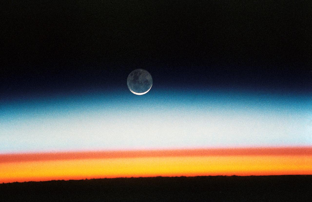
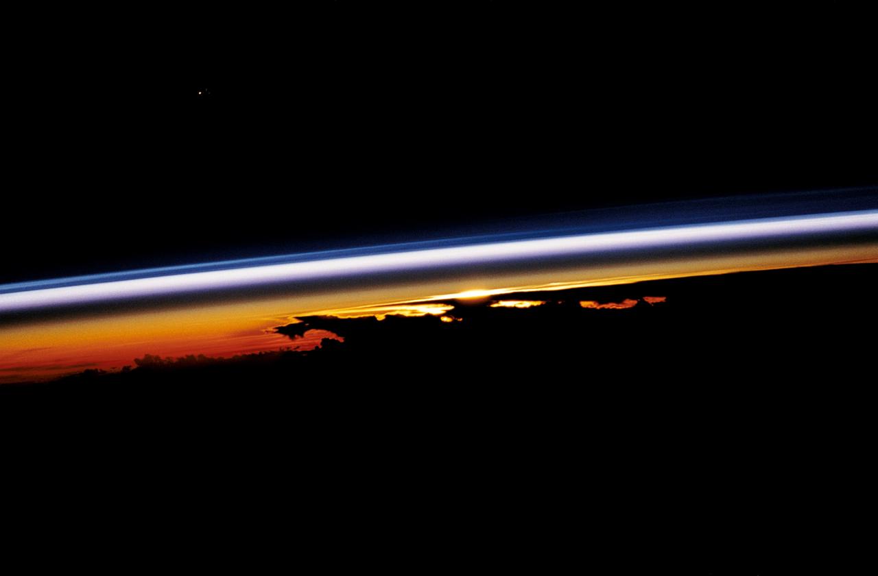
STS052-23-022 (22 Oct.-1 Nov. 1992) --- As the Space Shuttle Columbia orbited Earth in an easterly direction over the Indian Ocean, moonrise was followed quickly by sunrise. The photograph was taken from an altitude of 285 kilometers (154 nautical miles), over Lake Tanganyika in central Africa. The Sun was still 28 degrees below the horizon and not yet illuminating the dark band of low-level clouds on the limb 1,850 kilometers (l,000 nautical miles) away. Ranging from 13--18 kilometers above these low-level clouds is a brown layer at the tropical tropopause. A tropopause is a major atmospheric temperature inversion which isolates the troposphere from the stratosphere and effectively concentrates particulate from both above and below this level.
STS067-709-007 (2-18 March 1995) --- This shot, taken just after sunset, shows several distinct layers of gases in the atmosphere on the Earth’s limb. The distinct colors formed by the amount of scattered light that passes through these gases.

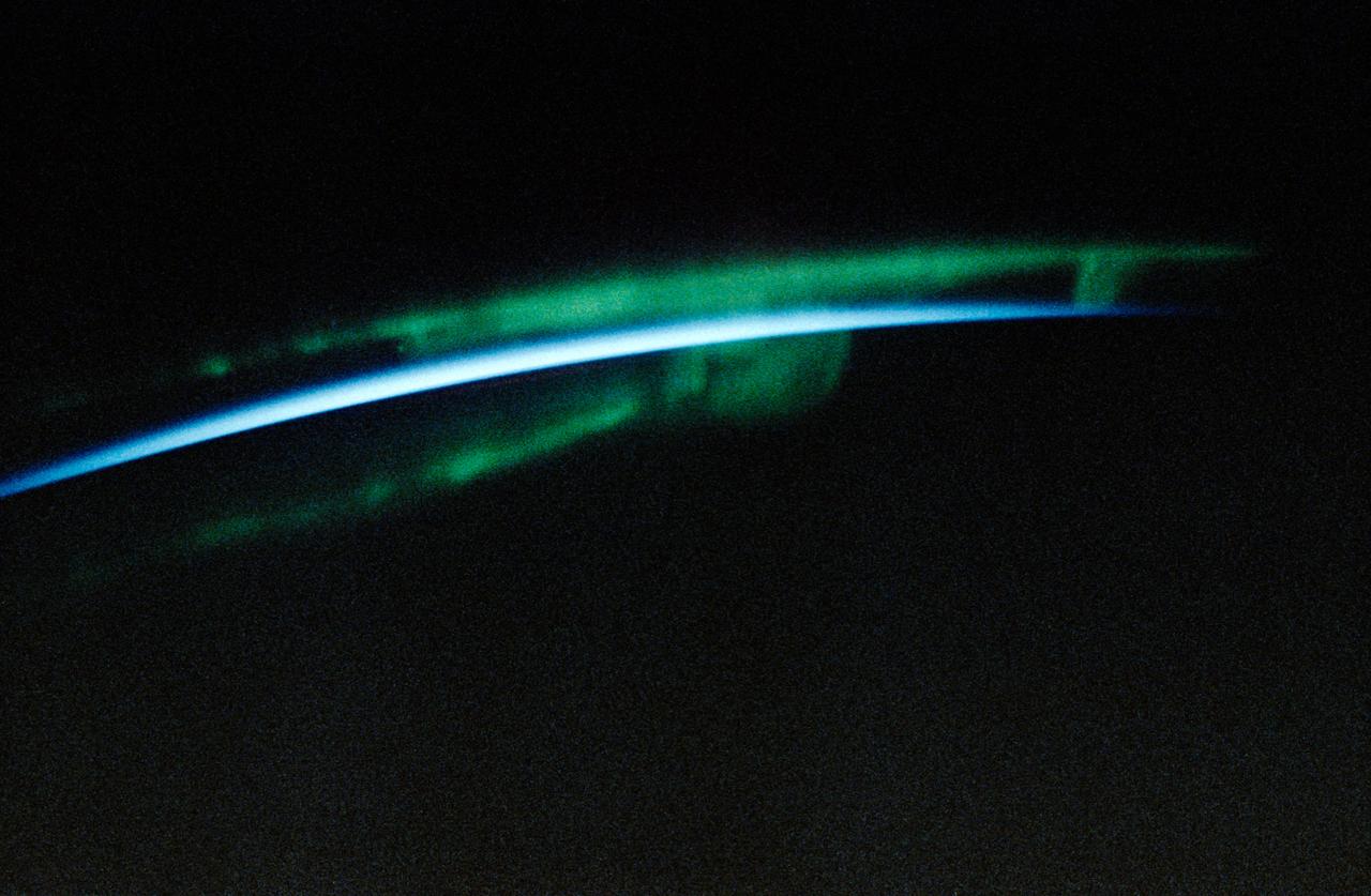
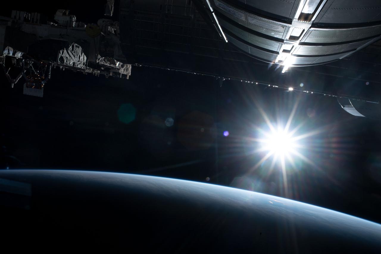
iss058e005282 (Jan. 19, 2019) --- A portion of the International Space Station's solar arrays caps this nighttime view of the Earth's limb with an aurora as the orbital complex orbited 258 miles above Ukraine and Russia.
STS-32 crew took this view of the moon setting over the Earth's limb. Near the center is a semi-vortex in the clouds - a storm system in the early stages of formation. The moon's image is distorted due to refraction through the Earth's atmosphere. The near side of the moon is visible showing the vast area of the moon's western seas (Mare Occidental), Apollo landing sites: Apollo 14 at Fra Mauro and Apollo 16 at Central Highlands near Descartes.
AST-27-2339 (20 July 1975) --- The Earth’s limb at sunrise and cloud silhouettes in the Southern Hemisphere, as photographed from the Apollo spacecraft during the joint U.S.-USSR Apollo-Soyuz Test Project mission. The photograph was taken at an altitude of 230 kilometers (143 statute miles) with a 70mm Hasselblad camera using medium-speed Ektachrome QX-807 type film.
S66-38275 (3-6 June 1966) --- Earth's limb at sunrise as seen from the orbiting Gemini-9 spacecraft during its three-day mission in space. Taken with a modified 70mm Hasselblad camera, using Eastman Kodak, Ektachrome MS (S.O. 217) color film. Photo credit: NASA
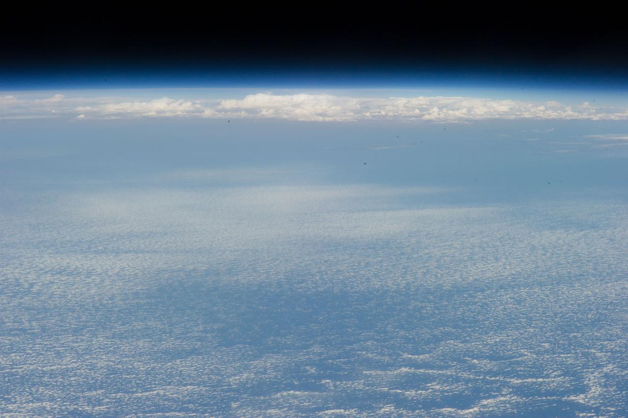
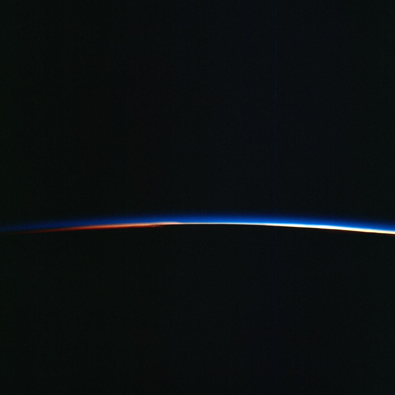
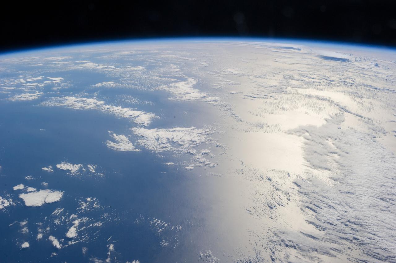
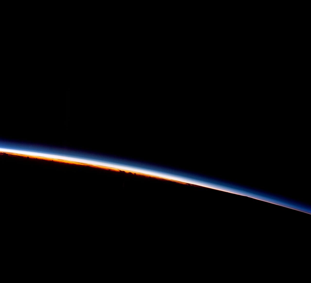
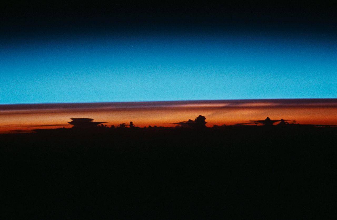
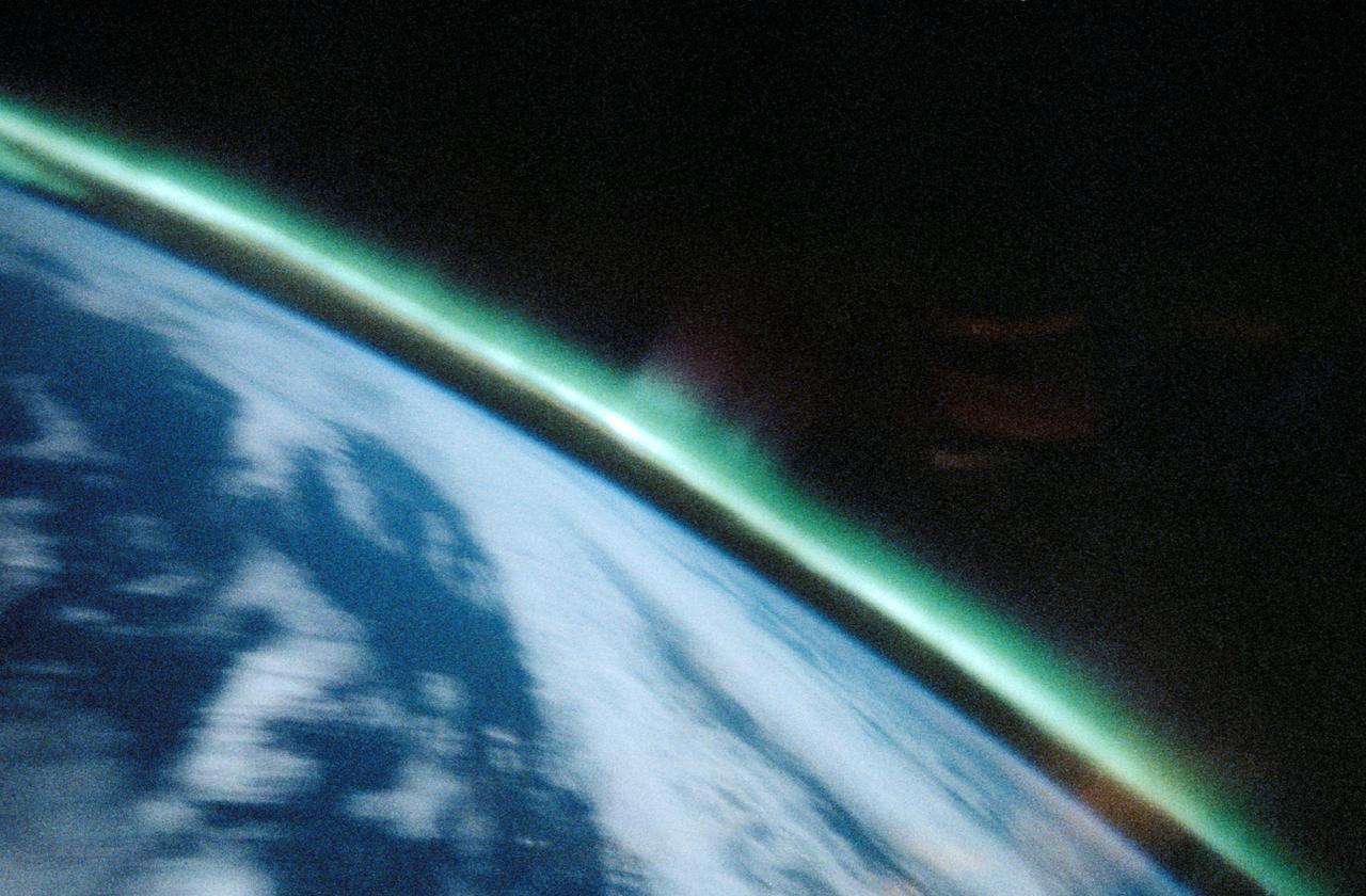
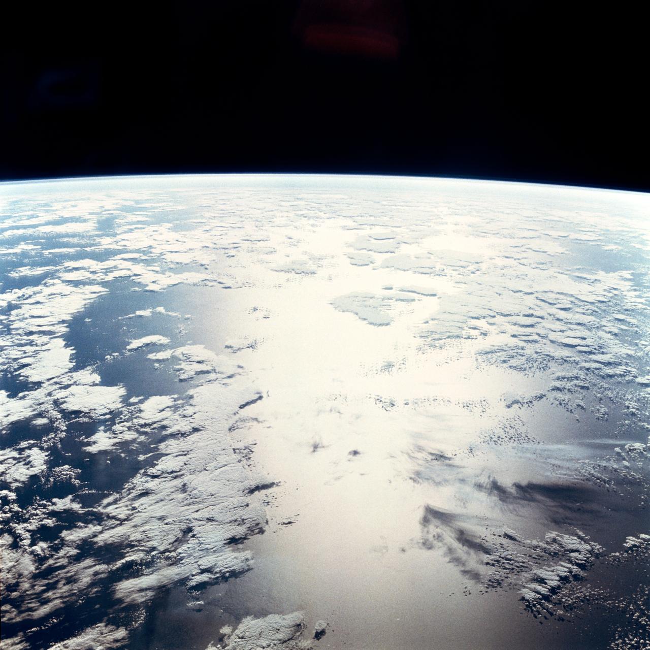
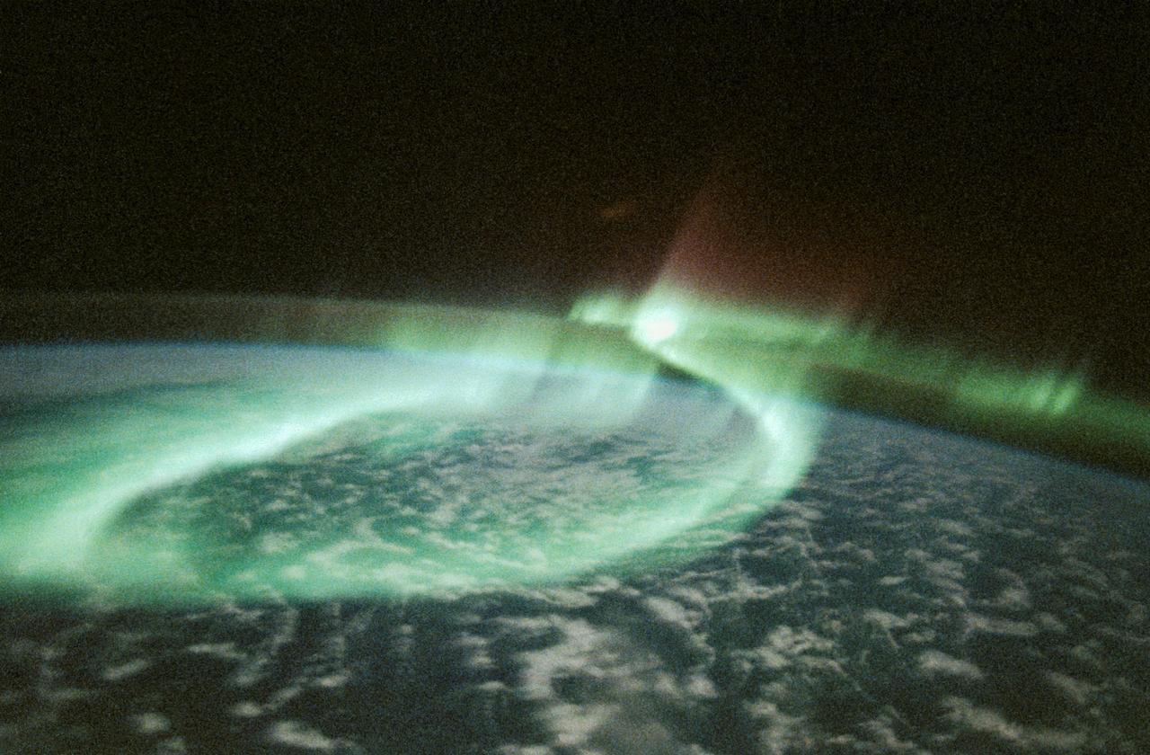
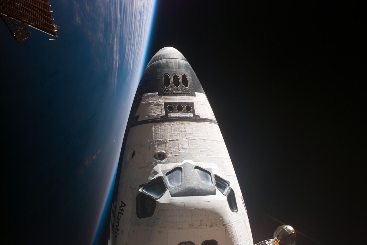
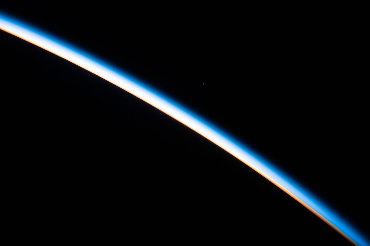
Earth Observations taken by Expedition 34 crewmember. Earth limb is visible.
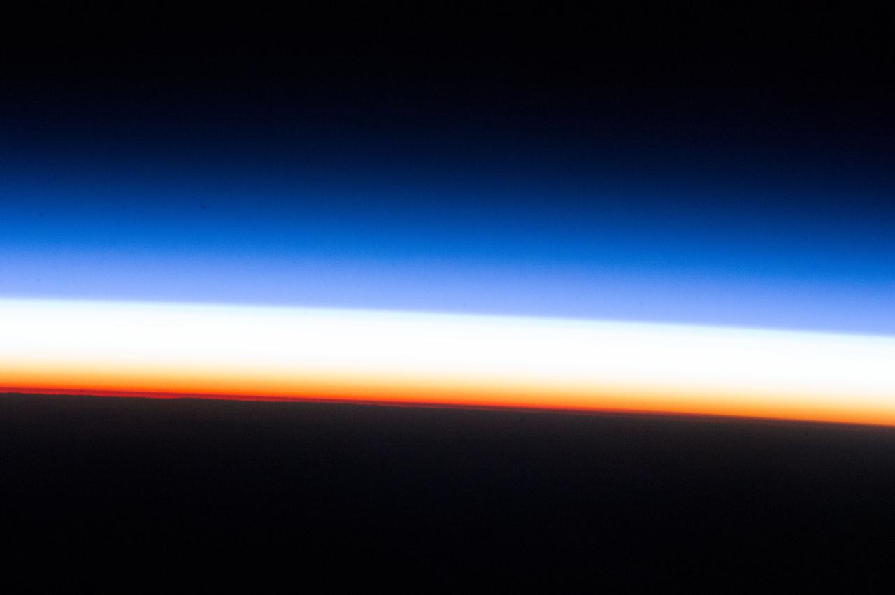
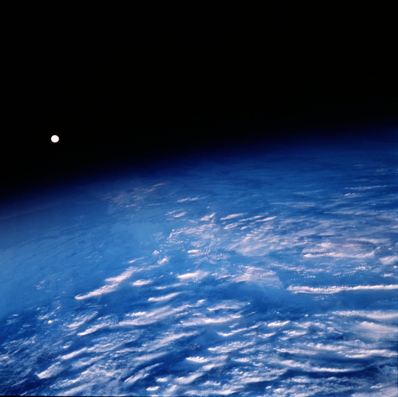
Earth Observations taken by Expedition 34 crewmember. Earth limb is visible.
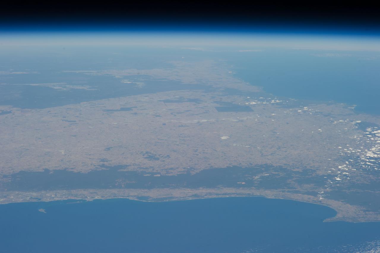
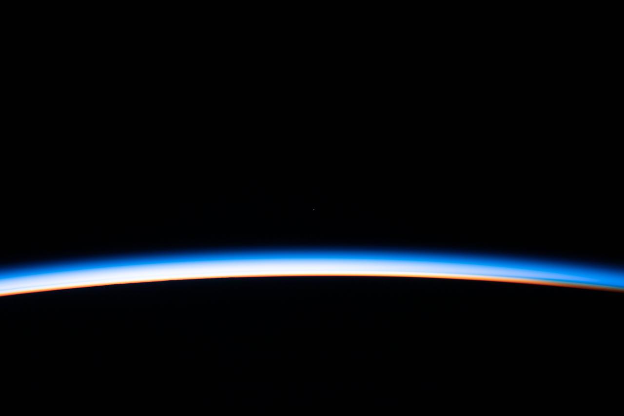
Earth Observations taken by Expedition 34 crewmember. Earth limb is visible.
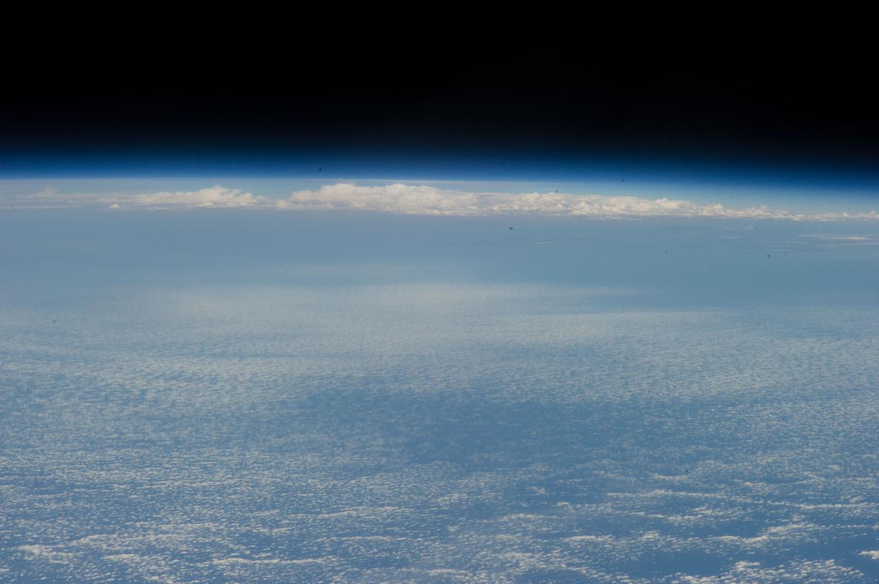
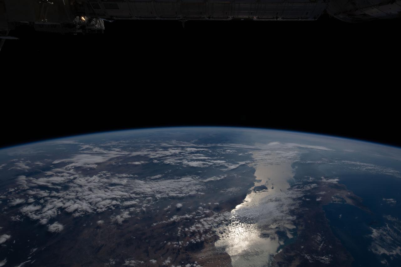
Earth Observations taken by Expedition 34 crewmember. Earth limb is visible.
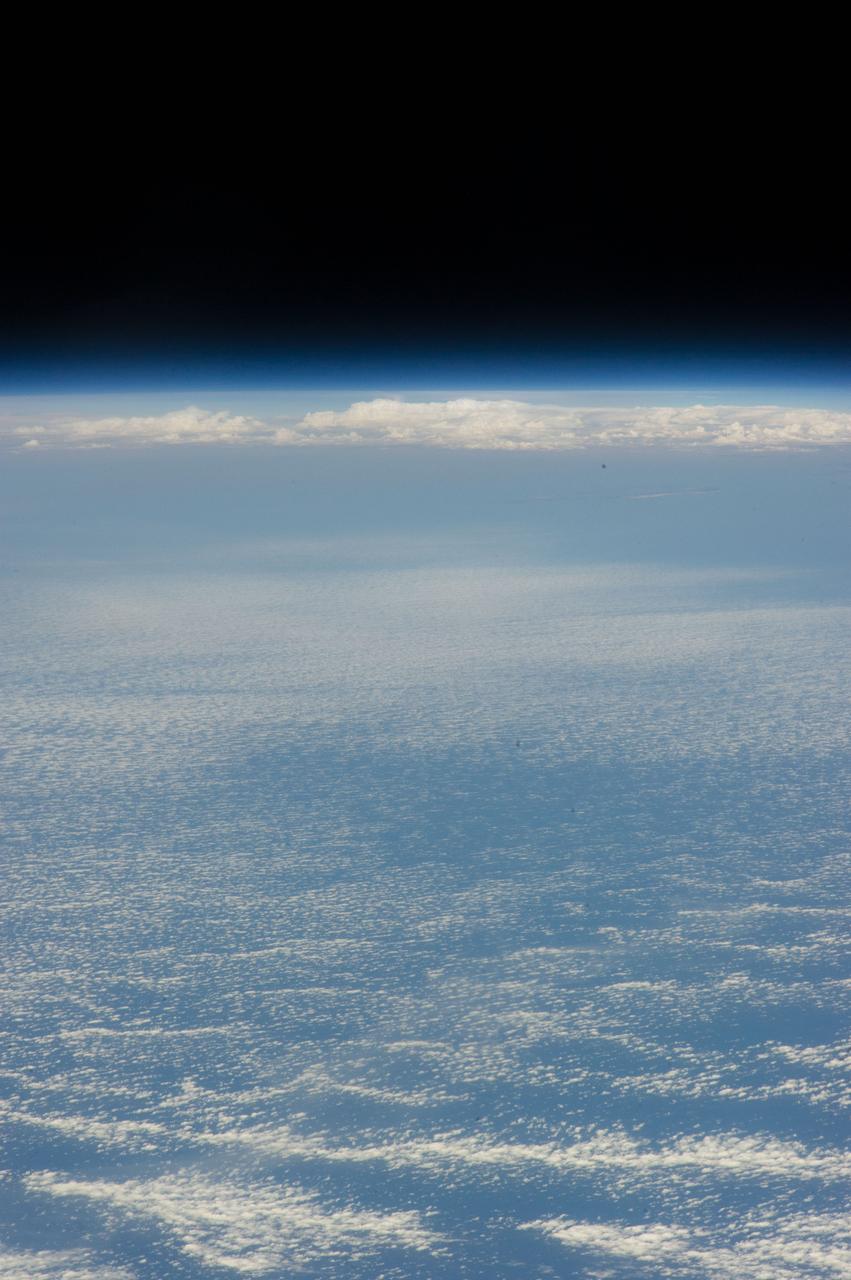
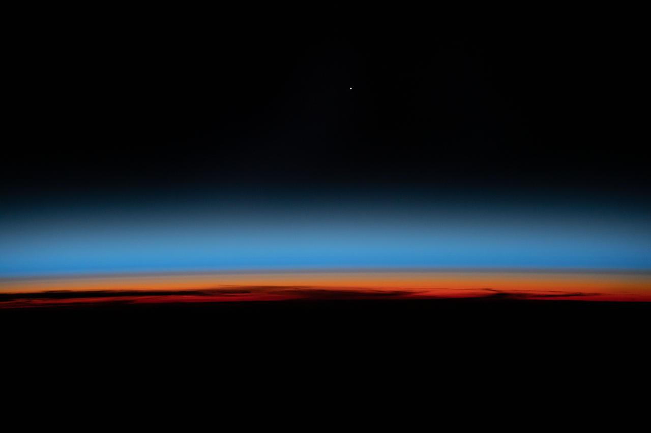
Earth Observations taken by Expedition 34 crewmember. Earth limb is visible.

STS006-46-617 (4-9 April 1983) --- This view of sunset over the Amazon Basin was photographed with a 35mm camera from the Earth-orbiting space shuttle Challenger. The reusable vehicle was making its first trip into space and carried a crew of astronauts Paul J. Weitz, Karol J. Bobko, F. Story Musgrave and Donald H. Peterson. Photo credit: NASA
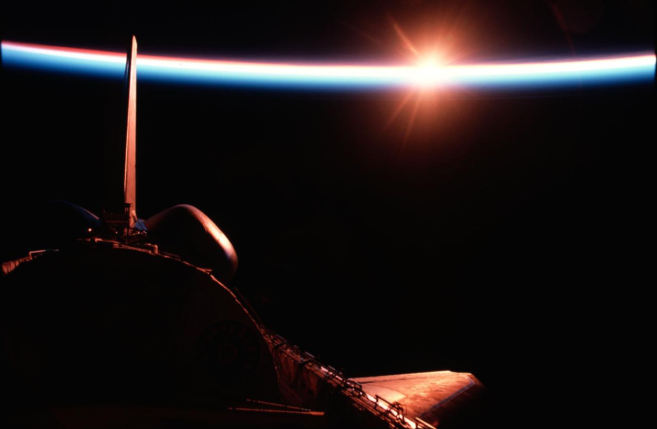
STS009-11-675 (December 1983) --- The Space Shuttle Columbia passes into a brilliant sunrise scene during the STS-9\Spacelab 1 mission. The photograph was taken with a 35mm camera aimed through Columbia's aft flight deck windows. Part of the science module, which hosted more than a week's scientific experimentation, is silhouetted against the scene.
Earth Observations taken by Expedition 34 crewmember. Earth limb is visible. One of a series of time lapse photos.
Earth observations taken by Expedition 38 crewmember. Earth limb is visible. Image was released by astronaut on Twitter.

ISS002-E-7082 (2 June 2001) --- Earth's limb at sunset as photographed by one of the Expedition Two crew members with a digital still camera aimed through the nadir window of the U.S. laboratory Destiny. Beneath the limb, a large mass of clouds fills the window.
S66-25771 (16 March 1966) --- Earth's limb with cloud layers in silhouette, sunrise over Guam, as seen from the Gemini-Titan VIII (GT-8) spacecraft during its third revolution of the Earth.
STS-43 Earth observation taken aboard Atlantis, Orbiter Vehicle (OV) 104, captures the Earth's limb at sunrise with unusual cloud patterns silhouetted by the sunlight and rising into the terminator lines.
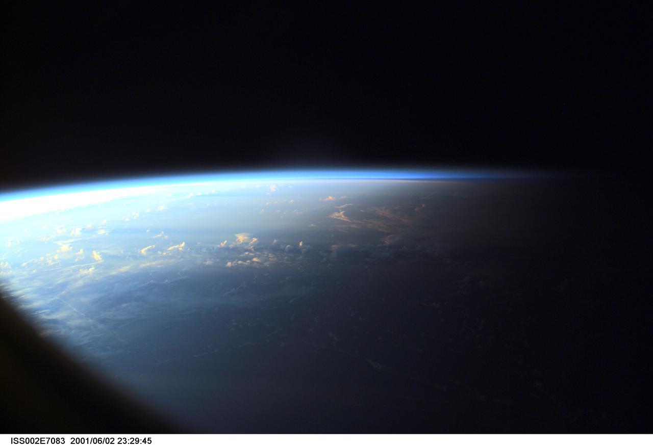
ISS002-E-7083 (2 June 2001) --- Earth's limb at sunset as photographed by one of the Expedition Two crew members with a digital still camera aimed through the nadir window of the U.S. laboratory Destiny.
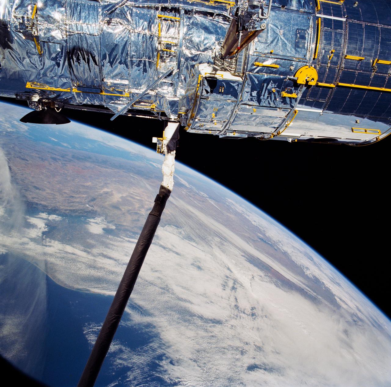
S114-E-5712 (28 July 2005) --- This view of the Orbital Boom Sensor System, backdropped by clouds and Earth’s limb, was taken by the STS-114 crew during approach and docking operations with the international space station.
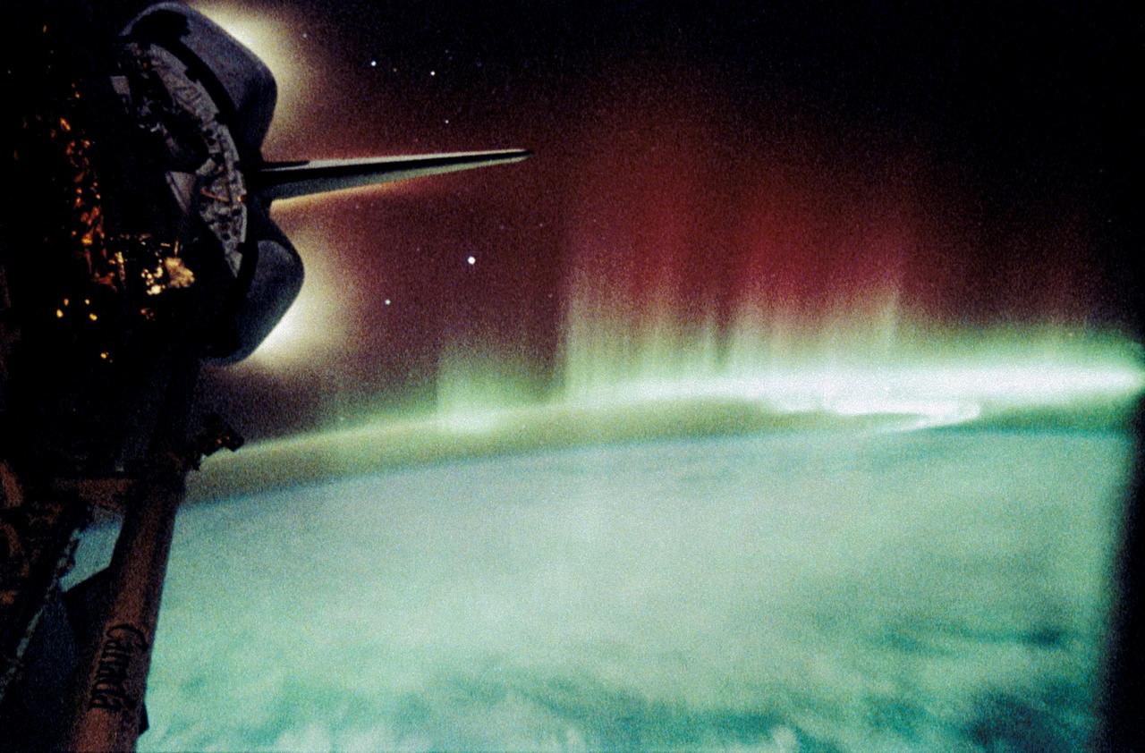
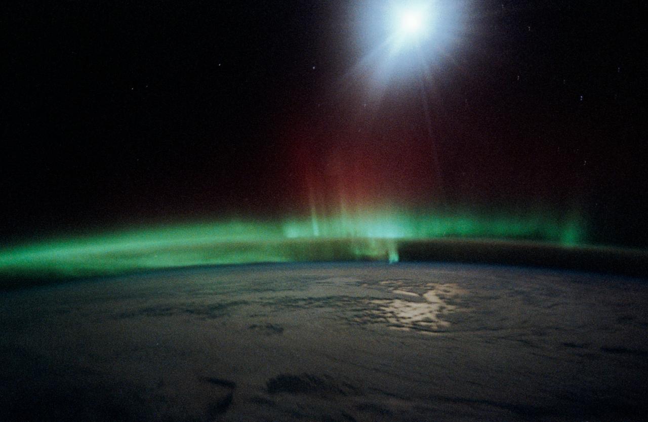
STS-45 Earth observation taken onboard Atlantis, Orbiter Vehicle (OV) 104, is of the Aurora Australis or Southern Lights. The green appearing auroral activity engulfs the thin blue line on the Earth's limb. Aurorae were observed and photographed throughout the STS-45 nine-day mission.
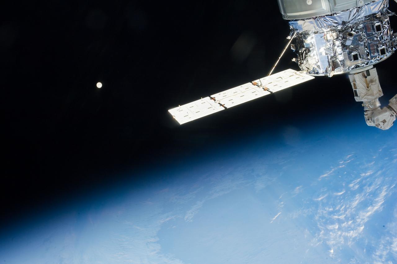
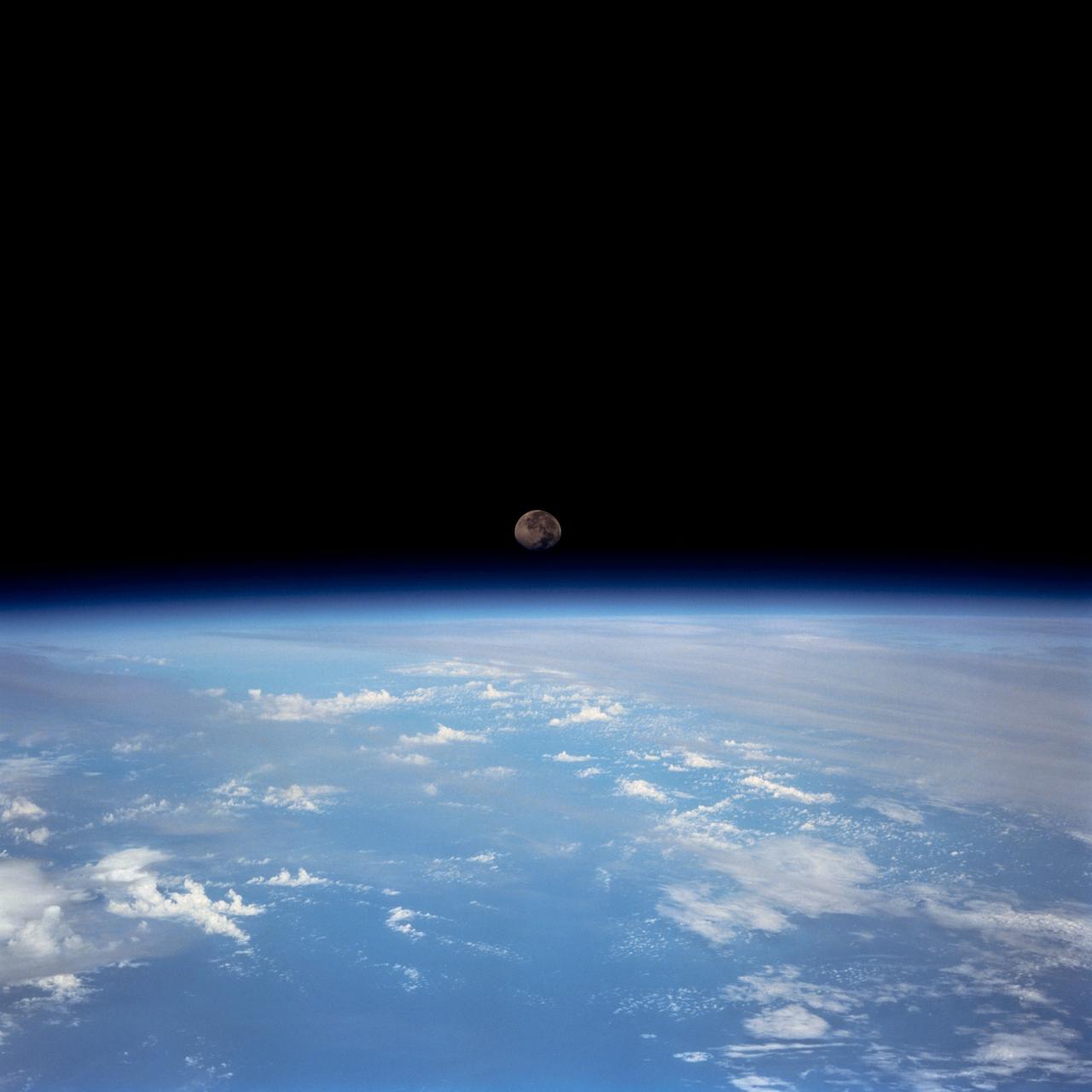
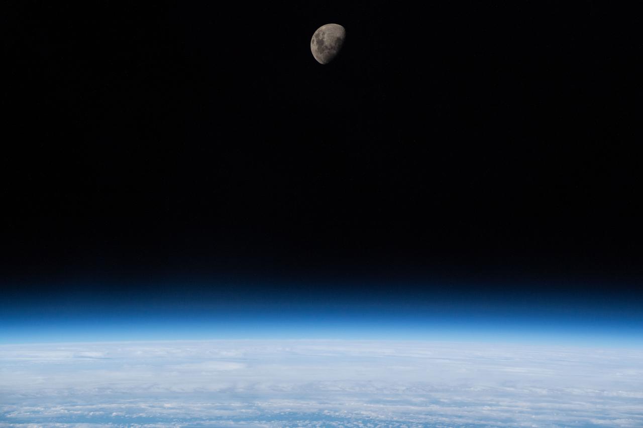
Distant view of the Moon over Earth limb taken by the Expedition 37 crew aboard the International Space Station (ISS). An ISS solar array is also visible.
STS047-54-018 (12-20 Sept. 1992) --- The colors in this photograph provide insight into the relative density of the atmosphere. The crew members had many opportunities to witness sunrises and sunsets, considering they orbit the Earth every 90 minutes, but few, they said, compared to this scene. It captures the silhouette of several mature thunderstorms with their cirrus anvil tops spreading out against the tropopause (the top of the lowest layer of Earth's atmosphere) at sunset. The lowest layer (troposphere) is the densest and refracts light at the red end of the visible spectrum (7,400 Angstroms), while the blues (4,000 Angstroms) are separated in the least dense portion of the atmosphere (middle and upper atmosphere, or stratosphere and mesosphere). Several layers of blue can be seen. NASA scientists studying the photos believe this stratification to be caused by the scattering of light by particulate trapped in the stratosphere and mesosphere particulate that generally originate from volcanic eruptions, such as those of Mt. Pinatubo in the Philippines and, most recently, Mt. Spurr in Alaska.
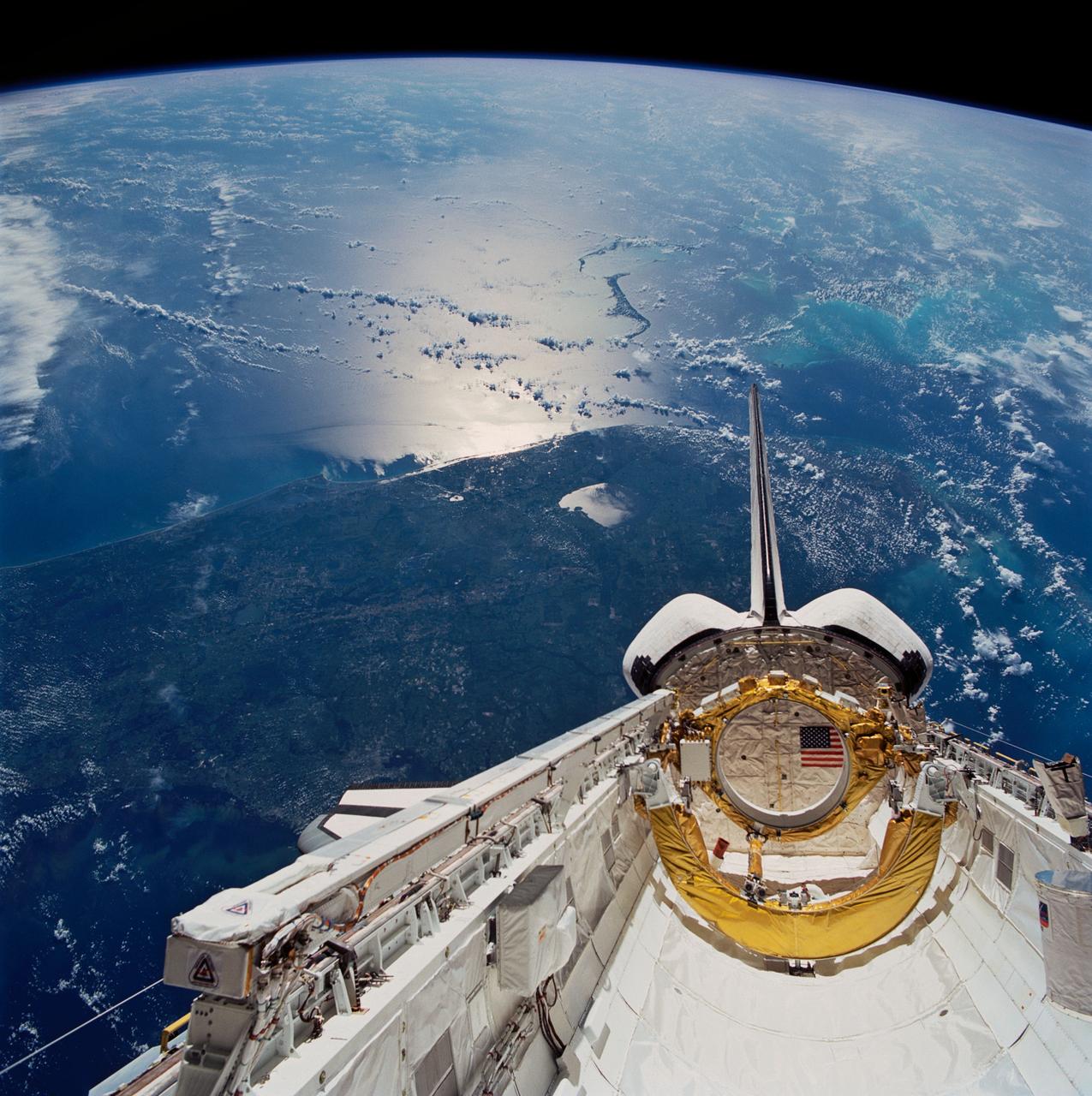
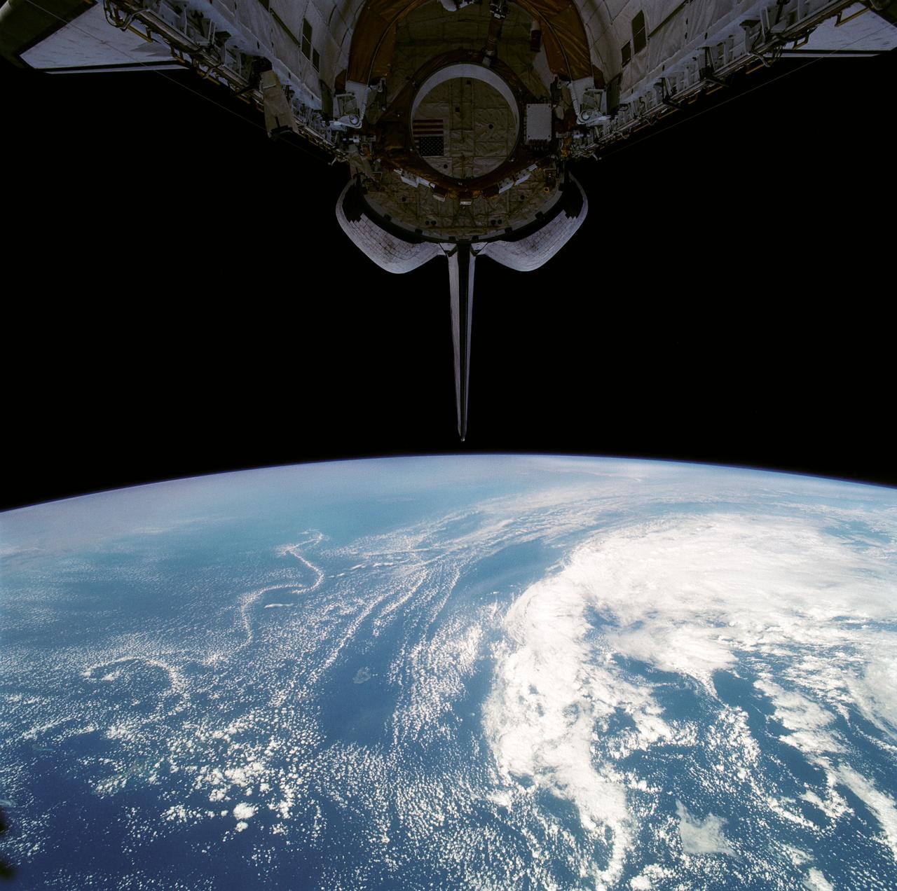
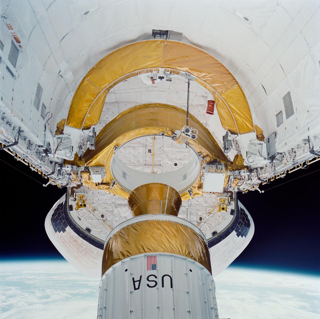
STS043-83-082 (2-11 Aug 1991) --- Having bade farewell to its Tracking and Data Relay Satellite/IUS payload, Atlantis' cargo bay appears somewhat vacant in this scene, backdropped over the southern two-thirds of the Florida peninsula. Important activity in the payload bay continues, however, with the operation of Space Station Heat Pipe Advanced Radiator Element (SHARE II), an experiment carried on the starboard side (lower left quadrant of frame). Purpose of the SHARE experiment is to demonstrate microgravity thermal vacuum performance of a heat pipe radiator for heat rejection as a prelude to development of a Space Station heat rejection system. The foil covered ring and horseshoe shaped objects aft in the payload bay served as restraint devices for the TDRS-E prior to its deployment six hours after Atlantis lifted off from Kennedy Space Center's Launch Pad 39A.

This cross section of the Earth's atmosphere at sunset and earth limb (24.5S, 43.5E) displays an unusual layering believed to be caused by temperature inversions which effectively concentrate smoke, dust and aerosols into narrow layers. the top of the stratosphere can be seen as the top of the white layer thought to contain volcanic debris. The purple layer is the troposphere containing smoke from landclearing biomass burning.
S65-65257 (4-18 Dec. 1965) --- Sunrise and Earth's limb, as photographed by astronauts Frank Borman and James A. Lovell Jr. during their Earth-orbital 14-day mission in the Gemini-7 (GT-7) spacecraft. Photo credit: NASA
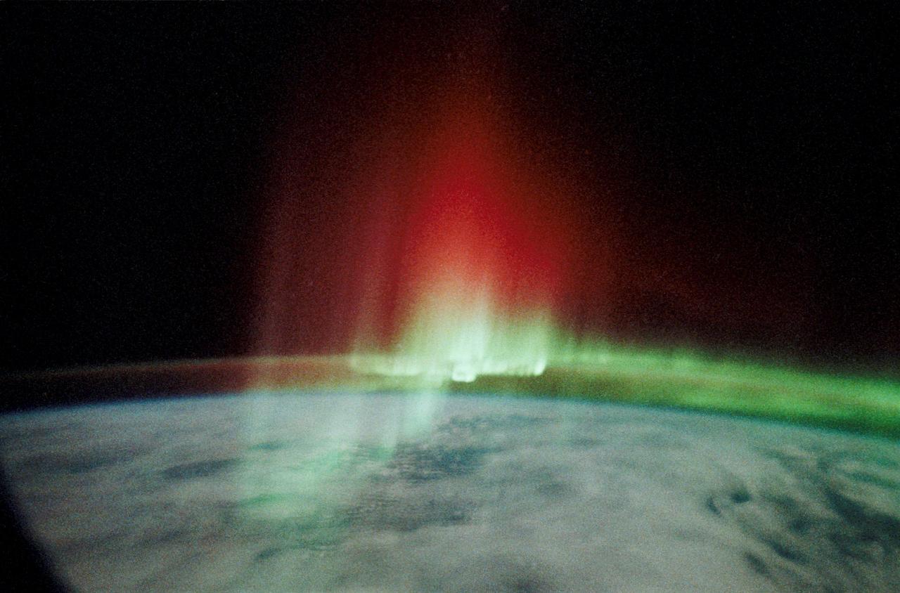
STS039-342-026 (28 April-6 May 1991) --- This view of the Aurora Australis, or Southern Lights, shows a band of airglow above the limb of Earth. Photo experts at NASA studying the mission photography identify the airglow as being in the 80-120 kilometer altitude region and attribute its existence to atomic oxygen (wavelength of 5,577 Angstroms), although other atoms can also contribute. The atomic oxygen airglow is usually most intense at altitudes around 65 degrees north and south latitude, and is most intense in the spring and fall of the year. The aurora phenomena is due to atmospheric oxygen and nitrogen being excited by the particles from the Van Allen Radiation belts which extend between the two geomagnetic poles. The red and green rays appear to extend upward to 200-300 kilometers, much higher than the usual upper limits of about 110 kilometers.
Stable, south flowing air over the western Pacific Ocean (26.0N, 131.0E) is disturbed by islands south of Korea, resulting in sinuous clouds known as von Karman vortices. The smoke plume from Japan's Mount Unzen Volcano on Kyushu, is visible just west of the large cloud mass and extending southward. A very large, purple tinged dust pall, originating in Mongolia, can be seen on the Earth's Limb, covering eastern China and extending into the East China Sea.
STS054-151-150 (13-19 Jan 1993) --- View west into sun glint off the Rio Salado, Saladillo, and Parana Rivers in Argentina. The Space Shuttle nadir is about 28 degrees north latitude and 57 degrees west longitude. The Andes Mountains are barely visible on Earth's limb. Thunderstorms along the eastern edge of the Andes are typical of this time of year (Southern Hemisphere summer), with anvils moving to the east from the core of the storm.
STS109-729-072 (9 March 2002) --- Looking westward, one of the STS-109 crew members photographed the newly serviced and upgraded Hubble Space Telescope (HST) near the earth's limb to the upper right of the center of this 70mm image. The Space Shuttle Columbia was located over the Atlantic Ocean southwest of the Cape Verde Islands when this image was acquired. Low to mid-altitude clouds are visible across the image. Some thunderstorms can be seen near the left center of the image as the sun reflects off the higher cloud tops.

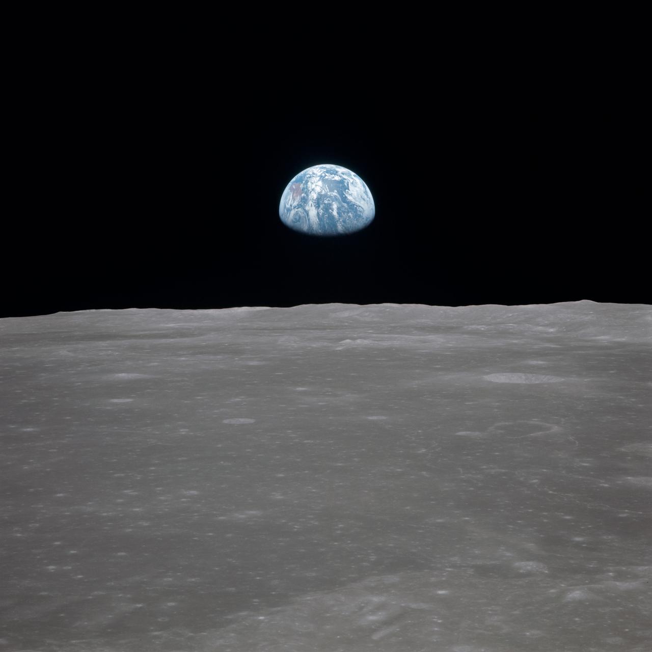
AS08-14-2383 (24 Dec. 1968) --- The rising Earth is about five degrees above the lunar horizon in this telephoto view taken from the Apollo 8 spacecraft near 110 degrees east longitude. The horizon, about 570 kilometers (350 statute miles) from the spacecraft, is near the eastern limb of the moon as viewed from Earth. Width of the view at the horizon is about 150 kilometers (95 statute miles). On Earth 240,000 statute miles away the sunset terminator crosses Africa. The crew took the photo around 10:40 a.m. Houston time on the morning of Dec. 24, and that would make it 15:40 GMT on the same day. The South Pole is in the white area near the left end of the terminator. North and South America are under the clouds.
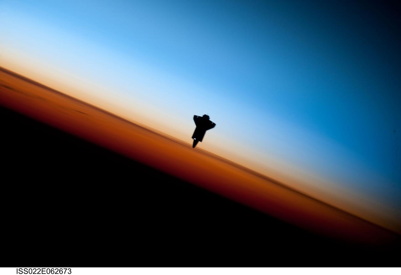
ISS022-E-062673 (9 Feb. 2010) --- Though astronauts and cosmonauts often encounter striking scenes of Earth's limb, this very unique image, part of a series over Earth's colorful horizon, has the added feature of a silhouette of the space shuttle Endeavour. The image was photographed by an Expedition 22 crew member prior to STS-130 rendezvous and docking operations with the International Space Station. Docking occurred at 11:06 p.m. (CST) on Feb. 9, 2010. The orbital outpost was at 46.9 south latitude and 80.5 west longitude, over the South Pacific Ocean off the coast of southern Chile with an altitude of 183 nautical miles when the image was recorded. The orange layer is the troposphere, where all of the weather and clouds which we typically watch and experience are generated and contained. This orange layer gives way to the whitish Stratosphere and then into the Mesosphere. In some frames the black color is part of a window frame rather than the blackness of space.
View of Moon limb with Earth on the horizon,Mare Smythii Region. Earth rise. This image was taken before separation of the LM and the Command Module during Apollo 11 Mission. Original film magazine was labeled V. Film Type: S0-368 Color taken with a 250mm lens. Approximate photo scale 1:1,300,000. Principal Point Latitude was 3 North by Longitude 85 East. Foward overlap is 90%. Sun angle is High. Approximate Tilt minimum is 65 degrees,maximum is 69. Tilt direction is West (W).
During STS-26, inertial upper stage (IUS) with tracking and data relay satellite C (TDRS-C) located in the payload bay (PLB) of Discovery, Orbiter Vehicle (OV) 103, is positioned into its proper deployment attitude (an angle of 50 degrees) by the airborne support equipment (ASE). In the foreground, the ASE forward cradle is visible. The IUS is mounted in the ASE aft frame tilt actuator (AFTA) table. TDRS-C components in stowed configuration include solar array panels, TDRS single access #1 and #2, TDRS SGL, and S-Band omni antenna. In the background are the orbital maneuvering system (OMS) pods, the Earth's cloud-covered surface, and the Earth's limb.
About 50,000 Clementine images were processed to produce the four orthographic views of the Moon. The images show albedo variations (normalized brightness or reflectivity) of the surface at a wavelength of 750 nm (just longward of visible red). The image projection is centered at 0 degree latitude and 180 degrees longitude. Mare Moscoviense (dark albedo feature upper left of image center) and South Pole-Aitken Basin (dark feature at bottom) represent maria regions largely absent on the lunar farside. The Clementine altimeter showed Aitken Basin to consist of a topographic rim about 2500 km in diameter, an inner shelf ranging from 400 to 600 km in width, and an irregular depressed floor about 12 km in depth. http://photojournal.jpl.nasa.gov/catalog/PIA00303
About 50,000 Clementine images were processed to produce the four orthographic views of the Moon. The images show albedo variations (normalized brightness or reflectivity) of the surface at a wavelength of 750 nm (just longward of visible red). The image projection is centered at 0 degree latitude and 180 degrees longitude. Mare Moscoviense (dark albedo feature upper left of image center) and South Pole-Aitken Basin (dark feature at bottom) represent maria regions largely absent on the lunar farside. The Clementine altimeter showed Aitken Basin to consist of a topographic rim about 2500 km in diameter, an inner shelf ranging from 400 to 600 km in width, and an irregular depressed floor about 12 km in depth. http://photojournal.jpl.nasa.gov/catalog/PIA00304
During STS-31, the Hubble Space Telescope (HST) is held in appendage deploy position by Discovery's, Orbiter Vehicle (OV) 103's, remote manipulator system (RMS) above the payload bay (PLB) and crew compartment cabin. While in this position the solar array (SA) wing bistem cassette (HST center) is deployed from its stowed location along side the Support System Module (SSM) forward shell. A high gain antenna (HGA) remains stowed along the SSM. The Earth's surface and the Earth limb creates a dramatic backdrop.

STS058-77-083 (18 Oct-1 Nov 1993) --- In this scene of the south coast of Africa, Cape Agulhas, the southernmost point on the continent, appears as the leftmost cape. Viewed with the Earth's limb top left, clouds at bottom, the view direction is west and north top right. The Cape of Good Hope, with Cape Town nearby, is the thin spike beyond. The great bay in the foreground is Algoa Bay with the city of Port Elizabeth. This was the first time European voyagers are known to have rounded the Cape of Good Hope in their quest to reach India by sea. The entire fold mountain belt of southern Africa is visible: these mountains appear as green (forested) wavy structures stretching west form the foreground, to the Cape of Good Hope, and then northwards some distance. One theory about their origin is that the Falkland Plateau, now an undersea extension of South America, was jostled up against Africa more than 150 million years ago, in times before the Atlantic Ocean existed, before Africa and South America drifted apart from one another. The jostling caused the evolution of the fold mountain belt.
During STS-26, inertial upper stage (IUS) with the tracking and data relay satellite C (TDRS-C) drifts above Discovery, Orbiter Vehicle (OV) 103, payload bay (PLB) after being positioned in deployment attitude (an angle of 50 degrees) by the airborne support equipment (ASE). IUS vacates the ASE aft frame tilt actuator (AFTA) table in the PLB while the disconnected ASE umbilical boom floats above ASE forward cradle. IUS first stage rocket motor and nozzle and the interstage are visible as the IUS is deployed. In the background are the orbital maneuvering system (OMS) pods and the Earth's limb.
During STS-26, inertial upper stage (IUS) with the tracking and data relay satellite C (TDRS-C) located in the payload bay (PLB) of Discovery, Orbiter Vehicle (OV) 103, is raised into deployment attitude (an angle of 50 degrees) by the airborne support equipment (ASE). ASE aft frame tilt actuator (AFTA) table supports the IUS as it is positioned in the PLB and the ASE umbilical boom drifts away from IUS toward ASE forward cradle. TDRS-C solar array panels (in stowed configuration) are visible on top of the IUS. In the background are the orbital maneuvering system (OMS) pods and the Earth's limb.

STS030-10-008 (4-8 May 1989) --- Since the beginning manned space travel, astronauts have taken with them items of personal sentiment. In case of Mark C. Lee, STS-30 mission specialist, a picture of a cow testifies to his background as one reared on a Wisconsin farm. The scene, through a flight deck aft window, also shows Earth some 160 nautical miles away.
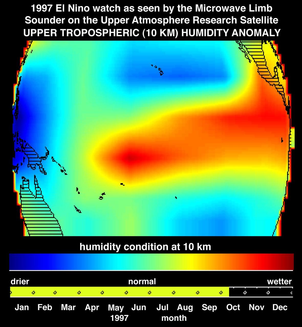
This image shows atmospheric water vapor in Earth upper troposphere, about 10 kilometers 6 miles above the surface, as measured by NASA Microwave Limb Sounder MLS instrument flying aboard the Upper Atmosphere Research Satellite.
S114-E-5496 (28 July 2005) --- Earth’s limb at sunset as photographed by one of the STS-114 crewmembers through a window on the Space Shuttle Discovery. Beneath the limb, a blue and white Earth is visible.
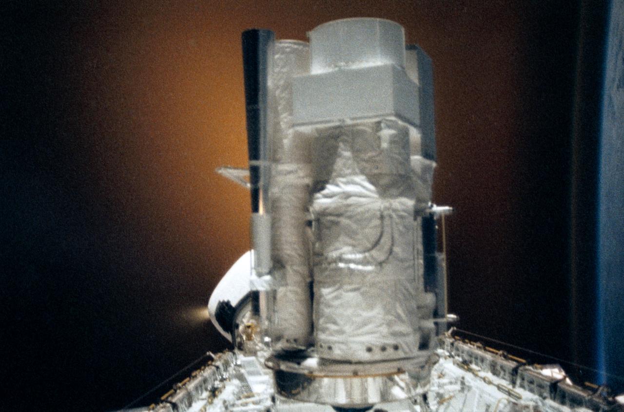
STS035-28-006 (2-10 Dec 1990) --- STS-35 Astronomy Laboratory 1 (ASTRO-1) telescopes, in on-orbit operating position in the payload bay (PLB), are silhouetted against an reaction control system (RCS) right thruster firing. Three ultraviolet telescopes are mounted and precisely co-aligned on a common structure, called the cruciform, that is attached to the instrument pointing system (IPS). Here the IPS holds the telescopes in a position that is parallel to the Earth's limb below. Visible on the cruciform are the star tracker (S TRK) (silver cone at the top), the Ultraviolet Imaging Telescope (UIT) (behind S TRK), and the Hopkins Ultraviolet Telescope(HUT).
STS047-54-016 (12 - 20 Sept 1992) --- The colors in this photograph provide insight into the relative density of the atmosphere. The crew members had many opportunities to witness sunrises and sunsets, considering they orbit the Earth every 90 minutes, but few, they said, compared to this scene. It captures the silhouette of several mature thunderstorms with their cirrus anvil tops spreading out against the tropopause (the top of the lowest layer of Earth's atmosphere) at sunset. The lowest layer (troposphere) is the densest and refracts light at the red end of the visible spectrum (7,400 Angstroms), while the blues (4,000 Angstroms) are separated in the least dense portion of the atmosphere (middle and upper atmosphere, or stratosphere and mesosphere). Several layers of blue can be seen. NASA scientists studying the photos believe this stratification to be caused by the scattering of light by particulate trapped in the stratosphere and mesosphere particulate that generally originate from volcanic eruptions, such as those of Mt. Pinatubo in the Philippines and, most recently, Mt. Spurr in Alaska.

This color picture of the limb of the Earth, looking north past Antarctica, is a mosaic of 11 images taken during a ten-minute period near 5:45 p.m. PST Dec. 8, 1990, by NASA’s Galileo imaging system. http://photojournal.jpl.nasa.gov/catalog/PIA00116
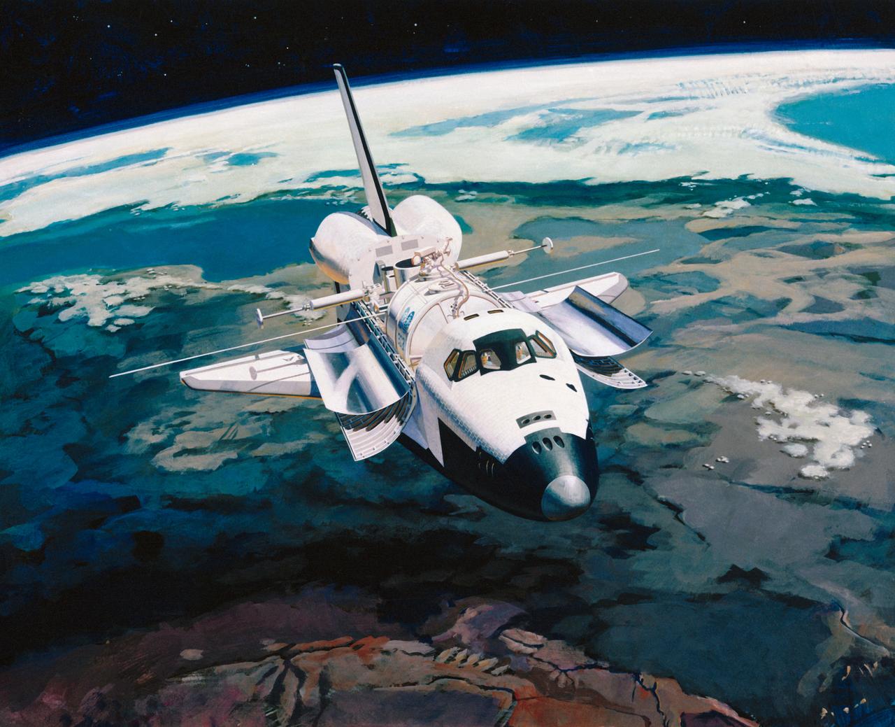
Artist Concept of Shuttle in-orbit flight with Earth limb in the background.
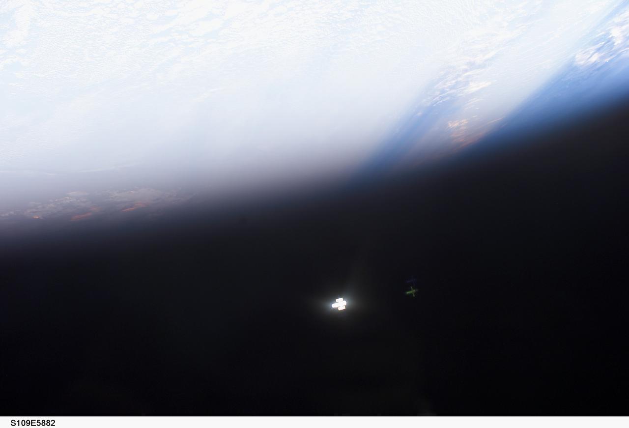
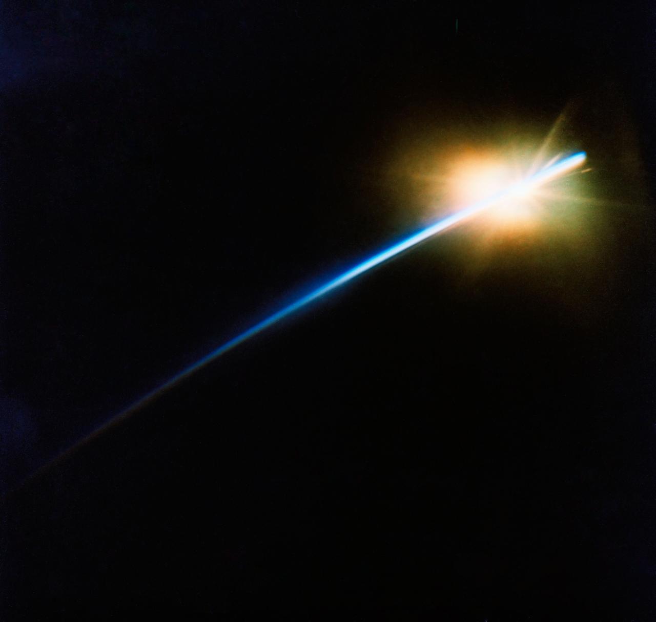
STS109-E-5882 (9 March 2002) --- The Hubble Space Telescope (HST), appearing as a tiny, almost indistinguishable glowing mass, distances itself from the Space Shuttle Columbia following its release on March 9, 2002. Considering its original deployment in 1990 and three previous servicing missions, this marked the fifth time a shuttle has bade farewell to the giant telescope. This image was recorded with a digital still camera.
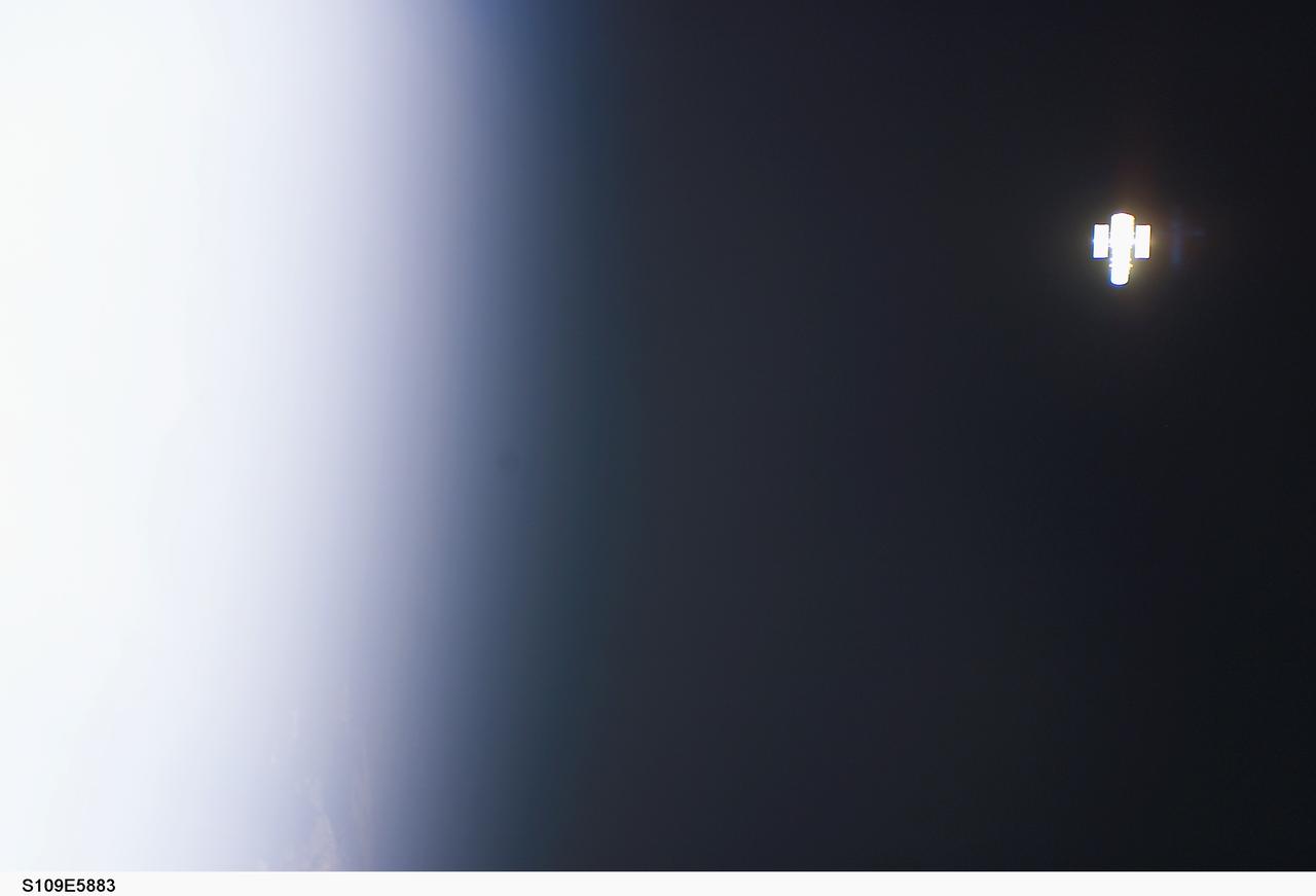
STS109-E-5883 (9 March 2002) --- The Hubble Space Telescope (HST) distances itself from the Space Shuttle Columbia following its release on March 9, 2002. Considering its original deployment in 1990 and three previous servicing missions, this marked the fifth time a shuttle has bade farewell to the giant telescope. This image was recorded with a digital still camera.
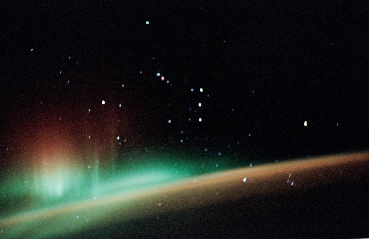
STS059-52-029 (9-20 April 1994) --- The constellation Orion is backdropped against a colorful display of the Southern Lights (aurora australis) in this 35mm image. Six NASA astronauts went on to spend a week and a half aboard the Space Shuttle Endeavour in support of the Space Radar Laboratory (SRL-1) mission.
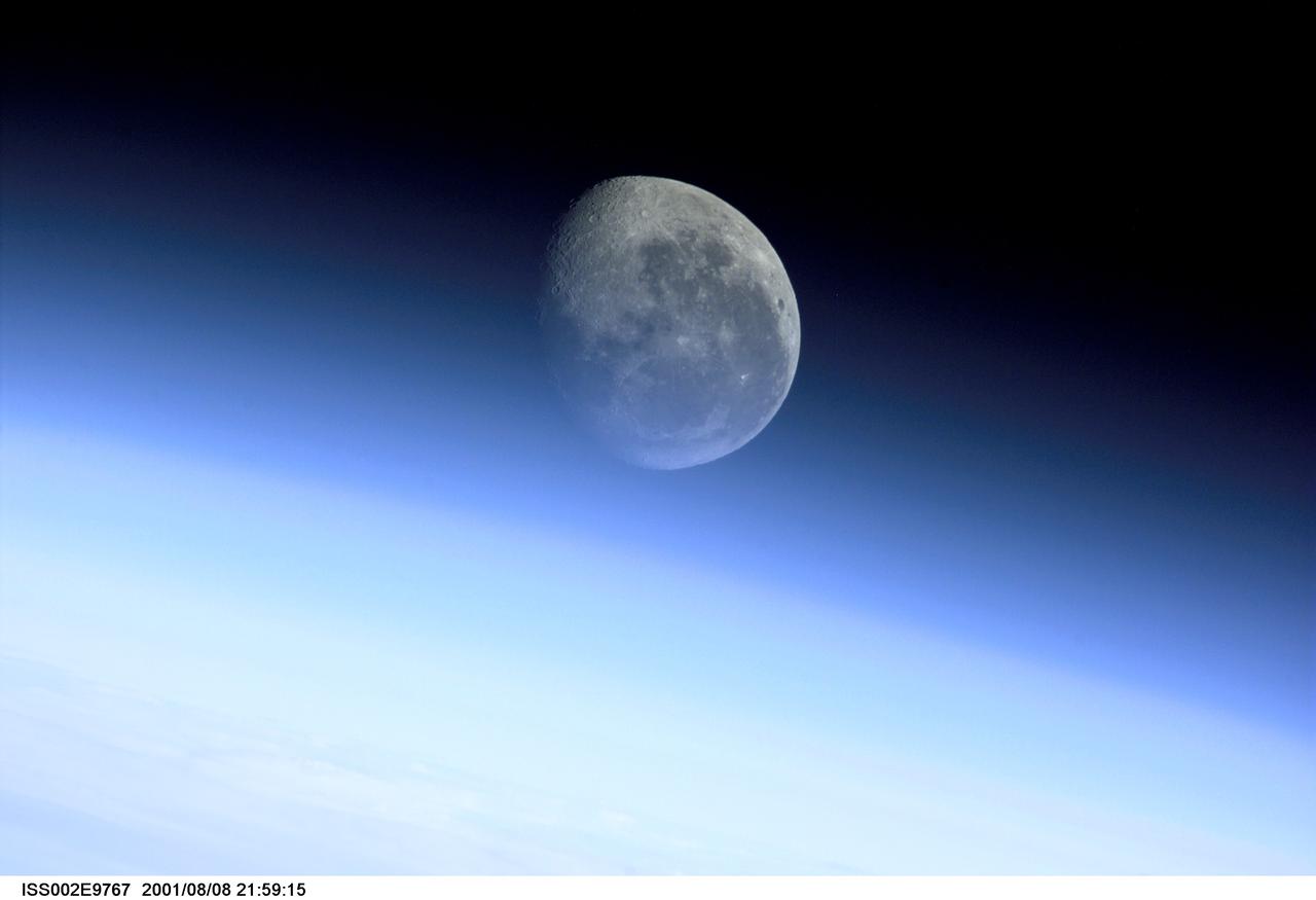
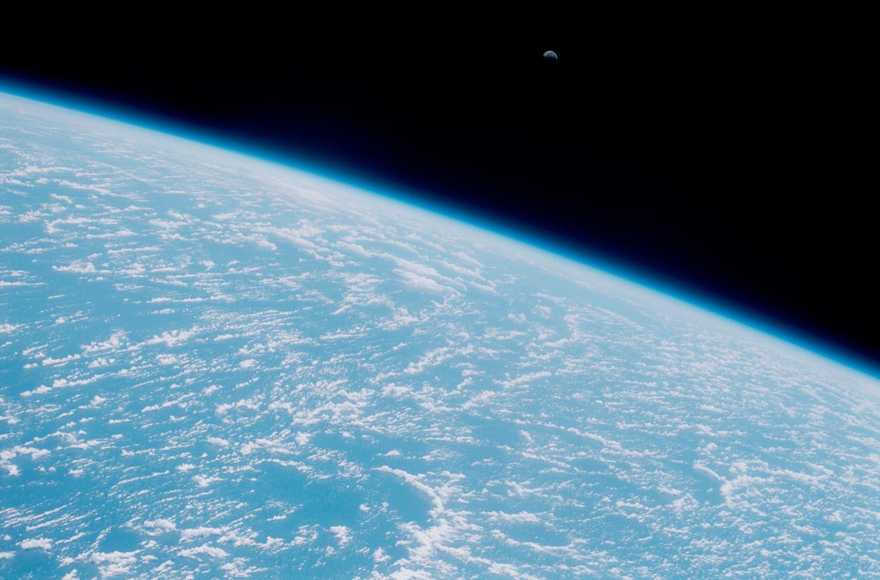
ISS002-E-9767 (8 Aug. 2001) --- This image, recorded with a digital still camera by one of the Expedition Two crew members onboard the International Space Station, is a glimpse of the barren moon through the Earth's limb. With no atmosphere, and therefore no limb of its own, the edge of the moon arcs crisply against the backdrop of space. Some of the most breathtaking views of Earth taken from space are those that capture our planet's limb. When viewed from the side, the Earth looks like a flat circle, and the atmosphere appears like a halo around it. This glowing halo is known as the limb. Viewed from satellites, space shuttles, and even the moon, the image of this luminous envelope of gases shielding the life on our planet from the dark, cold space beyond rarely fails to fascinate us.
STS058-92-064 (18 Oct-1 Nov 1993) --- This oblique view, looking northeast from central Egypt, shows great expanses of the sand covered and rocky Western Desert in the foreground (bottom). The dark patches bottom right are the Dakhla Oases on the south side of an escarpment. For centuries camel trains have moved from here to the Nile Valley, seen here as a broad green line winding through the desert. The northern half of Egypt's Nile appears here, from about the latitude of Luxor to the delta. Green colors indicate the small area of crops which feed Egypt's population of 55 million. The Nile Delta is partly obscured by a band of clouds, but can be discerned at the coast as a flattened triangle of green. The smaller triangle close by is the Faiyum Basin, a depression irrigated by water from the Nile. The coast of the Mediterranean Sea appears left.

Earth obsevation taken by the Expedition 40 crew aboard the International Space Station (ISS). Sunrise over Earth limb. Some Window reflections visible.
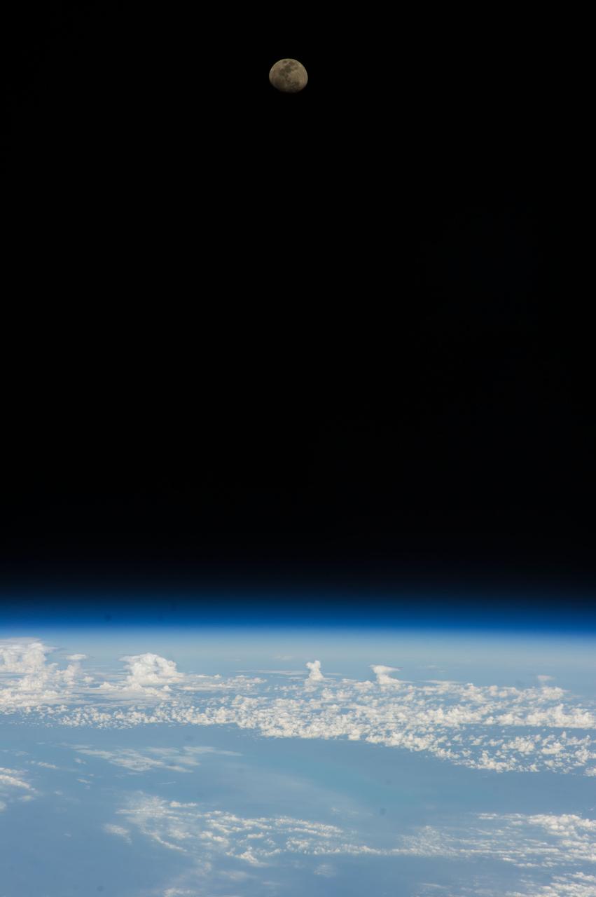
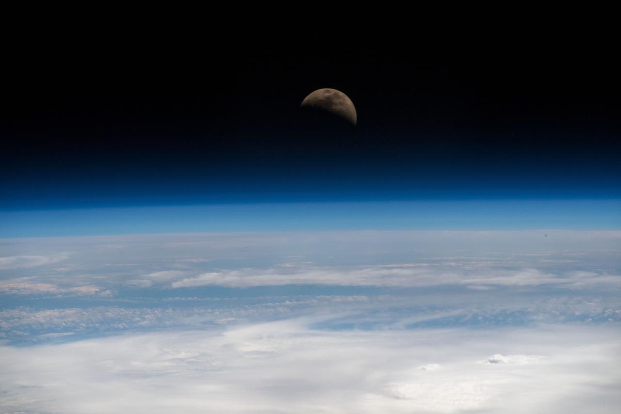
View of Moon setting over an Earth limb taken by the Expedition 40 crew aboard the International Space Station (ISS).
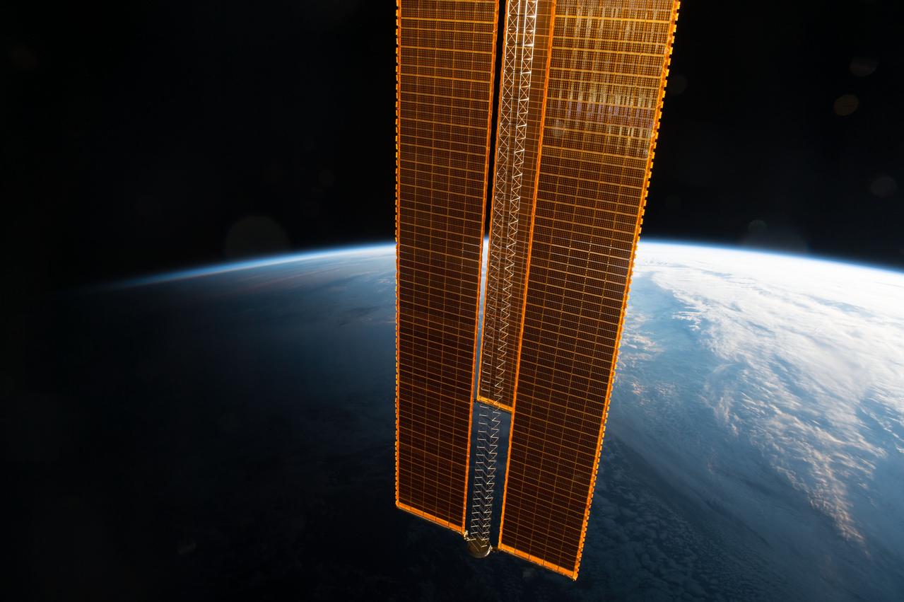
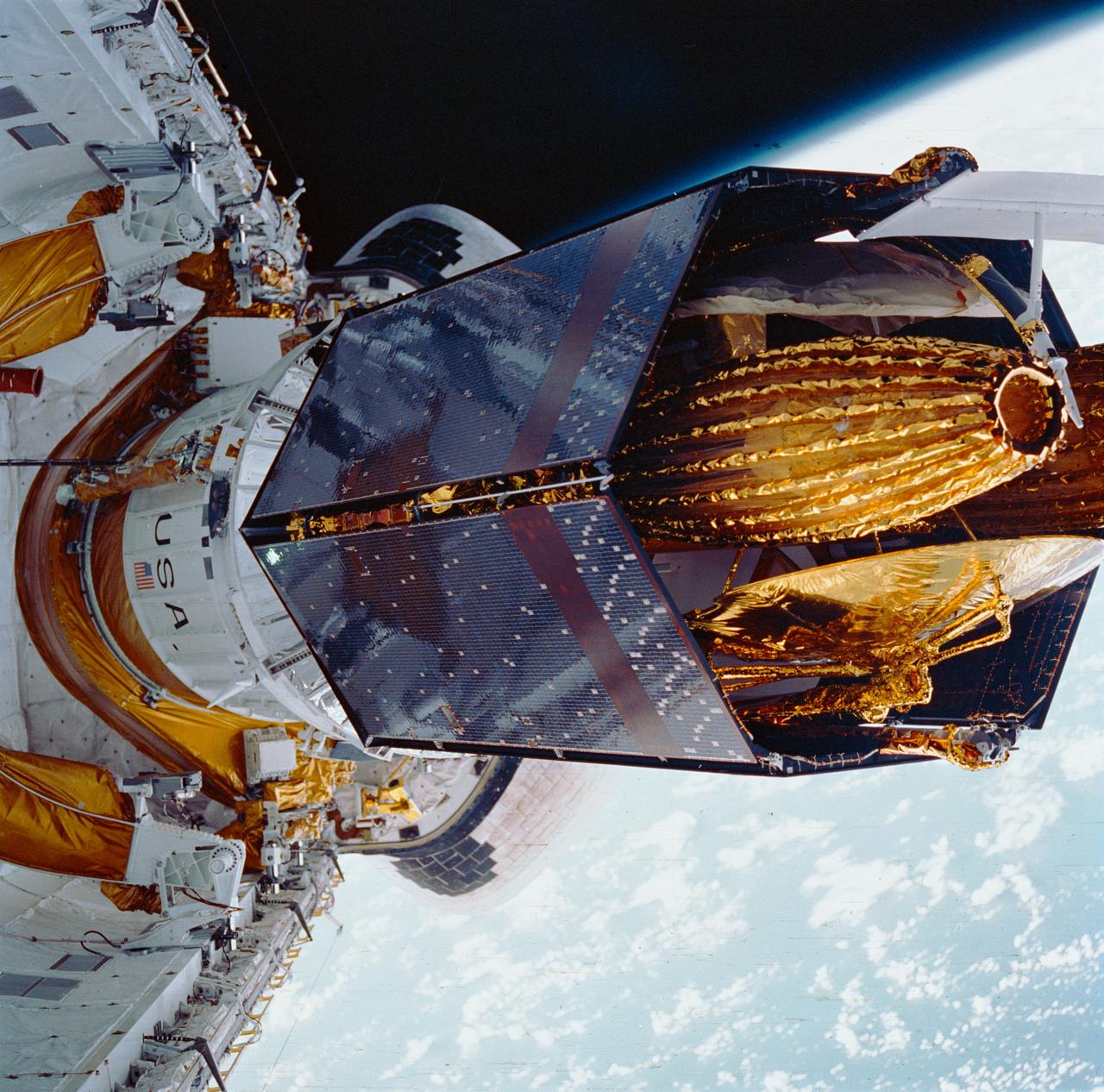
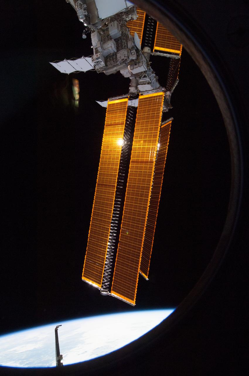
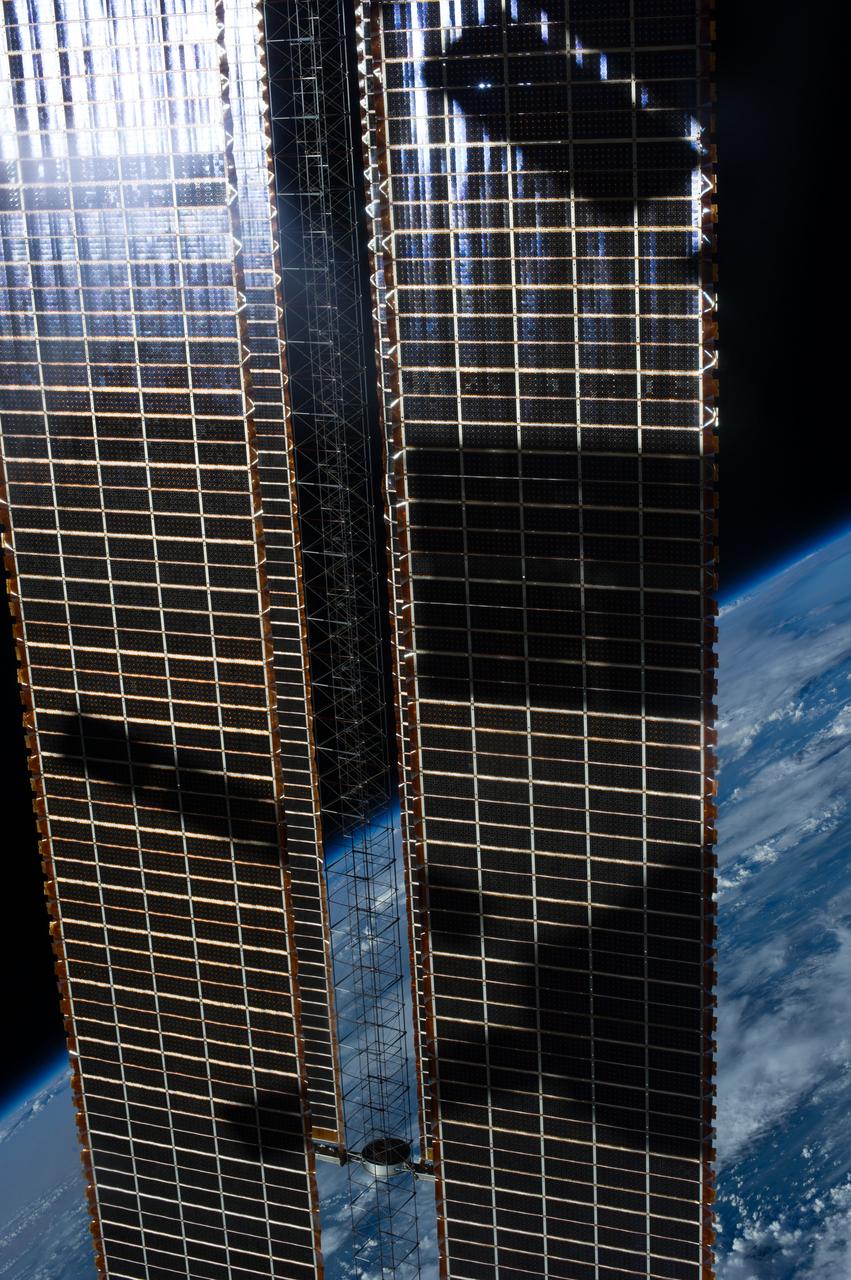
View of golden solar array with Earth limb in the background taken by the Expedition 49 crew.
Lunar observation taken by the Expedition 39 crew aboard the ISS. An Earth limb and airglow are in view. Image was released by astronaut on Twitter.
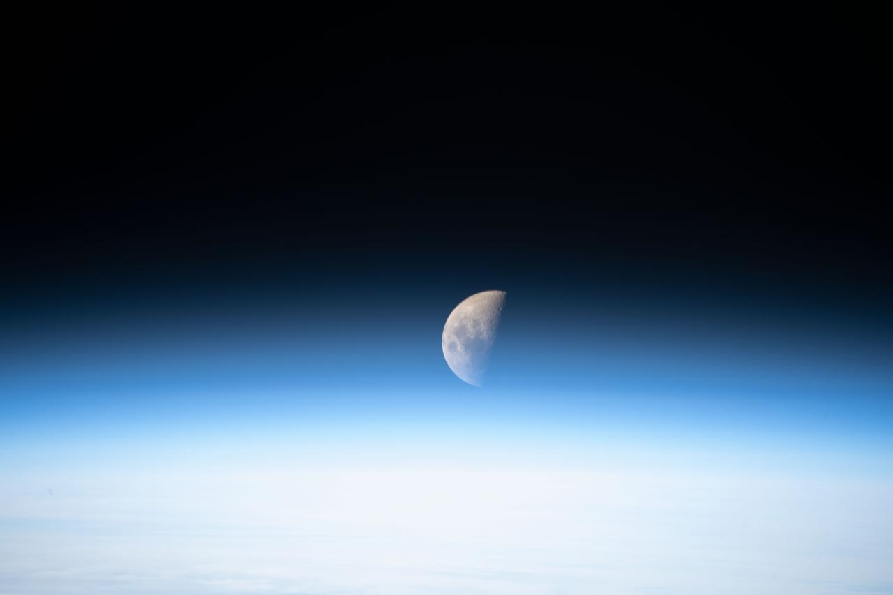
Lunar observation taken by the Expedition 35 crew aboard the ISS. An Earth limb is in view.
View of the Soyuz TMA-15M spacecraft docked to Rassvet Mini-Research Module 1 (MRM1) An Earth limb is in view.
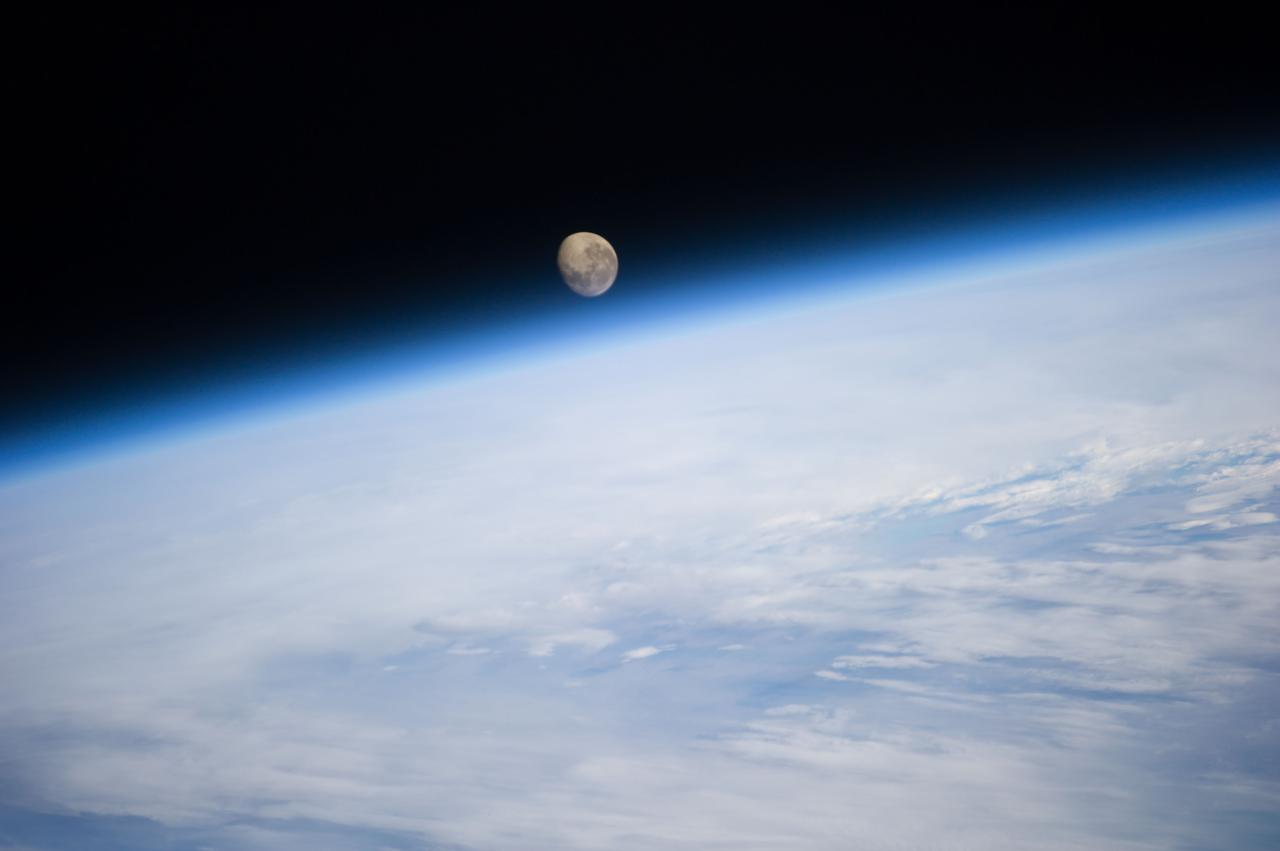
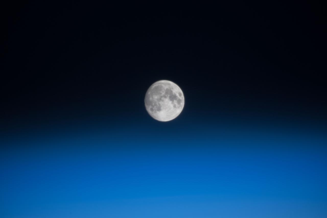
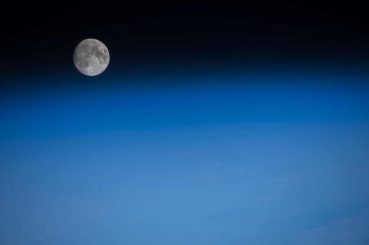
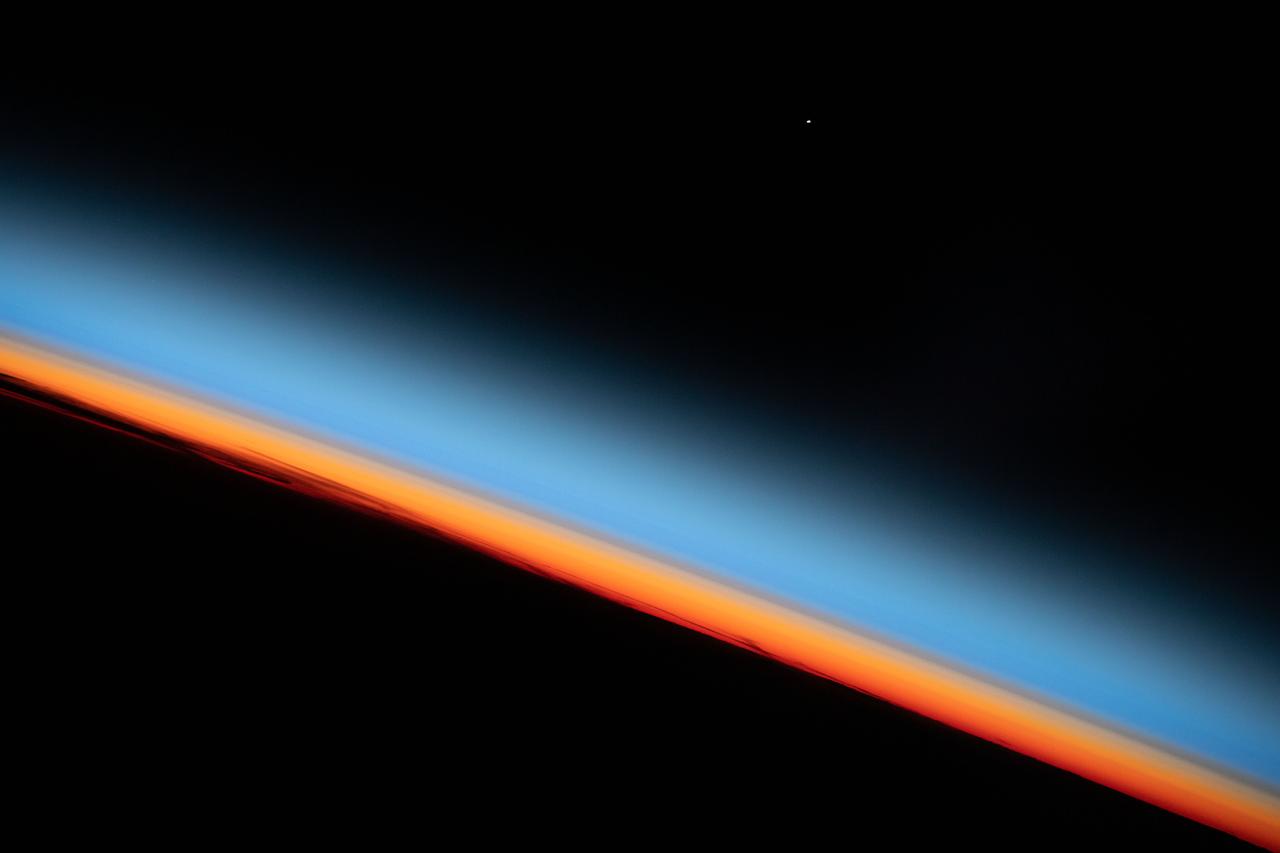
iss061e003881 (Oct. 5, 2019) --- A first quarter Moon is pictured from the International Space Station just above the Earth's limb.

In 1995, NASA Hubble Space Telescope discovered a new great dark spot, located in the northern hemisphere of the planet Neptune. Because the planet northern hemisphere was tilted away from Earth, the new feature appeared near the limb of the planet.
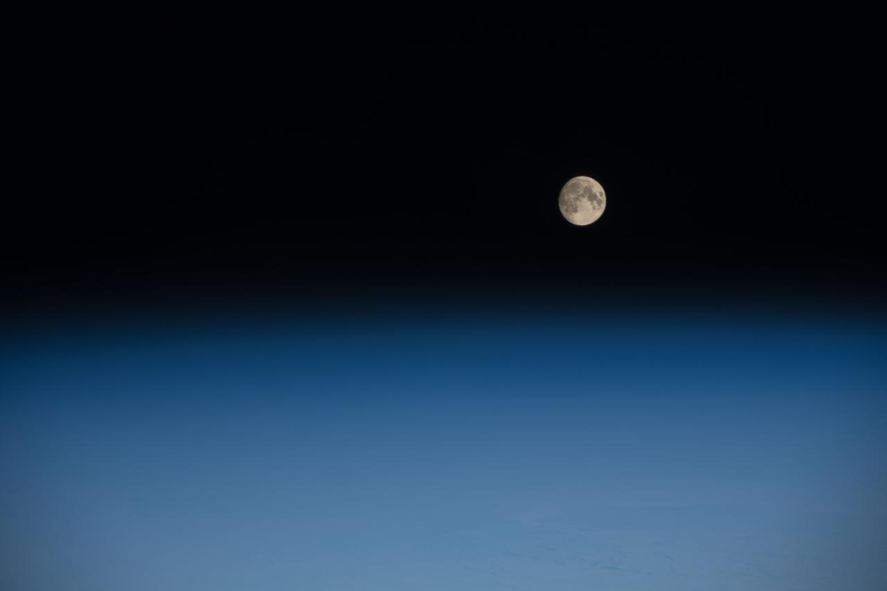
STS080-759-038 (19 Nov.-7 Dec. 1996) --- As photographed by the crewmembers aboard the space shuttle Columbia, a full moon is about to set beyond the limb of Earth. A full moon should be round but when it is near the limb, or edge of Earth, the atmosphere tends to distort the shape. The atmosphere, stratosphere, ionosphere is in reality acting as a lens, thus the distorted shape of the Moon. As the Moon reaches the Earth's horizon it will become "eggshaped".
STS039-23-036 (28 April-6 May 1991) --- A 35mm frame of the Aurora Australis, also known as the Southern Lights, photographed from the Space Shuttle Discovery's flight deck by one of its seven crew members. One of the mission objectives was to measure the spectral and spatial characteristics of auroral emissions. While passing over the sunlit portion of Earth, the crew was able to take a number of photos of the various geographic points on the planet; much of the time on nightside passes was devoted to a thorough study and documentation of auroral displays.
STS039-25-006 (28 April-6 May 1991) --- A 35mm frame of the Aurora Australis, also known as the Southern Lights, photographed from the Space Shuttle Discovery's flight deck by one of its seven crew members. One of the mission objectives was to measure the spectral and spatial characteristics of auroral emissions. While passing over the sunlighted portion of Earth, the crew was able to take a number of photos of the various geographic points on the planet; much of the time on nightside passes was devoted to a thorough study and documentation of auroral displays.
STS004-41-1206 (27 June-4July 1982) --- Sunglint reflects off the water of the North Atlantic Ocean in an area to the east of the Bahamas Islands sometimes called the Sargasso Sea. The area has also been referred to as the ?Bermuda Triangle.? Astronauts Thomas K. Mattingly II, STS-4 commander, and Henry W. Hartsfield Jr., pilot, spent seven days and one hour aboard the Earth-orbiting space shuttle Columbia and performed a variety of duties in addition to those of recording 70mm and 35mm imagery. Photo credit: NASA
STS039-23-020 (28 April-6 May 1991) --- A 35mm frame of the Aurora Australis, also known as the Southern Lights, photographed from Space Shuttle Discovery's flight deck by one of its seven crew members. One of the mission objectives was to measure the spectral and spatial characteristics of auroral emissions. While passing over the sunlighted portion of Earth, the crew was able to take a number of photos of the various geographic points on the planet; much of the time on nightside passes was devoted to a thorough study and documentation of auroral displays.
STS039-377-013 (28 April-6 May 1991) --- Moonlight saturates the high speed film used for auroral photography. Moon glint is visible in the open ocean and the cloud patterns are well illuminated. This frame was taken with a handheld 35mm camera from inside the Space Shuttle Discovery's crew cabin. This is one of 25 visuals used by the STS-39 crew at its May 17, 1991 Post Flight Press Conference (PFPC). Discovery's flight of eight days duration, launched April 28, 1991 from Kennedy Space Center (KSC) and completed on May 6, 1991 at the KSC landing facility, was dedicated to the Department of Defense (DOD). Crew members were astronauts Michael L. Coats, L. Blaine Hammond, Guion S. Bluford, Richard J. Hieb, Gregory J. Harbaugh, Donald R. McMonagle and Charles L. (Lacy) Veach.
View of one of the International Space Stations solar arrays is visible from a window in the ISS with an Earth limb in the background. Photo taken by the Expedition 37 crew.

iss051e039977 (May 8, 2017) --- The Moon, the Earth's limb and thin blue atmosphere are seen in this photograph taken by an Expedition 51 crew member.
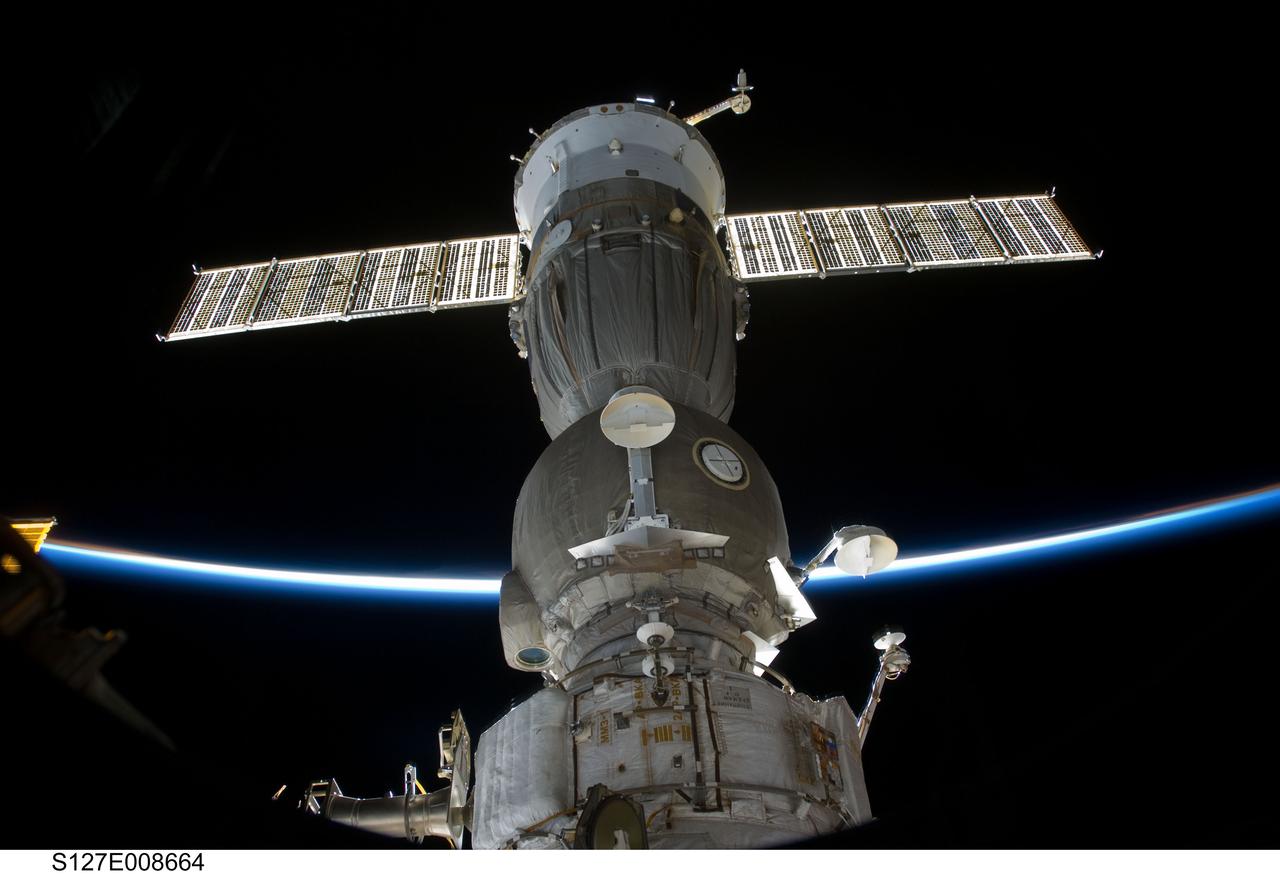
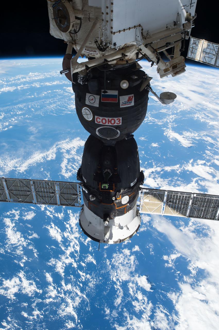
S127-E-008664 (25 July 2009) --- The limb of Earth intersects one of two Soyuz spacecraft that are docked with the Inernational Space Station.
iss064e002941 (Nov. 1, 2020) --- The Earth's limb, or horizon, is pictured as the International Space Station orbited above the north Pacific near Alaska's Aleutian Islands.

iss054e042061 (Feb. 11, 2018) --- A docked Russian Progress resupply ship dominates the foreground as Earth's limb is illuminated during an orbital night pass.
STS070-701-070 (13-22 JULY 1995) --- Dark surfaces of lunar mare can be identified on the ?tiny? Moon in the center of this clear 35mm frame, recorded by crew members aboard the Earth-orbiting Space Shuttle Discovery. A variety of cloud-types obscure land and water in the scene. Several tropical storms and tropical depressions were observed by the crew during its nine-day mission.
STS081-E-05436 (15 Jan. 1997) --- Soon after the astronauts docked the space shuttle Atlantis with Russia's Mir Space Station, astronaut Marsha S. Ivins, STS-81 mission specialist, went aboard the Mir complex and sought a window through which she could record this image of Atlantis' forward section. A solar array panel on the Mir is seen in one corner and the Ku-band antenna for Atlantis is visible in another. This view was taken with an electronic still camera (ESC). Photo credit: NASA
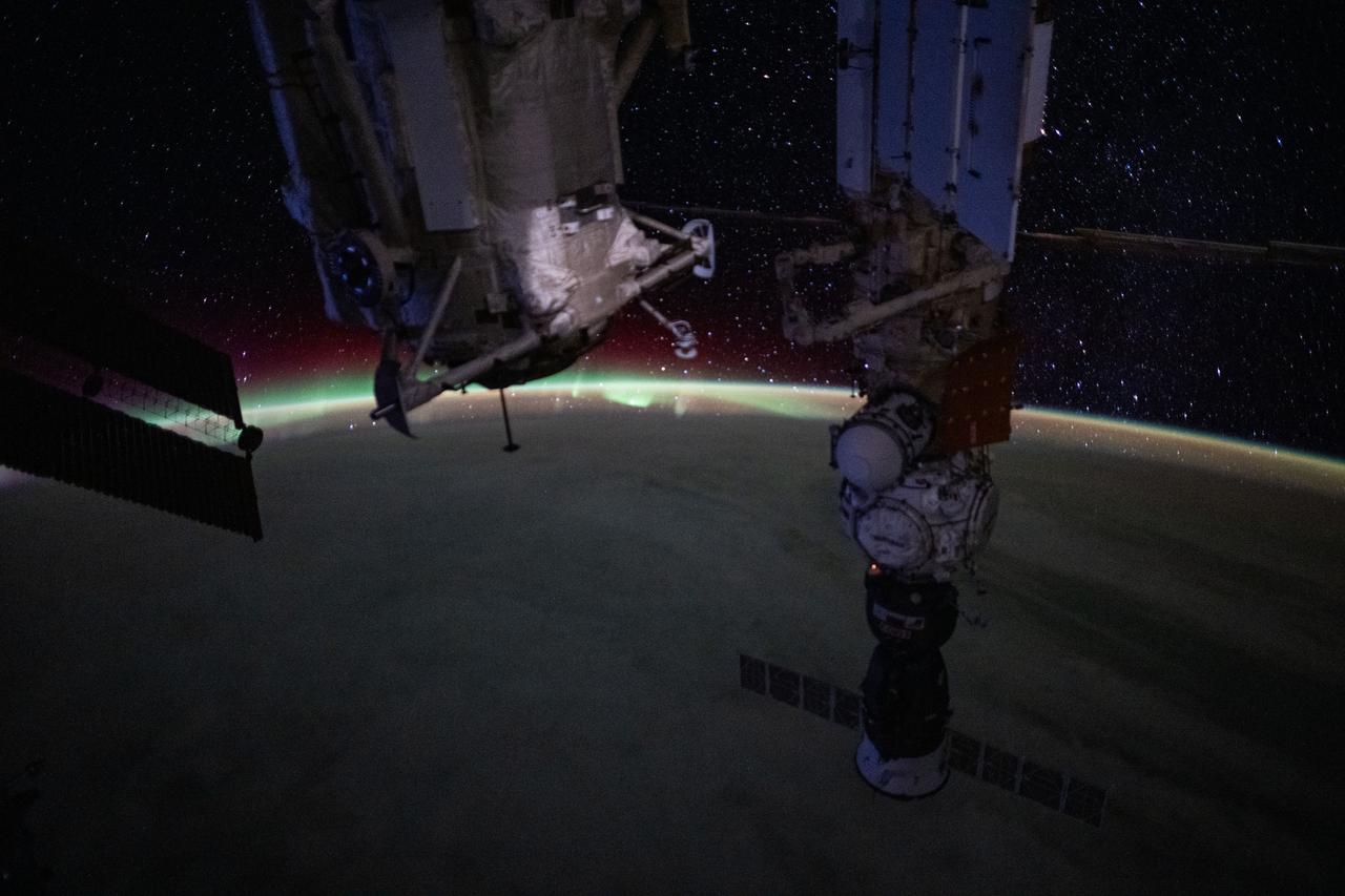
iss071e006791 (April 24, 2024) --- An aurora blankets Earth's horizon in this photograph from the International Space Station as it orbited 260 miles above North America. In the foreground, are the Rassvet module and the Nauka science module. The Prichal docking module and the Soyuz MS-25 crew ship are both attached to Nauka.
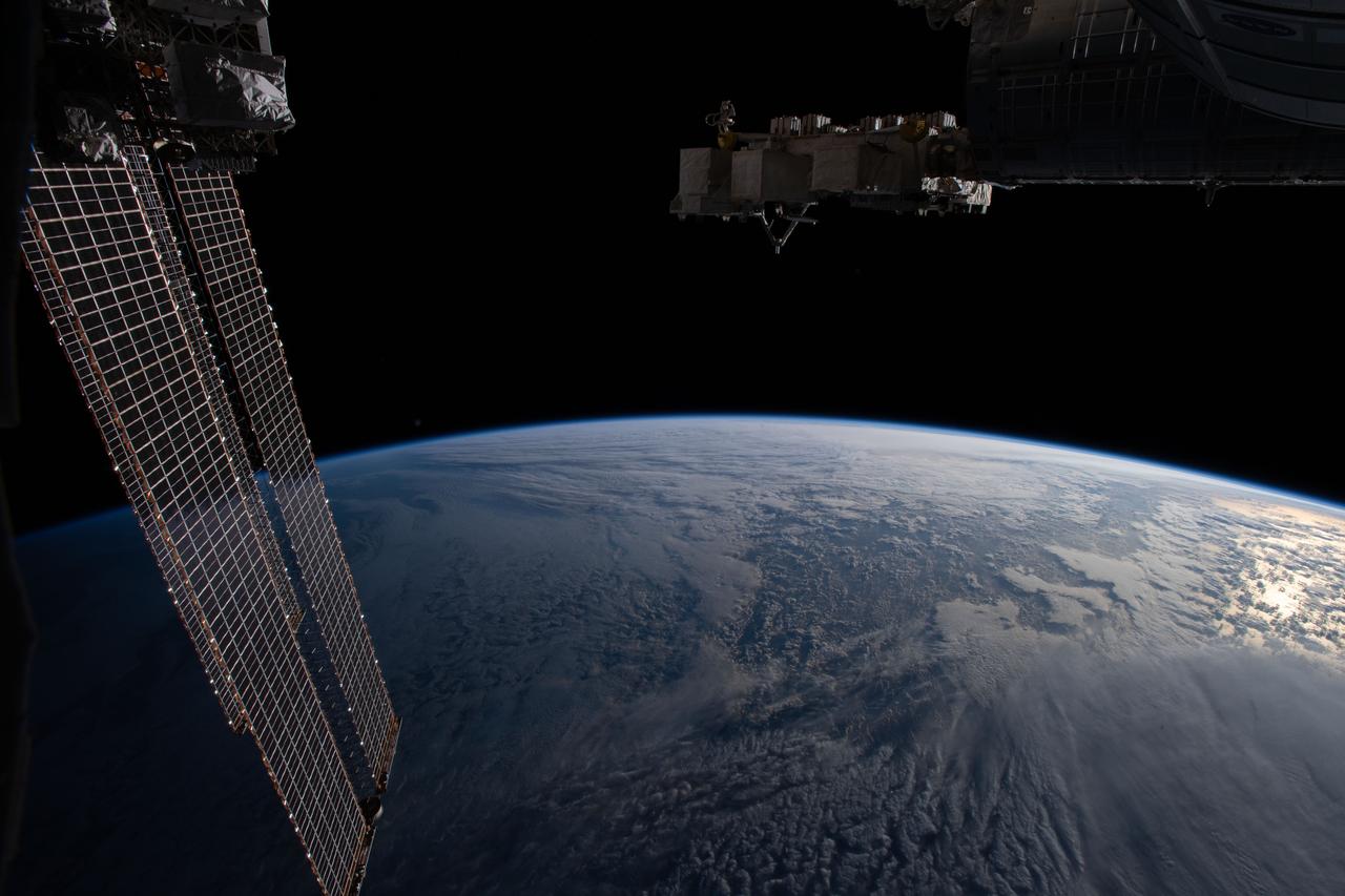
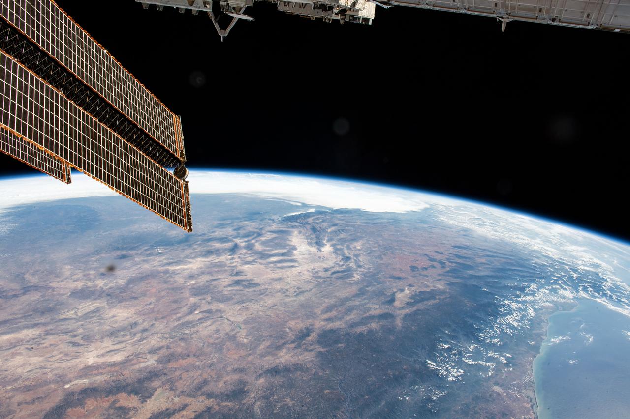
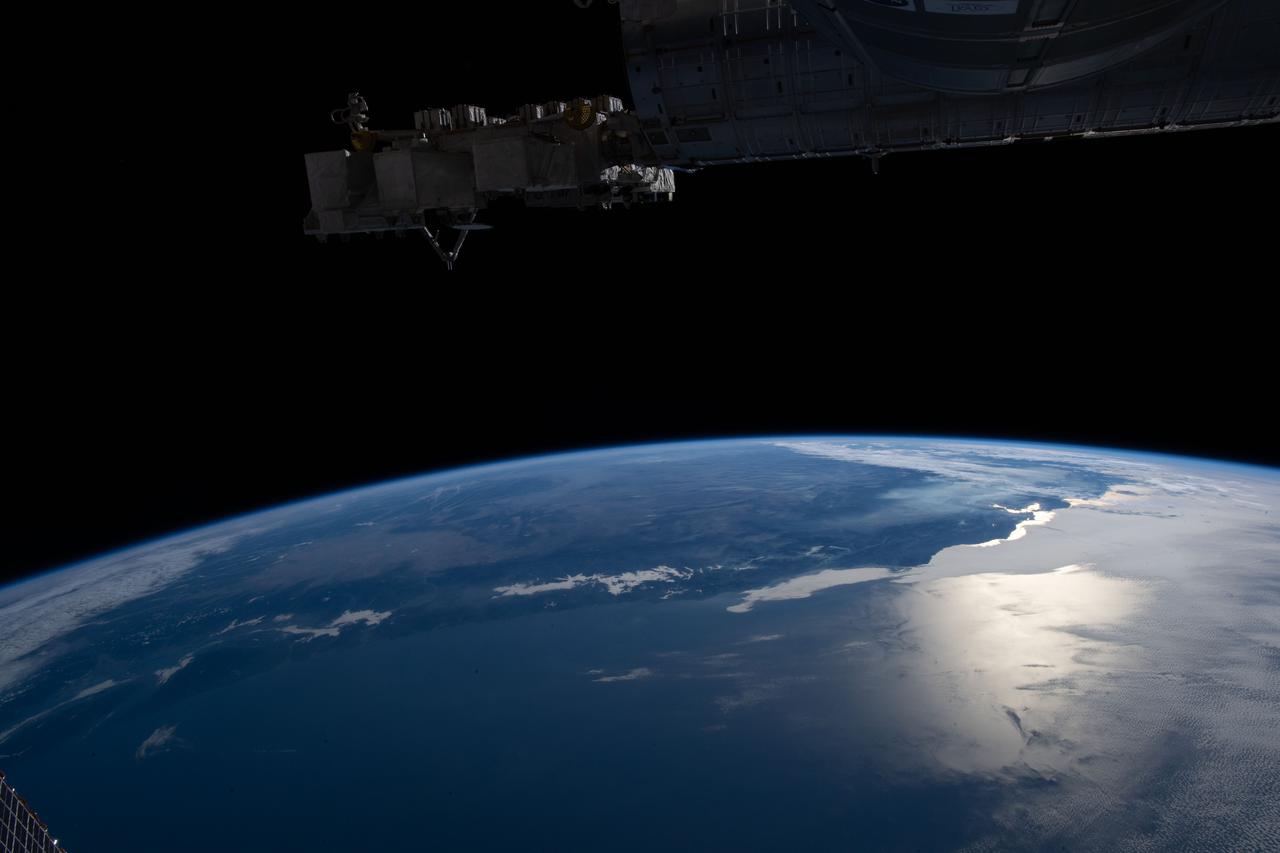
iss059e039713 (May 2, 2019) --- The Earth's limb and portions of the International Space Station's Canadarm2 robotic arm and solar arrays jut into the frame as the orbital complex flew 258 miles above the Great Lakes region of North America.
View of the solar array over an Earth limb taken during a day pass by an Expedition 36 crew member on board the International Space Station (ISS). Per Twitter message: Our Space Station casting shadows on itself.
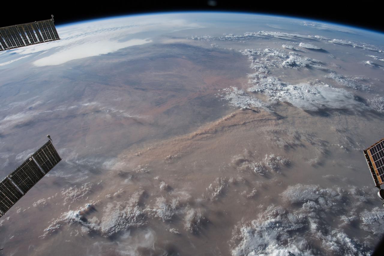
iss056e151163 (Aug. 18, 2018) --- Earth's limb and dust storms in the Sahara are pictured as the International Space Station orbited nearly 252 miles above the African country of Mali.
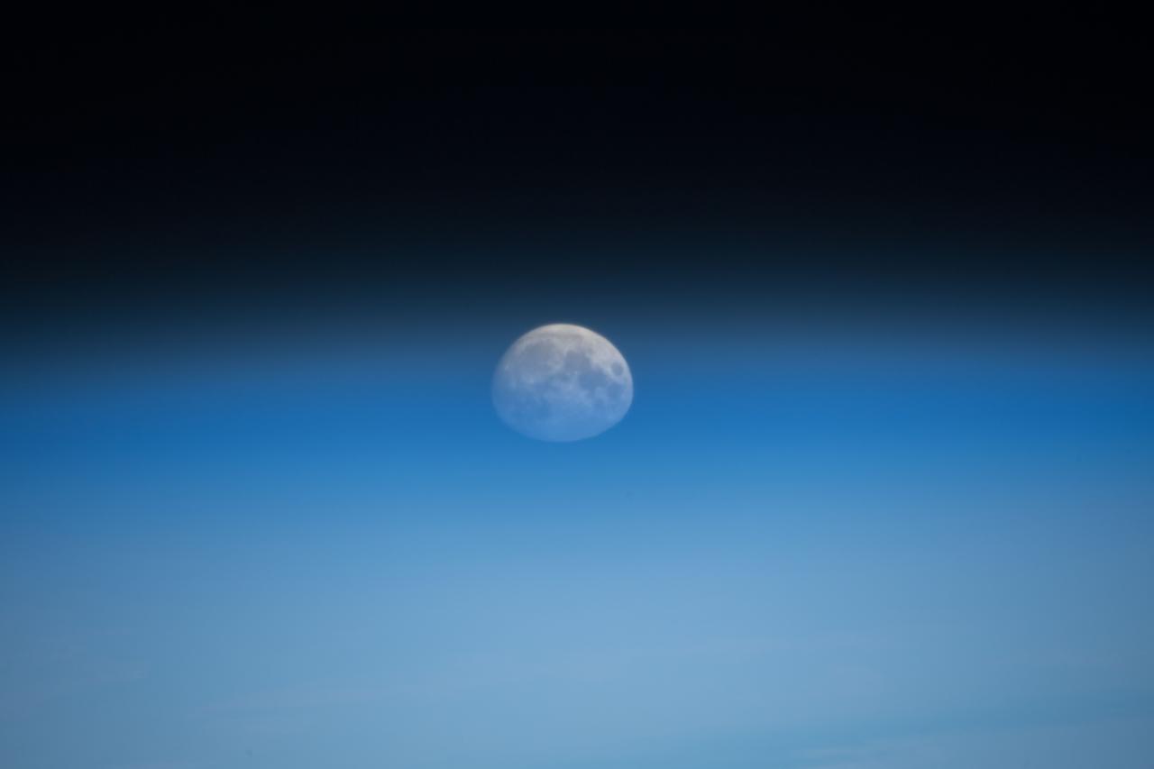
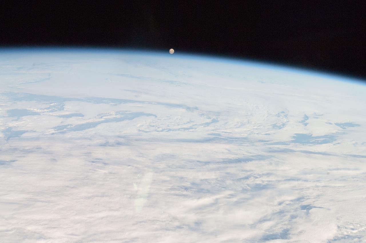
iss055e000043 (Feb. 28, 2018) --- A waxing gibbous moon was pictured above the Earth's limb as the International Space Station orbited over the southern Indian Ocean just southwest of the African continent.
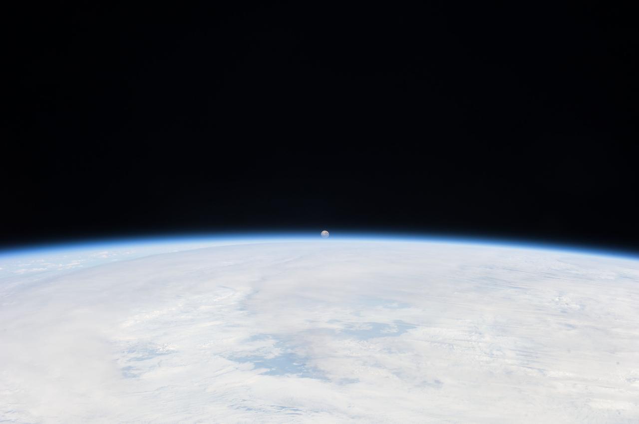
iss059e019955 (April 11, 2019) --- The moon is photographed in its first quarter phase just above the Earth's limb as the International Space Station orbited 255 miles above the Pacific Ocean south of the Hawaiian island chain.
iss055e000030 (Feb. 28, 2018) --- A waxing gibbous moon was pictured above the Earth's limb as the International Space Station orbited over the southern Indian Ocean just southwest of the African continent.
STS099-752-073 (11-22 February 2000) ---As seen by the crew aboard the Space Shuttle Endeavour, the Moon appears above Earth's limb with clouds in the foreground. Moonlit clouds and sunlit clouds are shown in the same scene.
iss061e123823 (Jan. 12, 2020) --- The first rays of an orbital sunrise illuminates the Earth's limb and highlights the atmosphere as the International Space Station orbits 260 miles above the Atlantic Ocean.
iss064e002894 (Nov. 1, 2020) --- The Earth's limb, or horizon, with the Sun's glint beaming off the Gulf of California, is pictured as the International Space Station orbited above southern California.
iss061e123466 (Jan. 12, 2020) --- The first rays of an orbital sunrise shine illuminates the Earth's limb and highlights the atmosphere as the International Space Station orbits 259 miles above the central United States.

ISS027-E-013302 (15 April 2011) --- This photo captured by one of the Expedition 27 crew members aboard the International Space Station features Earth's atmospheric limb and sunset over southwestern Asia.

iss059e027932 (April 21, 2019) --- The sun's first rays peek above Earth's limb highlighting the thin blue atmosphere during an orbital sunrise as the International Space Station orbited 255 miles above Indonesia.
STS102-324-028 (16 March 2001) --- The moon and Earth's limb were viewed from the Space Shuttle Discovery as it flew over the central Pacific Ocean with stratocumulus clouds below.
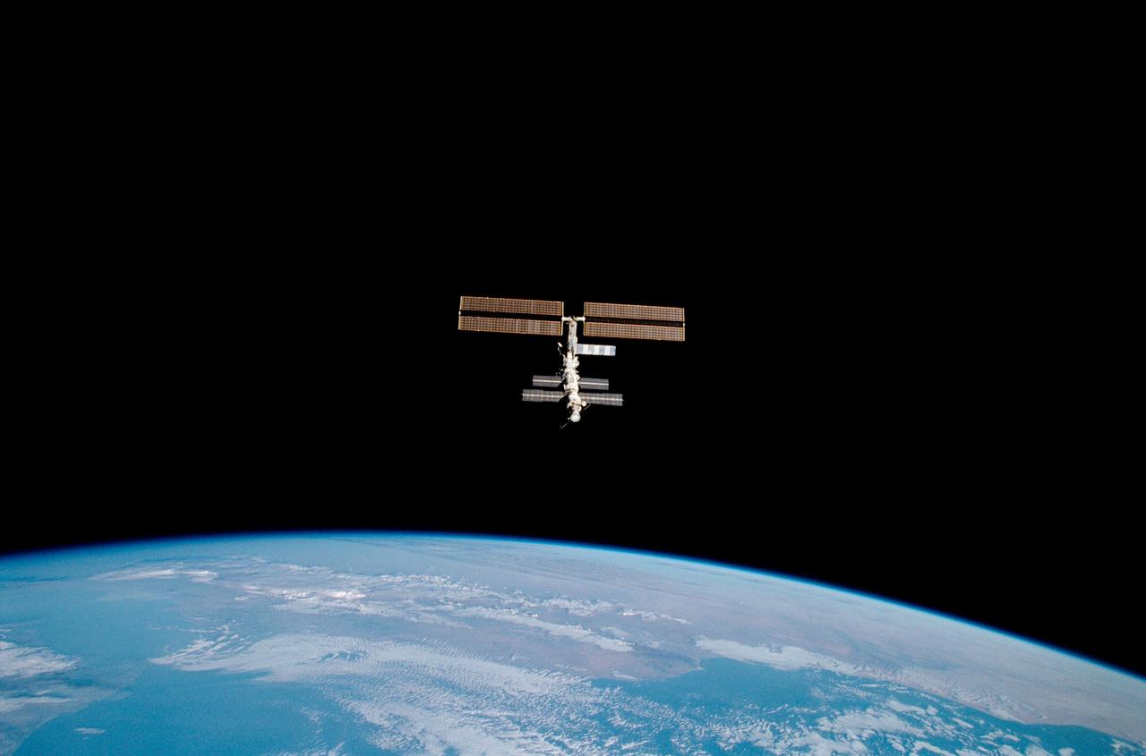
STS100-356-035 (29 April 2001) --- The International Space Station (ISS) is photographed above the Earth limb horizon during a fly-around by the Space Shuttle Endeavour.
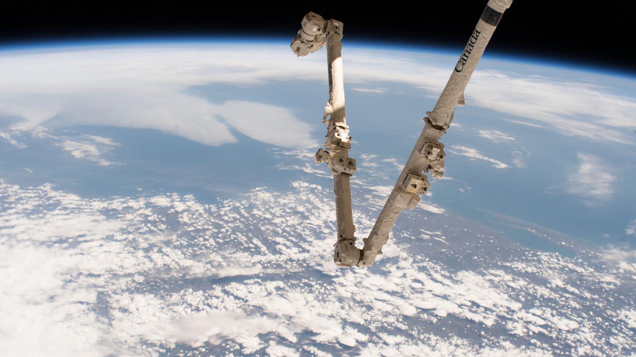
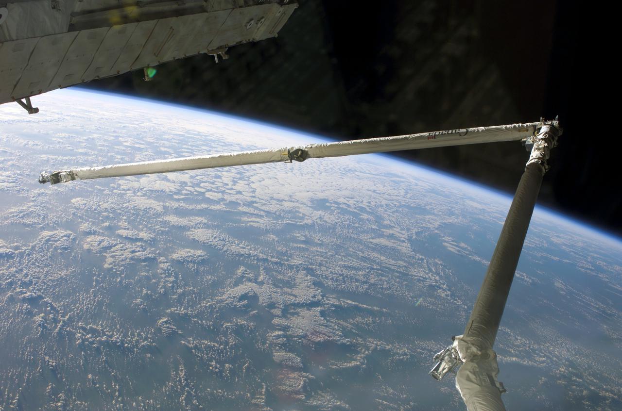
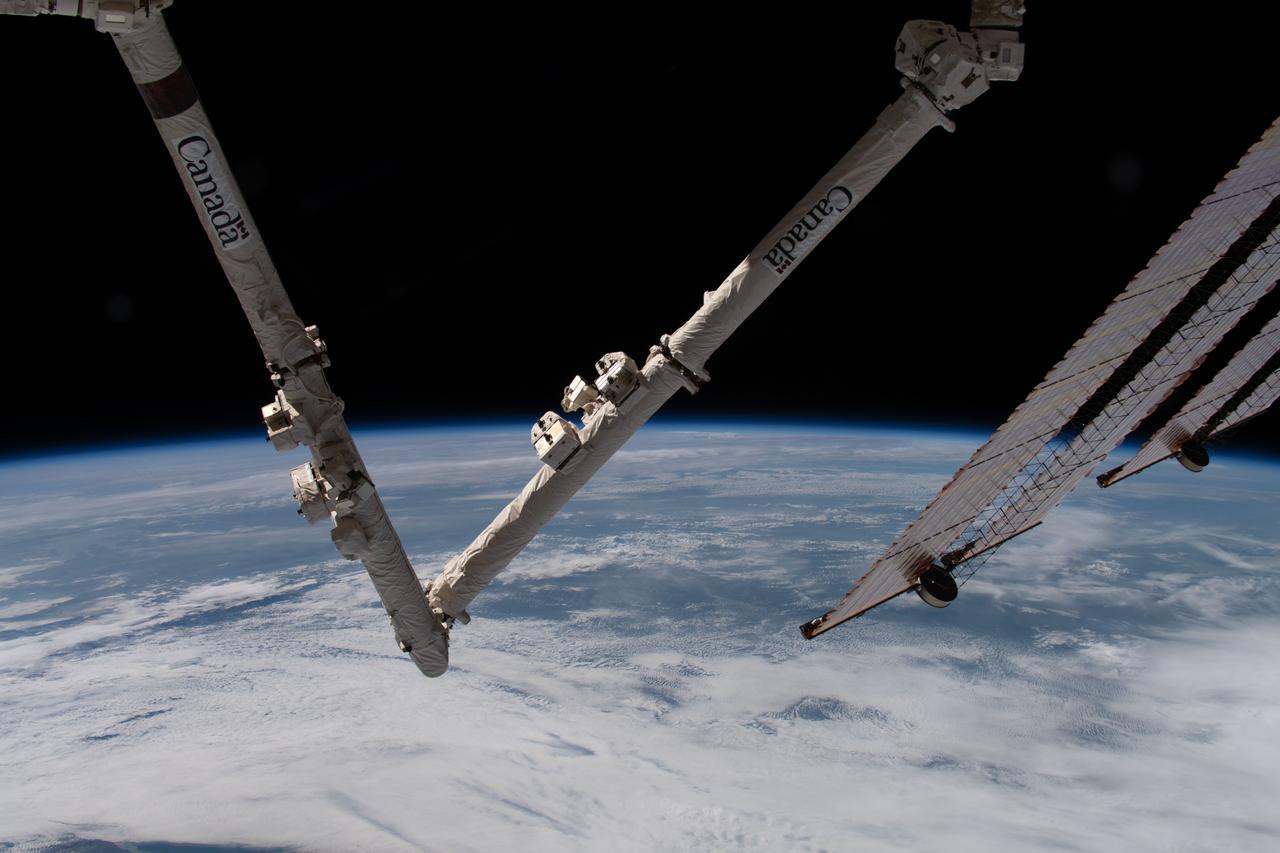
iss051e010470 (April 16, 2017) --- Canada's robotic arm, the Canadarm2, which is part of the Space Station Remote Manipulator System, is pictured with the Earth's limb in the background during a daytime orbital pass.
iss064e002057 (Oct. 28, 2020) --- The Earth's limb, or horizon, with the Sonoran Desert below, is pictured as the International Space Station orbited above the Baja California coast of central Mexico.
iss055e000034 (Feb. 28, 2018) --- A waxing gibbous moon was pictured above the Earth's limb as the International Space Station orbited over the southern Indian Ocean just southwest of the African continent.
View of the distant Moon over an Earth limb taken by an Expedition 36 crew member on board the International Space Station (ISS). Per Twitter message: The setting moon.
iss064e002872 (Nov. 1, 2020) --- The Earth's limb, or horizon, with the Sun's glint beaming off the Pacific Ocean and San Francisco Bay, is pictured as the International Space Station orbited off the coast of California.
iss056e127079 (Aug. 6, 2018) --- The International Space Station was orbiting above the countries of Germany, Czechia and Poland when an Expedition 56 crew member took this photograph of the European continent with Earth's limb in the background.
iss061e123824 (Jan. 12, 2020) --- The first rays of an orbital sunrise illuminates the Earth's limb and highlights the atmosphere as the International Space Station orbits 260 miles above the Atlantic Ocean.
iss067e221404 (July 31, 2022) --- The sun illuminates Earth's limb as the International Space station soared 271 miles above the Pacific Ocean south of the Australian island state of Tasmania.
iss055e000039 (Feb. 28, 2018) --- A waxing gibbous moon was pictured above the Earth's limb as the International Space Station orbited over the southern Indian Ocean just southwest of the African continent.
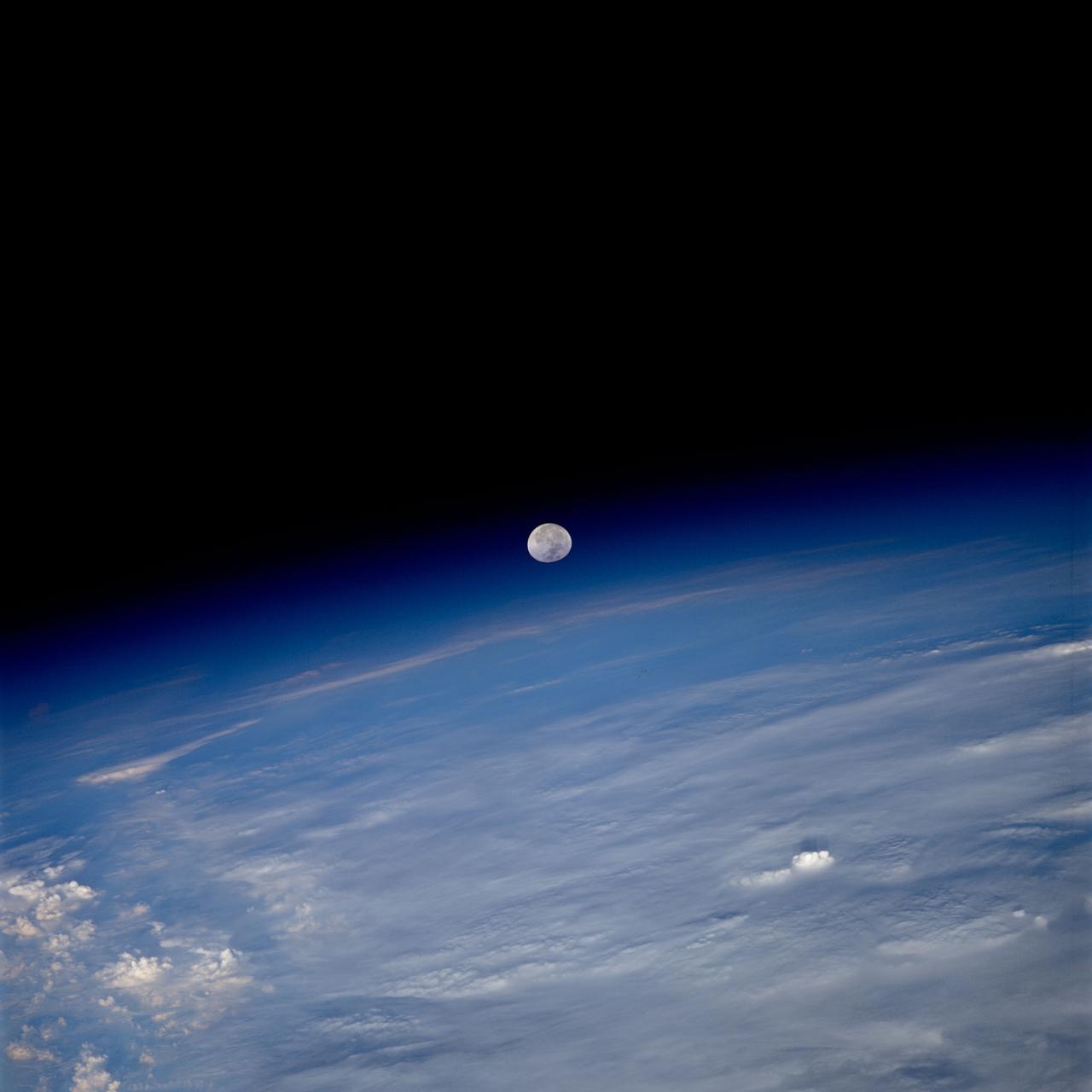
iss059e000461 (March 16, 2019) --- The waxing gibbous moon is pictured above Earth's limb as the International Space Station was orbiting 266 miles above the South Atlantic Ocean.
iss061e123468 (Jan. 12, 2020) --- The first rays of an orbital sunrise shine illuminates the Earth's limb and highlights the atmosphere as the International Space Station orbits 259 miles above the central United States.
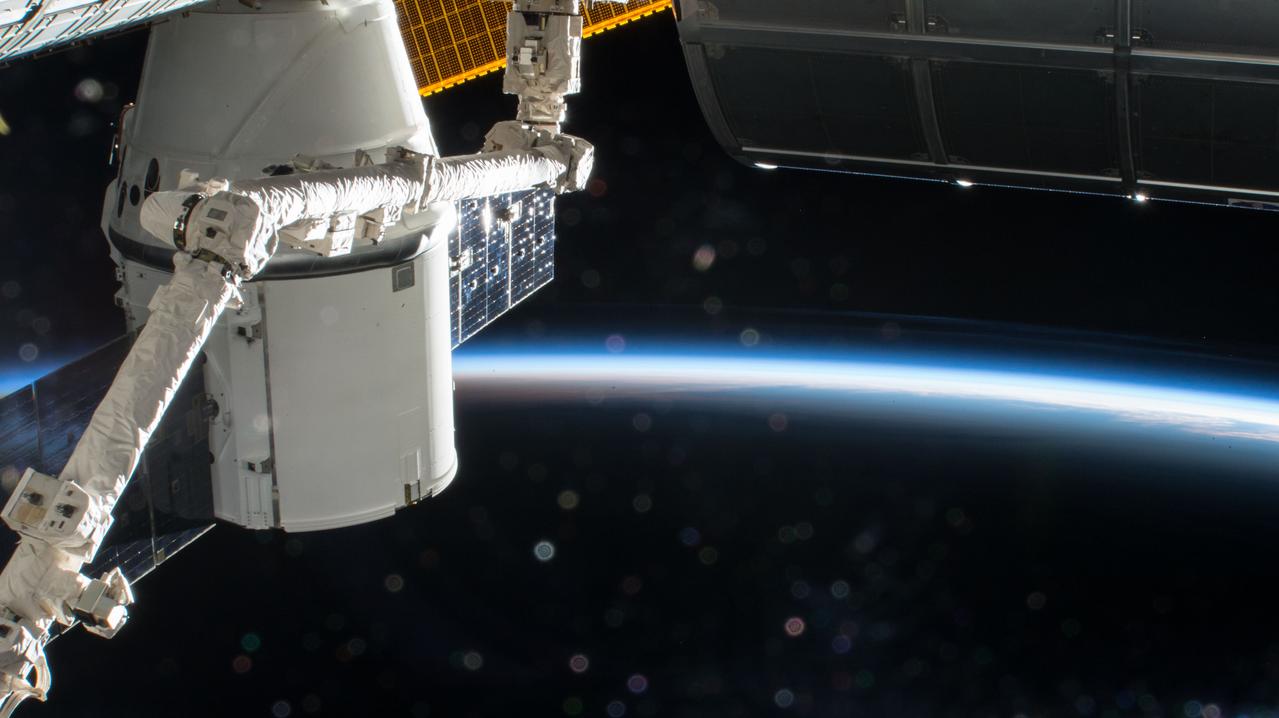
iss054e002538 (Dec. 24, 2017) --- The SpaceX Dragon is pictured with the Canadarm2 robotic arm in the foreground and the Earth's limb in the background as the International Space Station soars into an orbital sunrise during Expedition 54.