
VANDENBERG AIR FORCE BASE, Calif. -- At Vandenberg Air Force Base in California, the Taurus XL rocket's Stage 3 motor is on a stationary rail in a temporary processing tent near the pad at Space Launch Complex 576-E. Orbital Sciences' Taurus XL is a four-stage rocket that will carry NASA's Glory spacecraft into low Earth orbit. In early February, the spacecraft is scheduled to arrive at the pad, where it will be attached to the third stage and then stacked atop the remaining stages. Once Glory reaches orbit, it will collect data on the properties of aerosols and black carbon. It also will help scientists understand how the sun's irradiance affects Earth's climate. Launch is scheduled for 5:09 a.m. EST Feb. 23. For information, visit www.nasa.gov/glory. Photo credit: NASA/Randy Beaudoin, VAFB
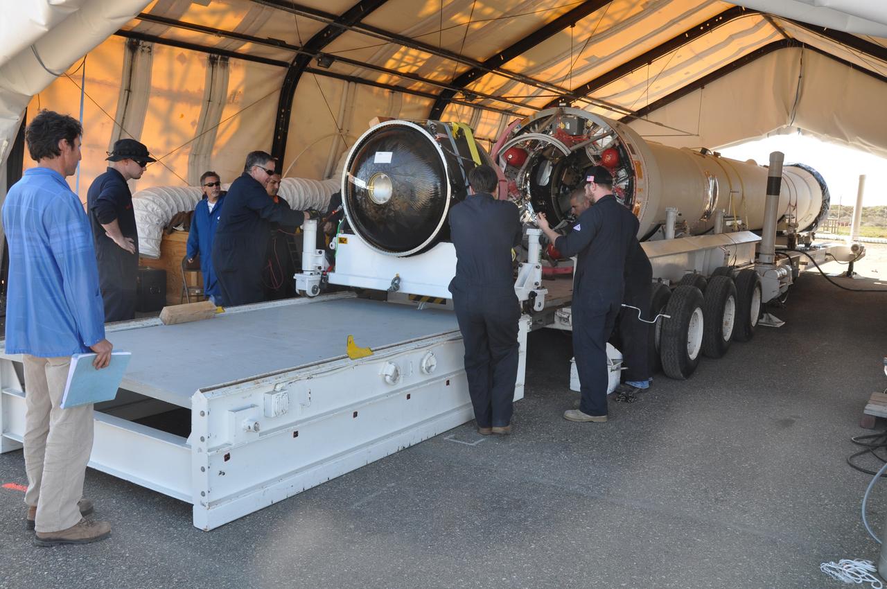
VANDENBERG AIR FORCE BASE, Calif. -- At Vandenberg Air Force Base in California, the Taurus XL rocket's Stage 3 motor is moved to a stationary rail in a temporary processing tent near the pad at Space Launch Complex 576-E. Orbital Sciences' Taurus XL is a four-stage rocket that will carry NASA's Glory spacecraft into low Earth orbit. In early February, the spacecraft is scheduled to arrive at the pad, where it will be attached to the third stage and then stacked atop the remaining stages. Once Glory reaches orbit, it will collect data on the properties of aerosols and black carbon. It also will help scientists understand how the sun's irradiance affects Earth's climate. Launch is scheduled for 5:09 a.m. EST Feb. 23. For information, visit www.nasa.gov/glory. Photo credit: NASA/Randy Beaudoin, VAFB

VANDENBERG AIR FORCE BASE, Calif. – At Vandenberg Air Force Base in California, mission managers participate in a pre-launch dress rehearsal in the Launch Vehicle Data Center for NASA’s Interface Region Imaging Spectrograph, or IRIS, solar observatory. Scheduled for launch from Vandenberg on June 26 aboard an Orbital Sciences Pegasus XL rocket, IRIS will open a new window of discovery by tracing the flow of energy and plasma through the chromospheres and transition region in to the sun’s corona using spectrometry and imaging. The IRIS mission will observe how solar material moves, gathers energy and heats up as it travels through a largely unexplored region of the solar atmosphere. The interface region, located between the sun’s visible surface and upper atmosphere, is where most of the sun’s ultraviolet emission is generated. These emissions impact the near-Earth space environment and Earth’s climate. For more information, visit http://www.nasa.gov/iris. Photo credit: NASA/Daniel Casper

VANDENBERG AIR FORCE BASE, Calif. – At Vandenberg Air Force Base in California, mission managers participate in a pre-launch dress rehearsal in the Launch Vehicle Data Center for NASA’s Interface Region Imaging Spectrograph, or IRIS, solar observatory. Scheduled for launch from Vandenberg on June 26 aboard an Orbital Sciences Pegasus XL rocket, IRIS will open a new window of discovery by tracing the flow of energy and plasma through the chromospheres and transition region in to the sun’s corona using spectrometry and imaging. The IRIS mission will observe how solar material moves, gathers energy and heats up as it travels through a largely unexplored region of the solar atmosphere. The interface region, located between the sun’s visible surface and upper atmosphere, is where most of the sun’s ultraviolet emission is generated. These emissions impact the near-Earth space environment and Earth’s climate. For more information, visit http://www.nasa.gov/iris. Photo credit: NASA/Daniel Casper
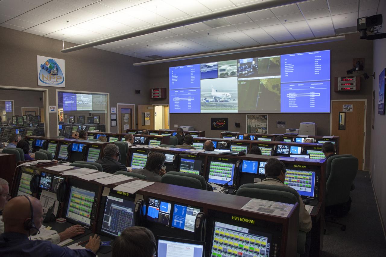
VANDENBERG AIR FORCE BASE, Calif. – At Vandenberg Air Force Base in California, mission managers participate in a pre-launch dress rehearsal in the Launch Vehicle Data Center for NASA’s Interface Region Imaging Spectrograph, or IRIS, solar observatory. Scheduled for launch from Vandenberg on June 26 aboard an Orbital Sciences Pegasus XL rocket, IRIS will open a new window of discovery by tracing the flow of energy and plasma through the chromospheres and transition region in to the sun’s corona using spectrometry and imaging. The IRIS mission will observe how solar material moves, gathers energy and heats up as it travels through a largely unexplored region of the solar atmosphere. The interface region, located between the sun’s visible surface and upper atmosphere, is where most of the sun’s ultraviolet emission is generated. These emissions impact the near-Earth space environment and Earth’s climate. For more information, visit http://www.nasa.gov/iris. Photo credit: NASA/Daniel Casper
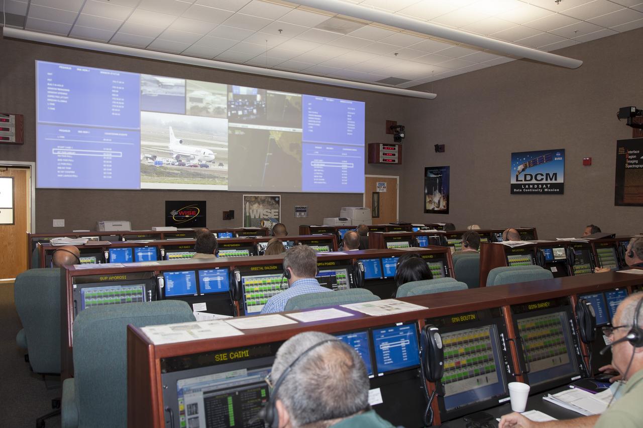
VANDENBERG AIR FORCE BASE, Calif. – At Vandenberg Air Force Base in California, mission managers participate in a pre-launch dress rehearsal in the Launch Vehicle Data Center for NASA’s Interface Region Imaging Spectrograph, or IRIS, solar observatory. Scheduled for launch from Vandenberg on June 26 aboard an Orbital Sciences Pegasus XL rocket, IRIS will open a new window of discovery by tracing the flow of energy and plasma through the chromospheres and transition region in to the sun’s corona using spectrometry and imaging. The IRIS mission will observe how solar material moves, gathers energy and heats up as it travels through a largely unexplored region of the solar atmosphere. The interface region, located between the sun’s visible surface and upper atmosphere, is where most of the sun’s ultraviolet emission is generated. These emissions impact the near-Earth space environment and Earth’s climate. For more information, visit http://www.nasa.gov/iris. Photo credit: NASA/Daniel Casper
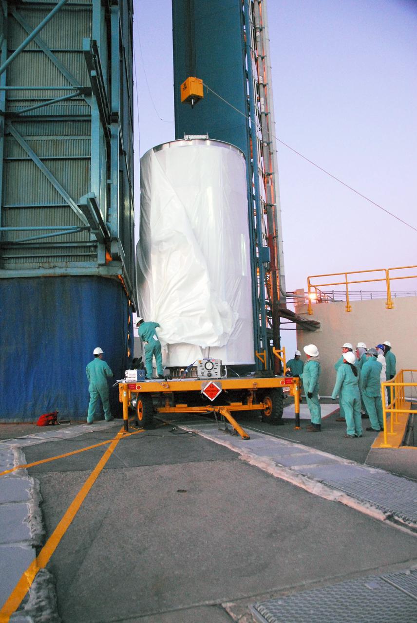
VANDENBERG AIR FORCE BASE, Calif. -- The NOAA-N Prime satellite, enclosed in a canister for travel, is prepared for its lift into the mobile service tower on Space Launch Complex 2 at Vandenberg Air Force Base in California. In the tower, the satellite will be encapsulated and installed on the launch vehicle, a Delta II rocket. NOAA-N Prime is the latest polar-orbiting operational environmental weather satellite developed by NASA for the National Oceanic and Atmospheric Administration. The satellite is scheduled to launch Feb. 4 aboard a Delta II rocket from Vandenberg Air Force Base. Photo credit: NASA/Mark Mackley, VAFB
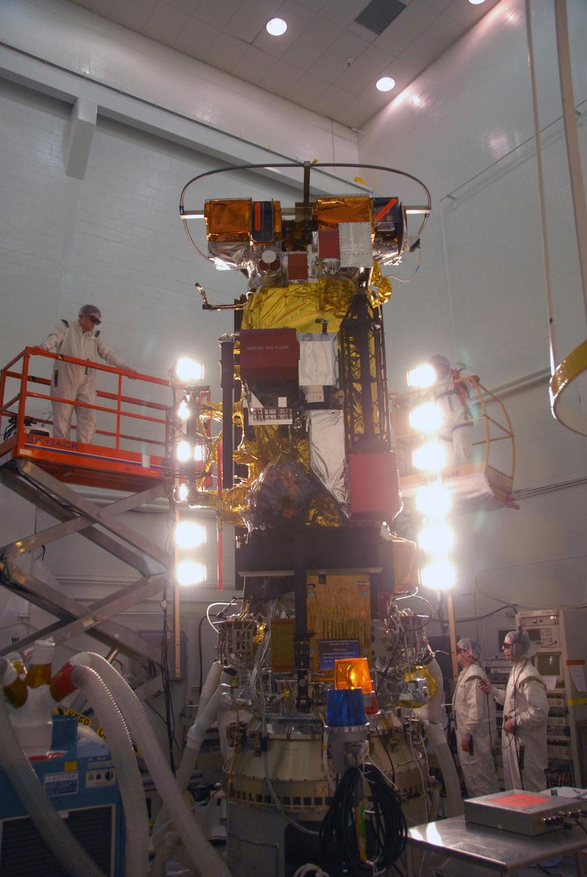
VANDENBERG AIR FORCE BASE, Calif. -- In the NASA payload processing facility at Vandenberg Air Force Base in California, workers conduct solar array illumination on the NOAA-N Prime satellite. NOAA-N Prime is the latest polar-orbiting operational environmental weather satellite developed by NASA for the National Oceanic and Atmospheric Administration. The satellite is scheduled to launch Feb. 4 aboard a Delta II rocket from Vandenberg Air Force Base. Photo credit: NASA/Robert Hargreaves Jr., VAFB
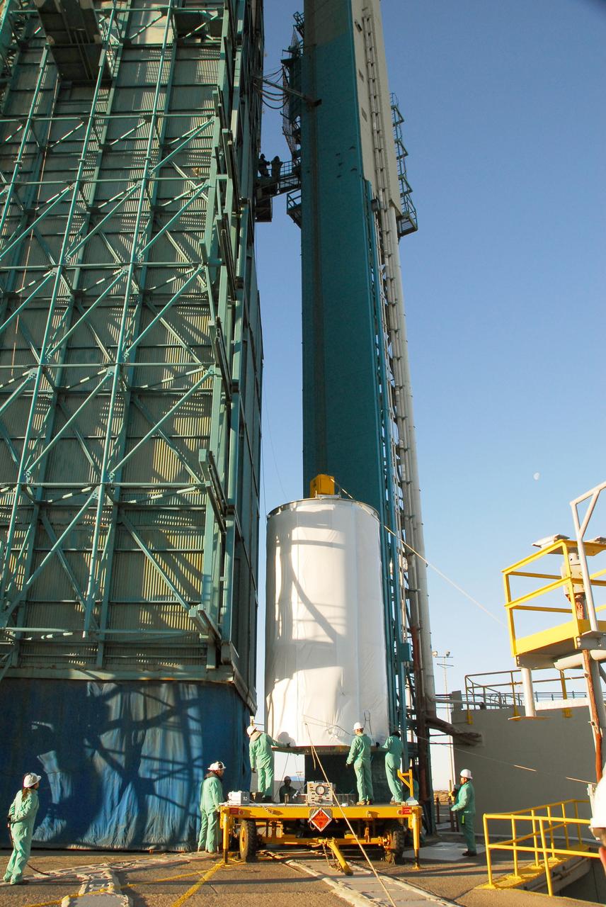
VANDENBERG AIR FORCE BASE, Calif. -- The NOAA-N Prime satellite, enclosed in a canister for travel, is lifted alongside the mobile service tower on Space Launch Complex 2 at Vandenberg Air Force Base in California. In the tower, the satellite will be encapsulated and installed on the launch vehicle, a Delta II rocket. NOAA-N Prime is the latest polar-orbiting operational environmental weather satellite developed by NASA for the National Oceanic and Atmospheric Administration. The satellite is scheduled to launch Feb. 4 aboard a Delta II rocket from Vandenberg Air Force Base. Photo credit: NASA/Mark Mackley, VAFB
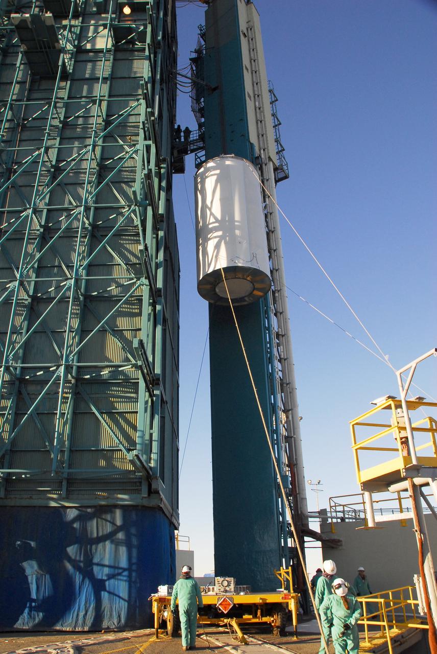
VANDENBERG AIR FORCE BASE, Calif. -- The NOAA-N Prime satellite, enclosed in a canister for travel, is lifted alongside the mobile service tower on Space Launch Complex 2 at Vandenberg Air Force Base in California. In the tower, the satellite will be encapsulated and installed on the launch vehicle, a Delta II rocket. NOAA-N Prime is the latest polar-orbiting operational environmental weather satellite developed by NASA for the National Oceanic and Atmospheric Administration. The satellite is scheduled to launch Feb. 4 aboard a Delta II rocket from Vandenberg Air Force Base. Photo credit: NASA/Mark Mackley, VAFB
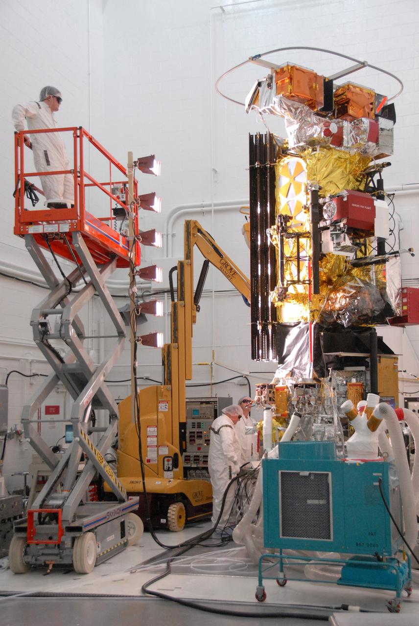
VANDENBERG AIR FORCE BASE, Calif. -- In the NASA payload processing facility at Vandenberg Air Force Base in California, workers conduct solar array illumination on the NOAA-N Prime satellite. NOAA-N Prime is the latest polar-orbiting operational environmental weather satellite developed by NASA for the National Oceanic and Atmospheric Administration. The satellite is scheduled to launch Feb. 4 aboard a Delta II rocket from Vandenberg Air Force Base. Photo credit: NASA/Robert Hargreaves Jr., VAFB
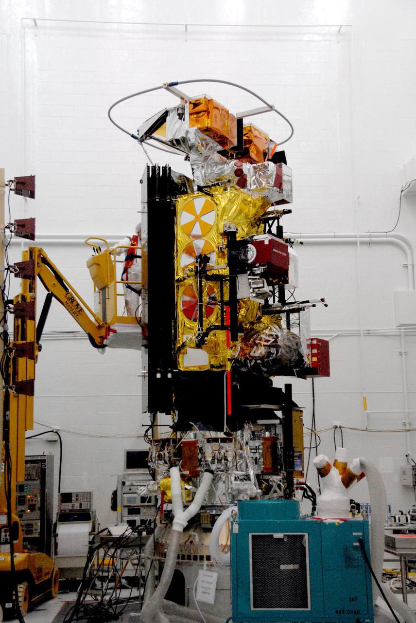
VANDENBERG AIR FORCE BASE, Calif. -- In the NASA payload processing facility at Vandenberg Air Force Base in California, the NOAA-N Prime satellite undergoes solar array illumination. NOAA-N Prime is the latest polar-orbiting operational environmental weather satellite developed by NASA for the National Oceanic and Atmospheric Administration. The satellite is scheduled to launch Feb. 4 aboard a Delta II rocket from Vandenberg Air Force Base. Photo credit: NASA/Robert Hargreaves Jr., VAFB
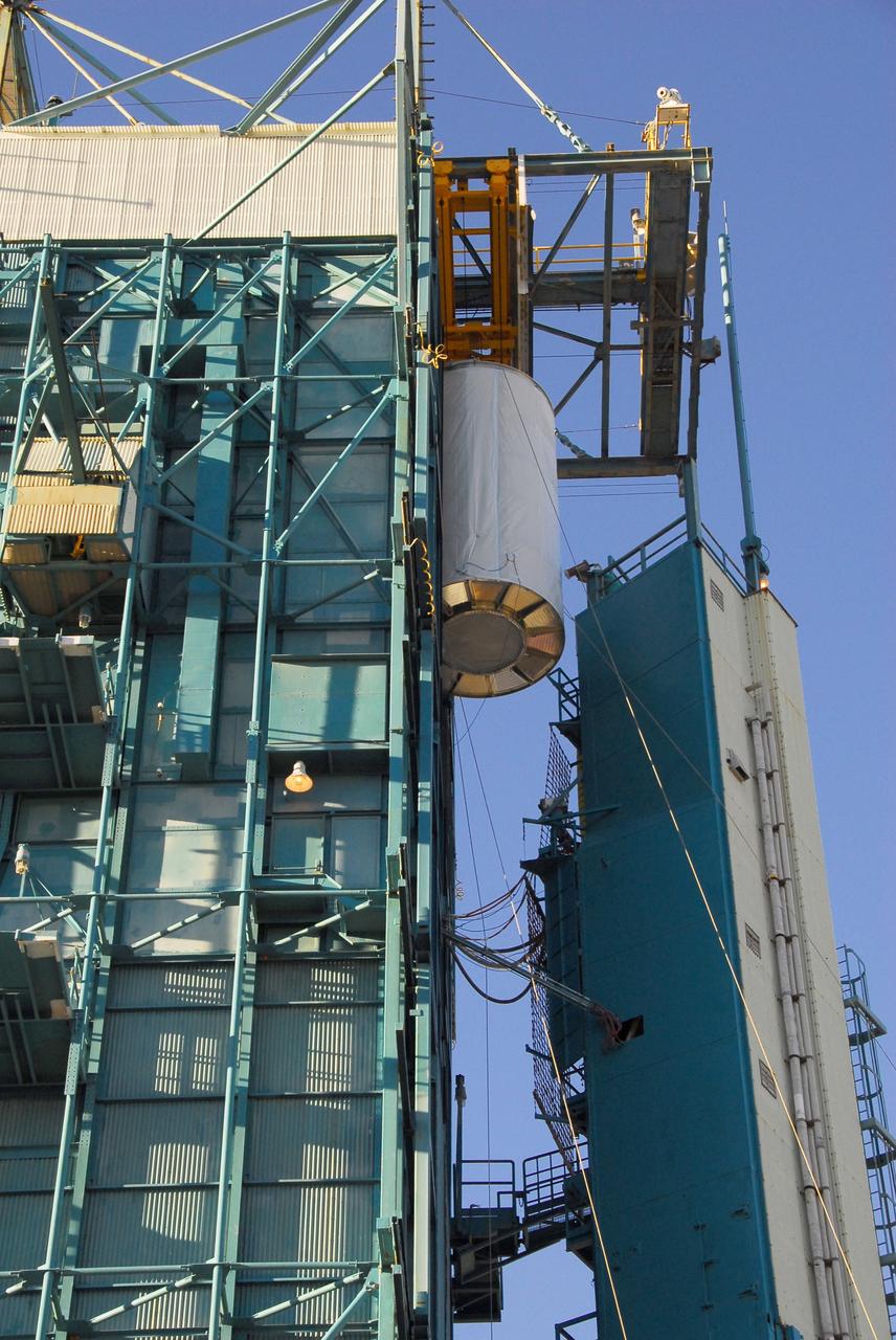
VANDENBERG AIR FORCE BASE, Calif. -- The NOAA-N Prime satellite is lifted to the top of the mobile service tower on Space Launch Complex 2 at Vandenberg Air Force Base in California. In the tower, the satellite will be encapsulated and installed on the launch vehicle, a Delta II rocket. NOAA-N Prime is the latest polar-orbiting operational environmental weather satellite developed by NASA for the National Oceanic and Atmospheric Administration. The satellite is scheduled to launch Feb. 4 aboard a Delta II rocket from Vandenberg Air Force Base. Photo credit: NASA/Mark Mackley, VAFB
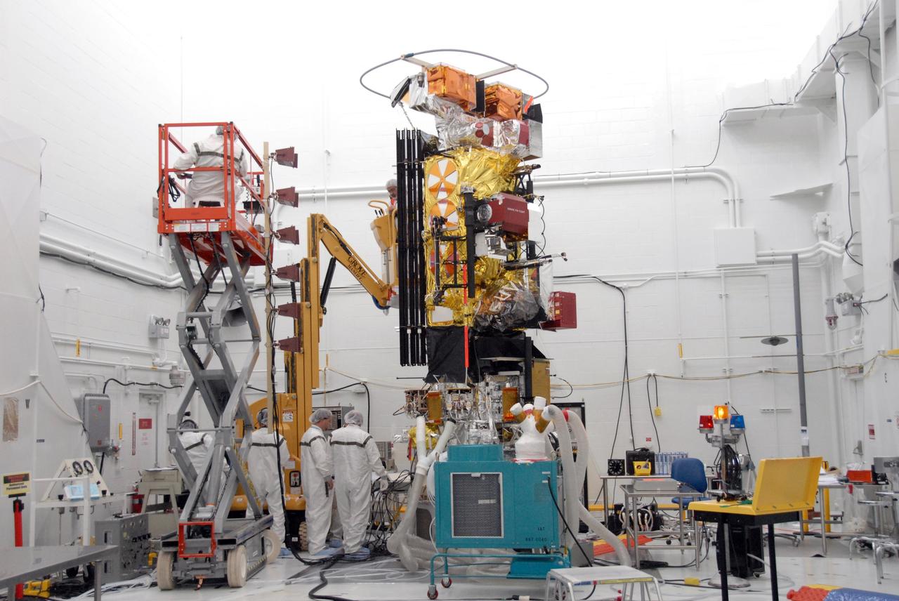
VANDENBERG AIR FORCE BASE, Calif. -- In the NASA payload processing facility at Vandenberg Air Force Base in California, workers complete the solar array illumination on the NOAA-N Prime satellite. NOAA-N Prime is the latest polar-orbiting operational environmental weather satellite developed by NASA for the National Oceanic and Atmospheric Administration. The satellite is scheduled to launch Feb. 4 aboard a Delta II rocket from Vandenberg Air Force Base. Photo credit: NASA/Robert Hargreaves Jr., VAFB
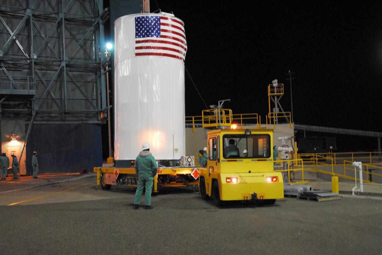
VANDENBERG AIR FORCE BASE, Calif. -- The NOAA-N Prime satellite, enclosed in a canister for travel, arrives on Space Launch Complex 2 at Vandenberg Air Force Base in California. The container will be lifted into the mobile service tower for encapsulation and installation on the launch vehicle, a Delta II rocket. NOAA-N Prime is the latest polar-orbiting operational environmental weather satellite developed by NASA for the National Oceanic and Atmospheric Administration. The satellite is scheduled to launch Feb. 4 aboard a Delta II rocket from Vandenberg Air Force Base. Photo credit: NASA/Mark Mackley, VAFB

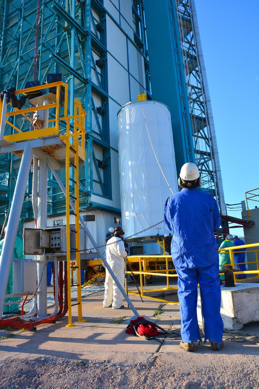
VANDENBERG AIR FORCE BASE, Calif. -- Stage 0 of the Taurus XL launch vehicle for the Orbiting Carbon Observatory arrives at complex 576E at Vandenberg Air Force Base in California. It will be mated with stages 1, 2 and 3 for the launch of OCO. The OCO is a new Earth-orbiting mission sponsored by NASA's Earth System Science Pathfinder Program. It is scheduled to launch Feb. 23. Photo credit: NASA/Randy Beaudoin, VAFB
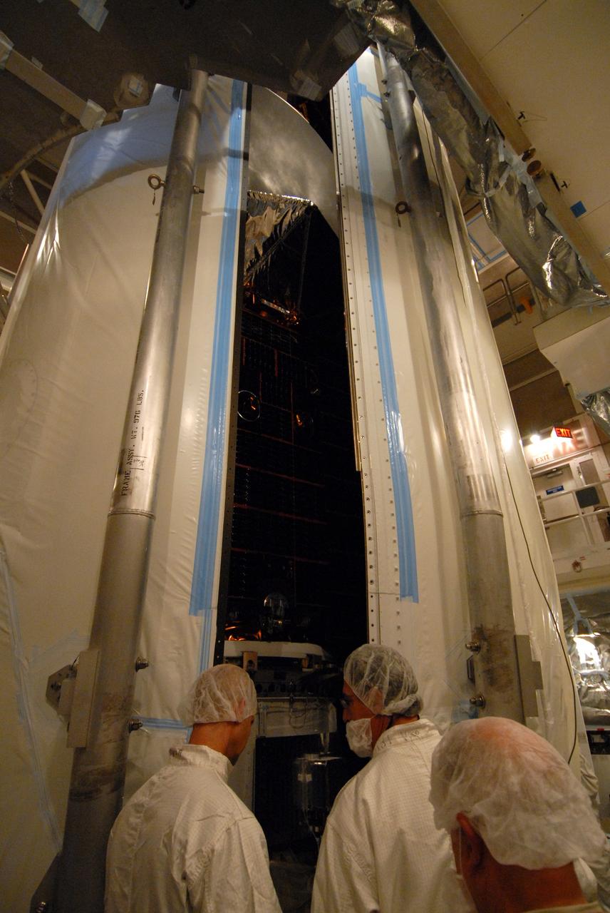
VANDENBERG AIR FORCE BASE, Calif. -- Inside the mobile service tower at NASA's Launch Complex-2 at Vandenberg Air Force Base in California, workers monitor the progress as the United Launch Alliance’s Delta II payload fairing closes around the Aquarius/SAC-D spacecraft. Aquarius will be integrated to the Delta II rocket in preparation for the targeted June 9 liftoff. Aquarius, the NASA-built instrument on the SAC-D spacecraft, will provide new insights into how variations in ocean surface salinity relate to fundamental climate processes on its three-year mission. Photo credit: NASA/VAFB
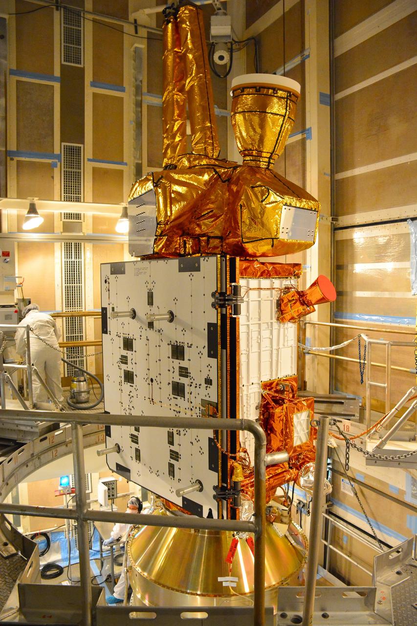
VANDENBERG AIR FORCE BASE, Calif. – At Vandenberg Air Force Base in California, NASA's Soil Moisture Active Passive mission, or SMAP, satellite is mated to its Delta II rocket at Space Launch Complex 2. SMAP will provide global measurements of soil moisture and its freeze/thaw state. These measurements will be used to enhance understanding of processes that link the water, energy and carbon cycles, and to extend the capabilities of weather and climate prediction models. SMAP data also will be used to quantify net carbon flux in boreal landscapes and to develop improved flood prediction and drought monitoring capabilities. Launch is scheduled for Jan. 29, 2015. To learn more about SMAP, visit http://smap.jpl.nasa.gov Photo credit: NASA/Randy Beaudoin
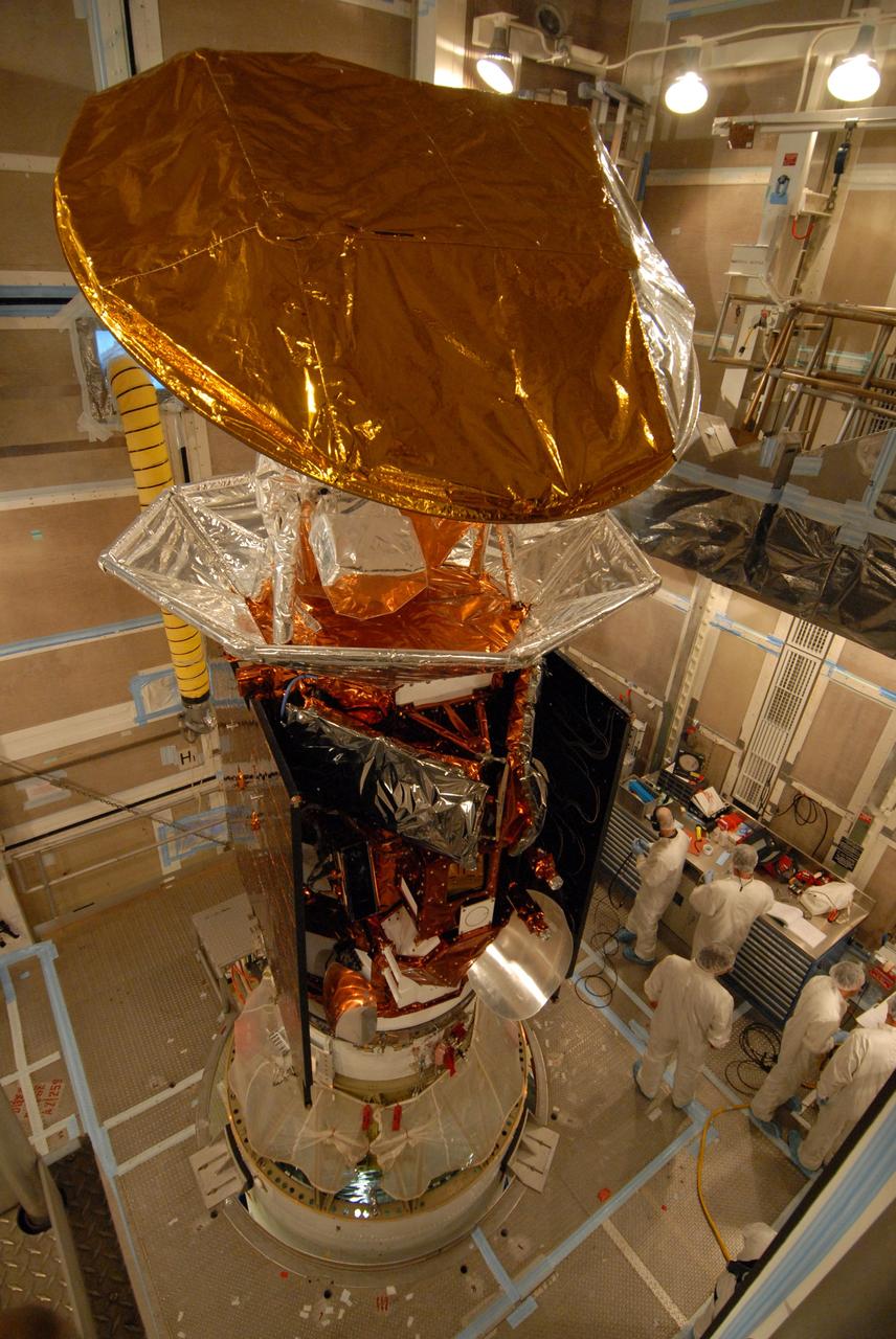
VANDENBERG AIR FORCE BASE, Calif. -- Inside the mobile service tower at NASA's Launch Complex-2 at Vandenberg Air Force Base in California, workers prepare the Aquarius/SAC-D spacecraft for fairing installation. Aquarius will be integrated to a United Launch Alliance Delta II rocket in preparation for the targeted June 9 liftoff. Aquarius, the NASA-built instrument on the SAC-D spacecraft, will provide new insights into how variations in ocean surface salinity relate to fundamental climate processes on its three-year mission. Photo credit: NASA/VAFB
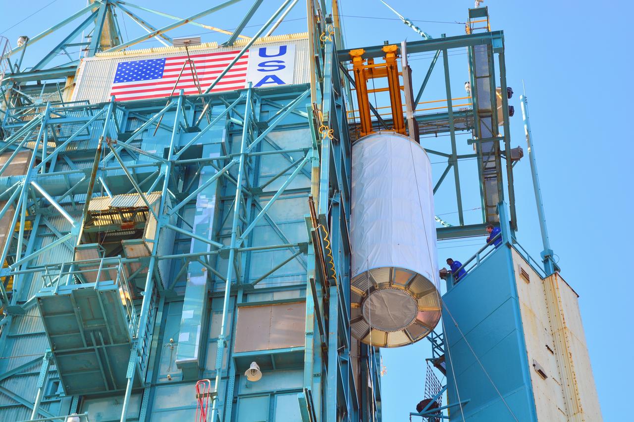
VANDENBERG AIR FORCE BASE, Calif. – At Vandenberg Air Force Base in California, NASA's Soil Moisture Active Passive mission, or SMAP, satellite is lifted at Space Launch Complex 2 for mating to its Delta II rocket. SMAP will provide global measurements of soil moisture and its freeze/thaw state. These measurements will be used to enhance understanding of processes that link the water, energy and carbon cycles, and to extend the capabilities of weather and climate prediction models. SMAP data also will be used to quantify net carbon flux in boreal landscapes and to develop improved flood prediction and drought monitoring capabilities. Launch is scheduled for Jan. 29, 2015. To learn more about SMAP, visit http://smap.jpl.nasa.gov Photo credit: NASA/Randy Beaudoin
VANDENBERG AIR FORCE BASE, Calif. – At Vandenberg Air Force Base in California, NASA's Soil Moisture Active Passive mission, or SMAP, satellite is prepared for lifting at Space Launch Complex 2 for mating to its Delta II rocket. SMAP will provide global measurements of soil moisture and its freeze/thaw state. These measurements will be used to enhance understanding of processes that link the water, energy and carbon cycles, and to extend the capabilities of weather and climate prediction models. SMAP data also will be used to quantify net carbon flux in boreal landscapes and to develop improved flood prediction and drought monitoring capabilities. Launch is scheduled for Jan. 29, 2015. To learn more about SMAP, visit http://smap.jpl.nasa.gov Photo credit: NASA/Randy Beaudoin
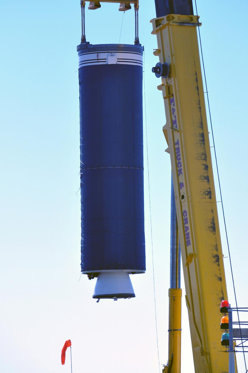
VANDENBERG AIR FORCE BASE, Calif. -- At complex 576E at Vandenberg Air Force Base in California, a crane lifts Stage 0 of the Taurus XL launch vehicle for the Orbiting Carbon Observatory from its transporter. The OCO is a new Earth-orbiting mission sponsored by NASA's Earth System Science Pathfinder Program. It is scheduled to launch Feb. 23. Photo credit: NASA/Randy Beaudoin, VAFB

VANDENBERG AIR FORCE BASE, Calif. -- Inside the mobile service tower at NASA's Launch Complex-2 at Vandenberg Air Force Base in California, a technician secures the United Launch Alliance’s Delta II payload fairing around the Aquarius/SAC-D spacecraft. Aquarius will be integrated to the Delta II rocket in preparation for the targeted June 9 liftoff. Aquarius, the NASA-built instrument on the SAC-D spacecraft, will provide new insights into how variations in ocean surface salinity relate to fundamental climate processes on its three-year mission. Photo credit: NASA/VAFB
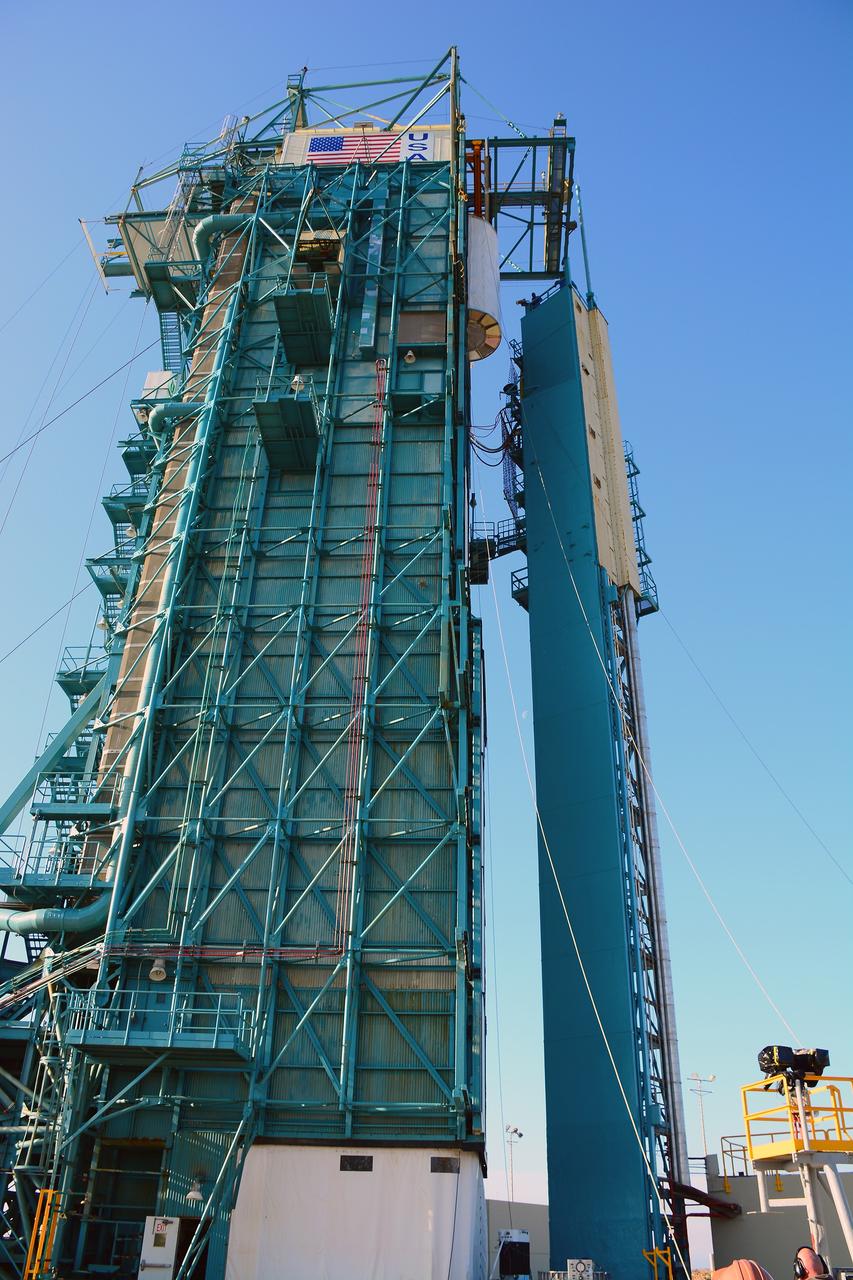
VANDENBERG AIR FORCE BASE, Calif. – At Vandenberg Air Force Base in California, NASA's Soil Moisture Active Passive mission, or SMAP, satellite is lifted at Space Launch Complex 2 for mating to its Delta II rocket. SMAP will provide global measurements of soil moisture and its freeze/thaw state. These measurements will be used to enhance understanding of processes that link the water, energy and carbon cycles, and to extend the capabilities of weather and climate prediction models. SMAP data also will be used to quantify net carbon flux in boreal landscapes and to develop improved flood prediction and drought monitoring capabilities. Launch is scheduled for Jan. 29, 2015. To learn more about SMAP, visit http://smap.jpl.nasa.gov Photo credit: NASA/Randy Beaudoin
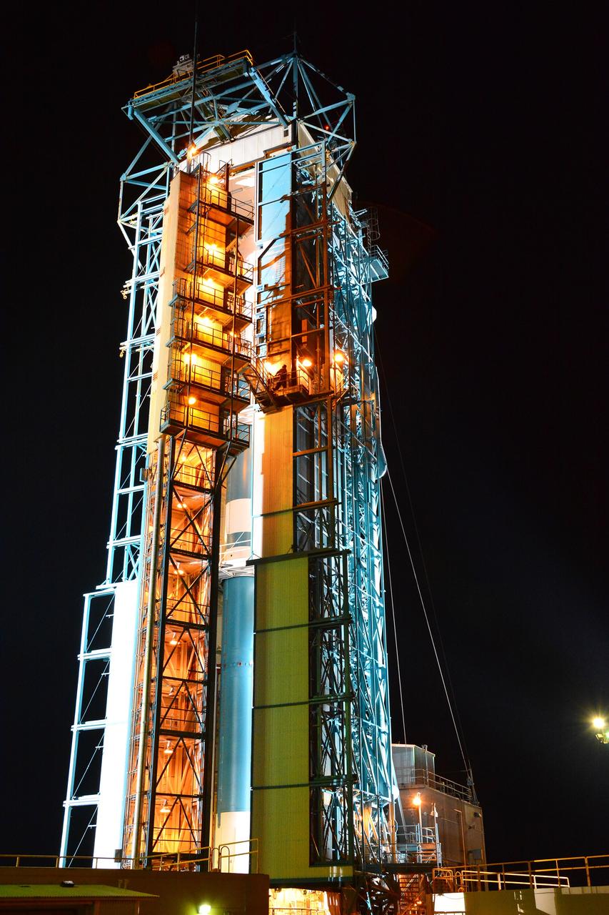
VANDENBERG AIR FORCE BASE, Calif. – The launch gantry is rolled back to reveal the United Launch Alliance Delta II rocket with the Soil Moisture Active Passive, or SMAP, satellite aboard, at Space Launch Complex 2 on Vandenberg Air Force Base in California. SMAP is a remote sensing mission designed to measure and map the Earth's soil moisture distribution and freeze/thaw stat with unprecedented accuracy, resolution and coverage. SMAP will provide global measurements of soil moisture and its freeze/thaw state. These measurements will be used to enhance understanding of processes that link the water, energy and carbon cycles, and to extend the capabilities of weather and climate prediction models. SMAP data also will be used to quantify net carbon flux in boreal landscapes and to develop improved flood prediction and drought monitoring capabilities. Launch is scheduled for Jan. 29, 2015. To learn more about SMAP, visit http://www.nasa.gov/smap. Photo credit: NASA/Randy Beaudoin
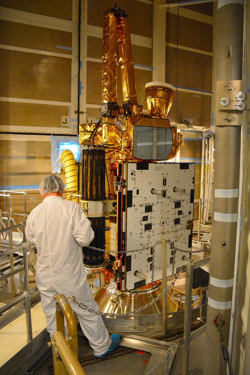
VANDENBERG AIR FORCE BASE, Calif. – At Vandenberg Air Force Base in California, NASA's Soil Moisture Active Passive mission, or SMAP, satellite is mated to its Delta II rocket at Space Launch Complex 2. SMAP will provide global measurements of soil moisture and its freeze/thaw state. These measurements will be used to enhance understanding of processes that link the water, energy and carbon cycles, and to extend the capabilities of weather and climate prediction models. SMAP data also will be used to quantify net carbon flux in boreal landscapes and to develop improved flood prediction and drought monitoring capabilities. Launch is scheduled for Jan. 29, 2015. To learn more about SMAP, visit http://smap.jpl.nasa.gov Photo credit: NASA/Randy Beaudoin
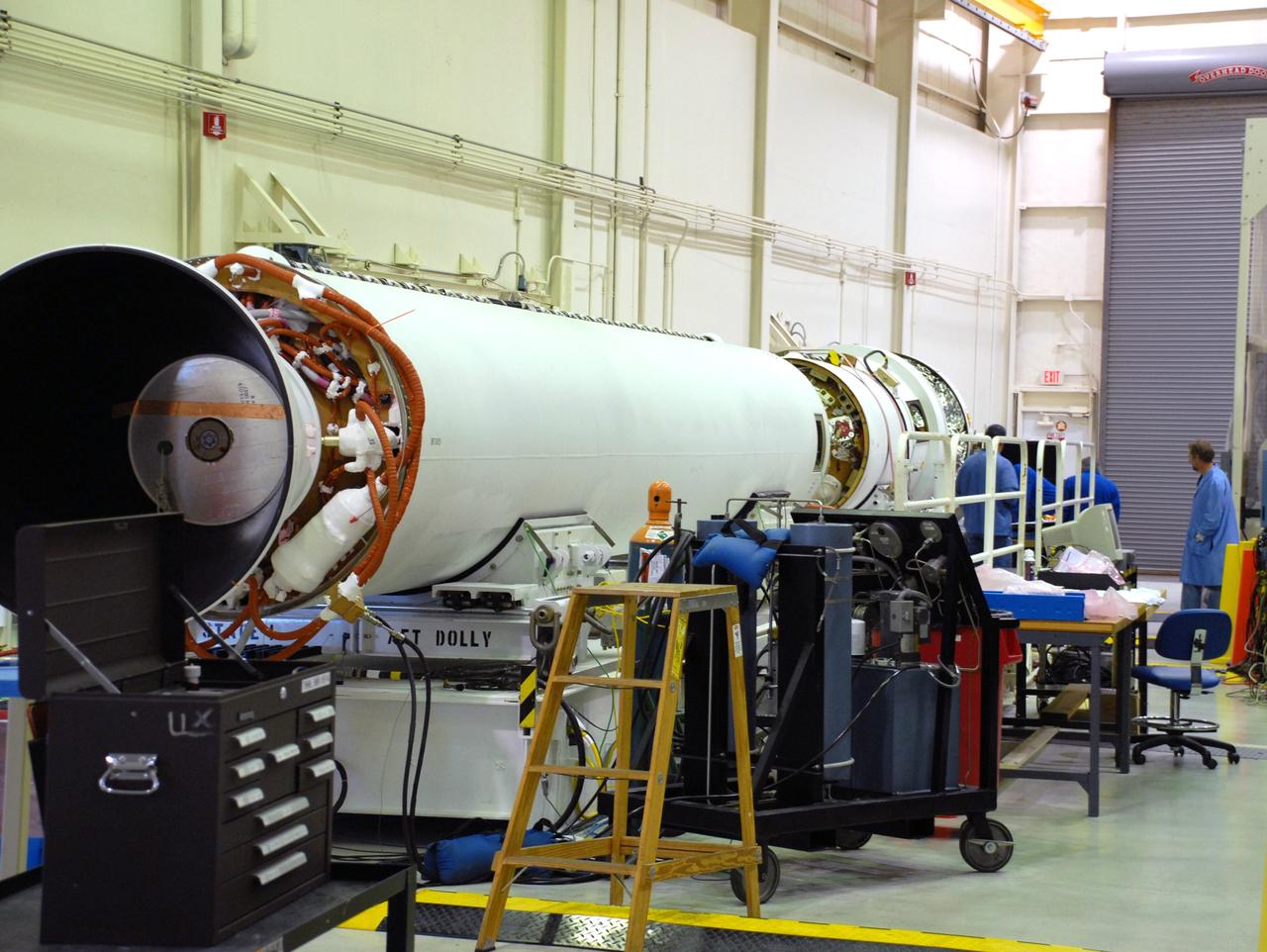
VANDENBERG AIR FORCE BASE, Calif. -- The avionics are mated to stage 2 of the Taurus XL launch vehicle for the Orbiting Carbon Observatory at Vandenberg Air Force Base in California. The OCO is a new Earth-orbiting mission sponsored by NASA's Earth System Science Pathfinder Program. The launch of OCO is scheduled for Feb. 23. Photo credit: NASA/VAFB
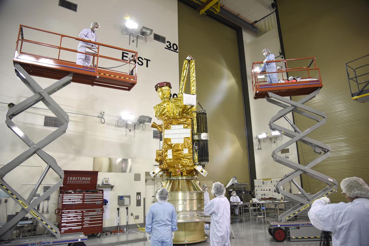
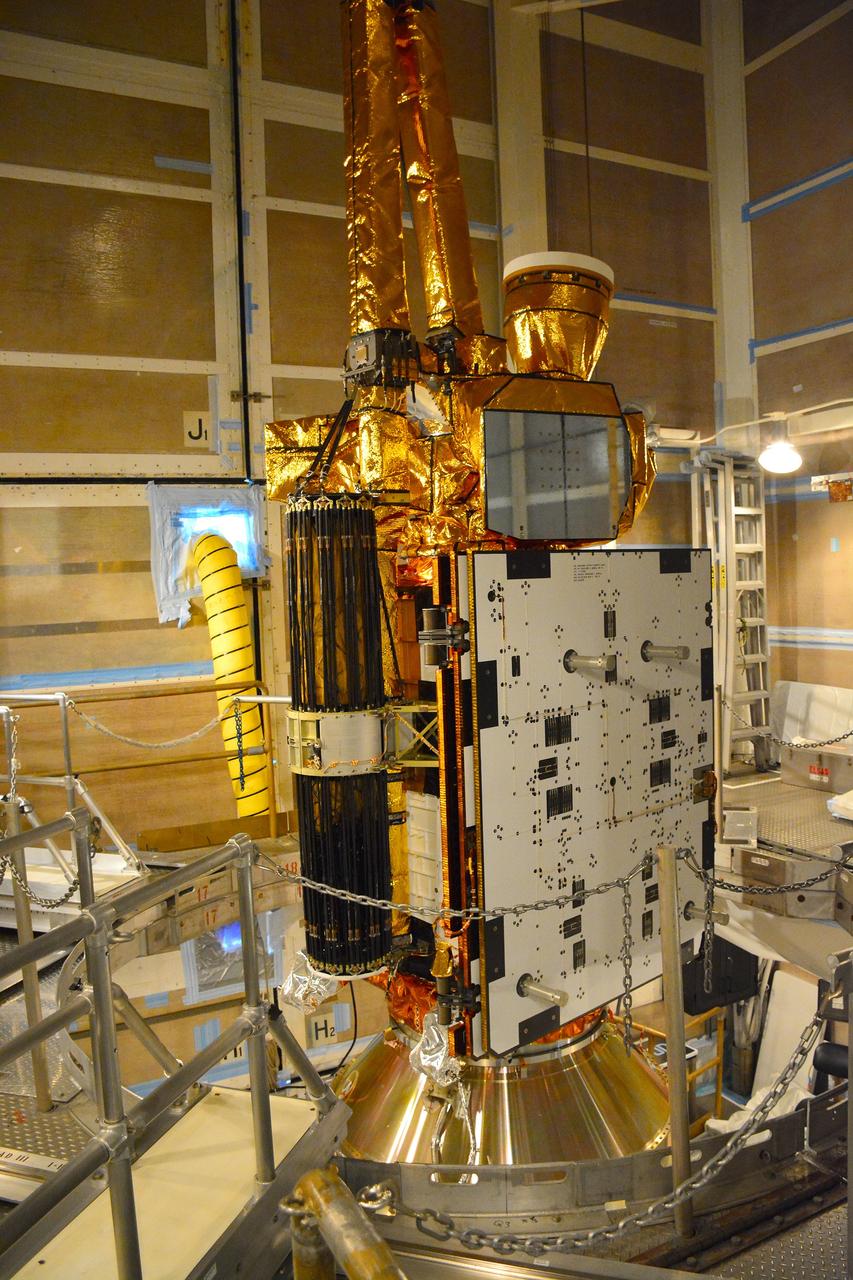
VANDENBERG AIR FORCE BASE, Calif. – Inside the Astrotech payload processing facility at Vandenberg Air Force Base in California, engineers and technicians inspect NASA's Soil Moisture Active Passive mission, or SMAP, satellite. SMAP will provide global measurements of soil moisture and its freeze/thaw state. These measurements will be used to enhance understanding of processes that link the water, energy and carbon cycles, and to extend the capabilities of weather and climate prediction models. SMAP data also will be used to quantify net carbon flux in boreal landscapes and to develop improved flood prediction and drought monitoring capabilities. Launch is scheduled for Jan. 29, 2015. To learn more about SMAP, visit http://smap.jpl.nasa.gov Photo credit: Jeremy Moore, USAF Photo Squadron
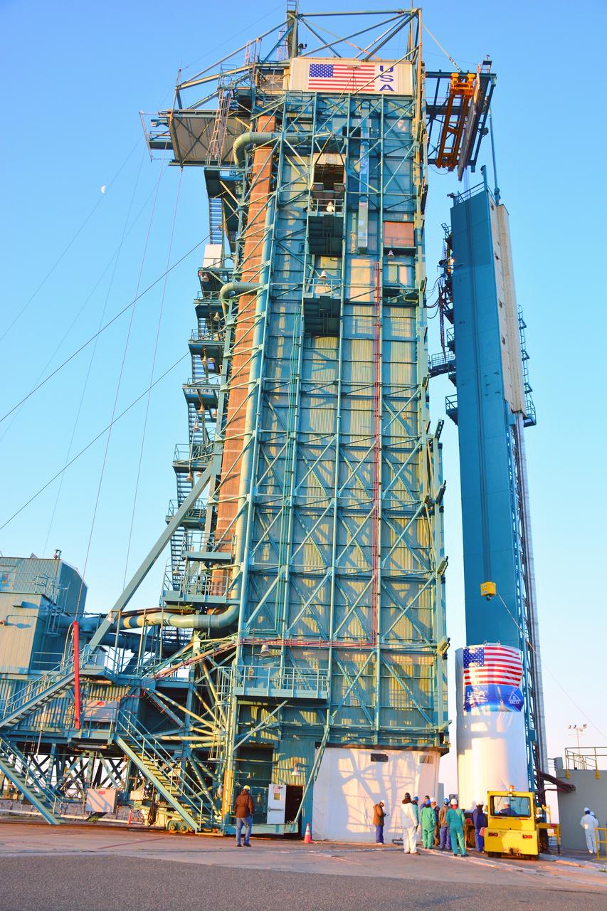
VANDENBERG AIR FORCE BASE, Calif. – At Vandenberg Air Force Base in California, NASA's Soil Moisture Active Passive mission, or SMAP, satellite is prepared for lifting at Space Launch Complex 2 for mating to its Delta II rocket. SMAP will provide global measurements of soil moisture and its freeze/thaw state. These measurements will be used to enhance understanding of processes that link the water, energy and carbon cycles, and to extend the capabilities of weather and climate prediction models. SMAP data also will be used to quantify net carbon flux in boreal landscapes and to develop improved flood prediction and drought monitoring capabilities. Launch is scheduled for Jan. 29, 2015. To learn more about SMAP, visit http://smap.jpl.nasa.gov Photo credit: NASA/Randy Beaudoin
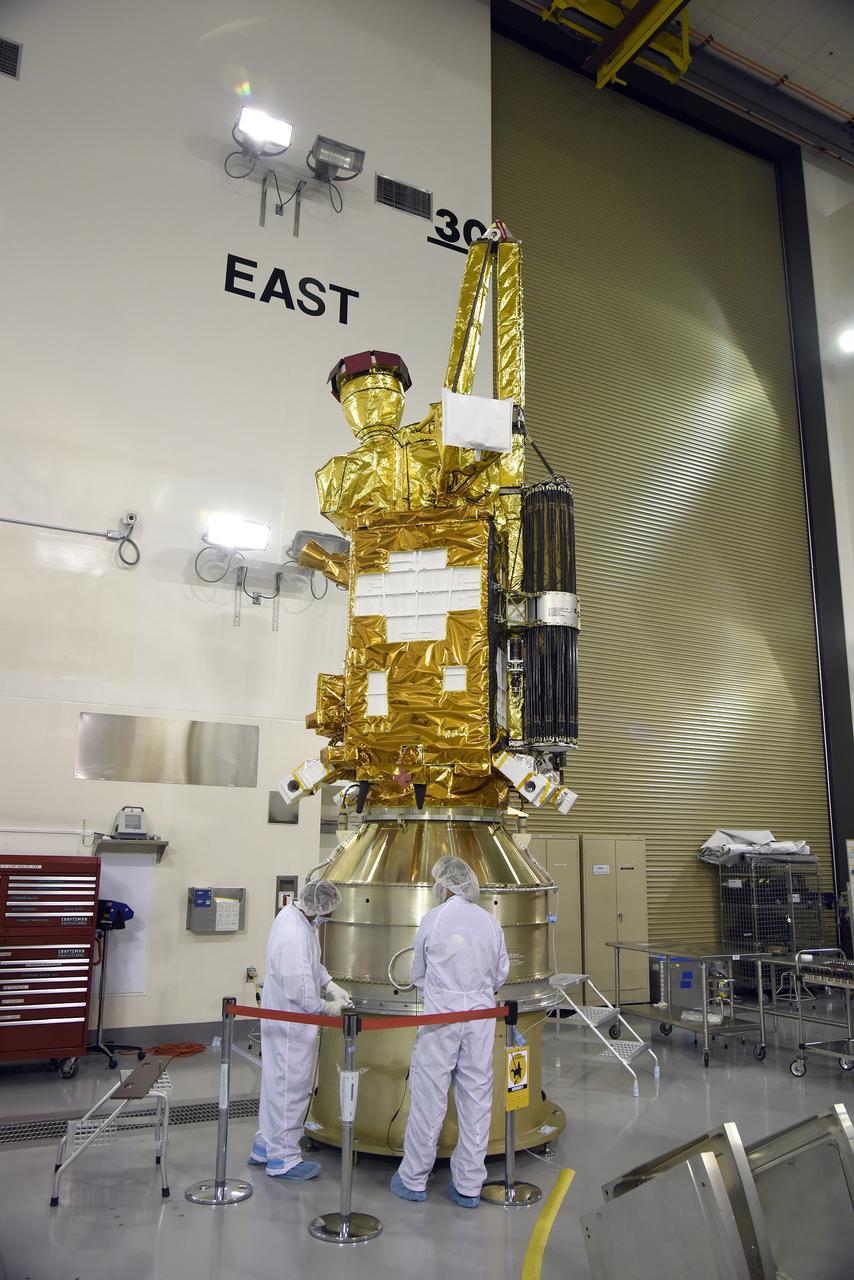
VANDENBERG AIR FORCE BASE, Calif. – Inside the Astrotech payload processing facility at Vandenberg Air Force Base in California, engineers and technicians inspect NASA's Soil Moisture Active Passive mission, or SMAP, satellite. SMAP will provide global measurements of soil moisture and its freeze/thaw state. These measurements will be used to enhance understanding of processes that link the water, energy and carbon cycles, and to extend the capabilities of weather and climate prediction models. SMAP data also will be used to quantify net carbon flux in boreal landscapes and to develop improved flood prediction and drought monitoring capabilities. Launch is scheduled for Jan. 29, 2015. To learn more about SMAP, visit http://smap.jpl.nasa.gov Photo credit: Jeremy Moore, USAF Photo Squadron
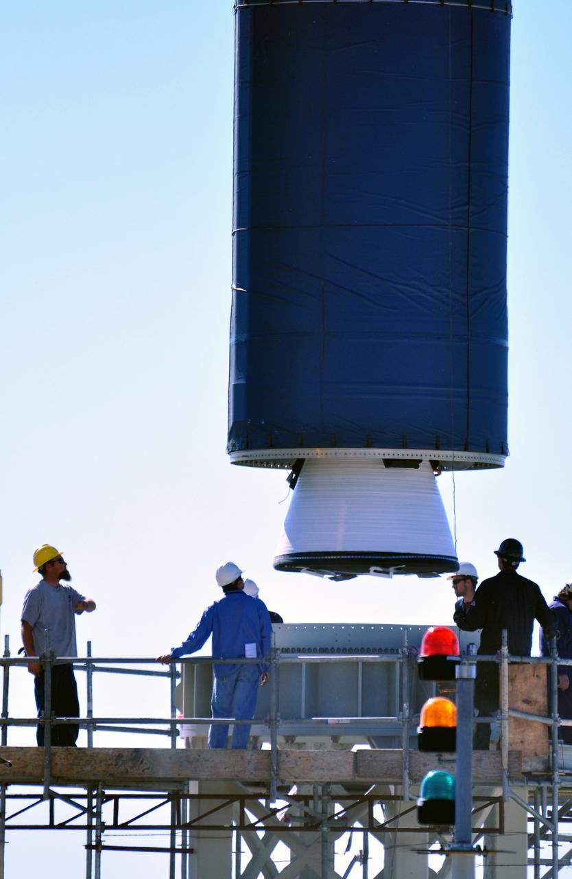
VANDENBERG AIR FORCE BASE, Calif. -- At complex 576E at Vandenberg Air Force Base in California, a crane lifts Stage 0 of the Taurus XL launch vehicle for the Orbiting Carbon Observatory from its transporter. The OCO is a new Earth-orbiting mission sponsored by NASA's Earth System Science Pathfinder Program. It is scheduled to launch Feb. 23. Photo credit: NASA/Randy Beaudoin, VAFB
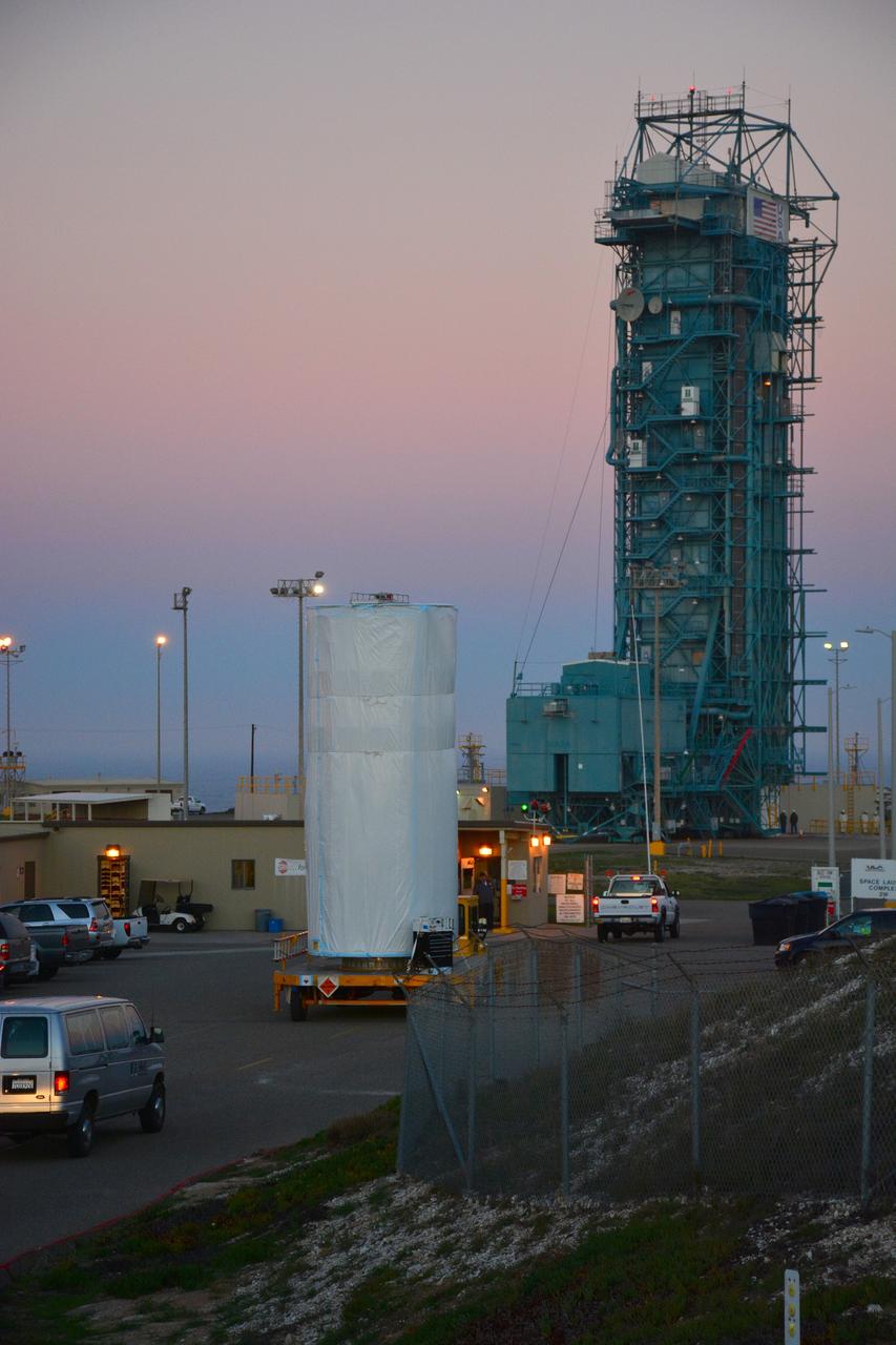
VANDENBERG AIR FORCE BASE, Calif. – At Vandenberg Air Force Base in California, NASA's Soil Moisture Active Passive mission, or SMAP, satellite is transported to Space Launch Complex 2 where it will be mated to a Delta II rocket. SMAP will provide global measurements of soil moisture and its freeze/thaw state. These measurements will be used to enhance understanding of processes that link the water, energy and carbon cycles, and to extend the capabilities of weather and climate prediction models. SMAP data also will be used to quantify net carbon flux in boreal landscapes and to develop improved flood prediction and drought monitoring capabilities. Launch is scheduled for Jan. 29, 2015. To learn more about SMAP, visit http://smap.jpl.nasa.gov Photo credit: NASA/Randy Beaudoin
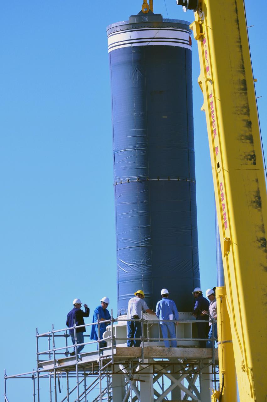
VANDENBERG AIR FORCE BASE, Calif. -- At complex 576E at Vandenberg Air Force Base in California, a crane lifts Stage 0 of the Taurus XL launch vehicle for the Orbiting Carbon Observatory from its transporter. The OCO is a new Earth-orbiting mission sponsored by NASA's Earth System Science Pathfinder Program. It is scheduled to launch Feb. 23. Photo credit: NASA/Randy Beaudoin, VAFB
VANDENBERG AIR FORCE BASE, Calif. – At Vandenberg Air Force Base in California, NASA's Soil Moisture Active Passive mission, or SMAP, satellite is lifted at Space Launch Complex 2 for mating to its Delta II rocket. SMAP will provide global measurements of soil moisture and its freeze/thaw state. These measurements will be used to enhance understanding of processes that link the water, energy and carbon cycles, and to extend the capabilities of weather and climate prediction models. SMAP data also will be used to quantify net carbon flux in boreal landscapes and to develop improved flood prediction and drought monitoring capabilities. Launch is scheduled for Jan. 29, 2015. To learn more about SMAP, visit http://smap.jpl.nasa.gov Photo credit: NASA/Randy Beaudoin
VANDENBERG AIR FORCE BASE, Calif. – The launch gantry is rolled back to reveal the United Launch Alliance Delta II rocket with the Soil Moisture Active Passive, or SMAP, satellite aboard, at Space Launch Complex 2 on Vandenberg Air Force Base in California. SMAP is a remote sensing mission designed to measure and map the Earth's soil moisture distribution and freeze/thaw stat with unprecedented accuracy, resolution and coverage. SMAP will provide global measurements of soil moisture and its freeze/thaw state. These measurements will be used to enhance understanding of processes that link the water, energy and carbon cycles, and to extend the capabilities of weather and climate prediction models. SMAP data also will be used to quantify net carbon flux in boreal landscapes and to develop improved flood prediction and drought monitoring capabilities. Launch is scheduled for Jan. 29, 2015. To learn more about SMAP, visit http://www.nasa.gov/smap. Photo credit: NASA/Randy Beaudoin
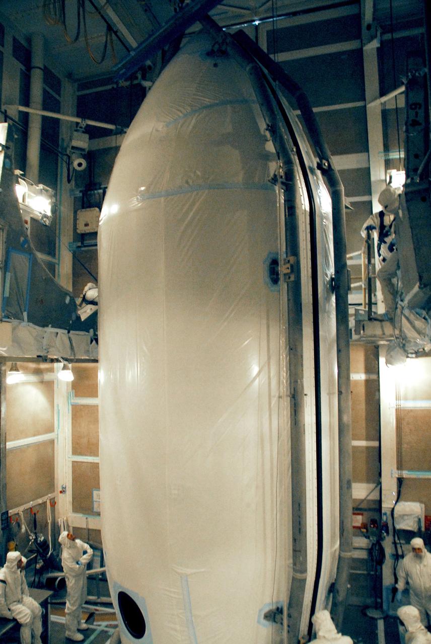
VANDENBERG AIR FORCE BASE, Calif. -- The two halves of the fairing are closed around the NOAA-N Prime spacecraft in the launch service tower on Space Launch Complex 2 at Vandenberg Air Force Base in California. The fairing is a molded structure that fits flush with the outside surface of the rocket and forms an aerodynamically smooth nose cone, protecting the spacecraft during launch and ascent. NOAA-N Prime is the latest polar-orbiting operational environmental weather satellite developed by NASA for the National Oceanic and Atmospheric Administration. The satellite is scheduled to launch Feb. 4 aboard the Delta II from Vandenberg Air Force Base. Photo credit: NASA/Mark Mackley, VAFB
VANDENBERG AIR FORCE BASE, Calif. – At Vandenberg Air Force Base in California, NASA's Soil Moisture Active Passive mission, or SMAP, satellite is transported to Space Launch Complex 2 where it will be mated to a Delta II rocket. SMAP will provide global measurements of soil moisture and its freeze/thaw state. These measurements will be used to enhance understanding of processes that link the water, energy and carbon cycles, and to extend the capabilities of weather and climate prediction models. SMAP data also will be used to quantify net carbon flux in boreal landscapes and to develop improved flood prediction and drought monitoring capabilities. Launch is scheduled for Jan. 29, 2015. To learn more about SMAP, visit http://smap.jpl.nasa.gov Photo credit: NASA/Randy Beaudoin
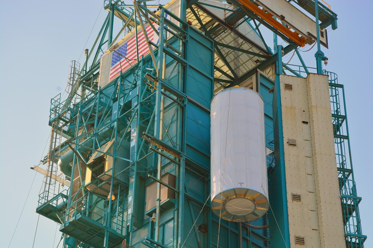
VANDENBERG AIR FORCE BASE, Calif. – At Vandenberg Air Force Base in California, NASA's Soil Moisture Active Passive mission, or SMAP, satellite is lifted at Space Launch Complex 2 for mating to its Delta II rocket. SMAP will provide global measurements of soil moisture and its freeze/thaw state. These measurements will be used to enhance understanding of processes that link the water, energy and carbon cycles, and to extend the capabilities of weather and climate prediction models. SMAP data also will be used to quantify net carbon flux in boreal landscapes and to develop improved flood prediction and drought monitoring capabilities. Launch is scheduled for Jan. 29, 2015. To learn more about SMAP, visit http://smap.jpl.nasa.gov Photo credit: NASA/Randy Beaudoin
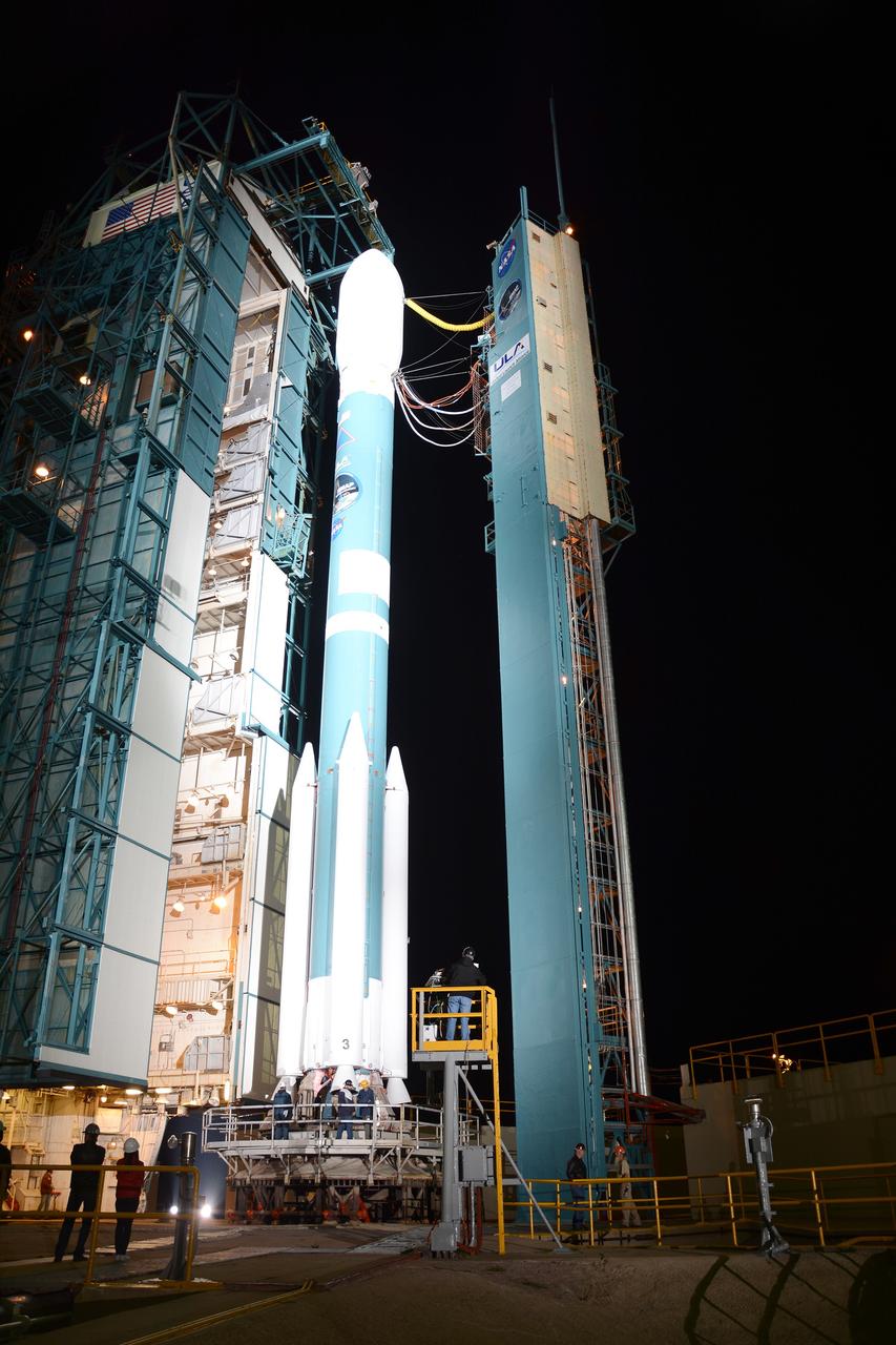
VANDENBERG AIR FORCE BASE, Calif. – The launch gantry is rolled back to reveal the United Launch Alliance Delta II rocket with the Soil Moisture Active Passive, or SMAP, satellite aboard, at Space Launch Complex 2 on Vandenberg Air Force Base in California. SMAP is a remote sensing mission designed to measure and map the Earth's soil moisture distribution and freeze/thaw stat with unprecedented accuracy, resolution and coverage. SMAP will provide global measurements of soil moisture and its freeze/thaw state. These measurements will be used to enhance understanding of processes that link the water, energy and carbon cycles, and to extend the capabilities of weather and climate prediction models. SMAP data also will be used to quantify net carbon flux in boreal landscapes and to develop improved flood prediction and drought monitoring capabilities. Launch is scheduled for Jan. 29, 2015. To learn more about SMAP, visit http://www.nasa.gov/smap. Photo credit: NASA/Randy Beaudoin
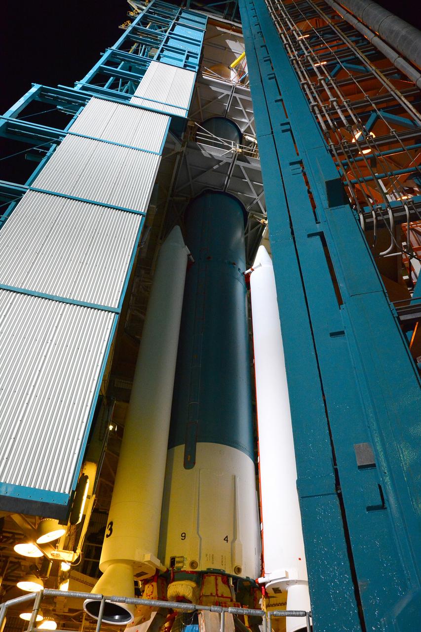
VANDENBERG AIR FORCE BASE, Calif. – The launch gantry is rolled back to reveal the United Launch Alliance Delta II rocket with the Soil Moisture Active Passive, or SMAP, satellite aboard, at Space Launch Complex 2 on Vandenberg Air Force Base in California. SMAP is a remote sensing mission designed to measure and map the Earth's soil moisture distribution and freeze/thaw stat with unprecedented accuracy, resolution and coverage. SMAP will provide global measurements of soil moisture and its freeze/thaw state. These measurements will be used to enhance understanding of processes that link the water, energy and carbon cycles, and to extend the capabilities of weather and climate prediction models. SMAP data also will be used to quantify net carbon flux in boreal landscapes and to develop improved flood prediction and drought monitoring capabilities. Launch is scheduled for Jan. 29, 2015. To learn more about SMAP, visit http://www.nasa.gov/smap. Photo credit: NASA/Randy Beaudoin
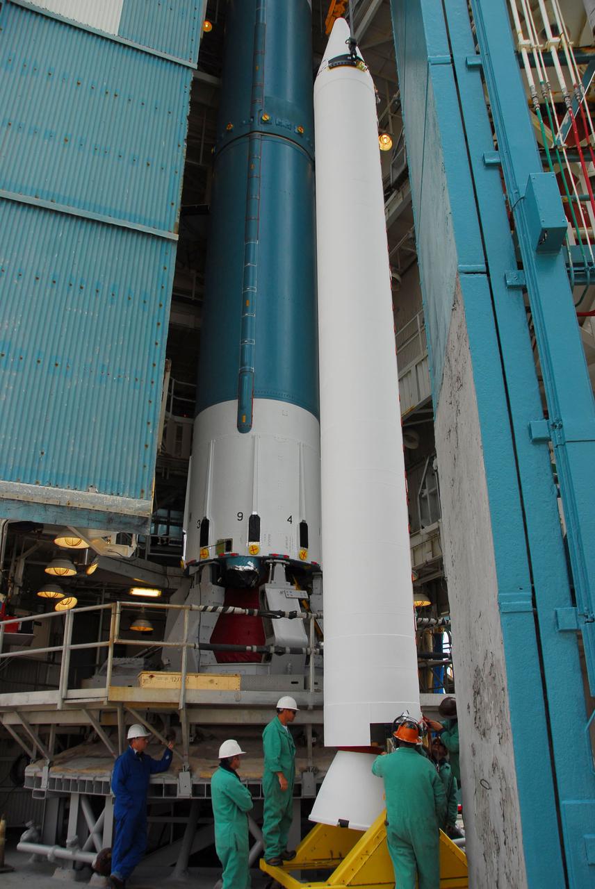
VANDENBERG AIR FORCE BASE, Calif. -- At Vandenberg Air Force Base in California, a crane is used to lift and position a solid rocket motor for attachment to the United Launch Alliance Delta II that will carry NASA's National Polar-orbiting Operational Environmental Satellite System Preparatory Project (NPP) satellite at NASA's Space Launch Complex-2. NPP represents a critical first step in building the next-generation of Earth-observing satellites. NPP will carry the first of the new sensors developed for this satellite fleet, now known as the Joint Polar Satellite System (JPSS) to be launched in 2016. NPP is the bridge between NASA's Earth Observing System (EOS) satellites and the forthcoming series of JPSS satellites. The mission will test key technologies and instruments for the JPSS missions. NPP is targeted to launch Oct. 25. For more information, visit http:__www.nasa.gov_NPP. Photo credit: NASA_VAFB, Dan Liberotti
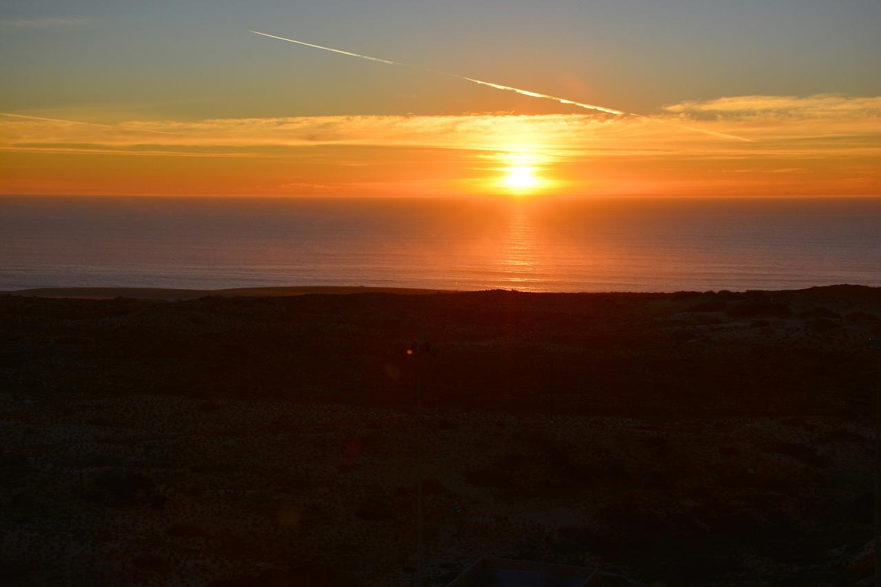
VANDENBERG AIR FORCE BASE, Calif. – The sun sets over the Pacific Ocean as seen from Vandenberg Air Force Base in California where NASA's Soil Moisture Active Passive mission, or SMAP, satellite is being prepared for liftoff from Space Launch Complex 2. SMAP will provide global measurements of soil moisture and its freeze/thaw state. These measurements will be used to enhance understanding of processes that link the water, energy and carbon cycles, and to extend the capabilities of weather and climate prediction models. SMAP data also will be used to quantify net carbon flux in boreal landscapes and to develop improved flood prediction and drought monitoring capabilities. Launch is scheduled for Jan. 29, 2015. To learn more about SMAP, visit http://smap.jpl.nasa.gov Photo credit: NASA/Randy Beaudoin
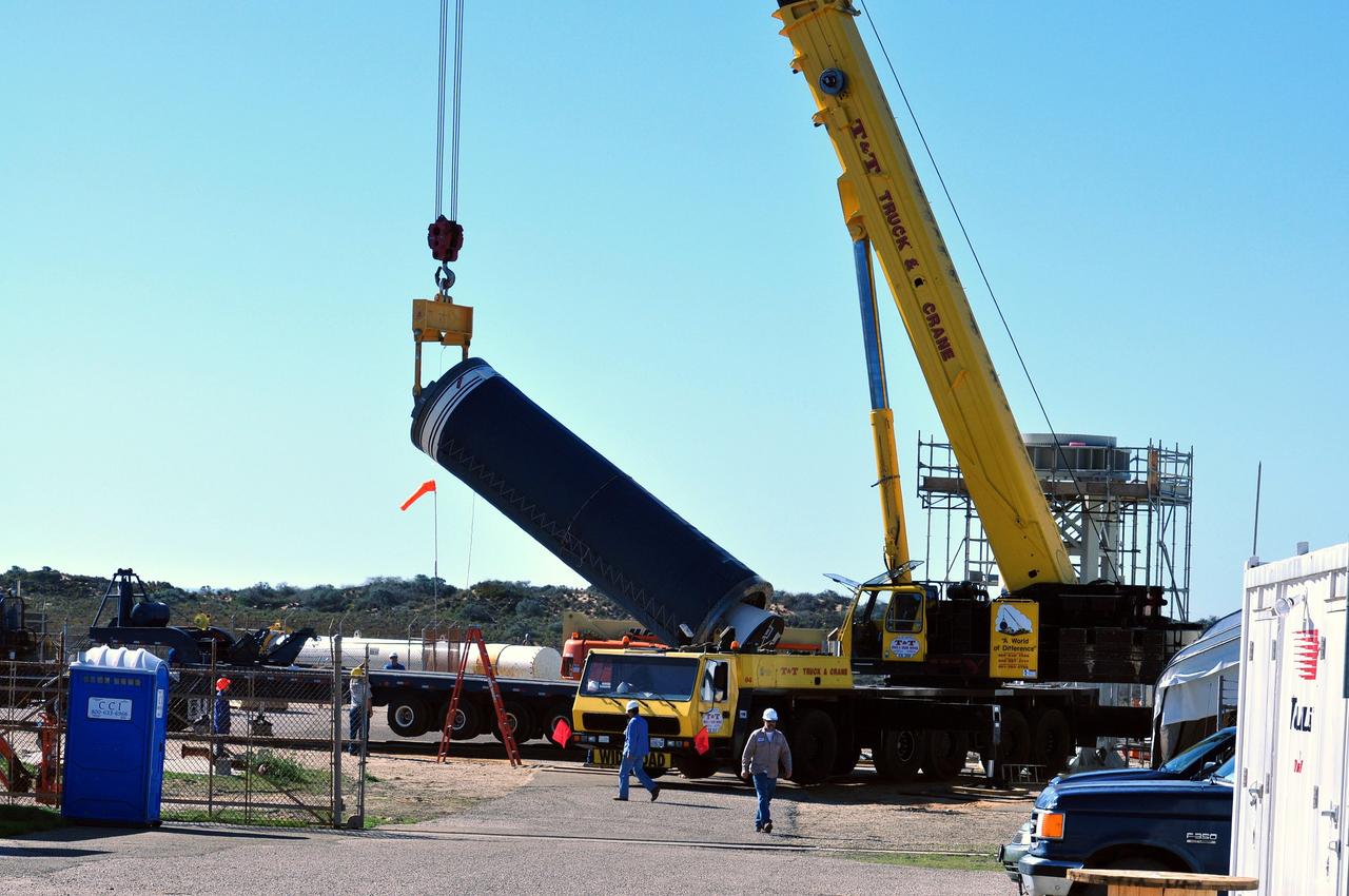
VANDENBERG AIR FORCE BASE, Calif. -- At complex 576E at Vandenberg Air Force Base in California, a crane raises Stage 0 of the Taurus XL launch vehicle for the Orbiting Carbon Observatory from its transporter. The OCO is a new Earth-orbiting mission sponsored by NASA's Earth System Science Pathfinder Program. It is scheduled to launch Feb. 23. Photo credit: NASA/Randy Beaudoin, VAFB
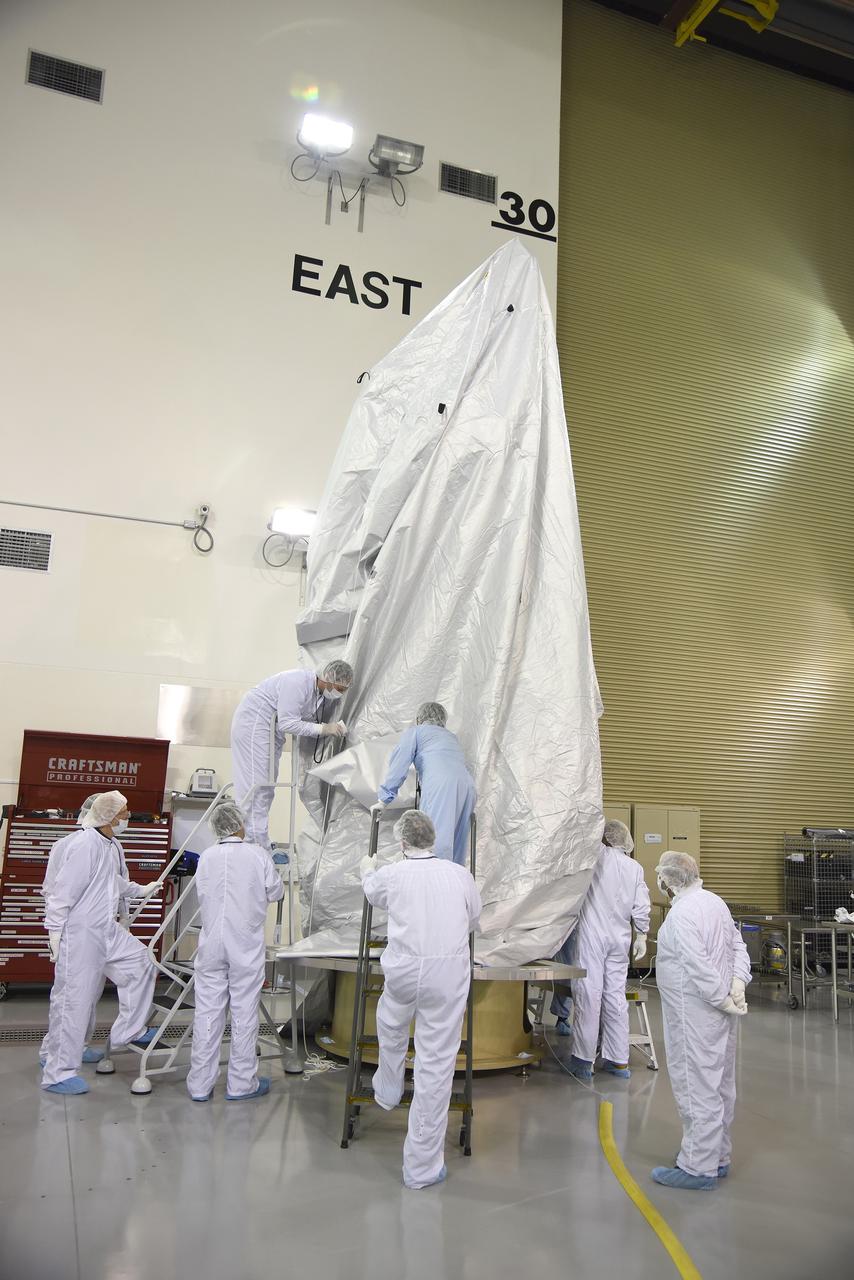
VANDENBERG AIR FORCE BASE, Calif. – Inside the Astrotech payload processing facility at Vandenberg Air Force Base in California, engineers and technicians place a protective cover over NASA's Soil Moisture Active Passive mission, or SMAP, satellite prior the spacecraft being transported to the launch pad. SMAP will provide global measurements of soil moisture and its freeze/thaw state. These measurements will be used to enhance understanding of processes that link the water, energy and carbon cycles, and to extend the capabilities of weather and climate prediction models. SMAP data also will be used to quantify net carbon flux in boreal landscapes and to develop improved flood prediction and drought monitoring capabilities. Launch is scheduled for Jan. 29, 2015. To learn more about SMAP, visit http://smap.jpl.nasa.gov Photo credit: Jeremy Moore, USAF Photo Squadron
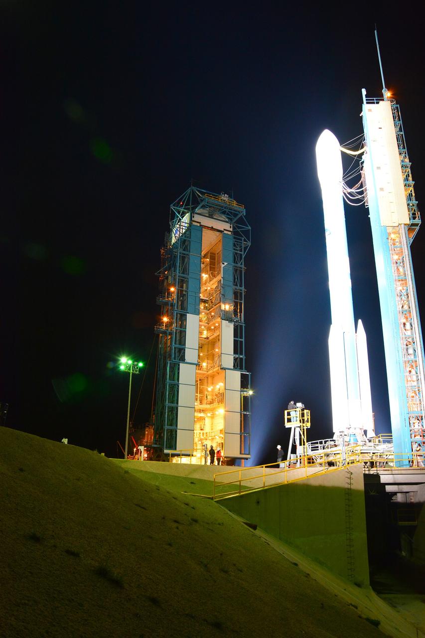
VANDENBERG AIR FORCE BASE, Calif. – The launch gantry is rolled back to reveal the United Launch Alliance Delta II rocket with the Soil Moisture Active Passive, or SMAP, satellite aboard, at Space Launch Complex 2 on Vandenberg Air Force Base in California. SMAP is a remote sensing mission designed to measure and map the Earth's soil moisture distribution and freeze/thaw stat with unprecedented accuracy, resolution and coverage. SMAP will provide global measurements of soil moisture and its freeze/thaw state. These measurements will be used to enhance understanding of processes that link the water, energy and carbon cycles, and to extend the capabilities of weather and climate prediction models. SMAP data also will be used to quantify net carbon flux in boreal landscapes and to develop improved flood prediction and drought monitoring capabilities. Launch is scheduled for Jan. 29, 2015. To learn more about SMAP, visit http://www.nasa.gov/smap. Photo credit: NASA/Randy Beaudoin
VANDENBERG AIR FORCE BASE, Calif. – At Vandenberg Air Force Base in California, NASA's Soil Moisture Active Passive mission, or SMAP, satellite is mated to its Delta II rocket at Space Launch Complex 2. SMAP will provide global measurements of soil moisture and its freeze/thaw state. These measurements will be used to enhance understanding of processes that link the water, energy and carbon cycles, and to extend the capabilities of weather and climate prediction models. SMAP data also will be used to quantify net carbon flux in boreal landscapes and to develop improved flood prediction and drought monitoring capabilities. Launch is scheduled for Jan. 29, 2015. To learn more about SMAP, visit http://smap.jpl.nasa.gov Photo credit: NASA/Randy Beaudoin
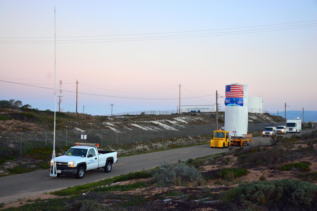
VANDENBERG AIR FORCE BASE, Calif. – At Vandenberg Air Force Base in California, NASA's Soil Moisture Active Passive mission, or SMAP, satellite is transported to Space Launch Complex 2 where it will be mated to a Delta II rocket. SMAP will provide global measurements of soil moisture and its freeze/thaw state. These measurements will be used to enhance understanding of processes that link the water, energy and carbon cycles, and to extend the capabilities of weather and climate prediction models. SMAP data also will be used to quantify net carbon flux in boreal landscapes and to develop improved flood prediction and drought monitoring capabilities. Launch is scheduled for Jan. 29, 2015. To learn more about SMAP, visit http://smap.jpl.nasa.gov Photo credit: NASA/Randy Beaudoin
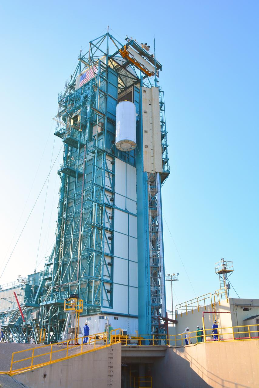
VANDENBERG AIR FORCE BASE, Calif. – At Vandenberg Air Force Base in California, NASA's Soil Moisture Active Passive mission, or SMAP, satellite is lifted at Space Launch Complex 2 for mating to its Delta II rocket. SMAP will provide global measurements of soil moisture and its freeze/thaw state. These measurements will be used to enhance understanding of processes that link the water, energy and carbon cycles, and to extend the capabilities of weather and climate prediction models. SMAP data also will be used to quantify net carbon flux in boreal landscapes and to develop improved flood prediction and drought monitoring capabilities. Launch is scheduled for Jan. 29, 2015. To learn more about SMAP, visit http://smap.jpl.nasa.gov Photo credit: NASA/Randy Beaudoin
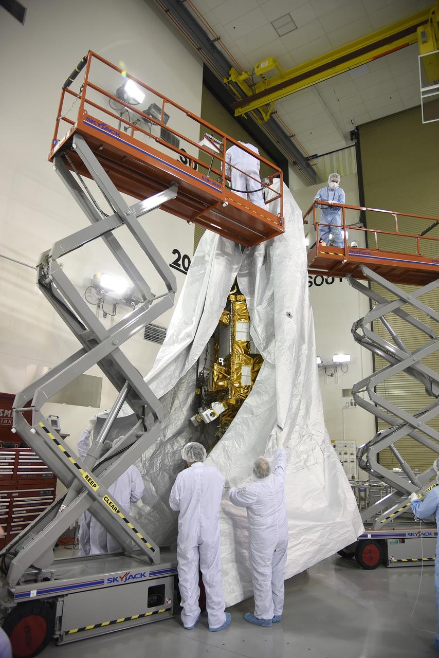
VANDENBERG AIR FORCE BASE, Calif. – Inside the Astrotech payload processing facility at Vandenberg Air Force Base in California, engineers and technicians place a protective cover over NASA's Soil Moisture Active Passive mission, or SMAP, satellite prior the spacecraft being transported to the launch pad. SMAP will provide global measurements of soil moisture and its freeze/thaw state. These measurements will be used to enhance understanding of processes that link the water, energy and carbon cycles, and to extend the capabilities of weather and climate prediction models. SMAP data also will be used to quantify net carbon flux in boreal landscapes and to develop improved flood prediction and drought monitoring capabilities. Launch is scheduled for Jan. 29, 2015. To learn more about SMAP, visit http://smap.jpl.nasa.gov Photo credit: Jeremy Moore, USAF Photo Squadron
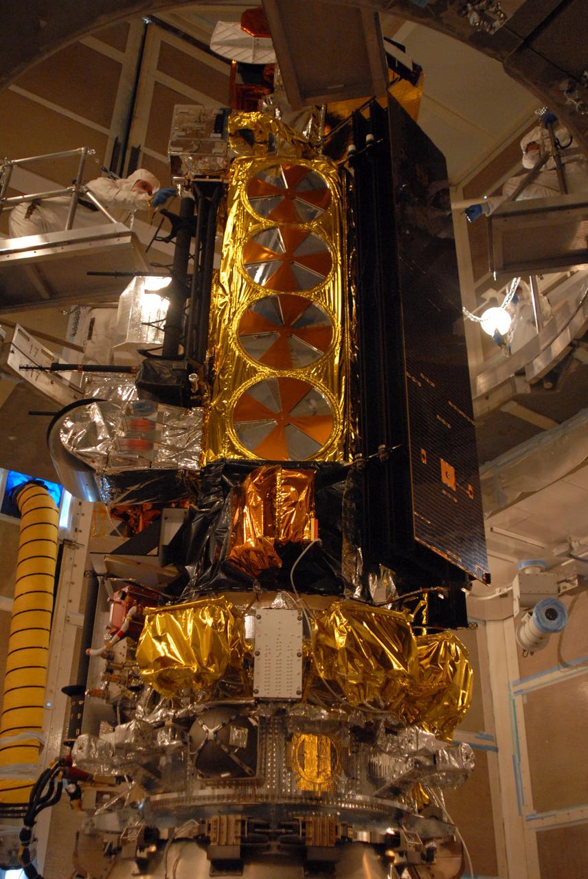
VANDENBERG AIR FORCE BASE, Calif. -- In the mobile service tower on Space Launch Complex 2 at Vandenberg Air Force Base in California, the NOAA-N Prime spacecraft is closed out for encapsulation and installation on the launch vehicle, a Delta II rocket. NOAA-N Prime is the latest polar-orbiting operational environmental weather satellite developed by NASA for the National Oceanic and Atmospheric Administration. The satellite is scheduled to launch Feb. 4 aboard the Delta II from Vandenberg Air Force Base. Photo credit: NASA/VAFB
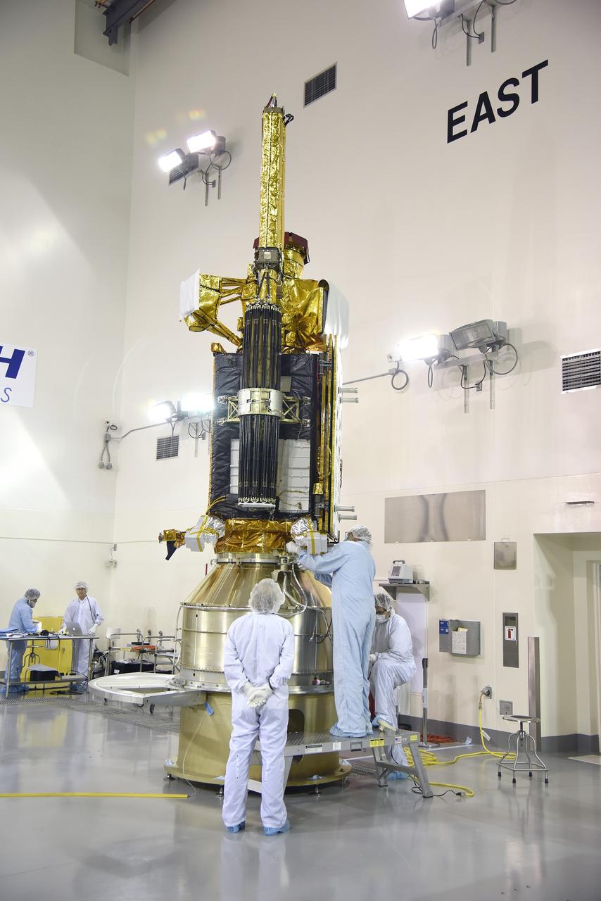
VANDENBERG AIR FORCE BASE, Calif. – Inside the Astrotech payload processing facility at Vandenberg Air Force Base in California, engineers and technicians inspect NASA's Soil Moisture Active Passive mission, or SMAP, satellite. SMAP will provide global measurements of soil moisture and its freeze/thaw state. These measurements will be used to enhance understanding of processes that link the water, energy and carbon cycles, and to extend the capabilities of weather and climate prediction models. SMAP data also will be used to quantify net carbon flux in boreal landscapes and to develop improved flood prediction and drought monitoring capabilities. Launch is scheduled for Jan. 29, 2015. To learn more about SMAP, visit http://smap.jpl.nasa.gov Photo credit: Jeremy Moore, USAF Photo Squadron
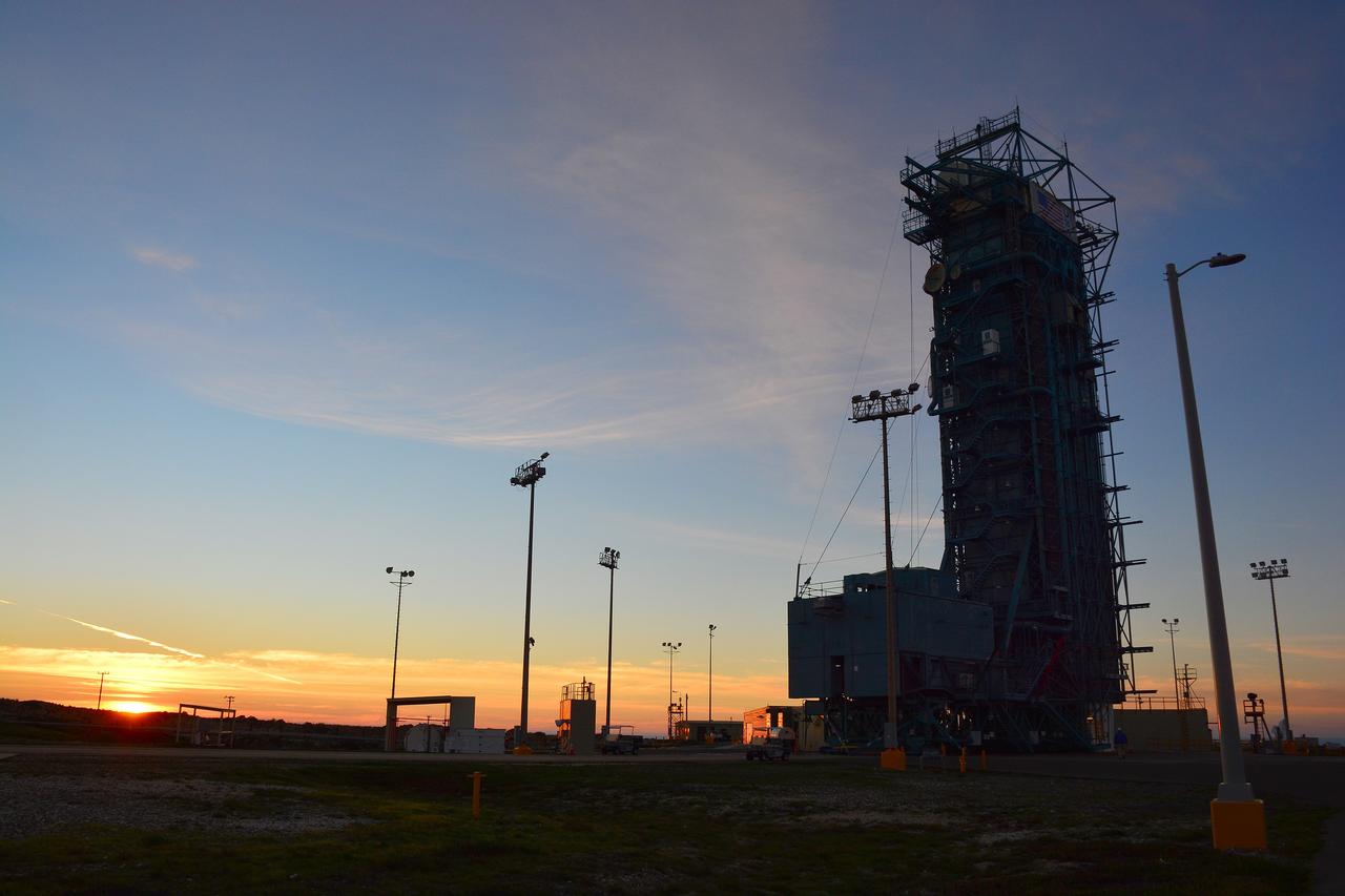
VANDENBERG AIR FORCE BASE, Calif. – The sun sets behind Space Launch Complex 2 at Vandenberg Air Force Base in California where NASA's Soil Moisture Active Passive mission, or SMAP, satellite is being prepared for liftoff. SMAP will provide global measurements of soil moisture and its freeze/thaw state. These measurements will be used to enhance understanding of processes that link the water, energy and carbon cycles, and to extend the capabilities of weather and climate prediction models. SMAP data also will be used to quantify net carbon flux in boreal landscapes and to develop improved flood prediction and drought monitoring capabilities. Launch is scheduled for Jan. 29, 2015. To learn more about SMAP, visit http://smap.jpl.nasa.gov Photo credit: NASA/Randy Beaudoin
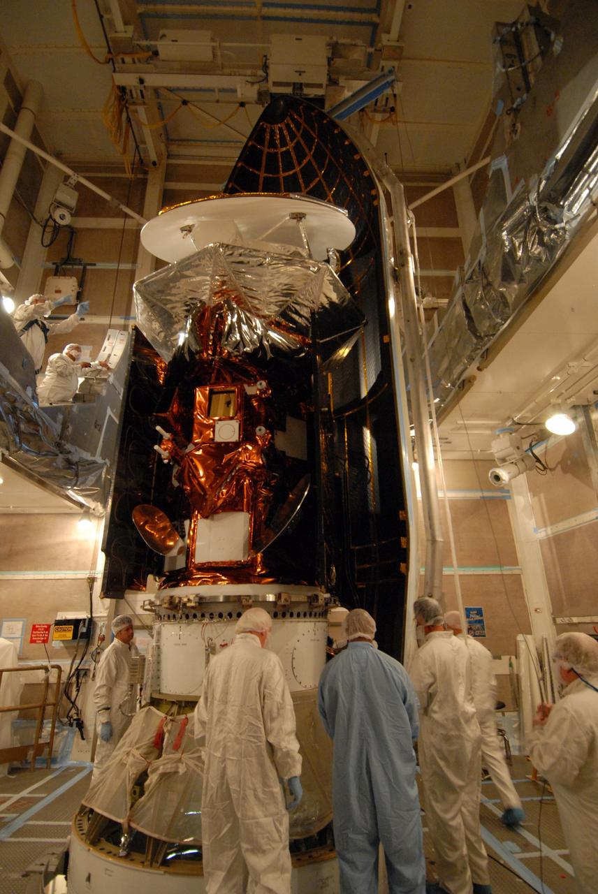
VANDENBERG AIR FORCE BASE, Calif. -- Inside the mobile service tower at NASA's Launch Complex-2 at Vandenberg Air Force Base in California, workers prepare to install the Aquarius/SAC-D spacecraft into the United Launch Alliance’s Delta II payload fairing. Aquarius will be integrated to the Delta II rocket in preparation for the targeted June 9 liftoff. Aquarius, the NASA-built instrument on the SAC-D spacecraft, will provide new insights into how variations in ocean surface salinity relate to fundamental climate processes on its three-year mission. Photo credit: NASA/VAFB
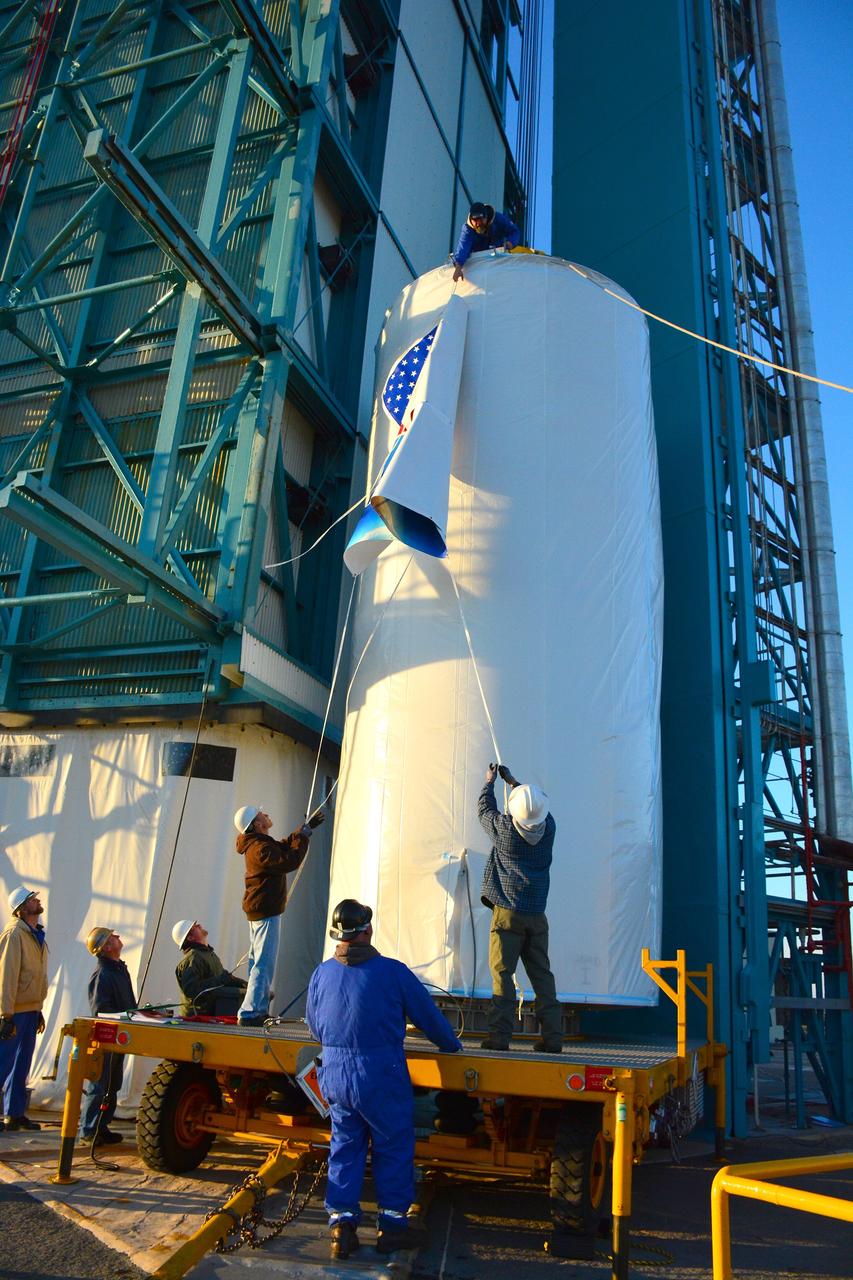
VANDENBERG AIR FORCE BASE, Calif. – At Vandenberg Air Force Base in California, NASA's Soil Moisture Active Passive mission, or SMAP, satellite is prepared for lifting at Space Launch Complex 2 for mating to its Delta II rocket. SMAP will provide global measurements of soil moisture and its freeze/thaw state. These measurements will be used to enhance understanding of processes that link the water, energy and carbon cycles, and to extend the capabilities of weather and climate prediction models. SMAP data also will be used to quantify net carbon flux in boreal landscapes and to develop improved flood prediction and drought monitoring capabilities. Launch is scheduled for Jan. 29, 2015. To learn more about SMAP, visit http://smap.jpl.nasa.gov Photo credit: NASA/Randy Beaudoin
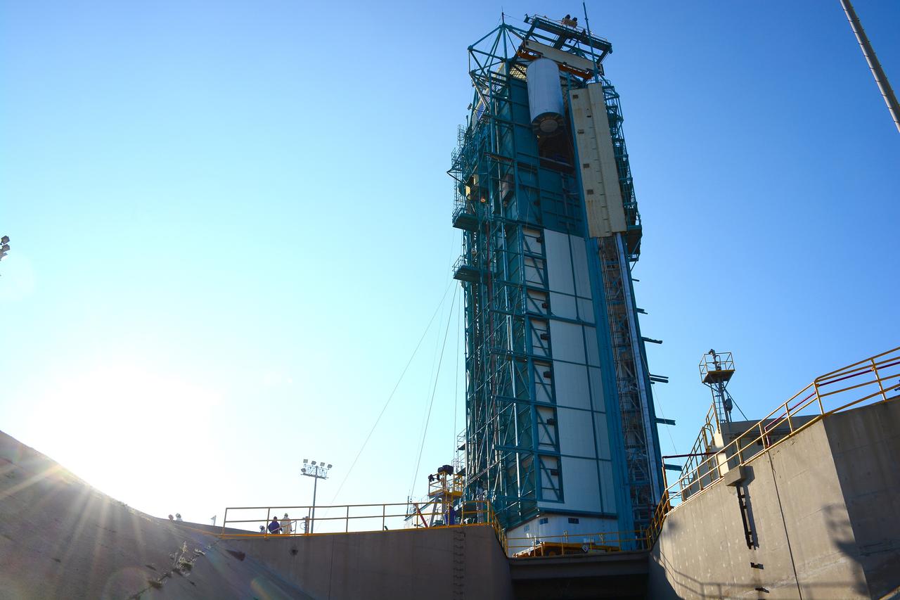
VANDENBERG AIR FORCE BASE, Calif. – At Vandenberg Air Force Base in California, NASA's Soil Moisture Active Passive mission, or SMAP, satellite is lifted at Space Launch Complex 2 for mating to its Delta II rocket. SMAP will provide global measurements of soil moisture and its freeze/thaw state. These measurements will be used to enhance understanding of processes that link the water, energy and carbon cycles, and to extend the capabilities of weather and climate prediction models. SMAP data also will be used to quantify net carbon flux in boreal landscapes and to develop improved flood prediction and drought monitoring capabilities. Launch is scheduled for Jan. 29, 2015. To learn more about SMAP, visit http://smap.jpl.nasa.gov Photo credit: NASA/Randy Beaudoin
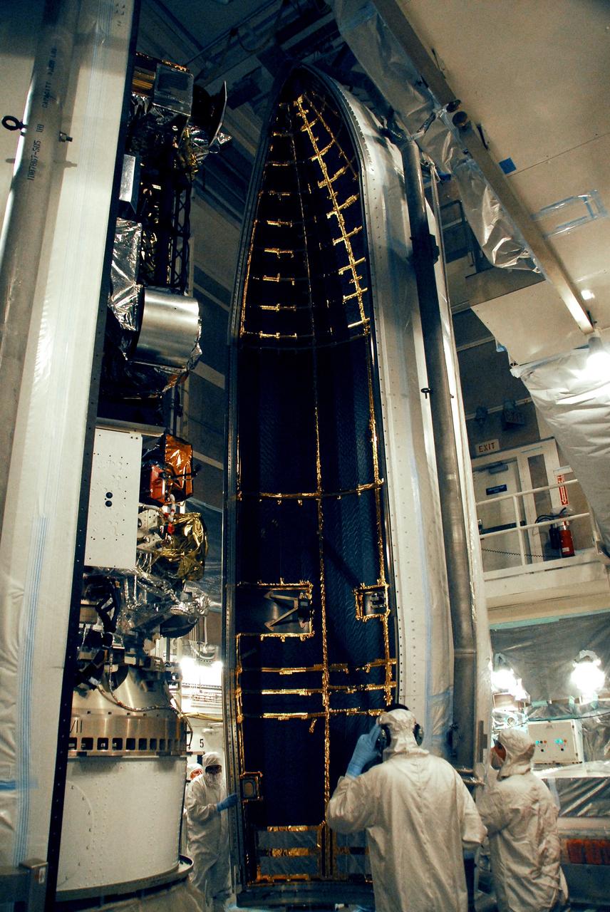
VANDENBERG AIR FORCE BASE, Calif. -- The second half of the fairing is moved into place around the NOAA-N Prime spacecraft in the launch service tower on Space Launch Complex 2 at Vandenberg Air Force Base in California. The fairing is a molded structure that fits flush with the outside surface of the rocket and forms an aerodynamically smooth nose cone, protecting the spacecraft during launch and ascent. NOAA-N Prime is the latest polar-orbiting operational environmental weather satellite developed by NASA for the National Oceanic and Atmospheric Administration. The satellite is scheduled to launch Feb. 4 aboard the Delta II from Vandenberg Air Force Base. Photo credit: NASA/Mark Mackley, VAFB
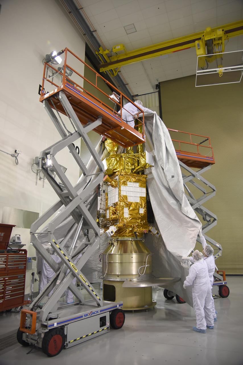
VANDENBERG AIR FORCE BASE, Calif. – Inside the Astrotech payload processing facility at Vandenberg Air Force Base in California, engineers and technicians place a protective cover over NASA's Soil Moisture Active Passive mission, or SMAP, satellite prior the spacecraft being transported to the launch pad. SMAP will provide global measurements of soil moisture and its freeze/thaw state. These measurements will be used to enhance understanding of processes that link the water, energy and carbon cycles, and to extend the capabilities of weather and climate prediction models. SMAP data also will be used to quantify net carbon flux in boreal landscapes and to develop improved flood prediction and drought monitoring capabilities. Launch is scheduled for Jan. 29, 2015. To learn more about SMAP, visit http://smap.jpl.nasa.gov Photo credit: Jeremy Moore, USAF Photo Squadron
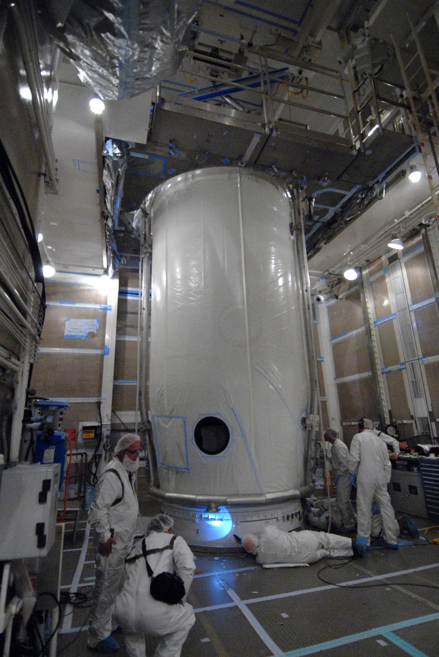
VANDENBERG AIR FORCE BASE, Calif. -- Inside the mobile service tower at NASA's Launch Complex-2 at Vandenberg Air Force Base in California, workers secure the United Launch Alliance’s Delta II payload fairing around the Aquarius/SAC-D spacecraft. Aquarius will be integrated to the Delta II rocket in preparation for the targeted June 9 liftoff. Aquarius, the NASA-built instrument on the SAC-D spacecraft, will provide new insights into how variations in ocean surface salinity relate to fundamental climate processes on its three-year mission. Photo credit: NASA/VAFB
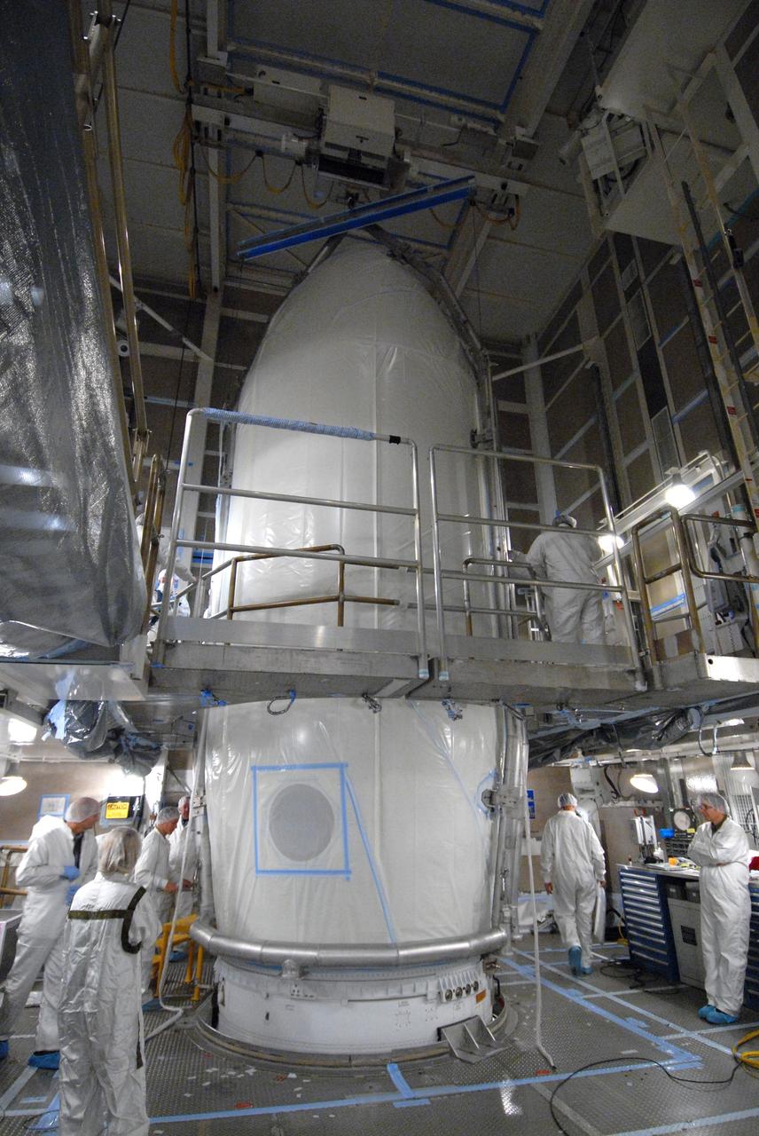
VANDENBERG AIR FORCE BASE, Calif. -- Inside the mobile service tower at NASA's Launch Complex-2 at Vandenberg Air Force Base in California, the Aquarius/SAC-D spacecraft is secure inside the United Launch Alliance’s Delta II payload fairing. Aquarius will be integrated to the Delta II rocket in preparation for the targeted June 9 liftoff. Aquarius, the NASA-built instrument on the SAC-D spacecraft, will provide new insights into how variations in ocean surface salinity relate to fundamental climate processes on its three-year mission. Photo credit: NASA/VAFB
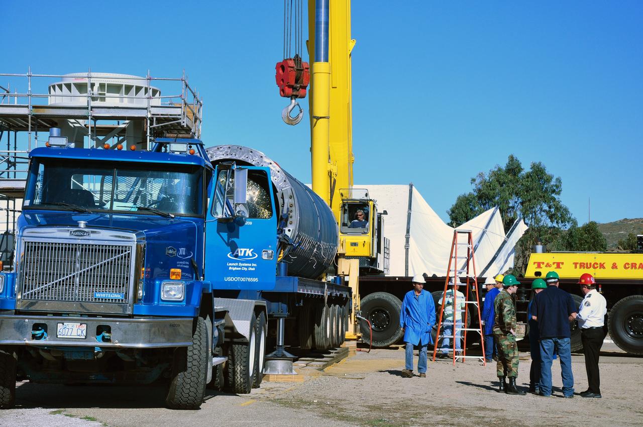
VANDENBERG AIR FORCE BASE, Calif. -- Stage 0 of the Taurus XL launch vehicle for the Orbiting Carbon Observatory arrives at complex 576E at Vandenberg Air Force Base in California. It will be mated with stages 1, 2 and 3 for the launch of OCO. The OCO is a new Earth-orbiting mission sponsored by NASA's Earth System Science Pathfinder Program. It is scheduled to launch Feb. 23. Photo credit: NASA/Randy Beaudoin, VAFB
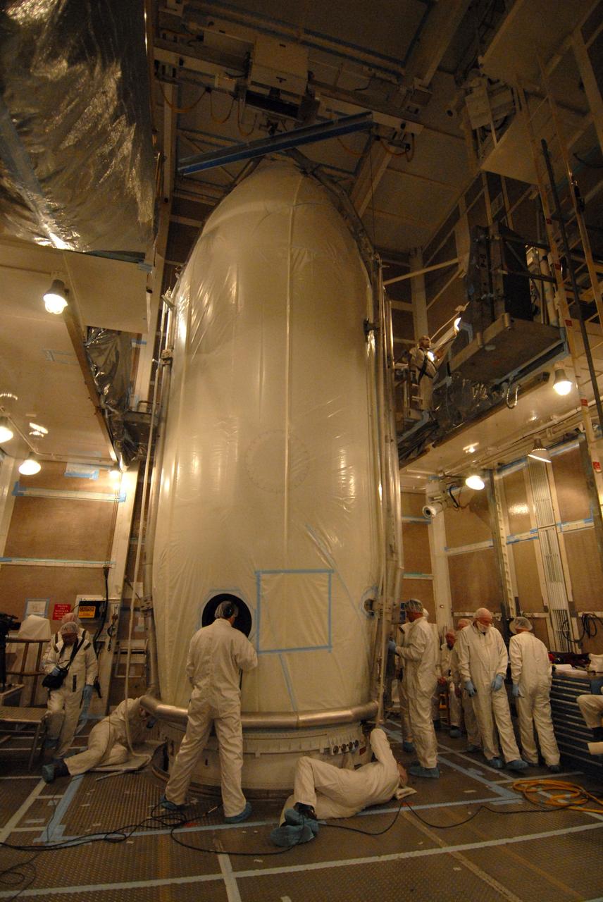
VANDENBERG AIR FORCE BASE, Calif. -- Inside the mobile service tower at NASA's Launch Complex-2 at Vandenberg Air Force Base in California, technicians secure the United Launch Alliance’s Delta II payload fairing around the Aquarius/SAC-D spacecraft. Aquarius will be integrated to the Delta II rocket in preparation for the targeted June 9 liftoff. Aquarius, the NASA-built instrument on the SAC-D spacecraft, will provide new insights into how variations in ocean surface salinity relate to fundamental climate processes on its three-year mission. Photo credit: NASA/VAFB
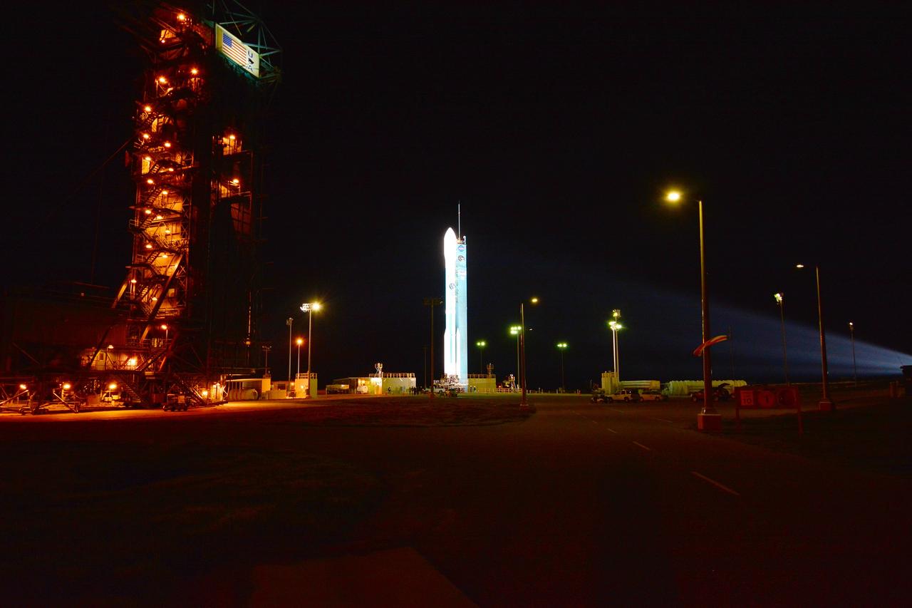
VANDENBERG AIR FORCE BASE, Calif. – The launch gantry is rolled back to reveal the United Launch Alliance Delta II rocket with the Soil Moisture Active Passive, or SMAP, satellite aboard, at Space Launch Complex 2 on Vandenberg Air Force Base in California. SMAP is a remote sensing mission designed to measure and map the Earth's soil moisture distribution and freeze/thaw stat with unprecedented accuracy, resolution and coverage. SMAP will provide global measurements of soil moisture and its freeze/thaw state. These measurements will be used to enhance understanding of processes that link the water, energy and carbon cycles, and to extend the capabilities of weather and climate prediction models. SMAP data also will be used to quantify net carbon flux in boreal landscapes and to develop improved flood prediction and drought monitoring capabilities. Launch is scheduled for Jan. 29, 2015. To learn more about SMAP, visit http://www.nasa.gov/smap. Photo credit: NASA/Randy Beaudoin
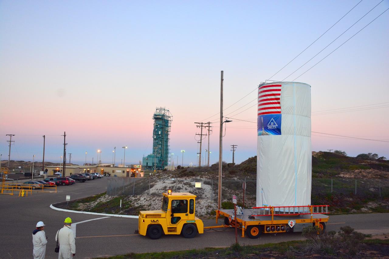
VANDENBERG AIR FORCE BASE, Calif. – At Vandenberg Air Force Base in California, NASA's Soil Moisture Active Passive mission, or SMAP, satellite is transported to Space Launch Complex 2 where it will be mated to a Delta II rocket. SMAP will provide global measurements of soil moisture and its freeze/thaw state. These measurements will be used to enhance understanding of processes that link the water, energy and carbon cycles, and to extend the capabilities of weather and climate prediction models. SMAP data also will be used to quantify net carbon flux in boreal landscapes and to develop improved flood prediction and drought monitoring capabilities. Launch is scheduled for Jan. 29, 2015. To learn more about SMAP, visit http://smap.jpl.nasa.gov Photo credit: NASA/Randy Beaudoin
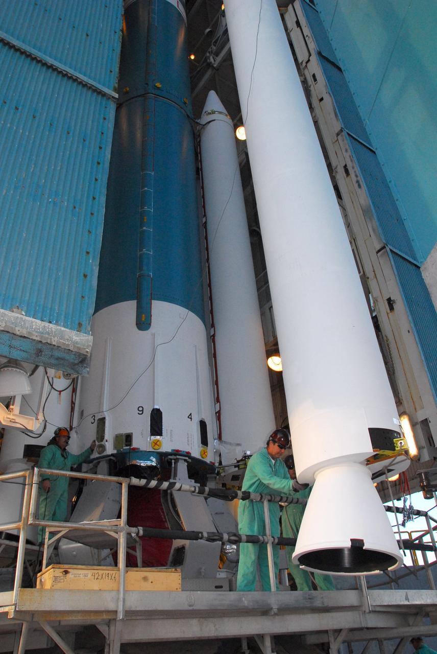
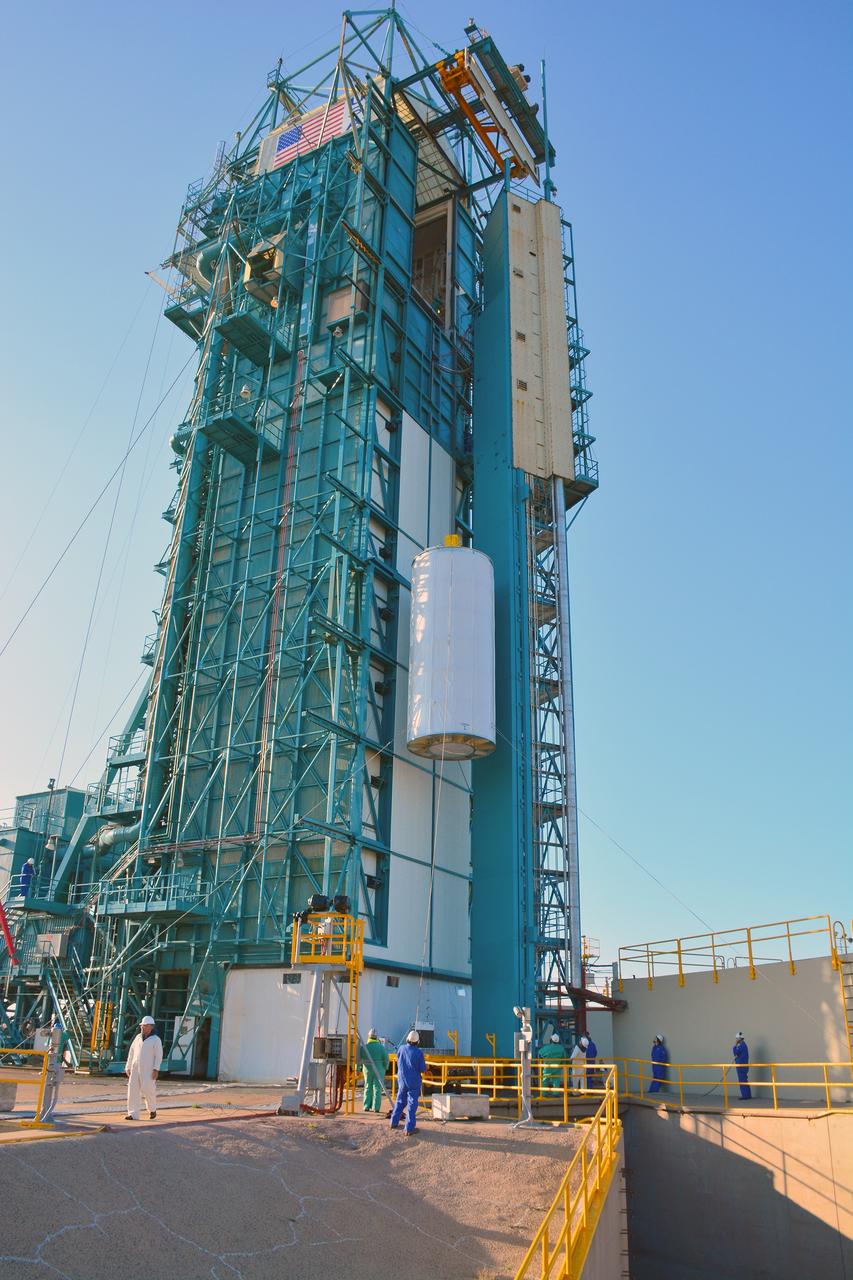
VANDENBERG AIR FORCE BASE, Calif. -- At NASA’s Space Launch Complex-2 at Vandenberg Air Force Base in California, technicians monitor the progress as a solid rocket motor is lifted by crane for attachment to the United Launch Alliance Delta II rocket is lifted by crane. The Delta II will carry NASA’s National Polar-orbiting Operational Environmental Satellite System Preparatory Project (NPP) satellite into space. NPP represents a critical first step in building the next-generation of Earth-observing satellites. NPP will carry the first of the new sensors developed for this satellite fleet, now known as the Joint Polar Satellite System (JPSS) to be launched in 2016. NPP is the bridge between NASA's Earth Observing System (EOS) satellites and the forthcoming series of JPSS satellites. The mission will test key technologies and instruments for the JPSS missions. NPP is targeted to launch Oct. 25. For more information, visit http://www.nasa.gov/NPP. Photo credit: NASA/VAFB, Mark Mackley
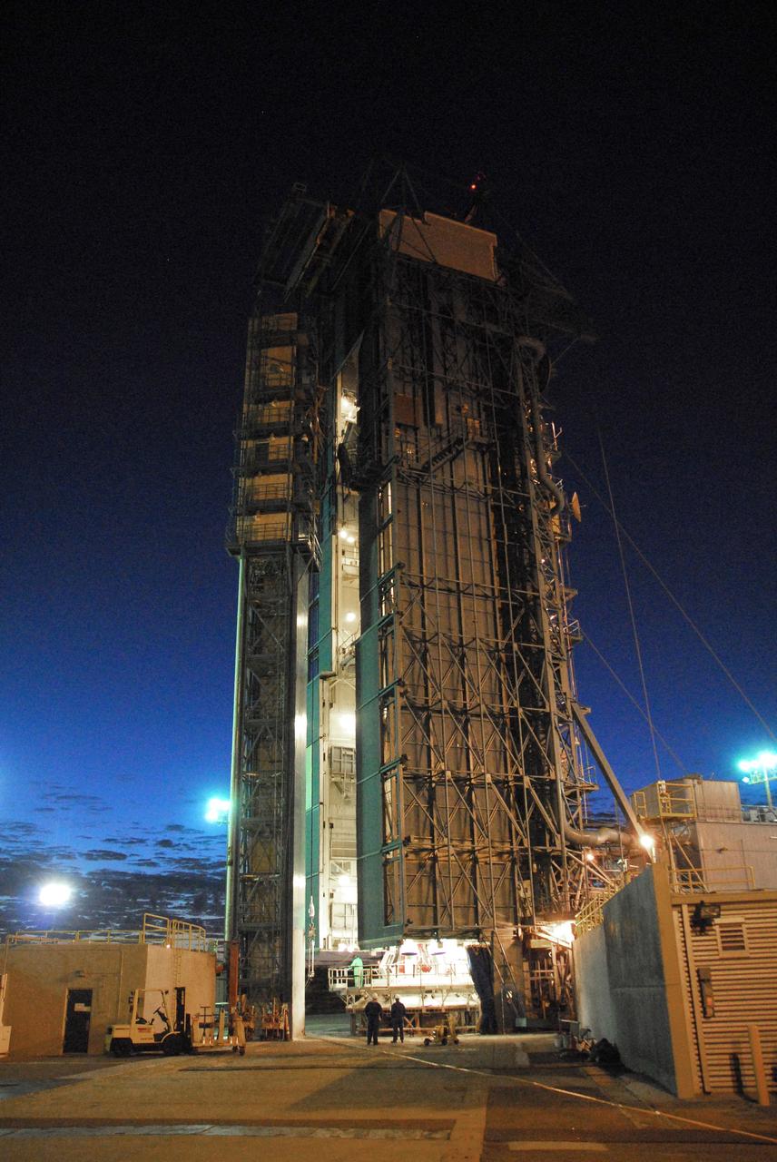
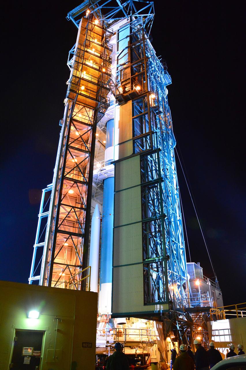
VANDENBERG AIR FORCE BASE, Calif. -- NASA’s Space Launch Complex-2 at Vandenberg Air Force Base in California, is illuminated against a midnight blue sky as solid rocket motors are attached to the United Launch Alliance Delta II rocket that will carry NASA's National Polar-orbiting Operational Environmental Satellite System Preparatory Project (NPP) satellite into space. NPP represents a critical first step in building the next-generation of Earth-observing satellites. NPP will carry the first of the new sensors developed for this satellite fleet, now known as the Joint Polar Satellite System (JPSS) to be launched in 2016. NPP is the bridge between NASA's Earth Observing System (EOS) satellites and the forthcoming series of JPSS satellites. The mission will test key technologies and instruments for the JPSS missions. NPP is targeted to launch Oct. 25. For more information, visit http://www.nasa.gov/NPP. Photo credit: NASA/VAFB, Mark Mackley
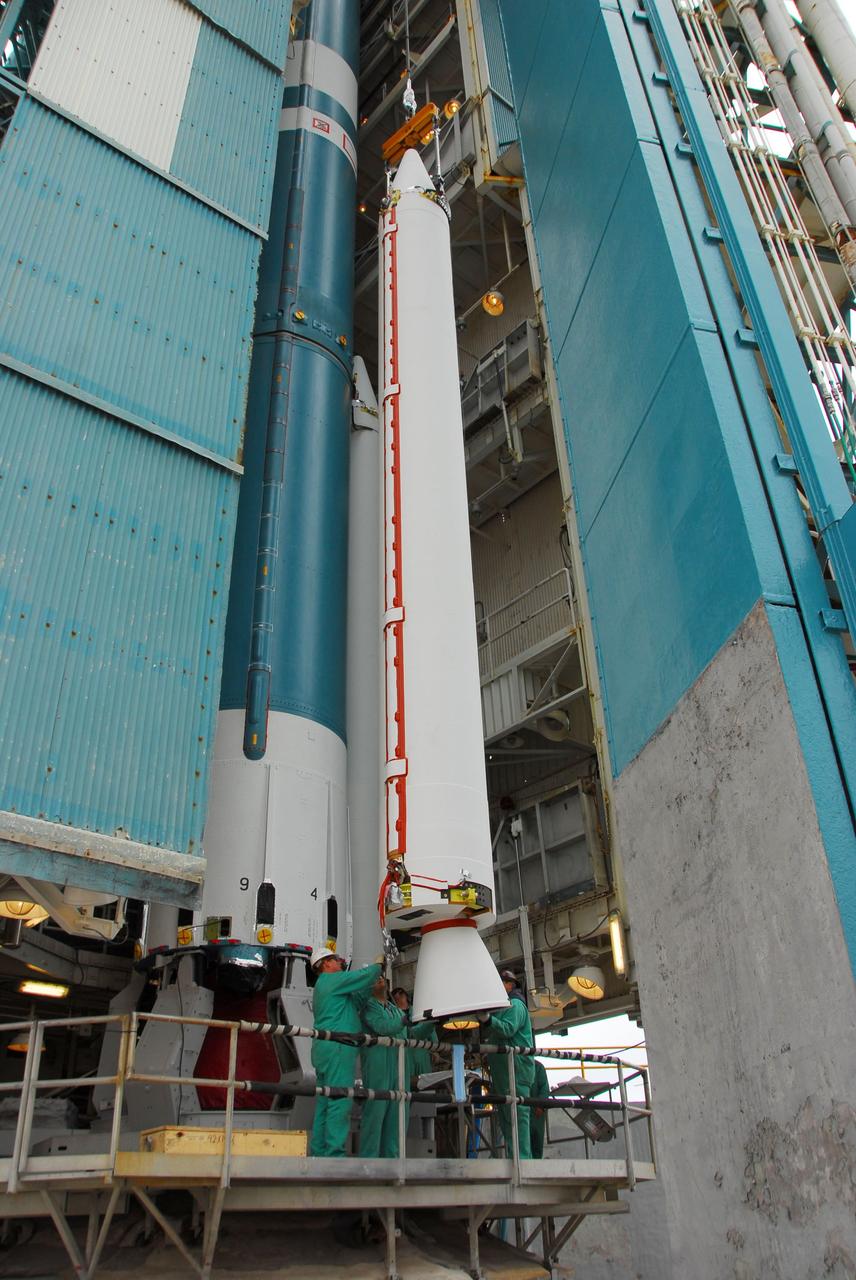
VANDENBERG AIR FORCE BASE, Calif. -- At Vandenberg Air Force Base in California, a crane is used to lift and position a solid rocket motor for attachment to the United Launch Alliance Delta II that will carry NASA's National Polar-orbiting Operational Environmental Satellite System Preparatory Project (NPP) satellite at NASA's Space Launch Complex-2. NPP represents a critical first step in building the next-generation of Earth-observing satellites. NPP will carry the first of the new sensors developed for this satellite fleet, now known as the Joint Polar Satellite System (JPSS) to be launched in 2016. NPP is the bridge between NASA's Earth Observing System (EOS) satellites and the forthcoming series of JPSS satellites. The mission will test key technologies and instruments for the JPSS missions. NPP is targeted to launch Oct. 25. For more information, visit http://www.nasa.gov/NPP. Photo credit: NASA/VAFB, Dan Liberotti

VANDENBERG AIR FORCE BASE, Calif. -- At Space Launch Complex-2 at Vandenberg Air Force Base in California, technicians prepare a solid rocket motor for attachment to the United Launch Alliance Delta II rocket. A work platform has been placed around the solid rocket motors. The Delta II will carry NASA’s National Polar-orbiting Operational Environmental Satellite System Preparatory Project (NPP) satellite into space. NPP represents a critical first step in building the next-generation of Earth-observing satellites. NPP will carry the first of the new sensors developed for this satellite fleet, now known as the Joint Polar Satellite System (JPSS) to be launched in 2016. NPP is the bridge between NASA's Earth Observing System (EOS) satellites and the forthcoming series of JPSS satellites. The mission will test key technologies and instruments for the JPSS missions. NPP is targeted to launch Oct. 25. For more information, visit http://www.nasa.gov/NPP. Photo credit: NASA/VAFB, Mark Mackley
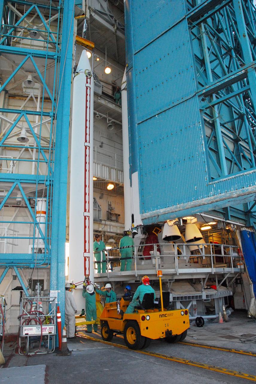
VANDENBERG AIR FORCE BASE, Calif. -- At NASA’s Space Launch Complex-2 at Vandenberg Air Force Base in California, several technicians assist as a crane begins to lift a solid rocket motor for attachment to the United Launch Alliance Delta II rocket. The Delta II will carry NASA’s National Polar-orbiting Operational Environmental Satellite System Preparatory Project (NPP) satellite into space. NPP represents a critical first step in building the next-generation of Earth-observing satellites. NPP will carry the first of the new sensors developed for this satellite fleet, now known as the Joint Polar Satellite System (JPSS) to be launched in 2016. NPP is the bridge between NASA's Earth Observing System (EOS) satellites and the forthcoming series of JPSS satellites. The mission will test key technologies and instruments for the JPSS missions. NPP is targeted to launch Oct. 25. For more information, visit http://www.nasa.gov/NPP. Photo credit: NASA/VAFB, Mark Mackley
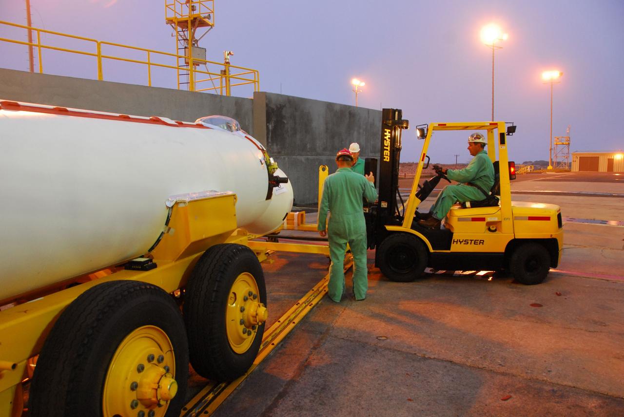
VANDENBERG AIR FORCE BASE, Calif. -- At Vandenberg Air Force Base in California, a solid rocket motor for the United Launch Alliance Delta II that will carry NASA's National Polar-orbiting Operational Environmental Satellite System Preparatory Project (NPP) satellite into space arrives at NASA's Space Launch Complex-2. NPP represents a critical first step in building the next-generation of Earth-observing satellites. NPP will carry the first of the new sensors developed for this satellite fleet, now known as the Joint Polar Satellite System (JPSS) to be launched in 2016. NPP is the bridge between NASA's Earth Observing System (EOS) satellites and the forthcoming series of JPSS satellites. The mission will test key technologies and instruments for the JPSS missions. NPP is targeted to launch Oct. 25. For more information, visit http://www.nasa.gov/NPP. Photo credit: NASA/VAFB, Dan Liberotti
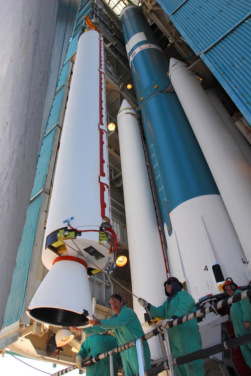
VANDENBERG AIR FORCE BASE, Calif. -- At NASA’s Space Launch Complex-2 at Vandenberg Air Force Base in California, technicians assist as a crane lifts a solid rocket motor closer to the United Launch Alliance Delta II rocket. The Delta II will carry NASA’s National Polar-orbiting Operational Environmental Satellite System Preparatory Project (NPP) satellite into space. NPP represents a critical first step in building the next-generation of Earth-observing satellites. NPP will carry the first of the new sensors developed for this satellite fleet, now known as the Joint Polar Satellite System (JPSS) to be launched in 2016. NPP is the bridge between NASA's Earth Observing System (EOS) satellites and the forthcoming series of JPSS satellites. The mission will test key technologies and instruments for the JPSS missions. NPP is targeted to launch Oct. 25. For more information, visit http://www.nasa.gov/NPP. Photo credit: NASA/VAFB, Mark Mackley
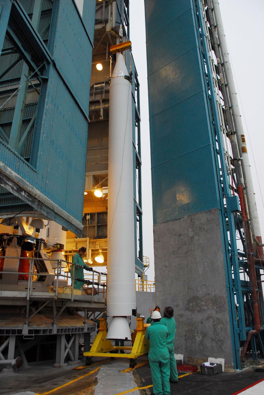
VANDENBERG AIR FORCE BASE, Calif. -- At Vandenberg Air Force Base in California, a crane is used to hoist up a solid rocket motor for the United Launch Alliance Delta II that will carry NASA's National Polar-orbiting Operational Environmental Satellite System Preparatory Project (NPP) satellite into space at NASA's Space Launch Complex-2. NPP represents a critical first step in building the next-generation of Earth-observing satellites. NPP will carry the first of the new sensors developed for this satellite fleet, now known as the Joint Polar Satellite System (JPSS) to be launched in 2016. NPP is the bridge between NASA's Earth Observing System (EOS) satellites and the forthcoming series of JPSS satellites. The mission will test key technologies and instruments for the JPSS missions. NPP is targeted to launch Oct. 25. For more information, visit http://www.nasa.gov/NPP. Photo credit: NASA/VAFB, Dan Liberotti

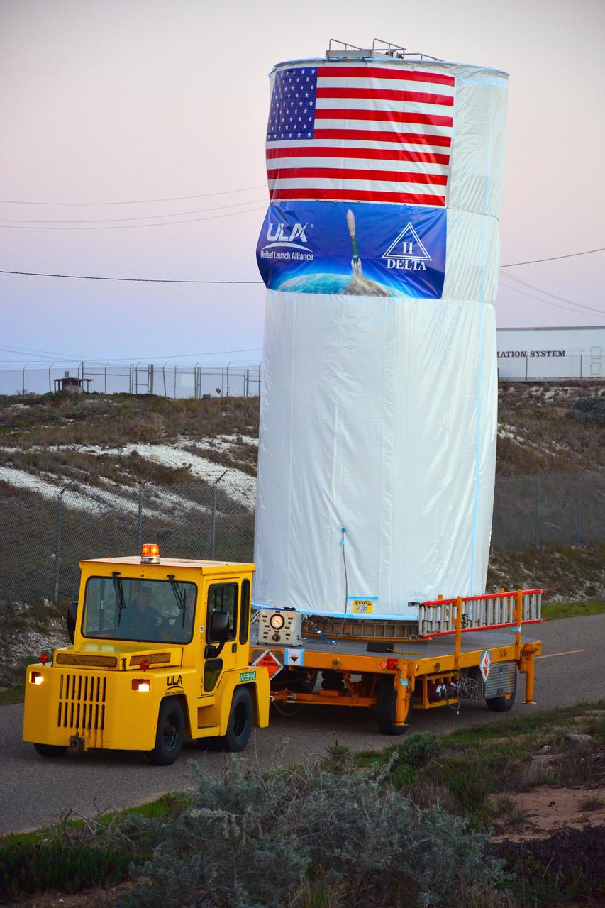
VANDENBERG AIR FORCE BASE, Calif. --- Loaded on a transporter, the payload faring containing the Landsat Data Continuity Mission LDCM spacecraft departs the Astrotech processing facility at Vandenberg Air Force Base in California and heads toward the launch pad at Space Launch Complex-3E. There it will be hoisted atop a United Launch Alliance Atlas V for launch. LDCM is the eighth satellite in the Landsat Program series of Earth-observing missions jointly managed by NASA and the U.S. Geological Survey. LDCM will continue the program’s critical role in monitoring, understanding and managing the resources needed for human sustainment such as food, water and forests. Photo credit: NASA/VAFB
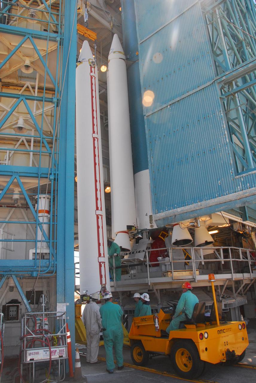
VANDENBERG AIR FORCE BASE, Calif. -- At Space Launch Complex-2 at Vandenberg Air Force Base in California, a crane lifts a solid rocket motor for attachment to the United Launch Alliance Delta II rocket. The Delta II will carry NASA’s National Polar-orbiting Operational Environmental Satellite System Preparatory Project (NPP) satellite into space. NPP represents a critical first step in building the next-generation of Earth-observing satellites. NPP will carry the first of the new sensors developed for this satellite fleet, now known as the Joint Polar Satellite System (JPSS) to be launched in 2016. NPP is the bridge between NASA's Earth Observing System (EOS) satellites and the forthcoming series of JPSS satellites. The mission will test key technologies and instruments for the JPSS missions. NPP is targeted to launch Oct. 25. For more information, visit http://www.nasa.gov/NPP. Photo credit: NASA/VAFB, Mark Mackley
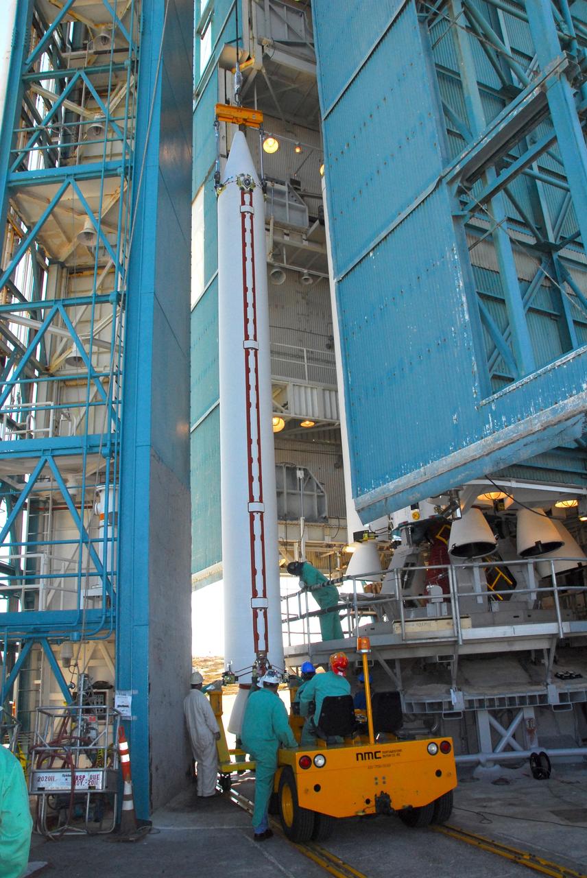
VANDENBERG AIR FORCE BASE, Calif. -- At NASA’s Space Launch Complex-2 at Vandenberg Air Force Base in California, technicians monitor the progress as a crane lifts a solid rocket motor for the United Launch Alliance Delta II rocket. The Delta II will carry NASA’s National Polar-orbiting Operational Environmental Satellite System Preparatory Project (NPP) satellite into space. NPP represents a critical first step in building the next-generation of Earth-observing satellites. NPP will carry the first of the new sensors developed for this satellite fleet, now known as the Joint Polar Satellite System (JPSS) to be launched in 2016. NPP is the bridge between NASA's Earth Observing System (EOS) satellites and the forthcoming series of JPSS satellites. The mission will test key technologies and instruments for the JPSS missions. NPP is targeted to launch Oct. 25. For more information, visit http://www.nasa.gov/NPP. Photo credit: NASA/VAFB, Mark Mackley
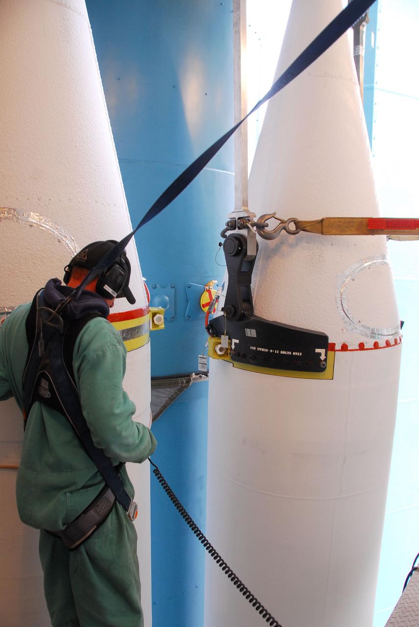
VANDENBERG AIR FORCE BASE, Calif. -- At NASA’s Space Launch Complex-2 at Vandenberg Air Force Base in California, a technician in a safety harness monitors the progress as a solid rocket motor is attached to the United Launch Alliance Delta II rocket. The Delta II will carry NASA's National Polar-orbiting Operational Environmental Satellite System Preparatory Project (NPP) satellite into space. NPP represents a critical first step in building the next-generation of Earth-observing satellites. NPP will carry the first of the new sensors developed for this satellite fleet, now known as the Joint Polar Satellite System (JPSS) to be launched in 2016. NPP is the bridge between NASA's Earth Observing System (EOS) satellites and the forthcoming series of JPSS satellites. The mission will test key technologies and instruments for the JPSS missions. NPP is targeted to launch Oct. 25. For more information, visit http://www.nasa.gov/NPP. Photo credit: NASA/VAFB, Dan Liberotti
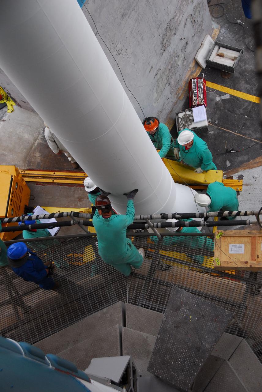
VANDENBERG AIR FORCE BASE, Calif. -- A view from above at NASA’s Space Launch Complex-2 at Vandenberg Air Force Base in California, as technicians help position a solid rocket motor for attachment to the United Launch Alliance Delta II that will carry NASA's National Polar-orbiting Operational Environmental Satellite System Preparatory Project (NPP) satellite into space. NPP represents a critical first step in building the next-generation of Earth-observing satellites. NPP will carry the first of the new sensors developed for this satellite fleet, now known as the Joint Polar Satellite System (JPSS) to be launched in 2016. NPP is the bridge between NASA's Earth Observing System (EOS) satellites and the forthcoming series of JPSS satellites. The mission will test key technologies and instruments for the JPSS missions. NPP is targeted to launch Oct. 25. For more information, visit http://www.nasa.gov/NPP. Photo credit: NASA/VAFB, Dan Liberotti
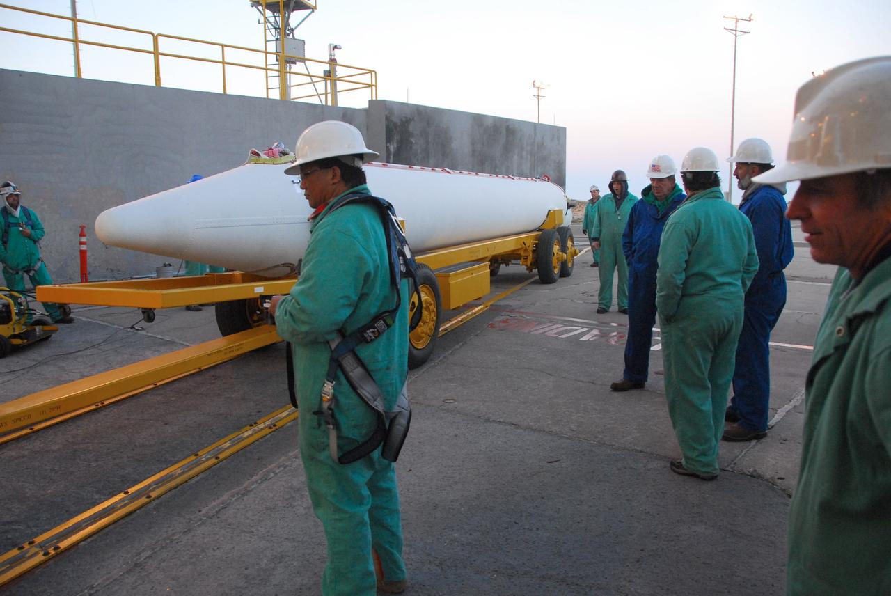
VANDENBERG AIR FORCE BASE, Calif. -- At Vandenberg Air Force Base in California, a solid rocket motor for the United Launch Alliance Delta II that will carry NASA’s National Polar-orbiting Operational Environmental Satellite System Preparatory Project (NPP) satellite into space arrives at NASA’s Space Launch Complex-2. NPP represents a critical first step in building the next-generation of Earth-observing satellites. NPP will carry the first of the new sensors developed for this satellite fleet, now known as the Joint Polar Satellite System (JPSS) to be launched in 2016. NPP is the bridge between NASA's Earth Observing System (EOS) satellites and the forthcoming series of JPSS satellites. The mission will test key technologies and instruments for the JPSS missions. NPP is targeted to launch Oct. 25. For more information, visit http://www.nasa.gov/NPP. Photo credit: NASA/VAFB, Mark Mackley
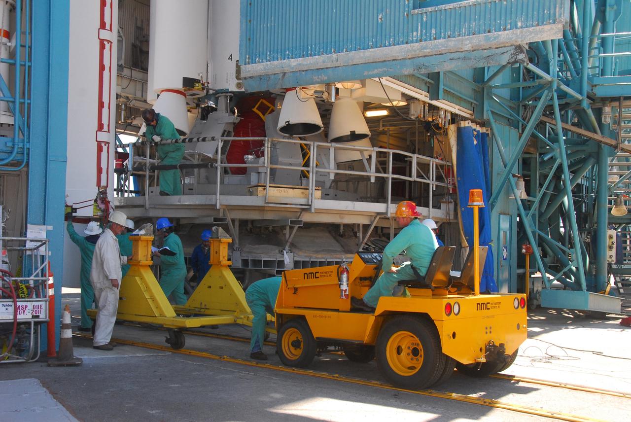
VANDENBERG AIR FORCE BASE, Calif. -- At Space Launch Complex-2 at Vandenberg Air Force Base in California, technicians monitor the progress as a crane lifts a solid rocket motor for the United Launch Alliance Delta II rocket. The Delta II will carry NASA’s National Polar-orbiting Operational Environmental Satellite System Preparatory Project (NPP) satellite into space. NPP represents a critical first step in building the next-generation of Earth-observing satellites. NPP will carry the first of the new sensors developed for this satellite fleet, now known as the Joint Polar Satellite System (JPSS) to be launched in 2016. NPP is the bridge between NASA's Earth Observing System (EOS) satellites and the forthcoming series of JPSS satellites. The mission will test key technologies and instruments for the JPSS missions. NPP is targeted to launch Oct. 25. For more information, visit http://www.nasa.gov/NPP. Photo credit: NASA/VAFB, Mark Mackley
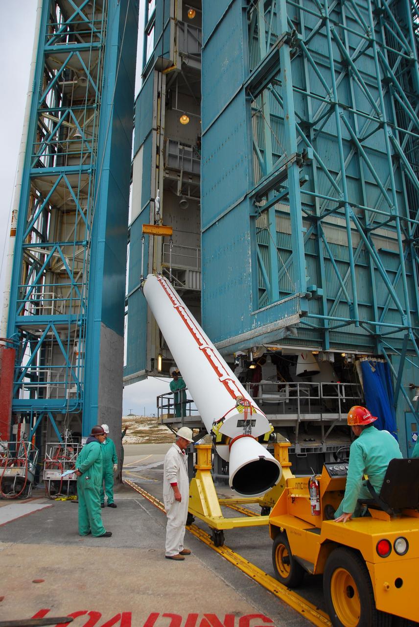
VANDENBERG AIR FORCE BASE, Calif. -- At Vandenberg Air Force Base in California, technicians use a crane to lift a solid rocket motor for the United Launch Alliance Delta II that will carry NASA's National Polar-orbiting Operational Environmental Satellite System Preparatory Project (NPP) satellite at NASA's Space Launch Complex-2. NPP represents a critical first step in building the next-generation of Earth-observing satellites. NPP will carry the first of the new sensors developed for this satellite fleet, now known as the Joint Polar Satellite System (JPSS) to be launched in 2016. NPP is the bridge between NASA's Earth Observing System (EOS) satellites and the forthcoming series of JPSS satellites. The mission will test key technologies and instruments for the JPSS missions. NPP is targeted to launch Oct. 25. For more information, visit http://www.nasa.gov/NPP. Photo credit: NASA/VAFB, Dan Liberotti
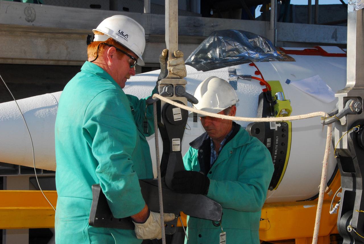
VANDENBERG AIR FORCE BASE, Calif. -- At NASA’s Space Launch Complex-2 at Vandenberg Air Force Base in California, technicians prepare a crane that will be used to lift the recently-arrived solid rocket motor for the United Launch Alliance Delta II rocket. The Delta II will carry NASA’s National Polar-orbiting Operational Environmental Satellite System Preparatory Project (NPP) satellite into space. NPP represents a critical first step in building the next-generation of Earth-observing satellites. NPP will carry the first of the new sensors developed for this satellite fleet, now known as the Joint Polar Satellite System (JPSS) to be launched in 2016. NPP is the bridge between NASA's Earth Observing System (EOS) satellites and the forthcoming series of JPSS satellites. The mission will test key technologies and instruments for the JPSS missions. NPP is targeted to launch Oct. 25. For more information, visit http://www.nasa.gov/NPP. Photo credit: NASA/VAFB, Mark Mackley

VANDENBERG AIR FORCE BASE, Calif. -- At Vandenberg Air Force Base in California, a solid rocket motor for the United Launch Alliance Delta II that will carry NASA's National Polar-orbiting Operational Environmental Satellite System Preparatory Project (NPP) satellite into space arrives at NASA's Space Launch Complex-2. NPP represents a critical first step in building the next-generation of Earth-observing satellites. NPP will carry the first of the new sensors developed for this satellite fleet, now known as the Joint Polar Satellite System (JPSS) to be launched in 2016. NPP is the bridge between NASA's Earth Observing System (EOS) satellites and the forthcoming series of JPSS satellites. The mission will test key technologies and instruments for the JPSS missions. NPP is targeted to launch Oct. 25. For more information, visit http://www.nasa.gov/NPP. Photo credit: NASA/VAFB, Dan Liberotti
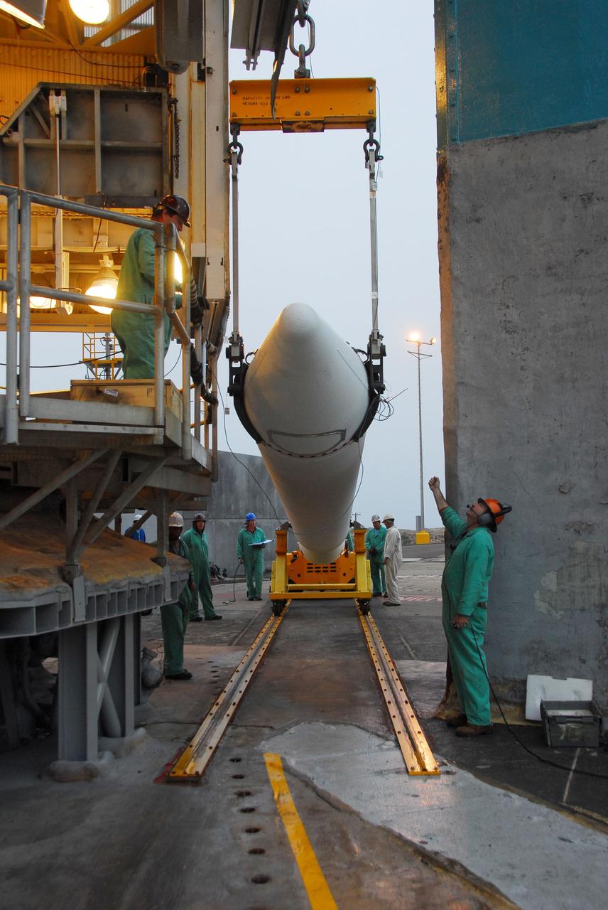
VANDENBERG AIR FORCE BASE, Calif. -- At Vandenberg Air Force Base in California, a crane is used to hoist up a solid rocket motor for the United Launch Alliance Delta II that will carry NASA's National Polar-orbiting Operational Environmental Satellite System Preparatory Project (NPP) satellite into space at NASA's Space Launch Complex-2. NPP represents a critical first step in building the next-generation of Earth-observing satellites. NPP will carry the first of the new sensors developed for this satellite fleet, now known as the Joint Polar Satellite System (JPSS) to be launched in 2016. NPP is the bridge between NASA's Earth Observing System (EOS) satellites and the forthcoming series of JPSS satellites. The mission will test key technologies and instruments for the JPSS missions. NPP is targeted to launch Oct. 25. For more information, visit http://www.nasa.gov/NPP. Photo credit: NASA/VAFB, Dan Liberotti
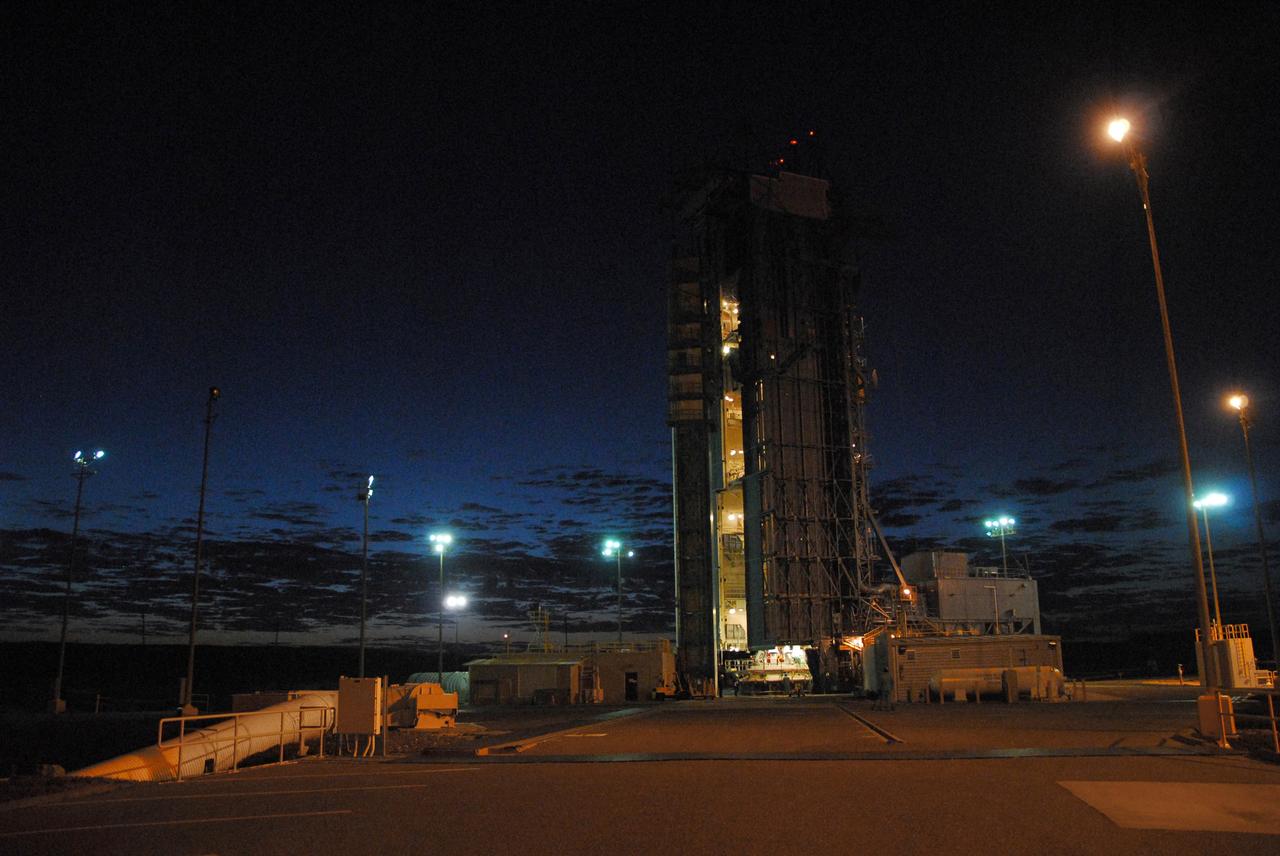
VANDENBERG AIR FORCE BASE, Calif. -- NASA’s Space Launch Complex-2 at Vandenberg Air Force Base in California, is illuminated against a midnight blue sky as solid rocket motors are attached to the United Launch Alliance Delta II rocket that will carry NASA's National Polar-orbiting Operational Environmental Satellite System Preparatory Project (NPP) satellite into space. NPP represents a critical first step in building the next-generation of Earth-observing satellites. NPP will carry the first of the new sensors developed for this satellite fleet, now known as the Joint Polar Satellite System (JPSS) to be launched in 2016. NPP is the bridge between NASA's Earth Observing System (EOS) satellites and the forthcoming series of JPSS satellites. The mission will test key technologies and instruments for the JPSS missions. NPP is targeted to launch Oct. 25. For more information, visit http://www.nasa.gov/NPP. Photo credit: NASA/VAFB, Mark Mackley
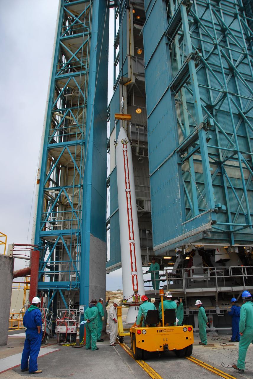
VANDENBERG AIR FORCE BASE, Calif. -- At Vandenberg Air Force Base in California, technicians use a crane to lift a solid rocket motor for the United Launch Alliance Delta II that will carry NASA's National Polar-orbiting Operational Environmental Satellite System Preparatory Project (NPP) satellite at NASA's Space Launch Complex-2. NPP represents a critical first step in building the next-generation of Earth-observing satellites. NPP will carry the first of the new sensors developed for this satellite fleet, now known as the Joint Polar Satellite System (JPSS) to be launched in 2016. NPP is the bridge between NASA's Earth Observing System (EOS) satellites and the forthcoming series of JPSS satellites. The mission will test key technologies and instruments for the JPSS missions. NPP is targeted to launch Oct. 25. For more information, visit http://www.nasa.gov/NPP. Photo credit: NASA/VAFB, Dan Liberotti

VANDENBERG AIR FORCE BASE, Calif. -- At NASA’s Space Launch Complex-2 at Vandenberg Air Force Base in California, technicians monitor the progress as solid rocket motors are lifted and attached to the United Launch Alliance Delta II rocket. The Delta II will carry NASA’s National Polar-orbiting Operational Environmental Satellite System Preparatory Project (NPP) satellite into space. NPP represents a critical first step in building the next-generation of Earth-observing satellites. NPP will carry the first of the new sensors developed for this satellite fleet, now known as the Joint Polar Satellite System (JPSS) to be launched in 2016. NPP is the bridge between NASA's Earth Observing System (EOS) satellites and the forthcoming series of JPSS satellites. The mission will test key technologies and instruments for the JPSS missions. NPP is targeted to launch Oct. 25. For more information, visit http://www.nasa.gov/NPP. Photo credit: NASA/VAFB, Mark Mackley
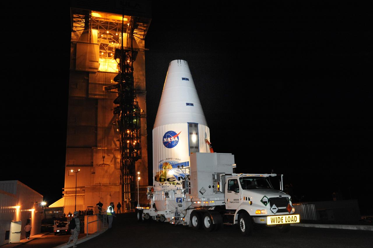
VANDENBERG AIR FORCE BASE, Calif. --- Loaded on a transporter, the payload faring containing the Landsat Data Continuity Mission LDCM spacecraft arrives at Vandenberg Air Force Base's Space Launch Complex-3E where it will be hoisted atop a United Launch Alliance Atlas V for launch. LDCM is the eighth satellite in the Landsat Program series of Earth-observing missions jointly managed by NASA and the U.S. Geological Survey. LDCM will continue the program’s critical role in monitoring, understanding and managing the resources needed for human sustainment such as food, water and forests. Photo credit: NASA/VAFB
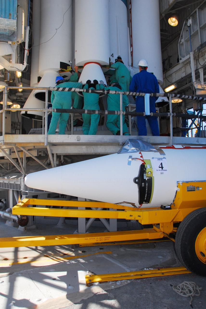
VANDENBERG AIR FORCE BASE, Calif. -- At Space Launch Complex-2 at Vandenberg Air Force Base in California, technicians assist as a solid rocket motor is attached to the United Launch Alliance Delta II rocket. The Delta II will carry NASA’s National Polar-orbiting Operational Environmental Satellite System Preparatory Project (NPP) satellite into space. NPP represents a critical first step in building the next-generation of Earth-observing satellites. NPP will carry the first of the new sensors developed for this satellite fleet, now known as the Joint Polar Satellite System (JPSS) to be launched in 2016. NPP is the bridge between NASA's Earth Observing System (EOS) satellites and the forthcoming series of JPSS satellites. The mission will test key technologies and instruments for the JPSS missions. NPP is targeted to launch Oct. 25. For more information, visit http://www.nasa.gov/NPP. Photo credit: NASA/VAFB, Mark Mackley
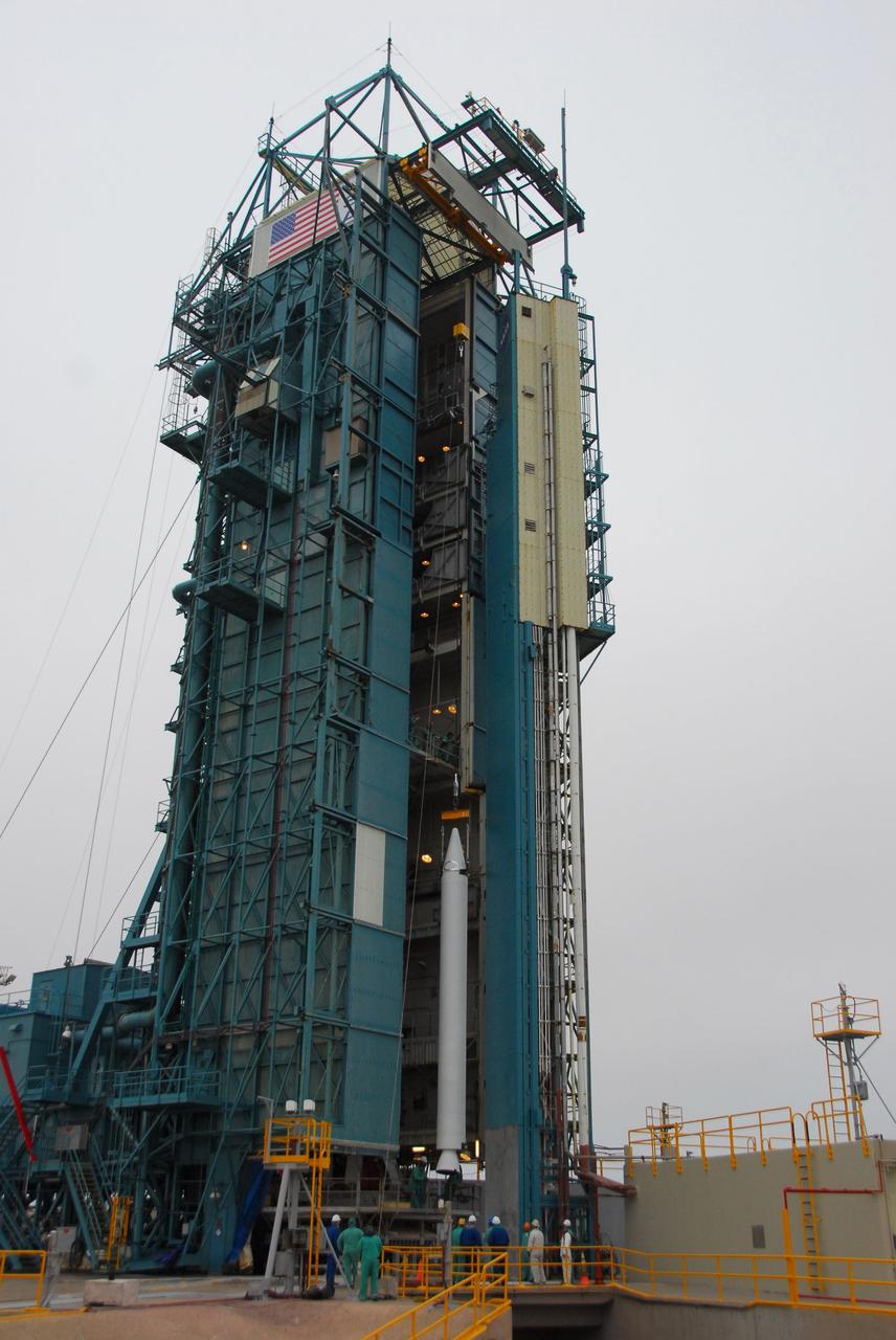
VANDENBERG AIR FORCE BASE, Calif. -- At Vandenberg Air Force Base in California, a solid rocket motor for the United Launch Alliance Delta II that will carry NASA's National Polar-orbiting Operational Environmental Satellite System Preparatory Project (NPP) satellite is hoisted up at NASA's Space Launch Complex-2. NPP represents a critical first step in building the next-generation of Earth-observing satellites. NPP will carry the first of the new sensors developed for this satellite fleet, now known as the Joint Polar Satellite System (JPSS) to be launched in 2016. NPP is the bridge between NASA's Earth Observing System (EOS) satellites and the forthcoming series of JPSS satellites. The mission will test key technologies and instruments for the JPSS missions. NPP is targeted to launch Oct. 25. For more information, visit http://www.nasa.gov/NPP. Photo credit: NASA/VAFB, Dan Liberotti
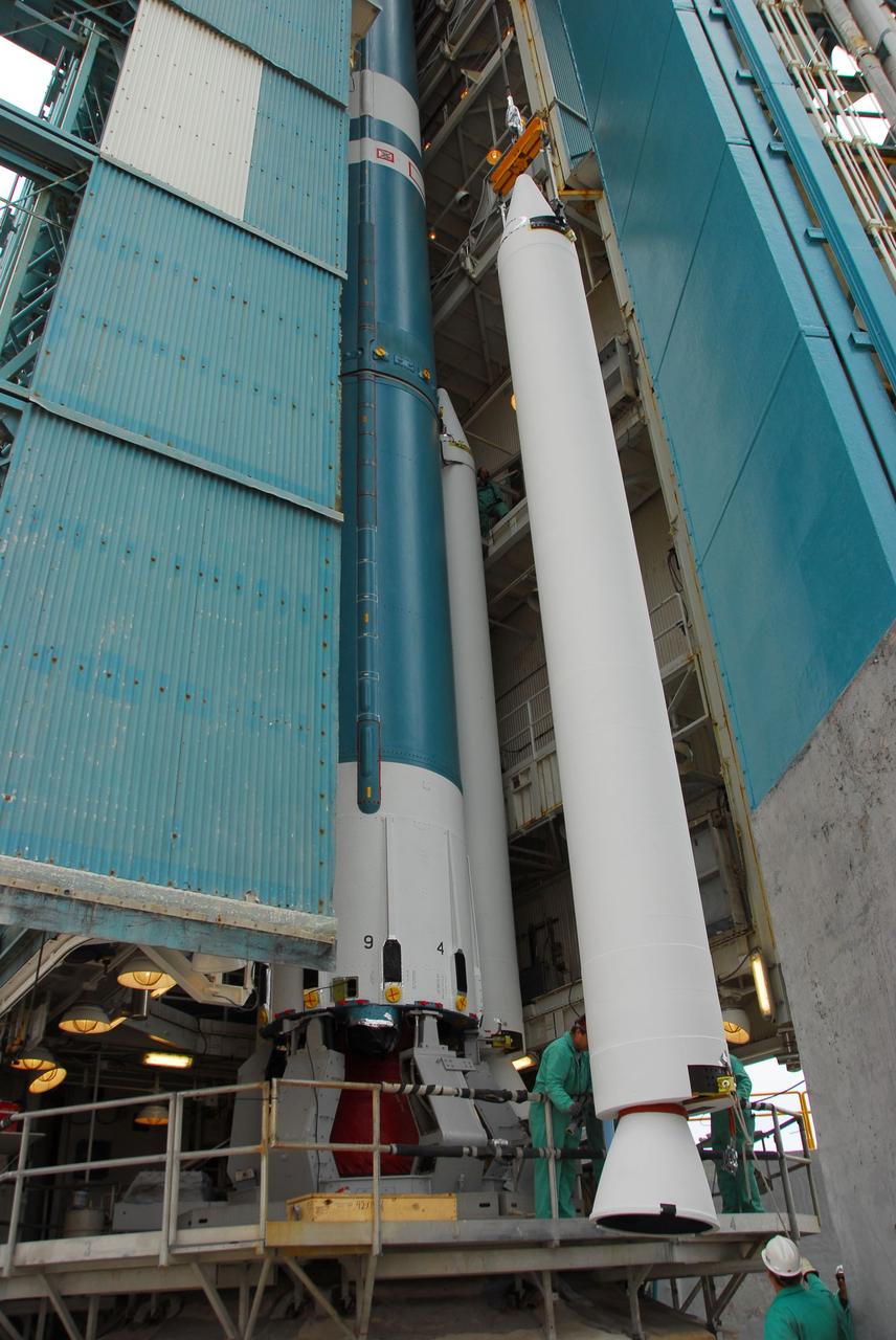
VANDENBERG AIR FORCE BASE, Calif. -- At Vandenberg Air Force Base in California, a crane is used to lift and position a solid rocket motor for attachment to the United Launch Alliance Delta II that will carry NASA's National Polar-orbiting Operational Environmental Satellite System Preparatory Project (NPP) satellite at NASA's Space Launch Complex-2. NPP represents a critical first step in building the next-generation of Earth-observing satellites. NPP will carry the first of the new sensors developed for this satellite fleet, now known as the Joint Polar Satellite System (JPSS) to be launched in 2016. NPP is the bridge between NASA's Earth Observing System (EOS) satellites and the forthcoming series of JPSS satellites. The mission will test key technologies and instruments for the JPSS missions. NPP is targeted to launch Oct. 25. For more information, visit http://www.nasa.gov/NPP. Photo credit: NASA/VAFB, Dan Liberotti
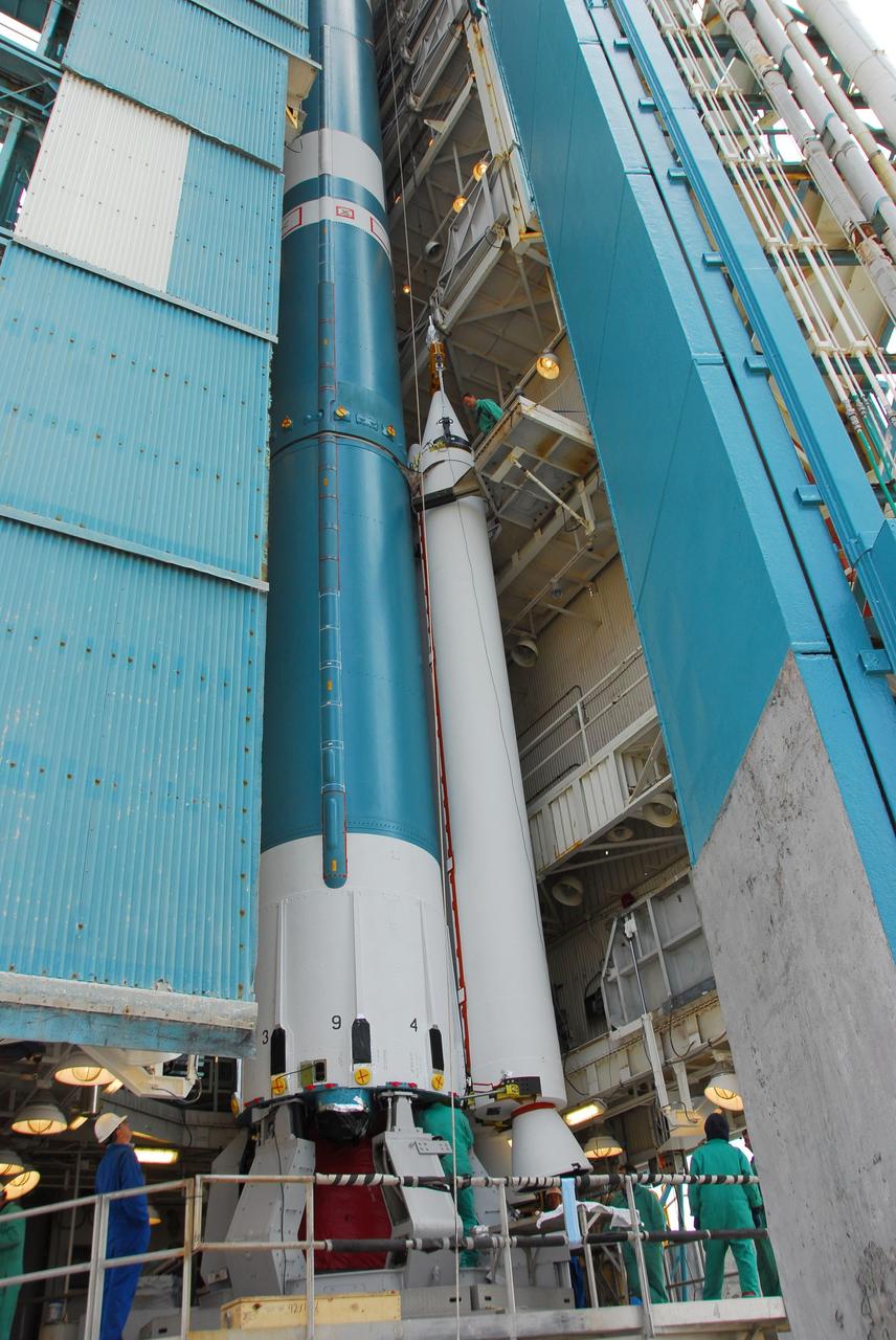
VANDENBERG AIR FORCE BASE, Calif. -- At Vandenberg Air Force Base in California, technicians monitor the progress as a crane lifts and positions a solid rocket motor for attachment to the United Launch Alliance Delta II that will carry NASA's National Polar-orbiting Operational Environmental Satellite System Preparatory Project (NPP) satellite at NASA's Space Launch Complex-2. NPP represents a critical first step in building the next-generation of Earth-observing satellites. NPP will carry the first of the new sensors developed for this satellite fleet, now known as the Joint Polar Satellite System (JPSS) to be launched in 2016. NPP is the bridge between NASA's Earth Observing System (EOS) satellites and the forthcoming series of JPSS satellites. The mission will test key technologies and instruments for the JPSS missions. NPP is targeted to launch Oct. 25. For more information, visit http://www.nasa.gov/NPP. Photo credit: NASA/VAFB, Dan Liberotti
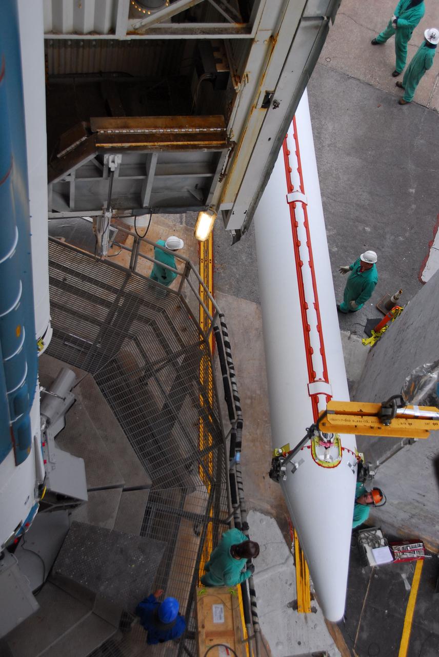
VANDENBERG AIR FORCE BASE, Calif. -- A view from above at NASA’s Space Launch Complex-2 at Vandenberg Air Force Base in California, as a crane lifts a solid rocket motor into position for the United Launch Alliance Delta II that will carry NASA's National Polar-orbiting Operational Environmental Satellite System Preparatory Project (NPP) satellite into space. NPP represents a critical first step in building the next-generation of Earth-observing satellites. NPP will carry the first of the new sensors developed for this satellite fleet, now known as the Joint Polar Satellite System (JPSS) to be launched in 2016. NPP is the bridge between NASA's Earth Observing System (EOS) satellites and the forthcoming series of JPSS satellites. The mission will test key technologies and instruments for the JPSS missions. NPP is targeted to launch Oct. 25. For more information, visit http://www.nasa.gov/NPP. Photo credit: NASA/VAFB, Dan Liberotti
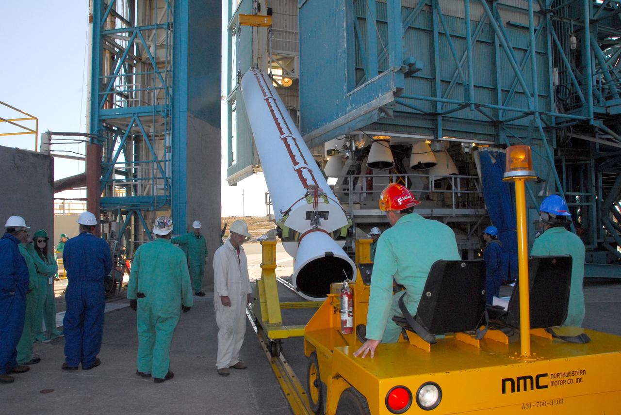
VANDENBERG AIR FORCE BASE, Calif. -- At NASA’s Space Launch Complex-2 at Vandenberg Air Force Base in California, technicians monitor the progress as a crane begins to lift up a solid rocket motor for the United Launch Alliance Delta II rocket. The Delta II will carry NASA’s National Polar-orbiting Operational Environmental Satellite System Preparatory Project (NPP) satellite into space. NPP represents a critical first step in building the next-generation of Earth-observing satellites. NPP will carry the first of the new sensors developed for this satellite fleet, now known as the Joint Polar Satellite System (JPSS) to be launched in 2016. NPP is the bridge between NASA's Earth Observing System (EOS) satellites and the forthcoming series of JPSS satellites. The mission will test key technologies and instruments for the JPSS missions. NPP is targeted to launch Oct. 25. For more information, visit http://www.nasa.gov/NPP. Photo credit: NASA/VAFB, Mark Mackley
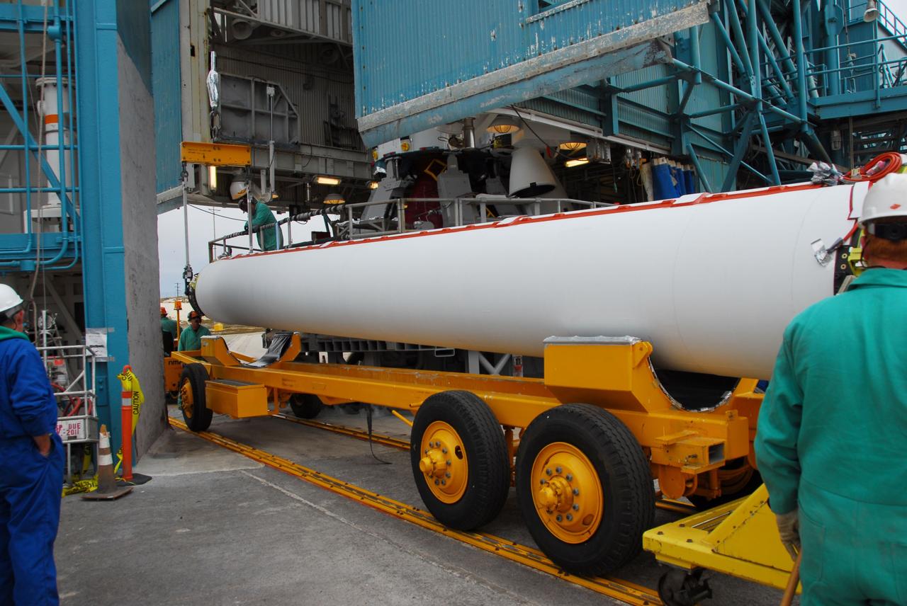
VANDENBERG AIR FORCE BASE, Calif. -- At Vandenberg Air Force Base in California, a solid rocket motor for the United Launch Alliance Delta II that will carry NASA's National Polar-orbiting Operational Environmental Satellite System Preparatory Project (NPP) satellite arrives at NASA's Space Launch Complex-2. NPP represents a critical first step in building the next-generation of Earth-observing satellites. NPP will carry the first of the new sensors developed for this satellite fleet, now known as the Joint Polar Satellite System (JPSS) to be launched in 2016. NPP is the bridge between NASA's Earth Observing System (EOS) satellites and the forthcoming series of JPSS satellites. The mission will test key technologies and instruments for the JPSS missions. NPP is targeted to launch Oct. 25. For more information, visit http://www.nasa.gov/NPP. Photo credit: NASA/VAFB, Dan Liberotti
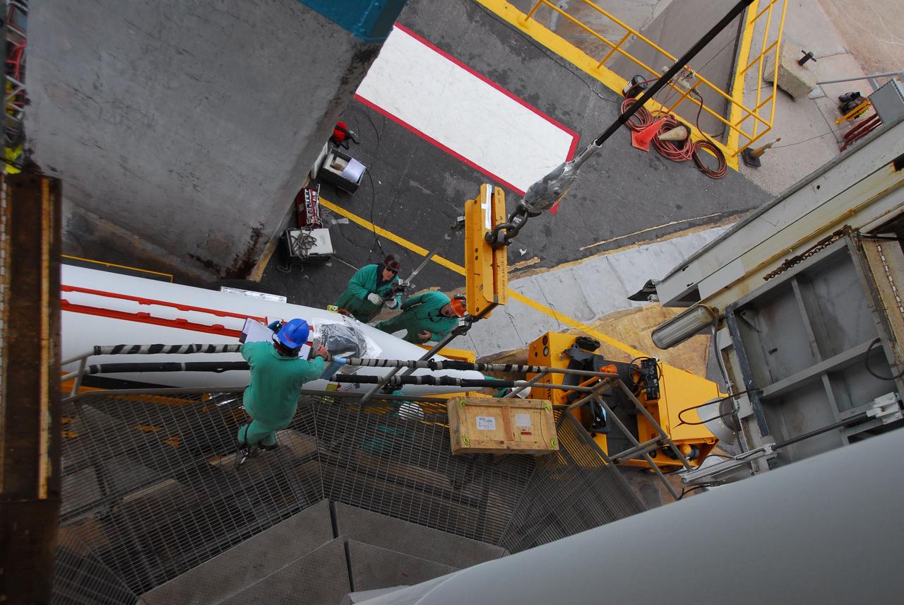
VANDENBERG AIR FORCE BASE, Calif. -- A view from above at NASA’s Space Launch Complex-2 at Vandenberg Air Force Base in California, as a solid rocket motor for the United Launch Alliance Delta II that will carry NASA's National Polar-orbiting Operational Environmental Satellite System Preparatory Project (NPP) satellite into space arrives. NPP represents a critical first step in building the next-generation of Earth-observing satellites. NPP will carry the first of the new sensors developed for this satellite fleet, now known as the Joint Polar Satellite System (JPSS) to be launched in 2016. NPP is the bridge between NASA's Earth Observing System (EOS) satellites and the forthcoming series of JPSS satellites. The mission will test key technologies and instruments for the JPSS missions. NPP is targeted to launch Oct. 25. For more information, visit http://www.nasa.gov/NPP. Photo credit: NASA/VAFB, Dan Liberotti
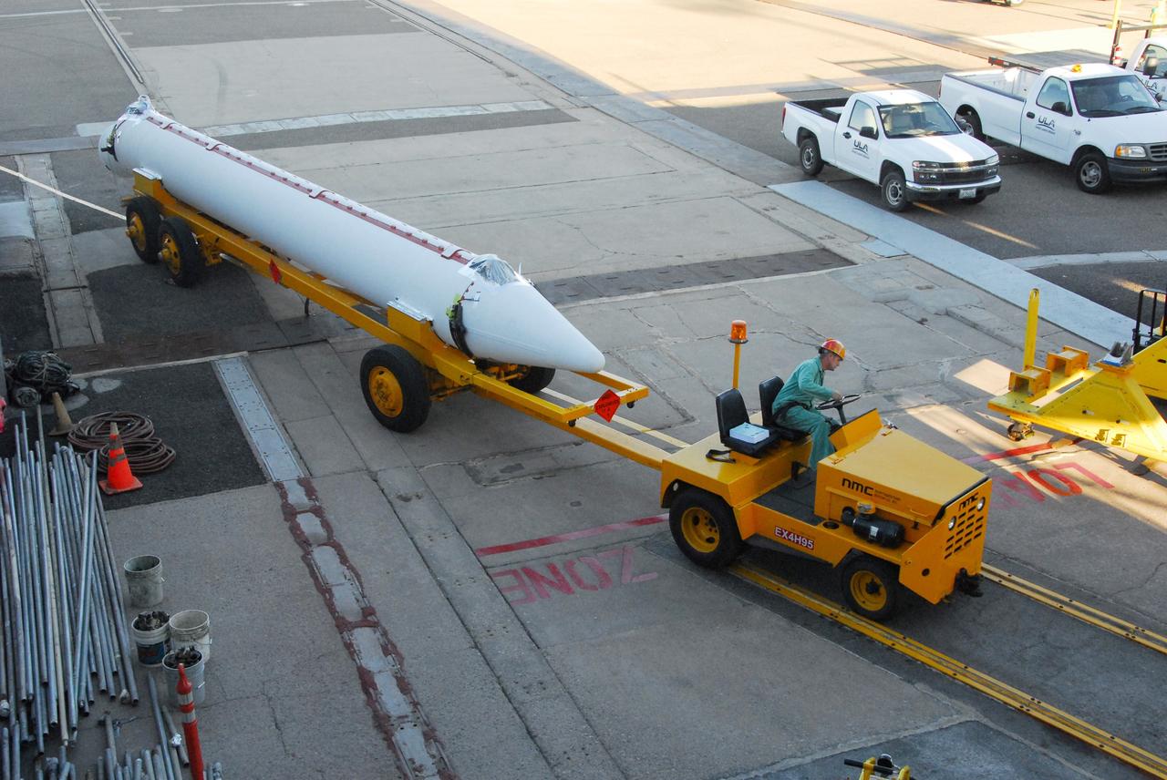
VANDENBERG AIR FORCE BASE, Calif. -- At Vandenberg Air Force Base in California, a solid rocket motor for the United Launch Alliance Delta II that will carry NASA’s National Polar-orbiting Operational Environmental Satellite System Preparatory Project (NPP) satellite into space arrives at NASA’s Space Launch Complex-2. NPP represents a critical first step in building the next-generation of Earth-observing satellites. NPP will carry the first of the new sensors developed for this satellite fleet, now known as the Joint Polar Satellite System (JPSS) to be launched in 2016. NPP is the bridge between NASA's Earth Observing System (EOS) satellites and the forthcoming series of JPSS satellites. The mission will test key technologies and instruments for the JPSS missions. NPP is targeted to launch Oct. 25. For more information, visit http://www.nasa.gov/NPP. Photo credit: NASA/VAFB, Mark Mackley
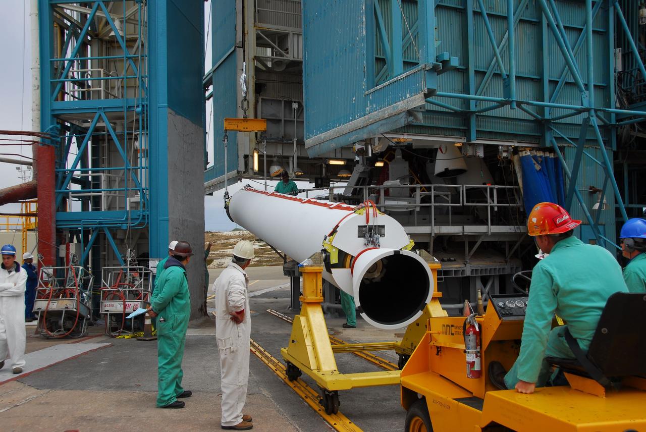
VANDENBERG AIR FORCE BASE, Calif. -- At Vandenberg Air Force Base in California, technicians use a crane to lift a solid rocket motor for the United Launch Alliance Delta II that will carry NASA's National Polar-orbiting Operational Environmental Satellite System Preparatory Project (NPP) satellite at NASA's Space Launch Complex-2. NPP represents a critical first step in building the next-generation of Earth-observing satellites. NPP will carry the first of the new sensors developed for this satellite fleet, now known as the Joint Polar Satellite System (JPSS) to be launched in 2016. NPP is the bridge between NASA's Earth Observing System (EOS) satellites and the forthcoming series of JPSS satellites. The mission will test key technologies and instruments for the JPSS missions. NPP is targeted to launch Oct. 25. For more information, visit http://www.nasa.gov/NPP. Photo credit: NASA/VAFB, Dan Liberotti
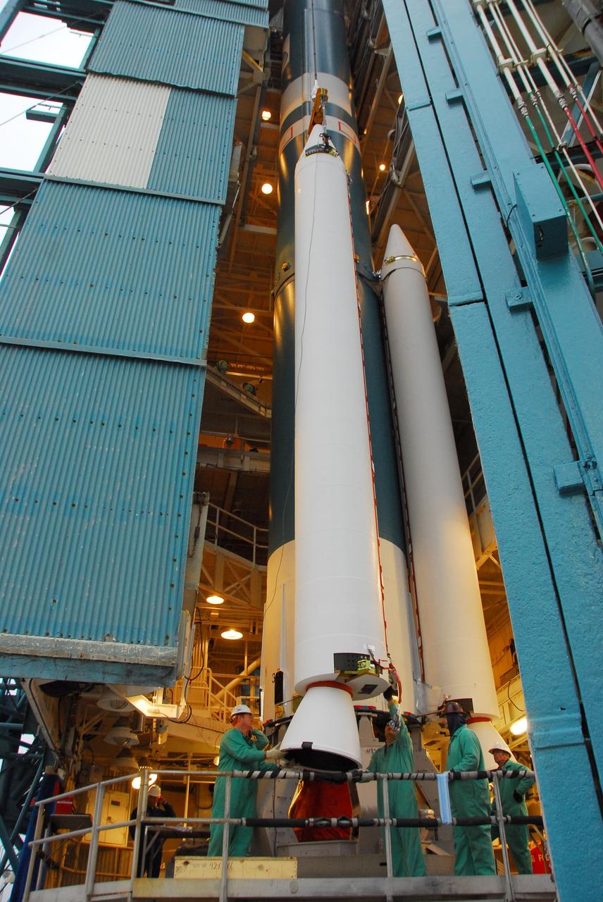
VANDENBERG AIR FORCE BASE, Calif. -- At Vandenberg Air Force Base in California, technicians monitor the progress as a crane lifts a solid rocket motor for the United Launch Alliance Delta II that will carry NASA's National Polar-orbiting Operational Environmental Satellite System Preparatory Project (NPP) satellite at NASA's Space Launch Complex-2. NPP represents a critical first step in building the next-generation of Earth-observing satellites. NPP will carry the first of the new sensors developed for this satellite fleet, now known as the Joint Polar Satellite System (JPSS) to be launched in 2016. NPP is the bridge between NASA's Earth Observing System (EOS) satellites and the forthcoming series of JPSS satellites. The mission will test key technologies and instruments for the JPSS missions. NPP is targeted to launch Oct. 25. For more information, visit http://www.nasa.gov/NPP. Photo credit: NASA/VAFB, Dan Liberotti
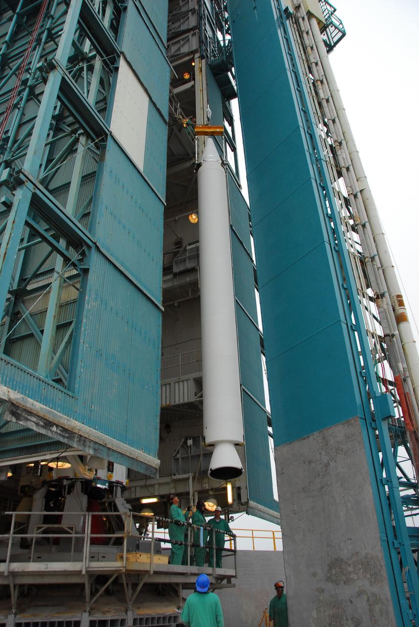
VANDENBERG AIR FORCE BASE, Calif. -- At Vandenberg Air Force Base in California, technicians monitor the progress as a solid rocket motor for the United Launch Alliance Delta II that will carry NASA's National Polar-orbiting Operational Environmental Satellite System Preparatory Project (NPP) satellite is hoisted up at NASA's Space Launch Complex-2. NPP represents a critical first step in building the next-generation of Earth-observing satellites. NPP will carry the first of the new sensors developed for this satellite fleet, now known as the Joint Polar Satellite System (JPSS) to be launched in 2016. NPP is the bridge between NASA's Earth Observing System (EOS) satellites and the forthcoming series of JPSS satellites. The mission will test key technologies and instruments for the JPSS missions. NPP is targeted to launch Oct. 25. For more information, visit http://www.nasa.gov/NPP. Photo credit: NASA/VAFB, Dan Liberotti
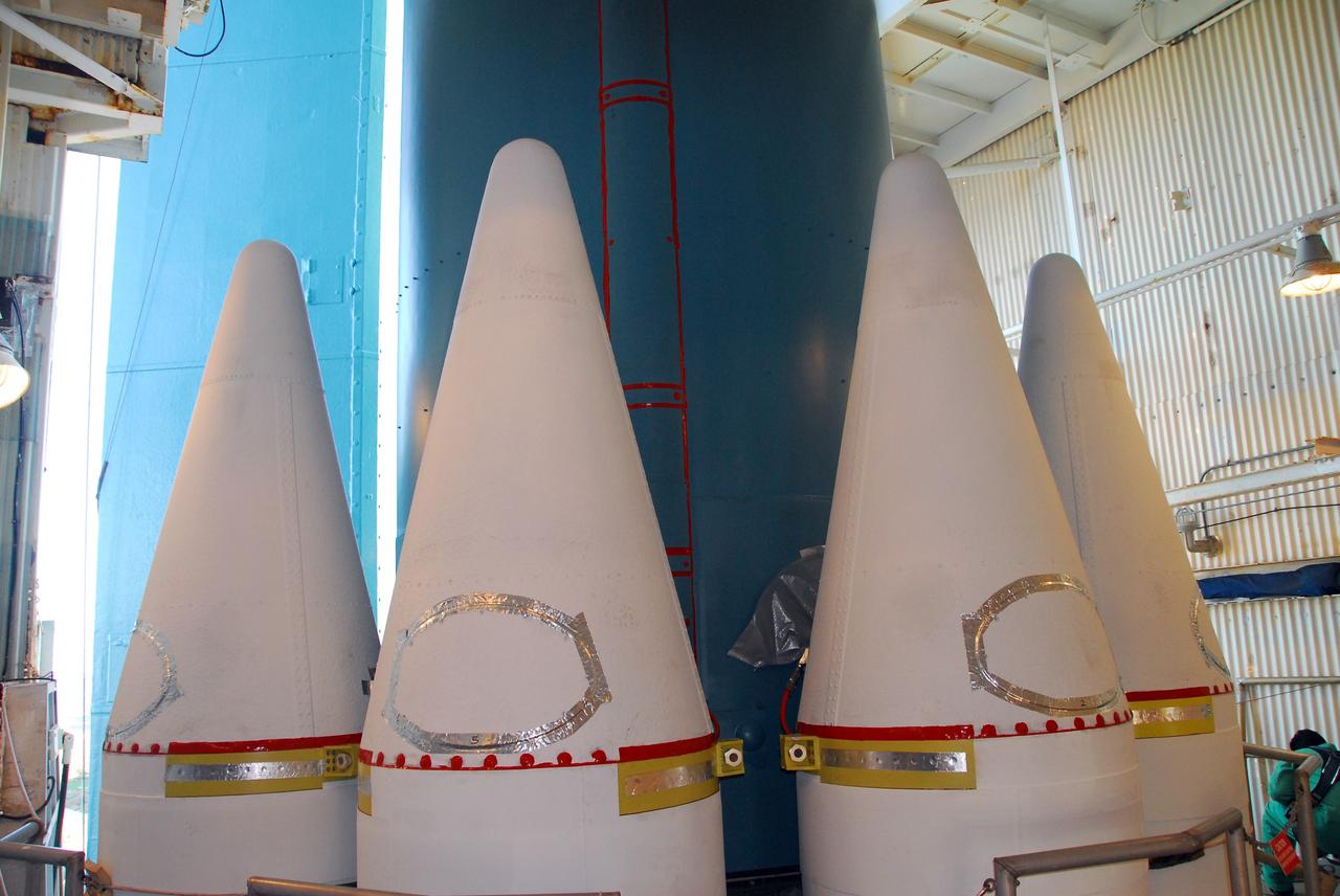
VANDENBERG AIR FORCE BASE, Calif. -- At NASA’s Space Launch Complex-2 at Vandenberg Air Force Base in California, several solid rocket motor closers have been attached to the United Launch Alliance Delta II rocket. The Delta II will carry NASA’s National Polar-orbiting Operational Environmental Satellite System Preparatory Project (NPP) satellite into space. NPP represents a critical first step in building the next-generation of Earth-observing satellites. NPP will carry the first of the new sensors developed for this satellite fleet, now known as the Joint Polar Satellite System (JPSS) to be launched in 2016. NPP is the bridge between NASA's Earth Observing System (EOS) satellites and the forthcoming series of JPSS satellites. The mission will test key technologies and instruments for the JPSS missions. NPP is targeted to launch Oct. 25. For more information, visit http://www.nasa.gov/NPP. Photo credit: NASA/VAFB, Mark Mackley
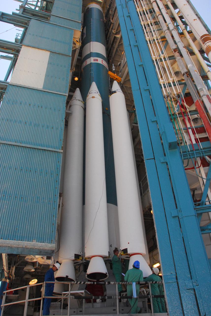
VANDENBERG AIR FORCE BASE, Calif. -- At Space Launch Complex-2 at Vandenberg Air Force Base in California, technicians monitor the progress as a crane positions a solid rocket motor for attachment to the United Launch Alliance Delta II rocket. The Delta II will carry NASA’s National Polar-orbiting Operational Environmental Satellite System Preparatory Project (NPP) satellite into space. NPP represents a critical first step in building the next-generation of Earth-observing satellites. NPP will carry the first of the new sensors developed for this satellite fleet, now known as the Joint Polar Satellite System (JPSS) to be launched in 2016. NPP is the bridge between NASA's Earth Observing System (EOS) satellites and the forthcoming series of JPSS satellites. The mission will test key technologies and instruments for the JPSS missions. NPP is targeted to launch Oct. 25. For more information, visit http://www.nasa.gov/NPP. Photo credit: NASA/VAFB, Mark Mackley