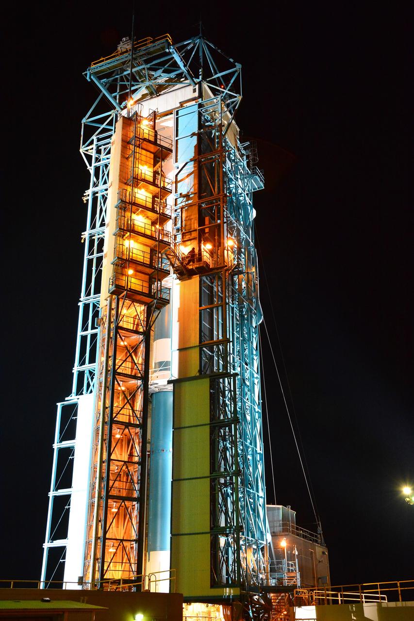
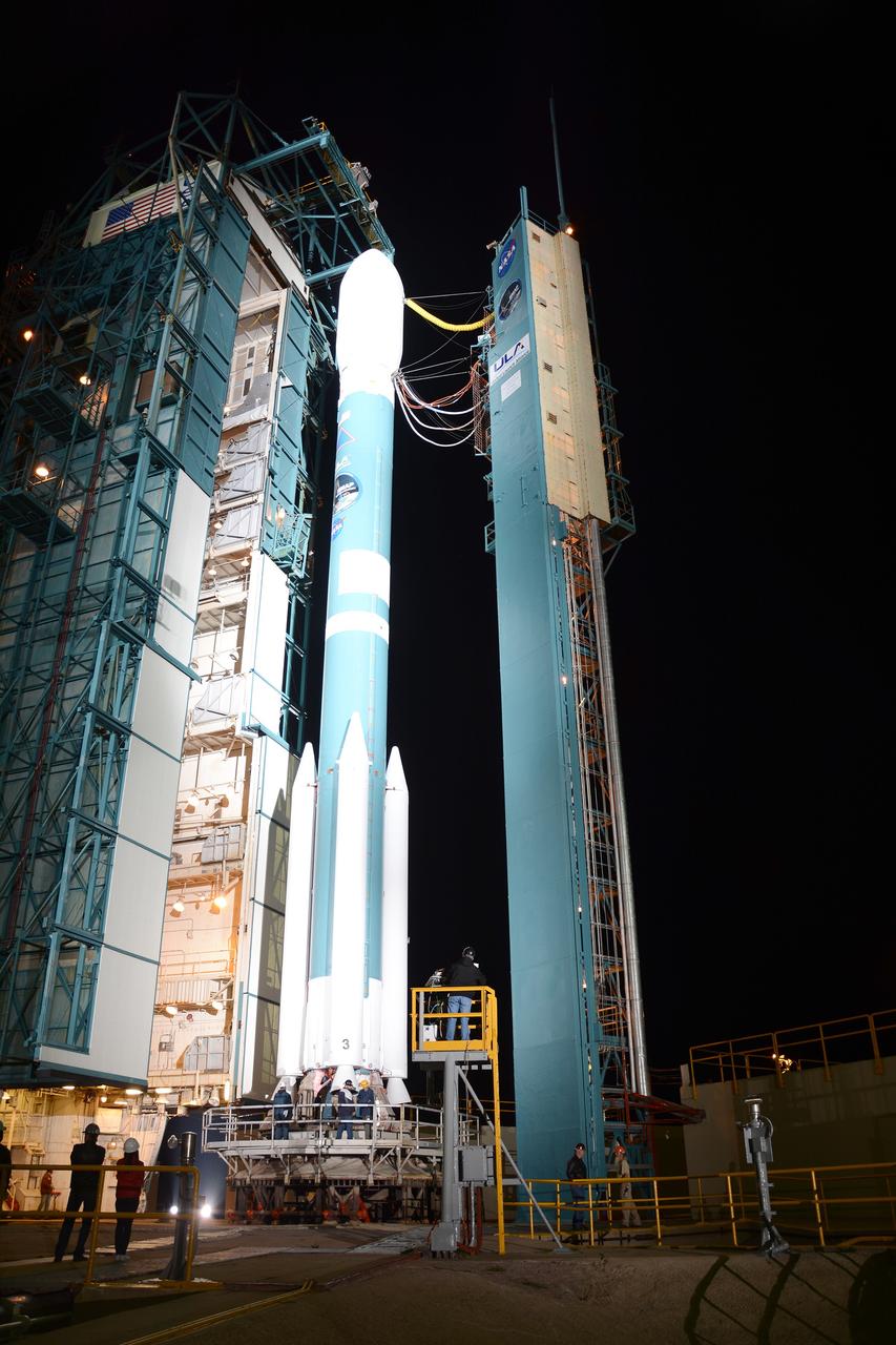
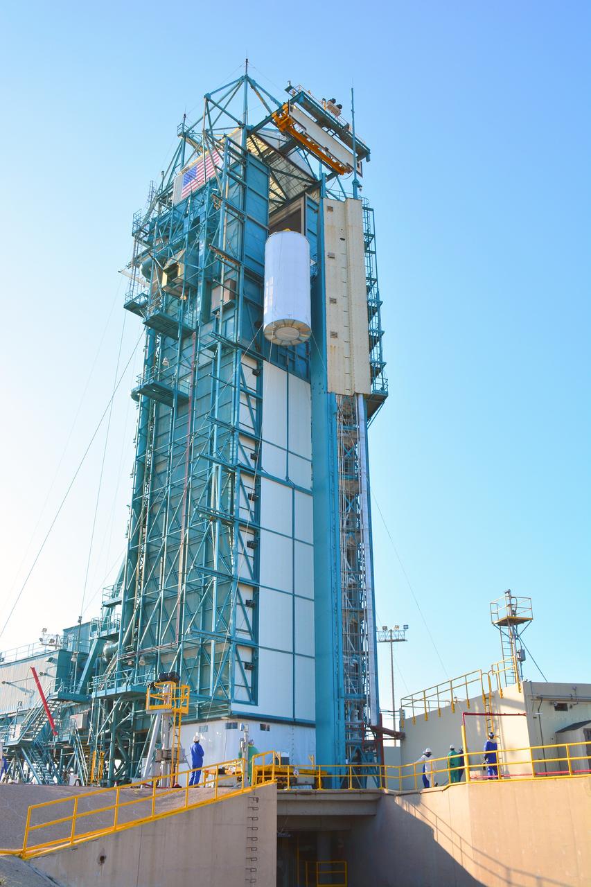
VANDENBERG AIR FORCE BASE, Calif. – At Vandenberg Air Force Base in California, NASA's Soil Moisture Active Passive mission, or SMAP, satellite is mated to its Delta II rocket at Space Launch Complex 2. SMAP will provide global measurements of soil moisture and its freeze/thaw state. These measurements will be used to enhance understanding of processes that link the water, energy and carbon cycles, and to extend the capabilities of weather and climate prediction models. SMAP data also will be used to quantify net carbon flux in boreal landscapes and to develop improved flood prediction and drought monitoring capabilities. Launch is scheduled for Jan. 29, 2015. To learn more about SMAP, visit http://smap.jpl.nasa.gov Photo credit: NASA/Randy Beaudoin
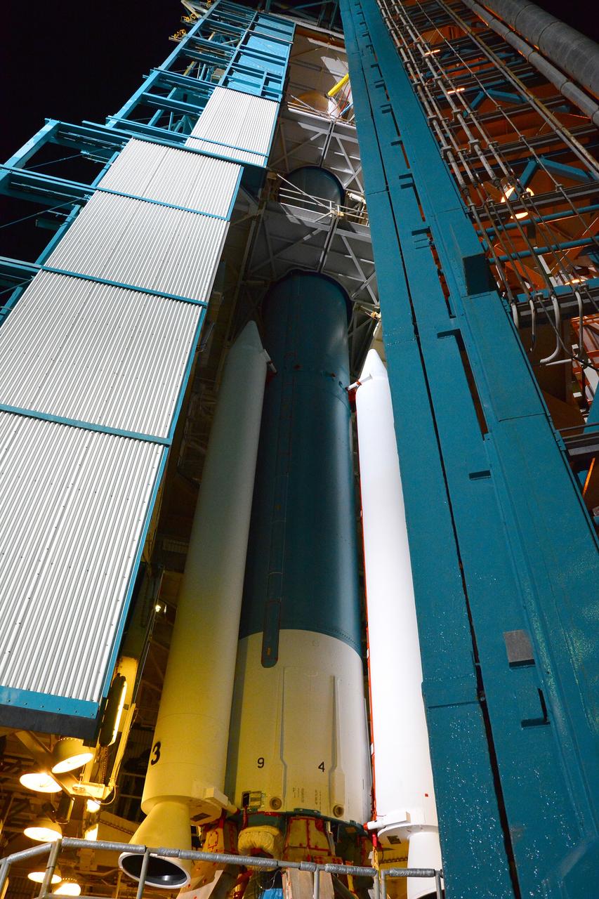
VANDENBERG AIR FORCE BASE, Calif. – At Vandenberg Air Force Base in California, NASA's Soil Moisture Active Passive mission, or SMAP, satellite is lifted at Space Launch Complex 2 for mating to its Delta II rocket. SMAP will provide global measurements of soil moisture and its freeze/thaw state. These measurements will be used to enhance understanding of processes that link the water, energy and carbon cycles, and to extend the capabilities of weather and climate prediction models. SMAP data also will be used to quantify net carbon flux in boreal landscapes and to develop improved flood prediction and drought monitoring capabilities. Launch is scheduled for Jan. 29, 2015. To learn more about SMAP, visit http://smap.jpl.nasa.gov Photo credit: NASA/Randy Beaudoin
VANDENBERG AIR FORCE BASE, Calif. – At Vandenberg Air Force Base in California, NASA's Soil Moisture Active Passive mission, or SMAP, satellite is prepared for lifting at Space Launch Complex 2 for mating to its Delta II rocket. SMAP will provide global measurements of soil moisture and its freeze/thaw state. These measurements will be used to enhance understanding of processes that link the water, energy and carbon cycles, and to extend the capabilities of weather and climate prediction models. SMAP data also will be used to quantify net carbon flux in boreal landscapes and to develop improved flood prediction and drought monitoring capabilities. Launch is scheduled for Jan. 29, 2015. To learn more about SMAP, visit http://smap.jpl.nasa.gov Photo credit: NASA/Randy Beaudoin
VANDENBERG AIR FORCE BASE, Calif. – At Vandenberg Air Force Base in California, NASA's Soil Moisture Active Passive mission, or SMAP, satellite is lifted at Space Launch Complex 2 for mating to its Delta II rocket. SMAP will provide global measurements of soil moisture and its freeze/thaw state. These measurements will be used to enhance understanding of processes that link the water, energy and carbon cycles, and to extend the capabilities of weather and climate prediction models. SMAP data also will be used to quantify net carbon flux in boreal landscapes and to develop improved flood prediction and drought monitoring capabilities. Launch is scheduled for Jan. 29, 2015. To learn more about SMAP, visit http://smap.jpl.nasa.gov Photo credit: NASA/Randy Beaudoin
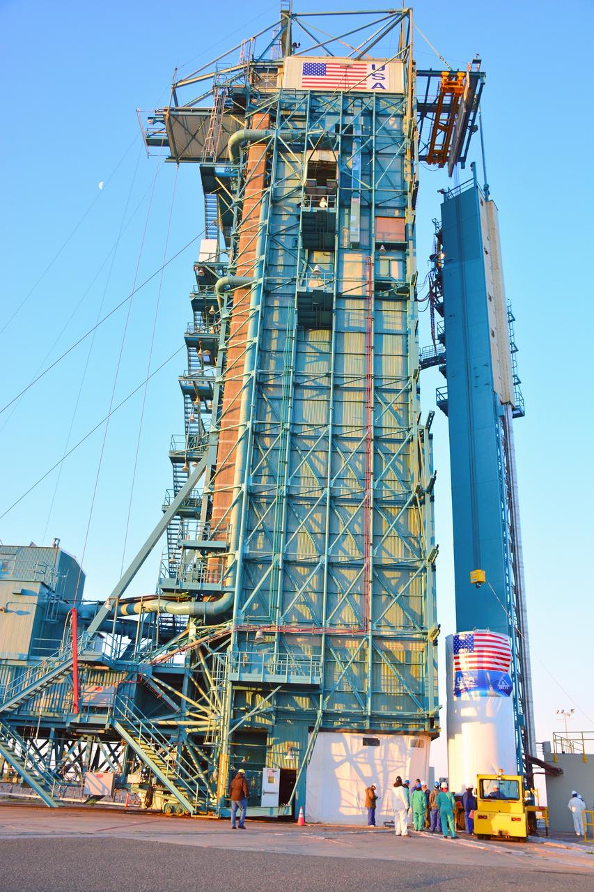
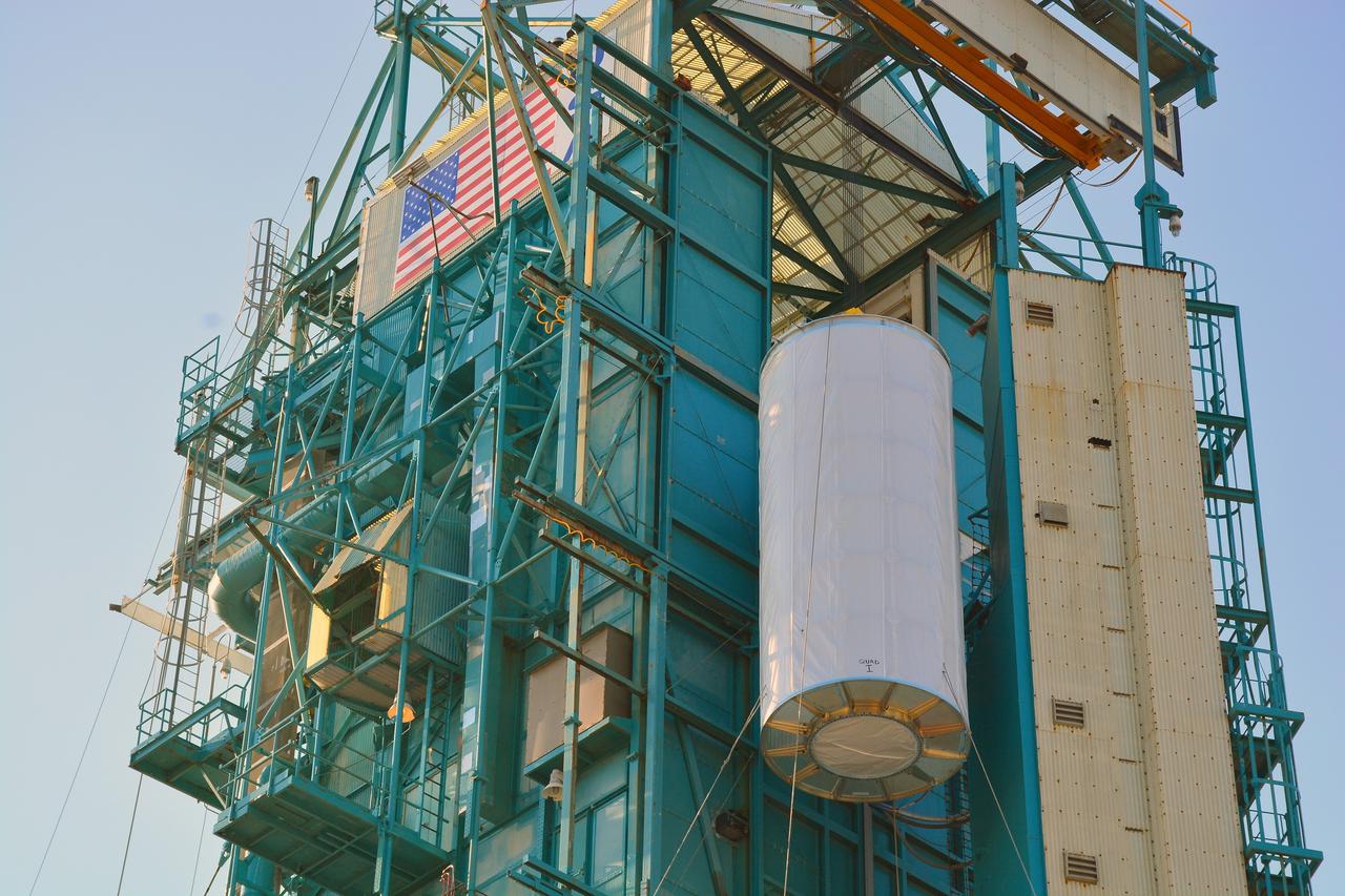
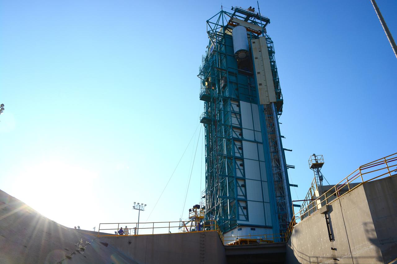
VANDENBERG AIR FORCE BASE, Calif. – The launch gantry is rolled back to reveal the United Launch Alliance Delta II rocket with the Soil Moisture Active Passive, or SMAP, satellite aboard, at Space Launch Complex 2 on Vandenberg Air Force Base in California. SMAP is a remote sensing mission designed to measure and map the Earth's soil moisture distribution and freeze/thaw stat with unprecedented accuracy, resolution and coverage. SMAP will provide global measurements of soil moisture and its freeze/thaw state. These measurements will be used to enhance understanding of processes that link the water, energy and carbon cycles, and to extend the capabilities of weather and climate prediction models. SMAP data also will be used to quantify net carbon flux in boreal landscapes and to develop improved flood prediction and drought monitoring capabilities. Launch is scheduled for Jan. 29, 2015. To learn more about SMAP, visit http://www.nasa.gov/smap. Photo credit: NASA/Randy Beaudoin
VANDENBERG AIR FORCE BASE, Calif. – At Vandenberg Air Force Base in California, NASA's Soil Moisture Active Passive mission, or SMAP, satellite is mated to its Delta II rocket at Space Launch Complex 2. SMAP will provide global measurements of soil moisture and its freeze/thaw state. These measurements will be used to enhance understanding of processes that link the water, energy and carbon cycles, and to extend the capabilities of weather and climate prediction models. SMAP data also will be used to quantify net carbon flux in boreal landscapes and to develop improved flood prediction and drought monitoring capabilities. Launch is scheduled for Jan. 29, 2015. To learn more about SMAP, visit http://smap.jpl.nasa.gov Photo credit: NASA/Randy Beaudoin
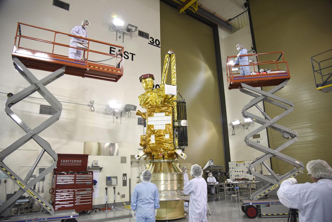
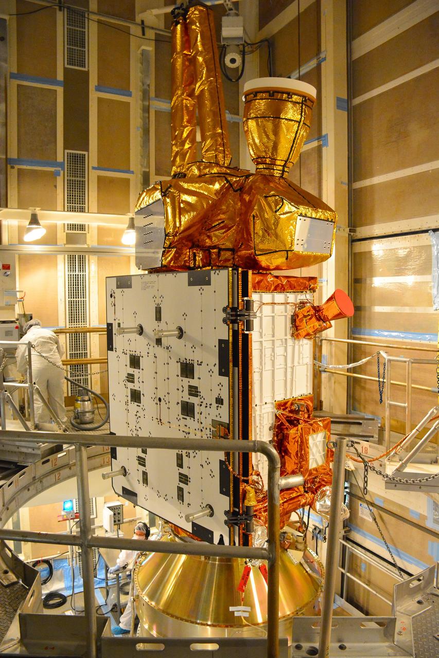
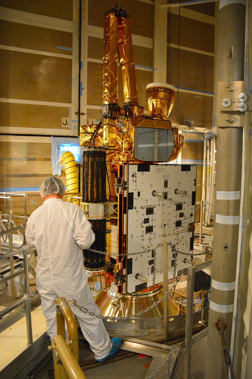
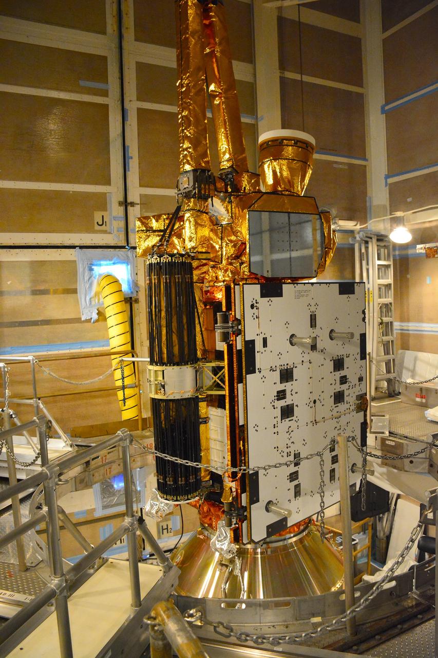
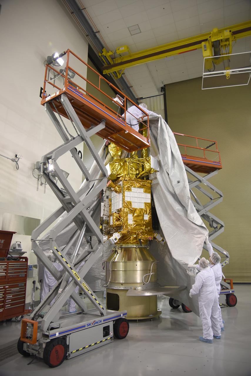
VANDENBERG AIR FORCE BASE, Calif. – Inside the Astrotech payload processing facility at Vandenberg Air Force Base in California, engineers and technicians inspect NASA's Soil Moisture Active Passive mission, or SMAP, satellite. SMAP will provide global measurements of soil moisture and its freeze/thaw state. These measurements will be used to enhance understanding of processes that link the water, energy and carbon cycles, and to extend the capabilities of weather and climate prediction models. SMAP data also will be used to quantify net carbon flux in boreal landscapes and to develop improved flood prediction and drought monitoring capabilities. Launch is scheduled for Jan. 29, 2015. To learn more about SMAP, visit http://smap.jpl.nasa.gov Photo credit: Jeremy Moore, USAF Photo Squadron
VANDENBERG AIR FORCE BASE, Calif. – At Vandenberg Air Force Base in California, NASA's Soil Moisture Active Passive mission, or SMAP, satellite is prepared for lifting at Space Launch Complex 2 for mating to its Delta II rocket. SMAP will provide global measurements of soil moisture and its freeze/thaw state. These measurements will be used to enhance understanding of processes that link the water, energy and carbon cycles, and to extend the capabilities of weather and climate prediction models. SMAP data also will be used to quantify net carbon flux in boreal landscapes and to develop improved flood prediction and drought monitoring capabilities. Launch is scheduled for Jan. 29, 2015. To learn more about SMAP, visit http://smap.jpl.nasa.gov Photo credit: NASA/Randy Beaudoin
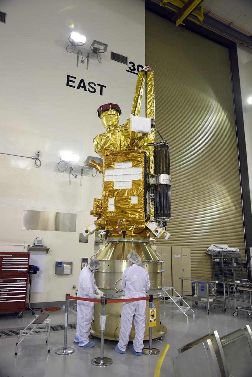
VANDENBERG AIR FORCE BASE, Calif. – Inside the Astrotech payload processing facility at Vandenberg Air Force Base in California, engineers and technicians inspect NASA's Soil Moisture Active Passive mission, or SMAP, satellite. SMAP will provide global measurements of soil moisture and its freeze/thaw state. These measurements will be used to enhance understanding of processes that link the water, energy and carbon cycles, and to extend the capabilities of weather and climate prediction models. SMAP data also will be used to quantify net carbon flux in boreal landscapes and to develop improved flood prediction and drought monitoring capabilities. Launch is scheduled for Jan. 29, 2015. To learn more about SMAP, visit http://smap.jpl.nasa.gov Photo credit: Jeremy Moore, USAF Photo Squadron
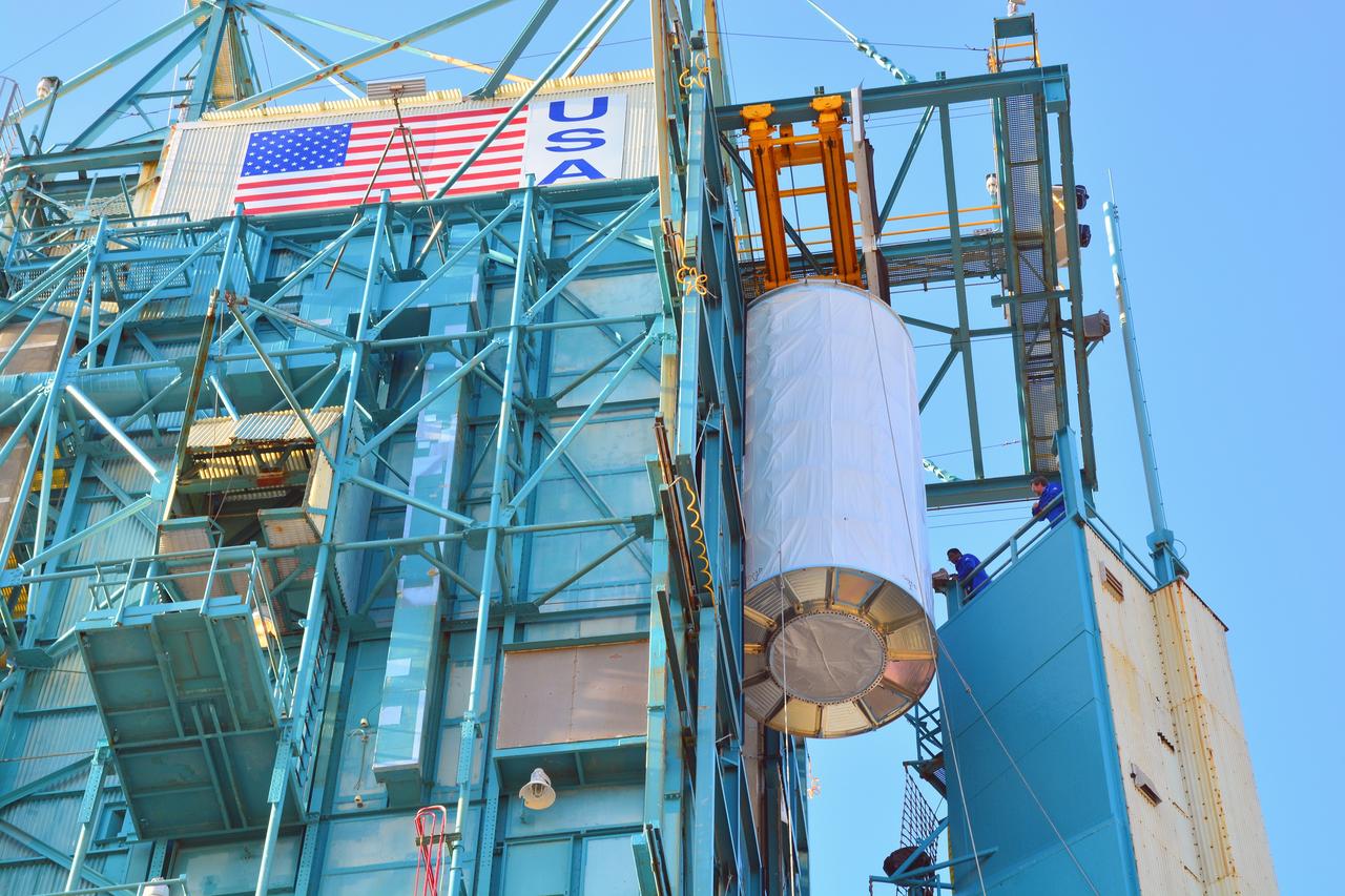
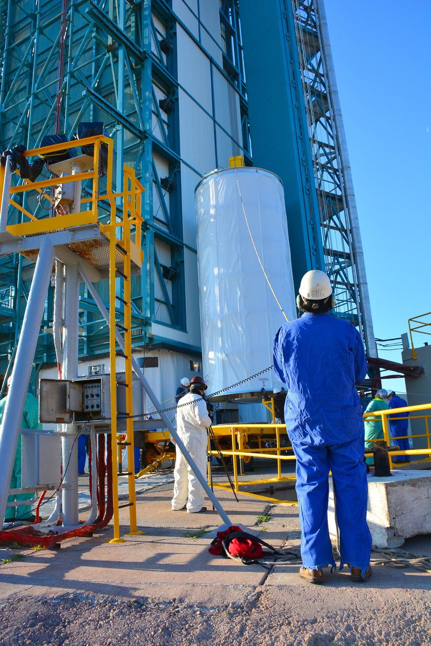
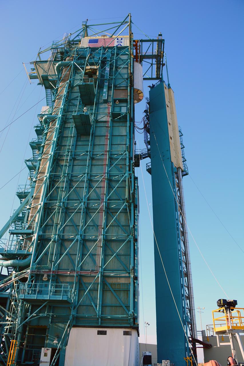
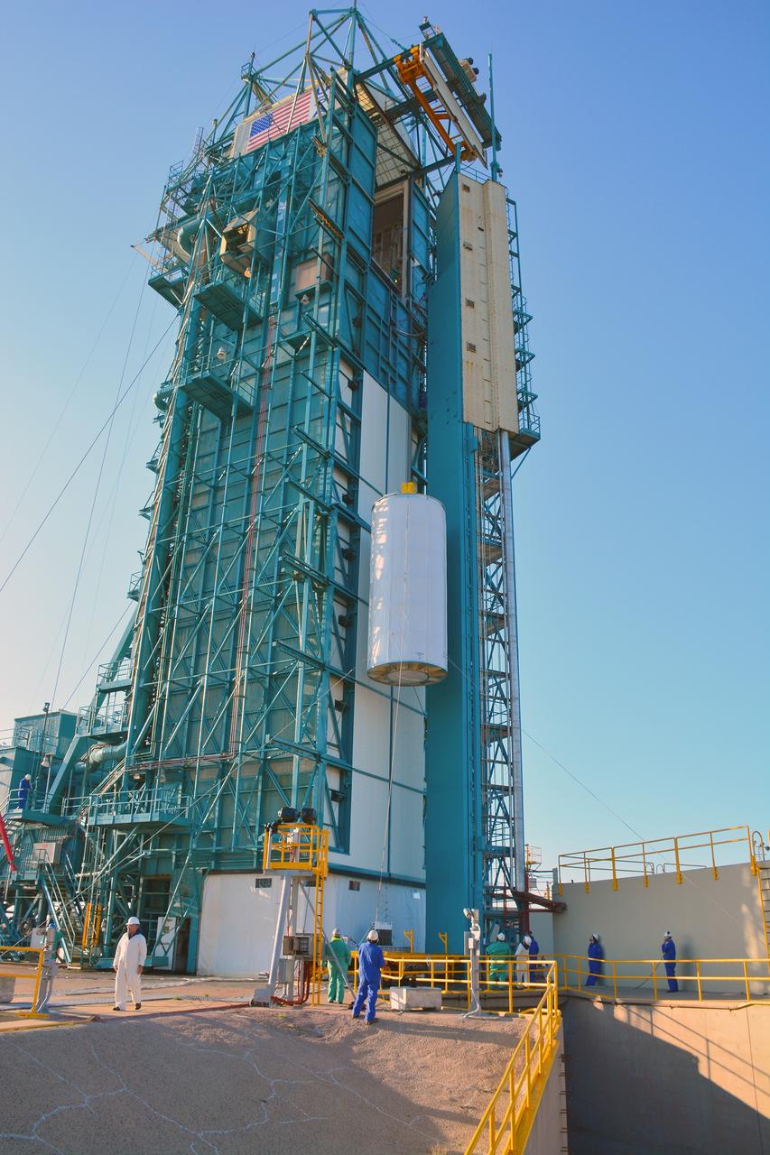
VANDENBERG AIR FORCE BASE, Calif. – At Vandenberg Air Force Base in California, NASA's Soil Moisture Active Passive mission, or SMAP, satellite is transported to Space Launch Complex 2 where it will be mated to a Delta II rocket. SMAP will provide global measurements of soil moisture and its freeze/thaw state. These measurements will be used to enhance understanding of processes that link the water, energy and carbon cycles, and to extend the capabilities of weather and climate prediction models. SMAP data also will be used to quantify net carbon flux in boreal landscapes and to develop improved flood prediction and drought monitoring capabilities. Launch is scheduled for Jan. 29, 2015. To learn more about SMAP, visit http://smap.jpl.nasa.gov Photo credit: NASA/Randy Beaudoin
VANDENBERG AIR FORCE BASE, Calif. – At Vandenberg Air Force Base in California, NASA's Soil Moisture Active Passive mission, or SMAP, satellite is lifted at Space Launch Complex 2 for mating to its Delta II rocket. SMAP will provide global measurements of soil moisture and its freeze/thaw state. These measurements will be used to enhance understanding of processes that link the water, energy and carbon cycles, and to extend the capabilities of weather and climate prediction models. SMAP data also will be used to quantify net carbon flux in boreal landscapes and to develop improved flood prediction and drought monitoring capabilities. Launch is scheduled for Jan. 29, 2015. To learn more about SMAP, visit http://smap.jpl.nasa.gov Photo credit: NASA/Randy Beaudoin
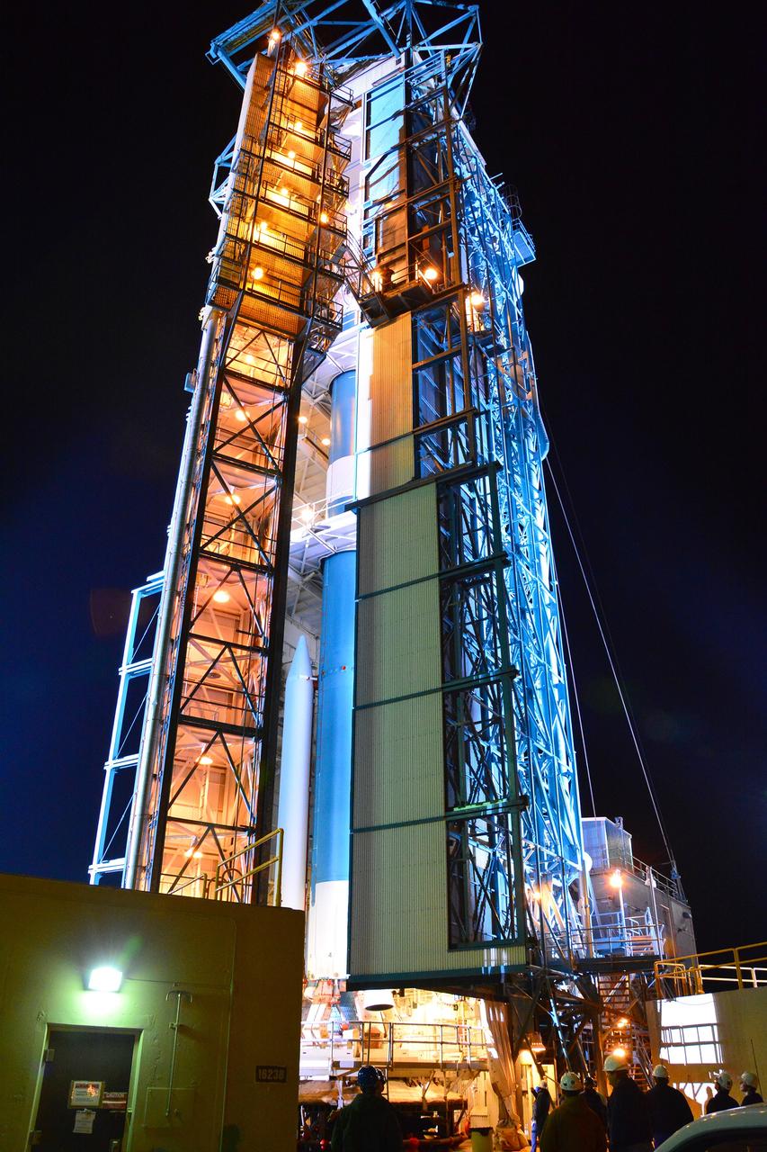
VANDENBERG AIR FORCE BASE, Calif. – The launch gantry is rolled back to reveal the United Launch Alliance Delta II rocket with the Soil Moisture Active Passive, or SMAP, satellite aboard, at Space Launch Complex 2 on Vandenberg Air Force Base in California. SMAP is a remote sensing mission designed to measure and map the Earth's soil moisture distribution and freeze/thaw stat with unprecedented accuracy, resolution and coverage. SMAP will provide global measurements of soil moisture and its freeze/thaw state. These measurements will be used to enhance understanding of processes that link the water, energy and carbon cycles, and to extend the capabilities of weather and climate prediction models. SMAP data also will be used to quantify net carbon flux in boreal landscapes and to develop improved flood prediction and drought monitoring capabilities. Launch is scheduled for Jan. 29, 2015. To learn more about SMAP, visit http://www.nasa.gov/smap. Photo credit: NASA/Randy Beaudoin
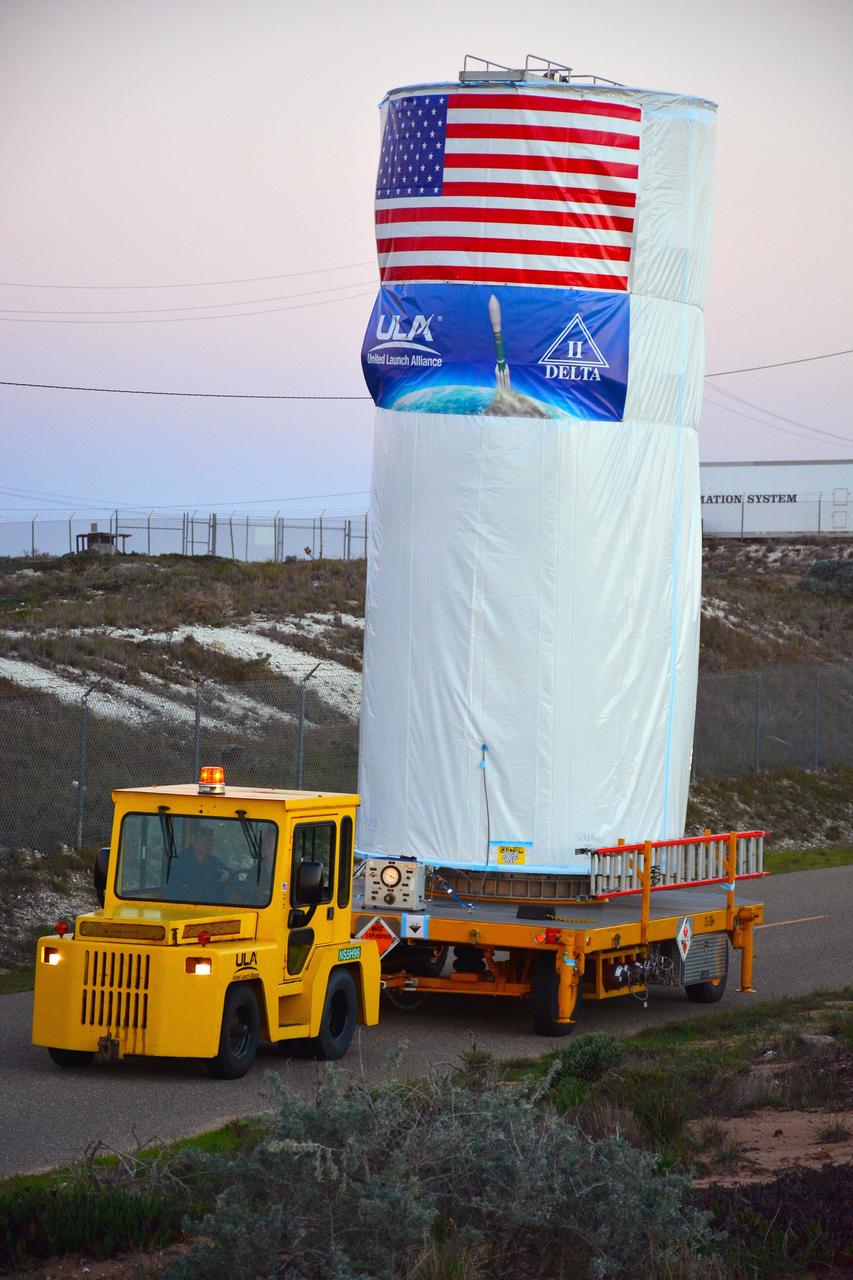
VANDENBERG AIR FORCE BASE, Calif. – At Vandenberg Air Force Base in California, NASA's Soil Moisture Active Passive mission, or SMAP, satellite is transported to Space Launch Complex 2 where it will be mated to a Delta II rocket. SMAP will provide global measurements of soil moisture and its freeze/thaw state. These measurements will be used to enhance understanding of processes that link the water, energy and carbon cycles, and to extend the capabilities of weather and climate prediction models. SMAP data also will be used to quantify net carbon flux in boreal landscapes and to develop improved flood prediction and drought monitoring capabilities. Launch is scheduled for Jan. 29, 2015. To learn more about SMAP, visit http://smap.jpl.nasa.gov Photo credit: NASA/Randy Beaudoin
VANDENBERG AIR FORCE BASE, Calif. – At Vandenberg Air Force Base in California, NASA's Soil Moisture Active Passive mission, or SMAP, satellite is lifted at Space Launch Complex 2 for mating to its Delta II rocket. SMAP will provide global measurements of soil moisture and its freeze/thaw state. These measurements will be used to enhance understanding of processes that link the water, energy and carbon cycles, and to extend the capabilities of weather and climate prediction models. SMAP data also will be used to quantify net carbon flux in boreal landscapes and to develop improved flood prediction and drought monitoring capabilities. Launch is scheduled for Jan. 29, 2015. To learn more about SMAP, visit http://smap.jpl.nasa.gov Photo credit: NASA/Randy Beaudoin
VANDENBERG AIR FORCE BASE, Calif. – The launch gantry is rolled back to reveal the United Launch Alliance Delta II rocket with the Soil Moisture Active Passive, or SMAP, satellite aboard, at Space Launch Complex 2 on Vandenberg Air Force Base in California. SMAP is a remote sensing mission designed to measure and map the Earth's soil moisture distribution and freeze/thaw stat with unprecedented accuracy, resolution and coverage. SMAP will provide global measurements of soil moisture and its freeze/thaw state. These measurements will be used to enhance understanding of processes that link the water, energy and carbon cycles, and to extend the capabilities of weather and climate prediction models. SMAP data also will be used to quantify net carbon flux in boreal landscapes and to develop improved flood prediction and drought monitoring capabilities. Launch is scheduled for Jan. 29, 2015. To learn more about SMAP, visit http://www.nasa.gov/smap. Photo credit: NASA/Randy Beaudoin
VANDENBERG AIR FORCE BASE, Calif. – The launch gantry is rolled back to reveal the United Launch Alliance Delta II rocket with the Soil Moisture Active Passive, or SMAP, satellite aboard, at Space Launch Complex 2 on Vandenberg Air Force Base in California. SMAP is a remote sensing mission designed to measure and map the Earth's soil moisture distribution and freeze/thaw stat with unprecedented accuracy, resolution and coverage. SMAP will provide global measurements of soil moisture and its freeze/thaw state. These measurements will be used to enhance understanding of processes that link the water, energy and carbon cycles, and to extend the capabilities of weather and climate prediction models. SMAP data also will be used to quantify net carbon flux in boreal landscapes and to develop improved flood prediction and drought monitoring capabilities. Launch is scheduled for Jan. 29, 2015. To learn more about SMAP, visit http://www.nasa.gov/smap. Photo credit: NASA/Randy Beaudoin

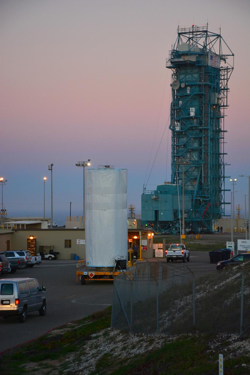
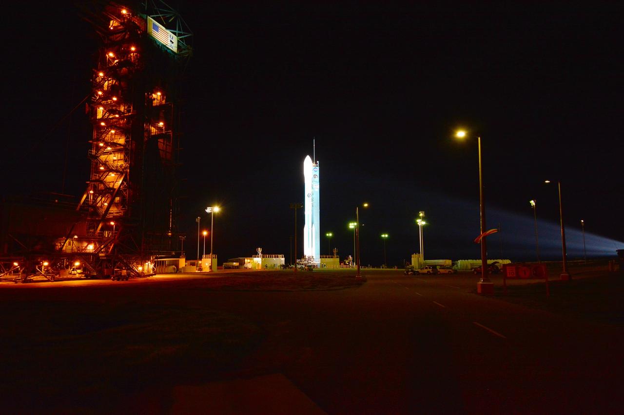
VANDENBERG AIR FORCE BASE, Calif. – The sun sets over the Pacific Ocean as seen from Vandenberg Air Force Base in California where NASA's Soil Moisture Active Passive mission, or SMAP, satellite is being prepared for liftoff from Space Launch Complex 2. SMAP will provide global measurements of soil moisture and its freeze/thaw state. These measurements will be used to enhance understanding of processes that link the water, energy and carbon cycles, and to extend the capabilities of weather and climate prediction models. SMAP data also will be used to quantify net carbon flux in boreal landscapes and to develop improved flood prediction and drought monitoring capabilities. Launch is scheduled for Jan. 29, 2015. To learn more about SMAP, visit http://smap.jpl.nasa.gov Photo credit: NASA/Randy Beaudoin
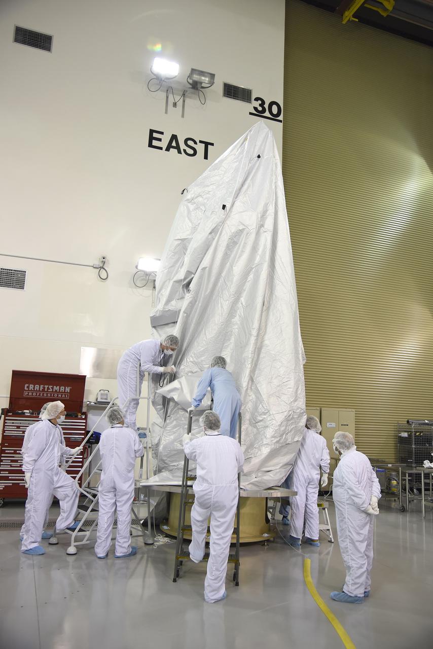
VANDENBERG AIR FORCE BASE, Calif. – Inside the Astrotech payload processing facility at Vandenberg Air Force Base in California, engineers and technicians place a protective cover over NASA's Soil Moisture Active Passive mission, or SMAP, satellite prior the spacecraft being transported to the launch pad. SMAP will provide global measurements of soil moisture and its freeze/thaw state. These measurements will be used to enhance understanding of processes that link the water, energy and carbon cycles, and to extend the capabilities of weather and climate prediction models. SMAP data also will be used to quantify net carbon flux in boreal landscapes and to develop improved flood prediction and drought monitoring capabilities. Launch is scheduled for Jan. 29, 2015. To learn more about SMAP, visit http://smap.jpl.nasa.gov Photo credit: Jeremy Moore, USAF Photo Squadron
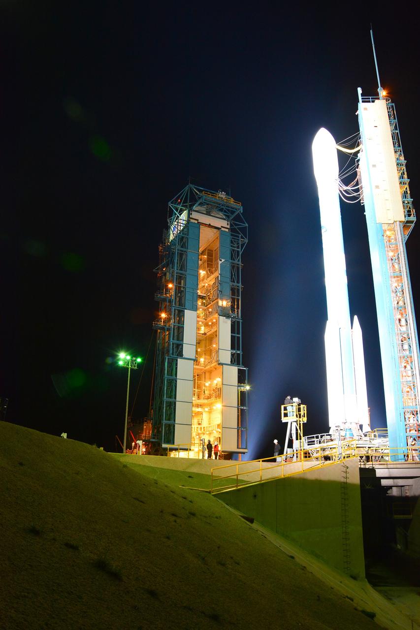
VANDENBERG AIR FORCE BASE, Calif. – The launch gantry is rolled back to reveal the United Launch Alliance Delta II rocket with the Soil Moisture Active Passive, or SMAP, satellite aboard, at Space Launch Complex 2 on Vandenberg Air Force Base in California. SMAP is a remote sensing mission designed to measure and map the Earth's soil moisture distribution and freeze/thaw stat with unprecedented accuracy, resolution and coverage. SMAP will provide global measurements of soil moisture and its freeze/thaw state. These measurements will be used to enhance understanding of processes that link the water, energy and carbon cycles, and to extend the capabilities of weather and climate prediction models. SMAP data also will be used to quantify net carbon flux in boreal landscapes and to develop improved flood prediction and drought monitoring capabilities. Launch is scheduled for Jan. 29, 2015. To learn more about SMAP, visit http://www.nasa.gov/smap. Photo credit: NASA/Randy Beaudoin
VANDENBERG AIR FORCE BASE, Calif. – At Vandenberg Air Force Base in California, NASA's Soil Moisture Active Passive mission, or SMAP, satellite is mated to its Delta II rocket at Space Launch Complex 2. SMAP will provide global measurements of soil moisture and its freeze/thaw state. These measurements will be used to enhance understanding of processes that link the water, energy and carbon cycles, and to extend the capabilities of weather and climate prediction models. SMAP data also will be used to quantify net carbon flux in boreal landscapes and to develop improved flood prediction and drought monitoring capabilities. Launch is scheduled for Jan. 29, 2015. To learn more about SMAP, visit http://smap.jpl.nasa.gov Photo credit: NASA/Randy Beaudoin
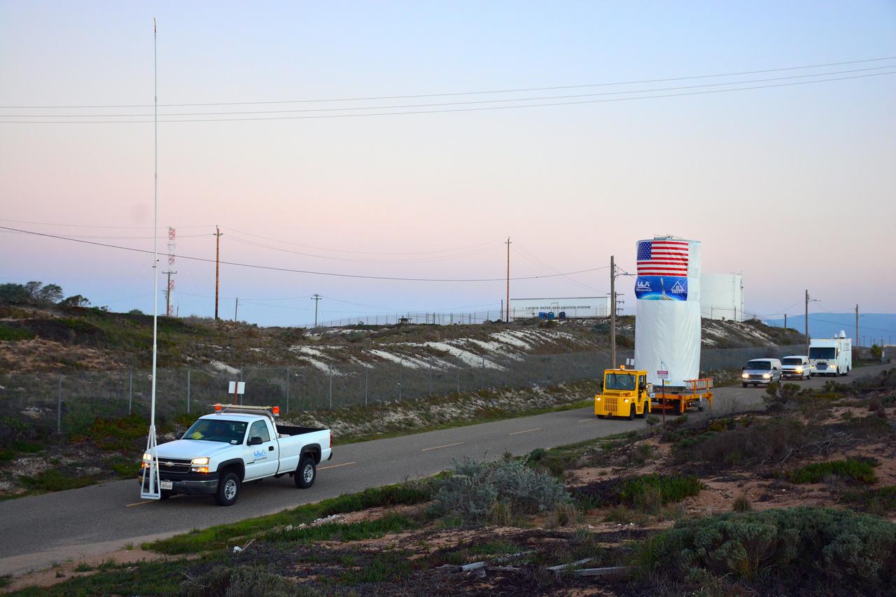
VANDENBERG AIR FORCE BASE, Calif. – At Vandenberg Air Force Base in California, NASA's Soil Moisture Active Passive mission, or SMAP, satellite is transported to Space Launch Complex 2 where it will be mated to a Delta II rocket. SMAP will provide global measurements of soil moisture and its freeze/thaw state. These measurements will be used to enhance understanding of processes that link the water, energy and carbon cycles, and to extend the capabilities of weather and climate prediction models. SMAP data also will be used to quantify net carbon flux in boreal landscapes and to develop improved flood prediction and drought monitoring capabilities. Launch is scheduled for Jan. 29, 2015. To learn more about SMAP, visit http://smap.jpl.nasa.gov Photo credit: NASA/Randy Beaudoin
VANDENBERG AIR FORCE BASE, Calif. – At Vandenberg Air Force Base in California, NASA's Soil Moisture Active Passive mission, or SMAP, satellite is lifted at Space Launch Complex 2 for mating to its Delta II rocket. SMAP will provide global measurements of soil moisture and its freeze/thaw state. These measurements will be used to enhance understanding of processes that link the water, energy and carbon cycles, and to extend the capabilities of weather and climate prediction models. SMAP data also will be used to quantify net carbon flux in boreal landscapes and to develop improved flood prediction and drought monitoring capabilities. Launch is scheduled for Jan. 29, 2015. To learn more about SMAP, visit http://smap.jpl.nasa.gov Photo credit: NASA/Randy Beaudoin
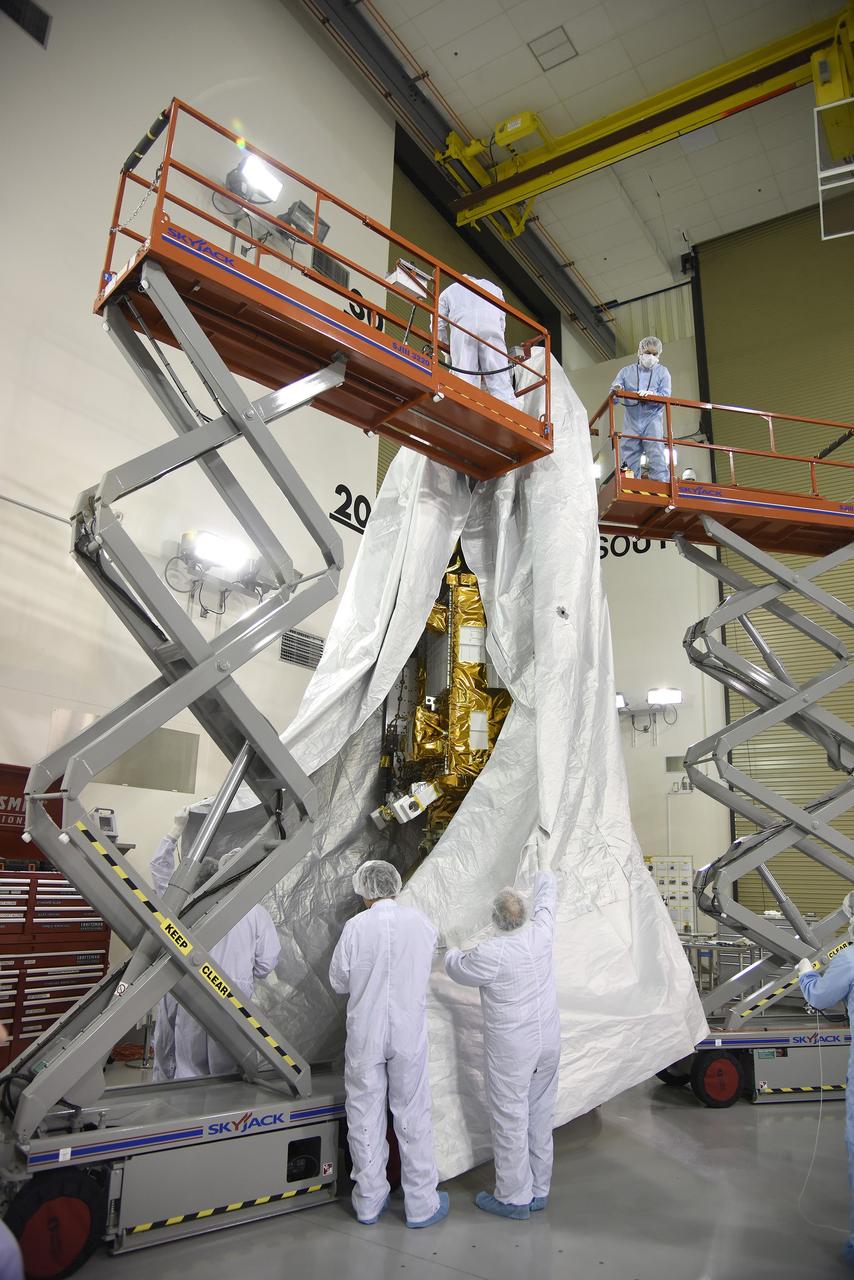
VANDENBERG AIR FORCE BASE, Calif. – Inside the Astrotech payload processing facility at Vandenberg Air Force Base in California, engineers and technicians place a protective cover over NASA's Soil Moisture Active Passive mission, or SMAP, satellite prior the spacecraft being transported to the launch pad. SMAP will provide global measurements of soil moisture and its freeze/thaw state. These measurements will be used to enhance understanding of processes that link the water, energy and carbon cycles, and to extend the capabilities of weather and climate prediction models. SMAP data also will be used to quantify net carbon flux in boreal landscapes and to develop improved flood prediction and drought monitoring capabilities. Launch is scheduled for Jan. 29, 2015. To learn more about SMAP, visit http://smap.jpl.nasa.gov Photo credit: Jeremy Moore, USAF Photo Squadron
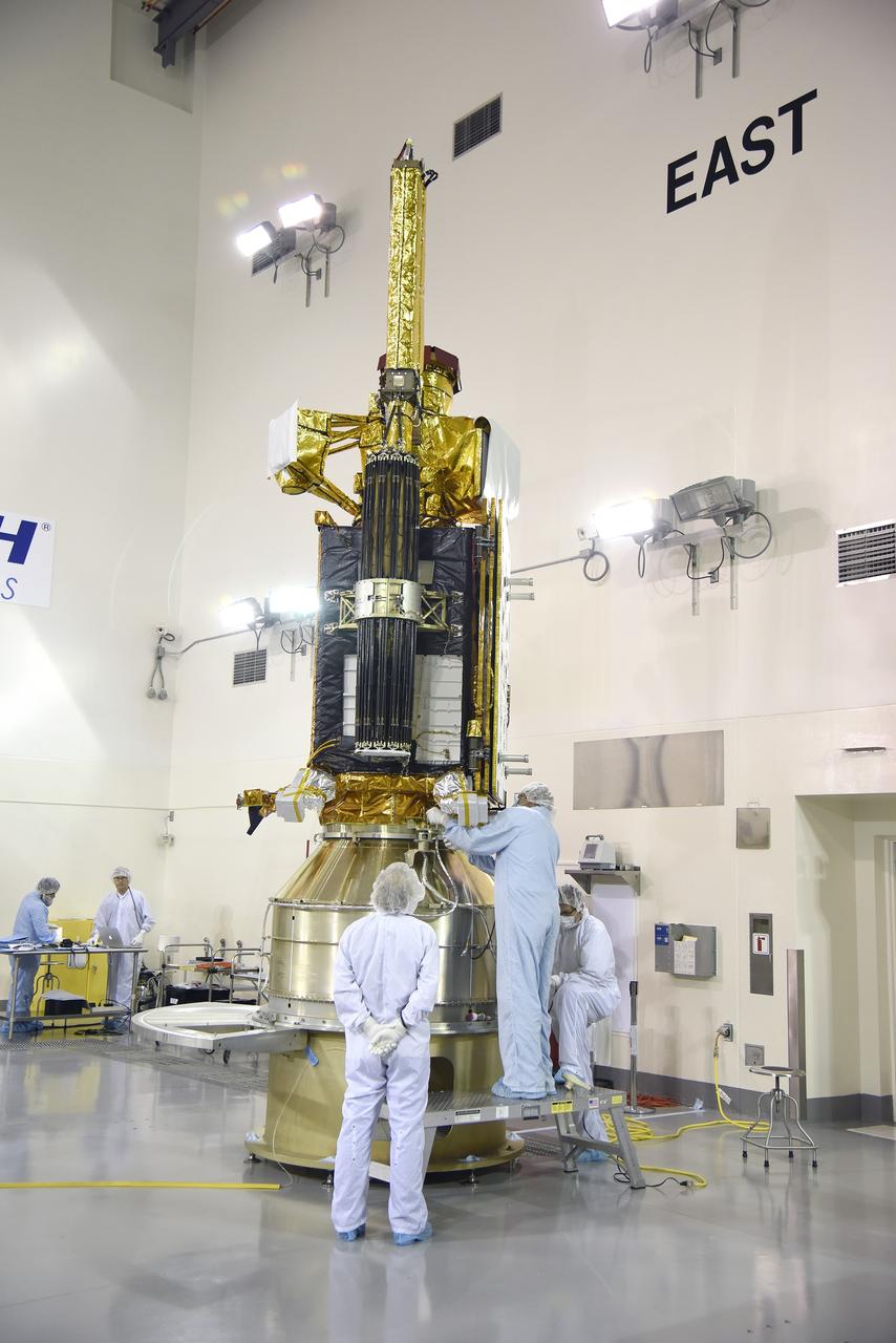
VANDENBERG AIR FORCE BASE, Calif. – Inside the Astrotech payload processing facility at Vandenberg Air Force Base in California, engineers and technicians inspect NASA's Soil Moisture Active Passive mission, or SMAP, satellite. SMAP will provide global measurements of soil moisture and its freeze/thaw state. These measurements will be used to enhance understanding of processes that link the water, energy and carbon cycles, and to extend the capabilities of weather and climate prediction models. SMAP data also will be used to quantify net carbon flux in boreal landscapes and to develop improved flood prediction and drought monitoring capabilities. Launch is scheduled for Jan. 29, 2015. To learn more about SMAP, visit http://smap.jpl.nasa.gov Photo credit: Jeremy Moore, USAF Photo Squadron
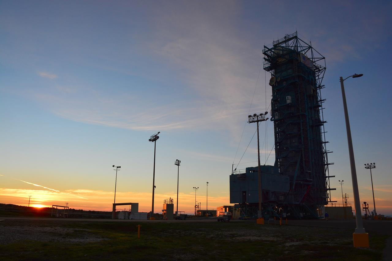
VANDENBERG AIR FORCE BASE, Calif. – The sun sets behind Space Launch Complex 2 at Vandenberg Air Force Base in California where NASA's Soil Moisture Active Passive mission, or SMAP, satellite is being prepared for liftoff. SMAP will provide global measurements of soil moisture and its freeze/thaw state. These measurements will be used to enhance understanding of processes that link the water, energy and carbon cycles, and to extend the capabilities of weather and climate prediction models. SMAP data also will be used to quantify net carbon flux in boreal landscapes and to develop improved flood prediction and drought monitoring capabilities. Launch is scheduled for Jan. 29, 2015. To learn more about SMAP, visit http://smap.jpl.nasa.gov Photo credit: NASA/Randy Beaudoin
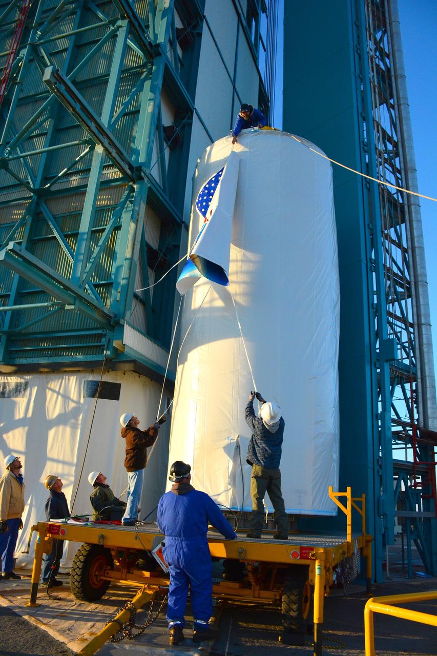
VANDENBERG AIR FORCE BASE, Calif. – At Vandenberg Air Force Base in California, NASA's Soil Moisture Active Passive mission, or SMAP, satellite is prepared for lifting at Space Launch Complex 2 for mating to its Delta II rocket. SMAP will provide global measurements of soil moisture and its freeze/thaw state. These measurements will be used to enhance understanding of processes that link the water, energy and carbon cycles, and to extend the capabilities of weather and climate prediction models. SMAP data also will be used to quantify net carbon flux in boreal landscapes and to develop improved flood prediction and drought monitoring capabilities. Launch is scheduled for Jan. 29, 2015. To learn more about SMAP, visit http://smap.jpl.nasa.gov Photo credit: NASA/Randy Beaudoin
VANDENBERG AIR FORCE BASE, Calif. – At Vandenberg Air Force Base in California, NASA's Soil Moisture Active Passive mission, or SMAP, satellite is lifted at Space Launch Complex 2 for mating to its Delta II rocket. SMAP will provide global measurements of soil moisture and its freeze/thaw state. These measurements will be used to enhance understanding of processes that link the water, energy and carbon cycles, and to extend the capabilities of weather and climate prediction models. SMAP data also will be used to quantify net carbon flux in boreal landscapes and to develop improved flood prediction and drought monitoring capabilities. Launch is scheduled for Jan. 29, 2015. To learn more about SMAP, visit http://smap.jpl.nasa.gov Photo credit: NASA/Randy Beaudoin
VANDENBERG AIR FORCE BASE, Calif. – Inside the Astrotech payload processing facility at Vandenberg Air Force Base in California, engineers and technicians place a protective cover over NASA's Soil Moisture Active Passive mission, or SMAP, satellite prior the spacecraft being transported to the launch pad. SMAP will provide global measurements of soil moisture and its freeze/thaw state. These measurements will be used to enhance understanding of processes that link the water, energy and carbon cycles, and to extend the capabilities of weather and climate prediction models. SMAP data also will be used to quantify net carbon flux in boreal landscapes and to develop improved flood prediction and drought monitoring capabilities. Launch is scheduled for Jan. 29, 2015. To learn more about SMAP, visit http://smap.jpl.nasa.gov Photo credit: Jeremy Moore, USAF Photo Squadron
VANDENBERG AIR FORCE BASE, Calif. – The launch gantry is rolled back to reveal the United Launch Alliance Delta II rocket with the Soil Moisture Active Passive, or SMAP, satellite aboard, at Space Launch Complex 2 on Vandenberg Air Force Base in California. SMAP is a remote sensing mission designed to measure and map the Earth's soil moisture distribution and freeze/thaw stat with unprecedented accuracy, resolution and coverage. SMAP will provide global measurements of soil moisture and its freeze/thaw state. These measurements will be used to enhance understanding of processes that link the water, energy and carbon cycles, and to extend the capabilities of weather and climate prediction models. SMAP data also will be used to quantify net carbon flux in boreal landscapes and to develop improved flood prediction and drought monitoring capabilities. Launch is scheduled for Jan. 29, 2015. To learn more about SMAP, visit http://www.nasa.gov/smap. Photo credit: NASA/Randy Beaudoin
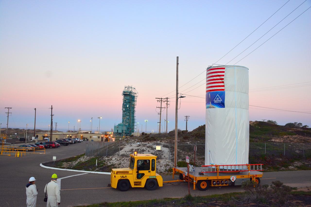
VANDENBERG AIR FORCE BASE, Calif. – At Vandenberg Air Force Base in California, NASA's Soil Moisture Active Passive mission, or SMAP, satellite is transported to Space Launch Complex 2 where it will be mated to a Delta II rocket. SMAP will provide global measurements of soil moisture and its freeze/thaw state. These measurements will be used to enhance understanding of processes that link the water, energy and carbon cycles, and to extend the capabilities of weather and climate prediction models. SMAP data also will be used to quantify net carbon flux in boreal landscapes and to develop improved flood prediction and drought monitoring capabilities. Launch is scheduled for Jan. 29, 2015. To learn more about SMAP, visit http://smap.jpl.nasa.gov Photo credit: NASA/Randy Beaudoin