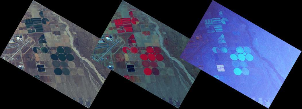
These three images are from NASA ER-2 aircraft which imaged the area around the Palmdale, Calif., airport during its first checkout flight on Oct. 7, 2010. For more details, go the Photojournal.
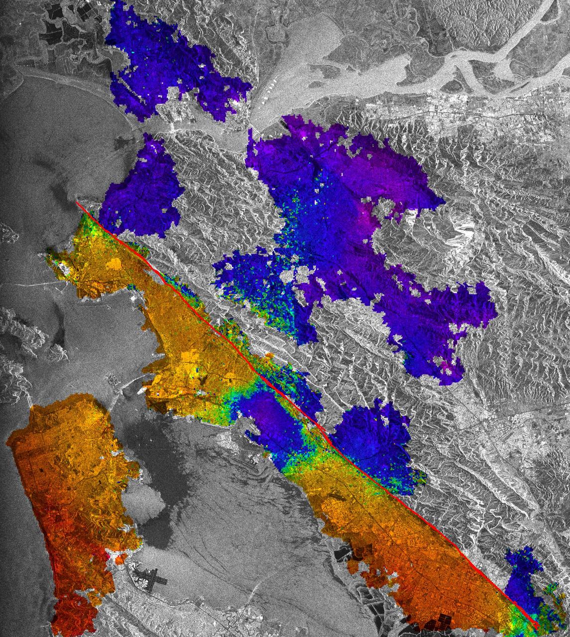
This image of California Hayward fault is an interferogram created using a pair of images taken by ESA ERS-1 and ERS-2 in June 1992 and September 1997 over the central San Francisco Bay in California.

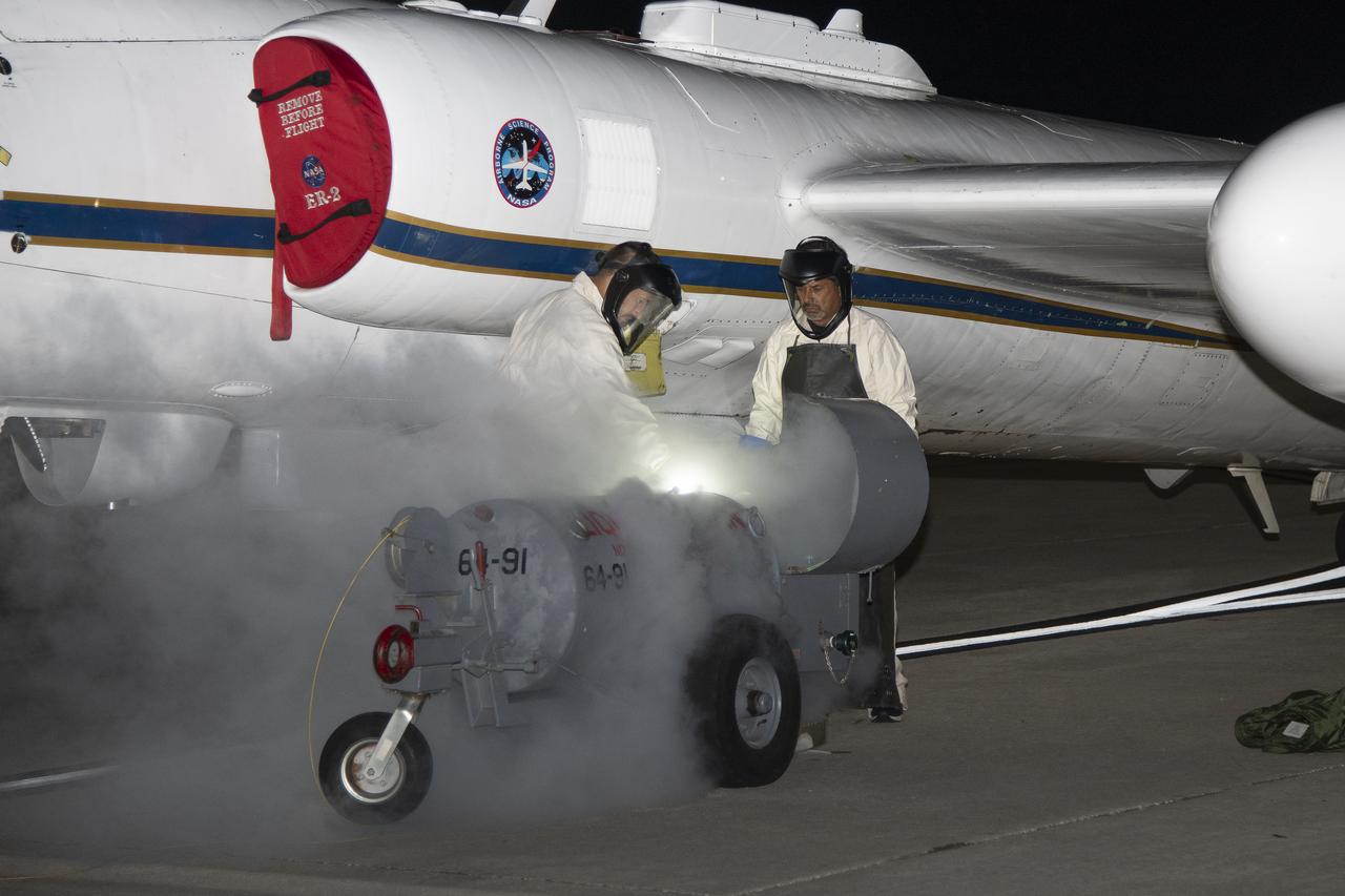
ER-2 tail number 706, was one of two Airborne Science ER-2s used as science platforms by Dryden. The aircraft were platforms for a variety of high-altitude science missions flown over various parts of the world. They were also used for earth science and atmospheric sensor research and development, satellite calibration and data validation.

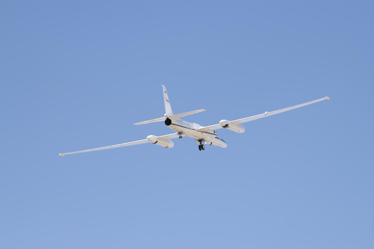
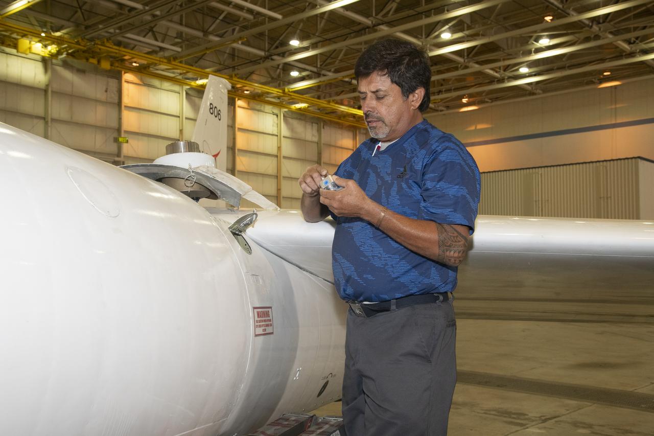
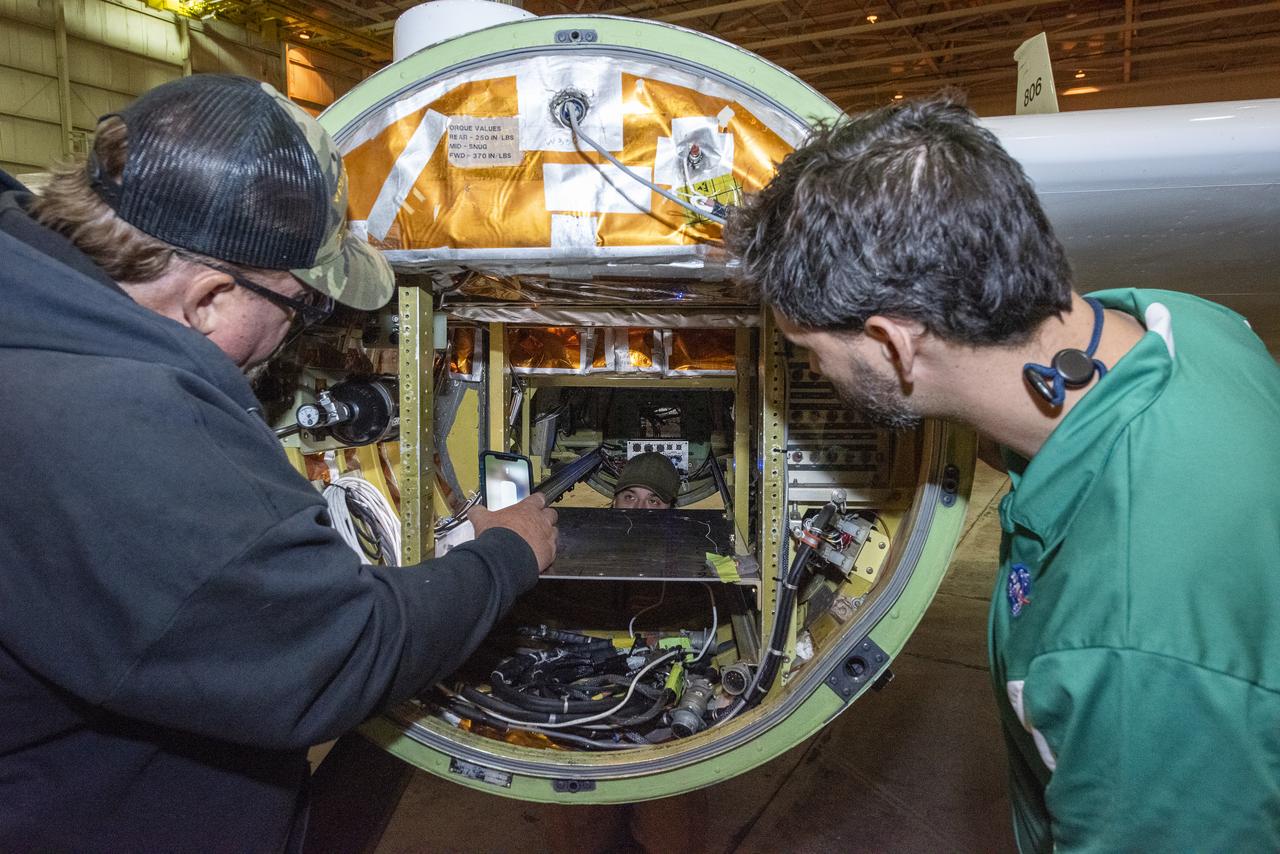
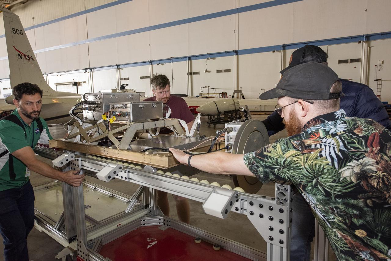
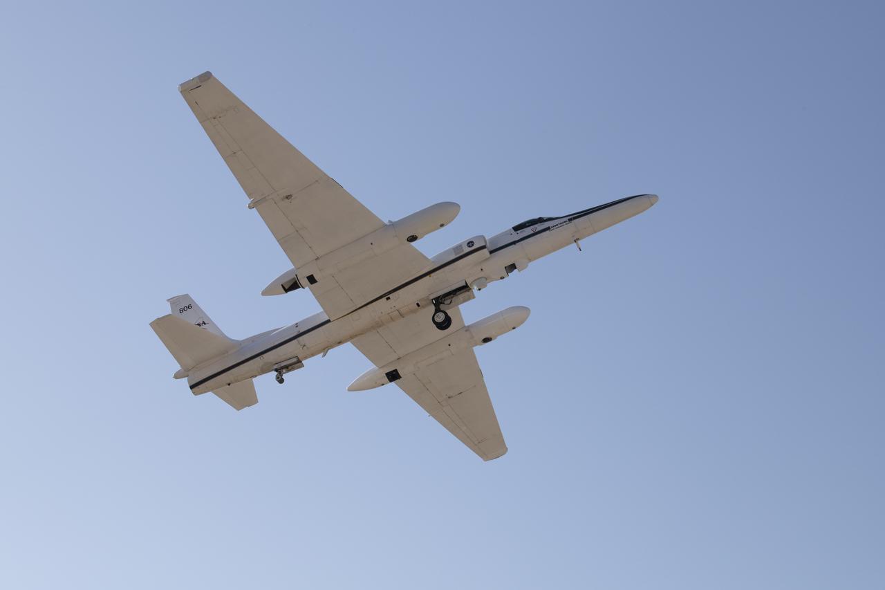
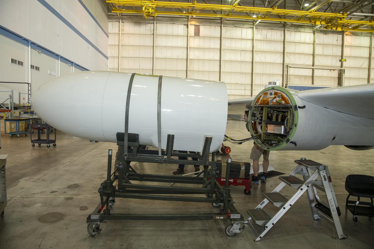
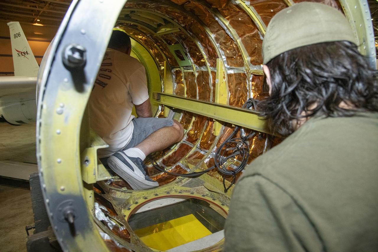
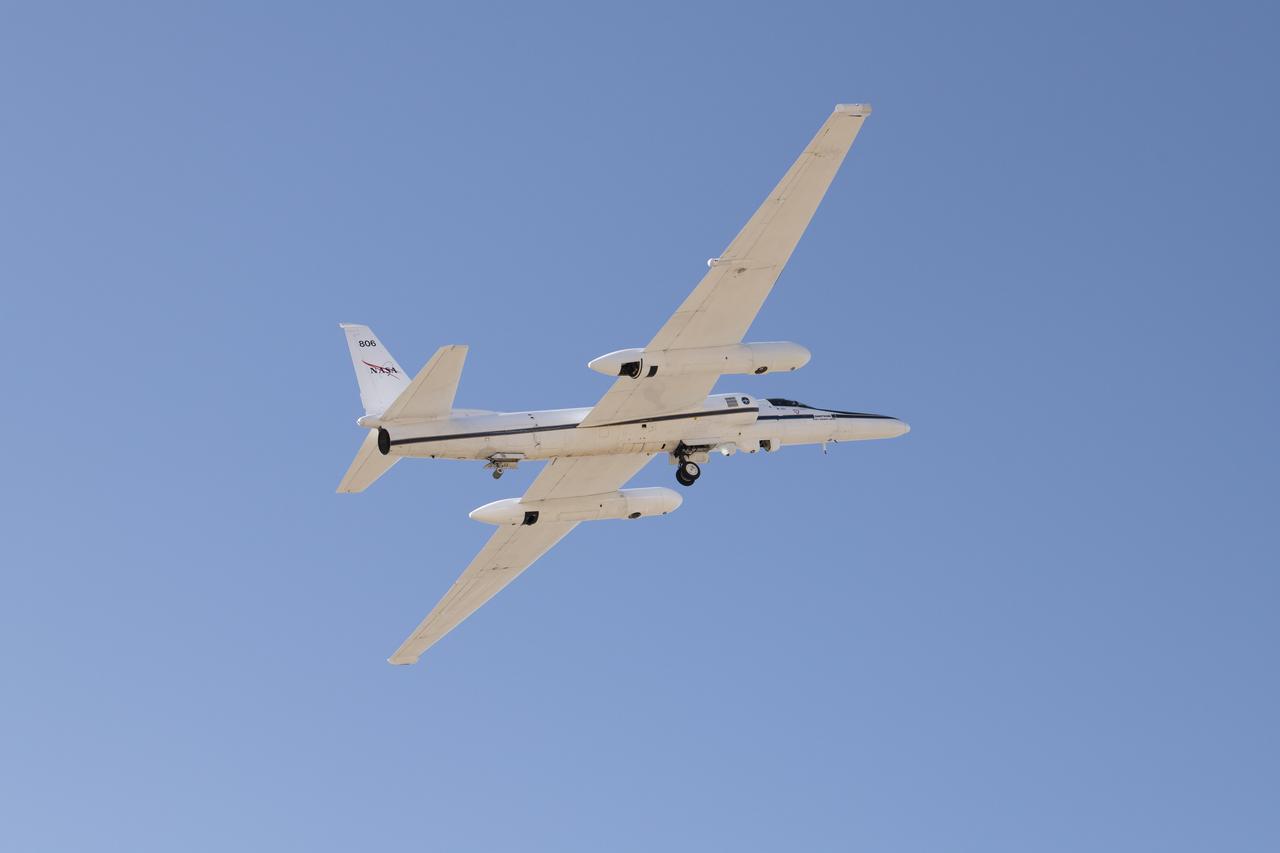
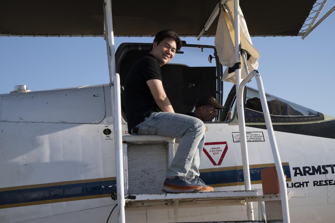
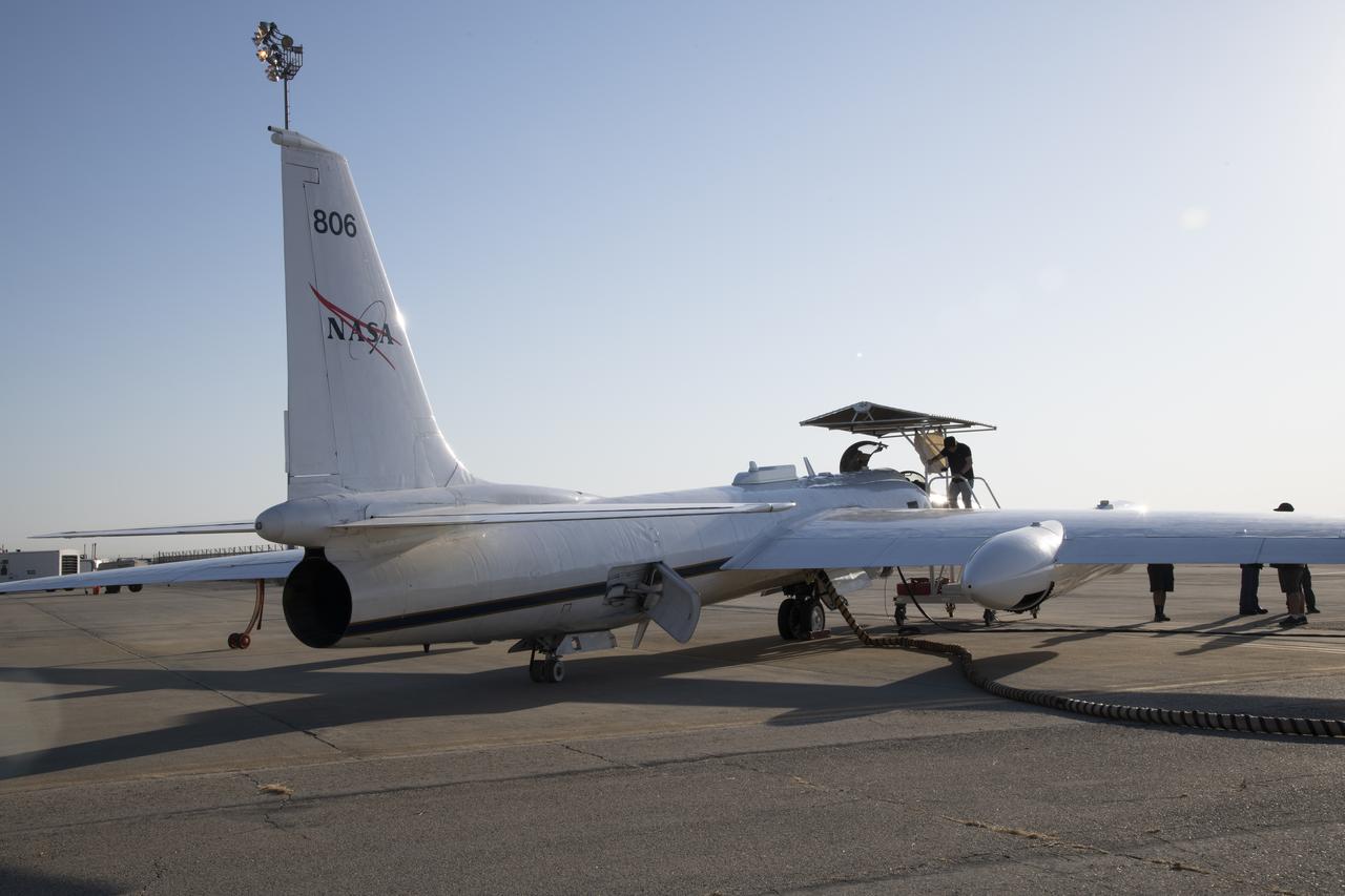
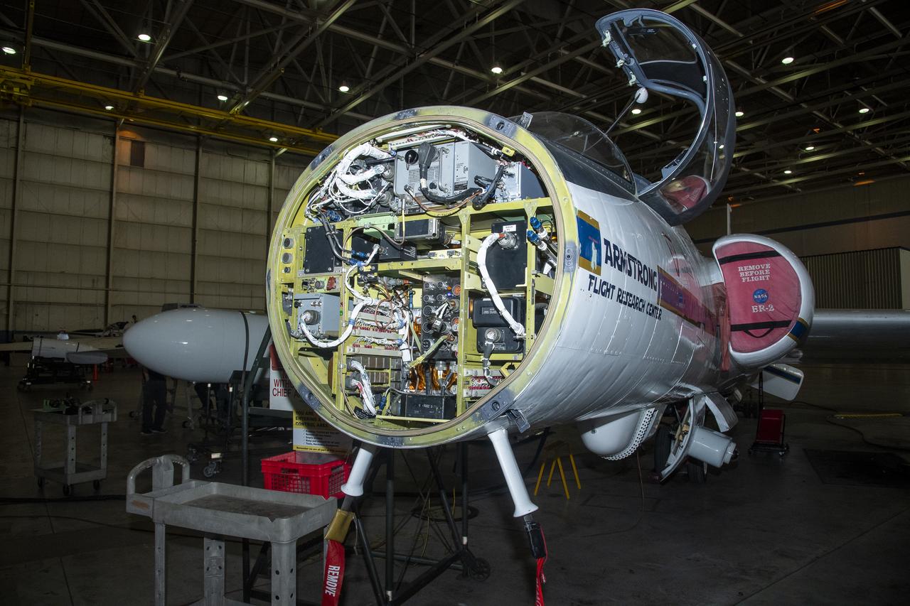
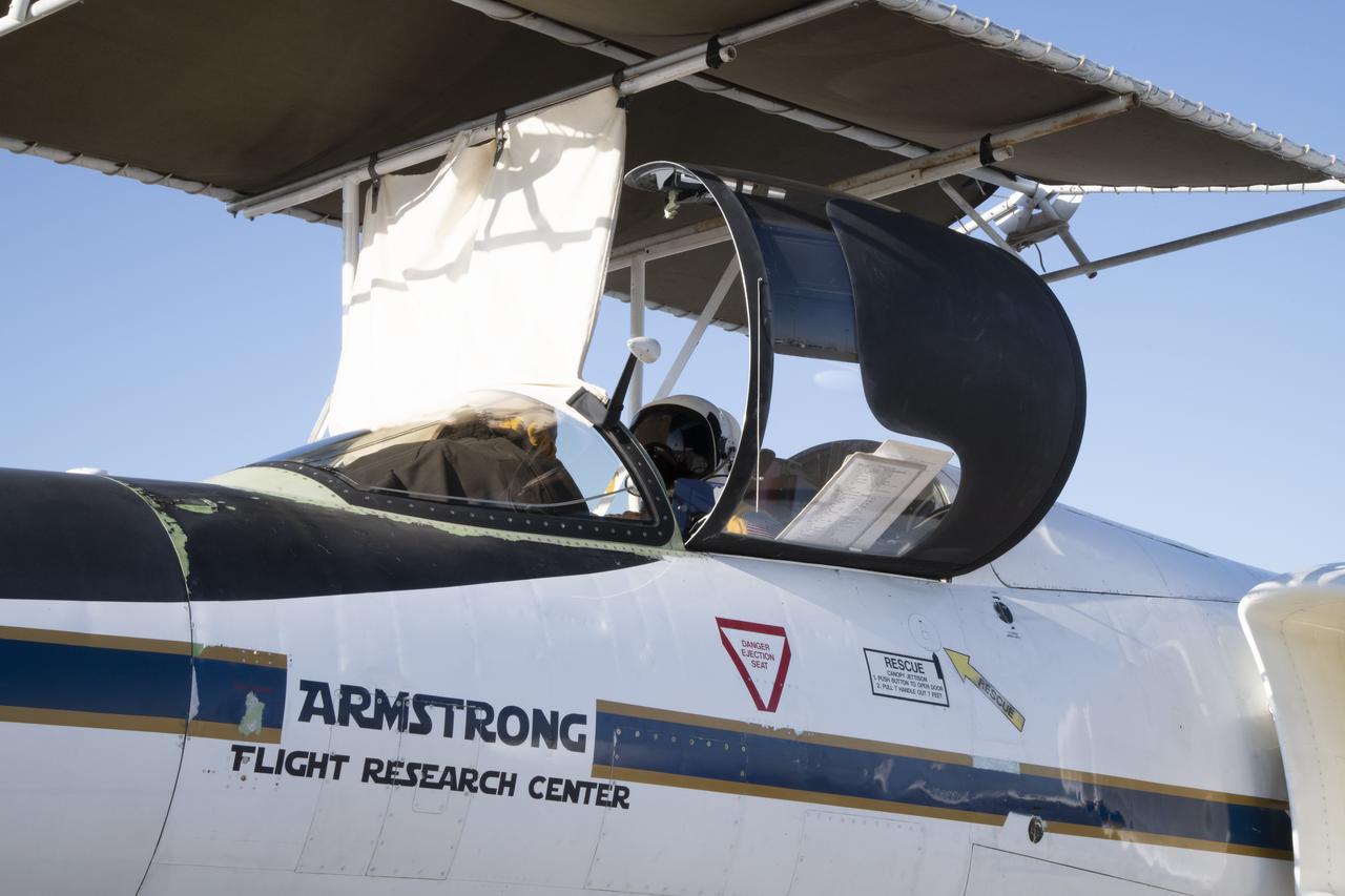
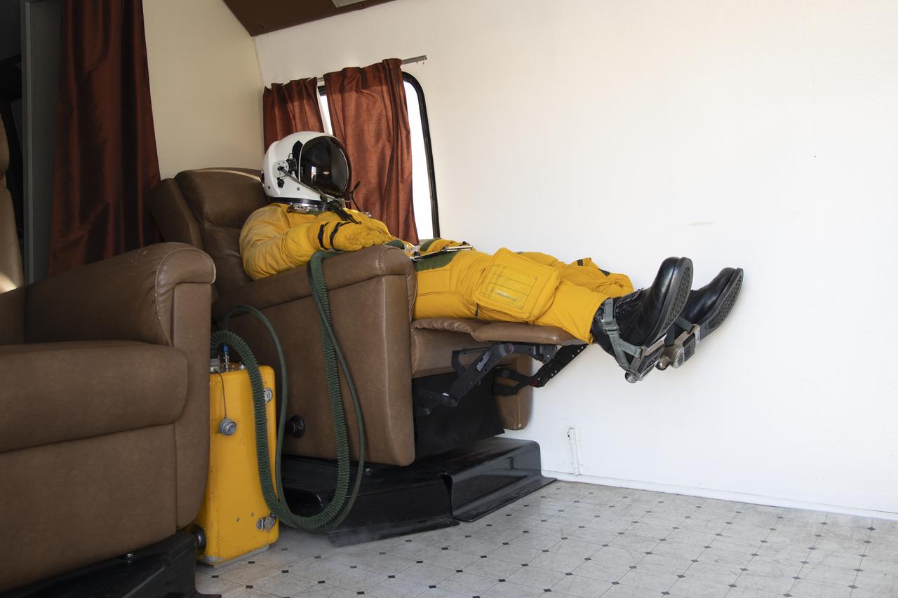
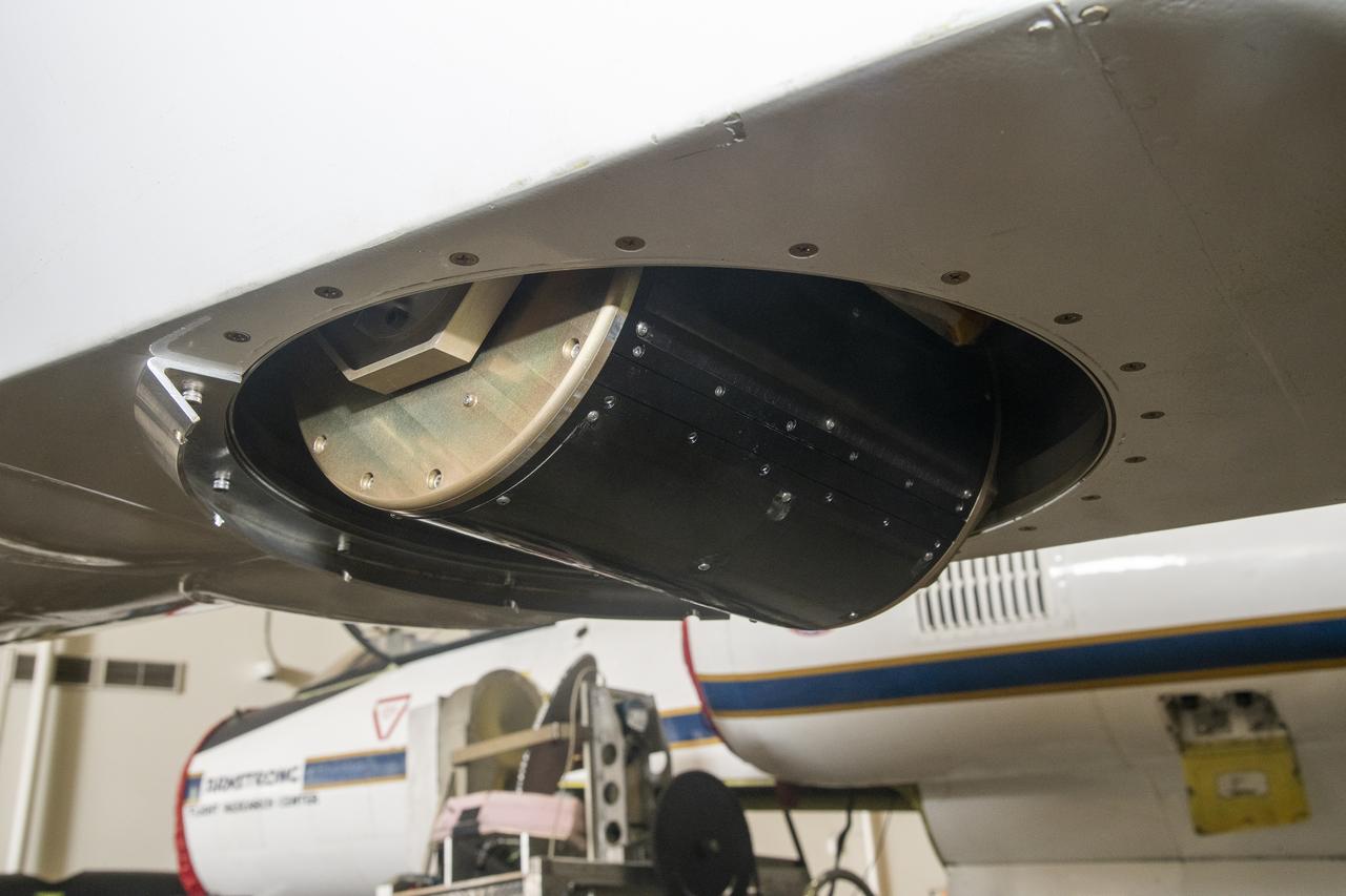
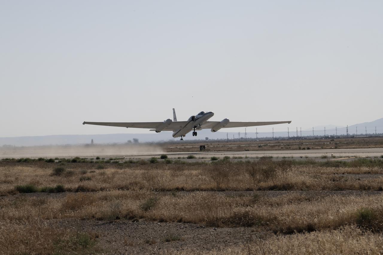
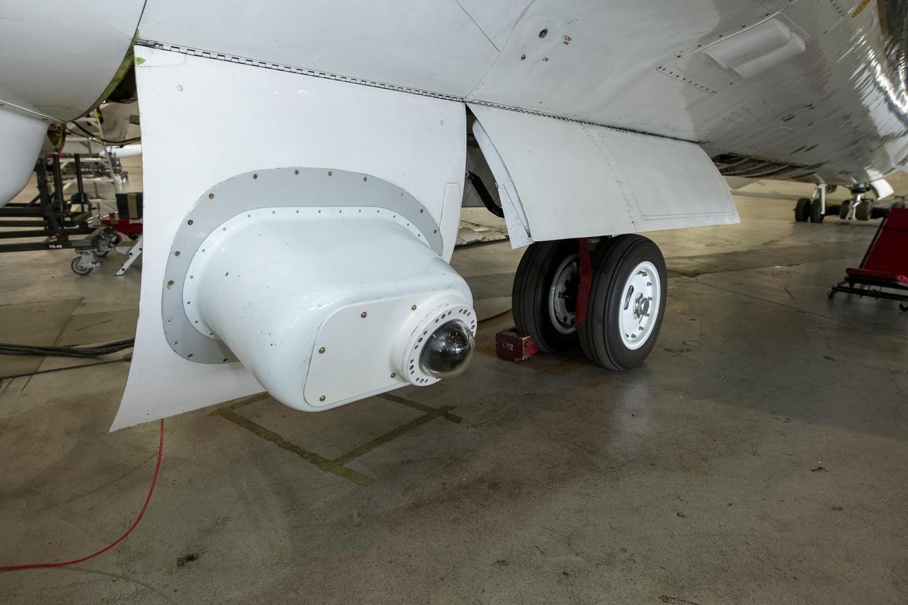
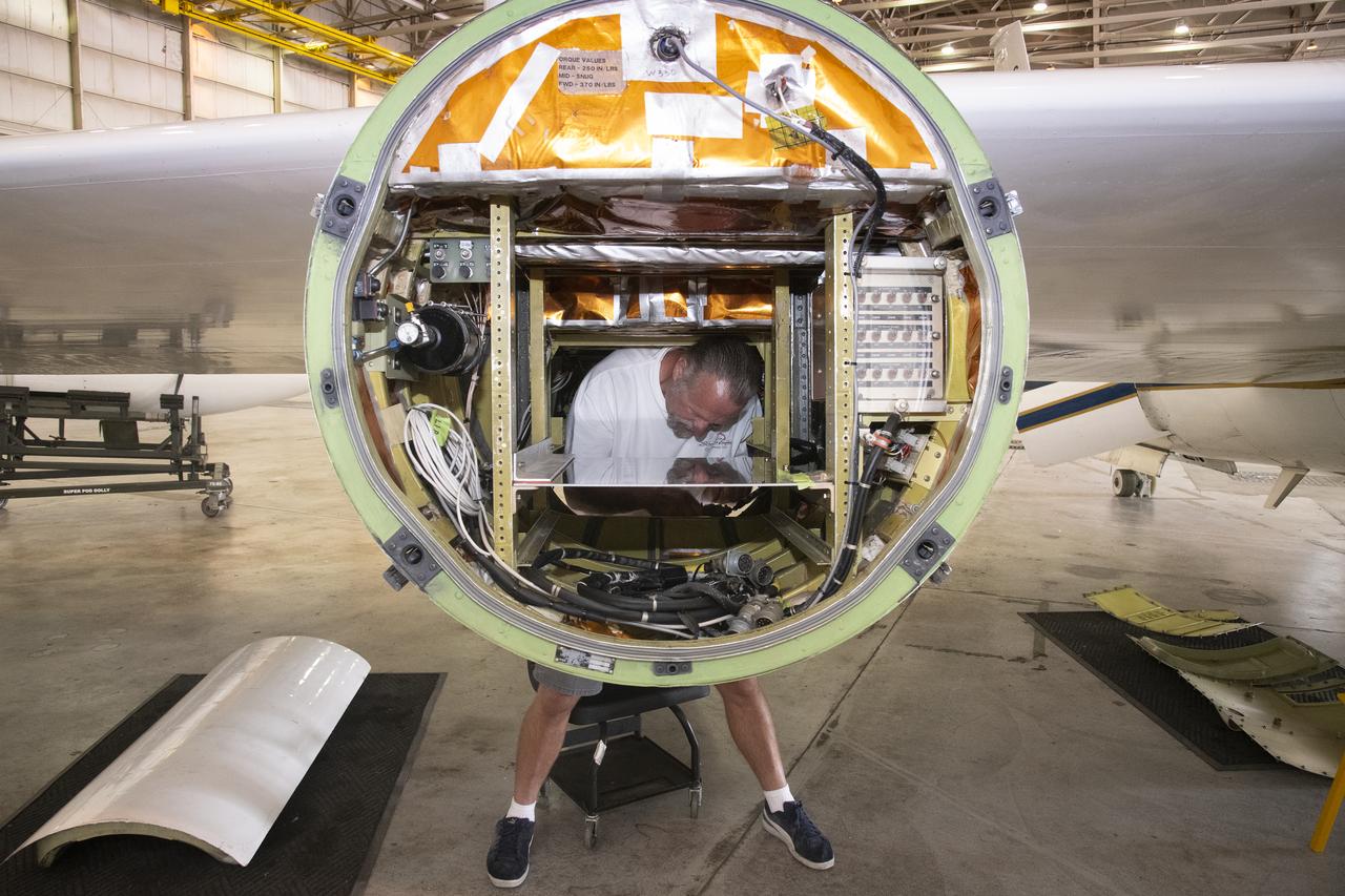
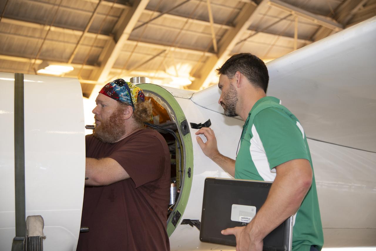
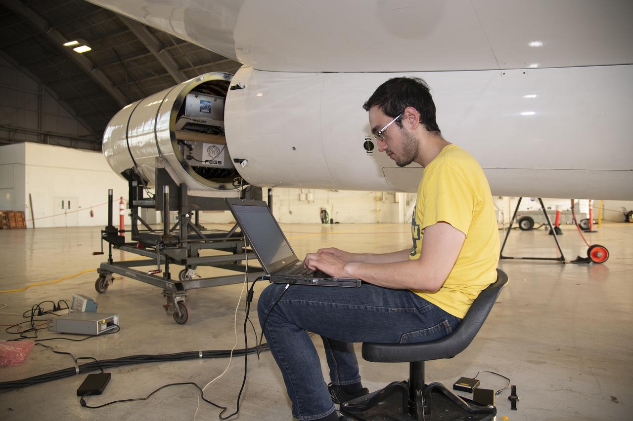
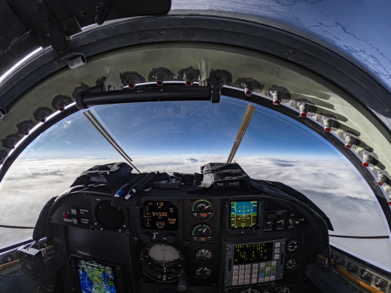
ER-2 tail number 806, is one of two Airborne Science ER-2s used as science platforms by Dryden. The aircraft are platforms for a variety of high-altitude science missions flown over various parts of the world. They are also used for earth science and atmospheric sensor research and development, satellite calibration and data validation. The ER-2s are capable of carrying a maximum payload of 2,600 pounds of experiments in a nose bay, the main equipment bay behind the cockpit, two wing-mounted superpods and small underbody and trailing edges. Most ER-2 missions last about six hours with ranges of about 2,200 nautical miles. The aircraft typically fly at altitudes above 65,000 feet. On November 19, 1998, the ER-2 set a world record for medium weight aircraft reaching an altitude of 68,700 feet. The aircraft is 63 feet long, with a wingspan of 104 feet. The top of the vertical tail is 16 feet above ground when the aircraft is on the bicycle-type landing gear. Cruising speeds are 410 knots, or 467 miles per hour, at altitude. A single General Electric F-118 turbofan engine rated at 17,000 pounds thrust powers the ER-2.
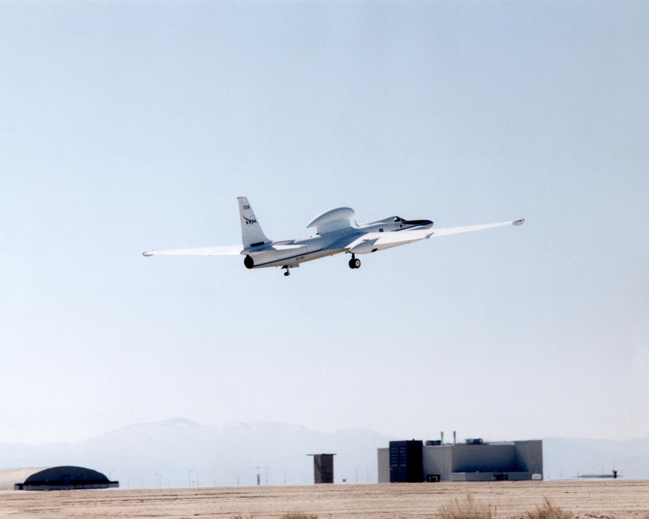
ER-2 tail number 709, was one of two Airborne Science ER-2s used as science platforms by Dryden. The aircraft were platforms for a variety of high-altitude science missions flown over various parts of the world. They were also used for earth science and atmospheric sensor research and development, satellite calibration and data validation.

ER-2 tail number 806, is one of two Airborne Science ER-2s used as science platforms by Dryden. The aircraft are platforms for a variety of high-altitude science missions flown over various parts of the world. They are also used for earth science and atmospheric sensor research and development, satellite calibration and data validation. The ER-2s are capable of carrying a maximum payload of 2,600 pounds of experiments in a nose bay, the main equipment bay behind the cockpit, two wing-mounted superpods and small underbody and trailing edges. Most ER-2 missions last about six hours with ranges of about 2,200 nautical miles. The aircraft typically fly at altitudes above 65,000 feet. On November 19, 1998, the ER-2 set a world record for medium weight aircraft reaching an altitude of 68,700 feet. The aircraft is 63 feet long, with a wingspan of 104 feet. The top of the vertical tail is 16 feet above ground when the aircraft is on the bicycle-type landing gear. Cruising speeds are 410 knots, or 467 miles per hour, at altitude. A single General Electric F-118 turbofan engine rated at 17,000 pounds thrust powers the ER-2.
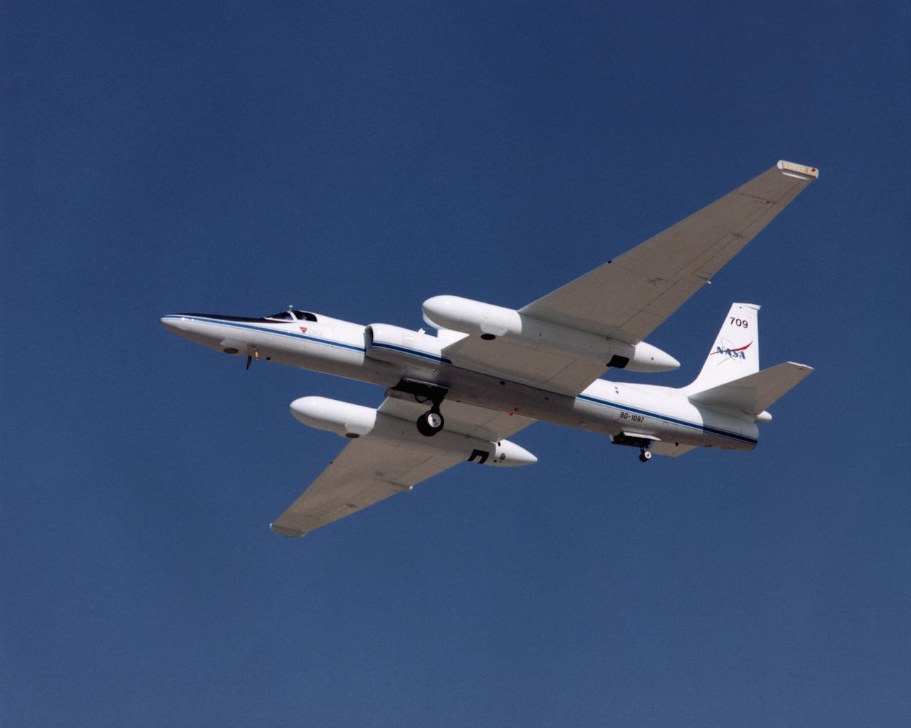
ER-2 tail number 709, was one of two Airborne Science ER-2s used as science platforms by Dryden. The aircraft were platforms for a variety of high-altitude science missions flown over various parts of the world. They were also used for earth science and atmospheric sensor research and development, satellite calibration and data validation.

ER-2 tail number 806, is one of two Airborne Science ER-2s used as science platforms by Dryden. The aircraft are platforms for a variety of high-altitude science missions flown over various parts of the world. They are also used for earth science and atmospheric sensor research and development, satellite calibration and data validation. The ER-2s are capable of carrying a maximum payload of 2,600 pounds of experiments in a nose bay, the main equipment bay behind the cockpit, two wing-mounted superpods and small underbody and trailing edges. Most ER-2 missions last about six hours with ranges of about 2,200 nautical miles. The aircraft typically fly at altitudes above 65,000 feet. On November 19, 1998, the ER-2 set a world record for medium weight aircraft reaching an altitude of 68,700 feet. The aircraft is 63 feet long, with a wingspan of 104 feet. The top of the vertical tail is 16 feet above ground when the aircraft is on the bicycle-type landing gear. Cruising speeds are 410 knots, or 467 miles per hour, at altitude. A single General Electric F-118 turbofan engine rated at 17,000 pounds thrust powers the ER-2.
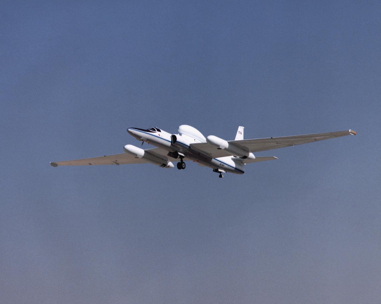
ER-2 tail number 709, was one of two Airborne Science ER-2s used as science platforms by Dryden. The aircraft were platforms for a variety of high-altitude science missions flown over various parts of the world. They were also used for earth science and atmospheric sensor research and development, satellite calibration and data validation.
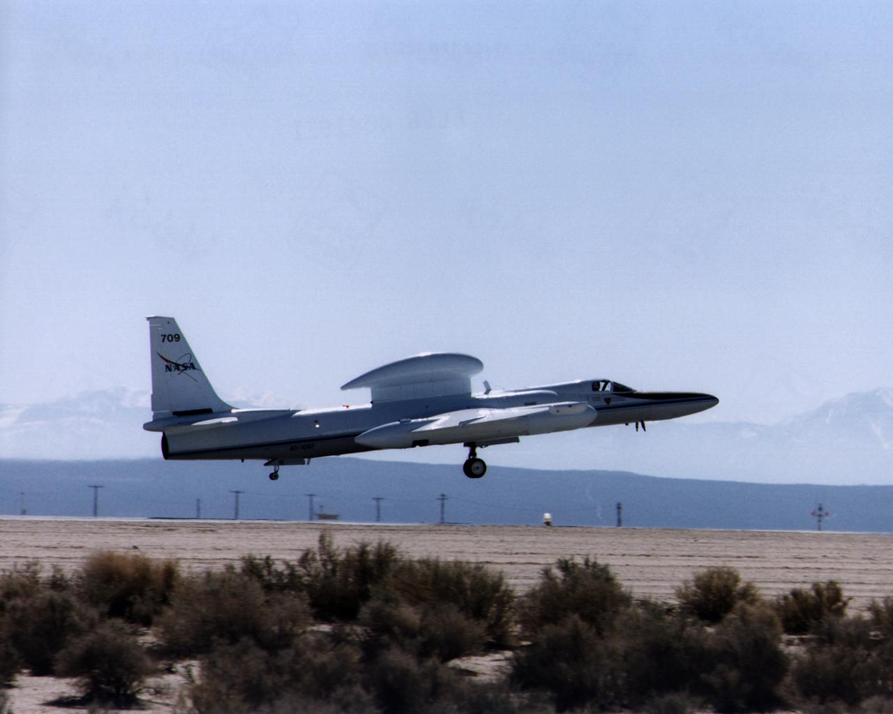
ER-2 tail number 709, was one of two Airborne Science ER-2s used as science platforms by Dryden. The aircraft were platforms for a variety of high-altitude science missions flown over various parts of the world. They were also used for earth science and atmospheric sensor research and development, satellite calibration and data validation.

ER-2 tail number 706, was one of two Airborne Science ER-2s used as science platforms by Dryden. The aircraft were platforms for a variety of high-altitude science missions flown over various parts of the world. They were also used for earth science and atmospheric sensor research and development, satellite calibration and data validation.
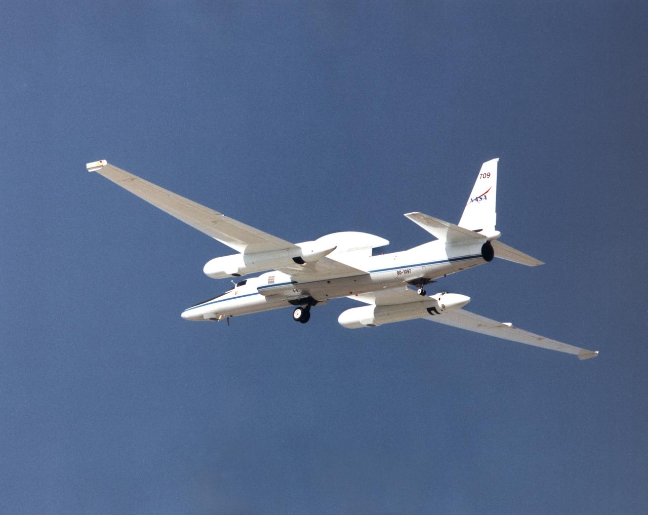
ER-2 tail number 709, was one of two Airborne Science ER-2s used as science platforms by Dryden. The aircraft were platforms for a variety of high-altitude science missions flown over various parts of the world. They were also used for earth science and atmospheric sensor research and development, satellite calibration and data validation.
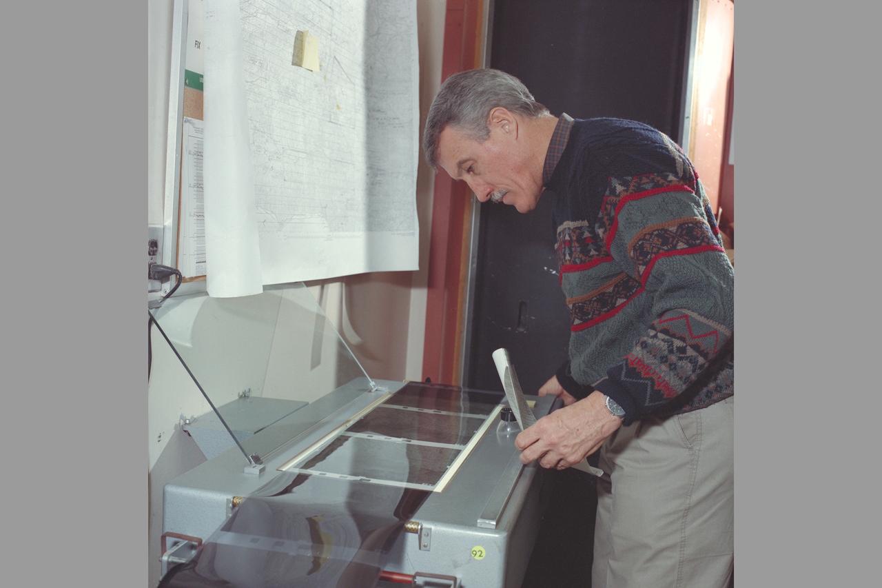
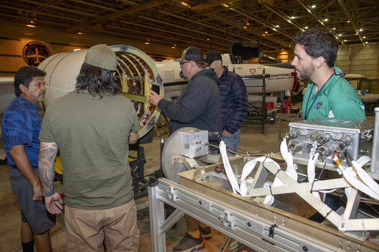
Bruce Coffland Coordinates ER-2 image print processing with Imaging Technology Branch
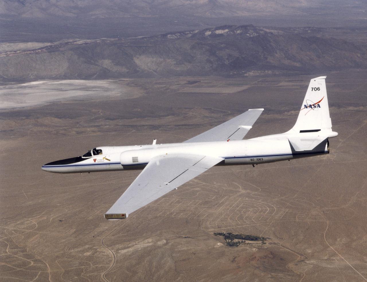
ER-2 tail number 706, was one of two Airborne Science ER-2s used as science platforms by Dryden. The aircraft were platforms for a variety of high-altitude science missions flown over various parts of the world. They were also used for earth science and atmospheric sensor research and development, satellite calibration and data validation.
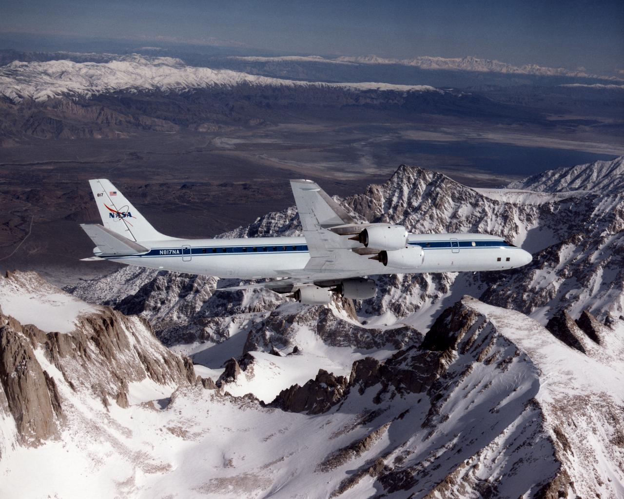
The DC-8 banking over the jagged peak of Mount Whitney on a February 25, 1998 flight. The DC-8 and a pair of ER-2 aircraft are operated by the Airborne Science program at the NASA Dryden Flight Research Center. NASA, other governmental agencies, academia, and scientific and technical organizations employ the DC-8 for a variety of experiments.
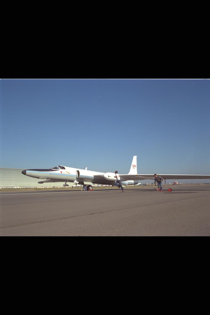
ER-2 (NASA 706) landing, image show wing wheels being placed by landing crew.

Moffett Federal Air Field, NASA Ames Research Center and Silicon Valley image from ER-2, 04387 FR#9904 (March 11, 1992) IR (Infrered) image.

Moffett Federal Air Field, NASA Ames Research Center and Silicon Valley image from ER-2, 04387 FR#9904 (March 11, 1992) IR (Infrered) image.

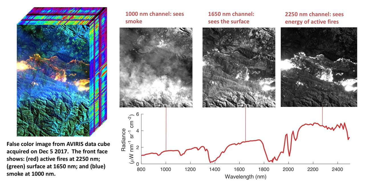
NASA's Airborne Visible Infrared Imaging Spectrometer instrument (AVIRIS), flying aboard a NASA Armstrong Flight Research Center high-altitude ER-2 aircraft, observed wildfires burning in Southern California on Dec. 5-7, 2017. AVIRIS is an imaging spectrometer that observes light in visible and infrared wavelengths, measuring the full spectrum of radiated energy. Unlike regular cameras with three colors, AVIRIS has 224 spectral channels, measuring contiguously from the visible through the shortwave infrared. Data from these flights, compared against measurements acquired earlier in the year, show many ways this one instrument can improve both our understanding of fire risk and the response to fires in progress. The top row in this image compilation shows pre-fire data acquired from June 2017. At top left is a visible-wavelength image similar to what our own eyes would see. The top middle image is a map of surface composition based on analyzing the full electromagnetic spectrum, revealing green vegetated areas and non-photosynthetic vegetation that is potential fuel as well as non-vegetated surfaces that may slow an advancing fire. The image at top right is a remote measurement of the water in tree canopies, a proxy for how much moisture is in the vegetation. The bottom row in the compilation shows data acquired from the Thomas fire in progress in December 2017. At bottom left is a visible wavelength image. The bottom middle image is an infrared image, with red at 2,250 nanometers showing fire energy, green at 1,650 nanometers showing the surface through the smoke, and blue at 1,000 nanometers showing the smoke itself. The image at bottom right is a fire temperature map using spectroscopic analysis to measure fire thermal emission recorded in the AVIRIS spectra. https://photojournal.jpl.nasa.gov/catalog/PIA22194
NASA's Airborne Visible Infrared Imaging Spectrometer instrument (AVIRIS), flying aboard a NASA Armstrong Flight Research Center high-altitude ER-2 aircraft, flew over the wildfires burning in Southern California on Dec. 5, 2017 and acquired this false-color image. Active fires are visible in red, ground surfaces are in green and smoke is in blue. AVIRIS is an imaging spectrometer that observes light in visible and infrared wavelengths, measuring the full spectrum of radiated energy. Unlike regular cameras with three colors, AVIRIS has 224 spectral channels from the visible through the shortwave infrared. This permits mapping of fire temperatures, fractional coverage, and surface properties, including how much fuel is available for a fire. Spectroscopy is also valuable for characterizing forest drought conditions and health to assess fire risk. AVIRIS has been observing fire-prone areas in Southern California for many years, forming a growing time series of before/after data cubes. These data are helping improve scientific understanding of fire risk and how ecosystems respond to drought and fire. https://photojournal.jpl.nasa.gov/catalog/PIA11243
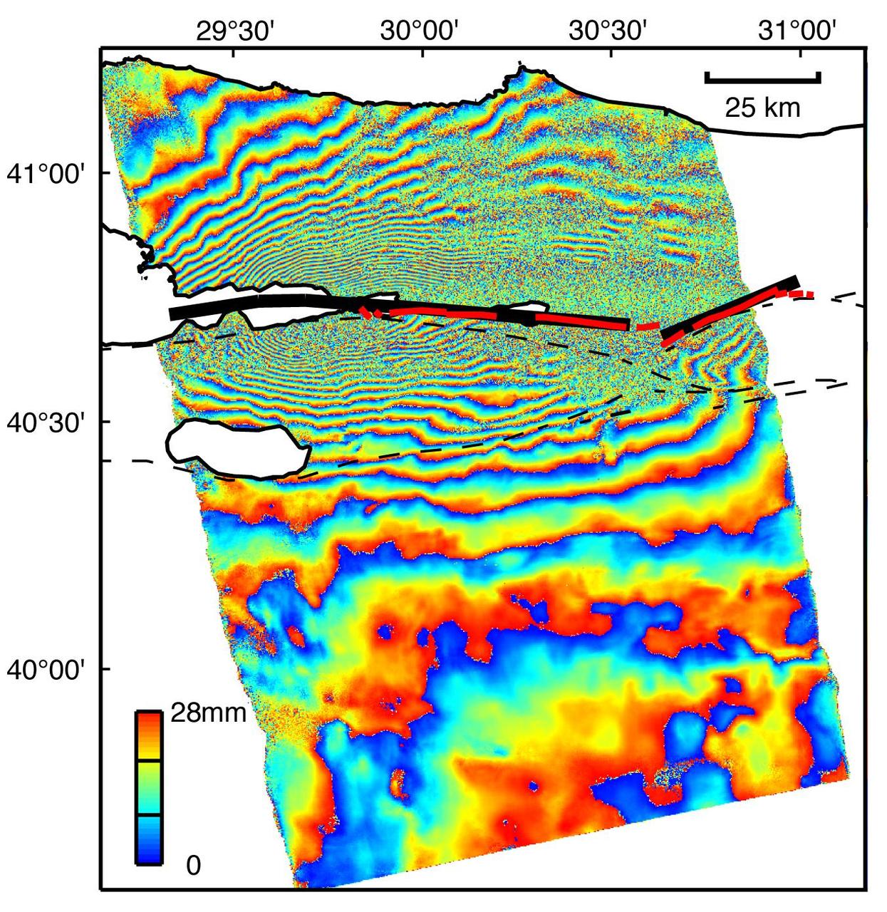
This image is an interferogram that was created using pairs of images taken by Synthetic Aperture Radar (SAR). The images, acquired at two different times, have been combined to measure surface deformation or changes that may have occurred during the time between data acquisition. The images were collected by the European Space Agency's Remote Sensing satellite (ERS-2) on 13 August 1999 and 17 September 1999 and were combined to produce these image maps of the apparent surface deformation, or changes, during and after the 17 August 1999 Izmit, Turkey earthquake. This magnitude 7.6 earthquake was the largest in 60 years in Turkey and caused extensive damage and loss of life. Each of the color contours of the interferogram represents 28 mm (1.1 inches) of motion towards the satellite, or about 70 mm (2.8 inches) of horizontal motion. White areas are outside the SAR image or water of seas and lakes. The North Anatolian Fault that broke during the Izmit earthquake moved more than 2.5 meters (8.1 feet) to produce the pattern measured by the interferogram. Thin red lines show the locations of fault breaks mapped on the surface. The SAR interferogram shows that the deformation and fault slip extended west of the surface faults, underneath the Gulf of Izmit. Thick black lines mark the fault rupture inferred from the SAR data. Scientists are using the SAR interferometry along with other data collected on the ground to estimate the pattern of slip that occurred during the Izmit earthquake. This then used to improve computer models that predict how this deformation transferred stress to other faults and to the continuation of the North Anatolian Fault, which extends to the west past the large city of Istanbul. These models show that the Izmit earthquake further increased the already high probability of a major earthquake near Istanbul. http://photojournal.jpl.nasa.gov/catalog/PIA00557
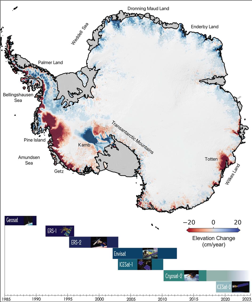
This map of Antarctica shows the changes in the elevation of the Antarctic ice sheet from 1985 through 2021. The map is part of a study, published in Earth System Science Data, conducted by researchers at NASA's Jet Propulsion Laboratory in Southern California. Ice height diminishes (shown in red) as the ice sheet melts by contact with ocean water; ice height rises (shown in blue) where accumulation exceeds ice loss. Ice shelves are shown in gray. The Pine Island and Thwaites glaciers in West Antarctica (the dark red spots on the left side of the map) are the largest areas of rapid ice loss. The stagnant Kamb Ice Stream (the dark blue area at middle-left) is the only major site of rapid accumulation as ice continues to push in from the interior but no longer flows out to an ice shelf. The image summarizes a new data set of monthly high-resolution "snapshots" of ice change. The satellite altimetry missions that supplied data for the study are listed in the timeline at the bottom of the image: Geosat (U.S. Navy), ERS-1 and ERS-2 (ESA, or European Space Agency), Envisat (ESA), ICESat-1 (NASA), Cryosat-2 (ESA), and ICESat-2 (NASA). https://photojournal.jpl.nasa.gov/catalog/PIA24990
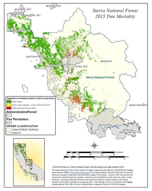
California, reveals the devastating effect of California's ongoing drought on Sierra Nevada conifer forests. The map will be used to help the U.S. Forest Service assess and respond to the impacts of increased tree mortality caused by the drought, particularly where wildlands meet urban areas within the Sierra National Forest. After several years of extreme drought, the highly stressed conifers (trees or bushes that produce cones and are usually green year-round) of the Sierra Nevada are now more susceptible to bark beetles (Dendroctonus spp.). While bark beetles killing trees in the Sierra Nevada is a natural phenomenon, the scale of mortality in the last couple of years is far greater than previously observed. The U.S. Forest Service is using recent airborne spectroscopic measurements from NASA's Airborne Visible/Infrared Imaging Spectrometer (AVIRIS) instrument aboard NASA's ER-2 aircraft, together with new advanced algorithms, to quantify this impact over this large region of rugged terrain. The high-altitude ER-2 aircraft is based at NASA's Armstrong Flight Research Center, Edwards, California. The image was created by scientists at the USFS's Pacific Southwest Region Remote Sensing Lab, McClellan, California, by performing a time series analysis of AVIRIS images. Scientists evaluated baseline tree mortality on public lands in the summer of 2015 using a machine learning algorithm called "random forest." This algorithm classifies the AVIRIS measurements as dominated by either shrubs, healthy trees or newly dead conifer trees. To quantify how much the amount of dead vegetation increased during the fall of 2015, the Forest Service scientists conducted an advanced spectral mixture analysis. This analysis evaluates each spectrum to determine the fraction of green vegetation, dead vegetation and soil. The full spectral range of AVIRIS is important to separate the signatures of soil and dead vegetation. To produce this comprehensive Sierra National Forest tree mortality map, the result from the summer of 2015 was evaluated to look for increases of more than 10 percent in dead vegetation during the fall of 2015. AVIRIS measures spectra of the Earth system to conduct advanced science research. These western U.S. AVIRIS measurements were acquired as part of NASA's Hyperspectral Infrared Imager (HyspIRI) preparatory airborne campaign. HyspIRI was one of the space missions suggested to NASA by the National Academy of Sciences in its 2007 decadal survey for Earth Science. In the future, HyspIRI could provide spectral and thermal measurements of this type globally for ecosystem research and additional science objectives. http://photojournal.jpl.nasa.gov/catalog/PIA20717
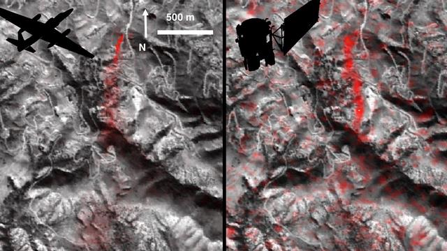
Atmospheric methane is a potent greenhouse gas, but the percentage of it produced through human activities is still poorly understood. Future instruments on orbiting satellites can help address this issue by surveying human-produced methane emissions. Recent data from the Aliso Canyon event, a large accidental methane release near Porter Ranch, California, demonstrates this capability. The Hyperion imaging spectrometer onboard NASA's EO-1 satellite successfully detected this release event on three different overpasses during the winter of 2015-2016. This is the first time the methane plume from a single facility has been observed from space. The orbital observations were consistent with airborne measurements. This image pair shows a comparison of detected methane plumes over Aliso Canyon, California, acquired 11 days apart in Jan. 2016 by: (left) NASA's AVIRIS instrument on a NASA ER-2 aircraft at 4.1 miles (6.6 kilometers) altitude and (right) by the Hyperion instrument on NASA's Earth Observing-1 satellite in low-Earth orbit. The additional red streaks visible in the EO-1 Hyperion image result from measurement noise -- Hyperion was not specifically designed for methane sensing and is not as sensitive as AVIRIS-NG. Additionally, the EO-1 satellite's current orbit provided poor illumination conditions. Future instruments with much greater sensitivity on orbiting satellites can survey the biggest sources of human-produced methane around the world. http://photojournal.jpl.nasa.gov/catalog/PIA20716
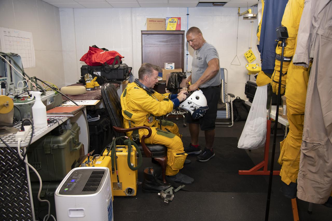
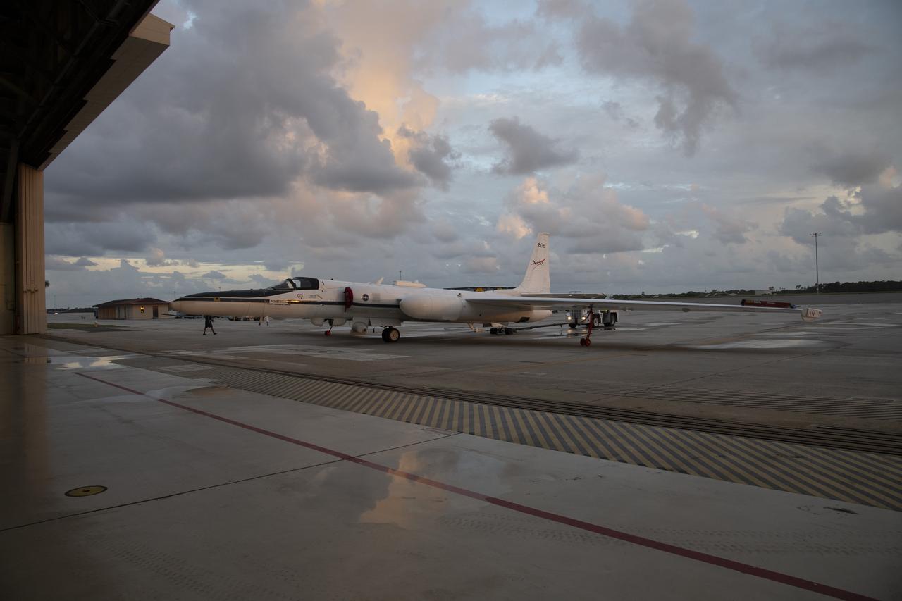
NASA Armstrong’s ER-2 aircraft deploys for its ALOFT mission. The ER-2 will fly at high altitudes above the Floridian coastline to collect data about the energetic characteristics and behavior of lightning and thunderclouds. A NASA pilot will operate the aircraft while scientists from the University of Bergen, Norway will interpret the data from the ground.
NASA Armstrong’s ER-2 aircraft is uploaded with instruments for its ALOFT mission. The ER-2 will fly at high altitudes above the Floridian coastline to collect data about the energetic characteristics and behavior of lightning and thunderclouds. Scientists from the University of Bergen, Norway will interpret that data from the ground and collaborate with NASA pilots to safely collect the most accurate data for this project about the power of lightning.
NASA Armstrong’s ER-2 aircraft is uploaded with instruments for its ALOFT mission. The ER-2 will fly at high altitudes above the Floridian coastline to collect data about the energetic characteristics and behavior of lightning and thunderclouds. Scientists from the University of Bergen, Norway will interpret that data from the ground and collaborate with NASA pilots to safely collect the most accurate data for this project about the power of lightning.
NASA Armstrong’s ER-2 aircraft is uploaded with instruments for its ALOFT mission. The ER-2 will fly at high altitudes above the Floridian coastline to collect data about the energetic characteristics and behavior of lightning and thunderclouds. Scientists from the University of Bergen, Norway will interpret that data from the ground and collaborate with NASA pilots to safely collect the most accurate data for this project about the power of lightning.
NASA Armstrong’s ER-2 aircraft is uploaded with instruments for its ALOFT mission. The ER-2 will fly at high altitudes above the Floridian coastline to collect data about the energetic characteristics and behavior of lightning and thunderclouds. Scientists from the University of Bergen, Norway will interpret that data from the ground and collaborate with NASA pilots to safely collect the most accurate data for this project about the power of lightning.
NASA Armstrong’s ER-2 aircraft is uploaded with instruments for its ALOFT mission. The ER-2 will fly at high altitudes above the Floridian coastline to collect data about the energetic characteristics and behavior of lightning and thunderclouds. Scientists from the University of Bergen, Norway will interpret that data from the ground and collaborate with NASA pilots to safely collect the most accurate data for this project about the power of lightning.
NASA Armstrong’s ER-2 aircraft is uploaded with instruments for its ALOFT mission. The ER-2 will fly at high altitudes above the Floridian coastline to collect data about the energetic characteristics and behavior of lightning and thunderclouds. Scientists from the University of Bergen, Norway will interpret that data from the ground and collaborate with NASA pilots to safely collect the most accurate data for this project about the power of lightning.
NASA Armstrong’s ER-2 aircraft deploys for its ALOFT mission. The ER-2 will fly at high altitudes above the Floridian coastline to collect data about the energetic characteristics and behavior of lightning and thunderclouds. A NASA pilot will operate the aircraft while scientists from the University of Bergen, Norway will interpret the data from the ground.
NASA Armstrong’s ER-2 aircraft is uploaded with instruments for its ALOFT mission. The ER-2 will fly at high altitudes above the Floridian coastline to collect data about the energetic characteristics and behavior of lightning and thunderclouds. Scientists from the University of Bergen, Norway will interpret that data from the ground and collaborate with NASA pilots to safely collect the most accurate data for this project about the power of lightning.
NASA Armstrong’s ER-2 aircraft is uploaded with instruments for its ALOFT mission. The ER-2 will fly at high altitudes above the Floridian coastline to collect data about the energetic characteristics and behavior of lightning and thunderclouds. Scientists from the University of Bergen, Norway will interpret that data from the ground and collaborate with NASA pilots to safely collect the most accurate data for this project about the power of lightning.

NASA Armstrong’s ER-2 aircraft is uploaded with instruments for its ALOFT mission. The ER-2 will fly at high altitudes above the Floridian coastline to collect data about the energetic characteristics and behavior of lightning and thunderclouds. Scientists from the University of Bergen, Norway will interpret that data from the ground and collaborate with NASA pilots to safely collect the most accurate data for this project about the power of lightning.
NASA Armstrong’s ER-2 aircraft is uploaded with instruments for its ALOFT mission. The ER-2 will fly at high altitudes above the Floridian coastline to collect data about the energetic characteristics and behavior of lightning and thunderclouds. Scientists from the University of Bergen, Norway will interpret that data from the ground and collaborate with NASA pilots to safely collect the most accurate data for this project about the power of lightning.
NASA Armstrong’s ER-2 aircraft deploys for its ALOFT mission. The ER-2 will fly at high altitudes above the Floridian coastline to collect data about the energetic characteristics and behavior of lightning and thunderclouds. A NASA pilot will operate the aircraft while scientists from the University of Bergen, Norway will interpret the data from the ground.
NASA Armstrong’s ER-2 aircraft deploys for its ALOFT mission. The ER-2 will fly at high altitudes above the Floridian coastline to collect data about the energetic characteristics and behavior of lightning and thunderclouds. A NASA pilot will operate the aircraft while scientists from the University of Bergen, Norway will interpret the data from the ground.
NASA Armstrong’s ER-2 aircraft is uploaded with instruments for its ALOFT mission. The ER-2 will fly at high altitudes above the Floridian coastline to collect data about the energetic characteristics and behavior of lightning and thunderclouds. Scientists from the University of Bergen, Norway will interpret that data from the ground and collaborate with NASA pilots to safely collect the most accurate data for this project about the power of lightning.
NASA Armstrong’s ER-2 aircraft is uploaded with instruments for its ALOFT mission. The ER-2 will fly at high altitudes above the Floridian coastline to collect data about the energetic characteristics and behavior of lightning and thunderclouds. Scientists from the University of Bergen, Norway will interpret that data from the ground and collaborate with NASA pilots to safely collect the most accurate data for this project about the power of lightning.
NASA Armstrong’s ER-2 aircraft deploys for its ALOFT mission. The ER-2 will fly at high altitudes above the Floridian coastline to collect data about the energetic characteristics and behavior of lightning and thunderclouds. A NASA pilot will operate the aircraft while scientists from the University of Bergen, Norway will interpret the data from the ground.
NASA Armstrong’s ER-2 aircraft is uploaded with instruments for its ALOFT mission. The ER-2 will fly at high altitudes above the Floridian coastline to collect data about the energetic characteristics and behavior of lightning and thunderclouds. Scientists from the University of Bergen, Norway will interpret that data from the ground and collaborate with NASA pilots to safely collect the most accurate data for this project about the power of lightning.
NASA Armstrong’s ER-2 aircraft deploys for its ALOFT mission. The ER-2 will fly at high altitudes above the Floridian coastline to collect data about the energetic characteristics and behavior of lightning and thunderclouds. A NASA pilot will operate the aircraft while scientists from the University of Bergen, Norway will interpret the data from the ground.
NASA Armstrong’s ER-2 aircraft deploys for its ALOFT mission. The ER-2 will fly at high altitudes above the Floridian coastline to collect data about the energetic characteristics and behavior of lightning and thunderclouds. A NASA pilot will operate the aircraft while scientists from the University of Bergen, Norway will interpret the data from the ground.
NASA Armstrong’s ER-2 aircraft is uploaded with instruments for its ALOFT mission. The ER-2 will fly at high altitudes above the Floridian coastline to collect data about the energetic characteristics and behavior of lightning and thunderclouds. Scientists from the University of Bergen, Norway will interpret that data from the ground and collaborate with NASA pilots to safely collect the most accurate data for this project about the power of lightning.
NASA Armstrong’s ER-2 aircraft deploys for its ALOFT mission. The ER-2 will fly at high altitudes above the Floridian coastline to collect data about the energetic characteristics and behavior of lightning and thunderclouds. A NASA pilot will operate the aircraft while scientists from the University of Bergen, Norway will interpret the data from the ground.
NASA Armstrong’s ER-2 aircraft is uploaded with instruments for its ALOFT mission. The ER-2 will fly at high altitudes above the Floridian coastline to collect data about the energetic characteristics and behavior of lightning and thunderclouds. Scientists from the University of Bergen, Norway will interpret that data from the ground and collaborate with NASA pilots to safely collect the most accurate data for this project about the power of lightning.
NASA Armstrong’s ER-2 aircraft is uploaded with instruments for its ALOFT mission. The ER-2 will fly at high altitudes above the Floridian coastline to collect data about the energetic characteristics and behavior of lightning and thunderclouds. Scientists from the University of Bergen, Norway will interpret that data from the ground and collaborate with NASA pilots to safely collect the most accurate data for this project about the power of lightning.

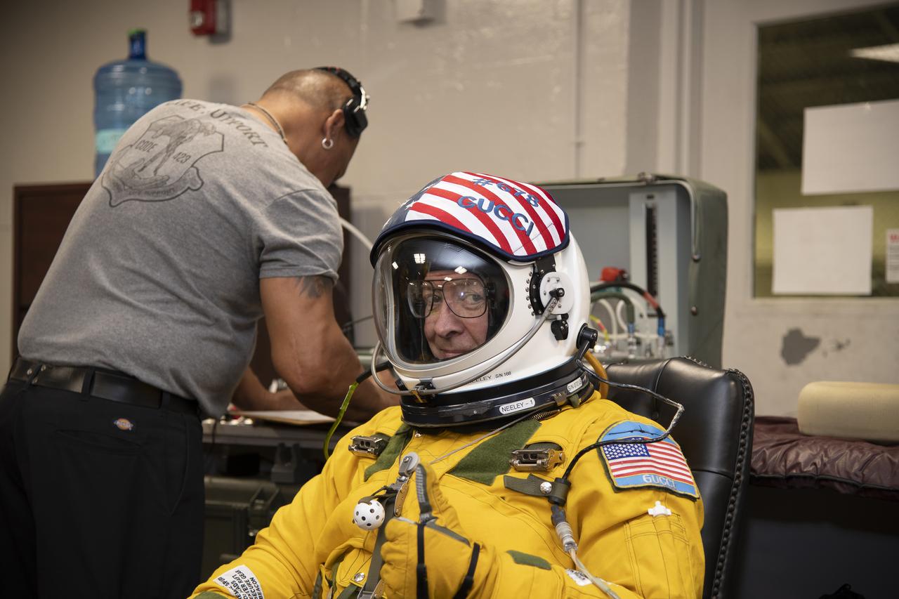
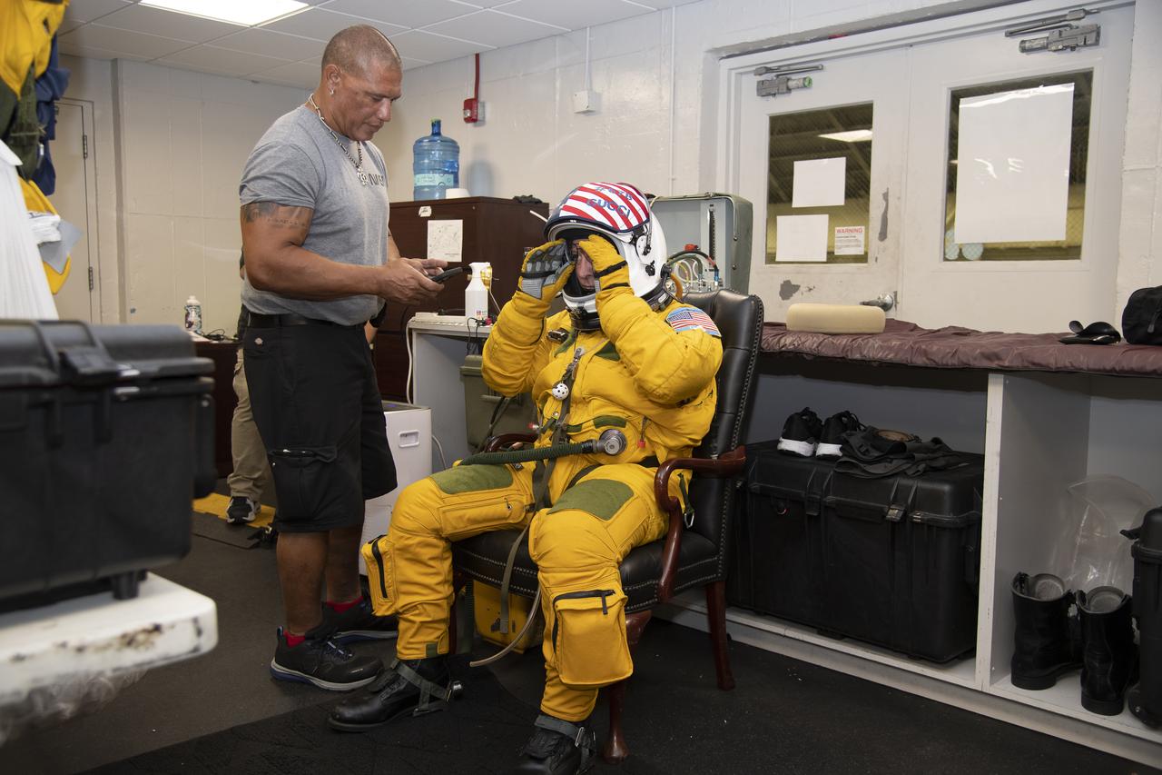
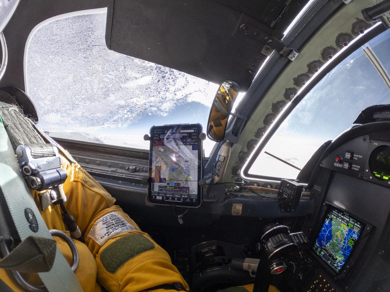
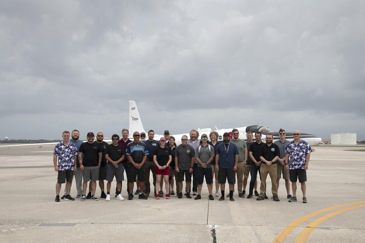
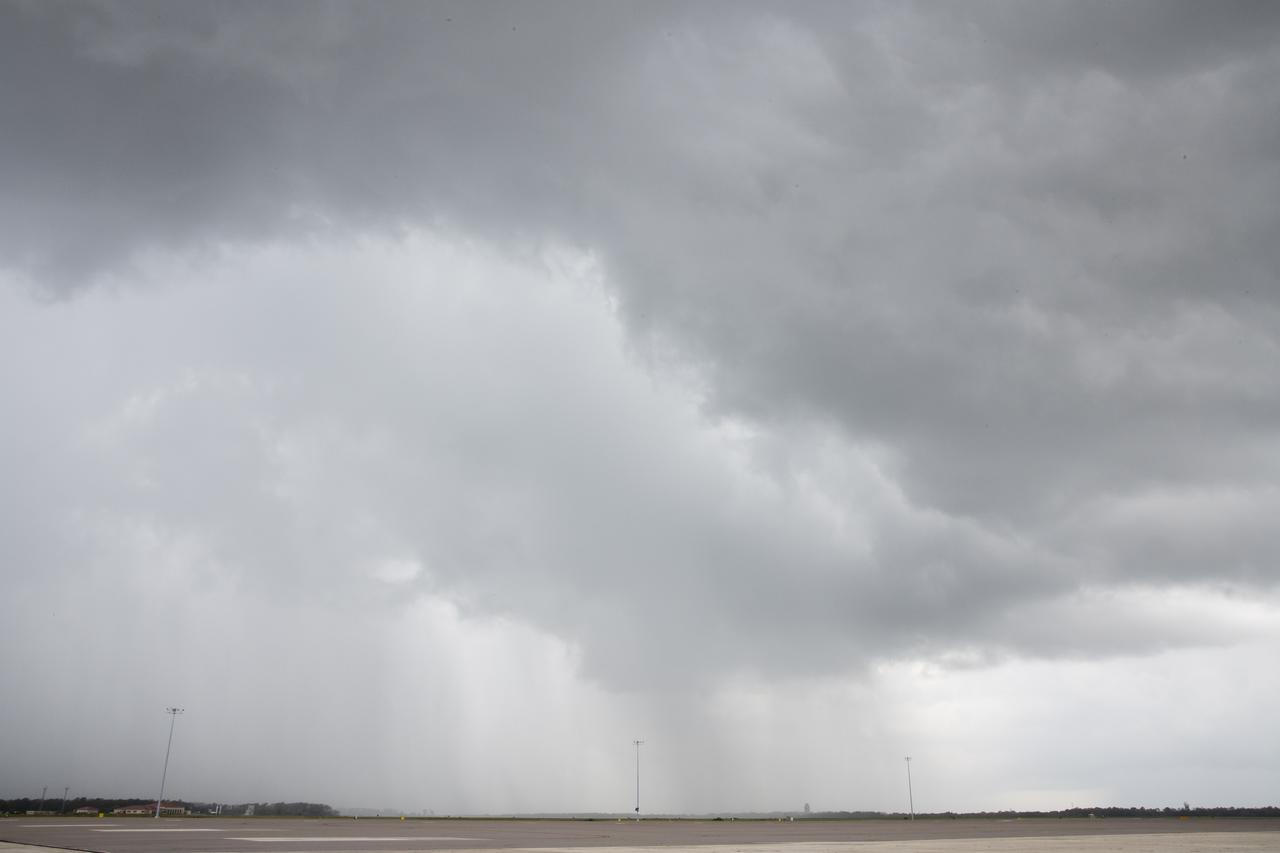
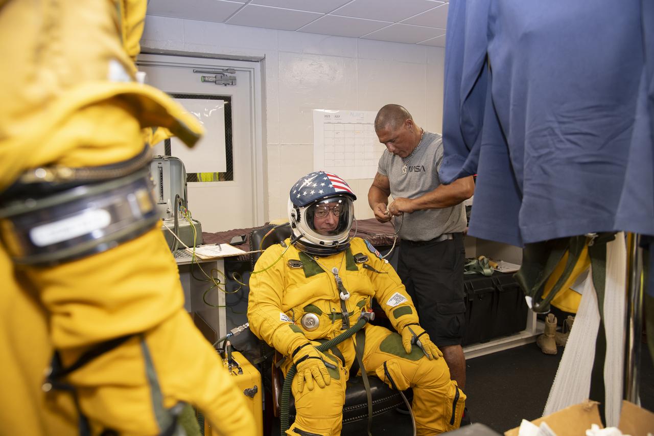
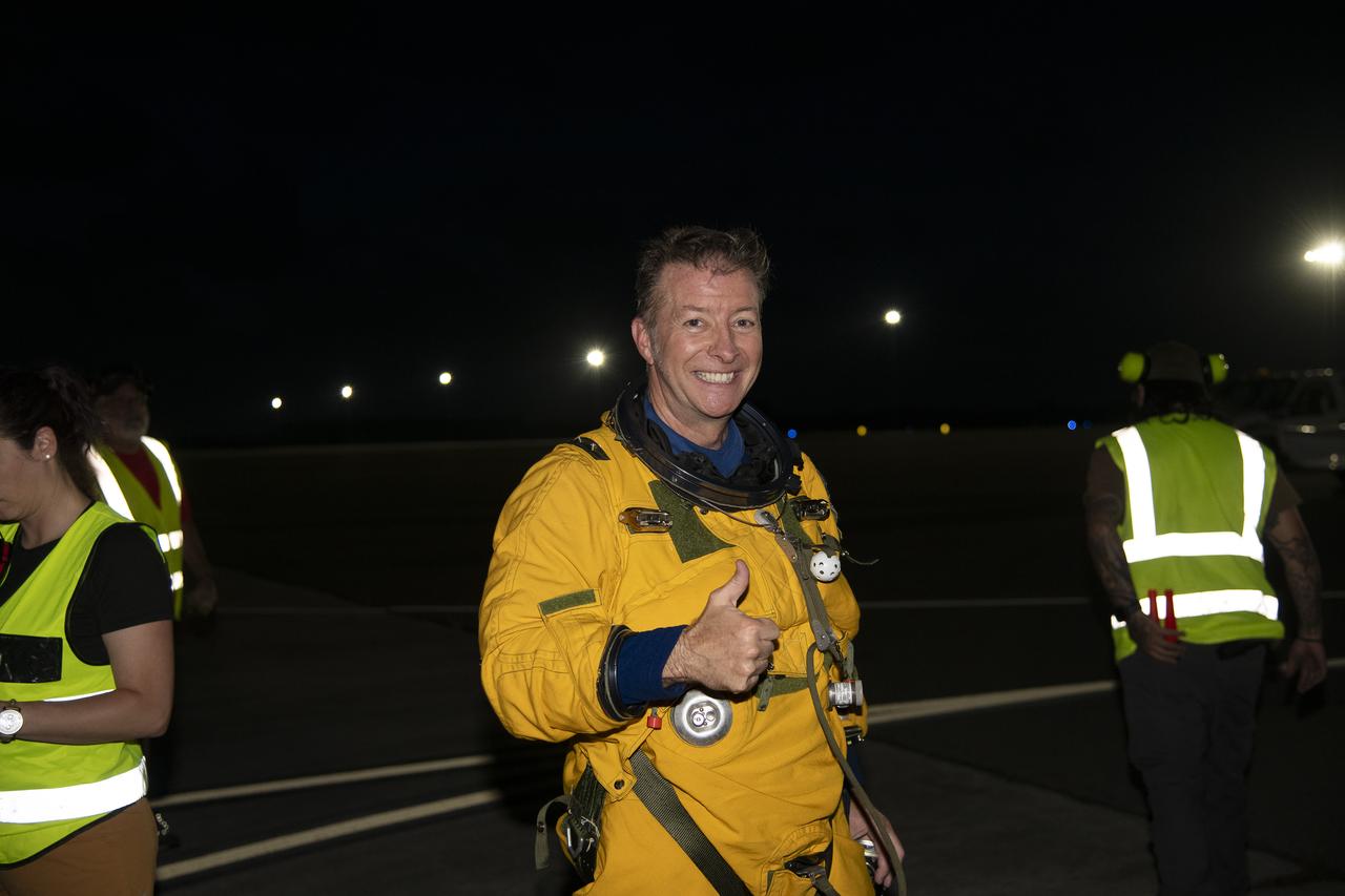
The ALOFT mission, Airborne Lightning Observatory for Fly’s eye simulator and Terrestrial gamma ray flashes, is a collaboration between NASA and the University of Bergen, Norway. NASA Armstrong Flight Research Center’s ER-2 aircraft flies just above the height of thunderclouds over the Floridian and Caribbean coastlines to collect data about lightning glows and terrestrial gamma ray flashes. Scientists expect to collect more accurate data than ever before that can advance the study of high-energy radiation emissions from thunderstorms.
The ALOFT mission, Airborne Lightning Observatory for Fly’s eye simulator and Terrestrial gamma ray flashes, is a collaboration between NASA and the University of Bergen, Norway. NASA Armstrong Flight Research Center’s ER-2 aircraft flies just above the height of thunderclouds over the Floridian and Caribbean coastlines to collect data about lightning glows and terrestrial gamma ray flashes. Scientists expect to collect more accurate data than ever before that can advance the study of high-energy radiation emissions from thunderstorms.
The ALOFT mission, Airborne Lightning Observatory for Fly’s eye simulator and Terrestrial gamma ray flashes, is a collaboration between NASA and the University of Bergen, Norway. NASA Armstrong Flight Research Center’s ER-2 aircraft flies just above the height of thunderclouds over the Floridian and Caribbean coastlines to collect data about lightning glows and terrestrial gamma ray flashes. Scientists expect to collect more accurate data than ever before that can advance the study of high-energy radiation emissions from thunderstorms.
The ALOFT mission, Airborne Lightning Observatory for Fly’s eye simulator and Terrestrial gamma ray flashes, is a collaboration between NASA and the University of Bergen, Norway. NASA Armstrong Flight Research Center’s ER-2 aircraft flies just above the height of thunderclouds over the Floridian and Caribbean coastlines to collect data about lightning glows and terrestrial gamma ray flashes. Scientists expect to collect more accurate data than ever before that can advance the study of high-energy radiation emissions from thunderstorms.

The ALOFT mission, Airborne Lightning Observatory for Fly’s eye simulator and Terrestrial gamma ray flashes, is a collaboration between NASA and the University of Bergen, Norway. NASA Armstrong Flight Research Center’s ER-2 aircraft flies just above the height of thunderclouds over the Floridian and Caribbean coastlines to collect data about lightning glows and terrestrial gamma ray flashes. Scientists expect to collect more accurate data than ever before that can advance the study of high-energy radiation emissions from thunderstorms.
The ALOFT mission, Airborne Lightning Observatory for Fly’s eye simulator and Terrestrial gamma ray flashes, is a collaboration between NASA and the University of Bergen, Norway. NASA Armstrong Flight Research Center’s ER-2 aircraft flies just above the height of thunderclouds over the Floridian and Caribbean coastlines to collect data about lightning glows and terrestrial gamma ray flashes. Scientists expect to collect more accurate data than ever before that can advance the study of high-energy radiation emissions from thunderstorms.

The ALOFT mission, Airborne Lightning Observatory for Fly’s eye simulator and Terrestrial gamma ray flashes, is a collaboration between NASA and the University of Bergen, Norway. NASA Armstrong Flight Research Center’s ER-2 aircraft flies just above the height of thunderclouds over the Floridian and Caribbean coastlines to collect data about lightning glows and terrestrial gamma ray flashes. Scientists expect to collect more accurate data than ever before that can advance the study of high-energy radiation emissions from thunderstorms.
The ALOFT mission, Airborne Lightning Observatory for Fly’s eye simulator and Terrestrial gamma ray flashes, is a collaboration between NASA and the University of Bergen, Norway. NASA Armstrong Flight Research Center’s ER-2 aircraft flies just above the height of thunderclouds over the Floridian and Caribbean coastlines to collect data about lightning glows and terrestrial gamma ray flashes. Scientists expect to collect more accurate data than ever before that can advance the study of high-energy radiation emissions from thunderstorms.

The ALOFT mission, Airborne Lightning Observatory for Fly’s eye simulator and Terrestrial gamma ray flashes, is a collaboration between NASA and the University of Bergen, Norway. NASA Armstrong Flight Research Center’s ER-2 aircraft flies just above the height of thunderclouds over the Floridian and Caribbean coastlines to collect data about lightning glows and terrestrial gamma ray flashes. Scientists expect to collect more accurate data than ever before that can advance the study of high-energy radiation emissions from thunderstorms.
The ALOFT mission, Airborne Lightning Observatory for Fly’s eye simulator and Terrestrial gamma ray flashes, is a collaboration between NASA and the University of Bergen, Norway. NASA Armstrong Flight Research Center’s ER-2 aircraft flies just above the height of thunderclouds over the Floridian and Caribbean coastlines to collect data about lightning glows and terrestrial gamma ray flashes. Scientists expect to collect more accurate data than ever before that can advance the study of high-energy radiation emissions from thunderstorms.
The ALOFT mission, Airborne Lightning Observatory for Fly’s eye simulator and Terrestrial gamma ray flashes, is a collaboration between NASA and the University of Bergen, Norway. NASA Armstrong Flight Research Center’s ER-2 aircraft flies just above the height of thunderclouds over the Floridian and Caribbean coastlines to collect data about lightning glows and terrestrial gamma ray flashes. Scientists expect to collect more accurate data than ever before that can advance the study of high-energy radiation emissions from thunderstorms.

The ALOFT mission, Airborne Lightning Observatory for Fly’s eye simulator and Terrestrial gamma ray flashes, is a collaboration between NASA and the University of Bergen, Norway. NASA Armstrong Flight Research Center’s ER-2 aircraft flies just above the height of thunderclouds over the Floridian and Caribbean coastlines to collect data about lightning glows and terrestrial gamma ray flashes. Scientists expect to collect more accurate data than ever before that can advance the study of high-energy radiation emissions from thunderstorms.

The ALOFT mission, Airborne Lightning Observatory for Fly’s eye simulator and Terrestrial gamma ray flashes, is a collaboration between NASA and the University of Bergen, Norway. NASA Armstrong Flight Research Center’s ER-2 aircraft flies just above the height of thunderclouds over the Floridian and Caribbean coastlines to collect data about lightning glows and terrestrial gamma ray flashes. Scientists expect to collect more accurate data than ever before that can advance the study of high-energy radiation emissions from thunderstorms.
The ALOFT mission, Airborne Lightning Observatory for Fly’s eye simulator and Terrestrial gamma ray flashes, is a collaboration between NASA and the University of Bergen, Norway. NASA Armstrong Flight Research Center’s ER-2 aircraft flies just above the height of thunderclouds over the Floridian and Caribbean coastlines to collect data about lightning glows and terrestrial gamma ray flashes. Scientists expect to collect more accurate data than ever before that can advance the study of high-energy radiation emissions from thunderstorms.
The ALOFT mission, Airborne Lightning Observatory for Fly’s eye simulator and Terrestrial gamma ray flashes, is a collaboration between NASA and the University of Bergen, Norway. NASA Armstrong Flight Research Center’s ER-2 aircraft flies just above the height of thunderclouds over the Floridian and Caribbean coastlines to collect data about lightning glows and terrestrial gamma ray flashes. Scientists expect to collect more accurate data than ever before that can advance the study of high-energy radiation emissions from thunderstorms.
The ALOFT mission, Airborne Lightning Observatory for Fly’s eye simulator and Terrestrial gamma ray flashes, is a collaboration between NASA and the University of Bergen, Norway. NASA Armstrong Flight Research Center’s ER-2 aircraft flies just above the height of thunderclouds over the Floridian and Caribbean coastlines to collect data about lightning glows and terrestrial gamma ray flashes. Scientists expect to collect more accurate data than ever before that can advance the study of high-energy radiation emissions from thunderstorms.
The ALOFT mission, Airborne Lightning Observatory for Fly’s eye simulator and Terrestrial gamma ray flashes, is a collaboration between NASA and the University of Bergen, Norway. NASA Armstrong Flight Research Center’s ER-2 aircraft flies just above the height of thunderclouds over the Floridian and Caribbean coastlines to collect data about lightning glows and terrestrial gamma ray flashes. Scientists expect to collect more accurate data than ever before that can advance the study of high-energy radiation emissions from thunderstorms.
The ALOFT mission, Airborne Lightning Observatory for Fly’s eye simulator and Terrestrial gamma ray flashes, is a collaboration between NASA and the University of Bergen, Norway. NASA Armstrong Flight Research Center’s ER-2 aircraft flies just above the height of thunderclouds over the Floridian and Caribbean coastlines to collect data about lightning glows and terrestrial gamma ray flashes. Scientists expect to collect more accurate data than ever before that can advance the study of high-energy radiation emissions from thunderstorms.
The ALOFT mission, Airborne Lightning Observatory for Fly’s eye simulator and Terrestrial gamma ray flashes, is a collaboration between NASA and the University of Bergen, Norway. NASA Armstrong Flight Research Center’s ER-2 aircraft flies just above the height of thunderclouds over the Floridian and Caribbean coastlines to collect data about lightning glows and terrestrial gamma ray flashes. Scientists expect to collect more accurate data than ever before that can advance the study of high-energy radiation emissions from thunderstorms.

The ALOFT mission, Airborne Lightning Observatory for Fly’s eye simulator and Terrestrial gamma ray flashes, is a collaboration between NASA and the University of Bergen, Norway. NASA Armstrong Flight Research Center’s ER-2 aircraft flies just above the height of thunderclouds over the Floridian and Caribbean coastlines to collect data about lightning glows and terrestrial gamma ray flashes. Scientists expect to collect more accurate data than ever before that can advance the study of high-energy radiation emissions from thunderstorms.
The ALOFT mission, Airborne Lightning Observatory for Fly’s eye simulator and Terrestrial gamma ray flashes, is a collaboration between NASA and the University of Bergen, Norway. NASA Armstrong Flight Research Center’s ER-2 aircraft flies just above the height of thunderclouds over the Floridian and Caribbean coastlines to collect data about lightning glows and terrestrial gamma ray flashes. Scientists expect to collect more accurate data than ever before that can advance the study of high-energy radiation emissions from thunderstorms.

The ALOFT mission, Airborne Lightning Observatory for Fly’s eye simulator and Terrestrial gamma ray flashes, is a collaboration between NASA and the University of Bergen, Norway. NASA Armstrong Flight Research Center’s ER-2 aircraft flies just above the height of thunderclouds over the Floridian and Caribbean coastlines to collect data about lightning glows and terrestrial gamma ray flashes. Scientists expect to collect more accurate data than ever before that can advance the study of high-energy radiation emissions from thunderstorms.

The ALOFT mission, Airborne Lightning Observatory for Fly’s eye simulator and Terrestrial gamma ray flashes, is a collaboration between NASA and the University of Bergen, Norway. NASA Armstrong Flight Research Center’s ER-2 aircraft flies just above the height of thunderclouds over the Floridian and Caribbean coastlines to collect data about lightning glows and terrestrial gamma ray flashes. Scientists expect to collect more accurate data than ever before that can advance the study of high-energy radiation emissions from thunderstorms.
The ALOFT mission, Airborne Lightning Observatory for Fly’s eye simulator and Terrestrial gamma ray flashes, is a collaboration between NASA and the University of Bergen, Norway. NASA Armstrong Flight Research Center’s ER-2 aircraft flies just above the height of thunderclouds over the Floridian and Caribbean coastlines to collect data about lightning glows and terrestrial gamma ray flashes. Scientists expect to collect more accurate data than ever before that can advance the study of high-energy radiation emissions from thunderstorms.
The ALOFT mission, Airborne Lightning Observatory for Fly’s eye simulator and Terrestrial gamma ray flashes, is a collaboration between NASA and the University of Bergen, Norway. NASA Armstrong Flight Research Center’s ER-2 aircraft flies just above the height of thunderclouds over the Floridian and Caribbean coastlines to collect data about lightning glows and terrestrial gamma ray flashes. Scientists expect to collect more accurate data than ever before that can advance the study of high-energy radiation emissions from thunderstorms.
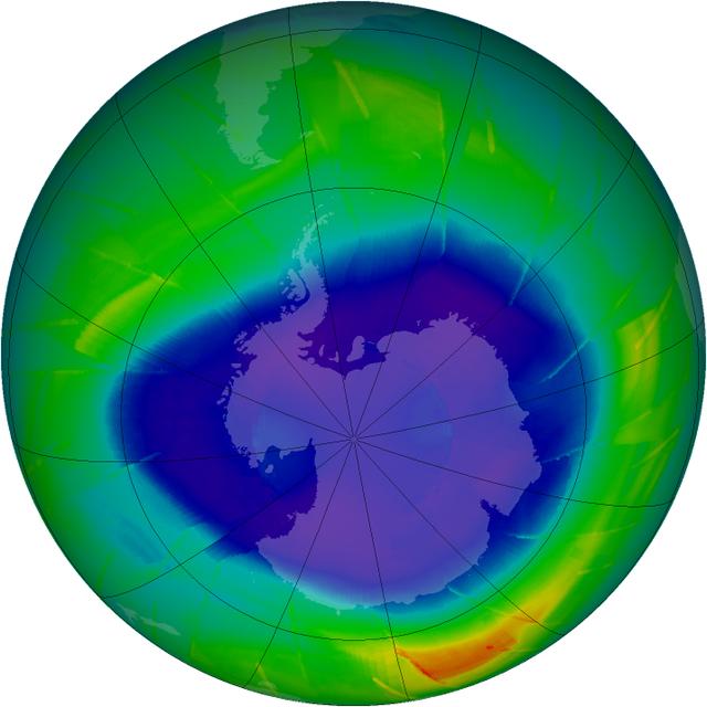
The annual ozone hole has started developing over the South Pole, and it appears that it will be comparable to ozone depletions over the past decade. This composite image from September 10 depicts ozone concentrations in Dobson units, with purple and blues depicting severe deficits of ozone. "We have observed the ozone hole again in 2009, and it appears to be pretty average so far," said ozone researcher Paul Newman of NASA's Goddard Space Flight Center in Greenbelt, Md. "However, we won't know for another four weeks how this year's ozone hole will fully develop." Scientists are tracking the size and depth of the ozone hole with observations from the Ozone Monitoring Instrument on NASA's Aura spacecraft, the Global Ozone Monitoring Experiment on the European Space Agency's ERS-2 spacecraft, and the Solar Backscatter Ultraviolet instrument on the National Oceanic and Atmospheric Administration's NOAA-16 satellite. The depth and area of the ozone hole are governed by the amount of chlorine and bromine in the Antarctic stratosphere. Over the southern winter, polar stratospheric clouds (PSCs) form in the extreme cold of the atmosphere, and chlorine gases react on the cloud particles to release chlorine into a form that can easily destroy ozone. When the sun rises in August after months of seasonal polar darkness, the sunlight heats the clouds and catalyzes the chemical reactions that deplete the ozone layer. The ozone hole begins to grow in August and reaches its largest area in late September to early October. Recent observations and several studies have shown that the size of the annual ozone hole has stabilized and the level of ozone-depleting substances has decreased by 4 percent since 2001. But since chlorine and bromine compounds have long lifetimes in the atmosphere, a recovery of atmospheric ozone is not likely to be noticeable until 2020 or later. Visit NASA's Ozone Watch page for current imagery and data: <a href="http://ozonewatch.gsfc.nasa.gov/index.html" rel="nofollow">ozonewatch.gsfc.nasa.gov/index.html</a>