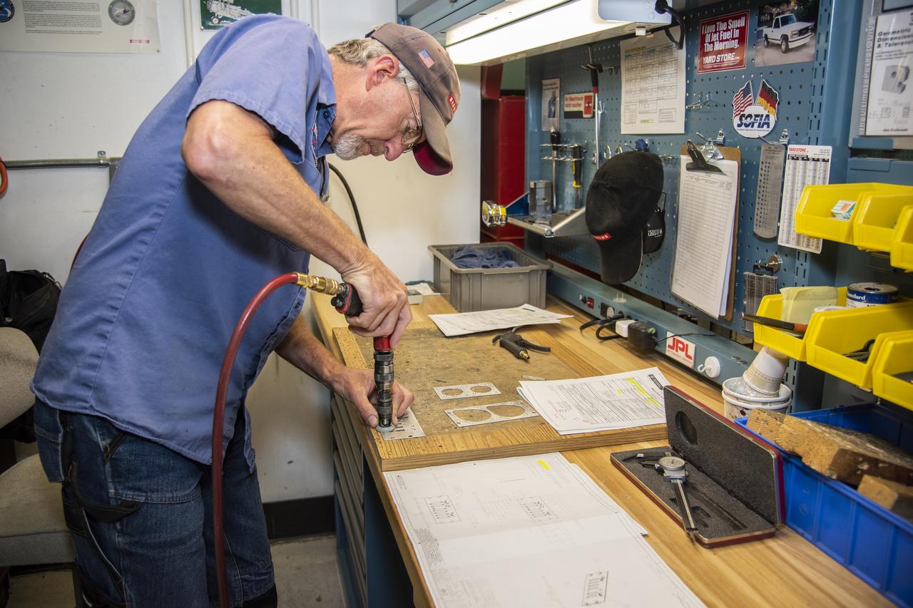
Andrew Shaw works on a component for the high-altitude ER-2 aircraft's instrument panel.
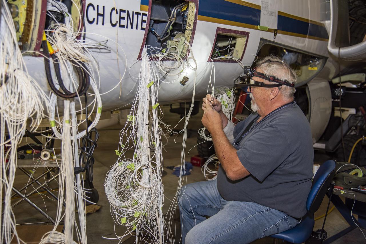
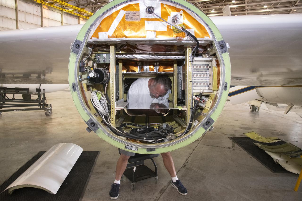
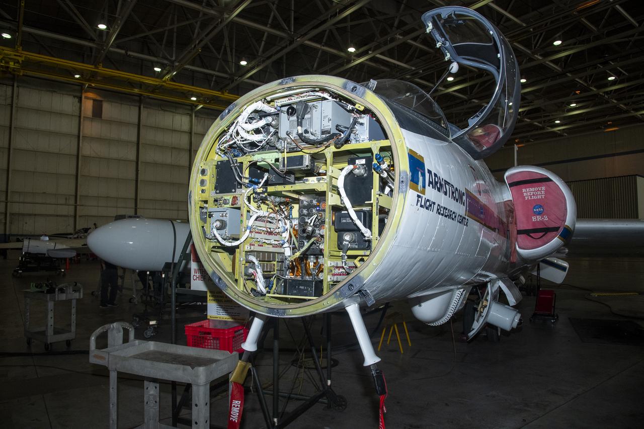
Technician David Johnson works on rewiring the high-altitude ER-2 aircraft's fixed nose and cockpit.Â

ER-2 tail number 706, was one of two Airborne Science ER-2s used as science platforms by Dryden. The aircraft were platforms for a variety of high-altitude science missions flown over various parts of the world. They were also used for earth science and atmospheric sensor research and development, satellite calibration and data validation.

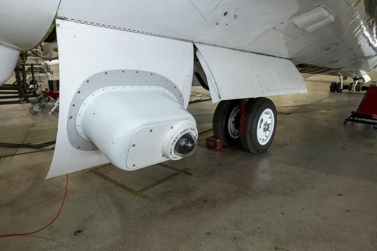
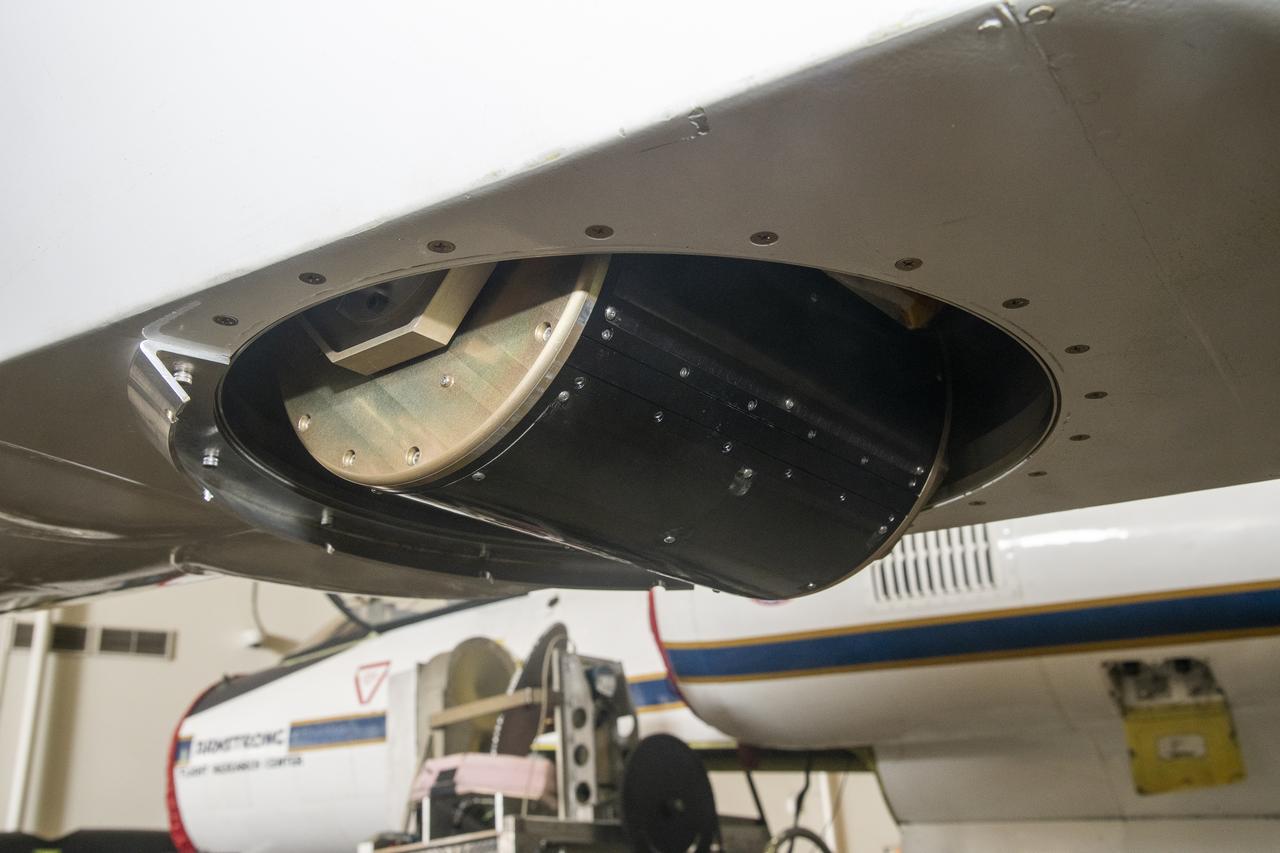
ER-2 tail number 809, is one of two Airborne Science ER-2s used as science platforms by Dryden. The aircraft are platforms for a variety of high-altitude science missions flown over various parts of the world. They are also used for earth science and atmospheric sensor research and development, satellite calibration and data validation. The ER-2s are capable of carrying a maximum payload of 2,600 pounds of experiments in a nose bay, the main equipment bay behind the cockpit, two wing-mounted superpods and small underbody and trailing edges. Most ER-2 missions last about six hours with ranges of about 2,200 nautical miles. The aircraft typically fly at altitudes above 65,000 feet. On November 19, 1998, the ER-2 set a world record for medium weight aircraft reaching an altitude of 68,700 feet. The aircraft is 63 feet long, with a wingspan of 104 feet. The top of the vertical tail is 16 feet above ground when the aircraft is on the bicycle-type landing gear. Cruising speeds are 410 knots, or 467 miles per hour, at altitude. A single General Electric F118 turbofan engine rated at 17,000 pounds thrust powers the ER-2.

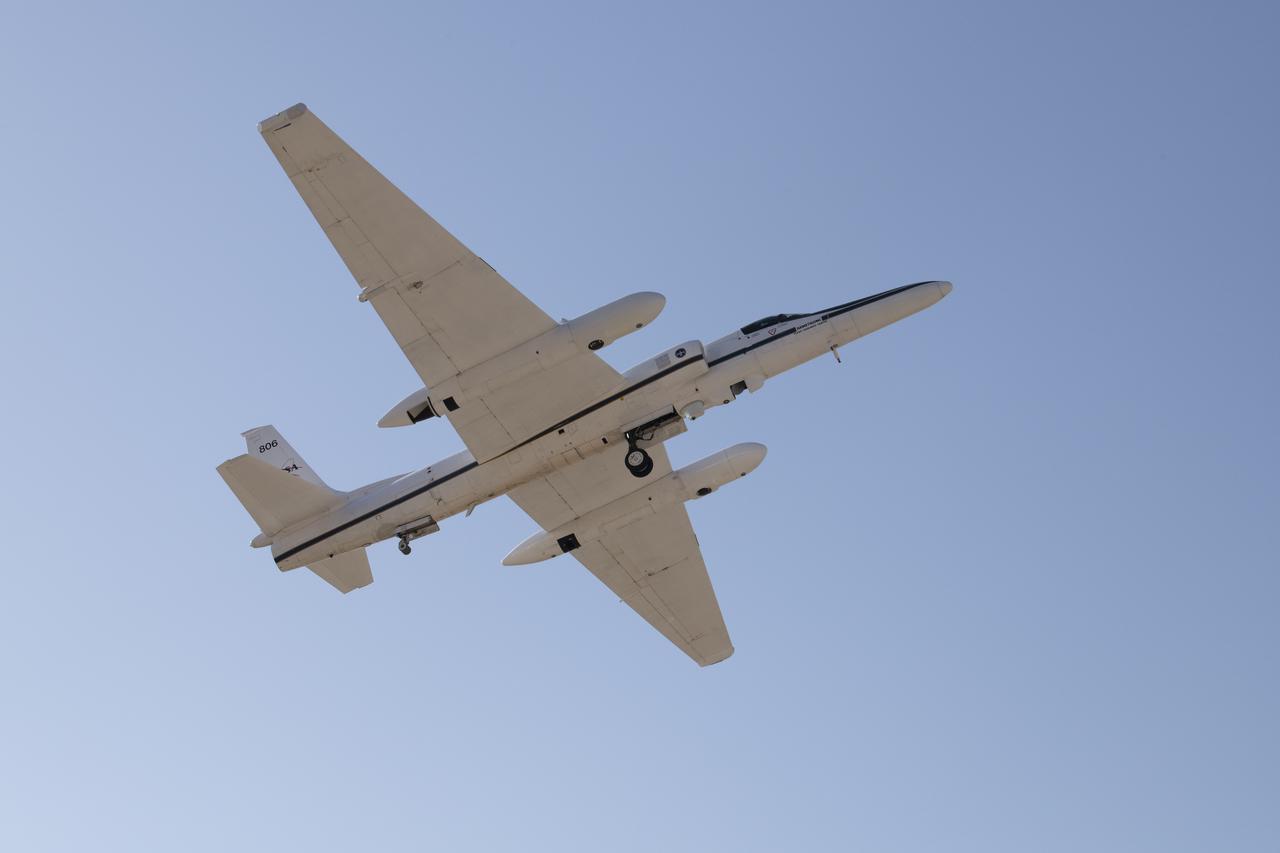
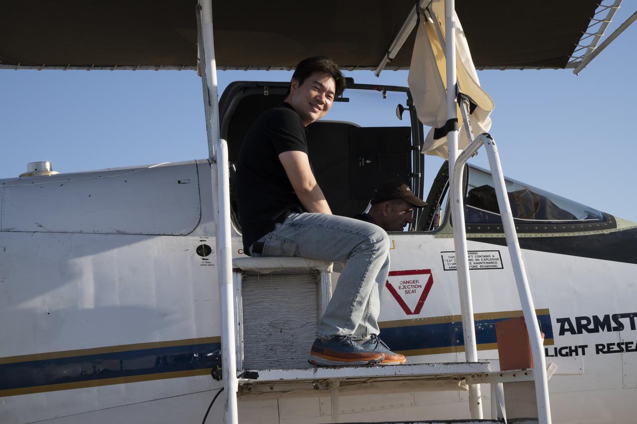
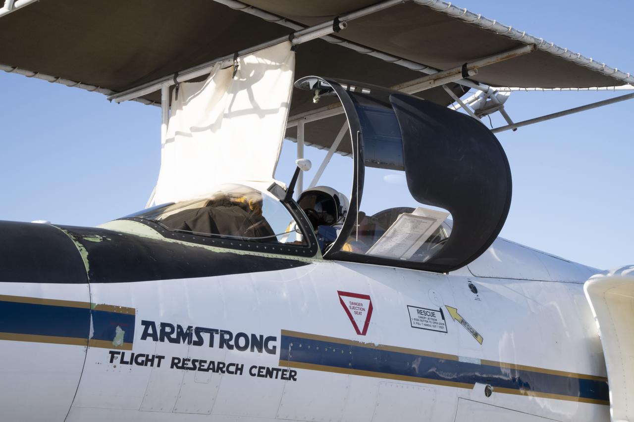
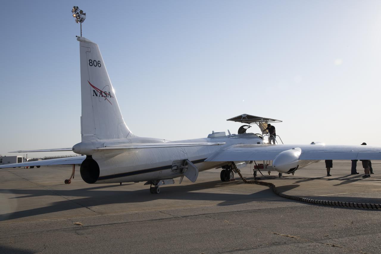
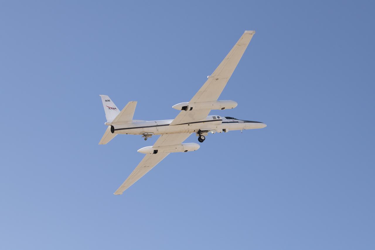
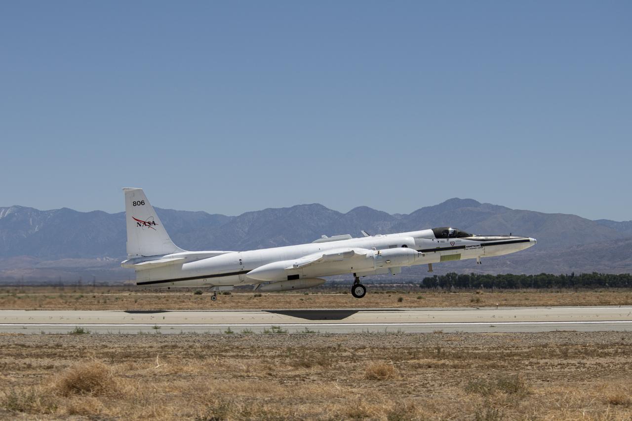
ER-2 tail number 806, is one of two Airborne Science ER-2s used as science platforms by Dryden. The aircraft are platforms for a variety of high-altitude science missions flown over various parts of the world. They are also used for earth science and atmospheric sensor research and development, satellite calibration and data validation. The ER-2s are capable of carrying a maximum payload of 2,600 pounds of experiments in a nose bay, the main equipment bay behind the cockpit, two wing-mounted superpods and small underbody and trailing edges. Most ER-2 missions last about six hours with ranges of about 2,200 nautical miles. The aircraft typically fly at altitudes above 65,000 feet. On November 19, 1998, the ER-2 set a world record for medium weight aircraft reaching an altitude of 68,700 feet. The aircraft is 63 feet long, with a wingspan of 104 feet. The top of the vertical tail is 16 feet above ground when the aircraft is on the bicycle-type landing gear. Cruising speeds are 410 knots, or 467 miles per hour, at altitude. A single General Electric F-118 turbofan engine rated at 17,000 pounds thrust powers the ER-2.

ER-2 tail number 806, is one of two Airborne Science ER-2s used as science platforms by Dryden. The aircraft are platforms for a variety of high-altitude science missions flown over various parts of the world. They are also used for earth science and atmospheric sensor research and development, satellite calibration and data validation. The ER-2s are capable of carrying a maximum payload of 2,600 pounds of experiments in a nose bay, the main equipment bay behind the cockpit, two wing-mounted superpods and small underbody and trailing edges. Most ER-2 missions last about six hours with ranges of about 2,200 nautical miles. The aircraft typically fly at altitudes above 65,000 feet. On November 19, 1998, the ER-2 set a world record for medium weight aircraft reaching an altitude of 68,700 feet. The aircraft is 63 feet long, with a wingspan of 104 feet. The top of the vertical tail is 16 feet above ground when the aircraft is on the bicycle-type landing gear. Cruising speeds are 410 knots, or 467 miles per hour, at altitude. A single General Electric F-118 turbofan engine rated at 17,000 pounds thrust powers the ER-2.

ER-2 tail number 806, is one of two Airborne Science ER-2s used as science platforms by Dryden. The aircraft are platforms for a variety of high-altitude science missions flown over various parts of the world. They are also used for earth science and atmospheric sensor research and development, satellite calibration and data validation. The ER-2s are capable of carrying a maximum payload of 2,600 pounds of experiments in a nose bay, the main equipment bay behind the cockpit, two wing-mounted superpods and small underbody and trailing edges. Most ER-2 missions last about six hours with ranges of about 2,200 nautical miles. The aircraft typically fly at altitudes above 65,000 feet. On November 19, 1998, the ER-2 set a world record for medium weight aircraft reaching an altitude of 68,700 feet. The aircraft is 63 feet long, with a wingspan of 104 feet. The top of the vertical tail is 16 feet above ground when the aircraft is on the bicycle-type landing gear. Cruising speeds are 410 knots, or 467 miles per hour, at altitude. A single General Electric F-118 turbofan engine rated at 17,000 pounds thrust powers the ER-2.
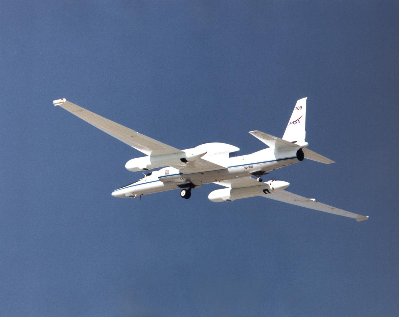
ER-2 tail number 709, was one of two Airborne Science ER-2s used as science platforms by Dryden. The aircraft were platforms for a variety of high-altitude science missions flown over various parts of the world. They were also used for earth science and atmospheric sensor research and development, satellite calibration and data validation.

ER-2 tail number 706, was one of two Airborne Science ER-2s used as science platforms by Dryden. The aircraft were platforms for a variety of high-altitude science missions flown over various parts of the world. They were also used for earth science and atmospheric sensor research and development, satellite calibration and data validation.
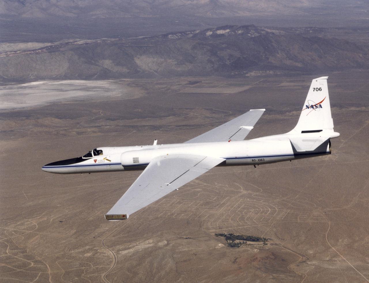
ER-2 tail number 706, was one of two Airborne Science ER-2s used as science platforms by Dryden. The aircraft were platforms for a variety of high-altitude science missions flown over various parts of the world. They were also used for earth science and atmospheric sensor research and development, satellite calibration and data validation.
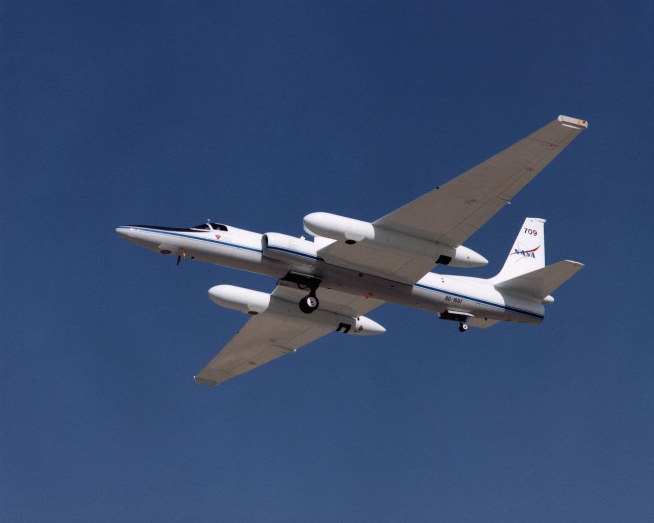
ER-2 tail number 709, was one of two Airborne Science ER-2s used as science platforms by Dryden. The aircraft were platforms for a variety of high-altitude science missions flown over various parts of the world. They were also used for earth science and atmospheric sensor research and development, satellite calibration and data validation.
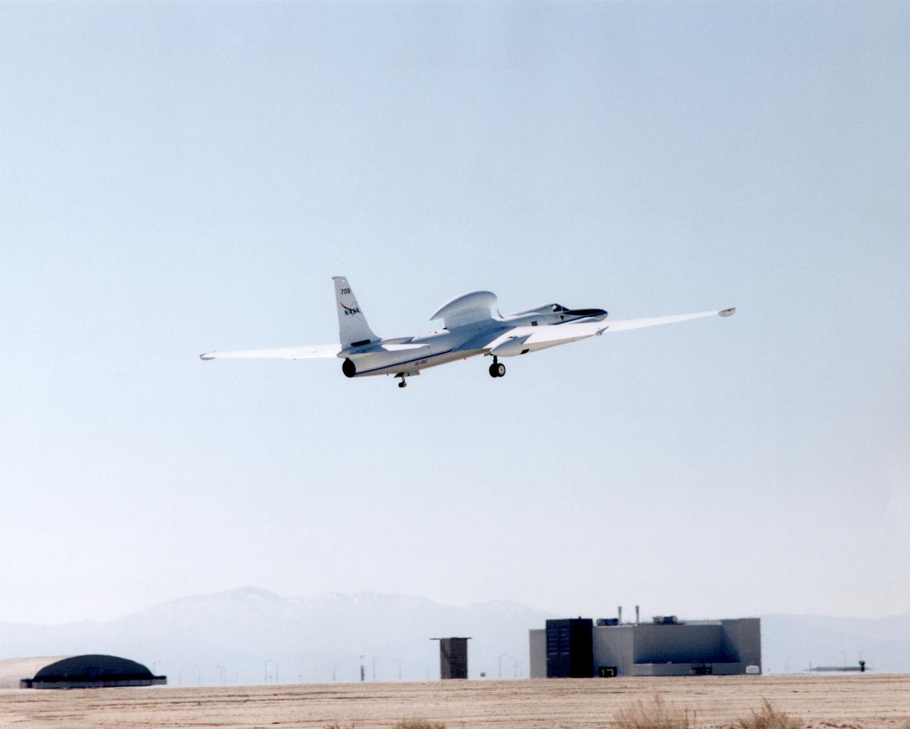
ER-2 tail number 709, was one of two Airborne Science ER-2s used as science platforms by Dryden. The aircraft were platforms for a variety of high-altitude science missions flown over various parts of the world. They were also used for earth science and atmospheric sensor research and development, satellite calibration and data validation.
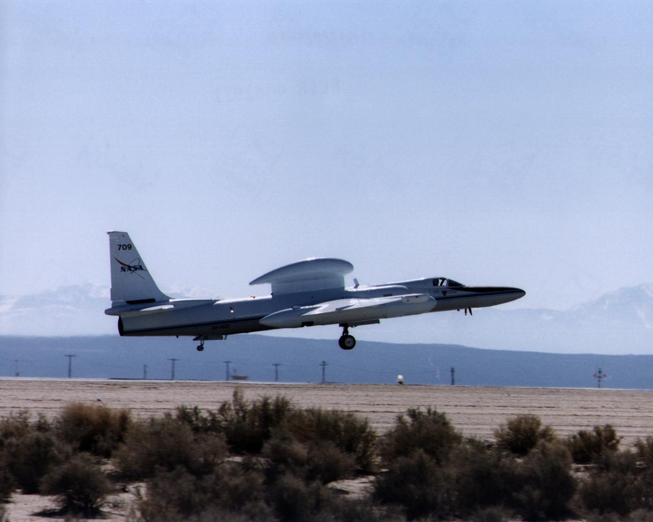
ER-2 tail number 709, was one of two Airborne Science ER-2s used as science platforms by Dryden. The aircraft were platforms for a variety of high-altitude science missions flown over various parts of the world. They were also used for earth science and atmospheric sensor research and development, satellite calibration and data validation.
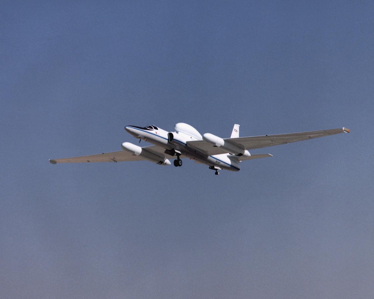
ER-2 tail number 709, was one of two Airborne Science ER-2s used as science platforms by Dryden. The aircraft were platforms for a variety of high-altitude science missions flown over various parts of the world. They were also used for earth science and atmospheric sensor research and development, satellite calibration and data validation.
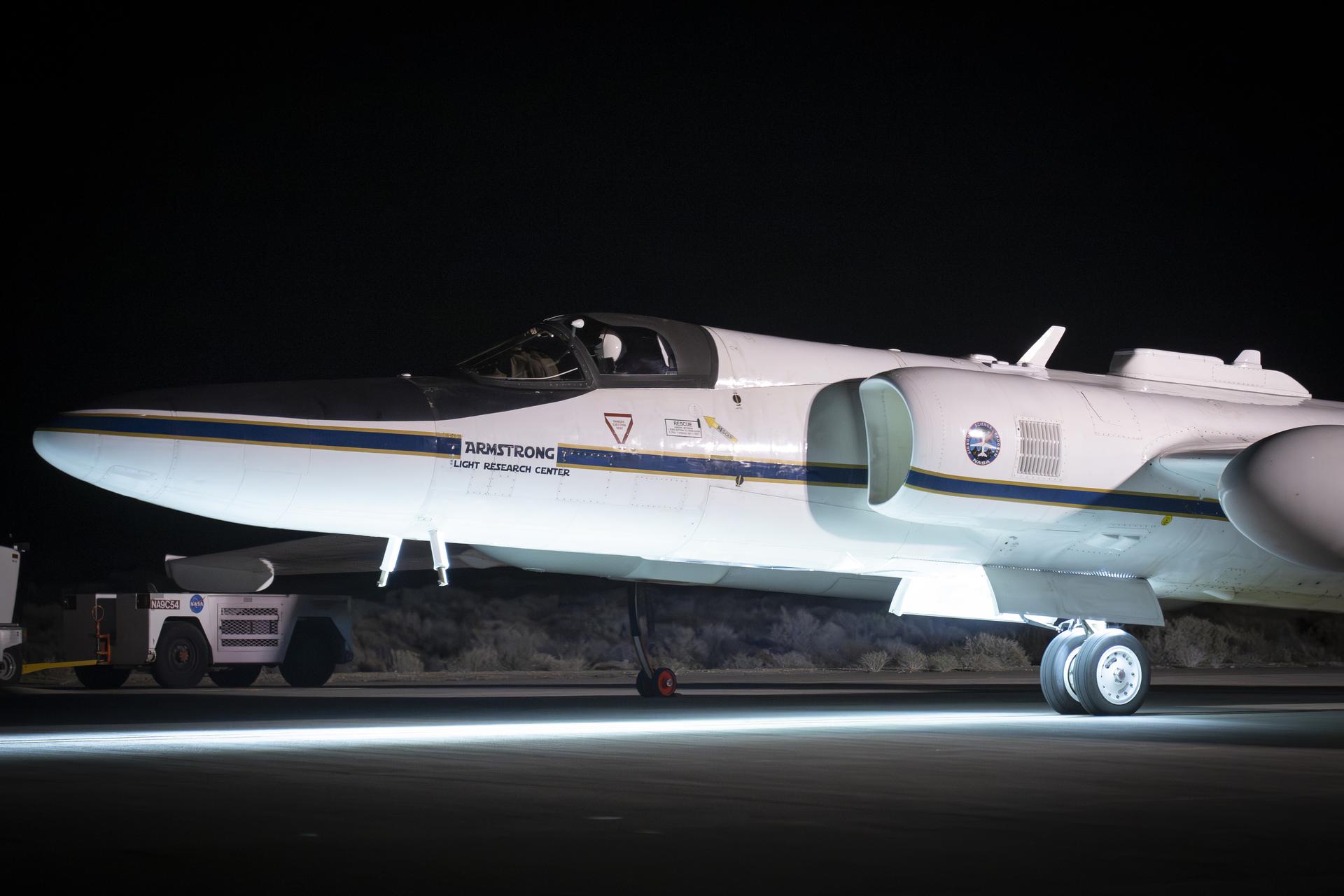
NASA’s ER-2 high-altitude aircraft prepares for a night flight with the Airborne Lunar Spectral Irradiance (air-LUSI) instrument on Monday, Feb. 2, 2026. The instrument measures Moonlight to improve accuracy of space-based sensors that forecast the weather, monitor agriculture, and study Earth’s ecosystem.

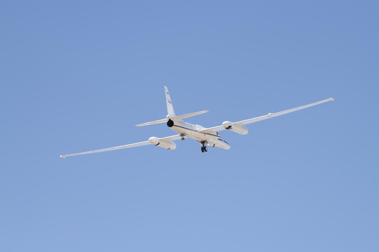
An ER-2 high-altitude Earth science aircraft banks away during a flight over the southern Sierra Nevada. NASA’s Armstrong Flight Research Center operates two of the Lockheed-built aircraft on a wide variety of environmental science, atmospheric sampling, and satellite data verification missions.

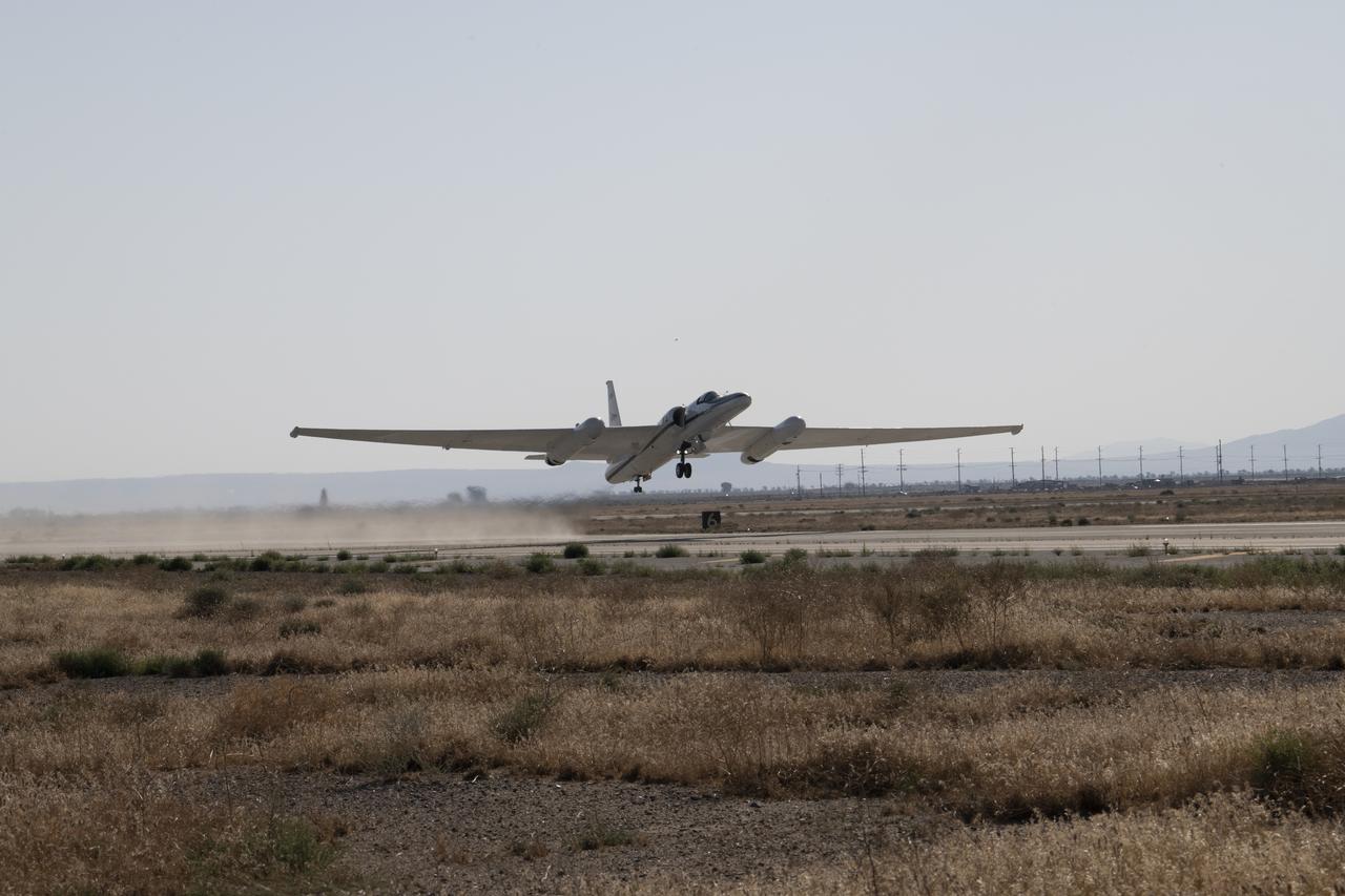
A NASA ER-2 high-altitude aircraft takes off from NASA’s Armstrong Flight Research Center in Edwards California on Tuesday, March 31, 2026, to support the Geological Earth Mapping Experiment (GEMx) airborne science mission.

A NASA ER-2 high-altitude aircraft takes off from NASA’s Armstrong Flight Research Center in Edwards California on Tuesday, March 31, 2026, to support the Geological Earth Mapping Experiment (GEMx) airborne science mission.

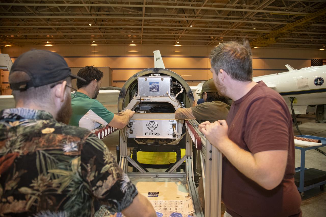
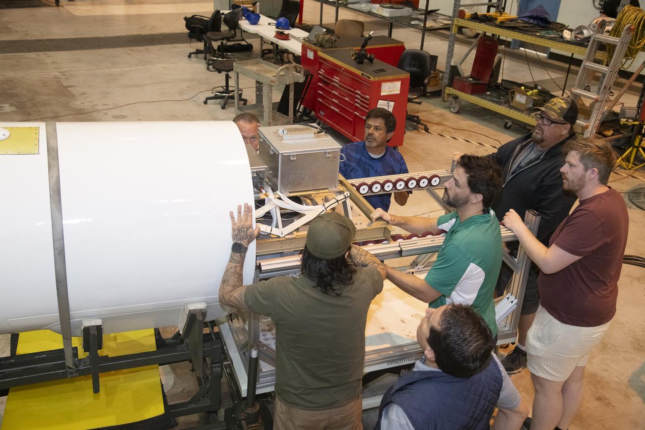
Crew chief Darin Whittington and mechanic Edwin Flores watch as mechanic Francisco Rodriguez works on a mounting bolt to secure the Airborne Visible/Infrared Imaging Spectrometer (AVIRIS) instrument into a NASA ER-2 high-altitude aircraft at NASA’s Armstrong Flight Research Center in Edwards, California, on Wednesday, March 11, 2026. The installation helped enabled the Geological Earth Mapping Experiment (GEMx) airborne science mission, which began on March 31, 2026.

Mechanic Francisco Rodriguez and crew chief Darin Whittington installed the Airborne Visible/Infrared Imaging Spectrometer (AVIRIS) instrument into a NASA ER-2 high-altitude aircraft at NASA’s Armstrong Flight Research Center in Edwards, California, on Wednesday, March 11, 2026. The installation helped enabled the Geological Earth Mapping Experiment (GEMx) airborne science
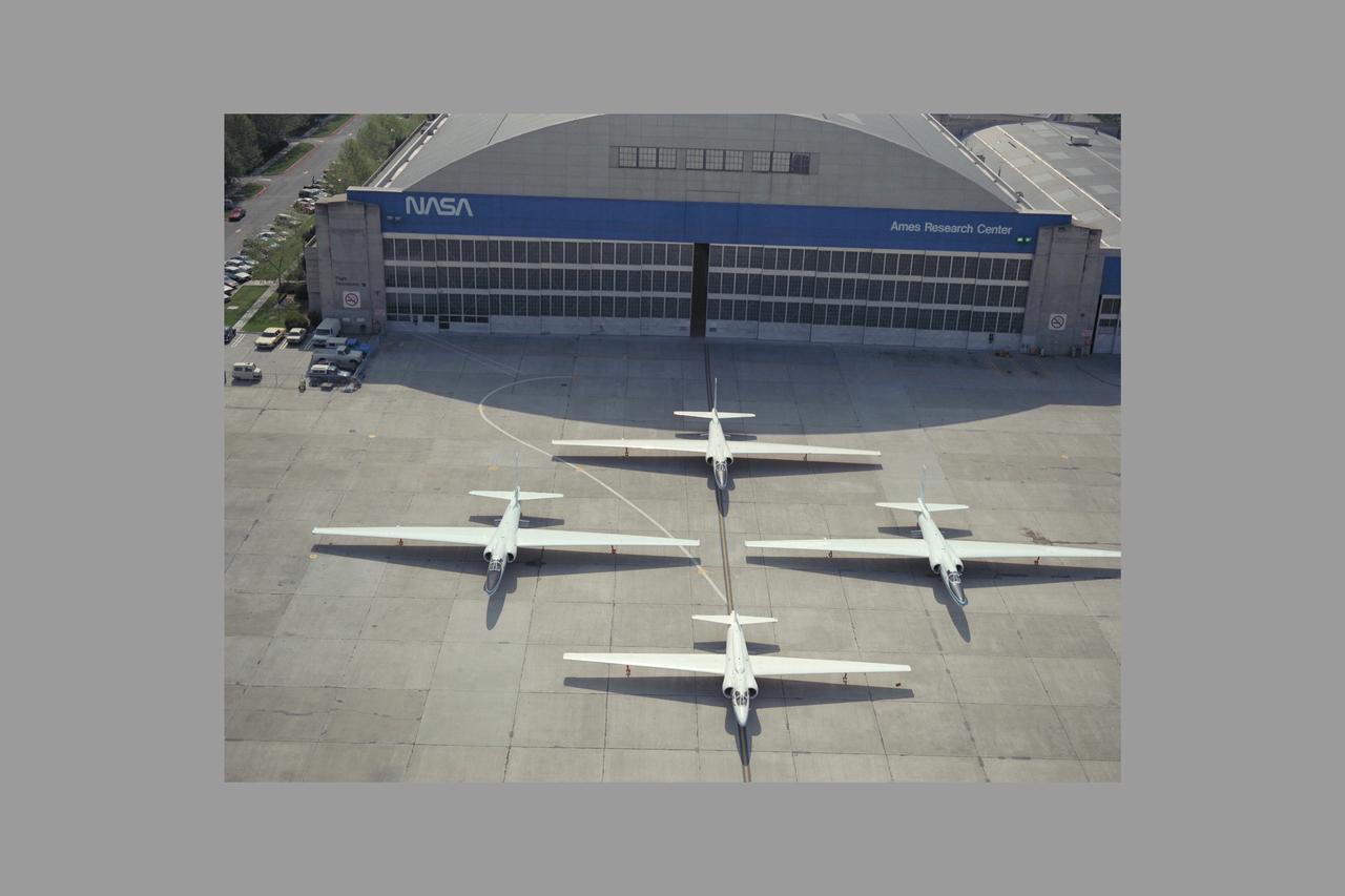
High Altitude MTPE Aircraft on flight line in front of N-211 hangar - three ER-2 and retiring U-2
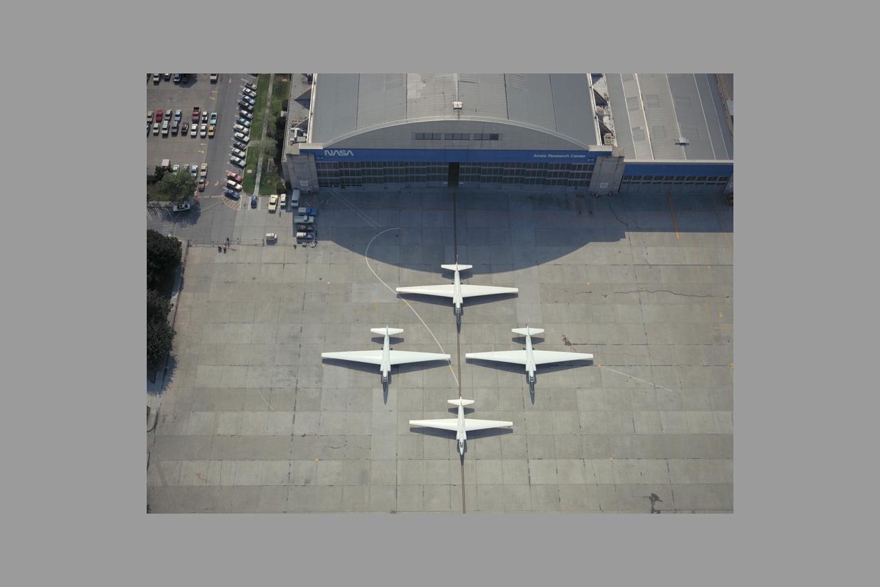
High Altitude MTPE Aircraft on flight line in front of N-211 hangar - three ER-2 and retiring U-2
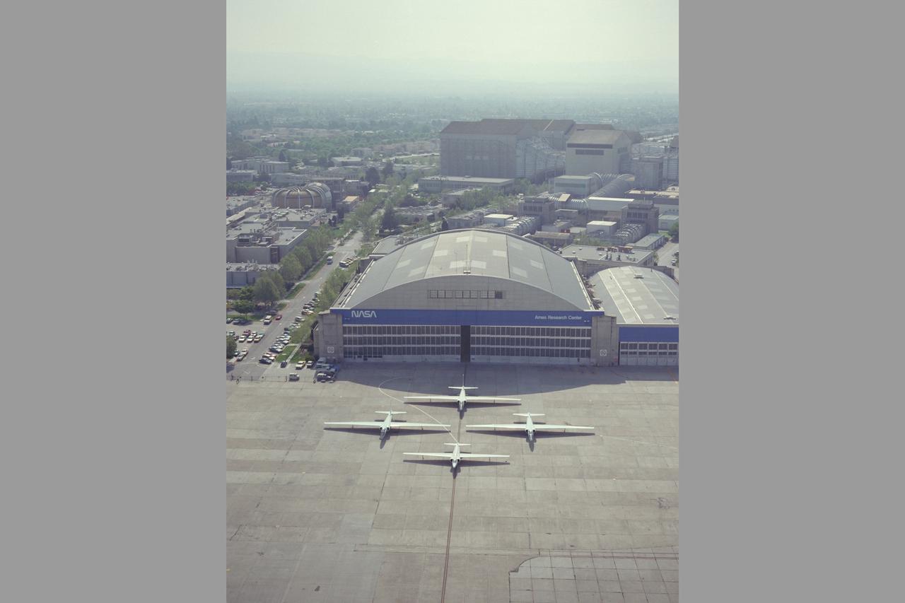
High Altitude MTPE Aircraft on flight line in front of N-211 hangar - three ER-2 and retiring U-2
NASA Armstrong’s ER-2 aircraft deploys for its ALOFT mission. The ER-2 will fly at high altitudes above the Floridian coastline to collect data about the energetic characteristics and behavior of lightning and thunderclouds. A NASA pilot will operate the aircraft while scientists from the University of Bergen, Norway will interpret the data from the ground.
NASA Armstrong’s ER-2 aircraft deploys for its ALOFT mission. The ER-2 will fly at high altitudes above the Floridian coastline to collect data about the energetic characteristics and behavior of lightning and thunderclouds. A NASA pilot will operate the aircraft while scientists from the University of Bergen, Norway will interpret the data from the ground.
NASA Armstrong’s ER-2 aircraft deploys for its ALOFT mission. The ER-2 will fly at high altitudes above the Floridian coastline to collect data about the energetic characteristics and behavior of lightning and thunderclouds. A NASA pilot will operate the aircraft while scientists from the University of Bergen, Norway will interpret the data from the ground.
NASA Armstrong’s ER-2 aircraft deploys for its ALOFT mission. The ER-2 will fly at high altitudes above the Floridian coastline to collect data about the energetic characteristics and behavior of lightning and thunderclouds. A NASA pilot will operate the aircraft while scientists from the University of Bergen, Norway will interpret the data from the ground.
NASA Armstrong’s ER-2 aircraft deploys for its ALOFT mission. The ER-2 will fly at high altitudes above the Floridian coastline to collect data about the energetic characteristics and behavior of lightning and thunderclouds. A NASA pilot will operate the aircraft while scientists from the University of Bergen, Norway will interpret the data from the ground.
NASA Armstrong’s ER-2 aircraft deploys for its ALOFT mission. The ER-2 will fly at high altitudes above the Floridian coastline to collect data about the energetic characteristics and behavior of lightning and thunderclouds. A NASA pilot will operate the aircraft while scientists from the University of Bergen, Norway will interpret the data from the ground.
NASA Armstrong’s ER-2 aircraft deploys for its ALOFT mission. The ER-2 will fly at high altitudes above the Floridian coastline to collect data about the energetic characteristics and behavior of lightning and thunderclouds. A NASA pilot will operate the aircraft while scientists from the University of Bergen, Norway will interpret the data from the ground.
NASA Armstrong’s ER-2 aircraft deploys for its ALOFT mission. The ER-2 will fly at high altitudes above the Floridian coastline to collect data about the energetic characteristics and behavior of lightning and thunderclouds. A NASA pilot will operate the aircraft while scientists from the University of Bergen, Norway will interpret the data from the ground.
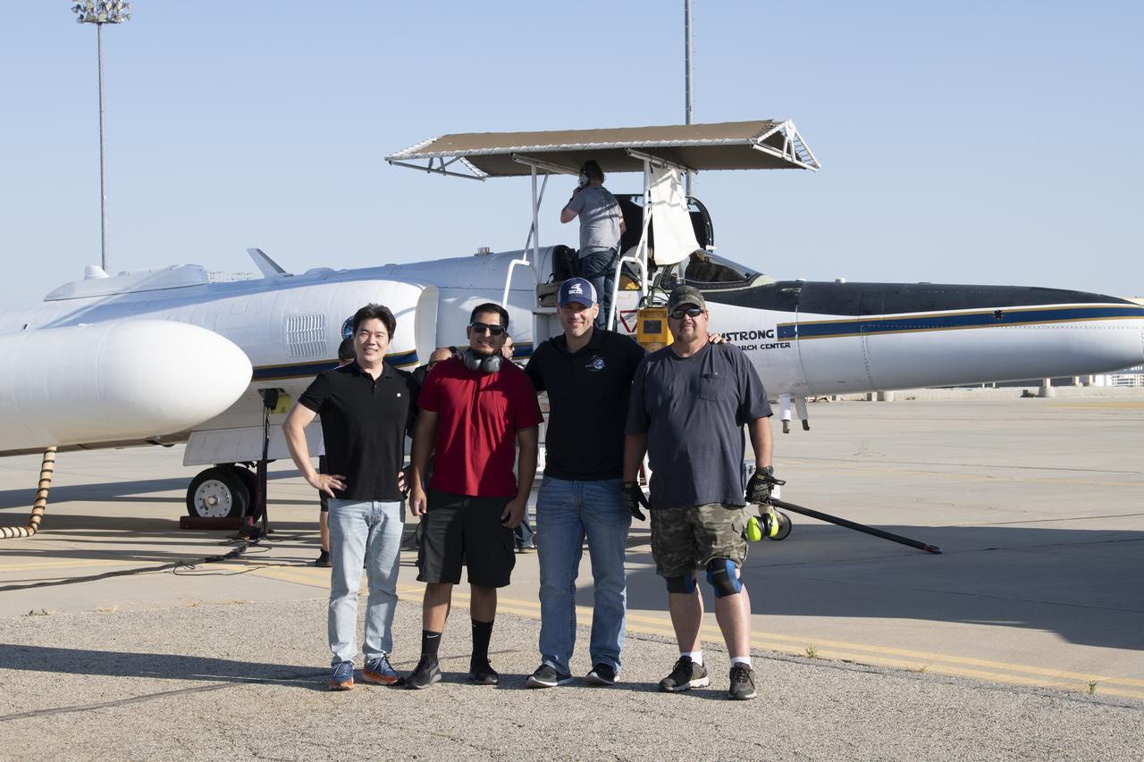
NASA Armstrong’s ER-2 aircraft deploys for its ALOFT mission. The ER-2 will fly at high altitudes above the Floridian coastline to collect data about the energetic characteristics and behavior of lightning and thunderclouds. A NASA pilot will operate the aircraft while scientists from the University of Bergen, Norway will interpret the data from the ground.
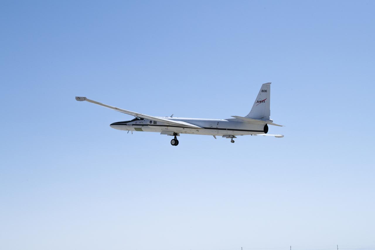
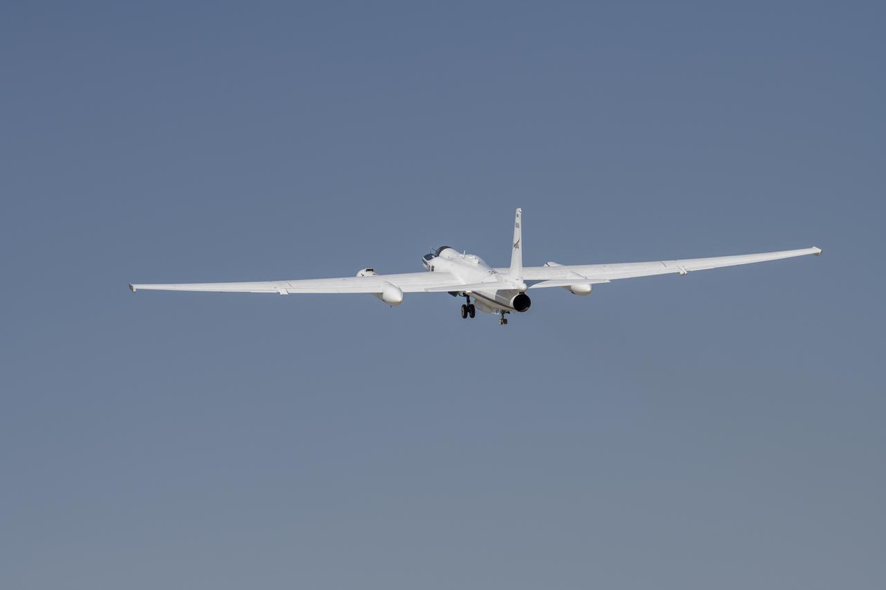
NASA’s ER-2 No. 806 returns to flying high-altitude on April 7, 2022, after three years of heavy maintenance. NASA Armstrong operates two ER-2 aircraft to collect information about Earth resources, celestial observations, atmospheric chemistry and dynamics, and oceanic processes.
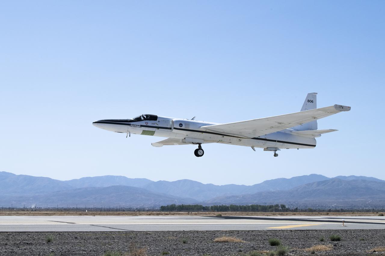
NASA's ER-2 No. 806 returns to flying high-altitude on April 7, 2022, after three years of heavy maintenance. NASA Armstrong operates two ER-2 aircraft to collect information about Earth resources, celestial observations, atmospheric chemistry and dynamics, and oceanic processes.
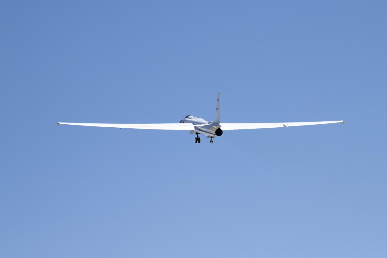
NASA’s ER-2 No. 806 returns to flying high-altitude on April 7, 2022, after three years of heavy maintenance. NASA Armstrong operates two ER-2 aircraft to collect information about Earth resources, celestial observations, atmospheric chemistry and dynamics, and oceanic processes.
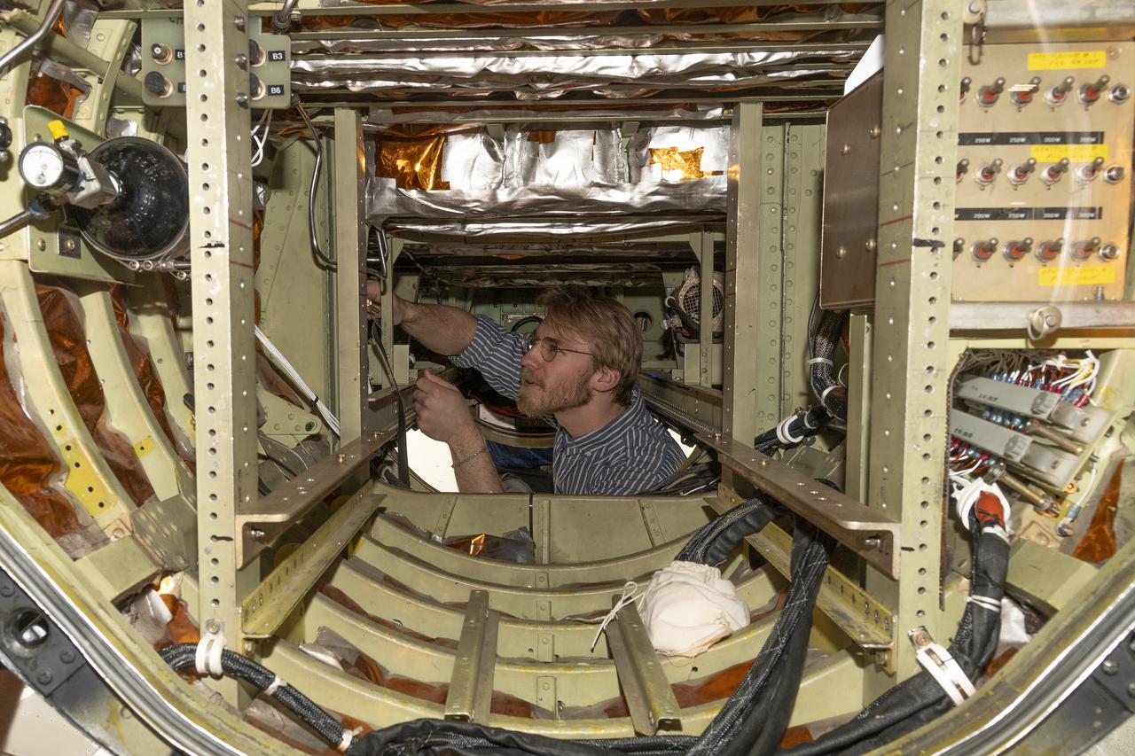
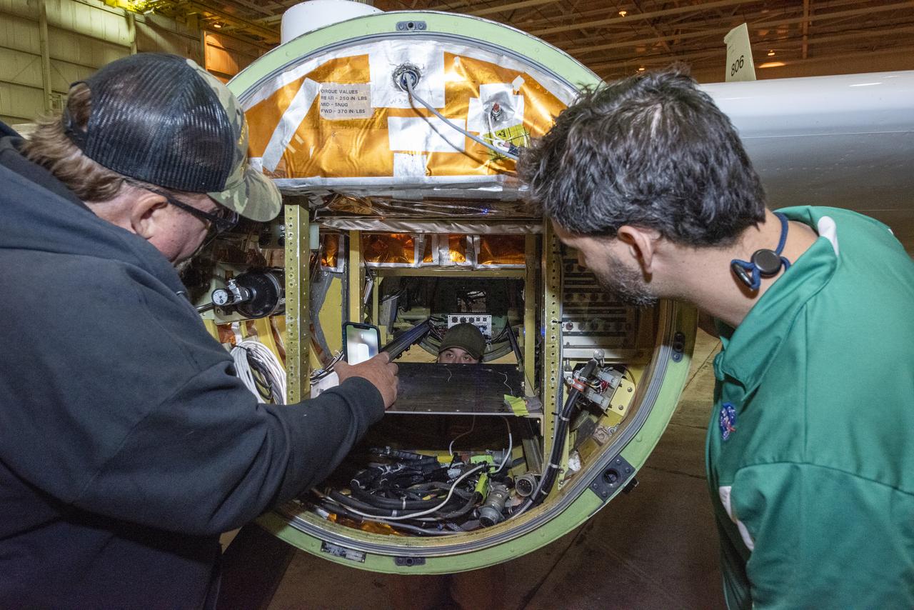
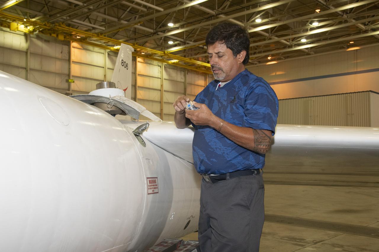
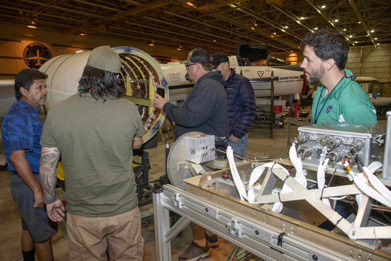
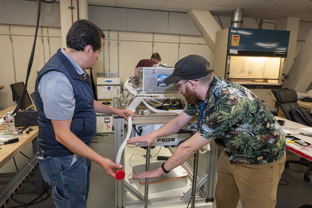
A team of experts prepares the ER-2 aircraft at Armstrong Flight Research Center in Edwards, California for the GSFC Lidar Observation and Validation Experiment (GLOVE) in February 2025. Researcher Jackson Begolka from the University of Iowa examines the instrument connectors in the ER-2 onboard the ER-2, which flies at high altitudes to validate satellite-borne data. As a collaboration between engineers, scientists, and aircraft professionals, GLOVE aims to improve satellite data products for Earth Science applications.
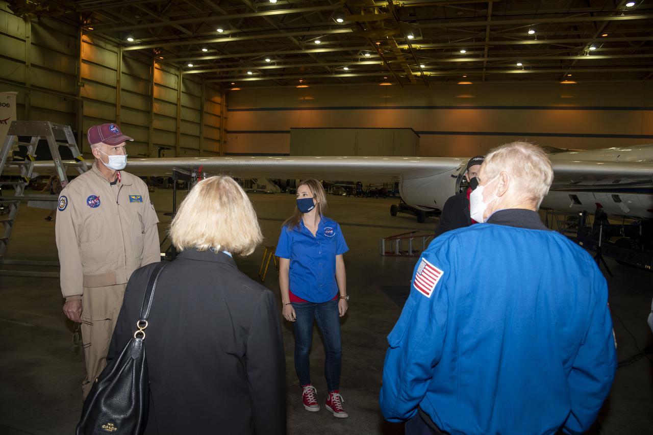
NASA Administrator Bill Nelson and NASA Deputy Administrator Pam Melroy receive a briefing on the high-altitude ER-2 aircraft and its missions from ER-2 pilot Greg "Coach" Nelson and ER-2 deputy project manager Fran Becker, and ER-2 pilot Tim Williams at Building 703 in Palmdale, California. The building is part of NASA's Armstrong Flight Research Center, which has its main campus in Edwards, California.
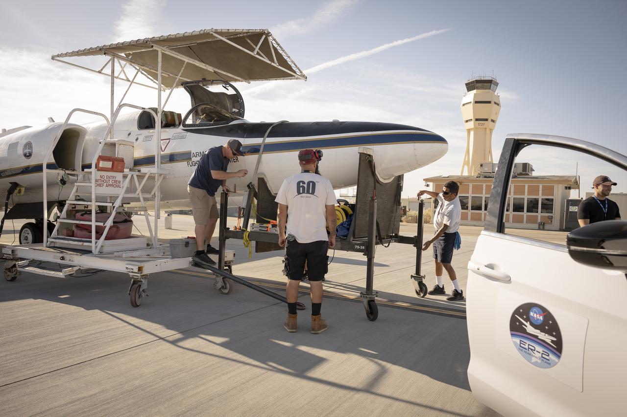
Ground crew members make final preparations on NASA Armstrong Flight Research Center’s ER-2 aircraft at Edwards, California, on Thursday, Aug. 21, 2025, ahead of a high-altitude mission for the Geological Earth Mapping Experiment (GEMx). The pilot will soon board the aircraft, which can fly at altitudes up to 70,000 feet.
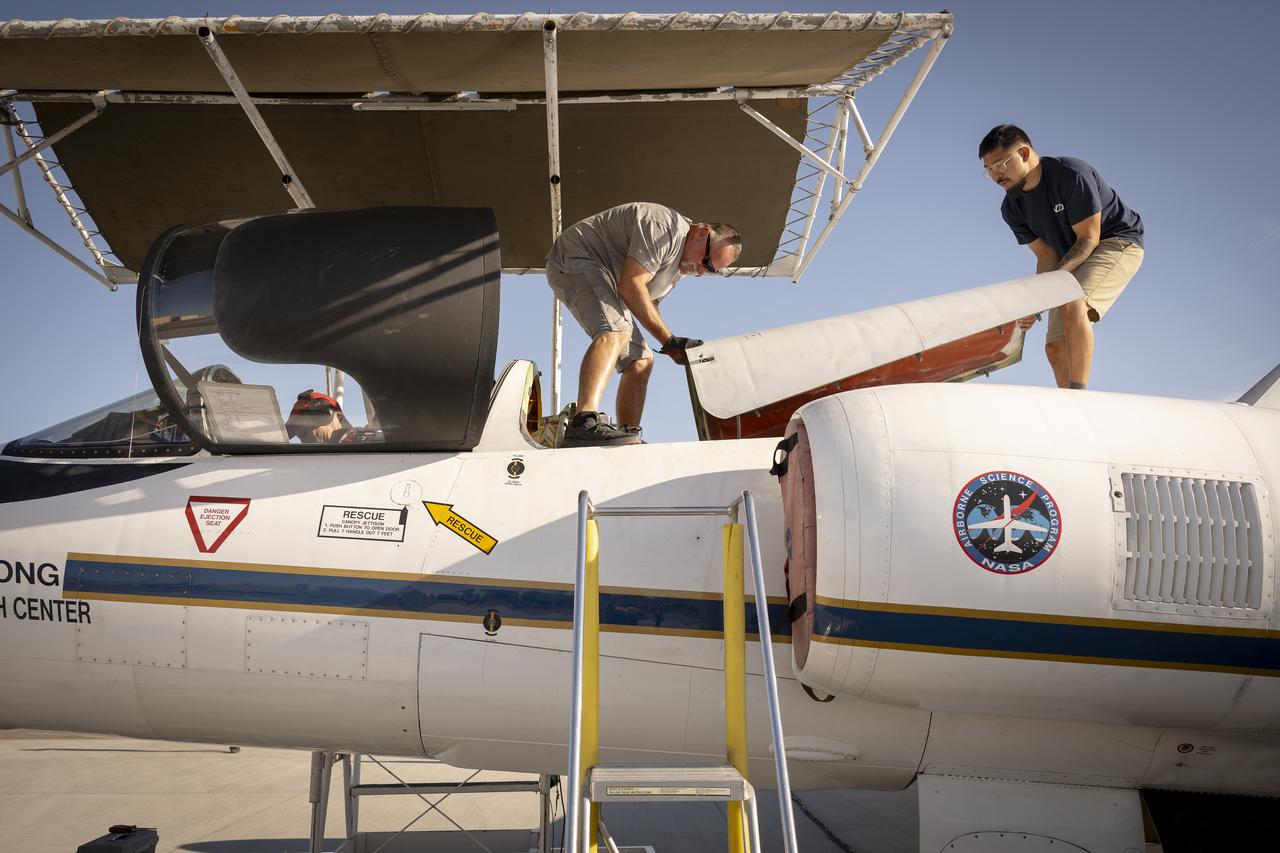
Ground crew members make final preparations on NASA Armstrong Flight Research Center’s ER-2 aircraft at Edwards, California, on Thursday, Aug. 21, 2025, ahead of a high-altitude mission for the Geological Earth Mapping Experiment (GEMx). The pilot will soon board the aircraft, which can fly at altitudes up to 70,000 feet.
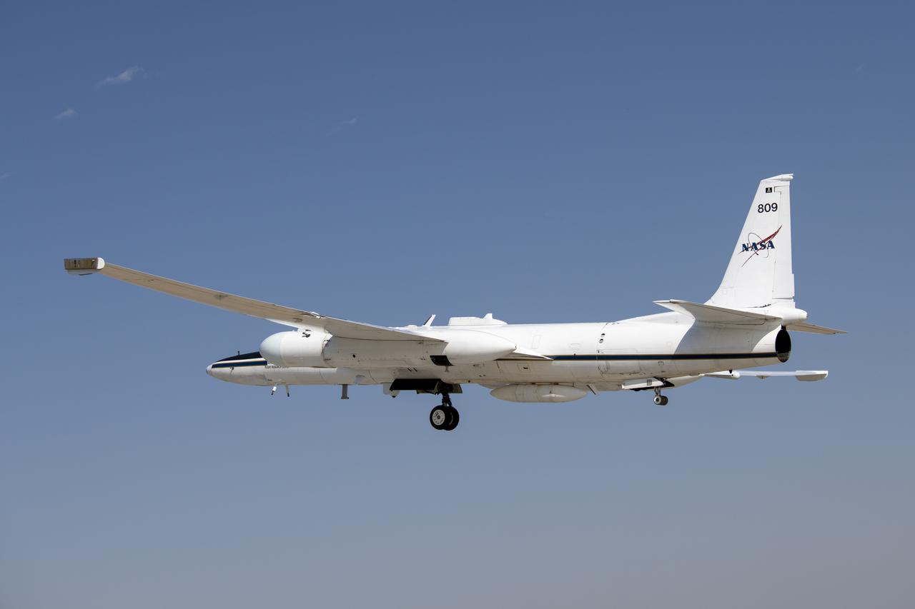
NASA's Armstrong Flight Research Center operates ER-2 #809 high-altitude aircraft for Dynamics and Chemistry of the Summer Stratosphere (DCOTSS) science flights on June 17, 2021.
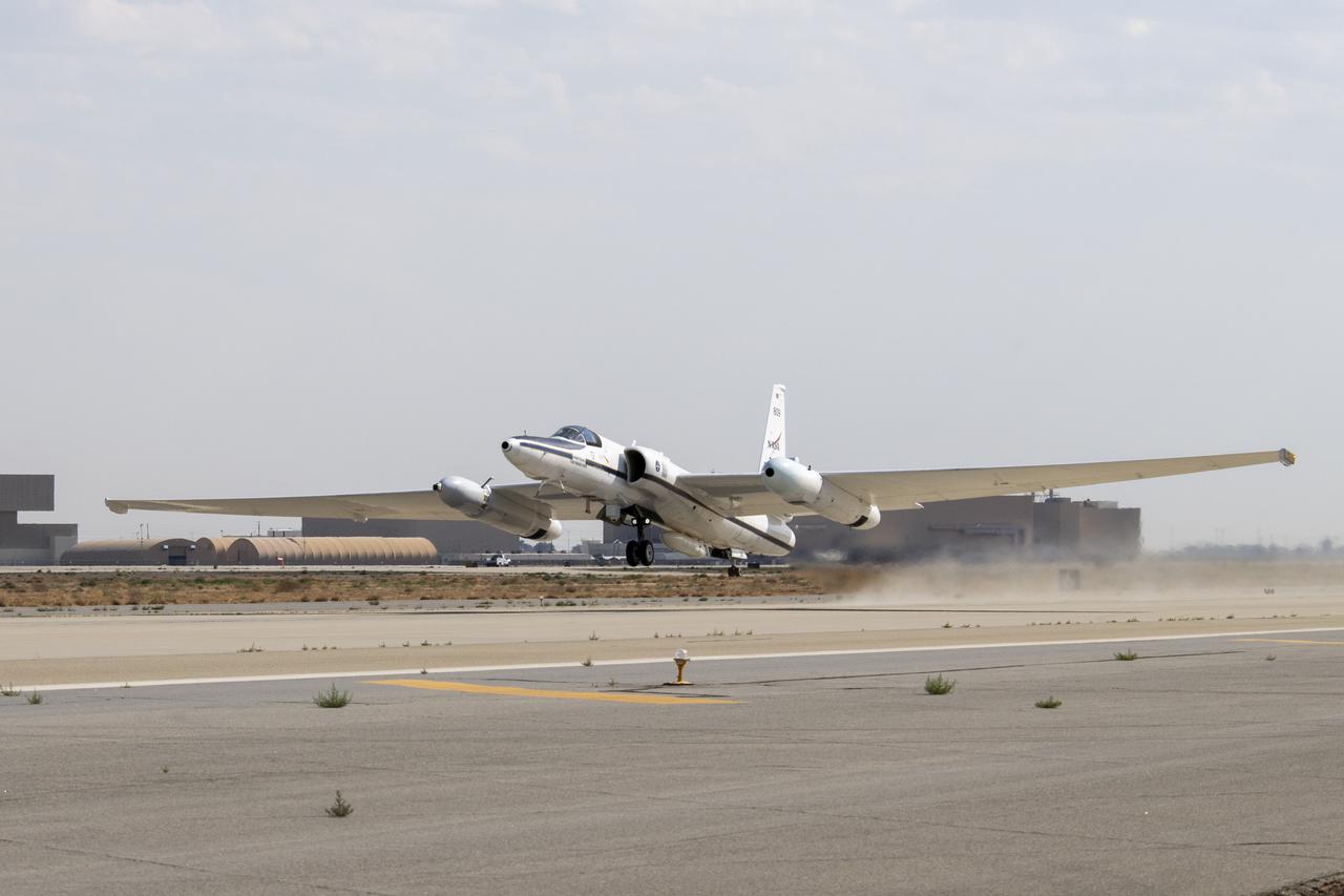
NASA’s Armstrong Flight Research Center ER-2 #809 high-altitude aircraft taking off for Dynamics and Chemistry of the Summer Stratosphere (DCOTSS) science flights in Palmdale, CA on June 17, 2021.
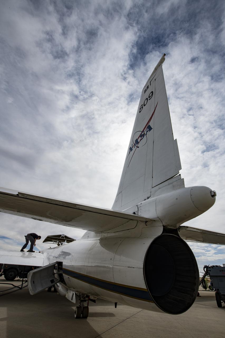
NASA's Armstrong Flight Research Center ER-2 #809 high-altitude aircraft prepped for Dynamics and Chemistry of the Summer Stratosphere (DCOTSS) science flights in Palmdale, CA.
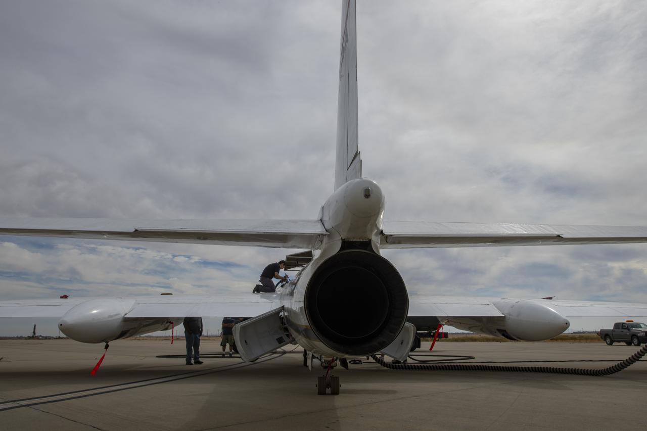
NASA's Armstrong Flight Research Center ER-2 #809 high-altitude aircraft prepped for Dynamics and Chemistry of the Summer Stratosphere (DCOTSS) science flights in Palmdale, CA.
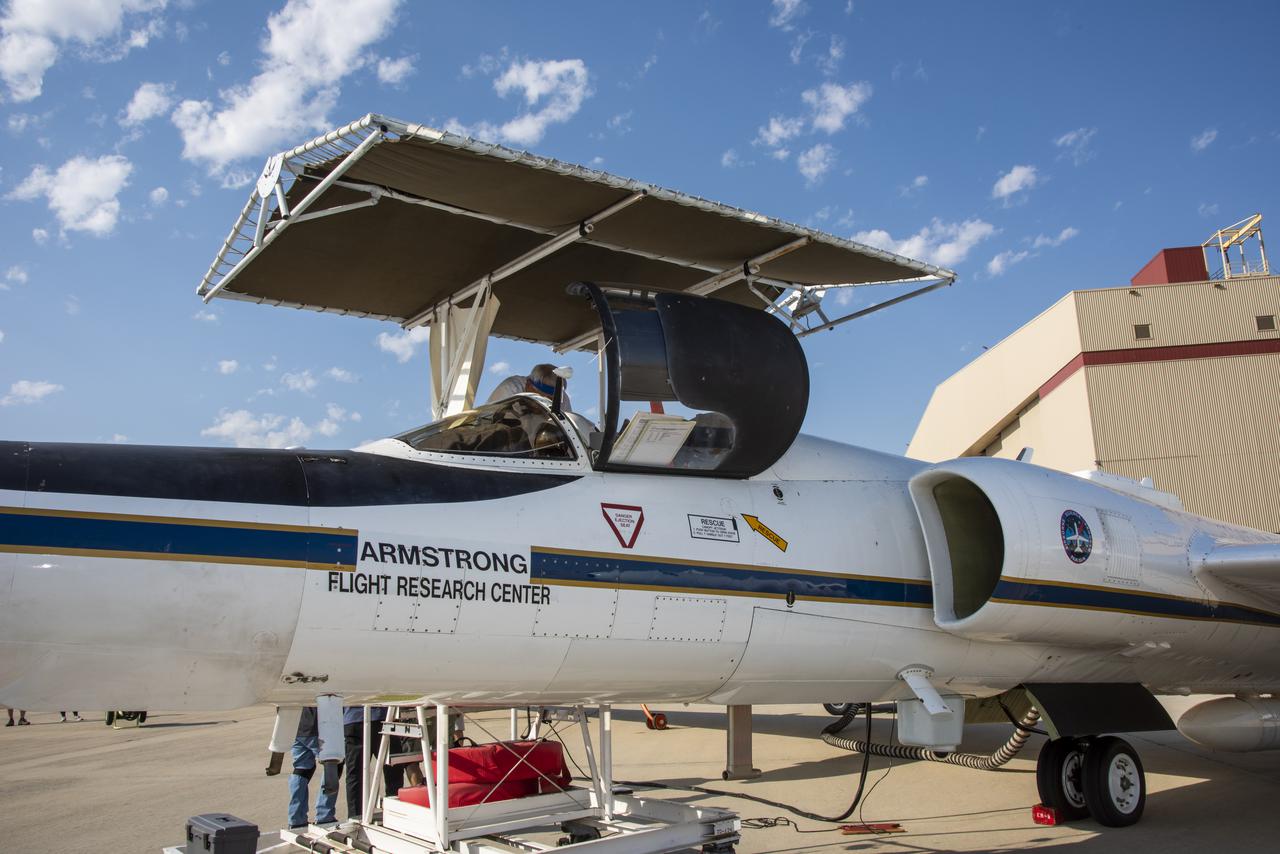
NASA's Armstrong Flight Research Center ER-2 #809 high-altitude aircraft prepared for Dynamics and Chemistry of the Summer Stratosphere (DCOTSS) science flights in Palmdale, CA on June 17, 2021
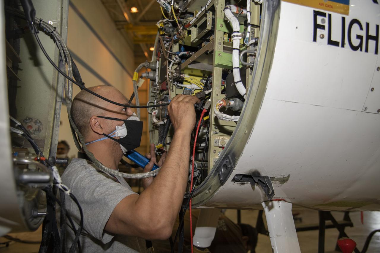
NASA’s Armstrong Flight Research Center ER-2 #809 high-altitude aircraft maintained by avionics technician Gregory Bantalin for Dynamics and Chemistry of the Summer Stratosphere (DCOTSS) science flights.
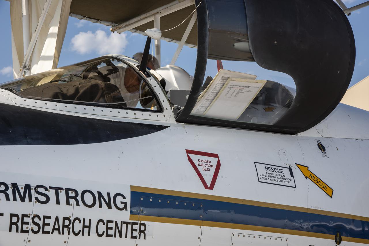
NASA's Armstrong Flight Research Center ER-2 #809 high-altitude aircraft prepared for Dynamics and Chemistry of the Summer Stratosphere (DCOTSS) science flights in Palmdale, CA on June 17, 2021.
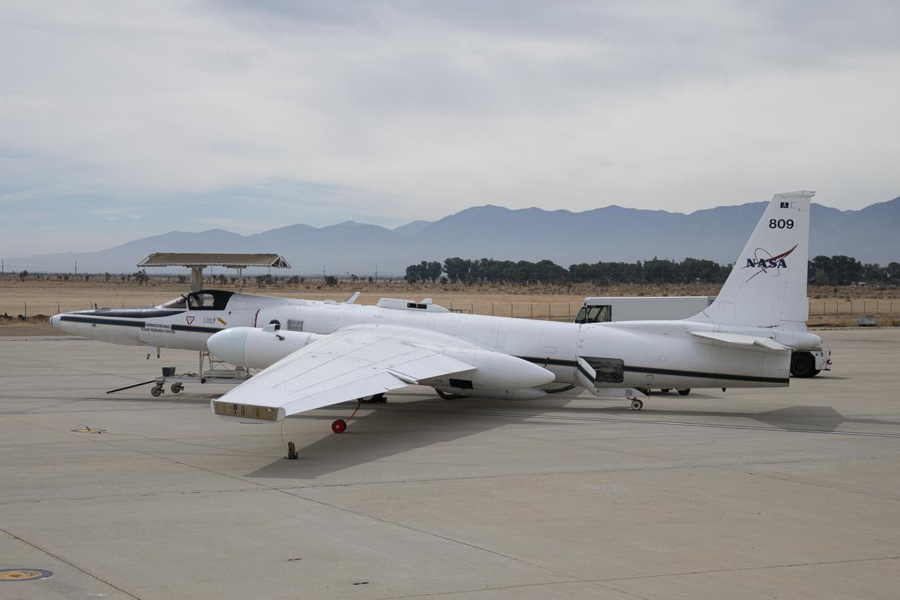
NASA's Armstrong Flight Research Center ER-2 #809 high-altitude aircraft prepped for Dynamics and Chemistry of the Summer Stratosphere (DCOTSS) science flights in Palmdale, CA.
NASA’s Armstrong Flight Research Center operates ER-2 #809 high-altitude aircraft for Dynamics and Chemistry of the Summer Stratosphere (DCOTSS) science flights on June 17, 2021.
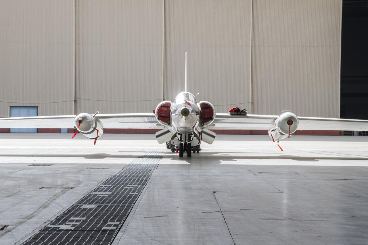
NASA’s Armstrong Flight Research Center ER-2 #809 high-altitude aircraft prepped for Dynamics and Chemistry of the Summer Stratosphere (DCOTSS) science flights in Palmdale, CA.
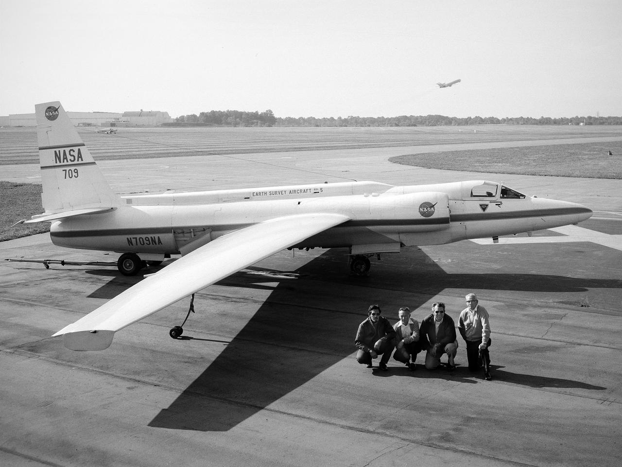
A National Aeronautics and Space Administration (NASA) Lockheed U-2 aircraft on display at the 1973 Inspection of the Lewis Research Center in Cleveland, Ohio. Lockheed developed the U-2 as a high-altitude reconnaissance aircraft in the early 1950s before satellites were available. The U-2 could cruise over enemy territory at 70,000 feet and remain impervious to ground fire, interceptor aircraft, and even radar. An advanced camera system was designed specifically for the aircraft. The pilot is required to use a pressure suit similar to those worn by astronauts. NASA’s Ames Research Center received two U-2 aircraft in April 1971 to conduct high-altitude research. They were used to study and monitor various Earth resources, celestial bodies, atmospheric chemistry, and oceanic processes. NASA replaced its U-2s with ER-2 aircraft in 1981 and 1989. The ER-2s were designed to carry up to 2600 pounds of scientific equipment. The ER-2 program was transferred to Dryden Flight Research Center in 1997. Since the inaugural flight for this program on August 31, 1971, NASA’s U-2 and ER-2 aircraft have flown more than 4500 data missions and test flights for NASA, other federal agencies, states, universities, and the private sector.
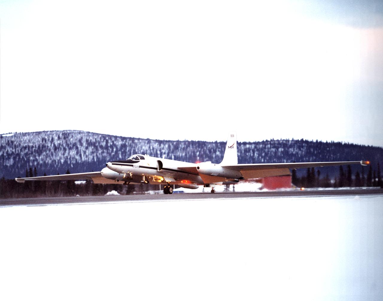
ER-2s bearing tail numbers 806 and 809 are used as airborne science platforms by NASA's Dryden Flight Research Center. The aircraft are platforms for a variety of high-altitude science missions flown over various parts of the world. They are also used for earth science and atmospheric sensor research and development, satellite calibration and data validation. The ER-2s are capable of carrying a maximum payload of 2,600 pounds of experiments in a nose bay, the main equipment bay behind the cockpit, two wing-mounted superpods and small underbody and trailing edges. Most ER-2 missions last about six hours with ranges of about 2,200 nautical miles. The aircraft typically fly at altitudes above 65,000 feet. On November 19, 1998, an ER-2 set a world record for medium weight aircraft reaching an altitude of 68,700 feet. The aircraft is 63 feet long, with a wingspan of 104 feet. The top of the vertical tail is 16 feet above ground when the aircraft is on the bicycle-type landing gear. Cruising speeds are 410 knots, or 467 miles per hour, at altitude. A single General Electric F-118 turbofan engine rated at 17,000 pounds thrust powers the ER-2.

ER-2s bearing tail numbers 806 and 809 are used as airborne science platforms by NASA's Dryden Flight Research Center. The aircraft are platforms for a variety of high-altitude science missions flown over various parts of the world. They are also used for earth science and atmospheric sensor research and development, satellite calibration and data validation. The ER-2s are capable of carrying a maximum payload of 2,600 pounds of experiments in a nose bay, the main equipment bay behind the cockpit, two wing-mounted superpods and small underbody and trailing edges. Most ER-2 missions last about six hours with ranges of about 2,200 nautical miles. The aircraft typically fly at altitudes above 65,000 feet. On November 19, 1998, an ER-2 set a world record for medium weight aircraft reaching an altitude of 68,700 feet. The aircraft is 63 feet long, with a wingspan of 104 feet. The top of the vertical tail is 16 feet above ground when the aircraft is on the bicycle-type landing gear. Cruising speeds are 410 knots, or 467 miles per hour, at altitude. A single General Electric F-118 turbofan engine rated at 17,000 pounds thrust powers the ER-2.
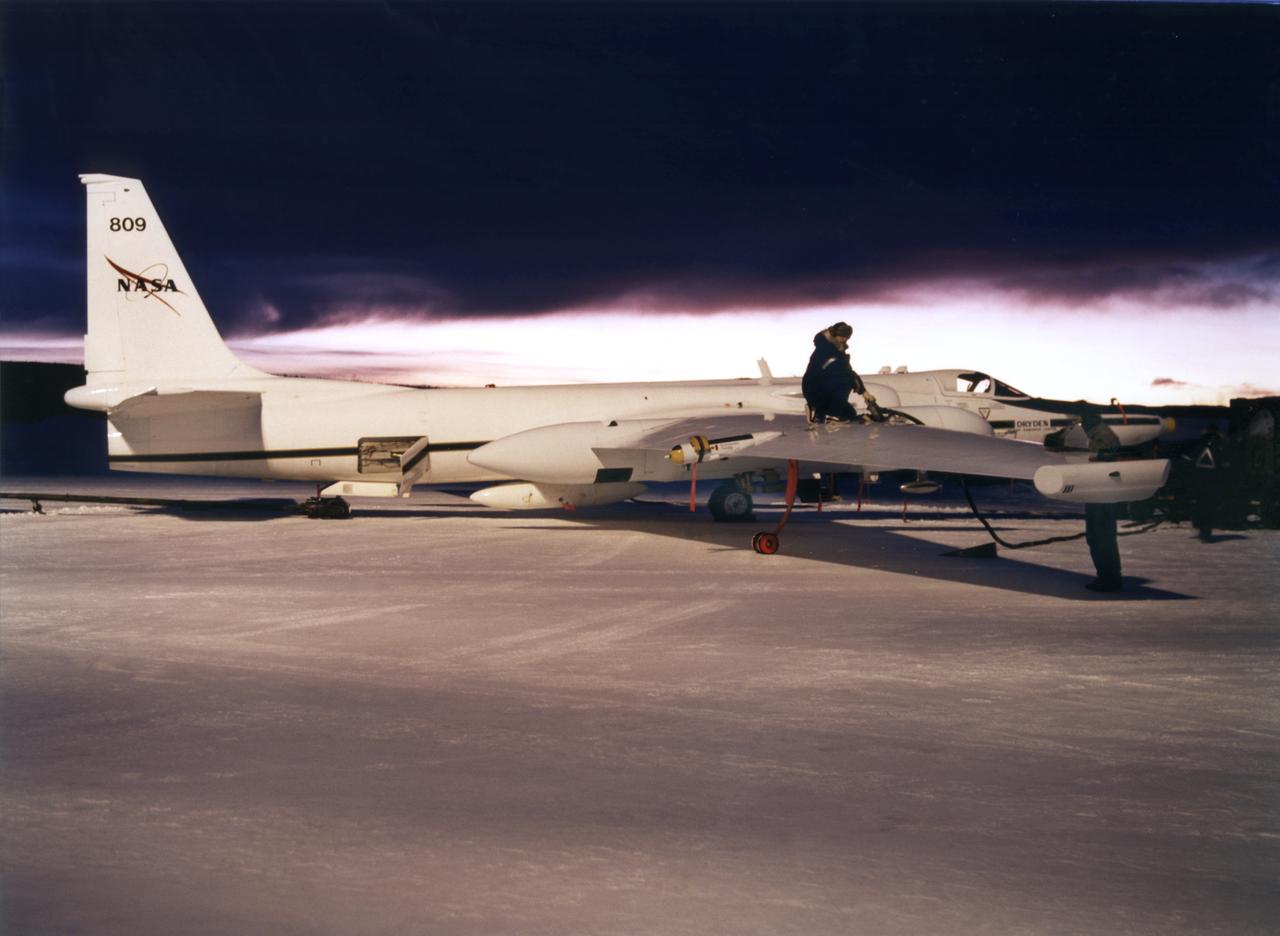
ER-2s bearing tail numbers 806 and 809 are used as airborne science platforms by NASA's Dryden Flight Research Center. The aircraft are platforms for a variety of high-altitude science missions flown over various parts of the world. They are also used for earth science and atmospheric sensor research and development, satellite calibration and data validation. The ER-2s are capable of carrying a maximum payload of 2,600 pounds of experiments in a nose bay, the main equipment bay behind the cockpit, two wing-mounted superpods and small underbody and trailing edges. Most ER-2 missions last about six hours with ranges of about 2,200 nautical miles. The aircraft typically fly at altitudes above 65,000 feet. On November 19, 1998, an ER-2 set a world record for medium weight aircraft reaching an altitude of 68,700 feet. The aircraft is 63 feet long, with a wingspan of 104 feet. The top of the vertical tail is 16 feet above ground when the aircraft is on the bicycle-type landing gear. Cruising speeds are 410 knots, or 467 miles per hour, at altitude. A single General Electric F-118 turbofan engine rated at 17,000 pounds thrust powers the ER-2.

ER-2s bearing tail numbers 806 and 809 are used as airborne science platforms by NASA's Dryden Flight Research Center. The aircraft are platforms for a variety of high-altitude science missions flown over various parts of the world. They are also used for earth science and atmospheric sensor research and development, satellite calibration and data validation. The ER-2s are capable of carrying a maximum payload of 2,600 pounds of experiments in a nose bay, the main equipment bay behind the cockpit, two wing-mounted superpods and small underbody and trailing edges. Most ER-2 missions last about six hours with ranges of about 2,200 nautical miles. The aircraft typically fly at altitudes above 65,000 feet. On November 19, 1998, an ER-2 set a world record for medium weight aircraft reaching an altitude of 68,700 feet. The aircraft is 63 feet long, with a wingspan of 104 feet. The top of the vertical tail is 16 feet above ground when the aircraft is on the bicycle-type landing gear. Cruising speeds are 410 knots, or 467 miles per hour, at altitude. A single General Electric F-118 turbofan engine rated at 17,000 pounds thrust powers the ER-2.
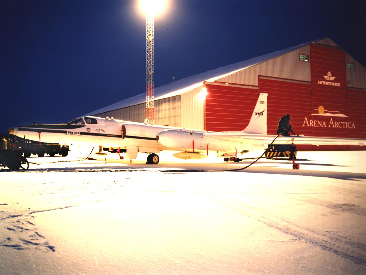
ER-2s bearing tail numbers 806 and 809 are used as airborne science platforms by NASA's Dryden Flight Research Center. The aircraft are platforms for a variety of high-altitude science missions flown over various parts of the world. They are also used for earth science and atmospheric sensor research and development, satellite calibration and data validation. The ER-2s are capable of carrying a maximum payload of 2,600 pounds of experiments in a nose bay, the main equipment bay behind the cockpit, two wing-mounted superpods and small underbody and trailing edges. Most ER-2 missions last about six hours with ranges of about 2,200 nautical miles. The aircraft typically fly at altitudes above 65,000 feet. On November 19, 1998, an ER-2 set a world record for medium weight aircraft reaching an altitude of 68,700 feet. The aircraft is 63 feet long, with a wingspan of 104 feet. The top of the vertical tail is 16 feet above ground when the aircraft is on the bicycle-type landing gear. Cruising speeds are 410 knots, or 467 miles per hour, at altitude. A single General Electric F-118 turbofan engine rated at 17,000 pounds thrust powers the ER-2.
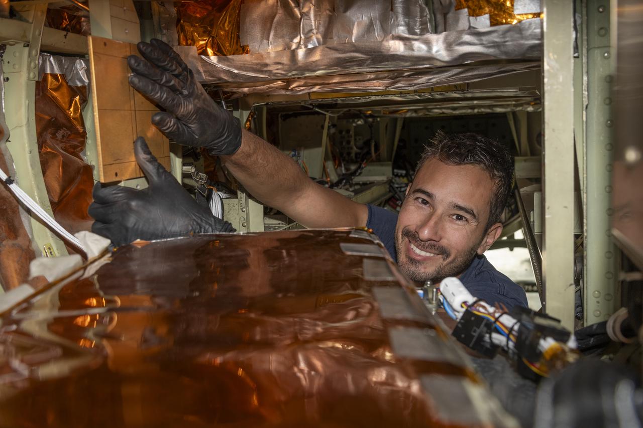
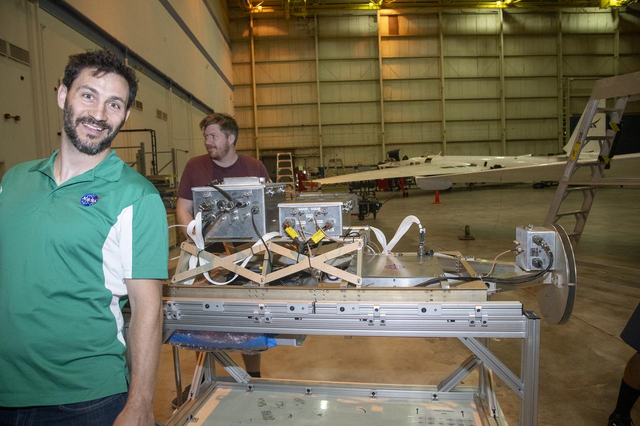
A team of experts prepares the ER-2 aircraft at Armstrong Flight Research Center in Edwards, California for the GSFC Lidar Observation and Validation Experiment (GLOVE) in February 2025. Aircraft mechanic Darick Alvarez-Alonzo installs a satellite-simulating instrument which will fly at high altitudes on the ER-2 to validate satellite-borne data. As a collaboration between engineers, scientists, and aircraft professionals, GLOVE aims to improve satellite data products for Earth Science applications.
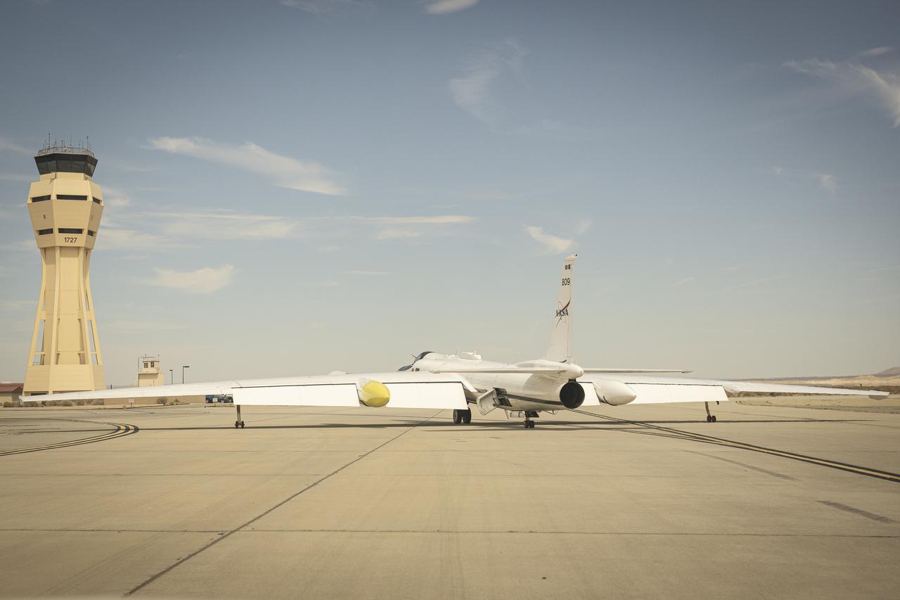
NASA Armstrong Flight Research Center’s ER-2 aircraft taxis at Edwards, California, on Thursday, Aug. 21, 2025, ahead of a high-altitude mission supporting the Geological Earth Mapping Experiment (GEMx), which requires flights of up to eight hours at approximately 65,000 feet altitude.

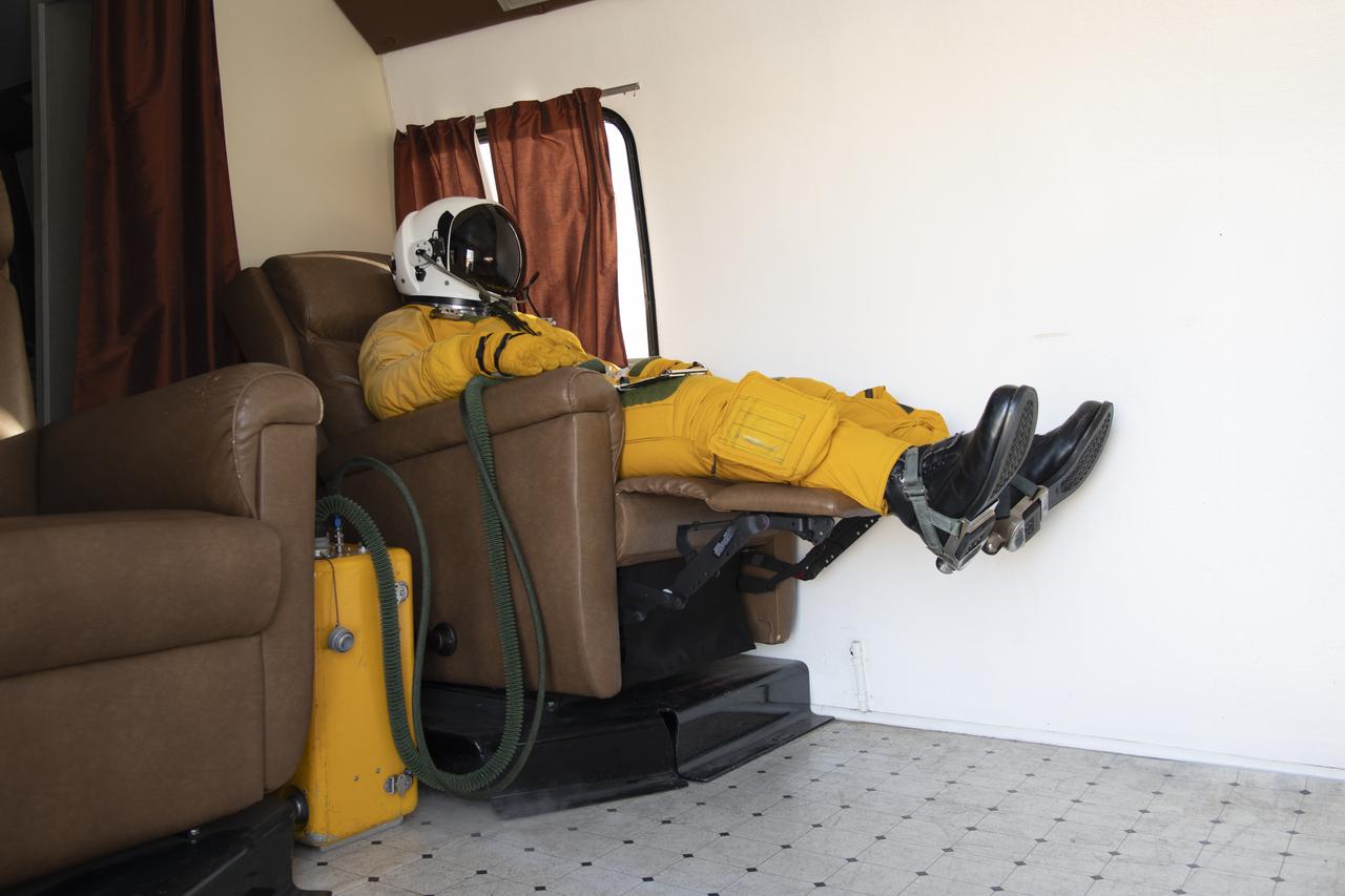
Suited up and ready, ER-2 pilot Kirt Stallings waits inside the transport vehicle at Edwards, California, on Thursday, Aug. 21, 2025, moments before boarding NASA’s Armstrong Flight Research Center’s ER-2 aircraft for a high-altitude mission supporting the Geological Earth Mapping Experiment (GEMx). Through the vehicle window, the aircraft can be seen being readied for flight.
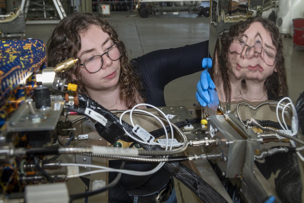
A team of experts prepares the ER-2 aircraft at Armstrong Flight Research Center in Edwards, California for the GSFC Lidar Observation and Validation Experiment (GLOVE) in February 2025. Researcher Jennifer Moore checks the cabling on the Roscoe instrument which flew at high altitudes on the ER-2. As a collaboration between engineers, scientists, and aircraft professionals, GLOVE aims to improve satellite data products for Earth Science applications.

NASA Armstrong’s ER-2 aircraft is uploaded with instruments for its ALOFT mission. The ER-2 will fly at high altitudes above the Floridian coastline to collect data about the energetic characteristics and behavior of lightning and thunderclouds. Scientists from the University of Bergen, Norway will interpret that data from the ground and collaborate with NASA pilots to safely collect the most accurate data for this project about the power of lightning.
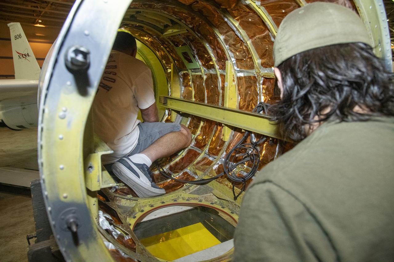
NASA Armstrong’s ER-2 aircraft is uploaded with instruments for its ALOFT mission. The ER-2 will fly at high altitudes above the Floridian coastline to collect data about the energetic characteristics and behavior of lightning and thunderclouds. Scientists from the University of Bergen, Norway will interpret that data from the ground and collaborate with NASA pilots to safely collect the most accurate data for this project about the power of lightning.
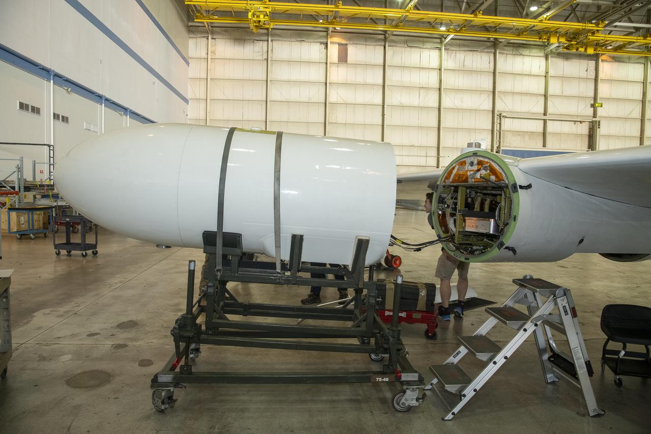
NASA Armstrong’s ER-2 aircraft is uploaded with instruments for its ALOFT mission. The ER-2 will fly at high altitudes above the Floridian coastline to collect data about the energetic characteristics and behavior of lightning and thunderclouds. Scientists from the University of Bergen, Norway will interpret that data from the ground and collaborate with NASA pilots to safely collect the most accurate data for this project about the power of lightning.
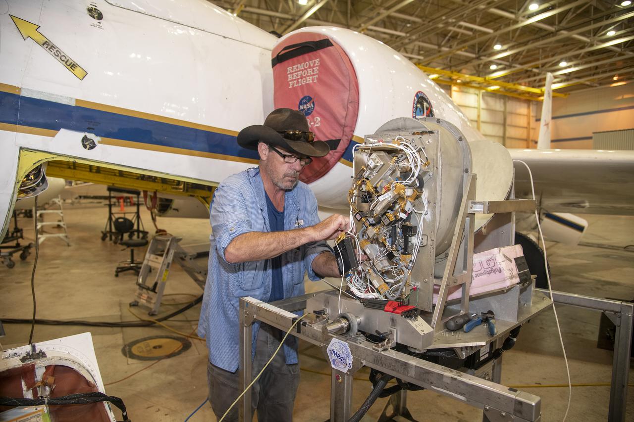
NASA Armstrong’s ER-2 aircraft is uploaded with instruments for its ALOFT mission. The ER-2 will fly at high altitudes above the Floridian coastline to collect data about the energetic characteristics and behavior of lightning and thunderclouds. Scientists from the University of Bergen, Norway will interpret that data from the ground and collaborate with NASA pilots to safely collect the most accurate data for this project about the power of lightning.
NASA Armstrong’s ER-2 aircraft is uploaded with instruments for its ALOFT mission. The ER-2 will fly at high altitudes above the Floridian coastline to collect data about the energetic characteristics and behavior of lightning and thunderclouds. Scientists from the University of Bergen, Norway will interpret that data from the ground and collaborate with NASA pilots to safely collect the most accurate data for this project about the power of lightning.
NASA Armstrong’s ER-2 aircraft is uploaded with instruments for its ALOFT mission. The ER-2 will fly at high altitudes above the Floridian coastline to collect data about the energetic characteristics and behavior of lightning and thunderclouds. Scientists from the University of Bergen, Norway will interpret that data from the ground and collaborate with NASA pilots to safely collect the most accurate data for this project about the power of lightning.
NASA Armstrong’s ER-2 aircraft is uploaded with instruments for its ALOFT mission. The ER-2 will fly at high altitudes above the Floridian coastline to collect data about the energetic characteristics and behavior of lightning and thunderclouds. Scientists from the University of Bergen, Norway will interpret that data from the ground and collaborate with NASA pilots to safely collect the most accurate data for this project about the power of lightning.
NASA Armstrong’s ER-2 aircraft is uploaded with instruments for its ALOFT mission. The ER-2 will fly at high altitudes above the Floridian coastline to collect data about the energetic characteristics and behavior of lightning and thunderclouds. Scientists from the University of Bergen, Norway will interpret that data from the ground and collaborate with NASA pilots to safely collect the most accurate data for this project about the power of lightning.
NASA Armstrong’s ER-2 aircraft is uploaded with instruments for its ALOFT mission. The ER-2 will fly at high altitudes above the Floridian coastline to collect data about the energetic characteristics and behavior of lightning and thunderclouds. Scientists from the University of Bergen, Norway will interpret that data from the ground and collaborate with NASA pilots to safely collect the most accurate data for this project about the power of lightning.
NASA Armstrong’s ER-2 aircraft is uploaded with instruments for its ALOFT mission. The ER-2 will fly at high altitudes above the Floridian coastline to collect data about the energetic characteristics and behavior of lightning and thunderclouds. Scientists from the University of Bergen, Norway will interpret that data from the ground and collaborate with NASA pilots to safely collect the most accurate data for this project about the power of lightning.
NASA Armstrong’s ER-2 aircraft is uploaded with instruments for its ALOFT mission. The ER-2 will fly at high altitudes above the Floridian coastline to collect data about the energetic characteristics and behavior of lightning and thunderclouds. Scientists from the University of Bergen, Norway will interpret that data from the ground and collaborate with NASA pilots to safely collect the most accurate data for this project about the power of lightning.
NASA Armstrong’s ER-2 aircraft is uploaded with instruments for its ALOFT mission. The ER-2 will fly at high altitudes above the Floridian coastline to collect data about the energetic characteristics and behavior of lightning and thunderclouds. Scientists from the University of Bergen, Norway will interpret that data from the ground and collaborate with NASA pilots to safely collect the most accurate data for this project about the power of lightning.
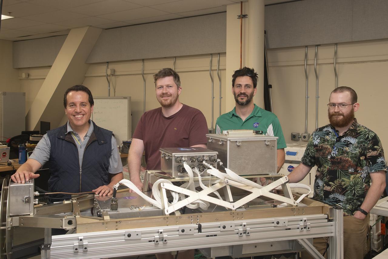
NASA Armstrong’s ER-2 aircraft is uploaded with instruments for its ALOFT mission. The ER-2 will fly at high altitudes above the Floridian coastline to collect data about the energetic characteristics and behavior of lightning and thunderclouds. Scientists from the University of Bergen, Norway will interpret that data from the ground and collaborate with NASA pilots to safely collect the most accurate data for this project about the power of lightning.
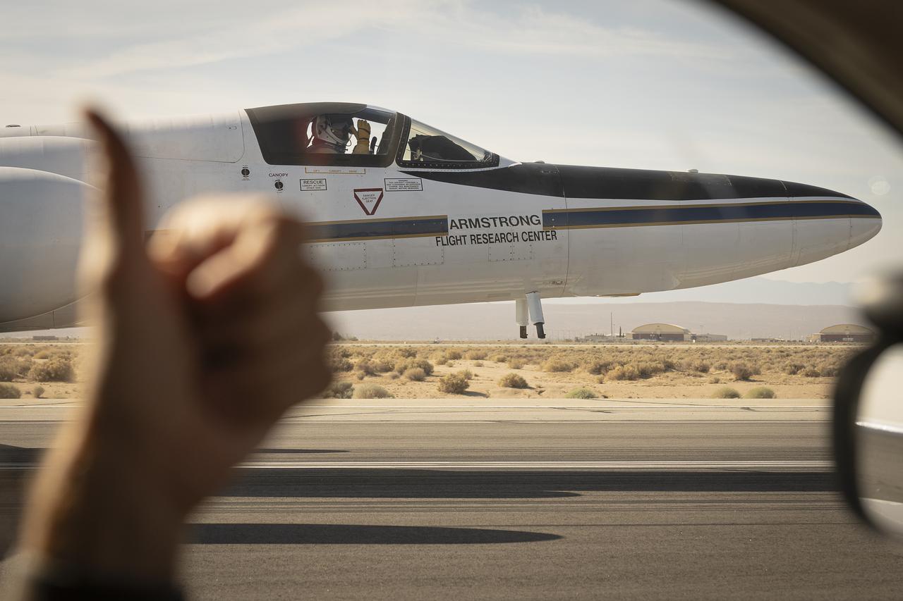
From the window of the ER-2 chase car, a crew member gives a thumbs up to the pilot as NASA Armstrong Flight Research Center’s ER-2 aircraft taxis at Edwards, California, on Thursday, Aug. 21, 2025. The gesture signals a final check before takeoff for the high-altitude mission supporting the Geological Earth Mapping Experiment (GEMx).
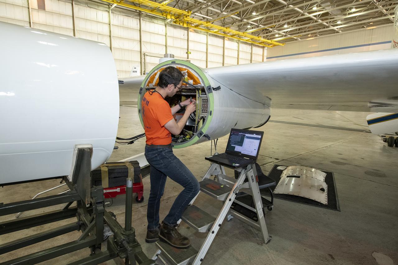
NASA Armstrong’s ER-2 aircraft is uploaded with instruments for its ALOFT mission. The ER-2 will fly at high altitudes above the Floridian coastline to collect data about the energetic characteristics and behavior of lightning and thunderclouds. Scientists from the University of Bergen, Norway will interpret that data from the ground and collaborate with NASA pilots to safely collect the most accurate data for this project about the power of lightning.
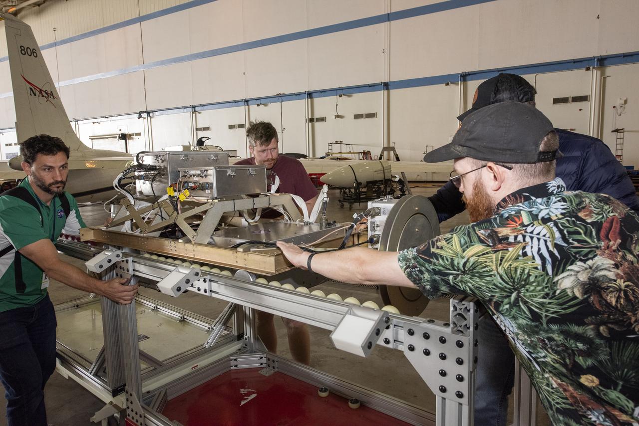
NASA Armstrong’s ER-2 aircraft is uploaded with instruments for its ALOFT mission. The ER-2 will fly at high altitudes above the Floridian coastline to collect data about the energetic characteristics and behavior of lightning and thunderclouds. Scientists from the University of Bergen, Norway will interpret that data from the ground and collaborate with NASA pilots to safely collect the most accurate data for this project about the power of lightning.
NASA Armstrong’s ER-2 aircraft is uploaded with instruments for its ALOFT mission. The ER-2 will fly at high altitudes above the Floridian coastline to collect data about the energetic characteristics and behavior of lightning and thunderclouds. Scientists from the University of Bergen, Norway will interpret that data from the ground and collaborate with NASA pilots to safely collect the most accurate data for this project about the power of lightning.
NASA Armstrong’s ER-2 aircraft is uploaded with instruments for its ALOFT mission. The ER-2 will fly at high altitudes above the Floridian coastline to collect data about the energetic characteristics and behavior of lightning and thunderclouds. Scientists from the University of Bergen, Norway will interpret that data from the ground and collaborate with NASA pilots to safely collect the most accurate data for this project about the power of lightning.
NASA Armstrong’s ER-2 aircraft is uploaded with instruments for its ALOFT mission. The ER-2 will fly at high altitudes above the Floridian coastline to collect data about the energetic characteristics and behavior of lightning and thunderclouds. Scientists from the University of Bergen, Norway will interpret that data from the ground and collaborate with NASA pilots to safely collect the most accurate data for this project about the power of lightning.
NASA's ER-2 high altitude aircraft takes off from Armstrong Flight Research Center Building 703 in Palmdale, California to perform a check flight for the the Dynamics and Chemistry of the Summer Stratosphere, or DCOTSS, 2022 campaign on May 13, 2022.
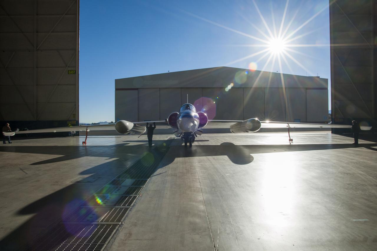
One of two NASA ER-2s (civilian U2-Rs) being backed out of the hangar at Building 703 in Palmdale. Capable of long duration flights at very high altitudes, the ER-2s have wing pods to accommodate science experiments and sensors, as well as a large volume bay behind the pilot. NASA first flew a U-2 for science—a first generation aircraft—in 1972.
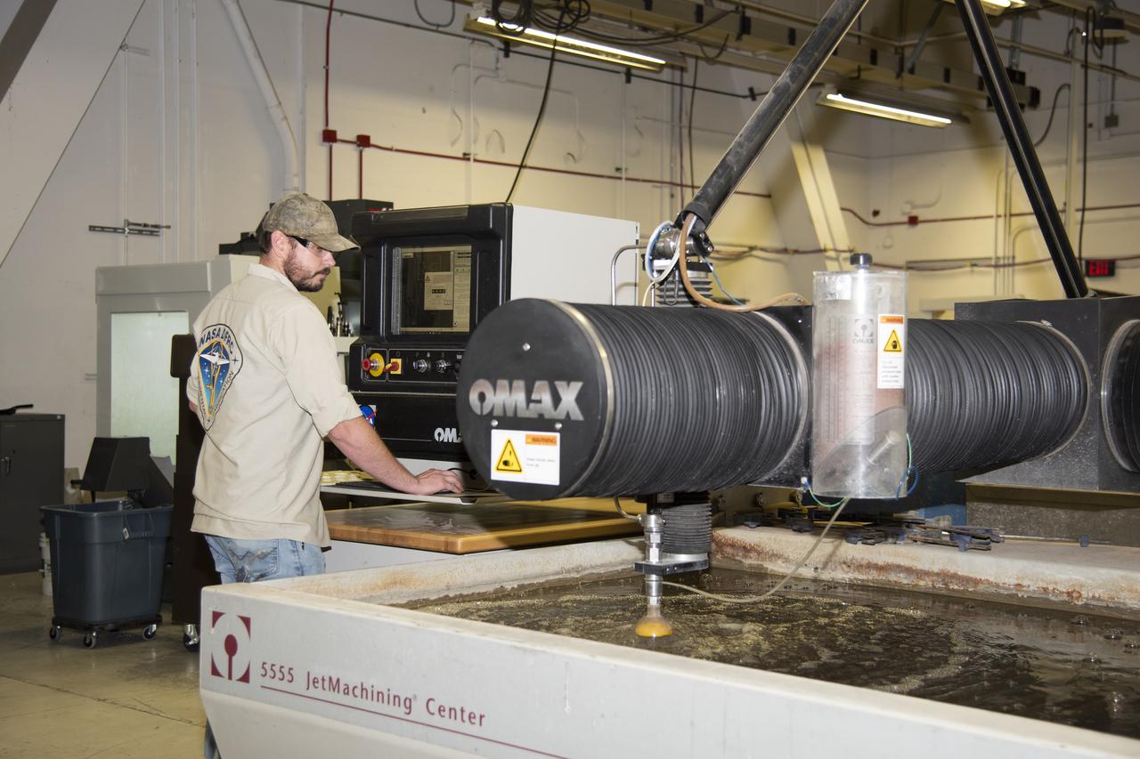
Eric Nisbet works on a part for the ER-2 instrument panel.
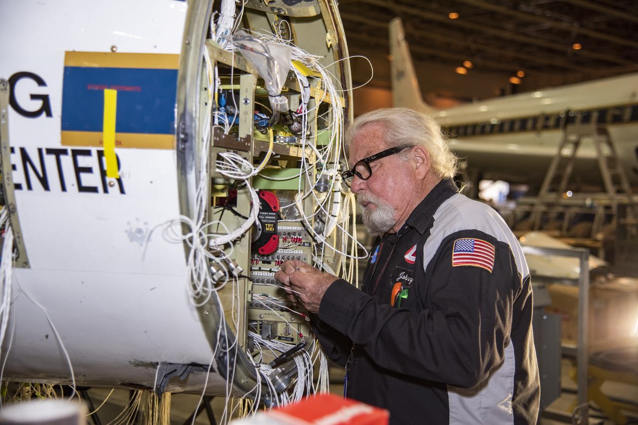
Technician Johnny Bryant works on rewiring the high-altitude aircraft's fixed nose and cockpit.
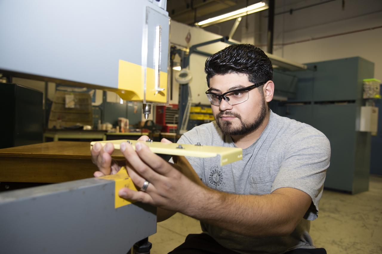
Hector Rosas works on fabricating a part for the ER-2 instrumentation panel.
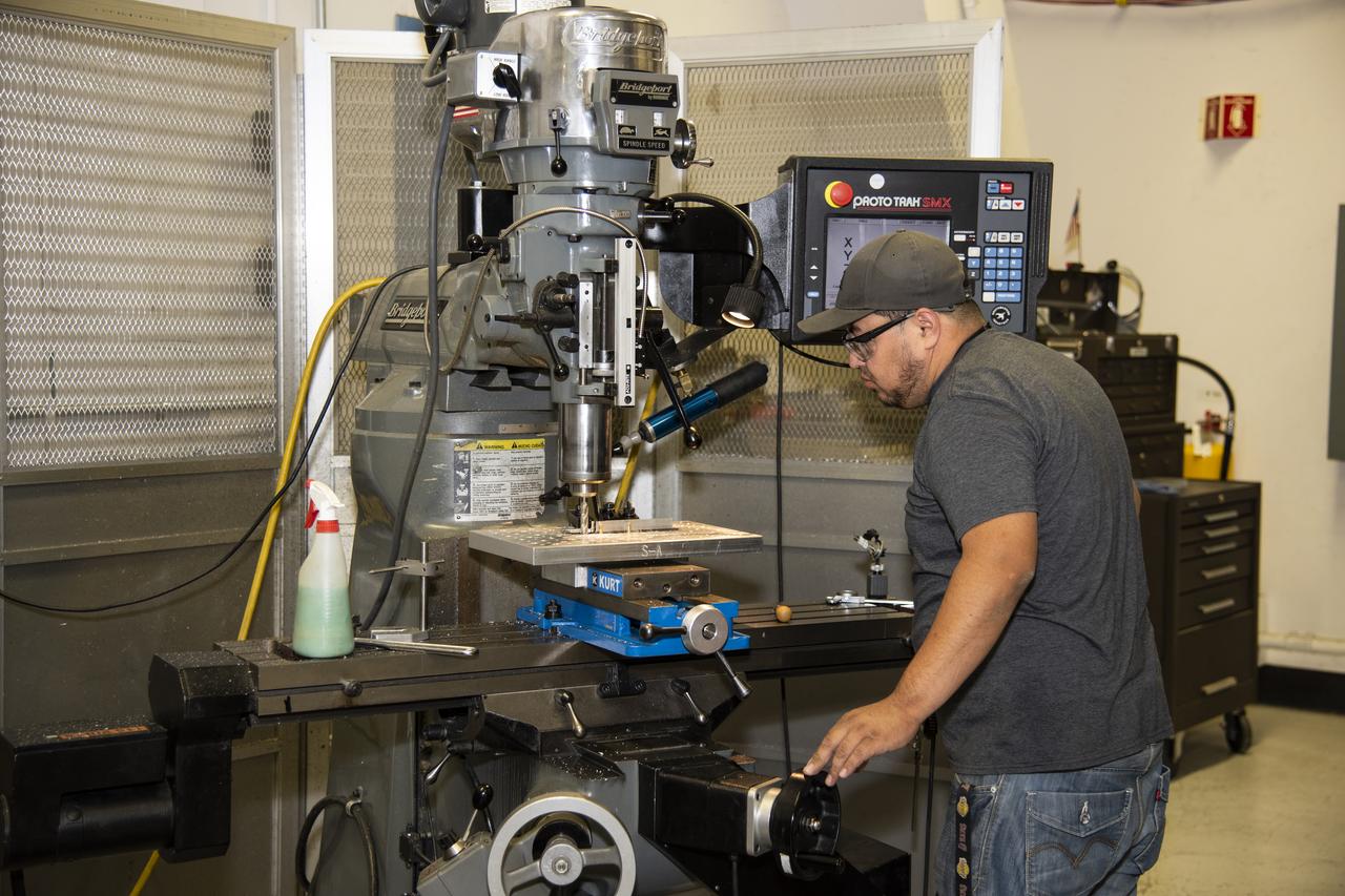
Herman Escobar works on a part for the ER-2 instrument panel.
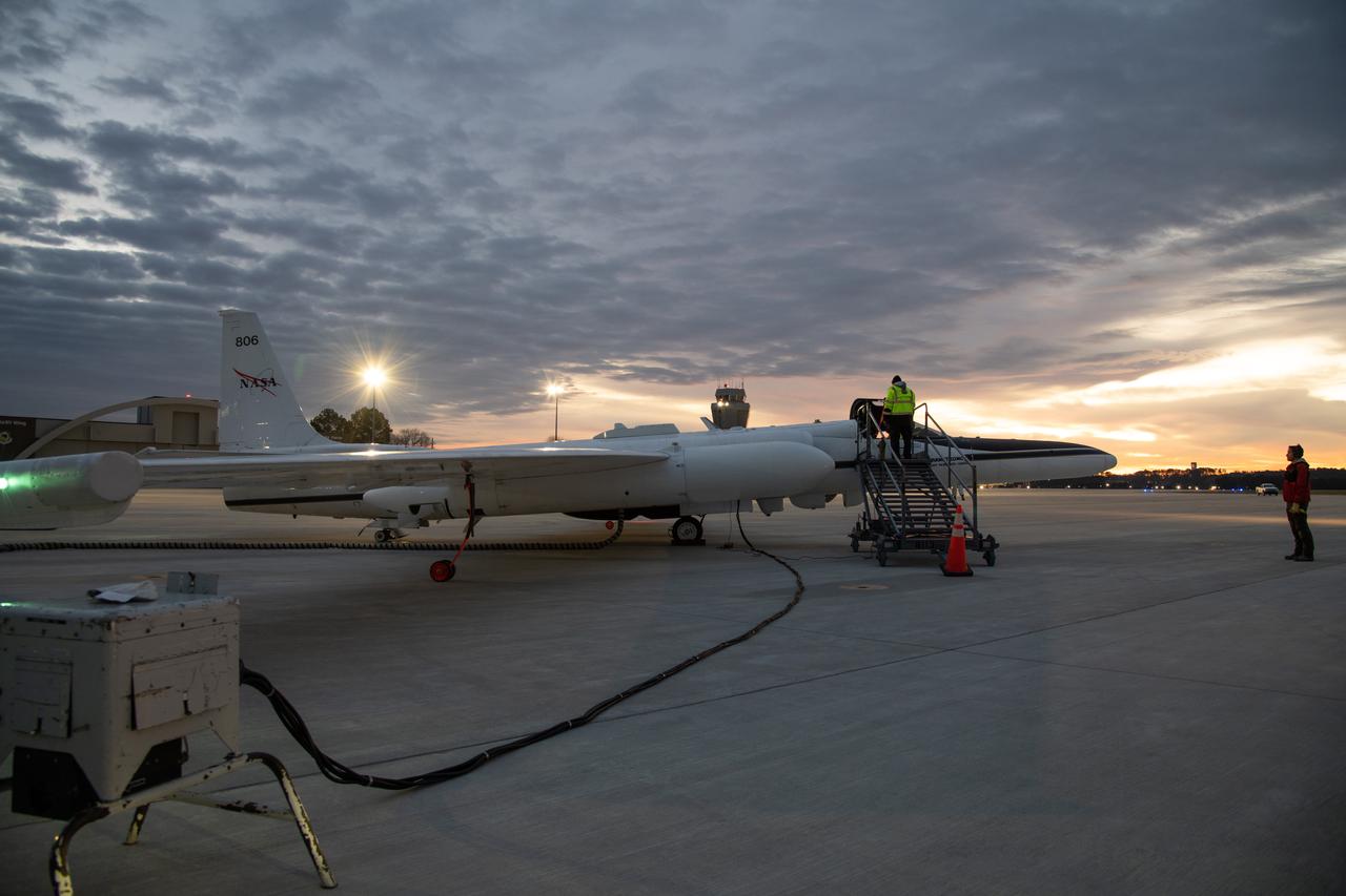
The NASA ER-2 high-altitude aircraft was prepared to support the Investigation of Microphysics and Precipitation for Atlantic Coast-Threatening Storms (IMPACTS) mission. For this mission, the IMPACTS team tracked storms across the Eastern United States to help understand how winter storms form and develop. The aircraft, which is based at NASA’s Armstrong Flight Research Center Building 703 in Palmdale, California, was temporarily based at Dobbins Air Reserve Base in Marietta, Georgia. The three-year IMPACTS campaign concluded on Feb. 28, 2023.
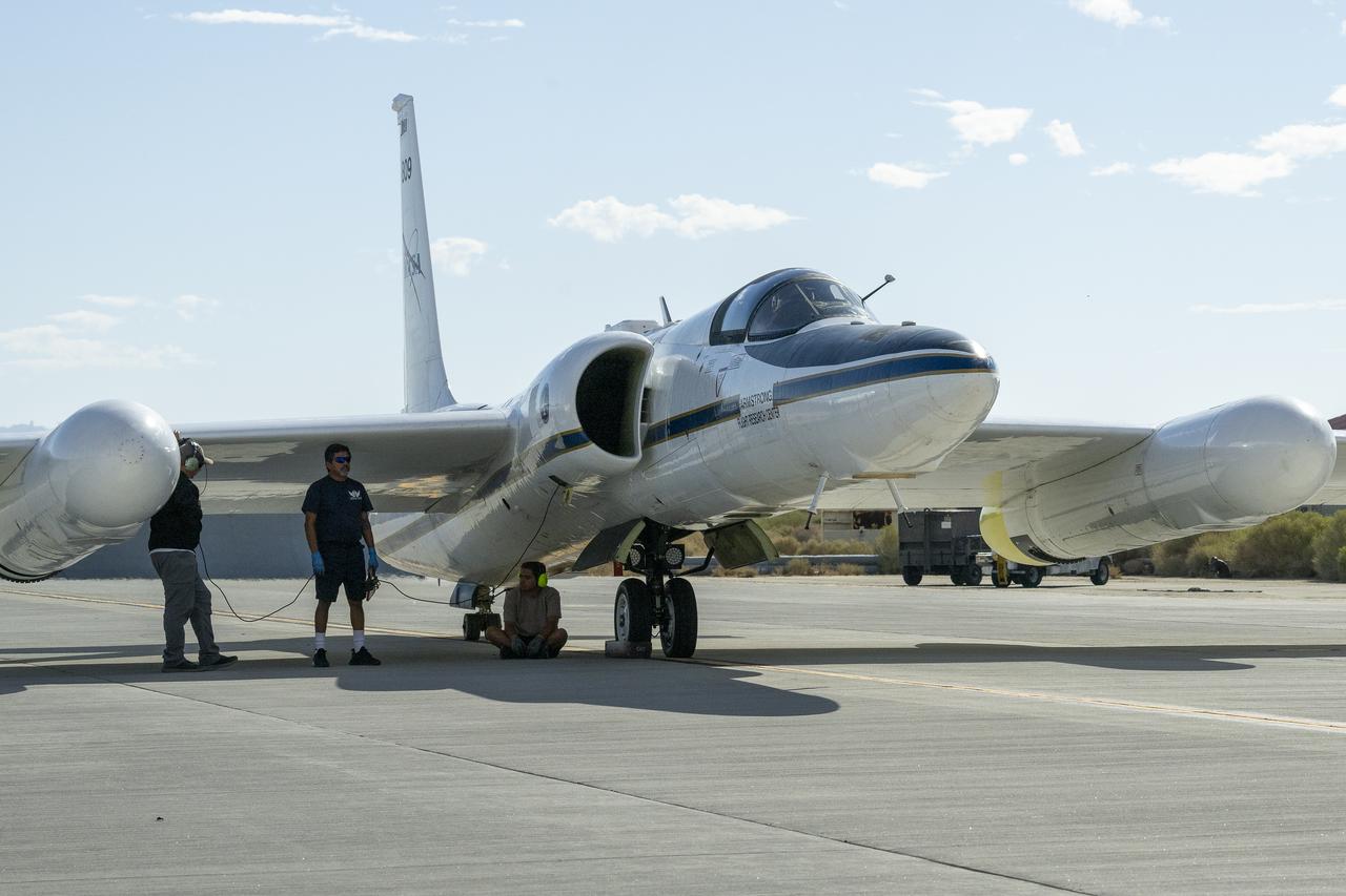
Crew members prepare NASA Armstrong Flight Research Center’s ER-2 aircraft for flight at Edwards, California, on Tuesday, Sept. 23, 2025, in support of the Geological Earth Mapping Experiment (GEMx). The high-altitude science aircraft operates between 20,000 and 70,000 feet. For this mission, pilots flew at approximately 65,000 feet, requiring them to wear specially designed pressure suits.
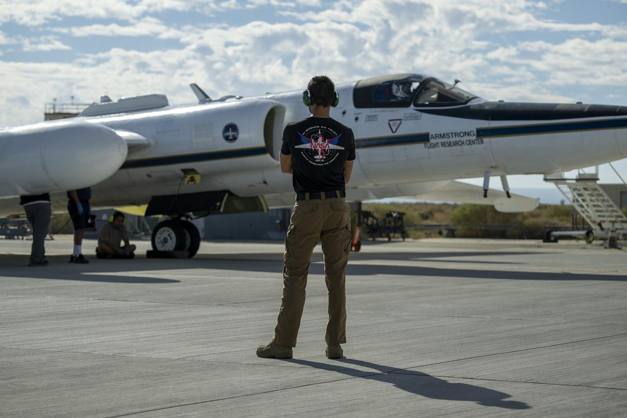
Crew members prepare NASA Armstrong Flight Research Center’s ER-2 aircraft for flight at Edwards, California, on Tuesday, Sept. 23, 2025, in support of the Geological Earth Mapping Experiment (GEMx). The high-altitude science aircraft operates between 20,000 and 70,000 feet. For this mission, pilots flew at approximately 65,000 feet, requiring them to wear specially designed pressure suits.
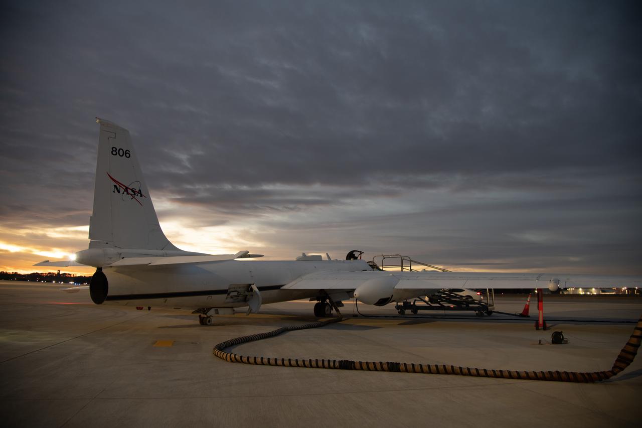
The NASA ER-2 high-altitude aircraft was prepared to support the Investigation of Microphysics and Precipitation for Atlantic Coast-Threatening Storms (IMPACTS) mission. For this mission, the IMPACTS team tracked storms across the Eastern United States to help understand how winter storms form and develop. The aircraft, which is based at NASA’s Armstrong Flight Research Center Building 703 in Palmdale, California, was temporarily based at Dobbins Air Reserve Base in Marietta, Georgia. The three-year IMPACTS campaign concluded on Feb. 28, 2023.
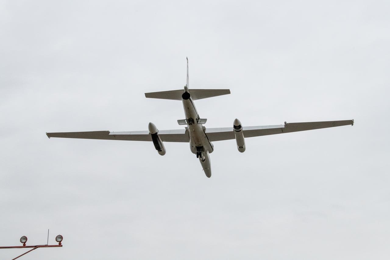
The NASA ER-2 high-altitude aircraft supported the Investigation of Microphysics and Precipitation for Atlantic Coast-Threatening Storms (IMPACTS) mission. For this mission, the IMPACTS team tracked storms across the Eastern United States to help understand how winter storms form and develop. The aircraft, which is based at NASA’s Armstrong Flight Research Center Building 703 in Palmdale, California, was temporarily based at Dobbins Air Reserve Base in Marietta, Georgia. The three-year IMPACTS campaign concluded on Feb. 28, 2023.
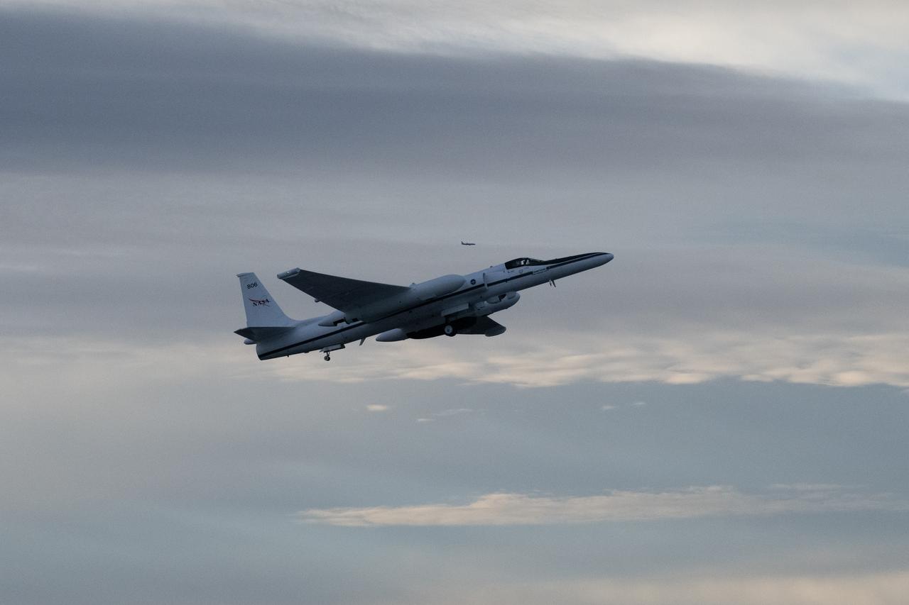
The NASA ER-2 high-altitude aircraft supported the Investigation of Microphysics and Precipitation for Atlantic Coast-Threatening Storms (IMPACTS) mission. For this mission, the IMPACTS team tracked storms across the Eastern United States to help understand how winter storms form and develop. The aircraft, which is based at NASA’s Armstrong Flight Research Center Building 703 in Palmdale, California, was temporarily based at Dobbins Air Reserve Base in Marietta, Georgia. The three-year IMPACTS campaign concluded on Feb. 28, 2023.
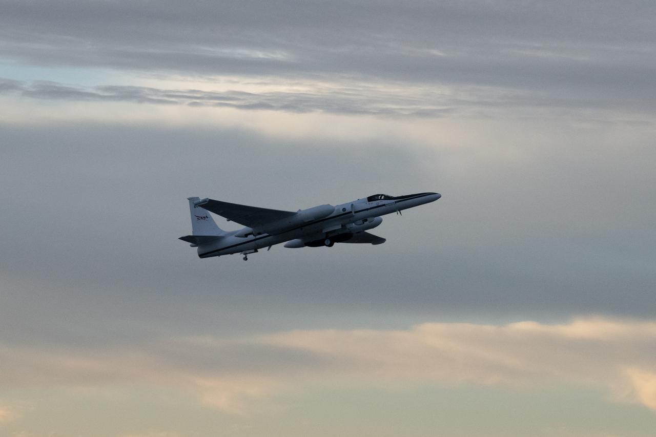
The NASA ER-2 high-altitude aircraft supported the Investigation of Microphysics and Precipitation for Atlantic Coast-Threatening Storms (IMPACTS) mission. For this mission, the IMPACTS team tracked storms across the Eastern United States to help understand how winter storms form and develop. The aircraft, which is based at NASA’s Armstrong Flight Research Center Building 703 in Palmdale, California, was temporarily based at Dobbins Air Reserve Base in Marietta, Georgia. The three-year IMPACTS campaign concluded on Feb. 28, 2023.
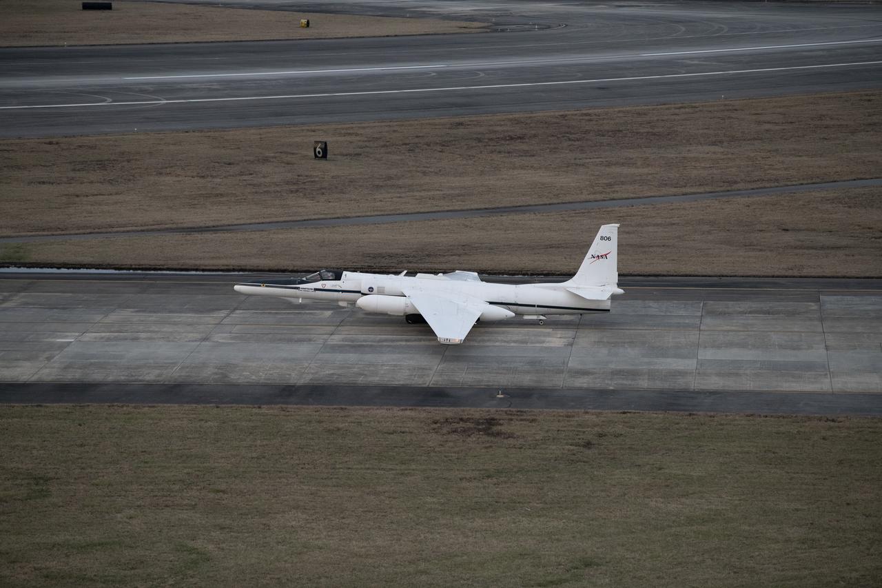
The NASA ER-2 high-altitude aircraft was prepared to support the Investigation of Microphysics and Precipitation for Atlantic Coast-Threatening Storms (IMPACTS) mission. For this mission, the IMPACTS team tracked storms across the Eastern United States to help understand how winter storms form and develop. The aircraft, which is based at NASA’s Armstrong Flight Research Center Building 703 in Palmdale, California, was temporarily based at Dobbins Air Reserve Base in Marietta, Georgia. The three-year IMPACTS campaign concluded on Feb. 28, 2023.
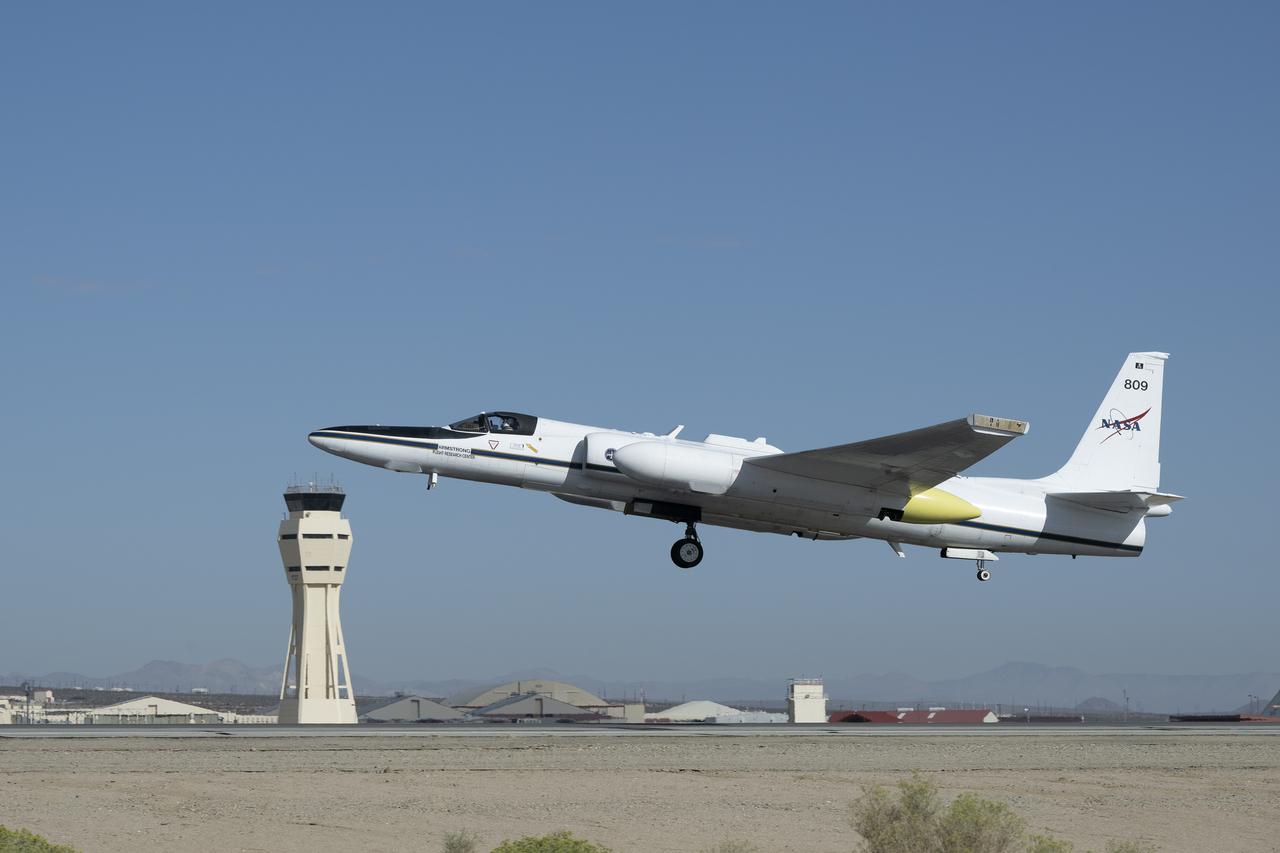
NASA Armstrong Flight Research Center’s ER-2 aircraft lifts off from Edwards, California, on Tuesday, Sept. 23, 2025, in support of the Geological Earth Mapping Experiment (GEMx). The high-altitude science aircraft operates between 20,000 and 70,000 feet. For this mission, pilots flew at approximately 65,000 feet, requiring them to wear specially designed pressure suits.
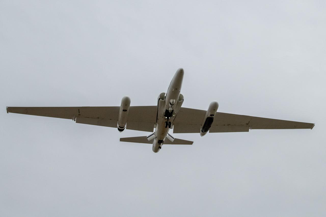
The NASA ER-2 high-altitude aircraft supported the Investigation of Microphysics and Precipitation for Atlantic Coast-Threatening Storms (IMPACTS) mission. For this mission, the IMPACTS team tracked storms across the Eastern United States to help understand how winter storms form and develop. The aircraft, which is based at NASA’s Armstrong Flight Research Center Building 703 in Palmdale, California, was temporarily based at Dobbins Air Reserve Base in Marietta, Georgia. The three-year IMPACTS campaign concluded on Feb. 28, 2023.
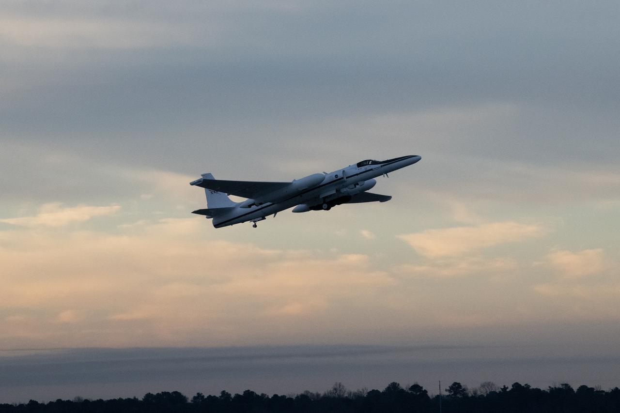
The NASA ER-2 high-altitude aircraft supported the Investigation of Microphysics and Precipitation for Atlantic Coast-Threatening Storms (IMPACTS) mission. For this mission, the IMPACTS team tracked storms across the Eastern United States to help understand how winter storms form and develop. The aircraft, which is based at NASA’s Armstrong Flight Research Center Building 703 in Palmdale, California, was temporarily based at Dobbins Air Reserve Base in Marietta, Georgia. The three-year IMPACTS campaign concluded on Feb. 28, 2023.

James Barrilleaux is the assistant chief pilot for ER-2s in the Flight Crew Branch of NASA's Dryden Flight Research Center, Edwards, California. The ER-2s--civilian variants of the military U-2S reconnaissance aircraft--are part of NASA's Airborne Science program. The ER-2s can carry airborne scientific payloads of up to 2,600 pounds to altitudes of about 70,000 feet to investigate such matters as earth resources, celestial phenomena, atmospheric chemistry and dynamics, and oceanic processes. Barrilleaux has held his current position since February 1998. Barrilleaux joined NASA in 1986 as a U-2/ER-2 pilot with NASA's Airborne Science program at Ames Research Center, Moffett Field, California. He flew both the U-2C (until 1989) and the ER-2 on a wide variety of missions both domestic and international. Barrilleaux flew high-altitude operations over Antarctica in which scientific instruments aboard the ER-2 defined the cause of ozone depletion over the continent, known as the ozone hole. He has also flown the ER-2 over the North Pole. Barrilleaux served for 20 years in the U.S. Air Force before he joined NASA. He completed pilot training at Reese Air Force Base, Lubbock, Texas, in 1966. He flew 120 combat missions as a F-4 fighter pilot over Laos and North Vietnam in 1970 and 1971. He joined the U-2 program in 1974, becoming the commander of an overseas U-2 operation in 1982. In 1983, he became commander of the squadron responsible for training all U-2 pilots and SR-71 crews located at Beale Air Force Base, Marysville, California. He retired from the Air Force as a lieutenant colonel in 1986. On active duty, he flew the U-2, F-4 Phantom, the T-38, T-37, and the T-33. His decorations included two Distinguished Flying Crosses, 12 Air Medals, two Meritorious Service Medals, and other Air Force and South Vietnamese awards. Barrilleaux earned a bachelor of science degree in chemical engineering from Texas A&M University, College Station, in 1964 and a master of science
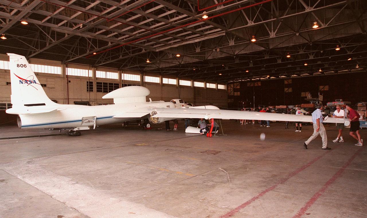
This high-altitude research plane, a specially equipped Dryden Flight Research Center ER-2, stops at Patrick Air Force Base long enough for visitors to get a close view. The modified U-2 aircraft, soaring above 65,000 feet, will measure the structure of hurricanes and the surrounding atmosphere that steers the storm’s movement. The plane is part of the NASA-led Atmospheric Dynamics and Remote Sensing program that includes other government weather researchers and the university community in a study of Atlantic hurricanes and tropical storms. The hurricane study, which lasts through September 1998, is part of NASA’s Earth Science enterprise to better understand the total Earth system and the effects of natural and human-induced changes on the global environment
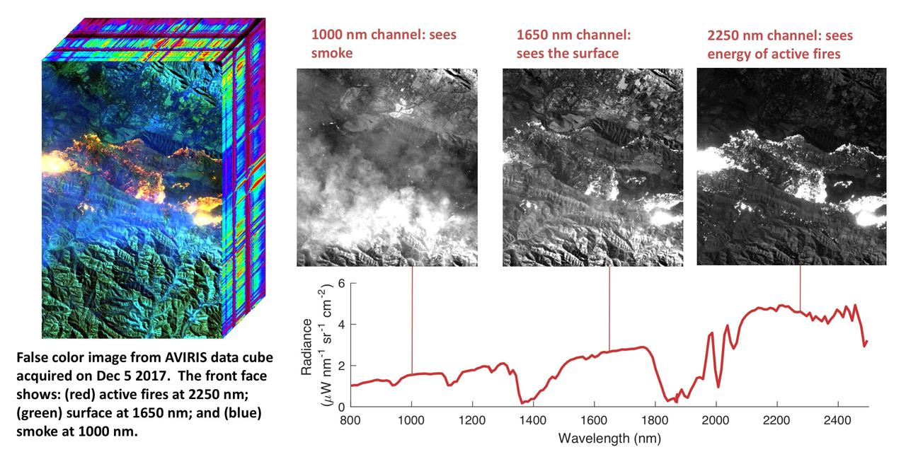
NASA's Airborne Visible Infrared Imaging Spectrometer instrument (AVIRIS), flying aboard a NASA Armstrong Flight Research Center high-altitude ER-2 aircraft, flew over the wildfires burning in Southern California on Dec. 5, 2017 and acquired this false-color image. Active fires are visible in red, ground surfaces are in green and smoke is in blue. AVIRIS is an imaging spectrometer that observes light in visible and infrared wavelengths, measuring the full spectrum of radiated energy. Unlike regular cameras with three colors, AVIRIS has 224 spectral channels from the visible through the shortwave infrared. This permits mapping of fire temperatures, fractional coverage, and surface properties, including how much fuel is available for a fire. Spectroscopy is also valuable for characterizing forest drought conditions and health to assess fire risk. AVIRIS has been observing fire-prone areas in Southern California for many years, forming a growing time series of before/after data cubes. These data are helping improve scientific understanding of fire risk and how ecosystems respond to drought and fire. https://photojournal.jpl.nasa.gov/catalog/PIA11243
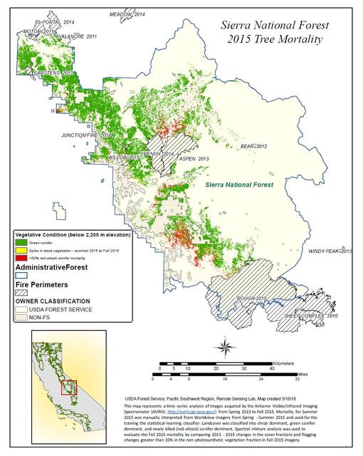
California, reveals the devastating effect of California's ongoing drought on Sierra Nevada conifer forests. The map will be used to help the U.S. Forest Service assess and respond to the impacts of increased tree mortality caused by the drought, particularly where wildlands meet urban areas within the Sierra National Forest. After several years of extreme drought, the highly stressed conifers (trees or bushes that produce cones and are usually green year-round) of the Sierra Nevada are now more susceptible to bark beetles (Dendroctonus spp.). While bark beetles killing trees in the Sierra Nevada is a natural phenomenon, the scale of mortality in the last couple of years is far greater than previously observed. The U.S. Forest Service is using recent airborne spectroscopic measurements from NASA's Airborne Visible/Infrared Imaging Spectrometer (AVIRIS) instrument aboard NASA's ER-2 aircraft, together with new advanced algorithms, to quantify this impact over this large region of rugged terrain. The high-altitude ER-2 aircraft is based at NASA's Armstrong Flight Research Center, Edwards, California. The image was created by scientists at the USFS's Pacific Southwest Region Remote Sensing Lab, McClellan, California, by performing a time series analysis of AVIRIS images. Scientists evaluated baseline tree mortality on public lands in the summer of 2015 using a machine learning algorithm called "random forest." This algorithm classifies the AVIRIS measurements as dominated by either shrubs, healthy trees or newly dead conifer trees. To quantify how much the amount of dead vegetation increased during the fall of 2015, the Forest Service scientists conducted an advanced spectral mixture analysis. This analysis evaluates each spectrum to determine the fraction of green vegetation, dead vegetation and soil. The full spectral range of AVIRIS is important to separate the signatures of soil and dead vegetation. To produce this comprehensive Sierra National Forest tree mortality map, the result from the summer of 2015 was evaluated to look for increases of more than 10 percent in dead vegetation during the fall of 2015. AVIRIS measures spectra of the Earth system to conduct advanced science research. These western U.S. AVIRIS measurements were acquired as part of NASA's Hyperspectral Infrared Imager (HyspIRI) preparatory airborne campaign. HyspIRI was one of the space missions suggested to NASA by the National Academy of Sciences in its 2007 decadal survey for Earth Science. In the future, HyspIRI could provide spectral and thermal measurements of this type globally for ecosystem research and additional science objectives. http://photojournal.jpl.nasa.gov/catalog/PIA20717

NASA's Airborne Visible Infrared Imaging Spectrometer instrument (AVIRIS), flying aboard a NASA Armstrong Flight Research Center high-altitude ER-2 aircraft, observed wildfires burning in Southern California on Dec. 5-7, 2017. AVIRIS is an imaging spectrometer that observes light in visible and infrared wavelengths, measuring the full spectrum of radiated energy. Unlike regular cameras with three colors, AVIRIS has 224 spectral channels, measuring contiguously from the visible through the shortwave infrared. Data from these flights, compared against measurements acquired earlier in the year, show many ways this one instrument can improve both our understanding of fire risk and the response to fires in progress. The top row in this image compilation shows pre-fire data acquired from June 2017. At top left is a visible-wavelength image similar to what our own eyes would see. The top middle image is a map of surface composition based on analyzing the full electromagnetic spectrum, revealing green vegetated areas and non-photosynthetic vegetation that is potential fuel as well as non-vegetated surfaces that may slow an advancing fire. The image at top right is a remote measurement of the water in tree canopies, a proxy for how much moisture is in the vegetation. The bottom row in the compilation shows data acquired from the Thomas fire in progress in December 2017. At bottom left is a visible wavelength image. The bottom middle image is an infrared image, with red at 2,250 nanometers showing fire energy, green at 1,650 nanometers showing the surface through the smoke, and blue at 1,000 nanometers showing the smoke itself. The image at bottom right is a fire temperature map using spectroscopic analysis to measure fire thermal emission recorded in the AVIRIS spectra. https://photojournal.jpl.nasa.gov/catalog/PIA22194