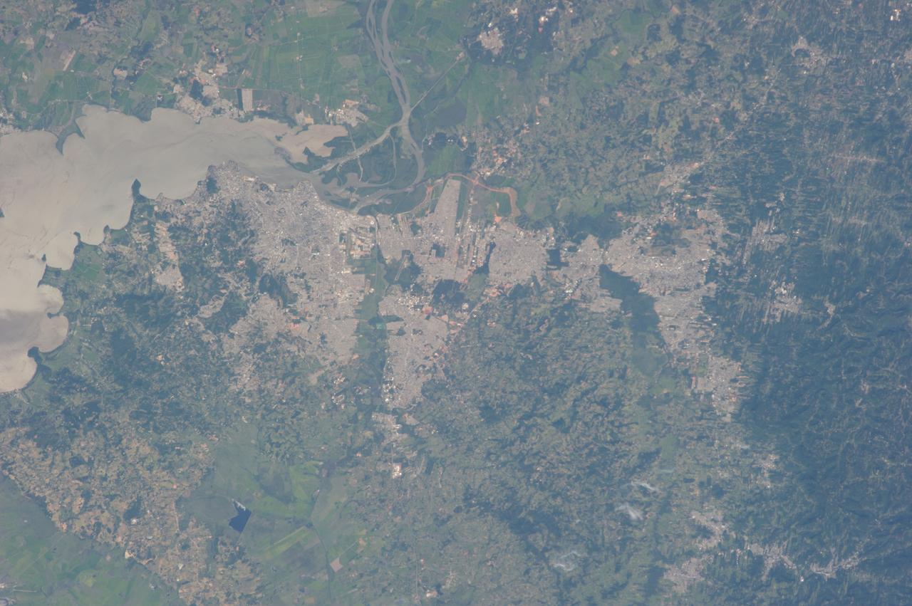
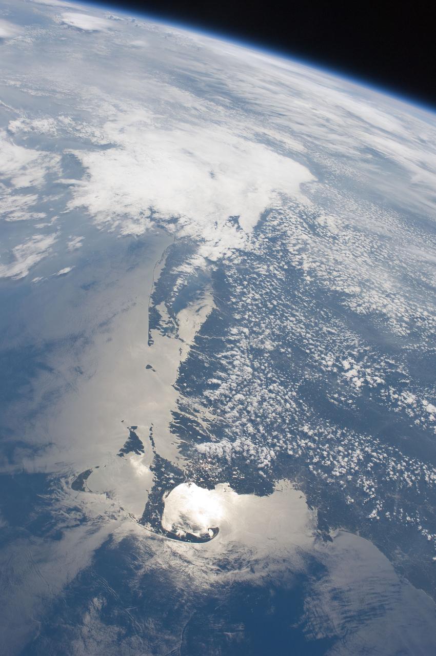
Earth Observations taken by Expedition 34 crewmember.
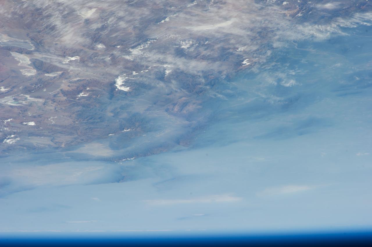
Earth Observations taken by Expedition 34 crewmember.
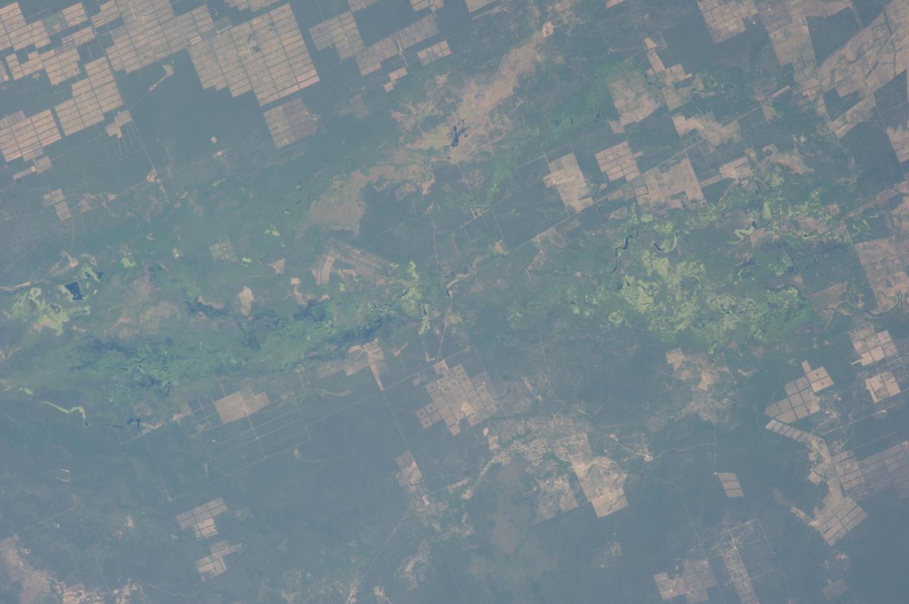
Earth Observations taken by Expedition 34 crewmember.
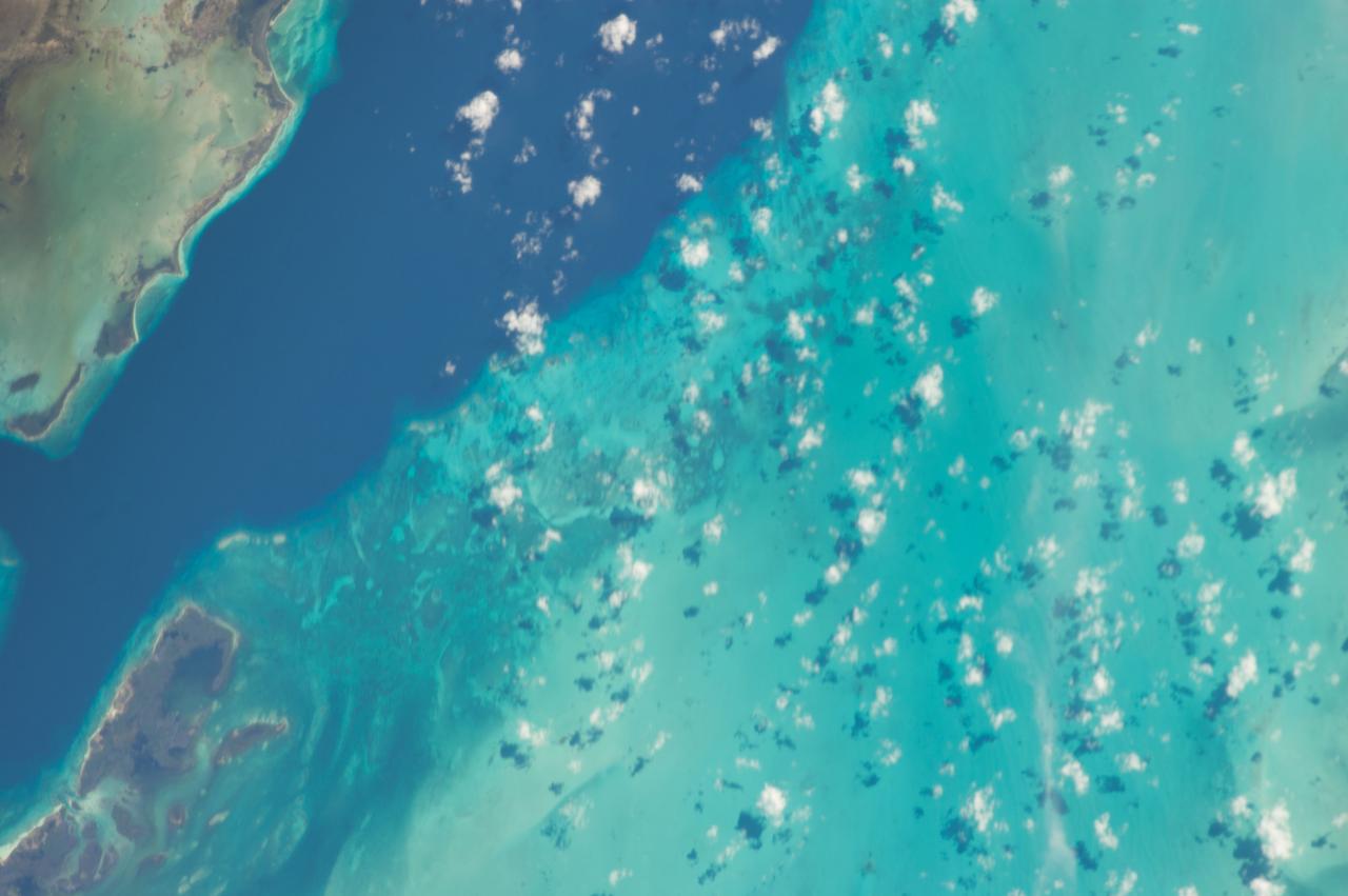
Earth observations taken by Expedition 38 crewmember. Crewmember indicates New Orleans and Cuba. Image was released by astronaut on Twitter.
ISS028-E-009979 (27 June 2011) --- The Massachusetts coastline is featured in this image photographed by an Expedition 28 crew member on the International Space Station. The Crew Earth Observations team at NASA Johnson Space Center sends specific ground targets for photography up to the station crew on a daily basis, but sometimes the crew takes imagery on their own of striking displays visible from orbit. One such display, often visible to the ISS crew due to their ability to look outwards at angles between 0 and 90 degrees, is sunglint on the waters of Earth. Sunglint is caused by sunlight reflecting off of a water surface?much as light reflects from a mirror?directly towards the observer. Roughness variations of the water surface scatter the light, blurring the reflection and producing the typical silvery sheen of the sunglint area. The point of maximum sunglint is centered within Cape Cod Bay, the body of water partially enclosed by the ?hook? of Cape Cod in Massachusetts (bottom). Cape Cod was formally designated a National Seashore in 1966. Sunglint off the water provides sharp contrast with the coastline and the nearby islands of Martha?s Vineyard and Nantucket (lower left), both popular destinations for tourists and summer residents. To the north, rocky Cape Ann extends out into the Atlantic Ocean; the border with New Hampshire is located approximately 30 kilometers up the coast. Further to the west, the eastern half of Long Island, New York is visible emerging from extensive cloud cover over the mid-Atlantic and Midwestern States. Persistent storm tracks had been contributing to record flooding along rivers in the Midwest at the time this image was taken in late June 2011. Thin blue layers of the atmosphere, contrasted against the darkness of space, are visible extending along the Earth?s curvature at top.
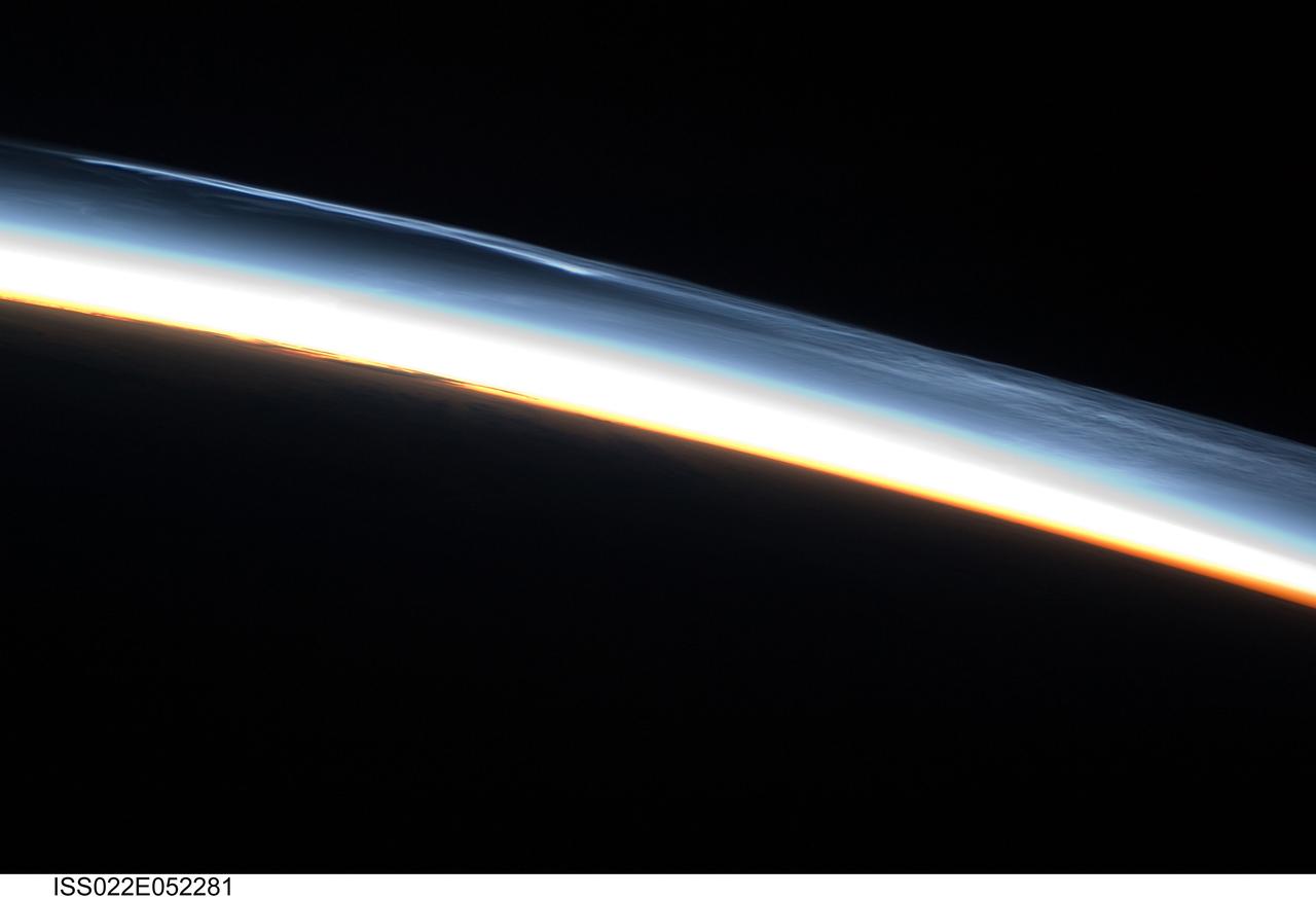
ISS022-E-052281 (30 Jan. 2010) --- Polar mesospheric clouds over the Southern Hemisphere are featured in this image photographed by an Expedition 22 crew member on the International Space Station. This striking view shows polar mesospheric clouds (PMC) over the polar region of the Southern Hemisphere. These clouds occur over the high latitudes of both northern and southern hemispheres during their respective summer months at very high altitudes of approximately 76?85 kilometers. When present they are visible during twilight, when the clouds are illuminated by the sun while the ground surface below is in darkness. The International Space Station (ISS) orbit extends from latitude 52 North to latitude 52 South; combined with the highly oblique views through Earth?s atmosphere possible with hand-held imagery, the ISS is an ideal platform for documenting these transient, high altitude phenomena. Another NASA mission, the Aeronomy of Ice in the Mesosphere or AIM satellite, is dedicated to the study of PMC and is providing daily information about their formation, distribution, and variability. Polar mesospheric clouds are also known as noctilucent or night-shining clouds ? a property that is clearly visible in this photograph. The PMC exhibit thin, wispy light blue forms that contrast with the darkness of space above (upper right). Lower levels of cloud are strongly illuminated by the sun and appear light orange to white. Clouds closest to Earth?s surface are reddish-orange (center). The image was taken approximately 38 minutes after midnight Greenwich Mean Time (GMT) while the ISS was located over the southern Atlantic Ocean. At this time of year, the sun never sets over Antarctica but rather defines an arc across the local horizon, allowing PMC to be observed near local midnight.
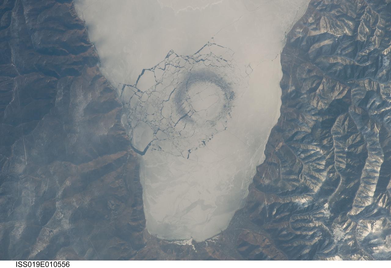
ISS019-E-010556 (23 April 2009) --- A circle in thin ice in Lake Baikal, Russia is featured in this image photographed by an Expedition 19 crewmember on the International Space Station. Late in April 2009, astronauts aboard the station observed a strange circular area of thinned ice (dark in color, with a diameter of about 4.4 kilometers) in the southern end of Lake Baikal in southern Siberia. Lake Baikal is unique in many regards. It is the largest (by volume) and deepest (1,637 meters at the deepest point) fresh water lake on Earth and, as a World Heritage Site, is considered one of Russia?s environmental jewels. The lake?s long, thin and deep profile results from its location in the Baikal Rift valley in Siberia. According to scientists, it is also one of the world?s oldest lakes (25-30 million years old); it contains up to 7 kilometers of sediment deposited on the bottom, and is home to an amazing array of plants and animals, many being found only in Lake Baikal. The lake?s biodiversity includes fresh water seals and several species of fish that are not found elsewhere on Earth. Siberia is remote and cold; ice cover can persist into June. This detailed image shows a circle of thin ice, which is the focal point for ice break up in the very southern end of the lake. While the origin of the circles is unknown, the peculiar pattern suggests convection in the lake?s water column. Ice cover changes rapidly at this time of year. Within a day, the ice can melt almost completely, and then freeze again overnight. Throughout April, the circles are persistent ? they appear when ice cover forms, and then disappear as ice melts. The pattern and appearance suggests that the ice is quite thin.
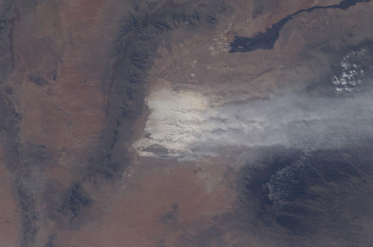
ISS030-E-174652 (28 Feb. 2012) --- A dust storm near the White Sands National Monument, New Mexico, USA is featured in this image photographed by an Expedition 30 crew member on the International Space Station. Driven by winter winds from the southwest, white dust from the White Sands dune field (center) in New Mexico rises thousands of feet from the valley floor, up and over the snowy peaks of the Sacramento Mts. downwind (right). White Sands National Monument lies in the 50 kilometers-wide Tularosa valley, between the dark rocks and forested slopes of the Sacramento Mts. and the San Andres Mts. (left center). The lower and warmer ridge line of the San Andres was without snow on this day. The striking black lava flows of the Carrizozo lava field also occupy the valley floor (top right). The darker tones of agriculture in the Rio Grande floodplain can be seen along the left margin of the image. The length of the dust plumes in this photograph is more than 120 kilometers. The vigor of the winds on this day can be judged also from the fact that they are lifting the dust particles from the valley floor more than 1,200 meters over the mountains. Winds channel the dust through a low point on the Sacramento Mts., some 800 meters below the ridge crests to north and south (right). The Moderate Resolution Imaging Spectroradiometer (MODIS) on the NASA Aqua satellite also captured a wider regional view of the extent of the plumes on the same day. In most parts of the world blowing dust is some shade of light brown or red. It is interesting to observe two colors of dust that contribute to this dust plume: redder dust from the local hillsides north of White Sands (seen by the small brown zone along the northern margin of the dust mass), and the white dust from the dune field. The sand dunes of the Monument are white since they are composed of the mineral gypsum, a relatively rare dune-forming mineral. The gypsum is deposited during evaporation of mineral-rich waters in an ephemeral lake located in the western part of the Monument. Erosion of the deposits, together with wind transport, provides the granular material for the dunes. The dunes? brilliance, especially contrasted against the nearby dark mountain slopes, makes the dunes easily identifiable at great distances by orbiting astronauts. The white speck of the dunes is even visible in images taken looking back at Earth by crews on the way to the moon.
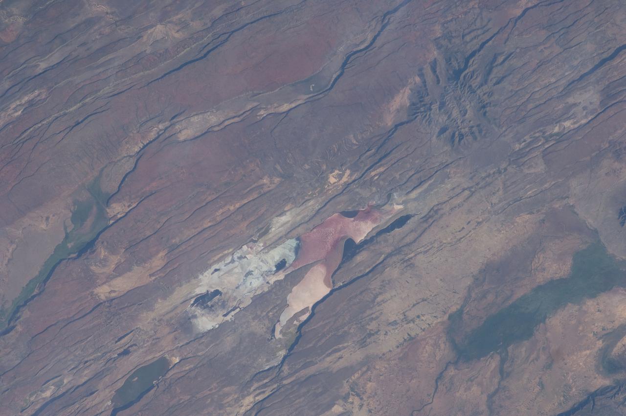
ISS030-E-035487 (14 Jan. 2012) --- The East African Rift Valley in Kenya is featured in this image photographed by an Expedition 30 crew member on the International Space Station. This photograph highlights classical geological structures associated with a tectonic rift valley, in this case the Eastern Branch of the East African Rift near Kenya’s southern border with Tanzania and just south of the Equator. The East African Rift is one of the great tectonic features of Africa, caused by fracturing of Earth’s crust. The Nubian (or African) plate includes the older continental crust of Africa to the west, while the Somalian plate that is moving away includes the Horn of Africa to the northeast; the tectonic boundary stretches from the southern Red Sea to central Mozambique. Landscapes in the rift valley can appear confusing. The most striking features in this view are the numerous, nearly parallel, linear fault lines that occupy the floor of the valley (most of the image). Shadows cast by the late afternoon sun make the fault scarps (steps in the landscape caused by slip motion along individual faults) more prominent. The faults are aligned with the north-south axis of the valley (lower left to top right). A secondary trend of less linear faults cuts the main fault trend at an acute angle, the fault steps throwing large shadows. The Eastern Branch of the East African Rift is arid (compared with the Western Branch which lies on the border of the Congolese rainforest). Evidence of this can be seen in the red, salt-loving algae of the shallow and salty Lake Magadi (center). A neighboring small lake to the north has deeper water and appears dark in the image. The white salt deposits of the dry part of the Lake Magadi floor (center) host a few small commercial salt pans. The lakes appear to be located where the main and secondary fault trends intersect. The East African rift system is marked by substantial volcanic activity, including lavas erupted from fissures along the rift in the region. Much of the faulting observed in this image cuts through such lavas. Elsewhere along the rift system individual volcanoes form. Some of those volcanoes are very large, including Mt. Kilimanjaro and Mt. Kenya. In this image, rising 400 meters above the valley floor, a volcano appears to be superimposed on the faults—indicating that the volcano is younger than the faults it covers. Deeply eroded slopes also suggest that the volcano has not been active for a long time. The largest vegetated area (lower left)—in an desert zone with no vegetation visible to the naked eye from space—is the green floor of a valley which drains an area large enough for water to exist near the surface so that plants can thrive. For a sense of scale, the vegetated valley floor is 17 kilometers long (10.5 miles).