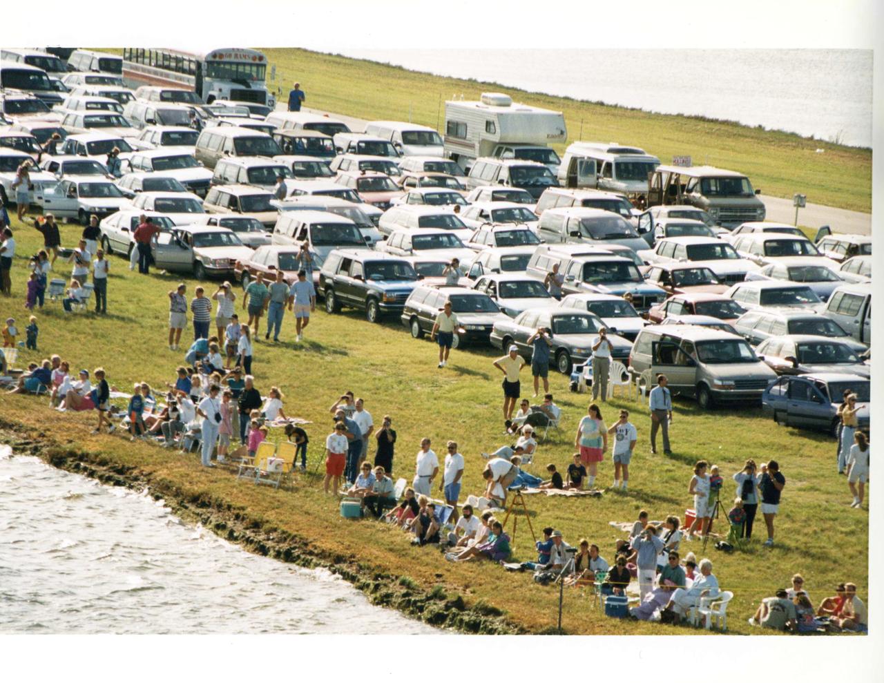
Aerial of the NASA Causeway East showing the viewing area set up for space shuttle launch viewers with car passes. Launch Complex 39 is to the north.
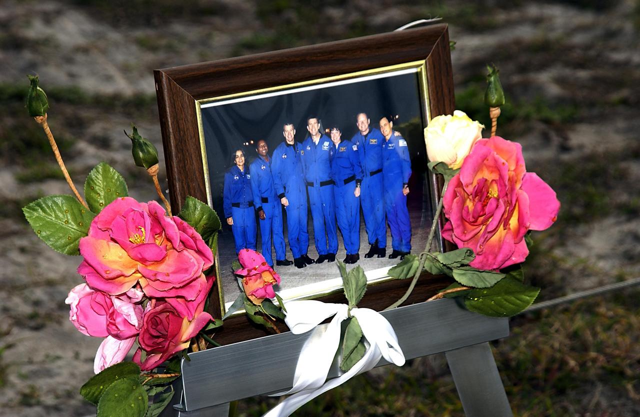
KENNEDY SPACE CENTER, FLA. - At the corner of Contractors Road and the Saturn Causeway, an STS-107 crew photograph, surrounded with flowers and U.S. flags, stands as a memorial tribute to the fallen crew of Columbia by KSC employees. The Space Shuttle Columbia and her crew of seven were lost on Feb. 1, 2003, over East Texas as they returned to Earth after a 16-day research mission, STS-107.
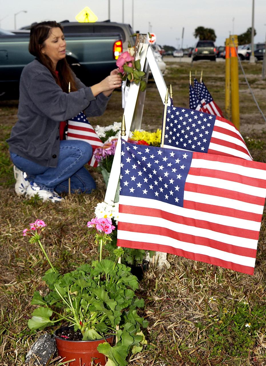
KENNEDY SPACE CENTER, FLA. - At the corner of Contractors Road and the Saturn Causeway, a KSC employee places an STS-107 crew photograph and surrounds it with flowers and U.S. flags as a memorial tribute to the fallen crew of Columbia. The Space Shuttle Columbia and her crew of seven were lost on Feb. 1, 2003, over East Texas as they returned to Earth after a 16-day research mission, STS-107.
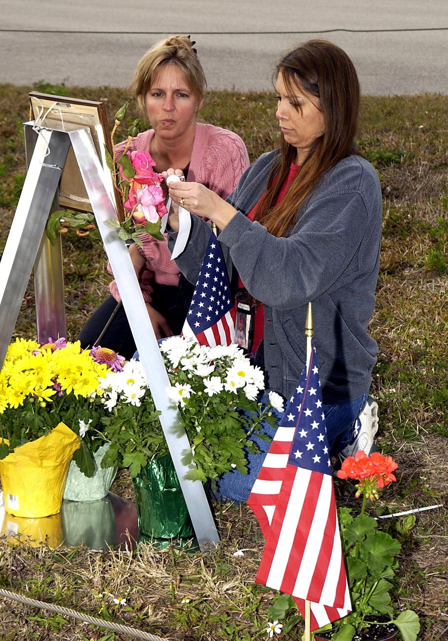
KENNEDY SPACE CENTER, FLA. - At the corner of Contractors Road and the Saturn Causeway, KSC employees place an STS-107 crew photograph and surround it with flowers as a memorial tribute to the fallen crew of Columbia. The Space Shuttle Columbia and her crew of seven were lost on Feb. 1, 2003, over East Texas as they returned to Earth after a 16-day research mission, STS-107.

A heavy-load transport truck carries the Orion crew access arm along the NASA Causeway east toward State Road 3 at NASA's Kennedy Space Center in Florida. The access arm will be moved to the mobile launcher (ML) near the Vehicle Assembly Building at the center. The crew access arm will be installed at about the 274-foot level on the mobile launcher tower. It will rotate from its retracted position and interface with the Orion crew hatch location to provide entry to the Orion crew module. The Ground Systems Development and Operations Program is overseeing installation of umbilicals and launch accessories on the ML tower to prepare for Exploration Mission-1.
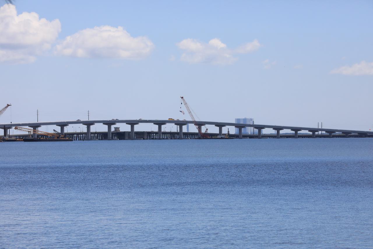
In view is the upgraded eastbound span of the Indian River Bridge leading to NASA’s Kennedy Space Center in Florida. A ribbon cutting ceremony was held June 9, 2023 to officially open the East part of the bridge. The new high-rise bridge serves as the primary entrance and exit to the space center for employees and visitors. The bridge spans the Indian River Lagoon and connects Kennedy and the Cape Canaveral Space Force Station to the mainland via State Road 405/NASA Causeway in Titusville. This first section of the bridge replaces the two-lane drawbridge which was built in the mid-1960s to support the Apollo program.
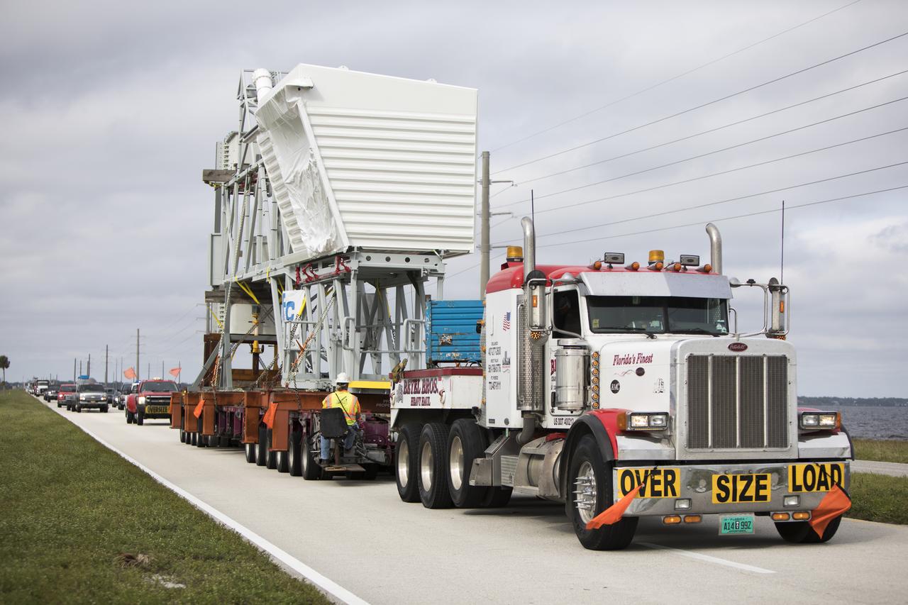
A heavy-load transport truck carries the Orion crew access arm along the NASA Causeway east toward State Road 3 at NASA's Kennedy Space Center in Florida. The access arm will be moved to the mobile launcher (ML) near the Vehicle Assembly Building at the center. The crew access arm will be installed at about the 274-foot level on the tower. It will rotate from its retracted position and interface with the Orion crew hatch location to provide entry to the Orion crew module. The Ground Systems Development and Operations Program is overseeing installation of umbilicals and launch accessories on the ML tower to prepare for Exploration Mission-1.
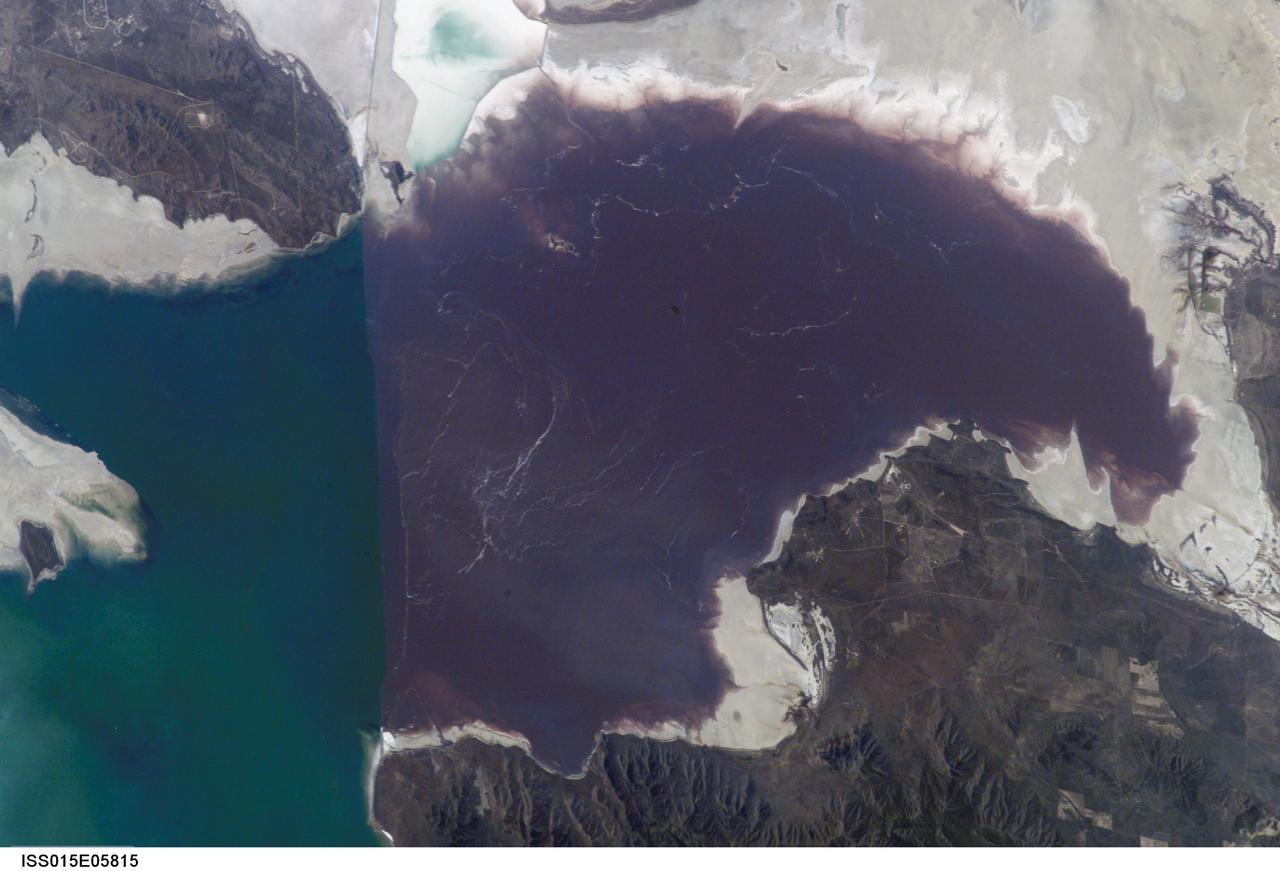
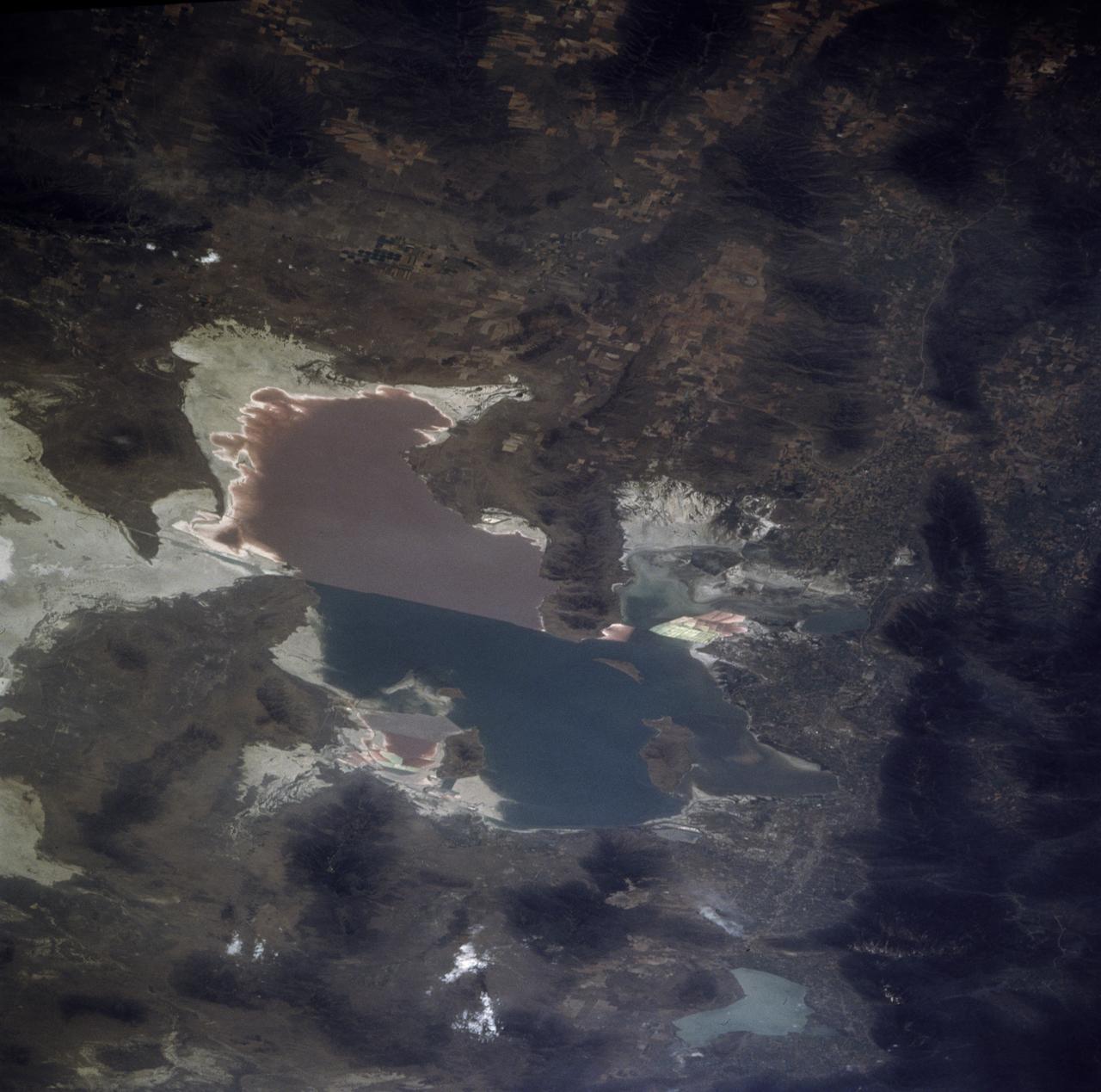
ISS015-E-05815 (30 April 2007) --- Algae in Great Salt Lake, Utah is featured in this image photographed by an Expedition 15 crewmember on the International Space Station. According to scientists, the Great Salt Lake of northern Utah is a remnant of glacial Lake Bonneville that extended over much of present-day western Utah, and into the neighboring states of Nevada and Idaho, approximately 32,000 to 14,000 years ago. During this time, the peaks of adjacent ranges such as the Promontory and Lakeside Mountains were most likely islands. As climate warmed and precipitation decreased in the region, glaciers that fed melt-water to Lake Bonneville disappeared, and the lake began to dry up. The present-day Great Salt Lake is a terminal lake in that water does not flow out of the lake basin. Water loss through the year is due primarily to evaporation, and when this loss exceeds input of water from rivers, streams, precipitation, and groundwater the lake level decreases. This is particularly evident during droughts. This process of evaporation, together with the relatively shallow water levels (maximum lake depth is around 33 feet), has led to increased salinity (dissolved salt content) of the lake waters. The north arm of the Lake, displayed in this image, typically has twice the salinity of the rest of the lake due to impoundment of water by a railroad causeway that crosses the lake from east to west. This restriction of water flow has led to a striking division in the types of algae and bacteria found in the north and south arms of the lake. In the northern arm (north of the causeway), the red algae Dunaliella Salina and the bacterial species Halo bacterium produce a pronounced reddish cast to the water, whereas the south arm (south of the causeway) is dominated by green algae such as Dunaliella viridis. The Great Salt Lake also supports brine shrimp and brine flies; and is a major stopover point for migratory birds including avocets, stilts, and plovers.
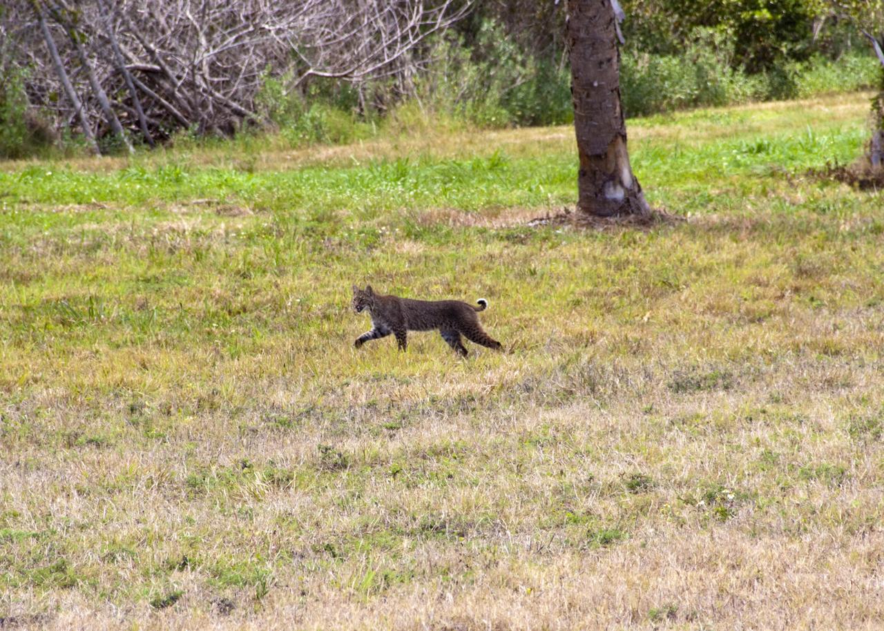
CAPE CANAVERAL, Fla. – A bobcat strolls across the causeway between NASA’s Kennedy Space Center and Cape Canaveral Air Force Station in Florida, oblivious to everything but the hunt for its next meal. The cat is seldom observed during the day unless scared from its daytime shelter. It is the last large mammalian predator remaining on the center. Kennedy and the Merritt Island National Wildlife Refuge mutually reside on 140,000 acres on central Florida’s east coast. The area’s coastal dunes, saltwater estuaries and marshes, freshwater impoundments, scrub, pine flatwoods, and hardwood hammocks provide habitats for more than 1,000 species of plants and animals, including about 331 species of birds. For more information, visit http://www.nasa.gov/kennedy. Photo credit: NASA/Jim Grossmann
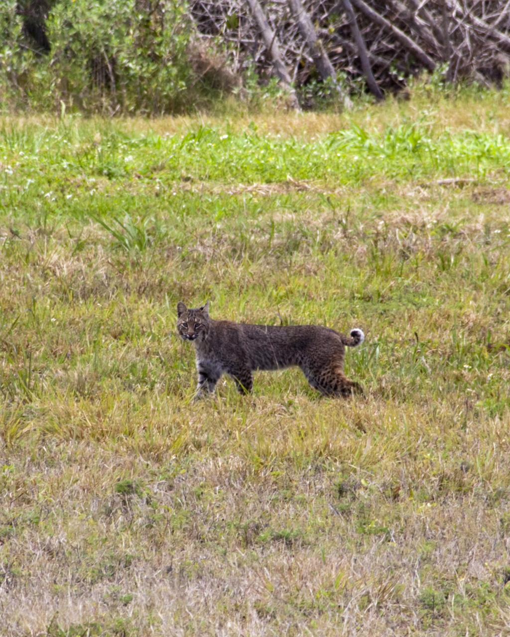
CAPE CANAVERAL, Fla. – A bobcat on the causeway between NASA’s Kennedy Space Center and Cape Canaveral Air Force Station in Florida pauses to check out the photographer who chanced upon it during the hunt for its next meal. The cat is seldom observed during the day unless scared from its daytime shelter. It is the last large mammalian predator remaining on the center. Kennedy and the Merritt Island National Wildlife Refuge mutually reside on 140,000 acres on central Florida’s east coast. The area’s coastal dunes, saltwater estuaries and marshes, freshwater impoundments, scrub, pine flatwoods, and hardwood hammocks provide habitats for more than 1,000 species of plants and animals, including about 331 species of birds. For more information, visit http://www.nasa.gov/kennedy. Photo credit: NASA/Jim Grossmann
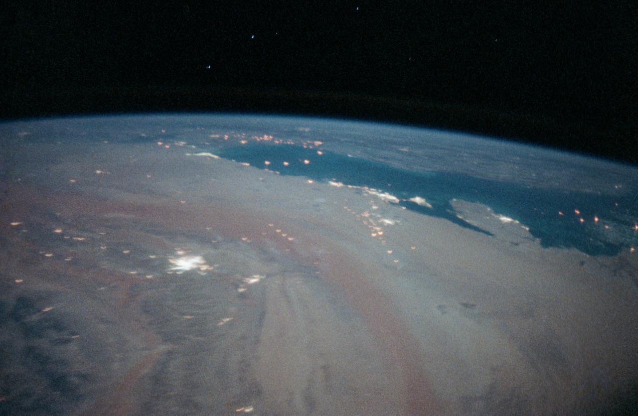
STS-35 Earth observation taken aboard Columbia, Orbiter Vehicle (OV) 102, is of the Persian Gulf area. Major cities and oilfields of the countries of Saudi Arabia (foreground), Iraq (top left), Iran (top center and top right), Kuwait, Bahrain, Qatar, and a portion of the United Arab Emirates are visible in this scene. The cities are the large whitish areas of city lights. Flares characteristic of the Mid-East oil field practices are visible both onshore and offshore throughout the scene. Major cities identifiable are in Iraq - Baghdad, Basra, and Faw; in Qatar - Ab Dawhah; in Kuwait - Kuwait City; in Saudi Arabia - Riyadh, Al Jubayl, Dharan, Al Huf, Ad Dilam and Al Hariq; and Bahrain and its associated causeway to the mainland.
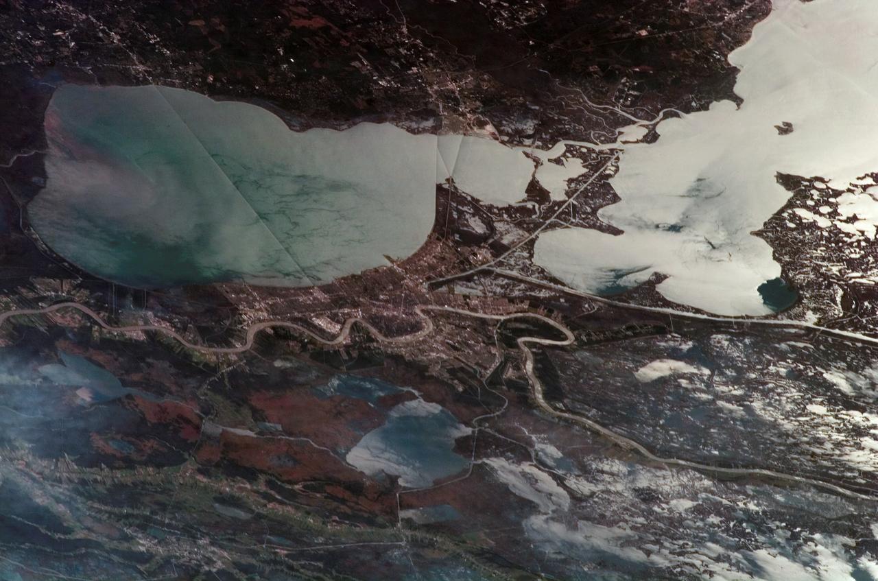
STS085-705-062 (7 - 19 August 1997) --- The Great Salt is one of the most saline inland bodies of water in the world and is the largest inland body of salt water in the Western Hemisphere. The lake is fed by three rivers (Bear, Weber and Jordon) and has no outlet. The water level varies with the amount of rainfall and evaporation in the basin. The distinct line across the center of the lake is the Lucin Cutoff. It is a 30 mile (48 kilometers), east-west causeway built in 1959 to support a rail line. The causeway connects the cities of Ogden and Lucin and affects the water level of the lake. Because the lake's main tributaries enter from the south, the water level of the southern section is several inches higher than that of the northern part. The Great Salt Lake's record high levels in the mid-1980's threatened the Lucin Cutoff, highways and sewage-treatment plants along the shore -- in 1987 pumps were installed that began draining some of the excess water into the Great Salt Lake Desert to the west. The resulting new body of water was called the Newfoundland Evaporation Basin -- it contains dissolved minerals, primarily sodium and chloride along with sulfate, magnesium, and potassium. The dissolved minerals, turbidity and microorganisms which can survive in saline water give the lake its varying colors. In this photo the north portion is dark red. The crew said that it looked like dirt when they first saw it. Crews can not remember the north portion ever looking so red -- it is usually a light blue color.
ISS014-E-08179 (18 Nov. 2006) --- New Orleans, Louisiana is featured in this image photographed by an Expedition 14 crewmember on the International Space Station. The location of New Orleans, in a shallow depression within unconsolidated deltaic sediments, makes it particularly vulnerable to subsidence and increased likelihood of flooding. The average elevation of metropolitan New Orleans is 1.8 meters below sea level, and a complicated system of levees, pumps, and upstream control structures on the Mississippi River is necessary to maintain dry conditions in the city. The ground subsidence occurs from groundwater withdrawal, reduction of sediment delivery by the Mississippi River, and land use changes (such as draining of wetlands) associated with continuing development. The low areas can be flooded by river floods, storm surges, or failure of levees holding back surrounding lake waters - as demonstrated catastrophically during Hurricane Katrina in 2005. Sunglint accentuates the wetland setting of New Orleans in this image by highlighting the numerous lakes, pond, and rivers (in various shades of silver-gray) surrounding the city. The view was acquired by a crewmember looking southwest from the station, which was located over north-central Alabama at the time this image was taken. Lake Pontchartrain borders New Orleans to the north, and the Lake Pontchartrain Causeway (36 kilometers in length) appears as a dark linear feature against the lake surface. Variations in surface water coloration to the east and west of the Causeway reflect the dynamics of the surface waters (including surface currents and wind-induced roughening). The patterns are made visible by the presence of surfactants on the water surface. Low cloud cover produces a blue-gray haze visible at lower left.
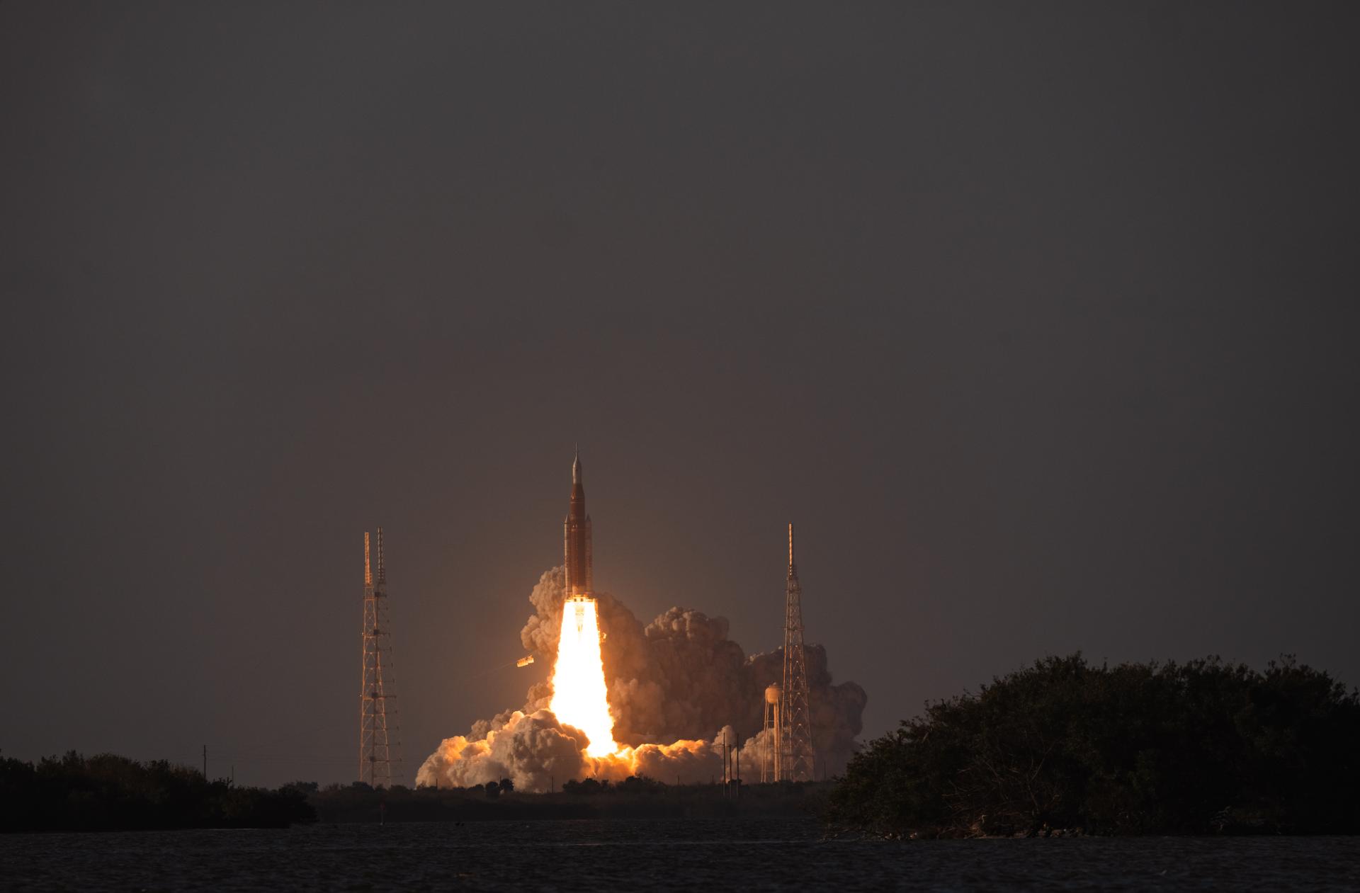
NASA’s Space Launch System rocket carrying the Orion spacecraft with NASA astronauts Reid Wiseman, commander; Victor Glover, pilot; Christina Koch, mission specialist; and CSA (Canadian Space Agency) astronaut Jeremy Hansen, mission specialist onboard launches on the Artemis II mission, Wednesday, April 1, 2026, from Launch Complex 39B at NASA’s Kennedy Space Center in Florida. NASA’s Artemis II mission will take Wiseman, Glover, Koch, and Hansen on a 10-day journey around the Moon and back aboard their Orion spacecraft. The quartet launched at 6:35 p.m. EDT, from Launch Complex 39B at the Kennedy Space Center. Photo Credit: (NASA/Steven B. Seipel)
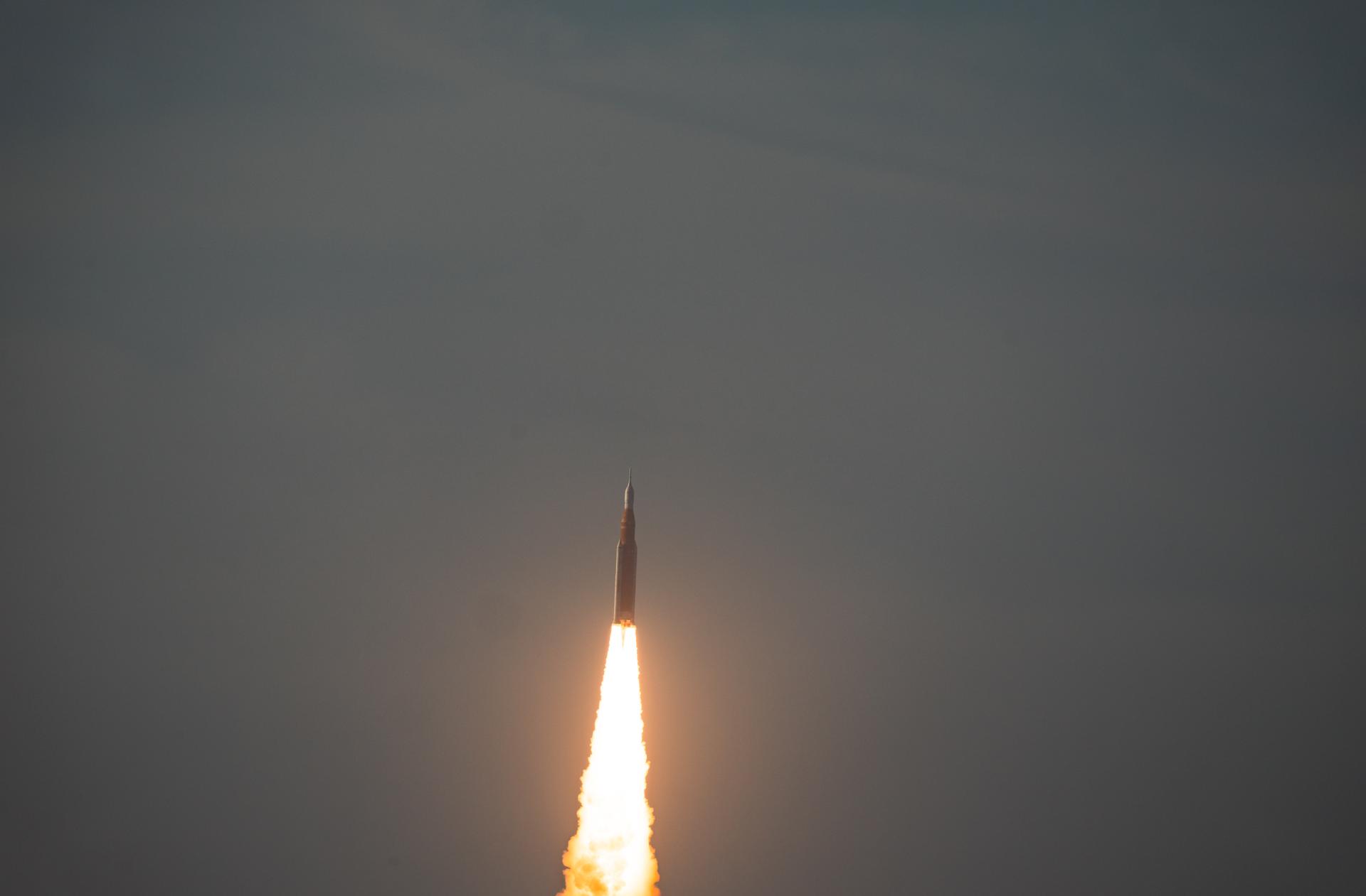
NASA’s Space Launch System rocket carrying the Orion spacecraft with NASA astronauts Reid Wiseman, commander; Victor Glover, pilot; Christina Koch, mission specialist; and CSA (Canadian Space Agency) astronaut Jeremy Hansen, mission specialist onboard launches on the Artemis II mission, Wednesday, April 1, 2026, from Launch Complex 39B at NASA’s Kennedy Space Center in Florida. NASA’s Artemis II mission will take Wiseman, Glover, Koch, and Hansen on a 10-day journey around the Moon and back aboard their Orion spacecraft. The quartet launched at 6:35 p.m. EDT, from Launch Complex 39B at the Kennedy Space Center. Photo Credit: (NASA/Steven B. Seipel)
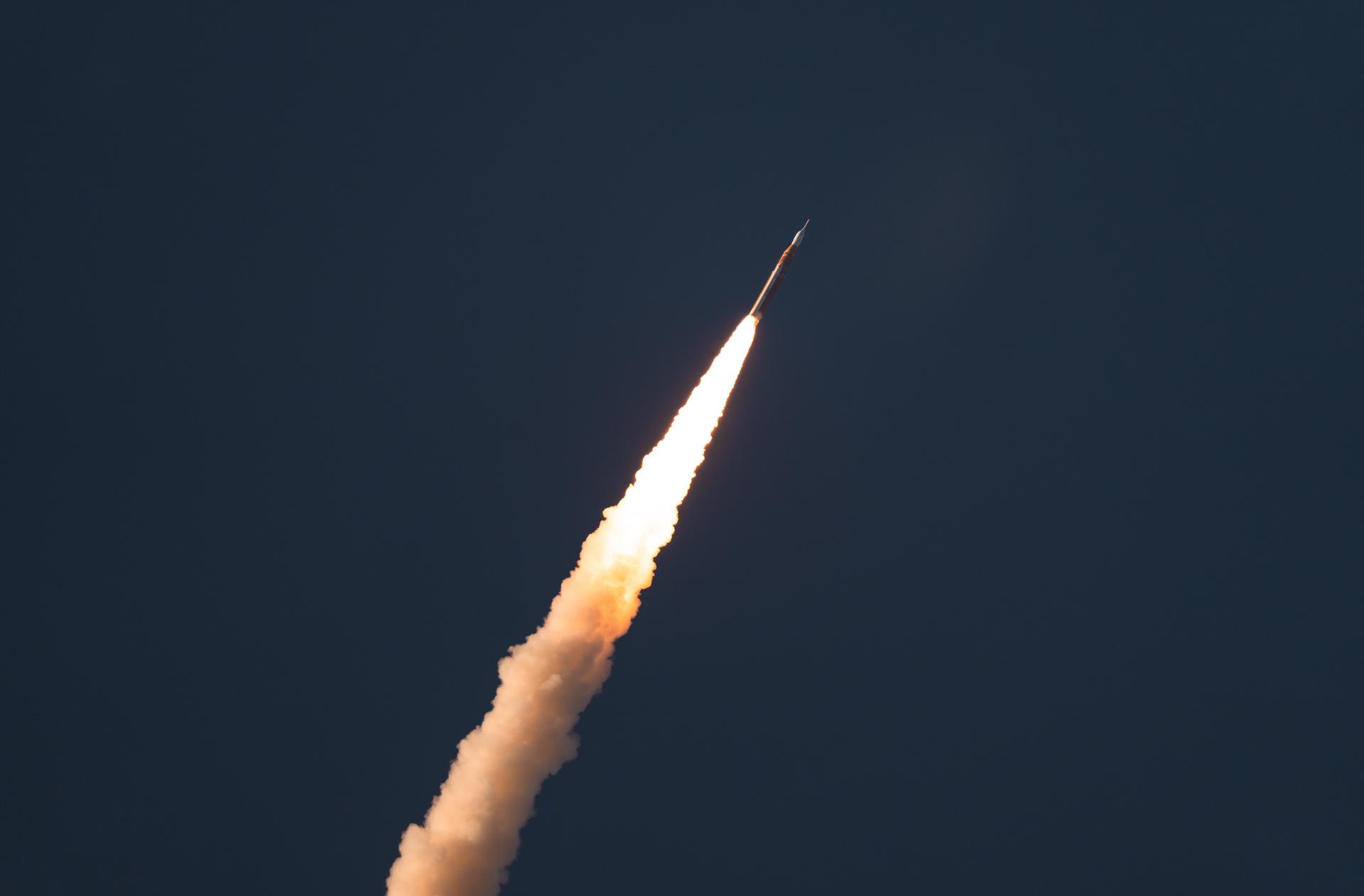
NASA’s Space Launch System rocket carrying the Orion spacecraft with NASA astronauts Reid Wiseman, commander; Victor Glover, pilot; Christina Koch, mission specialist; and CSA (Canadian Space Agency) astronaut Jeremy Hansen, mission specialist onboard launches on the Artemis II mission, Wednesday, April 1, 2026, from Launch Complex 39B at NASA’s Kennedy Space Center in Florida. NASA’s Artemis II mission will take Wiseman, Glover, Koch, and Hansen on a 10-day journey around the Moon and back aboard their Orion spacecraft. The quartet launched at 6:35 p.m. EDT, from Launch Complex 39B at the Kennedy Space Center. Photo Credit: (NASA/Steven B. Seipel)
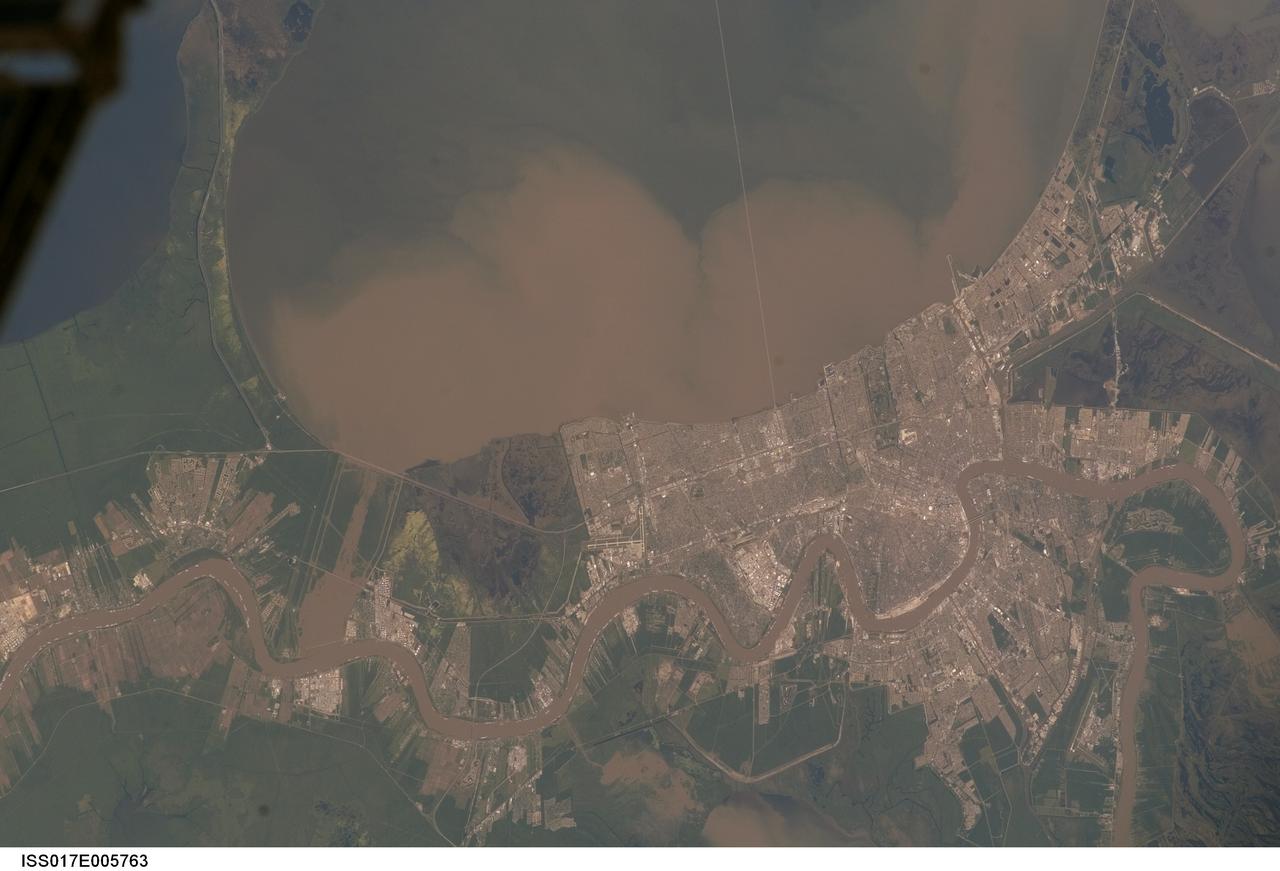
ISS017-E-005763 (29 April 2008) --- Lake Pontchartrain and the Bonnet Carre Spillway, Louisiana, are featured in this image photographed by an Expedition 17 crewmember on the International Space Station. Lake Pontchartrain, a big body of water immediately north of New Orleans, occupies the upper part of this view, with the winding course of the muddy Mississippi River snaking across the bottom of the image (flow is east, from left to right). The city of New Orleans is sandwiched between the lake and river. Heavy rain in March and April 2008 in the Mississippi's catchment area raised water levels in the river sufficiently to make the Army Corps of Engineers take action. To reduce the volume of the river where it passes through New Orleans, the Corps opened the Bonnet Carre Spillway (lower left), a major engineering structure 18 kilometers upriver from New Orleans. The spillway, a 1.6 kilometer-wide gap in the developments along the Mississippi levees, is an integral part of the river and canal system that allows Mississippi river water to flow into Lake Pontchartrain. The spillway control structure itself is visible as a thin, discontinuous, white line along the river's edge in this image. The spillway has only been opened eight times since 1937. News of the opening in April 2008 was transmitted to crewmembers aboard the International Space Station who managed to capture the immediate effect of muddy water flowing down the spillway and into Lake Pontchartrain, where it forms great brown lobes in the otherwise green water. These lobes moved slowly east along the New Orleans shoreline, where the line of the Lake Pontchartrain Causeway, the longest bridge in the U.S., can be seen, top right. Opening the spillway protects New Orleans in various ways. First, it reduces pressure on the levees, which famously collapsed at some points during the onslaught of Hurricane Katrina in 2005. Keeping water levels below critical high levels also helps the river channel to accommodate the discharge of water, and reduces both the speed of flow and cross currents in the river which can interfere with vessels navigating the river -- or even cause collisions with levees.

SL4-93-167 (February 1974) --- A vertical view of the Kennedy Space Center and the Florida Atlantic coast area is seen in this Skylab 4 Earth Resources Experiments Package S190-B (five-inch earth terrain camera) infrared photography taken from the Skylab space station in Earth orbit. This photograph shows the major land-ocean features of the Florida coast near Vero Beach northward to Cape Canaveral and the KSC complex. The launch pads for the Skylab missions are clearly visible. Identification of living vegetation is possible through the use of the color infrared film. Various shades of red portray differences in the vegetation such as shown in the patterns in the agricultural area near Vero Beach. In the Kennedy Space Center, the nearly continuous and uniform red color shows that most of the land areas are heavily vegetated. The white coastal beach areas are strongly contrasted to the red land and the blue Atlantic Ocean. Old dunal areas in KSC are visible on Merritt Island which is separated from the Launch areas by the Banana River and the mainland by the Indian River. Federal and state highways and numerous causeways over the rivers are easily identified. The Florida mainland is partly shadowed by small white clouds which cast a pronounced shadow to the east of each cloud indicated the Sun is west of solar noon. Federal agencies participating with NASA on the EREP project are the Departments of Agriculture, Commerce, Interior, the Environmental Protection Agency and the Core of Engineers. All EREP photography is available to the public through the Department of Interior's Earth Resources Observations Systems Data Center, Sioux Falls, South Dakota, 57198. Photo credit: NASA