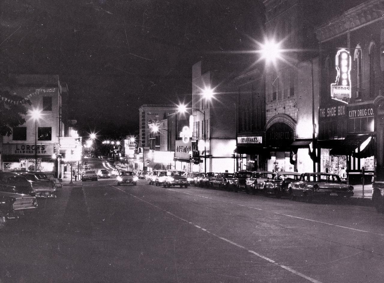
This is a 1956 night shot of the east side of Square in downtown Huntsville, Alabama. Photo Courtesy of Huntsville Public Library
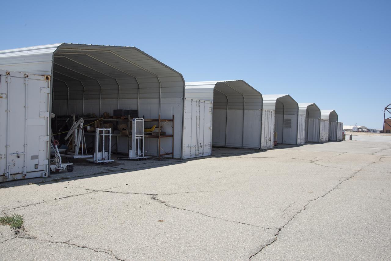
This 8,800-square-foot canopy area was demolished during the refurbishment of the east side of Building 4826, the future home of the X-59 Quiet SuperSonic Technology aircraft, at NASA's Armstrong Flight Research Center in Edwards, California.

Elevated platforms are seen hanging in front of the NASA Logo on the side of Kennedy Space Center's Vehicle Assembly Building. Also in view on the east side of the building are platforms on the facility's large vertical doors. Workers, suspended on the platforms from the top of the 525-foot-high VAB, use rollers and brushes to do the painting. The flag and logo were last painted in 1998, honoring NASA's 40th anniversary. The flag spans an area 209 feet by 110 feet, or about 23, 437 square feet. Each stripe is 9 feet wide and each star is 6 feet in diameter. The logo, also known as the "meatball," measures 110 feet by 132 feet, or about 12,300 square feet.
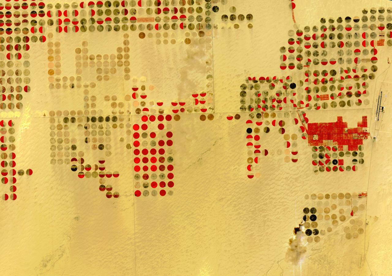
The Nubian Sandstone Aquifer System is the world's largest fossil water aquifer system. It covers an estimated area of 2.6 million square kilometers, including parts of Sudan, Chad, Libya, and most of Egypt. In the southwestern part of Egypt, the East Oweinat development project uses central pivot irrigation to mine the fossil water for extensive agricultural development. Crops include wheat and potatoes; they are transported via the airport on the eastern side. The image was acquired October 12, 2015, covers an area of 33.3 by 47.2 km, and is located near 22.6 degrees north, 28.5 degrees east. https://photojournal.jpl.nasa.gov/catalog/PIA24616
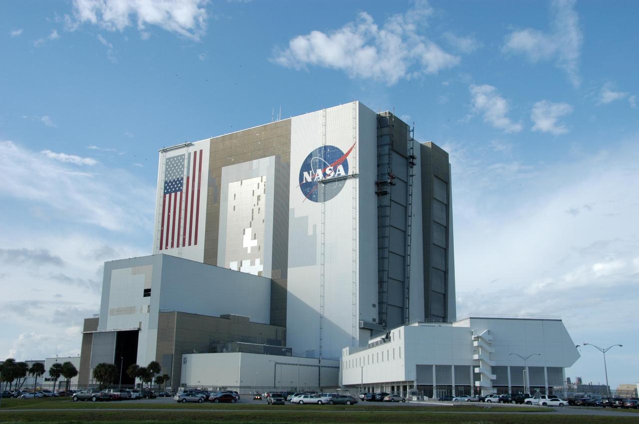
KENNEDY SPACE CENTER, FLA. -- Elevated platforms are seen hanging in front of the NASA Logo on the side of Kennedy Space Center's Vehicle Assembly Building. Also in view on the east side of the building are platforms on the facility's large vertical doors. Workers, suspended on the platforms from the top of the 525-foot-high VAB, use rollers and brushes to do the painting. The flag and logo were last painted in 1998, honoring NASA's 40th anniversary. The flag spans an area 209 feet by 110 feet, or about 23, 437 square feet. Each stripe is 9 feet wide and each star is 6 feet in diameter. The logo, also known as the "meatball," measures 110 feet by 132 feet, or about 12,300 square feet. Photo credit: NASA/George Shelton

KENNEDY SPACE CENTER, FLA. - Members of a hurricane assessment team from Johnson Space Center and Marshall Space Flight Center tour the roof of the Vehicle Assembly Building (VAB) a week after Hurricane Frances hit the east coast of Central Florida and Kennedy Space Center. The VAB lost 820, 4- x 16-foot panels from the side walls, or more than 52,000 square feet of its surface. One team member is astronaut Scott Altmann, fifth from right.
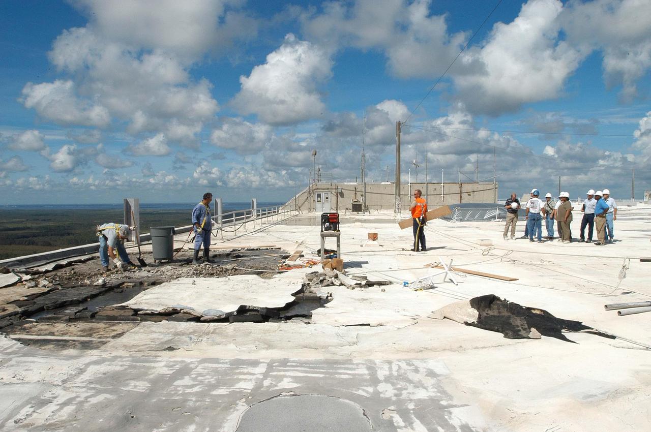
KENNEDY SPACE CENTER, FLA. - Members of a hurricane assessment team from Johnson Space Center and Marshall Space Flight Center look at damage on the roof of the Vehicle Assembly Building (VAB) a week after Hurricane Frances hit the east coast of Central Florida and Kennedy Space Center. The VAB lost 820, 4- x 16-foot panels from the side walls, or more than 52,000 square feet of its surface.
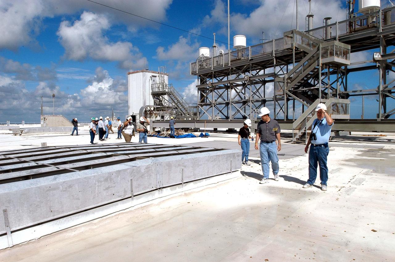
KENNEDY SPACE CENTER, FLA. - Members of a hurricane assessment team from Johnson Space Center and Marshall Space Flight Center tour the roof of the Vehicle Assembly Building (VAB) a week after Hurricane Frances hit the east coast of Central Florida and Kennedy Space Center. The VAB lost 820, 4- x 16-foot panels from the side walls, or more than 52,000 square feet of its surface.
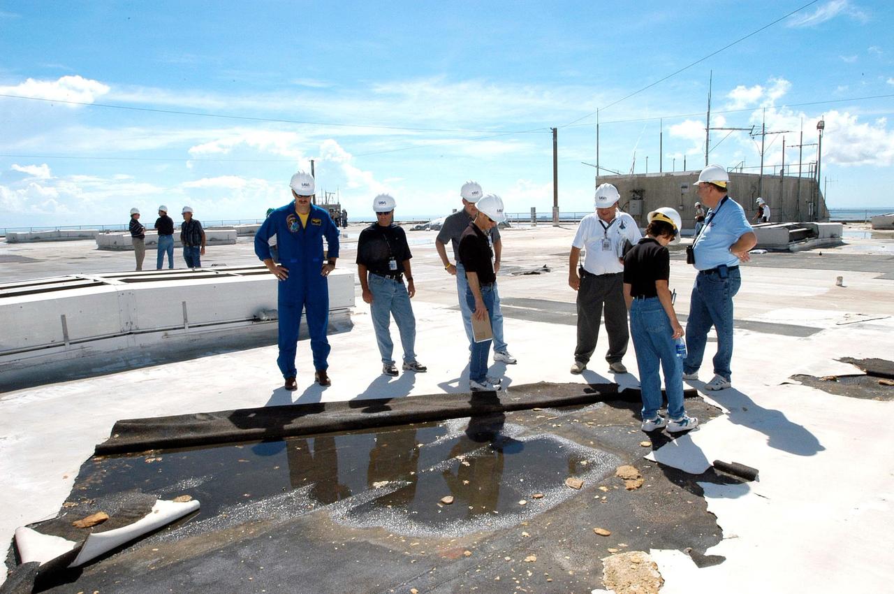
KENNEDY SPACE CENTER, FLA. - Members of a hurricane assessment team from Johnson Space Center and Marshall Space Flight Center look at damage on the roof of the Vehicle Assembly Building (VAB) a week after Hurricane Frances hit the east coast of Central Florida and Kennedy Space Center. The VAB lost 820, 4- x 16-foot panels from the side walls, or more than 52,000 square feet of its surface. One team member is astronaut Scott Altmann, at far left.
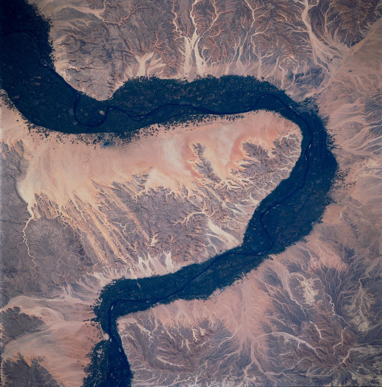
STS083-748-066 (4-8 April 1997) --- Luxor, Qus, and Qina, Egypt on the Nile. The Nile, which is about 4,132 miles long, is the longest river in the world. This photo demonstrates the dependency of the local agriculture on the River. This area is the historic area of ancient Thebes. Luxor, also called EL-AKSUR, or AL-UQSUR, a market town along the southern part of the Nile's curve, is located on the southern half of the ruins of Thebes. Ancient Thebes was about six miles square; the main part of the city was situated along the Nile's east bank; along the west bank was "the city of the dead" -- an area containing the Egyptian kings' mortuary temples and the houses of those priests, soldiers, craftsmen, and laborers who were devoted to their service. Qina, extending 3 - 4 miles (5 - 6 kilometers) on each side of the Nile River between the Arabian and Libyan deserts, is seen on the northeast part of the rivers curve. Occupying the great bend in the Nile Valley, it has an area of 715 square miles (1,851 square kilometers) and contains the celebrated ruins of Thebes and the Valley of the Tombs of the Kings. Qina has a dense agricultural population (more than 3,000 persons per square mile), and most of its land is under basin irrigation, yielding only one crop annually. Main crops are sugar (about three-fifths of the nation's production), lentils, and grains.
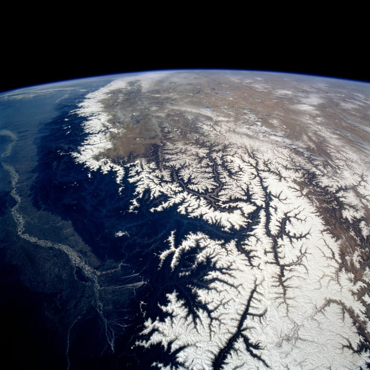
STS075-721-013 (22 Feb.-9 March 1996) --- Snow caps the line of the Himalayas in this 70mm frame photographed by a crew member using a handheld 70mm camera. The green plain of the Ganges-lower Brahamaputra is to the south (left) and the brown Tibetan Plateau desert to the right. The Brahamaputra River, 1,800 miles long, rises on the Tibetan Plateau (top) at the foot of a glacier at the elevation of 22,000 feet. It flows east (towards the camera) for more than half its length, and then descends onto the low plains through some of the deepest gorges in the world. In the low country of northeastern India (left side of photo), it flows west to meet the Ganges. Rainfall totals in this part of the Himalayas are some of the highest in the world, measuring 400 inches at Cherapunji on the Himalayan slopes center left. It has a drainage area of 250,000 square miles.
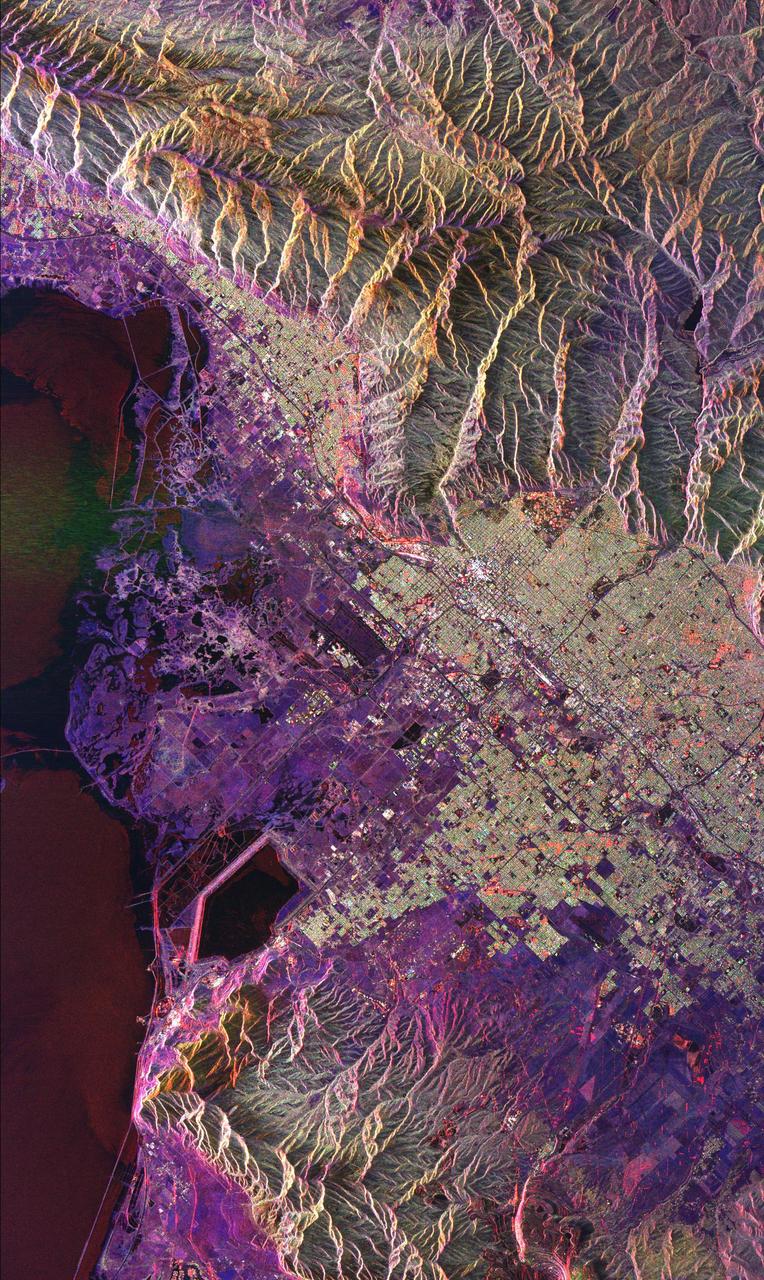
This radar image of Salt Lake City, Utah, illustrates the different land use patterns that are present in the Utah Valley. Salt Lake City lies between the shores of the Great Salt Lake (the dark area on the left side of the image) and the Wasatch Front Range (the mountains in the upper half of the image). The Salt Lake City area is of great interest to urban planners because of the combination of lake, valley and alpine environments that coexist in the region. Much of the southern shore of the Great Salt Lake is a waterfowl management area. The green grid pattern in the right center of the image is Salt Lake City and its surrounding communities. The Salt Lake City airport is visible as the brown rectangle near the center of the image. Interstate Highway 15 runs from the middle right edge to the upper left of the image. The bright white patch east of Interstate 15 is the downtown area, including Temple Square and the state capitol. The University of Utah campus is the yellowish area that lies at the base of the mountains, east of Temple Square. The large reservoir in the lower left center is a mine tailings pond. The semi-circular feature in the mountains at the bottom edge of the image is the Kennecott Copper Mine. The area shown is 60 kilometers by 40 kilometers (37 miles by 25 miles) and is centered at 40.6 degrees north latitude, 112.0 degrees west longitude. North is toward the upper left. This image was acquired by the Spaceborne Imaging Radar-C/X-Band Synthetic Aperture Radar (SIR-C/X-SAR) aboard the space shuttle Endeavour on April 10, 1994. The colors in this image represent the following radar channels and polarizations: red is L-band, horizontally transmitted and received; green is L-band, horizontally transmitted and vertically received; and blue is C-band, horizontally transmitted and vertically received. SIR-C/X-SAR, a joint mission of the German, Italian and United States space agencies, is part of NASA's Mission to Planet Earth program. http://photojournal.jpl.nasa.gov/catalog/PIA01798
ISS016-E-006986 (26 Oct. 2007) --- Great Sand Dunes National Park and Preserve, Colorado is featured in this image photographed by an Expedition 16 crewmember on the International Space Station. The Sangre de Cristo Mountains of south-central Colorado stretch dramatically from top left to lower right of this image, generally outlined by the dark green of forests with white snow-capped peaks on the highest elevations. Dun-colored dunes, covering an area of 80 square kilometers, are banked up on the west side of the mountains and comprise the Great Sand Dunes National Park and Preserve. Originally established in 1932 as a National Monument, it was reauthorized as a National Park in 2004. The park contains dunes over 750 feet (227 meters) high -- among the highest in North America. Sand grains that make up the dunes are small enough to be moved along by the wind (a process known as saltation), although much of the dunefield is now anchored by vegetation. Predominant winds blow broadly to the east, so that sand in the San Luis valley (part of which appears at lower left) is driven towards and piled against the Sangre de Cristo Mts. The sand of the dunes is mostly derived from ancient exposed lakebed sediments - now the floor of the San Luis valley - formed by erosion of rocks in the Sangre de Cristo and San Juan Mountains (located to the west). The action of streams and occasional storms today returns some of the impounded sand back to the valley, where the prevailing winds begin the sand's migration to the dunefield anew. Interestingly, the specific location of the sand field appears to be related to a locally lower altitude sector of the Sangre de Cristo Mts. Altitudes can be inferred from the distribution of snow cover on the day this image was taken. Areas to the north (Cleveland Peak and northward) of the dunefield, and to the south around Blanca Peak, are higher than the ridgeline next to the dune field where almost no snow is visible. Since winds are preferentially channeled over the lower parts of any range (hundreds of meters lower here than ridgelines to north and south), sand grains are carried up to (but not over) the low point of the range.