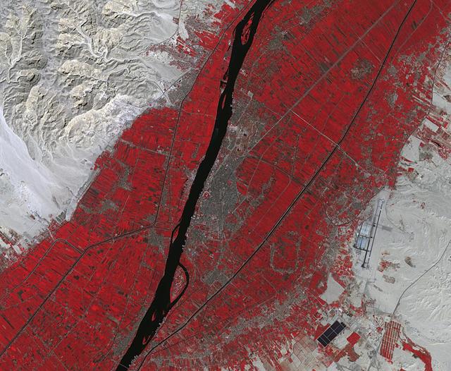
Luxor is a city in Upper Egypt, along the Nile. It is the site of the ancient Egyptian city of Waset, known to the Greeks as Thebes. Luxor is one of the world's greatest open-air museums, with the ruins of the temple complexes of Karnak and Luxor. Immediately across the Nile is the Valley of the Kings, burial place of dozens of Egypt's pharaohs, including King Tutankhamun. The image was acquired October 18, 2017, covers an area of 15.9 by 19.3 kilometers, and is located at 25.7 degrees north, 32.6 degrees east. https://photojournal.jpl.nasa.gov/catalog/PIA23060
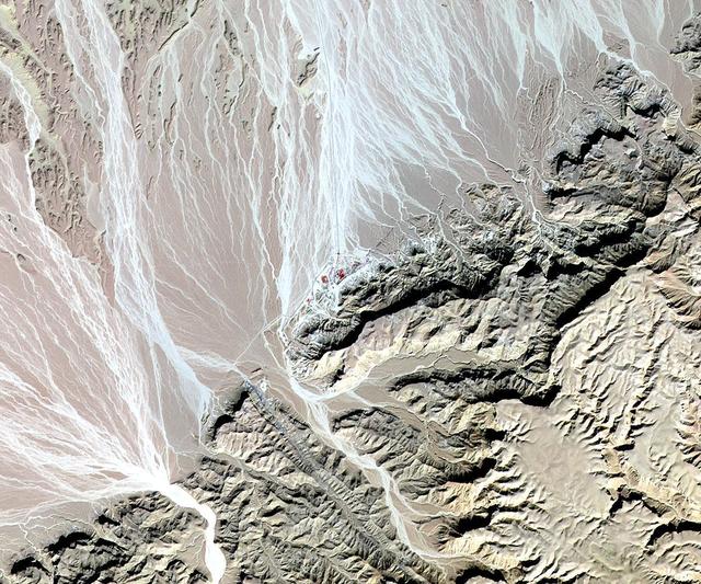
NASA Terra spacecraft acquired this image of St. Anthony, the world oldest Christian monastery, settled in the remote mountainous area of eastern Egypt near the Red Sea.
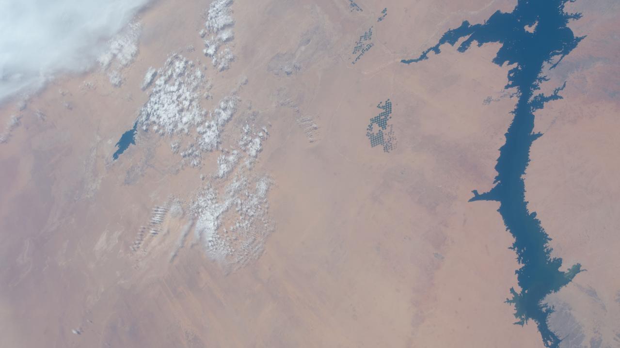
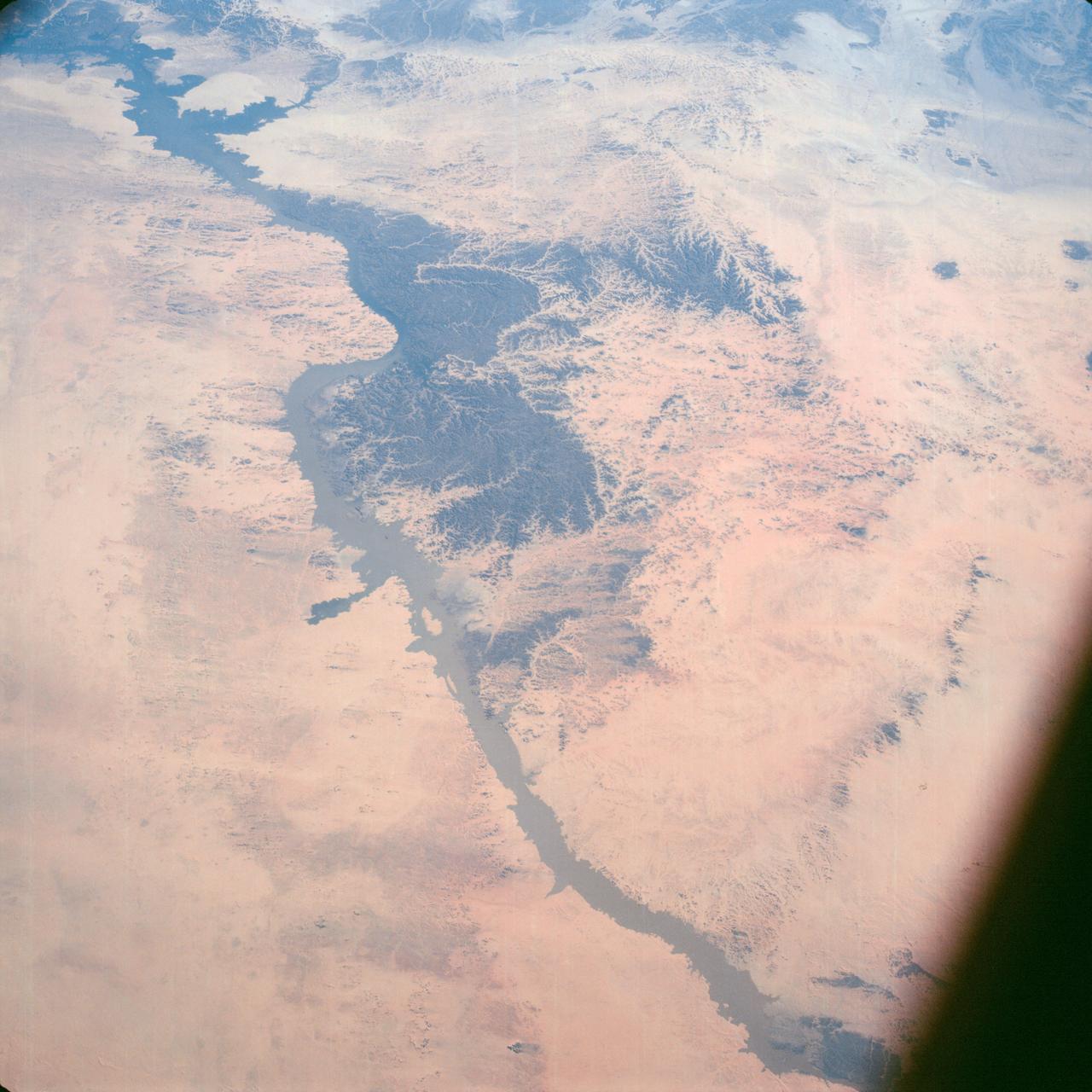
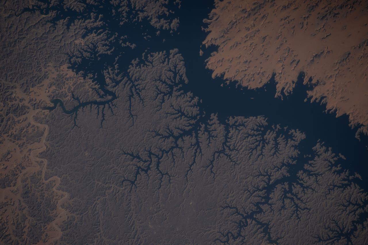
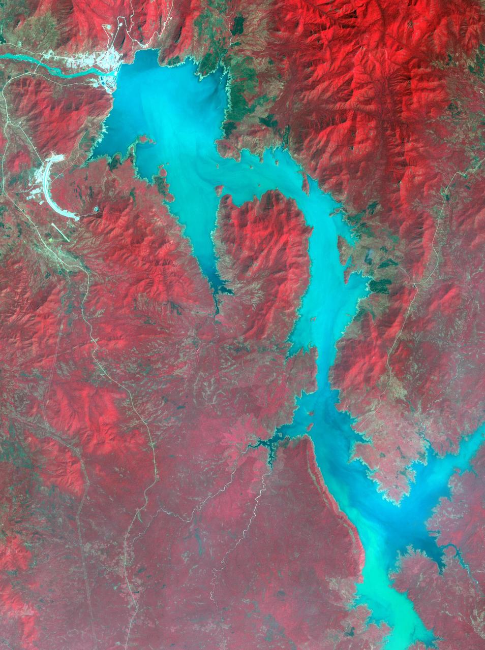
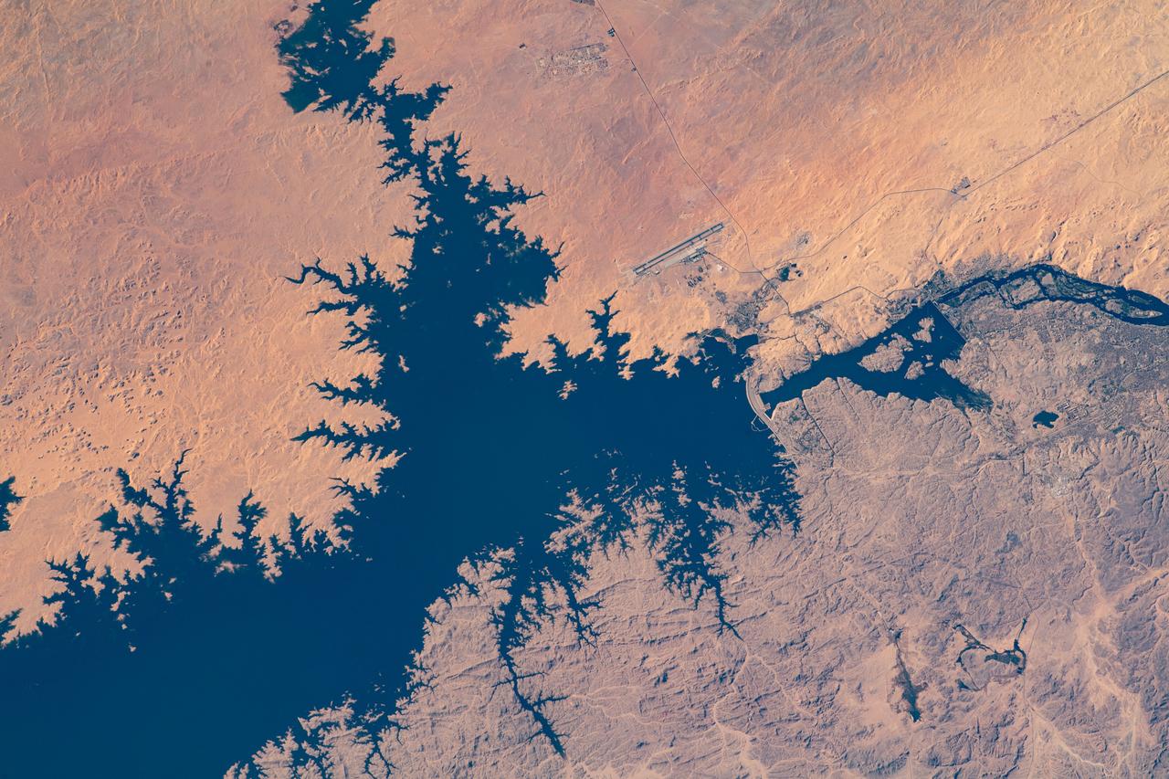
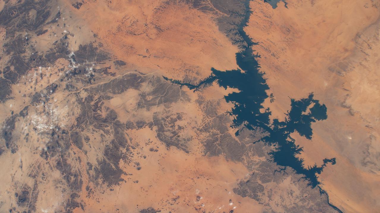
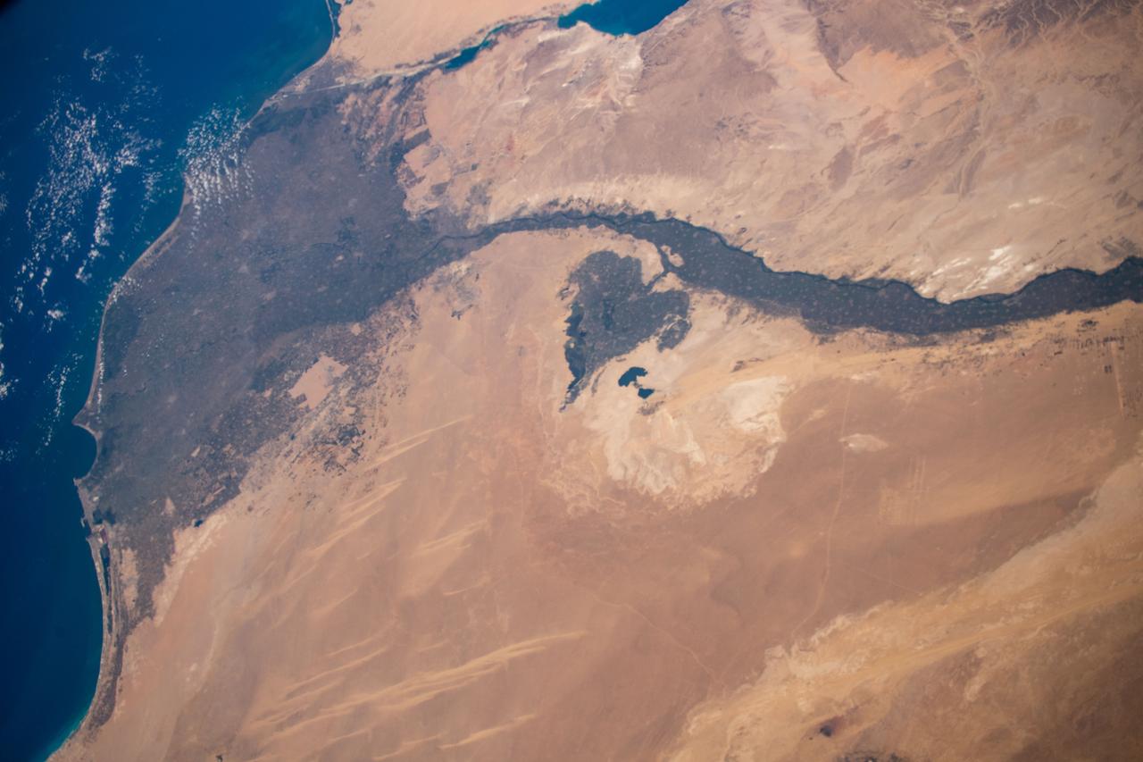
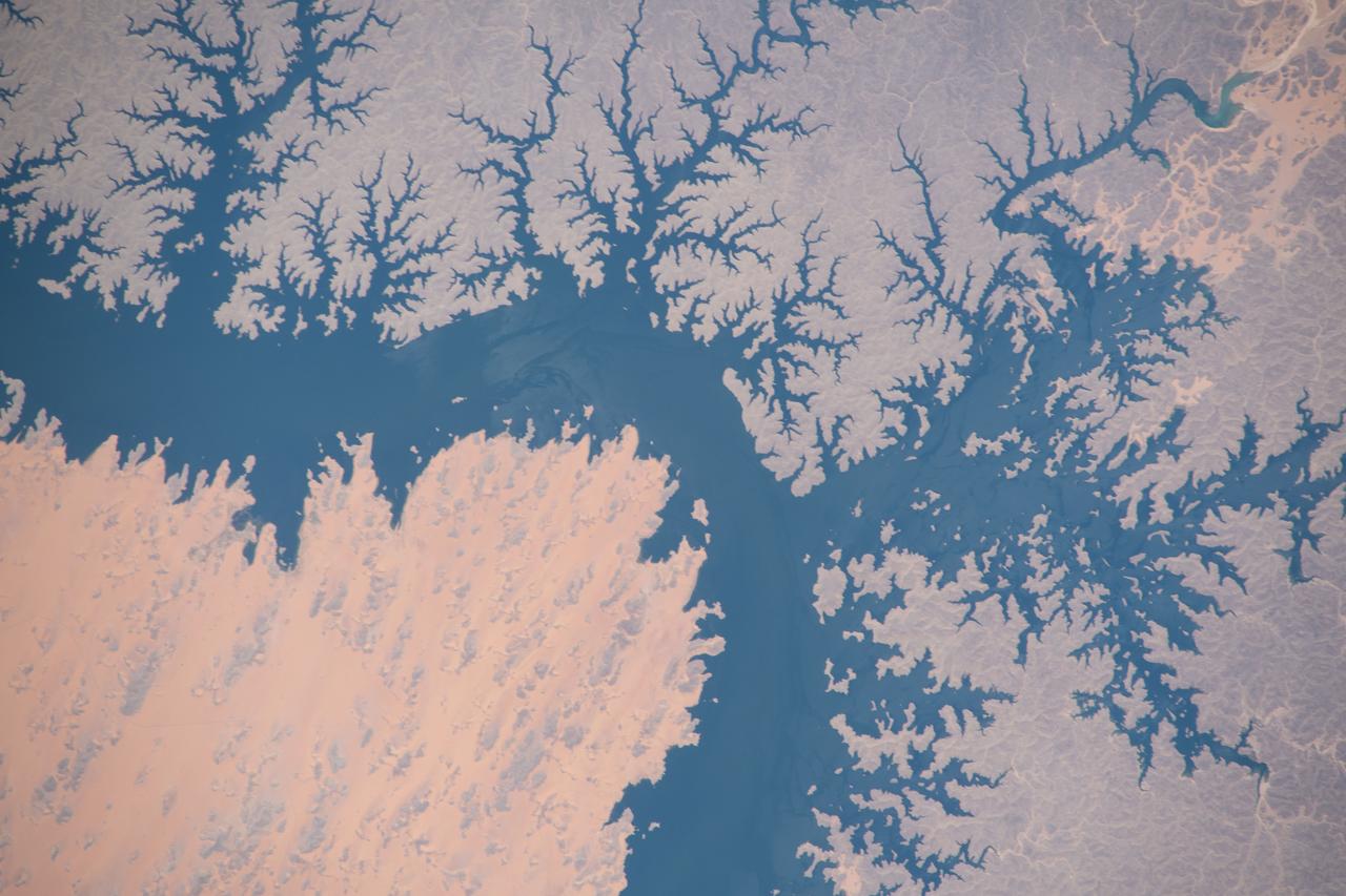
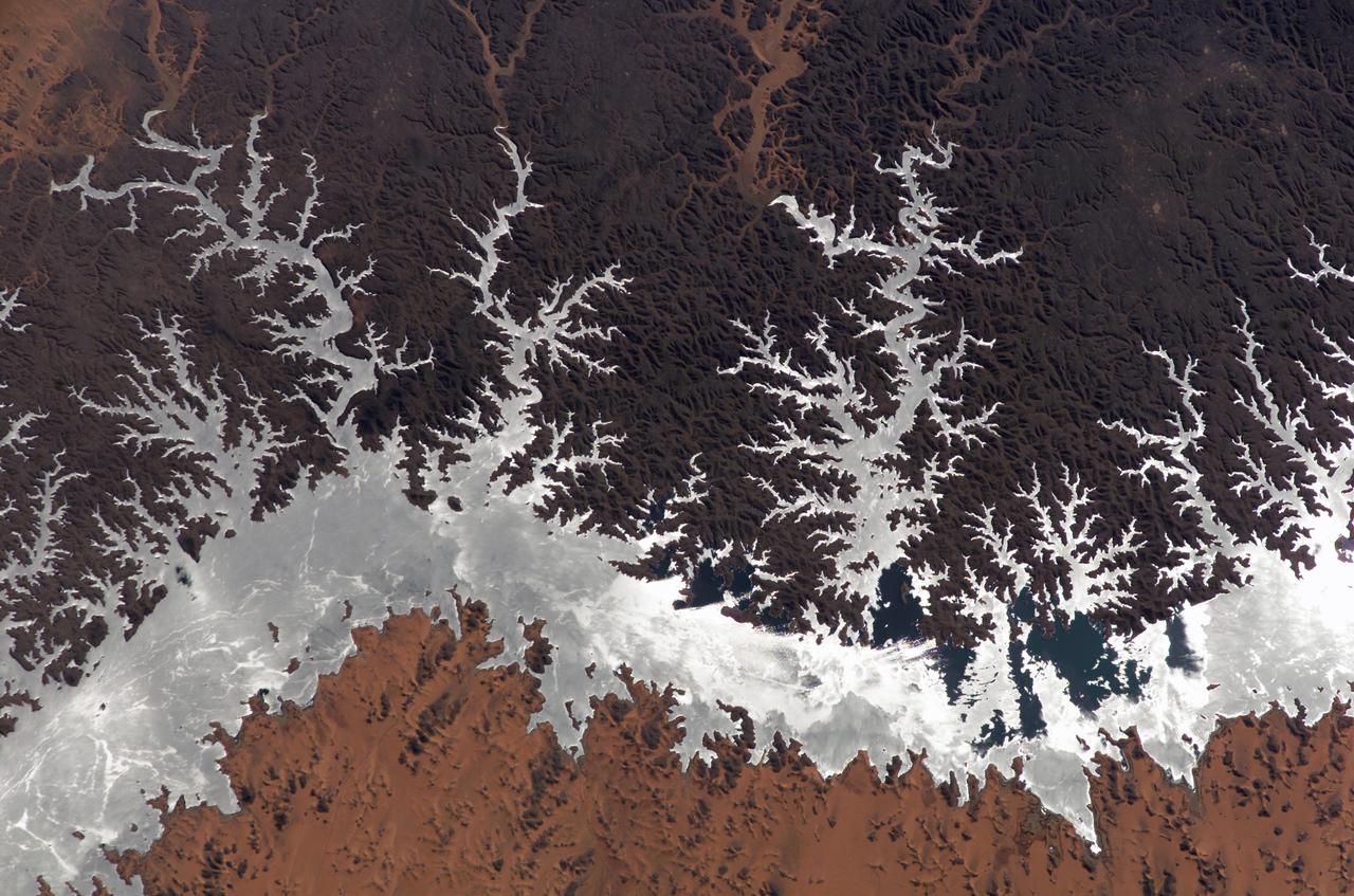
iss058e010623 (Feb. 5, 2019) --- Lake Nasser in Egypt, which leads to the Nile River, is pictured as the International Space Station orbited 251 miles above the Western Desert in the African nation.
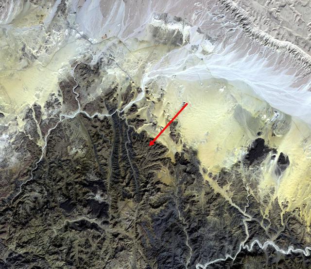
The earliest trace of alphabetic writing was found at Serabit el-Khadim in the Sinai Peninsula, Egypt at a temple to the Goddess Hathor. Since 2800 BCE, turquoise was mined here, mainly by the ancient Egyptians. Four thousand year old inscriptions are in the Proto-Sinaitic script, the ancestor to the Greek alphabet, and our modern alphabets. (Smithsonian magazine, January-February 2021) The image was acquired November 7, 2015, covers an area of 23.3 by 28.2 km, and is located at 29 degrees north, 33.4 degrees east. https://photojournal.jpl.nasa.gov/catalog/PIA24386
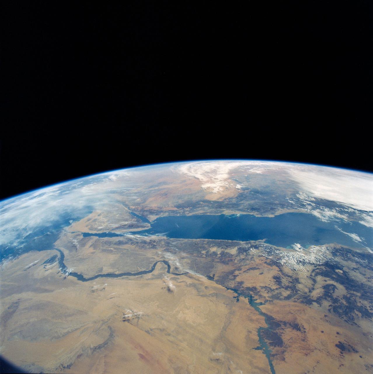
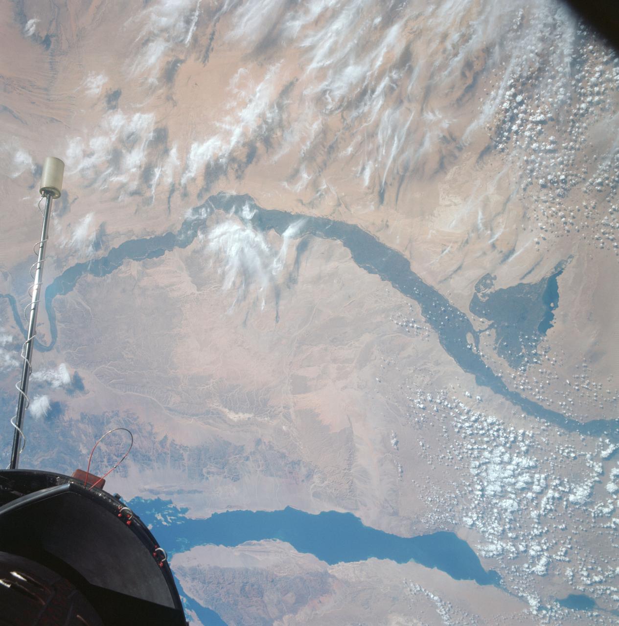
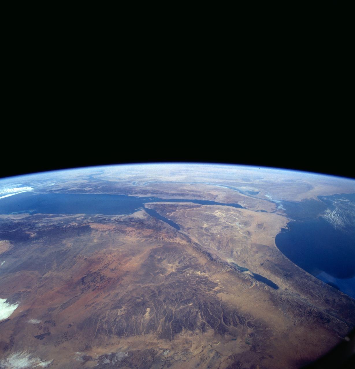
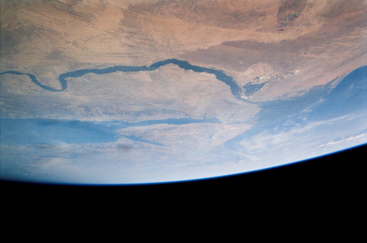
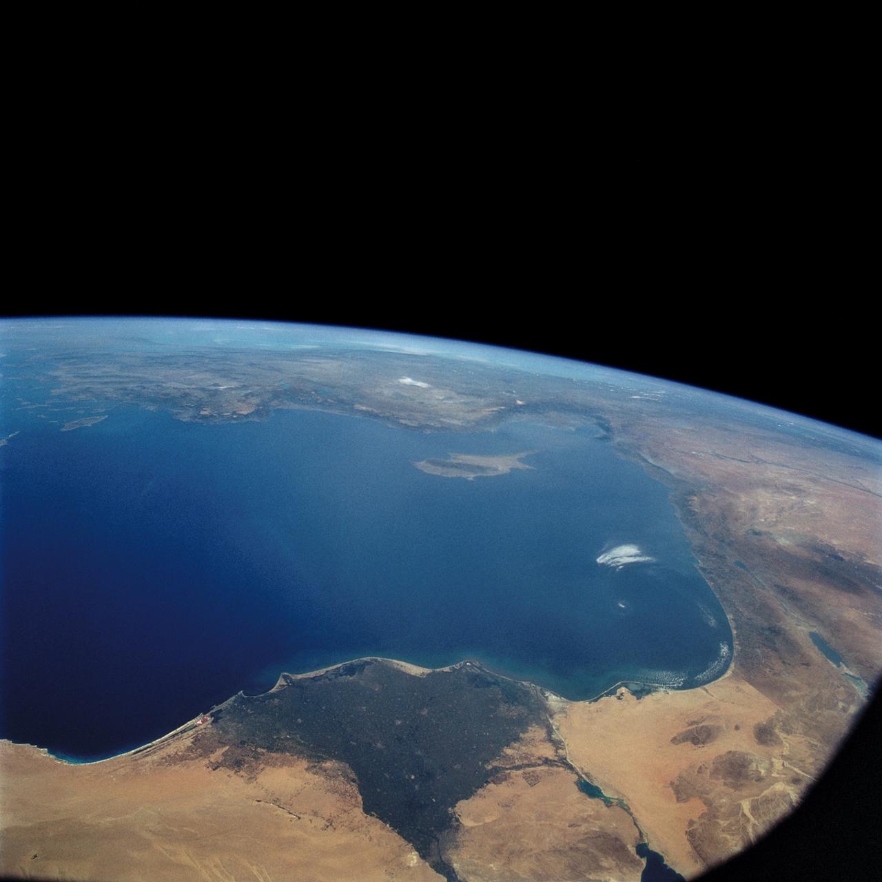
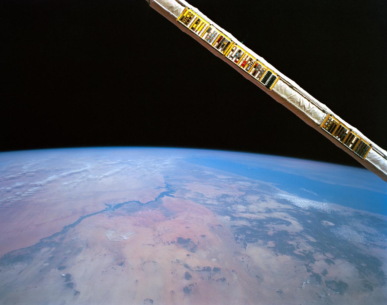
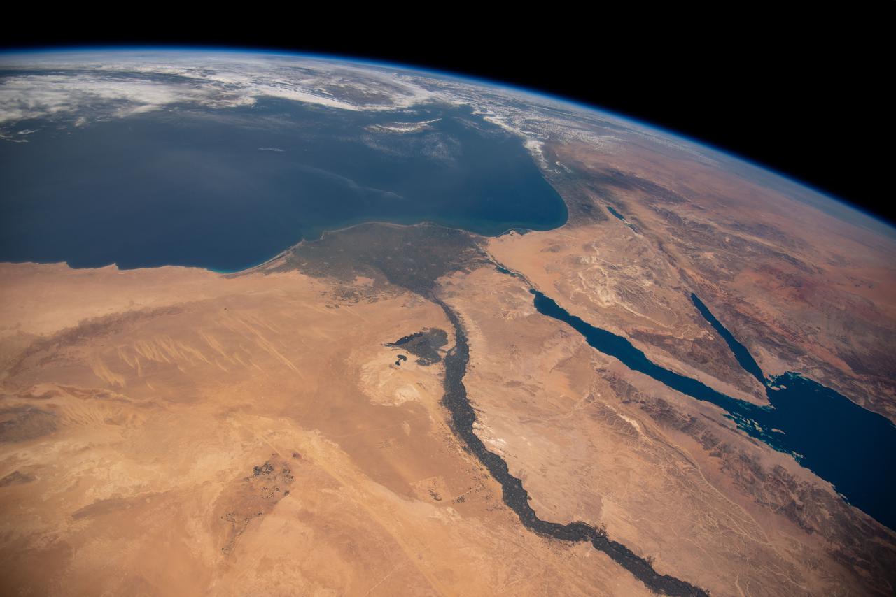
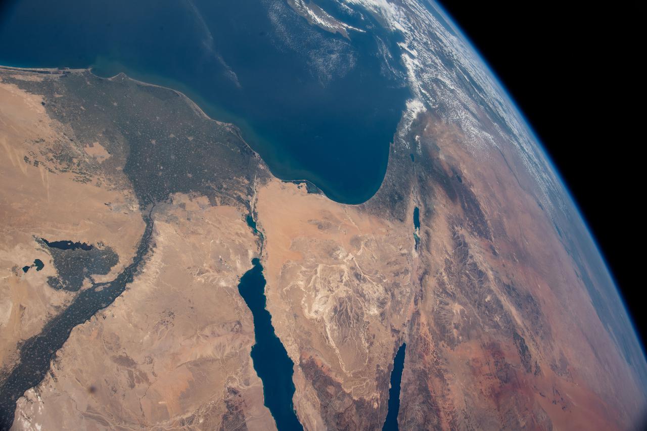
STS031-79-015 (24-29 April 1990) --- The 330-plus nautical mile orbital altitude of the Space Shuttle Discovery allowed for this unique high oblique 70mm Hasselblad frame. Egypt is in the foreground, with the Nile River and Lake Nasser readily identifiable. Cairo and Alexandria are visible. The Mediterranean Sea is on the horizon in upper left. The Red Sea is in the center. Other areas seen include Saudi Arabia, Jordan, Palestine and Israel; the Gulf of Aqaba and the Gulf of Suez.

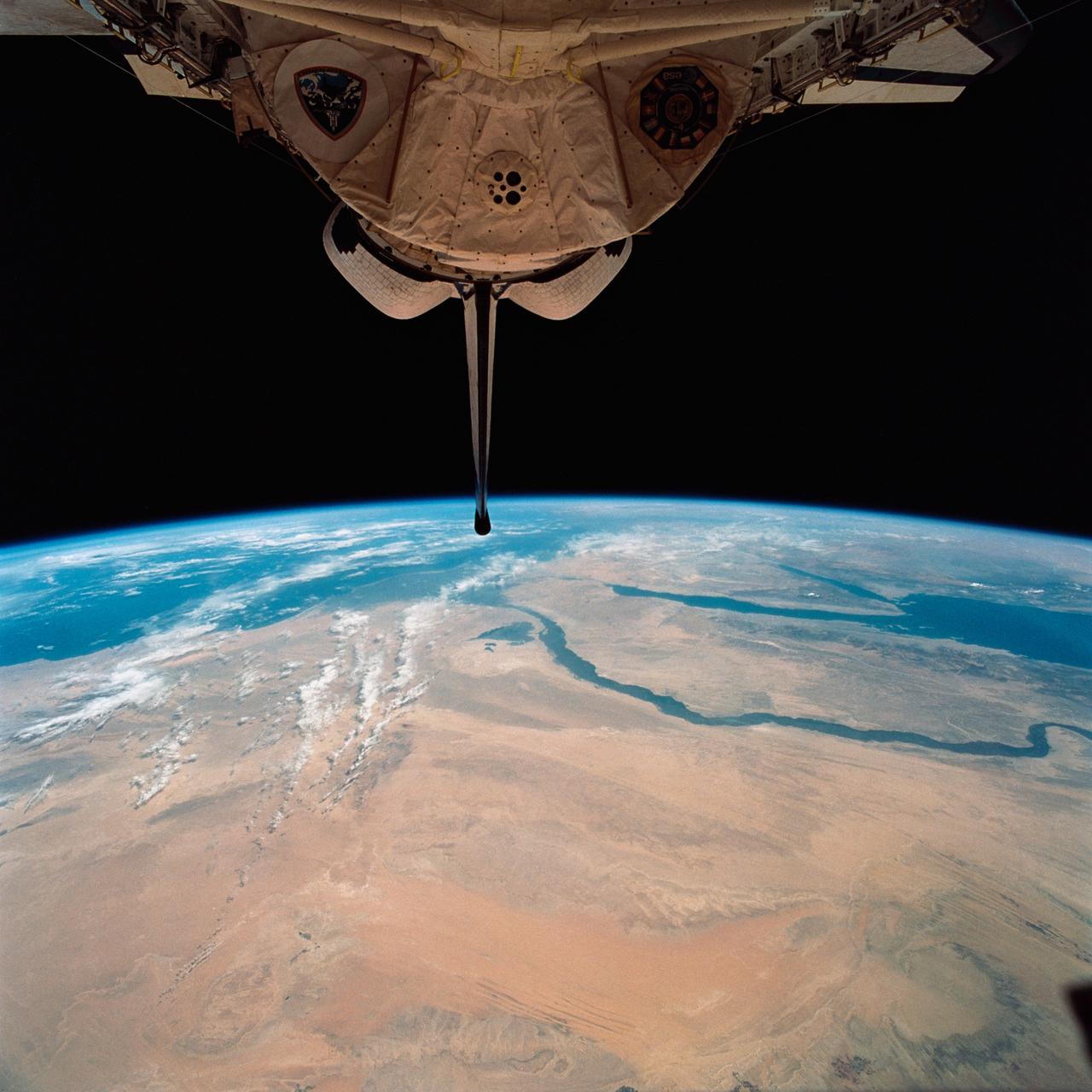
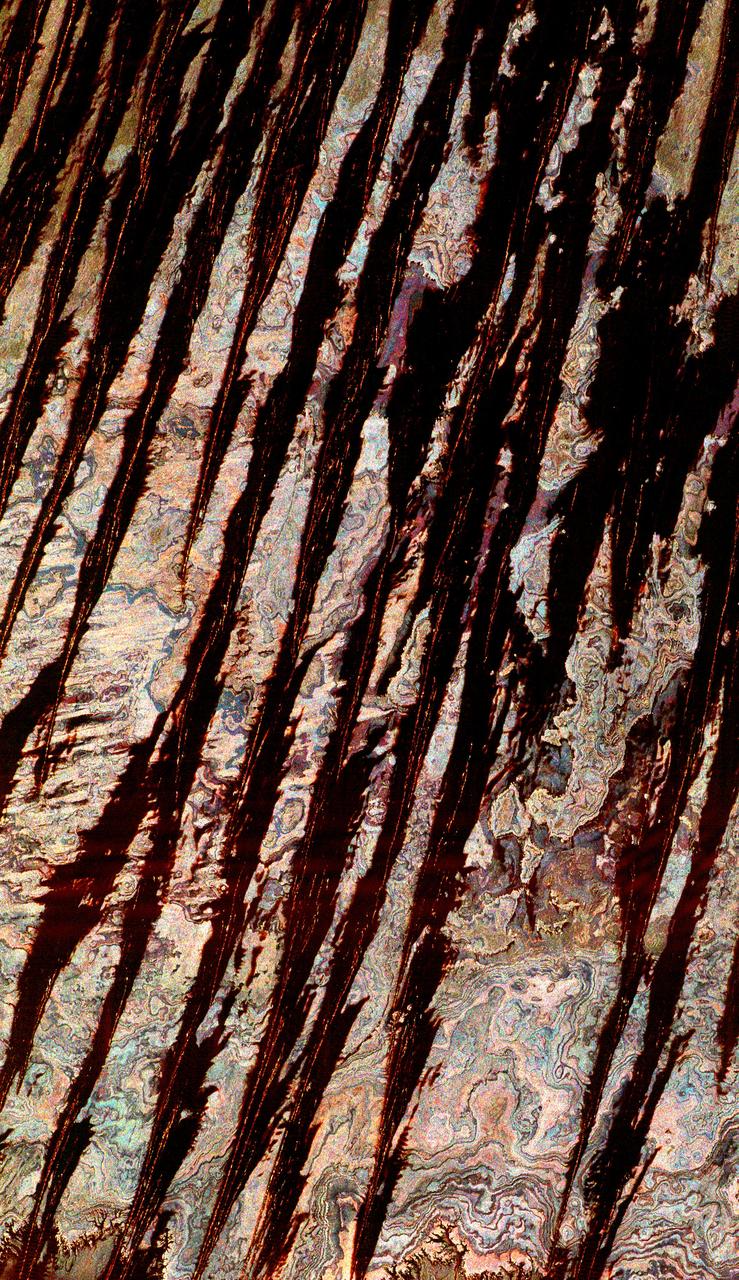
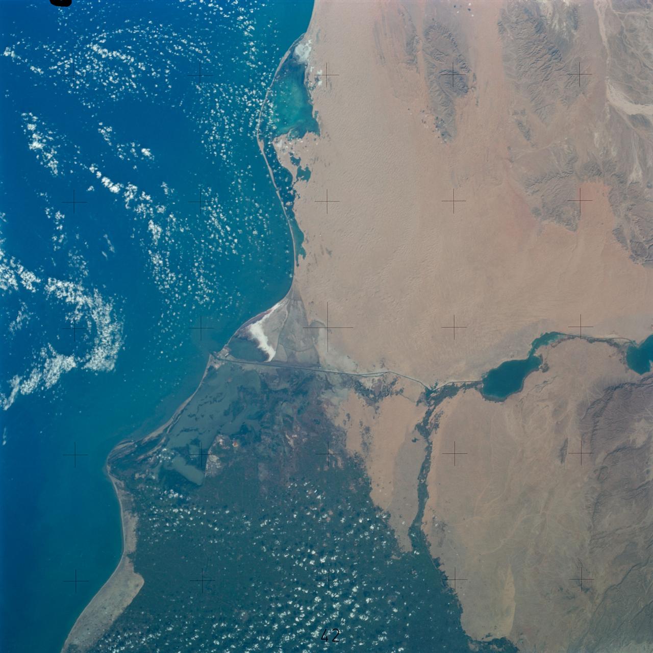
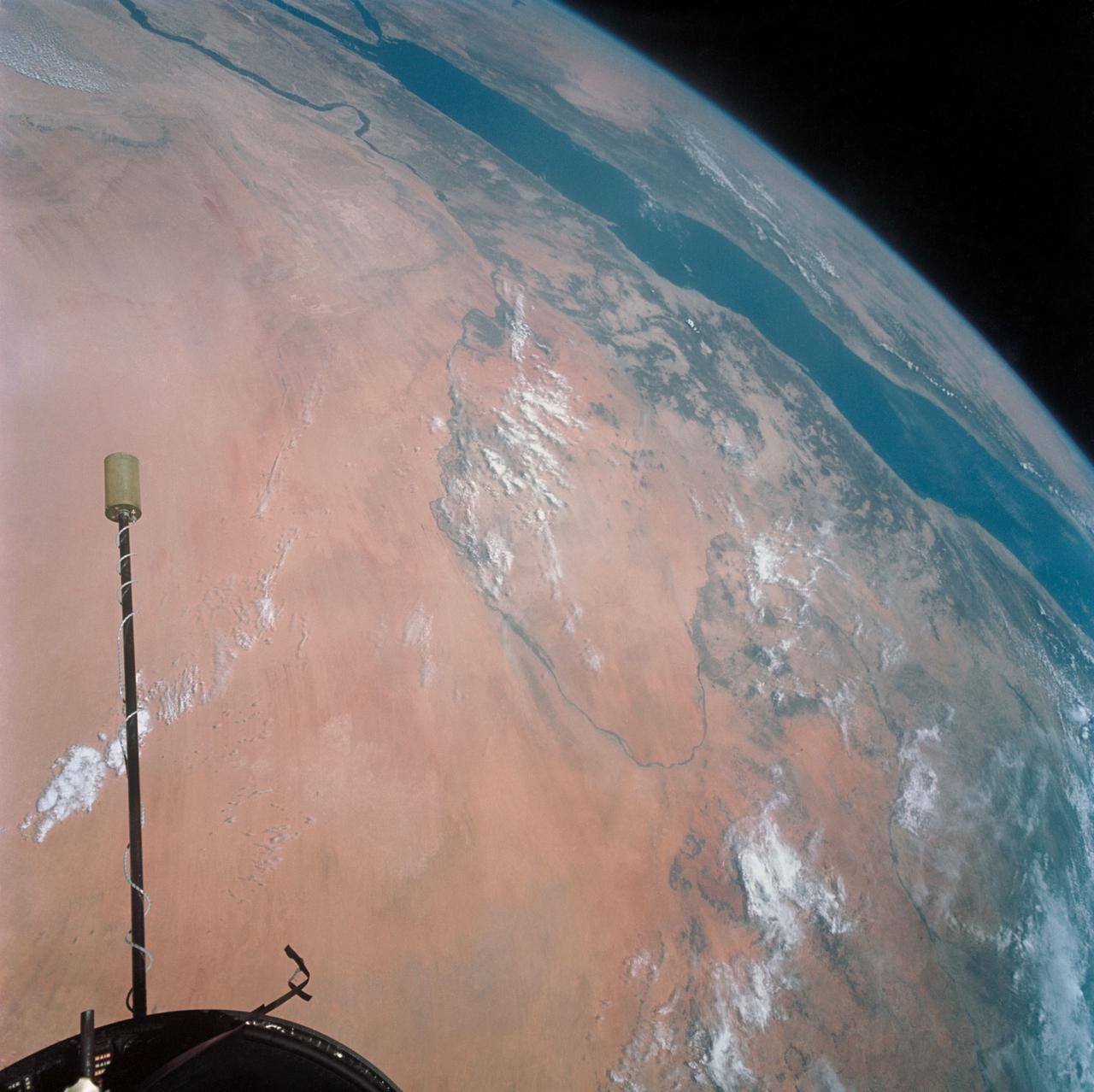
AST-02-130 (20 July 1975) --- An oblique view of a portion of Libya and the Arab Republic of Egypt, as photographed from the Apollo spacecraft in Earth orbit during the joint U.S.-USSR Apollo-Soyuz Test Project mission. The geological features are the Jebel Uweinat and Jebel Arkenu basaltic mountains in the Libyan sand sea. This picture was taken with a 70mm Hasselblad camera using medium-speed Ektachrome QX-807 type film. The spacecraft was at an altitude of 219 kilometers (136 statute miles).
Lake Nasser on the Nile River in southeastern United Arab Republic (Egypt) as seen from the Apollo 7 spacecraft during its 10th revolution of the earth. Photographed from an altitude of 130 nautical miles, at ground elapsed time of 14 hours and 56 minutes. Lake Nasser was created by the contruction of the Aswan Dam on the Nile.
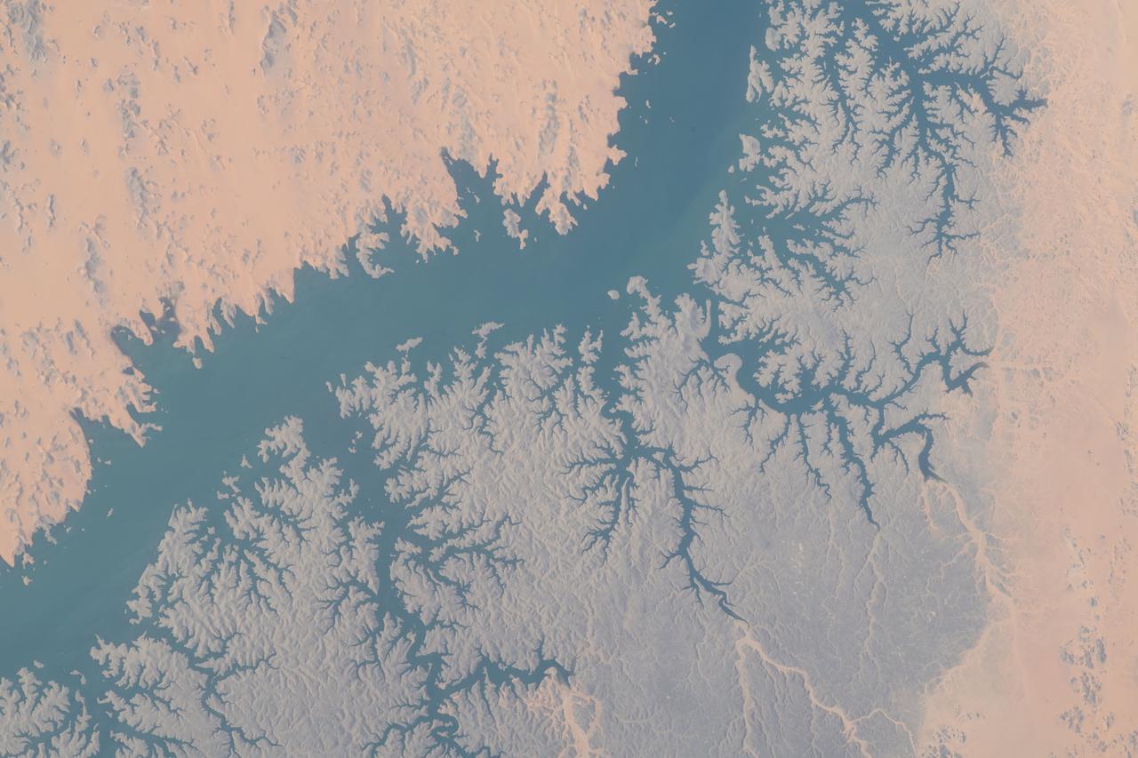
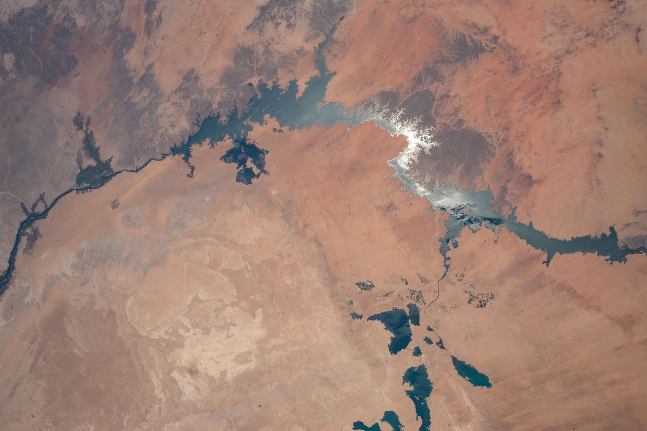
iss069e004011 (April 18, 2023) --- This portion of Lake Nasser in southern Egypt was pictured by NASA astronaut and Expedition 69 Flight Engineer Woody Hoburg as the International Space Station orbited 258 miles above.
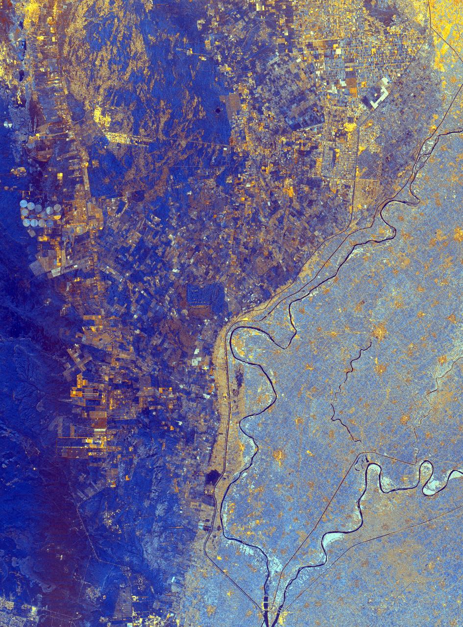
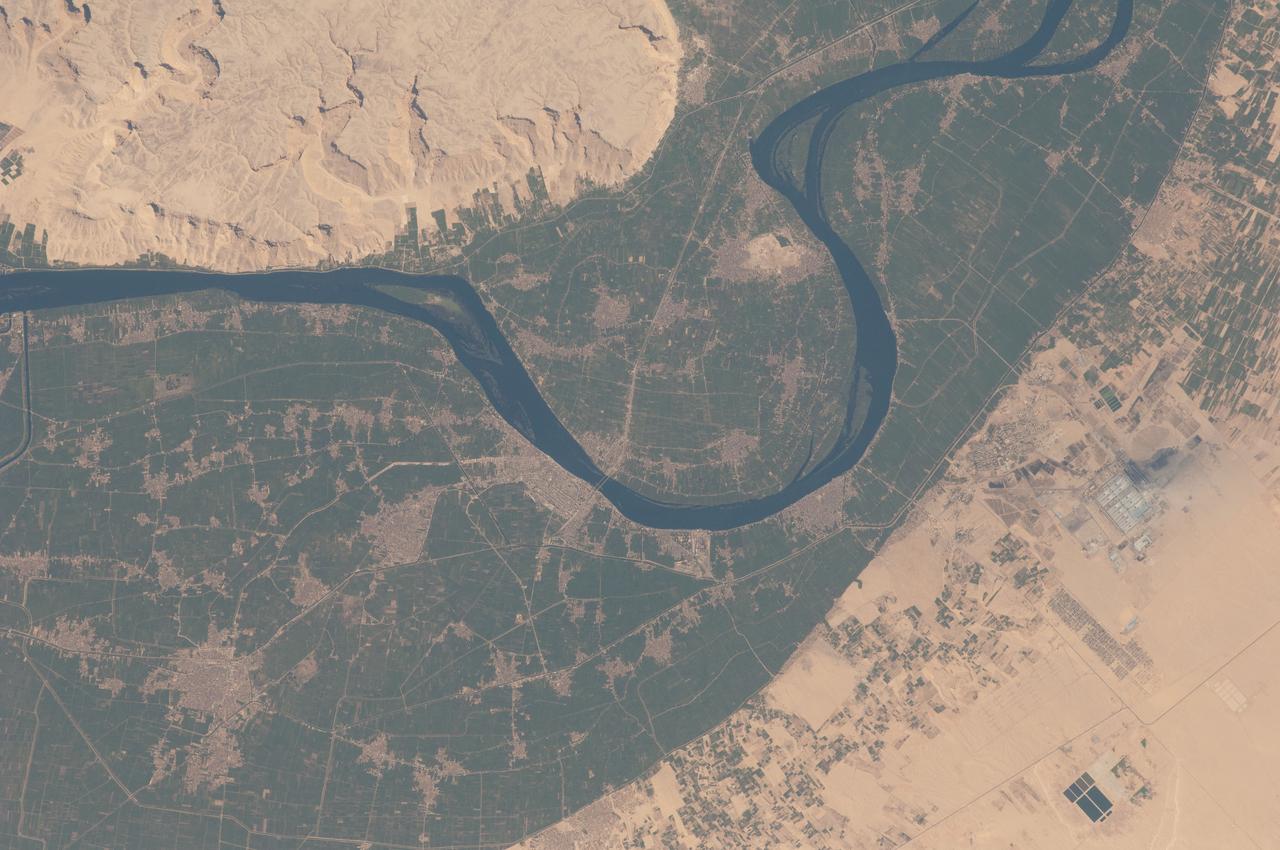
This spaceborne radar image shows the area just north of the city of Cairo, Egypt, where the Nile River splits into two main branches.
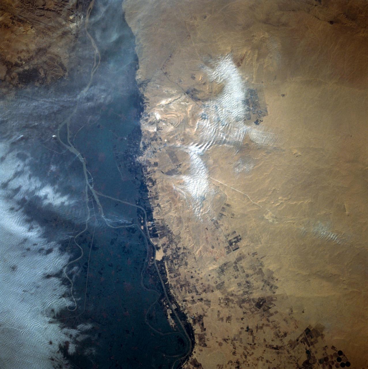
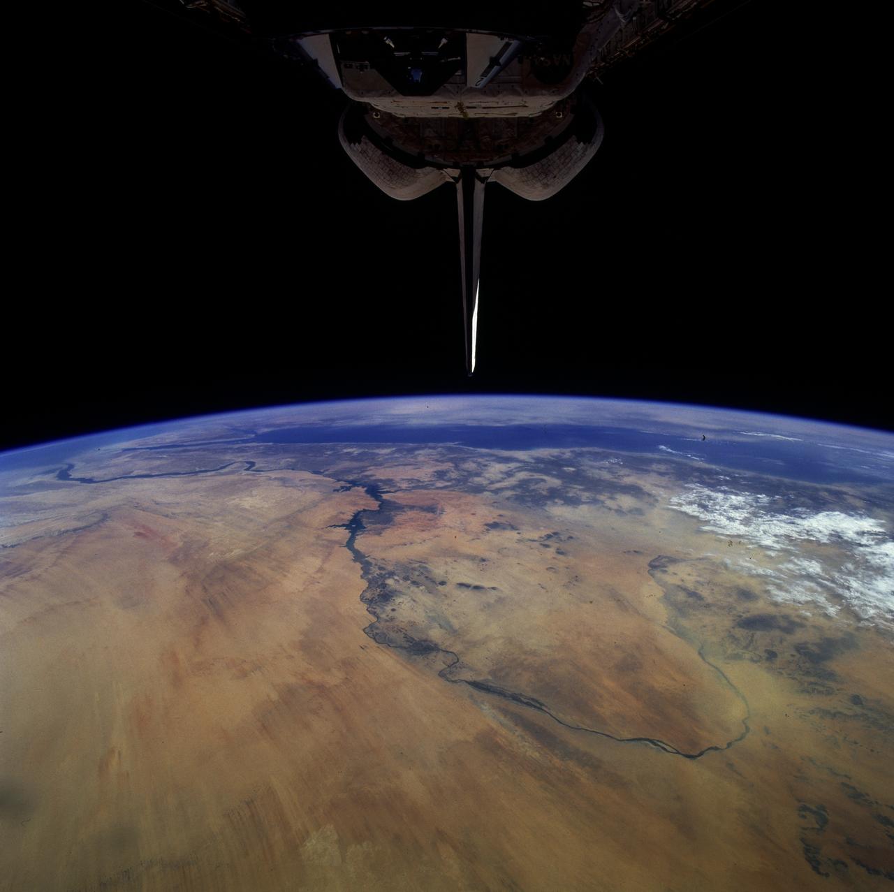
STS058-92-064 (18 Oct-1 Nov 1993) --- This oblique view, looking northeast from central Egypt, shows great expanses of the sand covered and rocky Western Desert in the foreground (bottom). The dark patches bottom right are the Dakhla Oases on the south side of an escarpment. For centuries camel trains have moved from here to the Nile Valley, seen here as a broad green line winding through the desert. The northern half of Egypt's Nile appears here, from about the latitude of Luxor to the delta. Green colors indicate the small area of crops which feed Egypt's population of 55 million. The Nile Delta is partly obscured by a band of clouds, but can be discerned at the coast as a flattened triangle of green. The smaller triangle close by is the Faiyum Basin, a depression irrigated by water from the Nile. The coast of the Mediterranean Sea appears left.
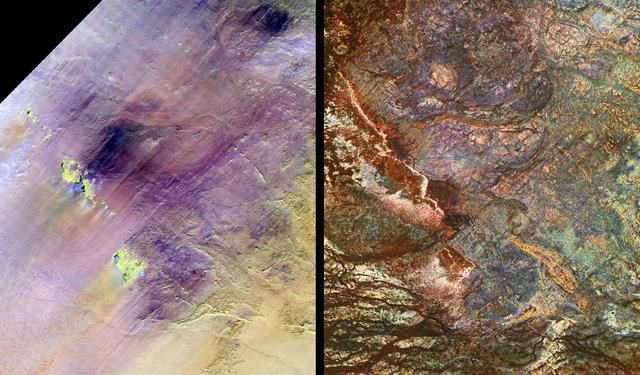
These images show two views of a region of south-central Egypt. On the left is an optical image from NASA Landsat Thematic Mapper, and on the right is a radar image from NASA Spaceborne Imaging Radar-C/X-band Synthetic Aperture Radar SIR-C/X-SAR.
The Nile River Delta of Egypt (30.0N, 31.0E) irrigated by the Nile River and its many distributaries, is some of the richest farm land in the world and home to some 45 million people, over half of Egypt's population. The capital city of Cairo is at the apex of the delta. Just across the river from Cairo can be seen the ancient three big pyramids and sphinx at Giza and the Suez Canal is just to the right of the delta.
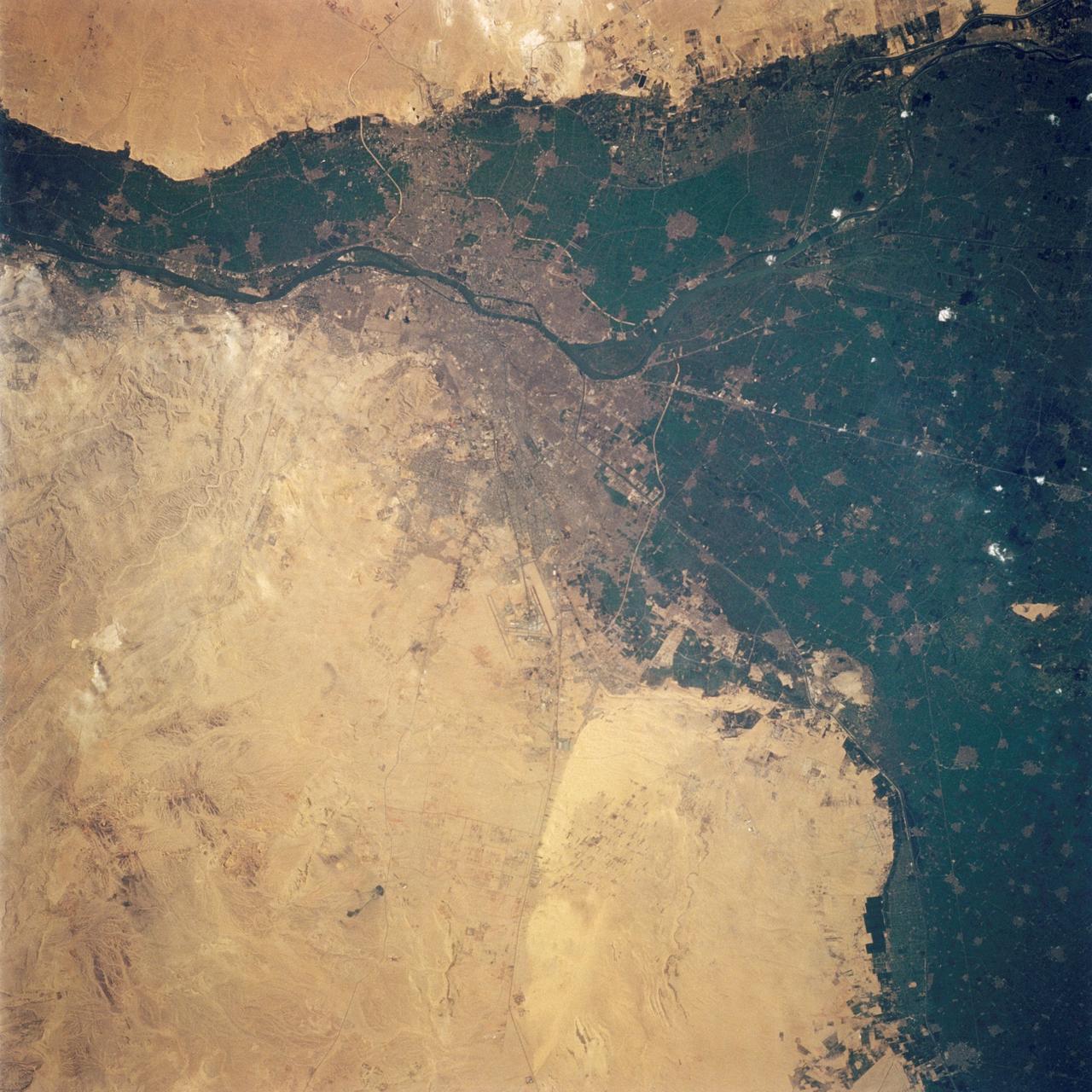
AST-09-555 (19 July 1975) --- A vertical view of a portion of the Arab Republic of Egypt, as photographed from the Apollo spacecraft in Earth orbit during the joint U.S.-USSR Apollo-Soyuz Test Project mission. The Nile Delta is in the most northerly corner of the picture. The City of Cairo on the Nile River is in the center of the photograph. The Gulf of Suez is in the most easterly corner of the picture. El Faiyum is south-southwest of Cairo. This picture was taken at an altitude of 223 kilometers (138 statute miles), with a 70mm Hasselblad camera using medium-speed Ektachrome QX-807 type film.
This three-frequency space radar image of west central Egypt shows detailed patterns of eroded sedimentary rock formations emerging through a vast sea of sand dunes.

This three-frequency space radar image of south-central Egypt demonstrates the unique capability of imaging radar to penetrate thin sand cover in arid regions to reveal hidden details below the surface.
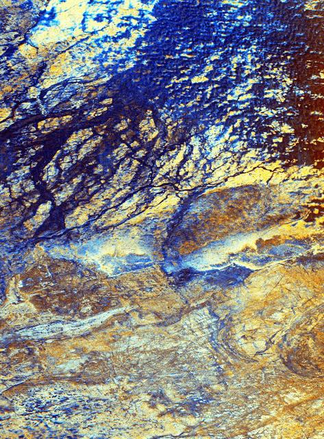
This is a false-color image of the uninhabited Safsaf Oasis in southern Egypt near the Egypt/Sudan border.
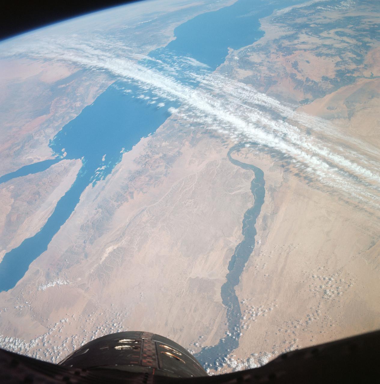
S66-63477 (13 Nov. 1966) --- United Arab Republic (Egypt), the Nile Valley from Luxor to Cairo, El Payium, Gulf of Suez, Sinai as seen from Gemini-12 spacecraft on its 25th revolution of Earth. Photo credit: NASA
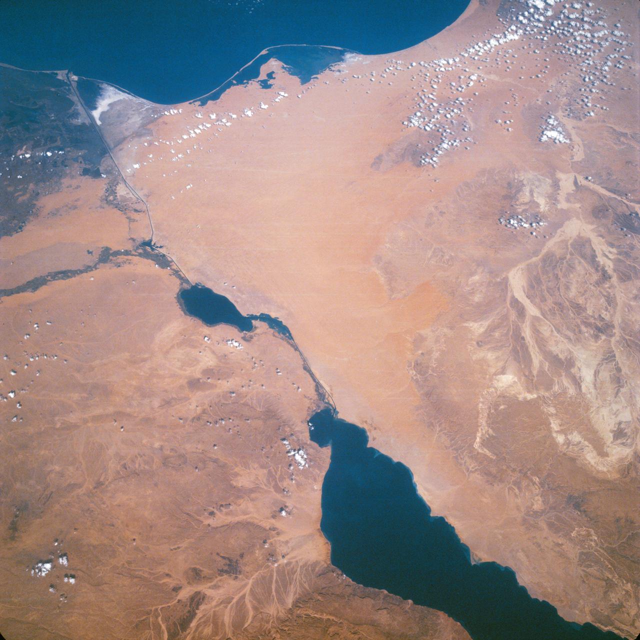
Suez Canal, Gulf of Suez, Sinai Peninsula, United Arab Republic (Egypt), Mediterranean Sea, as seen from the Apollo 7 spacecraft during its 13th revolution of the earth. Photographed from an altitude of 126 nautical miles, at ground elapsed time of 19 hours and 42 minutes.
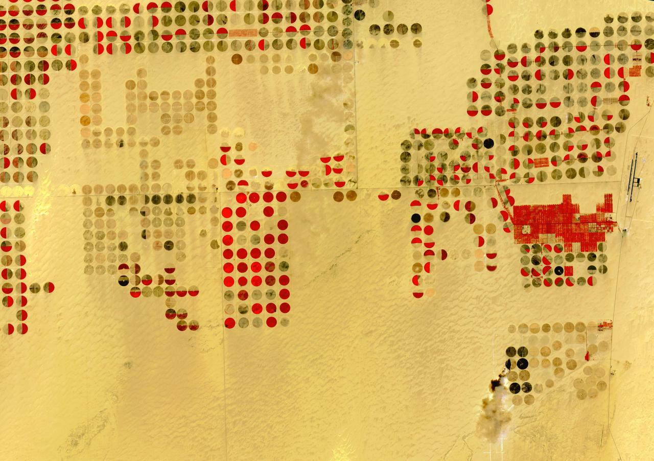
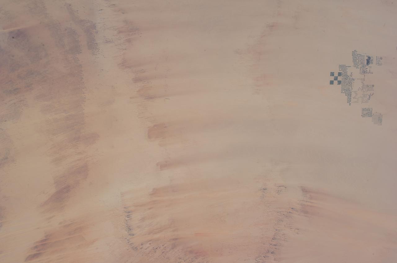
The Nubian Sandstone Aquifer System is the world's largest fossil water aquifer system. It covers an estimated area of 2.6 million square kilometers, including parts of Sudan, Chad, Libya, and most of Egypt. In the southwestern part of Egypt, the East Oweinat development project uses central pivot irrigation to mine the fossil water for extensive agricultural development. Crops include wheat and potatoes; they are transported via the airport on the eastern side. The image was acquired October 12, 2015, covers an area of 33.3 by 47.2 km, and is located near 22.6 degrees north, 28.5 degrees east. https://photojournal.jpl.nasa.gov/catalog/PIA24616
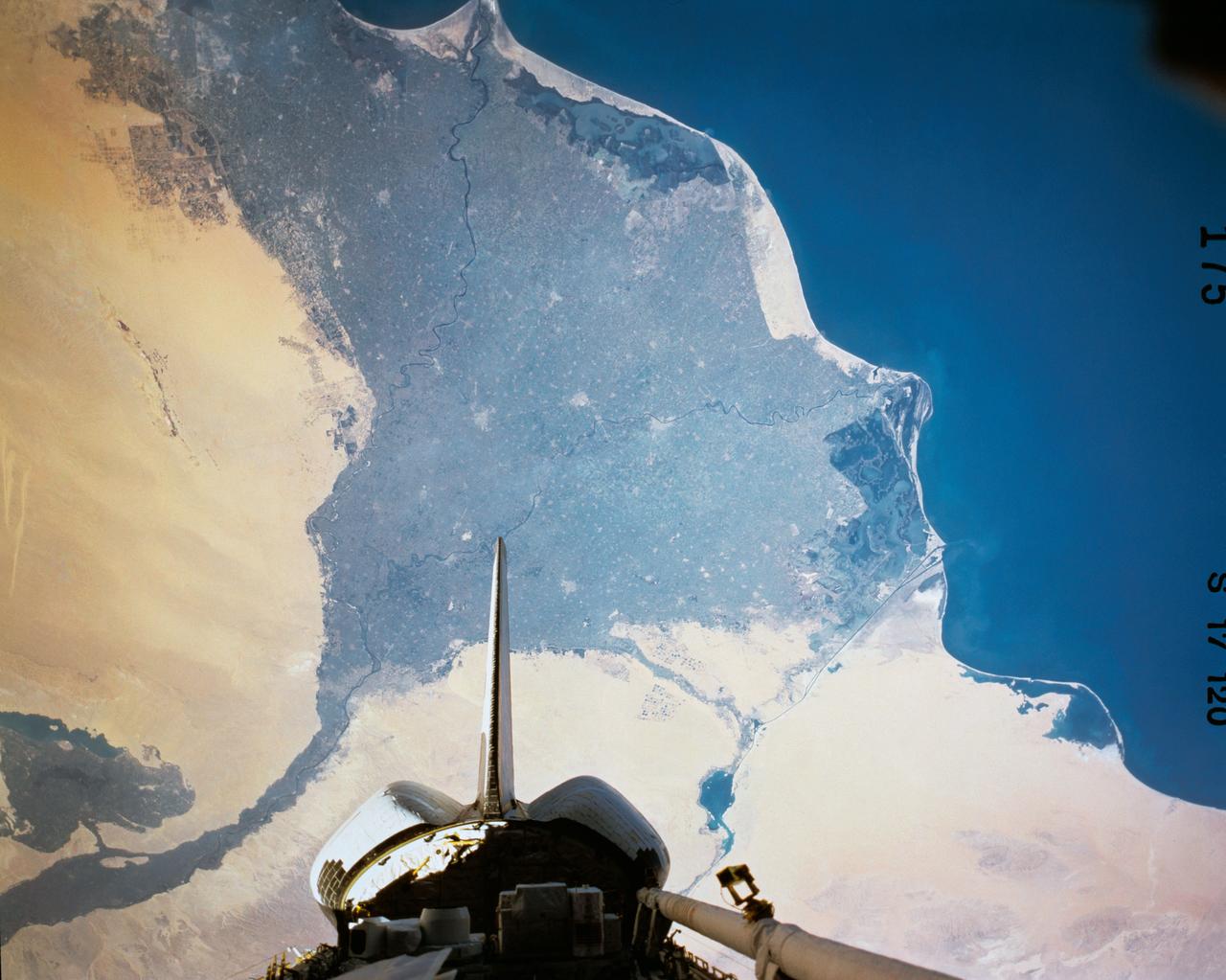
SL3-122-2620 (July-September 1973) --- Skylab 3 Earth view of the Nile Delta, Egypt and Suez Canal. Photo credit: NASA
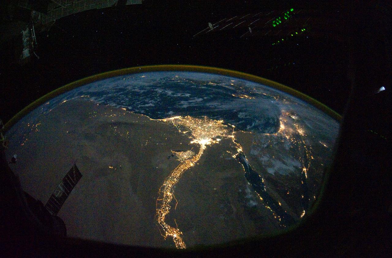
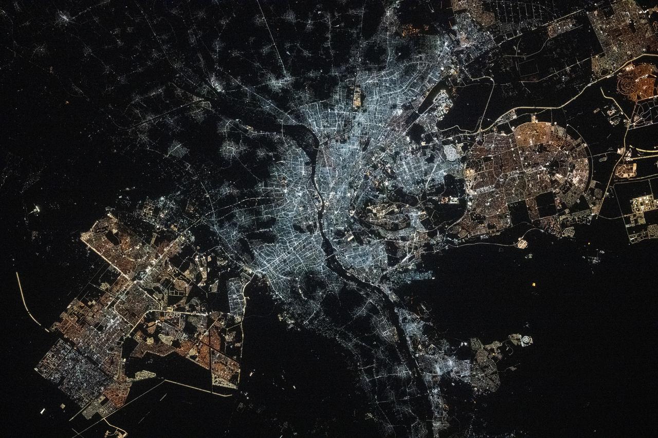
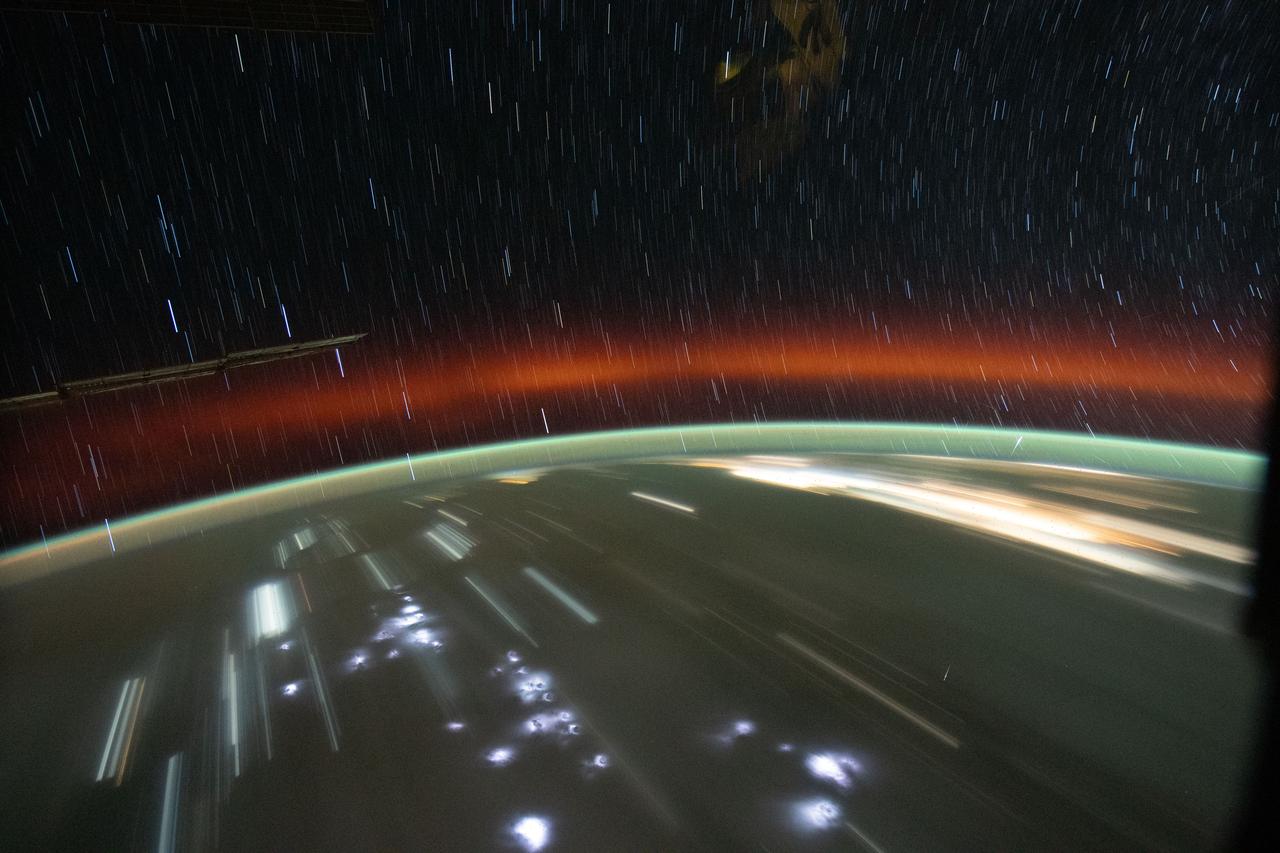
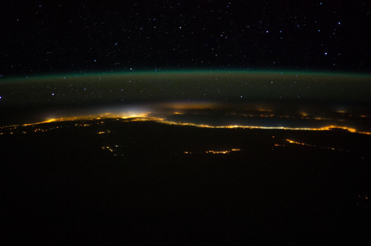
From 220 miles above Earth, one of the Expedition 25 crew members on the International Space Station took this night time photo featuring the bright lights of Cairo and Alexandria, Egypt on the Mediterranean coast. The Nile River and its delta stand out clearly as well. On the horizon, the airglow of the atmosphere is seen across the Mediterranean. The Sinai Peninsula, at right, is outlined with lights highlighting the Gulf of Suez and Gulf of Aqaba. Credit: NASA
iss072e905240 (March 22, 2025) --- Egypt's Nile Delta region, home to about 39 million people and where the Nile, Africa's longest river, drains into the Mediterranean Sea, is pictured from the International Space Station at 11:01 p.m. local time as it orbited 261 miles above.
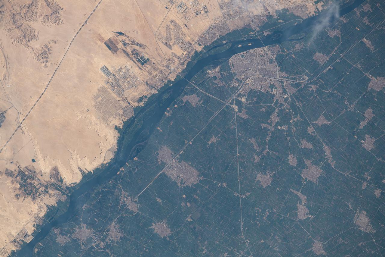
iss071e207494 (June 24, 2024) -- Soaring 263 miles above Egypt, NASA astronaut Butch Wilmore captured this photo from the International Space Station. To the left of the image is the Mediterranean Sea. Snaking from it is the Nile River, and at the very top of the image is the Red Sea.
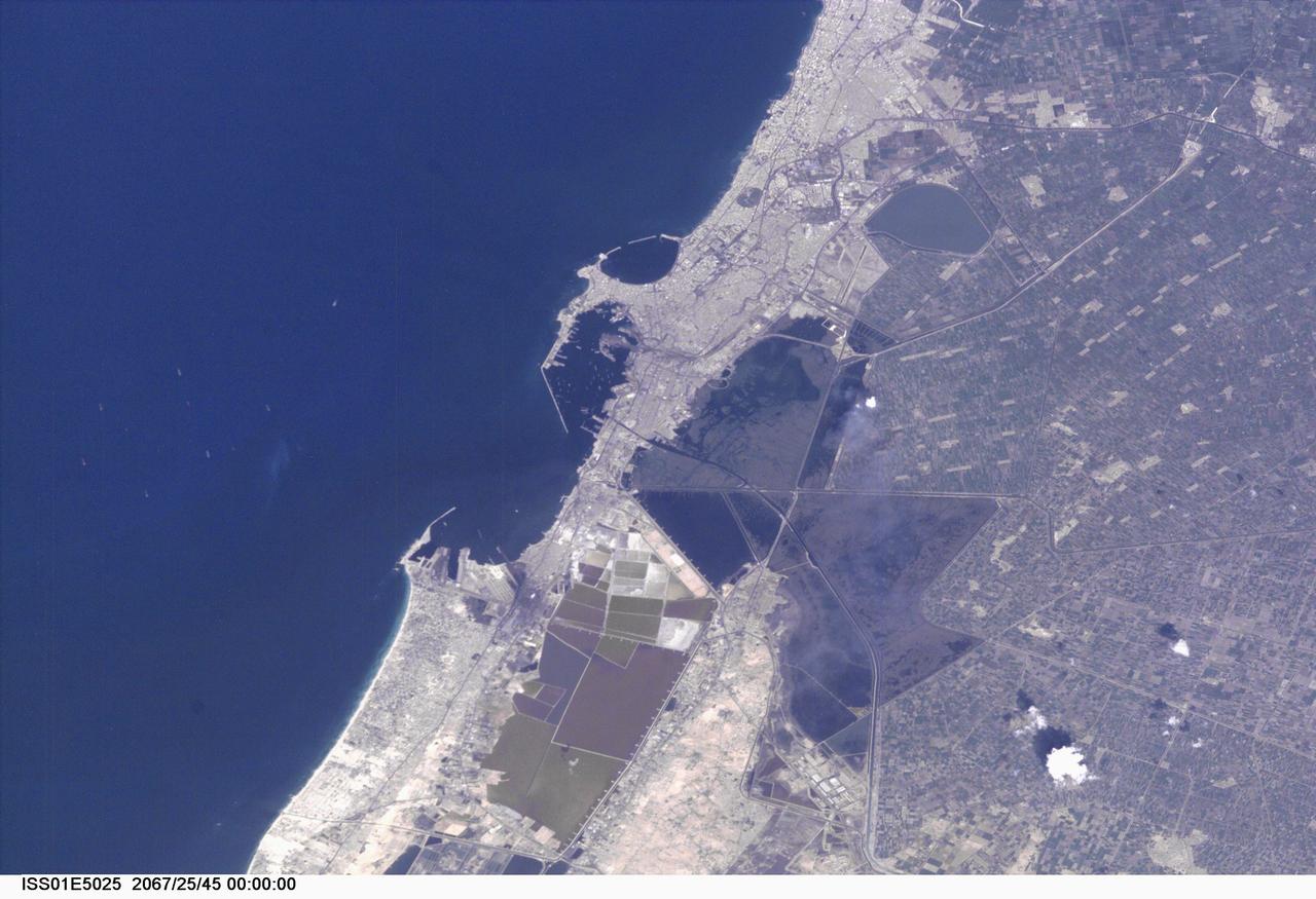
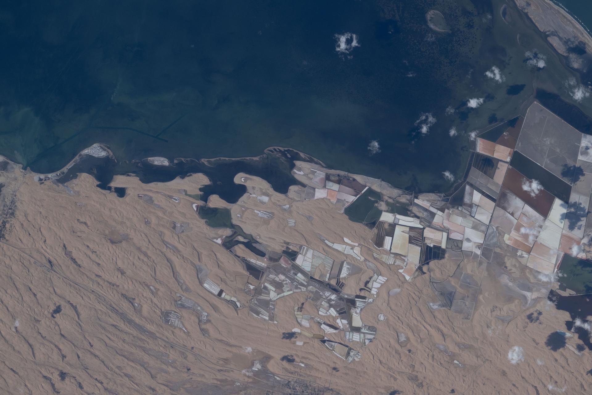
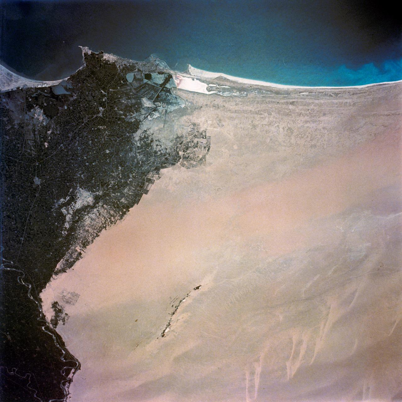
ISS01-E-5025 (November 2000) --- This nadir view of Alexandria, Egypt, was provided by a digital still camera image down linked from the International Space Station to flight controllers in Houston. Alexandria (Al Iskandariya) occupies a T-shaped peninsula and strip of land separating the Mediterranean from Lake Mariout. According to NASA scientists studying the Expedition One photo collection, the town was originally built upon a mole (stone breakwater) called Heptastadium, which joined the island of Pharos to the mainland. Since then, the scientists say, sedimentary deposits have added considerably to the width of the mole. Since 1905, when the city’s 370 thousand inhabitants lived in an area of about four square kilometers between the two harbors, the city (population 4 million) has grown beyond its medieval walls and now occupies an area of about 300 square kilometers. The Mahmudiya Canal, connecting Alexandria with the Nile, runs to the south of the city and, by a series of locks, enters the harbor of the principal port of Egypt (note ships). The reddish and ochre polygons west of Lake Mariout are salt-evaporation, chemical-storage, and water-treatment ponds within the coastal lagoon.
A high oblique view of the Middle East centered at approximately 28.0 degrees north and 34.0 degrees east. Portions of the countries of Egypt, Israel, Jordan and Saudi Arabia are visible. The Dead Sea Rift Valley continuing into the Gulf of Aqaba marks the boundary between Israel and Jordan. The vegetation change in the Sinai Peninsula is the border between the Gaza Strip and Egypt. In Egypt, the Suez Canal connects the Gulf of Suez with the Mediterranean Sea and forms the western boundary of the Sinai Peninsula. The green ribbon of the Nile River is in marked contrast to this arid region. Even the Jordan River does not support large scale agriculture.
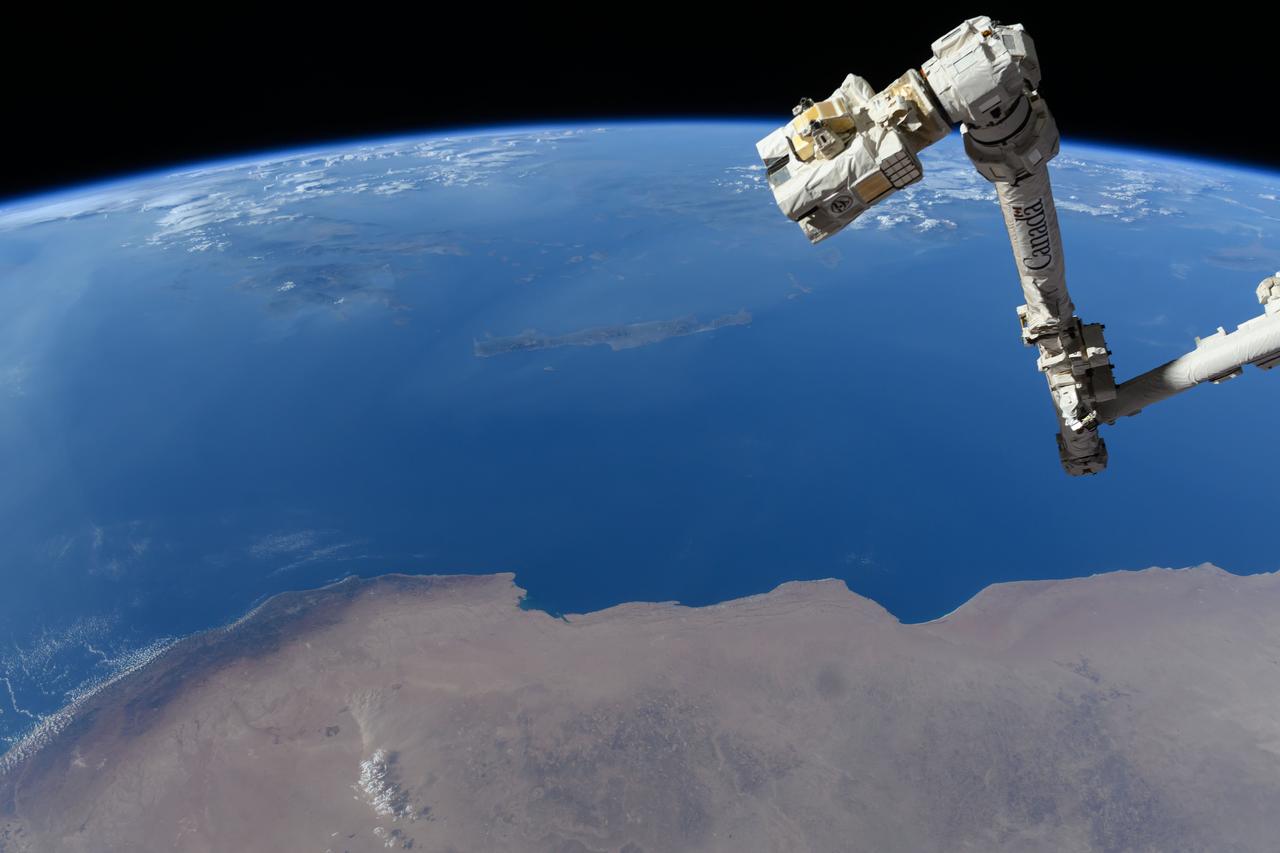
iss071e384199 (July 17, 2024) --- The Canadarm2 robotic arm's latching end effector, or LEE, is used to grapple fixtures on the International Space Station, as well as capture the approaching Cygnus cargo craft from Northrop Grumman and attach it to the Unity module for cargo transfer operations. 256 miles below the outpost is the Mediterranean coast of Libya and Egypt and the Greek island of Crete.
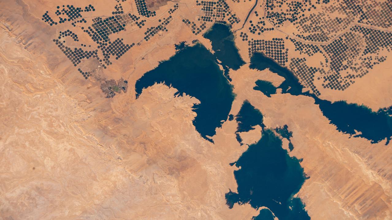
iss072e574769 (Jan. 29, 2025) --- Agricultural activity, supported by the Toshka Lakes created by the overflow from nearby Lake Nasser in Egypt, is pictured from the International Space Station as it orbited 259 miles above.
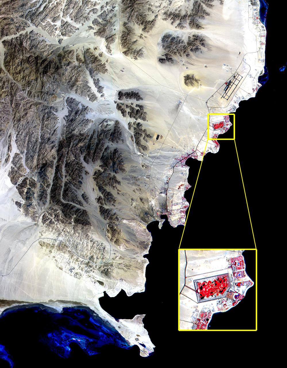
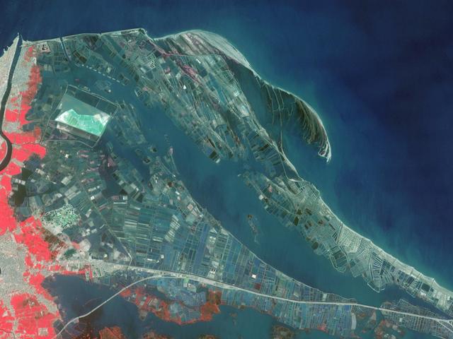
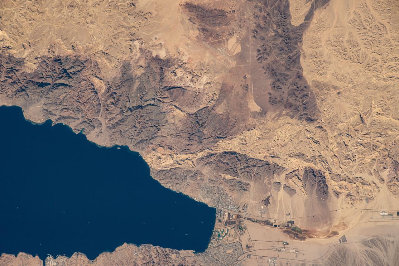
The Red Sea golf resort in Sharm El Sheik, Egypt, where President Clinton met with Israeli Prime Minister Ehud Barak and Palestinian Authority President Yasser Arafat, stands out against the desert landscape in this image acquired on August 25, 2000. This image of the southern tip of the Sinai Peninsula shows an area about 30 by 40 kilometers (19 by 25 miles) in the visible and near infrared wavelength region. Vegetation appears in red. The blue areas in the water at the top and bottom of the image are coral reefs. The airport is visible just to the north of the golf resort. http://photojournal.jpl.nasa.gov/catalog/PIA02667
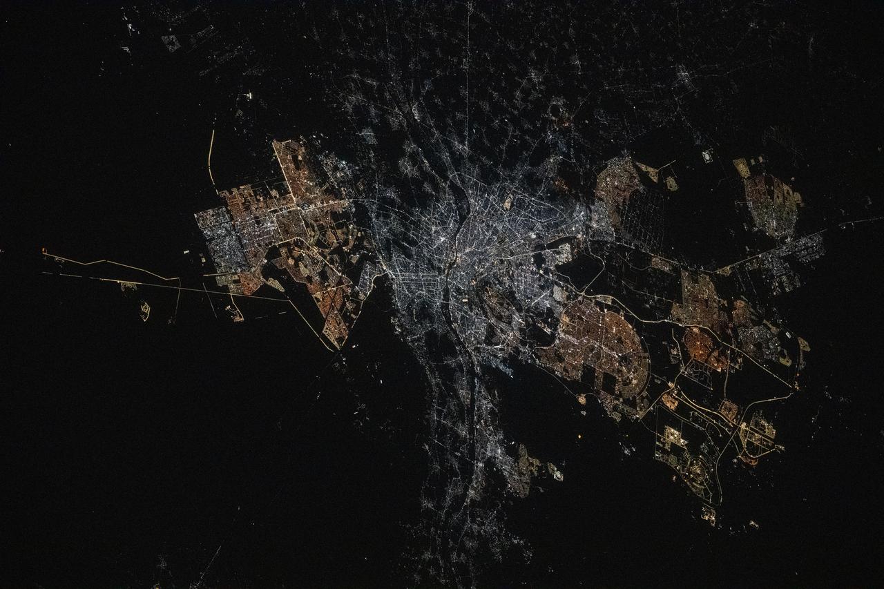
iss073e0175630 (May 23, 2025) --- Cairo, Egypt, and its surrounding metropolitan area with a population of about 22.6 million, near the base of the Nile Delta is pictured at approximately 11:28 p.m. local time from the International Space Station as it orbited 259 miles above the Middle Eastern nation.
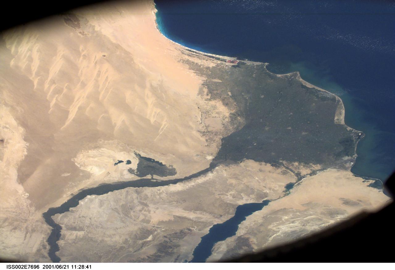
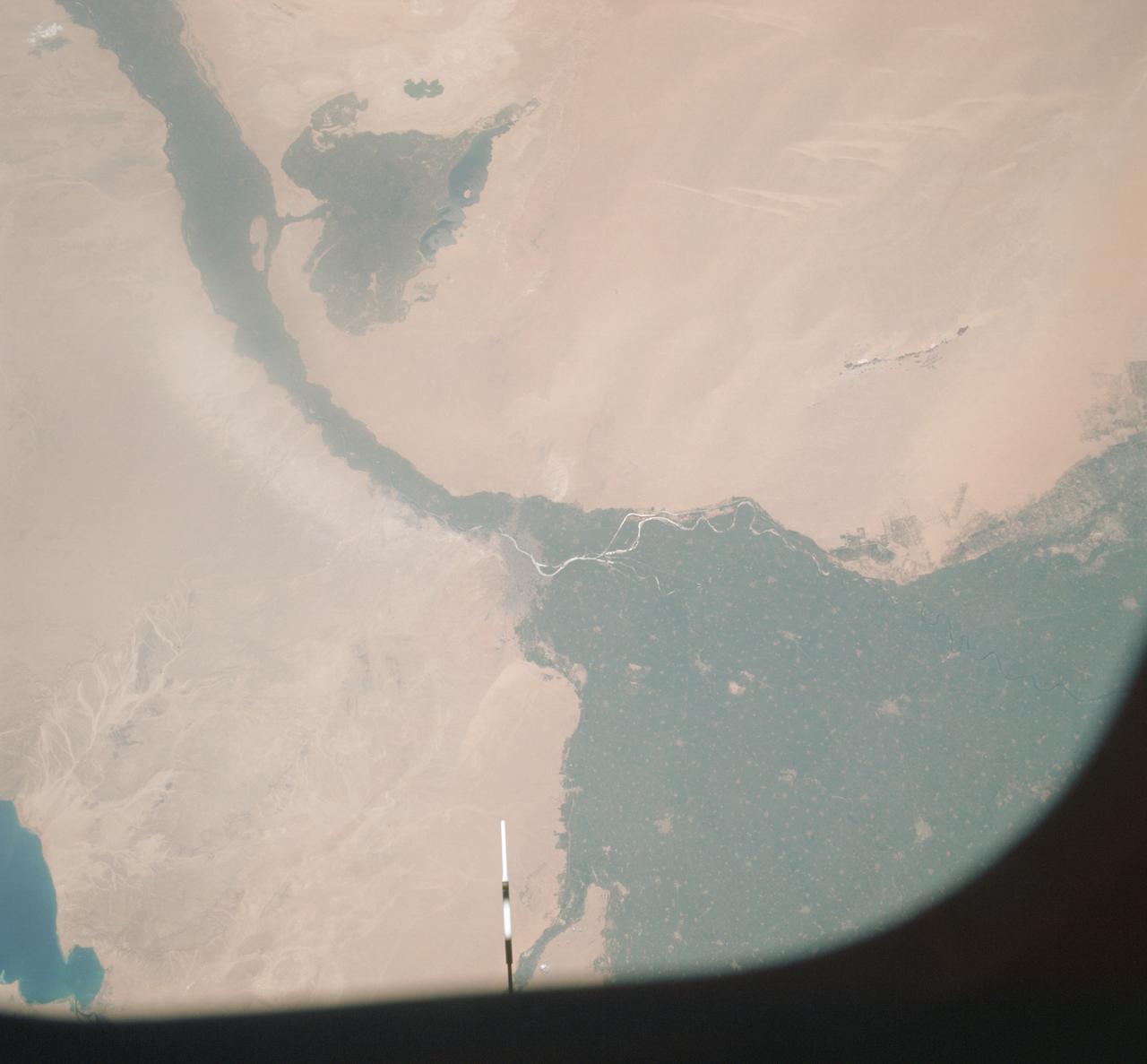
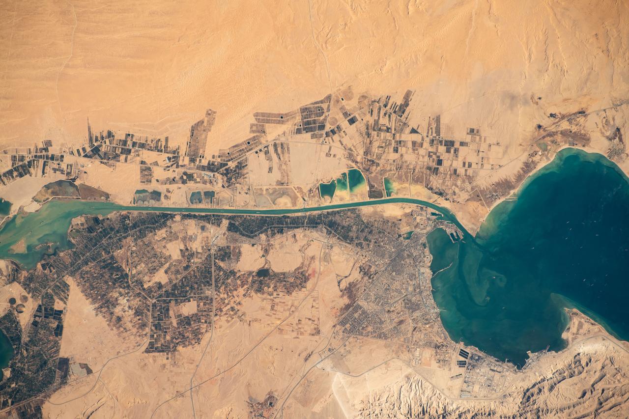
SS002-E-7696 (21 June 2001) --- Wide view of the Nile River and Suez Canal, Egypt, as photographed with a digital still camera aboard the International Space Station (ISS).
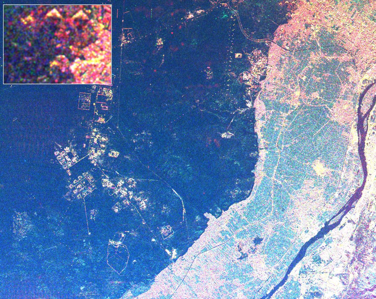
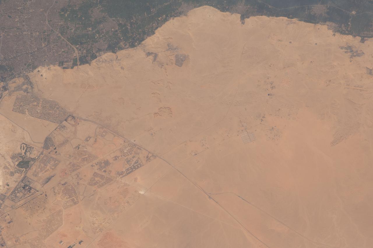
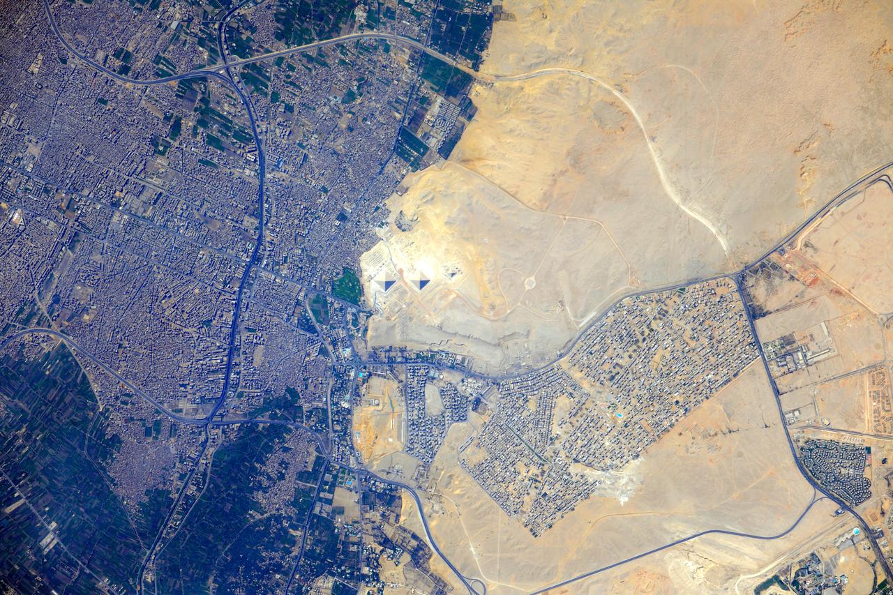
This radar image shows the area west of the Nile River near Cairo, Egypt. The Nile River is the dark band along the right side of the image and it flows approximately due North from the bottom to the right. The boundary between dense urbanization and the desert can be clearly seen between the bright and dark areas in the center of the image. This boundary represents the approximate extent of yearly Nile flooding which played an important part in determining where people lived in ancient Egypt. This land usage pattern persists to this day. The pyramids at Giza appear as three bright triangles aligned with the image top just at the boundary of the urbanized area. They are also shown enlarged in the inset box in the top left of the image. The Great Pyramid of Khufu (Cheops in Greek) is the northern most of the three Giza pyramids. The side-looking radar illuminates the scene from the top, the two sides of the pyramids facing the radar reflect most of the energy back to the antenna and appear radar bright; the two sides away from the radar reflect less energy back and appear dark Two additional pyramids can be seen left of center in the lower portion of the image. The modern development in the desert on the left side of the image is the Sixth of October City, an area of factories and residences started by Anwar Sadat to relieve urban crowding. The image was taken on April 19, 1994 by the Spaceborne Imaging Radar-C/X-Band Synthetic Aperture Radar (SIR-C/X-SAR) aboard the shuttle Endeavour. SIR-C/X-SAR, a joint mission of the German, Italian and the United States space agencies, is part of NASA's Mission to Planet Earth. The image is centered on latitude 29.72 degrees North latitude and 30.83 degrees East longitude. The area shown is approximately 20 kilometers by 30 kilometers. The colors in the image are assigned to different frequencies and polarizations of the radar as follows: red is L-band horizontally transmitted, horizontally received; green is C-band horizontally transmitted, horizontally received; blue is C-band horizontally transmitted, vertically received. http://photojournal.jpl.nasa.gov/catalog/PIA01793
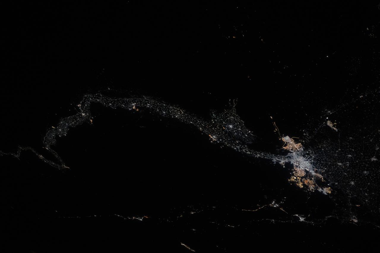
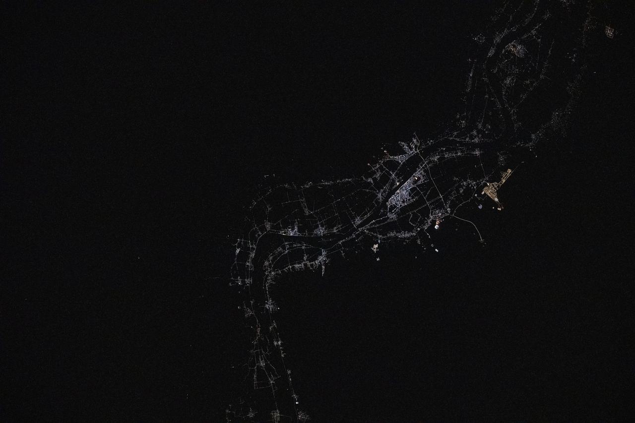
iss073e0422271 (July 18, 2025) --- Egypt’s Nile River stretches from Luxor—home to the ancient Valley of the Kings—at the far left of this nighttime view from the International Space Station, all the way to the sprawling metropolitan area of Cairo at the base of the Nile Delta. This photograph was taken at approximately 1:30 a.m. local time while the station was orbiting 259 miles above Earth.
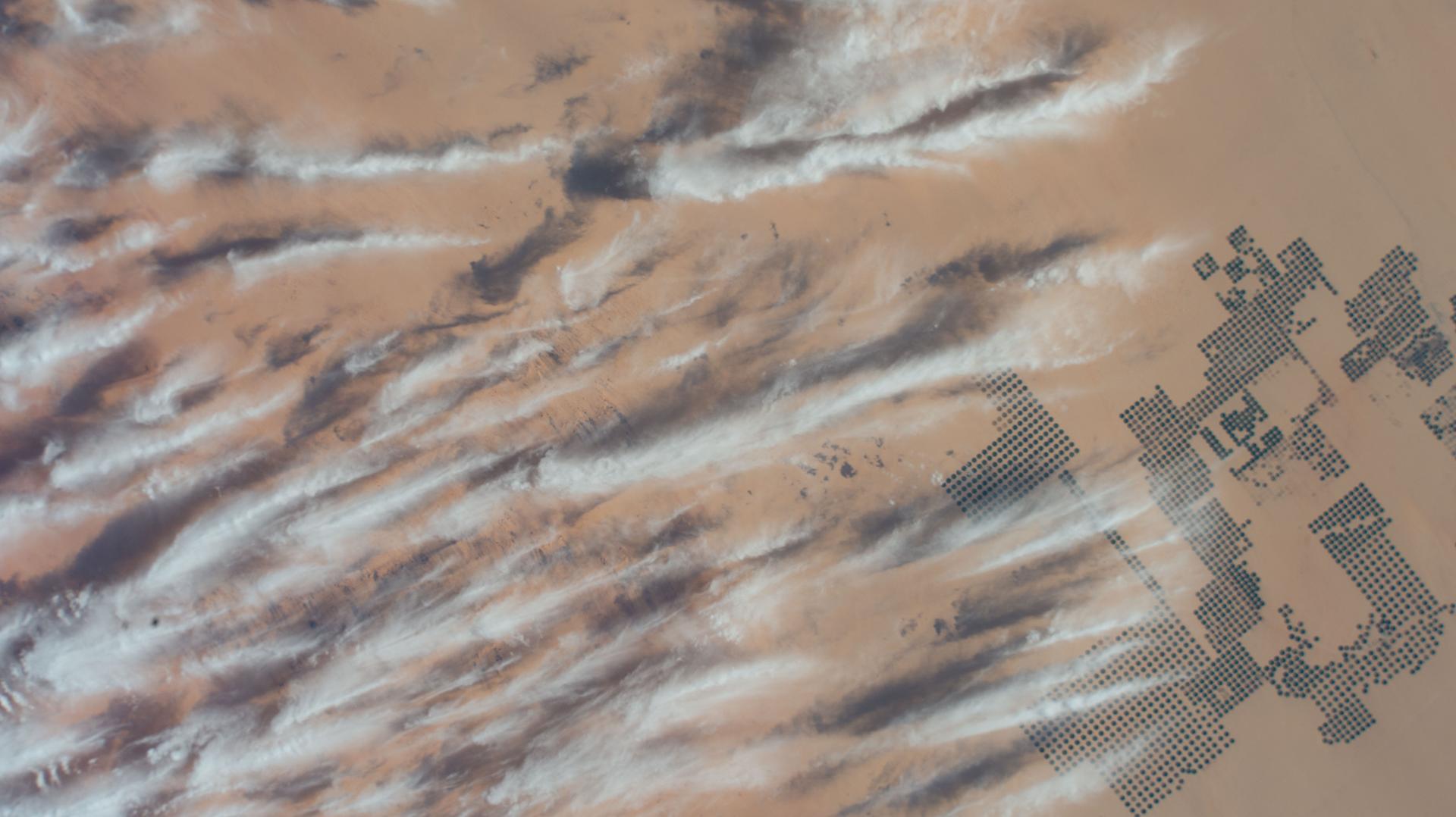
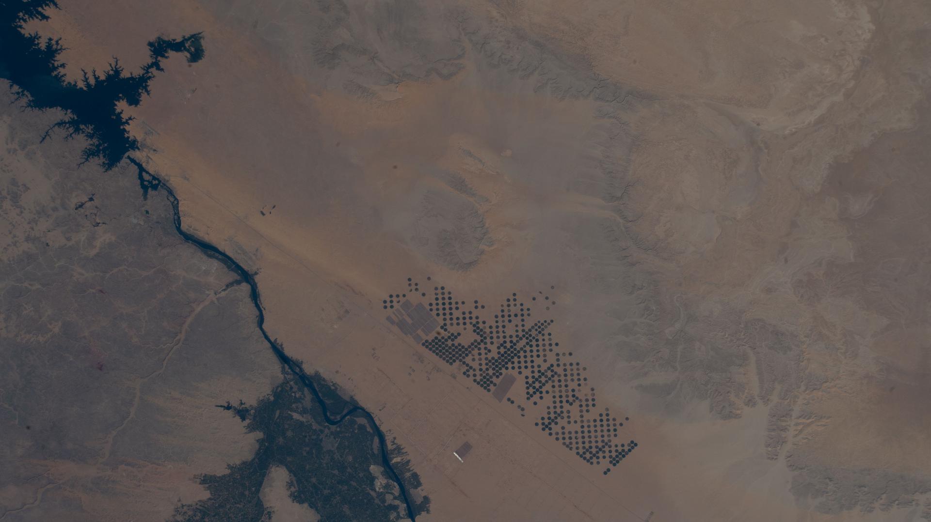
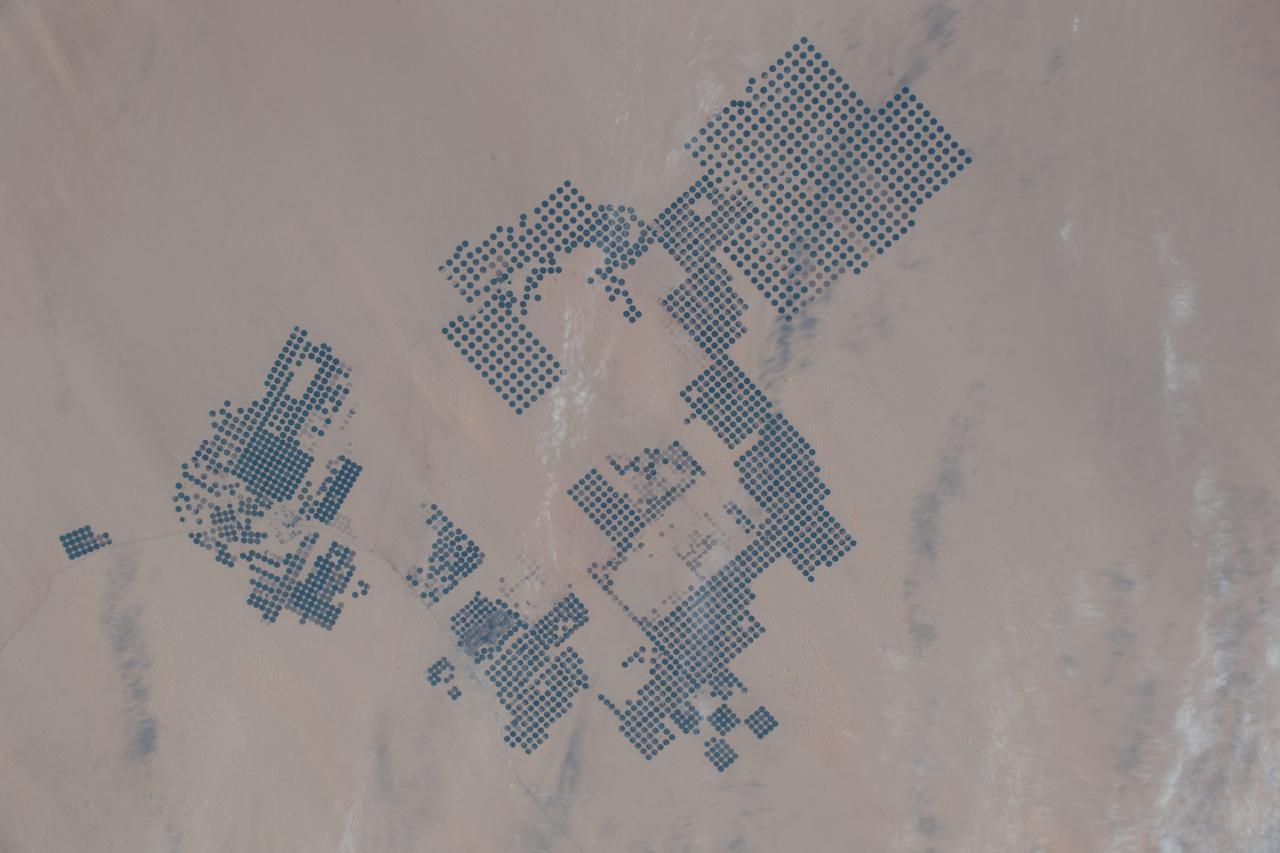
iss074e0247459 (Feb. 1, 2026) --- Large-scale agricultural projects (right) in southern Egypt near the Sudan border—known as center-pivot irrigation systems because they use an irrigation arm that rotates 360°, forming a perfect circle of crops such as potatoes and wheat—are pictured from the International Space Station as it orbited 258 miles above the African nation. Wispy cirrus clouds partly cover the cultivated land in the barren, extremely arid Western Desert.
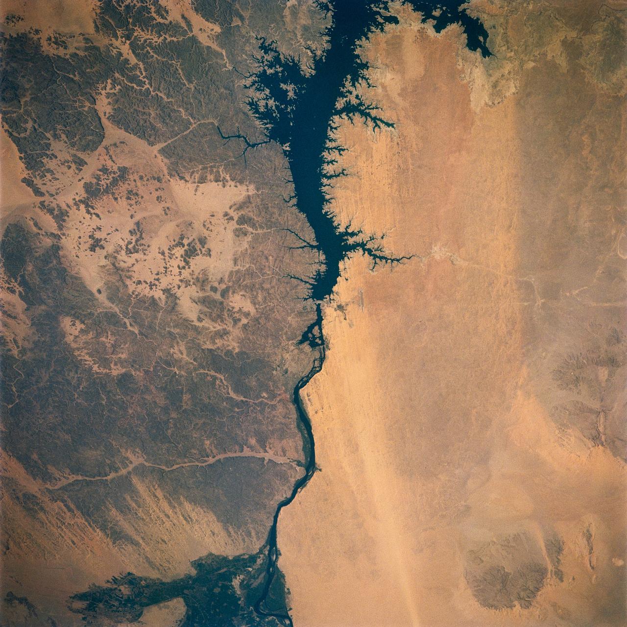
Egypt's High Aswan Dam on the Nile River at the first cataracts, Nile River, (24.0N, 33.0E) was completed in 1971 to provide cheap hydroelectric power and to regulate the historically uneven flow of the Nile River. The contrast between the largely base rock desert east of the Nile versus the sand covered desert west of the river and the ancient irrigated floodplain downstream from the damsite is clearly shown.
iss073e0857395 (Sept. 21, 2025) --- The Zaranik Protectorate nature preserve in Egypt's North Sinai region sits on the eastern edge of Lake Bardiwil and is a haven for migratory birds, nesting turtles, and supports a variety of species including bottlenose dolphins. The International Space Station was orbiting 258 miles above the Mediterranean Sea at the time of this photograph.
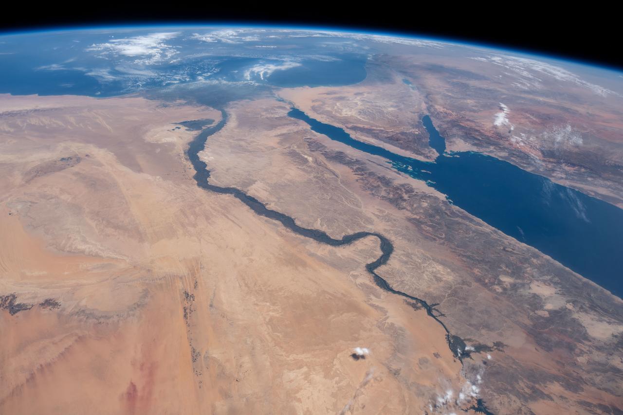
STS121-334-026 (4-17 July 2006) --- This photo, featuring an easterly view of the Nile River, the Nile River Delta, Sinai Peninsula, the Suez Canal, Red Sea and part of the Mediterranean Sea, was taken by one of the STS-121 crewmembers aboard the Space Shuttle Discovery. Cairo, Egypt, can be seen at far right.
iss073e0343877 (July 15, 2025) --- Egypt's metropolitan area of Cairo, New Cairo City, and Giza, including their surrounding suburbs at the base of the Nile Delta with a population of about 22.6 million, is pictured at approximately 2:21 a.m. local time from the International Space Station as it orbited 259 miles above.
iss073e0134628 (May 22, 2025) --- Cairo, Egypt, the Arab nation's largest city with a population of 10.1 million and located near the Nile Delta, and its surrounding suburbs are pictured at approximately 12:!6 a.m. local time from the International Space Station as it orbited 259 miles above.
This close-up view of the intensively cultivated Nile River flood plain near Cairo presents a sharp color contrast to the virtually non-vegetated, sandy desert, located to the west of the vegetated area. Some rectangular cultivated field patterns, as well as circular center pivot irrigation patterns, can be observed northwest of the Nile River flood plain. The world famous Giza Pyramids are located near the center of this photography (see highly reflective sand surfaces).
STS062-108-058 (4-18 March 1994) --- Cairo lies at the apex of the great delta of the Nile: the delta is marked by the strong greens of cultivated lands, Cairo by the gray sprawl along the river and the eastern delta apex as it develops in the direction of the airports and Suez. The city of El Giza lies on the west side of the Nile with the Giza pyramids in the desert just beyond the cultivated lands. Several major canals lead water to parts of the delta more distant from the Nile; generally these can be recognized as straighter, more engineered waterways. Towards the top left, the bifurcation of the Rosetta and Damietta branches of the Nile can be seen. These are the two major present-day veins of the Nile as it approaches the Mediterranean.
STS057-73-075 (21 June-1 July 1993) --- Eastern Mediterranean from an unusually high vantage point over the Nile River, this north-looking view shows not only the eastern Mediterranean but also the entire landmass of Asia Minor, with the Black Sea dimly visible at the horizon. Many of the Greek islands can be seen in the Aegean Sea (top left), off the coast of Asia Minor. Cyprus is visible under atmospheric dust in the northeast corner of the Mediterranean. The dust cloud covers the east end of the Mediterranean, its western edge demarcated by a line that cuts the center of the Nile Delta. This dust cloud originated far to the west, in Algeria, and moved northeast over Sicily, southern Italy, and Greece. Part of the cloud then moved on over the Black Sea, but another part swerved southward back towards Egypt. A gyre of clouds in the southeast corner of the Mediterranean indicates a complementary counterclockwise (cyclonic) circulation of air. The Euphrates River appears as a thin green line (upper right) in the yellow Syrian Desert just south of the blue-green mountains of Turkey. The Dead Sea (lower right) lies in a rift valley which extends north into Turkey and south thousands of miles down the Gulf of Aqaba, the Red Sea, and on through East Africa. The straight international boundary between Israel and Egypt (where the coastline angles) is particularly clear in this view, marked by the thicker vegetation on the Israeli side of the border. The green delta of the Nile River appears in the foreground, with the great conurbation of Cairo seen as a gray area at the apex of the triangle. Most of Egypt's 52 million inhabitants live in the delta. On the east side of the delta, the Suez Canal is visible. On the western corner of the delta lies the ancient city of Alexandria, beside the orange and white salt pans. The World War II battlesite El Alamein lies on the coast.
iss073e0879542 (Oct. 13, 2025) --- Lake Nasser, created by the Aswan High Dam in southern Egypt, is one of the world’s largest man-made reservoirs. Extending into northern Sudan, it stores water from the Upper Nile and regulates its flow into the Lower Nile. This photograph was taken from the International Space Station while orbiting 260 miles above the eastern Sahara.
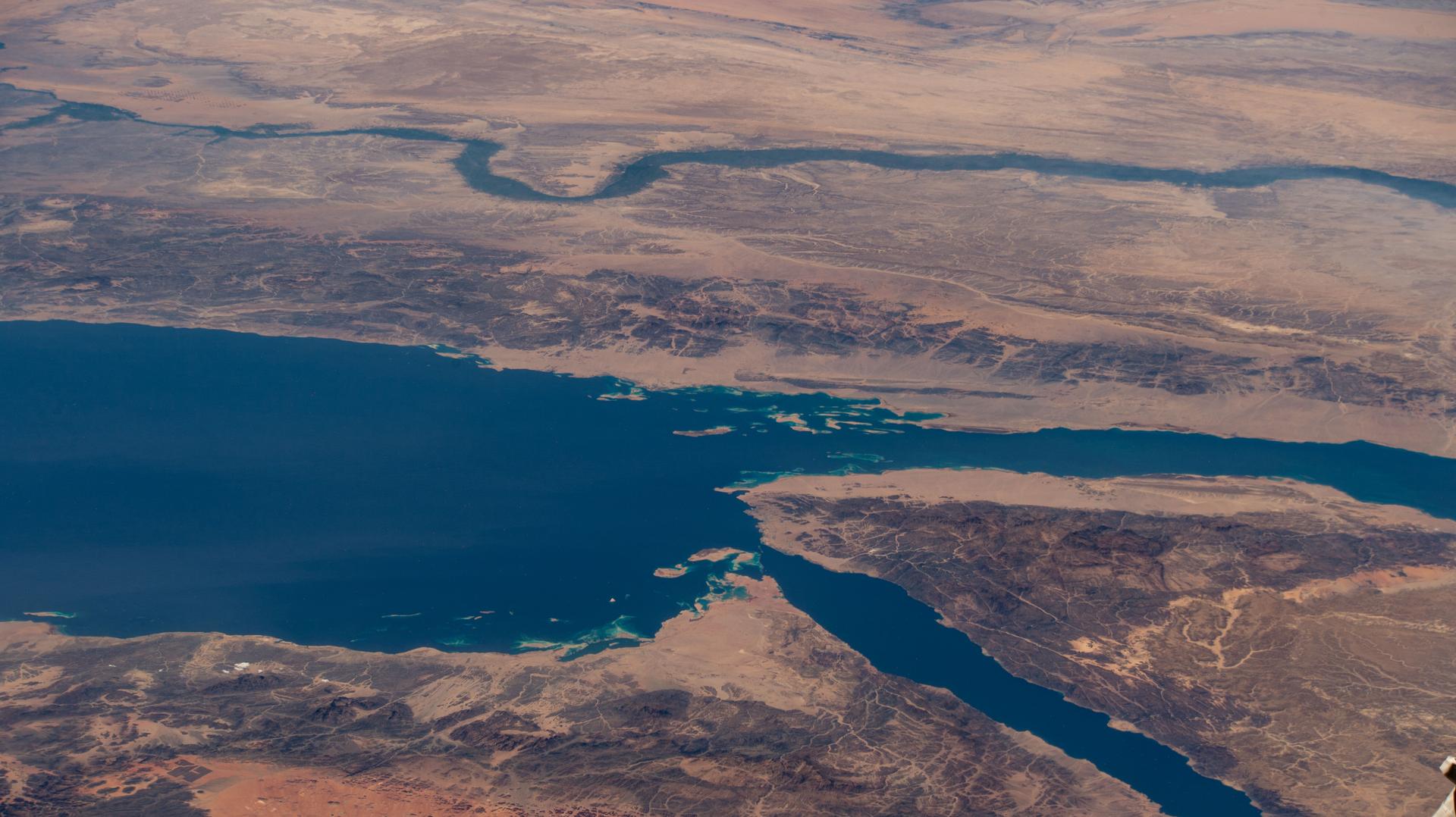
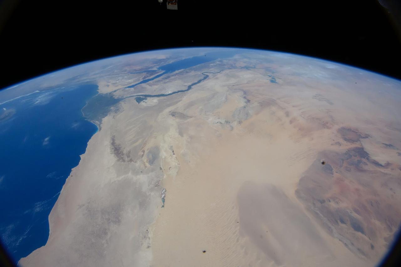
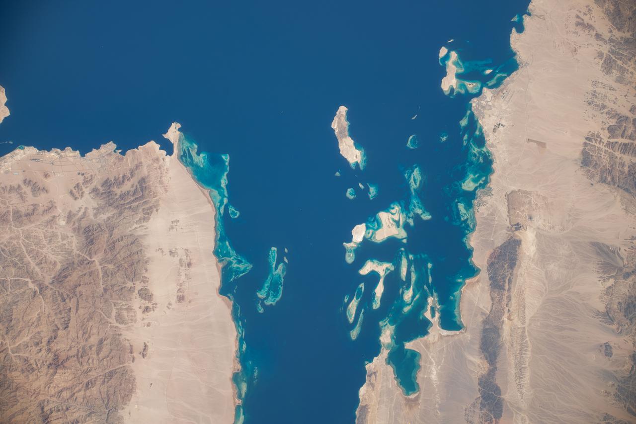
iss073e0768775 (Sept. 26, 2025) --- The Nile River (top) winds through Egypt, which is separated from Saudi Arabia by the Red Sea. The Red Sea branches into two gulfs: the Gulf of Suez, which leads to the Suez Canal—a strategic and economically vital waterway—and the Gulf of Aqaba. The International Space Station was orbiting 257 miles above the Middle East when this photograph was taken.
S66-63533 (14 Nov. 1966) --- United Arab Republic (Egypt) area as seen from the Gemini-12 spacecraft during its 39th revolution of Earth, looking southeast. Nile River is in center of picture. At bottom center is the Sinai Peninsula. Arabian Peninsula is at lower left. Large body of water is Red Sea. Gulf of Aqaba is on east side of Sinai Peninsula. Gulf of Suez separates Sinai from Egyptian mainland. Photo credit: NASA
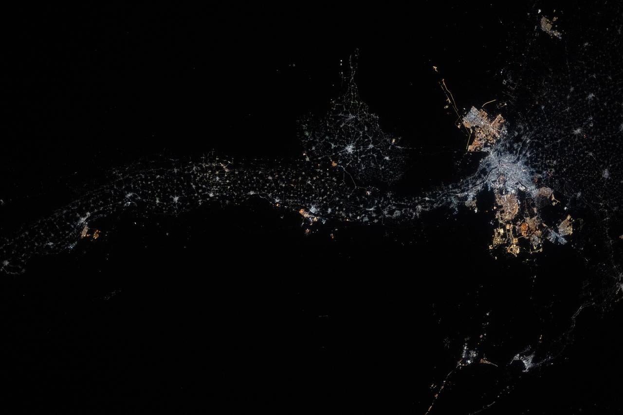
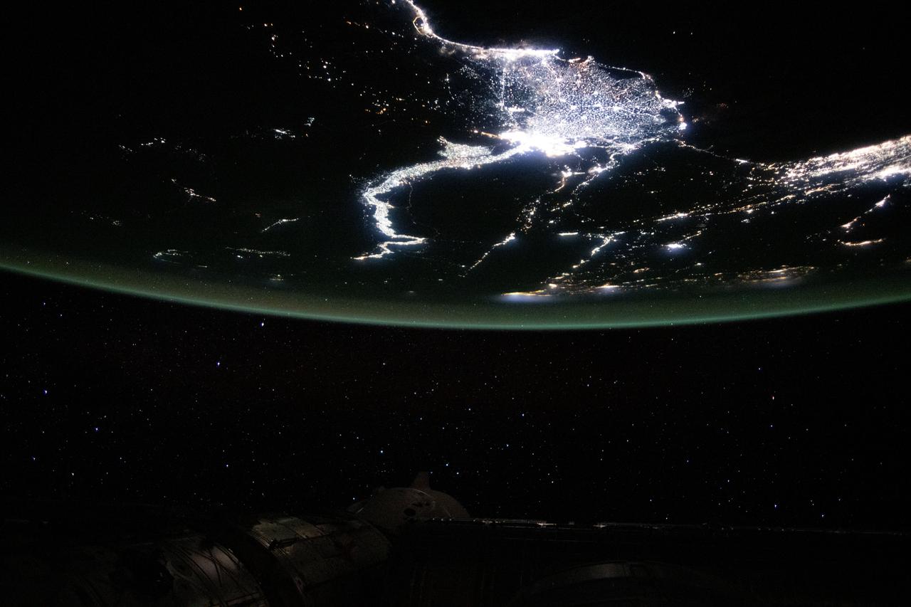
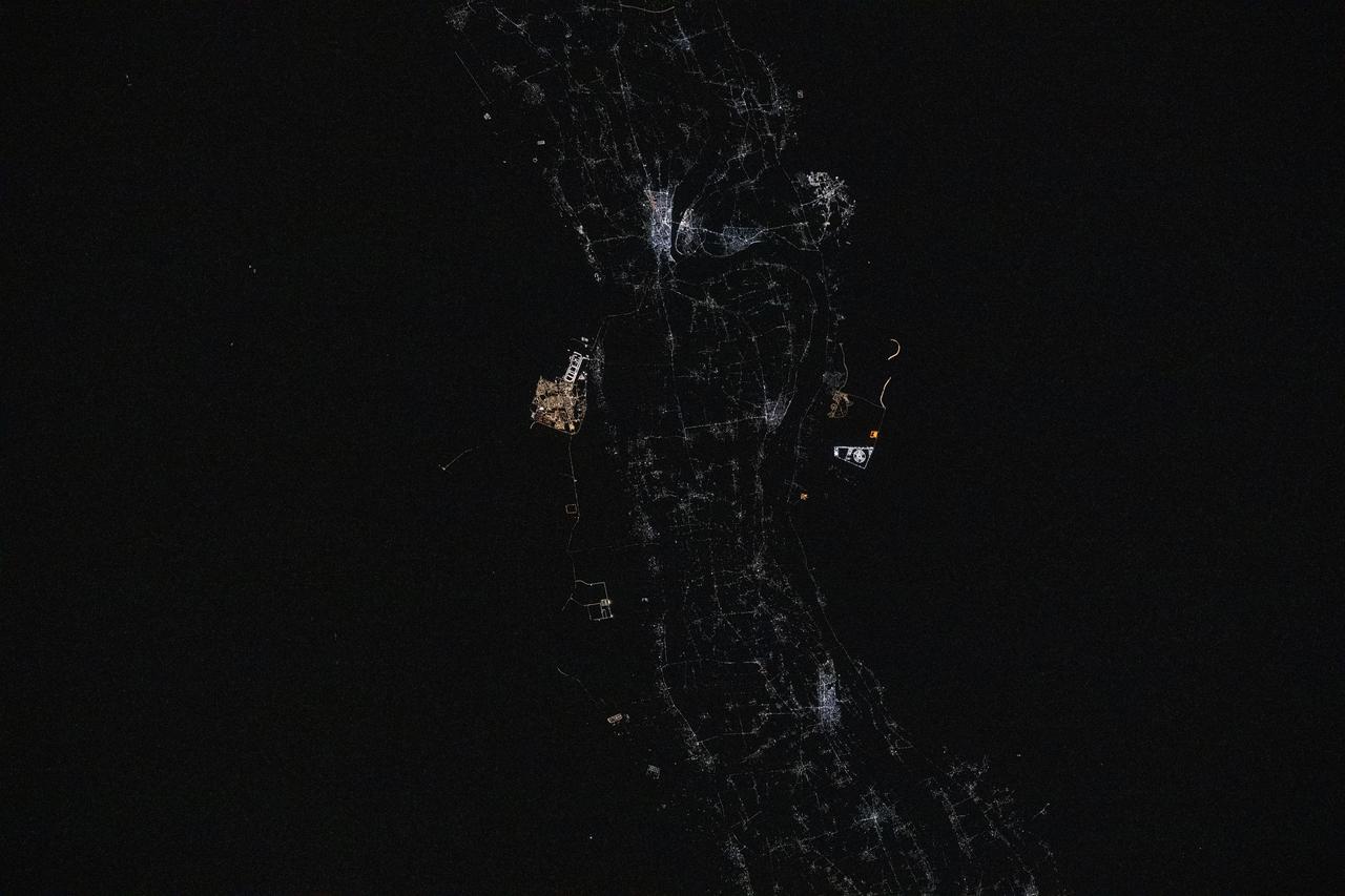
iss073e0422279 (July 18, 2025) --- Egypt’s Nile River stretches from left to right in this nighttime view from the International Space Station, with the brightest city lights tracing its path from Minya to New Bani Sewf City, and onward to the sprawling metropolitan area of Cairo at the base of the Nile Delta. This photograph was taken at approximately 1:32 a.m. local time while the station was orbiting 259 miles above Earth.
iss074e0315952 (Feb. 16, 2026) --- Egypt’s Nile River turns into Lake Nasser (upper left) at the Aswan High Dam, where the water spreads into a vast artificial reservoir that controls the river’s flow, prevents flooding, and generates hydroelectric power. Center‑pivot irrigation systems appear near the center bottom, forming perfect circles of crops such as potatoes and wheat. The International Space Station was orbiting 258 miles above the African nation at the time of this photograph. Credit: NASA
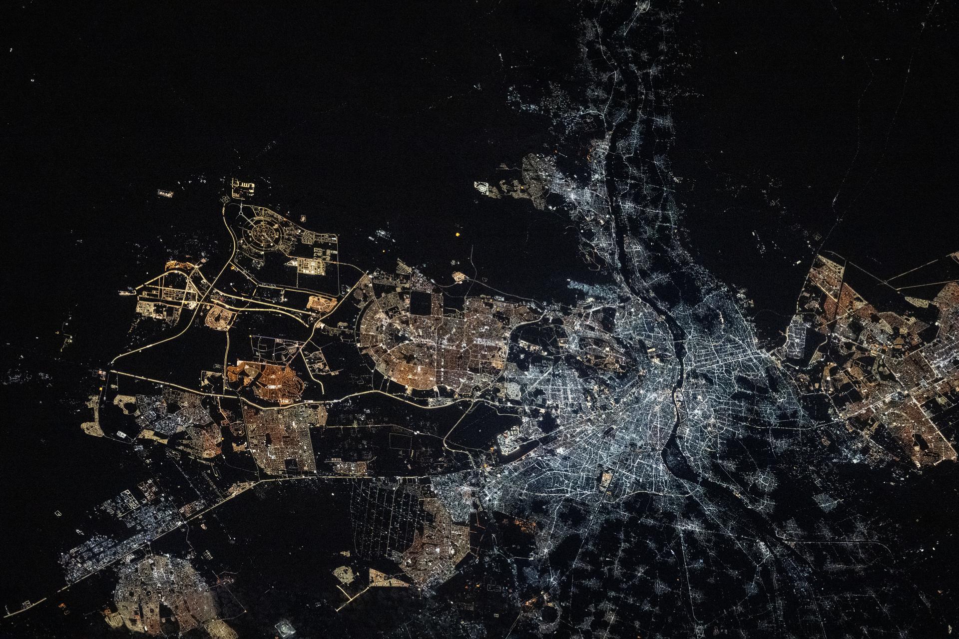
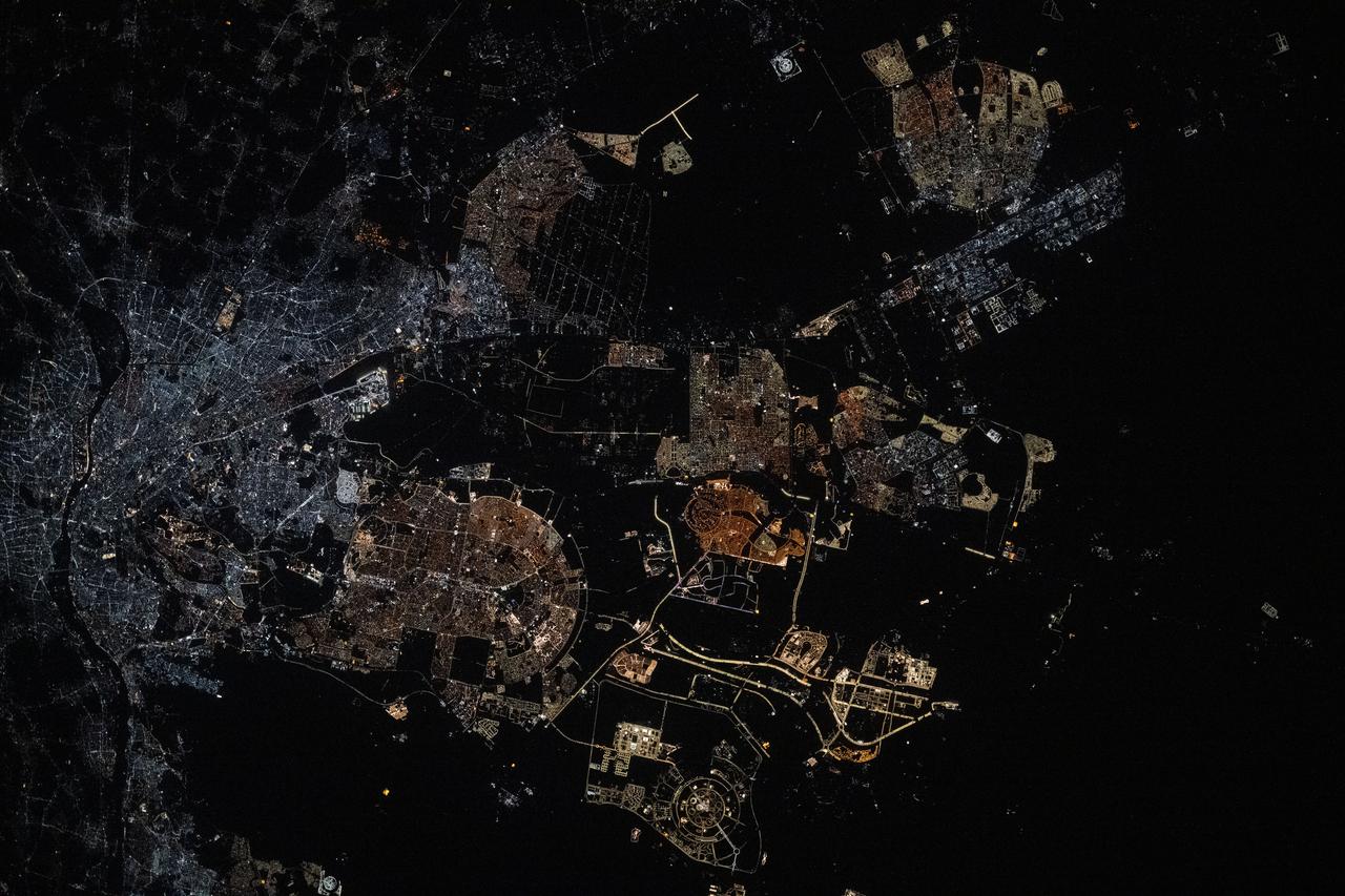
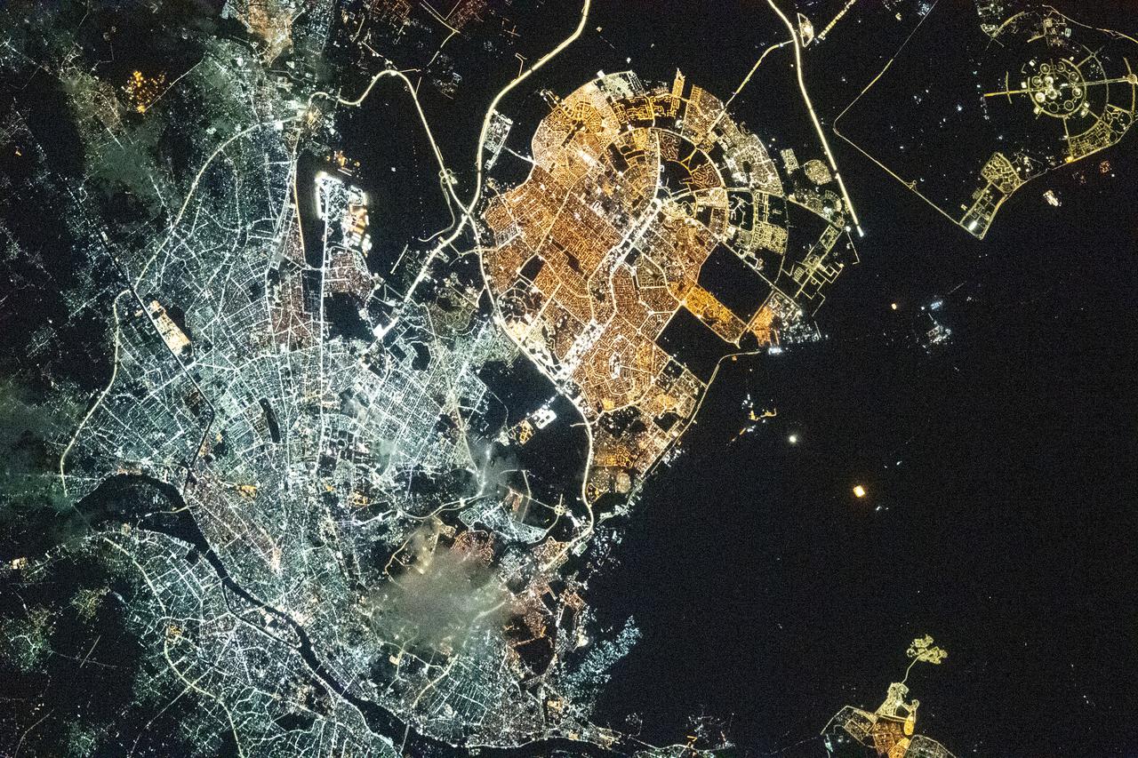
iss074e0043738 (Jan. 3, 2026) --- Egypt's Greater Cairo area, with a population of over 22 million and comprised of over a dozen cities, is split by the Nile River at the base of Nile Delta. In an unusual lighting pattern, the older districts of Cairo and Giza shine brightly with modern white lights, while the newer developments of New Cairo City on the left and El Sheikh Zayed City on the right appear in amber tones. The International Space Station was orbiting 261 miles above the Mediterranean Sea at approximately 9:09 p.m. local time when this photograph was taken. Credit: JAXA/Kimiya Yui
On the left is a radar image of asteroid 1998 WT24 taken in December 2001 by scientists using NASA's the 230-foot (70-meter) DSS-14 antenna at Goldstone, California. On the right is a radar image of the same asteroid acquired on Dec. 11, 2015, during the asteroid's most recent Earth flyby. The radar images from 2001 (on the left), have a resolution of about 60 feet (19 meters) per pixel. The radar image from 2015 (on the right) achieved a spatial resolution as fine as 25 feet (7.5 meters) per pixel. The 2015 radar image was obtained using the same DSS-14 antenna at Goldstone to transmit high-power microwaves toward the asteroid. However, this time, the radar echoes bounced off the asteroid were received by the National Radio Astronomy Observatory's 100-meter (330-foot) Green Bank Telescope in West Virginia. The next visit of asteroid 1998 WT24 to Earth's neighborhood will be on Nov. 11, 2018, when it will make a distant pass at about 12.5-million miles (52 lunar distances). http://photojournal.jpl.nasa.gov/catalog/PIA20216
iss073e0134645 (May 22, 2025) --- Sohag, Egypt (top center), on the River Nile's fertile plain with a population of about 270,000, is pictured at approximately 12:17 a.m. local time from the International Space Station as it orbited 259 miles above. Just to the south of Sohag, is the city of Sohag Al Gadida City, or New Sohag, established in 2000.
iss073e0134652 (May 22, 2025) --- Luxor, a 4,000-year-old city in Egypt with a population of over 263,000, sits on the bank of the River Nile in this photograph taken at approximately 12:17 a.m. local time from the International Space Station as it orbited 259 miles above. Luxor, a popular tourist destination, was the ancient Egyptian city of Thebes and is also home to numerous landmarks such as The Valley of the Kings and The Valley of the Queens.
Filling of the Grand Ethiopian Renaissance Dam (GERD) along the Blue Nile River is well under way near the Ethiopia-Sudan border. For a decade, Egypt and Ethiopia have been at a diplomatic stalemate over the Nile's management. Egypt proposes that Ethiopia should be able to generate hydropower from the GERD while minimizing the harm on downstream communities in Egypt and Sudan. Ethiopia's objective is to assert control over the Blue Nile, the largest tributary of the Nile River. The image was acquired November 6, 2020, covers an area of 32 by 42.9 kilometers, and is located near 11.1 degrees north, 35.2 degrees east. https://photojournal.jpl.nasa.gov/catalog/PIA24150
S65-45736 (21-29 Aug. 1965) --- Alexandria, Egypt is photographed from the Gemini-5 spacecraft in orbit over Earth.
iss069e036800 (July 24, 2023) -- Earth's atmosphere glows as the International Space Station soared roughly 260 miles above Egypt.
STS052-152-026 (22Oct-1 Nov 1992) --- Backdropped over eastern Egypt, the Canadian-built remote manipulator system (RMS) attached to NASA's Earth-orbiting Space Shuttle Columbia displays a Canadian Space Agency (CSA) experiment. Materials Exposure in Low Earth Orbit (MELEO) is one of a number of Canadian experiments which flew aboard Columbia for the ten-day STS-52 mission. Principal investigator for the experiment is Dr. David G. Zimick of the CSA. Plastic and composite materials used on the external surfaces of spacecraft have been found to degrade in the harsh environment of space. Evidence suggests that this degradation is caused by interaction with atomic oxygen which induces damaging chemical and physical reactions. The result is a loss in mass, strength, stiffness and stability of size and shape. During the mission, MELEO exposed over 350 material specimens mounted on "witness plates" on the RMS arm. The specimen collection will be analyzed in the weeks following the mission. Typical spacecraft materials and new developments in protective measures against atomic oxygen were tested as part of the MELEO experiment.
Earth Observation taken during a day pass by the Expedition 40 crew aboard the International Space Station (ISS). Folder lists this as: Egypt.
iss071e183808 (June 14, 2024) -- The mouth of the Gulf of Suez feeds into the Red Sea as the International Space Station orbited 262 miles above Egypt.
Earth Observation taken during a day pass by the Expedition 40 crew aboard the International Space Station (ISS). Folder lists this as: Egypt.
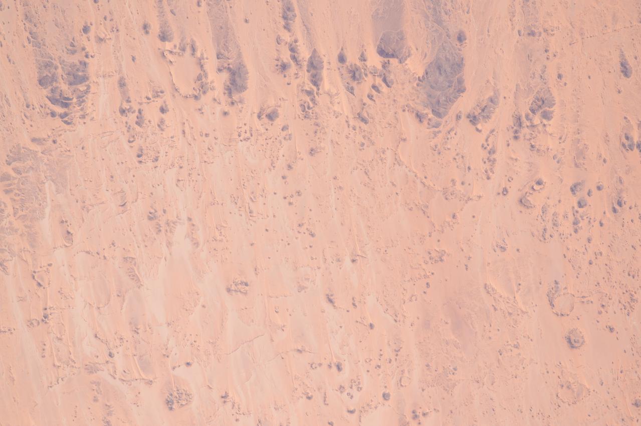
Earth observation taken during a day pass by an Expedition 36 crew member on board the International Space Station (ISS). Per Twitter message: Southwest Egypt.
iss064e006268 (Nov. 26, 2020) --- Pictured from the International Space Station, the Aswan Dam in Egypt separates Lake Nasser from the Nile River.
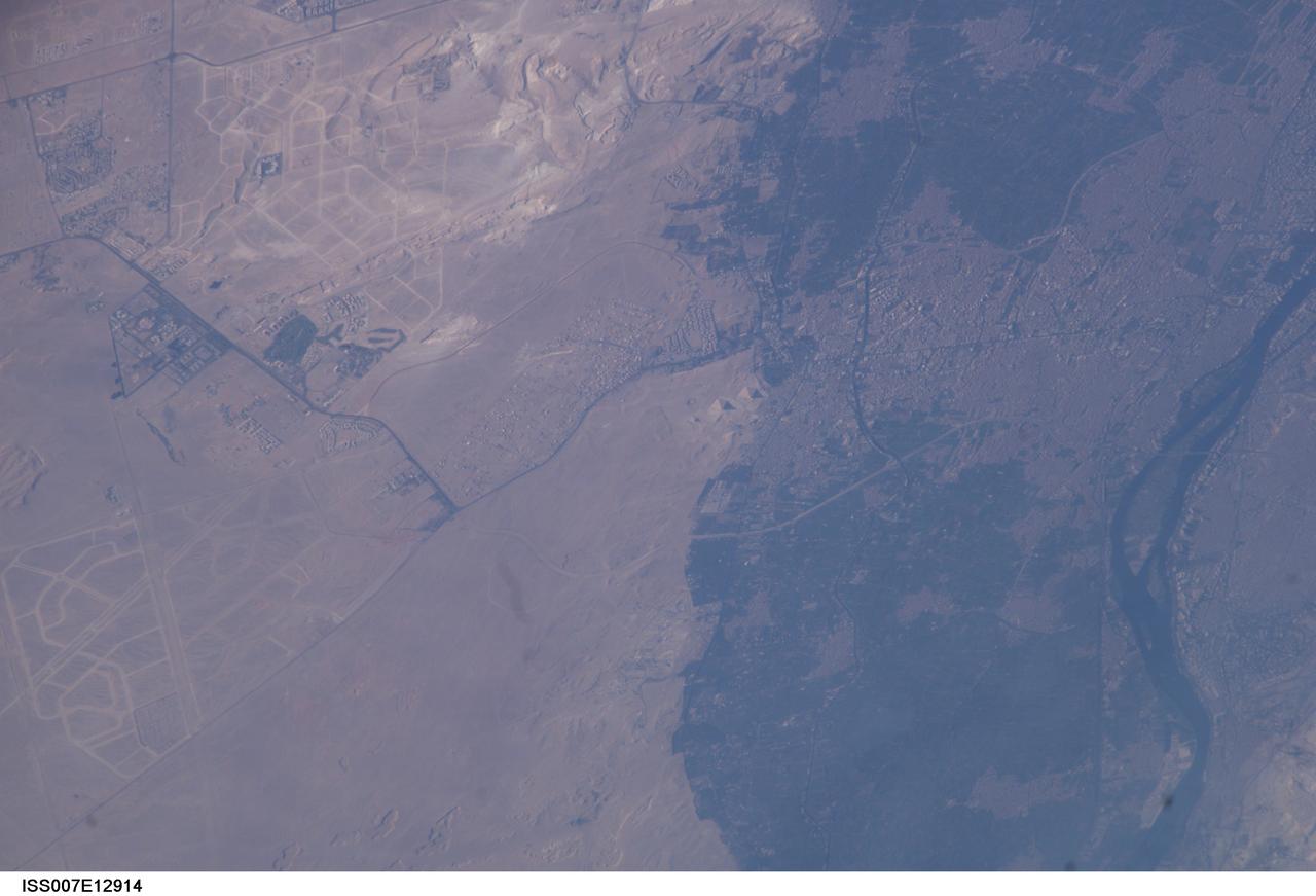
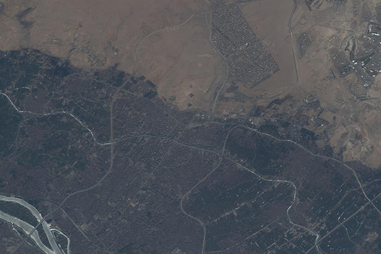
ISS007-E-12914 (18 August 2003) --- This view featuring Egypt’s Great pyramids of Giza (right center) was taken by an Expedition 7 crewmember onboard the International Space Station (ISS). Giza is a royal burial place, commissioned and built by pharaohs during the fourth dynasty around 2550 BC. Today, Giza is a rapidly growing region of Cairo. Population growth in Egypt continues to soar, leading to new construction. New roads for large new developments are obvious in the desert hills northwest and southwest of the pyramids.
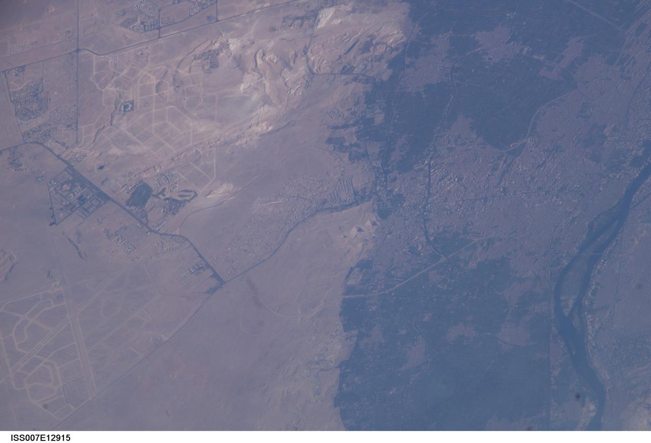
ISS007-E-12915 (18 August 2003) --- This view featuring Egypt’s Great pyramids of Giza (right center) was taken by an Expedition 7 crewmember onboard the International Space Station (ISS). Giza is a royal burial place, commissioned and built by pharaohs during the fourth dynasty around 2550 BC. Today, Giza is a rapidly growing region of Cairo. Population growth in Egypt continues to soar, leading to new construction. New roads for large new developments are obvious in the desert hills northwest and southwest of the pyramids.
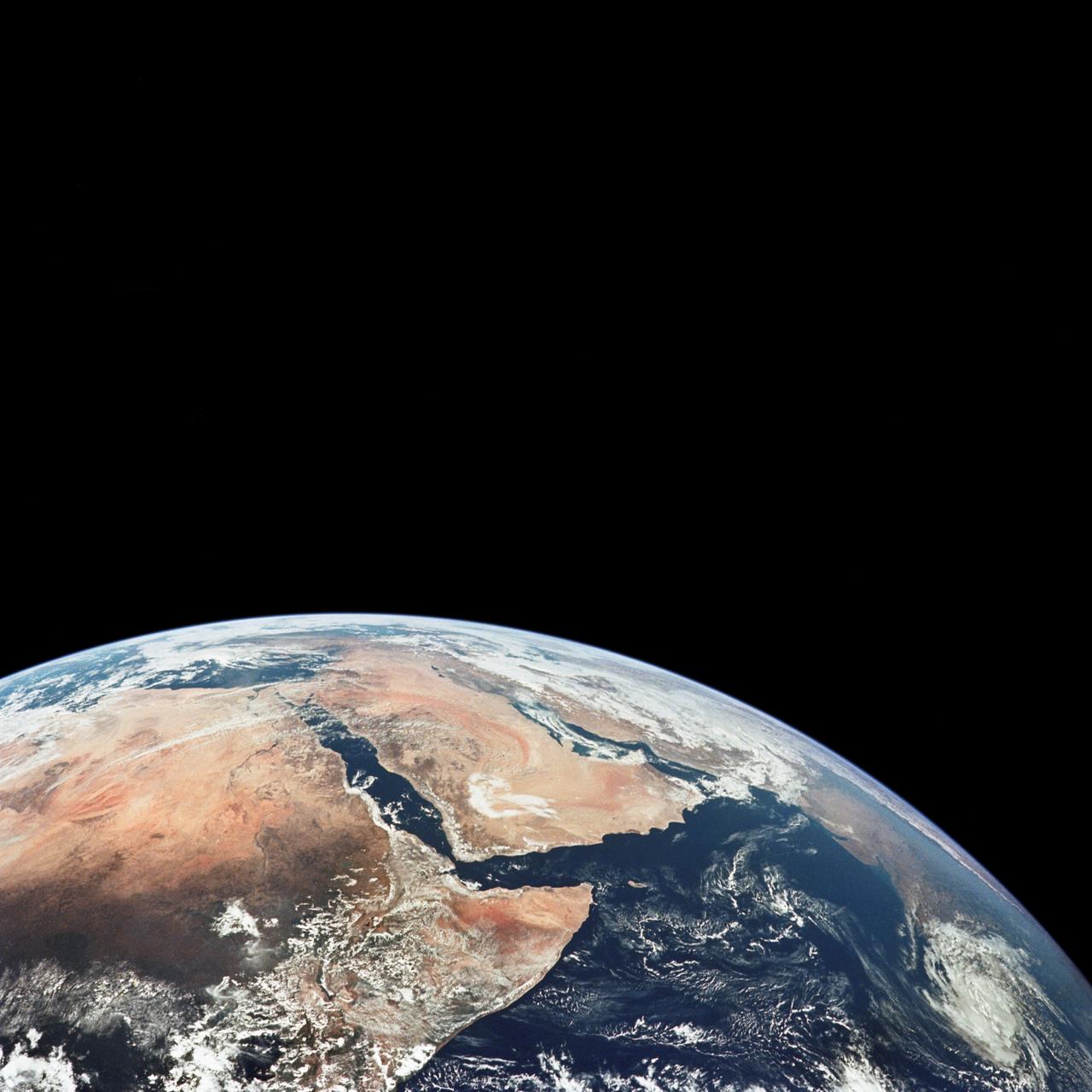
AS17-148-22718 (7-19 Dec. 1972) --- This excellent view of Saudi Arabia and the north eastern portion of the African continent was photographed by the Apollo 17 astronauts with a hand-held camera on their trans-lunar coast toward man's last lunar visit. Egypt, Sudan, Ethiopia are some of the African nations are visible. Iran, Iraq, Jordan are not so clearly visible because of cloud cover and their particular location in the picture. India is dimly visible at right of frame. The Red Sea is seen entirely in this one single frame, a rare occurrence in Apollo photography or any photography taken from manned spacecraft. The Gulf of Suez, the Dead Sea, Gulf of Aden, Persian Gulf and Gulf of Oman are also visible. This frame is one of 169 frames on film magazine NN carried aboard Apollo 17, all of which are SO368 (color) film. A 250mm lens on a 70mm Hasselblad camera recorded the image, one of 92 taken during the trans-lunar coast. Note AS17-148-22727 (also magazine NN) for an excellent full Earth picture showing the entire African continent.
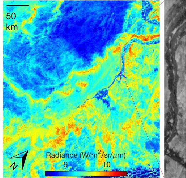
ECOSTRESS acquired this image the night of July 9, 2018, over Egypt. Yellow and red indicate generally higher temperatures. The River Nile is visible as a thin blue line on the main image. The black-and-white inset shows the level of detail available from ECOSTRESS, with the relatively cool Nile River and surrounding vegetation appearing darker. https://photojournal.jpl.nasa.gov/catalog/PIA22590
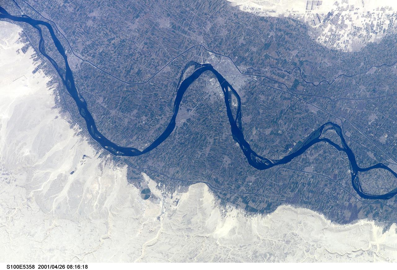
S100-E-5358 (26 April 2001) --- The City of Sawhaj, Egypt in the Nile Valley was photographed with a digital still camera by the crew members aboard the Space Shuttle Endeavour on April 26, 2001.
iss066e128266 (Jan. 26, 2022) --- The city lights of Cairo and New Cairo City in Egypt are pictured during an orbital nightime pass from the International Space Station as it orbited 260 miles above the Sinai Peninsula.
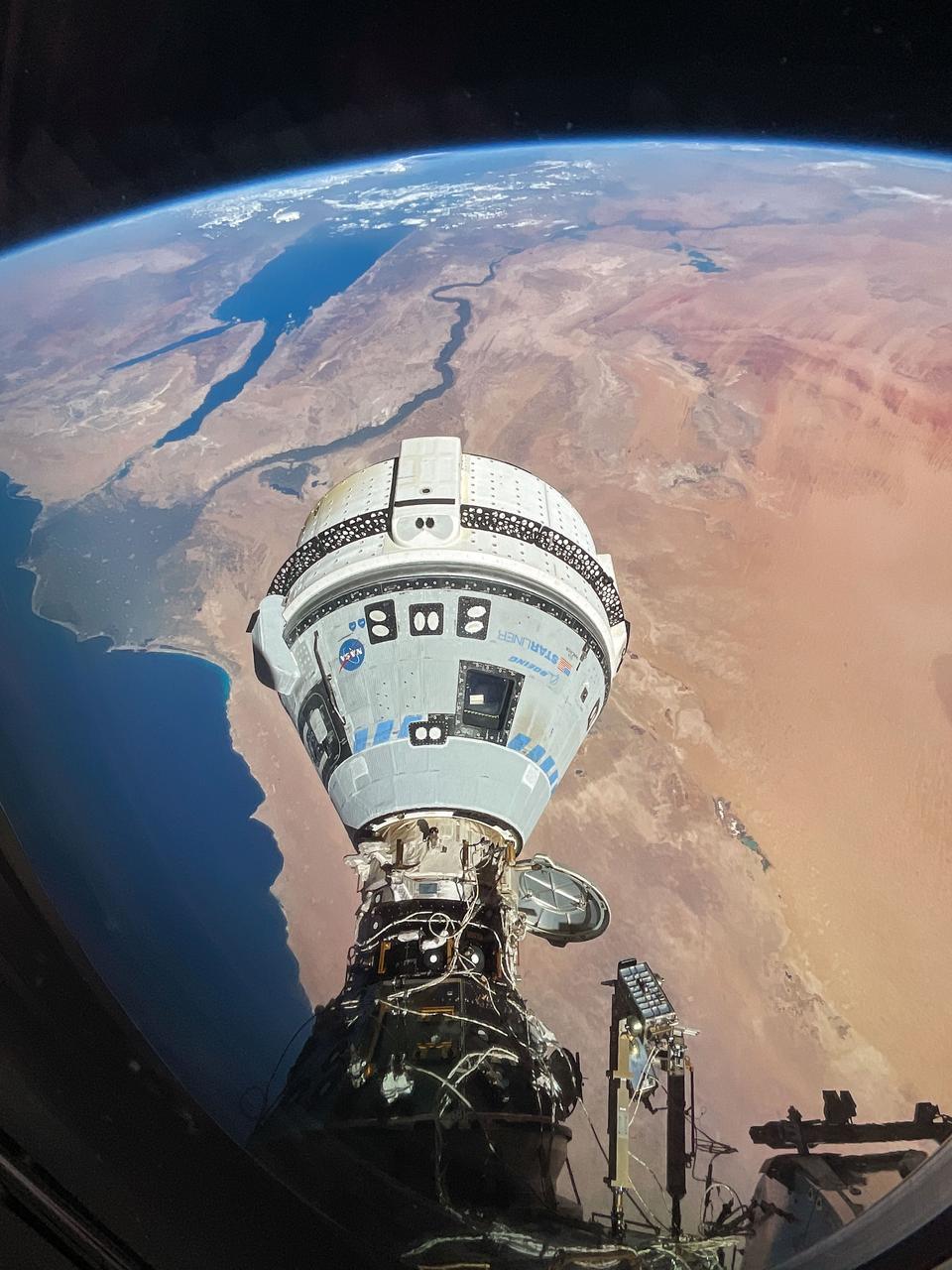
iss071e182991 (June 13, 2024) --- The Starliner spacecraft on NASA's Boeing Crew Flight Test is pictured docked to the Harmony module's forward port as the International Space Station orbited 262 miles above Egypt's Mediterranean coast.
iss072e660964 (Feb. 24, 2025) --- The northernmost tip of the Gulf of Aqaba, which Egypt, Israel, and Jordan border along in this photograph, is pictured from the International Space Station as it orbited 263 miles above the Middle East.
iss064e053173 (April 4, 2021) --- The Nile River, The Red Sea, The Gulf of Oman, The Gulf of Aqaba, and The Mediterranean Sea are pictured in the Middle East from the International Space Station as it orbited 263 miles above Egypt.

iss067e286515 (Aug. 21, 2022) --- This oblique view of Turkey and the island nation of Cyprus is pictured from the International Space Station as it orbited 257 miles above the Nile Delta in Egypt.
iss068e006657 (Oct. 1, 2022) --- Giza, Egypt, the home of the Great Pyramids (center), and a portion of the Nile River (lower left) are pictured from the International Space Station as it orbited 259 miles above the Mediterranean Sea.

iss063e028234 (June 16, 2020) --- Lake Nasser, a vast reservoir in southern Egypt and northern Sudan, is pictured from the International Space Station as it orbited above northeast Africa.
iss059e099177 (June 10, 2019) --- The Nile River, Red Sea and Mediterranean Sea are contrasted by the desert nations of Egypt, Saudi Arabia, Israel and Jordan as the International Space Station orbits 254 miles above Africa.
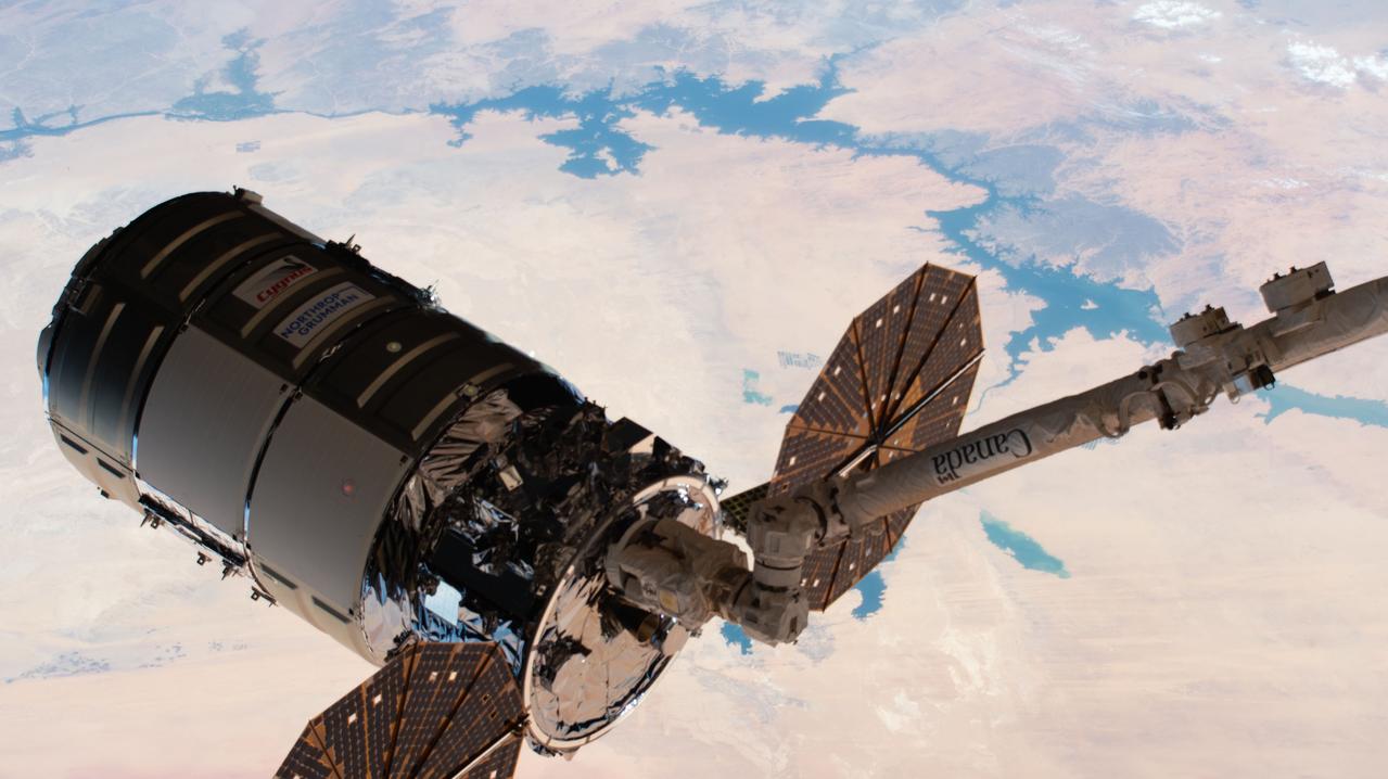
iss063e101635 (Oct. 5, 2020) --- The Northrop Grumman Cygnus space freighter is pictured after being captured by the Canadarm2 robotic arm as the International Space Station orbited above Egypt.
iss068e050817 (Feb. 9, 2023) --- An agricultural development in Egypt's New Valley Governate near the Sudan border is pictured from the International Space Station as it orbited 258 miles above the eastern Sahara.
iss067e141205 (June 19, 2022) --- This portion of the Western Desert is an area of the Sahara where the borders of Egypt, Libya, and Sudan meet. The International Space Station was orbiting 259 miles above north Africa at the time of this photograph.
iss068e017658 (Oct. 20, 2022) --- Lake Nasser, one of the largest man-made lakes in the world, is pictured in southern Egypt from the International Space Station as it orbited 262 miles above.
iss061e004613 (Oct. 9, 2019) --- Looking like a leaf on a vine, the Faiyum Oasis extends west of the Nile River and south of Cairo, Egypt. The fertile area at the left of the photograph is the Nile Delta opening up into the Mediterranean Sea.
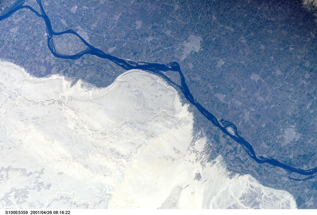
S100-E-5359 (26 April 2001) --- The City of Tahta, Egypt in the Nile Valley was photographed with a digital still camera by the crew members aboard the Space Shuttle Endeavour on April 26, 2001.
ISS043E182407 (05/08/2015) --- Shades of beige dominate this image of the Libyan Desert and southwestern Egypt scene captured by NASA astronaut Scott Kelly aboard the international Space Station on May, 8th, 2015.
iss072e065377 (Oct. 17, 2024) --- The borders of three African nations, Libya, Sudan, and Egypt, meet in the eastern portion of the Sahara in this photograph from the International Space Station as it orbited 258 miles above.
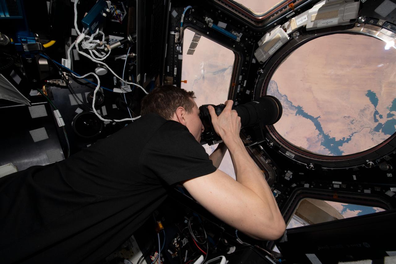
iss069e012494 (May 20, 2023) --- NASA astronaut and Expedition 69 Flight Engineer Woody Hoburg is pictured inside the seven window cupola photographing Lake Nasser in Egypt as the International Space Station orbited 257 miles above.
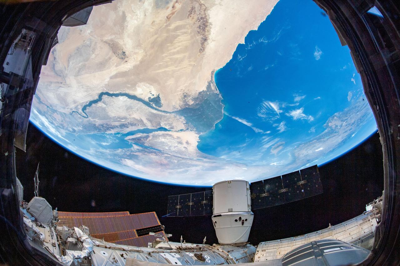
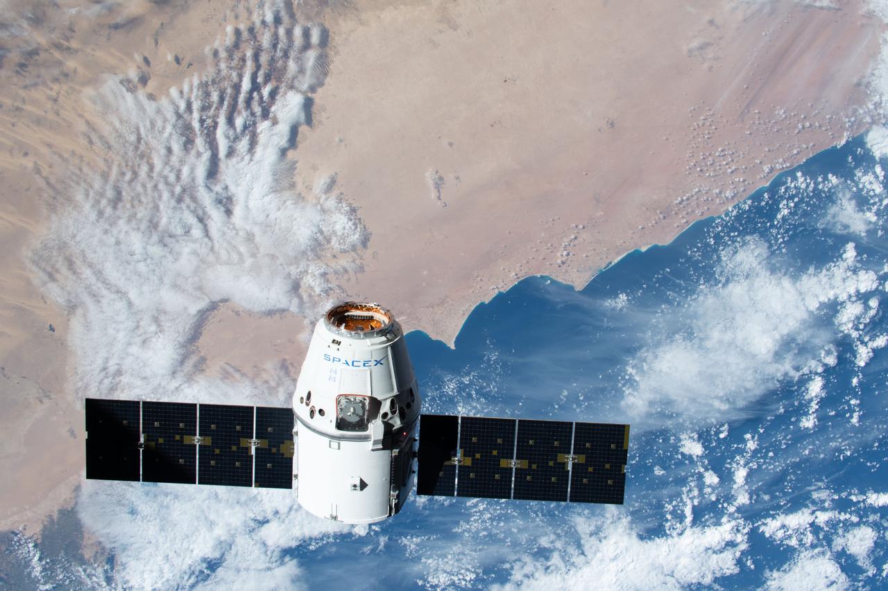
iss060e035437 (Aug. 13, 2019) -- The SpaceX Dragon resupply ship is pictured attached to the International Space Station's Harmony module as the orbital complex flew 260 miles above the Nile River Delta in Egypt.
iss067e222958 (Aug. 3, 2022) --- The sun's glint beams off Lake Nasser in Southern Egypt in this photograph from the International Space Station as it orbited 257 miles above.
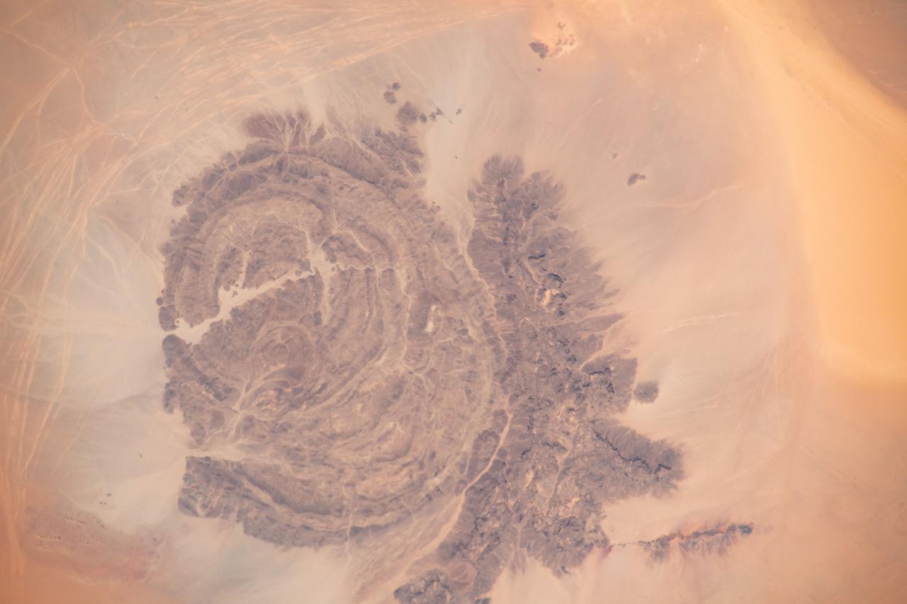
iss065e009521 (April 29, 2021) --- Mount Arkanu in southeast Libya, near the border with Egypt and Sudan, is pictured from the International Space Station as it orbited 262 miles above the Sahara Desert.
iss070e034694 (Nov. 30, 2023) --- The Suez Gulf (right) and the southern portion of the Suez Canal are pictured from the International Space Station as it orbited 260 miles above Egypt near the Mediterranean coast.
Earth observation taken during a night pass by the Expedition 40 crew aboard the International Space Station. Folder lists this as: Night-Egypt & war in Israel - missile impacts.
iss063e079157 (Aug. 28, 2020) --- The International Space Station was orbiting above Egypt when an Expedition 63 crew member photographed a portion of Lake Nasser, one of the largest man-made lakes in the world.
iss064e052447 (April 4, 2021) --- The Nile Delta, The Sinai Peninsula, and The Mediterranean Sea are pictured in the Middle East from the International Space Station as it orbited 263 miles above Egypt.
iss061e069080 (Dec. 8, 2019) --- The SpaceX Dragon resupply ship approaches the International Space Station as both spacecraft were orbiting 257 miles above Egypt and about to cross over the Mediterranean Sea.
S66-54530 --- Libyan Desert area of Sudan, foreground, and the United Arab Republic (Egypt), at lower left, as seen from the orbiting Gemini-11 spacecraft at an altitude of 300 nautical miles during its 27th revolution of Earth. In view is the Nile River from Biba in Egypt to Khartoum in the Sudan. The Red Sea is in the background. At upper left is the Arabian Peninsula. At top right is Ethiopia. Note L-band antenna of the Agena Target Vehicle. Taken with a modified 70mm Hasselblad camera, using Eastman Kodak, Ektachrome, MS (S.O. 368) color film. Photo credit: NASA
STS079-808-008 (16-26 Sept. 1996) --- In this 70mm frame from the space shuttle Atlantis, the Nile River wanders through the eastern Sahara Desert of Sudan and Egypt. In the foreground is a great bend of the Nile from north to south past the Fourth Cataract at Merowe (an ancient Sudanese dynastic capitol), then north past Dongola and the Third Cararact, to Lake Nasser in Egypt. Prominent sand streaks display a north-south alignment. North of the first great bend a thick dust storm completely obscures the land surface, near Merowe thinner dust creates a hazy look. In the distance the Red Sea stretches from Suez to southern Arabia.
ISS032-E-009123 (26 July 2012) --- Pyramids at Giza, Egypt are featured in this image photographed by an Expedition 32 crew member on the International Space Station. The Great Pyramids at Giza (center) are the last of the Seven Wonders of the Ancient World, and are perhaps the most famous of the ancient monuments in the Nile River Delta region of Egypt. They are also a favorite subject of photography from orbit ? particularly when high resolution imagery can be obtained. The southeast-facing sides of the pyramids of the pharaohs Khufu, Khafre, and Menkaure are all brightly illuminated by the sun, while the northwest facing sides are in shadow. This shadowing also highlights smaller unfinished pyramids to the south of Menkaure?s pyramid, as well as fields of rectangular flat roofed mastabas (tombs) to the east and west of Khufu?s pyramid. While not as grand as the pyramids, mastabas were the burial places of prominent persons during the periods of the ancient pharaohs. To the southeast of Khufu?s pyramid, the head and rear haunches of the Sphinx are also visible (albeit not clearly). It is a short distance between the glories of ancient Egypt and the modern Cairo metropolitan area to the north and east. The green vegetation of a hotel golf course (center left), and the numerous building and streets of El Giza, provide stark contrast to the bare rock and soil of the adjacent desert. Roadways visible in the desert (right) connect the urban regions to the east with further development to the north.
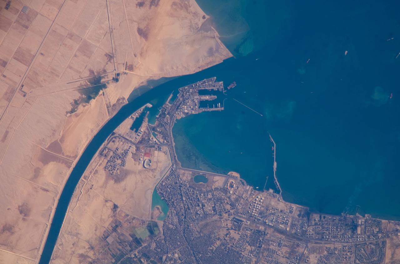
ISS016-E-019375 (30 Dec. 2007) --- Port of Suez, Egypt is featured in this image photographed by an Expedition 16 crewmember on the International Space Station. The Port of Suez is located in Egypt along the northern coastline of the Gulf of Suez. The port and city are the southern terminus of the Suez Canal that transits through Egypt and debouches into the Mediterranean Sea near Port Said. The port serves vessels transporting general cargo, oil tankers, and both commercial and private passenger vessels. The port is also an important waypoint for Muslim pilgrims traveling to and from Mecca in Saudi Arabia. Several large vessels are visible in the Gulf of Suez and berthed at various docks around the port. An extensive petroleum refinery complex forms the southern coastal boundary of the Port of Suez. At the time this image was acquired, gaseous byproducts of petroleum processing were being burned off -- as indicated by a smoke plume extending southwards into the Gulf of Suez (lower right). This view also captures several regions of greenish blue coloration in the Gulf. These are most probably sediments stirred up by passage of ships traveling to and from the Port. Similarly-colored regions along the coastline are bottom sediments visible through the shallow water column.
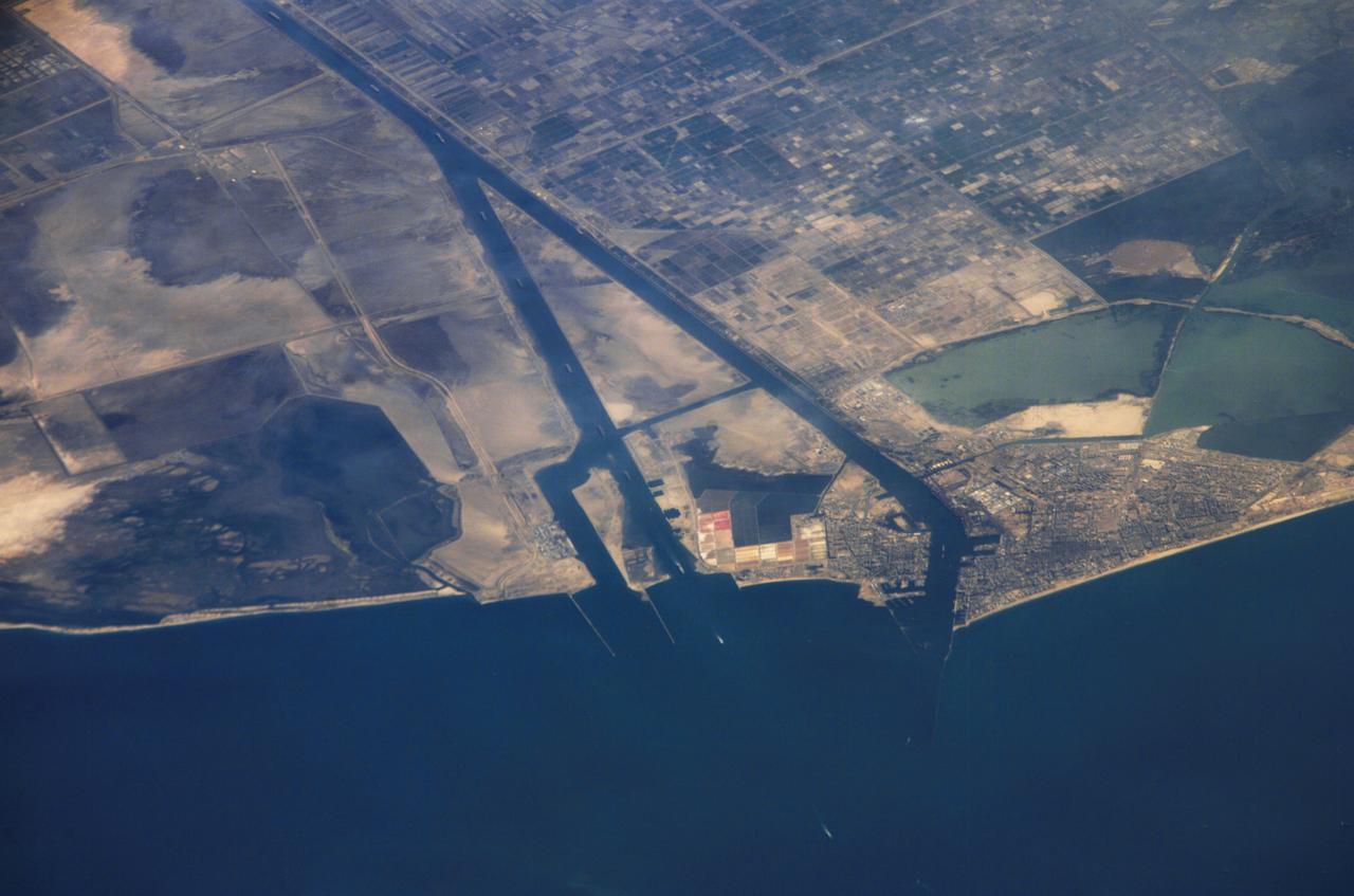
ISS013-E-44847 (30 June 2006) --- Ship traffic on the Suez Canal, Egypt is featured in this image photographed by an Expedition 13 crewmember on the International Space Station. This oblique photograph captures a northbound convoy of cargo ships entering the Mediterranean Sea from the Suez Canal in Egypt (leftmost canal branch at image center). Oblique images are taken at an angle other than vertical, or nadir -- looking down a line connecting the station to the point on the Earth's surface directly below it -- and this provides a sense of perspective. In this case, the station was located above the eastern coast of Cyprus and the crewmember was looking at Egypt to the southwest. Regions of reduced clarity in the image are caused by thin variable cloud cover. The Suez Canal connects Port Said on the Mediterranean Sea with the port of Suez on the Red Sea, and provides an essentially direct route for transport of goods between Europe and Asia. The Canal is 163 kilometers long and 300 meters wide at its narrowest point -- sufficiently wide for ships as large as aircraft carriers to traverse it. Transit time from end to end is 14 hours on average.
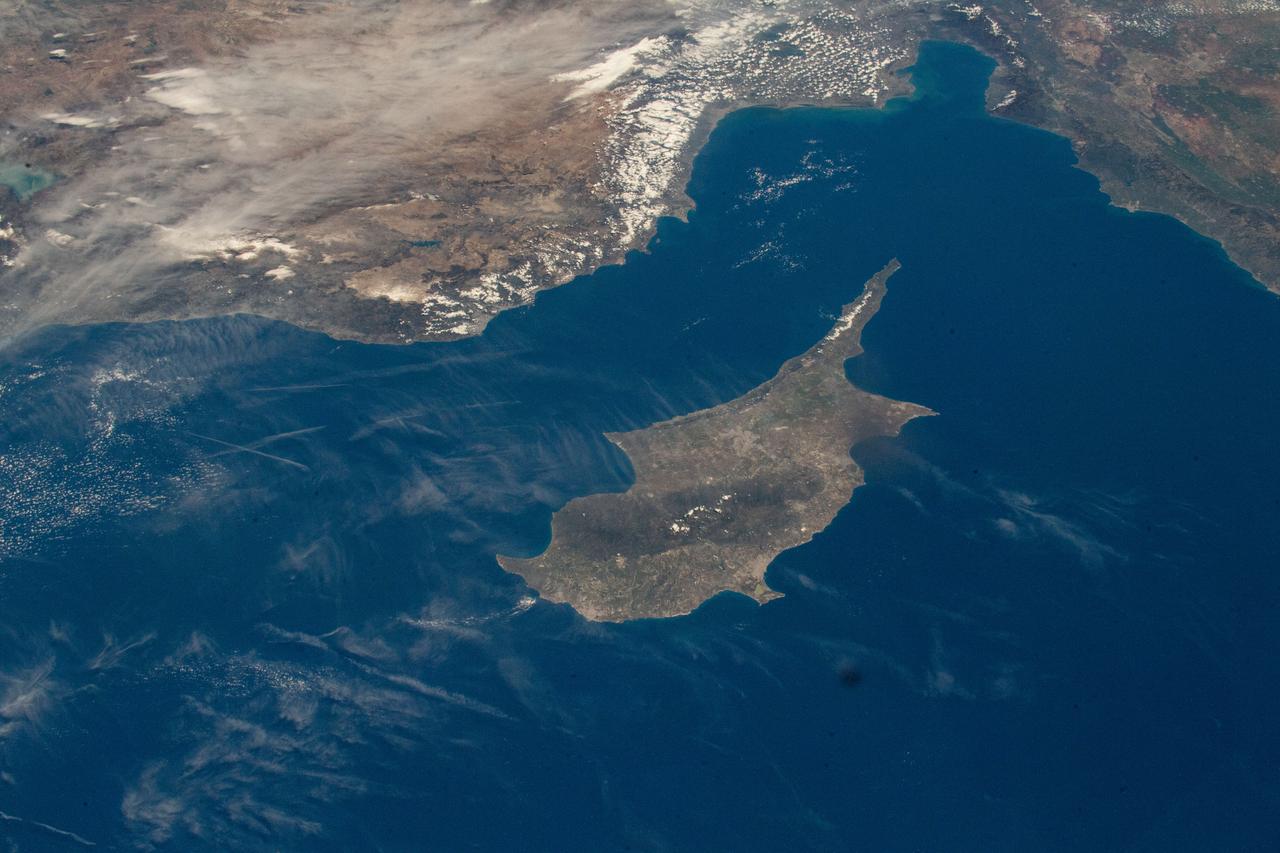
iss069e000764 (April 3, 2023) --- The International Space Station was orbiting 262 miles above the coast of Egypt when UAE (United Arab Emirates) astronaut and Expedition 69 Flight Engineer Sultan Alneyadi photographed the Turkish coast and the island of Cyprus in the Mediterranean Sea.
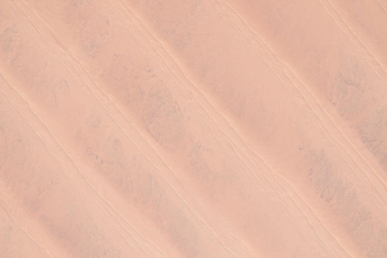
ISS043182398 (05/08/2015) --- Another view of the northern African Great Sand Sea, Libyan Desert and western Egypt with orange parallel dunes taken on May 8th 2015 by NASA astronaut Scott Kelly on the International Space Station.
iss063e067888 (Aug. 11, 2020) --- The International Space Station was orbiting above Egypt just east of the Nile River when this photograph was taken of the city of Beni Suef (toward the upper right), an important agricultural trade center on the west bank of the Nile, about 65 miles (110 kilometers) south of Cairo.
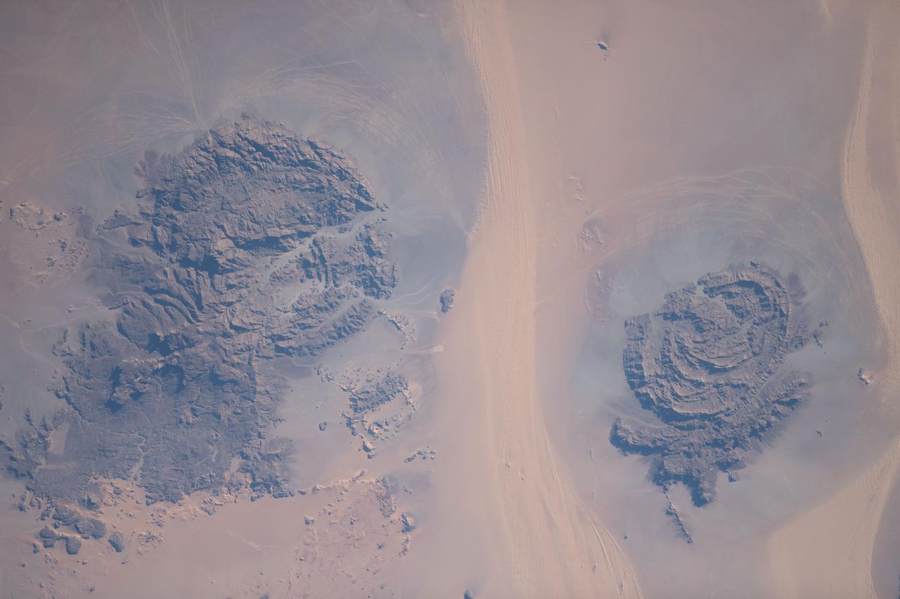
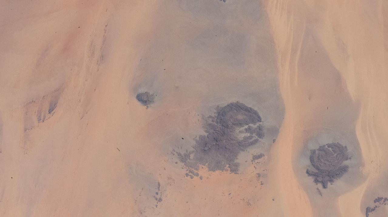
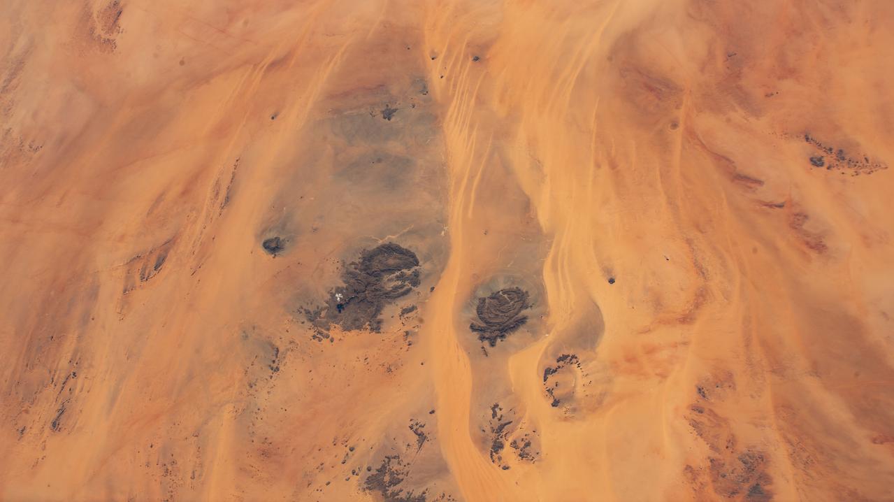
iss069e089643 (Sept. 18, 2023) --- Located in the Libyan Desert along the country's southeastern border with Sudan and Egypt are the Jebel Uweinat (left) and the Jabal Arkenu (right) mountains pictured from the International Space Station as it orbited 258 miles above.
ISS010-E-14618 (23 January 2005) --- Egypt's Lake Nasser, centered roughly at 22.64 degrees north latitude and 32.45 degrees east longitude, was captured with an electronic still camera by the Expedition 10 crew onboard the International Space Station. Sunglint on the lake makes it more easily visible.

iss069e000819 (April 4, 2023) --- The Faiyum Oasis (upper left) in Egypt, immediately west of the Nile river and south of the nation's capital of Cairo, is pictured from an external high definition camera on the International Space Station as it orbited 262 miles above.