Elysium Mons
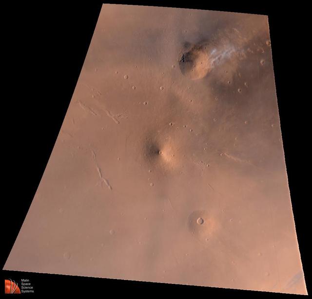
Elysium Mons Volcanic Region
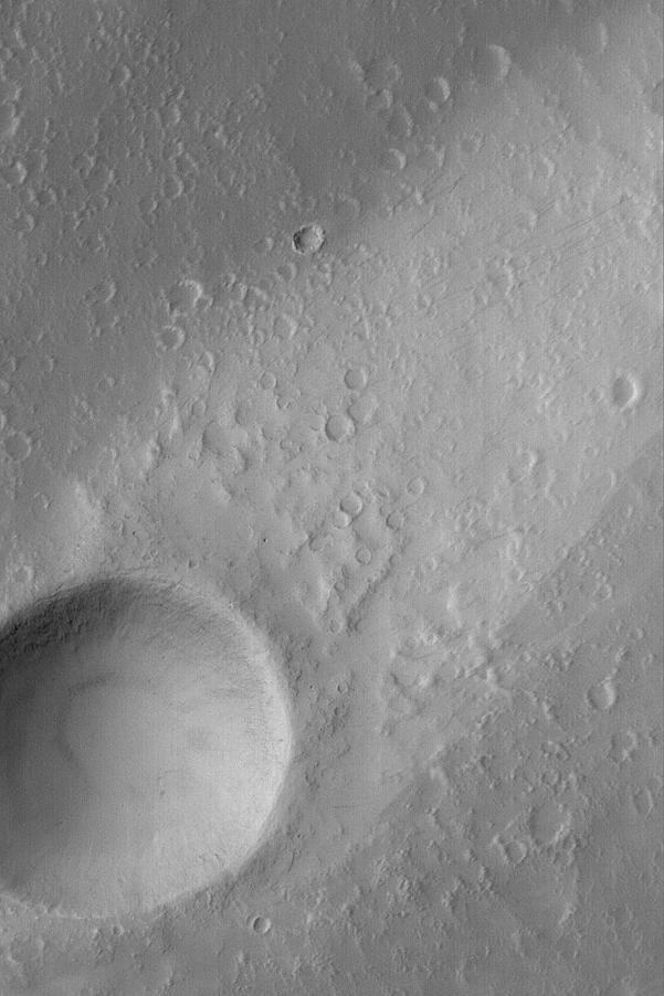
Elysium Mons Wind Streak
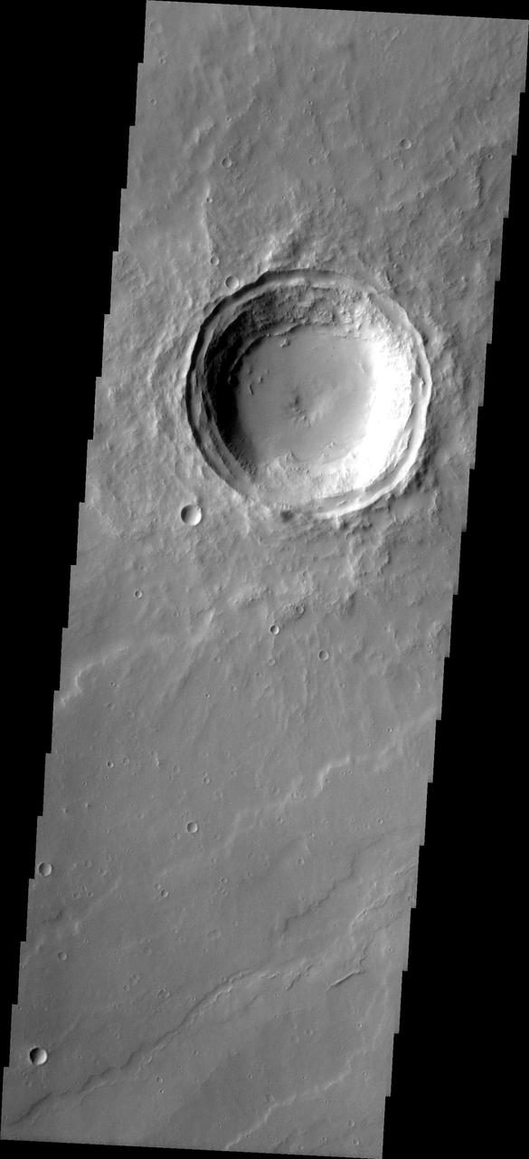
MSIP: Elysium Mons Crater

Elysium Mons Volcano
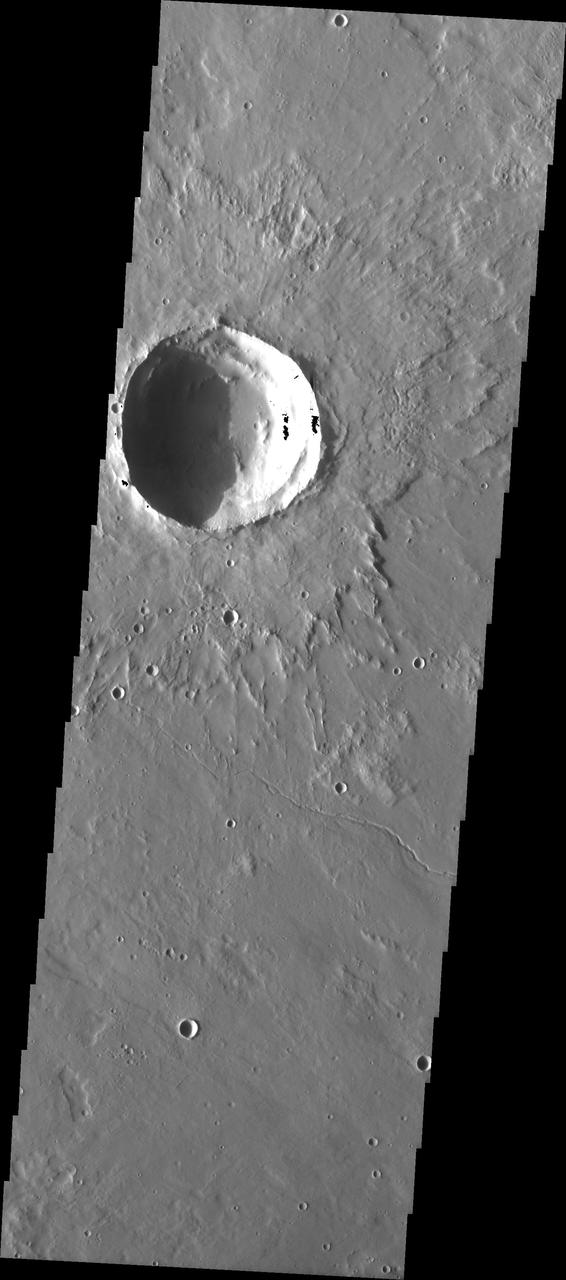
MSIP: Elysium Mons Lava Flow
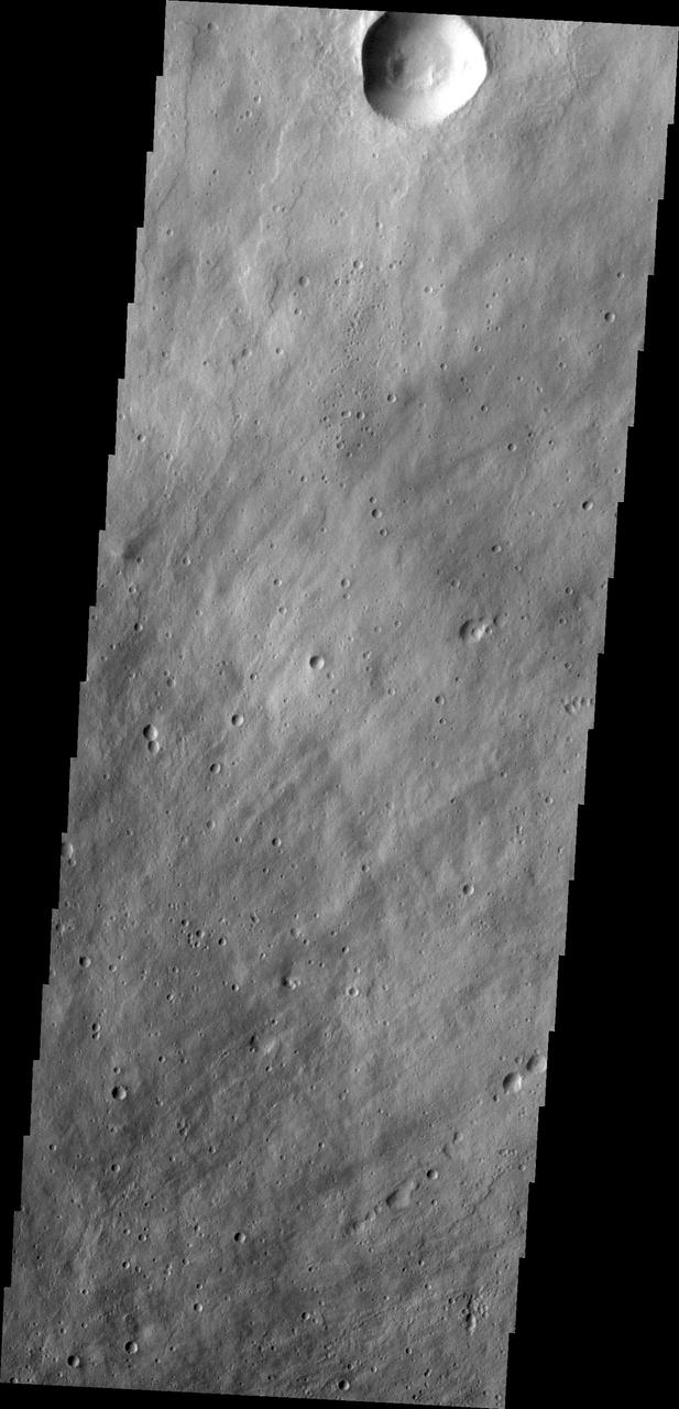
This image from NASA 2001 Mars Odyssey spacecraft shows part of the northeastern flank of Elysium Mons.

This image captured by NASA 2001 Mars Odyssey spacecraft shows the western flank of Elysium Mons.
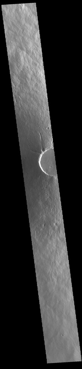
Today's VIS image shows a cross section of Elysium Mons, including part of the summit caldera. Unlike the Tharsis volcanoes to the east, there are very few identifiable lava flows on the flanks of the Elysium Mons. In profile the volcano looks like Mt. Fuji in Japan. Mt. Fuji is a stratovolcano. A stratovolcano, also known as a composite volcano, is a conical volcano built up by multiple layers of lava and ash erupting solely from the summit caldera. The Tharsis volcanoes are shield volcanoes, which will host flank eruptions, but rarely ash eruptions. Elysium Mons is 12.6km (7.8 miles) tall. For comparison, Mt. Fuji is 3.7 km (2.3 miles) tall. Orbit Number: 93908 Latitude: 24.4791 Longitude: 146.667 Instrument: VIS Captured: 2023-02-14 16:41 https://photojournal.jpl.nasa.gov/catalog/PIA25925
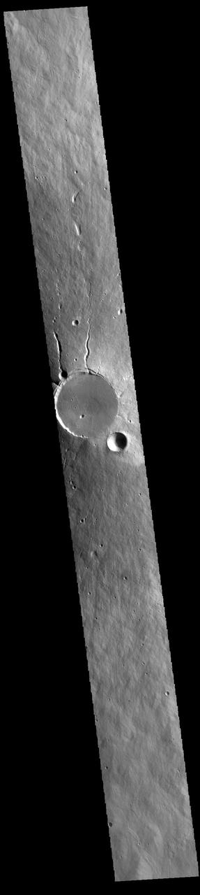
Today's VIS image shows a cross section of Elysium Mons, including the entire summit caldera. Unlike the Tharsis volcanoes to east, there are very few identifiable lava flows on the flanks of the Elysium Mons. In profile the volcano looks like Mt. Fuji in Japan. Mt. Fuji is a stratovolcano. A stratovolcano, also known as a composite volcano, is a conical volcano built up by multiple layers of lava and ash erupting solely from the summit caldera. The Tharsis volcanoes are shield volcanoes, which will host flank eruptions, but rarely ash eruptions. Elysium Mons is 12.6km (7.8 miles) tall. For comparison, Mt. Fuji is 3.7 km (2.3 miles) tall. Orbit Number: 86633 Latitude: 24.5225 Longitude: 146.837 Instrument: VIS Captured: 2021-06-25 16:09 https://photojournal.jpl.nasa.gov/catalog/PIA24959
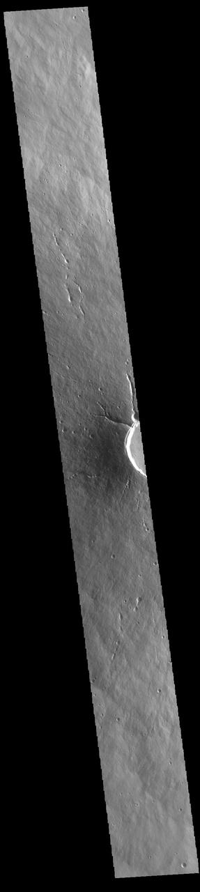
Today's VIS image shows a cross section of Elysium Mons, including part of the summit caldera. Unlike the Tharsis volcanoes to east, there are very few identifiable lava flows on the flanks of the Elysium Mons. In profile the volcano looks like Mt. Fuji in Japan. Mt. Fuji is a stratovolcano. A stratovolcano, also known as a composite volcano, is a conical volcano built up by multiple layers of lava and ash erupting solely from the summit caldera. The Tharsis volcanoes are shield volcanoes, which will host flank eruptions, but rarely ash eruptions. Elysium Mons is 12.6km (7.8 miles) tall. For comparison, Mt. Fuji is 3.7 km (2.3 miles) tall. Orbit Number: 94794 Latitude: 24.68 Longitude: 146.541 Instrument: VIS Captured: 2023-04-28 15:31 https://photojournal.jpl.nasa.gov/catalog/PIA26171
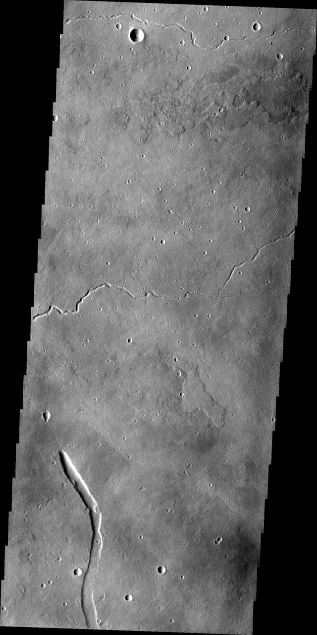
This image from NASA 2001 Mars Odyssey spacecraft shows part of the eastern flank of Elysium Mons. The small channels were likely created due to the flow of lava, rather than water.
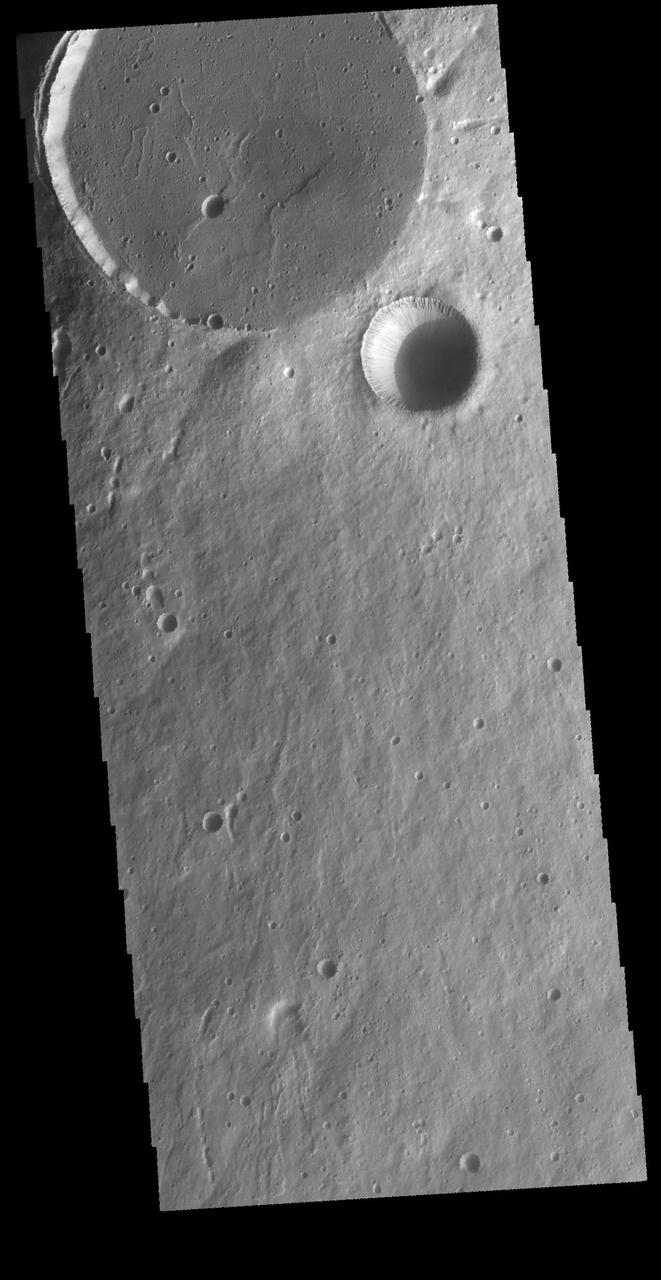
This VIS image shows two circular features. The flat floored feature at the top of the image is the summit caldera of Elysium Mons and was formed by volcanic activity. The bowl-shaped feature next to the caldera is an impact crater. Orbit Number: 65587 Latitude: 24.3248 Longitude: 146.842 Instrument: VIS Captured: 2016-09-26 07:14 http://photojournal.jpl.nasa.gov/catalog/PIA21159
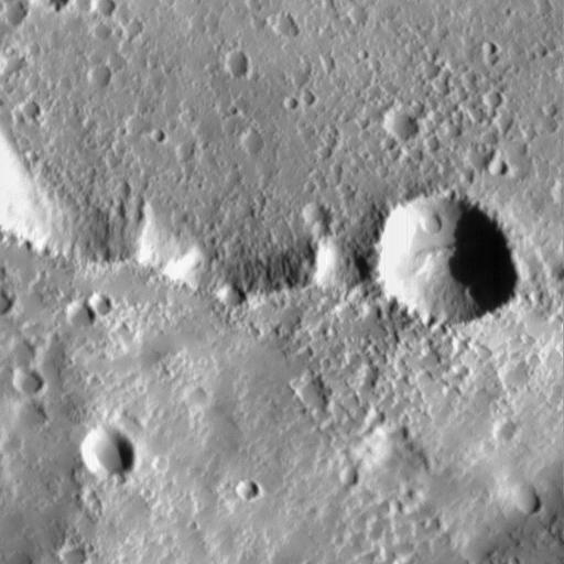
Elysium Mons Volcano - Detail of Southern Caldera Wall and Floor

This VIS image shows lava flows and graben near the northeastern flank of Elysium Mons. The linear graben crosses the image from left to right, while the more sinuous lava flows are running from the bottom of the image towards the top. Orbit Number: 81866 Latitude: 27.7402 Longitude: 148.194 Instrument: VIS Captured: 2020-05-29 04:04 https://photojournal.jpl.nasa.gov/catalog/PIA24082

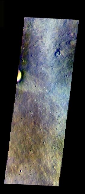
The THEMIS VIS camera contains 5 filters. The data from different filters can be combined in multiple ways to create a false color image. These false color images may reveal subtle variations of the surface not easily identified in a single band image. Today's false color image shows part of the eastern flank of Elysium Mons. Orbit Number: 11204 Latitude: 24.3982 Longitude: 147.076 Instrument: VIS Captured: 2004-06-23 22:32 http://photojournal.jpl.nasa.gov/catalog/PIA19789
During the 2018 Mars dust storm, we obtained a clear view of the summit of the giant volcano Elysium Mons. We see the western rim and floor of the caldera, and a chain of pits (called a "catena") extending from the caldera towards the north. The chain of pits likely formed by volcanic processes, such as the collapse of a lava tube after it drained. Or by a tectonic process, such as a rift in the rocks below that drained loose material from the surface. An unexpected feature of this catena is the presence of avalanches in two of the pits (marked A and B in the cutout, with the uphill direction towards the top of the image.) The flows in both pits could be ancient, produced during the formation of the catena, but they are not found in the other pits in the chain. They might have formed more recently by the collapse of steep dust deposits like those in a degraded crater to the left of the catena. https://photojournal.jpl.nasa.gov/catalog/PIA22728
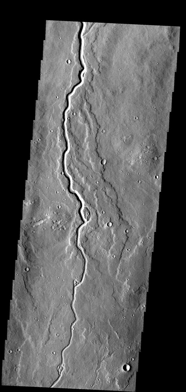
This lava channel is part of the Elysium Mons flows
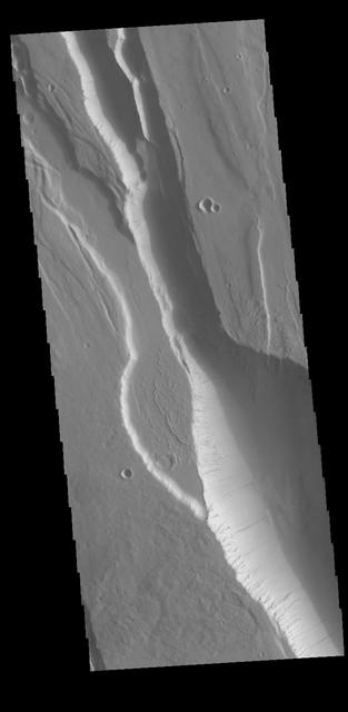
This fracture system is called Elysium Chasma. Located west of Elysium Mons, it is just one of many large fractures in the Elysium volcanic complex. Orbit Number: 77711 Latitude: 23.285 Longitude: 140.982 Instrument: VIS Captured: 2019-06-22 00:54 https://photojournal.jpl.nasa.gov/catalog/PIA23367

This fracture system, located southwest of Elysium Mons, is called Elysium Chasma. NASA Mars Odyssey captured this image on Sept. 15, 2010.

This VIS image shows the intersection between Elysium Chasma (vertical) and Hyblaeus Chamsa (horizontal). This fracture system is located southwest of Elysium Mons. These chasmata are just two of the many large fractures in the Elysium volcanic complex. These chasma are related to the volcanic activity that created Elysium Mons. Orbit Number: 85273 Latitude: 22.4383 Longitude: 141.433 Instrument: VIS Captured: 2021-03-05 16:38 https://photojournal.jpl.nasa.gov/catalog/PIA24773
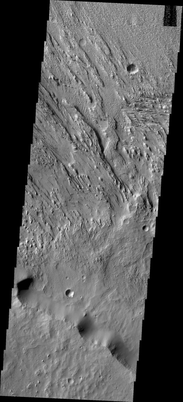
This image from NASA 2001 Mars Odyssey spacecraft shows two directions of wind erosion southwest of Olympus Mons and south of Elysium Mons.

The channels in this image captured by NASA 2001 Mars Odyssey spacecraft dissect the far western flank of the Elysium Mons highland.
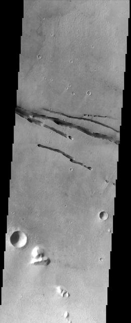
This image from NASA Mars Odyssey spacecraft shows fractures within the volcanic plains south of Elysium Mons.
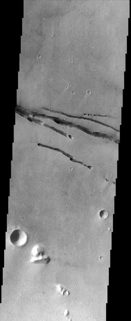
This image from NASA Mars Odyssey spacecraft shows fractures within the volcanic plains south of Elysium Mons.

The fractures in this image from NASA 2001 Mars Odyssey are located on the northwestern flank of the Elysium Mons volcanic complex.

Ituxi Vallis is a lava channel located on the eastern side of Elysium Mons in this image captured by NASA 2001 Mars Odyssey.
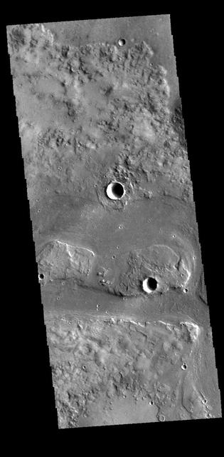
Today's VIS image shows a portion of Granicus Valles. This channel system is located west of Elysium Mons and likely was created by both lava and water flow related to the Elysium Mons volcanic complex. Orbit Number: 61084 Latitude: 28.5697 Longitude: 129.782 Instrument: VIS Captured: 2015-09-21 10:03 http://photojournal.jpl.nasa.gov/catalog/PIA20098
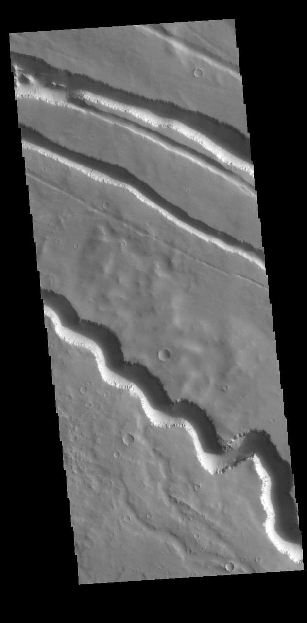
Today's VIS image contains a section of the many channel forms found radial to the Elysium Mons volcanic complex. In this case the fossae are located to the west of Elysium Mons. Elysium Fossae are comprised of both linear and sinuous channels, usually interpreted to have both fluid and tectonic forces playing a part in the formation. The linear depressions resemble grabens (formed by tectonic forces) and sinuous channel more closely resembles features caused by fluid flow – either lava or water created by melting subsurface ice due to volcanic heating. Orbit Number: 94994 Latitude: 25.539 Longitude: 136.625 Instrument: VIS Captured: 2023-05-15 02:45 https://photojournal.jpl.nasa.gov/catalog/PIA26227
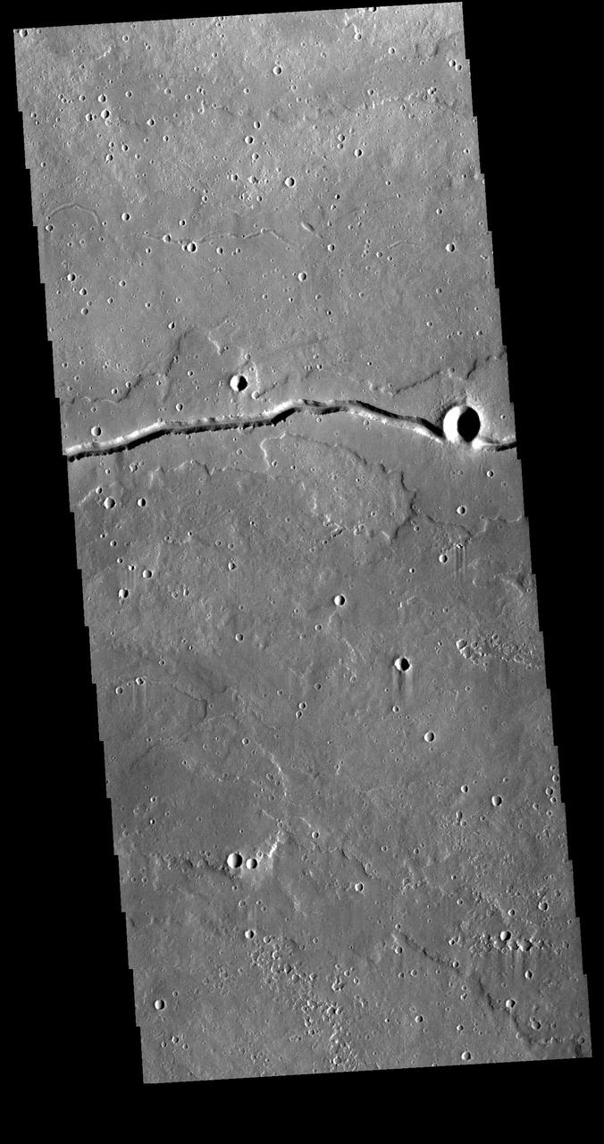
This VIS image shows a section of Patapsco Vallis, a channel located east of Elysium Mons. Patapsco Vallis, as other valley systems on the Elysium Mons volcanic complex, was likely formed by the flow of lava rather than water. Orbit Number: 81192 Latitude: 23.6547 Longitude: 153.166 Instrument: VIS Captured: 2020-04-03 16:07 https://photojournal.jpl.nasa.gov/catalog/PIA23937
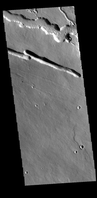
This VIS image is located west of Elysium Mons in the region called Elysium Fossae. The fossae are comprised of both linear and sinuous channels, usually interpreted to have both fluid and tectonic forces playing a part in the fossae formation. This image shows both channel types. Orbit Number: 77998 Latitude: 29.6423 Longitude: 139.454 Instrument: VIS Captured: 2019-07-15 16:09 https://photojournal.jpl.nasa.gov/catalog/PIA23416
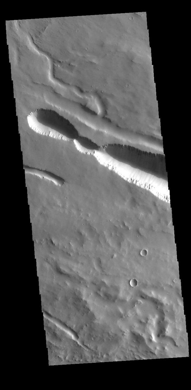
Today's VIS image contains a section of one of the many channel forms found radial to the Elysium Mons volcanic complex. In this case the fossae are located to the west of Elysium Mons. Elysium Fossae are comprised of both linear and sinuous channels, usually interpreted to have both fluid and tectonic forces playing a part in the formation. The linear depression resembles a graben (formed by tectonic forces) and sinuous channel more closely resembles features caused by fluid flow – either lava or water created by melting subsurface ice due to volcanic heating. Orbit Number: 94969 Latitude: 25.7616 Longitude: 137.829 Instrument: VIS Captured: 2023-05-13 01:21 https://photojournal.jpl.nasa.gov/catalog/PIA26223
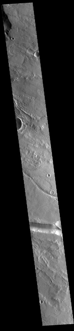
Today's VIS image contains a section of one of the many channel forms found radial to the Elysium Mons volcanic complex. In this case the fossae are located to the west of Elysium Mons. Elysium Fossae are comprised of both linear and sinuous channels, usually interpreted to have both fluid and tectonic forces playing a part in the formation. The linear depression resembles a graben (formed by tectonic forces) and sinuous channels more closely resembles features caused by fluid flow – either lava or water created by melting subsurface ice due to volcanic heating. Orbit Number: 93771 Latitude: 25.4228 Longitude: 138.846 Instrument: VIS Captured: 2023-02-03 09:57 https://photojournal.jpl.nasa.gov/catalog/PIA25876
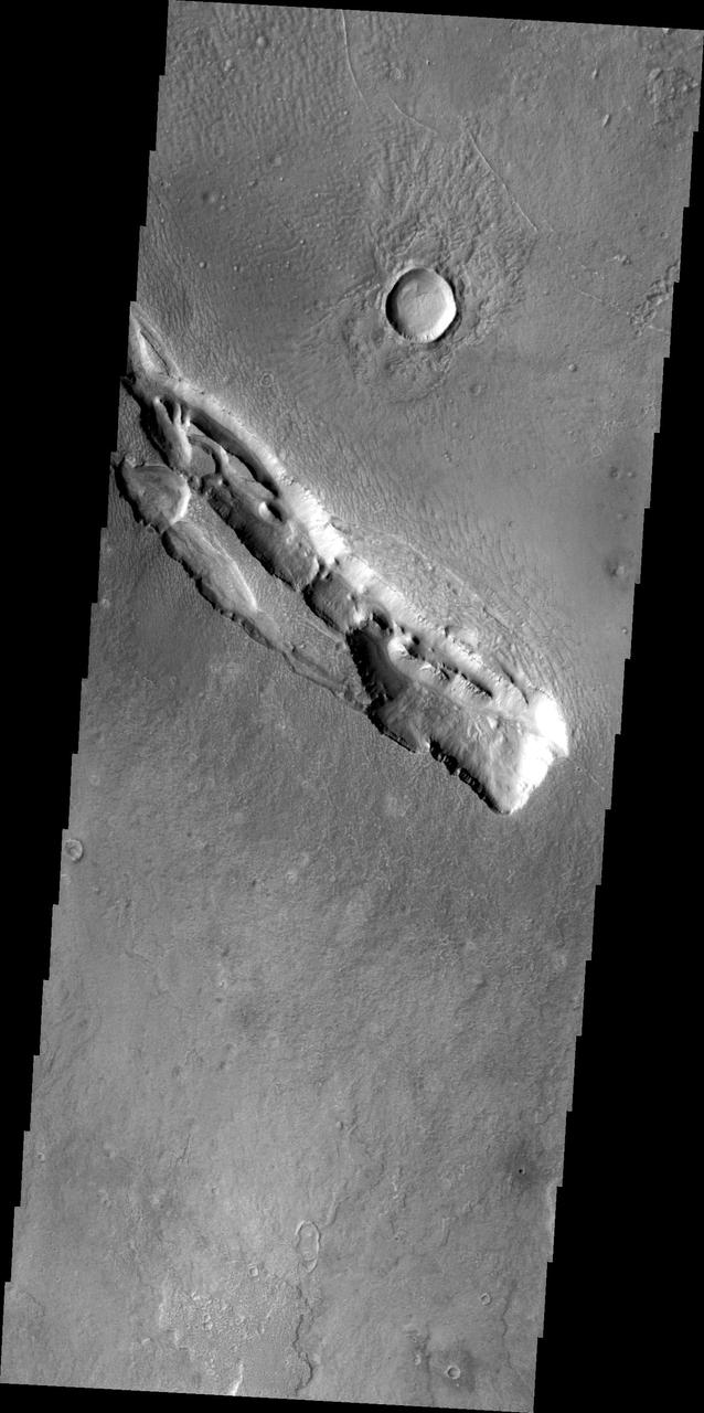
The fracture system in this image, captured by NASA 2001 Mars Odyssey, is part of Galaxias Fossae, a series of fractures on the northern part of the Elysium Mons volcanic complex.
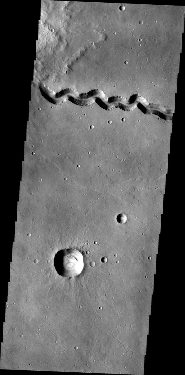
This image, taken by NASA 2001 Mars Odyssey spacecraft, shows a portion of Patapsco Vallis, a channel located on the eastern margin of Elysium Mons.
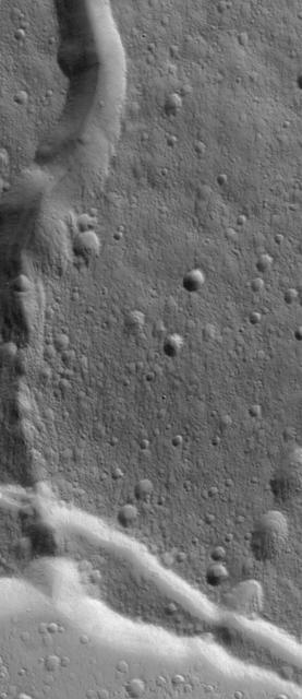
This Mars Global Surveyor MGS Mars Orbiter Camera MOC image shows a channel extending northward from the Elysium Mons caldera at the volcano summit
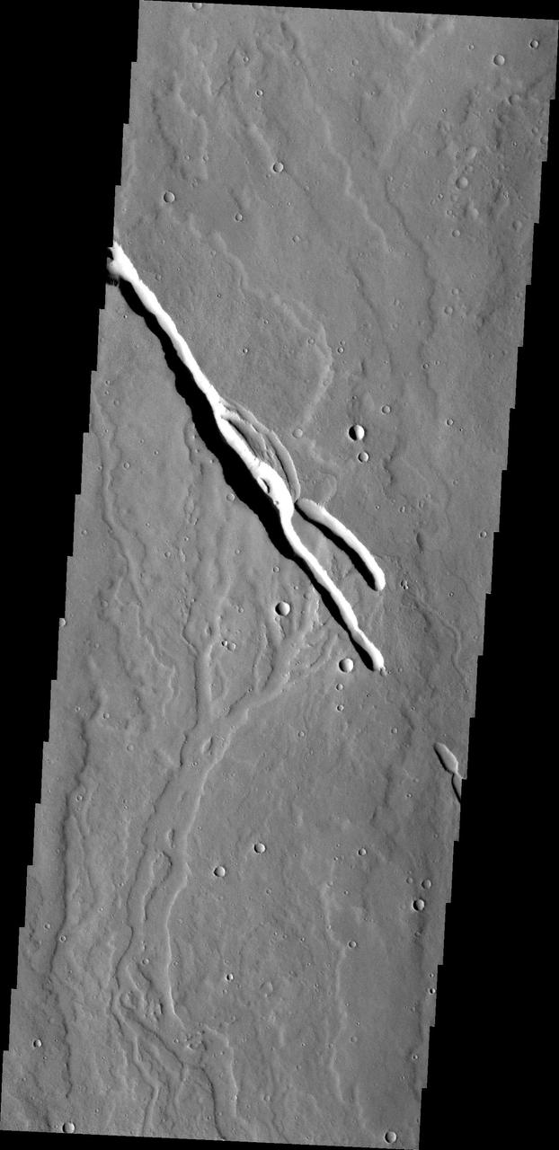
Located on the southern part of the Elysium Mons Volcanic region the channels in this image captured by NASA Mars Odyssey were likely formed by the flow of lava.

Located west of Elysium Mons, Hephaestus Fossae is a long, complex fracture system, as shown in this image captured by NASA 2001 Mars Odyssey spacecraft.
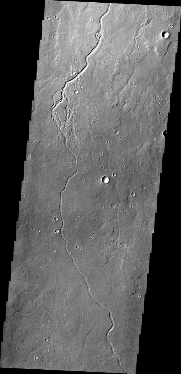
This image captured by NASA 2001 Mars Odyssey shows just one of many lava channels located on the Elysium Mons volcanic complex.
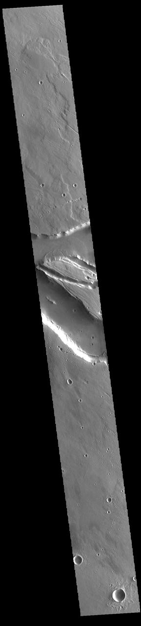
Today's VIS image contains a section of one of the many channel forms found radial to the Elysium Mons volcanic complex. In this case the fossae are located to the west of Elysium Mons. Elysium Fossae are comprised of both linear and sinuous channels, usually interpreted to have both fluid and tectonic forces playing a part in the formation. The linear depression resembles a graben (formed by tectonic forces) and sinuous channels more closely resembles features caused by fluid flow – either lava or water created by melting subsurface ice due to volcanic heating. The Elysium Fossae system is 1044 km (649 miles) in length. Orbit Number: 93983 Latitude: 27.1871 Longitude: 142.629 Instrument: VIS Captured: 2023-02-20 20:54 https://photojournal.jpl.nasa.gov/catalog/PIA25941
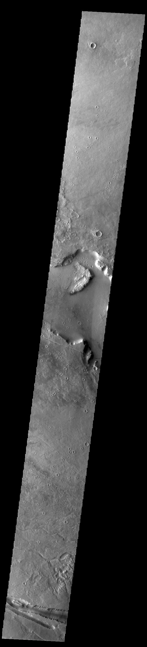
Today's VIS image contains a section of one of the many channel forms found radial to the Elysium Mons volcanic complex. In this case the fossae are located to the west of Elysium Mons. Elysium Fossae are comprised of both linear and sinuous channels, usually interpreted to have both fluid and tectonic forces playing a part in the formation. The linear depression resembles a graben (formed by tectonic forces) and sinuous channels more closely resembles features caused by fluid flow – either lava or water created by melting subsurface ice due to volcanic heating. The Elysium Fossae system is 1044 km (649 miles) in length. Orbit Number: 93802 Latitude: 27.5316 Longitude: 137.172 Instrument: VIS Captured: 2023-02-05 23:55 https://photojournal.jpl.nasa.gov/catalog/PIA25901
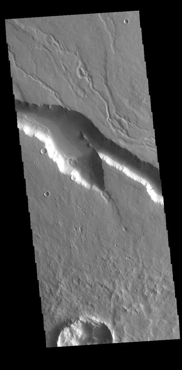
Today's VIS image contains a section of one of the many channel forms found radial to the Elysium Mons volcanic complex. In this case the fossae are located to the west of Elysium Mons. Elysium Fossae are comprised of both linear and sinuous channels, usually interpreted to have both fluid and tectonic forces playing a part in the formation. The linear depression resembles a graben (formed by tectonic forces) and sinuous channels more closely resembles features caused by fluid flow – either lava or water created by melting subsurface ice due to volcanic heating. The Elysium Fossae system is 1044 km (649 miles) in length. Orbit Number: 94320 Latitude: 29.5145 Longitude: 140.23 Instrument: VIS Captured: 2023-03-20 14:52 https://photojournal.jpl.nasa.gov/catalog/PIA26004
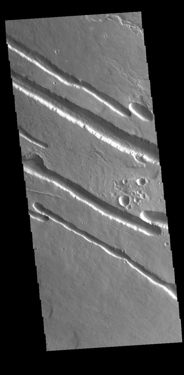
Today's VIS image contains a section of one of the many channel forms found radial to the Elysium Mons volcanic complex. In this case the fossae are located to the northwest of Elysium Mons. Elysium Fossae are comprised of both linear and sinuous channels, usually interpreted to have both fluid and tectonic forces playing a part in the formation. The linear depression resembles a graben (formed by tectonic forces) and sinuous channels more closely resembles features caused by fluid flow – either lava or water created by melting subsurface ice due to volcanic heating. The Elysium Fossae system is 1044 km (649 miles) in length. Orbit Number: 94058 Latitude: 29.9986 Longitude: 138.589 Instrument: VIS Captured: 2023-02-27 01:08 https://photojournal.jpl.nasa.gov/catalog/PIA25976
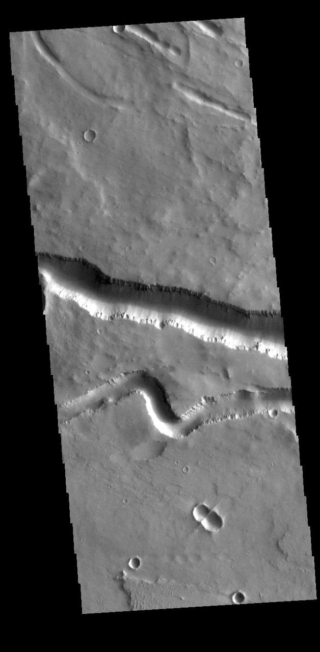
Today's VIS image contains sections of two of the many channel forms found radial to the Elysium Mons volcanic complex. In this case the fossae are located to the west of Elysium Mons. Elysium Fossae are comprised of both linear and sinuous channels, usually interpreted to have both fluid and tectonic forces playing a part in the formation. The linear depression resembles a graben (formed by tectonic forces) and sinuous channel more closely resembles features caused by fluid flow – either lava or water created by melting subsurface ice due to volcanic heating. The Elysium Fossae system is 1044 km (649 miles) in length. Orbit Number: 94395 Latitude: 25.0308 Longitude: 137.23 Instrument: VIS Captured: 2023-03-26 19:03 https://photojournal.jpl.nasa.gov/catalog/PIA26023

This image captured by NASA 2001 Mars Odyssey spacecraft shows where Patapsco Vallis enters the largest depression of Elysium Fossae. Patapsco Vallis, on the Elysium Mons volcanic complex, was likely formed by the flow of lava rather than water.
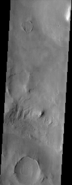
The larger craters in this image from NASA Mars Odyssey spacecraft showing a region north of Elysium Mons are buried and distorted almost beyond recognition. http://photojournal.jpl.nasa.gov/catalog/PIA04007

Today's VIS image shows part of Hyblaeus Fossae. Hyblaeus Fossae is located southwest of Elysium Mons and is just one of many tectonic graben located around the entire Elysium volcanic complex. Hyblaeus Fossae is 375 km (233 miles) long. Orbit Number: 85610 Latitude: 20.057 Longitude: 139.715 Instrument: VIS Captured: 2021-04-02 10:34 https://photojournal.jpl.nasa.gov/catalog/PIA24856
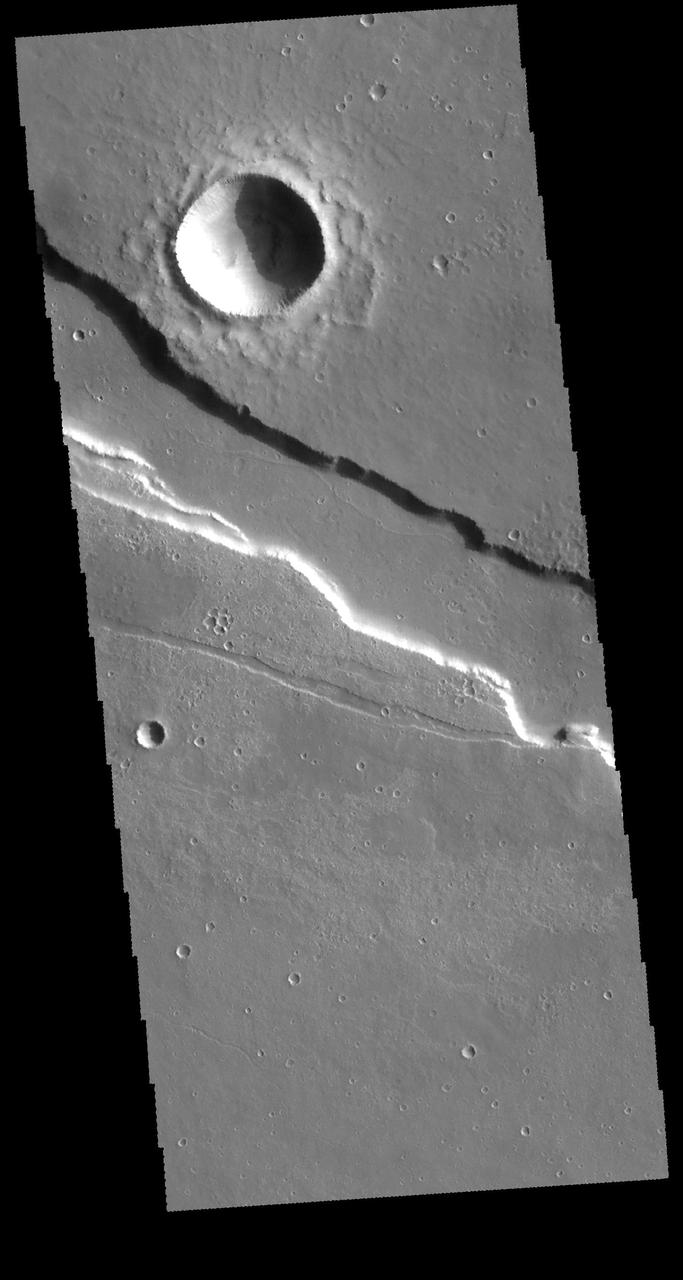
Located east of Elysium Mons, Elysium Fossae is a large tectonic graben. This image from NASA's 2001 Mars Odyssey spacecraft shows that lava may have flowed in the channel feature. Orbit Number: 61470 Latitude: 23.569 Longitude: 154.765 Instrument: VIS Captured: 2015-10-23 04:54 http://photojournal.jpl.nasa.gov/catalog/PIA20115
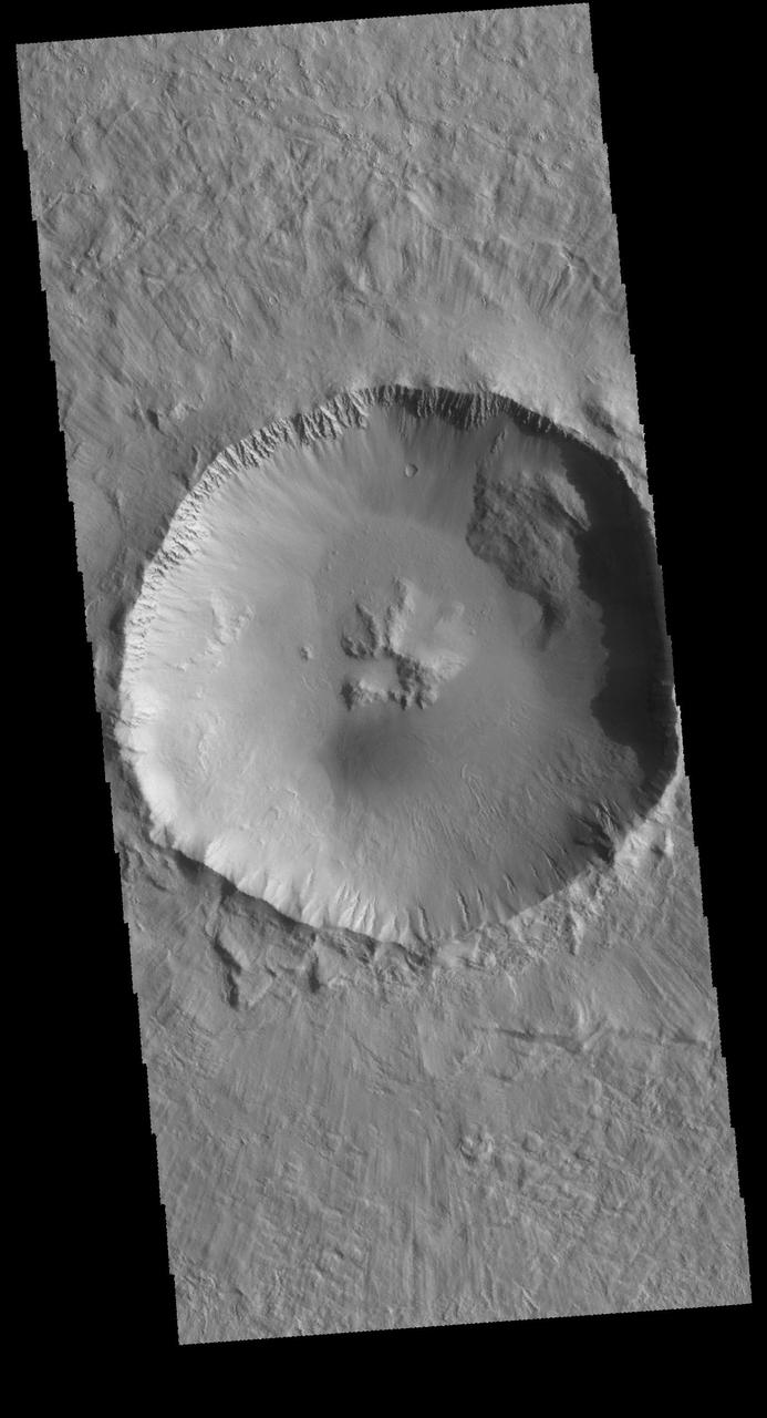
This image captured by NASA 2001 Mars Odyssey spacecraft shows an unnamed crater located northwest of Elysium Mons. This crater contains a central pit, which formed at the time of impact.

The channels in this image from NASA 2001 Mars Odyssey spacecraft are part of Granicus Valles. Granicus Valles is located just west of the Elysium Mons Volcanic Complex and was liked formed by the flow of lava rather than water.

Hrad Valles, seen in this image from NASA Mars Odyssey spacecraft, is located north-northwest of the large Elysium Mons volcanic complex and is yet another example of a channel that likely carried fluids.
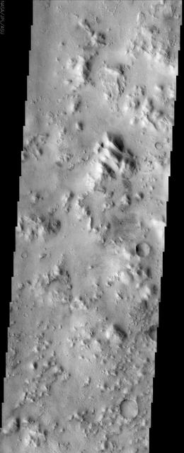
The Cerberus feature, imaged here by NASA Mars Odyssey, is a dark region at the southeastern edge of the huge Elysium Mons volcanic complex that was visible to early astronomers because it was a distinctive dark spot on a large bright region of Mars.
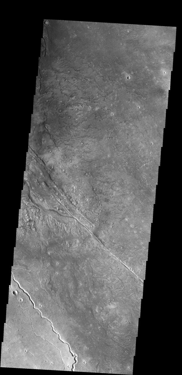
This image captured by NASA 2001 Mars Odyssey spacecraft shows several of the channels located in the Elysium Mons volcanic complex. It is likely that these channels were formed by lava flow rather than water.

The channel shown here is part of a large system of depressions located on the eastern side of the Elysium Mons volcanic complex. The depression in this image from NASA 2001 Mars Odyssey spacecraft is located just south of Albor Tholus.
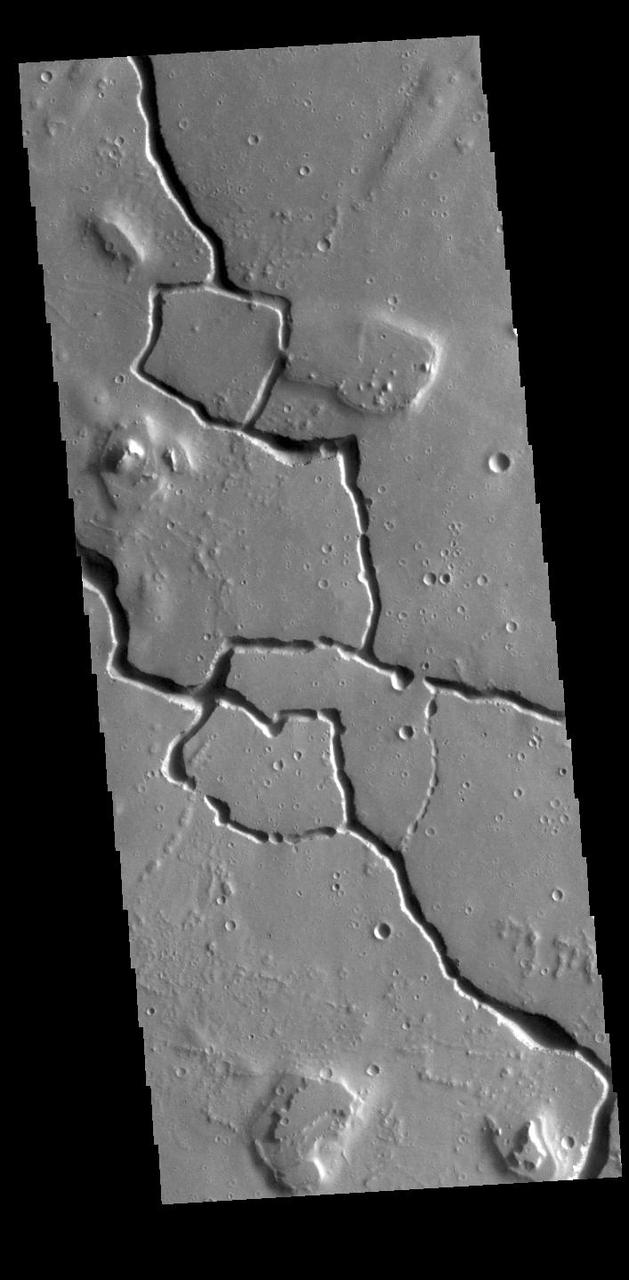
This VIS image shows part of Hephaestus Fossae. Hephaestus Fossae is a complex channel system in Utopia Planitia near Elysium Mons. Orbit Number: 94982 Latitude: 19.5692 Longitude: 123.658 Instrument: VIS Captured: 2023-05-14 03:00 https://photojournal.jpl.nasa.gov/catalog/PIA26225
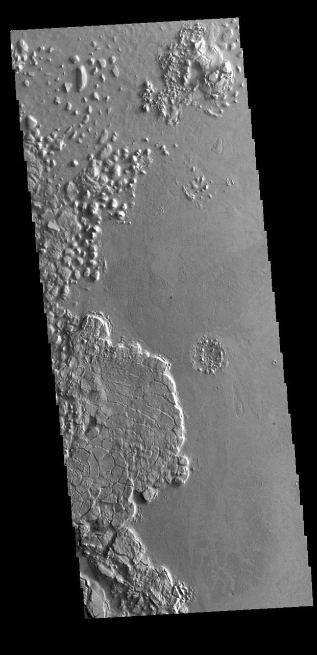
This region of arcuate (or curved) fractures is located north of Apollinaris Mons, on the margin with Elysium Planitia. Orbit Number: 86233 Latitude: -3.43549 Longitude: 170.087 Instrument: VIS Captured: 2021-05-23 17:33 https://photojournal.jpl.nasa.gov/catalog/PIA24229

This VIS image shows a section of Granicus Valles, one of several channel systems that originate near the western margin of the Elysium Mons volcanic complex. Orbit Number: 69466 Latitude: 28.3145 Longitude: 130.729 Instrument: VIS Captured: 2017-08-11 21:30 https://photojournal.jpl.nasa.gov/catalog/PIA22309
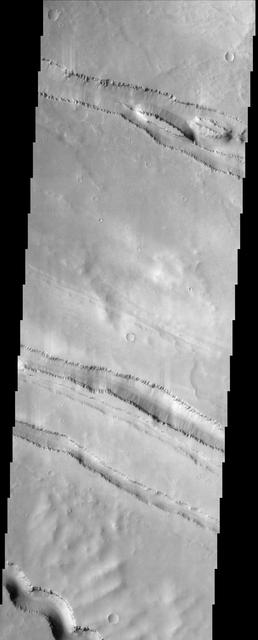
The grabens fractures that dominate this scene from NASA Mars Odyssey spacecraft are located northwest of a large shield volcano called Elysium Mons. Layered rock is evident along the lips of the graben as are ripples on the floors of these features. http://photojournal.jpl.nasa.gov/catalog/PIA04001

This VIS image shows a section of Granicus Valles. Granicus Valles is one of several channel systems the originate near Elysium Mons. Orbit Number: 69042 Latitude: 28.5329 Longitude: 130.626 Instrument: VIS Captured: 2017-07-07 23:05 https://photojournal.jpl.nasa.gov/catalog/PIA22306
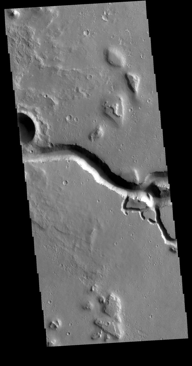
This VIS image is located in the southeastern portion of Hephaestus Fossae. Hephaestus Fossae is a complex channel system in Utopia Planitia near Elysium Mons. It has been proposed that the channel formed by the release of melted subsurface ice during the impact event that created a large crater west of this image. Additionally, the nearby Elysium volcanic center created subsurface heating that may have played a part in creating both Hephaestus Fossae and Hebrus Valles to the north. Hephaestus Fossae are over 600km long (373 miles). Orbit Number: 78847 Latitude: 17.5748 Longitude: 126.158 Instrument: VIS Captured: 2019-09-23 13:59 https://photojournal.jpl.nasa.gov/catalog/PIA23507
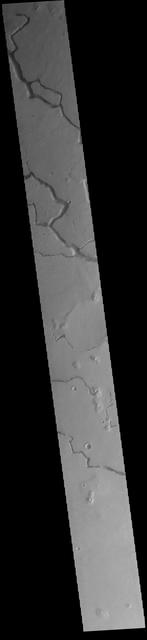
This VIS image is located in the central portion of Hephaestus Fossae. Hephaestus Fossae is a complex channel system in Utopia Planitia near Elysium Mons. It has been proposed that the channel formed by the release of melted subsurface ice during the impact event that created a large crater southeast of this image. Additionally, the nearby Elysium volcanic center created subsurface heating that may have played a part in creating both Hephaestus Fossae and Hebrus Valles to the north. Orbit Number: 82079 Latitude: 18.8004 Longitude: 124.5724 Instrument: VIS Captured: 2020-06-15 16:56 https://photojournal.jpl.nasa.gov/catalog/PIA24122
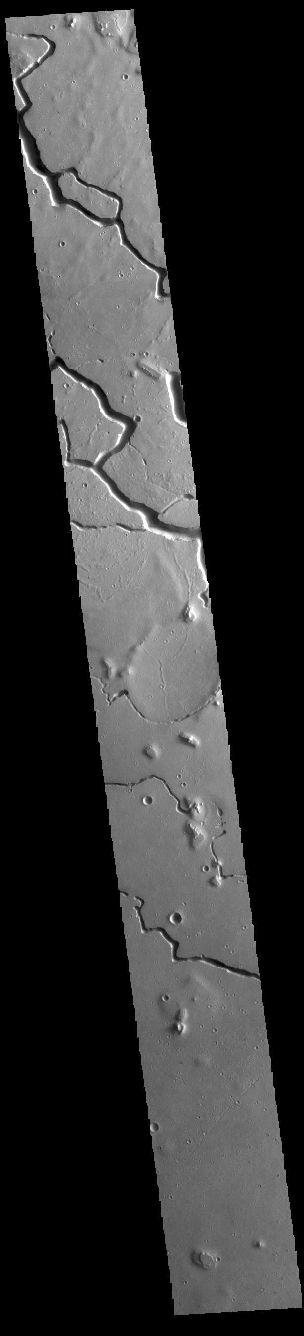
This VIS image is located in the central portion of Hephaestus Fossae. Hephaestus Fossae is a complex channel system in Utopia Planitia near Elysium Mons. It has been proposed that the channel formed by the release of melted subsurface ice during the impact event that created a large crater south of this image. Additionally, the nearby Elysium volcanic center created subsurface heating that may have played a part in creating both Hephaestus Fossae and Hebrus Valles to the north. Orbit Number: 77487 Latitude: 18.8111 Longitude: 124.593 Instrument: VIS Captured: 2019-06-03 14:10 https://photojournal.jpl.nasa.gov/catalog/PIA23335
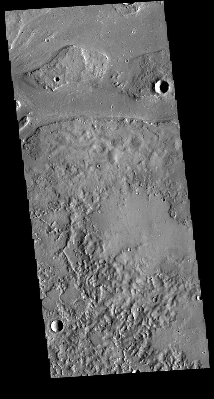
Granicus Valles is a complex channel system located west of Elysium Mons. The channel system is approximately 750km long. It is likely that both water and lava played a part in creating the channel. Orbit Number: 81068 Latitude: 28.2056 Longitude: 129.737 Instrument: VIS Captured: 2020-03-24 11:07 https://photojournal.jpl.nasa.gov/catalog/PIA23934

Towards the top of this image from NASA 2001 Mars Odyssey spacecraft is a T shaped depression and two sections of narrow channel located on the northeast part of the Elysium Mons volcanic complex. Fluids like water, or lava flow downhill.
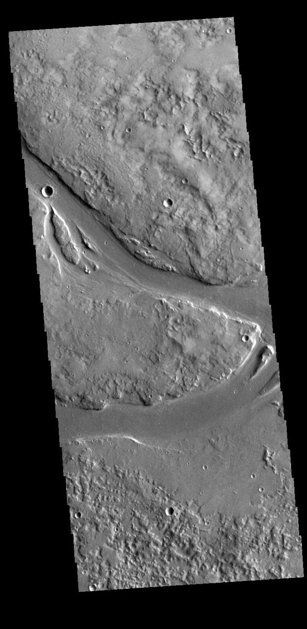
This VIS image shows part of Granicus Valles. Granicus Valles is a complex channel system located west of Elysium Mons. The system is approximately 750km (466 miles) long. It is likely that both water and lava played a part in creation of the feature. Orbit Number: 94545 Latitude: 28.4791 Longitude: 129.351 Instrument: VIS Captured: 2023-04-08 03:29 https://photojournal.jpl.nasa.gov/catalog/PIA26033
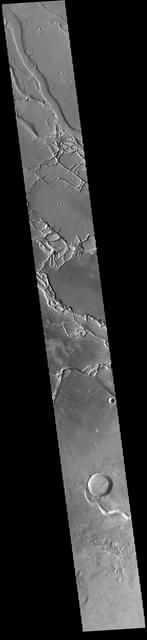
This VIS image shows many of the channel segments of Granicus Valles. Granicus Valles is a complex channel system located west of Elysium Mons. The system is approximately 750km long. It is likely that both water and lava played a part in creation of the feature. Orbit Number: 81542 Latitude: 26.6111 Longitude: 135.512 Instrument: VIS Captured: 2020-05-02 11:47 https://photojournal.jpl.nasa.gov/catalog/PIA23994
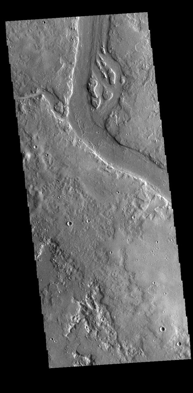
This VIS image shows many of the channel segments of Granicus Valles. Granicus Valles is a complex channel system located west of Elysium Mons. The system is approximately 750km (466 miles) long. It is likely that both water and lava played a part in creation of the feature. Orbit Number: 85523 Latitude: 29.3053 Longitude: 128.19 Instrument: VIS Captured: 2021-03-26 06:42 https://photojournal.jpl.nasa.gov/catalog/PIA24829
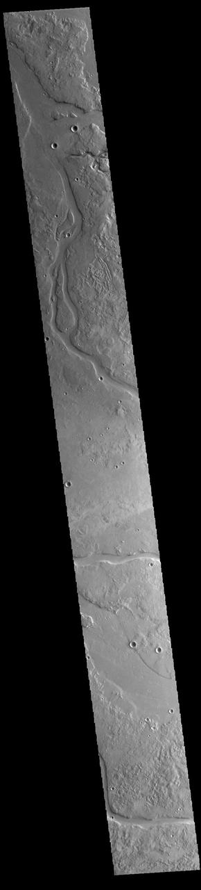
This VIS image shows many of the channel segments of Granicus Valles. Granicus Valles is a complex channel system located west of Elysium Mons. The system is approximately 750km long. It is likely that both water and lava played a part in creation of the feature. Orbit Number: 93896 Latitude: 28.5809 Longitude: 132.256 Instrument: VIS Captured: 2023-02-13 16:59 https://photojournal.jpl.nasa.gov/catalog/PIA25906
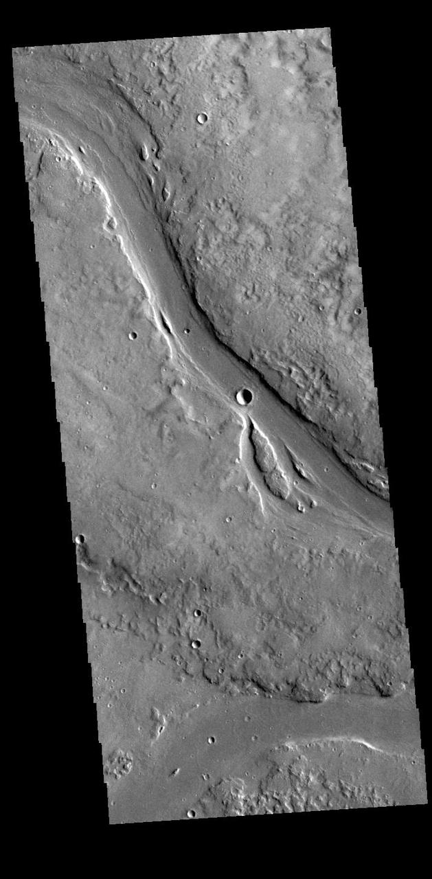
This VIS image shows two of the channel segments of Granicus Valles. Granicus Valles is a complex channel system located west of Elysium Mons. The system is approximately 750km long. It is likely that both water and lava played a part in creation of the feature. Orbit Number: 88156 Latitude: 28.6099 Longitude: 129.149 Instrument: VIS Captured: 2021-10-29 01:49 https://photojournal.jpl.nasa.gov/catalog/PIA25127
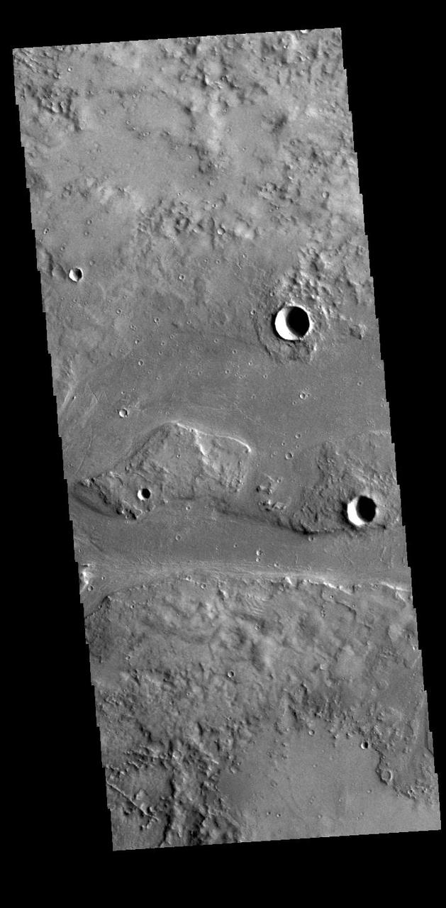
This VIS image shows part of Granicus Valles. Granicus Valles is a complex channel system located west of Elysium Mons. The system is approximately 750km (466 miles) long. It is likely that both water and lava played a part in creation of the feature. Orbit Number: 94832 Latitude: 28.5187 Longitude: 217.227 Instrument: VIS Captured: 2023-05-01 18:38 https://photojournal.jpl.nasa.gov/catalog/PIA26193
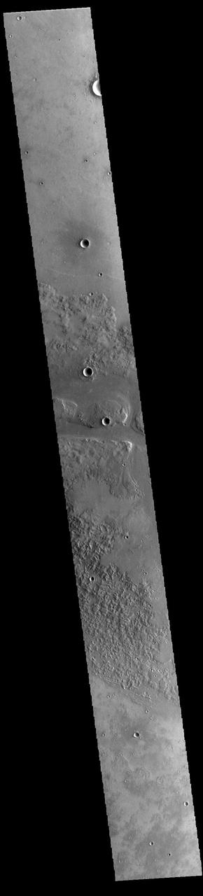
This VIS image shows one of the channels that comprise Granicus Valles. Granicus Valles is a complex channel system located west of Elysium Mons. The system is approximately 750km long (466 miles). It is likely that both water and lava played a part in creation of the feature. Orbit Number: 93946 Latitude: 28.3677 Longitude: 129.844 Instrument: VIS Captured: 2023-02-17 19:48 https://photojournal.jpl.nasa.gov/catalog/PIA25934
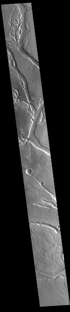
This VIS image shows many of the channel segments of Granicus Valles. Granicus Valles is a complex channel system located west of Elysium Mons. The system is approximately 750km long. It is likely that both water and lava played a part in creation of these features. Orbit Number: 85373 Latitude: 26.3625 Longitude: 135.996 Instrument: VIS Captured: 2021-03-13 22:16 https://photojournal.jpl.nasa.gov/catalog/PIA24779
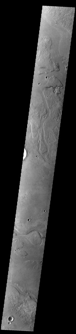
This VIS image shows many of the channel segments of Granicus Valles. Granicus Valles is a complex channel system located west of Elysium Mons. The system is approximately 750km long. It is likely that both water and lava played a part in creation of the feature. Orbit Number: 93615 Latitude: 28.8116 Longitude: 132.055 Instrument: VIS Captured: 2023-01-21 14:23 https://photojournal.jpl.nasa.gov/catalog/PIA25871
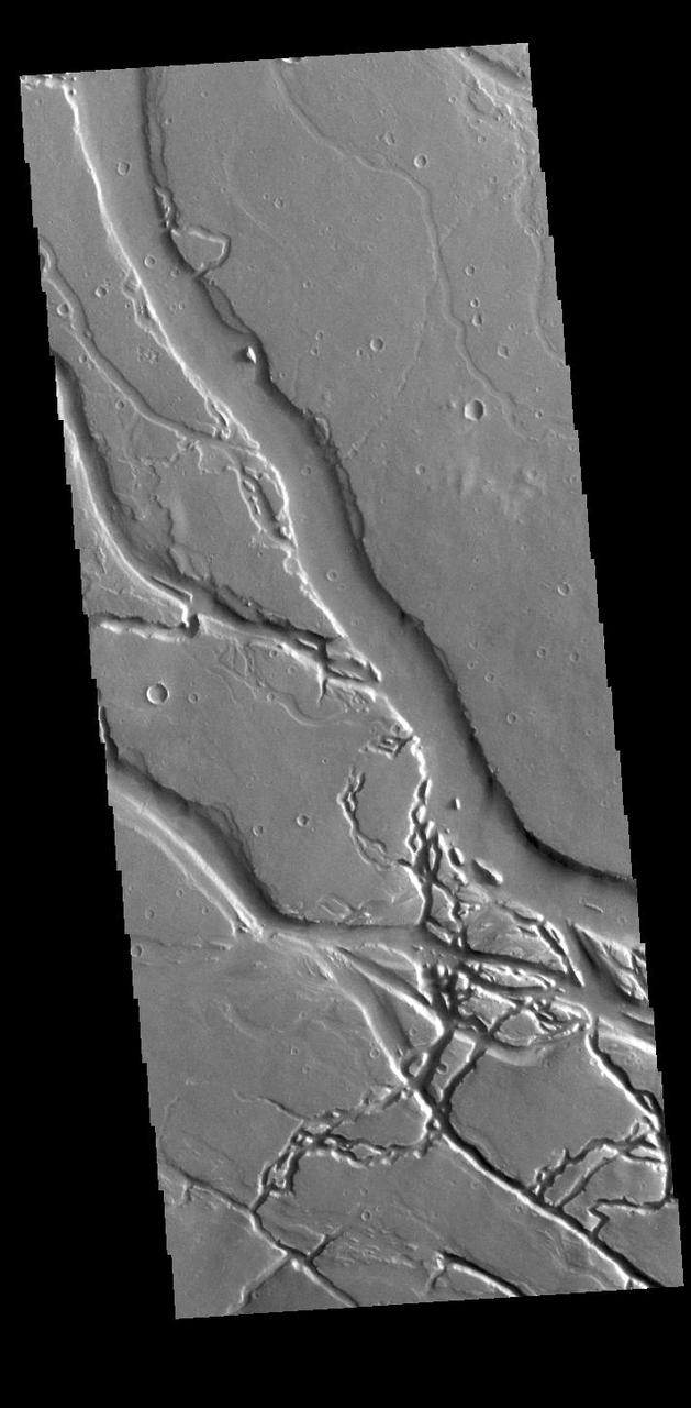
This VIS image shows many of the channel segments of Granicus Valles. Granicus Valles is a complex channel system located west of Elysium Mons. The system is approximately 750km long. It is likely that both water and lava played a part in creation of the feature. Orbit Number: 85972 Latitude: 27.7058 Longitude: 135.363 Instrument: VIS Captured: 2021-05-02 05:58 https://photojournal.jpl.nasa.gov/catalog/PIA24215
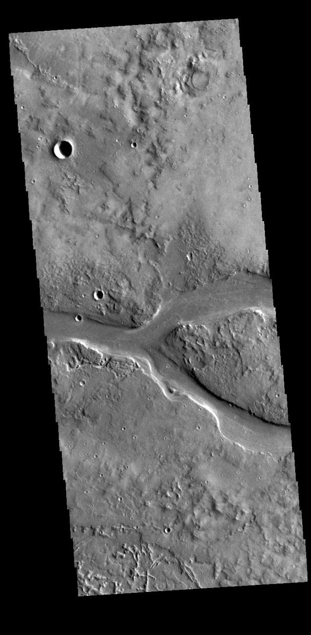
This VIS image shows part of Granicus Valles. Granicus Valles is a complex channel system located west of Elysium Mons. The system is approximately 750km long (466 miles). It is likely that both water and lava played a part in creation of the feature. Orbit Number: 94807 Latitude: 28.4465 Longitude: 130.95 Instrument: VIS Captured: 2023-04-29 17:14 https://photojournal.jpl.nasa.gov/catalog/PIA26174
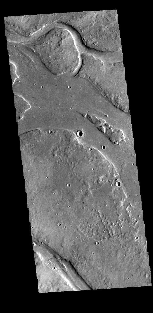
This VIS image shows many of the channel segments of Granicus Valles. Granicus Valles is a complex channel system located west of Elysium Mons. The system is approximately 750km long. It is likely that both water and lava played a part in creation of the feature. Orbit Number: 89541 Latitude: 27.8744 Longitude: 132.073 Instrument: VIS Captured: 2022-02-20 02:50 https://photojournal.jpl.nasa.gov/catalog/PIA25378
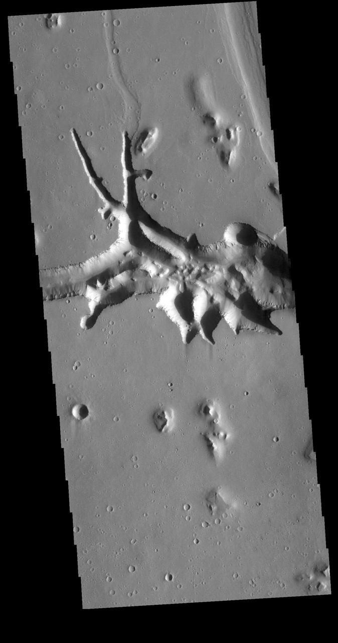
This VIS image is located at the eastern end of Hephaestus Fossae. Hephaestus Fossae is a channel system in Utopia Planitia near Elysium Mons. It has been proposed that the channel formed by the release of melted subsurface ice during the impact event that created a large crater west of this image. The method of formation for this complex feature at end of the channel is still unknown. Orbit Number: 72659 Latitude: 17.3167 Longitude: 126.988 Instrument: VIS Captured: 2018-05-01 22:42 https://photojournal.jpl.nasa.gov/catalog/PIA22621
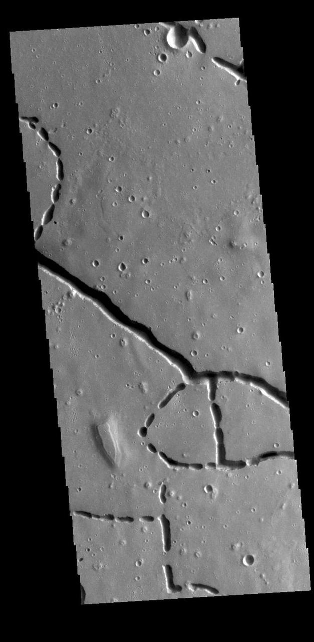
This VIS image is located in the northern portion of Hephaestus Fossae. Hephaestus Fossae is a complex channel system in Utopia Planitia near Elysium Mons. It has been proposed that the channels formed by the release of melted subsurface ice during the impact event that created a large crater southeast of this image. Additionally, the nearby Elysium volcanic center created subsurface heating that may have played a part in creating both Hephaestus Fossae and Hebrus Valles to the north. The right angle intersections indicate there is some tectonic activity in the region, and the circular depressions indicate surface collapse into subsurface voids. Hephaestus Fossae is a very complex set of features. Orbit Number: 85960 Latitude: 21.3916 Longitude: 122.454 Instrument: VIS Captured: 2021-05-01 06:13 https://photojournal.jpl.nasa.gov/catalog/PIA24212
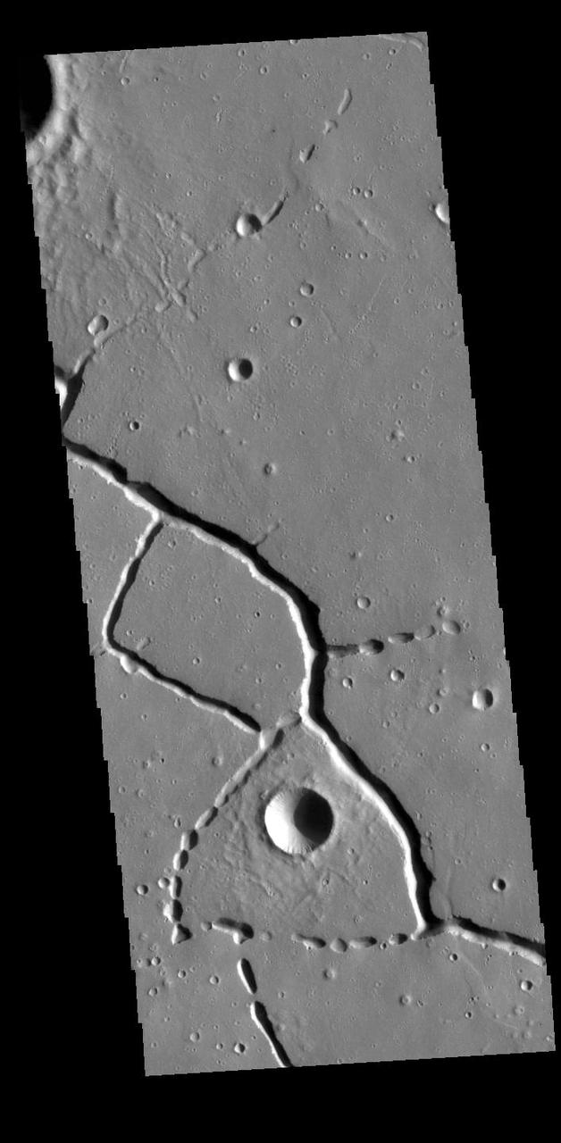
This VIS image is located in the northern portion of Hephaestus Fossae. Hephaestus Fossae is a complex channel system in Utopia Planitia near Elysium Mons. It has been proposed that the channels formed by the release of melted subsurface ice during the impact event that created a large crater southeast of this image. Additionally, the nearby Elysium volcanic center created subsurface heating that may have played a part in creating both Hephaestus Fossae and Hebrus Valles to the north. The right angle intersections indicate there is some tectonic activity in the region, and the circular depressions indicate surface collapse into subsurface voids. Hephaestus Fossae is a very complex set of features. Orbit Number: 88618 Latitude: 22.2991 Longitude: 121.441 Instrument: VIS Captured: 2021-12-06 02:47 https://photojournal.jpl.nasa.gov/catalog/PIA25199
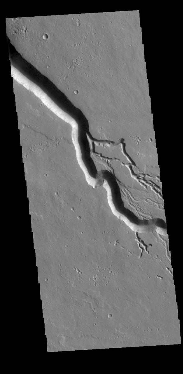
Today's VIS image contains a section of one of the many channel forms found radial to the Elysium Mons volcanic complex. In this case the fossae is located to the southeast of the volcano. The channel feature is thought to have both a tectonic and volcanic origin. The linear depression at the upper left of the image resembles a graben (formed by tectonic forces) and the smaller sinuous channels below the large linear depression more closely resemble features caused by fluid flow – either lava or water created by melting subsurface ice by volcanic heating. The linear depression is called Elysium Fossae, and the sinuous channel is called Iberus Vallis. Iberus Vallis is 87 km long (54 miles). Orbit Number: 88018 Latitude: 21.5352 Longitude: 151.454 Instrument: VIS Captured: 2021-10-17 17:04 https://photojournal.jpl.nasa.gov/catalog/PIA25110
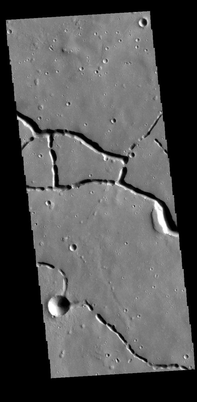
This VIS image is located in the northern portion of Hephaestus Fossae. Hephaestus Fossae is a complex channel system in Utopia Planitia near Elysium Mons. It has been proposed that the channels formed by the release of melted subsurface ice during the impact event that created a large crater southeast of this image. Additionally, the nearby Elysium volcanic center created subsurface heating that may have played a part in creating both Hephaestus Fossae and Hebrus Valles to the north. The right angle intersections indicate there is some tectonic activity in the region, and the circular depressions indicate surface collapse into subsurface voids. Hephaestus Fossae is a very complex set of features. Orbit Number: 88019 Latitude: 21.1587 Longitude: 122.646 Instrument: VIS Captured: 2021-10-17 19:02 https://photojournal.jpl.nasa.gov/catalog/PIA25111
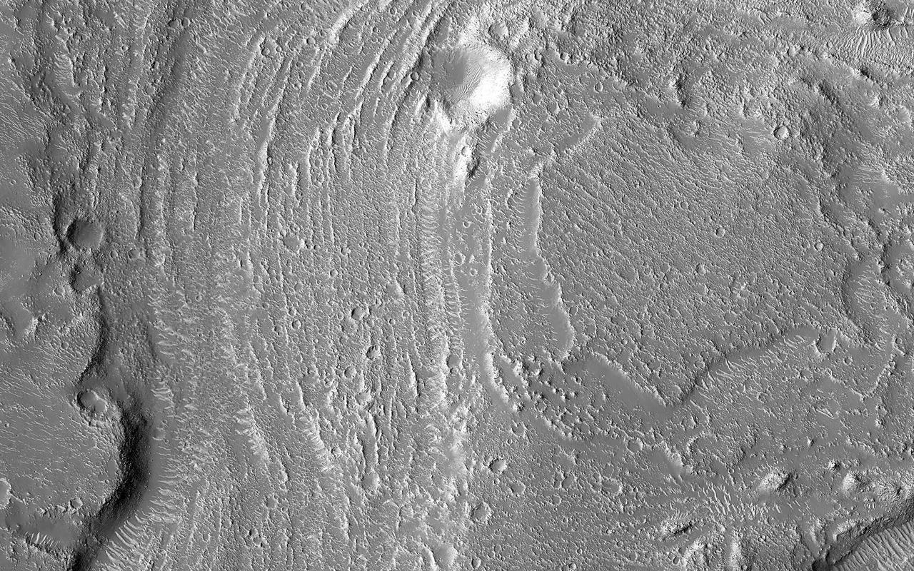
Granicus Valles form a low-lying complex of channel systems located west of the volcano Elysium Mons. They are one of several larger systems known as outflow channels because the water source is from the subsurface. In this case, Granicus Valles emanate from a series of fractures on the western flank of Elysium Mons. In this image, large, streamlined features and grooves have been carved by enormous water volumes into the floor of Granicus and point to the direction of flow towards the northwest. The floods of Granicus Valles are thought to have formed later in Mars history during the Amazonian epoch, several billion years ago. https://photojournal.jpl.nasa.gov/catalog/PIA25990
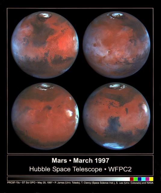
This photograph depicts four Mars views in northern summer provided by the Hubble Space Telescope (HST). The upper left view is centered on Ares Valles where Pathfinder landed in July 1997. Upper right is the Tharsis volcanic region and its associated cloud in the western half of the view. Olympus Mons lies near the western limb, Arsi Mons, Pavonis Mons Ascraeus Mons are to the west of the the center, and Valles Marineris is to the east. The lower Left view shows the Elysium volcanic region in the west, the Tharsis volcanos in East, and Cerberus is left of the center. In the lower right view, the Dark Syrtis Major region, Eysium Mons and Hellas are featured.
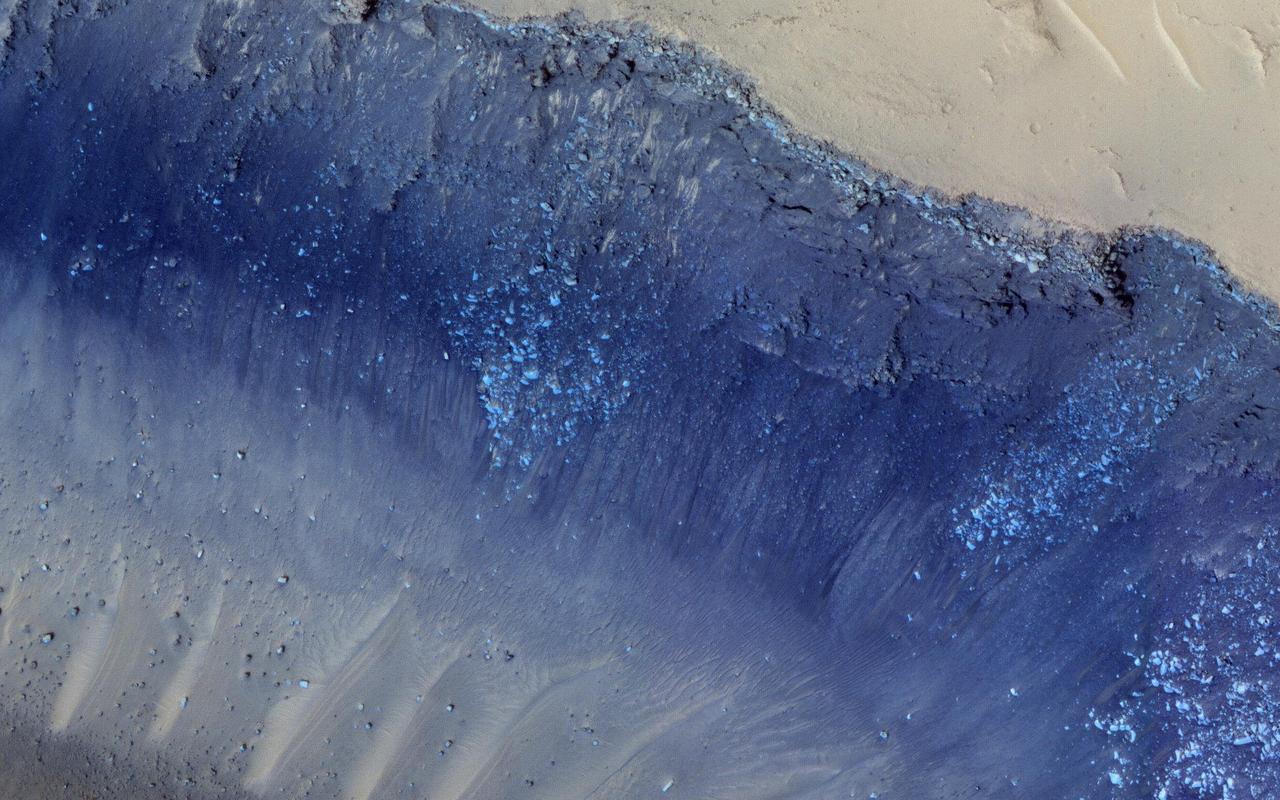
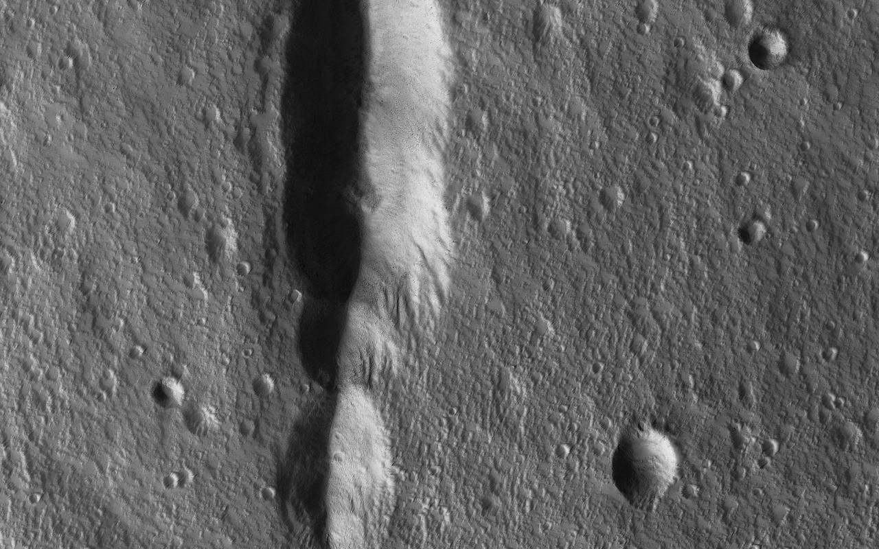
Cerberus Fossae is a steep-sided set of troughs cutting volcanic plains to the east of Elysium Mons. Steep slopes on Mars have active landslides (also called "mass wasting"), and here we see evidence for two types of activity. First, the light bluish boulders on the slope appear to originate at a layer of bedrock (also light blue) near the top of the section. Second, the dark thin lines are recurring slope lineae, probably also due to mass wasting, but composed of finer-grained materials. https://photojournal.jpl.nasa.gov/catalog/PIA23182

This VIS image shows a section of Granicus Valles, one of several channel systems that originate near the western margin of the Elysium Mons volcanic complex. The channel system is approximately 750 km (466 miles) long. It is likely that both water and lava played a part in creating the channel. Orbit Number: 80107 Latitude: 26.9142 Longitude: 133.873 Instrument: VIS Captured: 2020-01-05 08:02 https://photojournal.jpl.nasa.gov/catalog/PIA23755
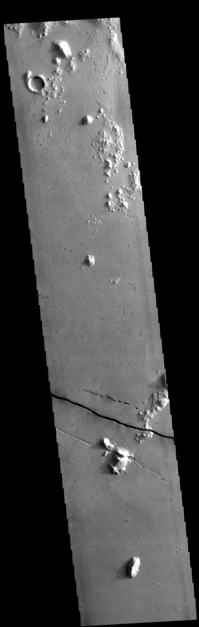
Today's VIS image shows a section of Cerberus Fossae. Cerberus Fossae are located in Elysium Planitia, southeast of the Elysium Mons volcanic complex. The linear features in the image are tectonic graben. Graben are formed by extension of the crust and faulting. When large amounts of pressure or tension are applied to rocks on timescales that are fast enough that the rock cannot respond by deforming, the rock breaks along faults. In the case of a graben, two parallel faults are formed by extension of the crust and the rock in between the faults drops downward into the space created by the extension. Numerous sets of graben are visible in this THEMIS image, trending from north-northwest to south-southeast. Because the faults defining the graben are formed perpendicular to the direction of the applied stress, we know that extensional forces were pulling the crust apart in the east-northeast/west-southwest direction. The Cerberus Fossae graben are sources of both channels and significant volcanic flows. Cerberus Fossae cuts across features such as hills, indicating the relative youth of the tectonic activity. Orbit Number: 94781 Latitude: 8.95114 Longitude: 163.746 Instrument: VIS Captured: 2023-04-27 13:44 https://photojournal.jpl.nasa.gov/catalog/PIA26156
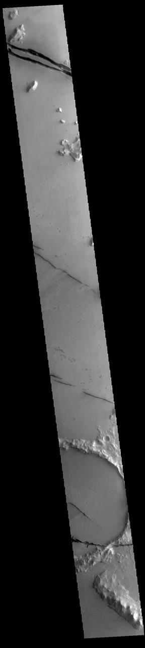
Today's VIS image shows a section of Cerberus Fossae. Cerberus Fossae are located in Elysium Planitia, southeast of the Elysium Mons volcanic complex. The linear features in the image are tectonic graben. Graben are formed by extension of the crust and faulting. When large amounts of pressure or tension are applied to rocks on timescales that are fast enough that the rock cannot respond by deforming, the rock breaks along faults. In the case of a graben, two parallel faults are formed by extension of the crust and the rock in between the faults drops downward into the space created by the extension. Numerous sets of graben are visible in this THEMIS image, trending from north-northwest to south-southeast. Because the faults defining the graben are formed perpendicular to the direction of the applied stress, we know that extensional forces were pulling the crust apart in the east-northeast/west-southwest direction. The Cerberus Fossae graben are sources of both channels and significant volcanic flows. Cerberus Fossae cuts across features such as hills, indicating the relative youth of the tectonic activity. Orbit Number: 93945 Latitude: 8.24256 Longitude: 161.492 Instrument: VIS Captured: 2023-02-17 17:42 https://photojournal.jpl.nasa.gov/catalog/PIA25933
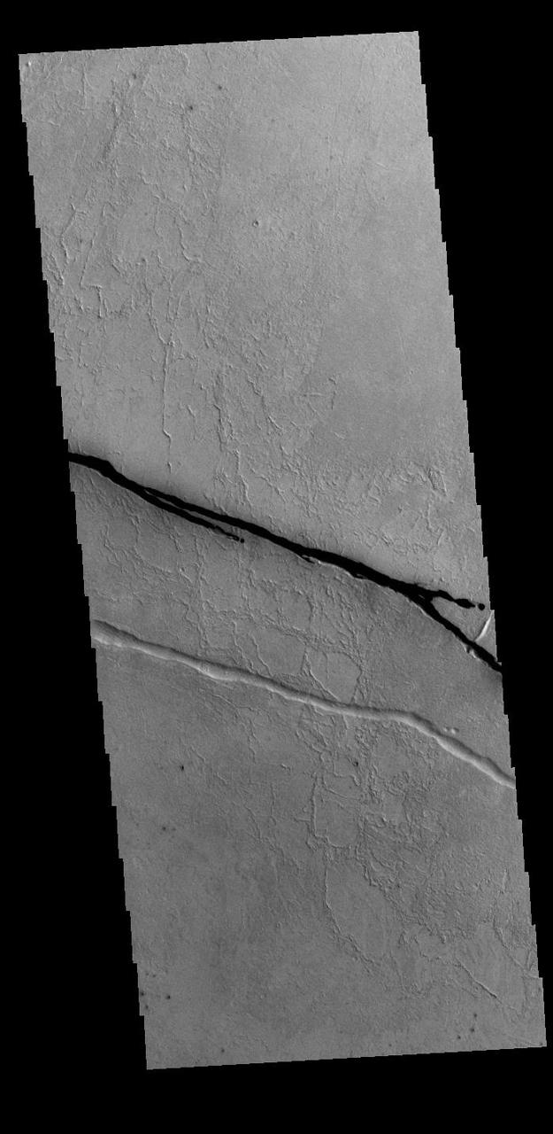
Today's VIS image shows a section of Cerberus Fossae. Cerberus Fossae are located in Elysium Planitia, southeast of the Elysium Mons volcanic complex. The linear features in the image are tectonic graben. Graben are formed by extension of the crust and faulting. When large amounts of pressure or tension are applied to rocks on timescales that are fast enough that the rock cannot respond by deforming, the rock breaks along faults. In the case of a graben, two parallel faults are formed by extension of the crust and the rock in between the faults drops downward into the space created by the extension. Two graben are visible in this THEMIS image, trending from west-northwest to east-southeast. Because the faults defining the graben are formed perpendicular to the direction of the applied stress, we know that extensional forces were pulling the crust apart in the north-northeast/south-southwest direction. The Cerberus Fossae graben are sources of both channels and significant volcanic flows. The rough surface around the graben is thought to be volcanic flows. Cerberus Fossae cuts across features such as hills, indicating the relative youth of the tectonic activity. Orbit Number: 94494 Latitude: 8.856 Longitude: 163.378 Instrument: VIS Captured: 2023-04-03 22:36 https://photojournal.jpl.nasa.gov/catalog/PIA26031
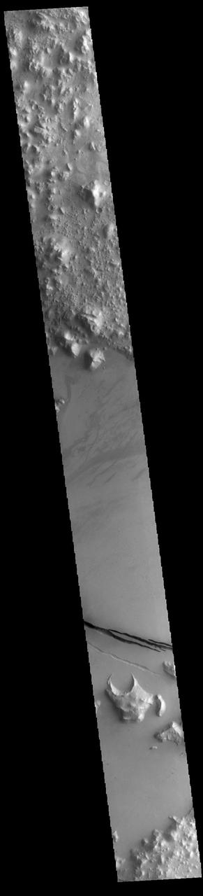
Today's VIS image shows a section of Cerberus Fossae. Cerberus Fossae are located in Elysium Planitia, southeast of the Elysium Mons volcanic complex. The linear features in the image are tectonic graben. Graben are formed by extension of the crust and faulting. When large amounts of pressure or tension are applied to rocks on timescales that are fast enough that the rock cannot respond by deforming, the rock breaks along faults. In the case of a graben, two parallel faults are formed by extension of the crust and the rock in between the faults drops downward into the space created by the extension. Several sets of graben are visible in this THEMIS image, trending from west-northwest to east-southeast. Because the faults defining the graben are formed perpendicular to the direction of the applied stress, we know that extensional forces were pulling the crust apart in the north-northeast/south-southwest direction. The Cerberus Fossae graben are sources of both channels and significant volcanic flows. Cerberus Fossae cuts across features such as hills, indicating the relative youth of the tectonic activity. The Cerberus Fossae system is 1235km (767 miles) long. Orbit Number: 94232 Latitude: 10.1207 Longitude: 161.626 Instrument: VIS Captured: 2023-03-13 08:52 https://photojournal.jpl.nasa.gov/catalog/PIA25999
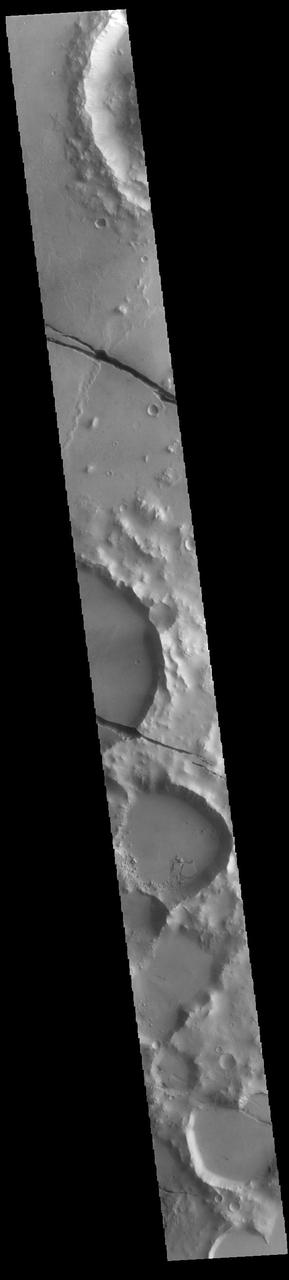
Today's VIS image shows a section of Cerberus Fossae. Cerberus Fossae are located in Elysium Planitia, southeast of the Elysium Mons volcanic complex. The linear features in the image are tectonic graben. Graben are formed by extension of the crust and faulting. When large amounts of pressure or tension are applied to rocks on timescales that are fast enough that the rock cannot respond by deforming, the rock breaks along faults. In the case of a graben, two parallel faults are formed by extension of the crust and the rock in between the faults drops downward into the space created by the extension. Numerous sets of graben are visible in this THEMIS image, trending from north-northwest to south-southeast. Because the faults defining the graben are formed perpendicular to the direction of the applied stress, we know that extensional forces were pulling the crust apart in the east-northeast/west-southwest direction. The Cerberus Fossae graben are sources of both channels and significant volcanic flows. Cerberus Fossae cuts across features such as hills, indicating the relative youth of the tectonic activity. The Cerberus Fossae system is 1235km (767 miles) long. Orbit Number: 94282 Latitude: 9.86336 Longitude: 159.223 Instrument: VIS Captured: 2023-03-17 11:40 https://photojournal.jpl.nasa.gov/catalog/PIA26000
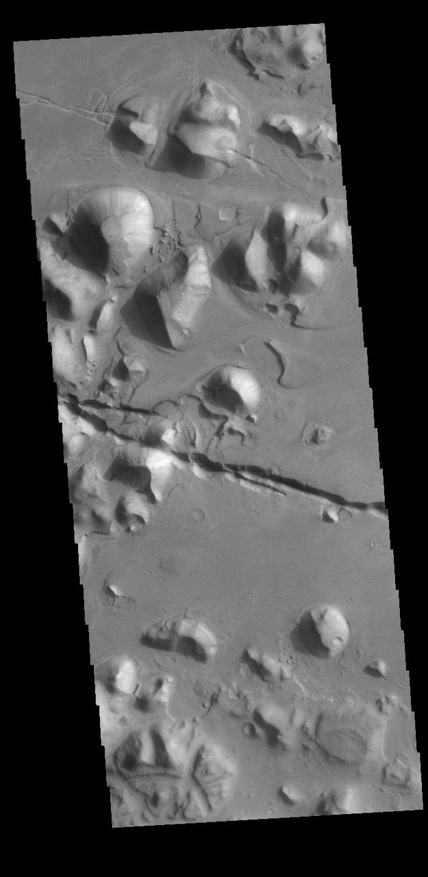
The linear depressions in the middle of this VIS image are graben called Cerberus Fossae. Graben form where extensional tectonic forces allows blocks of material to subside between paired faults. Cerberus Fossae are located in Elysium Planitia, southeast of the Elysium Mons volcanic complex. Orbit Number: 87793 Latitude: 15.3137 Longitude: 163.349 Instrument: VIS Captured: 2021-09-29 04:24 https://photojournal.jpl.nasa.gov/catalog/PIA25292
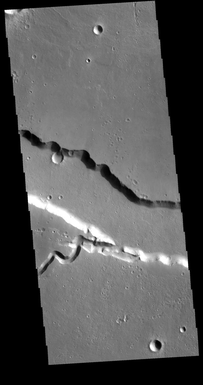
Today's VIS image contains a section of one of the many channel forms found radial to the Elysium Mons volcanic complex. In this case the fossae is located to the east of the volcano. The channel features are thought to have both a tectonic and volcanic origin. The linear depression resembles a graben (formed by tectonic forces) and the smaller sinuous channel below the large linear depression more closely resembles features caused by fluid flow — either lava or water created by melting subsurface ice by volcanic heating. Orbit Number: 79133 Latitude: 23.9518 Longitude: 153.966 Instrument: VIS Captured: 2019-10-17 03:13 https://photojournal.jpl.nasa.gov/catalog/PIA23571
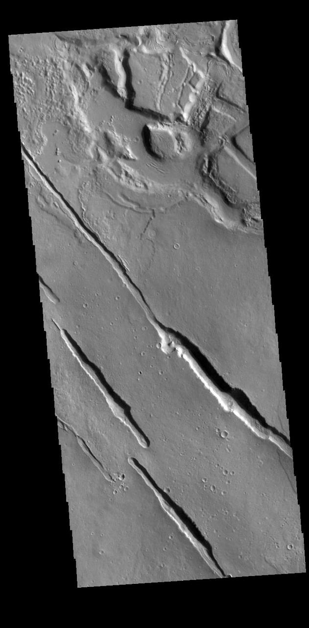
The linear depressions in this VIS image are part of Galaxias Fossae, a series of fractures on the northern part of the Elysium Mons volcanic complex. Orbit Number: 87232 Latitude: 33.1807 Longitude: 145.108 Instrument: VIS Captured: 2021-08-13 23:54 https://photojournal.jpl.nasa.gov/catalog/PIA25206

This VIS image contains a section of one of the many channel forms found on the northwestern side of the Elysium Mons volcanic complex. The channel features are thought to have both a tectonic and volcanic origin. The linear depression resembles a graben (formed by tectonic forces) and the smaller sinuous channels to the top of the image more closely resemble features caused by fluid flow - either lava or water created by melting subsurface ice by volcanic heating. Orbit Number: 72646 Latitude: 29.3486 Longitude: 140.473 Instrument: VIS Captured: 2018-04-30 21:04 https://photojournal.jpl.nasa.gov/catalog/PIA22619
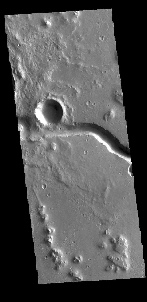
This VIS image shows part of Hephaestus Fossae. Hephaestus Fossae is a complex channel system in Utopia Planitia near Elysium Mons. It has been proposed that the channel formed by the release of melted subsurface ice during the impact event that created the crater just off the left side of the image – only the ejecta is seen in this image. The crater is fairly young, as there is only minimal modification of the crater floor. While it appears that the crater sits of top of the channel, the creation of the crater may have also created the channel. The impact event would have caused subsurface heating, melting any subsurface ice in the region which would have created surface flow to form the channel. Additionally, the nearby Elysium volcanic center created subsurface heating that may have played a part in creating both Hephaestus Fossae and Hebrus Valles to the north. Orbit Number: 94645 Latitude: 17.6141 Longitude: 126.055 Instrument: VIS Captured: 2023-04-16 09:02 https://photojournal.jpl.nasa.gov/catalog/PIA26040
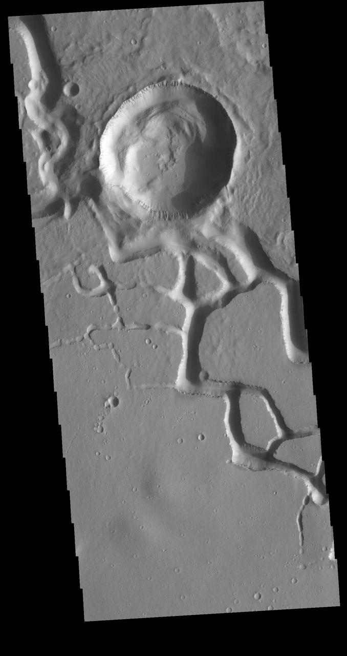
This VIS image is located in the central portion of Hephaestus Fossae. Hephaestus Fossae is a complex channel system in Utopia Planitia near Elysium Mons. It has been proposed that the channel formed by the release of melted subsurface ice during the impact event that created the crater in this image. Additionally, the nearby Elysium volcanic center created subsurface heating that may have played a part in creating both Hephaestus Fossae and Hebrus Valles to the north. Orbit Number: 81193 Latitude: 18.8168 Longitude: 124.985 Instrument: VIS Captured: 2020-04-03 18:04 https://photojournal.jpl.nasa.gov/catalog/PIA23938
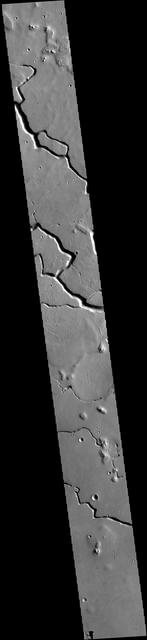
This VIS image is located in the central portion of Hephaestus Fossae. Hephaestus Fossae is a complex channel system in Utopia Planitia near Elysium Mons. It has been proposed that the channel formed by the release of melted subsurface ice during the impact event that created a large crater south of this image. Additionally, the nearby Elysium volcanic center created subsurface heating that may have played a part in creating both Hephaestus Fossae and Hebrus Valles to the north. Orbit Number: 79159 Latitude: 19.0493 Longitude: 124.534 Instrument: VIS Captured: 2019-10-19 06:34 https://photojournal.jpl.nasa.gov/catalog/PIA23579
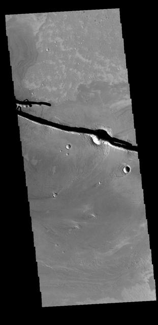
The linear depressions at the top half of this VIS image are graben that are called Cerberus Fossae. Graben form where extensional tectonic forces allows blocks of material to subside between paired faults. Cerberus Fossae are located in Elysium Planitia, southeast of the Elysium Mons volcanic complex. This graben is also the source of significant liquid flows, which created Athabasca Valles. The actual formation liquid proposed include flood water, low viscosity lava, and even glaciers. It is possible that water and lava both played a role in creating the channel system. Orbit Number: 78821 Latitude: 10.1133 Longitude: 157.297 Instrument: VIS Captured: 2019-09-21 10:33 https://photojournal.jpl.nasa.gov/catalog/PIA23503
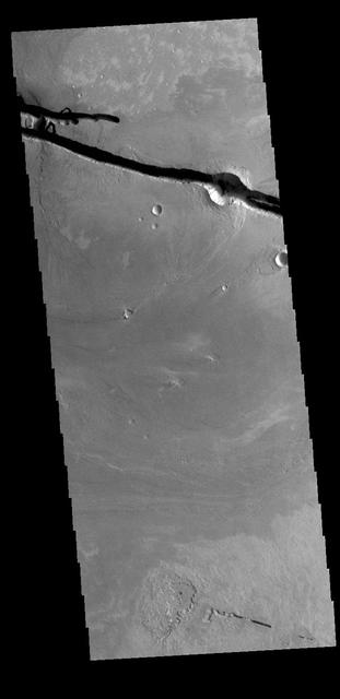
The linear depressions at the top of the VIS image are some of the graben that comprise Cerberus Fossae. Graben form where extensional tectonic forces allows blocks of material to subside between paired faults. Cerberus Fossae are located in Elysium Planitia, southeast of the Elysium Mons volcanic complex. The graben were also the source of significant volcanic flows, creating the deposits seen at the lower part of the image. Orbit Number: 77985 Latitude: 9.97726 Longitude: 157.285 Instrument: VIS Captured: 2019-07-14 14:21 https://photojournal.jpl.nasa.gov/catalog/PIA23400
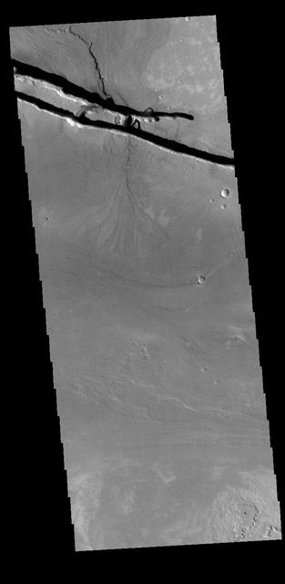
The linear depressions at the top of the VIS image are some of the graben that comprise Cerberus Fossae. Graben form where extensional tectonic forces allows blocks of material to subside between paired faults. Cerberus Fossae is located in Elysium Planitia, southeast of the Elysium Mons volcanic complex. These graben were also the source of significant volcanic flows, creating the flow features to the top and the bottom of the graben. These flows are called Athabasca Valles. Water may have also been released from the graben, creating a complex history for channel forms in this region. Orbit Number: 79108 Latitude: 10.0044 Longitude: 157.144 Instrument: VIS Captured: 2019-10-15 01:44 https://photojournal.jpl.nasa.gov/catalog/PIA23568