
Elysium Mons Volcano
Elysium Mons Volcano - Detail of Southern Caldera Wall and Floor
This Mars Global Surveyor MGS Mars Orbiter Camera MOC image shows a channel extending northward from the Elysium Mons caldera at the volcano summit
![Today's VIS image shows a cross section of Albor Tholus, a volcano found in the Elysium volcanic complex. The volcanic caldera is at the top of the image. The caldera is unusual in that it is very deep compared to volcano height. The top elevation of Albor Tholus is approximately 4.5km, the deepest part of the caldera measures 3km below this [an elevation of only 1.5km]. Orbit Number: 87756 Latitude: 17.9743 Longitude: 150.411 Instrument: VIS Captured: 2021-09-26 03:18 https://photojournal.jpl.nasa.gov/catalog/PIA25267](https://images-assets.nasa.gov/image/PIA25267/PIA25267~medium.jpg)
Today's VIS image shows a cross section of Albor Tholus, a volcano found in the Elysium volcanic complex. The volcanic caldera is at the top of the image. The caldera is unusual in that it is very deep compared to volcano height. The top elevation of Albor Tholus is approximately 4.5km, the deepest part of the caldera measures 3km below this [an elevation of only 1.5km]. Orbit Number: 87756 Latitude: 17.9743 Longitude: 150.411 Instrument: VIS Captured: 2021-09-26 03:18 https://photojournal.jpl.nasa.gov/catalog/PIA25267
![Today's VIS image shows a portion of the flank of Albor Tholus, a volcano found in the Elysium volcanic complex. The caldera of the volcano is very deep compared to it's height. The top elevation of Albor Tholus is approximately 4.5km, the deepest part of the caldera measures 3km below this [an elevation of only 1.5km]. Orbit Number: 77798 Latitude: 18.4758 Longitude: 151.507 Instrument: VIS Captured: 2019-06-29 04:49 https://photojournal.jpl.nasa.gov/catalog/PIA23382](https://images-assets.nasa.gov/image/PIA23382/PIA23382~small.jpg)
Today's VIS image shows a portion of the flank of Albor Tholus, a volcano found in the Elysium volcanic complex. The caldera of the volcano is very deep compared to it's height. The top elevation of Albor Tholus is approximately 4.5km, the deepest part of the caldera measures 3km below this [an elevation of only 1.5km]. Orbit Number: 77798 Latitude: 18.4758 Longitude: 151.507 Instrument: VIS Captured: 2019-06-29 04:49 https://photojournal.jpl.nasa.gov/catalog/PIA23382
Today's VIS image shows a cross section of Elysium Mons, including part of the summit caldera. Unlike the Tharsis volcanoes to the east, there are very few identifiable lava flows on the flanks of the Elysium Mons. In profile the volcano looks like Mt. Fuji in Japan. Mt. Fuji is a stratovolcano. A stratovolcano, also known as a composite volcano, is a conical volcano built up by multiple layers of lava and ash erupting solely from the summit caldera. The Tharsis volcanoes are shield volcanoes, which will host flank eruptions, but rarely ash eruptions. Elysium Mons is 12.6km (7.8 miles) tall. For comparison, Mt. Fuji is 3.7 km (2.3 miles) tall. Orbit Number: 93908 Latitude: 24.4791 Longitude: 146.667 Instrument: VIS Captured: 2023-02-14 16:41 https://photojournal.jpl.nasa.gov/catalog/PIA25925
Today's VIS image shows a cross section of Elysium Mons, including part of the summit caldera. Unlike the Tharsis volcanoes to east, there are very few identifiable lava flows on the flanks of the Elysium Mons. In profile the volcano looks like Mt. Fuji in Japan. Mt. Fuji is a stratovolcano. A stratovolcano, also known as a composite volcano, is a conical volcano built up by multiple layers of lava and ash erupting solely from the summit caldera. The Tharsis volcanoes are shield volcanoes, which will host flank eruptions, but rarely ash eruptions. Elysium Mons is 12.6km (7.8 miles) tall. For comparison, Mt. Fuji is 3.7 km (2.3 miles) tall. Orbit Number: 94794 Latitude: 24.68 Longitude: 146.541 Instrument: VIS Captured: 2023-04-28 15:31 https://photojournal.jpl.nasa.gov/catalog/PIA26171
Today's VIS image shows a cross section of Elysium Mons, including the entire summit caldera. Unlike the Tharsis volcanoes to east, there are very few identifiable lava flows on the flanks of the Elysium Mons. In profile the volcano looks like Mt. Fuji in Japan. Mt. Fuji is a stratovolcano. A stratovolcano, also known as a composite volcano, is a conical volcano built up by multiple layers of lava and ash erupting solely from the summit caldera. The Tharsis volcanoes are shield volcanoes, which will host flank eruptions, but rarely ash eruptions. Elysium Mons is 12.6km (7.8 miles) tall. For comparison, Mt. Fuji is 3.7 km (2.3 miles) tall. Orbit Number: 86633 Latitude: 24.5225 Longitude: 146.837 Instrument: VIS Captured: 2021-06-25 16:09 https://photojournal.jpl.nasa.gov/catalog/PIA24959
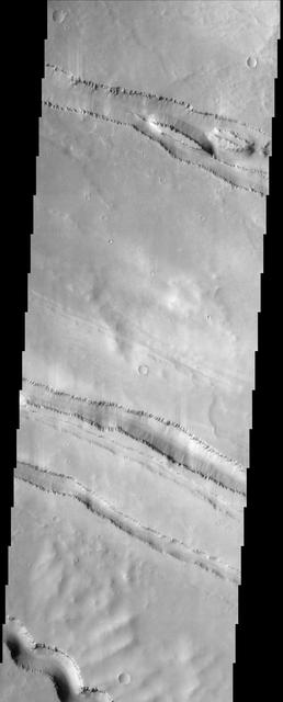
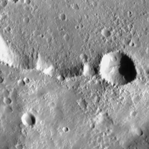
The grabens fractures that dominate this scene from NASA Mars Odyssey spacecraft are located northwest of a large shield volcano called Elysium Mons. Layered rock is evident along the lips of the graben as are ripples on the floors of these features. http://photojournal.jpl.nasa.gov/catalog/PIA04001
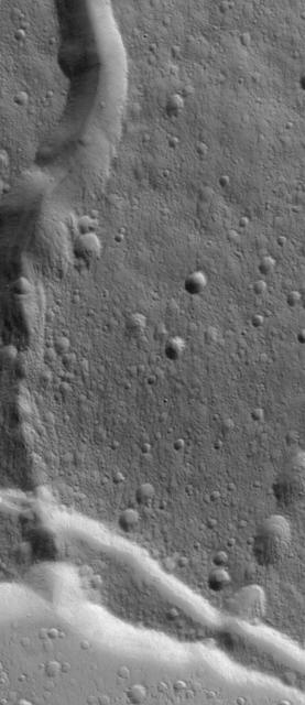
This VIS image shows part of Albor Fossae. These fossae (graben) are located on the southeastern flank of Albor Tholus, one of the volcanoes of the Elysium volcanic complex. Orbit Number: 81529 Latitude: 18.2534 Longitude: 151.75 Instrument: VIS Captured: 2020-05-01 10:03 https://photojournal.jpl.nasa.gov/catalog/PIA23991
A variegated mottled texture located NW of the volcano Elysium Monsis is readily apparent in the terrain imaged here by NASA Mars Odyssey spacecraft. The Hrad Vallis channel system can be seen sauntering across the bumpy landscape of Utopia Planitia.
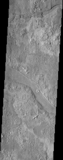
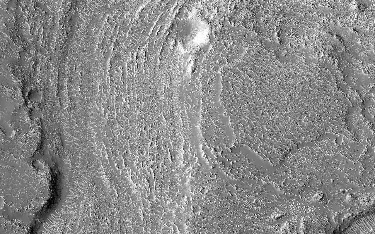
The drainages in this image are part of Hebrus Valles, an outflow channel system likely formed by catastrophic floods. Hebrus Valles is located in the plains of the Northern lowlands, just west of the Elysium volcanic region. Individual channels range from several hundred meters to several kilometers wide and form multi-threaded (anastamosing) patterns. Separating the channels are streamlined forms, whose tails point downstream and indicate that channel flow is to the north. The channels seemingly terminate in an elongated pit that is approximately 1875 meters long and 1125 meters wide. Using the shadow that the wall has cast on the floor of the pit, we can estimate that the pit is nearly 500 meters deep. The pit, which formed after the channels, exposes a bouldery layer below the dusty surface mantle and is underlain by sediments. Boulders several meters in diameter litter the slopes down into the pit. Pits such as these are of interest as possible candidate landing sites for human exploration because they might retain subsurface water ice (Schulze-Makuch et al. 2016, 6th Mars Polar Conf.) that could be utilized by future long-term human settlements. http://photojournal.jpl.nasa.gov/catalog/PIA11704
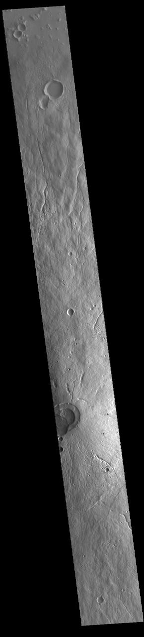
Today's VIS image shows part of the lowland plains north of the Elysium volcanic complex. Right angles are almost always created by tectonic forces. These linear depressions and the right angle intersections most likely were created in response to the volcanic activity that resulted in the uplifted surface and volcanoes of Elysium. Orbit Number: 88717 Latitude: 37.1901 Longitude: 143.037 Instrument: VIS Captured: 2021-12-14 06:30 https://photojournal.jpl.nasa.gov/catalog/PIA25298
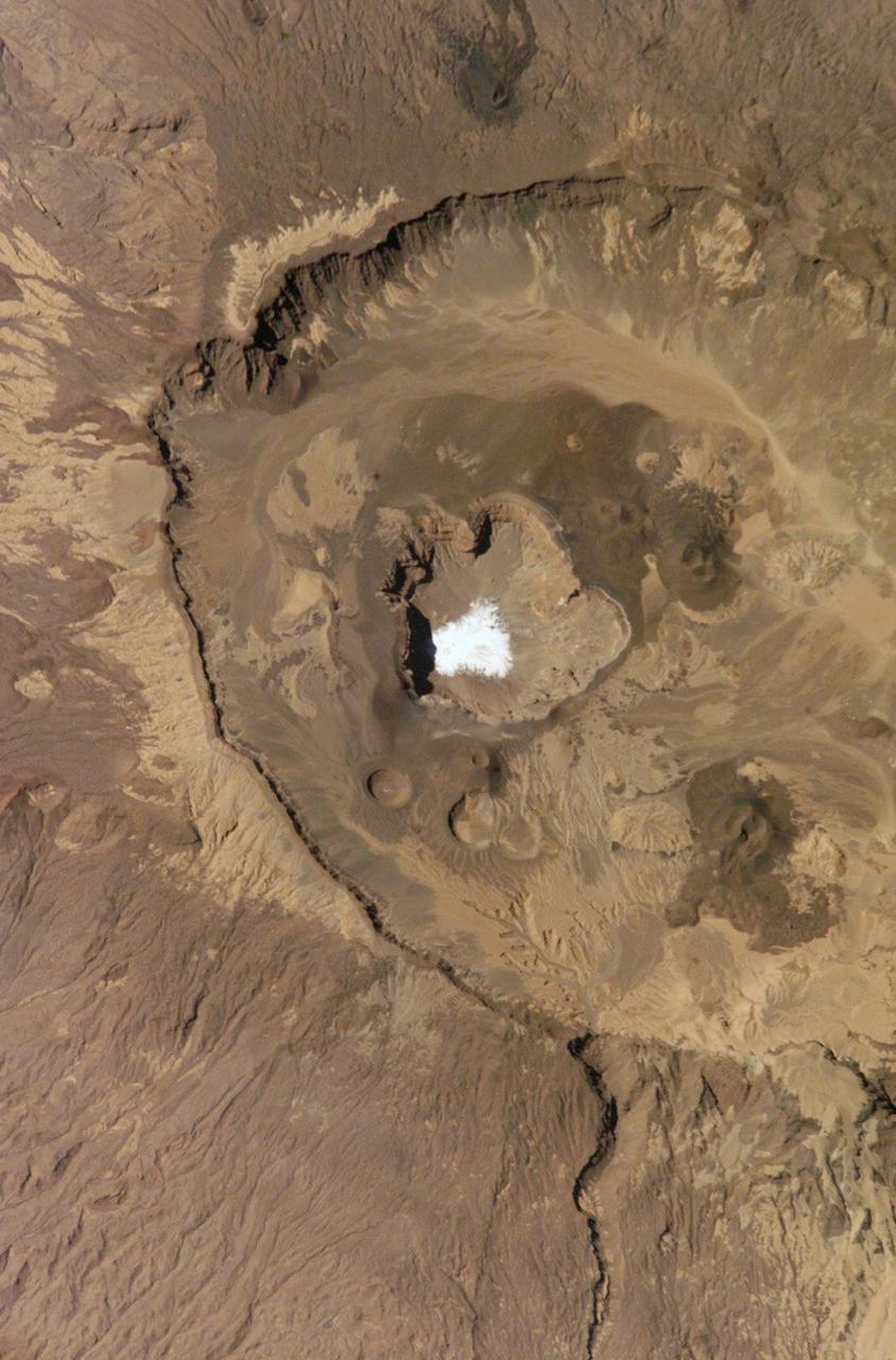
This is a view of the Emi Koussi Caldera captured by the Expedition Six Crew Observation (CEO) experiment aboard the International Space Station (ISS). Rising 2.3 km above the surrounding sandstone plains, Emi Koussi is a 6.5 km wide volcano located at the south end of the Tibesti Mountains in the central Sahara desert. The volcano is one of several in the Tibesti massif and has been used as a close analog to the famous Martian volcano Elysium Mons. Major charnels can be seen on volcanoes on both planets that indicate low points in caldera rims where lava spilled out of the pre-collapsed craters.
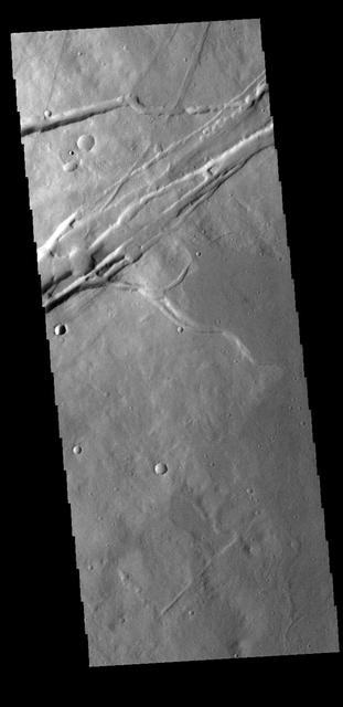
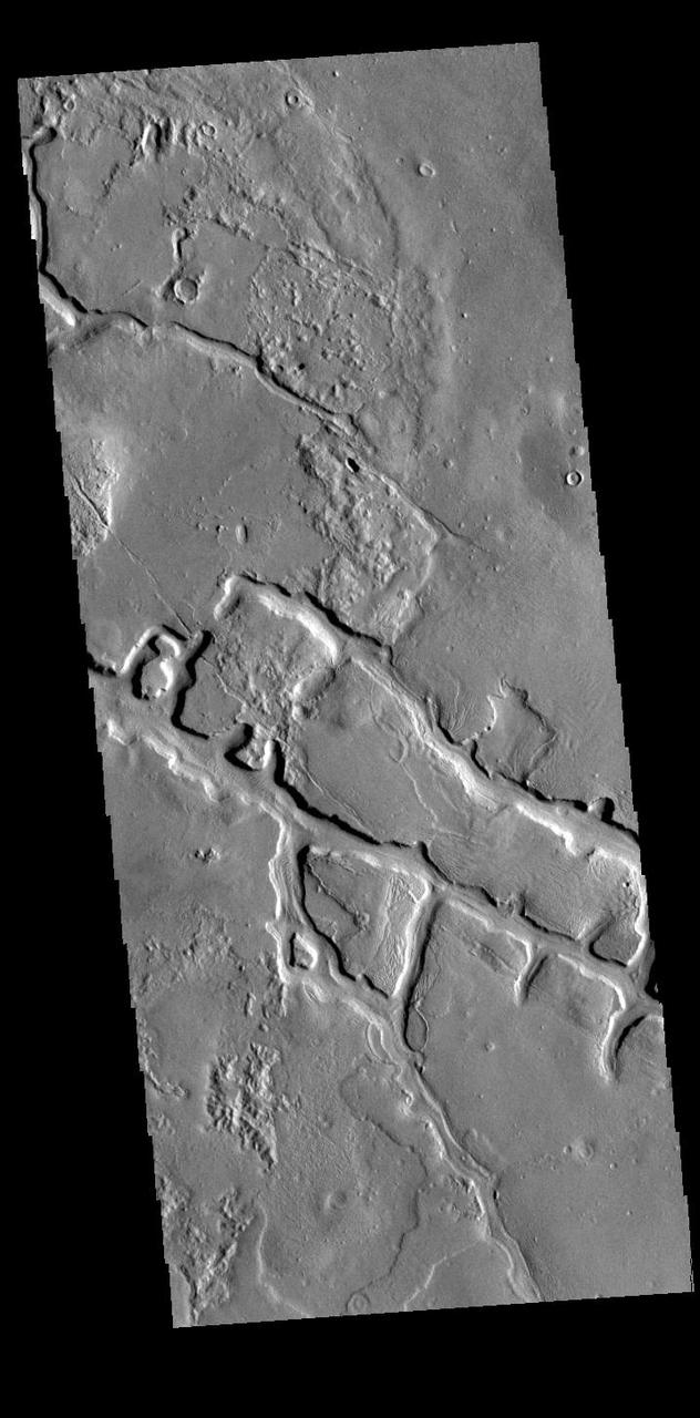
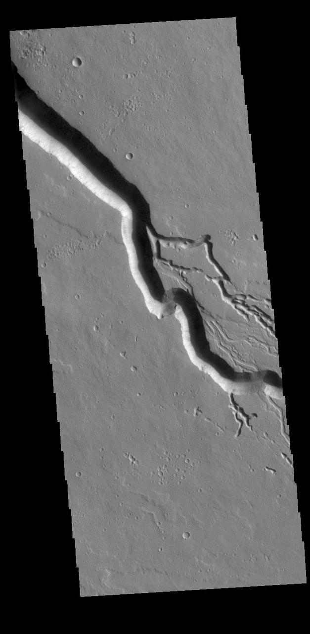
Granicus Valles form a low-lying complex of channel systems located west of the volcano Elysium Mons. They are one of several larger systems known as outflow channels because the water source is from the subsurface. In this case, Granicus Valles emanate from a series of fractures on the western flank of Elysium Mons. In this image, large, streamlined features and grooves have been carved by enormous water volumes into the floor of Granicus and point to the direction of flow towards the northwest. The floods of Granicus Valles are thought to have formed later in Mars history during the Amazonian epoch, several billion years ago. https://photojournal.jpl.nasa.gov/catalog/PIA25990
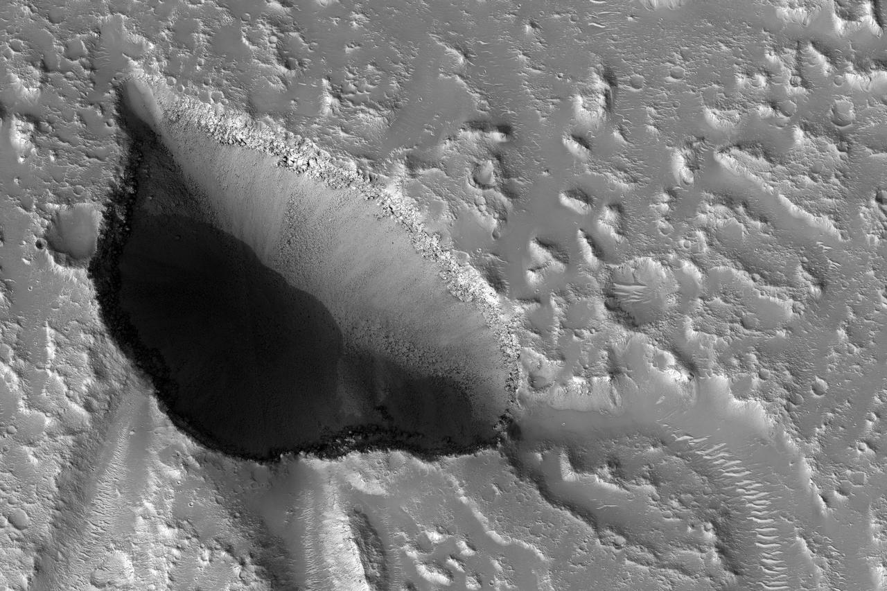
During the 2018 Mars dust storm, we obtained a clear view of the summit of the giant volcano Elysium Mons. We see the western rim and floor of the caldera, and a chain of pits (called a "catena") extending from the caldera towards the north. The chain of pits likely formed by volcanic processes, such as the collapse of a lava tube after it drained. Or by a tectonic process, such as a rift in the rocks below that drained loose material from the surface. An unexpected feature of this catena is the presence of avalanches in two of the pits (marked A and B in the cutout, with the uphill direction towards the top of the image.) The flows in both pits could be ancient, produced during the formation of the catena, but they are not found in the other pits in the chain. They might have formed more recently by the collapse of steep dust deposits like those in a degraded crater to the left of the catena. https://photojournal.jpl.nasa.gov/catalog/PIA22728
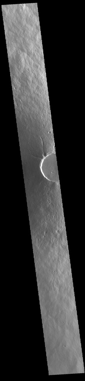
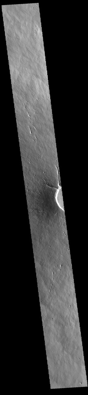
This VIS image crosses most of Hecates Tholus. The circular feature in the bottom half of the image is the summit caldera. This volcano is located on the northern part of the Elysium Volcanic Complex. Hecates Tholus is 5.3 km (3.3 miles) high and 182 km (113 miles) across. Orbit Number: 85360 Latitude: 32.2672 Longitude: 150.166 Instrument: VIS Captured: 2021-03-12 20:36 https://photojournal.jpl.nasa.gov/catalog/PIA24778
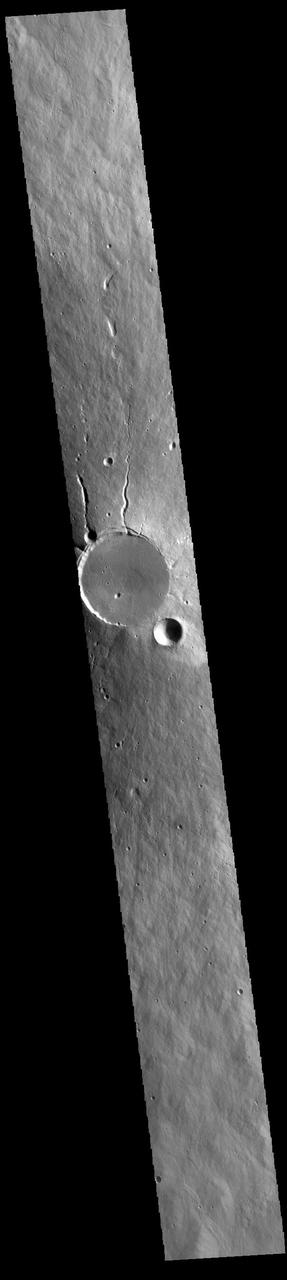
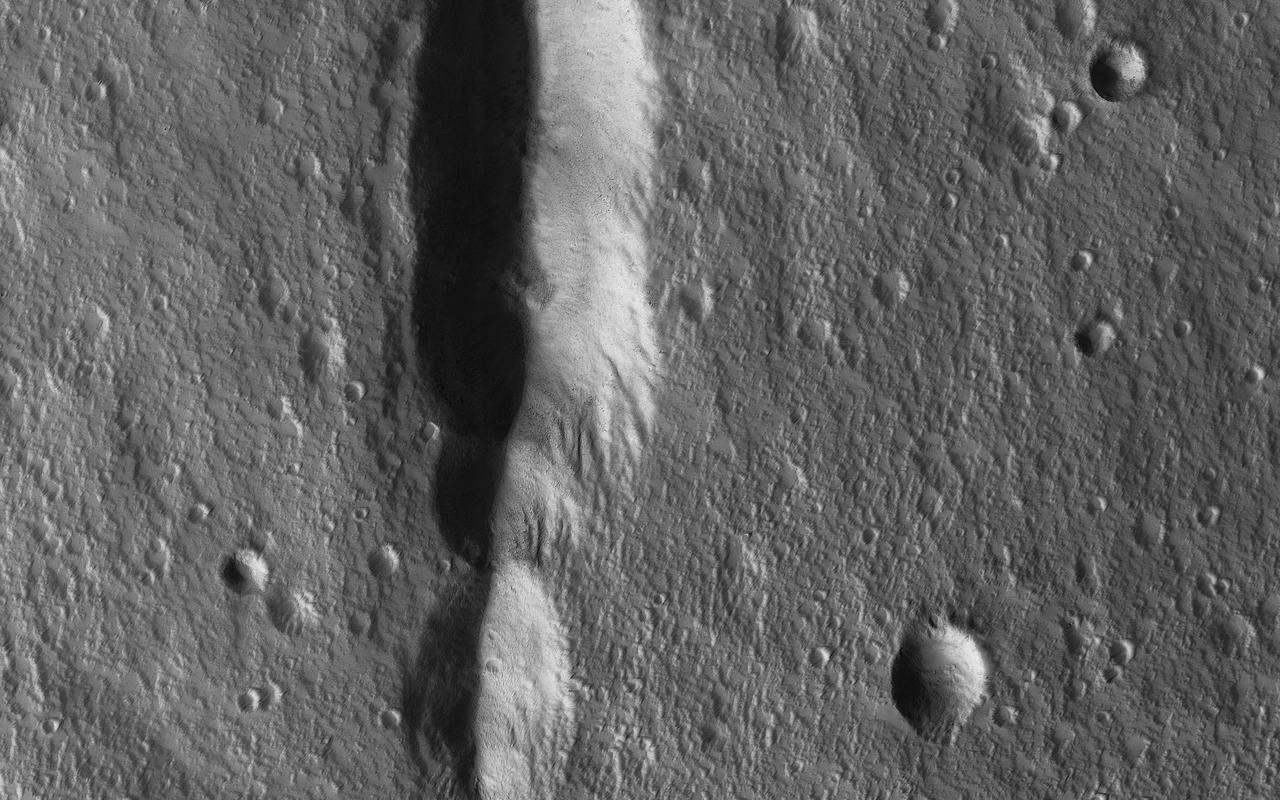
Today's VIS image contains a section of one of the many channel forms found radial to the Elysium Mons volcanic complex. In this case the fossae is located to the southeast of the volcano. The channel feature is thought to have both a tectonic and volcanic origin. The linear depression at the upper left of the image resembles a graben (formed by tectonic forces) and the smaller sinuous channels below the large linear depression more closely resemble features caused by fluid flow – either lava or water created by melting subsurface ice by volcanic heating. The linear depression is called Elysium Fossae, and the sinuous channel is called Iberus Vallis. Iberus Vallis is 87 km long (54 miles). Orbit Number: 88018 Latitude: 21.5352 Longitude: 151.454 Instrument: VIS Captured: 2021-10-17 17:04 https://photojournal.jpl.nasa.gov/catalog/PIA25110
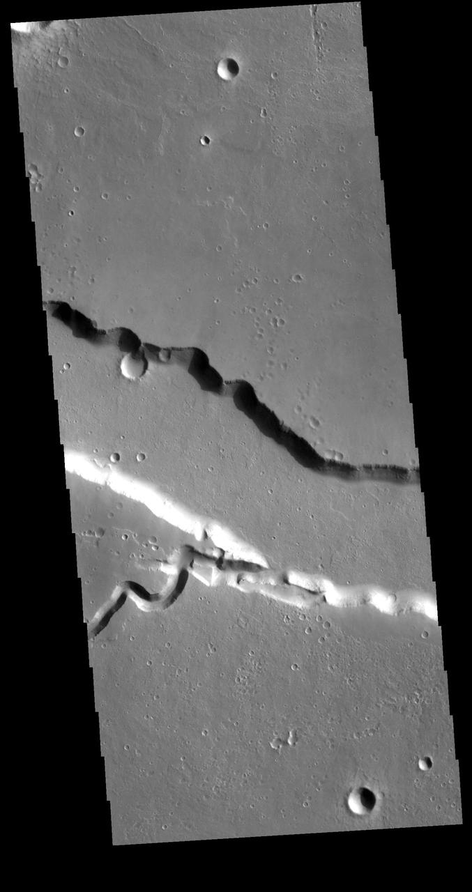
Today's VIS image contains a section of one of the many channel forms found radial to the Elysium Mons volcanic complex. In this case the fossae is located to the east of the volcano. The channel features are thought to have both a tectonic and volcanic origin. The linear depression resembles a graben (formed by tectonic forces) and the smaller sinuous channel below the large linear depression more closely resembles features caused by fluid flow — either lava or water created by melting subsurface ice by volcanic heating. Orbit Number: 79133 Latitude: 23.9518 Longitude: 153.966 Instrument: VIS Captured: 2019-10-17 03:13 https://photojournal.jpl.nasa.gov/catalog/PIA23571
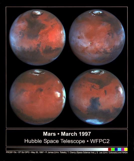
This photograph depicts four Mars views in northern summer provided by the Hubble Space Telescope (HST). The upper left view is centered on Ares Valles where Pathfinder landed in July 1997. Upper right is the Tharsis volcanic region and its associated cloud in the western half of the view. Olympus Mons lies near the western limb, Arsi Mons, Pavonis Mons Ascraeus Mons are to the west of the the center, and Valles Marineris is to the east. The lower Left view shows the Elysium volcanic region in the west, the Tharsis volcanos in East, and Cerberus is left of the center. In the lower right view, the Dark Syrtis Major region, Eysium Mons and Hellas are featured.
Given enough time, impact craters on Mars tend to fill up with different materials. For instance, some craters on Mars had lakes inside them in the past. When these lakes dried out, they left behind traces of their past existence, such as sedimentary deposits (materials that were carried along with the running water into the lake inside the crater and then settled down). Some craters, especially in high latitudes, contain ice deposits that filled the crater when an earlier ice age allowed ice to extend into the crater's latitude. Here, NASA's Mars Reconnaissance Orbiter spies a crater that lies close to Elysium, a major volcanic system on Mars. The whole region surrounding the crater was at some point covered by lava from the volcano creating vast lava plains, and in the process, flooding impact craters in their way. When the lava eventually cooled down, it solidified and began to shrink in size. This shrinking led to formation of cracks on the surface of the lava that grew in a circular pattern matching the shape of the crater it was filling. Scientists can study these fractures and estimate how much it shrank in volume to better understand the properties of the lava (such as its temperature) during the time it filled the crater. https://photojournal.jpl.nasa.gov/catalog/PIA21596
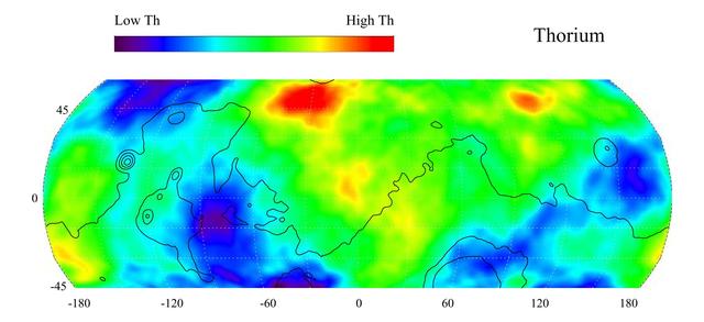
This gamma ray spectrometer map of the mid-latitude region of Mars is based on gamma-rays from the element thorium. Thorium is a naturally radioactive element that exists in rocks and soils in extremely small amounts. The region of highest thorium content, shown in red, is found in the northern part of Acidalia Planitia (50 degrees latitude, -30 degrees longitude). Areas of low thorium content, shown in blue, are spread widely across the planet with significant low abundances located to the north of Olympus Mons (near 55 degrees latitude, -155 degrees longitude), to the east of the Tharsis volcanoes (-10 degrees latitude, -80 degrees longitude) and to the south and east of Elysium Mons (20 degrees latitude, 160 degrees longitude). Contours of constant surface elevation are also shown. The long continuous contour line running from east to west marks the approximate separation of the younger lowlands in the north from the older highlands in the south. http://photojournal.jpl.nasa.gov/catalog/PIA04257
A dominant driver of surface processes on Mars today is aeolian (wind) activity. In many cases, sediment from this activity is trapped in low-lying areas, such as craters. Aeolian features in the form of dunes and ripples can occur in many places on Mars depending upon regional wind regimes. The Cerberus Fossae are a series of discontinuous fissures along dusty plains in the southeastern region of Elysium Planitia. This rift zone is thought to be the result of combined volcano-tectonic processes. Dark sediment has accumulated in areas along the floor of these fissures as well as inactive ripple-like aeolian bedforms known as "transverse aeolian ridges" (TAR). Viewed through HiRISE infrared color, the basaltic sand lining the fissures' floor stands out as deep blue against the light-toned dust covering the region. This, along with the linearity of the fissures and the wave-like appearance of the TAR, give the viewer an impression of a river cutting through the Martian plains. However, this river of sand does not appear to be flowing. Analyses of annual monitoring images of this region have not detected aeolian activity in the form of ripple migration thus far. http://photojournal.jpl.nasa.gov/catalog/PIA21063